Embed Size (px)
Citation preview
Overview of Soil Information and Soil Protection in Albania
Sherif Lushaj
Pandi Zdruli
Introduction
• Agriculture in Albania provides about 25% of the Gross Domestic Product
(GDP) and still remains an important sector of the economy;
• During the 1998-2004 period, the growth of agricultural production has
ranged from 5 to 8% annually;
• The overall country’s territory of 2,874,800 ha, is divided between:
– agricultural land with 24.4%, (699,500 ha);
– forests with 36.9%, (1,062,770 ha);
– pastures and meadows with 14.4%, (414,517 ha);
– other land uses with 24.3% (699,013 ha).
• The agricultural land surface per capita is about 0.21 ha.
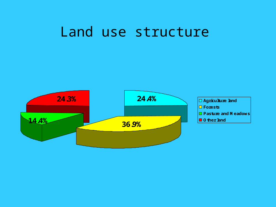
Land use structure
24.3% 24.4%
36.9%14.4%
Agriculture land
Forests
Pasture and Meadows
Other land
History of the Land Reform
• The agrarian reform was completed in 1946;
• The collectivization of agriculture was completed during the 1946-1968 period;
• Until 1990, Albanian Law defined all the land as state property. During this period, 700.000 ha of agricultural land was managed by 77 state farms and 415 by agricultural cooperatives;
• From 1990 to 2004, 564.000 ha of the agricultural land was privatized and as result about 450,000 private farms were established with an average size of 1,3 ha;
• Forests are divided between state with 73 %, communes with 26%, and private with 1%.
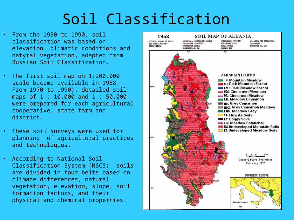
Soil Classification• From the 1950 to 1990, soil classification
was based on elevation, climatic conditions and natyral vegetation, adapted from Russian Soil Classification.
• The first soil map on 1:200.000 scale became available in 1958. From 1970 to 1990), detailed soil maps of 1 : 10.000 and 1 : 50.000 were prepared for each agricultural cooperative, state farm and district.
• These soil surveys were used for planning of agricultural practices and technologies.
• According to National Soil Classification System (NSCS), soils are divided in four belts based on climate differences, natural vegetation, elevation, slope, soil formation factors, and their physical and chemical properties.
1958
• After the 1990 in order to unify the Albanian Soil Classification with the
International System, the Soil Sciences Institute (SSI) of Albania in
cooperation with Soil European Bureau, developed the pedological map on
1:1 million scale
• The map was included in the European map.
• The SSI in cooperation with Mediterranean Agronomic Institute (IAM) in
Bari, carried out a study and prepared the pedological map on 1:250.000
scale for the overall area and a map on 1:50.000 scale for the coastal area.
Albanian Soil Classification and the International System
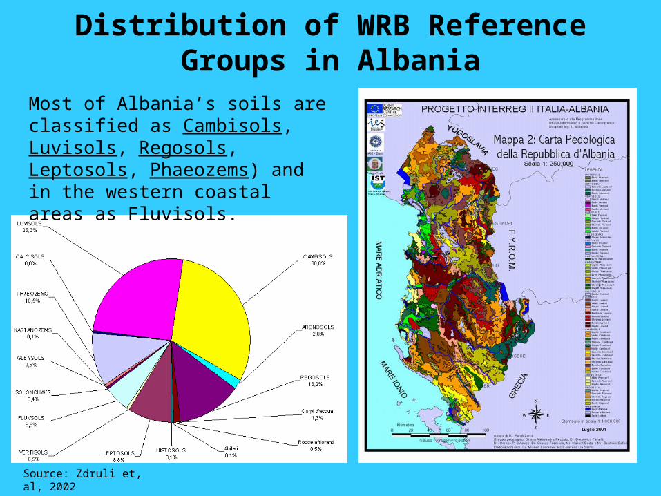
Distribution of WRB Reference Groups in Albania
Source: Zdruli et, al, 2002
Most of Albania’s soils are classified as Cambisols, Luvisols, Regosols, Leptosols, Phaeozems) and in the western coastal areas as Fluvisols.
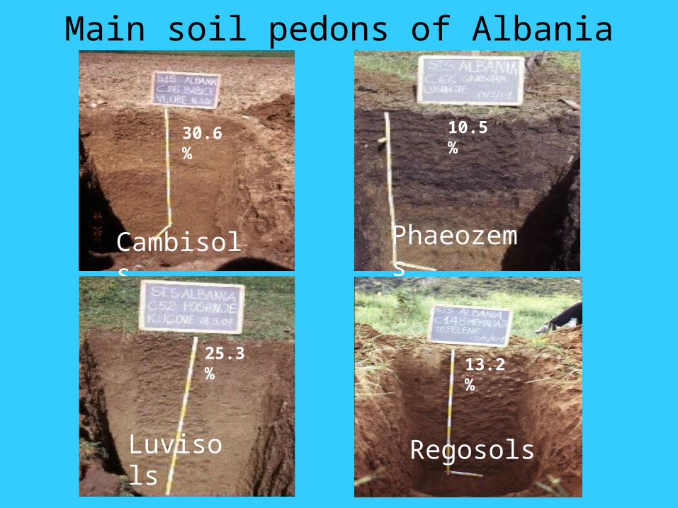
Main soil pedons of Albania
Cambisols Phaeozems
RegosolsLuvisols
30.6%
25.3%13.2%
10.5%
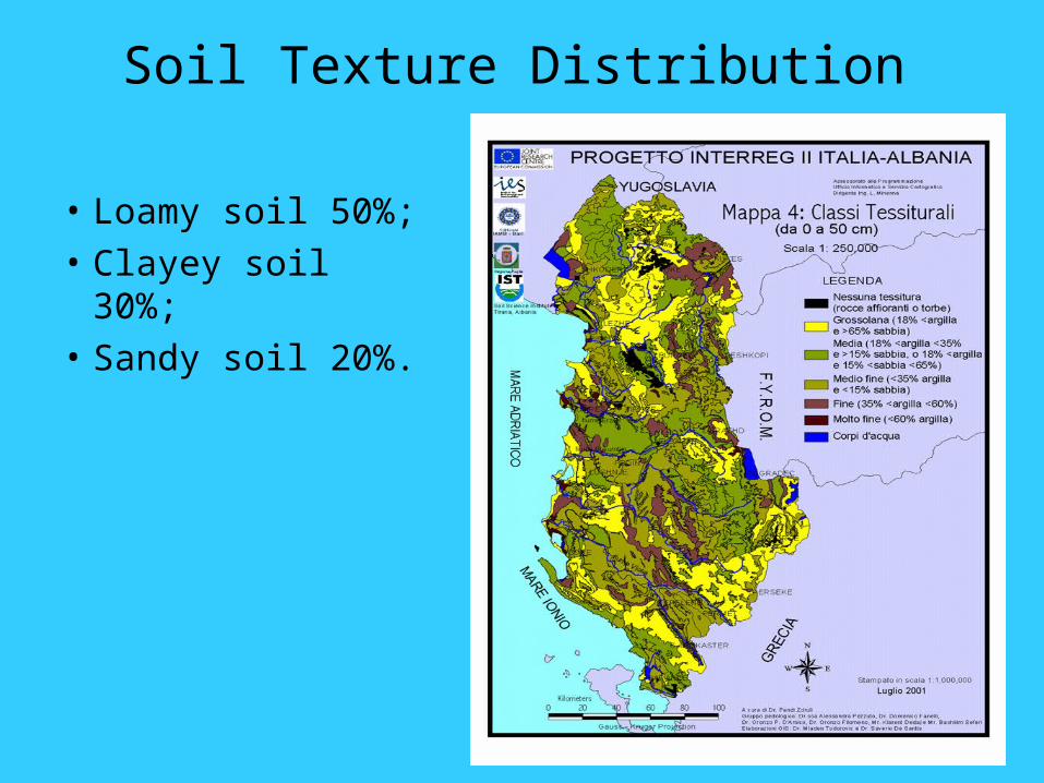
Soil Texture Distribution
• Loamy soil 50%;
• Clayey soil 30%;
• Sandy soil 20%.
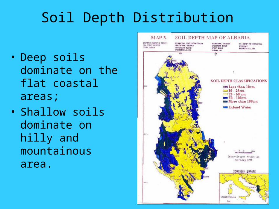
Soil Depth Distribution
• Deep soils dominate on the flat coastal areas;
• Shallow soils dominate on hilly and mountainous area.
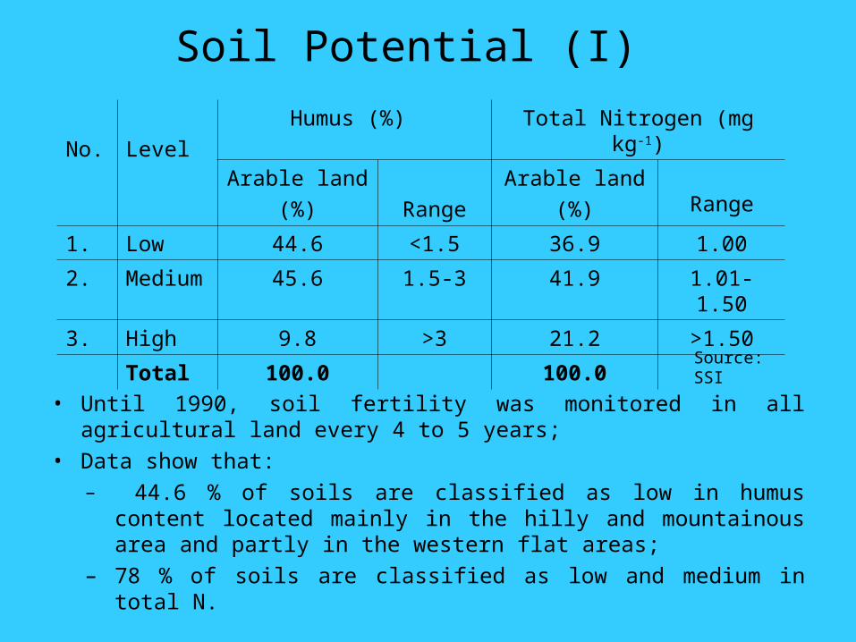
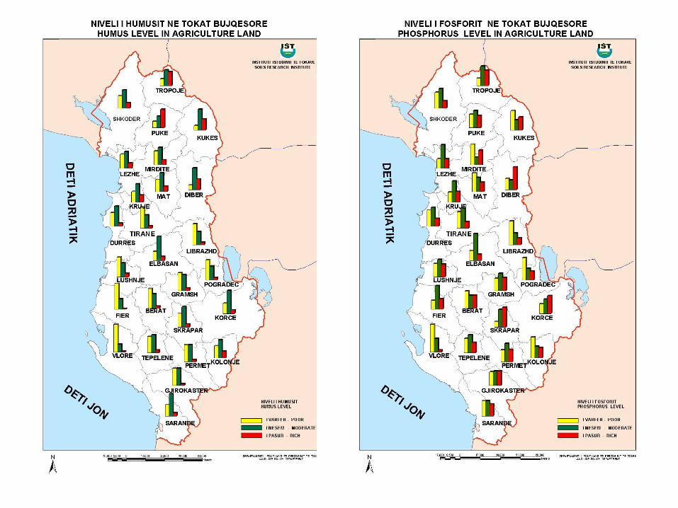
No. Level
Humus (%) Total Nitrogen (mg kg-1)
Arable land
(%) Range
Arable land
(%) Range
1. Low 44.6 <1.5 36.9 1.00
2. Medium 45.6 1.5-3 41.9 1.01-1.50
3. High 9.8 >3 21.2 >1.50
Total 100.0 100.0
Soil Potential (I)
• Until 1990, soil fertility was monitored in all agricultural land every 4 to 5 years;
• Data show that:– 44.6 % of soils are classified as low in humus content located mainly
in the hilly and mountainous area and partly in the western flat areas;
– 78 % of soils are classified as low and medium in total N.
Source: SSI
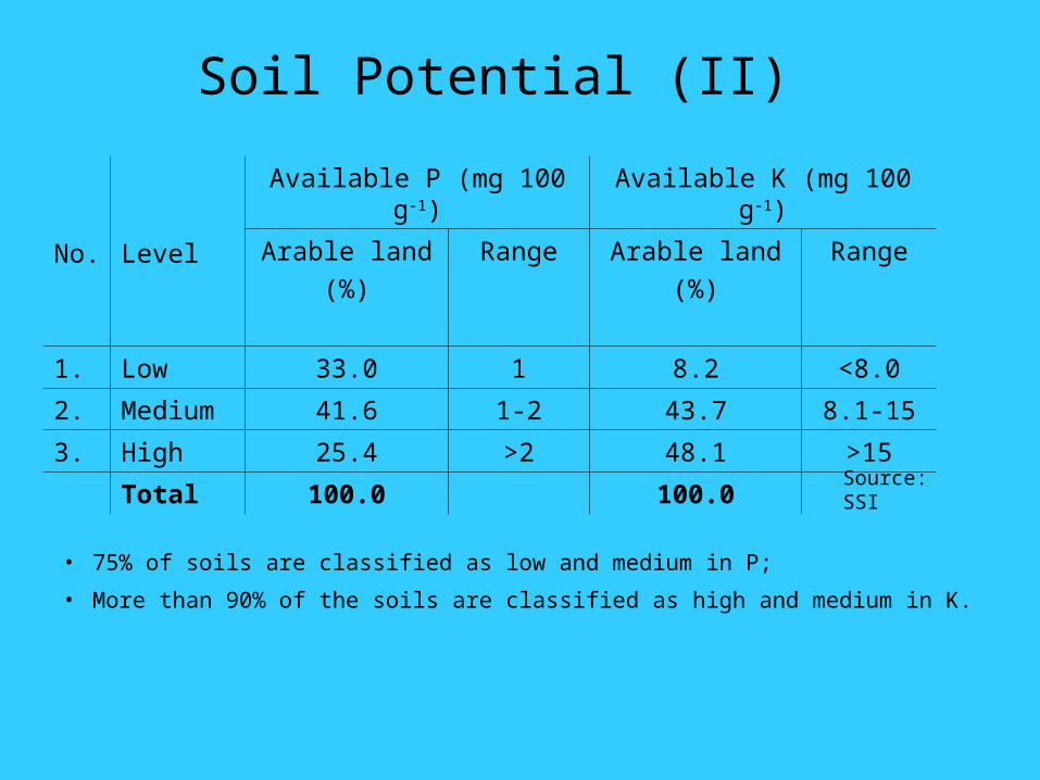
No. Level
Available P (mg 100 g-1) Available K (mg 100 g-1)
Arable land
(%)
Range
Arable land
(%)
Range
1. Low 33.0 1 8.2 <8.0
2. Medium 41.6 1-2 43.7 8.1-15
3. High 25.4 >2 48.1 >15
Total 100.0 100.0
• 75% of soils are classified as low and medium in P;
• More than 90% of the soils are classified as high and medium in K.
Source: SSI
Soil Potential (II)
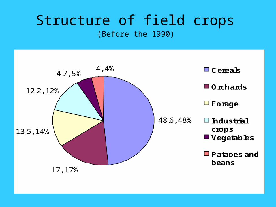
Structure of field crops
(Before the 1990)
48.6, 48%
17, 17%
13.5, 14%
12.2, 12%
4.7, 5%4, 4% Cereals
Orchards
Forage
IndustrialcropsVegetables
Pataoes andbeans
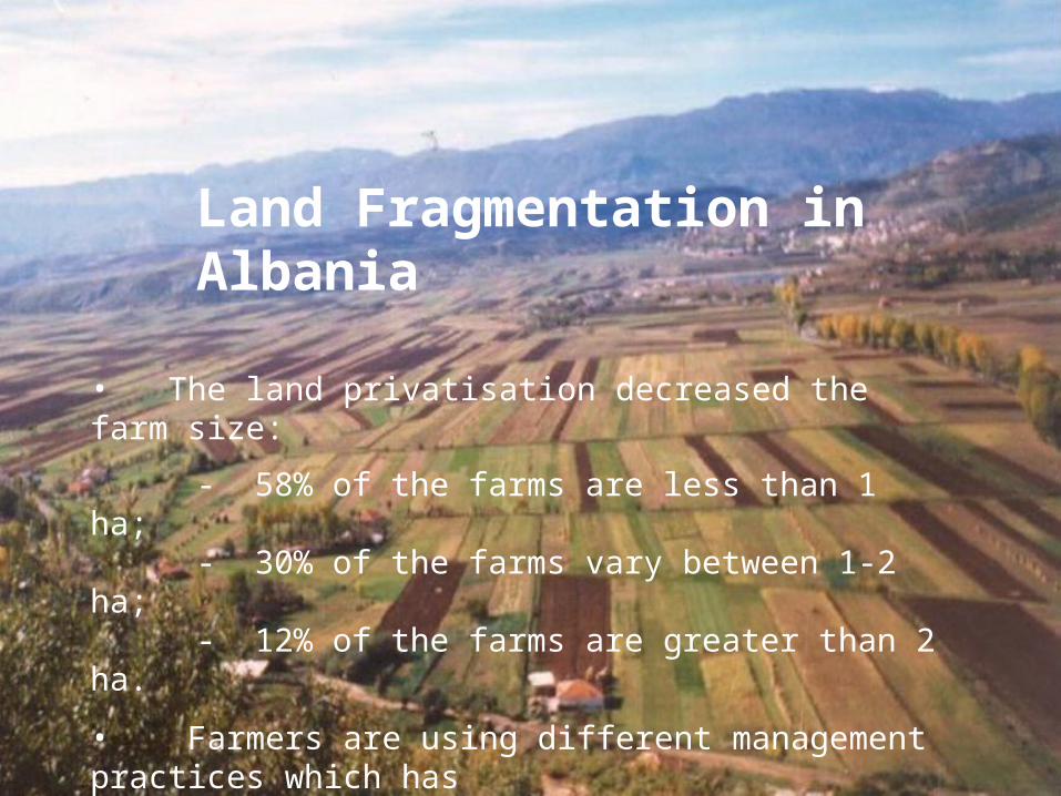
Land Fragmentation in Albania
• The land privatisation decreased the farm size:
- 58% of the farms are less than 1 ha;- 30% of the farms vary between 1-2 ha; - 12% of the farms are greater than 2 ha.
• Farmers are using different management practices which has created differences in the amount of fertilisers leading to reduced levels of soil fertility.
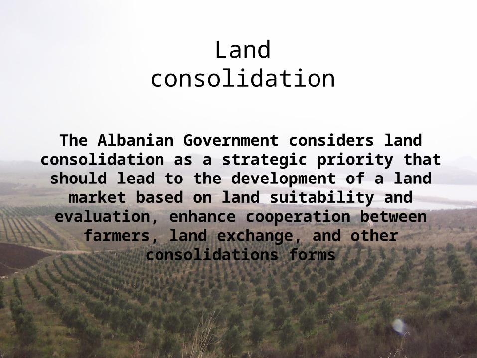
The Albanian Government considers land consolidation as a strategic priority that should lead to the development of a land
market based on land suitability and evaluation, enhance cooperation between
farmers, land exchange, and other consolidations forms
Land consolidation
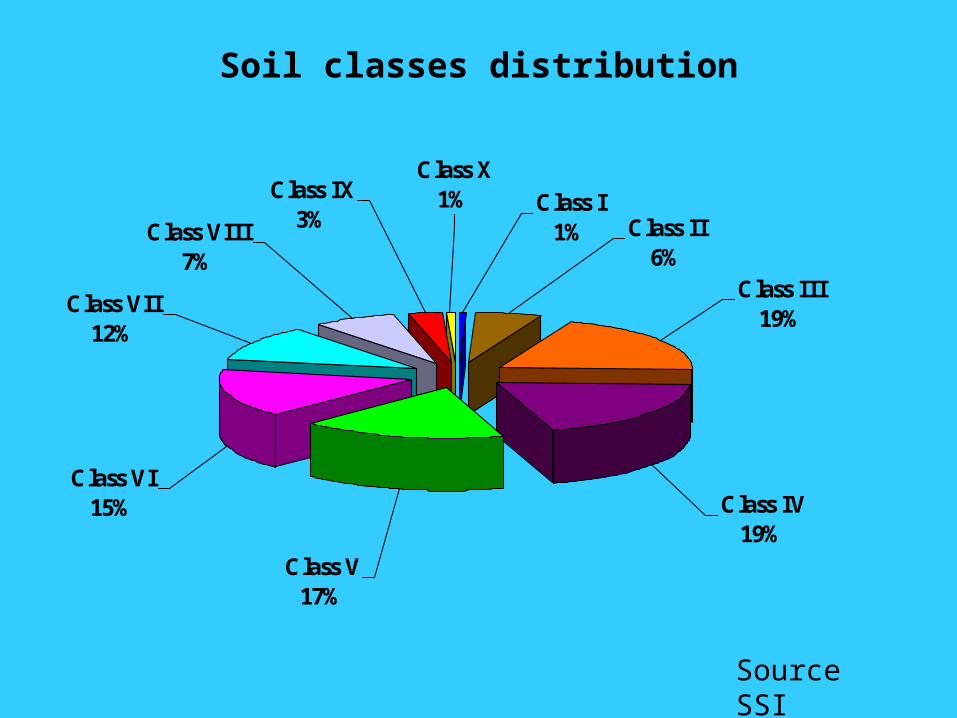
Soil classes distribution
Class VII12%
Class VI15%
Class V17%
Class IV19%
Class III19%
Class II6%
Class VIII7%
Class IX3%
Class X1% Class I
1%
Source SSI
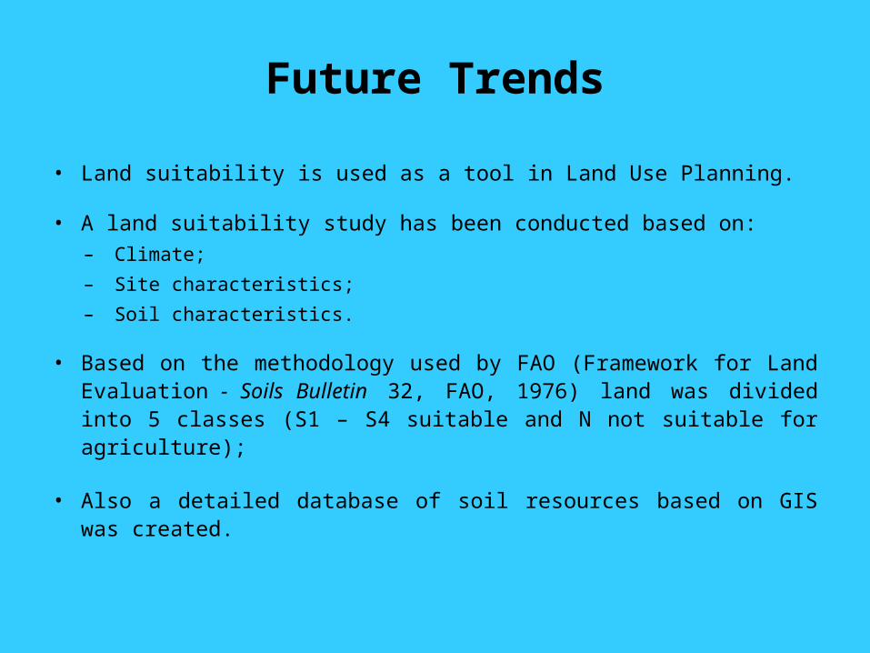
• Land suitability is used as a tool in Land Use Planning.
• A land suitability study has been conducted based on:– Climate;
– Site characteristics;
– Soil characteristics.
• Based on the methodology used by FAO (Framework for Land Evaluation - Soils Bulletin 32, FAO, 1976) land was divided into 5 classes (S1 – S4 suitable and N not suitable for agriculture);
• Also a detailed database of soil resources based on GIS was created.
Future Trends
Source: SSI
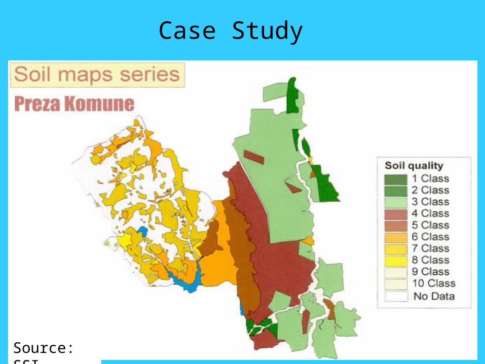
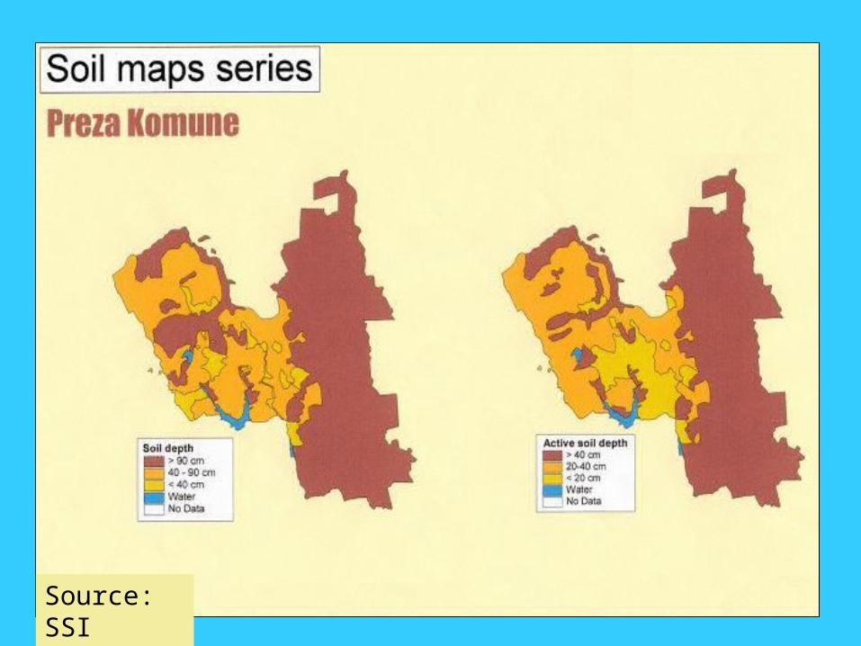
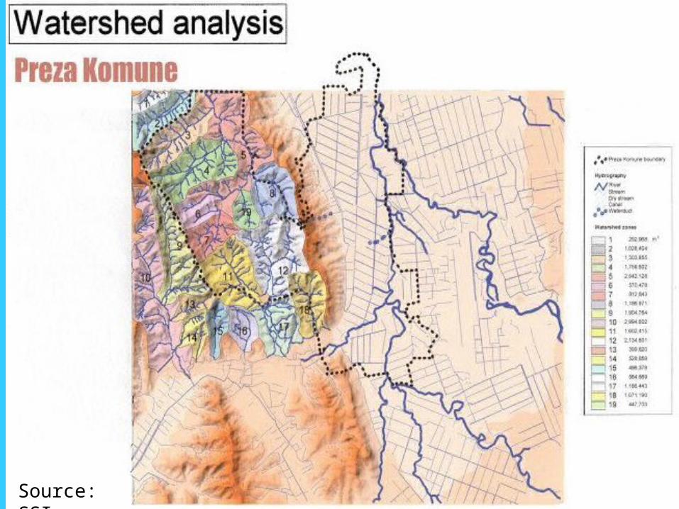
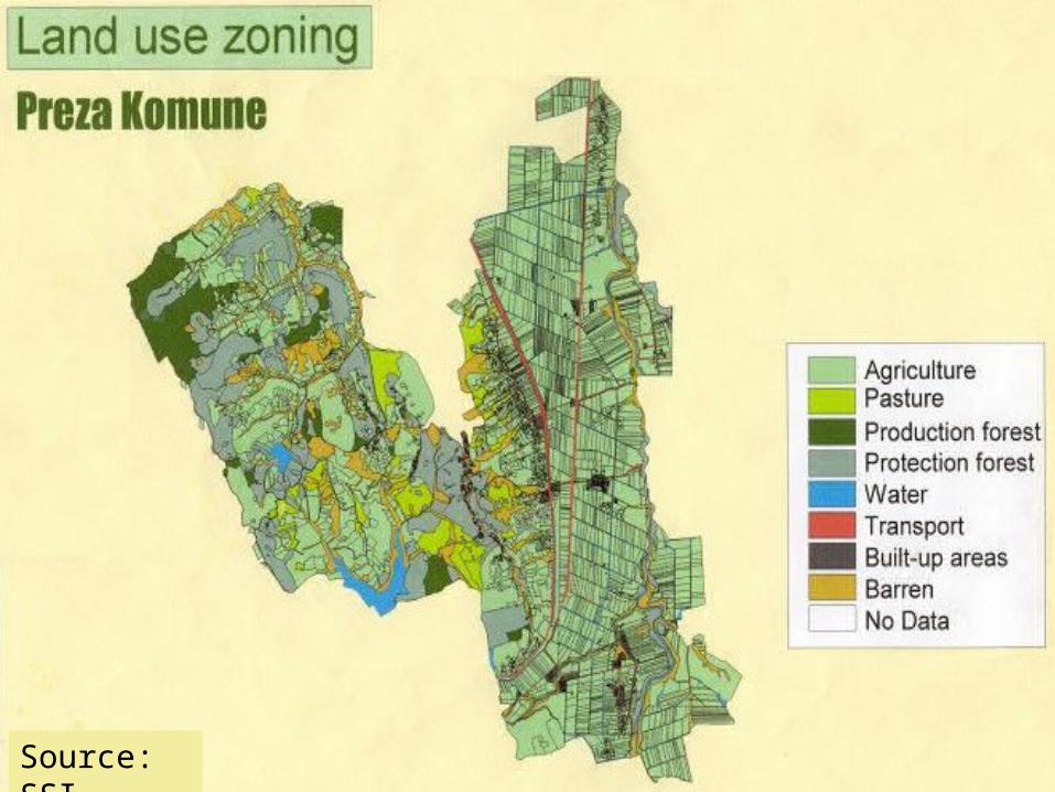
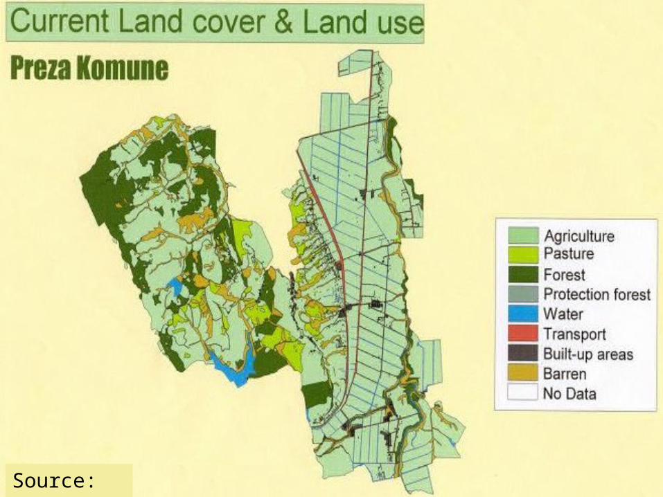
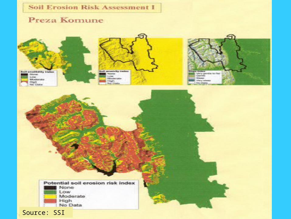
Case Study
Source: SSI

Source: SSI
Source: SSI
Source: SSI
Source: SSI
Source: SSI
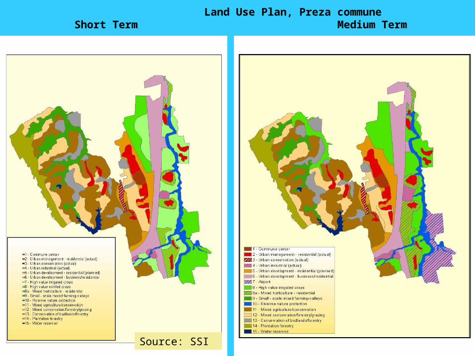
Land Use Plan, Preza commune Short Term Medium Term
Source: SSI
Land Degradation
Soil erosion&
pollution
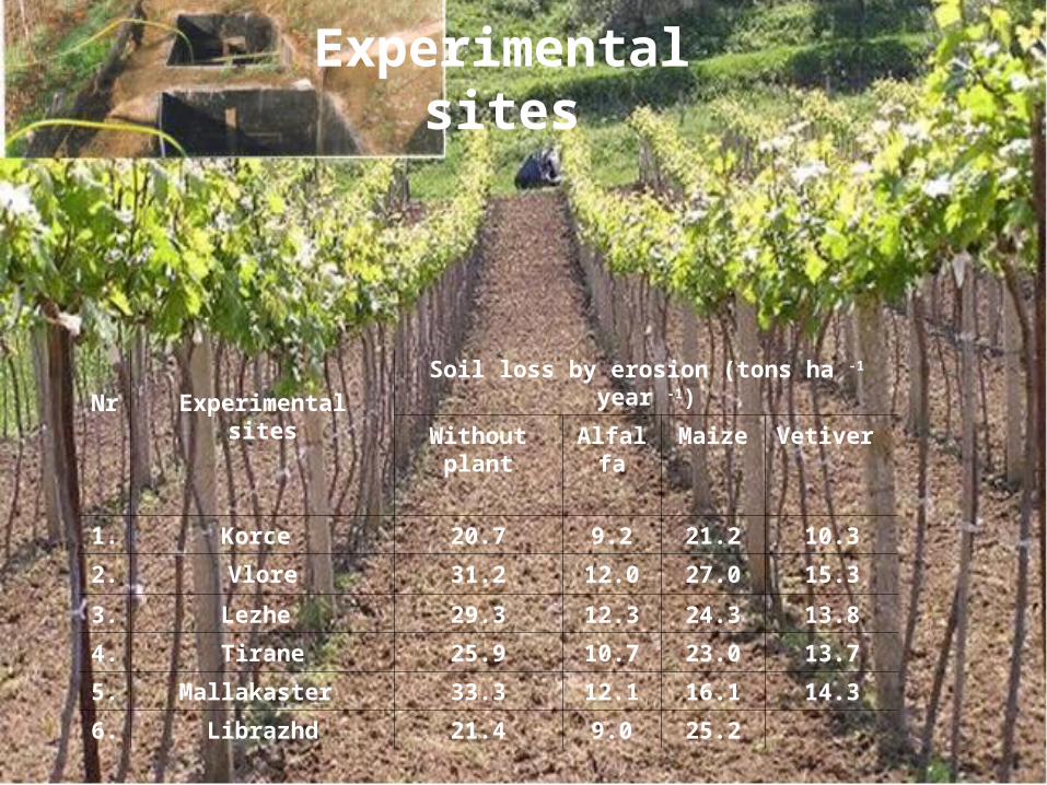
Foto Nr. 11.2
Experimental sites
Nr Experimental sites
Soil loss by erosion (tons ha -1 year -1)
Without plant
Alfalfa Maize Vetiver
1. Korce 20.7 9.2 21.2 10.3
2. Vlore 31.2 12.0 27.0 15.3
3. Lezhe 29.3 12.3 24.3 13.8
4. Tirane 25.9 10.7 23.0 13.7
5. Mallakaster 33.3 12.1 16.1 14.3
6. Librazhd 21.4 9.0 25.2
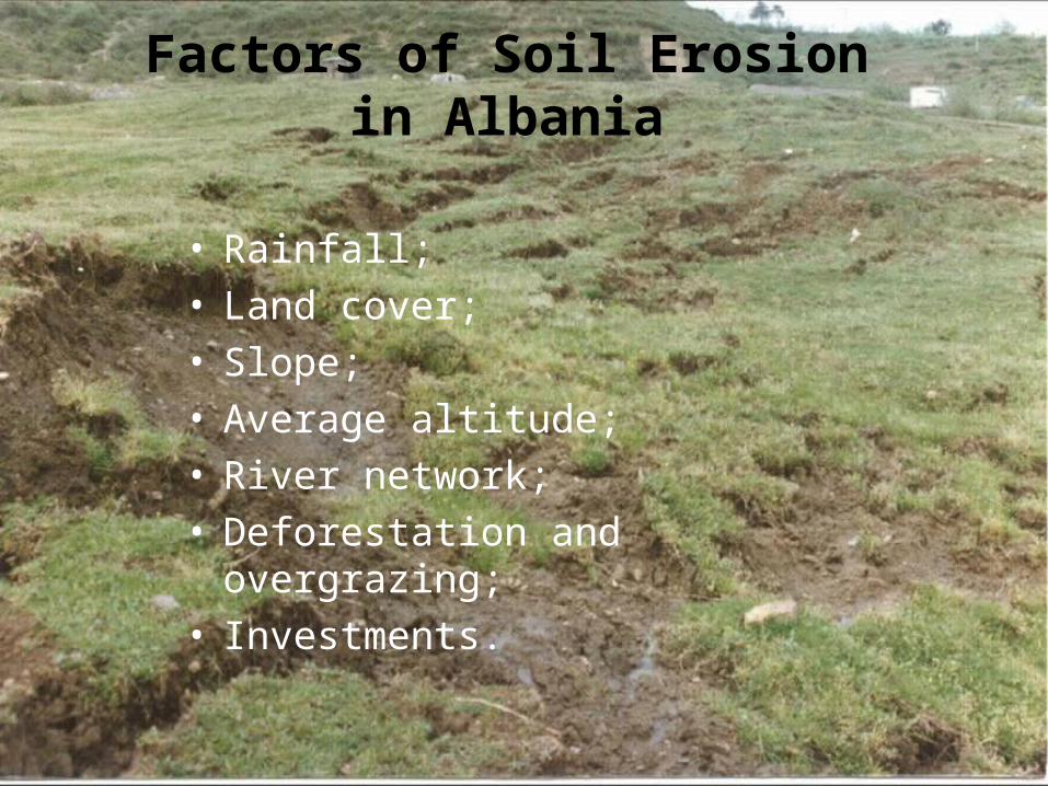
Factors of Soil Erosion in Albania
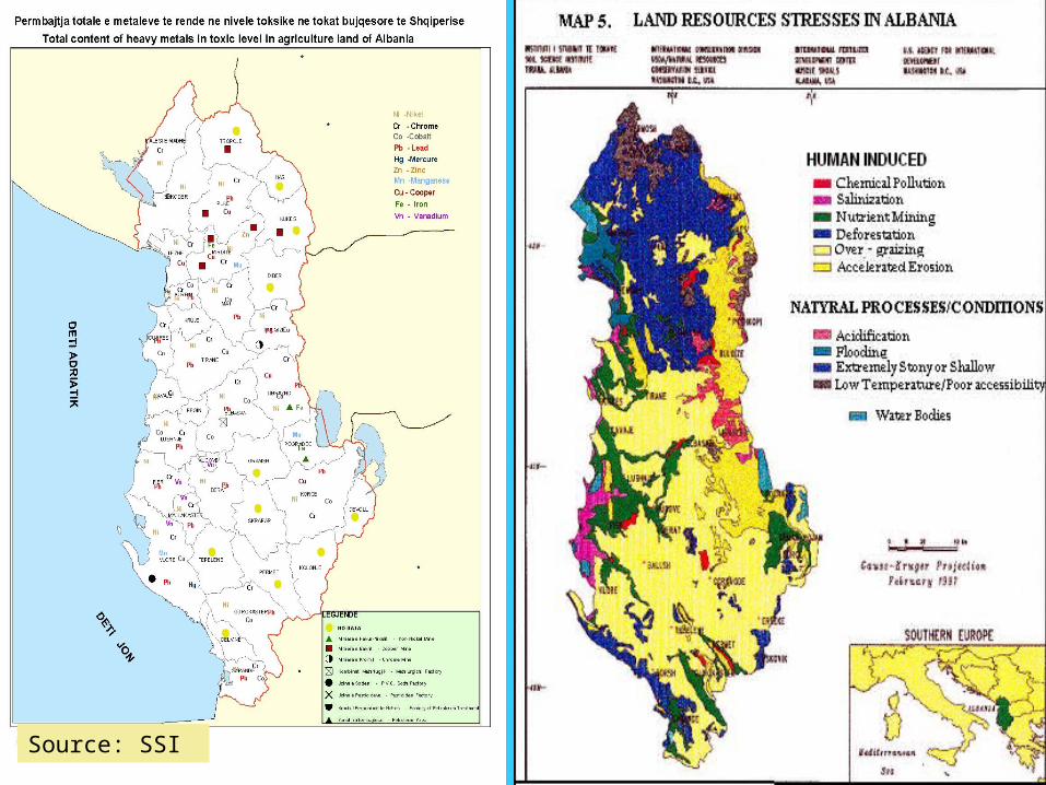
• Rainfall;• Land cover;• Slope; • Average altitude;• River network;• Deforestation and overgrazing;• Investments.
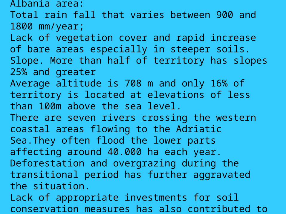
The major controlling soil erosion factors in Albania area:Total rain fall that varies between 900 and 1800 mm/year;Lack of vegetation cover and rapid increase of bare areas especially in steeper soils.Slope. More than half of territory has slopes 25% and greaterAverage altitude is 708 m and only 16% of territory is located at elevations of less than 100m above the sea level.There are seven rivers crossing the western coastal areas flowing to the Adriatic Sea.They often flood the lower parts affecting around 40.000 ha each year.Deforestation and overgrazing during the transitional period has further aggravated the situation.Lack of appropriate investments for soil conservation measures has also contributed to this problem.
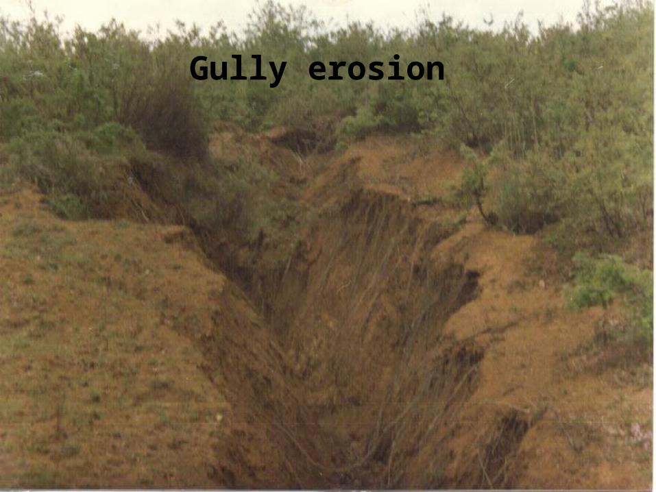
Gully erosion
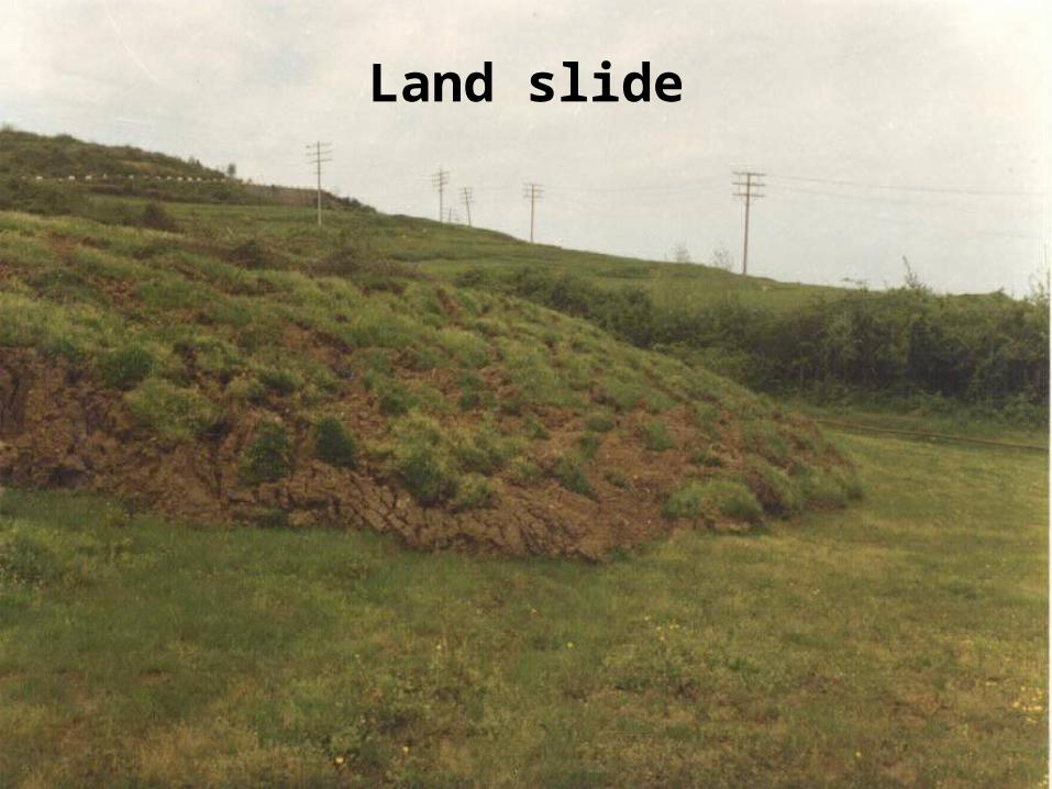
Land slide
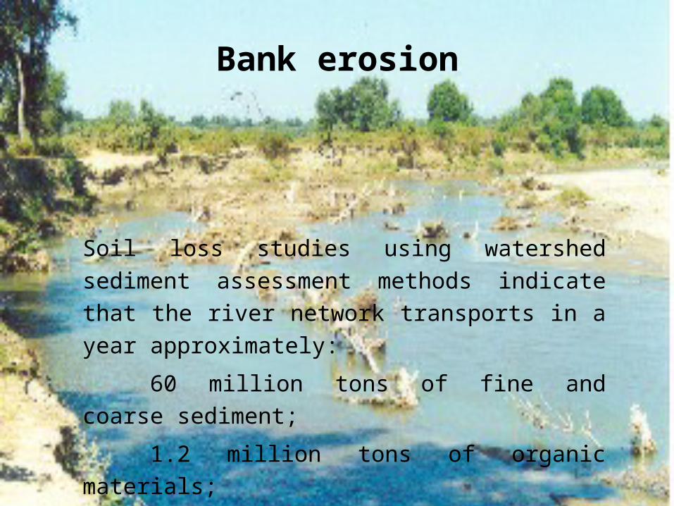
Bank erosion
Soil loss studies using watershed sediment assessment
methods indicate that the river network transports in a
year approximately:
60 million tons of fine and coarse sediment;
1.2 million tons of organic materials;
170 thousand tons of N, P, and K salts.
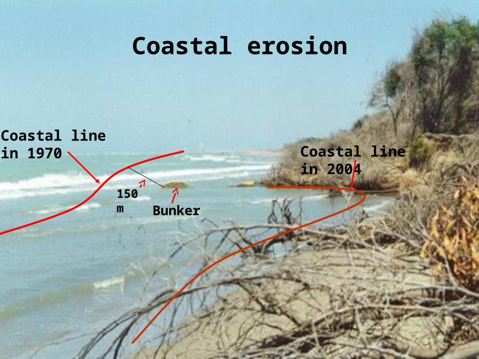
Coastal erosion
Bunker
Coastal line in 1970
150 m
Coastal line in 2004
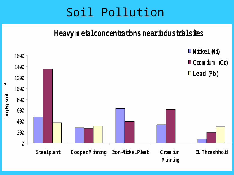
Heavy metal concentrations near industrial sites
0
200
400
600
800
1000
1200
1400
1600
Steel plant Cooper Minning Iron-Nickel Plant CromiumMinning
EU Threshhold
mg
kg s
oil
-1
Nickel (Ni)
Cromium (Cr)
Lead (Pb)
Soil Pollution
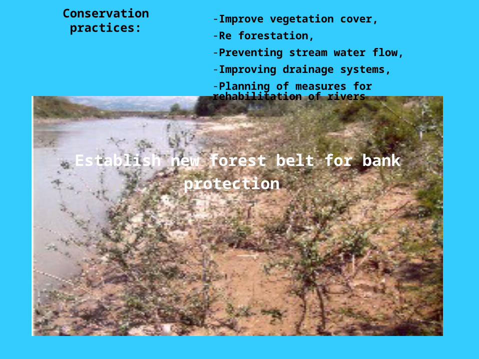
Conservation practices: -Improve vegetation cover,
-Re forestation,
-Preventing stream water flow,
-Improving drainage systems,
-Planning of measures for rehabilitation of rivers
Establish new forest belt for bank protection
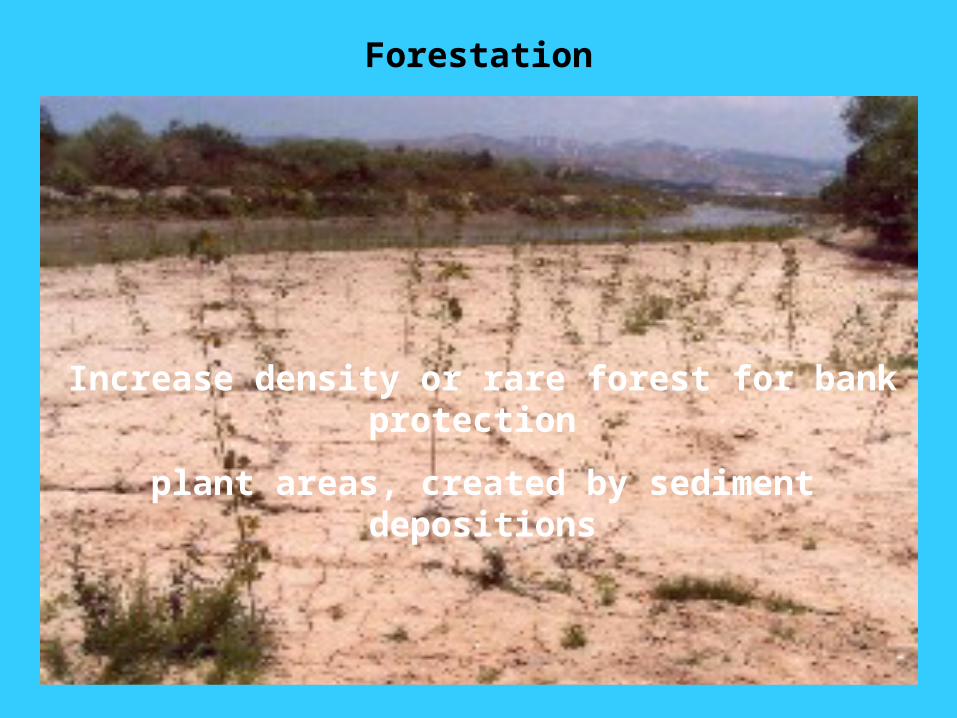
Forestation
Increase density or rare forest for bank protection
plant areas, created by sediment depositions
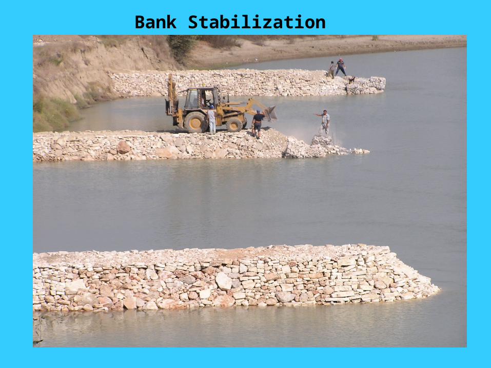
Bank Stabilization
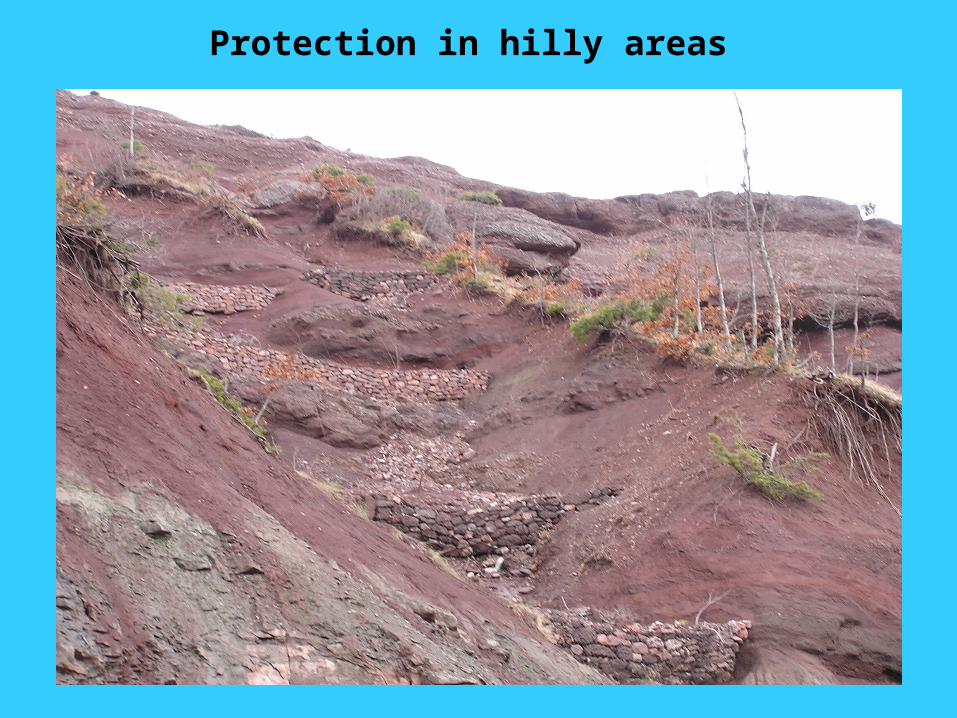
Protection in hilly areas
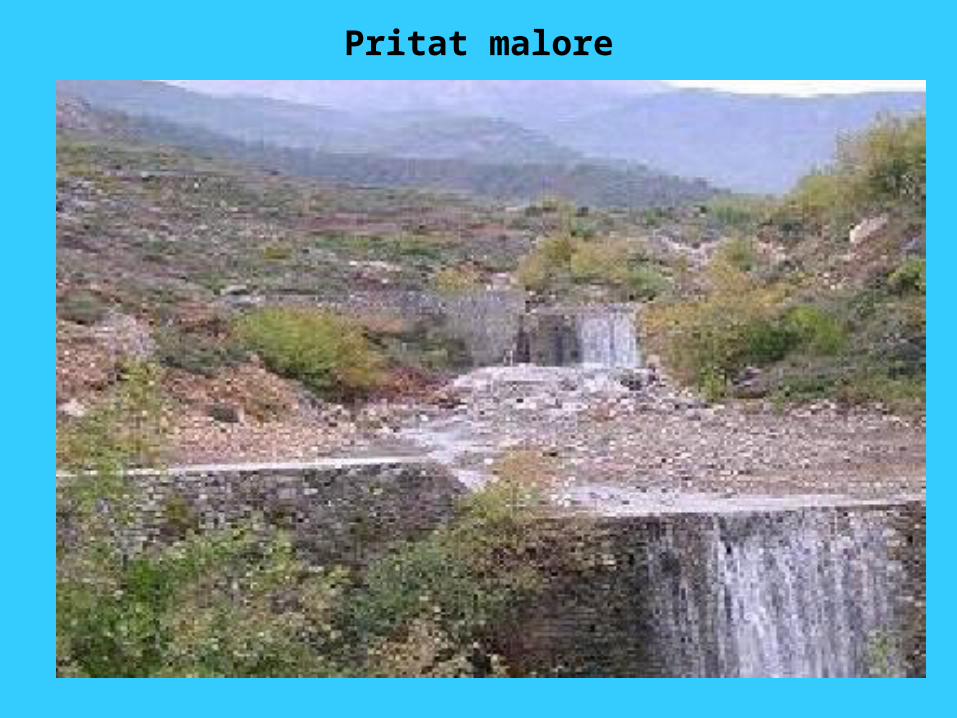
Pritat malore
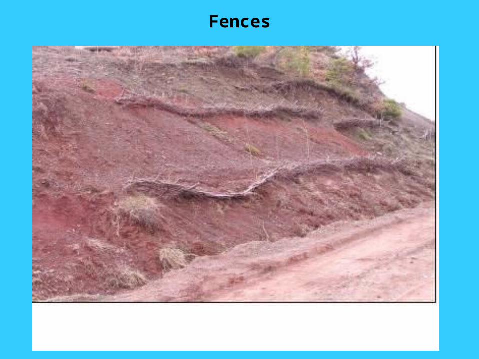
Fences
Source: SSI
Trends and Future Perspectives
• Land degradation is a continuous threat to Albania‘s land resources and should be considered as a priority;
• The conservation practices should be focused on: controlling erosion, improving soil fertility, improving the irrigation and drainage system, enhancing land consolidation, up-dating digital soil databases, and promoting a sustainable use of land resources;
• Legislation for natural resources conservation and management should be also completed;
• Capacity building related to agricultural reform and institutional transformation. Coordination still remains an essential aspect that needs to be improved;
• Scientific Research in agriculture in addition to the plant nutrition issues should also focus on environmental aspects;
• All these efforts should take in consideration the needs and interests of the farmers.
• Collaboration at the Balkan and European levels should be strengthened further. This is collaboration could be in areas such as information exchange, joint research projects and any other area as needed;
Regional Cooperation

Thank You