Embed Size (px)
Citation preview
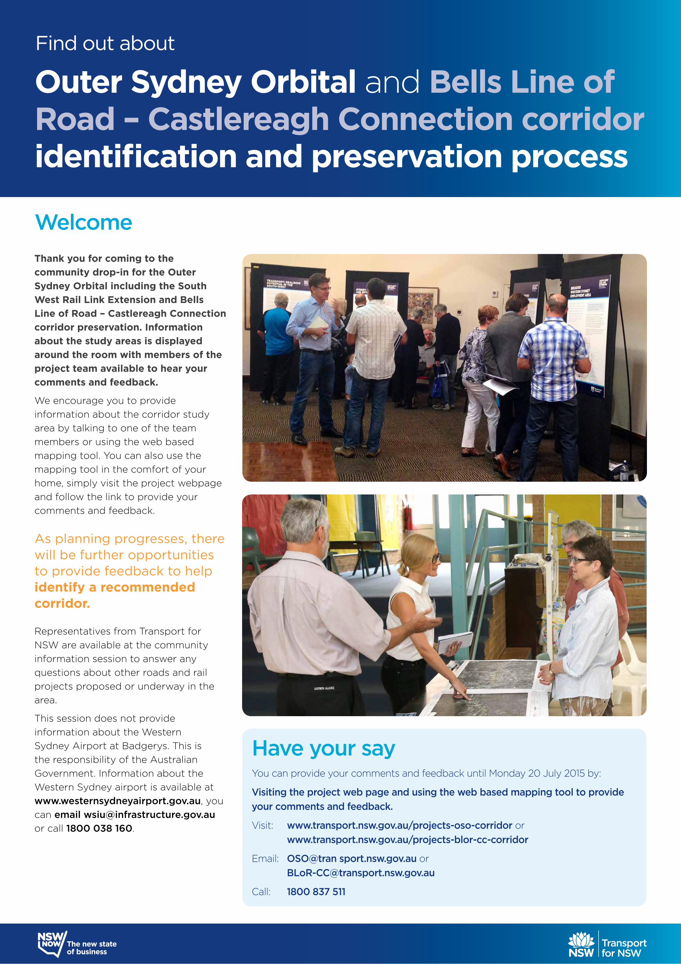
Thank you for coming to the community drop-in for the Outer Sydney Orbital including the South West Rail Link Extension and Bells Line of Road – Castlereagh Connection corridor preservation. Information about the study areas is displayed around the room with members of the project team available to hear your comments and feedback.
We encourage you to provide information about the corridor study area by talking to one of the team members or using the web based mapping tool. You can also use the mapping tool in the comfort of your home, simply visit the project webpage and follow the link to provide your comments and feedback.
Representatives from Transport for NSW are available at the community information session to answer any questions about other roads and rail projects proposed or underway in the area.
This session does not provide information about the Western Sydney Airport at Badgerys. This is the responsibility of the Australian Government. Information about the Western Sydney airport is available at www.westernsydneyairport.gov.au, you can email [email protected] or call 1800 038 160.
As planning progresses, there will be further opportunities to provide feedback to help identify a recommended corridor.
Have your sayYou can provide your comments and feedback until Monday 20 July 2015 by:
Visiting the project web page and using the web based mapping tool to provide your comments and feedback.
Visit: www.transport.nsw.gov.au/projects-oso-corridor or www.transport.nsw.gov.au/projects-blor-cc-corridor
Email: OSO@tran sport.nsw.gov.au or [email protected]
Call: 1800 837 511
Find out about
Outer Sydney Orbital and Bells Line of Road – Castlereagh Connection corridor identification and preservation process
Welcome
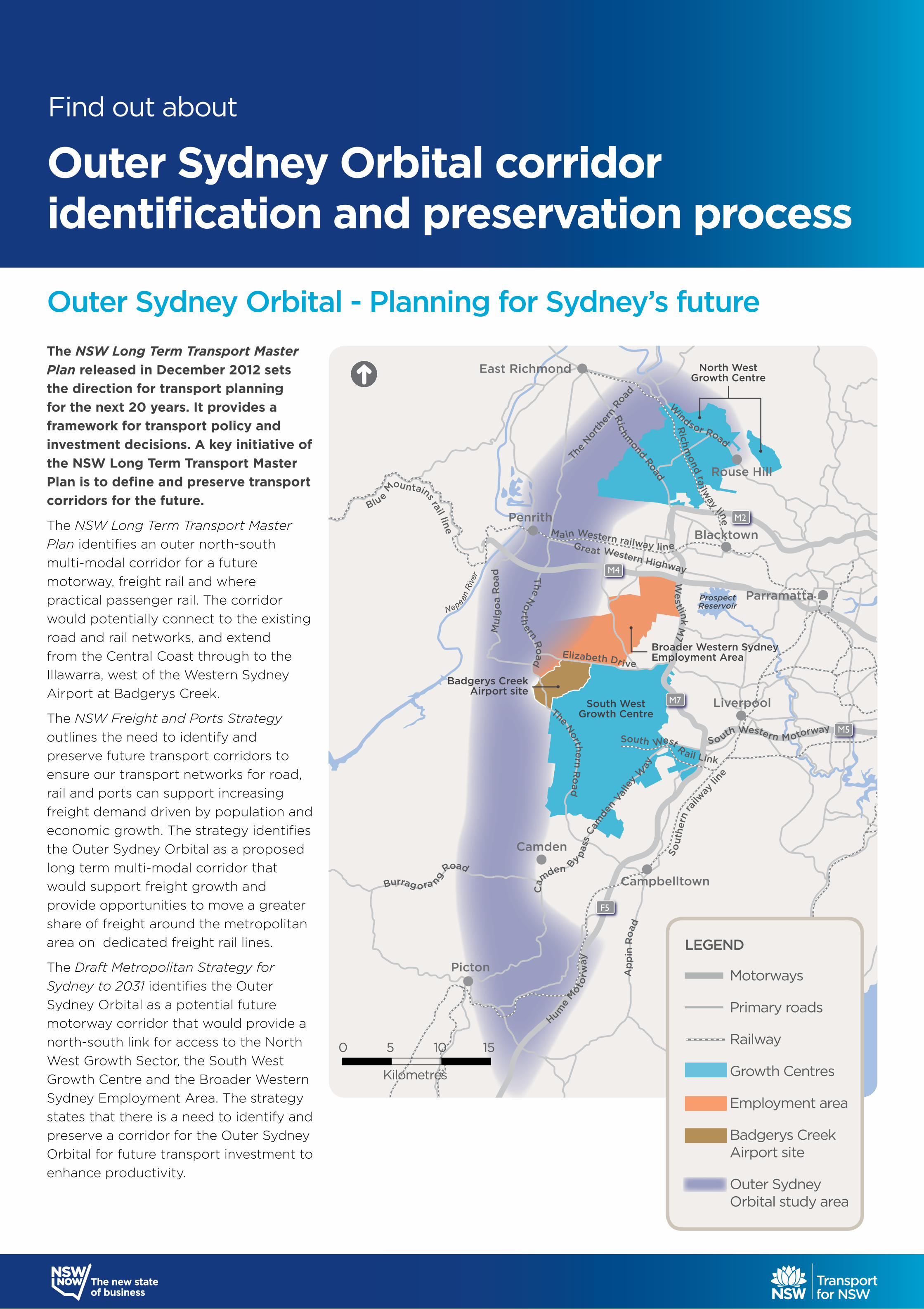
Outer Sydney Orbital - Planning for Sydney’s futureThe NSW Long Term Transport Master Plan released in December 2012 sets the direction for transport planning for the next 20 years. It provides a framework for transport policy and investment decisions. A key initiative of the NSW Long Term Transport Master Plan is to define and preserve transport corridors for the future.
The NSW Long Term Transport Master Plan identifies an outer north-south multi-modal corridor for a future motorway, freight rail and where practical passenger rail. The corridor would potentially connect to the existing road and rail networks, and extend from the Central Coast through to the Illawarra, west of the Western Sydney Airport at Badgerys Creek.
The NSW Freight and Ports Strategy outlines the need to identify and preserve future transport corridors to ensure our transport networks for road, rail and ports can support increasing freight demand driven by population and economic growth. The strategy identifies the Outer Sydney Orbital as a proposed long term multi-modal corridor that would support freight growth and provide opportunities to move a greater share of freight around the metropolitan area on dedicated freight rail lines.
The Draft Metropolitan Strategy for Sydney to 2031 identifies the Outer Sydney Orbital as a potential future motorway corridor that would provide a north-south link for access to the North West Growth Sector, the South West Growth Centre and the Broader Western Sydney Employment Area. The strategy states that there is a need to identify and preserve a corridor for the Outer Sydney Orbital for future transport investment to enhance productivity.
Elizabeth Drive
The No
rthern Road
Cam
den
Valle
y W
ay
Hume
M
otorw
ay
Ap
pin
Roa
d
The N
orth
ern
Roa
d
Great Western Highway
We
stlink M
7
So uth Western Motorway
Mu
lgo
a R
oad
The Northern Ro
ad
Windsor Road
Richm
ond Road
Nepean R
iver
Burrag ora ng
Road
ProspectReservoir
Rich
mond ra
ilway line
Main Western railway line
Sout
hern
railw
ay lin
e
South West R ail Link
Blue Mountains rail line
Cam
den B
y pass
Penrith
East Richmond
Blacktown
Rouse Hill
Parramatta
Liverpool
Campbelltown
Camden
Picton
M4
M7
M2
M5
F5
North WestGrowth Centre
South WestGrowth Centre
Broader Western Sydney Employment Area
Badgerys Creek Airport site
1. Outer Sydney Orbital Study area
LEGEND
Motorways
Primary roads
Railway
Growth Centres
Employment area
Badgerys Creek Airport site
Outer SydneyOrbital study area
0 5 10 15
Kilometres
Outer Sydney Orbital corridoridentification and preservation process
Find out about
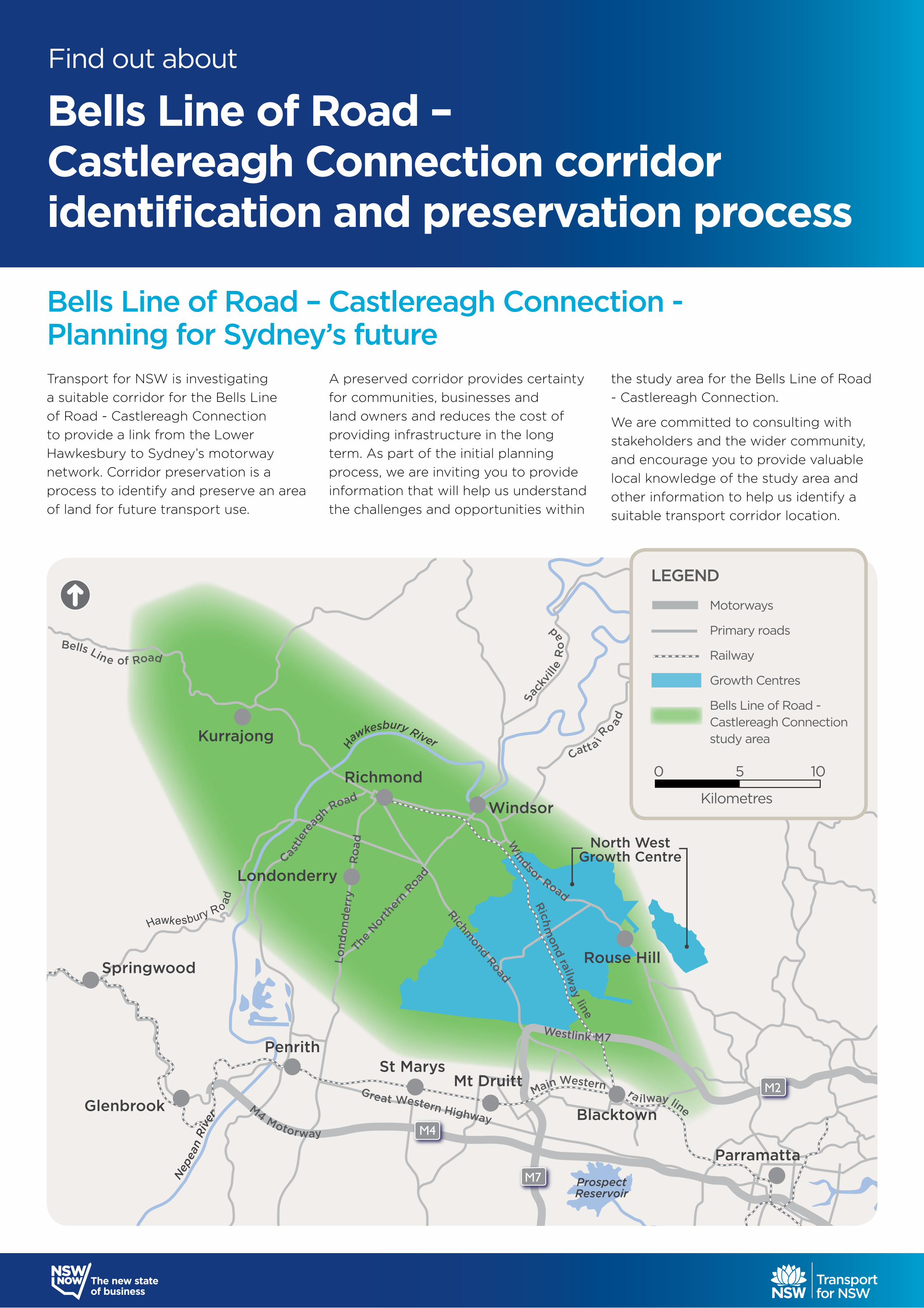
Transport for NSW is investigating a suitable corridor for the Bells Line of Road - Castlereagh Connection to provide a link from the Lower Hawkesbury to Sydney’s motorway network. Corridor preservation is a process to identify and preserve an area of land for future transport use.
A preserved corridor provides certainty for communities, businesses and land owners and reduces the cost of providing infrastructure in the long term. As part of the initial planning process, we are inviting you to provide information that will help us understand the challenges and opportunities within
the study area for the Bells Line of Road - Castlereagh Connection.
We are committed to consulting with stakeholders and the wider community, and encourage you to provide valuable local knowledge of the study area and other information to help us identify a suitable transport corridor location.
Bells Line of Road – Castlereagh Connection - Planning for Sydney’s future
Great Western Highway
H
awkesbury River
Sa
ckvi
lle R
oad
Wisemans F
err
y R
oad
Catta i Ro ad
Richmond Road
Westlink M7
Castle
re
agh R
oad
Windsor Road
Nep
ean
Riv
er
Lond
ond
erry
Ro
adTh
e Nor
ther
n Roa
d
Bells Line of Road
M4 Motorway
Hawkesbury R o
ad Rich
mond railw
ay line
Main Western ra ilway line
PenrithSt Marys
Mt Druitt
Springwood
Glenbrook
Londonderry
Richmond
Windsor
Rouse Hill
Blacktown
Parramatta
Kurrajong
M4
M7
M2
North WestGrowth Centre
ProspectReservoir
LEGEND
Motorways
Primary roads
Railway
Growth Centres
Bells Line of Road - Castlereagh Connection study area
0 5 10
Kilometres
Bells Line of Road – Castlereagh Connection corridor identification and preservation process
Find out about
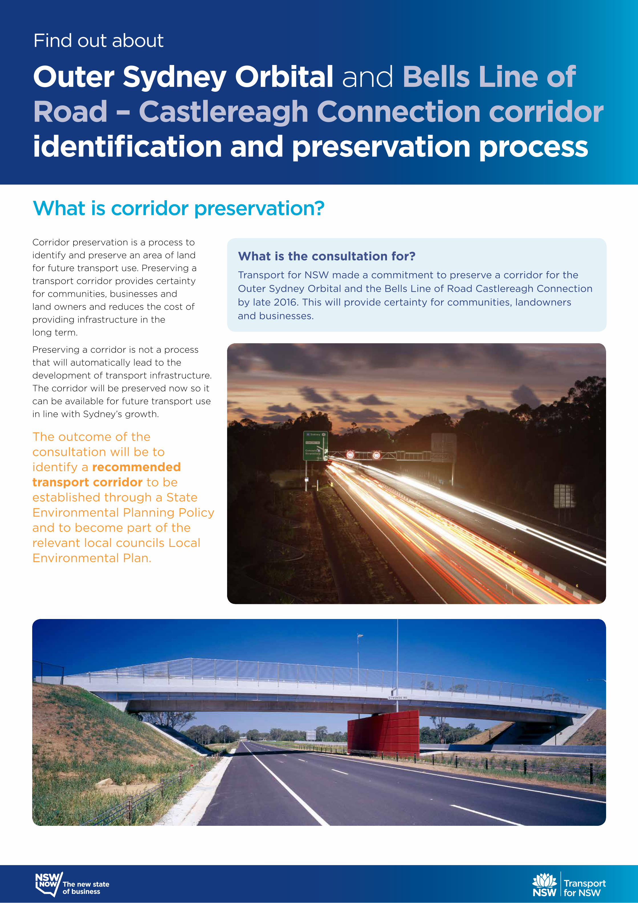
Corridor preservation is a process to identify and preserve an area of land for future transport use. Preserving a transport corridor provides certainty for communities, businesses and land owners and reduces the cost of providing infrastructure in the long term.
Preserving a corridor is not a process that will automatically lead to the development of transport infrastructure. The corridor will be preserved now so it can be available for future transport use in line with Sydney’s growth.
The outcome of the consultation will be to identify a recommended transport corridor to be established through a State Environmental Planning Policy and to become part of the relevant local councils Local Environmental Plan.
What is corridor preservation?
What is the consultation for?Transport for NSW made a commitment to preserve a corridor for the Outer Sydney Orbital and the Bells Line of Road Castlereagh Connection by late 2016. This will provide certainty for communities, landowners and businesses.
Find out about
Outer Sydney Orbital and Bells Line of Road – Castlereagh Connection corridor identification and preservation process
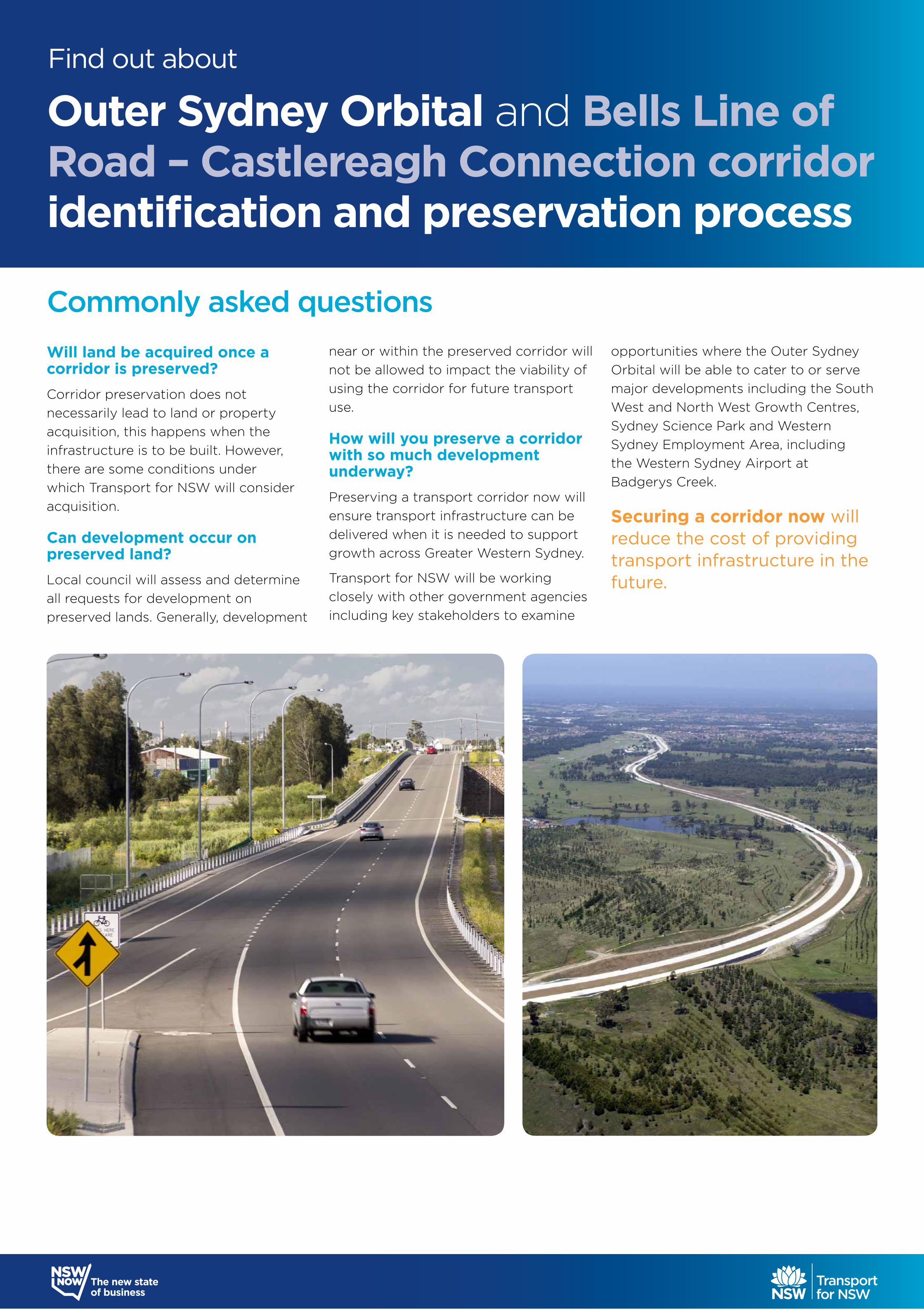
Will land be acquired once a corridor is preserved?Corridor preservation does not necessarily lead to land or property acquisition, this happens when the infrastructure is to be built. However, there are some conditions under which Transport for NSW will consider acquisition.
Can development occur on preserved land?Local council will assess and determine all requests for development on preserved lands. Generally, development
near or within the preserved corridor will not be allowed to impact the viability of using the corridor for future transport use.
How will you preserve a corridor with so much development underway?Preserving a transport corridor now will ensure transport infrastructure can be delivered when it is needed to support growth across Greater Western Sydney.
Transport for NSW will be working closely with other government agencies including key stakeholders to examine
opportunities where the Outer Sydney Orbital will be able to cater to or serve major developments including the South West and North West Growth Centres, Sydney Science Park and Western Sydney Employment Area, including the Western Sydney Airport at Badgerys Creek.
Securing a corridor now will reduce the cost of providing transport infrastructure in the future.
Commonly asked questions
Outer Sydney Orbital and Bells Line of Road – Castlereagh Connection corridor identification and preservation process
Find out about
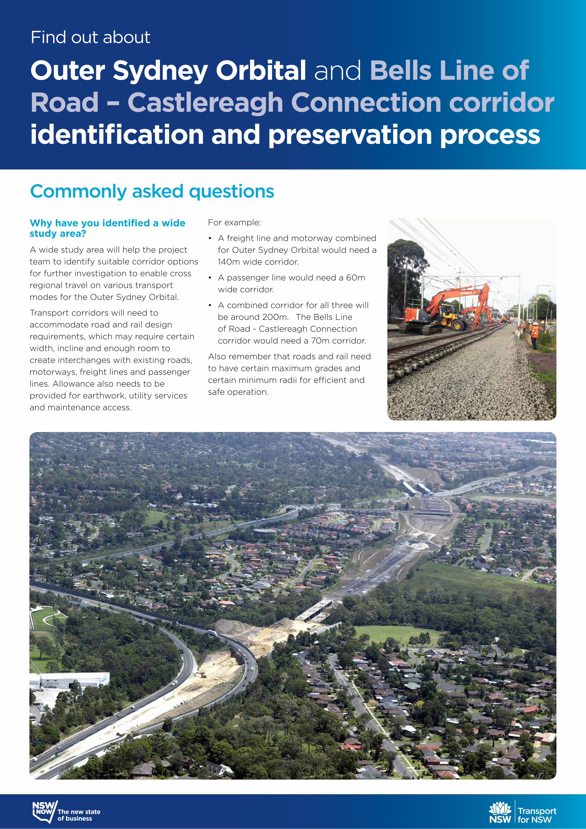
Why have you identified a wide study area?A wide study area will help the project team to identify suitable corridor options for further investigation to enable cross regional travel on various transport modes for the Outer Sydney Orbital.
Transport corridors will need to accommodate road and rail design requirements, which may require certain width, incline and enough room to create interchanges with existing roads, motorways, freight lines and passenger lines. Allowance also needs to be provided for earthwork, utility services and maintenance access.
For example:
• A freight line and motorway combined for Outer Sydney Orbital would need a 140m wide corridor.
• A passenger line would need a 60m wide corridor.
• A combined corridor for all three will be around 200m. The Bells Line of Road - Castlereagh Connection corridor would need a 70m corridor.
Also remember that roads and rail need to have certain maximum grades and certain minimum radii for efficient and safe operation.
Commonly asked questions
Outer Sydney Orbital and Bells Line of Road – Castlereagh Connection corridor identification and preservation process
Find out about
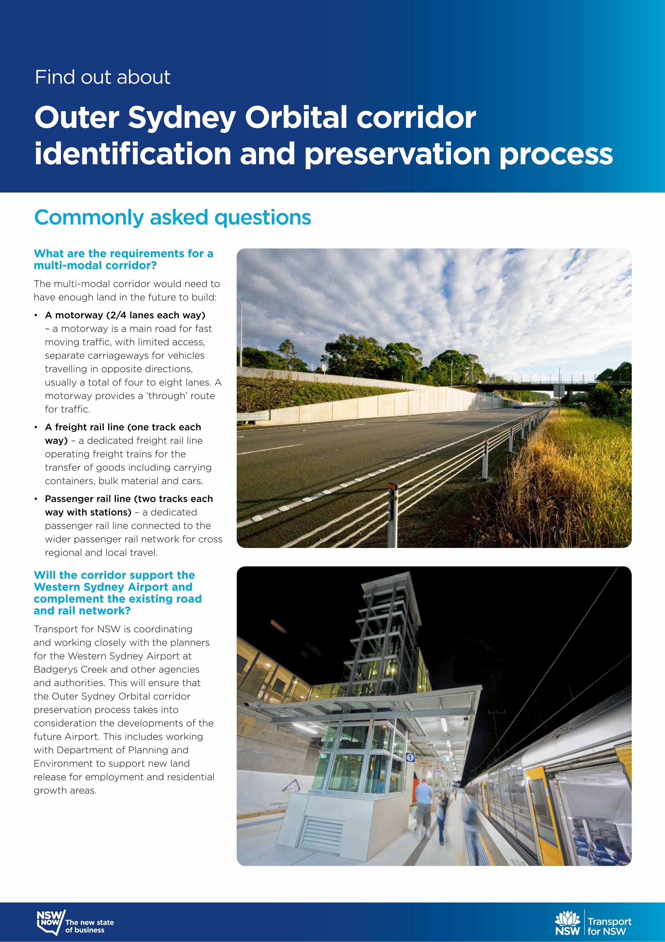
What are the requirements for a multi-modal corridor?The multi-modal corridor would need to have enough land in the future to build:
• A motorway (2/4 lanes each way) – a motorway is a main road for fast moving traffic, with limited access, separate carriageways for vehicles travelling in opposite directions, usually a total of four to eight lanes. A motorway provides a ‘through’ route for traffic.
• A freight rail line (one track each way) – a dedicated freight rail line operating freight trains for the transfer of goods including carrying containers, bulk material and cars.
• Passenger rail line (two tracks each way with stations) – a dedicated passenger rail line connected to the wider passenger rail network for cross regional and local travel.
Will the corridor support the Western Sydney Airport and complement the existing road and rail network?Transport for NSW is coordinating and working closely with the planners for the Western Sydney Airport at Badgerys Creek and other agencies and authorities. This will ensure that the Outer Sydney Orbital corridor preservation process takes into consideration the developments of the future Airport. This includes working with Department of Planning and Environment to support new land release for employment and residential growth areas.
Commonly asked questions
Find out about
Outer Sydney Orbital corridoridentification and preservation process
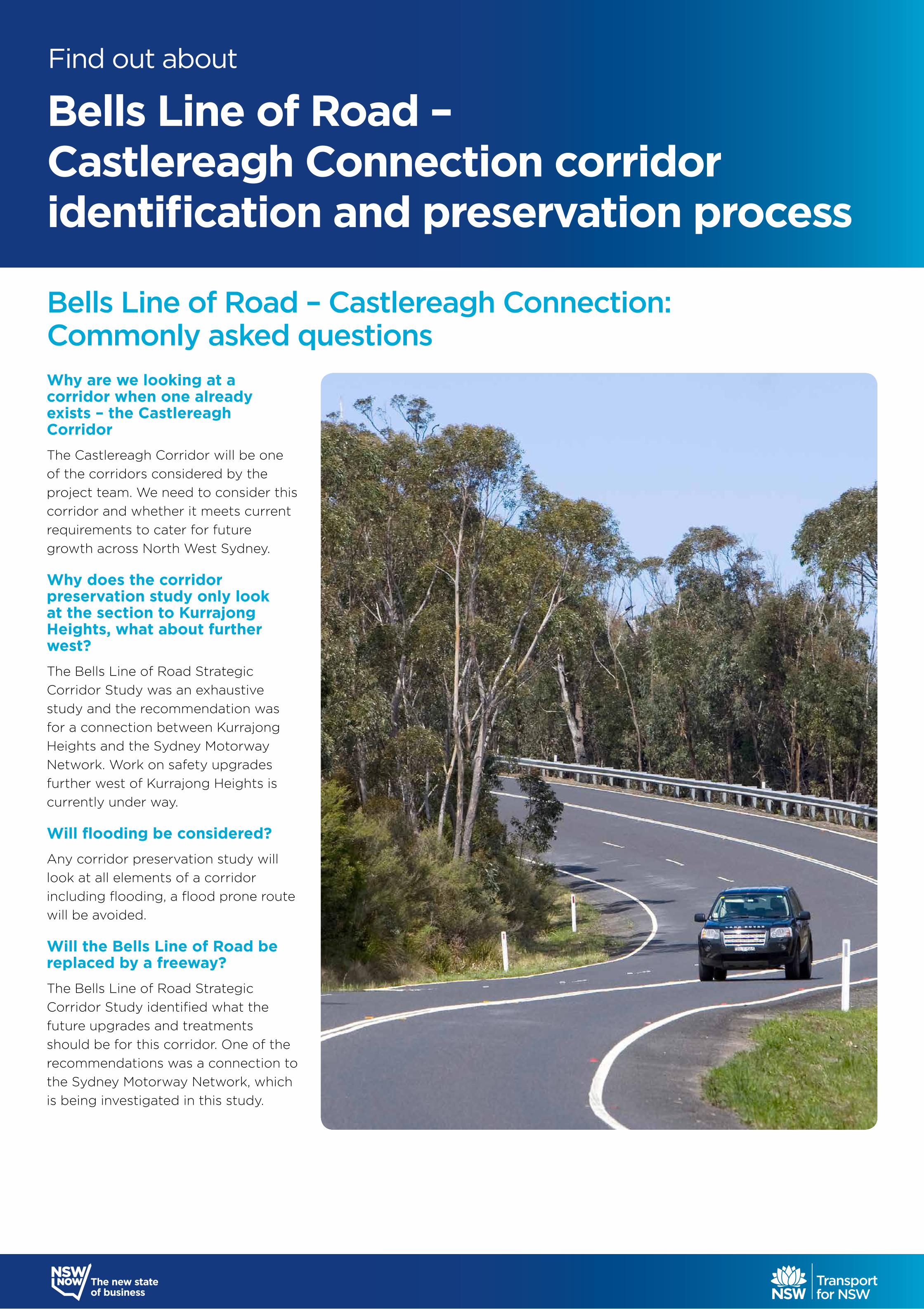
Why are we looking at a corridor when one already exists – the Castlereagh Corridor The Castlereagh Corridor will be one of the corridors considered by the project team. We need to consider this corridor and whether it meets current requirements to cater for future growth across North West Sydney.
Why does the corridor preservation study only look at the section to Kurrajong Heights, what about further west? The Bells Line of Road Strategic Corridor Study was an exhaustive study and the recommendation was for a connection between Kurrajong Heights and the Sydney Motorway Network. Work on safety upgrades further west of Kurrajong Heights is currently under way.
Will flooding be considered?Any corridor preservation study will look at all elements of a corridor including flooding, a flood prone route will be avoided.
Will the Bells Line of Road be replaced by a freeway? The Bells Line of Road Strategic Corridor Study identified what the future upgrades and treatments should be for this corridor. One of the recommendations was a connection to the Sydney Motorway Network, which is being investigated in this study.
Bells Line of Road – Castlereagh Connection: Commonly asked questions
Bells Line of Road – Castlereagh Connection corridor identification and preservation process
Find out about
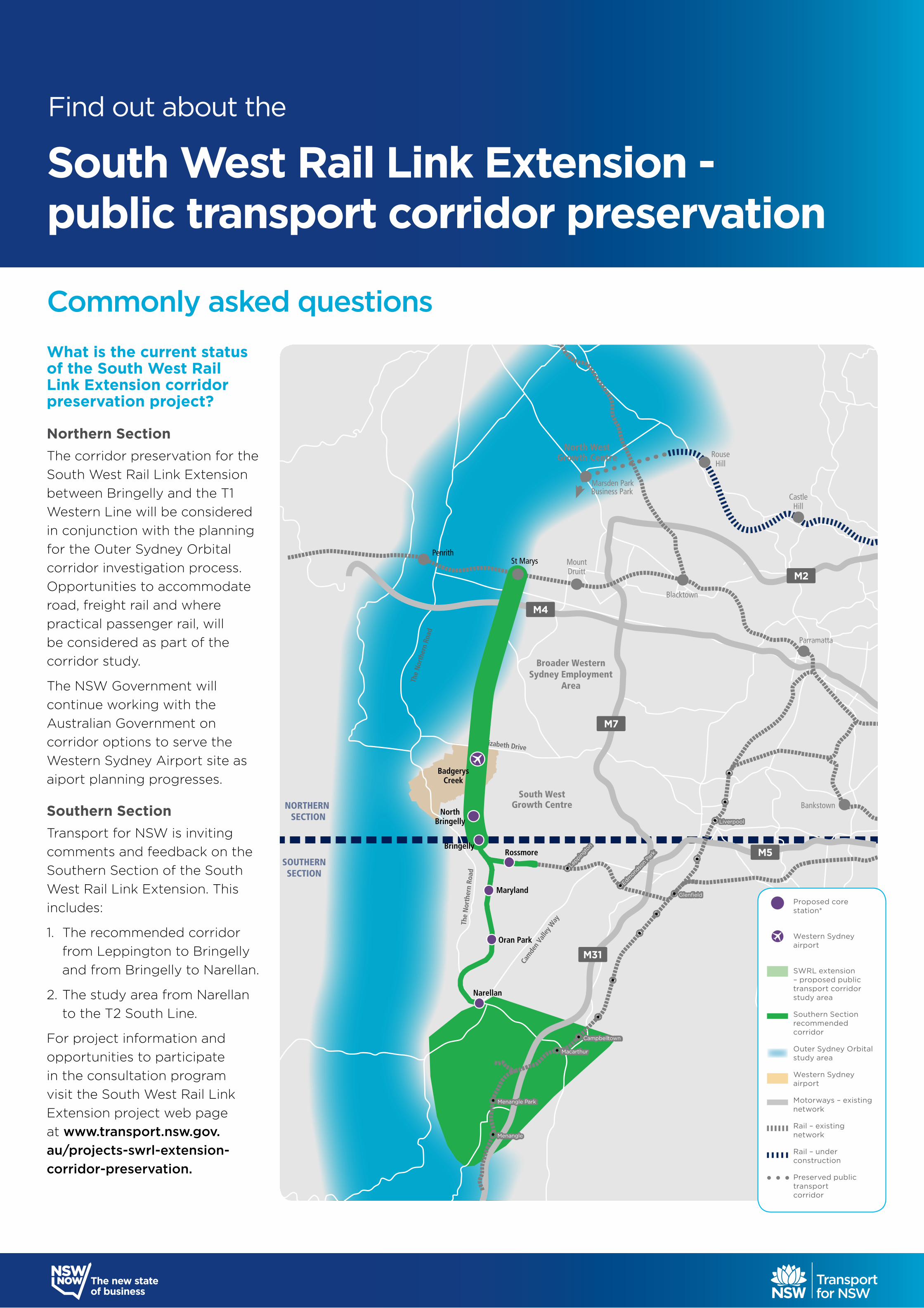
What is the current status of the South West Rail Link Extension corridor preservation project?
Northern SectionThe corridor preservation for the South West Rail Link Extension between Bringelly and the T1 Western Line will be considered in conjunction with the planning for the Outer Sydney Orbital corridor investigation process. Opportunities to accommodate road, freight rail and where practical passenger rail, will be considered as part of the corridor study.
The NSW Government will continue working with the Australian Government on corridor options to serve the Western Sydney Airport site as aiport planning progresses.
Southern SectionTransport for NSW is inviting comments and feedback on the Southern Section of the South West Rail Link Extension. This includes:
1. The recommended corridor from Leppington to Bringelly and from Bringelly to Narellan.
2. The study area from Narellan to the T2 South Line.
For project information and opportunities to participate in the consultation program visit the South West Rail Link Extension project web page at www.transport.nsw.gov.au/projects-swrl-extension-corridor-preservation.
Commonly asked questions
NORTHERN SECTION
SOUTHERNSECTION
The
Nor
ther
n Ro
ad
Cam
den
Valle
y Way
The
Nor
ther
n Ro
ad
Elizabeth Drive
M4
M7
M5
M31
M2
North WestGrowth Centre
St Marys
BadgerysCreek
NorthBringelly
BringellyRossmore
Oran Park
Narellan
Marsden ParkBusiness Park
RouseHill
Castle
Blacktown
Parramatta
Bankstown
Hill
MountPenrith
Druitt
South West
Broader WesternSydney Employment
Area
Growth Centre
Maryland
Menangle
Menangle Park
Menangle
Menangle Park
Macarthur Macarthur
Campbelltown Campbelltown
Glenfield Glenfield
Edmond
son
Park
Edmond
son
Park
Leppin
gton
Leppin
gton
Liverpool Liverpool
South West Rail Link Extension recommended corridor
Proposed core station*
Western Sydney airport
SWRL extension
– proposed public transport corridor study area
Southern Section recommended corridor
Outer Sydney Orbital study area
Western Sydney airport
Motorways – existing network
Rail – existing network
Rail – under construction
Preserved public transport corridor
South West Rail Link Extension - public transport corridor preservation
Find out about the
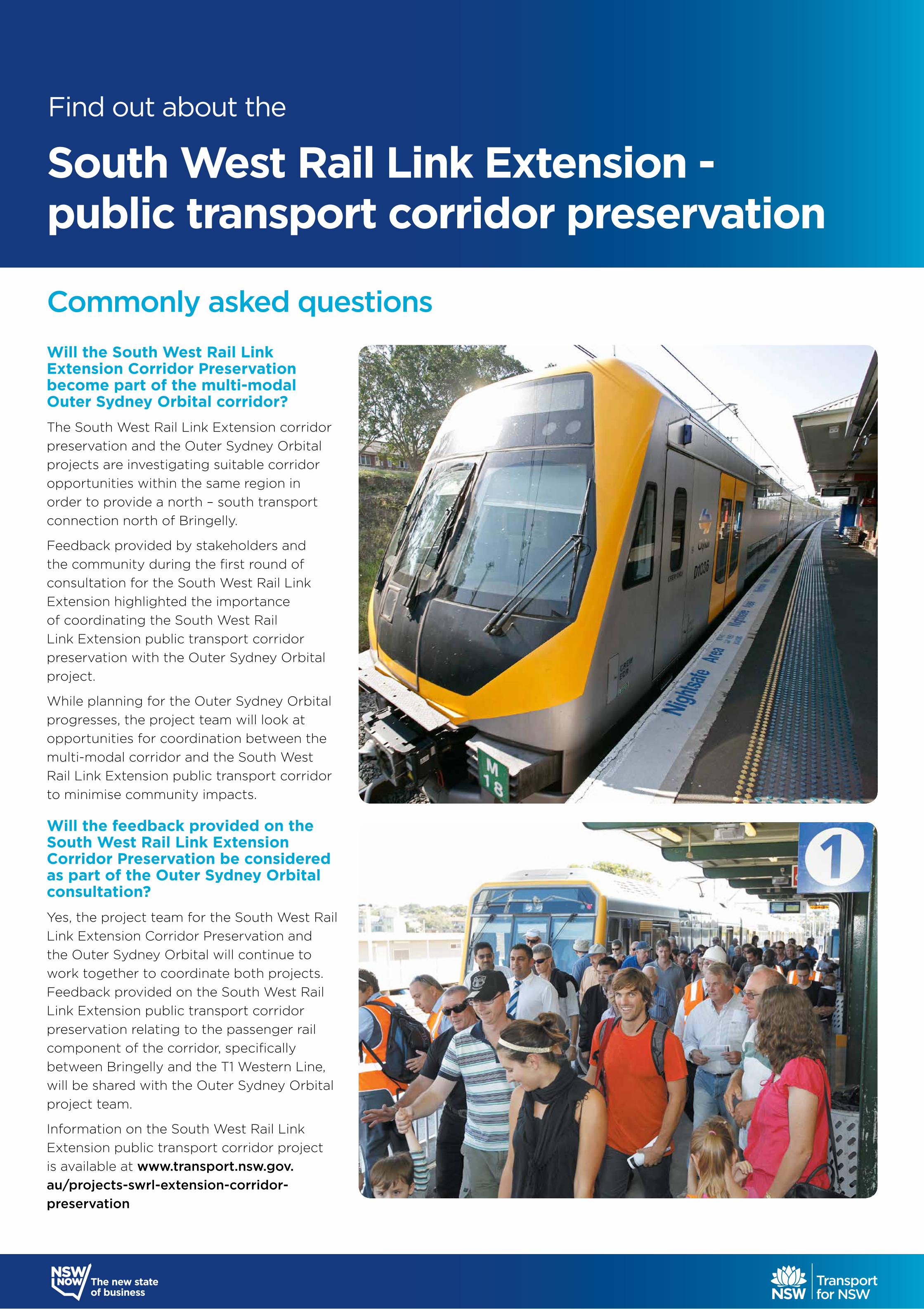
Will the South West Rail Link Extension Corridor Preservation become part of the multi-modal Outer Sydney Orbital corridor? The South West Rail Link Extension corridor preservation and the Outer Sydney Orbital projects are investigating suitable corridor opportunities within the same region in order to provide a north – south transport connection north of Bringelly.
Feedback provided by stakeholders and the community during the first round of consultation for the South West Rail Link Extension highlighted the importance of coordinating the South West Rail Link Extension public transport corridor preservation with the Outer Sydney Orbital project.
While planning for the Outer Sydney Orbital progresses, the project team will look at opportunities for coordination between the multi-modal corridor and the South West Rail Link Extension public transport corridor to minimise community impacts.
Will the feedback provided on the South West Rail Link Extension Corridor Preservation be considered as part of the Outer Sydney Orbital consultation?Yes, the project team for the South West Rail Link Extension Corridor Preservation and the Outer Sydney Orbital will continue to work together to coordinate both projects. Feedback provided on the South West Rail Link Extension public transport corridor preservation relating to the passenger rail component of the corridor, specifically between Bringelly and the T1 Western Line, will be shared with the Outer Sydney Orbital project team.
Information on the South West Rail Link Extension public transport corridor project is available at www.transport.nsw.gov.au/projects-swrl-extension-corridor-preservation
Commonly asked questions
South West Rail Link Extension - public transport corridor preservation
Find out about the
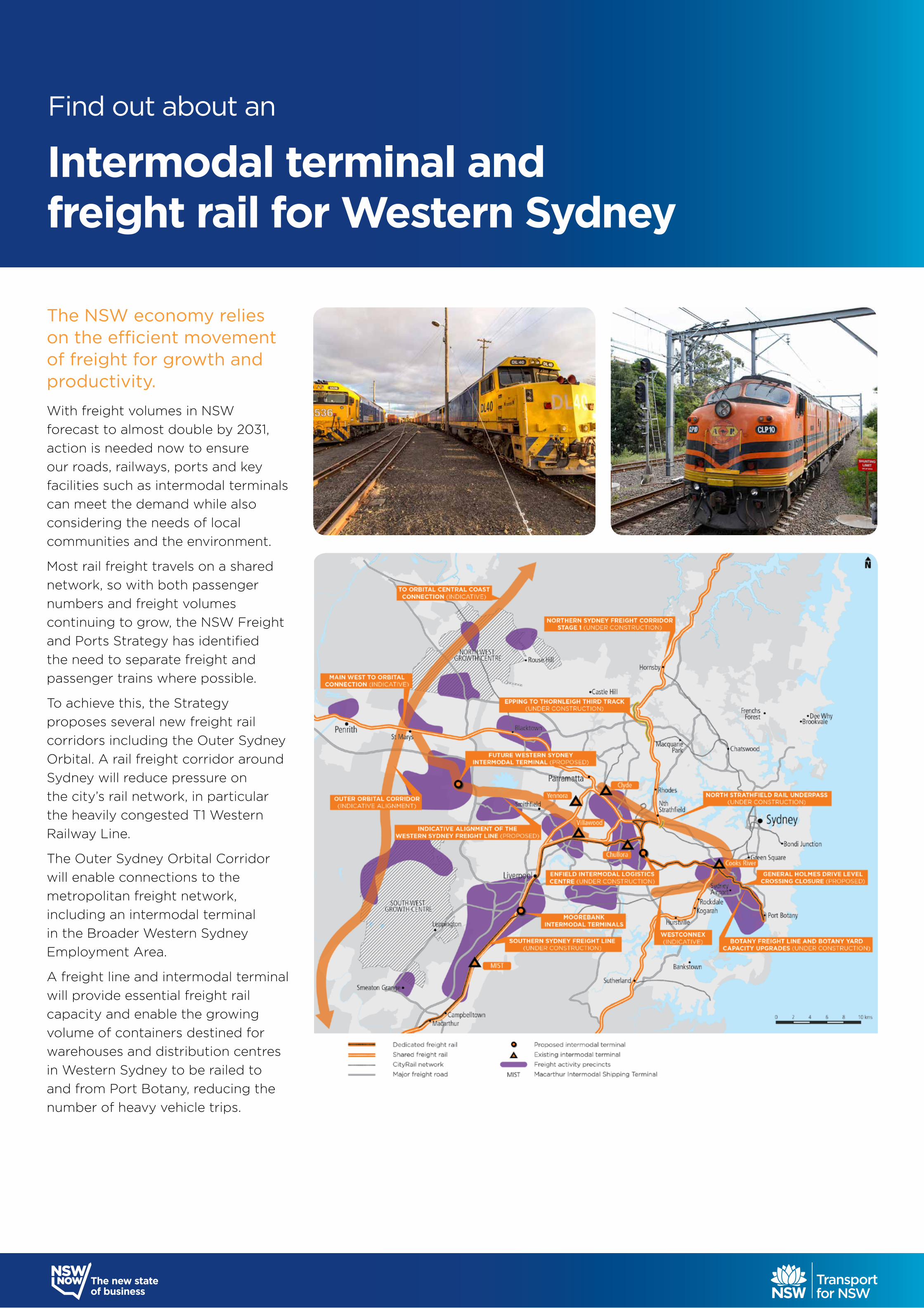
The NSW economy relies on the efficient movement of freight for growth and productivity.
With freight volumes in NSW forecast to almost double by 2031, action is needed now to ensure our roads, railways, ports and key facilities such as intermodal terminals can meet the demand while also considering the needs of local communities and the environment.
Most rail freight travels on a shared network, so with both passenger numbers and freight volumes continuing to grow, the NSW Freight and Ports Strategy has identified the need to separate freight and passenger trains where possible.
To achieve this, the Strategy proposes several new freight rail corridors including the Outer Sydney Orbital. A rail freight corridor around Sydney will reduce pressure on the city’s rail network, in particular the heavily congested T1 Western Railway Line.
The Outer Sydney Orbital Corridor will enable connections to the metropolitan freight network, including an intermodal terminal in the Broader Western Sydney Employment Area.
A freight line and intermodal terminal will provide essential freight rail capacity and enable the growing volume of containers destined for warehouses and distribution centres in Western Sydney to be railed to and from Port Botany, reducing the number of heavy vehicle trips.
Find out about an
Intermodal terminal and freight rail for Western Sydney
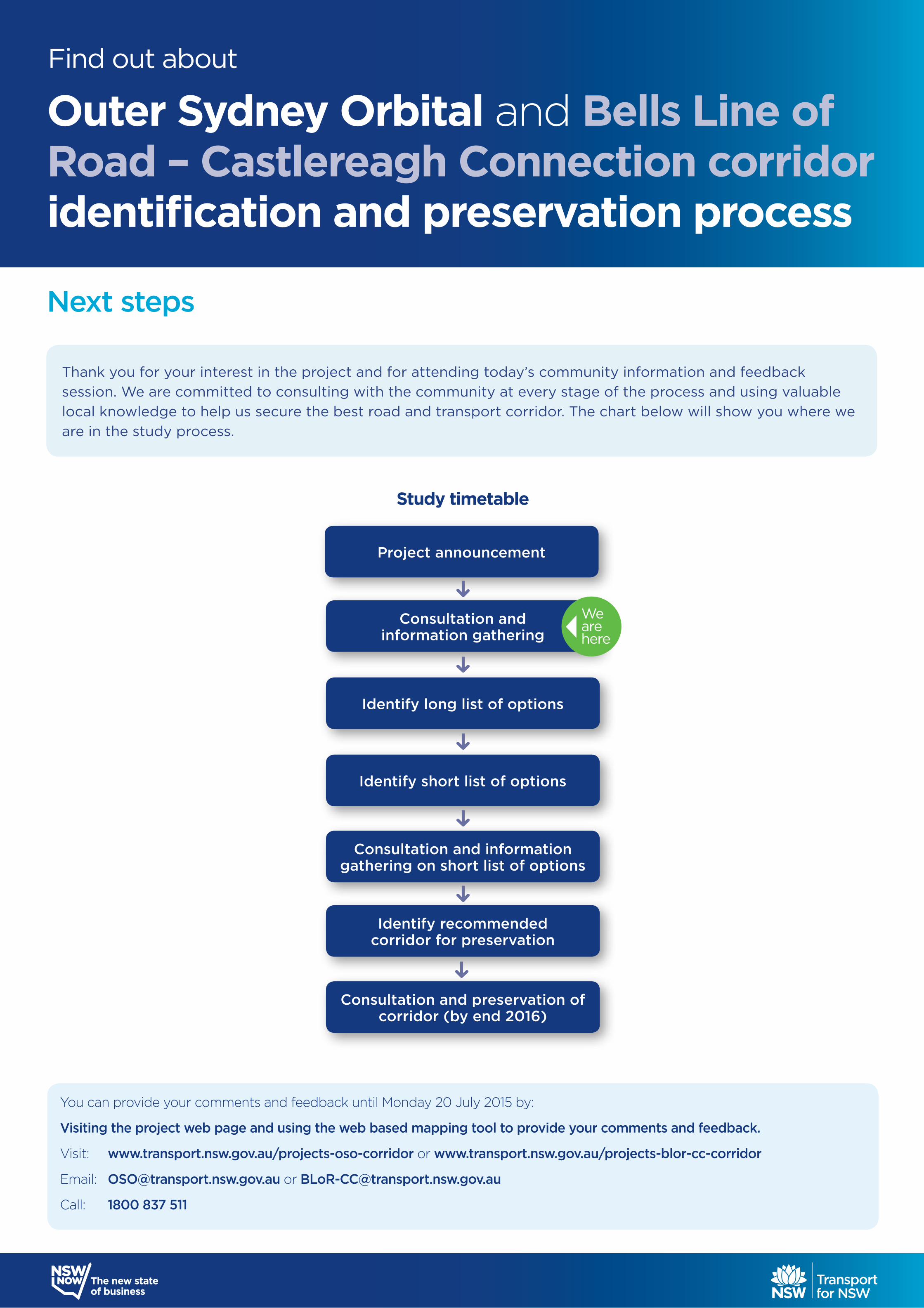
Next steps
Identify recommended corridor for preservation
Consultation and information gathering on short list of options
Identify short list of options
Identify long list of options
Consultation andinformation gathering
Project announcement
Consultation and preservation of corridor (by end 2016)
Study timetable
We are here
You can provide your comments and feedback until Monday 20 July 2015 by:
Visiting the project web page and using the web based mapping tool to provide your comments and feedback.
Visit: www.transport.nsw.gov.au/projects-oso-corridor or www.transport.nsw.gov.au/projects-blor-cc-corridor
Email: [email protected] or [email protected]
Call: 1800 837 511
Thank you for your interest in the project and for attending today’s community information and feedback session. We are committed to consulting with the community at every stage of the process and using valuable local knowledge to help us secure the best road and transport corridor. The chart below will show you where we are in the study process.
Outer Sydney Orbital and Bells Line of Road – Castlereagh Connection corridor identification and preservation process
Find out about