Embed Size (px)
Citation preview
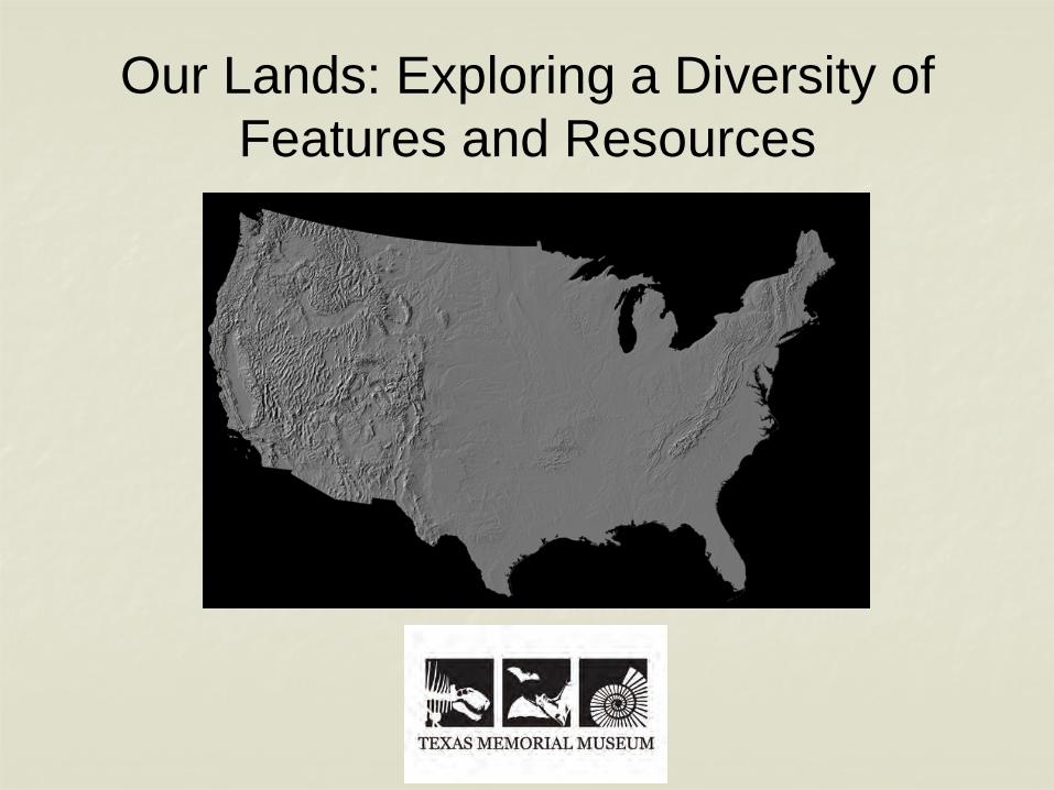
Our Lands: Exploring a Diversity of Features and Resources
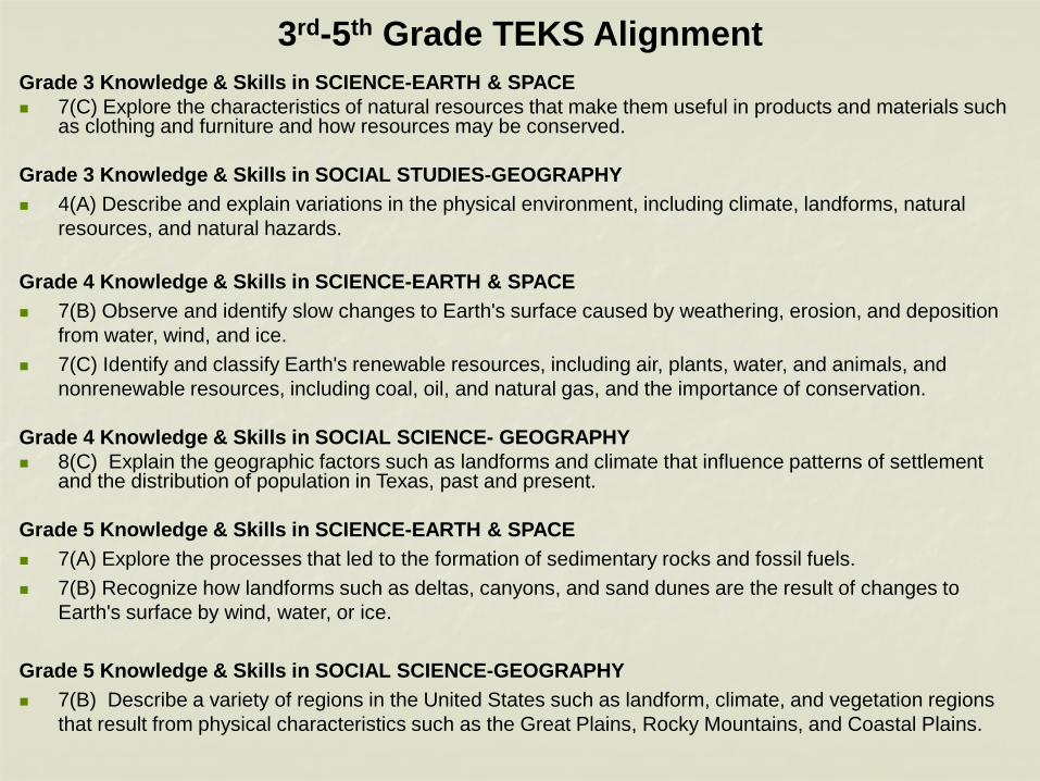
3rd-5th Grade TEKS AlignmentGrade 3 Knowledge & Skills in SCIENCE-EARTH & SPACE 7(C) Explore the characteristics of natural resources that make them useful in products and materials such
as clothing and furniture and how resources may be conserved.
Grade 3 Knowledge & Skills in SOCIAL STUDIES-GEOGRAPHY 4(A) Describe and explain variations in the physical environment, including climate, landforms, natural
resources, and natural hazards.
Grade 4 Knowledge & Skills in SCIENCE-EARTH & SPACE 7(B) Observe and identify slow changes to Earth's surface caused by weathering, erosion, and deposition
from water, wind, and ice. 7(C) Identify and classify Earth's renewable resources, including air, plants, water, and animals, and
nonrenewable resources, including coal, oil, and natural gas, and the importance of conservation.
Grade 4 Knowledge & Skills in SOCIAL SCIENCE- GEOGRAPHY 8(C) Explain the geographic factors such as landforms and climate that influence patterns of settlement
and the distribution of population in Texas, past and present.
Grade 5 Knowledge & Skills in SCIENCE-EARTH & SPACE 7(A) Explore the processes that led to the formation of sedimentary rocks and fossil fuels. 7(B) Recognize how landforms such as deltas, canyons, and sand dunes are the result of changes to
Earth's surface by wind, water, or ice.
Grade 5 Knowledge & Skills in SOCIAL SCIENCE-GEOGRAPHY 7(B) Describe a variety of regions in the United States such as landform, climate, and vegetation regions
that result from physical characteristics such as the Great Plains, Rocky Mountains, and Coastal Plains.
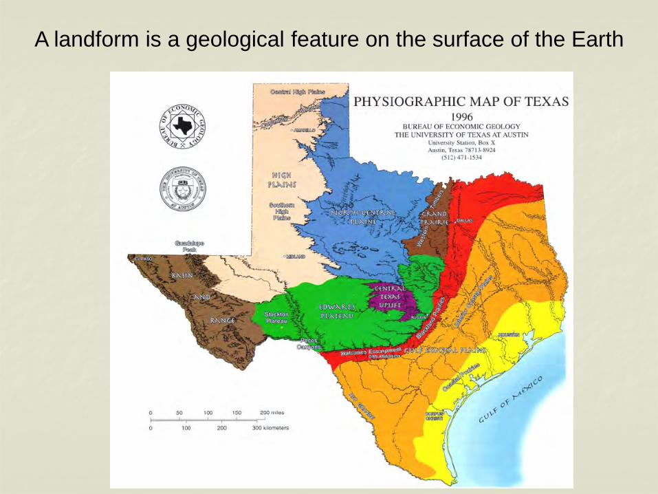
A landform is a geological feature on the surface of the Earth
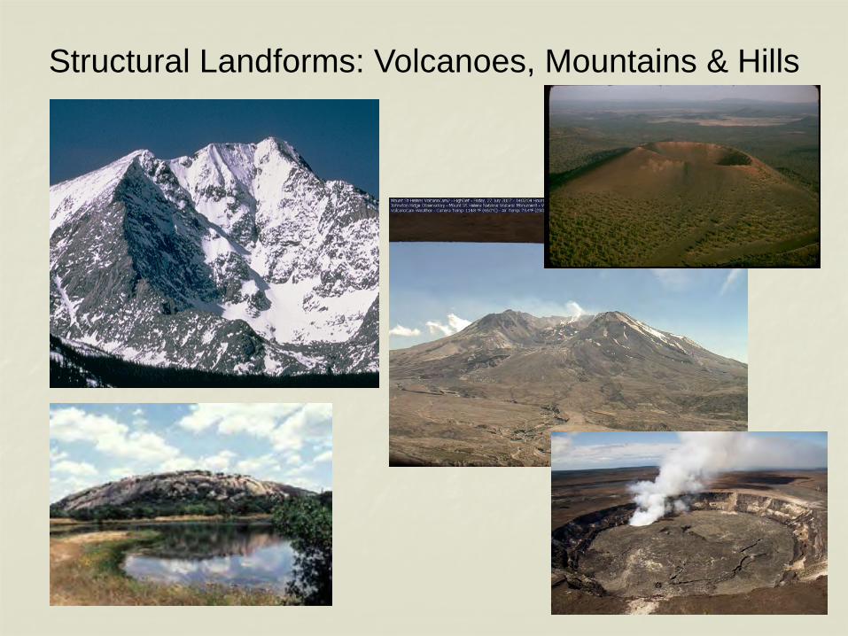
Structural Landforms: Volcanoes, Mountains & Hills
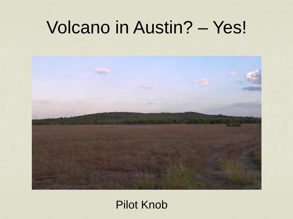
Volcano in Austin? – Yes!
Pilot Knob
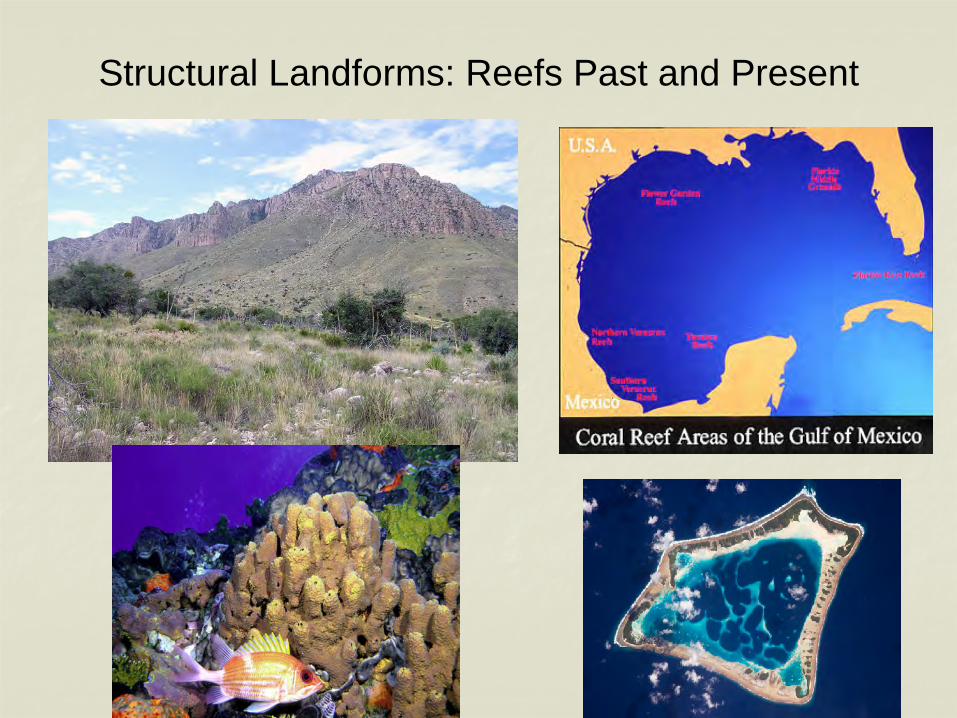
Structural Landforms: Reefs Past and Present
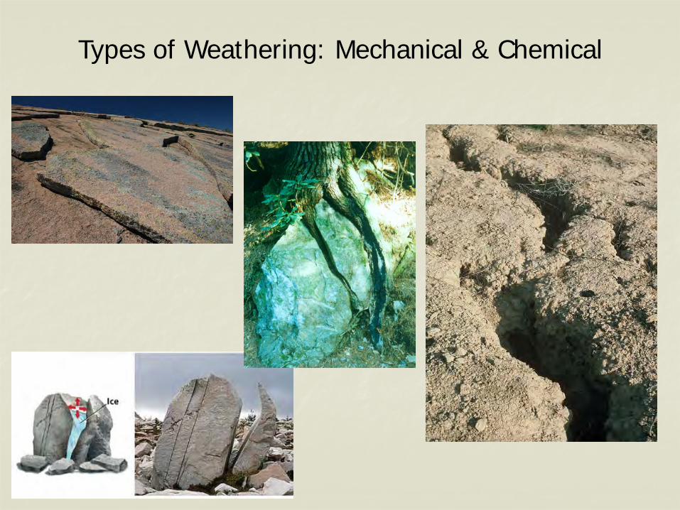
Types of Weathering: Mechanical & Chemical
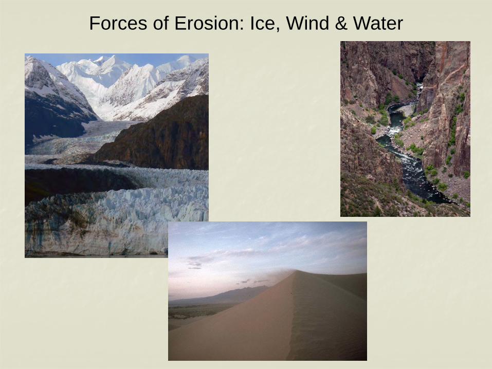
Forces of Erosion: Ice, Wind & Water
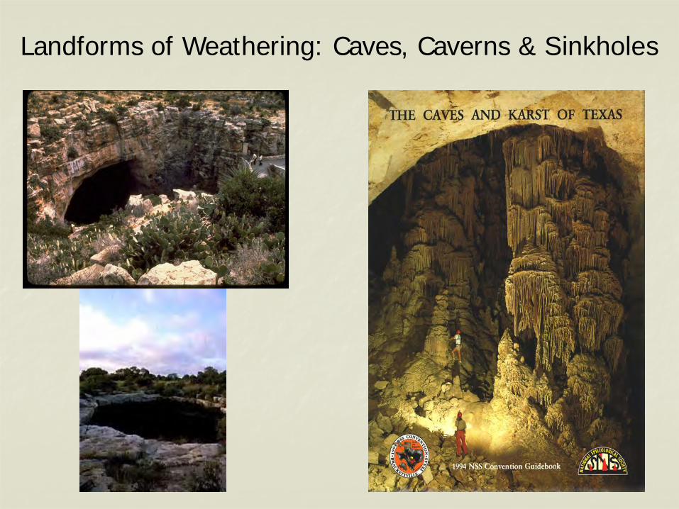
Landforms of Weathering: Caves, Caverns & Sinkholes
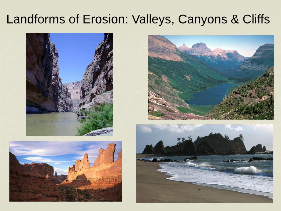
Landforms of Erosion: Valleys, Canyons & Cliffs
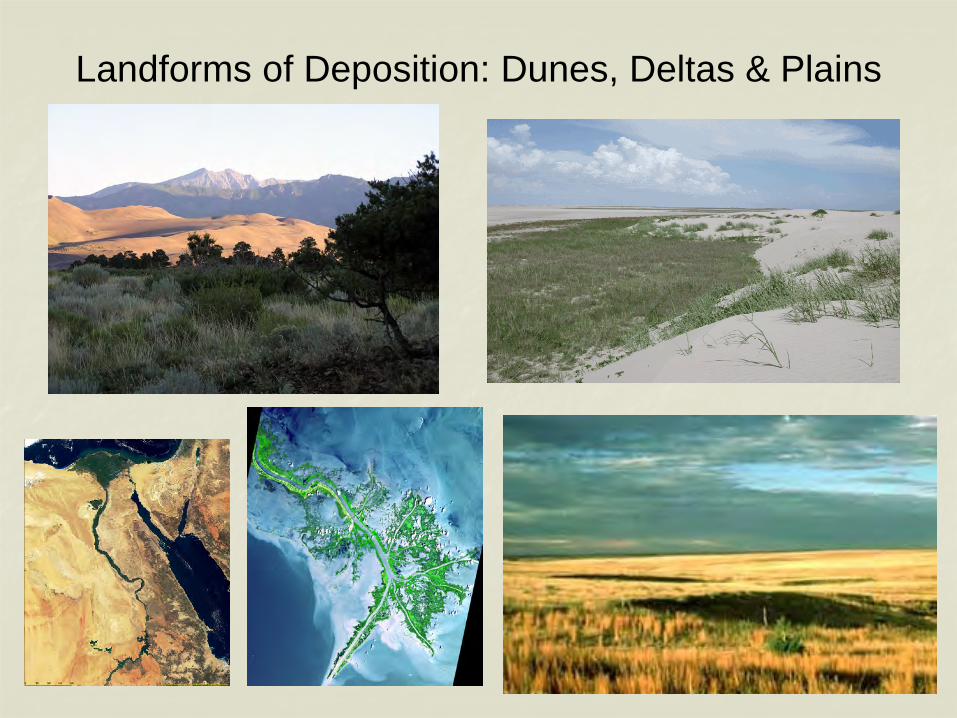
Landforms of Deposition: Dunes, Deltas & Plains
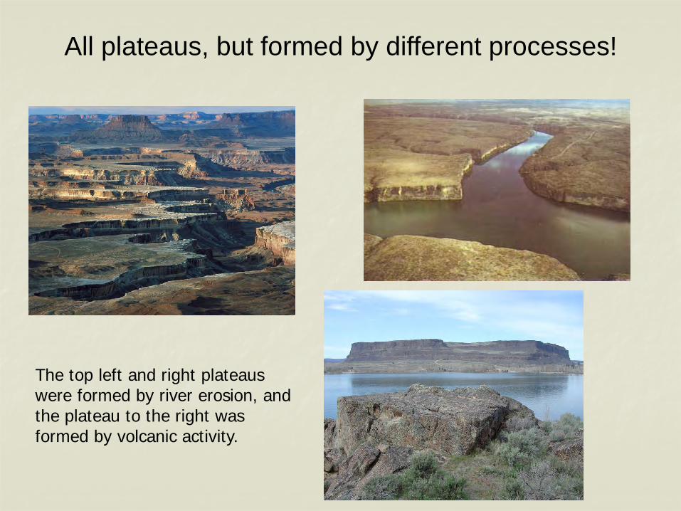
All plateaus, but formed by different processes!
The top left and right plateaus were formed by river erosion, and the plateau to the right was formed by volcanic activity.
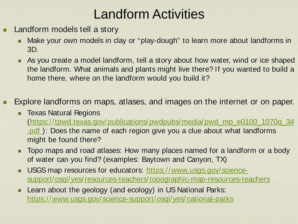
Landform Activities Landform models tell a story
Make your own models in clay or “play-dough” to learn more about landforms in 3D.
As you create a model landform, tell a story about how water, wind or ice shaped the landform. What animals and plants might live there? If you wanted to build a home there, where on the landform would you build it?
Explore landforms on maps, atlases, and images on the internet or on paper. Texas Natural Regions
(https://tpwd.texas.gov/publications/pwdpubs/media/pwd_mp_e0100_1070q_34.pdf ): Does the name of each region give you a clue about what landforms might be found there?
Topo maps and road atlases: How many places named for a landform or a body of water can you find? (examples: Baytown and Canyon, TX)
USGS map resources for educators: https://www.usgs.gov/science-support/osqi/yes/resources-teachers/topographic-map-resources-teachers
Learn about the geology (and ecology) in US National Parks: https://www.usgs.gov/science-support/osqi/yes/national-parks
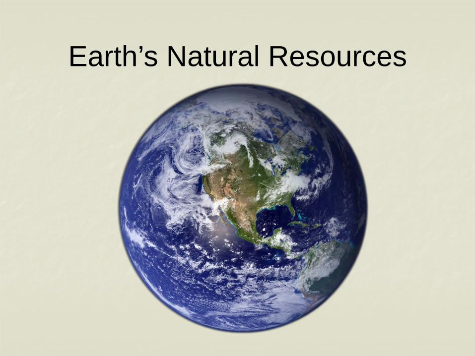
Earth’s Natural Resources
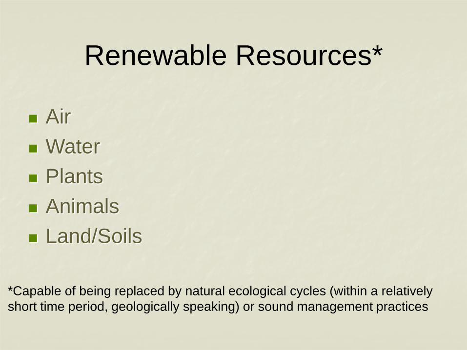
Renewable Resources*
Air Water Plants Animals Land/Soils
*Capable of being replaced by natural ecological cycles (within a relativelyshort time period, geologically speaking) or sound management practices
Can some “renewable” resources become “nonrenewable”?
YES!
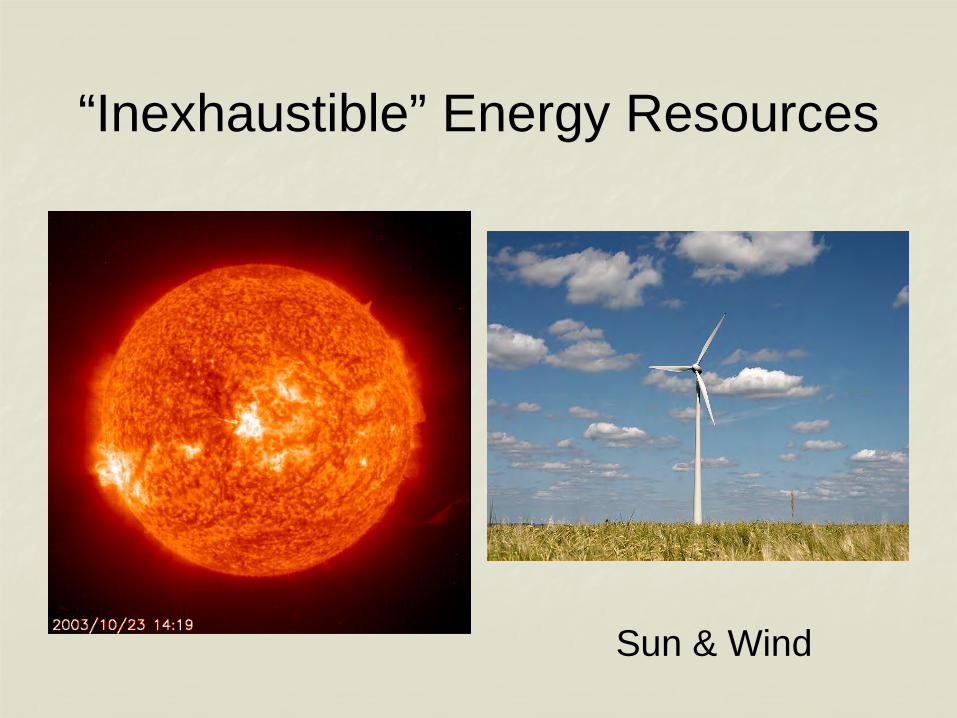
“Inexhaustible” Energy Resources
Sun & Wind
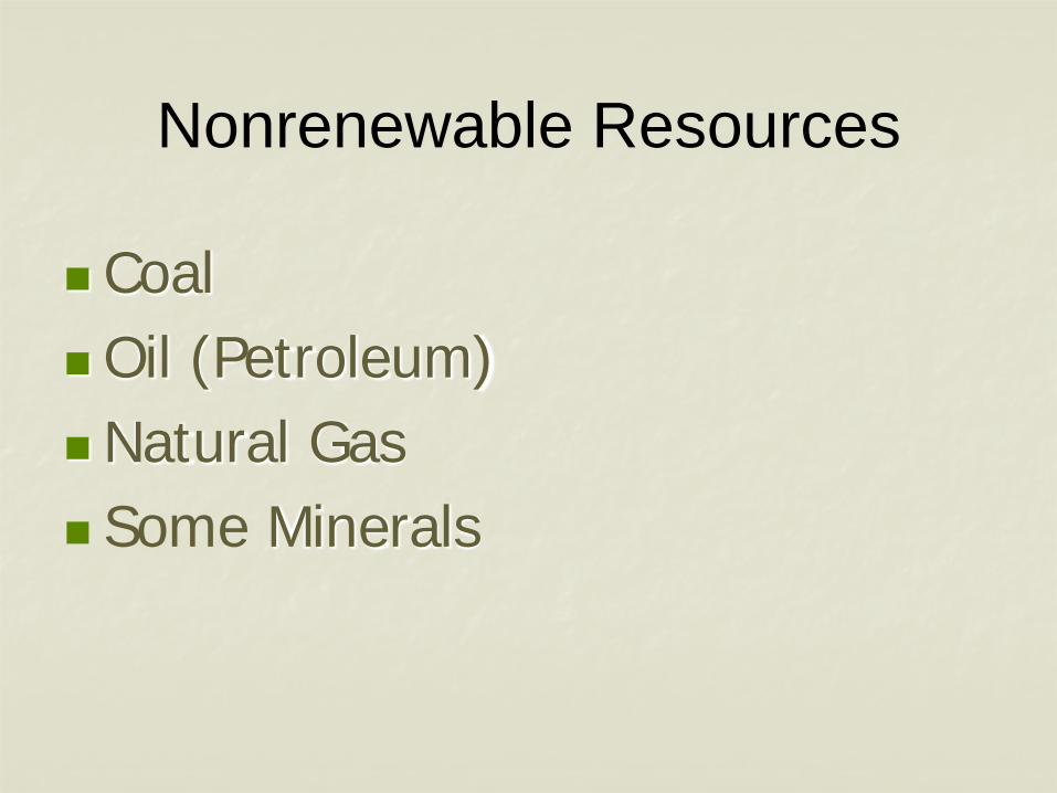
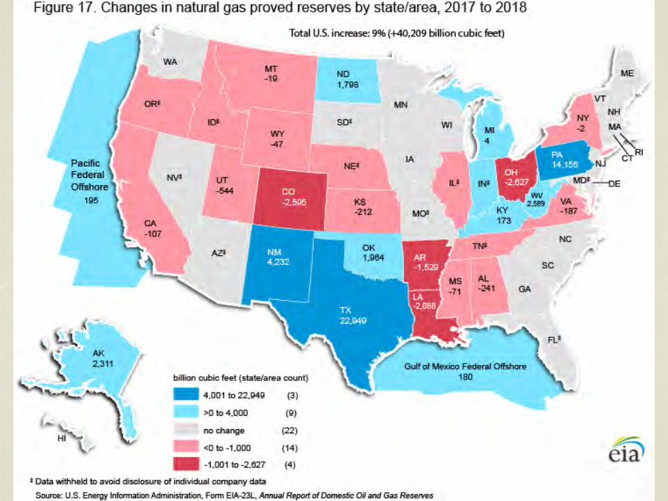
Nonrenewable Resources
CoalOil (Petroleum)Natural Gas Some Minerals
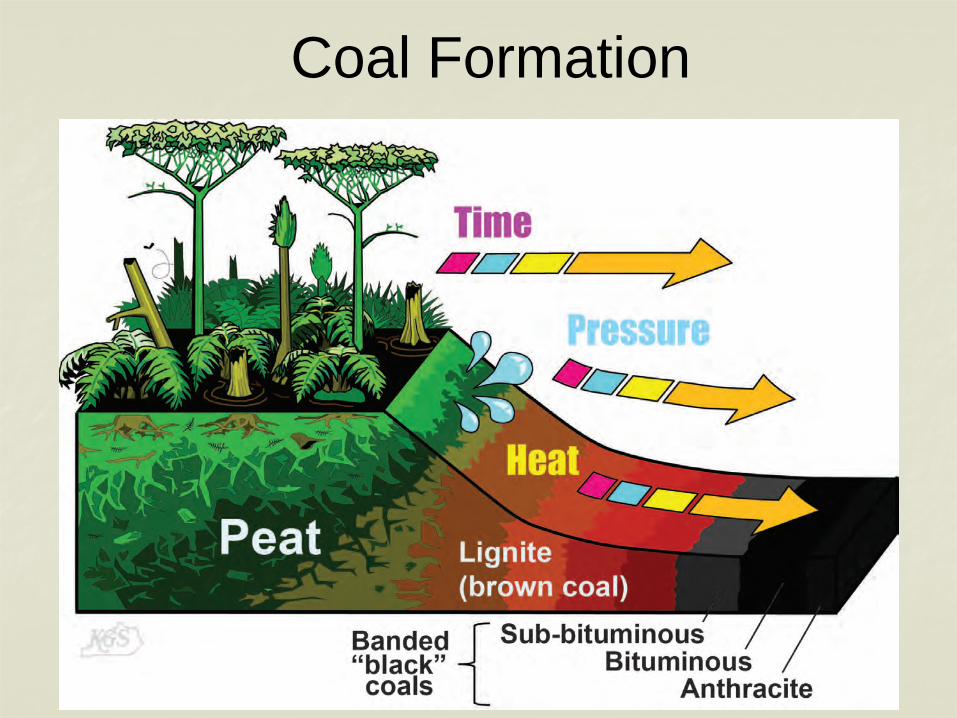
Coal Formation
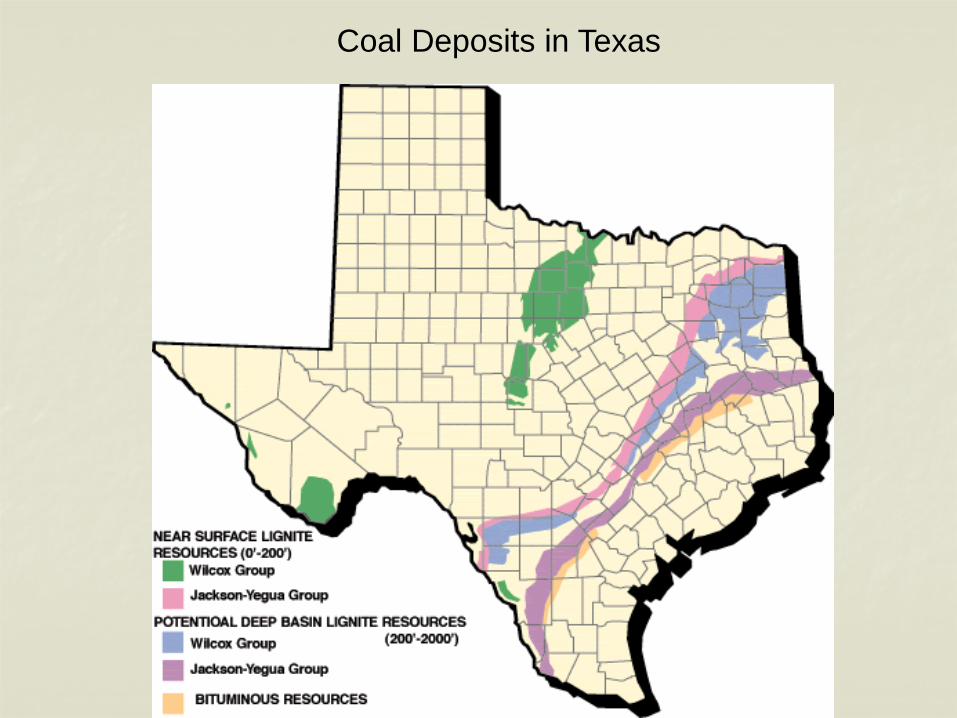
Coal Deposits in Texas

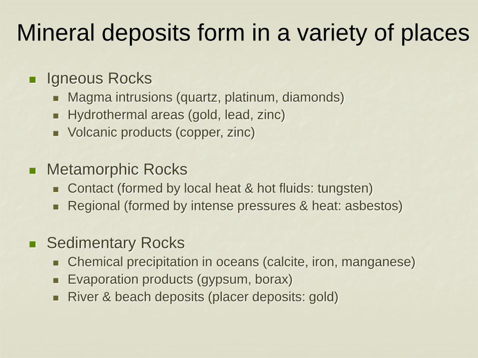
Mineral deposits form in a variety of places
Igneous Rocks Magma intrusions (quartz, platinum, diamonds) Hydrothermal areas (gold, lead, zinc) Volcanic products (copper, zinc)
Metamorphic Rocks Contact (formed by local heat & hot fluids: tungsten) Regional (formed by intense pressures & heat: asbestos)
Sedimentary Rocks Chemical precipitation in oceans (calcite, iron, manganese) Evaporation products (gypsum, borax) River & beach deposits (placer deposits: gold)
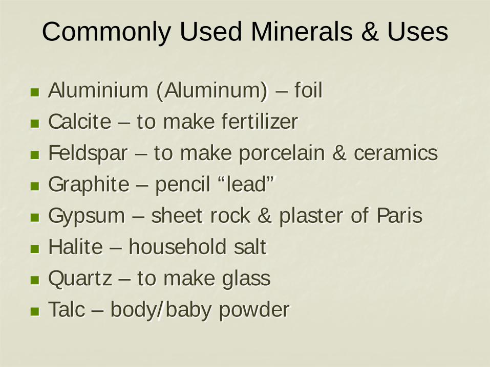
Commonly Used Minerals & Uses
Aluminium (Aluminum) – foil Calcite – to make fertilizer Feldspar – to make porcelain & ceramics Graphite – pencil “lead” Gypsum – sheet rock & plaster of Paris Halite – household salt Quartz – to make glass Talc – body/baby powder
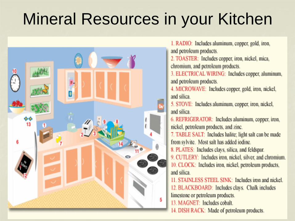
Mineral Resources in your Kitchen
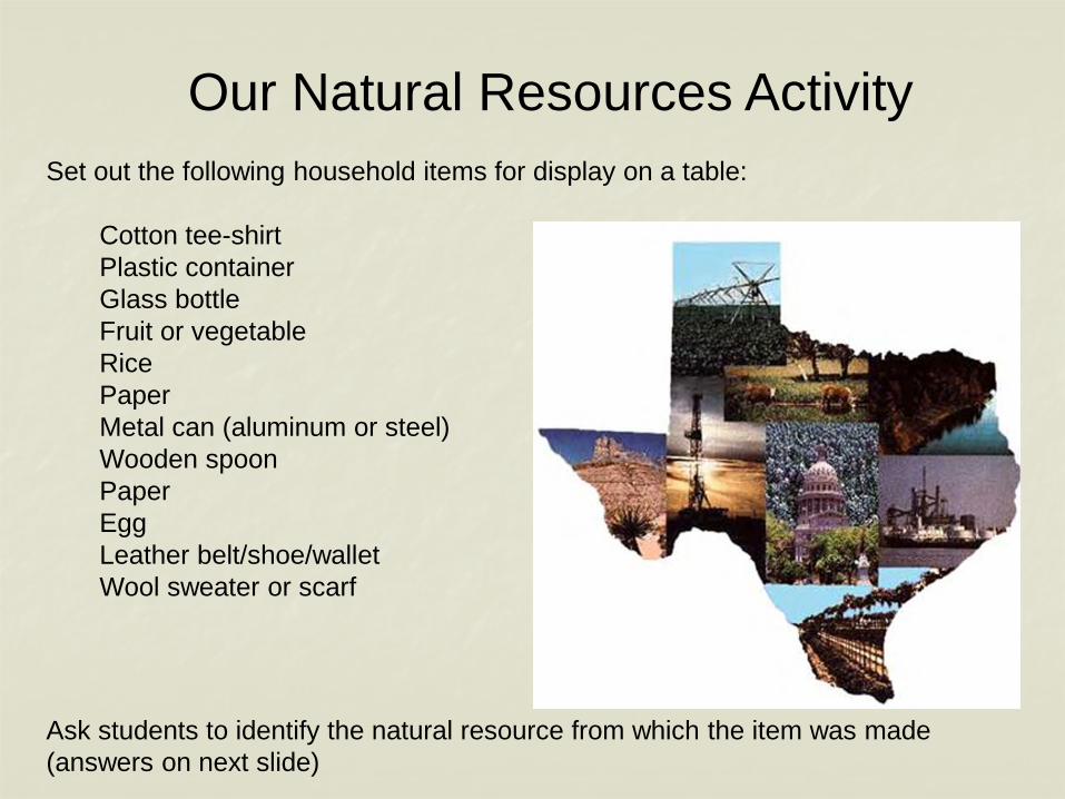
Our Natural Resources ActivitySet out the following household items for display on a table:
Cotton tee-shirtPlastic containerGlass bottleFruit or vegetableRicePaperMetal can (aluminum or steel)Wooden spoonPaperEggLeather belt/shoe/walletWool sweater or scarf
Ask students to identify the natural resource from which the item was made(answers on next slide)
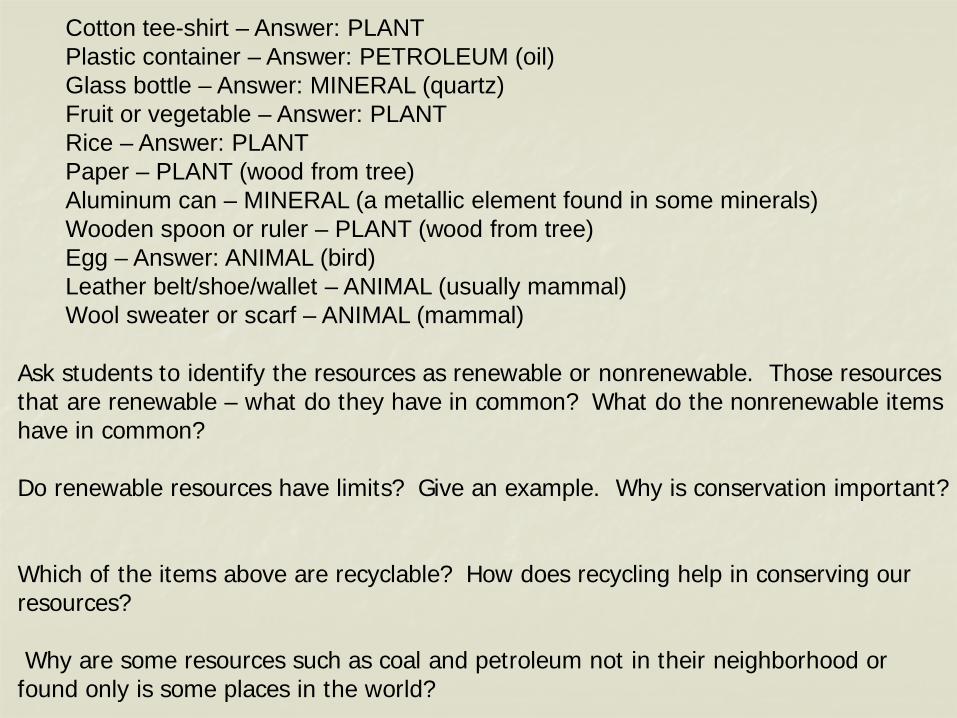
Cotton tee-shirt – Answer: PLANTPlastic container – Answer: PETROLEUM (oil)Glass bottle – Answer: MINERAL (quartz)Fruit or vegetable – Answer: PLANTRice – Answer: PLANT Paper – PLANT (wood from tree)Aluminum can – MINERAL (a metallic element found in some minerals)Wooden spoon or ruler – PLANT (wood from tree)Egg – Answer: ANIMAL (bird)Leather belt/shoe/wallet – ANIMAL (usually mammal)Wool sweater or scarf – ANIMAL (mammal)
Ask students to identify the resources as renewable or nonrenewable. Those resources that are renewable – what do they have in common? What do the nonrenewable items have in common?
Do renewable resources have limits? Give an example. Why is conservation important?
Which of the items above are recyclable? How does recycling help in conserving our resources?
Why are some resources such as coal and petroleum not in their neighborhood or found only is some places in the world?
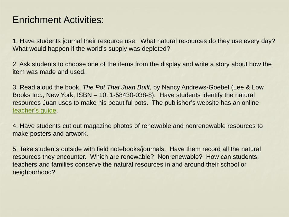
Enrichment Activities:
1. Have students journal their resource use. What natural resources do they use every day? What would happen if the world’s supply was depleted?
2. Ask students to choose one of the items from the display and write a story about how the item was made and used.
3. Read aloud the book, The Pot That Juan Built, by Nancy Andrews-Goebel (Lee & Low Books Inc., New York; ISBN – 10: 1-58430-038-8). Have students identify the natural resources Juan uses to make his beautiful pots. The publisher’s website has an online teacher’s guide.
4. Have students cut out magazine photos of renewable and nonrenewable resources to make posters and artwork.
5. Take students outside with field notebooks/journals. Have them record all the natural resources they encounter. Which are renewable? Nonrenewable? How can students, teachers and families conserve the natural resources in and around their school or neighborhood?
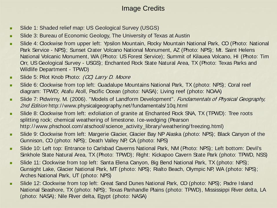
Image Credits
Slide 1: Shaded relief map: US Geological Survey (USGS) Slide 3: Bureau of Economic Geology, The University of Texas at Austin Slide 4: Clockwise from upper left: Ypsilon Mountain, Rocky Mountain National Park, CO (Photo: National
Park Service - NPS); Sunset Crater Volcano National Monument, AZ (Photo: NPS); Mt. Saint Helens National Volcanic Monument, WA (Photo: US Forest Service); Summit of Kilauea Volcano, HI (Photo: Tim Orr, US Geological Survey - USGS); Enchanted Rock State Natural Area, TX (Photo: Texas Parks and Wildlife Department - TPWD)
Slide 5: Pilot Knob Photo: (CC) Larry D. Moore Slide 6: Clockwise from top left: Guadalupe Mountains National Park, TX (photo: NPS); Coral reef
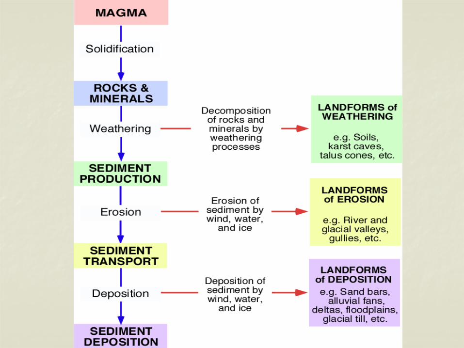
diagram: TPWD; Atafu Atoll, Pacific Ocean (photo: NASA); Living reef (photo: NOAA) Slide 7: Pidwirny, M. (2006). "Models of Landform Development". Fundamentals of Physical Geography,
2nd Edition http://www.physicalgeography.net/fundamentals/10q.html Slide 8: Clockwise from left: exfoliation of granite at Enchanted Rock SNA, TX (TPWD): Tree roots
splitting rock; chemical weathering of limestone. Ice-wedging (Pearson http://www.phschool.com/atschool/science_activity_library/weathering/freezing.html)
Slide 9: Clockwise from left: Margerie Glacier, Glacier Bay NP Alaska (photo: NPS); Black Canyon of the Gunnison, CO (photo: NPS); Death Valley NP, CA (photo: NPS)
Slide 10: Left top: Entrance to Carlsbad Caverns National Park, NM (Photo: NPS); Left bottom: Devil’s Sinkhole State Natural Area, TX (Photo: TPWD); Right: Kickapoo Cavern State Park (photo: TPWD, NSS)
Slide 11: Clockwise from top left: Santa Elena Canyon, Big Bend National Park, TX (photo: NPS); Gunsight Lake, Glacier National Park, MT (photo: NPS); Rialto Beach, Olympic NP, WA (photo: NPS); Arches National Park, UT (photo: NPS)
Slide 12: Clockwise from top left: Great Sand Dunes National Park, CO (photo: NPS); Padre Island National Seashore, TX (photo: NPS); Texas Panhandle Plains (photo: TPWD), Mississippi River delta, LA (photo: NASA); Nile River delta, Egypt (photo: NASA)
Image Credits
Slide 13: Clockwise from left: Canyonlands National Park, UT (photo: NPS); Edwards Plateau, confluence of the Pecos and Rio Grande, TX (photo: USGS); Steamboat Rock, Columbia River basalt, WA (photo: USGS)
Slide 15: Wikipedia Commons: https://commons.wikimedia.org/wiki/File:Earth_Western_Hemisphere_transparent_background.png
Slide 18: Sun storm (photo: NASA); Wind turbine (photo: CC Wagner Christian 2006) Slide 20: Stephen Greb, Kentucky Geological Survey, University of Kentucky
(https://www.uky.edu/KGS/coal/) Slide 21: EIA (US Energy Information Administration) Slide 22: www.texascenter.org Slide 23: https://rethinkenterprises.co.nz/we-dont-have-a-climate-crisis-we-have-a-behavioral-crisis-2/ Slide 24: Bureau of Economic Geology, The University of Texas at Austin Slide 25: EIA (US Energy Information Administration) Slide 26: EIA (US Energy Information Administration) Slide 29: USGS Slide 30: American Institute of Professional Geologists
1
Landforms & Bodies of Water: Type and Process Terms
Archipelago: A group of many islands. Basin: A low area in the Earth’s surface enclosed by higher land. Bay: Part of a body of water that reaches into the land; usually smaller than a gulf (if the bay is marine). Butte: An isolated flat-topped hill with steep sides and topped with a layer of resistant rock (cap-rock). Canyon (Cañon): A valley with steep sides formed by stream erosion. Cape: A curved or hooked land area extending into a body of water. Cave: A natural opening beneath the surface of the Earth. Channel: The deepest part of a stream, river or bay. Cliff: A high, steep face of rock. Coast: The strip of land along the sea or ocean. Continent: One of Earth’s major land masses. Continental shelf: The gently sloping part of a continent that extends underwater from the shoreline. Delta: Triangular or fan-shaped plain built up by deposits of sand, silt and mud at the mouth of a river. Deposition: The laying-down of rock-forming materials (sediments). Erosion: The transport of broken-down rock and sediments, typically by wind, water, ice and gravity. Fault: A fracture or fracture zone in rock along which there has been movement. Glacier: A slowly moving large body of ice formed on land from compacted and recrystallized snow. Gulf: A relatively large part of an ocean or sea extending far into land. Hill: A raised part of the Earth’s surface with sloping sides that is smaller than a mountain (usually less than 300 m/1000 feet in elevation). Island: An area of land that is smaller than a continent and completely surrounded by water. Isthmus: A narrow strip of land bordered by water on each side, that connects two larger pieces of land.
2
Lake: An inland body of water surrounded by land that is larger and deeper than a pond. Landform: A geological feature on the surface of the Earth. Mesa: A flat-topped mountain or plateau with at least one steep cliff. Mountain: A high (more than 300 m/1000 ft) raised part of the Earth’s surface with a specific top (summit area). May be a single feature or form a chain or range. Ocean: One of Earth’s largest bodies of salt water. Peninsula: A piece of land that extends from a larger body of land and is almost completely surrounded by water. Plain: A broad, flat or gently rolling area that is often low in elevation. Plateau: A flat highland area with at least one steep cliff, higher than a plain and wider than a mesa. Reef: A ridge near a shoreline composed of the mineral remains of marine organisms such as algae, corals and sponges. River: A large stream of water flowing through a channel into a lake, ocean, or other body of water. Sand dune: A mound or ridge of sand transported and deposited by wind. Sea: A large body of salt water, smaller than an ocean that is partly or completely surrounded by land. Valley: Low land between hills or mountains usually with a stream or river flowing down its length. Volcano: A cone to shield shaped mountain formed by lava, rock, ash and gases ejected from an opening in the Earth’s surface (vent). Waterfall: The steep drop of a stream as it flows over a cliff or plateau. Weathering: The chemical and mechanical (physical) break-down of rocks and minerals at or near the Earth’s surface. Examples of chemical weathering include: weak acids in rain or groundwater slowly dissolving limestones, and iron-bearing rocks break down where exposed to oxygen – the iron rusts (oxidizes) causing the rocks to crumble. Mechanical weathering examples include the break-down of rocks by tree roots, wind, and ice freeze-thaw cycles.