Embed Size (px)
Citation preview
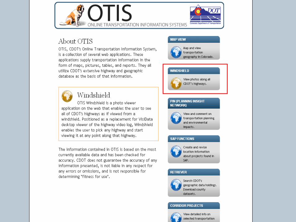
OTISOnline Transportation Information System
Kim HubbleColorado Department of Transportation
Allen IbaughData Transfer Solutions
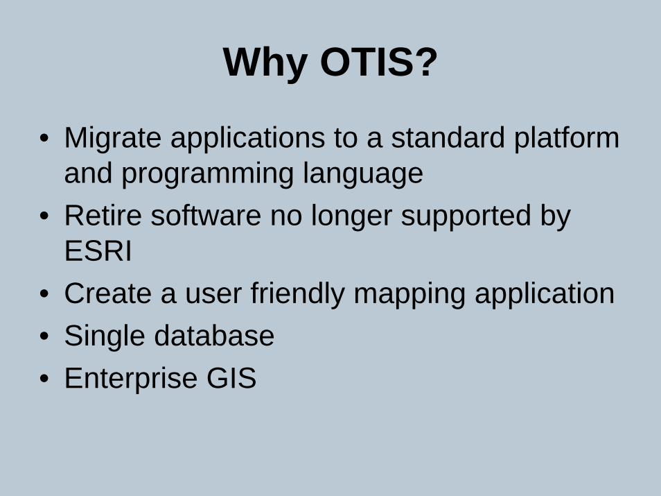
Why OTIS?
• Migrate applications to a standard platform and programming language
• Retire software no longer supported by ESRI
• Create a user friendly mapping application• Single database• Enterprise GIS
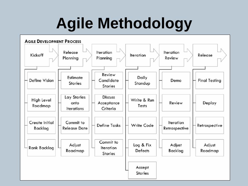
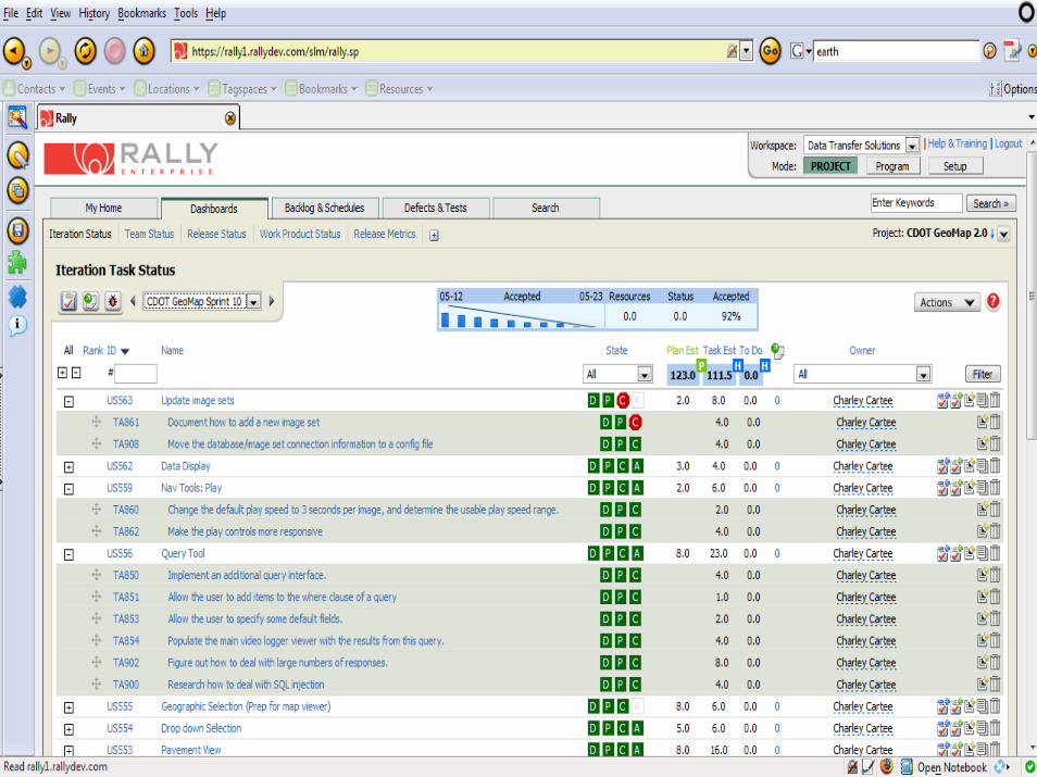
Agile Methodology
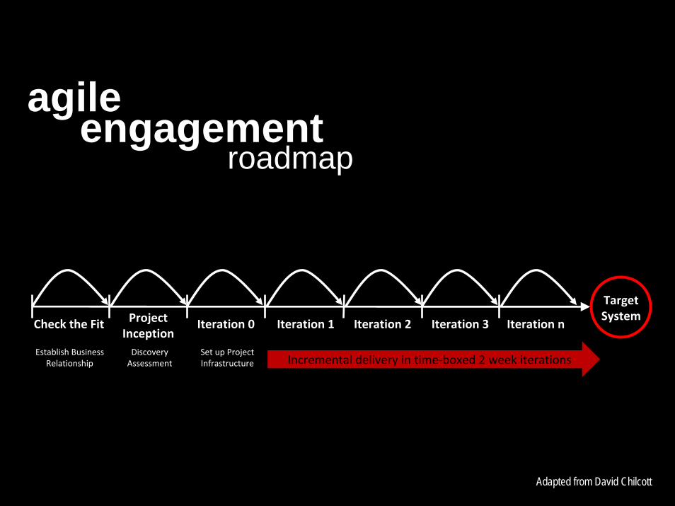
Check the Fit
Establish BusinessRelationship
ProjectInceptionDiscoveryAssessment
Iteration 0
Set up ProjectInfrastructure
TargetSystem
Incremental delivery in time‐boxed 2 week iterations
Iteration 1 Iteration 2 Iteration 3 Iteration n
agileengagement
roadmap
Adapted from David Chilcott
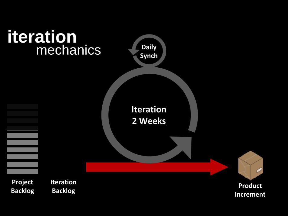
ProjectBacklog
IterationBacklog
Iteration2 Weeks
DailySynch
ProductIncrement
iterationmechanics
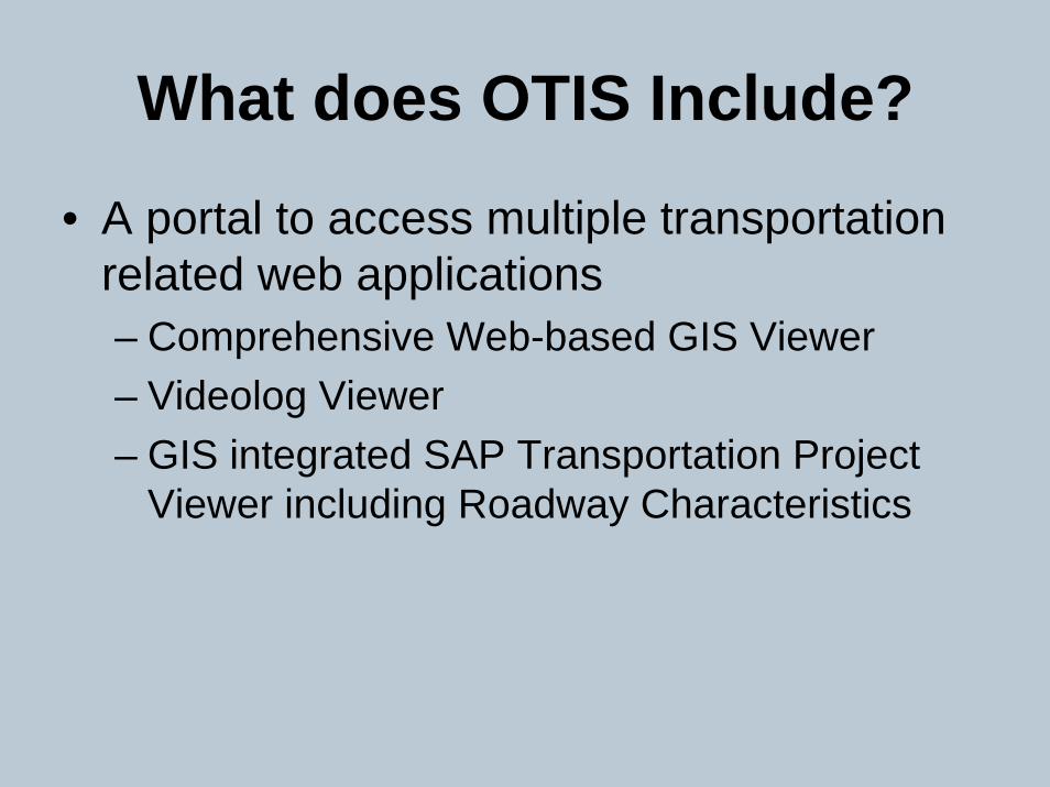
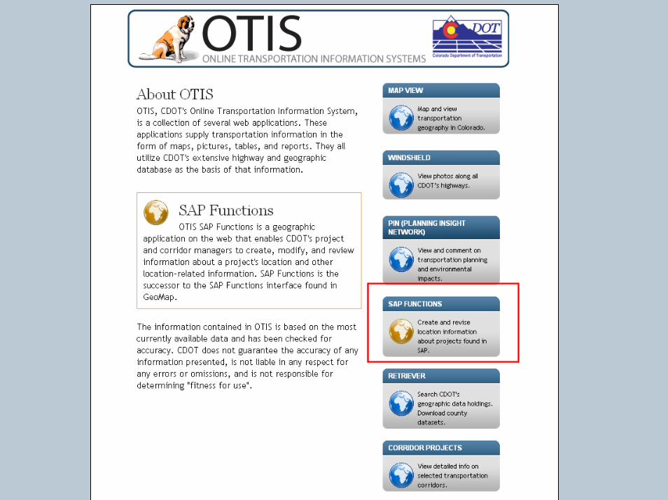
What does OTIS Include?
• A portal to access multiple transportation related web applications– Comprehensive Web-based GIS Viewer– Videolog Viewer– GIS integrated SAP Transportation Project
Viewer including Roadway Characteristics
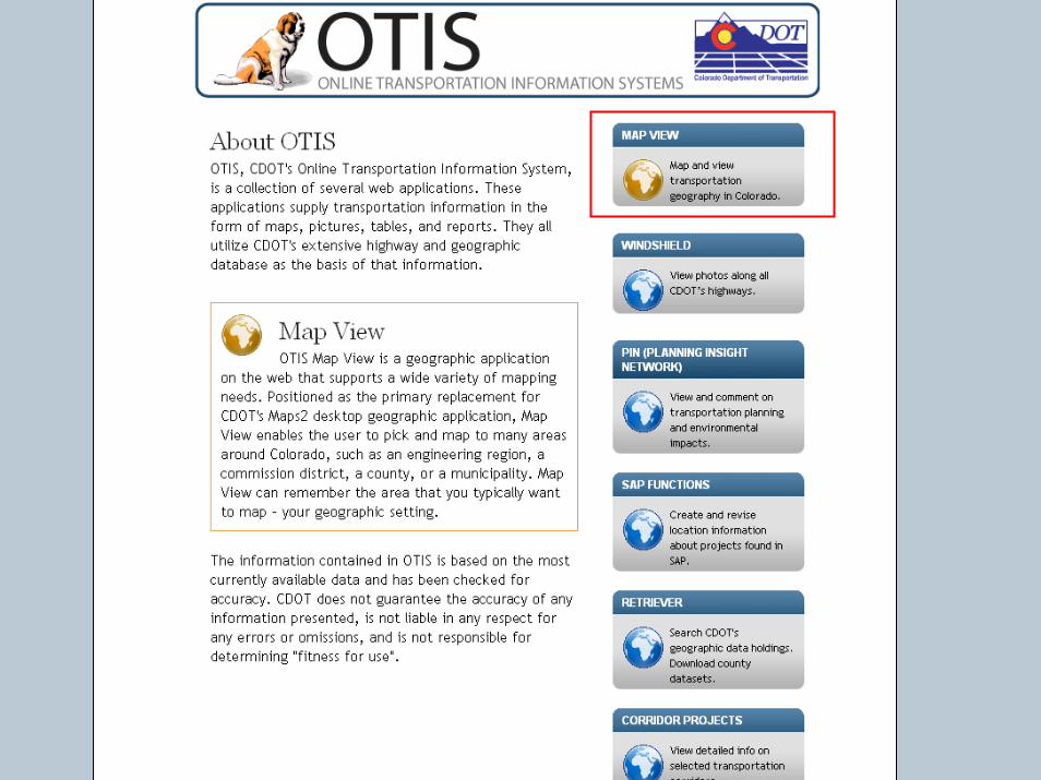
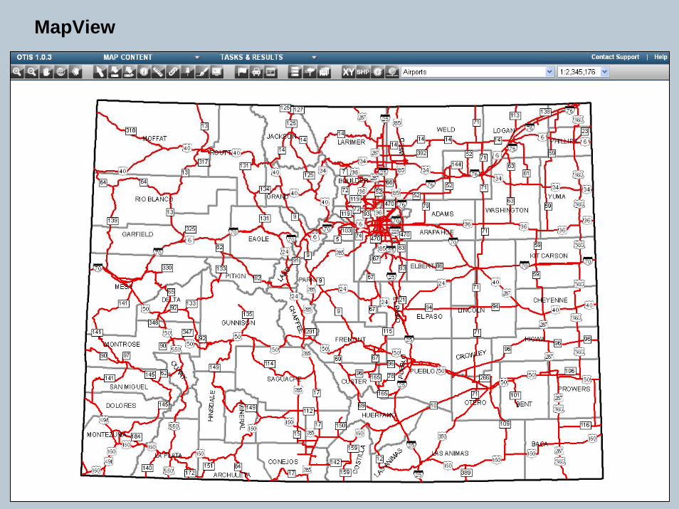
MapView
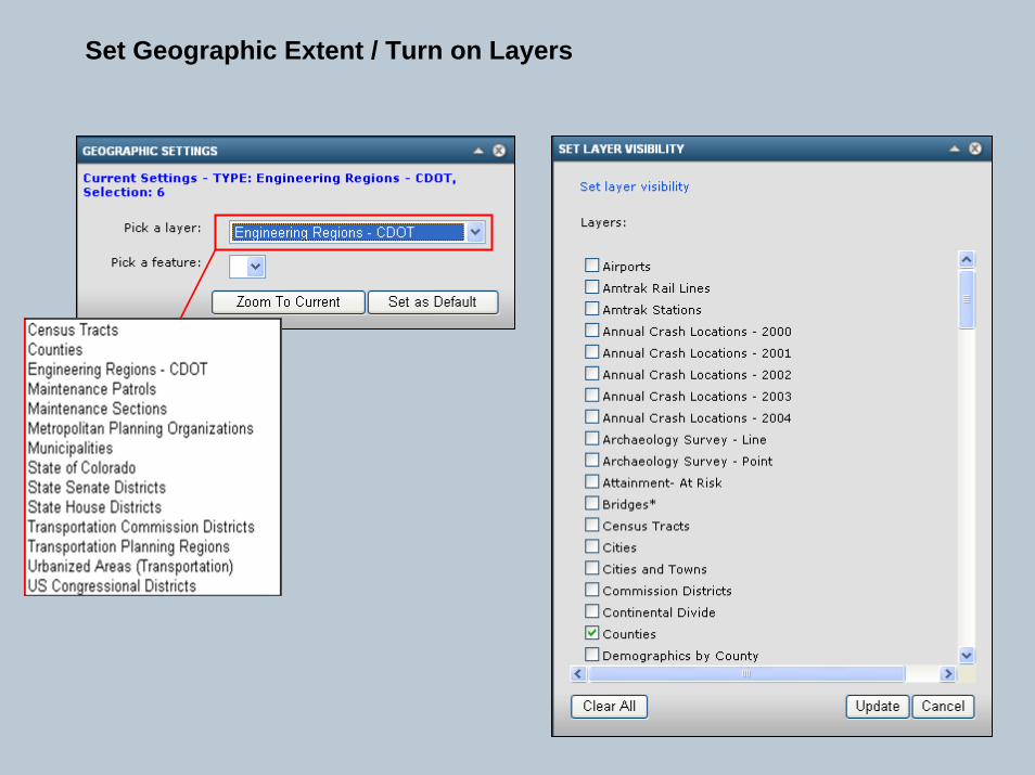
Set Geographic Extent / Turn on Layers
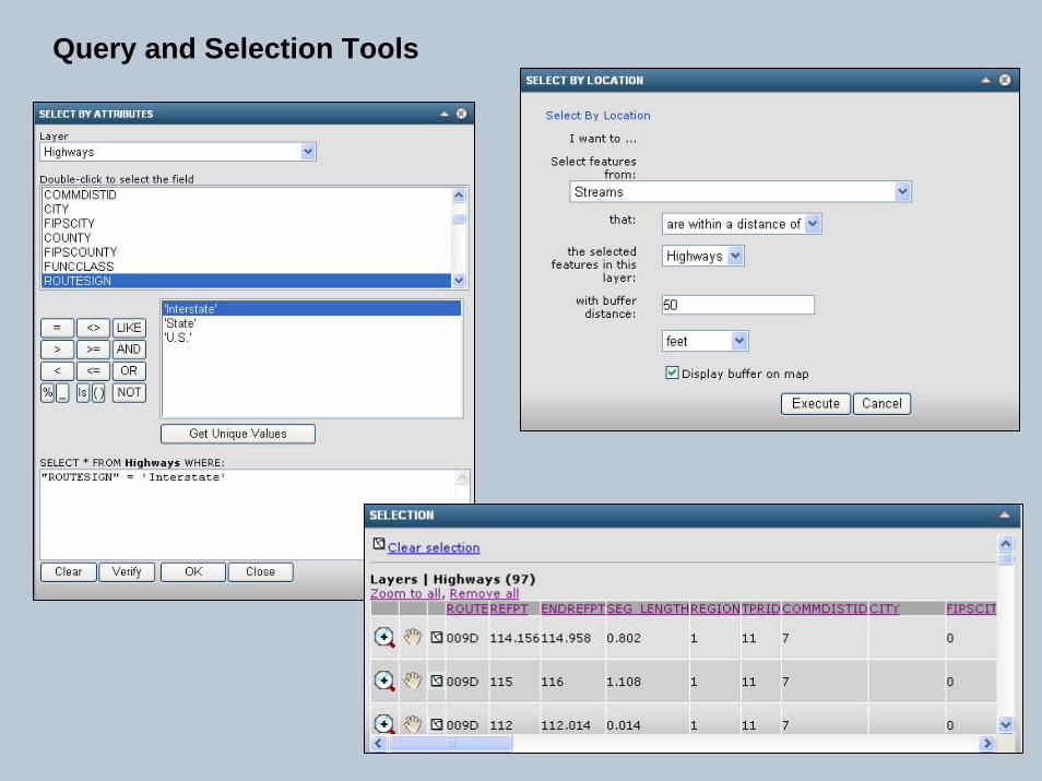
Query and Selection Tools
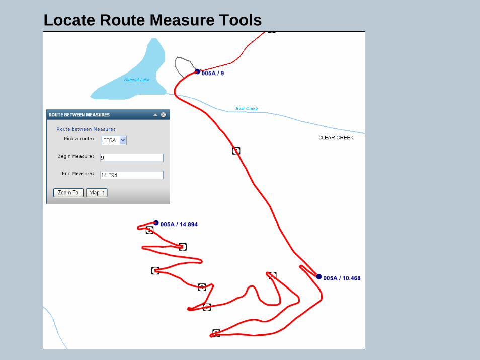
Locate Route Measure Tools
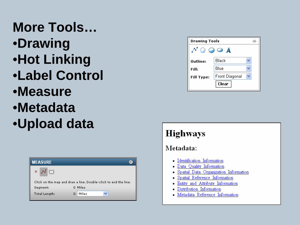
More Tools…•Drawing •Hot Linking•Label Control•Measure•Metadata•Upload data
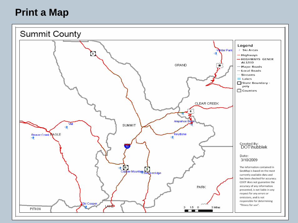
Print a Map
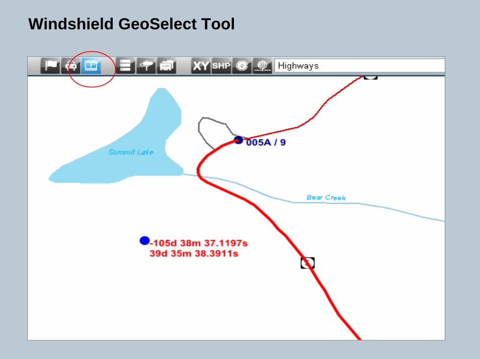
Windshield GeoSelect Tool
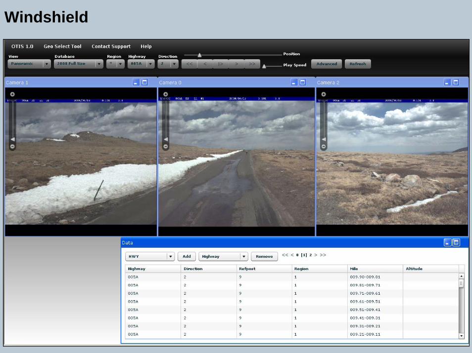
Windshield

Windshield Pavement View
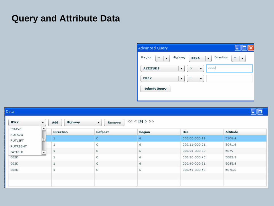
Query and Attribute Data
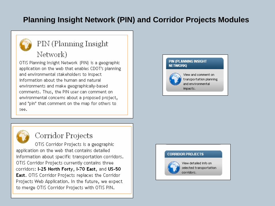
Planning Insight Network (PIN) and Corridor Projects Modules
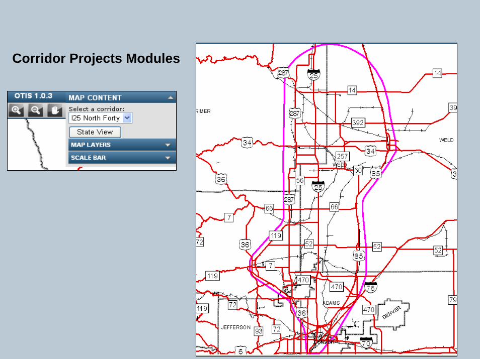
Corridor Projects Modules
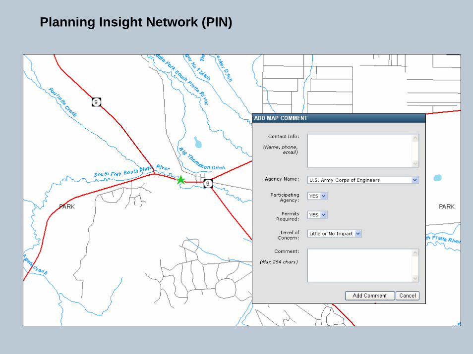
Planning Insight Network (PIN)

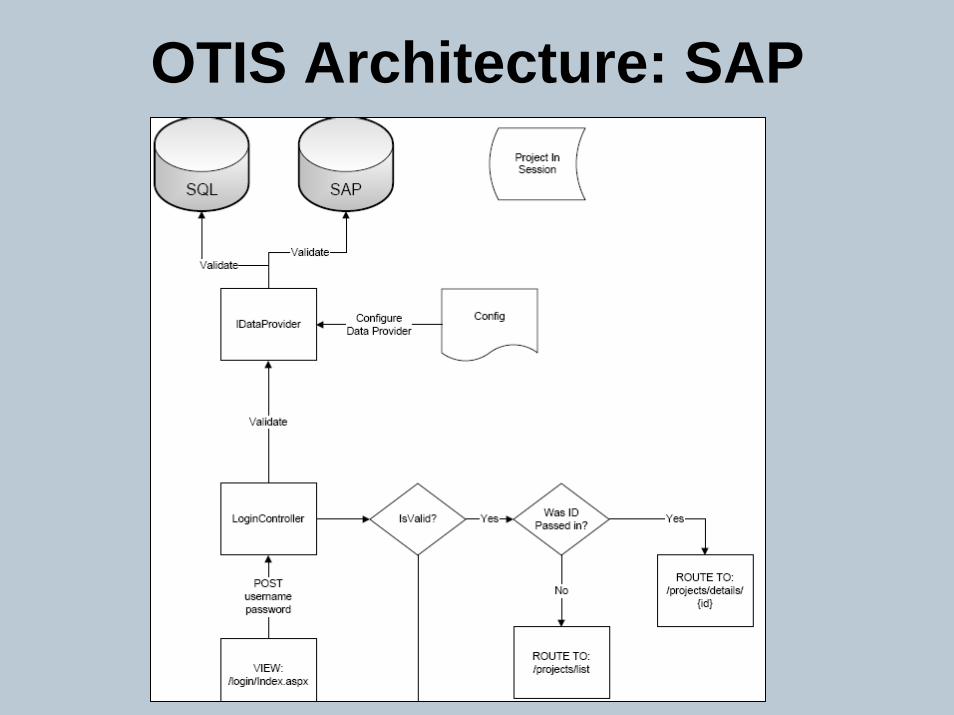
OTIS Architecture: SAP
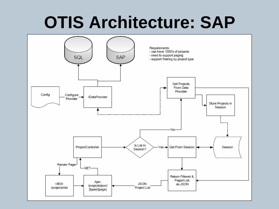
OTIS Architecture: SAP
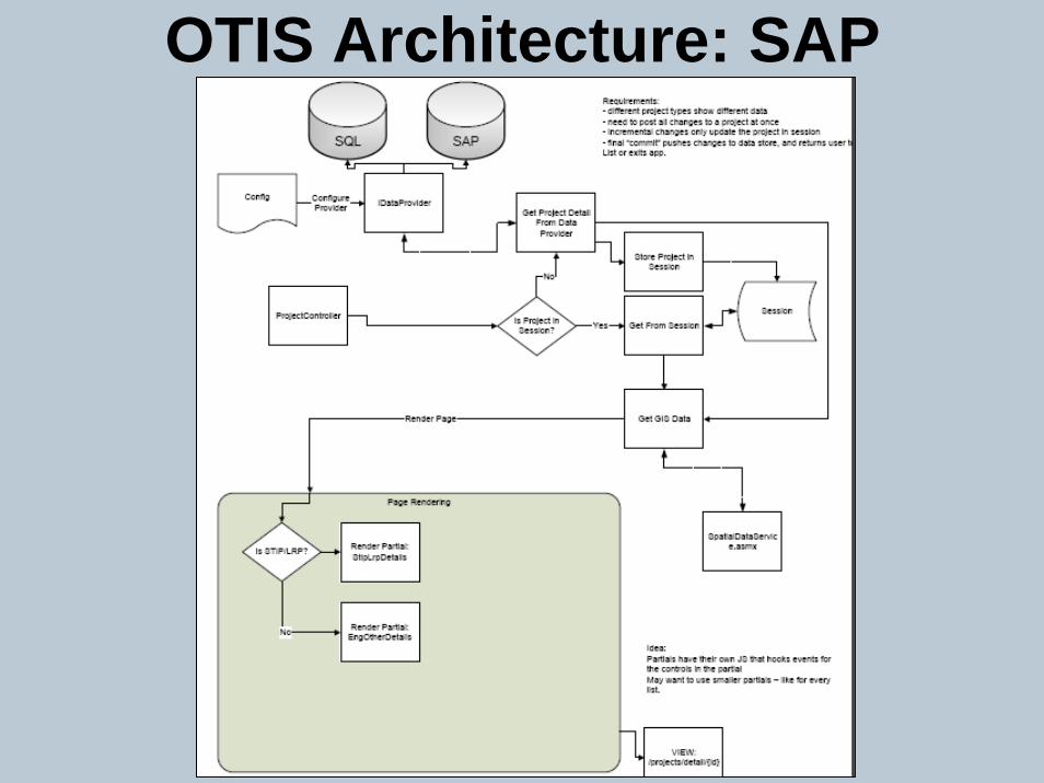
OTIS Architecture: SAP
OTIS Architecture: SAP
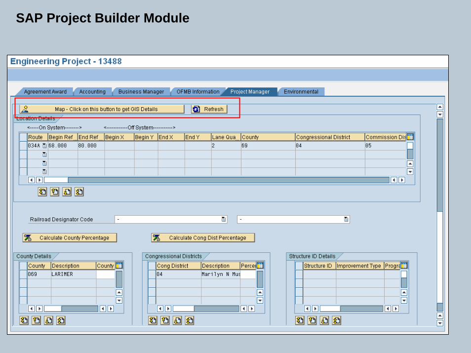
SAP Project Builder Module
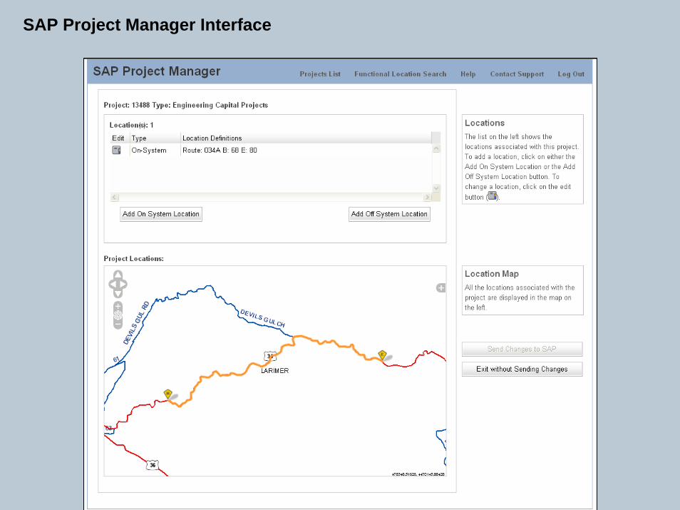
SAP Project Manager Interface
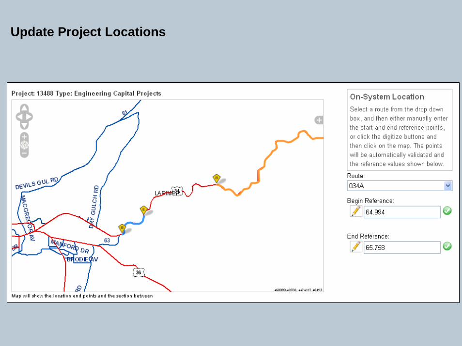
Update Project Locations
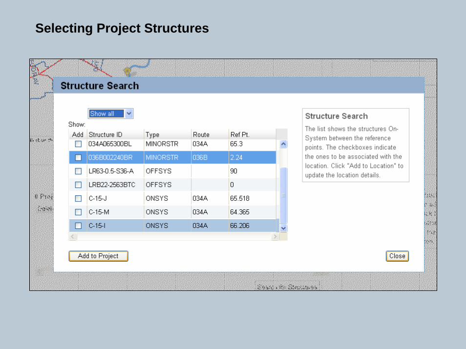
Selecting Project Structures
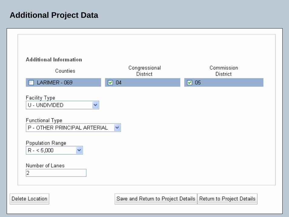
Additional Project Data
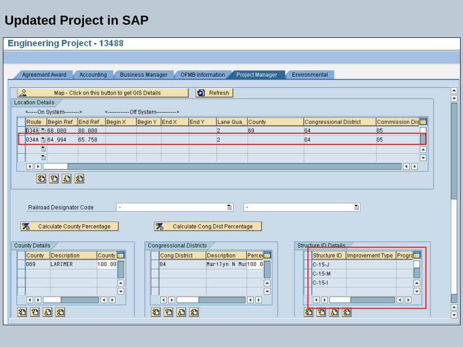
Updated Project in SAP
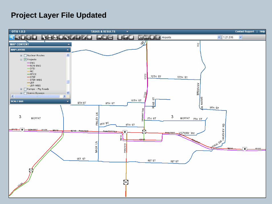
Project Layer File Updated
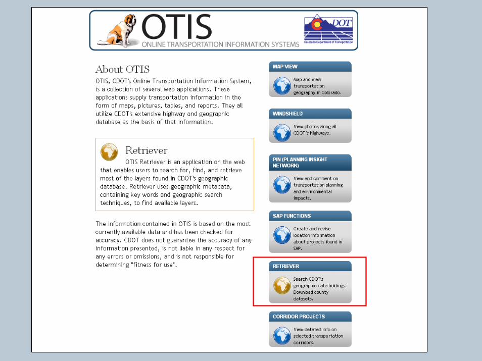
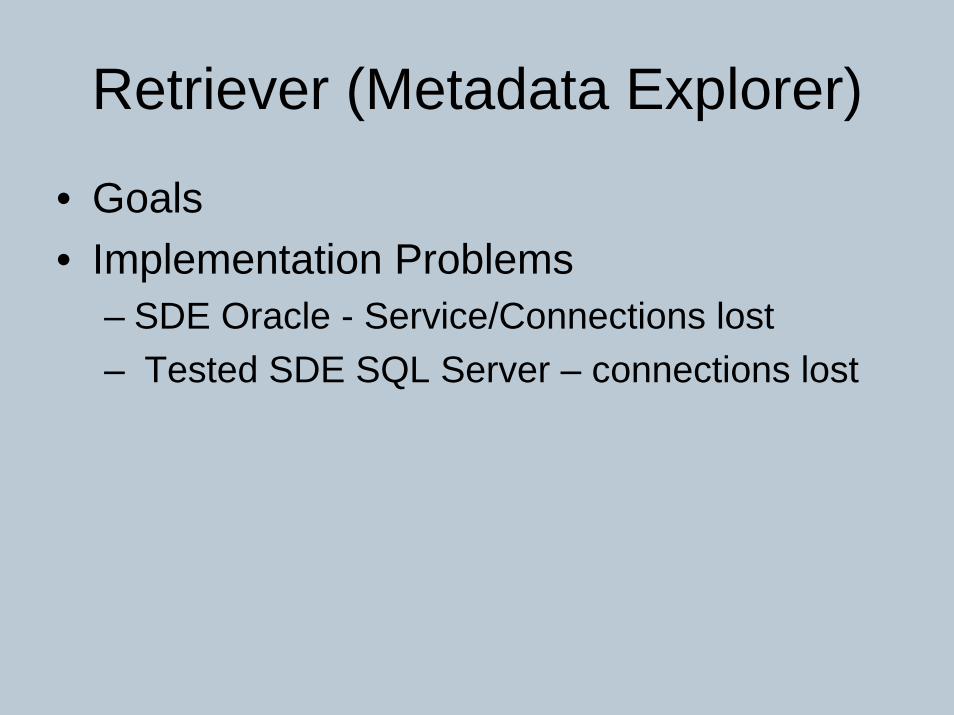
Retriever (Metadata Explorer)
• Goals• Implementation Problems
– SDE Oracle - Service/Connections lost– Tested SDE SQL Server – connections lost
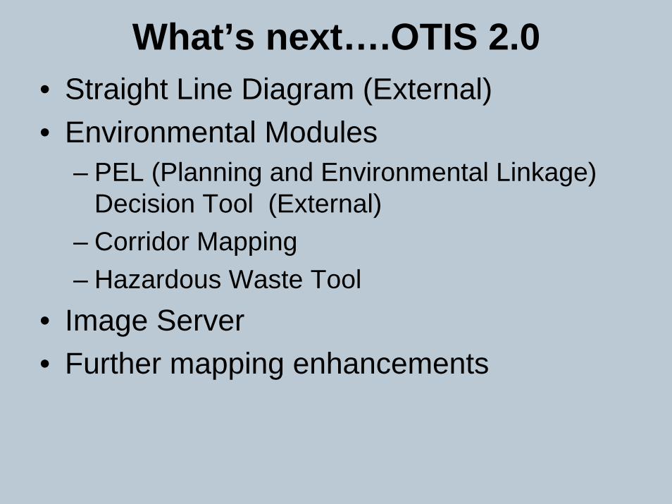
What’s next….OTIS 2.0• Straight Line Diagram (External)• Environmental Modules
– PEL (Planning and Environmental Linkage) Decision Tool (External)
– Corridor Mapping– Hazardous Waste Tool
• Image Server• Further mapping enhancements