Embed Size (px)
Citation preview
*]&
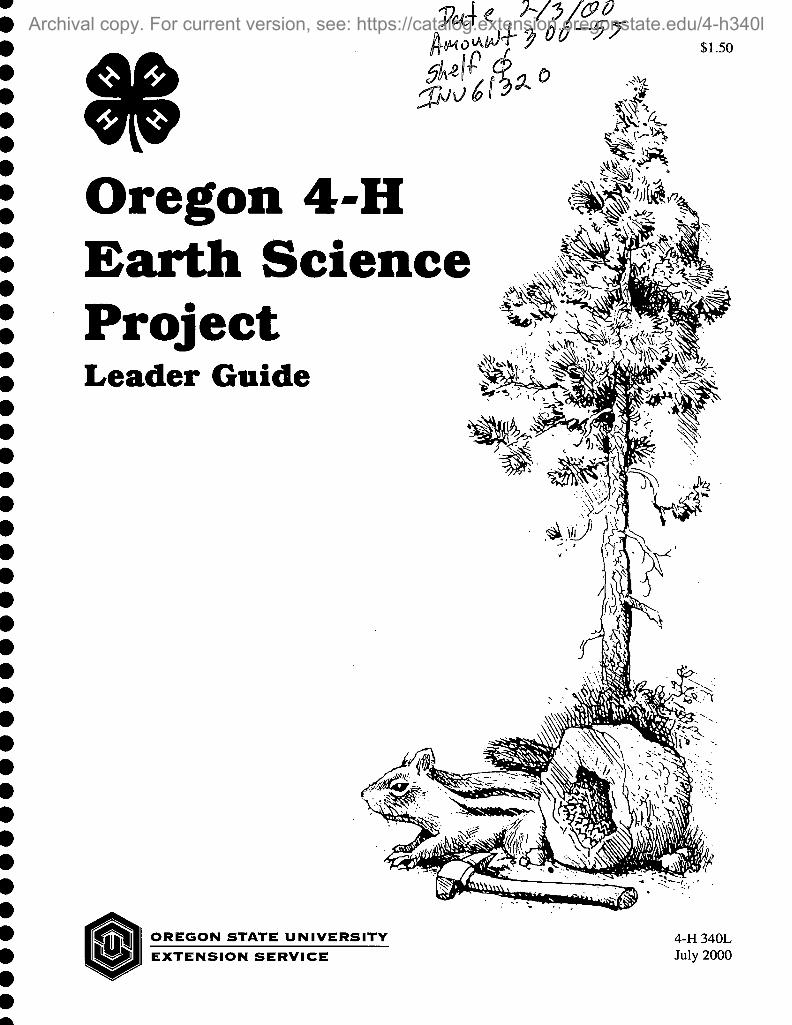
Oregon 4-H Earth Science Project Leader Guide
$1.50
OREGON STATE UNIVERSITY
EXTENSION SERVICE 4-H 340L July 2000
A more recent revision exists, For current version, see: https://catalog.extension.oregonstate.edu/sites/catalog/files/project/pdf/4h340l.pdf

Original text by Virginia Thompson, Extension 4-H specialist, Oregon State University. Chapter 9 co-author Alex Bourdeau, U.S. Fish and Wildlife Service. Illustrations by Virginia Thompson, Erin Thompson, and Alex Bourdeau. The author wishes to thank the review team for its contributions: George W. Moore, OSU Department of Geosciences; J. Herbert Huddleston, OSU Extension soil science specialist; Ken Emo and Marilyn Moore, Extension 4-H agents; Fay and Sherm Sallee, Tom Thompson, Ryan Collay, Patti Ball, and Alex Bourdeau, 4-H volunteers.
A more recent revision exists, For current version, see: https://catalog.extension.oregonstate.edu/sites/catalog/files/project/pdf/4h340l.pdf

Introduction Welcome to the Oregon 4-H Earth Science project for junior
(grades 4-6) and intermediate (grades 7-9) youth. This leader guide is designed for use in traditional 4-H clubs and camps
and also for school enrichment delivery. For ease of reading, the word "leader" has been used throughout the text to represent leaders, counse- lors, teachers, program assistants, and others who can lead these lessons with youth.
The chapters in the Oregon 4-H Earth Science Leader Guide are designed to be used sequentially, beginning at chapter 1 and ending at chapter 10. Chapter 10 is an Earth science trivia game to be used to review the many concepts introduced to learners throughout this text. Leaders will find many opportunities to integrate each chapter's activities with the 4-H Geology Member Guide (4-H 340), which focuses on creating a rock and mineral collection. Leaders also need to obtain a copy of A Description of Some Oregon Rocks and Minerals (4-H 3401L).
The activities in this Leader Guide provide a basis for youth to design original research and to develop educational displays or presentations. For information on presentations, ask your county agent for a copy of 4-H Presentations Leader Guide (4-H 0226L) and You Present (4-H 0226). The 4-H Geology Advancement Program in the 4-H Geology Member Guide (4-H 340) provides a series of additional learning experi- ences. Advancement programs are designed for learners to establish their own speed of learning and to select skills and personal development options as they go through the 4-H experience.
Each chapter in this Leader Guide contains a background section followed by three activities. Leaders should select or adjust the activities to meet their learners' ages and abilities by reviewing the background material prior to each session.
The activities are keyed to 4-H Life Skills1 and the current Oregon Department of Education Benchmarks for grades 5 and 8. The Benchmarks are coded (S) for science, (SS) for social science, (E) for English, and (M) for math. All activities are based on the 4-H Experiential Learning Model.2
Most of the materials needed for the activities are "everyday items," easy to obtain. Notable exceptions are the mineral test kits needed in Activity 4C, the rock and mineral samples needed in Activities 4C and 7C, the salol crystals needed in Activity 7C, and the copper sulfate crystals needed in Activity 6C. These items should be ordered in advance from a science supply company. For Activity 6A, the video Impressions of the Past should be ordered from the John Day Fossil Beds National Monument. Appen- dix B is a master materials list presented by chapter and activity. Additional information on suppliers appears in Appendix C—Resource List.
targeting Life Skills Model, Incorpo- rating Developmentally Appropriate Learning Opportunities to Assess Impact on Life Skill Development, Patricia A. Hendricks, Ph.D., Iowa State University, Ames, Iowa, 1996.
2Curriculum Development for Issues Programming: A National Handbook for Extension Youth Development Professionals (1992), Cooperative State Research, Education and Extension Service, U.S. Department of Agricul- ture, pp. 27-28.
4-H Experiential Learning Model
A more recent revision exists, For current version, see: https://catalog.extension.oregonstate.edu/sites/catalog/files/project/pdf/4h340l.pdf

Learners should be asked to purchase a 1" thick three-ring binder, to be used as their Oregon 4-H Earth Science notebook. Leaders will provide learners with 4-H Earth Science Journal pages, from the copy pages provided, as appropriate for some of the activities to be presented. A generic blank journal page also is provided in Appendix A for repro- duction.
The chapters list several field trip locations that support learners' understanding of the Oregon-specific information in the Background. Planning a day field trip or a tour of several days can be a learning activity for your group. Refer to 4-H Tours—A Teaching Tool (4-H 0254L) and Guidelines for 4-H Nature Hikes (4-H 3000L) for assistance in planning a trip.
When providing leadership for a group in the outdoors, safety is a primary concern. Leaders should keep informed of current road and trail conditions and watch for extreme weather events. Staff with the state parks, U.S. Forest Service (USFS), Bureau of Land Management (BLM), and National Parks and Monuments are happy to assist with planning trips. Information on contacting land management agencies for locations of field trips suggested in the text is given in Appendix C. A sample field trip outline follows this section.
Additional resources for planning field trips include:
• State of Oregon Department of Geology and Mineral Industries, 503- 731-4444. Or contact their Web site for Oregon Geologic Field Trip Guides at http://sarvis.dogami.state.or.us.
• Hiking Oregon's Geology, Ellen Morris Bishop and John Eliot Allen, The Mountaineers, 1997.
• Roadside Geology of Oregon, David D. Alt and Donald W. Hyndman, Mountain Press, 1998.
• Geology of Oregon, Fourth Edition, Elizabeth Orr, William Orr, and Ewart M. Baldwin, Kendall Hunt Publishing Co., 1992.
• Oregon State Parks, A Complete Recreation Guide, Jan Barman, The Mountaineers, 1993.
4 • Oregon 4-H Earth Science Project Leader Guide
A more recent revision exists, For current version, see: https://catalog.extension.oregonstate.edu/sites/catalog/files/project/pdf/4h340l.pdf

Sample Field Trip Outline Begin and end the trip at any point on the loop. Allow 3 or more days.
Hwy. 84 Portland—Columbia River Gorge—The Dalles—Biggs
Hwy. 97 Biggs—Shaniko
Hwy. 218 Shaniko—Antelope—Clamo Unit, John Day Fossil Beds National Monument (JDFB)—Fossil
Hwy. 19 Fossil—Spray—Kimberly—Force Area JDFB—Blue Basin Area JDFB—Cant Ranch Visitor Center JDFB—Sheep Rock Overlook—Picture Gorge to Junction with Hwy 26.
Hwy. 26 Junction Hwy. 26—west toward Mitchell—Painted Hill Unit JDFB—Ochoco National Forest (Side Trip 1—see below)—Prineville
Hwy. 126 Prineville—Redmond (Side Trip 2—see below)
Hwy. 97 Redmond—Bend—High Desert Museum—Deschutes National Forest—Lava Lands Visitor Center—Lava River Cave—Newberry National Volcanic Monument—Bend
Hwy. 20 Bend—Sisters (Side Trips 3a and 3b—see below)—Junction Hwy 22
Hwy. 22 To Salem (Side Trip 4—see below)—Junction Interstate 5
1-5 Salem—Portland
Side Trip 1: Green Jasper—Road 2630, Pisgah Lookout Road. After 3/4 mile, 2630 becomes 2210. Turn right on 2210-300, travel 2 miles to dig at dead end.
Side Trip 2: Hwy. 97 north to Terrebonne, follow signs to Smith Rocks State Park, Day Use Area.
Side TVip 3a: Hwy. 242 from Sisters to Dee Wright Observatory to Junction 126.
Side TYip 3b: Hwy. 20 from Sisters to Black Butte. Follow signs to the Headwaters of the Metolius River and Black Butte.
Side Trip 4: Hwy. 22 to Lyons, Fern Ridge Road junction. Follow signs to Silver Falls State Park.
Oregon 4-H Earth Science Project Leader Guide • 5
A more recent revision exists, For current version, see: https://catalog.extension.oregonstate.edu/sites/catalog/files/project/pdf/4h340l.pdf

Contents Chapter 1. Oregon's Geography—The Surface of Things 7
1A—Mapping Oregon 11 IB—Watersheds 15 1C—Weathering Away 18
Chapter 2. The Blue Mountains—Islands and Old Sea Floors 23 2A—Convection Currents 27 2B—Floating Densities 28 2C—Continents on the Move 29
Chapter 3. The Klamath Mountains 31 3A—Jurassic Oregon Map Overlay 34 3B—The Rock Cycle 34 3C—How Do Your Crystals Grow? 37
Chapter 4. Creations of the Cretaceous 41 4A—Cretaceous Oregon Map Overlay 45 4B—Sedimentary Rocks and the Preservation of Fossils 45 4C—Identifying Rocks and Minerals 48
Chapter 5. The Exciting Eocene 53 5A—Eocene Oregon Map Overlay 55 5B—Mountain Building: Folds and Faults 57 5C—Earthquakes! 60
Chapter 6. Where Have all the Oreodonts Gone? 63 6A—John Day Basin Timeline 68 6B—Be a Fossil Detective 72 6C—Walnut Shell Thunder Eggs 73
Chapter 7. Growing Mountains and Pouring Lava 75 7A—Miocene through Pleistocene Volcanic Events Oregon Map Overlay 79 7B—Volcano Anatomy 81 7C—Formation of Igneous Rocks 83
Chapter 8. Glacial Ice and Giant Floods 91 8A—Oregon's First People: Climate and Stone Tools 95 8B—Ice Action 102 8C—Soil: A Stop along the Rock Cycle 104
Chapter 9. People on the Landscape 107 9A—The Bridge of the Gods: Landslides and People Ill 9B—Gold Mining in Oregon 116 9C—Research and Report 123
Chapter 10. FOSSIL: An Earth Science Trivia Game 127
Appendix A. Copy Pages 137 Appendix B. Master Materials List 145 Appendix C. Resource List 151
6 • Oregon 4-H Earth Science Project Leader Guide
A more recent revision exists, For current version, see: https://catalog.extension.oregonstate.edu/sites/catalog/files/project/pdf/4h340l.pdf

1. Oregon's Geography- The Surface of Things Objectives Learners will be able to:
• Locate some of Oregon's major geologic provinces
• Locate and name some of Oregon's major rivers
• Define the word "watershed"
• Understand and explain some processes active within watersheds
Oregon Benchmarks
Activity 1A—Mapping Oregon Grade 5 • Examine and prepare maps to locate places and interpret geographic
information. (SS)
Grade 8 • Read, interpret, and prepare maps to understand geographic relation-
ships. (SS)
Activity IB—Watersheds Grade 5 • Use models to explain how a process works in the real world. (S)
• Organize evidence of a change over time. (S)
• Identify causes of Earth surface changes. (S)
• Diagram and explain a cycle. (S)
Grade 8 • Identify and explain evidence of physical changes over time. (S)
• Describe how the Earth's surface changes over time. (S)
• Identify and explain patterns of change as cycles and trends. (S)
Activity 1C—Weathering Away Grade 5 • Organize evidence of a change over time. (S)
• Identify causes of Earth surface changes. (S)
• Ask questions and make predictions that are based on observations and can be explored through simple investigations.
Oregon 4-H Earth Science Project Leader Guide • 7
A more recent revision exists, For current version, see: https://catalog.extension.oregonstate.edu/sites/catalog/files/project/pdf/4h340l.pdf

Grade 8 • Identify and explain evidence of physical changes over time. (S)
• Describe how the Earth's surface changes over time. (S)
• Ask questions and form hypotheses that are based on observations and scientific concepts and that can be explored through scientific investi- gations.
4-H Life Skills Learners will practice:
• Learning to learn
• Critical thinking
• Planning/organizing
• Cooperation
Background Oregon's geography and topography are the result of more than 360
million years of geological and meteorological forces. Volcanoes, plate tectonics, folding, faulting, sediment deposition, weathering, and erosion have in turn built up, then worn down the land. The Rock Cycle (Activity 3B) is a diagram of the geologic processes that continually change the Earth. These continual changes take place not only on the surface (crust) where people can observe them, but also deep inside the Earth. Crustal rock recycles into subduction zones to be remelted and recreated as new crust.
The Water Cycle (Figure 1) is a diagram of the processes that move water on earth. It is driven by solar energy and gravity. Evaporation and transpiration draw water droplets into the atmosphere, eventually form- ing clouds. The clouds release their precipitation load back to the earth. The water finds its way downhill in watersheds to return to the ocean. The Rock Cycle and the Water Cycle together continue to create Oregon's topography.
Physical weathering processes are driven by wind and water. Wind and water erode rocks, breaking large rocks into smaller rocks. Water seeps into cracks and pockets in rocks. If the water freezes, its volume expands by 9 percent. This can break off pieces of rock. Small rocks may be moved across the land surface by water, ice, and wind, in turn wearing down the rocks they contact.
In western Oregon, rain is an abundant source of landform weathering. Watersheds carry the water back to the sea. In Activity IB, learners will create a model watershed and see these processes in action.
Chemical weathering takes place when rocks are dissolved by rain or when the rock's mineral components are oxidized. Rusting is caused by oxidation of iron. A third type of chemical weathering is hydrolyzation. Hydrolyzation occurs when the rock's original mineral components unite with water, forming different minerals.
8 • Oregon 4-H Earth Science Project Leader Guide
A more recent revision exists, For current version, see: https://catalog.extension.oregonstate.edu/sites/catalog/files/project/pdf/4h340l.pdf

Figure 1.—The water cycle.
Acid rain increases the speed of erosion on limestone and marble materials used by humans. In Activity IC, learners will see that vinegar, an acid, causes the carbonate in limestone to fizz. Oregon is at the mercy of these large and small geological and meteorological forces today— they are still at work.
Scientists date the Earth at around 4.5 billion years old (Figure 2). The extent of the geologic time scale may seem very remote to young learn- ers. In the Holocene, the most recent epoch, geologic activity can be matched to human history that is recognizable. For instance:
• The last eruption period on Mt. Hood began around 10-15 years after the signing of the United States Declaration of Independence; and
• William Shakespeare was writing plays in Britain at the time Native American oral history tells us of a large landslide filling the Columbia River, providing a land bridge known as The Bridge of the Gods (Activity 9A).
Oregon 4-0 Earth Science Project Leader Guide • 9
A more recent revision exists, For current version, see: https://catalog.extension.oregonstate.edu/sites/catalog/files/project/pdf/4h340l.pdf

Years ago
10.000 -
100,000 -
1,000.000 -
10.000.000
100.000.000 -
1.000.000.000 -
10.000.000.000 -
Era
Cenozoic
Age of mammals
Period
Mesozoic
Age of
reptiles
Quaternary
Tertiary
Cretaceous
Jurassic
Paleozoic Age of
interlebrates
Precambrian
Triassic
Epoch
Holocene
Pleistocene
Ice age
Pliocene
Miocene
Oligocene
Eocene
Paleocene
Event
Shell middens, 5,000 years •0.001 Ma
Modem humans, 28,000years
Neanderthals, 300,000 years
Modern horse, 1 Ma
1.6 Ma
5 Ma
Astoria Formation, 15 Ma Nye Mudstone. 20 Ma
-24 Ma
- 38 Ma First horse (dog sized). 50 Ma
- 55 Ma
65 Ma ■ Dinosaur extinction. 65 Ma
138 Ma-
205 Ma
240 Ma
540 Ma
Trilobite extinction. 240 Ma
First animals* with hard parts. 540 Ma
First multicelled organisms. 670 Ma
Cells with nuclei. 1.400 Ma First life. 3.800 Ma; oxygonated atmosphoro. 2.800 Ma
Origin of Earth. 4.500 Ma
Oldest known galaxy, 15.000 Ma
Figure 2.—Geologic time scale. (Used with permission of George W. Moore.)
Ma - million years ago (mega-annums)
10 • Oregon 4-H Earth Science Project Leader Guide
A more recent revision exists, For current version, see: https://catalog.extension.oregonstate.edu/sites/catalog/files/project/pdf/4h340l.pdf

Even these "recent" events may seem ancient, and yet they are at the very end of a story that began many billions of years ago. Devonian corals in lime- stone outcrops in what is now central Oregon were deposited around 365 million years ago. Another way to think of Oregon's geologic time scale is to reduce it into a single "Geologic Year" of 365 days. The entire Holocene Epoch (0.01 million years) represents the last 272 hours of the Geologic Year. The last 500 years of human history on Earth would have taken place in the last 14 seconds of a Geologic Year viewed on this scale (Figure 3).
Activity 1A— Mapping Oregon
Part 1: Discover Oregon Materials • One copy of the Oregon
outline map for each learner (p. 13)
• One copy of the Oregon geologic provinces map on clear overhead film for each learner (P. 14)
• Have available map and atlas references or make a group trip to the library (example: Atlas of Oregon, William G. Loy, University of Oregon Books; general Oregon map showing county boundaries and major highways, rivers, and cities)
• Colored pencils, pens, or crayons
Preparations Ask learners to purchase a 1 "-thick three-ring binder to use as their
Oregon 4-H Earth Science Notebook throughout the following lessons, adding maps as they add to their understanding of Oregon's geology.
ERA PERIOD EPOCH AGE 3 65 DAY MODEL in millions of years
c E N O Z O I c
Q u A T B R N A R Y
HOLOCENE December 31
midnight 1 hour +27 minutes
PLEISTOCENE .001 December 31 22 hours + 33 minutes
PLIOCENE 1.6 December 30 10 am 3.4 days
T E R T I A R Y
MIOCENE 5 December 26 19 days
OLIGOCENE 24 December 7 14 days
EOCENE 38 November 23 17 days
PALEOCENE 55 November 6 10 days
H E S 0 Z O I c
CRETACEOUS 65 October 27 73 days
JURASSIC 138 August 15 67 days
TRIASSIC 205 June 9 35 days
p A L E O Z o I C
PERMIAN 240 May 5 4 0 days
CARBONIFEROUS 280 March 26 65 days
DEVONIAN 345 January 20 20 days
365 New Years Day
Figure 3.—A geologic year.
Oregon 4-H Earth Science Project Leader Guide • 11
A more recent revision exists, For current version, see: https://catalog.extension.oregonstate.edu/sites/catalog/files/project/pdf/4h340l.pdf

A copy page is provided in Appendix A for creating a 4-H Earth Science Journal. Leaders may choose to provide copies of the journal pages to learners for recording information about each activity presented in this text.
Using the copy page maps, make a copy of the Oregon outline map on card stock and make an overhead transparency copy of the map of Oregon Geologic Provinces for each learner. Learners may use the colored pencils, pens, or crayons to label their Oregon outUne map.
Procedures To comprehend the geologic history of Oregon, learners first must
become famiUar with the forces that shaped the landforms we see today. Using the reference maps, assist learners to locate the Coast and Cascade Mountain ranges, and the Klamath and Wallowa mountains. Ask learners to label the rivers on their Oregon outline map, beginning on the south- em coast and moving north, then east across the northern border and south along the eastern border. In the order given, the river systems depicted are the Catch, Rogue, Coquille, Coos, Umpqua, Siuslaw, Alsea, Yaquina, Siletz, Nestucca, Tillamook (Trask and Wilson), Nehalem, Columbia, Willamette, Hood, Deschutes, John Day, Grande Ronde, and Owyhee.
Ask learners to place the clear Geologic Provinces map over the Oregon outline map. Ask learners to locate where they live, where their cousins live (if in Oregon) and where they have been to visit on a vaca- tion or at camp. Use the reference books to look up information about the cities, industries, or natural resources in each of the areas.
Part 2: Mapping Closer to Home Materials • Several copies of the geological series quadrangle ("quad") maps for
your local area. Contact the State of Oregon Department of Geology and Mineral Industries Nature of the Northwest Information Center, see Appendix C.
• ModeUng clay
• Thin wire, 5-inch length
• White paper
• One copy of the Hills and Valleys Worksheet Journal page for each learner (p. 16)
Preparations Order several copies of the geological series quadrangle map for your
local area at least a month before leading the activity.
Procedures Before looking at the quad maps in detail, present a demonstration of
how topographic lines show altitude. Using modeling clay, make a three- dimensional model of one of the hills on the geologic map to be studied. Grasp the thin wire tightly with one end in each hand, and draw it through the model hill about Va of the distance from the working surface. Repeat this procedure about Va of the way down from the top of the
12 • Oregon 4-H Earth. Science Project Leader Guide
A more recent revision exists, For current version, see: https://catalog.extension.oregonstate.edu/sites/catalog/files/project/pdf/4h340l.pdf

Oregon outline map
Oregon 4-H Earth Science Project Leader Guide •IS
A more recent revision exists, For current version, see: https://catalog.extension.oregonstate.edu/sites/catalog/files/project/pdf/4h340l.pdf

o> c 3 3 CD O
^/i
(U (A <U TJ SI c
? a 03
\
- (
)
c a> nj O) a c
> < Of
TO ^ L "O —1 1 c C 1 ro
2> / f c I to J CO
i DQ
v6/* J* doe-
^ '^
«56. '^
^ ̂ %7
96ue8 Jseoa ^6
Oregon geologic provinces map
14 • Oregon 4-H Earth Science Project Leader Guide
A more recent revision exists, For current version, see: https://catalog.extension.oregonstate.edu/sites/catalog/files/project/pdf/4h340l.pdf

model hill. You should now have three hill slices that can be separated from each other.
Place the bottom hill slice on a blank piece of white paper and draw the outline of this slice. Remove the bottom slice from the paper. Place the second slice on the paper inside the outline of the bottom slice. Draw the outline of the second slice. Repeat this process with the top slice of the hill. Remove all the slices from the paper. Discuss with learners how the topographic Unes on the paper represent the model hill.
For additional practice visualizing topographic features, pass out a copy of the Hills and Valleys Journal Page to each learner. This activity may be done in pairs or as a full group. Answers to the Hills and Valleys Worksheet, from top to bottom, are B, E, D, C, F, A.
Using the quad maps, ask learners to locate their homes, schools, and other points of interest to them on the maps. The map will be color coded for "Surficial Geological Units" and "Bedrock Geological Units." Hills, valleys, and other surface features will be indicated by topographic relief lines similar to those created in the clay demonstration. Ask learners whether they understand that the closer the topographic lines are to- gether, the steeper the slope of the landform. The bold topographic lines on the quad map are labeled with the elevation.
Activity IB—Watersheds
ilffaterials • A supply of old newspapers
• One white (not clear or black) plastic garbage bag
• Small cup of soil
• One container of green decorating sugar
• Water spray bottle, labeled "cloud"
[NOTE: If budget allows, provide one set of equipment for each group of 3-4 learners.]
• Several copies of the Water Cycle Diagram (Figure 1)
FYI All water moves on and in the earth through the Water Cycle
(Figure 1). The salt water of the oceans makes up 97.2069% of the Earth's water. The amounts of fresh water are much smaller: ice caps/ glaciers = 2.15%; ground water = 0.62%; lakes = 0.017%; soil moisture = 0.005%; rivers/streams = 0.0001%; atmospheric water = 0.001%. In Oregon, the depth of the snow pack that builds up each winter is impor- tant to provide fresh melt water in spring and summer for recreation and irrigation.
Preparations It's best to do this activity outside. To make the demonstration water-
shed, crumple several sheets of the newspaper. Place the crumpled newspaper sheets on the ground in close proximity to each other.
Oregon 4-H Earth Science Project Leader Guide • 15
A more recent revision exists, For current version, see: https://catalog.extension.oregonstate.edu/sites/catalog/files/project/pdf/4h340l.pdf

Hills and Valleys Journal Page
Match the following:
B
D
16 • Oregon 4-H Earth Science Project Leader Guide
A more recent revision exists, For current version, see: https://catalog.extension.oregonstate.edu/sites/catalog/files/project/pdf/4h340l.pdf

Carefully spread the white plastic garbage bag over the newspaper. The lumps and bumps of the crumpled newspaper will create the hills and valleys of one or more watersheds. Adjust the newspaper and the plastic bag as needed so that at least one depression in the setup will create a lake when water is added. In the demonstration you will use the "cloud" spray bottle to rain on the watershed. You may want to test this prior to the demonstration to ensure that streams and a lake will be formed. Your "watershed" is now ready for the demonstration.
Procedures Explain to learners that the rivers they labeled on their Oregon maps in
Activity 1A are each part of a watershed. Look at the Willamette River on the map. All the land area from which surface water flows toward the Willamette River is called the Willamette Drainage Basin. Many rivers drain into the Willamette, and the Willamette, in turn, drains into the Columbia River.
Ask the learners to gather around the demonstration watershed so all can see it. Spray some water on the watershed. Where does the water go when it hits the surface? Discuss the water cycle, and how the watershed model is a part of the water cycle.
Sprinkle some soil on the watershed model. "Rain" on the watershed again. What happens? Where have learners seen soil being washed into surface water and carried away? Where does the soil go when it goes "away"?
Sprinkle some of the green sugar on one area of the watershed. Explain that the sugar is fertilizer that has been put on a golf course just before a rain storm. Ask learners what they think will happen when it rains. Rain on the watershed again. Where.does the fertilizer go when it washes off the slopes of the watershed?
In this demonstration watershed, the water is running off the surface rapidly. Ask learners how this is different from a real watershed. Where would water be stored in the cycle besides a lake or stream? In this model, all the water runs off the surface. In a natural watershed, water percolates through soil and may be stored as groundwater.
Looking at the Oregon maps the learners created in Activity 1 A, what can they determine about where it rains the most in Oregon? How do they know this? (Hint: where are the majority of the rivers?) If rain and runoff cause erosion, where in Oregon would learners expect to find the most erosion taking place?
Looking at the geological series quadrangle maps for the local area from Activity 1 A, ask learners to identify watersheds that influence their community.
Extension Additional lessons about watersheds can be found in the 4-H Water-
shed Project—From Ridges to Rivers, "Watershed Overview" and "Creek Carvings." This publication is listed in 4-H Natural Science Projects and Materials (4-H 0233L) under "Water Resources."
Oregon 4-H Earth Science Project Leader Guide • 17
A more recent revision exists, For current version, see: https://catalog.extension.oregonstate.edu/sites/catalog/files/project/pdf/4h340l.pdf
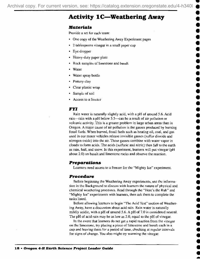
Activity 1C—Weathering Away
Materials Provide a set for each team:
One copy of the Weathering Away Experiment pages
2 tablespoons vinegar in a small paper cup
Eye dropper
Heavy-duty paper plate
Rock samples of limestone and basalt
Water
Water spray bottle
Pottery clay
Clear plastic wrap
Sample of soil
Access to a freezer
FFf Rain water is naturally slightly acid, with a pH of around 5.6. Acid
rain—rain with a pH below 5.5—can be a result of air pollution or volcanic activity. This is a greater problem in large urban areas than in Oregon. A major cause of air pollution is the gasses produced by burning fossil fuels. When burned, fossil fuels such as heating oil, coal, and gas used in our motor vehicles release invisible gasses (sulfur dioxide and nitrogen oxide) into the air. These gasses combine with water vapor in clouds to form acids. The acids (sulfuric and nitric) then fall to the earth as rain, hail, and snow. In this experiment, learners will put vinegar (pH about 2.0) on basalt and limestone rocks and observe the reaction.
Preparations Learners need access to a freezer for the "Mighty Ice" experiment.
Procedure Before beginning the Weathering Away experiments, use the informa-
tion in the Background to discuss with learners the nature of physical and chemical weathering processes. Read through the "Here's the Rub" and "Mighty Ice" experiments with learners, then ask them to complete the tasks listed.
Before allowing learners to begin "The Acid Test" section of Weather- ing Away, have a discussion about acid rain. Rain water is naturally mildly acidic, with a pH of around 5.6. A pH of 7.0 is considered neutral. The pH of acid rain may be as low as 2.0, equal to the pH of vinegar.
In the event that learners do not get a rapid reaction from the vinegar on the limestone, try placing a piece of limestone and basalt each in a cup and leaving them for a period of time, checking at regular intervals for signs of change. You also might try warming the vinegar.
18 • Oregon 4-H Earth Science Project Leader Guide
A more recent revision exists, For current version, see: https://catalog.extension.oregonstate.edu/sites/catalog/files/project/pdf/4h340l.pdf

Extension Visit a local graveyard where tombstones and monuments have been
made from granite, marble, limestone, and slate. These dated rock samples are ideal for studying weathering of rock over time. Look for lichen growths on the rocks. Lichens hold moisture against the stone and the plants are also mildly acidic. Look for roughened, grooved, or pitted surfaces. Look for evidence of cracking and flaking. Which type of stone shows the greatest resistance to weathering? What type of weathering is taking place? (Chemical.)
Oregon 4-H Earth Science Project Leader Guide •IS
A more recent revision exists, For current version, see: https://catalog.extension.oregonstate.edu/sites/catalog/files/project/pdf/4h340l.pdf

Weathering Away Experiments Use a sheet of notebook paper to write out the answers to the questions and record observations from the experiments.
Here's the Rub A) Rub two pieces of basalt rocks together over a piece of white paper. What happens?
Next, you are going to rub two pieces of limestone together over the paper. Predict what will happen. Try it and record your observations.
Predict what will happen if you rub basalt and limestone rocks together over the paper. Try it and record your observations.
What is on the paper as a result of rubbing the rocks together? Describe the material created.
Where might you find rocks being rubbed together in the natural world?
B) Examine the sample of soil provided by your leader. Is the soil similar to the material on the paper? Explain how it is similar and different.
Without blowing the sand onto his or her teammates or off the paper, one member of the team will now blow gently on the sand. What happens? Record your observations.
Predict what will happen if the water spray bottle is used to lightly spray the sand, then someone blows on the sand again. Try it.
Where would you expect to find wind moving sand in the natural world?
In this experiment, are rocks being weathered by physical or chemical processes?
Mighty Ice For this experiment you will need access to a freezer.
Make three round balls of pottery clay, each approximately 3 inches across. Using a pencil with a sharp point, label the balls A, B, and C.
Ball A—Using the eraser end of the pencil, make a hole in the top of the ball. Wrap in plastic wrap. This is your "control."
20 • Oregon 4-H Earth Science Project Leader Guide
A more recent revision exists, For current version, see: https://catalog.extension.oregonstate.edu/sites/catalog/files/project/pdf/4h340l.pdf

Ball B—Using the eraser end of the pencil, make a hole in the top of the ball. Fill the hole with water. Wrap in plastic wrap.
Ball C—Using the eraser end of the pencil, make 3 to 6 holes in the ball. All these holes should be positioned so that they can hold water. Fill all the holes with water. Wrap the ball in plastic wrap.
Put all the clay balls in the freezer. Be careful not to let any of the water spill out of the holes.
What do you expect to happen to the clay and the water?
After a minimum of 24 hours, take the balls out of the freezer and com- pare them. What has happened to the clay and the water? Why has this happened?
If the clay were a solid rock, how would the water act differently?
Thaw the clay balls, then freeze them again. Repeat this several times. What do you observe?
Where might you expect to find rocks being frozen naturally on Earth?
In this experiment, are rocks being weathered by physical or chemical processes?
The Acid Test In this experiment, you will be testing the effect of an acid, vinegar, on basalt and limestone. Place the basalt and limestone samples on a heavy- duty paper plate. What do you expect will happen if you put several drops of vinegar on the basalt? Try it. Wait and watch a few minutes. Record your observations.
How do you expect the limestone to react to the vinegar? Try it. Watch both rocks and record your observations.
In this experiment, are the rocks being weathered by physical or chemical processes?
Oregon 4-H Earth Science Project Lender Guide • 21
A more recent revision exists, For current version, see: https://catalog.extension.oregonstate.edu/sites/catalog/files/project/pdf/4h340l.pdf

22 • Oregon 4-H Earth Science Project Leader Guide
A more recent revision exists, For current version, see: https://catalog.extension.oregonstate.edu/sites/catalog/files/project/pdf/4h340l.pdf

2. The Blue Mountains— Islands and Old Sea Floors Objectives Learners will be able to:
• Understand how the plate tectonic theory explains the movement of lithospheric plates
• Understand how the plate tectonic theory helps to explain the origin of the early Blue Mountains
Oregon Benchmarks
Activity 2A—Convection Currents Grade 5 • Use a model to explain how a process works in the real world. (S)
• Identify causes of Earth surface change. (S)
Grade 8 • Recognize the solid earth is layered with a lithosphere, a hot convect-
ing mantle, and a dense metallic core. (S)
• Describe how Earth's surface changes over time. (S)
Activity 2B—Floating Densities GradeS • Use a model to explain how a process works in the real world. (S)
• Describe actions that can cause or prevent changes. (S)
GradeS • Describe how Earth's surface changes over time. (S)
• Recognize the solid earth is layered with a lithosphere, a hot convect- ing mantle, and a dense metallic core. (S)
• Understand that the lithospheric plates move at rates of centimeters per year in response to movements in the mantle. (S)
• Understand the evidence that supports the theory of plate tectonics. (S)
Activity 2C—Continents on the Move Grade 5 • Organize evidence of a change over time. (S)
Grade S • Identify and explain evidence of physical change over time. (S)
Oregon 4-0 Earth Science Project Leader Guide • 23
A more recent revision exists, For current version, see: https://catalog.extension.oregonstate.edu/sites/catalog/files/project/pdf/4h340l.pdf

Life SkiUs Learners will practice:
• Critical thinking
• Learning to learn
• Planning/organizing
• Cooperating
Field Trips Wallowa Mountains, Eagle Cap—coral reefs, sea floors, and glaciers.
Information from Eagle Cap Ranger District (USFS).
Hells Canyon—layers through geologic time. Information from Hells Canyon National Recreation Area.
Elkhom Mountains—gold prospecting. Information from Wallowa- Whitman National Forest or Bureau of Land Management, Baker City.
Background The Earth's interior is made up of three main layers. These are the
crust, the mantle, and the core (Figure 4). Each of these layers may be divided into smaller layers by their specific properties.
The crust is the outer layer, similar to the shell of an egg. Like an eggshell, the crust is thin compared to the thickness of the mantle and core. The crust ranges in thickness from as little as 4 miles (6 km) thick beneath the oceans to more than 50 miles (80 km) thick under continental mountains.
The mantle is directly beneath the crust, similar to the white of an egg. It is a plastic (pliable) layer of rock that is denser than the crust because it contains more iron and magnesium.
The core of the Earth is similar to the yolk of an egg. It is composed of an iron-nickel alloy and is nearly twice as dense as the mantle. The outer core is a thick liquid, approximately 1,800 miles deep with a thickness of 1,400 miles. The inner core is solid, due to the intense pressure at this depth. As the Earth rotates, the liquid outer core slowly flows, creating the Earth's magnetic field.
The lithosphere is the name given to the combined layers of crust and a cool outermost shell of the mantle. The theory of plate tectonics states that the lithosphere is composed of a dozen or more plates that move relative to one another as they ride atop hotter, more mobile materials. The plates move at average speeds of a few inches per year, about as fast as a human fingernail grows. The mantle zone that the tectonic plates "ride" or "float" on is called the asthenosphere.
Temperature differences in the mantle cause the asthenosphere to move by convection currents. The asthenosphere is a relatively thin, mobile zone of hot plastic material, which is soft and flows after being subjected to high temperature and pressure. In Activity 2A, learners will explore convection currents.
24 • Oregon 4-H Earth Science Project Leader Guide
A more recent revision exists, For current version, see: https://catalog.extension.oregonstate.edu/sites/catalog/files/project/pdf/4h340l.pdf

<vv ^
crust //
J Mantle
Lithosphere
Asthenosphere
Figure 4.—Inside the Earth.
A tectonic (or lithospheric) plate is a massive, irregular slab of solid rock. Plates are divided into two types, oceanic and continental plates, based on their physical properties. The difference in density of the oceanic and continental plates is important in understanding how the plates behave when they come together. Learners will explore Floating Densities in Activity 2B.
Continental plates have a thick crust composed of granitic rocks, which are made up of relatively lightweight minerals such as quartz and feldspar. By contrast, oceanic plates, which are denser and heavier, have a crust composed of iron-rich basaltic rocks. The crust under continents is on average around 20 miles thick. The crust under the oceans generally is only about 3 miles thick (Figure 5). Oceanic plates are created along oceanic ridges where mantle material rises toward the thin oceanic crust.
When the two types of plates meet, the oceanic plate, with its greater density, descends below the continental plate. Where a continental plate moves over an oceanic plate, the oceanic plate descends into the mantle in a subduction zone.
The creation and destruction of lithospheric plates happens very slowly. The interaction of crust and mantle in creating, destroying, and changing rocks is described by the Rock Cycle. Learners will look at the Rock Cycle in more detail in Activity 3B
What does this have to do with Oregon's geology? About 200 million years ago, the western edge of the North American continent ended approximately at the current location of Idaho. The continent has been moving westward for at least 200 million years and is still on the move today. As the edge of the North American continental plate has moved
Oregon 4-H Earth Science Project Leader Guide • 25
A more recent revision exists, For current version, see: https://catalog.extension.oregonstate.edu/sites/catalog/files/project/pdf/4h340l.pdf

Figure 5. Tectonic Plates
1. Oceanic plates are created along oceanic ridges where hot lower mantle material rises through the cold lithosphere.
2. Continental plate
3. Convergent plate boundary, where crust is destroyed as one plate dives under another
3a. Oceanic-continental plate converging
3b. Two oceanic plates converging
4. A trench is created by subduction of a plate. Trenches are the deepest parts of the ocean floor.
5. Subducting plate
6. Island arc volcanoes
west it has ridden over the heavier Pacific oceanic plate. The oceanic plate is moving downward into the mantle in an offshore subduction zone. This is a convergent plate boundary, one of three types of tectonic plate boundaries.
The other two types of plate boundaries are: divergent boundaries, where new crust is generated as plates pull away from each other; and transform boundaries, where crust is neither produced nor destroyed as plates slide horizontally past each other.
Convergent plate boundaries can occur in one of three ways: (1) between an oceanic and continental plate, (2) between two oceanic plates, or (3) between two continental plates. Convergent boundaries are associated with subduction zones, where crust on one side is being destroyed. They also are associated with large-scale volcanic and seismic (earthquake) activity. The crust and lithosphere material melts under great pressure as it enters the asthenosphere. Some of this melted mate- rial rises to feed the magma chambers of volcanoes.
Where continental crust rides over oceanic crust, as on the western coast of the North American continent, mountains such as the Cascade Range may be uplifted. Where two oceanic plates converge, the subduc- tion process results in the formation of a chain of arc volcanoes. Volcanic arcs, which closely parallel the subduction trenches that give rise to them, generally are curved. An example of island arc volcanoes associ- ated with modem earthquake and volcanic activity is Alaska's Aleutian Islands, where 40 volcanoes are considered active.
The area identified as the Blue Mountains in northeast Oregon began as island arc volcanoes in the warm seas off the western edge of North America. They were created in response to a subduction zone within the Pacific Basin. These island archipelagos were carried east on the oceanic
26 • Oregon 4-H Earth Science Project Leader Guide
A more recent revision exists, For current version, see: https://catalog.extension.oregonstate.edu/sites/catalog/files/project/pdf/4h340l.pdf

plate until it collided with the west coast of North America, which is moving westward. The collision that incorporated the islands into the continent caused enough heat and pressure to change some of the igne- ous and sedimentary rocks involved into metamorphic rocks.
The collision and subduction of plates causes changes in the land- forms of both the oceanic and continental types of crust. Sediments on the ocean floor may be scraped off the subducting slab and added to the continental edge, creating coastal mountain ranges. In addition, the massive plates can build up tremendous pressure as they move past each other. Sometimes the pressure built up over time is released suddenly, causing an earthquake. Both volcanic and earthquake activity are com- mon along the plate boundary marking the rim of the Pacific Ocean. This line where the Pacific Plate meets its many surrounding plates is called the Ring of Fire.
Reference The Dynamic Earth, the Story of Plate Tectonics, U.S. Geological
Survey.
Web site—Alaska Volcano Observatory: www.avo.alaska.edu/
Activity 2A—Convection Currents
Materials • Clear glass pyrex 2-cup measuring cup, or large beaker
• Fondue pot stand or beaker stand—If the stand will not hold the cup or beaker safely, place a square of hardware cloth on top of the stand under the cup or beaker.
• Food-warming candle or solid alcohol fuel
• Blue food coloring
• Eyedropper
• Cooking oil
• Access to a refrigerator
• Hot pads
FYI Convection currents are caused by differences in temperature. These
currents cause a circular motion, moving material away from a heat source as the material warms and expands. When cooling occurs away from the heat source, the material contracts. In the demonstration the water will be warmed over the candle, rise to the surface, move to the outside edge of the container, and then sink toward the bottom, creating a circular current.
Convection currents are found not only in the Earth's mantle; they're also found in the atmosphere, as seen when large thunderhead clouds form, and in large bodies of water such as inland seas and lakes. They are
Oregon 4-H Earth Science Project Leader Guide • 27
A more recent revision exists, For current version, see: https://catalog.extension.oregonstate.edu/sites/catalog/files/project/pdf/4h340l.pdf

responsible for the motion of oceans and lakes that redistribute nutrients through aquatic systems.
Preparations Gather all the materials to be used in the activity. Mix Vs cup of
cooking oil with a few drops of blue food coloring. Put the mixture in a refrigerator at least 24 hours prior to this demonstration.
Procedure Place about PA cups of water in the glass measuring cup and warm it
gently in a microwave. When the water is evenly warm, place the glass measuring cup on the stand over the lighted candle. Use extreme care in removing the cup from the microwave and transporting it to the stand. When the cup of water is placed on the stand over the candle, the water in the center will continue to warm. Noticeable bubbles will begin to form and rise toward the surface. The cooler water on the edges will begin to sink toward the bottom of the cup.
Tell the learners that you are going to put a few drops of blue oil into the water near the edge of the cup. Ask what they think will happen. Will it stay in one place? Be dissolved into the water? Or move in a particular direction? After the learners have made some suggestions, drop in some blue oil and observe what happens. Repeat this experiment by putting blue oil in the center of the cup.
Discussion Introduce learners to the idea that the Earth's tectonic plates ride at the
Earth's surface and are moved on the asthenosphere by convection currents in the mantle. Use the information provided in the Background section to lead the discussion.
Note: If possible, complete Activity 2B, "Floating Densities," and Activity 2 C, "Continents on the Move," soon after Activity 2A to assist learners in understanding this complex process.
Activity 2B—Floating Densities
Materials • An aquarium or large glass bowl
• Two thick-skinned oranges (if thick-skinned oranges are not avail- able, try comparing cans of diet and regular soda of the same brand)
• A raw egg (in the shell)
• Salt
• Spoon
• A glass or beaker of water
• Knife (to peel the orange)
28 • Oregon 4-H Earth Science Project Leader Guide
A more recent revision exists, For current version, see: https://catalog.extension.oregonstate.edu/sites/catalog/files/project/pdf/4h340l.pdf

FYI The mathematical formula for density is: Density = Mass/Volume. The
density of an item, gas, solid, or liquid is not related to its size or shape. In the experiment, learners will use water to compare the density of an orange with and without its skin. The orange with its skin is like the continental plate—it will float. Even though the orange with its skin is larger, the low- density peel acts like a life jacket, keeping the orange afloat. The peeled orange will sink because the high-density pulp is denser than the water.
Procedure Part 1: Orange Density
Ask learners what density is. Write suggested definitions on a board where all can see them. Fill the container with water. Hold the two oranges where learners can see them, then peel one of the oranges.
Ask learners what is the same and what is different about these two oranges. Explain to learners that you will be placing both the oranges into the water. Ask learners what they predict each of the two oranges will do. Place the oranges in the water and discuss the results. (The orange without a peel will sink. If a thick-skinned orange has been used, the orange with skin should float. Thin-skinned oranges will not float.)
Explain the relationship of the different densities of continental and oceanic plates and how this is similar to the oranges. Refer to the Back- ground section for information to assist the discussion.
Part 2: The Density of Water The density of pure water is always the same at a given temperature.
However, the density of water can be changed by adding things to it so it is no longer pure water.
Place a fresh, raw egg (in the shell) in a glass of water. Ask learners why the egg sinks. (A raw egg is denser than water.) Ask learners what they might do to change the density of the egg or the water to make the egg float.
After the learners have provided ideas on changing densities, begin stirring salt into the water, 1 tablespoon at a time. Have a learner record the amount of salt being added. The egg will rise to the top when the salt water becomes denser than the egg. Discuss what the learners believe to be happening.
Ask the learners for ideas on other ways density may be changed. Try as many of the learners' ideas as possible.
Activity 2C—Continents on the Move
Materials • Copy a Mercator projection map of the continents, two per learner.
• Scissors
• Colored paper
• Paste/glue stick
Oregon 4-H Earth Science Project leader Guide • 29
A more recent revision exists, For current version, see: https://catalog.extension.oregonstate.edu/sites/catalog/files/project/pdf/4h340l.pdf

Scientists believe that a huge land mass called Pangaea, comprising the existing continents, began to break up about 200 million years ago. The smaller pieces of Pangaea have been drifting apart or bumping together again ever since. Something as big as a continent does not move very rapidly. The continents that we see today are riding on plates that in turn ride on hot mantle material that is moved by convection currents.
Save the maps and continent pieces to use again in Activity 5B.
Procedures For each learner, pass out two copies of the map, one sheet of colored
paper, scissors, and glue. Ask learners to cut out the continents from one of their map copies and arrange the continents on a single sheet of colored paper, noting where the continents fit like a jigsaw puzzle because of their similar shapes. How many different ways can learners find that the continents may have been associated?
Discussion Remind learners of the convection currents (Activity 2A) and density
(Activity 2B) demonstrations. How do these processes and properties affect the motion of continents?
Extension Research the theories that have been proposed for continental move-
ment and give a report to the group, or create an educational display for a science fair or county 4-H fair.
Key words: Abraham Ortelius, Thesaurus Geographicus, "catastrophism," "uniformitarianism," James Hutton, continental drift, Alfred Wegener, Alexander DuToit, Pangaea, Gondwanaland.
30 • Oregon 4-H Earth Science Project Leader Guide
A more recent revision exists, For current version, see: https://catalog.extension.oregonstate.edu/sites/catalog/files/project/pdf/4h340l.pdf

3. The Klamath Mountains Objectives Learners will be able to:
• Discriminate between metamorphic, igneous, and sedimentary rocks and where they are found in the Rock Cycle
• Describe some geometric shapes of crystals
Oregon Benchmarks
Activity 3A—Jurassic Oregon Map Overlay Grade 5 • Identify causes of Earth surface changes. (S)
• Examine and prepare maps to locate and interpret geographic informa- tion. (SS)
Grade 8 • Describe how the Earth's surface changes over time. (S)
• Read, interpret, and prepare maps to understand geographic relation- ships. (SS)
Activity 3B—The Rock Cycle Grade 5 • Diagram and explain a cycle. (S)
• Identify causes of Earth surface changes. (S)
Grade 8 • Describe how the Earth's surface changes over time. (S)
Activity 3C—How Do Your Crystals Grow? Grade 5 • Build, draw, measure, and compare shapes. (M)
• Recognize and describe geometric shapes and their functions in natural and constructed environments. (M)
• Organize evidence of change over time. (S)
• Ask questions and make predictions that are based on observations and can be explored through simple investigations. (S)
• Collect, organize, and summarize data from investigations. (S)
Grade 8 • Identify, classify, draw, and describe geometric figures. (M)
Oregon 4-H Earth Science Project Leader Guide •SI
A more recent revision exists, For current version, see: https://catalog.extension.oregonstate.edu/sites/catalog/files/project/pdf/4h340l.pdf

• Recognize, describe, and analyze geometric shapes and their functions in natural and constructed environments. (M)
• Identify and explain evidence of physical change over time. (S)
• Describe how the Earth's surface changes over time. (S)
• Ask questions and form hypotheses that are based on observations and scientific concepts and that can be explored through scientific investi- gations. (S)
• Analyze, interpret, and summarize data from investigations. (S)
Life SkiUs Learners will practice:
• Learning to learn
• Teamwork
Field Trips Upper Table Rock—remnants of Miocene Cascade basalt flows. Informa-
tion from Medford Bureau of Land Management office.
Humbug Mountain State Park—Cretaceous pebbly beach. Information from State Parks and Recreation Department.
Mount Ashland—Jurassic granitic pluton. Information from Ashland Ranger District (USFS).
Oregon Caves National Monument—Triassic limestone. Information from Oregon Caves National Monument.
Background The area identified geologically as the Klamath Mountains in south-
west Oregon contains pieces of the oldest and most diverse rocks and landscapes in the state. Only about a quarter of the Klamath Mountains are in Oregon. The majority of the range is in northern California. The oldest part of these mountains was bom as island arc volcanoes (see Chapter 2, Background) in the warm ocean off the Oregon and California coast of the Paleozoic Era, 550 million years ago.
The Klamath Mountains have been created by wave after wave of separately generated island arcs. The lithospheric oceanic plate on which these islands were riding was moving north and east. A new series of volcanic islands was formed as the plate moved the previously created island arc away from a zone of sea floor spreading (Figure 5).
At the same time the Klamath island arcs were moving east, the western coast of North America was moving west. When the oceanic and continental plates collided, the islands were scraped off the oceanic plate and added to the continent in a violent process that resulted in massive earthquakes and additional volcanic activity. The lines of island arcs may have been pushed into a single island by the time their oceanic plate collided with the North America continental plate. The island arcs are
32 • Oregon 4-0 Earth Science Project Leader Guide
A more recent revision exists, For current version, see: https://catalog.extension.oregonstate.edu/sites/catalog/files/project/pdf/4h340l.pdf

welded together by magma that intruded into the previously formed volcanic islands. In Activity 3A, learners will create a map of Oregon in the Jurassic period.
Igneous rocks are formed when magma cools. When the magma cools underground, the rocks formed are called plutonic rocks. When the magma reaches the surface, it's called lava. The rocks formed when lava cools are called volcanic or extrusive rocks. The magma that intruded into the Klamath island arc volcanoes contained a high level of quartz, potassium-rich feldspar, and biotite, which cooled and solidified under- ground, creating intrusions and plutons made of the igneous rock granite.
Mt. Ashland is a pluton, a dome-shaped mass of igneous rock 7,523 feet in elevation, that intruded into older, softer shale material. The granite of Mt. Ashland rose from deep inside the Earth as magma. The magma formed a dome that cooled without reaching the surface. Over time, the shale material covering the granite intrusion has weathered away, leaving the dome-shaped pluton of Mt. Ashland.
Due to weathering over millions of years, much of the material that once covered the pluton is on its way to the ocean, perhaps as waterbome sediment of the Rogue River. When it reaches the ocean, the sediment may be carried into the trench created where the oceanic plate enters the subduction zone and is moved under the continental plate. The Rock Cycle describes the geologic processes that are slowly at work, continu- ously changing the Earth. Learners will use a diagram in Activity 3B to assist in understanding the many processes at work in the Rock Cycle.
The marble of the Oregon Caves is metamorphic rock that was once a limestone coral reef, rich in calcite, that formed at the base of the island arc volcanoes in the tropical Permian ocean. Metamorphic rocks are created when igneous or sedimentary rocks are exposed to great heat and pressure. Over time, the limestone, a sedimentary rock, was folded, fractured, and exposed to heat and pressure from the collisions of the island arcs and the continent. This geologic activity created a low-grade marble full of cracks and faults. Limestone and marble are made of calcite, which dissolves in water. Water flowing underground through the cracks dissolved and eroded the marble, creating the Oregon Caves. The dripstone formations are created when the dissolved calcite is redepos- ited. The icicle-like formations that grow down from the cave ceiling are called stalactites. Stalagmites are the formations that point up from the cave floor.
Calcite is found in the Oregon Caves both as a solid part of the dripstone formation and also dissolved in water. As the calcite is depos- ited in successive layers, it appears that the drip stone is growing, although it is not a living thing. All solid minerals "grow" or crystallize from vapor, magma, or a liquid solution. Matter comes in three forms— solid, liquid, and gas. When matter changes from one form to another (e.g., from liquid water to solid ice), it's called a change of state. Some crystals such as salt, sugar, and quartz are solid at room temperature. Others, such as ice, must be frozen to be solid. The shape of each solid mineral, its crystallization pattern, is always the same. Crystal shape is one characteristic used to identify minerals. In Activity 3C, learners will explore ways crystals are created.
Oregon 4-H Earth Science Project Leader Guide • 33
A more recent revision exists, For current version, see: https://catalog.extension.oregonstate.edu/sites/catalog/files/project/pdf/4h340l.pdf

Activity 3A: Jurassic Oregon Map Overlay
Materials • One copy of the Jurassic Oregon Map on clear overhead film for each
learner (p. 35)
• Several sets of wet-erase overhead transparency markers
• Several Oregon maps
Procedure Ask learners to place their copy of the Jurassic Oregon Map in the map
section of their three-ring Oregon 4-H Earth Science Notebooks. Learners may wish to use transparency pens to color the Jurassic coastline blue. Use the map in a discussion with learners about the geology of the Klamath Mountains and Blue Mountains based on the information in the Back- ground sections of chapters 2 and 3. The Wallowa Mountains are one of five large groups of transported rocks that make up the Blue Mountain province.
Using the Oregon maps, in southern Oregon locate Upper Table Rock, Mt. Ashland, Humbug Mountain State Park, and the Oregon Caves Na- tional Monument. In northern Oregon, locate Eagle Cap Wilderness, Hells Canyon, the Elkhom Mountain, LaGrande, Enterprise, and Baker City.
Activity 3B—The Rock Cycle
Materials • One copy of the Rock Cycle Journal Page diagram (p. 36>, for each
learner
Procedure Work with the learners to label the Rock Cycle diagram (answers on
page 37). The Rock Cycle is a diagram of the geologic processes that continually change the Earth. Discuss the events that shaped the Blue Mountains (Chapter 2) and the Klamath Mountains and where these are represented on the Rock Cycle diagram. Discuss how a coral reef is converted into the metamorphic rock marble. What geologic processes are at work turning coral to marble (Rock Cycle 4) and marble to dripstone formations (Rock Cycle 1)? Where are these processes represented on the Rock Cycle? Where do learners see the processes illustrated on the Rock Cycle diagram taking place today?
Extension Research Activity
Coral reefs have had a huge impact on the geologic history of Earth. Thick limestone layers—once reefs—underlie North America from Idaho to the Dakotas. Today on Earth, tropical coral reefs are found where the water surface temperature averages 68 degrees. Coral colonies grow
34 • Oregon 4-H Earth Science Project Leader Guide
A more recent revision exists, For current version, see: https://catalog.extension.oregonstate.edu/sites/catalog/files/project/pdf/4h340l.pdf

Jurassic Oregon map—hypothetical representation of Oregon in the late Jurassic period.
Oregon 4-0 Earth Science Project Leader Guide • 35
A more recent revision exists, For current version, see: https://catalog.extension.oregonstate.edu/sites/catalog/files/project/pdf/4h340l.pdf

Rock Cycle Journal Page
1.
2.
3-.
4.
5.
6..
7.
8.
36 • Oregon 4-H Earth Science Project Leader Guide
A more recent revision exists, For current version, see: https://catalog.extension.oregonstate.edu/sites/catalog/files/project/pdf/4h340l.pdf

slowly. In ideal conditions they grow at about a half inch per year. Some currently living atolls that are around a mile thick have been growing for 50 million years!
Develop some questions and research coral reefs. What does the coral- creating animal look like? Where are they found on Earth today? What is an atoll? What plants and animals live in coral habitat? How are coral reefs important to the local people and economy?
Try surfing the Web for information. Look up the Coral Reef Research Foundation at the Chuuk Atoll Research Laboratory.
Coral Reef Model Order from U.S. Geological Survey Educational Materials list (fact
sheet 225-96), "How to Make Four Paper Models That Describe Coral Reefs" (Open File Report 91-131).
Rock Cycle Journal Page Answers 1. Weathering (Chapters 1 and 3, Background)
2. Sediment deposited by water. (Chapter 4, Background and Activities 4B and 4C)
3. Sediments are compacted over time to form sedimentary rocks.
4. When sedimentary or igneous rocks are subjected to great heat and pressure, metamorphic rocks are created. (Chapter 3, Background)
5. Metamorphic rocks can melt inside the Earth to become molten magma. (Chapters 2 and 3, Background)
6. Magma rises to the Earth's surface in areas of volcanic activity.
7. Igneous rocks are formed from magma. When magma cools under- ground, the rocks formed are called plutonic igneous rocks.
8. When magma reaches the surface, it's called lava. When the lava cools, the rocks formed are called extrusive igneous rocks. (Chapter 7, Background and Activity 7C)
Activity 3C—How Do Your Crystals Grow?
Part 1: Quick Crystals? Materials • Box of rock salt
• Bag of "cocktail" ice, one for each 10 learners
• Measuring spoons
For each pair of learners:
• A pair of mittens or gloves (Ask learners to bring these from home.)
• 1-gallon "zip-lock" freezer bag
• 1-quart "zip-lock" freezer bag
• 172 cups of whole milk—plain, chocolate, or egg nog
• 2 tablespoons of sugar
Oregon 4-0 Earth Science Project Leader Guide • 37
A more recent revision exists, For current version, see: https://catalog.extension.oregonstate.edu/sites/catalog/files/project/pdf/4h340l.pdf

• 1 teaspoon vanilla
• Two spoons
• Two paper cups
Procedure Ask learners what the term "change of state" means. Use one of the
ice cubes to illustrate the solid, crystalline form of water. What happens to milk when it's frozen? What is a popular form of frozen milk? Does frozen milk contain crystals?
Explain to learners that they are going to put milk in a bag, place this bag into a larger bag, add ice and salt to the larger bag, and SHAKE. What do learners predict will happen?
Have each pair of learners measure the milk, sugar, and vanilla into a quart-size bag and mix gently. Ask learners to note that the material in the bag is a liquid. Now be sure that all the quart bags are securely sealed. Learners will place the quart bag into a gallon bag. Layer ice and salt into the gallon bag. Start with a one-to-one salt-to-ice ratio. Leave room in the gallon bag for it to be sealed. You might want to experiment with different ratios of salt to ice, and time needed to get results.
The learners should now put on their gloves. Ask each pair of learners to take one end of the gallon bag and shake it together for 15 minutes. Ask learners to observe what is happening in both the bags. Add more salt and ice as needed. Remind learners that often in science it is not a good idea to taste an experiment; however, in this case we will make an exception. Remember, we want to answer the question, "Does frozen milk contain crystals?" Open the quart bags and enjoy!
Part 2: Slow Crystals Materials • Epsom salts
• Dark construction paper—black, blue, green, brown
For each learner:
• Paper cup half full of warm water
• Spoon
• Scissors
• Empty '^-pint milk carton, rinsed, with the top removed
• Hand lens
Procedure Before beginning this activity, explain to learners that this is not an
experiment they should try to taste. Have each learner cut a piece of construction paper to fit the bottom of
the milk carton. Stir Epsom salts in the cup of warm water until they will no longer dissolve. Spoon the Epsom salt mixture over the paper in the milk carton until it forms a thin layer of liquid. Place the milk cartons in a warm location where they will not be disturbed for at least 24 hours.
Ask learners what they expect to happen. Compare the crystals that form in the milk cartons with the dry Epsom salts directly from the box.
38 • Oregon 4-H Earth Science Project Leader Guide
A more recent revision exists, For current version, see: https://catalog.extension.oregonstate.edu/sites/catalog/files/project/pdf/4h340l.pdf

Observe the crystals with a hand lens. What do the learners notice? Ask the learners to draw their observations in their 4-H Earth Science Jour- nals.
How is the Epsom salt demonstration similar to the processes that produced the dripstones of the Oregon Caves?
Part 3: Cardboard Crystals The following lesson was adapted from the "Shapes of Mineral
Crystals" activity, which is reprinted from the Great Explorations in Math and Science (GEMS) teachers' guide titled Stories in Stone, copyrighted by The Regents of the University of California, and used with permission.
Materials • One set of copies of the crystal model sheets, copied onto card stock
for each learner (Appendix A). For young learners, use only the cube, tetrahedron, and octahedron models.
For each pair of learners:
• One pair scissors
• One pencil
• One ruler
• Transparent tape
If learners will be constructing a crystal mobile, the following will be needed:
• Coat hanger, one per learner
• A supply of string (colored embroidery floss is nice)
• A supply of crayons
• Hole punch
FYI A limited number of crystal shapes have been found in nature. There
are only seven main groups or "crystal systems," into which all naturally occurring crystals can be placed. This suggests that there is a limited number of ways in which atoms may be arranged together to form these shapes. Because a single crystal represents the smallest component of a mineral, careful observation and analysis of distinctive crystal shapes has proved to be one of the best ways to classify and distinguish between different minerals.
Preparations Gather all the materials to be used in the activity. Make one of each of
the crystal models to become familiar with the construction process, and so you can show learners what the models will look like when com- pleted. Have one additional flat copy of the cube available to use in a construction demonstration.
Prior to beginning the activity, read the "Extension" suggestion at the end of the "Procedure" section. If you plan to have students color their crystals, have them do so before they cut them out of the cardboard and fold them.
Oregon 4-H Earth Science Project Leader Guide • 39
A more recent revision exists, For current version, see: https://catalog.extension.oregonstate.edu/sites/catalog/files/project/pdf/4h340l.pdf

Procedure Prior to passing out the materials, explain and demonstrate to learners
how to construct the cube model, one step at a time, as follows:
a. Write your name on the shape, somewhere not too visible.
b. Use scissors to carefully cut the cube pattern along the solid lines.
c. Use the sharp edge of a desk or table to make a fold along all dashed lines of the cutout. In making the folds, learners should make sure the dotted lines and any words (such as "CUBE") are on the outside of the shape being formed.
d. Fit the faces of the crystal shape together, tucking tabs as needed, and matching corresponding numbered comers. If making a mobile, use a hole punch to make holes as needed to tie a string on each model. Tape the edges.
Optional e. Tie a different length of string on each of the models, and tie the string
to the coat hanger to form a pleasing pattern.
The same procedure applies to all the crystal shapes. Have learners begin constructing their models, beginning with the cube. For younger learners use only the cube, tetrahedron, and octahedron models.
Save the cardboard crystals for use again in Activity 4C, "Identifying Rocks and Minerals."
Extension Before learners construct their cardboard models, ask them to research
the colors of some of the minerals being represented by the crystal shapes. Color the models to match the color of a mineral represented by each model.
Example: Cube: salt, galena, platinum Hexagonal prism: quartz Tetrahedron: chalcopyrite Octahedron: gold, platinum, magnetite, diamond Dodecahedron: gold Pyritohedron: pyrite (fool's gold)
40 • Oregon 4-0 Earth Science Project Leader Guide
A more recent revision exists, For current version, see: https://catalog.extension.oregonstate.edu/sites/catalog/files/project/pdf/4h340l.pdf

4. Creations of the Cretaceous Objectives Learners will be able to:
• Distmguish between metamorphic, igneous, and sedimentary rocks
• Explain the relationship of sedimentary rocks to fossils
• Explain how a fossil is formed and some conditions needed for formation
• Explain where dinosaur fossils are found and why they are NOT found in Oregon
• Define what a mineral is
• Define the relationship of minerals to rocks
• Explain and demonstrate some of the tests used to distinguish among different minerals
Oregon Benchmarks
Activity 4A—Cretaceous Oregon Map Overlay Grade 5 • Identify causes of Earth surface changes. (S)
• Examine and prepare maps to interpret geographic information. (SS)
Grade 8 • Describe how the Earth's surface changes over time. (S)
• Read, interpret, and prepare maps to understand geographic relation- ships. (SS)
Activity 4B—Sedimentary Rocks and. the Preservation of Fossils Grade 5 • Use a model to explain how events and/or processes work in the real
world. (S)
• Describe actions that can cause or prevent changes. (S)
• Describe physical and biological examples of how structure relates to function. (S)
• Identify properties and uses of earth materials. (S)
Oregon 4-H Earth Science Project Leader Guide •41
A more recent revision exists, For current version, see: https://catalog.extension.oregonstate.edu/sites/catalog/files/project/pdf/4h340l.pdf

Grade 8 • Use a model to make predictions about familiar and unfamiliar
phenomena in the natural world. (S)
• Identify and explain evidence of physical and biological changes over time. (S)
• Identify and describe the relationship between structure and function at various levels of organization in life, physical, or Earth/space science. (S)
• Describe how the Earth's surface changes over time. (S)
Activity 4C—Identifying Rocks and minerals GradeS • Identify properties of earth materials. (S)
GradeS • Compare and contrast properties of earth materials. (S)
Life SkiUs Learners will practice:
• Learning to leam
• Critical thinking
• Personal safety
• Teamwork
• Keeping records
Field Trips Mitchell Basin—from Mitchell to approximately 2.5 miles west on
Highway 26, Gable Creek Road. Gable Creek Formation, a 9,000- foot-thick sequence of Cretaceous material interfingered with Hudspeth Formation marine shales containing abundant ammonites in some localities. Pterosaur and ichthyosaur remnants have been re- ported.
Dinosaur National Monument—Park Headquarters, Dinosaur, Colorado.
Background The movie Jurassic Park was a huge success because children and
adults are endlessly fascinated by "classic dinosaurs" such as the bronto- saurus and the fearsome tyrannosaurus rex. To find the fossils of "classic dinosaurs," we must leave Oregon behind and travel east to the Utah- Colorado boarder to Dinosaur National Monument. Here are found fossils of the vegetarian brontosaurus (known as apatosaurus), diplodocus, and stegosaurus. The sharp-toothed carnivore allosaurus is found here, too. These fossils are preserved in a layer of sediment called
42 • Oregon 4-H Earth Science Project Leader Guide
A more recent revision exists, For current version, see: https://catalog.extension.oregonstate.edu/sites/catalog/files/project/pdf/4h340l.pdf

the Morrison Formation. A geologic formation is a layer (or unit) of rock with a similar composition, age, and origin.
It is believed that the fossil dinosaur bones found at Dinosaur National Monument were preserved when the dinosaurs, along with turtles, crocodiles, and clams, were washed by a huge flood onto a sandbar in an ancient river bed. When animals and plants are buried quickly by sedi- ment, their bones do not decay. They remain in the sediments to be mineralized and preserved. Over millions of years, thousands of feet of sediment layered on the bones, perhaps carried by the river and the ebb and flow of the sea. The sea that carried some of this sediment covered much of Oregon during the Jurassic and Cretaceous periods. Slowly, silica and calcium carbonate dissolved in water percolated through the sediment layers. The silica hardened, turning the ancient river bed into sandstone and the bones buried within to fossils.
By the Cretaceous period, 80 million years ago, central Oregon was just beginning to show evidence of low-lying, marshy, nearly solid land. Much of Oregon still was covered by a bay or inland sea. Sediments being washed from the existing continent and the Blue, Wallowa, and Klamath mountains were deposited in silty layers. These conditions proved ideal for the formation of some of Oregon's earliest fossils. The sandstone of the Hudspeth formation shows evidence of ammonites and fragments of a fishlike reptile, the ichthyosaur; and a flying reptile, the pterosaur, with a 10-foot wing span. Plant fossils found include cycads and palm. These types of plants are found today in tropical climates, leading paleontologists to theorize that the climate of Cretaceous Oregon was tropical. In Activity 4A, learners will create a map of Oregon in the Cretaceous Period.
Paleontologists are scientists who study fossils. Fossils generally are found in sedimentary rocks. They also may be found in frozen ground in Arctic life zones, or preserved in the resin of cone-bearing trees. Syrupy tree resin may flow over and cover insects or plant parts. When the resin hardens, it forms a translucent rocklike material called amber. In Activity 4B, learners will create their own fossil-rich conglomerate formation.
When paleontologists look for fossils, they begin by looking for sedimentary rock. Sedimentary rocks are composed of a variety of minerals and particles of gravel, sand, clay, and silt, that are carried by water into low-lying areas generally associated with rivers, lakes, and oceans. When layer upon layer of material is deposited, the pressure on the lower layers increases with the weight of each succeeding layer. Eventually, with the help of cements from silica, calcium carbonate, or clay, sedimentary rocks are formed. This creates an excellent environ- ment for preserving fossils.
Over geologic time, a pond may be covered and completely buried by a lava flow that hardens into basalt (Figure 6a), an igneous rock. Igneous rocks result from hot, melted magma that originates deep within the Earth. The word "igneous" comes from the Latin "ignis" for fire. The word "ignite" has the same root.
As more time passes, the sediments of the former pond under the basalt are compressed into sandstone. Fish skeletons and snail shells are mineralized. A fossil-rich layer of rock is created. This tiny layer of sedimentary rock may be sitting on top of a layer of black shale. Shale is
Oregon 4-H Earth Science Project Leader Guide • 43
A more recent revision exists, For current version, see: https://catalog.extension.oregonstate.edu/sites/catalog/files/project/pdf/4h340l.pdf

Figure 6.—A pond over geologic time.
a sedimentary rock that develops from fine-grained deposits in deep, quiet, water environments (Figure 6b).
More time passes. The shale is metamorphosed into slate. Metamor- phic rocks, such as slate, are created when the characteristics of sedimen- tary or igneous rocks are changed primarily by heat and pressure (Figure 6c).
As you can see, identifying the origin of rocks is not always simple. If a road were cut through the layers of rock described above, we would see a small, tan stripe of sedimentary rock sandwiched between a layer of black metamorphic slate rock on the bottom and black igneous basalt
rock on top. Rocks are divided into one of the three classes— sedimentary, meta- morphic, or igne- ous—based on the process that created them. Not all rocks are solid. Oil and natural gas, two of the most economi- cally important geologic materials, occur as a liquid and a gas. Oil and natural gas usually are trapped in sedimen- tary rocks.
Additional classi- fication of rocks requires identifica- tion of the types of minerals they con- tain. To identify the characteristics of minerals, a mineral test kit is helpful, as learners will see in Activity 4C.
44 • Oregon 4-H Earth Science Project Leader Guide
A more recent revision exists, For current version, see: https://catalog.extension.oregonstate.edu/sites/catalog/files/project/pdf/4h340l.pdf

Activity 4A—Cretaceous Oregon Map Overlay
Materials • One copy of the Cretaceous Oregon Map on clear overhead film for
each learner
• Several sets of wet-erase overhead transparency markers
• Several Oregon maps
• A map of the United States
Procedure Ask learners to place their copy of the Cretaceous Oregon Map in the
map section of their three-ring Oregon 4-H Geology notebooks. Ask learners to remove the Jurassic map for part of the discussion if it is confusing for them. Use the Jurassic and Cretaceous maps in a discussion of where large land dinosaurs might have been able to live during the Jurassic and Cretaceous Periods. Locate the town of Mitchell on an Oregon map. Using a map of the United States, locate Dinosaur National Monument.
Activity 4B—Sedimentary Rocks and the Preservation of Fossils
Materials • Plaster of Paris (NOTE: use the real product, not a craft plaster.)
• Sand (can be sandbox sand, available from, a toy store or home improvement department store)
• Water
• Earth color (brown, grey, black) liquid acrylic craft paints (optional)
• Supply of sea shells or other items to become "fossils." Fossil model casts made from plastic can be ordered from an educational science supply company.
One set per team of two learners:
• Clear plastic disposable "party" cups
• Dental picks (obtain used from a dentist's office)
• A set of small chisels, or nails modified on a grinder to have a chisel surface.
• Stiff toothbrush
• Small craft paintbrush
Oregon 4-H Earth Science Project Leader Guide • 45
A more recent revision exists, For current version, see: https://catalog.extension.oregonstate.edu/sites/catalog/files/project/pdf/4h340l.pdf

Cretaceous Oregon map—hypothetical representation of Oregon in the early Cretaceous
46 • Oregon 4-H Earth Science Project Leader Guide
A more recent revision exists, For current version, see: https://catalog.extension.oregonstate.edu/sites/catalog/files/project/pdf/4h340l.pdf

Preparation Create a dry mixture of two parts sand to one part Plaster of Paris. For
young learners, you may wish to make the Fossil Formation cups prior to the activity. Small aquarium gravel can be used in one or more of the formation layers to create a model conglomerate.
Mix several small batches of sand-plaster mix with water and the selected color of acrylic paint. The colored sandy plaster is then ready to be poured, one layer at a time, representing layered rock formations, into the clear cups. Press seashells or model fossils into one formation layer of wet plaster. Be sure that the "fossils" are resting inside a formation layer and not in the contact between different formations. After the plaster is poured, it should sit at least 1 day to harden completely before learners dig out their fossils.
Procedure Using the information presented in the Background section, lead a
discussion about how fossils are formed; where they are likely to be found; and why they are important to our understanding of how animals, plants, and climates have changed over time. Have learners seen rocks that look like they were layered? Review how sedimentary, igneous, and metamorphic rocks are formed.
Older learners will make their own Fossil Formation cups by layering the sand-plaster and shells in the clear cups, following the directions in the "Preparation" section. As you pour the succeeding layers of plaster, ask learners how many millions of years each layer took to be deposited. A layer of rock of similar age and composition may be given a formation name. For example, the dinosaur fossils at Dinosaur National Monument are found in the Morrison Formation. Learners may want to name the formation layers they are creating in their cups. The "sediment" (Plaster of Paris mixture) in the model hardens very quickly. Be sure that learners understand it takes millions of years for sediments to harden into rock and for fossils to be preserved—even though the original animal or plant may have been covered very quickly.
For the second part of the activity, cover the table with newspapers to collect the sediment. Each team should take their plaster model out of the clear cup to work on finding their fossils. Learners will need the tools, brushes, and a lot of patience to dig out their fossils without breaking them. Ask learners how long they think it takes to dig up something like a dinosaur bone. Learners should draw pictures of their work in process and their fossil finds in their 4-H Earth Science Journal.
Discussion Ask learners how this activity was similar to the preservation of fossils
in nature. How was it different?
Extension Fossil-collecting locations of various ages are located across Oregon.
Plan a day trip to a fossil location near you.
Oregon 4-H Earth Science Project Leader Guide • 47
A more recent revision exists, For current version, see: https://catalog.extension.oregonstate.edu/sites/catalog/files/project/pdf/4h340l.pdf

Activity 4C—Identifying Rocks and Minerals
Materials For each team of four learners:
• One mineral test kit—check your school or ESD supplier or order from an educational supply company such as Acorn Naturalist. Kit to include: for hardness test, a nail, a copper penny, and a piece of glass; vinegar, a magnet, a streak plate, and a hand lens.
• A supply of rocks and minerals to be investigated—can be ordered from a scientific supply company. Should include samples of igneous, metamorphic, and sedimentary rocks.
• One copy of the Rock and Mineral Identification Journal Page for each specimen to be identified (p. 51)
• Egg boxes, cigar boxes, shoe boxes, or "zip-lock" bags for storing rocks
• Labels
• Hand lens
• Rock and mineral field guides and reference books
FYI When learning to identify rocks, learners study the physical properties
of minerals and geologic processes that form rocks. Rocks are divided into three main groups, called "classes," based on the three geologic rock-forming processes. The three classes are sedimentary, metamorphic, and igneous rock. Refer to the Rock Cycle Journal Page in Activity 3B.
Sedimentary rocks have round grains that may look layered; the silt, sand, and/or clay is compacted and cemented to create the rock. Sand- stone and shale are examples of sedimentary rock.
Metamorphic rocks have a sheetlike texture; they may be compact and banded, and are very hard. Marble and slate are examples of metamor- phic rock.
Igneous rocks have interlocking grains with angular, sharp shapes. Igneous rocks that cool slowly have large crystals. Examples of igneous rock are basalt and granite. Faster cooling may cause the formation of tiny crystals or no crystals at all, as in basalt (see Activity 7C).
Rocks are a mixture of minerals. A single rock may not have the same mixture of minerals all the way through, and the size of the mineral crystals may change, too.
Characteristics that define minerals include:
1) The elements in a mineral are bound together in a repeating pattern that determines the specific shape of a mineral crystal.
2) Minerals have a distinct inorganic chemical composition. Most minerals are compounds of several elements.
3) Minerals are nonliving.
48 • Oregon 4-H Earth Science Project Leader Guide
A more recent revision exists, For current version, see: https://catalog.extension.oregonstate.edu/sites/catalog/files/project/pdf/4h340l.pdf

4) Minerals occur in a solid state at room temperature.
5) Minerals occur naturally on Earth.
6) Minerals have distinct physical properties.
The identification of minerals is like being a detective. Through a series of basic tests, the properties of the mineral are determined, and possibihties are eliminated one by one until the mineral is identified. The properties of minerals commonly tested for with a mineral test kit are color, luster, shape (crystallization), hardness, specific gravity, streak, cleavage, and unusual properties.
Color—some minerals have a characteristic identifying color.
Luster—A description of the way a mineral's surface looks in reflected light. Is it pearly, metallic, dull?
Shape—The specific shape of a mineral crystal is characteristic of its component elements (Activity 3C).
Hardness—Most mineral test kits use the Mohs Hardness Scale. Friedreich Mohs was a German scientist who invented a scale for comparing hardness among minerals. The Mohs scale runs from 1 (talc) to 10 (diamond). Common testing tools for the Mohs Hardness Scale include:
fingernail = 2.5 penny = 3.0
nail =5.0 glass = 5.5
steel file = 6.5
Specific gravity—This is the comparison of a mineral's weight to the same volume of water. Specific gravity does not change. Quartz has a specific gravity of 2.6. That means it weighs just over 272 times the weight of the same volume of water.
Streak—This is the color a mineral makes when scratched on a rough surface. In the test kit, a rough ceramic plate is used to test streak color.
Cleavage—The shape a mineral takes when it is broken.
Unusual properties include taste, such as in salt; odor, such as in sulfur; fluorescence under an ultraviolet light; or magnetism. Vinegar is used for testing lime minerals such as calcite.
Preparation Order a supply of rocks and minerals for learners to investigate in this
activity. If possible, provide one set for each team of four learners. A set might include: minerals—halite, quartz, and galena; igneous rocks— basalt, granite, and obsidian; sedimentary rocks—limestone, shale, and conglomerate; metamorphic rocks—slate and schist. This set also will be needed in Activity 7C.
Procedure Learners should investigate the rocks and minerals provided until they
are identified. If a full set of rocks and minerals is not available for each
Oregon 4-H Earth Science Project Leader Guide • 49
A more recent revision exists, For current version, see: https://catalog.extension.oregonstate.edu/sites/catalog/files/project/pdf/4h340l.pdf

team, teams may be assigned to identify part of the set. The teams can report on their investigation techniques and results with the full group. Learners should record their research results on a Rock and Mineral Identification Journal Page for each sample.
Remind learners that in Activity 1C, the action of vinegar on lime- stone and basalt was compared. What happened? Try placing some vinegar on a seashell. What happens? Why?
SO • Oregon 4-H Earth Science Project Leader Guide
A more recent revision exists, For current version, see: https://catalog.extension.oregonstate.edu/sites/catalog/files/project/pdf/4h340l.pdf

Rock and Mineral Identification Journal The sample is a:
Sedimentary rock Metamorphic rock
Igneous rock Mineral (continue below)
Characteristics of minerals • Hardness—the sample can be scratched with:
a fingernail, hardness 2.5
a penny, hardness 3.0
a nail, hardness 5.0
glass, hardness 5.5
steel file, hardness 6.5
• Color:
• Streak:
Page
• Is it magnetic? Yes. No
• Bubbles with vinegar? Contains lime: Yes No
• Crystal shapes visible—use cardboard crystal models to compare:
Cube Hexagonal Prism
Tetrahedron Octahedron
Dodecahedron Pyritohedron
Additional Notes
Oregon 4-H Earth Science Project Leader Guide •SI
A more recent revision exists, For current version, see: https://catalog.extension.oregonstate.edu/sites/catalog/files/project/pdf/4h340l.pdf

52 • Oregon 4-H Earth Science Project Leader Guide
A more recent revision exists, For current version, see: https://catalog.extension.oregonstate.edu/sites/catalog/files/project/pdf/4h340l.pdf

5. The Exciting Eocene Objectives Learners will be able to:
• Explain some geologic processes that result in earthquakes
• Explain why some areas are more likely to experi- ence earthquakes than others
• Understand relationships of earthquakes to moun- tain building, faults, and folding
• Explain tectonic relationship of some mountain building
• Explain some causes of climate change in Oregon in the Eocene
Oregon Benchmarks
Activity 5A—Eocene Oregon Map Overlay Grade 5 • Examine and prepare maps to interpret geographic mformation. (SS)
• Identify causes of Earth surface changes. (S)
Grade 8 • Read, interpret, and prepare maps to understand geographic relation-
ships. (SS)
• Describe how the Earth's surface changes over time. (S)
Activity 5B—Building Mountains: Folds and Faults Grade 5 • Use models to explain how processes work in the real world. (S)
• Identify causes of Earth surface changes. (S)
GradeS • Recognize that many of the concepts studied in science are portrayed
in the form of models. (S)
• Understand that the lithospheric plates move at rates of centimeters per year in response to movement in the mantle. Earthquakes, volcanic eruptions, mountain building, and continental movement result from the plate motions. (S)
Oregon 4-H Earth Science Project Leader Guide • 53
A more recent revision exists, For current version, see: https://catalog.extension.oregonstate.edu/sites/catalog/files/project/pdf/4h340l.pdf

Activity 5C—Earthquakes! Grade 5 • Use models to explain how processes work in the real world. (S)
• Identify causes of Earth surface changes. (S)
• Ask questions and make predictions that are based on observations and that can be explored through simple investigations. (S)
Grade 8 • Recognize that many of the concepts studied in science are portrayed
in the form of models. (S)
• Understand that the lithospheric plates move at rates of centimeters per year in response to movement in the mantle. Earthquakes, volcanic eruptions, mountain building, and continental movement result from the plate motions. (S)
• Ask questions and form hypotheses that are based on observations and scientific concepts and that can be explored through scientific investi- gations. (S)
Life SkiUs Learners will practice:
• Learning to learn
• Critical thinking
• Contributing to group effort
Field Trips Marys Peak—Oligocene pillow basalt, Marys Peak Road, USFS 30.
Information at Alsea Ranger District (USFS).
Cape Perpetua to Heceta Head—Hwy 101, rocky coastline of headlands and coves, lava flows that erupted underwater in the Eocene.
John Day Fossil Beds National Monument—Clamo Unit. Information from Cant Ranch Visitors Center.
Background In Oregon, geologic time seems to have flowed directly from the
Cretaceous Period to the Eocene poch, skipping the Paleocene epoch altogether. It has been suggested that during the Paleocene period, the erosion of rocks was more prevalent than any building processes. What- ever was happening between 54 and 60 million years ago, little record of it is preserved in Oregon. The Eocene epoch ushers in the start of some significant changes in Oregon's geology and topography that in turn created changes in the climate, plants, and animals.
Off the continental coast, where the Coast Range is today, a chain of underwater seamounts was building. These volcanic mounts released
54 • Oregon 4-H Earth Science Project Leader Guide
A more recent revision exists, For current version, see: https://catalog.extension.oregonstate.edu/sites/catalog/files/project/pdf/4h340l.pdf

lava into the water. The lava quickly chilled and solidified, forming characteristic balls with glassy exteriors and interiors marked by radial cracks called pillow basalt. These pillow basalts are the foundation of the Coast Range. The growth of the seamounts off the coast created a shallow sea floor area where sediment eroding from the continent slowly col- lected. In Activity 5 A, learners will create a map of Oregon in the Eocene.
In the western Blue Mountain Province, the Clamo volcanoes devel- oped in a curving line that was about 70 miles inland from the Eocene coastline. These volcanoes erupted andesitic and rhyolitic lava that produced fine-grained, light-colored igneous rocks. Vast quantities of loose ash erupted from the volcanic vents. The ash mixed with water, forming mudflows that poured down slopes with the consistency of syrup. Some Clamo mudflows solidified into sandstone and claystone deposits more than 1,000 feet thick. The liquefied ash provided perfect conditions for preserving a record of the plants and animals that were unlucky enough to be in the mudflow's path. The fossils tell of grasslands and wet subtropical forests of avocados, pecans, figs, and palm trees. Animal bones were preserved, including alligators, tapirs (Protapirus), brontotheres (Telmatherium), rhinoceros (Hyrachyus), and tiny, four-toed horses (Orohippus).
In the late Eocene, the coastline shifted west, closer to the present-day coastline. This shift was the result of complicated tectonic activity, with plates rotating in a northerly as well as westerly direction. A shift in the location of the subduction zone ended the activity of the Blue Mountain volcanoes. Learners will be introduced to the geologic processes involved in folding, faulting, and earthquakes in Activities 5B and 5C.
Activity 5A—Eocene Oregon Map Overlay
Materials • One copy of the Eocene Oregon Map on clear overhead film for each
learner
• Several sets of wet-erase overhead transparency markers
• Several Oregon maps
Procedure Ask learners to place their copy of the Eocene Oregon Map in the map
section of their three-ring Oregon 4-H Earth Science Notebooks. Learners may wish to use the transparency pens to outline the Eocene coasthne and the coastline of the embayment. Use an Oregon map to locate Marys Peak in the Coast Range west of Corvallis; Cape Perpetua; and the towns of Fossil, Mitchell, and John Day.
Review the geologic processes at work in Oregon in the Eocene as described in the Background. Ask learners whether they would classify rocks that form from hot mudflows originating with volcanic activity as igneous or sedimentary. Might parts of a mudflow be both? Might meta- morphic rocks also be found associated with volcanic activity?
Oregon 4-H Earth Science Project Leader Guide • 55
A more recent revision exists, For current version, see: https://catalog.extension.oregonstate.edu/sites/catalog/files/project/pdf/4h340l.pdf

Eocene Oregon map—Hypothetical representation of Oregon in the Eocene Epoch
56 ■ Oregon 4-H Earth Science Project Leader Guide
A more recent revision exists, For current version, see: https://catalog.extension.oregonstate.edu/sites/catalog/files/project/pdf/4h340l.pdf

Activity 5B—Mountain Building: Folds and Faults
Materials • Purchase a supply of craft foam sheets, 111/2" x 1772". This is sold
under brand names such as Fun Foam or Flexi-Foam. Any brand will do. Sheet colors to purchase: one light green, two brown, four blue, four yellow, and three red. NOTE: If only dark Christmas green foam is available, purchase one yellow (instead of light green) and four dark green (instead of yellow) sheets. It is important that the top sheet of foam used in the models be light enough to write on with felt pens.
• Craft glue
• Scissors or craft knife
• Permanent, fine-point felt pens, assorted colors
• World atlas
Preparation Gather all the materials listed above. The instructions that follow are
for the construction of the fold and fault models to be used in Activity 5B and the base of the earthquake model to be used in Activity 5C. If the supplies budget allows, make additional sets of models, one for each team of four learners. Set aside one sheet each of the blue, brown, and yellow foam. Learners will use these to create buildings for the earth- quake model in Activity 5C.
Cut each of the remaining 11 sheets for the earthquake, fold, and fault models, following the measurements below. NOTE: These measurements are designed for foam sheets measuring 1172 x 1772 inches. If your foam sheets are a different size, adjust the cutting lines to maximize use of the material.
From each foam sheet, cut:
One large rectangle @ 572" x 1772". This is the earthquake model.
One long rectangle @ 3" x 1772". This is the fold model.
Two small rectangles @ 3" x SW. These are the fault models.
Sort the foam pieces by size. Begin with all the large rectangle pieces (572" x 1772") for the earthquake model. Stack the foam rectangles as follows: Three red, three yellow, three blue, one brown (simulated soil), one green (simulated grass).
Glue the rectangles together in the order listed. Set the model aside to dry for at least 48 hours. This completes the base for the earthquake model.
To create the fold model, select the set of long rectangular pieces (3" x 1772"). Stack them and glue them in the order given above for the earthquake model. Set the model aside to dry for 48 hours. No further work is needed on the fold model.
To create the fault models, repeat the procedures as for the other two models. You will make two identical stacks of small rectangles (3" x 83/4") and glue each stack.
Oregon 4-H Earth Science Project Leader Guide • 57
A more recent revision exists, For current version, see: https://catalog.extension.oregonstate.edu/sites/catalog/files/project/pdf/4h340l.pdf

When the glue has dried on the fault models, place the two foam blocks side by side with their short ends together. On the long side of one of the blocks (A), write a 1 on the yellow strip. On the opposite side of this same block, write a 4 on the blue strip. On the long side of the second block (B), write a 2 on the blue strip. On the opposite side of this same block, write a 3 on the yellow strip. On the light green top of both blocks, draw a river and a road and write the numbers 5 and 6 in the locations shown.
'g>'"ok>3r)
G»t-tcn
•RW
StUo^
M
/\ (arer fy'oojn
gV." :4: ^feUoXT
R&i
^
Part 1: Folds FYI
The world's greatest mountain ranges are fold mountains that were created when the Earth's crust responded to enormous forces. Remind learners what they learned about the causes of continental movement and the four types of tectonic plate boundaries in Chapter 2.
When two tectonic plates collide at a convergent boundary, the kind of lithosphere involved determines how the plates and crust react to pres- sure. The Andes Mountains are created by the oceanic plate pushing into the South American plate. The oceanic plate is being subducted under the continent and, at the same time, the overriding South American plate is being uplifted. Strong, destructive earthquakes and the rapid uplift of mountain ranges are common in this region. When the subducting plate stops sinking smoothly, it may be locked in place for long periods before suddenly moving to generate a large earthquake.
Oceanic-continental convergence also sustains many of the Earth's active volcanoes, such as those in the Andes and the Cascade Range. The eruptive activity is associated with the oceanic subduction (Figure 5).
The Himalaya Mountains are created by two continental plates meeting head-on; neither is subducting. Instead, the crust is buckling upwards and sideways.
Folds do not always create huge mountains. Sometimes, more modest folds create hills. In addition to being pushed up in an arch called an anticline, rocks also may fold down, creating valleys. These downfolds are called synclines.
Procedure Use the Fold Model to demonstrate how rocks respond to pressure.
Place the Fold Model on a flat surface. Hold about 2 inches of each end down firmly against the surface. At the same time, press the ends toward each other. An anticline will be created. Ripples may be created in the foam layers as they respond to the various pressures. Notice how much pressure is needed to move the model into the arch position. Have pairs
58 • Oregon 4-H Earth Science Project Leader Guide
A more recent revision exists, For current version, see: https://catalog.extension.oregonstate.edu/sites/catalog/files/project/pdf/4h340l.pdf

of learners try creating anticlines. Use the world atlas to locate fold mountain ranges.
Part 2: Faults FYI
Sometimes the Earth's crust does not bend in response to the gradually accumulating energy of the plates. Sometimes it breaks. Faults are fractures in the Earth's crust where two blocks of rock move relative to each other. Once the Earth's crust has cracked, a zone of weakness is created. Additional motion, experienced as earthquakes (Activity 5C), may be expected on known fault lines.
Strike-slip faults occur where two tectonic plates are sliding horizon- tally past one another. These transform plate boundaries are most com- monly found on the ocean floor, where they offset active spreading (crust-producing) ridges, creating zigzag plate margins. On land, the most famous example of action by transform plate boundaries is the strike-slip San Andreas fault in California. It is actually a series of faults that extend from the Gulf of California to north of San Francisco. In a few million years, if movement continues as it is now, Los Angeles will be located directly west of San Francisco. A few more million years later, it will be north of San Francisco.
Normal faulting generally is associated with spreading zones and divergent plate boundaries. Thrust faulting is associated with subduction zones, convergent plate boundaries, and volcanic activity.
Procedure Use the Fault Model to demonstrate how blocks of rock can move in
relation to pressure. Place the two Fault Model blocks side by side on a flat surface. The river and road on the green top surfaces should be aligned.
a) Strike-Slip Fault. Move the blocks until point 5 is next to point 6. This demonstrates a strike-slip, or tear fault.
Ask learners: What happened to the road and the river? What hap- pened to the green, brown, blue, yellow, and red rock layers? Are the layers still continuous?
b) Normal Faults. Pick up the blocks and hold them with points 1 and 2 on the side where the learners can see them. Move your left hand down until point 2 is next to point 1. This demonstrates a normal fault. Normal faults occur when rocks are pulled apart in response to tension.
The Owyhee Uplands and Basin and Range physiographic provinces in southeastern Oregon are in the northwest comer of the Great Basin. In this area, the Earth's crust is being stretched. In Oregon, this stretching may have reached as much as twice the original width of the land surface. In response to these forces, faulting has created the features seen today as Steens Mountain, Owyhee Canyon, Hart Mountain, and Abert Rim.
At Steens Mountain, the same Steens Mountain Basalt layer that caps the mountain underlies the Alvord Desert's playa sediments. The east
Oregon 4-H Earth Science Project Leader Guide • 59
A more recent revision exists, For current version, see: https://catalog.extension.oregonstate.edu/sites/catalog/files/project/pdf/4h340l.pdf

face of Steens Mountain rises 9,774 feet above the floor of the Alvord Desert.
Ask learners to discuss the model. What has happened to the road and river? What happened to the rock layers? Are the layers still continu- ous?
c) Thrust Faults. Hold the Fault Model with points 3 and 4 where learn- ers can see them. Press the two blocks toward each other and at the same time slide point 3 up until it is next to point 4. This demonstrates a thrust or reverse fault. A thrust fault results from rocks compressing in response to stress. Thrust faults can happen in association with subduction zones where two plates are squeezing together.
The volcanic seamounts, pillow basalt, and sediment that originated on the Eocene-age ocean floor off Oregon now form the top of the Coast Range. The sinking sea floor scraped the seamounts and sedi- ments it carried onto the edge of the continent. In some locations, a large piece of sea floor basalt cropped out in the growing mountains. Through the action of folding and thrust faults at the advancing continental edge, the Coast Range continues to rise today.
Ask learners to discuss the model. What has happened to the road and river? What happened to the rock layers? Are the layers still continu- ous?
Reference "This Dynamic Earth—The Story of Plate Tectonics," U.S. Department
of the Interior, U.S. Geological Survey.
Activity 5C—Earthquakes!
Materials • Earthquake model, large rectangle craft foam stack (S'/a" x 1772")
constructed in Activity 5B
• One sheet each of blue, brown, and yellow craft foam
• Permanent, fine-point felt pens, assorted colors
• Box of sewing straight pins
• Hammer
• Large, coil-type spring or "Slinky" toy
• World atlas
FFf When the Earth's crust responds to pressure by folding or faulting, a
huge amount of energy is released. The crust may move suddenly when tectonic plates, which had become stuck, build up enough pressure to suddenly move past each other. When plates slip and faults occur, shock waves of energy are sent out in all directions through the Earth. These are called seismic waves. On the surface, these waves are felt as earthquakes.
60 • Oregon 4-H Earth Science Project Leader Guide
A more recent revision exists, For current version, see: https://catalog.extension.oregonstate.edu/sites/catalog/files/project/pdf/4h340l.pdf

The epicenter of an earthquake is the point on the surface directly above the focus. The focal depth is the depth from the Earth's surface down to the focus, the area where the earthquake's energy originated.
Earthquakes generated beneath the ocean floor can cause massive sea waves called tsunamis. The waves can travel at speeds up to 600 miles per hour. They generally are not destructive at sea. As they reach the shallow water along coastal margins, they can reach heights of 100 feet, engulfing coastal areas when they reach land.
The severity of an earthquake can be expressed in terms of both magnitude and intensity. Scientists use the Richter Magnitude Scale to measure and compare the amount of energy released by an earthquake. The Modified Mercalli Intensity Scale is being used in the United States to quantify the observed effects of ground shaking on people, buildings, and natural features.
A Richter Magnitude Scale measurement of 4.5 or above probably means damage will have occurred to roads and buildings. However, an earthquake's destructiveness depends on factors such as the focal depth, the distance from the epicenter, the type of rock or soil material at the surface, and how buildings and other structures are designed. The Modified Mercalli Intensity value assigned to a specific site after an earthquake is a more meaningful measure of severity to a nonscientist than the magnitude, because intensity refers to the effects actually experienced at that place.
Earthquakes produce two classes of seismic waves: surface waves and body waves. Surface waves travel through the rock near the Earth's surface. They are slower than body waves, have the strongest vibrations, and probably cause most of the damage associated with an earthquake.
The vibrations of body waves precede the surface waves to reach the surface first. They travel at high speed through deeper, denser rock within the Earth. There are two types of body waves: compressional waves, also called primary (P-) waves; and shear waves, also called secondary (S-) waves.
Preparations It will be helpful if learners have completed Activity 5B before
beginning this activity.
Procedure Part 1: Shake
Use the earthquake model to demonstrate how buildings and roads may respond to earthquakes. Draw a line across the short width of the model, 3 inches from one end. Have learners work together to create a community on the large section of the model (the 572 x 1472" area). Using the brown, blue, and yellow foam, cut out parts to create buildings. Hold the buildings together with the straight pins. Cut roads from the brown foam.
When the community is completed, place the earthquake model on a solid, flat surface with the 3-inch tab sitting off the edge of the surface. Explain to learners that you are going to strike the bottom of the tab with the hammer. What do they expect to happen? After you strike the model.
Oregon 4-0 Earth Science Project Leader Guide • 61
A more recent revision exists, For current version, see: https://catalog.extension.oregonstate.edu/sites/catalog/files/project/pdf/4h340l.pdf

have the learners record their observations in their 4-H Earth Science journals.
Place the model completely on the solid surface. Explain to learners that you are going to strike the tab from above with the hammer. What do they expect to happen? Strike the tab from above. What happens? What part of the model is like the epicenter of an earthquake?
Part 2: Spring Ask two learners to help with a demonstration of waves using the
spring. Ask one learner to hold the spring firmly on one end. The second learner will stretch out the spring until there is some tension, then swiftly push the end toward the first learner and bring it back to its starting location. Ask the learner whether he or she can see the wave travel down the spring. Learners should be able to see the spring alternately compress and expand as the waves travel through it. The wave the learners created is like a primary wave.
To demonstrate a secondary wave with the spring, have the second learner give the spring a sharp left-to-right tug. Secondary waves vibrate at right angles to the direction they are traveling, and often are more destructive than primary waves.
References "Earthquakes," and "The Severity of Earthquakes," U.S. Department of
the Interior, U.S. Geological Survey.
JSxtension • Order from the U.S. Geological Survey Educational Materials List
(fact sheet 225-96) the model "Earthquake Effects," Open File Report 92-200A.
• Research recent earthquakes such as the March 25, 1993 Scotts Mills earthquake, known in the news media as the "Spring Break Quake," which caused damage from Woodbum to Salem. This quake had a magnitude of 5.6. This quake was associated with the Mount Angel Fault line. Where does the Mount Angel Fault run? Why is it most likely there?
• Portland's West Hills are associated with two major fault zones that are pulling the Portland Basin apart. When was the last time Portland experienced an earthquake?
• Visit the following Web site:
—Pacific Northwest Current Earthquake Information, http://quake.wr.usgs.gov/QUAKES/CURRENT/pnw.html
62 • Oregon 4-H Earth Science Project Leader Guide
A more recent revision exists, For current version, see: https://catalog.extension.oregonstate.edu/sites/catalog/files/project/pdf/4h340l.pdf
6. Where Have all the Oreodonts Gone? Objectives Learners will be able to:
• Define a rock formation
• Explain how a sequence of fossil containing rock formations can teach us about how life on Earth changed over many millions of years
• Use a model to explain a sample span of geologic time in Central Oregon
• Understand the relationship of an animal's bone structure to its physical appearance and habitat
• Understand that an animal's bone structure and physical appearance may change over time to meet its needs in a changing habitat
• Understand that if an animal does not change to meet its needs in a changing habitat, it will become extinct
Oregon Benchmarks
Activity 6A—John Day Basin Timeline Grade 5 • Use models to explain how events and/or processes work in the real
world. (S)
• Identify interactions among parts of a system. (S)
• Identify causes of Earth surface changes. (S)
• Describe the relationship between characteristics of specific habitats and the organisms that live there. (S)
• Describe how adaptations help an organism survive in its environ- ment. (S)
Grade 8 • Use a model to make predictions about familiar and unfamiliar
phenomena in the natural world. (S)
• Compare and contrast properties and uses of earth materials. (S)
• Describe how the Earth's surface changes over time. (S)
• Describe and explain the theory of natural selection as a mechanism of change over time. (S)
Oregon 4-H Earth Science Project Leader Guide • 63
A more recent revision exists, For current version, see: https://catalog.extension.oregonstate.edu/sites/catalog/files/project/pdf/4h340l.pdf

• Identify and describe the factors that influence or change the balance of populations in their environments.
Activity 6B—Be a Fossil Detective Grade 5 • Identify interactions among parts of a system. (S)
• Describe physical and biological examples of how structure relates to function. (S)
• Describe the basic needs of all things. (S)
• Identify properties and uses of earth materials. (S)
• Describe the relationship between characteristics of specific habitats and the organisms that live there.
• Describe how adaptations help an organism survive in its environment. (S)
Grades • Identify a system's inputs and outputs. Explain the effects of changing
the system's components. (S)
• Identify and explain evidence of physical and biological changes over time. (S)
• Identify and describe the relationship between structure and function at various levels of organization in life science. (S)
• Identify and describe the factors that influence or change the balance of populations in their environments.
Activity 6C—Walnut Shell Thunder Eggs GradeS • Use models to explain how events and/or processes work in the real
world. (S)
• Identify properties and uses of earth materials. (S)
GradeS • Compare and contrast properties and uses of earth materials. (S)
Life SkiUs Learners will practice:
• Learning to learn
• Critical thinking
• Problem solving
• Contributing to group effort
• Cooperation
64 • Oregon 4-H Earth Science Project Leader Guide
A more recent revision exists, For current version, see: https://catalog.extension.oregonstate.edu/sites/catalog/files/project/pdf/4h340l.pdf

Field Trips John Day Fossil Beds National Monument—Information: Cant Ranch
Visitor Center, Kimberly, OR 97848. At the Painted Hills Unit, don't miss Painted Cove and Leaf Hill Trails. At the Sheep Rock Unit, stop at the Sheep Rock Overlook and the Cant Ranch Visitor's Center. In the Force Area, take the Story in Stone Trail. In the Blue Basin Area, take the Island in Time Trail.
Fossil, Oregon—John Day Formation leaf bed outcrop of Bridge Creek Flora behind Wheeler High School. These fossil beds probably were formed about 30 million years ago when falling volcanic ash was washed into a lake basin along with leaves, seeds, cones, and other plant material. Level after level of material piled up. The ash pre- served the plant material long enough for the beautiful impressions found today to be formed.
NOTE: Vertebrate fossils are relatively rare and may not be collected except under permit by qualified individuals. No fossil collection is allowed in the John Day Fossil Beds National Monument. When planning a field trip, check with public or private land owners to determine whether or not fossil collecting is permitted, and if so, what types of collection are permissible. Each fossil is an irreplaceable link to the past. Learners should understand that they are responsible for the wise collection, study, and conservation of fossils.
Madras/Prineville-area thunder eggs—Free site-collecting information from Prineville Ranger District or Prineville, Crook County Chamber of Commerce. Also fee sites at Richardson's Recreational Ranch in Madras or Judy Elkins Gemstones in Prineville.
Museums at which to see fossils:
Cant Ranch Visitor Center—John Day Fossil Beds National Monument
Oregon Museum of Science and Industry—Lon Hancock Fossil Collec- tion, 1945 SE Water Ave. Portland
Douglas County Museum of History and Natural History—1-5 exit 123, Roseburg
The High Desert Museum—59800 S. Highway 97, Bend
Background The Western Cascade volcanoes began building while the Clamo
Formation was being deposited about 42 million years ago. Today these volcanoes are low, forested foothills west of the High Cascades. Once the Western Cascades probably stood as tall as the present-day High Cascade Mountains. These mountains created a barrier to moisture traveling in clouds from the ocean, even as the High Cascades do today. This lack of rain on the east side of the mountains is called a rain shadow.
An average of over 80 inches of rain per year falls on the Western Cascades, resulting in extensive erosion and creating the Middle Fork, McKenzie, Santiam, and Clackamas rivers, which feed the Willamette River. Eastern Oregon already was feeling the effects of this rain shadow
Oregon 4-H Earth Science Project Leader Guide • 65
A more recent revision exists, For current version, see: https://catalog.extension.oregonstate.edu/sites/catalog/files/project/pdf/4h340l.pdf

in the late Clamo and John Day times as the climate changed from tropical to subtropical forests, then to deciduous forests and savanna. This climate change is recorded in the plant fossils found in these deposits.
There was a short lull in volcanic activity, perhaps lasting 2 million years, between the end of the deposition of the Clamo Formation and the beginning of the deposition of the John Day Formation. This new volca- nic period began about 39 million years ago. Rapid deposition of volca- nic ash and mud in low-lying areas proved ideal for the preservation of fossils.
In addition to producing large quantities of loose ash, the volcanoes also produced basalt and rhyolite. The rhyolite and ash cemented into tuff deposited in the area around present-day Madras and Prineville contain geodes and thunder eggs. Some scientists believe that gas bubbles were trapped in the cooling volcanic material, providing a pocket for the creation of these treasures. Not everyone agrees with this theory.
The thunder egg was designated Oregon's official state rock by the legislature in 1965. The internal structure of a thunder egg may be a hollow nodule, or a solid geode. Thunder eggs are made up of a combi- nation of mineral deposits. They typically have a russet-colored knobby or ribbed outer shell lined or filled with quartz crystals, opal, or chalce- dony. The variety of patterns and colors from mineral additives is almost endless. Activity 6C describes a method of creating model thunder eggs in walnut shells. Because copper sulfate, a poisonous chemical, is used to make the crystals, this activity is not appropriate for younger learners.
The fossil record of plant and animal life in Central Oregon over 40 million years from the Eocene to the Miocene is remarkably well pre- served. The Law of Superposition states that in an undisturbed horizontal sequence of rocks, the oldest rock layer will be on the bottom, with successively younger rock layers above these. This means that fossils found in the lowest levels in a sequence of layered rocks represent the oldest record of life in a locality. Layers of rock of the same age and with a similar origin are called formations. Paleontologists read the successive layers of the fossil record to tell the story of how plants and animals changed over time. There are no native camels, tapirs, or horses living in Oregon today. According to the fossil record, they did once live here. Where did these animals go? Scientists are still working today to answer this question.
The story of geologic time, preserved in fossils in the John Day Basin, begins with the Clamo Formation as the "bottom layer" and continues over 40 million years through the John Day, Mascall, and Rattlesnake Formations. In Activity 6A, learners will create a timeline to help them understand the changes taking place in climate, plants, and animals.
Other rock formations in Oregon are older, but the Clamo Formation is the start of an amazingly continuous fossil record. Tropical to subtropi- cal forests mantled the local terrain some 54 to 37 million years ago. The Clamo Nutbeds are among the finest fossil plant localities on the planet, with hundreds of species preserved. The avocado, cinnamon, palm, and fig fossils tell of lush woodlands in a tropical climate. The lush vegeta- tion supported large, awkward-looking browsing mammals including brontotheres and oreodonts, tapirs, and an aquatic rhinoceros. There were
66 • Oregon 4-H Earth Science Project Leader Guide
A more recent revision exists, For current version, see: https://catalog.extension.oregonstate.edu/sites/catalog/files/project/pdf/4h340l.pdf

strong-jawed scavengers such as hyaenadonts and Patriofelis. A few of these animals lived into the early Oligocene, 34 million years ago, but many have left no modem descendants. The early horse, rhino, tapir, and cats do have present-day descendants.
After the Clamo Formation comes the John Day Formation, spanning almost 20 million years. In the John Day Formation, fossils indicate that deciduous forests had replaced the subtropical plants. The volcanic tuff interspersed throughout the fossil-bearing beds of the John Day Forma- tion have allowed paleontologists to date the layers. Numerous fossil plant localities contain a great number of different species that indicate the vast biological diversity of the early Miocene Epoch. More than 100 groups of mammals have been found in this formation. Mammal fossils include camels, dogs, cats, rodents, swine, oreodonts, horses, and rhinoc- eroses.
Beginning in the middle Miocene, about 20 million years ago, a succession of basalt flows began to cover Oregon. They came from volcanic vents, cracks, and calderas along the Columbia River, at Picture Gorge in the John Day Basin, Steens Mountain, Mahogany Mountain in the Owyhee, and from the Cascade and Smith Rock volcanoes.
The Picture Gorge basalts were followed by deposition of ash from the still-growing Cascade volcanoes and sedimentary stream deposits from eroded basalt. Mascall Formation fossils, dating from 15 to 12 million years ago, indicate a moderate climate, fertile soils derived from basaltic parent material, lush grasses, and mixed hardwood forests. The Mascall savanna was home to a variety of horses, camels, deer, weasels, bears, and raccoons. Large mammals also appear again, including rhinos, bear- dogs, and the mastodon-like gomphotheres.
The last major episode of deposition and fossil preservation in the John Day Basin was the Rattlesnake Formation, dating from 8 to 6 million years ago. This formation contains fewer well-preserved fossils. Grazing animals such as horses, camels, pronghoms, and mastodons are more numerous than the browsing sloths, peccaries, and rhinos, suggest- ing that the climate was drier and cooler and the habitat mainly grass- land. In many places in Wheeler and western Grant counties, the forma- tion is capped by the Rattlesnake Ignimbrite, which was blasted from volcanic vents near Bums about 7.2 million years ago.
The story of the evolution of the horse from a tiny, four-toed creature to an animal we would recognize as a horse today is captured in layer upon layer of rock. Fossils of Metasequoia preserved in the John Day Formation have been dated at around 30 million years old. Metasequoia, the "dawn redwood," is a large tree, native to China and capable of growing in western Oregon's temperate climate today. In activity 6B, learners will explore how an animal's physical characteristics help it survive in a particular type of habitat.
References Oregon Fossils, Elizabeth Orr, William Orr, Kendall/Hunt Publishing
Company, 1999.
Oregon 4-H Earth Science Project Leader Guide • 67
A more recent revision exists, For current version, see: https://catalog.extension.oregonstate.edu/sites/catalog/files/project/pdf/4h340l.pdf

Activity 6A—John Day Basin Timeline
Materials • Video, "Impressions of the Past" (purchase from the John Day Fossil
Beds National Monument, or check the video loan library list at your county OSU Extension office)
• One copy of the Fossil Fauna pages for each learner
• Three sheets of 872 x 11-inch blank paper per learner
• Two empty toilet paper tubes, or one empty paper towel tube cut in half, per learner
• Transparent packing tape
• Assorted colored felt pens, pencils, or crayons
• Scissors
• Rulers
• Paper clips
Preparation Order the video soon enough to have it available at the start of this
activity.
Procedure View the video with learners and discuss the information presented
using the additional information in the Background. Cut the three sheets of blank 872 x 11" paper in half down their length.
Lay them end to end on a work surface. Tape them together, overlapping a half inch on each end. You should have a continuous paper strip six segments long. Wrap about 1 inch of the paper onto each tube. Tape each of the ends to a tube. If the timehne scroll is too long for your working surface, roll some of the paper onto the right-hand tube until it will sit on the table. Use a paper clip to keep the paper rolled on the tube.
Learners will create a timeline of the John Day Basin beginning with the Clamo Formation on the left edge of the scroll and ending with "TODAY" on the right end of the scroll. In this timeline 1 inch equals 1 million years. Use a ruler to draw the lines at the bottom edge of the scroll. Draw the timeline line 1 inch from the lower edge of the scroll. This will leave the upper 374 inches for the representative animals on the Fossil Fauna pages. Use a different colored pen to represent each of the periods.
Write the name of the formation on the line to create a timeline across the scroll as follows:
Clamo Formation, 54—37 million years ago. Draw a line 17 inches long.
Skip a space 2 inches long.
68 • Oregon 4-H Earth Science Project Leader Guide
A more recent revision exists, For current version, see: https://catalog.extension.oregonstate.edu/sites/catalog/files/project/pdf/4h340l.pdf

John Day Formation, 39-20 million years ago. Draw a line 19 inches long.
Picture Gorge Basalt, 20-15 million years ago. Draw a line 5 inches long.
Mascal Formation, 15-12 million years ago. Draw a line 4 inches long.
Skip a space 4 inches long.
Rattlesnake Formation, 8-6 million years ago. Draw a line 3 inches long.
Skip a space 6 inches long.
Draw a star and write, 'TODAY"
Give each learner a copy of the Fossil Fauna pages. Ask learners to cut each page into four quarters. Tape each animal picture along the timeline at the formation they represent. After the learners have completed the timeline, view the video again, noting each time period represented on the scroll.
Extension Research the early paleontologists who studied fossils in Oregon.
Oregon's first state geologist was Thomas Condon. Before becoming a geologist, Condon was a minister. What led him to change careers? Edward Drinker Cope and Othniel Charles Marsh studied fossils in the Blue Basin, in an area now part of the John Day Fossil Beds National Monument. They were rivals in seeking large dinosaurs. What other locations were studied for dinosaur fossil remains by Cope and Marsh?
Paleontologists continue to learn and reinterpret information about animals that lived during the Jurassic and Cretaceous periods. In 1992, Stephan Czerkas, working in Dinosaur National Monument, found preserved skin of a sauropod that suggested their skin was scaly and not leathery like an elephant's. What is new in dinosaur research today? What questions do you have about how dinosaurs lived and died? Where can you find the answers?
Oregon 4-H Earth. Science Project Leader Guide • 69
A more recent revision exists, For current version, see: https://catalog.extension.oregonstate.edu/sites/catalog/files/project/pdf/4h340l.pdf

Fossil Fauna
Clamo: Orohipus, 4 toed horse Clamo: Telmatherium, a brontothere
^
Clarno: Agriochoerus, a clawed oreodon John Day: Dinictis, a cat larger than a lynx
A more recent revision exists, For current version, see: https://catalog.extension.oregonstate.edu/sites/catalog/files/project/pdf/4h340l.pdf

Fossil Fauna
John Day: Paratylupus, a camel
John Day: Entelodon, "pig-like", horse-sized predator-scavenger
John Day: Diceratheium, a rhinoceros
Mascall: Gomphoptherium, a mastodon
A more recent revision exists, For current version, see: https://catalog.extension.oregonstate.edu/sites/catalog/files/project/pdf/4h340l.pdf

Activity 6B—Be a Fossil Detective
Materials • Collection of Zoo Books or similar animal encyclopedias, or access to
a library
• Large box of craft sticks
• Supply of modeling clay
FYI Learners can examine the fossil record and use actual data to put
together pieces of evidence to answer questions about the past. This is the process of science. To answer questions about past life on Earth, paleontologists must study the whole organism. This study can involve anatomy, comparative morphology, biometrics, pathology, botany, ecology, biology, and paleoenvironmental reconstruction. What stresses did the environment place on the animal? What type of skin, hair, or feet were most likely to help it survive? What type of teeth did it need to eat the predominant plants available? Is the animal extinct? If so, why? If not, where is it found on Earth today? Did the climate change? Was a new predator introduced? Was a food supply lost?
The principle of uniformitarianism tells us that the present is a key to the past. The first fossil turtles date from the Triassic Period, more than 200 million years ago. Turtle fossils dated at 28 million years old are found in the Blue Basin Sheep Rock Unit at the John Day Fossil Beds National Monument. Early turtles had teeth rather than the sharp-edged jaws seen in present-day reptiles. They probably lived in marshes. Over time, two types of turtles appeared in the fossil record and are found on Earth today; they are sea turtles and land turtles.
The sea turtle's front legs resemble flippers, and their carapaces are streamlined for moving through the water. Sea turtles return to land to lay their eggs, but otherwise spend most of their lives in the water. The land turtles, or tortoises, have stumpy legs suited to life on land. Then- carapaces often are high-domed, allowing them to withdraw their head and legs entirely inside the shell.
Procedure Ask learners how sea and land turtles protect themselves from preda-
tors. What would a predator have to look like to catch and eat each type of turtle? Continue this line of discussion to show learners how known information about turtles can be extrapolated to tell us about the habitats they once lived in. Discuss the conditions of turtle life today. The North American desert tortoise population is endangered. Population decline is attributed to alteration of habitat by off-road vehicles and overgrazing by cattle. Every species of sea turtle is either endangered or threatened. The loggerhead, green, and olive ridley turtles are threatened. The Kemp's ridley, leatherback, and hawksbill are endangered. After 180 million years of evolution, will turtles survive another million years?
Ask the learners to work in pairs or teams to choose an animal to investigate. Choosing mammals will make the activity easier for younger
72 • Oregon 4-H Earth Science Project Lender Guide
A more recent revision exists, For current version, see: https://catalog.extension.oregonstate.edu/sites/catalog/files/project/pdf/4h340l.pdf
learners. With the group, create a list of information they need on each animal, such as:
Habitats: desert; mountain meadow; plains or grasslands; forest; wetland; river
Food source: plants; live animals; dead or dying animals; both plants and animals; insects; worms, grubs; fish, shellfish
Defenses: flying; hiding; fighting; size; running; speed; burrowing under the ground; swimming; camouflage; play dead; taste bad; smell bad
Reproduction: Eggs; live birth; dependent young; independent young; location of nests/nurseries
Each team should gather all the information they can about their animal. This can be an assignment to complete before the next session.
Once the teams have gathered information about their animal, have them create a model or set of models with the craft sticks and clay. The models should show the characteristics of the animal that most clearly indicate how and where it lives. Have each team take turns showing the model(s) of their animal to the group. The other teams are to use their science question skills to ask questions to help them determine what type of animal is being displayed. Teams take turns asking yes or no ques- tions, such as, "Does your animal have cutting-tearing teeth?" If the answer to this question is yes, a follow-up question might be, "Is your animal a carnivore?"
Extension. • Contact the John Day Fossil Beds National Monument and request the
use of their Horse Fossil Study Kit and Teacher packet.
• Choose one or more of the sea turtle species listed in the Procedure section, then write and present a report on the reason for the turtle population's decline and what humans can do to help.
• Visit the following Web sites:
—University of California Museum of Paleontology, Berkeley, California, http://www.ucmp.berkeley.edu.
—Bureau of Land Management Paleontology sites, http://www.blm.gov/education/index.html.
Activity 6C—Walnut Shell Thunder Eggs
Materials • Copper sulfate crystals*
• Walnut shell halves, one for each learner
• Egg crate foam packing material; enough depressions for all the walnut shell halves
Oregon 4-H Earth Science Project Leader Guide • 73
A more recent revision exists, For current version, see: https://catalog.extension.oregonstate.edu/sites/catalog/files/project/pdf/4h340l.pdf

• Old cooking pot or sauce pan
• Water
• Access to a stove top burner or hot plate
• Safety Alert! Copper sulfate is poisonous. This activity is best for high-school-age learners who do not have young brothers or sisters at home. Ask learners to wash their hands after completing or handling their thunder eggs.
i
According to legends of the Warm Springs Indians, the adjacent mountain peaks Mt. Hood and Mt. Jefferson were brothers who would at times become angry with one another. They would rob the nests of the thunder bird, and then, accompanied by thunder and lightning, they would hurl the thunder eggs at each other.
Procedure Remind learners of the crystals they grew and made in Activity 3C.
The crystals in thunder eggs generally are made of quartz. A quartz crystal gemstone is a long, six-sided tube with a six-sided prism at each end (Activity 3C, Part 3: Cardboard Crystals). A pure quartz crystal, made only of silicon and oxygen, is clear. Add a tiny amount of manga- nese to the mix and you get violet quartz, also called amethyst. In the case of thunder eggs, the quartz generally is a variety of agate or opal. The quartz material is in the volcanic rock when it is still magma, deep inside the Earth. In the thunder egg beds, pockets in the hot volcanic tuff create an environment where hot water can deposit the quartz crystals. Obsidian—volcanic glass—is created when magma is so thick (viscous) that crystals cannot grow. The same material makes pumice. However, pumice is full of air bubbles (like the foam on a latte), cools quickly, and has a grainy structure.
Check the walnut shells to be sure they are clean on the inside. Ar- range them in the egg crate foam sheet. You might want to put the foam on a tray so it can be moved around easily.
Place Vs cup of water in the pan. Gently heat the water until small bubbles begin to rise. Add copper sulfate crystals slowly and carefully, stirring constantly until no more will dissolve in the solution. Remove the pan from the heat and let the solution cool slightly. Spoon some solution into each of the walnut shells. Set the foam and shells aside for several days until the water evaporates. If possible, have learners make note of the changes in the walnut shells each day. When the water has com- pletely evaporated, the remaining crystals will simulate a thunder egg.
74 ■ Oregon 4-H Earth Science Project Leader Guide
A more recent revision exists, For current version, see: https://catalog.extension.oregonstate.edu/sites/catalog/files/project/pdf/4h340l.pdf

7. Growing Mountains and Pouring Lava Objectives Learners will be able to:
• Explain where in Oregon volcanic events were responsible for Earth surface changes from the Miocene through the Pleistocene
• Diagram a composite volcano and explain the three types of volcanoes in Oregon and the types of eruptions that create them
• Understand how and where igneous rocks are formed
• Understand the relationship of speed of cooling to the size of crystals formed in igneous rock
Oregon Benchmarks
Activity 7A—Miocene Through Pleistocene Volcanic Events Oregon Map Overlay Grade 5 • Identify causes of Earth surface changes. (S)
• Examine and prepare maps to interpret geographic information. (SS)
Grade 8 • Describe how the Earth's surface changes over time. (S)
• Read, interpret, and prepare maps to understand geographic relation- ships. (SS)
Activity 7B—Volcano Anatomy Grade 5 • Identify properties of earth materials. (S)
• Identify causes of Earth surface changes. (S)
Grade 8 • Compare and contrast properties and uses of earth materials. (S)
• Describe how the Earth's surface changes over time. (S)
Oregon 4-0 Earth Science Project Leader Guide • 75
A more recent revision exists, For current version, see: https://catalog.extension.oregonstate.edu/sites/catalog/files/project/pdf/4h340l.pdf

Activity 7C—Formation of Igneous Rocks Grade 5
Describe and explain different rates of change. (S)
Identify interactions among parts of a system. (S)
Use models to explain how objects, events, and/or processes work in the real world. (S)
Organize evidence of change over time. (S)
Identify substances as they exist in different states of matter. (S)
Describe the ability of matter to change state by heating and cooling. (S)
Describe actions that can cause or prevent changes. (S)
Identify causes of Earth surface changes. (S)
Grade 8 Identify a system's inputs and outputs. Explain the effects of changing the system's components. (S)
Use a model to make predictions about familiar and unfamiliar phenom- ena in the natural world. (S)
Identify and explain evidence of physical and biological changes over time. (S)
Describe how the Earth's surface changes over time. (S)
Life SkiUs Learners will practice:
• Learning to learn
• Critical thinking
Field Trips Lava Lands Visitor Center—Hwy. 97, Bend; Lava Butte, Lava River Cave,
Lava Cast Forest
Dee Write Observatory—Hwy 242, McKenzie Pass; information from Deschutes National Forest
Newberry National Volcanic Monument—Paulina Peak, Big Obsidian Flow, Paulina and East lakes
Crater Lake National Park—Information from Superintendent, Crater Lake National Park
Silver Falls State Park—Silverton; Miocene Columbia River basalt on Oligocene marine sediment; information from Oregon State Parks and Recreation Department
Smith Rock State Park—Terrebonne (6 miles north of Redmond); spectacu- lar canyon of multicolored rock formations carved from 17 million-year- old volcanic ash and tuff; information from Oregon State Parks and Recreation Department
76 • Oregon 4-H Earth Science Project Leader Guide
A more recent revision exists, For current version, see: https://catalog.extension.oregonstate.edu/sites/catalog/files/project/pdf/4h340l.pdf

Background In the Miocene and Pliocene Epochs, volcanic mountain building and
huge outpourings of flood basalt dominate the geologic story across Oregon. Volcanic mountain building continued through the Pleistocene into the Holocene Epoch. Both Mt. Hood and South Sister still show intermittent volcanic activity. Mount St. Helens in Washington State erupted catastrophically on May 18, 1980.
Oregon's coastline was being lifted and folded to its current location about 5 million years ago as the continental edge rose up over the subducting oceanic plate (see Chapter 2, Background).
The Columbia River's path cut through the old Western Cascades to reach the ocean. The Willamette Valley also was rising, completing the transition from inland bay to dry land with the help of basalt lava from the Western Cascade volcanoes. In eastern Washington and Oregon and western Idaho, massive flood basalt flows were erupting from cracks in the Earth's crust. These thin, hot lavas flowed in wave after wave be- tween 17 and 12 million years ago. The size of the area covered and the volume of lava produced is difficult to comprehend.
The lava followed the Columbia River's channel toward the ocean. Many coastal features including Tillamook Head, Cape Mears, Cape Kiwanda, Yaquina Head, Depoe Bay, and Seal Rocks originated as Columbia River basalt lava deposits. In the Willamette Valley, pockets of Columbia River basalt flowed from the old Columbia River channel, creating the South Salem, Eola, and Amity hills.
The story of human interpretation of the origin of coastal headlands is an example of how what is known in science can change. Geologists once believed that many large coastal basalt features were the remnants of local Miocene volcanoes.
In central Oregon, the volcanoes that created Smith Rock were active between 10 and 17 million years ago. These small volcanoes produced multiple ash and sticky tuff eruptions. Weathering over millions of years by wind, rain, and the Crooked River produced the fantastic rock shapes visible today.
In the High Lava Plains, the volcanic activity began about 10 million years ago in the east near Steens Mountain. This activity moved west along a 140-mile line of vents that ends at Newberry Crater on the west. Throughout this area, the diversity of types of lava and features such as cones, buttes, lava tubes, and tree casts is amazing. Scientists classify volcanoes into three main types: shield volcanoes, composite (stratovol- canoes) volcanoes, and cinder cones.
Shield volcanoes are low-profile mountains with the gently curving slope of a warrior's shield laid on the ground. Their very fluid lava flows spread out over large areas to produce a mountain with broad, gentle slopes. Their eruptions generally are not explosive. Shield volcanoes are very common in Oregon, but because they don't form dramatic mountain peaks, few are well-known. Larch Mountain, east of Portland, is a shield volcano. Millican Butte, east of Bend, is another. The most famous shield volcanoes are Mauna Loa and Kilauea in Hawaii. Shield volcanoes are the largest of all volcanoes.
Oregon 4-H Earth Science Project Leader Guide • 77
A more recent revision exists, For current version, see: https://catalog.extension.oregonstate.edu/sites/catalog/files/project/pdf/4h340l.pdf

Composite volcanoes are more explosive and dynamic than shield volcanoes. The thick lavas that build the typical steep-sided symmetrical cones of composite volcanoes also contribute to their explosive nature. The name "composite volcano" comes from the material produced by alternating explosive eruptions of ash and rhyolite and quieter basalt and andesite lava eruptions. Composite volcanoes pose considerable danger to nearby human and animal habitats. In Activity 7B, learners will label a diagram of a composite volcano.
Cinder cones are the smallest volcanoes. They are formed by the piling of ash, cinders, and rocks, all of which are called pyroclastic ("fire-broken") material that has been explosively erupted from the vent of the volcano. As the material falls back to the Earth, it piles up to form a symmetrical, steep-sided cone around the vent. Lava Butte, at Lava Lands Visitor Center on Highway 97 near Bend, is a classic cinder cone volcano.
A few volcanic mountains combine characteristics from all three types of volcanoes. Oregon's Newberry Volcano is one of the best, and largest, examples of this kind of volcano in the world. Newberry has a shield shape, but actually is a composite volcano having erupted fluid basalts, thick rhyolites, and enormous quantities of pumice and ash. Its flanks are peppered with more than 400 cinder cones. Newberry covers more than 500 square miles. The summit of Newberry Volcano is a caldera, a large volcanic crater that forms when a volcano explodes and/or collapses into itself as lava drains out of underground chambers. Paulina and East lakes are found in Newberry's 5-mile-wide caldera. The Big Obsidian Row, which partially fills Newberry's caldera, is dated to 1,300 years ago, making it the youngest volcanic rock in Oregon.
The final major stage of Oregon's mountain building, after about 5 million years ago, gave rise to the High Cascade peaks stretching from Mt. McLoughlin to Mt. Hood. Even as these composite volcanoes were rising, the Pleistocene Epoch glaciers were wearing them down. The largest Cascade composite volcanoes in Oregon include Mt. Hood, Mt. Jefferson, the Three Sisters, and Mt. Mazama.
Around 6,600 years ago in the Holocene Epoch, Mt. Mazama erupted in a violent cataclysmic event typical of composite volcanoes. When it was done, the eruptions had left a caldera 4,000 feet deep, known today as Crater Lake. The highest point at Crater Lake is Hillman Peak at 8,156 feet. Scientists believe that before its eruption, Mt. Mazama stood 10,800 to 12,000 feet tall. Ash from the eruption that blew the top off the moun- tain was deposited across eastern Oregon in layers that can be used today to date older and younger deposits.
Mt. Hood is Oregon's most accessible composite volcano. The moun- tain is seismically active today. Thermal activity in the fumarole fields near Crater Rock and Devil's Kitchen, between the head of White River Glacier and the Summit Ridge, has been increasing. When Mount Hood erupts again, it will have a catastrophic impact on the environment and economy of Oregon.
78 • Oregon 4-H Earth Science Project Leader Guide
A more recent revision exists, For current version, see: https://catalog.extension.oregonstate.edu/sites/catalog/files/project/pdf/4h340l.pdf

Activity 7A—Miocene through Pleistocene Volcanic Events Oregon Map Overlay
Materials • One copy of the Miocene through Pleistocene Volcanic Events Oregon
Map on clear overhead film for each learner
• Several sets of wet-erase overhead transparency markers
• Several Oregon maps
Procedure Ask learners to place their copy of the Miocene through Pleistocene
map in the map section of their three-ring Oregon 4-H Earth Science notebooks. Use an Oregon map to locate Mt. Hood, South Sister, Smith Rock State Park, Steens Mountain, Newberry National Volcanic Monu- ment, Crater Lake National Park, and Silver Falls State Park.
How does the map of Oregon at the end of the Pleistocene compare with Oregon's physical features that can still be seen today? Use the background information provided to assist with this discussion.
Oregon 4-H Earth Science Project Leader Guide • 79
A more recent revision exists, For current version, see: https://catalog.extension.oregonstate.edu/sites/catalog/files/project/pdf/4h340l.pdf

o
1
Columbia River Basalt
r
/
I
■' s • Mt. Hood
Mt. Jefferson
\
\
v S
i # Three Fingered Jack
/ Mt. Washington •,
\ \ / ./
• Three • Sisters
Mt. Bachelor •
o Newberrv Caldera
/% Crater v Lake
Mt. Mcloughlin
A more recent revision exists, For current version, see: https://catalog.extension.oregonstate.edu/sites/catalog/files/project/pdf/4h340l.pdf

Activity 7B—Volcano Anatomy
materials • One copy of the Volcano Anatomy Journal Page for each learner
Procedure Work with the learners to label the diagram of the composite volcano
on the Volcano Anatomy Journal Page. Use the information in the Background section to discuss the three types of volcanoes found in Oregon. Use the pictures on the Journal Page to assist with a discussion of how the physical and eruptive characteristics of cinder-cone, compos- ite, and shield volcanoes differ. How are they alike?
Where are active composite and shield volcanoes found on Earth today? Use an atlas to assist learners to answer this question, and ques- tions 7 and 8 on the Journal Page.
Extension Order from the U.S. Geological Survey Education Materials List (Fact
Sheet 225-96), "Make Your Own Paper Model of A Volcano" (Open File Report 91-115A).
References From the U.S. Geological Survey, "This Dynamic Earth: the Story of
Plate Tectonics"; "Eruptions of Mount St. Helens: Past, Present and Future"; and "Eruptions of Hawaiian Volcanoes: Past, Present and Future."
Volcano Anatomy Journal Page Answers 1. Crater
2. Alternating layers of ash and rhyolite with lava from previous erup- tions
3. Parasitic cone, may be a cinder cone
4. Magma chamber
5. Central vent
6. Lava flow
7. Composite, Washington
8. Shield, Hawaii, Hawaii
Oregon 4-H Earth Science Project Leader Guide * SI
A more recent revision exists, For current version, see: https://catalog.extension.oregonstate.edu/sites/catalog/files/project/pdf/4h340l.pdf

Volcano Anatomy Journal Page
\
w ■^
5
\ ^
\
N -\ ^
y
S ^
4 gBJ-^
1.
2.
3.
4.
5.
6.
7. Mt. Rainier is a volcano located in
8. Mauna Loa and Kilauea are
State.
volcanoes located in the state of
on the island of
■■■* ^^"'^illiSLi^ *.-.'.''>vT.y^ ' —"_'
ocean: 19,000 ft. deep
Mauna Loa Kilauea
Mt. Rainer
82 • Oregon 4-H Earth Science Project Leader Guide
A more recent revision exists, For current version, see: https://catalog.extension.oregonstate.edu/sites/catalog/files/project/pdf/4h340l.pdf

Activity 7C—Formation of Igneous Rocks
Properties of rocks, such as the characteristics of their minerals and crystals, provide important clues about how they were formed. Rocks are formed through the actions of powerful geologic processes. Three of the most important processes that shape the Earth's crust and create different kinds of rocks and minerals are: volcanism, sedimentation, and metamor- phism. Each of these processes leads to the formation of a different type of rock, and rocks are accordingly classified into three major categories: igneous, sedimentary, and metamorphic. This session is about igneous rocks, formed through volcanism—in which molten material from the Earth's mantle rises up through the crust, where it later cools and solidi- fies.
In this session, to simulate the formation of igneous rocks the learners melt phenyl salicylate (salol) and observe the formation of crystals. They compare crystals formed when the salol has cooled at two different temperatures. The learners apply what they've learned to identify three igneous rock samples from their sets, inferring the relative rates at which the crystals cooled.
A JVote about Candles and Classroom Safety This activity uses candles, and some teachers have understandably
been concerned about safety. Yet teachers who tested the unit have told us that, when presented in the step-by-step fashion described below, this activity not only could be conducted safely, it was the highlight of the unit for many students. It has been done safely and successfully in many classrooms and we have seen learners as young as fourth grade use the candles and clearly focus on the experiments. While playing with the partly melted candle wax is also a temptation, no accidents or injuries have been reported. Obviously, the use of a candle in the classroom necessitates care, and you know best how to convey this to your learners and how to structure classroom activity to ensure safety. Caution is urged regarding long hair, clothing, or other risk factors. If you feel that your learners should not use candles on their own, we suggest that the teacher, classroom aide, or parent volunteer sit at a table with two candles, and to have each team of four come up to do the experiment while the other learners are doing something else.
Materials • One set of rocks and minerals (from Activity 4C)
• One book of matches
• One container of salol crystals (2 oz. is adequate for a class of 25)
• One quarter-teaspoon measuring spoon
One set per team of four learners:
• One ice cube
• Two magnifying lenses
• One paper towel
The "Formation of Igneous Rocks" activity was reprinted from the Great Explorations in Math and Science (GEMS) teacher's guide titled Stories in Stone, copyright by The Regents of the University of California, and used with permission. The GEMS series includes more than 60 teacher's guides and handbooks for preschool through 10th grade, available from LHS GEMS, Lawrence Hall of Science, University of California, Berkeley, CA 94720- 5200. Phone: 510-642-7771. The format of this GEMS session has been modified slightly to fit the content of this text.
Oregon 4-H Earth Science Project Leader Guide • 83
A more recent revision exists, For current version, see: https://catalog.extension.oregonstate.edu/sites/catalog/files/project/pdf/4h340l.pdf

• One tray
• Two paper cups, 2-3 oz. size
• Two votive candles with holder
• Two metal spoons
• Two lumps of modeling clay, or another method to support the spoons with liquid melted salol in them
• Four pairs of goggles
• Four copies of Observing Crystal Formation Data Sheets (p. 89)
• One flashlight
Preparations Before the day of the activity: 1. Purchase salol (phenyl salicylate) from science supply companies such
as those listed in Appendix C.
2. To become familiar with the experimental procedure, carry out the following steps:
a. Prepare the materials you will need. Light a votive candle. Set two metal spoons, a lump of clay, and a magnifying lens in front of you.
b. Place no more than Vs teaspoon (even Vie teaspoon is plenty) of salol crystals on a metal spoon. The reason to use a very small amount is to decrease the time it takes the mass of melted salol to cool down to the temperature at which crystals start forming.
c. Heat the salol crystals by holding the spoon at least 172 inch above a votive candle flame. When almost all the crystals have melted, forming a clear liquid, remove the spoon from the flame. It's best to remove the spoon from near the flame a little before the last crystals melt. Enough heat will remain in the spoon to melt the remaining crystals. (If the melted salol gets too hot, it will take much longer before it cools down and starts forming crystals.)
d. Add a pinch of salol grains to act as "seed crystals." These will help start the crystallization process.
e. Place the spoon with the melted salol on a table, and position the lump of clay beneath the end of the spoon's handle, so it does not spill. Observe the melted salol with a magnifying lens as it cools.
f. Repeat the entire process a second time using a different spoon. This time, hold the spoon containing the melted salol on top of an ice cube on a paper towel, and carefully observe crystallization using a magni- fying lens.
g. When near-total crystallization has occurred, place the ice-cooled spoon on the table next to the one containing crystals that are forming at room temperature, using the same support for the handles of both spoons. Compare both sets of crystals with the naked eye and with a magnifying lens.
84 • Oregon 4-H Earth Science Project Leader Guide
A more recent revision exists, For current version, see: https://catalog.extension.oregonstate.edu/sites/catalog/files/project/pdf/4h340l.pdf

3. You probably will notice that the salol placed on the ice cube cooled faster and formed smaller crystals than the room temperature salol. If you have time, remelt the salol in the spoons and try the experiment again to become more familiar with the variables that affect the outcomes.
Just before the activity: 1. Place the materials you will use to demonstrate the experiment in a
place where the learners can easily see you.
2. Put aside the ice and sets of rocks and minerals for use later.
3. Place all other supplies for teams of four learners (working in pairs) on trays. For each small cup, measure out a level quarter teaspoon of salol crystals.
FFI It's difficult to remove salol from metal spoons, so obtain old spoons
that you can keep permanently to use with this activity. Any salol left on a spoon will melt during the next experiment.
It's ideal if you can acquire a spoon for every learner, plus two for the leader. Sometimes very inexpensive metal spoons can be obtained from a flea market or secondhand store.
Salol, more technically known as phenyl salicylate, is an organic compound (C6H40HCOOC6H5) that is produced synthetically—that is, through processes that do not occur in nature. Since minerals are defined as inorganic solids that occur naturally, salol is not a mineral. However, just like natural mineral crystals, salol crystals possess regular geometric form and structure, resulting from three-dimensional internal order.
Salol also has other properties that make it an excellent choice for experiments. Due to its relatively low melting point (108oF) and gener- ally safe nature, salol is often used to illustrate fairly rapid crystal formation. In addition, salol is used in the manufacture of various plastics, lacquers, waxes, polishes, suntan oils, and creams.
Sometimes a large, often fan-shaped cluster of very tiny, whitish crystals forms when the salol cools very quickly. Occasionally, learners see the larger shape and jump to the mistaken conclusion that it repre- sents one large crystal. In this activity, the salol is used to demonstrate the difference in crystal size at different cooling speeds.
Crystals in igneous rocks tend to have angular shapes, more so than crystals in sedimentary or metamorphic rocks. This can be one clue in identification. While all crystals are angular when they form, those in sedimentary or metamorphic rocks usually have been subjected to other forces that tend to blunt and distort the edges of the crystals.
Procedures Part 1: Introducing Igneous Rocks 1. Remind learners how they observed properties when they began
classifying the rock and mineral samples (Activity 4C) and how they also have constructed models of different crystal shapes (Activity 3C). Explain to the learners that another way to classify rocks is to study
Oregon 4-H Earth Science Project Leader Guide • 85
A more recent revision exists, For current version, see: https://catalog.extension.oregonstate.edu/sites/catalog/files/project/pdf/4h340l.pdf

Deep within the Earth, batches of molten magma stir. When a volcano erupts, some of the magma reaches the Earth's surface, on land or sea. When this lava cools it forms igneous rocks.
Meanwhile, still inside the Earth, other magma also cools, but it cools more slowly, because it is warmer inside the Earth. This magma that cools more slowly also forms igneous rocks.
Let's suppose that the molten substance we're going to work with in this activity is magma, and let's see for ourselves what might happen when it cools at different tempera- tures.
the minerals within them and their other properties to determine how they were formed. One kind of rock is formed when a batch of hot liquid and crystal mush, called magma, cools and solidifies. Ask, "Who knows what landforms of the Earth's crust produce magma?" (Volcanoes.) "What do we call magma that actually reaches the Earth's surface?" (Lava.)
2. Remind learners that when magma cools it forms igneous rocks. Igneous rocks are one of the three major classes or types of rock found in the Earth's crust. The other two classes are sedimentary and meta- morphic rocks.
3. Emphasize that some igneous rocks form when magma cools slowly inside the Earth. Other igneous rocks form when hot lava comes out of the Earth and cools very quickly. The challenge for today is for the learners to work in pairs to create their own batches of hot liquid and crystal mush to investigate the effect that fast and slow cooling has on the formation of crystals.
Teachers may want to introduce the activities in this session with a brief story such as the one at left.
Part 2: Observing Crystal Formation at Room Temperature 1. Tell the learners that in this first part of the activity, each team of four
learners will work in pairs. Each pair of learners will use one metal spoon to grow salol crystals and observe as they form at room tem- perature. Demonstrate the procedure, one step at a time, following the directions on the learner data sheet, Observing Crystal Formation. In your demonstration, do NOT actually light the candle or melt the salol, but go through the motions of each step.
2. Caution the learners to do their experiments over the tray so that if the hot salol spills it will go onto the tray. Tell the learners that each pair of learners should pour less than half of the salol crystals from the cup into their spoon. Tell them that they will need leftover crystals in their cups to use as "seed crystals." Remind them how you added a few grains as "seed crystals" in your demonstration.
3. Show the data sheets and explain that you want each learner to com- plete his or her own data sheet during the experiment.
4. Distribute the trays with materials. When both partners are ready, light the candles for them. Remind them to hold the spoon well above the candle flame. Tell the students that they should try to get as much light as possible on their spoons for best viewing. The flashlights will help illuminate the crystals for better viewing.
5. Circulate around the class, making sure the experiments are proceed- ing and encouraging close observation. Allow time for the learners to draw the crystals on the data sheet.
6. As you circulate, ask questions to focus their observations, such as: "Does the salol seem to be forming one big crystal, or several smaller crystals?" "Do the crystals seem to have sharp edges or smooth ones?" "How would you describe the shape of each crystal?" (It is nearly impossible to get a large single crystal to grow from multiple seed
86 • Oregon 4-0 Earth Science Project Leader Guide
A more recent revision exists, For current version, see: https://catalog.extension.oregonstate.edu/sites/catalog/files/project/pdf/4h340l.pdf

crystals. So, if the learners think that they have observed one big crystal, ask them to reexamine it carefully and look for flat faces and sharp edges dividing smaller crystals.)
7. Ask the learners to describe how the crystals grew. "Did the crystals form all at once or a few at a time?" "Were you able to see the faces and edges move as the crystals grew?"
8. Explain that in the next part of the experiment, one of the spoons will be left with the crystals that formed at room temperature, while the salol in the other spoon will be remelted to find out what happens when the melted salol is cooled at a lower temperature.
Part 3: Comparing Crystal Formation at Different Temperatures 1. Tell the learners that now they will see what happens when the hot
liquid and crystal mush cools more quickly in a cold environment.
2. Give one ice cube to each team of four, and have them place it on the paper towel. Tell them to remelt the crystals in one of the spoons, leaving the other spoon with the crystals formed at room temperature for comparison.
3. Again, the spoon to be remelted should be held above the candle until almost all the salol melts. Then the bowl of the spoon should be held so that it touches the ice cube. Remind learners to add a few "seed crystals" to the spoon as it cools.
4. Encourage close observation through questioning as you circulate among the groups. "Are crystals forming?" "Do the crystals seem to be forming more quickly than before?" Each learner should draw the crystals that are forming in the salol over ice on the data sheet. Re- mind learners to look very closely at the crystals so they do not misinterpret large multi-crystal clusters as one big crystal. After drawing the results on the data sheet, learners are asked to briefly describe in writing the differences they've observed between the crystals that formed at different temperatures.
5. If you have time, the learners can repeat the experiment and time how long it takes for crystals to form at room temperature and in a cold environment. Doing this or other experiments can help all learners have a chance to do all the tasks involved, and can confirm that their results are repeatable. If learners disagree about their results, or conclusions from group to group vary widely, be sure to ask learners for their ideas on this in the discussion that follows.
6. When groups have finished their experiments, have them blow out their candles. Collect the candles and other materials.
Part 4: Observing Igneous Rocks 1. Ask the learners to imagine that the melted substance in their spoons
is volcanic magma. Ask, "Which of your magma batches completely crystallized fastest—with ice or without ice?" "What other differences did you observe in the two experiments?" Help them articulate that larger crystals formed with slower cooling.
Oregon 4-H Earth Science Project Leader Guide • 87
A more recent revision exists, For current version, see: https://catalog.extension.oregonstate.edu/sites/catalog/files/project/pdf/4h340l.pdf

2. Ask the learners to consider how their findings might apply to igneous rocks in the Earth's crust. Say, "Imagine mineral crystals in igneous rocks that formed from magma. Suppose some cooled slowly and some cooled quickly. Which ones do you think would have the biggest crystals?" (The ones that cooled more slowly.)
3. Explain that, as modeled by the experiment they did, geologists have noticed that: magma that cools very slowly deep inside the Earth tends to form igneous rocks with large crystals; lava that erupts at the surface of the Earth, or under the ocean, cools very quickly, and is likely to form igneous rocks with very tiny crystals or even no crystals at all; and whether cooled slowly or quickly, all the crystals in igneous rocks tend to have angular, sharp-edged shapes.
4. Distribute the sets of rocks and mineral samples to each group. Ask the learners whether they can tell which of the rocks are igneous. After learners have had a chance to predict, point out that granite, basalt, and obsidian are igneous rocks. They all formed from the cooling of magma.
5. Invite the learners to examine each of these rocks closely, and to put them in order according to how fast they think the magma or lava cooled.
6. Lead a discussion of their results. Inform the learners that obsidian, "volcanic glass," cools so fast that crystals have no time to form.
7. Lead the learners in a brief discussion of landforms on the surface of the Earth's crust where one might expect to find igneous rocks. Ask, "Where might igneous rocks be forming?" (Wherever magma reaches or comes close to the surface. Refer to the Field Trip and Background section of this chapter for more specific information.)
8. You might want to challenge older learners to think about the process involved in the formation of the Epsom salt (Activity 3C) and salol crystals. You could ask, "How was the process that created salol crystals similar to the process that created Epsom salt crystals?" "How did the two processes differ?" (In both cases, crystals were formed. The Epsom salt crystals formed from the evaporated solution of Epsom salt and water. In this case, water was added to dissolve the salt. The salol crystals formed from melted salol. In this case, heat was added to melt the salol.)
These differences have an interesting connection to rock classification. Rocks that contain crystals formed by evaporation are considered sedimentary, while rocks that contain crystals formed from a melting process are considered igneous.
88 • Oregon 4-H Earth Science Project Leader Guide
A more recent revision exists, For current version, see: https://catalog.extension.oregonstate.edu/sites/catalog/files/project/pdf/4h340l.pdf
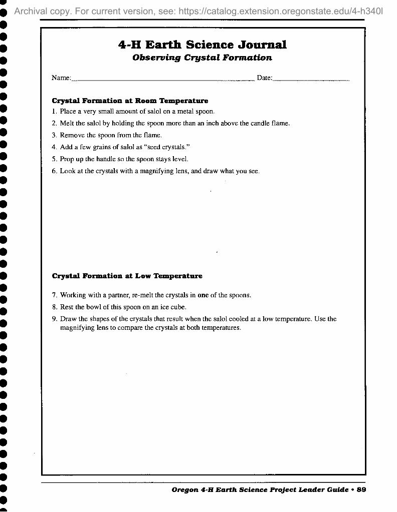
4-H Earth Science Journal Observing Crystal Formation
Name: Date:
Crystal Formation at Room Temperature 1. Place a very small amount of salol on a metal spoon.
2. Melt the salol by holding the spoon more than an inch above the candle flame.
3. Remove the spoon from the flame.
4. Add a few grains of salol as "seed crystals."
5. Prop up the handle so the spoon stays level.
6. Look at the crystals with a magmfying lens, and draw what you see.
Crystal Formation at Low Temperature
7. Working with a partner, re-melt the crystals in one of the spoons.
8. Rest the bowl of this spoon on an ice cube.
9. Draw the shapes of the crystals that result when the salol cooled at a low temperature. Use the magnifying lens to compare the crystals at both temperatures.
Oregon 4-H Earth Science Project Leader Guide • 89
A more recent revision exists, For current version, see: https://catalog.extension.oregonstate.edu/sites/catalog/files/project/pdf/4h340l.pdf

4-H Earth Science Journal Observing Crystal Formation
10. Describe how the shapes and sizes of the crystals differ when they cooled at room temperature.
11. What other experiments would you like to try? What would you like to know more about?
90 • Oregon 4-H Earth Science Project Leader Guide
A more recent revision exists, For current version, see: https://catalog.extension.oregonstate.edu/sites/catalog/files/project/pdf/4h340l.pdf

8. Glacial Ice and Giant Floods ^tg^W ■■*
N^- q Objectives Learners will be able to:
• Understand the relationship of Paleo-Indians to large prehistoric "" m mammals
• Explain why early Oregonians selected specific types of rocks for different tools
• Explain and demonstrate how ice can change landforms and move soil
• List three components of soil
• Explain soil's relationship to the Rock Cycle and how soils are different from rocks
Oregon Benchmarks
Activity 8A—Oregon's First People: Climate and Stone Tools Grade 5 • Identify interactions among parts of a system. (S)
• Describe physical and biological examples of how structure relates to function. (S)
• Identify causes of Earth surface changes. (S)
• Describe basic needs of all living things. (S)
• Describe how adaptations help an organism survive in its environ- ment. (S)
• Describe the relationship between characteristics of a habitat and the organisms that live there. (S)
• Examine and prepare maps to interpret geographic information. (SS)
• Interpret data and chronological relationships presented in timelines and narratives. (SS)
Grade 8 • Identify a system's inputs and outputs. Explain the effects of changing
the system's components. (S)
• Identify and describe the relationship between structure and function at various levels of organization in life, physical, and/or space science. (S)
• Describe how the Earth's surface changes over time. (S)
Oregon 4-H Earth Science Project Leader Guide • 91
A more recent revision exists, For current version, see: https://catalog.extension.oregonstate.edu/sites/catalog/files/project/pdf/4h340l.pdf

• Identify and describe the factors that influence or change the balance of populations in their environment. (S)
• Describe and explain the theory of natural selection as a mechanism for change over time. (S)
• Read, interpret, and prepare maps to understand geographic relation- ships. (SS)
• Represent and interpret data and chronological relationships from (pre-) history, using timelines and narratives. (SS)
Activity SB—Ice Action Grade 5 • Use models to explain how events and processes work in the real
world. (S)
• Organize evidence of a change over time. (S)
• Identify causes of Earth surface changes. (S)
Grade 8 • Use a model to make predictions about familiar and unfamiliar
phenomena in the natural world. (S)
• Identify and explain evidence of physical changes over time. (S)
• Describe how the Earth's surface changes over time. (S)
• Explain the water cycle and its relationship to weather and climatic patterns. (S)
Activity 8C—Soil: A Stop Along the Rock Cycle Grade 5
Identify interactions among parts of a system. (S)
Describe actions that can cause or prevent change. (S)
Identify properties and uses of earth materials. (S)
Identify causes of Earth surface changes. (S)
Grade 8 Identify a system's inputs and outputs. Explain the effects of changing the system's components. (S)
Identify and explain evidence of physical changes over time. (S)
Identify and describe the relationship between structure and function at various levels of organization in life or Earth science. (S)
Compare and contrast properties and uses of earth materials. (S)
Describe how the Earth's surface changes over time. (S)
92 • Oregon 4-H Earth Science Project Leader Guide
A more recent revision exists, For current version, see: https://catalog.extension.oregonstate.edu/sites/catalog/files/project/pdf/4h340l.pdf

Life SkiUs Learners will practice:
• Learning to learn
• Critical thinking
• Wise use of resources
• Cooperation
• Communication
• Contributions to group effort
• Empathy
Field Trips Erratic Rock State Park—3.4 miles west of McMinnville on Hwy 18 to
junction of Oldsville Road, turn right and go 0.3 miles, bearing left at the fork. Continue 1.4 miles and park on the shoulder. A 0.25-mile path leads to the boulder.
The Oregon Zoo—Alaskan Tundra Exhibit, Portland, Oregon.
Museum of the Arctic—Western Oregon State University, Monmouth, Oregon.
Mount Hood—Zigzag, Ladd, and White River glaciers. Where Hwy. 35 crosses White River, a lateral moraine is prominent just upstream from the bridge.
Kiger Gorge—at Steens Mountain. Shows U-shape of a previously glaciated valley.
Fort Rock State Park—This tuff ring erupted as an island in a Pleis- tocene lake that covered an area of more than 500 square miles. Erosion by water created wave-cut terraces. Information from Fort Rock State Park.
Background The Pleistocene Epoch, from 2 million to 10,000 years ago, is some-
times called the Ice Age. Large continental glaciers formed, followed by periods of glacial melting and floods. These alternating periods of expanding and retreating ice sheets created a series of Ice Ages.
These were global events. At times, continental glaciers covered 30 percent of the Earth's surface. They covered northern Europe, Russia, Canada, and parts of the northern United States. Remember from our discussion of the Water Cycle in Activity IB that the supply of water on Earth is fmite. Today polar ice and mountain glaciers store 2.15% of the water on Earth. During the Pleistocene, so much water was frozen into continental glaciers that the sea level was lowered along the continental coastline.
Glaciers are created where more snow falls than is melted off each year. Over time, the collecting snow turns to ice. Continental glaciers or
Oregon 4-H Earth Science Project Leader Guide • 93
A more recent revision exists, For current version, see: https://catalog.extension.oregonstate.edu/sites/catalog/files/project/pdf/4h340l.pdf

ice sheets cover large land masses. Antarctica is covered with glaciers that are more than 2 miles thick in places. Mountain or valley glaciers are rivers of ice that flow through mountain valleys. Beginning in high- altitude snow fields, these glaciers may cover great distances.
As a glacier moves over land, it carries sand, rocks, and boulders with it. This "sandpaper" ice leaves characteristic marks on the land. In Activity 8B, learners will explore some of the ways glaciers change landforms. Glacial valleys are worn to have broad U-shaped floors. Mountains are wom to horn shapes, cut from all sides by glacial action. The Matterhom in the Swiss Alps and Mt. Washington in Oregon are famous examples.
The huge weight of continental glaciers leaves behind shallow basins that fill with melt water to create lakes. The Great Lakes are a result of glacial depressions that filled with water.
Large rocks may be carried hundreds of miles from their source by glaciers. When they are deposited, they are called glacial erratics. Deposits of unsorted sediment left at the sides and front of a melting glacier are called moraines.
When a glacier reaches the ocean, it may form an ice shelf over the water. Large masses of ice can break away from the front of the ice shelf, creating icebergs. An iceberg is a floating island of ice. Less than 10 percent of an iceberg is visible above the water's surface.
During the Pleistocene, the closest a continental ice sheet approached Oregon was probably northern Washington. Mountain glaciers formed at high altitudes in the Cascade Mountains and moved toward the valley floors, rounding the foothills in their path. The North and South Santiam, Calapooia, and McKenzie rivers carried glacial debris into the Willamette Valley.
At Steens Mountain at the southeastern margin of the Basin and Range Province, glacial ice carved the U-shape of Kiger Gorge and sculpted lake basins.
The most spectacular geologic events in Oregon in the Pleistocene were caused by water, not ice. Massive floods occurred repeatedly over a period of 2,500 years. The flood waters came from an enormous lake that formed behind an ice dam on the Clark Fork River in the Idaho Pan- handle. As the continental ice sheet was retreating, meltwater backed up into western Montana. Various accounts hypothesize that the huge lake was 500 to 900 feet deep.
When the ice dams failed, unimaginably large amounts of water suddenly were released. All that water poured across eastern Washington, creating the Channeled Scablands, and followed the channel of the Columbia River toward the Pacific Ocean. The torrent widened and deepened the Columbia Gorge and deposited gravel across areas of eastern Oregon and Washington.
Flood water backed up and filled the entire Willamette Valley. Before it drained out, the water dropped much of its sediment load of tons of lake silt, sand, and large blocks of ice. This sediment contributed to the creation of the rich soil that supports agriculture and forestry in the Willamette Valley. In Activity 8C, learners will explore soil as a stop along the rock cycle.
94 • Oregon 4-H Earth Science Project Leader Guide
A more recent revision exists, For current version, see: https://catalog.extension.oregonstate.edu/sites/catalog/files/project/pdf/4h340l.pdf

In addition to soil components, the icebergs also had carried with them boulders that were widely deposited across the Willamette Valley as glacial erratics. Some of these boulders are composed of native Montana granite.
The Pleistocene also marks the beginning of the habitation of Oregon by people. In Activity 8A, learners will leam about some of the tools Oregon's first people made from rocks.
Activity 8A—Oregon's First People: Climate and Stone Tools
Materials • Copy the essay "Oregon's First People" on "Learner reading pages
1-4" (pp. 98-101), one per learner.
The "Oregon's First People: Climate and Stone Tools" was adapted from Section 2, "Oregon's People," in Exploring Oregon's Past teacher's activity guide for fourth through seventh grades, developed by the Bureau of Land Management Oregon State office and used with permission.
FYI The living descendents of the prehistoric people originally on this
continent are the American Indians; four recognized Indian tribes and five recognized confederated (grouped) tribes live in Oregon. There are also non-federally recognized tribes in Oregon that continue as distinct tribal entities.
People have a tendency to develop two erroneous concepts about the past. One misconception is the stereotyping of past peoples as primitive, backward, or simple; or conversely, as noble savages living perfectly in tune with nature, or as heroic pioneers and idealists living an idyllic, uncomplicated life with high-minded values. The other misconception is that archaeologists are interested only in "valuable or mystical" artifacts or works of ancient art.
The first misconception can be addressed by stressing that all people everywhere, past and present, exhibit an array of talents and personali- ties. As a group, people in the past possessed incredible skill and under- standing of their world. Prehistoric people had knowledge that enabled them to live successfully in environments that today seem inhospitable to most of us.
The second misconception can be remedied by emphasizing that archaeologists study the past cultures of all peoples. They seek to leam how the people lived their lives and how the culture of people changed over time. Archaeologists come to understand people by studying the artifacts and other remains that they left behind or that occur naturally in the occupied environment.
Procedure Discuss with learners what they know about Indians in Oregon. They
may be aware of Indian cultures only as they related to Oregon's settle- ment by Euro-Americans in historic times. Pass out the essay "Oregon's First People" for learners to read. You may choose to send the essay home prior to this activity so that learners already will have read the essay and are ready for the discussion and the Small Group Activity: Mammoth Dinner.
Oregon 4-H Earth Science Project Leader Guide • 95
A more recent revision exists, For current version, see: https://catalog.extension.oregonstate.edu/sites/catalog/files/project/pdf/4h340l.pdf

Discussion
^^A_ VN
~-^_ —' ' \-- —'■...'■
--'\ ^
k<? Ocm
Clovis point
Part 1: Vocabulary Artifact—any item made, modified, or used by humans. In common
usage, normally refers to portable items.
Atlatl (AT-ul-AT-ul)—a tool used to throw spears. The atlatl consists of a flat shaft, often with a groove down the middle and typically with a hook at the back end. A spear (dart) was held in the groove and thrown with an overhand motion.
Clovis point—type of large stone projectile point made by early paleo- Indians for use as a spear tip on a thrusting spear, characterized by a short, shallow channel on one or both faces.
Core—a prepared nodule of stone that a flintknapper strikes to remove thin flakes of stone; also the remnant chunk of stone left after flintknapping.
Culture—a set of learned beliefs, values, and behaviors generally shared by members of a society or group. Culture includes thought, knowl- edge, language, habits, art, actions, beliefs, and artifacts.
Diagnostic artifact—an item that is indicative of a particular time and/or cultural group.
Flake—a thin piece of stone removed from a core by striking it with a hammer or pressing with a flaker. The hammer or flaker may be made of bone, antler, or stone. Flakes have sharp edges and can be used as
5cm cutting implements. Flakes may be further shaped into tools. Flakes also are left as waste by-products of flintknapping.
Flintknapping—the technique of making stone tools from natural stone.
Mammoth and mastodon—Ice Age animals related to the modem-day elephant.
Paleo-Indian—the name given to the oldest known cultural group in North America. This is also the oldest known cultural group in Or- egon.
Prehistoric—information about past events prior to the recording of events in writing.
Projectile point—the point attached to the end of spears, darts, and arrows. The point may be made of stone, bone, antler, glass, or metal. Often erroneously termed "arrowheads."
Rockshelter—a shallow cave or sheltered area covered by a rock.
Tradition (archaeological usage)—different types of tools occurring together over a long span of time and/or a specific geographic area, and usually associated with a particular type of lifeway. For example, the Clovis tradition includes characteristic fluted points and the hunting of large game animals.
Tundra—a treeless plain that is characteristic of arctic and subarctic regions, consisting of black soil with a permanently frozen subsoil. Plants in this environment may be dense and often include conspicu- ously flowering dwarf herbs.
96 • Oregon 4-H Earth Science Project Leader Guide
A more recent revision exists, For current version, see: https://catalog.extension.oregonstate.edu/sites/catalog/files/project/pdf/4h340l.pdf

Part 2: Idea Review • Review the concept of habitat (Activity 6B). In the reading, what
changes were taking place in the habitat of the mammoths, giant bison, camels, and giant ground sloths that lived in Oregon in the Ice Age? How are the survival needs of animals and people different? How are they similar? What would it be like to have our climate in Oregon change to a tropical environment? How would this affect the clothes we wear, the food we grow, or the houses we live in?
• The reading tells learners the names of five different stone projectile points found in Oregon. How did the projectile points' design change over time? How did the tools they were used on change? Why were these changes important to the survival of the people?
• Why were stone tools important to the Paleo-Indians and later the people of the Great Basin? In addition to the projectile points, what other tools would have been made of stone?
• Chert is a type of quartz that was used to make some projectile points found in Oregon. Chert is harder than a knife (hardness group 7, Activity 4C) and fractures with a shell-like edge pattern that produces an edge that can be used for cutting. Unlike some metals, chert does not rust and maintains a sharp edge with longer use.
Other types of stone used for tools include obsidian (volcanic glass), nephrite (jade or jadeite), basalt, schistose sandstone, agate, quartz crystal, steatite, jasper, chalcedony, serpentine, and siltstone. Each type of rock has particular characteristics for meeting particular needs. Look up the properties of some of the rocks in a rock and mineral reference book. How would tools made from these materials compare to tools we might use today?
Small Group Activity: A Mammoth Dinner After the learners have read the essay "Oregon's First People," divide
them into teams of three or four learners each. The team is to prepare a presentation on how Paleo-Indians would have captured and used a huge mammoth for dinner. The teams are to use a variety of techniques to present the information. They may use charts, pictures, demonstrations, or dioramas, or write and present a skit. The presentation can be based on the essay and on additional research. Learners will need to infer some of the ideas they present on the humanity and lifeways of past people.
During problem solving, learners should give some consideration to: size of the mammoth; the large quantity of meat it will provide; how the meat is be stored and used; how will the meat be transported; how will the meat be shared among the group; what special skills or knowledge is needed to prepare a mammoth; what tools will be needed; who will make the tools and what will they be made from; what does the tool maker need to know about rocks; who will know all these needed skills, and how will they be passed on to other members of the group; what types of situations would cause these people to worry, be frightened, be surprised, or be joyful.
Oregon 4-H Earth Science Project Leader Guide • 97
A more recent revision exists, For current version, see: https://catalog.extension.oregonstate.edu/sites/catalog/files/project/pdf/4h340l.pdf

Oregon's First People Thirty thousand years ago, large herds of animals lived in the Ice Age
tundra lands of northern Asia. Tundra is cold, flat land where trees do not grow. The soil of tundra never completely thaws out. Tundra plants in- clude many kinds of grass and moss. These plants grow thickly, but they are small in size.
People had learned to live in these harsh, cold lands also. Mammoths, mastodons, caribou, musk oxen, and other large animals lived near the huge Ice Age glaciers. People hunted these animals for food.
During the Ice Age, much of the Earth's water was frozen into huge glaciers. This caused the oceans to be lower. Today the Bering Sea is a shallow sea between Alaska on the North American continent and Siberia on the Asian continent. During the Ice Age, the lower ocean level left dry land where the Bering Sea is today. Scientists call this area the Bering Land Bridge or Beringia. The Bering Land Bridge connected the conti- nents of Asia and North America.
Much of Alaska was not covered by glaciers. Tundra stretched across northern Asia, Beringia, and Alaska without a break. Scientists believe that people first came to North America from Asia walking across Beringia following the large animals they hunted. Archaeologists call the earliest known people living in North America the Paleo-Indians.
During the Ice Age, the mountains of Oregon were covered by large glaciers. Huge lakes filled the valleys and basins of eastern Oregon. Ar- chaeologists have discovered evidence of people living in Oregon 13,200 years ago. One group lived in a cave that was near a lake at Fort Rock in Lake County.
By 11,500 years ago, people were living all over North America. Many of these people used a large spearpoint with a shallow groove (flute) on each side of the point that has been named a Clovis point. Archaeologists do not know why the grooves were made, but they have inferred several ideas. Perhaps the groove made it easier to attach the point of the spear to a spear shaft. Perhaps it made the spear easier to remove from an animal that had been killed.
Learner reading page 1
98 • Oregon 4-H Earth Science Project Leader Guide
A more recent revision exists, For current version, see: https://catalog.extension.oregonstate.edu/sites/catalog/files/project/pdf/4h340l.pdf

Oregon's First People continued People using Clovis tools hunted big game animals including mam-
moths, mastodons, and a giant bison. Clovis points have been found in all parts of Oregon.
Clovis Point
-__ ■ . "^
Spear
1/2 real size
When Paleo-Indians first arrived in Oregon, much of Oregon was cov- ered by a cold tundra environment. Around 12,000 years ago, the world's climate began to change from the cold of the Ice Age to a warmer, drier climate. In Oregon, the climate changed too. Glaciers in Oregon's moun- tains began melting and became smaller and smaller. Many floods swept down the Columbia River as ice dams formed and broke in the mountains far to the northeast in Idaho. Sometimes the flood waters rushed up the Willamette River almost as far as Eugene. Granite boulders from Montana were carried by icebergs in these huge floods and can now be seen near Eugene and McMinnville. Floods also came from glaciers in the Cascade and Coast Range Mountains.
Oregon's plants and animals changed in response to the climate change. The very large herd animals that the Paleo-Indians relied on became ex- tinct or moved out of the area. Deer, antelope, bear, coyote, cougar, moun- tain sheep, elk, small mammals, birds, reptiles, and fish remained.
Melt waters from the glaciers formed large lakes and marshes that did not completely dry up for several thousand years. Groups of people could still live around the lakes. These people knew which wetland plants were good to eat. The ducks, geese, and animals that came to the lakes for water
Learner reading page 2
Oregon 4-H Earth Science Project Leader Guide • 99
A more recent revision exists, For current version, see: https://catalog.extension.oregonstate.edu/sites/catalog/files/project/pdf/4h340l.pdf
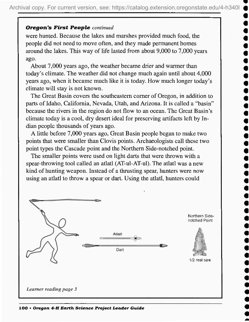
Oregon's First People continued were hunted. Because the lakes and marshes provided much food, the people did not need to move often, and they made permanent homes around the lakes. This way of life lasted from about 9,000 to 7,000 years ago.
About 7,000 years ago, the weather became drier and warmer than today's climate. The weather did not change much again until about 4,000 years ago, when it became much like it is today. How much longer today's climate will stay is not known.
The Great Basin covers the southeastern comer of Oregon, in addition to parts of Idaho, California, Nevada, Utah, and Arizona. It is called a "basin" because the rivers in the region do not flow to an ocean. The Great Basin's climate today is a cool, dry desert ideal for preserving artifacts left by In- dian people thousands of years ago.
A little before 7,000 years ago. Great Basin people began to make two points that were smaller than Clovis points. Archaeologists call these two point types the Cascade point and the Northern Side-notched point.
The smaller points were used on light darts that were thrown with a spear-throwing tool called an atlatl (AT-ul-AT-ul). The atlatl was a new kind of hunting weapon. Instead of a thrusting spear, hunters were now using an atlatl to throw a spear or dart. Using the atlatl, hunters could
Northern Side- notched Point
[5= 13.
112 real size
Learner reading page 3
lOO • Oregon 4-H Earth Science Project Leader Guide
A more recent revision exists, For current version, see: https://catalog.extension.oregonstate.edu/sites/catalog/files/project/pdf/4h340l.pdf

Oregon's First People continued throw a dart farther and more accurately than they could throw a spear by hand.
About 3,000 years ago, the climate began to cool. More rain fell. There was more snow in winter. Bows and arrows first came into use during this time. The people began making a different type of point for the ar- rows. These points were smaller. Archaeologists call the most common
Desert Side- notched point
Arrow 1/2 real size
types of points found from this period the Rosegate and the Desert Side- notched point.
While many things are known about Oregon's first people, much re- mains to be learned or understood. People can help archaeologists learn more about early people's lifeways by leaving artifacts where they find them and not digging in any sites. Sites that are left undisturbed tell a more complete story about how people lived and how their culture changed over time. Leave artifacts where you find them and report your find to an archaeologist or university.
Learner reading page 4
Oregon 4-H Earth Science Project Leader Guide • 101
A more recent revision exists, For current version, see: https://catalog.extension.oregonstate.edu/sites/catalog/files/project/pdf/4h340l.pdf

Activity 8B—Ice Action Materials • Plastic storage box, at least 7x12 inches
• Four custard cups, or small Pyrex bowls. They must be freeze-proof.
• Sand
• Aquarium gravel
• Two pieces of lumber, approximately 2x6x14 inches
• One pair insulated gloves
• Access to a freezer
Preparations Two days before the activity, freeze three identical glacier models and
one cup of plain ice. For each of the three glacier models, fill the cup 2h full with water and freeze. Make a mixture of the sand and gravel that is 3/4 sand and 74 gravel. When the water is frozen, sprinkle the top surface of three of the cups with some of the gravel mixture. Add just enough additional water to cover the gravel mixture, and freeze again. Fill the plastic storage box half full with the remaining gravel mixture.
Procedure Glaciers are not just part of the geologic past; they are active today in
arctic life zones on mountains and in the Arctic and Antarctic. Glaciers form when collecting snow packs down and turns to ice crystals. This is similar to what happens when you make a tightly packed snowball. A snowball is much harder and denser than the original snow used to make it.
If you have access to snow, you can demonstrate this using two measuring cups. Fill one cup with a scoop of loose snow. Pack a second cup tightly with snow. Allow the snow to melt in both cups. Compare the volume of water in each cup. Which cup contains the most water?
As learners complete the activities and discussion in the Push, Slide, and Scour sections below, remind them to take notes on an Earth Science Journal page. What additional experiments would the learners like to try?
Part 1: Push Remove one of the model glaciers from the freezer. Unmold it from
the cup. Place the model glacier at one end of the plastic storage box with its sandy side down. Ask the learners how much slope they think the box will need for the glacier to move. Allow learners to experiment with creating a slope. When they have agreed on a slope, set up the box. Have learners record the experiment's set up on a Journal Page. Proceed with parts 2 and 3.
Observe the glacier periodically. What is happening to the glacier? To the sand in the box? To the gravel mixture in the glacier? Ask learners to record their observations on a Journal Page.
Moraines are piles of rock debris that are heaped along the edge and snout of a glacier. They are what remains when a glacier melts. After
102 • Oregon 4-H Earth Science Project Leader Guide
A more recent revision exists, For current version, see: https://catalog.extension.oregonstate.edu/sites/catalog/files/project/pdf/4h340l.pdf

completing parts 2 and 3, have learners experiment with causing a moraine to be created in the box.
Part 2: Slide Remove a second model glacier from the freezer and unmold it. Prop
up a piece of 2 x 6 lumber at an angle. Place the glacier at the top of the slope. What happens? How steep an angle is needed for the ice to slide down the board? Place the board at an angle where the glacier will stay at the top of the elevated board. Leave it there for 10 minutes while you go on to Part 3.
When you return the learners' attention to the glacier, ask them, "What is happening to the glacier? How steep an angle is needed on the board for the ice to slide? Compare this angle to the angle of the plastic box. What forces are at work on the glaciers in Parts 1 and 2 that are (1) holding the glaciers back and (2) moving the glaciers down the slopes?" Ask learners to record on a Journal Page their observations and any additional experiments they would like to try.
Part 3: Scour Remove the third model glacier and the fourth cup without gravel
from the freezer and unmold them. Give one learner the pair of gloves. The gloves are not just to protect the learner from the cold; they are to protect the glacier from the learner's warm hand.
Ask a learner to rub the piece of ice without gravel in a circular pattern on the second piece of lumber. The learner should press down firmly on the ice. What happens? Continue this for a time. Notice what happens as the ice begins to melt.
Next, ask a learner to rub the model glacier in a circular pattern on the board. The learner should press down firmly on the glacier. What hap- pens? Continue this for a time. Notice what happens as the glacier begins to melt. How is the action of the glacier with gravel different from the plain ice? Remind learners to record their observations on a Journal Page.
The huge weight and scouring action of glaciers leaves signature landforms. The rocks a glacier has moved across may have grooves cut in their surfaces. These are called abraded rocks. Deep U-shaped valleys, hanging valleys, and jagged ridges are landforms that tell of glacier activity.
Now return to your glaciers in Parts 1 and 2.
Discussion Review the Push, Slide, and Scour actions of glaciers. What additional
experiments would the learners like to try?
Extension Order from U.S. Geological Survey Educational Materials List (fact
sheet 225-96) the activity "How to Construct Two Paper Models Show- ing the Effects of Glacial Ice on a Mountain Valley," Open File Report 89-190A.
Oregon 4-H Earth Science Project Leader Guide • 103
A more recent revision exists, For current version, see: https://catalog.extension.oregonstate.edu/sites/catalog/files/project/pdf/4h340l.pdf

Activity 8C—Soil: A Stop along the Rock Cycle
Materials • 3-5 soil samples. Collected samples should include the material on the
surface and down to about 4 inches deep.
• Newsprint or flip-chart paper, one per soil sample
• Clear jars with lids, one per soil sample
• Two glass measuring cups, 2-cup size
• Access to water
• Roll of paper towels
• Small wire mesh sieve or tea ball sieve
FYI Organic matter is anything that is, or once was, part of a living plant or
animal. The mixture of decayed organic matter found on the surface of the soil is called humus. Humus does not include living animals and plants, or dead but still recognizable animal and plant parts, which is sometimes called litter or duff.
When scientists study soil, they divide it into layers from the surface downward, called horizons. A set of horizons that describes a particular soil type is called a soil profile.
The surface, humus-rich horizon of most soils is called the A horizon. Some soils, especially in forests, have thin layers of plant litter on top of the mineral soil. These layers are called O horizons. O horizons consist- ing of peat or muck also may occur in swampy or boggy soils.
Subsoil horizons beneath the surface soil are called B horizons. B horizons contain less organic matter than A horizons. Colors of B hori- zons, along with their clay contents and shapes of soil aggregates, record the maximum effects of processes that change rocks into soils. Beneath the B horizons we find either C horizons, which are weathered but not fully altered into soil B horizons, or R horizons, which are hard bedrock.
Parent material refers to the original materials from which A, B, and C horizons have developed. In some soils, the A and B horizons have formed from materials like those in the C or R horizon beneath them. In many other soils, however, new parent materials have been deposited on top of older C or R horizons, and we cannot say that the C or R is the parent material of the soil above.
There is tremendous variation in soils and their development from parent material due to temperature, rainfall, vegetation, and slope at a particular location. Soils do not always develop profiles with all five horizons.
Procedure Just as a glacier might be a stop along the water cycle for a water
drop, so might soil be a stop along the rock cycle for small fragments of weathered rock. Have learners refer to their copy of the Rock Cycle
104 • Oregon 4-H Earth Science Project Leader Guide
A more recent revision exists, For current version, see: https://catalog.extension.oregonstate.edu/sites/catalog/files/project/pdf/4h340l.pdf

Journal Page from Activity 3B. Ask learners which processes depicted in the diagram contribute to the formation of soil.
In Activity 1C, learners rubbed rocks together to make sand. They compared the sand to a sample of soil. Leaders may want to revisit this activity. What does soil contain that weathered rock fragments alone do not?
Bring out the soil samples. Pour each sample onto a large sheet of paper. Ask learners to look through the samples. Look quickly!! There may be insects, snails, earthworms, or nematodes who will try to hide. The learners should be able to find and identify some pieces of plant material, parts of invertebrates, hair, feathers, and other bits of organic matter.
As learners complete the activities and discussion in the Air Spaces, Organic Matter, and Weathered Rock sections below, remind them to take notes on an Earth Science Journal Page. What additional experi- ments would the learners like to try?
Part 1: Air Spaces Pour one of the soil samples off the paper into one of the 2-cup
measuring cups. Learners should record how much soil is in the cup. Ask learners to predict how much of the volume of the soil is air space.
Use the second measuring cup to pour water onto the soil sample in the first cup. Begin with the lowest air space volume predicted by the learners. Pour this amount of water into the soil.
Measure and pour water into the soil until all the air spaces in the soil are full of water. The air spaces are full when the water just begins to appear at the top of the soil. Be sure to have a learner record the amount of water added each time so the total volume can be determined. How much of the volume of the soil was air space? Why is air space important in soil? Ask learners to record their observations and any additional experiments they would like to try on a Journal Page.
Pour the soil and water mixture into one of the clear jars and save. Repeat Part 1 with each of the other soil samples, and record results on a Journal Page.
Part 2: Organic Matter Add water to the soil in each of the clear jars from Part 1 until the
water is about an inch over each soil sample. Swirl each jar gently to loosen the soil sample. Do NOT shake the jar.
Using a small sieve, scoop out all the material floating in the first jar and dump it onto a stack of several paper towels to drain. Repeat this process with the other jars. This floating material is that portion of the organic matter consisting primarily of dead plant and animal parts from each soil sample. Use a hand lens to compare the samples. How are they the same or different? Remind learners to record their observations on a Journal Page.
Part 3: Weathered Rock Place the lid securely on each of the jars containing the soil and water
mixture from Parts 1 and 2. Shake the jars vigorously. What happens to the soil? Remind learners to record their observations on a Journal Page.
Place the jars where the learners can observe them. The soil particles will settle in layers, with the largest particles settling to the bottom of
Oregon 4-H Earth Science Project Leader Guide • 105
A more recent revision exists, For current version, see: https://catalog.extension.oregonstate.edu/sites/catalog/files/project/pdf/4h340l.pdf

each jar first. Sand grains, measuring 2 to Vie millimeters, will settle out first.
Next the silt content, particles from Vie to V256 millimeter, will settle out.
The smallest particles might remain suspended in the water for a long time. These are fine clays with particles less than Vzse millimeter in size.
How might the learners measure the amount of each layer without mixing them again? After the learners have concluded the activity, place the jars where they can remain undisturbed for a week or more. Ask learners to continue to watch for changes in the material in the jars.
Discussion Review the makeup of soil with learners. Were there any components
in soil that surprised anyone? What additional experiments would learners like to try with soil?
Extension The study of soil encompasses its own fascinating branch of science.
Soil scientists are called pedologists. Additional lessons about soils can be found in 4-H Watershed Project: From Ridges to Rivers (4-H 3803L) and 4-H Wetland Wonders Water Quality Program (4-H 3801L). These publications are available from the county Extension office, ordered on the 4-H Natural Science Project and Materials list (4-H 0233L) under "Water Resources."
106 • Oregon 4-H Earth Science Project Leader Guide
A more recent revision exists, For current version, see: https://catalog.extension.oregonstate.edu/sites/catalog/files/project/pdf/4h340l.pdf

9. People on the Landscape Objectives Learners will be able to:
• Understand the relationship between human population movement and population centers and current geological conditions
• Use a model to explain a landslide
• Explain how the discovery of gold in Oregon contributed to early settlements
• Describe early gold mining methods and their impact on local envi- ronments and Indian populations
• Understand how a research report is organized and presented on a selected topic in Earth science
Oregon Benchmarks f j O -^r - . '■■■ f*\ ■ > .V - .<•••!
Activity 9A—The Bridge of the Gods: ---- Landslides and People 1—3- Grade 5 • Identify interactions among parts of a system (S).
• Identify causes of Earth surface changes (S).
• Explain how physical environments are affected by human activities and present opportunities, constraints, and hazards for people (SS).
Grade 8 • Describe how the Earth's surface changes over time (S).
• Explain how human modifications of the physical environment in a place affect both that place and other places (SS).
Activity 9JB—Gold Mining in Oregon Grade 5 • Identify properties and uses of earth materials. (S)
• Understand how individuals changed or significantly influenced the course of U.S. history. (SS)
• Interpret data and chronological relationships presented in timelines and narratives. (SS)
• Identify patterns of migration and cultural interaction in the United States. (SS)
• Explain how physical environments are affected by human activities and present opportunities, constraints, and hazards for people. (SS)
Oregon 4-H Earth Science Project Leader Guide • 107
A more recent revision exists, For current version, see: https://catalog.extension.oregonstate.edu/sites/catalog/files/project/pdf/4h340l.pdf

Grade 8 • Compare and contrast properties and uses of earth materials. (S)
• Understand how various groups of people were affected by events and developments in U.S. history. (SS)
• Identify patterns of population distribution, migration, and cultural interaction in the United States. (SS)
• Explain how human modification of the physical environment in a place affects both that place and other places. (SS)
Activity 9C—Research and Report Grade 5 • Locate information and clarify meaning by using illustrations, tables of
contents, glossaries, indexes, headings, graphs, charts, diagrams, and/or tables. (E)
• Convey clear main ideas and supporting details in ways appropriate to topic, audience, and purpose. (E)
• Structure writing by developing a beginning, middle, and end, with clear sequencing of ideas and transitions. (E)
• Use correct spelling, grammar, punctuation, capitalization, and paragraphing. (E)
• Identify substances as they exist in different states of matter. (S)
• Identify properties and uses of earth materials. (S)
Grade 8 • Locate information and clarify meaning by using tables of contents,
glossaries, indexes, headings, graphs, charts, diagrams, and/or tables. (E)
• Convey clear, focused main ideas supported by details and examples in ways appropriate to topic, audience, and purpose. (E)
• Structure writing in a sequence by developing a beginning, middle, and end, and by making transitions among ideas and paragraphs. (E)
• Use correct spelling, grammar, punctuation, capitalization, paragraphing, and citations. (E)
• Compare and contrast properties of specific substances. (S)
• Compare and contrast properties and uses of earth materials. (S)
Life SkiUs Learners will practice:
• Learning to learn
• Critical thinking
• Teamwork
• Contributions to group effort
• Planning/organizing
108 • Oregon 4-H Earth Science Project Leader Guide
A more recent revision exists, For current version, see: https://catalog.extension.oregonstate.edu/sites/catalog/files/project/pdf/4h340l.pdf

• Communications
• Self-esteem
Field Trips Bonneville Dam and the Bonneville Landslide—40 miles east of Portland
on 1-84, trail head of Pacific Crest Trail at the base of the Bonneville Landslide.
Gin Lin Interpretive Trail—Information from Rogue River National Forest.
Kam Wah Chung Museum—John Day. Business of Chinese miner "Doc" Hay.
U.S. Bank—Baker City. Displayed collection of gold nuggets found in eastern Oregon.
National Historic Oregon Trail Interpretive Center—information and artifacts from study of the Flagstaff Mine.
Background The relationship of people with geology is often masked by geology's
enormous size. Most of our largest cities are on the contact point between continental and oceanic tectonic plates (Chapter 2, Figure 5). Other cities are built on major rivers and along lakes carved by glaciers. The productiv- ity of our farm lands is determined by the nature of their soils and their location relative to mountain ranges and oceans that strongly influence rainfall.
The movement of human populations in the past was directed by the nature of the landscapes they encountered. During the Ice Ages, lowering of the sea level allowed people to move onto continents where they had not lived before (Chapter 8, Activity 8A). Oceans and major mountain ranges isolated groups of people, allowing different cultures to develop in different areas. Even the small mountain ranges that bisect Greece caused the people living in the valleys between to become independent city-states 2,500 years ago.
In Oregon, the isolation of different groups from each other by major rivers and mountain ranges resulted in more than 200 different American Indian languages developing over the past 10,000 years. Some of these languages are as different from each other as English is from Chinese. Geological circumstances also influenced the first Oregonians' technology. For example, the Chinook Indians on the Columbia River used large canoes for transportation, while the Northern Paiute and Tenino Indians in eastern and central Oregon moved on foot and later on horses, which were intro- duced in the 18th century. Horses were never very useful in the dense forests of the Cascade and Coast ranges.
People have endured major geological catastrophes, and at times have taken advantage of the conditions left in their aftermath. The eruption of Mt. Vesuvius in 79 A.D. killed tens of thousands of people, but the ash that spread across the landscape left behind some of the richest soil in Italy. People farm the slopes of Mt. Vesuvius today, even though the volcano is still active.
Oregon 4-H Earth Science Project Leader Guide • 109
A more recent revision exists, For current version, see: https://catalog.extension.oregonstate.edu/sites/catalog/files/project/pdf/4h340l.pdf

All of the world's major rivers exist because of the Earth's geological activity. Mountain ranges built by colliding tectonic plates and erupting volcanoes intercept rainfall, creating watersheds. The Columbia River drains both the northern Rocky Mountains (a tectonic range) and the Cascades (a volcanic range), providing people with water for irrigation, navigation, and hydroelectric power (Chapter 1, Figure 1; Activity 1A; Figure 5; Chapter 5; Activity 5B).
The requirements of human technology and our fascination with rare metals and gemstones have influenced the movement of people, and caused conflicts between them, over tens of thousands of years. During prehistoric times, obsidian, the best material for making most stone tools, was traded over thousands of miles in Africa, Asia, Europe, and the Americas (Activity 8A). The island of Cyprus in the Mediterranean Sea gave its name to a metal common there, copper. Copper is a key compo- nent in the manufacture of bronze, the first metal used to replace stone tools. The Spanish conquest of Central and South America was driven by Spain's desire for gold, the principal medium of exchange in Europe during the 16th and 17th centuries A.D. The domination of India and south and central Africa by England, France, and Germany in the 19th century was due in large part to the wealth in diamonds and gold com- mon in those places. World War II was, in part, the result of Germany's and Japan's lack of a mineral resource—oil—critical to industrial na- tions. More recently, the Gulf War was fought over control of the same geological resource. In Activity 9B, learners will study how the discov- ery of gold in the Blue and Klamath mountains led to the settlement of these areas by immigrant Americans.
Humans also have attempted to change geology to meet their needs and prevent damage from geological events. Some of the earliest human engineering involved the construction of irrigation canals in Mesopotamia, India, and Central and South America to deliver water for farming to areas normally too dry to produce crops. Every large city built near an ocean or a river is protected from flooding by dams and levees. Humans have even connected oceans naturally isolated from each other by digging huge canals. The two most important to transportation are the Suez Canal, between the Indian Ocean and the Mediterranean Sea; and the Panama Canal, which links the Pacific and Atlantic oceans. Our attempts to control major rivers by building flood control levees often have made flooding worse by focusing the flood water's energy on places that are not adequately protected. Along the Mississippi in 1993, thousands of square miles of farm land, towns, and cities suffered because planners and builders did not fully understand this process.
Recently, countries worldwide have begun planning for major geologi- cal catastrophes. The western sides of Oregon and Washington are particularly vulnerable to both major earthquakes and volcanic eruptions, since they rest on a subduction zone, where North America is over-riding two oceanic plates. In this setting, large earthquakes (magnitudes be- tween 8 and 9) occur infrequently, at intervals of 300 to 500 years, but could destroy buildings, bridges, and roads and generate huge tsunamis that might inundate coastal towns and cities (Chapter 5, Activity 5C).
Many of the bridges and buildings in Portland and Seattle are being retro-fitted to resist these earthquakes. Modem building codes require
HO • Oregon 4-B Earth Science Project Leader Guide
A more recent revision exists, For current version, see: https://catalog.extension.oregonstate.edu/sites/catalog/files/project/pdf/4h340l.pdf

that new structures in the Pacific Northwest are built to resist earthquake damage. The Cascade Range contains some of the world's most danger- ous volcanoes. Mount St. Helens erupted in 1980, killing 57 people and disrupting traffic on the Columbia River and the roads and railroads along it. In the past, Mt. Rainier and Mt. Hood have produced huge lahars or mudflows that would reach Tacoma, Seattle, and Portland if they occurred today. The unstable geology in much of the Pacific North- west has caused major landslides in the past. The Columbia River Gorge has been the scene of some of the largest landslides in recent geological history. In Activity 9A, learners will study how the relationship between rock formations can predispose an area to landslides.
It's important for us to study and understand the geology of our planet. We rarely can do anything to predict or prevent geological events, but we can plan for these events and try to limit loss of life and property. The U.S. Geological Survey, in cooperation with other state and federal agencies, is studying the geological hazards that exist in Oregon. You can learn more about their research on the Internet at www.USGS.gov. In Activity 9C, learners will have an opportunity to research and report on additional topics in geology as they affect human populations.
Activity 9A—The Bridge of the Gods: Landslides and People
FYI The Bonneville LandsUde is located in the Columbia River Gorge, 40
miles east of Portland. This landslide is part of the Cascade Landslide Complex that originated in the mountains north of the town of Stevenson, Washington, and is an example of how geology affects human populations.
The geological processes that first formed and then altered these mountains created a very unstable situation. Three geological formations are stacked on top of each other and are exposed on Table Mountain, Greenleaf Peak, and Red Bluff.
On the bottom is the Weigle Formation, which is made up of sedimen- tary rocks, mostly mudflows or lahars, along with some river-deposited sediments and volcanic ash. The Weigle Formation has been deeply weathered and altered by hot groundwater until most of the minerals in the formation have been converted to clay. Above the Weigle Formation is the Eagle Creek Formation, which also is sedimentary. The Eagle Creek Formation is similar in composition to the Weigle Cap Formation, but the rocks are not as altered. Capping the mountains is Columbia River Basalt, a very dense volcanic rock that is vertically fractured into columns (Chapter 7, Background). In addition, the area is bisected by the Mount St. Helens seismic zone, where earthquakes are common.
During uplift of the Cascade Range over the past several million years, a major fold developed north of the Columbia River, tipping the Weigle, Eagle Creek, and Columbia River Basalt formations toward the river (Chapter 6, Background). The contact between the clayey Weigle Formation and the Eagle Creek Formation is like a well-greased
Oregon 4-H Earth Science Project Leader Guide •111
A more recent revision exists, For current version, see: https://catalog.extension.oregonstate.edu/sites/catalog/files/project/pdf/4h340l.pdf

skidboard. Even a small earthquake could cause landslides under these conditions. Geologists have identified four major landslides in and around Stevenson; the Bonneville is the most recent.
The Bonneville Landslide was catastrophic, instantly moving 200,000,000 cubic meters of rock, sand, and mud across the Columbia, coming to rest nearly 400 feet above what is now the town of Cascade Locks, Oregon (Figure 6). The event was recorded in the mythologies of the Klickitat and Chinook Indians, and is collectively referred to as the legend of the Bridge of the Gods, since a person could cross the mighty Columbia on the material deposited by the landslide and not get his or her feet wet.
When the Columbia River finally breached the landslide dam, it created a large set of rapids which Lewis and Clark called the Cascades. This name eventually was applied to the entire mountain range in Wash- ington, Oregon, and northern California. The Cascades created condi- tions favorable to people by slowing migrating salmon, making them easier to catch. In the centuries following the landslide, this part of the river was impassable for boats and canoes, which had to be unloaded and carried around the rapids. The Chinook Indians took advantage of the situation by collecting tolls from people using the trails that bypassed the Cascades.
The landslide formed a constriction in the river that was a key factor in selecting this site for Bonneville Dam, the first dam built on the Columbia. The modem Bridge of the Gods at Cascade Locks, Oregon was built here for the same reason.
The conditions that produced the Cascade landslide still exist. Table Mountain and Greenleaf Peak, the largest mountains in the area, are seriously over-steepended. Huge cracks, up to 30 meters across, can be seen on the face of Table Mountain. Earthquakes have been recorded on the Mount St. Helens Seismic Zone as recently as July, 1999. It's very likely that future earthquakes will trigger landslides in this area. The USGS and the Washington Department of Natural Resources are study- ing the Cascade Landslide Complex as part of ongoing geological hazards analysis.
Part 1 Materials • One copy of the Bonneville Landslide Journal Page (p. 114) per
learner
• Oregon map that shows features on the north edge of the Columbia River in Washington State
• One copy of Figure 6, The Cascade Landslide Complex, for each group of three learners
Procedures Using the Background and FYI sections, lead a discussion about the
impacts of geology on human activities. Use the Oregon/Washington map to locate Bonneville Dam and Cascade Locks in Oregon and Stevenson, Washington. Work with learners to label the Bonneville Landslide Profile.
112 • Oregon 4-H Earth Science Project leader Guide
A more recent revision exists, For current version, see: https://catalog.extension.oregonstate.edu/sites/catalog/files/project/pdf/4h340l.pdf

Greenleaf Peak II N
II
Stevenson
4x \ ~ A
Table Mt \ /
^ ^
5B \» P> J*
O ascade Locks -m
-
Bonneville Landslide
U
Washington Bridge of the Gods
Oregon
Bonneville Dam
1 mile
Figure 6—The Cascade Landslide Complex.
Oregon 4-H Earth Science Project Leader Guide • 113
A more recent revision exists, For current version, see: https://catalog.extension.oregonstate.edu/sites/catalog/files/project/pdf/4h340l.pdf

Bonneville Landslide Journal Page
Bonneville Landslide Profile Columbia River Gorge in the Vicinity of Cascade Locks, Oregon
Material displaced during the landslide.
t Z.^^cV y'r^" i-.^^"' -JiiVV*" ^ C51" v**
6. 1 ^~™J SL
:«£. r-\
4.
i-i-i-i-i-i-i-i-^4^s^^^T-i
6. / ' ■
^<0':
_-_-_" l."_-_-_- Washington ■_-_-_-_-_-_-___-_-_-_ Oregon .-_-_-_-
1.
2.
3.
4.
5.
6.
114 • Oregon 4-H Earth Science Project Leader Guide
A more recent revision exists, For current version, see: https://catalog.extension.oregonstate.edu/sites/catalog/files/project/pdf/4h340l.pdf

Bonneville Landslide Journal Page Answers 1. Weigle Formation
2. Eagle Creek Formation
3. Columbia River Basalt
4. Columbia River
5. Table Mountain
6. Bonneville Landslide
Part 2 Materials • 1-inch-thick book
• 872 x 11-inch sheet of corrugated cardboard
• Three sets of plastic building blocks, in three different colors (Legos or similar) —Color 1: 16 blocks @ 2 x 4 peg size —Color 2: 16 blocks @ 2 x 4 peg size —Color 3: 30 blocks @ 2 x 2 peg size
Preparations Using the set of plastic building blocks specified in the materials list,
create a model of the mountains that collapsed. From Color 1,2x4 peg blocks, build two stacks of blocks, each eight blocks high. These blocks will represent the Weigle Formation located at the bottom of the stack. Place these two stacks of blocks horizontally on the corrugated card- board, across the short width of the board.
From the Color 2 blocks, build two stacks of eight blocks each. These blocks represent the Eagle Creek Formation. The four stacks should be placed horizontally on the "Weigle Formation" blocks at a right angle to the direction the "Weigle" blocks were placed. The "Eagle Creek Forma- tion" blocks should be running the same direction as the length of the corrugated cardboard.
From the Color 3 blocks, build 10 stacks of three blocks each. These blocks represent the vertical columns of the Columbia River Basalt formation that caps the hills throughout this area. Place the "Columbia River Basalt" blocks vertically on top of the "Eagle Creek Formation" blocks.
CAREFULLY lift one short edge of the corrugated cardboard and rest it on a book.
Procedure Explain to learners that the three colors of blocks represent the Weigle,
Eagle Creek, and Columbia River Basalt formations. The landform is tipped toward the Columbia River. This is a representation of what the Washington side of the Columbia River looked like prior to the landslide. The Columbia River would be located where the cardboard rests on the table.
Have learners look at their Bonneville Landslide Journal Page and note the parts of the Columbia River Basalt and Eagle Creek formations
Oregon 4-H Earth Science Project Leader Guide • 115
A more recent revision exists, For current version, see: https://catalog.extension.oregonstate.edu/sites/catalog/files/project/pdf/4h340l.pdf

The "Gold Mining in Oregon" activity was adapted from Exploring Oregon s Past teacher's activity guide for fourth through seventh grades, developed by the Bureau of Land Management Oregon State office, and used with permission.
that were displaced during the landslide. Explain that one learner is going to bang firmly on the table surface. What do the learners think will happen? Ask one learner to bang on the table (it might take two good blows if the table is sturdy). The middle layer of blocks should skid off the bottom layer, tumbling the top layer onto the table surface.
Discussion The slippery surface between the "Weigle Formation" blocks and the
"Eagle Creek Formation" blocks represents the surface on which the BonneviUe Landslide moved. The rocks above this surface collapsed into the Columbia River Gorge as seen in the BonneviUe Landslide Journal Page and Figure 6.
Remind learners that 200,000,000 cubic meters of rock, sand, and mud were moved by this landslide. Have several copies of Figure 6, The Cascade Landslide Complex, available for learners to review. Measure the distance from BonneviUe Dam to Cascade Locks. How much area did the landslide material cover on the Oregon side of the river?
Activity 9B—Gold Mining in Oregon
Materials • Copy the essay, "Gold Mining In Oregon" on "Learner reading pages
1-4" (pp. 119-123), one per learner
FFf Gold is the most historically important mineral mined in Oregon. The
discovery of gold led to the settlement and development of major parts of the state. Gold mining had negative effects on the native populations and natural environment.
Gold occurs primarily in two regions of the state: the Blue Mountains (see Chapter 2) and the Klamath Mountains (see Chapter 3).
The way of life of the miner evolved from an individual prospector/ miner to working in a company. This change involved a change in lifestyle as well, from mostly male mining district communities to more family-oriented towns and settlements.
Gold mining is an industry that is very responsive to outside factors, particularly developments in technology and economic cycles of depres- sion and inflation.
Miners faced a common set of problems in the early days of mining regarding the rules of how to claim and hold land without conflict. There are no right or wrong answers to some of the discussion questions provided below. The problems faced were addressed differently by different groups. One common theme in all mining districts was the belief that a person who discovered a section of gold-bearing land had the right to exploit it, and that right lasted as long as the person actively mined the claim.
116 • Oregon 4-H Earth Science Project Leader Guide
A more recent revision exists, For current version, see: https://catalog.extension.oregonstate.edu/sites/catalog/files/project/pdf/4h340l.pdf

Procedure Discuss with learners what they know about gold mining in Oregon.
The California and Alaska gold rushes may be more familiar to them. Pass out the essay, "Gold Mining in Oregon," for the learners to read. You might choose to send the essay home prior to this activity so that learners abeady will have read the essay and are ready for the discussion.
After discussing the key points of the essay, divide the learners into several small groups. Each group will represent a mining district in Oregon. Ask each district of "miners" to organize themselves and develop a code of laws to regulate mining in their district. Each "miner" must agree to abide by the laws and must sign the code of laws. Each mining district will present its code of laws to the group.
Discussion
Part 1: Vocabulary Dredge—power-operated machine used in streams and rivers to dig,
process, and dispose of sand and gravel.
Hydraulic mining—method of mining in which gold-bearing material is washed out by a jet of water into sluice boxes.
Lode—deposit of mineral in a vein of rock.
Ore—rock containing a valuable metal for which the rock is mined.
Placer—deposit of eroded mineral in rock matrix, sand, and gravel commonly found in stream beds and river-deposited soil.
Sojourner—someone who lives somewhere temporarily; term appbed to Chinese miners.
Tailings—piles of rock and cobbles left from placer and lode mining after the gold has been extracted.
Part 2: Idea Review • The reading tells learners that the two largest areas in Oregon where
gold occurs are the Blue Mountains and Klamath Mountains. Remind learners of what they learned in Chapters 2 and 3. What do the two areas have in common geologically that would lead to the formation of gold deposits?
• Name one invention that helped mining. How did the invention work? —Pans for "washing" sand and gravel to find the heavier gold allowed a miner to work independently using only shovels and picks. —Sluice boxes have riffles (raised strips of wood) in the bottom to catch gold as water carries sand and gravel over them. —Hydraulic mining includes the use of "giants" to wash dirt off hillsides into sluice boxes. —Dredges are machines that dig sand and gravel out of the bottom of streams. —Lode mining included blasting, crushing, and processing. —Ore crushers (ore crushing mills) allowed greater recovery of gold from ore.
• What was "Gum San" and why did the "sojoumers" come there? What were some of the hardships Chinese miners faced?
Oregon 4-H Earth Science Project Leader Guide •117
A more recent revision exists, For current version, see: https://catalog.extension.oregonstate.edu/sites/catalog/files/project/pdf/4h340l.pdf

—"Gum San" means the "Mountain of Gold" in Chinese; it was how some Chinese people described America. —Chinese "sojoumers" came to the mines to make money to send back to their families in China. They planned to return to China when they became rich. —Hardships for Chinese miners included not being considered equal by whites; unequal treatment under the law; paying extra taxes; not being allowed to own land or mining claims; few Chinese women or children came to America, so Chinese men rarely had families in America; often worked claims white miners had abandoned; after the early 1880s, additional Chinese were prevented from entering America, so the Chinese population became smaller and smaller; difficulties maintaining customs.
Small Group Activity: Mining District Code of Laws
After discussing the key points of the essay, divide the learners into several small groups. Each group will represent a mining district in Oregon. Ask each district of "miners" to organize themselves and develop a code of laws to regulate mining in their district. Each "miner" must agree to abide by the laws and must sign the code of laws. Each mining district will present their code of laws to the group.
The following questions may be used to guide "miners" in the small group activity to create a code of laws for their mining district.
• Who may make a claim?
• How large a piece of land can a person claim?
• May a person make more than one claim?
• What happens if a miner gets sick and can't work his claim? Can someone else take it over?
• What happens if a miner dies or leaves the area?
• How is a claim recognized as "abandoned"? How does a claimant relinquish a claim?
• How often or how much does a miner have to work a claim to keep it? When does "claim-jumping" become justifiable?
• How should claims be recorded so that everyone knows what is claimed?
• Does the person (or group) who discovers a new mining area get any special privileges? Can that person or group have more claims than other people in that area?
References China Doctor of John Day, Jeffery Barlow and Christian Richardson,
Portland, Oregon, Binford and Mort, 1979.
Gold and Silver in Oregon, State of Oregon Department of Geology and Mineral Industries, Howard C. Brooks and Len Ramp, Bulletin 61, Portland, Oregon.
118 • Oregon 4-H Earth Science Project Leader Guide
A more recent revision exists, For current version, see: https://catalog.extension.oregonstate.edu/sites/catalog/files/project/pdf/4h340l.pdf

Gold Mining in Oregon Gold! When we think of mining in Oregon, gold immediately comes to mind. Gold was
the lure that drew thousands of people to Oregon in the 1850s; gold mining was a main source of money in some parts of the state for 70 years and provided money for many who were out of work during the Depression of the 1930s. For many, gold mining was a way of life as well as a type of work. Though other minerals, including silver, nickel, and mercury, are in the state, gold is the most important mineral in Oregon's history.
Where is the Gold? In Oregon, gold occurs mainly in two large areas, located at opposite comers of the state.
The Blue Mountains in northeastern Oregon have the richest deposits of gold and silver in the state. Silver occurs with gold in many ores. Ore is rock containing a valuable mineral or metal. The Klamath Mountains in the southwest comer of the state are the second-richest area. In addition to these gold-bearing regions, smaller deposits occur in the Cascade Moun- tains, which run north-south through the western half of the state, and in scattered places in eastern Oregon.
Types of Gold Deposits There are two main types of gold deposits: placer deposits and lode deposits. Placer depos-
its are made up of sands and gravels containing small bits or nuggets of gold that have eroded out of the original ore. Placer deposits usually are located near the top of the ground, espe- cially in river and stream beds, and in the sand and gravel terraces built up alongside the streams. Placer deposits are mined by using some form of washing action to separate the heavier gold from the lighter sand and gravels.
Lode deposits consist of hard-rock ores that contain gold. These ores often are found deep in the rocks of the mountains. They are mined by digging into the mountains, breaking up the gold-bearing rocks, and then crushing.the rocks to separate out the gold.
Boom and Bust: 100 Years of Gold Mining in Oregon The 1849 California gold rush brought thousands of people from all over the world to the
American West. Prospectors then spread out from California looking for gold in other areas of the West. In 1851, two packers, James Cluggage and James Poole, discovered gold in southwest Oregon. In 1862, prospectors discovered the rich deposits of northeastern Oregon.
The first miners in Oregon came as independent prospectors. They brought what they could carry on their backs and on their mules, working sometimes in pairs or small groups, or sometimes alone. One problem the miners faced in these early years was the lack of laws regulating mining. Miners solved this problem by forming mining districts. People who were mining in a certain area, or district, would meet and agree on the mining laws that they would all follow in that district. These laws covered how to make and keep a claim so that no one else had a right to take it ("claim-jumping"), when a miner had given up a right to mine a claim, how much land could be in a claim, how many claims one person could have, how to mark a claim so that others know who has claimed it, what would happen to a claim if a miner left, and many other such problems.
Learner reading page 1
Oregon 4-H Earth Science Project Leader Guide • 119
A more recent revision exists, For current version, see: https://catalog.extension.oregonstate.edu/sites/catalog/files/project/pdf/4h340l.pdf

Gold Mining in Oregon continued At first, the early miners worked the easy placer diggings. Their equipment was simple: a
pan, a pick, and a shovel. Some used a sluice box. A sluice box is a wooden box with riffles in the bottom that trap the gold as the water carrying sand and gravel runs through it. A sluice box was more efficient than a pan, and more dirt and gravel could be washed. These methods of mining rely on the fact that gold is heavier than most dirt and sand and will settle to the bottom, while the rest of the material washes away.
After the easiest gold placers were mined away, miners had to get the gold out of the deeper placer deposits. Two inventions helped: hydraulic mining, which was developed in the 1860s; and dredging, which became important about 1900. Both hydraulic mining and dredging need expensive equipment with several people to operate it. Hydraulic mining uses large machines called "giants," which operate like enormous garden hoses, to wash vast amounts of dirt off the mountainsides and into sluice boxes. It's often necessary to build long ditches to bring water to the "giants." Dredging uses a machine that can dig sand and gravel out of the bottom of a stream. Both of these ways of mining require more money and work than one miner alone can supply, and so mining becomes a business. No longer able to work as an independent prospector, the miner becomes a company man.
After the easy placer diggings were used up, miners also turned to the hard-to-mine lode deposits. Miners had to dig into the mountainside to get to the gold-bearing vein of rock (the lode), blast or dig out the lode to break up the ore, and get the broken ore out of the moun- tain. Then the ore had to be crushed and processed so that the gold could be collected from it. Like hydraulic mining, lode mining requires money to buy equipment and miners working together to get the gold. Like placer mining, too, lode mining was helped by new inventions that made it easier and worth more money to mine and process gold ore. Around the turn of the century, for example, methods of removing gold from ore improved, allowing miners to recover even more gold from the deposits.
The miners had little respect for the land. The hydraulic mining, dredges, and lode mines created huge scars on the land and left great piles of rubble called "tailings." Larger placer- mining operations washed huge amounts of sand and silt into the rivers, destroying fish habitat. Lode mining tore apart hillsides and increased erosion. Over a long time, many of these scars have begun to heal, but the evidence of mining is still present and easy to see on the land.
Gold mining was important to the settlement of Oregon. Oregon settlers first provided food and supplies to the miners in California. When the first miners came to Oregon, they also needed food and supplies. They had to buy them from packers bringing goods from the areas of Oregon already settled. Soon farmers and merchants came to the mining areas, starting farms and stores and selling miners their goods. Ranchers provided beef, and loggers provided timber to the miners and to the growing towns. Roads and railroads were built to these towns. More trade and travel then became possible. With towns, farms, roads, and railroads, other business and industry came to the areas. Without the gold rush, settlement of the southwest and northeast parts of the state would have been slower, and the history of the state different.
Learner reading page 2
120 • Oregon 4-H Earth Science Project Leader Guide
A more recent revision exists, For current version, see: https://catalog.extension.oregonstate.edu/sites/catalog/files/project/pdf/4h340l.pdf

Gold mining in Oregon continued As mining became a company-run business, the miner was more likely to be a man with a
family. Mining towns and camps sprang up near the mines, with post offices, schools, cabins, and bunkhouses. Some of these towns, such as Jacksonville in southwestern Oregon, man- aged to survive even after mining stopped. Other towns were abandoned when the gold ran out, or when the cost of mining was higher than the price of the gold.
Gold mining was important in certain parts of Oregon until World War n in the 1940s. The prosperity of the United States during the 1920s was a poor time for gold mining. Workers and equipment were expensive, and the price of gold was set by the government. The cost of mining could not be passed on in the sale of gold.
During the Great Depression of the 1930s, this situation completely changed. Many people came to Oregon to eke out a living in the mines. Gold mining was shut down in the 1940s during World War II, in order to focus on mining minerals important to fighting a war such as iron and oil. Following the war, gold mining started up again to a small extent. In the last 20 years of the 20th century, new inventions for mining and the rise in the price of gold once again brought people into gold mining.
The People of the Mines The first miners were mostly men, from many different places around the world. They
brought with them their own ways of working and ideas about how to live. Miners came from the United States, Mexico, Europe, China, and Hawaii (the Hawaiians were known as "kanakas"). Most of the miners who came thought they would "strike it rich" and return to their homes and families in their homelands. Yet many who came eventually decided to stay in Oregon.
Of the many different people coming to work in the Oregon mines, the Chinese were especially important. In China, America was known as "Gum San," the Mountain of Gold. Thousands of Chinese, mostly poor peasants, came to the mines of California, Oregon, Idaho, and Nevada during the gold rush days. They hoped to make money to send back to their families in China. They planned to return to China when they had become rich. These "sojoumers" worked and lived together, and followed a Chinese way of life, including foods, clothes, and customs, as much as possible. They were strong, hard, and careful workers, often making money on claims that white miners had abandoned.
The Chinese faced many difficulties in the United States. They were not considered equal to the white miner, and were not treated equally under the law. They had to pay extra taxes and could not own land or mining claims. They often did the most dangerous and hardest work. In the early 1880s, a law was passed preventing any more Chinese from coming into the United States.
Eventually, many of the Chinese in the United States returned to China. Others who died in the United States had their bones shipped back to their home villages. Since most of the Chinese people who came to Oregon were men without wives or children in the United States, there were only a few Chinese left in Oregon by the 1930s.
"Doc" Hay was one of the few Chinese to make Oregon his lifelong home. Bom to poor peasant parents in southern China, Doc Hay came to the mines as a very young man. He
Learner reading page 3
Oregon 4-H Earth Science Project Leader Guide •121
A more recent revision exists, For current version, see: https://catalog.extension.oregonstate.edu/sites/catalog/files/project/pdf/4h340l.pdf

Gold Mining in Oregon continued lived with other Chinese miners in the "Chinatown" of John Day, in northeastern Oregon. There he teamed up with another Chinese man to run a store for the Chinese miners. He had a special talent for doctoring and studied with a Chinese herbal doctor to learn the art and craft of Chinese medicine. His craft became widely respected by both the Chinese and white people in the area. Long after the "Chinatown" had shrunk to only a small community, Doc Hay still had a busy practice. The building that served as his home and business is now a museum in the town of John Day.
The gold rush also had bad effects. The effect on Indian people living in the gold-bearing areas was disastrous. Mining destroyed their main food sources and their homes. Rivers and streams they lived along were "claimed" and taken over by miners. Many Indian peoples fought back, but were driven from their homelands. Many died; others were taken to reserva- tions.
What's Left Today? The Archaeology of the Mines Archaeologists face a special problem when studying mining remains. A good mining
place is often mined over and over again, especially as new techniques and inventions allow miners to recover more gold from old deposits. Thus, the remains from the earliest mining places and camps get covered up or destroyed by later miners. Yet there are still many telltale signs of Oregon's mining history on the land, especially along the rivers and in the moun- tains in the northeast and southwest. Some of the most obvious are:
Tailing piles: These are vast mounds of rock and gravel that have been washed and dumped through hydraulic and dredge mining. They may be seen along many rivers and streams in the gold country.
Hydraulic faces: Hydraulic miners washed vast quantities of earth off river terraces and hillsides, leaving abrupt, steep scars in the landscape. Many of these cut-banks are still visible along rivers and streams.
Ditches, flumes, rock walls: It was important to direct water where it was needed, and miners built miles of ditches and flumes (wooden ditches over gullies or creeks) and rock walls to bring in water and channel it where it was needed.
Mining equipment and artifacts: Many mining sites contain pieces of equipment and tools the miners left behind when they departed. These include picks and shovels, parts of ore-crushing mills, pieces of pipe, and other machinery.
Miners' camps: The remains of cabins and garbage dumps are frequent reminders of the places the miners lived while working at their mines. Sometimes these occur as single dwellings; other times they represent a small, temporary town.
Tunnels, shafts, and adits: Lode miners dug into the mountains to remove the gold ore. A tunnel is an excavation that goes through to another tunnel or to the surface; an adit is an excavation that goes straight into a mountainside and ends. A shaft is an excavation straight down into the earth. All three types are common in mining country, but can be very danger- ous to enter and explore. Poison air, hidden shafts, and unfriendly animals all occur in these reminders of history.
Learner reading page 4
122 • Oregon. 4-H Earth Science Project Leader Guide
A more recent revision exists, For current version, see: https://catalog.extension.oregonstate.edu/sites/catalog/files/project/pdf/4h340l.pdf

Activity 9C—Research and Report
Part 1: Why are Rocks and Minerals Important? Materials • Collect some of the ordinary household objects listed on the "Minerals
at Home" Answer Sheet (p. 125). Place in a cardboard box: light bulbs, a roof shingle, waxed paper, a nickel, a penny, a marble, a hot plate, a plastic spray-bottle, tarragon (or other herb) in a container, cereal, fork, paper clip, a piece of asphalt, pipe fittings, a pair of glasses, wire cutters, a wooden clothespin, scotch tape, a thermometer, a pencil, a potter cup, and a sponge.
• Copy of "Minerals at Home" Worksheet for each pair of learners
Procedure Ask learners why they think it's important to study rocks and miner-
als. Accept all their answers, and list them on a chalk board or flip chart paper. Then display the materials you brought in the cardboard box, and ask: "Do you think these materials are related to rocks and minerals in any way?" Model how one can "work backward" to the source of the components or ingredients to see whether or not it has a connection to rocks and minerals by asking questions such as: "What materials are needed to make this object?" "Where do these materials come from?" Help the students follow the trail of materials further and further back until they were mined (or grown) in the Earth's crust.
Learners could help you sort the materials into three piles: (1) Objects or materials that include rocks and/or minerals. (2) Items that do NOT contain rocks and/or minerals, and (3) Not Sure. Encourage learners to debate the sorting as needed, and provide information that may help them. For example: Glass is made from sand, which is weathered rock. All metals come from ores, which are rocks or minerals that contain metals. Plastic is a petroleum product that comes from oil wells, coal mines, or other types of mines. The main idea is to help learners discover how many daily items are connected to rocks and minerals. Don't be concerned if there are some items that no one is sure how to classify. You might want to have students do further research on these.
Distribute the "Minerals at Home" worksheet to each pair of learners, and give them a few minutes to look at it. Ask learners if they can find similar things made of rocks or minerals in the room where you are working. Some of the items listed on the "Minerals at Home" sheet are not minerals. Some are chemical elements, such as metals, which are contained within minerals. Also, note that two large items—cars and televisions—have many minerals in them, but these are not detailed on the sheet. How could one find out what minerals these objects contain? In conclusion, you might want to ask learners to discuss or write about this question: "What would life be like for us if we could no longer mine rocks and minerals from the earth?"
The "Minerals at Home" lesson was adapted from the "Why Are Rocks and Minerals Important?" activity from the Great Explorations in Math and Science (GEMS) teacher's guide entitled Stories in Stone, copyright by The Regents of the University of California, and used with permission.
Oregon 4-H Earth Science Project Leader Guide • 123
A more recent revision exists, For current version, see: https://catalog.extension.oregonstate.edu/sites/catalog/files/project/pdf/4h340l.pdf

Part 2: Choose an Investigation Procedure
Learners will choose a topic in some aspect of Earth science, research the topic, write a report, and give an oral presentation to the group. The written report should include three or more of the following elements: illustrations, table of contents, glossaries, indexes, headings, graphs, charts, diagrams, tables.
A few possible topics: Gems Gems found in Oregon The Ring of Fire Geothermal energy Hydrothermal energy Cascade volcanoes Hawaii volcanoes Glacial activity Mt. Hood seismic events
Report on careers: paleontologist, geologist, comparative morphology, paleoenvironmental reconstruction, volcanologist.
Plan a field trip, road trip, or camp-out for the group.
124 • Oregon 4-H Earth Science Project Leader Guide
A more recent revision exists, For current version, see: https://catalog.extension.oregonstate.edu/sites/catalog/files/project/pdf/4h340l.pdf

MINERALS AT HOME Roof (shingles are asphalt; color from silicate minerals)
Windows (made of sand— silica and feldspar)
Insulation (in walls—silica and feldspar)
Paint (titanium oxide, clays, mica, talc, silica...)
Electrical Wire (copper, coated with plastic or rubber)
Automobile (at least 15 different minerals)
Plumbing Pipes (made of copper, zinc, iron, nickel, and chromite)
Plasterboard (on inside walls— made of gypsum)
Glass, Ceramics (silica sand, limestone, talc, lithium, borates, soda ash, feldspar)
Toilet (made of porcelain— clays and silica)
Linoleum Tiles (calcium carbonate and clays)
Toothpaste (calcium carbonate, limestone, sodium carbonate, fluorine)
Carpet (calcium carbonate and fibers)
Bricks (day minerals)
Door Knobs & Hinges (copper, zinc, and iron)
Foundation (cement—clays, gypsum, calcium carbonate)
Potting Soil (vermiculite, perlite, gypsum, peat)
Plant fertilizers (potash, phosphates, nitrogen, sulfur)
H6 .••••v.
Television (at least 35 different minerals) ■fctf
Baby powder (talc)
Lipstick (calcium carbonate, talc)
Kitty litter (pumice, volcanic ash, diatomite, zeolites)
Pencils (graphite, clay)
Cake, Bread (gypsum, phosphates)
4 • Jewelry • / (gold, silver, precious and semi-
• precious stones/gems) Pots & Pans (aluminum, iron)
AND LOTS MORE! 1995 by The Regents of the University of California. LHS GEMS: Sfories in Stone
May be duplicated for classroom use.
Oregon 4-H Earth Science Project Leader Guide • 125
A more recent revision exists, For current version, see: https://catalog.extension.oregonstate.edu/sites/catalog/files/project/pdf/4h340l.pdf

126 • Oregon 4-0 Earth Science Project Leader Guide
A more recent revision exists, For current version, see: https://catalog.extension.oregonstate.edu/sites/catalog/files/project/pdf/4h340l.pdf

10. FOSSIL: An Earth Science Trivia Game Objectives Learners will be able to:
• Demonstrate an increased knowledge of Earth science processes and Oregon geologic history
Oregon Benchmarks Grades 5 and 8
This game is a review of the many concepts introduced to learners throughout this text.
Materials • A prize for each team
• Large paper or chalk board to keep team scores
• Pad of paper and pen/pencil for each team
Preparation This game is a wrap-up activity for all the activities the learners have
participated in throughout this 4-H Earth Science Leaders Guide. The answers to all the questions can be found in the preceding nine chapters and Activity 9A. Leaders should review the questions prior to using the game with learners. The questions are listed in chapter order. Omit any questions on material not taught during the course of this program. Leaders may want to write their own additional questions.
Procedure Divide the group into two teams. Have each team select a name
related to Earth science, such as the Mighty Magmas. Give each team a pad of paper and a pen.
Multiple-choice questions are provided below. The leader will read a question aloud. After the question is read, the teams are to write the letter associated with the answer they believe is correct on their pad. The leader then asks each team in turn for their answer. Teams get one point for each correct answer.
However, if a team's answer is wrong, the team is assigned a letter from the word FOSSIL, beginning with F for the first mistake, followed by O for the second mistake, and so on. For each wrong answer, a team collects another letter in the word FOSSIL. If a team collects all the letters to spell FOSSIL before the leader has read all the questions, the
Oregon 4-H Earth Science Project Leader Guide • 127
A more recent revision exists, For current version, see: https://catalog.extension.oregonstate.edu/sites/catalog/files/project/pdf/4h340l.pdf

team has become Fossilized and the game is over. Teams do not want to become FOSSILs.
If both teams have the wrong answer, leaders may withhold the correct answer and ask the teams to do some further study after the game.
The game is over when (1) the leader runs out of questions, (2) the group runs out of time, or (3) one team collects all the letters to spell FOSSIL.
Questions The correct answer has a capital letter.
Chapter 1 Small rocks may be moved across the land surface by
a) water and ice b) wind C) both of the above
Chemical weathering of rocks takes place when A) rocks are dissolved or oxidized b) rocks are tumbled in water c) rocks are heated
Topographic maps are useful for a) locating rock types B) locating watershed boundaries c) locating a hospital
The Rogue River is found in which geologic province a) Coast Range b) Western and High Cascades C) Klamath Mountains
Which geologic province does not contain a major watershed that drains either to the Columbia River or the Pacific Ocean?
A) Basin and Range b) High Lava Plains c) Owyhee Uplands
The approximate percentage of the Earth's water supply that is found in the oceans is
a) 60% b) 80% C) 97%
In the water cycle, the sun provides energy for a) precipitation B) transpiration and evaporation c) infiltration of groundwater
128 • Oregon 4-H Earth. Science Project Leader Guide
A more recent revision exists, For current version, see: https://catalog.extension.oregonstate.edu/sites/catalog/files/project/pdf/4h340l.pdf

Chapter 2 The Earth's interior has been described as similar to the three layers of a hard-boiled egg. The three layers are called
a) soil, lava, magma B) crust, mantle, core c) shell, magma, core
The lithosphere is the name given to the combined layers of a) shell and membrane B) crust and the solid outer-most edge of the mantle c) crust and asthenosphere
The theory of plate tectonics explains a) how water moves on earth in the water cycle b) the creation of the Great Lakes C) how lithospheric plates move
Tectonic plates move on the asthenosphere because A) temperature differences create convection currents in the hot
plastic asthenosphere b) other tectonic plates are pushing them c) of the rotation of the Earth
The density of an item is not related to its a) mass and temperature B) size and shape c) volume and gas
A raw egg sinks in a glass of "plain" water because a) there are contaminants in the egg b) the raw egg is less dense than the water C) the raw egg is denser than the water
Chapter 3 Scientists believe that the ocean was warm when the Klamath Mountain island arc volcanoes were erupting because
A) the marbles of the Oregon Caves are metamorphic rock that was once a limestone coral reef
b) dripstone forms only from sedimentary rocks deposited in warm water
c) Mt. Ashland is composed mainly of granite
When magma cools underground, the igneous rocks formed are called a) extrusive rocks B) plutonic rocks c) basalt rocks
The three forms of matter are: a) ice, water, steam b) rock, liquid, steam C) solid, liquid, gas
Oregon 4-H Earth Science Project Leader Guide • 129
A more recent revision exists, For current version, see: https://catalog.extension.oregonstate.edu/sites/catalog/files/project/pdf/4h340l.pdf

Metamorphic rocks are formed when igneous or sedimentary rocks are exposed to
a) chemicals and rain B) heat and pressure c) wind
The Rock Cycle is a) an alternative hard rock band b) only about how igneous rocks are formed C) a description of the geologic processes that are continually
changing Earth
Crystal shape is one characteristic used to identify types of a) rocks b) taste C) minerals
A single crystal is A) the smallest component of a mineral b) a cube or a tetrahedron c) an atom
In ideal conditions, a coral reef may grow a) a foot per year B) a half inch per year c) three inches per year
Chapter 4 Sedimentary rocks form as layers of sediment are deposited and
A) compacted over time b) dissolved c) heated
Fossils of large land dinosaurs are not found in Oregon because a) no one is looking in the right place b) they are buried too deeply to be found C) much of Oregon was covered by a bay or island sea during the
Jurassic period
A fossil animal with a backbone from the Cretaceous period found in Oregon is
A) a fish-like reptile (ichthyosaur) and a flying reptile (pterosaur) b) a small horse and a rhinoceros c) a giant beaver
A paleontologist is a scientist who studies A) fossils b)rocks c) soils
130 • Oregon 4-H Earth Science Project Leader Guide
A more recent revision exists, For current version, see: https://catalog.extension.oregonstate.edu/sites/catalog/files/project/pdf/4h340l.pdf

Paleontologists believe that the climate of central Oregon was tropical in the Cretaceous period because fossils dating from that period
a) contain ammonites b) contain maple leaves and Douglas-fir needles C) contain cycads and palm leaves
The John Day Fossil Beds National Monument is located in which geologic province
A) Blue Mountains b) High Lava Plains c) Deschutes-Umatilla Plateau
Fossils generally are found in A) sedimentary rocks b) metamorphic rocks c) igneous rocks
A rock can be tested for hardness using a) a fingernail or a penny b) a nail or a piece of glass C) all of the above
Vinegar is used in a Mineral ID kit because it will bubble when placed on rocks containing
A) carbonate/lime minerals b) basalt c)sand
Before becoming Oregon's first state geologist, Thomas Condon was a) a trapper B) a minister c) in the army
Chapter 5 Rock formations dating from the Paleocene are rare in Oregon because
a) they are all buried deeply b) nothing was happening C) rock weathering and erosion processes dominate the period
Pillow basalt is formed when a) lava erupts in a soft part of the earth B) hot lava is chilled quickly under water c) lava cools underground
The geologic process that began the formation of the Appalachian, Rocky, and Himalaya Mountains and the Alps is called a/an
a) fault b) uplift C) fold
Oregon 4-H Earth Science Project Leader Guide • 131
A more recent revision exists, For current version, see: https://catalog.extension.oregonstate.edu/sites/catalog/files/project/pdf/4h340l.pdf

The San Andreas fault is an example of a A) strike-slip fault b) thrust fault c) normal fault
The Richter scale is used by scientists to measure an earthquake's a) severity B) magnitude c) intensity
The Mercalli scale is used by scientists to measure an earthquake's a) severity b) magnitude C) intensity
Massive ocean waves generated by earthquakes that center beneath the ocean or on the ocean floor are called
A) tsunamis b) destructive c) seismic waves
The epicenter of an earthquake is a) the point at the center of the Earth directly under the focus b) the depth from the Earth's surface to the area where the earthquake
originated C) the point on the Earth's surface directly above the focus
Chapter 6 As the Western Cascade volcanoes rose, they created a barrier to rain- bearing clouds. Eastern Oregon's climate changed from a tropical to a subtropical climate. Scientists know that the climate changed because
a) the climatologists kept good records in the Miocene B) the fossils of the Clamo formation are of plants from lush wood-
lands; later fossils are of deciduous forest plants and grasslands typical today in subtropical regions
c) the animal fossils in each layer of sediment are so different
Thunder eggs are found in central Oregon where A) conditions in the tuff allowed geodes or nodules to form b) Mt. Hood and Mt. Jefferson threw them c) the thunderbirds left them
The principle of uniformitarianism states a) scientists should wear uniforms b) layers of sediment will remain flat C) the present is a key to the past
132 • Oregon 4-H Earth Science Project Leader Guide
A more recent revision exists, For current version, see: https://catalog.extension.oregonstate.edu/sites/catalog/files/project/pdf/4h340l.pdf

Animals may become extinct because a) the climate changes and they cannot adapt quickly enough to
different food types b) they cannot find suitable nesting or den sites C) both of the above
For a population of animals to survive, they must have a habitat that provides them with
a) sunshine, water, and space b) air, minerals, plants, and water C) enough food, shelter, water, and space to keep them healthy enough
to produce young
Chapter 7 The Columbia River Basalt flows originated from
a) the western Cascade volcanoes b) the Channeled Scablands of eastern Washington C) cracks and vents across much of eastern Washington, Oregon, and
western Idaho
The reason the Columbia River Basalts could flow over such a large area is
a) they were flowing for a long time, between 6 and 7 million years b) the lava produced was thin and extremely hot C) both of the above
The fantastic rock formations at Smith Rock State Park were created by a) giant gophers in the John Day period b) too many rock climbers before the park was established C) weathering by wind and water
What type of volcano is Newberry volcano? a) a shield volcano b) a composite volcano C) both of the above
What type of a volcano was Mt. Mazama? a) a shield volcano B) a composite volcano c) a dormant volcano
The explosive eruption of Mount St. Helens on May 18, 1980 is typical of
A) a composite volcano b) a shield volcano c) a dormant volcano
Oregon 4-H Earth Science Project Leader Guide • 133
A more recent revision exists, For current version, see: https://catalog.extension.oregonstate.edu/sites/catalog/files/project/pdf/4h340l.pdf

Most of the composite volcanoes in the High Cascade Mountains are less than
a) 50,000 years old b) 500,000 years old C) 1 million years old
When salol is melted to liquid and then cooled, the largest crystals form when
A) the salol cools slowly b) the salol cools quickly c) the salol is boiled first
Chapter 8 Major geologic processes active in Oregon in the Pleistocene included
a) volcanoes in the High Cascades and High Lava Plains provinces b) repeated, massive flooding and soil deposition C) both
Granite boulders native to Montana are found in the Willamette Valley because
a) prehistoric people dragged them to Oregon using trained Mammoths
B) they were carried on icebergs floating in the flood waters c) they were pushed over the ground by the massive floods
Glaciers form when a) the weather stays cold for a long time B) more snow falls than is melted off each year c) snow on mountains becomes packed down by too many skiers
A Clovis point is a large stone projectile point used A) by Paleo-Indians b) by historic Great Basin Indians c) on an atlatl
Tundra is a type of plant community found a) in the northern part of Washington B) in arctic and subarctic life zones c) only during the Pleistocene
A soil profile can be described as having five segments called the O, A, B, C, and R
A) horizons b) formations c) layers
Soil is a complex mixture of a) bugs, hair, plants, and worms b) mixed up minerals from the parent material C) weathered rock, organic matter, air, and water
134 • Oregon 4-H Earth Science Project Leader Guide
A more recent revision exists, For current version, see: https://catalog.extension.oregonstate.edu/sites/catalog/files/project/pdf/4h340l.pdf

A pedologist is a scientist who studies a) fossils b)rocks C) soils
Chapter 9 The BonneviUe Landslide, located in the Columbia River Gorge, is thought to be the event recorded in Indian mythology about
a) the Changer piling up the Cascade Mountain Range B) the Bridge of the Gods c) a battle between Mt. Rainier and Mt. Hood
The narrowing of the Columbia River caused by the BonneviUe Land- slide created an ideal location for construction of
a) BonneviUe Dam b) the modem bridge C) both of the above
In Oregon, gold deposits are most common in the A) Blue and Klamath mountains b) Coast and Cascades mountains c) Kiger Gorge
Hydraulic mining was not environmentally friendly because a) hillsides were eroded by tons of water b) soil washed into streams destroying fish habitat and water quality C) Both of the above
People would form mining districts and agree to a code of laws to regulate mining because
a) the sheriff took too much gold for taxes b) they needed rules for correct claim jumping C) there were no state or local laws developed for them
Oregon 4-H Earth Science Project Leader Guide • 135
A more recent revision exists, For current version, see: https://catalog.extension.oregonstate.edu/sites/catalog/files/project/pdf/4h340l.pdf

136 • Oregon 4-0 Earth Science Project Leader Guide
A more recent revision exists, For current version, see: https://catalog.extension.oregonstate.edu/sites/catalog/files/project/pdf/4h340l.pdf

Appendix A—Copy Pages
Oregon 4-H Earth Science Project Leader Guide • 137
A more recent revision exists, For current version, see: https://catalog.extension.oregonstate.edu/sites/catalog/files/project/pdf/4h340l.pdf

• Describe or illustrate at least one idea you learned from this activity.
• Describe an idea that surprised or interested you.
• What would you like to know more about?
• What questions do you have?
138 • Oregon 4-H Earth Science Project Leader Guide
A more recent revision exists, For current version, see: https://catalog.extension.oregonstate.edu/sites/catalog/files/project/pdf/4h340l.pdf

I CUBE
Directions for Building Cube: 1. Cut along all dark lines with scissors. 2. Fold along all dashed lines. 3. Fold the shaded tab labelled "1" under
the corresponding square comer labelled"!" and tape the edge.
4. Repeat step 3 with shaded tabs and corresponding comers labelled "2," "3," "4." "5," "6,"and "7." You should have six square faces when you finish.
O 1995 by The Regents of the University of Californin. LHS GEMS: Stories t»i Stone
May be duplicated for classroom use.
Oregon 4-H Earth Science Project Leader Guide • 139
A more recent revision exists, For current version, see: https://catalog.extension.oregonstate.edu/sites/catalog/files/project/pdf/4h340l.pdf

TETRAHEDRON
Directions for Building Tetrahedron: 1. Cut along all dark lines with
scissors. 2. Fold along all dashed lines. 3. Fold shaded tab labelled "1
under the corresponding triangle comer labelled "!' and tape the edge.
4. Repeat step 3 with shaded tabs and corresponding triangles labelled "2," and "3." You should have four triangular faces when you finish.
-T,
u
E c o
E o
U o
> c
a. 3
-a
140 • Oregon 4-H Earth Science Project Leader Guide
A more recent revision exists, For current version, see: https://catalog.extension.oregonstate.edu/sites/catalog/files/project/pdf/4h340l.pdf

OCTAHEDRON
Directions for Building Octahedron: 1. Cut along all dark
lines with scissors. 2. Fold along all dashed
lines. 3. Fold the shaded tab labelled "1" under the correspond-
ing triangle comer labelled "1" and tape the edge. 4. Repeat step 3 with shaded tabs and corresponding
triangles labelled ■'2." "3." "4." and "5." You should have 8 triangular faces when you finish.
© 1995 by The Regents of the University of California LHS GEMS: S/oriM in Stone
May be duplicated for classroom use.
Oregon 4-H Earth Science Project Leader Guide •141
A more recent revision exists, For current version, see: https://catalog.extension.oregonstate.edu/sites/catalog/files/project/pdf/4h340l.pdf

PYRITOHEDRON
Directions for Building Pyritohedron: 1. Cut along all dark lines with
scissors. 2. Fold along all dashed lines. 3. Put tab"l" under edge "1" and
tape the edge. 4. Repeat step 3 for the shaded tabs
and corresponding edges num- bered "2" through "19." You should have 12 five-sided faces when you finish.
© 1995 by The Regents of the University of California. I-HS GEMS: Stories in Stone
May be duplicated for classroom use.
142 • Oregon 4-H Earth. Science Project Leader Guide
A more recent revision exists, For current version, see: https://catalog.extension.oregonstate.edu/sites/catalog/files/project/pdf/4h340l.pdf

DODECAHEDRON 8 f
1 \ \ \
Directions for Building / N.^^^ \ Dodecahedron: / 2%^^ \ 1. Cut along all dark lines with /„ >§& \
scissors. / ^L \j^ 2. Fold along all dashed lines. / , -AjW fc^ 3. Put shaded tab "1" under edge / / *S^ It
"1" and tape the edge. ^^ / O^' ^ 4. Repeat step 3 for each shaded ^^^^s. / f*» ^
lab and corresponding edge. ^^^^^^- ^ <V^ ^wS ^ You should have 12 parallelo- ^^^^^^^ ^O gram-shaped faces when you K»at finish. v
\ \ \
e N^i V^ /
/ /
/ /
/ ^ 11
\ \ \ \ \ \
/ /
/ /
/ /
CO 1995 by The Kvgcnls of the University of C.ilifornin. LHS GEMS: .SlnriAi m Slone
May be duplicated for classroom use.
Oregon 4-H Earth Science Project Leader Guide • 143
A more recent revision exists, For current version, see: https://catalog.extension.oregonstate.edu/sites/catalog/files/project/pdf/4h340l.pdf

Directions for Building Hexagonal Prism & Pyramid:
1. Cut along all dark lines with scissors. 2. Fold along all dashed lines. 3. Fold the shaded rectangular tab labelled "1" under
the corresponding rectangle comer labelled "1" and tape the edge.
4. Cover triangle labelled "2" with corresponding shaded triangle "2," and tape the edge.
5. Cover triangle labelled "3" with corre- sponding shaded triangle "3," and tape the edge.
6. Tuck semicircular tabs under corresponding triangles and tape the edges. You should have a six-sided "tube" with six-sided pyramids on the ends.
HEXAGONAL PRISM & PYRAMID
© 1995 by The Regents of the University of California. May be duplicated for classroom use.
LHS GEMS: Storic* in Stone
144 • Oregon 4-H Earth Science Project Leader Guide
A more recent revision exists, For current version, see: https://catalog.extension.oregonstate.edu/sites/catalog/files/project/pdf/4h340l.pdf

Appendix B—Master Materials List
Items marked with an * must be ordered from a supplier 4 to 6 weeks prior to conducting the activity. Some of the possible suppliers are listed in Appendix C—Resource List. Materials and Learner Pages to reproduce from pages in this text are not listed below. Be sure to consult the activity for specific information on some materials.
Chapter 1 1A • Colored pencils, pens, or crayons
Geological series quadrangle map* Modeling clay Thin wire, 5-inch length White paper
IB
1C
Supply of old newspapers White plastic garbage bag Cup of soil Green decorating sugar Water spray bottle
Access to a freezer Provide a set for each team:
2 tablespoons vinegar in a small paper cup Eye dropper Heavy-duty paper plate Rock samples of limestone and basalt* Water spray bottle Pottery clay Clear plastic wrap Sample of soil
Chapter 2 2A • Clear glass Pyrex measuring cup or large beaker*
Fondue pot stand or beaker stand* Food-warming candle or solid alcohol fuel* Blue food coloring Eyedropper Cooking oil Hot pads Access to a microwave oven
2B • An aquarium or large glass bowl Two thick-skinned oranges (note: If thick-skinned oranges are not available, try cans of diet and regular soda of the same brand) A raw egg
Oregon 4-H Earth Science Project Leader Guide • 145
A more recent revision exists, For current version, see: https://catalog.extension.oregonstate.edu/sites/catalog/files/project/pdf/4h340l.pdf

• Salt • Spoon • Glass or beaker of water
2C • Mercator projection map of the continents* • Scissors • Colored paper • Paste or glue stick
Chapter 3 3A • Wet-erase overhead transparency markers
• Several Oregon maps
3C Parti • Box of rock salt • Bag of "cocktail" ice, one for each 10 learners For each pair of learners: • A pair of mittens or gloves (ask learners to bring these from home) • 1 -gallon "zip-lock" freezer bag • 1 -quart "zip-lock" freezer bag • 1 xl2 cups of whole milk—plain, chocolate, or egg nog • 2 tablespoons of sugar • 1 teaspoon of vanilla • Two spoons • Two paper cups
Part 2 • Epsom salts • Dark construction paper—black, blue, green, brown For each learner: • Paper cup half full of warm water • Spoon • Scissors • Empty Va-pint milk carton, rinsed, with the top removed • Hand lens*
Part3 • Card stock for crystal boxes For each pair of learners: • Scissors • One pencil • One ruler • Transparent tape
If learners will be constructing a crystal mobile, the following will be needed: • Coat hanger, one per learner • A supply of string • A supply of crayons • Hole punch
146 • Oregon 4-H Earth. Science Project Leader Guide
A more recent revision exists, For current version, see: https://catalog.extension.oregonstate.edu/sites/catalog/files/project/pdf/4h340l.pdf

Chapter 4 4A • Wet-erase overhead transparency markers
Several Oregon maps Map of the United States
4B • Plaster of Paris (NOTE: real product, not a craft plaster) Sand (can be sandbox sand, available from a toy store or home improvement department store) Water Earth color (brown, grey, black) liquid acrylic craft paints (optional) Supply of sea shells or other items to become "fossils" (fossil model casts made from plastic can be ordered from a science supply company)*
One set per team of two learners: • Clear plastic disposable "party" cups • Dental picks (obtain used from a dentist's office)* • A set of small chisels, or nails modified on a grinder to have a chisel surface • Stiff toothbrush • Small craft paintbrush
4C For each team of four learners: • One mineral test kit—check your school or ESD supplier, to order from an educational supply
company such as Acorn Naturalist. Kit to include: for hardness test, a nail, a copper penny, and a piece of glass; vinegar, a magnet, a streak plate, and a hand lens.*
• A supply of rocks and minerals to be investigated—can be ordered from a scientific supply company. Should include samples of igneous, metamorphic, and sedimentary rocks and minerals.*
• Egg boxes, cigar boxes, shoe boxes, or "zip-lock" bags for storing rocks • Labels • Hand lens* • Rock and mineral field guides and reference books
Chapter 5 5 A • Wet-erase overhead transparency pens
• Several Oregon maps
5B • Supply of craft foam sheets (see lesson for details) • Craft glue • Scissors or craft knife • Permanent, fine-point felt pens, assorted colors • World atlas
5C All of the materials for lesson 5B, plus • Box of sewing straight pins • Hammer • Large, coil-type spring or "Slinky" toy
Oregon 4-H Earth Science Project Leader Guide • 147
A more recent revision exists, For current version, see: https://catalog.extension.oregonstate.edu/sites/catalog/files/project/pdf/4h340l.pdf

Chapter 6 6A • Video, "Impressions of the Past"* (purchase from the John Day Fossil Beds National Monument, or
check the video loan library list at your county OSU Extension office.) Three sheets of 872 x 11-inch blank paper per learner Two empty toilet paper tubes, or one empty paper towel tube cut in half, per learner Transparent packing tape Assorted colored felt pens, pencils, or crayons Scissors Rulers Paper clips
6B
6C
Collection of Zoo Books or similar animal encyclopedias, or access to a library Large box craft sticks Supply of modeling clay
Copper sulfate crystals* Walnut shell halves, one per learner Egg crate foam packing material (need enough depressions for all the walnut shell halves) Old cooking pot or sauce pan Water Access to a stove top burner or hot plate
Chapter 7 Wet-erase overhead transparency markers Several Oregon maps
7A
7C One set of rocks and minerals* One book of matches One container of salol crystals (2 oz. is adequate for a group of 25)* One quarter-teaspoon measuring spoon
One set per team of four learners: One ice cube Two magnifying lenses* One paper towel One tray Two paper cups, 2-3 oz. size Two votive candles with holder Two metal spoons Two lumps of modeling clay Four pairs of goggles* One flashlight
148 • Oregon 4-H Earth Science Project Leader Guide
A more recent revision exists, For current version, see: https://catalog.extension.oregonstate.edu/sites/catalog/files/project/pdf/4h340l.pdf
Chapter 8 8B • Plastic storage box, at least 7x12 inches
Four custard cups, or small Pyrex bowls Sand Aquarium gravel Two pieces of lumber, approximately 2 x 6 x 14 inches One pair of insulated gloves
8C • 3-5 soil samples Newsprint or flip-chart paper, one per soil sample Clear jars with lids, one per soil sample Two glass measuring cups, 2-cup size Water Roll of paper towels Small wire mesh sieve or tea ball sieve
Chapter 9 9A Three sets of plastic building blocks, in three different colors, Legos or similar
• Color one: 16 blocks @ 2 x 4 peg size • Color two: 16 blocks @ 2 x 4 peg size • Color three: 30 blocks @ 2 x 2 peg size • 872 x 11- inch sheet of corrugated cardboard • 1-inch-thick book
9B • Collection of household items listed on "Minerals at Home" Answer Sheet
Chapter lO • A prize for each team • Large paper or chalk board to keep team scores • Pad of paper and pen for each team
Oregon 4-0 Earth Science Project Leader Guide • 149
A more recent revision exists, For current version, see: https://catalog.extension.oregonstate.edu/sites/catalog/files/project/pdf/4h340l.pdf
ISO • Oregon 4-H Earth Science Project Leader Guide
A more recent revision exists, For current version, see: https://catalog.extension.oregonstate.edu/sites/catalog/files/project/pdf/4h340l.pdf
Appendix C—Resource List Acorn Naturalists, 17300 East 17th St, #J236, Tustin, CA 92780, 800-422-8886,
http://www.acomnaturalists.com
American Geological Institute, 4220 King St., Alexandria, VA 22302
Bend Ranger District, USES, Deschutes National Forest, 1230 NE Third, Bend, OR 97814, 541-388-5664
Cape Perpetua Visitors Center, Siuslaw National Forest, P.O. Box 274, Yachats, OR 97498, 541-547-3289
Carolina Biological Supply Company, 2700 York Rd., Burlington, NC 27215
Central Oregon Rockhound Guide, Ochoco National Forest
China Doctor of John Day, Jeffery Carlow and Christina Richardson, Binfords and Mort, Portland, OR
Crater Lake National Park, P.O. Box 7, Crater Lake, OR, 97604, 541-594-2211
Delta Education, P.O. Box 915, Hudson, NH 03051
Dictionary of Geologic Terms, Robert L. Bates, Julia A. Jackson, Editors, The American Geological Institute, Anchor Books, Doubleday, New York
Discover Nature In The Rocks, Things to Know, Things to Do, Rebecca Lawton, Diana Lawton, Susan Pantaja, Stackpole Books, Mechanicsberg, PA, 1997
Eagle Cap Ranger District, USFS, 88401 Highway 82, Enterprise, OR 97828, 541-426-4978
(The) Earth and How It Works, Steve Parker, Dorling Kindersley Inc., 1993
Exploring Oregon's Past, A Teacher's Activity Guide For Fourth Through Seventh Grades, Bureau of Land Management, Oregon State Office
Field Collecting Gemstones and Minerals, John Sinkankas, Geoscience Press, 1995
(A) Field Guide to Rocks and Minerals—Peterson Field Guide, Frederick H. Pough, Houghton Mifflin Co., 1997
Gem Trails of Oregon, James R. Mitchell, Gem Guides Book Co., 315 Cloverleaf Dr., Suite F, Baldwin Park, CA91706
Geology Crafts for Kids: 50 Nifty Projects to Explore the Marvels of Planet Earth, Alan Anderson, Gwen Diehn, Terry Krautwurst, Sterling Publications, 1998
(A) Guide to Fossils (Princeton Science Library), Helmut Mayr, D. Dineley (translator), G. Windsor (transla- tor), Princeton University Press, 1996
Hawaii Natural History Association, books and videos on Hawaiian volcanoes, P.O. Box 74, Hawaii National Park, HI 96718
Hells Canyon National Recreation Area, 88401 Hwy 82, Enterprise, OR 97828, 541-426-4978
Hiking Oregon's Geology, Ellen Morris, John Eliot Allen, The Mountaineers, 1997
Impressions of the Past. Video overview of the geologic events that produced the fossils in the John Day Basin. From John Day Fossil Beds National Monument.
Jensen Arctic Museum, Western Oregon University, Monmouth, OR, 503-838-8468
John Day Basin Paleontology Field Guide and Road Log, from John Day Fossil Beds National Monument
John Day Country, Thayer, from John Day Fossil Beds National Monument
John Day Fossil Beds National Monument, Cant Ranch Headquarters, Dayville, OR 97825, 541-987-2333
Oregon 4-H Earth Science Project Leader Guide • 151
A more recent revision exists, For current version, see: https://catalog.extension.oregonstate.edu/sites/catalog/files/project/pdf/4h340l.pdf

Marys Peak, USFS Alsea Ranger District, 18591 Alsea Highway, Alsea, OR 97324, 541-487-5811
Massachusetts Audubon Society, Public Information Office, Great South Rd., Lincoln, MA 01773
Mt. Ashland, USFS Ashland Ranger District, 645 Washington St., Ashland, OR 97520, 541-482-3333
National Audubon Society Field Guide to North American Fossils, Ida Thompson, Knopf, 1982
National Audubon Society Field Guide to North American Rocks and Minerals, Charles Wesley Chesterman, Knopf, 1979
National Geographic Society, Educational Services Catalog, 1145 17th St. NW, Washington, D.C. 20036
National Historic Oregon Trail Interpretive Center
Nature of the Northwest Information Center, 800 NE Oregon St., Portland, OR 97232, 503-731-4444
Newberry National Volcanic Monument, Deschutes National Forest, 1230 NE Third, Bend, OR 97701, 541-388-5674
Oregon Caves National Monument, 19000 Caves Hwy, Cave Junction, OR, 97523, 541-592-2100
Oregon Department of Geology and Mineral Industries, 800 NE Oregon St., Suite 941, Portland, OR 97232, 503-731-4100 • Gold and Silver in Oregon, Howard Brooks and Len Ramp • Oregon's Gold Places, Paper 5
Oregon Fossils, Elizabeth L. Orr, William N. Orr, Kendall/Hunt Publishing Co., Dubuque, LA, 1999
Oregon Geology, Elizabeth L. Orr, William N. Orr, Ewart M. Baldwin, Kendall/Hunt Publishing Co., Dubuque, IA, 1992
Oregon Museum of Science and Industry (OMSI), 1945 SE Water Ave., Portland, OR 97214, 503-797-4545
Oregon State Parks, A Complete Recreation Guide, Jan Barman, The Mountaineers, 1993
Oregon State Parks and Recreation Division, 1115 Commercial St. NE, Salem, OR 97301, 503-378-6305 • Cape Lookout State Park, Tillamook • Erratic Rock State Park, McMinnville • Fort Rock State Park, Bend • Humbug Mountain State Park, Port Orford • Silver Falls State Park, Salem • Smith Rock State Park, Terrebonne
Oregon Zoo, 4001 SW Canyon Rd., Portland, OR, 503-226-1561
Peterson First Guide to Rocks and Minerals, Frederick H. Pough, Houghton Mifflin Company, 1991
Roadside Geology of Oregon, David D. Alt, Donald W. Hyndman, Mountain Press Publishing Co., Missoula, MT, 1998
Stone, Bone, Antler and Shell, Artifacts of the Northwest Coast, Hilary Stewart, University of Washington Press, 1996
Stories In Stone, GEMS Teacher Guide. The GEMS series includes more than 60 teacher's guides and hand- books for preschool through tenth grade, available from: LHS GEMS, Lawrence Hall of Science, Univer- sity of California, Berkeley, CA 94720-5200, 510-642-7771.
Upper Table Rock, Bureau of Land Management, Medford District, 3040 Biddle Road, Medford, OR 97504, 541-770-2200
U.S. Forest Service, Region Six Headquarters, Pacific Northwest Regional Office, 319 Pine St., Portland, OR 97208, 503-221-2877
U.S. Geological Survey, Branch of Distribution/ Information Center, Box 25286, Federal Center, Denver, CO 80225
152 • Oregon 4-0 Earth Science Project Leader Guide
A more recent revision exists, For current version, see: https://catalog.extension.oregonstate.edu/sites/catalog/files/project/pdf/4h340l.pdf

• Western Map Distribution Center, Federal Center, Building 41, Denver, CO 80225 • The Dynamic Earth—Story of Plate Tectonics • Eruptions ofMt. Saint Helens
Ward's Natural Science Establishment, 5100 West Henrietta Rd., P.O. Box 92912, Rochester, NY 14692-9012
Oregon 4-H Earth Science Project Leader Guide • 153
A more recent revision exists, For current version, see: https://catalog.extension.oregonstate.edu/sites/catalog/files/project/pdf/4h340l.pdf

12000 Oregon State University
Produced and distributed in furtherance of the Acts of Congress of May 8 and June 30, 1914. Extension work is a cooperative program of Oregon State University, the U.S. Department of Agriculture, and Oregon counties. Oregon State University Extension Service offers educational programs, activities, and materials—without regard to race, color, religion, sex, sexual orientation, national origin, age, marital status, disability, and disabled veteran or Vietnam-era veteran status—as required by Title VI of the Civil Rights Act of 1964, Title IX of the Education Amendments of 1972, and Section 504 of the Rehabilitation Act of 1973. Oregon State University Extension Service is an Equal Opportunity Employer.
Published July 2000.
A more recent revision exists, For current version, see: https://catalog.extension.oregonstate.edu/sites/catalog/files/project/pdf/4h340l.pdf