Embed Size (px)
Citation preview
Oracle Spatial User Conference!
May 19, 2011 Ronald Reagan Building and International Trade Center
Washington, DC USA

Matt McCue Application Architect/Developer – Woolpert Inc.
Joseph Seppi Program Manager – Woolpert Inc.
May 2011 Oracle Spatial User Conference

Challenges and Advancements in Remotely Sensed Data Storage
May 2011 Oracle Spatial User Conference

More Data
• More payloads in service (civil and military) • Higher density, higher frequency sensors • More 3D • More persistence • More full-motion video • Higher resolution (smaller GSD) • More “phenomenologies” • More modalities • More cache • More metadata • More views & perspectives
May 2011 Oracle Spatial User Conference
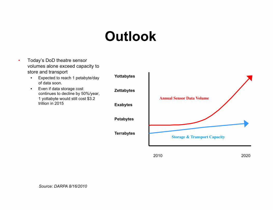
Outlook • Today’s DoD theatre sensor
volumes alone exceed capacity to store and transport • Expected to reach 1 petabyte/day
of data soon. • Even if data storage cost
continues to decline by 50%/year, 1 yottabyte would still cost $3.2 trillion in 2015
Yottabytes
Zettabytes
Exabytes
Petabytes
Terrabytes
2010 2020
Source: DARPA 8/16/2010
Annual Sensor Data Volume
Storage & Transport Capacity
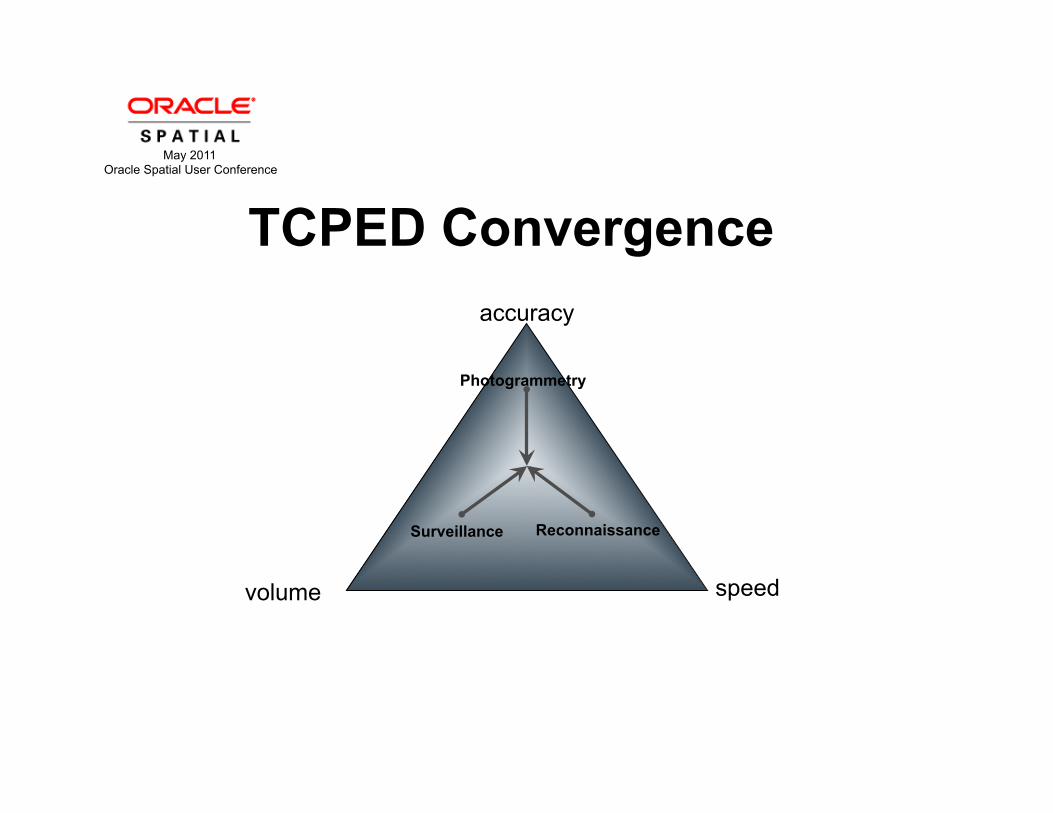
TCPED Convergence
speed
accuracy
volume
Reconnaissance
Photogrammetry
Surveillance
May 2011 Oracle Spatial User Conference
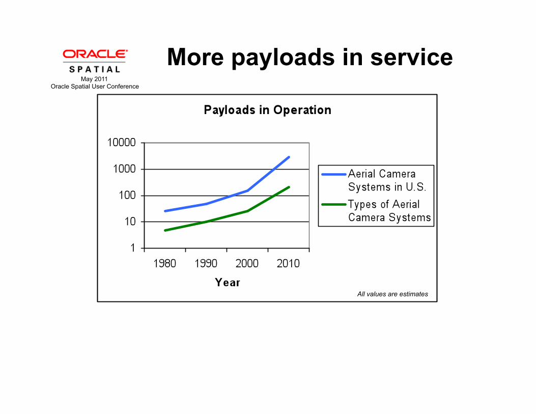
More payloads in service
All values are estimates
May 2011 Oracle Spatial User Conference

Higher density, multi-purpose sensors
• Improvements in digital sensors and “prosumer” components have created new opportunities for small and medium-format airborne imaging systems
• Passive & Active Systems
May 2011 Oracle Spatial User Conference
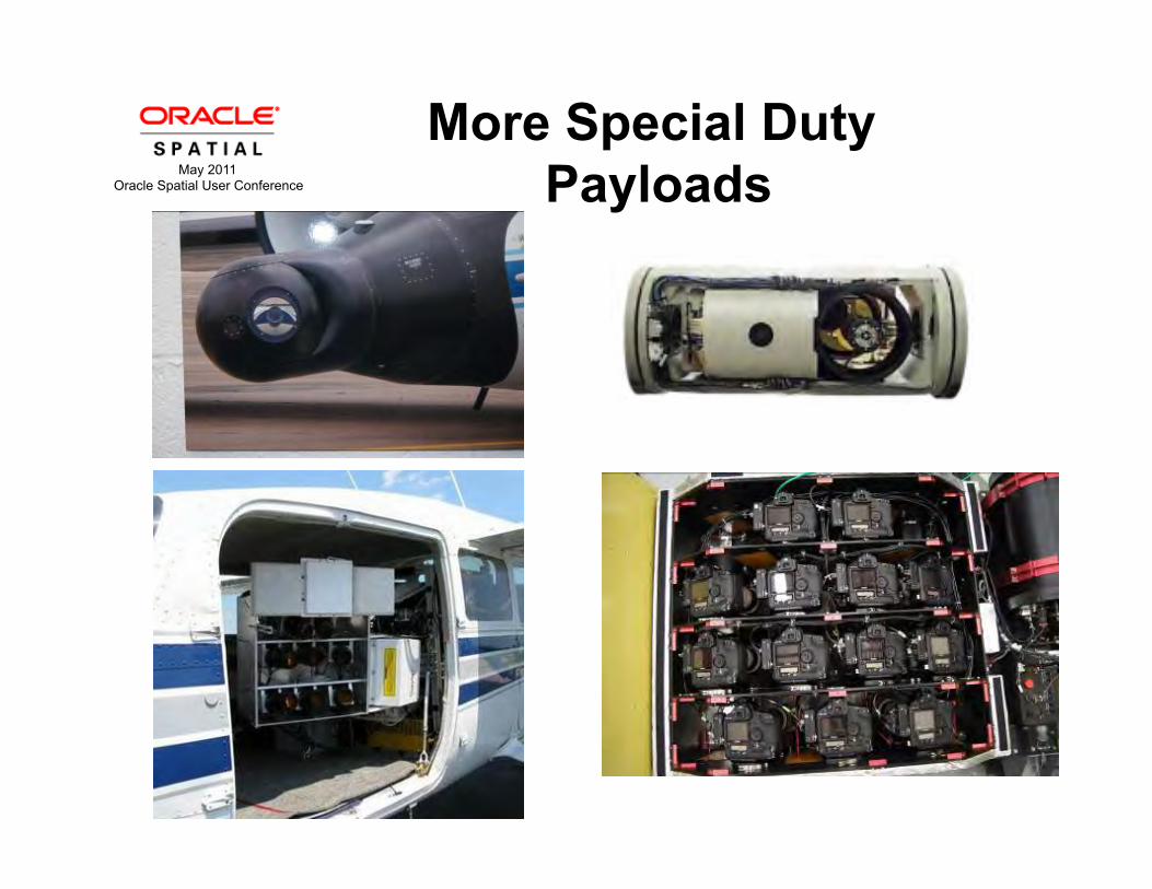
More Special Duty Payloads May 2011
Oracle Spatial User Conference

Compound Focal Plane Arrays
• Argus-IS
• 368 5mpix sensors to create a 1.8 gigapixel image at 12-15 frames/second
May 2011 Oracle Spatial User Conference

Small & Medium Format Arrays
Guardian Eagle WAAS Sensor
Wide Area Sensor Head • 6 – 16 Megapixel Cameras • 1 Frame per Second • 10 Megabytes per Second
Zoom / Spot Sensor Head • 1 – 16 Megapixel Camera • I Frame per Second • 1.5 Megabytes per Second
May 2011 Oracle Spatial User Conference
More persistence
• Airborne persistent surveillance for forensic analysis/playback
• Change detection • Even though we refresh more frequently we
still tend to keep everything
May 2011 Oracle Spatial User Conference
More modalities
• We create different products for different consumers of the same imagery. For aerial photography alone: • RAW and uncompressed 12 & 16-bit for image analysts • Single-frame NITF for analysts • 8-bit GeoTIFF • Compressed MrSID, JPEG and GeoPDF • Pyramided tile-cache for web users • Anaglyphs, Holographs, Texture Maps • Video (MPEG, MP4, MJPEG, WMV)
May 2011 Oracle Spatial User Conference
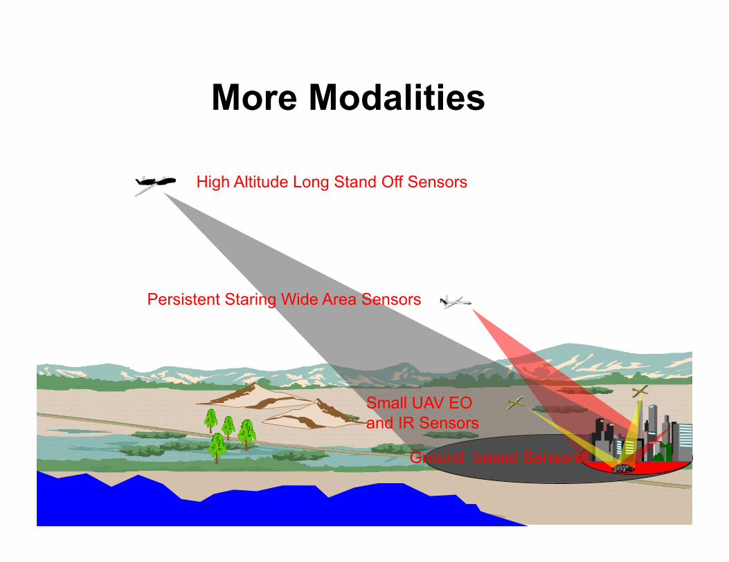
More Modalities
High Altitude Long Stand Off Sensors
Persistent Staring Wide Area Sensors
Small UAV EO and IR Sensors
Ground based Sensors
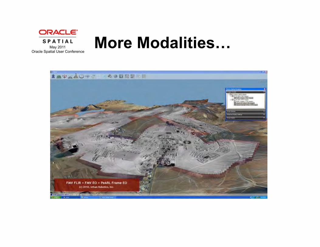
More Modalities… May 2011 Oracle Spatial User Conference
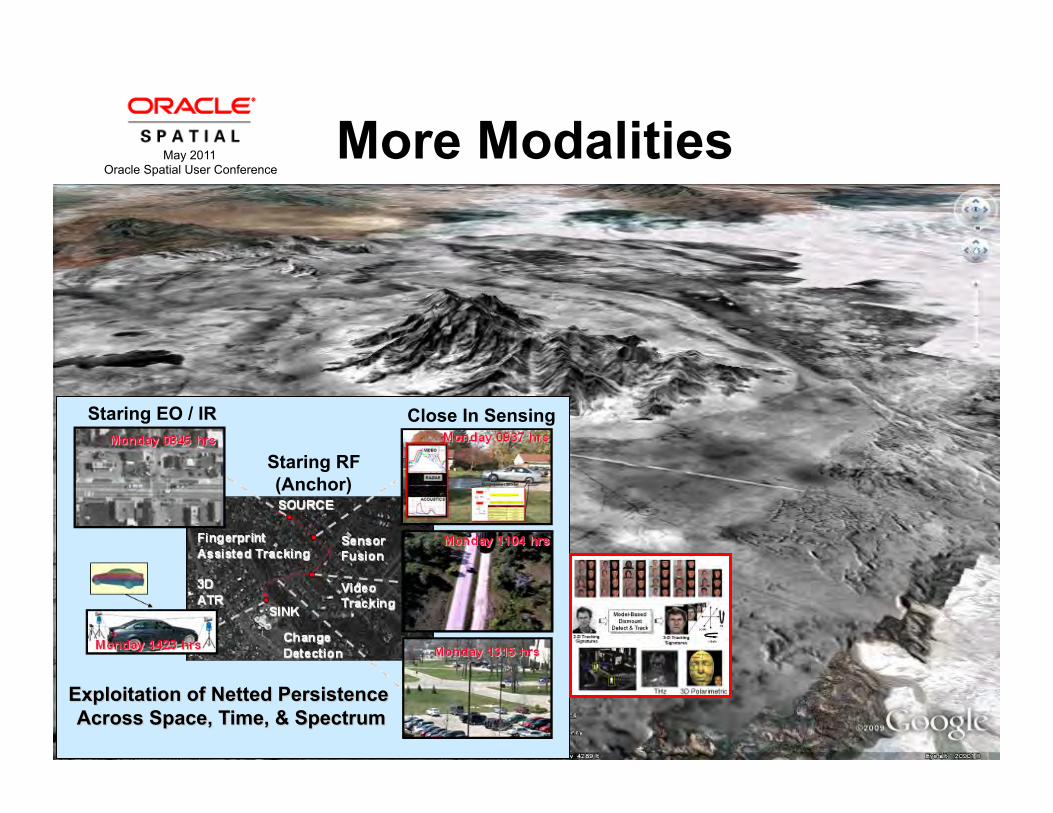
More Modalities
Staring RF (Anchor)
Staring EO / IR Close In Sensing
May 2011 Oracle Spatial User Conference
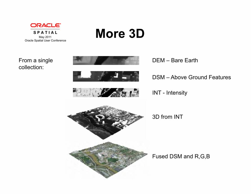
More 3D
From a single collection:
DEM – Bare Earth
DSM – Above Ground Features
INT - Intensity
3D from INT
Fused DSM and R,G,B
May 2011 Oracle Spatial User Conference
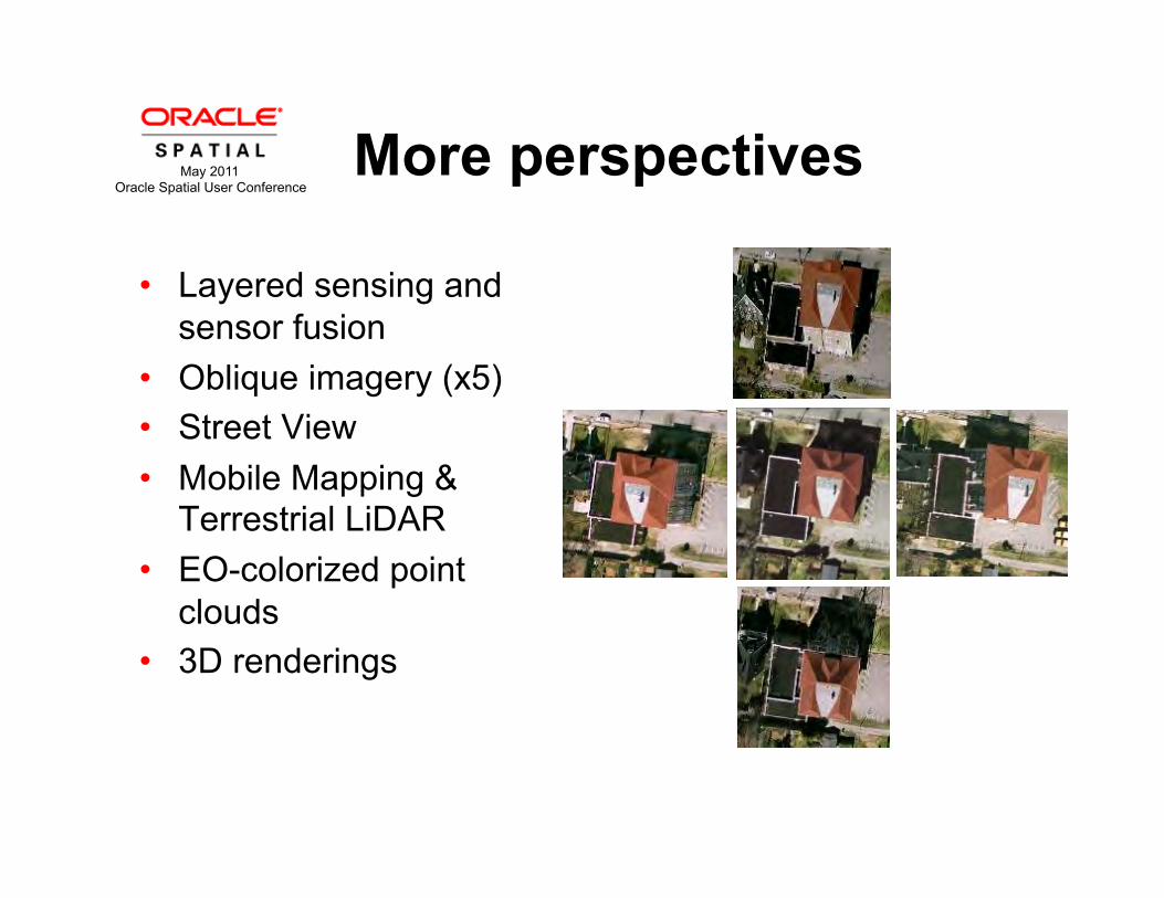
More perspectives
• Layered sensing and sensor fusion
• Oblique imagery (x5) • Street View • Mobile Mapping &
Terrestrial LiDAR • EO-colorized point
clouds • 3D renderings
May 2011 Oracle Spatial User Conference
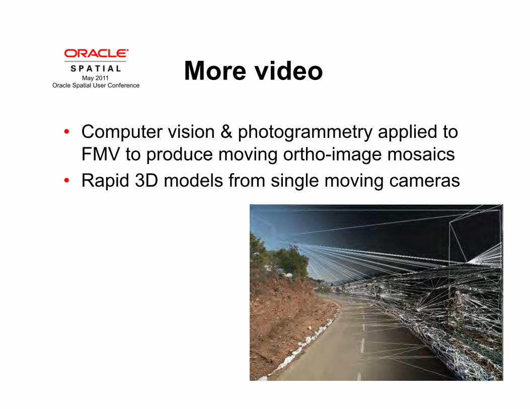
More video
• Computer vision & photogrammetry applied to FMV to produce moving ortho-image mosaics
• Rapid 3D models from single moving cameras
May 2011 Oracle Spatial User Conference

More phenomenologies
• Automated feature extraction creates more derivative products from single collects
May 2011 Oracle Spatial User Conference
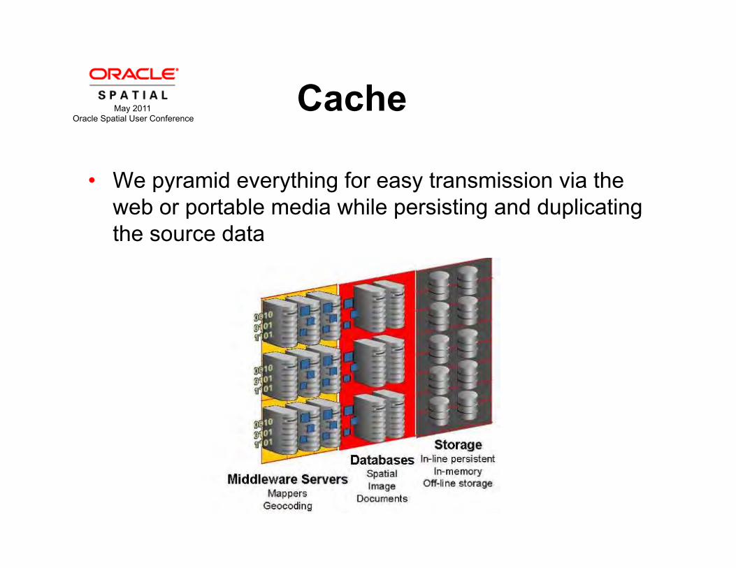
Cache
• We pyramid everything for easy transmission via the web or portable media while persisting and duplicating the source data
May 2011 Oracle Spatial User Conference
More metadata
• We want to preserve everything from a mission not just project-level metadata • Flight layouts, logs, weather reports • Trajectory (SBET) and GPS data • Camera data (Exif) • Triangulation (AT) • Ground Control Files • QA/QC results
May 2011 Oracle Spatial User Conference
Data Management
• Even though storage is cheap, it can not linearly-scale to keep up with the avalanche of geospatial data being generated
• “The problem is not that our sensors produce too much data; the problem is the structure of the data” –and how we manage it.
Defense Advanced Research Projects Agency Adaptive Execution Office
May 2011 Oracle Spatial User Conference
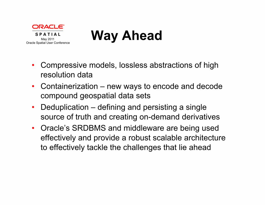
Way Ahead
• Compressive models, lossless abstractions of high resolution data
• Containerization – new ways to encode and decode compound geospatial data sets
• Deduplication – defining and persisting a single source of truth and creating on-demand derivatives
• Oracle’s SRDBMS and middleware are being used effectively and provide a robust scalable architecture to effectively tackle the challenges that lie ahead
May 2011 Oracle Spatial User Conference
Sensor Data Fusion SAFE SWE SAFE + SWE Future Work
May 2011 Oracle Spatial User Conference

SAFE
• Situational Awareness Fusion Engine • Purpose: Provide a framework for:
• Aggregation and Analysis of spatial and non-spatial data. • Design goals:
• Interoperability • Scalability • Efficiency • Portability • Simplicity
• Demonstrates a use-case scenario for tiered remote sensing • How Oracle technologies are or could be further used
May 2011 Oracle Spatial User Conference
SAFE
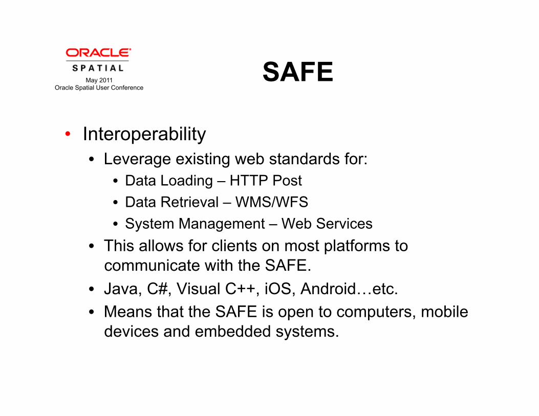
• Interoperability • Leverage existing web standards for:
• Data Loading – HTTP Post • Data Retrieval – WMS/WFS • System Management – Web Services
• This allows for clients on most platforms to communicate with the SAFE.
• Java, C#, Visual C++, iOS, Android…etc. • Means that the SAFE is open to computers, mobile
devices and embedded systems.
May 2011 Oracle Spatial User Conference
SAFE
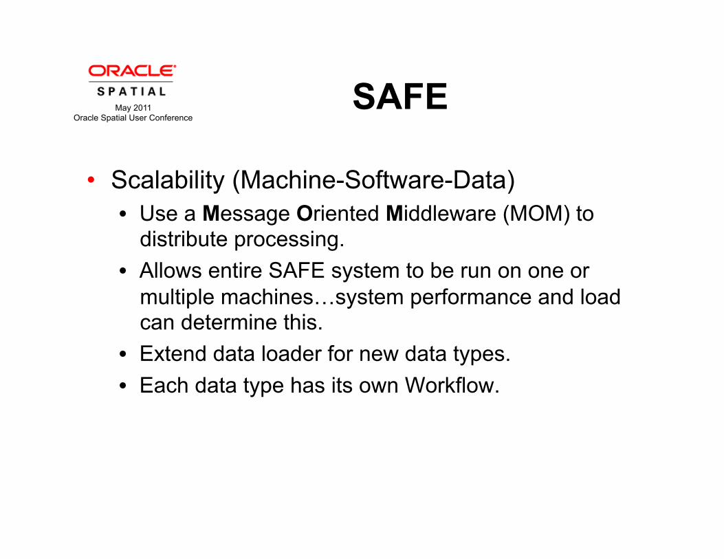
• Scalability (Machine-Software-Data) • Use a Message Oriented Middleware (MOM) to
distribute processing. • Allows entire SAFE system to be run on one or
multiple machines…system performance and load can determine this.
• Extend data loader for new data types. • Each data type has its own Workflow.
May 2011 Oracle Spatial User Conference

SAFE
• Efficiency • Efficiently store a variety of data types.
• Raster • Vector • LiDAR • Non-spatial
• Only store the data once. • Efficiently search large, and disparate data sets.
• Run spatial queries, instead of manual searches across a file system.
May 2011 Oracle Spatial User Conference
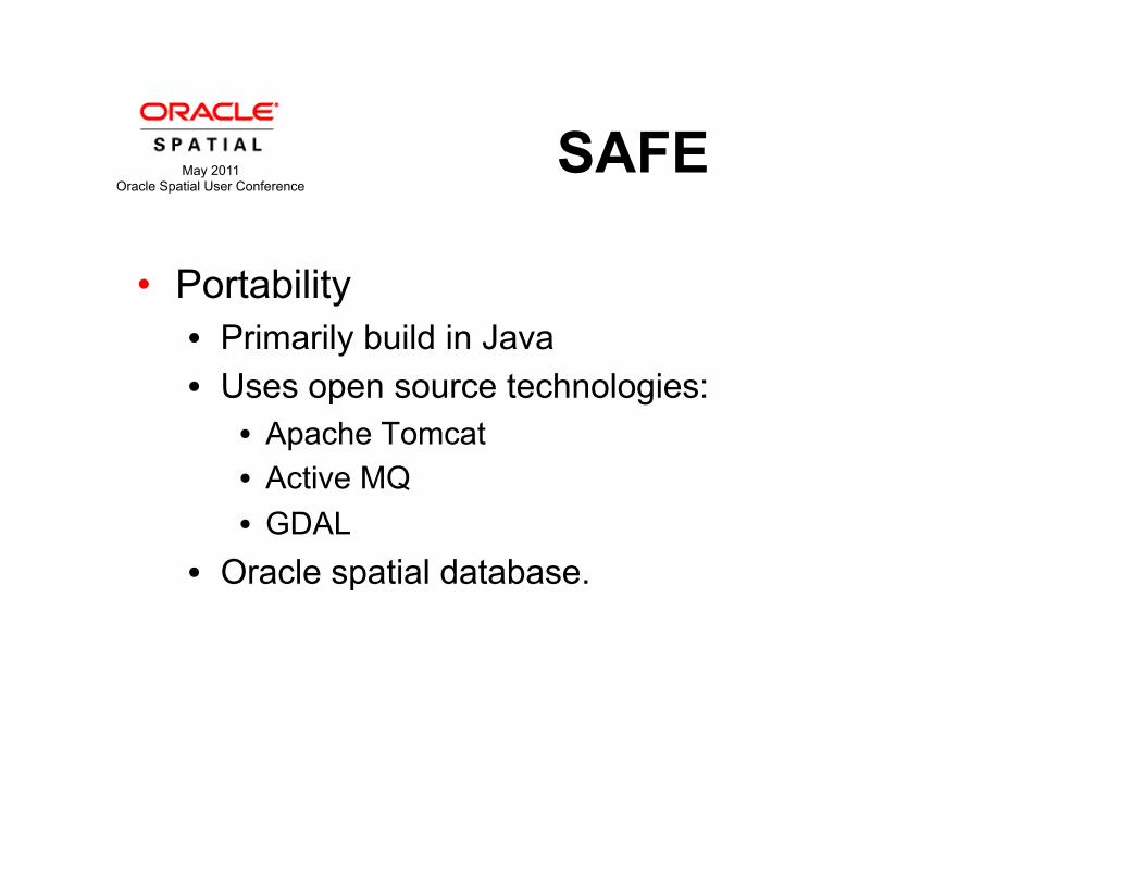
SAFE
• Portability • Primarily build in Java • Uses open source technologies:
• Apache Tomcat • Active MQ • GDAL
• Oracle spatial database.
May 2011 Oracle Spatial User Conference
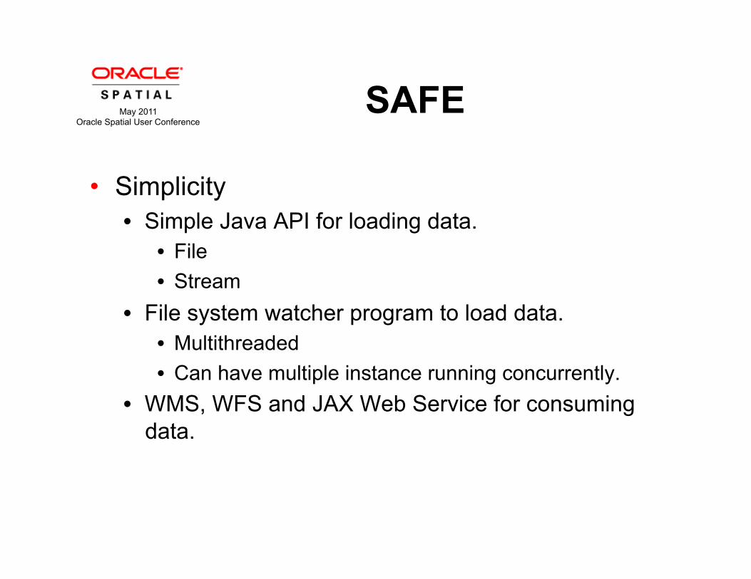
SAFE
• Simplicity • Simple Java API for loading data.
• File • Stream
• File system watcher program to load data. • Multithreaded • Can have multiple instance running concurrently.
• WMS, WFS and JAX Web Service for consuming data.
May 2011 Oracle Spatial User Conference

SAFE Diagram May 2011 Oracle Spatial User Conference
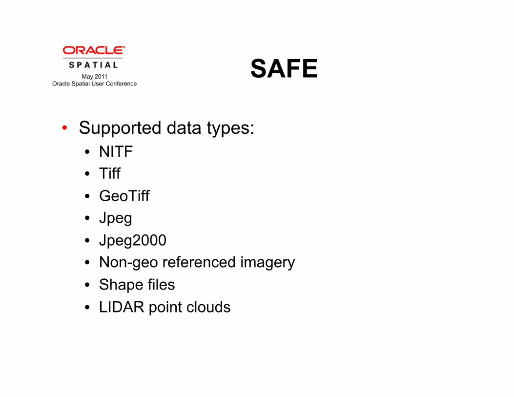
SAFE
• Supported data types: • NITF • Tiff • GeoTiff • Jpeg • Jpeg2000 • Non-geo referenced imagery • Shape files • LIDAR point clouds
May 2011 Oracle Spatial User Conference
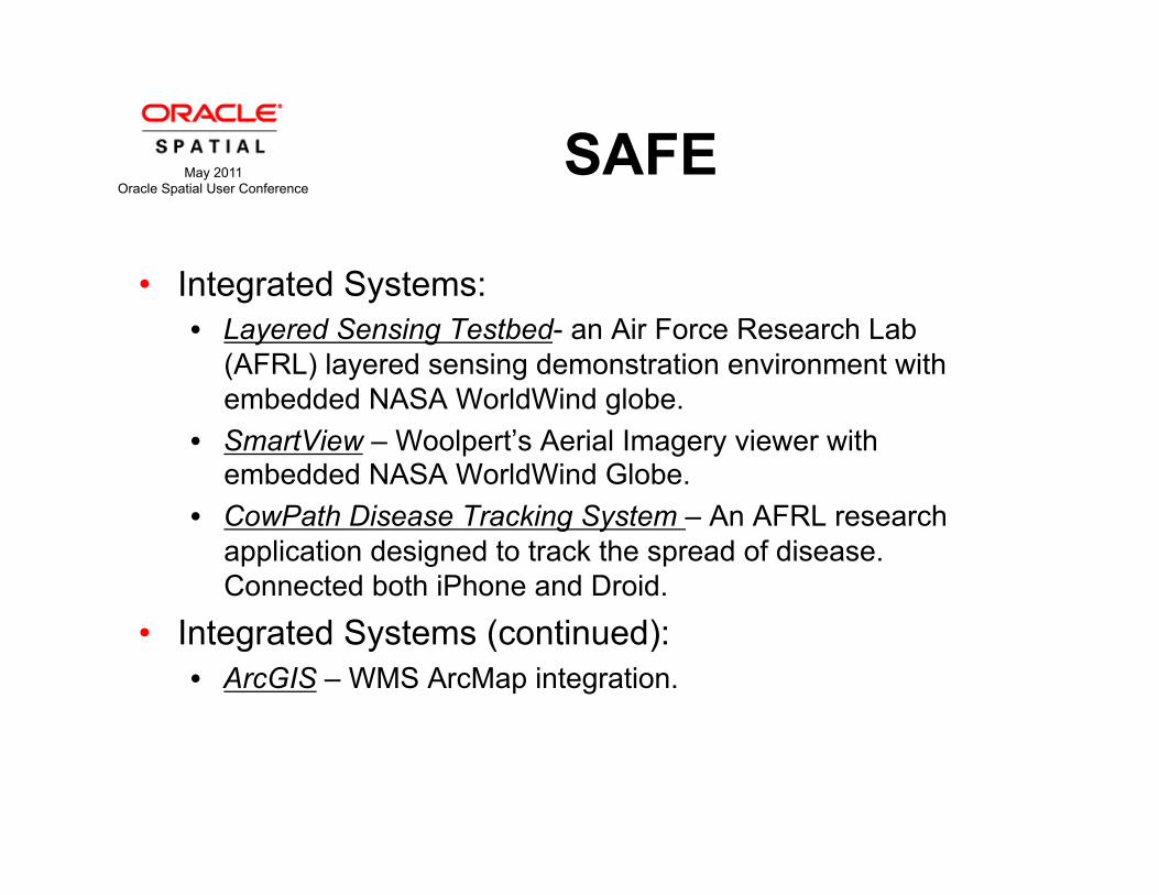
SAFE
• Integrated Systems: • Layered Sensing Testbed- an Air Force Research Lab
(AFRL) layered sensing demonstration environment with embedded NASA WorldWind globe.
• SmartView – Woolpert’s Aerial Imagery viewer with embedded NASA WorldWind Globe.
• CowPath Disease Tracking System – An AFRL research application designed to track the spread of disease. Connected both iPhone and Droid.
• Integrated Systems (continued): • ArcGIS – WMS ArcMap integration.
May 2011 Oracle Spatial User Conference

SAFE
• Analysis: • Various raster data formats normalized into
SDO_GEORASTER. • Vector data normalized into SDO_GEOMETRY. • Spatially referenced and indexed. • Can execute Spatial Proximity and/or Spatial
Interaction queries using SDO library.
May 2011 Oracle Spatial User Conference
SAFE
• Analysis Example: • Find all imagery that intersects with a known
building. • Run Spatial Interaction query –
SDO_ANYINTERACT(A,Q)….could also use SDO_RELATE(…)
• Query run over data collected over days, weeks, months, years in a matter of seconds.
May 2011 Oracle Spatial User Conference
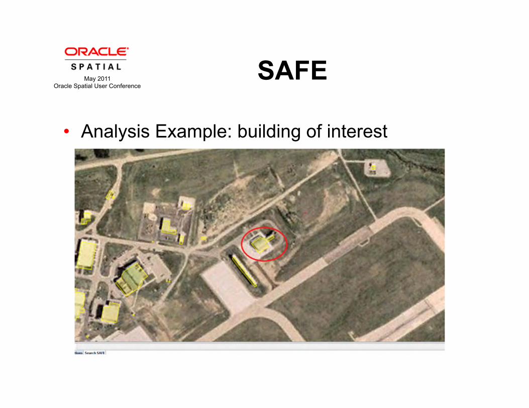
SAFE
• Analysis Example: building of interest
May 2011 Oracle Spatial User Conference

SAFE
• Analysis Example: image containing building
May 2011 Oracle Spatial User Conference
SWE
• Sensor Web Enablement • A set of open standards/specifications that turn
web accessible sensors into a connected network called a Sensor Web.
• Developed and maintained by the Open Geospatial Consortium.
• Currently seven specifications, we use two. • Read more at: http://www.opengeospatial.org/
projects/groups/sensorweb
May 2011 Oracle Spatial User Conference

SWE
• Targeted Functionality: Sensor Web • Discovery of sensor systems and observations. • Determine sensor capabilities. • Geo-locate sensors automatically. • Standardize sensor measurements. • Sensor management/control. • Publish/Subscribe to sensor alerts.
May 2011 Oracle Spatial User Conference

SWE
• Observations & Measurements (O&M) - standard model for representing and exchanging observation results.
• XMLSchema – defines the XML encoding for measurements and observations. • Data types • Relationships of the data types
• Observation - is an event with a result. • Result – a value describing a phenomenon.
May 2011 Oracle Spatial User Conference
SWE
• Sensor Observation Service (SOS) - service that provides access to sensor systems and their observations.
May 2011 Oracle Spatial User Conference
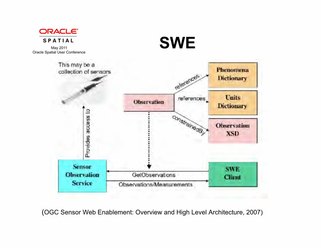
SWE May 2011 Oracle Spatial User Conference
(OGC Sensor Web Enablement: Overview and High Level Architecture, 2007)
SAFE + SWE
• Uses a 52 North implementation of a SWE SOS.
• Functionality includes: • Core SOS, • Transactional SOS and • Additional SOS operations
• Custom client
May 2011 Oracle Spatial User Conference
SAFE + SWE
• Core SOS operations: • GetCapabilities • GetObservation – data encoded in O&M format. • DescribeSensor
May 2011 Oracle Spatial User Conference
SAFE + SWE
• Transactional SOS operations: • RegisterSensor • InsertObservation
May 2011 Oracle Spatial User Conference
SAFE + SWE
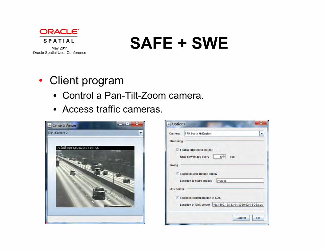
• Client program • Control a Pan-Tilt-Zoom camera. • Access traffic cameras.
May 2011 Oracle Spatial User Conference
SAFE + SWE
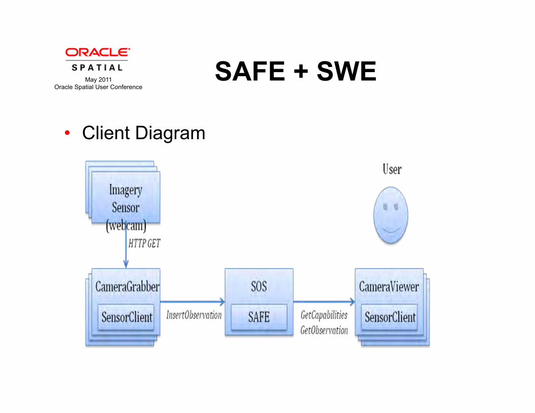
• Client Diagram
May 2011 Oracle Spatial User Conference

Future Work
• Load other types of spatial data for analysis. • Geo-located Twitter data.
• Intelligent control/coordination of sensors: • Build AI agent framework for controlling devices. • Expand SWE implementations to support sensor
control. • Sensor Model Language (SensorML).
May 2011 Oracle Spatial User Conference