Embed Size (px)
Citation preview
Optimising Survey Terrain in InRoads
Richard Tabe Parsons Brinckerhoff
1
Outline Project Importance of the Survey InRoads Creation of Survey – Normal
Method InRoads Creation of Survey – Streamlined The Survey Models Closing
22
3
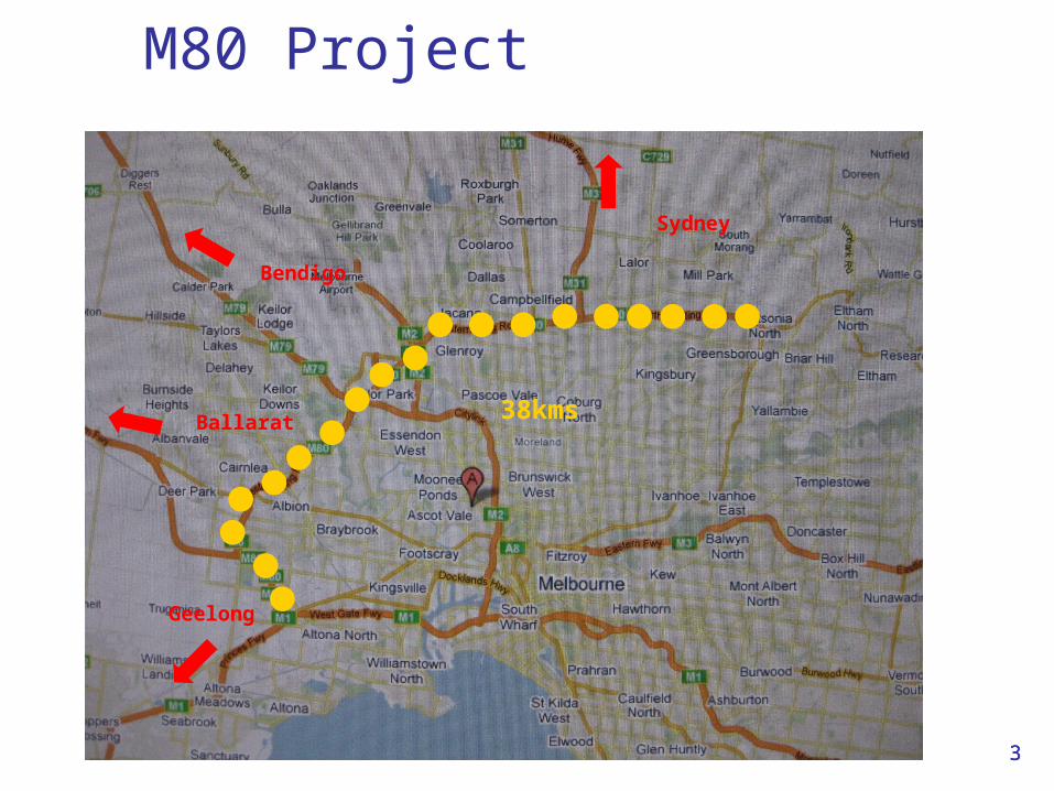
M80 Project
3
38kms
Bendigo
Ballarat
Geelong
Sydney
4
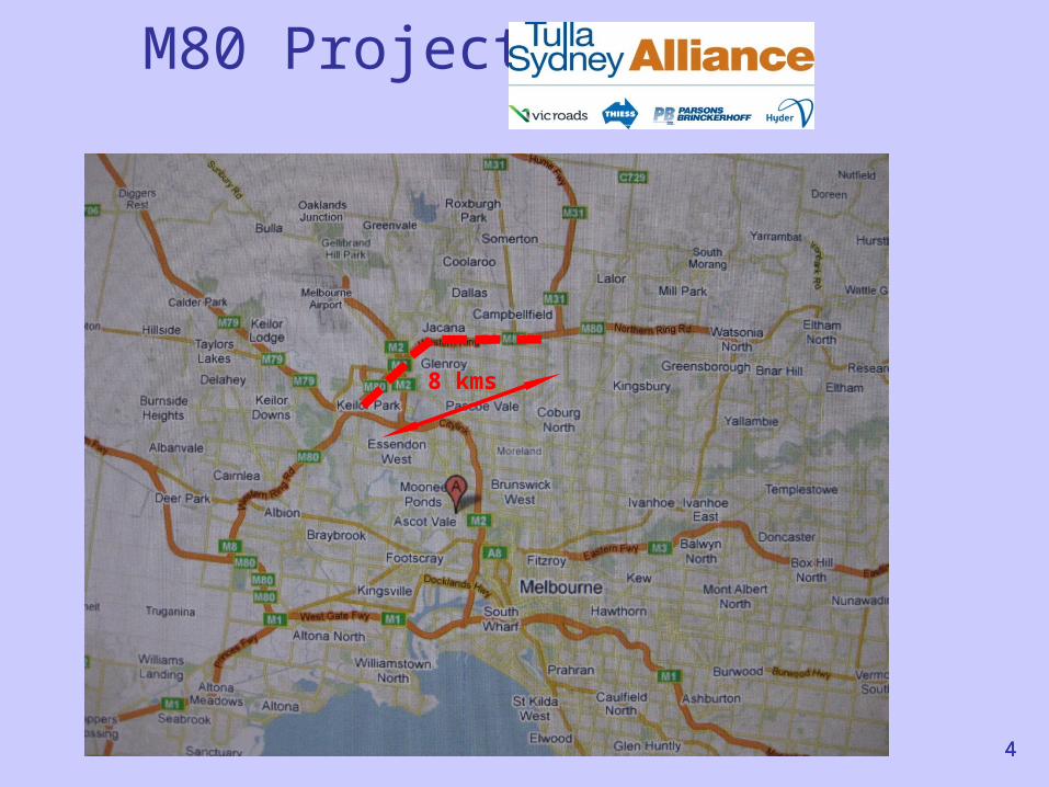
M80 Project
4
8 kms
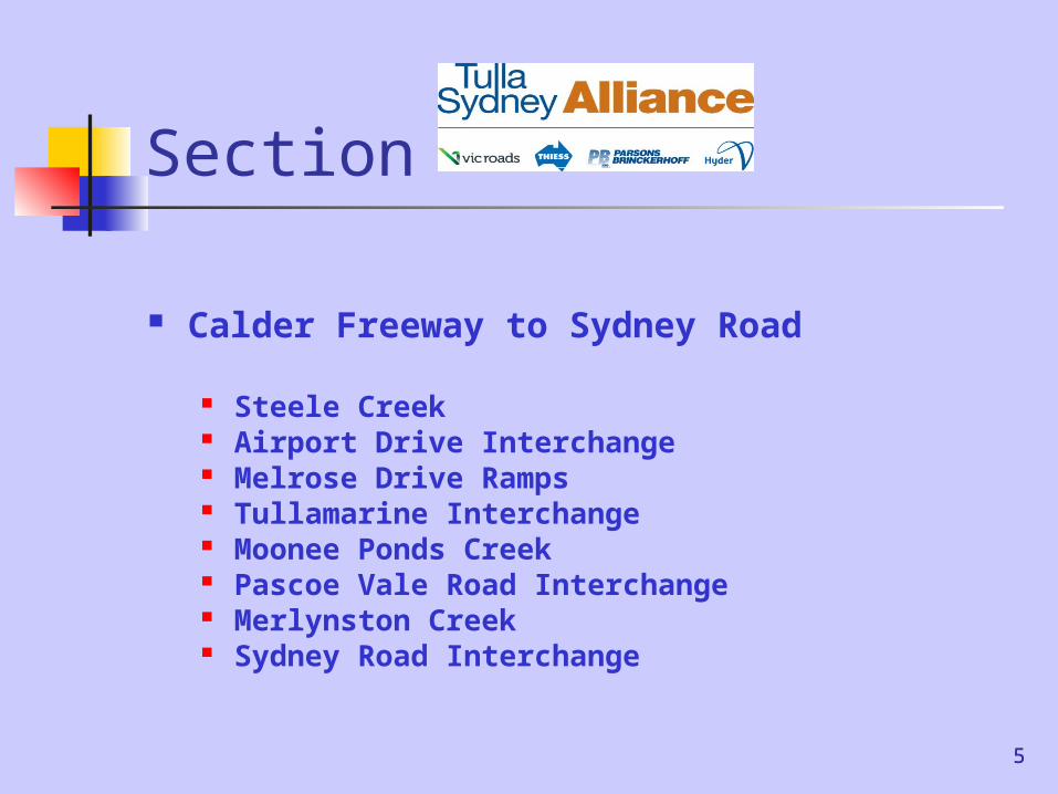
Section
Calder Freeway to Sydney Road
Steele Creek Airport Drive Interchange Melrose Drive Ramps Tullamarine Interchange Moonee Ponds Creek Pascoe Vale Road Interchange Merlynston Creek Sydney Road Interchange
55

Alliance Venture
Client – State DOT VicRoads Partnership –
VicRoads Thiess (Construction) Parsons Brinckerhoff & Hyder (Design
Consultants)
66
7
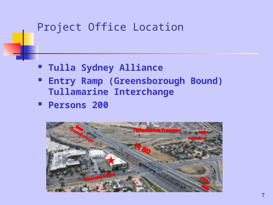
Project Office Location
Tulla Sydney Alliance Entry Ramp (Greensborough Bound)
Tullamarine Interchange Persons 200
7

8
The importance of handling survey correctly
Anyone can do it? A surveyor should do it ! Sometimes a road designer
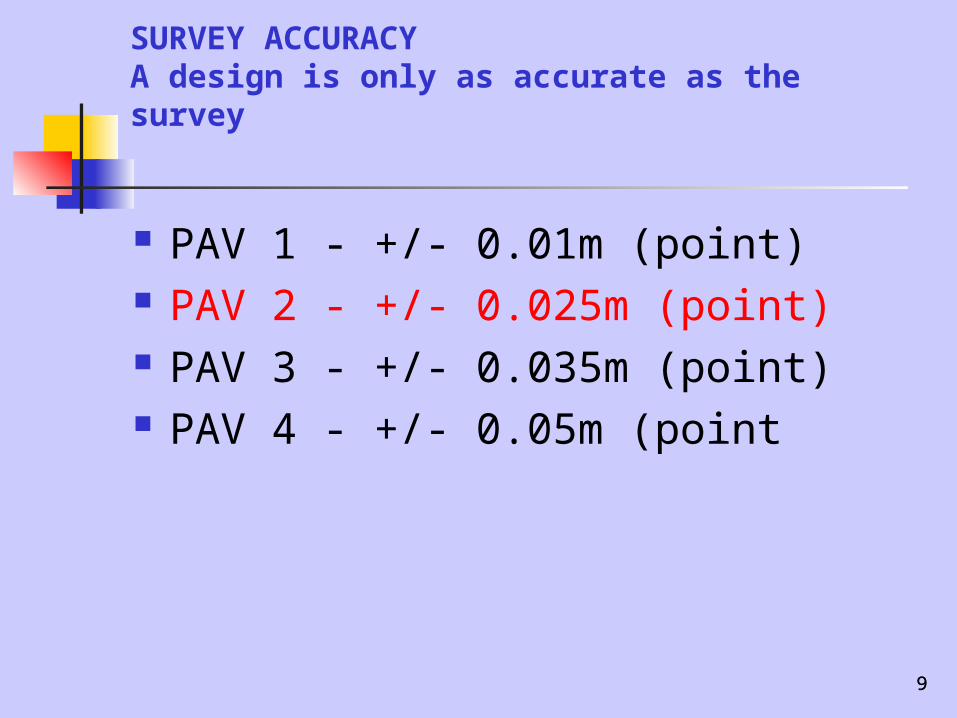
inherits it A design is only as accurate as
the survey
9
SURVEY ACCURACYA design is only as accurate as the survey
PAV 1 - +/- 0.01m (point) PAV 2 - +/- 0.025m (point) PAV 3 - +/- 0.035m (point) PAV 4 - +/- 0.05m (point
9
10
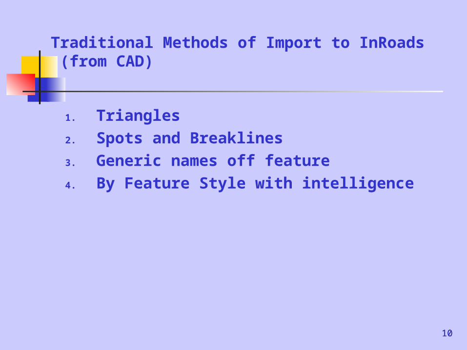
Traditional Methods of Import to InRoads (from CAD)
1. Triangles 2. Spots and Breaklines3. Generic names off feature4. By Feature Style with intelligence
10
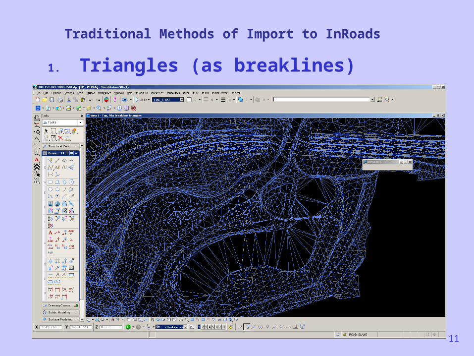
Traditional Methods of Import to InRoads
1. Triangles (as breaklines)
11
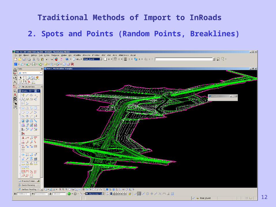
Traditional Methods of Import to InRoads
2. Spots and Points (Random Points, Breaklines)
12
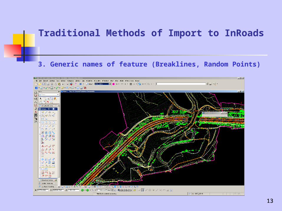
Traditional Methods of Import to InRoads
3. Generic names of feature (Breaklines, Random Points)
1313
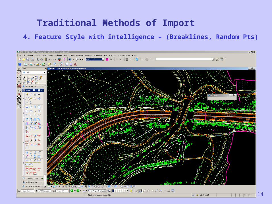
Traditional Methods of Import
4. Feature Style with intelligence – (Breaklines, Random Pts)
14
15
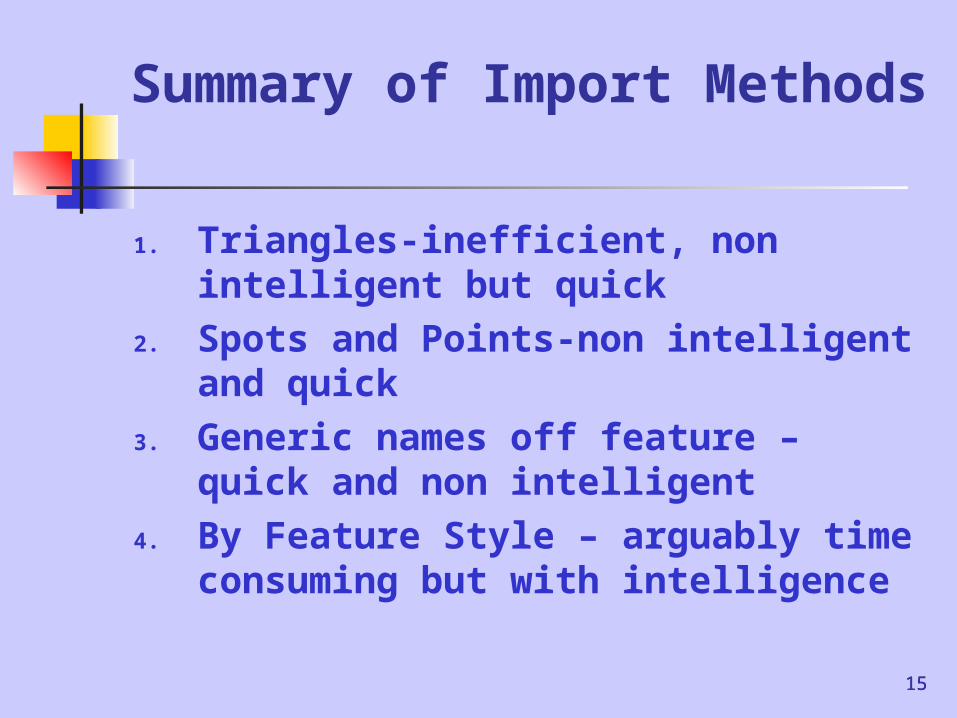
Summary of Import Methods
1. Triangles-inefficient, non intelligent but quick
2. Spots and Points-non intelligent and quick
3. Generic names off feature – quick and non intelligent
4. By Feature Style – arguably time consuming but with intelligence
15
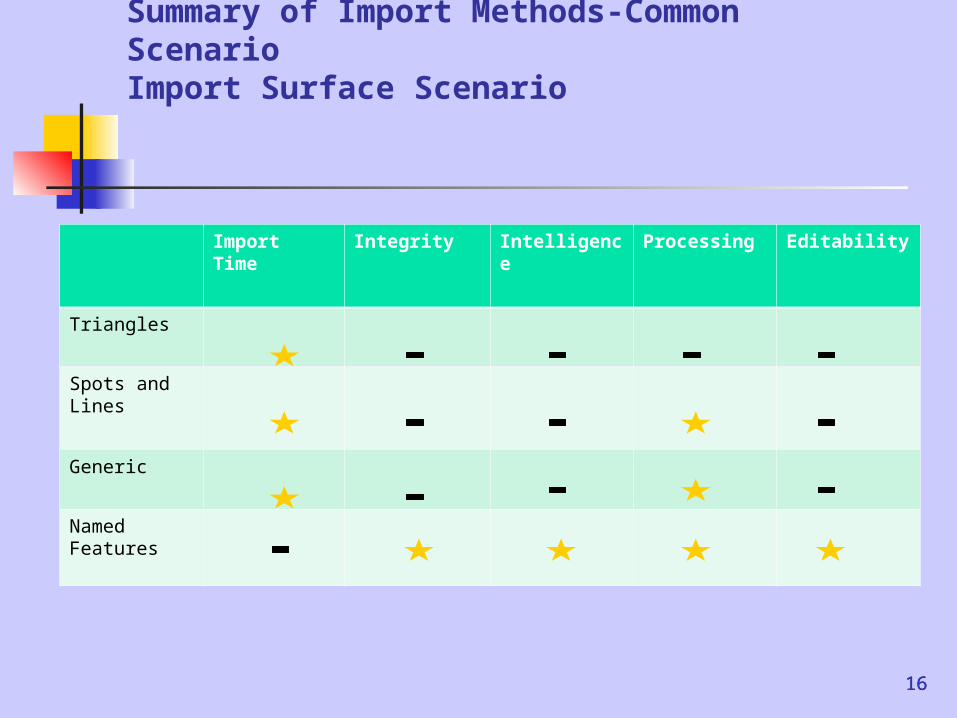
Summary of Import Methods-Common ScenarioImport Surface Scenario
Import Time
Integrity Intelligence Processing Editability
Triangles
Spots and Lines
Generic
Named Features
1616
17
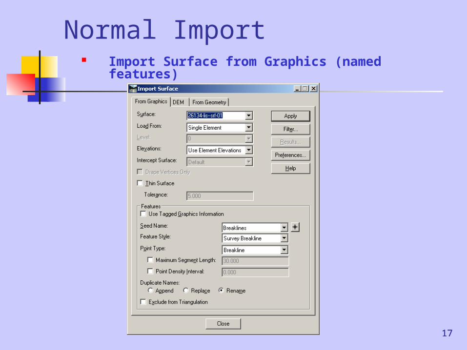
Normal Import Import Surface from Graphics
(named features)
17
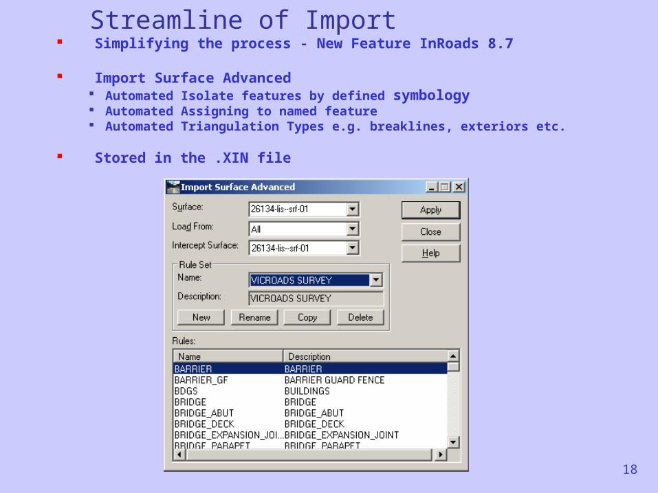
Streamline of Import Simplifying the process - New Feature InRoads 8.7
Import Surface Advanced Automated Isolate features by defined symbology Automated Assigning to named feature Automated Triangulation Types e.g. breaklines, exteriors etc.
Stored in the .XIN file
18
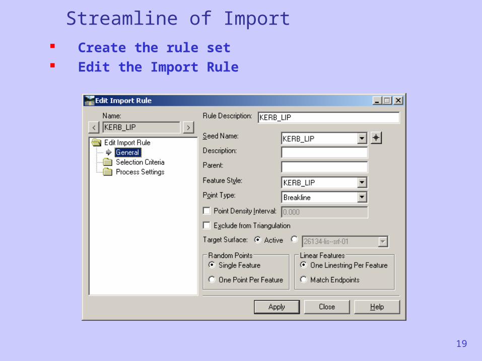
Streamline of Import Create the rule set Edit the Import Rule
19
20
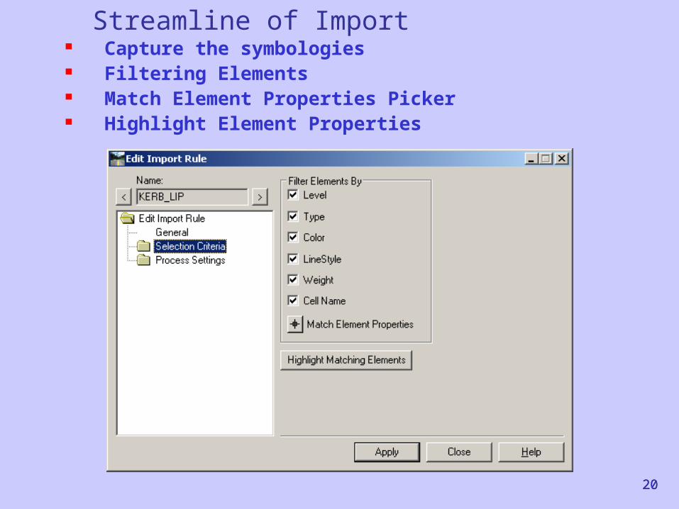
Streamline of Import Capture the symbologies Filtering Elements Match Element Properties Picker Highlight Element Properties
20
21
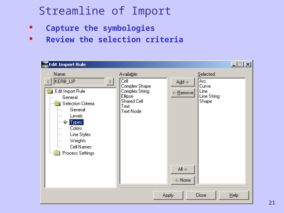
Streamline of Import Capture the symbologies Review the selection criteria
21
22
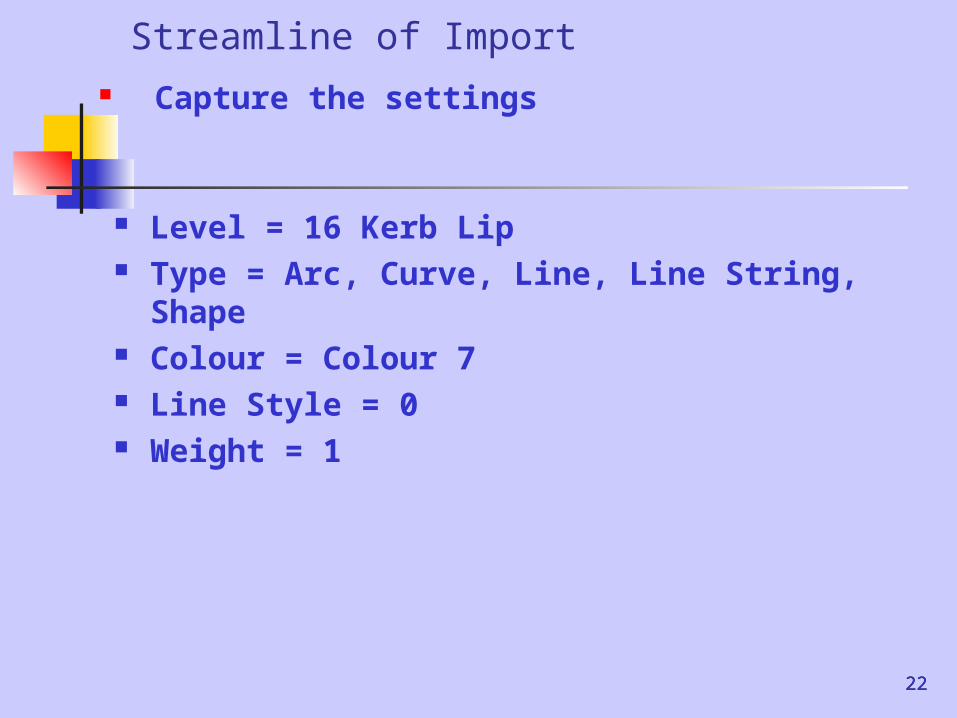
Streamline of Import Capture the settings
22
Level = 16 Kerb Lip Type = Arc, Curve, Line, Line String,
Shape Colour = Colour 7 Line Style = 0 Weight = 1
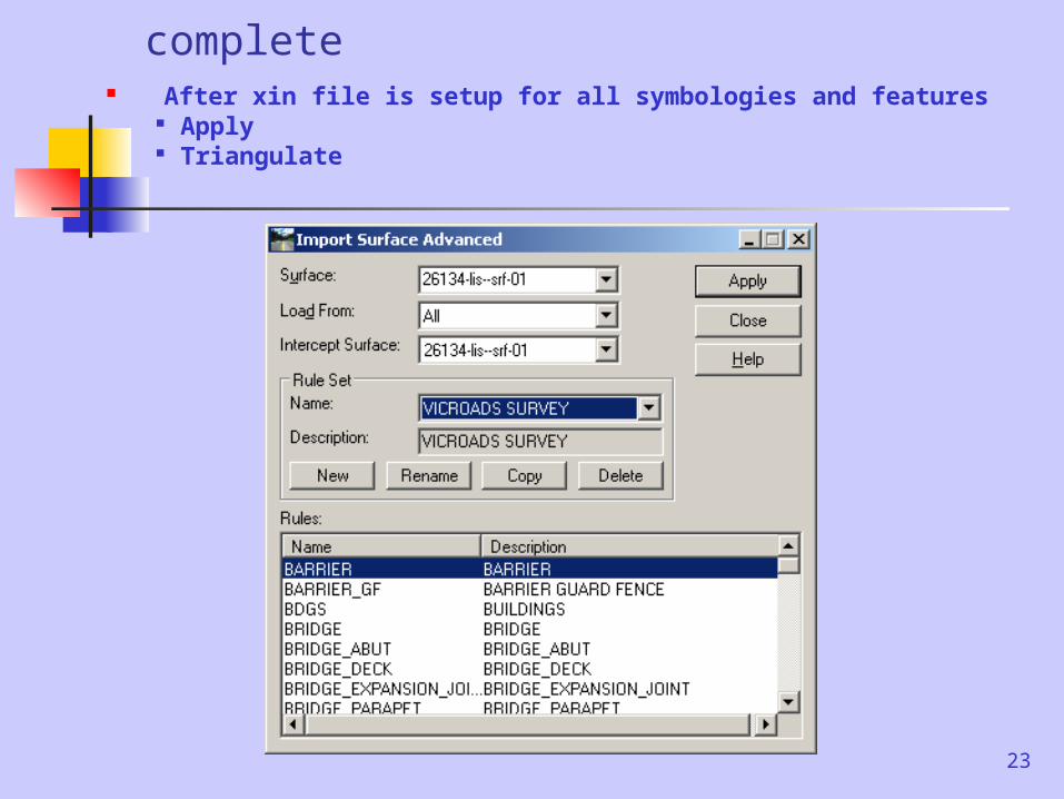
After the XIN file is complete After xin file is setup for all symbologies and features
Apply Triangulate
23
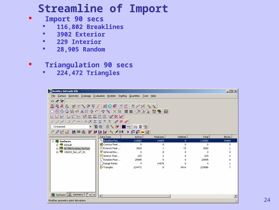
Streamline of Import Import 90 secs
116,802 Breaklines 3902 Exterior 229 Interior 28,905 Random
Triangulation 90 secs 224,472 Triangles
24
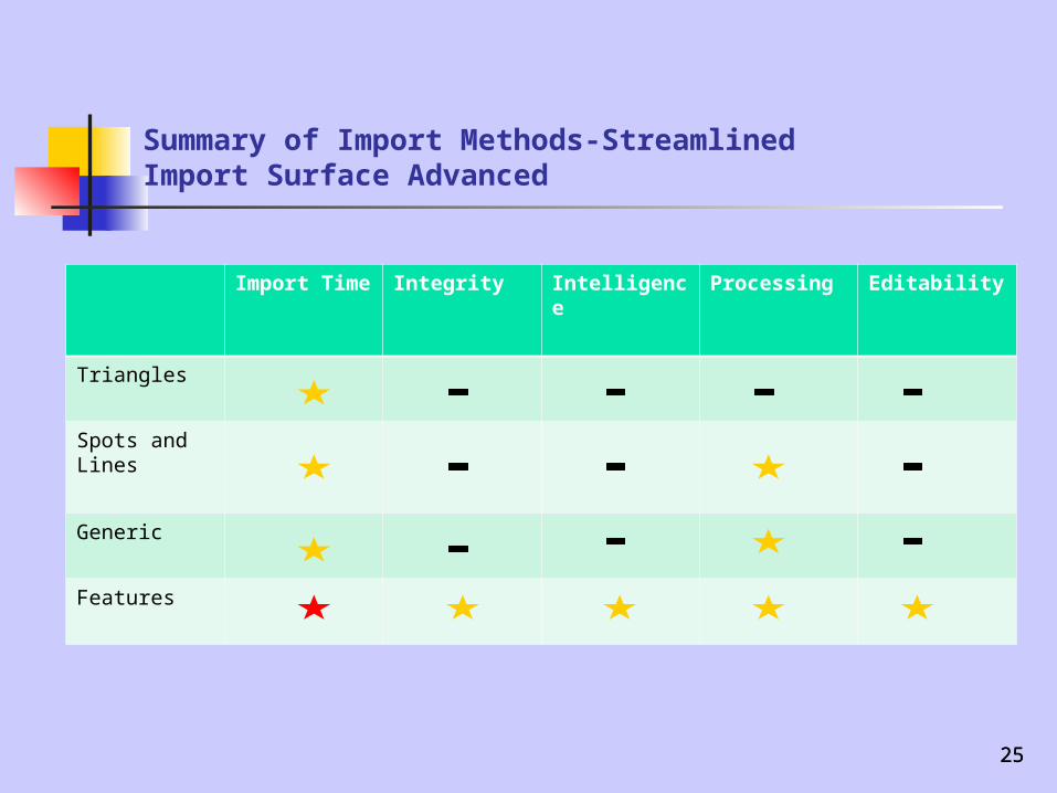
Summary of Import Methods-StreamlinedImport Surface Advanced
Import Time
Integrity Intelligence Processing Editability
Triangles
Spots and Lines
Generic
Features
2525
26
The Survey Models (Macro)
1. Feature Survey Consolidated (Model 1)
2. Survey Composite (Model 2)1. Feature2. Photogrammetric3. Topography
26
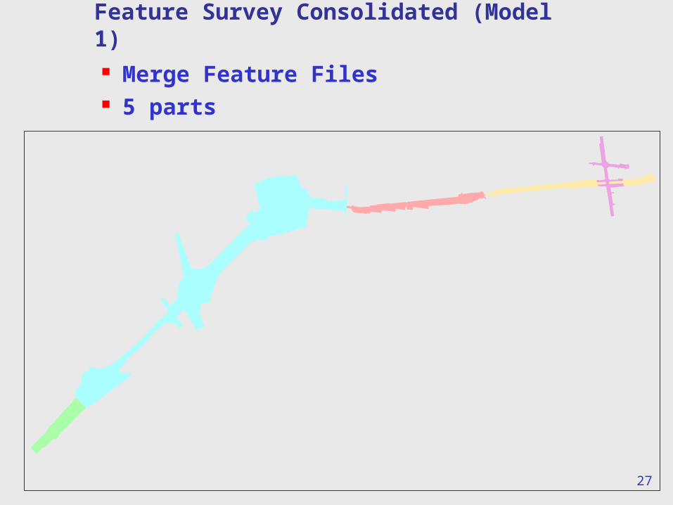
Feature Survey Consolidated (Model 1) Merge Feature Files 5 parts
27
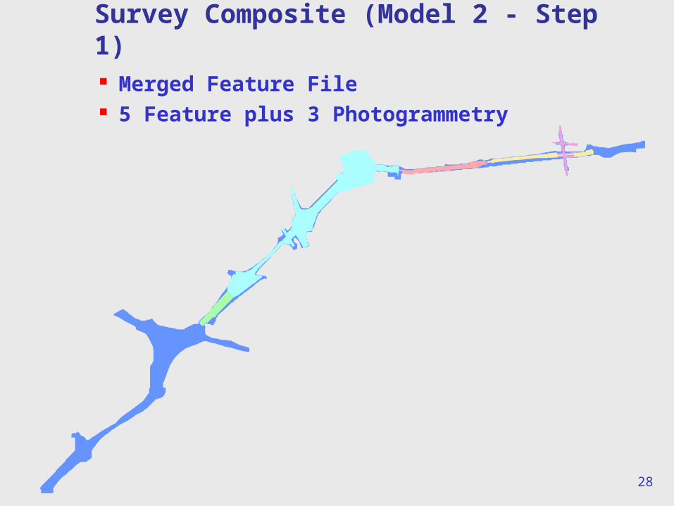
Survey Composite (Model 2 - Step 1) Merged Feature File 5 Feature plus 3 Photogrammetry
28
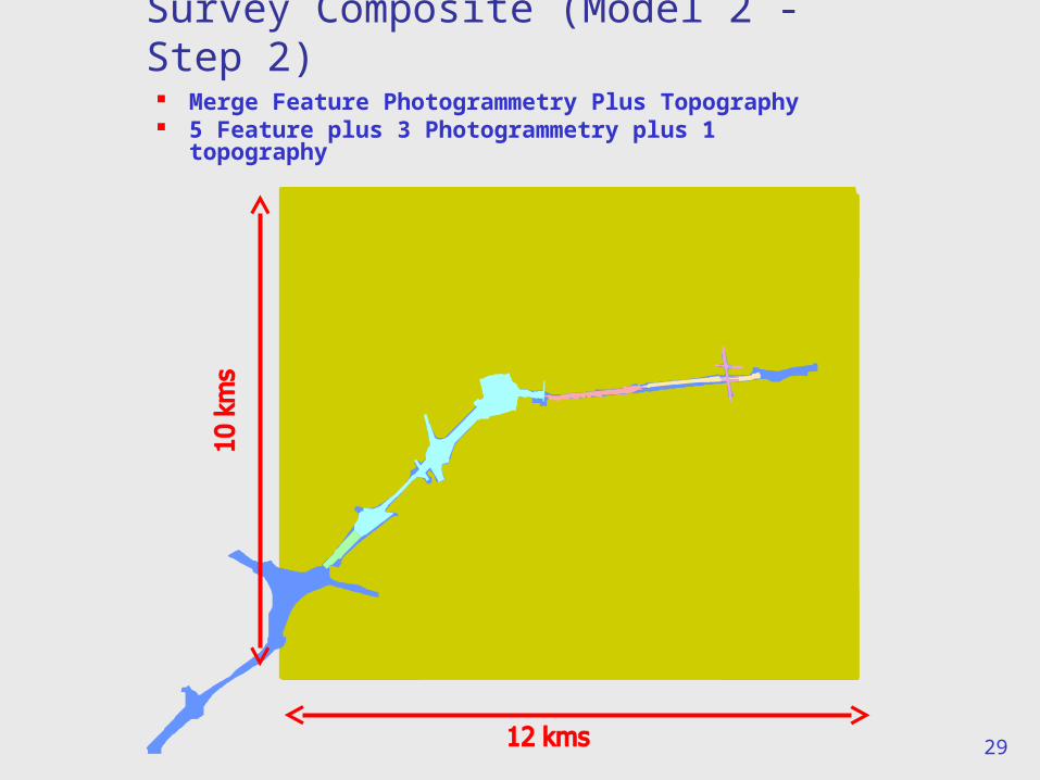
Survey Composite (Model 2 - Step 2)
Merge Feature Photogrammetry Plus Topography
5 Feature plus 3 Photogrammetry plus 1 topography
29
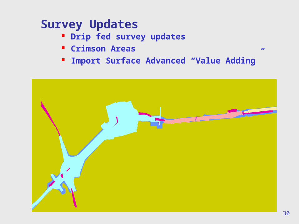
Survey Updates
30
Drip fed survey updates Crimson Areas Import Surface Advanced “Value Adding”
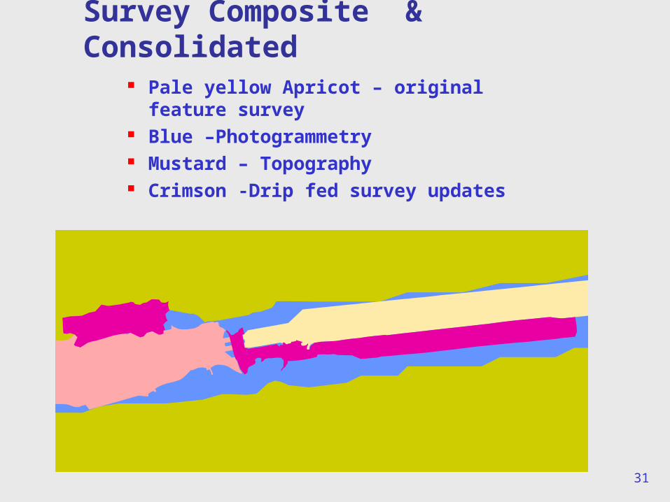
Pale yellow Apricot – original feature survey
Blue –Photogrammetry Mustard – Topography Crimson -Drip fed survey updates
31
Survey Composite & Consolidated
32
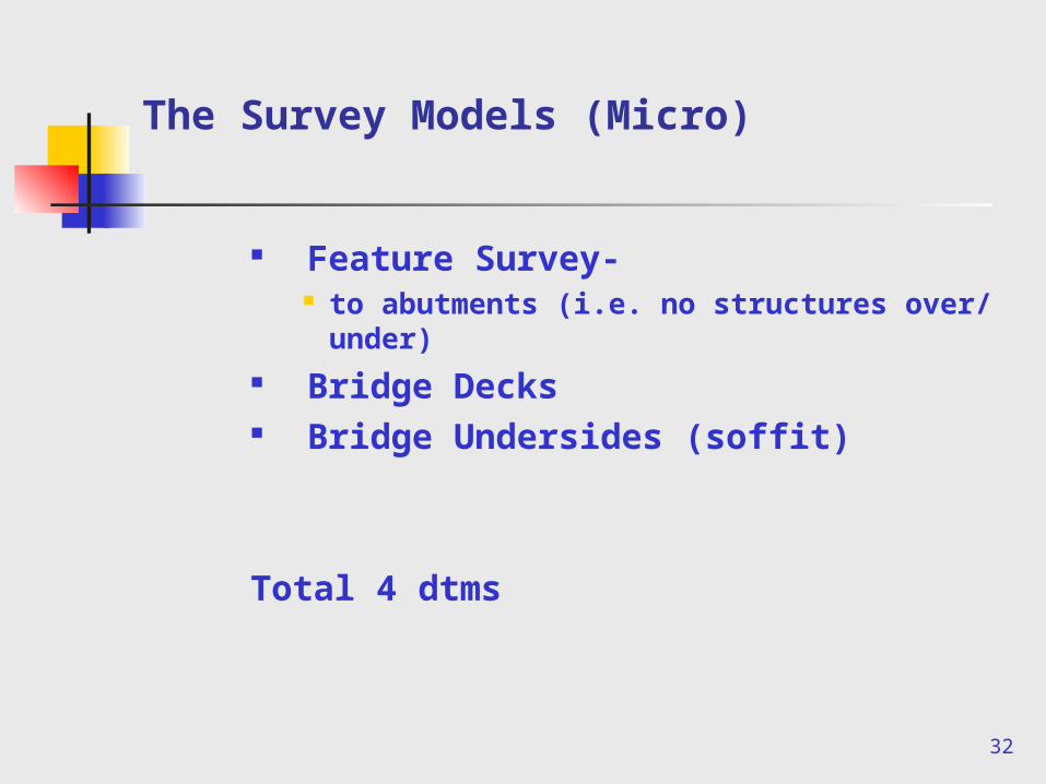
The Survey Models (Micro)
Feature Survey- to abutments (i.e. no structures over/
under) Bridge Decks Bridge Undersides (soffit)
Total 4 dtms
33
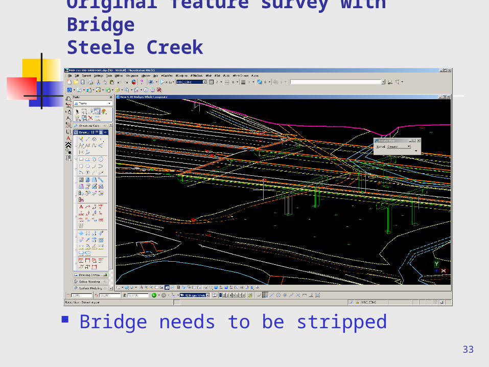
Original feature survey with BridgeSteele Creek
Bridge needs to be stripped
34
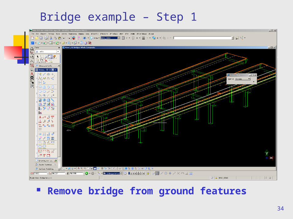
Bridge example – Step 1
Remove bridge from ground features
35
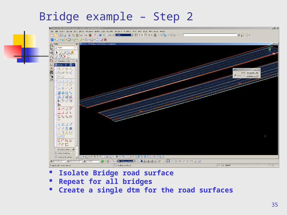
Bridge example – Step 2
Isolate Bridge road surface Repeat for all bridges Create a single dtm for the road surfaces
36
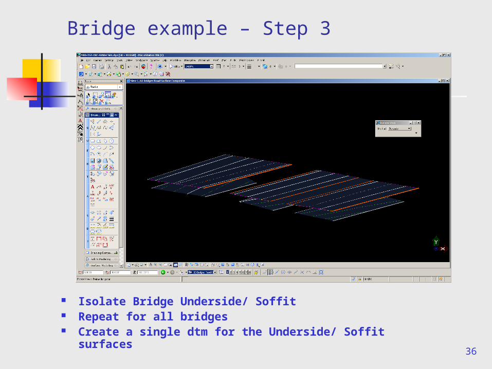
Bridge example – Step 3
Isolate Bridge Underside/ Soffit Repeat for all bridges Create a single dtm for the Underside/ Soffit
surfaces
37
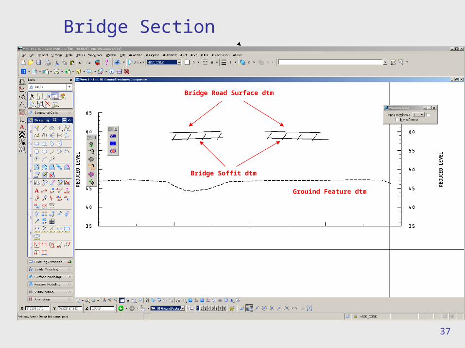
Bridge Section
Bridge Road Surface dtm
Bridge Soffit dtm
Grouind Feature dtm
38
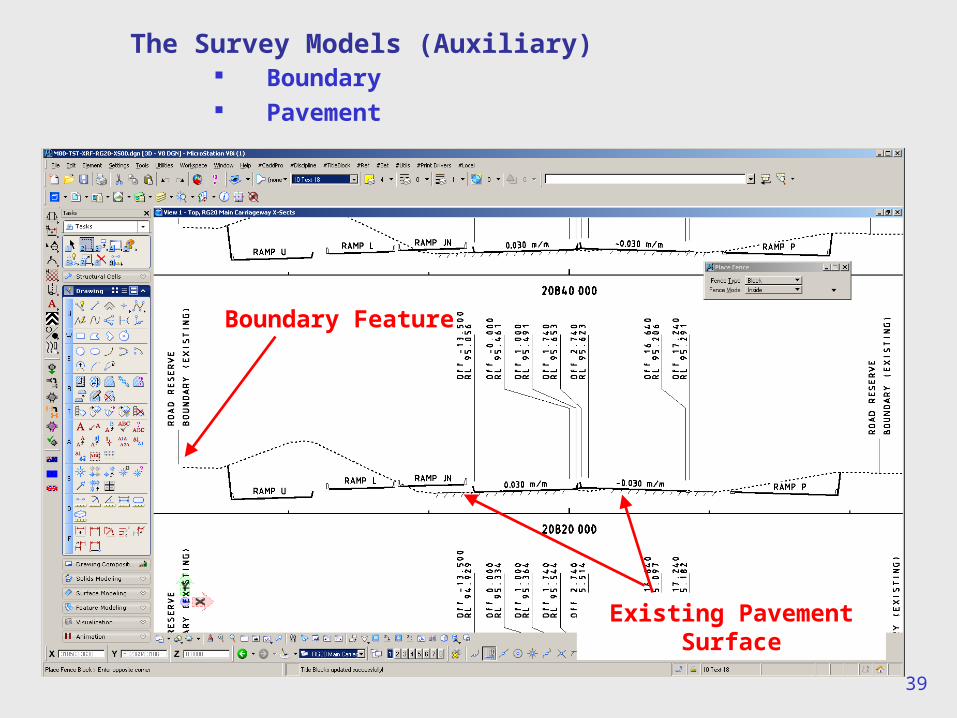
The Survey Models (Auxiliary)
Boundary Pavement Open Graded Friction Course (OGFC) Strip Transmission Wires/ No Go Zones Sub Strata (Geotech Boreholes) Utilities
39
The Survey Models (Auxiliary) Boundary Pavement
Boundary Feature
Existing Pavement Surface
40
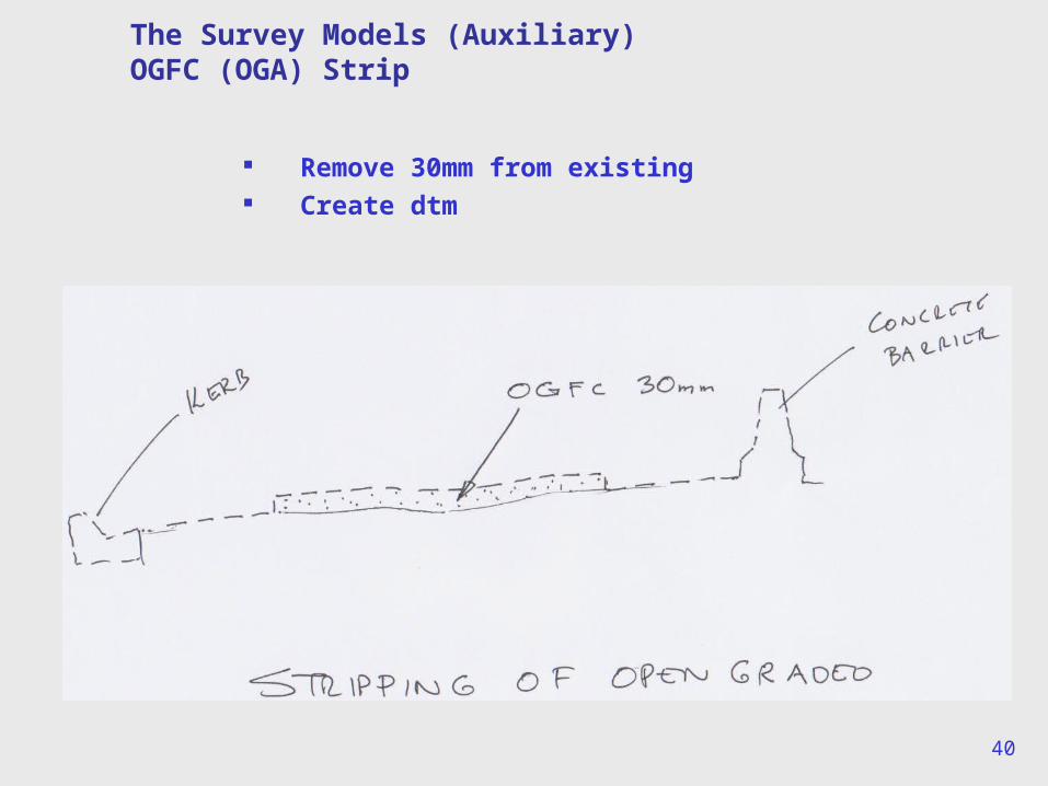
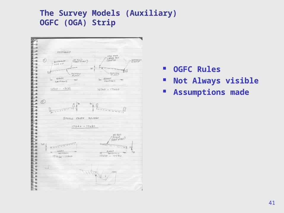
The Survey Models (Auxiliary)OGFC (OGA) Strip
Remove 30mm from existing Create dtm
41
The Survey Models (Auxiliary)OGFC (OGA) Strip
OGFC Rules Not Always visible Assumptions made
42
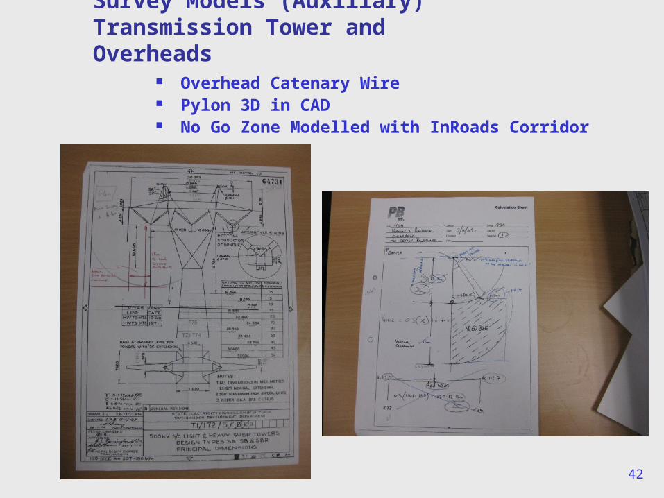
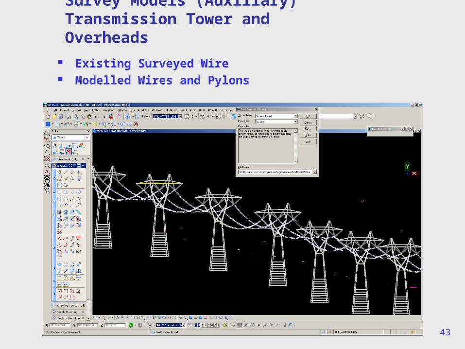
Survey Models (Auxiliary)Transmission Tower and Overheads
Overhead Catenary Wire Pylon 3D in CAD No Go Zone Modelled with InRoads Corridor
43
Existing Surveyed Wire Modelled Wires and Pylons
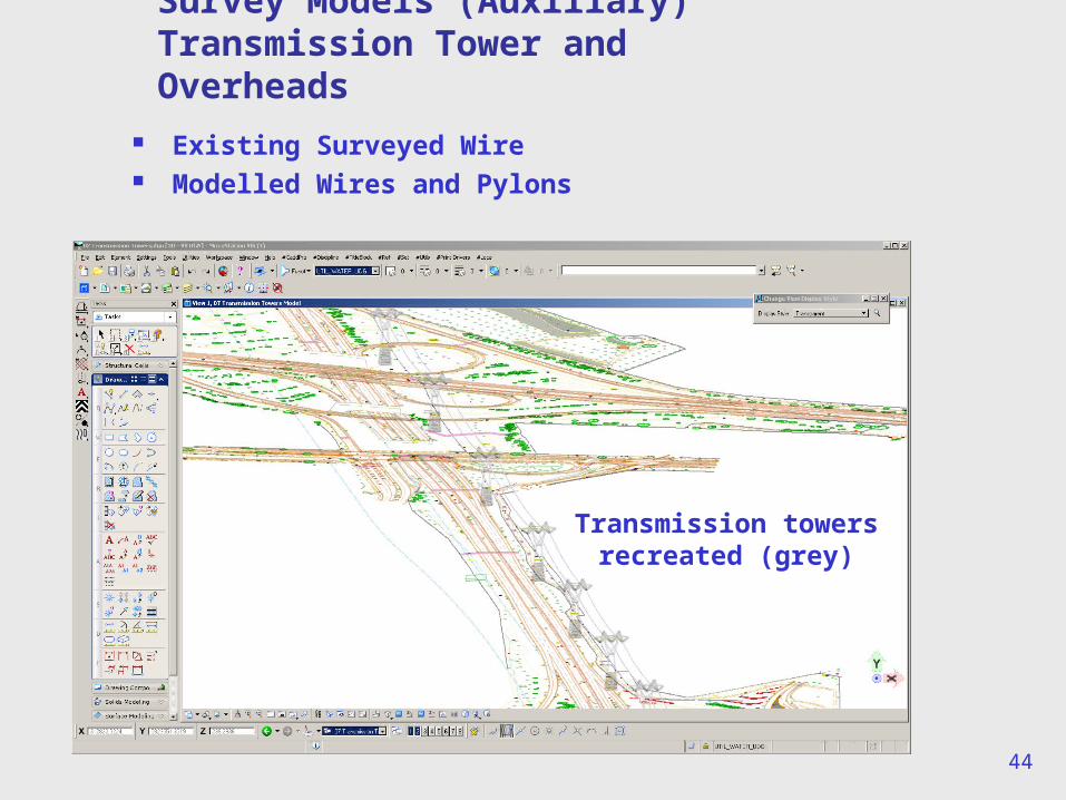
Survey Models (Auxiliary)Transmission Tower and Overheads
44
Existing Surveyed Wire Modelled Wires and Pylons
Survey Models (Auxiliary)Transmission Tower and Overheads
Transmission towers recreated (grey)
45
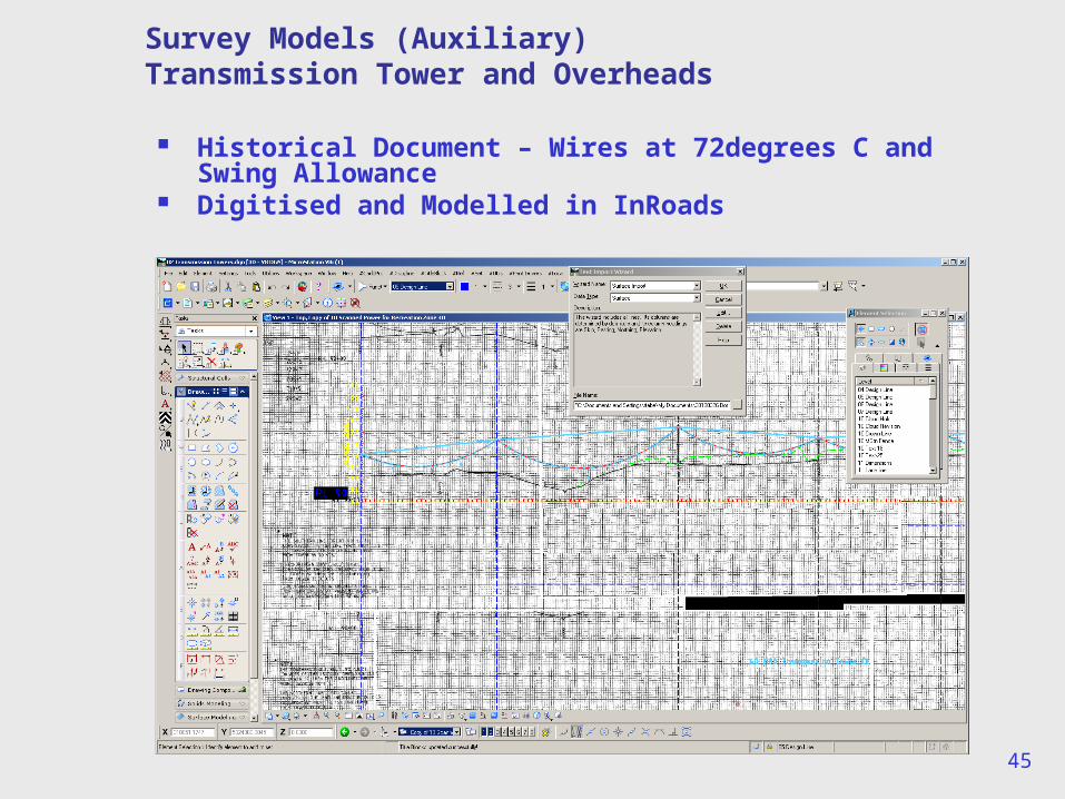
Survey Models (Auxiliary)Transmission Tower and Overheads
Historical Document – Wires at 72degrees C and Swing Allowance
Digitised and Modelled in InRoads
46
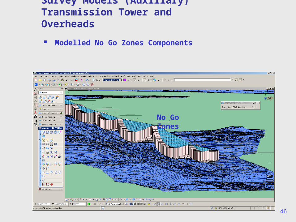
Modelled No Go Zones Components
Survey Models (Auxiliary)Transmission Tower and Overheads
No Go Zones
47
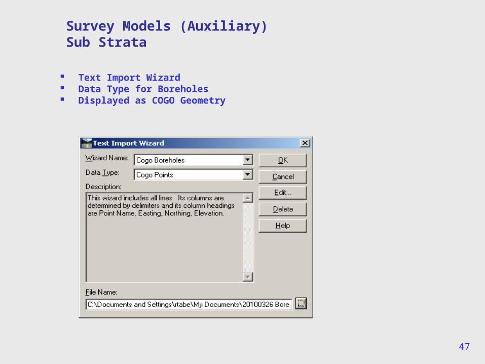
Survey Models (Auxiliary)Sub Strata
Text Import Wizard Data Type for Boreholes Displayed as COGO Geometry
48
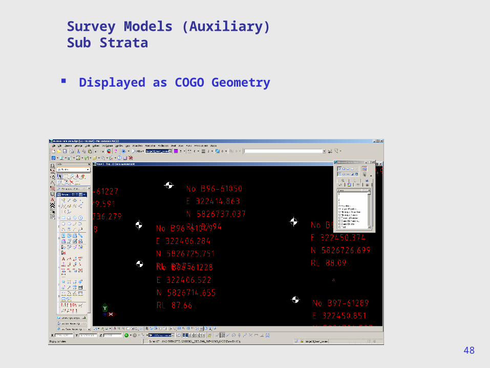
Survey Models (Auxiliary)Sub Strata
Displayed as COGO Geometry
49
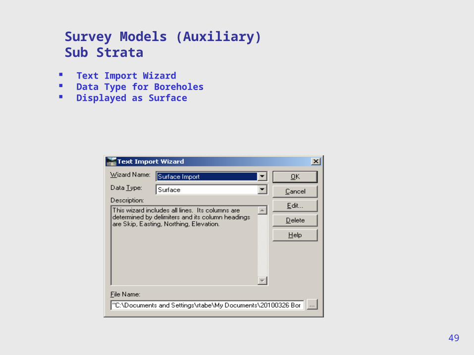
Survey Models (Auxiliary)Sub Strata
Text Import Wizard Data Type for Boreholes Displayed as Surface
50
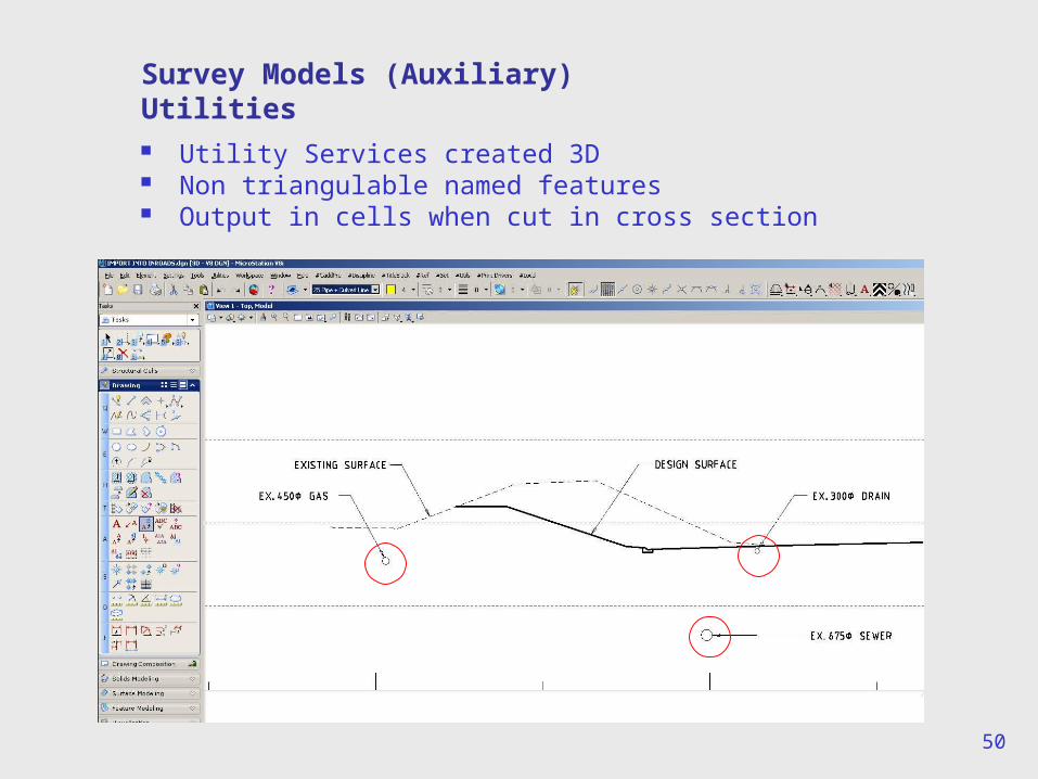
Survey Models (Auxiliary)Utilities Utility Services created 3D Non triangulable named features Output in cells when cut in cross section
51
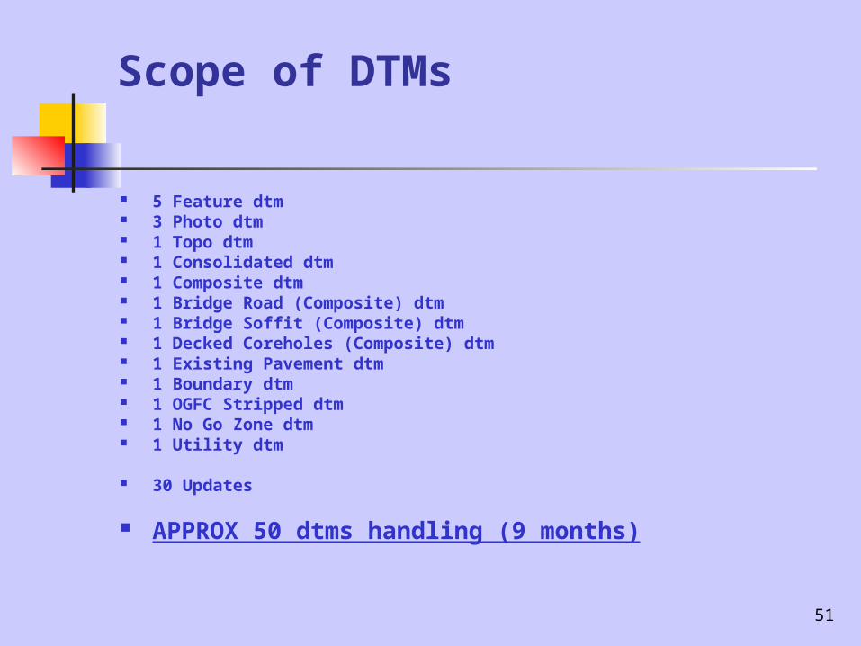
Scope of DTMs
5 Feature dtm 3 Photo dtm 1 Topo dtm 1 Consolidated dtm 1 Composite dtm 1 Bridge Road (Composite) dtm 1 Bridge Soffit (Composite) dtm 1 Decked Coreholes (Composite) dtm 1 Existing Pavement dtm 1 Boundary dtm 1 OGFC Stripped dtm 1 No Go Zone dtm 1 Utility dtm
30 Updates
APPROX 50 dtms handling (9 months)
52
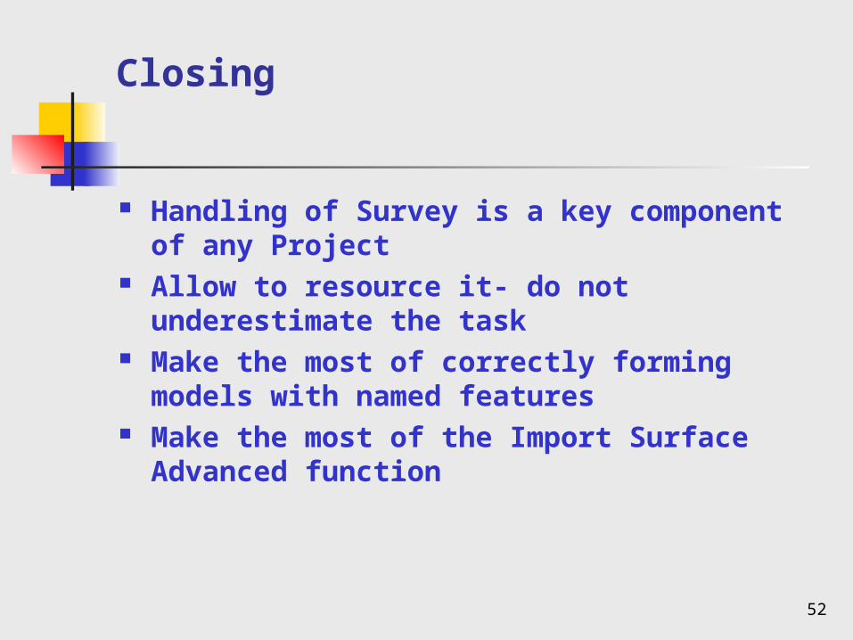
Closing
Handling of Survey is a key component of any Project
Allow to resource it- do not underestimate the task
Make the most of correctly forming models with named features
Make the most of the Import Surface Advanced function

53
Questions
Richard Tabe Parsons Brinckerhoff