Embed Size (px)
Citation preview
the role of open spaces in thetransformation of
landscapeurban

2

Edited by
anna lambertini
with Foreword by
raffaele milani
and Conclusions by
rita colantonio venturelli
the role of open spaces in the transformation of
urban landscape
Editorial AssistantAnna Lambertini
Graphic DesignElena Alberti
Editrice Compositoriis a trade mark of Compositori Comunicazione© 2013 Compositori Comunicazione srlVia Stalingrado 97/2 – 40128 Bolognatel. 051 3540111 – fax 051 [email protected]
ISBN 978-88-7794-831-1
The book was published with the support of:Italian Institute of Culture of Berlin
MEDDE, French Ministry of Ecology,Sustainable Development and Energy
Ser.In.Ar. Forlì-Cesena Soc.Cons.p.AServizi Integrati Facility srl
Login# Urban Landscape, Raffaele Milani ............................................................................................................ 9# Urban/Post-Urban/Not Urban: Proximate! Reinventing Border Landscapes, Anna Lambertini ......... 12# Urban Fragmentation and Open Spaces in Cities Undergoing Transformation. Commentary on the Sidelines of a Conference, Bas Pedroli .......................................................................................... 18# The Social Dimension of Projects Directed Toward the Recomposition of the Urban Landscape: European Vision and Local Identity. Commentary on the Sidelines of a Conference, Flavio Venturelli ... 21
1. Nature, Open Spaces and Landscapes 1.1. The Value of Ecosystem Services in Urban Landscapes, Beate Jessel, Alice Kube ................................... 291.2. The Ecological Role of Parks in Europe, Hansjörg Kuster ........................................................................ 411.3. Dans les «espaces ouverts» urbains, des vestiges du bocage paysan. Résilience ou trompe-l’œil? Monique Toublanc, avec la collaboration de Pauline Frileux ....................................................................... 51
2. Urban and Peri-urban Agriculture 2.1. Will the New Common Agricultural Policy Improve the Management of Rural and Peri-urban Settings and Landscaping?, Andrea Galli, Hubert Gulinck, Ernesto Marcheggiani .................................. 712.2. Economy of Rural Spaces. Two Results of our Work with Students, Kerstin Gothe .............................. 782.3. L’agriurbanité: trois modèles, de la ville agricole à la ville jardin, Pierre Donadieu ............................... 84
3. Public Spaces, Social Dynamic and Cities in Evolution3.1. Urban Open Spaces. Tradition and Modernity, Josefina Gómez-Mendoza ..........................................1033.2. Hidden Landscape. Rethinking the Contemporary City, Henrique Pessoa Pereira Alves .....................117 3.3. The Geography of Peri-urban Landscapes in Europe, Marc Antrop .....................................................1263.4. Les rapports sociaux à la nature et leurs évolutions, Yves Luginbühl ...................................................1423.5 Lifestyle and Ethnic Economies. The Contribution of Migrants in the Transformation of Urban Spaces in Berlin, Edith Pichler ................................................................................................................1513.6. Espaces publics périphériques et paysages de voisinage dans le Bronx (New York) et à L’Ile Saint Denis (Seine-Saint-Denis - Paris), Emeline Bailly ................................................................165
4. Landscape as a Project4.1. Aéroport Notre Dame des Landes, Nantes. Problématique de l’aménagement paysager lié au bocage Bernard Lassus......................................................................................................................1854.2. Landscape, Handle with Care, Franco Zagari .......................................................................................1924.3. “Moving” Urban Landscapes, Lorenzo Vallerini ...................................................................................1964.4. The Concept of Urban Lisière and its Application on Reunion Island, Sophie Bonin ...........................2114.5. New Landscape Opportunities in Urban Design, Giovanni Sala, Andreas Kipar .................................2274.6 Intermediate Scales for Italian Landscape. Projects in the Po Valley, Annalisa Metta ........................235
Logout# The Urban Landscape in the Digital Era, Rita Colantonio Venturelli ....................................................249
contents


7login
login

9
urban landscapeRaffaele Milani*
The present book is the product of lengthy discussions held initially in Berlin in March of 2013 and continued into March of 2014. It was no coincidence that Berlin was chosen as the site of the conference and the ideal location for an exchange of views on the city of today and the city of tomorrow. All the viewpoints expressed, which are interdisci-plinary in nature, flow from a single realization, namely, that the city is a landscape. It is increasingly so now that it has come to penetrate, through countless rivulets, into the surrounding countryside, swallowing up ever larger tracts of farmlands and wood-lands. But what sort of landscape are we talking about? We can leave the city and come into contact with the nature that surrounds it; however, we can also return to the city in order to indulge, from within, in the contemplation of its architecture, in its various forms and styles. In today’s extensive territorial habitat, the valorization of green areas, creative gardens, and shared gardens promotes an urban development that contrasts with cold planning policy, even as the latter is attempting to reinvent itself by proposing alternative energy sources, such as green or smart energy, to disguise the economic and political greed of large corporations. At the same time, however, we need to be wary of typically ideological actions on the part of some social groups. (Those who deface the walls of historic buildings while they support organic food stores engage in unaccepta-ble contradictions).
We often think of urban design as a philosophy, but this type of reflection is not nec-essarily the exclusive domain of specialists. There is also a popular vision of what the nature of developed land is and what it should or could be. What we wish to underscore here is the interrogating gaze of citizens in the face of the present forms of the grow-ing city where the senses are assaulted by empty spaces, unfinished projects, stylistic and environmental incongruities, abandoned, bare, or marginal zones, as well as ware-houses, road networks, mines, and landfills are seen of as opportunities for people to reinvent their urban environment. In their minds, citizens pursue the pleasurable, the tasteful, and the beautiful which, from place to place, can produce architecture with-out architects, and without involving great technical or structural revolutions. Such a
* Translated by Corrado Federici.
10 raffaele milani
perspective is useful for all sorts of arguments, especially today if we consider the new forms of the city that has become a cosmopolis, beyond any ideal, symbolic or meta-phorical meaning.
Irrespective of announced intentions, today’s improvised interventions on the part of some social groups appear as a useful showcase of creativity. Not every city is like Copenhagen or Stockholm. Except for a few important examples, we are discussing the typical city. This is not because people wish to become the next Tadao Ando, Frank Gehry, Kengo Kuma, Jean Nouvel, Richard Meyer, Renzo Piano, Dominique Perrault, or Daniel Libeskind, to name only a few of the more famous architects. Rather, it is because they would like to be liberated from the steady diet of forms imposed on them by an “architectural genius.” If anything, people fell closer to Emilio Ambaz and James Wines.
The cityscape, therefore, refers to the transformation of the land, but also to the great gamble of the times, the challenge of giving a human face to the cementification craze. Vertical gardens and green balconies appear on sections of our high-rise apart-ments; abandoned industrial areas are being transformed and converted for new use social uses; thin strips of green appear, like avenues of freedom, amid the solid mass of buildings opening up onto open spaces, between impromptu gardens, then fields, and woodlands. Architects design these kinds of structures, but they are not the only ones to do so since many groups of citizens also create them. Every architectural form, even if improvised, is increasingly landscape and, as such, is conducive to a productive, educational, and creative rapport between the environment and the spirit of the shared city. In the social context, our gaze and our body in motion activate waves of emotions, images, intentions, and forms of industriousness, both within and without, between what is outside and far from us and what is inside and close to us.
Today especially, as noted, the appropriate correlation between our experience of the natural environment and our experience of urban landscape in a reciprocal interchange is clear. As humankind inhabits the earth, so too do we inhabit the city. Urban conglom-erates large and small may have been the realization of the utopia of tradition or of mo-dernity, but the city, and even more so the modern megalopolis, with its diversification of zones, namely, its public squares, neighborhoods, buildings, monuments, and open spaces, can inspire many different and positive actions.
To inhabit a city aesthetically means to appreciate the dignity of the visible, struc-tural features of the whole in which we live. The opening up of a window onto a patio or a street, the vertical or horizontal expanse of buildings and their agglomeration, as passageways, boardwalks, arcades, unusual lanes, the map of our movements either on foot or by electric means of transportation, and the play of camouflage (whether good or bad) correspond to a dynamic based on a politics of doing, between sensibility and form,
11urban landscape
prompted by a desire to humanize the urban fabric. This is quite different from Rem Koolhaas’ reinvented cities. Furthermore, there exists in the vast expanse of masses and materials, a precise relationship with the very soul of storytelling, which has always accompanied the human adventure. This is a new story of humankind, a new mythology that unites us. We may think of the city as a text made of stones, a graphic invention, a green weft, an arabesque of symbols and meanings with grammatical and syntactical elements forming a rhetoric of space enlivened by many recurring figures of speech.
We discover an infinite number of ideal labyrinths in which to move while experienc-ing the pleasure of doing, building, and living aesthetically. Who knows? Out of this grand human narrative may emerge the idea of one’s identity based on an articulated industriousness in the extended territories, the new medieval guilds described by Rus-kin, with the aim of renewing the pact of cooperation and social planning among the inhabitants of a city.
In the future, where a positive relationship among the environment, architecture, and nature is possible, we may rediscover the captivating spirit of the Middle Ages, which perhaps will bring peace to a lacerated earth.
12
urban/post-urban1/not urban: proximate!reinventing border landscapes2
Anna Lambertini
Open spaces are heterogeneous, changeable and fragile, because they are constantly exposed to the risk of being filled, eroded and consumed in the construction of human settlements. Nevertheless, at every possible scale of analysis and interpretation (geo-graphic and topographic), they make up a primary resource that is fundamental for the protection and implementation of the web of life (meant in a biological, ecological, and even cultural and social meaning).
Open spaces are the negative spaces in built volumes: which regard public and private areas, comprehending permeable and impermeable surfaces, areas with or without ve-getation, designed places and abandoned places, small residual fragments of free soil or vast and composite regional areas, bodies of water and wooded areas. For the informed designer, this empty space always has a positive and promising meaning, expressed by the potentiality inherent in the dynamism of life. It should be read in dialectic terms, as a dialoging entity with the full weight of what has been constructed. Furthermore, each open space contains an image of complexity, it is an open process, it has various vocations, and it has its own poetic dimension. It doesn’t necessarily need to carry out a specific function and foresee a direct and active anthropogenic use3.
The story of the transformation of the modern city (Josephina Gomez) has accustomed us to coming to terms with the precariousness of open spaces, both inside and outside the urban fabric, and with the restlessness of the ideas of beauty and of the behaviors of the society that has shaped them over time (Franco Zagari).
The multiple, discontinuous and uncertain margins of the city, that we describe as spread-out, polycentric, endless and sprawling, are in great part the product of the poli-cies and projects founded on the belief that predominated for decades: that it is possible to govern that complexity by simply ignoring it.
1 About the idea of post-urban landscape, see Di Felice M. (2010), Paesaggi post-urbani. La fine dell’esperienza urbana e le forme comunicative dell’abitare, Bevivino Editore, Milano/Roma.
2 Translated by Cassandra Funsten.3 Ferrara G., Campioni G. (1997), Tutela della naturalità diffusa, pianificazione degli spazi aperti e
crescita metropolitana, Il Verde Editoriale, Milano.
13urban/post-urban/not urban: proximate! reinventing border landscapes
It was thought that the natural elements could be controlled without investigating the living processes. Abrupt changes in scale, accelerations of gravity, fraying, sudden contractions and dilations of the empty and full spaces characterize what is called the peri-urban area. Here, the unresolved tensions of urbanization lurk and the conflict between the compatibility of various materials, life rhythms, users and uses, and tem-poral stratifications becomes more evident.
However, these landscapes still represent a rich deposit of possibilities. They are made up of a kaleidoscope of situations, spaces, and habitats that we can see coexisting and that we can encourage to co-evolve. They are laboratories where responsible strategies and practices for living our time can be tried out. In these territories that have been hybridized by this de facto complexity, an advanced and eco-responsible vision of the landscapes of the XXI century can still be constructed if a primary structuring and con-nective role is assigned to the open spaces.
From whatever disciplinary perspective one wishes to consider, open urban and peri-urban spaces reveal their multiple potential, qualifying themselves each time as:- representation devices for the creation and sharing of aesthetic, socio-symbolic, po-
etic, and figurative values; - containers of natural, cultural, social, and economic resources; - factors of ecological and environmental compensation; - areas that produce cultural memory and social cohesion; - places that are necessary for the quality of daily life of those who live in the city4.
From the very first page, this is the common foundation that the reflections, design visions, and research trajectories that make up the multidisciplinary framework presen-ted to the reader follow. Peri-urban landscapes need to be analyzed through interpretive categories and forms of alternative perceptions (Andreas Kipar and Giovanni Sala, Henri-que Pessoa Pereira Alves) and to be managed through the application of new multidiscipli-nary visions of change. Thus, what’s needed at each and every level of programming and spatial planning is an intervention that overcomes sectorial visions and operates accor-ding to a holistic and integrated perspective. Regarding this point, both explicitly and indirectly, many of the contributions collected in this volume invite reflection: on the application of European Union measures relating to the productive-agricultural sector (Hubert Gulinck, Andrea Galli, Ernesto Marcheggiani), on the development of agro-urban models and the recognition of social practices consolidated in Neighborhood communi-
4 See Lambertini A., Corrado M. (2011), editeb by, Atlante delle Nature Urbane. Centounovoci per i paesaggi quotidiani, Editrice Compositori, Bologna.
14 anna lambertini
ty vegetable gardens (Pierre Donadieu, Yves Luginbuhl, Emeline Bailly); on local multicul-tural micro-economic incentives that can positively affect the quality of the city’s public spaces (Edith Pichler); on experimentation with instruments for regional government that rediscover the role of the “intermediate” scale (Annalisa Metta) and on the organi-zation of open spaces into a system with ecological and functional connections at the municipal and metropolitan level (Andreas Kipar e Giovanni Sala).
In their descriptions of scenarios and experiences, some of the authors suggested ac-tions and themes to be emphasized in design: exploring the landscape dimensions of the new large territorial infrastructures of mobility (Bernard Lassus, Lorenzo Vallerini); revi-ving those historic traces deposited in the remaining forms of traditional rural space (Mo-nique Toublanc); re-launching rural agriculture and the local micro-economy by imagining new multi-functional models (Kerstin Gothe); actively conserving agro-forestry regions and parks near the city, which are fundamental for the conservation of biodiversity and of eco-systemic services (Beate Jessel e Alice Kube, Hansjorg Kuster).
A wealth of perspectives and voices who invite the reader to consider the territory of urban sprawl without prejudice, in such a way as to bring out all of the different existing realities in order to favor new relationships in the present.
In this light, the term peri-urban reveals its semantic weakness5. Not only because it tends to evoke incorrect visions of contemporary settlements (city-centers with another territory around it), based on an antagonistic relationship between the city and the countryside, but also because it risks encouraging a generic use of the terms urban and agricultural, and as a consequence flattening the meanings and images of reality that re-ally have a multiple and changeable identity. Decades of the application of certain urban planning policies have demonstrated that evolutionary visions of places and landscapes cannot be based on the delimitation of mono-functional homogenous zones, floating on the flattened space of the zoning map like islands subject to separate rule. Inside and on the edge of the city, we have found that homogeneity, immobility and separateness are not good principles to adopt in order to guarantee the landscape and environment’s quality and to favor the richness of living in cultural, social, economic, and figurative terms as well as the intensity of every-day experiences.
The concepts are others: heterogeneity, transcalarity, the multiple temporality of chan-ge, perceptual and functional connectivity, and evolutionary dynamics. During the ‘Ni-neties, these key words (that we find written in the historical origins and the theoretical and practical traditions of landscape architecture) come up again and again in the debate
5 Valentini A. (2006), Paesaggi di limite, Firenze University Press, Firenze.
15
over the city and are recalled with insistence, to all those interested in spatial planning and urban design, as inescapable “new” guiding principles of regional dynamics.
Acknowledging the complexity of the processes of urbanization, however, does not only mean more consciously focusing on the multi-functional role of open space: it me-ans updating the usual technical and cultural instruments, facing change courageously, and experimenting with alternative critical categories and alternative implementations.
Some contributions to this volume, in their rereading of the relationship between urban and agricultural, between central and peripheral, rotate around the theme of limits: returning to the meaning of this figure helps to reformulate the approach to the question of sprawl. Historically, each time a crisis has come up regarding the interpretation of the city, of its form and its evolution, the spatial and temporal instability of the city itself as well as its bor-ders was noted. Currently, its taken for granted that this condition makes up the character of the city: the European scenarios present a geographic dynamism that has never been so high and diversified in the history of human settlements (Marc Antrop), played out on the continuous redefinition of the fronts where the urban meets the rural. In dwelling culture, an uncertain border tends to generate bewilderment, to make our inner compass waver6 and an etymologic reading confirms that the limit is inherent in that same concept of urban.
“Urban” is derived from the Latin word urbs, which according to Varrone, is derived from the contraction of the words urvum, the handle of the plow used by the Romans whose groove marked the limit within which the new city was to be built, and orbs, the boundary line drawn on the ground. This limit evokes the design of a constructed set-tlement with an ordered layout contained within a wall. It is a concept of city that only partially remains in the contemporary European reality as a historic testimony, but does not exist as a whole nor in what we imagine as its evolution.
Understood as the last confines that shouldn’t be crossed, the limit maintains all of its semantic charge as an ethical principle in defining the relationship between the evolu-tion of human settlements and the use of resources. Limit is, in fact, a key word in global environmental policies, present in the notion of sustainable development, a skillful reworking of the concept of limiting development introduced in the ‘Sixties (Henrique Pessoa Pereira Alves). Not withstanding the fact that it is currently abused, that notion maintains in nuce the principle (still largely disregarded) that natural resources and free soil are finite. This limit exists in contemporary urban culture as part of the idea of a responsible management of life on our planet, and has been invoked in various interna-tional conventions and agreement protocols.
6 Zanini P. (2002), Il significato del limite, Bruno Mondadori, Milano.
urban/post-urban/not urban: proximate! reinventing border landscapes
16 anna lambertini
However, by now the limit has become completely inadequate as a category of ur-ban design. Instead, the concept of the limit has been substituted by others that more efficiently control the processes of “shrinking cities”. Margins, fringes, edges and hems: by recalling complex spatial concepts, they allow the substitution of the concept of a border between opposite entities, or simply an administrative border, with that of a porous thickness of mediation, of a fractal band, of an irregular outline and therefore of a landscape entity of transition.
Margins, fringes, edges and hems mark changeable and sensible interfaces that relate between different proximate environments.
In particular, fringes, hems, and edges, have an additional nuance of meaning, because they go back to the idea of a fabric, of a warp and weft (Sophie Bonin). If the concept of fringe has a more consolidated use in the European planning lexicon, that of hem and edge seem much more convincing from the figurative and semantic point of view, as interpretative categories for landscape planning and design. In this exploration of the margins, fringes, edges and hems as landscape figures, we believe that the concept of pro-ximity7, with its simultaneous, different projections of meaning, provides a convincing design orientation as well as an inventive analysis of what exists. Speaking of proximity, in fact, allows the designer to refer to the idea of physical and spatial contiguity as much as to affectionate and relational contact between people and between people and places; furthermore, through its interpretation as nearness in a temporal sense, proximity invi-tes us to take responsibility for the changes in progress and predict upcoming forms of change and management actions. The primary field of human and social relationships as well as cultural exchanges, of potential mediations and conflicts, the space of proximity is a critical space of meeting and confronting the other. Therefore, the space of proximity is ontologically a field of interaction and by its very nature has an ambivalent role, a cha-racter of unpredictability that is impossible to erase.
Thus, discontinuity and breaks are intervals to reread and reconfigure, introducing gra-dients of approximation between places, areas, and landscape layers with different characte-ristics. It is with gradients of approximation (a synonym of drawing together, approaching) we are referring to a sequence of integrated actions/interventions that, by working in a recursive manner on more than one temporal and spatial scale, foreseeing various inten-sities of transformation, can bring together environmental systems, territorial patterns, emotional topographies, and spatial deployments that are near each other but not inter-
7 Lambertini A., (2013), Urban Beauty! Luoghi prossimi e pratiche di resistenza estetica, Editrice Compositori, Bologna.
17
connected, to involve them in dialectic co-evolutionary processes, favoring multiple and differentiated timing for change. Proceeding through gradients of approximation, which means that spaces and landscapes of proximity are also intercepted and reinvented throu-gh viewing them as well as by actively involving those that live there. Not only sharing the experience of site-specific interventions, but also recognizing fight-specific social processes.
The term approach grafting is used in horticulture and gardening to indicate the techni-que in which “two plants that grow near one another are welded together through their trunks or through their branches”8. By extension, one could speak of approach grafting landscapes and imagine looking at urbanization processes through the lens of landscape architecture, a discipline that deals with places as if they were living structures, bases design on themes of growth, of movement, of narration, on the construction of rela-tionships between different entities, in space and time, in area and in depth. The Lan-dscape project embraces the indeterminacy and randomness inherent in every living dynamic and even in this sense functions by gradients of approximation: it doesn’t propose definitive solutions, but adaptive adjustments. In landscape architecture “white zones” or neutral or unneeded empty spaces don’t exist: time is substance and open space is an aesthetic, social and ecological resource (from the Latin re-surgere, to rise again).
The fact that the concept of edge is also contained in the definition of ecotone reinfor-ces this position. Aside from making up, as is known, an ecologic zone of tension cha-racterized by an elevated biologic diversity, the ecotone is also an area of structural and functional connection9 that takes on a determinative role in the exchange of materials and energy between contiguous ecosystems, exercising a selective (filter) and regula-tory (buffer) action those exchanges. A landscape approach graft takes these functions into account, but in a broad sense, seeking to favor the figurative, socio-symbolic, and temporal diversity of proximate landscapes as well as their biological diversity.
With this perspective, working on multiple margins, on the irregular borders of the metropolitan areas with the materials and the methods that belong to landscape archi-tecture, would allow for the re-composition of a connective tissue, without stitches or rips (after Mac Harg, 1969). A continuous living fabric, heterogeneous and stratified, made by the multiplicity of spaces, of habitats and of nature that characterizes the hu-man settlements of the new millennium. Cultivating spaces and hybrid transformation times with an inventive attitude, we take this occasion to work on the quality of our proximate landscapes.
8 Cf. Treccani.it, vocabolario on line, http://www.treccani.it/vocabolario/approssimazione.9 Farina A. (2001), Ecologia del paesaggio, Principi, metodi e applicazioni, UTET, Torino.
urban/post-urban/not urban: proximate! reinventing border landscapes
18
urban fragmentation and open spaces in cities undergoing transformation. commentary on the sidelines of a conferenceBas Pedroli
It is the exciting urban environment of Berlin, the emblematic representation of a dynamic central-European city freed of its confines since only 25 years, completely re-vitalised in less than a generation’s life time, that is present – more or less implicit – as an inspiration in much of the considerations of the afternoon session of the Confer-ence. The question at stake was how to engage in responsible planning of the landscape in and around cities, as a precondition for a healthy future environment for all citizens. The speakers in this session have chosen a variety of challenging points of view, all attempting to pioneer in shifting the boundaries of traditional landscape planning practice.
It seems that the authors largely agree on some challenging issues:• publicopenspacesintheurbanlandscapeplayanessentialroleinthesociallive-
ability of the town (Luginbühl, Donadieu, Bonin, Bailly);• involvementoftheinhabitantsandotherstakeholdersinlandscapeplanningen-
hances the development of new, sustainable landscape concepts (Gothe, Toublanc, Bailly);
• newvisionsareneededontheintegrateddesignandplanningofliveableneigh-bourhoods (Donadieu, Gómez-Mendoza, Metta, Bailly);
• newfunctionsofurbanopenspaceswillneedtobeidentifiedtoenhancetheirsus-tainable development (Luginbühl, Gothe, Toublanc, Bonin);
If these challenges are taken serious, our future towns will definitely be more inviting!
Yves Luginbühl (Social Relations to Nature and their Development), starting from a historical perception of societal crisis, emphasises the importance of the everyday landscape in this context, since it consists in the values attributed to it by the citizens. Especially the degradation of allotment gardens in the former socialist countries is in-dicative for the huge change in the relationship of society with nature: the landscape of the gardens ceases to function as an opportunity of retreat and vitality, whereas the new peri-urban landscapes are not yet ready to assume these functions. This evokes the question: how can we live with nature, a question that is not of less topicality to policy development in Western Europe either.
19
Kerstin Gothe (The Economy of Rural Spaces) focusses on the possibility to involve students in rural settlement planning. The outsiders’ view of the students appears to produce sometimes astonishing new incentives for rural development, depending on the openness of the inhabitants to accommodate new trends, but also on the way urban citizens can be involved in making clear that they are ready to play a committed role in establishing new functions of the rural, like the adoption of renewable energy sources or changes in lifestyle and leisure activities.
Pierre Donadieu (Agriurbanity: Three Models, from Agricultural Town to Garden Town) proposes a new concept, agriurbanity, in the description of urban agriculture. Depart-ing from the observation that today more than half of the world’s population is urban (in Europe even more than 80%), a largely neglected policy need is evident to develop re-sponsible strategies for agricultural and natural spaces in and around the towns. Some examples already exist (among which the Barnim Nature Park at Berlin and the three agro-rings around Xi-An in China) where public policy is actively promoting agri-urban landscape as a common good. Many different variants of garden cities and peri-urban developments are subsequently described, where three basic models can be identified: the traditional (and vulnerable) agricultural town; the agro-ecological town with short, publicly governed producer – consumer chains; and the garden town, where the open public space is gradually replaced by private properties.
Monique Toublanc (Green Plots and Periurban Territory: Between Biodiversity and Landscape) argues that as long as green plots and hedgerows are remnants of former functional landscape elements, they are bound to degrade and finally disappear. Even when inhabitants tend to be attached to these relics of the landscapes which they still remember, or which they would like to see rehabilitated, the functions have changed and inevitably the expression of these green plots also undergo transition. Some nice examples are described of involvement of the local population (part of which newcom-ers) in the design of green plots in peri-urban landscapes, reconciling landscape identity with biodiversity through new functions.
Annalisa Metta (Intermediate Scales for Italian Landscape. Projects in the Po Valley) makes the observation that in traditional Italian town and landscape planning the bond between architecture sensu strictu and landscape planning was inseparable until the sev-enties. This led to famous masterpieces of landscape planning, inspiring landscape ar-chitects abroad as well. However, since then a large gap has arisen between architecture and planning, where quasi-democratic procedures and norms characterise the latter and would-be aesthetics the former. Three cities (Cesena, Bologna and Reggio Emilia) along the southern edge of the Po-plain are described, demonstrating a new tendency in the Emilia Romagna Region to promote exciting new, integrated peri-urban landscape
urban fragmentation and open spaces in cities undergoing transformation
20
projects. It seems that thus new opportunities are arising for structural cooperation between urban design and landscape architecture.
Josefina Gómez-Mendoza (The Tradition of Open Spaces in Cities and Modernity) dis-cusses the development patterns of several European cities, demonstrating that open spaces in town extensions in many cases evolved from well-designed publicly accessible or at least perceivable open spaces to poorly defined randomly located open spaces, of-ten just filling the space between building blocks, and dominated by transport. The town planning history of Barcelona and Madrid shows that densification of the originally designed urban structure has often undone the abundance and social practicability of open spaces in town. On the other hand, spontaneous peri-urban developments tend to result in a non-city occupation of the rural area, characterised by discontinuity and frag-mentation, and a predominance of private car transport. New visions are highly needed to create urban and peri-urban environments for new comfortable cities, encompassing sustainable landscapes.
Sophie Bonin (The Concept of Urban Fringe and its Application on Réunion Island) ad-dresses the various experiences of designing the urban fringe, a fairly recent area of practice in the French planning tradition pioneered by landscape architects. The exam-ple of Réunion Island is illustrative because of the large population growth, combined with limited suitable space for settlement, characterised at the same time by a very rich landscape and nature. Much like suggested by Donadieu, on Réunion the promising di-rection of public policies regarding peri-urban development seems to lie in the inclusion of sustainable agriculture in the public space of the town.
Emeline Bailly (Peripheral Public Spaces and Neighborhood Landscapes in the Bronx (New York) and L’Ile St Denis (Seine St Denis – Paris)), in the last presentation of the afternoon, presents a very interesting comparison between rehabilitated neighbour-hood landscapes in New York (Melrose) and Paris (Ile St Denis), within the perspective of sustainable development. In both cases for example, the value of nature is explicitly promoted as part of the new identity (green and blue infrastructure in St Denis, and the transferred ideal of “the house in the countryside” in Melrose), but is used as well to at-tract investors. Interestingly the inhabitants do not share the idea of urban nature (rep-resented in public space in St Denis, and rather in private property in Melrose), prefer-ring a much wilder image as nature. Landscape in this perspective may translate into a “governed freedom”, enhancing heterogeneity rather than reproducing known images.
bas pedroli
21
the social dimension of projects directed towards the recompositionof the urban landscape: european vision and local identity.commentary on the sidelines of a conferenceFlavio Venturelli*
A peaceable medium-sized German town like Stuttgart seems to embody the vision of modern urbanism: industrial plants and comfortable residences, all immersed in wide green spaces for all to use. Yet here in 2010 and 2011 groups of citizens chained themselves to century-old trees to prevent their felling to make space for a high-speed train station. The police did not take long to act, and the protesters eventually had to decamp. In Istanbul in 2013 the more brutal Gezi Park clashes were shown through-out the world. Although neither its history nor its present - characterized by a chaotic sprawl - make Istanbul comparable to Stuttgart, here too concerned citizens turned out to defend a green area threatened by new construction, at least in the early stage of the protest. It has widely been noted that in both countries only a minority of the protest-ers belonged to radical political groups, while the majority were ordinary citizens1. The question arises spontaneously: why are such large numbers of ordinary people prepared to take an active part in defending a few trees? The answer is equally straightforward: green areas are perceived as a limited resource, like oil, water and all the resources that are critical for human life on Earth. People are prepared to occupy urban spaces physi-cally to defend their resources and material and immaterial goods, including freedom itself. As many have noted, the term “Occupy” no longer characterizes merely a collec-tion of protest movements. Occupation involves repossession by the community of a real physical space that would otherwise risk becoming no more than a virtual presence in the urban landscape2. Protests enable citizens to restore to urban areas a meaning that their administrators seem to want to take away. Often, repossession may give rise to novel meanings: in line with Heidegger one could even say that repossession entails
* Translated by Silvia Modena.1 Delera, R. (2013), Una sera a Taksim, http://www.ilpost.it/2013/06/06/una-sera-a-taksim/, in Il Post,
visited Sept. 23rd, 2013.2 Mörtenböck, P., Mooshammer, H. (2012), Occupy. Räumedes Protests, Transcript Verlag, Bielefeld; see
also NCCR Democracy, Kriesi, H., Lars Müller Pub. (2013), editors, Democracy, Lars Müller, Zürich.
22 flavio venturelli
a new manifestation of the place that has been occupied3. At the same time the occupa-tion becomes an opportunity for citizens to express publicly their notion of their terri-tory. The protests thus prepare the ground for something that transcends the individual sites: it is the probable birth of new landscapes4.
Urban landscape transformations give rise to a variety of aesthetic notions and trends that are closely related to social dynamics: the images of the protests mentioned above expose this connection. Despite the unsettling pace and reach of the changes, the relationship between social and aesthetic aspects is not a novelty to those who study the landscape5. Moreover, the awareness of green spaces as a finite resource certainly does not arise in the early 21st century, but is inherent to the origin and development of industrial metropolises: literature and the visual arts6 have consistently documented the dramatic effects of the absence of urban green since the dawn of industrialization, permanently changing the way in which we think of the landscape. Acknowledging the value of public green areas in modern metropolises was the precondition for the emer-gence of the notion of urban landscape at least since F. L. Olmsted’s renowned designs7.
The most distinctive feature of the recent urban landscape transformations is their global diffusion. The simultaneous occurrence of urban sprawl and shrinking and their consequences have definitively demolished the notion of the landscape as something “outside town”. Accordingly, the phenomena related to the urban landscape are no long-
3 Heidegger, M. (1951), Bauen Wohnen Denken, pp. 152-158 in Vorträge und Aufsätze, Günther Neske, Pfullingen.
4 Based on the definition of landscape as formulated for instance by Rosario Assunto: “the landscape is nature where civilization looks at itself in the mirror, recognizes itself, identifying itself in its own forms (…)”; from Assunto, R. (1994): Il Paesaggio e l’estetica, Edizioni Novecento, Palermo, p. 21, quoted by Priore, R. (2009), No people no landscape. La Convenzione europea del paesaggio: luci e ombre nel processo di attuazione in Italia, Franco Angeli, Milano .
5 For a systematic discussion of the connection between the social and aesthetic aspects of the landscape see Küster, H. (2012), Die Entdeckung der Landschaft. Einführung in eine neue Wissenschaft, C.H. Beck, Mu-nich. For the specific theme of urban, especially European landscapes, see Greenkeys Project Team (2008), editors, eLearning Module in Greenkeys @ Your City – A Guide for Urban Green Quality, IOER Leibniz Institute of Ecological and Regional Development, Dresden.
6 A detailed discussion of these is outside the scope of the present work. The state of towns at the dawn of the industrial revolution is effectively described in the travel notebooks kept by K.F. Schinkel during his journey through England in 1826.
7 Miller, S. C. (2003), Central Park, An American Masterpiece: A Comprehensive History of the Nation’s First Urban Park, Abrams, New York; Zaitzevsky, C. (1982): Frederick Law Olmsted and the Boston Park System, The Belknap Press of Harvard University Press, Cambridge; Taylor, D. E. (2009), The Environment and the Pe-ople in American Cities, 1600s-1900s: Disorder, Inequality, and Social Change, Duke University Press, Durham.
23the social dimension of projects directed toward the recomposition of the urban landscape
er confined to a few metropolitan areas, but are affecting increasingly broad regions of the planet, hence increasingly large number of inhabitants. As mentioned earlier, in such areas it is not only open green spaces that are perceived as limited and valu-able: here all resources essential for human survival, i.e. for the biosphere, are viewed as a system that can no longer be exploited exclusively to achieve short-term profits, but rather requires managing based on the well-established notions of complexity and sustainability. From this standpoint the landscape is thus a system characterized by the interaction of the ecological, economic and social (or socio-aesthetic) dimensions.
Such momentous changes have deeply affected landscape-related disciplines since the turn of the millennium. In this context it is interesting to describe the different ap-proaches that were adopted on the two sides of the Atlantic. The north–American land-scape tradition, revisited in the second half of the 20th century by Ian McHarg8, found new exponents first in Landscape Urbanism and subsequently in the constellation of theoretical reflections and design experiences that has taken the name of Ecological Urbanism9. The urgent need to ensure the planet’s survival was set as the new task of design. Mohsen Mostafavi made this seminal observation:
“Increased numbers of people and cities go hand in hand with a greater exploitation of the world’s limited resources. Every year, more cities are feeling the devastating impacts of this situation. What are we to do? What means do we have as designers to address this challenging reality?”10.
The development of new aesthetic approaches and the refining of new praxes become essential means to answer such crucial questions. In this framework the ability to take into account the dimension of the landscape becomes a precondition for providing ef-fective responses. As noted by Charles Waldheim:
“Across a range of disciplines, landscape has become a lens through which the contem-porary city is represented and a medium through which it is constructed”11. The same changes were addressed in Europe in quite a different way, i.e. through an approach based on politics and an international treaty. In July 2000 the Ministers’ Committee
8 McHarg, I. (1969), Design with Nature, Garden City for the American Museum of Natural History, New York; Steiner, F. (2004), Steiner, Healing the earth: the relevance of Ian McHarg’s work for the future, pp. 141-149 in Philosophy & Geography Volume 7, Issue 1.
9 An overview of these developments is provided by the articles collected in Issue 71 of Topos. See in particular Kongjian Yu’s contribution on pp. 58-63 Five Traditions for Landscape Urbanism Thinking. Inspiring traditions in urban planning, design history and related fields.
10 Mostafavi, M. (2010), Why Ecological Urbanism? Why Now?, pp. 30-35 in Topos Issue 71.11 Waldheim, C. (2006), The Landscape Urbanism Reader, Princeton Architectural Press.
24
of the Council of Europe approved the text of the European Landscape Convention12. Riccardo Priore, who followed its draft on behalf of the Council, highlighted the novelty of the approach:
“In a society where images are often confused with reality, the landscape can thus become an opportunity to wield power in the positive sense of the opportunity offered to a community to establish, consolidate and develop its social organization. Thanks to its symbolic potential as the representation that a society can produce in relation to its ability to exist and become integrated in the world, the landscape can be the basis of a political project capable of sustaining civil and socio-economic progress”13.
Power viewed as an opportunity is clearly apparent in the contemporary urban land-scapes of Europe. In fact, more and more often portions of the urban landscape become the jousting ground for those who wield three different aspects of power: the designers themselves, who wield the power to define the development scenarios of a given land-scape; citizens, who are increasingly determined to exercise their criticism and decision-making power; and administrators, who are called upon to wield their power to steer, control and mediate between the other parties. The analogy with the separation of pow-ers that characterizes democracies is clear. So is the fact that the instruments envisaged by the Convention offer to European urban landscapes the historic opportunity to be-come one of the more mature manifestations of democracy14.
Again in Priore’s words15, the origin of the Convention is to be ascribed to the “desper-ate search for an identity” and a meaning of the sites, which gives rise to a “demand for landscape”16 that is particularly widespread among European citizens. Such demand, induced by crucial changes, is reflected into a pressing request for physical places where
12 For the Convention’s signatories and ratification status see Council of Europe (2012), editor, The Euro-pean Landscape Convention, http://www.coe.int/t/dg4/cultureheritage/heritage/Landscape/default_en.asp, visited Sept. 25th, 2013.
13 Priore, R. (2009), op. cit., p. 22.14 For the historical evolution of the relationship between political regimes and landscape see Lu-
ginbühl, Y. (2008), editor, Paysage et politique, pp. 90-101 in Colantonio Venturelli, R. (2008), I paesaggi d’Europa tra storia, arte e natura; “Atti della Conferenza Trilaterale di Ricerca 2005-2007”, Centro Italo-Tede-sco Villa Vigoni, Menaggio.
15 Priore, R. (2006), op. cit., p. 20.16 Gambino, R. (2004), I paesaggi dell’identità europea, p. 1 in Prolusione all’Anno Accademico 2003-2004, Po-
litecnico di Torino, Torino. With regard to the “demand for landscape” Gambino makes reference to Berque, A. (1995), Les raisons du paysage: de la Chine antique aux environnements de synthèse, Éditions Hazan, Paris.
flavio venturelli
25
communities can identify themselves. However, subsequent interventions demon-strate that the identity issue is never manifested univocally17.
Sometimes it is the same citizens who take direct and informal possession of non-conventional sites such as viaducts and rail tracks. With regard to the contributions of the speaker at the last session of the conference, Henrique Pessoa demonstrates that we are not fully aware of the extent of this movement: the history of New York’s High Line is merely its most advanced front. Elsewhere repossession is achieved through a steady, systematic redesign of the urban landscape. The designs presented by Andreas Kipar and Giovanni Sala for Milan and by Lorenzo Vallerini for Florence provide a community with an opportunity to revive its sense of belonging to its past and its present. But in what kind of landscape can a community that has ceased to be characterized by a puta-tive ethnic identity identify itself ? What is a multicultural landscape? In other terms, what landscape results from the meeting, not devoid of strain and tensions, of different cultures hence of different ways to view the landscape itself? Such vital questions have been asked by Edith Pichler in her analysis of the changes undergone by urban spaces as a result of the presence of new migrant communities in Berlin. This is probably among the most challenging issues posed by urban landscapes to those who are called upon to design and manage them. Paola Viganò’s study of the evolutionary scenarios of the Flemish landscape has taken up the challenge in one of Europe’s regions where the strain of identity issues is more intense.
Today those who are called upon to design a landscape are therefore required to come to terms on the one hand with historic changes and on the other with citizen communi-ties seeking to redefine their identity. As James Corner perceptively noted, it is possible to identify “four interpractical themes from which to organize the emerging […] prac-tice: ecological and urban processes over time, the staging of horizontal surfaces, the operational or working method, and the imaginary”18.
The broad spectrum occupied by these issues provides a measure of the power wielded by the designer today. Its exercise drives the landscape designer to evolve a strong public conscience. The work carried out by Franco Zagari over the years is exemplary in this sense, too. His projects, which he himself reviews in this volume, are a link between the
17 For a historical analysis of the identity issues related to modern European landscapes see Gröning, G., Schneider, U. (2001), editors, Gartenkultur und nationale Identität. Strategien nationaler und regionaler Iden-titätsstiftung in der deutschen Gartenkultur, Wernersche Verlagsgesellschaft, Worms.
18 Thus has Corner’s thought been synthesized in Waldheim, C. (2006), op. cit., p. 16.
the social dimension of projects directed toward the recomposition of the urban landscape
26
strong public commitment of European architects such as Giancarlo De Carlo, Luigi Snozzi and Álvaro Siza19, and the experience of the later designer generations20. The latter are less tied to an ideological vision of the world, but do not hesitate to challenge communities’ traditional perception of the landscape.
Challenging conventional perceptions is not however an end in itself. On the con-trary, it is often a necessary step enabling the designer to meet his counterparts on a common ground, that of the imaginary. In line with James Corner’s observations21, this is among the critical themes in the evolution of urban landscapes. The choice is between making reference to a landscape viewed as the univocal expression of a well-ordered community, as suggested by Ambrogio Lorenzetti in his fresco of “Buongoverno” in Sie-na22, and trying to produce a multi-dimensional image open to continuous redefinition, as evoked by models like Oswald Mathias Ungers’ “Archipel City”23 or the more recent “New Babylon”24. The stakes are high, because no landscape can emerge without mak-ing reference to the imaginary. The European experiences are aiming at an even higher objective: to involve all the stakeholders of society in producing a shared imaginary.
19 to mention just a few.20 Again as an example see Zardini, M., Borasi, G. (2008), editors, Actions. What You Can Do With the City,
Canadian Centre for Architecture, Montréal.21 Corner, J. (2006), Terra Fluxus pp. 21-34 in Waldheim, C. (2006), op. cit.22 Colantonio, R., Galli, A., Paci, G. (2008), Multidisciplinarietà e ricomposizione del sapere. Un contributo per
la gestione del paesaggio culturale, pp. 17-33 in Colantonio Venturelli, R. (2008), editor, op. cit.23 Ungers, O.M.U., Koolhaas, R., Riemann, P., Kollhoff, H., Ovaska, P. (1977), editors, The City in the City.
Berlin: a Green Archipelago, critical edition by Hertweck, F. and Marot, S., Lars Müller Publishers, Zürich.24 Karlsruhe Institute of Technology (2013), New Babylon. Architecture and Urbanism after Crisis, http://
www.after-crisis.com/, visited Sept. 25th, 2013.
flavio venturelli
1
Nature, open spaces and Landscapes

29
Recent discussions in nature conservation have been dominated by two essential con-cepts: Biodiversity and ecosystem services. The article gives a brief overview of these two approaches with a focus on urban landscapes and shows possible contributions of ecosystem services that might cities and towns help to cope with current challenges they are facing. Concerning the value of urban ecosystem services relevant processes, functions, services and benefits are indicated and also the economics of urban ecosys-tems is touched. Nevertheless it is important to underline right from the beginning that “value of ecosystem services” does not only and necessarily mean economic or even monetary values but does also include other aspects such as aesthetic and cultural ones. Another focus will be laid on the implementation of the German National Strategy on Biodiversity in the urban context.
Biodiversity and Ecosystem ServicesIt is a common misunderstanding that biodiversity is synonymous with ecosystem
services (Jessel 2011). The same applies to the hypothesis that biodiversity is the only basis of ecosystem services which leads to the wrong assumption that high biodiversity automatically leads to a high performance of ecosystem services.
The Millenium Ecosystem Assessment (MEA) has defined ecosystem services as “the benefits humans obtain from nature.” Biological diversity as defined by the Convention on Biological Diversity (CBD) comprises “the variability among living organisms from all sources (…); this includes diversity within species, between species and of ecosys-tems”. That means biodiversity includes the biotic elements of nature whereas ecosys-tem services also include abiotic, spiritual and cultural resources. Being oriented on the preservation of life in all its manifestations the concept of biodiversity follows a more or less static approach whereas the safeguarding of ecosystem services is orientated on functions and includes dynamic and change. In contrast to biodiversity which might also reflect a value in itself or intrinsic values and resulting obligations for the preserva-tion of nature the concept of ecosystem services has an anthropocentric perspective. In conclusion biodiversity and ecosystem services are not identical but complementary concepts which both deliver valuable arguments for nature conservation (Jessel 2011).
1.1The Values of Ecosystem Services in Urban LandscapesBeate Jessel, Alice Kube
30 Beate Jessel, Alice Kube
Human well-being plays an important role in both concepts as a comprehensive value which can be operationalized in different ways.
Ecosystem Services of Urban NatureThe concept of ecosystem services includes provisioning services (such as nutrition,
provision of drinking water or genetic resources), regulating services (such as climate regulation, regulation of water balance or protection from natural desasters), cultural services (such as recreation, education and aesthetic values) and supporting ones (such as soil formation, nutrient cycles and primary production). Within the concept of eco-system services biodiversity is not represented by a single service but contributes to many services. The concept of ecosystem services strongly supports the discussion on values of nature for people and society and it provides a channel to make evident dif-ferent types of values such as ecologic, economic and cultural ones. It also enables the economic assessment of these services. Especially in the daily discussions of planning decisions, the services that ecosystems provide in cities and elsewhere are often taken for granted. Their value is regularly underestimated in comparison to the potential eco-nomic value added, by building development, for example.
The role different services play for urban areas can briefly be demonstrated by two examples: climate regulation by green spaces and cultural services such as recreation, education and identification. 1. Cities and metropolitan areas are facing the consequences of climate change already.
The frequency of extremely high temperatures in recent years with its fatal health consequences has given a bitter taste of the future. But urban areas also offer oppor-tunities for climate-friendly development and adaptation to climate change.
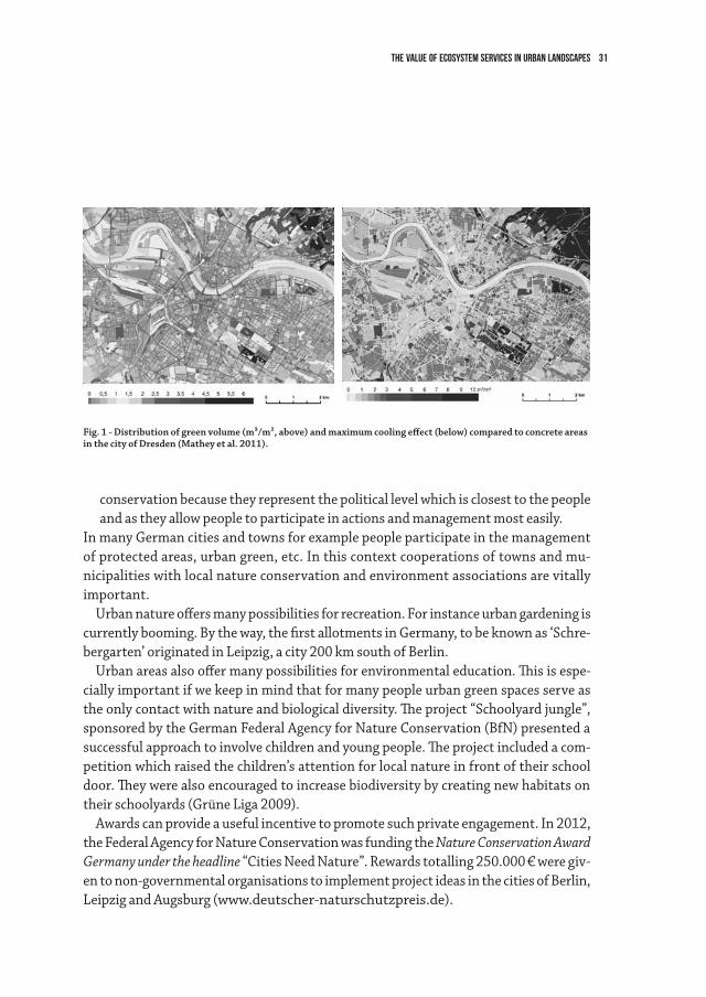
The climatic regulation services of green and open spaces gain in importance in times of climate change. These areas can mitigate impacts such as the increase in maximum temperatures and heat waves in summer. This is an important factor for human well-being in cities. Specifically, these welfare effects were investigated in the research and development project Urban Nature and Climate Change (Mathey et al. 2011). Figure 1 includes two maps that show the analogy of the amount of green spaces in the city of Dresden to the model of the maximum cooling effect compared to a concrete area.
2. The concept of ecosystem services is appropriate to demonstrate and to raise aware-ness for different kinds of values, including cultural ones which tend to be neglected within decision making procedures. The authors are convinced that nature conserva-tion – especially in an urban context – should give greater consideration to cultural and sociological aspects. Towns and municipalities are very important for nature
31The Value of Ecosystem Services in Urban Landscapes
conservation because they represent the political level which is closest to the people and as they allow people to participate in actions and management most easily.
In many German cities and towns for example people participate in the management of protected areas, urban green, etc. In this context cooperations of towns and mu-nicipalities with local nature conservation and environment associations are vitally important.
Urban nature offers many possibilities for recreation. For instance urban gardening is currently booming. By the way, the first allotments in Germany, to be known as ‘Schre-bergarten’ originated in Leipzig, a city 200 km south of Berlin.
Urban areas also offer many possibilities for environmental education. This is espe-cially important if we keep in mind that for many people urban green spaces serve as the only contact with nature and biological diversity. The project “Schoolyard jungle”, sponsored by the German Federal Agency for Nature Conservation (BfN) presented a successful approach to involve children and young people. The project included a com-petition which raised the children’s attention for local nature in front of their school door. They were also encouraged to increase biodiversity by creating new habitats on their schoolyards (Grüne Liga 2009).
Awards can provide a useful incentive to promote such private engagement. In 2012, the Federal Agency for Nature Conservation was funding the Nature Conservation Award Germany under the headline “Cities Need Nature”. Rewards totalling 250.000 € were giv-en to non-governmental organisations to implement project ideas in the cities of Berlin, Leipzig and Augsburg (www.deutscher-naturschutzpreis.de).
Fig. 1 - Distribution of green volume (m³/m², above) and maximum cooling effect (below) compared to concrete areas in the city of Dresden (Mathey et al. 2011).
32 Beate Jessel, Alice Kube
Challenges for Municipalities from the Perspective of Nature Conservation Safeguarding biodiversity and by this maintaining and promoting ecosystem services
seem to be of the utmost significance against the background of current challenges we face in urban spaces. Which are those main challenges for German towns and munici-palities from the perspective of nature conservation?
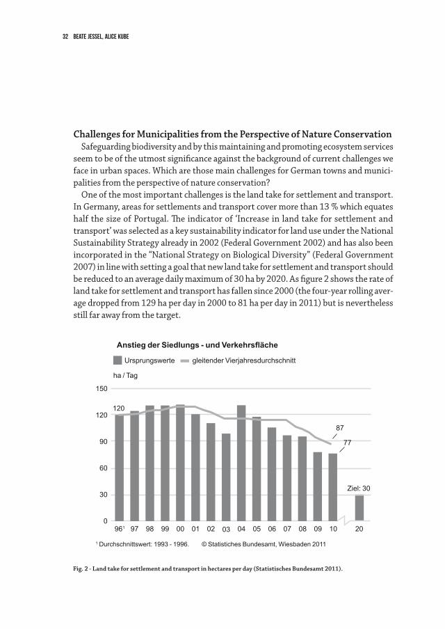
One of the most important challenges is the land take for settlement and transport. In Germany, areas for settlements and transport cover more than 13 % which equates half the size of Portugal. The indicator of ‘Increase in land take for settlement and transport’ was selected as a key sustainability indicator for land use under the National Sustainability Strategy already in 2002 (Federal Government 2002) and has also been incorporated in the “National Strategy on Biological Diversity” (Federal Government 2007) in line with setting a goal that new land take for settlement and transport should be reduced to an average daily maximum of 30 ha by 2020. As figure 2 shows the rate of land take for settlement and transport has fallen since 2000 (the four-year rolling aver-age dropped from 129 ha per day in 2000 to 81 ha per day in 2011) but is nevertheless still far away from the target.
Fig. 2 - Land take for settlement and transport in hectares per day (Statistisches Bundesamt 2011).
© Statistiches Bundesamt, Wiesbaden 20111 Durchschnittswert: 1993 - 1996.
Anstieg der Siedlungs - und Verkehrsfläche
Ursprungswerte
ha / Tag
gleitender Vierjahresdurchschnitt
150
120
90
60
30
020
Ziel: 30
77
87
1006 0804 0905 070397 99 0198 00 02961
120
33The Value of Ecosystem Services in Urban Landscapes
In contrast to the growing land take for settlement and transport the German popula-tion has been decreasing since 2003 in the course of demographic change. If the current demographic trend continues it will further decrease from now 82 million people to 65 to 70 million people in 2060 (Federal Statistical Office 2009). At the same time the area of derelict land has risen steadily in many cities since 1993. It currently comprises almost 4 % of the settlement and traffic area (Federal Environment Agency 2008). These areas often have unfavourable effects on the urban structure and the urban land-scape, and are often negatively perceived by the public. On the other hand, they offer potential for many positive effects, like the conservation of biological diversity, climate protection and air pollution control, recreation and ecological urban development.
Worldwide and in Germany, urbanization is one of the main threats for biodiversity. Ecosystems are directly destructed and indirectly affected by new settlements and new traffic infrastructure.
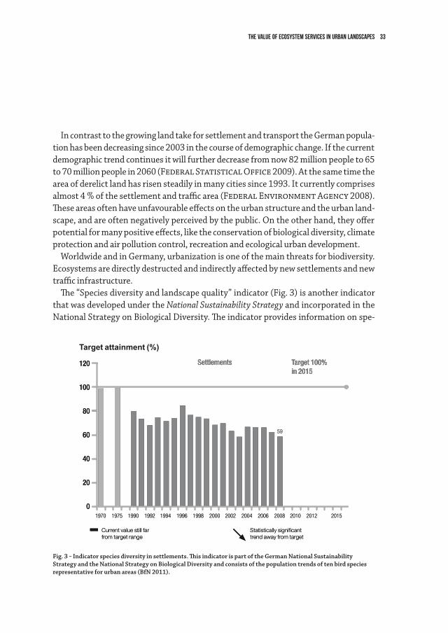
The “Species diversity and landscape quality” indicator (Fig. 3) is another indicator that was developed under the National Sustainability Strategy and incorporated in the National Strategy on Biological Diversity. The indicator provides information on spe-
Target attainment (%)
Current value still farfrom target range
Statistically significanttrend away from target
Settlements Target 100%in 2015
120
80
60
40
20
0
100
1970 1994 20021990 1998 2006 20101975 1996 20041992 2000 2008
59
2012 2015
Fig. 3 - Indicator species diversity in settlements. This indicator is part of the German National Sustainability Strategy and the National Strategy on Biological Diversity and consists of the population trends of ten bird species representative for urban areas (BfN 2011).
Current value still farfrom target range
Statistically significanttrend away from target
Settlements Target 100%in 2015
120
80
60
40
20
0
100
1970 1994 20021990 1998 2006 20101975 1996 20041992 2000 2008
59
2012 2015
34 Beate Jessel, Alice Kube
cies diversity, landscape quality and the sustainability of land use and consists of six sub-indicators. For the sub-indicator “settlements” ten representative bird species were selected as indicator species. An index value for the respective German bird popula-tions is computed annually for each species from the number of territories or breeding pairs counted in statistically representative sample plots. The current population size is expressed as a percentage of the target population size determined for 2015. As figure 3 shows the sub-indicator for settlements reached only 59% of the target value and showed a statistically significant trend away from the target in the ten years up to 2008 (Federal Ministry for the Environment, Nature Conservation and Nuclear Safety 2010).
Another challenge that still has been mentioned is climate change with the expected increase of weather extremes as a challenge especially for big cities.
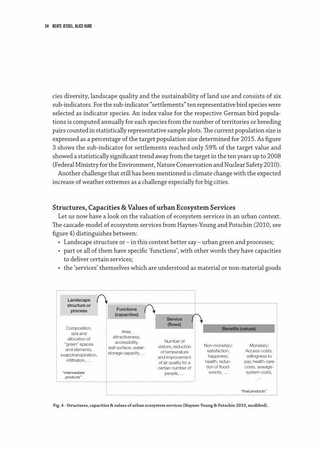
Structures, Capacities & Values of urban Ecosystem Services Let us now have a look on the valuation of ecosystem services in an urban context.
The cascade-model of ecosystem services from Haynes-Young and Potschin (2010, see figure 4) distinguishes between:
• Landscapestructureor–inthiscontextbettersay–urbangreenandprocesses;• partorallofthemhavespecific‘functions’,withotherwordstheyhavecapacities
to deliver certain services; • the‘services’themselveswhichareunderstoodasmaterialornon-materialgoods
Landscapestructure or
process
Composition,size and
allocation of “green” spaces and elements,
evapotranspiration, infiltration, …
“intermediateproducts”
“final products”
Area,attractiveness, accessibility,
leaf-surface, water-storage capacity, …
Number of visitors, reduction
of temperature and improvement of air quality for a certain number of
people, …
Non-monetary:satisfaction, happiness,
health, reduc-tion of flood-events, …
Monetary:Access-costs, willingness to
pay, health-care costs, sewage-system costs,
…
Functions(capacities)
Service(flows)
Benefits (values)
Fig. 4 - Structures, capacities & values of urban ecosystem services (Haynes-Young & Potschin 2010, modified).
35The Value of Ecosystem Services in Urban Landscapes
such as the fresher and purified air you breath or the aesthetical ‘information’ ur-ban parks provide to visitors;
• thevalues–monetaryornon-monetary–thatcanbeassignedtotheseservices.
The assessment of urban ecosystem services and their values for planning purposes has to build on information from all the four levels of the cascade:
• Composition,sizeandthelocationofgreenspacesandelements;• indicatorsforfunctionalitylikeattractiveness,accessibility,water-storagecapacity
or air filtering capacity;• thespecificflowsofservicestotheresidents,takingintoaccountwhoandhow
many people really benefit and finally;• theresultingbenefitscanbedescribedbynon-monetaryandmonetaryvalues:to
the first one belong living quality, happiness, health, reduction of flood-events;• theeconomicvaluesofthesebenefitscaneitherbecountedinmonetarytermslike
the willingness to pay higher rents for a “green” dwelling place or reduced access costs to green space due to a new urban park or in non-monetary terms like rank-ings of satisfaction with the urban environment or health indices associated to different urban environmental conditions.
Some examples shall demonstrate the benefits of urban green in terms of non-mon-etary and monetary values for society and individuals:
• Itisabitterexperienceofthepastyearsthathighsummertemperaturesin-crease mortality rates. During the very hot summer season of 1994 the mor-tality in Berlin rose about 67 % (Gabriel & Endlicher 2006). Urban green can lower this effect substantially which does not only reduce death rates but also healthcare costs.
• Improvingairqualityisnotonlygoodfortheindividualbutalsohelpscomply-ing with certain regulations like EU-guidelines. A survey on a single street tree in Karlsruhe showed that it had the capacity to filter out about 11 % of traffic emissions of particulate matter smaller than about 10 micrometers, referred to as PM10 (Langner 2006). One way to calculate effects in monetary terms is to look at the costs of alternative measures to reduce particulate matter concen-tration in cities.
Increased water infiltration in green areas gives opportunities to reduce sewage man-agement costs.
Last but not least urban green areas provide opportunities for nearby recreation which is good for health and wellbeing and also reduces travel costs caused by longer distances to recreation areas outside of cities.
36 Beate Jessel, Alice Kube
Not only is the saving of expenditures economically relevant but also the creation of additional benefits. The hedonic pricing approach is one way to monetarily measure the benefits of environmentally sound living surroundings. In Berlin the land value of real estates within a distance of max. 400 m to the next park is on average 173 €/m² higher than of real estates which are further away from parks (Gruehn 2008). The higher mon-etary value can be regarded as an indicator of other values people associate with attrac-tive green spaces in their neighbourhood such as living quality and health.
A statistical analysis of all urban green factors revealed that urban green is even re-sponsible for about one third of the market price of land in densely populated areas (Gruehn 2008).
Urban green is not only relevant for residents but also for investors. An attractive urban environment is one of the most important ‘soft’ factors for decisions on project locations, which was proven in a survey for the Bodensee county (Scherer 2012) and in many other studies.
The German Strategy on Biological Diversity: Vision and Aims for Urban Landscapes
Not least for all the reasons that have been mentioned before the importance of biodiversity and ecosystem services in urban landscapes is reflected in the National Strategy on Biological Diversity, adopted by the Federal Government in 2007 (Fed-eral Government 2007). The German Strategy on Biological Diversity formulates explicit visions, specific goals, tangible measures and indicators for urban landscapes. The vision for urban areas states: “Our towns provide their residents with a high quality of life, as well as providing a habitat for many species of flora and fauna, including rare and endangered species. A diverse range of plants improves the air quality and urban climate. Towns offer a wide range of recreational, play and nature experience opportunities for young and old alike.”
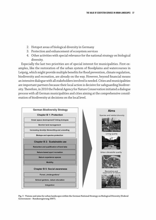
In the chapters on protection, sustainable use and social awareness within the strat-egy many specific aims and measurements for urban areas can be found which shall support the general aims for urban areas (see figure 5).
Obviously, the National Strategy on Biological Diversity can only be successful if it is implemented practically. To support the implementation a new federal funding pro-gramme on biological diversity was launched in 2011.
It focuses on four funding priorities:1. Species for which Germany has a high degree of responsibility (mainly species
whose main distribution range falls within the German territory);
37The Value of Ecosystem Services in Urban Landscapes
2. Hotspot areas of biological diversity in Germany 3. Protection and enhancement of ecosystem services4. Other activities with special relevance for the national strategy on biological
diversity.Especially the last two priorities are of special interest for municipalities. First ex-
amples, like the restoration of the urban system of floodplains and watercourses in Leipzig, which might provide multiple benefits for flood prevention, climate regulation, biodiversity and recreation, are already on the way. However, beyond financial means an intensive dialogue with all stakeholders involved is needed. Cities and municipalities are important partners because their local action is decisive for safeguarding biodiver-sity. Therefore, in 2010 the Federal Agency for Nature Conservation initiated a dialogue process with all German municipalities and cities aiming at the comprehensive consid-eration of biodiversity at decisions on the local level.
Fig. 5 - Visions and aims for urban landscapes within the German National Strategy on Biological Diversity (Federal Government – Bundesregierung 2007).
38 Beate Jessel, Alice Kube
As a result of the first meeting in February 2010 the municipalities involved prepared a declaration “Biological Diversity in Municipalities”. Meanwhile this self-commitment for active safeguarding and development of local biodiversity has been signed by more than 200 municipalities including big cities as Leipzig, Bonn and Frankfurt as well as medium towns and small villages all over Germany. Based on the declaration, these municipalities founded an “Alliance for Biodiversity” in February last year. This alliance shall provide a platform for the intermunicipal cooperation. It supports the practical work in cities and towns by exchange of experiences and transfers municipal interests and needs in political processes (www.kommunen-fuer-biologische-vielfalt.de).
Natural Capital Germany - TEEB DEEven though we know enough to esteem ecosystem services there is still a need to
assess them in a broader context on a national scale. At global scale the international study “The Economics of Ecosystems and Biodiversity” (TEEB) was the first attempt of a comprehensive approach. TEEB was initiated on the 2007 G8 meeting by Germany and the European Union and carried out under the direction of Pavan Sukhdev as study leader. “Natural Capital Germany – TEEB DE” is the German follow up of the interna-tional study on national level. It is funded by the German Federal Ministry for the Envi-ronment, Nature Conservation Building and Nuclear Safety and managed and advised by the Federal Agency for Nature Conservation.
Like the international project “Natural Capital Germany – TEEB DE” aims at:• analysingandpointingoutthebenefitsofbiodiversityandecosystemservicesin
qualitative, quantitative and – wherever possible – also economic terms;• showingwayshowtobettermainstreamtherecognitionandvaluationofnaturein
public funding and decision processes, including regional and local planning.From 2012 to 2015 4 reports will be published in the course of the project. One of
them will focus on the benefits of ecosystems and their services in urban areas. A core group of authors will prepare a compilation of existing knowledge and an evaluation of all relevant surveys in order to get the most complete and up to date picture of urban ecosystem services and their values. Scientists, practitioners and stakeholders will be involved in several workshops.
39The Value of Ecosystem Services in Urban Landscapes
ConclusionsUrban nature provides a wide range of ecosystem services which gain importance
against the background of current challenges such as climate change and demographic change. Beyond offering habitats for many animal and plant species a well-structured urban “green infrastructure” is decisive for living quality in cities and provides an im-portant location factor. For many people urban green spaces serve as the single contact with nature and biological diversity.
The values of ecosystem services cover many dimensions. One way to evaluate ecosys-tem services is the economic assessment, which might provide important arguments for the conservation and development of these services and of biodiversity in urban are-as. However, we should not restrict our considerations to economic values of ecosystem services but lead a broader discussion in our society on values of nature and ecosystems.
Last but not least biodiversity can contribute to the safeguarding of ecosystem ser-vices. The implementation process of the German National Strategy on Biodiversity takes this into consideration; its success will – among other factors – deeply depend on the close integration of towns and cities. The Federal funding programme on biodiver-sity will also contribute to these goals. With the outcomes of the study „Natural Capital Germany“ we are confidently looking forward to a better understanding of ecosystem services and thus to a better integration of biodiversity into decision making.
References
Federal Government - Bundesregierung (2002): National Sustainability Strategy. BonnFederal Government- Bundesregierung (2007): National Strategy on Biological Diversity.
BonnFederal Ministry for the Environment, Nature Conservation and Nuclear Safety -
Bundesministerium für Umwelt, Naturschutz und ReaktorsicherheiT (2010): Indica-tor Report to the National Strategy on Biological Diversity 2010. Berlin
Federal Statistical Office - Statistisches Bundesamt (2009): Bevölkerung Deutschlands bis 2060. 12. koordinierte Bevölkerungsvorausberechnung. Begleitmaterial zur Pressekonfer-enz am 18. November 2009 in Berlin
Gabriel, K. & Endlicher, W. (2006): Human vulnerability to heat waves in Berlin, Germany. 6th International Conference on Urban Climate, Urban Climate Group, Department of Geo-sciences, Göteborg University, Sweden (Eds.), 226-229. quoted after: Endlicher, Wilfried; Mül-ler, Marlén & Katharina Gabriel (2008): Climate Change and the Function of Urban Green for
40 Beate Jessel, Alice Kube
Human Health. In: Schweppe-Kraft, Burkhard (Ed.) (2008) Ecosystem Services of Natural and Semi-Natural Ecosystems and Ecologically Sound Land Use. Papers and Presentations of the Workshop „Economic Valuation of Biological Diversity – Ecosystem Services“, International Academy for Nature Conservation, Vilm, 13 – 16 May 2007. Bonn-Bad Godesberg (Federal Agency for Nature Conservation) Skript 237: 119-127
Gruehn, Dietwald D. (2008): Economic Valuation of Ecosystem Services of Urban Open Spaces – Contribution of Urban Green to Life Quality in European Cities. In: Schweppe-Kraft, Burkhard (Ed.) (2008) Ecosystem Services of Natural and Semi-Natural Ecosystems and Ecologically Sound Land Use. Papers and Presentations of the Workshop „Economic Valuation of Biological Diversity – Ecosystem Services“, International Academy for Nature Conservation, Vilm, 13 – 16 May 2007. Bonn-Bad Godesberg (Federal Agency for Nature Conservation) Skript 237: 109-118
Grüne Liga (2009): Schulhofdschungel. Ein Leitfaden zur naturnahen Umgestaltung von Schul-höfen. Berlin
Haines-Young, R. H. and Potschin, M. (2010): The links between biodiversity, ecosystem ser-vices and human well-being In: Raffaelli, D. and Frid, C. (eds) Ecosystem Ecology: A New Syn-thesis. BES Ecological Reviews Series, CUP. Cambridge: Cambridge University Press, 110–139
Jessel, Beate B. (2011): Ökosystemdienstleistungen. Potenziale und Grenzen eines aktuellen umweltpolitischen Konzepts. In: BBN Jahrbuch 2011, Band 58, 72-87
Langner, M. (2006): Exponierter innerstädtischer Spitzahorn (Acer platanoides) - eine effi-ziente Senke für PM10? Karlsruher Schriften zur Geographie und Geoökologie 21. Karlsruhe. zitiert nach: Langner, Marcel (2008): Reduction of airborne particulates by urban green. In: Schweppe-Kraft, Burkhard (Ed.) (2008) Ecosystem Services of Natural and Semi-Natural Ecosystems and Ecologically Sound Land Use. Papers and Presentations of the Workshop „Eco-nomic Valuation of Biological Diversity – Ecosystem Services“, International Academy for Na-ture Conservation, Vilm, 13 – 16 May 2007. Bonn-Bad Godesberg (Federal Agency for Nature Conservation) Skript 237: 129-137
Mathey, J.; Rössler, S.; Lehmann, I.; Bräuer, A.; Goldberg, V., Kurbjuhn, C.; Westbeld, A.: (2011): Noch wärmer, noch trockener? Stadtnatur und Freiraumstrukturen im Klimawandel. Bundesamt für Naturschutz (Hrsg.), Reihe Naturschutz und Biologische Vielfalt, Bd. 111
Scherer, Roland R. (2012) (Institut für Systemisches Management und Public Governance der Universität St Gallen): Wie entscheiden Menschen und Unternehmen über ihren Standort und welche Rolle spielt dabei der Faktor Natur? Vortrag beim Zukunftsforum ländliche Entwick-lung im Rahmen der internationalen Grünen Woche, Berlin, 25. Januar 2012
UBA Federal Environment Agency – Umweltbundesamt (2010): Flächenverbrauch ein-schränken – jetzt handeln. – Papier der Kommission Bodenschutz des Umweltbundesamtes (KBU).
41
Landscape and Land Use Systems: from Prehistoric to Historic TimesIn prehistory and history, men managed their environments in different ways. Doing
this they reacted to natural conditions, which were always connected with change: Na-ture is not stable, permanently changing. Rocks are eroded, sediments deposited. Oceans and seas are formed and drained, plants, animals and men grow and pass away. Also abstract species and landscapes evolve and disappear. Inside unstable nature men aim to stabilize economical, political, social and cultural conditions so that their life could be as stable as possible. This will never happen as nature still influences human life. Everyman will pass away, but perhaps some years later than without human interference.
In the course of time, various economical, political, social and cultural systems were built up by men. As a result of them different landscapes were utilized and formed; remnants of them are still visible in recent environments. Elements of landscapes had different functions and meanings inside subsequent land use systems1.
The early evolution of hominids took place in the tropics. There, under non-season-al climatic conditions, fruits and carrion for human nutrition were available all year round. During the recent periods of the Ice Age, hominids migrated to grasslands of the northern hemisphere. There successful life was also possible at that time as a lot of her-bivores were living there which could be hunted. Humans developed successful hunting techniques. Animals were killed by a group of humans and afterwards taken for nutri-tion. At that point of time meet was not fresh anymore; men went on to consume car-rion – as their ancestors also did in the tropical rain forests. Sometimes it was easier to kill an entire group of animals living together in flocks or herds. After killing of animals only a small part of the available meet could be taken for consumption, the remnants were consumed by wolves and other carrion consuming animals2.
After the Würmian or Weichselian, the last Ice Age, woodlands spread over large parts
1 H. Küster, Die Entdeckung der Landschaft. Einführung in eine neue Wissenschaft. München 2012.2 E. Turner, Solutré. An archaeozoological analysis oft he Magdalenian horizon. Mainz 2002. – E. Turner,
Horse, reindeer and bison hunters at Solutré. An archaeozoological analysis of a Magdalenian bone assemblage. Bonner zoologische Beiträge 50(3), 2002, 143-182.
2.2The ecological role of parks in EuropeHansjörg Küster
Hansjörg Küster42
of the Northern Hemisphere. As a result from this development herbivores left the area and migrated farther to the north where treeless steppe and tundra like ecosystems still existed at that time. Men had the choice: Either they migrated to the north, too, or they survived in the recently formed woodlands. On the northern hemisphere, woodlands are seasonally developing – in contrast to tropical rain forests: They are only green in summer, and fruits for human consumption are only available in late summer and au-tumn. During this season also a lot of mushrooms can be collected. There are also only a few animals which can survive in dense woodlands. Men are not able to detect sufficient nutrition in seasonally growing woodlands all the year round. On the northern hemi-sphere, they could only survive alongside rivers, lake and sea shores. There, fish and water fowl was available all year round. Only a very restricted number of men could sur-vive under the condition of the Mesolithic, as their culture is called by archaeologists.
From the point of time, when woodlands were spreading, men tried to store and to cultivate plants near of his settlements to receive a harvest from them. In some parts of Europe hazel nuts were collected and perhaps also propagated3. In several other parts of the world, in southwestern Asia, southeastern Asia and Central America, plant cultivation started resulting in the development of cultivated plants4. Culti-vated plants were developed in several regions of the world. It is therefore indicated that not just “chance” but systemic conditions favored these developments; humans were equally evolved in different parts of the world. For agriculture, environments had to be changed. In the Near East and along large rivers in other parts of the world, fields had to be irrigated. Wooded areas had to be cleared to allow the cultivation of plants. In the woodlands, farming was only practiced on the same places for some decades. Afterwards fields and settlements were given up and established at other locations. On the abandoned land, natural conditions alone prevailed allowing the re-establishment of woodland by mechanisms of secondary successions. During these developments the originally occurring tree species did not spread solely. Other spe-cies took part in the re-formation of woodland, beech in central Europe5, hornbeam
3 M. Regnell, Plant subsistence and environment at the Mesolithic site Tågerup, southern Sweden: new insights on the “Nut Age”. Vegetation History and Archeobotany 21(1), 2012, 1-16.
4 H. Küster, Am Anfang war das Korn. Eine andere Geschichte der Menschheit. München 2013.5 H. Küster, The role of farming in the postglacial expansion of beech and hornbeam in the oak woodlands of
central Europe. The Holocene 7(2), 1997, 239-242.
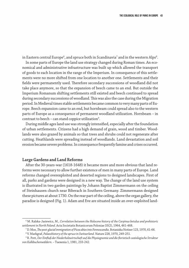
The ecological role of parks in Europe 43
in Eastern central Europe6, and spruce both in Scandinavia7 and in the western Alps8.In some parts of Europe the land use strategy changed during Roman times. An eco-
nomical and administrative infrastructure was built up which allowed the transport of goods to each location in the range of the Imperium. In consequence of this settle-ments were no more shifted from one location to another one. Settlements and their fields were permanently used. Therefore secondary successions of woodland did not take place anymore, so that the expansion of beech came to an end. But outside the Imperium Romanum shifting settlements still existed and beech continued to spread during secondary successions of woodland. This was also the case during the Migration period. In Medieval times stable settlements became common to very many parts of Eu-rope. Beech expansion came to an end, but hornbeam could spread also to the western parts of Europe as a consequence of permanent woodland utilization. Hornbeam – in contrast to beech – can stand coppice utilization9.
During middle ages land use was strongly intensified, especially after the foundation of urban settlements. Citizens had a high demand of grain, wood and timber. Wood-lands were also grazed by animals so that trees and shrubs could not regenerate after cutting. Heathlands were spreading instead of woodlands. Land devastation and soil erosion became severe problems. In consequence frequently famine and crises occurred.
Large Gardens and Land ReformsAfter the 30-years-war (1618-1648) it became more and more obvious that land re-
forms were necessary to allow further existence of men in many parts of Europe. Land reforms changed overexploited and deserted regions to designed landscapes. First of all, parks and gardens were designed in a new way. The change of the land use system is illustrated in two garden paintings by Johann Baptist Zimmermann on the ceiling of Steinhausen church near Biberach in Southern Germany. Zimmermann designed these pictures at about 1730. On the rear part of the ceiling, above the organ gallery, the paradise is designed (Fig. 1). Adam and Eve are situated inside an over-exploited land-
6 M. Ralska-Jasiewicz, M., Correlation between the Holocene history of the Carpinus betulus and prehistoric settlement in North Poland. Acta Societatis Botanicorum Poloniae 33(2), 1964, 461-468.
7 D. Moe, The post-glacial immigration of Picea abies into Fennoscandia. Botaniska Notiser 123, 1970, 61-66.8 V. Markgraf, Palaeohistory of the spruce in Switzerland. Nature 228, 1970, 249-251.9 R. Pott, Der Einfluß der Niederholzwirtschaft auf die Physiognomie und die floristisch-soziologische Struktur
von Kalkbuchenwäldern. – Tuexenia 1, 1981, 233-242.
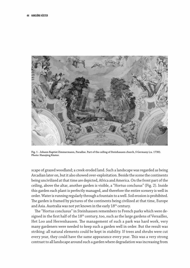
Hansjörg Küster44
scape of grazed woodland; a creek eroded land. Such a landscape was regarded as being Arcadian later on, but it also showed over-exploitation. Beside the scene the continents being uncivilized at that time are depicted, Africa and America. On the front part of the ceiling, above the altar, another garden is visible, a “Hortus conclusus” (Fig. 2). Inside this garden each plant is perfectly managed, and therefore the entire scenery is well in order. Water is running regularly through a fountain to a well. Soil erosion is prohibited. The garden is framed by pictures of the continents being civilized at that time, Europe and Asia. Australia was not yet known in the early 18th century.
The “Hortus conclusus” in Steinhausen remembers to French parks which were de-signed in the first half of the 18th century, too, such as the large gardens of Versailles, Het Loo and Herrenhausen. The management of such a park was hard work, very many gardeners were needed to keep such a garden well in order. But the result was striking: all natural elements could be kept in stability. If trees and shrubs were cut every year, they could have the same appearance every year. This was a very strong contrast to all landscape around such a garden where degradation was increasing from
Fig. 1 - Johann Baptist Zimmermann, Paradise. Part of the ceiling of Steinhausen church, S Germany (ca. 1730).Photo: Hansjörg Küster.
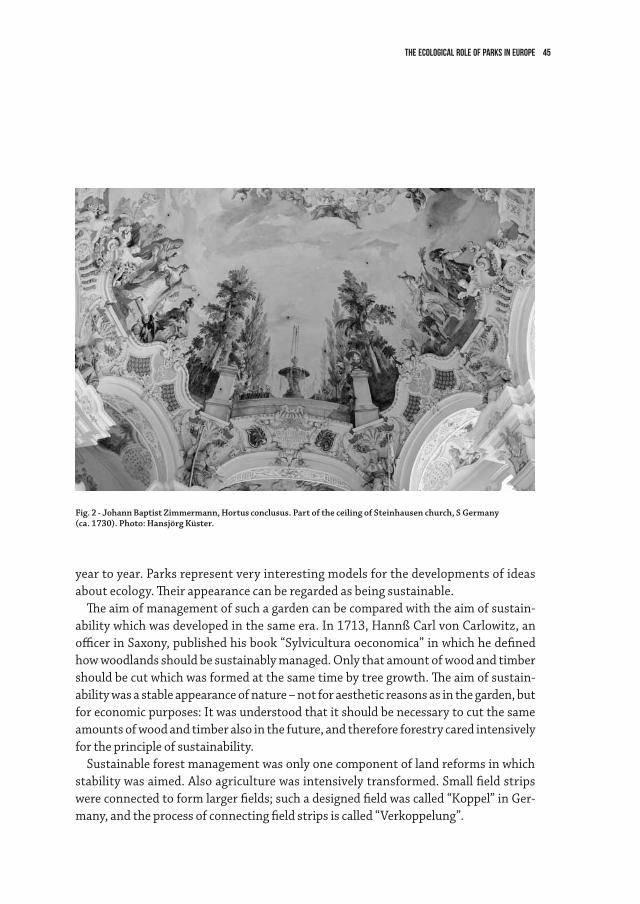
The ecological role of parks in Europe 45
year to year. Parks represent very interesting models for the developments of ideas about ecology. Their appearance can be regarded as being sustainable.
The aim of management of such a garden can be compared with the aim of sustain-ability which was developed in the same era. In 1713, Hannß Carl von Carlowitz, an officer in Saxony, published his book “Sylvicultura oeconomica” in which he defined how woodlands should be sustainably managed. Only that amount of wood and timber should be cut which was formed at the same time by tree growth. The aim of sustain-ability was a stable appearance of nature – not for aesthetic reasons as in the garden, but for economic purposes: It was understood that it should be necessary to cut the same amounts of wood and timber also in the future, and therefore forestry cared intensively for the principle of sustainability.
Sustainable forest management was only one component of land reforms in which stability was aimed. Also agriculture was intensively transformed. Small field strips were connected to form larger fields; such a designed field was called “Koppel” in Ger-many, and the process of connecting field strips is called “Verkoppelung”.
Fig. 2 - Johann Baptist Zimmermann, Hortus conclusus. Part of the ceiling of Steinhausen church, S Germany(ca. 1730). Photo: Hansjörg Küster.
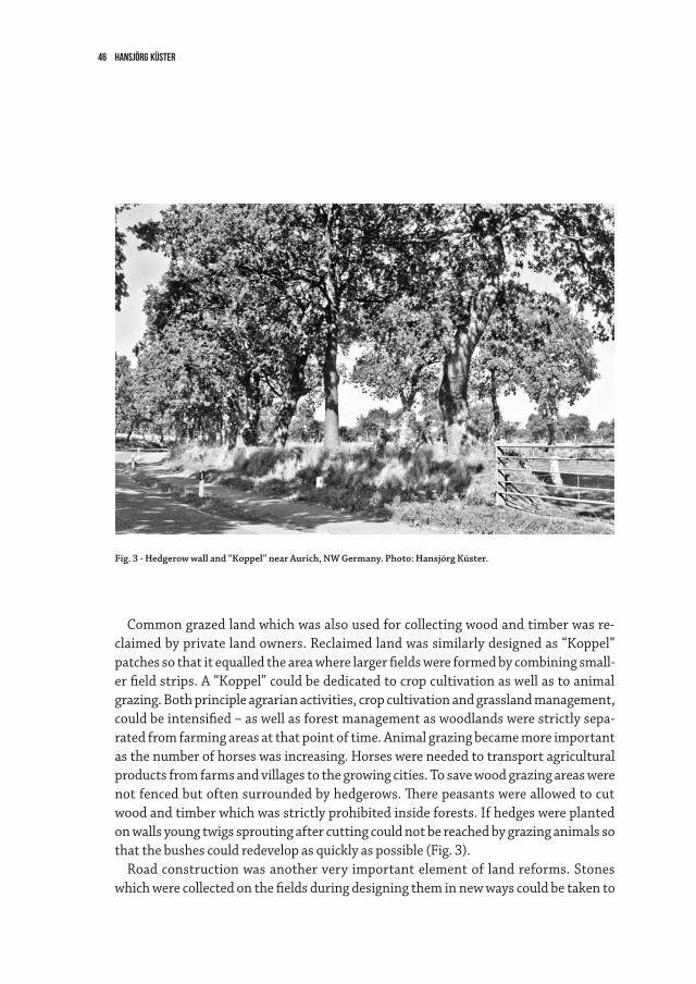
Hansjörg Küster46
Common grazed land which was also used for collecting wood and timber was re-claimed by private land owners. Reclaimed land was similarly designed as “Koppel” patches so that it equalled the area where larger fields were formed by combining small-er field strips. A “Koppel” could be dedicated to crop cultivation as well as to animal grazing. Both principle agrarian activities, crop cultivation and grassland management, could be intensified – as well as forest management as woodlands were strictly sepa-rated from farming areas at that point of time. Animal grazing became more important as the number of horses was increasing. Horses were needed to transport agricultural products from farms and villages to the growing cities. To save wood grazing areas were not fenced but often surrounded by hedgerows. There peasants were allowed to cut wood and timber which was strictly prohibited inside forests. If hedges were planted on walls young twigs sprouting after cutting could not be reached by grazing animals so that the bushes could redevelop as quickly as possible (Fig. 3).
Road construction was another very important element of land reforms. Stones which were collected on the fields during designing them in new ways could be taken to
Fig. 3 - Hedgerow wall and “Koppel” near Aurich, NW Germany. Photo: Hansjörg Küster.
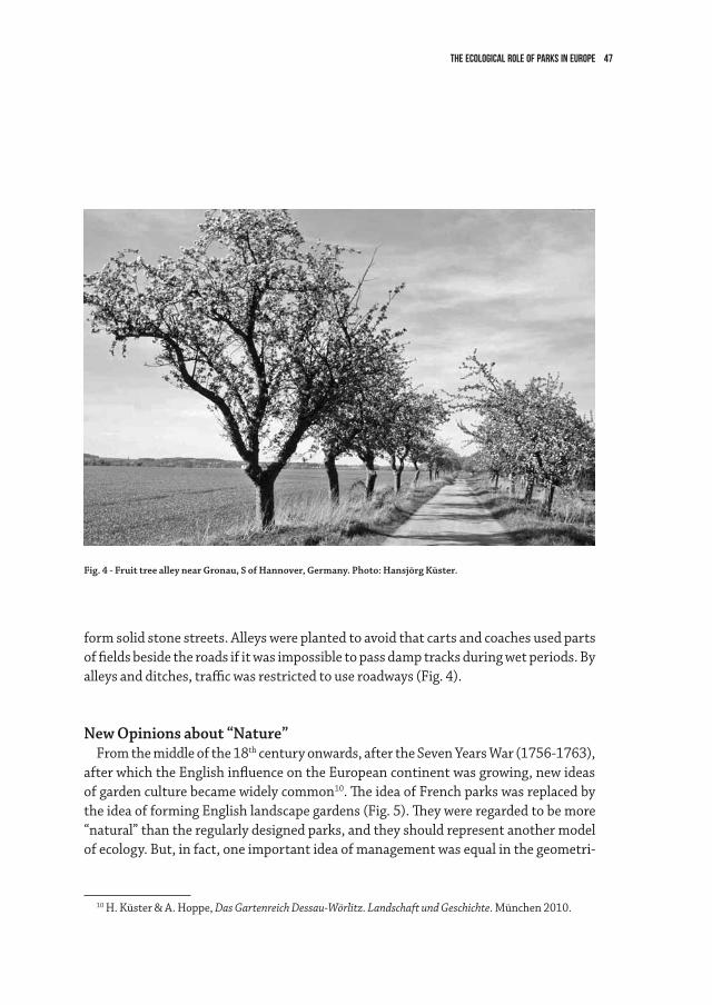
The ecological role of parks in Europe 47
Fig. 4 - Fruit tree alley near Gronau, S of Hannover, Germany. Photo: Hansjörg Küster.
form solid stone streets. Alleys were planted to avoid that carts and coaches used parts of fields beside the roads if it was impossible to pass damp tracks during wet periods. By alleys and ditches, traffic was restricted to use roadways (Fig. 4).
New Opinions about “Nature”From the middle of the 18th century onwards, after the Seven Years War (1756-1763),
after which the English influence on the European continent was growing, new ideas of garden culture became widely common10. The idea of French parks was replaced by the idea of forming English landscape gardens (Fig. 5). They were regarded to be more “natural” than the regularly designed parks, and they should represent another model of ecology. But, in fact, one important idea of management was equal in the geometri-
10 H. Küster & A. Hoppe, Das Gartenreich Dessau-Wörlitz. Landschaft und Geschichte. München 2010.
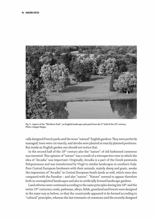
Hansjörg Küster48
cally designed French parks and the more “natural” English gardens: They were perfectly managed; trees were cut exactly, and shrubs were planted at exactly planned positions. But inside an English garden one should not notice that.
In the second half of the 18th century also the “nature” of old-fashioned commons was invented. This opinion of “nature” was a result of a retrospective view in which the idea of “Arcadia” was important: Originally, Arcadia is a part of the Greek peninsula Peloponnesus and was transformed by Virgil to similar landscapes in southern Italy. Poor Central European herdsmen with their animals, mainly sheep and goats, awoke the impression of “Arcadia” in Central European heath-lands as well, which were also compared with the Paradise – and also “nature”. “Nature” seemed to appear therefore both in overexploited landscapes and also in artificially formed landscape gardens.
Land reforms were continued according to the same principles during late 18th and the entire 19th centuries; roads, pathways, alleys, fields, grassland and forests were designed in the same way as before, so that the countryside appeared to be formed according to “cultural” principles, whereas the last remnants of commons and the recently designed
Fig. 5 - Aspect of the “Wörlitzer Park”, an English landscape style park from the 2nd half of the 18th century.Photo: Ansgar Hoppe.
The ecological role of parks in Europe 49
English gardens seemed to represent “nature”. The difference between culturally de-signed farming land and “nature” of both commons and parks was even seen more clearly in the course of time when the land reforms were strongly supported by developments of modern industry and transport. Industrialisation and land reforms became strongly interconnected in the course of time. The development of steam engines allowed inten-sive coal and potassium mining. By coal mining it became possible to receive another fuel; coal burning became an alternative to the use of fire-wood. Therefore, it was no more necessary to utilize high amounts of wood for firing. Potassium served as very important manure for fields. Yields could be enlarged enormously on fertile fields after manuring, so that less fertile fields could be transformed to plant additional woodlands. By steam railway and horse carts it became possible to transport coal and manure to each place wherever these goods were demanded. And it became easily possible to transport high amounts of crops and recently introduced potatoes from the countryside to the rapidly growing cities with their industrial reserves. Remnants of old commons, on the other hand, where regarded as nature reserves: In the first half of the 20th century, mainly heath-land and other extensively grazed areas as well as species-rich grazed woodlands and coppices were included to nature protection in many European countries. They were regarded as “nature” or “natural” – as well as English landscape gardens.
What is “Nature”?It was quickly understood that the “nature” of nature reserves demanded manage-
ment: Coppices should be cut; grass of grasslands should be removed. This management became necessary to avoid that the “aesthetic nature” was destroyed by really natural processes of succession. But this was not thought in that way as management was often regarded as necessary to keep a certain “state of nature”. Such a state exists in a perfectly managed English garden, but not in formerly extensively utilized agrarian landscape. On the other hand it was avoided to compare nature reserves and English gardens, as the latter were regarded as “culture” by nature conservancy managers: There e.g. exotic trees were planted which was not allowed in a nature reserve.
In connection with these ideas a central problem arose: In public discussions it is by no means clear what nature is. Does it equal the changing principle of life, which is the cen-tral object of a natural scientist, or is it aesthetically defined? In nature conservancy it is sometimes said that there is no difference between both “natures”. But this is only possi-ble in a fictional landscape such as Arcadia or the paradise. Therefore, it is often not clearly decided whether a wilderness concept (with natural change) is desired in a nature reserve or a special state, which should be preserved. To reject the difference between both kinds
Hansjörg Küster50
of “nature” can be the basis of undemocratic or even totalitarian opinions. People not see-ing the difference between both kinds of “nature” may argue, that the protection of the state of a “nature” is only possible by the way which is applied by themselves. In Germany, it is obvious that laws concerning nature protection were developed most successfully by the Nazis and the communists in the German Democratic Republic after Second World War. The Nazi law was not principally transformed after the formation of the Federal Republic of Germany for a long time. Also in more recent versions of the nature protec-tion laws it is not clearly defined what nature is or what is meant when the term “nature” is used. In the meantime one has the impression that it is clearer what nature protection and a nature protection area are than that what is meant, when the term “nature” is used.
There will be the important task of ecology to define in a clearer way, what “nature” really is11. It must be clearly described how environments are treated in (landscape) gardens, nature reserves and in all other parts of land. It might be nice to “play” with the term “nature” in landscape gardening, but this is not a perspective for overall land use including “nature” protection. It must become clear that a decision is necessary whether land should be managed or not. If land is managed, it is not wilderness or “nature” in the sense of natural sciences, as management of nature or wilderness is a contradiction in se. In modern communities it should be democratically decided whether land should be managed or not. Parks and gardens must be managed; this is clear from a cultural point of view. But management is also necessary in the most nature reserves, and the principles of land management are similar in parks and nature reserves. It is always a problem that management demands high amounts of manpower and money, whereas a pure wilderness concept is a cheap alternative to that. A wilderness concept is the only way of nature protection which is in accordance to natural sciences. But from a cultural point of view it is highly desired to conserve patches of landscape because of their aes-thetic value. As then it is always important to decide which appearance of landscape (and not “nature”!) should be protected it is necessary to apply the European Landscape Convention and not a natural conservancy law, when a patch of landscape should be pro-tected. Nature develops with and without men, and it is impossible to decide, in which way it should develop. But the aims how landscapes should look like can and must be decided. Therefore it is certainly necessary that all European countries sign and apply the European Landscape Convention rather than principles of natural conservancy which as an aim is not clearly defined; landscape can be defined and designed, whereas nature only can be seen and described.
11 H. Küster, Das ist Ökologie. Die biologischen Grundlagen unserer Existenz. München 2005.
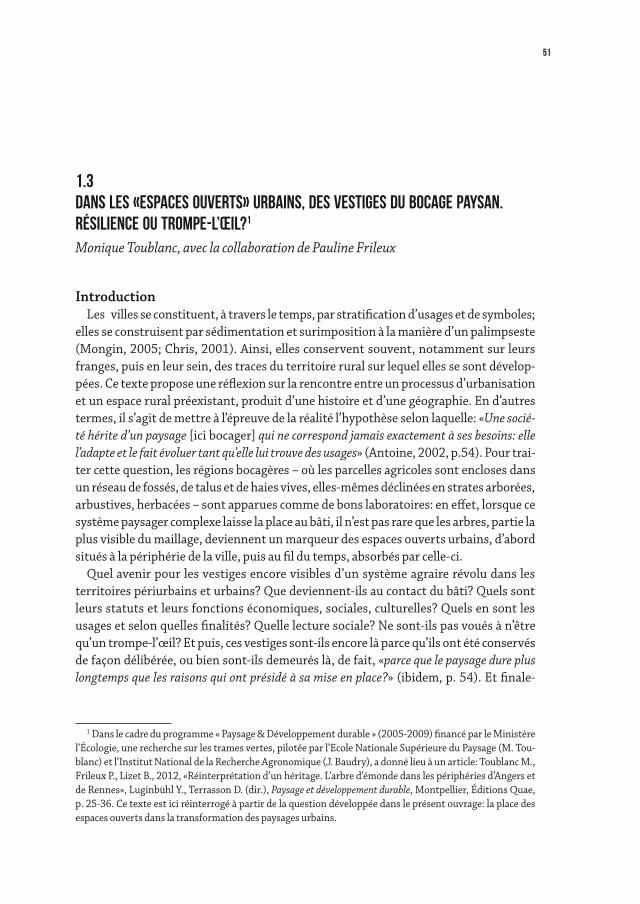
51
IntroductionLes villes se constituent, à travers le temps, par stratification d’usages et de symboles;
elles se construisent par sédimentation et surimposition à la manière d’un palimpseste (Mongin, 2005; Chris, 2001). Ainsi, elles conservent souvent, notamment sur leurs franges, puis en leur sein, des traces du territoire rural sur lequel elles se sont dévelop-pées. Ce texte propose une réflexion sur la rencontre entre un processus d’urbanisation et un espace rural préexistant, produit d’une histoire et d’une géographie. En d’autres termes, il s’agit de mettre à l’épreuve de la réalité l’hypothèse selon laquelle: «Une socié-té hérite d’un paysage [ici bocager] qui ne correspond jamais exactement à ses besoins: elle l’adapte et le fait évoluer tant qu’elle lui trouve des usages» (Antoine, 2002, p.54). Pour trai-ter cette question, les régions bocagères – où les parcelles agricoles sont encloses dans un réseau de fossés, de talus et de haies vives, elles-mêmes déclinées en strates arborées, arbustives, herbacées – sont apparues comme de bons laboratoires: en effet, lorsque ce système paysager complexe laisse la place au bâti, il n’est pas rare que les arbres, partie la plus visible du maillage, deviennent un marqueur des espaces ouverts urbains, d’abord situés à la périphérie de la ville, puis au fil du temps, absorbés par celle-ci.
Quel avenir pour les vestiges encore visibles d’un système agraire révolu dans les territoires périurbains et urbains? Que deviennent-ils au contact du bâti? Quels sont leurs statuts et leurs fonctions économiques, sociales, culturelles? Quels en sont les usages et selon quelles finalités? Quelle lecture sociale? Ne sont-ils pas voués à n’être qu’un trompe-l’œil? Et puis, ces vestiges sont-ils encore là parce qu’ils ont été conservés de façon délibérée, ou bien sont-ils demeurés là, de fait, «parce que le paysage dure plus longtemps que les raisons qui ont présidé à sa mise en place?» (ibidem, p. 54). Et finale-
1 Dans le cadre du programme « Paysage & Développement durable » (2005-2009) financé par le Ministère l’Écologie, une recherche sur les trames vertes, pilotée par l’Ecole Nationale Supérieure du Paysage (M. Tou-blanc) et l’Institut National de la Recherche Agronomique (J. Baudry), a donné lieu à un article: Toublanc M., Frileux P., Lizet B., 2012, «Réinterprétation d’un héritage. L’arbre d’émonde dans les périphéries d’Angers et de Rennes», Luginbühl Y., Terrasson D. (dir.), Paysage et développement durable, Montpellier, Éditions Quae, p. 25-36. Ce texte est ici réinterrogé à partir de la question développée dans le présent ouvrage: la place des espaces ouverts dans la transformation des paysages urbains.
1.3dANS LES «espaces ouverts» urbains, DES VESTIGES DU BOCAGE PAYSAN.RéSILIENCE OU trompe-l’œil?1 Monique Toublanc, avec la collaboration de Pauline Frileux
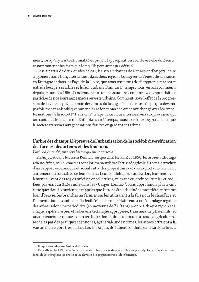
52 Monique Toublanc
ment, lorsqu’il y a intentionnalité et projet, l’appropriation sociale est-elle différente, et notamment plus forte que lorsqu’ils perdurent par défaut?
C’est à partir de deux études de cas, les aires urbaines de Rennes et d’Angers, deux agglomérations françaises situées dans deux régions bocagères de l’ouest de la France, en Bretagne et dans les Pays-de-la-Loire, que nous tenterons de décrypter la rencontre entre le bocage, ses arbres et le front urbain. Dans un 1er temps, nous verrons comment, depuis les années 1960, l’ancienne structure paysanne se combine avec l’espace bâti et participe de nos jours aux espaces ouverts urbains. Comment, sous l’effet de la progres-sion de la ville, la physionomie des arbres du bocage s’est transformée jusqu’à devenir parfois méconnaissable; comment leurs fonctions déclarées ont changé avec les trans-formations de la société? Dans un 2e temps, nous nous intéresserons aux processus qui ont conduit à les maintenir. Enfin, dans un 3e temps, nous nous interrogerons sur ce que la société transmet aux générations futures en gardant ces arbres.
L’arbre des champs à l’épreuve de l’urbanisation de la société: diversification des formes, des acteurs et des fonctions L’arbre d’émonde2, un arbre historiquement agricole…
En Anjou et dans le bassin Rennais, jusque dans les années 1950, les arbres du bocage (chêne, frêne, saule, charme) sont intimement liés à l’activité agricole; ils sont le produit d’un rapport économique et social entre des propriétaires et des exploitants fermiers, autrement dit locataires de leurs terres. Leur conduite, leur utilisation, leur renouvel-lement suivent des règles précises et collectives, relevant du droit coutumier et codi-fiées par écrit au XIXe siècle dans les «Usages Locaux»3. Sans approfondir plus avant cette question, il convient de rappeler que le tronc était destiné au propriétaire comme bois d’oeuvre, les branches au fermier qui les utilisaient à la fois pour le chauffage et l’alimentation des animaux (la feuillée). Le fermier était tenu à un émondage régulier des arbres selon une périodicité (en moyenne de 7 à 9 ans) propre à chaque région et à chaque espèce d’arbre; et selon une technique appropriée, transmise de père en fils, et unanimement reconnue sur un territoire donné, donc commune à tous les agriculteurs. Modelés par des pratiques identiques, ayant valeur de normes, les arbres offraient à la vue un même port très particulier. En Anjou, ils étaient conduits en têtards, arbres à
2 L’expression désigne l’arbre du bocage.3 Recueils écrits à l’échelle du canton et dans lesquels étaient notifiées les prescriptions collectives ayant
force de loi et réglant les droits et les devoirs des propriétaires et des fermiers.
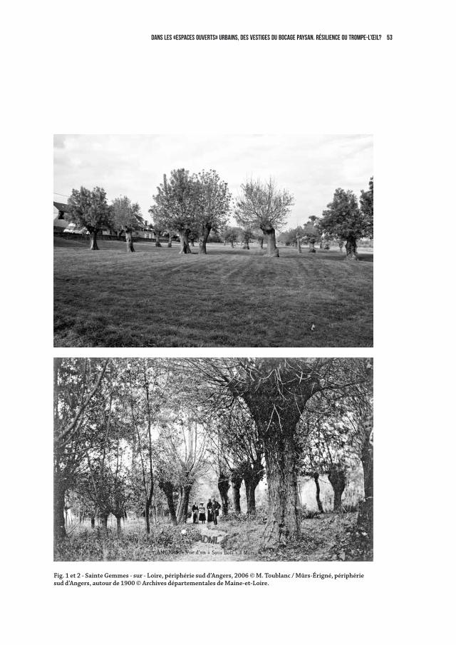
53dANS LES «espaces ouverts» urbains, DES VESTIGES DU BOCAGE PAYSAN. RéSILIENCE OU trompe-l’œil?
Fig. 1 et 2 - Sainte Gemmes - sur - Loire, périphérie sud d’Angers, 2006 © M. Toublanc / Mûrs-Érigné, périphérie sud d’Angers, autour de 1900 © Archives départementales de Maine-et-Loire.
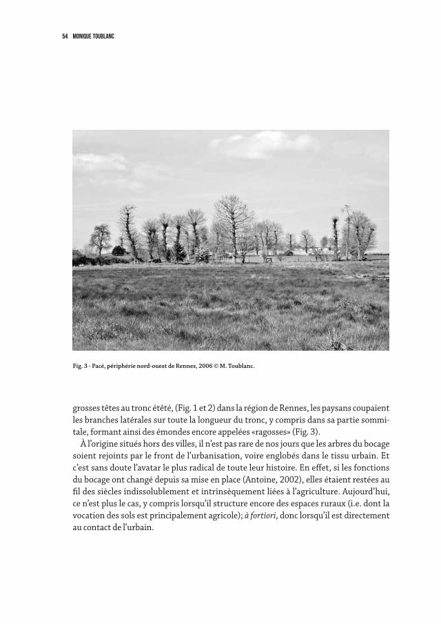
54 Monique Toublanc
grosses têtes au tronc étêté, (Fig. 1 et 2) dans la région de Rennes, les paysans coupaient les branches latérales sur toute la longueur du tronc, y compris dans sa partie sommi-tale, formant ainsi des émondes encore appelées «ragosses» (Fig. 3).
À l’origine situés hors des villes, il n’est pas rare de nos jours que les arbres du bocage soient rejoints par le front de l’urbanisation, voire englobés dans le tissu urbain. Et c’est sans doute l’avatar le plus radical de toute leur histoire. En effet, si les fonctions du bocage ont changé depuis sa mise en place (Antoine, 2002), elles étaient restées au fil des siècles indissolublement et intrinsèquement liées à l’agriculture. Aujourd’hui, ce n’est plus le cas, y compris lorsqu’il structure encore des espaces ruraux (i.e. dont la vocation des sols est principalement agricole); à fortiori, donc lorsqu’il est directement au contact de l’urbain.
Fig. 3 - Pacé, périphérie nord-ouest de Rennes, 2006 © M. Toublanc.
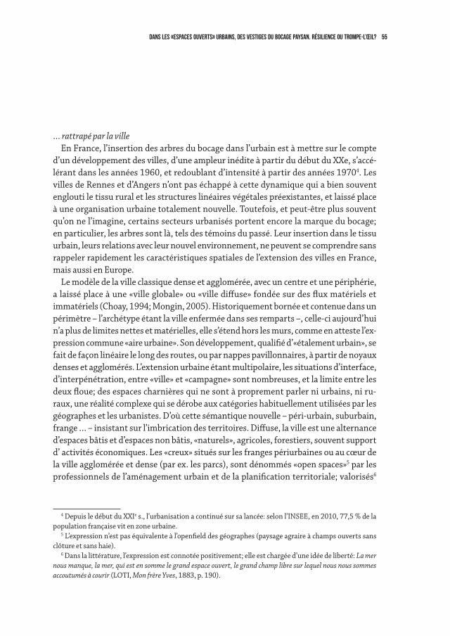
55dANS LES «espaces ouverts» urbains, DES VESTIGES DU BOCAGE PAYSAN. RéSILIENCE OU trompe-l’œil?
… rattrapé par la villeEn France, l’insertion des arbres du bocage dans l’urbain est à mettre sur le compte
d’un développement des villes, d’une ampleur inédite à partir du début du XXe, s’accé-lérant dans les années 1960, et redoublant d’intensité à partir des années 19704. Les villes de Rennes et d’Angers n’ont pas échappé à cette dynamique qui a bien souvent englouti le tissu rural et les structures linéaires végétales préexistantes, et laissé place à une organisation urbaine totalement nouvelle. Toutefois, et peut-être plus souvent qu’on ne l’imagine, certains secteurs urbanisés portent encore la marque du bocage; en particulier, les arbres sont là, tels des témoins du passé. Leur insertion dans le tissu urbain, leurs relations avec leur nouvel environnement, ne peuvent se comprendre sans rappeler rapidement les caractéristiques spatiales de l’extension des villes en France, mais aussi en Europe.
Le modèle de la ville classique dense et agglomérée, avec un centre et une périphérie, a laissé place à une «ville globale» ou «ville diffuse» fondée sur des flux matériels et immatériels (Choay, 1994; Mongin, 2005). Historiquement bornée et contenue dans un périmètre – l’archétype étant la ville enfermée dans ses remparts –, celle-ci aujourd’hui n’a plus de limites nettes et matérielles, elle s’étend hors les murs, comme en atteste l’ex-pression commune «aire urbaine». Son développement, qualifié d’«étalement urbain», se fait de façon linéaire le long des routes, ou par nappes pavillonnaires, à partir de noyaux denses et agglomérés. L’extension urbaine étant multipolaire, les situations d’interface, d’interpénétration, entre «ville» et «campagne» sont nombreuses, et la limite entre les deux floue; des espaces charnières qui ne sont à proprement parler ni urbains, ni ru-raux, une réalité complexe qui se dérobe aux catégories habituellement utilisées par les géographes et les urbanistes. D’où cette sémantique nouvelle – péri-urbain, suburbain, frange … – insistant sur l’imbrication des territoires. Diffuse, la ville est une alternance d’espaces bâtis et d’espaces non bâtis, «naturels», agricoles, forestiers, souvent support d’ activités économiques. Les «creux» situés sur les franges périurbaines ou au cœur de la ville agglomérée et dense (par ex. les parcs), sont dénommés «open spaces»5 par les professionnels de l’aménagement urbain et de la planification territoriale; valorisés6
4 Depuis le début du XXIe s., l’urbanisation a continué sur sa lancée: selon l’INSEE, en 2010, 77,5 % de la population française vit en zone urbaine.
5 L’expression n’est pas équivalente à l’openfield des géographes (paysage agraire à champs ouverts sans clôture et sans haie).
6 Dans la littérature, l’expression est connotée positivement; elle est chargée d’une idée de liberté: La mer nous manque, la mer, qui est en somme le grand espace ouvert, le grand champ libre sur lequel nous nous sommes accoutumés à courir (LOTI, Mon frère Yves, 1883, p. 190).
56 Monique Toublanc
comme espaces de respiration, selon une dialectique – vide/plein –, ils sont associés à l’idée «d’ouverture paysagère … donnant le sentiment d’une échappée possible … même si la perspective est contrainte par un écran végétal [ex. forêts, bocages] … L’espace ouvert offre un large champ des possibles en termes de pratiques, de représentations, de projets. L’ouver-ture est enfin, celle de l’accessibilité au publi» (Banzo, 2009, p. 9). Il est aussi perçu comme une coupure d’urbanisation de nature à empêcher un continuum urbain et à encadrer l’extension de la ville (îlots non construits et ayant vocation à le rester).
Sur les deux terrains, angevin et rennais, c’est bien dans les espaces dits «ouverts» des deux métropoles que l’ancien système agraire bocager se laisse encore deviner. D’abord sur le «front urbain», aux extrêmes confins de l’aire urbaine, lorsque celle-ci a cessé son extension, là où les constructions s’arrêtent et font face à des champs de culture, à des prairies, pâturées ou fauchées, enclos dans un maillage bocager plus ou moins dis-tendu. Ensuite, à l’intérieur des franges urbaines elles-mêmes, dans des enclaves non bâties, d’étendue variable, délaissées par l’agriculture ou encore exploitées, en sursis sans doute, car enserrés de toutes parts par des constructions. Enfin, l’absorption du bocage par la ville, c’est aussi des lambeaux de bocage, réduits bien souvent à quelques arbres alignés, voire isolés, à des bouts de talus qui sont aujourd’hui mis en scène dans les parcs urbains et dans des jardins privés; ou qui s’entremêlent avec le bâti animant les interstices urbains dans lesquels ils semblent s’être insinués: le long du réseau viaire (piétons, automobiles, …), en bordure des lotissements, au pieds d’immeubles, ou entre les maisons individuelles. Sans doute maintenus au départ en bordure de l’espace urba-nisé, ils se sont retrouvés, à la faveur de la progression de la ville, totalement incorporés dans celle-ci.
La trajectoire des vestiges bocagers, de la campagne vers la ville, s’accompagne d’une diversification de leur statut foncier et, corrélativement, des acteurs en charge de leur entretien. Les arbres en particulier sont travaillés par des rapports sociaux multiples et ils sont entre les mains de nombreux acteurs, privés ou publics, dont les motivations, les finalités et les logiques d’action sont diverses et parfois divergentes, voire contradic-toires: techniciens de la commune pour les espaces publics, habitants pour les espaces privés, entreprises de jardinage pour les espaces collectifs en copropriété (zones d’habi-tations, d’activités, de commerces ...).
Les différentes catégories d’acteurs façonnant la matérialité des arbres, ont des cultures techniques et des savoir-faire professionnels ou profanes différents, des moti-vations et des contraintes diverses; ils ne se réfèrent pas à des règles communes et ils ont une connaissance très variable de l’arbre et du vivant. Dans tous les cas, les manières de faire ne sont plus les mêmes qu’autrefois; les techniques et outils utilisés aujourd’hui ont changé. Pluralité des usages, foisonnement des pratiques et des statuts, change-
57dANS LES «espaces ouverts» urbains, DES VESTIGES DU BOCAGE PAYSAN. RéSILIENCE OU trompe-l’œil?
ment des modes de taille: autant de facteurs7 qui ont des répercussions importantes sur la physionomie et l’architecture des arbres.
Quelles sont les nouvelles silhouettes qui émergent? Sans épuiser la question, il s’agit simplement d’insister sur leur hétérogénéité et leur variabilité. Ici, dans des parcs ur-bains de la périphérie rennaise, on observe encore des formes agricoles traditionnelles, taillées avec ou sans «tire-sève» − encore appelé «tire jus» −, une pratique héritée de la culture paysanne; ces figures insolites alternent avec des arbres dont l’ensemble du houppier sommital a été gardé, des arbres de haut-jet au port libre, vraisemblablement des «coupelles» conduites dès le départ par les agriculteurs de manière à laisser se déve-lopper les branches seulement au sommet de l’arbre. Ailleurs, en limite des jardins pri-vatifs, les systèmes sont souvent hybrides: les arbres d’émondes vont côtoyer une haie arbustive exotique et horticole, la plupart du temps persistante. Des formes nouvelles et personnalisées s’imposent au regard: ici, dans un jardin privé, les arbres têtards sont taillés pour se protéger du regard des passants (Fig. 4); ou encore, sur un espace collectif dans le lotissement du Rheu, le plan de coupe est légèrement repoussé par rapport à l’axe du tronc, laissant apparaître des diverticules sur lesquels poussent les nouvelles branches, déséquilibrant le profil initial de l’arbre. Enfin, dans des coulées vertes suffi-samment amples de l’aire urbaine rennaise, seules les branches les plus basses et le bois mort sont coupés. On peut parler d’une taille plus «naturelle» des arbres … les arbres sont pour ainsi dire libérés d’une conduite très encadrée.
L’absorption des arbres d’émonde par la ville se traduit incontestablement par une multiplicité et une palette de formes bien visibles dans les espaces ouverts (open spaces), urbains comme périurbains. L’allure si singulière et si typée des anciennes figures arbo-rées paysannes en devenant urbaines s’est renouvelée, davantage peut-être que dans les couronnes rurales. Il faut dire que l’arbre du bocage paysan, sujet vivant, dont la société contemporaine a hérité, ne correspond plus aux besoins actuels. Soit il a disparu, soit il est modifié pour répondre à de nouvelles utilisations ou non-utilisations.
Pour autant, un œil averti va sans difficulté identifier, dans ces structures arborées, les restes, certes altérés, mais encore bien identifiables, du tissu bocager recouvert par la ville. Il y reconnaîtra les deux types de figures arborées − têtard et ragosse − spéci-fiques des systèmes bocagers angevin et breton (cf. supra). Dans le même temps, un regard expert aiguisé ne pourra que s’interroger sur les raisons de la persistance de ces éléments paysagers, apparaissant parfois tels des intrus en milieu urbain. Comment
7 Cette question complexe mais essentielle mériterait d’être développée pour comprendre la transmission de cet héritage.
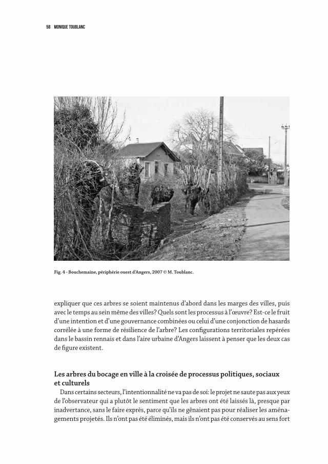
58 Monique Toublanc
expliquer que ces arbres se soient maintenus d’abord dans les marges des villes, puis avec le temps au sein même des villes? Quels sont les processus à l’œuvre? Est-ce le fruit d’une intention et d’une gouvernance combinées ou celui d’une conjonction de hasards corrélée à une forme de résilience de l’arbre? Les configurations territoriales repérées dans le bassin rennais et dans l’aire urbaine d’Angers laissent à penser que les deux cas de figure existent.
Les arbres du bocage en ville à la croisée de processus politiques, sociauxet culturels
Dans certains secteurs, l’intentionnalité ne va pas de soi: le projet ne saute pas aux yeux de l’observateur qui a plutôt le sentiment que les arbres ont été laissés là, presque par inadvertance, sans le faire exprès, parce qu’ils ne gênaient pas pour réaliser les aména-gements projetés. Ils n’ont pas été éliminés, mais ils n’ont pas été conservés au sens fort
Fig. 4 - Bouchemaine, périphérie ouest d’Angers, 2007 © M. Toublanc.
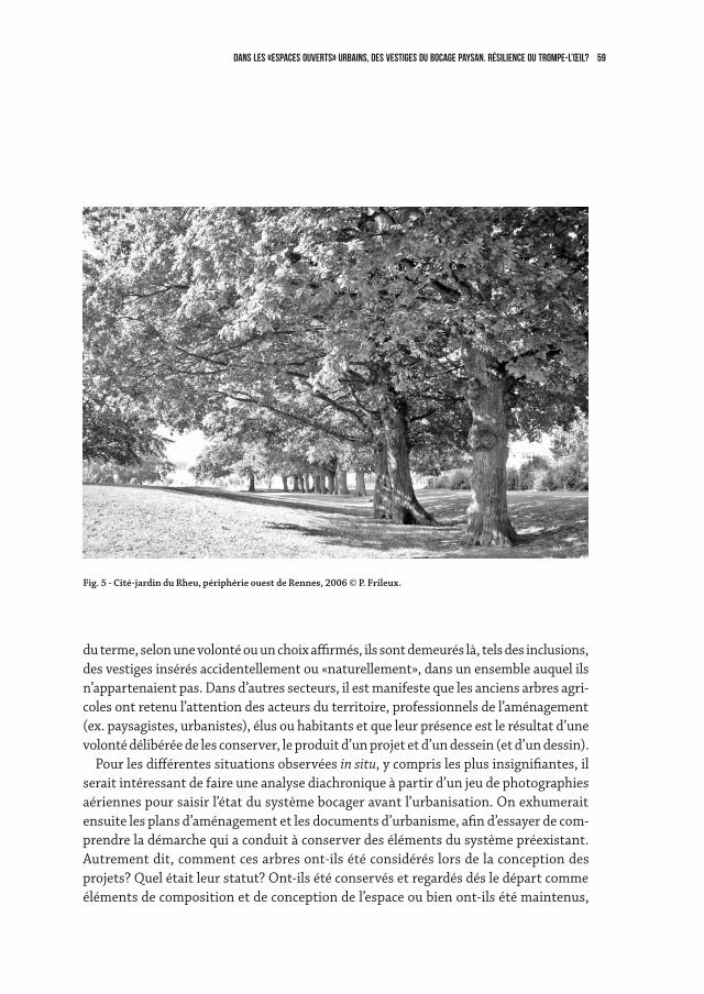
59dANS LES «espaces ouverts» urbains, DES VESTIGES DU BOCAGE PAYSAN. RéSILIENCE OU trompe-l’œil?
du terme, selon une volonté ou un choix affirmés, ils sont demeurés là, tels des inclusions, des vestiges insérés accidentellement ou «naturellement», dans un ensemble auquel ils n’appartenaient pas. Dans d’autres secteurs, il est manifeste que les anciens arbres agri-coles ont retenu l’attention des acteurs du territoire, professionnels de l’aménagement (ex. paysagistes, urbanistes), élus ou habitants et que leur présence est le résultat d’une volonté délibérée de les conserver, le produit d’un projet et d’un dessein (et d’un dessin).
Pour les différentes situations observées in situ, y compris les plus insignifiantes, il serait intéressant de faire une analyse diachronique à partir d’un jeu de photographies aériennes pour saisir l’état du système bocager avant l’urbanisation. On exhumerait ensuite les plans d’aménagement et les documents d’urbanisme, afin d’essayer de com-prendre la démarche qui a conduit à conserver des éléments du système préexistant. Autrement dit, comment ces arbres ont-ils été considérés lors de la conception des projets? Quel était leur statut? Ont-ils été conservés et regardés dés le départ comme éléments de composition et de conception de l’espace ou bien ont-ils été maintenus,
Fig. 5 - Cité-jardin du Rheu, périphérie ouest de Rennes, 2006 © P. Frileux.
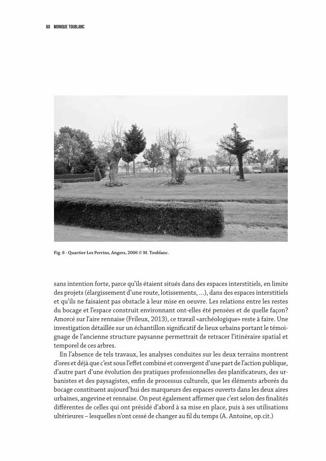
60 Monique Toublanc
sans intention forte, parce qu’ils étaient situés dans des espaces interstitiels, en limite des projets (élargissement d’une route, lotissements, …), dans des espaces interstitiels et qu’ils ne faisaient pas obstacle à leur mise en oeuvre. Les relations entre les restes du bocage et l’espace construit environnant ont-elles été pensées et de quelle façon? Amorcé sur l’aire rennaise (Frileux, 2013), ce travail «archéologique» reste à faire. Une investigation détaillée sur un échantillon significatif de lieux urbains portant le témoi-gnage de l’ancienne structure paysanne permettrait de retracer l’itinéraire spatial et temporel de ces arbres.
En l’absence de tels travaux, les analyses conduites sur les deux terrains montrent d’ores et déjà que c’est sous l’effet combiné et convergent d’une part de l’action publique, d’autre part d’une évolution des pratiques professionnelles des planificateurs, des ur-banistes et des paysagistes, enfin de processus culturels, que les éléments arborés du bocage constituent aujourd’hui des marqueurs des espaces ouverts dans les deux aires urbaines, angevine et rennaise. On peut également affirmer que c’est selon des finalités différentes de celles qui ont présidé d’abord à sa mise en place, puis à ses utilisations ultérieures – lesquelles n’ont cessé de changer au fil du temps (A. Antoine, op.cit.)
Fig. 6 - Quartier Les Perrins, Angers, 2006 © M. Toublanc.
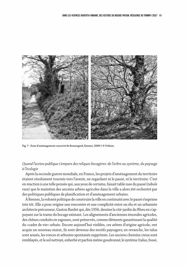
61dANS LES «espaces ouverts» urbains, DES VESTIGES DU BOCAGE PAYSAN. RéSILIENCE OU trompe-l’œil?
Quand l’action publique s’empare des reliques bocagères: de l’arbre au système, du paysage à l’écologie
Après la seconde guerre mondiale, en France, les projets d’aménagement du territoire étaient résolument tournés vers l’avenir, ne regardant ni le passé, ni le territoire. C’est en réaction à une telle pensée qui, aux yeux de certains, faisait table rase du passé (tabula rasa) que le maintien des anciens arbres agricoles dans la ville a alors été orchestré par des politiques publiques de planification et d’aménagement urbains.
À Rennes, la volonté politique de construire la ville en continuité avec le passé s’exprime très tôt. Elle a pour origine une rencontre et une complicité entre un élu et un urbaniste architecte précurseur, Gaston Bardet qui, dès 1956, dessine la cité-jardin du Rheu en s’ap-puyant sur la trame du bocage existant. Les alignements d’anciennes émondes agricoles, des chênes conduits en ragosses, sont préservés, comme éléments garantissant la qualité du «cadre de vie» urbain. Encore aujourd’hui visibles, ces arbres d’origine agricole, ont acquis un nouveau statut, ils sont devenus des motifs paysagers; en revanche, les talus sont arasés, les ronces et arbustes spontanés supprimés. Les anciens chemins creux sont remblayés, et le sol nettoyé, enherbé et parfois même goudronné; le système (talus, fossé,
Fig. 7 - Zone d’aménagement concerté de Beauregard, Rennes, 2008 © P. Frileux.
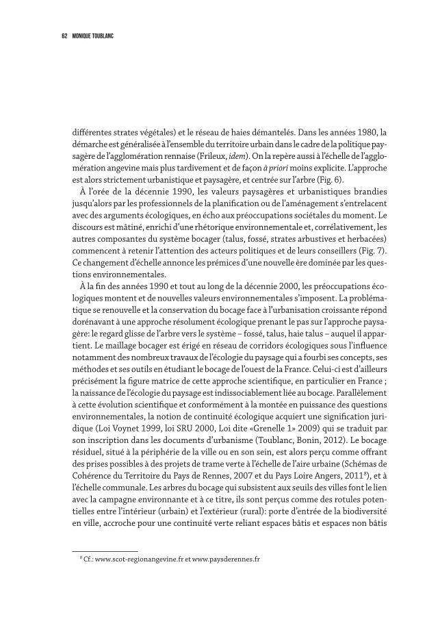
62 Monique Toublanc
différentes strates végétales) et le réseau de haies démantelés. Dans les années 1980, la démarche est généralisée à l’ensemble du territoire urbain dans le cadre de la politique pay-sagère de l’agglomération rennaise (Frileux, idem). On la repère aussi à l’échelle de l’agglo-mération angevine mais plus tardivement et de façon à priori moins explicite. L’approche est alors strictement urbanistique et paysagère, et centrée sur l’arbre (Fig. 6).
À l’orée de la décennie 1990, les valeurs paysagères et urbanistiques brandies jusqu’alors par les professionnels de la planification ou de l’aménagement s’entrelacent avec des arguments écologiques, en écho aux préoccupations sociétales du moment. Le discours est mâtiné, enrichi d’une rhétorique environnementale et, corrélativement, les autres composantes du système bocager (talus, fossé, strates arbustives et herbacées) commencent à retenir l’attention des acteurs politiques et de leurs conseillers (Fig. 7). Ce changement d’échelle annonce les prémices d’une nouvelle ère dominée par les ques-tions environnementales.
À la fin des années 1990 et tout au long de la décennie 2000, les préoccupations éco-logiques montent et de nouvelles valeurs environnementales s’imposent. La probléma-tique se renouvelle et la conservation du bocage face à l’urbanisation croissante répond dorénavant à une approche résolument écologique prenant le pas sur l’approche paysa-gère: le regard glisse de l’arbre vers le système – fossé, talus, haie talus – auquel il appar-tient. Le maillage bocager est érigé en réseau de corridors écologiques sous l’influence notamment des nombreux travaux de l’écologie du paysage qui a fourbi ses concepts, ses méthodes et ses outils en étudiant le bocage de l’ouest de la France. Celui-ci est d’ailleurs précisément la figure matrice de cette approche scientifique, en particulier en France ; la naissance de l’écologie du paysage est indissociablement liée au bocage. Parallèlement à cette évolution scientifique et conformément à la montée en puissance des questions environnementales, la notion de continuité écologique acquiert une signification juri-dique (Loi Voynet 1999, loi SRU 2000, Loi dite «Grenelle 1» 2009) qui se traduit par son inscription dans les documents d’urbanisme (Toublanc, Bonin, 2012). Le bocage résiduel, situé à la périphérie de la ville ou en son sein, est alors perçu comme offrant des prises possibles à des projets de trame verte à l’échelle de l’aire urbaine (Schémas de Cohérence du Territoire du Pays de Rennes, 2007 et du Pays Loire Angers, 20118), et à l’échelle communale. Les arbres du bocage qui subsistent aux seuils des villes font le lien avec la campagne environnante et à ce titre, ils sont perçus comme des rotules poten-tielles entre l’intérieur (urbain) et l’extérieur (rural): porte d’entrée de la biodiversité en ville, accroche pour une continuité verte reliant espaces bâtis et espaces non bâtis
8 Cf.: www.scot-regionangevine.fr et www.paysderennes.fr
63dANS LES «espaces ouverts» urbains, DES VESTIGES DU BOCAGE PAYSAN. RéSILIENCE OU trompe-l’œil?
(agricoles, forestiers, friches, …) dans des projets de trames vertes, y compris urbaines. Si un intérêt croissant pour le système est incontestable, l’attention portée à l’arbre
lui-même ne faiblit pas. Dans les villes, il est de plus en plus considéré comme produi-sant de la nature urbaine. À Paris, ce n’est plus seulement la canopée des arbres qui attire l’attention pour sa valeur paysagère et climatique mais leurs pieds qui sont regardés pour leur valeur écologique potentielle ; sur ces micro-parcelles de terre noyées dans une mer de bitume, des expériences de gestion sont menées visant à les intégrer sur le mode du pas japonais dans des continuités écologiques. On peut y voir une tentative pour réintroduire l’arbre dans un système (Maurel et al., 2013). Une telle réflexion ne semble pas avoir eu lieu sur les arbres du bocage insérés dans les villes d’Angers et de Rennes. En revanche, en Anjou, l’arbre têtard est désigné par le milieu associatif comme un habitat écologique remarquable, comme un «écosystème à lui seul» (cf. sites internet LPO Anjou et Sarthe). Et à ce titre, son maintien est encouragé financièrement par les pouvoirs publics dans une zone de prairies alluviales inondables, les Basses vallées angevines, situées aux portes de la ville d’Angers, et classée Natura 2000. Depuis 2004, les proprié-taires ou exploitants reçoivent des aides financières pour la régénération et l’entretien des arbres têtards qui parsèment le territoire; un soutien obtenu sous l’impulsion très active d’une association naturaliste, la LPO9.
Reflet d’une politique explicite, mêlant logique écologique et raisonnement paysager, les rescapés urbains du bocage paysan sont aussi à mettre à l’actif des urbanistes et des paysagistes qui, à l’instar de certains commanditaires, portent attention à l’existant dans les projets d’extension urbaine qu’ils accompagnent.
Quand les urbanistes et les paysagistes cherchent à arrimer leurs projets sur l’existant Dés le début des années 1970, les professionnels du paysage ont commencé à développer
l’idée de «prendre en compte le paysage existant»; au fil du temps, cette nouvelle conception s’est affirmée. Aujourd’hui, cette vision n’a pas perdu de sa vigueur, elle s’exprime à travers des formulations comme «renouer avec le territoire» (Toublanc, 2013, 101), autrement dit dessiner l’avenir en l’enracinant dans l’histoire et la géographie des lieux.
Cette posture sera un fil rouge dans les parcours professionnels de plusieurs paysa-gistes de renom. M. Corajoud, par exemple, en 1995, pour l’aménagement du centre ville de Montreuil, commune de la banlieue parisienne, défend l’idée de conserver les murs à pêche encore en place. Quelques années plus tard, en 2003, à l’occasion de la remise du
9 Cette association avait déjà joué un rôle déterminant en 1993 dans le lancement, la mise en œuvre et l’animation d’une politique publique de gestion agri-environnementale qui perdure encore de nos jours.
64 Monique Toublanc
Grand Prix de l’urbanisme, il reviendra sur son projet: «En sauvant les quelques hectares de pans de murs restant, la ville de Montreuil peut se constituer […] une mémoire à partir de laquelle, elle pourra, à nouveau, transposer et singulariser sa forme urbaine»… [Ces traces] «sont presque toujours le fruit d’une longue interdépendance, d’une patiente négociation entre l’homme et son milieu […] Elles forment un substrat capable […] d’initier une autre fondation [… les] murs […] se sont avérés judicieux plus tard, pour agencer les jardins et les maisons des Montreuillois» (Corajoud, 2010, p. 111 et 120). Cette attention au socle géographique, à son organisation spatiale héritée de l’histoire du lieu, le plus souvent agricole, est fon-datrice de la culture professionnelle des paysagistes10. Elle s’est amplifiée à partir des années 2000 avec la généralisation de l’idée de développement durable présentée par les paysagistes comme consubstantielle de leur pratique (C. de Courcy, J.-S. Bordreuil, 2013).
Au-delà du paysagisme, «contextualiser les projets » est devenu un mot d’ordre, une injonction, une doxa, dans le champ de l’aménagement du territoire, au nom d’un double principe de continuité et de renouvellement, de permanence et de rupture. Des urbanistes, architectes et autres professionnels de l’aménagement urbain, partagent l’idée que les marques de l’histoire, qu’elles soient rurales ou urbaines, ont vocation à contribuer et à orienter la construction de la ville, et à ce titre doivent être conservées, telle une «génétique urbaine» (B. Huet, 1998).
Mais en fait quel est le sens d’une prise en compte de l’existant, autrement dit, de ce qui se trouve en un lieu et un temps donnés ? Au-delà d’une rhétorique bien «huilée», dans les faits, que signifie ancrer un projet sur le territoire et ses structures passées? L’intérêt des professionnels du paysage, en particulier les concepteurs, pour l’existant porte plus sur les formes visibles à la surface du territoire – les lignes, les points, les surfaces …– (i.e., les apparences) que sur la réalité concrète des éléments (i.e., leur es-sence). Pour eux, arrimer leur projet à l’existant consiste bien souvent à repérer dans l’organisation spatiale, par exemple dans le parcellaire, même si celui-ci n’apparaît qu’en filigrane, des prises formelles pour imaginer le paysage à venir. Une telle posture soulève une question de fond: celle du sens et de la légitimité d’un projet qui s’appuierait sur des formes se rapportant à des éléments, certes hérités du passé et encore présents, mais n’étant plus utilisés et n’ayant plus de raison d’être.
Chargés de produire du paysage en ville, les arbres du bocage sont aussi invoqués pour produire de la biodiversité. Mais qu’en est-il de l’articulation entre les deux? La mise en forme paysagiste de la nature et du vivant peut-elle s’abstraire, se dispenser d’un
10 Cf.: www.ecole-paysage.fr
65dANS LES «espaces ouverts» urbains, DES VESTIGES DU BOCAGE PAYSAN. RéSILIENCE OU trompe-l’œil?
questionnement écologique? Et vice-versa, l’interrogation écologique peut-elle se passer d’une réflexion sur les formes?
L’intérêt des acteurs publics et des professionnels de l’aménagement du territoire pour les arbres du bocage croise celui des mondes associatif et artistique.
Quand des artistes et des acteurs associatifs portent un regard esthétique et patrimonial sur ces sujets arborés
Autrefois représentés par les peintres pour leur valeur pittoresque, les arbres d’émonde sont aujourd’hui remarqués et regardés pour leur valeur esthétique et pa-trimoniale par des artistes qui développent une production artistique à l’interface du champ de l’art et de l’action associative. Leur pratique est en quelque sorte un manifeste: menacés de disparition, ils les érigent en bien commun à conserver (Dominique Man-sion, Jardin des trognes, festival international de Chaumont-sur-Loire, 1999; Fran-çois Boissier, L’arbre en fée, Saint Léger-des-Bois, 2000), rejoignant en cela la position d’associations d’éducation à l’environnement pour lesquelles le têtard et la ragosse sont devenus des figures emblématiques et identitaires. Ainsi les associations «Les têtards du Chemin du roi» (périphérie d’Angers) et «Saint-Gilles Nature Environnement» (Rennes-Métropole), ont choisi comme logo et comme thème de leur mobilisation l’arbre du bocage; celui-ci étant le point de départ d’actions pédagogiques de sensibilisation et d’éducation du grand public à la nature (cf. sites internet)11.
Pour autant, malgré un intérêt politique et associatif pour ces arbres, on peut se poser la question de la durabilité – au sens du développement durable – et de la multifonction-nalité (valeurs paysagère et écologique notamment) des reliques bocagères restées dans les espaces ouverts urbains.
La durabilité des têtards et des ragosses urbaines en question Qu’en est-il des fonctions présumées, paysagères et écologiques des arbres d’émonde
étudiés? Les objectifs de qualité paysagère qui leur sont assignés ne vont clairement pas de soi.
En effet, excepté pour les associations et les artistes qui les érigent en patrimoine col-lectif, ils ne font pas forcément sens pour les habitants des aires urbaines et même pour ceux des campagnes, qui peuvent aller jusqu’à les rejeter. Ils sont choqués par de telles
11 Le logo de l’association «Saint-Gilles Nature Environnement» sera ensuite modifié, mais il est encore visible sur son site internet (http://www.sgne.fr) à la rubrique «Des ragosses en ville?»
66 Monique Toublanc
silhouettes arborées, privées temporairement de branches et de feuilles, aux troncs tor-tueux et dénudés. Leur taille radicale est critiquée, assimilée à une amputation: «arbres mutilés», «sortes de moignons», «arbres morts, tristes, morbides», «arbres hurlant leur souf-france», «c’est vilain et cela ne fait pas naturel»… Le mouvement écologique a renforcé cette vision antropomorphique. La critique, «c’est un vrai massacre à la tronçonneuse», est d’autant plus virulente que les individus sont géographiquement ou socialement éloi-gnés des agriculteurs; elle vise les ragosses davantage que les têtards. En effet, l’intérêt esthétique, patrimonial et symbolique est plus fort pour les seconds que pour les pre-mières, moins fréquentes et à l’apparence très controversée, en particulier juste après la taille. Il n’est pas rare alors qu’il y ait des conflits de représentation, des tensions entre les partisans de la taille en émonde et ceux de la taille douce. Outre la question de la perception et de l’interprétation par les populations, la valeur paysagère de ces figures arborées, c’est aussi le rôle qu’elles ont dans la structuration et la composition de l’espace, et là encore, cela ne tombe pas sous le sens, notamment dans les territoires n’ayant pas fait l’objet d’un projet d’aménagement les intégrant.
Si la durabilité paysagère pose question, les finalités écologiques poursuivies à travers le maintien en milieu urbain des arbres d’émonde sont mises à mal à plusieurs égards. D’abord, il ne reste bien souvent du bocage que des arbres isolés aux fonctions envi-ronnementales atténuées. Ensuite, ils ont été bien souvent fragilisés lors du chantier (tassement du sol) et le demeurent par la manière dont ils sont ensuite taillés. Par ail-leurs, l’aménagement de l’espace qui les environne (ex. sol imperméable) renforce leur vulnérabilité. Enfin, malgré quelques tentatives de gestion différenciée dans les deux aires urbaines étudiées, la conduite très horticole des espaces ouverts dans lesquels les anciens arbres agricoles s’inscrivent est souvent peu compatible avec les exigences affi-chées: gazon tondu régulièrement, surfaces nues, traitements phytosanitaires persis-tants malgré des engagements des collectivités locales dans des démarches «zéro phyto».
Conclusion Quel avenir pour ces arbres? Trompe-l’œil et donc appelés à disparaître à plus ou
moins longue échéance ou résurgence du passé s’invitant dans la ville d’aujourd’hui, tels certains monuments anciens, parfois antiques, à Rome par exemple, qui se fondent dans la structure urbaine contemporaine? À la manière de Thierry Algrin12, on peut se
12 2001, «Le monument est-il soluble dans l’urbanisme?», in Ville d’hier, ville d’aujourd’hui en Europe, Fayard, Paris cité p. 301 et 311 dans la ville et l’urbain l’état des savoirs, dir. Pacquot, Lussault, Body-Gendrot
67dANS LES «espaces ouverts» urbains, DES VESTIGES DU BOCAGE PAYSAN. RéSILIENCE OU trompe-l’œil?
demander si les vestiges paysagers de l’ancienne structure paysanne sont solubles dans l’urbanisme, et selon quels processus: engloutissement, insertion, ou influence sur le développement du tissu urbain?
Lorsqu’ils sont restés là, sans même peut-être avoir été remarqués, ou parce que leur destruction n’était pas jugées nécessaire, il est vraisemblable qu’il ne s’agisse que de reliques appelées à disparaître prochainement dans un processus lent de dissolution du paysage bocager à moins qu’ils ne finissent par se faire une place et se fondent dans l’espace qui les a accueillis.
Dans le cas contraire, autrement dit lorsqu’ils ont été conservés volontairement pour jouer un rôle dans la composition urbaine, on peut également s’interroger sur leur ave-nir. En effet, les arbres sont plus maintenus que préservés. La maîtrise d’ouvrage pu-blique met davantage l’accent sur les potentialités du bocage résiduel que sur son appro-priation concrète et symbolique par les populations. Pour les concepteurs, l’attention aux formes l’emporte sur la prise en compte de la matérialité vivante. Quant aux acteurs auxquels incombe l’entretien des arbres, ils n’ont pas la connaissance de la nature, les «savoirs et savoir-faire bocagers» (T. Arbousse Bastide, 2007) qui les avaient sculptés et dont étaient dépositaires les paysans.
Nous voici face à une ultime question: tout héritage est-il patrimoine? Rien n’est moins certain, comme le montre l’exemple ici traité. L’histoire a transmis les restes d’un territoire agraire aux caractéristiques bocagères; mais l’appropriation de ce legs paysan n’est pas évidente car elle se heurte aux transformations de la société et met en jeu une rencontre entre des cultures différentes, rurale et urbaine, passée et actuelle, à l’ori-gine au mieux de malentendus, au pire de controverses et de conflits. Que signifie alors la prise en compte du contexte géographique et historique érigée aujourd’hui, dans le champ de l’aménagement du territoire, en nouveau paradigme vertueux? La question reste ouverte et mériterait d’être approfondie à propos d’autres territoires, bocagers ou d’un autre type.
68 Monique Toublanc
References
Antoine Annie, 2002, Le paysage de l’historien. Archéologie des bocages de l’ouest de la France à l’époque moderne, Rennes, PUR, 2002, 340 p.
Arbousse-Bastide Tristan, 2007, La haie une économie buissonnière (résurgence de la culture de l’arbre en milieu rural), rapport préliminaire FR-Civam, 16 p.
Banzo, Mayté, 2009, L’espace ouvert pour une nouvelle urbanité (vol. 3), HDR, Université Michel de Montaigne-Bordeaux III, sous la direction de Guy Di Méo, 204 p.).
Bodiguel Maryvonne, 1986, Le rural en question, Paris, L’Harmattan, 183 p.Corajoud, Michel, 2010, «Le paysage, c’est l’endroit où le ciel et la terre se touchent », Arles, Actes Sud/
ENSP, 2010, 271 p. De Courcy, Constance, Jean-Samuel Bordreuil, «Le développement durable: une préoccupation
ordinaire de l’exercice paysagiste?», Luginbühl Y., Terrasson D. (dir.), Paysage et développement du-rable, Montpellier, Éditions Quae, p. 89 - 97
Frileux Pauline, 2013, Le bocage pavillonnaire. Une Ethnologie de la haie, Grâne, Creaphis éditions, 287 p.
Huet Bernard, 1998, Une génétique urbaine, Urbanisme, n°303, p. 56-59Maurel Noëllie et al., 2013, «Trames vertes: les pieds d’arbres à la croisée des chemins», in P. Cler-
geau, N. Blanc (dir.), Trames vertes urbaines. De la recherche scientifique au projet urbain, Paris, Le Moniteur éditions, p. 169-187
Mongin O., 2005, La condition urbaine. La ville à l’heure de la mondialisation, Paris, Le Seuil, 325 p.Toublanc Monique, 2013, «Ressources paysagères entre héritage et projets», Luginbühl Y., Terras-
son D. (dir.), Paysage et développement durable, Montpellier, Éditions Quae, p. 101 -114Toublanc Monique, Bonin Sophie, 2012, «Planifier les trames vertes dans les aires urbaines: une
alliance à trouver entre paysagisme et écologie» Développement durable et Territoires, vol. 3,/n°2 juillet 2012, mis en ligne le 7 juillet 2012, URL :http://developpementdurable.revues.org/9347.
Toublanc Monique, Frileux Pauline, Lizet Bernadette, 2012, «Réinterprétation d’un héritage. L’arbre d’émonde dans les périphéries d’Angers et de Rennes», Luginbühl Y., Terrasson D. (dir.), Paysage et développement durable, Montpellier, Éditions Quae, p. 25-36.
Toublanc Monique, Frileux Pauline, Lizet Bernadette, 2014 (à paraître) «Reinterpretation of a heritage. Pruned trees on the outskirts of Angers and Rennes», Luginbühl Y., Terrasson D. (dir.), Landscape and sustainable development, Surrey, Ashgte.
Younés Chris, Le temps désorienté, dossier «Temps et territoires», Revue Urbanisme, n°320, Sept.-Oct. 2001.
2
Urban and Peri-urban Agriculture

71
2.1
Will the new Common Agricultural Policy improve the managementof rural and peri-urban settings and landscaping? Andrea Galli, Hubert Gulinck, Ernesto Marcheggiani
The aim of this paper is to stimulate a wide discussion about three key topics, which in our vision are changing the meaning of Landscape Planning for the near future: Ruralty, Common Agricultural Policies (CAP) and new the challenges human being is facing to preserve the scarcity of resources. Following this overarching idea a reasoning frame to forward with the concept is above discussed.
Rurality and Peri-urbans Settings: which Contemporary Rurality Do We Have to Face for the Time Being?To getting acquainted with a depth understanding of the main characters of contempo-rary rural and peri-urban settings a clear statement on the meaning of modern rural-ity is a key prerequisite. The modern rurality has become a complex matter due to the deep changes occurred in the agricultural and open space settings over the last decades (Antrop, 2004; Gulinck, 2004). So is the agricultural sector which has played an overall pivotal role in the management and planning of open, rural and agricultural settings across Europe (Rizov, 2004). That has become particularly true after the adoption of CAP reforms (Mac Sharry reform, 1992; Fischler reform, 2003; Rural development, EU Reg. 1698/2005; Cross Compliance, EU Reg. 73/2009). This way new functions of pri-mary sector have emerged (e.g. environmental services, landscape, human well-being and leisure, …) in addition to the traditional ones, above all the provision of primary goods (Fry, 2001; van der Ploeg et al., 2002; de Groot, 2006; Willemen et al., 2008; Perella et al., 2010). In addition, the relentless pace of change in the structural and functional patterns featuring rural and agricultural lands, and consequently on the or-dinary daily life of people living there, has forced the sector to improve and strengthen its relationship with the other sectors of human activities: housing and industrial set-tlements, commerce, tertiary and services. The progressive sprawling of “alien“ struc-tures, functionally and morphologically far from that of classical old rural tradition (van der Ploeg et al., 2008; Gulinck et al., 2010) has led to a contemporary rural landscape made up of new structural and functional mixes strongly diverging from the tradition of places. New patterns bring with them new characteristics not always fully embedded within the cultural setting of each local territorial realm (Antrop, 2004; Gulinck et al.,
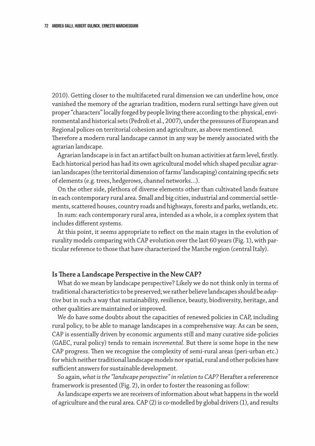
72 Andrea Galli, Hubert Gulinck, Ernesto Marcheggiani
2010). Getting closer to the multifaceted rural dimension we can underline how, once vanished the memory of the agrarian tradition, modern rural settings have given out proper “characters” locally forged by people living there according to the: physical, envi-ronmental and historical sets (Pedroli et al., 2007), under the pressures of European and Regional polices on territorial cohesion and agriculture, as above mentioned.Therefore a modern rural landscape cannot in any way be merely associated with the agrarian landscape.
Agrarian landscape is in fact an artifact built on human activities at farm level, firstly. Each historical period has had its own agricultural model which shaped peculiar agrar-ian landscapes (the territorial dimension of farms’ landscaping) containing specific sets of elements (e.g. trees, hedgerows, channel networks…).
On the other side, plethora of diverse elements other than cultivated lands feature in each contemporary rural area. Small and big cities, industrial and commercial settle-ments, scattered houses, country roads and highways, forests and parks, wetlands, etc.
In sum: each contemporary rural area, intended as a whole, is a complex system that includes different systems.
At this point, it seems appropriate to reflect on the main stages in the evolution of rurality models comparing with CAP evolution over the last 60 years (Fig. 1), with par-ticular reference to those that have characterized the Marche region (central Italy).
Is There a Landscape Perspective in the New CAP?What do we mean by landscape perspective? Likely we do not think only in terms of
traditional characteristics to be preserved; we rather believe landscapes should be adap-tive but in such a way that sustainability, resilience, beauty, biodiversity, heritage, and other qualities are maintained or improved.
We do have some doubts about the capacities of renewed policies in CAP, including rural policy, to be able to manage landscapes in a comprehensive way. As can be seen, CAP is essentially driven by economic arguments still and many curative side-policies (GAEC, rural policy) tends to remain incremental. But there is some hope in the new CAP progress. Then we recognise the complexity of semi-rural areas (peri-urban etc.) for which neither traditional landscape models nor spatial, rural and other policies have sufficient answers for sustainable development.
So again, what is the “landscape perspective” in relation to CAP? Herafter a refererence framerwork is presented (Fig. 2), in order to foster the reasoning as follow:
As landscape experts we are receivers of information about what happens in the world of agriculture and the rural area. CAP (2) is co-modelled by global drivers (1), and results
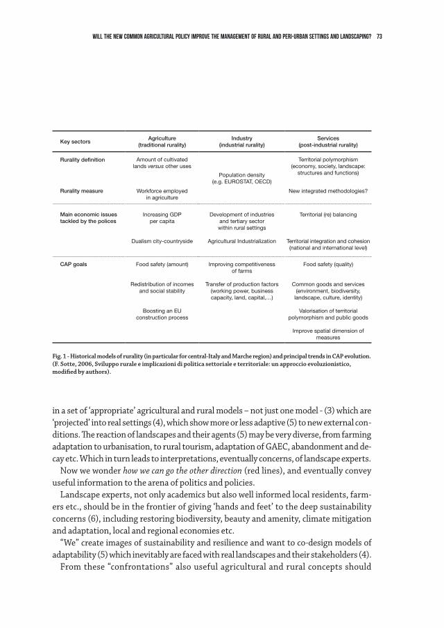
73Will the new Common Agricultural Policy improve the management of rural and peri-urban settings and landscaping?
in a set of ‘appropriate’ agricultural and rural models – not just one model - (3) which are ‘projected’ into real settings (4), which show more or less adaptive (5) to new external con-ditions. The reaction of landscapes and their agents (5) may be very diverse, from farming adaptation to urbanisation, to rural tourism, adaptation of GAEC, abandonment and de-cay etc. Which in turn leads to interpretations, eventually concerns, of landscape experts.
Now we wonder how we can go the other direction (red lines), and eventually convey useful information to the arena of politics and policies.
Landscape experts, not only academics but also well informed local residents, farm-ers etc., should be in the frontier of giving ‘hands and feet’ to the deep sustainability concerns (6), including restoring biodiversity, beauty and amenity, climate mitigation and adaptation, local and regional economies etc.
“We” create images of sustainability and resilience and want to co-design models of adaptability (5) which inevitably are faced with real landscapes and their stakeholders (4).
From these “confrontations” also useful agricultural and rural concepts should
Key sectorsAgriculture
(traditional rurality)Industry
(industrial rurality)Services
(post-industrial rurality)
Rurality definition Amount of cultivatedlands versus other uses
Population density(e.g. EUROSTAT, OECD)
Territorial polymorphism(economy, society, landscape:
structures and functions)
Rurality measure Workforce employedin agriculture
New integrated methodologies?
Main economic issuestackled by the polices
Increasing GDPper capita
Dualism city-countryside
Development of industriesand tertiary sectorwithin rural settings
Agricultural Industrialization
Territorial (re) balancing
Territorial integration and cohesion(national and international level)
CAP goals Food safety (amount)
Redistribution of incomesand social stability
Boosting an EUconstruction process
Improving competitivenessof farms
Transfer of production factors (working power, businesscapacity, land, capital,…)
Food safety (quality)
Common goods and services(environment, biodiversity,
landscape, culture, identity)
Valorisation of territorial polymorphism and public goods
Improve spatial dimension of measures
Fig. 1 - Historical models of rurality (in particular for central-Italy and Marche region) and principal trends in CAP evolution.(F. Sotte, 2006, Sviluppo rurale e implicazioni di politica settoriale e territoriale: un approccio evoluzionistico, modified by authors).
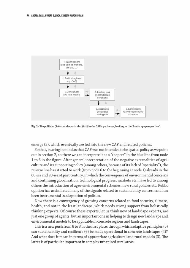
74 Andrea Galli, Hubert Gulinck, Ernesto Marcheggiani
emerge (3), which eventually are fed into the new CAP and related policies. So that, bearing in mind as that CAP was not intended to be spatial policy as we point
out in section 2, so there we can interprete it as a “chapter” in the blue line from node 1 to 6 in the figure. After general interpretation of the negative externalities of agri-culture and its supporting policy (among others, because of its lack of “spatiality”), the reverse line has started to work (from node 6 to the beginning at node 1) already in the 80-ies and 90-ies of past century, in which the convergence of environmental concerns and continuing globalisation, technological progress, markets etc. have led to among others the introduction of agro-environmental schemes, new rural policies etc. Public opinion has assimilated many of the signals related to sustainability concern and has been instrumental in adaptation of policies.
Now there is a convergency of growing concerns related to food security, climate, health, and not in the least landscape, which needs strong support from holistically thinking experts. Of course these experts, let us think now of landscape experts, are just one group of agents, but an important one in helping to design new landscape and environmental models to be applicable in concrete regions and landscapes.
This is a new push from 6 to 3 in the first place: through which adaptive principles (5) can sustainability and resilience (6) be made operational in concrete landscapes (4)? And what does it mean in terms of appropriate agricultural and rural models (3). The latter is of particular important in complex urbanised rural areas.
Fig. 2 - The pull idea (1-6) and the push idea (6-1) in the CAP’s pathways, looking at the “landscape perspective”.
1. Global drivers (geo-politics, markets,
climate, …)
2. Political regimes(e.g. CAP)
3. Agriculturaland rural models
4. Existing ruraland landscape
conditions
5. Adaptative landscapesand agents
5. Landscapesrelated sustainability
concerns
75Will the new Common Agricultural Policy improve the management of rural and peri-urban settings and landscaping?
At the same time they should be aware of the opportunities likely to be offered by new CAP concepts (2), such as the new focus on its spatial dimension (from 2 to 5).
So, what is the “landscape perspective”? It is a “pull” idea: drawing the best from CAP and other policies, be translators and conveyors of such policies to local and regional conditions and with support of stakeholders. And it is a “push” idea: feeding back crea-tive ideas of landscapes the way back to of course local stakeholders and landscapes, to rural and agricultural models and ultimately to CAP itself.
Common Agricultural Policy (CAP): an Effective Tool to Better Manage the Rural Landscape?Before dealing with this matter, it’s compulsory to underline that CAP was never in-tended to be a spatial policy. As a matter of fact, agricultural planning is so far rather a matter of upkeeping a production basis, much more than territorial planning. Agricul-tural systems are normally being maintained and developed on a pre-existing spatial base in the rural area, in which agriculture used to be the key stakeholder. Spatial plan-ning, on the other hand, has indeed and essentially be an instrument for organising multiple urban and industrial stakeholders. In recent decades, spatial planners have realised the importance in protecting open spaces, but also for the sake of the life quali-ties of a society that culturally has become essentially “urban”.
Rermarkably and during last decennia, both agriculture and urban development tend to find each others in matters of environment, in a certain way. The GAEC 5.2 standard (Buffer Streps) and the GAEC 4.4 standard (Landscape Features) are a good example to find a linkage between the two. But a major drawback of these instruments is that they apply incrementally, at the level of individual enterprises and of fields. In other words, the basic intention may be comprehensive and holistic, in reality it is rather a matter of punc-tual application of a principle, in an implicit hope that individual applications converge to a connected network of protective bufferstrips and improved agrarian landscapes.
Nevertheless, another important driver must be taken in account: the public opin-ion. His role in influencing political choices is increasing in modern society. Because of problems arising due to the de-industrialisation process, a new social demand in rural areas requires a solution to improve environmental conditions (pollution, erosion, loss of biodiversity, climate change, renewable energy, landscape degradation) as well as the safety of goods (food safety , traceability, product quality) and quality of life (economic, cultural and psychological aspects).
Therefore, spatial planning and agricultural policies are both pressed from society, in a certain way, to tackling these questions. Some answers seem to come out. Note the
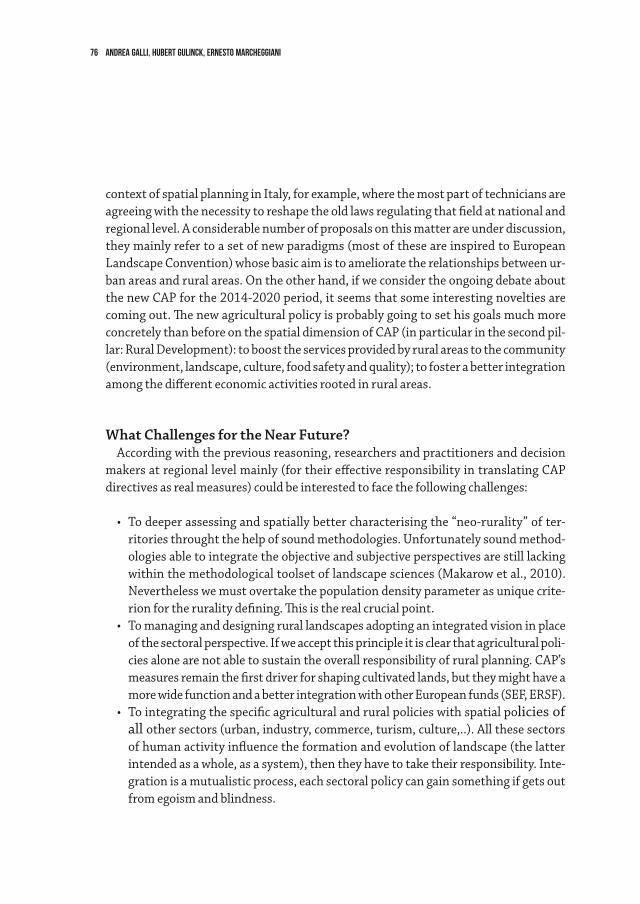
76 Andrea Galli, Hubert Gulinck, Ernesto Marcheggiani
context of spatial planning in Italy, for example, where the most part of technicians are agreeing with the necessity to reshape the old laws regulating that field at national and regional level. A considerable number of proposals on this matter are under discussion, they mainly refer to a set of new paradigms (most of these are inspired to European Landscape Convention) whose basic aim is to ameliorate the relationships between ur-ban areas and rural areas. On the other hand, if we consider the ongoing debate about the new CAP for the 2014-2020 period, it seems that some interesting novelties are coming out. The new agricultural policy is probably going to set his goals much more concretely than before on the spatial dimension of CAP (in particular in the second pil-lar: Rural Development): to boost the services provided by rural areas to the community (environment, landscape, culture, food safety and quality); to foster a better integration among the different economic activities rooted in rural areas.
What Challenges for the Near Future?According with the previous reasoning, researchers and practitioners and decision
makers at regional level mainly (for their effective responsibility in translating CAP directives as real measures) could be interested to face the following challenges:
• Todeeperassessingandspatiallybettercharacterisingthe“neo-rurality”ofter-ritories throught the help of sound methodologies. Unfortunately sound method-ologies able to integrate the objective and subjective perspectives are still lacking within the methodological toolset of landscape sciences (Makarow et al., 2010). Nevertheless we must overtake the population density parameter as unique crite-rion for the rurality defining. This is the real crucial point.
• Tomanaginganddesigningrurallandscapesadoptinganintegratedvisioninplaceof the sectoral perspective. If we accept this principle it is clear that agricultural poli-cies alone are not able to sustain the overall responsibility of rural planning. CAP’s measures remain the first driver for shaping cultivated lands, but they might have a more wide function and a better integration with other European funds (SEF, ERSF).
• Tointegratingthespecificagriculturalandruralpolicieswithspatialpolicies of all other sectors (urban, industry, commerce, turism, culture,..). All these sectors of human activity influence the formation and evolution of landscape (the latter intended as a whole, as a system), then they have to take their responsibility. Inte-gration is a mutualistic process, each sectoral policy can gain something if gets out from egoism and blindness.
77Will the new Common Agricultural Policy improve the management of rural and peri-urban settings and landscaping?
References
Antrop M., 2004, “Landscape change and the urbanization process in Europe,” Landscape and Urban Planning, 67: 9-26.
de Groot, R., 2006, “Function-analysis and valuation as a tool to assess land use conflicts in plan-ning for sustainable, multi-functional landscapes,” Landscape and Urban Planning, 75, 175–186.
Fry G.L.A., 2001, “Multifunctional landscapes – towards transdisciplinary research,” Landscape and Urban Planning, 57, 159–168.
Council of Europe, European Landscape Convention, Florence, 2000, CETS No 176.Makarow M., Rodriguez Pena A., Zic-Fuchs M., Caball M., 2010, “Landscape in a changing
World - European Science Foundation”, Science Policy Briefing, October 2010.Gulinck, H., 2004, “Neo-rurality and multifunctional landscapes,” in Brandt, J. and Vejre, H.
(eds.), Multifunctional Landscapes, Vol. 1: Theory, Values and History, WIT Press, Southampton, pp. 63-73.
Gulinck et al., 2010, “Underrated transformations in the open space—The case of an urbanized and multifunctional area,” Landscape and Urban Planning, 94: 196–205.
Rizov M., 2004, “Rural development and welfare implications of CAP reforms,” Journal of Policy Modeling, 26: 209–222.
Sotte F., 2006, “Sviluppo rurale e implicazioni di politica settoriale e territoriale. Un approccio evoluzionistico”, in: Cavazzani A et al. (a cura di): Politiche, governance e innovazione per le aree rurali, Napoli, INEA - Edizioni Scientifiche Italiane.
Perella G., Galli A., Marcheggiani E., 2010, “The potential of Ecomuseum in Strategies for Local Sustainable Development in Rural Areas” Landscape Research Vol. 35, No. 4, 431-447.
Pedroli G.B.M., Van Elsen Th. And Van Mansvelt J.D., 2007, “Values of rural landscapes in Europe: inspiration or by-product?” NJAS - Wageningen Journal of Life Sciences, Volume 54, Issue 4, 2007, 431-447.
van der Ploeg, J.D., Long A., Banks J., 2002, Living Countrysides: Rural Development Processes in Europe: the State of the Art, Elsevier, EBI.
van der Ploeg, J.D., van Broekhuizen R., Brunori G., Sonnino R., Knickel K., Tisenkopfs T., Oostindie H., 2008, “Towards a new theoretical framework for understanding regional rural development”, in Unfolding Webs: The dynamics of regional rural development, van Gorcum, Assen.
Willemen L., Verburg P.H., Hein L., M.E.F. Van Mensvoort, 2008, “Spatial characterization of lands-cape functions,” Landscape and Urban Planning, 88: 34-43.
78
In this paper I want to provide examples of student work that involves rural spaces. Basic conditions for planning in a rural context in Germany: • Demandsonlandscapearechanging,developpedareasareever-growing:inBaden-
Württemberg alone 6,3 hectares of agricultural land are being declared as settle-ment areas daily. Surfaces used for energy production and compensation for impact mitigation compete with agricultural uses.
• Thenumberofinhabitantsinruralareasisdecreasingandpeoplearegettingolder.• Costsforheatingandespeciallymobilityaregrowingandweighheavilyonrural
households.• Newwaysoflivinginruralareasandusesforagriculturehavetobefound.• AlsotourisminGermanyhastoanswertonewdemands.• Oneproposedmethodistokeepsettlementandlandscapestructuresasabasic
condition for the designing of regional architecture as well as using the landscape as a new source of income and energy. Ideas based on this concept are shown in two students projects:one about a valley in Lower Saxony and one in two villages in the Black Forest in the south of Germany.
First Example: Gut Walshausen in Innerste Valley. (Diploma thesis by Sebastian Selbmann and Daniela Walz at the faculty of architecture at KIT, 2012)
Gut Walshausen is an old estate, first mentioned in 1146, surrounded by a historically valuable park which has fallen into disrepair. In 1829 Georg Ludwig Friedrich Laves built a classicist villa and rearranged the adjoining buildings into a symmetrically styled courtyard ensemble. The park was remade into an English style landscape park. Over time, the estate was temporarily used by the church, where it was a place of scientific studies and served as a representative summer residence. It was derelict from 1940 to 1980 and then fell into disrepair. After that period, it was yet again inhabited, but due to rising costs for energy the estate is currently in a precarious situation.
New concepts for thematic and economic uses and remodelling of building substance should be developed for many of these old estates in the Innerste valley area situated on the border between wetlands and agricultural plots on the slopes.
The further use of fossil energy sources was not a valid sustainable or financial option,
2.2Economy of rural spaces. Two results of our work with students Kerstin Gothe
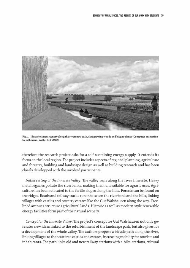
79Economy of rural spaces. Two results of our work with students
therefore the research project asks for a self-sustaining energy supply. It extends its focus on the local region. The project includes aspects of regional planning, agriculture and forestry, building and landscape design as well as building research and has been closely developped with the involved participants.
Initial setting of the Innerste Valley: The valley runs along the river Innerste. Heavy metal legacies pollute the riverbanks, making them unavailable for agraric uses. Agri-culture has been relocated to the fertile slopes along the hills. Forests can be found on the ridges. Roads and railway tracks run inbetween the riverbank and the hills, linking villages with castles and country estates like the Gut Walshausen along the way. Tree-lined avenues structure agricultural lands. Historic as well as modern style renewable energy facilities form part of the natural scenery.
Concept for the Innerste Valley: The project’s concept for Gut Walshausen not only ge-rerates new ideas linked to the refurbishment of the landscape park, but also gives for a development of the whole valley. The authors propose a bicycle path along the river, linking villages to the scattered castles and estates, increasing mobility for tourists and inhabitants. The path links old and new railway stations with e-bike-stations, cultural
Fig. 1 - Ideas for a new scenery along the river: new path, fast growing woods and biogas plants (Computer animation by Selbmann, Waltz, KIT 2012).
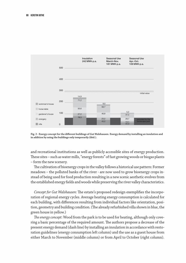
80 kerstin gothe
and recreational institutions as well as publicly accessible sites of energy production. These sites – such as water mills, “energy forests” of fast growing woods or biogas plants – form the new scenery.
The cultivation of bioenergy crops in the valley follows a historical use pattern: Former meadows – the polluted banks of the river - are now used to grow bioenergy crops in-stead of being used for food production resulting in a new scenic aesthetic evolves from the established energy fields and woods while preserving the river valley characteristics.
Concept for Gut Walshausen: The estate’s proposed redesign exemplifies the incorpo-ration of regional energy cycles. Average heating energy consumption is calculated for each building, with differences resulting from individual factors like orientation, posi-tion, geometry and building condition. (The already refurbished villa shown in blue, the green house in yellow.)
The energy concept: Wood from the park is to be used for heating, although only cove-ring a basic percentage of the required amount. The authors propose a decrease of the present energy demand (dash line) by installing an insulation in accordance with resto-ration guidelines (energy consumption left column) and the use as a guest house from either March to November (middle column) or from April to October (right column).
Fig. 2 - Energy concept for the different buildings of Gut Walshausen. Energy demand by installing an insulation and in addition by using the buildings only temporarily (ibid.).
Insulation242 MWh p.a.
Seasonal UseMarch-Nov.181 MWh p.a.
Seasonal UseApr.-Oct.109 MWh p.a.
workman’s house
horse table
gardener’s house
orangery
villa
500
400
300
200
14,9
71,2
50,6
27,2
78,3
9,0
5,2
provided by thelandscape park
initial value
37,2
29,7
14,122,3
58,7
46,8
23,243,2
100
0

81Economy of rural spaces. Two results of our work with students
This applies individually to each building. User groups include tourists as well as regio-nal institutions such as the universities or colleges of Hildesheim. Some buildings could host artists in residence in their upper floors of the manor offers hotel rooms or inthe ground floor seminar rooms. Only one house is inhabited year round. Wood from the park is used for heating: Assuming seven hectares of the park are to be re-established as an English style landscape park with one percent of the tree stock being cut down for heating per year, there still remains a gap of about 2.4 hectares of wood which needs to be taken from an energy plantation to fully cover the heating energy demand. This wood can be grown on the riverbanks without compromising the natural scenery. A repre-sentative, newly built power plant with an affiliated bistro bridges the river and stages diverse means of energy production such as photovoltaic, solar collectors, heat pumps or a hydro-electric power plant. This new building intends to combine the traditional barn typology with a more contemporary aesthetic of energy production.
New, regional energy cycles are initiated, which are visible for the public.
Results: An example of a local, sustainable energy production is shown to be feasable. New ways of energy production help to the care for cultivated landscape and to preserve the historical building substance at the same time. A carbon neutral operation mode and
feed-in for regional useelectric power supply of the property
heating of the property
approx. 25 t p.a. woodfrom the landscape park
approx. 36 t p.a. wood from the energy plantationapprox. 1200 MWh p.a. electricity from hydro power
Fig. 3 - Energy cycles help cultivating landscape and preserving the historical building substance. (ibid.).
82 kerstin gothe
heating of the estate in accordance with restoration guidelines is made possible with individual use concepts and a seasonally graded use intensity for the various buildings. The notable historical scenery can thus be preserved with the addition of contemporary elements. The region which formerly covered only 14% of its energy consumption with renewable resources (as is the German average) can now develop new prospects.
Second Example: Summerschool Update Schwarzwald in August 2012.New Prospects for Two Black Forest villages
In a ten day long on-location case study in the villages Bernau/Menzenschwand, 22 architecture and urban planning students from the Universities of Stuttgart, Karlsruhe, Hamburg, Tübingen, Linz and Wageningen, tutored by lecturers from KIT and the Uni-versity of Stuttgart1 generated ideas on how to activate regional creative potential and how to bridge vacancies in old Black Forest houses, lodges or bankrupt clinics. They also tried to identify potential local players and to develop new concepts for existing buildings. Accompanying lectures for the students and interested citizens from the con-cerned villages were provided as an opportunity for informal discussion.
From the many of the useful ideas that were developed, I will elaborate on one of the proposals that was made: Julia Schütz, Claudia Zimmermann and Julia Kolk found that there were numerous apprenticeship and qualified professional positions available and many commuters, which led them to their concept titled „bed’n’job – Black Forest on trial“. Job positions will be offered in combination with optionally furnished property for rent, such as in an apartment, a flat or a house, shared or for single occupancy, which encourages young people like apprentices, interns or job entrants to try living in the countryside. Vacant buildings used anew are re-established as a quality for rural regions.
The “bed’n’job“-administration will bring together job and housing offers. The “inha-bitants on trial“ can share communal rooms, even means of transportation (i.e. carsha-ring). They add to local associations and make use of the recreational potential of the region with activities like hiking, mountain biking or climbing; they introduce new lei-sure activities and lifestyles to the community. The students show how newly restored facades on buildings mirror the transformation and how existing spatial structures are more or less applicable to the various new living requirements.
I have picked three other works which focus on different aspects:New concepts of hosting guests and visitors: A selection of 0 to 4 star accomodation,
recreational and restaurant facilities cater to a wider range of clientele: The whole of the
1 Kerstin Gothe, Philipp Dechow, Johann Jessen, Luigi Pantisano, Antje Stokman and Johannes Jörg.
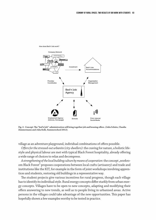
83Economy of rural spaces. Two results of our work with students
Fig. 4 - Concept: The “bed’n’job“-administration will bring together job and housing offers. (Julia Schütz, Claudia Zimmermann and Julia Kolk, Summerschool 2012).
How does Bed’n’Job work?
Company Network
Investment
ProvidesCoordinates
OrganisationManagement
Bed’n’JobAccommodations
Schools
Bed’n’JobAgency
Print, Internet,Social Media
Employment Agency(Advices, Homepage)
village as an adventure playground, individual combinations of offers possible.Offers for the stressed-out urbanite (city-dwellers): the craving for nature, a holistic life-
style and physical labour are met with typical Black Forest hospitality, already offering a wide range of choices to relax and decompress.
A strengthening of the local building culture by means of cooperation: the concept „workro-om Black Forest“ proposes cooperations between local crafts (artisanry) and trade and institutions like the KIT, for example in the form of joint workshops involving appren-tices and students, restoring old buildings in a representative way.
The student projects give various incentives for rural progress, though each village has to identify its individual style. Rural energy concepts differ starkly from urban ener-gy concepts. Villages have to be open to new concepts, adapting and modifying their offers answering to new trends, as well as to people living in urbanised areas. Active persons in the villages could take advantage of the new opportunities. This paper has hopefully shown a few examples worthy to be tested in practice.
84
Aujourd’hui comme hier, les responsables politiques des villes de toutes tailles n’ont pas en général mesuré l’intérêt que les villes et leurs habitants ont à conserver ou à recréer les espaces boisés, agricoles et jardinés. Ce qu’on appelle le plus souvent la nature d’un point de vue pratcien, mais aussi littéraire et artistique, et qui correspond aux es-paces verts (boisés, agricoles et jardinés) et aquatiques urbains. Dans ce texte, nous indi-querons comment il est possible au XXIe siècle d’avoir recours au concept d’agriurbanité pour prendre les décisions publiques concernant la persistance des espaces agricoles dans les régions urbaines. Enfin nous décrirons trois scénarios tendanciels qui peuvent être réunis dans le même territoire administratif urbanisé: en France par exemple, les communautés d’agglomération et les communautés urbaines, dont les populations varient de 50 000 habitants à plus de six millions d’habitants (Paris Métropole).
La nécessité agroécologique de proximité Dans la plupart des villes du monde, les migrations vers les villes ainsi que la crois-
sance démographique, surtout dans les pays du sud, ont abouti à la concentration des populations dans les agglomérations. En 2010 plus de 50 % de la population de la pla-nète est urbaine. Dans la plupart des pays d’Europe, plus de 80 % de la population se concentre dans les aires urbaines (urban areas) et les agglomérations, centrales ou péri-phériques, qui s’y localisent.
Dans ces régions urbaines, au sens élargi de l’écologue et planificateur anglais R.T.T. Forman (2008), il est possible de penser la question non seulement de la sécurité ali-mentaire des habitants, mais des multiples services environnementaux et sociaux que ces espaces agricoles et jardinés peuvent fournir aux citadins. N’oublions pas que «800 millions de personnes pratiquent aujourd’hui l’agriculture urbaine assurant 15 à 20 % de la production mondiale de nourriture»1. Et que la crise environnementale (pollu-tions, réchauffement climatique) et sociale (chômage, pauvreté, ségrégation sociale) des villes est chronique.
1 Courrier International, n° 1112, 2012.
2.3L’agriurbanité: trois modèles, de la ville agricole à la ville jardinPierre Donadieu
85L’agriurbanité: trois modèles, de la ville agricole à la ville jardin
Perte de l’agriculture et des espaces publics Les tendances les plus lourdes de l’urbanisation sont celles qui suppriment l’agricul-
ture des villes (désagricolisation). En France par exemple, la consommation d’espaces agricoles (par l’urbanisation, mais également par l’abandon agricole des terres en mon-tagne) ne cesse de s’accroître en dépit des politiques publiques de protection des terres agricoles: environ 60 000 hectares ont disparu en 2010. Cette désagricolisation des régions urbaines s’accompagne de trois phénomènes.
Dans beaucoup de pays de l’Europe du nord et de l’ouest, les terres agricoles non construites des régions urbaines sont reboisées pour des finalités environnementales (séquestration du CO2, microclimatisation urbaine), sociales (loisirs de proximité ou régionaux) et culturelles (l’intérêt social pour les arbres et la nature). Beaucoup de ces espaces boisés ou jardinés deviennent publics en raison du rachat par la puissance publique (agences foncières en France par exemple). Mais d’autres restent privés, en Grande-Bretagne notamment. Car beaucoup de municipalités ont recours à une alter-native à l’agriurbanisation possible de la ville: celle de la naturalisation de l’espace par les boisements. Au sud est de Montpellier par exemple les projets publics urbains «Eco-cité» mettent en avant la notion de ville-nature. Depuis 15 ans à la place des anciens vignobles, ils créent des parcs publics (les parcs Marianne et de la Lironde), avec des finalités de limitation des risques d’inondation des rivières et d’accueil du public habi-tant. En outre, on observe, ce qui n’est pas un phénomène récent, que les espaces non ou peu construits des régions urbaines passent ou restent sous le contrôle des logiques marchandes. Non seulement dans les parcs d’attractions payants, mais également dans les terrains de sports (associations, clubs) notamment sur les bords de mers et de lacs (restaurants, hôtels). On observe ces phénomènes de réduction de l’espace public acces-sible à tous tout autour de la mer Méditerranée, à Beyrouth ou à Tunis par exemple.
C’est dans les pays de l’Union européenne que l’on note de plus en plus des résis-tances ponctuelles à la disparition de l’espace public agricole. Des périmètres protégés émergent depuis 20 ans sous la forme notamment des parcs-natures à la fois boisés, agricoles et aquatiques (Lyon, Barcelone, Berlin) et des parcs agricoles (Barcelone, Mi-lan, Turin). À l’ouest de Montpellier et de Paris, comme au Nord de Bordeaux ou à Reims des espaces viticoles et agricoles privés et protégés par les règlements d’urbanisme font désormais partie des agglomérations, en principe de manière pérenne.
Peut-on penser la ville avec ces deux objectifs: nourrir les citadins proches et créer les conditions d’une ville habitable (risques naturels et anthropogènes limités, offres d’espaces publics de loisir, cadre attractif vert)? La nourriture de proximité ne fait-elle pas partie des conditions souhaitables de l’habitabilité de la région urbaine ?
86 pierre donadieu
Nécessité des agricultures de proximitéLes postulats de l’économie libérale ont fait valoir depuis le XVIIIe siècle les principes
du libre échange à l’échelle mondiale. Tout consommateur urbain trouve donc, et en-core aujourd’hui, normal de disposer de n’importe quel produit alimentaire à n’importe quel moment de l’année, quelle qu’en soit l’origine géographique. Or les perspectives internationales de raréfaction des ressources énergétiques carbonées, et la nécessité de restreindre les rejets de carbone dans l’atmosphère se traduisent par une nouvelle prise de conscience politique autant que citoyenne: limiter la circulation planétaire des biens alimentaires. C’est pourquoi depuis 2005, le mouvement des locavores (s’approvi-sionner localement dans un rayon de 150 à 200 kilomètres autour des villes) préconise ces nouvelles pratiques citoyennes (Novel, 2010). Non seulement pour participer à la lutte contre le réchauffement climatique, mais pour se nourrir mieux en identifiant les producteurs et leur commercialisation locale, et en s’attachant aux cuisines et aux produits locaux, biologiques ou non (comme ceux des AMAP –Association pour le main-tien de l’agriculture paysanne – en France), le mouvement international Slow food, les cueillettes directes, les circuits courts de vente, etc.). Cette idéologie rencontre de nom-breux opposants: les partisans du commerce équitable et du soutien des paysanneries lointaines par les consommateurs des pays du nord; ceux qui constatent que les agricul-tures des régions urbaines sont en général peu favorables à ces pratiques, et la grande distribution qui fait valoir sa rationalisation de l’approvisionnement, plus efficace du point de vue énergétique (et du rejet de CO2) que les petits producteurs- commerçants, regroupés ou non.
Même si les idées locavores sont logiques, elles ne constituent qu’une réponse par-tielle à la crise climatique et surtout énergétique. C’est pourquoi, la tentation d’une région urbaine autonome sur le plan alimentaire restera longtemps une utopie, chimé-rique mais nécessaire. Personne n’arrêtera les déplacements des marchandises à tra-vers la planète. En revanche, il est tout à fait possible aux pouvoirs publics des régions urbaines d’organiser un ensemble de communes pour qu’elles tendent vers l’autosuffi-sance en produits frais de base (légumes, fruits, fleurs, lait, fromage, viandes, etc.). Pour cela il est indispensable de penser la multifonctionnalité des espaces et l’usage multiple des activités agricoles et jardinières qui y sont localisées.
Installer la multifonctionnalité de l’espace non bâti sur un sol vivant Le trait commun essentiel aux espaces non bâtis est leur sol naturel, vivant, plus
ou moins fertile selon leur histoire et les situations climatiques et topographiques. La dénaturalisalisation de la ville accompagne la perte de ses sols. Tout sol, selon ses caractéristiques pédologiques, peut permettre l’implantation d’arbres, de buissons ou
87L’agriurbanité: trois modèles, de la ville agricole à la ville jardin
d’herbes, de boisements, de champs, de jardins, de serres, de plans d’eaux ou de parcs publics. Plus il est artificiel (sols urbains, cultures hydroponiques ou aquaponiques), moins il est souple pour s’adapter à l’arbre, au buisson ou à l’herbe. La résilience de la ville (sa capacité à s’adapter) face aux crises chroniques ou non en diminue d’autant, et celle du citadin également. Plus le sol est naturel, plus il est facile de passer de l’herbacé au ligneux (et inversement) et de permettre de s’adapter à des besoins imprévisibles (nourrir en cas de guerre par exemple) ou prévisibles (microclimatisation, fixation du carbone, loisirs extérieurs, etc.). Plus il est fertile (riche en matière organique), plus son usage agricole intensif est possible.
C’est pourquoi, la conservation et la reconquête des sols vivants (avec une activité microbienne et de la matière organique en quantité suffisante) sont fondamentales. Ce qu’enseignent les sciences agroécologiques. Car leur perte (par la construction) est irréversible pour un territoire donné, même s’il est possible de les reconstituer pour des cultures intensives (les sols horticoles). Aussi, chaque commune ou groupe de com-munes sont-ils invités à penser la répartition spatiale des fonctions et usages des sols non construits. Si les sols sont agricoles (et en général privés), les pouvoirs publics ont la possibilité de les préserver non seulement pour des productions de biens agroali-mentaires à destination de la ville et de ses habitants, mais en tant qu’espaces ouverts à la promenade piétonne, au cyclisme et à l’équitation. En tant également qu’espaces d’accompagnement des transports automobiles, ferroviaires, par tramway et canaux, des transports d’électricité et de gaz en particulier, sans compter ceux qui sont associés aux gares et aux aéroports. En outre, ces agricultures, surtout si elles sont biologiques, peuvent favoriser la biodiversité locale et être pensées simultanément en vue de la transmission d’un patrimoine architectural de fermes et de petits patrimoines, hydrau-liques notamment, comme dans le parc agricole au sud de Milan, ou les parcs naturels régionaux périurbains en France.
À l’inverse, un espace boisé, privé ou public, peut être imaginé certainement en fonction de sa production de bois ou d’accueil de la faune sauvage, mais surtout pour l’espace du loisir qu’il offre quand il est aménagé à cet effet. Sans compter les effets de microclimati-sation, de dépollution et de fixation du carbone de l’air. C’est donc la hiérarchie entre ces fonctions et usages qui doit être réfléchie et décidée avec les habitants, les propriétaires, les agriculteurs, les forestiers et les pouvoirs publics locaux. Cette gouvernance des pro-jets urbains est essentielle pour une politique de développement urbain qui recherche la transmission aux générations futures des meilleures conditions locales et globales d’habi-tabilité des territoires. Elle est difficile car l’information des acteurs est hétérogène, et les conditions d’un débat public équitable pas toujours réunies. C’est pourquoi, il est néces-saire d’introduire de nouvelles notions éthiques et politiques dans ce débat.
88 pierre donadieu
L’espace cultivé comme bien commun public des citadins La démocratie (le gouvernement par et pour le peuple) s’oppose à la tyrannie d’un
seul ou de quelques-uns. Elle n’est pas toujours dirigée par des valeurs morales comme la dignité, l’égalité, la justice ou la liberté. Et elle ne se prononce pas nécessairement sur la place des ressources publiques et privées, comme les biens environnementaux.
Le bien commun paysager agricole D’un point de vue juridique on appelle biens communs, les ressources indivises que
chacun peut consommer (et surconsommer). Ces biens donnés par la nature, comme l’air, la diversité biologique, l’eau des nappes phréatiques ou les poissons des mers et des cours d’eau, longtemps considérés comme res nullius (biens de personne) ont été surex-ploités, et le plus souvent sont en voie d’altération ou de destruction. Pour les protéger, et préserver ainsi les chances de survie des générations futures, il existe deux postures possibles. Soit les privatiser, comme le suggère de plus en plus l’économie libérale, et en faire un bien marchand profitable, soit lui donner le statut de bien public au sens éthique et politique (Donadieu, 2012; Grange, 2012, p. 25).
Dans ce dernier cas, il s’agit de faire prévaloir, par des règles d’usage publiques et hors du marché, au nom notamment de la solidarité et de la justice sociale (Petrella, 1996), l’intérêt du plus grand nombre. Ce qui serait visé, est de constituer une communauté de ressources, repérables dans l’espace matériel (l’eau par exemple, mais aussi les sols agricoles et les forêts), et sans doute de la sortir des logiques d’échanges marchands (Grange, 2012, p. 27). En remplaçant la logique du prix de marché par celle des valeurs civiques (la survie) et de transmission, il serait possible d’accroître ce que l’économiste et philosophe Amartya Sen (2009) appelle la capabilité, c’est à dire la possibilité de choix pour soi et son groupe. Ce qui a été déjà préfiguré par la politique de l’UNESCO de dési-gnation des biens patrimoniaux mondiaux (940 sites inscrits sur la liste du patrimoine mondial en 2012).
Comme dans le cas de l’eau qui peut leur être associé, si les sols agricoles et forestiers deviennent patrimoine commun (sans compromettre leur statut foncier le plus sou-vent privatif), cette construction nouvelle devrait sortir ces biens communs publics de la logique du profit. Devenus non appropriables sous la garantie d’une autorité (des Régions et des États à l’Europe et à l’UNESCO), ils échapperont peut-être aux logiques du marché. Cette position de la philosophe Juliette Grange permet de ne plus faire des biens communs des marchandises. Toutefois elle réduit, de manière lucide, la libre dis-position des biens privés (les sols agricoles), comme celle des biens publics (avec la pêche ou le gibier par exemple). Les biens communs publicisés peuvent être également imma-tériels, nous le verrons avec les biens communs paysagers.
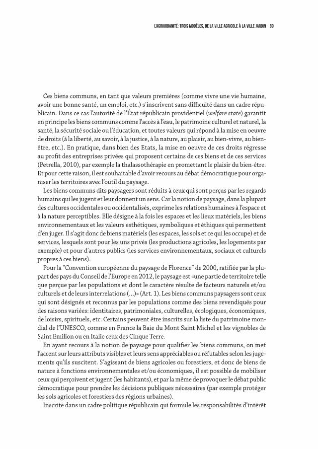
89L’agriurbanité: trois modèles, de la ville agricole à la ville jardin
Ces biens communs, en tant que valeurs premières (comme vivre une vie humaine, avoir une bonne santé, un emploi, etc.) s’inscrivent sans difficulté dans un cadre répu-blicain. Dans ce cas l’autorité de l’État républicain providentiel (welfare state) garantit en principe les biens communs comme l’accès à l’eau, le patrimoine culturel et naturel, la santé, la sécurité sociale ou l’éducation, et toutes valeurs qui répond à la mise en oeuvre de droits (à la liberté, au savoir, à la justice, à la nature, au plaisir, au bien-vivre, au bien-être, etc.). En pratique, dans bien des Etats, la mise en oeuvre de ces droits régresse au profit des entreprises privées qui proposent certains de ces biens et de ces services (Petrella, 2010), par exemple la thalassothérapie en promettant le plaisir du bien-être. Et pour cette raison, il est souhaitable d’avoir recours au débat démocratique pour orga-niser les territoires avec l’outil du paysage.
Les biens communs dits paysagers sont réduits à ceux qui sont perçus par les regards humains qui les jugent et leur donnent un sens. Car la notion de paysage, dans la plupart des cultures occidentales ou occidentalisés, exprime les relations humaines à l’espace et à la nature perceptibles. Elle désigne à la fois les espaces et les lieux matériels, les biens environnementaux et les valeurs esthétiques, symboliques et éthiques qui permettent d’en juger. Il s’agit donc de biens matériels (les espaces, les sols et ce qui les occupe) et de services, lesquels sont pour les uns privés (les productions agricoles, les logements par exemple) et pour d’autres publics (les services environnementaux, sociaux et culturels propres à ces biens).
Pour la “Convention européenne du paysage de Florence” de 2000, ratifiée par la plu-part des pays du Conseil de l’Europe en 2012, le paysage est «une partie de territoire telle que perçue par les populations et dont le caractère résulte de facteurs naturels et/ou culturels et de leurs interrelations (…)» (Art. 1). Les biens communs paysagers sont ceux qui sont désignés et reconnus par les populations comme des biens revendiqués pour des raisons variées: identitaires, patrimoniales, culturelles, écologiques, économiques, de loisirs, spirituels, etc. Certains peuvent être inscrits sur la liste du patrimoine mon-dial de l’UNESCO, comme en France la Baie du Mont Saint Michel et les vignobles de Saint Emilion ou en Italie ceux des Cinque Terre.
En ayant recours à la notion de paysage pour qualifier les biens communs, on met l’accent sur leurs attributs visibles et leurs sens appréciables ou réfutables selon les juge-ments qu’ils suscitent. S’agissant de biens agricoles ou forestiers, et donc de biens de nature à fonctions environnementales et/ou économiques, il est possible de mobiliser ceux qui perçoivent et jugent (les habitants), et par la même de provoquer le débat public démocratique pour prendre les décisions publiques nécessaires (par exemple protéger les sols agricoles et forestiers des régions urbaines).
Inscrite dans un cadre politique républicain qui formule les responsabilités d’intérêt
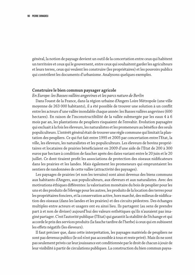
90 pierre donadieu
général, la notion de paysage devient un outil de la concertation entre ceux qui habitent un territoire et ceux qui le gouvernent, entre ceux qui souhaitent garder les agriculteurs et leurs terres, ceux qui veulent les construire (les propriétaires) et les pouvoirs publics qui contrôlent les documents d’urbanisme. Analysons quelques exemples.
Construire le bien commun paysager agricoleEn Europe: les Basses vallées angevines et les parcs nature de Berlin
Dans l’ouest de la France, dans la région urbaine d’Angers Loire Métropole (une ville moyenne de 263 000 habitants), il a été possible de trouver une solution à un conflit entre les acteurs d’une vallée inondable chaque année: les Basses vallées angevines (600 hectares). En raison de l’inconstructibilité de la vallée submergée par les eaux 4 à 6 mois par an, les plantations de peupliers risquaient de l’envahir. Evolution paysagère qui excluait à la fois les éleveurs, les naturalistes et les promeneurs au bénéfice des seuls populiculteurs. L’intérêt général était de trouver une règle commune qui limitait la plan-tation des peupliers. Ce qui fut fait entre 1995 et 2005 par concertation entre l’Etat, la ville, les éleveurs, les naturalistes et les populiculteurs. Les éleveurs de bovins proprié-taires et locataires de prairies bénéficiaient en 2009 d’une aide de l’Etat de 200 à 300 euros par hectare à condition de faucher après des dates variant entre le 20 juin et le 20 juillet. Ce dont tiraient profit les associations de protection des oiseaux nidificateurs dans les prairies et les landes. Mais également les promeneurs qui empruntaient les sentiers de randonnées de cette vallée (attractivité des paysages).
Les paysages de prairies (et non les terrains) sont ainsi devenus des biens communs aux habitants d’Angers, aux populiculteurs, aux éleveurs et aux naturalistes. Avec des motivations éthiques différentes: la valorisation monétaire du bois de peuplier pour les uns et des produits de l’élevage pour les autres, les produits de la location des terres pour les propriétaires fonciers, et la conservation active, hors marché, des milieux de nidifica-tion des oiseaux (dans les landes et les prairies) et des circuits pédestres. Des échanges multiples entre acteurs et usagers ont eu ainsi lieu. Ils partagent (au sens de prendre part à et non de diviser) aujourd’hui des valeurs esthétiques qu’ils n’auraient pas ima-giné partager. C’est l’autorité publique (l’Etat) qui garantit la stabilité de l’échange et qui accorde le prix des services produits (la fauche tardive de l’herbe) à ceux qui en subissent les effets négatifs (les éleveurs).
Il faut préciser que, dans cette interprétation, les paysages matériels de peupliers ne sont pas devenus publics (le sol n’est pas accessible à tous et reste privé). Mais ils ne sont pas seulement privés car leur jouissance est conditionnée par le droit de chacun à jouir de leur visibilité à partir de circulations publiques. La construction du bien commun paysa-
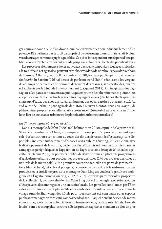
91L’agriurbanité: trois modèles, de la ville agricole à la ville jardin
ger équivaut donc à celle d’un droit à jouir collectivement et non individuellement d’un paysage. Elle ne limite pas le droit de propriété ou de fermage d’un sol mais le fait évoluer vers des usages communs jugés équitables. Ce qui se fait cependant aux dépens d’une po-litique locale d’extension des cultures de peupliers et limite la liberté des populiculteurs.
Les processus d’émergence de ces nouveaux paysages composites, à usages multiples, à la fois urbains et agricoles, peuvent être observés dans de nombreux pays dans et hors de l’Europe. À Berlin (3 450 000 habitants en 2010), les parcs publics périurbains (lands-chaftpark) du Barnim (296 ha) desservis par le métro (S-Bahn) réunissent des vergers, des champs de céréales et de pommes de terre et des prairies, sans pesticides, qui ont été rachetés par le Sénat de l’Environnement (Jacquand, 2012). Aménagés par des pay-sagistes, les parcs sont ouverts au public qui emprunte des cheminements piétonniers et cyclistes mettant en scène les caractères paysagers locaux (des lignes électriques, des châteaux d’eaux, des silos agricoles, un bunker, des observatoires d’oiseaux, etc.). Au sud-ouest de Berlin, le parc agricole de Gatow s’ouvrira bientôt. Peut-être s’agit-il de phénomènes propres à des villes à faible croissance? Qu’en est-il en revanche en Chine, haut lieu de croissance urbaine et de planification urbaine centralisée?
En Chine les vignes et vergers de Xi’an Dans la métropole de Xi’an (9 200 000 habitants en 2010), capitale de la province du
Shaanxi au centre de la Chine, et presque autonome pour l’approvisionnement agri-cole, l’urbanisation a consommé au cours des dix dernières années l’espace agricole dis-ponible sans créer suffisamment d’espaces verts publics (Yueting, 2012). Ce qui, avec le développement de la voiture, déclenche des afflux périodiques de touristes dans les campagnes périphériques et l’apparition de l’agrotourisme (nong jia le) chez les agri-culteurs. Depuis 2005, les pouvoirs publics de X’ian ont mis en place des programmes d’agriculture urbaine pour protéger les espaces agricoles (1/4 des espaces agricoles et naturels de la métropole). «Une première couronne accueille des parcs de jardins frui-tiers (des pêchers), viticoles et potagers, la deuxième concentre la transformation des produits, et la troisième près de la montagne Quin Ling est vouée à l’agriculture biolo-gique et à l’agritourisme» (Yueting, 2012, p. 207). Certains parcs viticoles, propriétés de la collectivité, comme celui de Han Xuan Ling ont été aménagés avec soin: avec des allées pavées, des ombrages et une statuaire locale. Les parcelles sont louées par l’Etat à des viticulteurs souvent pluriactifs et la vente des produits a lieu sur place. Dans le village rural de Shanwang, des hôtels pour touristes ont été construits et les espaces publics réaménagés en font «une campagne idéalisée». Laquelle en fait devient de moins en moins agricole car les activités liées au tourisme (jeux, restaurants, hôtels, lieux de loisirs) sont beaucoup plus lucratives. Et les produits agricoles viennent de plus en plus
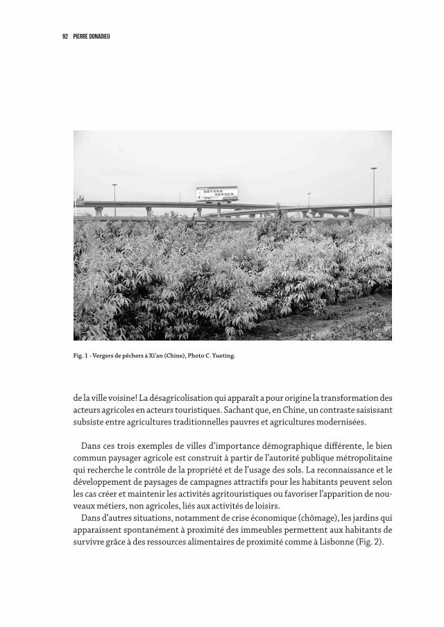
92 pierre donadieu
de la ville voisine! La désagricolisation qui apparaît a pour origine la transformation des acteurs agricoles en acteurs touristiques. Sachant que, en Chine, un contraste saisissant subsiste entre agricultures traditionnelles pauvres et agricultures modernisées.
Dans ces trois exemples de villes d’importance démographique différente, le bien commun paysager agricole est construit à partir de l’autorité publique métropolitaine qui recherche le contrôle de la propriété et de l’usage des sols. La reconnaissance et le développement de paysages de campagnes attractifs pour les habitants peuvent selon les cas créer et maintenir les activités agritouristiques ou favoriser l’apparition de nou-veaux métiers, non agricoles, liés aux activités de loisirs.
Dans d’autres situations, notamment de crise économique (chômage), les jardins qui apparaissent spontanément à proximité des immeubles permettent aux habitants de survivre grâce à des ressources alimentaires de proximité comme à Lisbonne (Fig. 2).
Fig. 1 - Vergers de pêchers à Xi’an (Chine), Photo C. Yueting.
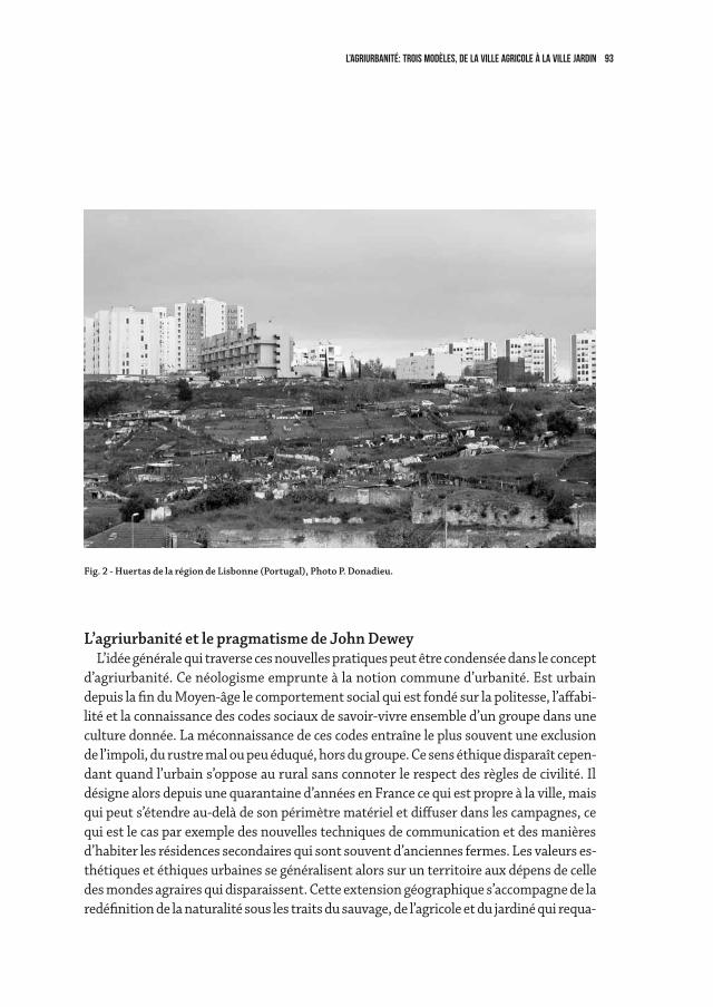
93L’agriurbanité: trois modèles, de la ville agricole à la ville jardin
L’agriurbanité et le pragmatisme de John DeweyL’idée générale qui traverse ces nouvelles pratiques peut être condensée dans le concept
d’agriurbanité. Ce néologisme emprunte à la notion commune d’urbanité. Est urbain depuis la fin du Moyen-âge le comportement social qui est fondé sur la politesse, l’affabi-lité et la connaissance des codes sociaux de savoir-vivre ensemble d’un groupe dans une culture donnée. La méconnaissance de ces codes entraîne le plus souvent une exclusion de l’impoli, du rustre mal ou peu éduqué, hors du groupe. Ce sens éthique disparaît cepen-dant quand l’urbain s’oppose au rural sans connoter le respect des règles de civilité. Il désigne alors depuis une quarantaine d’années en France ce qui est propre à la ville, mais qui peut s’étendre au-delà de son périmètre matériel et diffuser dans les campagnes, ce qui est le cas par exemple des nouvelles techniques de communication et des manières d’habiter les résidences secondaires qui sont souvent d’anciennes fermes. Les valeurs es-thétiques et éthiques urbaines se généralisent alors sur un territoire aux dépens de celle des mondes agraires qui disparaissent. Cette extension géographique s’accompagne de la redéfinition de la naturalité sous les traits du sauvage, de l’agricole et du jardiné qui requa-
Fig. 2 - Huertas de la région de Lisbonne (Portugal), Photo P. Donadieu.
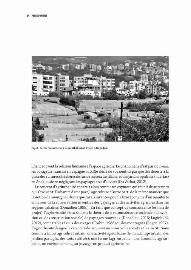
94 pierre donadieu
lifient souvent la relation humaine à l’espace agricole. Le phénomène n’est pas nouveau, les voyageurs français en Espagne au XIXe siècle ne voyaient-ils pas que des déserts à la place des cultures céréalières de l’aride meseta castillane, et des jardins opulents (huertas) en Andalousie en négligeant les paysages secs d’oliviers (Du Vachat, 2012).
Le concept d’agriurbanité apparaît alors comme un oxymore qui réunit deux termes qui s’excluent: l’urbanité d’une part, l’agriculture d’autre part, de la même manière que la notion de campagne urbaine que j’avais inventée pour le titre éponyme d’un manifeste en faveur de la conservation inventive des paysages et des activités agricoles dans les régions urbaines (Donadieu 1998,). En tant que concept de connaissance (et non de projet), l’agriurbanité s’inscrit dans la théorie de la reconnaissance sociétale, (d’inven-tion ou de construction sociale) de paysages nouveaux (Donadieu, 2013; Luginbühl, 2012), comparables à ceux des rivages (Corbin, 1988) ou des montagnes (Roger, 1997). L’agriurbanité désigne le caractère de ce qui est reconnu par la société et les institutions comme à la fois agricole et urbain: une activité agriurbaine (le maraîchage urbain, des jardins partagés, des toits cultivés); une ferme (agri)urbaine ; une économie agriur-baine; un environnement, un paysage, un produit agriurbains.
Fig. 3 - Serres maraîchères à Beyrouth (Liban), Photo P. Donadieu.
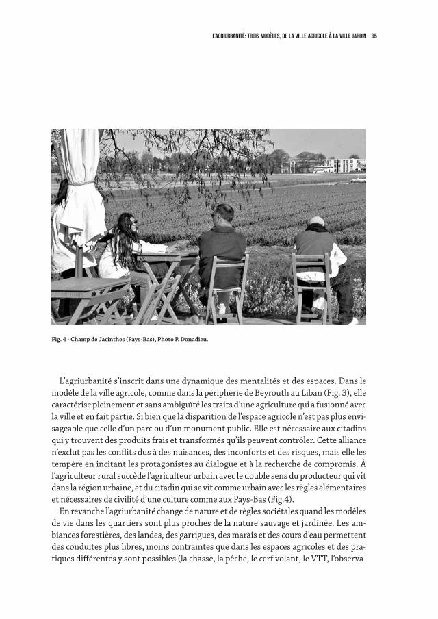
95L’agriurbanité: trois modèles, de la ville agricole à la ville jardin
L’agriurbanité s’inscrit dans une dynamique des mentalités et des espaces. Dans le modèle de la ville agricole, comme dans la périphérie de Beyrouth au Liban (Fig. 3), elle caractérise pleinement et sans ambiguïté les traits d’une agriculture qui a fusionné avec la ville et en fait partie. Si bien que la disparition de l’espace agricole n’est pas plus envi-sageable que celle d’un parc ou d’un monument public. Elle est nécessaire aux citadins qui y trouvent des produits frais et transformés qu’ils peuvent contrôler. Cette alliance n’exclut pas les conflits dus à des nuisances, des inconforts et des risques, mais elle les tempère en incitant les protagonistes au dialogue et à la recherche de compromis. À l’agriculteur rural succède l’agriculteur urbain avec le double sens du producteur qui vit dans la région urbaine, et du citadin qui se vit comme urbain avec les règles élémentaires et nécessaires de civilité d’une culture comme aux Pays-Bas (Fig.4).
En revanche l’agriurbanité change de nature et de règles sociétales quand les modèles de vie dans les quartiers sont plus proches de la nature sauvage et jardinée. Les am-biances forestières, des landes, des garrigues, des marais et des cours d’eau permettent des conduites plus libres, moins contraintes que dans les espaces agricoles et des pra-tiques différentes y sont possibles (la chasse, la pêche, le cerf volant, le VTT, l’observa-
Fig. 4 - Champ de Jacinthes (Pays-Bas), Photo P. Donadieu.
96 pierre donadieu
tion naturaliste, le rafting, etc.). Même si certaines sont prohibées ou plus ou moins tolérées (la prostitution, la vente de drogues). On pourrait alors parler de naturbanité comme dans la réserve de nature de la petite Amazonie à Nantes ou sur les bords du Lez à Montpellier en France (Fig. 5).
Mais c’est dans le monde du jardin privé ou public que l’urbanité policée raffine da-vantage ses règles et ses codes, la passeggiata italienne ne peut avoir lieu que sous les ombrages des arbres d’un mail, elle suppose la connaissance des codes d’habillement et de civilité, là où viennent se montrer ceux qui désirent être vus. L’agriurbanité disparaît alors au profit de l’urbanité ordinaire de l’espace public et privé, à la ville comme à la campagne (Fig. 6).
Dans ce contexte que nous enseigne la philosophie pragmatiste de l’Américain John Dewey (1859-1962) qui puisse éclairer le recours à l’agriurbanité pour mieux com-prendre la construction des régions urbaines? Dewey qui était un philosophe de la démocratie s’est évertué à mettre fin aux dualismes encombrants comme ceux de la théorie et de la pratique, de l’individu et du social, ou de l’éthique et de la politique. Ni rationaliste, ni positiviste, ni libéral, il s’intéresse aux transactions, aux associations entre les hommes et à la manière dont ils expérimentent et construisent, entre l’Etat et la société «le public» en fonction d’intérêts communs et citoyens. Il écrit: « Percevoir les conséquences d’une activité conjointe (…) crée un intérêt commun, c’est-à-dire une préoccupation de la part de chacun pour l’activité conjointe et pour la contribution de chacun des membres qui s’y livrent» (Le public et ses problèmes, p. 288). Il préconise «l’enquête» pour discerner comment émerge la redistribution des formes sociales et comment la domination d’une seule forme d’association (l’Etat, l’Eglise, la famille) ap-pauvrit la vie sociale et ralentit le dépassement de dualités comme celle de l’opposition entre agricultures et villes. C’est un fait que le contrôle social (celui des agriculteurs innovants par les agriculteurs conventionnels majoritaires en particulier) ou le contrôle politique (l’application variable des règles juridiques) bloque les innovations d’intérêt général (moins polluer les eaux et les sols par exemple). En d’autres termes, il précise (p. 305) que les mesures politiques et d’actions sociétales doivent être traitées comme des hypothèses et non comme des buts à atteindre ou des programmes à appliquer. C’est à ceux «qui portent les chaussures de savoir s’ils se blessent, et non seulement aux experts de la chaussure», même si ce sont les experts qui mènent les enquêtes. L’agriurbanité à ce titre n’est qu’un repère culturel dans la construction des paysages urbains qui peut laisser place selon le débat public à des formes hybrides et imprévues selon la qualité de l’échange démocratique.
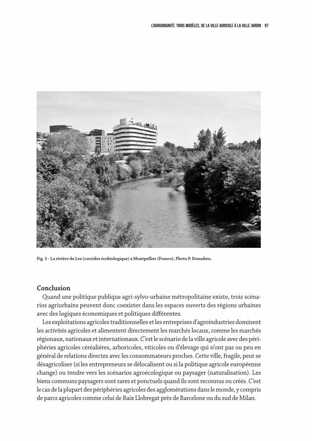
97L’agriurbanité: trois modèles, de la ville agricole à la ville jardin
ConclusionQuand une politique publique agri-sylvo-urbaine métropolitaine existe, trois scéna-
rios agriurbains peuvent donc coexister dans les espaces ouverts des régions urbaines avec des logiques économiques et politiques différentes.
Les exploitations agricoles traditionnelles et les entreprises d’agroindustries dominent les activités agricoles et alimentent directement les marchés locaux, comme les marchés régionaux, nationaux et internationaux. C’est le scénario de la ville agricole avec des péri-phéries agricoles céréalières, arboricoles, viticoles ou d’élevage qui n’ont pas ou peu en général de relations directes avec les consommateurs proches. Cette ville, fragile, peut se désagricoliser (si les entrepreneurs se délocalisent ou si la politique agricole européenne change) ou tendre vers les scénarios agroécologique ou paysager (naturalisation). Les biens communs paysagers sont rares et ponctuels quand ils sont reconnus ou créés. C’est le cas de la plupart des périphéries agricoles des agglomérations dans le monde, y compris de parcs agricoles comme celui de Baix Llobregat près de Barcelone ou du sud de Milan.
Fig. 5 - La rivière du Lez (corridor écobiologique) à Montpellier (France), Photo P. Donadieu.
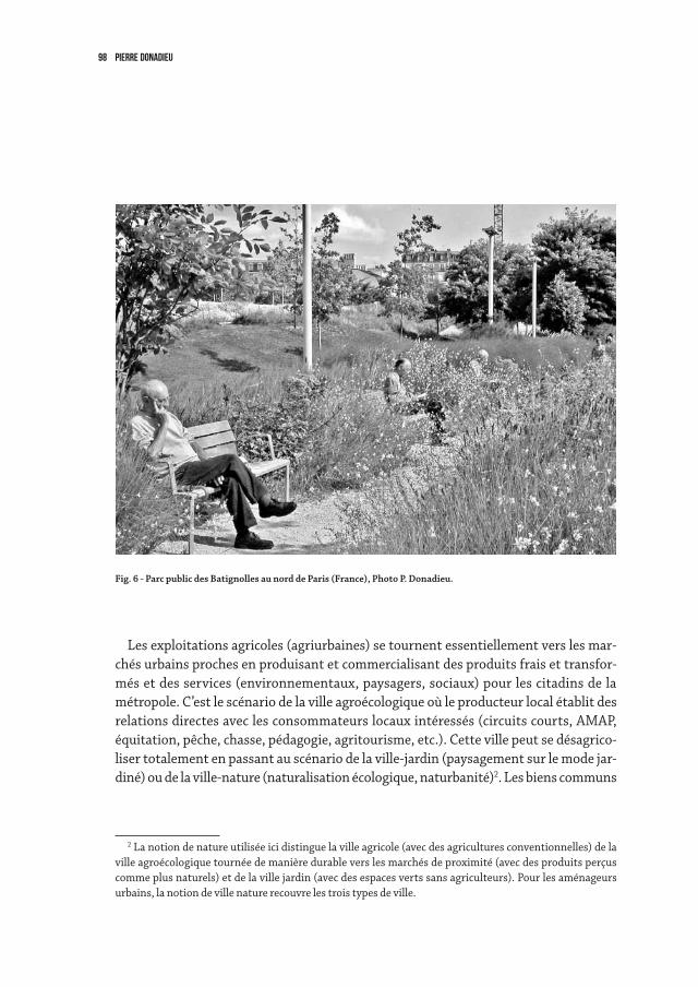
98 pierre donadieu
Les exploitations agricoles (agriurbaines) se tournent essentiellement vers les mar-chés urbains proches en produisant et commercialisant des produits frais et transfor-més et des services (environnementaux, paysagers, sociaux) pour les citadins de la métropole. C’est le scénario de la ville agroécologique où le producteur local établit des relations directes avec les consommateurs locaux intéressés (circuits courts, AMAP, équitation, pêche, chasse, pédagogie, agritourisme, etc.). Cette ville peut se désagrico-liser totalement en passant au scénario de la ville-jardin (paysagement sur le mode jar-diné) ou de la ville-nature (naturalisation écologique, naturbanité)2. Les biens communs
2 La notion de nature utilisée ici distingue la ville agricole (avec des agricultures conventionnelles) de la ville agroécologique tournée de manière durable vers les marchés de proximité (avec des produits perçus comme plus naturels) et de la ville jardin (avec des espaces verts sans agriculteurs). Pour les aménageurs urbains, la notion de ville nature recouvre les trois types de ville.
Fig. 6 - Parc public des Batignolles au nord de Paris (France), Photo P. Donadieu.
99L’agriurbanité: trois modèles, de la ville agricole à la ville jardin
paysagers reconnus émergent avec une propriété foncière publique ou privée. C’est le cas des Basses vallées angevines, des parcs agricoles de Berlin, des espaces agricoles protégés de Xi’an, ainsi que des jardins familiaux qui sont installés dans les parcs publics comme à Angers dans le parc Balzac3.
Dans le scénario classique de la ville jardin, les agriculteurs disparaissent et sont rempla-cés dans les espaces ouverts par les acteurs techniques des services publics environnemen-taux et paysagers à la ville. Et la propriété publique des terres non construites se substitue progressivement à la propriété privée. Des étapes intermédiaires subsistent avec les deux autres scénarios. Les biens communs paysagers et environnementaux deviennent publics. Mais ils peuvent également être privatisés dans le cadre d’une économie ultra libérale.
Correspondant à ces trois scénarios, les paysages des campagnes urbaines sont donc évolutifs. Les directions prises, ville par ville, ou quartier par quartier dépendent essen-tiellement des politiques publiques d’urbanisation des régions urbaines. Elles peuvent se désagricoliser, soit au profit de l’urbanisation, soit à celui des espaces de natures non agricoles (parcs et boisements publics et privés). Ou bien rester agricole, s’agriurbaniser
(Donadieu, 2013), grâce aux principes de l’agriurbanisme (sécurisation foncière notam-ment) déjà mis en œuvre aux Pays-Bas, en Suisse ou au Québec.
3 Ce scénario de l’intégration de la nature agricole dans la ville est particulièrement mobilisée dans la plupart des dix projets du Grand Paris en 2009.
100 pierre donadieu
References
Corbin, A., Le territoire du vide. L’Occident et le désir du rivage. 1750-1840, Paris, Aubier, 1988.Du Vachat A., L’émergence du paysage espagnol à travers les récits des voyageurs français (1650-1936). Thèse de doctorat ENSP Versailles/ AgroParisTech (sous la direc-
tion de P. Donadieu), 2012.Forman R.T.T., Urban Regions: Ecology and Planning Beyond the City, Cambridge University Press,
Cambridge/New York, 2008.Donadieu P., Sciences du paysage, entre théories et pratiques, Lavoisier, Paris, 2012.Grange J., Pour une philosophie de l’écologie, Agora, Pocket, 2012, 151 p.Donadieu P. (édit.), L’agriurbanisation, rêves ou réalités, Paris, Editopics, 2013 (à paraître).Jacquand C., «Les parcs agricoles de Berlin-Barnim – quelques fondements historiques d’une
hétérotopie contemporaine», Ecole d’architecture et de paysage de Lille, Cahiers thématiques n° 11, 2012, pp. 75-88.
Luginbühl Y., La mise en scène du monde, Paris, CNRS, 2012.Novel A.-S., Le guide du locavore pour mieux consommer local, Eyrolles, 2010, 154 p.Roger A., Court traité de paysage, Paris, Gallimard, 1997.Petrella R., Le bien commun, Eloge de la solidarité, Bruxelles, Labor. 1996.Petrella R., L’eau, Res Publica ou marchandise? La Dispute, 2010Sen A., L’idée de justice, traduction de P. Chemla, Flammarion, Paris, 2010Yueting C., «L’agriculture urbaine dans la construction métropolitaine de Xi’an», Ecole d’archi-
tecture et de paysage de Lille, Cahiers thématiques n° 11, 2012, pp. 201-211.
3
Public spaces, social dynamic and citiesin evolution

103
3.1urban open spaces. tradition and modernityJosefina Gómez-Mendoza
Criticism of Historical Cities and Extensions in XIX CenturyFirst Modernity, from Cerdà to Le Corbusier, has openly condemned, in the name
of hygiene and circulation, the design of historical urban centres, rejecting both their construction and their open spaces: streets and lanes with their broken, curved lay-outs of variable lengths and widths; squares, patios and courtyards, market gardens, gardens and wooded promenades. From this perspective, historical town needed to be renewed which meant partial demolition (Gómez-Mendoza, 2005).
Some of the planned urban extensions for town centres constitute remarkable and unequalled pieces of design and urban conception, in particular the extraordinary Eix-ample (or Ensanche) in Barcelona by Ildefonso Cerdà. Undoubtedly, the most evident and emblematic aspect of the Eixample is its reticular plan, but it would be a big mistake to perceive only the regular pattern in Cerdà’s contribution. As a child of his century, the Catalan engineer and town-planner was pursuing the goal of an egalitarian city. He based the city upon the residential unit and his genius rests in making the most of the compact city through a continuous pattern of quadrangular «blocks of buildings» (manzanas de casas, pâtés de maisons), each side 113.3 m in length and with chamfered corners at 45º (Fig. 1). All the blocks had double ventilation to the streets and to an in-ner courtyard providing all the dwellings with light, sunshine and ventilation. This was how he conceived the «urbanization of the country and ruralisation of the city», as he postulated in his General Theory of Urbanization (Cerdà, 1859, 1861). In Cerdà’s urban theory, there was a proportional relationship between circulating and living and be-tween the width of the streets and the distribution of open and constructed spaces on the block. According to him, there should be «a perfect harmony between the dwelling and the mobility of side walkers, both on foot and on horseback». Nonetheless, in the endless implementation process of the Eixample, landowners, promoters, technicians and town councils came to disfigure the project and, as in many other cases, reduced the size of the open spaces. The engineer had projected blocks with buildings around a perimeter and inner courtyards almost always occupying half the area, but reality turned out to be quite different because, in the vast majority of cases, the buildings occupy most of the land area of the plots (Solà-Morales, 1986; Fig. 2 and 3).
In this initial stage, before the Modern Movement established its canons of design,
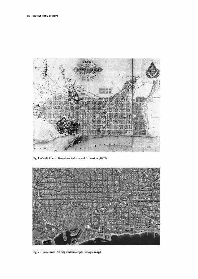
104 Josefina Gómez-Mendoza
Fig. 2 - Barcelona: Old city and Eixample (Google map).
Fig. 1 - Cerdà Plan of Barcelona Reform and Extension (1859).
105urban open spaces. tradition and modernity
of town construction, they were some great landscape architects (such as, for instance, in the case of Spain, Jean Claude Forestier, Javier de Winthuysen or Nicolau Rubió i Tudurí) with ambitious proposals on town planning. They all had good knowledge both of the European tradition of wooded promenades and of the American parkways, and the desire to base construction of the city upon a system of open spaces, parks and bou-levards. They were not echoed and their ideas could only be implemented in isolated projects. Forestier, for instance, said that «the boulevard-avenues constitute pleasant communication and access roads. They offer an uninterrupted stroll. They can also help to provide value to the viewpoints, riverbanks, and interesting landscapes» (Forestier, 1906; Le Dantec, 1996). In this sense, the engineer José de Lorite proposed for the city of Madrid a linear system of parks along the river, in the west of the city, making use of the topographic conditions to create cultural images and landscapes. “Goya’s paint-ing of the San Isidro meadow would suffice to make this part of Madrid an intangible place» (Lorite, 1931). Unfortunately, nowadays image remains far from Lorite’s idylic thought (Fig. 4 and 5).
Open spaces in Mass Production HousesThe Modern Movement, with Le Corbusier, Mies van der Rohe or Ludwig Hilber-
seimer, attempted to make cities healthy, with great open blocks of apartment residence rising up among gardens. Prior to the Chart of Athens, Le Corbusier had said in his first book, Towards a new architecture, in 1927: «Instead of towns being laid out in massive quadrangles, with the streets in narrow trenches walled in by seven-storey buildings set perpendicular on the pavement and enclosing unhealthy courtyards, airless and sunless walls, our new layout, employing the same area and housing the same number of people, would show great blocks of houses with successive set-backs, stretching along arterial avenues. No more courtyards, but flats opening on every side to air and light, and look-ing, not on the puny trees of our boulevards of to-day, but upon green sward, sports grounds and abundant plantations of trees» (Le Corbusier, 1926 in 1946: 59-61). This is the criterion for the so-called «House Machine», for «Mass Production Houses», this mass production of buildings that are “healthy, morally and beautiful too”. In his book, L’urbanisme des trois établissments urbains (1945), Le Corbusier postulated the death of streets: “Il faut tuer le corridor”. The aesthetics of what came to be called New Architec-ture opened up walls like curtains onto fresh air, light and sunshine, freeing the building from its heavy foundation and highlighting the importance of structural functions with simple and intelligent design; aesthetics that, according to Gropius, “respond as well to material needs as to psychological ones” (Gropius 1935).
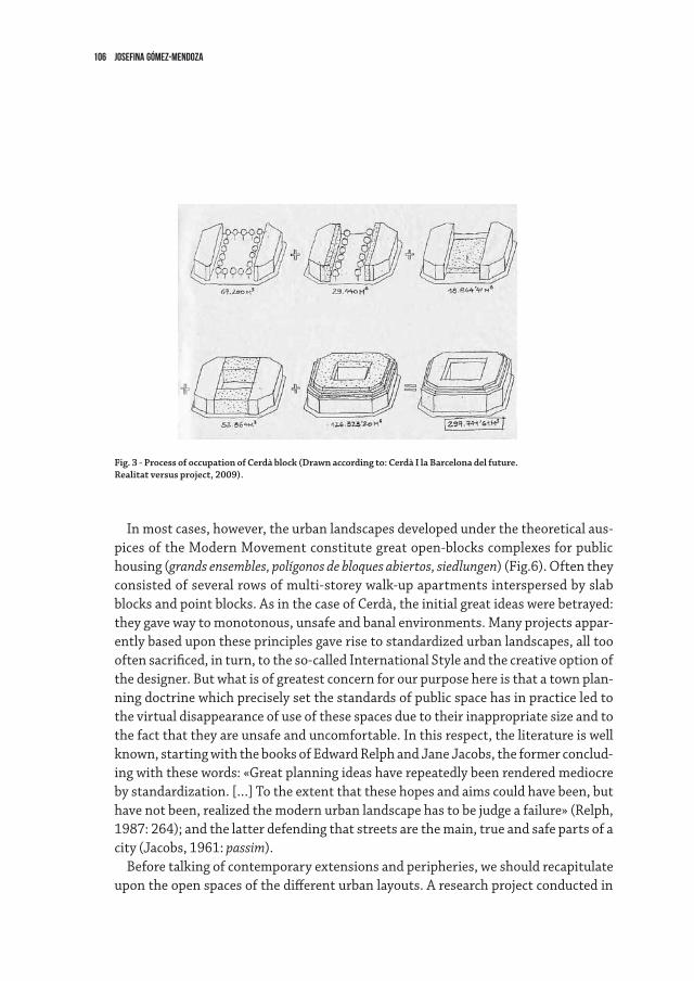
106 Josefina Gómez-Mendoza
In most cases, however, the urban landscapes developed under the theoretical aus-pices of the Modern Movement constitute great open-blocks complexes for public housing (grands ensembles, polígonos de bloques abiertos, siedlungen) (Fig.6). Often they consisted of several rows of multi-storey walk-up apartments interspersed by slab blocks and point blocks. As in the case of Cerdà, the initial great ideas were betrayed: they gave way to monotonous, unsafe and banal environments. Many projects appar-ently based upon these principles gave rise to standardized urban landscapes, all too often sacrificed, in turn, to the so-called International Style and the creative option of the designer. But what is of greatest concern for our purpose here is that a town plan-ning doctrine which precisely set the standards of public space has in practice led to the virtual disappearance of use of these spaces due to their inappropriate size and to the fact that they are unsafe and uncomfortable. In this respect, the literature is well known, starting with the books of Edward Relph and Jane Jacobs, the former conclud-ing with these words: «Great planning ideas have repeatedly been rendered mediocre by standardization. […] To the extent that these hopes and aims could have been, but have not been, realized the modern urban landscape has to be judge a failure» (Relph, 1987: 264); and the latter defending that streets are the main, true and safe parts of a city (Jacobs, 1961: passim).
Before talking of contemporary extensions and peripheries, we should recapitulate upon the open spaces of the different urban layouts. A research project conducted in
Fig. 3 - Process of occupation of Cerdà block (Drawn according to: Cerdà I la Barcelona del future.Realitat versus project, 2009).
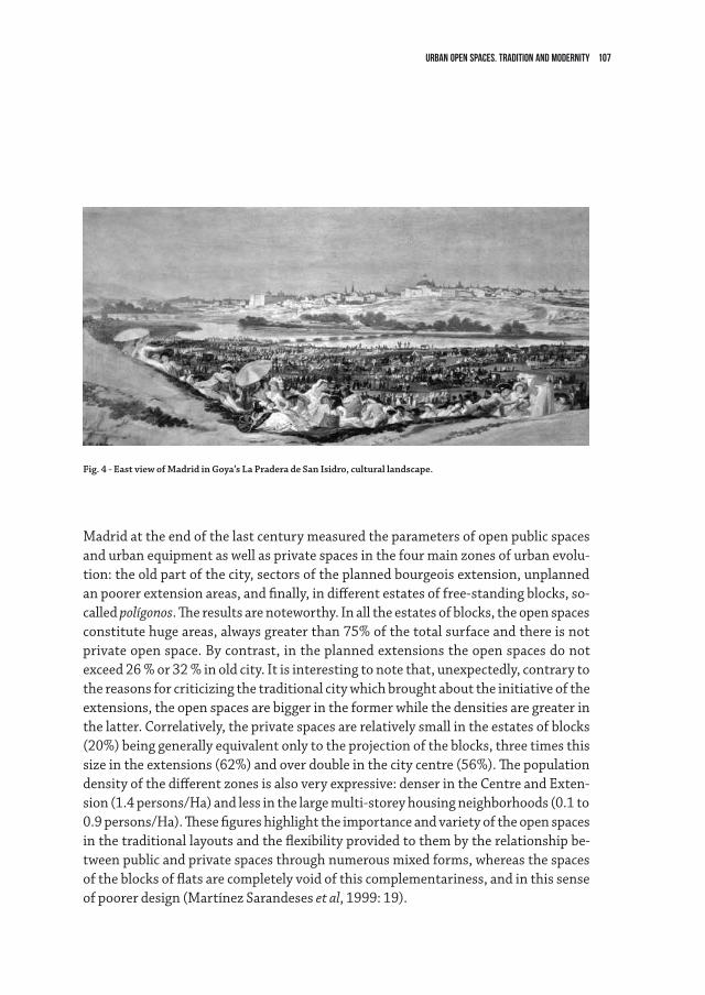
107urban open spaces. tradition and modernity
Madrid at the end of the last century measured the parameters of open public spaces and urban equipment as well as private spaces in the four main zones of urban evolu-tion: the old part of the city, sectors of the planned bourgeois extension, unplanned an poorer extension areas, and finally, in different estates of free-standing blocks, so-called polígonos. The results are noteworthy. In all the estates of blocks, the open spaces constitute huge areas, always greater than 75% of the total surface and there is not private open space. By contrast, in the planned extensions the open spaces do not exceed 26 % or 32 % in old city. It is interesting to note that, unexpectedly, contrary to the reasons for criticizing the traditional city which brought about the initiative of the extensions, the open spaces are bigger in the former while the densities are greater in the latter. Correlatively, the private spaces are relatively small in the estates of blocks (20%) being generally equivalent only to the projection of the blocks, three times this size in the extensions (62%) and over double in the city centre (56%). The population density of the different zones is also very expressive: denser in the Centre and Exten-sion (1.4 persons/Ha) and less in the large multi-storey housing neighborhoods (0.1 to 0.9 persons/Ha). These figures highlight the importance and variety of the open spaces in the traditional layouts and the flexibility provided to them by the relationship be-tween public and private spaces through numerous mixed forms, whereas the spaces of the blocks of flats are completely void of this complementariness, and in this sense of poorer design (Martínez Sarandeses et al, 1999: 19).
Fig. 4 - East view of Madrid in Goya’s La Pradera de San Isidro, cultural landscape.
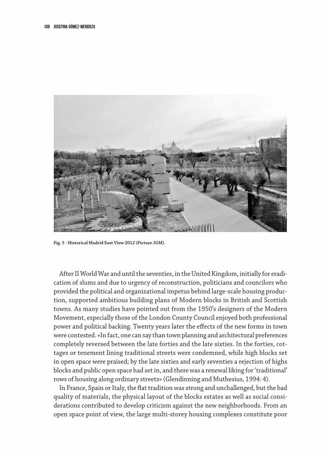
108 Josefina Gómez-Mendoza
After II World War and until the seventies, in the United Kingdom, initially for eradi-cation of slums and due to urgency of reconstruction, politicians and councilors who provided the political and organizational impetus behind large-scale housing produc-tion, supported ambitious building plans of Modern blocks in British and Scottish towns. As many studies have pointed out from the 1950’s designers of the Modern Movement, especially those of the London County Council enjoyed both professional power and political backing. Twenty years later the effects of the new forms in town were contested. «In fact, one can say than town planning and architectural preferences completely reversed between the late forties and the late sixties. In the forties, cot-tages or tenement lining traditional streets were condemned, while high blocks set in open space were praised; by the late sixties and early seventies a rejection of highs blocks and public open space had set in, and there was a renewal liking for ‘traditional’ rows of housing along ordinary streets» (Glendinning and Muthesius, 1994: 4).
In France, Spain or Italy, the flat tradition was strong and unchallenged, but the bad quality of materials, the physical layout of the blocks estates as well as social consi-derations contributed to develop criticism against the new neighborhoods. From an open space point of view, the large multi-storey housing complexes constitute poor
Fig. 5 - Historical Madrid East View 2012 (Picture JGM).
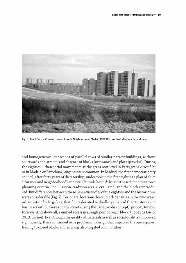
109urban open spaces. tradition and modernity
and homogeneous landscapes of parallel rows of similar narrow buildings, without courtyards and streets, and absence of blocks (manzanas) and plots (parcelas). During the eighties, urban social movements at the grass root level in Paris grand ensembles or in Madrid or Barcelona polígonos were common. In Madrid, the first democratic city council, after forty years of dictatorship, undertook in the first eighties a plan of slum clearance and neighborhood’s renewal (Remodelación de barrios) based upon new town planning criteria. The Ensanche tradition was re-evaluated, and the block reintrodu-ced. But differences between these news ensanches of the eighties and the historic one were considerable (Fig. 7): Peripheral locations; lower block densities in the new areas; urbanization by large lots; first floors devoted to dwellings instead than to stores and business (without «eyes on the street» using the Jane Jacobs concept); priority for mo-torways. And above all, a unified access in a single point of each block. (López de Lucio, 2013: passim). Even though the quality of materials as well as social qualities improved significantly, there continued to be problems in design that impacted the open spaces, leading to closed blocks and, in a way also to gated communities.
Fig. 6 - Block States: Construction of Begoña Neighborhood. Madrid 1972 (Picture José Martínez Sarandeses).
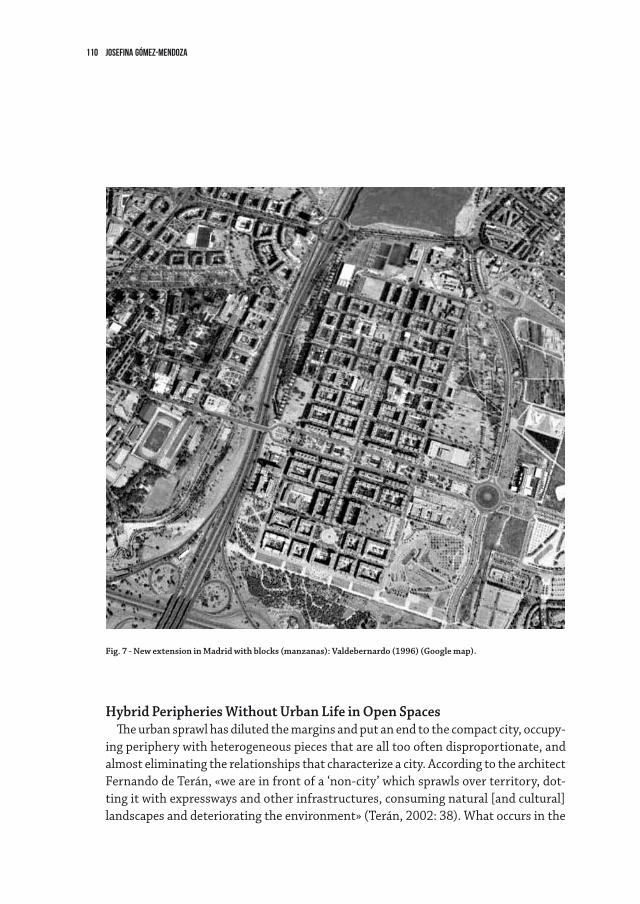
110 Josefina Gómez-Mendoza
Hybrid Peripheries Without Urban Life in Open SpacesThe urban sprawl has diluted the margins and put an end to the compact city, occupy-
ing periphery with heterogeneous pieces that are all too often disproportionate, and almost eliminating the relationships that characterize a city. According to the architect Fernando de Terán, «we are in front of a ‘non-city’ which sprawls over territory, dot-ting it with expressways and other infrastructures, consuming natural [and cultural] landscapes and deteriorating the environment» (Terán, 2002: 38). What occurs in the
Fig. 7 - New extension in Madrid with blocks (manzanas): Valdebernardo (1996) (Google map).
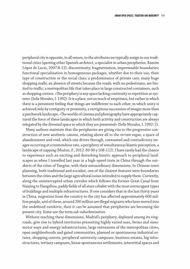
111urban open spaces. tradition and modernity
peripheral city is opposite, in all senses, to the attributes we typically assign to our tradi-tional cities (quoting other Spanish architect, a specialist in urban peripheries, Ramón López de Lucio, 2007:8-12): discontinuity, fragmentation, impermeable boundaries; functional specialization in homogeneous packages, whether due to their use, their type of construction or the social class; a predominance of private cars; many huge shopping malls; an absence of streets because the roads, with no pedestrians, are lim-ited to traffic; a metropolitan life that takes place in large constructed containers, such as shopping centres. «The periphery is any space lacking continuity or repetition or sys-tem» (Solà-Morales, I. 1992). It is a place, not so much of emptiness, but rather in which there is a persistent feeling that things are indifferent to each other, in which unity is achieved only by contiguity or proximity, a vertiginous succession of images more than a patchwork landscape. «The worlds of cinema and photography have appropriately cap-tured the force of these landscapes in which both activity and construction are always relegated by the divested space in which they are presented» (Solà-Morales, I. 1992: 2).
Many authors maintain that the peripheries are giving rise to the progressive con-struction of new aesthetic canons, relating above all to the terrain vague, a space of abandonment and void, which one drives through, contrasted and contradictory im-ages occurring at a tremendous rate, a periphery of simultaneous kinetic perception, a landscape of zapping (Muñoz, F., 2012: 89-90 y 108-112). I have rarely had the chance to experience such an exciting and disturbing kinetic approach to peripheral land-scapes as when I travelled last year in a high-speed train in China through the out-skirts of the cities of Yangtse, with their extraordinary dimensions. In Chinese town planning, both traditional and socialist, one of the clearest features were boundaries between the cities and the large agricultural zones intended to supply them. Currently, along the uninterrupted urban corridor which follows the former Great Canal from Nanjing to Hangzhou, paddy fields of all sizes cohabit with the most extravagant types of buildings and multiple infrastructures. If one considers that in the last thirty years in China, migration from the country to the city has affected approximately 600 mil-lion people, and of these, around 200 million are illegal migrants who have moved into the undefined outskirts, then it can be assumed that peripheries are becoming the present city. Some use the term sub-suburbanization.
Without reaching these dimensions, Madrid’s periphery, deployed among its ring-roads, give rise to hybrid territories presenting highly varied uses, forms and sizes: motor ways and energy infrastructures, large extensions of the metropolitan cities, open neighborhoods and gated communities, planned or spontaneous industrial es-tates, shopping centres, peripheral university campuses, business estates, big infra-structures, tertiary campuses, linear spontaneous settlements, interstitial spaces and
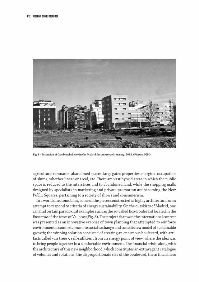
112 Josefina Gómez-Mendoza
agricultural remnants, abandoned spaces, large gated properties, marginal occupation of slums, whether linear or areal, etc. There are vast hybrid areas in which the public space is reduced to the interstices and to abandoned land, while the shopping malls designed by specialists in marketing and private promotion are becoming the New Public Squares, pertaining to a society of shows and consumerism.
In a world of automobiles, some of the pieces constructed as highly architectural ones attempt to respond to criteria of energy sustainability. On the outskirts of Madrid, one can find certain paradoxical examples such as the so-called Eco-Boulevard located in the Ensanche of the town of Vallecas (Fig. 8). The project that won the international contest was presented as an innovative exercise of town planning that attempted to reinforce environmental comfort, promote social exchange and constitute a model of sustainable growth; the winning solution consisted of creating an enormous boulevard, with arti-facts called «air trees», self-sufficient from an energy point of view, where the idea was to bring people together in a comfortable environment. The financial crisis, along with the architecture of this new neighborhood, which constitutes an extravagant catalogue of volumes and solutions, the disproportionate size of the boulevard, the artificialness
Fig. 8 - Extension of Carabanchel, city in the Madrid first metropolitan ring, 2012. (Picture JGM).
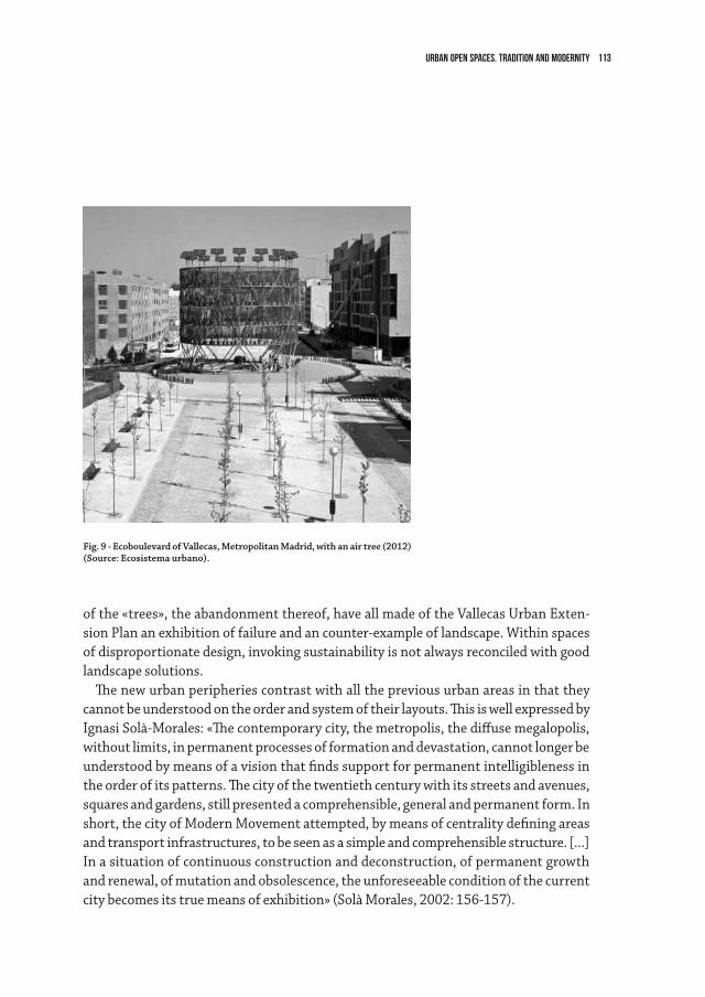
113urban open spaces. tradition and modernity
of the «trees», the abandonment thereof, have all made of the Vallecas Urban Exten-sion Plan an exhibition of failure and an counter-example of landscape. Within spaces of disproportionate design, invoking sustainability is not always reconciled with good landscape solutions.
The new urban peripheries contrast with all the previous urban areas in that they cannot be understood on the order and system of their layouts. This is well expressed by Ignasi Solà-Morales: «The contemporary city, the metropolis, the diffuse megalopolis, without limits, in permanent processes of formation and devastation, cannot longer be understood by means of a vision that finds support for permanent intelligibleness in the order of its patterns. The city of the twentieth century with its streets and avenues, squares and gardens, still presented a comprehensible, general and permanent form. In short, the city of Modern Movement attempted, by means of centrality defining areas and transport infrastructures, to be seen as a simple and comprehensible structure. [...] In a situation of continuous construction and deconstruction, of permanent growth and renewal, of mutation and obsolescence, the unforeseeable condition of the current city becomes its true means of exhibition» (Solà Morales, 2002: 156-157).
Fig. 9 - Ecoboulevard of Vallecas, Metropolitan Madrid, with an air tree (2012) (Source: Ecosistema urbano).
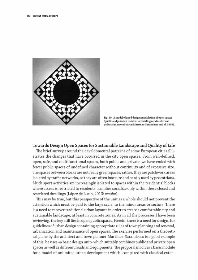
114 Josefina Gómez-Mendoza
Towards Design Open Spaces for Sustainable Landscape and quality of LifeThe brief survey around the developmental patterns of some European cities illu-
strates the changes that have occurred in the city open spaces. From well-defined, open, safe, and multifunctional spaces, both public and private, we have ended with fewer public spaces of undefined character without continuity and of excessive size. The spaces between blocks are not really green spaces, rather, they are patchwork areas isolated by traffic networks, so they are often insecure and hardly used by pedestrians. Much sport activities are increasingly isolated to spaces within the residential blocks where access is restricted to residents. Families socialize only within these closed and restricted dwellings (López de Lucio, 2013: passim).
This may be true, but this perspective of the unit as a whole should not prevent the attention which must be paid to the large scale, to the minor areas or sectors. There is a need to recover traditional urban layouts in order to create a comfortable city and sustainable landscape, at least in concrete zones. As in all the processes I have been reviewing, the key still lies in open public spaces. Herein, there is a need for design, for guidelines of urban design containing appropriate rules of town planning and renewal, urbanization and maintenance of open spaces. The exercise performed on a theoreti-cal plane by the architect and town planner Martínez-Sarandeses is a good example of this: he uses «a basic design unit» which suitably combines public and private open spaces as well as different roads and equipments. The proposal involves a basic module for a model of unlimited urban development which, compared with classical exten-
Fig. 10 - A model of good design: modulation of open spaces (public and private), residential buildings and motor and pedestrian ways (Source: Martínez-Sarandeses and al. 1999).
115urban open spaces. tradition and modernity
sions, acquires the proportions of a «superblock». In the shape of a rotated rhombus (Fig.10), it is based on the application of certain parameters: maximum distance to the junctions of public transport, which is located at corners; decreasing gradient of density, from the outside to the inside of the block ‒ from the blocks on the perimeter to the single-family units at the core; the layout and the hierarchy are those of a road system that is never linear; the gradient too, in the public spaces, runs from the small intermediate square to the large central park. All of this makes up an autonomous organism generating a city by means of addition and which is seen as an approach to utopian thinking, but is based upon absolutely pragmatic principles (Martínez Sa-randeses et al, 1999, 11-41).
The original and innovative ideas of some visionaries in urban planning have often ended in mediocre and even perverse results, given the number and strength of all the vested interests affecting urbanization, not to speak about the greed of some of the developers. We must excel in the design of public spaces, fitted for current and future uses, to enhance the present urban landscapes and the quality of life.
116 Josefina Gómez-Mendoza
references
Cerdá, Ildefonso (1859): Teoría de la construcción de ciudades. Aplicada al proyecto de reforma y ensanche de Barcelona, Madrid, Ministerio para las Administraciones Públicas, Ayuntamiento de Barcelona, 1991.
Cerdá, Ildefonso (1861): Teoría de la viabilidad urbana. Reforma de la de Madrid. Madrid, Mini-sterio de las Administraciones Públicas y Ayuntamiento de Madrid, 1991.
Cerdá, Ildefonso (1864): Teoría general de la urbanización. Reforma y ensanche de Barcelona.Madrid, Instituto de Estudios Fiscales, 3 volumes. 1968-1971.Fernández Galiano, Luis (2012): Arquitectura y vida. El arte en mutación. Real Academia de Bellas
Artes de San Fernando. Forestier, Jean Claude Nicolas (1908): Grandes villes et système de parcs. Paris, Hachette.
Reedition by B. Leclerc and S. Tarragó, Norma, 1997. Gropius, Walter (1935): The New Architecture and the Bauhaus. Gómez Mendoza, Josefina (2006): Urbanismo e Ingeniería en el siglo XIX. Reforma interior de las
ciudades y movilidad. Madrid, Real Academia de Ingeniería, 2006.Gómez Mendoza, Josefina (2012): «China, las periferias urbanas fantasmas y mis posts»;
«Beijing y Shanghai, 1984-2012 y sus fotografías. ¿Las mismas ciudades?», «La urbanización china como motor del crecimiento económico. Herencias socialistas y liderazgo urbano en la atracción del capital», http://josefinagomezmendoza.com/blog/.
Le Corbusier (1927): Towards a new architecture, (first edition in French: Vers une nouvelle archi-tecture. 1925). Translated from the French by Frederick Etchells, 1946. London, The Architec-tural Press.
Le Dantec, Jean-Pierre (2002): Le sauvage et le régulier. Art des jardins et paysagisme en France au XXème Siècle, Paris, Le Moniteur, 2002.
Glendinning, Miles and Muthesius, Stefan (1994): Tower block. Modern Public Housing in England, Scotland, Wales and Northern Ireland. New Haven and London, Yale University Press.
López de Lucio, Ramón (2007): Construir ciudad en la periferia. Criterios de diseño para áreas residenciales sostenibles, Madrid, Mairea.
López de Lucio, Ramón (2013): Vivienda colectiva, espacio público y ciudad. Evolución y crisis en los tejidos residenciales, 1860-2010. Buenos Aires, Nabuko.
Martínez Sarandeses, José et al. (1999): Guía de diseño urbano, Madrid, Ministerio de Fomen-to. Reedition 2003.
Relph, Edward (1987): The modern urban landscape, London, Sydney, Croom Helm Solà-Morales, Manuel (1986): “Siglo XIX: Ensanchamiento y saneamiento de las ciudades”,
en VV.AA.: Vivienda y urbanismo en España, Madrid, Banco Hipotecario: 161-178.Solà-Morales, Ignasi (1992): “Projectar la periferia “, UR, Revista d’Urbanisme, nº 9-10: 2-4. Terán, Fernando de (2002): Medio siglo de pensamiento sobre la ciudad, Madrid, Real Academia de
Bellas Artes de San Fernando.
117
IntroductionThe exponential urban growth in the contemporary world – with the world’s urban
population reaching proportions and numbers never seen before – must orientate land-scape research and project aimed at restoring the quality of life in the city, mainly with regard to the man/nature relationship and the demand for living space and recreation. The difficulty of rethinking contemporary urban landscape depends not only on the dimension of the urban phenomenon, but also on its complexity and on the more and more important environmental issues.
It is necessary to answer some basic questions on project interventions: which urban landscape arises from attempts to restore landscape and environment? How much can be done within the existing urban fabric? Where and how can be identified the new project areas? How far the destruction of the environment can be contained through new ways of ‘using’ the cities?
While trying to discuss again these questions, it is important to emphasize the impor-tance of the ‘creation’ of a citizen sensible to the environmental impact of simple actions and decisions taken by him or her in everyday life. Only the education to these principles can change the standards that are needed for the recognition, appreciation and promo-tion of the new urban landscape. Assuming that ‘the city of the future’ already exists, it is the aim of landscape architects and urban designers to develop and promote systems of ‘gentle mobility’, which leads to a different way of understanding the relationship be-tween man and nature. It is possible to unveil new ways to enjoy the city by its inhabitants – a perspective which has wider implications for the design process, even considering its ‘silent’ implementation.
It is also necessary to deal with the myriad of micro-spaces that are not concerned by edification and with the use of disused infrastructures. Often created for the transport of people and goods, these structures become the desired network connection between the surrounding areas and the city itself.
3.2Hidden Landscape. Rethinking the contemporary cityHenrique Pessoa Pereira Alves*
* This paper is an introduction to a more large study on the new urban landscape, based on the analysis of recent projects and urban situations in some major western cities.
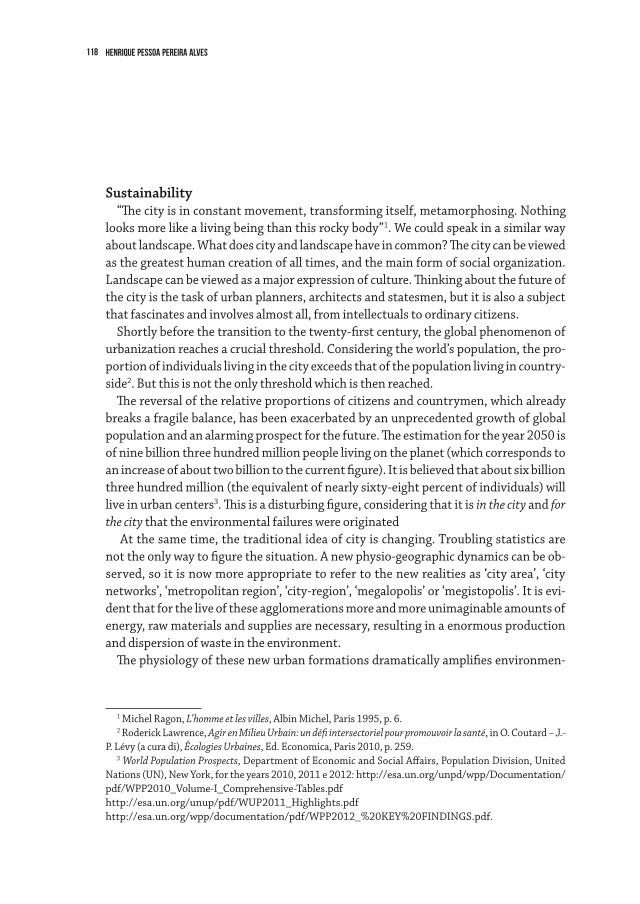
118 Henrique Pessoa Pereira Alves
Sustainability“The city is in constant movement, transforming itself, metamorphosing. Nothing
looks more like a living being than this rocky body”1. We could speak in a similar way about landscape. What does city and landscape have in common? The city can be viewed as the greatest human creation of all times, and the main form of social organization. Landscape can be viewed as a major expression of culture. Thinking about the future of the city is the task of urban planners, architects and statesmen, but it is also a subject that fascinates and involves almost all, from intellectuals to ordinary citizens.
Shortly before the transition to the twenty-first century, the global phenomenon of urbanization reaches a crucial threshold. Considering the world’s population, the pro-portion of individuals living in the city exceeds that of the population living in country-side2. But this is not the only threshold which is then reached.
The reversal of the relative proportions of citizens and countrymen, which already breaks a fragile balance, has been exacerbated by an unprecedented growth of global population and an alarming prospect for the future. The estimation for the year 2050 is of nine billion three hundred million people living on the planet (which corresponds to an increase of about two billion to the current figure). It is believed that about six billion three hundred million (the equivalent of nearly sixty-eight percent of individuals) will live in urban centers3. This is a disturbing figure, considering that it is in the city and for the city that the environmental failures were originated
At the same time, the traditional idea of city is changing. Troubling statistics are not the only way to figure the situation. A new physio-geographic dynamics can be ob-served, so it is now more appropriate to refer to the new realities as ‘city area’, ‘city networks’, ‘metropolitan region’, ‘city-region’, ‘megalopolis’ or ‘megistopolis’. It is evi-dent that for the live of these agglomerations more and more unimaginable amounts of energy, raw materials and supplies are necessary, resulting in a enormous production and dispersion of waste in the environment.
The physiology of these new urban formations dramatically amplifies environmen-
1 Michel Ragon, L’homme et les villes, Albin Michel, Paris 1995, p. 6.2 Roderick Lawrence, Agir en Milieu Urbain: un défi intersectoriel pour promouvoir la santé, in O. Coutard – J.-
P. Lévy (a cura di), Écologies Urbaines, Ed. Economica, Paris 2010, p. 259.3 World Population Prospects, Department of Economic and Social Affairs, Population Division, United
Nations (UN), New York, for the years 2010, 2011 e 2012: http://esa.un.org/unpd/wpp/Documentation/pdf/WPP2010_Volume-I_Comprehensive-Tables.pdf http://esa.un.org/unup/pdf/WUP2011_Highlights.pdf http://esa.un.org/wpp/documentation/pdf/WPP2012_%20KEY%20FINDINGS.pdf.
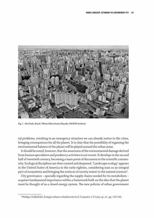
119Hidden Landscape. Rethinking the contemporary city
tal problems, resulting in an emergency situation we can already notice in the cities, bringing consequences for all the planet. It is clear that the possibility of regaining the environmental balance of the planet will be played around the urban areas.
It should be noted, however, that the awareness of the environmental damage derived from human speculative and predatory activities is not recent. It develops in the second half of twentieth century, becoming a main point of discussion in the scientific commu-nity. Ecological disciplines are then created and deepened. ‘Landscape ecology’ appears in the United States of America in the early eighties, considering man as an integral part of ecosystems and bringing the sciences of society nearer to the natural sciences4.
City governance – specially regarding the supply chains needed for its metabolism – acquires fundamental importance within a framework built on the idea that the planet must be thought of as a closed energy system. The new policies of urban government
4 Phillipe CLERGEAU, Écologie urbaine et biodiversité in O. Coutard e J.-P. Lévy, op. cit., pp. 154-165.
Fig. 1 - São Paulo, Brasil. (Photo Silvio Soares Macedo, FAUUSP Archive).
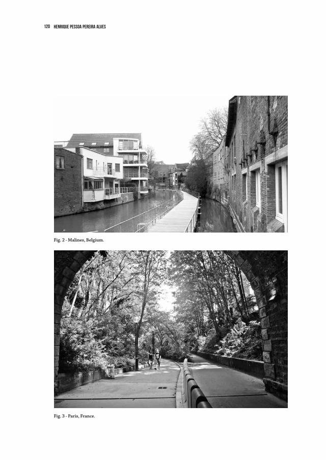
120 Henrique Pessoa Pereira Alves
Fig. 3 - Paris, France.
Fig. 2 - Malines, Belgium.
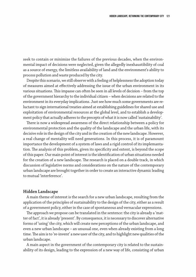
121Hidden Landscape. Rethinking the contemporary city
seek to contain or minimize the failures of the previous decades, when the environ-mental impact of decisions were neglected, given the allegedly inexhaustibility of coal as a source of energy, the limitless availability of land and the environment’s ability to process pollution and waste produced by the city.
Despite this scenario, we still observe with a feeling of helplessness the adoption today of measures aimed at effectively addressing the issue of the urban environment in its various situations. This impasse can often be seen in all levels of decision – from the top of the government hierarchy to the individual citizen – when decisions are related to the environment in its everyday implications. Just see how much some governments are re-luctant to sign international treaties aimed at establishing guidelines for shared use and exploitation of environmental resources at the global level, and to establish a develop-ment policy that actually adheres to the precepts of what it is now called ‘sustainability’.
There is now a widespread awareness of the direct relationship between a policy for environmental protection and the quality of the landscape and the urban life, with its decisive role in the design of the city and in the creation of the new landscape. However, a real change of mentality will need generations. In this process, it is of paramount importance the development of a system of laws and a rigid control of its implemanta-tion. The analysis of this problem, given its specificity and extent, is beyond the scope of this paper. Our main point of interest is the identification of urban situations needed for the creation of a new landscape. The research is placed on a double track, in which discussion of legislative norms and considerations on the nature of the contemporary urban landscape are brought together in order to create an interactive dynamic leading to mutual ‘interference’.
Hidden LandscapeA main theme of interest is the search for a new urban landscape, resulting from the
application of the principles of sustainability to the design of the city, either as a result of a government policy, either in the case of spontaneous and vernacular expressions.
The approach we propose can be translated in the sentence: the city is already a ‘mat-ter of fact’, it is already ‘present’. By consequence, it is necessary to discover alternative forms of ‘using’ the city, which will create new perceptions of the urban landscape, and even a new urban landscape – an unusual one, even when already existing from a long time. The aim is to ‘re-invent’ a new user of the city, and to highlight new qualities of the urban landscape.
A main aspect in the government of the contemporary city is related to the sustain-ability of its design, leading to the expression of a new way of life, consisting of urban
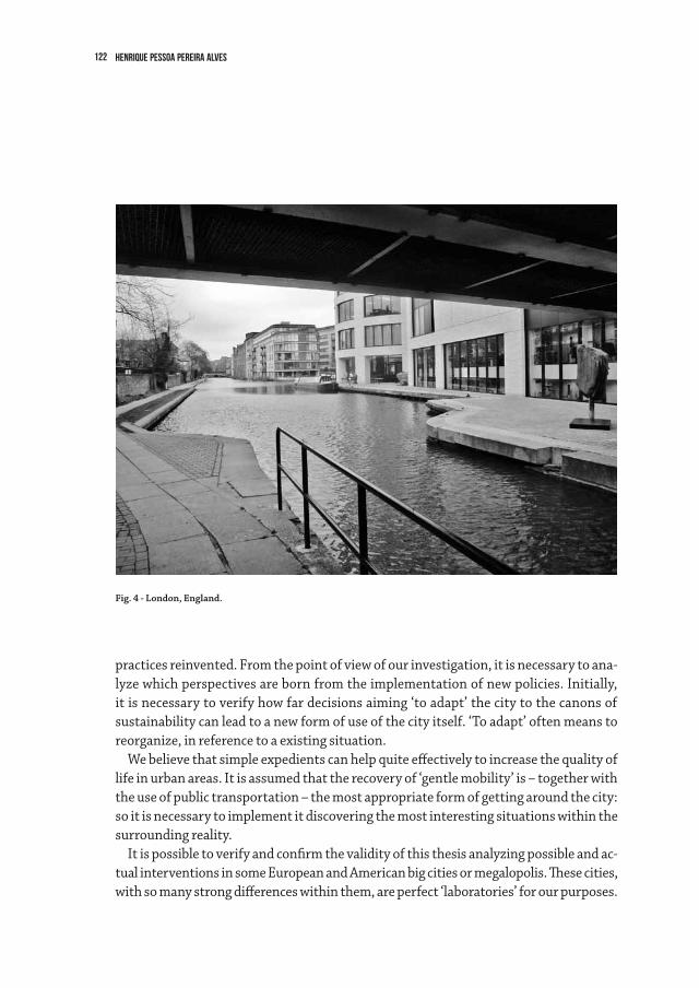
122 Henrique Pessoa Pereira Alves
Fig. 4 - London, England.
practices reinvented. From the point of view of our investigation, it is necessary to ana-lyze which perspectives are born from the implementation of new policies. Initially, it is necessary to verify how far decisions aiming ‘to adapt’ the city to the canons of sustainability can lead to a new form of use of the city itself. ‘To adapt’ often means to reorganize, in reference to a existing situation.
We believe that simple expedients can help quite effectively to increase the quality of life in urban areas. It is assumed that the recovery of ‘gentle mobility’ is – together with the use of public transportation – the most appropriate form of getting around the city: so it is necessary to implement it discovering the most interesting situations within the surrounding reality.
It is possible to verify and confirm the validity of this thesis analyzing possible and ac-tual interventions in some European and American big cities or megalopolis. These cities, with so many strong differences within them, are perfect ‘laboratories’ for our purposes.
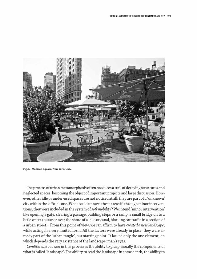
123Hidden Landscape. Rethinking the contemporary city
The process of urban metamorphosis often produces a trail of decaying structures and neglected spaces, becoming the object of important projects and large discussion. How-ever, other idle or under-used spaces are not noticed at all: they are part of a ‘unknown’ city within the ‘official’ one. What could unravel these areas if, through minor interven-tions, they were included in the system of soft mobility? We intend ‘minor intervention’ like opening a gate, clearing a passage, building steps or a ramp, a small bridge on to a little water course or over the shore of a lake or canal, blocking car traffic in a section of a urban street... From this point of view, we can affirm to have created a new landscape, while acting in a very limited form. All the factors were already in place: they were al-ready part of the ‘urban tangle’, our starting point. It lacked only the one element, on which depends the very existence of the landscape: man’s eyes.
Conditio sine qua non in this process is the ability to grasp visually the components of what is called ‘landscape’. The ability to read the landscape in some depth, the ability to
Fig. 5 - Madison Square, New York, USA.
124 Henrique Pessoa Pereira Alves
decode it, to understand its poetics and the power of its stimuli are cultural attributes, so it is the same concept of ‘landscape’. These general assertions acquire a particular importance in the case of the landscape of the city. The fascination of things that are not explicit, and which should be revealed, adds value to the hidden landscape.
Given the urban scene in which we are called to intervene as ‘committed designers’, our attention is driven in a particular way to the following question: what are the new criteria and what are the new values that should guide landscape projects, while we are searching for a new parameter for the quality of urban life? Which landscape will ‘dominate’ in the huge agglomerations of men we call megalopolis? To what extent does the landscape project will effectively contribute to the enhancement of the quality of urban life?
We can not forget how far the theme of the ‘city of the future’ has historically stimu-lated the imagination of men, driven by fear and fascination for the unknown. Plans, constructions, and studies on the subject are well known, from the cities of foundation to utopian visions. However, the interest for the city of the ‘future’ has never been the prerogative of only architects or urban planners. The ‘idea’ of fantastic cities have always solicited the imagination of so many individuals. Writers, painters, and filmmakers5 have viewed, and even anticipated a image of city and of social organization that became true after some time.
We must recognize that the ‘city of the future’ already exists. It was created in recent decades as the result of adaptations induced by the great rapidity of the changes in the world. The inevitable process of metamorphosis suggests that “you have to run if you still want to see things – everything is disappearing”, to paraphrase the famous words of Cézanne. The urban landscape is the main factor in this process.
So we have to consider the effects generated by the environmental emergency in ur-ban areas and by the global economic crisis. In recent years, the words ‘sustainable city’, ‘sustainable development’, ‘development or sustainable cities’, have had a tremendous success in the media, but it does not always have a precise meaning. There are different conceptions of ‘durable city’, for example, so you need to specify which one you are referring6.
Observing and listening to the basic needs of human beings may be a way to recover forgotten practices. It must be emphasized, however, that it does not mean acting di-
5 Jean Motett et al., Les paysages du cinema, Champ Vallon, Seyssel 1999.6 Catherine Charlot-Valdeiu, Philippe Outrequin, L’urbanisme durable. Concevoir un écoquartier, Group Mo-
niteur, Paris 2009, p. 24.
125Hidden Landscape. Rethinking the contemporary city
rectly on economic issues (survival of the people: how to feed, educate, preserve health, provide decent housing for the population of a city) – things that can not be ignored, but they are not the purview of the landscape architect. We can only hope that these questions are raised and answered by those who should deal with it.
Very often the expression ‘sustainable development’ has a magic effect for people speaking about issues related to the salvation of the Earth and humanity. Very often such expressions are used only for the purposes of political propaganda or commercial interests. The mere reference to ‘sustainability’ gives any decision or product, in any field, a ‘politically correct’ image. This expression is declined in various ways and the danger is to find it combined with purely cosmetic solutions. Nevertheless, the serious-ness of the matter should not be diminished, and it is now widely recognized by the international scientific community.
The ultimate goal of the work I am interested in is the identification of what can be called ‘landscape of sustainability’, which should provide inputs to new urban govern-ment policies. The demand for a better quality of urban living is not only derived from statistical information mentioned by government documents, but corresponds to an actual and pressing need of the most different groups of citizens in the new urban reali-ties. This is a strong element in support of the objective of revealing the hidden land-scapes – i.e., the aim of producing a new landscape which recreates the quality of every-day life in urban contemporary areas.
126
3.3The Geography of Peri-Urban Landscapes in EuropeMarc Antrop
Defining UrbanisationThe settlement continuum
An urban place is one of many possible forms of human settlement. The United Na-tions recognised already in 1955 that “there is no point in the continuum from large agglomerations to small clusters or scattered dwellings where urbanity disappears and rurality begins […] the division between urban and rural is necessarily arbitrary” (United Nations, 1955). Until the 19th century, towns and cities were easily recognis-able as distinct urban places, as islands in a vast rural countryside, from which they were clearly separated by town walls. Historical towns had a characteristic morphology, a special way of life, a great autonomy and freedom thanks to a proper law, and they were centres where many specialised functions concentrated. Moreover, as political and economical core areas they controlled a vast hinterland and formed with other places urban networks. With the process of urbanization, many typical urban functions spread to all places and changed lifestyle even in the remote countryside. The clear distinction between urban and rural vanished. The main questions now are how to define urban places, and how to define urbanisation? Actually, urbanisation refers to two very differ-ent concepts: as a statistic and as a process.
Urbanisation as a statistic and as a processFirst, the word urbanisation is used to denote a quantitative indicator as a statistic.
The oldest one was expressing the degree of urbanisation by the proportion of the total population living in urban places. This is commonly used in international statistics. However, the meaning of ‘urban places’ varies a lot from country to country and defin-ing and delimiting urban areas is a difficult and complex task.
Second, urbanisation refers to a process, which was initially defined by the United Na-tions as the movement of people from rural to urban areas, causing the growth of urban places and population decline in the countryside.
However, urbanisation can also be seen as a diffusion process of a new life style (genre de vie), introducing new functions and values, also in the countryside, and which de-manded new forms of land use and consequently also transforms the landscape. This process changes the relationship between the urban and the rural and affects even the
127The Geography of Peri-Urban Landscapes in Europe
remotest countryside. Urbanisation is a complex process and manifests itself in a great variety of new morphological forms and patterns. Consequently, many new concepts have been introduced to cover this complexity. Meeus and Gulinck (2008) gave an over-view. A non-exhaustive list looks like this:
• suburbanisation-peri-urban,semi-urban,suburb,rurban,urbansprawl,urbanshadow, (inner/outer) urban fringe,…
• counterurbanisation–disurbanisation,exo-urbanisation• networkcity-cittàdiffusa,fractalcity,Nebelstadt…• reurbanisation–cityvillages,cityagriculture…• primatecity-megapolis• metropolitanarea• metropolitanvillages• edgecities• desakota• exurbs• ecopolis-lobe-city• LargeUrbanZone(LUZ)• FunctionalUrbanRegionsorAreas(FUR/FUA)• UrbanMorphologicalZones(UMZ)
The first series of concepts in this list is rather varied, which illustrates also the com-plexity of the matter. There is also a subtle linguistic difference: the concept peri-urban is more commonly used in Latin languages (French, Portuguese, Italian, etc.) in the sense of suburban as used in the English publications. In this article, per-urban is used in a more general and generic way, encompassing these differences.
Often, the first phase in the urbanisation of the countryside is a functional change, while morphology remains unchanged. The classical example is a farm becoming a weekend house, residence or restaurant. The phase of functional urbanisation (Antrop 2004) has also been called ‘urbanisation in disguise’ (Præstholm and Kristensen 2007). In a second phase, morphology changes as well: new architecture, new constructions and infrastructure, and generally more build up land. Rural landscapes gradually trans-form into semi-urban or peri-urban landscapes (Meeus and Gulinck 2008, Antrop 2004, Berger et al. 1980).
Defining urban placesUrban areas can be defined mainly according to four different groups of criteria: 1.
administrative units (e.g. municipalities), 2. statistical units (e.g. NUTS units), 3. mor-
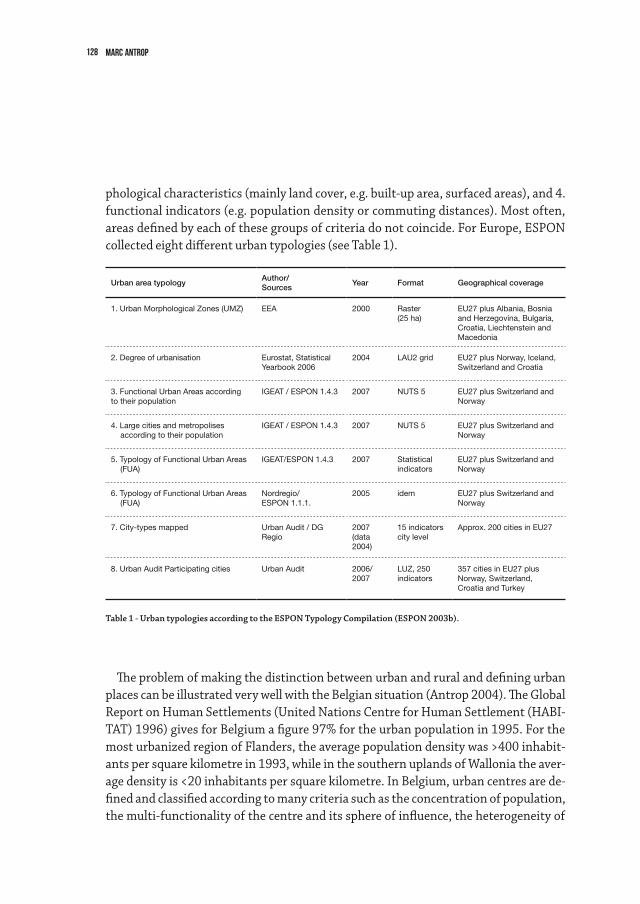
128 Marc Antrop
phological characteristics (mainly land cover, e.g. built-up area, surfaced areas), and 4. functional indicators (e.g. population density or commuting distances). Most often, areas defined by each of these groups of criteria do not coincide. For Europe, ESPON collected eight different urban typologies (see Table 1).
Table 1 - Urban typologies according to the ESPON Typology Compilation (ESPON 2003b).
Urban area typologyAuthor/Sources
Year Format Geographical coverage
1. Urban Morphological Zones (UMZ) EEA 2000 Raster (25 ha)
EU27 plus Albania, Bosnia and Herzegovina, Bulgaria, Croatia, Liechtenstein and Macedonia
2. Degree of urbanisation Eurostat, Statistical Yearbook 2006
2004 LAU2 grid EU27 plus Norway, Iceland, Switzerland and Croatia
3. Functional Urban Areas accordingto their population
IGEAT / ESPON 1.4.3 2007 NUTS 5 EU27 plus Switzerland and Norway
4. Large cities and metropolises according to their population
IGEAT / ESPON 1.4.3 2007 NUTS 5 EU27 plus Switzerland and Norway
5. Typology of Functional Urban Areas (FUA)
IGEAT/ESPON 1.4.3 2007 Statistical indicators
EU27 plus Switzerland and Norway
6. Typology of Functional Urban Areas (FUA)
Nordregio/ESPON 1.1.1.
2005 idem EU27 plus Switzerland and Norway
7. City-types mapped Urban Audit / DG Regio
2007 (data 2004)
15 indicators city level
Approx. 200 cities in EU27
8. Urban Audit Participating cities Urban Audit 2006/2007
LUZ, 250 indicators
357 cities in EU27 plus Norway, Switzerland, Croatia and Turkey
The problem of making the distinction between urban and rural and defining urban places can be illustrated very well with the Belgian situation (Antrop 2004). The Global Report on Human Settlements (United Nations Centre for Human Settlement (HABI-TAT) 1996) gives for Belgium a figure 97% for the urban population in 1995. For the most urbanized region of Flanders, the average population density was >400 inhabit-ants per square kilometre in 1993, while in the southern uplands of Wallonia the aver-age density is <20 inhabitants per square kilometre. In Belgium, urban centres are de-fined and classified according to many criteria such as the concentration of population, the multi-functionality of the centre and its sphere of influence, the heterogeneity of
129The Geography of Peri-Urban Landscapes in Europe
the population and the building density (National Committee of Geography 2012). It is more sensible to say that Belgium counts 15 urban regions of at least 80,000 inhab-itants, grouping about 53% of the total population. Besides the main cities there are many other (large and small) towns and urbanized villages.
However, according to the ESPON 2013 Database (ESPON 2013a), the conurbation “Bruxelles-Antwerpen-Gent” occupies the 6th place in the top ten ranking of Urban MetropolitanZones(UMZ2000database)with3,769,885inhabitantsandadensityof 1,841 inh./km2. Brussels is a typical example of a city that stretches far beyond its administrative borders and over different political regions (Flemish region and Brus-sels-Capitalregion).TheESPONnamingrulesfortheUMZresultedinatypeof“UMZwith several cores” named “Bruxelles-Antwerpen-Gent”, which does not perfectly corre-spond to the definition of the “Flemish Diamond” and “Brussel”, as used in the Belgian planning context.
As population counts are based on administrative spatial units, which vary a lot in size and shape and are defined on very different criteria, the outcome of defining urban places by population size or density becomes hazardous. For example the population size of London in 1991 was estimated as 6.7 million inhabitants in the main built-up area, 7.4 million in what was defined as ‘urban region’ and 12.5 million for the ‘metro-politan area’. A settlement is considered an urban place when it has >2,500 inhabitants in the USA, when a municipality in The Netherlands exceeds 2,000 inhabitants, while in France a agglomeration of contiguous housing of >2,000 inhabitants is needed.
Often population size is used to define the typology and hierarchy of urban places in series, such as mega (world) cities – metropolis – primate cities – main (capital) cities – towns – villages – hamlets – farmsteads – homesteads. The distribution of the settle-ments ranked by size shows a remarkable regularity know as the rank-size rule, also referredtoasZipf’slaw(Fonseca1988).Ingeneral,thefrequenciesofsettlementsofagiven rank decrease in size respective to the size of the largest city in the areas (country, region, world) according to a power function. This results in a few large cities and a much larger number of smaller settlements depending on their rank. In its simplest form, the rank-size rule states that the size of the city with a given rank tends to be equal to the size of the largest city divided by that rank (Haggett 1975). The rank-size rule was popu-lar amongst the urban geographers during the 1960s to 1980s. The rule helped to clas-sify national or regional city-systems according to the degree of dominance exhibited by a primate city. However, many anomalies to the rank-size rule existed due to regional specificities and history, and later studies showed increasing anomalies as settlement formsandurbanisationbecamemorecomplex.Forexample,thedeviationfromZipf’slawismostsignificantforthetoptenUMZinEurope(ESPON2013a).
130 Marc Antrop
With the availability of high resolution aerial imagery and the development of land cover mapping, built-up and surfaced areas became new criteria for defining urban ar-eas. Also here, spatial size (resolution) and shape of the map units and the choice and definition of the land cover categories being considered as urban, resulted in different solutions.MostcommoninEuropehavebecometheUrbanMetropolitanZones(UMZ),but many other concepts emerged as well. Some will be discussed briefly.
From Urban–Rural Dichotomy Towards Functional Urban Regions and UrbanMorphological Zones
The European Spatial Development Programme introduced the concept of Functional Urban Areas (FUA) (SPESP 2000). It was an attempt to solve the problem that the func-tional urban area typically extends well beyond the administrative and morphological boundaries of a town or city and that all kind of fluxes and flows could cover vast areas over long distances. Simultaneously, the relationship between urban and rural was de-fined, as expressed by the types of functional urban areas that were recognised:
• Regionsdominatedbyalargemetropolis• Polycentricregionswithhighurbanandruraldensities• Polycentricregionswithhighurbandensities• Ruralareasundermetropolitaninfluence• Ruralareaswithnetworksofmedium-sizedandsmalltowns• RemoteruralareasClearly, the vision is one over urban dominance and the rural countryside offering
services to the cities (ESPON 2007). Meanwhile, the Directorate-General for Regional Policy (DG-Regio) of the European
Commission took the initiative for the Urban Audit (European Communities 2004). The aim was to harmonise definitions of urbanisation in Europe and to collect comparable statistics and indicators for cities, at three different scales (Sub-Districts, City Core and LargerUrbanZones).ThesedefinitionswereagreedbetweenEurostatandtheNationalStatistics Offices of the different countries. Eurostat introduced the concept of a Larger UrbanZone(LUZ)attemptingtodelimitandmapfunctionalareasaroundcities,mainlyrelated to commuting zones. The approach is bottom-up, using the national definitions andstatisticalsourcestodefinetheLUZ,whicharesubsequentlyadjustedtoadminis-trativeboundariesthatapproximatetheFunctionalUrbanRegion(FUR).In2006LUZdefinitionswerechangedsignificantlyimprovingthecomparabilityofLUZdefinitionsacross different countries.
TheLUZaremappedintheEuropeanUrbanAtlasandarebasicallyinter-comparable,
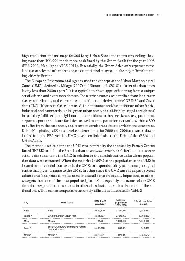
131The Geography of Peri-Urban Landscapes in Europe
high-resolutionlandusemapsfor305LargeUrbanZonesandtheirsurroundings,hav-ing more than 100.000 inhabitants as defined by the Urban Audit for the year 2006 (EEA 2013, Mequignon/SIRS 2011). Essentially, the Urban Atlas only represents the land use of selected urban areas based on statistical criteria, i.e. the major, ‘benchmark-ing’ cities in Europe.
The European Environmental Agency used the concept of the Urban Morphological Zones(UMZ),definedbyMilago(2007)andSimonetal.(2010)as“asetofurbanareaslaying less than 200m apart.” It is a typical top-down approach staring from a unique set of criteria and a common dataset. These urban zones are identified from land cover classes contributing to the urban tissue and function, derived from CORINE Land Cover data (CLC) ‘Urban core classes’ are used, i.e. continuous and discontinuous urban fabric, industrial and commercial units, green urban areas, and adding ‘enlarged core classes’ in case they fulfil certain neighbourhood conditions to the core classes (e.g. port areas, airports, sport and leisure facilities, as well as transportation networks within a 300 m buffer from the core areas, and forest en scrub areas situated within the core areas. UrbanMorphologicalZoneshavebeendeterminedfor2000and2006andcanbedown-loadedfromtheEEAwebsite.UMZhavebeenlinkedalsototheUrbanAtlas(EEA)andUrban Audit.
ThemethodusedtodefinetheUMZwasinspiredbytheoneusedbyFrenchCensusBoard (INSEE) to define the French urban areas (unités urbaines). Criteria and rules were settodefineandnametheUMZinrelationtotheadministrativeunitswherepopula-tiondatawereextracted.Whenthemajority(>50%)ofthepopulationoftheUMZislocatedinoneadministrativeunit,theUMZcorrespondsmainlytoonemorphologicalcentrethatgivesitsnametotheUMZ.InothercasestheUMZcanencompassseveralurban cores (and gets a complex name in case all cores are equally important, or other-wisegetsthenameofthemostpopulatedplace).Consequently,thenamesoftheUMZdo not correspond to cities names in other classifications, such as Eurostat of the na-tional ones. This makes comparison extremely difficult as illustrated in Table 2.
City UMZ nameUMZ top50population
Eurostat population(2003-2006)
Official population (actual)
Paris Paris 9,656,810 2,181,374 2,243,833
London Greater London Urban Area 8,221,307 7,429,200 8,308,369
Milan Milano 4,164,504 1,299,439 1,366,409
Essen*Essen/Duisburg/Dortmund//Bochum/Gelsenkirchen-1
3,892,380 588,084 566,862
Madrid Madrid-1 3,823,031 3,228,319 3,233,527
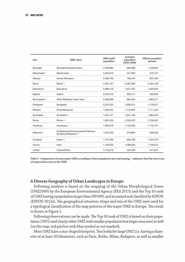
132 Marc Antrop
A Diverse Geography of Urban Landscapes in EuropeFollowinganalysis isbasedonthemappingoftheUrbanMorphologicalZones
(UMZ2000)bytheEuropeanEnvironmentalAgency(EEA2013)andtheTop50rankofUMZhavingapopulationlargerthan500000,andasnamedandclassifiedbyESPON(ESPON2013a).Thegeographicalsituation,shapeandsizeoftheUMZwereusedforatypologicalclassificationofthemappatternsofthemajorUMZinEurope.Theresultis shown in Figure 1.
Followingobservationscanbemade.TheTop50rankofUMZisbasedontheirpopu-lation(2001)andclearlyotherUMZwithsmallerpopulationbutlargerareaexistaswell(on the map: red patches with blue symbol or not marked).
MostUMZhaveastar-shapedfootprint.ThisholdsforlargeUMZ(i.e.havingadiam-eter of at least 50 kilometre), such as Paris, Berlin, Milan, Budapest, as well as smaller
Table 2 - Comparison of some major UMZ according to their population size and naming. * indicates that the city is one of many urban cores in the UMZ.
City UMZ nameUMZ top50population
Eurostat population(2003-2006)
Official population (actual)
Brussels* Brussel/Antwerpen/Gent 3,769,885 999,899 1,138,854
Manchester* Manchester 3,546,819 437,000 510,772
Athens* Dimos Athinaion 3,489,768 796,442 655,780
Berlin Berlin-1 3,367,457 3,387,828 3,394,130
Barcelona* Barcelona 3,088,470 1,621,537 1,620,943
Naples Napoli 2,354,010 995,171 956,664
Birmingham* West Midlands Urban Area 2,286,859 992,400 1,085,417
Budapest Budapest 2,042,024 1,695,814 1,740,041
Warsaw M.St.Warszawa 1,948,024 1,716,855 1,711,324
Bucharest Bucaresti-1 1,925,741 1,927,448 1,883,425
Rome Roma-1 1,891,236 2,553,873 2,799,350
Hamburg Hamburg-1 1,838,019 1,734,830 1,742,707
Katowice*M.Katowice/M.Sosnowiec/M.Gilwice/M.Zabrze/M.Bytom-1
1,810,260 319,904 308,269
Cologne* Koeln-1 1,767,659 969,709 1,024,373
Vienna Wien 1,756,034 1,598,626 1,749,673
Lisbon* Lisboa/Sintra 1,749,316 529,485 547,631
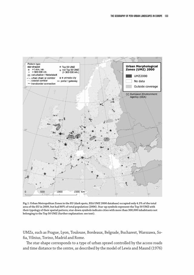
133The Geography of Peri-Urban Landscapes in Europe
UMZs,suchasPrague,Lyon,Toulouse,Bordeaux,Belgrade,Bucharest,Warszawa,So-fia, Vilnius, Torino, Madrid and Rome.
The star-shape corresponds to a type of urban sprawl controlled by the access roads and time distance to the centre, as described by the model of Lewis and Maund (1976)
Fig.1: Urban Metropolitan Zones in the EU (dark spots, EEA UMZ 2000 database) occupied only 4.3% of the total area of the EU in 2009, but had 80% of total population (2006). Star-up symbols represent the Top 50 UMZ with their typology of their spatial pattern; star-down symbols indicate cities with more than 300,000 inhabitants not belonging to the Top 50 UMZ (further explanation: see text).
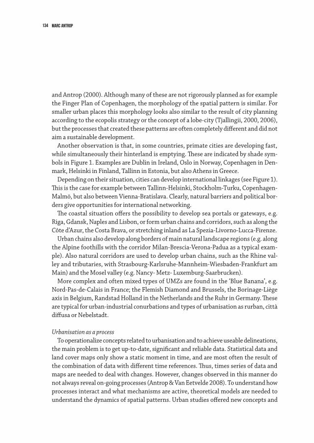
134 Marc Antrop
and Antrop (2000). Although many of these are not rigorously planned as for example the Finger Plan of Copenhagen, the morphology of the spatial pattern is similar. For smaller urban places this morphology looks also similar to the result of city planning according to the ecopolis strategy or the concept of a lobe-city (Tjallingii, 2000, 2006), but the processes that created these patterns are often completely different and did not aim a sustainable development.
Another observation is that, in some countries, primate cities are developing fast, while simultaneously their hinterland is emptying. These are indicated by shade sym-bols in Figure 1. Examples are Dublin in Ireland, Oslo in Norway, Copenhagen in Den-mark, Helsinki in Finland, Tallinn in Estonia, but also Athens in Greece.
Depending on their situation, cities can develop international linkages (see Figure 1). This is the case for example between Tallinn-Helsinki, Stockholm-Turku, Copenhagen-Malmö, but also between Vienna-Bratislava. Clearly, natural barriers and political bor-ders give opportunities for international networking.
The coastal situation offers the possibility to develop sea portals or gateways, e.g. Riga, Gdansk, Naples and Lisbon, or form urban chains and corridors, such as along the Côte d’Azur, the Costa Brava, or stretching inland as La Spezia-Livorno-Lucca-Firenze.
Urban chains also develop along borders of main natural landscape regions (e.g. along the Alpine foothills with the corridor Milan-Brescia-Verona-Padua as a typical exam-ple). Also natural corridors are used to develop urban chains, such as the Rhine val-ley and tributaries, with Strasbourg-Karlsruhe-Mannheim-Wiesbaden-Frankfurt am Main) and the Mosel valley (e.g. Nancy- Metz- Luxemburg-Saarbrucken).
MorecomplexandoftenmixedtypesofUMZsarefoundinthe‘BlueBanana’,e.g.Nord-Pas-de-Calais in France; the Flemish Diamond and Brussels, the Borinage-Liège axis in Belgium, Randstad Holland in the Netherlands and the Ruhr in Germany. These are typical for urban-industrial conurbations and types of urbanisation as rurban, città diffusa or Nebelstadt.
Urbanisation as a processTo operationalize concepts related to urbanisation and to achieve useable delineations,
the main problem is to get up-to-date, significant and reliable data. Statistical data and land cover maps only show a static moment in time, and are most often the result of the combination of data with different time references. Thus, times series of data and maps are needed to deal with changes. However, changes observed in this manner do not always reveal on-going processes (Antrop & Van Eetvelde 2008). To understand how processes interact and what mechanisms are active, theoretical models are needed to understand the dynamics of spatial patterns. Urban studies offered new concepts and
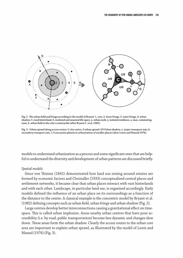
135The Geography of Peri-Urban Landscapes in Europe
models to understand urbanisation as a process and some significant ones that are help-ful to understand the diversity and development of urban patterns are discussed briefly.
Spatial modelsSince von Thünen (1842) demonstrated how land use zoning around estates are
formed by economic factors and Christaller (1933) conceptualised central places and settlement networks, it became clear that urban places interact with vast hinterlands and with each other. Landscape, in particular land use, is organised accordingly. Early models defined the influence of an urban place on its surroundings as a function of the distance to the centre. A classical example is the concentric model by Bryant et al. (1982) defining concepts such as urban field, urban fringe and urban shadow (Fig. 2).
Large centres develop better interconnections causing a gravitational effect on time-space. This is called urban implosion. Areas nearby urban centres that have poor ac-cessibility (i.e. by road, public transportation) become less dynamic and changes slow down. These areas form the urban shadow. Clearly the access routes to the urban core area are important to explain urban sprawl, as illustrated by the model of Lewis and Maund (1976) (Fig. 3).
Fig. 2 - The urban field and fringe according to the model of Bryant: 1. core, 2. inner fringe, 3. outer fringe, 4. urban shadow, 5. rural hinterland, 6. weekend and seasonal life space, x. urban node, y. isolated residence, a. max. commuting zone, b. urban field or the city’s countryside (after Bryant C. et al. 1982).
Fig. 3 - Urban sprawl along access routes: C city centre, S urban sprawl, US Urban shadow, a. major transport axis, b. secondary transport axis, 1-3 successive phases in urbanisation of smaller places (after Lewis and Maund 1976).
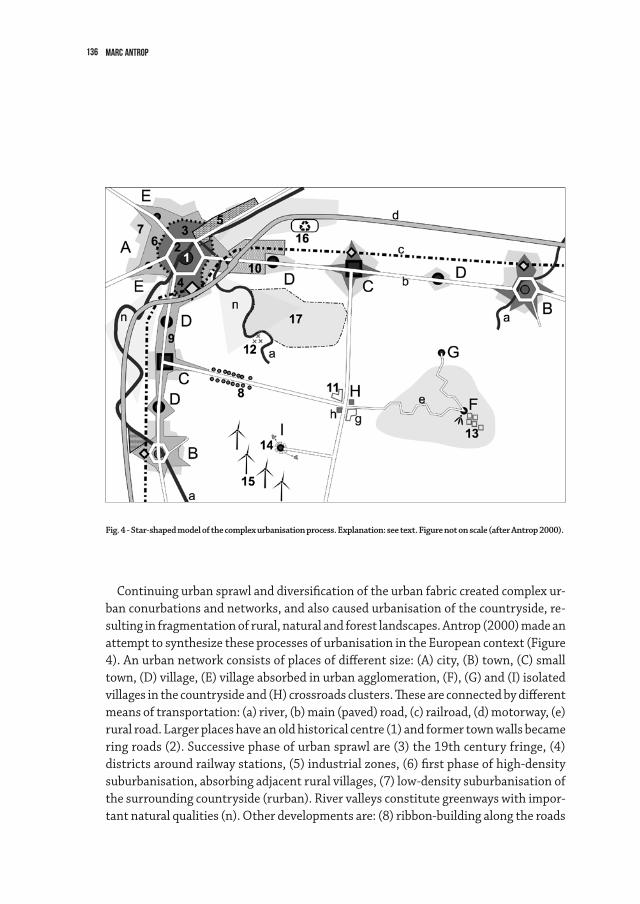
136 Marc Antrop
Continuing urban sprawl and diversification of the urban fabric created complex ur-ban conurbations and networks, and also caused urbanisation of the countryside, re-sulting in fragmentation of rural, natural and forest landscapes. Antrop (2000) made an attempt to synthesize these processes of urbanisation in the European context (Figure 4). An urban network consists of places of different size: (A) city, (B) town, (C) small town, (D) village, (E) village absorbed in urban agglomeration, (F), (G) and (I) isolated villages in the countryside and (H) crossroads clusters. These are connected by different means of transportation: (a) river, (b) main (paved) road, (c) railroad, (d) motorway, (e) rural road. Larger places have an old historical centre (1) and former town walls became ring roads (2). Successive phase of urban sprawl are (3) the 19th century fringe, (4) districts around railway stations, (5) industrial zones, (6) first phase of high-density suburbanisation, absorbing adjacent rural villages, (7) low-density suburbanisation of the surrounding countryside (rurban). River valleys constitute greenways with impor-tant natural qualities (n). Other developments are: (8) ribbon-building along the roads
Fig. 4 - Star-shaped model of the complex urbanisation process. Explanation: see text. Figure not on scale (after Antrop 2000).
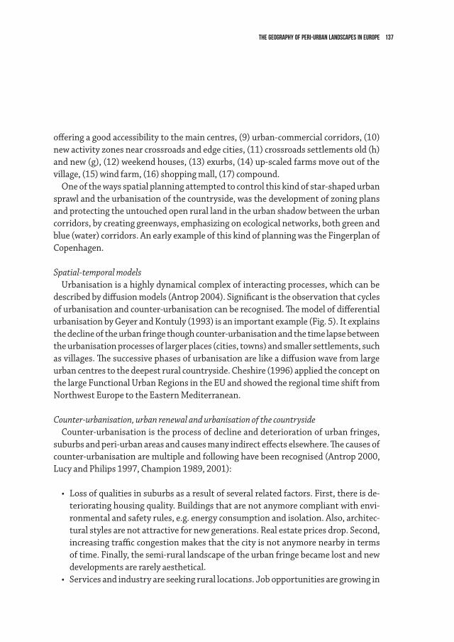
137The Geography of Peri-Urban Landscapes in Europe
offering a good accessibility to the main centres, (9) urban-commercial corridors, (10) new activity zones near crossroads and edge cities, (11) crossroads settlements old (h) and new (g), (12) weekend houses, (13) exurbs, (14) up-scaled farms move out of the village, (15) wind farm, (16) shopping mall, (17) compound.
One of the ways spatial planning attempted to control this kind of star-shaped urban sprawl and the urbanisation of the countryside, was the development of zoning plans and protecting the untouched open rural land in the urban shadow between the urban corridors, by creating greenways, emphasizing on ecological networks, both green and blue (water) corridors. An early example of this kind of planning was the Fingerplan of Copenhagen.
Spatial-temporal modelsUrbanisation is a highly dynamical complex of interacting processes, which can be
described by diffusion models (Antrop 2004). Significant is the observation that cycles of urbanisation and counter-urbanisation can be recognised. The model of differential urbanisation by Geyer and Kontuly (1993) is an important example (Fig. 5). It explains the decline of the urban fringe though counter-urbanisation and the time lapse between the urbanisation processes of larger places (cities, towns) and smaller settlements, such as villages. The successive phases of urbanisation are like a diffusion wave from large urban centres to the deepest rural countryside. Cheshire (1996) applied the concept on the large Functional Urban Regions in the EU and showed the regional time shift from Northwest Europe to the Eastern Mediterranean.
Counter-urbanisation, urban renewal and urbanisation of the countrysideCounter-urbanisation is the process of decline and deterioration of urban fringes,
suburbs and peri-urban areas and causes many indirect effects elsewhere. The causes of counter-urbanisation are multiple and following have been recognised (Antrop 2000, Lucy and Philips 1997, Champion 1989, 2001):
• Lossofqualitiesinsuburbsasaresultofseveralrelatedfactors.First,thereisde-teriorating housing quality. Buildings that are not anymore compliant with envi-ronmental and safety rules, e.g. energy consumption and isolation. Also, architec-tural styles are not attractive for new generations. Real estate prices drop. Second, increasing traffic congestion makes that the city is not anymore nearby in terms of time. Finally, the semi-rural landscape of the urban fringe became lost and new developments are rarely aesthetical.
• Servicesandindustryareseekingrurallocations.Jobopportunitiesaregrowingin
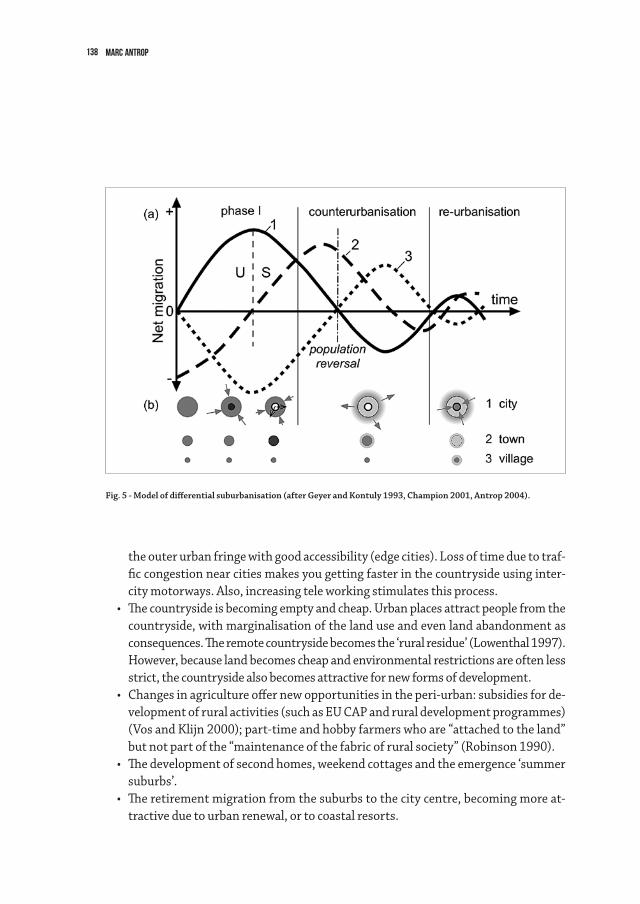
138 Marc Antrop
the outer urban fringe with good accessibility (edge cities). Loss of time due to traf-fic congestion near cities makes you getting faster in the countryside using inter-city motorways. Also, increasing tele working stimulates this process.
• Thecountrysideisbecomingemptyandcheap.Urbanplacesattractpeoplefromthecountryside, with marginalisation of the land use and even land abandonment as consequences. The remote countryside becomes the ‘rural residue’ (Lowenthal 1997). However, because land becomes cheap and environmental restrictions are often less strict, the countryside also becomes attractive for new forms of development.
• Changesinagricultureoffernewopportunitiesintheperi-urban:subsidiesforde-velopment of rural activities (such as EU CAP and rural development programmes) (Vos and Klijn 2000); part-time and hobby farmers who are “attached to the land” but not part of the “maintenance of the fabric of rural society” (Robinson 1990).
• Thedevelopmentofsecondhomes,weekendcottagesandtheemergence‘summersuburbs’.
• Theretirementmigrationfromthesuburbstothecitycentre,becomingmoreat-tractive due to urban renewal, or to coastal resorts.
Fig. 5 - Model of differential suburbanisation (after Geyer and Kontuly 1993, Champion 2001, Antrop 2004).
139The Geography of Peri-Urban Landscapes in Europe
The major driving factors here can be summarized as changing life style, changing mobility and accessibility.
ConclusionStatistical indicators are used to define urban places and areas and aim to express the
degree of mainly morphological en in a lesser degree functional urbanisation. This is mainly based on population and land cover data sources. Different approaches lead to different classifications of urban places, which rarely coincide or are consistent. Moreo-ver, in the attempt to obtain internationally comparable classifications, the European scale does not reflect the internal spatial heterogeneity or the specific identity of the urban places. The geographical diversity of urban places is still very rich and contrib-utes to the regional character. Also, the international classifications do not include how general driving forces act at the regional and local scale and what processes are involved.
Urbanisation and the related industrial and commercial development and densifi-cation of transport infrastructure, is factor of pronounced process of polarisation of geographical space. In rather small core areas urban occurs a concentration of people and activities, resulting in an extreme intensification of multifunctional land use. Si-multaneously, vast areas in the periphery and in between urban core areas, in the urban shadow, are becoming extensively used. These areas are characterised by reducing ser-vices, loss of functionality, increasing marginalisation, reforestation and rewilding, and finally land abandonment. Clearly as a process, urbanisation is affecting all landscapes, and all aspects of the landscape are affected.
140 Marc Antrop
References
Antrop M. & Van Eetvelde V., 2008. Mechanisms in recent landscape transformation. In: Man-der, Ü, Brebbia, C.A., Martin-Duque, J.F. (eds.), Geo-Environment and Landscape Evolution III, WIT Press, Southhampton, 183-192.
Antrop M., 2004. Landscape change and the urbanization process in Europe, Landscape and Urban Planning 67, 9–26.
Antrop, M., 2000. Changing patterns in the urbanized countryside of Western Europe. Land-scape Ecology, 15,3, 257-270.
Berger, M., Fruit, J-P, Plet, F., Robic, M-C; 1980; Rurbanisation et analyse des espaces ruraux péri-urbains; L’ Espace Géographique,4, 303-313.
Bryant, C., Russwurm, L., McLellan, A.; 1982. The city’s countryside: Land and its manage-ment in the rural urban fringe. London, Longman.
Champion, A.G. (ed.), 1989. Counterurbanization. London, Edward Arnold, 266 pp.Champion, T., 2001. Urbanisation, Suburbanisation, Counterurbanisation and Reurbanisation.
In: Paddison, R. (ed.), 2001. Handbook of Urban Studies. London, SAGE Publications, 143-161.Cheshire, P., 1995. A new phase of urban development in Western Europe? The evidence for the
1980s’, Urban Studies, 32(7), pp.1045-1063.Christaller, W., 1933. Die zentralen Orte in Süddeutschland. Jena, Fischer.EEA, 2013. Urban Atlas. http://www.eea.europa.eu/data-and-maps/data/urban-atlas last
modified 17 Apr 2013.ESPON, 2007. Study on Urban Functions. Final report, ESPON project 1.4.3., http://www.es-
pon.eu/export/sites/default/Documents/Projects/ESPON2006Projects/StudiesScienti-ficSupportProjects/UrbanFunctions/fr-1.4.3_April2007-final.pdf
ESPON, 2013a.NamingUMZ:adatabasenowoperationalforurbanstudies.TechnicalReport,March 2011, pp.39. http://www.espon.eu/export/sites/default/Documents/Toolsand-Maps/ESPON2013Database/3.5_TR_Naming_UMZ.pdf
ESPON, 2013b. ESPON Typology Compilation. Scientific Platform and Tools 2013/3/022, The ESPON 2013 Programme, Interim Report, ESPON & Spatial Foresight GmbH, pp. 162. http://www.espon.eu/export/sites/default/Documents/Projects/ScientificPlatform/Typology-Compilation/fir-090615.pdf
European Communities, 2004. Urban Audit – Methodological Handbook. Eurostat, Luxem-bourg: Office for Official Publications of European Communities, pp.88.
EUROSTAT Urban Atlas http://epp.eurostat.ec.europa.eu/cache/ITY_OFFPUB/KS-BD-04-002/EN/KS-BD-04-002-EN.PDF
Fonseca, J. W., 1988. Urban Rank-Size Hierarchy – A Mathematical Interpretation. Monograph #8, Institute Mathematical Geography, University of Ann Arbor, Michigan, pp.90 http://www-personal.umich.edu/~copyrght/image/monog08/fulltext.pdf
Geyer, H.S. & Kontuly, T.M., 1993. A theoretical foundation for the concept of differential ur-

141The Geography of Peri-Urban Landscapes in Europe
banization. International regional Science Review, 15 (12), 157-177 pp. http://epp.eurostat.ec.europa.eu/cache/ITY_OFFPUB/KS-BD-04-002/EN/KS-BD-04-002-EN.PDF
Haggett, P., 1975. Geography a modern synthesis. Harper & Row, London, 620 pp. http://acm.eionet.europa.eu/reports/docs/ETCACC_TP_2010_12_Urban_CC_Vuln_Adapt.pdf
Lewis, G.J. and Maund, D.J., 1976. The Urbanization of the Countryside: a Framework for Anal-ysis. Geografiska Annaler, 58B, 17-27.
Lowenthal, D., 1997. European landscape transformations: the rural residue. In: Groth, P. & Bressi, T.W. (eds.) Understanding Ordinary Landscapes. New Haven, CT, Yale University Press, pp.180-188.
Lucy, W. and Philips, D., 1997. The post-suburban era comes to Richmond: city decline, subur-ban transition and exurban growth. Landscape and Urban Planning, 36: 259–275.
Meeus and Gulinck, Semi-Urban Areas in Landscape Research: a Review. Living Rev.Landscape Res., 2, (2008), 3 www.livingreviews.org/lrlr-2008-3
Mequignon, L., 2011. Urban Atlas – Delivery of land use/cover maps of major european urban agglomerations. Final Report, European Commission/SIRS, pp.96
Milego, R.,2007.UrbanMorphologicalZonesVersionF1v0.Definitionandproceduralsteps.Report,European Topic Centre Land Use and Spatial Information, Universitat Autonoma de Barcelona, pp.11.
National Committee of Geography, 2012. A Concise Geography of Belgium. Academia Press, Gent, pp.52. http://www.atlas-belgique.be/ACGoB.pdf
Præstholm, S. & Kristensen, S.P., 2007. Farmers as initiators and farms as attractors for non-agricultural economic activities in peri-urban areas in Denmark. Geografisk Tidsskrift, Danish Journal of Geography 107(2), 13-27.
Robinson, G.M., 1990. Conflict and change in the Countryside. London, Belhaven Press, 482 pp.Simon, A., Fons, J. and Milego, R.,2010.UrbanMorphologicalZonesVersionF2v0.Definition
and procedural steps. Final report, European Topic Centre Land Use and Spatial Information, Universitat Autonoma de Barcelona, pp.27.
SPESP, 2000. Study Programme on European Spatial Planning (SPESP). Final Report 31 March 2000. http://www.nordregio.se
Tjallingii, S. 2000. Ecology on the edge. Landscape and ecology between town and country. Landscape and urban planning 48 (2000) 103-119.
Tjallingii, S. 2005. Carrying Structures. urban development guided by water and traffic net-works. In: Hulsbergen, E., I.Klaasen & I.Kriens (eds.) 2005 : Shifting Sense. Techne press. Amsterdam, p. 355-369.
United Nations Centre for Human Settlement (HABITAT), 1996. An Urbanizing World. Global Report on Human Settlements 1996. Oxford University Press, 559 pp.
United Nations, 1955. Demographic Yearbook 1955, New York.von Thünen, J.H., 1842. Der isolierte Staat in Beziehung auf Landwirtschaft und Nationalökono-
mie, Scientia Verlag, Aalen 1990; 678 pp.Vos, W. & Klijn, F., 2000. Trends in European landscape development: prospects for a sustain-
able future. In: Klijn, F. & Vos, W. (eds.) From landscape ecology to landscape science. Kluwer Academic Publishers, Dordrecht, 3-29
142
S’opposant à la dynamique régulière et inexorable du paysage que les historiens des années 1930 supposaient, l’actuelle conception des temporalités des paysages fait de leur évolution une succession de ruptures, d’accélérations et de chaos. Les paysages européens, et sans doute de la planète ont traversé des crises qui n’ont pas provoqué que des changements matériels: ils en ont profondément modifié les représentations et les valeurs1. Conçu comme une double construction sociale, matérielle et immatérielle, le paysage est le produit de l’interaction entre la dynamique de la nature et de celle des activités sociales; les rapports sociaux à la nature s’inscrivent directement au sein des représentations que les sociétés se construisent des paysages. Préciser l’évolution de ces rapports permet de mieux comprendre comment les sociétés ont envisagé leur insertion dans les paysages et comment ils imaginent y vivre et y développer leurs activités.
Les récentes recherches sur les paysages ont fourni la mesure des liens étroits établis entre la gouvernance territoriale et les rapports que les sociétés entretiennent avec les paysages. Il a fallu cependant que se rencontrent, à l’occasion de l’ambition européenne de la recherche sur le paysage2, des conceptions presque diamétralement opposées, les unes plutôt tournées vers la dimension politique du paysage et d’autres, orientées vers les interactions entre le biophysique et le social. L’explicitation de ces liens a procédé par étapes successives, qui ont tout d’abord mis l’accent sur le rôle fondamental des tempo-ralités – naturelles d’un côté – sociales de l’autre permettant de saisir la complexité des rapports sociaux à la nature et des modes de gouvernance des territoires: temps écarte-lés entre les temps géologiques et les temps sociaux, qui peuvent être à la fois aussi longs que brefs (le temps de la formation de la terre et celui d’un séisme, le temps de l’histoire et celui d’un mandat politique).
1 Luginbühl Yves, La mise en scène du monde, construction du paysage européen, Editions CNRS, Paris.2 Voir notamment les programmes de recherche du Ministère Français de l’écologie sur le paysage: 1998-
2005, Politiques publiques et paysages: analyse, évaluation, comparaison; 2005-2010, Paysage et développement durable, phase 1; 2010-2015, Paysage et développement durable, phase 2. Voir également les colloques inter-nationaux organisés par le même ministère en 2004 (Bordeaux; De la connaissance des paysages à l’action paysagère), et en 2011 (Perpignan-Gérone, Paysages de la vie quotidienne).
3.4Les rapports sociaux à la nature et leurs évolutionsYves Luginbühl
143Les rapports sociaux à la nature et leurs évolutions
Cette première réflexion a croisé un second processus, celui de la prise de conscience de la question environnementale par l’individu-monde, confronté aux pressions de la mondialisation de l’économie et de sa financiarisation, résolu de se dégager de la hié-rarchie descendante qu’exerce la politique sur la prise de décision dans l’aménagement du territoire et souhaitant désormais peser lui aussi dans un processus ascendant que le monde politique a du mal à admettre.
La crise actuelle éclaire l’évolution du sens du paysage au cours de l’histoire pendant laquelle se sont croisés ces divers processus: elle a modifié les rapports sociaux à la nature, eux-mêmes associés aux caractéristiques sociales, au mode de gouvernance territoriale, aux rapports de classes sociales, notamment.
Les paysages périurbains, les plus en expansion aujourd’hui, souvent décriés comme les paysages les plus dégradés et opposés à l’idée de l’harmonie paysagère, posent en effet la question des rapports à la nature. Ni ville, ni campagne, ils représentent une catégorie hors des canons esthétiques habituels: les spécialistes n’ont pas encore trouvé une dénomination qui pourrait leur convenir. Parmi ces paysages, ceux qui entourent les villes d’Europe de l’est présentent une configuration singulière: depuis l’instauration du collectivisme après la Seconde Guerre Mondiale, ils ont été envahis par d’innombrables lotissements de jardins ouvriers et familiaux qui répondaient à l’incapacité de l’écono-mie du système soviétique à nourrir les populations.
C’est à travers l’analyse des rapports à la nature qu’entretiennent les «jardiniers» de ces parcelles que peut être saisie leur dynamique en les comparant à celle des pays d’Eu-rope occidentale.
Temps des crises et modèles paysagersLa crise du 14ème siècle, démographique avec la disparition de près de 50% de la popu-
lation européenne3, climatique avec une période d’étés froids et pluvieux, économique avec l’essoufflement du système agraire féodal et politique avec la prise du pouvoir économique par les classes bourgeoises aux dépens de l’aristocratie et du clergé, qui annonce la Renaissance et l’arrivée des termes équivalents au paysage dans les langues européennes, révèle les modèles paysager du pastoral ou du bucolique et du pays de cocagne. En même temps, elle annonce le déclin du droit coutumier au profit d’un droit
3 En raison de la grande épidémie de peste mais également de l’affaiblissement des populations ayant moins accès à une alimentation carnée donc protéinique, car la période précédente a vu une forte poussée démographique entraînant des défrichements aux dépens des espaces de pâture, donc de l’élevage.
144 Yves Luginbühl
régalien qui met à mal les modes de gouvernance territoriale locale fondés sur les usages locaux, comme le précise Kenneth Olwig4.
La crise du 18ème siècle est plus profondément politique tout d’abord, bouleversant les régimes de monarchie absolue au profit de la démocratie, notamment en France et aux Etats-Unis; mais c’est surtout une crise économique qui voit la fin du système éco-nomique féodal, remplacé par le libéralisme qui permet le développement industriel, en Angleterre tout d’abord, dans le reste de l’Europe ensuite, avec l’instauration géné-ralisée de la propriété individuelle du sol, la suppression de la propriété collective et la fin corrélative de l’interdiction de la clôture des champs. Le développement industriel, fondé sur la suprématie de l’homme sur la nature, dont il accélère la vitesse pour devenir plus puissant qu’elle (la machine à vapeur et les lois de la thermodynamique) instaure ainsi le modèle paysager du sublime, exprimant la victoire de l’homme sur la nature et celui du pittoresque, fondement esthétique du tourisme.
Les sociétés européennes et mondiales sont entrées dans la troisième grande crise, politique, qui déstabilise le fonctionnement des démocraties et laisse la place aux ex-trêmes, économique où les forces financières mettent à mal la redistribution des ri-chesses et bien évidemment écologique avec le développement du protectionnisme de la nature et les risques du changement climatique et de l’érosion de la biodiversité. Tout ceci ne se fait pas sans changement de l’organisation sociale, ni sans changement des modèles paysagers: apparaissent alors les modèles du pittoresque biologique et nos-talgique, ainsi que celui du paysage quotidien, notamment reconnu par la Convention Européenne du Paysage adoptée en octobre 2000 par 18 Etats du Conseil de l’Europe et aujourd’hui ratifiée par 36 pays membres. Le paysage quotidien est le principal enjeu de l’aménagement des paysages aujourd’hui, car il est celui qui environne la très grande majorité des européens et même des populations de la planète, celui qu’elles vivent dans l’exercice de leur vie quotidienne.
De quoi est fait le paysage quotidien ? Définir le paysage quotidien revient à se pencher sur ce qui fait le cadre de vie de
chaque individu; le paysage quotidien est tout d’abord fait de la matérialité naturelle et artificielle qui dessine des formes produites par les effets des activités économiques, culturelles, sociales sur les milieux, mais plus précisément par l’interaction entre le
4 Olwig, K. R., 2002, Landscape, Nature and the body politic, from britain’s renaissance to America’s new world, The University of Wisconsin Press, Madison.
145Les rapports sociaux à la nature et leurs évolutions
biophysique et le social, c’est-à-dire par l’immatérialité des représentations sociales du paysage qui expriment l’effet en retour des transformations matérielles des milieux et des paysages sur les formes de pensée de la nature.
Le paysage quotidien est donc fait aussi de valeurs que les individus attribuent aux paysages et qu’il est inutile de repréciser ici: valeur de liberté, d’harmonie (sociale, éco-logique et esthétique) qui suppose leurs contraires, c’est-à-dire la contrainte sociale et la dysharmonie. En outre, les rapports que les individus entretiennent à la nature dé-pendent en partie des sens humains mobilisés pour l’évaluation sensible des paysages.
Les individus se représentent le paysage quotidien selon trois échelles qui expriment les manières dont le paysage a été structuré dans le cours de l’histoire: une échelle globale, ou arrière plan selon John Searle5, qui fait référence aux modèles paysagers évoqués précédemment, et qui expriment le sens des rapports à la nature conçu et dif-fusé par l’ensemble des médias (littérature, peinture, photographie, cinéma, etc.); une échelle locale, qui fait référence à des lieux précis auxquels l’individu ou le groupe estime appartenir, mais aussi à la mémoire sociale, aux rapports sociaux et aux cultures de la nature, modes de connaissance et d’apprentissage empiriques des milieux «naturels»; une échelle individuelle enfin, qui renvoie à l’expérience de l’individu et qui lui est irré-ductible. Ainsi pensées, les représentations sociales des paysages permettent de com-prendre pourquoi un paysage peut être envisagé à la fois comme beau et laid par un même individu, car celui-ci se réfère à plusieurs échelles ou plusieurs modèles; c’est là la complexité du paysage comme peut l’être aussi un être vivant, ambigu, contradictoire, flou, qualités que la science positiviste n’admet pas6. L’évaluation d’un paysage est ainsi complexe et difficile, car elle est très rarement univoque, et il est nécessaire de l’inscrire dans ces trois échelles.
Mais les représentations sociales des paysages évoluent également, et dans le contexte de la crise actuelle, cette évolution prend un sens singulier: avant les années 1990, le paysage était surtout synonyme de campagne; à partir de cette période, le sens du paysage change et la campagne s’efface devant la nature, tout en subsistant, mais en changeant de sens: elle devient la campagne nostalgique des paysans, alors qu’elle est en réalité celle des entrepreneurs agricoles ou agri-managers. L’effacement relatif de la campagne au profit de la nature tient surtout aux effets des crises alimentaires (ESB, fièvres aviaires, aphteuse, le bœuf cheval, etc.), aux pollutions et aux transformations des paysages agraires.
5 Searle John, 1995, La construction de la réalité sociale, nrf essais, Gallimard, Paris.6 Morin Edgar, 2005, Introduction à la pensée complexe, Essais, Points, Seuil, Paris.
146 Yves Luginbühl
Cependant, la nature évoquée dans les représentations sociales des paysages n’est pas n’importe pas laquelle des natures: il s’agit d’une nature lointaine, épargnée par les appétits inconsidérés des hommes, c’est-à-dire pure et harmonieuse. Ces apprécia-tions, cependant, doivent être relativisées par rapport aux divers groupes sociaux qui ne donnent pas forcément le même poids à la nature, comme par exemple les classes d’âge jeune pour lesquelles la nature domine largement leur pensée du paysage, à l’inverse des personnes âgées qui pensent davantage campagne que nature.
Changements des rapports sociaux à la nature dans le post-communisme Les jardins ouvriers et familiaux à l’ouest comme à l’est constituent un objet idéal
d’analyse des rapports sociaux à la nature, car ils représentent une construction de nature manipulée par la pensée humaine et subissent les effets des transformations sociales et politiques des pays où ils se développent. En Europe de l’est, ils compensent pendant la période collectiviste, la déficience du système agricole soviétique centré sur la production industrielle; très nombreux, au nombre proche du million en Pologne7, entourant les villes comme à Miskolc, en Hongrie, où 180.000 habitants entretiennent 40.000 lots de jardins, ils concernent toutes les catégories sociales et ont subi un chan-gement manifeste et rapide.
Leur densité se comprend en raison de la forte demande sociale motivée par le faible accès des populations à une alimentation diversifiée et par le symbole qu’ils repré-sentent d’un attachement à une parcelle de terre, impossible dans des pays où la pro-priété individuelle n’existe pas; c’est d’ailleurs pour cette raison qu’ils sont contestés par les pouvoirs politiques qui leur attribuent une signification bourgeoise; mais il sont peu à peu acceptés sous la pression de cadres de l’industrie (médecins des entreprises collec-tives notamment) et de la forte demande ou bien par des «astuces» de leurs promoteurs qui proposent que les cadres des administrations en bénéficient également.
Jardins d’avant 1989Avant 1989, sous le régime soviétique, ces jardins sont tout d’abord le siège d’un rap-
port utilitaire qui se traduit par la culture potagère, fruitière mais aussi de fleurs qui agrémentent la parcelle, reproduisant les modèles villageois. Les fleurs souvent mélan-gées aux légumes expriment un rapport contemplatif, les compositions faisant de toute
7 960.000 jardins sous contrat associatif + les autres qui ne sont pas toujours identifiés mais aussi sinon plus nombreux.

147Les rapports sociaux à la nature et leurs évolutions
évidence d’une recherche esthétique singulière, où le jaune or des soucis se mêle au vert bleuté des choux par exemple. Rapport également symbolique, la possession apparente d’une parcelle qui compense l’absence de propriété individuelle du sol et qui va de pair avec un sentiment d’appropriation d’une nature que l’on semble posséder et parfois collectionner. Rapport enfin de domination, d’une nature contre laquelle on lutte, qu’on cherche à maîtriser ou que l’on prend pour allié.
Ces jardins jouent un rôle social fondamental: la survie tout d’abord dans le contexte de pénurie alimentaire, mais aussi de sociabilité et de bien-être, le séjour dans le jardin représentant un moment de paix et de sérénité par rapport à l’univers bien plus contrai-gnant des immeubles de résidence, au point que très vite, les cabanons deviendront des résidences secondaires. Leur processus de développement répond à des objectifs prin-cipaux officiels, inculquer une culture (morale) de la nature ou lutter contre l’alcoolisme et la délinquance et à des objectifs occultés, assurer l’alimentation des populations et éviter les contestations politiques.
Les jardiniers sont la plupart du temps des ruraux de toutes catégories sociales qui se rassemblent dans un processus associatif puissant qui leur permet de lutter pour accéder au confort minimum. Car les autorités politiques municipales leur imposent des contraintes fortes, comme la limitation de la superficie construite, un statut locatif parfois temporaire pour contribuer à la rotation des occupants en raison de la forte de-mande, l’obligation de participer à une association; en outre l’accès aux infrastructures est le plus souvent absent: pas d’eau courante sauf un robinet collectif, pas d’électricité ni d’assainissement. Les réaction des jardiniers ne se font pas attendre: ils contournent les règles ou réalisent eux-mêmes les réseaux comme les puits individuels ou les lignes électriques qu’ils installent collectivement; ces pratiques contribuent au renforcement de l’esprit collectif et de la lutte pour obtenir de nouveaux services; en respectant la superficie au sol, l’addition d’un étage permet de bénéficier d’une pièce supplémentaire, ces modes de construction ayant sur les cabanons un effet de bricolage, un éclectisme des aménagements jardiniers, ou une esthétique populaire un peu «kitch», mais souvent avec un certain charme et une marque d’une grande inventivité. En tout cas une esthé-tique non-conformiste lointaine de celle des pavillons de banlieue ou des lotissements du périurbain.
Jardins d’après la chute du mur de BerlinLa libéralisation du système politique provoque une transformation des jardins liée à
l’évolution sociale, au changement économique et à l’ouverture des pays d’Europe cen-trale au marché de l’occident et notamment aux modèles esthétiques. L’évolution sociale qui accentue les écarts entre riches et pauvres et à des effets sur les jardins: une diminu-
148 Yves Luginbühl
tion de l’entretien des lotissements, l’abandon ou la mise en vente des parcelles et des cabanons, le vieillissement des jardiniers qui ne peuvent plus entretenir leurs jardins ou encore une demande de jardins par les plus pauvres et en particulier par ceux qui entrent dans une catégorie sociale encore inconnue, les chômeurs.
Les temps de travail ont changé: ceux qui ont un emploi n’ont plus le temps de s’occu-per de leur jardin chaque jour, comme ils le faisaient avant 1989. C’est en général le potager qui en fait les frais au profit de la pelouse que l’on vient tondre le samedi ou des fleurs, achetées désormais dans les nouveaux supermarchés offrant des plantes impor-tées d’Europe de l’ouest et remplacées souvent en raison de l’accès à de nouvelles espèces encore inconnues qui ne résistent pas aux conditions de ces lotissements; s’ensuit un nouveau rapport consumériste à la nature qui a pour corollaire un apprentissage plus commercial de la flore à travers des livres ou revues importées: un rapport cognitif se développe plus ou moins selon les groupes sociaux. Par ailleurs, un nouveau rapport plus hédonique s’accompagne d’une recherche individuelle du bien-être corporel et spi-rituel qui tend parfois à l’ésotérisme. La sociabilité qui caractérisait les lotissements de jardins dans les pays d’Europe centrale fait plus souvent place à cet individualisme alors que les jardins partagés à l’ouest sont plus favorables à l’action collective.
Points communs avec la France et l’Europe de l’ouestL’entrée des pays d’Europe centrale dans un contexte politique et économique simi-
laire à celui des pays d’Europe occidentale pourrait laisser penser que les situations respectives des jardins ouvriers se rapprochent et tendent vers des caractéristiques semblables. Celles-ci sont, il est vrai, de plus en plus communes aux deux univers euro-péens ; mais en même temps, subsistent des différences8.
Ce qui est similaire concerne tout d’abord les modes d’habiter: le jardin symbolise l’ancrage dans un lieu et l’affirmation de soi, le lien social et le don par l’abondance des productions qui augmente le plaisir que le donateur ressent dans le plaisir procuré à l’autre. L’organisation associative conduit à l’élaboration d’une «république jardinière», quasi autonome par rapport à la société environnante, où les normes confèrent au mi-lieu périurbain une certaine rigidité alors que le fonctionnement des jardins est plus souple, plus propice au bien-être individuel et social; pour les retraités et les chômeurs, le jardin constitue le moyen de renouer avec les rythmes de la vie sociale. Similitude
8 Voir à cet égard: Molnar Melinda, «Les rapports à la nature et les modes d’habiter à travers les jardins ouvriers et familiaux en France et en Hongrie, analyse et comparaison», Thèse de Doctorat de Géographie soutenue le 4 mars 2013 à l’Université de Paris1 Panthéon Sorbonne, sous la direction d’Yves Luginbühl.
149Les rapports sociaux à la nature et leurs évolutions
également dans les rapports à la nature: l’apparent contrôle de la nature contribue au bien-être, car le jardin est un lieu d’expérimentation permanente, où les jardiniers sont les paysagistes de leur propre destin, investissent leur propre sensibilité et leur inventi-vité, réfléchissent à l’avenir du lotissement et pas uniquement de leur parcelle.
Mais en même temps, les jardins à l’est et à l’ouest présentent des différences; dans les modes d’habiter, les jardins ne sont pas encore complètement légitimes pour les autorités, ils restent des lieux marginaux, alors qu’à l’ouest, ils établissent avec leur environnement social des relations apaisées et figurent même comme des pratiques vertueuses. A l’est, l’investissement spatio-temporel des jardiniers a été bouleversé par les changements dans les rythmes de travail, les chômeurs pouvant consacrer plus de temps au jardinage alors que ceux qui ont un emploi, au contraire, ont vu leur temps de jardinier diminuer. Une différence majeure est leur statut de résidence secondaire à l’est, impensable en Europe occidentale. Toutefois, ces jardins s’inscrivent bien dans l’ère post-industrielle: produits de l’industrie, ils font partie d’une société dont l’activité dominante est l’activité tertiaire.
En ce qui concerne les rapports à la nature, une première différence réside dans la place donné à ce qui est considéré comme naturel: en Europe de l’ouest, la priorité est donnée au «naturel», alors qu’à l’est, l’artificiel est encore fréquent. Par ailleurs, les lotis-sements de jardins sont devenus des espaces de nature à voir, à visiter, une biodiversité à protéger, un paysage à savourer dans ses textures et ses couleurs, situations encore peu admises en Europe de l’est où, malgré des expériences d’ouverture des lotissements de jardins au public, les jardiniers n’adhèrent pas globalement à ces projets.
Conclusion: Habiter la nature ? Les recherches poursuivies sur ces jardins conduisent à la rupture de l’opposition
entre les modes d’habiter et la nature. Elles incitent à se poser la question: «comment habiter la nature ?», et le périurbain est précisément un lieu où on peut habiter la nature. Cette question renvoie ainsi à d’autres interrogations: «quel mode d’habiter?», «quelles natures?». Ce qui revient à poser le problème de la gouvernance des modes d’habiter et des natures, c’est-à-dire penser l’habiter et les natures ensemble et non séparément, comme les pratiques de contrôle politique de l’habitat et de la nature ont donné l’habi-tude de le faire.
150 Yves Luginbühl
references
Blanc Nathalie, 2004, Des paysages pour vivre la ville de demain, rapport de recherche pour le MEDD, programme de recherche Politiques Publiques et Paysages.
Blanc Nathalie, 1995, La nature dans la cité, Thèse de géographie de l’Université de Paris I Pan-théon-Sorbonne, sous la direction de MATHIEU Nicole.
CrosKarpatiZsuzsa;GubiczaCsilla;ÓnodiGábor, 2004, Kertségek és kertművelők: Urba-nizáció vagy vidékfejlesztés? Környezet - és Tájgazdálkodási Intézet Kht. et Mezőgazda Kiadó, Budapest.
Dubost Françoise, 1984, Côté jardins, Scarabée, Paris.Dubost Françoise, 1991, «Le légume-phénomène dans la tradition des jardins-ouvriers», in
Meiller Daniel; Vannier Paul (dir.): Le Grand livre des fruits et légumes: Histoire, culture et usage, La Manufacture, Besançon, pages 167-168.
Dubost Françoise, 1997, Les jardins ordinaires. Collection Logiques sociales, L’Harmattan, Paris.Limido, Luisa, 2002, L’art des jardins sous le Second Empire. Jean-Pierre Barillet-Deschamps
(1824-1873), Champ Vallon, Seyssel.Luginbühl Yves, La mise en scène du monde, construction du paysage européen, Editions
CNRS, Paris, 430 pages.Luginbühl Yves, 1990, Paysage élitaire et paysages ordinaires, in: Ethnologie française, 1989/
XIX, fasc. 3, Paris, Armand Colin, pp. 227-23.Luginbühl Yves, 2001, Paysage modèle et modèles de paysages, in L’environnement, question
sociale, Editions Odile Jacob, pp 49-56.Luginbühl Yves, 2002, «Rural tradition and Landscape Innovation in the eighteenth Century»,
in Tradition and Innovation in French Garden Art, University of Pennsylvannia Press, Phila-delphia, dir. John DIXON HUNT, p. 82-92.
Luginbühl Y, 2009, «Rappresentazioni sociali del paesaggio ed evoluzione della domanda so-ciale», in Castiglioni B., De Marchi M. (a cura), Di chi è il paesaggio, la partecipazione degli attori nella individuazione, valutazione e pianificazione, CLEUP, Padova, pp. 59-67.
Molnar Melinda, 2013, Les rapports à la nature et les modes d’habiter à travers les jardins ouvriers et familiaux en France et en Hongrie, analyse et comparaison, thèse de doctorat de géographie soutenue le 4 mars 2013 à l’Université de Paris1 Panthéon Sorbonne, sous la direction d’Yves Luginbühl.
Paysage au pluriel: pour une approche ethnologique des paysages, 1995- Paris: Editions de la MSH.- 240 p. (Coll. «Ethnologie de la France»; 9).
Programmes de recherche du ministère français de l’écologie sur le paysage: 1998-2005, Poli-tiques publiques et paysages: analyse, évaluation, comparaison; 2005-2010, Paysage et déve-loppement durable, phase 1; 2010-2015, Paysage et développement durable, phase 2.
sansot pierre, Variations paysagères, Université des sciences sociales de Grenoble, mars 1982.
151
“People of the same kind do not create a city.”
Socrate1
Immigration and Entrepreneurship The politics of the German government regarding immigrants in the years after the
Second World War were founded on the principle of rotation. Nevertheless, more and more immigrants tended to establish themselves in Germany instead of going back to their native countries.
Summarily we may notice diverse periods of immigration and so divers types of mi-grants that sometimes are characteristic for a determinate period:
• The Guest-worker period (1955-1973)2
• The period of family reunion and settling• The period of the east-west migration after 1989• The period of the globalisation• The period of the new European mobility-immigrationThe number of people from an immigrant background living in Germany is estimated
at 15 million and will increase. Now Germany is confronted with a young migration from the countries of South-Europe like Spain, Greece or Italy. These young people often with a good professional education are looking for a better quality of life in the cities of Germany. Particularly Berlin is one important destination of these young migrant generation that I call the new mobiles. (Pichler: 2002, 2013)
Recapitulating we can find the following groups of immigrants:• EUcitizens• ethnicGermanimmigrantsfromeasternEurope
1 Cit. Dilger,T./Fürst, H., German Journal of Urban Studies Vol. 47 (2008), No. 1.2 1955 Italy and Germany signed the first bilateral agreement about the recruitment of guest- workers, it fol-
lowed a similar agreement with other countries like Turkey, Greece, Spain, Portugal, Morocco, Tunisia, Yugosla-via. Because of the oil crisis and also the crisis of the mass-industries in 1973 the German government stopped this policy of recruitment. As a consequence migrants began to bring their family to Germany. (Pichler: 1997).
3.5Lifestyles and Ethnic Economies. The Contribution of Migrantsin the Transformation of Urban Spaces in BerlinEdith Pichler
152 Edith Pichler
• dependentsofpeoplefromthirdcountries(non-EUcitizens)• asylumseekersandrefugees• limited-termlaborimmigrants• highlyqualifiedspecialists.
Häußermann and Siebel (2000) ascertained that immigrants prefer to live in the cit-ies. So: “The inner-city neighbourhoods of large cities have been and remain important ports of entry where people arriving from abroad are received and integrated… Immi-grants are thus increasingly important actors in urban development processes and in the further development of the quality of urban life” (Dilger/Fürst, 2008).
So we can observe that immigrants more and more took back and re-urbanised areas which bad been abandoned by German shop owners, artisans and restaurateurs. So at the beginning of the eighties the number of migrant entrepreneurs is more growing than the number of the German entrepreneurs, alone in the nineties their amount has doubled. This development reflects on the one hand the changing of the mi-grant generation, on the other hand indicates the deteriorating Job-situation in Germany, upon which the immigrants react with entrepreneurships. Ethnic econo-mies represented a self-inclusion practice in a context in which pronounced forms of social exclusion exist. However this orientation may be facilitated by the fact that the majority of emigrants did not come from a proletarian milieu but from families with a self-employment tradition (artisans, farmers, salesmen). (Pichler, 1997)
Culture of Entrepreneurships or Reaction Model?The works of Weber (1920; 2010) on Protestant ethics, of Simmel (1908) on the Frem-
den (strangers) and of Sombart (1911) on the importance of the Jewish religion for the development of modern capitalism can be considered as pioneering studies regarding the economic activities of ethnic minorities. On the wake of these studies, concepts such as that of middleman minorities were developed in the research of ethnic economy, and they underline the importance of cultural factors and the possibility that the ethnic context represents a resource for the entrepreneur. These conceptualisations single out a certain propensity to self-employment in determined groups, like the possibility to ac-tivate resources, for example, social capital, solidarity, cultural competences and knowl-edge, etc. All of these are factors which facilitate the foundation of enterprises. On the other hand, other theories wonder in which measure minorities that are discriminated against in society and socially disadvantaged are pushed, precisely by these reasons to develop an entrepreneurial rank, stressing the economic behavior of immigrants in the
153Lifestyles and Ethnic Economies
modern industrial states. These concepts with a structural trend emphasize environ-mental effects and analyze the weight that social and institutional conditions have in the choice to start a self-run activity, such as discrimination and occupational perspec-tives. (Pichler: 2011a) Summing up, one could then speak of a “cultural” model and of a “reaction” model (Bonacich, 1973; Waldinger et al. 1990)
Analyzing Italian entrepreneurship in Germany, one can ascertain that both mod-els are present, and that sometimes they can interact among themselves. The reaction model can probably be valid for the generation of the “Gastarbeiter” in the years after the Second World War and of their ancestors, who are the most touched by the produc-tion crisis, by a segmented and unsure work market, and by a scarce social mobility, and who see a possible way out of this situation in self-employment. A clear cultural model, intended as the possibility to activate ethnic resources such as cultural competences etc, probably goes more for the most recent generation of emigrants.
A Definition of Ethnic EconomyA division is also made regarding the type of ethnic economy. On this point we dif-
ferentiate between:1. complement ethnic economy2. niche ethnic economy.The complement economy covers the demand for determined ethnic products inside
one’s community. This requirement, which results from the migration situation, is not covered by autochthonous suppliers. Food shops, import activities, and video shops are examples of what is a part of this. Then with time, even due to the formation of bet-ter-educated groups and freelance professions inside these communities, bookshops, translations offices, banks, software producers, consultants etc. come to be. (Schüleri et al.: 2005) Some of these activities become more and more important, even for the local economy, and they can develop in the direction of an ethnic niche economy if, for example, the economic activity which at the beginning was directed at satisfying the consumption needs of one’s community, begins to expand due to the demand of the native population (grocery stores, fruit and vegetable markets).
The supply of the ethnic niche market is prevalently aimed at satisfying the demand of the country of adoption, and it includes restaurants, Ice-cream shops, lunch bars, tai-lor’s shops, and markets. The division between complement ethnic economy and niche ethnic economy is, however, not always very clear. Many market “niches”, moreover, are linked to the entrepreneurs’ presumed cultural competences. In the case of Italians in Germany, in particular, if we focus principally on commercial and gastronomic activi-
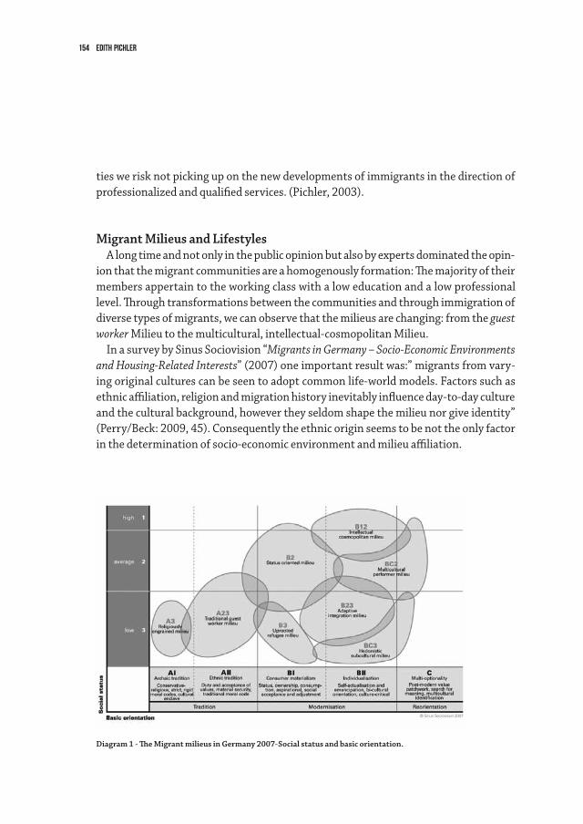
154 Edith Pichler
ties we risk not picking up on the new developments of immigrants in the direction of professionalized and qualified services. (Pichler, 2003).
Migrant Milieus and LifestylesA long time and not only in the public opinion but also by experts dominated the opin-
ion that the migrant communities are a homogenously formation: The majority of their members appertain to the working class with a low education and a low professional level. Through transformations between the communities and through immigration of diverse types of migrants, we can observe that the milieus are changing: from the guest worker Milieu to the multicultural, intellectual-cosmopolitan Milieu.
In a survey by Sinus Sociovision “Migrants in Germany – Socio-Economic Environments and Housing-Related Interests” (2007) one important result was:” migrants from vary-ing original cultures can be seen to adopt common life-world models. Factors such as ethnic affiliation, religion and migration history inevitably influence day-to-day culture and the cultural background, however they seldom shape the milieu nor give identity” (Perry/Beck: 2009, 45). Consequently the ethnic origin seems to be not the only factor in the determination of socio-economic environment and milieu affiliation.
Diagram 1 - The Migrant milieus in Germany 2007-Social status and basic orientation.
155Lifestyles and Ethnic Economies
The study describes a total of eight migrants with their own distinctive values, life-styles, everyday aesthetics, levels of integration and housing preferences.
In the diagram we can distinguish the positioning of the migrant milieus according to social standing and basic orientation: “The higher the milieu is on the socio-economic scale, the higher is their level of education, income and professional group; the further it stretches to the right, the less traditional is the milieu” (Perry/Beck: 2009, 45).
The researchers ascertained in total three large milieu groups:1. “The mainly older members of the traditional migrant group are still attached to
the social traditions from their country of origin. This group comprises mostly first generation migrants that are only marginally integrated into German society. This milieu is made up of a large number of elderly people and pensioners.
1. In contrast milieus that have embraced the process of modernisation are nowonly partially influenced by the traditions of their country of origin. They strive for inte-gration and speak good German. Many of them have jobs requiring qualifications. It is only the group of deracinated refugees that comprises refugees from areas of civil war such as former Yugoslavia that is less well integrated.
2. Young second and third generation often belong to the post-modern migrant milieus. They are usually more familiar with German culture than with the culture of their
country of origin. In part their cultural identity is ambivalent: they are living in Germany; a life in their country of origin is not a realistic alternative. But the Ger-man culture has not become their native culture.” (Perry/Beck: 2009, 45f.)
The young achievement-orientated milieu with bicultural identity, cosmopolite - postmodern lifestyle, aims often at professional success. By the development of their own business they are oriented to adopt the new lifestyles, and diverse forms of distinc-tion, especially regarding consumer behavior. Because of their ability to use the own cultural and social capital, they can offer not only “ethnic food” but also culture; and not only “ethnic culture” but rather milieu-orientated culture. Culture as an “ethnic resource” means-for this group not only a business opportunity, but also the possibility to accomplish individual interests.
Migrant-Berliners and their BusinessAlready in 1960 22.000 immigrants were living in Berlin. After the construction of
the wall their figure rose to 162.509 in 1972 and 385.911 in 1992. In 2012 the number of foreigners was 518 969, but when we added the number of people with a migration-background the total is 971.758.
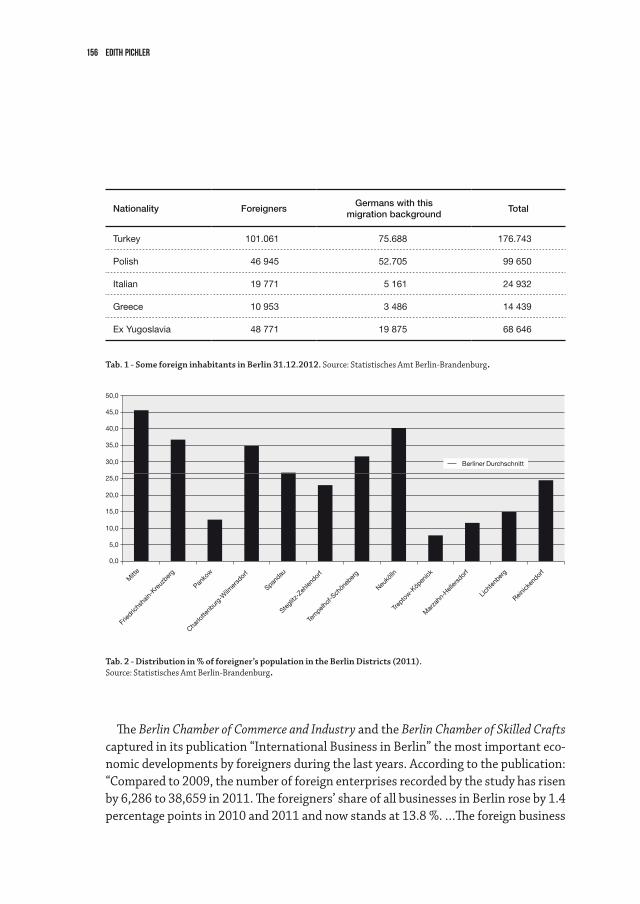
156 Edith Pichler
Nationality ForeignersGermans with this
migration backgroundTotal
Turkey 101.061 75.688 176.743
Polish 46 945 52.705 99 650
Italian 19 771 5 161 24 932
Greece 10 953 3 486 14 439
Ex Yugoslavia 48 771 19 875 68 646
Tab. 1 - Some foreign inhabitants in Berlin 31.12.2012. Source: Statistisches Amt Berlin-Brandenburg.
Mitt
e
Panko
w
Spandau
Fried
richs
hain-
Kreuz
berg
Charlo
ttenb
urg-
Wilm
ersd
orf
Stegli
tz-Zeh
lendor
f
Tem
pelhof
-Sch
öneb
erg
Neukö
lln
Trepto
w-Köp
enick
Mar
zahn
-Hell
ersd
orf
Licht
enber
g
Reinick
endor
f
50,0
45,0
40,0
35,0
30,0
25,0
20,0
15,0
10,0
5,0
0,0
Berliner Durchschnitt
The Berlin Chamber of Commerce and Industry and the Berlin Chamber of Skilled Crafts captured in its publication “International Business in Berlin” the most important eco-nomic developments by foreigners during the last years. According to the publication: “Compared to 2009, the number of foreign enterprises recorded by the study has risen by 6,286 to 38,659 in 2011. The foreigners’ share of all businesses in Berlin rose by 1.4 percentage points in 2010 and 2011 and now stands at 13.8 %. …The foreign business
Tab. 2 - Distribution in % of foreigner’s population in the Berlin Districts (2011).Source: Statistisches Amt Berlin-Brandenburg.
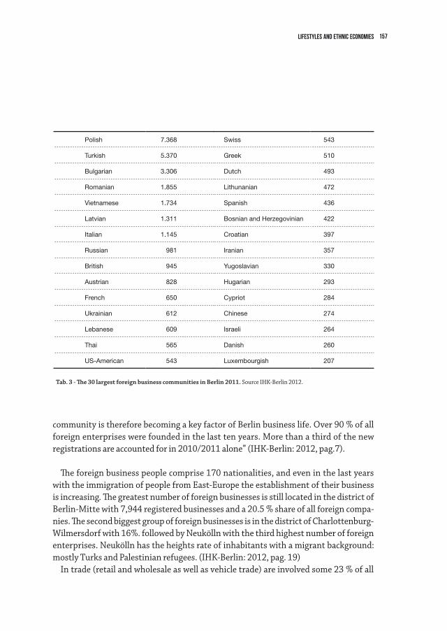
157Lifestyles and Ethnic Economies
community is therefore becoming a key factor of Berlin business life. Over 90 % of all foreign enterprises were founded in the last ten years. More than a third of the new registrations are accounted for in 2010/2011 alone” (IHK-Berlin: 2012, pag.7).
The foreign business people comprise 170 nationalities, and even in the last years with the immigration of people from East-Europe the establishment of their business is increasing. The greatest number of foreign businesses is still located in the district of Berlin-Mitte with 7,944 registered businesses and a 20.5 % share of all foreign compa-nies. The second biggest group of foreign businesses is in the district of Charlottenburg-Wilmersdorf with 16%. followed by Neukölln with the third highest number of foreign enterprises. Neukölln has the heights rate of inhabitants with a migrant background: mostly Turks and Palestinian refugees. (IHK-Berlin: 2012, pag. 19)
In trade (retail and wholesale as well as vehicle trade) are involved some 23 % of all
Polish 7.368
Turkish 5.370
Bulgarian 3.306
Romanian 1.855
Vietnamese 1.734
Latvian 1.311
Italian 1.145
Russian 981
British 945
Austrian 828
French 650
Ukrainian 612
Lebanese 609
Thai 565
US-American 543
Swiss 543
Greek 510
Dutch 493
Lithunanian 472
Spanish 436
Bosnian and Herzegovinian 422
Croatian 397
Iranian 357
Yugoslavian 330
Hugarian 293
Cypriot 284
Chinese 274
Israeli 264
Danish 260
Luxembourgish 207
Tab. 3 - The 30 largest foreign business communities in Berlin 2011. Source IHK-Berlin 2012.
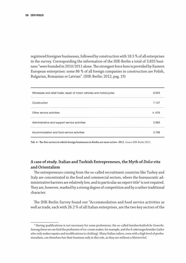
158 Edith Pichler
registered foreigner businesses, followed by construction with 18.5 % of all enterprises in the survey. Corresponding the information of the IHK-Berlin a total of 3,835 busi-ness “were founded in 2010/2011 alone. The strongest force here is provided by Eastern European enterprises: some 86 % of all foreign companies in construction are Polish, Bulgarian, Romanian or Latvian”. (IHK-Berlin: 2012, pag. 19)
A case of study. Italian and Turkish Entrepreneurs, the Myth of Dolce vitaand Orientalism
The entrepreneurs coming from the so-called recruitment countries like Turkey and Italy are concentrated in the food and commercial sectors, where the bureaucratic ad-ministrative barriers are relatively low, and in particular an expert title3 is not required. They are, however, marked by a strong degree of competition and by a rather traditional character.
The IHK-Berlin Survey found out “Accommodation and food service activities as well as trade, each with 26.2 % of all Italian enterprises, are the two key sectors of the
3 Having qualifications is not necessary for some professions: the so-called handwerksähnliche Gewerbe. Among these we can find the profession of ice-cream maker, for example, and the Ä·nderungschneider (tailor who only makes repairs and modifications to clothing). Many Italian tailors, even with a high level of profes-sionalism, can therefore fun their business only in this role, as they are without a Meistertitel.
Tab. 4 - The five sectors in which foreign businesses in Berlin are most active- 2011. Source IHK-Berlin 2012.
Wholesale and retail trade; repair of motor vehicles and motorcycles 8.933
Construction 7.137
Other service activities 4. 676
Administrative and support service activities 3.993
Accommodation and food service activities 3.799
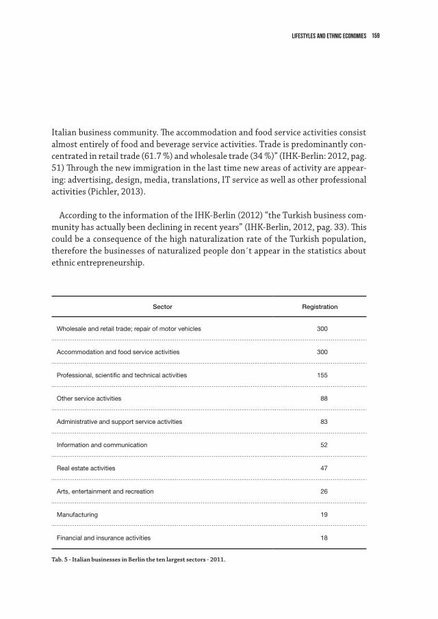
159Lifestyles and Ethnic Economies
Italian business community. The accommodation and food service activities consist almost entirely of food and beverage service activities. Trade is predominantly con-centrated in retail trade (61.7 %) and wholesale trade (34 %)” (IHK-Berlin: 2012, pag. 51) Through the new immigration in the last time new areas of activity are appear-ing: advertising, design, media, translations, IT service as well as other professional activities (Pichler, 2013).
According to the information of the IHK-Berlin (2012) “the Turkish business com-munity has actually been declining in recent years” (IHK-Berlin, 2012, pag. 33). This could be a consequence of the high naturalization rate of the Turkish population, therefore the businesses of naturalized people don´t appear in the statistics about ethnic entrepreneurship.
Sector Registration
Wholesale and retail trade; repair of motor vehicles 300
Accommodation and food service activities 300
Professional, scientific and technical activities 155
Other service activities 88
Administrative and support service activities 83
Information and communication 52
Real estate activities 47
Arts, entertainment and recreation 26
Manufacturing 19
Financial and insurance activities 18
Tab. 5 - Italian businesses in Berlin the ten largest sectors - 2011.
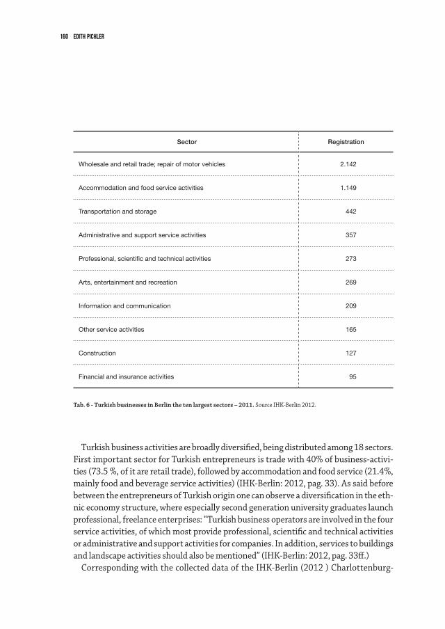
160 Edith Pichler
Turkish business activities are broadly diversified, being distributed among 18 sectors. First important sector for Turkish entrepreneurs is trade with 40% of business-activi-ties (73.5 %, of it are retail trade), followed by accommodation and food service (21.4%, mainly food and beverage service activities) (IHK-Berlin: 2012, pag. 33). As said before between the entrepreneurs of Turkish origin one can observe a diversification in the eth-nic economy structure, where especially second generation university graduates launch professional, freelance enterprises: “Turkish business operators are involved in the four service activities, of which most provide professional, scientific and technical activities or administrative and support activities for companies. In addition, services to buildings and landscape activities should also be mentioned” (IHK-Berlin: 2012, pag. 33ff.)
Corresponding with the collected data of the IHK-Berlin (2012 ) Charlottenburg-
Sector Registration
Wholesale and retail trade; repair of motor vehicles 2.142
Accommodation and food service activities 1.149
Transportation and storage 442
Administrative and support service activities 357
Professional, scientific and technical activities 273
Arts, entertainment and recreation 269
Information and communication 209
Other service activities 165
Construction 127
Financial and insurance activities 95
Tab. 6 - Turkish businesses in Berlin the ten largest sectors – 2011. Source IHK-Berlin 2012.
161Lifestyles and Ethnic Economies
Wilmersdorf with a business presence of 20.3 %) is the most attractive district for the Italian entrepreneurs, it follows Friedrichshain-Kreuzberg and Berlin-Mitte (each with 16.2 %) as well as Pankow (11.4 %). (IHK-Berlin: 2012, pag. 51). These districts located in East-Berlin with its quarter Prenzlauer Berg has been characterized in the last years through gentrification: young professionally educated people with a good income and a distinguished Lifestyle replace the earlier inhabitants: the inhabitants of the GDR time, the students and artists-bohemians of the time after 1989.
For the Turkish entrepreneurs one of the most important districts is Berlin-Mitte (20.4 %), followed by Neukölln(18.1 %), Friedrichshain-Kreuzberg (16.3 %) and Tem-pelhof-Schöneberg (11.4 %).(IHK-Berlin: 2012, pag. 51). As already mentioned in the district of Neukölln lives a high number of inhabitants with a Turkish background and as well as in Kreuzberg.
We can observe an occupational ethnicisation here, each migrant group occupies de-termined niches. The Markets are so linked to the entrepreneurs´ presumed cultural competence and the expectation of the autochthone population in this regard. Some-times, in this way, in this context the imagination of the host country regarding the identities and the characteristics of determined groups, with attributions which often verge on stereotypes: by the Italian the seducing Dolce Vita (Janz/Sala: 2011) and by Turks the strange intriguing Orientalism (Said: 2009). The migrants themselves however speculate with this stereotypes and imagination and utilize this (sometimes conscious-ly; sometimes unconsciously because of their tradition) in their business.
Turks are highly active in the fruit, vegetable and groceries business; Italians however are specialized in catering trade (mainly Restaurants). The decoration of the Turks fruit and vegetable stalls on the Berliner open markets and also in the Turks stores seem to be like what in the imagination of the customers could be an “oriental bazaar”. Italian restaurant owners play instead with the idea or imagination of the Italian way of life by the diverse milieu of their customers: from the dolce vita lifestyle evocated in the Italian films, books or songs to the left-radical chic dolce vita feeling by the socially involved customers.
For example some young Italian taking advantage of the climate in the 70then would invest their own social capital by opening places with a “left-wing” image, a mix between a brewery and a tavern. The “ltalian left-wing” fascinated many Germans, who were very pleased to show their solidarity with the “left-wing movement” and with the emigration world, between a class of red wine and a plate of lasagna. Some new establishments in East Berlin after the reunification, “nostalgically” rediscovering the left-wing environ-ment. This type of memory, which in part had some folkloristic connotations, seems to have been successful. Easily, the former activists in the 1968 protest movement like the
162 Edith Pichler
no-global activists, symbolically identified themselves with this environment.Through this “specialization” a syllogism has appeared: each ethnicity occupies deter-
mined niches. This division became so ingrained in one’s imagination that the phrase “go to the Turk’s” (zum Türke gehen) means mainly to buy vegetables, while “been to the Italian’s” (war beim Italiener)4 means in the most part to have gone to lunch or dinner in an Italian5 establishment.
Ethnic Segregation or Urban Recycling? Migrant’s Economy and UrbanDevelopment
Hillmann (2001; 2012) criticizes that the debate about immigration and urban devel-opment in the media and by politicians is often connected with problems. There is the talk about the formation of Ghettos, of one urban underclass and a warning sign of social exclusion. The urban researcher Dilger/Fürst (2008) underlay instead in their paper that the “revitalization of urban culture”, which was an essential component of suc-cessful urban development, happening through increasingly heterogeneous lifestyles – including those of immigrants. But immigrants not only have an advantage by the re-vitalization of urbane culture but also contribute with their lifestyle and activities to an urban recycling (Yildiz: 2013) Through the (post)migrants (Yildiz: 2013) the urbane Orte (urbane places) open themselves to the Welt (world) and change themselves to a center for manifold cultures and experience. At the same time the daily praxis of migrants are pioneer examples of transnational communication (Yildiz: 2013)
With their businesses, the foreign entrepreneurs in Berlin cover the needs of their own ethnic group, on one hand, and on the other hand they cover the growing need for ethnic products or other services by a part of the native population. The ethnic economy contributed to the stabilization of some neighborhoods, giving back a certain urbanity to districts that were living some segregation processes. In fact, the immigrants often acquired establishments and shops which had been abandoned by German merchants, because they were no longer competitive with the large chains of distribution. So for
4 This “stereotype” is reproduced for example also in the media. In an interview with the social-democra-tic politician Steinmeier he answered a question about his meeting with an other politician:“ …Manchmal treffen wir uns sogar zufällig beim Italiener…” (Sometimes we even meet each other accidentally by the Italiener”. (Tagesspiegel 19.08.2013). In this example the reader knows that with the Italiener is meant not a specific person but an Italian-Restaurant.
5 Recently, moreover, with the concept “der Italiener” we mean even the numerous Italian specialty shops, for which, even if the owner is German or other Nationality, we still speak of the Italiener anyway. (Pichler, 2011).
163Lifestyles and Ethnic Economies
example after the fall of the wall, and the disappearance of the network of supplies linked to the cooperative Socialist system in the eastern part of the city, the immigrant businesses (grocery stores, restaurants) acquired a certain importance.
The taking back of abandoned areas and the presence of various businesses also made some city streets safer. Through the investments of immigrants, the general atmosphere and the degree of identification of the residing population improved. Ethnic economy also contributed in diverse quarters of Berlin to the stabilisation and re-evaluation of neighbourhood. These enterprises are not only points of communication for the ethnic groups but also meeting points for the various inhabitants. They are simultaneously an important social contribution for the living together and the acceptance of diversity.
The presence of establishments and shops attracted a different public, and the various ethnic establishments were an attraction for Berlin’s youth. Moreover with the renewal of some neighborhoods, also the inhabitants’ socio-demographic structure changed. The so called new average set of the lifestyle-intellectual or not - began to establish itself in these neighborhoods, attracted by the urban character of the different Kiezes (Berlin term for neighborhood area, and is used also to describe a certain identification with it), however also calling for a distinction and a differentiation. (Pichler, 2011).
To summarize, part of the quarters of the City had won through the activity of ethnic entrepreneur’s urban quality and in a certain measure safety and they got also mediter-ranean-oriental flair. Not only because with the first sunshine the pedestrian way and the small squares are occupied with tables and chairs, but also because the diverse fruits markets and the signs and advertising of ethnic stores give the prussian and sober Berlin a tone of vivacity and lightness.
164 Edith Pichler
References
Bonacich, Edna: 1973, A Theory of Middleman Minorities, in: American Sociological Review, Vol. 38, No. 5 (Oct., 1973), pp. 583-594.
Dilger,T./Fürst, H., German Journal of Urban Studies Vol. 47 (2008), No. 1Häussermann, Hartmut/Siebel, Walter (2000): Wohnverhältnisse und Ungleichheit, in:
Harth, Annette/Scheller, Gitta/Tessin, Wulf (eds.): Stadt und soziale Ungleichheit, Opladen. IHK-Berlin: (2012) International Business in Berlin. Berlin.Hillmann, Felicitas: 2001, Ethnische Ökonomien: eine Chance für die Städte und ihre
Migrant(inn)en?. In: Gestring, N. et al., Jahrbuch Stadtregion,Opladen, S. 35–56. Hillmann, Felicitas (Hg): 2011, Marginale Urbanität. Migrantisches Unternehmentum und
Stadtentwicklung. Bielefeld.Häussermann, Hartmut/Siebel, Walter (2000): Wohnverhältnisse und Ungleichheit, in:
Harth, Annette/Scheller, Gitta/Tessin, Wulf (eds.): Stadt und soziale Ungleichheit, OpladenPerry/Beck: 2009, Migrants in Germany – Socio-EconomicEnvironments and Housing-Related
Interests, Working-paper.Pichler Edith: 2011, Die Italiener in Berlin und ihr Selbstverständnis als neue Europäer in:
Sala/Jenz (Hg.) Dolce Vita? Das Bild der Italiener in Deutschland. Frankfurt/New York. Pichler Edith: 2011a ,Ethnic economics: the Italian enterpreneurs in Germany, in: Chiappari-
no, Francesco(Hg.) The Alien Entrepreneur, Milano. S.Pichler, Edith: 2013, Von Arbeitssuchenden, Empörten und kreativem Prekariat. Die neue
italienische Einwanderung nach Berlin, Heinrich Böll Stiftung.Pichler, Edith: 2002, Pioniere, Arbeitsmigranten, Rebellen, Postmoderne und Mobile: Ital-
iener in Berlin, in: Friedrich-Ebert-Stiftung in Verbindung mit dem Institut für Sozialge-schichte e.V. Braunschweig-Bonn (Hg.), Archiv für Sozialgeschichte. - Bd. 42 Arbeitsmigration in Deutschland nach 1945 – Bonn
Pichler, Edith: 1997, Migration, Community-Formierung und ethnische Ökonomie. Die ital-ienischen Gewerbetreibenden in Berlin. Berlin.
Said, Edward : 2009, Orientalismus, Frankfurt am Main. Schuleri-Hartje, U.-K./ Floeting, H/ Reimann, B.: Von „Tante Emma“ zu „Onkel Ali“ – En-
twicklung der Migrantenökonomie in den Stadtquartieren deutscher Großstädte. Darmstadt/Berlin: Schader-Stiftung/Deutsches Institut für Urbanistik, 2005
Simmel, Georg: 1908, Exkurs über den Fremden, in: Soziologie. Untersuchungen über die For-men der Vergesellschaftung (1908); 7. Auflage 2013, Berlin.
Sombart, Werner: 1911, Die Juden und das Wirtschaftsleben. LeipzigWeber, Max: 2010, Die protestantische Ethik und der Geist des Kapitalismus, Vollständige Aus-
gabe. Herausgegeben und eingeleitet von Dirk Kaesler, 3. durchgeseh. Aufl. München.Waldinger, R. / Aldrich, H. / Ward, R. (eds.): Ethnic entrepreneurs. Immigrant business in
industrial socities. Newberry Park / London / Delhi, 1990, p. 13Yildiz, Erol: 2013, Die weltoffene Stadt. Wie Migration Globalisierung zum urbanen Alltag
macht. Bielefeld.
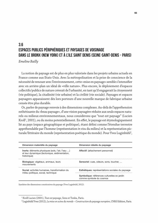
165
La notion de paysage est de plus en plus valorisée dans les projets urbains actuels en France comme aux Etats-Unis. Avec la métropolisation et la prise de conscience de la nécessité de renouer avec l’environnement, cette «mise en paysage» semble s’intensifier avec en arrière-plan un idéal de «ville nature». Plus encore, le déploiement d’espaces collectifs/publics de nature créerait de l’urbanité, en tant qu’il engagerait la citoyenneté (vie politique), la citadinité (vie urbaine) et la civilité (vie sociale). Paysages et espaces paysagers apparaissent dès lors porteurs d’une nouvelle marque de fabrique urbaine censée être plus durable.
Or, parler de paysage renvoie à des dimensions complexes. Au-delà de l’appréhension esthétisante du «beau paysage», d’une vision paysagère réduite aux seuls espaces natu-rels ou milieux environnementaux, nous considérons que “tout est paysage” (Lucien Kroll1, 2001), ou du moins potentiellement. En effet, le paysage est étymologiquement lié au pays (espace géographique et politique), étant défini comme l’étendue terrestre appréhendable par l’homme (représentation in visu du milieu) et la représentation pic-turale/littéraire du monde (représentation poétique du monde). Pour Yves Luginbühl2,
1 Kroll Lucien (2001), Tout est paysage, Sens et Tonka, Paris.2 Luginbühl Yves (2012), La mise en scène du monde – Construction du paysage européen, CNRS Edition, Paris.
3.6Espaces publics périphériques et paysages de voisinagedans le Bronx (New York) et à L’Ile Saint Denis (Seine-Saint-Denis - Paris)Emeline Bailly
Synthèse des dimensions constitutives du paysage (Yves Luginbühl, 2012).
Dimension materiélle du paysage Dimension idéelle du paysage
Inerte: éléments physiques (sols, l’air, l’eau …) et leur dynamique (tectonique, sédimentation, historique)
Affectif: (attachement personnel)
Biologique: végétaux, animaux, leurs mouvements
Sensoriel: vues, odeurs, sons, toucher, …
Social: activités humaines, transformation du milieu politique, social, technique
Esthétiques: représentations sociales du paysage
Symbolique: références culturelles ex jardin comme symbole du cosmos
166 Emeline Bailly
cette double dimension matérielle et idéelle du paysage se décline elle-même en mul-tiples dimensions, elles-mêmes en dynamiques permanentes.
Le paysage est aussi lié à l’expérience humaine in situ et à celle de projet (qualité, amé-nagement, gestion, protection paysagère) comme le rappelle la Convention Européenne du Paysage (2000). Ainsi, il est autant réel qu’idéel, créé que vécu. Il résulte ainsi autant des politiques urbaines, avec ses compositions urbaines et paysagères que des interpré-tations culturelles ou subjectives, pratiques des usagers, qu’elles soient individuelles ou collectives. Il est à la fois le milieu composé par les hommes, une matérialisation d’un projet sociétal, le lieu de projection de notre être. Ce qui est considéré comme paysage résulte d’une composition de significations, elles mêmes variables selon les individus, groupes humains ou sociétés et en évolution constante. Il exprime autant l’écoumène3, la relation des hommes à l’étendue terrestre (Augustin Berque, 1994) que l’effort des hommes pour habiter le monde (Jean Marc Besse, 2000)4. Autrement dit, appréhen-der le paysage nécessite de penser les relations entre les strates politiques, habitées et vernaculaires des paysages (Jackson John Brinckerhoff, 1984)5, mais aussi idéelles et projectuelles.
Le paysage est ainsi multidimensionnel, lié à de multiples expériences (in visu, in situ, idéelle, projet), et en évolution permanente. Il implique dès lors une pensée de la complexité et ce d’autant plus quand on considère le paysage urbain. Un site naturel, ur-banisé, marqué par une sédimentation historique, une vie sociale, culturelle, politique et économique singulière est en permanence interprété selon une lecture d’éléments multiples attachés aux lieux qui prennent sens les uns par rapport aux autres. Parler de paysage urbain implique en effet de considérer les dimensions idéelles et les interpréta-tions de l’espace urbain qui sont à la fois :
• Unactedereprésentation6 renvoyant autant à la manière de signifier par des formes, figures, images, signes (tel le langage) qu’aux significations associées à l’espace urbain lui-même (repères,…).
3 Berque Augustin (sous la direction) (1994), Cinq propositions pour une théorie du paysage, Champ Vallon, Seyssel.4 Besse J. M., 2000, Le goût du monde, exercices de paysage, Arles : Actes Sud ENSP/Centre du paysage.5 Brinckerhoff Jackson John (1984), A la découverte du paysage vernaculaire, réed. Acte Sud, Paris.6 Etym lat.repraesentatio, -onis « action de mettre sous les yeux » d’où « image » / v. représenter (replacer
devant les yeux, re rendre présent). La notion de représentation, selon le Littré, comprend à la fois l’action de représenter un phénomène, une idée au moyen d’une figure, d’un symbole, d’une image artistique, de signes mais aussi les images, figures, symboles de cette pensée représentée. Elle renvoie autant à l’acte de signifier qu’aux significations.

167Espaces publics périphériques et paysages de voisinage…
• Unactedeperception7, renvoyant, selon les sciences cognitives, à la prise de connaissance du réel par les sens biologiques et physiques, les sensations et émo-tions suscitées par des images mentales correspondantes, des interprétations phy-siques, psychologiques et culturelles. Pour la philosophie, il traduit une intelligence globale8, un mode de représentation immédiat du réel changeant à chaque instant.
• Uneexpérience9 vécue, soit l’acte d’éprouver, de développer une connaissance des lieux par leur pratique et par une confrontation plus ou moins longue de soi avec un environnement.
• Unprojetexprimantundessein,ceversquoil’hommetendavecunepartd’incerti-tude, mais aussi l’intention de faire, l’estimation des moyens nécessaires à sa réali-sation, sa mise en action.
C’est cette multiple appréhension de l’espace urbain qui se joue dans la fabrication d’un paysage urbain. Nous faisons l’hypothèse que l’appréciation du paysage, en tant que relation distanciée à un environnement, à une possibilité de s’y projeter est avant tout liée à la perception sensible, et ce en référence à Merleau Ponty10 qui y voit le premier socle de la constitution des analyses de la conscience, en tant qu’ouverture primordiale au monde vécu (au Lebenswelt). En ce sens, le paysage peut être support de commun, en tant que capacité de tout à chacun de percevoir le monde à un moment donné. Dès lors, peut-on envisager des politiques urbaines partagées avec les habitants à même de concevoir ce paysage commun? A travers l’analyse des représentations du paysage en France et aux Etats-Unis, puis des politiques urbaines menées dans deux quartiers périphériques de New York (Melrose – South Bronx) et Paris (Ile St Denis – Plaine Commune)11, nous proposons de questionner les politiques paysagères à l’œuvre en les mettant en regard avec ce qui constitue le paysage urbain pour les habitants de ces quartiers. Or, parmi les éléments valorisés par les riverains, comme nous le montrerons, les open spaces ou
7 Etym lat. perceptio « action de saisir par l’esprit, connaissance », de percipere, se saisir de, recueillir, litté-ralement, prendre à travers.
8 C’est-à-dire qui intègre la pensée, le niveau de connaissance, l’expérience empirique, les croyances, le raisonnement, la mémoire, la culture, les émotions,...
9 Etym lat. class. experientia: essai, épreuve, tentative.10 Merleau-Ponty Maurice (1945), Phénoménologie de la perception, Paris: Rééd. Gallimard.11 Bailly E. (coord.), Rosemary Wakeman, Hervé Duret, Vincent Prié, L’enjeu du paysage commun, program-
me de recherche Paysage et Développement Durable – MEDDE CGDD (en cours).
168 Emeline Bailly
espaces ouverts12 semblent jouer un rôle particulier dans la fabrication du sens urbain et paysager. Autrement dit, ces questionnements nous amèneront à interroger l’adéqua-tion entre les conceptions du paysage par les politiques publiques et celles des riverains, mais surtout d’évaluer le rôle des espaces ouverts dans la fabrication du sens paysager ?
Des pensées urbaines du paysage liées à leur contexte culturelLa mise en regard de deux contextes de politiques paysagères révèle le caractère émi-
nemment culturel du paysage. Fondée sur la conquête des espaces, le défrichage d’une terre inhospitalière, la ville américaine veut inventer un Nouveau Monde, ouvert sur la campagne, sur l’immensité du territoire (Catherine Maumi, 2009)13. En référence au mythe de la Pastorale du jardin du monde, la volonté est de transformer le land en lands-cape, l’œuvre de Dieu en paysage humain. La petite ville permet par ailleurs de créer une nouvelle civilisation basée sur les vertus considérées originelles de l’humanité: la nature et le droit à la propriété. Le common, cet espace partagé par la communauté, devient le morceau de nature lié à la ville, où chacun peut vivre avec lui-même, autrui et Dieu. Cet idéal de fusion de la ville et de la campagne va fonder la pensée urbaine américaine. Les premières villes sont projetées sans limites, pouvant s’étendre dans la nature. New York a été conçu avec un plan en damier à mème se développer à l’infini. Plus tard, le plan de développement de la ville First Park Act de 1876 ambitionne de transformer New York en grand parc urbain et prévoit la réalisation de grands espaces verts, en particulier Central Park. La ville nature, avec son idéal des suburbs et de la maison dans la nature se consolidera plus encore au XIXème siècle en opposition à la ville industrielle et tenta-culaire européenne.
Comme le rappelle Catherine Maumi, les paysagistes seront en conséquence les pro-fessionnels privilégiés pour aménager les villes. Andrew Downing (1815-1852), paysa-giste influent, considère ainsi la «nature citadine» non pas comme une terre agricole, ni comme la vraie nature, mais comme «l’art du paysage». Pour lui, l’art complète ce que la nature ne peut achever. L’architecte Frank Lloyd Wright dans son projet utopique de
12 Le mot «open space», littéralement «espace ouvert», est de plus en plus utilisé dans les discours sur la ville. L’open space décrit les espaces collectifs des ensembles immobiliers privés, soit les cours (courts ou yard) ou-vertes à l’usage des résidents mais aussi du voisinage. Il traduit un usage plus collectif que le courtyard. Après s’être substitué au terme de courtyard aux Etats Unis, son sens s’est généralisé. Par extension, il désigne aussi les parcs urbains publics et tous les espaces vides de la ville, favorisant une multiplicité d’interprétations.
13 Maumi Catherine (2009), Usonia ou le mythe de la ville nature américaine, édition de la Villette, collection Penser l’espace, Paris.
169Espaces publics périphériques et paysages de voisinage…
Broadacre City propose de développer une ville à l’infini intégrée à la nature. La dilution de la ville permet aux citoyens de retrouver leur indépendance et leur autonomie en harmonie avec le paysage naturel. Dans les années 1920 et 1930, les urbanistes améri-cains ont privilégié les cités-jardins importées de Letchworth et de Ebenezer Howard et Raymond Unwin en Angleterre. Clarence Stein, Clarence Perry et Lewis Mumford ont ainsi adapté la notion de cité-jardin au contexte américain dans une vision régionale de petites cités dans la nature autour d’une métropole-jardin, New York. Le common est conforté comme espace public vert au centre de la cité, le lieu des fêtes, rencontres politiques et sociales, etc. Les cités-jardins construites dans la banlieue new yorkaise telles Sunnyside Gardens et Radburn de même que le développement original du Bronx autour de villages-jardins et de grands parcs sont les exemples significatifs de ces no-tions de paysage et d’espaces publics de nature. A la fin du XXème siècle, le mouvement du New Urbanism se développe à nouveau autour de cette idée de petite ville compacte dans la campagne, comme solution aux problèmes sociaux des métropoles. Le mythe pastoral perdure dans la pensée des paysagistes américains et par extension celle de l’environnement et du développement durable.
En France, le paysage est issu de plusieurs visions qui tendent à se superposer. A côté des représentations artistiques de la nature, les découvertes scientifiques favorisent l’essor de l’agronomie et de l’art des jardins à l’interface de l’art et de la science. Peintures, littératures et jardins à la française conduisent à l’édification de codes esthétiques du pay-sage, comme représentation du monde habité. Le paysage devient parallèlement projet politique selon des idéaux sociaux, spatiaux et culturels. Palais et monuments s’ornent de parcs, jardins, allées plantées. Ces derniers sont autant d’inventions humaines du pay-sage, un «aspect de la surface de la Terre» comme le définit Jean-Robert Pitte (1983)14. Cette mise en scène est empreinte de desseins artistique, scientifique et politique qui trouveront leurs traductions dans les propositions d’embellissement du paysage urbain et d’aménagement des espaces publics. A Paris, le premier plan d’embellissement de 1769 signé du Roi sera suivi en 1794 par le plan de rénovation de Paris, dit «plan des Artistes». Le dernier propose de tracer de grands axes mettant en décor la ville du pouvoir telle la rue de Rivoli, le long des jardins des Tuileries. Au XIXème siècle, la nouvelle ambition marchande, rationnelle et industrielle se traduit à nouveau par une ambition de maîtrise et d’ordonnancement des espaces urbains. Le baron Haussmann (1809-1891) entreprit la planification de Paris avec une volonté d’en traduire l’unité et la grandeur par de nou-velles perspectives urbaines, notamment les percées reliant monuments et grands es-
14 Pitte Jean Robert (1983), Histoire du paysage français, de la préhistoire à nos jours, réed. 2003, Tallandier, Paris.
170 Emeline Bailly
paces publics tels la place des Champs Elysées ou le parc des Buttes-Chaumont. Le végétal s’insère comme évocation de la nature maîtrisée. Les avenues et boulevards ont des terre-pleins centraux ou latéraux plantés. Une multiplicité de squares est créée non seulement comme élément d’embellissement et d’harmonie, mais aussi comme lieu de promenade, de loisirs. Une série de dispositifs hygiénistes de maîtrise de l’eau, la lumière, etc., sont développés. La ville haussmannienne est un projet de paysage urbain esthétique, hygié-niste, social… contrôlé par la puissance publique. Contrairement aux Etats-Unis, le pay-sage urbain est conçu par les pouvoirs publics et non un environnement naturel, ouvert à la liberté d’édification privée. Ce seront d’ailleurs les architectes et urbanistes qui seront en charge de la construction des villes et de leur «mise en paysage» urbain dont la nature constitue principalement un élément esthétique et d’usage.
Après la Seconde Guerre mondiale, les politiques de paysage émergent en France à tra-vers des projets de conservation et la mise en place d’une législation de protection des sites naturels parallèlement à celle de préservation des monuments historiques. Elles concernent avant tout les territoires ruraux qu’il s’agit de «protéger» de l’urbanisation. Elles ont pris récemment une dimension nouvelle avec la loi de mise en valeur des pay-sages de 1993 (Pierre Donadieu, Michel Périgord, 2007)15 qui oblige à intégrer la dimen-sion paysage aux constructeurs et de concevoir des chartes paysagères aux collectivités, y compris dans l’espace urbain. La convention européenne du paysage a enfin introduit l’idée d’une qualité paysagère de tous les lieux et non plus seulement une logique de préservation des espaces ruraux. Le paysage est alors défini comme le cadre de vie des populations, expressions des patrimoines et de l’identité locale. Le MEDDAT la décline comme un élément de la qualité de vie des populations, du bien-être individuel et social.
La question du paysage urbain est donc ancienne et toujours associée à la question de la nature en ville. A présent, le retour du discours sur le paysage urbain tant en France qu’aux Etats-Unis se manifeste en particulier par une attention à l’identité et la mise en scène des espaces extérieurs. Ainsi, en France le paysage est reconnu juridiquement en tant que «composante essentielle du cadre de vie des populations, expression de la diversité de leur patrimoine commun culturel et naturel, et fondement de leur iden-tité» (MEDDE, site internet). Aux Etats-Unis, on observe également un regain d’intérêt des politiques de développement des quartiers périphériques pour les espaces publics comme landscape (paysage), notamment autour de la notion de streetscape (paysage de rue). Il y a donc ainsi un glissement de la considération des espaces publics ou collectifs vers la notion de paysage urbain, notamment depuis l’essor du développement durable.
15 Donadieu Pierre et Périgord Michel (2007), Le paysage, entre nature et cultures, Armand Colin.
171Espaces publics périphériques et paysages de voisinage…
Des paysages urbains périphériques dits sans qualité à New York et à Paris La mise en perspective de deux quartiers périphériques en mutation de Paris et New
York dans le cadre de la recherche L’enjeu du paysage commun pour le programme Pay-sage et Développement Durable 2 du MEDDE, a permis d’interroger l’évolution et la conception du paysage urbain dans des territoires souvent dépeints comme banaux, sans qualité.
A New York, le quartier de Melrose a la particularité d’être situé sur une colline. Il présente des configurations urbaines et bâties variant suivant la topographie du site. Il est aussi marqué par de multiples coupures urbaines (voies ferrées, voiries), mais aussi le délaissement de ce territoire (parcelles vacantes ou à l’abandon, grillagées, canaux abandonnés, etc.). Ce quartier populaire est stigmatisé socialement, et ce d’autant plus que Melrose fut au cœur de la dépression du Bronx. Il est par ailleurs considéré sans qua-lité urbaine, n’ayant pas de paysages ou d’espaces publics identifiables selon les modèles urbains de la ville compacte new yorkaise. Alors que ces espaces urbains populaires sym-bolisent la précarité et la marginalisation physique et sociale, ils traduisent surtout des logiques d’occupation et de dynamiques urbaines différentes. Melrose connait actuelle-ment des transformations majeures liées à des projets de développements résidentiels portés par la ville de New York, notamment dans le secteur de renouvellement urbain Melrose Commons (URA)16. Dans ce cadre, est prévu un ensemble d’espaces naturels composés de jardins communautaires, de chemins piétonniers, d’alignements d’arbres et de zones paysagères. Ces projets interrogent à nouveau la qualité du paysage et des lieux perçus de ce quartier, introduisant des modèles urbains de la ville centre au détri-ment de ses singularités.
A Paris, L’Ile-Saint-Denis et ses deux rives bénéficient également d’une situation naturelle particulière (insularité, confluence Seine/Canal de Saint-Denis). Avec 7000 habitants, L’Ile-Saint-Denis s’étend sur 8 km de long et sur 200 m de large, dans un méandre de la Seine à quelques kilomètres du périphérique nord. Son caractère insulaire lui confère une identité particulière distincte de St Denis. Celle-ci s’exprime autant dans la géographie que dans la configuration de séquences et univers urbains juxtaposés. L’île et ses rives symbolisent à la fois des paysages arborés des bords de Seine, des quar-tiers de maisons populaires, des cités des années 1960-70 dont certaines apparaissent
16 Initié en 1994, ce projet porte sur le développement de 34 ilots. Environ 582 logements et 7000 m2 d’espaces commerciaux ont été créés et environ 726 logements et 7000 m2 d’espaces commerciaux sont actuellement en construction. Le nombre total de logements devrait s’élever à 1789, ce qui correspond à la construction totale de la zone.
172 Emeline Bailly
stigmatisées (cité du Bocage, cité Marcel Paul), mais aussi des espaces en reconversion (friches industrielles, entrepôts). Ainsi, à côté d’une image d’Epinal sciemment culti-vée d’écrin de verdure (les berges de Seine avec ses péniches), ce territoire présente des caractéristiques moins bucoliques: un quartier sud isolé, voire relégué, un centre-ville organisé autour d’un axe de transit, une zone d’entrepôts en friches s’étendant de part et d’autre d’un pont autoroutier, véritable coupure urbaine. L’Ile-Saint-Denis et ses rives sont aujourd’hui au centre d’un territoire dense en pleine mutation sociale et urbaine (Plaine Commune). Elles présentent une transformation urbaine de grande envergure avec deux projets d’écoquartiers, de transports en commun (gare de RER, tramway), de zones commerciales… Rien que l’écoquartier fluvial sur la zone d’entrepôts de L’Ile-Saint-Denis représente 1000 logements sur environ 25 ha, soit 30% de ménages supplémentaires. Si les projets de requalification initiés doivent permettre la revalori-sation d’une grande partie de l’île, il suscitent cependant de fortes inquiétudes parmi les populations, car ils portent des risques de banalisation d’un paysage aujourd’hui considéré singulier, voire une relégation-exclusion de quartiers modestes par contraste avec la gentrification qu’ils pourraient générer. La mise en perspective des conceptions du paysage dans les discours des politiques publiques et les projets urbains à l’œuvre avec ce qui constitue le paysage pour ceux qui y vivent, vise à explorer les fondements du paysage urbain et plus particulièrement du paysage de voisinage, du paysage commun dans ces deux quartiers périphériques.
Nature, paysages et espaces collectifs comme enjeu de développement durable L’analyse des discours et projets urbains initiés à Melrose et à l’Ile St Denis montre
une mobilisation de la nature comme traduction des enjeux de développement durable affiché dans les politiques publiques (Agenda 21, Haute Qualité Environnementale (HQE), Leadership in Energy & Environmental Design (Leed), etc.). La nature est alors associée aux évolutions paysagères et aux espaces publics qui apparaissent symbolisés, à leur tour, dans la ville dite durable ou sustainable.
La nature, comme ressource environnementale La nature est d’abord mobilisée comme une ressource, pour ne pas dire une richesse
environnementale, qu’il s’agit de ménager (paysages remarquables) ou de requalifier (qui serait lié à leur destruction par l’urbanisation ou par les pollutions). Ainsi, à L’Ile St Denis, la valorisation des abords de la Seine, des trames vertes et bleues du fleuve et ses rives sont mises en avant. Elle vise la protection de l’environnement et de la biodiversité, mais aussi la création d’espaces de nature ouverte aux usages publics. Elle ambitionne
173Espaces publics périphériques et paysages de voisinage…
de faire pénétrer la nature en ville, de «renaturaliser» l’espace urbain, en s’opposant à l’urbanisation destructrice de la nature et de ses paysages dits remarquables.
A New York, la représentation est moins duale, la vision de la nature par les politiques publiques ou les promoteurs étant une nature habitée, à l’image de la maison dans la campagne qui a fondé l’idéal urbain americain. Par exemple, la skyline depuis les points hauts de Melrose (colline ou immeubles en hauteur) est mentionnée. A l’inverse, la ville pouvant être polluante (pollution atmosphérique, canal abandonné aux eaux usés, etc.), la question de sa gestion est posée. Plus encore, celle de la résorption des espaces abandonnés semble être source de préoccupations pour les politiques publiques. Suite aux émeutes et incendies des années 1970, de nombreux espaces sont restés vacants à Melrose et l’enjeu des politiques urbaines est la reconquête de ce foncier souvent pro-priété de la ville de New York. De fait, dans les deux contextes, cette nature est un enjeu de valorisation foncière et immobilière largement plébiscité dans les futurs quartiers construits (quartier Confluence, éco quartier fluvial à Plaine Commune, Via Verde dans le Bronx). La présence de nature serait attractive, permettant d’attirer des populations nouvelles et d’assurer les ventes de logements en préservant une gamme de prix inté-ressante pour les promoteurs.
La nature promue dans les projets urbains étudiés apparaît par ailleurs le plus sou-vent aménagée dans une perspective environnementale et maîtrisée dans sa conception par la puissance publique. La nature sauvage est même présentée comme une nuisance (saleté, espace délaissé, lieux des infrastructures).
Aménagée selon des principes environnementaux (noues, étanchéité, bassin d’infil-tration des eaux de voirie, biodiversité, etc.), les espaces naturels deviendraient source de «bien-être» et à même de remplir le contrat intergénérationnel avec les générations futures que prône le développement durable. En ce sens, la moindre parcelle de nature est associée à une fonction environnementale. Par exemple, dans l’écoquartier fluvial, les caniveaux deviennent des noues végétalisées. Les berges de la Seine sont conçues en référence aux talus réaménagés quai de Loire à Nantes. Ces talus permettent un déve-loppement d’une végétation naturelle, dont la fauche régulière limite l’envahissement des ligneux pour «favoriser un paysage maîtrisé et relativement «homogène»17.
Cette maîtrise est également recherchée en matière de gestion. Avec la gestion diffé-renciée, par exemple, c’est le savant mélange d’essences plantées et vivaces, l’alliance de laisser-faire et d’entretien jardinier qui est recherché. La nature malgré son apparence «naturelle», sauvage, reste largement maîtrisée.
17 Cf. Schéma directeur d’aménagement des berges de l’éco quartier Fluvial – Plaine Commune - 2012.
174 Emeline Bailly
Plus ponctuellement, la nature est aussi vue comme un matériau de recyclage. Par exemple, la récupération des terres, mais aussi des matériaux de déconstructions d’entrepôts par le collectif Bellastock sur l’Ile St Denis vise notamment à recomposer et paysager un espace ouvert le temps du chantier de l’écoquartier. Cette approche nuance la critique de l’urbanisation passée en y voyant une ressource de «paysagement» transitoire, c’est-à-dire de mise en espace, avant l’édification du nouveau quartier. En s’inscrivant dans les temporalités intermédiaires du chantier, cette action propose une acception du développement durable plus évolutive, revendiquant le caractère non figé des constructions bâties, leur réemploi favorisant une dynamique d’évolution urbaine permanente. Dans tous les cas, cette vision de la nature aménagée entre en contradic-tion avec la perception des habitants interrogés sur ces deux quartiers, qui valorise une nature libre, en marge des sites urbanisés, à même de créer des expériences différen-ciées de la ville. Les résidents prônent une nature spontanée, sauvage, permettant des usages libres, des havres de paix où s’isoler, se retrouver, contempler leurs paysages de voisinage. Ils apparaissent comme une possibilité d’un rapport distancié au monde, comme une possibilité de s’y projeter et d’y participer, loin de la nature aménagée pour l’environnement ou pour des usages donnés.
La mise en paysage, emblème de la ville durableL’ambition de «ville nature durable» portée par les politiques urbaines est très souvent
associée au terme de paysage/landscape et à la pratique du paysagisme. Elle se traduit par un déploiement de la nature dans l’espace urbain qui s’immisce sur les construc-tions, les façades, les toits, les espaces publics et collectifs censés donner à voir cet idéal de ville respectueuse de l’environnement. Cette végétation apparaît plus largement in-vestie dans l’espace public à l’Ile St Denis/St Denis qu’à Melrose, où elle est surtout mise en valeur dans les cœurs d’îlots ou dans les passages résidentiels de proximité.
Cette mise en scène entre espaces naturels et construits vise à aménager des paysages urbains porteurs d’images, d’ «impressions» de nature et se pose en rupture avec l’idée d’une urbanisation destructrice des sites naturels et de leurs paysages… Le paysage appa-raît ainsi comme une réponse à l’incapacité de l’aménagement urbain à gérer la complexi-té de l’environnement urbain élargi notamment ses dimensions sociétales ou idéelles.
A Melrose, comme dans les aménagements récents de New York, des streetscape guide-lines (paysages de rue) sont définis en vue de changer l’image des lieux. Ces plans-guides tentent de lier dimensions physiques et sociales, statuts privés et publics, façades et es-paces collectifs. Ils prennent en compte l’espace urbain dans une perspective plus glo-bale, considérant même l’atmosphère des lieux, la «streetlife». Ces projets semblent ainsi s’ériger contre l’uniformisation urbaine et la standardisation de l’imaginaire dénoncée,
175Espaces publics périphériques et paysages de voisinage…
entre autres, par Serge Latouche (2000)18. Autrement dit, elle permettrait de revenir à une pluralité de mondes, d’univers, d’imaginaires urbains. Pour autant, souvent centrée sur une seule évolution spatiale, on s’interroge sur sa capacité à produire des représentations et expériences urbaines différenciées. Bien au contraire, cette reconquête urbaine par le paysage semble avant tout viser une transformation uniforme de l’image urbaine au nom du paysage.
En effet, la naturalisation comme la mise en paysage de l’espace urbain traduit une re-cherche d’attractivité. Par exemple, le développement commercial recherché, déjà très pré-gnant dans les politiques urbaines américaines, favorise la reproduction d’univers connus. Il conduit à façonner de nouvelles rues en référence aux Main Streets «traditionnelles» avec ses petites boutiques aux façades distinctes, ornementées d’enseignes à l’ancienne, bor-dées de larges trottoirs arborés. Il est censé se référer à un imaginaire partagé, lié au passé, favoriser la reconnaissance, l’adhésion, la fréquentation. Il se référ aux modèles des petites villes américaines conçues dans la nature en opposition à la ville industrielle tentaculaire. Il conduit dès lors à reconstituer ces univers au nom de l’attractivité.
On pourrait dire de même de l’habillage vert des nouveaux quartiers d’habitations projetés, qui vise l’attrait d’une vie urbaine plus écologique, plus durable. Cette re-cherche d’attractivité ne suffit pas à masquer les enjeux de marketing urbain, le paysage étant réduit à la notion d’image. Elle favorise plus l’uniformité qu’une pluralité d’uni-vers urbains, pourtant valorisés par les résidents.
Ainsi, la mobilisation de nature, mais aussi d’autres éléments porteurs d’imaginaires (les commerces, la Main Street, les politiques environnementales, etc., comme en France l’idéal de la place du village), vise à recomposer l’image de l’espace urbain. Ce sont moins des paysages que des décors, facilement reconnaissables, qui sont conçus. D’ailleurs, le vocabulaire professionnel est associé aux termes de «scène», «décor», «scenery» et d’«esthétique/esthetic». Le paysage est un site (setting) composé de volumes (mass) et d’espaces végétalisés. Il construit la partie visible et externe de l’aménagement pro-jeté. Comme l’énonce Christine Boyer (1992)19, la ville devient fiction et simulation, un «tableau vivant», un monde du spectacle, qui fait le lien entre le passé et un présent /futur idéalisé.
Pour autant, la profession de paysagiste ou de landscape designer s’envisage comme une nouvelle conception abstraite et symbolique de l’espace urbain, associée à une re-
18 Latouche Serge (2000), La Planète uniforme, Climat, Paris.19 Boyer Christine (1992), “Cities for sale”, in Sorkin Mickael, Variations on a theme park, the new american
city and the end of public space, Hill&Wang, New York.
176 Emeline Bailly
présentation esthétique, une culture, mais aussi aux identités projetées d’un territoire, et par extension à des représentations sociales et politiques enjeux de marketing. Elle s’associe à une pratique d’aménagement susceptible d’artialiser le monde. Aux Etats-Unis, les urbanistes associent plus encore la composition paysagère en référence à la notion de placemaking20. L’idée est que l’agencement spatial de l’environnement peut conduire à lui donner du sens (sense of place) et une identité (community identity). Ce-pendant, comme le rappelle Rosemary Wakeman, la notion de «placemaking» n’est pas seulement spatiale ou esthétique. Pour Kevin Lynch21, elle repose sur les usages et des expériences urbaines variées et complexes (sociale, mémorielle, sensorielle, etc.). Elle se construit dans le temps selon l’histoire et les pratiques des lieux.
En outre, la pratique paysagère tend à se centrer sur des enjeux spatiaux et de mar-ketings territoriaux selon des référents culturels dominant dans les représentations professionnelles. Par exemple, les codes de beauté classique liés à un espace maîtrisé par l’homme, telle la campagne riante, ont évolué vers des visions pittoresques d’une nature nostalgique ou encore vers du sublime magnifiant le rapport humain aux forces de la nature (Alain Corbin, 2001)22. Aujourd’hui, l’esthétique spatiale et paysagère liée à la recherche d’attractivité et à l’idée d’une ville respectueuse de l’environnement conduit à privilégier une conception urbaine fondée sur une mise en nature et des aménagements types formant autant d’archétypes urbains partagés sans pour autant s’interroger sur les expériences individuelles sensibles ou subjectives des lieux, à même de leur conférer leur identité, leur paysage de voisinage.
La recherche de paysage des projets semble traduire une conception de «liberté maî-trisée», où les hommes comme les espaces urbains seraient susceptibles d’évoluer dans ce nouveau décor paré d’attraits pour les concepteurs tout en restant sous le contrôle de la puissance publique et des représentations professionnelles d’un archétype de «ville nature durable». La mise en paysage se traduit dès lors par des enjeux hétérogènes, alliant ambitions d’attractivité, de renouvellement de l’image de ces quartiers et objec-tifs de qualité urbaine, pour ne pas dire de maîtrise urbaine censée produire du «bien-être». On est loin de ce qui fonde la notion de paysage dans sa complexité perçue, vécue, éprouvée, imaginée par chacun.
20 Le terme de «placemaking» commence à être utilisé dans les années 1970 par des architectes et urbani-stes pour décrire les processus de conception, de création et d’appropriation de places, parcs, rues, fronts de mer ou quais, qui attirent les gens parce que ces lieux sont agréables ou intéressants.
21 Lynch Kevin (1969), L’image de la cité, Rééd. Dunod, Vottem.22 Corbin Alain (2001), L’homme dans le paysage, ed. Textuel, Paris.
177Espaces publics périphériques et paysages de voisinage…
Des espaces publics de nature comme renouveau des espaces publicsDans les deux métropoles étudiées, les projets urbains posent l’articulation es-
paces-paysages comme l’armature de la ville durable. Les espaces de nature, emblème du paysage de cette ville durable, sont non seulement aménagés selon des principes environnementaux, mais aussi selon des fonctions déterminées (usages récréatifs, ludiques, promenades, etc.). Ces vocations leurs conféreraient leur «qualité» d’espaces publics à même de susciter une sociabilité que les espaces publics hérités ne seraient plus à même de générer. En effet, en France, les discours sur la fin des espaces pu-blics, plus encore dans les espaces périphériques, sont légion. Ils sont associés à l’idée d’une perte politique, d’un cadre spatial de la vie collective, de valeurs de civilités et d’urbanité, de bienveillance à autrui (Delbaere, 2011). De même, aux Etats Unis, les débats sur le « placemaking» réduit à sa dimension spatiale favorisent la dilution entre les termes de paysage et d’espace public. De fait, les termes d’espaces urbains (urban spaces) et parcs (parks) y sont indifféremment utilisés pour désigner les lieux publics, et non seulement les espaces verts. Park, emprunté du vieil anglais, qui désignait une réserve naturelle fermée, un espace de chasse, est même défini à présent comme un espace attaché à des usages : parking, camp militaire (military park), espace commer-cial (commercial park), etc. L’espace semble avoir perdu de sa substance et n’exister qu’en relation à une pratique sans pour autant poser la question de l’espace public qui est autrement plus complexe.
En effet, selon la définition du dictionnaire Émile Littré, les rues et places sont un vide bordé d’habitations et de bâtiments. Les espaces apparaissent publics dès lors qu’ils sont un vide interprétable et accessible à tous, qualifiés par des édifices et activités pu-blics ou privés. Ceux-ci impliquent d’être autant façonnés par des actes urbains publics que qualifiés par des initiatives de ceux qui y vivent (décor des façades, fleurissements, pratiques des lieux, etc.). C’est plutôt dans cette complexité de composition de l’espace qu’ils pourraient être support d’identité, d’appropriation individuelle et collective, qu’ils pourraient générer du public, de l’urbanité.
Plus encore, l’approche du paysage des projets urbains de l’Ile St Denis et de Melrose tend à se réduire à des espaces de nature, qui seraient à même de susciter des sociabi-lités urbaines plus harmonieuses. Ceux-ci symboliseraient une nécessité de nouvelles formes d’espaces collectifs/publics protégés, mais aussi appropriables, habitables, dans un contexte de métropolisation, de problématiques environnementales, mais aussi de tensions sociales. Nous sommes, dans le Bronx et à St Denis, dans des territoires mar-qués par des émeutes, conflits et problèmes d’insécurité.
Cette vision idéal-type de la nature pacifiant les rapports sociaux est en partie héri-tée. Le jardin par exemple, dans son étymologie indo-européenne (ghorto) ou anglaise
178 Emeline Bailly
(gardinus) signifie enclos, clôturé. Il exprime l’espace protégé, la domestication de la nature sauvage, dangereuse et inhospitalière. Encore aujourd’hui, les parcs naturels ou écologiques organisent une nature sauvage pour protéger des formes de vie collectives dans la nature. Cette vision est aussi une interprétation «rousseauiste», où l’homme s’épanouirait dans la nature, et par extension celle-ci favoriserait, des formes de vie collective «harmonieuse», si ce n’est pas «naturelle».
Or, cette vision d’une nature pacificatrice est loin d’être simple. La capacité à faire espace public et générer du paysage des parcs, jardins et autres trames vertes proje-tés, ne va pas de soi. Souvent surdimensionnés (grands parcs, esplanades minérales ponctuellement végétalisées, trames vertes, etc.) ou limités à des espaces d’agréments, ils semblent avant tout conçus comme des stratégies de verdissement ou de biodiver-sité, sans s’interroger sur la manière dont ils vont être appropriés, support de sens et d’aménités pour ceux qui les fréquentent. Les espaces privés ouverts sont même parfois l’enjeu de fermeture spatiale, notamment avec la résidentialisation. La critique d’une vie de voisinage envahissante, du contrôle social d’autrui, des problèmes de sécurité, de gestion, etc., conforte cette tendance à la fermeture spatiale. Ces logiques tendent à engendrer, une multiplication d’espaces privés d’agréments. Il y a donc lieu de s’interro-ger sur la qualité des espaces produits et en quoi ils constituent un enjeu d’urbanité et par extension de paysage commun.
Il faut noter toutefois que parallèlement à ces projets, sans parler de ceux qui oc-cupent des espaces vides pour des habitations d’urgence (squats, campements), à L’Ile-St-Denis/St Denis comme à Melrose, les espaces vacants (naturels ou construits) sont réappropriés par des habitants, artistes ou associations pour créer de nouveaux espaces d’usages (6 B, la Briche, promenades, etc.). Ces réappropriations expriment le besoin d’espaces collectifs autres que ceux hérités ou récemment aménagés.
Ces porteurs d’initiatives s’érigent d’ailleurs souvent contre les visions profession-nelles de leur environnement, au motif qu’ils nieraient leur connaissance vécue des lieux et leurs représentations des paysages. Ils utilisent d’ailleurs une autre terminologie que les professionnels. Ils préfèrent les termes de rue, trottoir, parc, open space… à ceux de paysage, d’espace public, de placemaking, de «place». Les projets sont même perçus comme une menace, en particulier en phase de densification résidentielle, pour ne pas dire de gentrification. En ce sens, ces conceptions entrent en tension et deviennent un sujet éminemment politique.
Par ailleurs, l’analyse des enquêtes auprès des habitants conduite à L’Ile-Saint-Denis et à Melrose, révèle un souci particulier pour les espaces intermédiaires, les espaces d’entre-deux qui apparaissent comme autant d’espaces d’altérité qui permette de créer un horizon, d’habitation, à l’infini du monde. C’est ce que synthétise avec acuité Peter
179Espaces publics périphériques et paysages de voisinage…
Handke23, dans Mon année dans la baie de Personne: «Les maisons produisent ensemble des espaces intermédiaires si variés que les choses qu’elles contiennent, les buissons, les cordes à linge, les bancs, et tout au fond la forêt, ou simplement l’interstice vide en lui-même, m’accompagnent dans mon passage, marchent, roulent, chevauchent, défilent avec moi. Les intervalles offerts au regard, ou ces signes d’approcher encore et encore, dans la gaîté de leur rythme, forment, même si ce n’est souvent qu’une fente, des cours entre les maisons (…) Grâce à ces espaces intermédiaires, l’image devient à chaque pas plus nette, comme un rideau qui s’ouvre, (…) jusqu’au dernier arrière-plan, tandis que s’éclairent l’un après l’autre des éléments de toutes les autres maisons, enchevêtrés dans la profondeur, une fenêtre ici, un fronton, un jardin un peu plus loin, une véranda là au coin de la rue, un escalier extérieur abrupt qui monte jusqu’à une mansarde – chacun de ces éléments particuliers faisant manifestement partie d’une habitation humaine, et l’ensemble constituant un habitat élémentaire, et ce n’est pas un plan, mais à l’échelle 1/1, non pas un rêve pour plus tard, mais bien réel». Or, ces espaces intermédiaires tendent aujourd’hui à disparaître, étant fermés spatialement, voire bâtis pour répondre aux enjeux de densification du développement durable.
Espaces ouverts et fabrication du sens paysagerSi pour les habitants, les lieux en marges, peu aménagés d’une part et les espaces inter-
médiaires jouent un rôle pour interpréter le paysage et vivre des expériences différentes de la ville et de sa relation à autrui, il y a lieu de s’interroger sur leur rôle dans la fabrica-tion du paysage, et leur prise en compte dans les politiques publiques. Ils semblent en effet à même de favoriser la composition de paysage, par une relation sensible à distance de la vie quotidienne, mais aussi les multiples détails que chacun dépose dans l’espace urbain. Ceux-ci deviennent autant de significations pour ceux qui fréquentent ces lieux. Ils forment, pour reprendre la formule de Peter Handke, une conscience de l’«habitation humaine». Le réinvestissement des espaces ouverts par des pratiques plus libres, indi-viduelles comme collectives, échappant aux représentations sociales de l’espace urbain constitué, partecipe à l’évolution des paysages urbains aux-mèmes. Ces formes d’espaces ouverts en marges ou intermédiaires, semblent ainsi porteuses de significations et constituent autant d’éléments d’articulation utiles à la composition paysagère que cha-cun peut établir dans sa relation à son environnement, à son sentiment de paysage.
Dès lors, il nous semble que les espaces ouverts devraient être l’enjeu d’une attention
23 Handke Peter (reéd. 2000), Mon année dans la baie de Personne, Gallimard, Paris.
180 Emeline Bailly
particulière dans la conception des paysages urbains et des espaces publics. L’une des spécificités de New York est d’avoir envisagé l’aménagement de lieux collectifs privés que les pouvoirs publics ne planifient pas, les open spaces. Ils tirent parti des promo-teurs pour offrir des nouveaux lieux collectifs. Ces lieux ouverts entremêlent statuts et usages publics / privés. Ils ont une vocation collective, étant censés être accessibles et utilisables par toutes les personnes propriétaires ou vivant dans le voisinage d’un ensemble résidentiel ou de bureaux privés. Ils sont différents des servitudes de passage françaises, qui obligent un propriétaire à rendre accessible un passage de sa parcelle. Dans la réglementation américaine des open spaces, il n’y a en effet aucune sur fonction prédéterminée.
Toutefois, ces open spaces ne sont pas pensés comme des lieux d’expériences urbaines différentes, d’engagements individuels ou collectifs plus libres, à même de charger les lieux de sens, de permettre une profondeur de champ, des perspectives sur l’horizon. Malgré l’intérêt qu’il pourrait présenter, ils sont d’ailleurs l’objet de vives critiques. Ils se sont développés au moment des opérations résidentielles modernistes sur plusieurs îlots, dits superblocks, comme Stuyvesant Town à Manhattan, puis durant le mandat de l’ancien maire new yorkais, Rudolph Giuliani (1994-2001), qui a créé des bonus de constructibilité (emprise au sol, hauteur des bâtiments, etc.), en contrepartie de la créa-tion d’espaces privés ouverts24.
Ceux-ci sont désapprouvés, car ils ont mis en cause le plan en damier caractérisant New York et surtout la rue, largement défendue par Jane Jacobs en réaction du mouve-ment moderne. Ils ont en outre été fermés progressivement ou limités dans leur accessi-bilité. Le slogan de contestation de l’opération Atlantic Yard à Brooklyn est démonstratif de cette tendance à la privatisation : «open spaces are not public!». Enfin, ces open spaces sont souvent qualifiés de sales et insécures. Ayant été parfois conçus en retrait, dans des recoins pour en réduire l’usage, ils peuvent être difficiles d’entretien ou même le lieu de pratiques délictueuses… Ils ne constituent donc pas ces espaces en marges ou inter-médiaires, sources de sens, qu’évoquent les résidents de L’Ile St Denis ou de Melrose.
Inversement, les nouveaux espaces que nous qualifions de vernaculaires, comme les community gardens ou jardins partagés, ou autres espaces d’usages artistiques, citoyens ou militants, se développant localement dans les deux agglomérations, en particulier dans les espaces d’entre-deux ou vacants, constituent d’autres représentations de l’es-pace commun. Ils s’apparentent à des commons. Ils apparaissent comme une réponse des
24 Ces open spaces sont à présent encadrés par une règle, l’«open space ratio» (OSR) qui détermine un pourcentage d’espaces à créer selon la densité bâtie.
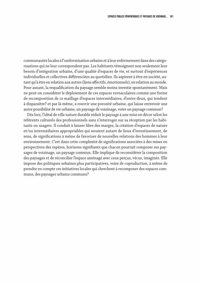
181Espaces publics périphériques et paysages de voisinage…
communautés locales à l’uniformisation urbaine et à leur enfermement dans des catégo-risations qui ne leur correspondent pas. Les habitants témoignent non seulement leur besoin d’intégration urbaine, d’une qualité d’espaces de vie, et surtout d’expériences individuelles et collectives différenciées au quotidien. Ils aspirent à être en société, au-tant qu’à être en relation aux autres (liens affectifs, émotionnels), en relation au monde. Pour autant, la requalification du paysage semble moins investie spontanément. Mais ne peut-on considérer le déploiement de ces espaces vernaculaires comme une forme de recomposition de ce maillage d’espaces intermédiaires, d’entre-deux, qui tendent à disparaître? et par là même, à rouvrir une porosité urbaine, qui laisse entrevoir une autre possibilité de vie urbaine, un paysage de voisinage, voire un paysage commun?
Dès lors, l’idéal de ville nature durable réduit le paysage à une mise en décor selon les référents culturels des professionnels sans s’interroger sur sa réception par les habi-tants ou usagers. Il conduit à laisser libre des marges, la création d’espaces de nature et/ou intermédiaires appropriables qui seraient autant de lieux d’investissement, de sens, de significations à même de favoriser de nouvelles relations des hommes à leur environnement. C’est dans cette complexité de significations associées à des mises en perspectives des repères, horizons signifiants que chacun pourrait composer ses pay-sages de voisinage, un paysage commun. Elle implique de reconsidérer la composition des paysages et de réconcilier l’espace aménagé avec ceux perçus, vécus, imaginés. Elle impose des politiques urbaines plus participatives, voire de coproduction, à même de prendre en compte ces initiatives locales qui cherchent à recomposer des espaces com-muns, des paysages urbains communs?

183aÉroport Notre dame des landes, nantes
4
landscape as a project

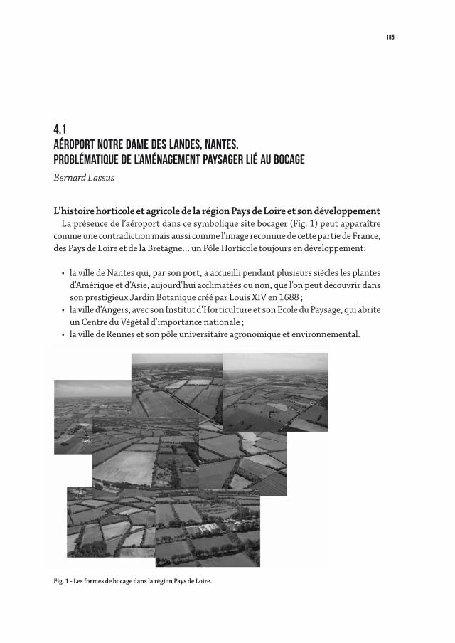
185
4.1aÉroport Notre dame des landes, nantes.problÉmatique de l’amÉnagement paysager liÉ au bocageBernard Lassus
L’histoire horticole et agricole de la région Pays de Loire et son développementLa présence de l’aéroport dans ce symbolique site bocager (Fig. 1) peut apparaître
comme une contradiction mais aussi comme l’image reconnue de cette partie de France, des Pays de Loire et de la Bretagne… un Pôle Horticole toujours en développement:
• lavilledeNantesqui,parsonport,aaccueillipendantplusieurssiècleslesplantesd’Amérique et d’Asie, aujourd’hui acclimatées ou non, que l’on peut découvrir dans son prestigieux Jardin Botanique créé par Louis XIV en 1688 ;
• lavilled’Angers,avecsonInstitutd’HorticultureetsonEcoleduPaysage,quiabriteun Centre du Végétal d’importance nationale ;
• lavilledeRennesetsonpôleuniversitaireagronomiqueetenvironnemental.
Fig. 1 - Les formes de bocage dans la région Pays de Loire.
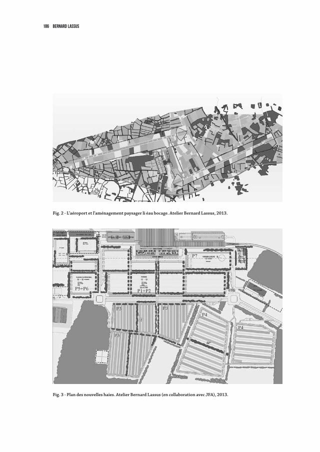
186 Bernard Lassus
Fig. 3 - Plan des nouvelles haies. Atelier Bernard Lassus (en collaboration avec JFA), 2013.
Fig. 2 - L’aéroport et l’aménagement paysager li éau bocage. Atelier Bernard Lassus, 2013.
Fig. 5
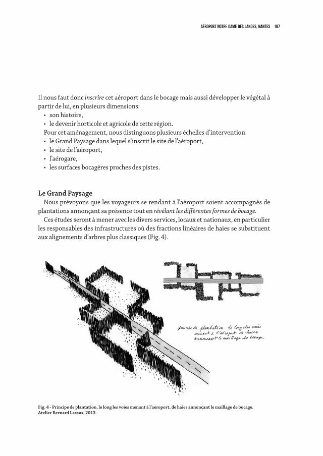
187aÉroport Notre dame des landes, nantes
Il nous faut donc inscrire cet aéroport dans le bocage mais aussi développer le végétal à partir de lui, en plusieurs dimensions:
• sonhistoire,• ledevenirhorticoleetagricoledecetterégion.Pour cet aménagement, nous distinguons plusieurs échelles d’intervention:• leGrandPaysagedanslequels’inscritlesitedel’aéroport,• lesitedel’aéroport,• l’aérogare,• lessurfacesbocagèresprochesdespistes.
Le Grand PaysageNousprévoyonsquelesvoyageursserendantàl’aéroportsoientaccompagnésde
plantations annonçant sa présence tout en révélant les différentes formes de bocage. Ces études seront à mener avec les divers services, locaux et nationaux, en particulier
les responsables des infrastructures où des fractions linéaires de haies se substituent aux alignements d’arbres plus classiques (Fig. 4).
Fig. 4 - Principe de plantation, le long les voies menant à l’aeroport, de haies annonçant le maillage de bocage.Atelier Bernard Lassus, 2013.
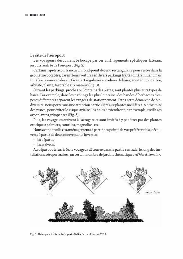
188 Bernard Lassus
Le site de l’aéroportLes voyageurs découvrent le bocage par ces aménagements spécifiques latéraux
jusqu’à l’entrée de l’aéroport (Fig. 2). Certains,aprèsavoirfranchiunrond-pointdevenurectangulairepourresterdansla
géométriebocagère,garentleursvoituresendiversparkingstraitésdifféremmentmaistous fractionnés en des surfaces rectangulaires encadrées de haies, écartant tout arbre, arbuste, plante, favorable aux oiseaux (Fig. 3).
Suivantlesparkings,prochesoulointainsdespistes,sontplantésplusieurstypesdehaies.Parexemple,danslesparkingslespluslointains,desbandesd’herbacéesd’es-pècesdifférentesséparentlesrangéesdestationnement.Danscettedémarchedebio-diversité,nousporteronsuneattentionparticulièreauxplantesmellifères.Aproximitédes pistes, pour éviter le risque aviaire, les haies deviendront, par exemple, treillages avec plantes grimpantes (Fig. 5).
Puis, les voyageurs arrivent à l’aérogare et sont invités à y pénétrer par des plantes exotiques: palmiers, camélias, magnolias, etc.
Nousavonsétudiécesaménagementsàpartirdespointsdevuepréférentiels,décou-verts à partir de deux mouvements inverses:
• lesdéparts,• lesarrivées.Au départ ou à l’arrivée, le voyageur découvre dans la partie centrale; le long des ins-
tallations aéroportuaires, un certain nombre de jardins thématiques «d’hier à demain».
Fig. 5 - Haies pour le site de l’aéroport. Atelier Bernard Lassus, 2013.
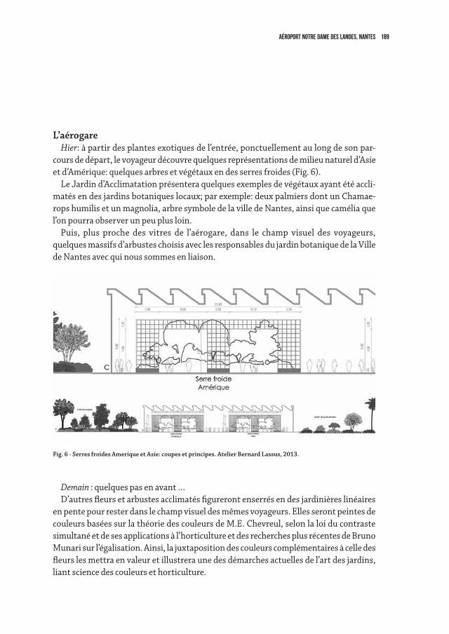
189aÉroport Notre dame des landes, nantes
Fig. 6 - Serres froides Amerique et Asie: coupes et principes. Atelier Bernard Lassus, 2013.
L’aérogareHier: à partir des plantes exotiques de l’entrée, ponctuellement au long de son par-
cours de départ, le voyageur découvre quelques représentations de milieu naturel d’Asie et d’Amérique: quelques arbres et végétaux en des serres froides (Fig. 6).
Le Jardin d’Acclimatation présentera quelques exemples de végétaux ayant été accli-matés en des jardins botaniques locaux; par exemple: deux palmiers dont un Chamae-ropshumilisetunmagnolia,arbresymboledelavilledeNantes,ainsiquecaméliaquel’on pourra observer un peu plus loin.
Puis, plus proche des vitres de l’aérogare, dans le champ visuel des voyageurs, quelques massifs d’arbustes choisis avec les responsables du jardin botanique de la Ville deNantesavecquinoussommesenliaison.
Demain : quelques pas en avant … D’autresfleursetarbustesacclimatésfigurerontenserrésendesjardinièreslinéaires
enpentepourresterdanslechampvisueldesmêmesvoyageurs.EllesserontpeintesdecouleursbaséessurlathéoriedescouleursdeM.E.Chevreul,selonlaloiducontrastesimultané et de ses applications à l’horticulture et des recherches plus récentes de Bruno Munari sur l’égalisation. Ainsi, la juxtaposition des couleurs complémentaires à celle des fleurslesmettraenvaleuretillustreraunedesdémarchesactuellesdel’artdesjardins,liant science des couleurs et horticulture.
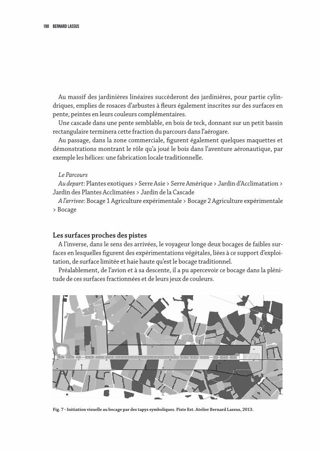
190 Bernard Lassus
Fig. 7 - Initiation visuelle au bocage par des tapys symboliques. Piste Est. Atelier Bernard Lassus, 2013.
Aumassifdesjardinièreslinéairessuccèderontdesjardinières,pourpartiecylin-driques,empliesderosacesd’arbustesàfleurségalementinscritessurdessurfacesenpente, peintes en leurs couleurs complémentaires.
Unecascadedansunepentesemblable,enboisdeteck,donnantsurunpetitbassinrectangulaire terminera cette fraction du parcours dans l’aérogare.
Au passage, dans la zone commerciale, figurent également quelques maquettes et démonstrations montrant le rôle qu’a joué le bois dans l’aventure aéronautique, par exemple les hélices: une fabrication locale traditionnelle.
Le Parcours Au depart: Plantes exotiques > Serre Asie > Serre Amérique > Jardin d’Acclimatation >
Jardin des Plantes Acclimatées > Jardin de la CascadeA l’arrivee: Bocage 1 Agriculture expérimentale > Bocage 2 Agriculture expérimentale
> Bocage
Les surfaces proches des pistesA l’inverse, dans le sens des arrivées, le voyageur longe deux bocages de faibles sur-
faces en lesquelles figurent des expérimentations végétales, liées à ce support d’exploi-tation, de surface limitée et haie haute qu’est le bocage traditionnel.
Préalablement, de l’avion et à sa descente, il a pu apercevoir ce bocage dans la pléni-tude de ces surfaces fractionnées et de leurs jeux de couleurs.
191aÉroport Notre dame des landes, nantes
Pour bien marquer leur importance, même les surfaces les plus proches des pistes d’atterrissagesontcouvertesd’herbacéesrasesdedifférentesteintes,cequirappellelagéométriedessurfacesencadréesdehaiesmaissanscelles-ci,toujoursàcausedurisqueaviaire.Cesdiverstypesd’herbacéesontétéchoisispourpermettred’unepartcesdiffé-renciations visuelles en contraste et d’autre part une gestion commune. L’ensemble des coloris des cultures du bocage va varier au fil des saisons (Fig. 7).
Dansledossierquinousavaitétéremispourleconcours,nousavionsrelevél’impéra-tive nécessité d’éviter les risques aviaires, ce qui est à un premier niveau contradictoire puisquelebocageabriteetfavorise61espècesd’oiseaux.Lebocagedoitaussiêtreréa-ménagédanslaperspectived’unelimitationdesprésencesaviaires.Nousavonsabordécettequestion:lechoixduvégétalpeut-ilnepasfavoriserleurprésence?
Quantauchoixdesculturesinternesaubocage,ils’agitdèsàprésentd’éliminer,parexempleleblé,c’est-à-direleurnourriturefavorite.
Ceci implique de passer des accords avec les cultivateurs voisins, afin de coordonner les productions agricoles. Cette coordination permet aussi de limiter la présence visuelle de l’aéroport. Ainsi, bocage externe et bocage interne présenteraient des similitudes. L’association des bocages permettrait d’envisager une limitation visuelle de l’impact de l’aéroport puisqu’une partie de son site appartiendrait à l’activité agricole locale et non à une activité conservatrice liée au territoire portuaire.
Cetteaffirmationvisuellem’amèneauniveaudel’aménagementpaysagerdusiteaé-roportuaire à bien dissocier son activité propre de celle du bocage. Il convient donc d’en affirmer le contraste, sinon nous prendrions le risque que le “bocage aéroport“ lui soit assimilé, ce qui en augmenterait l’impact.
Cette intervention entraîne que tout ce qui ne peut paraître qu’artificiel soit claire-ment montré sans monumentalisation et limité par la naturalisation de ce qui pourrait l’être de l’artificiel.
Cette démarche permet d’éviter que l’ensemble de la surface soit visuellement identi-fié comme étant l’aéroport, donc en limite l’impact visuel.
192
Nothingcouldbemoredynamicandunstablethanoutdoorspaces.Theyaremostlybuilt with few resources and exposed to a huge consumption, but that’s not the point, the ideas and the behaviours that give them life change so fast, and their psychological obsolescence is even stronger than the economic one.
Thethemeofpublicspace,onceexhaustedtheepicstagethatsincethesixtiesofthetwentieth century rewrites the rules of a new centrality of countless urban areas, would seemtohavemorevitalityifyouknowhowtopreserveitfromtheobsessiverepetitionsof genres, and from increasingly bizarre solutions.
Lookingattheevolutionofthisissueitturnsoutthatbetweenthecrisisandthestateofthelandscaperunsatightcausalrelationship,butthisorderofcauseandeffectisnot clear.
Wemaywellaskourselveswhetherthepoorqualityofthelandscapeisoneofthemain causes of the crisis, and not secondary, as the programs of the political parties seem to believe.
What is the cultural value, but further more social and economic, and thence political, ofalandscapedesign?
And which is the role of the public space in among various design themes, which trends?Whichisthesensewewanttogivetotheterm‘sustainability’?
Anyhabitualawarenessseemstolack,aboutknowinghowisandhowcouldbethelandscape, how the ability to create landscapes could occur today, here and now, with spontaneity, through actions for the protection, management and planning and raising awareness of the value of a living landscape.
Thecrisisisinpartaneconomicandfinancialsituation,inpartasudden,abrupt,complicatedtransitiontoadifferentstageofourcivilization,withsomeconsequences:itisnotsoeasy,Isay,tounderstandwhetherthecrisisismorecauseoreffectofthepoorqualityofmanylandscapes,andbynowweknowthatthereasonsforthecrisishavemainlyremoteorigins,somearereallylittleknown,othersaremorededuciblebecausemorelocalanddomestic.Inanycase,allofthemaffectourbehaviourandourimagination with profound repercussions, forcing a relocation, about landscape, of our private and public sphere of action, which creates a lot of surprises that we are trying to decrypt,oftenwithaneffect– it’s just should say –of‘disorientation’.
4.2LANDSCAPE, HANDLE WITH CAREFranco Zagari
193landscape, handle with care
Butwhatarethecountertrend’snews?Canbeauty,likeDostoevskysays,‘savetheworld’?Ithinkso,itisabsolutelynecessarytobringbackthemasteryoftheprojecttoits high civil mission.
Thismeanstheunderstandingofthestrategicvalueintheimplementationofpublicworks’planning,assumewithouthypocrisytheresponsibilitytodeclare,inthenameof a public mandate, open and clear: beauty is the first direct and explicit objective to be pursuedforahigherqualityofthelandscape.Idonotknowanyotherway.
Averypopularsongsays,initswisdom,thatwhatwereallyneedisa‘permanentcenter of gravity’, giving an acceptable stability to our actions.
When we admire a beautiful landscape, in such ecstatic state, we feel the joy of an exquisitebreakofbalanceandharmonybetweenusandaworldotherwisegonemad.
Atanyscalethegoalofalandscapeprojectshouldnotbemorethanthis:knowhowtostaging with art tangible and intangible elements as sequences with a meaning, express-ing a representative character of values essential to us but … the issue is more complex, our eternal Aristotelian condemnation to search for beauty, goodness and justice forces us to want more.
Herewewillfocusonopenspaces.ThereisonepointthatIwanttostress:thepublic-private relationship has changed dramatically in recent years, particularly since the startofthecrisis,from2008-2009tothepresent.
Thepublic’sdomaininthetransformationsoftheterritoryhaslostground,Ibelievethatitisnecessarytoreplacehabitsandwatchwords(keywords)todefinethequalityofopenspaces,evenbecauseprivate’sdomainhasnottakenover,butitmerelyseekseco-nomic satisfaction through objectives poorly permeable to a vision of the new advanced city of the third millennium.
Thisrelationshipisnotsoclearbecausealltheusualthemesofpublicspaceareplayedwith a reduced value, which is more quantitative than qualitative, a trivialization of an element that virtually has and could have a much more decisive role in our habitat.
But from my traveling observatory in Italy, facing the enormous disaster that ac-companies an unprecedented urbanization phenomenon, important news seem to be captured, expressed in a revolution of behaviour, especially in young people.
Thepeople,forbetterorforworse,exploreandexperiencethecitynotonlyasaworkingenvironment, but also with a growing demand for loisir, and a greater need for quality.
Thereisaconsiderableextensionofattendanceevenatnight,spacesofconvivialityto correspond to an economic and social demand driven by the consumer culture that becomes a mass phenomenon.
Theyinventandrepeatendlesslycanonicalspaces,gardens,squares,parks,butinafewcaseswithleadingprojects,suchasthegreatcityparkswithnewdimensions,such
194 franco zagari
as those of Paris and São Paulo, where innovative intuitions surprise and anticipate, I hope,aspiritofre-foundation.
Havingsaidthis,don’tyouthinkitwouldsoundbettertosay:“Theroleofurbanland-scapeinthetrasformationofopenspaces”?
Itseemsaplayonwordswhenwereversethetermsofthetitle,butitoffersundeni-ableadvantages,thatincludethetreatingoflandscapeasadisciplinarymethod-ap-proach,method,tools-andnotonlyasatheme.Ibelievethatthisapproachopensupinterestingprospects.Nowit’sthetimeforthisthemeofthepublicspacetobeshiftedfrom its usual hinges into a viable and productive way.
Returningtothepointwherethestoryofthepublicspacewasthestartingpointwiththecharacteristicsofarealrevolutioninthewayweseeandthinkofthecity-intheWestern world I’d put in the criticism of Ciam to several tenets of the Modern Move-mentandinparticularthechoiceofthethemeofcityheartasakeytosettingthenewurbansettlements-wecanrealizethatthefoundingfatherssuchasAldoVanEyck,GiancarloDeCarlo,RalphErskine,AlisonandPeterSmithsonhadaprescientvisionofanewroadtobetaken.Theissueatadistanceofaboutfiftyyearsremainscompletelyopen,andinalong-termperspectivethere’saclearneedforgreateropennessofthehorizon,andforareviewoftheconceptofthepublicalso,that,usingNanniMoretti’sexpression,wouldperhapsberedefinedas‘somethingleftwing’.Iftheconflictbetweenpublic and private is certainly high, when you touch the interest, the mutual interaction ispotentiallymoreandmoreinevitable,butinnewways.Thereisindeedagreatfluiditybetweentheirrespectivefieldsofinfluence,anditturnsoutthatthewholeaffairshouldbe seen about the actual impact that every public and private action can have, not so much on direct targets, which are discounted, as on the outcome, which is prevalent but accessibleonlyatintuitivelevel,thusbasicallyunknown.Theanalysisofcostsandben-efits that throng the planning seem often to deny the evidence of facts. I mean that the tasksofthetwodomainsofactivity,thepublicandtheprivate,shouldfindnewwaystoexpress themselves, and to collaborate each other.
Thepublic,moreover,shouldperhapsbelessextensiveandatthesametimemoreeffective.Itshouldhaveroleasleaderandascatalystofsituationswhereapoliticalwill’s stamp is useful, indeed necessary, and it should involve communities in its vari-ous components as the protagonist, participant and responsible of the development’s directions of a place.
Thepublichaslostground.Whatiscuriousandnotadequatelystudiedisthatthisphenomenon is due only partly to the dehydration of public financial sources, but rather to a sort of mentality of abdication, a shortage of ideas and instruments.
Local authorities and other usual public corporations that had so far driven – well
195landscape, handle with care
or badly –aplanning,havegraduallyorientedtobackoutoftooambitiousbusinesses’transformation, and often even fail the standard prevention and maintenance of the territory.
As a result, they are subjected or demand as substitute an increasingly significant in-tervention from the outside, which would be fine if there was the ability to express a clear developmentplan.Thepublicdemandformoreandmoreoftenisinfactablankproxy.
So there’s no wonder that everything moves in a celebration of consumption, which frommeansbecomesanend,andthiscyclelookswearytoo.
Butifournewcentresofsocialattractionaremostlyjusthypermarkets,thelessonscomefromothercountries,wherewe’vefoundgreatintegratedhigh-qualitycentres,ad-ministrativeservices,entertainment,exhibition,sports,restaurants,cafes,bookshops.JustthinkofalltheseriesofopencentresinSãoPaulostartingwithoneofPompeia
by Lina Bo Bardi, at the end of the seventies, with the grace of her feminine genius, an-otherrevolutionthathasremainedalmostinvisible.Theissuearisesinanentirelynewway,becauseourhabitatsarenowcompletelydifferentthanwherewewereborn,andinmanypartsisnolongerdefinableurban,ruralandnatural,itisa‘cityisnotthecity’,whichgrowswithanunknownspeed,thecityofthenewmillennium.
But the project, of which the landscape should be the natural complement, instead appearsasthestoneguestofDonGiovanni:fearedasthethreatofimmanentjustice,ashadowofourbadconscience,eventuallylivedasahazardthatcansuffocateadesperateyearningforfreedom.Thechallengeistoact,withoutwastingtime,actindirectdrive,knowhowtoquestion,toovercometheinactivityofarhetoricalpublicspace.Oneofthe nodes of the matter is that people are systematically on the margins or completely excludedfromthechoices,partlybecauseofrepresentationsor-better-ofrelentlessreductions by an old culture, firmly anchored to its positions of power. As well, I want to believe that hope persists in many acts that mostly spontaneously occur in our coun-try…Itsfortuneisindispensableforus,becauseIthinkit’sthecommonsenseofourdemocracy.
196
Identity, quality, urban Space “… Collective themes, streets and squares …, once brought under discussion by a long
processofsocialthematization,retaintheirsignificanceinEuropeevenwhentheiroriginalthemehasbeenforgotten,afull-roundsignificancerootedinthesymbolicsphere – and for this reason incorporated, from a tender age, into citizens’ perceptions of the world in which they live, perennial constitutive terms of its beauty … And just as persistent, subtracted from the wear and tear of time … is the aesthetic sphere … and thewhollyEuropeanawarenessthatthecityisaworkofartaccompaniesusdownitsstreets … into its houses and into its themed collective spaces…”.(Romano,2008)Theinterweaveofidentity,thesenseofbelongingtothecity,toone’sowncity,and
the urban quality of open/public space and of architecture is beautifully summed up byMarcoRomano1, who sees the urban public space as an essential factor determining the image of the city, an irreplaceable place for gathering and socialization, with which the entire community identifies and from which each citizen draws his or her sense of identity.Thecityisnotasumofbuildingswithstreetsandroadsleadingfromonetoanother.Itissomethingmore.Byaskingourselveswhetheritisthearchitecturethatmakesthecityorwhether,instead,itistheopenspaceswhichweavetheurbanfabricon which the architecture is “embroidered,” we increase our level of attention to the pat-ternofthesespaces,whethertheybestreets,squares,pedestrian-bicyclepaths,historicstreets,parks,gardens,privategreenareas,“fringe”spaces,etc..
If the city is not a simple sum of buildings, then the open spaces must constitute the “mappingsystem”thatmakesthecityvisible.Abuilding,howeverbeautifulitmaybe,doesnotmakeacity.Thespacesbetween the buildings, the squares, the streets, theparks,thewatercourses,thevegetation,theabandonedorrundownareas,etc.,are the connective tissue of the city, the spaces in which we move (slowly, or by rail or
*PartsofthisworkhavebeenpublishedinthemagazineonlineNIP-Network in Progressnumber14May-June2013,CasaEditriceETS,Pisa(ISSN2281-1176)Websitehttp://www.nipmagazine.it/
1MarcoRomanohastaught“Aesthetics”atvariousItalianuniversitiesandhaspublishednumerousworksontheaestheticsoftheEuropeancity.
4.3“Moving” urban landscapes *
Lorenzo Vallerini
197“moving” urban LANDSCAPEs
on water, etc.) and meet (open public spaces) are where the city’s social life is lived. Therefore,developingthesystemofopenpublicspacesacquiresarelevancebothin
terms of enhancing and recomposing the existing and the new parts of the city. Theurbandevelopmentwehaveseeninrecentdecadesseems,however,tohavelost
sight of the relationship between architecture and the city, between the city and open spaces. Quite often, what is most evident is the lack of an overall urban form, of spaces thatreflectanytypeofimpetustowardcollectiveidentification.Andtheflauntedcred-ibility and/or opulence of the single new buildings, even those designed by interna-tional “archistars”, is often poor compensation for the formal and material paucity of the streets, the squares, the open spaces – in other words, the spaces of collective life.
When upgrading rundown and abandoned areas, disused spaces, whether industrial or otherwise, all that counts are the cubic meters to be constructed while the little bit of greenery is left to the mercy of the standards set by law – old laws – without seizing theseopportunitiesasoccasionsforimprovingthecityasawhole.Thecubicmetersareclearlynecessary,–otherwise,whowouldpay?Buttheyseemalltoooftentobetheonlysubject for discussion and discourse, sometimes for protests – but without calling into play the relationships among the urban context, the traffic system, and open spaces.
Thesamecanbesaidofthemobilityinfrastructures,which,bothinsidethecityandintheperi-urbanareashavealmostneverbecomeintegralpartsoftheterritorybutratherintrusions motivated by their specific primary function, transportation. Synergies ca-pable of fostering symbiotic interactions between infrastructures and surrounding con-text have not been created. “Specialized” transportation cuts through the territory and the city as a closed system and, often, the infrastructure simply runs through places, remainingtoalleffectsextraneoustothefeaturesoftheterrain,totheurbansitesittravels, exorcising them with technologically themed constructions such as bridges, viaducts,embankments,tunnels,etc.,andalongthewayoffendingthesensibilitiesofthe“commonpeople”–sparkingneighbourhoodmeetingsandprotestmovements.
Inpointoffact–asinsteadsooftenhappens–itisnotenoughtostate(evenifbackedup by a good urban planning study or approved project) one’s intention to create a “sys-temofopenspaces”(squares,streets/roads,parks,neighbourhoodgreenareas,etc.)to automatically conjure up a “good” city. Much more is required; the city must possess what has been termed the “will to forge a collective identity.”
Attainingabalancebetweenbuilt-upspaceandfree/openspace,ofwhatevertype,re-quires much more than simply adding up the parts; it requires, and it is the product of, a collective will that at times transcends the will of our political representatives. It would be appropriate to say that everyone deserves the city they choose, for better or worse.
198 lorenzo vallerini
urban Transformation and MobilityIn many cases, introduction of “transportation infrastructures in the urban environ-
ment”producesa“breakup”ofurbanequilibriums;butitcanalso,andaboveall(and,obviously,notalways),offeran“occasion”forupgradingtheurbanareasandopenspac-eslinkedtotheseinfrastructures,forgeneratingnewurbantraffic/mobilitypatterns.Wecanthinkofthe“urbanexpressways”thatweavethroughtheperi-urbandistricts,ofthesubwaysandtramlinesthatlinkthecentreandtheoutlyingdistricts,ofthesta-tions/station-junctionsasnewurbanstructuresandidentities.And,wecanviewpe-destrianizationofsquares,streets,theriverembankmentroadsinthehistoriccentres,thatareoftenlinkedtonewmasstransportationsystemsas“newinfrastructures”forurban movement.
InseveralEuropean(Barcelona,Paris,Bordeaux,Strasbourg,etc.)andItalian(Tu-rin, Milan, Mestre, Florence, etc.) cities, much urban transformation has followed the creation of infrastructures impacting large segments of the population and their sense oftheidentityofthe“transited”areas–oftenwithpositiveresults.Naturally,thesechanges involved difficulties and protests – but then, when has any “major” urban trans-formationeverfailedtoarouseheatedarguments?
TheEuropean Landscape Convention addresses the basic issues that orbit the central issue of “transformation” and provides indications for correct conservation, planning, andtransformationoftheterritory.Theconventionframeworkprovidesrecognizable quality objectives, including definition of criteria for directing transformations, whether broad-scale,attheurbanorperi-urbanscale,oratthesingle-projectlevel,butaboveallfordirectingplanningofnewworks,whetherinhistoricareasorinurbanexpansionar-eas.ThekeywordsofthemessagetransmittedbytheConvention,integration-transfor-mation-participation,applyequallytoworkatallscalesanddictatecarefulconsiderationof quality, not only when assessing rural or natural spaces, undeveloped areas, urban open spaces, and greening, but indeed to all transformation policies – from planning tools to major projects and infrastructures, from energy systems to urban policies, from new developments to the historic centres, etc..
Putting words into action is never easy, and this is especially true in the case new infrastructures, which by their very nature are always intrusive, and strongly impact establishedlandscapeandterritorialbalances.Itistransformationtakentoitsextremeconsequences, because in the case of transportation infrastructures the transformation islinear,passingstraightthroughplaces,images,andsystemsthatareoftenverydiffer-ent and diversified, with strong natural and artificial identities, each often with its own firmly established social organization.
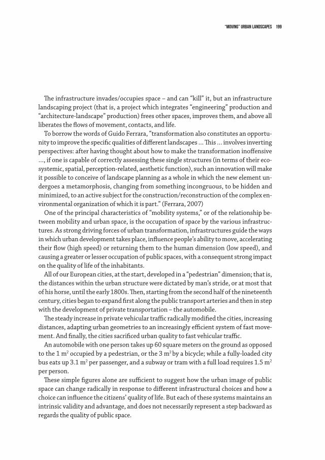
199“moving” urban LANDSCAPEs
Theinfrastructureinvades/occupiesspace–andcan“kill”it,butaninfrastructurelandscaping project (that is, a project which integrates “engineering” production and “architecture-landscape”production)freesotherspaces,improvesthem,andaboveallliberatestheflowsofmovement,contacts,andlife.
ToborrowthewordsofGuidoFerrara,“transformationalsoconstitutesanopportu-nitytoimprovethespecificqualitiesofdifferentlandscapes…This…involvesinvertingperspectives:afterhavingthoughtabouthowtomakethetransformationinoffensive…, if one is capable of correctly assessing these single structures (in terms of their eco-systemic,spatial,perception-related,aestheticfunction),suchaninnovationwillmakeit possible to conceive of landscape planning as a whole in which the new element un-dergoes a metamorphosis, changing from something incongruous, to be hidden and minimized, to an active subject for the construction/reconstruction of the complex en-vironmental organization of which it is part.” (Ferrara, 2007)
Oneoftheprincipalcharacteristicsof“mobilitysystems,”oroftherelationshipbe-tween mobility and urban space, is the occupation of space by the various infrastruc-tures. As strong driving forces of urban transformation, infrastructures guide the ways inwhichurbandevelopmenttakesplace,influencepeople’sabilitytomove,acceleratingtheirflow(highspeed)orreturningthemtothehumandimension(lowspeed),andcausing a greater or lesser occupation of public spaces, with a consequent strong impact on the quality of life of the inhabitants.
AllofourEuropeancities,atthestart,developedina“pedestrian”dimension;thatis,the distances within the urban structure were dictated by man’s stride, or at most that ofhishorse,untiltheearly1800s.Then,startingfromthesecondhalfofthenineteenthcentury, cities began to expand first along the public transport arteries and then in step with the development of private transportation – the automobile.
Thesteadyincreaseinprivatevehiculartrafficradicallymodifiedthecities,increasingdistances, adapting urban geometries to an increasingly efficient system of fast move-ment. And finally, the cities sacrificed urban quality to fast vehicular traffic.
Anautomobilewithonepersontakesup60squaremetersonthegroundasopposedto the 1 m2 occupied by a pedestrian, or the 3 m2 byabicycle;whileafully-loadedcitybus eats up 3.1 m2 per passenger, and a subway or tram with a full load requires 1.5 m2 per person.
Thesesimplefiguresalonearesufficienttosuggesthowtheurbanimageofpublicspacecanchangeradicallyinresponsetodifferentinfrastructuralchoicesandhowachoicecaninfluencethecitizens’qualityoflife.Buteachofthesesystemsmaintainsanintrinsicvalidityandadvantage,anddoesnotnecessarilyrepresentastepbackwardasregards the quality of public space.
200 lorenzo vallerini
Infact,ifanystrategicmobilityoptionisnotaccompaniedbyspecificopen-spacepro-jects that remodel the transformation introduced by the new mobility infrastructure, the latter can become a “foreign body” in the context it serves and which, in any case, itchangesbyitsverypresence.Thisistruenotonlyfor“highspeed”infrastructures(roadsandmotorways,high-speedundergroundtransportation)butalsoforthe“lowspeed” options (pedestrian areas, cycling paths, tramlines, bus lines, etc.).
In many cases, ordinary territorial planning addresses the question of infrastruc-tures inside and outside of the city without considering proposals for reducing the real inconveniences that may follow the introduction of mobility infrastructures, without accompanying infrastructural proposals with assessment of the context in which they will be inserted, and without giving the urban improvement and landscape enhance-ment projects priority; instead, quite often all this is limited to a posteriori actions for “reorganization” and regreening – in short, damage control.
Certainly, a lot of water has run under the bridges of infrastructure planning, and “landscape design” of/in infrastructures is by now an integral part of “infrastructural projects” – but at least in Italy, it is still the poor relation that receives only limited and leftoverfunds.Theyaremeagrebudgets,especiallyifcomparedtotheoftenextremelyhighcostoftheinfrastructuralworkitself.
ExamplesofgoodpracticeinEuropeanandothercountriesneverthelessaboundinthespecializedperiodicalsandbooks:manyhavebeenputintopracticewhilemanystillexist only on paper.
ThespecificcaseoftheFlorentineareaconsideredbelowis,forthemoment,mostlyinthe latter category. But the premises for loosening the grip of the vehicular traffic that suffocatesthecity,forchangingthecityandforbetteringit,notonlybyreducingtrafficandcreatinganefficienttransportationnetworkbutalsothroughthatredesignofur-banandperi-urbanopenspacesthatmustaccompanythetransformation,areallthere.
The Case of the Florentine Area: High Speed and Low SpeedThenewmobilitysystemfortheFlorentinemetropolitanarearestsessentiallyon
four pillars. 1 Construction of the Third lane of the A1 motorway that curves around the city from
southtonorth,doublingasanurbanringroadandlinkingtheFirenze-Maremo-torwaytothenortherncoastandGenoa,theFirenze-Pisa-Livornosuperhighwayrunningwest,andtheinlandFirenze-Siena-GrossetosuperhighwaythatrunstosouthernTuscany.
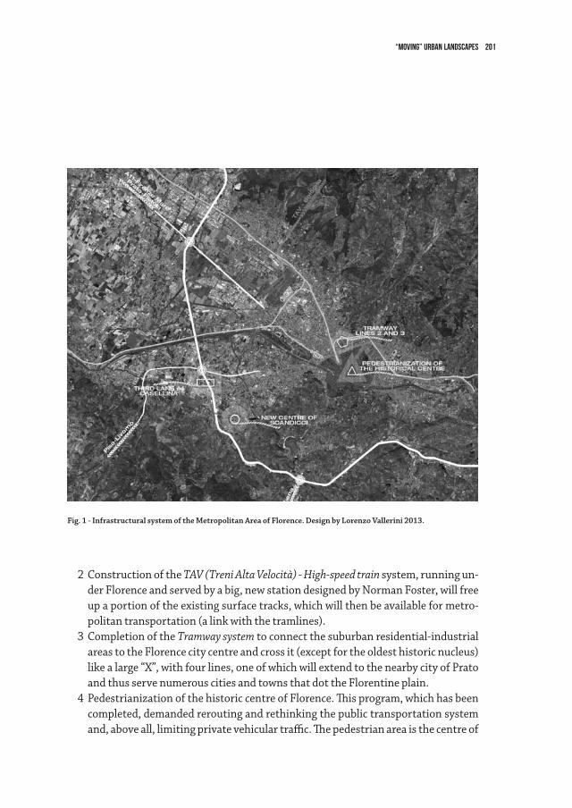
201“moving” urban LANDSCAPEs
2 Construction of the TAV (Treni Alta Velocità) - High-speed train system, running un-derFlorenceandservedbyabig,newstationdesignedbyNormanFoster,willfreeupaportionoftheexistingsurfacetracks,whichwillthenbeavailableformetro-politantransportation(alinkwiththetramlines).
3 Completion of the Tramway systemtoconnectthesuburbanresidential-industrialareas to the Florence city centre and cross it (except for the oldest historic nucleus) likealarge“X”,withfourlines,oneofwhichwillextendtothenearbycityofPratoand thus serve numerous cities and towns that dot the Florentine plain.
4PedestrianizationofthehistoriccentreofFlorence.Thisprogram,whichhasbeencompleted,demandedreroutingandrethinkingthepublictransportationsystemand,aboveall,limitingprivatevehiculartraffic.Thepedestrianareaisthecentreof
Fig. 1 - Infrastructural system of the Metropolitan Area of Florence. Design by Lorenzo Vallerini 2013.
202 lorenzo vallerini
a large circle that comprises and integrates all the mobility systems of the Floren-tine area including the suburbs.
Themostsignificantfeatureofthissystemistheinterconnectionamongthefourlev-elsofmobilityvianewaggregationsites,park-and-ridefacilities,interchangestations,roadandrailwayconnections,etc..Theentirenetworkis“embedded”intheFlorentineconurbation,whichembracesdensely-populatedareas,urbanfringeareas,andruralareas with scattered settlements.
Oncecompleted,thesystemwillpermitmovingbetween“high-speed”routesand“low-speed”areasandroutes,bothofwhichareindispensibleforguaranteeingeaseofmovement within the metropolitan area and, it is hoped, a better quality of life in a city more in tune with human needs.
“High speed” as an occasion for urban upgrading concerns the A1 motorway with the thirdlane,while“lowspeed”work,intermsofinterconnectionbetweeninfrastructuralsystemsandurbanopenspaces,regardstheTramwaywhileinthesenseofreappropria-tionofpublicspacesthroughurbanre-planningfornewfunctions,itinvolvesthenewtown centre of Scandicci and pedestrianization of the historic centre of Florence.
Third Lane of the A1Thebuilt-upareaofCasellinaisthecontinuation,andanintegralpart,oftheurbancen-
tre of Scandicci, which, in turn, is welded to the vaster Florentine area metropolitan system.OneoftheelementscharacterizingthecentreofCasellinaistheA1motorway,which
cutsthroughtheurbansystemandwhichlinksupwiththeFirenze-Pisa-Livornosuper-highway via the urban fabric.
WorkforthethirdlaneoftheA1hasprovidedareleaseinasituationwhichforalong timehasbeen“compromised,”bothbyheavytrafficflowandbyaseriesofincongruousstructures.Ittriggeredsparkedprojectsforrethinkingandredesigningthemotorwayitself as well as other related infrastructures, which are in turn connected with yet other infrastructureprojects,suchasthenewTramwayLine1(FirenzeS.M.N.Station–Scan-dicci,withaplannedextensionasfarasCasellina)orthenewlocalroadslinkingScan-dicci and Florence, and new development plans, such as a new shopping mall.
TheUrbanPlanfortheCasellinaareacallsnotonlyforretrofitandregreeningactionsto complement the new road and motorway system, but also – and above all – for “stitch-ing together” the existing system of open spaces, the new ones included in the planning instruments, and those that will be become available through the “retirement” of certain portionsofthecurrentmotorwayright-of-wayandthenewlayoutofthemotorway.
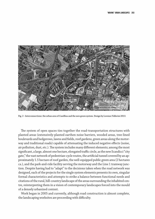
203“moving” urban LANDSCAPEs
Thesystemofopenspacestiestogethertheroad-transportationstructureswithplantedareas(extensively-plantedearthennoisebarriers,woodedareas,tree-linedboulevards and hedgerows, lawns and fields, roof gardens, green areas along the motor-wayandtraditionalroads)capableofattenuatingtheinducednegativeeffects(noise,airpollution,dust,etc.).Thesystemincludesmanydifferentelements;amongthemostsignificant, a large, almost one hectare, elongated traffic circle, as the new Scandicci “city gate,”thevastnetworkofpedestrian-cycleroutes,theartificialtunnelcoveredbyanap-proximately1.5hectareofroofgarden,thewell-equippedpublicgreenarea(2hectaresca.),andthepark-and-ridefacilityservingthemotorwayandtheLine1tramwayjunc-tion.Despitehavinghadto“adapt”tothedecisionstakenwhentheroadnetworkwasdesigned, each of the projects for the single system elements presents its own, singular formalcharacteristicsandattemptstostrikeabalancebetweenfunctionalneedsandcitationsoftherural,hill-countrylandscapeoftheareassurroundingtheinhabitedcen-tre, reinterpreting them in a vision of contemporary landscapes forced into the mould of a densely urbanized context.
Workbeganin2005andcurrently,althoughroadconstructionisalmostcomplete,thelandscapingworksitesareproceedingwithdifficulty.
Fig. 2 - Interconnections: the urban area of Casellina and the new green system. Design by Lorenzo Vallerini 2013.
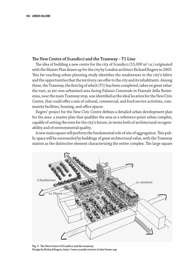
204 lorenzo vallerini
The new Centre of Scandicci and the Tramway – T1 LineTheideaofbuildinganewcentreforthecityofScandicci(15,000m2 ca.) originated
withtheMasterPlandrawnupforthecitybyLondonarchitectRichardRogersin2003.Thisfar-reachingurbanplanningstudyidentifiestheweaknessesinthecity’sfabricandtheopportunitiesthattheterritorycanoffertothecityanditsinhabitants.Among these,theTramway,thefirstlegofwhich(T1)hasbeencompleted,takesongreatvalue:thevast,asyetnon-urbanizedareafacingPalazzoComunaleinPiazzaledellaResist-enza,nearthemainTramwaystop,wasidentifiedastheideallocationfortheNewCivicCentre,thatcouldofferamixofcultural,commercial,andfoodserviceactivities,com-munity facilities, housing, and office spaces.
Rogers’projectfortheNewCivicCentredefinesadetailedurbandevelopmentplanforthearea:amasterplanthatqualifiestheareaasareference-pointurbancomplex,capable of setting the tone for the city’s future, in terms both of architectural recognis-ability and of environmental quality.
Anewmainsquarewillperformthefundamentalroleofsiteofaggregation.Thispub-licspacewillbesurroundedbybuildingsofgreatarchitecturalvalue,withtheTramwaystationasthedistinctiveelementcharacterizingtheentirecomplex.Thelargesquare
Fig. 3 - The new Centre of Scandicci and the tramway.Design by Richard Rogers, http://www.scandiccicentro.it/site/home.asp
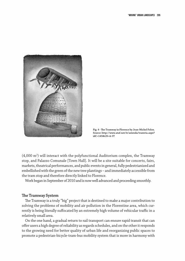
205“moving” urban LANDSCAPEs
(4,000 m2)willinteractwiththepolyfunctionalAuditoriumcomplex,theTramwaystop,andPalazzoComunale[TownHall].Itwillbeasitesuitableforconcerts,fairs,markets,theatricalperformances,andpubliceventsingeneral,fullypedestrianizedandembellished with the green of the new tree plantings – and immediately accessible from thetramstopandthereforedirectlylinkedtoFlorence.
WorkbeganinSeptemberof2010andisnowwelladvancedandproceedingsmoothly.
The Tramway SystemTheTramwayisatruly“big”projectthatisdestinedtomakeamajorcontributionto
solving the problems of mobility and air pollution in the Florentine area, which cur-rentlyisbeingliterallysuffocatedbyanextremelyhighvolumeofvehiculartrafficinarelatively small area.
Ontheonehand,agradualreturntorailtransportcanensurerapidtransitthatcanofferusersahighdegreeofreliabilityasregardsschedules,andontheotheritrespondsto the growing need for better quality of urban life and reorganizing public spaces to promoteapedestrian-bicycle-tram-busmobilitysystemthatismoreinharmonywith
Fig. 4 - The Tramway in Florence by Jean-Michel Folon. Source: http://www.ataf.net/it/azienda/tramvia.aspx? idC=145&Ln=it-IT
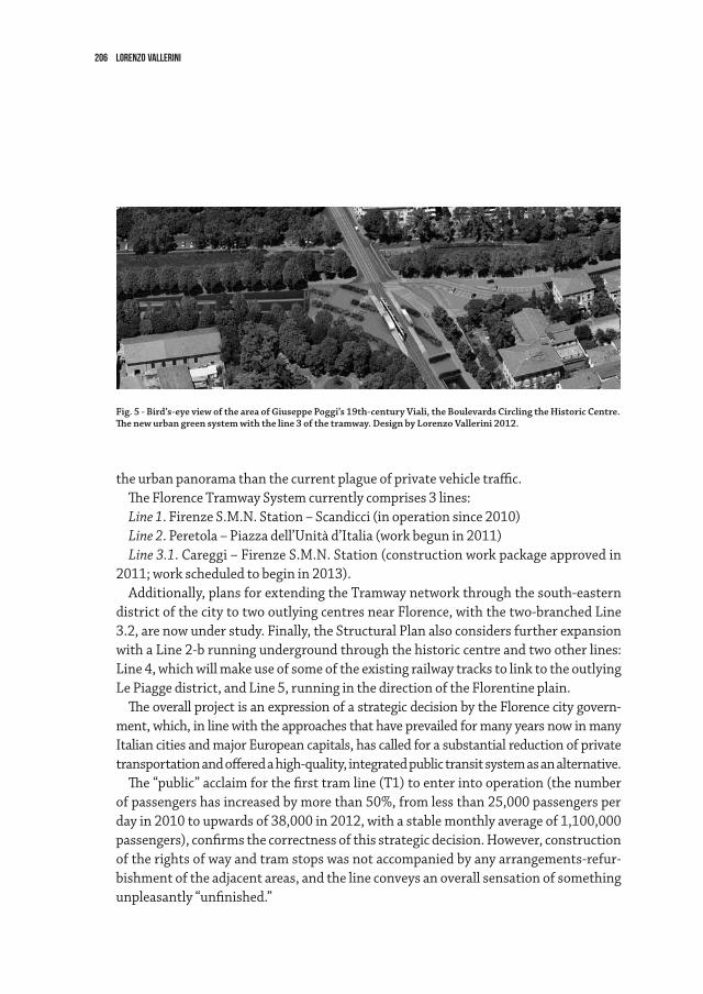
206 lorenzo vallerini
the urban panorama than the current plague of private vehicle traffic. TheFlorenceTramwaySystemcurrentlycomprises3lines:Line 1.FirenzeS.M.N.Station–Scandicci(inoperationsince2010)Line 2.Peretola–Piazzadell’Unitàd’Italia(workbegunin2011)Line 3.1.Careggi–FirenzeS.M.N.Station(constructionworkpackageapprovedin
2011;workscheduledtobeginin2013).Additionally,plansforextendingtheTramwaynetworkthroughthesouth-eastern
districtofthecitytotwooutlyingcentresnearFlorence,withthetwo-branchedLine3.2, are now under study. Finally, the Structural Plan also considers further expansion withaLine2-brunningundergroundthroughthehistoriccentreandtwootherlines:Line4,whichwillmakeuseofsomeoftheexistingrailwaytrackstolinktotheoutlyingLe Piagge district, and Line 5, running in the direction of the Florentine plain.
TheoverallprojectisanexpressionofastrategicdecisionbytheFlorencecitygovern-ment, which, in line with the approaches that have prevailed for many years now in many ItaliancitiesandmajorEuropeancapitals,hascalledforasubstantialreductionofprivatetransportationandofferedahigh-quality,integratedpublictransitsystemasanalternative.The“public”acclaimforthefirsttramline(T1)toenterintooperation(thenumber
of passengers has increased by more than 50%, from less than 25,000 passengers per day in 2010 to upwards of 38,000 in 2012, with a stable monthly average of 1,100,000 passengers), confirms the correctness of this strategic decision. However, construction oftherightsofwayandtramstopswasnotaccompaniedbyanyarrangements-refur-bishment of the adjacent areas, and the line conveys an overall sensation of something unpleasantly “unfinished.”
Fig. 5 - Bird’s-eye view of the area of Giuseppe Poggi’s 19th-century Viali, the Boulevards Circling the Historic Centre. The new urban green system with the line 3 of the tramway. Design by Lorenzo Vallerini 2012.
207“moving” urban LANDSCAPEs
ForLines2and3,instead,engineeringworkhasbeenmorecloselycoordinatedwithplanningoftheadjacentopenspaces,selectionofmaterialsandurbanfurnishings.Thisis necessary because the lines will travel through portions of the city that are, histori-cally, more consolidated and more “inhabited” than those crossed by Line 1 – and they are certainly more prestigious and “sensitive.”
Inparticular,qualityplanshavebeendrawnupfortheopenspacesintheareaofGi-useppePoggi’s19th-centuryViali, the boulevards circling the historic centre. Some of these spaces, such as the extensive area near the historic Fortezza da Basso which is the venue for internationalfashioneventshavebeen“liberated”bythepassageoftheTramway.
ThesystemofboulevardsandgardensattheFortezzawaspartofPoggi’soriginalplans, and the new landscaping design has been superimposed on this system, respect-ingandenhancingit.TheplansforLine3andconstructionoftheVialeMiltonandVialeStrozziautomobileunderpassesemphasizethelandscapingeffectsofthemajesticrowsoftreesandwillfreelargeareasfromvehiculartraffic.Theplanscallforjustfewmodi-ficationstotheexistingarrangementoftreesandwillmakeitpossibletomaintainandconsolidatethesystemofplantingsandlinkittothegreeneryoftheFortezzaparks,todayhemmedinbytraffic.Thetramwayandthestopareintegralpartsoftheplanswhichoffergreateropportunitiesforpedestrianandbicycletrafficandlinkups.
Thelandscapingplanscall,ontheonehand,foralmostfullpreservationoftheexist-ingtreeplantingsandforintegrationsinvariousareas;andontheother,fornewworkin the extensive area that will be freed by construction of the underpasses (4,000 m2) consisting of a series of shrubbery hedges along the boulevard, lawns, and paved areas with seating – which become, in essence, a “roof garden” covering the three vehicle un-derpasses and stitching together the old and the new functions of the area.
Pedestrianization of the Historic Centre of FlorenceThehistoriccentreofFlorence,withinthecircleofboulevardsthatfollowthepathof
theMedievalwallsandrecognizedasaWorldHeritageSitebyUNESCOsince1982,nowone of the world’s largest pedestrian areas, has recently been enlarged to include Piazza Duomo,ViaTornabuoni,andPiazzaPitti.
ThelastphotographsshowingPiazzaDuomoandtheadjacentPiazzaSanGiovanni,homeoftheBaptistery,inuseasparkingareasdatefromalmost30yearsagowhenthegradual–andhuge-taskofpedestrianizingthecentreofFlorencewasbegun.Itwascompletedin2011,with13hectaresofnewpedestrianareascrowningtheso-called“LimitedTrafficArea”whichcorrespondstotheancientRomancastrum, a rectangle withitscornersatPiazzaSantaMariaNovellaandPiazzadelDuomoandextendingto
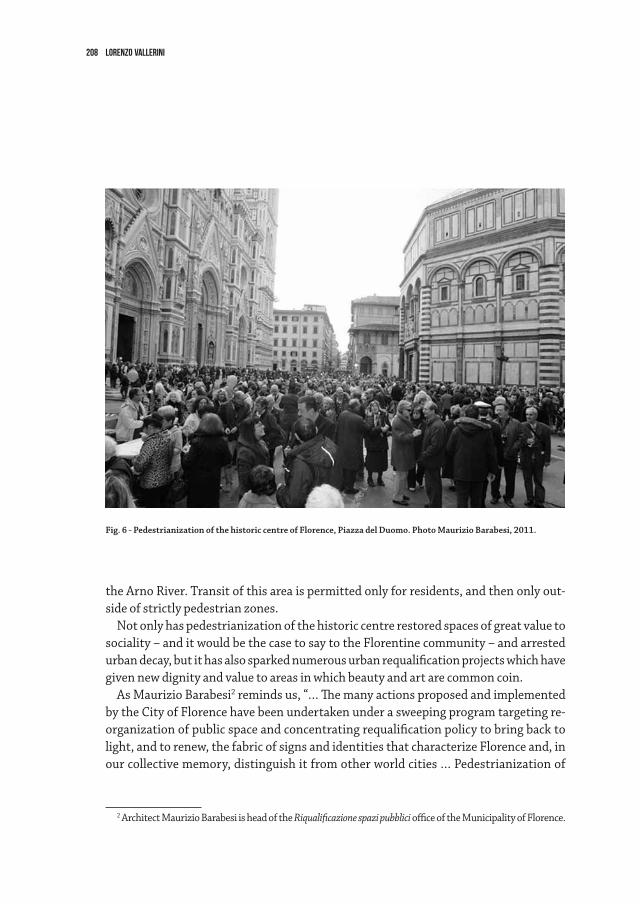
208 lorenzo vallerini
theArnoRiver.Transitofthisareaispermittedonlyforresidents,andthenonlyout-side of strictly pedestrian zones.
Notonlyhaspedestrianizationofthehistoriccentrerestoredspacesofgreatvaluetosociality – and it would be the case to say to the Florentine community – and arrested urbandecay,butithasalsosparkednumerousurbanrequalificationprojectswhichhavegiven new dignity and value to areas in which beauty and art are common coin.
As Maurizio Barabesi2remindsus,“…ThemanyactionsproposedandimplementedbytheCityofFlorencehavebeenundertakenunderasweepingprogramtargetingre-organizationofpublicspaceandconcentratingrequalificationpolicytobringbacktolight, and to renew, the fabric of signs and identities that characterize Florence and, in our collective memory, distinguish it from other world cities … Pedestrianization of
2 Architect Maurizio Barabesi is head of the Riqualificazione spazi pubblici office of the Municipality of Florence.
Fig. 6 - Pedestrianization of the historic centre of Florence, Piazza del Duomo. Photo Maurizio Barabesi, 2011.
209“moving” urban LANDSCAPEs
PiazzaDuomo,whenitwasimplemented…abolishedvehiculartraffic,includingthe2,200 buses that passed through every day, and achieved two results:
• itremovedtheelementsthatproducedvisual,atmospheric,andacousticpollutionandsubtractedspacefromtheurbansceneanditsfruitionbywalkers,andremovedelements that did not belong in the urban space …
• itconfirmedandacceleratedtheurbanplanningdecisiontotransformthecityfroma monocentric to a polycentric entity, transforming the public transportation sys-temfromaradialtoanintegratednetwork…”(Barabesi,2013).
PedestrianizationofPiazzaDuomo,ViaMartelli,ViaTornabuoni,PiazzaPitti,andthe surrounding areas has made it possible to restore the existing stone paving and to lay stone paving in areas in which it had been replaced by asphalt to accommodate the since abolished vehicle traffic and to enhance the new pedestrian areas with quality urban furnishings.
“… In these actions, the material is the identifying element which permits us to con-tinue the Florentine tradition of stone paving, in which the design of the pavements and the way the stones are dressed components that interact with the urban scenario to highlight its principal historical and contemporary features …” (Barabesi, 2013).
Theimpetusimpressedontheentirecitybythenewandextensivepedestrianareatranscends,intermsofdimensions,thecentreitselfwithitsbeneficialchain-reactioneffects,whichhaveinturnledtoacceleratingconstructionofthenewtramlinesandmodifyingcity-dwellers’“lazy”habits.Butaboveall,theseactionshavebroughtFloren-tines closer to their great city of art, which for too long has been left to tourists alone: the squares and the streets are now filled with events, with social exchanges, with new life.
210 lorenzo vallerini
references
Barabesi M., Public space forever,inProfessioneArchitettoOverview,11/02/2013,FlorenceComunediFirenze,Soc.TramviadiFirenzeS.p.A.,Progetto delle sistemazioni paesaggistiche-Viale
Milton, Viale Strozzi, Archlandstudio, 2012DiBenedettoG., I suoli di Izdik,EdizioniCulturadellaPace,SanDomenicodiFiesole(FI),1997FerraraG., Per un progetto di paesaggio,inEmanuelaMorelli,Strade e paesaggio della Toscana,
Florence,AlineaEditore,2007,pp.3-4.La Cecla F., Contro l’architettura,BollatiBoringhieriEditore,Turin,2008LynchK., L’immagine della città,MarsilioEditore,Venice,2006ParolottoF., The future of transport and cities, published on the magazine l’Arca on February
2012, www.arcadata.comRomanoM., La città come opera d’arte,GiulioEinaudiEditore,Turin,2008ValleriniL., edited by, Il paesaggio attraversato - Inserimento paesaggistico di grandi infrastrutture
lineari.EdifirEdizioni,Florence,2009.ValleriniL., Paesaggio e infrastrutture inthejournal“ArchitetturadelPaesaggio”,23,July-De-
cember 2010, Milan.
WEBSITE
From the Comune di Scandicci website (february2013): http://www.comune.scandicci.fi.it/index.php/a1-terza-corsia.html
From the Comune di Scandicci website (february2013): http://www.scandiccicentro.it/site/home.asp
From the Comune di Firenze website (february2013): http://www.comune.fi.it/opencms/openc-ms/comune_firenze/mobilita/tramvia/Tramvia.html#4
211
Theinjunctiontofixurbanfrontsaccordingtoadensecitymodelratherthanac-companying urban sprawl has today gained a high level of consensus among the main actors of urban planning. According to documents on urbanism, both agricultural and natural spaces are to be preserved within a common paradigm under the designation “openspaces.”Experiencehashowevershownthattheforceforplanningsuchfronts,inscribedintheurbanismmasterplanssincethe1960s,findsitdifficulttoresisteco-nomicforces(landandrealestatemarkets,vitalityofagriculture),politicalforces(localand regional governance) and social forces (housing requirements, progressively larger surfaces per inhabitant). A proposed solution – which is also a consequence – for ad-dressing this issue is to gain recognition of such open spaces from local populations as a commongood,alandscapetopreserveforthelivingenvironmentofperi-urbaninhab-itants.Thissolutioncorrespondstoanevolutioninthewaytomakeacitywhichaimsat renewing, even recreating, a means of drawing inhabitants into urban management.
Within this context, a research programme1 into qualifying urban fringe landscapes has brought to light the emergence of a new landscaping concept, a new conception of space: the urban lisière.AccordingtoBertrandFolléa(DPLGlandscapearchitectoftheFolléa-GautierAgency),itaimsatcreatingan“…urbanlisière which participates in theorganisationoftheterritory.Itmaterialiseslimitstourbanisation,formsabuffer,an interface or glaze between agricultural or natural spaces and constructed spaces”2; “… transitions are to be emplaced, urban and agricultural lisières constituted to address this issue (banalisation of urban landscapes): groves of trees, orchards and horticul-
1TheLandscape and Sustainable DevelopmentProgrammeresearchprojectonqualifyingperi-urbanfringelandscapes.Thisproject,co-pilotedbytheLADYSSMixedResearchUnit(RichardRaymond),theVersaillesSchoolofLandscapeArchitecture(SophieBonin)andtheESPACEInstituteofResearchforDevelopmentinMontpellier(PierreDérioz),aimsatfindingkeysforreadingperi-urbanspacesbystudyingpoliticaldi-scourseandthatoflandscapeexpertsalongwiththeperceptionsofinhabitantsofthreedifferentregions:theIledeFrance(Parisianregion),theLanguedoc-RoussillonandReunionIslandintheIndianOcean.TheReunionIslandterritorywasexploredwiththevaluablecollaborationofMoniqueToublanc.
2AgenceFolléa-Gautier,ZoneUP,Atelierdel’Isthme,2009,Schéma intercommunal d’aménagement des lisières urbaines, Territoire Côte Ouest,TCO,Réunion-Directiondel’aménagement.
4.4The concept of urban lisière and its application on Reunion IslandSophie Bonin
212 sophie bonin
turalzonesalldeservetobeimplementedduringtheon-goingdevelopment”3. Such transitionalzonescanalsobeseenasachangeinthewayoflookingatandreappro-priating spaces “… which have no a priori value within a future of urbanism dedicated to land sale profits …” but “… which have an inherent availability, one of the basic constituants of urban public space”4. Urban lisière is a term very pregnantly employed incontemporaryurbanreflections,forexampleinthoseoftheGreaterParisInterna-tionalWorkshoportheIle-de-Franceurbanismagency.Itisalsofoundinthewritingsof reputable landscape architects: Bertrand Folléa has been using this term in his land-scapingprojectssincetheendofthe1990s,ashasMichelDesvignes,evokedbelow.
Seizing and focussing on this concept thus appears to be an interesting entry point withinthehypothesisthatitwillwitnesstoabreakingwiththehabituallynegative–evenpejorative–discourseconcerningperi-urbanlandscapes.Theideaofurbanlisière ispartoftheprojectofrequalifyingtheperi-urban,changingitsimageanditsmodesof installation. We will first see how it is constructed with reference to another concept andanoldertermmoreoftenusedinmasterplans:theurbanfront.Wewillthenlookatseveralexamplesofitsimplementation,withReunionIslandservingasourlaboratory.
A Recently Added Term in the Field of urbanism, and One with Interesting SemanticsRecent appearance in the field of urbanism
In urban planning and in documents on urbanism, mastering urban sprawl is a fundamen-tal question and among the main motivations of injunctions, especially concerning control-ling the consumption of farmland and natural spaces. It requires apprehending the limits of the city. In the Parisian region, where the oldest urban master plans of France are found, the termsinitiallyusedwerequiteneutral:limits,perimeters.Thefirstplanextendingreflec-tionbeyondintramuralParis,the1934regionalurbanismplan(approvedbylegaldecreein1939),givesaratherconstrainingdefinitionofa“perimeterofagglomeration”inreactiontotherapidanduncontrolledexpansioninprivatehomesandsub-divisionsfollowingWWII.Itdefineditastheperimeterbeyondwhichtheurbanisedzonecouldnotbeextended.ThetermperimeterofagglomerationwasusedagaininthePADOG–Pland’Aménagement
3AgenceBertrandFolléa–ClaireGautier(paysagistes),MarcMarcesse(CETEMéditerranée),1997,Etude préalable au Plan de Paysage de l’Ouest,Ministèredel’Equipement,DDEdelaRéunion,DIRENdelaRéunion.
4MaheyP.,1999,«Lalisière,potentield’accueildesnouveauxespacespublicsdedébat»,Les annales de la recherche urbaine,n°82,mars1999.
213The concept of urban lisière and its application on Reunion Island
etd’OrganisationGénérale(PlanfortheInstallationandGeneralOrganisation)fortheParisianregion–approvedbydecreein1960.Itwasconceivedasaborder,anenclosure,conforming to the general constructed region including interstices, but forbidding oil stain expansion.Theconceptalsoappearsinthe1965SDAURP–Schémad’Aménagementetd’Urbanisme (Installation and Urbanism Scheme) for the Parisian region – where the term ‘agglomerationfringe’isusedratherthan‘front’inassociationwithpreservationofarurallandscape to “… avoid the countryside’s losing its natural charm …” (p. 237).
Fromthe1970sor1980s,thetermsgreen belt and especially urban front appear prom-inently.Thesecondconceptismostcommon.Itexpressesthedesiretofixthelimitsofthe city and can be found in most of the master plans at the scale of agglomerations in the1980s.Itsgeneralphilosophywasexpressedinthe1976Schéma d’Aménagement et d’UrbanismeoftheIle-de-Franceregion(SDAURIF),undoubtedlyasanewandoriginalconceptastheprecedentdocumentin1965hadnotmentionedit.Onefindsanout-line of the urban lisière conceptasitisnowusedbylandscapearchitects,andthe1976SDAURIFwasevenmoreconcreteinitsinstallationproposalsthanwastheprojectofSchéma Directeur Régional d’Ile-de-France(Ile-de-FranceRegionalDirectorialScheme)of2008 with comparable formulations.
Thefollowingtwoextractsgiveclearportrayalsoftheproposofeachepochonthiscommon goal of installing limits :
• 1976Schémad’Aménagementetd’urbanismedelarégionIledeFrance(p.112): “… at the limits of the agglomeration, where the countryside begins, “external fronts”formthenewfacadesofthecity.Theyshouldbedesignedsoastoexpressthis character of an organised limit, and the operations carried out must rely on a compositionofarchitecturalandurbanarrangementscontributingtothiseffect.Moreover, their overlap of contiguous peripheral rural zones should be treated in “glazes,”thatistosay,asvastnon-constructedzonesbasedonnaturalcomplexes.
At the edge of large forest complexes, which are now part of the agglomeration and especially in the new towns where such contacts are numerous, constructed fronts shouldbekeptbackfromtheforestedgesoastoconserveabufferzonenecessaryfor good ecological management of the latter. A landscaped and functional transi-tionshouldbeassuredthroughtheuseofgardens,plantedwalksandparks.
Concerning local and regional discontinuities, the same principle of sharing be-tween constructed and empty spaces leads to treating the “internal fronts” by using terraced or planted constructed elements ending at clear topographical positions to unambiguously affirm the separation they represent.
• 2008SchémaDirecteurRégionald’IledeFrance,adoptedbytheregionbutneverapproved:
214 sophie bonin
Concerning“…[existing]urbanisedspacestooptimise,…thelimitsoftheexistingurbanisation must be so installed as to constitute a coherent front, a transitional space valorising both the city and nature.”
Concerning urban extensions, “… the urbanisation must continue existing con-structions, but without harming an ecological continuity, urban ruptures, an agri-culturalcontinuity,agreenlink,theedgesofawoodedspace,oranurbanfrontofregional interest represented on a map.
“Urban fronts of spaces opened to urbanisation, lines of contact with natural, agri-cultural and forest spaces, must be controlled and treated so as to preserve the ag-ricultural,naturalandforestentities,thecontinuitiesandthelinksbetweentheseentities and the urban ruptures”5.
Thesetextsreflectacertainsenseofthelimitconceivedinalinearandclearfashionbetweenconstructedandopenspaces.Thelatterarecalledfreespacesinthedocumentsofthe1960sand1970sfortheParisianregionwhichalsousedsuchwordsas“façade”,limit,linesofcontact.The1976SDAURIF,however,inwhichlandscapearchitectspar-ticipated,outlinesanideaoftheselimitshavingthicknessandevenconstitutingspaceinthefullestsense,“glazes,”“bufferzones”(wordsusedindefiningthecontemporaryurban lisière),“vastunconstructedzone.”The1976textalsoproposestheideaofapar-ticularlymulti-functionalvocationforsuchspacebymentioningconcernforecologicalmanagement as well as gardens, thus eventually including food production, leisure, aestheticandsymbolicfunctions.Neitherofthetwolargeregionalmasterplanscitedused the term urban lisière as such, and the term is also absent from most dictionaries on urbanism and town planning6. It is found only in the dictionaries most dedicated to landscape,especiallyinthefieldofgardenandlandscape,andreflectuponplotlimits,“… particularly when they separate a wood from a field or pasture”7. It is characterised
5 Schéma Directeur Régional d’Ile de France,projectadoptedbydeliberationoftheRegionalCouncil,28Sep-tember,2008,p.174-175.http://www.iau-idf.fr/fileadmin/user_upload/Enjeux/Sdrif/sdrif_adopte.pdf.
6Exhaustivesearchwascarriedoutinthedictionariesonurbanismandthelandscape(urbanandinstalla-tionregistry,gardenandlandscaperegistry)intheENSPlibrary,themostrecentofwhichdatesto2008.IntheGallicabibliographicalbaselistingmainlyclassicaltexts,seeking“urbanlisière”and“urbanfront”gaveno results. “Urban fringe” appears from 2000 in urbanist and organism reports of the Ponts et Chaussées/CETEtype,editedbytheDocumentation Française.Thislexicalfieldisthusrecentatthescaleofthehistoryof urbanism.
7GodronMichel,JolyHubert,Dictionnaire du paysage, Conseil international de la langue française, 2008, p.109.
215The concept of urban lisière and its application on Reunion Island
asbeinga“…habitatrichinspecies…”evokingthe“lisièreeffect”wherethenumberand diversity of species are often higher than in either of the contiguous biocenoses8.
A change of view in landscape discourseSincetheendofthe1990s,thisproposaltosubstantiatelimitsbetweenconstructed
and open spaces has appeared with force in the discourses and projects at the scale ofurbanplanning,particularlywithcontributionsfromlandscapearchitects.TheGreaterParisInternationalWorkshop9 showed that this vocabulary is now widely used by designers of urban space in the large sense: landscape architects, urbanists, archi-tects.Duringtheinternationalconsultationswhichtookplacein2008-2009,severalteams place the lisièreconceptattheheartoftheirproposals(LIN,DescartesGroup,JeanNouvel,Jean-MarieDuthilleul,MichelCantal-Dupart,AntoineGrumbachandAssociates)10. “Intensifying lisières”thusbecameoneofthethirteenGreaterParispathslaidoutfor“constructingthecityonthecity”.Twolandscapearchitects,BertrandFolléaandMichelDesvignes,havebeenespeciallyinstrumentalinconstructinganddiffusingthe lisière notionasaprojectconceptsincethe1990s,withpublicationsinspecializedinstallation reviews.
HereishowMichelDesvigneexpressesthecontemporarysingularityofthisinstal-lationfigure:“Substantiatingthelisièrewouldcreateopenlinks,establishaporosityratherthanabeltwhich,evenifgreen,correspondstoadilatedgrid.Thissingularme-dium would call upon practices and techniques borrowed from the world of agriculture andaddressthedeficitsoftheurbanperiphery.[…]Itwouldbethekeytolandscapeinterventionsatoncecontinuousandverydivers,ahemofferingnewhorizons.Onthecity side, this landscape would represent an opening and the end of a border. A public space,itwouldmakeitpossibletoescapethebootcamplogic.Itssimpleexistencewouldhavedeep-lyingeffects.Present-daysub-divisiondeadendswouldleadtosharedspac-
8 Dictionnaire des jardins et des paysages,Dicovert,AnneCamusandPhilippeThebaud,Arcature,1993.9ArchivesoftheInternationalConsultationheldin2008-2009presenting,inparticular,theconceptof
lisière,alargebibliographyandworksunderwaycanbefoundatwww.ateliergrandparis.fr under the theme “InhabitingGreaterParis.”
10“It[thenaturalcity]negotiatesitslimitsbycomposingdiversurbanlisières intermediate spaces betwe-en the city and farmland, public spaces granting access to the countryside while respecting farming acti-vities.”(AntoineGrumbachandAssociates,Le Grand Pari de l’Agglomération Parisienne,Deuxièmerenduintermédiairedes3chantiers,Cahier2,livret,MinistèredelaCultureetdelaCommunication,EMOCEta-blissementPublicdeMaîtrised’OuvragedesTravauxCulturels,p.26.http://www.ateliergrandparis.com/aigp/conseil/grumbach/GRUMBACH1c01.pdf, consulted 27 January, 2013).
216 sophie bonin
es.Theirsignificancewouldchangeastheylosttheirstatusofpublicroadsforprivateuse. As for the countryside, the same dilating applied to the limit between two proper-tieswouldcreateanetworkofroads,ofditches(previouslypresent,todaygone,whichmadeitpossibletocontroltheflowofwater),towhichotherrudimentaryplotscouldbejoined (meadows, orchards, etc.) and constitute, a little at a time, truly common spaces.
Thetoolsarethussimpleandfew.Theycanberapidlysetupwithlargescaleeffectsifonethinkstolayoutthelisières.Thecreatedinterfacewouldreconcilethetwoworldsbyallowingthemformsinwhichtodevelopandeconomicexchangesofproximity.Naturalresources would be not only preserved, but rather animated and amplified”11.
From this extract one sees that the concept of lisière is well part of imagined crea-tion, as shown by the use of the conditional. It is also a particular heritage within the specificity of the landscape designers who have long specialized in treating interfaces, creatinglandscapesbyvalorisinglimits,fringes,andbyseekingthemulti-functionalityofspaces.Thisefforttobuildarelationshipbetweenspacesofdifferentnatures,thisworkoninterfaces,ispracticallyconsubstantialwithlandscaping:thecreationoffreespaces, spaces aimed at creating a harmonious relationship, hybridization, between the cityandnature/environmentisfoundinnumerousworksbythepioneeringlandscapearchitectsofthe1960-1970s.Withintheconceptionoftheselisières one also finds the model of the garden, from which it “… borrows an idyllic and euphorizing vision of the world and tends to transpose it to the real world”12.
Renewal of connotationsIn the Littré dictionary and according to the Dictionnaire historique de la langue fran-
çaise editedbyAlainRey,inthefirstattestationsoftheword(1244)lisière designated the edge of a sheet, a piece of cloth13, “… that which forms the lengthwise edge of a fab-ric.”Thesecondmeaninggivenisthatof“…chordsattachedtoachild’srobetoholdhimashewalks,thuscalledbecausetheyareusuallymadewiththeedgesofsheets.[insert
11Desvigne,M.,2011,“Lepaysageenpréalable,”inMasoungi,A.,Barbet-Massin,O.,Le paysage en préala-ble, Michel Desvigne, Grand prix de l’urbanisme 2011. Joan Busquets, Special Prize,ed.ParenthèsesandDGALN,Marseilles,p.60-61.
12Donadieu,P.,2009.Les paysagistes, Actes Sud, p. 135.13Thisinitialmeaningisfoundinother19thcenturyFrenchdictionaries,suchastheNouveau Larousse
illustréeditedbyClaudeAugé(1897-1904),anduptorecentlyintheQuillet-FlammarionDictionnaire usuel illustré, 1981, or Le petit Robert,1990.Themeaningofedgeofafieldorforestisthusasecondorthirdmeaningand figurative.
217The concept of urban lisière and its application on Reunion Island
Fig.]Thatwhichisusedtoguide,tosupport,asaguidinglisière, a support14.Thissensehassincedroppedintodisuse,butitremainsinterestingasaconnotation.Inthe1980sand1990sFrenchdictionariescommonlyplacedthisedgeofafabricmeaningfirst.Butsince 2000 it is the edge or extremity of a space which comes first, then that of vegeta-tion, a curtain of trees, on the edge of a forest or parcel, and finally the edge of a piece of cloth15.Overthepast20yearstherehasthusbeenashiftinfavourofthespatialandecological sense in the vocabulary presented by the dictionaries.Theoriginalmeaningisinterestingbecauseitbreakswiththeothertermsofthe
paradigm designating the limit between the city and the countryside, structure and nature, constructed and productive spaces: front, border, fringe, belt. If front – in the senseofforeheadfromtheFrench–is,properlyspeaking,alimitofthehead,thecapi-tal organ, lisière referstotheedgeofapieceofcloth,asheet.Thecitymetaphorhereat play is thus the urban tissue, more than a reference to the head. Hence, the place of the city, of urbanity, is relativized within the notion of lisière with reference to that of afront,alongwiththatofaffronting,ofdisputedterraintobeconqueredorretaken.Thelinearcharacterofthefrontissubstantiatedbythetermlisière: the front is a line on a map; the lisière is a zone, a type of space corresponding moreover to that which ecologues call the ecotone. It is an additional element confirming that the vocabulary ofmilitarystrategyisbeingdroppedforthatofsewingandweaving…Thisvocabularyundoubtedly is part of the landscape architect’s culture, as it is also found behind terms suchasframe,hem,weavingoflinksandurbantissue,alloftenusedbylandscapear-chitects during the 20thcentury.Thereisthereforenothingsurprisinginfindingthatlandscape architects were pioneers in using this word in the field of urbanism.
A meeting Amongst Actors Remaining to Be Constructed: On-site Confrontation on Reunion IslandThe concept of urban lisière on Reunion Island
AccordingtoBertandFolléa(interviewinNovember,2012andarticleinLes Carnets du paysage16),itwasthelandscapestudiesonReunionIslandwhichledhimtobetterformalise the concept of lisière.ReunionIslandiscertainlyamobilisingcontext:the
14Littre,E.1874.Dictionnairedelalanguefrançaise.Paris,Hachette,vol.3,p.321.15 For example, in the electronic version of the Larousse dictionary : http://www.larousse.fr/dictionnai-
res/francais/lisi%C3%A8re/47395?q=lisi%C3%A8re#4732516Folléa,B.,“Lepaysagecommerelation,”LesCarnetsdupaysage,n°21,ActesSud/ENSP,p.191-213.
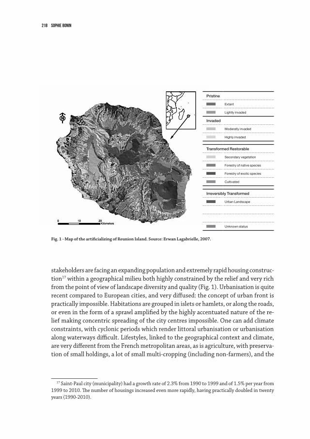
218 sophie bonin
stakeholdersarefacinganexpandingpopulationandextremelyrapidhousingconstruc-tion17 within a geographical milieu both highly constrained by the relief and very rich from the point of view of landscape diversity and quality (Fig. 1). Urbanisation is quite recentcomparedtoEuropeancities,andverydiffused:theconceptofurbanfrontispractically impossible. Habitations are grouped in islets or hamlets, or along the roads, or even in the form of a sprawl amplified by the highly accentuated nature of the re-liefmakingconcentricspreadingofthecitycentresimpossible.Onecanaddclimateconstraints, with cyclonic periods which render littoral urbanisation or urbanisation alongwaterwaysdifficult.Lifestyles,linkedtothegeographicalcontextandclimate,areverydifferentfromtheFrenchmetropolitanareas,asisagriculture,withpreserva-tionofsmallholdings,alotofsmallmulti-cropping(includingnon-farmers),andthe
17Saint-Paulcity(municipality)hadagrowthrateof2.3%from1990to1999andof1.5%peryearfrom1999to2010.Thenumberofhousingsincreasedevenmorerapidly,havingpracticallydoubledintwentyyears(1990-2010).
Fig. 1 - Map of the artificializing of Reunion Island. Source: Erwan Lagabrielle, 2007.
Pristine
Extant
Lightly invaded
Invaded
Moderatly invaded
Highly invaded
Transformed Restorable
Secondary vegetation
Forestry of native species
Forestry of exotic species
Cultivated
Irreversibly Transformed
Urban Landscape
Unknown status
219The concept of urban lisière and its application on Reunion Island
sugar cane industry. But the urbanisation dynamic poses the same problems and ques-tionsasmetropolitanperi-urbanisation,albeitinamoreamplifiedmanner.InsuchacontextitisinterestingtoexaminethestudiescarriedoutontheWestCoastTerritorysincetheendofthe1990sandwhichtookamarkedlandscapingorientationthroughtheworkoftheBertrandFolléaandClaireGautierAgency,landscapearchitects.Thecooperation between the agglomeration community of this territory occupying about a fourth of the island (212,000 inhabitants in 2013) and the landscape architect agency isquitesingularandhasinfluencedtheactualdraftingofurbanismdocuments,atleastatthescaleofthisinter-communalterritory.ItbeganwiththePlan de paysage (Land-scapePlan)of199718,sponsoredbystateservices(DDEandDIREN),continuedwitha Landscape Charter in 200719andaninter-communallayoutoflisièresin200920, the ideasofwhichwererecuperatedintherecentTerritorialCoherenceScheme–SCOT21 –ofthisWestCoastTerritory(2011,approvedandenforceablesinceJune,2013)22. Amongtheproposalsformulatedinthe1997LandscapePlanaimedatstructuringes-peciallyslopesandcreatinga“…frameworkoflandscapestobestaccompanyon-goingchanges,”figuredifferentprinciples:alternating(atagivenlevelofrelief,alternatingdifferenttypesofopenspaceandmoreorlessdenseformsofurbanisation),a“chainof
18AgenceBertrandFolléa–ClaireGautier(landscapearchitects),MarcMarcesse(CETEMediterranean),1997,EtudepréalableauPlandePaysagedel’Ouest,MinistryoftheEquipment,ReunionIslandDDE,ReunionIslandDIREN.
19AgenceFolléa-Gautier(paysagistes),PW2C(PatrickWolfCommunication),Vued’Ici(SIG),2006-2007,Charteintercommunalepaysagère,patrimonialeetarchitecturale.Unechartepourlaqualitéducadredeviedansl’Ouest(3volumes),TerritoireCôteOuest-Directiondel’aménagementetdudéveloppement.
20AgenceFolléa-Gautier,ZoneUP,Atelierdel’Isthme,2009,Schémaintercommunald’aménagementdeslisièresurbaines,TerritoireCôteOuest,TCO,Réunion-Directiondel’aménagement.
21ASCOTisasortofMasterPlan,urbanismdocumentproposingmajorprincipalsofinstallation:habi-tations,transport,energyandeconomicdevelopment.Itisopposabletolocalurbanismplans.Theterri-torymustbeinter-communal.Ofvaryingsizes,itcanbequitelarge,formedbyfrom3-4municipalitiestoseveraldozen.Itisgenerallylinkedtoanurbanpoleanditsterritoryofinfluence.ForReunionIsland,theadministrative organisation is well structured and with little overlap: 4 agglomeration communities cover all the municipalities of the island, corresponding to about a fourth of the surface area and a fourth of the population,andcorrespondingtotheperimetersoftheSCOT.
22TCOSCOT,Volume3,Document d’orientations générales,December,2011,p.42:O14–“Urbanlisières – Urban projects located in the priority urbanisation spaces and preferential urbanisation zones contributing to the rene-walandextensionofurbanspacesmakeitpossibletovalorisethelimitsofthecontiguousagriculturalornaturalspaces,spaceswhichconcretisetheinterpretationbetweencity,agricultureandnature.Theyaimparticularlyatguarantying and developing three important functions: landscape by definition, ecology (biodiversity and the fightagainstpollution,rainwaterworks),urbanstructuring(publicspaceofproximity,collectivefamilygardens).”
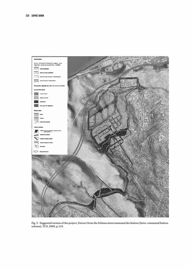
220 sophie bonin
Fig. 2 - Suggested version of the project, Extract from the Schéma intercommunal des lisières [Inter-communal lisières scheme], TCO, 2009, p.119.
221The concept of urban lisière and its application on Reunion Island
landscapes-parks”(agriculturalpark,savannahnaturalpark,humidzonenaturalpark,forestpark)withanarchipelagoofconstructedisles,butalsoforurbanism,urbanlisières.Thefinalconceptaimsatorganizingrelationshipsbetweenconstructedspaceand open spaces, at “… instituting vegetal transitions between constructed space and cultivated space: tree groves, orchards, vegetable gardens, etc.” as well as between con-structedandnaturalspaces.Themainideaistocreatetransversaltransitionsbetweenthe ravines: often deep, structuring districts of habitation, they are indeed mostly orientedEast-Westcreatingnaturallisières which follow the slopes. Urban lisières are thus mostly to be created in the global direction of the isohyetes, perpendicular to the slopes.Withoutreferringtoit,thisconceptionjoinstheresearchseekingtoconstitutebothsocialandecologicalcontinuitiesinnetworks,alsoclosetotheideaofa“systemofparks”whichappearedfromtheendofthe19th century23.
TheFolléa–GautierAgencytookuptheurbanlisière formulationquitequicklyforanIle-de-Franceproject:Guidelines for Valorising Farming and the Landscape on the Plaine de France (Plan Guide pour la valorisation agricole et paysagère de la Plaine de France,1998,Agencyofgreenspaces,Ile-de-Franceregion).Drawnfromagriculturalspace,thelisière is conceived as giving it added value through a “fruit promenade” and smaller, more diversified plots (orchards, prairies, wooded meadows, family gardens). But here we are interested solely in theechoofthebeforementionedprinciplesfoundonReunionIsland:theconceptoflisière poppedupquiteofteninthemasterplans,atagglomerationscale,theSCOT.
Butwhatisthecaseatascaleclosertotheconcreteprojects?Forexample,doesoneobserverealisationsintheon-siteZACprojects(Zonesd’AménagementConcerté,Con-certedInstallationZones)?MissionscarriedoutinMay2012andJuly2013withMo-niqueToublancwithintheframeworkoftheresearchprogrammecitedintheintroduc-tion made it possible to give a few elements of response.
Unequal diffusion of the concept down to urban planning projectsAs we have seen, the principal of installing and preserving lisières was retained in
theSCOT,andtheotherlocalurbanismdocumentsareforcedtoconform.IntheLocalUrbanismPlanofSaint-Paul,themainmunicipalityoftheterritory,thePresentationReportusestheurbanlisière terminology by referring to the landscape charter of the inter-communalterritory.Itvalorisestheirhydrologicalfunctions(evacuationofrain-
23Toublanc,M.Bonin,S.,2012,“Planifierlestramesvertesdanslesairesurbaines:uneallianceàtrouverentre paysagisme et écologie,” Développement durable et Territoires, vol. 3 n°2, July, 2012 (http://developpe-mentdurable.revues.org/9347).
222 sophie bonin
water), social functions (leisure, relaxation, breathing space), spatial functions (urban rupture) and ecological functions (ecological corridor). In another volume of this local urbanism and sustainable development plan24, however, no mention is made of urban lisière.Noteventherelationshipbetweenconstructionsandagriculturalornaturalspaces(gullies,savannas)isevoked.Theissueslinkedtothesespacesarevalorisingmainly natural heritage and maintaining “urban ruptures.” An examination of the In-stallationOrientationscomponent,whichconcretisestheplanningoffutureurbanpro-jects, also reveals a difficult or at least incomplete emergence of the original proposal.
Still,incomparingtheInstallationOrientationsofaprovisoryversionofthelocalurbanismplandecreed29September,2011(non-approved)withtheapprovedversionof September, 2012, one sees principles which evolve. In the provisory version of 2011, the landscape charter and the notion of lisièreseemtohavenoeffectontheprojectstocome.Onefindsonly,forcertainprecincts,thedesiretohave“…preservedandinstallednatural spaces with pedestrian paths …” often placed at the edges of the open spaces, the idea of a “ … precinct open to the gullies …” when the urbanisation advances towards the gullies, or the idea of “… greenways …” along the edges or in the centre.
TheSeptember,2012approvedversion,ontheotherhand,showsanotableevolutioninsomeprojectplans.Themostimportantintermsofconsumednaturalsurfaceonthemid-slopesoftheislandandintermsofnumberofplannedhousingsistheRenais-sanceIIIZAConCaillouPlateau(89ha,600housingsintheshortterm,2500plannedinthelongterm).ThisurbanextensionisinterestingasitwastakenintoaccountintheGuidelinesofthelandscapecharteroftheinter-municipalityterritoryin2007.Therewas a double outline around the new precinct, substantiating the limit of urbanisation for the “… urban lisières : creation of vegetal bands accompanying the urban limits, compositionofanurbanfrontindialogwiththesavannah.”Theserecommendationscanbefoundintheinter-municipalschemeoflisièresof2009(Fig.2).Still,intheorien-tations of the 2011 urbanism plan for the precinct, the term lisière no longer appears, and the only thing drawn is a green band bearing no legend and corresponding to the presence of a gully. In the 2012 approved version, however, if the term lisière is still not mentioned, the drawing clearly indicates a green transition. But it is discontinuous andbearsthelegend“greenway(gullies,rockybuttresses)”.Theideaofmaintainingalisière is thus above all envisaged from the angle of ecology, with the loss of its aesthetic dimensions,ofitspotentialusage,itsco-visibilityandevenitsroleofinter-relations
24 Both the version decreed in September, 2011 and that approved in September 2012 were consulted and they had modifications, but not on this point.
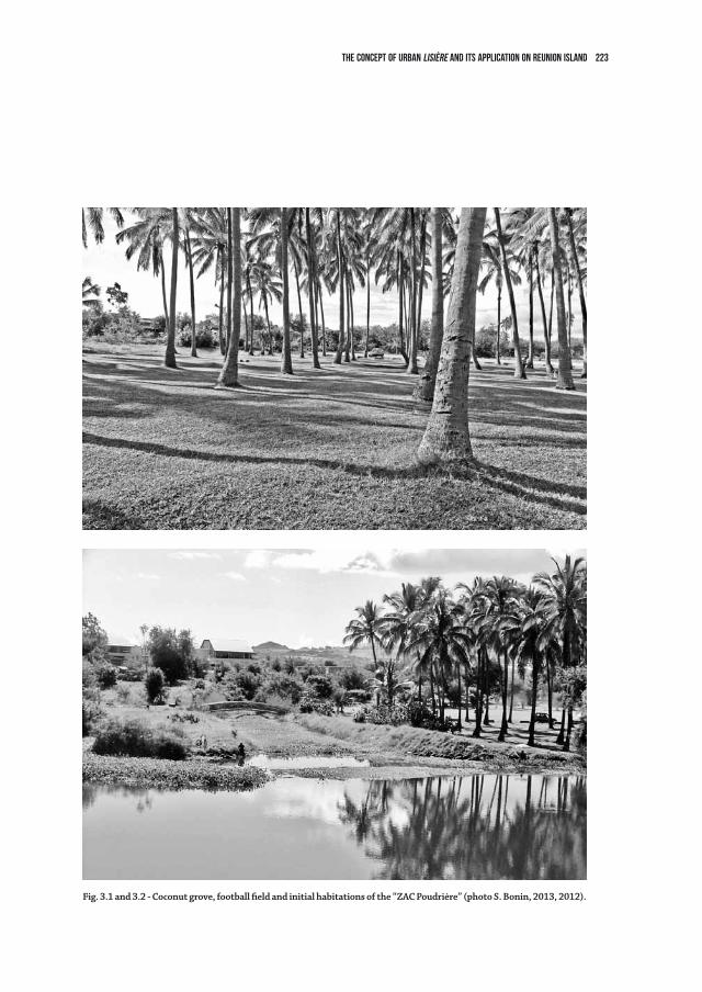
223The concept of urban lisière and its application on Reunion Island
Fig. 3.1 and 3.2 - Coconut grove, football field and initial habitations of the “ZAC Poudrière” (photo S. Bonin, 2013, 2012).
224 sophie bonin
betweenhumanandnaturalworlds.Thistransferismorethanaproblemofwords:itillustrates the pregnancy of the ecological discourse and witnesses to its domination over that of the landscape, which thereafter appears more social but disappears in the face of environmental injonctions.
On-site difficulties and successOntheurbanfringesrecentlyfinishedorunderway25, we neither observed nor heard about any concrete realisations of lisières between agricultural spaces and construc-tions,whicharegenerallymadeonagriculturalfields.Thedominantlogicisthatoffencing, with the periphery serving first of all as the axis for automobile traffic, hardly adapted to gentle circulations nor to ecological functions other than those necessary for suchinstallation.Theinstaurationofadialogbetweenagricultureandthecityhasnot– at least not yet – been made readable or been thought out for the future inhabitants.
Thedesireformulti-functionalspacesinproximitytothehabitationsthusrunsupagainst the logics of complex and varied actors. For the actors of the farming world, for example, the lisière simply adds to lost farmland. It is suggested that it be installed within the perimeter to be urbanised, but there is then a problem of cost and an absence ofactorstosupportthiscost.Toinstallpublicspacesofleisureandrelaxation,promot-ers and constructors prefer the centre of precincts for reasons of optimal distances from housingsofsuchhighlyrequestedspaces.TheotherobstacletobeevokedislinkedtotheReunionIslandlifestyleandhabitations.Smallanimalfarms,food,spicesormedici-nalplantations,areallstillfrequentpracticeswhichcanbefoundinthediffuseurbanspaces.Theyareassociatedwithprivateproperty,to“kours” (yards) of homes closed upon themselves to avoid theft. Such practices can also be found “wild,” or at least spontaneous,onpublicspaces(roadsides,floodablespaces,wasteland,etc.).Hence,the institutionalisation of productive space on public space which the lisière concept proposes, is not yet accepted by the actors who are the closest to the field.
Ontheotherhand,onecanobserveconsiderablesuccessintheinstallationoflisières between constructed and “natural” spaces (natural reserves, humid zones, forest, coastline)overthepasttenyears.SpacesseldomfrequentedtraditionallyforReunionIsland leisure are thus being truly “invented” from the social and landscape points of
25Differenthabitationprecincts,eitherrecentorinworks,werevisitedinthestudiedinter-municipalterritory(LaSalinelesHauts,RenaissanceIandIIZAConCaillouPlateau,PortailZACinSaint-Leu)aswellasinotherregionsoftheisland.NotablyvisitedwastheBeauséjourZAC,whichisanewtowninthegentleslopesaboveSainte-Marieofwhichapartwasrealisedin2012-2013andanotherpartison-going.
225The concept of urban lisière and its application on Reunion Island
view.Suchisremarkablythecasefortheseaside.ThetraditionalbreathingspaceforReunionIslandersofallsocialcategoriesismainlyathigheraltitudes.Thispracticeof“changingtheair”hasbewelldescribedinitsculturalspecificitiesbyRenéRobert26. TheseasidedoesnotholdsuchaplaceintheimaginationandculturalpracticesonRe-union Island (limited fishing, learning to swim in freshwater “pools” rather than in the sea)27. But over the last few years, coastal paths have been installed to allow gentle cir-culations,joggingandpick-nicking.Thesedevelopmentshaveincreasedconsiderably,both for the interest of users and for the coherence of a project requiring continuity and thus cooperation or emulation among local actors. A variety of installations have accompanied this “invention,” from the gentlest and simplest path through a forest in the domain to the more gardened and maintained of the new “green spaces.” But the strength of the urban lisièreconceptinitsmult-functionalgoalbetweenfoodproduc-tion and ecological leisure services is no longer present: it is an urbanising of nature, not a “ruralising” of the city.
Still,afinalexamplecanperhapswitnesstotheimplementationofeffortstoreachthegoal,oratleasttoapproachit.ItconcernstheperimeterofaZAC(correspondingtoa newly developed precinct) of which the limit with a pond classified as a natural reserve was installed as a transition zone for leisure while preserving a coconut grove (Fig. 3.1, 3.2).Indeed,theprecinct,initiallycalledthe“ZACPoudrière”wasre-baptisedasthe“ZACdelaCocoteraie”(CoconutGrove).Itisatree-linedproductionspaceoflimitedprofitabilityandwhichmakesitpossibletoconciliateseveraluses.Itisnot,however,includedintheco-propertyoftheprecinct.ItbelongsinparttotheONF(nationalforestry service) and in part to the municipality. Its maintenance is thus the responsi-bilityofthecollectivity(nationalfortheONFandthemunicipalityforthecommunalgrounds), which does not correspond to the urban lisière “ideal” as conceived in the landscape charter.
26Robert,R.,1999,“LaGestionetlavalorisationdudomainepublicdanslesHautsdel’îledelaRéunion.[ManagingandValorisingthePublicDomainintheReunionIslandHauts]”»,Annales de Géographie, n° 603, 1999,p.279-284.
27Foran“ethnologyofReunionIslandlandscapes”givingaremarkabledescriptionoftheserepresenta-tionsandculturalpracticesondifferentpartsoftheisland,seethereportbyJean-LucBonniol,JeanBenoist,1994,Unrapportétagémisàbas.ContributionàuneéthnologiedespaysagesàlaRéunion,Reportfortheethnological heritage Mission, notably p. 65, 87 for a representation hostile to the sea, and p. 103 for the traditionalsocialpracticesofpick-nickingin“lesHauts”(theHighlands)andalongtherivers.Thisreportwasrecentlyputonline:www.culturecommunication.gouv.fr/.../Ethno_Benoist_1994_084.pdf
226 sophie bonin
Thepresentationofthesesituations,specificandisolated,isnotaimedat“testingutopiaon-site;”thecomplextiesknittingdiscoursetorealityarefullyacknowledgedanditisnotaquestionoftesting.Still,thisexplorationofrecentoron-goingprojectsshows the manifest evolution in the relationship between urbanites and nature, with the development of practices of proximity which are the subject of strong social de-mand.Thisevolutioncoincideswiththerecognitionofnaturalspacesofproximity,of-ten given a low qualification by the inhabitants (neglected, left as wasteland, serving as backyards)butwhichhavebecomethesubjectofecologicalrecognition,ofanemerging“ordinarybiodiversity,”assuchspacesarepoliticallywonback.
Thisexplorationalsoshowsthatthechangesintherelationshipsbetweenurbanitesand food production cannot be considered an analogue to that with nature : with ag-ricultural spaces, there are actors “on both sides” of the lisièrewithdifferentsystemsoflogicandfewinstitutionsfordialogorworkingtogether.Thefutureseemstightlylinkedtothatof“sustainableagriculture.”Theconceptoflisière is integrated into a largerpolicyaimingatchangingthescaleandrelocatingagro-foodcircuits,atleastforproducers closest to the cities.
Approachingperi-urbanspacesthroughthelisière landscapeconceptmakesitpossibletoperceiveofanevolutionintheclassicalurban-ruralorcity-naturedichotomy,whichintheplanningdiscoursetendstosacraliseagriculturalornaturalspace.Thisdichotomy,whichwasrightlypresentedasaface-offandanactofdominationofthecityoverthecountryside, is today being upset28.Evermoreelaboratediscourseswitnesstothewilltorediscoverthesolidaritiesandfunctionallinksbetweenthecityanditsenvironment.Urbanfringes,whenevertheydevelopapoliticaldesireformakinginstallations,valoris-ing or becoming attentive to the living environment become innovative grounds for re-searchintoimbrication,inter-dependency:onemustonlyhopethattheecological,food,aesthetic,hedonicorludicdimensionsremaintightlyknittedto–toweavetheregisterof the lisière–andnon-dissociatedfromtheorientationsofinstallation.
28Ehrman,S.,“Penséesdé-moralisantespouruneunionlibredel’agricultureetdelamétropole”,Cahiers thématiques de l’école supérieure d’architecture et de paysage de Lille,n°11,p.47-61.
227
4.5NEW LANDSCAPE opportunities IN URBAN DESIGNGiovanni Sala, Andreas Kipar
Post Modern City: Voids and SprawlWhen we examine urban development through the centuries we can recognize the
steps that the city has gone through, developing from a compact aggregation of func-tions and of social relationships to a larger system of activities and a more specialized systemofconnections.Thisurbansystembecamephysicallylessdefinedinshapeanditsboundariesprogressivelyfadedbetweenthecityoutskirtsandthecultivatedfields,thus leading to the dissolution of the enclosed city – corresponding to Cedric Price’s famousimageofthe“hard-boiledegg”.
In the era of industrialization, industry has played a particularly prominent role in the physical body of the city: productive activities first occupied spaces in the core of urbandevelopments,thenthefactoriestookovertheperipheryanddeterminedanalmostuncontrolledexpansionoftheoutskirts.WorldWarIIbombingsdramaticallygenerated great voids, while the urban sprawl caused by industry in the first half of the century went into reverse with the industrial decay in the last decades.
Thecitywalls,asthefeatureseparatingurbanspacefromlandscape,disappearatthispoint. What formerly was the whole town came to be the city center, while beyond the old city walls further urban enlargements developed: residential settlements, factories, manufactures,infrastructures,parkingareas,airportsetc.Theresultwasthenamix-ture of city and rural landscape.
Sievertsdescribesthe‘Zwischenstadt’(In-betweenCity)asazonethatcanbeseenneitherascitynorascountryside,andonlydevelopedinthelastfewdecades.Thisspaceisneglectedbecauseneitherpartfeelsresponsible.Inthesesub-urbanareas,whichhavestilltobeplanned,peoplecanpotentiallyliveandworkverycomfortablyonceacloselinkagebetweennewdevelopmentsandtheopen-spaceisachieved.Spaceistherealpotential and today the availability of space may be the ultimate luxury.
ButitoftenhappensthattheZwischenstadtisleftunplanned,anditsgrowthdoesnot spontaneously find a relation of continuity with the consolidated city. If not ad-dressed, the potential of the periphery is wasted and the final result is the sprawl of differentepisodes,whichareleftunabletointeract.ButtheZwischenstadt has very good opportunities that have to be seized instead.
Inthismoment,weliveinatimeofpost-de-industrialization,withindustrywith-
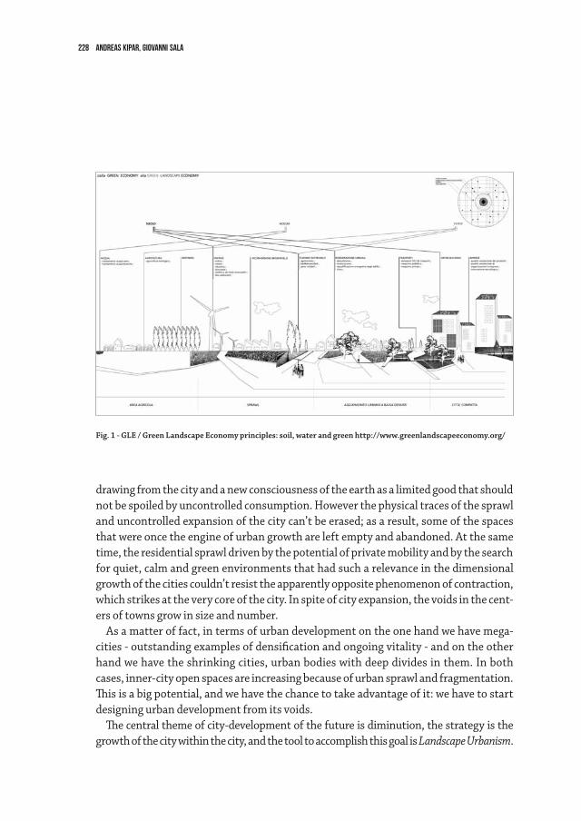
228 Andreas Kipar, Giovanni Sala
drawing from the city and a new consciousness of the earth as a limited good that should not be spoiled by uncontrolled consumption. However the physical traces of the sprawl and uncontrolled expansion of the city can’t be erased; as a result, some of the spaces that were once the engine of urban growth are left empty and abandoned. At the same time, the residential sprawl driven by the potential of private mobility and by the search for quiet, calm and green environments that had such a relevance in the dimensional growth of the cities couldn’t resist the apparently opposite phenomenon of contraction, whichstrikesattheverycoreofthecity.Inspiteofcityexpansion,thevoidsinthecent-ers of towns grow in size and number.
Asamatteroffact,intermsofurbandevelopmentontheonehandwehavemega-cities-outstandingexamplesofdensificationandongoingvitality-andontheotherhandwehavetheshrinkingcities,urbanbodieswithdeepdividesinthem.Inbothcases,inner-cityopenspacesareincreasingbecauseofurbansprawlandfragmentation.Thisisabigpotential,andwehavethechancetotakeadvantageofit:wehavetostartdesigning urban development from its voids.
Thecentralthemeofcity-developmentofthefutureisdiminution,thestrategyisthegrowth of the city within the city, and the tool to accomplish this goal is Landscape Urbanism.
Fig. 1 - GLE / Green Landscape Economy principles: soil, water and green http://www.greenlandscapeeconomy.org/
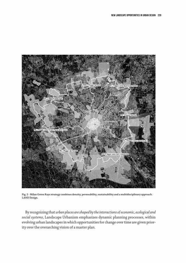
229NEW LANDSCAPE Opportunities IN URBAN DESIGN
By recognizing that urban places are shaped by the interactions of economic, ecological and social systems, Landscape Urbanism emphasizes dynamic planning processes, within evolving urban landscapes in which opportunities for change over time are given prior-ity over the overarching vision of a master plan.
Fig. 2 - Milan Green Rays strategy combines density, permeability, sustainability and a multidisciplinary approach. LAnD Design.
230 Andreas Kipar, Giovanni Sala
The Case of Milan. Stop the Sprawl: More Density, More PermeabilityItiswellknownthatMilanoisacompactcity,a“smallMetropolis”whichgrowsto-
wards a conurbation, but is still way smaller if compared to other cities such as Berlin andwhosedensity(inhabitants/sqKm)isstillhigh.Though,lookingatitsmaponecannotice that the city has a number of open spaces, from the center to the sprawl of the city.Becauseoffreneticdailylifeandlackofconnections,itscitizenscanhardlyperceivethese voids, these open spaces.
Inordertore-conquerthosespacesandenhancethedailyqualityoflifeintown,allofthe fragmented areas and green resources need to be organized in a system, so as to bring thembacktoprominenceandmakethempartoftheeverydayexperienceofthecity.
Infactpost-moderncitiesareaskingtobere-discoveredbynewformsofperceptionrather than new forms of design, as claimed for quite some time by psychologist and philosopher James Hillman1, a major interpreter of the reconsideration of urban land-scape in the everyday life of the city users.
ThisattitudecanbealsofoundintheLeipzig Charter on Sustainable European Cities2 signed on 25th May 2007, which contains very consistent statements and commitments on the theme of innovation in urban policies: the quality of public space, of the urban landscape, of architecture and of urban development will be increasingly weighing on the citizens’ quality of life.
Todaygrowthbypureadditionisdefinitivelyover.It’snowtimetothinkofsubtrac-tion, for the re-conquered voids can play an ecological and environmental role as well as a hygienic- sanitary function, in the pursuit of a renewed sustainability of the dense section of the city.
Green Rays: the Main Strategy for the urban Green Plan of MilanTheproject“AGreenRayforMilan”,conceivedinpartnershipwithAIM(Associazione
Interessi Metropolitani), starts from the analytical study of the open spaces in Milan, which are then organized in a hierarchy of spaces that unfold along the eight main radial routesofthecityfromthecentertotheMetropolitanarea.Eight‘rays’,thebackboneforasystemofcyclingandwalkingpathsthatjoinalltheplaceswhereitispossibletohaveawalk,arest,orarun,incorporatingalldifferentkindofgreenspacesscatteredintown.
As environmental corridors, they funnel the quality of the wide green spaces of the
1JamesHillman,“L’animadeiluoghi”,aconversationwithC.Truppi.Milano,Rizzoli2004.2 http://www.bmvbs.de/SharedDocs/EN/Artikel/SW/territorial-agenda-of-the-eu.html.
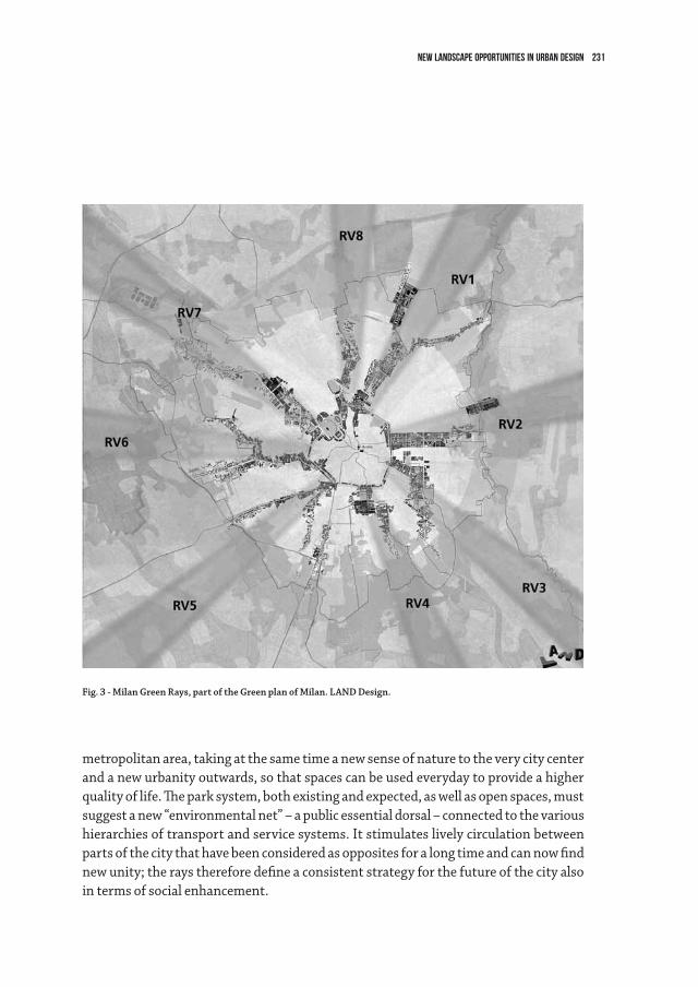
231NEW LANDSCAPE Opportunities IN URBAN DESIGN
metropolitanarea,takingatthesametimeanewsenseofnaturetotheverycitycenterand a new urbanity outwards, so that spaces can be used everyday to provide a higher qualityoflife.Theparksystem,bothexistingandexpected,aswellasopenspaces,mustsuggest a new “environmental net” – a public essential dorsal – connected to the various hierarchies of transport and service systems. It stimulates lively circulation between parts of the city that have been considered as opposites for a long time and can now find new unity; the rays therefore define a consistent strategy for the future of the city also in terms of social enhancement.
Fig. 3 - Milan Green Rays, part of the Green plan of Milan. LAnD Design.
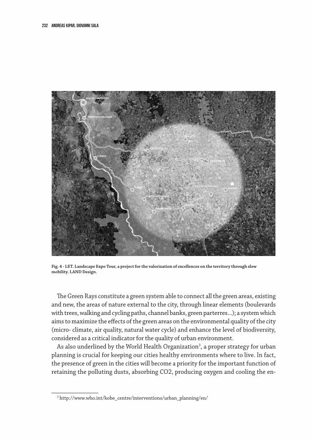
232 Andreas Kipar, Giovanni Sala
TheGreenRaysconstituteagreensystemabletoconnectallthegreenareas,existingand new, the areas of nature external to the city, through linear elements (boulevards withtrees,walkingandcyclingpaths,channelbanks,greenparterres...);asystemwhichaimstomaximizetheeffectsofthegreenareasontheenvironmentalqualityofthecity(micro-climate,airquality,naturalwatercycle)andenhancethelevelofbiodiversity,considered as a critical indicator for the quality of urban environment.
AsalsounderlinedbytheWorldHealthOrganization3, a proper strategy for urban planningiscrucialforkeepingourcitieshealthyenvironmentswheretolive.Infact,the presence of green in the cities will become a priority for the important function of retainingthepollutingdusts,absorbingCO2,producingoxygenandcoolingtheen-
3http://www.who.int/kobe_centre/interventions/urban_planning/en/
Fig. 4 - LET. Landscape Expo Tour, a project for the valorization of excellences on the territory through slow mobility. LAnD Design.
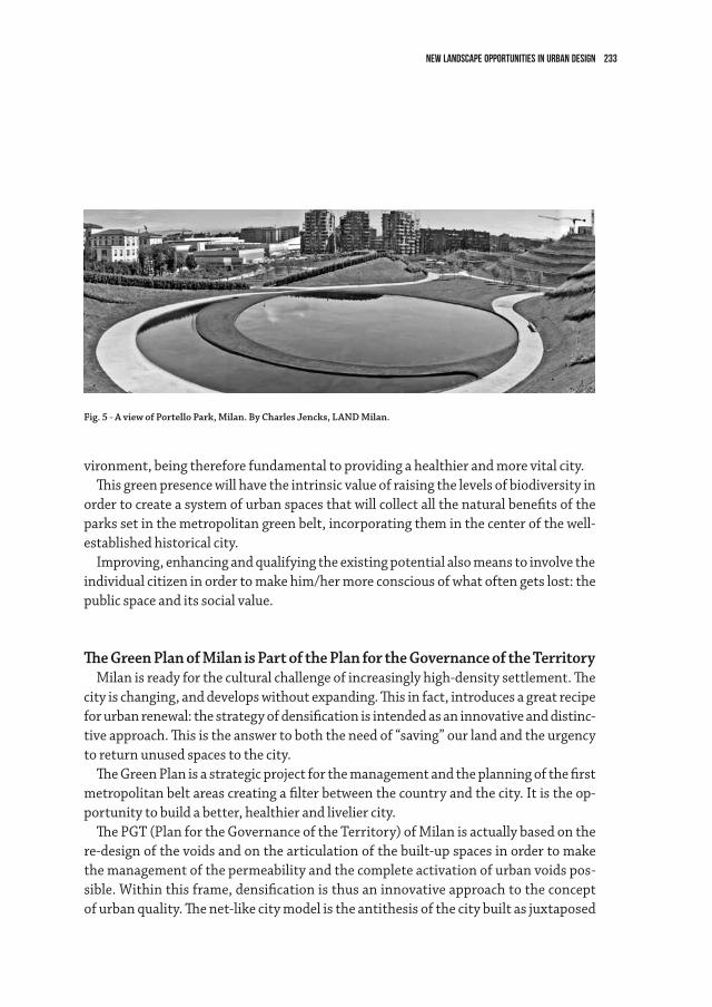
233NEW LANDSCAPE Opportunities IN URBAN DESIGN
vironment, being therefore fundamental to providing a healthier and more vital city.Thisgreenpresencewillhavetheintrinsicvalueofraisingthelevelsofbiodiversityin
order to create a system of urban spaces that will collect all the natural benefits of the parkssetinthemetropolitangreenbelt,incorporatingtheminthecenterofthewell-established historical city.
Improving, enhancing and qualifying the existing potential also means to involve the individualcitizeninordertomakehim/hermoreconsciousofwhatoftengetslost:thepublic space and its social value.
The Green Plan of Milan is Part of the Plan for the Governance of the TerritoryMilanisreadyfortheculturalchallengeofincreasinglyhigh-densitysettlement.The
cityischanging,anddevelopswithoutexpanding.Thisinfact,introducesagreatrecipefor urban renewal: the strategy of densification is intended as an innovative and distinc-tiveapproach.Thisistheanswertoboththeneedof“saving”ourlandandtheurgencyto return unused spaces to the city.
TheGreenPlanisastrategicprojectforthemanagementandtheplanningofthefirstmetropolitan belt areas creating a filter between the country and the city. It is the op-portunity to build a better, healthier and livelier city.
ThePGT(PlanfortheGovernanceoftheTerritory)ofMilanisactuallybasedonthere-designofthevoidsandonthearticulationofthebuilt-upspacesinordertomakethe management of the permeability and the complete activation of urban voids pos-sible. Within this frame, densification is thus an innovative approach to the concept ofurbanquality.Thenet-likecitymodelistheantithesisofthecitybuiltasjuxtaposed
Fig. 5 - A view of Portello Park, Milan. By Charles Jencks, LAnD Milan.
234 Andreas Kipar, Giovanni Sala
“enclaves”.Themainideaisinfacttore-thinkthecityandmoveonfromtheideaoftheinnercity-peripheraldichotomy,therebybreakingastronghierarchicaldistributionoflandvalueaswellasofsocialquality.ThePGTincludeseightradialGreenRaysplustwo: the circuit of the ancient bastions of the city, and the “fil rouge” connecting with a circularpathalltheperi-urbanparksalonga72Kmcyclingroute.
ThenewcitydesignedbythePlanisacityabletointerconnectitslandscaperesources-parks,squares,boulevardandgardens-withthemostimportantenvironmentalre-sources of the metropolitan territory: a vision of the city which aims at the realization ofurbansceneryhingedonthedesignofthe‘publiccity’and,therefore,onthedesignof the urban vacuums to be safeguarded, valorized and returned to the city.
SuchaPlanfortheGovernanceoftheTerritoryismeanttoactivateallthepotentiallyinteresting areas not only in the tight boundaries of the city of Milan but also in the larger Milan area, rich of environmental qualities that can be valorized through a proper interpretation of the environmental system.
The L.E.T. - Landscape Expo Tour Project is Part Of Expo2015: an Opportunity for the Territory
AttheedgeofMilan,attheencounteroftheGreenRayswiththeouterboundaryofthecity,anumberofrelevantkeyspotsarefunctioningas“territorialmechanisms”:eachone of these is able to attract people, becomes a public node and is able to multiply the effectoftheactivationoftheterritory.TheareaoftheMilanoFairandtheExpo2015siterepresentoneofthesekeynodes,westofMilancitycenteralongGreenRay7.
TheopportunitygivenbyExpo2015isthatofbringingaconsiderablenumberofvisi-tors to a sector of the city that has not yet been sufficiently explored. Being present a relevant number and variety of historical, environmental and cultural excellences on thisterritory,theLET-LandExpoTourprojectdefinessomeroutes,orrathercircuits,thatlinktheseexcellencesandpreparetheterritoryusingtheoccasionofsuchaneventontheonehandtowelcomeallthevisitorsofExpo2015andontheotherhandtoraisethe value of these areas by giving more access and visibility to these cultural goods.
Throughdirectinvolvementofcitizens,municipalities,localadministrations,au-thoritiesfortheenvironmentalandterritorialmanagementandsafeguard,LETprojectpromotesanorganizedsystemofgreen-toursthroughastrategywithadoublegoal:toprotectandtovalorizetheopenareasinWestMilan,intheExpo2015areaofinfluence.Expo2015isafundamentalchancefortheseterritoriestoprepareforagreaterde-
velopment and foresee a new identity, reaching a much greater importance and inte-gration to the city of Milan for the future.
235
4.6Intermediate scale for Italian Landscape. Projects in the Po ValleyAnnalisa Metta
What about? Landscape ArchitectureThewordlandscape is one of the most inclusive of our vocabularies. It opens up a multi-
tudeofdifferentmeanings,astherichnessofpositionsspreadingfromthepaperscollectedinthisbookcaneasydisplay.Thisvarietyisatreasurewemustnotgiveup,althoughitcallsustodeclaretheextentofourpositionabout,albeitunstableandopen.Therefore,beforegoing into my arguments, I must say that my point of view is that of design and I will deal with landscape in terms of project. I will refer to landscape architecture, meaning the con-scioussettlementofopenspaces:oneormoreauthors,wellknownaswellanonymous,rec-ognize and seize the vocations of places and communities, listen to their declared or silent questions, and then give them expression in terms of technical, ethical and aesthetic items.
Where Did We Remain? The After World War II ItalianTraditionLandscape architecture in Italy only recently is gaining its authonomy of method and
subject. For a long time, open spaces design has been absorbed within urban planning andbuildingsarchitecture.Thisconditionoftenproducedvirtuousconvergence,asshown by most of the theoretical and design research about the relationship among city, buildings and open space produced in Italy, between World War II and the Seventies. We couldconsidertheworkofarchitectssuchasRobertoGabetti,AimaroIsola,MarcelloD’Olivo,GiancarloDeCarlo,GiòPonti,amongothers.Ofcoursetheywerenotlandscapearchitects in the way we are used to define this profession nowadays, but certainly they had an inclusive attitude to habitat design, gathering in a whole buildings and open spac-es, from small to huge dimensions1. We could also mention urban planners who made
1 For a wider investigation about relations about architecture, planning and landscape in Italian tradition, see: L. Benevolo, L’Italia da costruire. Un programma per il territorio,Laterza,Roma-Bari,1996;L. Caravaggi, Paesaggi di paesaggi,Meltemi,Roma,2002;G.DurbianoandM.Robiglio,Paesaggio e ar-chitettura nell’Italia contemporanea,Donzelli,Roma,2003;B.Zevi,Controstoria dell’architettura in Italia. Paesaggi e città,NewtonCompton,Roma,1995;M.Zoppi,“Laviaitalianaall’architetturadelpaesaggio:dalConvegnodiBagnidiLuccaallaConvenzioneEuropeadelPaesaggio”,inG.Ferrara,G.Rizzo,M.Zoppi,Paesaggio: didattica, ricerche e progetti: 1997-2007, Firenze University Press, 2007.
236 annalisa metta
landscapetheirelectivefield,asGiovanniAstengoandLuigiPiccinato.Amongothers,Irefer especially to Vittoria Calzolari, with her studies and projects for Brescia and Siena, intersectingtheworkofBernardoSecchi,anotherkeyfigure.Finally,wehavetorecalltheworkofproperlandscapearchitects,whoseworksmarkanItalianwaytomodernlandscape architecture close related to urban condition, a matter perhaps not yet plenty documented and told2.Amongthem,MariaTeresaParpagliolo,RaffaeleDeVicoand,more over, Pietro Porcinai, authors of uncountable masterpieces, who applied their tal-ent to a huge range of open spaces and wrote outstanding papers about urban landscape3.Theseandotherexamplespointoutthatlandscapeprojectinsixties-seventiesItal-
ian tradition has been the bond between architecture and planning: buildings, open spacesandcitieshavelongbeeninseparable,whileremainingindependent.ThisItalianpeculiarityinspiredandinfluencedresearchcarriedoutelsewhere,towhichafterwardswelookedasmodels,notwithoutregret.Forexample,MichelCorajoud,oneofthepioneersoftheFrench“structuralistapproach”,acknowledgedhisintellectualdebttoItalianarchitecturalresearch,referringinparticulartoVittorioGregotti,recognizingtheinfluenceofhisideaoflandscapeas“voluntarygeography”4.
Two Opposite DirectionsOnthecontrary,inthelasttwenty-fiveyears,followingtheculturalandprofessional
gap between planning and architecture matters, in Italy open spaces design gradually addressedtowardstwooppositedirections.Thefirstisthatoflandscape planning, which belongstotheworldofknowledge,proceduresandactivitiesofaplannerparticularlysensitive to environment values and is expressed through wide area plans, regional and territorialplans,MountainCommunitiesplans,BasinPlansetc.Thesecondapproachisthat of public space design, defined here as more properly dealing with the architectural definitionofpublicopenspaces,suchassquaresandpedestrianareas,parks,banks,permanentorephemeralgardens.Thesetwopracticesareoftencompletelyseparated,
2 A. Conforti Calcagni, Una grande casa, cui sia di tetto il cielo, Il Saggiatore, Milano, 2011; L. Latini and M. Cunico, editors, Pietro Porcinai. Il progetto del paesaggio nel XX secolo,MarsilioEditori,Venezia,2013;M. de Vico Fallani, Raffaele de Vico e i giardini di Roma,SansoniEditore,Firenze,1985.
3Wehavetomention,inparticular,thesurvey“LacampagnadiDomusperilverde”(TheDomuscampainforgreen)editedbyM.T.ParaglioloandP.PorcinaiforthearchitecturemagazineDomus start-ingin1937,withGiòPontiaseditorinchief.
4 M. Corajoud, “Le paysage: une expérience pour construire la ville”, in A. Masboungi (editor), Michel Corajoud et cinq grandes figures de l’urbanisme,DGUHC,Paris,2003.
237Intermediate scale for Italian Landscape. Projects in the Po Valley
producingdestructiveeffectsonthesocial,economic,practicaland,notlast,estheticcontentandaimofinterventions.SoFrancoZagariwrites:“Andthisisthemistery,whenwespeakaboutlandscapewefocusonethicstoignoreit,whileestheticsfatallyfall dawn: at architecture scale, landscape beauty often becomes cosmetics and chore-ography, while instead in planning, once a certain dimension has been overcome, the so called “big scale”, beauty seems to evaporate, everything is reduced in quantity and numbersanddrawingsalwaysarejusttwo-dimensionszoning”5.
The Reticular Pattern of Intermediate ScaleWe failed attention and expertise applied to what we might call the intermediate
scale6, that of those projects which, regardless of size, have the ambition to set up open spaces starting from deep ties with territorial matrix, in terms of physical and cultural geography.Thishappenedbecausewetrappedourvisionanddesireaboutfutureinlandscape in the rubble of deterministic sequence from big to small, from whole to detail,fromregiontosidewalk.It’sprobablyareminiscenceofapositivisticpositionwho desperately continues to read and describe our world in linear and consecutive steps, while really we should accept the intricate reticular nature of relations in our life contests. In a reticular pattern we are not able to recognize an obliged starting point as well not a unique goal: we have to move in an adaptive way, giving each node a role connected with what is happening around, time after time. In a reticular pattern every idea about gerarchy, about bigness or smallness, before and after, overall or detail vi-sion is unsettled, changeable, variable. Landscape architecture in a reticular pattern is based on relations among spatial, temporal, environmental and social coordinates, linkingplaces,factsandactionsoftenonlyapparentlyseparated.Inthissense,theterm intermediate scale refers not so much to the dimension of the project, but to qual-ity produced by interactions of meanings and values.
5F.Zagari,Paesaggio. Lettera aperta, Libria, Melfi 2013. 6 “La scala intermedia per il progetto del paesaggio italiano” (The intermediate scale for Italian landscape
design)isthetitleofaworkinprogressreaserchatUniversitàRomaTre,DipartimentodiArchitettura.Re-searchgroup:FrancescoRiccardoGhio(teamleader),MariaGraziaCianci,AnnalisaMetta,LucaMontuori.
238 annalisa metta
As Good As it GetsAnyway, even if the gap we wrote about signs the prevalent situation, a certain con-
cern for the intermediate scale, as we defined it, never fully disappeared, spreading out againstartingfromNineties,coincidingwiththeemergenceofamoregeneral,sharedand passionate interest in landscape design. In a very short list of events connected withthisrecoveringinthelastdecades,wecaninclude:1990,Genoa,“SchoolinGarden,LandscapeArchitectureandPlanning”foundation;1997,Modena,Symposium“Paes-aggisticaelinguaggiogradozerodell’architettura”;1999,Naples,CharterofNaples(AIAPP-Fedap);1999,Rome,NationalLandscapeConference;2000,Florence,Euro-pean Landscape Convention. We have also to note the increase of publications about landscapearchitecture:magazines,perhapsmorethanbooks7, played a central role. We can recall two French magazines, the most widespread in Italy: Urbanisme and Architec-ture d’Aujourd’hui,thatintroducedthework,amongothers,ofMichelCorajoud,Alex-andreChemetoff,JacquesCoulon,JacquesSimon,GillesDescombes,GillesClément,MichelDesvigne.Inthesameyears,alsoItalianmagazinesinvestigatedabouturbanopen spaces design, in particular Abitare, Parametro and AU Arredo Urbano, beyond Casa-bella, editedbyGregotti,andLotus International.
Theseandotherfactsarethebackgroundonwhichseveralprojectshavebeendi-rected,rethinkingtheItalianlandscapeinthelightofthereticularparadigmofinter-mediate scale.Severalworks,competitionprojects,urbanplansledbydesignteamwithmultidisciplinary approach display the richness of Italian scenario over the last fiftheen yearsorso:justlikeasortofresistance.
The Po ValleyAsanexampleofthispromisingrecovering,wecanlookatexperiencesinthegeo-
graphicalareaofthePovalley.Poisthelongest(650km)andwiththelargestbasin(about70.000sqkm)riverentirelywithintheItalianterritory.ItoriginatedinPied-montandflowsintotheAdriaticSeainalargedelta.Becauseofitsgeographicalposi-tion, length, history, social and economic factors dealing with it, Po is recognized as themostimportantItalianwatercourse.Formostofitscourse,itflowsinaflatarea,fromwhichittakesitsname:justthePoValley,comprisedamongEmiliaRomagna,Veneto,LombardyandPiedmontRegions.Allofthemhavelongledadvancedpolicies
7ThebookF.Zagari,L’Architettura del Giardino Contemporaneo,Mondadori,Roma,1988isthefirstorganic review of contemporary landscape architecture for Italian readers.
239Intermediate scale for Italian Landscape. Projects in the Po Valley
on landscape through projects, programs and laws8. In Veneto we can mention, among others,theprogramcalled“LandscapeExperimentations”9, wich adfirms the centrality of landscape in all policies that may have a direct impact on territories, wether big or small they could be. Lombardy has advanced programs about land use10, with a balanced approach between the reasons of soil consumption containment and those of quality andliveabilityofplaces.InPiedmontwecanthinkabouttheGreen CrownofTurin11, astrategicprojectunderregionaldirectionthataffectsthemetropolitanarea,dealingwith the territory of ninetythree municipalities.
As it is impossible in the short space we have to describe the complex scenario of allthefourregions,Iwillfocusononeofthem,EmiliaRomagna12. After the approval oftheRegionalLandscapePlanin1993,rulesaboutlandscapetransformationdeeplychanged13;severalregionalprojects,aswellasmembershipininternationalnetworks,describe a context of great interest and excitement about landscape, using project as an instrument to overcome the inertia of a management carried out mainly by means oflegislation.Since1993,theregionhaspromotedsixtyfiveintegratedprojects,in-tendedas“actionplans”,thatdon’tenvisagesingleworks,butterritorialstructures;crossdisciplinesandinstitutionsandworkonsystemofrelationstointegratespecific
8 For an overall vision of Po Valley policies: Autorità di bacino del fiume Po, Il Po fiume d’Europa: riflessioni e proposte sulle strategie di pianificazione.ThedocumentwasworkedoutbyateamledbyRobertoPassinoandcomposedbyG.DematteisandR.Gambino(PolitecnicodiTorino),B.Dolcetta(IstitutoUniversitariodiAr-chitetturadiVenezia),P.Ghetti(UniversitàdiVenezia),R.Palomba(IstitutodiRicerchesullaPopolazione),G.Roma(CentroStudiInvestimentiSocialidelCENSIS,Roma).
9Editedby“Direzioneurbanisticaepaesaggio,ServizioPaesaggioeOsservatorio”ofVenetoRegions,it’sdevelopedin“PianiPaesaggisticididettaglio”(Detailedlandscapeplans)and“Progettidiriqualificazionepaesaggistica” (Landscape recovery projects).
10SeeRegionalLaw31,5december2008.11“ProgettoCoronaVerde:pianificazionestrategicaegovernance”,developedbyRegionePiemonteand
DipartimentoInterateneoTerritorio-PolitecnicoandUniversitàdiTorino,2005-2007.Researchcoordin-tator:RobertoGambino.
12RegioneEmilia-Romagna,AssessoratoProgrammazioneeSviluppoterritoriale,CooperazionecolSiste-madelleAutonomie,Organizzazione–ServizioValorizzazioneeTuteladelpaesaggioedegliInsediamentiStorici, Progetti di paesaggio. Idee ed esperienze nella programmazione regionale, Servizio Stampa e Informa-zionedellaGiuntaregionaledell’Emilia-Romagna,2007.P.GabelliniwithA.DiGiovanni,C.Gfeller,M.Mareggi, Immagini del cambiamento in Emilia-Romagna,EditriceCompositori,Bologna2012.
13C.Lanzoni,“EmiliaRomagna.Dalpianoaiprogetti,lanecessitàdiunavisioned’insieme”,inRi-Vista ricerche per la progettazione del paesaggio,DottoratodiRicercainProgettazionePaesistica,FacoltàdiArchi-tettura,UniversitàdegliStudidiFirenze,gennaio-giugno2010.
240 annalisa metta
interventions14.Severalprojectspromotedbydifferentmunicipalitieswereaddedtothe regional ones, connected with a general renewal of planning and management tools about landscape transformations.
Three CitiesTobetterunderstandwhatwearetalkingabout,ithelpstodealwithexperiences
rather than still on the settings of principles. We will visit three cities situated along theViaEmilia,thehistoricalRomanroutebetweenRiminiandPiacenzaandoneofthemainbackboneinfrastructureoftheentireItalianpeninsula.Itwasbuiltin189-187b.C.toconquerthebiggestfertileplainofthewholepeninsula–thePoValleyindeed-right on the edge between the foot of Apennines and the Valley.
Cesena(about100,000inhabitants)islocatedalmostinthecenterofRomagna,half-waybetweenthehillsandthesea,whichisonly15kmfar,atthepointwherethean-cientViaEmiliaandViaFlaminiacrosseachother.TheSavioRiveranditsvalleyarethemainmarkersofthisterritory.
Themunicipalarea(250sqkm)ismorphologicallyvaried:flatinthenorth-east(thatisthelastpartofthePoValley,justsouththePoDeltaRegion),wheretracesofRomansettlementsof“centuriazione”arestillveryvisible;hillyinthesouth-west,closetoApennines. In addition, the modern mobility infrastructures system (the XX century Bologna-Tarantomotorway,theE45roadandthesecant)superimposedonthestruc-tureofRomansettlements.Thisledtoverydifferentusesandformsoftheinhabitatedareas.Thestar-shapedandnotsocompacturbanimprintallowsawidespreadavail-abilityandqualityofhabitat,naturalorsemi-natural,forrecreational,educationalandimprovement of urban health.
Theproject“LandscapePlanningofCesena,spatialconceptsanddesignofopen
14 AmongtheserveralprojectsdevelopedinEmiliaRomagnainthelastfifteenyearswecanmention:theIdeasCompetition“PaesaggiLiquidi”byProvinciadiReggioEmilia,2008(winnerBarrecaeNavarra,Yel-lowoffice,NatureMood);theprojectfor“GuidelinestotransformlandscapedealingwiththeproductivehubclosetoTerrediCanossa–Campeginetollbooth,definedforProvinciadiReggioEmiliabyRenatoBocchi,PaoloCecconandLauraZampieri(2010);theMarecchiaRiverLandscapeMasterplan atPoggioBerniandTorriana,Rimini,byP’ARC(2008);theproject“FromCentotoPoggioRenatico.TheRenoRiverasmatrixfor a coherent development of Alto Ferrarese Landscape”, defined by Provincia di Ferrara and Alto Ferrarese MuniciplaitiesAssociation,supportedbyDipartimentodiArchitetturaePianificazioneTerritorialeofBo-lognaUniversity-AlmaMaterStudiorum(2010).
241Intermediate scale for Italian Landscape. Projects in the Po Valley
spaces”, drawn in 2000 by P’arc design office, considers the whole municipal territory, workingontheconceptofsystemicnetworkofopenspacesatgeographicalscale;atthesametime,theprojectisverifiedatthescaleofurbanpublicspace,thatofstreets,parksand residual areas close to infrastructures.
Theideaofgradientamongurbanrealm,ruralsettlementsandnaturalinfrastruc-turesisthemainoutcomeofthedesignconcept,workingon:howtodevelopagradi-ent through “city and not city” and how to devise interventions not as objects but as geographicsystems,asnetworksofgreenareas,urbanforestation,publicspaces,etc..Modelsofurban-suburbangradientbetweencityandnot-citywereidentifiedtoprovidesupporttodesign,withoutpre-definingspecificarchitecturalchoices.Theyderivefromcombiningthreepatterns-theurbanarea(existing),theperi-urbanarea(processing)andthenoturbanterritory-,accordingtoadjacencywith:thesourcesofhabitat(hillsand river Savio), where it is easy and reasonable to predict environmental connective interventions; the not centurial countryside at northwest, where the limes between the cityandnot-cityisveryclear;thecenturialcountrysideatnortheast,wherethehistori-cal and aesthetic value of the land division is still readable and the limes between the cityandnot-cityisamoreporousspace.Thesemodelsaredifferent“spatialconcepts”thatguidemoredetaileddesigns.Theyaretesseraeofthelandscapemosaic,builtpiecebypiece,placebyplace,andnotpredeterminedinitswholeness.Thesesimplerulesas-surethecoherenceofdesignedlandscapeasanongoingprocess,remainingflexibleandwelcoming the inevitable accidents of living landscape. It’s a combinatory game, where rules are the bases for always open set of players, actions and results.
Thisexperienceshowshowtoworkontheintermediatescaletocircumventtheim-passe of deterministic concatenation from the general to the particular. Project can advantageously proceed with discontinuous trajectories, going, even for jumps, to the systemic roots that bind a intervention, even the smallest, with its surroundings.
Bologna is the capital of the region and the heart of a metropolitan area of about 1,000,000 inhabitants.
It’sclosetotheApennineshills,betweentheriversRenoandSavenavalleys:“Bolognais an old lady with a little soft hips, with her breasts on the Po and bottom on the hills”, asFrancescoGuccinisings15.
“Bologna city of cities” is the image at the base of the Municipal Structural Plan of the city,averyadvanceddocument,workedoutunderthecoordinationofPatriziaGabel-
15FrancescoGuccini,“Bologna”,inMetropolis,Emi,1981.
242 annalisa metta
lini16.TheSevenCities–calledTrainStation,RingRoad,Hill,Reno,Savena,ViaEmiliaPonente,ViaEmiliaLevante–arehingedintoeachother,butdifferentforcharacteriticsand vocations.
ThehillofBologna,preservedfromdevelopmentsincetheSixtiesthroughplanninginstrumentsofprotection,intimebecameaprivateresidentialEden.Defensehadofcourse a strategic and symbolic importance for the city and the society of the early Six-ties; but in the name of a general indisputable value, such as environmental protection, an extraordinary landscape was frozen from the point of view of urban dynamics and visions for future. Moreover, constraints were not able to deal with natural transforma-tion process: they weren’t enough to prevent the hydrogeological disruption as well the returnoftheforest.Atthesametime,theimportantendowmentofpublicparks,fromaquantitypointofview,isnotenoughtomakethehillreallylivedandvalued.
Theresearchdesign–developedwiththeguideoftheMunicipalStructuralPlanbythelocalofficeTascaandtheBarcelonabasedofficeJornet,Llop,PastorArquitectes–aimstorediscoverthisuniqueassetofthemetropolitanarea,makingitagainaccessible,usableandproductive.Itmarksthedualityandreciprocityoftwodifferentlandscapes:the foothills and the deepest hill. It’s impossible transforming the one, of strongly ur-banidentity,andtheother,morenatural,withthesamerules.Yet,theprocessingofonecannottakeplacewithoutthemodificationoftheother.
Goingacrossthesetwoapproaches,theproposalforthehillcanbesummarizedintwo main sections: to implement a system of use and accessibility of the hill (connec-tions), not only from the urbanized band at north, but from all over the vast territory surroundingthehill;todefineanetworkofspecificprojectsforspecificplaces,whichinvolveareasalreadypronetobetransformedintoservicesandfacilitiesfortheparkor the urban low hill areas (transformation sites). In turn, these two sections are divided into twelve themes, among them: foothills gardens (a potential alveolar public “system park”isalreadythere,justbytransformingintoanetworkthewholeoffoothills,urbanand hilly countryside gardens); equipped continuity (territorial systems are continuous facilitiesconnectingmanydifferentlandscapesandsituations,intermsoffruitionandperception); doors (the points of contact and access between the city and the hill); deep Hill (a system of paths starting from the southern edge, joined to doors and routes); services (by the reuse of existing public buildings, now abandoned, which together con-stitute the main means of economic development, also because already disseminated all
16 Municipality of Bologna, “Piano Strutturale Comunale” (Municipal Structural Plan), 2007. Scientific generalconsultant:PatriziaGabellini,PolitecnicodiMilano.
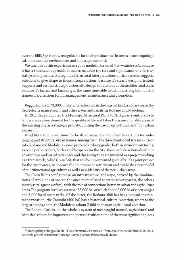
243Intermediate scale for Italian Landscape. Projects in the Po Valley
over the hill); joys (topos, recognizable for their preciousness in terms of anthropologi-cal, monumental, environment and landscape content).
Wecanlookatthisexperienceasagoodmodelintermsofintermediate scale, because ithasatranscalarapproach:itmakesreadablethesizeandsignificanceofaterrito-rial system, provides strategic and structural interpretations of that system, suggests solutions to give shape to those interpretations; because it’s clearly design oriented: supports and verifies strategic vision with design simulations at the architectural scale; becauseit’sfactualandfarseeingatthesametime,abletodefineastrongbutnotstiffframeworkofactionsforhillmanagement,maintenanceandpromotion.
ReggioEmilia(170,000inhabitants)islocatedintheheartofEmiliaandiscrossedbyCrostolo,itsmainstream,andotherriversandcanals,asRodanoandMadolena.
In2011ReggioadoptedtheMunicipalStructuralPlan(PSC).Itgivesacentralroletolandscapeasakeyelementforthequalityoflifeandtakestheissueofqualificationofthe existing city as a strategic priority, limiting the use of agricultural land17 for urban expansion.
Inadditiontointerventionsforlocalizedareas,thePSCidentifiesactionsforwide-ranging and structural urban frames. Among them, the three mentioned streams – Cros-tolo,RodanoandModolena–needproposalstobeupgradedbothinenvironmentterms,asecologicalcorridors,bothaspublicspacesforthecity.Theseincludeactionsdistribut-edovertimeandvariedoverspaceandthisiswhytheyareinvolvedinaprojectworkingasaframework,calledGreen Belt, that will be implemented gradually. It’s a joint project for the rivers areas, to improve the environment settlement and establishi a new model ofmultifunctionalagricultureaswellanewidentityoftheperi-urbanareas.
TheGreen Belt is configured as an infrastructure landscape, derived by the combina-tionsoftwokindsofspaces:theonesmorerelatedtowater(rivers parks), the others mostly rural (green wedges), with the role of connections between urban and agriculture areas.Theprograminvolvesanareaof5,000ha,ofwhichabout2,000haofgreen wedges and 3,000 ha of rivers parks.Ofthelatter,theRodano(600ha)hasanaturalenviron-mentvocation,theCrostolo(400ha)hasahistorical-culturalvocation,whereasthelargest among them, the Modolena (about 2,000 ha) has an agricultural vocation.
TheRodanoParkis,onthewhole,asystemofmeaningfulnatural,agriculturalandhistorical values. Its improvement opens to fruition some of the most significant places
17MunicipalityofReggioEmilia,“PianoStrutturaleComunale”(MunicipalStructuralPlan),2009-2011.Scientificgeneralconsultant:GiuseppeCamposVenuti,PolitecnicodiMilano.
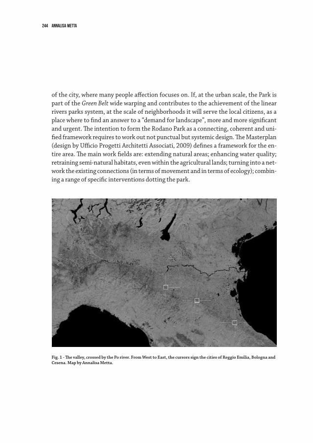
244 annalisa metta
ofthecity,wheremanypeopleaffectionfocuseson.If,attheurbanscale,theParkispart of the Green Belt wide warping and contributes to the achievement of the linear riversparkssystem,atthescaleofneighborhoodsitwillservethelocalcitizens,asaplace where to find an answer to a “demand for landscape”, more and more significant andurgent.TheintentiontoformtheRodanoParkasaconnecting,coherentanduni-fiedframeworkrequirestoworkoutnotpunctualbutsystemicdesign.TheMasterplan(designbyUfficioProgettiArchitettiAssociati,2009)definesaframeworkfortheen-tirearea.Themainworkfieldsare:extendingnaturalareas;enhancingwaterquality;retrainingsemi-naturalhabitats,evenwithintheagriculturallands;turningintoanet-worktheexistingconnections(intermsofmovementandintermsofecology);combin-ingarangeofspecificinterventionsdottingthepark.
Fig. 1 - The valley, crossed by the Po river. From West to East, the cursors sign the cities of Reggio Emilia, Bologna and Cesena. Map by Annalisa Metta.
245Intermediate scale for Italian Landscape. Projects in the Po Valley
And So?Thesethreeexperiencesdealwithperiurbanlandscapeandadopttheintermediate
scaleasthemaintopic.Theyshareattitudeandabilitytothinklandscapearchitecturesimultaneouslyasstrategicandprogressiveframeworkaswellasconfiguredopenspac-es.Theyaresamplesofhowopenspacedesigncancontributetoadeeprenewalofthemethodsandpracticesofurbanprojectinitsdifferentscales.Thisattitudeenhancesthe ability to deal with a variety of scales and themes and, above all, with extremely fast and sometimes unpredictable changes, which require solutions that are less rigid and prescriptive in favor of others, more open to process and uncertainty.
City paradigms are changing faster and faster: we just got able to deal with sprawl, thatcitystartedtoshrink.So,wecan’tignoresomequestions:whichopenspacesforwhichcities?Whatideaofcitywe’refightingagainstorwe’redreamingabout?Isitwetherthesprawlingortheshrinkingcity?Theconsolidatedortheprocessiveone?Thegrayorthegreen?Thefutureorthenostalgic?
In this condition, the transcalar and performing landscape approach is essential to successfully govern the continuous changes of the contemporary city, on condition that wenomoretakeonlydefenseandremedyorientedpositions,butfinallyproposeonesfitforthemultiplicityoftransformationsthattakeplaceeverywhereinthecitiesasinthe countryside, in the beautiful countries as in derelict lands.
Compared to the arguments with which we began, that is the gap of landscape in two drifts due to the gap between urban design and architecture, landscape practice is an unmissable opportunity for approaching two disciplinary traditions with an urgent needtore-tunetheirstrategies.Landscapemakescloseagaincityandarchitecture,byprovidingawayofoperation,whichnotonlytakescareofobjectsandspaces,butalsoof the dynamic relationships that move through them (in terms of culture, economics, society, technologies, esthetics).
Finally, we need a structure: a meaning and space structure that should be clear and simple, as well adaptive and open to process, able to deal with overcoming changes andcontradictions,withcoherenceandconflicts,withgraniticpermanenceandsuddenoverturning. We need a penthagram where notes freely accorde themselves, not neces-sarlyintermsofarmony.Thispenthagram,thisstructurecouldbecalledlandscape,Isuppose.


247The urban landscape in the digital era
logout

249
The fragmented TownThe landscape is the physical expression of human culture and of how man has or-
ganised and managed it according to the models prevailing in the various epochs. The contemporary urban landscape bears the marks of a multiplicity of interests, passions and tendencies that have often failed to be judiciously coordinated. It reflects the lack of a conscious space organisation that blends respect and innovation to achieve a coherent result. Urban transformations have often been separate from the cultural, architectural, social or economic context where they were taking place. The result of such political in-consistency is an urban and territorial fragmentation that to a greater or a lesser extent is clearly apparent in the environment that many of us experience. The phenomenon has generated a model where the town is too sprawled to have identifiable boundaries and is no longer distinct from surrounding rural areas; a town dominated by private transport; that is the venue of growing numbers of protest movements; and whose his-torical centre is often disfigured while its suburbs are squalid. This is the town of social unease and of the dominion of finance, where urban planning has been in the hands of private interests that have spread, overlapped, and clashed without significant opposi-tion: in sum, this is the town without urban culture.
The Town in the Digital EraTown culture cannot and ought not to be uniform, indeed it should inherently be
open and eager to accommodate the multiple and ever new requirements of its inhabit-ants. Its strength rests on the fact that no single person guides cultural changes, but all can freely participate in them. In this connection open urban spaces, the public ones but to some extent also the private ones, play a key role as spaces of free expression, whether individual or collective. This is something that the officials in charge of urban administration and planning are finally being compelled to take into account. The ad-vent of the digital era has highlighted some strengths and weaknesses of this phase of urban development. On the one hand instant communication tools enhance the access to information in all areas and enable the mobilisation of groups of various sizes – even whole networks – in real time for a variety of purposes: to express support or dissent, to
The urban landscape in the digital eraRita Colantonio Venturelli
250 Rita Colantonio Venturelli
meet up for sports or cultural events, to exchange views. Sociology relates these behav-iours to the construction of the “we”, which would be paralleled by a false construction of the “I”. Undeniably, the digital era has the potential to blur reality, generating the illusion that space and time can be overcome and that people may own, as opposed to use, public goods; this risks turning proper participation into incessant exasperated fighting, litigiousness or even social confrontation.
The instinctive reaction is to place open spaces under control through continuous video recording and surveillance circuits, which according to some jeopardise individual liberties.
The New Disciplinary DebateIt is widely agreed that “grass-root urbanism” is becoming a major principle inspiring
urban development that cannot be ignored, as also demonstrated by the most recent urban history. However further, different but equally important principles have also become established over this time: they should be acknowledged as key elements in the ongoing transformations and ones that will mark the functional and spatial organisa-tion of towns. Such principles are related to the ecological state of towns and to its ability to renew the town’s resources continuously, keeping up the offer of ecosystem services; these services support life, provide for supply procurement, regulate climate and are cultural aesthetic, educational and recreational values.
The ecological principles are closely related to the economic ones, as demonstrated by the 2007 EU Commission document1. The study mentioned in the document found an annual loss of € 50 billions, accounting for 7% of GDP, due to the persistent critical state of biodiversity. The Commission’s recommendations involve the adoption of damage re-duction measures and the development of financial tools to protect ecosystem services.
In Italy, ISPRA is intensively publicising the problem and describing some actions that could steer urban development in directions that can also benefit towns’ economy2. The reorganisation of public transport routes and the consumption of food produced locally provide a critical contribution and have implications for two areas of action – the economy of transport and the economy of peri-urban rural spaces – both of which are indispensable for decisions that regard urban planning and the behaviour of the popula-tion entitled to the “right to the town”.
1 European Commission, The Economics of Ecosystem and Biodiversity (TEEB), Potsdam, 2007. 2 Istituto Superiore per la Protezione e la Ricerca Ambientale (ISPRA), Annuario dei dati ambientali, Varese, 2008.
251The urban landscape in the digital era
The reasoning comes back full circle to social issues, all of which provide a contribu-tion to urban transformation. It is therefore clear that all the disciplines involved in the management of urban spaces should learn to talk and listen to one another, to ensure that all the active principles are respected and give rise to a single system. This has not come about often, at least not always in the right way, but where it has its results have been startling. In fact “culture in practice” and joint field experimentation have gener-ated some examples of correct and balanced management of the various interests and the consequent organisation on the territory of structures and functions3.
To start and support both this dialogue and the multidisciplinary debate it should however be noted that although the circulation of scientific information is clearly es-sential, the notions and concepts advocated by the various disciplines despite being viewed from different perspectives are often quite similar. Yet, it is far from true that this entails their in-depth examination; on the contrary notions and concepts are often wielded until they are threadbare and subsequently abandoned without even testing them for their possible practical value.
This meeting has laid a sound scientific basis to overcome the gap between general in-formation, scientific data, multidisciplinary work, and real landscape transformation. It has also witnessed the coming of age of the notion that open urban, peri-urban and rural spaces should be viewed as the keystone of the organisation of the entire urban space and should thus contribute to confer on it the shape that is most suitable to each circumstance.
Open Spaces in the Changing Town The above-mentioned inspiring principles related to the town in the digital era – a
system that is both complex and clear in its components – suggest the need for turning around the view that has prevailed until recently, and to state that the town no longer equals built space. The new urban landscape should be organised as one system, where the network of open spaces has the task to support both the urban and the rural peri-urban tissue, because such spaces are the ecological expression of an organism and are all closely connected with its economic, social, cultural and scientific facets. The shape of the town plan in the digital era thus stems directly from its inspiring principles in a seamless relationship between current culture and its physical expression.
3 An explicit stance in this sense comes both from the final document of the 6th Word Urban Forum (Napo-li, Italy, 2012) and from Charter of public space, stemming from the 2nd Biennale dello spazio pubblico (Roma, Italy, 2013), which developed some of its key points.
252 Rita Colantonio Venturelli
Although this does not require pre-established formal models, it is essential to ac-knowledge that open spaces have different functional meanings (ecological, social, economic) in different urban contexts. Here it should be noted that multidisciplinary knowledge – albeit indispensable – is unable to shape urban spaces except through the decision-making and the needs of the population, whose involvement in town construc-tion and management is increasing and is increasingly felt.
This means that it is essential to start consolidation projects where expert knowledge has a key role and planners bear the responsibility of translating the process into spatial organisation, and do not withdraw after the design phase, but follow it throughout its development. In fact a town is not a “consensus machine”, but an organism that is made stronger by cohesion whereas superficial embellishment and hurried harmonisation fail to achieve lasting effects4.
final Reflections and Recommendations Stemming from the Conference of Berlin
The meeting’s sessions of the Conference of Berlin have adopted the view of the ur-ban landscape as a “system of systems”, one encompassing relationships that are both internal to it (relations among its constituent systems: economic, ecological and social) and external (between the urban-rural system and the rest of the landscape). The rec-ommendations that have stemmed from this opportunity for collective reflection thus involve economic, ecological and social aspects according to the systemic view, where open spaces are considered as the focus of future urban development. A clear and articu-lated synthesis of the most salient principles that have emerged from each contribution are found in the Login of this book. The general reflections that follow stress the struc-tural connections among sessions.
Ecological viewpoint: The importance of ecosystem services is multidimensional and is directly connected with the concept of biodiversity – i.e. the whole formed by all ge-netically different life forms and their ecosystems – whereas the notion of ecosystem services is anthropocentric. The two concepts are not overlapping but complementary; in both, human wellbeing plays a key role and must therefore be considered as the main goal of landscape, particularly urban, management. This is the key challenge if both non-monetary and monetary values of open urban spaces are to be protected. In this connection environmental education should provide a critical contribution to heighten-
4 Cfr. Rautenberg, H., Wir sind die Stadt, Surkamp, Berlin, Germany, 2013, p.148.
253The urban landscape in the digital era
ing the population’s awareness of the new “right to the urban landscape”.Economic viewpoint: “The town moves, transforms, and changes constantly. Nothing
resembles more a living being than this stone body”5. But the stone body has a paper core6. The town’s physical body is in fact conditioned by financial interests, a variety of interests ranging from those involving the use of open spaces for small neighbour-hood initiatives with a small turnover to those of private subjects who speculate in the real estate market. The “paper town” is in fact the one that rules the shape, spaces, and urban planning interventions of the “stone town”. The dichotomy has generated a sort of two-speed of urban economy: on the one hand the rich real estate business managed by a small number of private subjects, on the other a labour market penalised by the economic crisis of the past few years that is unable to generate and regenerate sound opportunities and invent new types of jobs.
Overcoming this dichotomy should be one of the main goals of urban development. The task is mainly one for the local administrators, who should try to achieve a new urban prosperity by acknowledging the importance of the different cultures and ensur-ing equal rights also to the more disadvantaged strata. Public spaces should thus be considered as common goods and as targets for priority action7.
Social viewpoint: A key principle contained in the European Landscape Convention is the close relationship between the cultural identity of a population and the land it inhabits 8. The historical and social value of a place is its very soul, a soul that lives and evolves with the local population but is also apparent to all visitors, be they tourists, scholars or passers-by: each of these individuals establishes a different relationship with the landscape, one that is filtered by previous experience but is not necessarily less intense or less important in enriching the local culture. History is also made by this type of contributions. In fact, several recently released documents that make reference to these principles and relate them to the intrinsic historical value of the places highlight the important role and topical value of history in future landscape organisation and management9. Protection must always be granted as a function of the overall multidi-mensional development of the landscape: this once again is the shared task of planners,
5 Ragon, M., L’homme et les villes, Albin Michel, Paris, France, 1995, p. 6.6 Magnier, A., Morandi, M., Paesaggi in mutamento, Franco Angeli, Milano, 2013.7 6th Urban Forum, Napoli, Italy, 2013.8 Council of Europe, European landscape convention, Firenze, Italy, 2000.9 A highly interesting document among others is the Final statement of the international meeting “The In-
ternational Protection of Landscapes”, promoted by Fondazione Romualdo del Bianco and IPOGEA on the occasion of the 40th anniversary of the UNESCO charter (Firenze, Italy, 2012).
254 Rita Colantonio Venturelli
administrators and the population. Only their steady collaboration can ensure a bal-anced growth process inspired to the ”optimism of doing”, which must involve the ”I” and the “we” in a constant “urban activism”10.
The multidisciplinary dialogue, to which this meeting has provided a contribution, should become the inspiring principle enabling scientific knowledge to attempt its re-constitution; this in turn could generate a new vision of the articulation of the urban system and of its open spaces through the creation of social networks, the reorganisa-tion of ecological networks and the harmonisation of economic aspects. I view the town as the space of the individuals and of their participation in collective expression, an expression that is multifarious yet inhomogeneous, which is free to develop in a cultural dimension that is no longer “atomised”, but is supported by public efficiency, equality and happiness11.
Here is my wish then: long live this town.
10 Cfr. Rautenberg, H., Wir sind die Stadt, Surkamp, Berlin, Germany, 2013.11 Cfr. Bruni, L., Zamagni, S., Economia civile - efficienza, equità e felicità pubblica, Bologna, 2004.

Printed in 2013by Compositori Comunicazione,
Bologna, Italy
In 2013, an International Conference was held from the 12th to the 14th of March in Berlin. It was promoted by the Laboratory for Research on the City of the Univer-sity of Bologna, together with the MEDDE French Ministry of Ecology, Sustainable Development and Energy, within the “Landscape and Sustainable Development” Research Program. The Conference was organized under the scientific direction of Raffaele Milani and Rita Colantonio Venturelli with the support of the Italian In-stitute of Culture of Berlin, the City of Bologna, the Interdepartmental Center for Research in Landscape (CIRP) of the University of Marche, UNISCAPE, the SER.IN.AR Forlì-Cesena Soc.Cons.p.A and the European Union National Institutes for Culture (EUNIC) of Berlin.
The conference, which was divided into three interdisciplinary discussion sec-tions, had two principal objectives:- to reflect on the results of past projects and experiences regarding the organi-
zation and management of urban and peri-urban open space, as well as some projects that are still being reviewed and revised;
- to propose new possible directions for the planning and management of space that follows the common European vision that respects local identities.
With the objective of promote another moment of interdisciplinary comparison, the volume publishes the contributions collected one year after the conference, pro-posing them in a thematic articulation different but complementary to that of the meeting. The intention is to offer an additional key to analyzing the role of open spaces in the processes of urbanization.