Embed Size (px)
Citation preview
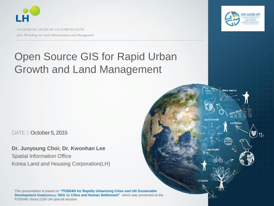
DATEㅣOctober 5, 2015
Dr. Junyoung Choi; Dr. Kwonhan Lee
Spatial Information Office
Korea Land and Housing Corporation(LH)
Open Source GIS for Rapid Urban
Growth and Land Management
UN-GGIM-AP, UN-ESCAP, UN-HABITAT/GLTN Joint Workshop on Land Administration and Management
This presentation is based on “FOSS4G for Rapidly Urbanizing Cities and UN Sustainable
Development Goals(SDGs); SDG 11 Cities and Human Settlement” which was presented at the
FOSS4G Seoul 2105 UN special session.
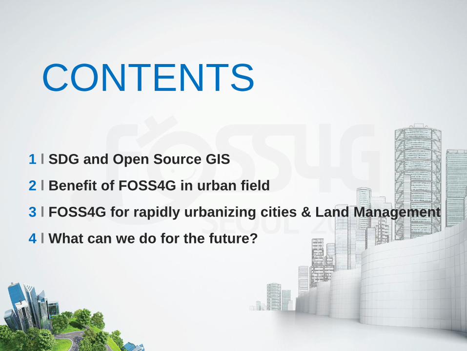
1 l SDG and Open Source GIS
2 l Benefit of FOSS4G in urban field
3 l FOSS4G for rapidly urbanizing cities & Land Management
4 l What can we do for the future?
CONTENTS

#1 SDG and Open Source GIS
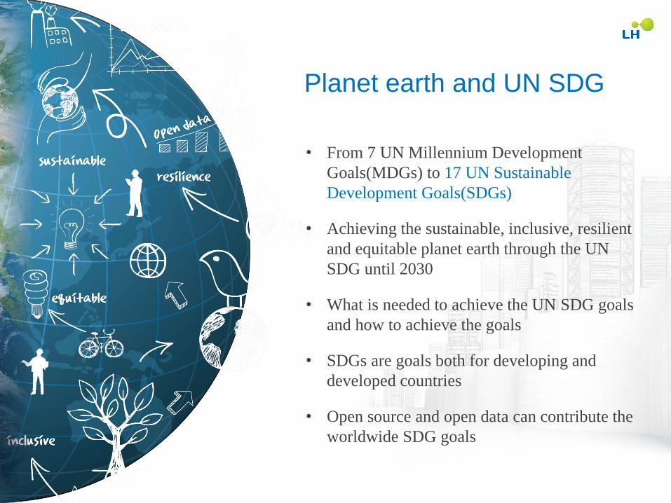
Planet earth and UN SDG
• From 7 UN Millennium Development
Goals(MDGs) to 17 UN Sustainable
Development Goals(SDGs)
• Achieving the sustainable, inclusive, resilient
and equitable planet earth through the UN
SDG until 2030
• What is needed to achieve the UN SDG goals
and how to achieve the goals
• SDGs are goals both for developing and
developed countries
• Open source and open data can contribute the
worldwide SDG goals
GIS in SDG
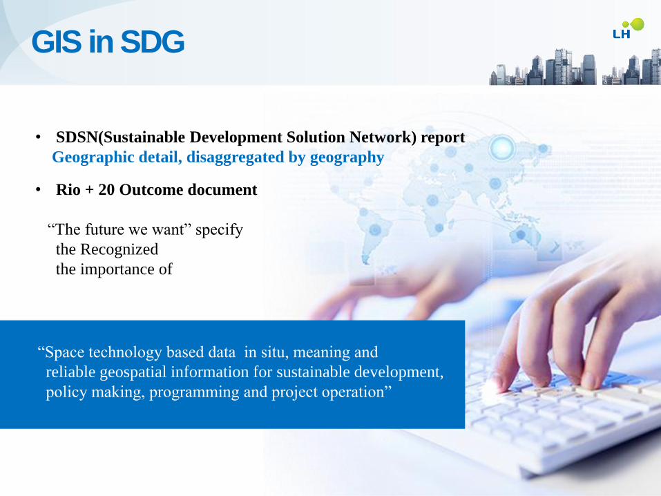
• SDSN(Sustainable Development Solution Network) report
Geographic detail, disaggregated by geography
• Rio + 20 Outcome document
“The future we want” specify
the Recognized
the importance of
“Space technology based data in situ, meaning and
reliable geospatial information for sustainable development,
policy making, programming and project operation”
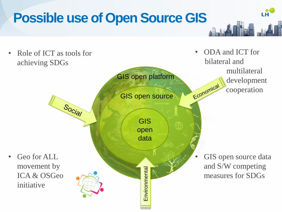
• ODA and ICT for
bilateral and
multilateral
development
c cooperation
• GIS open source data
and S/W competing
measures for SDGs
• Role of ICT as tools for
achieving SDGs
• Geo for ALL
movement by
ICA & OSGeo
initiative
GIS open platform
GIS open source
GIS
open
data E
nviro
nm
en
tal
Possible use of Open Source GIS
#2 Benefits of FOSS4G in Urban Field
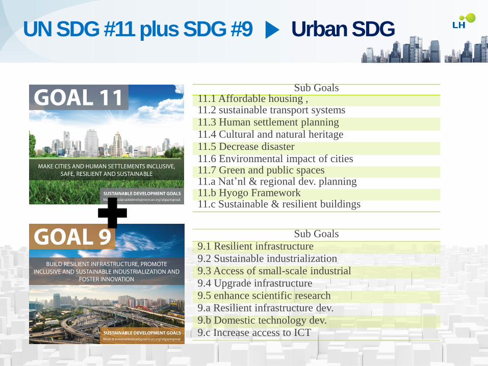
Sub Goals 11.1 Affordable housing , 11.2 sustainable transport systems 11.3 Human settlement planning 11.4 Cultural and natural heritage 11.5 Decrease disaster 11.6 Environmental impact of cities 11.7 Green and public spaces 11.a Nat’nl & regional dev. planning 11.b Hyogo Framework 11.c Sustainable & resilient buildings
Sub Goals
9.1 Resilient infrastructure
9.2 Sustainable industrialization
9.3 Access of small-scale industrial
9.4 Upgrade infrastructure
9.5 enhance scientific research
9.a Resilient infrastructure dev.
9.b Domestic technology dev.
9.c Increase access to ICT
UN SDG #11 plus SDG #9 ▶ Urban SDG
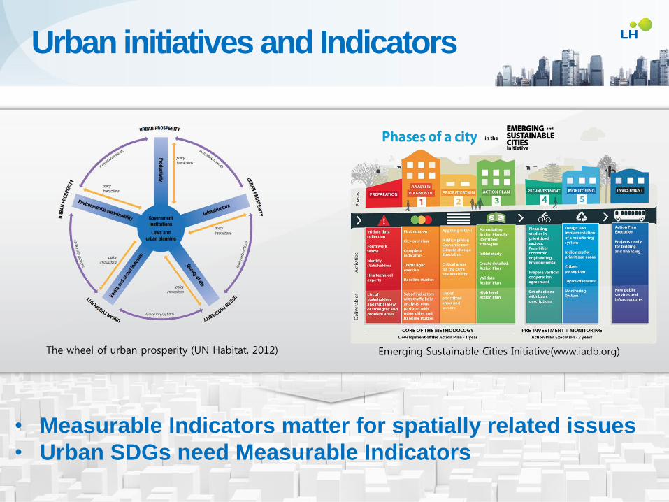
The wheel of urban prosperity (UN Habitat, 2012)
Urban initiatives and Indicators
• New generation of National urban
policies
• Urban patterns for a green economy
through City region planning
• Creating sustainable urban space
through Planned city extensions
• Implementation through Land
readjustment
• Measurable Indicators matter for spatially related issues
• Urban SDGs need Measurable Indicators
Emerging Sustainable Cities Initiative(www.iadb.org)

Urban
Population Proportion of the
population that has
a public transit stop
within
0.5 km
Financial support that is
allocated to the construction
and retrofitting of sustainable,
resilient and resource-efficient
buildings
Cities implementing risk
reduction and resilience
policies that include
vulnerable and
marginalized groups
Built-up areas of cities in
open space in public
ownership and use
Number
of housing units
damaged and
destroyed by
disasters
Percentage
of urban
solid waste
regularly
collected
'Number of people
killed, injured,
displaced,
evacuated,
relocated, by
disasters
Proportion of population
resilient / robust to hazards
and climate
-related
events
National budget
for heritage
Efficient land use
Proportion of
income spent by
urban families
on transport
Cities
Housing
Heri-
tage
Environ-
ment
Trans-
port
Developing Countries
Dev
elop
ed
Cou
ntr
ies
• Land cover
• Population Growth
• Public transportation
Ratio of land
consumption
rate to urban
population
growth rate
·보금자리통합정보
• Metropolitan area
• Waste management
• Built up area
• Housing unit
• Vulnerable area
Open
space
Dis-
aster
Jobs in the
metropolitan area
can access within
60/75 minutes
without a private
car
Measurability Quantifying the indicators using GIS
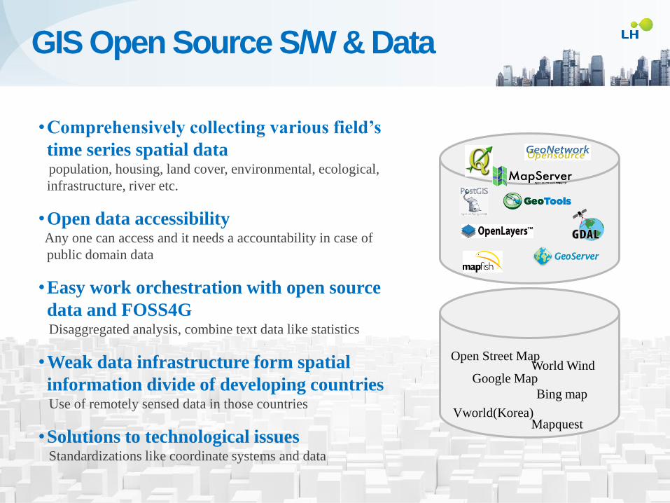
•Comprehensively collecting various field’s
time series spatial data population, housing, land cover, environmental, ecological,
infrastructure, river etc.
•Open data accessibility Any one can access and it needs a accountability in case of
public domain data
•Easy work orchestration with open source
data and FOSS4G Disaggregated analysis, combine text data like statistics
•Weak data infrastructure form spatial
information divide of developing countries Use of remotely sensed data in those countries
•Solutions to technological issues Standardizations like coordinate systems and data
Open Street Map World Wind
Vworld(Korea)
Bing map
Mapquest
Google Map
GIS Open Source S/W & Data
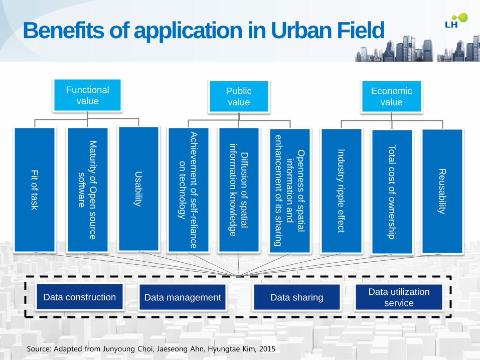
Functional
value Public
value
Economic
value
Fit o
f task
Ma
turity
of O
pe
n s
ou
rce
so
ftwa
re
Usa
bility
Ach
ieve
me
nt o
f se
lf-relia
nce
on
tech
no
log
y
Diffu
sio
n o
f sp
atia
l
info
rma
tion
kn
ow
led
ge
Op
en
ne
ss o
f sp
atia
l
info
rma
tion
an
d
en
ha
nce
men
t of its
sh
arin
g
Ind
ustry
ripp
le e
ffect
To
tal c
ost o
f ow
ne
rsh
ip
Re
usa
bility
Data construction Data management Data sharing Data utilization
service
Source: Adapted from Junyoung Choi, Jaeseong Ahn, Hyungtae Kim, 2015
Benefits of application in Urban Field
#3 FOSS4G for Rapidly Urbanizing Cities and Land Management
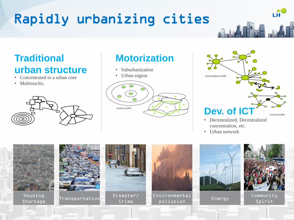
Motorization
Dev. of ICT
• Suburbanization
• Urban-region
• Decentralized, Decentralized
concentration, etc.
• Urban network
Traditional
urban structure • Concentrated to a urban core
• Multinuclei,
Hartshorn(1997)
Graham&Marvin(1996)
`
Hartshorn(1997)
Housing
Shortage Transportation
Disaster/
Crime
Environmental
pollution Energy
Community
Spirit
Rapidly urbanizing cities
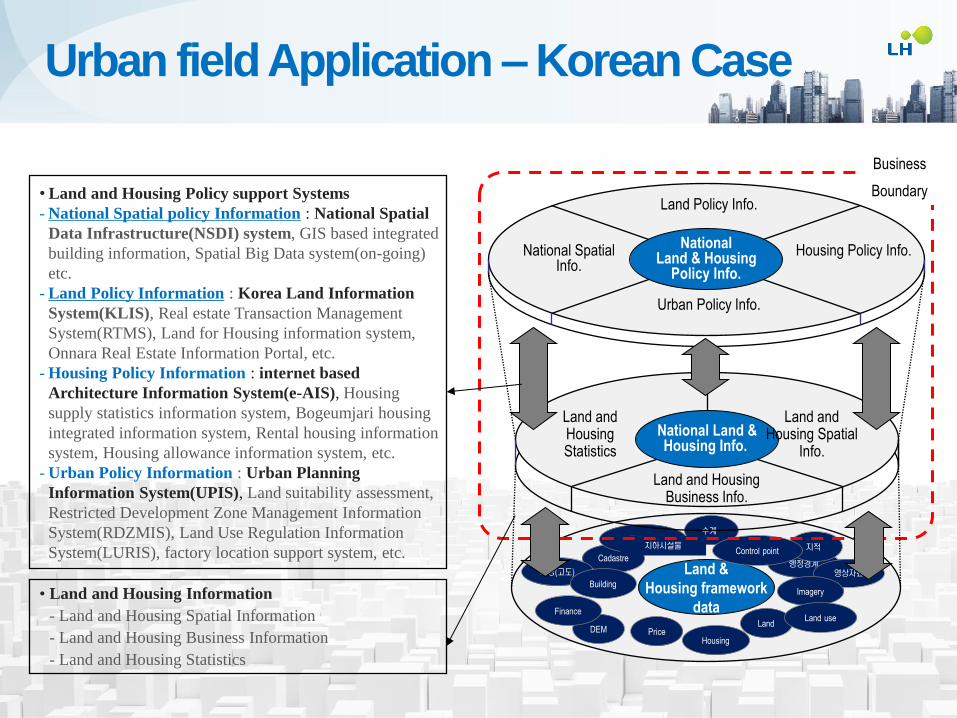
Urban Policy Info.
National Spatial Info.
Land &
Housing framework
data
Housing Policy Info.
Cadastre
수계 교통(도로)
행정경계
지적
영상자료 지형(고도)
지하시설물 Control point
National Land & Housing
Policy Info.
Land Policy Info.
Business
Boundary
Building
DEM Price Housing
Imagery
Finance
Land Land use
National Land & Housing Info.
Land and Housing Statistics
Land and Housing Business Info.
Land and Housing Spatial
Info.
• Land and Housing Policy support Systems
- National Spatial policy Information : National Spatial
Data Infrastructure(NSDI) system, GIS based integrated
building information, Spatial Big Data system(on-going)
etc.
- Land Policy Information : Korea Land Information
System(KLIS), Real estate Transaction Management
System(RTMS), Land for Housing information system,
Onnara Real Estate Information Portal, etc.
- Housing Policy Information : internet based
Architecture Information System(e-AIS), Housing
supply statistics information system, Bogeumjari housing
integrated information system, Rental housing information
system, Housing allowance information system, etc.
- Urban Policy Information : Urban Planning
Information System(UPIS), Land suitability assessment,
Restricted Development Zone Management Information
System(RDZMIS), Land Use Regulation Information
System(LURIS), factory location support system, etc.
• Land and Housing Information
- Land and Housing Spatial Information
- Land and Housing Business Information
- Land and Housing Statistics
Urban field Application – Korean Case
0
200
400
운행…
송산
2…
마두역
화정…
부대앞
역촌…
홍제…
서대…
녹번…
시계…
원당…
별빛…
주엽역
백송
인
원
수(
명)
시간대별 (차량수)
광역버스 9701번
04:00 ~ 06:00
(08대)
06:00 ~ 08:00
(13대)
08:00 ~ 10:00
(11대)
0
1000
2000
구미동…
대우롯…
중앙공…
백현마…
삼성프…
백현마…
중앙공…
신원아…
구미동…
인
원
수(
명)
시간대별 (차량수)
광역버스 9401번
04:00 ~ 06:00
(19대)
06:00 ~ 08:00
(34대)
08:00 ~ 10:00
(21대)
Space-time diagram of bus # 9407
Space-time diagram of bus # 9401
고속화 구간
Number of boarding and alighting passenger of bus # 9407 at each stop
Number of boarding and alighting passenger of bus # 9401 at each stop
정류장 중심의 하차수 오전 08시30분
서울 중구->경기도 대중교통 이용 이동수
경기도 성남->서울 대중교통 이용 이동수
성남 분당->경기도 대중교통 이용 이동수
강남구->서울,경기도 대중교통 이용 이동수
중구->서울,경기도 대중교통 이용 이동수
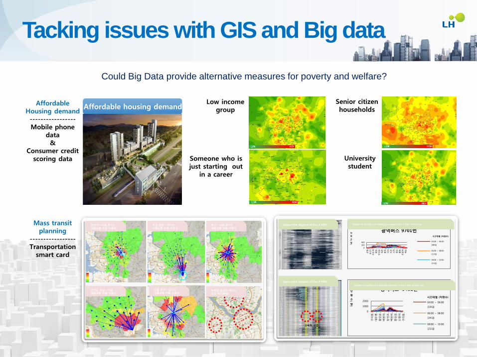
Senior citizen households
Low income group
University student
Someone who is just starting out
in a career
Affordable housing demand Affordable
Housing demand ----------------- Mobile phone
data &
Consumer credit scoring data
Mass transit planning
----------------- Transportation
smart card
Tacking issues with GIS and Big data
Could Big Data provide alternative measures for poverty and welfare?

Some Project Data Inter-face
Open Source Applied Spatial data processing tech. Client Server DBMS LIB Framework
Water supply network management system of
a Korean local gov.
Raster/Vector
WMS/WFS
Hazardous material safety transportation
management system of a Korean gov.
Raster(
Open
API)
WMS,
Vector
using
native
coding
Geobolivia
WMS,
WFS,
WCS,
CWS, T-
WFS
Online What If Planning Support System
Wildfire management tool(WMT), World
Wind project REST
Word Bank PUMA 1) Google
map
Geotools
Urban
Infra
Urban
Enviro
n-
ment
Urban
Analys
is
1) PUMA: Platform for Urban Management and Analysis
MySQL Geo
Server
Open
layers2
MySQL Open
layers2
PostGIS,
MySQL
Geo
Server,
MapSe
rver,
Deegre
e,
Geonet
work
Mapbuild
er,
Intermap
, Kamap,
Openlay
ers
Web
World S
아,
RequireJ
S, Jquery,
Prime-UI,
Bootstrap
MySQL
WMT
REST
Service
2)
WebGL,
Globe
Pycsw(
OGC
CSW
Server
Implem
entatio
n)
Maps
API,
Openlay
ers2,
ExtJS
Geotools
Postgre
SQL, Post
GIS,
Couch DB
Geo
Server
Word
Wind
Geonode
Processing and
representation of line data
using Geotools, need
additional data handling like
insert water supply network
Link external data using
Open API which is needed
to monitor the hazardous
vehicle
2) CPS internally uses WMS Map Servers, USGS Landfire Servers, etc.
Computing Fire Behavior
Using selecting fuel models,
adjusting and conditioning
the fuel to the environment
and computing the "fine" fuel
moisture content based on
solar heating combined with
the cooling effect of wind
FOSS4G application in urban field: Exampl
es
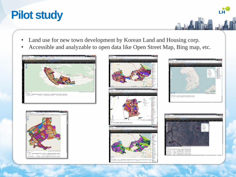
• Land use for new town development by Korean Land and Housing corp.
• Accessible and analyzable to open data like Open Street Map, Bing map, etc.
Pilot study
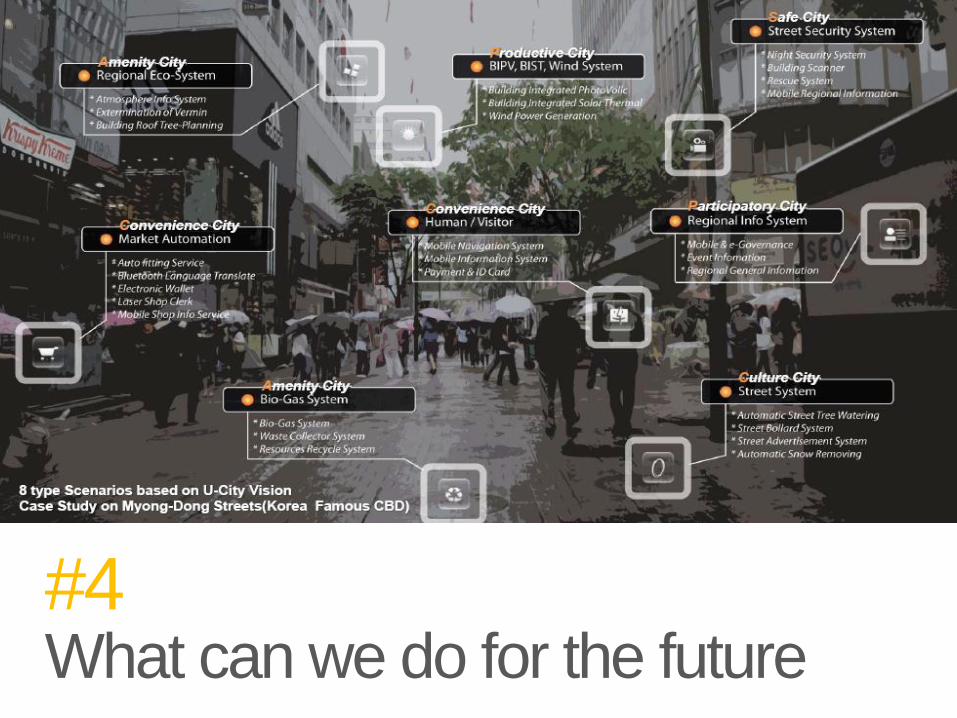
#4 What can we do for the future
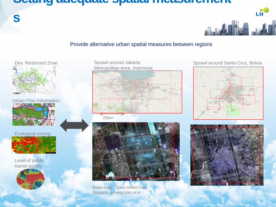
Setting adequate spatial measurement
s
25km
Sprawl around Jakarta
Metropolitan Area, Indonesia
10km
Sprawl around Santa Cruz, Bolvia
Base map : Open street map
Imagery: arirang.kari.re.kr
Dev. Restricted Zone
Urban Plan Information
Ecological zoning
Level of public
transit supply
Provide alternative urban spatial measures between regions
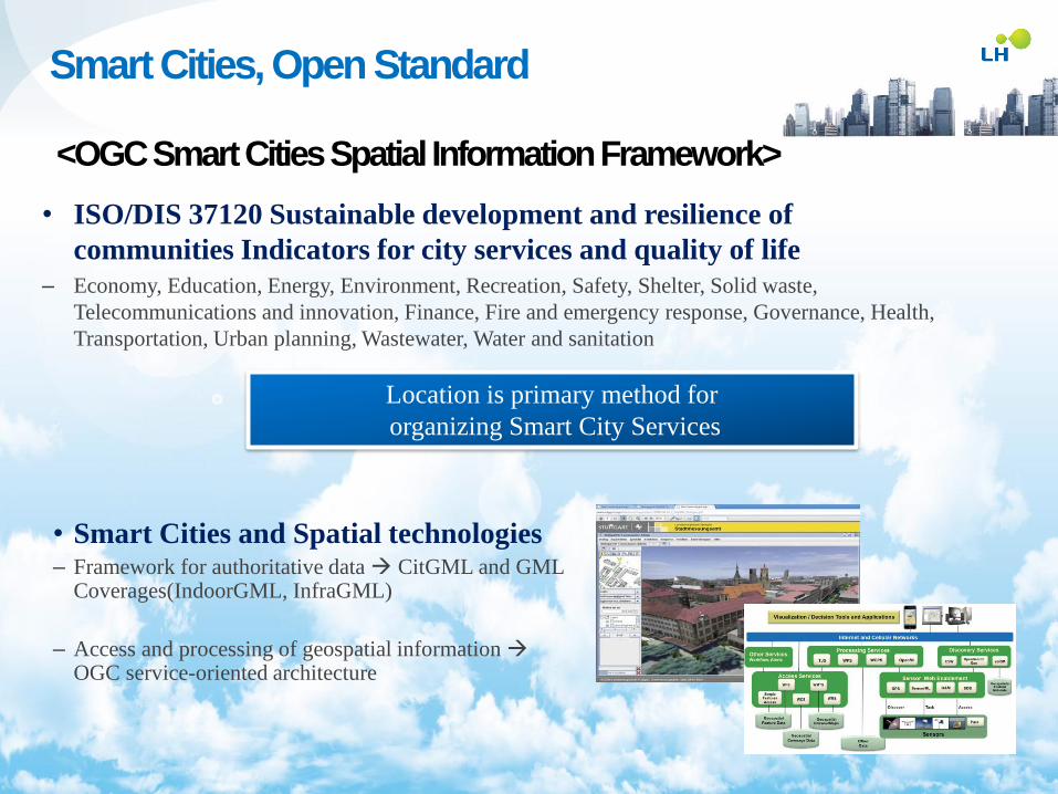
• ISO/DIS 37120 Sustainable development and resilience of
communities Indicators for city services and quality of life
– Economy, Education, Energy, Environment, Recreation, Safety, Shelter, Solid waste,
Telecommunications and innovation, Finance, Fire and emergency response, Governance, Health,
Transportation, Urban planning, Wastewater, Water and sanitation
Location is primary method for
organizing Smart City Services
• Smart Cities and Spatial technologies – Framework for authoritative data CitGML and GML
Coverages(IndoorGML, InfraGML)
– Access and processing of geospatial information OGC service-oriented architecture
Smart Cities, Open Standard
<OGC Smart Cities Spatial Information Framework>
Cooperation to implement the tasks
Supportive goals
• Cooperation of stakeholders
Working group: United
Nations(Geospatial information
dept., UN-HABIT, etc.),
Governments, MDBs such as WB,
ADB, IDB, etc.
Trust fund : Money for the action
“Realization of Urban SDGs using the geographically
disaggregated spatial measurements”
Urban SDGs can be achieved using the open, free and
affordable spatial technologies, Open Source GIS or Free
Open Source for Geospatial

THANK YOU