Embed Size (px)
Citation preview
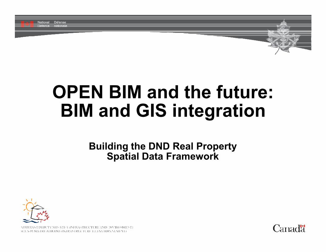
OPEN BIM and the future:BIM and GIS integration
Building the DND Real Property Spatial Data Framework
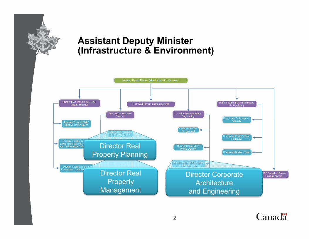
Assistant Deputy Minister (Infrastructure & Environment)
2
Director Real
Property Planning
Director Real
Property
Management
Director Corporate
Architecture
and Engineering
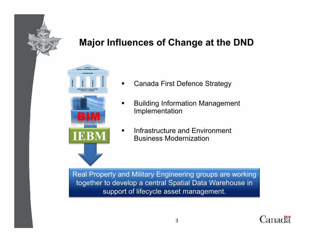
Major Influences of Change at the DND
� Canada First Defence Strategy
� Building Information ManagementImplementation
BIM
3
� Infrastructure and Environment Business Modernization
Real Property and Military Engineering groups are working
together to develop a central Spatial Data Warehouse in
support of lifecycle asset management.
IEBM
BIM
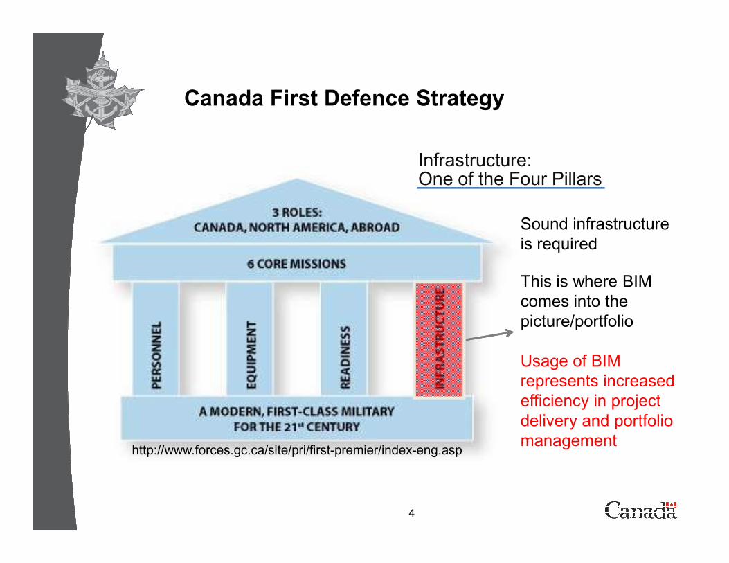
Sound infrastructure
is required
This is where BIM
Canada First Defence Strategy
Infrastructure:One of the Four Pillars
4
This is where BIM
comes into the
picture/portfolio
Usage of BIM
represents increased
efficiency in project
delivery and portfolio
managementhttp://www.forces.gc.ca/site/pri/first-premier/index-eng.asp
Building Information Modelling
BIM
5
BIM
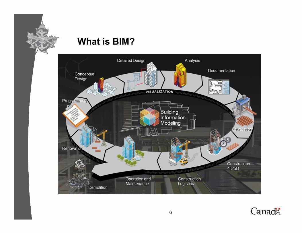
What is BIM?
� Many definitions of the acronym exist from different sources:• OGC - Open Geospatial Consortium;
• NIBS – National Institute of Building Sciences;
• RAIC – Royal Architectural Institute of Canada;
• AIA - American Institute of Architects;
• Vendors - Autodesk, Bentley, Graphisoft and others.
6
• Vendors - Autodesk, Bentley, Graphisoft and others.
� NIBS - A computable representation of the physical and functional characteristics of a facility and its related project/life-cycle information using open industry standards to inform business decision making for realizing better value .
� BIM is NOT limited to buildings.
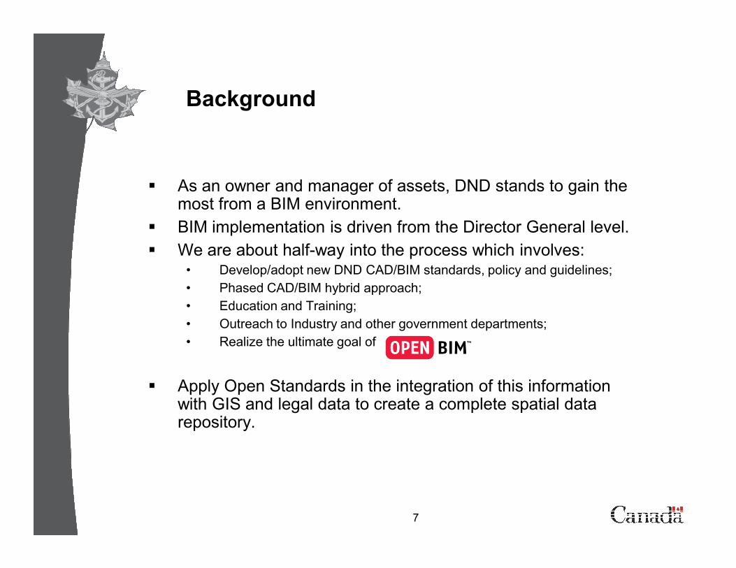
Background
� As an owner and manager of assets, DND stands to gain the most from a BIM environment.
� BIM implementation is driven from the Director General level.
� We are about half-way into the process which involves:• Develop/adopt new DND CAD/BIM standards, policy and guidelines;
• Phased CAD/BIM hybrid approach;
7
• Phased CAD/BIM hybrid approach;
• Education and Training;
• Outreach to Industry and other government departments;
• Realize the ultimate goal of
� Apply Open Standards in the integration of this information with GIS and legal data to create a complete spatial data repository.
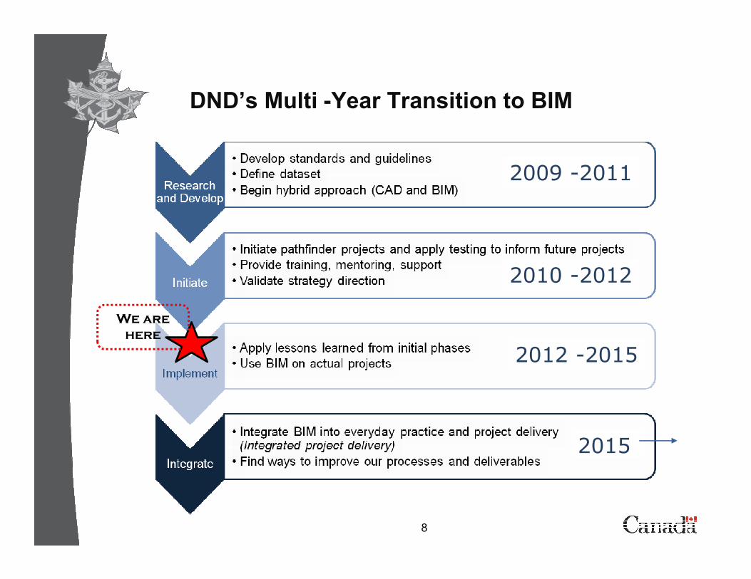
2009 -2011
2010 -2012
DND’s Multi -Year Transition to BIM
8
2012 -2015
2015
We are
here
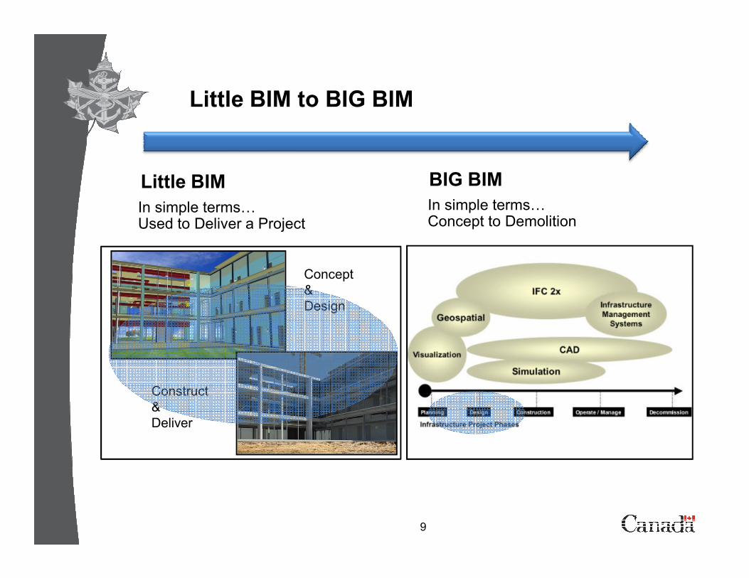
Little BIM to BIG BIM
BIG BIM
In simple terms= Concept to Demolition
Little BIM
In simple terms=Used to Deliver a Project
Concept
&
9
&
Design
Construct
&
Deliver
BIM and Standards
� The global BIM standards will incorporate “model views" of information exchanged between AEC and DND the owner / operator. The standards will build upon standards in use today, in particular:
• The buildingSMART (formally International Alliance for Interoperability) IFCs;
10
• Standards of the National Institute for Building Sciences (NIBS)
• ISO standards;
• Open Standards Consortium for Real Estate (OSCRE) standards;
• Open Geospatial Consortium (OGC) standards;
• The FIATECH capital investment roadmap;
• Efforts like CSI OmniClass taxonomies, COBIE (Construction to Operations Building Information Exchange), etc.
� All of these will have an impact on our ability to exchange Real Property information on a corporate wide basis.
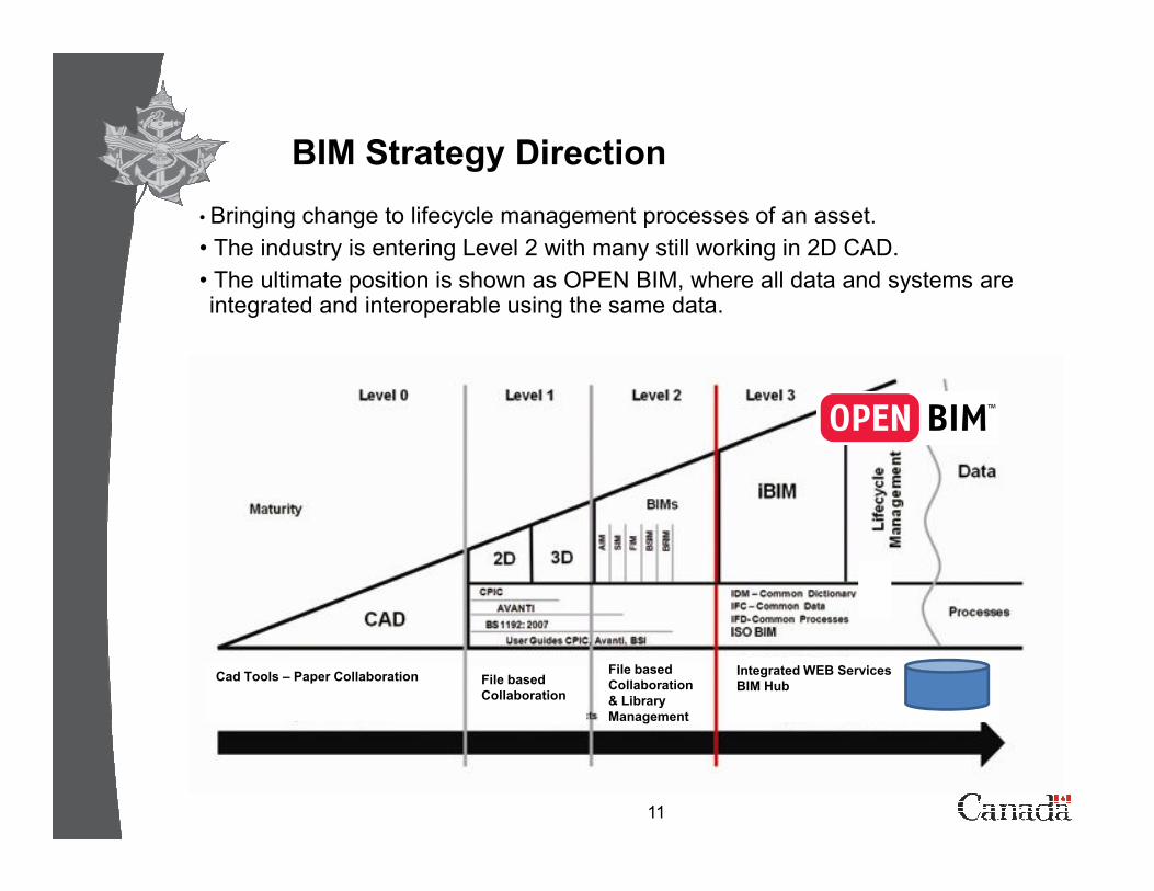
• Bringing change to lifecycle management processes of an asset.
• The industry is entering Level 2 with many still working in 2D CAD.
• The ultimate position is shown as OPEN BIM, where all data and systems are integrated and interoperable using the same data.
BIM Strategy Direction
11
Cad Tools – Paper Collaboration File based
Collaboration
File based
Collaboration
& Library
Management
Integrated WEB Services
BIM Hub
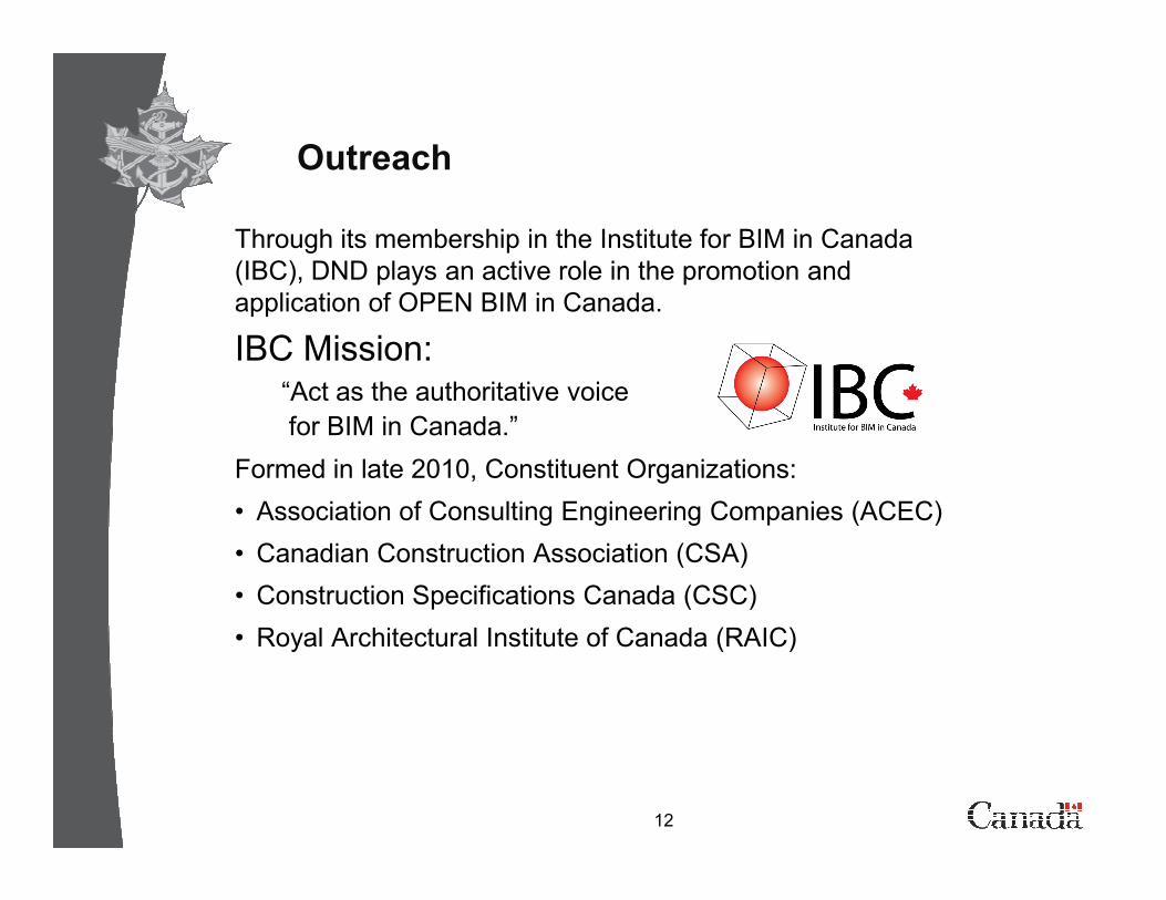
Through its membership in the Institute for BIM in Canada
(IBC), DND plays an active role in the promotion and
application of OPEN BIM in Canada.
IBC Mission:“Act as the authoritative voice
for BIM in Canada.”
Outreach
12
Formed in late 2010, Constituent Organizations:
• Association of Consulting Engineering Companies (ACEC)
• Canadian Construction Association (CSA)
• Construction Specifications Canada (CSC)
• Royal Architectural Institute of Canada (RAIC)
Institute for BIM in Canada
• Develop contract language
• Supplementary conditions to existing contract forms
• Standalone contract forms
• Established the Canadian Chapter of buildingSMART International in
mid 2011.
• Canadian practitioners were participating in the work of the North
13
• Canadian practitioners were participating in the work of the North
American chapter, the buildingSMART Alliance
• Need to establish Canadian chapter due to differences between US
and Canadian industries.
• Legal
• Language
• Metric System www.ibc-bim.ca
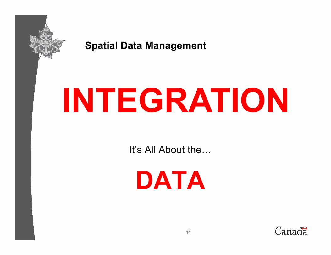
Spatial Data Management
INTEGRATION
14
It’s All About the=
DATA
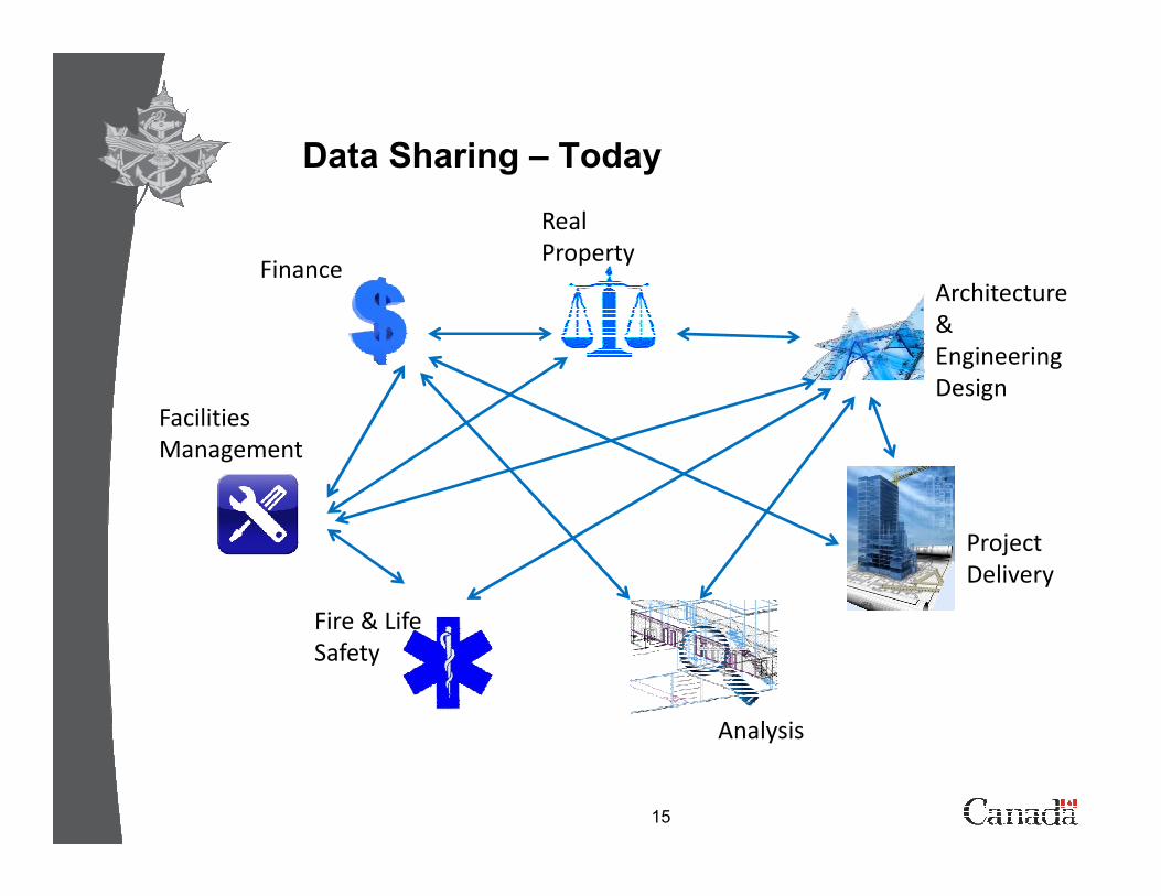
Data Sharing – Today
Facilities
Management
Finance
Real
Property
Architecture
&
Engineering
Design
15
Fire & Life
Safety
Management
Project
Delivery
Analysis
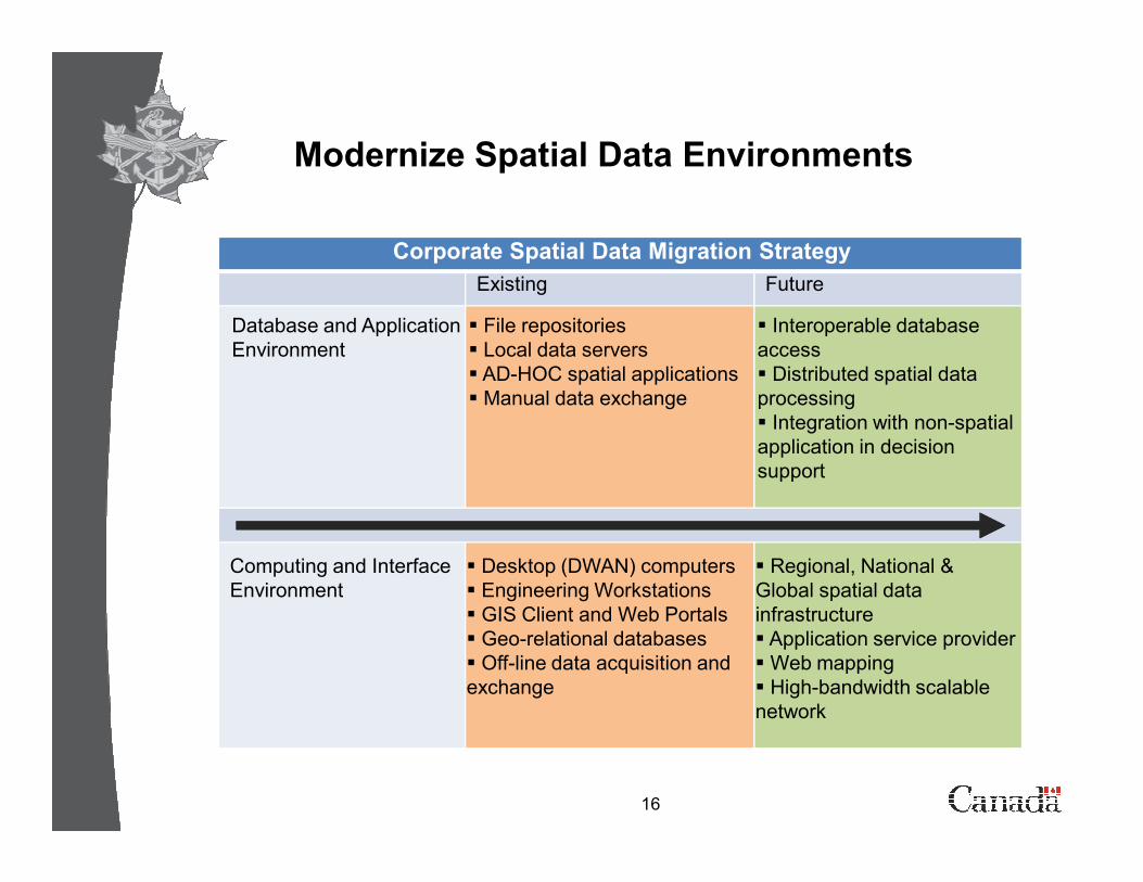
Modernize Spatial Data Environments
Corporate Spatial Data Migration Strategy
Existing Future
Database and Application
Environment
� File repositories
� Local data servers
� AD-HOC spatial applications
� Manual data exchange
� Interoperable database
access
� Distributed spatial data
processing
� Integration with non-spatial
application in decision
16
application in decision
support
Computing and Interface
Environment
� Desktop (DWAN) computers
� Engineering Workstations
� GIS Client and Web Portals
� Geo-relational databases
� Off-line data acquisition and
exchange
� Regional, National &
Global spatial data
infrastructure
� Application service provider
� Web mapping
� High-bandwidth scalable
network
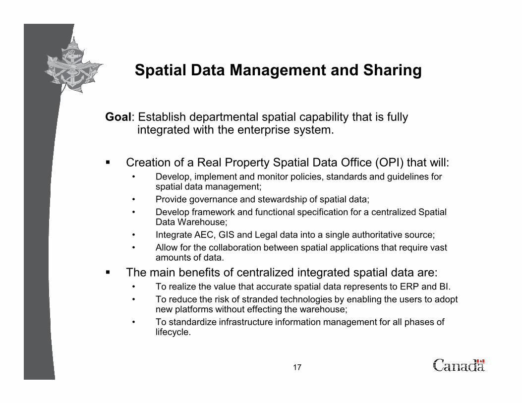
Spatial Data Management and Sharing
Goal: Establish departmental spatial capability that is fully integrated with the enterprise system.
� Creation of a Real Property Spatial Data Office (OPI) that will:• Develop, implement and monitor policies, standards and guidelines for
spatial data management;
• Provide governance and stewardship of spatial data;
17
• Provide governance and stewardship of spatial data;
• Develop framework and functional specification for a centralized Spatial Data Warehouse;
• Integrate AEC, GIS and Legal data into a single authoritative source;
• Allow for the collaboration between spatial applications that require vast amounts of data.
� The main benefits of centralized integrated spatial data are:• To realize the value that accurate spatial data represents to ERP and BI.
• To reduce the risk of stranded technologies by enabling the users to adopt new platforms without effecting the warehouse;
• To standardize infrastructure information management for all phases of lifecycle.
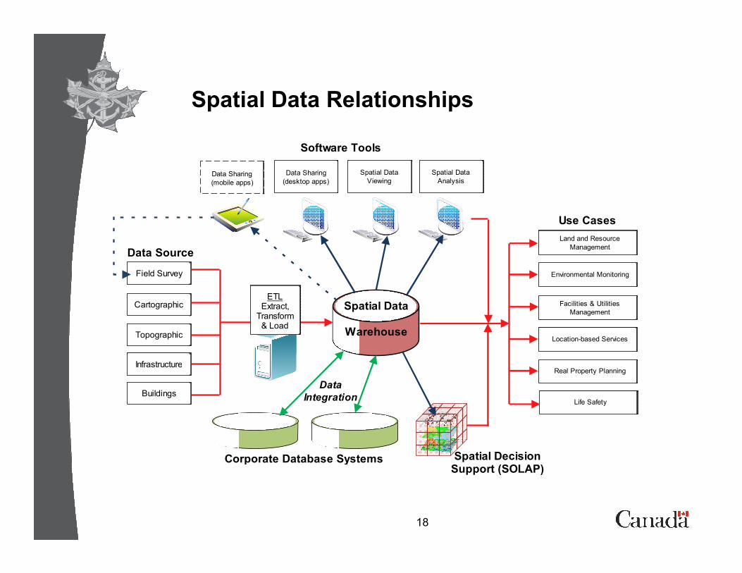
Spatial Data Relationships
Land and Resource
Management
Environmental MonitoringField Survey
Data Sharing
(desktop apps)
Spatial Data
Viewing
Spatial Data
Analysis
Software Tools
Use Cases
Data Source
Data Sharing
(mobile apps)
18
ETLExtract,
Transform & Load
Spatial Data
Warehouse
Facilities & Utilities
Management
Location-based Services
Real Property Planning
Life Safety
Cartographic
Topographic
Infrastructure
Buildings
Corporate Database Systems
Data
Integration
Spatial Decision Support (SOLAP)
Spatial Data Integration Mandates
� Surpass government requirements (Treasury Board);
� Allow class structures for GIS and BIM data to co-exist;
� Establish rich metadata through ISO 19115:2003;
� Ensure support for a multitude of software applications;
� Include terrain, buildings, legal and site infrastructure;
� Ensure the platform provides speed, scalability and
19
� Ensure the platform provides speed, scalability and interoperability;
� Provide validated information through an automated workflow;
� Track progress and apply Total Quality Management principles in the refinement of the system.
� Share the model with other government real property departments.
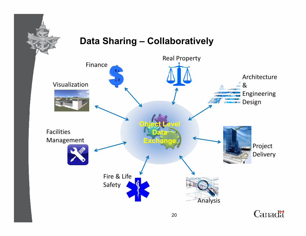
Data Sharing – Collaboratively
FinanceReal Property
Architecture
&
Engineering
Design
Visualization
20
Fire & Life
Safety
Facilities
Management Project
Delivery
Analysis
Object Object Level Level
DataData
ExchangeExchange
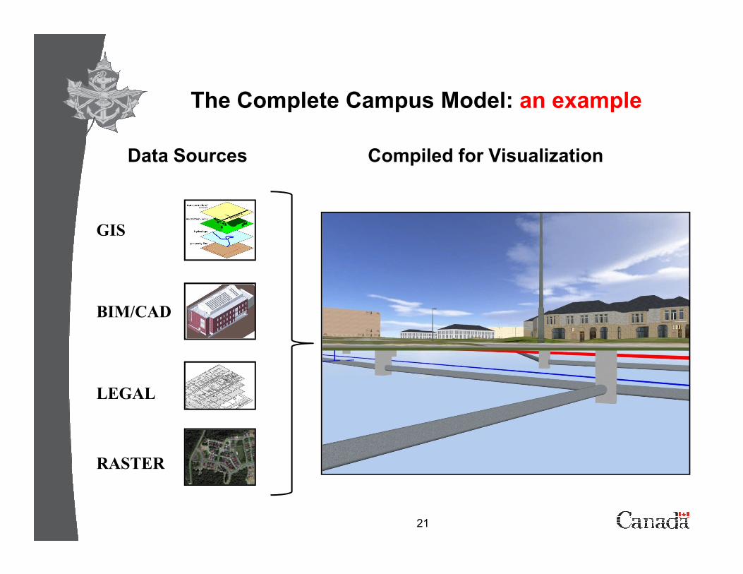
The Complete Campus Model: an example
Data Sources
GIS
Compiled for Visualization
21
BIM/CAD
LEGAL
RASTER

Questions Welcome
22