Embed Size (px)
Citation preview
Ohio’s Linear Based Referencing System(a.k.a. Location Based Response System – LBRS),a True State and Local Government Partnership
Ron CramerDigital Data Technologies, Inc.
Joseph HausmanThe Ohio Department of Transportation
LBRS Concept:
Create it once
Use it a bunch
and maintain it
Defining the ProblemCreate it once Use it a bunch And maintain it
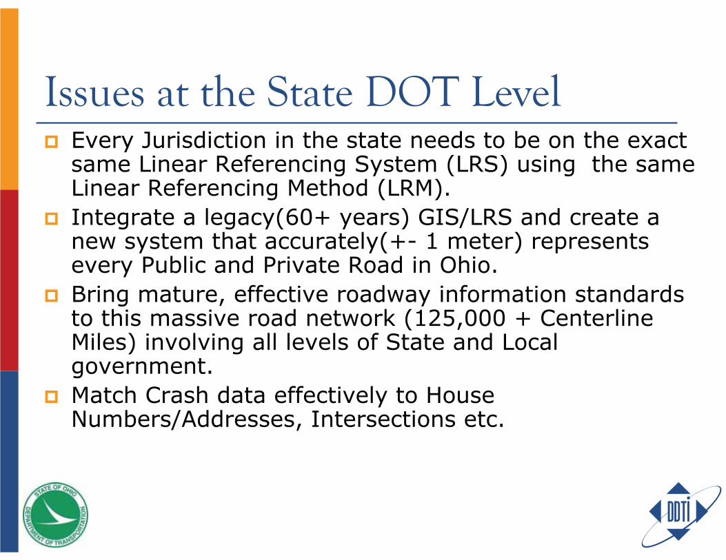
Issues at the State DOT LevelEvery Jurisdiction in the state needs to be on the exact same Linear Referencing System (LRS) using the same Linear Referencing Method (LRM).Integrate a legacy(60+ years) GIS/LRS and create a new system that accurately(+- 1 meter) represents every Public and Private Road in Ohio. Bring mature, effective roadway information standards to this massive road network (125,000 + Centerline Miles) involving all levels of State and Local government.Match Crash data effectively to House Numbers/Addresses, Intersections etc.
Standardization of Common Roadway Elements
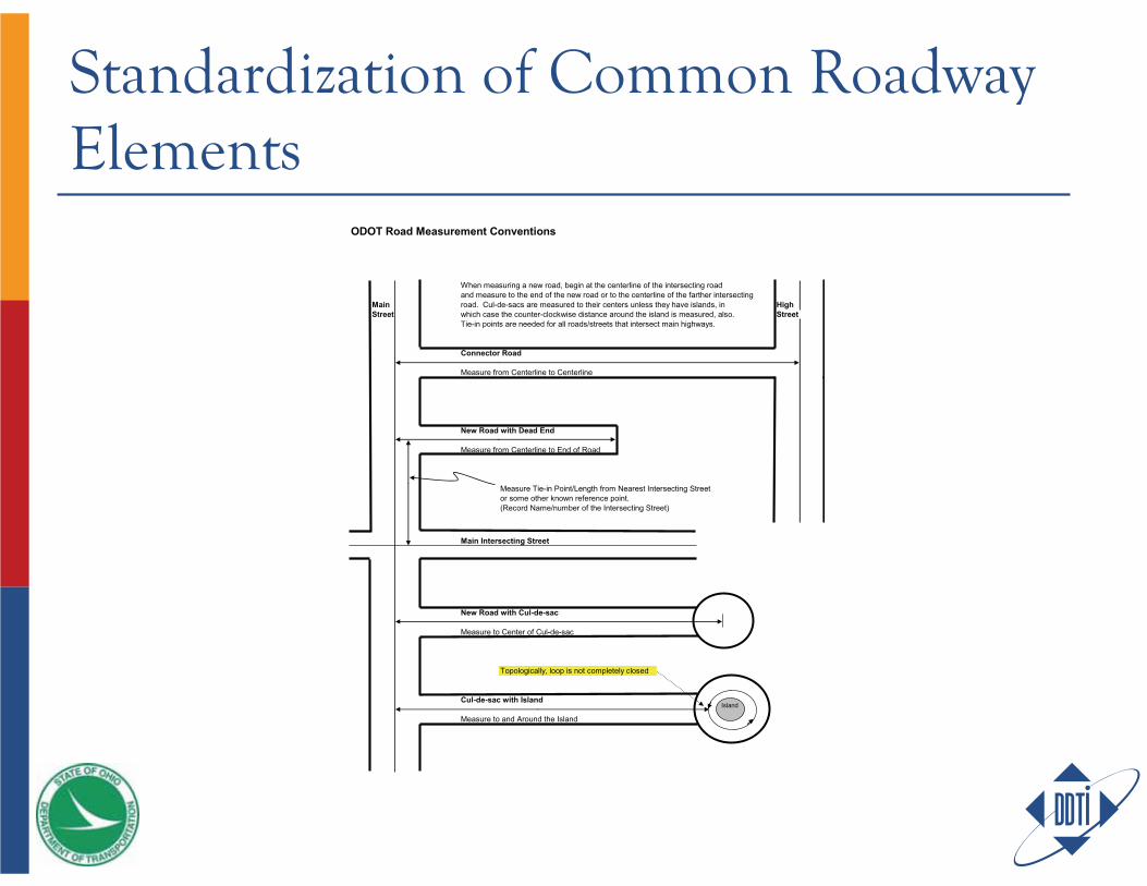
ODOT Road Measurement Conventions
When measuring a new road, begin at the centerline of the intersecting road and measure to the end of the new road or to the centerline of the farther intersecting
Main road. Cul-de-sacs are measured to their centers unless they have islands, in HighStreet which case the counter-clockwise distance around the island is measured, also. Street
Tie-in points are needed for all roads/streets that intersect main highways.
Connector Road
Measure from Centerline to Centerline
New Road with Dead End
Measure from Centerline to End of Road
Measure Tie-in Point/Length from Nearest Intersecting Streetor some other known reference point.(Record Name/number of the Intersecting Street)
Main Intersecting Street
New Road with Cul-de-sac
Measure to Center of Cul-de-sac
Topologically, loop is not completely closed
Cul-de-sac with Island
Measure to and Around the Island
Island
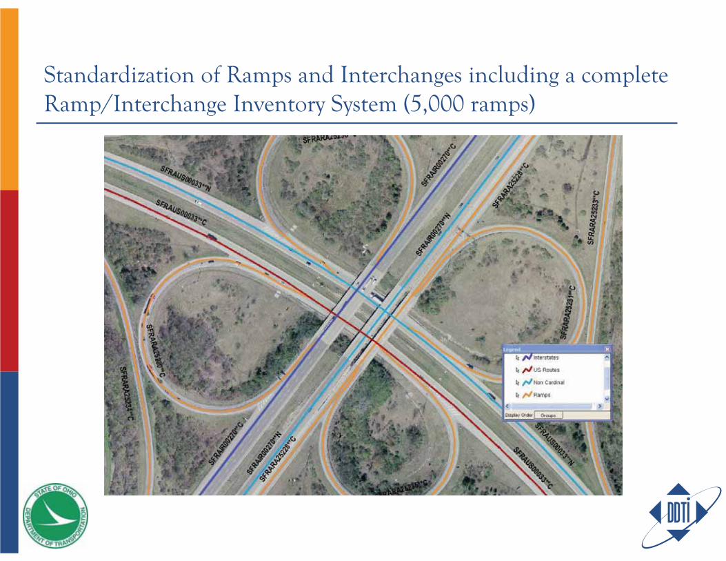
Standardization of Ramps and Interchanges including a complete Ramp/Interchange Inventory System (5,000 ramps)
Defining Part of the Local Government Problem
Point-based addressing – ensures jurisdiction’s homes, businesses, landmarks and other assets will be accurately located. Most do not have this.Geocoding, a mapping method that approximates address locations based on ranges assigned to a road segment, is unreliable for applications that require accurate locations and it wastes time that could save lives.
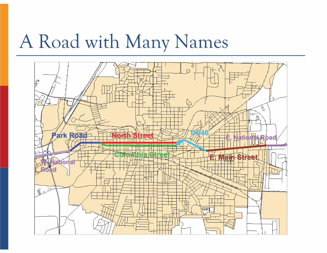
A Road with Many Names
North StreetNorth Street
Columbia StreetColumbia Street
Park RoadPark Road US40US40
E. Main StreetE. Main StreetW. National W. National RoadRoad
E. National RoadE. National Road
To create “quality” data, some tried to useAn orthophoto to create the centerlinesAddress data from the Assessor and other departments to populate the addresses
It became clear that in order to obtain accurate, reliable data, ALL addresses and roads must be field-verified
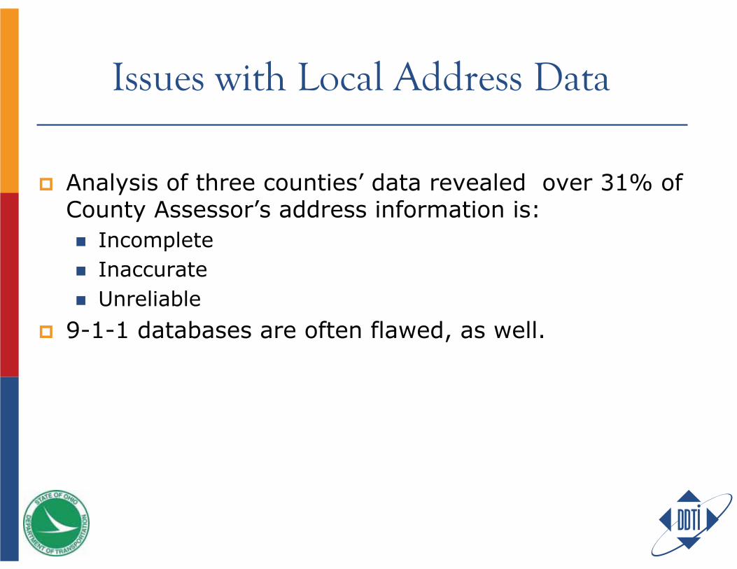
Issues with Local Address Data
Analysis of three counties’ data revealed over 31% of County Assessor’s address information is:
IncompleteInaccurateUnreliable
9-1-1 databases are often flawed, as well.
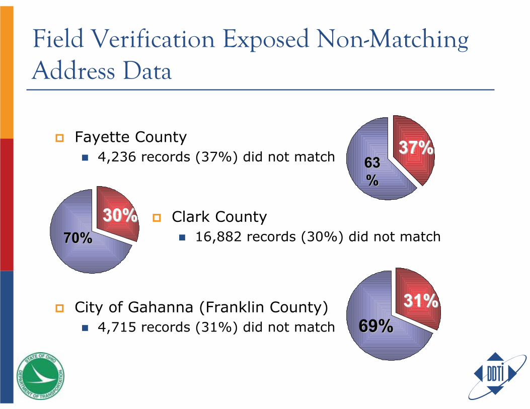
Field Verification Exposed Non-Matching Address Data
6363%%
37%37%Fayette County4,236 records (37%) did not match
70%70%30%30% Clark County
16,882 records (30%) did not match
31%31%69%69%
City of Gahanna (Franklin County)4,715 records (31%) did not match
37% 25%
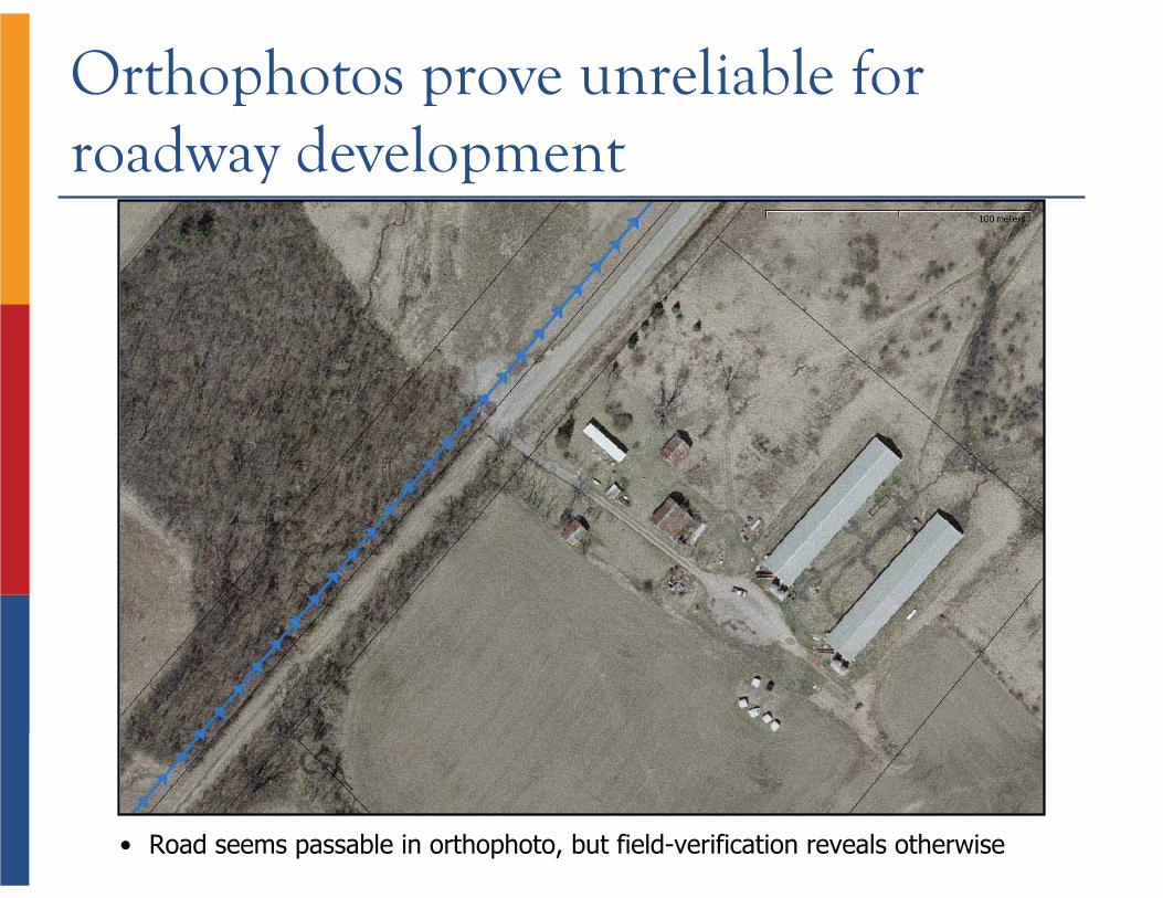
• Road seems passable in orthophoto, but field-verification reveals otherwise
Orthophotos prove unreliable for roadway development
37% 25%
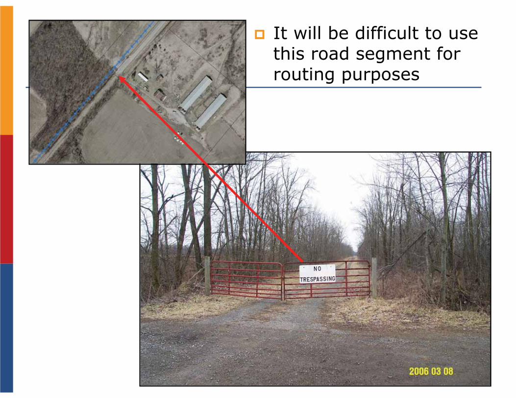
It will be difficult to use this road segment for routing purposes
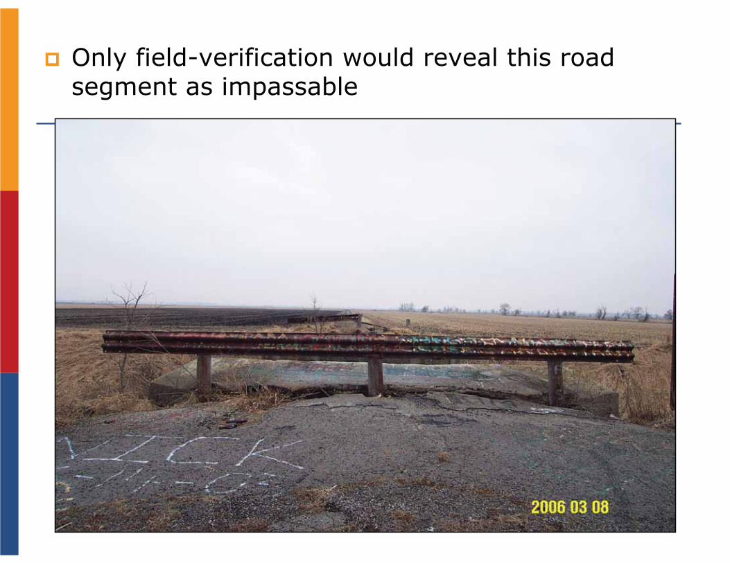
Only field-verification would reveal this road segment as impassable
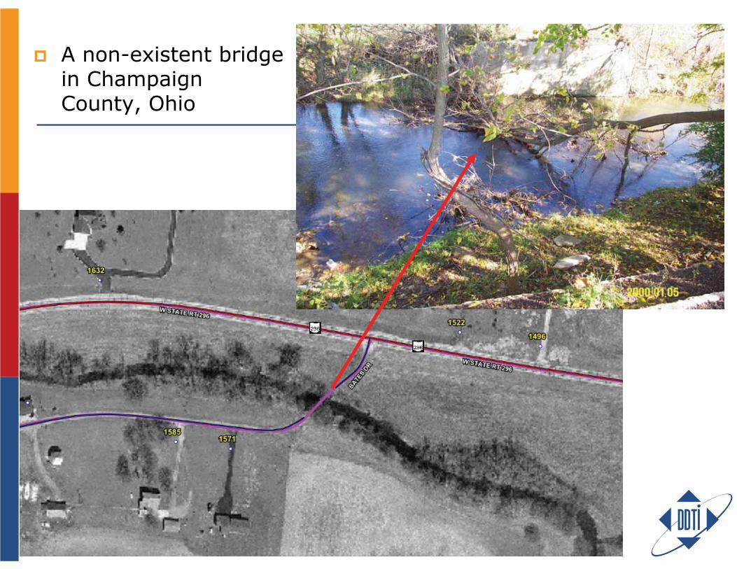
A non-existent bridge in Champaign County, Ohio
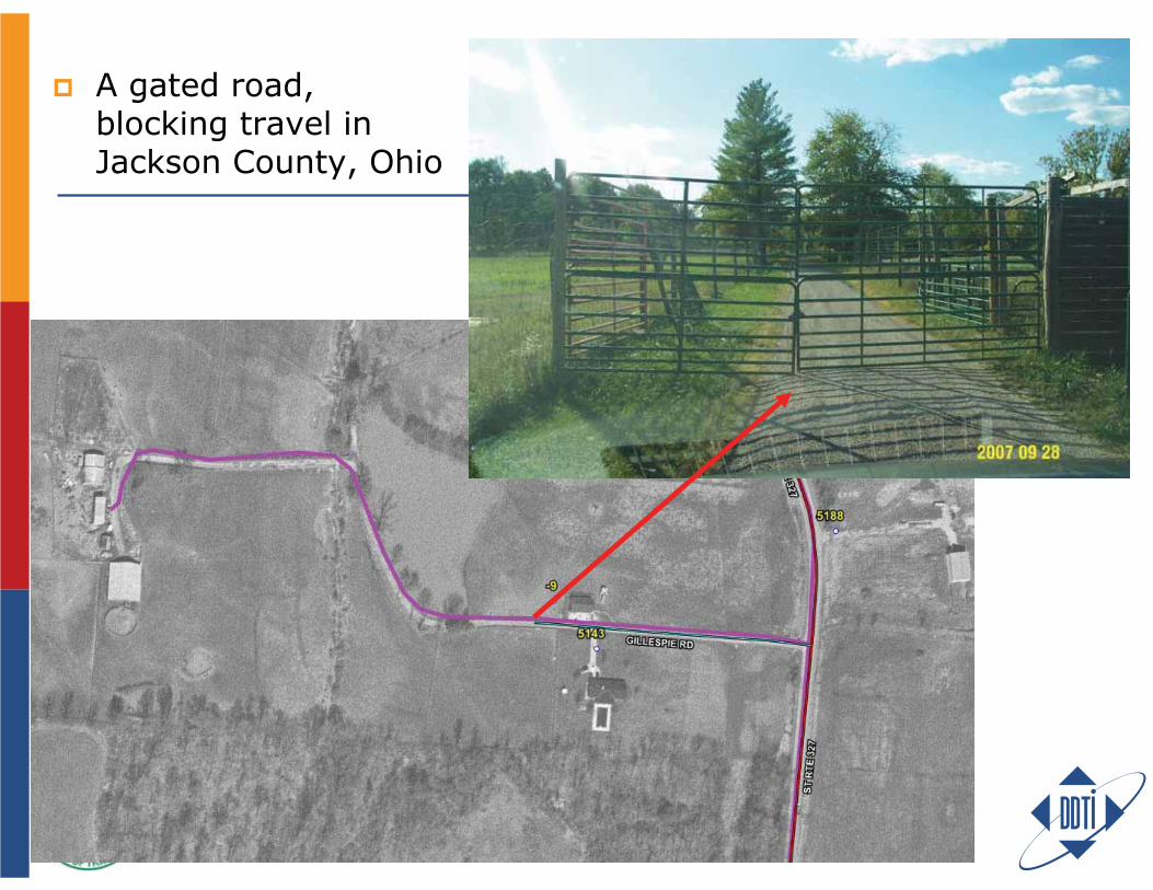
A gated road, blocking travel in Jackson County, Ohio
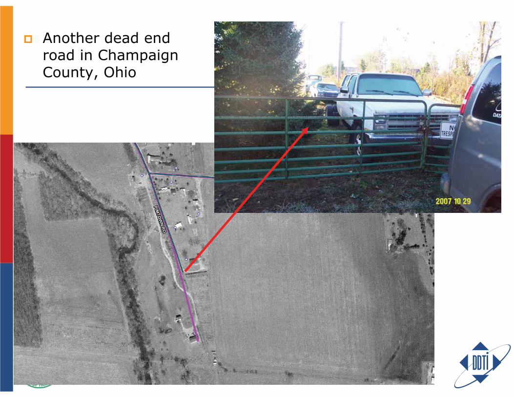
Another dead end road in Champaign County, Ohio
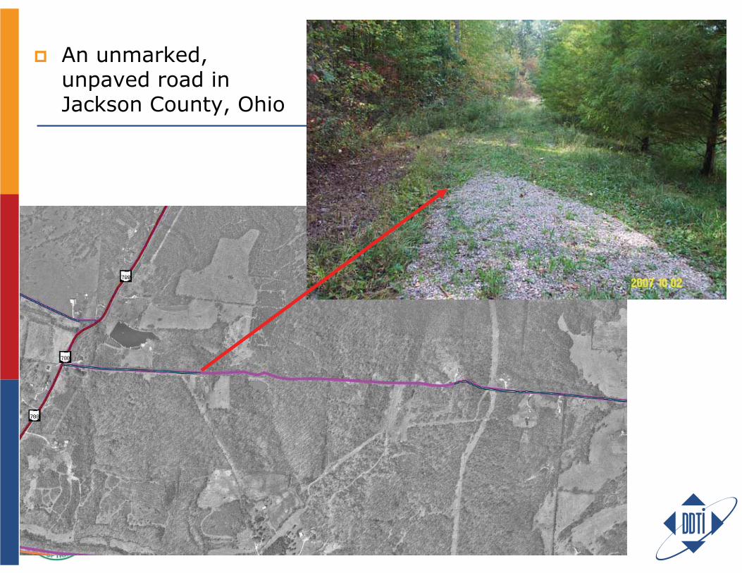
An unmarked, unpaved road in Jackson County, Ohio
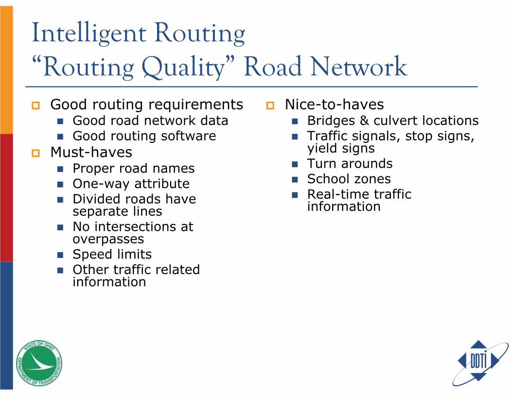
Intelligent Routing“Routing Quality” Road Network
Good routing requirementsGood road network dataGood routing software
Must-havesProper road namesOne-way attributeDivided roads have separate linesNo intersections at overpassesSpeed limitsOther traffic related information
Nice-to-havesBridges & culvert locationsTraffic signals, stop signs, yield signsTurn aroundsSchool zonesReal-time traffic information
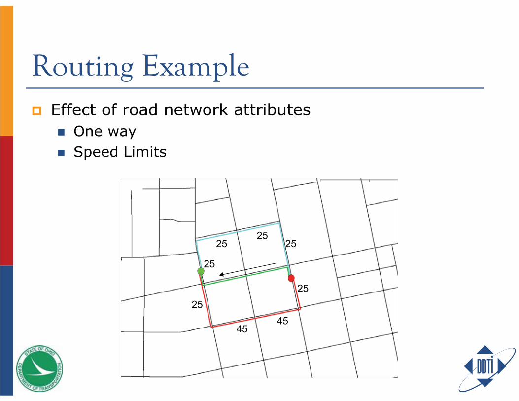
Routing ExampleEffect of road network attributes
One waySpeed Limits
25
2525
25
25
4545
25
25
2525
25
25
4545
25
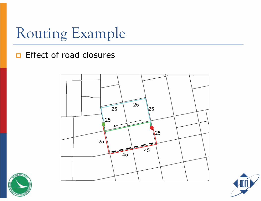
Routing ExampleEffect of road closures
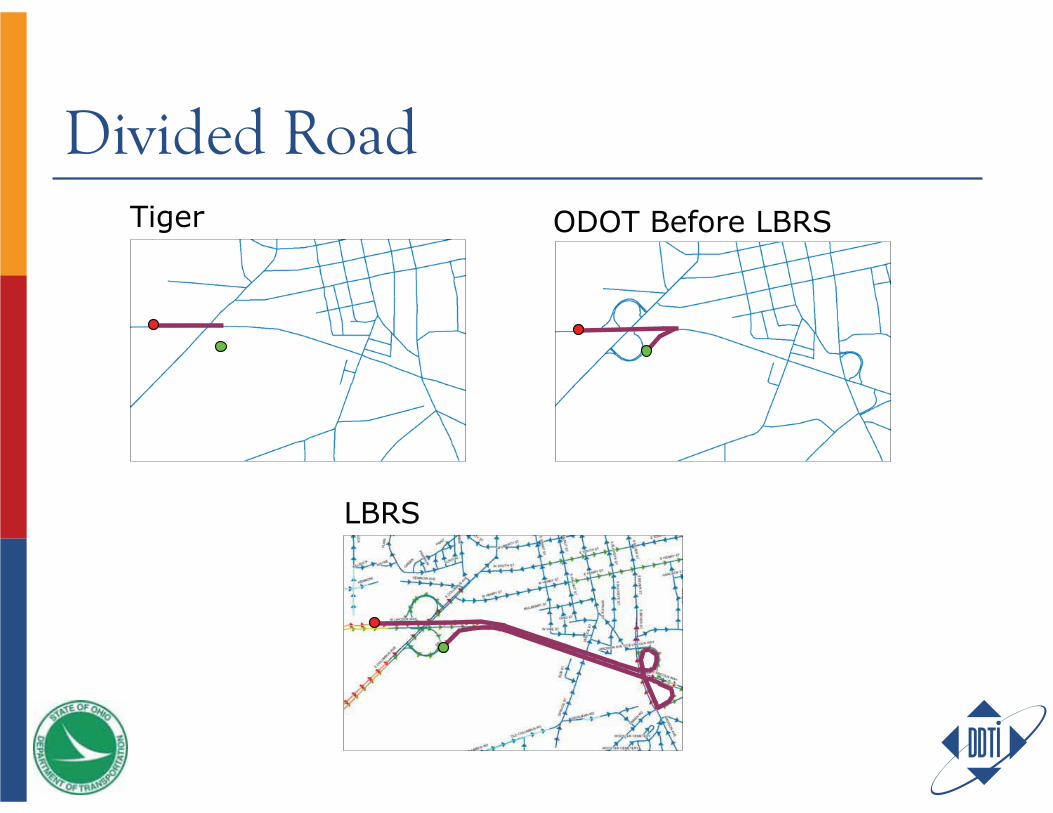
Divided RoadTiger
LBRS
ODOT Before LBRS
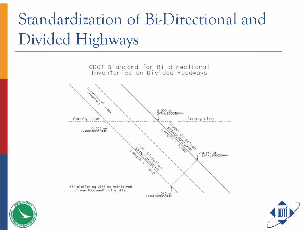
Standardization of Bi-Directional and Divided Highways

CREATE IT ONCECreate it once Use it a bunch And maintain it
Create It Once – The Solution…Location Based Response System (LBRS)
State-level plan for every Ohio countyMemorandums of Agreement between the Counties and the State
Create spatially accurate street centerlines with field verified site-specific address locations, with emphasis on linear referencing/mileposts
What is LBRS, cont’d.Avoids duplication of efforts
Fed, state, county and local levels were creating independent datasets that met their particular needs
The challenge for DDTI? Create the initial LBRS pilot project dataset that could meet the unique needs of the DOT with emphasis on linear referencing/milepost, while meeting the needs of county & local GIS, and Emergency Response
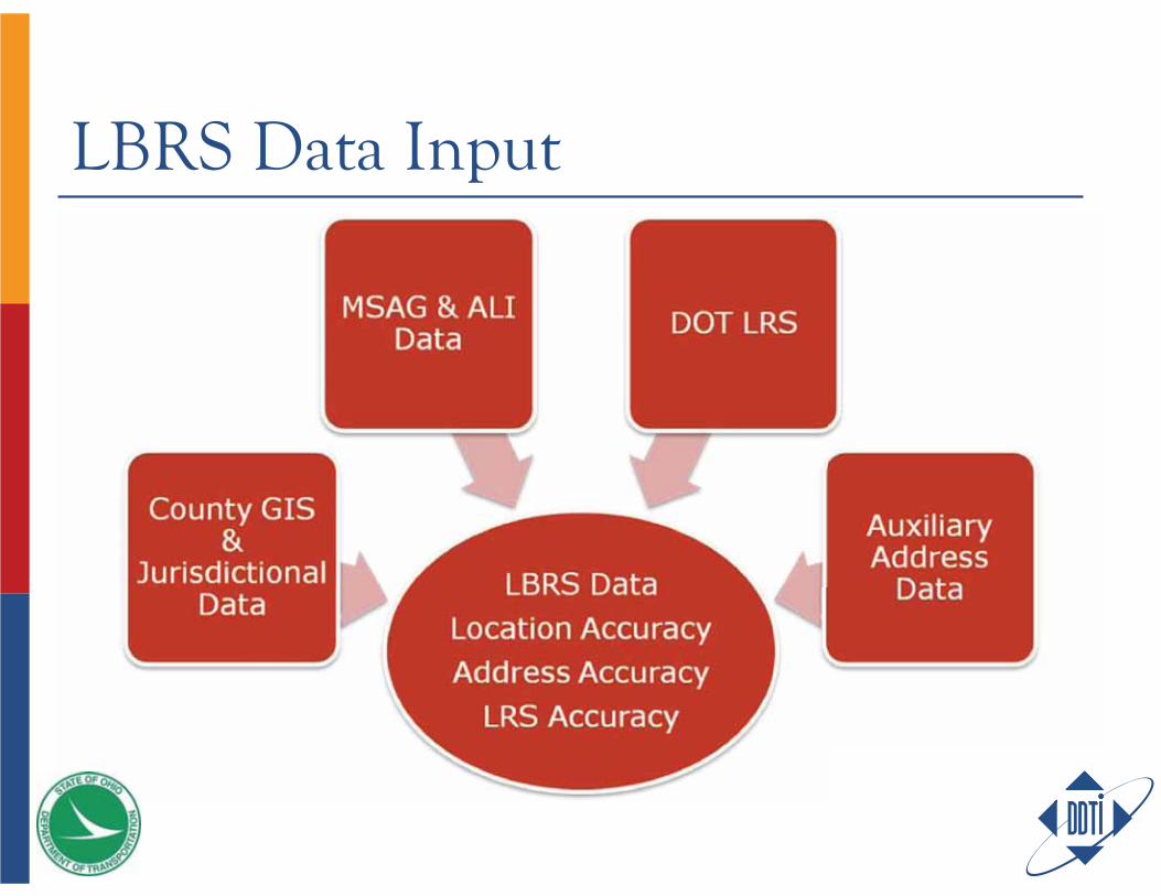
LBRS Data Input
What’s so unique? The Next Generation Road Network that supports advanced applications contains these attributes…
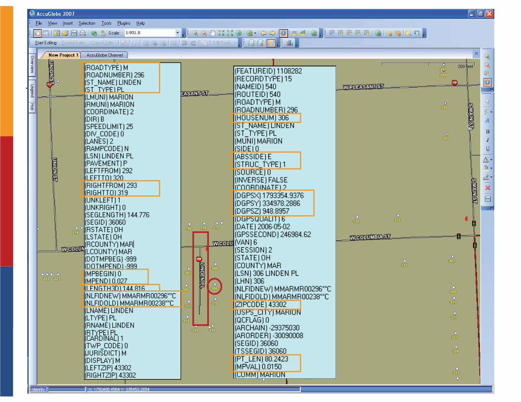
Centerline
Address
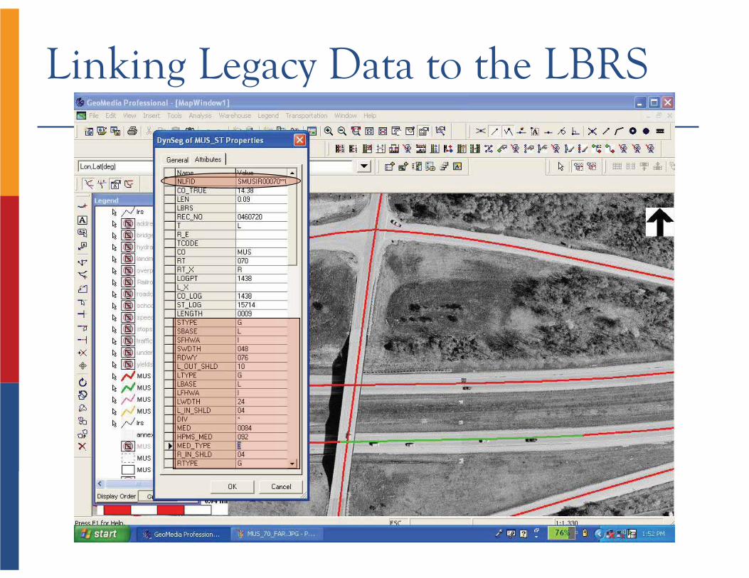
Linking Legacy Data to the LBRS
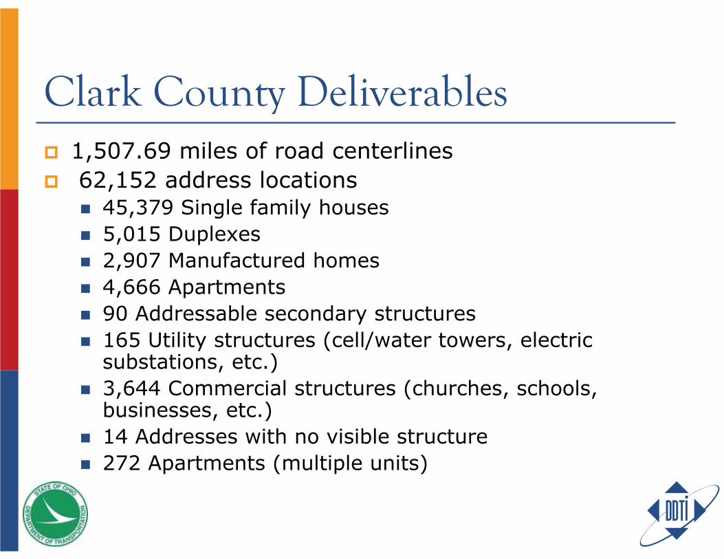
1,507.69 miles of road centerlines 62,152 address locations
45,379 Single family houses5,015 Duplexes2,907 Manufactured homes4,666 Apartments90 Addressable secondary structures165 Utility structures (cell/water towers, electric substations, etc.)3,644 Commercial structures (churches, schools, businesses, etc.)14 Addresses with no visible structure272 Apartments (multiple units)
Clark County Deliverables
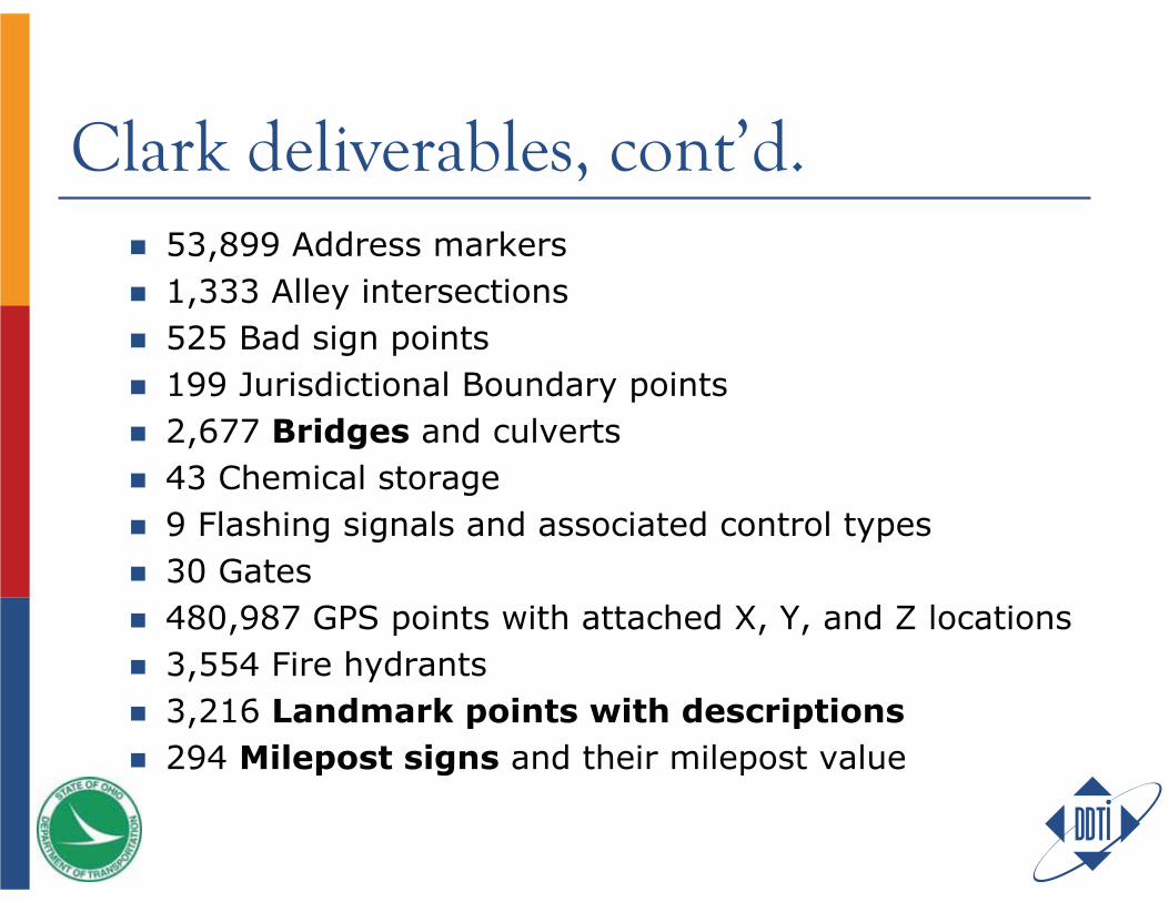
Clark deliverables, cont’d.53,899 Address markers 1,333 Alley intersections525 Bad sign points199 Jurisdictional Boundary points2,677 Bridges and culverts43 Chemical storage9 Flashing signals and associated control types30 Gates480,987 GPS points with attached X, Y, and Z locations3,554 Fire hydrants 3,216 Landmark points with descriptions294 Milepost signs and their milepost value
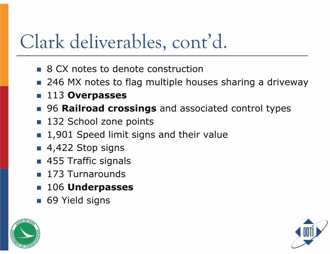
Clark deliverables, cont’d.8 CX notes to denote construction 246 MX notes to flag multiple houses sharing a driveway 113 Overpasses96 Railroad crossings and associated control types 132 School zone points 1,901 Speed limit signs and their value 4,422 Stop signs 455 Traffic signals 173 Turnarounds106 Underpasses69 Yield signs
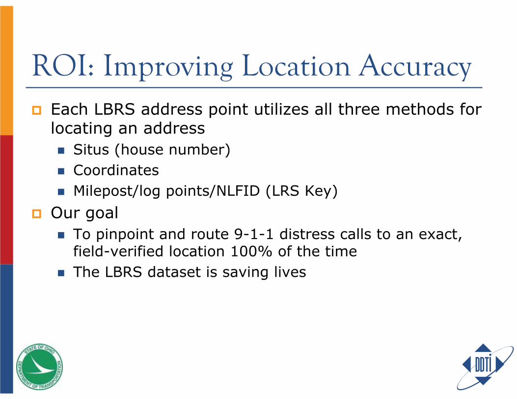
ROI: Improving Location AccuracyEach LBRS address point utilizes all three methods for locating an address
Situs (house number)CoordinatesMilepost/log points/NLFID (LRS Key)
Our goalTo pinpoint and route 9-1-1 distress calls to an exact, field-verified location 100% of the timeThe LBRS dataset is saving lives
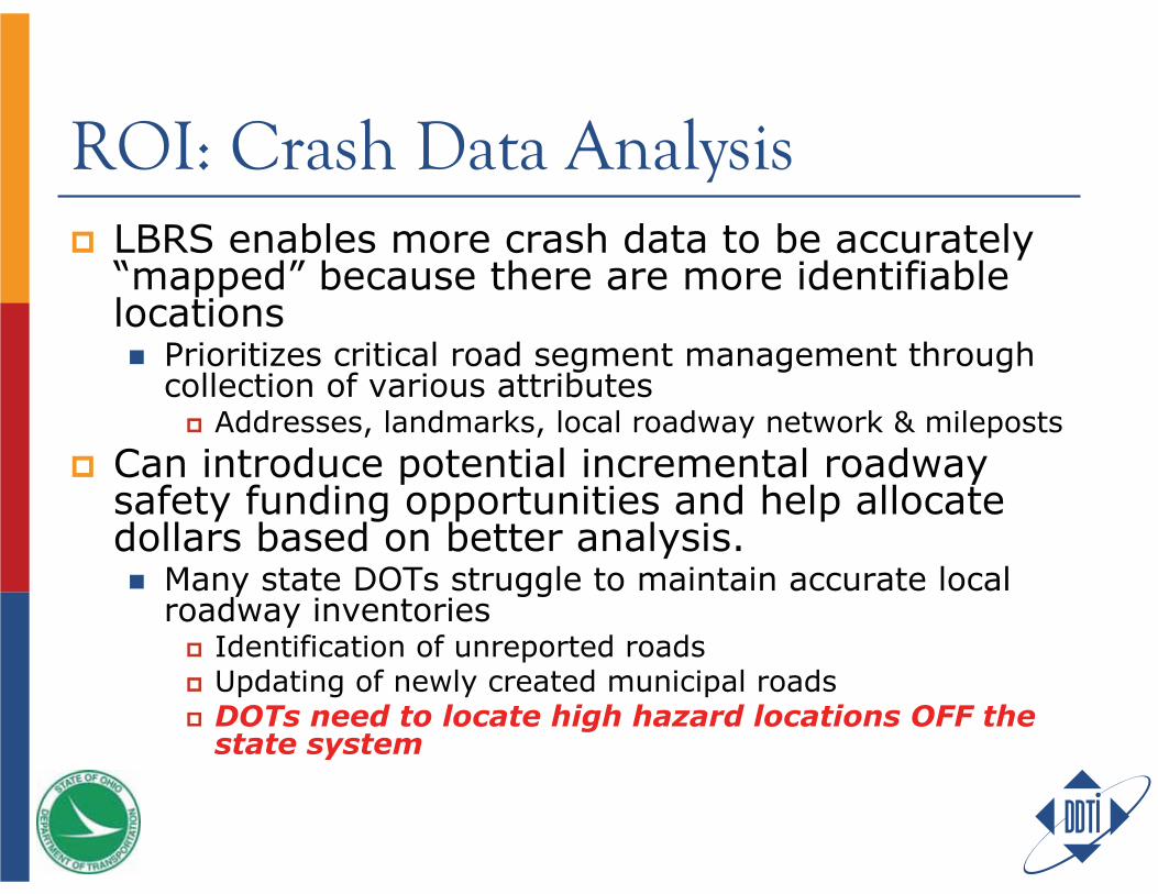
ROI: Crash Data AnalysisLBRS enables more crash data to be accurately “mapped” because there are more identifiable locations
Prioritizes critical road segment management through collection of various attributes
Addresses, landmarks, local roadway network & mileposts
Can introduce potential incremental roadway safety funding opportunities and help allocate dollars based on better analysis.
Many state DOTs struggle to maintain accurate local roadway inventories
Identification of unreported roadsUpdating of newly created municipal roadsDOTs need to locate high hazard locations OFF the state system

Crash Study Case StudyDOT reported 190 traffic accidents in a county along two major cooridorsAfter comparing crash data with LBRS centerline information, thecounty was able to locate more than 550 crashes.
LBRS road centerline data allowed crashes with incorrect street names or addresses and various other inconsistent reference points to be mapped to the correct, single point
Most urban safety studies spend about $2,000 to identify and locate all traffic crashes at a given intersection
Cost is associated with trying to find all the crashes based upon multiple location methods (street-intersection, address, route number-milepost, etc.)When LBRS data is available and used to scrub crash location data, and resolve alternative location methods to a lat-long, the cost to do the same crash study is about $150 – cost of intersection analysis reduced by a factor of 10!
Leaves more available funds for correcting the problemAlso introduces incremental roadway safety funding
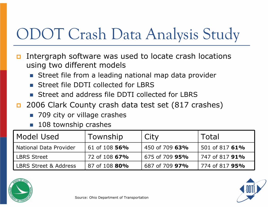
ODOT Crash Data Analysis StudyIntergraph software was used to locate crash locations using two different models
Street file from a leading national map data providerStreet file DDTI collected for LBRS Street and address file DDTI collected for LBRS
2006 Clark County crash data test set (817 crashes)709 city or village crashes 108 township crashes
Model Used Township City TotalNational Data Provider 61 of 108 56% 450 of 709 63% 501 of 817 61%
LBRS Street 72 of 108 67% 675 of 709 95% 747 of 817 91%
LBRS Street & Address 87 of 108 80% 687 of 709 97% 774 of 817 95%
Source: Ohio Department of Transportation
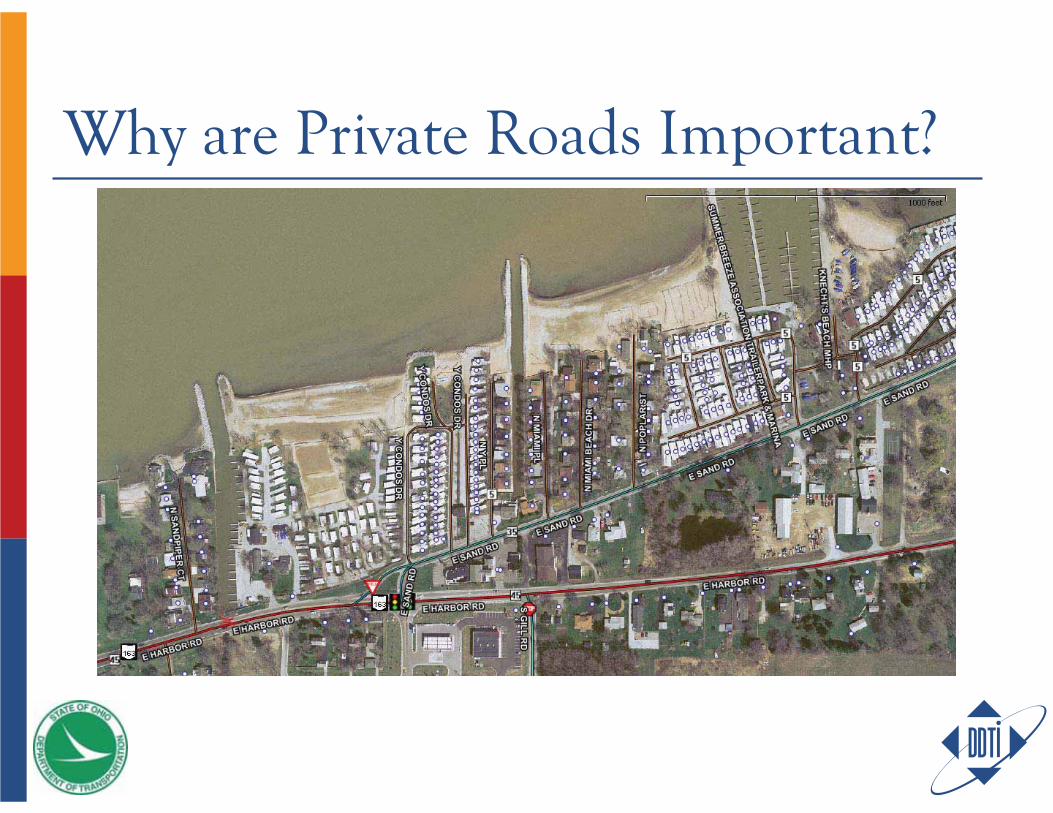
Why are Private Roads Important?
Additional ROISales Tax
Collection & disbursement of internet sales taxStreamlined Sales Tax
Census’ LUCAApproximately $300 billion in federal grant money distributed to the state & local level
Direct tie to annual population estimates
Numerous state-level departmentsPolitical ROI
USE IT A BUNCH(a.k.a. – more ROI)
Create it once Use it a bunch And maintain it

Examples of LBRS Users

AccuGlobe ExtensionsAccuGlobe 9-1-1 Dispatch/Mobile/Web
AND MAINTAIN ITCreate it once Use it a bunch And maintain it
Example: Issues With Addressing80%+ of data has a spatial component (address)Maintenance is the key to upholding quality and accuracy of evolving data sets
PROBLEM: While parcels may be maintained by one department at the county-level, multiple addressing authorities are scattered throughout local governmentData coordination/consolidation across all agencies is needed
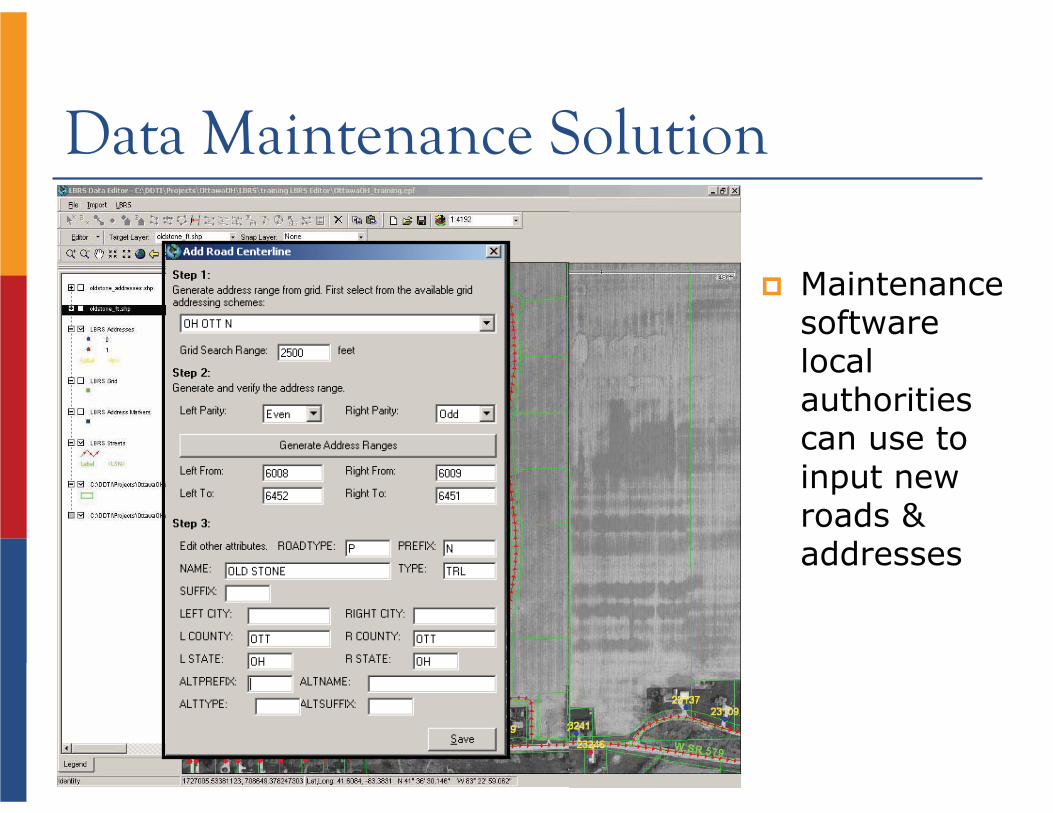
Data Maintenance Solution
Maintenancesoftwarelocalauthoritiescan use to input new roads & addresses
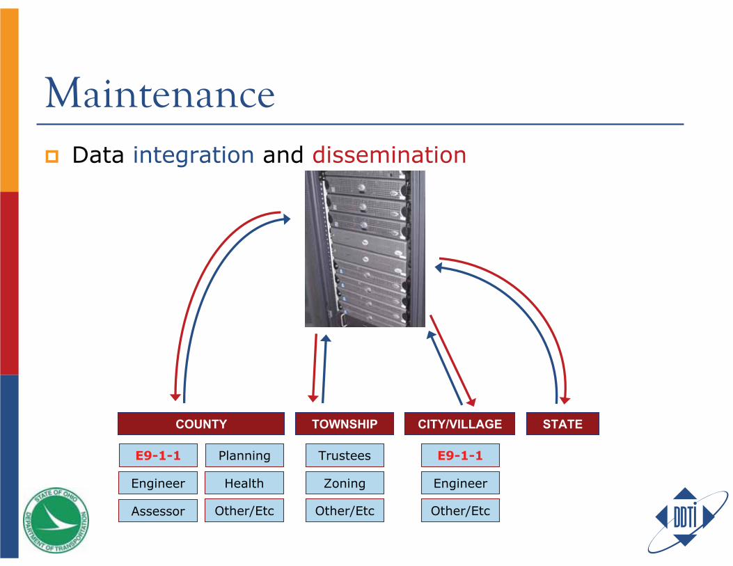
MaintenanceData integration and dissemination
COUNTY
E9-1-1 Planning
Engineer Health
Assessor Other/Etc
TOWNSHIP STATE
Other/Etc
Zoning
Trustees
Other/Etc
Engineer
E9-1-1
CITY/VILLAGE
DDTIDDTIDDTICLIENTCLIENTCLIENT
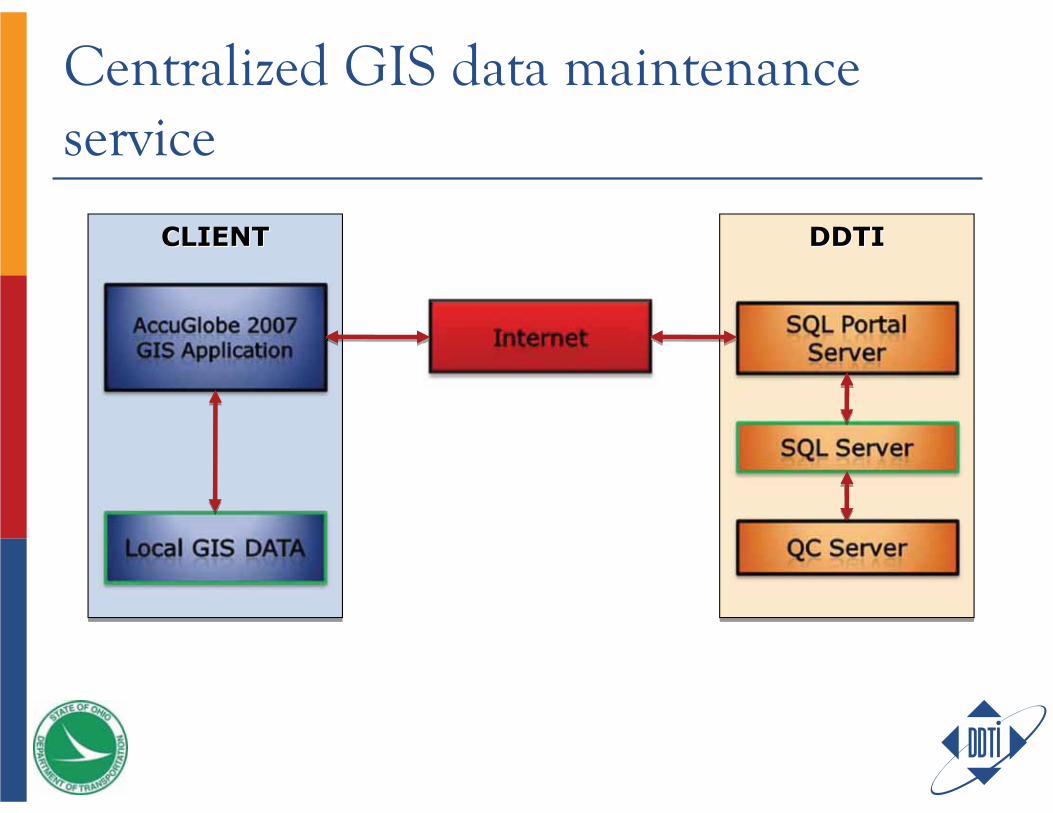
Centralized GIS data maintenance service
Centralized GIS data maintenance service
Multiple users can edit the GIS data (spatial and attribute) simultaneously via the InternetFull history of edits are saved with audit trailComputed attributes generated on servers
User enters only non-computable data
QC checks populate the error layer within seconds after the changes are committed for quick feedbackNightly GIS data extract provides fresh data for GIS applications for other agencies
AccuGlobe 2007 GIS ApplicationProvides the user interface to view and edit the GIS data
Data layers can come from local sources (orthos, water ways, rail road, special layers for the Client, etc.) or remotely (via SQL Portal, etc.) A redraw of the SQL Portal layer displays the latest committed data on the Servers Edits on SQL Portal layers are sent to the SQL Portal server when the user commits them
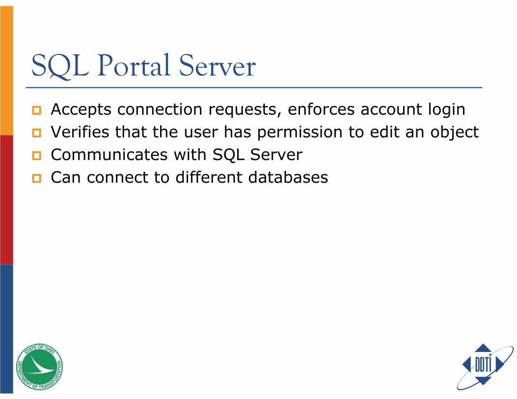
SQL Portal ServerAccepts connection requests, enforces account loginVerifies that the user has permission to edit an objectCommunicates with SQL ServerCan connect to different databases
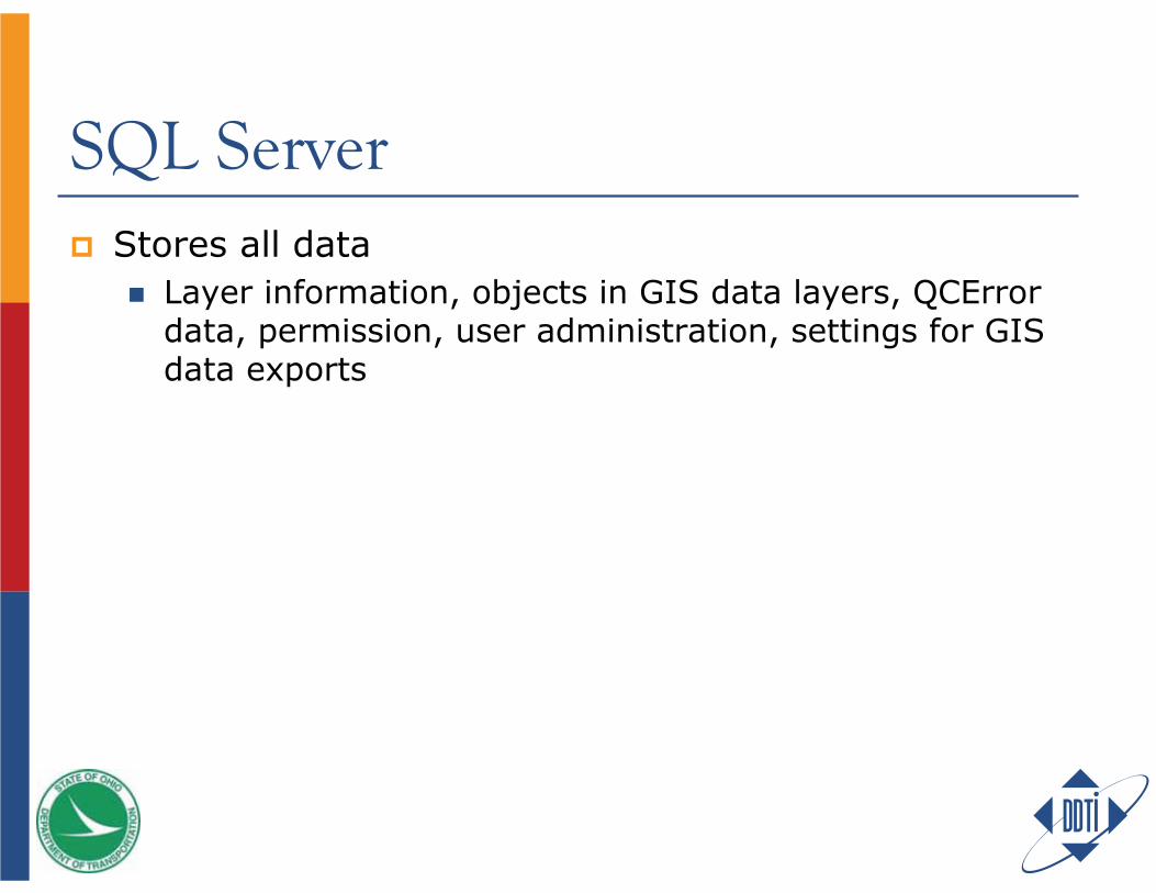
SQL ServerStores all data
Layer information, objects in GIS data layers, QCErrordata, permission, user administration, settings for GIS data exports
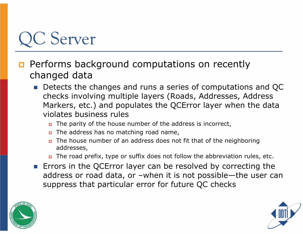
QC ServerPerforms background computations on recently changed data
Detects the changes and runs a series of computations and QC checks involving multiple layers (Roads, Addresses, Address Markers, etc.) and populates the QCError layer when the data violates business rules
The parity of the house number of the address is incorrect, The address has no matching road name, The house number of an address does not fit that of the neighboring addresses,The road prefix, type or suffix does not follow the abbreviation rules, etc.
Errors in the QCError layer can be resolved by correcting the address or road data, or –when it is not possible—the user can suppress that particular error for future QC checks
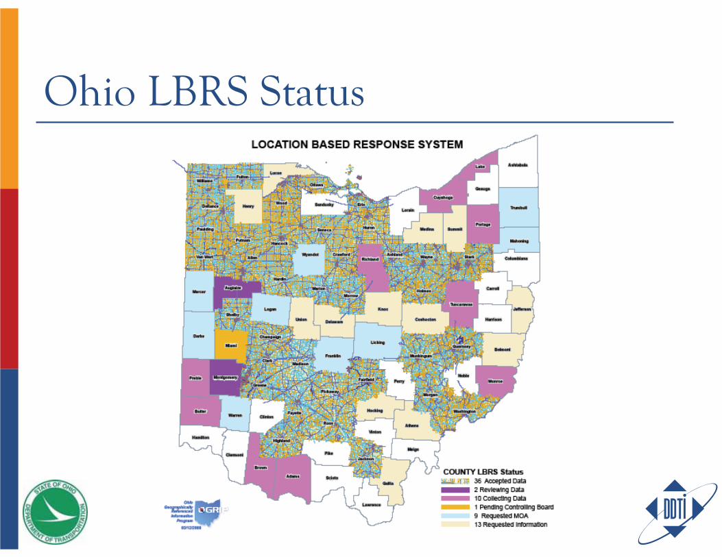
Ohio LBRS Status