Embed Size (px)
Citation preview
# N Z S E A I C E 2 0 # N Z S E A I C E
N Z S E A I C ES Y M P O S I U M
2 0 2 0Ō T E P O T I D U N E D I N
2 7 - 2 8 J A N U A R Y 2 0 2 0
T H E N E W Z E A L A N D S E A I C E S Y M P O S I U M2 0 2 0 H A S B E E N G E N E R O U S L Y S P O N S O R E D
B Y
VENUE
KEYNOTE SPEAKERPROFESSOR PAT LANGHORNE
SCHEDULE
ABSTRACTS
01
2 0 2 0S Y M P O S I U M
02
04
08
Photo credits: Cover page: Madi Rosevear
Prev. and current page: Pat Wongpan, 2014 season
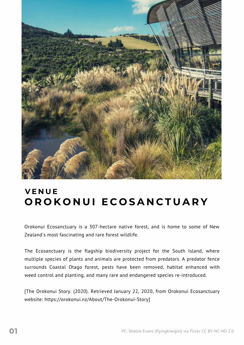
O R O K O N U I E C O S A N C T U A R Y
Orokonui Ecosanctuary is a 307-hectare native forest, and is home to some of New
Zealand's most fascinating and rare forest wildlife.
The Ecosanctuary is the flagship biodiversity project for the South Island, where
multiple species of plants and animals are protected from predators. A predator fence
surrounds Coastal Otago forest, pests have been removed, habitat enhanced with
weed control and planting, and many rare and endangered species re-introduced.
[The Orokonui Story. (2020). Retrieved January 22, 2020, from Orokonui Ecosanctuary
website: https://orokonui.nz/About/The-Orokonui-Story]
V E N U E
PC: Shellie Evans (flyingkiwigirl) via Flickr CC BY-NC-ND 2.001

P R O F E S S O R P A T
L A N G H O R N E
Pat Langhorne is an Antarctic sea ice researcher andProfessor in the Physics department at theUniversity of Otago. She graduated from theUniversity of Aberdeen (Scotland) and obtained herPhD at the University of Cambridge (England) forstudies on sea ice. Pat applied to the BritishAntarctic Survey to work in Antarctica before doingher PhD but was asked to withdraw her applicationwhen they realised she was a woman. Her sea icefieldwork for her PhD was, therefore, done in theArctic. In 1985 she was invited to take part in an Antarcticexperiment which brought her to New Zealand forthe first time, and since 1988 she has been teachingphysics and researching sea ice physical processesat the University of Otago. Working with post-graduate students and with national andinternational collaborators, Pat has been privilegedto take part in about twenty-five research visits toAntarctica, mostly to the New Zealand sector. In 2019 she was awarded a New Zealand AntarcticMedal for services to Antarctic science, inrecognition of her leadership role in sea ice physicsin New Zealand.
K E Y N O T E S P E A K E R
02
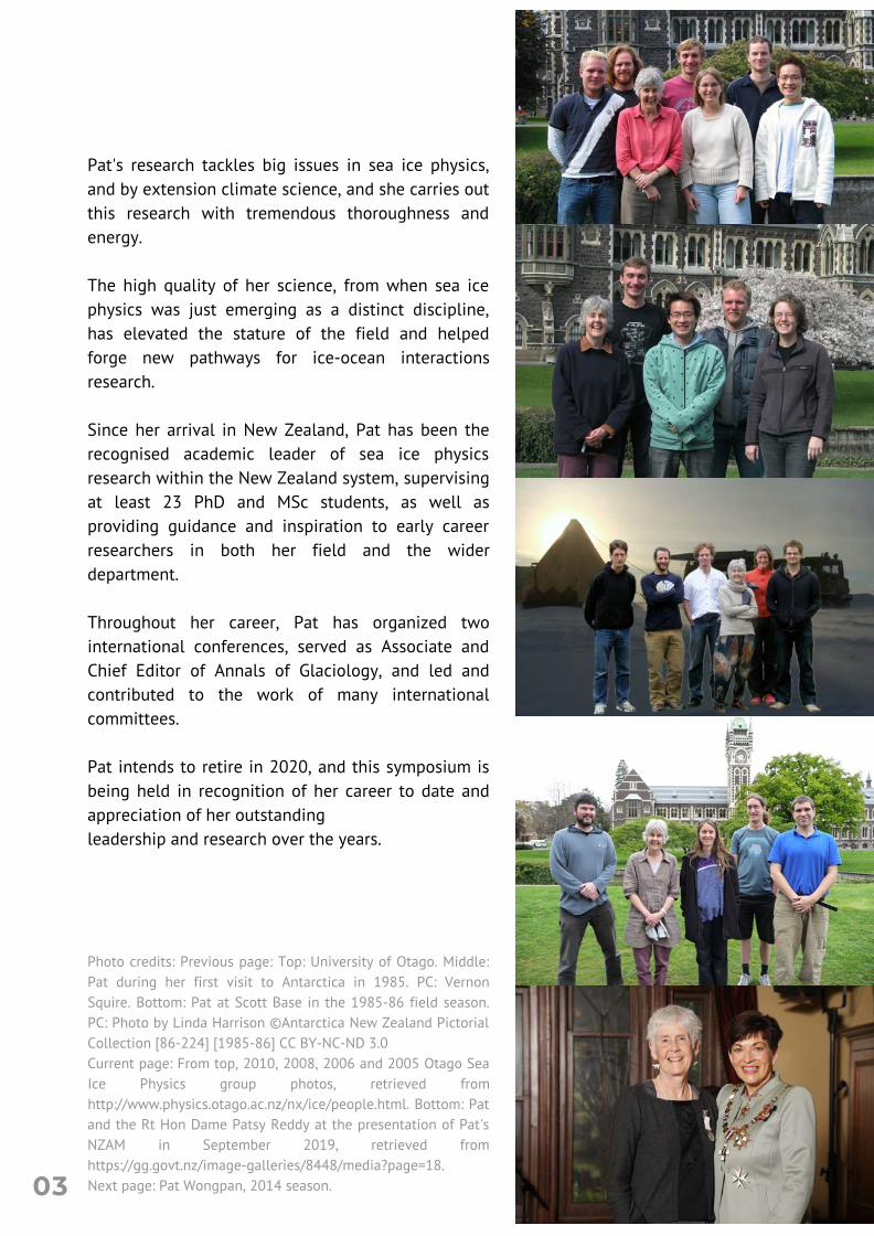
Pat's research tackles big issues in sea ice physics,and by extension climate science, and she carries outthis research with tremendous thoroughness andenergy. The high quality of her science, from when sea icephysics was just emerging as a distinct discipline,has elevated the stature of the field and helpedforge new pathways for ice-ocean interactionsresearch. Since her arrival in New Zealand, Pat has been therecognised academic leader of sea ice physicsresearch within the New Zealand system, supervisingat least 23 PhD and MSc students, as well asproviding guidance and inspiration to early careerresearchers in both her field and the widerdepartment. Throughout her career, Pat has organized twointernational conferences, served as Associate andChief Editor of Annals of Glaciology, and led andcontributed to the work of many internationalcommittees. Pat intends to retire in 2020, and this symposium isbeing held in recognition of her career to date andappreciation of her outstandingleadership and research over the years.
Photo credits: Previous page: Top: University of Otago. Middle:Pat during her first visit to Antarctica in 1985. PC: VernonSquire. Bottom: Pat at Scott Base in the 1985-86 field season.PC: Photo by Linda Harrison ©Antarctica New Zealand PictorialCollection [86-224] [1985-86] CC BY-NC-ND 3.0Current page: From top, 2010, 2008, 2006 and 2005 Otago SeaIce Physics group photos, retrieved fromhttp://www.physics.otago.ac.nz/nx/ice/people.html. Bottom: Patand the Rt Hon Dame Patsy Reddy at the presentation of Pat'sNZAM in September 2019, retrieved fromhttps://gg.govt.nz/image-galleries/8448/media?page=18. Next page: Pat Wongpan, 2014 season.03
S C H E D U L E
9.00 BUS LEAVES THE UNIVERSITY
9.30
10.00 WELCOME AND KEYNOTE SPEAKERCHAIR: INGA SMITH
BUS ARRIVES AT THE ECOSANCTUARY
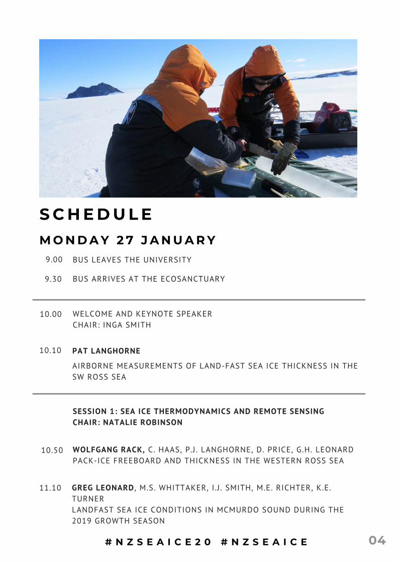
AIRBORNE MEASUREMENTS OF LAND-FAST SEA ICE THICKNESS IN THESW ROSS SEA
10.10 PAT LANGHORNE
SESSION 1: SEA ICE THERMODYNAMICS AND REMOTE SENSINGCHAIR: NATALIE ROBINSON
10.50 WOLFGANG RACK, C. HAAS, P.J . LANGHORNE, D. PRICE, G.H. LEONARDPACK-ICE FREEBOARD AND THICKNESS IN THE WESTERN ROSS SEA
11.10 GREG LEONARD , M.S. WHITTAKER, I .J . SMITH, M.E. RICHTER, K.E.TURNERLANDFAST SEA ICE CONDITIONS IN MCMURDO SOUND DURING THE2019 GROWTH SEASON
M O N D A Y 2 7 J A N U A R Y
# N Z S E A I C E 2 0 # N Z S E A I C E 04
11.30 MAREN RICHTER , G.H. LEONARD, I .J . SMITH, P.J . LANGHORNE, A.R.MAHONEYNOT STRAIGHT(FORWARD). FINDING THE BOTTOM OF THE SEA ICE.
11.50 NITAY BEN-SHAHAR , M. MCGUINNESS, H.J. TRODAHLREFINING FIRST-YEAR ANTARCTIC SEA ICE GROWTH MODELS
12.10 LUNCH
12:45 ECOSANCTUARY WALK
SESSION 2: SEA ICE AND CLIMATECHAIR: FABIEN MONTIEL
14.15 INGA SMITH, A.G. PAULING, C.M. BITZ, K. LILLY, P.J . LANGHORNE, C.L.HULBEWHAT ARE THE IMPACTS OF INCREASED SOUTHERN OCEANFRESHWATER FLUXES? RESULTS USING CCSM4
14.35 SHONA MACKIE, P.J. LANGHORNE, I .J . SMITHIMPROVED SEA ICE FORMATION IN THE NEW ZEALAND EARTH SYSTEMMODEL
14.55 AFTERNOON TEA
SESSION 3: STUDENT LIGHTENING TALKS AND PANEL DISCUSSIONCHAIR: INGA SMITH
15.25 RODRIGO GOMEZ FELL, W. RACKICE TONGUE STABILITY IN A CHANGING WORLD: DRYGALSKI ICE TONGUEA CASE STUDY
15.30 SAM WALKER , I . J . SMITH, P. RUSSELLADAPTING VERTICAL DYNAMICS INTO A SIMPLE ONE DIMENSIONALFRAZIL ICE MODEL
15.35 ELIJAH NG, P.J. LANGHORNETHROUGH THICK AND THIN: MAKING SEA ICE THIN SECTIONS
05
15.40 PANEL DISCUSSION: MIKE WILLIAMS, PAT LANGHORNE, WOLFGANGRACK, JOE TRODAHLNEW ZEALAND SEA ICE RESEARCH FUNDING: PAST TO PRESENT
16.20 WRAP UP
16.30 BUS LEAVES FOR ST CLAIR BEACH
17.45 DINNER AT THE ESPLANADE
9.00 BUS LEAVES THE UNIVERSITY
SESSION 4: ICE-OCEAN OBSERVATIONS AND MODELLINGCHAIR: GREG LEONARD
9.45
STEFAN JENDERSIE, A. MALYARENKO, C.L. STEVENS, F. PESSINI, C. DOWTHE SENSITIVITY OF SIMULATED SURFACE OCEAN CONDITIONS TO THECHOICE OF ICE SHELF-OCEAN COUPLING ALGORITHMS
10.05
ALENA MALYARENKO, S. JENDERSIE, M.J. WILLIAMS, N.J. ROBINSON, P.JLANGHORNEICE SHELF-OCEAN ABLATION: A WIDE RANGE IN OBSERVATIONS, AWIDER RANGE IN MODELLING
T U E S D A Y 2 8 J A N U A R Y
10.25 NATALIE ROBINSON,P.J. LANGHORNE, C.L. STEWART, C.L. STEVENS, B.S.GRANTQUANTIFICATION OF THE VICTORIA LAND COASTAL CURRENT
PETER RUSSELL, I .J . SMITH, M.E. RICHTER, B.E. SCHMIDT, L.H.SMEDSRUD, G.H. LEONARD, J . LAWRENCE, B. HURWITZ, J . EVERTS, M.MEISTERHIPSMI - HIGH PRECISION SUPERCOOLING MEASUREMENTINSTRUMENT FOR SUPERCOOLING MEASUREMENTS UNDER ICESHELVES
10.45
06
SESSION 5: WAVES AND SEA ICE DRIFTCHAIR: PAT LANGHORNE
11.35 RICHARD GORMAN, L. ROACH, S. DEAN, A. KOHOUTFORECAST APPLICATIONS OF COUPLED WAVE-ICE MODELLING
11.55 FABIEN MONTIEL, T. MILNE, A. KOHOUT, L. ROACHOCEAN WAVE ATTENUATION IN THE ROSS SEA MARGINAL ICE ZONE
11.05 MORNING TEA
12.15LILY GAMSON, F. MONTIELOBSERVATIONS OF SEA ICE DRIFT IN THE ROSS SEA MARGINAL ICEZONE
12.35 USAMA FAROOQ, W. RACK, A. MCDONALD, S. HOWELLTHE ROLE OF WINDS IN THE SEA ICE DRIFT USING HIGH-RESOLUTIONSATELLITE IMAGES - ROSS SEA REGION, ANTARCTICA
12.55 LUNCH
SESSION 6: STRATEGIC PLANNINGCHAIR: INGA SMITH
13.55 STRATEGIC PLANNING I
14.30 AFTERNOON TEA
15:00 STRATEGIC PLANNING II AND WRAP UP
16.20 WRAP UP - SYMPOSIUM ENDS
16.30 BUS LEAVES FOR THE UNIVERSITY
07
PC: Pat Wongpan
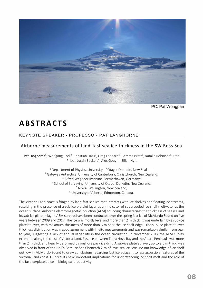
A B S T R A C T S KEYNOTE SPEAKER - PROFESSOR PAT LANGHORNE Airborne measurements of land-fast sea ice thickness in the SW Ross Sea
Pat Langhorne1, Wolfgang Rack2, Christian Haas3, Greg Leonard4, Gemma Brett2, Natalie Robinson5, Dan
Price2, Justin Beckers6, Alex Gough1, Elijah Ng1.
1 Department of Physics, University of Otago, Dunedin, New Zealand; 2 Gateway Antarctica, University of Canterbury, Christchurch, New Zealand;
3 Alfred Wegener Institute, Bremerhaven, Germany; 4 School of Surveying, University of Otago, Dunedin, New Zealand;
5 NIWA, Wellington, New Zealand; 6 University of Alberta, Edmonton, Canada.
The Victoria Land coast is fringed by land-fast sea ice that interacts with ice shelves and floating ice streams, resulting in the presence of a sub-ice platelet layer as an indicator of supercooled ice shelf meltwater at the ocean surface. Airborne electromagnetic induction (AEM) sounding characterises the thickness of sea ice and its sub-ice platelet layer. AEM surveys have been conducted over the spring fast ice of McMurdo Sound on five years between 2009 and 2017. The ice was mostly level and more than 2 m thick. It was underlain by a sub-ice platelet layer, with maximum thickness of more than 6 m near the ice shelf edge. The sub-ice platelet layer thickness distribution was in good agreement with in-situ measurements and was remarkably similar from year to year, suggesting a lack of annual variability in the ocean circulation. In November 2017 the AEM survey extended along the coast of Victoria Land. Fast ice between Terra Nova Bay and the Adare Peninsula was more than 2 m thick and heavily deformed by onshore pack ice drift. A sub-ice platelet layer, up to 2.5 m thick, was observed in front of the Hell’s Gate Ice Shelf beneath 2 m of level sea ice. We use our knowledge of ice shelf outflow in McMurdo Sound to draw conclusions regarding fast ice adjacent to less accessible features of the Victoria Land coast. Our results have important implications for understanding ice shelf melt and the role of the fast ice/platelet ice in biological productivity.
SESSION 1: SEA ICE THERMODYNAMICS AND REMOTE SENSING
Pack-ice thickness and freeboard in the Western Ross Sea
Wolfgang Rack1, Christian Haas2, Pat Langhorne3, Dan Price1, Greg Leonard4
1University of Canterbury, Gateway Antarctica, Christchurch, New Zealand 2Alfred Wegener Institute, Bremerhaven, Germany
3Department of Physics, University of Otago, Dunedin, New Zealand 4School of Surveying, University of Otago, Dunedin, New Zealand
Ice thickness is the major uncertainty in the assessment of Antarctic sea ice mass balance. Although sea ice concentration is well known from satellite observations, we lack knowledge of thickness to convert area to mass. This is important because trends in sea ice cover in the Ross Sea might be linked to a change in ice mass and the production of high salinity shelf water and Antarctic bottom water. It might have therefore impacted on region-wide oceanic circulation.
Satellite-based estimates of thickness are difficult because sea ice is thin and snow covered. We conducted airborne measurements over pack ice, partly along satellite tracks, to assess ice thickness and morphology in the Western Ross Sea. We used airborne electromagnetic induction (EM) sounding, deployed from a DC-3 aircraft, simultaneously with a lidar and camera.
EM data collected during two flights in November 2017, over two transects with a combined length of approximately 800 km show a mean sea ice thickness of about 1.5 m. We identify large regional variability in ice thickness driven by pack ice of differing age and formation history. Clear thickness gradients are identified in the vicinity of the major polynyas. The thickest ice is located in the northern sector of the western Ross Sea with a mean thickness along the northern Victoria Land coast of more than 2 m, which is thicker than what was commonly assumed.
Here we present our main results and the strategy for continued multidisciplinary work within the Antarctic Science Platform.
The anomalous winter 2019 McMurdo Sound sea ice conditions
G. H. Leonard1, M. S. Whittaker2, I. J. Smith2, M. E. Richter2, K. E. Turner2
1National School of Surveying, University of Otago, Dunedin 2Department of Physics, University of Otago, Dunedin
The winter 2019 sea ice conditions in McMurdo Sound, Antarctica were anomalous due the frequency and extent of sea ice break-out events. This resulted in the unusually late formation of a stable landfast sea ice cover in the southern reaches of the Sound. This in turn affected winter / spring sea ice operations for the United States and New Zealand Antarctic programmes operating in the region. The greater than average number of break-out events appeared to be related to an increase in the number and intensity of southerly wind events in the region in the late spring / early winter period. Here we investigate the correlation between sea ice break-out events and southerly storms to elucidate this relationship. First we review the literature to describe the current understanding of the climatology of landfast sea ice in McMurdo Sound. We then characterise the 2019 winter sea ice cover using a combination of space-borne remote sensing products to quantify the nature and extent of the break-out events. Finally we compare these break-out events to the near-surface wind field and discuss how the southerly storms influenced the formation of the landfast sea ice in different regions of the Sound. An improved understanding of the way in which winter storms affect the landfast sea ice in McMurdo Sound has the potential to improve operational confidence in sea ice operations in McMurdo Sound during the late winter / spring period.
Not straight(forward). Finding the bottom of the sea ice.
Maren E. Richter1, Greg H. Leonard2, Inga J. Smith1, Pat J. Langhorne1, Andrew R. Mahoney3
1Department of Physics, University of Otago, Dunedin, NZ
2National School of Surveying, University of Otago, Dunedin, NZ 3Geophysical Institute, University of Alaska, Fairbanks, USA
A precise knowledge of sea ice thickness is important for many different reasons. It allows the volume and mechanical strength of sea ice to be estimated, influences the amount of light available under the ice and gives information on the growth and decay of the ice cover. However, defining the underside of the ice is not as trivial as it may appear, for example where there is a sub-ice platelet layer under the ice. Sea ice in McMurdo Sound, Antarctica is influenced by supercooled water exported from a nearby ice shelf which allows the formation of a sub-ice platelet layer. This friable layer consists of ice platelets of seemingly random orientation under the consolidated sea ice and influences the sea ice growth rate. The transition, when there is a sub-ice platelet layer present, from solid ice to water, via a matrix of loose or semi-consolidated ice crystals, complicates the definition of sea ice thickness.
Here, we present an analysis of sea ice thicknesses calculated from thermistor strings deployed in McMurdo Sound over two decades. We compare the robustness, precision and accuracy of different methods of processing thermistor string data to determine the ice-ocean interface. The resulting thickness time-series can be used to study interannual variability and existing or emerging trends in McMurdo sea ice and the sub-ice platelet layer. Although sub-ice platelet layers are rarely found outside the vicinity of deep drafted ice shelves, our results are of relevance to other situations in which the ice bottom is ill-defined.
Refining first-year Antarctic sea ice growth models
Nitay Ben-Shahar1, M. McGuinness2, H.J. Trodahl1
1School of Chemical and Physical Sciences, Victoria University of Wellington 2School of Mathematics and Statistics, Victoria University of Wellington
A 1D model of the freezing of sea-ice with a snow cover is presented and coded in MATLAB. The model is based on historical models in the literature, and is primarily intended to provide a computational tool to be used when detailed temperature measurements are available in growing sea ice. The model is validated by comparing the modeled ice temperature profile and growth rate to measurements from 1997 in McMurdo Sound, Antarctica. This comparison shows evidence of platelet ice growth. Despite this, an accuracy of 0.3 °C is achieved throughout the entire ice temperature profile. The model is also used to explain a previously speculated discrepancy between ice growth rates measured via banding structures in ice cores and simple steady state ice growth models with the inclusion of a thin 8mm snow layer.
SESSION 2: SEA ICE AND CLIMATE
What are the impacts of increased Southern Ocean freshwater fluxes? Results using CCSM4.
Inga J. Smith1, Andrew G. Pauling1,2, Cecilia M. Bitz2, Katherine Lilly1, Patricia J. Langhorne1, Christina L. Hulbe3
1Department of Physics, University of Otago, Dunedin, New Zealand. 2Department of Atmospheric Sciences, University of Washington, Seattle, USA.
3National School of Surveying, University of Otago, Dunedin, New Zealand. To examine potential future impacts on sea ice area and feedback effects on climate (e.g., surface air temperatures in both hemispheres), we ran three climate model scenarios of changes in outflow from Antarctic ice sheet and ice shelves in CCSM4 starting in 1980. We then ran two idealized experiments starting at 1850 for comparison. We chose to run from a base year of 1980, which we assumed to be when the Antarctic ice sheet was in mass balance, and then increased freshwater fluxes to give the approximate equivalent of 3 m of sea level rise over a 150-year period. Sea ice area behaviour “turned around” from increasing after approximately 78 years. Two shorter branched runs were carried out to test the persistence of the effects, one where the additional fresh water and latent heat effects were switched off and the other where the freshwater was held constant at the point where sea ice area behaviour “turned around”. Another two shorter runs were carried out, starting in 1850, with ramped freshwater and with latent heat effects included under historical greenhouse gas forcings and with greenhouse gas forcings held constant at 1850 levels, respectively. This was to separate out the effects of greenhouse gas forcings on the ramped freshwater and latent heat effects over long time periods.
Improved sea ice formation in the New Zealand Earth System Model
Shona Mackie1, Pat Langhorne1, Inga Smith1
1Department of Physics, University of Otago, Dunedin, New Zealand.
In most climate models, new sea ice forms in open water in response to supercooling at the surface. The difference between the surface temperature and the salinity-dependant freezing temperature creates an energy deficit which is removed, using ice enthalpy to convert it to a volume of new sea ice. In reality, supercooling can create ice crystals in the water column, which rise to the surface and mix with the ambient water to create a slushy layer of grease ice, with a greater volume than the ice crystals alone. Upon further cooling, this may freeze into new sea ice, or, under a warming atmosphere, it may melt into the ocean without ever forming sea ice. Grease may persist for several days before melting or freezing into ice, and it may be piled against the edge of existing sea ice, creating a non-uniform thickness distribution, and potentially allowing open water to persist upwind. Neglecting these processes in sea ice formation may mean that new sea ice is produced too quickly in climate models and is too thin. Prematurely closing leads and polynyas effects surface albedo and so has implications for the planetary radiation budget. Accurately representing areas of open water, and their persistence within the sea ice, is important for reliable calculations of ocean-atmosphere heat and CO2, important to most aspects of the climate system. We have developed and implemented a scheme to represent grease ice processes in the NZESM, including all atmosphere and ocean feedbacks and are assessing its impact.
SESSION 3: STUDENT LIGHTENING TALKS AND PANEL DISCUSSION
Ice tongue stability in a changing world: Drygalski ice tongue a case study
Rodrigo Gomez Fell1, W. Rack1
1Gateway Antarctica, University of Canterbury
Adapting vertical dynamics into a simple one-dimensional frazil ice model
Samuel J. Walker1, Inga J. Smith1, Pete Russell1
1Department of Physics, University of Otago, Dunedin NZ
Underneath Antarctic Ice Shelves a layer of supercooled Ice Shelf Water (ISW) is sometimes present. The behaviour of ISW changes depending on the presence of frazil Ice Crystals. Concentration and size distributions of frazil Ice are necessary for work on the Marsden-funded HIPSMI project regarding making direct measurements of supercooling. Direct measurements of frazil are not available so recourse is made to frazil ice models. Higher resolution of frazil size significantly increases computational complexity. A one-dimensional model would be beneficial to reduce computational overheads. A pre-existing one-dimensional model was adapted to include the vertical distribution of frazil ice derived from the work of another group. Preliminary results showed physically reasonable behaviour. Both the original and adapted model show frazil ice behaviour has a dependence on the poorly constrained basal drag and Shields criterion parameters. We find that accurate description of frazil ice behaviour using a one-dimensional model is not possible with currently available physical observations of ISW. Direct observations of frazil Ice in situ could improve the predictive capabilities of one dimensional frazil Ice models.
Through thick and thin: Making sea ice thin sections
Elijah Ng1, Pat Langhorne1
1Department of Physics, University of Otago, Dunedin NZ
SESSION 4: ICE-OCEAN OBSERVATIONS AND MODELLING
The Sensitivity of simulated surface ocean conditions to the choice of ice
shelf-ocean coupling algorithms.
Stefan Jendersie1, Alena Malyarenko1, Craig Stevens1, Federica Pessini2, Christine Dow3
1NIWA, Wellington, New Zealand 2IAS-CNR, Oristano, Italy
3 University of Waterloo, Canada
To quantify Antarctic ice mass loss and the subsequent sea level rise the geophysical modelling community is pushing towards frameworks that fully couple increasingly complex models of atmosphere, ocean, sea ice and ice sheets & shelves. One particular hurdle remains the accurate representation of the vertical ocean-ice interaction at the base of ice shelves. Parameterizations that are tuned to particular data sets naturally perform best in comparable ice shelf cavity environments. This poses the challenge in continental scale ocean-ice shelf models to choose one melt parameterization that performs sufficiently well in diverse cavity environment. Thus, adding uncertainty in ice shelf induced ocean freshening crucially affects modelled sea ice growth. The impact magnitude of ice shelf supplied melt water on growth rates, thickness and extent of sea ice in the open ocean is currently debated in the literature.
We reviewed and compared 12 commonly utilized melting/freezing parameterizations in coupled ocean-ice shelf models. Melt rates differ hugely, in identical idealized conditions between 0.1m/yr to 3m/yr. In this talk we present results of a realistic circum-Antarctic ice shelf coupled ocean model (ROMS), where we look at the effects of the chosen ice shelf melt parameterization on modeled sea surface salinity. We also present a new family of regional models that will be used to further investigate these effects on circum-Antarctic as well as regional scales.
Ice shelf-ocean ablation: a wide range in observations, a wider range in modelling
Alena Malyarenko1,2, Jendersie S.3, Williams M.J.M.2, Robinson N.J.2, Langhorne P.L.1
1University of Otago, Dunedin, New Zealand
2National Institute of Water and Atmospheric Research, Wellington, New Zealand 3Antarctic Research Centre, Victoria University of Wellington, New Zealand
Boundary layer mixing at the ice-ocean thermodynamic interface is represented by turbulent transfer coefficients, ΓT andΓS. Different values and expressions have been suggested for these based on observations at the sea ice-ocean and ice shelf-ocean boundaries, in laboratory studies, DNS modelling and theoretical studies. The resulting values of transfer coefficients range over 5 orders of magnitude (10-7< ΓT< 10-2).
To demonstrate the potential effect of the choice of turbulent transfer parameterisation we applied all of the available transfer coefficient values (12) to an idealised ice shelf-ocean cavity model experiment using the ISOMIP domain. We have quantified the effects on the ablation rate, boundary layer stratification and depth in warm and cold cavities. The mean ablation rate in warm cavity scenarios varies between 2.1 and 4.7 m/year, and in cold cavity scenarios between 0.03 and 0.17 m/year. The simulated ablation rates are more sensitive to the choice of the transfer coefficients than the choice of the drag coefficient or the flux balance formulation. The various behaviours are oceanographically characterised by boundary layer stratification, highlighting an existing uncertainty of ice-ocean boundary layer processes.
Quantification of the Victoria Land Coastal Current
N. J. Robinson1, P. J. Langhorne2, C. L. Stewart1, C. L. Stevens1,3, B. S. Grant1
1University of Otago, Dunedin, New Zealand
2National Institute of Water and Atmospheric Research, Wellington, New Zealand 3Department of Physics, University of Auckland
On multiple occasions over the past decade, NZ researchers have collected oceanographic data from within the northward flow of supercooled Ice Shelf Water (ISW) through Western McMurdo Sound – the Victoria Land Coastal Current (VLCC). Here we present maps of supercooling depth and degree for the late winter season (October/November) created from these data. The spatial distribution patterns are broadly consistent with those of sea ice thickness and sub-ice platelet layer thickness (Langhorne et al., 2015; Brett et al., under review) over the same area and for a similar time period. The ocean data reveal the strength of the linear relationship between degree and depth of supercooling, which can be used to translate between these parameters in the case of missing data. In addition, it is possible to estimate rates of new ice formation by quenching of supercooling along the flow path. Longer-term context is necessary in order to estimate the contribution of the VLCC to fresh-water flux into the Ross Sea. This is possible through integration with historical oceanographic data from the area. However, interpretation is complicated by the region-wide 40-year freshening trend of the Ross Sea, which has recently apparently rebounded. We are currently working to resolve inconsistencies that arise from this large-scale temporal variability. In addition, we hope to broaden the seasonal understanding of ISW flow and associated processes with the deployment of year-round moored instrumentation in Haskell Strait in coming years.
HiPSMI - High Precision Supercooling Measurement Instrument for supercooling measurements under ice shelves
Russell, Peter1, Smith, Inga J.1, Richter, Maren E.1, Schmidt, Britney E.2, Smedsrud, Lars H.3, Leonard, Gregory
H.4, Lawrence, Justin2, Hurwitz, Ben2, Everts, Jonathan1, Meister, Matthew2
1Department of Physics, University of Otago, P.O. Box 56, Dunedin 9054, New Zealand 2School of Earth and Atmospheric Sciences, Georgia Institute of Technology, Ford Environmental Sciences
Building, 311 Ferst Drive, Atlanta, Georgia, GA 30332-0340, USA 3Geophysical Institute, University of Bergen, Allegaten 70, Bergen 5007, Norway
4National School of Surveying, University of Otago, P.O. Box 56, Dunedin 9054, New Zealand
The oceans beneath Antarctic ice shelves are the least measured waters on Earth. Beneath the Antarctic sea ice and ice shelves, sea water is often colder than its freezing point temperature, yet still liquid. Such water is called “supercooled” sea water. Snap-freezing of supercooled sea water and small free-floating ice crystals known as “frazil” are fundamental obstacles to obtaining high-precision measurements of key ocean parameters needed for climate research. In the project “Supercooling measurements under ice shelves”, we are working to overcome this obstacle by working as an international collaborative team (New Zealand, USA and Norway) to design and construct a new novel instrument; the High Precision Supercooling Measurement Instrument (“HiPSMI”). HiPSMI will be optimised for harsh Antarctic ocean conditions and installed into an innovative, modular underwater robot, “Icefin”. HiPSMI will include high precision temperature and pressure sensors and a pumped electrical conductivity sensor, configured for supercooling measurements. In addition, Icefin will have on-board un-pumped electrical conductivity sensors, possibly including nanotechnology sensors, to allow comparisons with HiPSMI. Observations will be made beneath the sea ice and McMurdo Ice Shelf, Antarctica in October and November 2020. We will determine the influence of frazil crystals on measurements of in situ supercooling. The measurements, in conjunction with numerical modelling and laboratory work, will revolutionise our understanding of supercooled waters by providing a high-precision, observational-based indicator for future climate observations beneath the vast cold cavity ice shelves of

Antarctica. Our research will feed into the ocean engineering challenges of the next frontier of polar exploration; ice-covered oceans on other worlds. This project is funded through the New Zealand Marsden Fund’s Engineering and Interdisciplinary Sciences Panel, with a technology-for-observations development focus.
SESSION 5: WAVES AND SEA ICE DRIFT
Forecast applications of coupled wave-ice modelling
Richard Gorman1, Lettie Roach2, Sam Dean1 and Alison Kohout1
1National Institute of Water and Atmospheric Research, New Zealand
2University of Washington, WA, USA
Safe polar navigation requires an ability to predict the evolution of sea ice cover in the Marginal Ice Zone (MIZ), where sea ice is composed of floes of varying size and thickness. The MIZ is the most dynamic part of the cryosphere, where sea ice responds most rapidly to interactions with both the atmosphere and the ocean, resulting in significant changes to ice conditions occurring over the typical duration of voyages through the ice field. Waves entering the MIZ are attenuated and scattered by the floes, causing some floes to be broken up by wave-induced stresses.
While several international agencies run operational or research forecast systems capable of providing sea ice information (predominantly for the Arctic), none currently include the effect of wave-ice interaction in their models. Recent studies with a model (CICE-FSTD) that represents the interaction of waves with a field of ice floes of varying sizes and thicknesses, have suggested that wave-ice interactions play a dominant role in the evolution of the MIZ.
In a new 3-year research programme, we will further develop linkages between CICE-FSTD and the spectral wave model Wavewatch III. This will produce a fully-coupled wave-ice model that will then form the basis of an operational forecast system that will provide daily 6-day forecasts of wave and ice conditions in Antarctic waters, with atmospheric forecasts provided by operational global weather and ocean forecasts.
Ocean wave attenuation in the Ross Sea marginal ice zone
Fabien Montiel1, Timo Milne1, Alison Kohout2, Lettie Roach3
1University of Otago, Dunedin, New Zealand
2National Institute for Water and Atmospheric Research, Christchurch, New Zealand 3University of Washington, Seattle, USA
We report the analysis of wave buoy measurements conducted in the austral autumn and winter of 2017 during the Polynyas, Ice Production, and seasonal Evolution in the Ross Sea (PIPERS) voyage. Fourteen buoys were deployed in the advancing marginal ice zone (MIZ). A number of large wave events with significant wave height at high as 9 m were recorded. We analysed the attenuation of ocean waves with penetration in the MIZ and computed the rate of exponential decay as a function of wave period. We found that the attenuation rate peaks at about 8–10 s, consistently across the dataset. Analysis of the ice conditions (obtained from satellites or in-situ observations) reveals that fragmented sea ice composed of small floes attenuates ocean waves faster than continuous ice or an ice cover composed of large floes, suggesting inhomogeneities in the MIZ needs to be better quantified to predict wave attenuation rates.
Observations of sea ice drift in the Ross Sea marginal ice zone
Lily Gamson1, Fabien Montiel1
1 University of Otago, Dunedin, New Zealand
We discuss sea-ice drift measurements carried out in the autumn and winter of 2017 during the Polynyas, Ice Production, and seasonal Evolution in the Ross Sea (PIPERS) voyage. Fourteen waves-in-ice observation systems (WIIOS), or ‘buoys’, were deployed on ice floes in the Ross Sea during the expansion of the marginal ice zone (MIZ). The buoys recorded wave data over a 3-month period. Sea ice drift was analysed using buoy velocities as a proxy and was compared to ERA5 hourly wind data and sea ice concentration data. Results show strong correlation of drift velocities with surface wind velocities in both the north-south and east-west components as well as the fastest drift velocities ever recorded in the Southern Ocean. A simplified sea ice drift model was also constructed to investigate the impact of other factors (e.g. internal stress and ocean drag) on the observed sea-ice drift. The role of winds in the sea ice drift using high-resolution satellite images
- Ross Sea region, Antarctica
Usama Farooq1, Wolfgang Rack1, Adrian McDonald1, 2, Stephen Howell3
1 Gateway Antarctica, University of Canterbury, Christchurch, New Zealand
2 School of Physical and Chemical Sciences, University of Canterbury, Christchurch, New Zealand. 3 Environment and Climate Change Canada
Sea ice drift is forced by winds and ocean currents and is an essential element in the dynamics of the polar oceans. Sea ice extent, concentration, and thickness are heavily influenced by ice dynamics. Satellite observations of sea ice drift provide valuable information about the governing dynamical processes of sea ice and its role within the Antarctic climate system. This study used the high-resolution satellite images to calculate the sea ice deformation fields of the Western Ross Sea. The Ross Sea region has experienced a significant increase in sea ice extent in recent decades. This region includes three main polynyas; McMurdo Sound (MSP), Terra Nova Bay (TNBP) and the Ross Ice Shelf Polynya (RISP). For this study, we used sequential Advanced Synthetic Aperture Radar (ASAR) images from the Envisat satellite. We downsampled the Wide Swath (WS) mode (swath width of 400km) images from 75 m pixel resolution to 150m. The drift velocity is calculated in centimeters per second using phase correlation techniques. Average motion vectors will be correlated with wind velocity, which is one of the main forces responsible for driving sea ice motion. We used the Antarctic Mesoscale Prediction System (AMPS) wind velocity data set having a spatial resolution of 5km. Here we present the results showing the high correlation between sea ice drift velocity and wind velocity.