Embed Size (px)
Citation preview
NWS / SPoRT Coordination CallOctober 2010
NWA posters/presentationsScott Overpeck, Chris McKinney, and Kent Prochazka, WFO Houston/Galveston. The Coastal Gravity Wave Event of 24 April 2010. Deirdre Kann and Brian Guyer, WFO Albuquerque. The Operational Use of NASA SPoRT Imagery at NWS Albuquerque. CIRA TPW - Newest Version We will discuss the recent change to the CIRA TPW data set being provided through SPoRT which is using the MIRS data vs the current operational NESDIS version without MIRS.
8/3/2009
8/3/2009
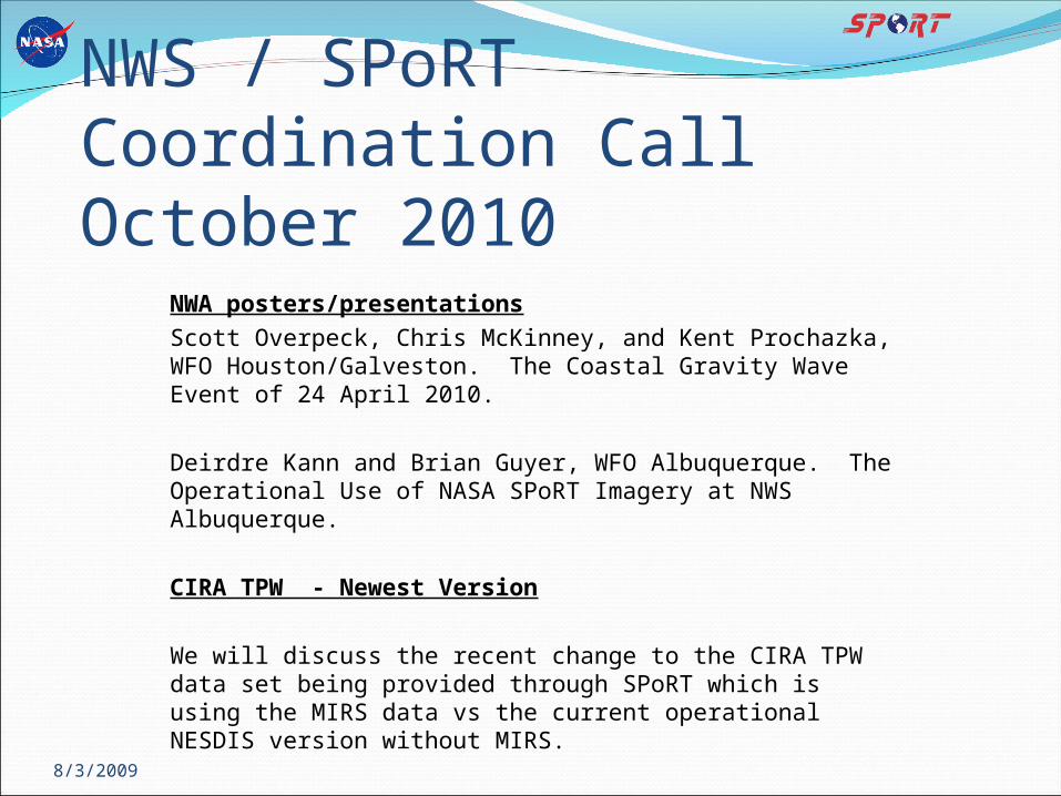
What Instruments were blended in the initial product by CIRA? Up to 8 may be used
5 AMSU
(NOAA/POES & MetOp),
1 SSM/I (DMSP)
Passive micro. over
water
Micro. over land still
being researched
GPS (only over land)
Interim use overland
300-400 stations
Caribbean, CA, Oil rigs
Highly accurate
GOES Sounder DPIGOES Sounderfills individually
AMSU & SSM/Iover water areas
GPS-METsmoothed over land
GOES Sounderfills individually
AMSU & SSM/Iover water areas
8/3/2009
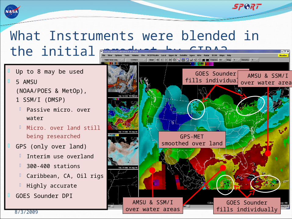
Things to Watch Out for…..
GPS bias for rough terrain
GOES DPI
Blended TPW
MIRSTime ~ 00 UTC
Drier Sierras,Wetter Valley
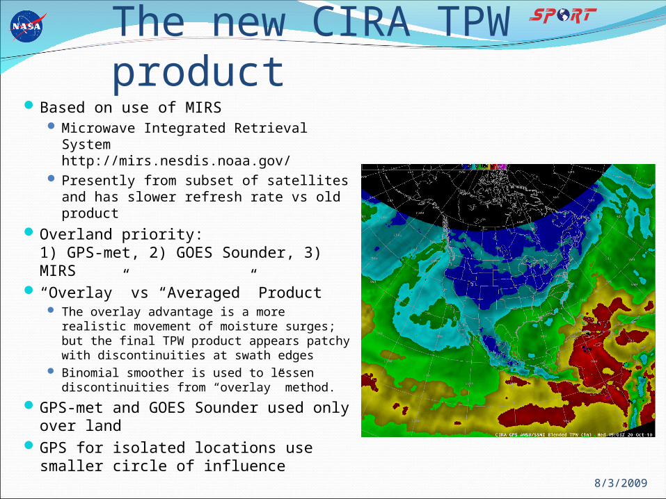
The new CIRA TPW productBased on use of MIRS
Microwave Integrated Retrieval Systemhttp://mirs.nesdis.noaa.gov/
Presently from subset of satellites and has slower refresh rate vs old product
Overland priority: 1) GPS-met, 2) GOES Sounder, 3) MIRS
“Overlay” vs “Averaged” Product The overlay advantage is a more realistic
movement of moisture surges; but the final TPW product appears patchy with discontinuities at swath edges
Binomial smoother is used to lessen discontinuities from “overlay” method.
GPS-met and GOES Sounder used only over land
GPS for isolated locations use smaller circle of influence 8/3/2009
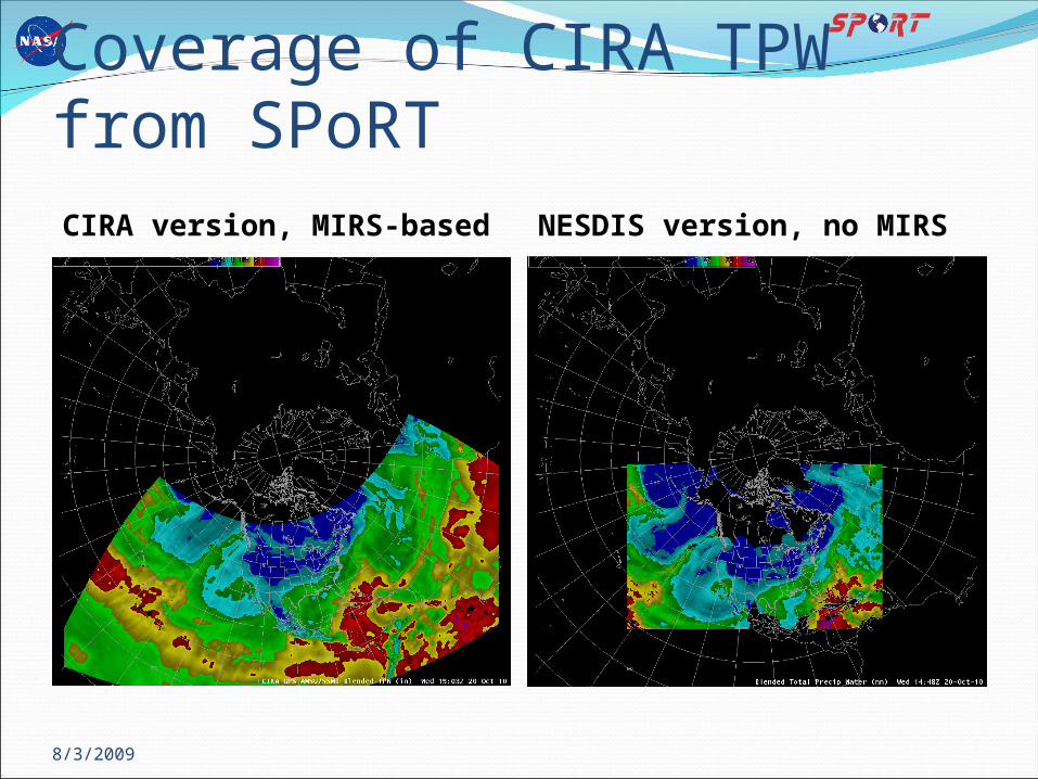
Coverage of CIRA TPW from SPoRTCIRA version, MIRS-based NESDIS version, no MIRS
8/3/2009
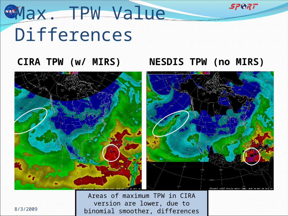
Max. TPW Value DifferencesCIRA TPW (w/ MIRS) NESDIS TPW (no MIRS)
8/3/2009
Areas of maximum TPW in CIRA version are lower, due to binomial
smoother, differences in data used and timing of data processing.
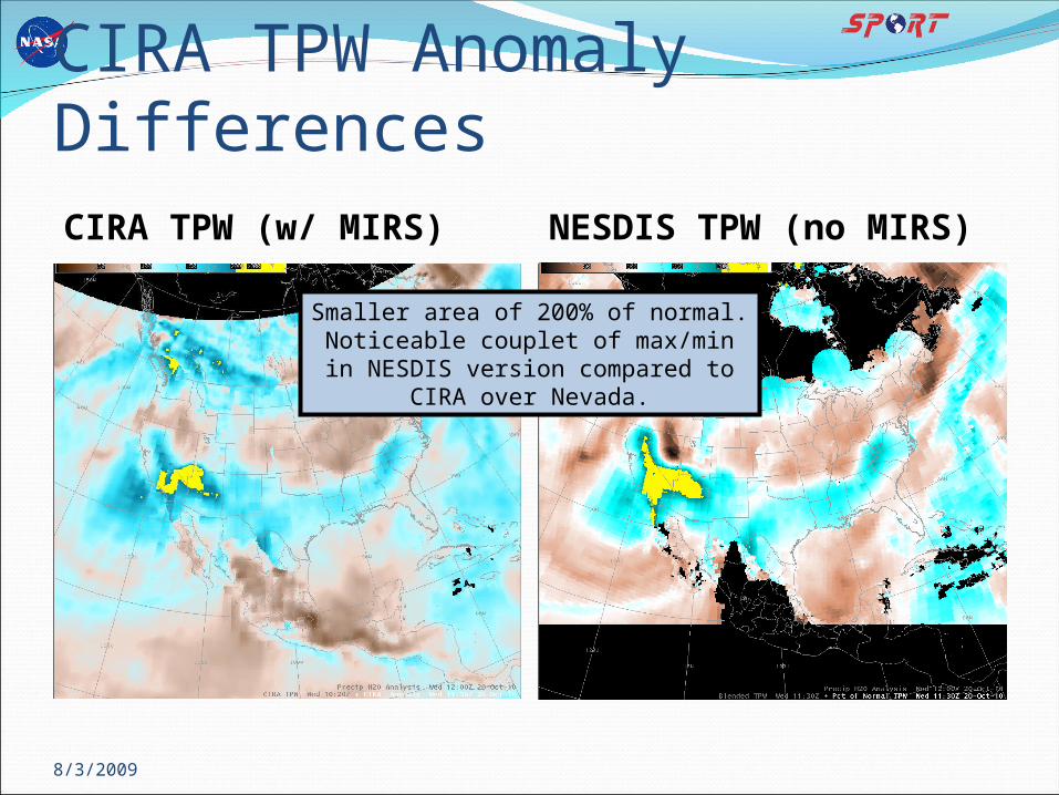
CIRA TPW Anomaly DifferencesCIRA TPW (w/ MIRS) NESDIS TPW (no MIRS)
8/3/2009
Smaller area of 200% of normal. Noticeable couplet of max/min in
NESDIS version compared to CIRA over Nevada.
Next Generation CIRA TPWThis is the future type of the product that is
likely to be supplied by NESDIS to the WFOs.Anticipating more details from CIRA on the
new product validation and caveatsEvaluation feedback needed from end users
due to noted differences in final product.
8/3/2009
Next Call – November 18, 2010Main topic: GOES-R Proving Ground products
to be evaluated by SPoRT partnersLightning: A Pseudo-GLM product has been
developed by SPoRT. Evaluation of this product is needed using WES cases.
Imagery: Several groups are creating ABI proxy products. SPoRT is focusing on near-realtime products to simulate ABI. This will combine GOES and MODIS (possibly VIIRS in future) at the resolution of ABI in order to prep users for the coming GOES-R era. Evaluation in a concentrated time period is needed for those willing.
8/3/2009