Embed Size (px)
Citation preview
PLYMOUTH, MA WAKEFIELD, MA WORCESTER, MA RINDGE, NH
Notice of Intent Application
September 28, 2017
Proposed Project
Swampscott Road at First Street Roundabout Construction Project
Salem, Massachusetts
Applicant
City of Salem
David Knowlton, City Engineer
120 Washington Street, 3d Floor
Salem, MA 01970
LEC Environmental Consultants, Inc.
12 Resnik Road, Suite 1
Plymouth, MA 02360
508-746-9491
508-746-9492 fax
www.lecenvironmental.com
September 28, 2017
Hand Delivery
Salem Conservation Commission
City Hall Annex
120 Washington Street
Salem, MA 01970
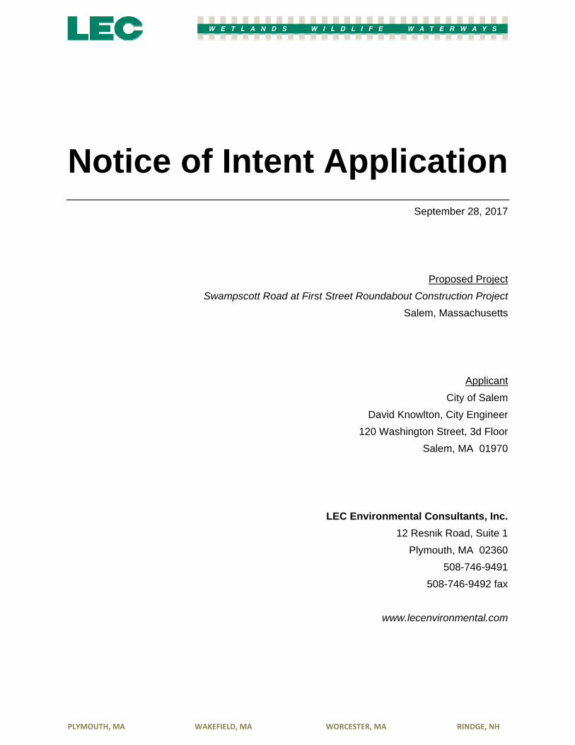
RE: Notice of Intent Application [LEC File #: SI\17-086.02]
Swampscott Road at First Street Roundabout Construction Project
Salem, Massachusetts
Dear Members of the Commission:
On behalf of the Applicant, the City of Salem, LEC Environmental Consultants, Inc., (LEC) is submitting
a Notice of Intent (NOI) Application for the Swampscott Road at First Street Roundabout Construction
Project in Salem, Massachusetts. Portions of the proposed work will occur within the 100-foot Buffer
Zone to Bordering Vegetated Wetland (BVW) and Bank, and within the 200-foot Riverfront Area
associated with the Forest River.
The proposed project has been designed to achieve compliance with the Massachusetts Wetlands
Protection Act (M.G.L. c. 131, s. 40), its implementing Regulations (310 CMR 10.00), and the City of
Salem Wetlands Protection Ordinance (Salem Code Chapter 50). Project details are depicted on the
Swampscott Road at First Street Roundabout Construction Plans, prepared by Stantec, dated September
2017 (attached).
Thank you for your consideration of this Application. We look forward to discussing this project with the
Commission at the October 12, 2017 Public Hearing. If you have any questions or need additional
information, please do not hesitate to contact us in our Plymouth office at 508-746-9491 or at
[email protected] and/or at [email protected].
Sincerely,
LEC Environmental Consultants, Inc.
Andrew Johnson Mark L. Manganello
Environmental Scientist Assistant Director of Ecological Services
cc: DEP Northeast Region; City of Salem; Stantec
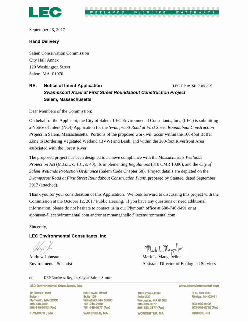
Table of Contents
PLYMOUTH, MA WAKEFIELD, MA WORCESTER, MA RINDGE, NH
i. WPA Form 3- Notice of Intent ii. Affidavit of Service iii. Abutter Letter iv. Abutter Notification v. Certified List of Abutters
Wetland Resource Area Analysis and Report
1. Introduction 1
2. General Site Description 2 2.1 Floodplain Designation 3 2.2 Massachusetts Natural Heritage & Endangered Species Program Designation 3
3. Wetland Boundary Determination Methodology 4
4. Wetland Resource Area Descriptions 4 4.1 Bordering Vegetated Wetland 5 4.2 Bank 5 4.3 Riverfront Area 6
5. Proposed Project 6
6. Mitigation Measures 8 6.1 Stormwater Management/Sedimentation and Erosion Control 8
7 Regulatory Compliance 9 7.1 Massachusetts Wetlands Protection Act 9
8. Summary 10
Literature Referenced
Appendices
Appendix A Locus Maps Figure 1: Aerial Orthophoto Figure 2: FEMA Flood Insurance Map Figure 3: USGS Topographic Quadrangle Figure 4: NHESP Map Figure 5: Aerial Orthophoto with Tax Parcels
Attachments
Stormwater Management Memorandum, prepared by Stantec, September 2017
Swampscott Road at First Street Roundabout Construction Plans, prepared by Stantec, dated September 2017
wpaform3.doc • rev. 6/28/2016
Page 1 of 9
Massachusetts Department of Environmental Protectio n Bureau of Resource Protection - Wetlands
WPA Form 3 – Notice of Intent Massachusetts Wetlands Protection Act M.G.L. c. 131, §40
Provided by MassDEP:
MassDEP File Number
Document Transaction Number
Salem City/Town
Important: When filling out forms on the computer, use only the tab key to move your cursor - do not use the return key.
Note: Before completing this form consult your local Conservation Commission regarding any municipal bylaw or ordinance.
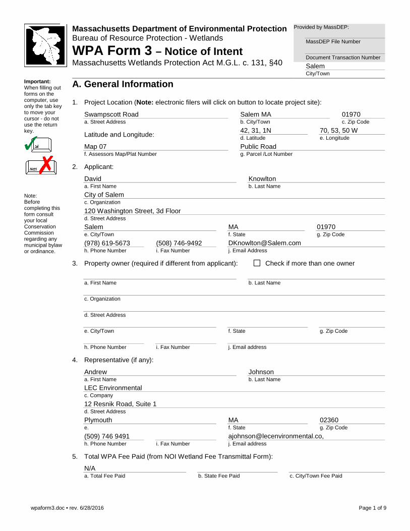
A. General Information
1. Project Location (Note: electronic filers will click on button to locate project site):
Swampscott Road a. Street Address
Salem MA b. City/Town
01970 c. Zip Code
Latitude and Longitude: 42, 31, 1N d. Latitude
70, 53, 50 W e. Longitude
Map 07 f. Assessors Map/Plat Number
Public Road g. Parcel /Lot Number
2. Applicant:
David a. First Name
Knowlton b. Last Name
City of Salem c. Organization
120 Washington Street, 3d Floor d. Street Address
Salem e. City/Town
MA f. State
01970 g. Zip Code
(978) 619-5673 h. Phone Number
(508) 746-9492 i. Fax Number
[email protected] j. Email Address
3. Property owner (required if different from applicant): Check if more than one owner
a. First Name
b. Last Name
c. Organization
d. Street Address
e. City/Town
f. State
g. Zip Code
h. Phone Number
i. Fax Number
j. Email address
4. Representative (if any):
Andrew a. First Name
Johnson b. Last Name
LEC Environmental c. Company
12 Resnik Road, Suite 1 d. Street Address
Plymouth e.
MA f. State
02360 g. Zip Code
(509) 746 9491 h. Phone Number
i. Fax Number
[email protected], j. Email address
5. Total WPA Fee Paid (from NOI Wetland Fee Transmittal Form):
N/A a. Total Fee Paid
b. State Fee Paid
c. City/Town Fee Paid
wpaform3.doc • rev. 6/28/2016
Page 2 of 9
Massachusetts Department of Environmental Protectio n Bureau of Resource Protection - Wetlands
WPA Form 3 – Notice of Intent Massachusetts Wetlands Protection Act M.G.L. c. 131, §40
Provided by MassDEP:
MassDEP File Number
Document Transaction Number
Salem City/Town
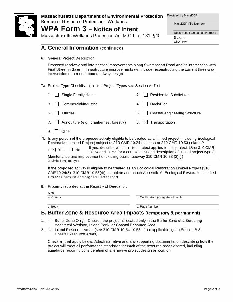
A. General Information (continued)
6. General Project Description:
Proposed roadway and intersection improvements along Swampscott Road and its intersection with First Street in Salem. Infrastructure improvements will include reconstructing the current three-way intersection to a roundabout roadway design.
7a. Project Type Checklist: (Limited Project Types see Section A. 7b.)
1. Single Family Home 2. Residential Subdivision
3. Commercial/Industrial 4. Dock/Pier
5. Utilities 6. Coastal engineering Structure
7. Agriculture (e.g., cranberries, forestry) 8. Transportation
9. Other
7b. Is any portion of the proposed activity eligible to be treated as a limited project (including Ecological
Restoration Limited Project) subject to 310 CMR 10.24 (coastal) or 310 CMR 10.53 (inland)?
1. Yes No If yes, describe which limited project applies to this project. (See 310 CMR 10.24 and 10.53 for a complete list and description of limited project types)
Maintenance and improvement of existing public roadway 310 CMR 10.53 (3) (f) 2. Limited Project Type
If the proposed activity is eligible to be treated as an Ecological Restoration Limited Project (310 CMR10.24(8), 310 CMR 10.53(4)), complete and attach Appendix A: Ecological Restoration Limited Project Checklist and Signed Certification.
8. Property recorded at the Registry of Deeds for:
N/A a. County
b. Certificate # (if registered land)
c. Book
d. Page Number
B. Buffer Zone & Resource Area Impacts (temporary & permanent)
1. Buffer Zone Only – Check if the project is located only in the Buffer Zone of a Bordering Vegetated Wetland, Inland Bank, or Coastal Resource Area.
2. Inland Resource Areas (see 310 CMR 10.54-10.58; if not applicable, go to Section B.3, Coastal Resource Areas).
Check all that apply below. Attach narrative and any supporting documentation describing how the project will meet all performance standards for each of the resource areas altered, including standards requiring consideration of alternative project design or location.
wpaform3.doc • rev. 6/28/2016
Page 3 of 9
Massachusetts Department of Environmental Protectio n Bureau of Resource Protection - Wetlands
WPA Form 3 – Notice of Intent Massachusetts Wetlands Protection Act M.G.L. c. 131, §40
Provided by MassDEP:
MassDEP File Number
Document Transaction Number
Salem City/Town
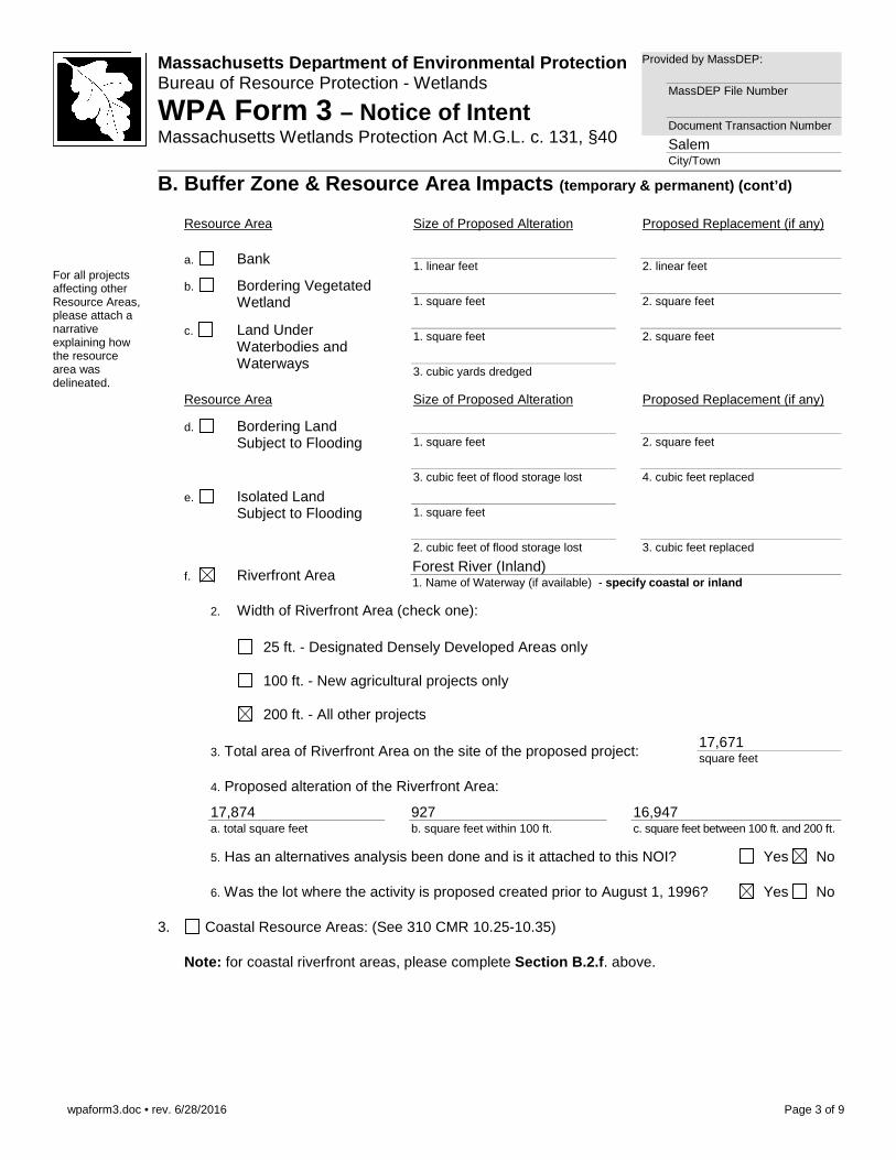
B. Buffer Zone & Resource Area Impacts (temporary & permanent) (cont’d)
For all projects affecting other Resource Areas, please attach a narrative explaining how the resource area was delineated.
Resource Area Size of Proposed Alteration Proposed Replacement (if any)
a. Bank 1. linear feet
2. linear feet
b. Bordering Vegetated Wetland
1. square feet
2. square feet
c. Land Under Waterbodies and Waterways
1. square feet
2. square feet
3. cubic yards dredged
Resource Area Size of Proposed Alteration Proposed Replacement (if any)
d. Bordering Land Subject to Flooding
1. square feet
2. square feet
3. cubic feet of flood storage lost
4. cubic feet replaced
e. Isolated Land Subject to Flooding
1. square feet
2. cubic feet of flood storage lost
3. cubic feet replaced
f. Riverfront Area Forest River (Inland) 1. Name of Waterway (if available) - specify coastal or inland
2. Width of Riverfront Area (check one):
25 ft. - Designated Densely Developed Areas only
100 ft. - New agricultural projects only
200 ft. - All other projects
3. Total area of Riverfront Area on the site of the proposed project:
17,671 square feet
4. Proposed alteration of the Riverfront Area:
17,874 a. total square feet
927 b. square feet within 100 ft.
16,947 c. square feet between 100 ft. and 200 ft.
5. Has an alternatives analysis been done and is it attached to this NOI? Yes No
6. Was the lot where the activity is proposed created prior to August 1, 1996? Yes No
3. Coastal Resource Areas: (See 310 CMR 10.25-10.35)
Note: for coastal riverfront areas, please complete Section B.2.f . above.
wpaform3.doc • rev. 6/28/2016
Page 4 of 9
Massachusetts Department of Environmental Protectio n Bureau of Resource Protection - Wetlands
WPA Form 3 – Notice of Intent Massachusetts Wetlands Protection Act M.G.L. c. 131, §40
Provided by MassDEP:
MassDEP File Number
Document Transaction Number
Salem City/Town
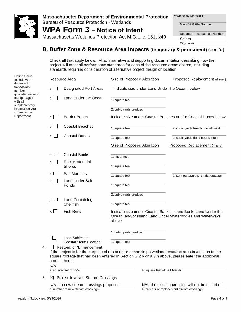
B. Buffer Zone & Resource Area Impacts (temporary & permanent) (cont’d)
Check all that apply below. Attach narrative and supporting documentation describing how the project will meet all performance standards for each of the resource areas altered, including standards requiring consideration of alternative project design or location.
Online Users: Include your document transaction number (provided on your receipt page) with all supplementary information you submit to the Department.
Resource Area Size of Proposed Alteration Proposed Replacement (if any)
a. Designated Port Areas Indicate size under Land Under the Ocean, below
b. Land Under the Ocean 1. square feet
2. cubic yards dredged
c. Barrier Beach Indicate size under Coastal Beaches and/or Coastal Dunes below
d. Coastal Beaches 1. square feet
2. cubic yards beach nourishment
e. Coastal Dunes
1. square feet
2. cubic yards dune nourishment
Size of Proposed Alteration Proposed Replacement (if any)
f. Coastal Banks
1. linear feet
g. Rocky Intertidal Shores
1. square feet
h. Salt Marshes
1. square feet
2. sq ft restoration, rehab., creation
i. Land Under Salt Ponds
1. square feet
2. cubic yards dredged
j. Land Containing Shellfish
1. square feet
k. Fish Runs Indicate size under Coastal Banks, inland Bank, Land Under the Ocean, and/or inland Land Under Waterbodies and Waterways, above
1. cubic yards dredged
l. Land Subject to Coastal Storm Flowage
1. square feet
4. Restoration/Enhancement If the project is for the purpose of restoring or enhancing a wetland resource area in addition to the square footage that has been entered in Section B.2.b or B.3.h above, please enter the additional amount here.
N/A a. square feet of BVW
b. square feet of Salt Marsh
5. Project Involves Stream Crossings
N/A- no new stream crossings proposed a. number of new stream crossings
N/A- the existing crossing will not be disturbed b. number of replacement stream crossings
wpaform3.doc • rev. 6/28/2016
Page 5 of 9
Massachusetts Department of Environmental Protectio n Bureau of Resource Protection - Wetlands
WPA Form 3 – Notice of Intent Massachusetts Wetlands Protection Act M.G.L. c. 131, §40
Provided by MassDEP:
MassDEP File Number
Document Transaction Number
Salem City/Town
C. Other Applicable Standards and Requirements This is a proposal for an Ecological Restoration Limited Project. Skip Section C and
complete Appendix A: Ecological Restoration Limited Project Checklists – Required Actions (310 CMR 10.11).
Streamlined Massachusetts Endangered Species Act/We tlands Protection Act Review
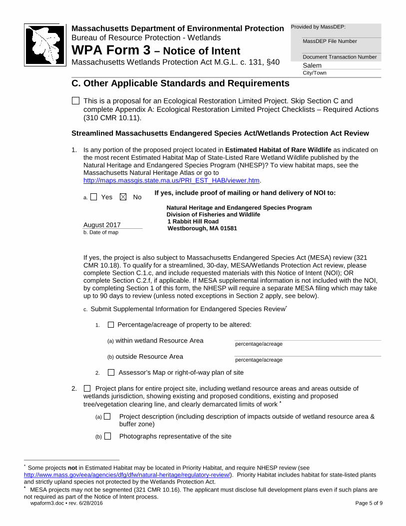
1. Is any portion of the proposed project located in Estimated Habitat of Rare Wildlife as indicated on
the most recent Estimated Habitat Map of State-Listed Rare Wetland Wildlife published by the Natural Heritage and Endangered Species Program (NHESP)? To view habitat maps, see the Massachusetts Natural Heritage Atlas or go to http://maps.massgis.state.ma.us/PRI_EST_HAB/viewer.htm.
a. Yes No
If yes, include proof of mailing or hand delivery o f NOI to: Natural Heritage and Endangered Species Program Division of Fisheries and Wildlife 1 Rabbit Hill Road Westborough, MA 01581
Phone: (508) 389-6360
August 2017 b. Date of map
If yes, the project is also subject to Massachusetts Endangered Species Act (MESA) review (321 CMR 10.18). To qualify for a streamlined, 30-day, MESA/Wetlands Protection Act review, please complete Section C.1.c, and include requested materials with this Notice of Intent (NOI); OR complete Section C.2.f, if applicable. If MESA supplemental information is not included with the NOI, by completing Section 1 of this form, the NHESP will require a separate MESA filing which may take up to 90 days to review (unless noted exceptions in Section 2 apply, see below).
c. Submit Supplemental Information for Endangered Species Review∗
1. Percentage/acreage of property to be altered:
(a) within wetland Resource Area
percentage/acreage
(b) outside Resource Area
percentage/acreage
2. Assessor’s Map or right-of-way plan of site
2. Project plans for entire project site, including wetland resource areas and areas outside of
wetlands jurisdiction, showing existing and proposed conditions, existing and proposed tree/vegetation clearing line, and clearly demarcated limits of work ∗∗
(a) Project description (including description of impacts outside of wetland resource area & buffer zone)
(b) Photographs representative of the site
∗ Some projects not in Estimated Habitat may be located in Priority Habitat, and require NHESP review (see http://www.mass.gov/eea/agencies/dfg/dfw/natural-heritage/regulatory-review/). Priority Habitat includes habitat for state-listed plants and strictly upland species not protected by the Wetlands Protection Act. ∗∗ MESA projects may not be segmented (321 CMR 10.16). The applicant must disclose full development plans even if such plans are not required as part of the Notice of Intent process.
wpaform3.doc • rev. 6/28/2016
Page 6 of 9
Massachusetts Department of Environmental Protectio n Bureau of Resource Protection - Wetlands
WPA Form 3 – Notice of Intent Massachusetts Wetlands Protection Act M.G.L. c. 131, §40
Provided by MassDEP:
MassDEP File Number
Document Transaction Number
Salem City/Town
C. Other Applicable Standards and Requirements (cont’d)
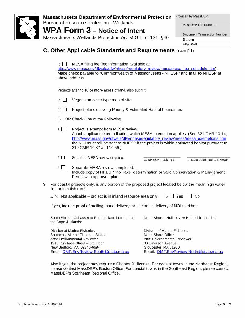
(c) MESA filing fee (fee information available at http://www.mass.gov/dfwele/dfw/nhesp/regulatory_review/mesa/mesa_fee_schedule.htm). Make check payable to “Commonwealth of Massachusetts - NHESP” and mail to NHESP at above address
Projects altering 10 or more acres of land, also submit:
(d) Vegetation cover type map of site
(e) Project plans showing Priority & Estimated Habitat boundaries
(f) OR Check One of the Following
1. Project is exempt from MESA review.
Attach applicant letter indicating which MESA exemption applies. (See 321 CMR 10.14, http://www.mass.gov/dfwele/dfw/nhesp/regulatory_review/mesa/mesa_exemptions.htm; the NOI must still be sent to NHESP if the project is within estimated habitat pursuant to 310 CMR 10.37 and 10.59.)
2. Separate MESA review ongoing.
a. NHESP Tracking #
b. Date submitted to NHESP
3. Separate MESA review completed.
Include copy of NHESP “no Take” determination or valid Conservation & Management Permit with approved plan.
3. For coastal projects only, is any portion of the proposed project located below the mean high water line or in a fish run?
a. Not applicable – project is in inland resource area only b. Yes No
If yes, include proof of mailing, hand delivery, or electronic delivery of NOI to either:
South Shore - Cohasset to Rhode Island border, and the Cape & Islands:
Division of Marine Fisheries - Southeast Marine Fisheries Station Attn: Environmental Reviewer 1213 Purchase Street – 3rd Floor New Bedford, MA 02740-6694 Email: [email protected]
North Shore - Hull to New Hampshire border:
Division of Marine Fisheries - North Shore Office Attn: Environmental Reviewer 30 Emerson Avenue Gloucester, MA 01930 Email: [email protected]
Also if yes, the project may require a Chapter 91 license. For coastal towns in the Northeast Region, please contact MassDEP’s Boston Office. For coastal towns in the Southeast Region, please contact MassDEP’s Southeast Regional Office.
wpaform3.doc • rev. 6/28/2016
Page 7 of 9
Massachusetts Department of Environmental Protectio n Bureau of Resource Protection - Wetlands
WPA Form 3 – Notice of Intent Massachusetts Wetlands Protection Act M.G.L. c. 131, §40
Provided by MassDEP:
MassDEP File Number
Document Transaction Number
Salem City/Town
C. Other Applicable Standards and Requirements (cont’d)
Online Users: Include your document transaction number (provided on your receipt page) with all supplementary information you submit to the Department.
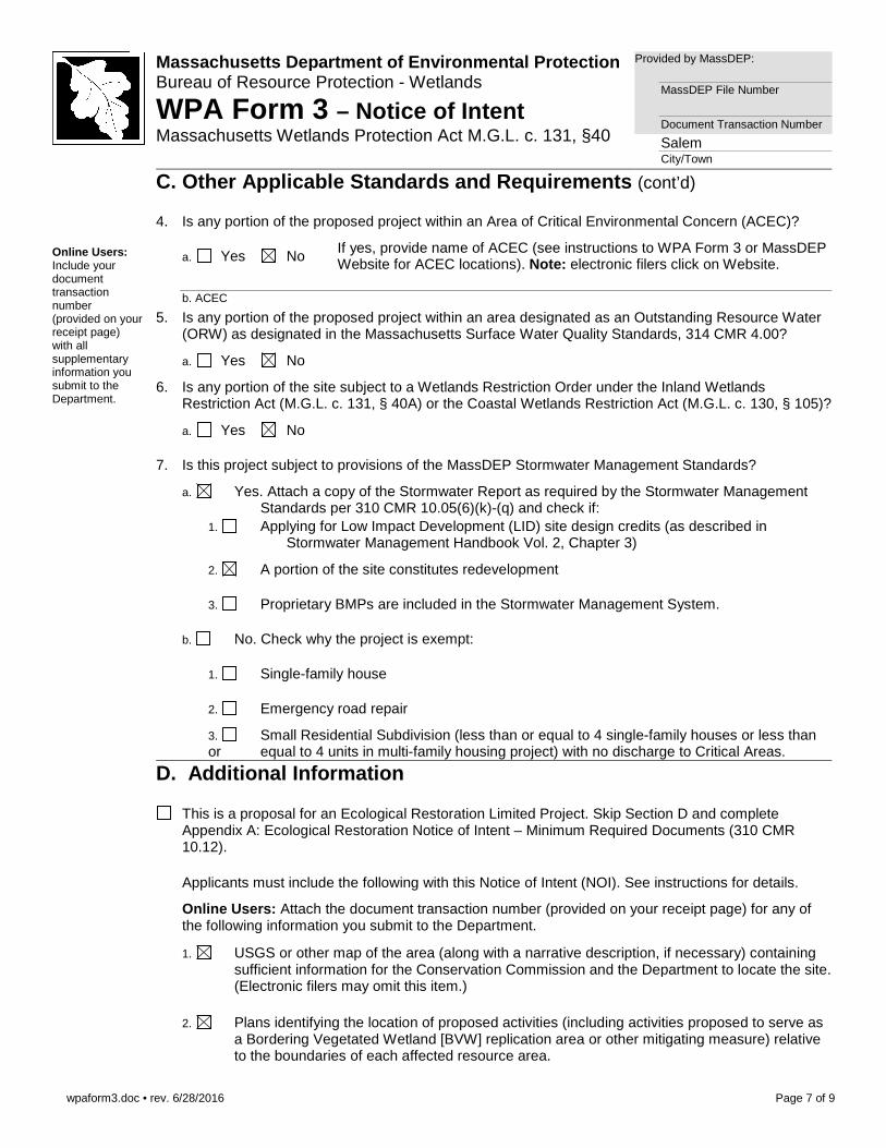
4. Is any portion of the proposed project within an Area of Critical Environmental Concern (ACEC)?
a. Yes No If yes, provide name of ACEC (see instructions to WPA Form 3 or MassDEP Website for ACEC locations). Note: electronic filers click on Website.
b. ACEC
5. Is any portion of the proposed project within an area designated as an Outstanding Resource Water (ORW) as designated in the Massachusetts Surface Water Quality Standards, 314 CMR 4.00?
a. Yes No
6. Is any portion of the site subject to a Wetlands Restriction Order under the Inland Wetlands Restriction Act (M.G.L. c. 131, § 40A) or the Coastal Wetlands Restriction Act (M.G.L. c. 130, § 105)?
a. Yes No
7. Is this project subject to provisions of the MassDEP Stormwater Management Standards?
a. Yes. Attach a copy of the Stormwater Report as required by the Stormwater Management Standards per 310 CMR 10.05(6)(k)-(q) and check if:
1. Applying for Low Impact Development (LID) site design credits (as described in Stormwater Management Handbook Vol. 2, Chapter 3)
2. A portion of the site constitutes redevelopment
3. Proprietary BMPs are included in the Stormwater Management System.
b. No. Check why the project is exempt:
1. Single-family house
2. Emergency road repair
3. Small Residential Subdivision (less than or equal to 4 single-family houses or less than or equal to 4 units in multi-family housing project) with no discharge to Critical Areas.
D. Additional Information
This is a proposal for an Ecological Restoration Limited Project. Skip Section D and complete Appendix A: Ecological Restoration Notice of Intent – Minimum Required Documents (310 CMR 10.12).
Applicants must include the following with this Notice of Intent (NOI). See instructions for details.
Online Users: Attach the document transaction number (provided on your receipt page) for any of the following information you submit to the Department.
1. USGS or other map of the area (along with a narrative description, if necessary) containing sufficient information for the Conservation Commission and the Department to locate the site. (Electronic filers may omit this item.)
2. Plans identifying the location of proposed activities (including activities proposed to serve as a Bordering Vegetated Wetland [BVW] replication area or other mitigating measure) relative to the boundaries of each affected resource area.
wpaform3.doc • rev. 6/28/2016
Page 8 of 9
Massachusetts Department of Environmental Protectio n Bureau of Resource Protection - Wetlands
WPA Form 3 – Notice of Intent Massachusetts Wetlands Protection Act M.G.L. c. 131, §40
Provided by MassDEP:
MassDEP File Number
Document Transaction Number
Salem City/Town
D. Additional Information (cont’d)
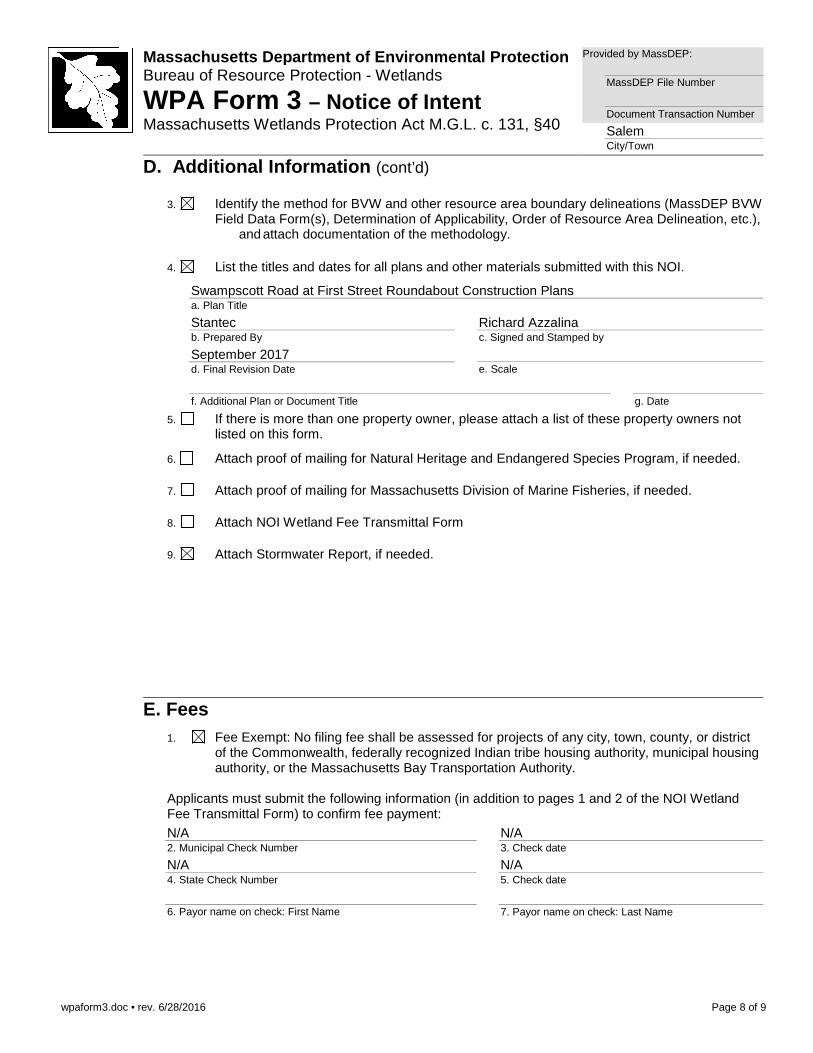
3. Identify the method for BVW and other resource area boundary delineations (MassDEP BVW Field Data Form(s), Determination of Applicability, Order of Resource Area Delineation, etc.), and attach documentation of the methodology.
4. List the titles and dates for all plans and other materials submitted with this NOI.
Swampscott Road at First Street Roundabout Construction Plans a. Plan Title
Stantec b. Prepared By
Richard Azzalina c. Signed and Stamped by
September 2017 d. Final Revision Date
e. Scale
f. Additional Plan or Document Title
g. Date
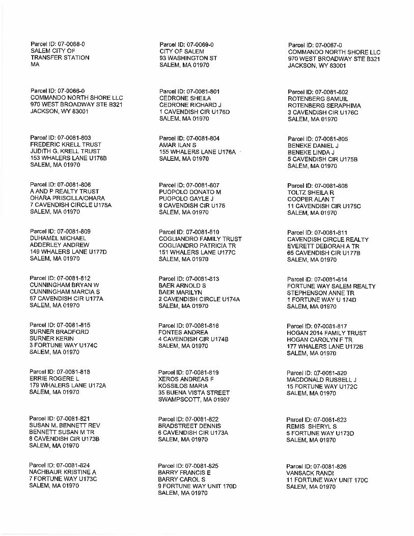
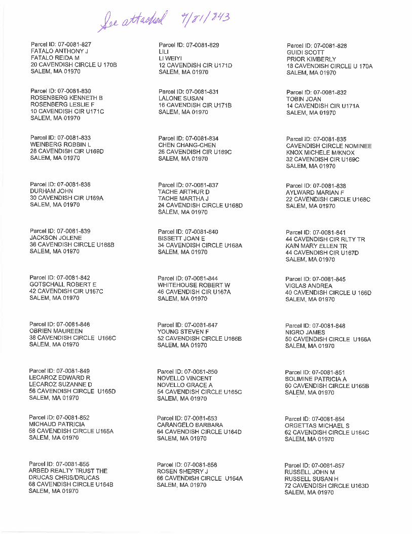
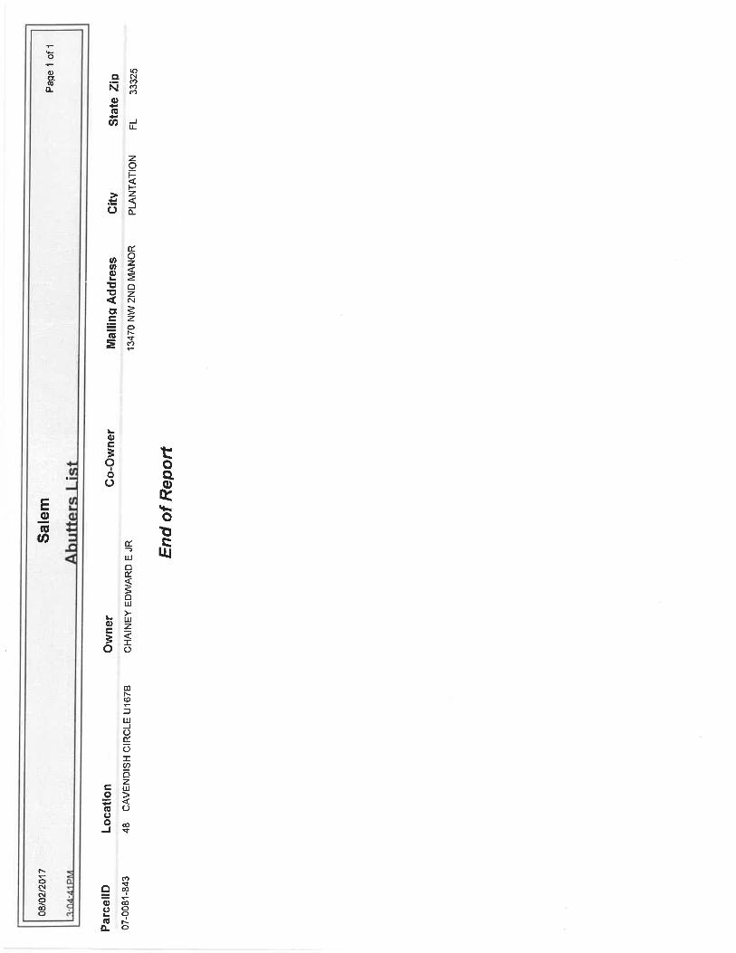
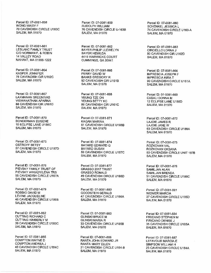
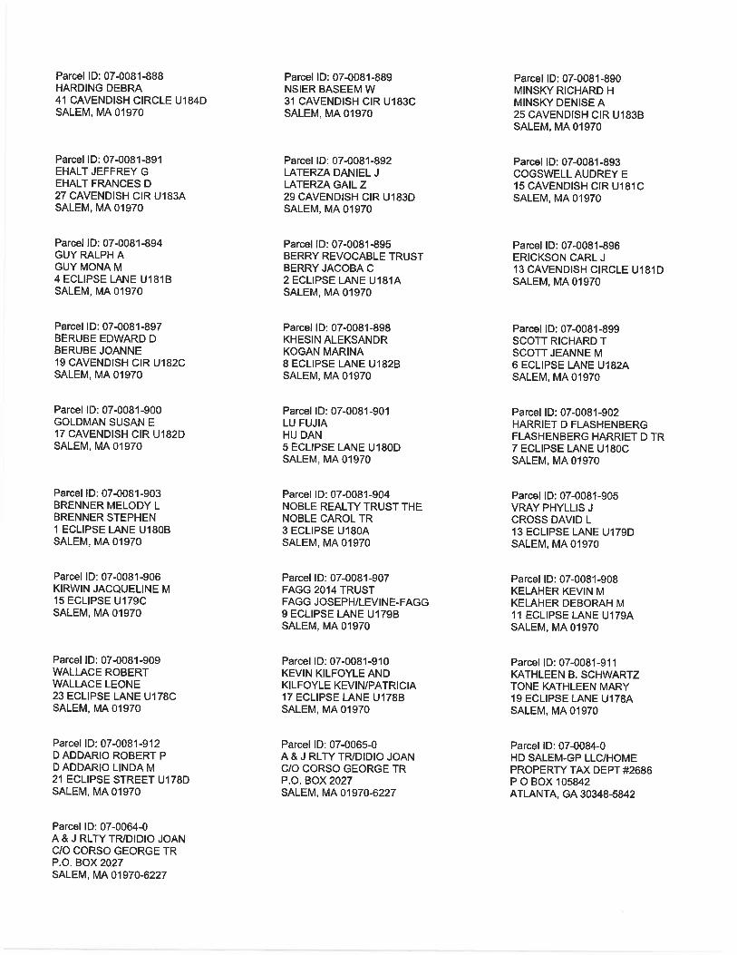
5. If there is more than one property owner, please attach a list of these property owners not
listed on this form.
6. Attach proof of mailing for Natural Heritage and Endangered Species Program, if needed.
7. Attach proof of mailing for Massachusetts Division of Marine Fisheries, if needed.
8. Attach NOI Wetland Fee Transmittal Form
9. Attach Stormwater Report, if needed.
E. Fees 1. Fee Exempt: No filing fee shall be assessed for projects of any city, town, county, or district
of the Commonwealth, federally recognized Indian tribe housing authority, municipal housing authority, or the Massachusetts Bay Transportation Authority.
Applicants must submit the following information (in addition to pages 1 and 2 of the NOI Wetland Fee Transmittal Form) to confirm fee payment:
N/A 2. Municipal Check Number
N/A 3. Check date
N/A 4. State Check Number
N/A 5. Check date
6. Payor name on check: First Name
7. Payor name on check: Last Name
wpaform3.doc • rev. 6/28/2016
Page 9 of 9
Massachusetts Department of Environmental Protectio n Bureau of Resource Protection - Wetlands
WPA Form 3 – Notice of Intent Massachusetts Wetlands Protection Act M.G.L. c. 131, §40
Provided by MassDEP:
MassDEP File Number
Document Transaction Number
Salem City/Town
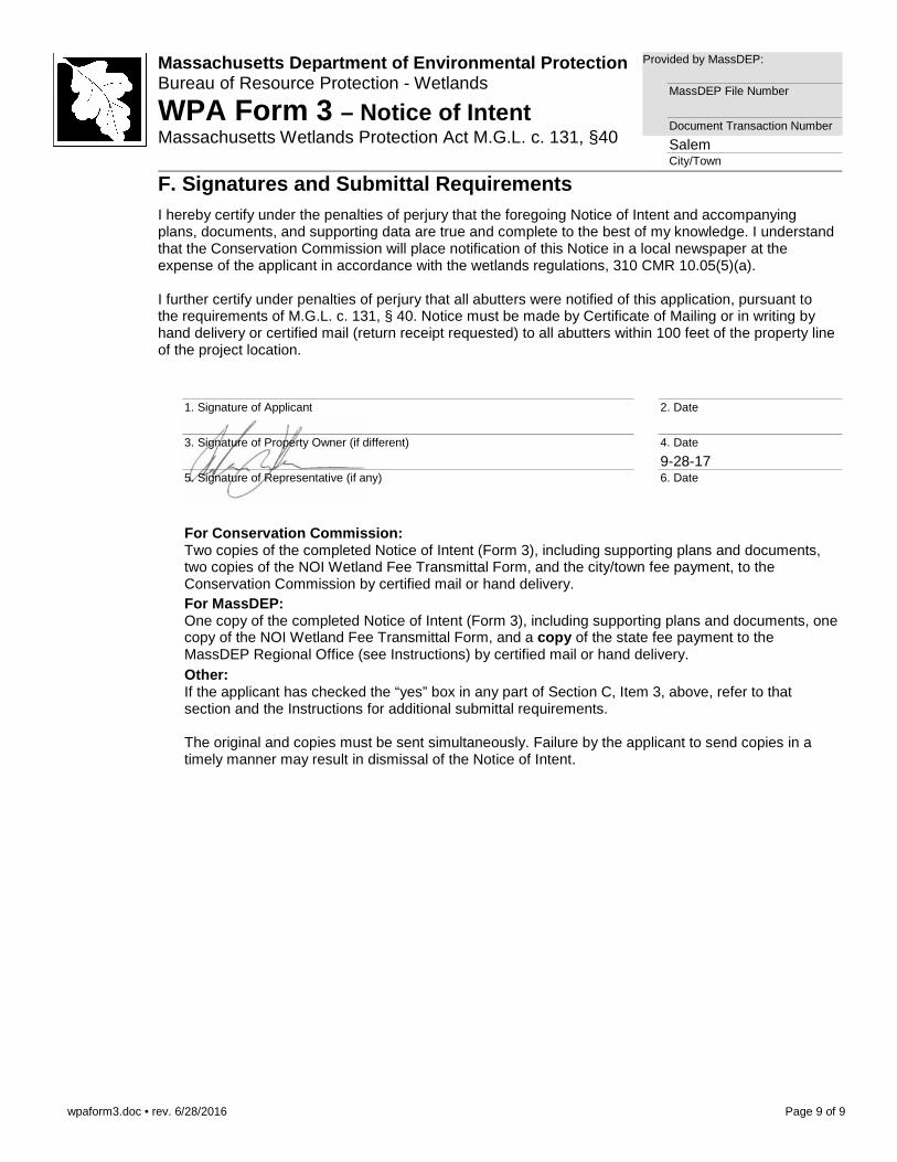
F. Signatures and Submittal Requirements I hereby certify under the penalties of perjury that the foregoing Notice of Intent and accompanying
plans, documents, and supporting data are true and complete to the best of my knowledge. I understand that the Conservation Commission will place notification of this Notice in a local newspaper at the expense of the applicant in accordance with the wetlands regulations, 310 CMR 10.05(5)(a). I further certify under penalties of perjury that all abutters were notified of this application, pursuant to the requirements of M.G.L. c. 131, § 40. Notice must be made by Certificate of Mailing or in writing by hand delivery or certified mail (return receipt requested) to all abutters within 100 feet of the property line of the project location.
1. Signature of Applicant
2. Date
3. Signature of Property Owner (if different)
4. Date
5. Signature of Representative (if any)
9-28-17 6. Date
For Conservation Commission: Two copies of the completed Notice of Intent (Form 3), including supporting plans and documents, two copies of the NOI Wetland Fee Transmittal Form, and the city/town fee payment, to the Conservation Commission by certified mail or hand delivery.
For MassDEP: One copy of the completed Notice of Intent (Form 3), including supporting plans and documents, one copy of the NOI Wetland Fee Transmittal Form, and a copy of the state fee payment to the MassDEP Regional Office (see Instructions) by certified mail or hand delivery.
Other: If the applicant has checked the “yes” box in any part of Section C, Item 3, above, refer to that section and the Instructions for additional submittal requirements. The original and copies must be sent simultaneously. Failure by the applicant to send copies in a timely manner may result in dismissal of the Notice of Intent.
noifeetf.doc • Wetland Fee Transmittal Form • rev. 10/11 Page 1 of 2
Massachusetts Department of Environmental Protectio n Bureau of Resource Protection - Wetlands
NOI Wetland Fee Transmittal Form Massachusetts Wetlands Protection Act M.G.L. c. 131, §40
Important: When filling out forms on the computer, use only the tab key to move your cursor - do not use the return key.
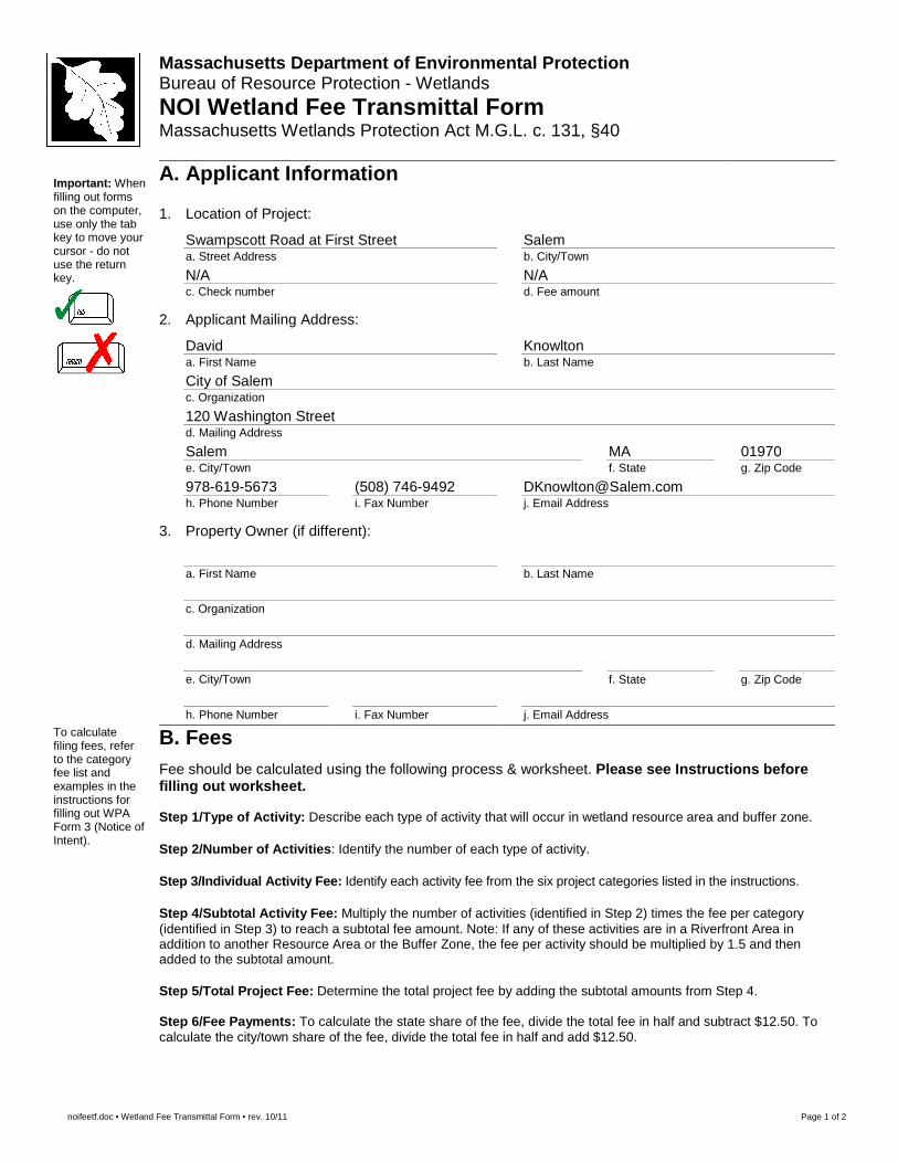
A. Applicant Information
1. Location of Project:
Swampscott Road at First Street a. Street Address
Salem b. City/Town
N/A c. Check number
N/A d. Fee amount
2. Applicant Mailing Address:
David a. First Name
Knowlton b. Last Name
City of Salem c. Organization
120 Washington Street d. Mailing Address
Salem e. City/Town
MA f. State
01970 g. Zip Code
978-619-5673 h. Phone Number
(508) 746-9492 i. Fax Number
[email protected] j. Email Address
3. Property Owner (if different):
a. First Name
b. Last Name
c. Organization
d. Mailing Address
e. City/Town
f. State
g. Zip Code
h. Phone Number
i. Fax Number
j. Email Address
To calculate filing fees, refer to the category fee list and examples in the instructions for filling out WPA Form 3 (Notice of Intent).
B. Fees Fee should be calculated using the following process & worksheet. Please see Instructions before filling out worksheet. Step 1/Type of Activity: Describe each type of activity that will occur in wetland resource area and buffer zone. Step 2/Number of Activities : Identify the number of each type of activity. Step 3/Individual Activity Fee: Identify each activity fee from the six project categories listed in the instructions. Step 4/Subtotal Activity Fee: Multiply the number of activities (identified in Step 2) times the fee per category (identified in Step 3) to reach a subtotal fee amount. Note: If any of these activities are in a Riverfront Area in addition to another Resource Area or the Buffer Zone, the fee per activity should be multiplied by 1.5 and then added to the subtotal amount. Step 5/Total Project Fee: Determine the total project fee by adding the subtotal amounts from Step 4. Step 6/Fee Payments: To calculate the state share of the fee, divide the total fee in half and subtract $12.50. To calculate the city/town share of the fee, divide the total fee in half and add $12.50.
noifeetf.doc • Wetland Fee Transmittal Form • rev. 10/11 Page 2 of 2
Massachusetts Department of Environmental Protectio n Bureau of Resource Protection - Wetlands
NOI Wetland Fee Transmittal Form Massachusetts Wetlands Protection Act M.G.L. c. 131, §40
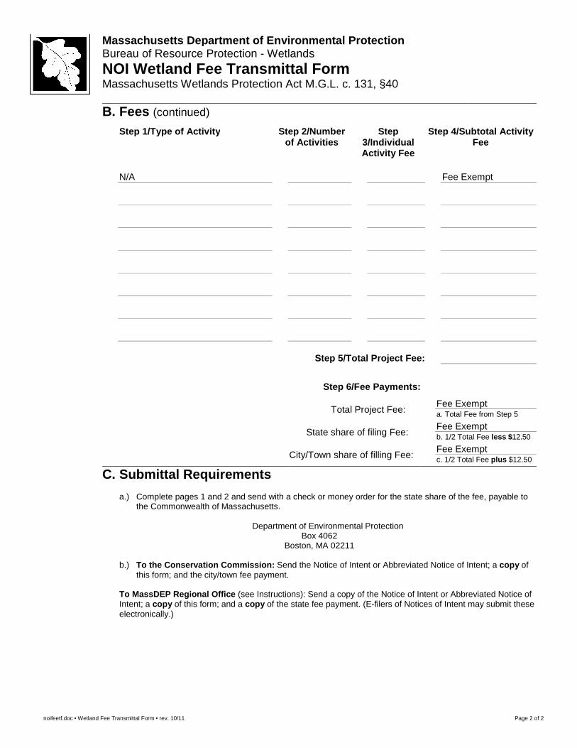
B. Fees (continued)
Step 1/Type of Activity Step 2/Number of Activities
Step 3/Individual Activity Fee
Step 4/Subtotal Activity Fee
N/A
Fee Exempt
Step 5/Total Project Fee:
Step 6/Fee Payments:
Total Project Fee:
Fee Exempt a. Total Fee from Step 5
State share of filing Fee: Fee Exempt b. 1/2 Total Fee less $12.50
City/Town share of filling Fee: Fee Exempt c. 1/2 Total Fee plus $12.50
C. Submittal Requirements
a.) Complete pages 1 and 2 and send with a check or money order for the state share of the fee, payable to the Commonwealth of Massachusetts.
Department of Environmental Protection
Box 4062 Boston, MA 02211
b.) To the Conservation Commission: Send the Notice of Intent or Abbreviated Notice of Intent; a copy of
this form; and the city/town fee payment.
To MassDEP Regional Office (see Instructions): Send a copy of the Notice of Intent or Abbreviated Notice of Intent; a copy of this form; and a copy of the state fee payment. (E-filers of Notices of Intent may submit these electronically.)
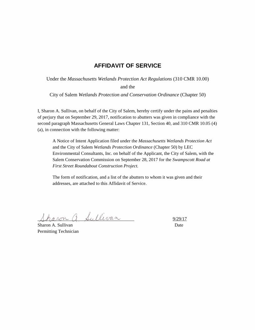
AFFIDAVIT OF SERVICE
Under the Massachusetts Wetlands Protection Act Regulations (310 CMR 10.00)
and the
City of Salem Wetlands Protection and Conservation Ordinance (Chapter 50)
I, Sharon A. Sullivan, on behalf of the City of Salem, hereby certify under the pains and penalties of perjury that on September 29, 2017, notification to abutters was given in compliance with the second paragraph Massachusetts General Laws Chapter 131, Section 40, and 310 CMR 10.05 (4) (a), in connection with the following matter:
A Notice of Intent Application filed under the Massachusetts Wetlands Protection Act and the City of Salem Wetlands Protection Ordinance (Chapter 50) by LEC Environmental Consultants, Inc. on behalf of the Applicant, the City of Salem, with the Salem Conservation Commission on September 28, 2017 for the Swampscott Road at First Street Roundabout Construction Project.
The form of notification, and a list of the abutters to whom it was given and their addresses, are attached to this Affidavit of Service.
__________________________________________ 9/29/17 Sharon A. Sullivan Date Permitting Technician
September 29, 2017
Certificate of Mailing
«Name» «Name2» «Address» «City», «State» «Zip»
Re: Notice of Intent Application [LEC File #: SI\17-086.02]
Swampscott Road and First Street Intersection Reconstruction Project Salem, Massachusetts
Dear Abutter:
On behalf of the Applicant, the City of Salem, LEC Environmental Consultants, Inc. (LEC) has filed a Notice of Intent (NOI) Application with the Salem Conservation Commission for the Swampscott Road at First Street Roundabout Construction Project. The footprint of the proposed project includes municipal roadway reconstruction activities within 300 feet of the existing three-way intersection of Swampscott Road and First Street. The project extends into an adjacent parking lot, which will be slightly expanded, located immediately to the west of the intersection in Salem, Massachusetts. Portions of the proposed work will occur within the 100-foot Buffer Zone to Bordering Vegetated Wetland (BVW) and Bank, and within the 200-foot Riverfront Area associated with the Forest River, as protected by the Massachusetts Wetlands Protection Act (M.G.L. c. 131, s. 40), its implementing Regulations (310 CMR 10.00), and the City of Salem Wetlands Protection Ordinance.
The NOI Application and accompanying site plans are available for review by the public at the Salem Conservation Commission. The Public Hearing will be held in the 3rd Floor Conference Room, City Hall Annex, 120 Washington Street, Salem on October 12, 2017 at 6:30 p.m., in accordance with the provisions of the Massachusetts Wetlands Protection Act (M.G.L. c. 131, s. 40), its implementing Regulations (310 CMR 10.00), and the City of Salem Wetlands Protection Ordinance. Further information regarding this application will be published at least five (5) days in advance in The Salem News. Notice of the Public Hearing will also be posted at the Salem City Hall at least 48 hours in advance.
Please do not hesitate to review the materials and/or attend the public hearing should you have questions or concerns about the proposed project.
Sincerely,
LEC Environmental Consultants, Inc. Andrew Johnson Environmental Scientist enclosure
Notification to Abutters Under the
Massachusetts Wetlands Protection Act Regulations (310 CMR 10.00) and the
City of Salem Wetlands Protection and Conservation Ordinance (Chapter 50)
In accordance with the second paragraph of Massachusetts General Laws Chapter 131, Section 40, the Massachusetts Wetlands Protection Act Regulations (310 CMR 10.00) and the City of Salem Wetlands Protection and Conservation Ordinance (Chapter 50), you are hereby notified of the following:
A. The names of the Applicant is The City of Salem, 120 Washington Street, 3rd Floor, Salem, MA 01970
B. The Applicant has filed a Notice of Intent Application (NOI) with the Conservation Commission for the municipality of Salem, Massachusetts for the Swampscott Road at First Street Roundabout Construction Project. Portions of the proposed work will occur within the 100-foot Buffer Zone to Bordering Vegetated Wetland (BVW) and Bank, and within the 200-foot Riverfront Area associated with the Forest River, as protected under the Massachusetts Wetlands Protection Act (M.G.L., c. 131, s. 40), its implementing Regulations (310 CMR 10.00), and the City of Salem Wetlands and Conservation Ordinance.
C. The footprint of the proposed project includes municipal roadway reconstruction activities within 300 feet of the existing three-way intersection of Swampscott Road and First Street. The project extends into an adjacent parking lot, which will be slightly expanded, located immediately to the west of the intersection.
D. Copies of the Notice of Intent Application may be examined at the Salem Conservation Commission office located at 120 Washington Street, 3rd Floor, Salem, MA or by contacting the Commission at 978-619-5685.
E. Copies of the Notice of Intent Application may be obtained from LEC Environmental Consultants, Inc. (the applicant’s representative) by calling 781-245-2500 between the hours of 8:00 a.m. and 5:00 p.m., Monday through Friday. A fee may be charged for each copy requested.
F. Information regarding the public hearing may be obtained from the Salem Conservation Commission (the regulatory agency) by calling 978-619-5685.
NOTE: Notice of the Public Hearing, including its date, time, and place, will be published at least five (5) days in advance in The Salem News.
NOTE: You also may contact the nearest Department of Environmental Protection Regional Office for more information about this application or the Wetlands Protection Act. To contact DEP, call:
Northeast Region: 978-694-3200

Notice of Intent Application
Swampscott Road at First Street Roundabout Construction Project
Salem, Massachusetts
September 28, 2017
PLYMOUTH, MA WAKEFIELD, MA WORCESTER, MA RINDGE, NH
Notice of Intent Application Swampscott Road at First Street Roundabout Construction Project
Salem, Massachusetts
Page 1 of 10
PLYMOUTH, MA WAKEFIELD, MA WORCESTER, MA RINDGE, NH
1. Introduction
On behalf of the Applicant, the City of Salem, LEC Environmental Consultants, Inc.,
(LEC) is submitting a Notice of Intent (NOI) Application for the Swampscott Road at
First Street Roundabout Construction Project in Salem, Massachusetts. The footprint of
the proposed project includes municipal roadway improvement and reconstruction
activities within 300 feet of the existing three-way intersection of Swampscott Road and
First Street. In addition to improving the intersection, the project extends into an adjacent
parking lot, which will be slightly expanded, located immediately to the west of the
intersection. The intersection is within a busy transportation corridor that experiences
frequent traffic issues due to its current configuration and existing visual obstructions.
The general project concept is to reconstruct the existing intersection by converting it to a
roundabout design. The proposed project has been designed to accomplish objectives
consistent with the City of Salem’s Master Plan and is intended to achieve the following
goals (including, but not limited to):
Improve traffic safety and operations;
Improve safe access to local business;
Enhance pedestrian connections throughout Salem and to local businesses;
Provide landscaping improvements to a previously degraded area through the
construction of a landscaped center island within the roundabout.
The proposed transportation improvement project is located within a previously
developed area that primarily consists of impervious surface. The proposed project will
not result in substantial increase of impervious surface and includes landscaping to
improve visual aesthetics in the vicinity of the project.
Portions of the proposed work will occur within the 100-foot Buffer Zone to Bordering
Vegetated Wetland (BVW) and Bank, and also involves temporary and permanent
disturbances within the 200-foot Riverfront Area associated with the Forest River. The
Wetland Resource Areas listed above are protected under the Massachusetts Wetlands
Protection Act (M.G.L. c. 131, s. 40; the Act), its implementing Regulations (310 CMR
10.00; the Regulations), and the City of Salem Wetlands Protection Ordinance (Salem
Code Chapter 50).
Notice of Intent Application Swampscott Road at First Street Roundabout Construction Project
Salem, Massachusetts
Page 2 of 10
PLYMOUTH, MA WAKEFIELD, MA WORCESTER, MA RINDGE, NH
The following narrative provides a description of the site, the associated Wetland
Resource Areas, proposed activities, and mitigation measures proposed to prevent and/or
minimize potential impacts to Wetland Resource Areas and their associated Buffer
Zones. Specific project details are depicted on the Swampscott Road at First Street
Roundabout Construction Plans, prepared by Stantec, dated September 2017 (attached).
2. General Site Description
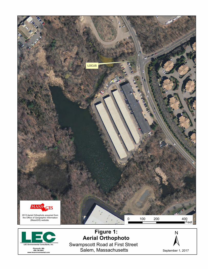
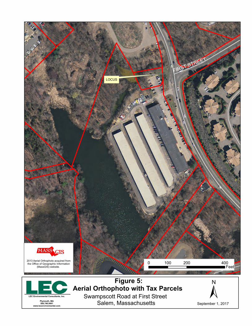
The intersection of Swampscott Road and First Street (Appendix A, Figure 1) is located
within southwest Salem, and is comprised mainly of impervious surface and previously
disturbed upland associated with the existing transportation infrastructure. First Street
intersects with Swampscott Road from the east, forming a three-way intersection.
Swampscott Road travels in a north to south orientation and has right-of-way through the
intersection, with a one-way stop sign demarcating the termination of First Street at the
intersection. Swampscott Road and First Street are both undivided public roadways with
one lane of travel in each direction. North of the intersection, Swampscott Road turns
slightly towards the west as it approaches Route 107/Highland Avenue. Topography is
generally flat throughout the project footprint, with steep slopes descending into the
surrounding wetland areas.
A degraded pedestrian crosswalk is located along the southern edge of the intersection,
connecting a parking lot at 36 Swampscott Road to the sidewalk on the southeast corner
of the intersection. To the west of the intersection, a driveway extends to the commercial
property at 36-52 Swampscott Road (Appendix A, Figure 5). A curbed concrete platform
containing a utility pole protected by four crash dampening devices is located between
the driveway and Swampscott Road.
The project footprint is bordered on its northwestern edge by a City-owned transfer
station which is protected by a chain link fence along the property line. To the southwest
lies the above-referenced commercial development and parking area. The transfer station
and commercial development are bounded by steep embankments along the Forest River,
located to the west. An unnamed intermittent stream and fringing Bordering Vegetated
Wetland (BVW) extends between the transfer station and the commercial development,
topographically separating the developments. To the southeast of the intersection, the
Swampscott Road sidewalk adjoins a manicured lawn which extends along the toe of a
steep armored embankment supporting a condominium development located on
Notice of Intent Application Swampscott Road at First Street Roundabout Construction Project
Salem, Massachusetts
Page 3 of 10
PLYMOUTH, MA WAKEFIELD, MA WORCESTER, MA RINDGE, NH
Cavendish Circle. To the northeast of the intersection, undeveloped property exists, with
a steep and descending vegetated slope that extends into a BVW and a forested upland
area. Vegetation within the forested area primarily consists of red maple (Acer rubrum),
tree of heaven (Ailanthus altissima), shagbark hickory (Carya ovata), smooth sumac
(Rhus glabra), Japanese knotweed (Fallopia japonica), and multiflora rose (Rosa
multiflora).
As noted above, two watercourses are present in the vicinity of the project footprint. The
Forest River is a perennial stream that flows north to south to the west of the project
footprint, and an intermittent stream flows into the Forest River northwest of the
intersection as further described in Section 4.2 below.
Two BVWs were identified in the vicinity of the project footprint. One BVW is located
along the northeast corner of the intersection and receives stormwater drainage from
Swampscott Road and First Street via a constructed vertical headwall containing two
culvert outlets. A culvert underneath Swampscott Road provides a hydrological
connection from the northeasterly BVW to a second BVW along the northwest corner of
the intersection. The BVWs are further described in Section 4.1 below.
According to the Essex County Soil Survey, soils surrounding the project footprint are
generally mapped as Chatfield-Hollis-Rock outcrop complex. The presence of these soils
was confirmed during our site evaluation. However, the surrounding steep slopes
appeared to contain substantial amounts of other solid waste and historic fill associated
with development in this area which has existed for many decades.
2.1 Floodplain Designation
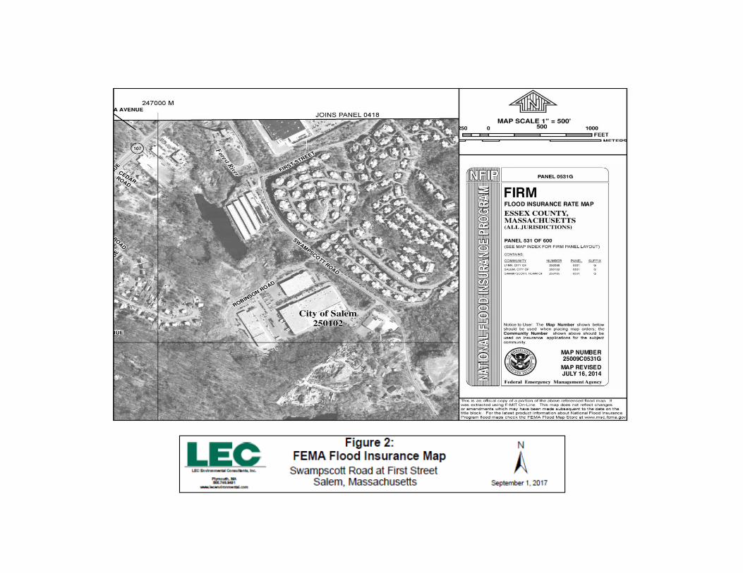
According to the Federal Emergency Management Agency Flood Insurance Rate Maps
for the Essex County, Massachusetts, (Panel: 25009C0531G), dated July 16, 2014, the
aforementioned site exists within an area mapped as Zone X (Unshaded) – Areas
determined to be outside the 0.2% annual chance floodplain.
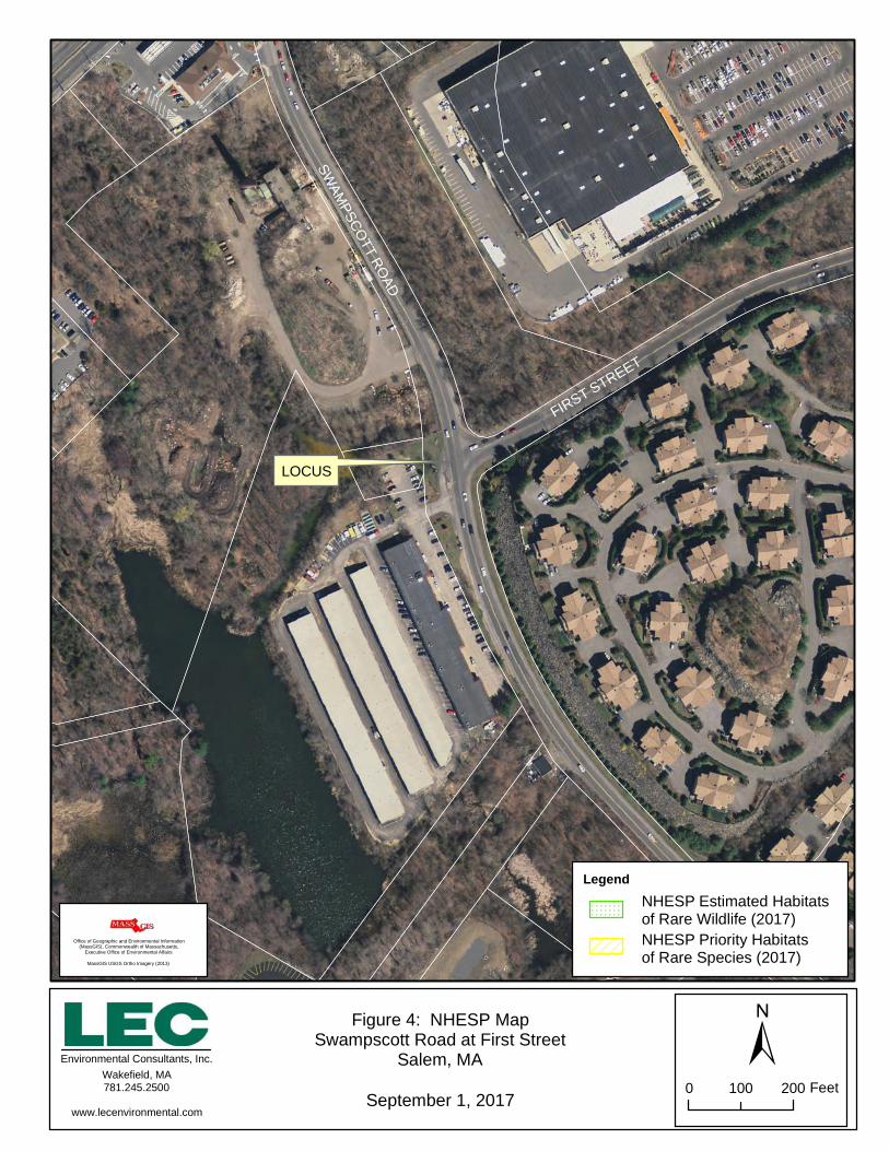
2.2 Massachusetts Natural Heritage & Endangered Species Program Designation
According to the 14th edition of the Massachusetts Natural Heritage Atlas (effective
August 1, 2017) published by the Natural Heritage & Endangered Species Program
(NHESP), the project site does not occur within an Estimated Habitat of Rare Wildlife or
Priority Habitat of Rare Species. No Certified or Potential Vernal Pools occur within the
vicinity of the project site.
Notice of Intent Application Swampscott Road at First Street Roundabout Construction Project
Salem, Massachusetts
Page 4 of 10
PLYMOUTH, MA WAKEFIELD, MA WORCESTER, MA RINDGE, NH
3. Wetland Boundary Determination Methodology
On June 8, 2017 and July 26, 2017, LEC conducted a site evaluation to identify and
characterize existing protectable Wetland Resource Areas located on or immediately
adjacent to the project footprint. Bordering Vegetated Wetland (BVW) boundaries were
determined through observations of the existing plant communities, using the "fifty
percent criteria" to determine dominance of wetland/upland vegetation, the interpretation
of soil characteristics, and other indicators of wetland hydrology in accordance with the
Massachusetts Department of Environmental Protection (MADEP) handbook,
Delineating Bordering Vegetated Wetlands under the Massachusetts Wetlands Protection
Act (March 1995), the Field Indicators for Identifying Hydric Soils in New England
(April, 2004), and the criteria set forth in 310 CMR 10.55.
The boundaries of the BVW were demarcated in the field with blaze orange, surveyor’s
flagging tape embossed with the words “LEC Resource Area Boundary” in bold, black
print. Wetland flags associated with the BVW were survey-located and are numbered
and demarcated on the Plans. The boundaries of each BVW were labeled as follows:
BVW 1 through BVW 10
BVW 100 through BVW 111
The Bank/Mean Annual High-Water line associated with the Forest River was
approximated to be coincident with wetland flag 111 and then extending northwest and
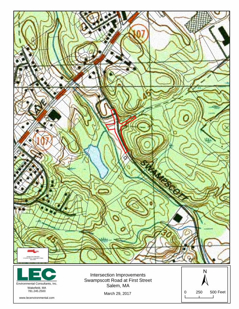
southwest and away from the project footprint. According to the USGS Map (Appendix
A, Figure 3) and confirmed during our Wetland Resource Area delineation, an unnamed
intermittent stream is present along the northern edge of the intersection and functions as
a tributary to the Forest River. Although there was no flow or evidence of pronounced
channelization, we conservatively presumed that the intermittent stream contains a low-
flow channel and the Bank generally coincides with the BVW boundary.
4. Wetland Resource Area Descriptions
Wetland Resource Areas located in the vicinity of the project include Bordering
Vegetated Wetland (BVW), Bank and Riverfront Area associated with the Forest River.
A brief description of each resource area is provided below.
Notice of Intent Application Swampscott Road at First Street Roundabout Construction Project
Salem, Massachusetts
Page 5 of 10
PLYMOUTH, MA WAKEFIELD, MA WORCESTER, MA RINDGE, NH
4.1 Bordering Vegetated Wetland
Bordering Vegetated Wetland (BVW) is defined at 310 CMR 10.55 (2) as freshwater
wetlands that border on creeks, rivers, streams, ponds and lakes. The types of freshwater
wetlands are wet meadows, marshes, swamps and bogs. Bordering Vegetated Wetlands
are areas where the soils are saturated and/or inundated such that they support a
predominance of wetland indicator plants. The boundary of Bordering Vegetated
Wetland is the line within which 50% or more of the vegetational community consists of
wetland indicator plants and saturated or inundated conditions exist.
As previously stated, the two Bordering Vegetated Wetlands (BVW) identified in
proximity to the site are presumed to be hydrologically connected and fringing upon an
intermittent stream channel and ultimately the Forest River, as depicted on the USGS
Map. The BVWs generally are dominated by similar plant communities consisting of
moderately dense canopies of red maple (Acer rubrum) with scattered patches of
common reed (Phragmites australius) and sparse ground cover consisting of skunk
cabbage (Symplocarpus foetidus) and cattail (Typha latifolla).
The BVW west of the intersection is surrounded on three sides by steep slopes and did
not appear to contain persistent surface water during the time of inspection. The BVW is
narrow and linear in shape (oriented east to west), measuring approximately 150 feet by
20 feet and adjoins the Forest River. The BVW northeast of the intersection is oblong in
shape, measuring approximately 100 feet by 50 feet. At the time of inspection on July
26, 2017, the BVW appeared to contain stagnant surface water no greater than
approximately 6 inches in depth.
4.2 Bank
Bank is defined in 310 CMR 10.54 (2) (c) as the first observable break in the slope or the
mean annual flood level, whichever is lower. The lower boundary of a Bank is the mean
annual low flow level.
Bank is defined in the City of Salem Wetlands Protection Ordinance (Salem Code
Chapter 50) as that part of land adjoining any body of water which confines the water.
According to the USGS Topographic Map (Appendix A, Figure 3) and verified in the
field, Bank is associated with two streams in proximity to the project footprint. The
unnamed intermittent stream which connects both above mentioned BVWs through a
culvert under Swampscott Road to the north of the intersection contains man-made
Notice of Intent Application Swampscott Road at First Street Roundabout Construction Project
Salem, Massachusetts
Page 6 of 10
PLYMOUTH, MA WAKEFIELD, MA WORCESTER, MA RINDGE, NH
Banks. At the time of inspection, the culvert appeared to be located significantly below
the existing ground surface. Although no flow was observed, it is presumed that the
Bank coincides with the boundary of the delineated BVWs.
The Bank of the Forest River also appears to be man-made and is confined by a sharp
break in the slope behind the city’s transfer station until its confluence with the unnamed
intermittent stream. At this location, the Bank appears to be less defined or at least less
visible due to the ponded water. However, a steep embankment was visible under water,
which appeared to confine the Forest River’s flow during low flow conditions. The river
transitions back to a steeply sloped Bank comprised of a constructed rip-rap revetment
near the self-storage facility. The Bank of Forest River functions as the Mean Annual
High Water (MAHW) line for the purposes of establishing the limits of Riverfront Area.
4.3 Riverfront Area
Riverfront Area is defined at 310 CMR 10.58 (2) as the area of land between a river’s
mean annual high-water line measured horizontally outward from the river and a
parallel line located 200 feet away, except that the parallel line is located 25 feet away in
Boston, Brockton, Cambridge, Chelsea, Everett, Fall River, Lawrence, Lowell, Malden,
New Bedford, Somerville, Springfield, Winthrop, and Worcester.
Riverfront Area is associated with the Forest River which flows parallel to Swampscott
Road to the west of the project, as described above. The Riverfront Area extends 200
feet from the Bank of the river and is encompassed by a mix of previously disturbed area
associated with the surrounding commercial, industrial, and transportation infrastructure.
As a result, the project footprint is confined primarily within Previously Developed
Riverfront Area, as per 310 CMR 10.58 (5).
5. Proposed Project
The Swampscott Road at First Street Roundabout Construction Project in Salem involves
reconstruction of the existing intersection and surrounding infrastructure to improve
traffic safety, improve pedestrian safety, provide visual mitigation, and enhance traffic
patterns. Proposed construction activities include the following:
Notice of Intent Application Swampscott Road at First Street Roundabout Construction Project
Salem, Massachusetts
Page 7 of 10
PLYMOUTH, MA WAKEFIELD, MA WORCESTER, MA RINDGE, NH
Reconstruction of the intersection from its current three-way design to a
roundabout design with associated grading and landscaping to create four
congruent points of ingress and egress. Additional components include:
- Proposed landscaped center island within the roundabout encompassed
by a concrete truck apron.
- Crosswalk establishment and revitalization to the south and east of the
intersection. The proposed crosswalks would be equipped with
wheelchair ramps to allow for safe access on and off the curbed
sidewalks.
- Minor roadway widening to accommodate for flared entrance/exit to the
roundabout (also intended to improve safety by reducing visual
obstructions while entering/exiting the intersection).
- Proposed cement barriers around the island safely demarcating/dividing
the travel lanes of each path of travel.
- Improved signage within the intersection.
- Relocation of utilities.
Expansion of the existing parking lot at 36 Swampscott Road towards the north
and south in order to maintain the number of current parking spaces and
accommodate the new driveway location.
Proposed activity is further detailed in the Swampscott Road at First Street Roundabout
Construction Plans (attached). Although construction timing and construction “means
and method” sequencing is subject to change, it is anticipated that construction will begin
in the Fall of 2017 and be completed in Fall of 2018. Prior to construction, utility
removal and relocation will be completed by National Grid. Upon mobilization, it is
anticipated that erosion controls will be installed to protect adjacent wetland resource
areas (see attached Plans) and to demarcate the limit of work. Upon installation of
erosion controls, intersection improvements/reconstruction will commence utilizing an
approved traffic management plan. Restoration will occur after construction is complete
and will include stabilization and repair of temporarily disturbed areas to their original
condition. Lastly, sediment and erosion controls will be removed from the site.
Notice of Intent Application Swampscott Road at First Street Roundabout Construction Project
Salem, Massachusetts
Page 8 of 10
PLYMOUTH, MA WAKEFIELD, MA WORCESTER, MA RINDGE, NH
As noted above, the proposed project will involve temporary and permanent disturbance
to the 100-foot Buffer Zone to BVW, Bank, and also the 200-foot Riverfront Area
associated with the Forest River as follows:
100-foot Buffer Zone BVW/Bank: 26,337 square feet of temporary disturbance
and 4,281 square feet of permanent disturbance.
Riverfront Area: 14,721 square feet of temporary disturbance and 3,153 square
feet of permanent disturbance. The project footprint is primarily located within
previously developed Riverfront Area.
- Within 0 – 100 feet: 332 square feet of temporary disturbance and 595
square feet of permanent disturbance.
- Within 100 – 200 feet: 14,389 square feet of temporary disturbance and
2,558 square feet of permanent disturbance.
6. Mitigation Measures
6.1 Stormwater Management/Sedimentation and Erosion Control
The Stormwater Management System for the proposed project has been designed to
include structural Best Management Practices (BMPs) in order to comply with the DEP’s
Stormwater Management Guidance and Performance Standards at 310 CMR 10.05 (6)
(k). The existing stormwater management facilities within the project footprint are
comprised of a closed drainage system consisting of man holes, catch basins, and piping.
Where applicable, the proposed project includes retrofitting the existing drainage system
by relocating, adjusting or construction of new deep sump/hooded catch basins, piping,
and drainage manholes. Additional information regarding proposed improvements to the
existing drainage system are identified on the Plans and within the Stormwater
Management Memorandum, prepared by Stantec and dated September 2017 (attached).
An erosion control program will be implemented to protect the adjacent Wetland
Resource Areas from sedimentation during the proposed construction activities. Erosion
controls will be installed to demarcate the limit of work and provide additional assurance
that construction equipment will not further intrude beyond the limits of proposed work
to protectable Wetland Resource Areas. All barriers will remain in place until disturbed
areas are stabilized with vegetation. Erosion controls will be installed prior to
Notice of Intent Application Swampscott Road at First Street Roundabout Construction Project
Salem, Massachusetts
Page 9 of 10
PLYMOUTH, MA WAKEFIELD, MA WORCESTER, MA RINDGE, NH
construction and inspected/maintained for the entirety of the project until vegetated
stabilization is achieved. Furthermore, for the duration of the project, soil disturbances
will be limited to only that necessary to safely operate equipment and conduct proposed
reconstruction activity within the confines of the proposed limits of work.
7. Regulatory Compliance
The Regulations under the Act and the Ordinance enumerate several Performance
Standards for proposed work activities within 100-foot Buffer Zone and within
Riverfront Area; however, the Act includes a Limited Project provision [Section 10.53 (3)
(f) specific to correcting substandard intersections as described below. The City of Salem
Wetlands Protection Ordinance does not contain any regulations that substantially differ
from the state Regulations; therefore, the following analysis of the state Regulations is
applicable to permitting the project under the Ordinance as well.
7.1 Massachusetts Wetlands Protection Act Regulations
According to 310 CMR 10.53 (3), “… the Issuing Authority may issue an Order of
Conditions and impose such conditions as will contribute to the interests identified in
M.G.L. c. 131, § 40 permitting the following limited projects (although no such project may
be permitted which will have any adverse effect on specified habitat sites of Rare Species.
According to 310 CMR 10.53 (3) (f), “…Maintenance and improvement of existing
public roadways, but limited to widening less than a single lane, adding shoulders,
correcting substandard intersections, and improving inadequate drainage systems.
Buffer Zone and Riverfront Area disturbances may be permitted under the above Limited
Project provision for the improvement of existing roadways and correcting of
substandard intersections, such as the Swampscott Road/First Street intersection. The
proposed reconstructed intersection, which will improve the existing roadway, is limited
to widening less than a single lane and involves improvements to the existing drainage
systems, as described above. As noted above, the project is not proposed within any
Priority Habitat for Rare Species and therefore no adverse effects are anticipated to
specific habitat sites of Rare Species.
Notice of Intent Application Swampscott Road at First Street Roundabout Construction Project
Salem, Massachusetts
Page 10 of 10
PLYMOUTH, MA WAKEFIELD, MA WORCESTER, MA RINDGE, NH
8. Summary
On behalf of the Applicant, the City of Salem, LEC is submitting this NOI Application to
construct the Swampscott Road at First Street Roundabout Construction Project.
Portions of the proposed work will occur within the 100-foot Buffer Zone to BVW and
Bank. The project also involves temporary and permanent disturbances within the
Riverfront Area associated with the Forest River but qualifies as a Limited Project and
has been designed by Stantec, in collaboration with the City of Salem and LEC, to
achieve compliance with the Massachusetts Wetlands Protection Act (M.G.L. c. 131, s.
40), its implementing Regulations (310 CMR 10.00), and the City of Salem Wetlands
Protection Ordinance (Salem Code Chapter 50).
Literature Referenced
PLYMOUTH, MA WAKEFIELD, MA WORCESTER, MA RINDGE, NH
Massachusetts Department of Environmental Protection - Division of Wetlands and
Waterways, Delineating Bordering Vegetated Wetlands Under the Massachusetts
Wetlands Protection Act, A Handbook, dated 1995.
Massachusetts Natural Heritage and Endangered Species Program Atlas of Estimated
Habitat of State-listed Rare Wetlands Wildlife. Natural Heritage & Endangered Species
Program, Massachusetts Division of Fisheries & Wildlife, Route 135, Westborough, MA
01581, www.state.ma.us/dfwele/dfw
Massachusetts Wetlands Protection Act (M.G.L. c. 131, §. 40), www.state.ma.us/dep
Massachusetts Wetlands Protection Act Regulations (310 CMR 10.00),
www.state.ma.us/dep
City of Salem Wetlands Protection Ordinance (Salem Code Chapter 50).
National Flood Insurance Program, Federal Emergency Management Agency Flood
Insurance Rate Map
New England Hydric Soils Technical Committee. April 2004, 3rd ed., Field Indicators for
Identifying Hydric Soils in New England, New England Interstate Water Pollution
Control Commission, Wilmington, MA.
Reed, P.B. 1988. National List of Plant Species that Occur in Wetlands: 1988
Massachusetts. U.S. Department of the Interior, Fish and Wildlife Service. NERC-
88/18.21.
City of Salem GIS Database
Appendix A
Locus Maps
Figure 1: Aerial Orthophoto
Figure 2: FEMA Flood Insurance Map
Figure 3: USGS Topographic Quadrangle
Figure 4: NHESP Map
Figure 5: Aerial Orthophoto with Tax Parcels
LEC Environmental Consultants, Inc.
Plymouth, MA508.746.9491
www.lecenvironmental.com
Figure 1:Aerial Orthophoto ±Swampscott Road at First Street
Salem, Massachusetts September 1, 2017
0 200 400100Feet
LOCUS
2013 Aerial Orthophoto acquired from the Office of Geographic Information
(MassGIS) website.
<Double-click here to enter title>
Intersection ImprovementsSwampscott Road at First Street
Salem, MAMarch 29, 2017
Environmental Consultants, Inc.Wakefield, MA781.245.2500
www.lecenvironmental.com
±0 500250 Feet
Images from MassGIS1:25,000 USGS Topographic Maps
April 2001
<Double-click here to enter title>
Figure 4: NHESP MapSwampscott Road at First Street
Salem, MA
September 1, 2017
LOCUS
SWAM
PSCOTT RO
AD
FIRST STREET
Environmental Consultants, Inc.Wakefield, MA781.245.2500
www.lecenvironmental.com
±0 200100 Feet
Office of Geographic and Environmental Information(MassGIS), Commonwealth of Massachusetts,
Executive Office of Environmental Affairs
MassGIS USGS Ortho Imagery (2013)
NHESP Estimated Habitatsof Rare Wildlife (2017)NHESP Priority Habitatsof Rare Species (2017)
Legend
LEC Environmental Consultants, Inc.
Plymouth, MA508.746.9491
www.lecenvironmental.com
FIRST STR
EET
Figure 5:Aerial Orthophoto with Tax Parcels ±Swampscott Road at First Street
Salem, Massachusetts September 1, 2017
0 200 400100Feet
LOCUS
2013 Aerial Orthophoto acquired from the Office of Geographic Information
(MassGIS) website.