Embed Size (px)
Citation preview
Northern Virginia’s
Integrated Corridor Management (ICM)
Planning Effort for the East-West Travel Shed
Amy McElwain
September 22, 2016
ITS MARYLAND ANNUAL CONFERENCE
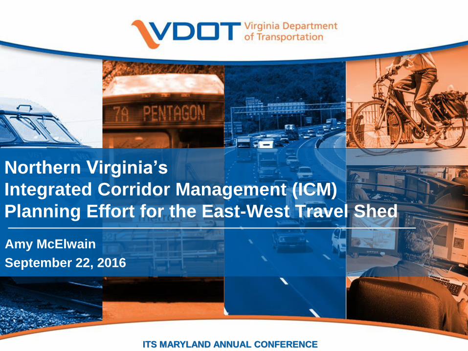
What is ICM to Virginia?
Choice for customers
Utilizing “all seats” (bus, train, car), all travel lanes, all parking, and
all modes in a corridor.
Coordinated Actions for Operators
The integrated, joint management of a multimodal transportation
system.2
It’s the freedom to move where you want to, when you want to, and how you want to
Lane / Facility Choice
Time of day choice
Route Choice
Mode choice
Destination choice
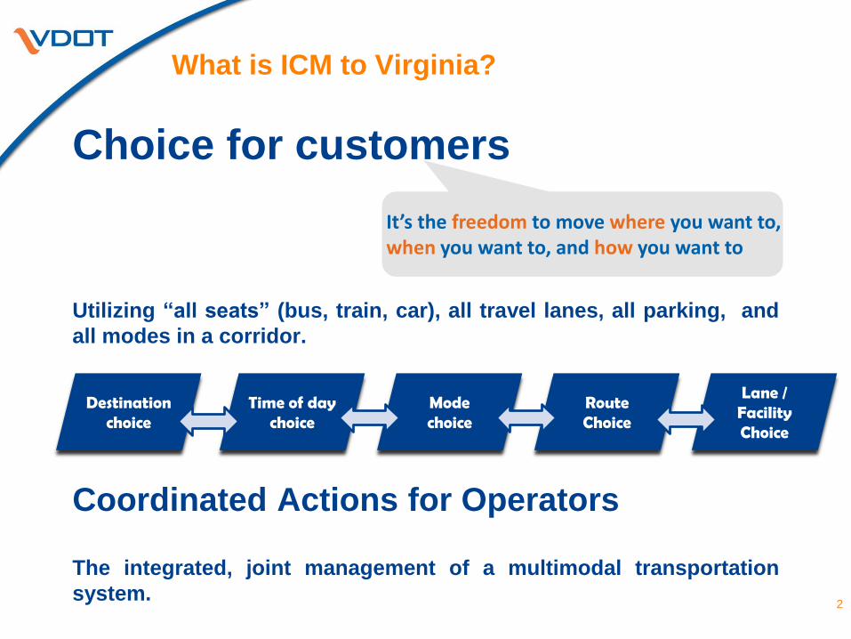
Why ICM?
3(Source: USDOT ICM Initiative)
ICM – A Paradigm Shift
• From moving vehicles to moving people and freight.
• From Individual Modes and Facilities to End-to-End Trips focusing on
multiple modes and connectivity.
• From Individual Jurisdictions to Multiple adopting a more balanced
approach meeting local, regional and national transportation needs.
• Intermodal - opportunities to structure freeway, arterial, and transit
operations where modes can work together and thrive in a corridor .
4
ICM – Virginia’s Approach
• Customer Focused
End-to-end trip planning with options
• Stakeholder-Driven
Multi-agency collaboration & coordination
• Technology-Enabled
Technology is the tool, not the goal
Make all travel options more attractive
• Performance-Based & with Targeted-Outcomes
Objective ways to ensure sustainability & appropriate investment
• Building Blocks
Don’t let the “perfect” be the enemy of “good”
Flexible and adaptabal to demonstrate early results
5
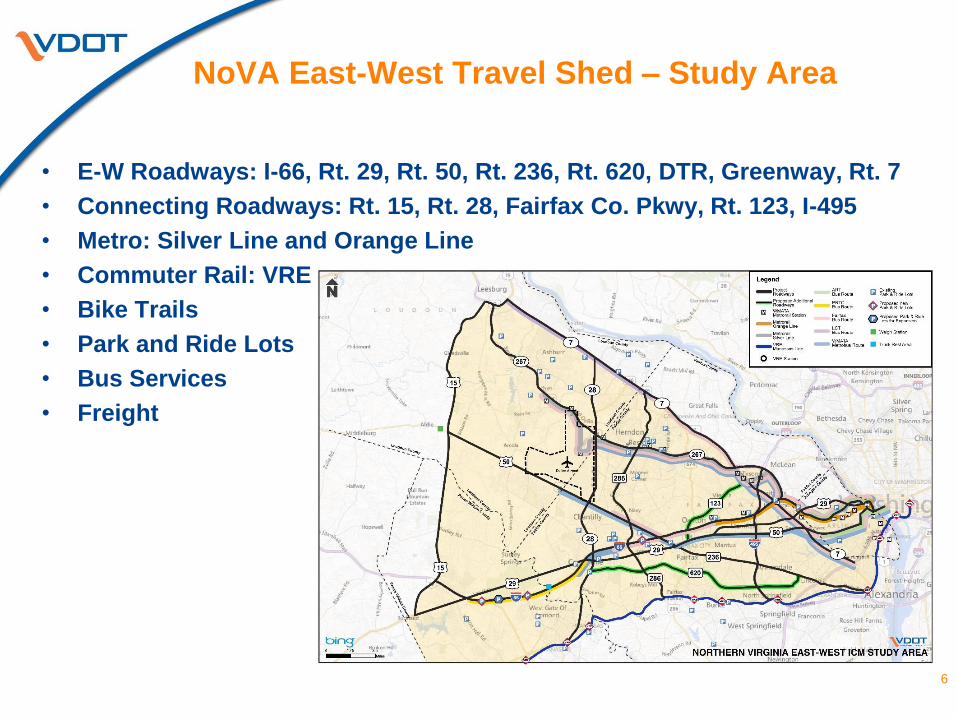
NoVA East-West Travel Shed – Study Area
6
• E-W Roadways: I-66, Rt. 29, Rt. 50, Rt. 236, Rt. 620, DTR, Greenway, Rt. 7
• Connecting Roadways: Rt. 15, Rt. 28, Fairfax Co. Pkwy, Rt. 123, I-495
• Metro: Silver Line and Orange Line
• Commuter Rail: VRE
• Bike Trails
• Park and Ride Lots
• Bus Services
• Freight
7
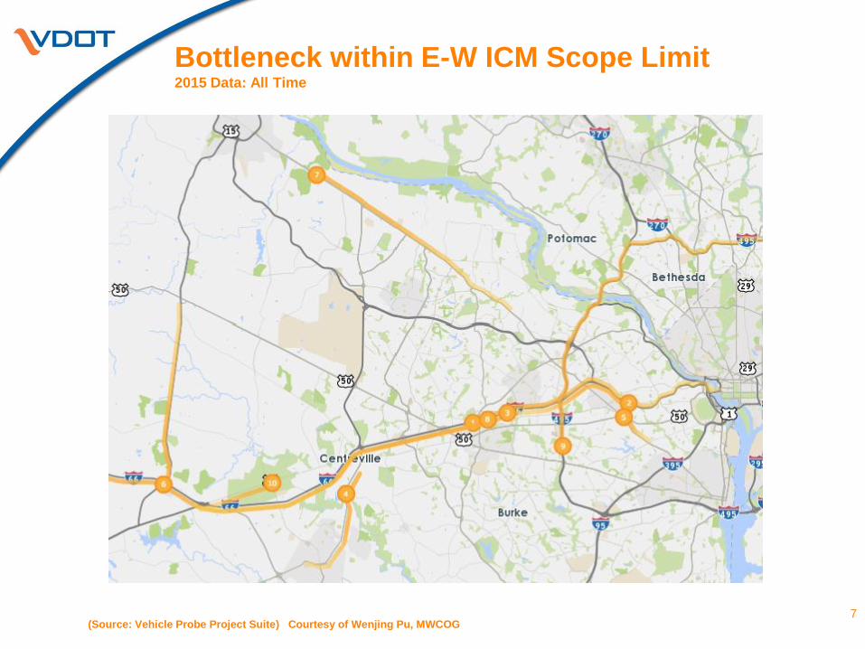
Bottleneck within E-W ICM Scope Limit2015 Data: All Time
(Source: Vehicle Probe Project Suite) Courtesy of Wenjing Pu, MWCOG
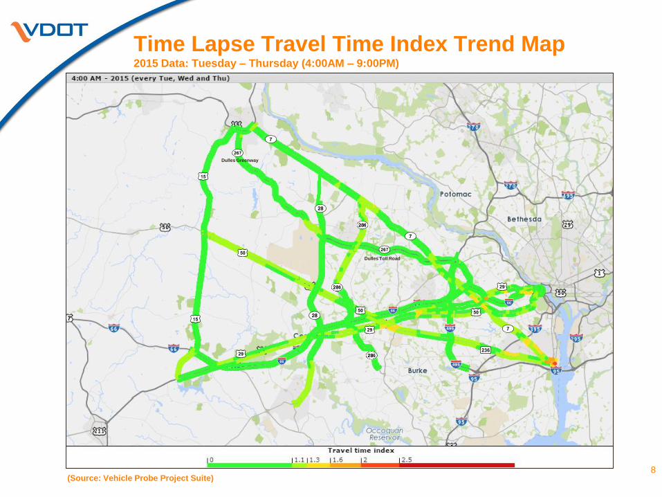
Time Lapse Travel Time Index Trend Map2015 Data: Tuesday – Thursday (4:00AM – 9:00PM)
8(Source: Vehicle Probe Project Suite)
Dulles Greenway
Dulles Toll Road
9
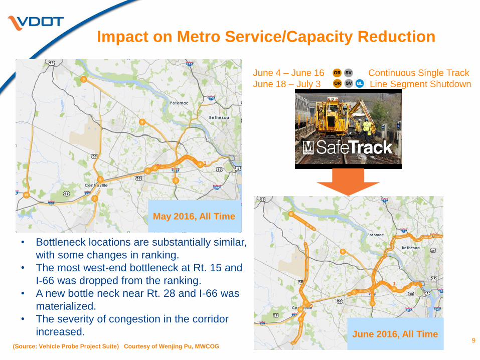
Impact on Metro Service/Capacity Reduction
• Bottleneck locations are substantially similar,
with some changes in ranking.
• The most west-end bottleneck at Rt. 15 and
I-66 was dropped from the ranking.
• A new bottle neck near Rt. 28 and I-66 was
materialized.
• The severity of congestion in the corridor
increased.
May 2016, All Time
(Source: Vehicle Probe Project Suite) Courtesy of Wenjing Pu, MWCOG
June 4 – June 16 Continuous Single Track
June 18 – July 3 Line Segment Shutdown
June 2016, All Time
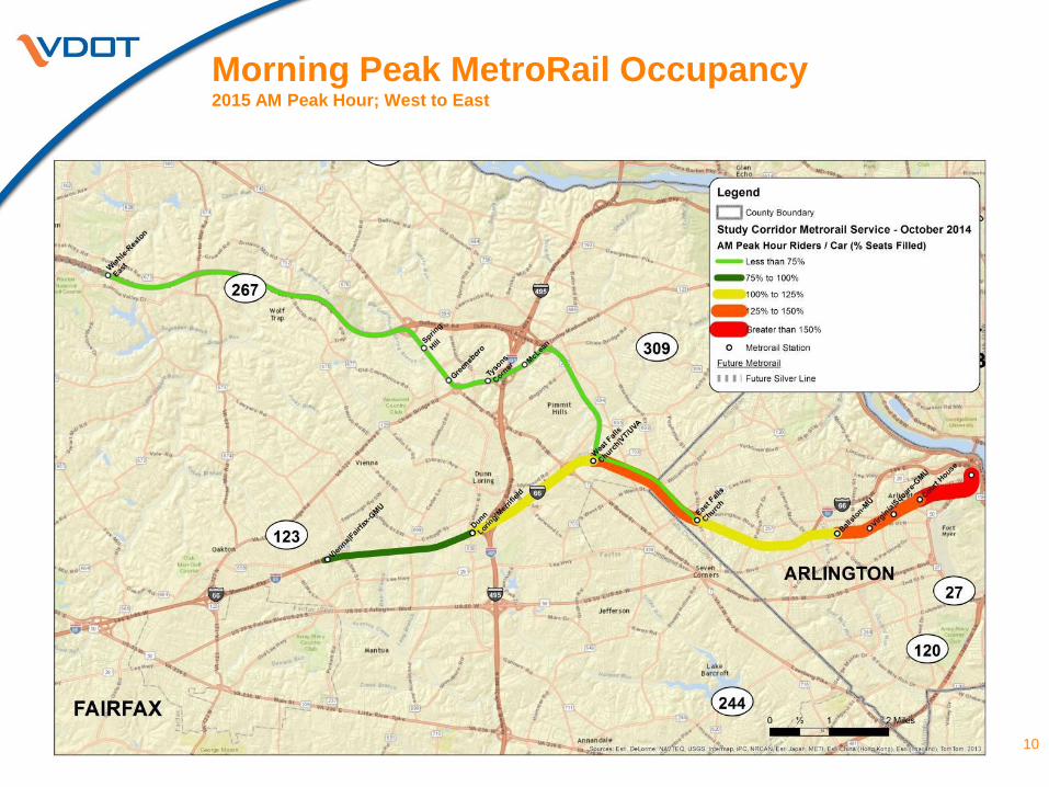
Morning Peak MetroRail Occupancy2015 AM Peak Hour; West to East
10
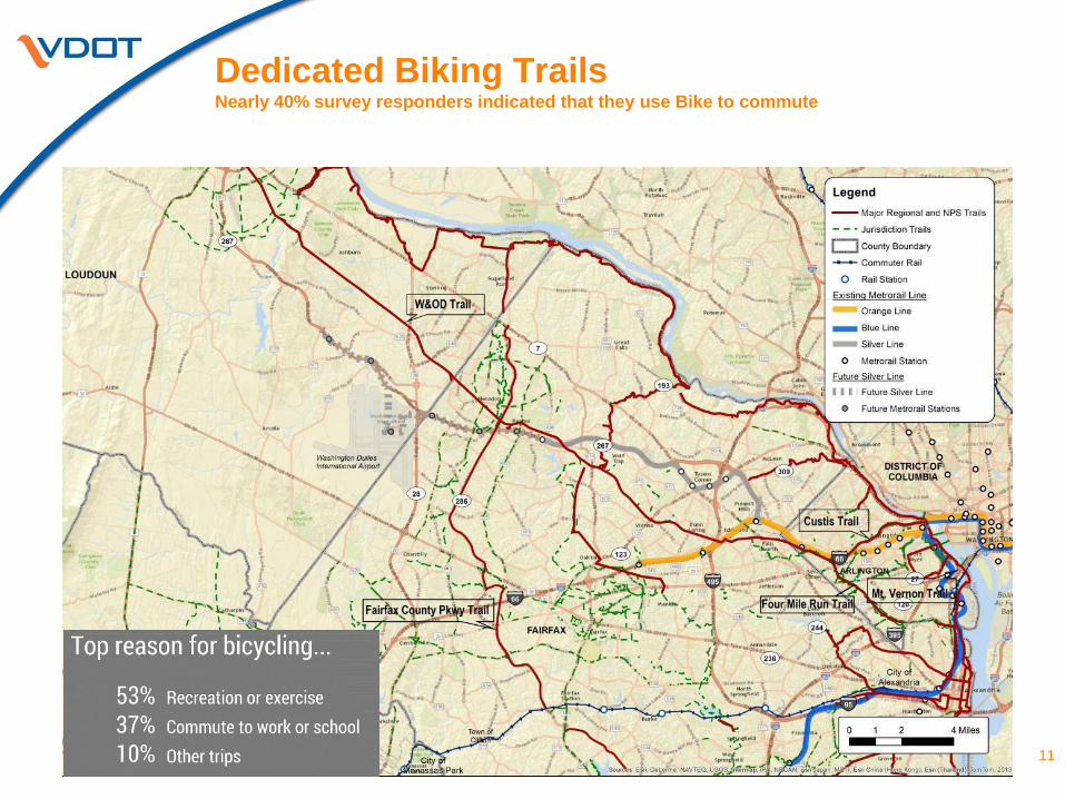
Dedicated Biking TrailsNearly 40% survey responders indicated that they use Bike to commute
11
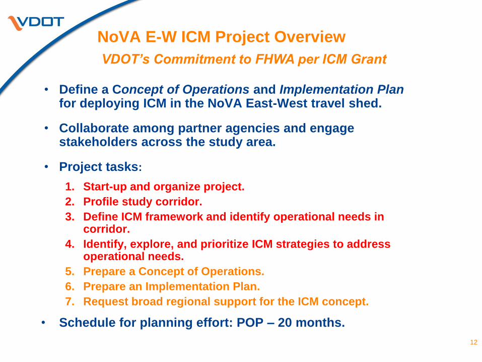
NoVA E-W ICM Project Overview
• Define a Concept of Operations and Implementation Plan for deploying ICM in the NoVA East-West travel shed.
• Collaborate among partner agencies and engage stakeholders across the study area.
• Project tasks:
1. Start-up and organize project.
2. Profile study corridor.
3. Define ICM framework and identify operational needs in corridor.
4. Identify, explore, and prioritize ICM strategies to address operational needs.
5. Prepare a Concept of Operations.
6. Prepare an Implementation Plan.
7. Request broad regional support for the ICM concept.
• Schedule for planning effort: POP – 20 months.
12
VDOT’s Commitment to FHWA per ICM Grant
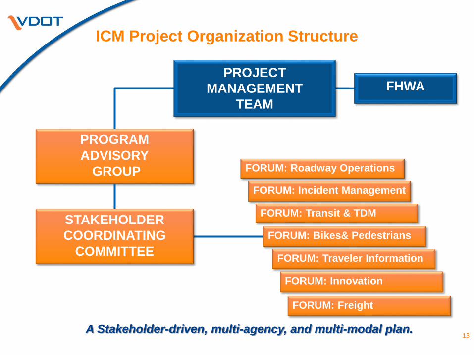
ICM Project Organization Structure
13
PROGRAM
ADVISORY
GROUP
STAKEHOLDER
COORDINATING
COMMITTEE
PROJECT
MANAGEMENT
TEAM
FHWA
A Stakeholder-driven, multi-agency, and multi-modal plan.
FORUM: Roadway Operations
FORUM: Incident Management
FORUM: Transit & TDM
FORUM: Bikes& Pedestrians
FORUM: Innovation
FORUM: Freight
FORUM: Traveler Information
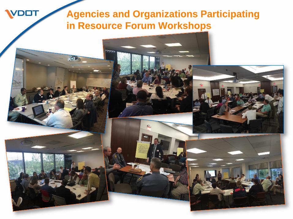
Agencies and Organizations Participating
in Resource Forum Workshops
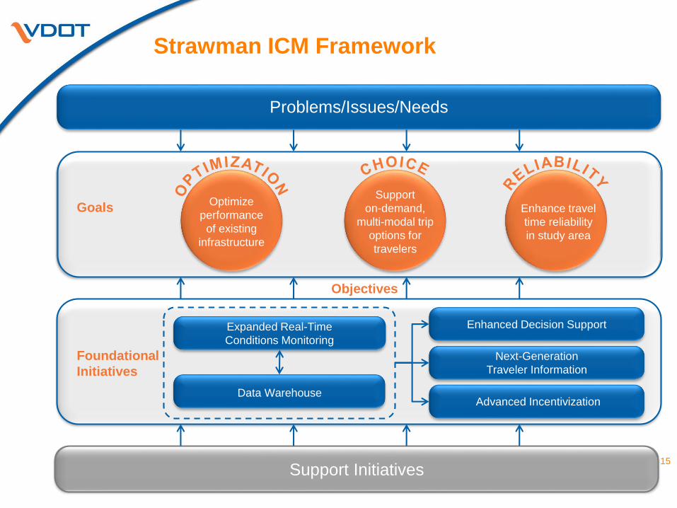
Strawman ICM Framework
Problems/Issues/Needs
Support Initiatives
Goals
Foundational
Initiatives
Optimize
performance
of existing
infrastructure
Support
on-demand,
multi-modal trip
options for
travelers
Enhance travel
time reliability
in study area
Expanded Real-Time
Conditions Monitoring
Data Warehouse
Enhanced Decision Support
Next-Generation
Traveler Information
Advanced Incentivization
Objectives
15
Challenges and Next Steps
Challenges
Identifying “pockets” of excess capacity on roads and transit
Lacking consistent arterial condition monitoring
Maintaining stakeholder involvement and commitment beyond the
planning phase
Next Steps
Refining the Corridor Profile
Developing the Concept of Operations
Gathering ConOps-related input from stakeholders
Preparing the Implementation Plans
16

Contact:
Amy Tang McElwain
Operations Project Administrator
Northern Region Operations (NRO)
Virginia Department of Transportation (VDOT)
703-259-1782