Embed Size (px)
Citation preview
North Korean Infiltration Tunnels
andClandestine Tunnel #4
Mark Lavin and J. David Rogers
OUTLINE
• The Korean War: 1950-1953
• Terrain and Geology • Tunnel Characteristics• Discovery• Military Significance• Conclusion
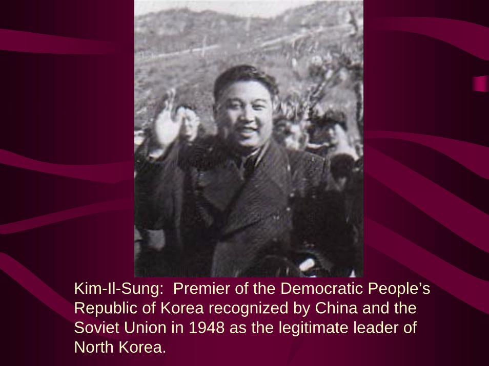
Kim-Il-Sung: Premier of the Democratic People’s Republic of Korea recognized by China and the Soviet Union in 1948 as the legitimate leader of North Korea.
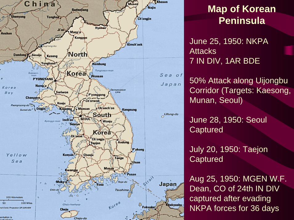
Map of Korean Peninsula
June 25, 1950: NKPA Attacks7 IN DIV, 1AR BDE
50% Attack along UijongbuCorridor (Targets: Kaesong, Munan, Seoul)
June 28, 1950: Seoul Captured
July 20, 1950: TaejonCaptured
Aug 25, 1950: MGEN W.F. Dean, CO of 24th IN DIV captured after evading NKPA forces for 36 days
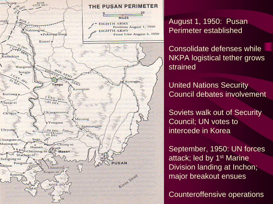
August 1, 1950: PusanPerimeter established
Consolidate defenses while NKPA logistical tether grows strained
United Nations Security Council debates involvement
Soviets walk out of Security Council; UN votes to intercede in Korea
September, 1950: UN forces attack; led by 1st Marine Division landing at Inchon; major breakout ensues
Counteroffensive operations
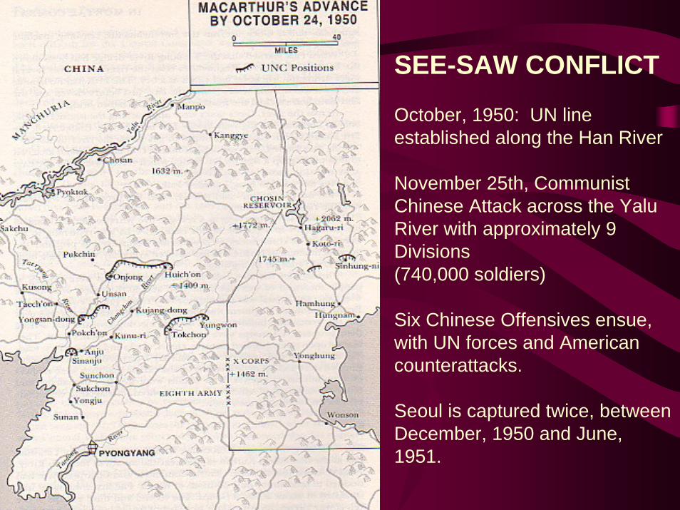
SEE-SAW CONFLICT
October, 1950: UN line established along the Han River
November 25th, Communist Chinese Attack across the YaluRiver with approximately 9 Divisions(740,000 soldiers)
Six Chinese Offensives ensue, with UN forces and American counterattacks.
Seoul is captured twice, between December, 1950 and June, 1951.
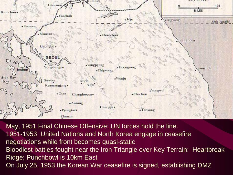
May, 1951 Final Chinese Offensive; UN forces hold the line. 1951-1953 United Nations and North Korea engage in ceasefire negotiations while front becomes quasi-staticBloodiest battles fought near the Iron Triangle over Key Terrain: Heartbreak Ridge; Punchbowl is 10km EastOn July 25, 1953 the Korean War ceasefire is signed, establishing DMZ
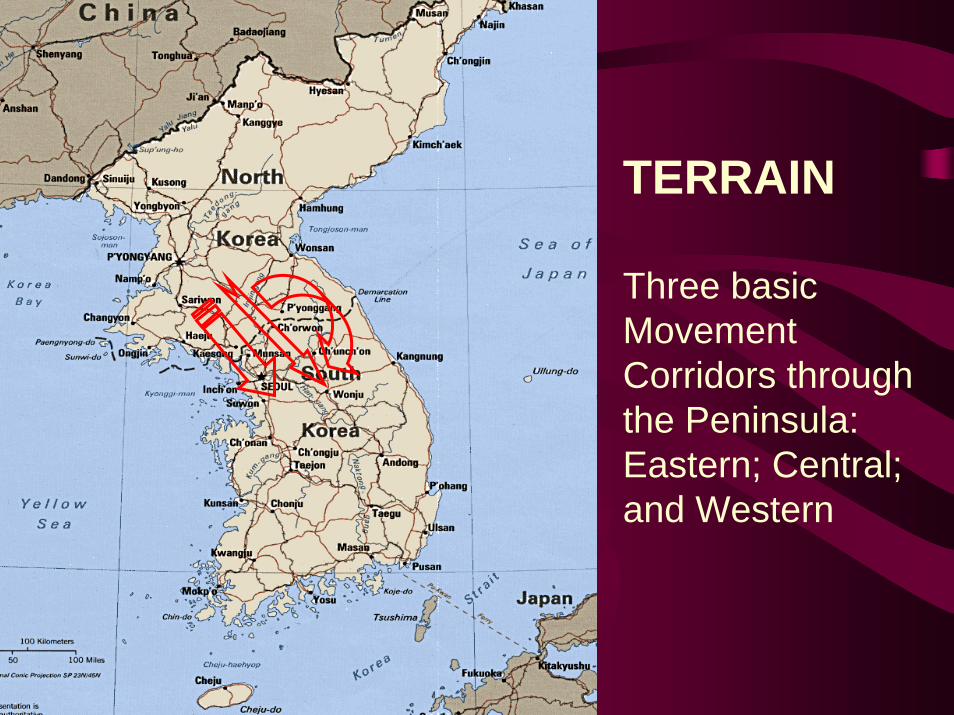
TERRAIN
Three basic Movement Corridors through the Peninsula:Eastern; Central; and Western
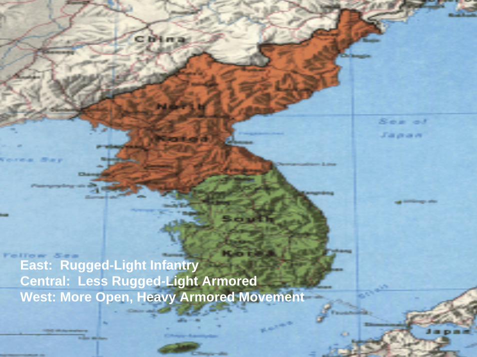
East: Rugged-Light Infantry Central: Less Rugged-Light ArmoredWest: More Open, Heavy Armored Movement
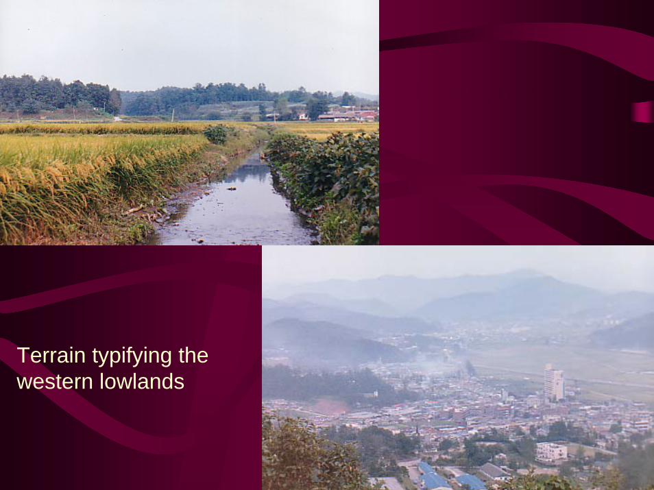
Terrain typifying the western lowlands
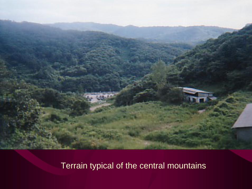
Terrain typical of the central mountains
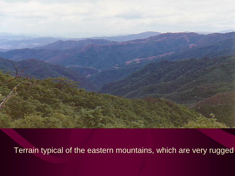
Terrain typical of the eastern mountains, which are very rugged
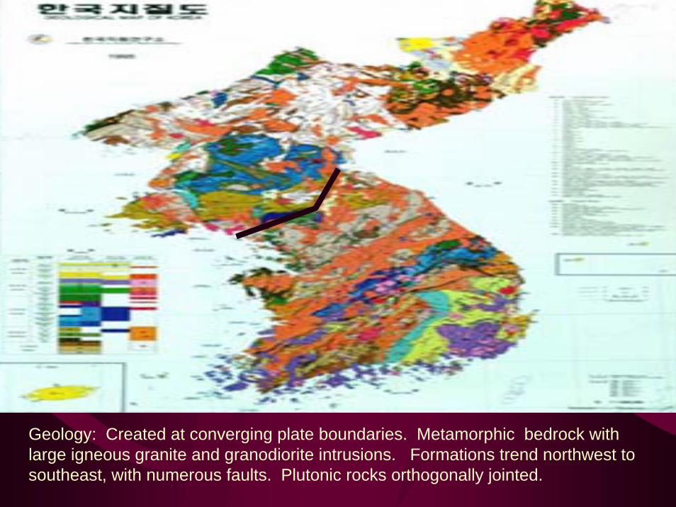
Geology: Created at converging plate boundaries. Metamorphic bedrock with large igneous granite and granodiorite intrusions. Formations trend northwest to southeast, with numerous faults. Plutonic rocks orthogonally jointed.
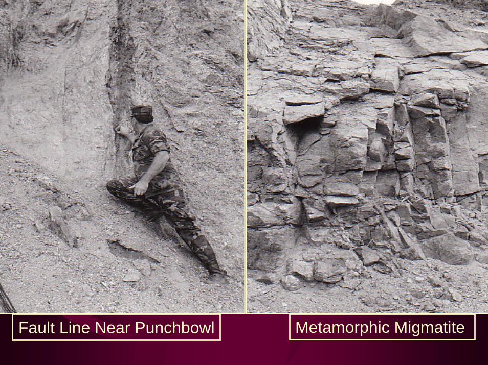
Metamorphic MigmatiteFault Line Near Punchbowl
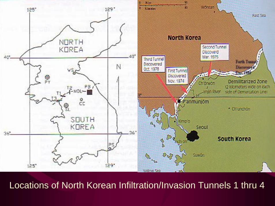
Locations of North Korean Infiltration/Invasion Tunnels 1 thru 4
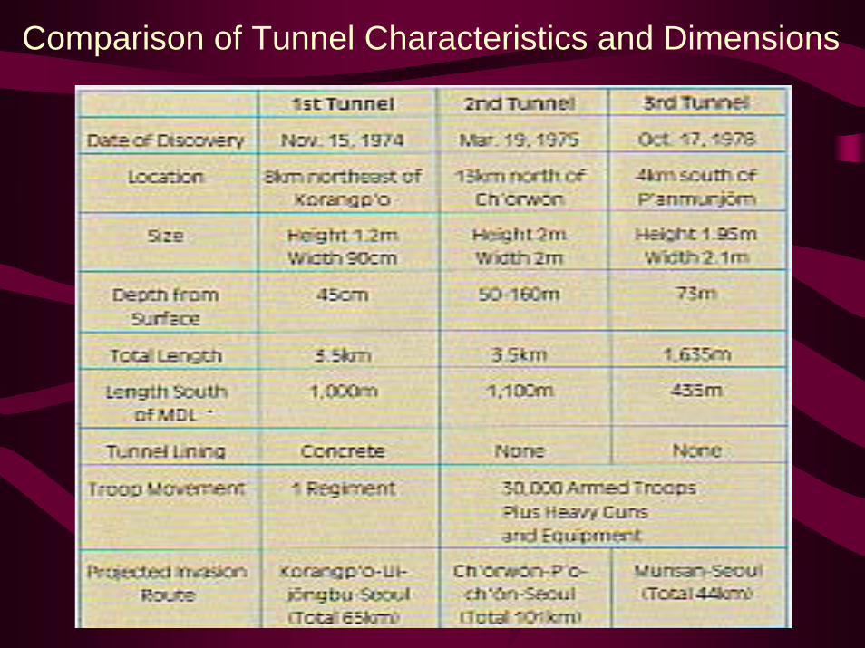
Comparison of Tunnel Characteristics and Dimensions
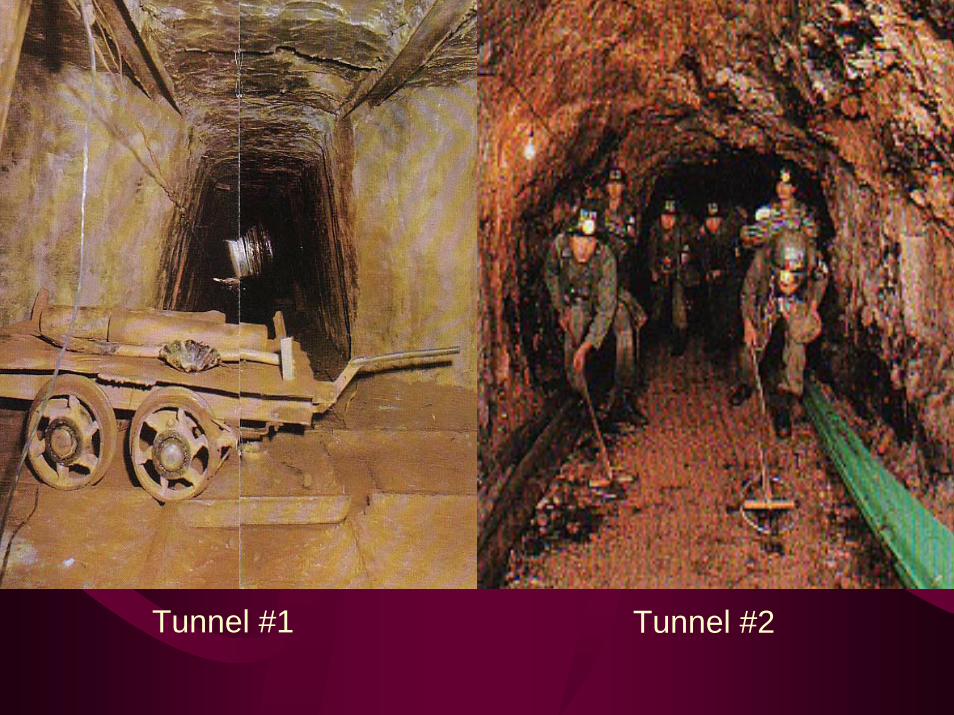
Tunnel #1 Tunnel #2
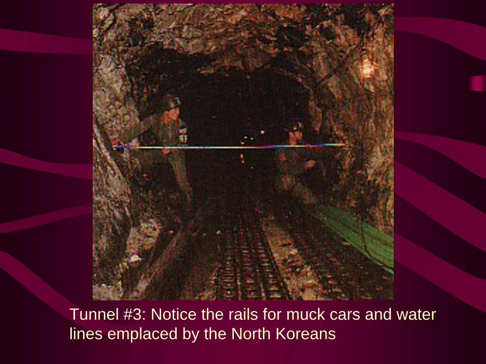
Tunnel #3: Notice the rails for muck cars and waterlines emplaced by the North Koreans
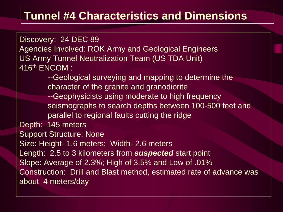
Tunnel #4 Characteristics and Dimensions
Discovery: 24 DEC 89Agencies Involved: ROK Army and Geological EngineersUS Army Tunnel Neutralization Team (US TDA Unit)416th ENCOM :
--Geological surveying and mapping to determine the character of the granite and granodiorite--Geophysicists using moderate to high frequency seismographs to search depths between 100-500 feet and parallel to regional faults cutting the ridge
Depth: 145 metersSupport Structure: NoneSize: Height- 1.6 meters; Width- 2.6 metersLength: 2.5 to 3 kilometers from suspected start pointSlope: Average of 2.3%; High of 3.5% and Low of .01%Construction: Drill and Blast method, estimated rate of advance was about 4 meters/day
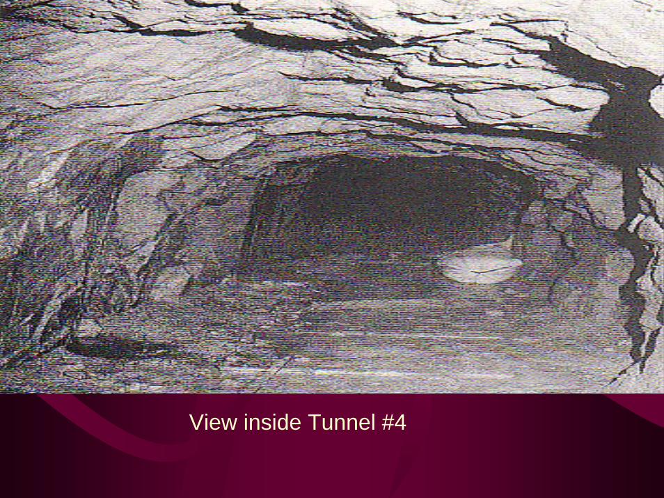
View inside Tunnel #4
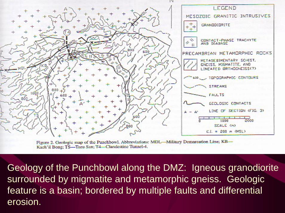
Geology of the Punchbowl along the DMZ: Igneous granodioritesurrounded by migmatite and metamorphic gneiss. Geologic feature is a basin; bordered by multiple faults and differentialerosion.
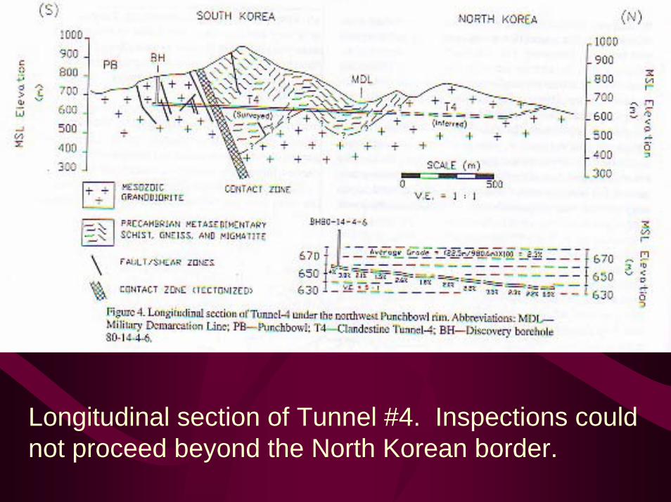
Longitudinal section of Tunnel #4. Inspections could not proceed beyond the North Korean border.
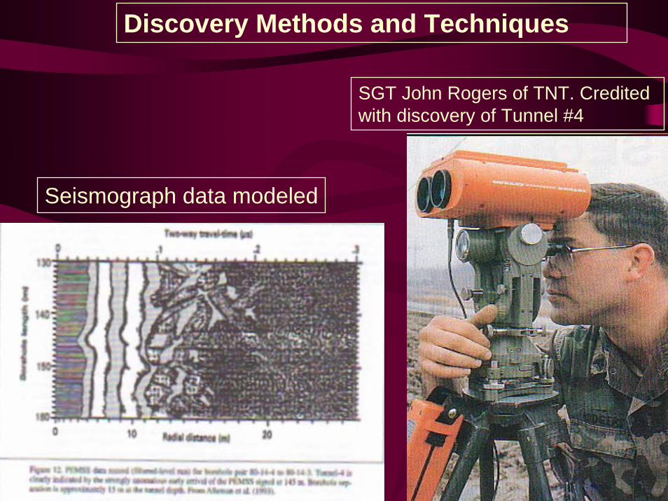
Discovery Methods and Techniques
SGT John Rogers of TNT. Credited with discovery of Tunnel #4
Seismograph data modeled
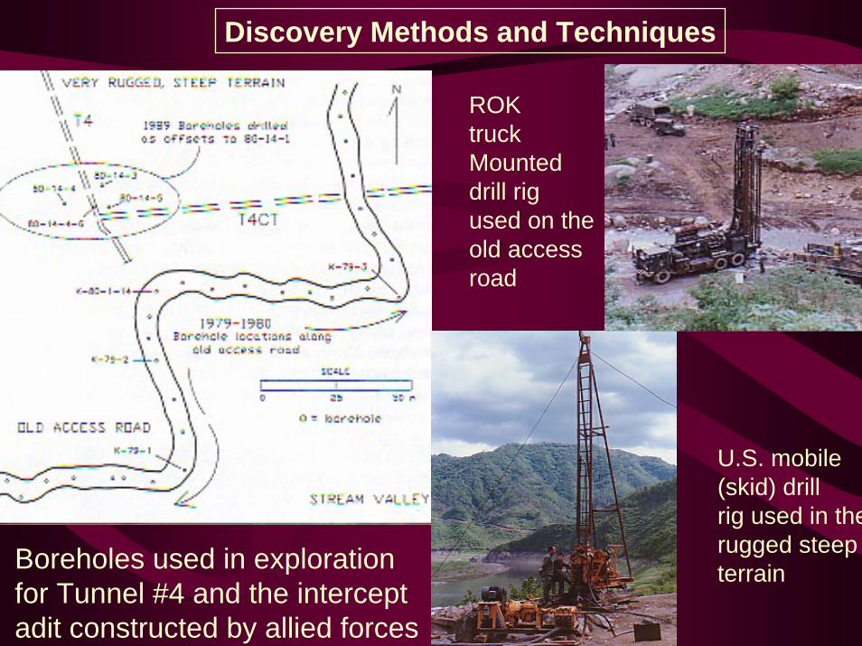
Discovery Methods and Techniques
ROK truckMounted drill rig used on the old access road
U.S. mobile (skid) drillrig used in therugged steep terrainBoreholes used in exploration
for Tunnel #4 and the intercept adit constructed by allied forces
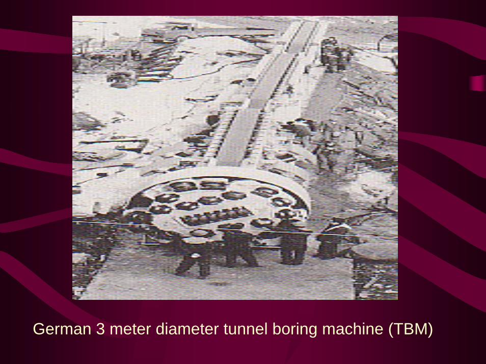
German 3 meter diameter tunnel boring machine (TBM)
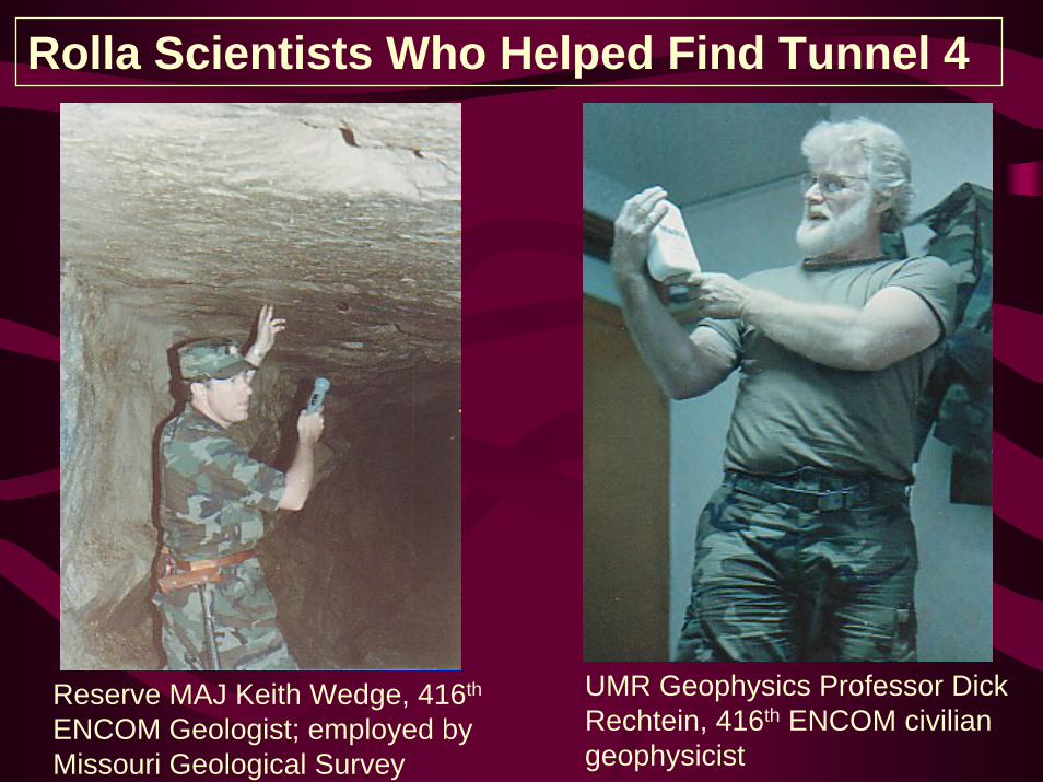
Rolla Scientists Who Helped Find Tunnel 4
UMR Geophysics Professor Dick Rechtein, 416th ENCOM civilian geophysicist
Reserve MAJ Keith Wedge, 416th
ENCOM Geologist; employed by Missouri Geological Survey
• BG Keith Wedge, Provided personal pictures and was interviewed by CPT Mark Lavin on 17OCT02.
• Cameron, C.P. “Clandestine Tunnel-4 Punchbowl, Korean Demilitarized Zone,” Military Geology in War and Peace Volume XIII, The Geological Society of America, Boulder, CO 1998 (pages 99-110.)
• Mehl, Thomas W. “Tunnel Neutralization Team,” KORUS Magazine, USFK May 1, 1990 (page 14.)
• Paschall, Rod, Witness to War: Korea, Berkley Publishing Company, New York, NY (1995)
• Toland, John. In Mortal Combat: Korea, 1950-1953, William Morrow Publishers (New York, NY 1991.)
• Various ROK Propaganda Pamphlets• http://www.fas.usda.gov• http://www.kigam.re
References