Embed Size (px)
Citation preview
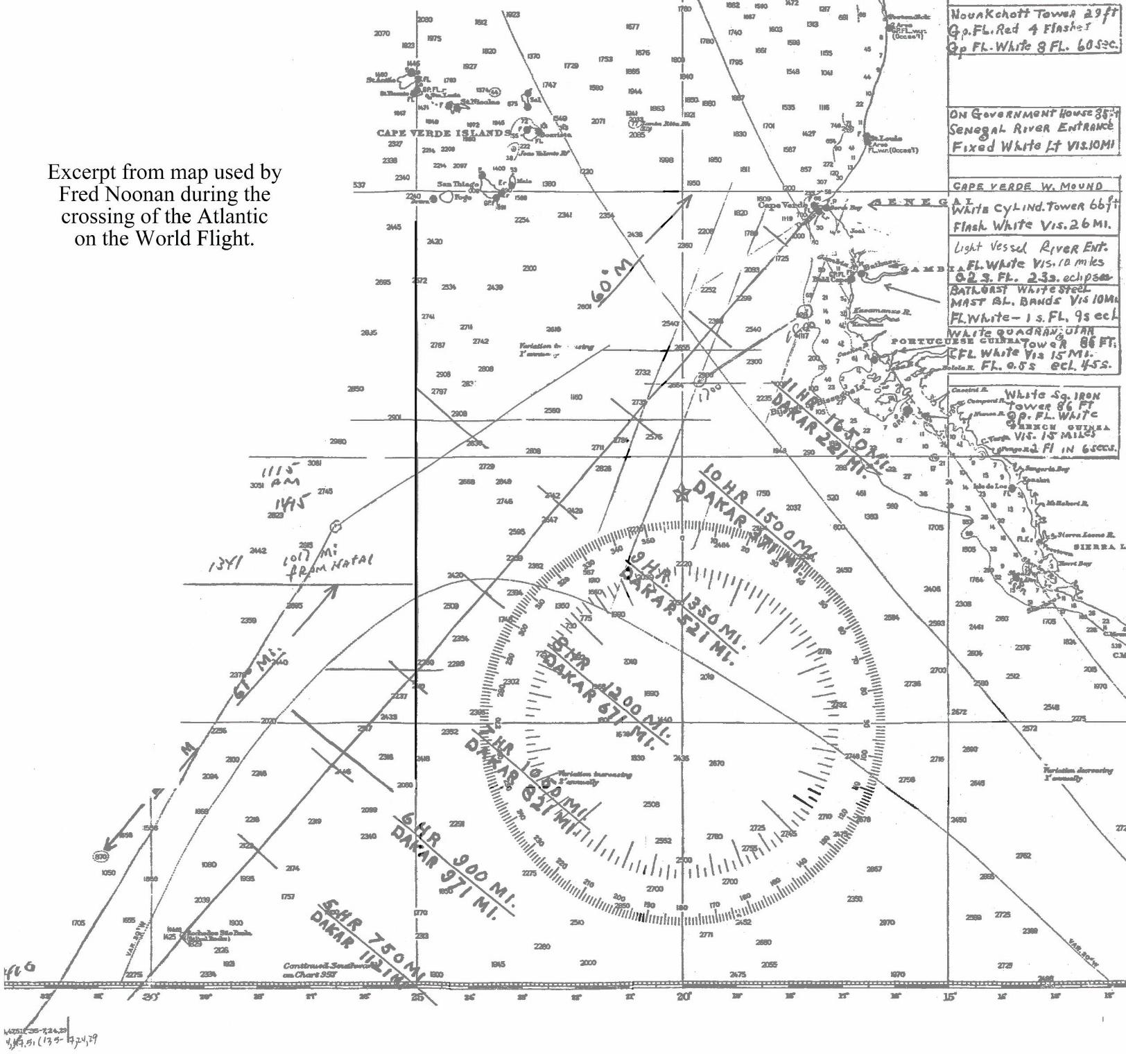
Noonan’s South Atlantic Chart.
This is a digitally restored image of the map Fred Noonan used on the flight from Natal, Brazil to St. Louis, Senegal, French West Africa on June 7, 1937. The original map was sent back to the U.S. later in the world flight and is now in the Purdue Earhart Collection at Purdue University in West Lafayette, Indiana.
The International Group for Historic Aircraft Recovery2812 Fawkes Drive · Wilmington, DE 19808 · USA
Voice 302.994.4410 · Fax 302.994.7945 · www.tighar.org · [email protected]