Embed Size (px)
Citation preview
EXECUTIVE SUMMARY FOR MHRWS
MOUNT HAMIGUITAN RANGE WILDLIFE SANCTUARY
MT. HAMIGUITANRANGE WILDLIFE SANCTUARY
Proposed Inscription to the UNESCO World Heritage List
VOLUME 1
EXECUTIVE SUMMARY
EXECUTIVE SUMMARY FOR MHRWS
MOUNT HAMIGUITAN RANGE WILDLIFE SANCTUARY
EXECUTIVE SUMMARY
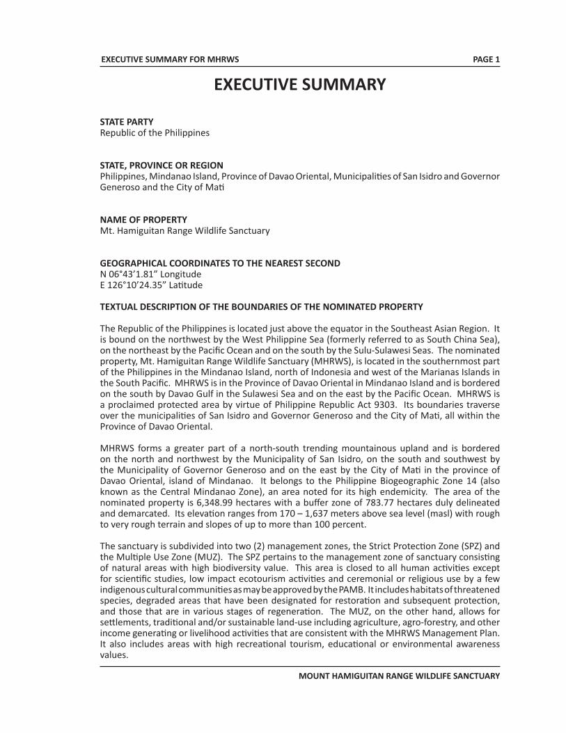
STATE PARTYRepublic of the Philippines
STATE, PROVINCE OR REGIONPhilippines, Mindanao Island, Province of Davao Oriental, Municipalities of San Isidro and Governor Generoso and the City of Mati
NAME OF PROPERTYMt. Hamiguitan Range Wildlife Sanctuary
GEOGRAPHICAL COORDINATES TO THE NEAREST SECONDN 06°43’1.81” LongitudeE 126°10’24.35” Latitude
TEXTUAL DESCRIPTION OF THE BOUNDARIES OF THE NOMINATED PROPERTY
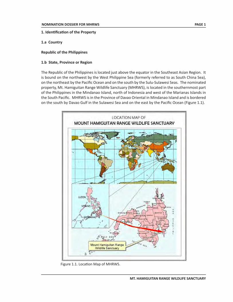
The Republic of the Philippines is located just above the equator in the Southeast Asian Region. It is bound on the northwest by the West Philippine Sea (formerly referred to as South China Sea), on the northeast by the Pacific Ocean and on the south by the Sulu-Sulawesi Seas. The nominated property, Mt. Hamiguitan Range Wildlife Sanctuary (MHRWS), is located in the southernmost part of the Philippines in the Mindanao Island, north of Indonesia and west of the Marianas Islands in the South Pacific. MHRWS is in the Province of Davao Oriental in Mindanao Island and is bordered on the south by Davao Gulf in the Sulawesi Sea and on the east by the Pacific Ocean. MHRWS is a proclaimed protected area by virtue of Philippine Republic Act 9303. Its boundaries traverse over the municipalities of San Isidro and Governor Generoso and the City of Mati, all within the Province of Davao Oriental.
MHRWS forms a greater part of a north-south trending mountainous upland and is bordered on the north and northwest by the Municipality of San Isidro, on the south and southwest by the Municipality of Governor Generoso and on the east by the City of Mati in the province of Davao Oriental, island of Mindanao. It belongs to the Philippine Biogeographic Zone 14 (also known as the Central Mindanao Zone), an area noted for its high endemicity. The area of the nominated property is 6,348.99 hectares with a buffer zone of 783.77 hectares duly delineated and demarcated. Its elevation ranges from 170 – 1,637 meters above sea level (masl) with rough to very rough terrain and slopes of up to more than 100 percent.
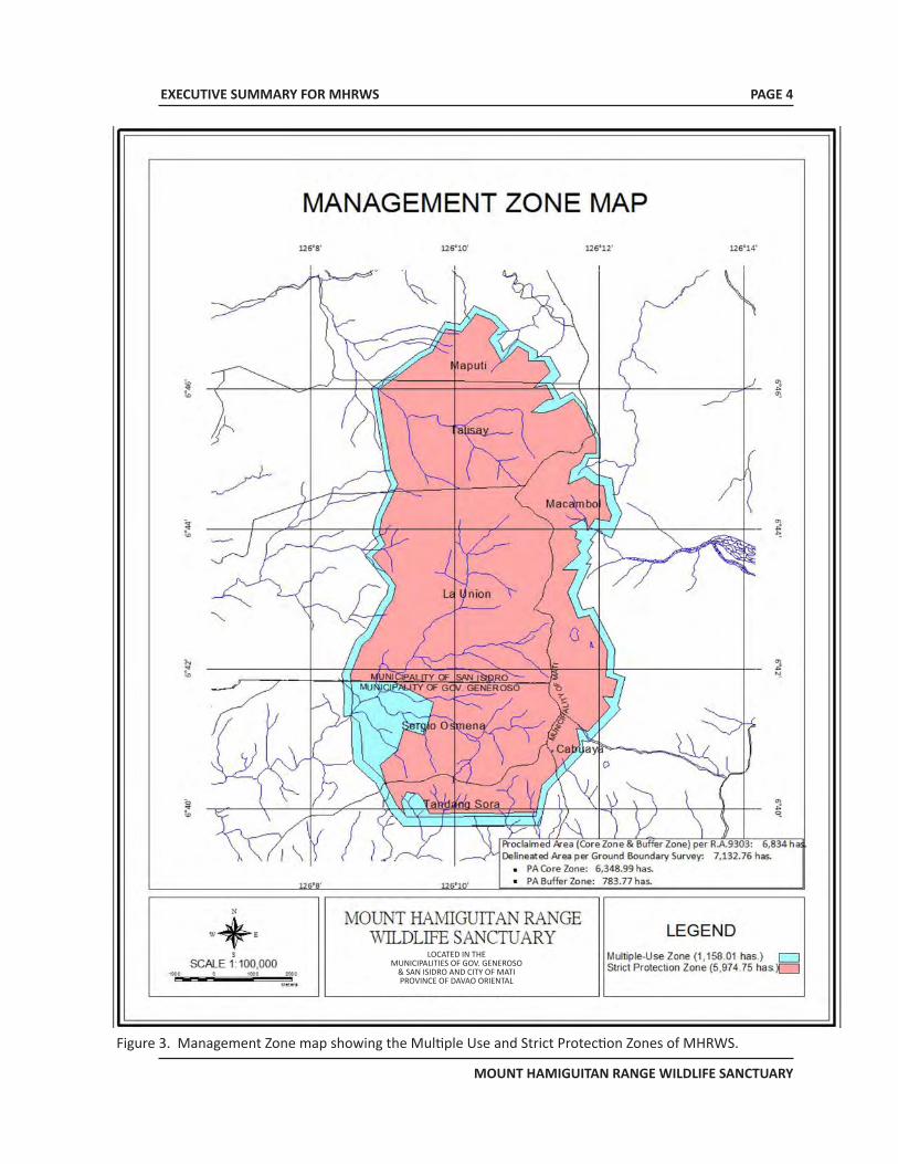
The sanctuary is subdivided into two (2) management zones, the Strict Protection Zone (SPZ) and the Multiple Use Zone (MUZ). The SPZ pertains to the management zone of sanctuary consisting of natural areas with high biodiversity value. This area is closed to all human activities except for scientific studies, low impact ecotourism activities and ceremonial or religious use by a few indigenous cultural communities as may be approved by the PAMB. It includes habitats of threatened species, degraded areas that have been designated for restoration and subsequent protection, and those that are in various stages of regeneration. The MUZ, on the other hand, allows for settlements, traditional and/or sustainable land-use including agriculture, agro-forestry, and other income generating or livelihood activities that are consistent with the MHRWS Management Plan. It also includes areas with high recreational tourism, educational or environmental awareness values.
PAGE 1
EXECUTIVE SUMMARY FOR MHRWS
MOUNT HAMIGUITAN RANGE WILDLIFE SANCTUARY
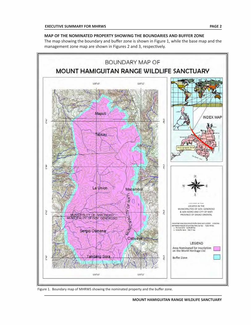
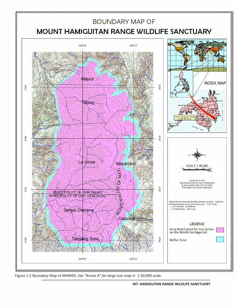
Figure 1. Boundary map of MHRWS showing the nominated property and the buffer zone.
MAP OF THE NOMINATED PROPERTY SHOWING THE BOUNDARIES AND BUFFER ZONEThe map showing the boundary and buffer zone is shown in Figure 1, while the base map and the management zone map are shown in Figures 2 and 3, respectively.
PAGE 2
LOCATED IN THEMUNICIPALITIES OF GOV. GENEROSO
& SAN ISIDRO AND CITY OF MATIPROVINCE OF DAVAO ORIENTAL
EXECUTIVE SUMMARY FOR MHRWS
MOUNT HAMIGUITAN RANGE WILDLIFE SANCTUARY
PAGE 3
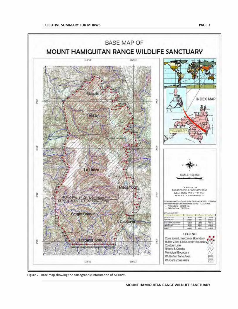
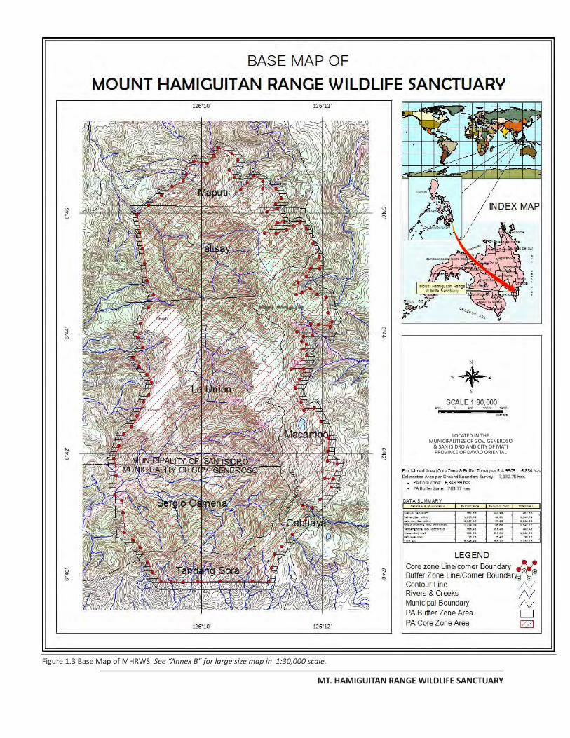
Figure 2. Base map showing the cartographic information of MHRWS.
LOCATED IN THEMUNICIPALITIES OF GOV. GENEROSO
& SAN ISIDRO AND CITY OF MATIPROVINCE OF DAVAO ORIENTAL
EXECUTIVE SUMMARY FOR MHRWS
MOUNT HAMIGUITAN RANGE WILDLIFE SANCTUARY
PAGE 4
Figure 3. Management Zone map showing the Multiple Use and Strict Protection Zones of MHRWS.
LOCATED IN THEMUNICIPALITIES OF GOV. GENEROSO
& SAN ISIDRO AND CITY OF MATIPROVINCE OF DAVAO ORIENTAL
EXECUTIVE SUMMARY FOR MHRWS
MOUNT HAMIGUITAN RANGE WILDLIFE SANCTUARY
PAGE 5
JUSTIFICATIONSTATEMENT OF OUTSTANDING UNIVERSAL VALUEThe MHRWS is of outstanding universal value as a center for endemism and a sanctuary for rare, threatened and endangered species of global significance for the Southeast Asian region. MHWRS is an exemplary example of biodiversity that is resilient and adaptive even in the face of adverse environmental conditions. The lessons that could be learned from the unique biodiversity, its interrelationships and its coping mechanisms could likely provide insight into appropriate climate change adaptive measures for current and future reference. Thus its preservation and protection ought to be of global concern.
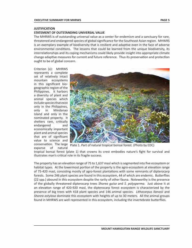
Criterion (x): MHRWS represents a complete set of relatively intact mountain ecosystems in this significant bio-geographic region of the Philippines. It harbors a diversity of plant and animal species which include species that exist only in the Philippines, only in Mindanao Island and only in the nominated property. It shelters rare, critically endangered and economically important plant and animal species that are of significant value to science and conservation. The large expanse of natural tropical bonsai forest (plate 1) that crowns its crest embodies nature’s fight for survival and illustrates man’s critical role in its fragile success.
The property has an elevation range of 75 to 1,637 masl which is segmented into five ecosystem or habitat types. At the lowermost portion of the property is the agro-ecosystem at elevation range of 75-420 masl, consisting mostly of agro-forest plantations with some remnants of dipterocarp forests. Some 246 plant species are found in this ecosystem, 44 of which are endemic. Butterflies (22 spp.) abound in this ecosystem despite the rarity of other fauna. Noteworthy is the presence of the globally threatened dipterocarp trees Shorea guiso and S. polysperma. Just above it at an elevation range of 420-920 masl, the dipterocarp forest ecosystem is characterized by the presence of big trees with 418 plant species and 146 animal species. Lithocarpus llanosii and Shorea astylosa dominate this ecosystem with heights of up to 30 meters. All the animal groups found in MHRWS are well represented in this ecosystem, including the invertebrate butterflies.
Plate 1. Part of natural tropical bonsai forest. (Photo by EDC)
EXECUTIVE SUMMARY FOR MHRWS
MOUNT HAMIGUITAN RANGE WILDLIFE SANCTUARY
PAGE 6
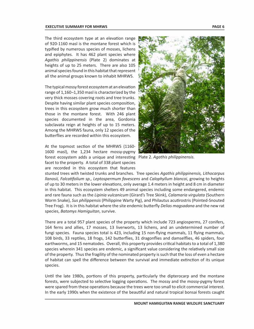
The third ecosystem type at an elevation range of 920-1160 masl is the montane forest which is typified by numerous species of mosses, lichens and epiphytes. It has 462 plant species where Agathis philippinensis (Plate 2) dominates at heights of up to 25 meters. There are also 105 animal species found in this habitat that represent all the animal groups known to inhabit MHRWS.
The typical mossy forest ecosystem at an elevation range of 1,160¬1,350 masl is characterized by the very thick mosses covering roots and tree trunks. Despite having similar plant species composition, trees in this ecosystem grow much shorter than those in the montane forest. With 246 plant species documented in the area, Gordonia subclavata reign at heights of up to 15 meters. Among the MHRWS fauna, only 12 species of the butterflies are recorded within this ecosystem.
At the topmost section of the MHRWS (1160-1600 masl), the 1,234 hectare mossy-pygmy forest ecosystem adds a unique and interesting facet to the property. A total of 338 plant species are recorded in this ecosystem that features stunted trees with twisted trunks and branches. Tree species Agathis philippinensis, Lithocarpus llanosii, Falcatifolium sp., Leptospermum favescens and Calophyllum blancoi, growing to heights of up to 30 meters in the lower elevations, only average 1.4 meters in height and 8 cm in diameter in this habitat. This ecosystem shelters 49 animal species including some endangered, endemic and rare fauna such as the Lipinia vulcanicum (Girard’s Tree Skink), Calamaria virgulata (Southern Worm Snake), Sus philippensis (Philippine Warty Pig), and Philautus acutirostris (Pointed-Snouted Tree Frog). It is in this habitat where the site endemic butterfly Delias magsadana and the new rat species, Batomys Hamiguitan, survive.
There are a total 957 plant species of the property which include 723 angiosperms, 27 conifers, 164 ferns and allies, 17 mosses, 13 liverworts, 13 lichens, and an undetermined number of fungi species. Fauna species total is 423, including 15 non-flying mammals, 11 flying mammals, 108 birds, 33 reptiles, 18 frogs, 142 butterflies, 31 dragonflies and damselflies, 46 spiders, four earthworms, and 15 nematodes. Overall, this property provides critical habitats to a total of 1,380 species wherein 341 species are endemic, a significant value considering the relatively small size of the property. Thus the fragility of the nominated property is such that the loss of even a hectare of habitat can spell the difference between the survival and immediate extinction of its unique species.
Until the late 1980s, portions of this property, particularly the dipterocarp and the montane forests, were subjected to selective logging operations. The mossy and the mossy-pygmy forest were spared from these operations because the trees were too small to elicit commercial interest. In the early 1990s when the existence of the beautiful and natural tropical bonsai forests caught
Plate 2. Agathis philippinensis.
EXECUTIVE SUMMARY FOR MHRWS
MOUNT HAMIGUITAN RANGE WILDLIFE SANCTUARY
PAGE 7
the attention of the local political leaders, the local government units (LGUs) surrounding MHRWS initiated protection measures, persistently requesting the national government to declare it as a protected area. In 2004, through Republic Act 9303, the national government declared this property as a protected area under the category of wildlife sanctuary. Since then, logging activities have ceased inside the property and most of the logged over sections of the sanctuary have reverted back into closed canopy forests.
After its declaration as a protected area and in accordance with the provision of RA 9303, the MHRWS Protected Area Management Board (PAMB), the policy-making body of the protected area, was organized wherein representatives from the different LGUs, the academe, Non-Government Organizations, Government Organizations, Peoples Organizations and Indigenous People were enlisted as members with the DENR as chair. Along with the PAMB, the Protected Area Superintendent Office (PASO) was also created to execute its policies and directives. The PASO is in charge of the implementation of plans, programs and policies crafted and approved by the PAMB and DENR for the proper management, administration and protection of the protected area. Within the PASO are the forest protection officers who conduct regular monitoring and protection activities of the property. As an adjunct, the LGUs of the Municipalities of San Isidro and Governor Generoso and the City of Mati deployed their respective Bantay Gubat (Community Forest Rangers) to reinforce the protection of MHRWS. Hence, with this set up, MHRWS is well secured from any unwelcome intrusions and unwarranted activities.
CRITERIA UNDER WHICH INSCRIPTION IS PROPOSED
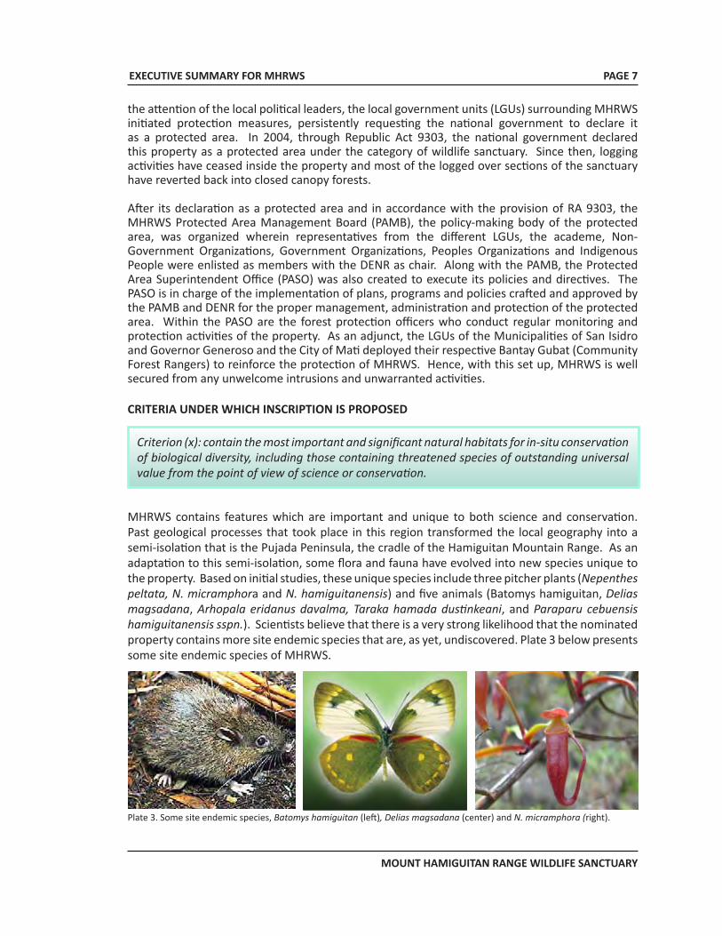
MHRWS contains features which are important and unique to both science and conservation. Past geological processes that took place in this region transformed the local geography into a semi-isolation that is the Pujada Peninsula, the cradle of the Hamiguitan Mountain Range. As an adaptation to this semi-isolation, some flora and fauna have evolved into new species unique to the property. Based on initial studies, these unique species include three pitcher plants (Nepenthes peltata, N. micramphora and N. hamiguitanensis) and five animals (Batomys hamiguitan, Delias magsadana, Arhopala eridanus davalma, Taraka hamada dustinkeani, and Paraparu cebuensis hamiguitanensis sspn.). Scientists believe that there is a very strong likelihood that the nominated property contains more site endemic species that are, as yet, undiscovered. Plate 3 below presents some site endemic species of MHRWS.
Criterion (x): contain the most important and significant natural habitats for in-situ conservation of biological diversity, including those containing threatened species of outstanding universal value from the point of view of science or conservation.
Plate 3. Some site endemic species, Batomys hamiguitan (left), Delias magsadana (center) and N. micramphora (right).
EXECUTIVE SUMMARY FOR MHRWS
MOUNT HAMIGUITAN RANGE WILDLIFE SANCTUARY
PAGE 8
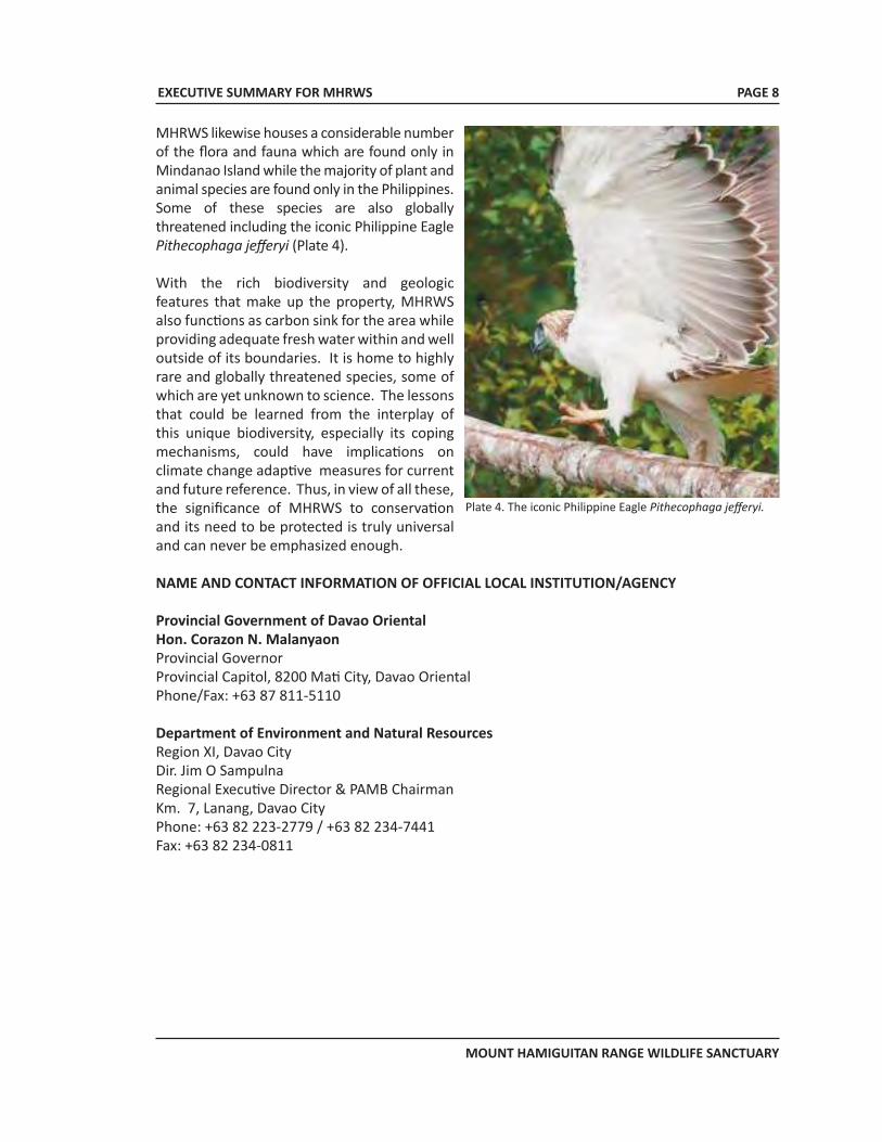
MHRWS likewise houses a considerable number of the flora and fauna which are found only in Mindanao Island while the majority of plant and animal species are found only in the Philippines. Some of these species are also globally threatened including the iconic Philippine Eagle Pithecophaga jefferyi (Plate 4).
With the rich biodiversity and geologic features that make up the property, MHRWS also functions as carbon sink for the area while providing adequate fresh water within and well outside of its boundaries. It is home to highly rare and globally threatened species, some of which are yet unknown to science. The lessons that could be learned from the interplay of this unique biodiversity, especially its coping mechanisms, could have implications on climate change adaptive measures for current and future reference. Thus, in view of all these, the significance of MHRWS to conservation and its need to be protected is truly universal and can never be emphasized enough.
NAME AND CONTACT INFORMATION OF OFFICIAL LOCAL INSTITUTION/AGENCY
Provincial Government of Davao OrientalHon. Corazon N. MalanyaonProvincial GovernorProvincial Capitol, 8200 Mati City, Davao OrientalPhone/Fax: +63 87 811-5110
Department of Environment and Natural ResourcesRegion XI, Davao CityDir. Jim O SampulnaRegional Executive Director & PAMB ChairmanKm. 7, Lanang, Davao CityPhone: +63 82 223-2779 / +63 82 234-7441Fax: +63 82 234-0811
Plate 4. The iconic Philippine Eagle Pithecophaga jefferyi.
NOMINATION DOSSIER FOR MHRWS
MT. HAMIGUITAN RANGE WILDLIFE SANCTUARY
NOMINATION DOSSIER FOR MHRWS
MT. HAMIGUITAN RANGE WILDLIFE SANCTUARY
MT. HAMIGUITANRANGE WILDLIFE SANCTUARY
Proposed Inscription to the UNESCO World Heritage List
VOLUME 2NOMINATION DOSSIER
NOMINATION DOSSIER FOR MHRWS
MT. HAMIGUITAN RANGE WILDLIFE SANCTUARY
ii
TABLE CONTENTS
1 IDENTIFICATION OF THE PROPERTY 1 1.a Country 1 1.b State, Province or Region 1 1.c Name of Property 2 1.d Geographical Coordinates to the Nearest Second 2 1.e Maps and plans, showing the boundaries of the nominated property 2 1.f Area of nominated property (ha.) and proposed buffer zone (ha.) 2
2 DESCRIPTION OF THE PROPERTY 5 2.a Description of the property 6 2.b History and development 21
3 JUSTIFICATION FOR INSCRIPTION 23 3.a Criteria under which inscription is proposed 23 3.b Statement of outstanding universal value 24 3.c Comparative analysis (including state of conservation of similar properties) 26 3.d Integrity of the nominated property 30
4 STATE OF CONSERVATION AND FACTORS AFFECTING THE PROPERTY 31 4.a Present state of conservation 31 4.b Factors affecting the property 34
5 PROTECTION AND MANAGEMENT 36 5.a Ownership 36 5.b Protective designation 37 5.c Means of implementing protective measures 38 5.d Existing plans related to municipality and region in which the proposed property is located 40 5.e Property management plan or other management system 40 5.f Sources and levels of finance (Years 2011-2020) 42 5.g Sources of expertise and training in conservation and management techniques 44 5.h Visitor facilities and statistics 44 5.i Policies and programmes related to the presentation and promotion of the property 45 5.j Staffing levels 45
NOMINATION DOSSIER FOR MHRWS
MT. HAMIGUITAN RANGE WILDLIFE SANCTUARY
iii
6 MONITORING 46 6.a Key indicators for measuring state of conservation 46 6.b Administrative arrangements for monitoring the property 52 6.c Results of previous reporting exercises 53
7 DOCUMENTATION 82 7.a Photographs, slides, image inventory and authorization table and other audiovisual materials 82 7.b Texts relating to protective designation, copies of property management systems and extracts of others plans
relevant to the property 83 7.c Form and date of most recent records or inventory of property 83 7.d Address where inventory, records and archives are held 84 7.e Bibliography 84
8 CONTACT INFORMATION 85 8.a Preparer 85 8.b Official local institution/agency 86 8.c Other local institutions 87 8.d Official web address 87
9 SIGNATURE ON BEHALF OF STATE PARTY 87
ACKNOWLEDGEMENT 88
LIST OF FIGURESFIGURE 1.1 Location map of MHRWS 1 FIGURE 1.2 Boundary map of MHRWS 3FIGURE 1.3 Base map of MHRWS 4FIGURE 2.1 Philippine Bio-geographic Zones 5FIGURE 2.2 Watershed and drainage map of MHRWS 7FIGURE 2.3. Transect diagram of the vegetation types of MHRWS 9FIGURE 4.1. Land cover map of MHRWS 33FIGURE 5.1. Management structure of MHRWS and the interrelationship among the agencies 41FIGURE 6.1 Photomap of the recent monitoring of MHRWS and vicinities 50FIGURE 6.2 MEA-METT conceptual framework 51
LIST OF TABLES TABLE 1.1 Size and distribution of the component protected area of MHRWS 5TABLE 2.1 Endemic and globally threatened species of Shorea 12TABLE 2.2 List of endangered, endemic and rare species of flora in MHRWS that must be given high priority for protection and conservation 15TABLE 2.3 List of threatened vertebrates with known occurrences in Mt. Hamiguitan and their threat level categories by IUCN 18 TABLE 2.4 List of globally significant and site endemic species of fauna in MHRWS 20
NOMINATION DOSSIER FOR MHRWS
MT. HAMIGUITAN RANGE WILDLIFE SANCTUARY
iv
TABLE 3.1 Comparison to similar natural properties 29 similar natural properties TABLE 4.1 Vegetative cover of MHRWS core zone 34TABLE 5.1 MHRWS 10 year work and financial plan 44
TABLE 6.1. Monitoring indicators for measuring state of conservation of the nominated property 46
TABLE 6.2 Survey and Registration of Protected Area Occupants as of June, 2011. 48TABLE 7.1 Photographs, slides and other images that are of the final WHS nomination dossier 82 LIST OF PLATES PLATE 2.1 Plants growing on top of thin layer of ultramafic soil and layer of rocks 6PLATE 2.2. The twin falls 8PLATE 2.3. Smaller waterfalls in mhrws 8PLATE 2.4 The Agro-ecosystem dominated by coconut trees 10PLATE 2.5 The dipterocarpforest dominated by Shorea species and other dipterocarp trees 10PLATE 2.6 The Montane forest dominated by Agathis philippinensis 10PLATE 2.7 The mossy forest dominated by C. blancoi and D. elatum 11PLATE 2.8 The mossy-pygmy forest MHRWS 11PLATE 2.9 Typical natural bonsai tree inside the mossy pygmy forest 11 PLATE 2.10 Tinagong Dagat 12PLATE 2.11 Some endemic, threatened and rare plants of Hamiguitan Range 13PLATE 2.12 Nepenthes micramphora 14PLATE 2.13 N. peltata 14PLATE 2.14 N. hamiguitanensis 14PLATE 2.15 The Critically Endangered Philippine Eagle 17PLATE 2.16 The Critically Endagred Philippine Cockatoo 17PLATE 2.17 The site endemic Delias magsadana 17PLATE 2.18 Site endemic Hamuigitan hairy-tailed rat 19PLATE 6.1 Trail inside MHRWS 47
NOMINATION DOSSIER FOR MHRWS
MT. HAMIGUITAN RANGE WILDLIFE SANCTUARY
v
LIST OF ACRONYMSACB ASEAN Centre for BiodiversityASEAN Association of Southeast Asian NationsBMS Biodiversity Monitoring SystemBRMFI Bukidnon Resources Management Foundation, Inc.CBFM Community-Based Forest ManagementCBFMA Community-Based Forest Management AgreementCENRO Community Environment and Natural Resources OfficeCEPF Critical Ecosystem Management FundCI Conservation InternationalCITES Convention on International Trade in Endangered Species of Flora and FaunaCMU Central Mindanao UniversityCR Critically EndangeredCSC Certificate of Stewardship ContractDENR Department of Environment and Natural ResourcesDPYF Dong Phayayenkhao Yai ForestECC Environmental Compliance CertificateECP Environmental Consciousness ProgramEMB Environmental Management BureauEMCBAAP Eastern Mindanao Corridor Biodiversity Assessment and Archiving ProjectEN EndangeredERDB Ecosystems Research and Development BureauFGD Focus Group DiscussionGMPS General Management Planning StrategyGOP Government of the PhilippinesIBA Important Bird AreaIEC Information Education CommunicationIP Indigenous PeopleIUCN International Union for the Conservation of Nature and Natural ResourcesKBA Key Biodiversity AreaKNP Keoladeo National ParkLGU Local Government UnitLTER Long-Term Ecological ResearchMASL Meters above sea levelMEA Management Effectiveness AssessmentMETT Management Effectiveness Tracking Tool
NOMINATION DOSSIER FOR MHRWS
MT. HAMIGUITAN RANGE WILDLIFE SANCTUARY
MHMSC Mt. Hamiguitan Multi-Stakeholders CouncilMHRWS Mt. Hamiguitan Range Wildlife SanctuaryMKNP Mt. Kitanglad Natural ParkMUZ Multiple Use ZoneNIPAS National Integrated Protected Areas SystemNT Near ThreatenedOGA Other Government AgenciesPA Protected AreaPAMB Protected Area Management BoardPASA Protected Area Suitability AssessmentPASO Protected Area Superintendent’s OfficePASu Protected Area SuperintendentPAWB Protected Areas and Wildlife BureauPEFI Philippine Eagle Foundation, Inc.PENRO Provincial Environment and Natural Resources OfficePO People’s OrganizationRA Republic ActRMNP Rwenzori Mountains National ParkSGPS Sechuan Giant Panda SanctuarySPZ Strict Protection ZoneSRPAO Survey and Registration of Protected Area OccupantsTI Tenurial InstrumentUNACOM UNESCO National Commission of the PhilippinesUNESCO United Nations Educational, Scientific and Cultural OrganizationVU VulnerableWCPA World Commission on Protected Areas
vi
NOMINATION DOSSIER FOR MHRWS
MT. HAMIGUITAN RANGE WILDLIFE SANCTUARY
PAGE 1
1. Identification of the Property
1.a Country
Republic of the Philippines
1.b State, Province or Region
The Republic of the Philippines is located just above the equator in the Southeast Asian Region. It is bound on the northwest by the West Philippine Sea (formerly referred to as South China Sea), on the northeast by the Pacific Ocean and on the south by the Sulu-Sulawesi Seas. The nominated property, Mt. Hamiguitan Range Wildlife Sanctuary (MHRWS), is located in the southernmost part of the Philippines in the Mindanao Island, north of Indonesia and west of the Marianas Islands in the South Pacific. MHRWS is in the Province of Davao Oriental in Mindanao Island and is bordered on the south by Davao Gulf in the Sulawesi Sea and on the east by the Pacific Ocean (Figure 1.1).
Figure 1.1. Location Map of MHRWS.
NOMINATION DOSSIER FOR MHRWS
MT. HAMIGUITAN RANGE WILDLIFE SANCTUARY
PAGE 2
The Mt. Hamiguitan Range, of which the property is a part, forms a north-south trending mountainous upland in the southeastern part of the Eastern Mindanao Biodiversity Corridor, a priority site for conservation as designated by Conservation International in view of its high level of biodiversity and accompanying threats. The nominated property occupies the northern part of this range and straddles two municipalities and one city, namely, the Municipalities of San Isidro and Governor Generoso and City of Mati in the Province of Davao Oriental, Philippines at altitudes ranging from 170 to 1,637 meters above sea level.
1.c Name of PropertyMt. Hamiguitan Range Wildlife Sanctuary
1.d Geographic Coordinates to the Nearest Second
1.e Maps and Plans, showing the boundaries of the nominated properties
1.f Area of Nominated Property and established buffer zone (ha.)Cognizant of the profound impact of human activities on the natural environment and to ensure the conservation of rich and unique biological diversity in the Mt. Hamiguitan Range, the Philippine Government enacted into law Republic Act 9303 dated 30 July 2004 declaring the Mt. Hamiguitan Range Wildlife Sanctuary (MHRWS) as a protected area (Appendix 1). As such, it automatically became a component of the Philippines’ National Integrated Protected Areas System (NIPAS) pursuant to R.A. 7586 of 1992 (Appendix 2). The MHRWS has a ground delineated area of 7,132.76 hectares, designating a total area of 6,348.99 hectare as core zone (nominated property) and 783.77 hectares as buffer zone. Boundary Map and Base Map of the property are shown in Figures 1.2 and 1.3, respectively.
MHRWS Central Coordinates:
Longitude: N 06°43’1.81” Latitude: E 126°10’24.35” Name of the Site
Province Coordinates Area of Nominated Property
Buffer Zone Map No.
Mt. Hamiguitan Range Wildlife Sanctuary
Davao Oriental Longitude: N 06°43’1.81” Latitude: E 126°10’24.35”
6,348.99 has. 783.77 has. Figure 1.2 Figure 1.3
NOMINATION DOSSIER FOR MHRWS
MT. HAMIGUITAN RANGE WILDLIFE SANCTUARY
PAGE 4
Figure 1.2 Boundary Map of MHRWS. See “Annex A” for large size map in 1:30,000 scale.
LOCATED IN THEMUNICIPALITIES OF GOV. GENEROSO
& SAN ISIDRO AND CITY OF MATIPROVINCE OF DAVAO ORIENTAL
NOMINATION DOSSIER FOR MHRWS
MT. HAMIGUITAN RANGE WILDLIFE SANCTUARY
PAGE 5
Figure 1.3 Base Map of MHRWS. See “Annex B” for large size map in 1:30,000 scale.
LOCATED IN THEMUNICIPALITIES OF GOV. GENEROSO
& SAN ISIDRO AND CITY OF MATIPROVINCE OF DAVAO ORIENTAL
NOMINATION DOSSIER FOR MHRWS
MT. HAMIGUITAN RANGE WILDLIFE SANCTUARY
PAGE 5
The area occupied by the nominated property (core zone) and the buffer zone of the MHRWS is presented in Table 1.1.
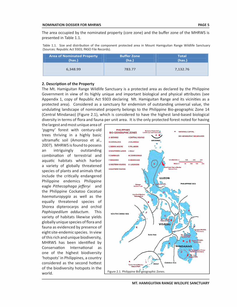
2. Description of the Property The Mt. Hamiguitan Range Wildlife Sanctuary is a protected area as declared by the Philippine Government in view of its highly unique and important biological and physical attributes (see Appendix 1, copy of Republic Act 9303 declaring Mt. Hamiguitan Range and its vicinities as a protected area). Considered as a sanctuary for endemism of outstanding universal value, the undulating landscape of nominated property belongs to the Philippine Bio-geographic Zone 14 (Central Mindanao) (Figure 2.1), which is considered to have the highest land-based biological diversity in terms of flora and fauna per unit area. It is the only protected forest noted for having the largest and most unique area of ‘pygmy’ forest with century-old trees thriving in a highly basic ultramafic soil (Amoroso et al., 2007). MHRWS is found to possess an intriguingly outstanding combination of terrestrial and aquatic habitats which harbor a variety of globally threatened species of plants and animals that include the critically endangered Philippine endemics Philippine eagle Pithecophaga jefferyi and the Philippine Cockatoo Cacatua haematuropygia as well as the equally threatened species of Shorea dipterocarps and orchid Paphiopedilum adductum. This variety of habitats likewise yields globally unique species of flora and fauna as evidenced by presence of eight site-endemic species. In view of this rich and unique biodiversity, MHRWS has been identified by Conservation International as one of the highest biodiversity ‘hotspots’ in Philippines, a country considered as the second hottest of the biodiversity hotspots in the world. Figure 2.1. Philippine Bio-geographic Zones.
Table 1.1. Size and distribution of the component protected area in Mount Hamiguitan Range Wildlife Sanctuary (Sources: Republic Act 9303; PASO File Records).
Area of Nominated Property (has.)
Buffer Zone (ha.)
Total (has.)
6,348.99
783.77
7,132.76
NOMINATION DOSSIER FOR MHRWS
MT. HAMIGUITAN RANGE WILDLIFE SANCTUARY
PAGE 6
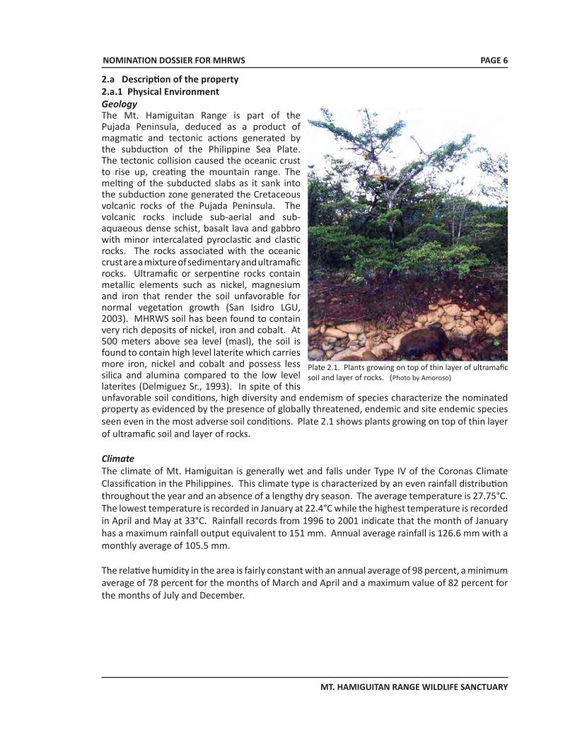
2.a Description of the property2.a.1 Physical EnvironmentGeologyThe Mt. Hamiguitan Range is part of the Pujada Peninsula, deduced as a product of magmatic and tectonic actions generated by the subduction of the Philippine Sea Plate. The tectonic collision caused the oceanic crust to rise up, creating the mountain range. The melting of the subducted slabs as it sank into the subduction zone generated the Cretaceous volcanic rocks of the Pujada Peninsula. The volcanic rocks include sub-aerial and sub-aquaeous dense schist, basalt lava and gabbro with minor intercalated pyroclastic and clastic rocks. The rocks associated with the oceanic crust are a mixture of sedimentary and ultramafic rocks. Ultramafic or serpentine rocks contain metallic elements such as nickel, magnesium and iron that render the soil unfavorable for normal vegetation growth (San Isidro LGU, 2003). MHRWS soil has been found to contain very rich deposits of nickel, iron and cobalt. At 500 meters above sea level (masl), the soil is found to contain high level laterite which carries more iron, nickel and cobalt and possess less silica and alumina compared to the low level laterites (Delmiguez Sr., 1993). In spite of this unfavorable soil conditions, high diversity and endemism of species characterize the nominated property as evidenced by the presence of globally threatened, endemic and site endemic species seen even in the most adverse soil conditions. Plate 2.1 shows plants growing on top of thin layer of ultramafic soil and layer of rocks.
ClimateThe climate of Mt. Hamiguitan is generally wet and falls under Type IV of the Coronas Climate Classification in the Philippines. This climate type is characterized by an even rainfall distribution throughout the year and an absence of a lengthy dry season. The average temperature is 27.75°C. The lowest temperature is recorded in January at 22.4°C while the highest temperature is recorded in April and May at 33°C. Rainfall records from 1996 to 2001 indicate that the month of January has a maximum rainfall output equivalent to 151 mm. Annual average rainfall is 126.6 mm with a monthly average of 105.5 mm.
The relative humidity in the area is fairly constant with an annual average of 98 percent, a minimum average of 78 percent for the months of March and April and a maximum value of 82 percent for the months of July and December.
Plate 2.1. Plants growing on top of thin layer of ultramafic soil and layer of rocks. (Photo by Amoroso)
NOMINATION DOSSIER FOR MHRWS
MT. HAMIGUITAN RANGE WILDLIFE SANCTUARY
PAGE 7
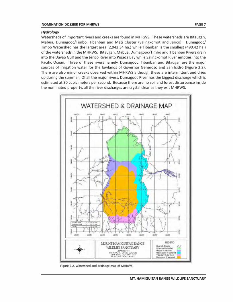
HydrologyWatersheds of important rivers and creeks are found in MHRWS. These watersheds are Bitaugan, Mabua, Dumagooc/Timbo, Tibanban and Mati Cluster (Salingkomot and Jerico). Dumagooc/Timbo Watershed has the largest area (2,942.34 ha.) while Tibanban is the smallest (490.42 ha.) of the watersheds in the MHRWS. Bitaugan, Mabua, Dumagooc/Timbo and Tibanban Rivers drain into the Davao Gulf and the Jerico River into Pujada Bay while Salingkomot River empties into the Pacific Ocean. Three of these rivers namely, Dumagooc, Tibanban and Bitaugan are the major sources of irrigation water for the lowlands of Governor Generoso and San Isidro (Figure 2.2). There are also minor creeks observed within MHRWS although these are intermittent and dries up during the summer. Of all the major rivers, Dumagooc River has the biggest discharge which is estimated at 30 cubic meters per second. Because there are no soil and forest disturbance inside the nominated property, all the river discharges are crystal clear as they exit MHRWS.
Figure 2.2. Watershed and drainage map of MHRWS.
LOCATED IN THEMUNICIPALITIES OF GOV. GENEROSO
& SAN ISIDRO AND CITY OF MATIPROVINCE OF DAVAO ORIENTAL
NOMINATION DOSSIER FOR MHRWS
MT. HAMIGUITAN RANGE WILDLIFE SANCTUARY
PAGE 8
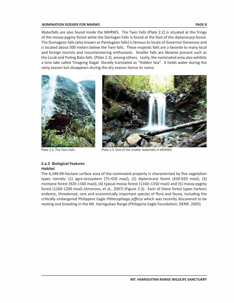
Waterfalls are also found inside the MHRWS. The Twin Falls (Plate 2.2) is situated at the fringe of the mossy-pygmy forest while the Danlogan Falls is found at the foot of the dipterocarp forest. The Dumagooc falls (also known as Pandugaan falls) is famous to locals of Governor Generoso and is located about 500 meters below the Twin falls. These majestic falls are a favorite to many local and foreign tourists and mountaineering enthusiasts. Smaller falls are likewise present such as the Licub and Puting Bato falls (Plate 2.3), among others. Lastly, the nominated area also exhibits a lone lake called Tinagong Dagat literally translated as “Hidden Sea”. It holds water during the rainy season but disappears during the dry season hence its name.
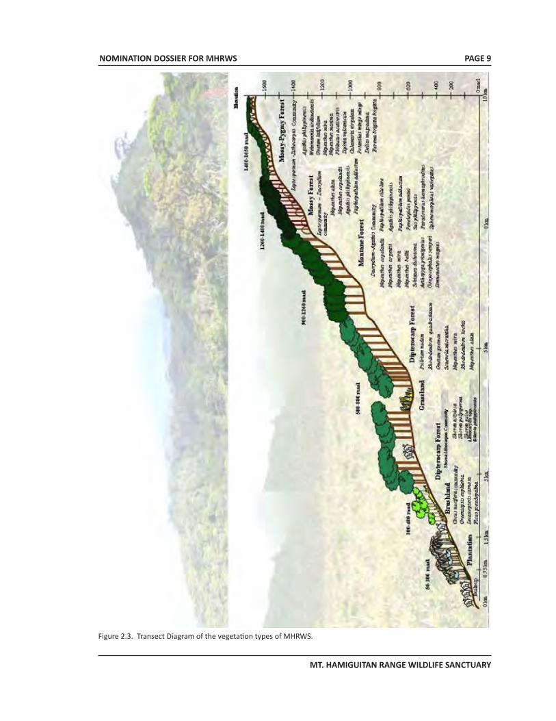
2.a.2 Biological FeaturesHabitatThe 6,348.99-hectare surface area of the nominated property is characterized by five vegetation types namely: (1) agro-ecosystem (75-420 masl), (2) dipterocarp forest (420-920 masl), (3) montane forest (920-1160 masl), (4) typical mossy forest (1160¬1350 masl) and (5) mossy-pygmy forest (1160-1200 masl) (Amoroso, et al., 2007) (Figure 2.3). Each of these forest types harbors endemic, threatened, rare and economically important species of flora and fauna, including the critically endangered Philippine Eagle Pithecophaga jefferyi which was recently discovered to be nesting and breeding in the Mt. Hamiguitan Range (Philippine Eagle Foundation; DENR, 2005).
Plate 2.3. One of the smaller waterfalls in MHRWS. Plate 2.2. The Twin Falls.
NOMINATION DOSSIER FOR MHRWS
MT. HAMIGUITAN RANGE WILDLIFE SANCTUARY
PAGE 9
Figure 2.3. Transect Diagram of the vegetation types of MHRWS.
NOMINATION DOSSIER FOR MHRWS
MT. HAMIGUITAN RANGE WILDLIFE SANCTUARY
PAGE 10
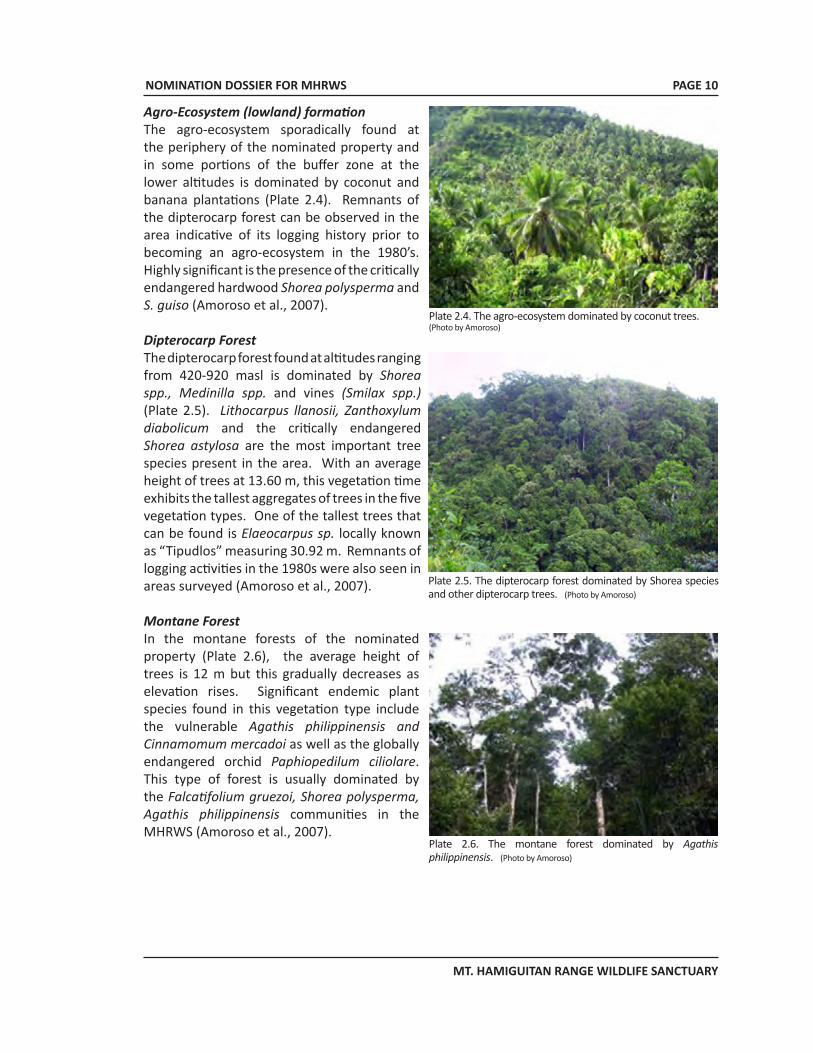
Agro-Ecosystem (lowland) formation The agro-ecosystem sporadically found at the periphery of the nominated property and in some portions of the buffer zone at the lower altitudes is dominated by coconut and banana plantations (Plate 2.4). Remnants of the dipterocarp forest can be observed in the area indicative of its logging history prior to becoming an agro-ecosystem in the 1980’s. Highly significant is the presence of the critically endangered hardwood Shorea polysperma and S. guiso (Amoroso et al., 2007).
Dipterocarp Forest The dipterocarp forest found at altitudes ranging from 420-920 masl is dominated by Shorea spp., Medinilla spp. and vines (Smilax spp.) (Plate 2.5). Lithocarpus llanosii, Zanthoxylum diabolicum and the critically endangered Shorea astylosa are the most important tree species present in the area. With an average height of trees at 13.60 m, this vegetation time exhibits the tallest aggregates of trees in the five vegetation types. One of the tallest trees that can be found is Elaeocarpus sp. locally known as “Tipudlos” measuring 30.92 m. Remnants of logging activities in the 1980s were also seen in areas surveyed (Amoroso et al., 2007).
Montane Forest In the montane forests of the nominated property (Plate 2.6), the average height of trees is 12 m but this gradually decreases as elevation rises. Significant endemic plant species found in this vegetation type include the vulnerable Agathis philippinensis and Cinnamomum mercadoi as well as the globally endangered orchid Paphiopedilum ciliolare. This type of forest is usually dominated by the Falcatifolium gruezoi, Shorea polysperma, Agathis philippinensis communities in the MHRWS (Amoroso et al., 2007).
Plate 2.4. The agro-ecosystem dominated by coconut trees.(Photo by Amoroso)
Plate 2.5. The dipterocarp forest dominated by Shorea species and other dipterocarp trees. (Photo by Amoroso)
Plate 2.6. The montane forest dominated by Agathis philippinensis. (Photo by Amoroso)
NOMINATION DOSSIER FOR MHRWS
MT. HAMIGUITAN RANGE WILDLIFE SANCTUARY
PAGE 11
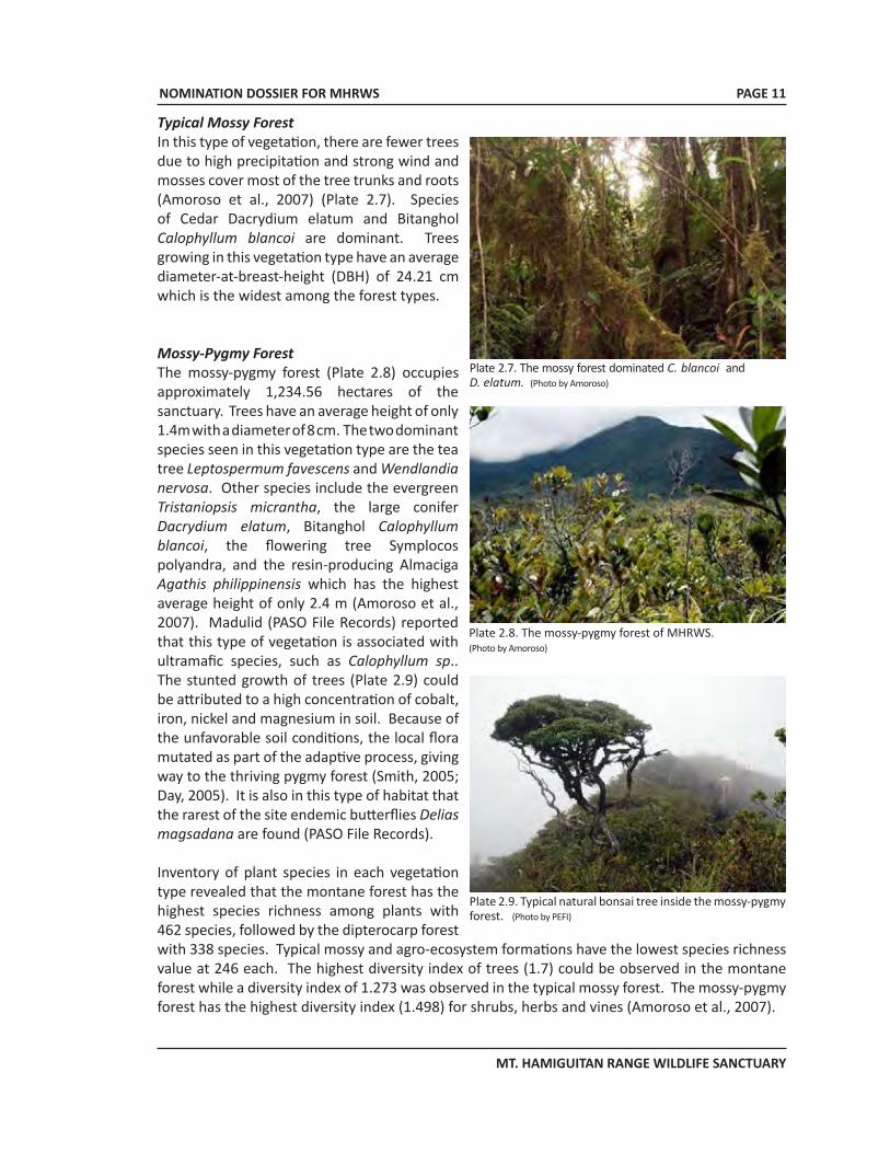
Typical Mossy Forest In this type of vegetation, there are fewer trees due to high precipitation and strong wind and mosses cover most of the tree trunks and roots (Amoroso et al., 2007) (Plate 2.7). Species of Cedar Dacrydium elatum and Bitanghol Calophyllum blancoi are dominant. Trees growing in this vegetation type have an average diameter-at-breast-height (DBH) of 24.21 cm which is the widest among the forest types.
Mossy-Pygmy Forest The mossy-pygmy forest (Plate 2.8) occupies approximately 1,234.56 hectares of the sanctuary. Trees have an average height of only 1.4m with a diameter of 8 cm. The two dominant species seen in this vegetation type are the tea tree Leptospermum favescens and Wendlandia nervosa. Other species include the evergreen Tristaniopsis micrantha, the large conifer Dacrydium elatum, Bitanghol Calophyllum blancoi, the flowering tree Symplocos polyandra, and the resin-producing Almaciga Agathis philippinensis which has the highest average height of only 2.4 m (Amoroso et al., 2007). Madulid (PASO File Records) reported that this type of vegetation is associated with ultramafic species, such as Calophyllum sp.. The stunted growth of trees (Plate 2.9) could be attributed to a high concentration of cobalt, iron, nickel and magnesium in soil. Because of the unfavorable soil conditions, the local flora mutated as part of the adaptive process, giving way to the thriving pygmy forest (Smith, 2005; Day, 2005). It is also in this type of habitat that the rarest of the site endemic butterflies Delias magsadana are found (PASO File Records).
Inventory of plant species in each vegetation type revealed that the montane forest has the highest species richness among plants with 462 species, followed by the dipterocarp forest with 338 species. Typical mossy and agro-ecosystem formations have the lowest species richness value at 246 each. The highest diversity index of trees (1.7) could be observed in the montane forest while a diversity index of 1.273 was observed in the typical mossy forest. The mossy-pygmy forest has the highest diversity index (1.498) for shrubs, herbs and vines (Amoroso et al., 2007).
Plate 2.8. The mossy-pygmy forest of MHRWS. (Photo by Amoroso)
Plate 2.9. Typical natural bonsai tree inside the mossy-pygmy forest. (Photo by PEFI)
Plate 2.7. The mossy forest dominated C. blancoi and D. elatum. (Photo by Amoroso)
NOMINATION DOSSIER FOR MHRWS
MT. HAMIGUITAN RANGE WILDLIFE SANCTUARY
PAGE 12
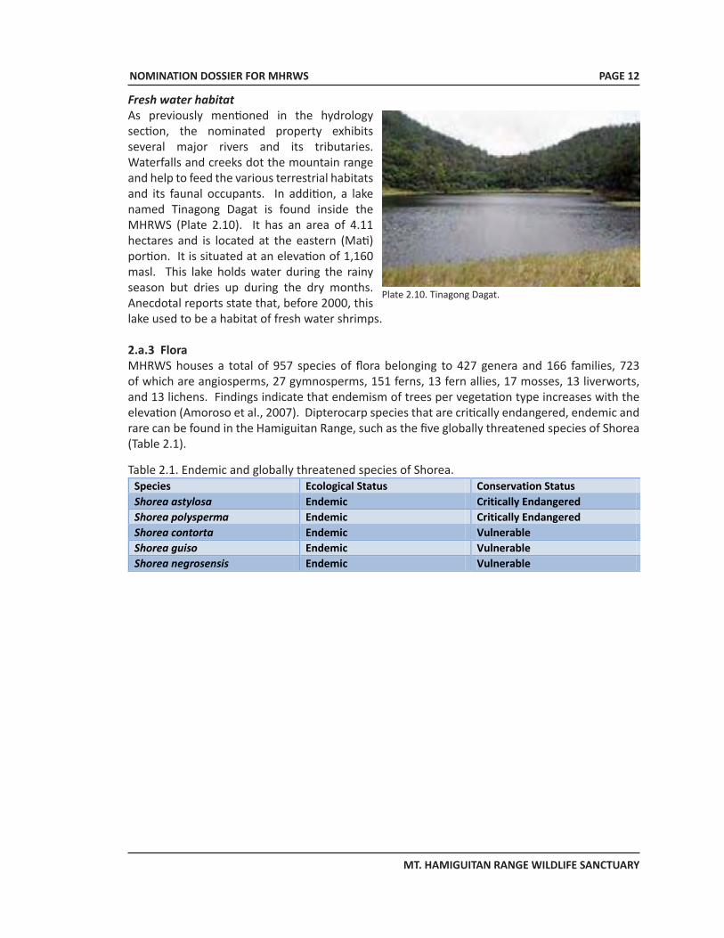
Fresh water habitat As previously mentioned in the hydrology section, the nominated property exhibits several major rivers and its tributaries. Waterfalls and creeks dot the mountain range and help to feed the various terrestrial habitats and its faunal occupants. In addition, a lake named Tinagong Dagat is found inside the MHRWS (Plate 2.10). It has an area of 4.11 hectares and is located at the eastern (Mati) portion. It is situated at an elevation of 1,160 masl. This lake holds water during the rainy season but dries up during the dry months. Anecdotal reports state that, before 2000, this lake used to be a habitat of fresh water shrimps.
2.a.3 Flora MHRWS houses a total of 957 species of flora belonging to 427 genera and 166 families, 723 of which are angiosperms, 27 gymnosperms, 151 ferns, 13 fern allies, 17 mosses, 13 liverworts, and 13 lichens. Findings indicate that endemism of trees per vegetation type increases with the elevation (Amoroso et al., 2007). Dipterocarp species that are critically endangered, endemic and rare can be found in the Hamiguitan Range, such as the five globally threatened species of Shorea (Table 2.1).
Plate 2.10. Tinagong Dagat.
Table 2.1. Endemic and globally threatened species of Shorea.Species Ecological Status Conservation Status Shorea astylosa Endemic Critically Endangered Shorea polysperma Endemic Critically Endangered Shorea contorta Endemic Vulnerable Shorea guiso Endemic Vulnerable Shorea negrosensis Endemic Vulnerable
NOMINATION DOSSIER FOR MHRWS
MT. HAMIGUITAN RANGE WILDLIFE SANCTUARY
PAGE 13
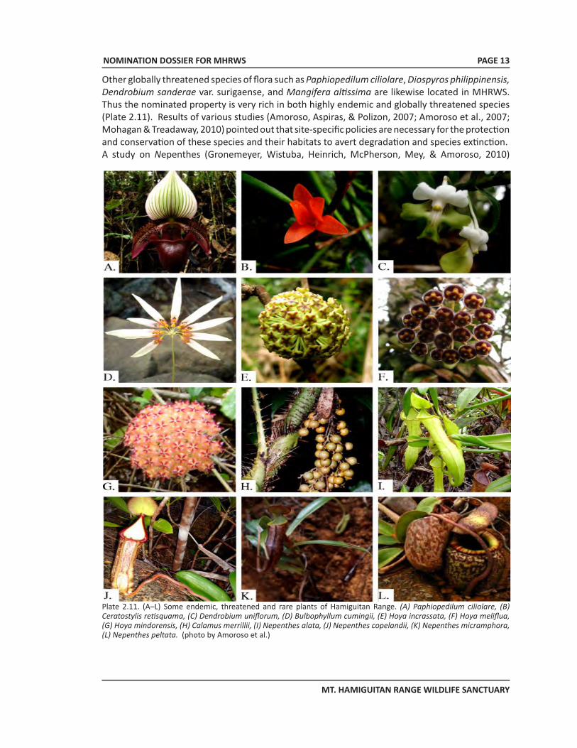
Plate 2.11. (A–L) Some endemic, threatened and rare plants of Hamiguitan Range. (A) Paphiopedilum ciliolare, (B) Ceratostylis retisquama, (C) Dendrobium uniflorum, (D) Bulbophyllum cumingii, (E) Hoya incrassata, (F) Hoya meliflua, (G) Hoya mindorensis, (H) Calamus merrillii, (I) Nepenthes alata, (J) Nepenthes copelandii, (K) Nepenthes micramphora, (L) Nepenthes peltata. (photo by Amoroso et al.)
Other globally threatened species of flora such as Paphiopedilum ciliolare, Diospyros philippinensis, Dendrobium sanderae var. surigaense, and Mangifera altissima are likewise located in MHRWS. Thus the nominated property is very rich in both highly endemic and globally threatened species (Plate 2.11). Results of various studies (Amoroso, Aspiras, & Polizon, 2007; Amoroso et al., 2007; Mohagan & Treadaway, 2010) pointed out that site-specific policies are necessary for the protection and conservation of these species and their habitats to avert degradation and species extinction.A study on Nepenthes (Gronemeyer, Wistuba, Heinrich, McPherson, Mey, & Amoroso, 2010)
NOMINATION DOSSIER FOR MHRWS
MT. HAMIGUITAN RANGE WILDLIFE SANCTUARY
PAGE 14
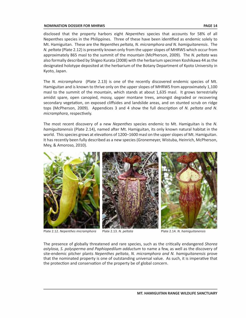
disclosed that the property harbors eight Nepenthes species that accounts for 58% of all Nepenthes species in the Philippines. Three of these have been identified as endemic solely to Mt. Hamiguitan. These are the Nepenthes peltata, N. micramphora and N. hamiguitanensis. The N. peltata (Plate 2.12) is presently known only from the upper slopes of MHRWS which occur from approximately 865 masl to the summit of the mountain (McPherson, 2009). The N. peltata was also formally described by Shigeo Kurata (2008) with the herbarium specimen Koshikawa 44 as the designated holotype deposited at the herbarium of the Botany Department of Kyoto University in Kyoto, Japan.
The N. micramphora (Plate 2.13) is one of the recently discovered endemic species of Mt. Hamiguitan and is known to thrive only on the upper slopes of MHRWS from approximately 1,100 masl to the summit of the mountain, which stands at about 1,635 masl. It grows terrestrially amidst spare, open canopied, mossy, upper montane trees, amongst degraded or recovering secondary vegetation, on exposed cliffsides and landslide areas, and on stunted scrub on ridge tops (McPherson, 2009). Appendices 3 and 4 show the full description of N. peltata and N. micramphora, respectively.
The most recent discovery of a new Nepenthes species endemic to Mt. Hamiguitan is the N. hamiguitanensis (Plate 2.14), named after Mt. Hamiguitan, its only known natural habitat in the world. This species grows at elevations of 1200–1600 masl on the upper slopes of Mt. Hamiguitan. It has recently been fully described as a new species (Gronemeyer, Wistuba, Heinrich, McPherson, Mey, & Amoroso, 2010).
Plate 2.13. N. peltataPlate 2.12. Nepenthes micramphora Plate 2.14. N. hamiguitanensis
The presence of globally threatened and rare species, such as the critically endangered Shorea astylosa, S. polysperma and Paphiopedilum adductum to name a few, as well as the discovery of site-endemic pitcher plants Nepenthes peltata, N. micramphora and N. hamiguitanensis prove that the nominated property is one of outstanding universal value. As such, it is imperative that the protection and conservation of the property be of global concern.
NOMINATION DOSSIER FOR MHRWS
MT. HAMIGUITAN RANGE WILDLIFE SANCTUARY
PAGE 15
SPECIES FAMILY CONSERVATION STATUS
VEGETATION TYPES
ALTITUDE (m asl)
LOCATION
1. Nepenthes copelandii
Nepenthaceae Critically endangered, endemic and rare
M, Mo, M-P 1180 San Isidro
2. Paphiopedilum adductum
Orchidaceae Critically endangered and endemic
M, M-P 1146 San Isidro
3. Platycerium coronarium
Polypodiaceae Critically endangered and endemic
D, M 160 – 480 Mati
4. Rhododendron kochii
Ericaceae Critically endangered and endemic
D, M 540 - 980 San Isidro
5. Shorea astylosa Dipterocarpaceae Critically endangered and endemic
A, D, M 120 – 1060
San Isidro, Mati, Gov. Generoso
6. Shorea polysperma
Dipterocarpaceae Critically endangered and endemic
D 320 – 620 San Isidro, Mati, Gov. Generoso
7. Alocasia zebrina
Araceae Endangered and endemic
D 685 San Isidro
8. Diospyros philippinensis
Ebenaceae Endangered and endemic
A, D 240 – 820 San Isidro
9. Hoya bulusanensis / panchoi
Asclepiadaceae Endangered and endemic
M 1120 San Isidro
10. Medinilla magnifica
Melastomataceae Endangered and endemic
D, M 420 – 980 San Isidro, Mati
11. Nepenthes micramphora
Nepenthaceae Endangered, endemic and rare
M, M-P 980 - 1,560
San Isidro
12. Paphiopedilum ciliolare
Orchidaceae Endangered and endemic
M, Mo, M-P 905, 965, 1220
San Isidro
13. Agalmyla persimilis
Gesneriaceae Vulnerable and endemic
A, D 380 – 860 San Isidro, Mati
14. Aeschynanthus miniaceous
Gesneriaceae Vulnerable and endemic
A, D 380 – 740 San Isidro
15. Cinnamomum mercadoi
Lauraceae Vulnerable and endemic
M, Mo 920 - 1100 San Isidro
16. Dendrobium sanderae var. surigaense
Orhidaceae Vulnerable and endemic
M, Mo, M-P 920 – 1200
San Isidro
17. Shorea contorta
Dipterocarpaceae Vulnerable and endemic
A, D 360 – 740 San Isidro, Mati
18. Shorea guiso Dipterocarpaceae Vulnerable and endemic
A, D, M 240 – 820 San Isidro, Mati
19. Shorea negrosensis
Dipterocarpaceae Vulnerable and endemic
A, D San Isidro, Mati
20. Agathis philippinensis
Araucariaceae Vulnerable and endemic
D, M, Mo, M-P
905-1235 San Isidro, Gov. Generoso, Mati
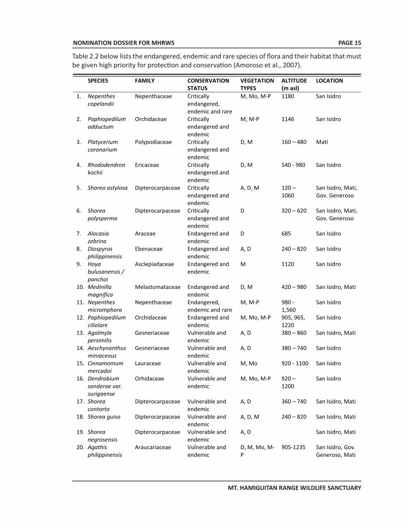
Table 2.2 below lists the endangered, endemic and rare species of flora and their habitat that must be given high priority for protection and conservation (Amoroso et al., 2007).
NOMINATION DOSSIER FOR MHRWS
MT. HAMIGUITAN RANGE WILDLIFE SANCTUARY
PAGE 16
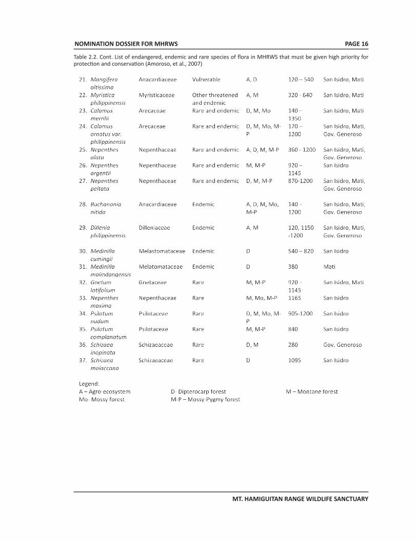
Table 2.2. Cont. List of endangered, endemic and rare species of flora in MHRWS that must be given high priority for protection and conservation (Amoroso, et al., 2007)
NOMINATION DOSSIER FOR MHRWS
MT. HAMIGUITAN RANGE WILDLIFE SANCTUARY
PAGE 17
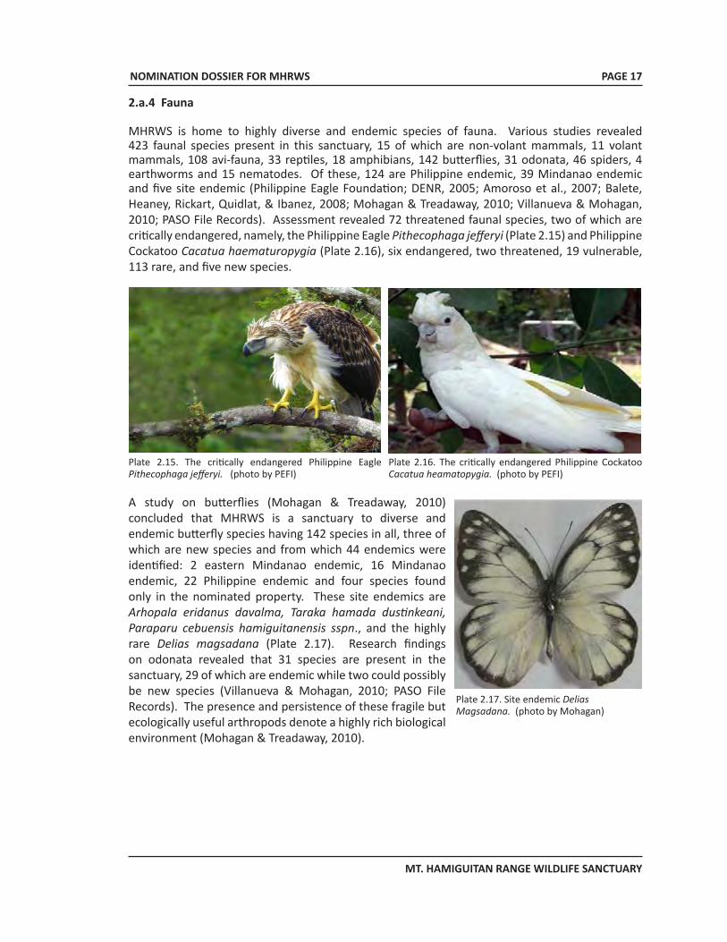
2.a.4 Fauna
MHRWS is home to highly diverse and endemic species of fauna. Various studies revealed 423 faunal species present in this sanctuary, 15 of which are non-volant mammals, 11 volant mammals, 108 avi-fauna, 33 reptiles, 18 amphibians, 142 butterflies, 31 odonata, 46 spiders, 4 earthworms and 15 nematodes. Of these, 124 are Philippine endemic, 39 Mindanao endemic and five site endemic (Philippine Eagle Foundation; DENR, 2005; Amoroso et al., 2007; Balete, Heaney, Rickart, Quidlat, & Ibanez, 2008; Mohagan & Treadaway, 2010; Villanueva & Mohagan, 2010; PASO File Records). Assessment revealed 72 threatened faunal species, two of which are critically endangered, namely, the Philippine Eagle Pithecophaga jefferyi (Plate 2.15) and Philippine Cockatoo Cacatua haematuropygia (Plate 2.16), six endangered, two threatened, 19 vulnerable, 113 rare, and five new species.
A study on butterflies (Mohagan & Treadaway, 2010) concluded that MHRWS is a sanctuary to diverse and endemic butterfly species having 142 species in all, three of which are new species and from which 44 endemics were identified: 2 eastern Mindanao endemic, 16 Mindanao endemic, 22 Philippine endemic and four species found only in the nominated property. These site endemics are Arhopala eridanus davalma, Taraka hamada dustinkeani, Paraparu cebuensis hamiguitanensis sspn., and the highly rare Delias magsadana (Plate 2.17). Research findings on odonata revealed that 31 species are present in the sanctuary, 29 of which are endemic while two could possibly be new species (Villanueva & Mohagan, 2010; PASO File Records). The presence and persistence of these fragile but ecologically useful arthropods denote a highly rich biological environment (Mohagan & Treadaway, 2010).
Plate 2.16. The critically endangered Philippine Cockatoo Cacatua heamatopygia. (photo by PEFI)
Plate 2.15. The critically endangered Philippine Eagle Pithecophaga jefferyi. (photo by PEFI)
Plate 2.17. Site endemic Delias Magsadana. (photo by Mohagan)
NOMINATION DOSSIER FOR MHRWS
MT. HAMIGUITAN RANGE WILDLIFE SANCTUARY
PAGE 18
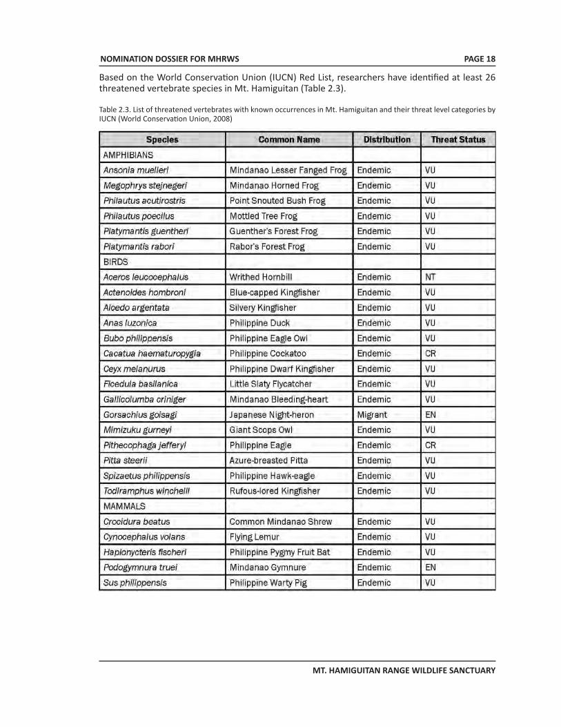
Based on the World Conservation Union (IUCN) Red List, researchers have identified at least 26 threatened vertebrate species in Mt. Hamiguitan (Table 2.3).
Table 2.3. List of threatened vertebrates with known occurrences in Mt. Hamiguitan and their threat level categories by IUCN (World Conservation Union, 2008)
NOMINATION DOSSIER FOR MHRWS
MT. HAMIGUITAN RANGE WILDLIFE SANCTUARY
PAGE 19
Plate 2.18. Site endemic Hamiguitan hairy-tailed rat Batomys hamiguitan.
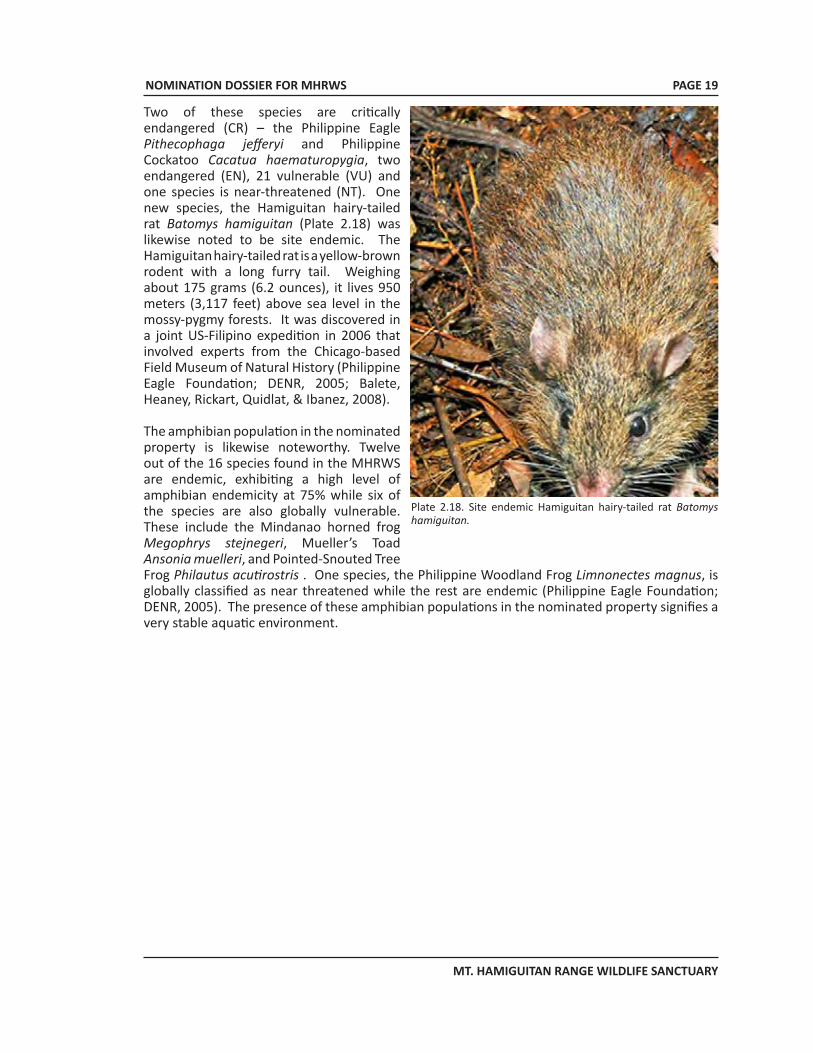
Two of these species are critically endangered (CR) – the Philippine Eagle Pithecophaga jefferyi and Philippine Cockatoo Cacatua haematuropygia, two endangered (EN), 21 vulnerable (VU) and one species is near-threatened (NT). One new species, the Hamiguitan hairy-tailed rat Batomys hamiguitan (Plate 2.18) was likewise noted to be site endemic. The Hamiguitan hairy-tailed rat is a yellow-brown rodent with a long furry tail. Weighing about 175 grams (6.2 ounces), it lives 950 meters (3,117 feet) above sea level in the mossy-pygmy forests. It was discovered in a joint US-Filipino expedition in 2006 that involved experts from the Chicago-based Field Museum of Natural History (Philippine Eagle Foundation; DENR, 2005; Balete, Heaney, Rickart, Quidlat, & Ibanez, 2008).
The amphibian population in the nominated property is likewise noteworthy. Twelve out of the 16 species found in the MHRWS are endemic, exhibiting a high level of amphibian endemicity at 75% while six of the species are also globally vulnerable. These include the Mindanao horned frog Megophrys stejnegeri, Mueller’s Toad Ansonia muelleri, and Pointed-Snouted Tree Frog Philautus acutirostris . One species, the Philippine Woodland Frog Limnonectes magnus, is globally classified as near threatened while the rest are endemic (Philippine Eagle Foundation; DENR, 2005). The presence of these amphibian populations in the nominated property signifies a very stable aquatic environment.
NOMINATION DOSSIER FOR MHRWS
MT. HAMIGUITAN RANGE WILDLIFE SANCTUARY
PAGE 20
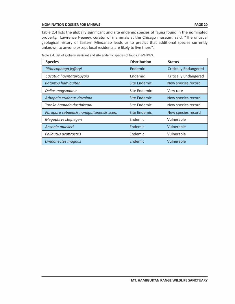
Table 2.4 lists the globally significant and site endemic species of fauna found in the nominated property. Lawrence Heaney, curator of mammals at the Chicago museum, said: “The unusual geological history of Eastern Mindanao leads us to predict that additional species currently unknown to anyone except local residents are likely to live there”.
Table 2.4. List of globally signicant and site endemic species of fauna in MHRWS.
Species Distribution Status
Pithecophaga jefferyi Endemic Critically Endangered
Cacatua haematuropygia Endemic Critically Endangered
Batomys hamiguitan Site Endemic New species record
Delias magsadana Site Endemic Very rare
Arhopala eridanus davalma Site Endemic New species record
Taraka hamada dustinkeani Site Endemic New species record
Paraparu cebuensis hamiguitanensis sspn. Site Endemic New species record
Megophrys stejnegeri Endemic Vulnerable
Ansonia muelleri Endemic Vulnerable
Philautus acutirostris Endemic Vulnerable
Limnonectes magnus Endemic Vulnerable
NOMINATION DOSSIER FOR MHRWS
MT. HAMIGUITAN RANGE WILDLIFE SANCTUARY
PAGE 21
2.b History and Development2.b.1 History of the Region
About 300 years ago, Davao Oriental was part of the Caraga Province - forming part of the Encomienda de Bislig with the Encomienda de Seargao, Butuan and Tandag. The Province became historically important in 1846, when distinguished Attorney-at-Law, Don Jose Uyanguren upon the order of Gov. Gen. Narciso Claveria, organized settlements with considerable inhabitants south of Encomienda de Bislig. Today, these are the Municipalities of Baganga, Gov. Generoso and Mati.
The settlement continued to grow. Don Jose was able to crush Datu Bago, a Muslim chieftain who ruled Samal Island in 1849. Gov. Claveria decreed the partition of Caraga Province in two: the northern portion was named Surigao Province with Surigao town as the capital and the southern Part as Nueva Vergara with Caraga town as its capital.
In 1898, Davao became a district of the Moro Province created as part of Mindanao by the Americans. In 1916, Jones Law converted the Moro Province into Department of Mindanao and Sulu.
On 1 July 1967, under Republic Act 4867, Davao was divided into three provinces. Davao Oriental was created as a separate and independent province along with Davao del Sur and Davao del Norte. Through Republic Act 4744, San Isidro which was part of the municipality of Governor Generoso separated and became an independent municipality on 18 June 1966. San Isidro has political jurisdiction on more than half of the nominated property with the Municipality of Governor Generoso and Mati City covering the rest.
The municipality of San Isidro at present, is composed of 16 barangays (a barangay is the smallest political unit of a province), which population is composed mostly of immigrants from the Visayas Region (56%) and the indigenous people, the Mandaya and other Lumads (11%) who settled at the foot of the mountain range.
2.b.2 History of Preservation/ProtectionMt. Hamiguitan is the headwater of major river systems, one of which is Dumagooc River which is the principal source of water for the lowlands, especially the municipality of Governor Generoso. Municipal Resolution No. 121-5-93 requesting for the establishment of the Dumagooc Watershed Reservation was submitted to former President Fidel V. Ramos through the Sangguniang Bayan (Municipal Council) of Governor Generoso to ensure continuous supply of water for the people. Following the objectives of the National Integrated Protected Areas System (NIPAS) set into law in 1992 under R.A. 7586, House Bill No. 3872 declaring Mt. Hamiguitan as an agri-ecotourism destination in Davao Oriental was proposed but it failed to be enacted into law. Instead, in 2001, Representative J. Mayo Z. Almario submitted to Congress House Bill No. 2777, declaring Mt. Hamiguitan as Protected Area under the category of Wildlife Sanctuary (San Isidro LGU 2003). On 30 July 2004, by virtue of Republic Act No. 9303, Mt. Hamiguitan Range Wildlife Sanctuary was formally declared a protected area with an area size of 6,834 hectares, consisting of 5,993.00 hectares core area and a buffer zone of 841.00 hectares.
In pursuance of Section 6A(a) of RA 9303, a boundary delineation and demarcation survey of the declared protected area was conducted and completed in 2007. Based on the survey result, the delineated protected area was expanded to 7,132.75 hectares wherein 6,348.99 hectares was declared as core zone and 783.77 hectares as buffer zone. The established buffer zone covers
NOMINATION DOSSIER FOR MHRWS
MT. HAMIGUITAN RANGE WILDLIFE SANCTUARY
PAGE 22
the periphery of the sanctuary and is included in the management plan of MHRWS to protect the same from activities that will directly or indirectly harm it. The Philippine Department of Environment and Natural Resources (DENR) exercises its authority over protected areas as well as buffer zones as provided for in the NIPAS Act.
Although there are direct and indirect threats from illegal logging, excessive harvesting of forest products, slash-and-burn farming (kaingin), conversion of the land to agricultural production and mineral explorations in areas adjacent to the nominated property, protected area management efforts including sustainable development and rehabilitation activities are being undertaken within and in areas immediately surrounding the nominated property. As mandated by the NIPAS Act of 1992, the MHRWS is under the control of the Protected Area and Wildlife Bureau (PAWB) of the DENR and the Protected Area Management Board (PAMB). The PAMB is the highest policy- and decision-making body of any protected area in the country. In MHRWS, its PAMB holds regular and special meetings to decide on matters relating to planning and protection of the nominated property and to address various issues and concerns related to it.
As required under RA 9303, the Protected Area Superintendent Office (PASO) was established to carry out the day-to-day operations of the protected area covering regular and special activities in relation to the management, protection and administration of MHRWS. The PASu heads the PASO, acts as the chief operations officer of the protected area and is accountable to the PAMB Chairman and the DENR thru the PENR Officer concerned. The PASu is provided technical and support staff from DENR.
In support to the DENR management, the LGUs have designated eight forest guards or “Bantay Gubat” from the three municipalities within the protected area. Through Focus Group Discussions (FGDs) organized by the Central Mindanao University, the University of the Philippines-Mindanao and the Davao Oriental State College of Science and Technology, members of the “Bantay Gubat” were capacitated in inventory techniques, floral and faunal identification as well as classification and preservation of specimens for analysis.
Indigenous communities present in the area have also helped extensively in the management of the property through the application of their existing traditional beliefs and practices (Amoroso, Aspiras, & Polizon, 2007). They value this site as their home. They are knowledgeable of the endemic species found in the area and have nurtured these species, as their ancestors did in the past. Surrounding the nominated property as they do, these indigenous communities provide another layer of protection to the MHRWS, deterring the entry of unscrupulous people with illegal intentions and acting as diligent watch for the PAMB and the PASO.
Various conservation initiatives from the academe, scientists, environmental advocates and NGOs were also undertaken to strengthen the protection and management of the sanctuary and policy formulation of PAMB. Technical assistance in the form of research projects and studies, particularly on biodiversity assessment and conservation of endangered, endemic and economically important flora and fauna of was conducted in the past, providing the PAMB with appropriate information that could be transformed to practical policies. One of the initiatives was the training of stakeholders of the Mt. Hamiguitan Range Wildlife Sanctuary on biodiversity monitoring and evaluation (BIOME) given by the Central Mindanao University (CMU), Bukidnon Resources Management Foundation, Inc. (BRMFI), the Philippine Eagle Foundation (PEF) and the DENR PAW-Region 11, through the support of the Critical Ecosystem Partnership Fund (CEPF) (Amoroso, et al., 2007). Another
NOMINATION DOSSIER FOR MHRWS
MT. HAMIGUITAN RANGE WILDLIFE SANCTUARY
PAGE 23
noteworthy project developed was the Eastern Mindanao Corridor Biodiversity Assessment and Archiving Project (EMCBAAP) in 2005 by the Philippine Eagle Foundation designed to assess and archive these threatened biodiversity resources and capacity building of stakeholders.
The ongoing or most recent completed research studies in MHRWS include the following:• Partnerships for Enhancing Expertise in Taxonomy of Insects (with a concentration on
Auchenorrhyncha): Assessing Philippine Biodiversity including their Relationships to Each Other and to Other Regions by Dr. Alma B. Mohagan, Central Mindanao University, Philippiness in collaboration with Dr. Chris Simon, University of Connecticut, CT, Dr. Chris Dietrich, Natural History Survey, IL and Dr. Jason Cryan, New York State Museum, NY. The study (currently ongoing) covers a group insects known as Auchenorrhyncha which includes a great number of described species of Fulgoroidea and Cicadelloidea (plant hoppers, frog hoppers, leaf hoppers), of Cicadoidea (cicadas), of Membracoidea (tree hoppers), and of Cercopoidea (spittlebugs).
• Resource Valuation of Hamiguitan Mountain Range conducted in 2008 and 2009 by the University of Southern Mindanao in collaboration with Mindanao State University-Iligan Institute of Technology, Southern Christian College, Cebu Biodiversity Conservation Foundation and the National Museum. The study was subdivided into three parts: mapping, biodiversity survey and valuation. Partial data were provided to the PAMB last September 2010.
• Biosystematics of the Genus Amomum Roxb. (Family Zingiberaceae) in the Philippines by Florfe M. Acma, 2008-2009. The full report is scheduled to be presented to the PAMB.
• Diversity and status of Butterflies across vegetation types of Mt. Hamiguitan, Davao Oriental, Philippines (Mohagan & Treadaway, 2010) Central Mindanao University, Musuan, Bukidnon
• Diversity and status of odonata across vegetation types in Mt. Hamiguitan Range Wildlife Sanctuary, Davao Oriental (Villanueva & Mohagan, 2010), Central Mindanao University, Musuan, Bukidnon
3. Justification for Inscription 3.a Criteria under which inscription is proposed
Criterion (x): contain the most important and significant natural habitats for in-situ conservation of biological diversity, including those containing threatened species of outstanding universal value from the point of view of science or conservation.
The nominated property is home to 957 species of flora that include 171 endemics, of which 3 are site endemic (McPherson, 2009), i.e., they are found nowhere else in the world but MHRWS. It likewise provides shelter to 423 species of fauna with 124 endemics and 5 site endemics (Philippine Eagle Foundation; DENR, 2005; Balete, Heaney, Rickart, Quidlat, & Ibanez, 2008; Mohagan & Treadaway, 2010; Villanueva & Mohagan, 2010). The species list of MHRWS includes globally significant species such as the critically endangered dipterocarp species of genus Shorea and the rare orchid Paphiopedilum adductum along with fauna of equally universal importance such as the Philippine eagle Pithecophaga jefferyi and the Philippine Cockatoo Cacatua haematuropygia. The list also features an array of endemic species, including site endemic species such as the Nepenthes hamiguitanensis and the Hamiguitan hairy-tailed rat Batomys hamiguitanensis. Other potentially unique examples of biodiversity in the MHRWS still await taxonomic confirmation by experts. In addition to this, its extensive and varied forest types significantly contribute to carbon sequestration while providing a reliable fresh water source, among other ecologically important services (Philippine Eagle Foundation; DENR, 2005).
NOMINATION DOSSIER FOR MHRWS
MT. HAMIGUITAN RANGE WILDLIFE SANCTUARY
PAGE 24
Past geologic processes that took place in the region transformed the local geography into a semi-isolation that is the Pujada Peninsula, the cradle of the Hamiguitan Mountain Range. As a result of this semi-isolation and its varied habitat types growing in dissimilar soil and climate conditions, its biodiversity has shown a significantly high level of endemicity that has led scientists to believe that there may be more globally unique species waiting to be discovered in the area. Thus MHWRS is an exemplary example of biodiversity that is resilient and adaptive even in the face of adverse environmental conditions. The lessons that could be learned from the unique biodiversity, its interrelationships and its coping mechanisms could likely provide insight into appropriate climate change adaptive measures for current and future reference. Thus its preservation and protection ought to be of global concern.
3.b Statement of Outstanding Universal ValueMHRWS, located at the southeastern corridor of Mindanao Island, Philippines, is a unique showcase of terrestrial and aquatic habitats and their faunal denizens evolving in different altitudes and drastically dissimilar soil and climate conditions. It represents a veritable treasure trove of biodiversity, providing a surface area of 7,132.76 hectares of sanctuary to a host of globally threatened and endemic flora and fauna, eight of which know no other home in the world but Mt. Hamiguitan. Its high level of endemicity concentrated in a small undulating landscape is cause for global concern in view of its fragility. MHRWS teaches a universal lesson on nature’s resilience, its ability to adapt to changing environmental settings and its limitations given man’s impositions.
MHRWS exhibits segmentation of terrestrial habitats according to elevation. At the lowermost portion of the property, the agro-ecosystem (75-420 masl) with its agro-forest plantations and remnants of dipterocarp forests house some 246 plant species, 44 of which are endemic including the globally threatened dipterocarps of the genus Shorea. Butterflies (22 species) still abound in this ecosystem despite the rarity of other fauna. Above the agro-ecosystem, the dipterocarp forest ecosystem (420-920 masl), characterized by the presence of big trees, is home to 418 plant and 146 animal species which include the globally threatened Mindanao bleeding heart and Philippine warty pig. Further up between 920-1,160 masl, the montane forest ecosystem exhibits numerous species of mosses, lichens and epiphytes. It displays 462 plant species with the Agathis philippinensis (VU) dominating the area in heights of up to 25 meters. This ecosystem type houses 105 animal species representing all the animal groups found in MHRWS as well as the new rat species Hamiguitan hairy-tailed rat Batomys hamiguitan. The fourth ecosystem type is the typical mossy forest ecosystem found at elevation ranges of 1160¬1350 masl and is characterized by the thick mosses covering roots and tree trunks. It contains 246 plant species where Gordonia subclavata dominate at heights of up to 15 meters and where animal species that include the globally threatened the Philippine pygmy fruit bat Haplonycteris fischeri and the Pointed-snouted tree frog Philautus acutirostris reside.
Criterion (x): MHRWS represents a complete set of intact mountain ecosystems in a significant biogeographic region of the Philippines. Its diversity of plants and animals include globally threatened species as well as species that exist only in the Philippines, only in Mindanao and only in the nominated property. The natural tropical bonsai forest that crowns the MHRWS epitomizes nature’s bid to survive even in adverse conditions and chronicles man’s critical role in its fragile success. With its high number of unique, endemic and globally threatened species of flora and fauna evolving in this small pocket of land,
NOMINATION DOSSIER FOR MHRWS
MT. HAMIGUITAN RANGE WILDLIFE SANCTUARY
PAGE 25
At the topmost (1160-1200 masl) is the mossy-pygmy forest ecosystem that adds a unique layer to the property. A total of 338 plant species are found spread over 1,234 hectares of natural tropical bonsai forest that include the globally threatened species Paphiopedilum adductum (CR), P. ciliolare (EN) and stunted growths of Agathis philippinensis (VU). It also provides sanctuary to 49 animal species including Philippine Warty Pig Sus philippensis (VU) and the Pointed-Snouted Tree Frog Philautus acutirostris (VU). This pygmy forest is also the only known habitat in the world of the pitcher plant Nepenthes hamiguitanensis and the equally rare butterfly Delias magsadana.
The interesting combination of terrestrial and aquatic ecosystems in the nominated property MHRWS is home to a total of 1,380 species with 341 endemics that include the critically endangered Philippine Eagle and the Philippine Cockatoo as well as the Shorea polysperma, S. astylosa and the orchid Paphiopedilum adductum, to name a few. It manifests a high level of endemicity that is well exemplified by its amphibian (75%) and reptilian (84%) populations (Philippine Eagle Foundation; DENR, 2005) and is at par with, if not higher than, other globally significant habitats in the world. Despite the presence of threats in and around the property such as illegal collection of wildlife and mining, it is still generally intact and of adequate size to provide for the conservation of its biodiversity and other natural resources. The present land or vegetative cover of the sanctuary indicates that the property is in its pristine condition with 73% of its surface area covered by closed canopy forest, 18% by open canopy forest and only 8.7% as brush land. The terrestrial and aquatic habitats are well preserved and globally threatened and endemic species such as the critically endangered Philippine Eagle, the Philippine Cockatoo and the fragile orchid Paphiopedilum adductum still thrive within the MHRWS. Populations of site-endemic butterflies such as the Arhopala eridanus davalma, Taraka hamadadustinkeani and Delias magsadana thrive along with the globally threatened Philippine Woodland Frog Limnonectes magnus, Mueller’s Toad Ansonia muelleri, and Pointed-Snouted Tree Frog Philautus acutirostri, sensitive bioindicators that point to the healthy state of the forest and aquatic habitats of the nominated property. Waters exiting the MHRWS are crystal clear, further attesting to the pristine condition of its core zone.
There are several layers of protective measures in place from the national to the local levels. Legislations and policies such as the NIPAS Act and RA 9303 have been promulgated to ensure the property’s protection and management. Apart from delineating the boundaries of the property, these laws make sure that no physical interventions, such as logging, mining exploration or surveying for energy resources are allowed inside the property. Enforcement is shared by both the national and local government agencies in partnership with other stakeholders. As a result, recent monitoring activities have shown that the globally threatened and endemic species of flora and fauna, especially the site endemic species, continue to thrive within the nominated property.
The preservation of MHRWS is further strengthened by the local and indigenous communities living in its periphery. Their lifestyles and spiritual beliefs are based on a healthy respect for the environment and its biodiversity and have, over time, subtly molded their way of life to ensure the sustainable use of their resources. At the same time, the harsh conditions of the mountain range serve as a deterrent for other human settlements that do not conform to a similarly symbiotic lifestyle. Thus the core zone is free of human habitation.
EXECUTIVE SUMMARY FOR MHRWS
MOUNT HAMIGUITAN RANGE WILDLIFE SANCTUARY
PAGE 26
The MHRWS Management Plan is currently being implemented by the Mt. Hamiguitan PAMB and the PASO. The plan, formulated in 2010 in consultation with the various stakeholders of the nominated property, provides for key programs of conservation: information dissemination, conservation research and monitoring, conservation management and enforcement, and sustainable development. Its review in a few years’ time will ensure that conservation efforts for the nominated property will continue to be appropriate and effective over the years to come.
3.c Comparative Analysis (including state of conservation of similar properties)The Mt. Hamiguitan Range Wildlife Sanctuary, a property of outstanding universal value, is of paramount conservation concern. The nominated property is a unique site for ecological specialization and conservation studies because of its rich biodiversity that features a high endemicity index even in the face of harsh environmental conditions.
Mt. Hamiguitan Range Wildlife Sanctuary is being compared with the following similar properties:
1. Sichuan Giant Panda Sanctuaries (SGPS) - Wolong, Mt. Siguniang and Jiajin Mountains. This property is home to more than 30% of the world’s pandas which are classified as highly endangered and covers 924,500 ha with seven nature reserves and nine scenic parks in the Qionglai and Jiajin Mountains. The sanctuaries constitute the largest remaining contiguous habitat of the giant panda, a relict from the paleotropic forests of the Tertiary Era. It is also the species’ most important site for captive breeding (Advisory Body Evaluation). The following points of comparison are noted between this World Heritage Site and the MHRWS:
a. The two sites exhibit a similarity in topography, characterized by variations in elevation with the SGPS having a wider range of altitude, more heavily ridged terrain dissected by deep valleys and gorges featuring perennial rivers emanating from glaciated snow peaks. On the other hand, MHRWS is tropical in nature and its terrain is more undulating than jagged. The rivers of MHRWS originate from watersheds covering the property. Because of the similarity in the topography, both sites exhibit a diversity of habitat types within its boundaries with the MHWRS, again, being more tropical in its type of vegetation while that of the SGPS is more of the temperate variety. In further contrast to the SGPS, the surface area of the MHWRS is infinitely smaller and possesses fewer varieties of habitat types.
The geologic characteristic of the SGPS is predominantly Triassic siltstone, limestone, slate, and Permocarboniferous rock. In comparison, MHRWS soil is characterized by high levels of iron, nickel and cobalt with silica and alumina being present to a lesser extent, giving the terrain a harsher and more toxic environment for plants and animals. Although there is limited paleontologic data on the MHRWS as is available on the SGPS, the presence of a large spread of pygmy forest on the crest of the property that is home to some of the site-endemic species suggest at a plethora of information on the evolutionary path these plants and animals took to survive their naturally toxic environment.
b. Both sites are home to globally threatened, rare and endemic species of plants and animals. Although the SGPS contains a much higher number of species, it is spread throughout an infinitely larger area. Thus MHRWS exhibits significantly higher floral and faunal species densities per hectare. In addition, MHRWS showcases site endemic species of flora and fauna. With these two considerations and the glaring difference in the size of the properties in mind, it may be concluded that MHRWS faces a higher degree of challenge in conserving its biodiversity since a loss of even one hectare of habitat can result in bigger losses to its ecological integrity than it would to that of SGPS.
c. Both sites are managed by their respective state parties and conduct conservation activities as identified in their Management Plans. MHRWS management, however, is much younger, having only been declared a protected area in 2004. Both nevertheless favor research and ecotourism activities over any other within its protected areas. Similar to SGPS, MHRWS has one human settlement within the periphery of its property. This settlement, however, is limited to the multiple-use zone and its residents assist the management in monitoring the area against illegal activities.
2. Keoladeo National Park (KNP) – The site is situated in Eastern Rajasthan, 2 km southeast of Bharatpur and 50 km west of Agra. The area consists of a fat patchwork of marshes in the Gangetic plain, artificially created in the 1850s and maintained ever since by a system of canals, sluices and dykes. This former duck-hunting reserve of the Maharajas is one of the major wintering areas for large numbers of aquatic birds from Afghanistan, Turkmenistan, China and Siberia. Some 364 species of birds, including the rare Siberian crane, have been recorded in the park (Advisory Body Evaluation). The following discussion studies its similarities and differences with MHRWS:
a. MHRWS differs wholly in topography, situated as it is on a mountain range. Thus habitat types are likewise different from that of KNP in that it is more varied and spanning a comparatively larger area. In addition, the two sites differ in its origins as the MHRWS evolved naturally without human intervention. The MHRWS also has a natural supply of fresh water and does, in fact, support the additional demand for water outside of the property. The similarity of the two sites lies in their relatively small surface area and in the fact that both are surrounded by human settlements in its periphery which has implications on its management needs.
b. The composition and nature of the biodiversity in the two sites are also significantly different from each other. While that of the KNP is mostly migratory in nature and aquatic in classification, the biodiversity of the MHRWS is primarily terrestrial and has a highly limited habitat range with some species further limited to specific habitat types within the nominated property. The KNP exhibits a higher faunal density given its smaller size. However, given the migratory nature of most of these animals, the demand on its habitat may not be as great or as constant throughout the year as is experienced in MHRWS.
NOMINATION DOSSIER FOR MHRWS
MT. HAMIGUITAN RANGE WILDLIFE SANCTUARY
PAGE 27
c. KNP has a long history of protection, having been created more than a century ago. Given its man-made origins and its small area, the delineation of its boundaries is not as complex or involved a process as in MHRWS. In contrast, the evolution of the management of MHRWS involved several stakeholders with different motivations coming together because of one commonality which is the nominated property. Furthermore, although both sites are surrounded by human settlements, KNP’s management concerns appear to mainly focus on the biological and ecological issues since their anthropogenic threats have apparently been controlled. In the case of MHRWS, anthropogenic threats make up the majority of current and potential threats to its biodiversity.
3. Dong Phayayen-Khao Yai Forest Complex (DPKY-FC) – This property spans 230 km between Ta Phraya National Park on the Cambodian border in the east and Khao Yai National Park in the west. The site is home to more than 800 species of fauna including 112 mammal species (among them two species of gibbon), 392 birds and 200 reptile and amphibian species (Advisory Body Evaluation).
a. Of the three World Heritage Sites compared to the MHRWS, the DPKY-FC closely approximates it in elevation range, its undulating terrain and its varying vegetation types. The MHRWS, similar to DPKY-FC, also features river systems that supply neighboring settlements of its fresh water. Although a very large difference in size can be observed, both sites feature globally threatened and endemic species. Both belong to their respective biogeographic unit based on the Conservation International’s biogeographic hotspot identification process. MHRWS has likewise been identified as a Key Biodiversity Area (KBA) by CI and as an Important Bird Area (IBA) by Birdlife International in view of the significant bird population in its boundaries.
Apart from the large difference in surface area, the two sites also differ in their soil composition. Despite having apparently similar geologic processes giving rise to their respective mountain ranges, Permo-Triassic igneous volcanic rocks, Jurassic calcareous, micaceous siltstones and sandstones, and limestone karsts characterize the DPKY-FC. In contrast, MHRWS resulted in an ultramafic soil rich in nickel and cobalt that created a more toxic and therefore challenging environment for its plants and animals to survive in.
b. The total number of flora and fauna species found in DPKY-FC is vastly greater than MHRWS partly as a result in the big difference in surface area covered by the two sites. Both sites contain globally threatened and endemic species nonetheless with MHRWS showcasing site endemics as well. Furthermore, MHRWS notably exhibits a higher species density, again, due to its smaller area. Thus it faces a bigger challenge in conserving its biodiversity by comparison.
4. Rwenzori Mountains National Park (RMNP) – The Rwenzori Mountains National Park (RMNP) in Uganda comprises of glacier and snow-capped mountains just kilometers above the equator and is the third highest mountain in Africa at 5,109 m. RMNP covers an area of 99,600 ha of which 70% lies at over 2,500 m in height. The Rwenzori Mountains are the highest and most permanent sources of the River Nile and comprises an important water catchment. Its fast flowing rivers, magnificent waterfalls and stratified vegetation make the property exceptionally scenic and beautiful. The mountains are well-known for their unique alpine flora which includes many species endemic to the Albertine Rift in the higher altitude zones including giant heathers, groundsels and lobelias. The Park also supplies local communities with various wild resources and is an important cultural heritage (Advisory Body Evaluation).
NOMINATION DOSSIER FOR MHRWS
MT. HAMIGUITAN RANGE WILDLIFE SANCTUARY
PAGE 28
a. Except for a large difference in property size and elevation, the habitats of RMNP and MHRWS both exhibit stratified vegetation and fresh water systems that represent a vital water catchment for their respective localities. Both properties report a high degree of endemicity of flora and fauna although species composition greatly varies between sites. Interestingly, where RMNP is characterized by giant flora (hence its name “Africa’s botanical big game”), MHRWS is known for its pygmy forest which constitutes about one fifth of the property. The two sites differ in soil composition likely giving rise to this difference. Both sites have been designated as IBAs although their avian species, again, varies but this nevertheless adds to the conservation significance of both properties.
b. Although both properties are mountainous in character, their biodiversity vastly differs primarily because of their geographical location. Both sites represent microcosms of their respective regional biodiversity and thus are highly significant in their respective totality. Considering this and the great difference in the sizes of the properties, the demands of managing an area as large as RMNP may be much greater but it is undeniable that a loss of even a hectare of MHRWS will cause a bigger blow to biodiversity conservation in general.
5. Mt. Kitanglad Natural Park (MKNP) – This protected area in the Philippines is just north of the nominated property and is also found in Mindanao Island. The site houses 1,257 species of flora and fauna spread over 47,270 hectares rising up to about 2,900 masl. It is the headwater source of several major river systems that drain northern and central Mindanao and is being nominated as an ASEAN heritage site by the state party (DENR).
a. Given their close proximity, the Mt. Kitanglad Natural Park (MKNP) and the MHRWS share some species including the critically endangered Philippine eagle. Both sites exhibiting high endemicity although MHRWS represents a much higher density of both flora and fauna in view of the property size difference. MKNP reaches higher altitudes than MHRWS and also displays a pygmy forest near its crest but the trees in the MKNP bonsai forest are still much bigger, standing at 10-12 m. This may be partly due to the degree of infertility of the soil of the respective sites.
b. The biggest difference in the two sites is in the level of development within their boundaries. While MKNP slopes contain several infrastructures such as communication towers and settlements, MHRWS forest habitats are relatively pristine with only 474 hectares in the lower slopes allotted for human settlements. Due to this development in the area, studies in MKNP have shown signs of decline and possible local extirpation of some species of fauna (DENR). Thus, despite the huge difference in size, MHRWS exhibits a higher level of biodiversity making it more critically significant to conservation.
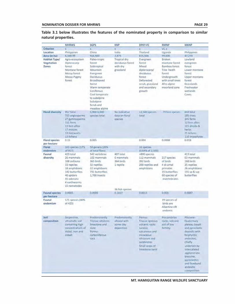
NOMINATION DOSSIER FOR MHRWS
MT. HAMIGUITAN RANGE WILDLIFE SANCTUARY
PAGE 29
Table 3.1 below illustrates the features of the nominated property in comparison to similar natural properties.
NOMINATION DOSSIER FOR MHRWS
MT. HAMIGUITAN RANGE WILDLIFE SANCTUARY
PAGE 30
3.d Integrity of the nominated propertyMHRWS contains the typical mountain ecosystems of the biogeographic region it belongs to which include the agro-ecosystem, the dipterocarp, the montane, the mossy, and mossy-pygmy forests. These ecosystems harbor an assemblage of endemic, rare and economically important flora and fauna. Of foremost significance is the rediscovery of a nesting Philippine eagle (CR) in its vicinity when it was previously believed to have been locally extirpated. The geomorphology, variations in topography and typical tropical climate of the nominated property have contributed to the development and maintenance of species biodiversity and high endemism in both plants and animals.
The natural tropical bonsai forest or the mossy-pygmy forest which is located at the topmost portion provides an added interesting layer to the property with its century-old fruit-bearing trees standing at less than two meters in height. With a total surface area of 1,234 hectares, it has attracted the interests of national and international scientists because of the presence of globally threatened species such as Paphiopedilum adductum (CR), P. ciliolare (EN), the Philippine Warty Pig Sus philippensis (VU), and the Pointed-Snouted Tree Frog Philautus acutirostris (VU). Most especially, researchers the world over have their eyes on the new species of pitcher plant Nepenthes hamiguitanensis and the equally rare butterfly Delias magsadana that can only be found in this habitat.
Overall research findings (Amoroso et al., 2007) indicate that the property is of adequate size to sustain the existing species in the MHRWS. Globally threatened and endemic species along with other more fragile bioindicators such as the butterflies (Mohagan & Treadaway, 2010), odonata (Villanueva & Mohagan, 2010) and the amphibians (Philippine Eagle Foundation; DENR, 2005; PASO File Records) continue to thrive, attesting to the healthy condition of its terrestrial and aquatic habitats. Fresh water emanating from MHRWS remains crystal clear as it leaves the property (PASO File Records), further evidence of the undisturbed condition of the core zone where the major rivers and its tributaries originate.
Agro-forestry plantations – where the presence of human activities is relatively intense – intersperse with remnants of the natural forests within the buffer zone. These agro-forestry plantations are covered by legal instruments such as Community-Based Forestry Management Agreements (CBFMA) and Certificate of Stewardship Contracts (CSC) issued by the DENR prior to the enactment of RA 9303 in 2004. Further up into the dipterocarp and montane areas previously subjected to selective logging until the 1980s, some small patches of open canopies show recovery as the natural regeneration process remain unhampered. Likewise, wild faunal populations appear to be recovering due to the strict prohibition on hunting inside the property. The mossy and the mossy-pygmy/bonsai forests remain untouched by logging operations since the trees in the area are never big enough to be of commercial interest. Neither are there roads in the vicinity precisely because of the absence of logging activities in this portion of the property in the past. Only narrow foot trails can be observed across these portions which have recently become overgrown with mosses and grasses (Ponce, 2011) since MHRWS was closed to visitors for almost a year pending the formulation of the ecotourism business plan.
Other factors contributed to the preservation of the outstanding biological features of MHRWS as well. Except for areas covered by CBFMAs and CSCs, no land conversion for agricultural purposes occurred within the MHRWS even prior to the enactment of RA 9303 in 2004. This is due to the common knowledge that most agricultural plants, particularly short-term crops, do not thrive in ultramafic soil. In addition, the lack of roads and related infrastructures within the property add to the impracticality of the notion. Furthermore, having learned of the existence of the wondrous natural bonsai forest in the early 1990s, the heads of the LGUs with territorial jurisdiction over the property decided to initiate protection and preservation measures, even going as far as rejecting a major proposal for mining in the Municipality of San Isidro.
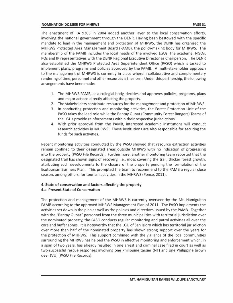
NOMINATION DOSSIER FOR MHRWS
MT. HAMIGUITAN RANGE WILDLIFE SANCTUARY
PAGE 31
The enactment of RA 9303 in 2004 added another layer to the local conservation efforts, involving the national government through the DENR. Having been bestowed with the specific mandate to lead in the management and protection of MHRWS, the DENR has organized the MHRWS Protected Area Management Board (PAMB), the policy-making body for MHRWS. The membership of the PAMB includes the local heads of the involved LGUs, the academe, NGOs, POs and IP representatives with the DENR Regional Executive Director as Chairperson. The DENR also established the MHRWS Protected Area Superintendent Office (PASO) which is tasked to implement plans, programs and policies approved by the PAMB. A multi-stakeholder approach to the management of MHRWS is currently in place wherein collaborative and complementary rendering of time, personnel and other resources is the norm. Under this partnership, the following arrangements have been made:
1. The MHRWS PAMB, as a collegial body, decides and approves policies, programs, plans and major actions directly affecting the property.
2. The stakeholders contribute resources for the management and protection of MHRWS.3. In conducting protection and monitoring activities, the Forest Protection Unit of the
PASO takes the lead role while the Bantay Gubat (Community Forest Rangers) Teams of the LGUs provide reinforcements within their respective jurisdictions.
4. With prior approval from the PAMB, interested academic institutions will conduct research activities in MHRWS. These institutions are also responsible for securing the funds for such activities.
Recent monitoring activities conducted by the PASO showed that resource extraction activities remain confined to their designated areas outside MHRWS with no indication of progressing into the property (PASO File Records). Furthermore, another monitoring team reported that the designated trail has shown signs of recovery, i.e., moss covering the trail, thicker forest growth, attributing such developments to the closure of the property pending the formulation of the Ecotourism Business Plan. This prompted the team to recommend to the PAMB a regular close season, among others, for tourism activities in the MHRWS (Ponce, 2011).
4. State of conservation and factors affecting the property 4.a Present State of Conservation
The protection and management of the MHRWS is currently overseen by the Mt. Hamiguitan PAMB according to the approved MHRWS Management Plan of 2011. The PASO implements the activities set down in the plan as well as the policies and directives issued by the PAMB. Together with the “Bantay Gubat” personnel from the three municipalities with territorial jurisdiction over the nominated property, the PASO conducts regular monitoring and patrol activities all over the core and buffer zones. It is noteworthy that the LGU of San Isidro which has territorial jurisdiction over more than half of the nominated property has shown strong support over the years for the protection of MHRWS. This support combined with the vigilance of the local communities surrounding the MHRWS has helped the PASO in effective monitoring and enforcement which, in a span of two years, has already resulted in one arrest and criminal case filed in court as well as two successful rescue responses involving one Philippine tarsier (NT) and one Philippine brown deer (VU) (PASO File Records).
NOMINATION DOSSIER FOR MHRWS
MT. HAMIGUITAN RANGE WILDLIFE SANCTUARY
PAGE 32
It is likewise significant to note that the Provincial Government of Davao Oriental as well as the Municipal Governments of San Isidro, General Generoso and Mati have aligned their tourism and development plans to the Management Plan of MHRWS. This move will ensure that the protection of the nominated property will be given adequate importance and consideration and that development in the next few years will not hamper nor detract from the conservation of the biodiversity of MHRWS.
To date, the core zone of the nominated property remains well preserved and intact as evidenced by the results of studies conducted recently (Mohagan & Treadaway, 2010; Villanueva & Mohagan, 2010; Ponce, 2011). The present vegetative cover (Figure 4.1) of MHRWS is composed of 4,668.94 hectares closed canopy forest which includes the 1,234 pygmy forest, 1,139.67 hectares open canopy forest and 540.39 hectares brushland (Table 4.1). The closed canopy forest represents the habitats of 1,379 known plant and animal species, of which 246 are endemic, 45 threatened, 59 rare and 204 of economic importance. Hence, except for 474 hectares, the core zone is classified as Strict Protection Zone (SPZ) wherein human activity is limited to scientific studies while visitor entries are under the strict guidance of the PA rangers. The open canopy forest as well as the brushland will be subject to future rehabilitation to ensure the stability of the habitat of the MHRWS fauna.
Threats to MHRWS such as bio-prospecting, illegal collection of non-timber forest products and unauthorized entry of visitors to the pygmy forest continue to exist. These illegal activities have been considered in the recent formulation of the Management Plan wherein mitigating measures have been likewise identified and are now being implemented by the PASO and its partners. The PASO and its partner stakeholders also conduct the Biodiversity Monitoring System (BMS) every quarter of the year. Data gathered from these activities are presented to the PAMB for translation to policy developments and/or actions.
As an additional layer of threat, mining operations continue just outside of the nominated area buffer zone which will also have some negative implications on MHRWS however indirectly. The MHRWS PAMB is studying possible measures to mitigate this. Thus far, one of the possible options they have considered is the promotion of ecotourism activities in the area to compete with the mining lure for a stable source of income. The LGUs are likewise encouraging ecotourism developments to this end.
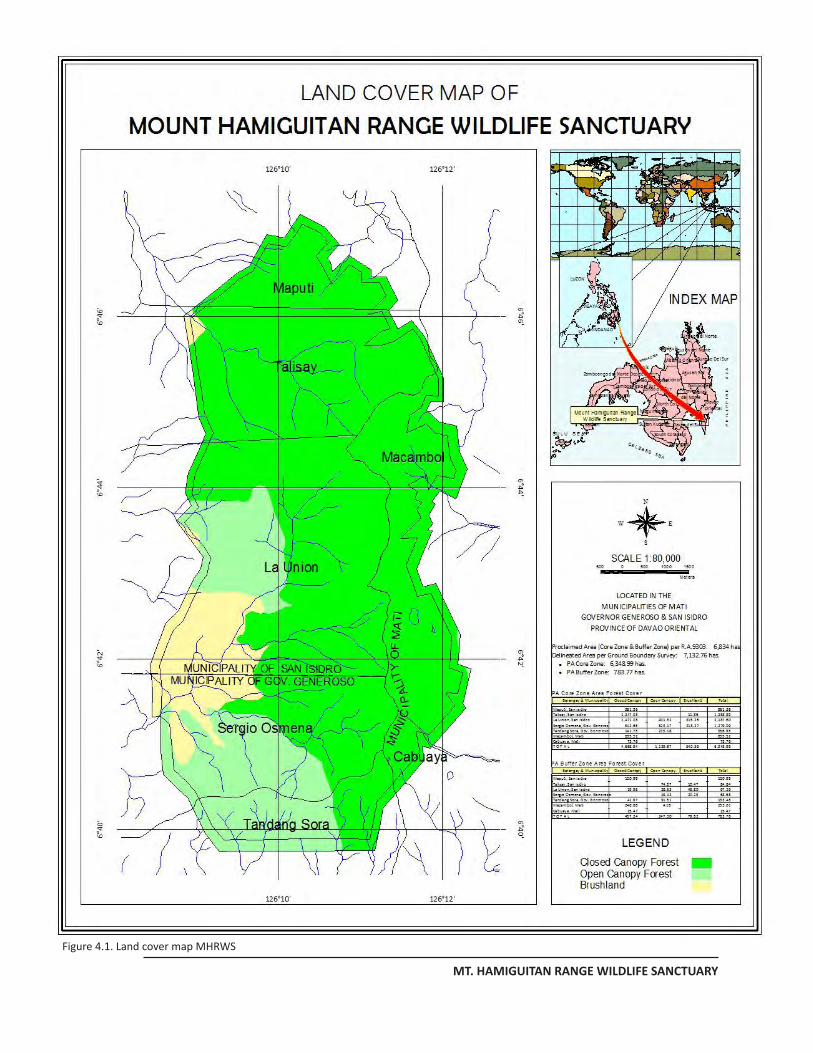
NOMINATION DOSSIER FOR MHRWS
MT. HAMIGUITAN RANGE WILDLIFE SANCTUARY
PAGE 34
Figure 4.1. Land cover map MHRWS
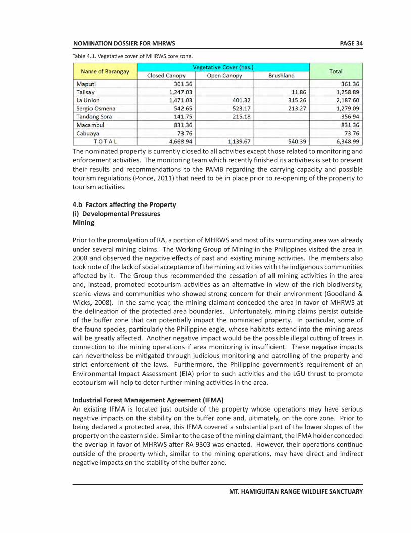
NOMINATION DOSSIER FOR MHRWS
MT. HAMIGUITAN RANGE WILDLIFE SANCTUARY
PAGE 34
The nominated property is currently closed to all activities except those related to monitoring and enforcement activities. The monitoring team which recently finished its activities is set to present their results and recommendations to the PAMB regarding the carrying capacity and possible tourism regulations (Ponce, 2011) that need to be in place prior to re-opening of the property to tourism activities.
4.b Factors affecting the Property(i) Developmental PressuresMining
Prior to the promulgation of RA, a portion of MHRWS and most of its surrounding area was already under several mining claims. The Working Group of Mining in the Philippines visited the area in 2008 and observed the negative effects of past and existing mining activities. The members also took note of the lack of social acceptance of the mining activities with the indigenous communities affected by it. The Group thus recommended the cessation of all mining activities in the area and, instead, promoted ecotourism activities as an alternative in view of the rich biodiversity, scenic views and communities who showed strong concern for their environment (Goodland & Wicks, 2008). In the same year, the mining claimant conceded the area in favor of MHRWS at the delineation of the protected area boundaries. Unfortunately, mining claims persist outside of the buffer zone that can potentially impact the nominated property. In particular, some of the fauna species, particularly the Philippine eagle, whose habitats extend into the mining areas will be greatly affected. Another negative impact would be the possible illegal cutting of trees in connection to the mining operations if area monitoring is insufficient. These negative impacts can nevertheless be mitigated through judicious monitoring and patrolling of the property and strict enforcement of the laws. Furthermore, the Philippine government’s requirement of an Environmental Impact Assessment (EIA) prior to such activities and the LGU thrust to promote ecotourism will help to deter further mining activities in the area.
Industrial Forest Management Agreement (IFMA)An existing IFMA is located just outside of the property whose operations may have serious negative impacts on the stability on the buffer zone and, ultimately, on the core zone. Prior to being declared a protected area, this IFMA covered a substantial part of the lower slopes of the property on the eastern side. Similar to the case of the mining claimant, the IFMA holder conceded the overlap in favor of MHRWS after RA 9303 was enacted. However, their operations continue outside of the property which, similar to the mining operations, may have direct and indirect negative impacts on the stability of the buffer zone.
Table 4.1. Vegetative cover of MHRWS core zone.
NOMINATION DOSSIER FOR MHRWS
MT. HAMIGUITAN RANGE WILDLIFE SANCTUARY
PAGE 35
PollutionCurrently, there is a minor pollution problem in the property involving small-time offenders such as illegal gatherers and poachers who sometimes leave behind trash and other non-biodegradable materials in their rush to avoid detection and apprehension. It is also expected that the volume of solid, biological and even chemical waste may increase in the future with the promotion of tourism in the area. This potential problem is already being addressed by the PAMB and the heads of the LGUs with the preparation of the ecotourism business plan which, among others, will attempt to find measures to mitigate such problems, if not totally avoid it. As an initial step towards it, the PAMB has tasked the monitoring team to assess the carrying capacity of the property as well as delineate the trails that would be used by tourists in the future (Ponce, 2011) to identify the potential areas for concern.
(ii) Environmental Pressures
The MHRWS currently does not suffer from environmental pressures such as those associated with climate change. Its current problems predominantly center on anthropogenic pressures. However, it is possible that, should climate change impacts increase in severity, e.g., longer periods of droughts, drastic increase in amount of precipitation, storms of higher frequency and intensity, it is likely to affect the pygmy forest first, resulting in soil erosion and washing out of the stunted trees in the areas nearest the water sources. Given the relatively small surface area of the property, this can have severe effects on the biodiversity of MHRWS. In the worst case scenario, this could lead to the loss of a significant amount of habitat and possibly even of its site endemic species.
Furthermore, with the introduction of ecotours in the property, the demand for fresh water in the area is likely to increase depending on the volume of tourists that will be attracted by the property. This early on and as previously mentioned, the PAMB has closed the MHRWS to the public pending the formulation of an ecotourism business plan and has tasked the monitoring team to conduct a study on the carrying capacity of the property. It is hoped that, with proper planning, these potential problems may be circumvented.
(iii) Natural disasters and risk preparedness (earthquakes, floods, fires)
MHRWS sits atop the Hamiguitan Mountain Range and surrounded by forests with only foot trails to access it. This situation renders MHRWS quite vulnerable in the event of a forest fire. Currently, natural factors are protecting the property from such a disaster, i.e., relatively adequate and frequent precipitation in the mountain range, high levels of moisture in the forested areas especially the mossy forests. In addition, each of the LGU has their own disaster response team in place although they are trained to conduct rescue of humans and not of wildlife. There are plans, nevertheless, to incorporate disaster response measures in the ecotourism business plan. The probability of forest fires can be expected to rise with the influx of tourists into the property but it does not necessarily have to be so. This is why the ecotourism business plan is crucial to the management of the property. The plan should have a section solely devoted to natural disasters and risks management.
Flooding of the aquatic habitats is also a possibility in the event that climate change impacts will intensify. However, the probability of this occurring in the near future is low because of the generally pristine condition of the MHRWS and its vegetation. The risks and damages to biodiversity and human lives as a result of flooding is nonetheless of concern to the management. Thus this will also be tackled in the Plan.
NOMINATION DOSSIER FOR MHRWS
MT. HAMIGUITAN RANGE WILDLIFE SANCTUARY
PAGE 36
Lastly, although fault lines traverse the province of Davao Oriental, the Mt. Hamiguitan Range has been spared of it. Furthermore, there have been few records of earthquakes in the province in the past and these were of low frequency.
(iv) Visitor/tourism pressures
After the accidental discovery of the pygmy forest by a group of documenters in 1993, the interest of mountaineers and nature enthusiasts on the property have gone up resulting in an increase in visitation. In 2009, it was estimated that around 2,500 visitors went up to the pygmy forest. Due to the absence of a management plan, visitor management was handled by the respective municipal governments utilizing their own set of accredited porters who also serve as tour guides. With this set up, visitor monitoring was very lax and variable. However, since those who visited MHRWS, particularly the pygmy forest, were mostly nature lovers and environmentalists, they were conscientious enough not to impact the environment unduly, e.g., the visitors took home their garbage, sticking to the designated trail/path.
In view of this potential problem, the MHRWS Management Plan provided for an ecotourism business plan specific for the property. In conformance to this provision, the PAMB of MHRWS issued Resolution 2010-02 (Appendix 7) indefinitely closing MHRWS to visitors, except for research purposes, until such time as a responsive visitor management program is in place. Corollary to this, MHRWS PAMB also issued Resolution 2010-03 (Appendix 8) adopting the 7-point agenda as major requirements for the reopening of MHRWS to visitors. This 7-point agenda includes:
1. Clean up drive by the respective LGUs; 2. Carrying capacity assessment; 3. Trail assessment, development and/or rehabilitation; 4. Development of camp sites, basic facilities, amenities and recreation areas; 5. Identification and development of alternative tourist destination within MHRWS or
adjacent areas; 6. Capability building; and 7. LGU mountaineering and trekking ordinance with detailed guidelines. Having these in
place, it is expected that a more efficient and effective visitor management program will minimize the expected negative tourism impacts in MHRWS.
(v) Number of inhabitants within the property and the buffer zone
Estimated population located within:Area of nominated property: less than 100Buffer zone: less than 100Total: less than 200Month/Year: June 2011
5. Protection and Management 5.a Ownership
The parcel of land under MHRWS is classified as timberland under Land Classification Map Nos. 2660 and 2687. As such, it belongs to the state and is non-alienable. The DENR is the government agency assigned as its administrator.
The DENR, being the administrator, can issue tenure agreements with individuals, cooperatives or corporations in the form of lease agreement, joint venture, production-sharing agreement or
NOMINATION DOSSIER FOR MHRWS
MT. HAMIGUITAN RANGE WILDLIFE SANCTUARY
PAGE 37
stewardship contract over public forestlands. As early as the 1970s, there were already some tenurial instruments (TIs) issued by the DENR over the MHRWS area prior to the promulgation of RA 9303 in 2004. These TIs include CSCs, CBFMAs and IFMAs. All these TIs have a 25-year effectivity period and may be renewed for another 25 years.
The CSCs were issued starting in the late 1970s to Filipinos residing at or near their areas applied for to help the government in the protection of specific forest lots and to develop them in accordance to the appropriate land use such as agro-forestry or reforestation. The CBFMAs were issued starting in the early 1990s up to the early 2000s to Peoples Organizations (POs) engaged in reforestation projects. The majority of area covered by these CBFMAs falls outside of the MHRWS. Portions of the CBFMA area that fall inside the protected area has been specifically set aside as protection forest in the CBFM land use plan of the POs or tenure holders to be consistent with the provisions of NIPAS law. With the concerted information campaign conducted by the DENR, PAMB, PASO, LGUs, and NGOs, these CBFM POs are now aware of the importance of maintaining the integrity of MHRWS. In effect, these POs are the local partners of the DENR in implementing vegetative cover restoration. They also serve as an added layer of defense in the protection of MHRWS. The fact that the property includes the headwater of river systems that supplies water to the communities adds impetus the local and indigenous cultural communities’ support for the protection of the proclaimed sanctuary.
The IFMA, as mentioned in Secton 4.b(i), was issued to Asia Pulp and Paper Integrated Mills, Inc. prior to the declaration of the property as a protected area. However, their claimed area overlapping with the nominated area was ceded back to DENR upon the enactment of RA 9303.
5.b Protective designationThe RA 7586 which was promulgated in 1992 established the “National Integrated Protected Area System” or NIPAS of the Philippines. This Act was in conformity to the State’s policy which states that
“Cognizant of the profound impact of man’s activities on all components of the natural environment particularly the effect of increasing population, resource exploitation and industrial advancement and recognizing the critical importance of protecting and maintaining the natural biological and physical diversities of the environment notably in areas with biologically unique features to sustain human life and development as well as plant and animal life, it is hereby declared the policy of the State to secure for the Filipino people of present and future generations the perpetual existence of all native plants and animals through the establishment of a comprehensive system of integrated protected areas within the classification of national parks as provided for in the Constitution.”
Under this law, there are seven categories of protected areas as follows: a) Strict nature reserve; b) Natural park; c) Natural monument; d) Wildlife sanctuary; e) Protected landscape and seascapes; f) Resource reserve; g) Natural biotic areas; and h) Other categories established by law, conventions or international agreements to which
the Philippine Government is a signatory.
NOMINATION DOSSIER FOR MHRWS
MT. HAMIGUITAN RANGE WILDLIFE SANCTUARY
PAGE 38
The RA 9147 (Appendix 9), also known as the “Wildlife Resources Conservation and Protection Act,” stipulates the policy of the state to conserve its wildlife resources and their habitats or sustainability with the objectives of:
a) Conserving and protecting wildlife species and their habitats to promote ecological balance and enhance biological diversity;
b) Regulating the collection and trade of wildlife; c) Pursuing, with due regard to the national interest, the Philippine commitment to
international convention, protection of wildlife and their habitats; and d) Initiating or supporting scientific studies on the conservation of biological diversity.
This Act also provides safeguards and measures against any abuse or detrimental acts to the wildlife resources of the Philippines.
Pursuant to the NIPAS Law, MHRWS was declared as a wildlife sanctuary under Republic Act No. 9303 which took effect July 30, 2004 “Declaring Mt. Hamiguitan Range and its Vicinities as Protected Area under the Category of Wildlife Sanctuary and its Peripheral Areas as Buffer Zone.” Aside from the institutional mechanisms which are prescribed in this Act (discussed in Section 5.c below), RA 9303 also specifies for (a) ancestral rights, (b) proper settlement of tenured migrants, (c) Integrated Protected Area Fund, (d) the prohibited acts, and (e) the prosecution of violators with the corresponding fines and penalties for violators.
5.c Means of implementing protective measuresSection 6 of RA 9303 stipulates that MHRWS is under the administrative jurisdiction of the DENR through the PAMB with the following institutional arrangements quoted from RA 9303:
(A) The Department of Environment and Natural Resources (DENR). The Secretary of the DENR shall have supervision over the management of Mt. Hamiguitan Range Wildlife Sanctuary, hereinafter referred to as the Protected Area (PA), and is empowered to perform any and all of the following acts:
1. Cause the boundary demarcation of the PA;2. Conduct of studies on various characteristics, features and conditions of the PA;3. Adopt and enforce land-use schemes and zoning plan in adjoining area that may threaten
the ecological balance in the PA;4. Certify that the PA Management Plan conforms to all national rules and regulations on
protected area management, and to communicate objections, if any, to the PAMB within sixty (60) days upon receipt thereof, otherwise the PA Management Plan is considered approved;
5. Coordinate with other government agencies, academic institutions, etc., for collaborative programs, projects and activities affecting the PA;
6. Submit to the Office of the President and to Congress the annual report of the PA; and7. Formulate the implementing rules and regulations necessary to carry out the provisions
of this Act.
(B) The Protected Area Management Board (PAMB). The Protected Area Management Board shall serve as the highest policy-making body of the Mt. Hamiguitan Range Wildlife Sanctuary. It shall be composed of the following: the Regional Executive Director (RED) of DENR Region XI who shall act as PAMB Chairman; the Provincial Governor of Davao Oriental or his authorized representative; the Provincial Planning and Development Officer or his authorized representative; the municipality/city mayors of Mati, San Isidro and Governor Generoso or their respective authorized representatives; all barangay captains within Mt. Hamiguitan Range Wildlife Sanctuary; three (3) representatives from people’s organizations and non-government organizations from
NOMINATION DOSSIER FOR MHRWS
MT. HAMIGUITAN RANGE WILDLIFE SANCTUARY
PAGE 39
the municipalities of Mati, San Isidro and Governor Generoso; representatives from other departments or national government agencies operating within the protected area which can potentially contribute to protected area management; and other stakeholders who can potentially contribute to the protection, preservation and conservation of the Mt. Hamiguitan Range Wildlife Sanctuary.
Specifically, the PAMB shall exercise the following powers and functions:1. Review, approve and adopt a management plan for the PA;2. Review the deputation of individuals/groups to augment the PA’s protection personnel
and thereafter indorse the list to the regional executive director for approval;3. Fix and impose administrative fees for the use of the PA and fines for violations of
prohibited acts in the PA;4. Approve contracts and agreements consistent with the purpose of this Act except
international contracts and agreements;5. Accept donations and grants in the form of contributions and endowments;6. Review and approve a work and financial plan for the PA;7. Coordinate with other government agencies, academic institutions, etc., involved in the
management, development and conservation of the PA;8. Submit an annual report to the DENR Secretary;9. Delegate authority to the PAMB Executive Committee;10. Prepare or cause the inventory of protected flora and fauna;11. Permit, control or regulate the following within the PA: (a) Infrastructures; (b) Public Utilities; (c) Occupancy of appropriate management zones; (d) Dumping of waste; (e) Use of motorized equipment; (f) Business enterprise; (g) Other use of the PA such as mountain climbing, research or study; and (h) Recreational activities.12. Promulgate rules and policies for the conduct of its business; and13. Initiate and file suits against entities whose existence and/or operations have detrimental
effects on the PA.
(C) The DENR Regional Executive Director (RED) for Region XI:1. As chairman of the PAMB, sign/approve contracts and agreements consistent with this
Act except international contracts and agreements; and2. Approve the deputation of field officers.
(D) The Protected Area Superintendent’s Office (PASO). There is hereby created a Protected Area Superintendent’s Office which shall be supported by a sufficient number of personnel who shall perform day-to-day management, protection and administration of the PA. The head of the office shall be the chief operations officer of the Mt. Hamiguitan Range Wildlife Sanctuary and shall be accountable to the RED of the DENR-Region XI and the PAMB.Section 11 of RA 9303 also stipulates that the LGUs within MHRWS shall be bound to follow the management plan and adopt it once approved. The LGUs shall not pass ordinances to amend the management plan nor shall the management plan be overturned by an ordinance. It further stipulates that any development or project proposals of the LGU within the MHRWS shall, prior to its implementation, be reviewed, evaluated and approved by the PAMB.
NOMINATION DOSSIER FOR MHRWS
MT. HAMIGUITAN RANGE WILDLIFE SANCTUARY
PAGE 40
5.d Existing plans related to municipality and region in which proposed property is located
1. The provincial government of Davao Oriental has included the Mt. Hamiguitan as one of its ecotourism destination site.
2. On the conceptualization and planning stage for the establishment of the Davao Oriental Museum which shall be located just 10 kilometers north of MHRWS – A section of this museum will feature Mt. Hamiguitan.
5.e Property management plan or other management system
In accordance to Section 5 of RA 9303 and the General Management Planning Strategy as prescribed by RA 7586 or the NIPAS Law, a management plan was prepared and approved by the MHRWS PAMB last December 2009. A copy of this plan is attached as Dossier Volume 3. The drafting of this plan was made possible after the following were accomplished:
1. Ground delineation and demarcation of the core and buffer zones of MHRWS. Following the technical descriptions of the boundaries of MHRWS as provided under RA
9303, the boundaries were delineated and demarcated on the ground. The boundaries of both the core and buffer zones were delineated and demarcated. The field surveys were witnessed by representatives of the mining claimant and the results were acknowledged by these representatives. This arrangement settled the issue on the supposed overlap between MHRWS and the mining claim.
A concrete monument inscribe with the corresponding corner number was installed at every boundary corner of MHRWS. All these monuments serve as the permanent markers of the PA.
2. Protected area profiling and inventory studies of the flora and fauna composition of MHRWS.
After completing the boundary surveys, the profiling of MHRWS conducted which involved the documentation of the bio-geophysical, climatological and socio-political attributes of MHRWS.
3. Situational Analysis Having completed the MHRWS profile, a comprehensive picture of property was then
realized. At this stage, the PAMB and the stakeholders had a clearer appreciation of the outstanding universal values of MHRWS. It was also at this point that the integrity of MHRWS particularly its large area of natural tropical bonsai forest was confirmed to be of pristine condition.
4. Management zoning Pursuant to the provision of the NIPAS Act, management zoning was conducted over
the entire MHRWS area, including the buffer zone. Portions of MHRWS which were at their pristine or near-pristine conditions especially the habitats of species with high conservation values were classified as Strict Protection Zone (SPZ) wherein all activities which could create environmental disturbance were prohibited. The Buffer Zone and those portions of the MHRWS core zone with low integrity particularly those areas with frequent human activities were classified as Multiple-Use Zone (MUZ) where these human activities are allowed but within limits provided that their environmental impacts were of tolerable levels.
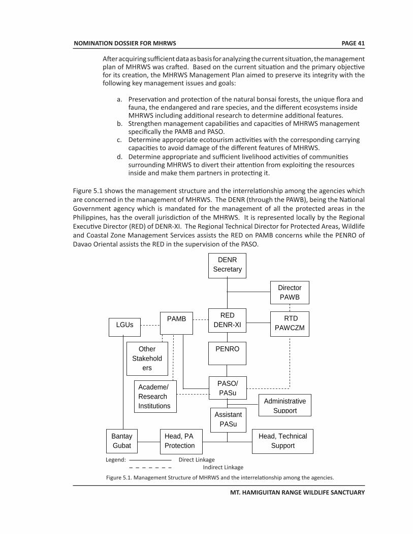
NOMINATION DOSSIER FOR MHRWS
MT. HAMIGUITAN RANGE WILDLIFE SANCTUARY
PAGE 41
After acquiring sufficient data as basis for analyzing the current situation, the management plan of MHRWS was crafted. Based on the current situation and the primary objective for its creation, the MHRWS Management Plan aimed to preserve its integrity with the following key management issues and goals:
a. Preservation and protection of the natural bonsai forests, the unique flora and fauna, the endangered and rare species, and the different ecosystems inside MHRWS including additional research to determine additional features.
b. Strengthen management capabilities and capacities of MHRWS management specifically the PAMB and PASO.
c. Determine appropriate ecotourism activities with the corresponding carrying capacities to avoid damage of the different features of MHRWS.
d. Determine appropriate and sufficient livelihood activities of communities surrounding MHRWS to divert their attention from exploiting the resources inside and make them partners in protecting it.
Figure 5.1 shows the management structure and the interrelationship among the agencies which are concerned in the management of MHRWS. The DENR (through the PAWB), being the National Government agency which is mandated for the management of all the protected areas in the Philippines, has the overall jurisdiction of the MHRWS. It is represented locally by the Regional Executive Director (RED) of DENR-XI. The Regional Technical Director for Protected Areas, Wildlife and Coastal Zone Management Services assists the RED on PAMB concerns while the PENRO of Davao Oriental assists the RED in the supervision of the PASO.
Figure 5.1. Management Structure of MHRWS and the interrelationship among the agencies.
Legend: direct linkage indirect linkage/coordination
DENR Secretary
RED DENR-XI
Director PAWB
RTD PAWCZMS
PENRO
PAMB
PASO/ PASu
LGUs
Assistant PASu
Head, PA Protection
Head, Technical Support
Bantay Gubat
Academe/ Research Institutions
Other Stakehold
ers
Administrative Support
Legend: Direct Linkage Indirect Linkage
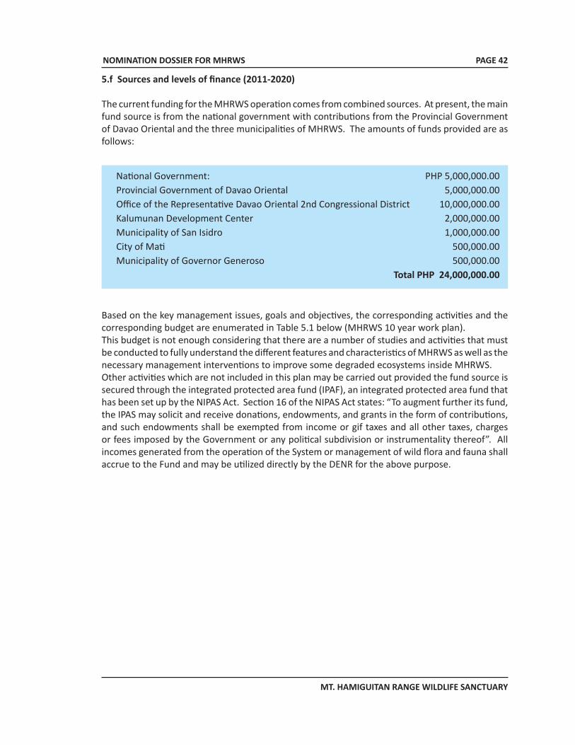
NOMINATION DOSSIER FOR MHRWS
MT. HAMIGUITAN RANGE WILDLIFE SANCTUARY
PAGE 42
5.f Sources and levels of finance (2011-2020)
The current funding for the MHRWS operation comes from combined sources. At present, the main fund source is from the national government with contributions from the Provincial Government of Davao Oriental and the three municipalities of MHRWS. The amounts of funds provided are as follows:
Based on the key management issues, goals and objectives, the corresponding activities and the corresponding budget are enumerated in Table 5.1 below (MHRWS 10 year work plan). This budget is not enough considering that there are a number of studies and activities that must be conducted to fully understand the different features and characteristics of MHRWS as well as the necessary management interventions to improve some degraded ecosystems inside MHRWS. Other activities which are not included in this plan may be carried out provided the fund source is secured through the integrated protected area fund (IPAF), an integrated protected area fund that has been set up by the NIPAS Act. Section 16 of the NIPAS Act states: “To augment further its fund, the IPAS may solicit and receive donations, endowments, and grants in the form of contributions, and such endowments shall be exempted from income or gif taxes and all other taxes, charges or fees imposed by the Government or any political subdivision or instrumentality thereof”. All incomes generated from the operation of the System or management of wild flora and fauna shall accrue to the Fund and may be utilized directly by the DENR for the above purpose.
National Government: PHP 5,000,000.00 Provincial Government of Davao Oriental 5,000,000.00Office of the Representative Davao Oriental 2nd Congressional District 10,000,000.00Kalumunan Development Center 2,000,000.00Municipality of San Isidro 1,000,000.00 City of Mati 500,000.00 Municipality of Governor Generoso 500,000.00
Total PHP 24,000,000.00
NOMINATION DOSSIER FOR MHRWS
MT. HAMIGUITAN RANGE WILDLIFE SANCTUARY
PAGE 43
Activity Year of Implementation Budget 1 2 3 4 5 6 7 8 9 10
A. Preservation and protection of the ecosystems
1. Monitoring & protection activities 3,000,000.00
2. Biological & ecosystems researches 3,000,000.00 3. Rehabilitation of degraded
ecosystems 5,000,000.00
4. Conduct Information, Communication and Education (ICE) campaign
1,200,000.00
B. PAMB and PASO strengthening & regular activities
1. Conduct refresher seminar to PAMB members on the authorities, duties and responsibilities of PAMB members based on RAs 9303 and 7586 and cross visits.
100,000.00
2. Paralegal seminars for PASu staff and Bantay Gubat members on their police powers (RA 7586)
100,000.00
3. Deputize Bantay Gubat Members as Environment & Natural Resources Officers (DENRO)
600,000.00
4. PAMB meetings 3,500,000.00
C. MHRWS Ecotourism
1. Conduct ecotourism business planning. 200,000.00
D. Community Development Activities
1. Conduct community tenure assessment
200,000.00
2. Implement community alternative livelihood activities/IGPs.
3,000,000.00
E. Infrastructure Development
1. Trail development 200,000.00
2. Look-out towers (3) construction 900,000.00
3. Foot bridge construction (at bonsai forest)
3,000,000.00
Table 5.1. MHRWS 10 year work and financial plan.
NOMINATION DOSSIER FOR MHRWS
MT. HAMIGUITAN RANGE WILDLIFE SANCTUARY
PAGE 44
These incomes shall be derived from: a. Taxes from the enterprises permitted by the PAMBb. Proceeds from lease of multiple-use areas;c. Contributions from industries and facilities directly benefiting from the protected area;
and d. Such other fees and incomes derived from the operation of the protected area.
Disbursements from the Fund shall be made solely for the protection, maintenance, administration, and management of the System, and duly approved projects endorsed by the PAMBs, in the amounts authorized by the DENR”.
5.g Sources of expertise and training in conservation and management techniques
Universities in MindanaoAside from the capabilities of the DENR Regional office, expertise is available in some universities in Mindanao. The comprehensive biodiversity survey conducted in Hamiguitan was carried out by researchers from the Central Mindanao University, University of the Philippines-Mindanao, University of Southern Mindanao, and Davao Oriental State College of Science and Technology. MHRWS now has local researchers who can accurately identify the flora and fauna of Mt. Hamiguitan and who are competent in the use of the Global Positioning System.
Non-Government Organizations (NGOs)Expertise on biodiversity conservation is also available from NGOs who have collaborated with MHRWS management. Among these are the Philippine Eagle Foundation (PEF) and Conservation International (CI). International scientists from Germany and Japan have already conducted studies at MHRWS. International scientists are allowed to conduct researches and studies inside the MHRWS provided the corresponding permit is secured from the DENR and PAMB prior to the activity.
Other sources of expertise Experts from the UP Visayas and UP Diliman shall also be tapped in a wide range of potential research studies in the property. Interventions or technical assistance from relevant international organizations and the World Heritage Advisory bodies shall also be sought to ensure effective and responsive conservation and management of the MHRWS.
5.h Visitor facilities and statistics
As mentioned in Section 4.b(iv), the annual volume of visitors to the pygmy forest gradually increased since its accidental discovery in 1993. In 2009, an estimated 2,500 visitors went up to the pygmy forest. Due to the absence of a management plan, visitor management was handled separately by the LGUs independently of each other. Thus visitor data is incomplete.
In terms of visitor lodging facilities, there is one site-based lodging house called the Long House located at Sitio Tumalite in Barangay La Union which is near the boundary of MHRWS. It can accommodate up to ten persons. In terms of other tourism activities and destinations, the municipalities of Governor Generoso and San Isidro and the City of Mati offer several options including beaches, diving and surfing sites, waterfalls, coves, inland bodies of water, caves etc. The hotel accommodations in these three places total approximately 300 rooms.
NOMINATION DOSSIER FOR MHRWS
MT. HAMIGUITAN RANGE WILDLIFE SANCTUARY
PAGE 45
5.i Policies and programs related to the presentation and promotion of the property
The Municipal government of San Isidro has conducted an IEC program to educate local stakeholders on the importance of protecting the endemic and threatened plant and animal species found in the protected area. The IEC materials (Appendix 4) contained information on scientific names, local name and conservation status of the various species of flora and fauna of MHRWS. The IEC is aimed at promoting awareness on the conservation and protection of these important species.
The IEC materials were disseminated to the communities and distributed to the local researchers to be used in identifying and monitoring the species. Likewise, the research outputs were disseminated to the public during regional and international scientific meetings and symposia such as University and Regional Research and Development Symposia, Flora Malesiana Symposium in Leiden, The Netherlands and to the scientific committee of the Mt. Hamiguitan Wildlife Sanctuary of DENR Region XI, Davao City. Presentation of the initial results was also conducted for the local researchers and head of the village in Macambol, Mati City in the province of Davao Oriental. The research outputs were also presented to the Mayors, Municipal Planning and Tourism Officers, barangay captains, members of the Protected Area Management Board and the Bantay Gubat of MHRWS in the three municipalities.
The PAMB thru the PASO also conducts IEC on a regular basis, along with linkages with the stakeholders and concerned agencies/parties, including research individuals or institutions, to strengthen the awareness and support for the conservation and protection of the property. As a result, MHRWS has been highlighted in various local and international conferences, fora and symposia, including the International LTER symposia (October 2006 and November 2010) and the 4th Symposium on Asian Pteridology and Garden Show, Central Mindanao University, Musuan, Bukidnon, Philippines (November 2007).
5.j Staffing levels (professional, technical, maintenance)
The PAMB for Mt. Hamiguitan Range Wildlife Sanctuary consists of the following members:1. Regional Executive Director of DENR Region XI as Chair of the Board2. Governor and Provincial Planning Officer of Davao Oriental3. Mayors of the Municipalities of San Isidro and Governor Generoso and Mati City4. Barangay Captains of village centers in the protected area5. Representatives from the academe, NGOs and POs6. Tribal chieftains of Indigenous Peoples
The Protected Area Superintendent’s Office (PASO) has the following composition:1. Technical/Administrative Services
• Protected Area Superintendent • Asst. Protected Area Manager• Head PA Protection Officer• PA Administrative Aide/Driver
2. Support Staff (concurrent staff from CENROs concerned)• Patrol Sector 1 (San Isidro, Davao Oriental) o Protection and Warden Officers (#3)• Patrol Sector 2 (Gov. Generoso, Davao Oriental) o Protection and Warden Officers (#2)• Patrol Sector 3 (Mat, Davao Oriental) o Protection and Warden Officers (#2)
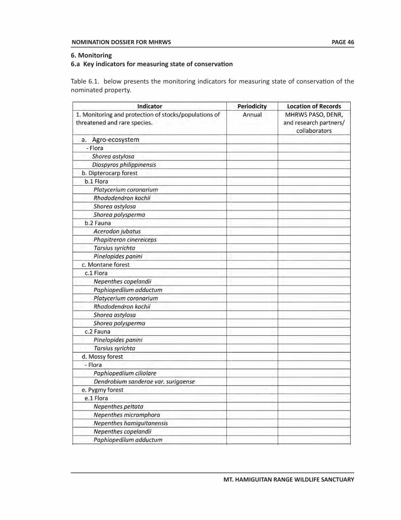
NOMINATION DOSSIER FOR MHRWS
MT. HAMIGUITAN RANGE WILDLIFE SANCTUARY
PAGE 46
6. Monitoring 6.a Key indicators for measuring state of conservation
Table 6.1. below presents the monitoring indicators for measuring state of conservation of the nominated property.
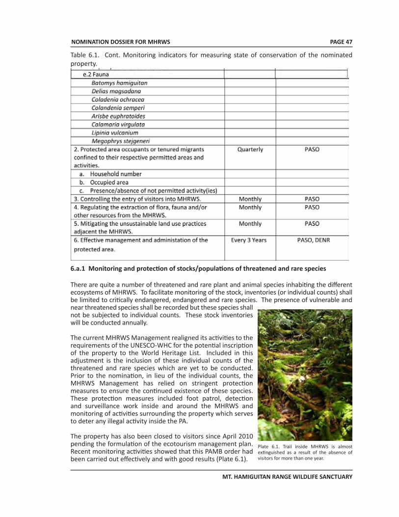
NOMINATION DOSSIER FOR MHRWS
MT. HAMIGUITAN RANGE WILDLIFE SANCTUARY
PAGE 47
Table 6.1. Cont. Monitoring indicators for measuring state of conservation of the nominated property.
6.a.1 Monitoring and protection of stocks/populations of threatened and rare species
There are quite a number of threatened and rare plant and animal species inhabiting the different ecosystems of MHRWS. To facilitate monitoring of the stock, inventories (or individual counts) shall be limited to critically endangered, endangered and rare species. The presence of vulnerable and near threatened species shall be recorded but these species shall not be subjected to individual counts. These stock inventories will be conducted annually.
The current MHRWS Management realigned its activities to the requirements of the UNESCO-WHC for the potential inscription of the property to the World Heritage List. Included in this adjustment is the inclusion of these individual counts of the threatened and rare species which are yet to be conducted. Prior to the nomination, in lieu of the individual counts, the MHRWS Management has relied on stringent protection measures to ensure the continued existence of these species. These protection measures included foot patrol, detection and surveillance work inside and around the MHRWS and monitoring of activities surrounding the property which serves to deter any illegal activity inside the PA.
The property has also been closed to visitors since April 2010 pending the formulation of the ecotourism management plan. Recent monitoring activities showed that this PAMB order had been carried out effectively and with good results (Plate 6.1).
Plate 6.1. Trail inside MHRWS is almost extinguished as a result of the absence of visitors for more than one year.
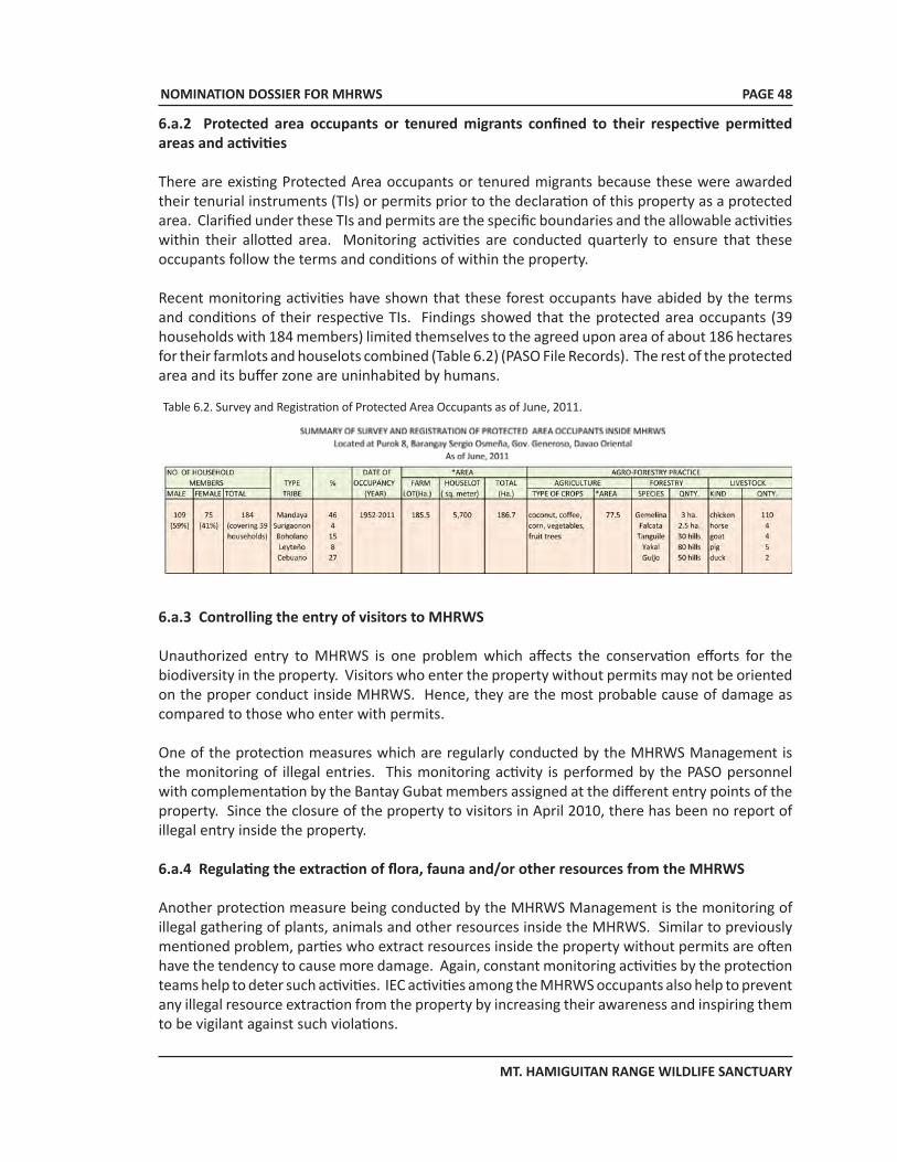
NOMINATION DOSSIER FOR MHRWS
MT. HAMIGUITAN RANGE WILDLIFE SANCTUARY
PAGE 48
6.a.2 Protected area occupants or tenured migrants confined to their respective permitted areas and activities
There are existing Protected Area occupants or tenured migrants because these were awarded their tenurial instruments (TIs) or permits prior to the declaration of this property as a protected area. Clarified under these TIs and permits are the specific boundaries and the allowable activities within their allotted area. Monitoring activities are conducted quarterly to ensure that these occupants follow the terms and conditions of within the property.
Recent monitoring activities have shown that these forest occupants have abided by the terms and conditions of their respective TIs. Findings showed that the protected area occupants (39 households with 184 members) limited themselves to the agreed upon area of about 186 hectares for their farmlots and houselots combined (Table 6.2) (PASO File Records). The rest of the protected area and its buffer zone are uninhabited by humans.
Table 6.2. Survey and Registration of Protected Area Occupants as of June, 2011.
6.a.3 Controlling the entry of visitors to MHRWS
Unauthorized entry to MHRWS is one problem which affects the conservation efforts for the biodiversity in the property. Visitors who enter the property without permits may not be oriented on the proper conduct inside MHRWS. Hence, they are the most probable cause of damage as compared to those who enter with permits.
One of the protection measures which are regularly conducted by the MHRWS Management is the monitoring of illegal entries. This monitoring activity is performed by the PASO personnel with complementation by the Bantay Gubat members assigned at the different entry points of the property. Since the closure of the property to visitors in April 2010, there has been no report of illegal entry inside the property.
6.a.4 Regulating the extraction of flora, fauna and/or other resources from the MHRWS
Another protection measure being conducted by the MHRWS Management is the monitoring of illegal gathering of plants, animals and other resources inside the MHRWS. Similar to previously mentioned problem, parties who extract resources inside the property without permits are often have the tendency to cause more damage. Again, constant monitoring activities by the protection teams help to deter such activities. IEC activities among the MHRWS occupants also help to prevent any illegal resource extraction from the property by increasing their awareness and inspiring them to be vigilant against such violations.
NOMINATION DOSSIER FOR MHRWS
MT. HAMIGUITAN RANGE WILDLIFE SANCTUARY
6.a.5 Mitigating the unsustainable land use practices adjacent to the MHRWS
A number of fauna have habitats which extend beyond the boundaries of the property. Thus, activities adjacent to MHRWS will have an impact either directly or indirectly on the biodiversity conservation efforts of management. Thus constant monitor of activities even outside of the property is done by the PASO as well. Results of recent monitoring activities, however, showed that such potentially deleterious activities outside of the property are too far at the moment to pose any negative impact on the property. Nevertheless, the PAMB, along with the LGUs and the PASO, continue to conduct IEC campaigns to increase awareness and support for the conservation of the property. Figure 6.1 shows the photomap of recent monitoring of MHRWS.
PAGE 49
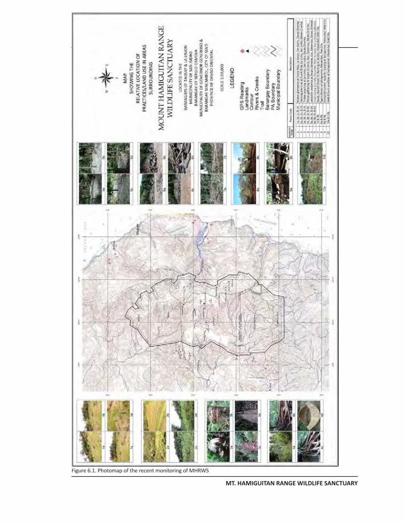
NOMINATION DOSSIER FOR MHRWS
MT. HAMIGUITAN RANGE WILDLIFE SANCTUARY
Figure 6.1. Photomap of the recent monitoring of MHRWS
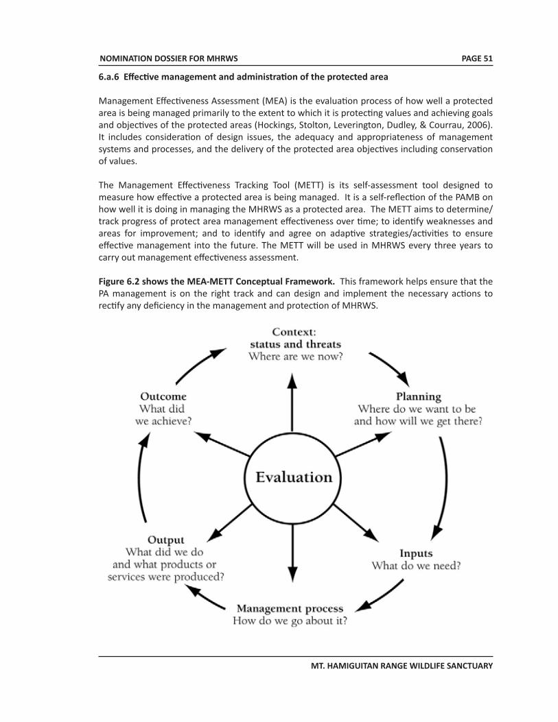
NOMINATION DOSSIER FOR MHRWS
MT. HAMIGUITAN RANGE WILDLIFE SANCTUARY
PAGE 51
6.a.6 Effective management and administration of the protected area
Management Effectiveness Assessment (MEA) is the evaluation process of how well a protected area is being managed primarily to the extent to which it is protecting values and achieving goals and objectives of the protected areas (Hockings, Stolton, Leverington, Dudley, & Courrau, 2006). It includes consideration of design issues, the adequacy and appropriateness of management systems and processes, and the delivery of the protected area objectives including conservation of values.
The Management Effectiveness Tracking Tool (METT) is its self-assessment tool designed to measure how effective a protected area is being managed. It is a self-reflection of the PAMB on how well it is doing in managing the MHRWS as a protected area. The METT aims to determine/track progress of protect area management effectiveness over time; to identify weaknesses and areas for improvement; and to identify and agree on adaptive strategies/activities to ensure effective management into the future. The METT will be used in MHRWS every three years to carry out management effectiveness assessment.
Figure 6.2 shows the MEA-METT Conceptual Framework. This framework helps ensure that the PA management is on the right track and can design and implement the necessary actions to rectify any deficiency in the management and protection of MHRWS.
NOMINATION DOSSIER FOR MHRWS
MT. HAMIGUITAN RANGE WILDLIFE SANCTUARY
PAGE 52
6.b Administrative arrangements for monitoring the property
DENR: Department of Environment & Natural Resources – XI Km. 7, Lanang Davao City 8000 Tel. No. +6382 235 1201 c/o Emmanuel Isip Regional Technical Director for PAWCZMS
MHRWS PAMB/PASO: Mt. Hamiguitan Range Wildlife Sanctuary-Protected Area Superintendent Office Government Center, Batobato, San Isidro, Davao Oriental E-mail: [email protected]; Mobile No. +63928 315 7277 c/o Ruel D. Colong Protected Area Superintendent NGO: Kalumonan Development Center, Inc. Pob. Batobato, San Isidro, Davao Oriental Tel. No: +6387 811 3123 c/o Justina MB Yu Executive Director
Academe/Research Institutions: Central Mindanao University & University Town, Musuan, Bukidnon E-mail: [email protected]; Mobile No. +63917 549 5084 c/o Dr. Victor B. Amoroso Scientist III & Chair, Phil. Nat’l. Committee on LTER & DIVERSITAS Davao Oriental State College of Science and Technology Mati, Davao Oriental c/o Dr. Lea A. Jimenez Director for Research and Extention Tel. No. +6387 388 3195 Philippine Eagle Foundation Malagos, Calinan, Davao City Tel. No. +6382 271 2337; Fax No. +6382 301 1033 c/o Jayson C. Ibanez Director for Research & Conservation
University of Southern Mindanao Kabacan, North Cotabato E-mail: [email protected] c/o Prof. John Aries Tabora Professor, Department of Biological Sciences
NOMINATION DOSSIER FOR MHRWS
MT. HAMIGUITAN RANGE WILDLIFE SANCTUARY
PAGE 53
6.c Results of previous reporting exercises
MT. HAMIGUITAN RANGE WILDLIFE SANCTUARYUPDATE AS OF 30 JULY 2010
Brief Background
• The Mt. Hamiguitan Range Wildlife Sanctuary (MHRWS) is a Protected Area established under R.A. 9303 of 2004 which was enacted pursuant to R.A. 7586, otherwise known as NIPAS Act of 1992.
• MHRWS is located in the Municipalities of San Isidro and Gov. Genoroso and Mati City, all in the Province of Davao Oriental with an area of 6,834 hectares. However, it has an area of 7,132.76 hectares per boundary delineation survey.
• Mt. Hamiguitan Protected Area or the MHRWS is under the general management and administration of the Protected Area Management Board (PAMB) with members composed of National Government agencies (with DENR as lead agency), local government units (Mun. Gov’t. of San Isidro, Gov. Generoso & Mati City and the Prov’l. Gov’t. of Davao Oriental), Non Government Organizations, Peoples Organizations/Indigenous People and the Academic Institution.
• The day-to-day management, administration and protection of the Protected Area (including implementation of PA plans/programs/projects/activities) are being carried out by the Protected Area Superintendent (PASu) Office of the PAMB and the DENR headed by the designated PASu as the DENR Chief Operating Officer.
• Mt. Hamiguitan Range Wildlife Sanctuary in Mindanao, Philippines is the only protected forest noted for its unique bonsai field or ‘pygmy’ forest of 100-year old trees in an ultramafic soil. Mt. Hamiguitan has been found to have five (5) vegetation types and these are the agroecosystem, dipterocarp, montane, typical mossy and the mossy-pygmy forest.
• The diversity of habitat and plant and animal species in this PA is attributed to the geologic setting. Mount Hamiguitan is an ultramafic terrain giving rise to an ultramafic forest and associated diverse habitats and flora and fauna. At the national level, Hamiguitan is a conservation interest. At a global scale, this Protected Area is known to be habitats of globally important species of plants and animals. Being sanctuary of endemism, it possesses the highest and richest bio-diversity in terms of flora and fauna per unit area having unique, rare and threatened endemic species of outstanding universal value.
• Other points of interest inside MHRWS are the (i) Tinagong Dagat (Hidden Lake), (ii) Twin Falls, (iii) Hidden Garden all located within or at the fringe of the pygmy forest.
New Development
• There are newly discovered/recorded site-endemic species in MHRWS, meaning these species can be only found in Mt Hamiguitan and nothing in any part of the Wold. These species are the following:
• Nepenthes peltata • Nepenthes micramphora • Nepenthes hamiguitanensis • Hamiguitan Hairy-tailed Rat Batomys hamiguitan. This is in addition to the previously recorded site-endemic butterfly Delias magsadana (the rarest butterfly sp.)
NOMINATION DOSSIER FOR MHRWS
MT. HAMIGUITAN RANGE WILDLIFE SANCTUARY
PAGE 54
Regular Activites Conducted
• PA protection thru foot patrol, surveillance and detection work. This is being undertaken on a monthly basis.
• Implementation of Biodiversity Monitoring System. This is being carried out on a quarterly basis.• PAMB operationalization. The PAMB regular and special meetings and related activities are
being facilitated by the PASu office as its secretariat and implementing office.
During the Regular PAMB Meeting held on 25 March 2010, the PAMB has passed two (2) important resolutions, as follows:
• MHRWS-PAMB Resolution 2010-02, a resolution approving the indefinite closure of MHRWS to visitors/mountaineers/trekkers effective 03 April 2010 except for duly approved scientific research studies and activities in line with its 7-Point Agenda; and
• MHRWS-PAMB Resolution 2010-03, a resolution approving and adopting the 7-Point Agenda as major requirement in re-opening the MHRWS for nature recreation particularly to visitors/mountaineers/trekkers, to be co-managed by LGU/s concerned.
Special Activities Conducted
• Delineation/demarcation of PA boundary. • Actual ground survey was conducted and completed in 2007 with a delineated area
of 7,132 hectares, Core Zone of which is 6,48.99 hectares and a Buffer Zone of 783,77 hectares.
• Establishment of PA Management Zones. s The assessment/identification of proposed management zones of the PA was conducted/
completed in CY 2009 with partial accomplishment on demarcation/monuments establishment and/or locating of natural markers.
s Currently, demarcation/establishment of permanent markers and interpretative signs are ongoing and expected to be completed before the year-end.
• Preparation/formulation of PA Management Plan s Initial draft of PA Management Plan was done in Dec. 2009-Jan. 2010 with support from
the Prov’l LGU of Davao Oriental and other stakeholders of the PA. s The management plan is also an important document that will form part of the Nomination
Dossier of MHRWS to be inscribed in the UNESCO World Heritage List. s The PA Management Plan shall be completed (final/updated Mgt. Plan) on 3rd quarter, CY
2010 with funding support from the DENR-RXI. • Preparation/packaging of the Nomination Dossier of MHRWS as World Heritage Site. s On 21 December 2009, MHRWS was officially and separately included in the UNESCO
Tentative List of Philippine cultural and natural heritage sites to be inscribed in the World Heritage List subject to the set of requirements to be complied with the parties concerned.
s A video material featuring MHRWS was initially prepared together with partial documents compilation and initial drafting of the Dossier with support from the Prov’l LGU of Davao Oriental and other stakeholders of the PA.
s A complete Nomination Dossier of MHRWS shall be prepared/packaged on 3rd quarter, CY 2010 with funding support from DENR-RXI
NOMINATION DOSSIER FOR MHRWS
MT. HAMIGUITAN RANGE WILDLIFE SANCTUARY
PAGE 55
Other Related Activities Undertaken
• Establishment of MHRWS-PASu Office. As required under the NIPAS Act and the special law of Mt. Hamiguitan, the PASu Office of MHRWS was established in March 2009 at the Government Center, San Isidro, Davao Oriental with support from Mun. LGU-San Isidro which provided the office building and lot area through a MOA executed between the Regional Executive Director of DENR-RXI and the Mun. Mayor of San Isidro.
• Information, education and communication (IEC). This is being undertaken formally and informally incidental to the regular and special activities conducted by the PASu and staff within and outside the PA site. The PASu has been disseminating the unique and special features of MHRWS in several conferences/symposia/fora or seminars within and outside the PA site.
• Linkages with government and non-government or private institutions. The PAMB/PASO has made formal and/or informal linkages with the following:
• Provincial Government of Davao Oriental and concerned Municipal/Brgy. LGUs led by the Prov’l Governor - for support/assistance in formulating the initial draft PA Mgt. Plan and
packaging of MHRWS Nomination Dossier as World Heritage Site.• IMPEDE and Philippine Eagle Foundation (NGOs) - for research assistance and/or partnership in
project implementation related to biodiversity conservation or climate change mitigation.• Central Mindanao University thru its Lead Researcher, Dr. Victor Amoroso - for assistance
or partnership in research studies on Biodiversity Assessment and Conservation of MHRWS and its Environs.
• University of Southern Mindanao thru its Research Team Leader, Prof. John Aries Tabora for the conduct of research study on Natural Resource Valuation of Mt. Hamiguitan.
• ASEAN Centre for Biodiversity (ACB) - for possible inclusion of MHRWS to be featured in the regular ACB Publication.
• Energy Development Corporation - for assistance in photo documentation of Mt. Hamiguitan pygmy (bonsai) forest and other features of the PA and possible inclusion of MHRWS in its 2011 Company Calendar featuring the nominees as World Heritage Sites under UNESCO that include MHRWS.
• Participation of or attendance by the PASu on recent conferences/seminars/symposia, as follows:s Ecotourism and Basic Guiding Seminar-Workshop held at Marco Polo Hotel,
Davao City, 29-30 July 2010s 3rd ASEAN Heritage Parks Conference held in Brunei Darussalam on 23-25 June 2010s PAWCZMS Sectoral Conference-Workshop held at DENR-XI, Davao City, 15 June 2010s 2nd National PAMB Summit held in Calamba, Laguna on 27-28 April 2010s Workshop-2 for Developing Proposals for Priority Protected Areas held in
Tagaytay City, on 22-24 February 2010s Workshop on Biodiversity Partnership Program held in Quezon City on 7-9
February 2010
NOMINATION DOSSIER FOR MHRWS
MT. HAMIGUITAN RANGE WILDLIFE SANCTUARY
PAGE 56
• Orientation-Workshop on the Management Effectiveness Assessment of Protected Areas held in Antipolo City on 28-29 January 2010
• In order to ensure effective and efficient management, administration and protection of Mt. Hamiguitan Range Wildlife Sanctuary on a sustainable manner, the support/assistance from and strong collaboration between and among concerned stakeholders and concerned government agencies/units with the PAMB/PASO should be in place and functional.
Prepared by:
RUEL D. COLONG, M.Sc.Protected Area Superintendent
NOMINATION DOSSIER FOR MHRWS
MT. HAMIGUITAN RANGE WILDLIFE SANCTUARY
PAGE 57
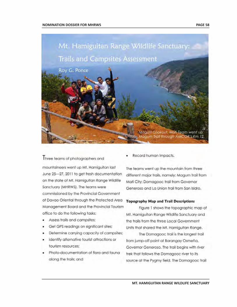
NOMINATION DOSSIER FOR MHRWS
MT. HAMIGUITAN RANGE WILDLIFE SANCTUARY
PAGE 58
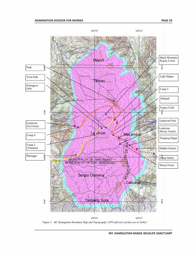
NOMINATION DOSSIER FOR MHRWS
MT. HAMIGUITAN RANGE WILDLIFE SANCTUARY
PAGE 59
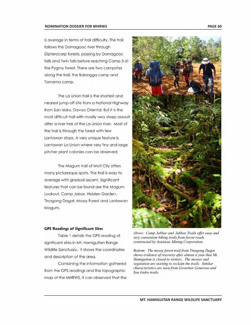
NOMINATION DOSSIER FOR MHRWS
MT. HAMIGUITAN RANGE WILDLIFE SANCTUARY
PAGE 60
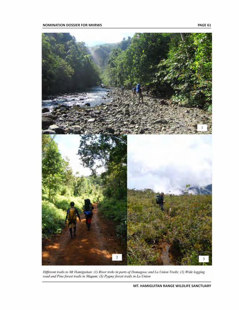
NOMINATION DOSSIER FOR MHRWS
MT. HAMIGUITAN RANGE WILDLIFE SANCTUARY
PAGE 61
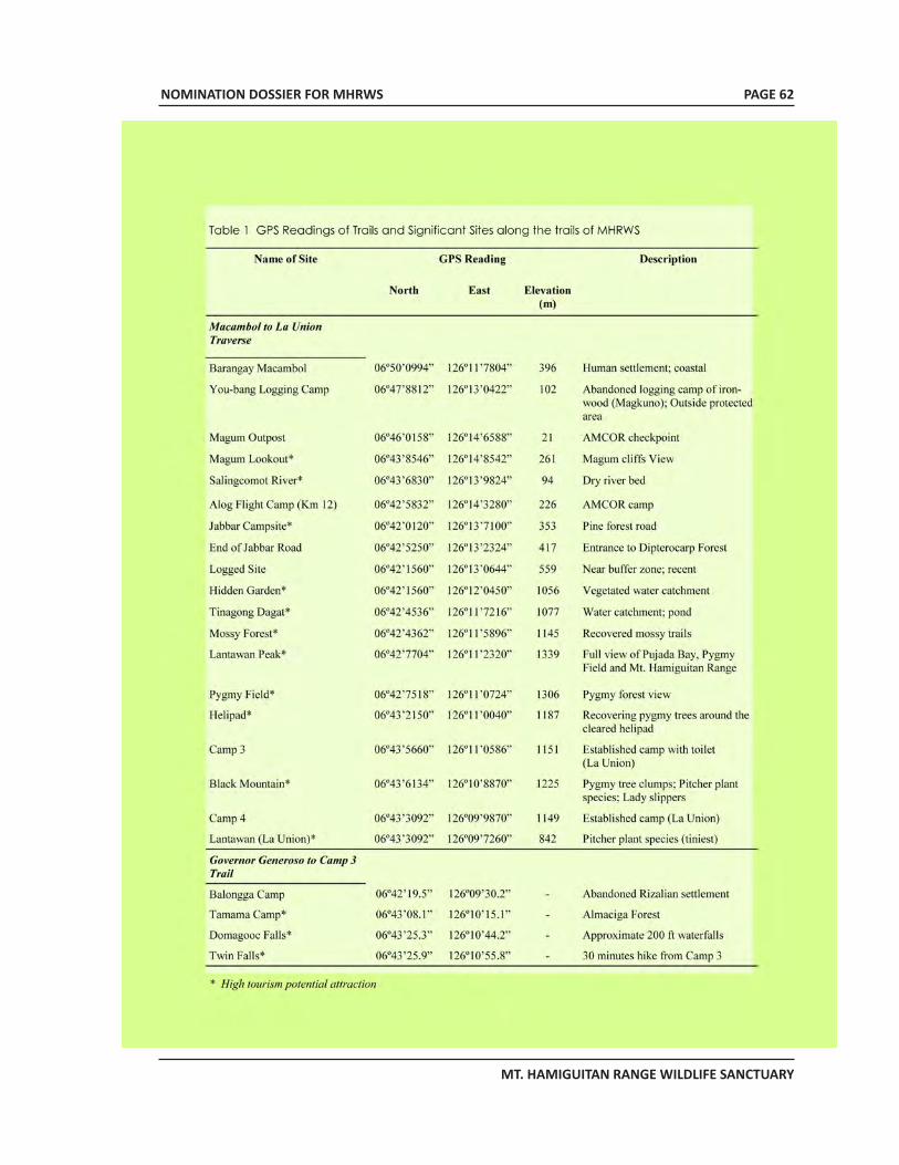
NOMINATION DOSSIER FOR MHRWS
MT. HAMIGUITAN RANGE WILDLIFE SANCTUARY
PAGE 62
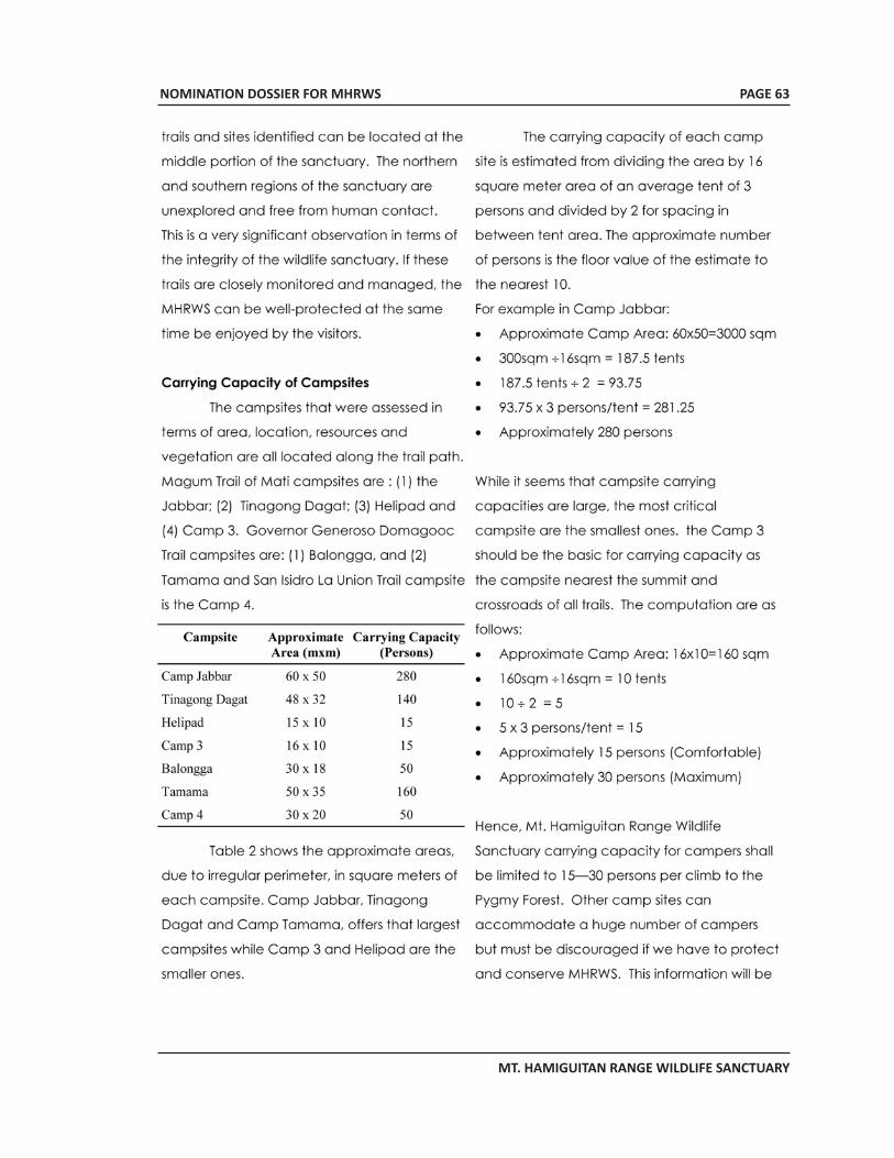
NOMINATION DOSSIER FOR MHRWS
MT. HAMIGUITAN RANGE WILDLIFE SANCTUARY
PAGE 63
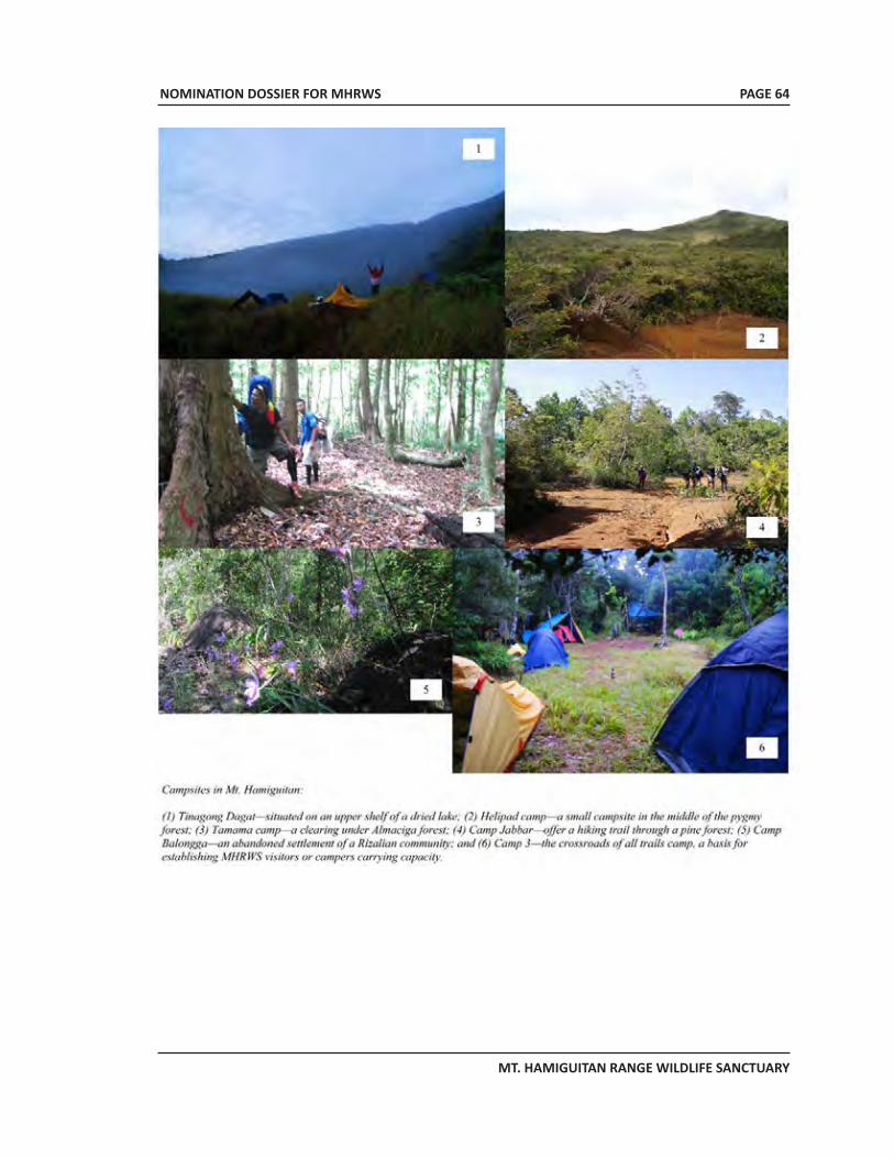
NOMINATION DOSSIER FOR MHRWS
MT. HAMIGUITAN RANGE WILDLIFE SANCTUARY
PAGE 64
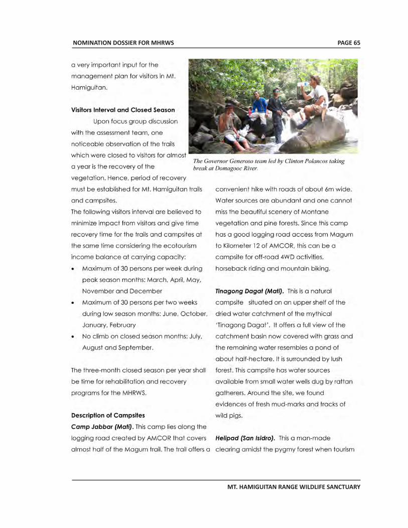
NOMINATION DOSSIER FOR MHRWS
MT. HAMIGUITAN RANGE WILDLIFE SANCTUARY
PAGE 65
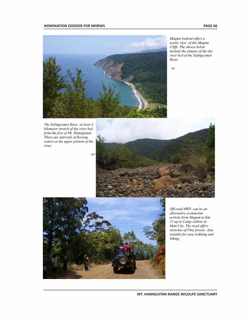
NOMINATION DOSSIER FOR MHRWS
MT. HAMIGUITAN RANGE WILDLIFE SANCTUARY
PAGE 66
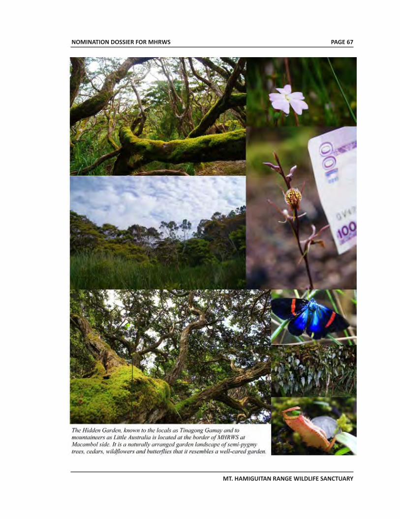
NOMINATION DOSSIER FOR MHRWS
MT. HAMIGUITAN RANGE WILDLIFE SANCTUARY
PAGE 67
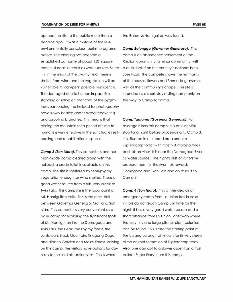
NOMINATION DOSSIER FOR MHRWS
MT. HAMIGUITAN RANGE WILDLIFE SANCTUARY
PAGE 68
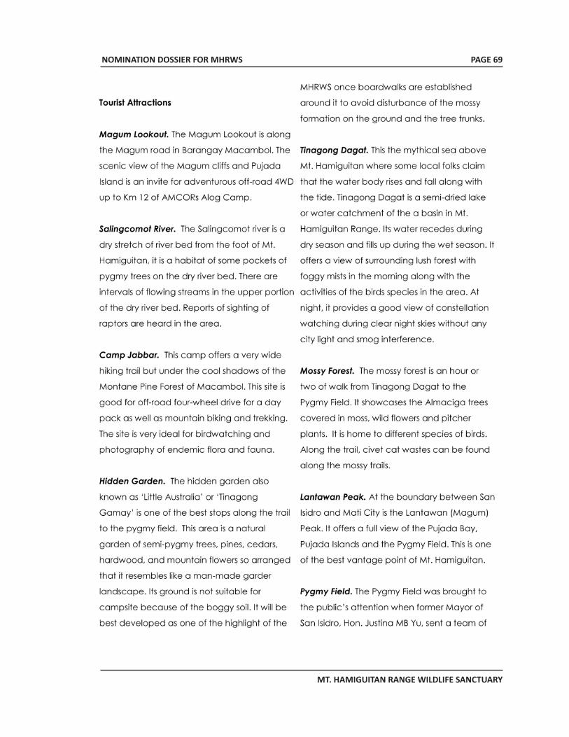
NOMINATION DOSSIER FOR MHRWS
MT. HAMIGUITAN RANGE WILDLIFE SANCTUARY
PAGE 69
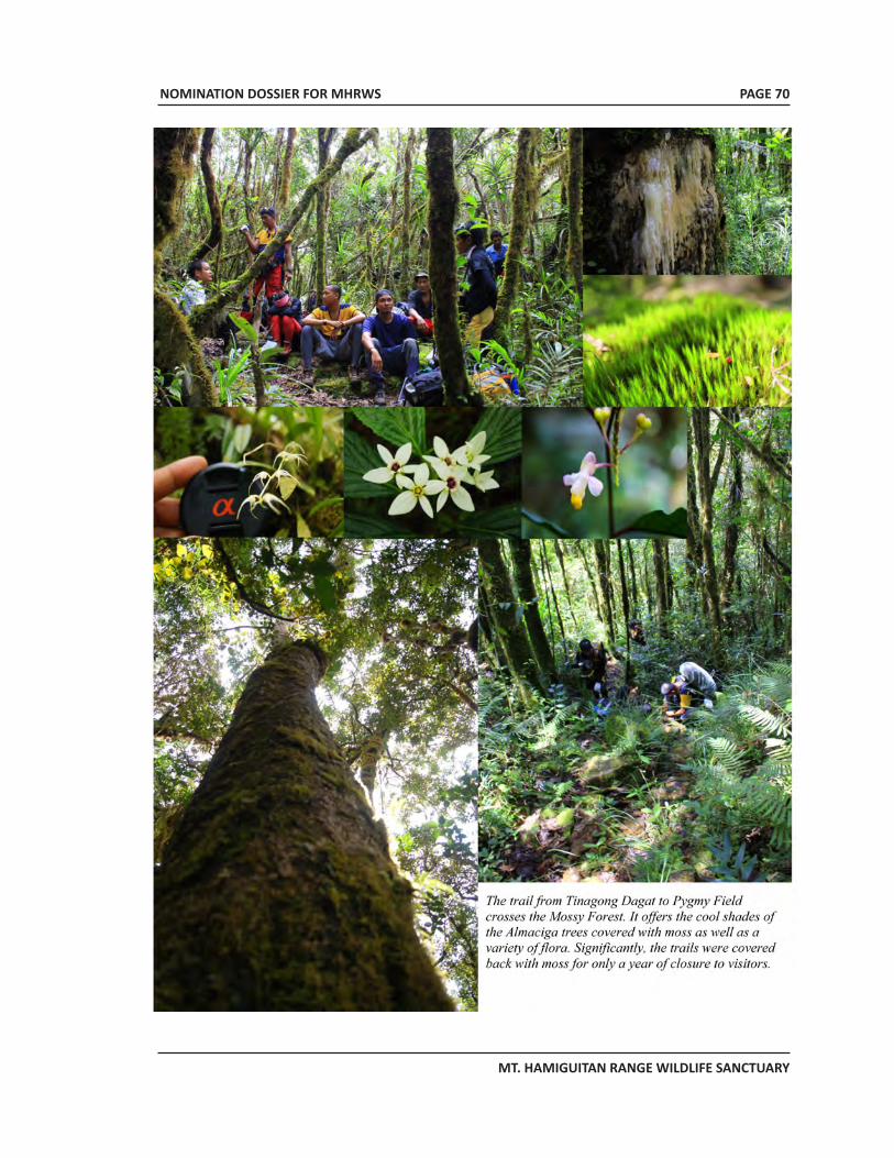
NOMINATION DOSSIER FOR MHRWS
MT. HAMIGUITAN RANGE WILDLIFE SANCTUARY
PAGE 70
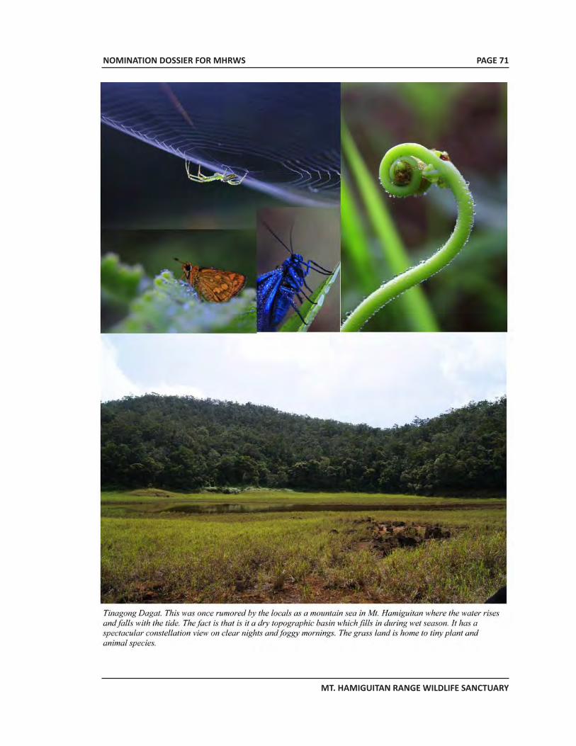
NOMINATION DOSSIER FOR MHRWS
MT. HAMIGUITAN RANGE WILDLIFE SANCTUARY
PAGE 71
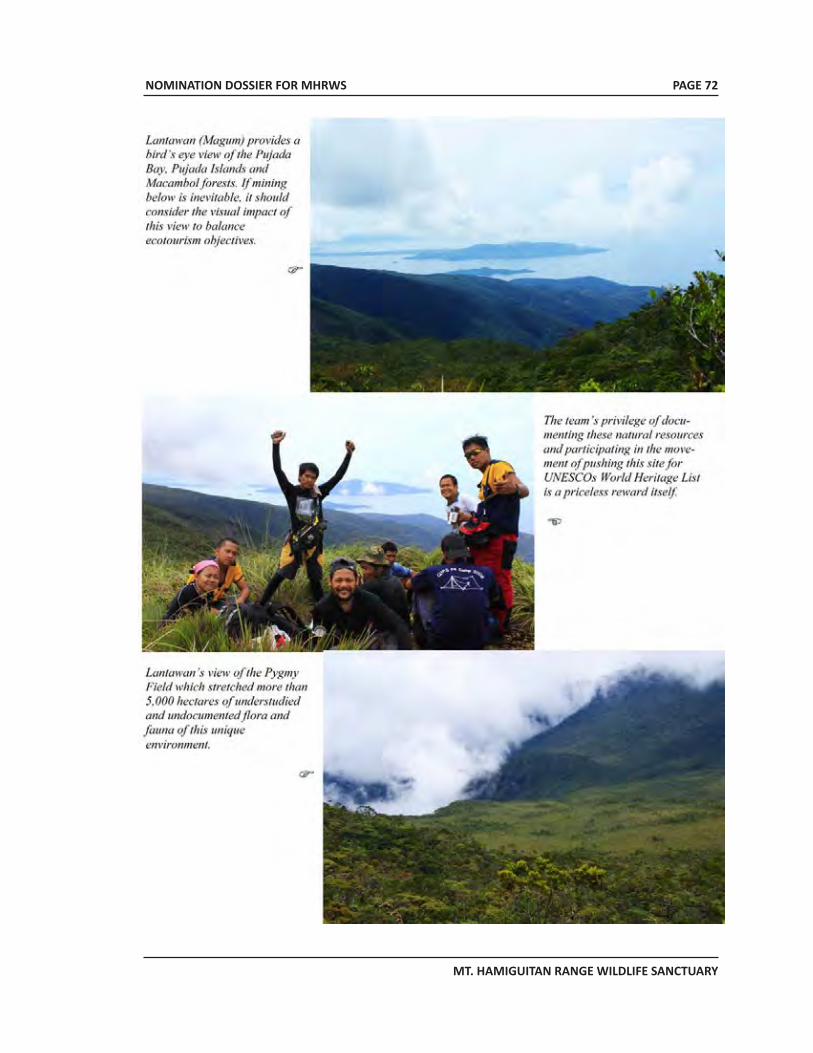
NOMINATION DOSSIER FOR MHRWS
MT. HAMIGUITAN RANGE WILDLIFE SANCTUARY
PAGE 72
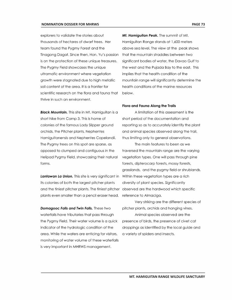
NOMINATION DOSSIER FOR MHRWS
MT. HAMIGUITAN RANGE WILDLIFE SANCTUARY
PAGE 73
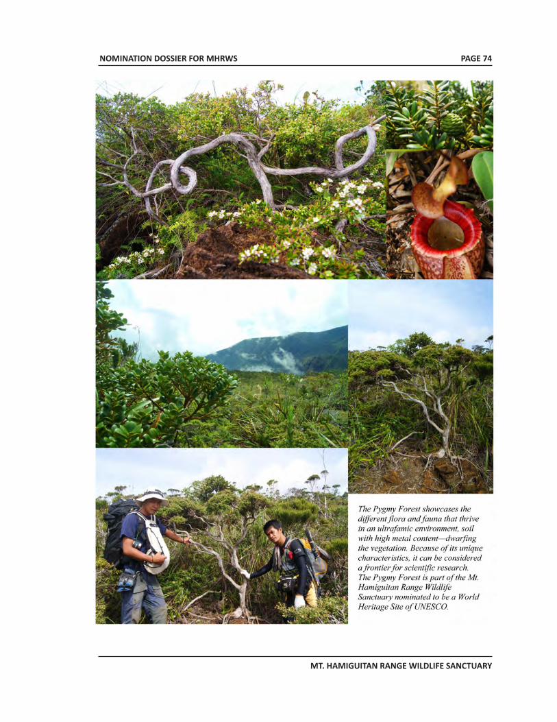
NOMINATION DOSSIER FOR MHRWS
MT. HAMIGUITAN RANGE WILDLIFE SANCTUARY
PAGE 74
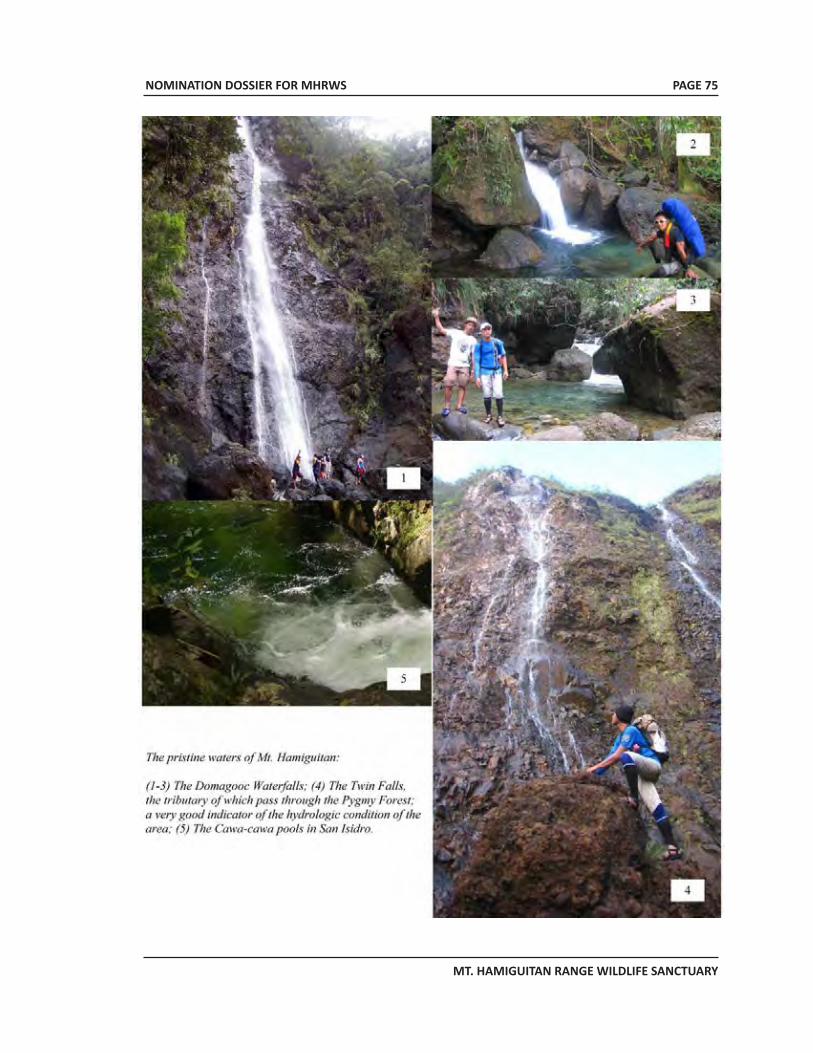
NOMINATION DOSSIER FOR MHRWS
MT. HAMIGUITAN RANGE WILDLIFE SANCTUARY
PAGE 75
NOMINATION DOSSIER FOR MHRWS
MT. HAMIGUITAN RANGE WILDLIFE SANCTUARY
PAGE 76
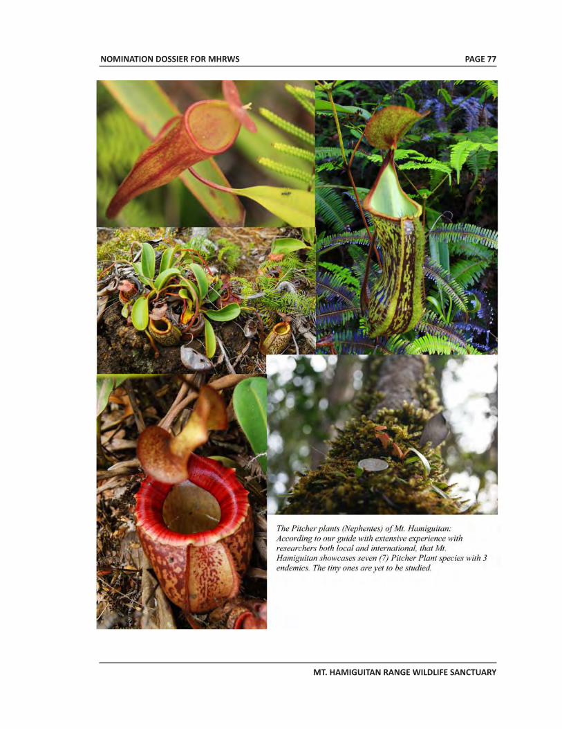
NOMINATION DOSSIER FOR MHRWS
MT. HAMIGUITAN RANGE WILDLIFE SANCTUARY
PAGE 77
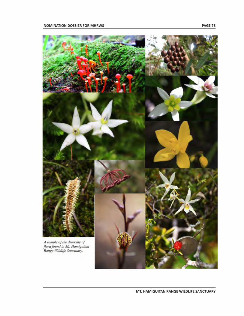
NOMINATION DOSSIER FOR MHRWS
MT. HAMIGUITAN RANGE WILDLIFE SANCTUARY
PAGE 78
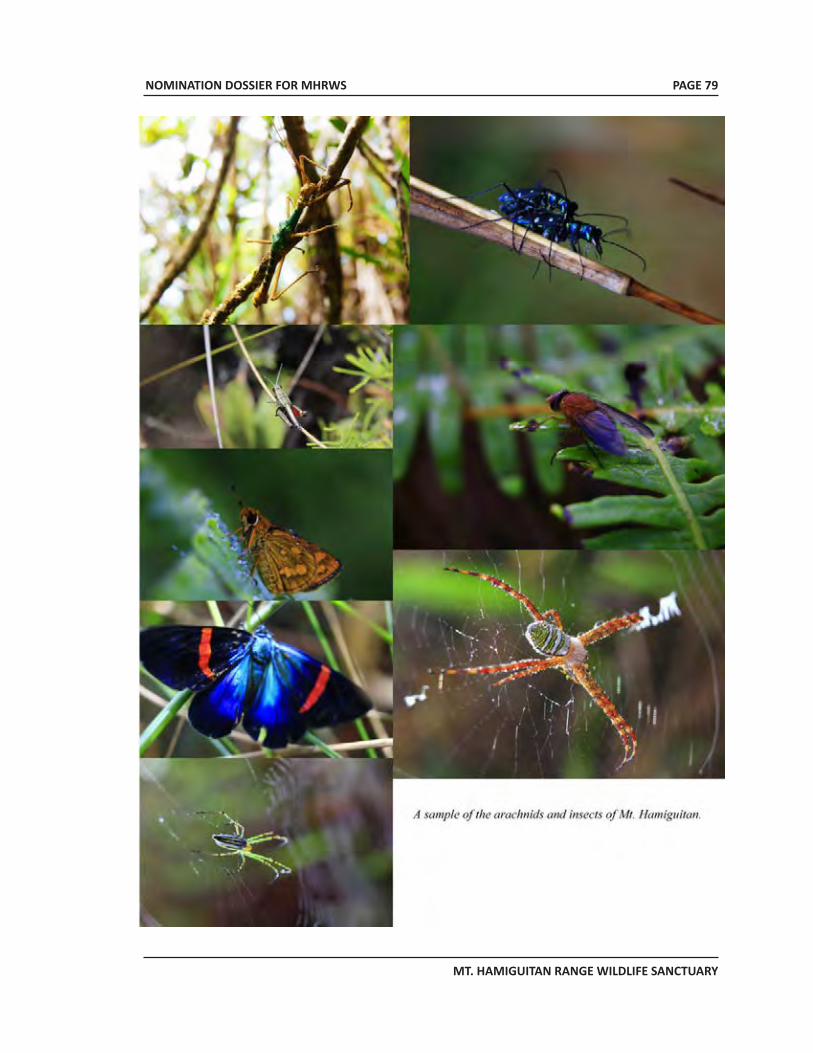
NOMINATION DOSSIER FOR MHRWS
MT. HAMIGUITAN RANGE WILDLIFE SANCTUARY
PAGE 79
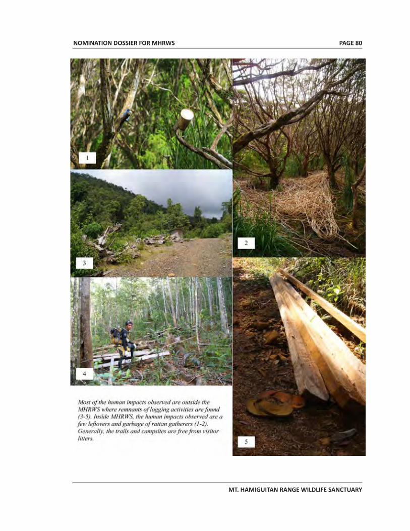
NOMINATION DOSSIER FOR MHRWS
MT. HAMIGUITAN RANGE WILDLIFE SANCTUARY
PAGE 80
NOMINATION DOSSIER FOR MHRWS
MT. HAMIGUITAN RANGE WILDLIFE SANCTUARY
PAGE 81
EXECUTIVE SUMMARY FOR MHRWS
MOUNT HAMIGUITAN RANGE WILDLIFE SANCTUARY
PAGE 82
7. Documentation
7.a Photographs, slides, image inventory and authorization table and other audiovisual materials
Table 7.1 presents photographs, slides and other images that are part of the final WHS nomination dossier.
Id. N
o.
Form
at
Capt
ion
Dat
e of
Ph
oto/
M
ater
ial
Phot
ogra
pher
/Dire
ctor
of
the
Vide
o
Copy
right
O
wne
r Co
ntac
t Det
ails
of P
hoto
grap
her/
Co
pyrig
ht O
wne
r N
on-
excl
usiv
e
cess
ion
of
right
s Sl
ides
1 Sl
ide
View
of M
ount
Ham
igui
tan
2006
U
nkno
wn
Amor
oso
et a
l (1
) Dr.
Vict
or B
. Am
oros
o Ce
ntra
l Min
dana
o U
nive
rsity
M
aram
ag, M
usua
n, B
ukid
non
Phon
e: +
63.9
17.5
49.5
084
Em
ail:
amor
osov
ic@
yaho
o.co
m
Yes
2 Sl
ide
Blac
k sp
otte
d sp
heno
mor
phou
s 20
06
Unk
now
n Am
oros
o et
al
Yes
3 Sl
ide
Bons
ai tr
ees o
bser
ved
belo
w th
e pe
ak o
f Mou
nt H
amig
uita
n 20
06
Unk
now
n Am
oros
o et
al
Yes
4 Sl
ide
Bons
ai tr
ee in
Mou
nt H
amig
uita
n 20
06
Unk
now
n Am
oros
o et
al
Yes
5 Sl
ide
Cent
iped
e flo
wer
20
06
Unk
now
n Am
oros
o et
al
Yes
6 Sl
ide
Mon
tane
fore
st
2006
U
nkno
wn
Amor
oso
et a
l Se
e (1
) abo
ve
Yes
7 Sl
ide
Hass
elt’s
toad
20
06
Unk
now
n Am
oros
o et
al
See
(1) a
bove
Ye
s 8
Slid
e M
ossy
fore
st lo
cate
d ne
ar th
e pe
ak o
f Mou
nt H
amig
uita
n 20
06
Unk
now
n Am
oros
o et
al
See
(1) a
bove
Ye
s 9
Slid
e Pi
tche
r pla
nt
2006
U
nkno
wn
Amor
oso
et a
l Se
e (1
) abo
ve
Yes
10
Slid
e Vi
ew o
f the
fore
st c
over
of M
ount
Ham
igui
tan
2006
U
nkno
wn
Amor
oso
et a
l Se
e (1
) abo
ve
Yes
Plat
es
2.
1 Ph
otog
raph
Pl
ants
gro
win
g on
top
of th
in la
yer o
f ultr
amaf
ic so
il an
d la
yer o
f ro
cks
2007
U
nkno
wn
Amor
oso
et a
l Se
e (1
) abo
ve
Yes
2.2
Phot
ogra
ph
The
twin
falls
20
07
Unk
now
n Am
oros
o et
al
See
(1) a
bove
Ye
s 2.
3 Ph
otog
raph
Sm
alle
r wat
erfa
lls in
MHR
WS
2006
Ja
yson
Ibañ
ez
Jays
on Ib
añez
(2
) Phi
lippi
ne E
agle
Fou
ndat
ion
Mal
agos
, Cal
inan
, Dav
ao C
ity
Phon
e: +
63 8
2 27
1-23
37;
Emai
l: fa
lcon
2car
@ya
hoo.
com
Yes
2.4
Phot
ogra
ph
The
Agro
-eco
syst
em d
omin
ated
by
coco
nut t
rees
20
06
Unk
now
n Am
oros
o et
al
See
(1) a
bove
Ye
s 2.
5 Ph
otog
raph
Th
e di
pter
ocar
p fo
rest
dom
inat
ed b
y Sh
orea
spec
ies a
nd o
ther
di
pter
ocar
p tr
ees
2006
U
nkno
wn
Amor
oso
et a
l Se
e (1
) abo
ve
Yes
2.6
Phot
ogra
ph
The
Mon
tane
fore
st d
omin
ated
by
Agat
his
phili
ppin
ensis
20
06
Unk
now
n Am
oros
o et
al
See
(1) a
bove
Ye
s 2.
7 Ph
otog
raph
Th
e m
ossy
fore
st d
omin
ated
by
C. b
lanc
oi a
nd D
. ela
tum
20
06
Unk
now
n Am
oros
o et
al
See
(1) a
bove
Ye
s 2.
8 Ph
otog
raph
Th
e m
ossy
-pyg
my
fore
st M
HRW
S 20
06
Unk
now
n Am
oros
o et
al
See
(1) a
bove
Ye
s 2.
9 Ph
otog
raph
Ty
pica
l nat
ural
bon
sai t
ree
insi
de th
e m
ossy
pyg
my
fore
st
2006
Ja
yson
Ibañ
ez
Jays
on Ib
añez
Se
e (2
) abo
ve
Yes
2.10
Ph
otog
raph
Ti
nago
ng D
agat
U
nkno
wn
Unk
now
n U
nkno
wn
Unk
now
n Ye
s 2.
11
Phot
ogra
ph
Som
e en
dem
ic, t
hrea
tene
d an
d ra
re p
alnt
s of
Ham
igui
tan
Rang
e 20
06
Unk
now
n Am
oros
o et
al
See
(1) a
bove
Ye
s 2.
12
Phot
ogra
ph
Nep
enth
es m
icra
mph
ora
2011
PA
SO st
aff
MHR
WS-
PASO
(3
) Rue
l D. C
olon
g M
HRW
S-PA
SO, G
ovt.
Cent
er
San
Isid
ro, D
avao
Orie
ntal
Em
ail:
ruel
colz@
yaho
o.co
m
Yes
2.13
Ph
otog
raph
N
. pel
tata
20
11
PASO
staf
f M
HRW
S-PA
SO
Yes
2.14
Ph
otog
raph
N
. ham
igui
tane
nsis
20
11
PASO
staf
f M
HRW
S-PA
SO
Yes
2.15
Ph
otog
raph
Th
e Cr
itica
lly E
ndan
gere
d Ph
ilipp
ine
Eagl
e 20
06
Jays
on Ib
añez
Ja
yson
Ibañ
ez
See
(2) a
bove
Yes
2.16
Ph
otog
raph
Th
e Cr
itica
lly E
ndag
red
Phili
ppin
e Co
ckat
oo
200
6Ja
yson
Ibañ
ez
Jays
on Ib
añez
See
(2) a
bove
Y
es
Yes
2.17
Ph
otog
raph
Th
e si
te e
ndem
ic D
elia
s mag
sada
na
2006
Al
ma
B. M
ohag
an
Alm
a B.
M
ohag
an
Cent
ral M
inda
nao
Uni
vers
ity
Mar
amag
, Mus
uan,
Buk
idno
n Em
ail:
alm
ohag
an@
gmai
l.com
Yes
2.18
Ph
otog
raph
Si
te e
ndem
ic H
amui
gita
n ha
iry-t
aile
d ra
t 20
06
Jays
on Ib
añez
Ja
yson
Ibañ
ez
See
(2) a
bove
Ye
s 6.
1 Ph
otog
raph
Tr
ail i
nsid
e M
HRW
S 20
11
Roy
G. P
once
Ro
y G
. Pon
ce
Dava
o O
rient
al S
tate
Col
lege
of
Scie
nce
and
Tech
nolo
gy, M
ati C
ity,
Dava
o O
rient
al
Emai
l: ro
yg.p
once
@ya
hoo.
com
Yes
Flas
h pr
esen
tatio
n
CD
Mul
timed
ia p
rese
ntat
ion
on M
t. Ha
mig
uita
n Ra
nge
Wild
life
Sanc
tuar
y 20
11
Ruel
D. C
olon
g M
HRW
S-PA
SO
See
(3) a
bove
Ye
s
NOMINATION DOSSIER FOR MHRWS
MT. HAMIGUITAN RANGE WILDLIFE SANCTUARY
PAGE 83
7.b Texts relating to protective designation, copies of property management systems and extracts of other plans relevant to the property
• Appendix 1 - Republic Act No. 9303 dated 30 July 2004: An act declaring Mt. Hamiguitan Range and its vicinities as protected area under the category of wildlife sanctuary and its peripheral areas as buffer zone and appropriating funds therefore.
• Appendix 2 - Republic Act 7586 dated 22 July 1992: An Act providing for the establishment and management of National Integrated Protected Areas System (NIPAS), defining its scope and coverage and for other purposes.
• Appendix 2A - DAO 2008-26: Revised Implementing Rules and Regulations of Republic Act No. 7586 or the NIPAS Law of 1992.
• Appendix 3 - Detailed description of Nepenthes peltata, a new species endemic only to MHRWS.
• Appendix 4 - Detailed description of Nepenthes micramphora, a new species endemic only to MHRWS.
• Appendix 5 - Photo documentation on some endemic, threatened, rare and economically important floral species in MHRWS.
• Appendix 6 - Photo documentation on some endemic, threatened, rare and economically important faunal species in MHRWS.
• Appendix 7 - Photo documentation on some endemic, endangered and rare butterflies in MHRWS.
• Appendix 8 - MHRW PAMB Resolution 2010-02 dated 25 March 2010: A Resolution approving the indefinite closure of Mt. Hamiguitan Range Wildlife Sanctuary to visitors/mountaineers/trekkers effective 03 April 2010 except for duly approved research studies and activities in line with its 7-Point Agenda.
• Appendix 9 - MHRW PAMB Resolution 2010-03 dated 25 March 2010: A Resolution approving and adopting the 7-Point Agenda as major requirement in re-opening the Mt. Hamiguitan Range Wildlife Sanctuary for naturare recreation particularly to visitors/mountaineers/trekkers, to be co-managed by LGU/s concerned.
• Appendix 10 – Republic Act 9147 dated 19 March 2001: An act providing for the conservation and protection of wildlife resources and their habitats, appropriating funds therefore and for other purposes.
7.c Form and date of most recent records or inventory of property
The comprehensive biodiversity inventory and assessment of MHRWS was conducted by a group of scientists from various universities in Mindanao during the period of 2004-2007. The lead university for this endeavor is the Central Mindanao University. The biodiversity assessment was done in association with the Davao Oriental State College of Science and Technology, University of the Philippines Mindanao, University of Southern Mindanao and the Philippine Eagle Foundation.
NOMINATION DOSSIER FOR MHRWS
MT. HAMIGUITAN RANGE WILDLIFE SANCTUARY
PAGE 84
Other related research activities were also conducted separately by the University of Southern Mindanao and its collaborating universities/colleges, the Philippine Eagle Foundation and the re-search group of Dr. Alma B. Mohagan .
7.d Address where inventory, records and archives are held
Records of the latest inventory of the Hamiguitan Range Wildlife Sanctuary is found at the Central Mindanao University located in University Town, Musuan, Maramag, Bukidnon 8710 Philippines. Further information can be obtained from:
PASu Ruel D. ColongMHRWS - Protected Area Superintendent’s Office Government Center, San Isidro, Davao OrientalEmail: [email protected]
Dr. Victor B. AmorosoCentral Mindanao University (CMU)University Town, Musuan,Maramag, BukidnonMobile: +63 917 549-5084Email: [email protected]
Mr. Jayson C. IbanezPhilippine Eagle FoundationMalagos, Calinan, Davao CityPhone: +63 82 271-2337; Fax: +63 82 301-1033
Prof. John Aries TaboraUniversity of Southern MindanaoKabacan, North CotabatoE-mail: [email protected] 7.e Bibliography
Advisory Body Evaluation. (n.d.). World Heritage Centre. Retrieved December 15, 2011, from World Heritage Centre Web site: http://http://www.worldheritagesite.org
Amoroso, V., Aspiras, R., & Polizon, J. J. (2007). Participatory inventory and distribution of endangered, endemic and economically important plants in the Hamiguitan Range Wildlife Sanctuary, Davao Oriental. A Progressive Philippines Anchored in Science: Building a Culture of Science in the Philippines. 29th National Academy of Science and Technology Annual Scientific Meeting, 29. MetroManila.
Amoroso, V., Obsioma, L., Sales, E., Ates, F., Orreno, H., Arlalejo, J., et al. (2007). Biodiversity Assessment and Conservation of Hamiguitan Range and Its Environ, Davao Oriental.
Balete, D., Heaney, L., Rickart, E., Quidlat, R., & Ibanez, J. (2008). A new species of Batomys (Mammalia: Muridae) from eastern Mindanao Island, Philippines. Proceedings of the Biological Society of Washington , 121 (4), 411-428.
Day, D. (2005, February). Rugged Plants Struggle to Survive on Barren Serpentine Soil. Retrieved November 27, 2011, from Northern California Geological Society Website: http://www.ncgeolsoc.org
Delmiguez Sr., E. (1993). Mining Engineer’s Report of the Nickel Deposits of North Pujada Project, Mati, Davao Oriental.
NOMINATION DOSSIER FOR MHRWS
MT. HAMIGUITAN RANGE WILDLIFE SANCTUARY
PAGE 85
DENR. (n.d.). Mt. Kitanglad Natural Park: A Nomination as ASEAN Heritage Park.Goodland, R., & Wicks, C. (2008). Philippines: Mining or Food? London, United Kingdom: The
Working Group of Mining in the Philippines.Gronemeyer, T., Wistuba, A., Heinrich, V., McPherson, S., Mey, F., & Amoroso, V. (2010). Nepenthes
hamiguitanensis (Nepenthaceae), a new pitcher plant from Mindanao Island, Philippines. In S. R. McPherson, Carnivorous Plants and their Habitats (Vol. 1). Poole: Redfern Natural History Productions Ltd.
Hockings, M., Stolton, S., Leverington, F., Dudley, N., & Courrau, J. (2006). Evaluating Effectiveness: A framework for assessing management effectiveness of protected areas (2nd ed.). Gland, Switzerland and Cambridge, UK: IUCN, Gland, Switzerland and Cambridge, UK.
IUCN 2011. IUCN Red List of Threatened Species. Version 2011.2. <www.iucnredlist.org>. Downloaded on 27 November 2011.
Kurata, S. (2008). Nepenthes peltata (Nepenthaceae), a new species of pitcher plant from the Philippines. Journal of the Insectivorous Plant Society , 59 (1), 12–17.
McPherson, S. (2009). Pitcher Plants of the Old World (Vol. 2). (A. R. Fleishchmann, Ed.) England: MPG Books Group.
Mohagan, A., & Treadaway, C. G. (2010). Diversity and Status of Butterflies across Vegetation Types of Mt. Hamiguitan, Davao Oriental, Philippines. Asian Journal of Biodiversity , 1, 1-24.
PASO File Records. (n.d.).Philippine Eagle Foundation; DENR. (2005). Eastern Mindanao Corridor Biodiversity Archiving and
Assessment Project. Ponce, R. (2011). Mt. Hamiguitan Range Wildlife Sanctuary: Trails and Camp Sites Assessment.
Mati, Davao Oriental.Smith, C. (2005, January 26). Geochemical Investigation of Habitat Distribution of Arabis
mcdonaldiana in the Six River National Forest, Del Norte County, California. California, USA.Villanueva, J. R., & Mohagan, A. B. (2010). Diversity and Status of Odonata across Vegetation Types
in Mt. Hamiguitan Wildlife Sanctuary, Davao Oriental. Asian Journal of Biodiversity , 1, 25-38.
8. Contact Information of responsible authorities
8.a Preparer
Provincial Government of Davao OrientalHon. Corazon N. MalanyaonProvincial GovernorProvincial Capitol, 8200 Mati CityPhone/Fax: +63 87 8115110Email: [email protected]
Hon. Justina MB YuBoard Member, Sangguniang PanlalawiganSP Complex, Dahican, 8200 Mati CityEmail: [email protected]
Ms. Cynthia B. RodriguezProvincial Tourism ConsultantProvincial Capitol, 8200 Mati CityEmail: [email protected]
NOMINATION DOSSIER FOR MHRWS
MT. HAMIGUITAN RANGE WILDLIFE SANCTUARY
PAGE 86
MHRWS Documentation TeamRuel D. Colong, M.Sc.Protected Area SuperintendentMHRWS-Protected Area Superintendent’s Office Governement Center, San Isidro, Davao OrientalEmail: [email protected]
Fidel M. AmbiAssisting Professional/Local Consultantc/o Prov’l. Capitol, 8200 Mati CityEmail: [email protected]
Roy G. PonceHead, Teaching - Learning Resource, Assessment and Evaluation CenterDavao Oriental State College of Science and TechnologyDahican, 8200 Mati CityEmail: [email protected]
Others who extended assistance to the teamPASO Staff & Local Bantay GubatMaria Theresa Aquino, DVMRita Fe Cordova, Ph.D.Edgar Barquin, GIS SpecialistAriel Aguhob, Layout & Graphic ArtistAmy G. Ponce, Research AssistantMilan N. Jerusalem, Layout Asst./Computer Encoder
8.b Official Local Institution/Agency
Province of Davao OrientalHon. Corazon N. MalanyaonProvincial GovernorProvincial Capitol, 8200 Mati City, Davao OrientalPhone/Fax: +63 87 811-5110
DENR Region 11 Davao CityDir. Jim O SampulnaRegional Executive DirectorKm. 7, Lanang, Davao CityPhone: +63 82 223-2779 / +63 82 234-7441; Fax: +63 82 234-0811
NOMINATION DOSSIER FOR MHRWS
MT. HAMIGUITAN RANGE WILDLIFE SANCTUARY
8.c Other Local Institutions
Name of Agency Contact Person Designation Address Contact Number Municipality of Mati
Hon. Michelle N. Rabat
Municipal Mayor Municipal Hall
Municipality of San Isidro
Hon. Edgar Flor V. Saulon
Mayor Municipal Hall +63 82 440-3420
Municipality of Governor Generoso
Hon. Vicente D. Orencia
Mayor Municipal Hall +63 82 440-3541
Central Mindanao University
Dr. Victor B. Amoroso
Prof. & Scientist III & PNC Chair for LTER & DIVERSITAS
CMU, Musuan, Bukidnon
+63 82 223-2779 +63 82 234-7441
PENRO Davao Oriental
Mr. Gregorio V. Lagura OIC, PENRO Mati, Davao
Oriental +63 87 388-3275
8.d Official Web Address
The nominated property has no official web address at present. All communications regarding the nominated property may be coursed through:
Hon. Corazon N. MalanyaonProvincial Governor, Davao OrientalProvincial Capitol, Mati City+63 87 8115110Email: [email protected]; [email protected]
Dr. Virginia A. MiralaoSecretary-GeneralUNESCO National Commission of the PhilippinesDepartment of Foreign Affairs, 2330 Roxas Boulavard, Pasay CityPhone: +63 2 834-3447 and +63 2 834-4843Email: [email protected]
9. SIGNATURE ON BEHALF OF THE STATE PARTY
For the government of the Republic of the Philippines:
ALBERT F. DEL ROSARIOSecretary, Department of Foreign Affairs andChairperson, UNESCO National Commission of the Philippines
PAGE 87
NOMINATION DOSSIER FOR MHRWS
MT. HAMIGUITAN RANGE WILDLIFE SANCTUARY
ACKNOWLEDGEMENT
The preparers of the Nomination Dossier for the Proposed Inscription of the Mt. Hamiguitan Range Wildlife Sanctuary would like to thank the following groups, individuals and institutions who have given their full support to this endeavor:
• Protected Area Management Board of MHRWS• Regional Executive Director Jim O Sampulna of DENR Region XI• Hon. Thelma Z. Almario, Representative of 2nd Cong. District, Davao Oriental• Hon. Joel Mayo Z. Almario, Vice Governor of Davao Oriental• Hon. Apolinar Q. Ruelo, Sr., former Municipal Mayor of San Isidro
The preparers would like also to thank the following for providing support in one way or another:
• Regional Technical Director Emmanuel Isip of DENR Region XI• Dr. Victor B. Amoroso et al. for providing their research output on biodiversity assessment and
conservation of Mt. Hamiguitan Range and its environs• Mr. Dennis Salvador of the Philippine Eagle Foundation for providing a copy of wildlife studies
on Mount Hamiguitan• Prof. John Aries Tabora et al. for sharing the result of research study on Resources Valuation of
MHRWS• Dr. Alma B. Mohagan et al. for sharing the results of research studies on butterflies and odonata
in MHRWS• PENR Officer Gregorio V. Lagura of DENR-PENRO, Davao Oriental• Municipal Mayor of San Isidro, Hon. Edgar Flor V. Saulon• Municipal Mayor of Gov. Generoso, Hon. Vicente Orencia• Municipal Mayor of Mati, Hon. Michelle N. Rabat
Special thanks are extended to the following officials and staff of the UNESCO National Commission of the Philippines:• Hon. Albert F. Del Rosario, DFA Secretary and UNACOM Chairperson• Dr. Virginia A. Miralao, UNACOM Secretary General• Hon. Alberto G. Romulo, former DFA Secretary and UNACOM Chairman• Hon. Preciosa Soliven, former Ambassador and UNACOM Secretary General • Dir. Jeannette D. Tuason, Deputy Executive Director II, UNACOM• Arch. Ma. Joycelyn B. Mananghaya, UNACOM Commissioner• Ms. Maria Victoria Punay, Project Officer for Culture, UNACOM • Ms. Marie Antoinette Reyes, Development Mgt. Officer III, UNACOM
PAGE 88
MANAGEMENT PLAN FOR MHRWS
MOUNT HAMIGUITAN RANGE WILDLIFE SANCTUARY
MT. HAMIGUITANRANGE WILDLIFE SANCTUARY
Proposed Inscription to the UNESCO World Heritage List
VOLUME 3
MANAGEMENT PLAN
MANAGEMENT PLAN FOR MHRWS
MOUNT HAMIGUITAN RANGE WILDLIFE SANCTUARY
1. Executive Summary
1.1 Profile
Mt. Hamiguitan Range Wildlife Sanctuary (MHRWS) was created on July 30, 2004 by virtue of Republic Act No. 9303. It is located in Region XI specifically in the Southeastern part of Mindanao and belongs to the Philippine Biogeographic Zone 14 of Central Mindanao. Its boundaries traverse along the Municipalities of San Isidro, Governor Generoso and City of Mati, Davao Oriental.
MHRWS is nestled atop the Pujada Peninsula. It is situated inside the coordinates 6039’45” to 6047’10” north latitude and 126008’30” to 126012’15” longitude. Its elevation range is from 170 to 1637 meters above sea level (masl). It has a rough to very rough terrain.
MHRWS has Type IV Climate which is characterized by even rainfall distribution throughout the year and an absence of a lengthy dry season. There is no rainfall data inside MHRWS, but the nearest rain gauge station has recorded an annual average rainfall of 1,266 millimeter (mm) with a monthly average rainfall of 105.5 mm. Average temperature recorded at the nearest weather station is 27.75°C. The lowest temperature is recorded in January at 22.4°C while the highest temperature is recorded in April and May at 33°C, respectively. Unofficial temperature recorded inside the pygmy forest is from 100C to 16.50C and the relative humidity is 98 percent.
The total area of MHRWS is 7,132.76 hectares. Out of this, 6,348.99 hectares is classified as protected area (PA) and 783.77 hectares constitute the buffer zone. The land cover is classified into agro-ecosystem, dipterocarp forest, montane forest, mossy forest and mossy-pygmy forest, but the area coverage of each land cover is still to be surveyed on the ground or through satellite imagery analysis.
Majority of the MHRWS area, particularly those where the natural tropical bonsai forests are located, is characterized by ultramafic rocks with thin soil cover which is highly acidic and has low fertility.
There are a total of 957 plant species found in the area. They are composed of 723 angiosperms, 27 gymnosperms, 164 ferns and allies, 17 mosses, 13 liverworts, 13 lichens and undetermined number of fungi species. Out of this total number of species, 35 are critically endangered, endangered or vulnerable; 33 are rare; 163 are found only in the Philippines; and, 204 are considered economically important. Eight species are recorded new for Mindanao. Moreover, there are also three species of pitcher plants found only in MHRWS, the Nepenthes peltata, N. micramphora and N. hamiguitanensis.
A total of 423 animal species which include 15 non-flying mammals, 11 flying mammals, 108 birds, 33 reptiles, 18 frogs, 142 butterflies, 31 dragonflies and damselflies, 46 spiders, four earthworms and 15 nematodes. Ten (10) of these species are either endangered, threatened or vulnerable; 26 are rare; 60 are found only in the Philippines; and, 23 are found only in Mindanao. There are also seven animals (Batomys hamiguitan, Delias magsadana, Arhopala eridanus davalma, Arisbe euphratoides, Paruparu cebuensis, Anax guttatus, Prodasineura integra). which can only be found in the pygmy forest of MHRWS.
Aside from the abovementioned species, MHRWS is also renowned for its 1,234 hectares of natural tropical bonsai forest which is considered unique worldwide. A pygmy forest where Tropical tree species such as Almaciga (Agathis philippinensis), Cedar (Dacrydium elatum) and Ulayan (Lithocarpus llanosii), among others, have average heights of only 1.4 meters while they attain heights of 20 meters or taller at the dipterocarp and montane forests .
PAGE 1
MANAGEMENT PLAN FOR MHRWS
MOUNT HAMIGUITAN RANGE WILDLIFE SANCTUARY
Other prominent natural features of MHRWS include the Tinagong Dagat Lake, Twin Falls, Hidden Garden, Licub Falls and Mansadok Peak. Some watersheds of Bitaogan, Mabua, Dumagooc, Tibanban, Salingkomot and Jericho Rivers are also found inside MHRWS.
The completed management zoning for MHRWS classified 5,792.36 hectares of the area as strict protection zone (SPZ) and 1,340.40 hectares as multiple-use zone (MUZ). In the strict protection zone, only scientific studies and researches are allowed while at the MUZ, agro-forestry, sustainable use of minor forest products such as Almaciga resin and rattan, gathering of fallen branches, seeds, leaves, twigs and driftwoods as well as ecotourism activities are allowed.
Biodiversity assessment of MHRWS was already completed and researches on resource valuation and Biosystematics of the Genus Amomum Roxb are on-going.
In terms of human habitation, 39 households are located inside the buffer zone/multiple use zone. The surrounding communities recorded a minimal overall population growth of 2.04 percent during the years 2001-2007.
Sanctuary protection is being carried out effectively by the regular protection officers of MHRWS. This is being reinforced also by the community forest rangers locally called as “Bantay Gubat”.
1.2 Situational Analysis
The unique features of MHRWS especially the 1,234 hectares of natural tropical bonsai forest and the presence of rare, threatened, economically important plant and animal species greatly require concerted local protection efforts as well as support from national and international institutions. The proper management of MHRWS is also deemed necessary because of its capacity to produce massive cloud formation resulting to frequent rainfalls that contribute to the sustainability of the agricultural plantations not only in its vicinity, but including the nearby provinces such as Compostela Valley Province, Davao del Norte and Davao del Sur; the vast amount of carbon it sequesters which exhibit its role in climate change mitigation; and the high altitudes of the Hamiguitan Mountain Range serve as wind break which shield the agricultural plantations at COMVAL, Davao del Norte and Davao City.
There are 1,308.14 hectares of open canopy forest and 619.91 hectares of brush land that need rehabilitation in order to improve the habitats of the plant and animal species of MHRWS.
The following are possible threats to MHRWS, if not properly addressed:
1. The negative effect of industrialization on the existence of the bonsai trees;2. Timber poaching outside the MHRWS that may possibly encroach inside the PA if not
prevented;3. Illegal gathering of wildlife resources;4. Destructive methods of rattan and Almaciga resin gathering;5. Lack of alternative livelihood for nearby residents who are dependent on the natural
resources in the vicinities; 6. Illegal and uncontrolled entries of visitors which can pose threats to the bonsai forest because
of their lack of awareness on the proper ways take care of it; and,
PAGE 2
MANAGEMENT PLAN FOR MHRWS
MOUNT HAMIGUITAN RANGE WILDLIFE SANCTUARY
PAGE 3
7. The limited resources of MHRWS management to carry out various activities to safeguard Mt. Haguimitan.
There are several holders of existing tenure instruments inside MHRWS. They are holders of Certificate of Stewardship Contracts (CSCs), Community Based Forest Management Agreements (CBFMAs), Industrial Forest Management Agreement (IFMA) and Mineral Production Sharing Agreement (MPSA). However, they are not considered threats to MHRWS. The CSCs and CBFMAs are located at the MUZ hence, their development activities are permissible for that zone. The IFMA and MPSA are also not threats to MHRWS since the portions of MHRWS which fall inside these tenures have elevations of 1,000 masl. and already form part of the protection forests. As such, no activities which will result to the alteration of the environmental condition of the area are allowed as provided under RA 7586 or the National Integrated Protected Areas System (NIPAS). There is no ancestral domain claim inside MHRWS.
Under Republic Act 9303, MHRWS is declared as protected area. Therefore, it is legally stable. All sectors particularly the Local Government Units (LGUs), from the provincial government down to the seven barangays, and a number of NGOs are working unceasingly for its preservation, protection and management.
With all the necessary factors mentioned, MHRWS can be surely considered a unique as well as prime ecotourism destination and a new frontier for scientific researches and studies.
1.3 Management Plan
The key management issues include the following:
1. Preservation and protection of the natural bonsai forests, the unique flora and fauna, endangered and rare species as well as the different ecosystems inside MHRWS including additional research to determine additional features;
2. Strengthening the management capabilities and capacities of MHRWS management specifically the Protected Area Management Board (PAMB) & the Protected Area Superintendent Office (PASO);
3. Appropriate ecotourism activities to avoid damage to the different features of MHRWS; and,4. Appropriate and sufficient livelihood activities of communities surrounding MHRWS to veer
away their attention from exploiting the resources inside and to make them partners in protecting it.
From these key management issues, the following goals, objectives and management activities are set (Table 1.1):
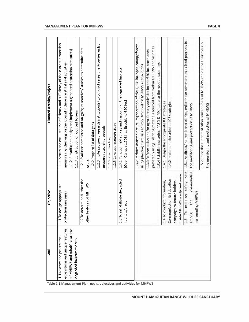
MANAGEMENT PLAN FOR MHRWS
MOUNT HAMIGUITAN RANGE WILDLIFE SANCTUARY
PAGE 4
Table 1.1 Management Plan, goals, objectives and activities for MHRWS
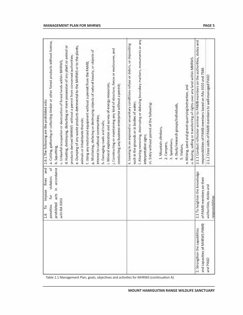
MANAGEMENT PLAN FOR MHRWS
MOUNT HAMIGUITAN RANGE WILDLIFE SANCTUARY
PAGE 5
Table 1.1 Management Plan, goals, objectives and activities for MHRWS (continuation A)
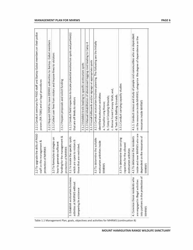
MANAGEMENT PLAN FOR MHRWS
MOUNT HAMIGUITAN RANGE WILDLIFE SANCTUARY
PAGE 6
Table 1.1 Management Plan, goals, objectives and activities for MHRWS (continuation B)
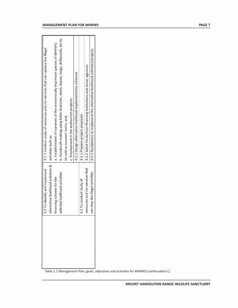
MANAGEMENT PLAN FOR MHRWS
MOUNT HAMIGUITAN RANGE WILDLIFE SANCTUARY
PAGE 7
Table 1.1 Management Plan, goals, objectives and activities for MHRWS (continuation C)
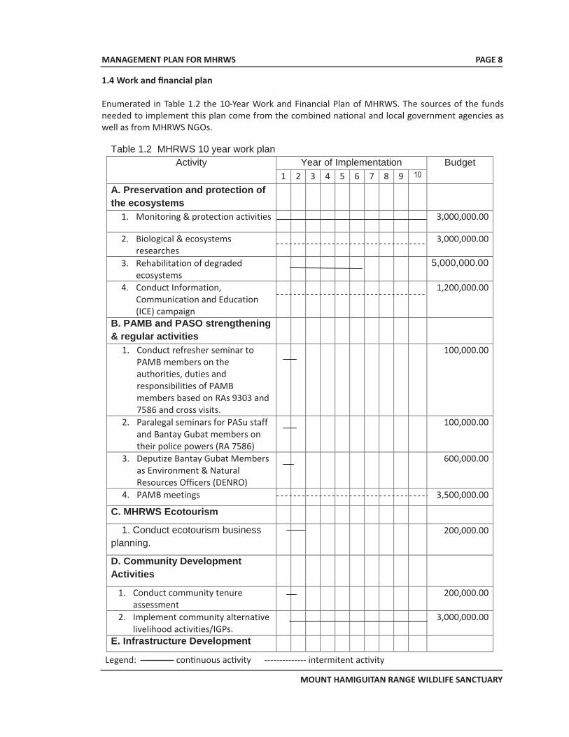
MANAGEMENT PLAN FOR MHRWS
MOUNT HAMIGUITAN RANGE WILDLIFE SANCTUARY
1.4 Work and financial plan
Enumerated in Table 1.2 the 10-Year Work and Financial Plan of MHRWS. The sources of the funds needed to implement this plan come from the combined national and local government agencies as well as from MHRWS NGOs.
Table 1.2 MHRWS 10 year work plan
Activity Year of Implementation Budget 1 2 3 4 5 6 7 8 9 10
A. Preservation and protection of the ecosystems
1. Monitoring & protection activities
3,000,000.00
2. Biological & ecosystems researches
3,000,000.00
3. Rehabilitation of degraded ecosystems
5,000,000.00
4. Conduct Information, Communication and Education (ICE) campaign
1,200,000.00
B. PAMB and PASO strengthening & regular activities
1. Conduct refresher seminar to PAMB members on the authorities, duties and responsibilities of PAMB members based on RAs 9303 and 7586 and cross visits.
100,000.00
2. Paralegal seminars for PASu staff and Bantay Gubat members on their police powers (RA 7586)
100,000.00
3. Deputize Bantay Gubat Members as Environment & Natural Resources Officers (DENRO)
600,000.00
4. PAMB meetings
3,500,000.00
C. MHRWS Ecotourism
1. Conduct ecotourism business planning.
200,000.00
D. Community Development Activities
1. Conduct community tenure assessment
200,000.00
2. Implement community alternative livelihood activities/IGPs.
3,000,000.00
E. Infrastructure Development
PAGE 8
Legend: continuous activity -------------- intermitent activity
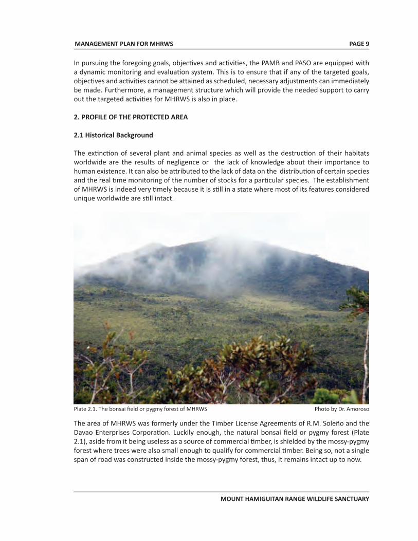
MANAGEMENT PLAN FOR MHRWS
MOUNT HAMIGUITAN RANGE WILDLIFE SANCTUARY
PAGE 9
In pursuing the foregoing goals, objectives and activities, the PAMB and PASO are equipped with a dynamic monitoring and evaluation system. This is to ensure that if any of the targeted goals, objectives and activities cannot be attained as scheduled, necessary adjustments can immediately be made. Furthermore, a management structure which will provide the needed support to carry out the targeted activities for MHRWS is also in place. 2. PROFILE OF THE PROTECTED AREA
2.1 Historical Background
The extinction of several plant and animal species as well as the destruction of their habitats worldwide are the results of negligence or the lack of knowledge about their importance to human existence. It can also be attributed to the lack of data on the distribution of certain species and the real time monitoring of the number of stocks for a particular species. The establishment of MHRWS is indeed very timely because it is still in a state where most of its features considered unique worldwide are still intact.
Plate 2.1. The bonsai field or pygmy forest of MHRWS Photo by Dr. Amoroso
The area of MHRWS was formerly under the Timber License Agreements of R.M. Soleño and the Davao Enterprises Corporation. Luckily enough, the natural bonsai field or pygmy forest (Plate 2.1), aside from it being useless as a source of commercial timber, is shielded by the mossy-pygmy forest where trees were also small enough to qualify for commercial timber. Being so, not a single span of road was constructed inside the mossy-pygmy forest, thus, it remains intact up to now.
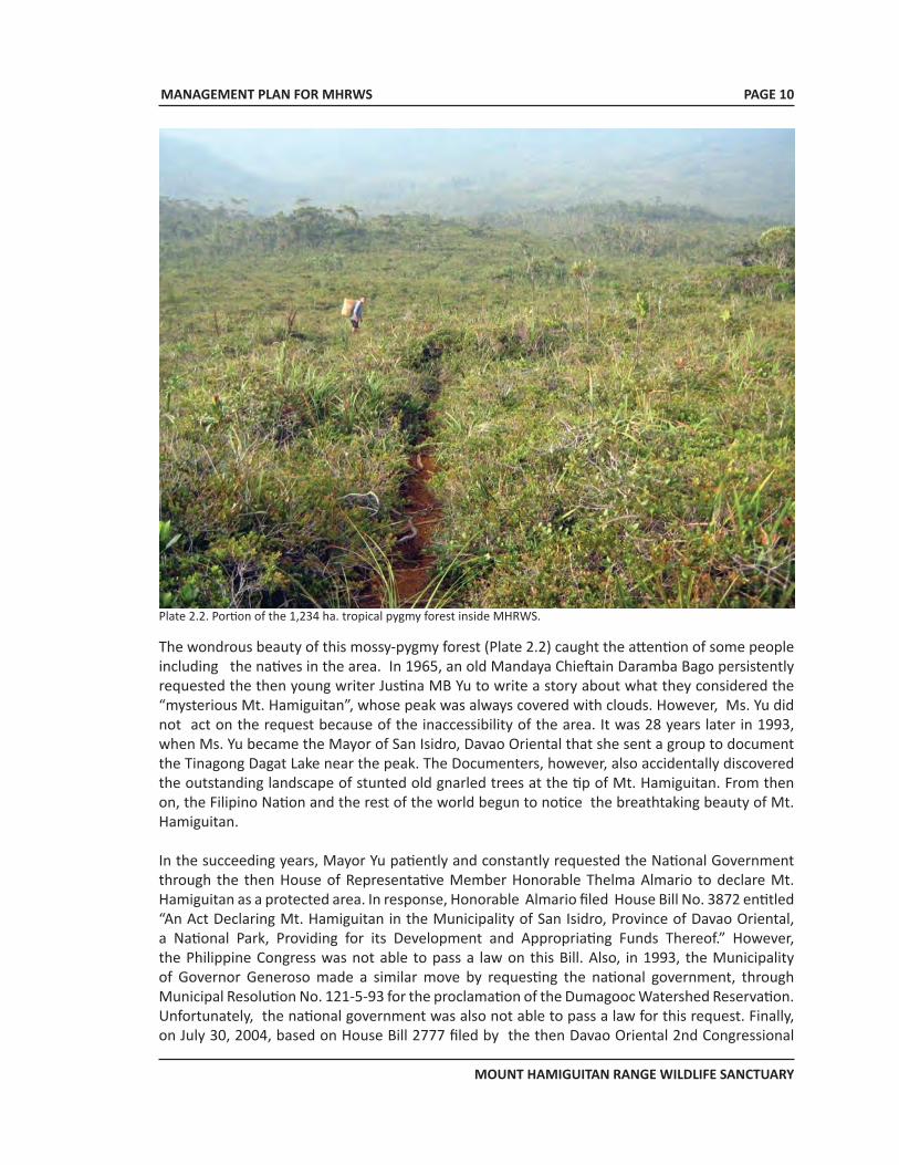
MANAGEMENT PLAN FOR MHRWS
MOUNT HAMIGUITAN RANGE WILDLIFE SANCTUARY
PAGE 10
Plate 2.2. Portion of the 1,234 ha. tropical pygmy forest inside MHRWS.
The wondrous beauty of this mossy-pygmy forest (Plate 2.2) caught the attention of some people including the natives in the area. In 1965, an old Mandaya Chieftain Daramba Bago persistently requested the then young writer Justina MB Yu to write a story about what they considered the “mysterious Mt. Hamiguitan”, whose peak was always covered with clouds. However, Ms. Yu did not act on the request because of the inaccessibility of the area. It was 28 years later in 1993, when Ms. Yu became the Mayor of San Isidro, Davao Oriental that she sent a group to document the Tinagong Dagat Lake near the peak. The Documenters, however, also accidentally discovered the outstanding landscape of stunted old gnarled trees at the tip of Mt. Hamiguitan. From then on, the Filipino Nation and the rest of the world begun to notice the breathtaking beauty of Mt. Hamiguitan.
In the succeeding years, Mayor Yu patiently and constantly requested the National Government through the then House of Representative Member Honorable Thelma Almario to declare Mt. Hamiguitan as a protected area. In response, Honorable Almario filed House Bill No. 3872 entitled “An Act Declaring Mt. Hamiguitan in the Municipality of San Isidro, Province of Davao Oriental, a National Park, Providing for its Development and Appropriating Funds Thereof.” However, the Philippine Congress was not able to pass a law on this Bill. Also, in 1993, the Municipality of Governor Generoso made a similar move by requesting the national government, through Municipal Resolution No. 121-5-93 for the proclamation of the Dumagooc Watershed Reservation. Unfortunately, the national government was also not able to pass a law for this request. Finally, on July 30, 2004, based on House Bill 2777 filed by the then Davao Oriental 2nd Congressional
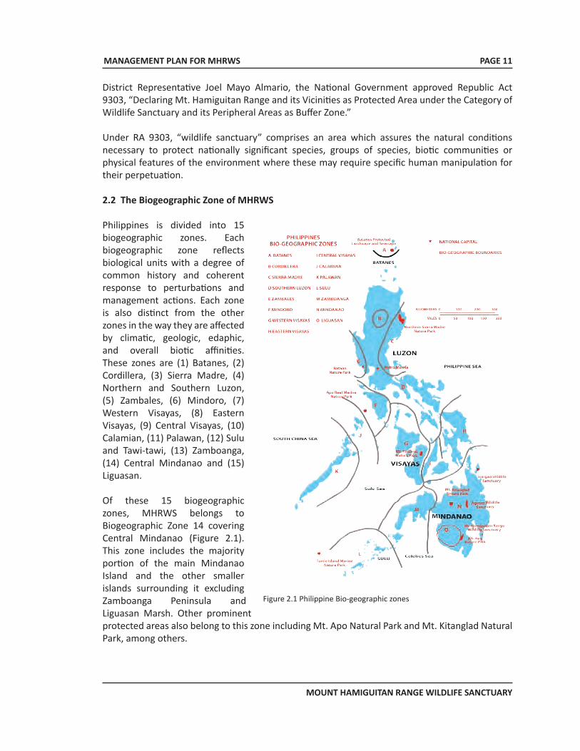
MANAGEMENT PLAN FOR MHRWS
MOUNT HAMIGUITAN RANGE WILDLIFE SANCTUARY
District Representative Joel Mayo Almario, the National Government approved Republic Act 9303, “Declaring Mt. Hamiguitan Range and its Vicinities as Protected Area under the Category of Wildlife Sanctuary and its Peripheral Areas as Buffer Zone.”
Under RA 9303, “wildlife sanctuary” comprises an area which assures the natural conditions necessary to protect nationally significant species, groups of species, biotic communities or physical features of the environment where these may require specific human manipulation for their perpetuation.
2.2 The Biogeographic Zone of MHRWS
Philippines is divided into 15 biogeographic zones. Each biogeographic zone reflects biological units with a degree of common history and coherent response to perturbations and management actions. Each zone is also distinct from the other zones in the way they are affected by climatic, geologic, edaphic, and overall biotic affinities. These zones are (1) Batanes, (2) Cordillera, (3) Sierra Madre, (4) Northern and Southern Luzon, (5) Zambales, (6) Mindoro, (7) Western Visayas, (8) Eastern Visayas, (9) Central Visayas, (10) Calamian, (11) Palawan, (12) Sulu and Tawi-tawi, (13) Zamboanga, (14) Central Mindanao and (15) Liguasan.
Of these 15 biogeographic zones, MHRWS belongs to Biogeographic Zone 14 covering Central Mindanao (Figure 2.1). This zone includes the majority portion of the main Mindanao Island and the other smaller islands surrounding it excluding Zamboanga Peninsula and Liguasan Marsh. Other prominent protected areas also belong to this zone including Mt. Apo Natural Park and Mt. Kitanglad Natural Park, among others.
PAGE 11
Figure 2.1 Philippine Bio-geographic zones
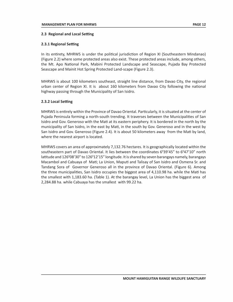
MANAGEMENT PLAN FOR MHRWS
MOUNT HAMIGUITAN RANGE WILDLIFE SANCTUARY
PAGE 12
2.3 Regional and Local Setting
2.3.1 Regional Setting
In its entirety, MHRWS is under the political jurisdiction of Region XI (Southeastern Mindanao) (Figure 2.2) where some protected areas also exist. These protected areas include, among others, the Mt. Apo National Park, Mabini Protected Landscape and Seascape, Pujada Bay Protected Seascape and Mainit Hot Spring Protected Land-scape (Figure 2.3).
MHRWS is about 100 kilometers southeast, straight line distance, from Davao City, the regional urban center of Region XI. It is about 160 kilometers from Davao City following the national highway passing through the Municipality of San Isidro.
2.3.2 Local Setting MHRWS is entirely within the Province of Davao Oriental. Particularly, it is situated at the center of Pujada Peninsula forming a north-south trending. It traverses between the Municipalities of San Isidro and Gov. Generoso with the Mati at its eastern periphery. It is bordered in the north by the municipality of San Isidro, in the east by Mati, in the south by Gov. Generoso and in the west by San Isidro and Gov. Generoso (Figure 2.4). It is about 50 kilometers away from the Mati by land, where the nearest airport is located.
MHRWS covers an area of approximately 7,132.76 hectares. It is geographically located within the southeastern part of Davao Oriental. It lies between the coordinates 6039’45” to 6047’10” north latitude and 126008’30” to 126012’15” longitude. It is shared by seven barangays namely, barangays Macambol and Cabuaya of Mati; La Union, Maputi and Talisay of San Isidro and Osmena Sr. and Tandang Sora of Governor Generoso all in the province of Davao Oriental. (Figure 6). Among the three municipalities, San Isidro occupies the biggest area of 4,110.98 ha. while the Mati has the smallest with 1,183.60 ha. (Table 1). At the barangay level, La Union has the biggest area of 2,284.88 ha. while Cabuaya has the smallest with 99.22 ha.
MANAGEMENT PLAN FOR MHRWS
MOUNT HAMIGUITAN RANGE WILDLIFE SANCTUARY
PAGE 10
Figure 2.2 Location Map of MHRWS
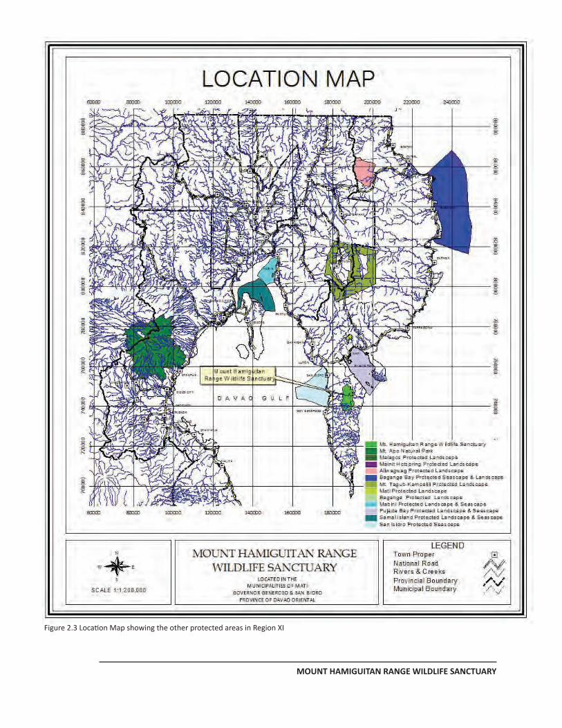
MANAGEMENT PLAN FOR MHRWS
MOUNT HAMIGUITAN RANGE WILDLIFE SANCTUARY
PAGE 11
Figure 2.3 Location Map showing the other protected areas in Region XI
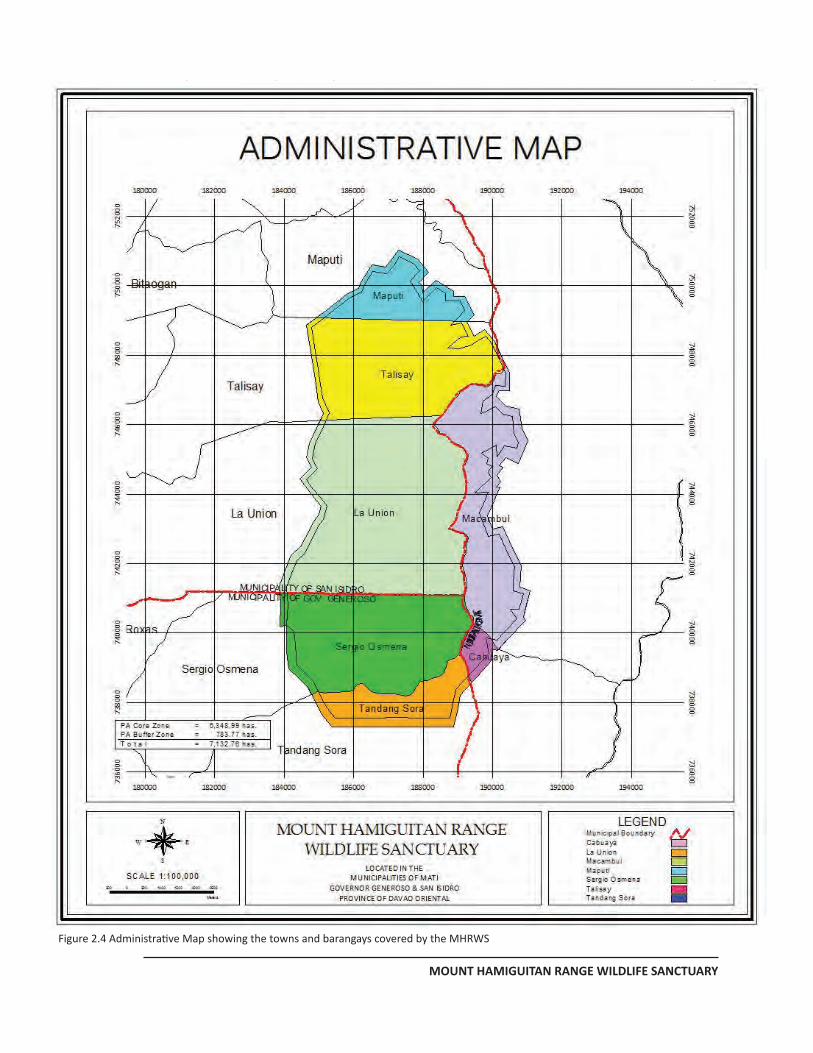
MANAGEMENT PLAN FOR MHRWS
MOUNT HAMIGUITAN RANGE WILDLIFE SANCTUARY
PAGE 12
Figure 2.4 Administrative Map showing the towns and barangays covered by the MHRWS
MANAGEMENT PLAN FOR MHRWS
MOUNT HAMIGUITAN RANGE WILDLIFE SANCTUARY
PAGE 16
2.4 Elevation, Topography, Geology and Soils
The elevation range of MHRWS is from 170 to 1,637 meters above sea level (masl). Figure 2.5 shows the spatial distribution of the different elevation classes inside MHRWS while Table 2.2 shows the elevation classes of each barangays in terms of hectares. Majority of the portions of MHRWS belong to the elevation range of 500-1500 masl.
Table 2.1. MHRWS Area Distribution by City, Municipalities and Barangays
Mun./City San Isidro Gov. Generoso Mati Barangay
Maputi 482.35 Sergio Osmaña 1,347.77 Macambol 1,084.38 Talisay 1,343.74 Tandang Sora 490.41 Cabuaya 99.22 La Union 2,284.89
Total 4,110.98 1,838.18 1,183.60 Grand Total 7,132.76 hectares
Name of Barangay Meter Above Sea Level
200-500 500-1000 1000-1500 1500 & above Maputi 3.32 208.05 270.98 Talisay 86.29 660.95 596.23 0.26 La Union 327.97 1,146.05 780.40 30.47 Sergio Osmeña 387.64 717.73 204.99 1.58 Tandang Sora 1.16 412.52 76.73 Macambol 203.72 864.69 15.96 Cabuaya 44.44 54.79 T O T A L 806.38 3,393.46 2,848.81 48.28
Table 2.2. Elevation Classes of Each Barangays in Terms of Hectares
MHRWS has a generally rough terrain with very steep slope gradient ranging from 8 – 100 percent. Figure 2.6 shows the spatial distribution of the different slope classes inside MHRWS, while Table 3 shows the different slope classes of each barangay in terms of hectares. Out of the 7,132.76 ha., 5,035.50 ha. have slopes of 50% or steeper.
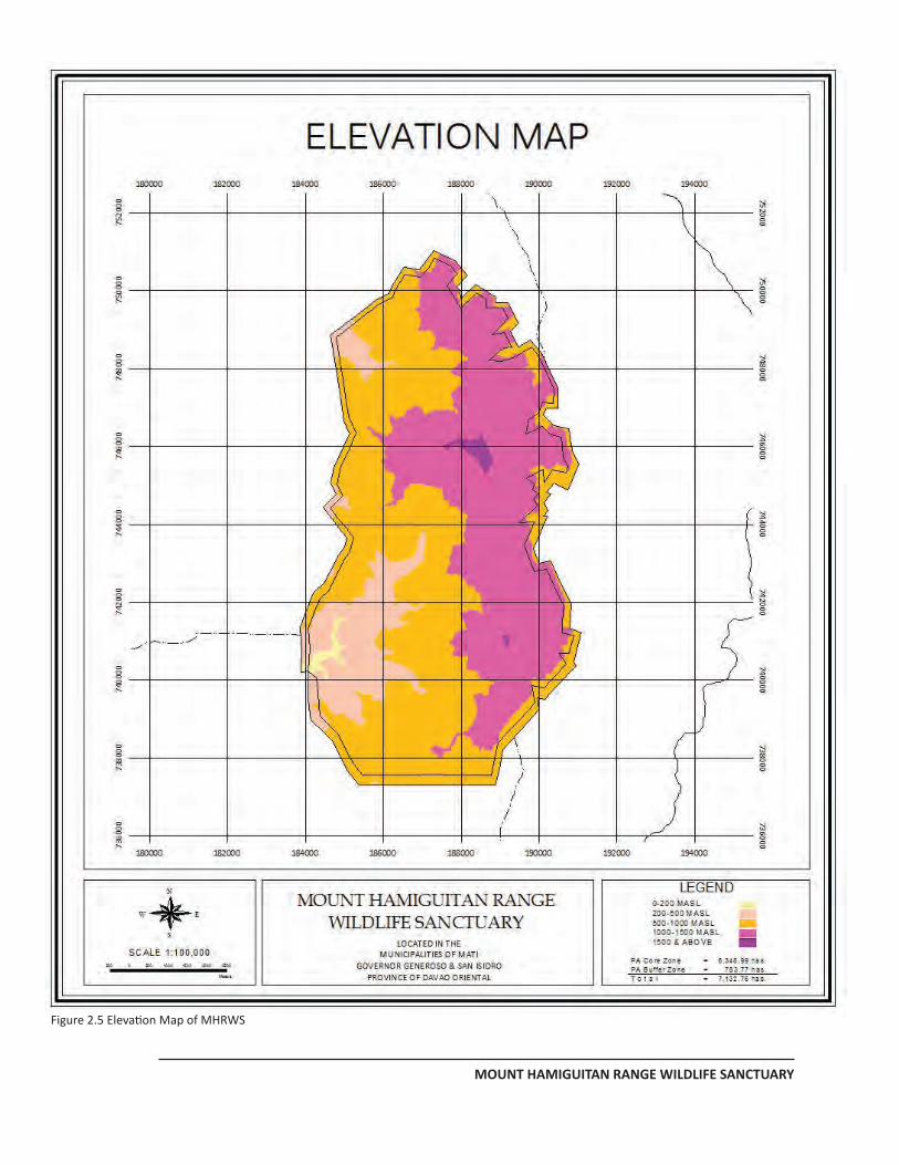
MANAGEMENT PLAN FOR MHRWS
MOUNT HAMIGUITAN RANGE WILDLIFE SANCTUARY
PAGE 16
Figure 2.5 Elevation Map of MHRWS
MANAGEMENT PLAN FOR MHRWS
MOUNT HAMIGUITAN RANGE WILDLIFE SANCTUARY
PAGE 18
Name of Barangay
Slope Class
18-30% 30-50% 50% & above TOTAL
Maputi 207.71 274.64 482.35
Talisay 210.49 0.38
1,132.87 1,343.74
La Union 62.12 565.44
1,490.07 2,284.89
Sergio Osmena 113.87
1,233.90 1,347.77 Tandang Sora 116.32 374.10 490.42 Macambol 565.03 22.43 485.41 1,084.38 Cabuaya 54.72 44.51 99.23
T O T A L 1,045.35 873.16
5,035.50 7,132.76 Table 2.3 Slopes Class of Each Barangay in Terms of Hectares
MHRWS belongs to the Pujada Peninsula, which is interpreted to be a product of magmatic and tectonic actions generated by the subduction of the Philippine Sea Plate. The rocks associated with the oceanic crust are a mixture of sedimentary and ultramafic rocks. Ultramafic or serpentine rocks along with other soil elements such as nickel, magnesium, iron and other minerals render the soil unfavorable for normal growth of vegetation. This condition is common throughout Mt. Hamiguitan Range where the soil is not suitable for short term agricultural crops. It is very pronounced in the section of MHRWS where the pygmy forest is situated.
The soil inside MHRWS is from sandy loam to clay loam under the Malalag and Camansa series. Based on the findings of the Soil and Land Resources Evaluation for the Strategic Agriculture and Fisheries Development Zone – Comprehensive Land Use Plan (SAFDZ-CLUP) Integration Project conducted by the Bureau of Soils and Water Management of the Department of Agriculture in February 2004, the pygmy forest has a pH range of 4.1 – 5.5 which is very acidic and very low soil fertility (Table 2.4).
MANAGEMENT PLAN FOR MHRWS
MOUNT HAMIGUITAN RANGE WILDLIFE SANCTUARY
Table 2.6. Slope Map of MHRWS
MANAGEMENT PLAN FOR MHRWS
MOUNT HAMIGUITAN RANGE WILDLIFE SANCTUARY
PAGE 20
Table 2.4 Soil Characteristics Pygmy Forest in MHRWS (Pedon No. 18, Pygmy Forest, Mt. Hamiguitan, Brgy. La Union, San Isidro, Davao Oriental. Data source: Strategic Agriculture and Fisheries Development Zone – Comprehensive Land Use Plan (SAFDZ-CLUP) Integration Project. Bureau of Soils and Water Management, Department of Agriculture, 2004.)
The other noticeable geologic/landform features found in MHRWS include the Tinagong Dagat Lake (Plate 2.3), the Hidden Garden (Figure 43), the Twin Falls (Plate 2.4), and the Mansadok Peak.
2.5 Hydrology and Watershed
Found in Mt Hamiguitan are the watersheds of some rivers and creeks (Figure 2.7). These watersheds are Bitaugan, Mabua, Dumagooc/Timbo, Tibanban and Mati Cluster (Salingkomot and Jerico). Dumagooc/Timbo Watershed has the largest area of 2,942.34 ha. while Tibanban Watershed has the smallest are of 490.42 ha. (Table 5). Bitaugan, Mabua, Dumagooc/Timbo and Tibanban Rivers drain to the Davao Gulf. Jerico River drains to the Pujada Bay while Salingkomot River drains to the Pacific Ocean.
Plate 2.3 Tinagong Dagat Lake
MANAGEMENT PLAN FOR MHRWS
MOUNT HAMIGUITAN RANGE WILDLIFE SANCTUARY
PAGE 21
Three of these rivers namely: Dumagooc, Tibanban and Bitaugan are the major sources of irrigation waters for the agricultural lands of the municipalities of Governor Generoso and San Isidro. Minor creeks are also seen in MHRWS, however, these are intermittent and dries up during summer. Of all the major rivers, Dumagooc River has the biggest discharge which is estimated to be at 30 cubic meters per second. And because there are no soil and forest disturbance inside, the water from the river is crystal clear as they exit MHRWS.
In addition to the various rivers and creeks found inside MHRWS, two waterfalls exist. They are the Twin Falls in barangay La Union and the Danlogan Falls in Barangay Maputi.
Tinagong Dagat is the only lake inside MHRWS. It has an area of 4.11 ha. and is located at the eastern (Mati) portion. It is situated at an elevation of 1160 masl. This lake dries up during dry season and holds water during rainy season. However, it was reported that before year 2000, this lake used to be a habitat of fresh water shrimps.
Plate 2.4 The Twin Falls
Table 2.5 List of Watershed by Barangay in Terms of Hectares
Name of Barangay
Name of Watersheds Total Bitaugan Mabua Mati Cluster Tibanban Timbo /
Dumagooc Maputi 482.35
482.35 Talisay
1,297.94
45.79
1,343.74
La Union
36.62
653.70
1,594.58
2,284.89
Sergio Osmena
1,347.77
1,347.77
Tandang Sora
490.42
490.42
Macambol 1,084.38 1,084.38 Cabuaya 99.23 99.23 T O T A L
1,816.91
699.49
1,183.60
490.42
2,942.34
7,132.76
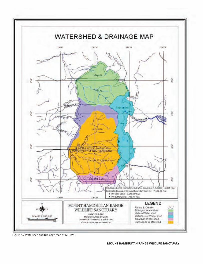
MANAGEMENT PLAN FOR MHRWS
MOUNT HAMIGUITAN RANGE WILDLIFE SANCTUARY
PAGE 18
Figure 2.7 Watershed and Drainage Map of MHRWS
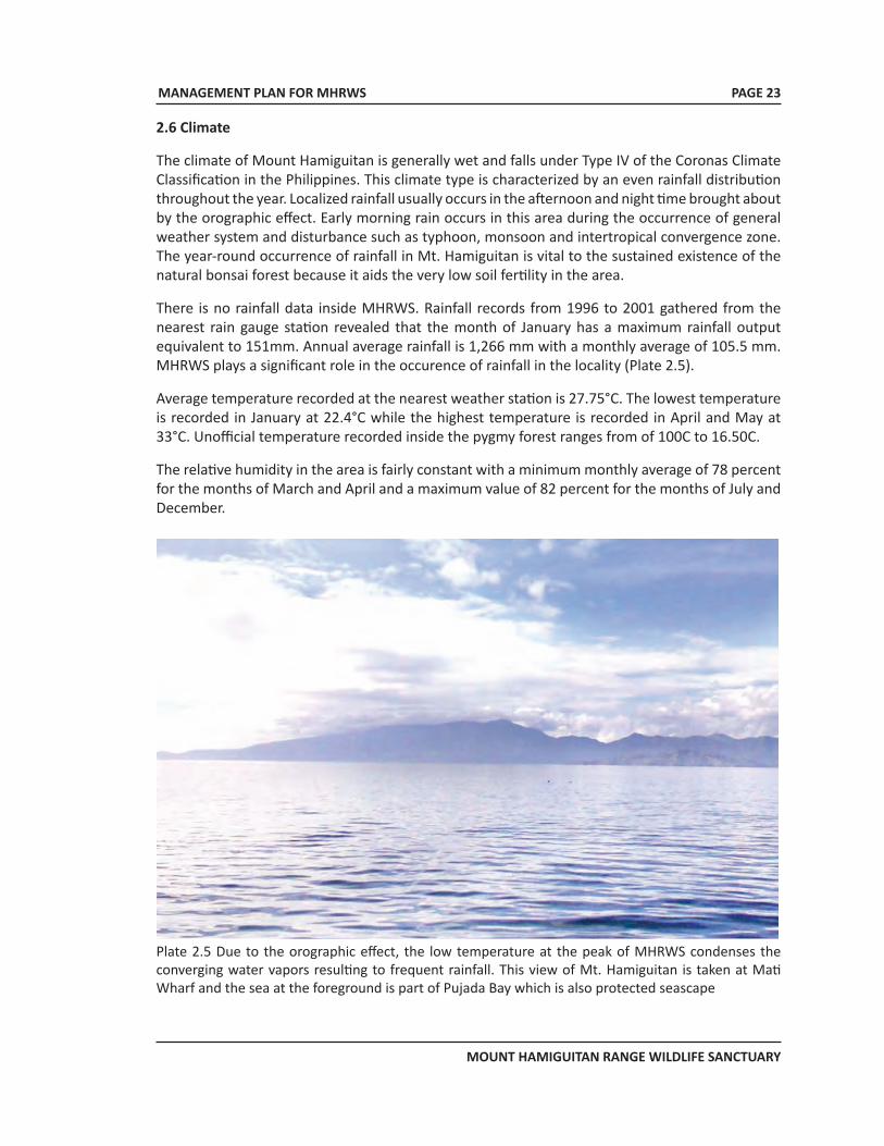
MANAGEMENT PLAN FOR MHRWS
MOUNT HAMIGUITAN RANGE WILDLIFE SANCTUARY
PAGE 23
2.6 Climate
The climate of Mount Hamiguitan is generally wet and falls under Type IV of the Coronas Climate Classification in the Philippines. This climate type is characterized by an even rainfall distribution throughout the year. Localized rainfall usually occurs in the afternoon and night time brought about by the orographic effect. Early morning rain occurs in this area during the occurrence of general weather system and disturbance such as typhoon, monsoon and intertropical convergence zone. The year-round occurrence of rainfall in Mt. Hamiguitan is vital to the sustained existence of the natural bonsai forest because it aids the very low soil fertility in the area.
There is no rainfall data inside MHRWS. Rainfall records from 1996 to 2001 gathered from the nearest rain gauge station revealed that the month of January has a maximum rainfall output equivalent to 151mm. Annual average rainfall is 1,266 mm with a monthly average of 105.5 mm. MHRWS plays a significant role in the occurence of rainfall in the locality (Plate 2.5).
Average temperature recorded at the nearest weather station is 27.75°C. The lowest temperature is recorded in January at 22.4°C while the highest temperature is recorded in April and May at 33°C. Unofficial temperature recorded inside the pygmy forest ranges from of 100C to 16.50C.
The relative humidity in the area is fairly constant with a minimum monthly average of 78 percent for the months of March and April and a maximum value of 82 percent for the months of July and December.
Plate 2.5 Due to the orographic effect, the low temperature at the peak of MHRWS condenses the converging water vapors resulting to frequent rainfall. This view of Mt. Hamiguitan is taken at Mati Wharf and the sea at the foreground is part of Pujada Bay which is also protected seascape
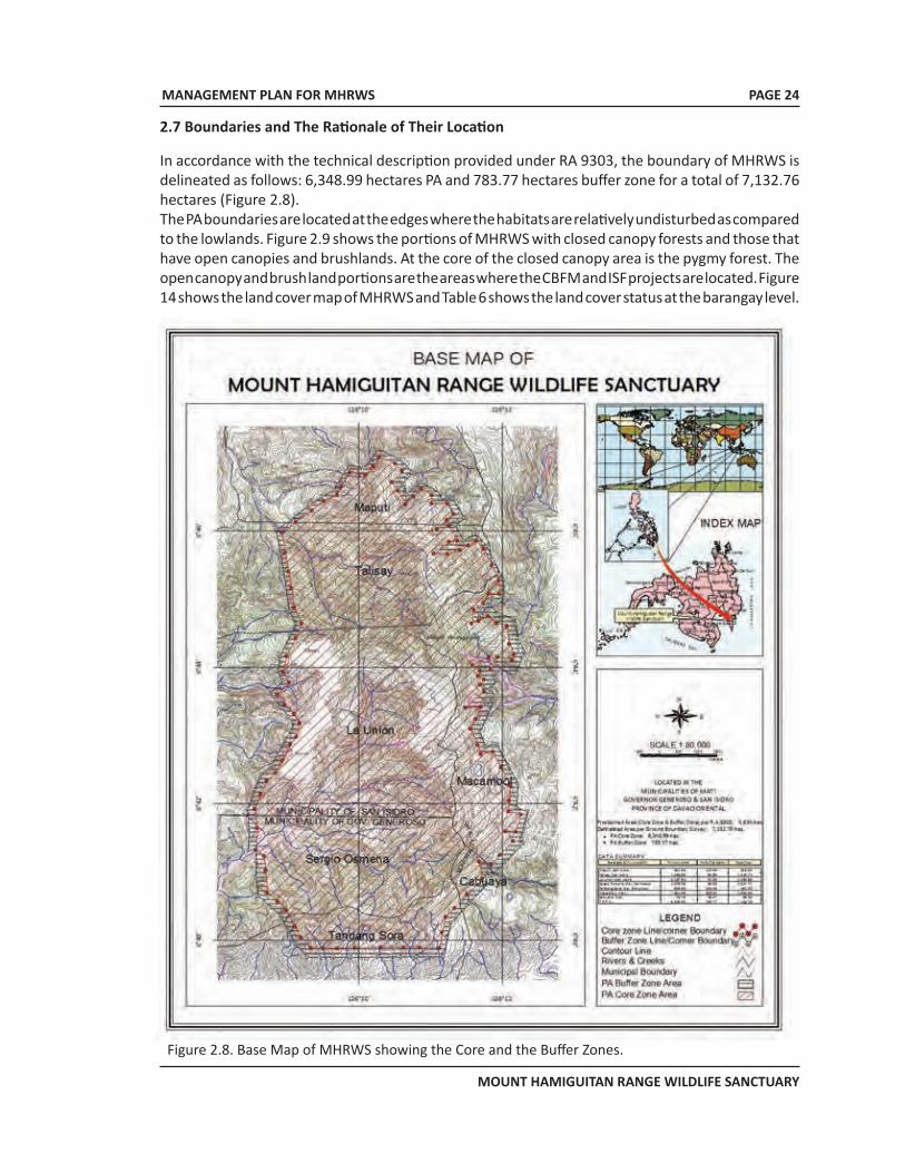
MANAGEMENT PLAN FOR MHRWS
MOUNT HAMIGUITAN RANGE WILDLIFE SANCTUARY
PAGE 24
2.7 Boundaries and The Rationale of Their Location
In accordance with the technical description provided under RA 9303, the boundary of MHRWS is delineated as follows: 6,348.99 hectares PA and 783.77 hectares buffer zone for a total of 7,132.76 hectares (Figure 2.8). The PA boundaries are located at the edges where the habitats are relatively undisturbed as compared to the lowlands. Figure 2.9 shows the portions of MHRWS with closed canopy forests and those that have open canopies and brushlands. At the core of the closed canopy area is the pygmy forest. The open canopy and brush land portions are the areas where the CBFM and ISF projects are located. Figure 14 shows the land cover map of MHRWS and Table 6 shows the land cover status at the barangay level.
Figure 2.8. Base Map of MHRWS showing the Core and the Buffer Zones.
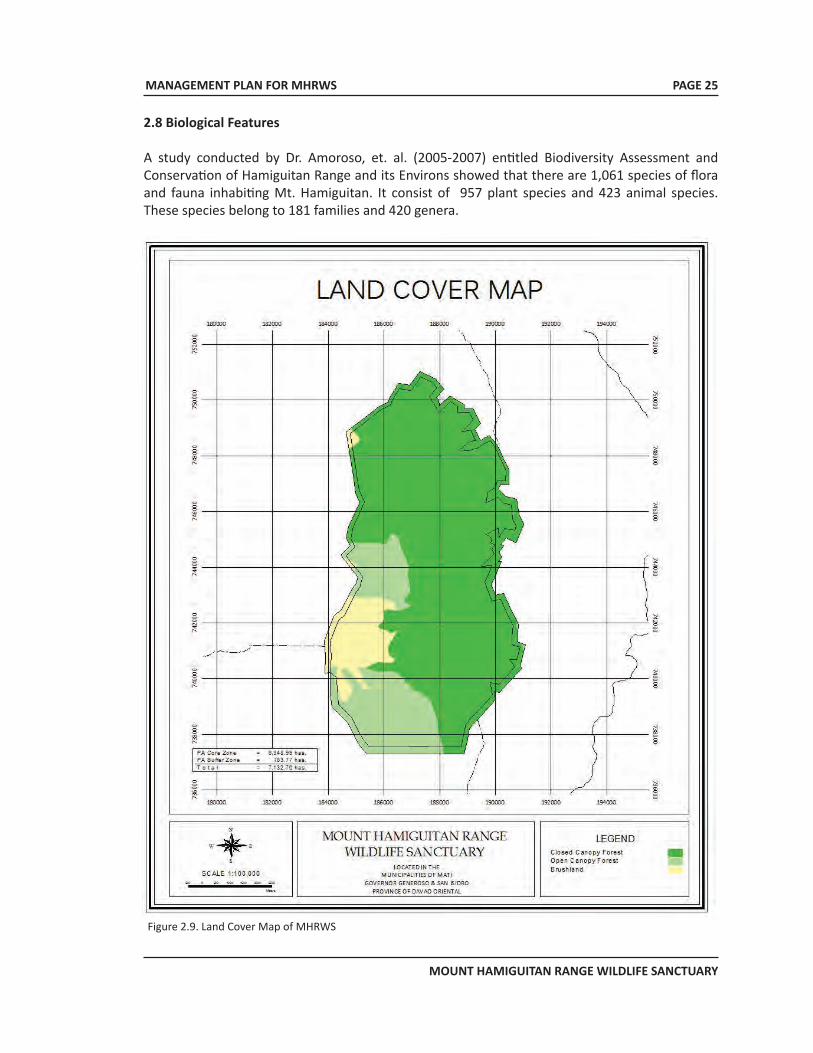
MANAGEMENT PLAN FOR MHRWS
MOUNT HAMIGUITAN RANGE WILDLIFE SANCTUARY
PAGE 25
2.8 Biological Features
A study conducted by Dr. Amoroso, et. al. (2005-2007) entitled Biodiversity Assessment and Conservation of Hamiguitan Range and its Environs showed that there are 1,061 species of flora and fauna inhabiting Mt. Hamiguitan. It consist of 957 plant species and 423 animal species. These species belong to 181 families and 420 genera.
Figure 2.9. Land Cover Map of MHRWS
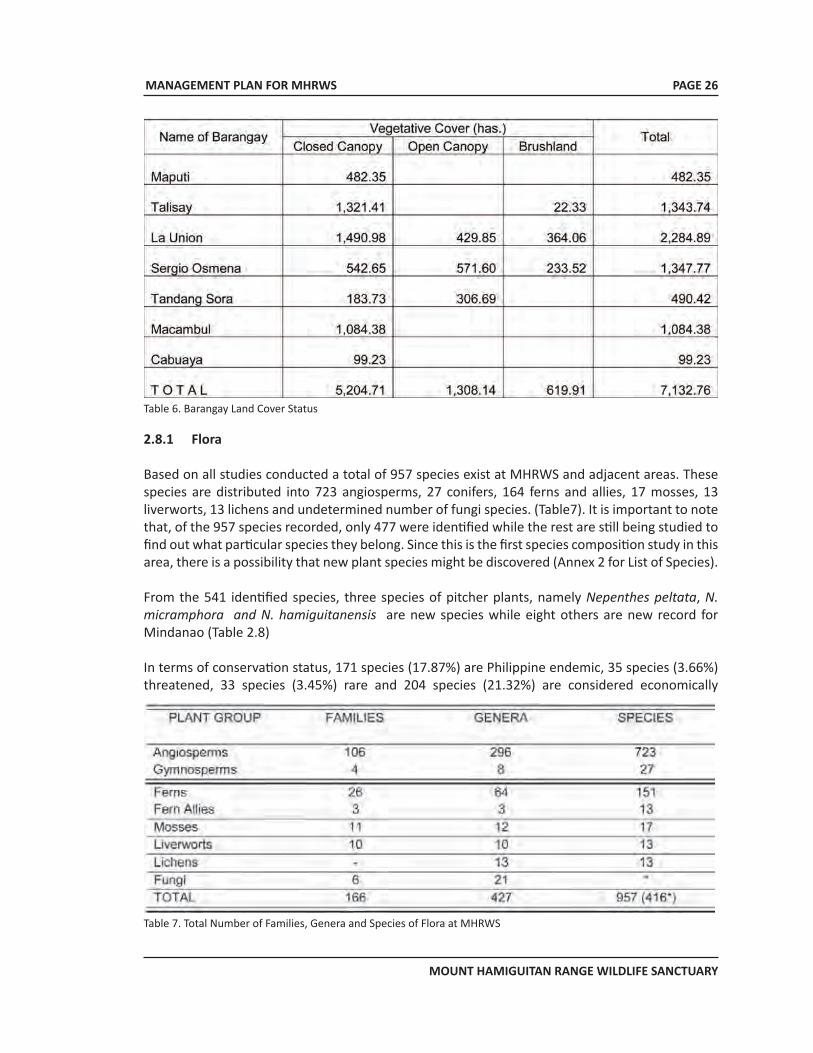
MANAGEMENT PLAN FOR MHRWS
MOUNT HAMIGUITAN RANGE WILDLIFE SANCTUARY
PAGE 26
Table 6. Barangay Land Cover Status
2.8.1 Flora
Based on all studies conducted a total of 957 species exist at MHRWS and adjacent areas. These species are distributed into 723 angiosperms, 27 conifers, 164 ferns and allies, 17 mosses, 13 liverworts, 13 lichens and undetermined number of fungi species. (Table7). It is important to note that, of the 957 species recorded, only 477 were identified while the rest are still being studied to find out what particular species they belong. Since this is the first species composition study in this area, there is a possibility that new plant species might be discovered (Annex 2 for List of Species).
From the 541 identified species, three species of pitcher plants, namely Nepenthes peltata, N. micramphora and N. hamiguitanensis are new species while eight others are new record for Mindanao (Table 2.8)
In terms of conservation status, 171 species (17.87%) are Philippine endemic, 35 species (3.66%) threatened, 33 species (3.45%) rare and 204 species (21.32%) are considered economically
Table 7. Total Number of Families, Genera and Species of Flora at MHRWS
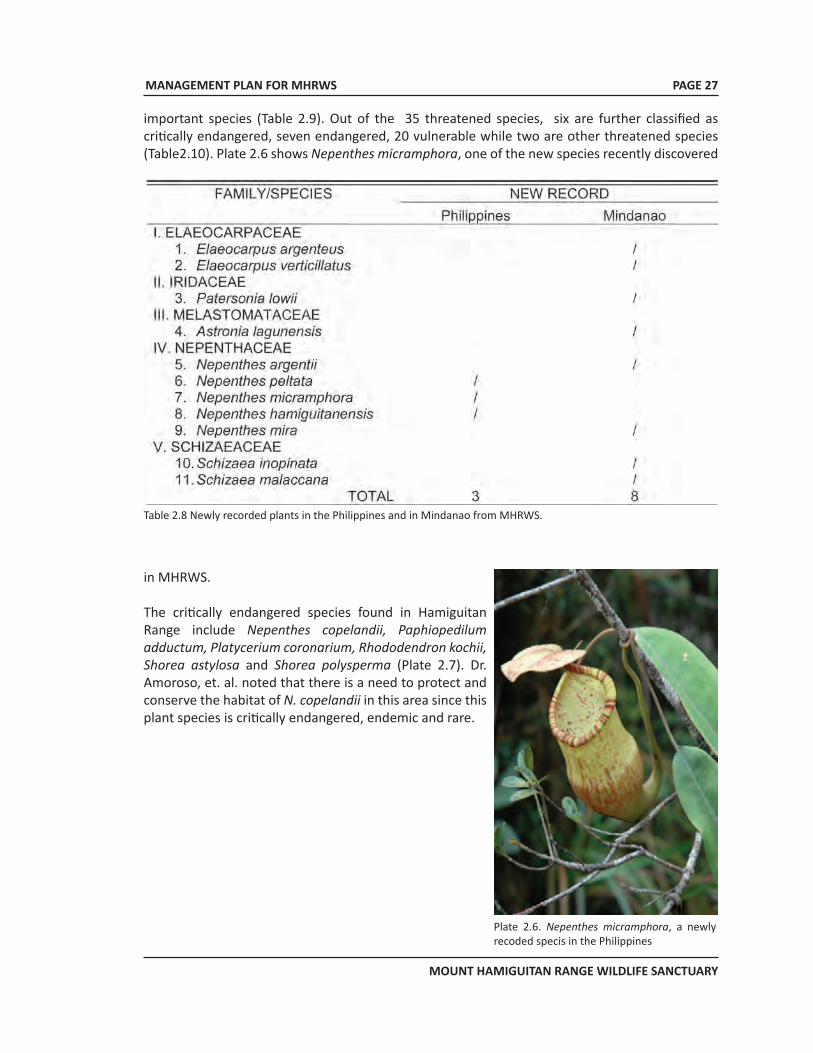
MANAGEMENT PLAN FOR MHRWS
MOUNT HAMIGUITAN RANGE WILDLIFE SANCTUARY
PAGE 27
important species (Table 2.9). Out of the 35 threatened species, six are further classified as critically endangered, seven endangered, 20 vulnerable while two are other threatened species (Table2.10). Plate 2.6 shows Nepenthes micramphora, one of the new species recently discovered
in MHRWS.
The critically endangered species found in Hamiguitan Range include Nepenthes copelandii, Paphiopedilum adductum, Platycerium coronarium, Rhododendron kochii, Shorea astylosa and Shorea polysperma (Plate 2.7). Dr. Amoroso, et. al. noted that there is a need to protect and conserve the habitat of N. copelandii in this area since this plant species is critically endangered, endemic and rare.
Plate 2.6. Nepenthes micramphora, a newly recoded specis in the Philippines
Table 2.8 Newly recorded plants in the Philippines and in Mindanao from MHRWS.
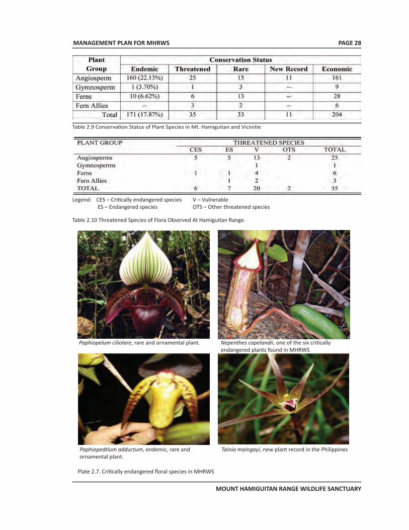
MANAGEMENT PLAN FOR MHRWS
MOUNT HAMIGUITAN RANGE WILDLIFE SANCTUARY
PAGE 28
Table 2.9 Conservation Status of Plant Species in Mt. Hamiguitan and Vicinitie
Legend: CES – Critically endangered species V – Vulnerable ES – Endangered species OTS – Other threatened species
Table 2.10 Threatened Species of Flora Observed At Hamiguitan Range.
Paphiopelum ciliolare, rare and ornamental plant. Nepenthes copelandii, one of the six critically endangered plants found in MHRWS
Paphiopedtlum adductum, endemic, rare and ornamental plant.
Tainia maingayi, new plant record in the Philippines
Plate 2.7. Critically endangered floral species in MHRWS
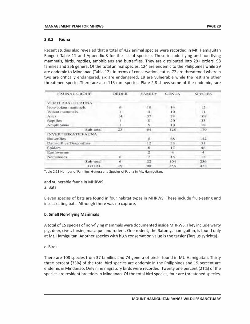
MANAGEMENT PLAN FOR MHRWS
MOUNT HAMIGUITAN RANGE WILDLIFE SANCTUARY
Table 2.11 Number of Families, Genera and Species of Fauna in Mt. Hamiguitan.
2.8.2 Fauna
Recent studies also revealed that a total of 422 animal species were recorded in Mt. Hamiguitan Range ( Table 11 and Appendix 3 for the list of species). These include flying and non-flying mammals, birds, reptiles, amphibians and butterflies. They are distributed into 29+ orders, 98 families and 256 genera. Of the total animal species, 124 are endemic to the Philippines while 39 are endemic to Mindanao (Table 12). In terms of conservation status, 72 are threatened wherein two are critically endangered, six are endangered, 19 are vulnerable while the rest are other threatened species.There are also 113 rare species. Plate 2.8 shows some of the endemic, rare
and vulnerable fauna in MHRWS. a. Bats
Eleven species of bats are found in four habitat types in MHRWS. These include fruit-eating and insect-eating bats. Although there was no capture,
b. Small Non-flying Mammals
A total of 15 species of non-flying mammals were documented inside MHRWS. They include warty pig, deer, civet, tarsier, macaque and rodent. One rodent, the Batomys hamiguitan, is found only at Mt. Hamiguitan. Another species with high conservation value is the tarsier (Tarsius syrichta).
c. Birds
There are 108 species from 37 families and 74 genera of birds found in Mt. Hamiguitan. Thirty three percent (33%) of the total bird species are endemic in the Philippines and 19 percent are endemic in Mindanao. Only nine migratory birds were recorded. Twenty one percent (21%) of the species are resident breeders in Mindanao. Of the total bird species, four are threatened species.
PAGE 29
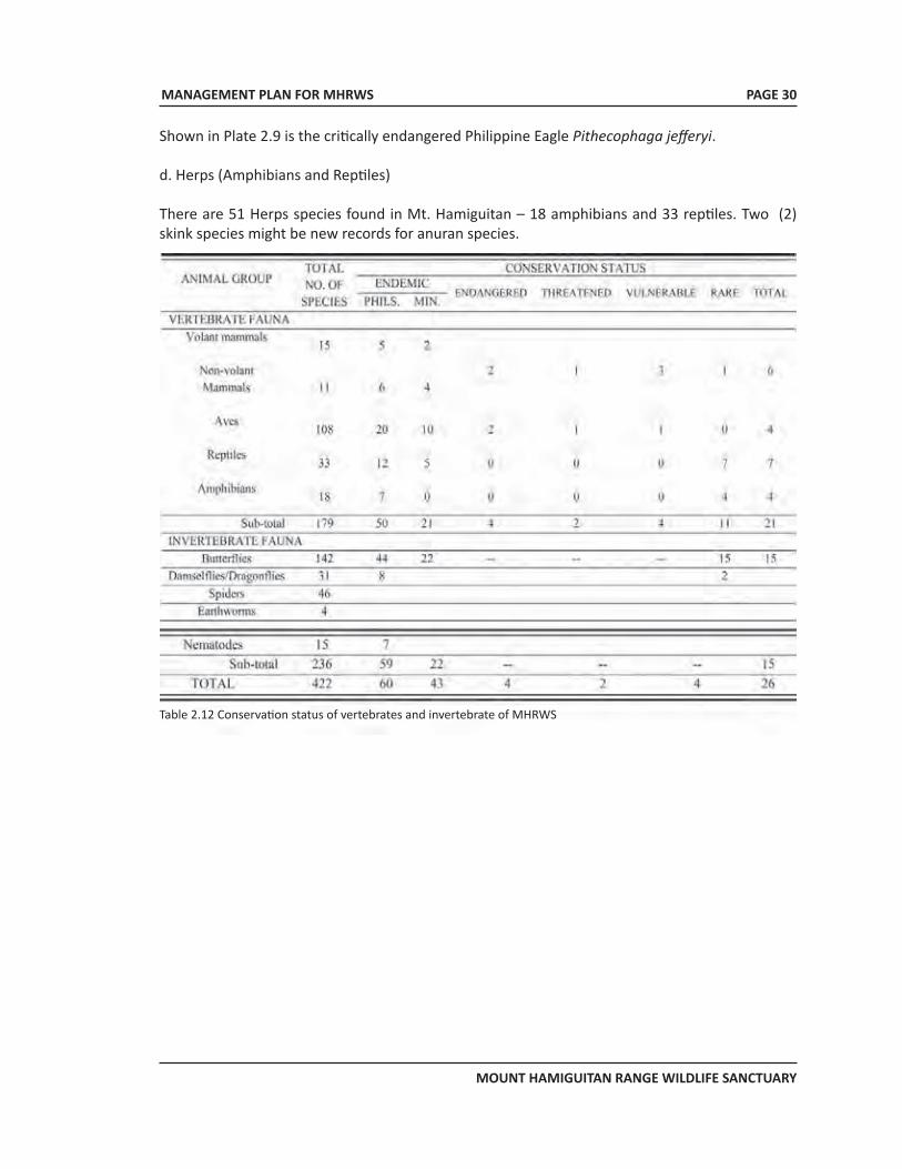
MANAGEMENT PLAN FOR MHRWS
MOUNT HAMIGUITAN RANGE WILDLIFE SANCTUARY
PAGE 30
Shown in Plate 2.9 is the critically endangered Philippine Eagle Pithecophaga jefferyi.
d. Herps (Amphibians and Reptiles)
There are 51 Herps species found in Mt. Hamiguitan – 18 amphibians and 33 reptiles. Two (2) skink species might be new records for anuran species.
Table 2.12 Conservation status of vertebrates and invertebrate of MHRWS
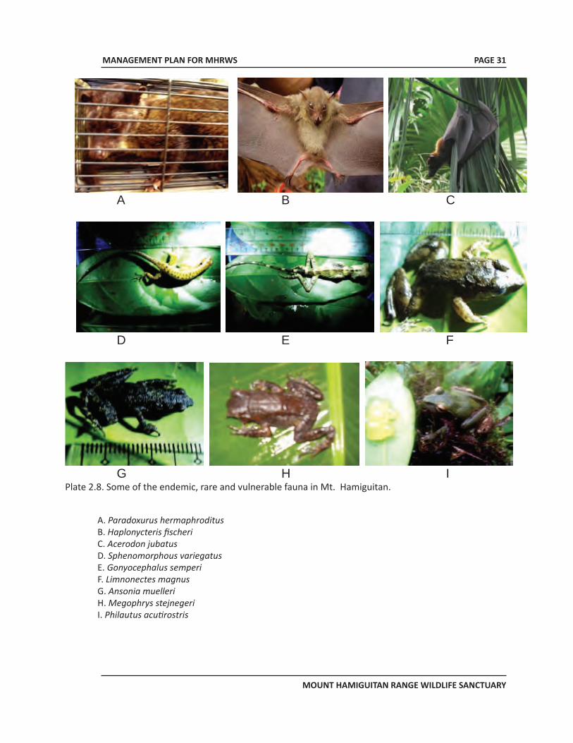
MANAGEMENT PLAN FOR MHRWS
MOUNT HAMIGUITAN RANGE WILDLIFE SANCTUARY
PAGE 31
Plate 2.8. Some of the endemic, rare and vulnerable fauna in Mt. Hamiguitan.
A. Paradoxurus hermaphroditus B. Haplonycteris fischeri C. Acerodon jubatus D. Sphenomorphous variegatus E. Gonyocephalus semperi F. Limnonectes magnus G. Ansonia muelleriH. Megophrys stejnegeriI. Philautus acutirostris
A B C
D E F
G H I Figure 16. Some of the endemic, rare and vulnerable fauna in Hamiguitan Range A. Paradoxurus hermaphroditus D. Sphenomorphous variegatus G. Ansonia muelleri B. Haplonycteris fischeri E. Gonyocephalus semperi H. Megophrys stejnegeri C Acerodon jubatus F. Limnonectes magnus I. Philautus acutirostris

MANAGEMENT PLAN FOR MHRWS
MOUNT HAMIGUITAN RANGE WILDLIFE SANCTUARY
PAGE 32
e. Butterflies
MHRWS is home to diverse and endemic butterfly species. A total of 142 species of butterflies have been identified from 65 genera and five families. Of these, 44 species are endemic: four site 22 Philippine endemic, two eastern Mindanao endemic, 16 Mindanao endemic, and four species is site endemic such as Coladenia ochracea, Colandenia semperi, Arisbe euphratoides and Delias magsadana the rarest of them all and can be found only in the mossy-pygmy forest of the sanctuary.
Seven species are new recorded for Mindanao. Trend of species richness for butterflies revealed an increasing trend from agro¬ecosystem to montane forest and decreasing from typical mossy to mossy-pygmy forest. Inferring this trend on the vegetation type, the dipterocarp forest has been found to be the home of the most endemic and threatened species followed by the montane forest and the mossy-pygmy forest. Rare species have been observed starting from the dipterocarp up to the mossy-pygmy forest.For the conservation status of butterflies, Table 13 indicates their endemicity and conservation
SPECIES FAMILY STATUS Delias. Magsadana Pieridae Rare, Site endemic Acrophtalmia leto ochine Nymphalidae Rare, Mindanao endemic Eurema brigitta brigitta Pieridae Rare, Philippine endemic Eurema sarilata sarilata Pieridae Rare, Philippine endemic Moduza thespian Nymphalidae Rare, Philippine endemic Monodontides apona Lycaenidae Rare, Philippine endemic Mycalesis felderi felderi Nymphalidae Rare, Philippine endemic Potanthus mingo mingo Hesperidae Rare, Philippine endemic Ragadia melindina melindina Nymphalidae Rare, Philippine endemic Suada albino Hesperidae Rare, Philippine endemic Tacola magindana magindana Nymphalidae Rare, Philippine endemic Zeuxidia sibulana sibulana Nymphalidae Rare, Philippine endemic
(Adopted from Amoroso et al 2007)
Table 2.13 Endemic and Rare Species of Butterflies That Must be Given High Priority for Protection and Conservation.
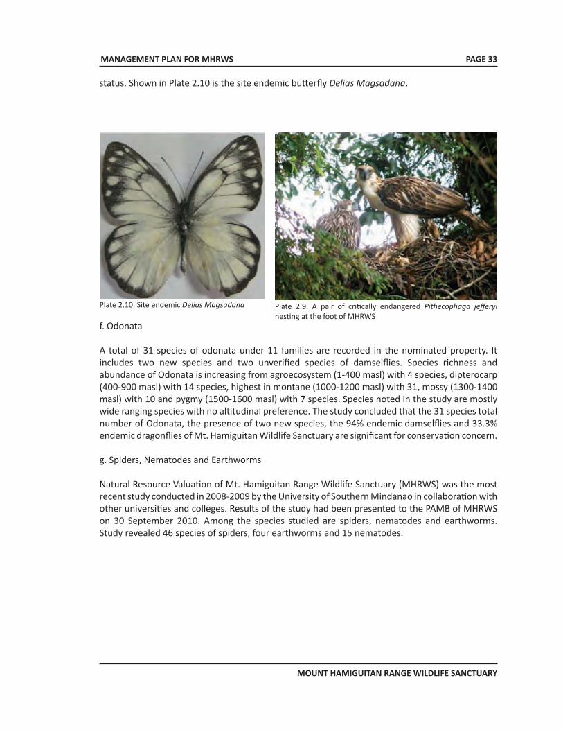
MANAGEMENT PLAN FOR MHRWS
MOUNT HAMIGUITAN RANGE WILDLIFE SANCTUARY
f. Odonata
A total of 31 species of odonata under 11 families are recorded in the nominated property. It includes two new species and two unverified species of damselflies. Species richness and abundance of Odonata is increasing from agroecosystem (1-400 masl) with 4 species, dipterocarp (400-900 masl) with 14 species, highest in montane (1000-1200 masl) with 31, mossy (1300-1400 masl) with 10 and pygmy (1500-1600 masl) with 7 species. Species noted in the study are mostly wide ranging species with no altitudinal preference. The study concluded that the 31 species total number of Odonata, the presence of two new species, the 94% endemic damselflies and 33.3% endemic dragonflies of Mt. Hamiguitan Wildlife Sanctuary are significant for conservation concern.
g. Spiders, Nematodes and Earthworms
Natural Resource Valuation of Mt. Hamiguitan Range Wildlife Sanctuary (MHRWS) was the most recent study conducted in 2008-2009 by the University of Southern Mindanao in collaboration with other universities and colleges. Results of the study had been presented to the PAMB of MHRWS on 30 September 2010. Among the species studied are spiders, nematodes and earthworms. Study revealed 46 species of spiders, four earthworms and 15 nematodes.
Plate 2.10. Site endemic Delias Magsadana Plate 2.9. A pair of critically endangered Pithecophaga jefferyi nesting at the foot of MHRWS
status. Shown in Plate 2.10 is the site endemic butterfly Delias Magsadana.
PAGE 33
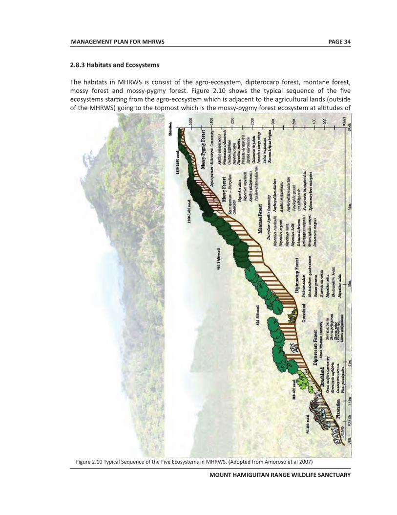
MANAGEMENT PLAN FOR MHRWS
MOUNT HAMIGUITAN RANGE WILDLIFE SANCTUARY
PAGE 34
Figure 2.10 Typical Sequence of the Five Ecosystems in MHRWS. (Adopted from Amoroso et al 2007)
2.8.3 Habitats and Ecosystems
The habitats in MHRWS is consist of the agro-ecosystem, dipterocarp forest, montane forest, mossy forest and mossy-pygmy forest. Figure 2.10 shows the typical sequence of the five ecosystems starting from the agro-ecosystem which is adjacent to the agricultural lands (outside of the MHRWS) going to the topmost which is the mossy-pygmy forest ecosystem at altitudes of
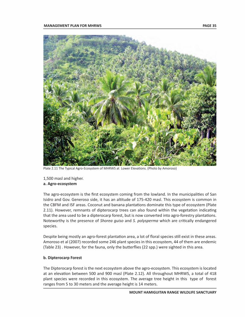
MANAGEMENT PLAN FOR MHRWS
MOUNT HAMIGUITAN RANGE WILDLIFE SANCTUARY
PAGE 35
Plate 2.11 The Typical Agro-Ecosystem of MHRWS at Lower Elevations. (Photo by Amoroso)
1,500 masl and higher.a. Agro-ecosystem
The agro-ecosystem is the first ecosystem coming from the lowland. In the municipalities of San Isidro and Gov. Generoso side, it has an altitude of 175-420 masl. This ecosystem is common in the CBFM and ISF areas. Coconut and banana plantations dominate this type of ecosystem (Plate 2.11). However, remnants of dipterocarp trees can also found within the vegetation indicating that the area used to be a dipterocarp forest, but is now converted into agro-forestry plantations. Noteworthy is the presence of Shorea guiso and S. polysperma which are critically endangered species.
Despite being mostly an agro-forest plantation area, a lot of floral species still exist in these areas. Amoroso et al (2007) recorded some 246 plant species in this ecosystem, 44 of them are endemic (Table 23) . However, for the fauna, only the butterflies (22 spp.) were sighted in this area.
b. Dipterocarp Forest
The Dipterocarp forest is the next ecosystem above the agro-ecosystem. This ecosystem is located at an elevation between 500 and 900 masl (Plate 2.12). All throughout MHRWS, a total of 418 plant species were recorded in this ecosystem. The average tree height in this type of forest ranges from 5 to 30 meters and the average height is 14 meters.
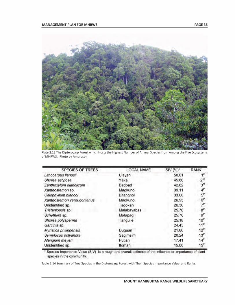
MANAGEMENT PLAN FOR MHRWS
MOUNT HAMIGUITAN RANGE WILDLIFE SANCTUARY
PAGE 36
Plate 2.12 The Dipterocarp Forest which Hosts the Highest Number of Animal Species from Among the Five Ecosystems of MHRWS. (Photo by Amoroso)
Table 2.14 Summary of Tree Species in the Dipterocarp Forest with Their Species Importance Value and Ranks.
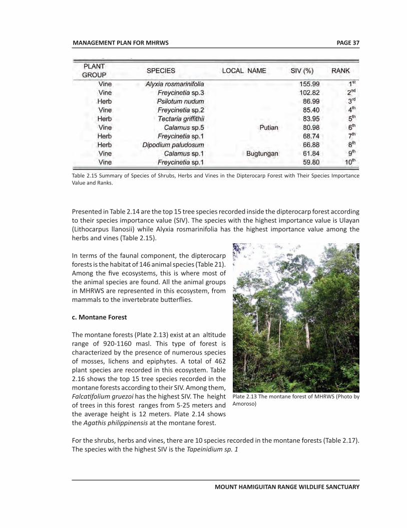
MANAGEMENT PLAN FOR MHRWS
MOUNT HAMIGUITAN RANGE WILDLIFE SANCTUARY
PAGE 37
Table 2.15 Summary of Species of Shrubs, Herbs and Vines in the Dipterocarp Forest with Their Species Importance Value and Ranks.
Presented in Table 2.14 are the top 15 tree species recorded inside the dipterocarp forest according to their species importance value (SIV). The species with the highest importance value is Ulayan (Lithocarpus llanosii) while Alyxia rosmarinifolia has the highest importance value among the herbs and vines (Table 2.15).
In terms of the faunal component, the dipterocarp forests is the habitat of 146 animal species (Table 21). Among the five ecosystems, this is where most of the animal species are found. All the animal groups in MHRWS are represented in this ecosystem, from mammals to the invertebrate butterflies.
c. Montane Forest
The montane forests (Plate 2.13) exist at an altitude range of 920-1160 masl. This type of forest is characterized by the presence of numerous species of mosses, lichens and epiphytes. A total of 462 plant species are recorded in this ecosystem. Table 2.16 shows the top 15 tree species recorded in the montane forests according to their SIV. Among them, Falcatifolium gruezoi has the highest SIV. The height of trees in this forest ranges from 5-25 meters and the average height is 12 meters. Plate 2.14 shows the Agathis philippinensis at the montane forest.
For the shrubs, herbs and vines, there are 10 species recorded in the montane forests (Table 2.17). The species with the highest SIV is the Tapeinidium sp. 1
Plate 2.13 The montane forest of MHRWS (Photo by Amoroso)
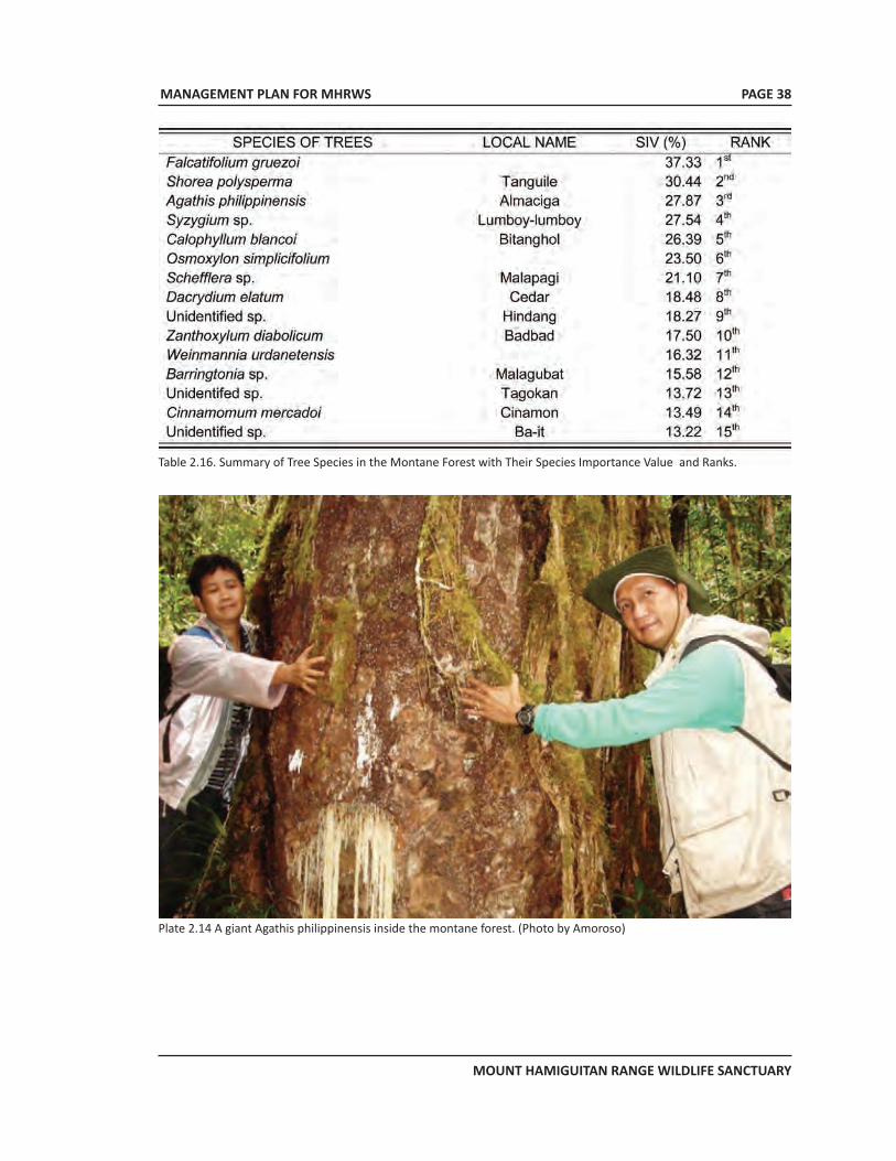
MANAGEMENT PLAN FOR MHRWS
MOUNT HAMIGUITAN RANGE WILDLIFE SANCTUARY
PAGE 38
Table 2.16. Summary of Tree Species in the Montane Forest with Their Species Importance Value and Ranks.
Plate 2.14 A giant Agathis philippinensis inside the montane forest. (Photo by Amoroso)
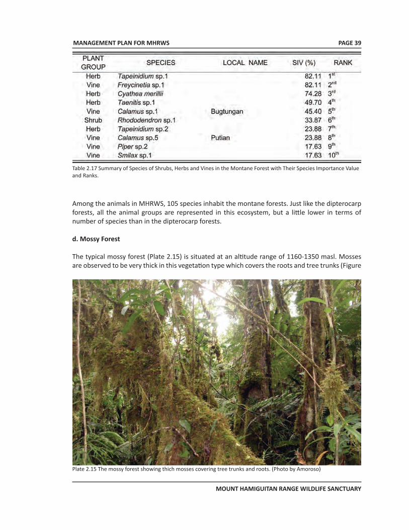
MANAGEMENT PLAN FOR MHRWS
MOUNT HAMIGUITAN RANGE WILDLIFE SANCTUARY
PAGE 39
Among the animals in MHRWS, 105 species inhabit the montane forests. Just like the dipterocarp forests, all the animal groups are represented in this ecosystem, but a little lower in terms of number of species than in the dipterocarp forests.
d. Mossy Forest
The typical mossy forest (Plate 2.15) is situated at an altitude range of 1160-1350 masl. Mosses are observed to be very thick in this vegetation type which covers the roots and tree trunks (Figure
Plate 2.15 The mossy forest showing thich mosses covering tree trunks and roots. (Photo by Amoroso)
Table 2.17 Summary of Species of Shrubs, Herbs and Vines in the Montane Forest with Their Species Importance Value and Ranks.
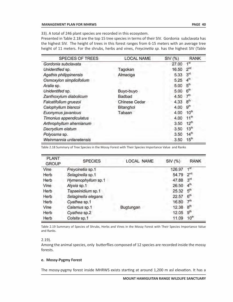
MANAGEMENT PLAN FOR MHRWS
MOUNT HAMIGUITAN RANGE WILDLIFE SANCTUARY
PAGE 40
33). A total of 246 plant species are recorded in this ecosystem. Presented in Table 2.18 are the top 15 tree species in terms of their SIV. Gordonia subclavata has the highest SIV. The height of trees in this forest ranges from 6-15 meters with an average tree height of 11 meters. For the shrubs, herbs and vines, Freycinetia sp. has the highest SIV (Table
Table 2.18 Summary of Tree Species in the Mossy Forest with Their Species Importance Value and Ranks
Table 2.19 Summary of Species of Shrubs, Herbs and Vines in the Mossy Forest with Their Species Importance Value and Ranks.
2.19).Among the animal species, only butterflies composed of 12 species are recorded inside the mossy forests.
e. Mossy-Pygmy Forest
The mossy-pygmy forest inside MHRWS exists starting at around 1,200 m asl elevation. It has a
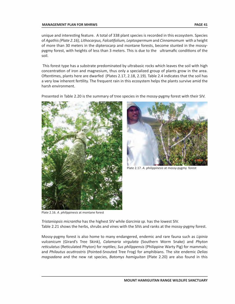
MANAGEMENT PLAN FOR MHRWS
MOUNT HAMIGUITAN RANGE WILDLIFE SANCTUARY
PAGE 41
unique and interesting feature. A total of 338 plant species is recorded in this ecosystem. Species of Agathis (Plate 2.16), Lithocarpus, Falcatifolium, Leptospermum and Cinnamomum with a height of more than 30 meters in the dipterocarp and montane forests, become stunted in the mossy-pygmy forest, with heights of less than 3 meters. This is due to the ultramafic conditions of the soil.
This forest type has a substrate predominated by ultrabasic rocks which leaves the soil with high concentration of iron and magnesium, thus only a specialized group of plants grow in the area. Oftentimes, plants here are dwarfed (Plates 2.17, 2.18, 2.19). Table 2.4 indicates that the soil has a very low inherent fertility. The frequent rain in this ecosystem helps the plants survive amid the harsh environment.
Presented in Table 2.20 is the summary of tree species in the mossy-pygmy forest with their SIV.
Plate 2.16. A. philippinesis at montane forest
Plate 2.17. A. philippinesis at mossy-pygmy forest
Tristaniopsis micrantha has the highest SIV while Garcinia sp. has the lowest SIV. Table 2.21 shows the herbs, shrubs and vines with the SIVs and ranks at the mossy-pygmy forest.
Mossy-pygmy forest is also home to many endangered, endemic and rare fauna such as Lipinia vulcanicum (Girard’s Tree Skink), Calamaria virgulata (Southern Worm Snake) and Phyton reticulatus (Reticulated Phyton) for reptiles; Sus philippensis (Philippine Warty Pig) for mammals; and Philautus acutirostris (Pointed-Snouted Tree Frog) for amphibians. The site endemic Delias magsadana and the new rat species, Batomys hamiguitan (Plate 2.20) are also found in this
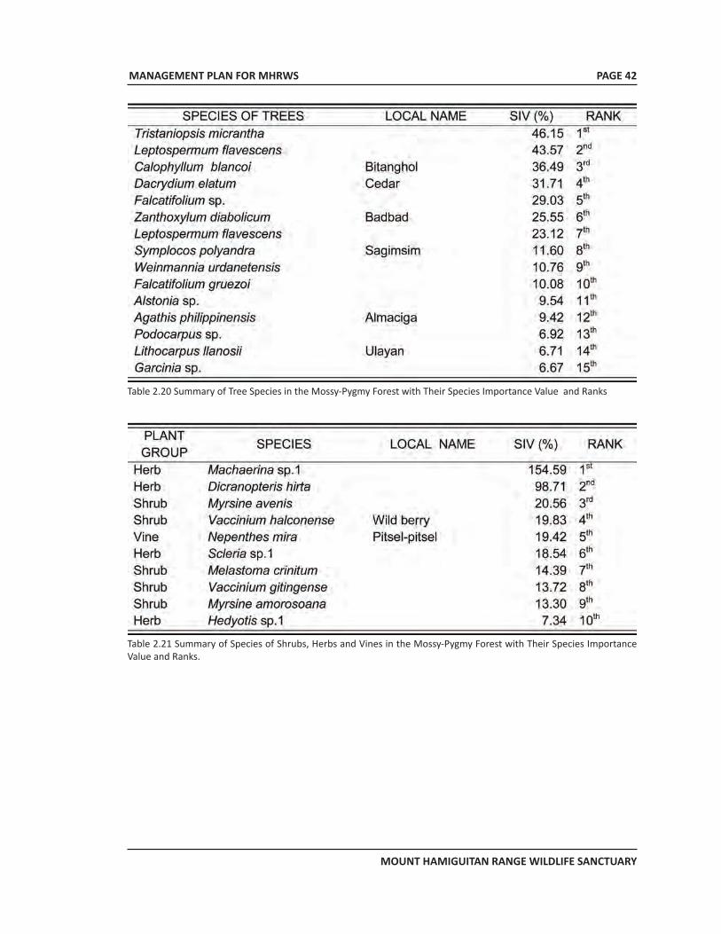
MANAGEMENT PLAN FOR MHRWS
MOUNT HAMIGUITAN RANGE WILDLIFE SANCTUARY
PAGE 42
Table 2.20 Summary of Tree Species in the Mossy-Pygmy Forest with Their Species Importance Value and Ranks
Table 2.21 Summary of Species of Shrubs, Herbs and Vines in the Mossy-Pygmy Forest with Their Species Importance Value and Ranks.
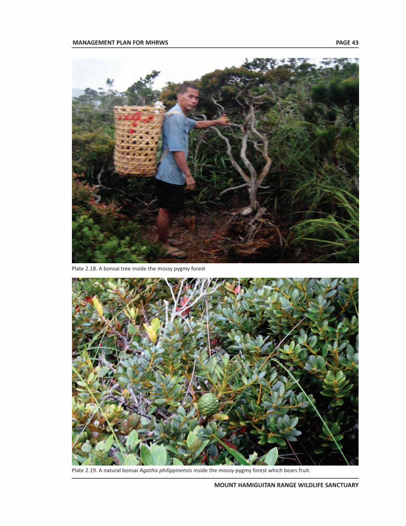
MANAGEMENT PLAN FOR MHRWS
MOUNT HAMIGUITAN RANGE WILDLIFE SANCTUARY
PAGE 43
Plate 2.18. A bonsai tree inside the mossy pygmy forest
Plate 2.19. A natural bonsai Agathis philippinensis inside the mossy-pygmy forest which bears fruit.
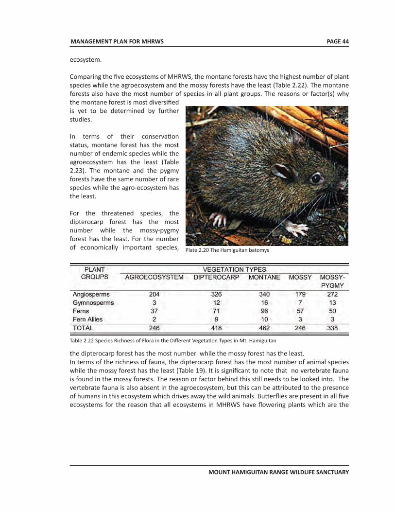
MANAGEMENT PLAN FOR MHRWS
MOUNT HAMIGUITAN RANGE WILDLIFE SANCTUARY
PAGE 44
ecosystem.
Comparing the five ecosystems of MHRWS, the montane forests have the highest number of plant species while the agroecosystem and the mossy forests have the least (Table 2.22). The montane forests also have the most number of species in all plant groups. The reasons or factor(s) why the montane forest is most diversified is yet to be determined by further studies.
In terms of their conservation status, montane forest has the most number of endemic species while the agroecosystem has the least (Table 2.23). The montane and the pygmy forests have the same number of rare species while the agro-ecosystem has the least.
For the threatened species, the dipterocarp forest has the most number while the mossy-pygmy forest has the least. For the number of economically important species, Plate 2.20 The Hamiguitan batomys
Table 2.22 Species Richness of Flora in the Different Vegetation Types in Mt. Hamiguitan
the dipterocarp forest has the most number while the mossy forest has the least.In terms of the richness of fauna, the dipterocarp forest has the most number of animal species while the mossy forest has the least (Table 19). It is significant to note that no vertebrate fauna is found in the mossy forests. The reason or factor behind this still needs to be looked into. The vertebrate fauna is also absent in the agroecosystem, but this can be attributed to the presence of humans in this ecosystem which drives away the wild animals. Butterflies are present in all five ecosystems for the reason that all ecosystems in MHRWS have flowering plants which are the
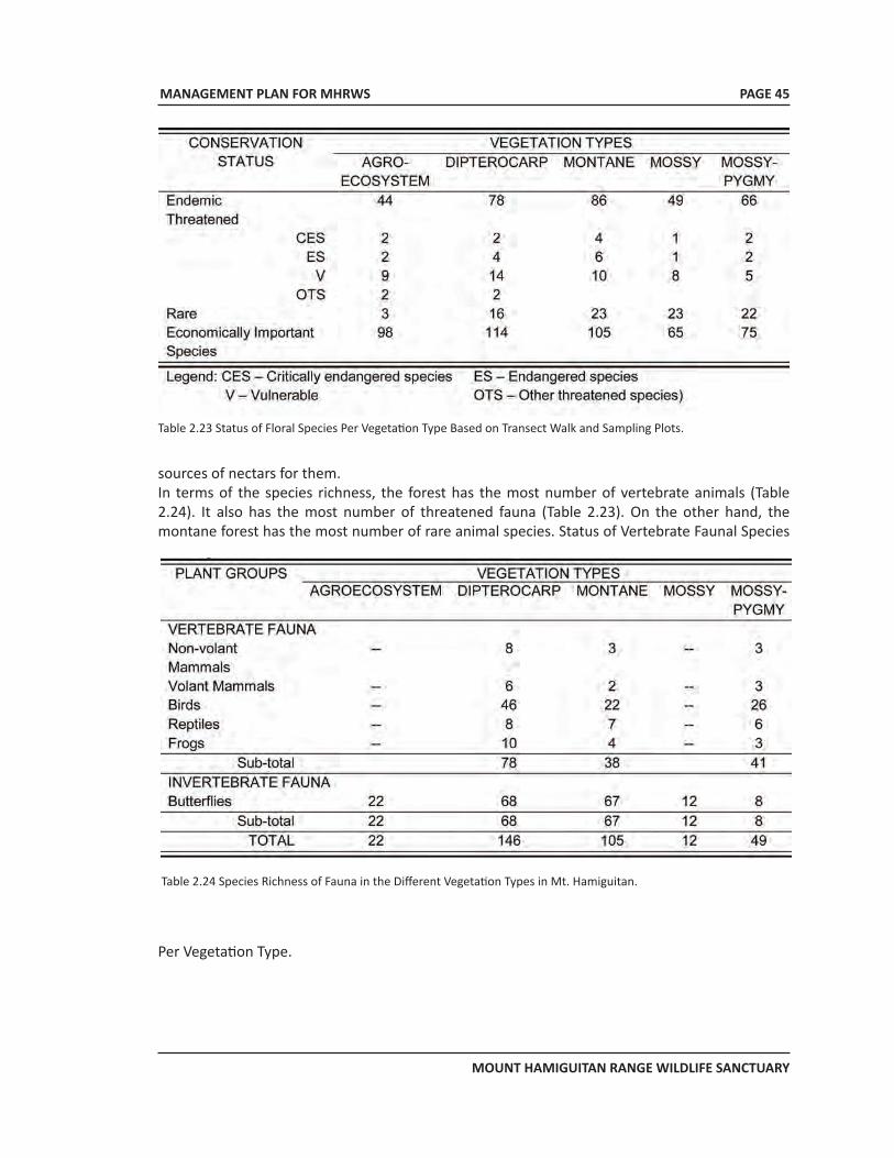
MANAGEMENT PLAN FOR MHRWS
MOUNT HAMIGUITAN RANGE WILDLIFE SANCTUARY
PAGE 45
Table 2.23 Status of Floral Species Per Vegetation Type Based on Transect Walk and Sampling Plots.
sources of nectars for them.In terms of the species richness, the forest has the most number of vertebrate animals (Table 2.24). It also has the most number of threatened fauna (Table 2.23). On the other hand, the montane forest has the most number of rare animal species. Status of Vertebrate Faunal Species
Table 2.24 Species Richness of Fauna in the Different Vegetation Types in Mt. Hamiguitan.
Per Vegetation Type.
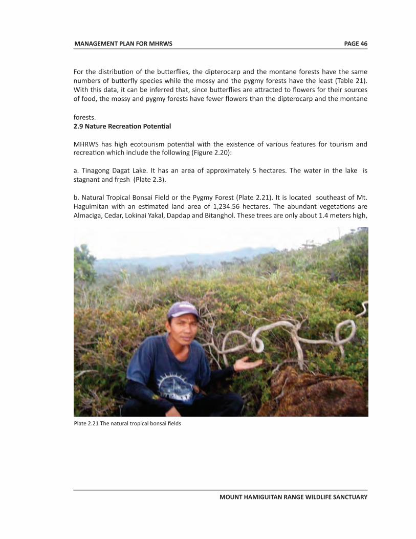
MANAGEMENT PLAN FOR MHRWS
MOUNT HAMIGUITAN RANGE WILDLIFE SANCTUARY
PAGE 46
For the distribution of the butterflies, the dipterocarp and the montane forests have the same numbers of butterfly species while the mossy and the pygmy forests have the least (Table 21). With this data, it can be inferred that, since butterflies are attracted to flowers for their sources of food, the mossy and pygmy forests have fewer flowers than the dipterocarp and the montane
forests.2.9 Nature Recreation Potential
MHRWS has high ecotourism potential with the existence of various features for tourism and recreation which include the following (Figure 2.20):
a. Tinagong Dagat Lake. It has an area of approximately 5 hectares. The water in the lake is stagnant and fresh (Plate 2.3).
b. Natural Tropical Bonsai Field or the Pygmy Forest (Plate 2.21). It is located southeast of Mt. Haguimitan with an estimated land area of 1,234.56 hectares. The abundant vegetations are Almaciga, Cedar, Lokinai Yakal, Dapdap and Bitanghol. These trees are only about 1.4 meters high,
Plate 2.21 The natural tropical bonsai fields
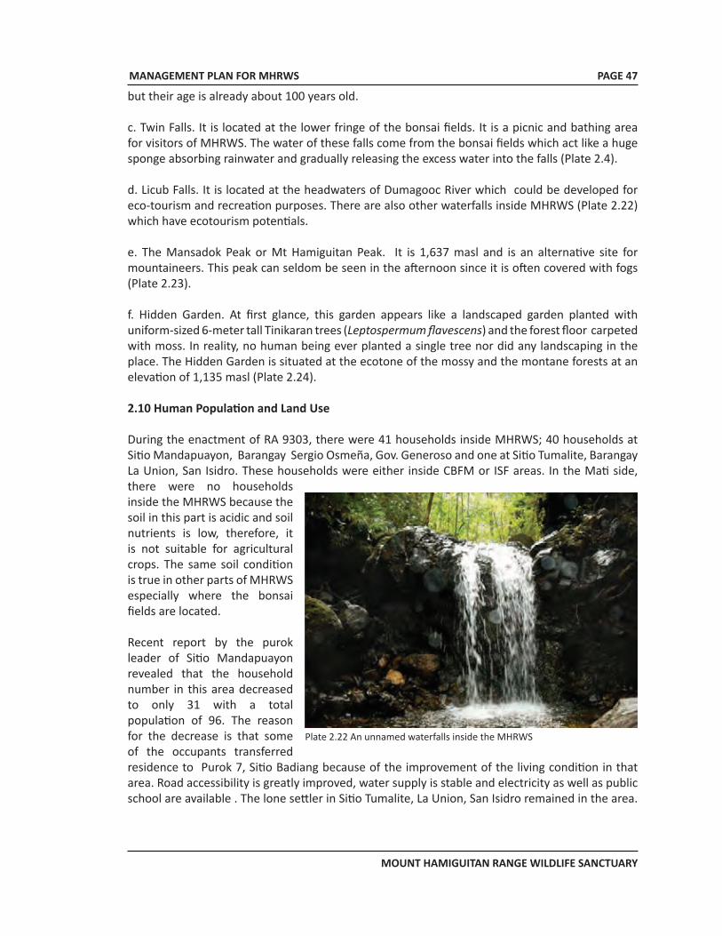
MANAGEMENT PLAN FOR MHRWS
MOUNT HAMIGUITAN RANGE WILDLIFE SANCTUARY
PAGE 47
but their age is already about 100 years old.
c. Twin Falls. It is located at the lower fringe of the bonsai fields. It is a picnic and bathing area for visitors of MHRWS. The water of these falls come from the bonsai fields which act like a huge sponge absorbing rainwater and gradually releasing the excess water into the falls (Plate 2.4).
d. Licub Falls. It is located at the headwaters of Dumagooc River which could be developed for eco-tourism and recreation purposes. There are also other waterfalls inside MHRWS (Plate 2.22) which have ecotourism potentials.
e. The Mansadok Peak or Mt Hamiguitan Peak. It is 1,637 masl and is an alternative site for mountaineers. This peak can seldom be seen in the afternoon since it is often covered with fogs (Plate 2.23).
f. Hidden Garden. At first glance, this garden appears like a landscaped garden planted with uniform-sized 6-meter tall Tinikaran trees (Leptospermum flavescens) and the forest floor carpeted with moss. In reality, no human being ever planted a single tree nor did any landscaping in the place. The Hidden Garden is situated at the ecotone of the mossy and the montane forests at an elevation of 1,135 masl (Plate 2.24).
2.10 Human Population and Land Use
During the enactment of RA 9303, there were 41 households inside MHRWS; 40 households at Sitio Mandapuayon, Barangay Sergio Osmeña, Gov. Generoso and one at Sitio Tumalite, Barangay La Union, San Isidro. These households were either inside CBFM or ISF areas. In the Mati side, there were no households inside the MHRWS because the soil in this part is acidic and soil nutrients is low, therefore, it is not suitable for agricultural crops. The same soil condition is true in other parts of MHRWS especially where the bonsai fields are located.
Recent report by the purok leader of Sitio Mandapuayon revealed that the household number in this area decreased to only 31 with a total population of 96. The reason for the decrease is that some of the occupants transferred residence to Purok 7, Sitio Badiang because of the improvement of the living condition in that area. Road accessibility is greatly improved, water supply is stable and electricity as well as public school are available . The lone settler in Sitio Tumalite, La Union, San Isidro remained in the area.
Plate 2.22 An unnamed waterfalls inside the MHRWS
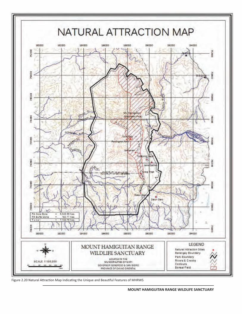
MANAGEMENT PLAN FOR MHRWS
MOUNT HAMIGUITAN RANGE WILDLIFE SANCTUARY
PAGE 42
Figure 2.20 Natural Attraction Map Indicating the Unique and Beautiful Features of MHRWS
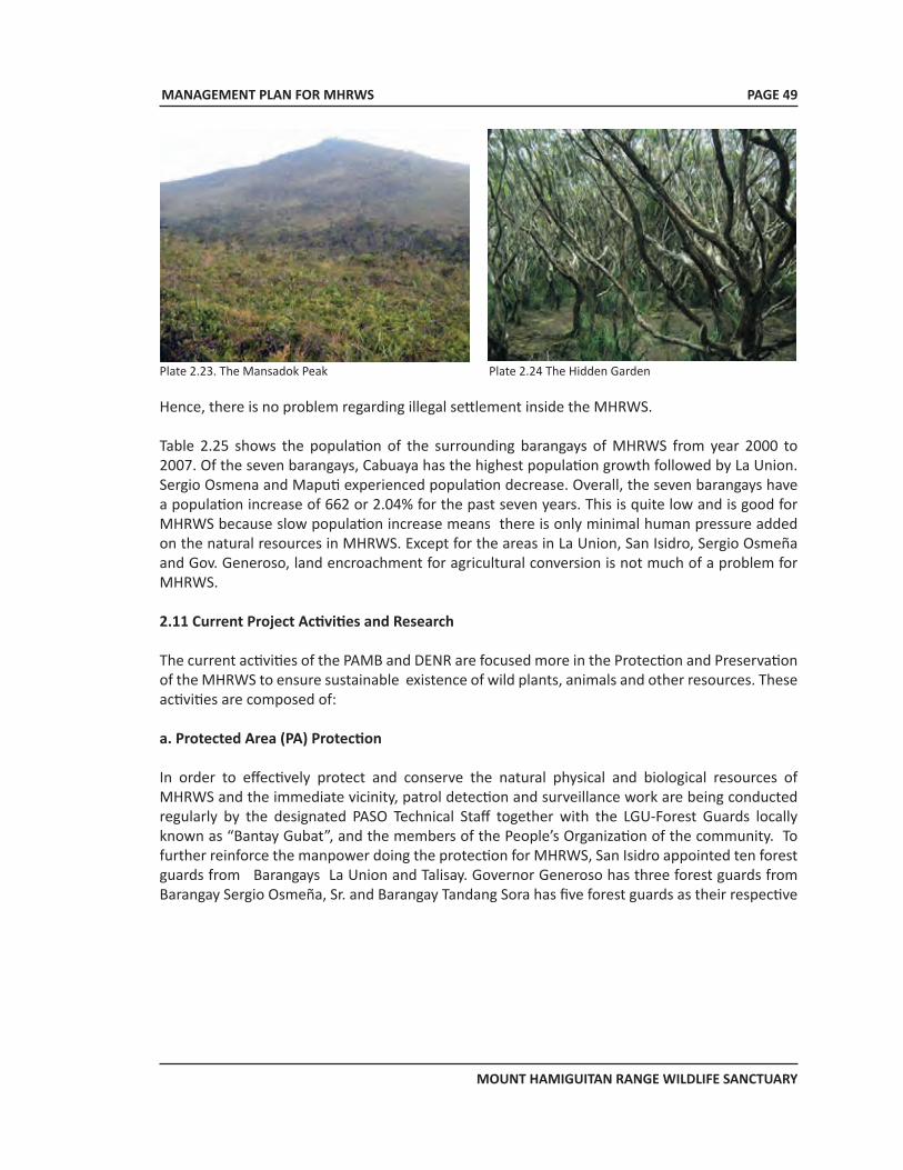
MANAGEMENT PLAN FOR MHRWS
MOUNT HAMIGUITAN RANGE WILDLIFE SANCTUARY
PAGE 49
Plate 2.23. The Mansadok Peak Plate 2.24 The Hidden Garden
Hence, there is no problem regarding illegal settlement inside the MHRWS.
Table 2.25 shows the population of the surrounding barangays of MHRWS from year 2000 to 2007. Of the seven barangays, Cabuaya has the highest population growth followed by La Union. Sergio Osmena and Maputi experienced population decrease. Overall, the seven barangays have a population increase of 662 or 2.04% for the past seven years. This is quite low and is good for MHRWS because slow population increase means there is only minimal human pressure added on the natural resources in MHRWS. Except for the areas in La Union, San Isidro, Sergio Osmeña and Gov. Generoso, land encroachment for agricultural conversion is not much of a problem for MHRWS.
2.11 Current Project Activities and Research
The current activities of the PAMB and DENR are focused more in the Protection and Preservation of the MHRWS to ensure sustainable existence of wild plants, animals and other resources. These activities are composed of:
a. Protected Area (PA) Protection
In order to effectively protect and conserve the natural physical and biological resources of MHRWS and the immediate vicinity, patrol detection and surveillance work are being conducted regularly by the designated PASO Technical Staff together with the LGU-Forest Guards locally known as “Bantay Gubat”, and the members of the People’s Organization of the community. To further reinforce the manpower doing the protection for MHRWS, San Isidro appointed ten forest guards from Barangays La Union and Talisay. Governor Generoso has three forest guards from Barangay Sergio Osmeña, Sr. and Barangay Tandang Sora has five forest guards as their respective
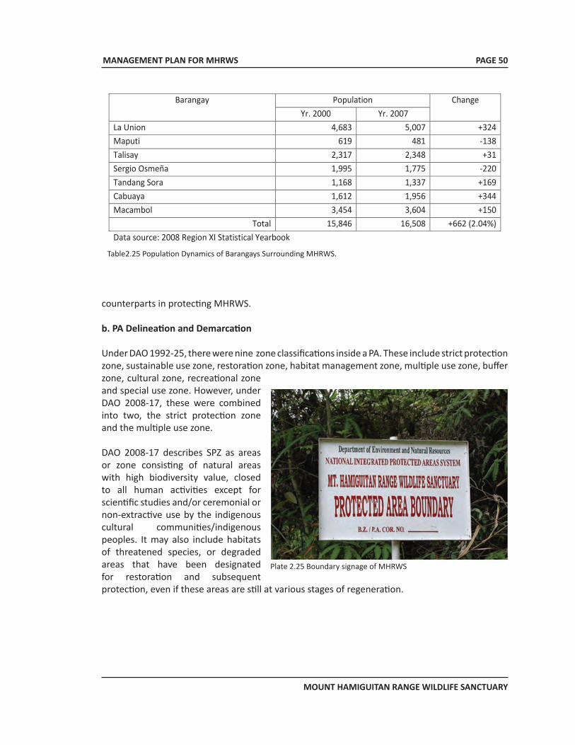
MANAGEMENT PLAN FOR MHRWS
MOUNT HAMIGUITAN RANGE WILDLIFE SANCTUARY
PAGE 50
Table2.25 Population Dynamics of Barangays Surrounding MHRWS.
Barangay Population Change
Yr. 2000 Yr. 2007 La Union 4,683 5,007 +324 Maputi 619 481 -138 Talisay 2,317 2,348 +31 Sergio Osmeña 1,995 1,775 -220 Tandang Sora 1,168 1,337 +169 Cabuaya 1,612 1,956 +344 Macambol 3,454 3,604 +150
Total 15,846 16,508 +662 (2.04%) Data source: 2008 Region XI Statistical Yearbook
counterparts in protecting MHRWS.
b. PA Delineation and Demarcation
Under DAO 1992-25, there were nine zone classifications inside a PA. These include strict protection zone, sustainable use zone, restoration zone, habitat management zone, multiple use zone, buffer zone, cultural zone, recreational zone and special use zone. However, under DAO 2008-17, these were combined into two, the strict protection zone and the multiple use zone.
DAO 2008-17 describes SPZ as areas or zone consisting of natural areas with high biodiversity value, closed to all human activities except for scientific studies and/or ceremonial or non-extractive use by the indigenous cultural communities/indigenous peoples. It may also include habitats of threatened species, or degraded areas that have been designated for restoration and subsequent protection, even if these areas are still at various stages of regeneration.
Plate 2.25 Boundary signage of MHRWS
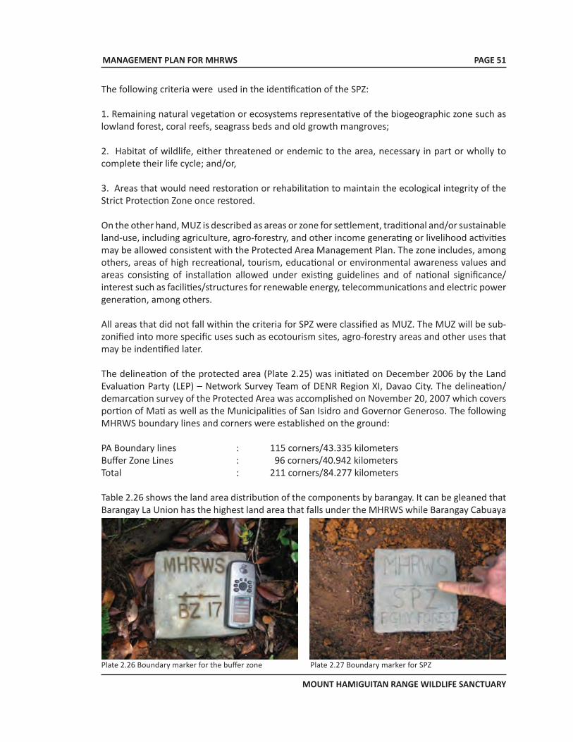
MANAGEMENT PLAN FOR MHRWS
MOUNT HAMIGUITAN RANGE WILDLIFE SANCTUARY
PAGE 51
The following criteria were used in the identification of the SPZ:
1. Remaining natural vegetation or ecosystems representative of the biogeographic zone such as lowland forest, coral reefs, seagrass beds and old growth mangroves;
2. Habitat of wildlife, either threatened or endemic to the area, necessary in part or wholly to complete their life cycle; and/or,
3. Areas that would need restoration or rehabilitation to maintain the ecological integrity of the Strict Protection Zone once restored.
On the other hand, MUZ is described as areas or zone for settlement, traditional and/or sustainable land-use, including agriculture, agro-forestry, and other income generating or livelihood activities may be allowed consistent with the Protected Area Management Plan. The zone includes, among others, areas of high recreational, tourism, educational or environmental awareness values and areas consisting of installation allowed under existing guidelines and of national significance/interest such as facilities/structures for renewable energy, telecommunications and electric power generation, among others.
All areas that did not fall within the criteria for SPZ were classified as MUZ. The MUZ will be sub-zonified into more specific uses such as ecotourism sites, agro-forestry areas and other uses that may be indentified later.
The delineation of the protected area (Plate 2.25) was initiated on December 2006 by the Land Evaluation Party (LEP) – Network Survey Team of DENR Region XI, Davao City. The delineation/demarcation survey of the Protected Area was accomplished on November 20, 2007 which covers portion of Mati as well as the Municipalities of San Isidro and Governor Generoso. The following MHRWS boundary lines and corners were established on the ground:
PA Boundary lines : 115 corners/43.335 kilometersBuffer Zone Lines : 96 corners/40.942 kilometersTotal : 211 corners/84.277 kilometers
Table 2.26 shows the land area distribution of the components by barangay. It can be gleaned that Barangay La Union has the highest land area that falls under the MHRWS while Barangay Cabuaya
Plate 2.26 Boundary marker for the buffer zone Plate 2.27 Boundary marker for SPZ
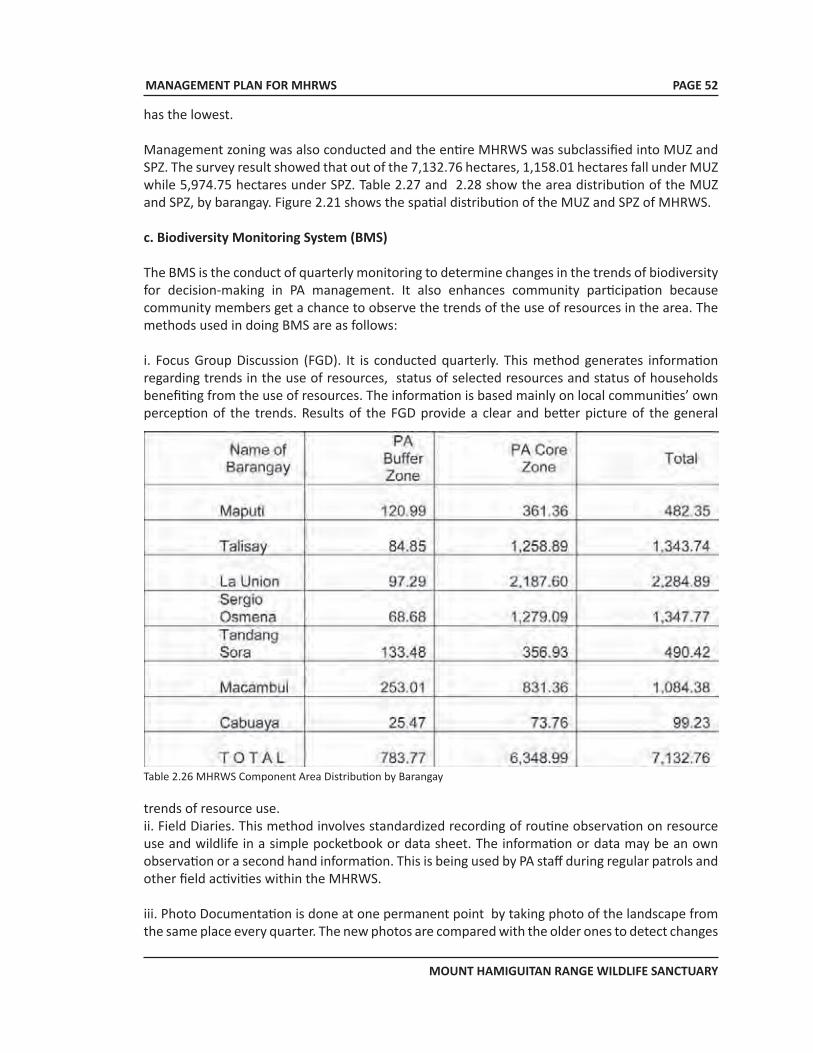
MANAGEMENT PLAN FOR MHRWS
MOUNT HAMIGUITAN RANGE WILDLIFE SANCTUARY
PAGE 52
has the lowest.
Management zoning was also conducted and the entire MHRWS was subclassified into MUZ and SPZ. The survey result showed that out of the 7,132.76 hectares, 1,158.01 hectares fall under MUZ while 5,974.75 hectares under SPZ. Table 2.27 and 2.28 show the area distribution of the MUZ and SPZ, by barangay. Figure 2.21 shows the spatial distribution of the MUZ and SPZ of MHRWS.
c. Biodiversity Monitoring System (BMS)
The BMS is the conduct of quarterly monitoring to determine changes in the trends of biodiversity for decision-making in PA management. It also enhances community participation because community members get a chance to observe the trends of the use of resources in the area. The methods used in doing BMS are as follows:
i. Focus Group Discussion (FGD). It is conducted quarterly. This method generates information regarding trends in the use of resources, status of selected resources and status of households benefiting from the use of resources. The information is based mainly on local communities’ own perception of the trends. Results of the FGD provide a clear and better picture of the general
Table 2.26 MHRWS Component Area Distribution by Barangay
trends of resource use.ii. Field Diaries. This method involves standardized recording of routine observation on resource use and wildlife in a simple pocketbook or data sheet. The information or data may be an own observation or a second hand information. This is being used by PA staff during regular patrols and other field activities within the MHRWS.
iii. Photo Documentation is done at one permanent point by taking photo of the landscape from the same place every quarter. The new photos are compared with the older ones to detect changes
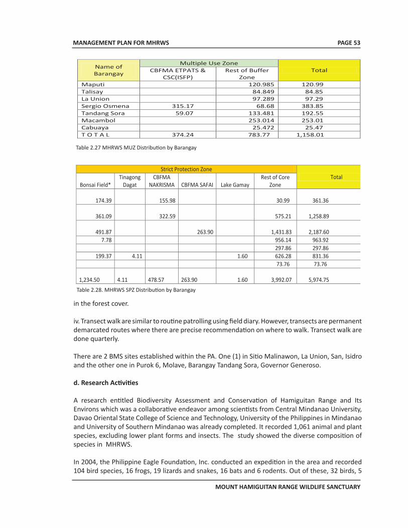
MANAGEMENT PLAN FOR MHRWS
MOUNT HAMIGUITAN RANGE WILDLIFE SANCTUARY
PAGE 53
Table 2.27 MHRWS MUZ Distribution by Barangay
Name of Barangay
Multiple Use Zone Total CBFMA ETPATS &
CSC(ISFP) Rest of Buffer
Zone Maputi 120.985 120.99 Talisay 84.849 84.85 La Union 97.289 97.29 Sergio Osmena 315.17 68.68 383.85 Tandang Sora 59.07 133.481 192.55 Macambol 253.014 253.01 Cabuaya 25.472 25.47 T O T A L 374.24 783.77 1,158.01
Strict Protection Zone Total
Bonsai Field* Tinagong
Dagat CBFMA
NAKRISMA CBFMA SAFAI Lake Gamay Rest of Core
Zone
174.39
155.98 30.99 361.36
361.09
322.59 575.21 1,258.89
491.87
263.90 1,431.83 2,187.60 7.78 956.14 963.92
297.86 297.86 199.37 4.11 1.60 626.28 831.36
73.76 73.76 1,234.50
4.11
478.57
263.90 1.60 3,992.07 5,974.75
Table 2.28. MHRWS SPZ Distribution by Barangay
in the forest cover.
iv. Transect walk are similar to routine patrolling using field diary. However, transects are permanent demarcated routes where there are precise recommendation on where to walk. Transect walk are done quarterly.
There are 2 BMS sites established within the PA. One (1) in Sitio Malinawon, La Union, San, Isidro and the other one in Purok 6, Molave, Barangay Tandang Sora, Governor Generoso.
d. Research Activities
A research entitled Biodiversity Assessment and Conservation of Hamiguitan Range and Its Environs which was a collaborative endeavor among scientists from Central Mindanao University, Davao Oriental State College of Science and Technology, University of the Philippines in Mindanao and University of Southern Mindanao was already completed. It recorded 1,061 animal and plant species, excluding lower plant forms and insects. The study showed the diverse composition of species in MHRWS.
In 2004, the Philippine Eagle Foundation, Inc. conducted an expedition in the area and recorded 104 bird species, 16 frogs, 19 lizards and snakes, 16 bats and 6 rodents. Out of these, 32 birds, 5
MANAGEMENT PLAN FOR MHRWS
MOUNT HAMIGUITAN RANGE WILDLIFE SANCTUARY
PAGE 54
rodents, 6 bats, 12 frogs and 8 snakes were endemic to the Philippines.
On-going research for MHRWS are the following:
1. Resource Valuation of Hamiguitan Mountain Range. This is a collaborative research activity involving the University of Southern Mindanao, Mindanao State University, Southern Christian College, Cebu Biodiversity Conservation Foundation and the National Museum.
2. Biosystematics of the Genus Amomum Roxb. (Family Zingiberaceae) in the Philippines.
e. Protected Area Management Plan
The Protected Area Management Plan is currently being prepared by accredited professionals in coordination with the PAMB, PASO, DENR and concerned LGUs in Davao Oriental. The financial requirement for the plan preparation is bank-rolled by the Provincial Government of Davao Oriental.
f. Accreditation as World Heritage Site
The team consisting of the PAMB, PASO, DENR, Davao Oriental Provincial Government, Office of the House of Representative 2nd Congressional District of Davao Oriental and the municipal governments of San Isidro and Governor Generoso and the Mati exerts a unified effort for the recognition of MHRWS as a World Heritage Site which is being processed by the UNESCO.
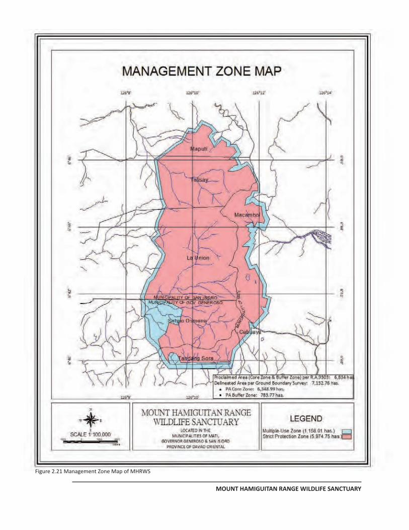
MANAGEMENT PLAN FOR MHRWS
MOUNT HAMIGUITAN RANGE WILDLIFE SANCTUARY
PAGE 49
Figure 2.21 Management Zone Map of MHRWS
MANAGEMENT PLAN FOR MHRWS
MOUNT HAMIGUITAN RANGE WILDLIFE SANCTUARY
PAGE 56
3. SITUATIONAL ANALYSIS
3.1 Conservation Value
MHRWS has a paramount conservation value not only in the Philippines, but worldwide as well. Having several distinct forest formations, the range of vegetation differs elsewhere. Mt. Hamiguitan’s 1,234 hectares of mossy–pygmy forest with gnarled suffrutescent floral species of Epacridacea is dominated by 1.4 meter tall floral species of Leptospermum flavescnens and Wendlandia nervosa. This summit formation characteristic is unique and can be considered one of the few habitats in the world, most important for ecological specialization.
Below the summit formation are the high and mid-montane forest areas which support the second largest remaining prime populations of woodland vegetation in the country. This habitat form the last identified strongholds of one of the largest and most threatened eagles in the world, the majestic Philippine Eagle (Pithecophaga jefferyi) which is considered as an outstanding universal value for science and conservation.
MHRWS has also the exceptional natural habitat because of its very high and most diverse flora and fauna in terms of numbers of wildlife endemism per unit area. It harbors around 1,061 species of both flora and fauna which are almost all endemic to Mindanao. Mt. Hamiguitan also has the high to highest diversity indices per unit area of unique, endangered and rare species.3.2 Biodiversity Concerns
The presence of plant and animal species which are endemic to Mt. Hamiguitan is the topmost concern for biodiversity. Being specific to this area, there is an utmost urgency to preserve and isolate the habitats of these species for their sustained existence. In addition, of the 1,046 flora and fauna specimens collected and/or observed, a considerable number has not yet been identified in terms of the specific species they belong.
3.3 Externalities
The benefits that are derived in maintaining the excellent condition of MHRWS are not limited only to the immediate communities. It extends to the nearby towns and provinces. The rainfalls resulting from the clouds that are formed atop Mt. Hamiguitan are not only confined to the immediate environs. Oftentimes, these reach the nearby provinces of Compostela Valley Province, Davao del Norte and even Davao del Sur as well as Davao city where several agricultural plantations exist.
The verdant forests of MHRWS also contain vast amount of carbon. This exhibits its importance in carbon sequestration and in mitigating climate change. It also produces ample amount of oxygen, through the photosynthetic process, which contribute to the better health of the residents in the surrounding areas.
The prevailing winds in the region have the southeast general direction. The relatively high altitudes of the Hamiguitan Mountain Range serve as wind break which shield the agricultural
MANAGEMENT PLAN FOR MHRWS
MOUNT HAMIGUITAN RANGE WILDLIFE SANCTUARY
PAGE 57
plantations at COMVAL, Davao del Norte and Davao City.
3.4 Habitat and Wildlife Rehabilitation Needs
Out of the 7,132.76 hectares total area of MHRWS, 1,308.14 hectares is open canopy forest while 619.91 hectares is brush land. Being the habitat of several endemic faunal species, it is of equal importance that these open canopy forests and brush lands be restored into closed canopy forests. The other areas are still in their pristine state, hence, there is no need for rehabilitation.
3.5 Management Constraints
The constraints confronting the management of the PA are as follows:
a. Negative Effect of Industrialization to the Existence of the Bonsai Trees
It is a known fact that the natural bonsai trees at the pygmy forest of MHRWS survived in that area despite the inherent very low fertility and highly acidic soil. One factor that they depended on is the frequent rain occurrence in the area. This frequent rain is due to the orographic effect wherein water vapor converges at the peak, and due to the cold temperature, condenses resulting to rainfall.
The plan of a multinational mining company to construct a nickel processing plant in the vicinity might alter this condition. The high temperature required to extract pure nickel from the ore might raise the ambient temperature that may reduce the occurrence of rainfall over the pygmy forest. If a prolonged absence of rain happens, there is the possibility that the thin soil layer supporting the bonsai trees might dry up and would result to the death of these bonsais. Although this scenario is speculative, there is a possibility for it to happen. Thus, a thorough and accurate environmental impact study must be required prior to the construction of the said processing plant to ensure the sustained existence of the pygmy forest of MHRWS.
b. Timber Poaching
Timber poaching (Plate 3.01) is rampant in some forest areas below and outside the MHRWS. This is happening allegedly because of the concerted efforts of the illegal logging financers and few local residents who find this type of activity the most readily available source of income. And, although their operations are still outside, there is the possibility that this illegal activity will be done inside the MHRWS because of the abundance of commercial timber inside the dipterocarp and the montane forests.
c. Gathering and Collecting of Wildlife Resources
The result of the biodiversity assessment study revealed that some rare and endemic species are present inside MHRWS. Also, the documentation by some visitors and the subsequent publications in the different media outlets spread the information on the beautiful and rare flowers and other ornamental plants especially the century-old natural bonsai trees found in MHRWS. This will give an idea to some bioprospectors to venture into gathering any of these species, thus, endangering the existence of the Mt. Hamiguitan endemic species (Plate 3.02).
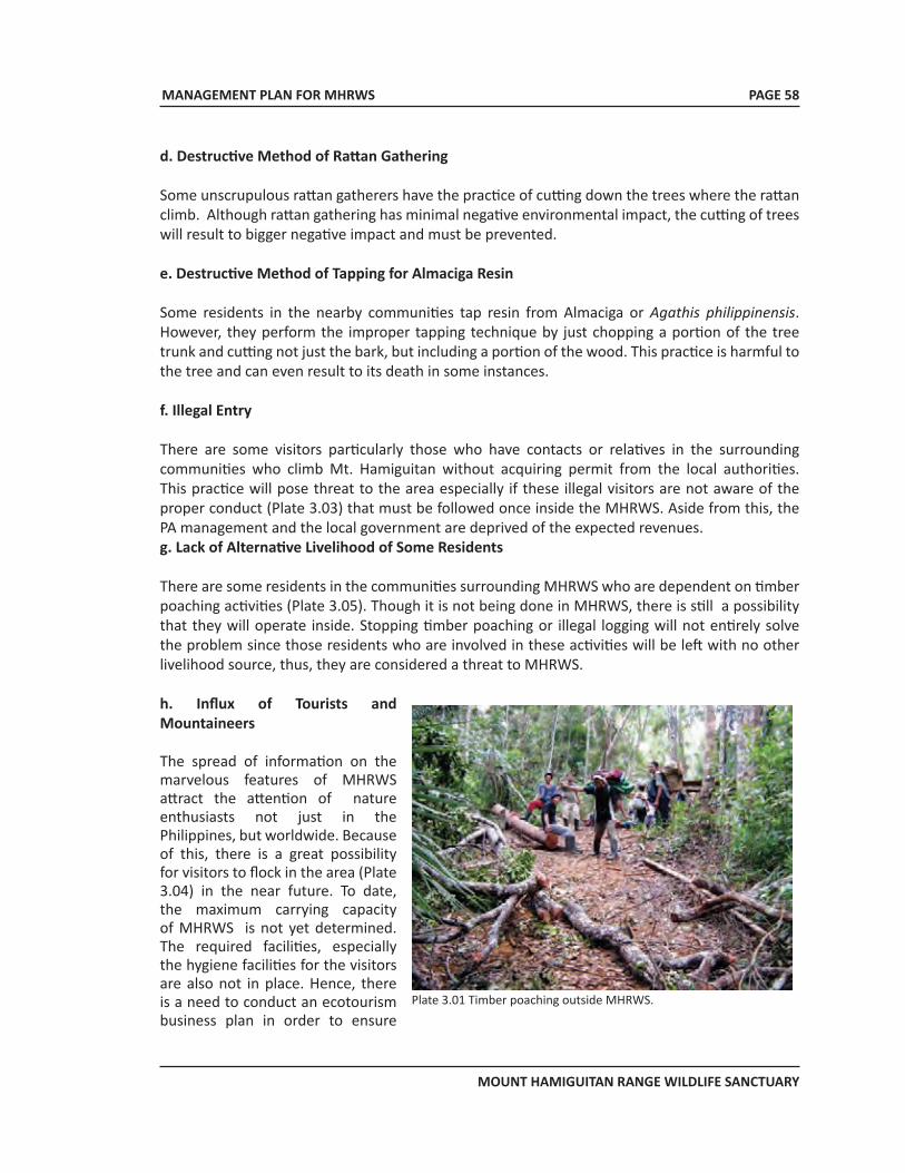
MANAGEMENT PLAN FOR MHRWS
MOUNT HAMIGUITAN RANGE WILDLIFE SANCTUARY
PAGE 58
d. Destructive Method of Rattan Gathering
Some unscrupulous rattan gatherers have the practice of cutting down the trees where the rattan climb. Although rattan gathering has minimal negative environmental impact, the cutting of trees will result to bigger negative impact and must be prevented.
e. Destructive Method of Tapping for Almaciga Resin
Some residents in the nearby communities tap resin from Almaciga or Agathis philippinensis. However, they perform the improper tapping technique by just chopping a portion of the tree trunk and cutting not just the bark, but including a portion of the wood. This practice is harmful to the tree and can even result to its death in some instances.
f. Illegal Entry
There are some visitors particularly those who have contacts or relatives in the surrounding communities who climb Mt. Hamiguitan without acquiring permit from the local authorities. This practice will pose threat to the area especially if these illegal visitors are not aware of the proper conduct (Plate 3.03) that must be followed once inside the MHRWS. Aside from this, the PA management and the local government are deprived of the expected revenues. g. Lack of Alternative Livelihood of Some Residents
There are some residents in the communities surrounding MHRWS who are dependent on timber poaching activities (Plate 3.05). Though it is not being done in MHRWS, there is still a possibility that they will operate inside. Stopping timber poaching or illegal logging will not entirely solve the problem since those residents who are involved in these activities will be left with no other livelihood source, thus, they are considered a threat to MHRWS.
h. Influx of Tourists and Mountaineers
The spread of information on the marvelous features of MHRWS attract the attention of nature enthusiasts not just in the Philippines, but worldwide. Because of this, there is a great possibility for visitors to flock in the area (Plate 3.04) in the near future. To date, the maximum carrying capacity of MHRWS is not yet determined. The required facilities, especially the hygiene facilities for the visitors are also not in place. Hence, there is a need to conduct an ecotourism business plan in order to ensure
Plate 3.01 Timber poaching outside MHRWS.
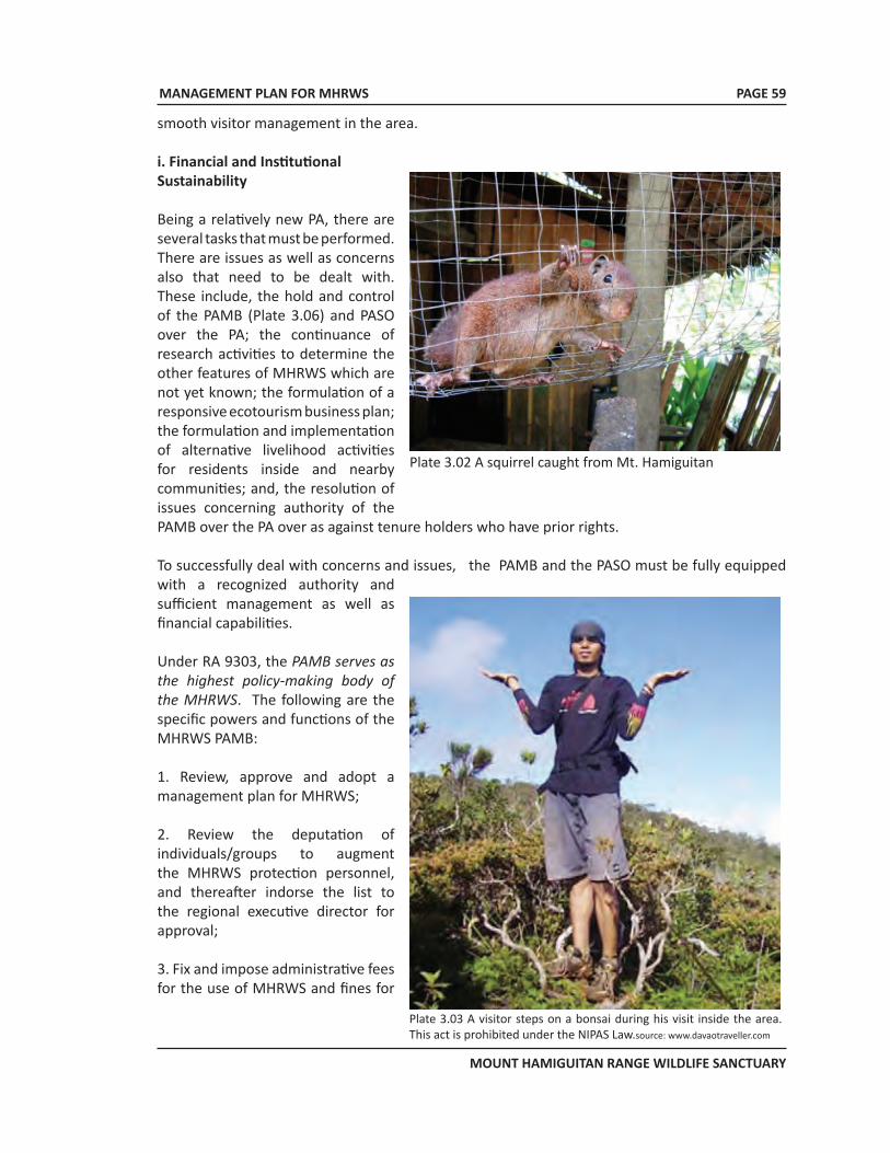
MANAGEMENT PLAN FOR MHRWS
MOUNT HAMIGUITAN RANGE WILDLIFE SANCTUARY
PAGE 59
smooth visitor management in the area. i. Financial and Institutional Sustainability
Being a relatively new PA, there are several tasks that must be performed. There are issues as well as concerns also that need to be dealt with. These include, the hold and control of the PAMB (Plate 3.06) and PASO over the PA; the continuance of research activities to determine the other features of MHRWS which are not yet known; the formulation of a responsive ecotourism business plan; the formulation and implementation of alternative livelihood activities for residents inside and nearby communities; and, the resolution of issues concerning authority of the PAMB over the PA over as against tenure holders who have prior rights.
To successfully deal with concerns and issues, the PAMB and the PASO must be fully equipped with a recognized authority and sufficient management as well as financial capabilities.
Under RA 9303, the PAMB serves as the highest policy-making body of the MHRWS. The following are the specific powers and functions of the MHRWS PAMB:
1. Review, approve and adopt a management plan for MHRWS;
2. Review the deputation of individuals/groups to augment the MHRWS protection personnel, and thereafter indorse the list to the regional executive director for approval;
3. Fix and impose administrative fees for the use of MHRWS and fines for
Plate 3.02 A squirrel caught from Mt. Hamiguitan
Plate 3.03 A visitor steps on a bonsai during his visit inside the area. This act is prohibited under the NIPAS Law.source: www.davaotraveller.com
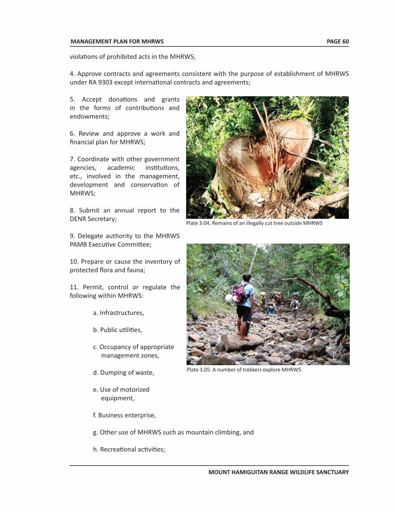
MANAGEMENT PLAN FOR MHRWS
MOUNT HAMIGUITAN RANGE WILDLIFE SANCTUARY
PAGE 60
violations of prohibited acts in the MHRWS;
4. Approve contracts and agreements consistent with the purpose of establishment of MHRWS under RA 9303 except international contracts and agreements;
5. Accept donations and grants in the forms of contributions and endowments;
6. Review and approve a work and financial plan for MHRWS;
7. Coordinate with other government agencies, academic institutions, etc., involved in the management, development and conservation of MHRWS;
8. Submit an annual report to the DENR Secretary;
9. Delegate authority to the MHRWS PAMB Executive Committee;
10. Prepare or cause the inventory of protected flora and fauna;
11. Permit, control or regulate the following within MHRWS:
a. Infrastructures,
b. Public utilities,
c. Occupancy of appropriate management zones,
d. Dumping of waste,
e. Use of motorized equipment,
f. Business enterprise,
g. Other use of MHRWS such as mountain climbing, and
h. Recreational activities;
Plate 3.04. Remains of an illegally cut tree outside MHRWS
Plate 3.05. A number of trekkers explore MHRWS
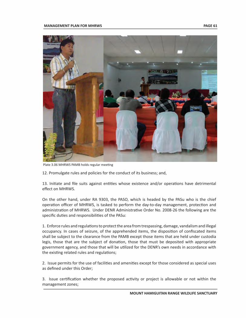
MANAGEMENT PLAN FOR MHRWS
MOUNT HAMIGUITAN RANGE WILDLIFE SANCTUARY
PAGE 61
12. Promulgate rules and policies for the conduct of its business; and,
13. Initiate and file suits against entities whose existence and/or operations have detrimental effect on MHRWS.
On the other hand, under RA 9303, the PASO, which is headed by the PASu who is the chief operation officer of MHRWS, is tasked to perform the day-to-day management, protection and administration of MHRWS. Under DENR Administrative Order No. 2008-26 the following are the specific duties and responsibilities of the PASu:
1. Enforce rules and regulations to protect the area from trespassing, damage, vandalism and illegal occupancy. In cases of seizure, of the apprehended items, the disposition of confiscated items shall be subject to the clearance from the PAMB except those items that are held under custodia legis, those that are the subject of donation, those that must be deposited with appropriate government agency, and those that will be utilized for the DENR’s own needs in accordance with the existing related rules and regulations;
2. Issue permits for the use of facilities and amenities except for those considered as special uses as defined under this Order;
3. Issue certification whether the proposed activity or project is allowable or not within the management zones;
Plate 3.06 MHRWS PAMB holds regular meeting
MANAGEMENT PLAN FOR MHRWS
MOUNT HAMIGUITAN RANGE WILDLIFE SANCTUARY
PAGE 62
4. Issue cutting permit for planted trees for a volume of up to five (5) cubic meters per applicant per year for traditional and subsistence uses by ICCs/IPs and tenured migrants only. Provided, that PACBRMA holders with affirmed Community Resource Management Plan (CRMP) shall no longer be issued cutting permits. Provided further, that the total volume of extraction does not exceed the limit set by the PAMB and the location of extraction is within the appropriate site within the multiple use zone;
5. Issue Certificate of Origin and/or transport permits for natural resources and other products collected/gathered from the protected area in accordance with the resource use instruments/agreements or gratuitous permits issued by the PAMB and/or the DENR;
6. Submit quarterly progress reports to the PAMB;
7. Serve as Head Secretariat to the PAMB and its Executive Committee;
8. Collect and/or receive pertinent fees, charges, donations and other income for the protected area. Provided, that such fees, charges, donations and other income collected/received shall be reported regularly to the PAMB in accordance with the existing guidelines;
9. Prepare and recommend to the PAMB approval of the annual work and financial plans of the protected area based on the IPAP or the Management Plan;
10. Develop management information system to ensure that relevant and updated information are available for planning, monitoring and decision-making; and
11. Perform other relevant functions that the RED or PAMB may delegate.
3.6 Land Use
Under the Philippine Land Classification System the entire 7,132.76 ha. total area of MHRWS is classified as timberland under L.C. Map Nos. 2660 and 2687 certified on September 05, 1975 and July 23, 1971, respectively. Of this total, 894.77 ha. are under CBFMAs, 256.54 ha. under CSCs while 2,415 ha. under IFMA prior to its enactment as a protected area (Figure 2.22). However, the IFMA area is not much of an issue since its elevation is 1000 masl and higher, which means that this area is precluded from any development activity, other than conservation and protection.
On the other hand, the CBFMAs and CSCs fall under the MUZ, hence, the land uses in these areas are not inconsistent with the PA management objectives. There was no specific land use for the remaining area which means that PAMB and PASO do not have much obstacles in carrying out the conservation, protection and other related activities for these portions as long as the relevant policies and regulations are followed.
3.7 Local People’s Interest, Rights and Concerns The indigenous people inside or at the vicinity of MHRWS belong to the Mandaya Tribe. Some of them belong to the 40 household occupants at Bgy. Sergio Osmeña, Gov. Generoso. The other Mandaya group resides at Bgy Macambol, but are residing outside the MHRWS.
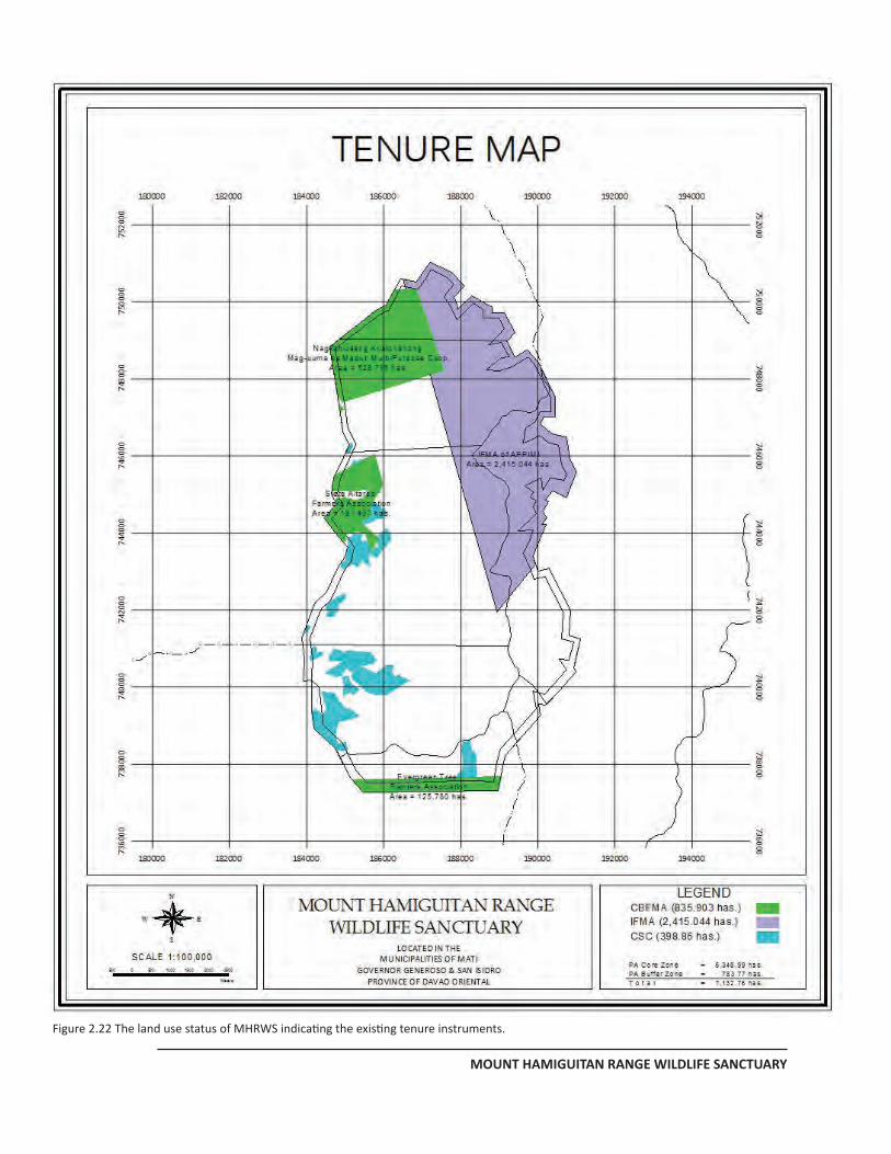
MANAGEMENT PLAN FOR MHRWS
MOUNT HAMIGUITAN RANGE WILDLIFE SANCTUARY
PAGE 61
Figure 2.22 The land use status of MHRWS indicating the existing tenure instruments.
MANAGEMENT PLAN FOR MHRWS
MOUNT HAMIGUITAN RANGE WILDLIFE SANCTUARY
PAGE 64
The other groups living below the MHRWS are migrants from other parts of the Philippines and have settled in the area several decades ago. Some of them were born in the area, hence, they considered this area their permanent residence.Whether indigenous people or migrants, they have a common interest to derive benefits from the forest and other natural resources in the area. Thus, if MHRWS is to be developed into a prime ecotourism destination, it is important to involve these local people in order for them to benefit from such economic activity and to make them realize that they are also stakeholders of the area.
In addition, the flash flood that happened in Macambol in the 1970s which was caused by rampant illegal logging also made them realize about the importance of maintaining sufficient forest cover in these areas in order to avoid occurrence of the same incident in the future.
3.8 Development Potential
MHRWS is a very potential eco-tourism site. It is one of the best places for nature lovers, adventurers and scientifically inclined individuals and groups. Its more than a thousand hectares natural bonsai fields which feature diverse and rare plant species is what attracts tourists most, both local and international. Incidentally, the said natural bonsai fields is also the habitat of the newly discovered rat species, the Hamiguitan batomys and the site endemic Delias magsadana. MHRWS is also an ideal place for the sustained existence of plant and animal species, including those considered rare. It can be utilized as a venue for scientific researches specifically those that have something to do with biodiversity and human health.
3.9 Role of LGU, NGO and Special Groups
Even before the declaration of MHRWS as a protected area, some LGUs of Davao Oriental are already in the forefront of conducting different protection and conservation activities. In 1993, Gov. Generoso passed Municipal Resolution No. 121 requesting the Philippine Congress to declare Mt. Hamiguitan as a wildlife sanctuary. In 2000, San Isidro, under the leadership of then Mayor Justina Yu, passed Municipal Resolution No. 81 for the same purpose and then Representative Joel Mayo Almario sponsored House Bill No. 2777 which became the basis for Congress to enact Republic Act No. 9303 establishing MHRWS which also became a component of the Philippine National Integrated Protected Area System (NIPAS).
The following are the other actions of LGUs for MHRWS:
a) Municipality of San Isidro
• Allocated monetary support as a commitment intended for MHRWS
• Offered vacant office for PASO at SB Building and other mobility facilities to facilitate the implementation of the Protected Area
• Appointed 10 Bantay Gubat from two (2) barangays of La Union and Talisay to effectively protect Mt. Hamiguitan Range Wildlife Sanctuary and its vicinities;
MANAGEMENT PLAN FOR MHRWS
MOUNT HAMIGUITAN RANGE WILDLIFE SANCTUARY
PAGE 65
• Formulated ordinance no. 146, s. 2000 regulating mountain climbing activity preferably at Bonsai Field as proposed Eco-tourism Project; and,
• Organized porters since 2001 for Mt. Hamiguitan as an alternative livelihood for the local community.
b) Municipality of Governor Generoso
• Allocated monetary support as a commitment intended for MHRWS; and,
• Utilized three (3) Bantay Gubat from Barangay Sergio Osmeña, Sr. and five (5) Bantay Gubat of Barangay Tandang Sora to protect Mt. Hamiguitan Range Wildlife Sanctuary
c) Davao Oriental Provincial Government
Committed to ensure environmental protection and the conservation of the existing natural resources of the province, the Provincial Government of Davao Oriental extended its full support to MHRWS. It has bank-rolled the financing of the preparation of the management plan aside from other logistic and manpower support.
d) Office of the Representative of the 2nd Congressional District of Davao Oriental
Aside from sponsoring House Bill 2777 which led to the enactment of RA 9303, the Representative of the 2nd Congressional District of Davao Oriental is also instrumental for the budget appropriations from the national government needed for the operationalization of the MHRWS PAMB and PASO.
Non-Government Organizations have also been actively supporting MHRWS. The following are the NGOs who lobbied for the protection of MHRWS and their activities:
a) Philippine Eagle Foundation, Inc.
The Philippine Eagle Foundation, Inc. (PEF) has been in Mt. Hamiguitan even before MHRWS was
Name of Barangay
Tenure CBFMA
NAKRISMA CBFMA SAFAI
CBFMA ETFATS CSC(ISFP) IFMA
APPIMI Total
Maputi 155.98
155.98
Talisay 322.59
322.59
La Union
290.50 15.75
306.25
Sergio Osmena 210.89
210.89
Tandang Sora
125.70 29.90
155.60
Macambol 2,415.04
2,415.04 Cabuaya
T O T A L 478.57
290.50
125.70 256.54 2,415.04
3,566.35 Table 3.1 Existing land tenures inside MHRWS
MANAGEMENT PLAN FOR MHRWS
MOUNT HAMIGUITAN RANGE WILDLIFE SANCTUARY
PAGE 66
established. Its primary concern in the area is the protection of the Philippine Eagle which inhabits the place. In so doing, it has also contributed in the preservation and protection of the other wildlife present in the area.b) Kalumonan Development Center
• Established backyard gardening within the community adjacent to Mt. Hamiguitan using coco husk as an alternative livelihood project.
• Assist in different environmental activities such as coastal and river clean-up, tree planting, among others
• Bee culture• Coco fiber flower vase/pots• Presented the unique features of Bonsai field and other flora of Mt. Hamiguitan during the
Hiyas Ng Turismo in Manila represented by its Executive Director Justina MB Yu
c) IMPEDE
• Provided environmental projects within CBFM areas which serve as a buffer zone of the PA. The projects are with funding assistance from UNDP
d) Luwas Kinaiyahan
• Assisted in the environmental protection and conservation of the PA
e) MHRMS Council Support• Assists PAMB operations and the implementation of RA 9303• Committed on the protection of biodiversity conservation and sustainable development• Assisted all research activities and came up with policy recommendations for the conservation
and sustainable use of Mt. Hamiguitan Biodiversity
f) Davao Oriental State College of Science and Technology
• Serves as the academic institution partner of MHRWS
The academe, scientists, environmental advocates and NGOs have also conducted several initiatives to strengthen the protection and management of the sanctuary and policy formulation of PAMB. Assistance is in the form of research projects and studies and capacity-building of stakeholders of the MHRWS.
3.10 Changes Required in Legal Status
Being established under a Republic Act made MHRWS a component of the NIPAS, hence, there is
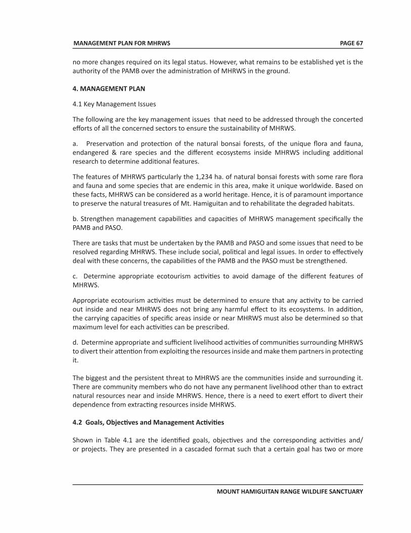
MANAGEMENT PLAN FOR MHRWS
MOUNT HAMIGUITAN RANGE WILDLIFE SANCTUARY
PAGE 67
no more changes required on its legal status. However, what remains to be established yet is the authority of the PAMB over the administration of MHRWS in the ground. 4. MANAGEMENT PLAN
4.1 Key Management Issues
The following are the key management issues that need to be addressed through the concerted efforts of all the concerned sectors to ensure the sustainability of MHRWS.
a. Preservation and protection of the natural bonsai forests, of the unique flora and fauna, endangered & rare species and the different ecosystems inside MHRWS including additional research to determine additional features.
The features of MHRWS particularly the 1,234 ha. of natural bonsai forests with some rare flora and fauna and some species that are endemic in this area, make it unique worldwide. Based on these facts, MHRWS can be considered as a world heritage. Hence, it is of paramount importance to preserve the natural treasures of Mt. Hamiguitan and to rehabilitate the degraded habitats.
b. Strengthen management capabilities and capacities of MHRWS management specifically the PAMB and PASO.
There are tasks that must be undertaken by the PAMB and PASO and some issues that need to be resolved regarding MHRWS. These include social, political and legal issues. In order to effectively deal with these concerns, the capabilities of the PAMB and the PASO must be strengthened.
c. Determine appropriate ecotourism activities to avoid damage of the different features of MHRWS.
Appropriate ecotourism activities must be determined to ensure that any activity to be carried out inside and near MHRWS does not bring any harmful effect to its ecosystems. In addition, the carrying capacities of specific areas inside or near MHRWS must also be determined so that maximum level for each activities can be prescribed.
d. Determine appropriate and sufficient livelihood activities of communities surrounding MHRWS to divert their attention from exploiting the resources inside and make them partners in protecting it.
The biggest and the persistent threat to MHRWS are the communities inside and surrounding it. There are community members who do not have any permanent livelihood other than to extract natural resources near and inside MHRWS. Hence, there is a need to exert effort to divert their dependence from extracting resources inside MHRWS.
4.2 Goals, Objectives and Management Activities
Shown in Table 4.1 are the identified goals, objectives and the corresponding activities and/or projects. They are presented in a cascaded format such that a certain goal has two or more
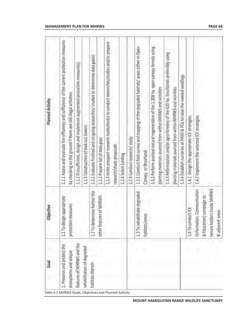
MANAGEMENT PLAN FOR MHRWS
MOUNT HAMIGUITAN RANGE WILDLIFE SANCTUARY
PAGE 68
Table 4.1 MHRWS Goals, Objectives and Planned Activity
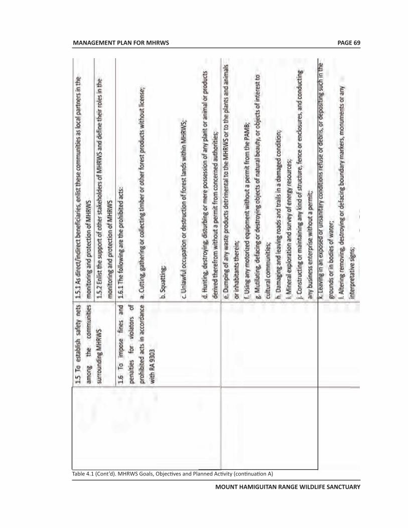
MANAGEMENT PLAN FOR MHRWS
MOUNT HAMIGUITAN RANGE WILDLIFE SANCTUARY
PAGE 69
Table 4.1 (Cont’d). MHRWS Goals, Objectives and Planned Activity (continuation A)
MANAGEMENT PLAN FOR MHRWS
MOUNT HAMIGUITAN RANGE WILDLIFE SANCTUARY
PAGE 70
Table 4.1 (Cont’d). MHRWS Goals, Objectives and Planned Activity (continuation B)
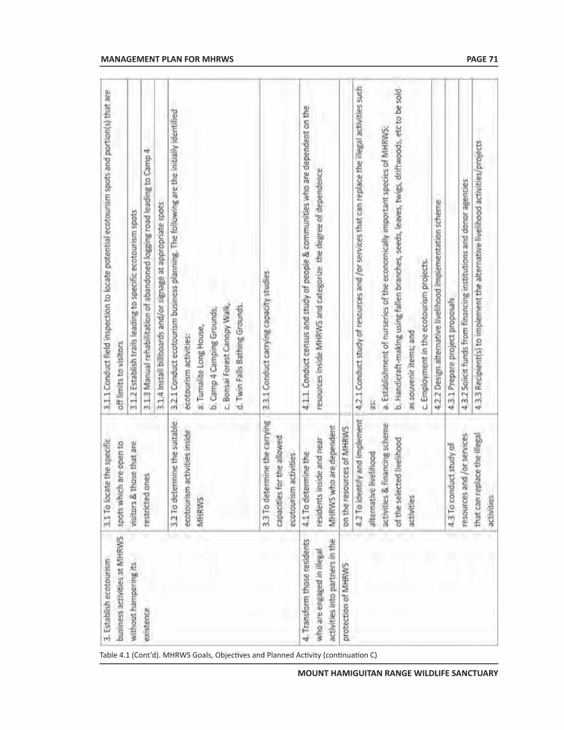
MANAGEMENT PLAN FOR MHRWS
MOUNT HAMIGUITAN RANGE WILDLIFE SANCTUARY
PAGE 71
Table 4.1 (Cont’d). MHRWS Goals, Objectives and Planned Activity (continuation C)
MANAGEMENT PLAN FOR MHRWS
MOUNT HAMIGUITAN RANGE WILDLIFE SANCTUARY
PAGE 72
objectives, and each objective has one or more planned activity or project. The conduct of each of the planned activity will lead to the attainment of each specific objective.
5. SPECIAL CONCERN: SECOND LAYER OF DEFENSE FOR MHRWS
Being unique worldwide reinforced by its inherent high conservation values, there is an urgent need to maintain the protection of MHRWS. Hence, aside from the forest rangers and bantay gubat members, there is a plan to use the existing as well as future CBFMAs (Table 5.1 and figure 5.5), CSCs and other tenure instruments that might be issued in the timberland areas surrounding MHRWS as the second layer of defense for MHRWS. For this purpose the following actions shall be taken by the PAMB and PASO:
1. Coordinate with the concerned CENROs and LGUs for MOAs to strengthen joint efforts with parties/organizations holding the respective tenure instruments;
2. Design institutional mechanisms and arrangements for these tenure holders to function effectively as second layer of defense for MHRWS; and,
Municipality CBFMA Area (ha.)
San Isidro NAKRISMA 1,000 NMTC 350 SAFAI 450
Gov. Generoso ETPATS 3,300 OFMPC 3,180
Mati MCC 1,000 CCMPC 5,000
Total 7 14,280
Table 5.1 Existing CBFMAs Surrounding MHRWS which Serve as Second Layer of Defense for MHRWS Protection.
3. In coordination with the concerned CENROs and LGUs, institute measures to strengthen the capabilities of these tenure holders for the effective and efficient management of their respective tenured areas.
6. MONITORING AND EVALUATION
The monitoring and evaluation system being adopted by the MHRWS Management is a practical, simple and a concrete one. All the goals and objectives are laid out and evaluated on a regular basis.
Goals undergo annual evaluation, while objectives are subjected to an evaluation interval of not more than one year, depending on how critical the attainment of a certain objective is. The more critical the objective is, the shorter the interval is. Goals and objectives which are not attained on the targeted time are evaluated to determine the factors behind the non-attainment, after which, remedial or alternative action plan(s) is formulated (Figure 6.1).
The PAMB reviews goals and objectives annually and formulate and/or approve remedial or
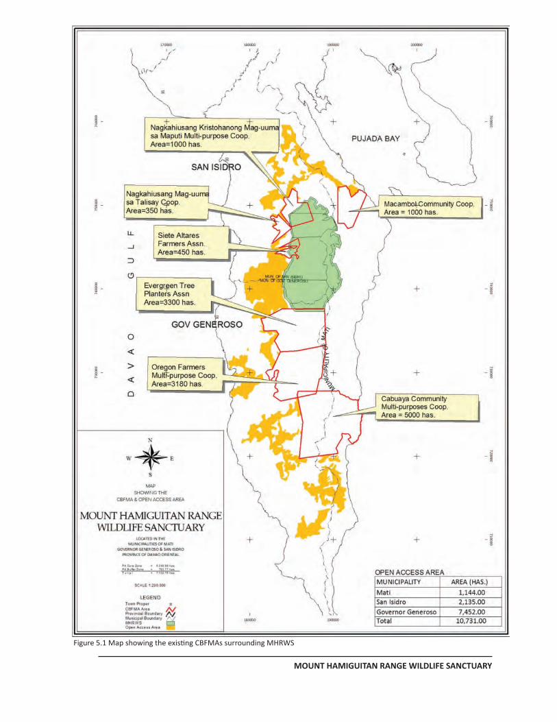
MANAGEMENT PLAN FOR MHRWS
MOUNT HAMIGUITAN RANGE WILDLIFE SANCTUARY
Figure 5.1 Map showing the existing CBFMAs surrounding MHRWS
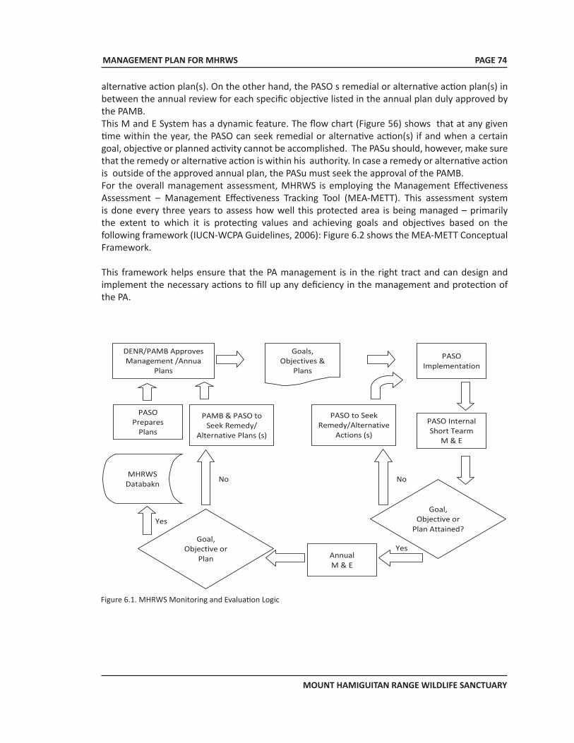
MANAGEMENT PLAN FOR MHRWS
MOUNT HAMIGUITAN RANGE WILDLIFE SANCTUARY
alternative action plan(s). On the other hand, the PASO s remedial or alternative action plan(s) in between the annual review for each specific objective listed in the annual plan duly approved by the PAMB.This M and E System has a dynamic feature. The flow chart (Figure 56) shows that at any given time within the year, the PASO can seek remedial or alternative action(s) if and when a certain goal, objective or planned activity cannot be accomplished. The PASu should, however, make sure that the remedy or alternative action is within his authority. In case a remedy or alternative action is outside of the approved annual plan, the PASu must seek the approval of the PAMB. For the overall management assessment, MHRWS is employing the Management Effectiveness Assessment – Management Effectiveness Tracking Tool (MEA-METT). This assessment system is done every three years to assess how well this protected area is being managed – primarily the extent to which it is protecting values and achieving goals and objectives based on the following framework (IUCN-WCPA Guidelines, 2006): Figure 6.2 shows the MEA-METT Conceptual Framework.
This framework helps ensure that the PA management is in the right tract and can design and implement the necessary actions to fill up any deficiency in the management and protection of the PA.
DENR/PAMB Approves Management /Annua
Plans
PASO Prepares
Plans
PAMB & PASO to Seek Remedy/
Alternative Plans (s)
MHRWS Databakn
Goals, Objectives &
Plans
PASO to Seek Remedy/Alternative
Actions (s)
PASO Internal Short Tearm
M & E
Goal, Objective or
Plan
Goal, Objective or
Plan Attained?
PASO Implementation
Annual M & E
Yes
No No
Yes
Figure 6.1. MHRWS Monitoring and Evaluation Logic
PAGE 74
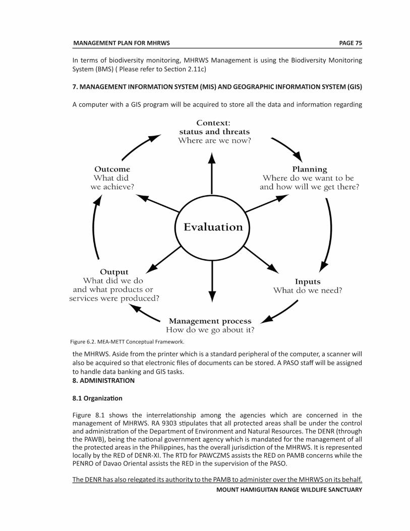
MANAGEMENT PLAN FOR MHRWS
MOUNT HAMIGUITAN RANGE WILDLIFE SANCTUARY
Figure 6.2. MEA-METT Conceptual Framework.
In terms of biodiversity monitoring, MHRWS Management is using the Biodiversity Monitoring System (BMS) ( Please refer to Section 2.11c)
7. MANAGEMENT INFORMATION SYSTEM (MIS) AND GEOGRAPHIC INFORMATION SYSTEM (GIS)
A computer with a GIS program will be acquired to store all the data and information regarding
the MHRWS. Aside from the printer which is a standard peripheral of the computer, a scanner will also be acquired so that electronic files of documents can be stored. A PASO staff will be assigned to handle data banking and GIS tasks.8. ADMINISTRATION 8.1 Organization
Figure 8.1 shows the interrelationship among the agencies which are concerned in the management of MHRWS. RA 9303 stipulates that all protected areas shall be under the control and administration of the Department of Environment and Natural Resources. The DENR (through the PAWB), being the national government agency which is mandated for the management of all the protected areas in the Philippines, has the overall jurisdiction of the MHRWS. It is represented locally by the RED of DENR-XI. The RTD for PAWCZMS assists the RED on PAMB concerns while the PENRO of Davao Oriental assists the RED in the supervision of the PASO.
The DENR has also relegated its authority to the PAMB to administer over the MHRWS on its behalf.
PAGE 75
MANAGEMENT PLAN FOR MHRWS
MOUNT HAMIGUITAN RANGE WILDLIFE SANCTUARY
PAGE 76
The MHRWS PAMB has the responsibilities of ensuring the management plan implementation and in acquiring the necessary resources for the plan implementation.
On the other hand, the PASO is in charge of executing/implementing the plan. The PASO also takes charge in preparing annual plans which are subject to the approval of the PAMB/DENR. The PASu takes order directly from the PAMB and the DENR.
By having representatives to the PAMB, the MHRWS LGUs and other stakeholders participates through the PAMB. In terms of the monitoring and protection activities, the LGUs directly participate through the Bantay Gubat. Academic/research institutions, who conduct researches/studies inside MHRWS, coordinate with the PAMB and the PASO.
8.2 Staffing
The following is the current staffing of the MHRWS:
1. Technical/Administrative Services 1.1 Protected Area Superintendent 1.2 Asst. Protected Area Superintendent 1.3 Head PA Protection Officer/Chief, Surveys Unit 1.4 PA Administrative Aide/Driver
2. Support Staff 2.1 Patrol Sector 1 (San Isidro, Davao Oriental) Three (3) Protection and Warden Officers
2.2 Patrol Sector 2 (Gov. Generoso, Davao Oriental) Two (2) Protection and Warden Officers
2.3 Patrol Sector 3 (Mati, Davao Oriental) Two (2) Protection and Warden Officers
8.3 Work and Financial Plan
Based on the key management issues, goals and objectives, the corresponding activities and the corresponding budget are enumerated in Table 8.1 below (MHRWS 10 year work plan).
Other activities which are not included in this plan may be carried out provided the fund source(s) is secured.
The current funding for the 10-year MHRWS Management Plan comes from combined sources. At present, the main fund source is from the national government with contributions from the Provincial Government of Davao Oriental and the three municipalities of MHRWS. The amounts of funds provided are as follows:
DENR PHP 5,000,000.00 Office of the Representative Davao Or. 2nd District 10,000,000.00Provincial Government of Davao Oriental 5,000,000.00Municipality of San Isidro 1,000,000.00 Municipality of Mati 500,000.00
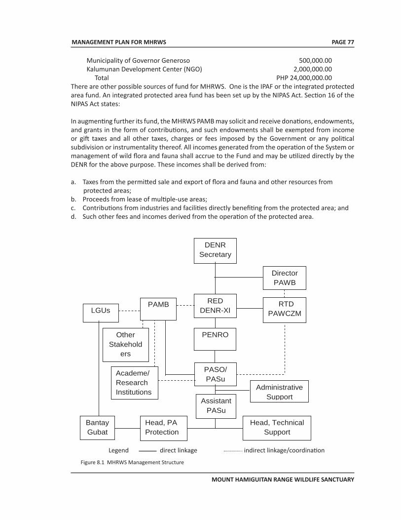
MANAGEMENT PLAN FOR MHRWS
MOUNT HAMIGUITAN RANGE WILDLIFE SANCTUARY
PAGE 77
Municipality of Governor Generoso 500,000.00Kalumunan Development Center (NGO) 2,000,000.00 Total PHP 24,000,000.00
There are other possible sources of fund for MHRWS. One is the IPAF or the integrated protected area fund. An integrated protected area fund has been set up by the NIPAS Act. Section 16 of the NIPAS Act states:
In augmenting further its fund, the MHRWS PAMB may solicit and receive donations, endowments, and grants in the form of contributions, and such endowments shall be exempted from income or gift taxes and all other taxes, charges or fees imposed by the Government or any political subdivision or instrumentality thereof. All incomes generated from the operation of the System or management of wild flora and fauna shall accrue to the Fund and may be utilized directly by the DENR for the above purpose. These incomes shall be derived from:
a. Taxes from the permitted sale and export of flora and fauna and other resources from protected areas;
b. Proceeds from lease of multiple-use areas; c. Contributions from industries and facilities directly benefiting from the protected area; and d. Such other fees and incomes derived from the operation of the protected area.
Legend: direct linkage indirect linkage/coordination
DENR Secretary
RED DENR-XI
Director PAWB
RTD PAWCZMS
PENRO
PAMB
PASO/ PASu
LGUs
Assistant PASu
Head, PA Protection
Head, Technical Support
Bantay Gubat
Academe/ Research Institutions
Other Stakehold
ers
Administrative Support
Figure 8.1 MHRWS Management Structure
Legend direct linkage indirect linkage/coordination
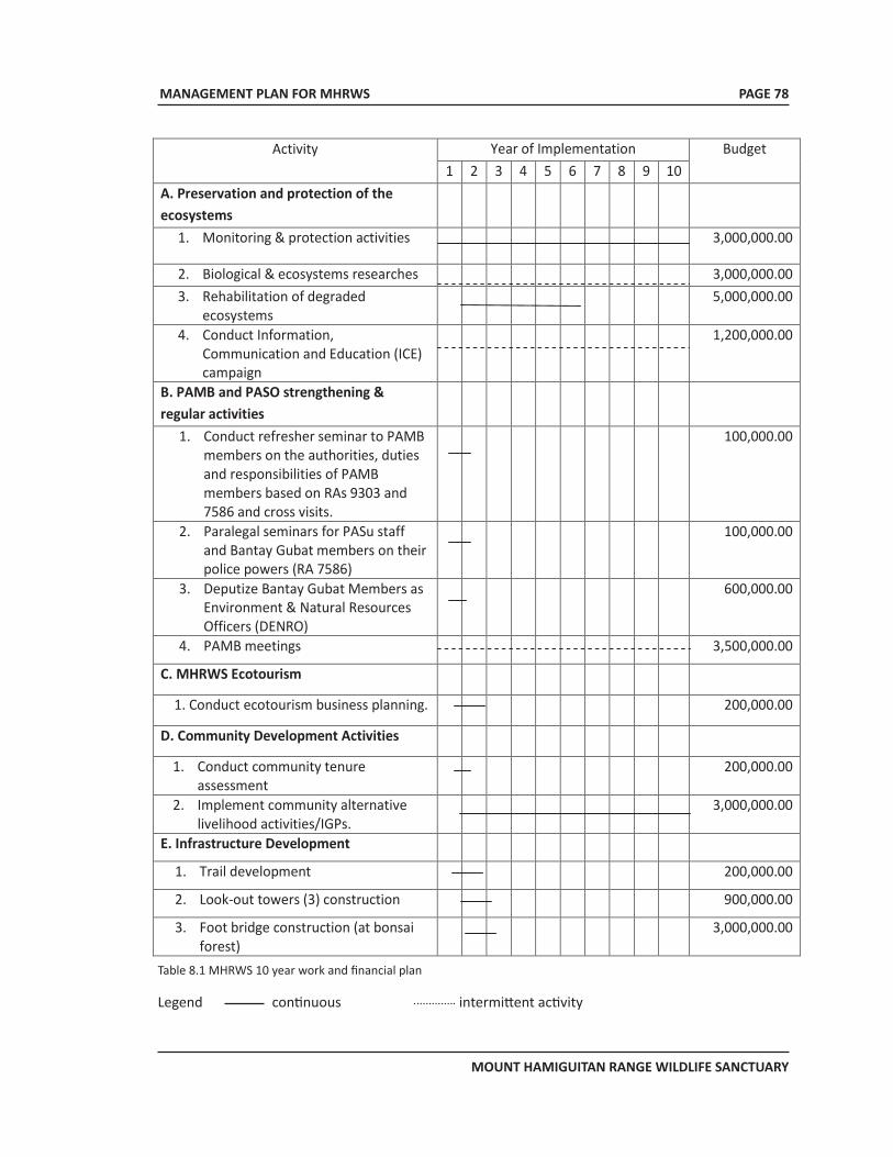
MANAGEMENT PLAN FOR MHRWS
MOUNT HAMIGUITAN RANGE WILDLIFE SANCTUARY
PAGE 78
Activity Year of Implementation Budget 1 2 3 4 5 6 7 8 9 10
A. Preservation and protection of the ecosystems
1. Monitoring & protection activities
3,000,000.00
2. Biological & ecosystems researches
3,000,000.00 3. Rehabilitation of degraded
ecosystems
5,000,000.00
4. Conduct Information, Communication and Education (ICE) campaign
1,200,000.00
B. PAMB and PASO strengthening & regular activities
1. Conduct refresher seminar to PAMB members on the authorities, duties and responsibilities of PAMB members based on RAs 9303 and 7586 and cross visits.
100,000.00
2. Paralegal seminars for PASu staff and Bantay Gubat members on their police powers (RA 7586)
100,000.00
3. Deputize Bantay Gubat Members as Environment & Natural Resources Officers (DENRO)
600,000.00
4. PAMB meetings
3,500,000.00
C. MHRWS Ecotourism
1. Conduct ecotourism business planning.
200,000.00
D. Community Development Activities
1. Conduct community tenure assessment
200,000.00
2. Implement community alternative livelihood activities/IGPs.
3,000,000.00
E. Infrastructure Development
1. Trail development
200,000.00
2. Look-out towers (3) construction
900,000.00
3. Foot bridge construction (at bonsai forest)
3,000,000.00
Table 8.1 MHRWS 10 year work and financial plan
Legend continuous intermittent activity
MANAGEMENT PLAN FOR MHRWS
MOUNT HAMIGUITAN RANGE WILDLIFE SANCTUARY
PAGE 79
Disbursements from the Fund shall be made solely for the protection, maintenance, administration, and management of the System, and duly approved projects endorsed by the PAMB, in the amounts authorized by the DENR.
9. APPENDICES
9.1 Maps
9.2 MHRWS Flora
9.3 MHRWS Fauna
9.4 Conservation Status of Some MHRWS Flora
9.5 Conservation Status of Some MHRWS Fauna
MANAGEMENT PLAN FOR MHRWS
MOUNT HAMIGUITAN RANGE WILDLIFE SANCTUARY
APPENDIX 1MHRWS Maps
PAGE 80
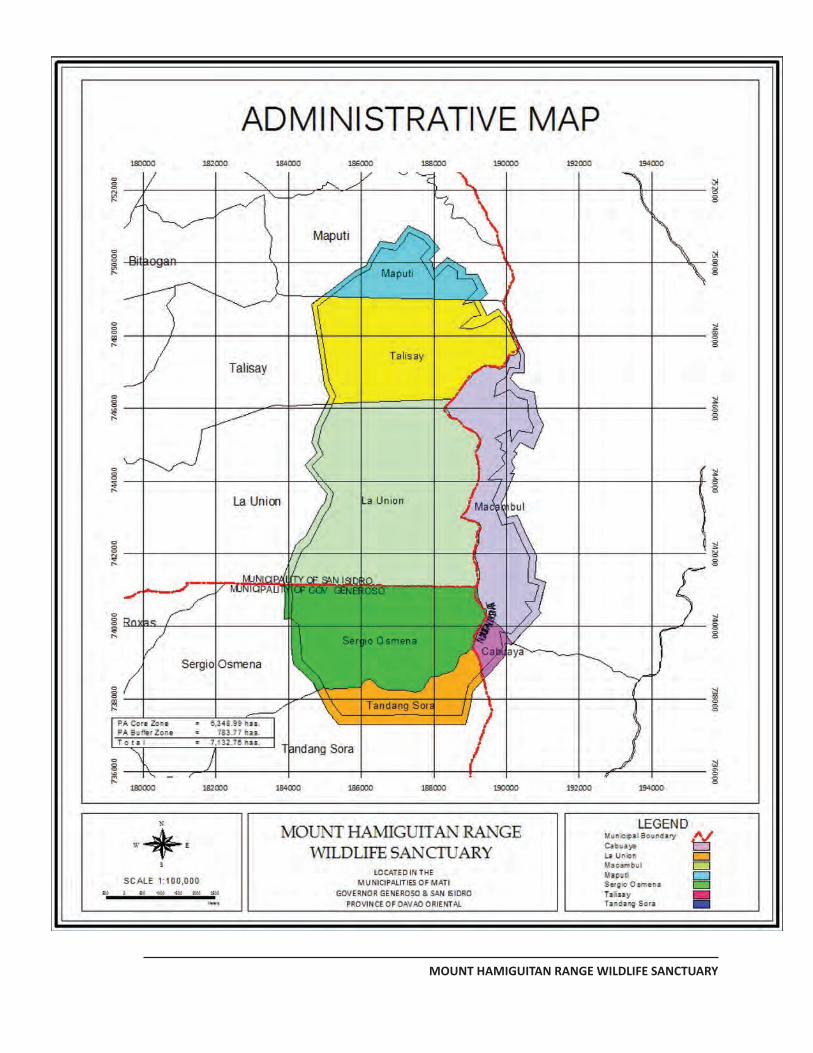
MANAGEMENT PLAN FOR MHRWS
MOUNT HAMIGUITAN RANGE WILDLIFE SANCTUARY
PAGE 79
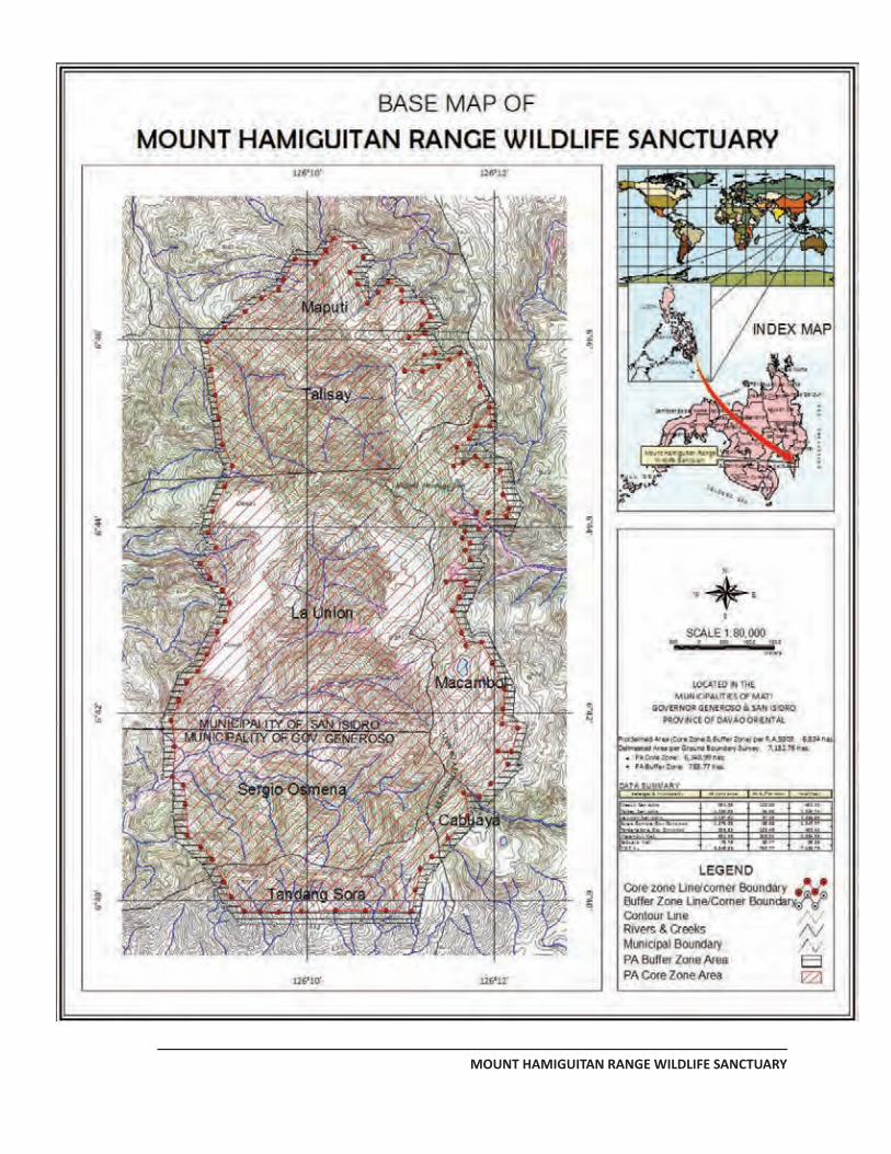
MANAGEMENT PLAN FOR MHRWS
MOUNT HAMIGUITAN RANGE WILDLIFE SANCTUARY
PAGE 80
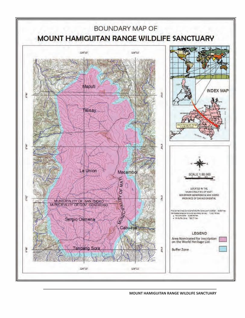
MANAGEMENT PLAN FOR MHRWS
MOUNT HAMIGUITAN RANGE WILDLIFE SANCTUARY
PAGE 81
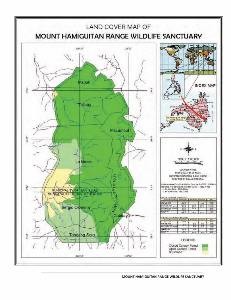
MANAGEMENT PLAN FOR MHRWS
MOUNT HAMIGUITAN RANGE WILDLIFE SANCTUARY
PAGE 82
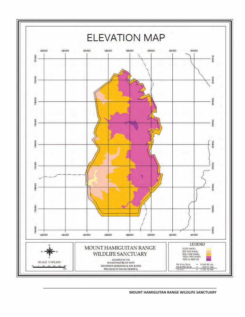
MANAGEMENT PLAN FOR MHRWS
MOUNT HAMIGUITAN RANGE WILDLIFE SANCTUARY
PAGE 83
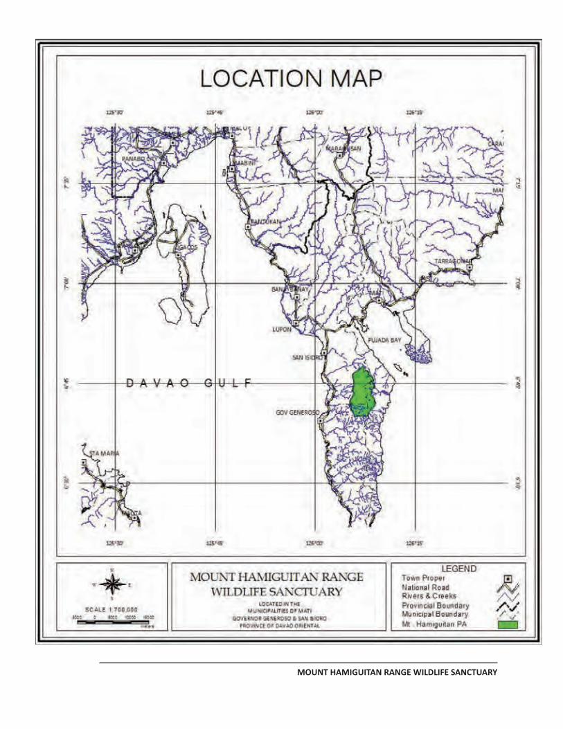
MANAGEMENT PLAN FOR MHRWS
MOUNT HAMIGUITAN RANGE WILDLIFE SANCTUARY
PAGE 84
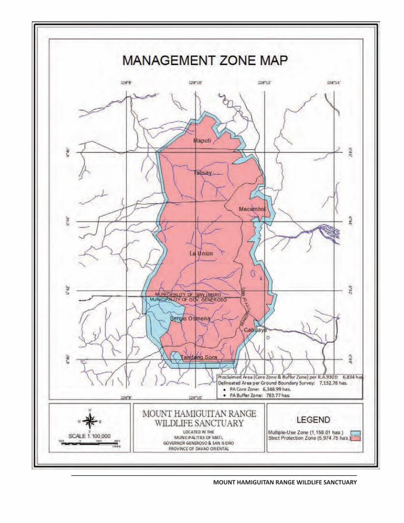
MANAGEMENT PLAN FOR MHRWS
MOUNT HAMIGUITAN RANGE WILDLIFE SANCTUARY
PAGE 85
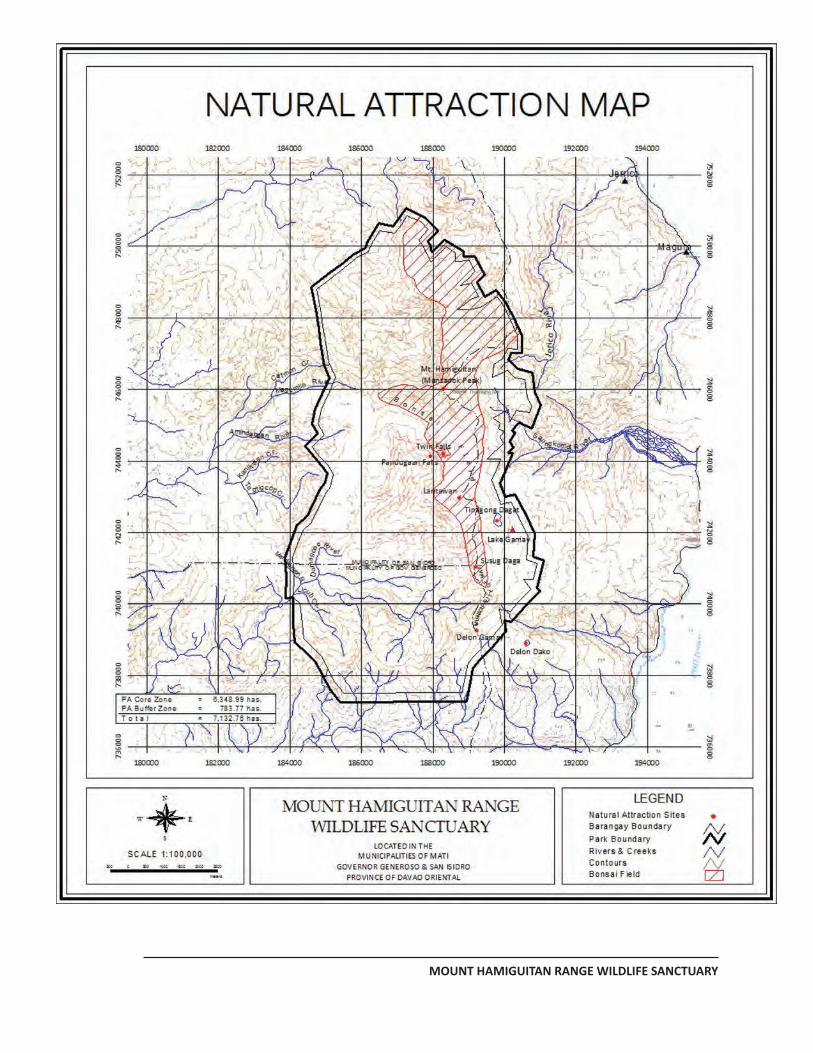
MANAGEMENT PLAN FOR MHRWS
MOUNT HAMIGUITAN RANGE WILDLIFE SANCTUARY
PAGE 86
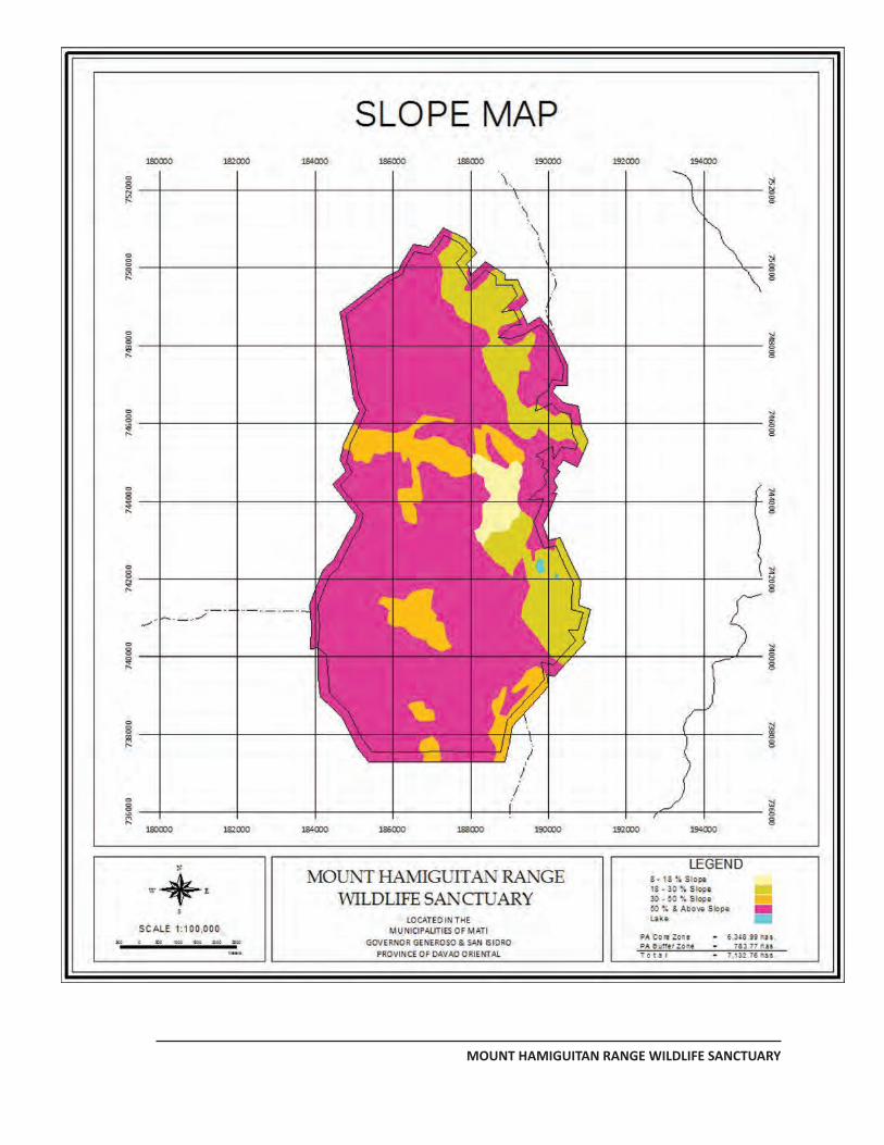
MANAGEMENT PLAN FOR MHRWS
MOUNT HAMIGUITAN RANGE WILDLIFE SANCTUARY
PAGE 87
MANAGEMENT PLAN FOR MHRWS
MOUNT HAMIGUITAN RANGE WILDLIFE SANCTUARY
PAGE 88
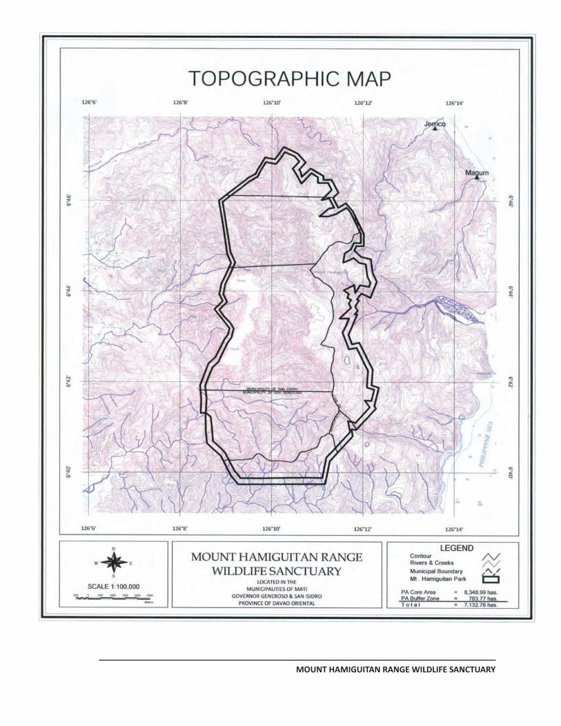
MANAGEMENT PLAN FOR MHRWS
MOUNT HAMIGUITAN RANGE WILDLIFE SANCTUARY
PAGE 89
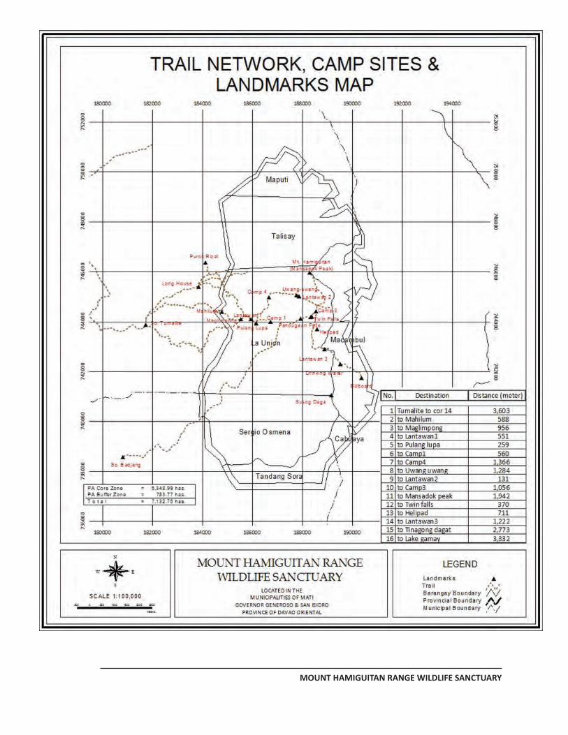
MANAGEMENT PLAN FOR MHRWS
MOUNT HAMIGUITAN RANGE WILDLIFE SANCTUARY
PAGE 90
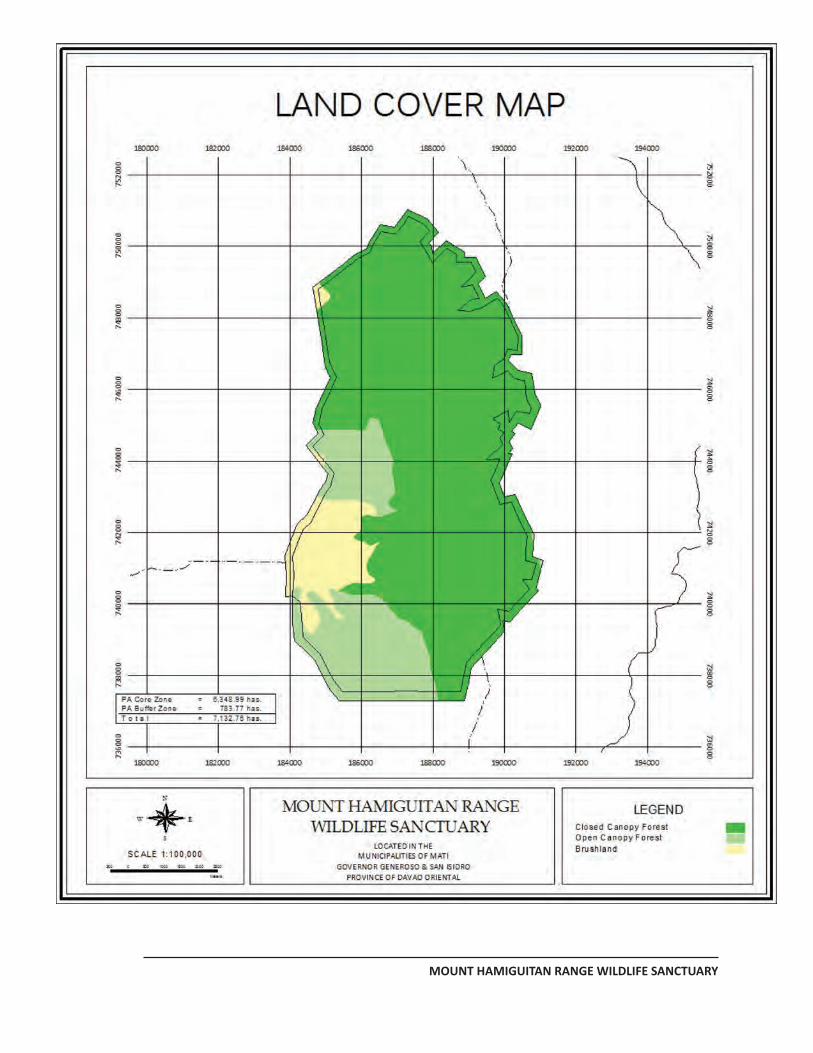
MANAGEMENT PLAN FOR MHRWS
MOUNT HAMIGUITAN RANGE WILDLIFE SANCTUARY
PAGE 91
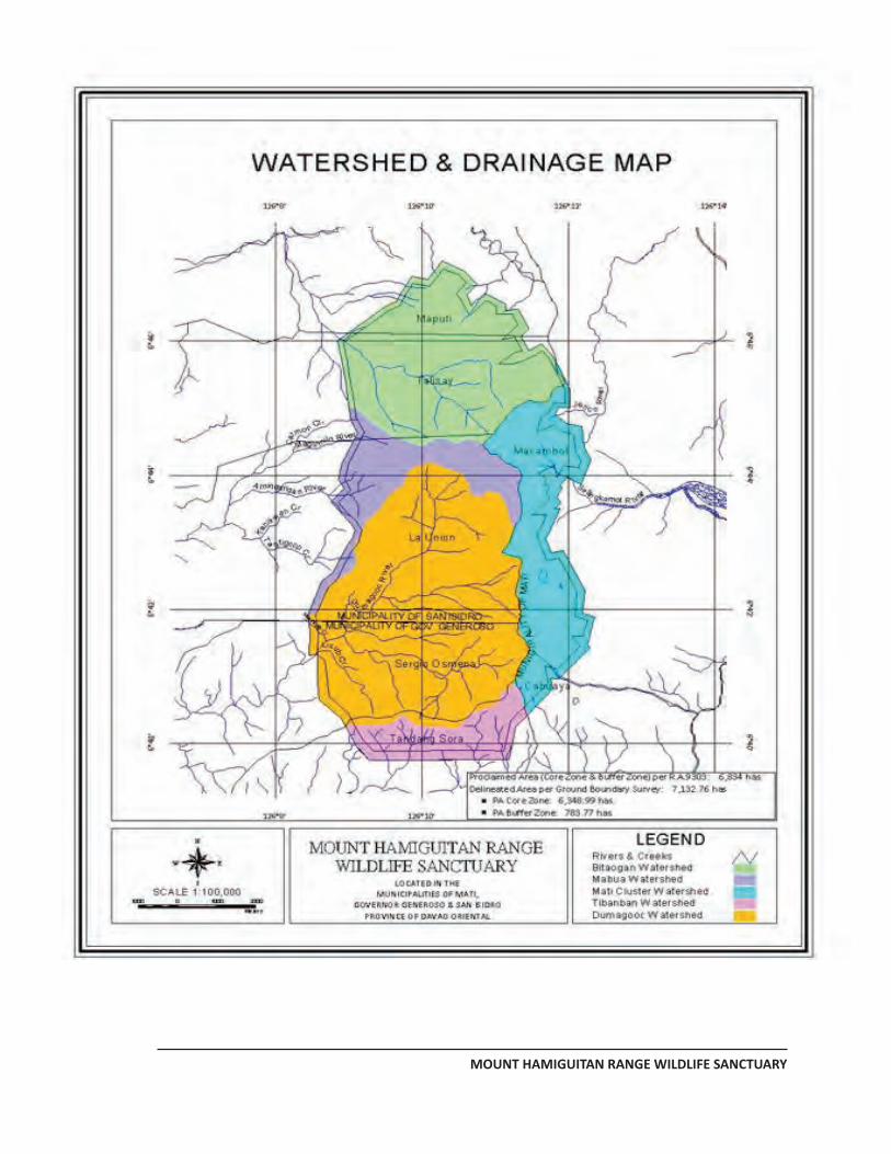
MANAGEMENT PLAN FOR MHRWS
MOUNT HAMIGUITAN RANGE WILDLIFE SANCTUARY
PAGE 92
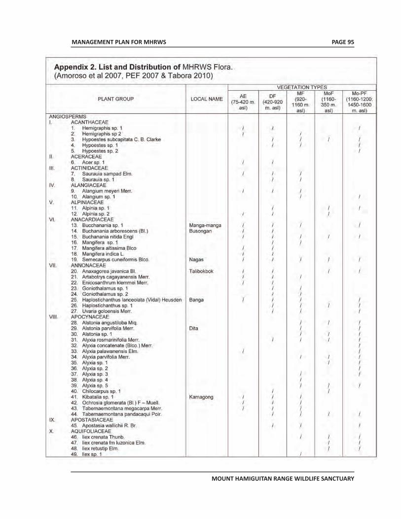
MANAGEMENT PLAN FOR MHRWS
MOUNT HAMIGUITAN RANGE WILDLIFE SANCTUARY
PAGE 95
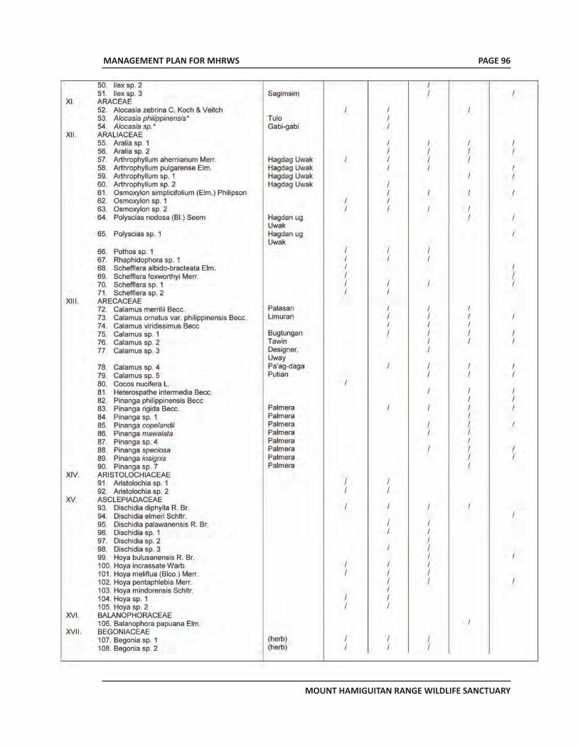
MANAGEMENT PLAN FOR MHRWS
MOUNT HAMIGUITAN RANGE WILDLIFE SANCTUARY
PAGE 96
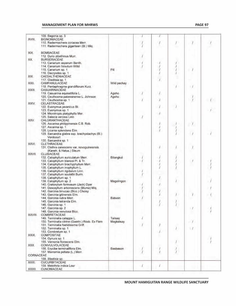
MANAGEMENT PLAN FOR MHRWS
MOUNT HAMIGUITAN RANGE WILDLIFE SANCTUARY
PAGE 97
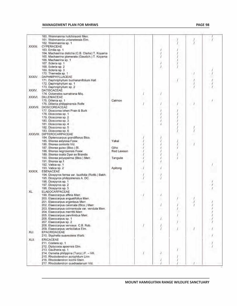
MANAGEMENT PLAN FOR MHRWS
MOUNT HAMIGUITAN RANGE WILDLIFE SANCTUARY
PAGE 98
MANAGEMENT PLAN FOR MHRWS
MOUNT HAMIGUITAN RANGE WILDLIFE SANCTUARY
PAGE 99
MANAGEMENT PLAN FOR MHRWS
MOUNT HAMIGUITAN RANGE WILDLIFE SANCTUARY
PAGE 100
MANAGEMENT PLAN FOR MHRWS
MOUNT HAMIGUITAN RANGE WILDLIFE SANCTUARY
PAGE 101
MANAGEMENT PLAN FOR MHRWS
MOUNT HAMIGUITAN RANGE WILDLIFE SANCTUARY
PAGE 102
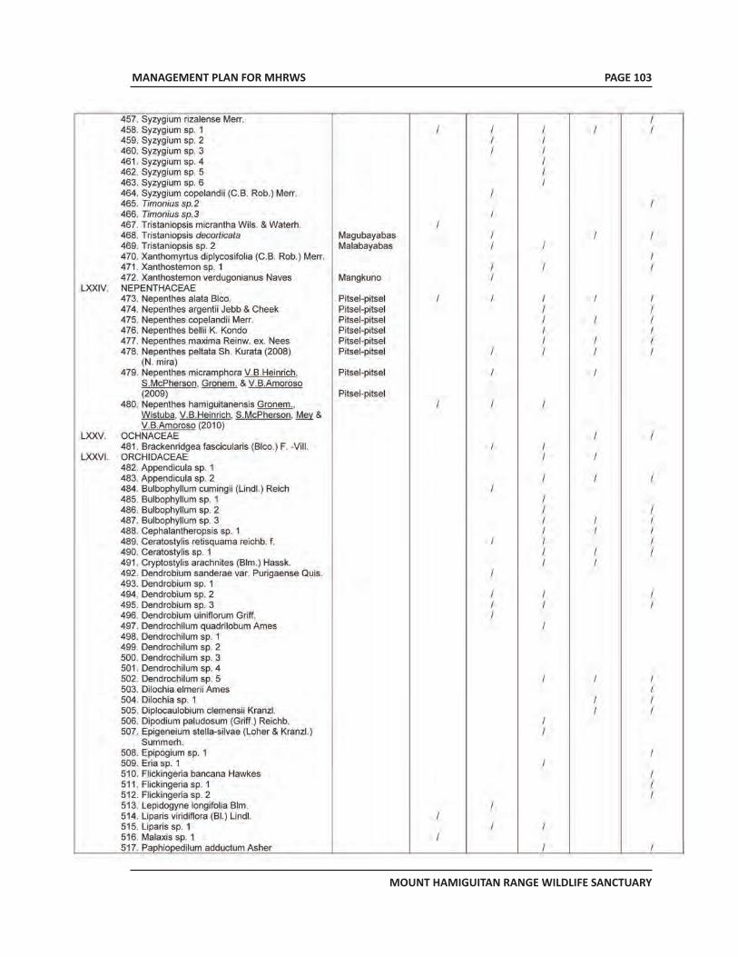
MANAGEMENT PLAN FOR MHRWS
MOUNT HAMIGUITAN RANGE WILDLIFE SANCTUARY
PAGE 103
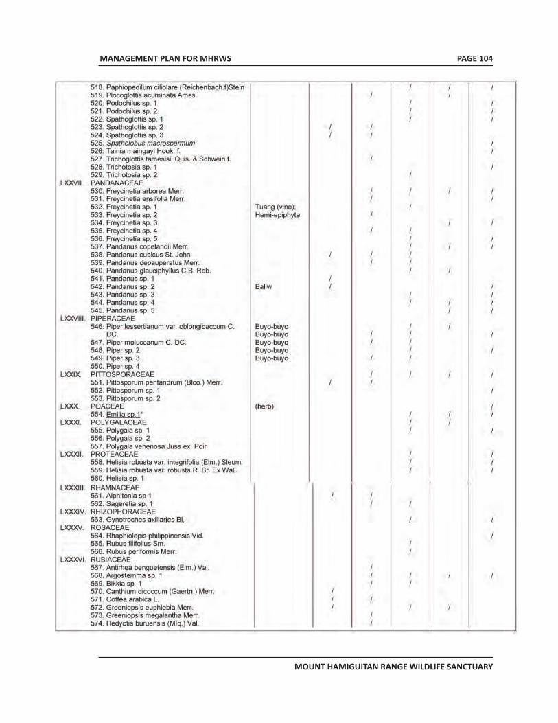
MANAGEMENT PLAN FOR MHRWS
MOUNT HAMIGUITAN RANGE WILDLIFE SANCTUARY
PAGE 104
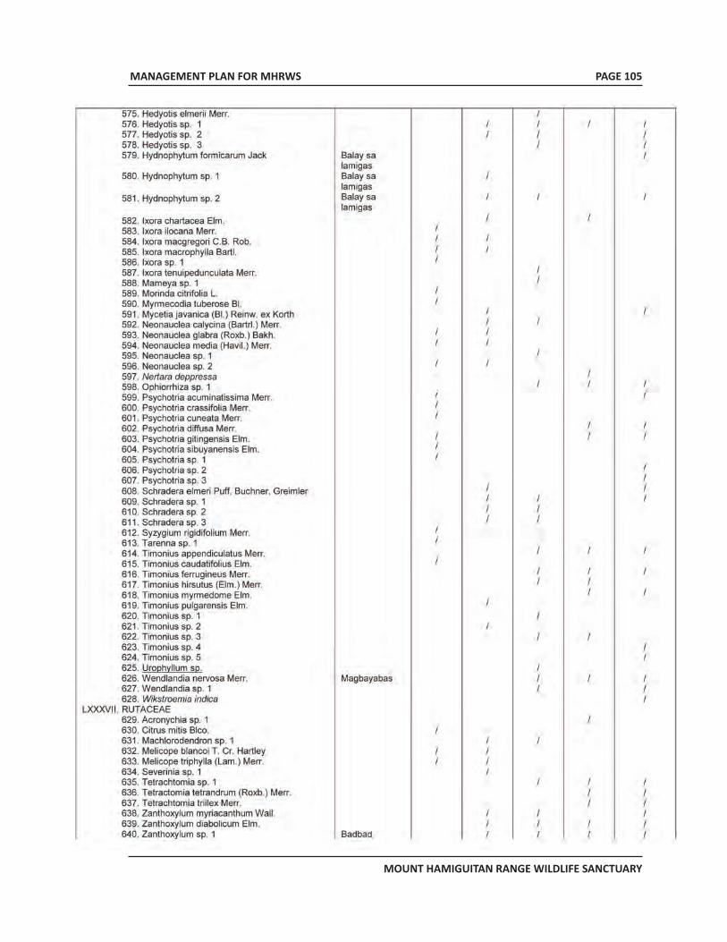
MANAGEMENT PLAN FOR MHRWS
MOUNT HAMIGUITAN RANGE WILDLIFE SANCTUARY
PAGE 105
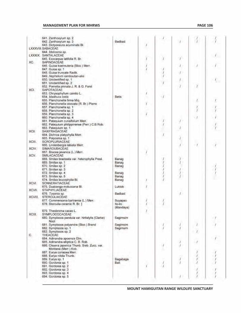
MANAGEMENT PLAN FOR MHRWS
MOUNT HAMIGUITAN RANGE WILDLIFE SANCTUARY
PAGE 106
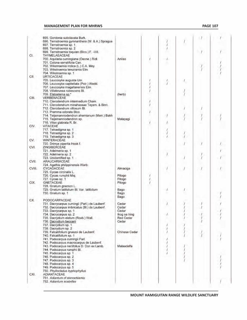
MANAGEMENT PLAN FOR MHRWS
MOUNT HAMIGUITAN RANGE WILDLIFE SANCTUARY
PAGE 107
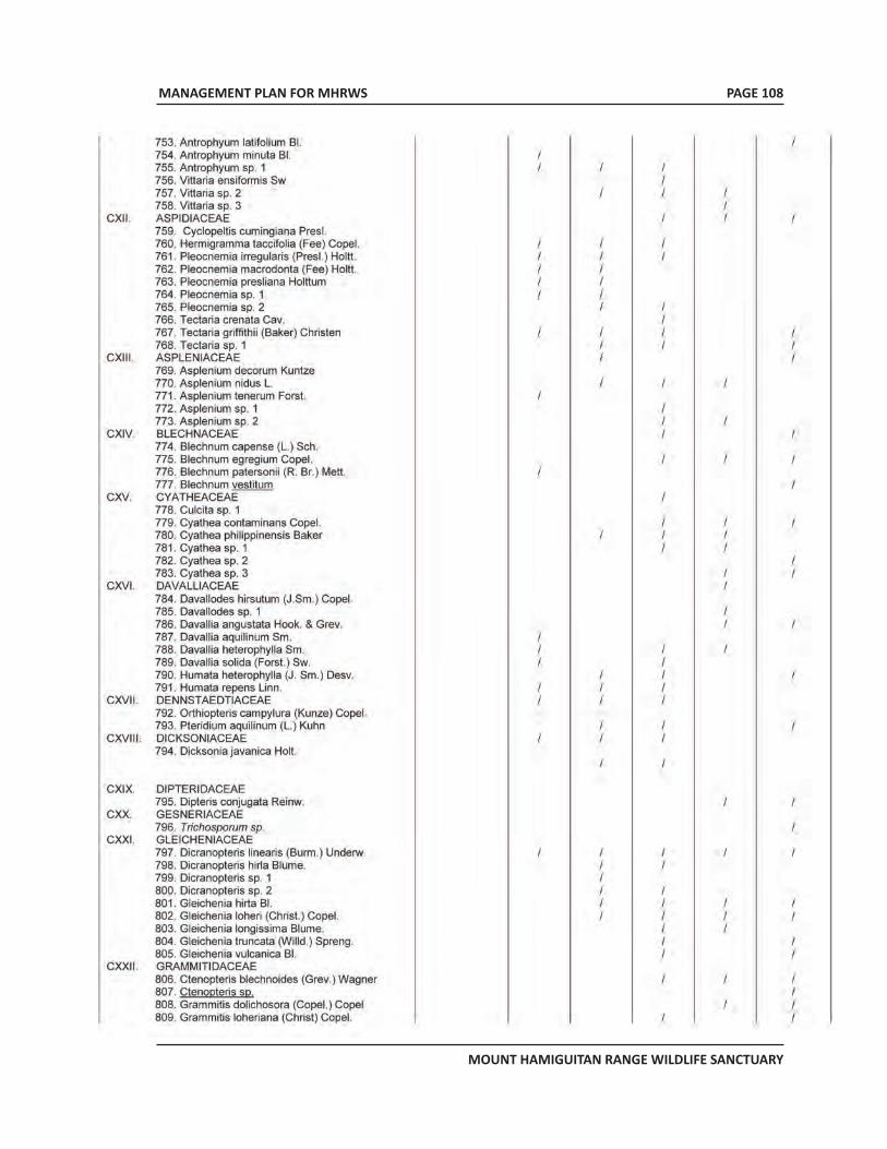
MANAGEMENT PLAN FOR MHRWS
MOUNT HAMIGUITAN RANGE WILDLIFE SANCTUARY
PAGE 108
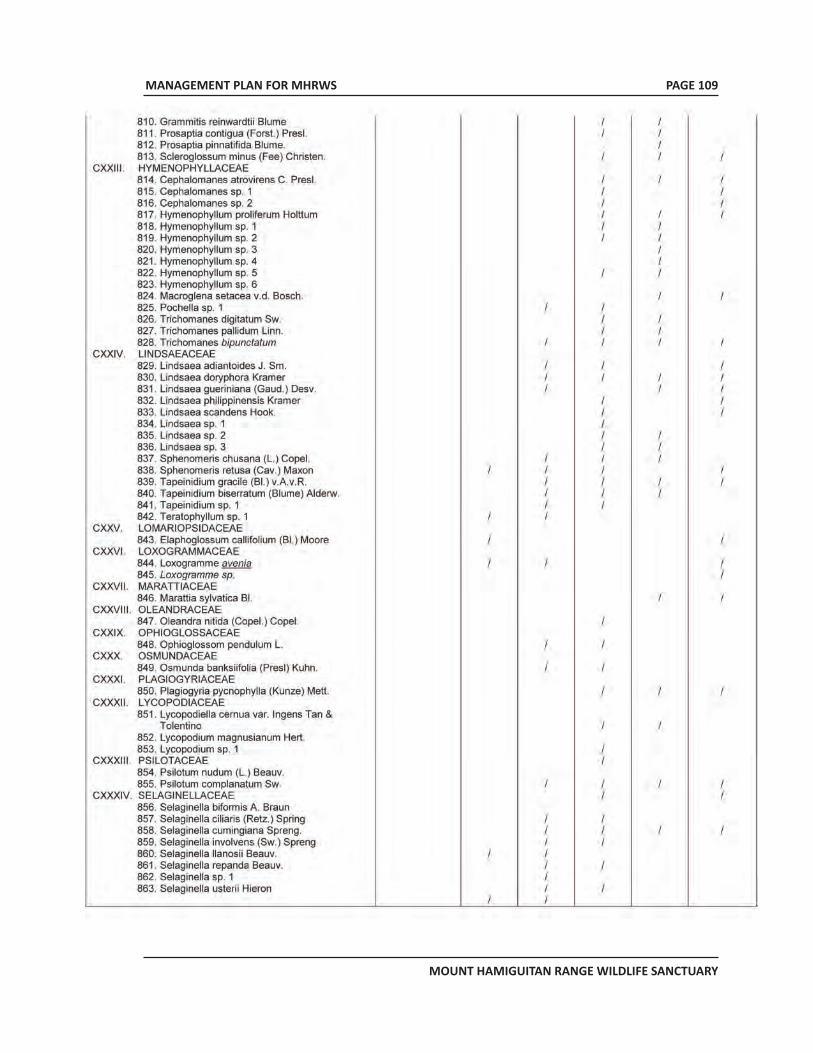
MANAGEMENT PLAN FOR MHRWS
MOUNT HAMIGUITAN RANGE WILDLIFE SANCTUARY
PAGE 109
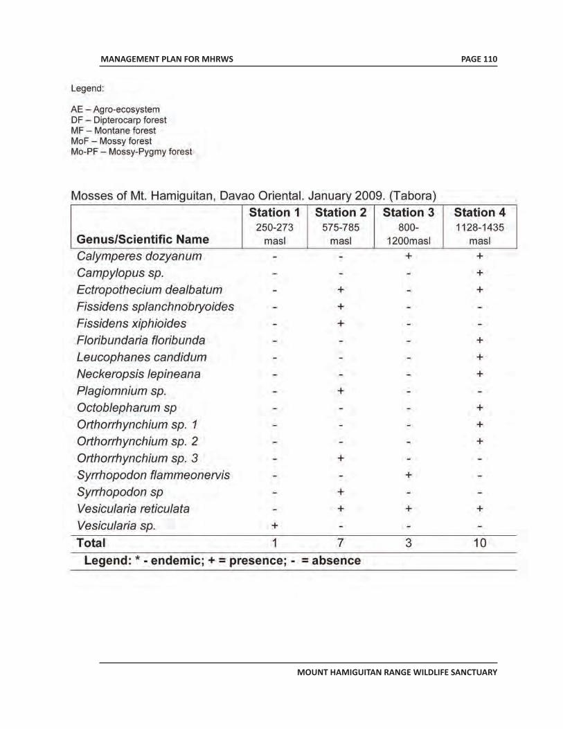
MANAGEMENT PLAN FOR MHRWS
MOUNT HAMIGUITAN RANGE WILDLIFE SANCTUARY
PAGE 110
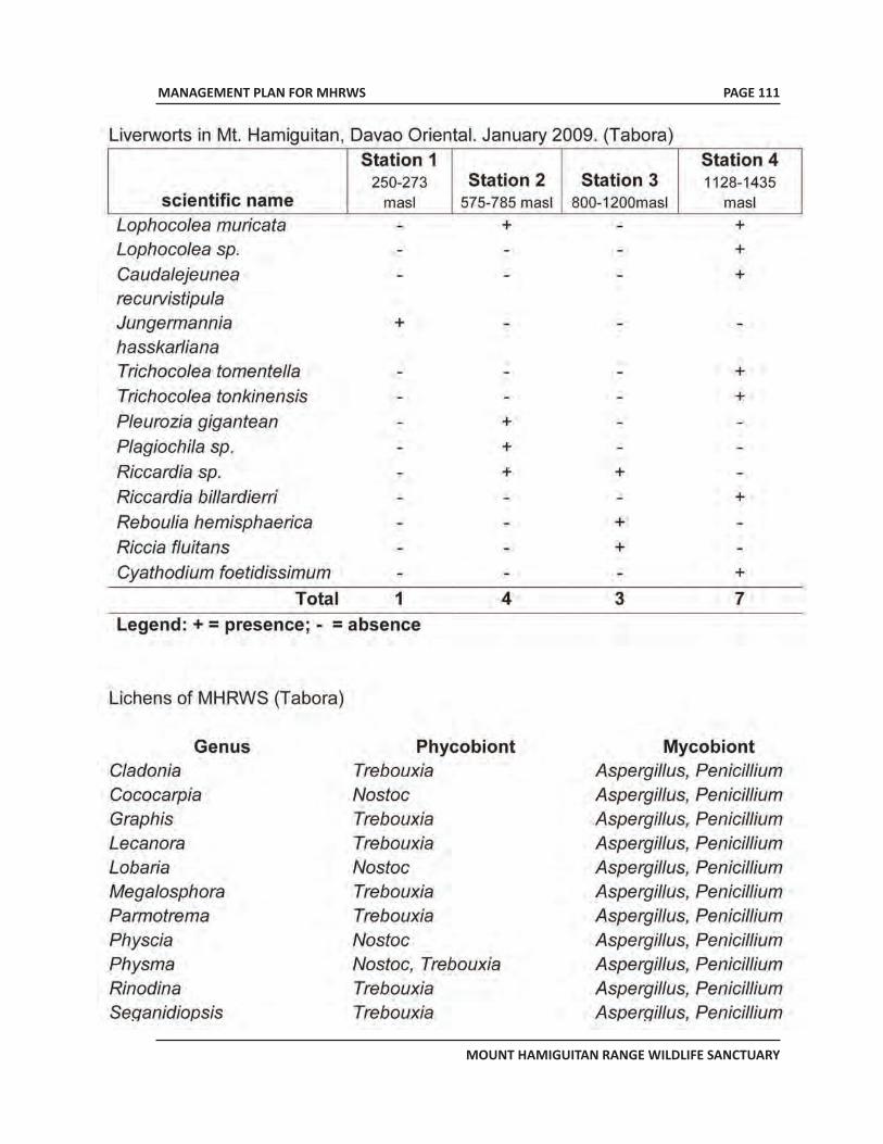
MANAGEMENT PLAN FOR MHRWS
MOUNT HAMIGUITAN RANGE WILDLIFE SANCTUARY
PAGE 111
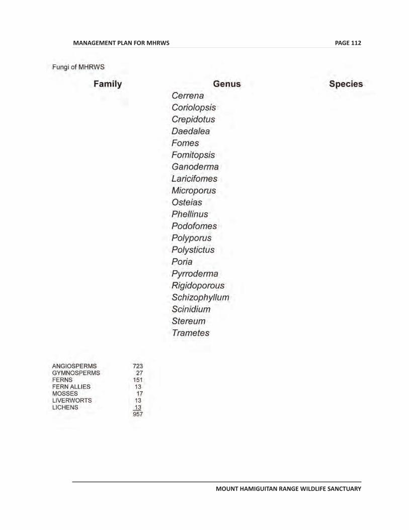
MANAGEMENT PLAN FOR MHRWS
MOUNT HAMIGUITAN RANGE WILDLIFE SANCTUARY
PAGE 112
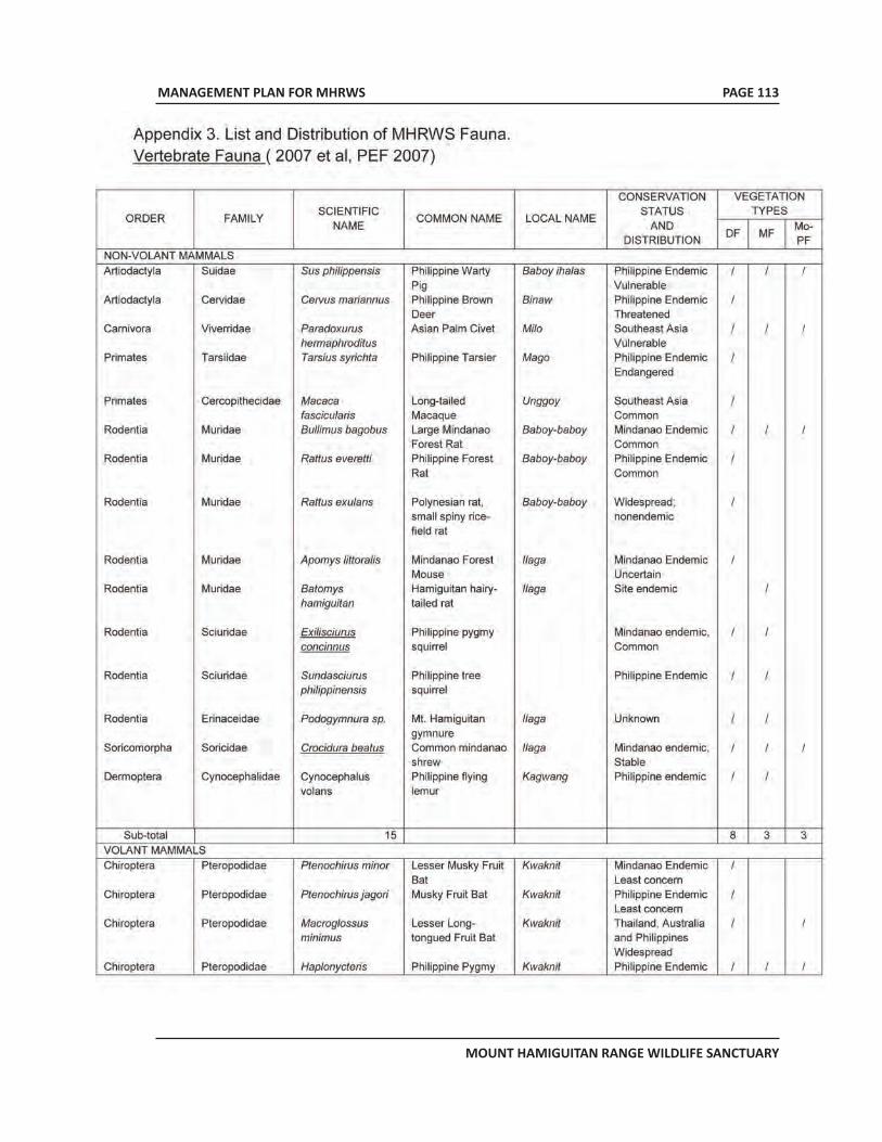
MANAGEMENT PLAN FOR MHRWS
MOUNT HAMIGUITAN RANGE WILDLIFE SANCTUARY
PAGE 113
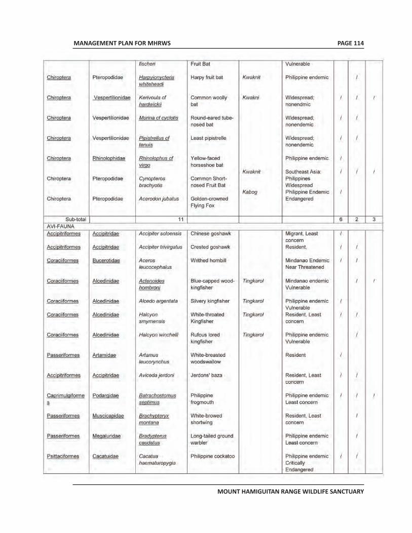
MANAGEMENT PLAN FOR MHRWS
MOUNT HAMIGUITAN RANGE WILDLIFE SANCTUARY
PAGE 114
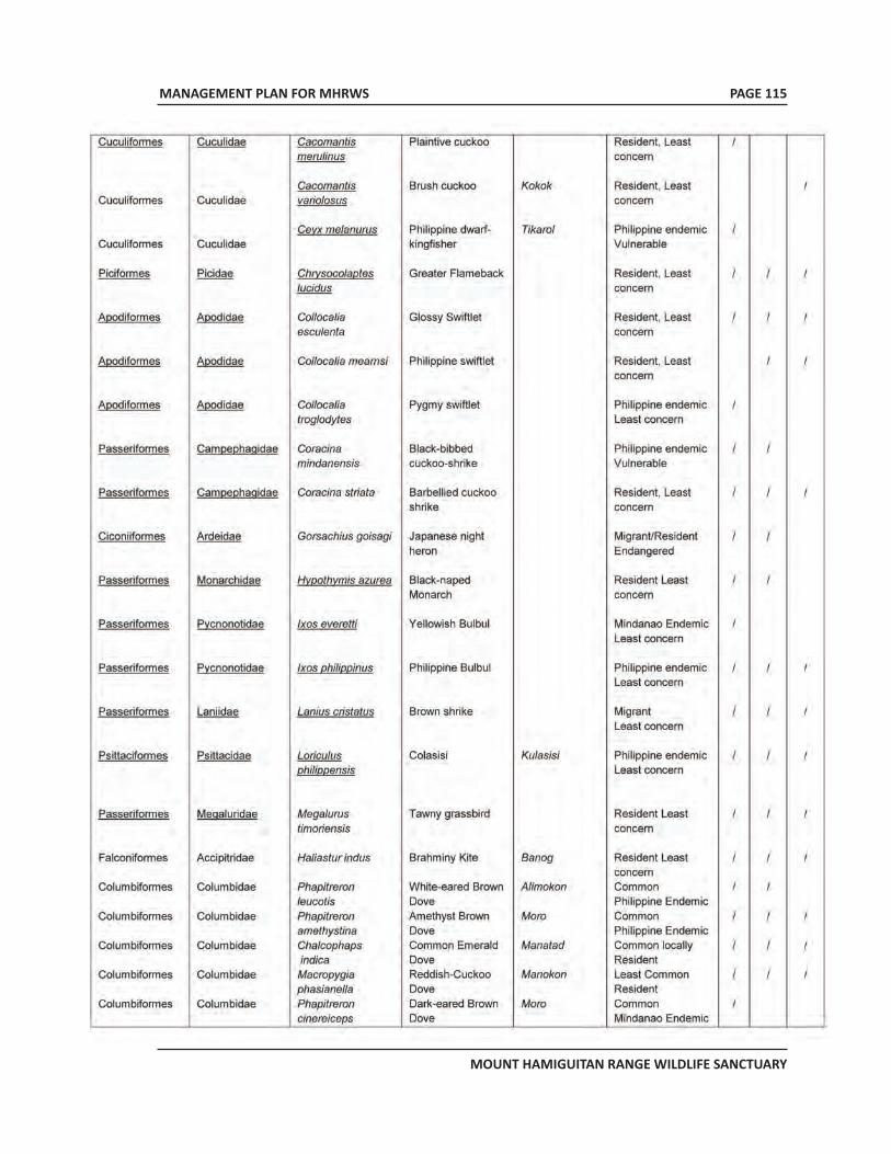
MANAGEMENT PLAN FOR MHRWS
MOUNT HAMIGUITAN RANGE WILDLIFE SANCTUARY
PAGE 115
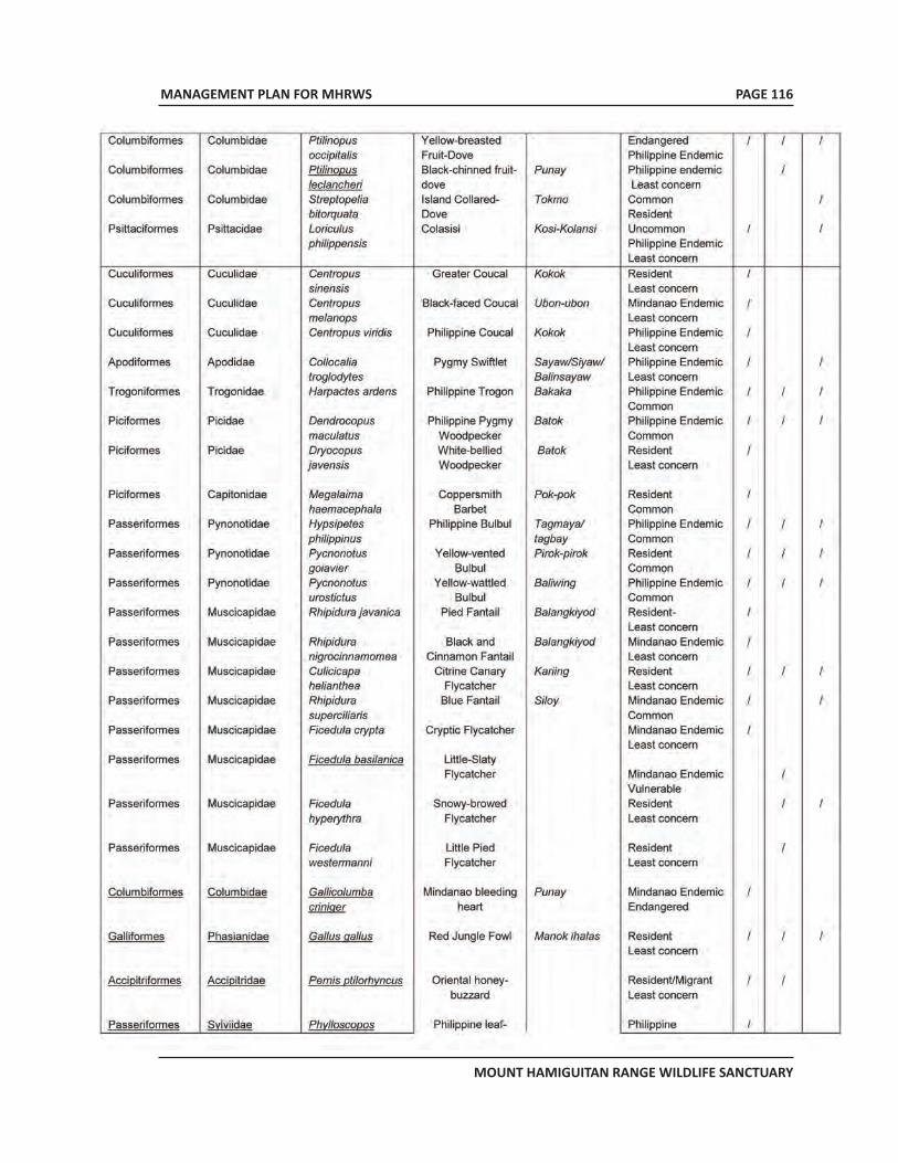
MANAGEMENT PLAN FOR MHRWS
MOUNT HAMIGUITAN RANGE WILDLIFE SANCTUARY
PAGE 116
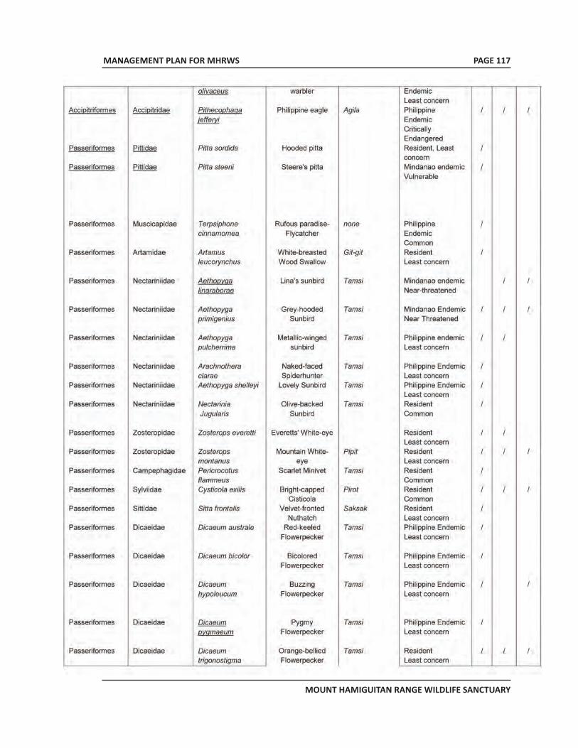
MANAGEMENT PLAN FOR MHRWS
MOUNT HAMIGUITAN RANGE WILDLIFE SANCTUARY
PAGE 117
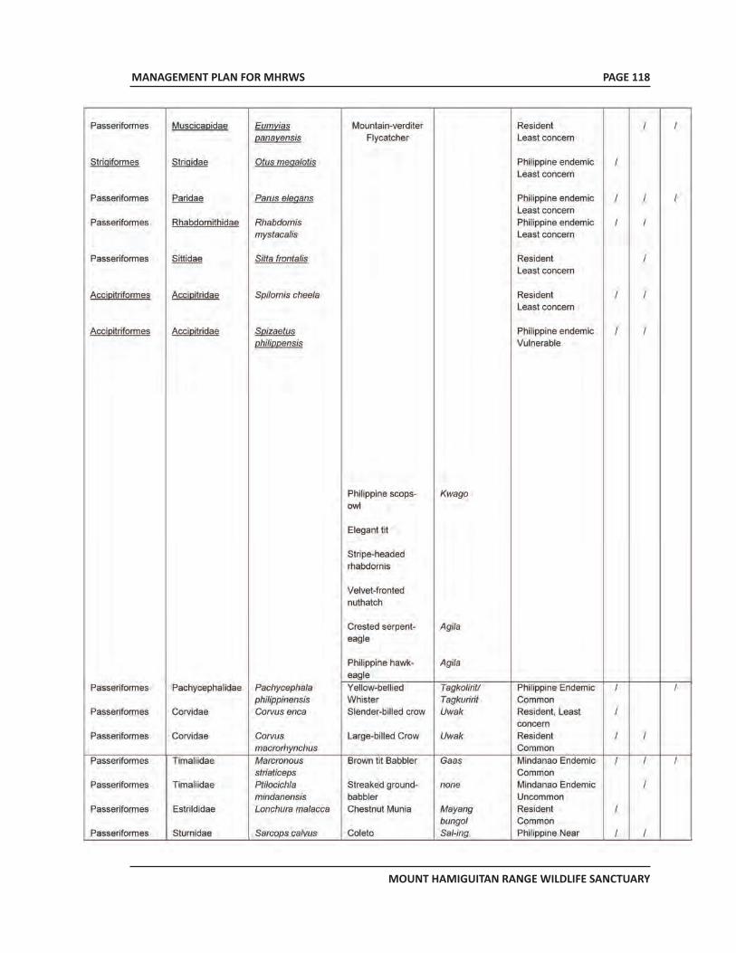
MANAGEMENT PLAN FOR MHRWS
MOUNT HAMIGUITAN RANGE WILDLIFE SANCTUARY
PAGE 118
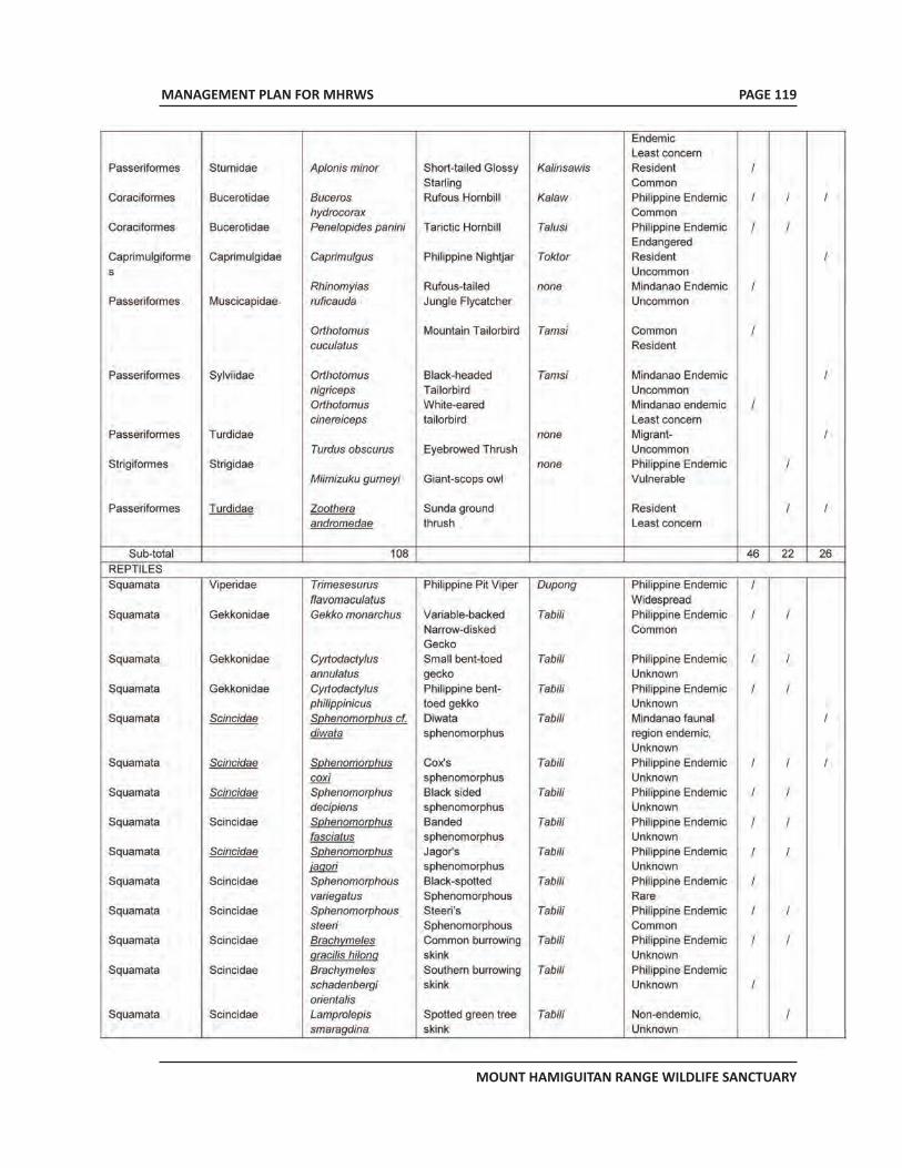
MANAGEMENT PLAN FOR MHRWS
MOUNT HAMIGUITAN RANGE WILDLIFE SANCTUARY
PAGE 119
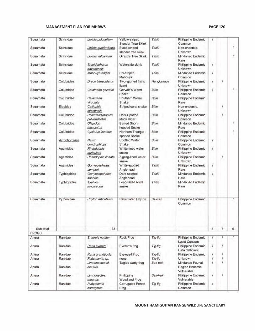
MANAGEMENT PLAN FOR MHRWS
MOUNT HAMIGUITAN RANGE WILDLIFE SANCTUARY
PAGE 120
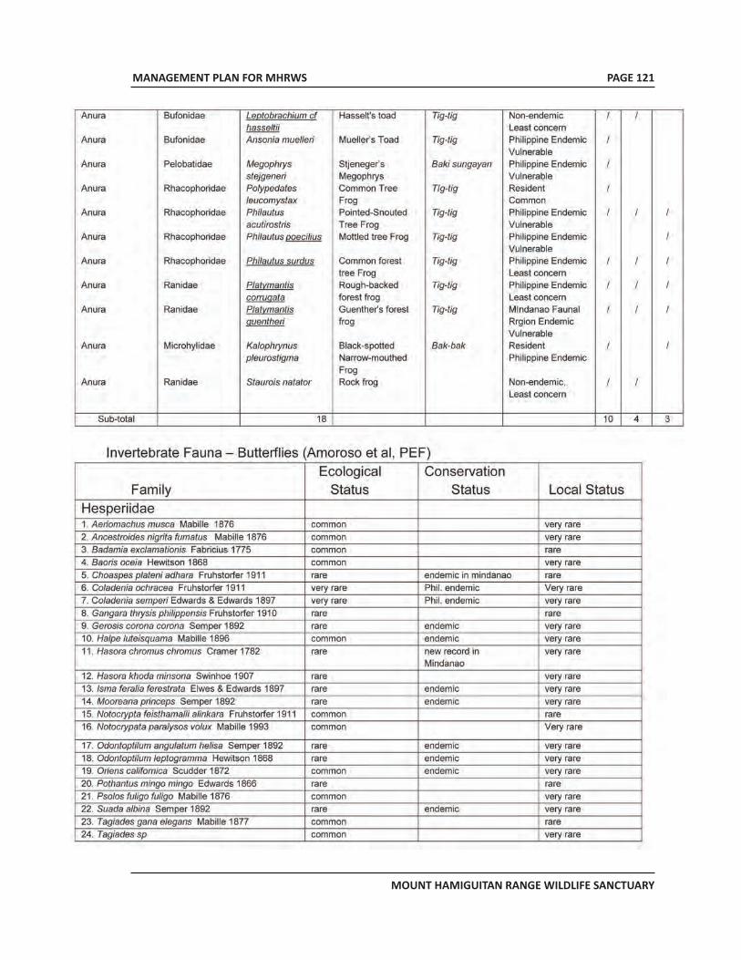
MANAGEMENT PLAN FOR MHRWS
MOUNT HAMIGUITAN RANGE WILDLIFE SANCTUARY
PAGE 121
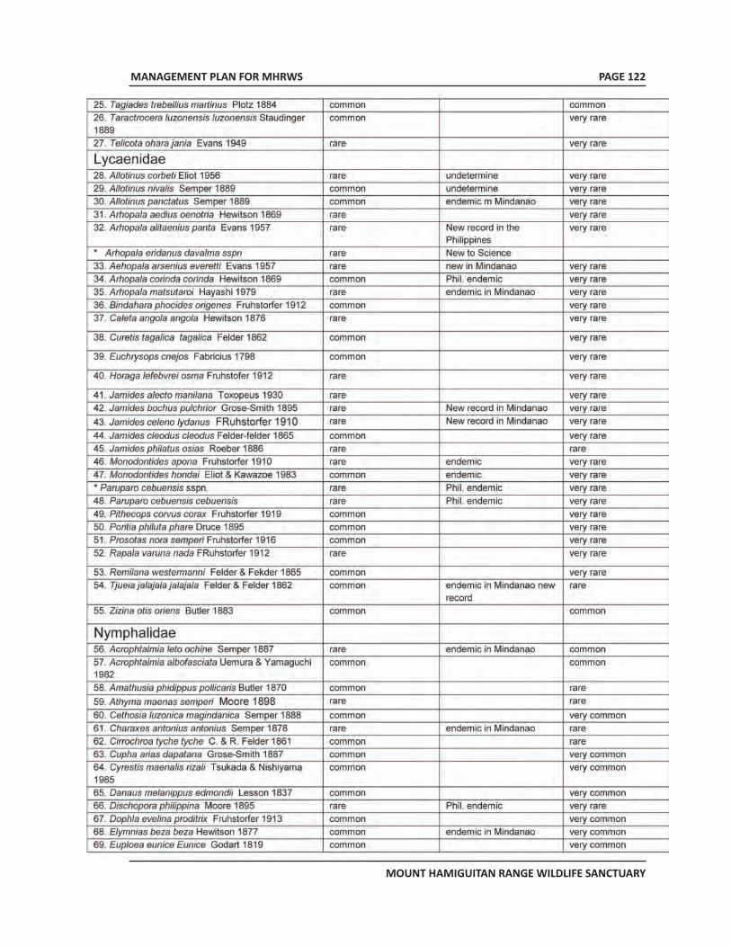
MANAGEMENT PLAN FOR MHRWS
MOUNT HAMIGUITAN RANGE WILDLIFE SANCTUARY
PAGE 122
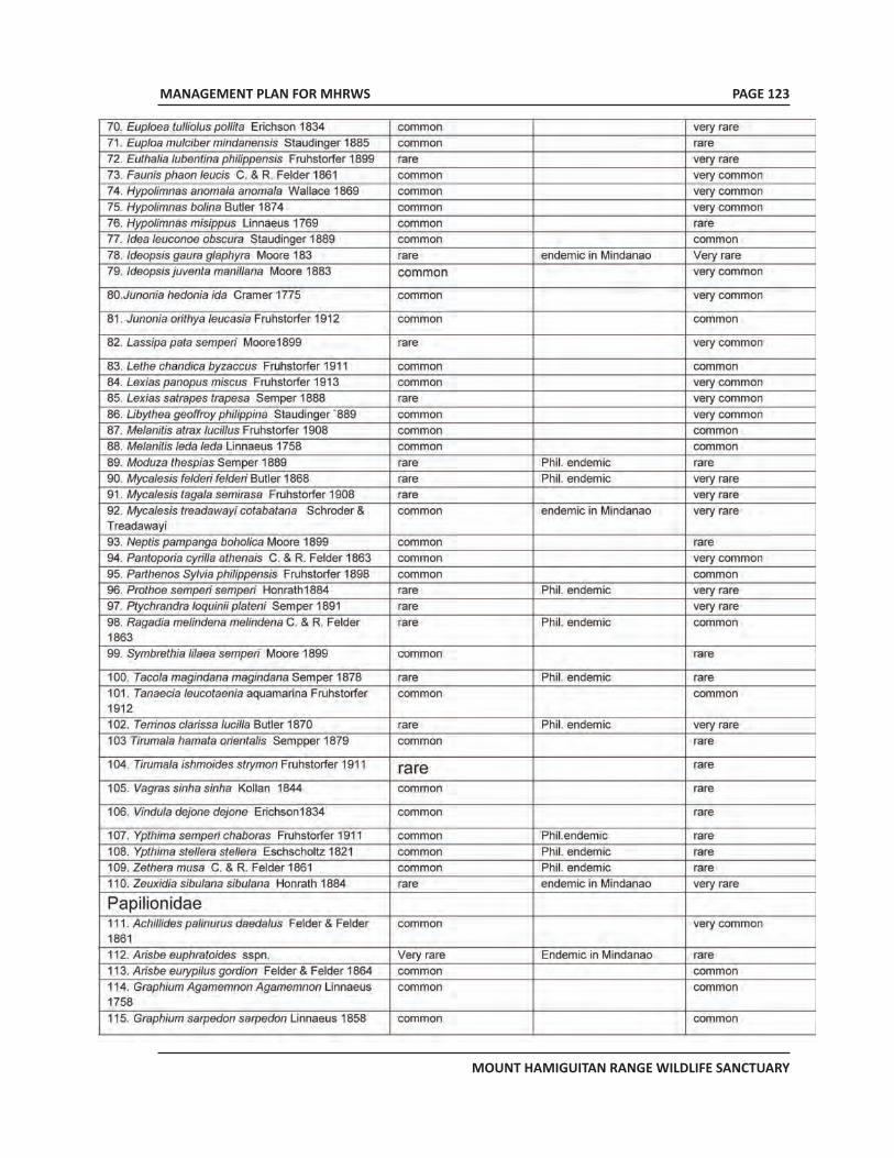
MANAGEMENT PLAN FOR MHRWS
MOUNT HAMIGUITAN RANGE WILDLIFE SANCTUARY
PAGE 123
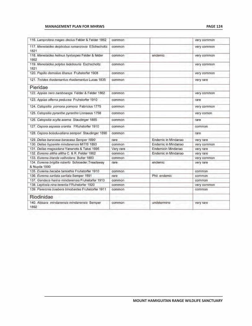
MANAGEMENT PLAN FOR MHRWS
MOUNT HAMIGUITAN RANGE WILDLIFE SANCTUARY
PAGE 124
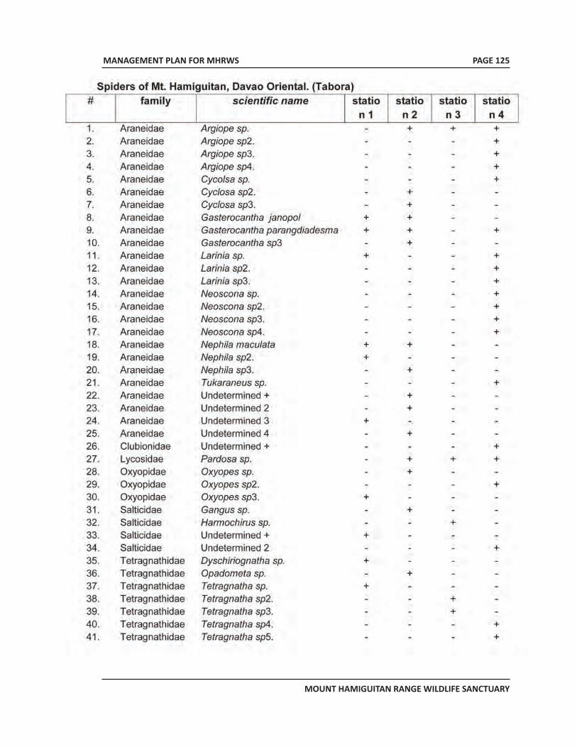
MANAGEMENT PLAN FOR MHRWS
MOUNT HAMIGUITAN RANGE WILDLIFE SANCTUARY
PAGE 125
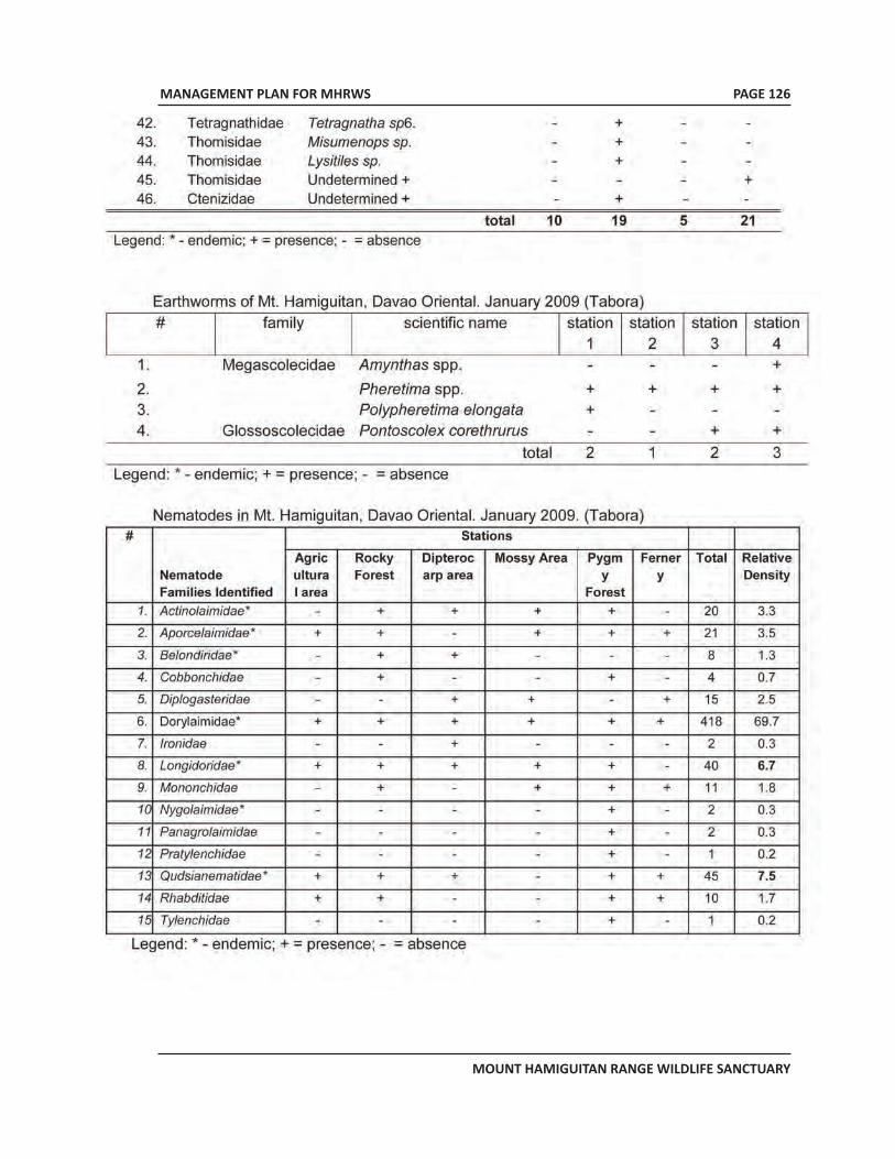
MANAGEMENT PLAN FOR MHRWS
MOUNT HAMIGUITAN RANGE WILDLIFE SANCTUARY
PAGE 126
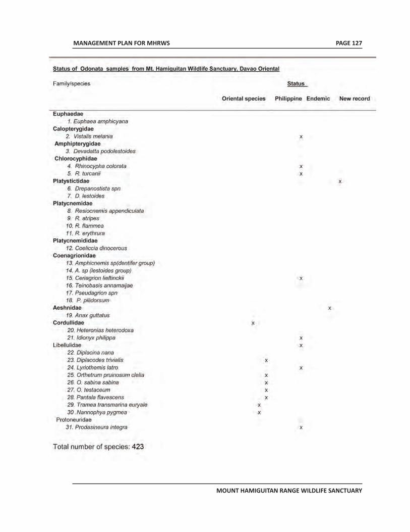
MANAGEMENT PLAN FOR MHRWS
MOUNT HAMIGUITAN RANGE WILDLIFE SANCTUARY
PAGE 127
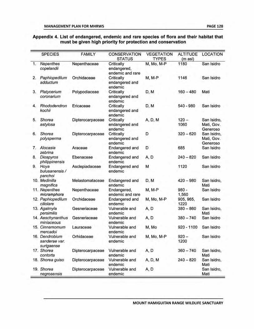
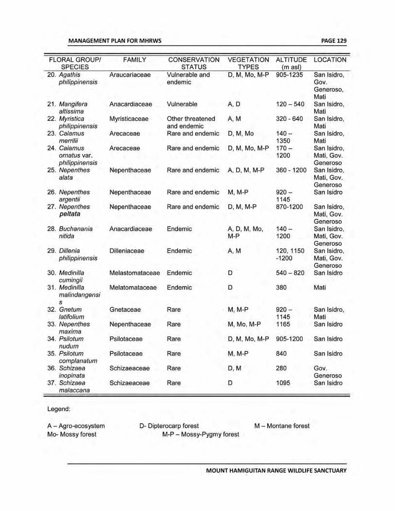
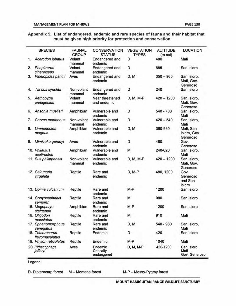
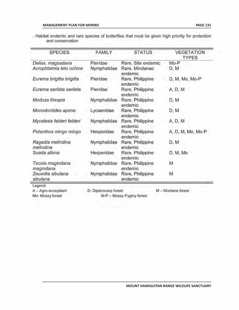
MANAGEMENT PLAN FOR MHRWS
MOUNT HAMIGUITAN RANGE WILDLIFE SANCTUARY
PAGE 131
APPENDICES FOR MHRWS
MT. HAMIGUITAN RANGE WILDLIFE SANCTUARY
MT. HAMIGUITANRANGE WILDLIFE SANCTUARY
Proposed Inscription to the UNESCO World Heritage List
VOLUME 4APPENDICES
APPENDICES FOR MHRWS
MT. HAMIGUITAN RANGE WILDLIFE SANCTUARY
ii
Table of ContentsAPPENDIX TITLE NO. OF PAGES APPENDIX 1 REPUBLIC ACT NO. 9303, AN ACT DECLARING MT. HAMIGUITAN RANGE AND ITS VICINITIES AS PROTECTED AREA UNDER THE CATEGORY OF WILDLIFE SANCTUARY AND ITS PERIPHERAL AREAS AS BUFFER ZONE AND APPROPRIATING FUNDS THEREFORE 1
APPENDIX 2 REPUBLIC ACT 7586, AN ACT PROVIDING FOR THE ESTABLISHMENT AND MANAGEMENT OF NATIONAL INTEGRATED PROTECTED AREAS SYSTEM, DEFINING ITS SCOPE AND COVERAGE AND FOR OTHER PURPOSES 18
APPENDIX 2A DAO 2008-26, REVISED IMPLEMENTING RULES AND REGULATIONS OF REPUBLIC ACT NO. 7586 OR THE NATIONAL INTEGRATED PROTECTED AREAS SYSTEM (NIPAS) ACT OF 1992 29
APPENDIX 3 DETAILED DESCRIPTION OF NEPENTHES PELTATA, A NEW SPECIES ENDEMIC ONLY TO MHRWS 80 APPENDIX 4 DETAILED DESCRIPTION OF NEPENTHES MICRAMPHORA, A NEW SPECIES ENDEMIC ONLY TO MHRWS 83
APPENDIX 5 PHOTO DOCUMENTATION ON SOME ENDEMIC, THREATENED, RARE AND ECONOMICALLY IMPORTANT FLORAL SPECIES IN MHRWS 86
APPENDIX 6 PHOTO DOCUMENTATION ON SOME THREATENED AND ENDEMIC FAUNAL SPECIES IN MHRWS 97
APPENDIX 7 PHOTO DOCUMENTATION ON SOME ENDEMIC, ENDANGERED AND RARE BUTTERFLIES IN IN MHRWS 103
APPENDIX 8 MHRWS PAMB RESOLUTION 2010-02 DATED 25 MARCH 2010: A RESOLUTION APPROVING THE INDEFINITE CLOSURE OF MT. HAMIGUITAN RANGE WILDLIFE SANCTUARY TO VISITORS/MOUNTAINEERS/TREKKERS EFFECTIVE 03 APRIL 2010 EXCEPT FOR DULY APPROVED RESEARCH STUDIES AND ACTIVITIES IN LINE WITH ITS 7-POINT AGENDA 109
APPENDIX 9 MHRWS PAMB RESOLUTION 2010-03 DATED 25 MARCH 2010: A RESOLUTION ADOPTING AND APPROVING THE MHRWS 7-POINT AGENDA AS REQUIREMENT IN RE-OPENING THE MT. HAMIGUITAN RANGE WILDLIFE SANCTUARY FOR NATURE RECREATION PARTICULARLY TO VISITORS /MOUNTAINEERS/TREKKERS TO BE CO-MANAGED BY LGUS CONCERNED 111
APPENDIX 10 REPUBLIC ACT 9147, AN ACT PROVIDING FOR THE CONSERVATION AND PROTECTION OF WILDLIFE RESOURCES AND THEIR HABITATS, APPROPRIATING FUNDS THEREFORE AND FOR OTHER PURPOSES 115
APPENDICES FOR MHRWS
MT. HAMIGUITAN RANGE WILDLIFE SANCTUARY
PAGE 1
APPENDIX 1Republic Act 9303
An Act declaring Mt. Hamiguitan Range and its Vicinitiesas Protected Area under the Category of Wildlife Sanctuaryand Its Peripheral Areas as Buffer Zone and Appropriating
Funds Therefore
APPENDICES FOR MHRWS
MT. HAMIGUITAN RANGE WILDLIFE SANCTUARY
PAGE 2
Republic Act No. 9303 July 30, 2004
AN ACT DECLARING MT. HAMIGUITAN RANGE AND ITS VICINITIES AS PROTECTED AREA UNDER THE CATEGORY OF WILDLIFE SANCTUARY AND ITS PERIPHERAL AREAS AS BUFFER ZONE AND APPROPRIATING FUNDS THEREFOR
Be it enacted by the Senate and House of Representatives of the Philippines in Congress assembled:
SECTION. 1. Short Title. - This Act shall be known as Mt. Hamiguitan Range Wildlife Sanctuary Act of 2004.
SEC. 2. Declaration of Policy. - Cognizant of the profound impact of man’s activities on all components of the natural environment particularly the effect of increasing population, resource exploitation and industrial advancement, and recognizing the critical importance of protecting and maintaining the natural biologically unique features to sustain human life and development, as well as plant and animal life, it is hereby declared the policy of the State to provide that the management, protection, sustainable development, and rehabilitation of protected areas shall be undertaken primarily to ensure the conservation of biological diversity and that the use and enjoyment of protected areas must be consistent with that principle.
SEC. 3. Scope. - Certain parcels of land situated in the municipalities of Mati, San Isidro and Governor Generoso, Province of Davao Oriental, Island of Mindanao are hereby established as a protected area under the category of wildlife sanctuary to be known as the Mt. Hamiguitan Range Wildlife Sanctuary and the areas within its peripheral areas as buffer zone. Such protected area and buffer zone shall become part of the National Integrated Protected Areas System (NIPAS) subject to such rights as are provided for in this Act.
The Department of Environment and Natural Resources (DENR) shall mark on the ground the boundaries set forth in this Act which shall not be modified except by an act of Congress. The parcels of land covered herein are more particularly described by the following technical description:
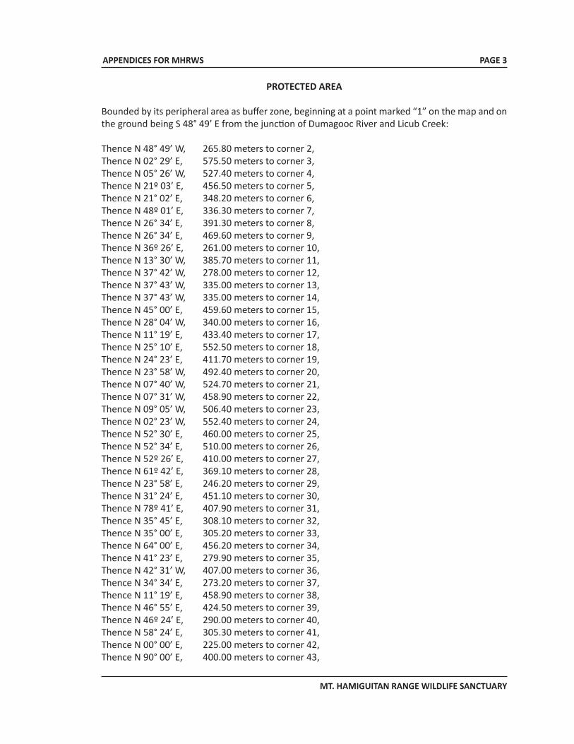
APPENDICES FOR MHRWS
MT. HAMIGUITAN RANGE WILDLIFE SANCTUARY
PROTECTED AREA
Bounded by its peripheral area as buffer zone, beginning at a point marked “1” on the map and on the ground being S 48° 49’ E from the junction of Dumagooc River and Licub Creek:
Thence N 48° 49’ W, 265.80 meters to corner 2, Thence N 02° 29’ E, 575.50 meters to corner 3, Thence N 05° 26’ W, 527.40 meters to corner 4, Thence N 21º 03’ E, 456.50 meters to corner 5, Thence N 21° 02’ E, 348.20 meters to corner 6, Thence N 48º 01’ E, 336.30 meters to corner 7, Thence N 26° 34’ E, 391.30 meters to corner 8, Thence N 26° 34’ E, 469.60 meters to corner 9, Thence N 36º 26’ E, 261.00 meters to corner 10, Thence N 13° 30’ W, 385.70 meters to corner 11, Thence N 37° 42’ W, 278.00 meters to corner 12, Thence N 37° 43’ W, 335.00 meters to corner 13, Thence N 37° 43’ W, 335.00 meters to corner 14, Thence N 45° 00’ E, 459.60 meters to corner 15, Thence N 28° 04’ W, 340.00 meters to corner 16, Thence N 11° 19’ E, 433.40 meters to corner 17, Thence N 25° 10’ E, 552.50 meters to corner 18, Thence N 24° 23’ E, 411.70 meters to corner 19, Thence N 23° 58’ W, 492.40 meters to corner 20, Thence N 07° 40’ W, 524.70 meters to corner 21, Thence N 07° 31’ W, 458.90 meters to corner 22, Thence N 09° 05’ W, 506.40 meters to corner 23, Thence N 02° 23’ W, 552.40 meters to corner 24, Thence N 52° 30’ E, 460.00 meters to corner 25, Thence N 52° 34’ E, 510.00 meters to corner 26, Thence N 52º 26’ E, 410.00 meters to corner 27, Thence N 61º 42’ E, 369.10 meters to corner 28, Thence N 23° 58’ E, 246.20 meters to corner 29, Thence N 31° 24’ E, 451.10 meters to corner 30, Thence N 78º 41’ E, 407.90 meters to corner 31, Thence N 35° 45’ E, 308.10 meters to corner 32, Thence N 35° 00’ E, 305.20 meters to corner 33, Thence N 64° 00’ E, 456.20 meters to corner 34, Thence N 41° 23’ E, 279.90 meters to corner 35, Thence N 42° 31’ W, 407.00 meters to corner 36, Thence N 34° 34’ E, 273.20 meters to corner 37, Thence N 11° 19’ E, 458.90 meters to corner 38, Thence N 46° 55’ E, 424.50 meters to corner 39, Thence N 46º 24’ E, 290.00 meters to corner 40, Thence N 58° 24’ E, 305.30 meters to corner 41, Thence N 00° 00’ E, 225.00 meters to corner 42, Thence N 90° 00’ E, 400.00 meters to corner 43,
PAGE 3
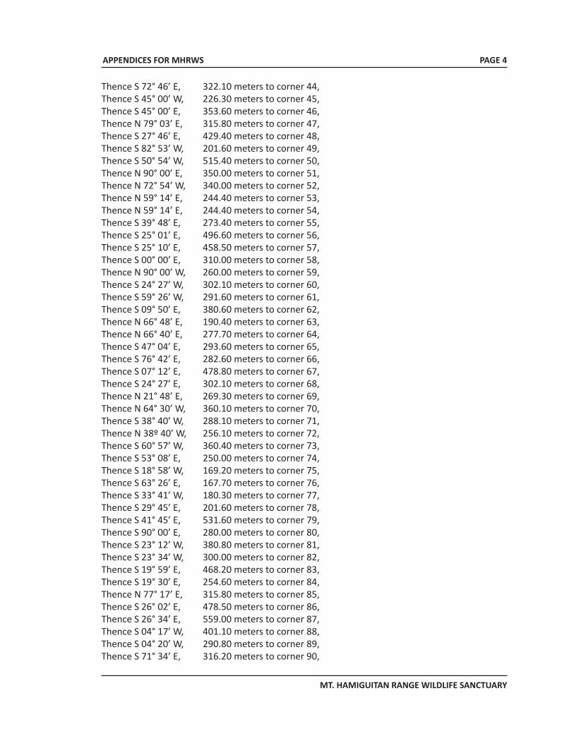
APPENDICES FOR MHRWS
MT. HAMIGUITAN RANGE WILDLIFE SANCTUARY
Thence S 72° 46’ E, 322.10 meters to corner 44, Thence S 45° 00’ W, 226.30 meters to corner 45, Thence S 45° 00’ E, 353.60 meters to corner 46, Thence N 79° 03’ E, 315.80 meters to corner 47, Thence S 27° 46’ E, 429.40 meters to corner 48, Thence S 82° 53’ W, 201.60 meters to corner 49, Thence S 50° 54’ W, 515.40 meters to corner 50, Thence N 90° 00’ E, 350.00 meters to corner 51, Thence N 72° 54’ W, 340.00 meters to corner 52, Thence N 59° 14’ E, 244.40 meters to corner 53, Thence N 59° 14’ E, 244.40 meters to corner 54, Thence S 39° 48’ E, 273.40 meters to corner 55, Thence S 25° 01’ E, 496.60 meters to corner 56, Thence S 25° 10’ E, 458.50 meters to corner 57, Thence S 00° 00’ E, 310.00 meters to corner 58, Thence N 90° 00’ W, 260.00 meters to corner 59, Thence S 24° 27’ W, 302.10 meters to corner 60, Thence S 59° 26’ W, 291.60 meters to corner 61, Thence S 09° 50’ E, 380.60 meters to corner 62, Thence N 66° 48’ E, 190.40 meters to corner 63, Thence N 66° 40’ E, 277.70 meters to corner 64, Thence S 47° 04’ E, 293.60 meters to corner 65, Thence S 76° 42’ E, 282.60 meters to corner 66, Thence S 07° 12’ E, 478.80 meters to corner 67, Thence S 24° 27’ E, 302.10 meters to corner 68, Thence N 21° 48’ E, 269.30 meters to corner 69, Thence N 64° 30’ W, 360.10 meters to corner 70, Thence S 38° 40’ W, 288.10 meters to corner 71, Thence N 38º 40’ W, 256.10 meters to corner 72, Thence S 60° 57’ W, 360.40 meters to corner 73, Thence S 53° 08’ E, 250.00 meters to corner 74, Thence S 18° 58’ W, 169.20 meters to corner 75, Thence S 63° 26’ E, 167.70 meters to corner 76, Thence S 33° 41’ W, 180.30 meters to corner 77, Thence S 29° 45’ E, 201.60 meters to corner 78, Thence S 41° 45’ E, 531.60 meters to corner 79, Thence S 90° 00’ E, 280.00 meters to corner 80, Thence S 23° 12’ W, 380.80 meters to corner 81, Thence S 23° 34’ W, 300.00 meters to corner 82, Thence S 19° 59’ E, 468.20 meters to corner 83, Thence S 19° 30’ E, 254.60 meters to corner 84, Thence N 77° 17’ E, 315.80 meters to corner 85, Thence S 26° 02’ E, 478.50 meters to corner 86, Thence S 26° 34’ E, 559.00 meters to corner 87, Thence S 04° 17’ W, 401.10 meters to corner 88, Thence S 04° 20’ W, 290.80 meters to corner 89, Thence S 71° 34’ E, 316.20 meters to corner 90,
PAGE 4
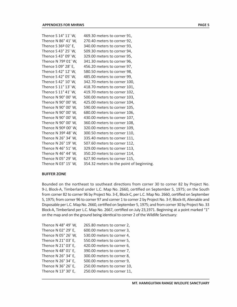
APPENDICES FOR MHRWS
MT. HAMIGUITAN RANGE WILDLIFE SANCTUARY
Thence S 14° 11’ W, 469.30 meters to corner 91, Thence N 86° 41’ W, 270.40 meters to corner 92, Thence S 36º 02’ E, 340.00 meters to corner 93, Thence S 43° 25’ W, 509.30 meters to corner 94, Thence S 43° 09’ W, 329.00 meters to corner 95, Thence N 79º 01’ W, 341.30 meters to corner 96, Thence S 09° 28’ E, 456.20 meters to corner 97, Thence S 42° 12’ W, 580.50 meters to corner 98, Thence S 42° 05’ W, 485.00 meters to corner 99, Thence S 42° 10’ W, 342.70 meters to corner 100, Thence S 11° 13’ W, 418.70 meters to corner 101, Thence S 11° 41’ W, 419.70 meters to corner 102, Thence N 90° 00’ W, 500.00 meters to corner 103, Thence N 90° 00’ W, 425.00 meters to corner 104, Thence N 90° 00’ W, 590.00 meters to corner 105, Thence N 90° 00’ W, 680.00 meters to corner 106, Thence N 90° 00’ W, 430.00 meters to corner 107, Thence N 90° 00’ W, 360.00 meters to corner 108, Thence N 90º 00’ W, 320.00 meters to corner 109, Thence N 39º 48’ W, 300.50 meters to corner 110, Thence N 26° 34’ W, 335.40 meters to corner 111, Thence N 26° 19’ W, 507.60 meters to corner 112, Thence N 46° 51’ W, 329.00 meters to corner 113, Thence N 46° 44’ W, 350.20 meters to corner 114, Thence N 05° 29’ W, 627.90 meters to corner 115, Thence N 03° 15’ W, 354.32 meters to the point of beginning. BUFFER ZONE
Bounded on the northeast to southeast directions from corner 30 to corner 82 by Project No. 9-J, Block-A, Timberland under L.C. Map No. 2660, certified on September 5, 1975; on the South from corner 82 to corner 96 by Project No. 3-E, Block-C, per L.C. Map No. 2660, certified on September 5, 1975; from corner 96 to corner 97 and corner 1 to corner 2 by Project No. 3-F, Block-III, Alienable and Disposable per L.C. Map No. 2660, certified on September 5, 1975; and from corner 30 by Project No. 33 Block-A, Timberland per L.C. Map No. 2667, certified on July 23,1971. Beginning at a point marked “1” on the map and on the ground being identical to corner 2 of the Wildlife Sanctuary:
Thence N 48° 49’ W, 265.80 meters to corner 2, Thence N 02° 29’ E, 600.00 meters to corner 3, Thence N 05° 26’ W, 530.00 meters to corner 4, Thence N 21° 03’ E, 550.00 meters to corner 5, Thence N 21° 03’ E, 420.00 meters to corner 6, Thence N 48° 01’ E, 390.00 meters to corner 7, Thence N 26° 34’ E, 300.00 meters to corner 8, Thence N 26° 34’ E, 500.00 meters to corner 9, Thence N 36° 26’ E, 250.00 meters to corner 10, Thence N 13° 30’ E, 250.00 meters to corner 11,
PAGE 5
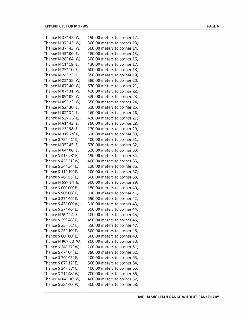
APPENDICES FOR MHRWS
MT. HAMIGUITAN RANGE WILDLIFE SANCTUARY
Thence N 37° 42’ W, 190.00 meters to corner 12, Thence N 37° 43’ W, 300.00 meters to corner 13, Thence N 37° 43’ W, 500.00 meters to corner 14, Thence N 45° 00’ E, 480.00 meters to corner 15, Thence N 28° 04’ W, 300.00 meters to corner 16, Thence N 11° 19’ E, 420.00 meters to corner 17, Thence N 25° 10’ E, 600.00 meters to corner 18, Thence N 24° 23’ E, 350.00 meters to corner 19, Thence N 23° 58’ W, 380.00 meters to corner 20, Thence N 07° 40’ W, 630.00 meters to corner 21, Thence N 07° 31’ W, 420.00 meters to corner 22, Thence N 09° 05’ W, 520.00 meters to corner 23, Thence N 09° 23’ W, 650.00 meters to corner 24, Thence N 52° 30’ E, 610.00 meters to corner 25, Thence N 02° 34’ E, 460.00 meters to corner 26, Thence N 52º 26’ E, 420.00 meters to corner 27, Thence N 61° 42’ E, 350.00 meters to corner 28, Thence N 23° 58’ E, 170.00 meters to corner 29, Thence N 31º 24’ E, 610.00 meters to corner 30, Thence S 78º 41’ E, 400.00 meters to corner 31, Thence N 35° 45’ E, 620.00 meters to corner 32, Thence N 64° 00’ E, 620.00 meters to corner 33, Thence S 41º 23’ E, 490.00 meters to corner 34, Thence S 42° 31’ W, 400.00 meters to corner 35, Thence S 34° 34’ E, 120.00 meters to corner 36, Thence S 11° 19’ E, 200.00 meters to corner 37, Thence S 46° 55’ E, 500.00 meters to corner 38, Thence N 58º 24’ E, 600.00 meters to corner 39, Thence S 00° 00’ E, 150.00 meters to corner 40, Thence S 90° 00’ E, 330.00 meters to corner 41, Thence S 27° 46’ E, 590.00 meters to corner 42, Thence S 45° 00’ W, 310.00 meters to corner 43, Thence S 27° 46’ E, 550.00 meters to corner 44, Thence N 59° 14’ E, 400.00 meters to corner 45, Thence S 39° 48’ E, 450.00 meters to corner 46, Thence S 25º 01’ E, 550.00 meters to corner 47, Thence S 25° 10’ E, 500.00 meters to corner 48, Thence S 00° 00’ E, 560.00 meters to corner 49, Thence N 90º 00’ W, 300.00 meters to corner 50, Thence S 24° 27’ W, 200.00 meters to corner 51, Thence S 47° 04’ E, 380.00 meters to corner 52, Thence S 76° 42’ E, 400.00 meters to corner 53, Thence S 07° 12’ E, 560.00 meters to corner 54, Thence S 24º 27’ E, 400.00 meters to corner 55, Thence S 21° 48’ W, 700.00 meters to corner 56, Thence N 64° 30’ W, 400.00 meters to corner 57, Thence S 38° 40’ W, 300.00 meters to corner 58,
PAGE 6
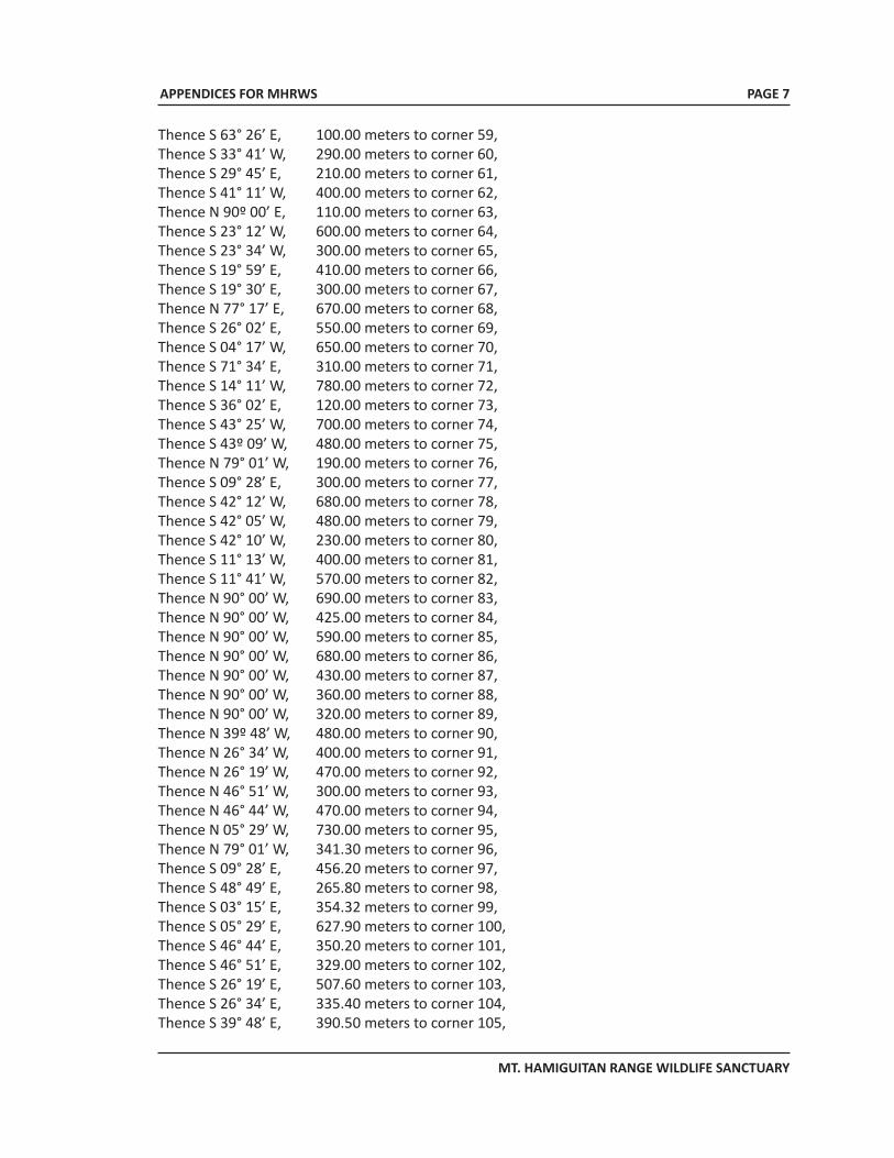
APPENDICES FOR MHRWS
MT. HAMIGUITAN RANGE WILDLIFE SANCTUARY
Thence S 63° 26’ E, 100.00 meters to corner 59, Thence S 33° 41’ W, 290.00 meters to corner 60, Thence S 29° 45’ E, 210.00 meters to corner 61, Thence S 41° 11’ W, 400.00 meters to corner 62, Thence N 90º 00’ E, 110.00 meters to corner 63, Thence S 23° 12’ W, 600.00 meters to corner 64, Thence S 23° 34’ W, 300.00 meters to corner 65, Thence S 19° 59’ E, 410.00 meters to corner 66, Thence S 19° 30’ E, 300.00 meters to corner 67, Thence N 77° 17’ E, 670.00 meters to corner 68, Thence S 26° 02’ E, 550.00 meters to corner 69, Thence S 04° 17’ W, 650.00 meters to corner 70, Thence S 71° 34’ E, 310.00 meters to corner 71, Thence S 14° 11’ W, 780.00 meters to corner 72, Thence S 36° 02’ E, 120.00 meters to corner 73, Thence S 43° 25’ W, 700.00 meters to corner 74, Thence S 43º 09’ W, 480.00 meters to corner 75, Thence N 79° 01’ W, 190.00 meters to corner 76, Thence S 09° 28’ E, 300.00 meters to corner 77, Thence S 42° 12’ W, 680.00 meters to corner 78, Thence S 42° 05’ W, 480.00 meters to corner 79, Thence S 42° 10’ W, 230.00 meters to corner 80, Thence S 11° 13’ W, 400.00 meters to corner 81, Thence S 11° 41’ W, 570.00 meters to corner 82, Thence N 90° 00’ W, 690.00 meters to corner 83, Thence N 90° 00’ W, 425.00 meters to corner 84, Thence N 90° 00’ W, 590.00 meters to corner 85, Thence N 90° 00’ W, 680.00 meters to corner 86, Thence N 90° 00’ W, 430.00 meters to corner 87, Thence N 90° 00’ W, 360.00 meters to corner 88, Thence N 90° 00’ W, 320.00 meters to corner 89, Thence N 39º 48’ W, 480.00 meters to corner 90, Thence N 26° 34’ W, 400.00 meters to corner 91, Thence N 26° 19’ W, 470.00 meters to corner 92, Thence N 46° 51’ W, 300.00 meters to corner 93, Thence N 46° 44’ W, 470.00 meters to corner 94, Thence N 05° 29’ W, 730.00 meters to corner 95, Thence N 79° 01’ W, 341.30 meters to corner 96, Thence S 09° 28’ E, 456.20 meters to corner 97, Thence S 48° 49’ E, 265.80 meters to corner 98, Thence S 03° 15’ E, 354.32 meters to corner 99, Thence S 05° 29’ E, 627.90 meters to corner 100, Thence S 46° 44’ E, 350.20 meters to corner 101, Thence S 46° 51’ E, 329.00 meters to corner 102, Thence S 26° 19’ E, 507.60 meters to corner 103, Thence S 26° 34’ E, 335.40 meters to corner 104, Thence S 39° 48’ E, 390.50 meters to corner 105,
PAGE 7
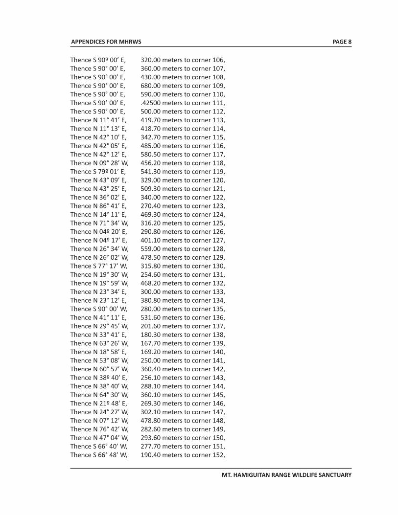
APPENDICES FOR MHRWS
MT. HAMIGUITAN RANGE WILDLIFE SANCTUARY
Thence S 90º 00’ E, 320.00 meters to corner 106, Thence S 90° 00’ E, 360.00 meters to corner 107, Thence S 90° 00’ E, 430.00 meters to corner 108, Thence S 90° 00’ E, 680.00 meters to corner 109, Thence S 90° 00’ E, 590.00 meters to corner 110, Thence S 90° 00’ E, .42500 meters to corner 111, Thence S 90° 00’ E, 500.00 meters to corner 112, Thence N 11° 41’ E, 419.70 meters to corner 113, Thence N 11° 13’ E, 418.70 meters to corner 114, Thence N 42° 10’ E, 342.70 meters to corner 115, Thence N 42° 05’ E, 485.00 meters to corner 116, Thence N 42° 12’ E, 580.50 meters to corner 117, Thence N 09° 28’ W, 456.20 meters to corner 118, Thence S 79º 01’ E, 541.30 meters to corner 119, Thence N 43° 09’ E, 329.00 meters to corner 120, Thence N 43° 25’ E, 509.30 meters to corner 121, Thence N 36° 02’ E, 340.00 meters to corner 122, Thence N 86° 41’ E, 270.40 meters to corner 123, Thence N 14° 11’ E, 469.30 meters to corner 124, Thence N 71° 34’ W, 316.20 meters to corner 125, Thence N 04º 20’ E, 290.80 meters to corner 126, Thence N 04º 17’ E, 401.10 meters to corner 127, Thence N 26° 34’ W, 559.00 meters to corner 128, Thence N 26° 02’ W, 478.50 meters to corner 129, Thence S 77° 17’ W, 315.80 meters to corner 130, Thence N 19° 30’ W, 254.60 meters to corner 131, Thence N 19° 59’ W, 468.20 meters to corner 132, Thence N 23° 34’ E, 300.00 meters to corner 133, Thence N 23° 12’ E, 380.80 meters to corner 134, Thence S 90° 00’ W, 280.00 meters to corner 135, Thence N 41° 11’ E, 531.60 meters to corner 136, Thence N 29° 45’ W, 201.60 meters to corner 137, Thence N 33° 41’ E, 180.30 meters to corner 138, Thence N 63° 26’ W, 167.70 meters to corner 139, Thence N 18° 58’ E, 169.20 meters to corner 140, Thence N 53° 08’ W, 250.00 meters to corner 141, Thence N 60° 57’ W, 360.40 meters to corner 142, Thence N 38º 40’ E, 256.10 meters to corner 143, Thence N 38° 40’ W, 288.10 meters to corner 144, Thence N 64° 30’ W, 360.10 meters to corner 145, Thence N 21º 48’ E, 269.30 meters to corner 146, Thence N 24° 27’ W, 302.10 meters to corner 147, Thence N 07° 12’ W, 478.80 meters to corner 148, Thence N 76° 42’ W, 282.60 meters to corner 149, Thence N 47° 04’ W, 293.60 meters to corner 150, Thence S 66° 40’ W, 277.70 meters to corner 151, Thence S 66° 48’ W, 190.40 meters to corner 152,
PAGE 8
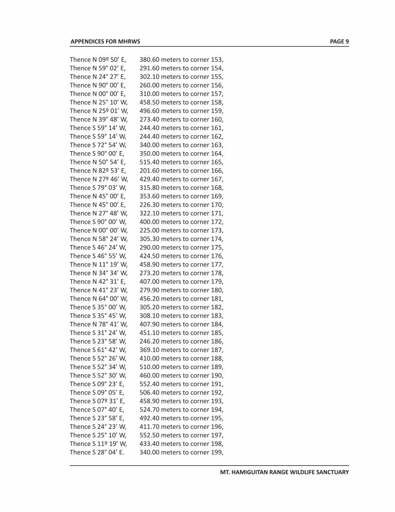
APPENDICES FOR MHRWS
MT. HAMIGUITAN RANGE WILDLIFE SANCTUARY
Thence N 09º 50’ E, 380.60 meters to corner 153, Thence N 59° 02’ E, 291.60 meters to corner 154, Thence N 24° 27’ E, 302.10 meters to corner 155, Thence N 90° 00’ E, 260.00 meters to corner 156, Thence N 00° 00’ E, 310.00 meters to corner 157, Thence N 25° 10’ W, 458.50 meters to corner 158, Thence N 25º 01’ W, 496.60 meters to corner 159, Thence N 39° 48’ W, 273.40 meters to corner 160, Thence S 59° 14’ W, 244.40 meters to corner 161, Thence S 59° 14’ W, 244.40 meters to corner 162, Thence S 72° 54’ W, 340.00 meters to corner 163, Thence S 90° 00’ E, 350.00 meters to corner 164, Thence N 50° 54’ E, 515.40 meters to corner 165, Thence N 82º 53’ E, 201.60 meters to corner 166, Thence N 27º 46’ W, 429.40 meters to corner 167, Thence S 79° 03’ W, 315.80 meters to corner 168, Thence N 45° 00’ E, 353.60 meters to corner 169, Thence N 45° 00’ E, 226.30 meters to corner 170, Thence N 27° 48’ W, 322.10 meters to corner 171, Thence S 90° 00’ W, 400.00 meters to corner 172, Thence N 00° 00’ W, 225.00 meters to corner 173, Thence N 58° 24’ W, 305.30 meters to corner 174, Thence S 46° 24’ W, 290.00 meters to corner 175, Thence S 46° 55’ W, 424.50 meters to corner 176, Thence N 11° 19’ W, 458.90 meters to corner 177, Thence N 34° 34’ W, 273.20 meters to corner 178, Thence N 42° 31’ E, 407.00 meters to corner 179, Thence N 41° 23’ W, 279.90 meters to corner 180, Thence N 64° 00’ W, 456.20 meters to corner 181, Thence S 35° 00’ W, 305.20 meters to corner 182, Thence S 35° 45’ W, 308.10 meters to corner 183, Thence N 78° 41’ W, 407.90 meters to corner 184, Thence S 31° 24’ W, 451.10 meters to corner 185, Thence S 23° 58’ W, 246.20 meters to corner 186, Thence S 61° 42’ W, 369.10 meters to corner 187, Thence S 52° 26’ W, 410.00 meters to corner 188, Thence S 52° 34’ W, 510.00 meters to corner 189, Thence S 52° 30’ W, 460.00 meters to corner 190, Thence S 09° 23’ E, 552.40 meters to corner 191, Thence S 09° 05’ E, 506.40 meters to corner 192, Thence S 07º 31’ E, 458.90 meters to corner 193, Thence S 07° 40’ E, 524.70 meters to corner 194, Thence S 23° 58’ E, 492.40 meters to corner 195, Thence S 24° 23’ W, 411.70 meters to corner 196, Thence S 25° 10’ W, 552.50 meters to corner 197,Thence S 11º 19’ W, 433.40 meters to corner 198, Thence S 28° 04’ E. 340.00 meters to corner 199,
PAGE 9
APPENDICES FOR MHRWS
MT. HAMIGUITAN RANGE WILDLIFE SANCTUARY
Thence S 45º 00’ W, 459.60 meters to corner 200, Thence S 37° 43’ E, 335.00 meters to corner 201, Thence S 37° 43’ E, 335.00 meters to corner 202, Thence S 37° 42’ E, 278.00 meters to corner 203, Thence S 13° 30’ W, 385.70 meters to corner 204, Thence S 36° 26’ W, 261.00 meters to corner 205, Thence S 26° 34’ W, 469.60 meters to corner 206,Thence S 26° 34’ W, 391.30 meters to corner 207, Thence S 48° 01’ W, 336.30 meters to corner 208, Thence S 21° 02’ W, 348.20 meters to corner 209Thence S 03° 00’ W, 456.50 meters to corner 210 Thence S 05° 26’ E, 527.40 meters to corner 211 Thence S 02° 29’ W, 572 meters to the point of beginning containing an area of approximately six thousand eight hundred thirty-four hectares (6,834 has.) more or less.
SEC. 4. Definition of Terms. - (a) “National Integrated Protected Area System (NIPAS)” refers to the classification and inclusion
of all designated protected areas into one system pursuant to Republic Act No. 7586 or the National Integrated Protected Areas System (NIPAS) Act of 1992 to maintain essential ecological processes and life-support systems, to preserve genetic diversity, to ensure sustainable use of resources found therein, and to maintain their natural conditions to the greatest extent possible.
(b) “Protected area” refers to identified portions of land and water set aside by reason of their unique physical and biological significance, managed to enhance biological diversity and protected against destructive human exploitation.
(c) “Buffer zone” refers to identified areas outside the boundaries of and immediately adjacent to designated areas that need special development control in order to avoid or minimize harm to the protected area.
(d) “Wildlife sanctuary” refers to an area which assures the natural conditions necessary to protect nationally significant species, groups of species, biotic communities or physical features of the environment where these may require specific human manipulation for their perpetuation.
(e) “Indigenous Cultural Community (ICC)” refers to a group of people sharing common bonds of language, customs and tradition and other distinct cultural traits, as further defined under Republic Act No. 8371 or the Indigenous Peoples Rights Act (IPRA) of 1997.
(f) “Natural park” refers to a relatively large area not materially altered by human activity where extractive resource uses are not allowed and maintained to protect outstanding natural and scenic uses of national or international significance for scientific, educational and recreational use.
(g) “Tenured migrants” refer to occupants within the protected area who have actually and continuously occupied such area for five (5) years before the designation of the same as protected area and are solely dependent therein for subsistence.
PAGE 10
APPENDICES FOR MHRWS
MT. HAMIGUITAN RANGE WILDLIFE SANCTUARY
(h) “Biodiversity” refers to the variety of life in all its forms found on earth.
(i) “Protected Area Management Board (PAMB)” refers to a multi-sectoral body tasked in planning for the appropriate management strategy to ensure resource protection and the general administration of the protected area.
(j) “Private rights” refers to the right of individual persons to own, under existing laws, and in the case of indigenous cultural communities, rights of possession since time immemorial, which possession may include places of abode and worship, burial grounds and well-defined territories.
SEC. 5. Management Plan. - A management plan and a management manual consistent with the General Management Planning Strategy (GMPS) pursuant to Republic Act No. 7586 shall be prepared by the DENR in coordination with the PAMB of the Mt. Hamiguitan Range Wildlife Sanctuary, concerned LGUs, and other sectors affected which shall serve as bases for the protection and conservation of the biodiversity of the protected area.
The management plan shall be approved by the PAMB and certified to by the DENR Secretary that it conforms to national laws, this Act, and pertinent DENR rules and regulations on protected areas.
SEC. 6. Administration and Management. - The Mt. Hamiguitan Range Wildlife Sanctuary shall be under the administrative jurisdiction of the DENR through the PAMB. Pursuant hereto, the following institutional arrangement is hereby adopted:
(A) The Department of Environment and Natural Resources (DENR). - The Secretary of the DENR shall have supervision over the management of Mt. Hamiguitan Range Wildlife Sanctuary, hereinafter referred to as the Protected Area (PA), and is empowered to perform any and all of the following acts:
(a) Cause the boundary demarcation of the PA;
(b) Conduct of studies on various characteristics, features and condition of the PA;
(c) Adopt and enforce land-use scheme and zoning plan in adjoining areas that may threaten the ecological balance in the PA;
(d) Certify that the PA Management Plan conforms to all national rules and regulations on protected area management, and to communicate objections, if any, to the PAMB within sixty (60) days upon receipt thereof, otherwise the PA Management Plan is considered approved;
(e) Coordinate with other government agencies, academic institutions, etc., for collaborative programs, projects and activities affecting the PA;
(f) Submit to the Office of the President and to Congress the annual report of the PA; and
(g) Formulate the implementing rules and regulations necessary to carry out the provisions of this Act.
PAGE 11
APPENDICES FOR MHRWS
MT. HAMIGUITAN RANGE WILDLIFE SANCTUARY
(B) The Protected Area Management Board (PAMB). - There shall be a Protected Area Management Board which shall serve as the highest policy-making body of the Mt. Hamiguitan Range Wildlife Sanctuary. It shall be composed of the following: the Regional Executive Director (RED) of DENR Region XI who shall act as PAMB Chairman; the Provincial Governor of Davao Oriental or his authorized representative; the Provincial Planning and Development Officer or his authorized representative; the municipality/city mayors of Mati, San Isidro and Governor Generoso or their respective authorized representatives; all barangay captains within the Mt. Hamiguitan Range Wildlife Sanctuary; three (3) representatives from people’s organizations and non-government organizations from the municipalities of Mati, San Isidro and Governor Generoso; representatives from other departments or national government agencies operating within the protected area which can potentially contribute to protected area management; and other stakeholders who can potentially contribute in the protection, preservation and conservation of the Mt. Hamiguitan Range Wildlife Sanctuary.
Specifically, the PAMB shall exercise the following powers and functions:
1. Review, approve and adopt a management plan for the PA;
2. Review the deputation of individuals/groups to augment the PA’s protection personnel and thereafter indorse the list to the regional executive director for approval;
3. Fix and impose administrative fees for the use of the PA and fines for violations of prohibited acts in the PA;
4. Approve contracts and agreements consistent with the purpose of this Act except international contracts and agreements;
5. Accept donations and grants in the form of contributions and endowments;
6. Review and approve a work and financial plan for the PA;
7. Coordinate with other government agencies, academic institutions, etc., involved in the management, development and conservation of the PA;
8. Submit an annual report to the DENR Secretary;
9. Delegate authority to the PAMB Executive Committee;
10. Prepare or cause the inventory of protected flora and fauna;
11. Permit, control or regulate the following within the PA:
a. Infrastructures;
b. Public utilities;
c. Occupancy of appropriate management zones;
PAGE 12
APPENDICES FOR MHRWS
MT. HAMIGUITAN RANGE WILDLIFE SANCTUARY
d. Dumping of waste;
e. Use of motorized equipment;
f. Business enterprise;
g. Other use of the PA such as mountain climbing, research/study; and
h. Recreational activities.
12. Promulgate rules and policies for the conduct of its business; and
13. Initiate and file suits against entities whose existence and/or operations have detrimental effect on the PA.
(C) The DENR Regional Executive Director (RED) for Region XI. -
a. As chairman of the PAMB, sign/approve contracts and agreements consistent with this Act except international contracts and agreements; and
b. Approve the deputation of field officers.
(D) The Protected Area Superintendent’s Office (PASO). - There is hereby created a Protected Area Superintendent’s Office which shall be supported by a sufficient number of personnel who shall perform day-to-day management, protection and administration of the PA. The head of the office shall be the chief operation officer of the Mt. Hamiguitan Range Wildlife Sanctuary and shall be accountable to the RED of the DENR-Region XI and the PAMB.
SEC. 7. Existing Facilities Within the PA. - Existing facilities within the PA prior to the enactment of this Act shall be subjected to inventory and assessment by the PAMB using its own criteria which shall consider the impact of said facilities on the PA, on biodiversity conservation, resolution of possible conflict between public interest against local interest and national significance of said facilities.
The PAMB, through the PASO, shall monitor the operations of said facilities and shall recommend appropriate actions/measures if said facilities are found not consistent with the purpose of this Act. The PAMB shall also impose royalties or administrative fees or adopt a profit sharing scheme on said facilities subject to negotiations with concerned proponent/s.
SEC. 8. Ancestral Lands and Rights Over Them. - Ancestral lands and domain within the PA shall be recognized and managed pursuant to Republic Act No. 8371.
SEC. 9. Tenured Migrants. - Tenured migrants shall be eligible to become stewards of portions of land within production zones as may be designated by the DENR and from which they may derive subsistence. The DENR shall develop an appropriate tenurial instrument for these inhabitants within the PA.
PAGE 13
APPENDICES FOR MHRWS
MT. HAMIGUITAN RANGE WILDLIFE SANCTUARY
Tenured migrants shall be considered and treated individually or per household on the basis of head of families with legitimate dependents.
Tenured migrants occupying portions of ancestral domain shall be treated separately. The PAMB shall develop appropriate mechanisms to resolve any dispute arising therein. Absentee/transient migrants in the PA who do not qualify as tenured migrants shall not be eligible to become stewards of portions of land within multiple-use and sustainable zones.
SEC. 10. Other Activities Within the PA. - Proposals for activities like construction of dams, irrigation, canals, transmission lines, access roads/trails and buildings which are outside the scope of the management plan for the PA shall, upon permission of the PAMB, be subject to an environmental impact assessment as required by law before they are adopted, and the results thereof shall be taken into consideration in the decision-making process. No actual implementation of such activities shall be allowed without the required Environmental Compliance Certificate (ECC) under the Philippine Environment Impact Assessment (EIA) System. In instances where such activities are to be undertaken, the proponent shall plan and carry them out in such manner as will minimize any adverse effects and take preventive and remedial action when appropriate. The proponent shall be liable for damage due to lack of caution or indiscretion.
The PAMB shall determine what activities for the essential use of the communities shall be allowed consistent with the management plan and based on biodiversity criteria and management zoning plan.
Areas under the management of other agencies of the government shall be integrated in the overall management plan of the PA.
SEC. 11. Local Government Units (LGUs). - The local government units (LGUs) within the PA shall be bound to follow the management plan and adopt it once approved. The LGUs shall not pass ordinances to amend the management plan nor shall the management plan be overturned by an ordinance.
Segregation of portions of the PA for LGU use, such as tourism and industrial estate, shall be assessed based on biodiversity criteria and consistent with the management plan of the PA.
Any development/project proposals of the LGU within the PA shall, prior to its implementation, be reviewed, evaluated and approved by the PAMB.
SEC. 12. Integrated Protected Areas Fund (IPAF). - There is hereby established a trust fund to be known as the Integrated Protected Areas Fund (IPAF) for purposes of financing projects of the system. All incomes generated from the operation of the system or management of wild flora and fauna in the PA shall accrue to the fund. These income shall be derived from fees from permitted sale and export of flora and fauna and other resources from the PA, proceeds from lease of multiple-use areas, contributions from industries and facilities directly benefiting from the PA; and such other fees and incomes derived from the operation of the PA.
The fund may be augmented by grants, donations, endowment from various sources, domestic or foreign, for purposes related to their functions: Provided, That the fund shall be deposited as
PAGE 14
APPENDICES FOR MHRWS
MT. HAMIGUITAN RANGE WILDLIFE SANCTUARY
a special account in the National Treasury and disbursements therefrom shall be made solely for the protection, maintenance, administration and management of the system, and duly approved projects endorsed by the PAMB in accordance with existing accounting and budgeting rules and regulations: Provided, further, That no amount shall be disbursed for the operating expenses of the Department and other concerned agencies.
All donations, grants, endowments shall be exempted from the donor’s tax and all other taxes, charges and fees imposed by the government.
SEC. 13. Special Prosecutors. - The Department of Justice (DOJ) shall designate special prosecutors to prosecute violations of laws, rules and regulations in the PA.
SEC. 14. Prohibited Acts. - The following acts are prohibited within the PA:
1. Cutting, gathering or collecting timber or other forest products without license. Any person who shall cut, gather, collect, remove timber or other forest products from any forest land within the PA without any authority under a license or permit, or possess timber or other forest products without the legal documents as required under existing forestry laws and regulations, shall be guilty of qualified theft as defined and punishable under Articles 309 and 310 of the Revised Penal Code.
2. Squatting. - Any person who with the use of force, intimidation or threat, or taking advantage of the absence or tolerance of the landowner/claimant, succeeds in occupying or possessing the property/claim of the latter, against his will for residential, commercial or any other purposes, shall be punished by imprisonment ranging from six (6) months to one (1) year or a fine of not less than One thousand pesos (P1,000.00) nor more than Five thousand pesos (P5,000.00) at the discretion of the court, with subsidiary imprisonment in case of insolvency.
If the offender is a corporation or association, the maximum penalty of five (5) years imprisonment and a fine of Five thousand pesos (P5, 000.00) shall be imposed upon the president, director, manager or managing partners thereof.
3. Unlawful occupation or destruction of forest lands within the PA. - Any person who enters and occupies or possesses or makes kaingin for his own private use or for others any land within the PA without any authority or permit from the PAMB or in any manner destroys such land or part thereof or causes any damage to the timber stand and other forest products and forest growths found therein shall be punishable by the penalties provided for in Section 15 hereof.
4. Except as may be allowed by the nature of their categories and pursuant to the rules and regulations governing the same, the following additional acts are prohibited within the PA and shall subject those found guilty by the penalties provided for in Section 15 hereof.
a. Hunting, destroying, disturbing, or more possession of any plant or animal or products derived therefrom without a permit from concerned authorities;
PAGE 15
APPENDICES FOR MHRWS
MT. HAMIGUITAN RANGE WILDLIFE SANCTUARY
b. Dumping of any waste products detrimental to the PA, or to the plants and animals or inhabitants therein;
c. Using any motorized equipment without a permit from the PAMB;
d. Mutilating, defacing or destroying objects of natural beauty, or objects of interest to cultural communities;
e. Damaging and leaving roads and trails in a damaged condition;
f. Mineral exploration and survey of energy resources;
g. Constructing or maintaining any kind of structure, fence or enclosures, and conducting any business enterprise without a permit;
h. Leaving in exposed or unsanitary conditions refuse or debris, or depositing such in the grounds or in bodies of water;
i. Altering, removing, destroying or defacing boundary markers, monuments or interpretative signs; and
j. Entry without a permit of the following:
1. Mountain climbers;
2. Campers;
3. Spelunkers;
4. Study/research groups/individuals; and
5. Visitors.
k. Mining, sand and gravel quarrying/extraction; and
l. Buying, selling or transferring of rights over any land within the PA.
SEC. 15. Penalties. - Whoever is found guilty of the acts prohibited under this Act or any rules and regulations issued by the Department pursuant to this Act or whoever is found guilty by competent court of justice of any of the offenses in the preceding section shall be penalized with a fine of not less than Five thousand pesos (P5,000.00) nor more than Five hundred thousand pesos (P500,000.00), exclusive of the value of the thing damaged, or imprisonment for not less than one (1) year but not more than six (6) years, or both, as determined by the court: Provided, That the offender shall also be required to restore or compensate for the restoration to the damage: Provided, further, That the court shall order the eviction of the offender from the land and the forfeiture in favor of the government of all minerals, timber, or any species collected or removed including all equipment, devices and firearms used in connection therewith, or any construction
PAGE 16
APPENDICES FOR MHRWS
MT. HAMIGUITAN RANGE WILDLIFE SANCTUARY
or improvements made thereon by the offender. If the offender is an association or corporation, the president or manager shall be directly responsible for the act of his employees and laborers: Provided, finally, That the DENR shall impose administrative fines and penalties it may deem fit and consistent with this Act.
SEC. 16. Appropriations. - The Secretary of the DENR shall include in its program the implementation of this Act, the funding of which shall be charged against the IPAF constituted under this Act.
SEC. 17. Transitory Provisions. - All regular DENR and other personnel assigned/detailed with the Office of the Mt. Hamiguitan Range Wildlife Sanctuary of the DENR-Region XI prior to the approval of this Act will form part of the PA regular staff.
Portions of the PA which are within the jurisdiction of the Provincial Environment and Natural Resources Office (PENRO) and the Community Environment and Natural Resources Office (CENRO) in Davao Oriental, as the case may be, shall be transferred to the administrative jurisdiction of the PA.
SEC. 18. Separability Clause. - If any part or section of this Act is declared unconstitutional, such declaration shall not affect in any manner the other parts or sections of this Act.
SEC. 19. Repealing Clause. - All laws, presidential decrees, executive orders, rules and regulations inconsistent with any provision of this Act shall be deemed repealed or modified accordingly.
SEC. 20. Effectivity Clause. - This Act shall take effect fifteen (15) days after its publication in two (2) newspapers of general circulation.
PAGE 17
APPENDICES FOR MHRWS
MT. HAMIGUITAN RANGE WILDLIFE SANCTUARY
PAGE 18
APPENDIX 2Republic Act 7586
An Act Providing for the Establishment and Management ofNational Integrated Protected Areas System, Defining
Its Scope and Coverage and for Other Purposes
APPENDICES FOR MHRWS
MT. HAMIGUITAN RANGE WILDLIFE SANCTUARY
PAGE 19
SECTION 1. Title. — This Act shall be known and referred to as the “National Integrated Protected Areas System Act of 1992.”
SECTION 2. Declaration of Policy. — Cognizant of the profound impact of man’s activities on all components of the natural environment particularly the effect of increasing population, resource exploitation and industrial advancement and recognizing the critical importance of protecting and maintaining the natural biological and physical diversities of the environment notably on areas with biologically unique features to sustain human life and development as well as plant and animal life, it is hereby declared the policy of the State to secure for the Filipino people of present and future generations the perpetual existence of all native plants and animals through the establishment of a comprehensive system of integrated protected areas within the classification of national park as provided for in the Constitution.
It is hereby recognized that these areas, although distinct in features, possess common ecological values that may be incorporated into a holistic plan representative of our natural heritage; that effective administration of these areas is possible only through cooperation among national government, local government and concerned private organizations; that the use and enjoyment of these protected areas must be consistent with the principles of biological diversity and sustainable development.
To this end, there is hereby established a National Integrated Protected Areas System (NIPAS), which shall encompass outstandingly remarkable areas and biologically important public lands that are habitants of rare and endangered species of plants and animals, biogeographic zones and related ecosystems, whether terrestrial, wetland or marine, all of which shall be designated as “protected areas.”
SECTION 3. Categories. — The following categories of protected areas are hereby established:(a) Strict nature reserve;(b) Natural park;(c) Natural monument;(d) Wildlife sanctuary;(e) Protected landscape and seascapes;(f) Resource reserve;(g) Natural biotic areas; and(h) Other categories established by law, conventions or international agreements which
the Philippine Government is a signatory.
SECTION 4. Definition of Terms. — For purposes of this Act, the following terms shall be defined as follows:
(a) “National Integrated Protected Areas Systems (NIPAS)” is the classification and administration of all designated protected areas to maintain essential ecological processes and life-support systems, to preserve genetic diversity, to ensure sustainable use of resources found therein, and to maintain their natural conditions to the greatest extent possible;
(b) “Protected area” refers to identified portions of land and water set aside by reason of their unique physical and biological significance, managed to enhance biological diversity and protected against destructive human exploitation;
APPENDICES FOR MHRWS
MT. HAMIGUITAN RANGE WILDLIFE SANCTUARY
(c) “Buffer zones” are identified areas outside the boundaries of and immediately adjacent to designated protected areas pursuant to Section 8 that need special development control in order to avoid or minimize harm to the protected area;
(d) “Indigenous cultural community” refers to a group of people sharing common bonds of language, customs, traditions and other distinctive cultural traits, and who have, since time immemorial, occupied, possessed and utilized a territory;
(e) “National park” refers to a forest reservation essentially of natural wilderness character which has been withdrawn from settlement, occupancy or any form of exploitation except in conformity with approved management plan and set aside as such exclusively to conserve the area or preserve the scenery, the natural and historic objects, wild animals and plants therein and to provide enjoyment of these features in such areas;
(f) “Natural monument” is a relatively small area focused on protection of small features to protect or preserve nationally significant natural features on account of their special interest or unique characteristics;
(g) “Natural biotic area” is an area set aside to allow the way of life of societies living in harmony with the environment to adopt to modern technology at their pace;
(h) “Natural park” is a relatively large area not materially altered by human activity where extractive resources uses are not allowed and maintained to protect outstanding natural and scenic areas of national or international significance for scientific, educational and recreational use;
(i) “Protected landscapes/seascapes” are areas of national significance which are characterized by the harmonious interaction of man and land while providing opportunities for public enjoyment through recreation and tourism within the normal lifestyle and economic activity of these areas;
(j) “Resources reserve” is an extensive and relatively isolated and uninhabited area normally with difficult access designated as such to protect natural resources of the area for future use and prevent or contain development activities that could affect the resource pending the establishment of objectives which are based upon appropriate knowledge and planning;
(k) “Strict nature reserve” is an area possessing some outstanding ecosystem, features and/or species of flora and fauna of national scientific importance maintained to protect nature and maintain processes in an undisturbed state in order to have ecologically representative examples of the natural environment available for scientific study, environmental monitoring, education, and for the maintenance of genetic resources in a dynamic and evolutionary state;
(l) “Tenured migrant communities” are communities within protected areas which have actually and continuously occupied such areas for five (5) years before the designation of the same as protected areas in accordance with this Act and are solely dependent therein for subsistence; and
(m) “Wildlife sanctuary” comprises an area which assures the natural conditions necessary to protect nationally significant species, groups of species, biotic communities or physical features of the environment where these may require specific human manipulation for their perpetuation.
PAGE 20
APPENDICES FOR MHRWS
MT. HAMIGUITAN RANGE WILDLIFE SANCTUARY
SECTION 5. Establishment and Extent of the System. — The establishment and operationalization of the System shall involve the following:
(a) All areas or islands in the Philippine proclaimed, designated or set aside, pursuant to a law, presidential decree, presidential proclamation or executive order as national park, game refuge, bird and wildlife sanctuary, wilderness are, strict nature reserve, watershed, mangrove reserve, fish sanctuary, natural and historical landmark, protected and managed landscape/seascapes as well as identified virgin forests before the effectivity of this Act are hereby designated as initial components of the System. The initial components of the System shall be governed by existing laws, rules and regulations, not inconsistent with this Act;
(b) Within one (1) year from the effectivity of this Act, the DENR shall submit to the Senate and the House of Representatives a map and legal description or natural boundaries of each protected area initially comprising the System. Such maps and legal descriptions shall, by virtue of this Act, constitute the official documentary representation of the entire System, subject to such changes as Congress deems necessary;
(c) All DENR records pertaining to said protected areas, including maps and legal descriptions or natural boundaries, copies of rules and regulations governing them, copies of public notices of, and reports submitted to Congress regarding pending additions, eliminations, or modifications shall be made available to the public.
These legal documents pertaining to protected areas shall also be available to the public in the respective DENR Regional Offices, Provincial Environment and Natural Resources Offices (PENROs) and Community Environment and Natural Resources Offices (CENROs) where NIPAS areas are located;
(d) Within three (3) years from the effectivity of this Act, the DENR shall study and review each area tentatively composing the System as to its suitability or nonsuitability for preservation as protected area and inclusion in the System according to the categories established in Section 3 hereof and report its findings to the President as soon as each study is completed. The study must include in each area:
(1) A forest occupants survey; (2) An ethnographic study; (3) A protected area resource profile; (4) Land use plans done in coordination with the respective Regional Development
Councils; and (5) Such other background studies as will be sufficient bases for selection.
The DENR shall:(i) Notify the public of the proposed action through publication in a newspaper of general
circulation, and such other means as the System deems necessary in the area or areas in the vicinity of the affected land thirty (30) days prior to the public hearing.
(ii) Conduct public hearing at the locations nearest to the area affected;(iii) At the least thirty (30) days prior to the date of hearing advise all local government
PAGE 21
APPENDICES FOR MHRWS
MT. HAMIGUITAN RANGE WILDLIFE SANCTUARY
units (LGUs) in the affected areas, national agencies concerned, people’s organizations and nongovernment organizations and invite such officials to submit their views on the proposed action at the hearing not later than thirty (30) days following the date of the hearing; and
(iv) Give due consideration to the recommendations at the public hearing; and provide sufficient explanation for his recommendations contrary to the general sentiments expressed in the public hearing;
(e) Upon receipt of the recommendations of the DENR the President shall issue a presidential proclamation designating the recommended areas as protected areas and providing for measures for their protection until such time when Congress shall have enacted a law finally declaring such recommended areas as part of the integrated protected area system; and
(f) Thereafter, the President shall send to the Senate and the House of Representatives his recommendations with respect to the designations as protected areas or reclassification of each area on which review has been completed, together with maps and legal description of boundaries. The President, in his recommendation, may propose the alteration of existing boundaries of any or all proclaimed protected areas, additional of any contiguous area of public land of predominant physical and biological value. Nothing contained herein shall limit the President to propose, as part of this recommendation to Congress, additional areas which have not been designated, proclaimed or set aside by law, presidential decree, proclamation or executive order as protected area/s.
SECTION 6. Additional Areas to be Integrated to the System. — Notwithstanding the establishment of the initial component of the System, the Secretary shall propose the inclusion in the System of additional areas with outstanding physical features, anthropological significance and biological diversity in accordance with the provisions of Section 5(d).
SECTION 7. Disestablishment as Protected Area. — When in the opinion of the DENR a certain protected area should be withdrawn or disestablished, or its boundaries modified as warranted by a study and sanctioned by the majority of the members of the respective boards for the protected area as herein established in Section 11, it shall, in turn, advice Congress. Disestablishment of a protected area under the System or modification of its boundary shall take effect pursuant to an act of Congress.
Thereafter, said area shall revert to the category of public forest unless otherwise classified by Congress: Provided, however, That after disestablishment by Congress, the Secretary may recommend the transfer of such disestablished area to other government agencies to serve other priority programs of national interest.
SECTION 8. Buffer Zones. — For each protected area, there shall be established peripheral buffer zones which necessary, in the same manner as Congress establishes the protected area, to protect the same from activities that will directly and indirectly harm it. Such buffer zones shall be included in the individual protected area management plan that shall be prepared for each protected area. That DENR shall exercise its authority over protected areas as provided in this Act on such area designated as buffer zones.
PAGE 22
APPENDICES FOR MHRWS
MT. HAMIGUITAN RANGE WILDLIFE SANCTUARY
SECTION 9. Management Plans. — There shall be a general management planning strategy to serve as guide in formulating individual plans for each protected area. The management planning strategy shall, at the minimum, promote the adoption and implementation of innovative management techniques including, if necessary, the concept of zoning, buffer zone management for multiple use and protection, habitat conservation and rehabilitation, diversity management, community organizing, socioeconomic and scientific researches, site-specific policy development, pest management, and fire control. The management planning strategy shall also provide guidelines for the protection of indigenous cultural communities, other tenured migrant communities and sites and for close coordination between and among local agencies of the Government as well as the private sector.
Each component area of the System shall be planned and administered to further protect and enhance the permanent preservation of its natural conditions.
A management manual shall be formulated and developed which must contain the following: an individual management plan prepared by three (3) experts, basic background information, field inventory of the resources within the area, an assessment of assets and limitation, regional interrelationships, particular objectives for managing the area, appropriate division of the area into management zones, a review of the boundaries of the area, and a design of the management programs.
SECTION 10. Administration and Management of the System. — The National Integrated Protected Areas System is hereby placed under the control and administration of the Department of Environment and Natural Resources. For this purpose, there is hereby created a division in the regional offices of the Department to be called the Protected Areas and Wildlife Division in regions where protected areas have been established, which shall be under the supervision of a Regional Technical Director, and shall be include subordinate officers, clerks, and employees as may be proposed by the Secretary, duly approved by the Department of Budget and Management, and appropriated for by Congress. The Service thus established shall manage protected areas and promote the permanent preservation, to the greatest extent possible of their natural conditions.To carry out the mandate of this Act, the Secretary of the DENR is empowered to perform any and all of the following acts:
(a) To conduct studies on various characteristic features and conditions of the different protected areas, using commonalities in their characteristics, classify and define them into categories and prescribe permissible or prohibited human activities in each category in the System;
(b) To adopt and enforce a land-use scheme and zoning plan in adjoining areas for the preservation and control of activities that may threaten the ecological balance in the protected areas;
(c) To cause the preparation of and exercise the power to review all plans and proposals for the management of protected areas;
(d) To promulgate rules and regulations necessary to carry out the provisions of this Act;(e) To deputize field officers and delegate any of his powers under this Act and other laws
to expedite its implementation and enforcement;(f) To fix and prescribe reasonable NIPAS fees to be collected from government agencies
or any person, firm or corporation deriving benefits from the protected areas;
PAGE 23
APPENDICES FOR MHRWS
MT. HAMIGUITAN RANGE WILDLIFE SANCTUARY
(g) To exact administrative fees and fines as authorized in Section 21 for violations of guidelines, rules and regulations of this Act as would endanger the viability of protected areas;
(h) To enter into contracts and/or agreements with private entities or public agencies as may be necessary to carry out the purposes of this Act;
(i) To accept in the name of the Philippine Government and in behalf of NIPAS funds, gifts or bequests of money for immediate disbursements or other property in the interest of the NIPAS, its activities, or its services;
(j) To call on any agency or instrumentality of the Government as well as academic institutions, nongovernment organizations and the private sector as may be necessary to accomplish the objectives and activities of the System;
(k) To submit an annual report to the President of the Philippines and to Congress on the status of protected areas in the country;
(l) To establish a uniform marker for the System, including an appropriate and distinctive symbol for each category in the System, in consultation with appropriate government agencies and public and private organizations;
(m) To determine the specification of the class, type and style of buildings and other structures to be constructed in protected areas and the materials to be used;
(n) Control the construction, operation and maintenance of roads, trails, waterworks, sewerage, fire protection, and sanitation systems and other public utilities within the protected area;
(o) Control occupancy of suitable portions of the protected area and resettle outside of said area forest occupants therein, with the exception of the members of indigenous communities ; and
(p) To perform such other functions as may be directed by the President of the Philippines, and to do such acts as may be necessary or incidental to the accomplishment of the purpose and objectives of the System.
SECTION 11. Protected Area Management Board. — A Protected Area Management Board for each of the establishment protected area shall be created and shall be composed of the following: the Regional Executive Director under whose jurisdiction the protected area is located; one (1) representative from the autonomous regional government, if applicable; the Provincial Development Officer; one (1) representative from the municipal government; one (1) representative from each barangay covering the protected area; one (1) representative from each tribal community, if applicable; and, at least three (3) representatives from nongovernment organizations/local community organizations, and if necessary, one (1) representative from other departments or national government agencies involved in protected area management.
PAGE 24
APPENDICES FOR MHRWS
MT. HAMIGUITAN RANGE WILDLIFE SANCTUARY
The Board shall, by a majority vote, decide the allocations for budget, approve proposals for funding, decide matters relating to planning, peripheral protection and general administration of the area in accordance with the general management strategy. The members of the Board shall serve for a term of five (5) years without compensation, except for actual and necessary traveling and subsistence expenses incurred in the performance of their duties. They shall be appointed by the Secretary of the DENR as follows:
(a) A member who shall be appointed to represent each local government down to barangay level whose territory or portion is included in the protected area. Each appointee shall be the person designated by the head of such LGU, except for the Provincial Development Officer who shall serve ex officio;
(b) A member from nongovernment organizations who shall be endorsed by heads of organizations which are preferably based in the area or which have established and recognized interest in protected areas;
(c) The RED/s in the region/s where such protected area lies shall sit as ex officio member of the Board and shall serve as adviser/s in matters related to the technical aspect of management of the area; and
(d) The RED shall act as chairman of the Board. when there are two (2) or more REDs in the Board, the secretary shall designate one (1) of them to be the Chairman. Vacancies shall be filled in the same manner as the original appointment.
SECTION 12. Environmental Impact Assessment. — Proposals for activities which are outside the scope of the management plan for protected areas shall be subject to an environmental impact assessment as required by law before they are adopted, and the results thereof shall be taken into consideration in the decision-making process. No actual implementation of such activities shall be allowed without the required Environmental Compliance Certificate (ECC) under the Philippines Environment Impact Assessment (ELA) system. In instances where such activities are allowed to be undertaken, the proponent shall plan and carry them out in such manner as will minimize any adverse effects and take preventive and remedial action when appropriate. The proponent shall be liable for any damage due to lack of caution or indiscretion.
SECTION 13. Ancestral Lands and Rights Over Them. — Ancestral lands and customary rights and interest arising shall be accorded due recognition. The DENR shall prescribe rules and regulations to govern ancestral lands within protected areas: Provided, That the DENR shall have no power to evict indigenous communities from their present occupancy nor resettle them to another area without their consent: Provided, however, That all rules and regulations, whether adversely affecting said communities or not, shall be subjected to notice and hearing to be participated in by members of concerned indigenous community.
SECTION 14. Survey for Energy Resources. — Consistent with the policies declared in Section 2 hereof, protected areas, except strict nature reserves and natural parks, may be subjected to exploration only for the purpose of gathering information on energy resources and only if such activity is carried out with the least damage to surrounding areas. Surveys shall be conducted only in accordance with a program approved by the DENR, and the result of such surveys shall be made available to the public and submitted to the President for recommendation to Congress. Any exploitation and utilization of energy resources found within NIPAS areas shall be allowed only through a law passed by Congress.
PAGE 25
APPENDICES FOR MHRWS
MT. HAMIGUITAN RANGE WILDLIFE SANCTUARY
SECTION 15. Areas Under the Management of Other Departments and Government Instrumentalities. — Should there be protected areas, or portions thereof, under the jurisdiction of government instrumentalities other than the DENR, such jurisdiction shall, prior to the passage of this Act, remain in the said department or government instrumentality:
Provided, That the department or government instrumentality exercising administrative jurisdiction over said protected area or a portion thereof shall coordinate with the DENR in the preparation of its management plans, upon the effectivity of this Act.
SECTION 16. Integrated Protected Areas Fund. — There is hereby established a trust fund to be known as Integrated Protected Areas (IPAS) Fund for purposes of financing projects of the System. The IPAS may solicit and receive donations, endowments, and grants in the form of contributions, and such endowments shall be exempted from income or gift taxes and all other taxes, charges or fees imposed by the Government for any political subdivision or instrumentality thereof.
All incomes generated from the operation of the System or management of wild flora and fauna shall accrue to the Fund and may be utilized directly by the DENR for the above purpose. These incomes shall be derived from:
(a) Taxes from the permitted sale and export of flora and fauna and other resources from protected areas;
(b) Proceeds from lease of multiple-use areas;(c) Contributions from industries and facilities directly benefiting from the protected areas;
and(d) Such other fees and incomes derived from the operation of the protected area.
Disbursements from the Fund shall be made solely for the protection, maintenance, administration, and management of the System, and duly approved projects endorsed by the PAMBs, in the amounts authorized by the DENR.
SECTION 17. Annual Report to Congress. — At the opening of each session of Congress, the DENR shall report to the President, for transmission to Congress, on the status of the System, regulation in force and other pertinent information, together with recommendations.
SECTION 18. Field Officers. — All officials, technical personnel and forest guards employed in the integrated protected area service or all persons deputized by the DENR, upon recommendation of the Management Board shall be considered as field officers and shall have the authority to investigate and search premises and buildings and make arrests in accordance with the rule on criminal procedure for the violation of laws and regulation relating to protected areas. Persons arrested shall be brought to the nearest police precinct for investigation.Nothing herein mentioned shall be constructed as preventing regular law enforcers and police officers from arresting any person in the act of violating said laws and regulating.
SECTION 19. Special Prosecutor. — The Department of Justice shall designate special prosecutors to prosecute violations of laws rules and regulations in protected areas.
SECTION 20. Prohibited Acts. — Except as may be allowed by the nature of their categories and pursuant to rules and regulations governing the same, the following acts are prohibited within protected areas:
PAGE 26
APPENDICES FOR MHRWS
MT. HAMIGUITAN RANGE WILDLIFE SANCTUARY
(a) Hunting, destroying, disturbing, or mere possession of any plants or animals or products derived therefrom without a permit from the Management Board;
(b) Dumping of any waste products detrimental to the protected area, or to the plants and animals or inhabitants therein;
(c) Use of any motorized equipment without a permit from the Management Board;
(d) Mutilating, defacing or destroying objects of natural beauty or objects of interest to cultural communities (of scenic value);
(e) Damaging and leaving roads and trails in a damaged condition;
(f) Squatting, mineral locating, or otherwise occupying any land;
(g) Constructing or maintaining any kind of structure, fences or enclosures, conducting any business enterprise without a permit;
(h) Leaving in exposed or unsanitary conditions refuse or debris, or depositing in ground or in bodies of water; and
(i) Altering, removing destroying or defacing boundary marks or signs.
SECTION 21. Penalties. — Whoever violates, this Act or any rules and regulations issued by the Department pursuant to this Act or whoever is found guilty by a competent court of justice of any of the offenses in the preceding section shall be fined in the amount of not less than Five thousand pesos (P5,000) nor more than Five hundred thousand pesos (P500,000), exclusive of the value of the thing damaged or imprisonment for not less than one (1) year but not more than six (6) years, or both, as determined by the court:
Provided, That, if the area requires rehabilitation or restoration as determined by the court, the offender shall also be required to restore or compensate for the restoration to the damage: Provided, further, That the court shall order the eviction of the offender from the land and the forfeiture in favor of the Government of all minerals, timber or any species collected or removed including all equipment, devices and firearms used in connection therewith, and any construction or improvement made thereon by the offender. If the offender is an association or corporation, the president or manager shall be directly responsible for the act of his employees and laborers: Provided, finally, That the DENR may impose administrative fines and penalties consistent with this Act.
SECTION 22. Separability Clause. — If any part or section of this Act is declared unconstitutional, such declaration shall not affect the other parts or sections of this Act.
SECTION 23. Repealing Clause. — All laws, presidential decrees, executive orders, rules and regulations inconsistent with any provisions of this Act shall be deemed repealed or modified accordingly.
PAGE 27
APPENDICES FOR MHRWS
MT. HAMIGUITAN RANGE WILDLIFE SANCTUARY
SECTION 24. Effectivity Clause. — This Act shall take effect fifteen (15) days after its complete publication in two (2) newspapers of general circulation.
Approved;
(SGD) NEPTALI A. GONZALESPresident of the Senate
This Act which is a consolidation of House Bill No. 34696 and Senate Bill No. 1914 was finally passed by the House of Representatives and the Senate on February 6, 1992.
(SGD) ANACLETO D. BADOY, JR.Secretary of the Senate
(SGD)CAMILO L. SABIOSecretary General
House of RepresentativesApproved: June 01 1992
PAGE 28
(SGD.) CORAZON C. AQUINOPresident of the Philippines
(SGD) RAMON V. MITRASpeaker of the House of Representative
APPENDICES FOR MHRWS
MT. HAMIGUITAN RANGE WILDLIFE SANCTUARY
APPENDIX 2 (A)DAO 2008-26
Revised Implementing Rules and Regulations of RepublicAct No. 7586 or the National Integrated Protected Areas
System (NIPAS) Act of 1992
PAGE 29
APPENDICES FOR MHRWS
MT. HAMIGUITAN RANGE WILDLIFE SANCTUARY
PAGE 30
APPENDICES FOR MHRWS
MT. HAMIGUITAN RANGE WILDLIFE SANCTUARY
PAGE 31
APPENDICES FOR MHRWS
MT. HAMIGUITAN RANGE WILDLIFE SANCTUARY
PAGE 32
APPENDICES FOR MHRWS
MT. HAMIGUITAN RANGE WILDLIFE SANCTUARY
PAGE 33
APPENDICES FOR MHRWS
MT. HAMIGUITAN RANGE WILDLIFE SANCTUARY
PAGE 34
APPENDICES FOR MHRWS
MT. HAMIGUITAN RANGE WILDLIFE SANCTUARY
PAGE 35
APPENDICES FOR MHRWS
MT. HAMIGUITAN RANGE WILDLIFE SANCTUARY
PAGE 36
APPENDICES FOR MHRWS
MT. HAMIGUITAN RANGE WILDLIFE SANCTUARY
PAGE 37
APPENDICES FOR MHRWS
MT. HAMIGUITAN RANGE WILDLIFE SANCTUARY
PAGE 38
APPENDICES FOR MHRWS
MT. HAMIGUITAN RANGE WILDLIFE SANCTUARY
PAGE 39
APPENDICES FOR MHRWS
MT. HAMIGUITAN RANGE WILDLIFE SANCTUARY
PAGE 40
APPENDICES FOR MHRWS
MT. HAMIGUITAN RANGE WILDLIFE SANCTUARY
PAGE 41
APPENDICES FOR MHRWS
MT. HAMIGUITAN RANGE WILDLIFE SANCTUARY
PAGE 42
APPENDICES FOR MHRWS
MT. HAMIGUITAN RANGE WILDLIFE SANCTUARY
PAGE 43
APPENDICES FOR MHRWS
MT. HAMIGUITAN RANGE WILDLIFE SANCTUARY
PAGE 44
APPENDICES FOR MHRWS
MT. HAMIGUITAN RANGE WILDLIFE SANCTUARY
PAGE 45
APPENDICES FOR MHRWS
MT. HAMIGUITAN RANGE WILDLIFE SANCTUARY
PAGE 46
APPENDICES FOR MHRWS
MT. HAMIGUITAN RANGE WILDLIFE SANCTUARY
PAGE 47
APPENDICES FOR MHRWS
MT. HAMIGUITAN RANGE WILDLIFE SANCTUARY
PAGE 48
APPENDICES FOR MHRWS
MT. HAMIGUITAN RANGE WILDLIFE SANCTUARY
PAGE 49
APPENDICES FOR MHRWS
MT. HAMIGUITAN RANGE WILDLIFE SANCTUARY
PAGE 50
APPENDICES FOR MHRWS
MT. HAMIGUITAN RANGE WILDLIFE SANCTUARY
PAGE 51
APPENDICES FOR MHRWS
MT. HAMIGUITAN RANGE WILDLIFE SANCTUARY
PAGE 52
APPENDICES FOR MHRWS
MT. HAMIGUITAN RANGE WILDLIFE SANCTUARY
PAGE 53
APPENDICES FOR MHRWS
MT. HAMIGUITAN RANGE WILDLIFE SANCTUARY
PAGE 54
APPENDICES FOR MHRWS
MT. HAMIGUITAN RANGE WILDLIFE SANCTUARY
PAGE 55
APPENDICES FOR MHRWS
MT. HAMIGUITAN RANGE WILDLIFE SANCTUARY
PAGE 56

APPENDICES FOR MHRWS
MT. HAMIGUITAN RANGE WILDLIFE SANCTUARY
PAGE 57
APPENDICES FOR MHRWS
MT. HAMIGUITAN RANGE WILDLIFE SANCTUARY
PAGE 58
APPENDICES FOR MHRWS
MT. HAMIGUITAN RANGE WILDLIFE SANCTUARY
PAGE 59
APPENDICES FOR MHRWS
MT. HAMIGUITAN RANGE WILDLIFE SANCTUARY
PAGE 60
APPENDICES FOR MHRWS
MT. HAMIGUITAN RANGE WILDLIFE SANCTUARY
PAGE 61
APPENDICES FOR MHRWS
MT. HAMIGUITAN RANGE WILDLIFE SANCTUARY
PAGE 62
APPENDICES FOR MHRWS
MT. HAMIGUITAN RANGE WILDLIFE SANCTUARY
PAGE 63

APPENDICES FOR MHRWS
MT. HAMIGUITAN RANGE WILDLIFE SANCTUARY
PAGE 64
APPENDICES FOR MHRWS
MT. HAMIGUITAN RANGE WILDLIFE SANCTUARY
PAGE 65
APPENDICES FOR MHRWS
MT. HAMIGUITAN RANGE WILDLIFE SANCTUARY
PAGE 66PAGE 66
APPENDICES FOR MHRWS
MT. HAMIGUITAN RANGE WILDLIFE SANCTUARY
PAGE 67
APPENDICES FOR MHRWS
MT. HAMIGUITAN RANGE WILDLIFE SANCTUARY
PAGE 68
APPENDICES FOR MHRWS
MT. HAMIGUITAN RANGE WILDLIFE SANCTUARY
PAGE 69
APPENDICES FOR MHRWS
MT. HAMIGUITAN RANGE WILDLIFE SANCTUARY
PAGE 70
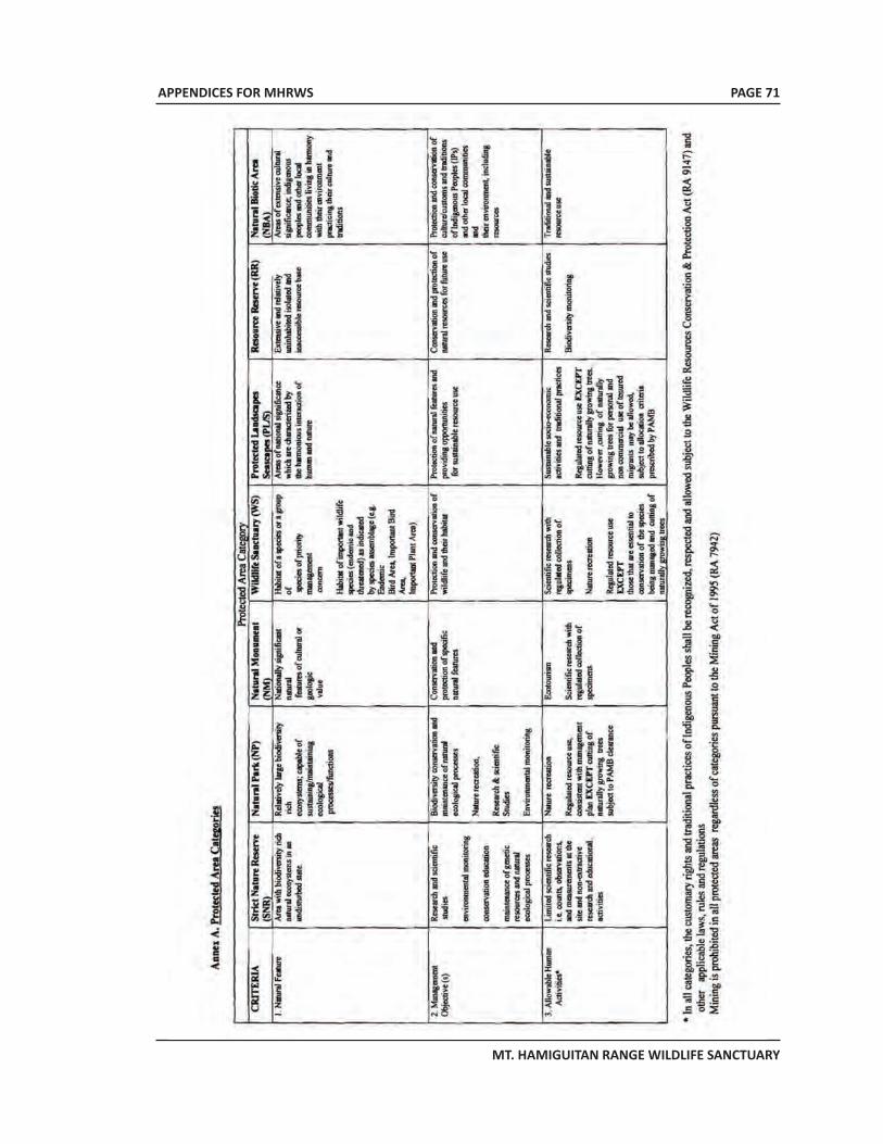
APPENDICES FOR MHRWS
MT. HAMIGUITAN RANGE WILDLIFE SANCTUARY
PAGE 71
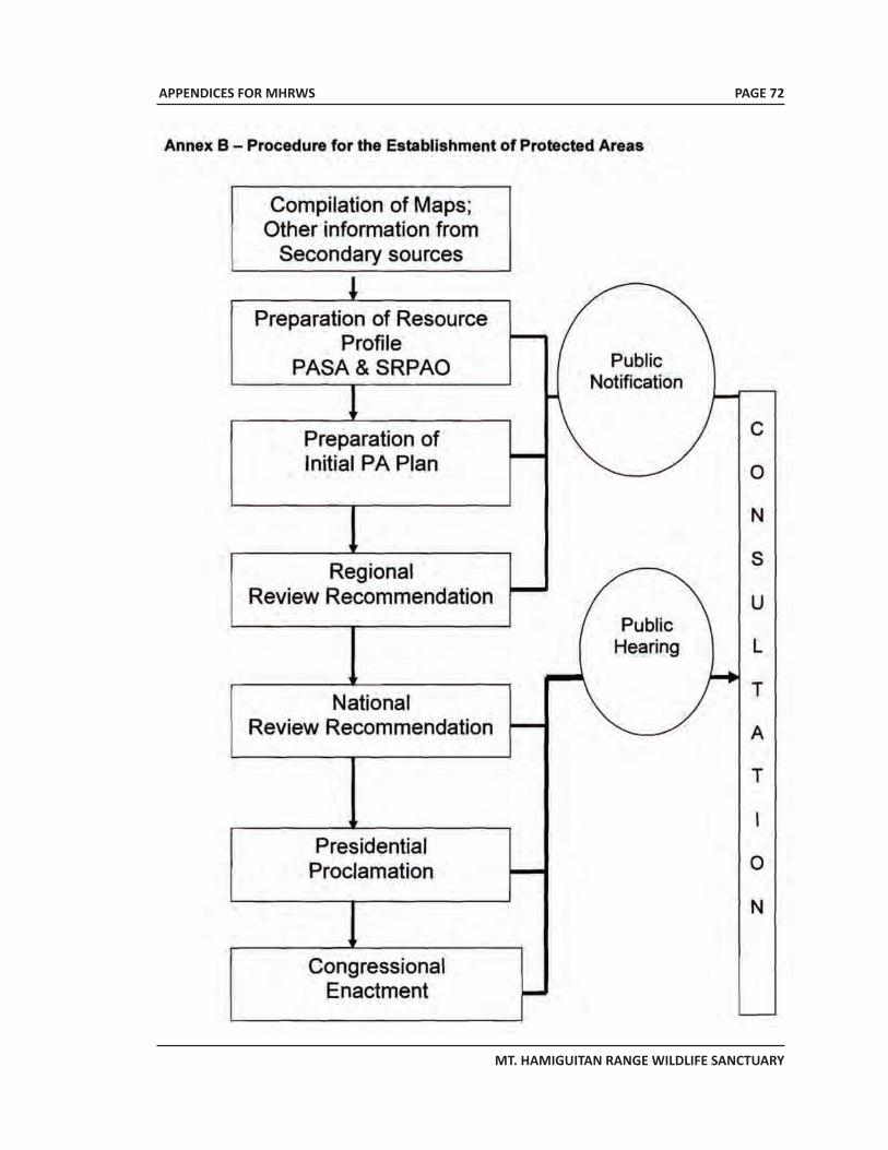
APPENDICES FOR MHRWS
MT. HAMIGUITAN RANGE WILDLIFE SANCTUARY
PAGE 72
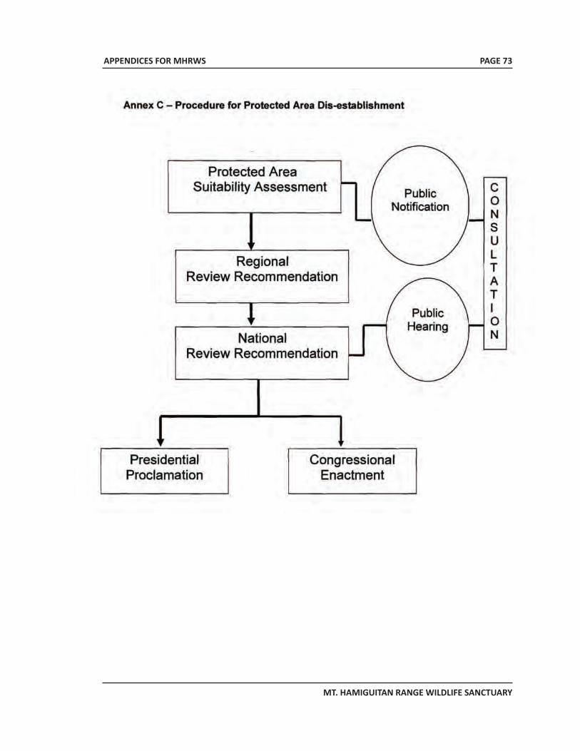
APPENDICES FOR MHRWS
MT. HAMIGUITAN RANGE WILDLIFE SANCTUARY
PAGE 73
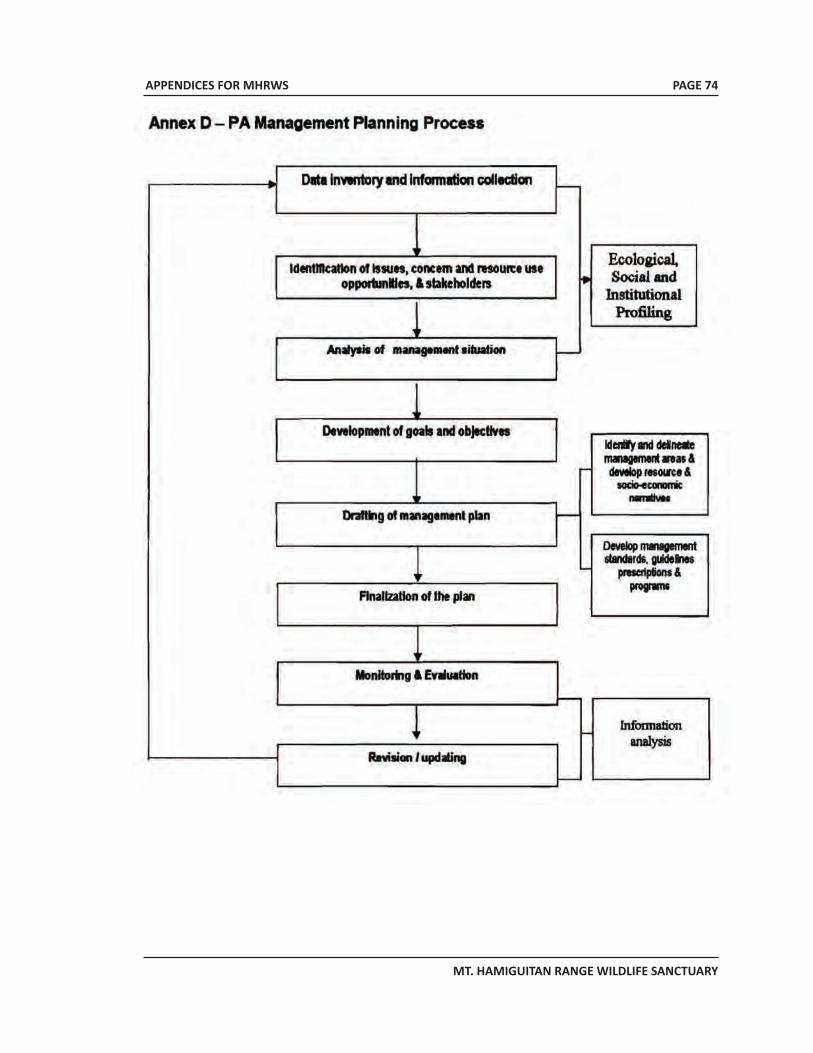
APPENDICES FOR MHRWS
MT. HAMIGUITAN RANGE WILDLIFE SANCTUARY
PAGE 74
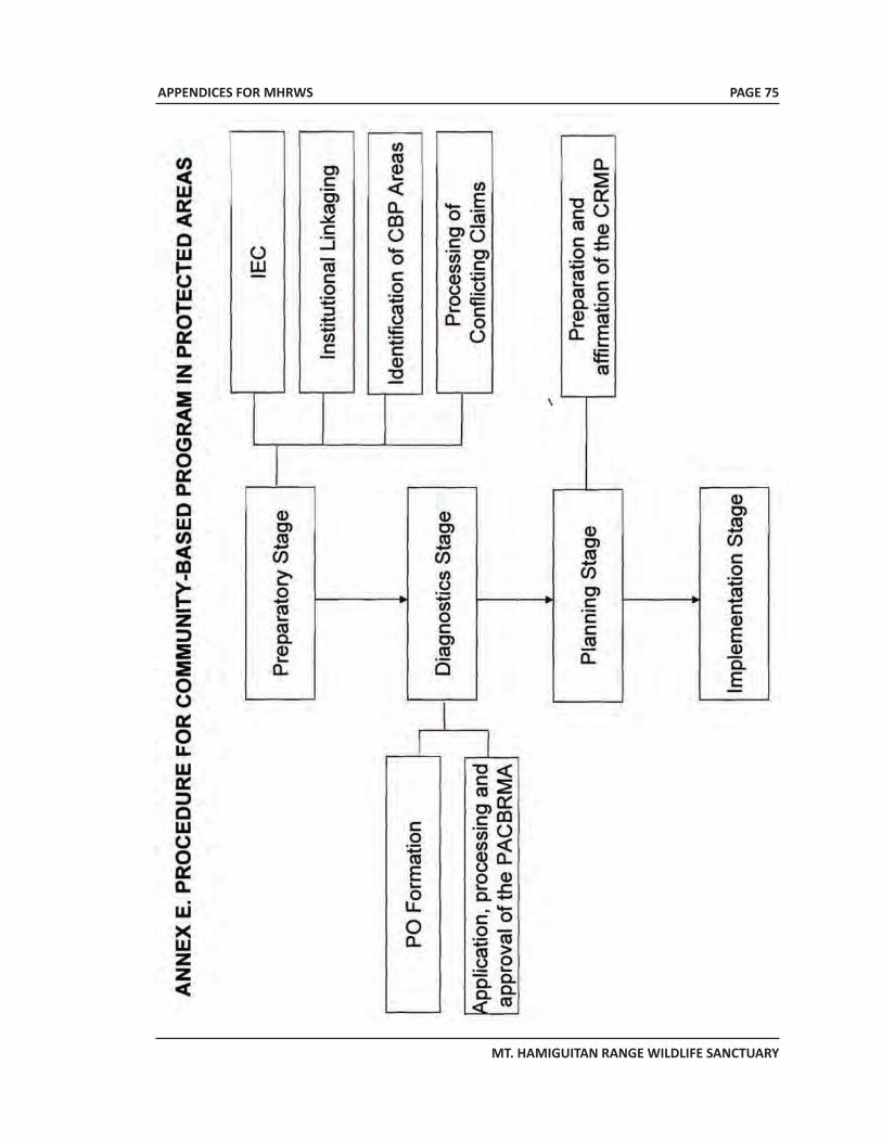
APPENDICES FOR MHRWS
MT. HAMIGUITAN RANGE WILDLIFE SANCTUARY
PAGE 75
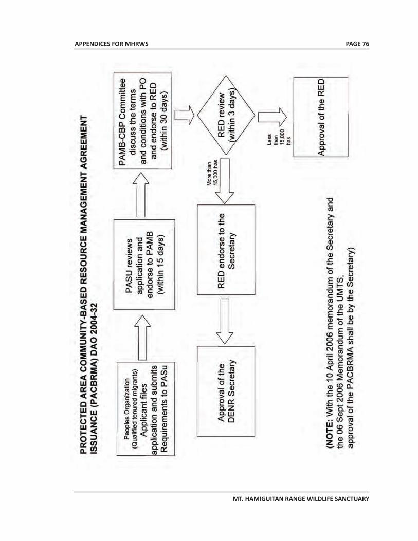
APPENDICES FOR MHRWS
MT. HAMIGUITAN RANGE WILDLIFE SANCTUARY
PAGE 76
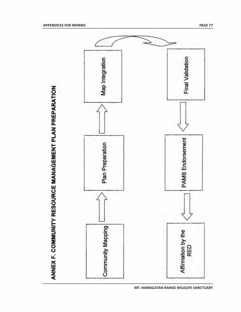
APPENDICES FOR MHRWS
MT. HAMIGUITAN RANGE WILDLIFE SANCTUARY
PAGE 77
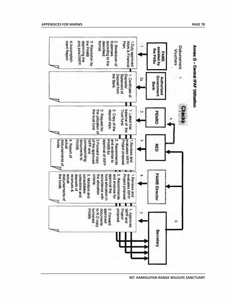
APPENDICES FOR MHRWS
MT. HAMIGUITAN RANGE WILDLIFE SANCTUARY
PAGE 78
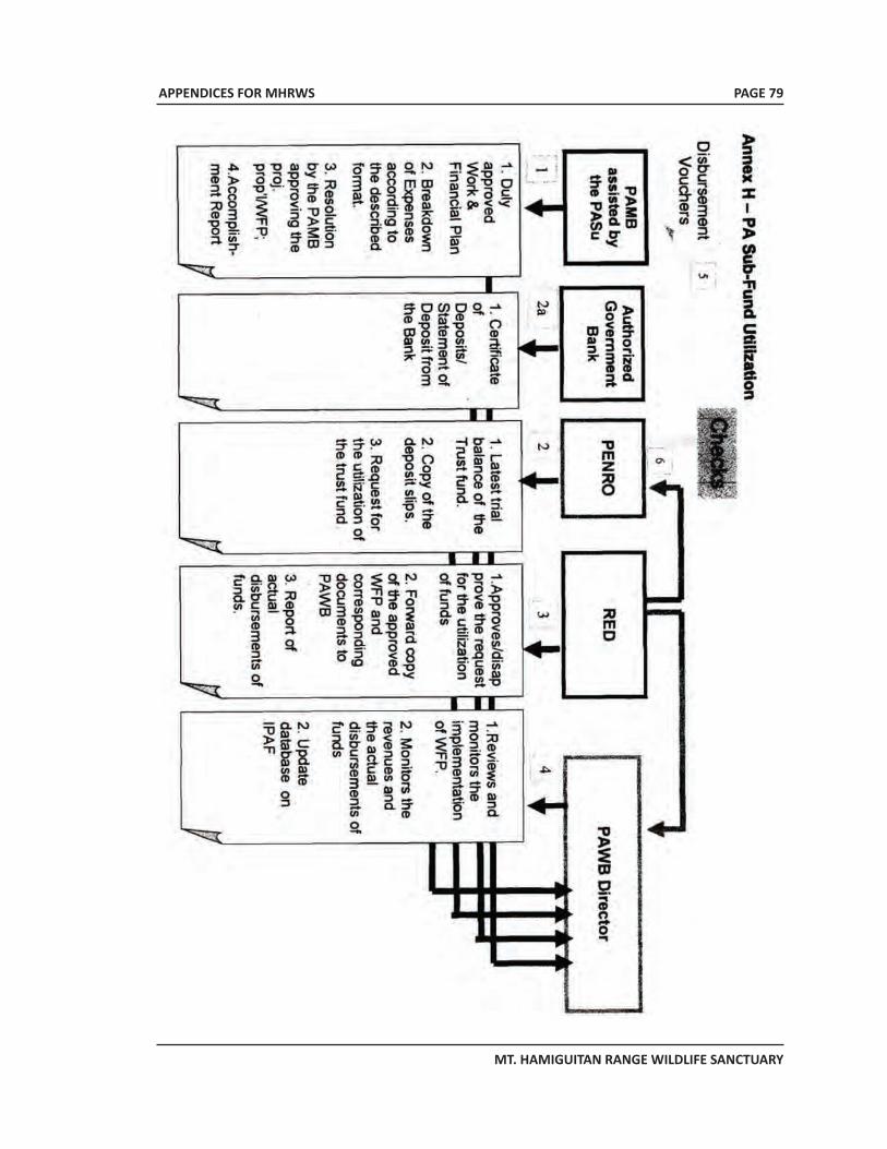
APPENDICES FOR MHRWS
MT. HAMIGUITAN RANGE WILDLIFE SANCTUARY
PAGE 79

APPENDICES FOR MHRWS
MT. HAMIGUITAN RANGE WILDLIFE SANCTUARY
APPENDIX 3Detailed description of Nepenthes peltata, a new species
endemic only to MHRWS
PAGE 80
APPENDICES FOR MHRWS
MT. HAMIGUITAN RANGE WILDLIFE SANCTUARY
PAGE 81
Nepenthes peltata Sh. KurataOriginal description; Kurata, S. 2008. Journal of the Insectivorous Plant Society (Japan) 59(1): 12-17
The specific epithet refers to the peltate leaves of this species. Nepenthes peltatadoes not have any synonyms or infraspecific taxa.
Nepenthes peltata is presently known only from the upper slopes of Mount Hamiguitan in Mindanao (Figure 401). The species may have a wider distribution than is currently appreciated, but the highlands of southern Mindanao remain poorly researched due continuing separatist conflict. On Mount Hamiguitan, N. peltata occurs from approximately 865 m to the summit of the mountain, which stands at 1635 m. It grows terrestrially in mossy, upper montane forest, amongst degraded or recovering secondary vegetation, on exposed cliffsides and landslide areas, and alongside stunted scrub on ridge tops (Figure 402). Nepenthes peltata forms a short, rigid, upright stem to 1 m high that grows above or through surrounding vegetation. It is tolerant of shaded conditions, but grows most vigorously in strong or direct sunlight. Occasionally, scrambling stems up to 3 m long may be produced, but no climbing stems or upper pitchers have been observed. Nepenthes peltata naturally hybridises with N. micramphora, and hybrids are very common on Mount Hamiguitan, particularly above 1400 m.
The lamina in oblong, up to 50 cm long and 9 cm wide. The leaf apex is rounded and the leaf base is abruptly contracted and petiolate. The leaf tip is strongly peltate, the tendril emerging up to 27 mm from the apex of the leaf. The petiole is up to 7 cm long, and is canaliculated. The petiole is reduced or absent in seedlings and juvenile plants. The leaves are generally flat, but the margins may be variably upturned. They are also very distinctive because the upper surface of the leaf is dark green, and the lower surface is usually, though not always, dark red (Figure 403). The midrib is yellow or light green, and the stem, petioles and tendrils, and lower surface of the leaves are lined with coarse, long, brown hairs. These hairs may be absent or sparsely scattered over the upper surface of the leaves and pitchers. The lower pitchers are variable in size and shape (Figure 404). They are up to 28 cm tall and 16 cm wide, and may be wholly ovate, ellipsoidal, or urceolate. Wings up to 10 mm wide, fringed with filaments up to 9 mm long, run down the front of the lower pitchers. The peristome is loosely cylindrical, up to 2 cm wide, and expanded towards the sides and back of the pitcher opening. The peristome is lined with ribs up to 1.5 mm high, spaced up to 2 mm apart. Sometimes the ribs are elongated on the inner edge of the peristome to form teeth up to 1 mm long, but such teeth are often lacking. The peristome is slightly raised at the back of the pitcher opening, immediately below lid. The outer margin of the peristome extends into the pitcher opening for several millimeters, particularly below the lid. The lid is elliptic or ovate, up to 8 cm long and 6 cm wide. A well-formed appendage is generally lacking, but a pronounced keel, somewhat triangular in shape, may sometimes be present; if so, this keel is apparent close to the base of the lid and may extend downwards for a few millimeters. Many large, conspicuous nectar glands up to 3 mm wide are distributed across the underside of the lid. The spur is narrow, unbranched, up to 12 mm long and is often hairy.
APPENDICES FOR MHRWS
MT. HAMIGUITAN RANGE WILDLIFE SANCTUARY
The colouration of the lower pitchers s exceptionally variable (Figures 405 and 406). The exterior may be yellow, orange, pink, red or purple, mottled with dark purple or black blotches. The interior of the trap is light yellow or green, often faintly flecked with dark red or purple. The peristome may be bright yellow, orange, red, or purple, often striped with variable bands of yellow, orange or red. The lid may be yellow, orange, red or dark reddish purple, and is often decorated with dark red, purple or black blotches and flecks.
The inflorescence is a raceme, to 75 cm long by 3.5 cm at the widest point, but up to 6.5 cm wide in the female. The peduncle is up to 46 cm long and up to 9 mm in diameter at the base, the rachis to 20 cm long. Flowers are borne on predominantly 2-flowered partial peduncles up to 3 mm long, with a narrow bract 4-7 mm long towards the base, on pedicles to 14 mm long. Tepals are ovate with an acute apex and up to 4 mm long. The anther head is borne on a column up to 4 mm long. Fruits are 20 mm long and seeds approximately 4 mm long.
During my observations of this species on Mount Hamiguitan, no climbing stems or upper pitchers were located. The holotype also lacks upper pitchers, and it seems that upper pitchers are produced rarely or not at all. Consequently, a description cannot be presented here. It is possible that this species does produce climbing stems and upper pitchers when growing amidst tall vegetation or in dense shade, much like its close relatives, N. deaniana and N. mira, but this can only be confirmed through further investigation.
Nepenthes peltata is closely related to the Palawan species, N. attenboroughii, N. deaniana, N. mantalingajanensis and N. mira, but is easily distinguished from all of these by its strongly peltate leaves, distinctive leaf colouration, and very hirsute foliage. As with most of these species, N. peltata occurs on ultramafic soils and shares some common features with N. rajah, of Borneo, including its markedly peltate leaves. The recent discoveries of these taxa on Palawan and Mindanao, coupled with prehistoric topographical data for this region, provide convincing evidence that these predominantly ultramafic species share a common, Bornean ancestor (Robinson et al., 2009).
Although Mount Hamiguitan is relatively easy to access and frequently visited as a result, N. peltata is not currently threatened. Populations of this species are extensive and widespread, and admission to the mountain is only permitted in the company of a trained, conservation aware guide. Due to the commendable efforts of the local government of San Isidro, an application has been submitted to the UNESCO in 2008 in order to protect Mount Hamiguitan as a World Heritage site. At the time of writing, Mount Hamiguitan is listed on the tentative list of World Heritage sites; see http://whc.unesco.org/en/tentativelists/5387/. If World Heritage status is successfully obtained, it will help to further secure the future of this species in the wild. Source:
Pitcher Plants of the Old World – Volume Two Stewart McPherson, 2009
PAGE 82
APPENDICES FOR MHRWS
MT. HAMIGUITAN RANGE WILDLIFE SANCTUARY
APPENDIX 4Detailed description of Nepenthes micramphora, a new
species endemic only to MHRWS
PAGE 83
APPENDICES FOR MHRWS
MT. HAMIGUITAN RANGE WILDLIFE SANCTUARY
Nepenthes micramphora V.Heinrich, S.McPherson, Gronemeyer & Amoroso
Original description; Heinrich et al., 2009, in Pitcher Plants of the Old World Volume Two, by S. McPherson: 1314.
The specific epithet is derived from the Greek micros (small) and Latin amphora (pitcher or urn) and refers to the diminutive size of the traps of this plant (Figure 387).
Nepenthes micramphora does not have any synonyms or infraspecific taxa. The description of this species is presented in the appendix of this work.
Nepenthes micramphora is presently known only from the upper slopes of Mount Hamiguitan in southern Mindanao. It may have a wider distribution than is presently recognized, as the southern Mindanao highlands remain poorly explored due to continuing separatist conflict. On Mount Hamiguitan, N. micramphora occurs from approximately 1100 m to the summit of the mountain, which stands at 1635 m. It grows terrestrially amidst spare, open canopied, mossy, upper montane trees, amongst degraded or recovering secondary vegetation, on exposed cliffsides and landslide areas, and on stunted scrub on ridge tops (Figure 388). Nepenthes micramphora is generally absent from tall, closed canopy montane forest. It readily produces a branched stem up to 2 m long, that climbs and scrambles through surrounding vegetation or trails across the ground. Nepenthes micramphora is tolerant of shaded conditions, but grows most vigorously in strong or direct sunlight. It naturally hybridises with N. peltata and possibly with N. mindanaoensis. Hybrids are very common on Mount Hamiguitan, particularly above 1400 m.
The lamina is linear or slightly spathulate, up to 80 mm long and 10 mm wide. The apex of the leaf is acute, and the base is attenuate and sessile to slightly amplexicaul. The lamina is green. The stem is often bright red, orange, yellow or green. The midrib is typically yellow, but may be reddish towards the stem, and the tendril may be yellow, orange or red. All parts of the foliage of mature plants are glabrous.
Lower pitchers are produced only very briefly by young plants prior to the production of a climbing stem (Figure 389). The lower traps are up to 41 mm tall 16 mm wide. The bottom third to half of the pitcher is narrowly ovate, and variably swollen. Above this part, the width narrows slightly, before becoming cylindrical or very slightly infundibular towards the pitcher opening. Wings up to 4 mm wide, fringed with filaments up to 3 mm long, run down the front of the trap. The wings are often reduced to ridges or are only partly expressed. The peristome is up to 0.8 mm in width, and lined with inconspicuous ribs to 0.1 mm high, spaced 0.1 mm apart. These ribs are often so fine that they may not be apparent at all. The lid is elliptic, ovate or orbicular, often with a cordate base, up to 20 mm long and 18 mm wide. The lid lacks an appendage. The spur is up to 3 mm long and is branched or occasionally divided.
The exterior of the lower pitcher may be orange, red or reddish-brown, often with dark red or black wings. The interior of the trap is light yellowish green or creamy white. The peristome is yellowish green or flushed red, and the lid is orange or red, often with a lighter underside.
Despite their small size, the upper pitchers are produced in abundance, particularly on mature, climbing plants. The upper pitchers are up to 67 mm tall and 20 mm wide, but usually much
PAGE 84
APPENDICES FOR MHRWS
MT. HAMIGUITAN RANGE WILDLIFE SANCTUARY
smaller, more typically attaining a size of 40 mm tall and 17mm wide (Figures 390 and 391). The bottom third to half of the pitcher is narrowly infundibular. Above this part, the pitcher narrows, sometimes forming a faint hip, and becomes cylindrical or infundibular towards the pitcher opening. The wings are entirely reduced to ridges. All other parts are similar to the lower pitchers.
The colouration of the upper pitchers is diverse, but usually colourful and attractive. The exterior of the upper pitchers is bright yellow, orange, red or reddishbrown, often with dark red wing ridges. The interior of the trap is light, yellowish green or creamy white. The peristome is yellowish green or red, and the lid may be bright yellow, orange, red or reddish-brown, often with a lighter underside.
The inflorescence is a raceme, to 35 cm long. The peduncle is up to 8 cm long and 1 mm in diameter at the base. Flowers are borne singly on bractless pedicels, up to 40 flowers per inflorescence. Tepals are ovate, to 2.5 mm long by 1.2 mm wide. Fruits are up to 20 mm long and the seed is unknown.
The diminutive pitchers of N. micramphora distinguish it from most other Nepenthes; only N. bellii and N. gracilis produce foliage that is superficially similar in size and appearance. Nepenthes bellii is distinguished by the shape of its lower pitchers, which are wholly cylindrical, ellipsoidal or occasionally urceolate, with a broad, peristome lined with defined ribs and teeth; the lower pitchers of N. micramphora are comparatively slender, with a narrowly ovate base and very narrow peristome. Nepenthes gracilis is not sympatric with N. micramphora and therefore unlikely to be confused with that species. However, the leaves of N. gracilis are narrower and strongly decurrent, with lower pitchers produced in abundance and stems that are triangular in cross section.
Although N. micramphora is known only from the upper slopes of one mountain, the species is not currently threatened. Although Mount Hamiguitan is relatively easy to access and frequently visited as a result, populations of N. micramphora are extensive and widespread, and admission to the mountain is only permitted in the company of a trained, conservation aware guide. Due to the commendable efforts of the local government of San Isidro, an application has been submitted to the UNESCO in 2008 in order to protect Mount Hamiguitan as a World Heritage site. At the time of writing, Mount Hamiguitan is listed on the tentative list of World Heritage sites; see http://whc.unesco.org/en/tentativelists/5387/. If World Heritage status is successfully obtained, it will help to further secure the future of this species in the wild. Source:
Pitcher Plants of the Old World – Volume Two Stewart McPherson, 2009
PAGE 85
APPENDICES FOR MHRWS
MT. HAMIGUITAN RANGE WILDLIFE SANCTUARY
PAGE 86
APPENDIX 5Photo documentation on some endemic, threatened, rare
and economically important floral species in MHRWS
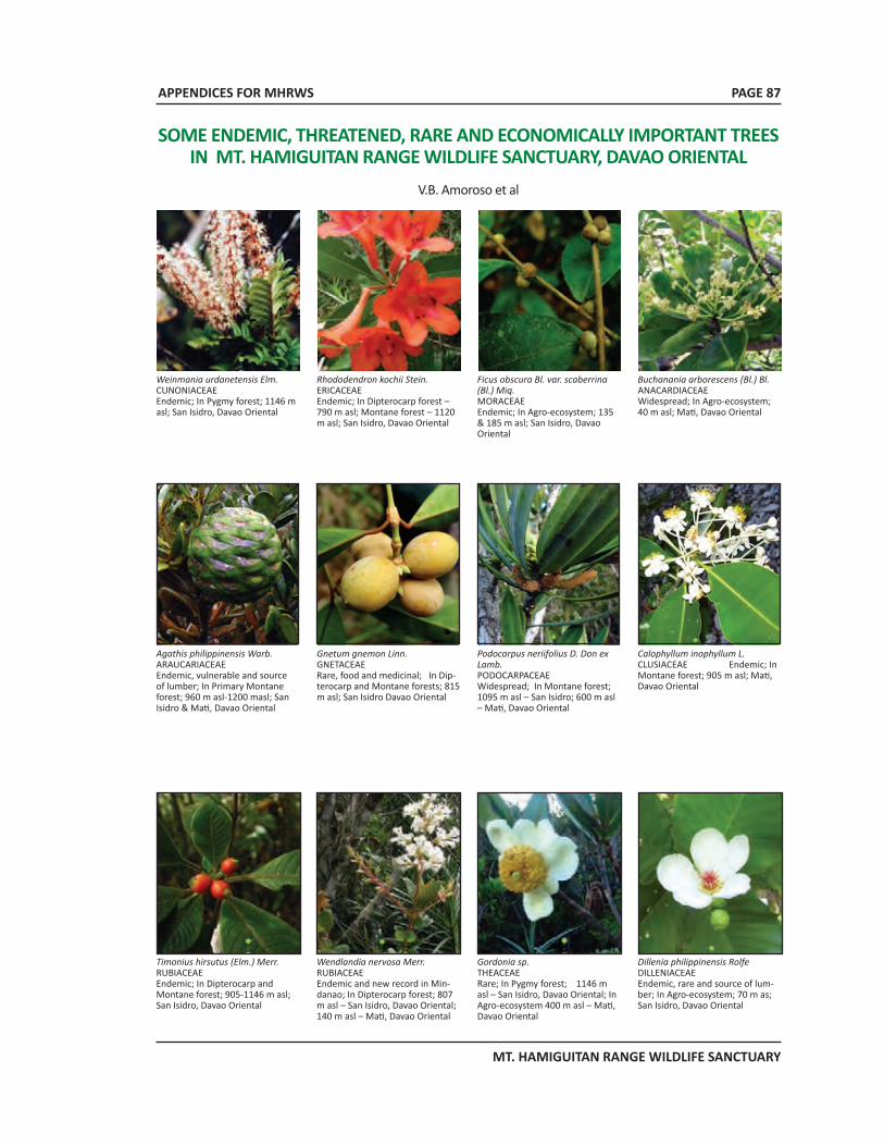
APPENDICES FOR MHRWS
MT. HAMIGUITAN RANGE WILDLIFE SANCTUARY
PAGE 87
SOME ENDEMIC, THREATENED, RARE AND ECONOMICALLY IMPORTANT TREES IN MT. HAMIGUITAN RANGE WILDLIFE SANCTUARY, DAVAO ORIENTAL
V.B. Amoroso et al
Weinmania urdanetensis Elm.CUNONIACEAE Endemic; In Pygmy forest; 1146 m asl; San Isidro, Davao Oriental
Rhododendron kochii Stein.ERICACEAEEndemic; In Dipterocarp forest – 790 m asl; Montane forest – 1120 m asl; San Isidro, Davao Oriental
Ficus obscura Bl. var. scaberrina (Bl.) Miq.MORACEAEEndemic; In Agro-ecosystem; 135 & 185 m asl; San Isidro, Davao Oriental
Buchanania arborescens (Bl.) Bl.ANACARDIACEAEWidespread; In Agro-ecosystem; 40 m asl; Mati, Davao Oriental
Agathis philippinensis Warb.ARAUCARIACEAEEndemic, vulnerable and source of lumber; In Primary Montane forest; 960 m asl-1200 masl; San Isidro & Mati, Davao Oriental
Gnetum gnemon Linn.GNETACEAERare, food and medicinal; In Dip-terocarp and Montane forests; 815 m asl; San Isidro Davao Oriental
Podocarpus neriifolius D. Don ex Lamb. PODOCARPACEAEWidespread; In Montane forest; 1095 m asl – San Isidro; 600 m asl – Mati, Davao Oriental
Calophyllum inophyllum L. CLUSIACEAE Endemic; In Montane forest; 905 m asl; Mati, Davao Oriental
Timonius hirsutus (Elm.) Merr.RUBIACEAEEndemic; In Dipterocarp and Montane forest; 905-1146 m asl; San Isidro, Davao Oriental
Wendlandia nervosa Merr.RUBIACEAEEndemic and new record in Min-danao; In Dipterocarp forest; 807 m asl – San Isidro, Davao Oriental; 140 m asl – Mati, Davao Oriental
Gordonia sp.THEACEAERare; In Pygmy forest; 1146 m asl – San Isidro, Davao Oriental; In Agro-ecosystem 400 m asl – Mati, Davao Oriental
Dillenia philippinensis RolfeDILLENIACEAE Endemic, rare and source of lum-ber; In Agro-ecosystem; 70 m as; San Isidro, Davao Oriental
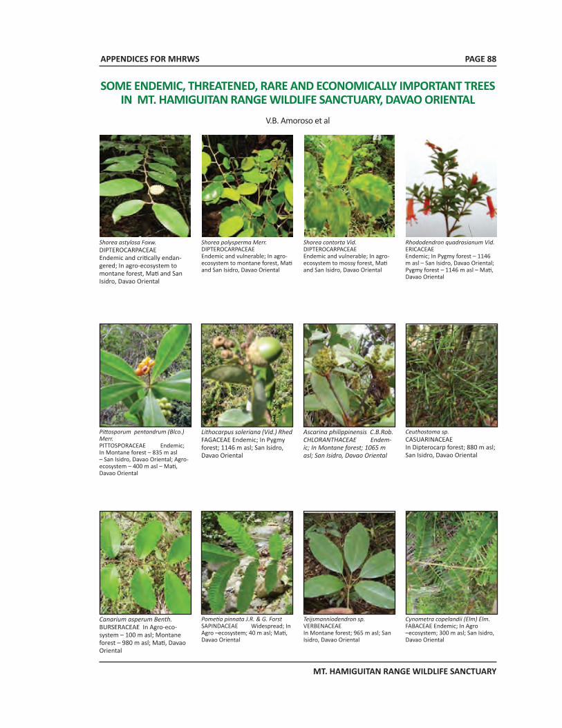
APPENDICES FOR MHRWS
MT. HAMIGUITAN RANGE WILDLIFE SANCTUARY
PAGE 88
Shorea astylosa Foxw.DIPTEROCARPACEAEEndemic and critically endan-gered; In agro-ecosystem to montane forest, Mati and San Isidro, Davao Oriental
Shorea polysperma Merr.DIPTEROCARPACEAEEndemic and vulnerable; In agro-ecosystem to montane forest, Mati and San Isidro, Davao Oriental
Shorea contorta Vid.DIPTEROCARPACEAEEndemic and vulnerable; In agro-ecosystem to mossy forest, Mati and San Isidro, Davao Oriental
Rhododendron quadrasianum Vid.ERICACEAEEndemic; In Pygmy forest – 1146 m asl – San Isidro, Davao Oriental; Pygmy forest – 1146 m asl – Mati, Davao Oriental
Pittosporum pentandrum (Blco.) Merr. PITTOSPORACEAE Endemic; In Montane forest – 835 m asl – San Isidro, Davao Oriental; Agro-ecosystem – 400 m asl – Mati, Davao Oriental
Lithocarpus soleriana (Vid.) Rhed FAGACEAE Endemic; In Pygmy forest; 1146 m asl; San Isidro, Davao Oriental
Ascarina philippinensis C.B.Rob. CHLORANTHACEAE Endem-ic; In Montane forest; 1065 m asl; San Isidro, Davao Oriental
Ceuthostoma sp.CASUARINACEAE In Dipterocarp forest; 880 m asl; San Isidro, Davao Oriental
Canarium asperum Benth. BURSERACEAE In Agro-eco-system – 100 m asl; Montane forest – 980 m asl; Mati, Davao Oriental
Pometia pinnata J.R. & G. Forst SAPINDACEAE Widespread; In Agro –ecosystem; 40 m asl; Mati, Davao Oriental
Teijsmanniodendron sp. VERBENACEAEIn Montane forest; 965 m asl; San Isidro, Davao Oriental
Cynometra copelandii (Elm) Elm. FABACEAE Endemic; In Agro –ecosystem; 300 m asl; San Isidro, Davao Oriental
SOME ENDEMIC, THREATENED, RARE AND ECONOMICALLY IMPORTANT TREES IN MT. HAMIGUITAN RANGE WILDLIFE SANCTUARY, DAVAO ORIENTAL
V.B. Amoroso et al
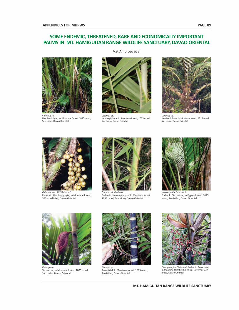
APPENDICES FOR MHRWS
MT. HAMIGUITAN RANGE WILDLIFE SANCTUARY
PAGE 89
SOME ENDEMIC, THREATENED, RARE AND ECONOMICALLY IMPORTANT PALMS IN MT. HAMIGUITAN RANGE WILDLIFE SANCTUARY, DAVAO ORIENTAL
V.B. Amoroso et al
Calamus sp.Hemi-epiphyte; In Montane forest; 1035 m asl; San Isidro, Davao Oriental
Calamus sp.Hemi-epiphyte; In Montane forest; 1035 m asl; San Isidro, Davao Oriental
Calamus sp.Hemi-epiphyte; In Montane forest; 1215 m asl; San Isidro, Davao Oriental
Calamus merrillii “Gataran”Endemic; Hemi-epiphyte; In Montane forest; 370 m asl Mati, Davao Oriental
Calamus viridissimusEndemic; Hemi-epiphyte; In Montane forest; 1035 m asl; San Isidro, Davao Oriental
Heterospathe intermediaEndemic; Terrestrial; In Pygmy forest; 1045 m asl; San Isidro, Davao Oriental
Pinanga sp.Terrestrial; In Montane forest; 1005 m asl; San Isidro, Davao Oriental
Pinanga sp.Terrestrial; In Montane forest; 1005 m asl, San Isidro, Davao Oriental
Pinanga rigida “Palmera” Endemic; Terrestrial; In Montane forest; 1080 m asl; Governor Gen-eroso, Davao Oriental
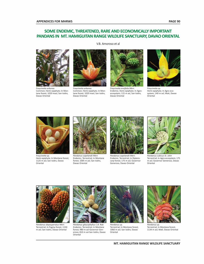
APPENDICES FOR MHRWS
MT. HAMIGUITAN RANGE WILDLIFE SANCTUARY
Freycinetia arboreaCommon; Hemi-epiphyte; In Mon-tane forest; 1020 masl; San Isidro, Davao Oriental
Freycinetia arboreaCommon; Hemi-epiphyte; In Mon-tane forest; 1020 masl; San Isidro, Davao Oriental
Freycinetia ensifolia Merr.Endemic; Hemi-epiphyte; In Agro-ecosystem; 115 m asl, San Isidro, Davao Oriental
Freycinetia sp.Hemi-epiphyte; In Agro-eco-system; 140 m asl; Mati, Davao Oriental
Freycinetia sp. Hemi-epiphyte; In Montane forest; 1125 m asl; San Isidro, Davao Oriental
Pandanus copelandii Merr.Endemic; Terrestrial; In Montane forest; 1005 m asl; San Isidro, Davao Oriental
Pandanus copelandii Merr.Endemic; Terrestrial; In Diptero-carp forest; 175 m asl; Governor Generoso, Davao Oriental
Pandanus cubicus St. JohnTerrestrial; In Agro-ecosystem; 175 m asl; Governor Generoso, Davao Oriental
Pandanus depauperatus Merr.Terrestrial; In Pygmy forest; 1150 m asl; San Isidro, Davao Oriental
Pandanus glauciphyllus C.B. RobEndemic; Terrestrial; In Montane forest; 980 m asl-Governor Gen-eroso; 810 m asl-San Isidro, Davao Oriental
Pandanus sp.Terrestrial; In Montane forest; 1060 m asl; San Isidro, Davao Oriental
Pandanus sp.Terrestrial; In Montane forest; 1134 m asl; Mati, Davao Oriental
SOME ENDEMIC, THREATENED, RARE AND ECONOMICALLY IMPORTANT PANDANS IN MT. HAMIGUITAN RANGE WILDLIFE SANCTUARY, DAVAO ORIENTAL
V.B. Amoroso et al
PAGE 90
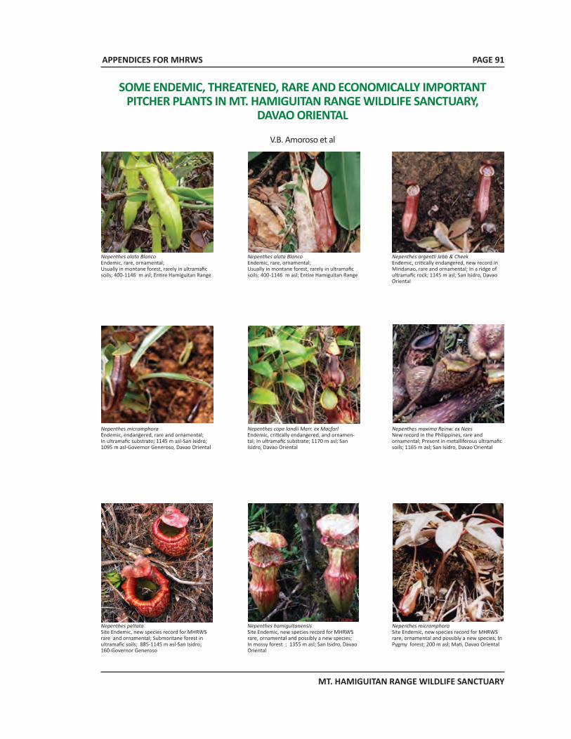
APPENDICES FOR MHRWS
MT. HAMIGUITAN RANGE WILDLIFE SANCTUARY
SOME ENDEMIC, THREATENED, RARE AND ECONOMICALLY IMPORTANT PITCHER PLANTS IN MT. HAMIGUITAN RANGE WILDLIFE SANCTUARY,
DAVAO ORIENTAL
V.B. Amoroso et al
Nepenthes alata BlancoEndemic, rare, ornamental; Usually in montane forest, rarely in ultramafic soils; 400-1146 m asl; Entire Hamiguitan Range
Nepenthes alata BlancoEndemic, rare, ornamental; Usually in montane forest, rarely in ultramafic soils; 400-1146 m asl; Entire Hamiguitan Range
Nepenthes argentii Jebb & Cheek Endemic, critically endangered, new record in Mindanao, rare and ornamental; In a ridge of ultramafic rock; 1145 m asl; San Isidro, Davao Oriental
Nepenthes micramphoraEndemic, endangered, rare and ornamental; In ultramafic substrate; 1145 m asl-San Isidro; 1095 m asl-Governor Generoso, Davao Oriental
Nepenthes cope landii Merr. ex MacfarlEndemic, critically endangered, and ornamen-tal; In ultramafic substrate; 1170 m asl; San Isidro, Davao Oriental
Nepenthes maxima Reinw. ex NeesNew record in the Philippines, rare and ornamental; Present in metalliferous ultramafic soils; 1165 m asl; San Isidro, Davao Oriental
Nepenthes peltata Site Endemic, new species record for MHRWS rare and ornamental; Submontane forest in ultramafic soils; 885-1145 m asl-San Isidro; 160-Governor Generoso
Nepenthes hamiguitanensisSite Endemic, new species record for MHRWS rare, ornamental and possibly a new species; In mossy forest ; 1355 m asl; San Isidro, Davao Oriental
Nepenthes micramphoraSite Endemic, new species record for MHRWS rare, ornamental and possibly a new species; In Pygmy forest; 200 m asl; Mati, Davao Oriental
PAGE 91
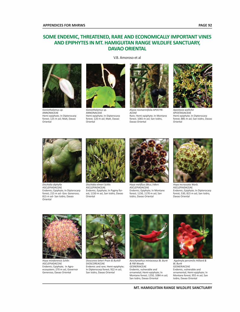
APPENDICES FOR MHRWS
MT. HAMIGUITAN RANGE WILDLIFE SANCTUARY
PAGE 92
Goniothalamus sp.ANNONACEAEHemi-epiphyte; In Dipterocarp forest; 125 m asl; Mati, Davao Oriental
Goniothalamus sp.ANNONACEAEHemi-epiphyte; In Dipterocarp forest; 120 m asl; Mati, Davao Oriental
Alyxia rosmarinifolia APOCYN-ACEAERare; Hemi-epiphyte; In Montane forest; 1065 m asl; San Isidro, Davao Oriental
Apostasia wallichiiAPOSTASIACEAEHemi-epiphyte; In Dipterocarp forest; 885 m asl; San Isidro, Davao Oriental
Dischidia diphyllaASCLEPIADACEAEEndemic; Epiphyte; In Dipterocarp forest; 215 m asl- Gov. Generoso; 815 m asl- San Isidro, Davao Oriental
Dischidia elmeri Schltr.ASCLEPIADACEAEEndemic; Epiphyte; In Pygmy for-est; 1150 m asl, San Isidro, Davao Oriental
Hoya meliflua (Blco.) Merr.ASCLEPIADACEAEEndemic; Epiphyte; In Montane forest; 1150, 1170 m asl; San Isidro, Davao Oriental
Hoya incrassata Warb.ASCLEPIADACEAEEndemic; Epiphyte; In Dipterocarp forest; 530, 815 m asl; San Isidro, Davao Oriental
Hoya mindorensis Schltr. ASCLEPIADACEAEEndemic; Epiphyte; In Agro-ecosystem; 270 m asl, Governor Generoso, Davao Oriental
Dioscorea loheri Prain & BurkillDIOSCOREACEAEEndemic and rare; Hemi-epiphyte; In Dipterocarp forest; 922 m asl; San Isidro, Davao Oriental
Aeschynathus miniaceaus BL Burtt & PJB WoodsGESNERIACEAEEndemic, vulnerable and ornametal; Hemi-epiphyte; In Montane forest; 1250, 1084 m asl; San Isidro, Davao Oriental
Agalmyla persimilis Hilliard & BL BurttGESNERIACEAEEndemic, vulnerable and ornamental; Hemi-epiphyte; In Montane forest; 955 m asl; San Isidro, Davao Oriental
SOME ENDEMIC, THREATENED, RARE AND ECONOMICALLY IMPORTANT VINES AND EPIPHYTES IN MT. HAMIGUITAN RANGE WILDLIFE SANCTUARY,
DAVAO ORIENTALV.B. Amoroso et al
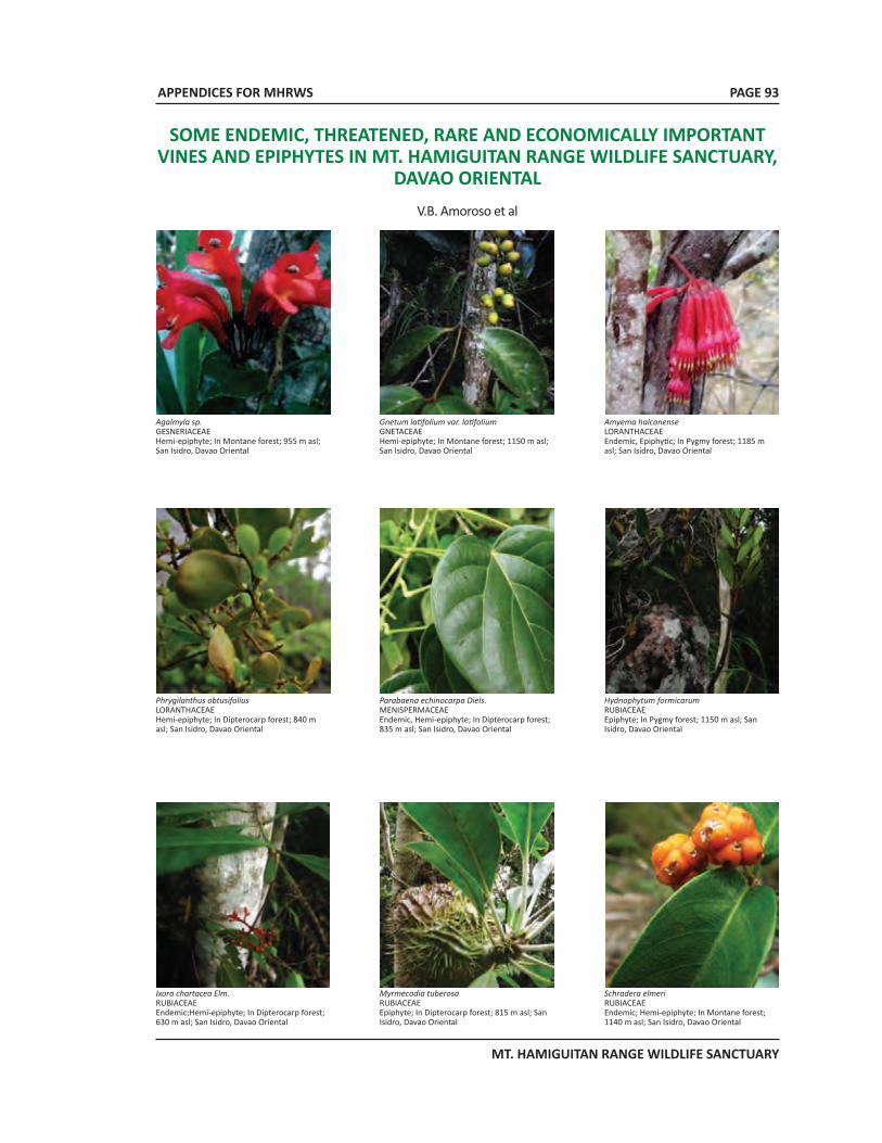
APPENDICES FOR MHRWS
MT. HAMIGUITAN RANGE WILDLIFE SANCTUARY
PAGE 93
SOME ENDEMIC, THREATENED, RARE AND ECONOMICALLY IMPORTANT VINES AND EPIPHYTES IN MT. HAMIGUITAN RANGE WILDLIFE SANCTUARY,
DAVAO ORIENTALV.B. Amoroso et al
Agalmyla sp.GESNERIACEAEHemi-epiphyte; In Montane forest; 955 m asl; San Isidro, Davao Oriental
Gnetum latifolium var. latifoliumGNETACEAEHemi-epiphyte; In Montane forest; 1150 m asl; San Isidro, Davao Oriental
Amyema halconenseLORANTHACEAEEndemic, Epiphytic; In Pygmy forest; 1185 m asl; San Isidro, Davao Oriental
Phrygilanthus obtusifoliusLORANTHACEAEHemi-epiphyte; In Dipterocarp forest; 840 m asl; San Isidro, Davao Oriental
Parabaena echinocarpa Diels.MENISPERMACEAEEndemic, Hemi-epiphyte; In Dipterocarp forest; 835 m asl; San Isidro, Davao Oriental
Hydnophytum formicarumRUBIACEAE Epiphyte; In Pygmy forest; 1150 m asl; San Isidro, Davao Oriental
Ixora chartacea Elm.RUBIACEAEEndemic;Hemi-epiphyte; In Dipterocarp forest; 630 m asl; San Isidro, Davao Oriental
Myrmecodia tuberosaRUBIACEAEEpiphyte; In Dipterocarp forest; 815 m asl; San Isidro, Davao Oriental
Schradera elmeriRUBIACEAEEndemic; Hemi-epiphyte; In Montane forest; 1140 m asl; San Isidro, Davao Oriental
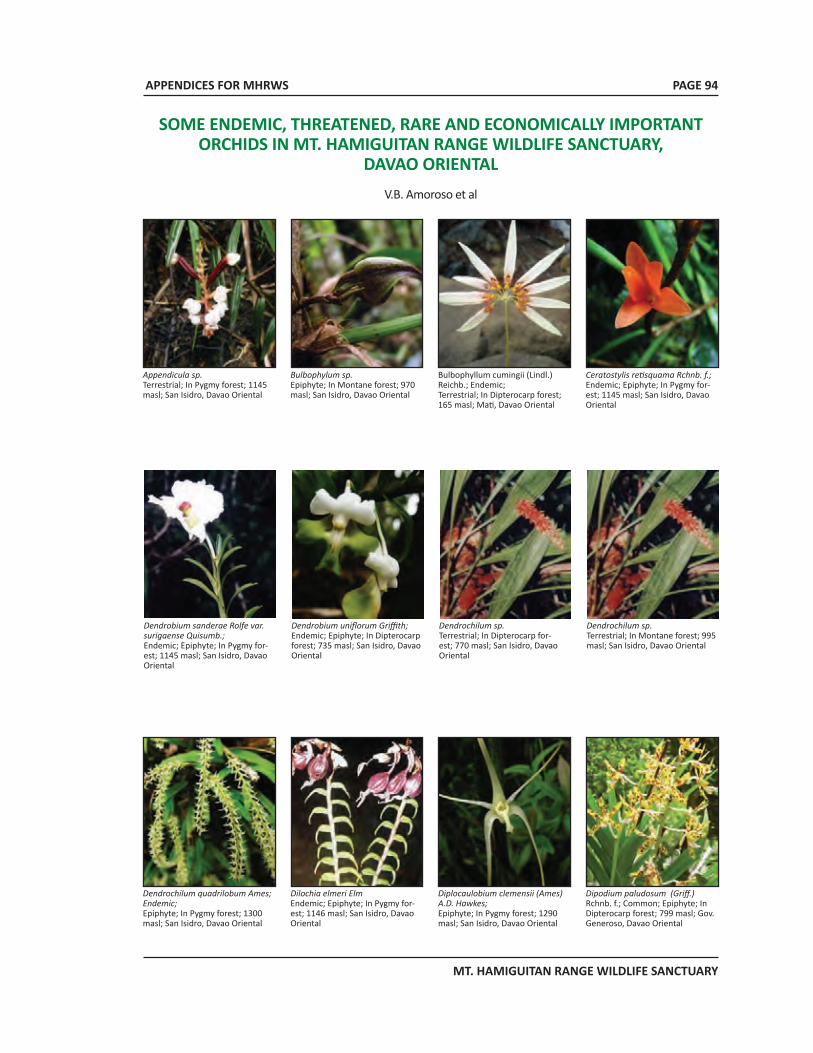
APPENDICES FOR MHRWS
MT. HAMIGUITAN RANGE WILDLIFE SANCTUARY
PAGE 94
SOME ENDEMIC, THREATENED, RARE AND ECONOMICALLY IMPORTANT ORCHIDS IN MT. HAMIGUITAN RANGE WILDLIFE SANCTUARY,
DAVAO ORIENTALV.B. Amoroso et al
Ceratostylis retisquama Rchnb. f.; Endemic; Epiphyte; In Pygmy for-est; 1145 masl; San Isidro, Davao Oriental
Bulbophyllum cumingii (Lindl.) Reichb.; Endemic;Terrestrial; In Dipterocarp forest; 165 masl; Mati, Davao Oriental
Dendrobium sanderae Rolfe var. surigaense Quisumb.; Endemic; Epiphyte; In Pygmy for-est; 1145 masl; San Isidro, Davao Oriental
Dendrobium uniflorum Griffith;Endemic; Epiphyte; In Dipterocarp forest; 735 masl; San Isidro, Davao Oriental
Dendrochilum sp.Terrestrial; In Dipterocarp for-est; 770 masl; San Isidro, Davao Oriental
Dendrochilum sp.Terrestrial; In Montane forest; 995 masl; San Isidro, Davao Oriental
Dendrochilum quadrilobum Ames; Endemic; Epiphyte; In Pygmy forest; 1300 masl; San Isidro, Davao Oriental
Dilochia elmeri ElmEndemic; Epiphyte; In Pygmy for-est; 1146 masl; San Isidro, Davao Oriental
Diplocaulobium clemensii (Ames) A.D. Hawkes; Epiphyte; In Pygmy forest; 1290 masl; San Isidro, Davao Oriental
Dipodium paludosum (Griff.) Rchnb. f.; Common; Epiphyte; In Dipterocarp forest; 799 masl; Gov. Generoso, Davao Oriental
Appendicula sp.Terrestrial; In Pygmy forest; 1145 masl; San Isidro, Davao Oriental
Bulbophylum sp. Epiphyte; In Montane forest; 970 masl; San Isidro, Davao Oriental
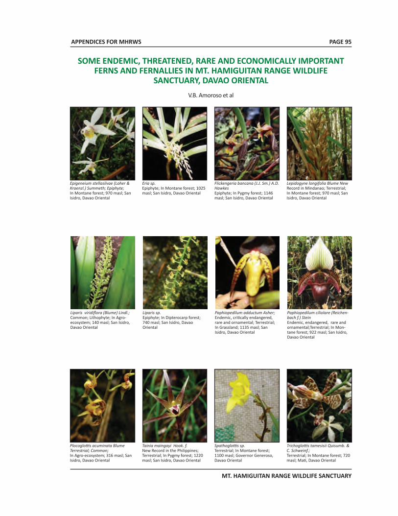
APPENDICES FOR MHRWS
MT. HAMIGUITAN RANGE WILDLIFE SANCTUARY
PAGE 95
SOME ENDEMIC, THREATENED, RARE AND ECONOMICALLY IMPORTANT FERNS AND FERNALLIES IN MT. HAMIGUITAN RANGE WILDLIFE
SANCTUARY, DAVAO ORIENTALV.B. Amoroso et al
Liparis viridiflora (Blume) Lindl.; Common; Lithophyte; In Agro-ecosystem; 140 masl; San Isidro, Davao Oriental
Liparis sp.Epiphyte; In Dipterocarp forest; 740 masl; San Isidro, Davao Oriental
Paphiopedilum adductum Asher; Endemic, critically endangered, rare and ornamental; Terrestrial; In Grassland; 1135 masl; San Isidro, Davao Oriental
Paphiopedilum ciliolare (Reichen-bach f.) SteinEndemic, endangered, rare and ornamental;Terrestrial; In Mon-tane forest; 922 masl; San Isidro, Davao Oriental
Plocoglottis acuminata Blume Terrestrial; Common; In Agro-ecosystem; 316 masl; San Isidro, Davao Oriental
Tainia maingayi Hook. f. New Record in the Philippines; Terrestrial; In Pygmy forest; 1220 masl; San Isidro, Davao Oriental
Spathoglottis sp.Terrestrial; In Montane forest; 1100 masl; Governor Generoso, Davao Oriental
Trichoglottis tamesisii Quisumb. & C. Schweinf.;Terrestrial; In Montane forest; 720 masl; Mati, Davao Oriental
Lepidogyne longifolia Blume New Record in Mindanao; Terrestrial; In Montane forest; 970 masl; San Isidro, Davao Oriental
Flickengeria bancana (J.J. Sm.) A.D. HawkesEpiphyte; In Pygmy forest; 1146 masl; San Isidro, Davao Oriental
Epigeneium stellasilvae (Loher & Kraenzl.) Summeth; Epiphyte; In Montane forest; 970 masl; San Isidro, Davao Oriental
Eria sp.Epiphyte; In Montane forest; 1025 masl; San Isidro, Davao Oriental
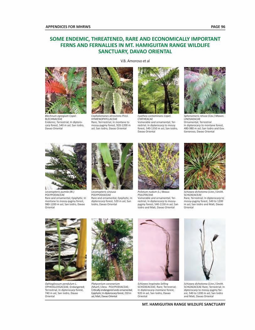
APPENDICES FOR MHRWS
MT. HAMIGUITAN RANGE WILDLIFE SANCTUARY
PAGE 96
Blechnum egregium Copel. BLECHNACEAEEndemic; Terrestrial; In diptero-carp forest, 540 m asl; San Isidro, Davao Oriental
Cephalomanes atrovirens Presl.HYMENOPHYLLACEAERare; Terrrestrial; In montane to mossy-pygmy forest, 920-1200 m asl; San Isidro, Davao Oriental
Cyathea contaminans Copel. CYATHEACAEVulnerable and ornamental; Ter-restrial; In dipterocarp to mossy forest, 540-1350 m asl; San Isidro, Davao Oriental
Sphenomeris retusa (Cav.) Maxon.LINDSAEACAEOrnamental; Terrestrial In dipterocarp to montane forest, 480-980 m asl; San Isidro and Gov. Generoso, Davao Oriental
Lecanopteris pumila (Bl.)POLYPODIACEAERare and ornamental; Epiphytic; In montane to mossy-pygmy forest, 980-1200 m asl; San Isidro, Davao Oriental
Lecanopteris sinousa POLYPODIACEAERare and ornamental; Epiphytic; In dipterocarp forest, 520 m asl; San Isidro, Davao Oriental
Psilotum nudum (L.) Beauv.PSILOTACEAEVulnerable and ornamental; Ter-restrial; In dipterocarp to mossy-pygmy forest; 540-1150 m asl; San Isidro and Mati, Davao Oriental
Schizaea dichotoma (Linn.) Smith.SCHIZAEACEAERare; Terrestrial; In dipterocarp to mossy-pygmy forest, 540 to 1200 m asl; San Isidro and Mati, Davao Oriental
SOME ENDEMIC, THREATENED, RARE AND ECONOMICALLY IMPORTANT FERNS AND FERNALLIES IN MT. HAMIGUITAN RANGE WILDLIFE
SANCTUARY, DAVAO ORIENTALV.B. Amoroso et al
Ophioglossum pendulum L. OPHIOGLOSSACEAE; Endangered; Terrestrial; In dipterocarp forest, 740 m asl, San Isidro, Davao Oriental
Platycerium coronarium (Muell.) Desv. POLYPODIACEAE; Critically endangered ands ornamental; Epiphytic; In dipterocarp forest, 210 m asl, Mati, Davao Oriental
Schizaea inopinata Selling SCHIZAEACEAE; Rare; Terrestrial; In dipterocarp-montane forest, 920 m asl, San Isidro, Davao Oriental
Schizaea dichotoma (Linn.) Smith.SCHIZAEACEAE Rare; Terrestrial; In dipterocarp to mossy-pygmy for-est, 540 to 1200 m asl; San Isidro and Mati, Davao Oriental

APPENDICES FOR MHRWS
MT. HAMIGUITAN RANGE WILDLIFE SANCTUARY
APPENDIX 6Photo documentation on some threatened and
and endemic faunal species in MHRWS
PAGE 97
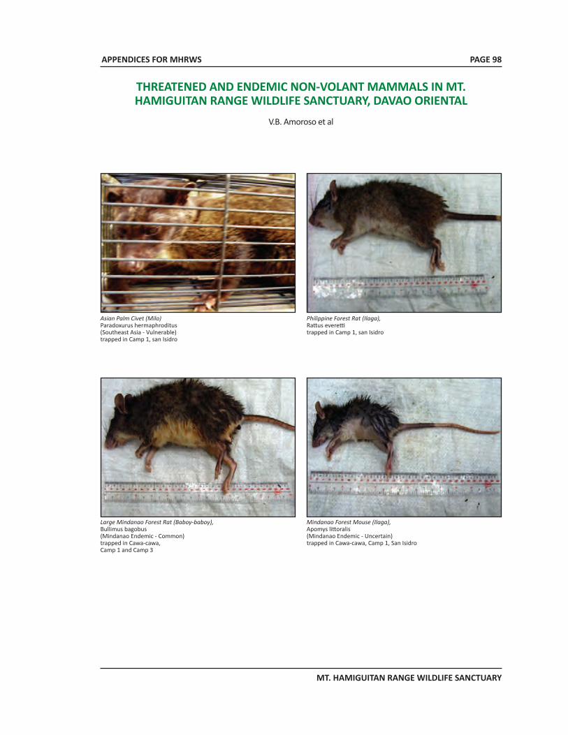
APPENDICES FOR MHRWS
MT. HAMIGUITAN RANGE WILDLIFE SANCTUARY
PAGE 98
THREATENED AND ENDEMIC NON-VOLANT MAMMALS IN MT. HAMIGUITAN RANGE WILDLIFE SANCTUARY, DAVAO ORIENTAL
V.B. Amoroso et al
Asian Palm Civet (Milo)Paradoxurus hermaphroditus(Southeast Asia - Vulnerable)trapped in Camp 1, san Isidro
Philippine Forest Rat (Ilaga),Rattus everettitrapped in Camp 1, san Isidro
Large Mindanao Forest Rat (Baboy-baboy),Bullimus bagobus(Mindanao Endemic - Common)trapped in Cawa-cawa, Camp 1 and Camp 3
Mindanao Forest Mouse (Ilaga),Apomys littoralis(Mindanao Endemic - Uncertain)trapped in Cawa-cawa, Camp 1, San Isidro
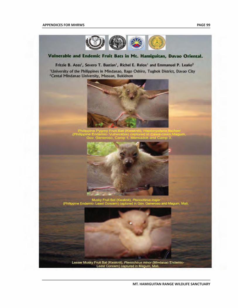
APPENDICES FOR MHRWS
MT. HAMIGUITAN RANGE WILDLIFE SANCTUARY
PAGE 99
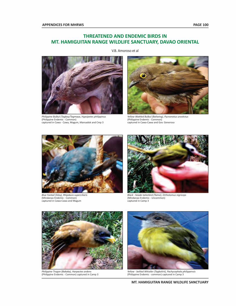
APPENDICES FOR MHRWS
MT. HAMIGUITAN RANGE WILDLIFE SANCTUARY
THREATENED AND ENDEMIC BIRDS IN MT. HAMIGUITAN RANGE WILDLIFE SANCTUARY, DAVAO ORIENTAL
V.B. Amoroso et al
Philippine Bulbul (Tagbay/Tagmaya, Hypsipetes philippinus(Philippine Endemic - Common) captured in Cawa - Cawa, Magum, Mansadok and Cmp 3
Yellow-Wattled Bulbul (Baliwing), Pycnonotus urostictus(Philippine Endemic - Common) captured in Cawa-Cawa and Gov. Generoso
Blue Fantail (Siloy), Rhipidura superciliaris(Mindanao Endemic - Common)captured in Cawa-Cawa and Magum
Black - heade tailorbird (Tamsi), Orthotomus nigriceps(Mindanao Endemic - Uncommon)captured in Camp 3
Philippine Trogon (Bakaka), Harpactes ardens(Philippine Endemic - Common) captured in Camp 3
Yellow - bellied Whistler (Tagkolirit), Pachycephala philippensis (Philippine Endemic - common) captured in Camp 3
PAGE 100
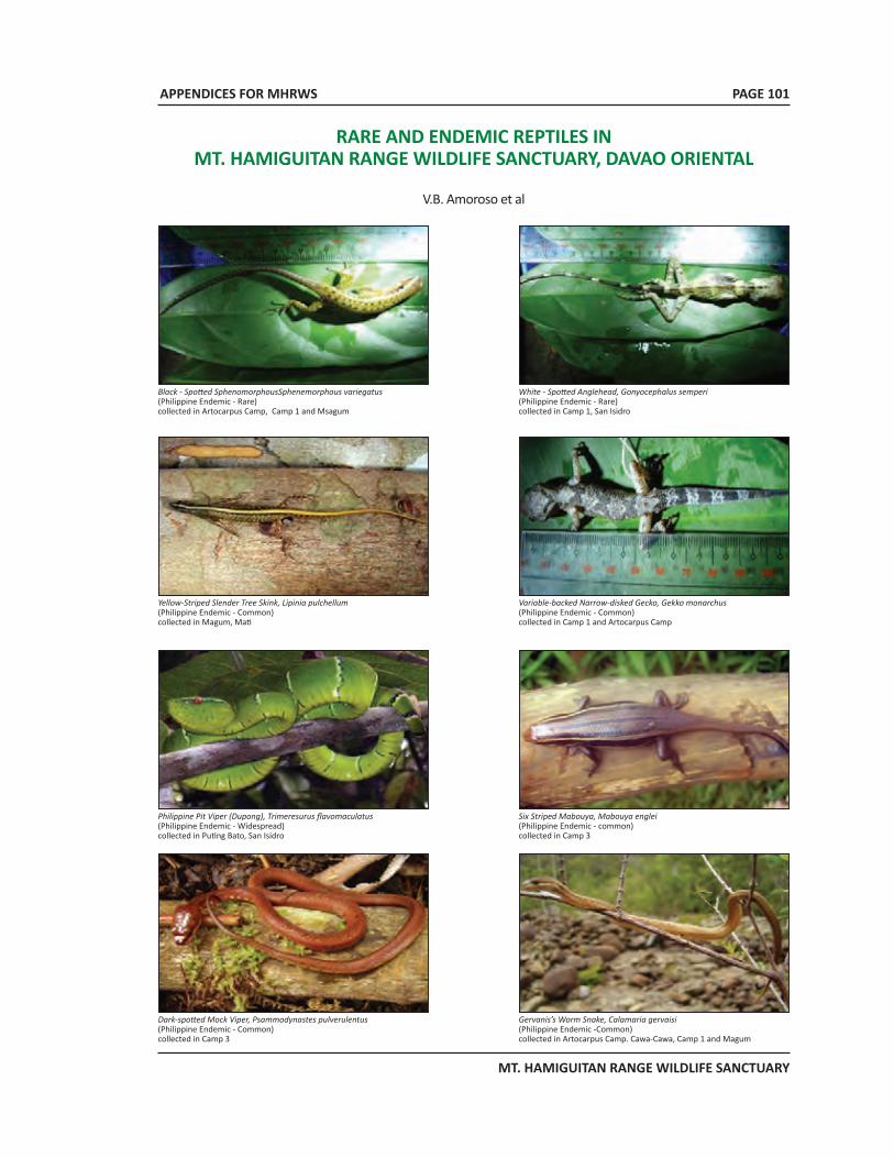
APPENDICES FOR MHRWS
MT. HAMIGUITAN RANGE WILDLIFE SANCTUARY
PAGE 101
RARE AND ENDEMIC REPTILES IN MT. HAMIGUITAN RANGE WILDLIFE SANCTUARY, DAVAO ORIENTAL
V.B. Amoroso et al
Black - Spotted SphenomorphousSphenemorphous variegatus(Philippine Endemic - Rare) collected in Artocarpus Camp, Camp 1 and Msagum
White - Spotted Anglehead, Gonyocephalus semperi(Philippine Endemic - Rare) collected in Camp 1, San Isidro
Yellow-Striped Slender Tree Skink, Lipinia pulchellum(Philippine Endemic - Common)collected in Magum, Mati
Variable-backed Narrow-disked Gecko, Gekko monarchus(Philippine Endemic - Common)collected in Camp 1 and Artocarpus Camp
Philippine Pit Viper (Dupong), Trimeresurus flavomaculatus(Philippine Endemic - Widespread)collected in Puting Bato, San Isidro
Six Striped Mabouya, Mabouya englei(Philippine Endemic - common)collected in Camp 3
Dark-spotted Mock Viper, Psammodynastes pulverulentus(Philippine Endemic - Common)collected in Camp 3
Gervanis’s Worm Snake, Calamaria gervaisi(Philippine Endemic -Common) collected in Artocarpus Camp. Cawa-Cawa, Camp 1 and Magum
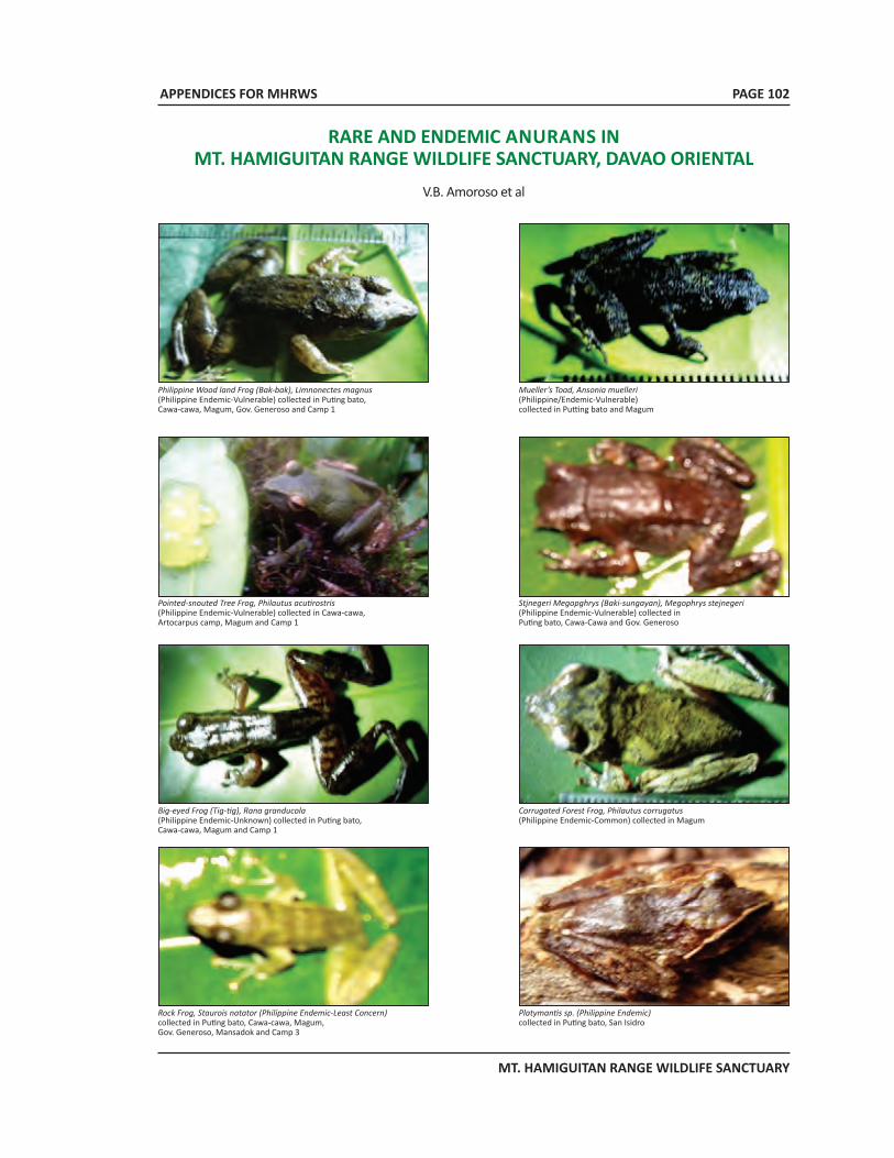
APPENDICES FOR MHRWS
MT. HAMIGUITAN RANGE WILDLIFE SANCTUARY
RARE AND ENDEMIC ANURANS IN MT. HAMIGUITAN RANGE WILDLIFE SANCTUARY, DAVAO ORIENTAL
V.B. Amoroso et al
Philippine Wood land Frog (Bak-bak), Limnonectes magnus (Philippine Endemic-Vulnerable) collected in Puting bato, Cawa-cawa, Magum, Gov. Generoso and Camp 1
Mueller’s Toad, Ansonia muelleri (Philippine/Endemic-Vulnerable)collected in Putting bato and Magum
Pointed-snouted Tree Frog, Philautus acutirostris (Philippine Endemic-Vulnerable) collected in Cawa-cawa, Artocarpus camp, Magum and Camp 1
Stjnegeri Megopghrys (Baki-sungayan), Megophrys stejnegeri(Philippine Endemic-Vulnerable) collected inPuting bato, Cawa-Cawa and Gov. Generoso
Big-eyed Frog (Tig-tig), Rana granducola (Philippine Endemic-Unknown) collected in Puting bato, Cawa-cawa, Magum and Camp 1
Corrugated Forest Frog, Philautus corrugatus (Philippine Endemic-Common) collected in Magum
Rock Frog, Staurois natator (Philippine Endemic-Least Concern) collected in Puting bato, Cawa-cawa, Magum, Gov. Generoso, Mansadok and Camp 3
Platymantis sp. (Philippine Endemic) collected in Puting bato, San Isidro
PAGE 102
APPENDICES FOR MHRWS
MT. HAMIGUITAN RANGE WILDLIFE SANCTUARY
PAGE 103
APPENDIX 7Photo documentation on some endemic, endangered and rare
butterflies in in MHRWS
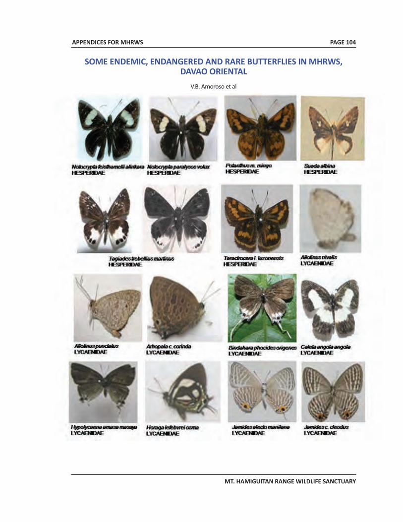
APPENDICES FOR MHRWS
MT. HAMIGUITAN RANGE WILDLIFE SANCTUARY
SOME ENDEMIC, ENDANGERED AND RARE BUTTERFLIES IN MHRWS,DAVAO ORIENTAL
V.B. Amoroso et al
PAGE 104
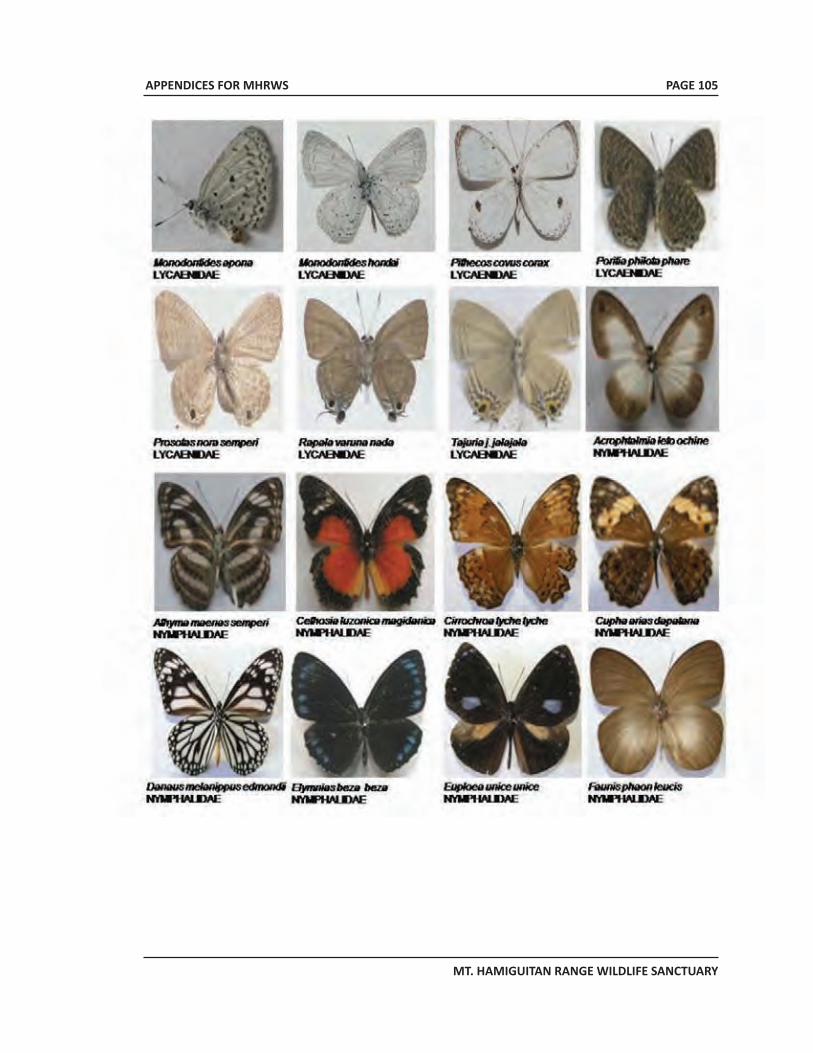
APPENDICES FOR MHRWS
MT. HAMIGUITAN RANGE WILDLIFE SANCTUARY
PAGE 105
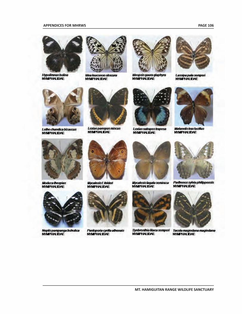
APPENDICES FOR MHRWS
MT. HAMIGUITAN RANGE WILDLIFE SANCTUARY
PAGE 106
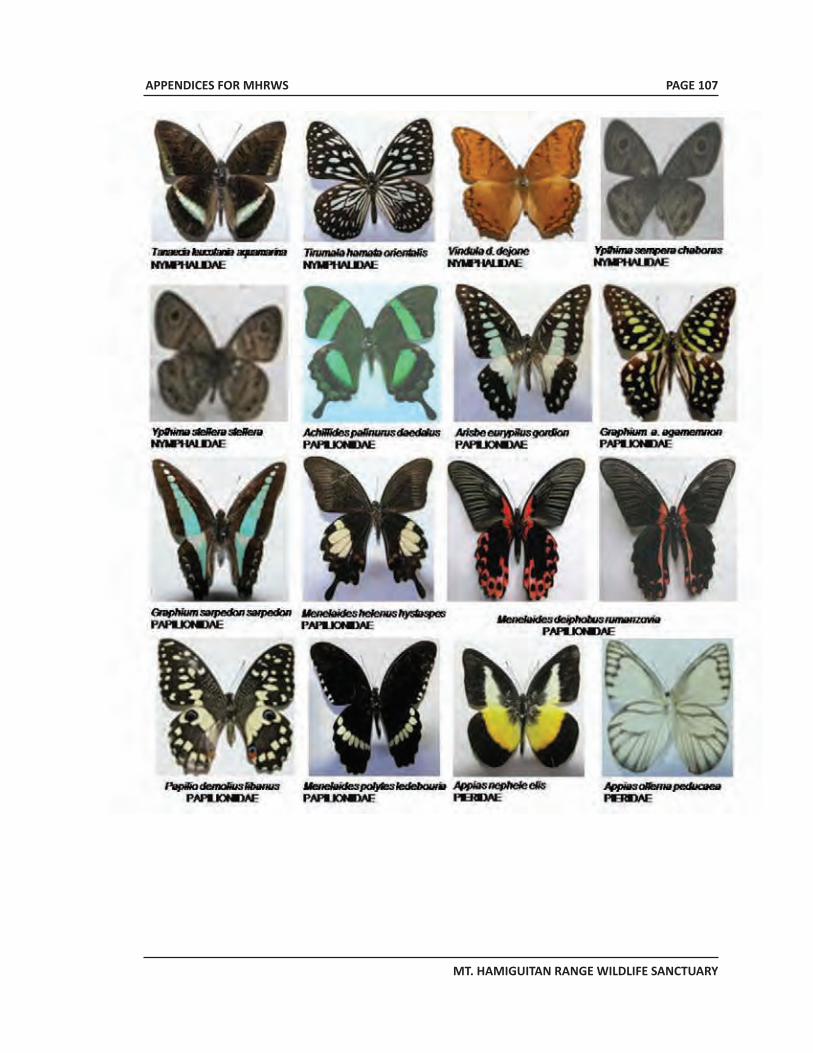
APPENDICES FOR MHRWS
MT. HAMIGUITAN RANGE WILDLIFE SANCTUARY
PAGE 107
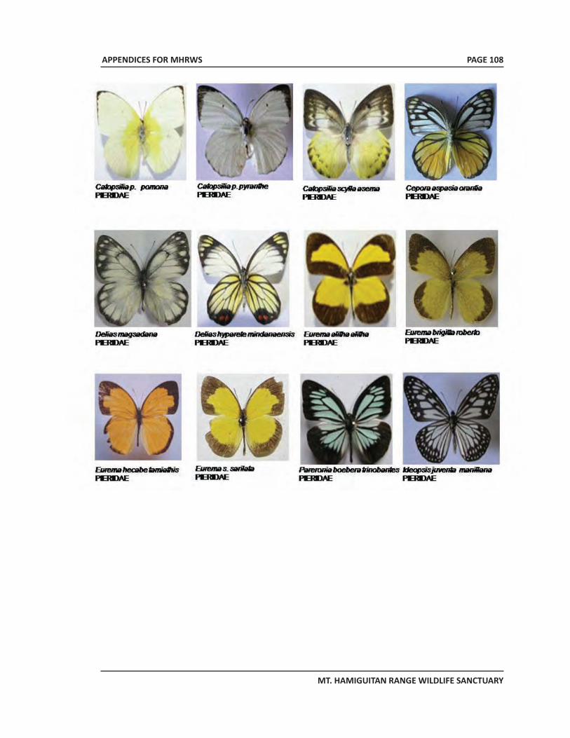
APPENDICES FOR MHRWS
MT. HAMIGUITAN RANGE WILDLIFE SANCTUARY
PAGE 108
APPENDICES FOR MHRWS
MT. HAMIGUITAN RANGE WILDLIFE SANCTUARY
PAGE 109
APPENDIX 8MHRWS PAMB Resolution 2010-02 dated 25 March 2010: A
Resolution approving the indefinite closure of Mt.Hamiguitan Range Wildlife Sanctuary to visitors/
mountaineers/trekkers effective 03 April 2010 except forduly approved research studies and activities in line with its
7-Point Agenda
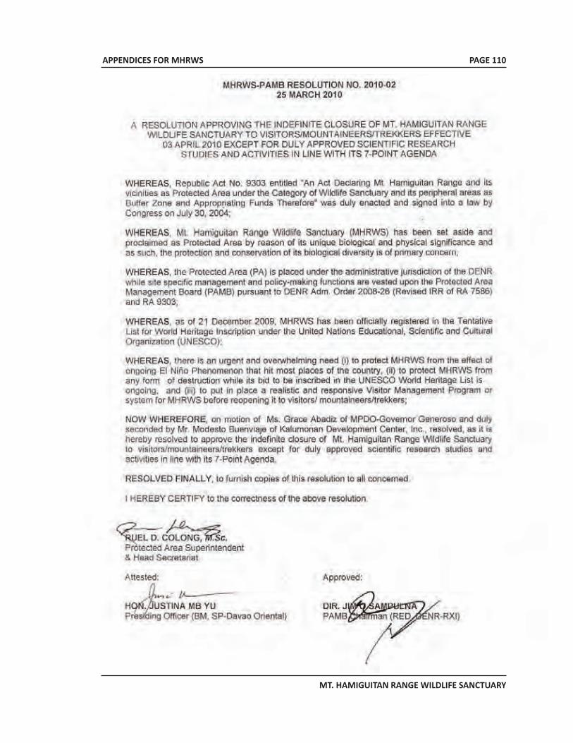
APPENDICES FOR MHRWS
MT. HAMIGUITAN RANGE WILDLIFE SANCTUARY
PAGE 110
APPENDICES FOR MHRWS
MT. HAMIGUITAN RANGE WILDLIFE SANCTUARY
PAGE 111
APPENDIX 9MHRWS PAMB Resolution 2010-03 dated 25
March 2010: A Resolution approving andadopting the 7-Point Agenda as major
requirement in re-opening the Mt. HamiguitanRange Wildlife Sanctuary for nature recreation
particularly to visitors/mountaineers/trekkers tobe co-managed by LGU/s concerned.
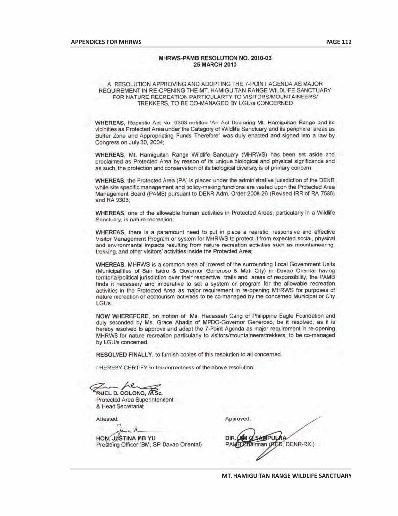
APPENDICES FOR MHRWS
MT. HAMIGUITAN RANGE WILDLIFE SANCTUARY
PAGE 112
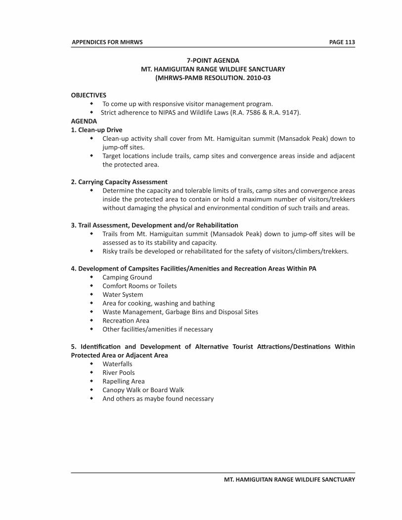
APPENDICES FOR MHRWS
MT. HAMIGUITAN RANGE WILDLIFE SANCTUARY
7-POINT AGENDAMT. HAMIGUITAN RANGE WILDLIFE SANCTUARY
(MHRWS-PAMB RESOLUTION. 2010-03
OBJECTIVESw To come up with responsive visitor management program.w Strict adherence to NIPAS and Wildlife Laws (R.A. 7586 & R.A. 9147).
AGENDA1. Clean-up Drive
w Clean-up activity shall cover from Mt. Hamiguitan summit (Mansadok Peak) down to jump-off sites.
w Target locations include trails, camp sites and convergence areas inside and adjacent the protected area.
2. Carrying Capacity Assessmentw Determine the capacity and tolerable limits of trails, camp sites and convergence areas
inside the protected area to contain or hold a maximum number of visitors/trekkers without damaging the physical and environmental condition of such trails and areas.
3. Trail Assessment, Development and/or Rehabilitationw Trails from Mt. Hamiguitan summit (Mansadok Peak) down to jump-off sites will be
assessed as to its stability and capacity.w Risky trails be developed or rehabilitated for the safety of visitors/climbers/trekkers.
4. Development of Campsites Facilities/Amenities and Recreation Areas Within PAw Camping Groundw Comfort Rooms or Toiletsw Water Systemw Area for cooking, washing and bathingw Waste Management, Garbage Bins and Disposal Sitesw Recreation Areaw Other facilities/amenities if necessary
5. Identification and Development of Alternative Tourist Attractions/Destinations Within Protected Area or Adjacent Area
w Waterfallsw River Poolsw Rapelling Areaw Canopy Walk or Board Walkw And others as maybe found necessary
PAGE 113
APPENDICES FOR MHRWS
MT. HAMIGUITAN RANGE WILDLIFE SANCTUARY
6. Capability Buildingw Orientation-seminar or trainings should be conducted involving but not limited to the
following groups:w Protected area staffw Porter’s associationw Local Bantay Gubatw Other partners in the protection and conservation of the protected area.
7. Mountaineering/Trekking Ordinance with Detailed Guidelinesw A realistic and responsive LGU Ordinance and corresponding guidelines on
mountaineering/trekking to the protected area are required to authorize the concerned LGU/s to manage the PA Visitors Mgt. Program and ensure adherence to regulations and mitigate the expected environmental and social impacts it may bring about.
EVALUATION/VALIDATION OF LGU/S’ COMPLIANCE AND ISSUANCE OF PAMB RESOLUTION ADOPTING THE SUPPOSED ORDINANCE
w A documented compliance report with supporting data and pictorials together with the draft Mountaineering/Trekking Ordinance and Guidelines shall be submitted to PAMB/PASO.
w Upon evaluation/validation of LGUs’ compliance, a Resolution shall be passed by the PAMB to authorize/legitimize co-management by LGU/s on the Visitor Management Program in MHRWS particularly on mountaineering/trekking activity.
PAGE 114
APPENDICES FOR MHRWS
MT. HAMIGUITAN RANGE WILDLIFE SANCTUARY
PAGE 115
APPENDIX 10An Act Providing for the conservation and protection of
wildlife resources and their habitats, appropriating fundstherefore and for other purposes
APPENDICES FOR MHRWS
MT. HAMIGUITAN RANGE WILDLIFE SANCTUARY
REPUBLIC ACT NO. 9147July 30, 2001
AN ACT PROVIDING FOR THE CONSERVATION AND PROTECTION OF WILDLIFE RESOURCES AND THEIR HABITATS, APPROPRIATING FUNDS THEREFOR AND FOR OTHER PURPOSES
Be it enacted by the Senate and the House of Representatives of the Philippines in Congress assembled:
CHAPTER I
GENERAL PROVISIONS
Section 1. Title. This act shall be known as the “Wildlife Resources Conservation and Protection Act.”Section 2. Declaration of Policy. It shall be the policy of the State to conserve the country’s wildlife resources and their habitats for sustainability. In the pursuit of this policy, this Act shall have the following objectives:
a. to conserve and protect wildlife species and their habitats to promote ecological balance and enhance biological diversity;
b. to regulate the collection and trade of wildlife;c. to pursue, with due regard to the national interest, the Philippine commitment to
international conventions, protection of wildlife and their habitats; andd. to initiate or support scientific studies on the conservation of biological diversity.
Section 3. Scope of Application. The provisions of this Act shall be enforceable for all wildlife species found in all areas of the country, including protected areas under Republic Act No. 7586, otherwise known as the National Integrated Protected Areas System (NIPAS) Act, and critical habitats. This Act shall also apply to exotic species which are subject to trade, are cultured, maintained and/or bred in captivity or propagated in the country.
Section 4. Jurisdiction of the Department of Environment and Natural Resources and the Department of Agriculture. The Department of Environment and Natural Resources (DENR) shall have jurisdiction over all terrestrial plant and animal species, all turtles and tortoises and wetland species, including but not limited to crocodiles, waterbirds and all amphibians and dugong. The Department of Agriculture (DA) shall have jurisdiction over all declared aquatic critical habitats, all aquatic resources including but not limited to all fishes, aquatic plants, invertebrates and all marine mammals, except dugong. The secretaries of the DENR and the DA shall review, and by joint administrative order, revise and regularly update the list of species under their respective jurisdiction. In the Province of Palawan, jurisdiction herein conferred is vested to the Palawan Council for Sustainable Development pursuant to Republic Act No. 7611.
PAGE 116
APPENDICES FOR MHRWS
MT. HAMIGUITAN RANGE WILDLIFE SANCTUARY
CHAPTER II
DEFINITION OF TERMS
Section 5. Definition of Terms. As used in the Act, the term:“Bioprospecting” means the research, collection and utilization of biological and genetic resources for purposes of applying the knowledge derived there from solely for commercial purposes; “By-product or derivatives” means any part taken or substance extracted from wildlife, in raw or in processed form. This includes stuffed animals and herbarium specimens;
“Captive-breeding/culture or propagation” means the process of producing individuals under controlled conditions or with human interventions;
“Collection or collecting” means the act of gathering or harvesting wildlife, its by-products orderivatives;
“Conservation” means preservation and sustainable utilization of wildlife, and/or maintenance, restoration and enhancement of the habitat;
“Critically endangered species” refers to a species or subspecies that is facing extremely high risk of extinction in the wild in the immediate future;
“Economically important species” quot; means species or subspecies which have actual or potential value in trade or utilization for commercial purpose;
“Endangered species” refers to species or subspecies that is not critically endangered but whose survival in the wild is unlikely if the causal factors continue operating;
“Endemic species” Means species or subspecies which is naturally occurring and found only within specific areas in the country;
“Exotic species” means species or subspecies which do not naturally occur in the country;
“Export permit” refers to a permit authorizing an individual to bring out wildlife from the Philippines to any other country;
“Gratuitous permit” means permit issued to any individual or entity engaged in noncommercial scientific, or educational undertaking to collect wildlife;
“Habitat” means place or environment where species or subspecies naturally occur or has naturally established its population;
“Import permit” refers to a permit authorizing an individual to bring in wildlife from another country;
“Indigenous wildlife” means species or subspecies of wildlife naturally occurring or has naturally established population in the country;
PAGE 117
APPENDICES FOR MHRWS
MT. HAMIGUITAN RANGE WILDLIFE SANCTUARY
“Introduction” means bringing species into the wild that is outside its natural habitat;
“Re-export permit” refers to a permit authorizing an individual to bring out of the country a previous imported wildlife;
“Secretary” means either or both the Secretary of the Department of Environment and Natural Resources and the Secretary of the Department of Agriculture;
“Threatened species” a general term to denote species or subspecies considered as critically endangered, endangered, vulnerable or other accepted categories of wildlife whose population is at risk of extinction;
“Trade” means the act of engaging in the exchange, exportation or importation, purchase or sale of wildlife, their derivatives or by-products, locally or internationally;
“Traditional use” means utilization of wildlife by indigenous people in accordance with written or unwritten rules, usage, customs and practices traditionally observed, accepted and recognized by them;
“Transport permit” means a permit issued authorizing an individual to bring wildlife from one place to another within the territorial jurisdiction of the Philippines;
“Vulnerable species” refers to species or subspecies that is not critically endangered nor endangered but is under threat from adverse factors throughout their range and is likely to move to the endangered category in the near future;
“Wildlife” means wild forms and varieties of flora and fauna, in all developmental stages, including those which are in captivity or are being bred or propagated;
“Wildlife collector’s permit” means a permit to take or collect from the wild certain species and quantities of wildlife for commercial purposes; and
“Wildlife farm/culture permit” means a permit to develop, operate and maintain a wildlife breeding farm for conservation, trade and/or scientific purposes.
CHAPTER III
CONSERVATION AND PROTECTION OF WILDLIFE
RESOURCES
ARTICLE ONE
General ProvisionSection 6. Wildlife Information. All activities, as subsequently manifested under this Chapter, shall be authorized by the Secretary upon proper evaluation of best available information or scientific data showing that the activity is, or for a purpose, not detrimental to the survival of the species
PAGE 118
APPENDICES FOR MHRWS
MT. HAMIGUITAN RANGE WILDLIFE SANCTUARY
or subspecies involved and/or their habitat. For this purpose, the Secretary shall regularly update wildlife information through research.
Section 7. Collection of Wildlife. Collection of wildlife may be allowed in accordance with Section 6 of this Act: Provided, That in the collection of wildlife, appropriate and acceptable wildlife collection techniques with least or no detrimental effects to the existing wildlife populations and their habitats shall, likewise, be required: Provided, further, That collection of wildlife by indigenous people may be allowed for traditional use and not primarily for trade:
Provided, furthermore, That collection and utilization for said purpose shall not cover threatened species: Provided, finally, That Section 23 of this Act shall govern the collection ofthreatened species.
Section 8. Possession of Wildlife. No person or entity shall be allowed possession of wildlife unless such person or entity can prove financial and technical capability and facility to maintain said wildlife: Provided, That the source was not obtained in violation of this Act.
Section 9. Collection and/or Possession of By-Products and Derivatives. By-products and derivatives may be collected and/or possessed: Provided, That the source was not obtained in violation of this Act.
Section 10. Local Transport of Wildlife, By- Products and Derivatives. Local transport of wildlife, by-products and derivatives collected or possessed through any other means shall be authorized unless the same is prejudicial to the wildlife and public health.
Section 11. Exportation and/or Importation of Wildlife. Wildlife species may be exported to or imported from another country as may be authorized by the Secretary or the designated representative, subject to strict compliance with the provisions of this Act and rules and regulations promulgated pursuant thereto: Provided, That the recipient of the wildlife is technically and financially capable to maintain it.
Section 12. Introduction, Reintroduction or Restocking of Endemic or Indigenous Wildlife. The introduction, reintroduction or restocking of endemic and indigenous wildlife shall be allowed only for population enhancement of recovery purposes subject to prior clearance from the Secretary of the authorized representative pursuant to Section 6 of this Act.
Any proposed introduction shall be subject to a scientific study which shall focus on the bioecology. The proponent shall also conduct public consultations with concerned individuals or entities.
Section 13. Introduction of Exotic Wildlife. - No exotic species shall be introduced into the country, unless a clearance from the Secretary or the authorized representative is first obtained. In no case shall exotic species be introduced into protected areas covered by Republic Act No. 7586 and to critical habitats under Section 25 hereof.In cases where introduction is allowed, it shall be subject to environmental impact study which shall focus on the bioecology, socioeconomic and related aspects of the area where the species will be introduced. The proponent shall also be required to secure the prior informed consent from the local stakeholders.
PAGE 119
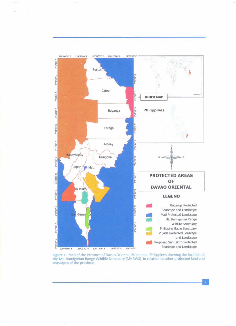
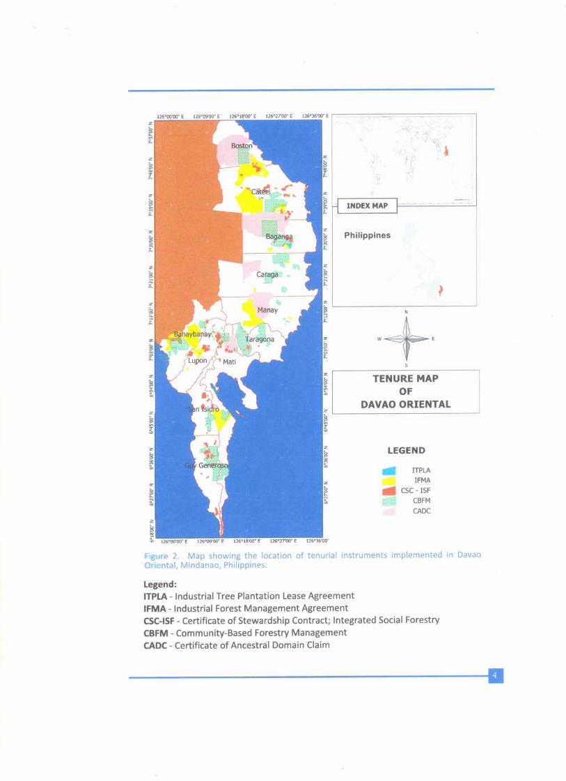
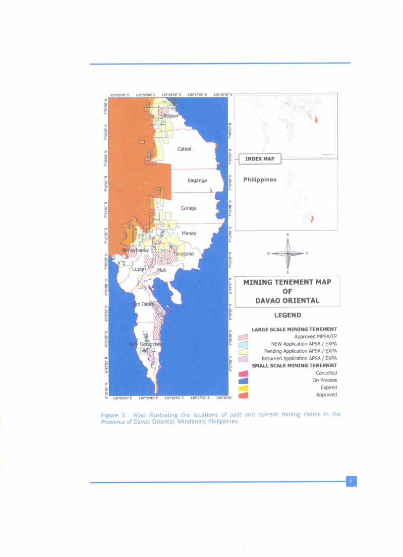
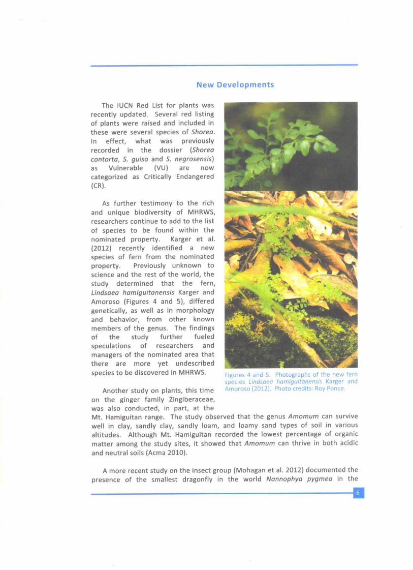
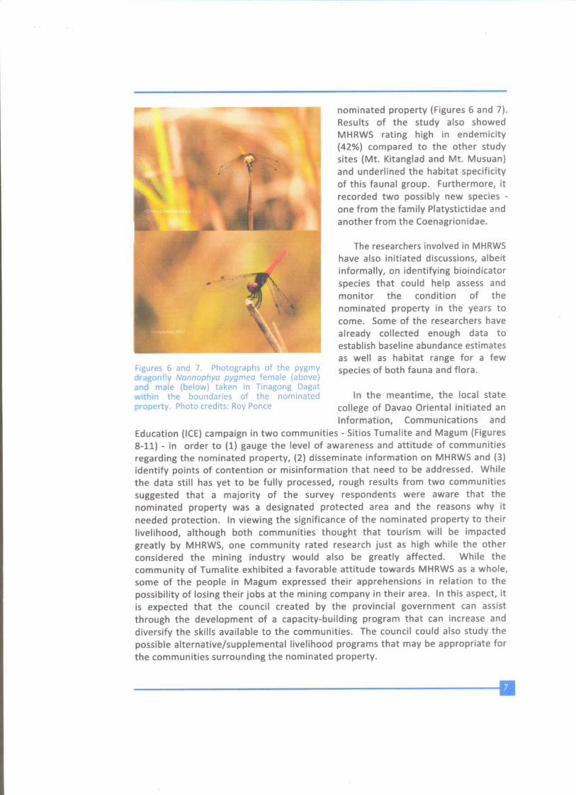
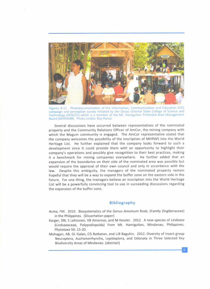
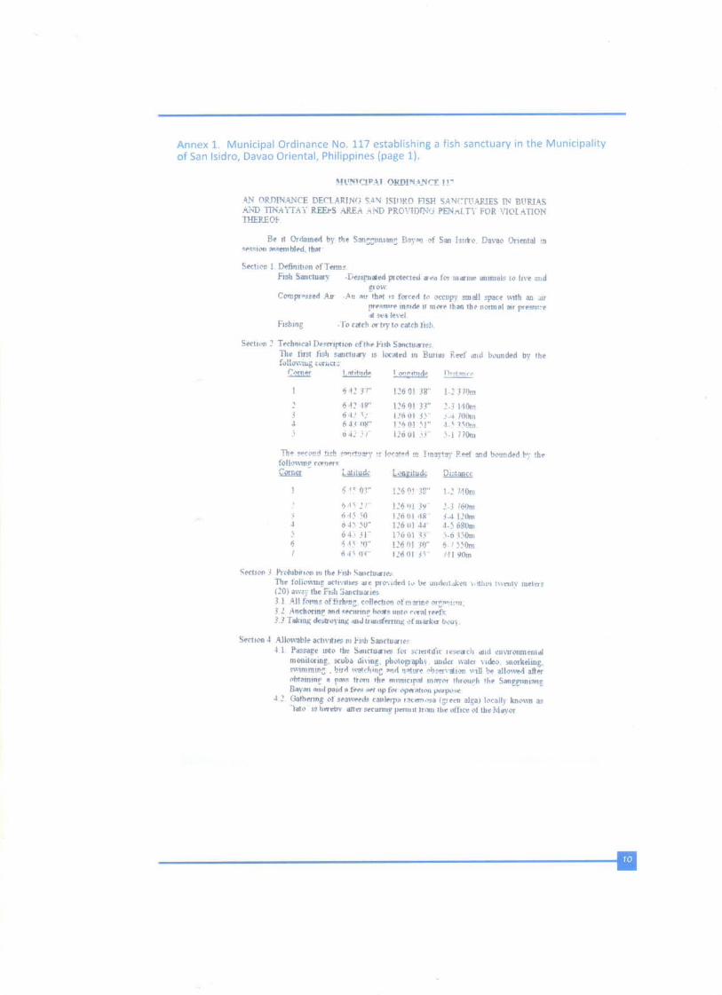
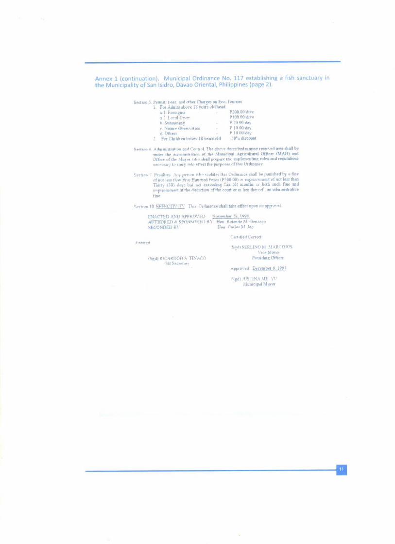
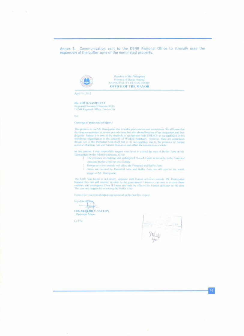
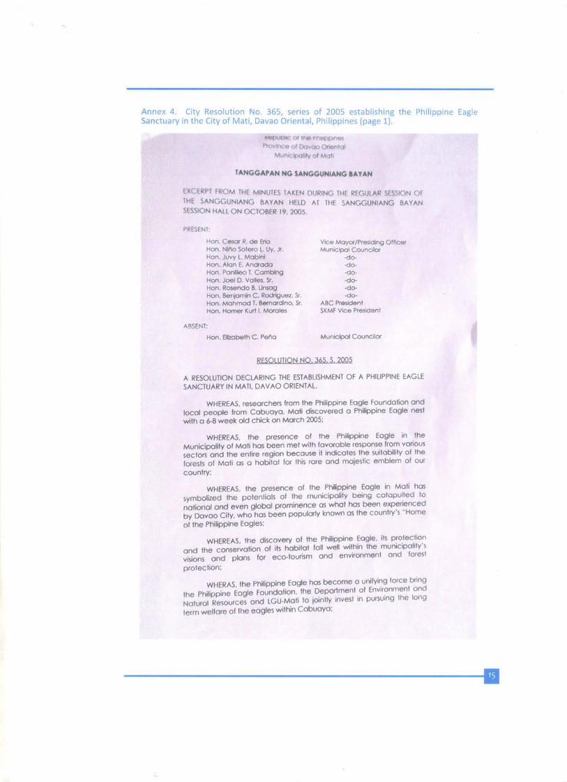
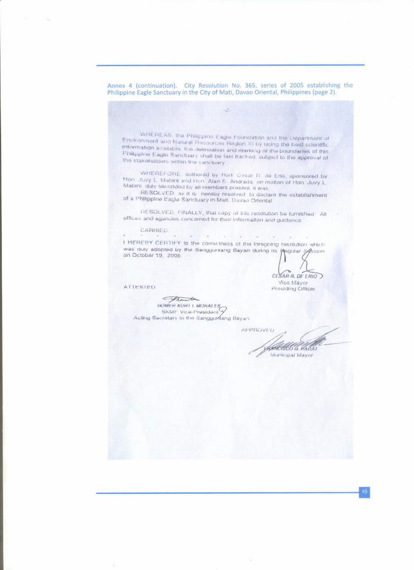
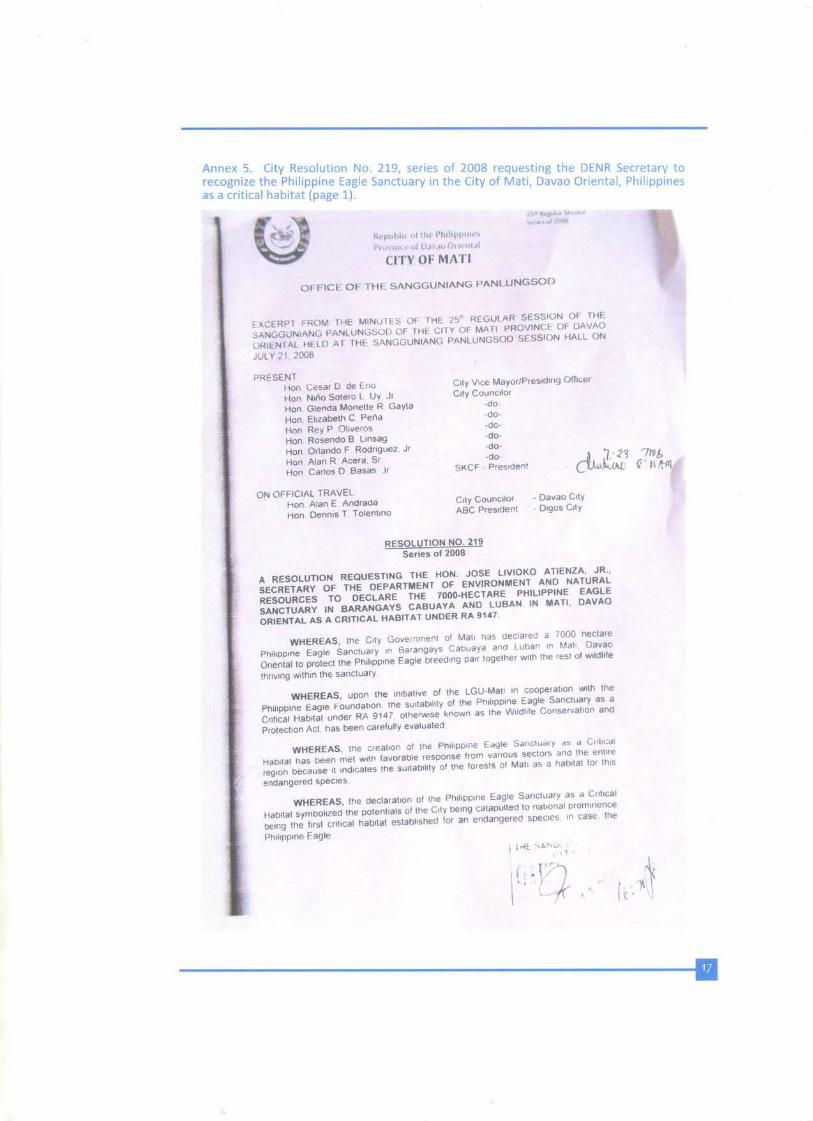
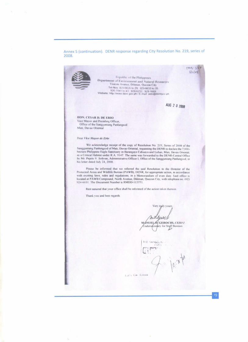
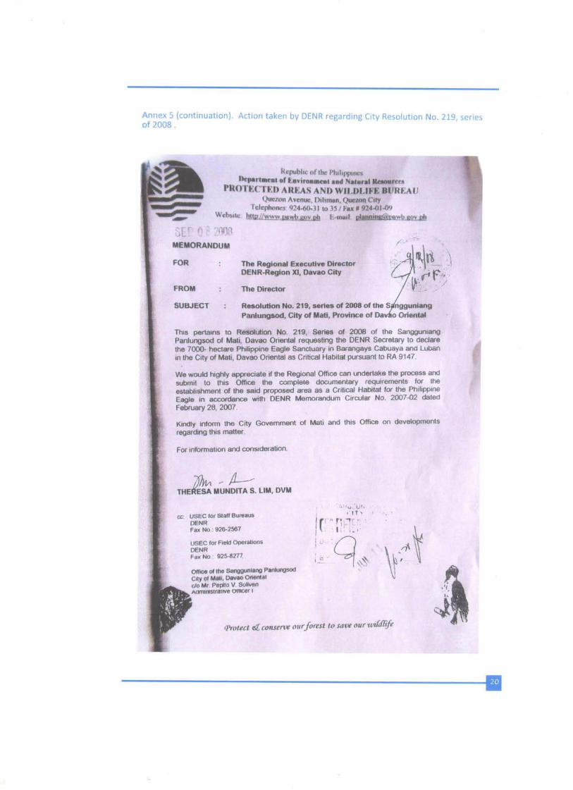
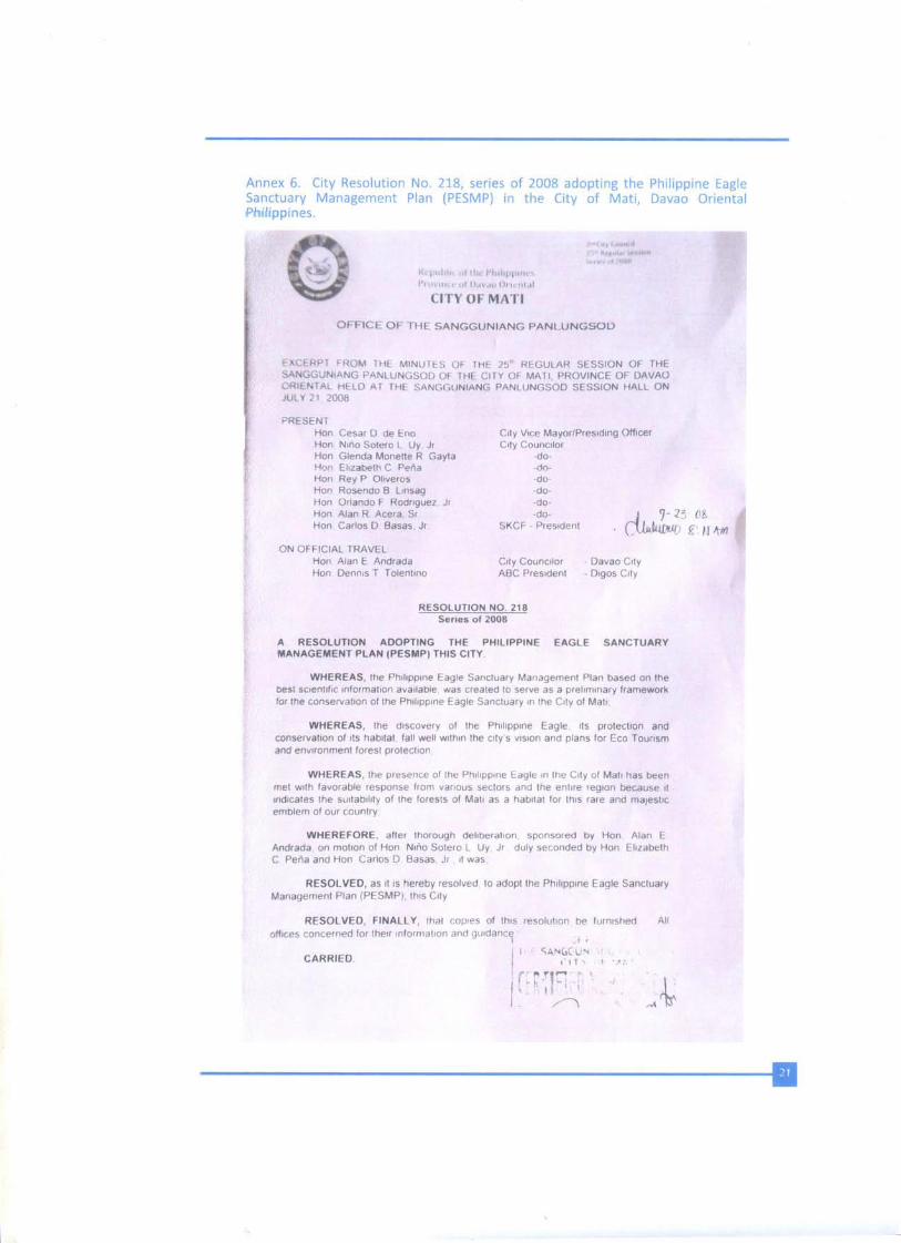
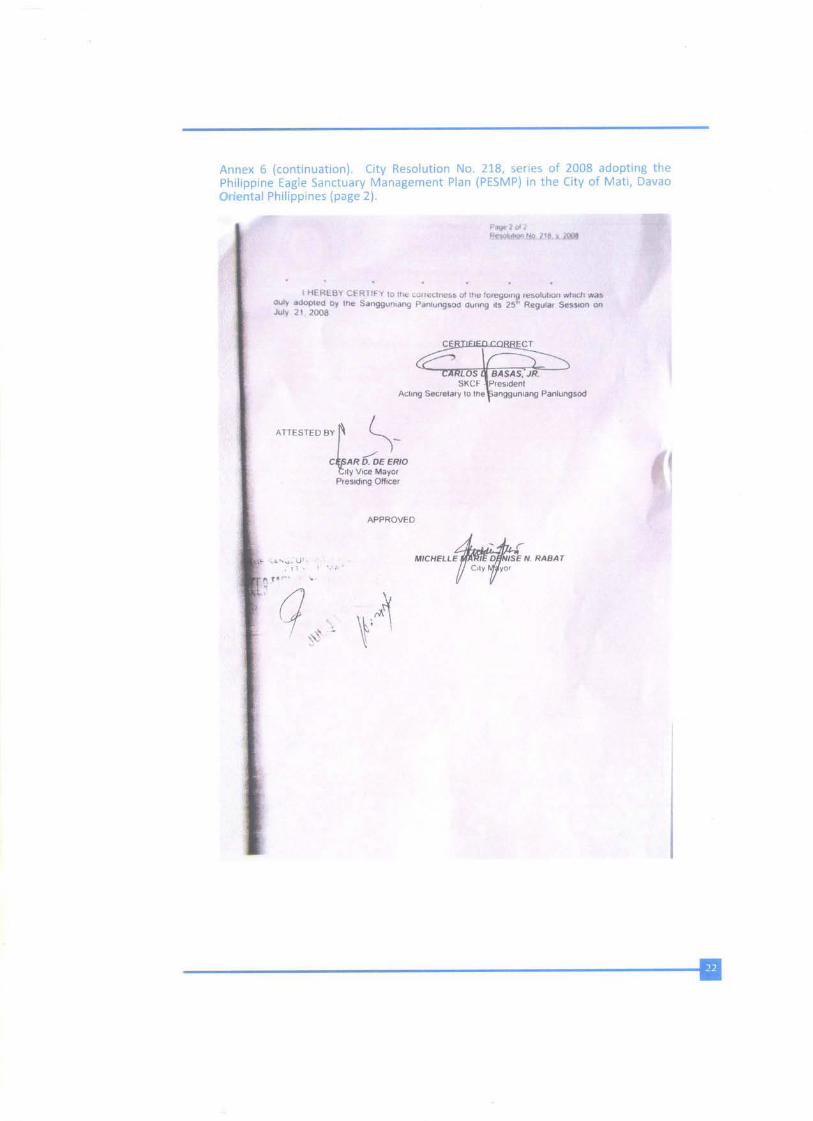
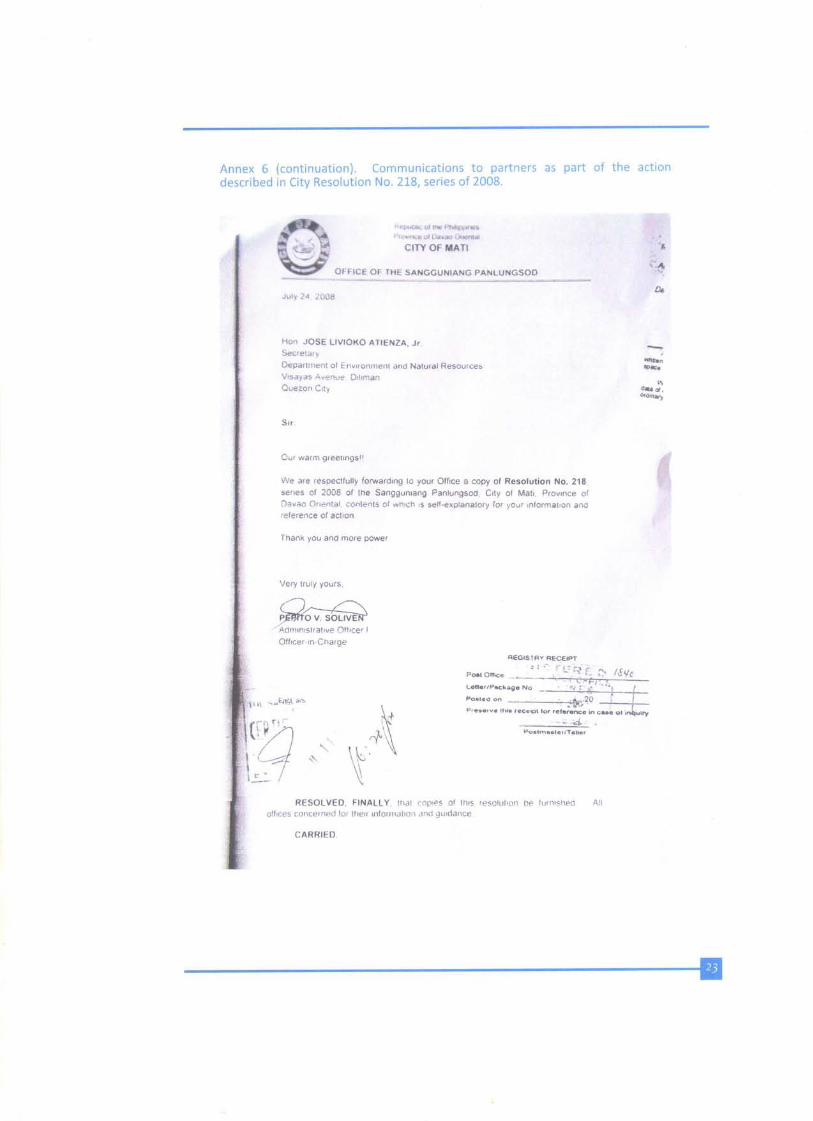
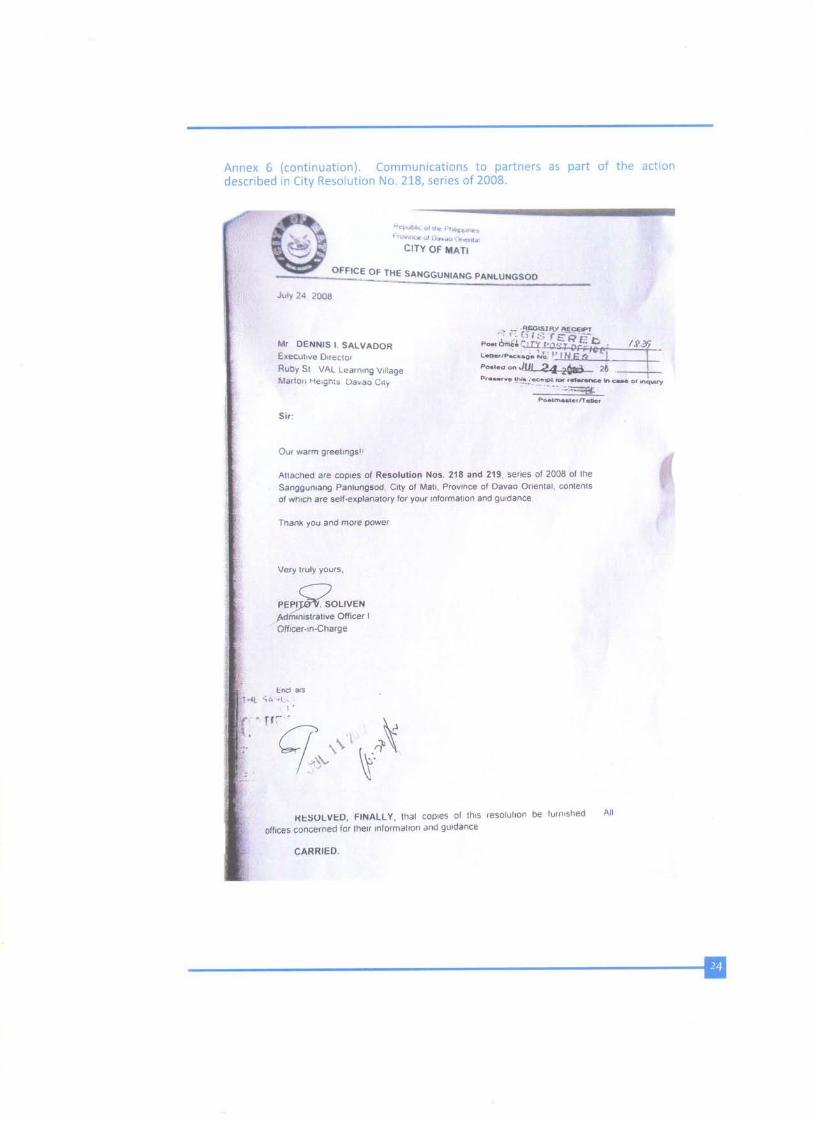
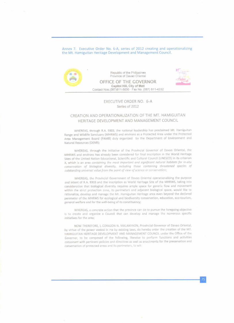
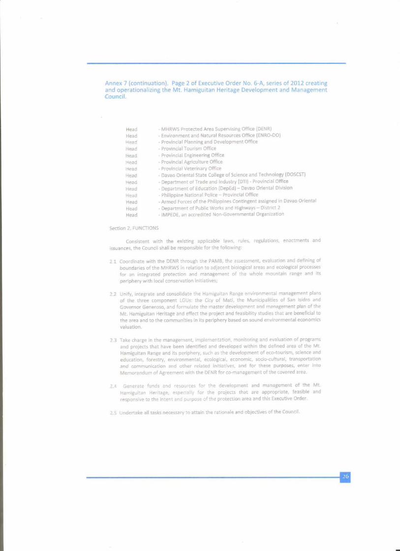
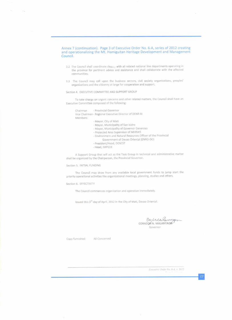
APPENDICES FOR MHRWS
MT. HAMIGUITAN RANGE WILDLIFE SANCTUARY
Section 14. Bioprospecting. - Bioprospecting shall be allowed upon execution of an undertaking by any proponent, stipulating therein its compliance with and commitment(s) to reasonable terms and conditions that may be imposed by the Secretary which are necessary to protect biological diversity. The Secretary or the authorized representative, in consultation with the concerned agencies, before granting the necessary permit, shall require that prior informed consent be obtained by the applicant from the concerned indigenous cultural communities, local communities, management board under Republic Act No. 7586 or private individual or entity. The applicant shall disclose fully the intent and scope of the bioprospecting activity in a language and process understandable to the community. The prior informed consent from the indigenous peoples shall be obtained in accordance with existing laws. The action on the bioprospecting proposal by concerned bodies shall be made within a reasonable period.
Upon submission of the complete requirements, the Secretary shall act on the research proposal within a reasonable period.
If the applicant is a foreign entity or individual, a local institution should be actively involved in the research, collection and, whenever applicable and appropriate in the technological development of the products derived from the biological and genetic resources.
Section 15. Scientific Researches on Wildlife. Collection and utilization of biological resources for scientific research and not for commercial purposes shall be allowed upon execution of an undertaking/agreement with and issuance of a gratuitous permit by the Secretary or the authorized representative: Provided, That prior clearance from concerned bodies shall be secured before the issuance of the gratuitous permit: Provided, further, That the last paragraph of Section 14 shall likewise apply.
Section 16. Biosafety. All activities dealing on genetic engineering and pathogenic organisms in the Philippines, as well as activities requiring the importation, introduction, field release and breeding of organisms that are potentially harmful to man and the environment shall be reviewed in accordance with the biosafety guidelines ensuring public welfare and the protection and conservation of wildlife and their habitats.
Section 17. Commercial Breeding or Propagation of Wildlife Resources. Breeding or propagation of wildlife for commercial purposes shall be allowed by the Secretary or the authorized representative pursuant to Section 6 through the issuance of wildlife farm culture permit: Provided, That only progenies of wildlife raised, as well as unproductive parent stock shall be utilized for trade: Provided, further: That commercial breeding operations for wildlife, whenever appropriate, shall be subject to an environmental impact study.
Section 18. Economically Important Species. The Secretary, within one (1) year after the effectivity of this Act, shall establish a list of economicallyimportant species. A population assessment of such species shall be conducted within a reasonable period and shall be regularly reviewed and updated by the Secretary.
The Collection of certain species shall only be allowed when the results of the assessment show that, despite certain extent of collection, the population of such species can still remain viable and capable of recovering its numbers. For this purpose, the Secretary shall establish a schedule and
PAGE 120
APPENDICES FOR MHRWS
MT. HAMIGUITAN RANGE WILDLIFE SANCTUARY
volume of allowable harvests.Whenever an economically important species become threatened, any form of collection shall be prohibited except for scientific, educational or breeding/propagation purposes, pursuant to the provisions of this Act.
Section 19. Designation of Management and Scientific Authorities for International Trade in Endangered Species of Wild Fauna and Flora. For the implementation of International agreement on international trade in endangered species of wild fauna and fora, the management authorities for terrestrial and aquatic resources shall be the Protected Areas and Wildlife Bureau (PAWB) of the DENR and the Bureau of Fisheries and Aquatic Resources (BFAR) of the DA, respectively and that in the Province of Palawan the implementation hereof is vested to the Palawan Council for Sustainable Development pursuant to Republic Act No. 7611.
To provide advice to the management authorities, there shall be designated scientific authorities for terrestrial and aquatic/marine species. For the terrestrial species, the scientific authorities shall be the Ecosystems Research and Development Bureau (ERDB) of the DENR, the U.P. Institute of Biological Sciences and the National Museum and other agencies as may be designated by the Secretary. For the marine and aquatic species, the scientific authorities shall be the BFAR, the U.P. Marine Science Institute, U.P. Visayas, Siliman University and the National Museum and other agencies as may be designated by the Secretary:
Provided, That in the case of terrestrial species, the ERDB shall chair the scientific authorities, and in the case of marine and aquatic species, the U.P. Marine Science Institute shall chair the scientific authorities.
Section 20. Authority of the Secretary to Issue Permits. - The Secretary or the duly authorized representative, in order to effectively implement this Act, shall issue permits/certifications/ clearances with corresponding period of validity, whenever appropriate, which shall include but not limited to the following:
a. Wildlife farm or culture permit 3 to 5 years;b. Wildlife collector’s permit 1 to 3 years;c. Gratuitous permit 1 year;d. Local transport permit 1 to 3 months; ande. Export/Import/Re-export permit 1 to 6 months.
These permits may be renewed subject to the guidelines issued by the appropriate agency and upon consultation with concerned groups.
Section 21. Fees and Charges. - Reasonable fees and charges as may be determined upon consultation with the concerned groups, and in the amount fixed by the Secretary shall be imposed for the issuances of permits enumerated in the preceding section.For the export of wildlife species, an export permit fee of not greater than three percentum (3%) of the export value, excluding transport costs, shall be charged: Provided, however, That in the determination of aforesaid fee, the production costs shall be given due consideration. Cutflowers, leaves and the like, produced from farms shall be exempted from the said export fee: Provided, further, That fees and charges shall be reviewed by the Secretary every two (2) years or as the need arises and revise the same accordingly, subject to consultation with concerned sectors.
PAGE 121
APPENDICES FOR MHRWS
MT. HAMIGUITAN RANGE WILDLIFE SANCTUARY
ARTICLE TWO
Protection of Threatened Species
Section 22. Determination of Threatened Species. - The Secretary shall determine whether any wildlife species or subspecies is threatened, and classify the same as critically endangered, endangered, vulnerable or other accepted categories based on the best scientific data and with due regard to internationally accepted criteria, including but not limited to the following: present or threatened destruction, modification or curtailment of its habitat or range;
a. over-utilization for commercial, recreational, scientific or educational purposes;b. inadequacy of existing regulatory mechanisms; andc. other natural or man-made factors affecting the existence of wildlife.
The Secretary shall review, revise and publish the list of categorized threatened wildlife within one (1) year after effectivity of this Act. Thereafter, the list shall be updated regularly or as the need arises: Provided, That a species listed as threatened shall not be removed there from within three (3) years following its initial listing.
Upon filing of a petition based on substantial scientific information of any person seeking for the addition or deletion of a species from the list, the Secretary shall evaluate in accordance with the relevant factors stated in the first paragraph of this section, the status of the species concerned and act on said petition within a reasonable period.
The Secretary shall also prepare and publish a list of wildlife which resembles so closely in appearance with listed threatened wildlife, which species shall likewise be categorized as threatened.
Section 23. Collection of Threatened Wildlife, Byproducts and Derivatives. The collection of threatened wildlife, as determined and listed pursuant to this Act, including its by-products and derivatives, shall be allowed only for scientific, or breeding or propagation purposes in accordance with Section 6 of this Act: Provided, That only the accredited individuals, business, research, educational or scientific entities shall be allowed to collect for conservation breeding or propagation purposes.
Section 24. Conservation Breeding or Propagation of Threatened Species. Conservation breeding or propagation of threatened species shall be encouraged in order to enhance its population in its natural habitat. It shall be done simultaneously with the rehabilitation and/or protection of the habitat where the captive-bred or propagated species shall be released, reintroduced or restocked.
Commercial breeding or propagation of threatened species may be allowed provided that the following minimum requirements are met by the applicant, to wit:
a) Proven effective breeding and captive management techniques of the species; andb) Commitment to undertake commercial breeding in accordance with Section 17 of this
Act, simultaneous with conservation breeding.The Secretary shall prepare a list of threatened species for commercial breeding and shall regularly revise or update such list or as the need arises.
PAGE 122
APPENDICES FOR MHRWS
MT. HAMIGUITAN RANGE WILDLIFE SANCTUARY
Section 25. Establishment of Critical Habitats. - Within two (2) years following the effectivity of this Act, The Secretary shall designate critical habitats outside protected areas under Republic Act No. 7586, where threatened species are found. Such designation shall be made on the basis of the best scientific data taking into consideration species endemicity and/or richness, presence of man-made pressures/threats to the survival of wildlife living in the area, among others.
All designated, critical habitats shall be protected, in coordination with the local government units and other concerned groups, from any form of exploitation or destruction which may be detrimental to the survival of the threatened species dependent therein. For such purpose, the Secretary may acquire, by purchase, donation or expropriation, lands, or interests therein, including the acquisition of usufruct, establishment of easements or other undertakings appropriate in protecting the critical habitat.
ARTICLE THREE
Registration of Threatened and Exotic Species
Section 26. Registration of Threatened and Exotic Wildlife in the Possession of Private Persons. - No person or entity shall be allowed possession of wildlife unless such person or entity can prove financial and technical capability and facility to maintain said wildlife. Twelve (12) months after the effectivity of this Act, the Secretary shall set a period, within which persons/entities shall register all threatened species collected and exotic species imported prior to the effectivity of this Act.
However, when the threatened species is needed for breeding/propagation or research purposes, the State may acquire the wildlife through a mutually acceptable arrangement.
After the period set has elapsed, threatened wildlife possessed without certificate of registration shall be confiscated in favor of the government, subject to the penalties herein provided.
All Philippine wildlife which are not listed as threatened prior to the effectivity of this Act but which may later become so, shall likewise be registered during the period set after the publication of the updated list of threatened species.
CHAPTER IV ILLEGAL ACTSSection 27. Illegal Acts. - Unless otherwise allowed in accordance with this Act, it shall be unlawful for any person to willfully and knowingly exploit wildlife resources and their habitats, or undertake the following acts;a) killing and destroying wildlife species, except in the following instances;
i. when it is done as part of the religious rituals of established tribal groups or indigenous cultural communities;
ii. when the wildlife is afflicted with an incurable communicable disease;iii. when it is deemed necessary to put an end to the misery suffered by the wildlife;iv. when it is done to prevent an imminent danger to the life or limb of a human being;
andv. when the wildlife is killed or destroyed after it has been used in authorized research or
experiments
PAGE 123
APPENDICES FOR MHRWS
MT. HAMIGUITAN RANGE WILDLIFE SANCTUARY
b) inflicting injury which cripples and/or impairs the reproductive system of wildlife species;
c) effecting any of the following acts in critical habitat(s)i. dumping of waste products detrimental to wildlife;ii. squatting or otherwise occupying any portion of the critical habitat;iii. mineral exploration and/or extraction;iv. burning;v. logging; andvi. quarryingd) introduction, reintroduction or restocking of wildlife resources;e) trading of wildlife;f) collecting, hunting or possessing wildlife, their by-products and derivatives;g) gathering or destroying of active nests, nest trees, host plants and the like;h) maltreating and/or inflicting other injuries not covered by the preceding paragraph;
andi) transporting of wildlife.
CHAPTER V
FINES AND PENALTIES
Section 28. Penalties for Violations of this Act. For any person who undertakes illegal acts under paragraph (a) of the immediately preceding section to any species as may be categorized pursuant to this Act, the following penalties and/or fines shall be imposed;
a. imprisonment of a minimum of six (6) years and one (1) day to twelve (12) years and/or a fine of One hundred thousand pesos (P100,000.00) to One million pesos (P1,000,000.00), if inflicted or undertaken against species listed as critical;
b. imprisonment of four (4) and one (1) day to six (6) years and/or a fine of Fifty thousand pesos (P50,000.00) to Five hundred thousand pesos (P500,000.00) if inflicted or undertaken against endangered species;
c. imprisonment of two (2) years and one (1) day to four (4) years and/or a fine of Thirty thousand pesos (P30,000.00) to Three hundred thousand pesos (P300,000.00), if inflicted or undertaken against vulnerable species;
d. imprisonment of one (1) year and one (1) day to two (2) years and/or a fine of Twenty thousand pesos (P20,000.00) to Two hundred thousand pesos (P200,000.00) if inflicted or undertaken against other threatened species; and
e. imprisonment of six (6) months and one (1) day to one (1) year and/or a fine of Ten thousand pesos (P10,000.00) to One hundred thousand pesos (P100,000.00), if inflicted or undertaken against other wildlife species.
For illegal acts under paragraph (b) of the immediately preceding section, the following penalties and/or fines shall be imposed;
a. imprisonment of minimum of four (4) years and one (1) day to six (6) years and/or a fine of Fifty thousand pesos (P50,000.00) to Five hundred thousand pesos (P500,000.00), if inflicted or undertaken against species listed as critical;
PAGE 124
APPENDICES FOR MHRWS
MT. HAMIGUITAN RANGE WILDLIFE SANCTUARY
b. imprisonment of two (2) years and one (1) day to four (4) years and/or a fine of Thirty thousand pesos (P30,000.00) to Two hundred thousand pesos (P200,000.00), if inflicted or undertaken against endangered species;
c. imprisonment of one (1) year and one (1) day to two (2) years and/or a fine of Twenty thousand pesos (P20,000.00) to Two hundred thousand pesos (P200,000.00), if inflicted or undertaken against vulnerable species;
d. imprisonment of six (6) months and one (1) day to one (1) year and/or fine of Ten thousand pesos (P10,000.00) to Fifty thousand pesos (P50,000.00), if inflicted or undertaken against other threatened species; and
e. imprisonment of one (1) month to six (6) months and/or a fine of Five thousand pesos (P5,000.00) to Twenty thousand pesos (P20,000.00), if inflicted or undertaken against other wildlife species.
For illegal acts under paragraphs (c) and (d) of the immediately preceding section, an imprisonment of one (1) month to eight (8) years and/or a fine of Five thousand pesos (P5,000.00) to Five million pesos (P5,000,000.00) shall be imposed.
For illegal acts under paragraph (e), the following penalties and/or fines shall be imposed:a. imprisonment of two (2) years and one (1) day to four (4) years and/or a fine of Five
thousand pesos (P5,000.00) to Three hundred thousand pesos (P300,000.00), if inflicted or undertaken against species listed as critical;
b. imprisonment of one (1) year and one (1) day to two (2) years and/or a fine of Two thousand pesos (P2,000.00) to Two hundred thousand pesos (P200,000.00), if inflicted or undertaken against endangered species;
c. imprisonment of six (6) months and one (1) day to one (1) year and/or a fine of One thousand pesos (P1,000.00) to One hundred thousand pesos (P100,000.00), if inflicted or undertaken against vulnerable species;
d. imprisonment of one (1) month and one (1) day to six (6) months and/or a fine of Five hundred pesos (P500.00) to Fifty thousand pesos (P50,000.00), if inflicted or undertaken against species listed as threatened species; and
e. imprisonment of ten (10) days to one (1) month and/or a fine of Two hundred pesos (P200.00) to Twenty thousand pesos (P20,000.00), if inflicted or undertaken against other wildlife species.
For illegal acts under paragraphs (f) and (g) of the immediately preceding section, the following penalties and/or fines shall be imposed:
a. imprisonment of two (2) years and one (1) day to four (4) years and a fine of Thirty thousand pesos (P30,000.00) to Three hundred thousand pesos (P300,000.00), if inflicted or undertaken against species listed as critical;
b. imprisonment of one (1) year and one (1) day to two (2) years and a fine of Twenty thousand pesos (P20,000.00) to Two hundred thousand pesos (P200,000.00), if inflicted or undertaken against endangered species;
c. imprisonment of six (6) months and one (1) day to one (1) year and a fine of Ten thousand pesos (P10,000.00) to One hundred thousand pesos (P100,000.00), if inflicted or undertaken against vulnerable species;
d. imprisonment of one (1) month and one (1) day to six (6) months and a fine of Five thousand pesos (P5,000.00) to Fifty thousand pesos (P50,000.00), if inflicted or undertaken against species as other threatened species; and
PAGE 125
APPENDICES FOR MHRWS
MT. HAMIGUITAN RANGE WILDLIFE SANCTUARY
e. imprisonment of ten (10) days to one (1) month and a fine of One thousand pesos (P1,000.00) to Five thousand pesos (P5,000.00), if inflicted or undertaken against other wildlife species: Provided, That in case of paragraph (f), where the acts were perpetuated through the means of inappropriate techniques and devices, the maximum penalty herein provided shall be imposed.
For illegal acts under paragraph (h) and (i) of the immediately preceding section, the following penalties and/or fines shall be imposed:
a. imprisonment of six (6) months and one (1) day to one (1) year and a fine of Fifty thousand pesos (P50,000.00) to One hundred thousand pesos (P100,000.00) if inflicted or undertaken against species listed as critical species;
b. imprisonment of three (3) months and one (1) day to six (6) months and a fine of Twenty thousand pesos (P20,000.00) to Fifty thousand pesos (P50,000.00), if inflicted or undertaken against endangered species;
c. imprisonment of one (1) month and one (1) day to three (3) months and a fine of Five thousand pesos (P5,000.00) to Twenty thousand pesos (P20,000.00), if inflicted or undertaken against vulnerable species;
d. imprisonment of ten (10) days to one (1) month and a fine of One thousand pesos (P1,000.00) to Five thousand pesos (P5,000.00), if inflicted or undertaken against species listed as other threatened species;
e. imprisonment of five (5) days to ten (10) days and a fine of Two hundred pesos (P200.00) to One thousand pesos (P1,000.00), if inflicted or undertaken against other wildlife species.
All wildlife, its derivatives or by-products, and all paraphernalia, tools and conveyances used in connection with violations of this Act, shall be ipso facto forfeited in favor of the government; Provided, That where the ownership of the aforesaid conveyances belong to third persons who has no participation in or knowledge of the illegal acts, the same may be released to said owner. The apprehending agency shall immediately cause the transfer of all wildlife that have been seized or recovered to the nearest Wildlife Rescue Center of the Department in the area.
If the offender is an alien, he shall be deported after service and payment of fines, without any further proceedings.The fines herein prescribed shall be increased by at least ten percent (10%) every three (3) years to compensate for inflation and to maintain the deterrent function of such fines.
CHAPTER VI
MISCELLANEOUS PROVISIONS
Section 29. Wildlife Management Fund. There is
hereby established a Wildlife Management Fund to be administered by the Department as a special account in the National Treasury which shall finance rehabilitation or restoration of habitats affected by acts committed in violation of this Act and support scientific research, enforcement and monitoring activities, as well as enhancement of capabilities of relevant agencies.The Fund shall derive from fines imposed and damages awarded, fees, charges, donations,
PAGE 126
APPENDICES FOR MHRWS
MT. HAMIGUITAN RANGE WILDLIFE SANCTUARY
endowments, administrative fees or grants in the form of contributions. Contributions to the Fund shall be exempted from donor taxes and all other tax charges or fees imposed by the government.
Section 30. Deputation of Wildlife Enforcement Officers. The Secretary shall deputize wildlife enforcement officers from non-government organizations, citizens groups, community organizations and other volunteers who have undergone necessary training for this purpose.
The Philippine National Police (PNP), the Armed Forces of the Philippines (AFP), the National Bureau of Investigation (NBI) and other law enforcement agencies shall designate wildlife enforcement officers. As such, the wild enforcement officers shall have the full authority to seize illegally traded wildlife and to arrest violators of this Act subject to existing laws, rules and regulations on arrest and detention.
Section 31. Establishment of National Wildlife Research Centers. The Secretary shall establish national wildlife research centers for terrestrial and aquatic species to lead in the conduct of scientific researches on the proper strategies for the conservation and protection of wildlife, including captive breeding or propagation. In this regard, the Secretary shall encourage the participation of experts from academic/research institutions and wildlife industry.
Section 32. Wildlife Rescue Center. The Secretary shall establish or designate wildlife rescue centers to take temporary custody and care of all confiscated, abandoned and/or donated wildlife to ensure their welfare and well-being. The Secretary shall formulate guidelines for the disposition of wildlife from the rescue centers.
Section 33. Creation of Wildlife Traffic Monitoring Units. - The Secretary shall create wildlife traffic monitoring units in strategic air and seaports all over the country to ensure the strict compliance and effective implementation of all existing wildlife laws, rules and regulations, including pertinent international agreements.
Customs officers and/or other authorized government representatives assigned at air or seaports who may have intercepted wildlife commodities in the discharge of their official functions shall, prior to further disposition thereof, secure a clearance from the wildlife traffic monitoring unit assigned in the area.Section 34. Exemption from taxes - Any donation, contribution, bequest, subsidy or financial aid which may be made to the Department of Environment and Natural Resources or to the Department of Agriculture and to NGOs engaged in wildlife conservation duly registered with the Securities and Exchange Commission as certified by the local government unit, the Department of Environment and Natural Resources or the Department of Agriculture, for the conservation and protection of wildlife resources and their habitats shall constitute as an allowable deduction from the taxable income of the donor and shall be exempt from donor’s tax.
Section 35. Flagship Species. Local government units shall initiate conservation measures for endemic species in their areas. For this purpose, they may adopt flagship species such as the Cebu black shama (copsychus cebuensis), tamaraw (bubalus mindorensis), Philippine tarsier (tarsius syrichta), Philippine teak (tectona philippinensis), which shall serve as emblems of conservation for the local government concerned.
PAGE 127
APPENDICES FOR MHRWS
MT. HAMIGUITAN RANGE WILDLIFE SANCTUARY
Section 36. Botanical Gardens, Zoological Parks and Other Similar Establishments. The Secretary shall regulate the establishment, operation and maintenance of botanical gardens, zoological parks and other similar establishments for recreation, education and conservation.
Section 37. Implementing Rules and Regulations. Within twelve (12) months following the effectivity of this Act, secretaries of the Department of Environment and Natural Resources and the Department of Agriculture, in coordination with the Committees on Environment and Ecology of the Senate and the House of Representatives, respectively, shall promulgate respective rules and regulations for the effective implementation of this Act.
Whenever appropriate, coordination in the preparation and implementation of rules and regulations on joint and inseparable issues shall be done by both Departments. The commitments of the State to international agreements and protocols shall likewise be a consideration in the implementation of this Act.
Section 38. Appropriations. The amount necessary to implement the provisions of this Act shall be charged against the appropriations of the Department of Environment and Natural Resources in the current General Appropriations Act. Therefore, such sums as may be necessary to fully implement the provisions of this Act shall be included in the annual General Appropriations Act.
Section 39. Separability Clause. - Should any provision of this Act be subsequently declared as unconstitutional, the same shall not affect the validity or the legality of the other provisions.
Section 40. Repealing Clause. - Act Nos. 2590 and 3983, Commonwealth Act No. 63, as amended, Presidential Decree No. 1219, as amended, Republic Act No. 6147, and other laws, orders and regulations inconsistent herewith are hereby repealed or amended accordingly. Section 41. Effectivity. - This Act shall take effect fifteen (15) days after publication in the Official Gazette or two (2) newspapers of general circulation.
Approved,
(Sgd) AQUILINO Q. PIMENTEL JR.President of the Senate
FELICIANO BELMONTE JR.Speaker of the House of Representatives
This Act which is a consolidation of House Bill No. 10622 and Senate Bill No. 2128 was finally passed by the House of Representatives and the Senate on February 8, 2001 and March 20, 2001, respectively.
(Sgd) LUTGARDO B. BARBOSecretary of the Senate
(Sgd) ROBERTO P. NAZARENOSecretary General House of Representatives
Approved: July 30, 2001
(Sgd) GLORIA MACAPAGAL-ARROYOPresident of the Philippines To come up
with responsive visitor management
PAGE 128
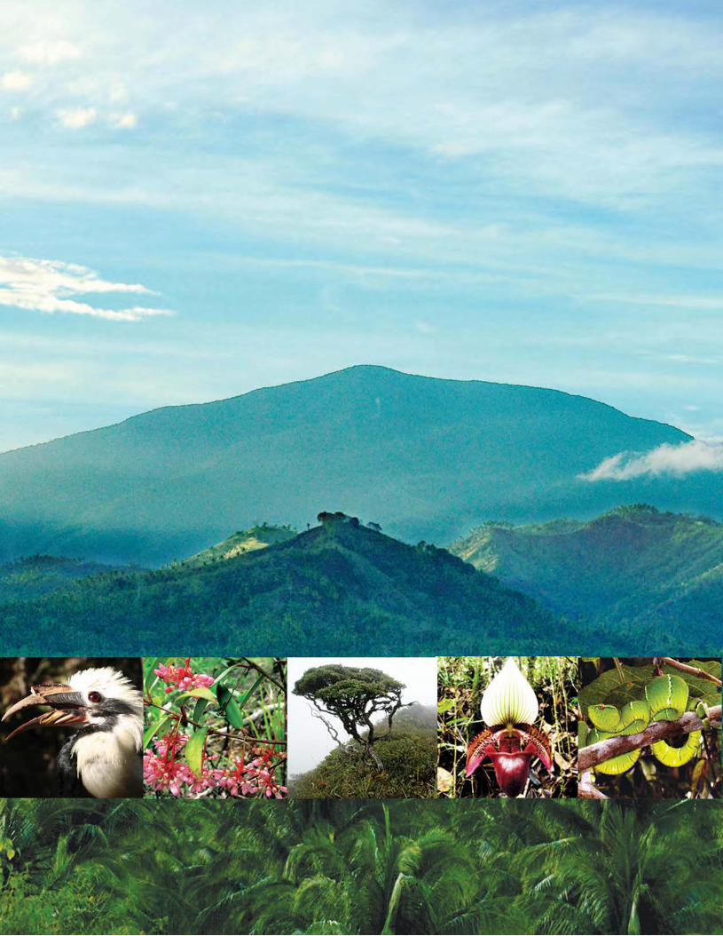
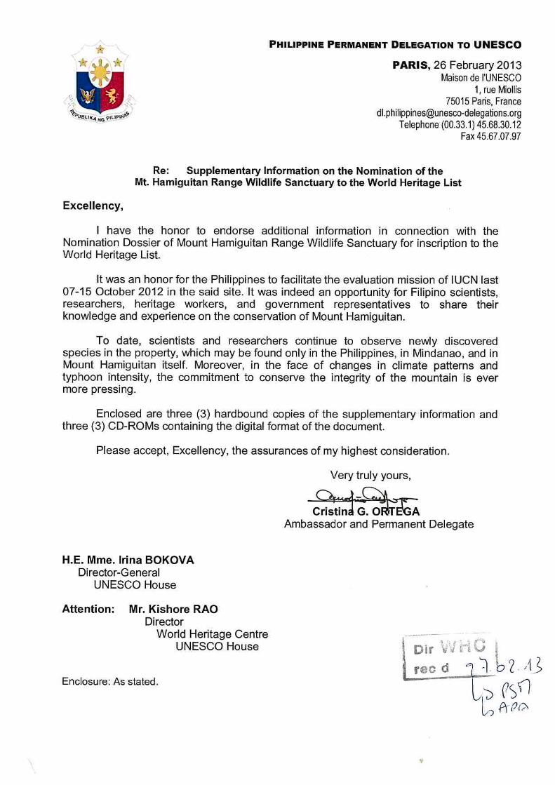
MOUNT HAMIGUITAN RANGE
WILDLIFE SANCTUARY
SUPPLEMENTARY INFORMATION

Cover Photo:Staurois natator, Mount Hamiguitan Range Wildlife Sanctuary
Photographer: Roy Ponce
MOUNT HAMIGUITAN RANGE
WILDLIFE SANCTUARY
SUPPLEMENTARY INFORMATION
TABLE OF CONTENTS
Title Page ……………………………… i
Table of Contents ……………………………… ii
List of Acronyms ……………………………… iii
List of Figures ……………………………… iv
List of Tables ……………………………… v
List of Text Boxes ……………………………… vi
List of Annexes ……………………………… vii
Supplementary Items Page
I Indication of commitment to extend the buffer zone to enhance protection of the protected area, specifically the habitat of the Philippine eagle ……………………………….
10
II Assessment of threats to the property emanating from adjoining mining areas and how such threats can be managed and reduced ………………………………………..
20
III State Party’s willingness to consider inclusion of other nature reserve areas on Mindanao as an eventual serial site to better represent the remaining biodiversity values of this area ………………………………………………………..
33
IV State Party’s commitment to provide increased and longer term financing to the property including a budget plan for the next five years …………………………………………….
35
IV Definitive map indicating overlap of indigenous land claim/s with the property and its buffer zone ……………………
41
Annexes
ii
LIST OF ACRONYMS
Acronyms
AMCOR Asiaticus Management Corporation
BPP Biodiversity Partnership Program
DENR Department of Environment and Natural Resources
EPEP Environment Protection and Enhancement Program
GEF Global Environment Facility
KBA Key Biodiversity Area
LGU Local Government Unit
MHRWS Mount Hamiguitan Range Wildlife Sanctuary
MMT Multi-partite Monitoring Team
MRFC Mine Rehabilitation Fund Committee
NCIP National Commission on Indigenous Peoples
PAMB Protected Area Management Board
UNDP United Nations Development Program
UNESCO United Nations Educational, Scientific, and Cultural Organization
iii
LIST OF FIGURES
Figure Page
1 Base map 4
2 Boundary map with proposed Buffer Zone expansion and proposed Wildlife Sanctuary/ Key Biodiversity Area Expansion (Philippine Eagle Critical Habitat)
5
3 Indicative map of NCIP Claims 33
iv
LIST OF TABLES
Table Page
1 Current mining activities near MHRWS 13
2 Threats of mining activities near MHRWS 16
v
LIST OF TEXT BOXES
Text Box Page
1 A BRIEFER ON BIODIVERSITY PARTNERSHIPS PROJECT (BPP)
OF THE DENR IN PARTNERSHIP WITH THE NATIONAL
GOVERNMENT AGENCIES, CONSERVATION NGOs
AND LOCAL GOVERNMENT UNITS
6
2 CITY OF MATI RESOLUTION NO. 218 SERIES 2008 A
RESOLUTION ADOPTING THE PHILIPPINE EAGLE SANCTUARY
MANAGEMENT PLAN
7
3 CITY OF MATI RESOLUTION NO. 219 SERIES 2008
A RESOLUTION REQUESTING THE HON. JOSE LIVIOKO ATIENZA,
JR.SECRETARY OF THE DEPARTMENT OF ENVIRONMENT AND
NATURAL RESOURCESTO DECLARE THE 7,000 HECTARE
PHILIPPINE EAGLE SANCTUARYIN BARANGAYS CABUAYA AND
LUBAN IN MATI, DAVAO ORIENTAL AS CRITICAL HABITAT UNDER
RA9147
9
4 DENR CORRESPONDENCE WITH AMCOR 21
5 FINANCIAL SUPPORT COMMITMENT FROM THE LOCAL GOVERNMENT OF GOVERNOR GENEROSO
29
6 FINANCIAL SUPPORT COMMITMENT FROM THE LOCAL GOVERNMENT OF SAN ISIDRO
30
7 STATUS OF THE CERTIFICATE OF ANCESTRAL DOMAIN TITLE APPLICATION IN DAVAO ORIENTAL
34
8 NOTICE OF PUBLICATION FOR CERTIFICATE OF ANCESTRAL DOMAIN TITLE APPLICATION IN MACAMBOL AND CABUAYA, MATI CITY
36
vi
LIST OF ANNEXES
ANNEX
A Base Map
B Boundary map with proposed Buffer Zone expansion and proposed Wildlife Sanctuary/ Key Biodiversity Area Expansion (Philippine Eagle Critical Habitat)
C Indicative map of NCIP Claims
vii
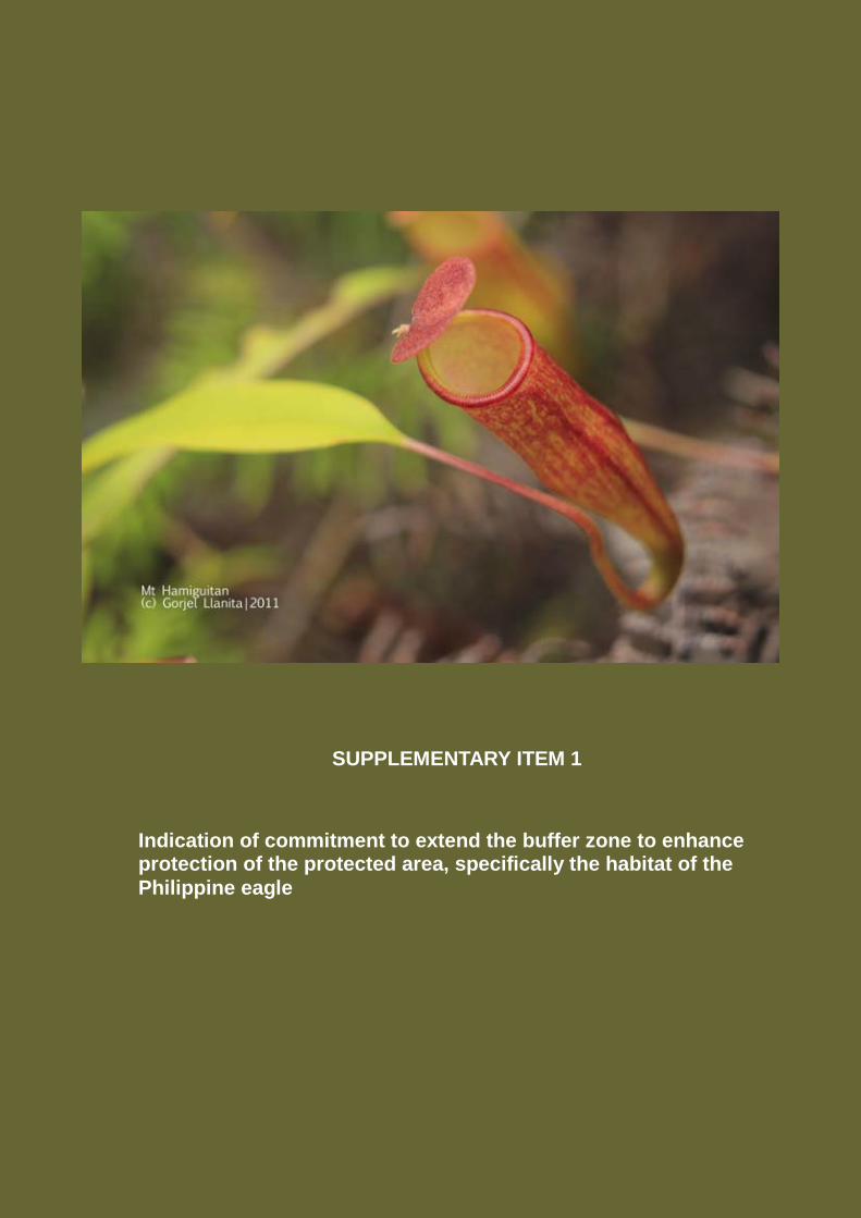
SUPPLEMENTARY ITEM 1
Indication of commitment to extend the buffer zone to enhance protection of the protected area, specifically the habitat of the
Philippine eagle
Indication of commitment to extend the buffer zone to enhance the protection of
the protected area, specifically the habitat of the Philippine eagle
By virtue of Republic Act 9303, Mt. Hamiguitan has a protected core zone area of
6,348.99 hectares and a buffer zone of 783.77 or a total of 7, 132., 76 hectares. In
addition to the 7,132.76 hectares of protected area of the mountain, a legislative action by
the Sangguniang Bayan (Municipal Legislative Council) in 2005 declared a 7,000-hectare
area in Barangays Cabuaya and Luban, Mati as the Philippine Eagle (Pithecophaga
jeffeyi) Sanctuary. Another legislative action followed suit through a Sangguniang
Panlunsod (City Legislative Council) resolution in 2008, declaring the habitats of Cabuaya
and Luban as Critical Habitat for the Philippine Eagle (Pithecophaga jeffeyi) The City of
Mati likewise adopted the legislation and created the Philippine Eagle Sanctuary
Management Plan, thus, ascertain the protection of the area.
Further on, the commitment to supplement safeguards to the protected area commenced
in year 2012 through the implementation of the Biodiversity Partnership Program (BPP) of
the Department of Environment and Natural resources (DENR) (See Text Box 1 on page
6). The project is assisted financially by the United Nations Development Program
(UNDP) and the Global Environment Facility (GEF), which aims to mainstream
biodiversity conservation into the local land use plan.
The project will expand the buffer zone and the wildlife sanctuary of the nominated
property (protected area), defined as the Key Biodiversity Area (KBA) of the Mount
Hamiguitan Range, through the inclusion of the critical habitat of the Philippine Eagle
(Pithecophaga jeffeyi).
The expansion will be implemented using several approaches, namely the following: (1) a
local legislative resolution from the concerned Local Government Units (LGUs); (2)
forging of conservation agreement with the stakeholders after the subsequent delineation
and demarcation survey of the property; and (3) application for an expanded buffer zone
paving a legislative action.
2
With the proposed area expansion, the new Base Map and the Boundary Map of
the property with its components has the following summary information:
MHRWS Core Zone (UNESCO-nominated property): 6,348.99 hectares
MHRWS Buffer Zone: 783.77 hectares
Proposed Wildlife Sanctuary/Key Biodiversity Area (KBA) expansion
that includes the Philippine Eagle Habitat: 6,950.65 hectares (Figure 1 .
Base Map)
Proposed buffer Zone expansion: 9,758.66 hectares (Figure 2. Boundary
Map with Proposed Buffer Zone Expansion and Proposed Wildlife
Sanctuary/KBA Expansion (Philippine Eagle Critical Habitat)
At the eastern side of the protected area, no buffer zone expansion was proposed as
there are already mining tenements that cover the adjoining area. However, the mining
tenement holders in the areas assured they will endeavor to support the protection of
KBAs including that of Mt. Hamiguitan protected area.
With the proposed expansion, the property will have a new total area of 13, 825.94
hectares for the wildlife sanctuary/KBA and 10,026.13 for the combined buffer zone area
or a total component area of 23,842.07 hectares.
The project expansion as included in the BPP project of DENR then will be the founding
basis for the Government of the Province of Davao Oriental to pursue actions for the
eventuality of attaining local municipal and city Legislative Ordinances and the
promulgation of a National Law (through a Republic Act) thereby, ultimately expanding
the protected area of MHWRS to another 13, 825.94 hectares.
Endnotes:
1. Resolution No. 365, series of 2005, the City of Mati, then a municipality, declared a Philippine Eagle Sanctuary in Cabuaya, Mati.
2. Sangguniang Panlunsod Resolution No. 219, series of 2008 requested DENR to declare 7,000-hectare-area in Barangays Cabuaya and Luban, Mati as a Critical Habitat under R.A. 9147 (Wildlife Conservation and Protection Act) for the Philippine Eagle (Pithecophaga jefferyi).
3
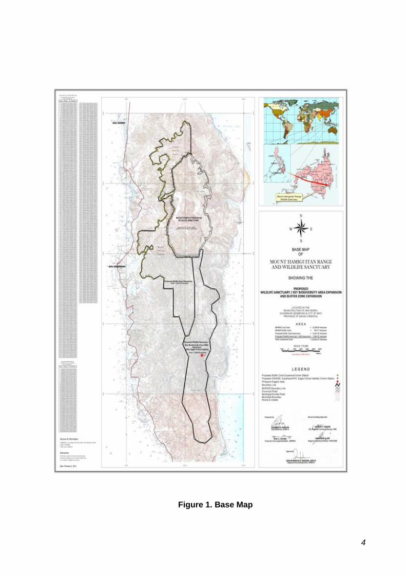
Figure 1. Base Map
4
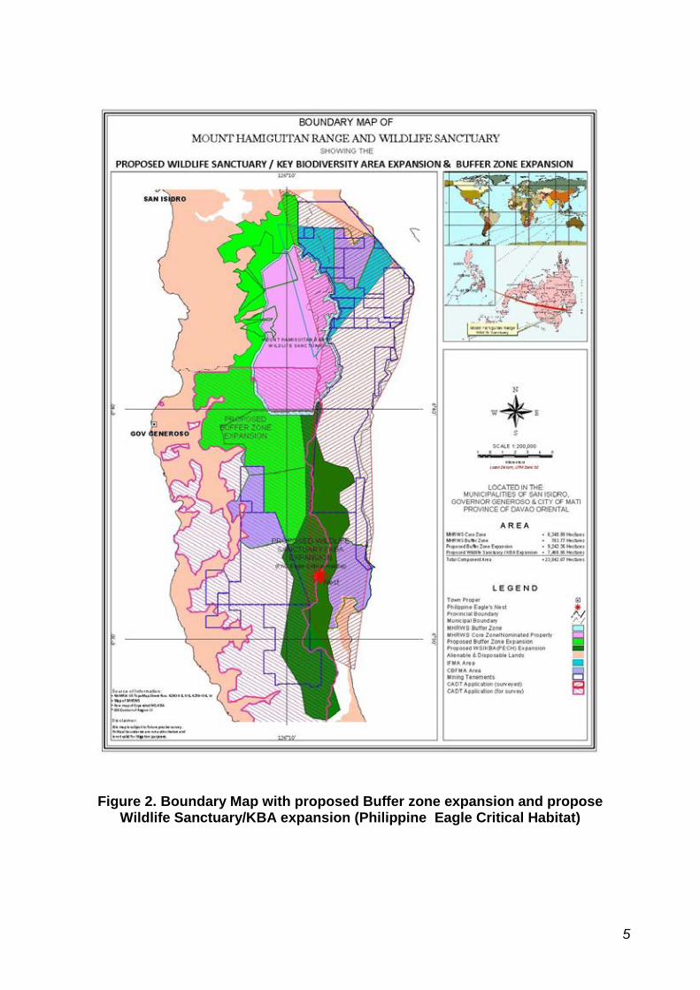
Figure 2. Boundary Map with proposed Buffer zone expansion and propose Wildlife Sanctuary/KBA expansion (Philippine Eagle Critical Habitat)
5
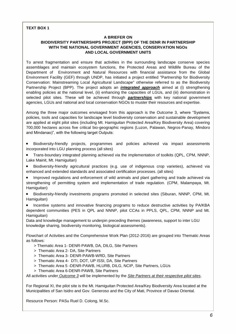
TEXT BOX 1
A BRIEFER ON
BIODIVERSITY PARTNERSHIPS PROJECT (BPP) OF THE DENR IN PARTNERSHIP
WITH THE NATIONAL GOVERNMENT AGENCIES, CONSERVATION NGOs
AND LOCAL GOVERNMENT UNITS
To arrest fragmentation and ensure that activities in the surrounding landscape conserve species
assemblages and maintain ecosystem functions, the Protected Areas and Wildlife Bureau of the
Department of Environment and Natural Resources with financial assistance from the Global
Environment Facility (GEF) through UNDP, has initiated a project entitled "Partnership for Biodiversity
Conservation: Mainstreaming Local Agricultural Landscape" otherwise referred to as the Biodiversity
Partnership Project (BPP). The project adopts an integrated approach aimed at (i) strengthening
enabling policies at the national level, (ii) enhancing the capacities of LGUs, and (iii) demonstration in
selected pilot sites. These will be achieved through partnerships with key national government
agencies, LGUs and national and local conservation NGOs to muster their resources and expertise.
Among the three major outcomes envisaged from this approach is the Outcome 3, where “Systems,
policies, tools and capacities for landscape level biodiversity conservation and sustainable development
are applied at eight pilot sites (including Mt. Hamiguitan Protected Area/Key Biodiversity Area) covering
700,000 hectares across five critical bio-geographic regions (Luzon, Palawan, Negros-Panay, Mindoro
and Mindanao)”, with the following target Outputs:
Biodiversity-friendly projects, programmes and policies achieved via impact assessments
incorporated into LGU planning process (all sites)
Trans-boundary integrated planning achieved via the implementation of toolkits (QPL, CPM, NNNP,
Lake Mainit, Mt. Hamiguitan)
Biodiversity-friendly agricultural practices (e.g. use of indigenous crop varieties), achieved via
enhanced and extended standards and associated certification processes. (all sites)
Improved regulations and enforcement of wild animals and plant gathering and trade achieved via
strengthening of permitting system and implementation of trade regulation. (CPM, Malampaya, Mt.
Hamiguitan)
Biodiversity-friendly investments programs promoted in selected sites (Siburan, NNNP, CPM, Mt.
Hamiguitan)
Incentive systems and innovative financing programs to reduce destructive activities by PA/KBA
dependent communities (PES in QPL and NNNP, pilot CCAs in PPLS, QPL, CPM, NNNP and Mt.
Hamiguitan)
Data and knowledge management to underpin preceding themes (awareness, support to inter LGU
knowledge sharing, biodiversity monitoring, biological assessments).
Flowchart of Activities and the Comprehensive Work Plan (2012-2016) are grouped into Thematic Areas
as follows:
> Thematic Area 1- DENR-PAWB, DA, DILG, Site Partners
> Thematic Area 2- DA, Site Partners
> Thematic Area 3- DENR-PAWB-WRD, Site Partners
> Thematic Area 4- DTI, DOT, UP ISSI, DA, Site Partners
> Thematic Area 5 -DENR-PAWB, HLURB, DILG, NCIP, Site Partners, LGUs
> Thematic Area 6-DENR-PAWB, Site Partners
All activities under Outcome 3 will be implemented by the Site Partners at their respective pilot sites.
For Regional XI, the pilot site is the Mt. Hamiguitan Protected Area/Key Biodiversity Area located at the
Municipalities of San Isidro and Gov. Generoso and the City of Mati, Province of Davao Oriental.
Resource Person: PASu Ruel D. Colong, M.Sc.
6
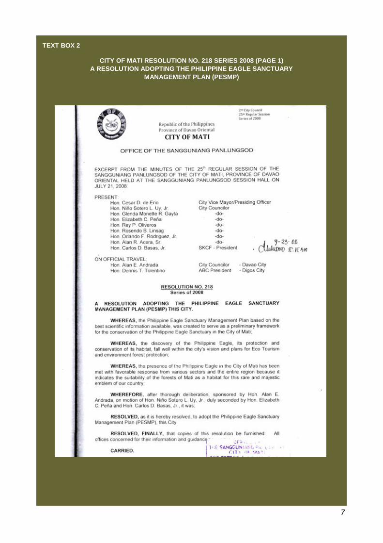
TEXT BOX 2
CITY OF MATI RESOLUTION NO. 218 SERIES 2008 (PAGE 1)
A RESOLUTION ADOPTING THE PHILIPPINE EAGLE SANCTUARY
MANAGEMENT PLAN (PESMP)
7
TEXT BOX 2 (CONTINUATION)
CITY OF MATI RESOLUTION NO. 218 SERIES 2008 (PAGE 2)
A RESOLUTION ADOPTING THE PHILIPPINE EAGLE SANCTUARY
MANAGEMENT PLAN (PESMP)
8
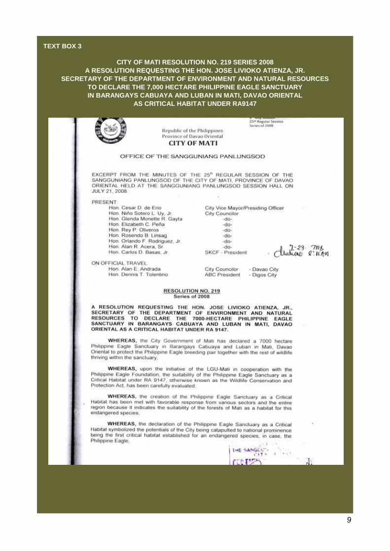
TEXT BOX 3
CITY OF MATI RESOLUTION NO. 219 SERIES 2008
A RESOLUTION REQUESTING THE HON. JOSE LIVIOKO ATIENZA, JR.
SECRETARY OF THE DEPARTMENT OF ENVIRONMENT AND NATURAL RESOURCES
TO DECLARE THE 7,000 HECTARE PHILIPPINE EAGLE SANCTUARY
IN BARANGAYS CABUAYA AND LUBAN IN MATI, DAVAO ORIENTAL
AS CRITICAL HABITAT UNDER RA9147
9
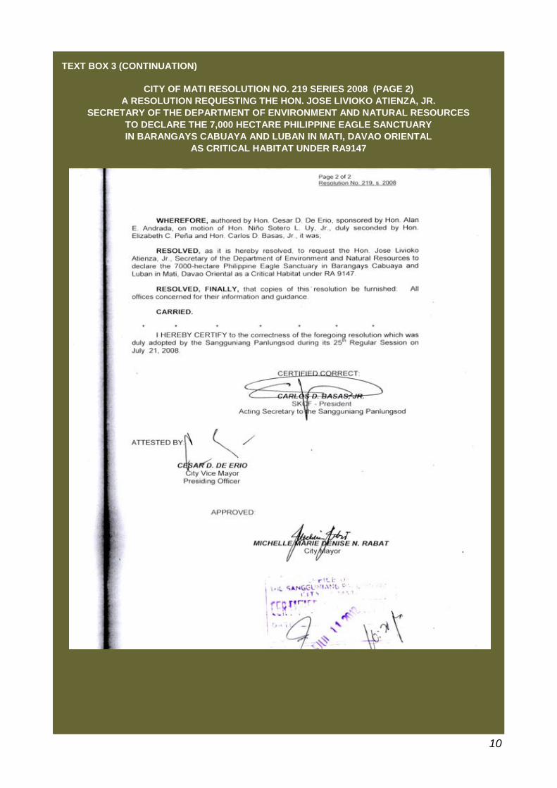
TEXT BOX 3 (CONTINUATION)
CITY OF MATI RESOLUTION NO. 219 SERIES 2008 (PAGE 2)
A RESOLUTION REQUESTING THE HON. JOSE LIVIOKO ATIENZA, JR.
SECRETARY OF THE DEPARTMENT OF ENVIRONMENT AND NATURAL RESOURCES
TO DECLARE THE 7,000 HECTARE PHILIPPINE EAGLE SANCTUARY
IN BARANGAYS CABUAYA AND LUBAN IN MATI, DAVAO ORIENTAL
AS CRITICAL HABITAT UNDER RA9147
10
SUPPLEMENTARY ITEM 2
Assessment of threats to the property emanating from adjoining mining areas and how such threats can be managed and reduced
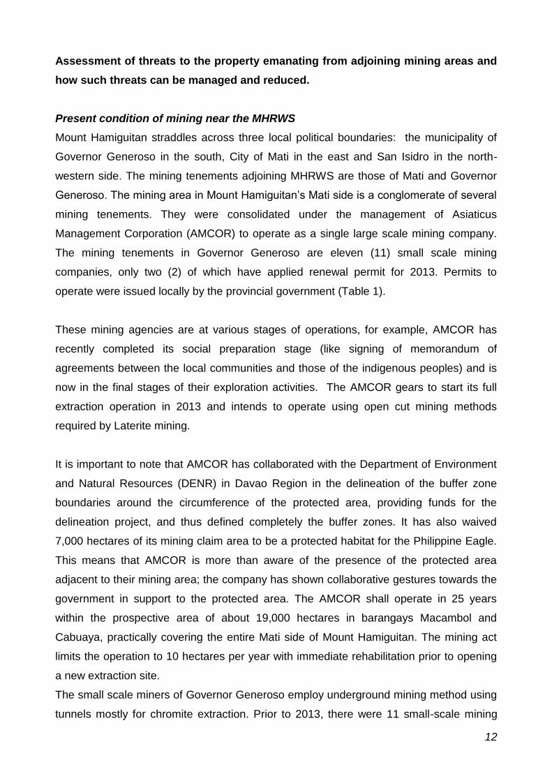
Assessment of threats to the property emanating from adjoining mining areas and
how such threats can be managed and reduced.
Present condition of mining near the MHRWS
Mount Hamiguitan straddles across three local political boundaries: the municipality of
Governor Generoso in the south, City of Mati in the east and San Isidro in the north-
western side. The mining tenements adjoining MHRWS are those of Mati and Governor
Generoso. The mining area in Mount Hamiguitan’s Mati side is a conglomerate of several
mining tenements. They were consolidated under the management of Asiaticus
Management Corporation (AMCOR) to operate as a single large scale mining company.
The mining tenements in Governor Generoso are eleven (11) small scale mining
companies, only two (2) of which have applied renewal permit for 2013. Permits to
operate were issued locally by the provincial government (Table 1).
These mining agencies are at various stages of operations, for example, AMCOR has
recently completed its social preparation stage (like signing of memorandum of
agreements between the local communities and those of the indigenous peoples) and is
now in the final stages of their exploration activities. The AMCOR gears to start its full
extraction operation in 2013 and intends to operate using open cut mining methods
required by Laterite mining.
It is important to note that AMCOR has collaborated with the Department of Environment
and Natural Resources (DENR) in Davao Region in the delineation of the buffer zone
boundaries around the circumference of the protected area, providing funds for the
delineation project, and thus defined completely the buffer zones. It has also waived
7,000 hectares of its mining claim area to be a protected habitat for the Philippine Eagle.
This means that AMCOR is more than aware of the presence of the protected area
adjacent to their mining area; the company has shown collaborative gestures towards the
government in support to the protected area. The AMCOR shall operate in 25 years
within the prospective area of about 19,000 hectares in barangays Macambol and
Cabuaya, practically covering the entire Mati side of Mount Hamiguitan. The mining act
limits the operation to 10 hectares per year with immediate rehabilitation prior to opening
a new extraction site.
The small scale miners of Governor Generoso employ underground mining method using
tunnels mostly for chromite extraction. Prior to 2013, there were 11 small-scale mining
12
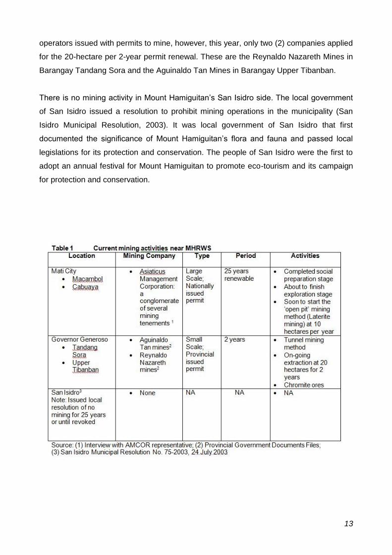
operators issued with permits to mine, however, this year, only two (2) companies applied
for the 20-hectare per 2-year permit renewal. These are the Reynaldo Nazareth Mines in
Barangay Tandang Sora and the Aguinaldo Tan Mines in Barangay Upper Tibanban.
There is no mining activity in Mount Hamiguitan’s San Isidro side. The local government
of San Isidro issued a resolution to prohibit mining operations in the municipality (San
Isidro Municipal Resolution, 2003). It was local government of San Isidro that first
documented the significance of Mount Hamiguitan’s flora and fauna and passed local
legislations for its protection and conservation. The people of San Isidro were the first to
adopt an annual festival for Mount Hamiguitan to promote eco-tourism and its campaign
for protection and conservation.
13
Threats of mining activities near MHRWS
This report presents the threats of mining activities to MHRWS. The threats are identified
from theoretical/conceptual frameworks gathered from literature that refers to impact of
mining towards the extraction sites and its immediate surrounds, as well as the threats
identified in the context of MHRWS using community opinions through rapid participatory
appraisal focus groups.
Table 2 presents a summary matrix of the effects of mining activities to mine sites and
their possible impact to MHRWS which is adjacent to the mine areas. It is to be noted that
studies on mining impacts usually refer to the actual mine sites and its immediate
surrounds. In the context of the MHRWS, the mine sites are found in the lower areas of
the mountain range while MHRWS is located in the upper regions of the mountain. This
situation lends to the claim of AMCOR and some community members that the mining
activities located in the lower areas of the mountain pose only some ‘indirect’ threats to
the protected area above. This is in contrast with the ‘direct’ threats that are imminent to
affect Pujada Bay Seascapes below, another protected area adjacent to the mining site.
In a correspondence of AMCOR to DENR, the company made note that ‘the protected
area is way way [sic] above’ their mining area. This view is subscribed by some
community members:
‘I agree that the trees of the forest of Mount Hamiguitan need to be protected.
About mining threats, I don’t see any effect because the protected area is in the
upland and the mining activities are in the lowland.’ (Macambol, Female
Participant)
‘The threat is not going up to the protected area but down towards Pujada Bay that
will catch all the mining effect. But threats are always there, with or without mining,
for example the people are threat to the protected area because of livelihood
problems.’ (Macambol, Male Participant)
‘The protected area is very far from us and it is in the upper areas. We know where
the markers are because we are members of the CBFM. The boundary markers
are very far from where we operate. Our mining will have no impact to the upper
areas of the mountain but down below, there should be mitigating measures. If we
14

talk about mining, it is expected that there is environmental destruction, but for
small scales miners like us, they can be managed. We are closely monitored that
we are not allowed to go beyond the area allocated to us.’ (Governor Generoso,
Male Participant)
The most easily identified threats are those associated with geo-morphological changes
of landscapes due to mining activities. These are landslides and erosions, impact to
visual aesthetics that poses trade-off for eco-tourism potentials, and most likely the
siltation and reduced water quality that would most likely impact the protected seascapes
of Pujada Bay and Tinaytay Reefs in the coastal and marine areas.
Additionally, there are threats that could only be identified using the theoretical
frameworks of scientific studies in which without thorough and long term technical studies
these threats could not be identified or observed easily (Clode, 2006; Kumar, 2010). For
example, the effect of changes in humidity levels to the mossy forest because
deforestation in the lower Dipterocarp forests needs to be technically established, the
same could be said in the case of micro-climate changes and impact
on local rainfall patterns on which MHRWS is critically dependent.
Some members of the community expressed apprehension to these ‘unknown’ impacts,
and notably female participants:
‘For now, we haven’t seen any threat yet. It’s a good idea to set up a monitoring
team to watch for the threats that may happen.’ (Macambol, Female Participant)
‘We are worried because we do not know anything about mining effects, if that is
really responsible mining that they are claiming.’ (Macambol, Female Participant)
‘We cannot see the full effect until the operation starts. We have the power to stop
any activity. In the MOA, there is an ‘addendum’ section that we can add
conditions. The mining company signed.’ (Macambol, Female Participant)
15
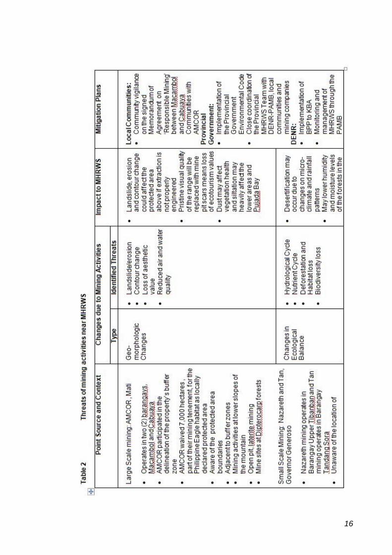
16
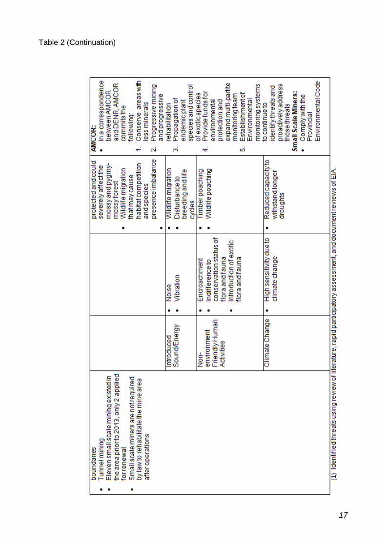
Table 2 (Continuation)
17
Threats to wildlife because of human presence and activities are also highly likely.
Examples are noise and vibration pollutions that may significantly disturb wild animals,
and hence negatively impact their breeding, feeding and survival abilities. Human
activities also threaten the protected area when human mismanagement occurs. For
example, timber poaching is possible in areas of tunnel mining that requires significant
number of timber for tunnel frames. Wildlife poaching could also happen as well as loss
of rare and unrecorded species due to indifference or low knowledge of species
conservation status.
Finally, there is the possibility that even small and seemingly safe levels of changes in the
sensitive balance of land formation, ecology and life patterns of wildlife may reduce
significantly the capacity to withstand and survive when conditions posed by climate
change are considered. The erratic conditions resulting from climate change like longer
droughts, changing weather patterns and unusual atmospheric conditions like freak
typhoons are overarching threats that could overwhelm the protected area.
Mitigation to reduce and manage mining activity threats to MHRWS
The different stakeholders of MHRWS, at several levels from local to national, express
support for the protection and conservation of the protected area. The mitigation
strategies to proactively address the threats because of mining activities near MHRWS
are more pronounced among the local communities and AMCOR itself.
Local Communities
The local communities, particularly the barangay residents, women’s organization and
some indigenous peoples’ representatives, express a strong sense of empowerment in
relation to their decision to allow mining in barangays Macambol and Cabuaya in Mati.
They claim that they have the power to stop mining operations if they see threats coming
from the mining activities.
‘We are vigilant, we can stop the mining anytime if we sense things are not
happening as agreed. We have the power to stop. It is written in the
MOA.’ (Macambol, Male Participant)
18
‘We cannot see the full effect until the operation starts. We have the power to stop
any activity. In the MOA, there is an ‘addendum’ section that we can add
conditions. The mining company signed.’ (Macambol, Female Participant)
‘Before we have decided to let the mining in, we are already vigilant. Most of what
we observed in the history of mining, the results were bad. We know about that.
AMCOR
In a correspondence between AMCOR and DENR (Text Box 4, page 22 ), AMCOR
commits specific measures to help manage and reduce the potential threats of mining
operations to MHRWS:
Less mineralized areas near the Hamiguitan Protected Area shall be adopted
under the Adopt-A-Mining Forest and Adopt-A-Mountain Project and shall form
part of the Environmental Protection and Enhancement Program (EPEP) of the
mining company in accordance with the Mining Act and Executive Order 79.
These projects could help expand the buffer zone, further between the protected
area and the mining areas.
Progressive mining and progressive rehabilitation to limit open areas to only 10 –
20 hectares per year shall be observed to minimize environmental footprints.
Collection of wildlings from endemic plant species to areas that will be mined
shall be undertaken prior to area clearing to propagate seedlings in nurseries
that will be planted during the rehabilitation to limit introduction of exotic species.
Use of large and mature seedlings as one of the best practices in mining
rehabilitation like in Rio Tulba shall be replicated on site to reduce the log time of
rehabilitation and put back the forest in shorter or 3-years period.
Expanded membership to the Mine Rehabilitation Fund Committee (MRFC) and
Multi-Partite Monitoring Team (MMT) shall be endeavoured to include the
Hamiguitan Protected Area authorities as mandated special bodies to enable the
Environmental Protection and Enhancement Program (EPEP) including
monitoring on environmental compliance more sensitive to Hamiguitan.
19
The EPEP and FMRDP shall include projects and substantial fund allocation that
could help manage, protect and enhance the protected area and its buffer zones.
The company shall establish environmental monitoring system and facilities including
environmental weather stations to continue to identify threats and proactively
address those threats.
These commitments from AMCOR, if properly carried out, could address most, if not all,
of the threats identified in Table 2 matrix. It is essential that these statements be
incorporated in the monitoring and evaluation framework of the MHRWS management
system.
The Local Provincial Government and the Department of Environment and Natural
Resources
The Local Provincial Government of Davao Oriental, in collaboration with the DENR and
other stakeholders, being the proponent of MHRWS to be inscribed in the World Heritage
List as an approach to conservation addresses to manage and reduce the threats posed
by mining activities in Mount Hamiguitan through the implementation of the Provincial
Government Environmental Code. This macro-management ensures close coordination
of the Provincial MHRWS Team with DENR-PAMB, local communities and mining
companies in the management, monitoring and developing MHRWS protection and
conservation program. Along with DENR’s implementation of the Biodiversity Partnership
Program to Key Biodiversity Areas as well as the management of MHRWS through the
Protected Area Management Board, the mitigation plans for the threats to MHRWS due
to mining activities is most likely collaboratively and successfully implemented.
Reference Clode, D. (2006). As if for a thousand years: a history of Victoria’s Land Conservation and Environment Conservation Councils. Victorian Environmental Assessment Council: Melbourne. Kumar, K.S. (2010). Environmental impact assessment of a proposed Bauxite mining using rapid impact assessment matrix method. International Journal of Applied Environmental Sciences, 5 (1), 29-38. Ponce, R., Alzate, J. Galvez, L. & Pastolero, N. (2013). Assessment of threats to Mount Hamiguitan Range Wildlife Sanctuary posed by mining activities nearby using rapid participatory appraisal approach. [Unpublished Research Report] Research and Extension Office, DOSCST: Mati City. San Isidro Municipal Resolution. (2003). A resolution interposing strong opposition to large scale mining activity within the territorial jurisdiction of San Isidro. Municipal Resolution No. 75-2003: San Isidro, Davao Oriental.
20
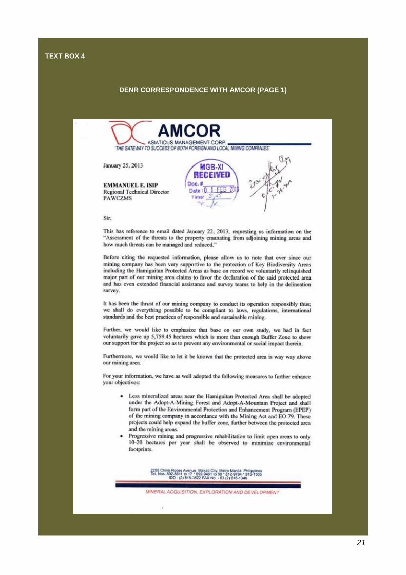
TEXT BOX 4
DENR CORRESPONDENCE WITH AMCOR (PAGE 1)
21
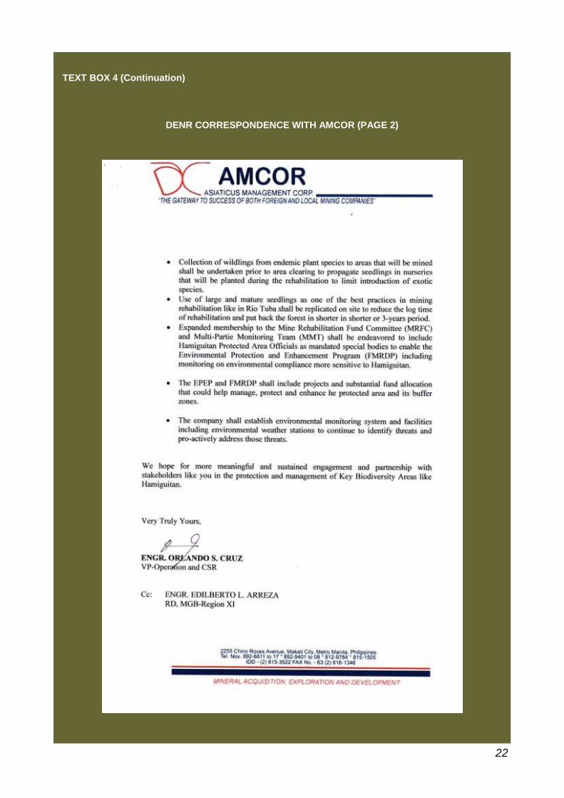
TEXT BOX 4 (Continuation)
DENR CORRESPONDENCE WITH AMCOR (PAGE 2)
22
SUPPLEMENTARY ITEM 3
State Party’s willingness to consider inclusion of other nature reserve areas in Mindanao as an eventual serial site to better
represent the remaining biodiversity values of this area
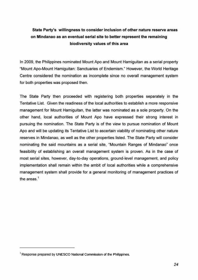
UNESCO National Commission of the Philippines.
SUPPLEMENTARY ITEM 4
State Party’s commitment to provide increased and longer term financing to the property including a budget plan for the next five
years
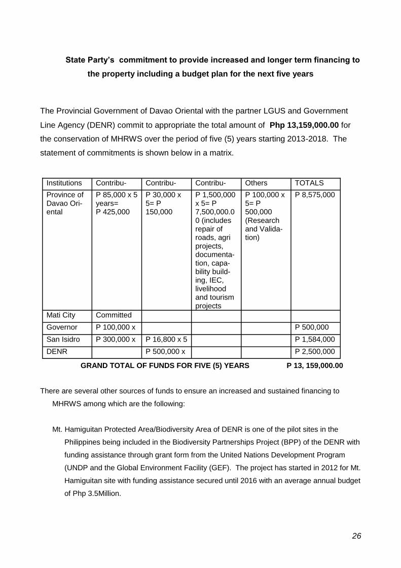
State Party’s commitment to provide increased and longer term financing to
the property including a budget plan for the next five years
The Provincial Government of Davao Oriental with the partner LGUS and Government
Line Agency (DENR) commit to appropriate the total amount of Php 13,159,000.00 for
the conservation of MHRWS over the period of five (5) years starting 2013-2018. The
statement of commitments is shown below in a matrix.
GRAND TOTAL OF FUNDS FOR FIVE (5) YEARS P 13, 159,000.00
There are several other sources of funds to ensure an increased and sustained financing to
MHRWS among which are the following:
Mt. Hamiguitan Protected Area/Biodiversity Area of DENR is one of the pilot sites in the
Philippines being included in the Biodiversity Partnerships Project (BPP) of the DENR with
funding assistance through grant form from the United Nations Development Program
(UNDP and the Global Environment Facility (GEF). The project has started in 2012 for Mt.
Hamiguitan site with funding assistance secured until 2016 with an average annual budget
of Php 3.5Million.
Institutions Contribu- Contribu- Contribu- Others TOTALS
Province of Davao Ori-ental
P 85,000 x 5 years= P 425,000
P 30,000 x 5= P 150,000
P 1,500,000 x 5= P 7,500,000.00 (includes repair of roads, agri projects, documenta-tion, capa-bility build-ing, IEC, livelihood and tourism projects
P 100,000 x 5= P 500,000 (Research and Valida-tion)
P 8,575,000
Mati City Committed
Governor P 100,000 x P 500,000
San Isidro P 300,000 x P 16,800 x 5 P 1,584,000
DENR P 500,000 x P 2,500,000
26
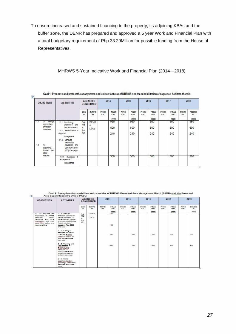
To ensure increased and sustained financing to the property, its adjoining KBAs and the
buffer zone, the DENR has prepared and approved a 5 year Work and Financial Plan with
a total budgetary requirement of Php 33.29Million for possible funding from the House of
Representatives.
MHRWS 5-Year Indicative Work and Financial Plan (2014—2018)
27
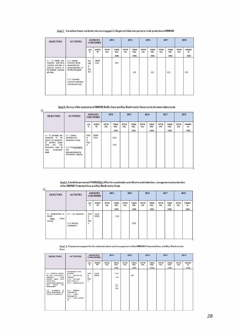
28
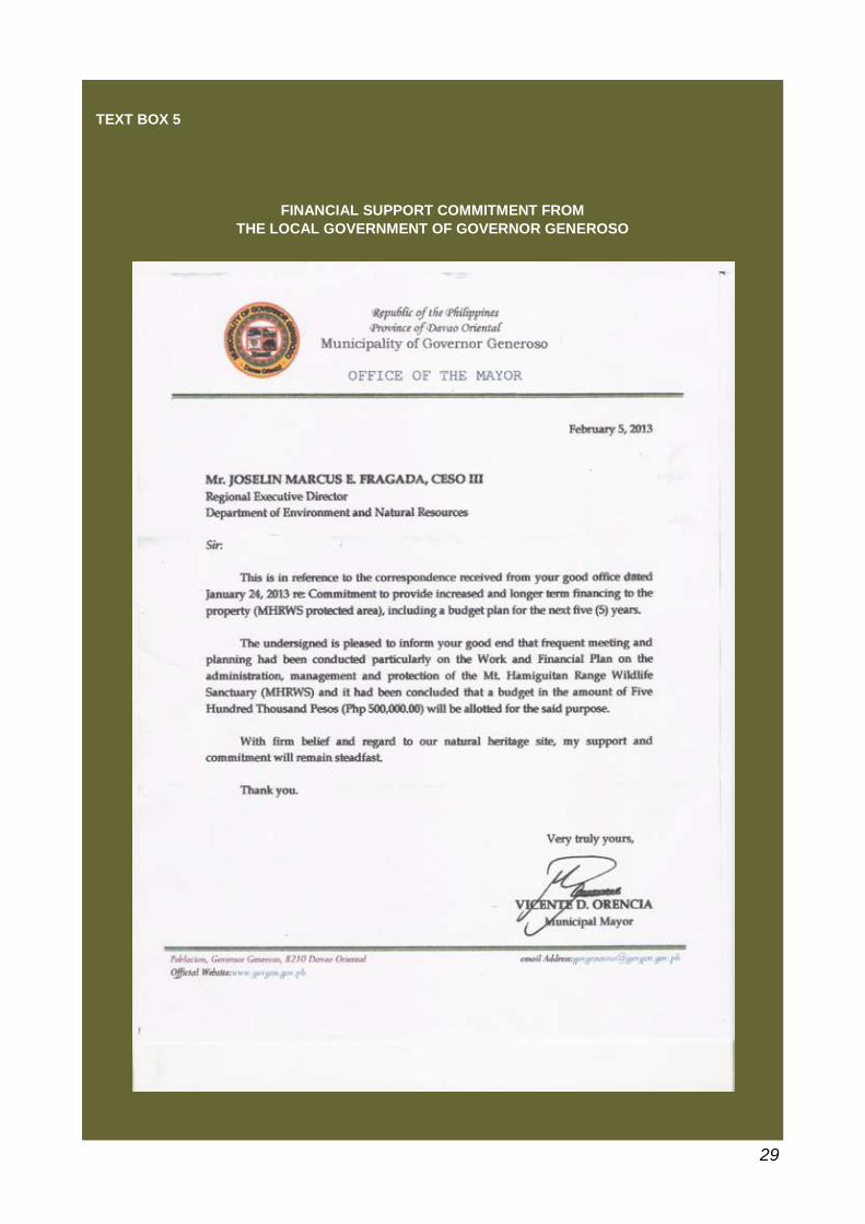
TEXT BOX 5
FINANCIAL SUPPORT COMMITMENT FROM
THE LOCAL GOVERNMENT OF GOVERNOR GENEROSO
29
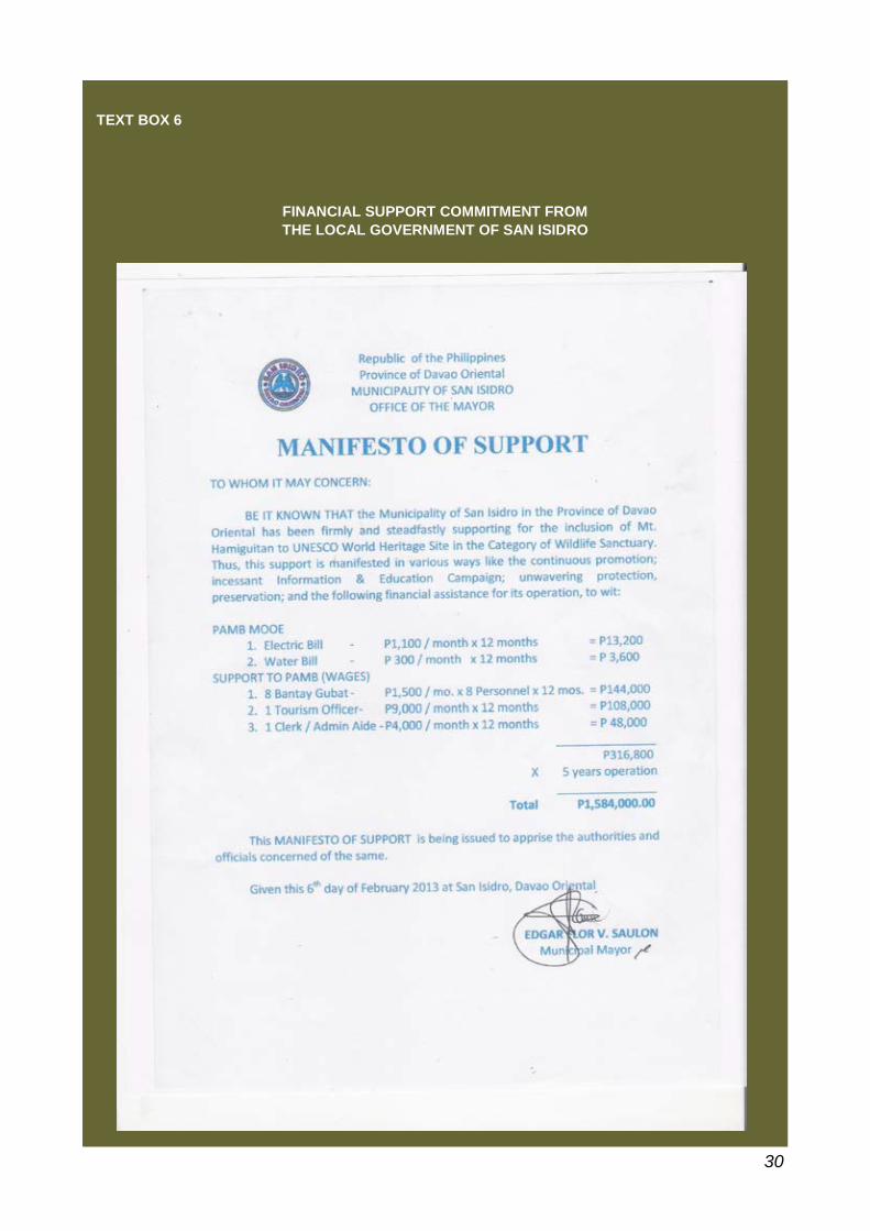
TEXT BOX 6
FINANCIAL SUPPORT COMMITMENT FROM
THE LOCAL GOVERNMENT OF SAN ISIDRO
30
SUPPLEMENTARY ITEM 5
Definitive map indicating overlap of indigenous land claim/s with
the property and its buffer zone
Definitive map indicating overlap of indigenous land claim/s with the property
and its buffer zone.
At the time of the nomination, records from the Department of Natural Resources (DENR)
did not indicate any potential overlapping of the Protected Area property with ancestral
domain claims from the indigenous groups. However, upon consultation with the National
Commission for Indigenous Peoples (NCIP), information confirms overlaps between the
Philippine Eagle Sanctuary, AMCOR mining Company, and the Protected Area itself.
The overlapping claims are demonstrated in the map shown in Figure 3.
To verify the information of the overlapping of claims, consultative meetings with the OIC
of the NCIP office were held twice in Mati in February 6 and 8, 2013. In the said
consultation, the OIC Provincial Officer cited the integral objective of the land claims
running in parallel to the efforts of the stakeholders to protect the MHRWS. Her statement
bears founding basis vis-à-vis the stipulation in RA 8371 SEC. 58 of the Indigenous
People’s Law, stating among others that “protected areas shall be maintained, managed,
developed and protected with the full and effective assistance of government agencies.
Speaking in behalf of the members of the indigenous groups she represents in Davao
Oriental, she further said that “indigenous groups are in consonance with the intent of
preserving and conserving the natural resources of Davao Oriental and of Mt.
Hamiguitan specifically, as mandated upon them by RA 8371.
Status of the NCIP Claim
The current status of the NCIP claim is estimated to be about 30,000 hectares in the
municipalities of Mati and Governor Generoso as applied for by Mr. Guillermo Tan for both Mati
and Governor Generoso. The records of the updates and status is shown in Text Box 7.
32
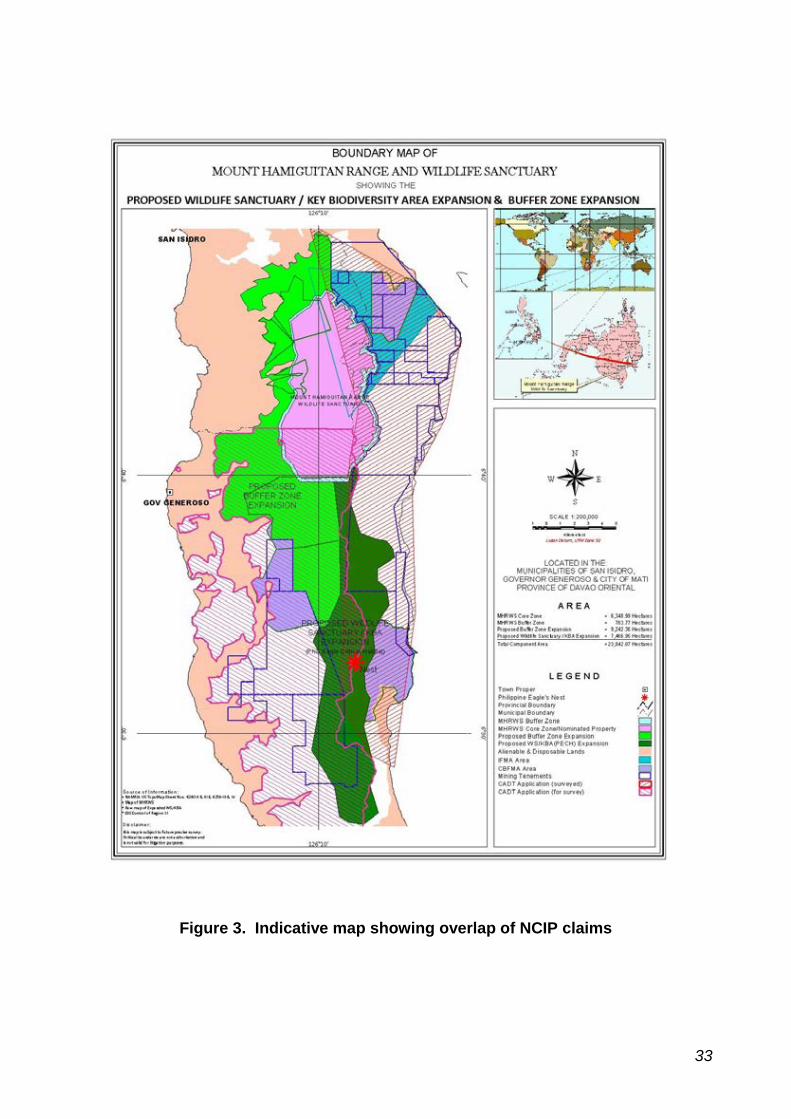
Figure 3. Indicative map showing overlap of NCIP claims
33
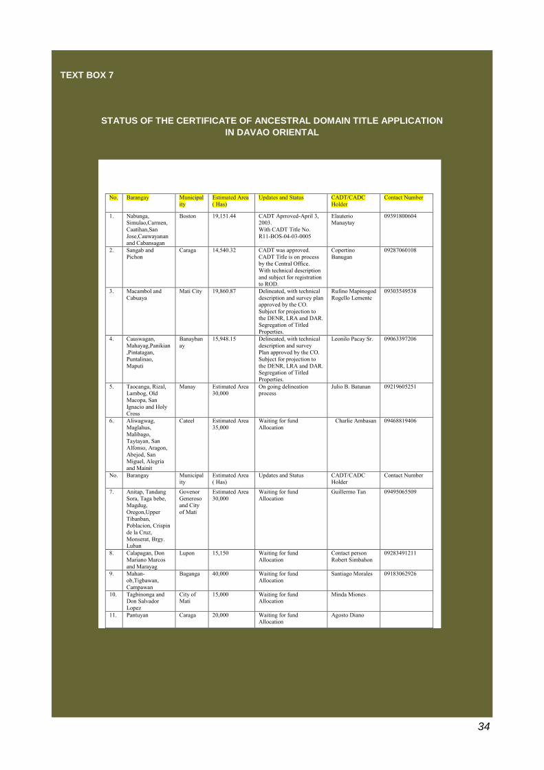
TEXT BOX 7
STATUS OF THE CERTIFICATE OF ANCESTRAL DOMAIN TITLE APPLICATION
IN DAVAO ORIENTAL
No. Barangay Municipal
ity
Estimated Area
( Has)
Updates and Status CADT/CADC
Holder
Contact Number
1. Nabunga, Simulao,Carmen,
Caatihan,San
Jose,Cauwayanan and Cabansagan
Boston 19,151.44 CADT Aprroved-April 3, 2003.
With CADT Title No.
R11-BOS-04-03-0005
Elauterio Manaytay
09391800604
2. Sangab and
Pichon
Caraga 14,540.32 CADT was approved.
CADT Title is on process by the Central Office.
With technical description
and subject for registration
to ROD.
Copertino
Banugan
09287060108
3. Macambol and
Cabuaya
Mati City 19,860.87 Delineated, with technical
description and survey plan approved by the CO.
Subject for projection to
the DENR, LRA and DAR. Segregation of Titled
Properties.
Rufino Mapinogod
Rogello Lemente
09303549538
4. Causwagan,
Mahayag,Panikian,Pintatagan,
Puntalinao,
Maputi
Banayban
ay
15,948.15 Delineated, with technical
description and survey Plan approved by the CO.
Subject for projection to
the DENR, LRA and DAR. Segregation of Titled
Properties.
Leonilo Pacay Sr. 09063397206
5. Taocanga, Rizal, Lambog, Old
Macopa, San
Ignacio and Holy
Cross
Manay Estimated Area 30,000
On going delineation process
Julio B. Batunan 09219605251
6. Aliwagwag,
Maglahus,
Malibago, Taytayan, San
Alfonso, Aragon,
Abejod, San Miguel, Alegria
and Mainit
Cateel Estimated Area
35,000
Waiting for fund
Allocation
Charlie Ambasan 09468819406
No. Barangay Municipal
ity
Estimated Area
( Has)
Updates and Status CADT/CADC
Holder
Contact Number
7. Anitap, Tandang
Sora, Taga bebe, Magdug,
Oregon,Upper
Tibanban, Poblacion, Crispin
de la Cruz,
Monserat, Brgy. Luban
Govenor
Generoso and City
of Mati
Estimated Area
30,000
Waiting for fund
Allocation
Guillermo Tan 09495065509
8. Calapagan, Don
Mariano Marcos
and Marayag
Lupon 15,150 Waiting for fund
Allocation
Contact person
Robert Simbahon
09283491211
9. Mahan-
ob,Tigbawan,
Campawan
Baganga 40,000 Waiting for fund
Allocation
Santiago Morales 09183062926
10. Tagbinonga and Don Salvador
Lopez
City of Mati
15,000 Waiting for fund Allocation
Minda Miones
11. Pantuyan Caraga 20,000 Waiting for fund Allocation
Agosto Diano
34
The said update however, holds accurate only in the Municipality of Mati; for it is on the
Mati side that an estimated 19,860,865 hectares were actually surveyed and executed by
the NCIP Engineers on July 3-28, 2009 and July 28-to August 2, 2010. The 19,860,865
is currently with monument bearing “PRS”-GRID. The claim was published on December
4 and 11 2012 in a local newspaper the Pujada Broadcast.
Given therefore of the current status of the NCIP claims in the Municipality of Mati, the
essence of harmonizing the conservation management of MHRWS further points to the
importance of incorporating in the plans the provision of the alternative livelihood needs
of the stakeholders; and for this to be continually explored, to ensure among others, that
communities will not be displaced.
The NCIP claimants are themselves stakeholders of Mt. Hamiguitan. An integral
process of synchronizing all purposes for the end objective of preserving Mt. Hamiguitan
is and will be continually pursued through the IECs and sustainable economic programs
in the communities.
While the NCIP continue working on the finality of their claims, the proponent of the
MHRWS project, the Provincial Government of Davao Oriental and its partner agencies
will incessantly endeavor to arrive at a Memorandum of Agreement among all the
Stakeholders for the conservation, protection and management of MHRWS. And for all
parties to make effectual and doable efforts to assist the communities to find sustainable
means to use the resources of the surrounding areas of MHWRS for their livelihood,
while equally ensuring the state of protection of the biodiversity Mt. Hamiguitan.
35
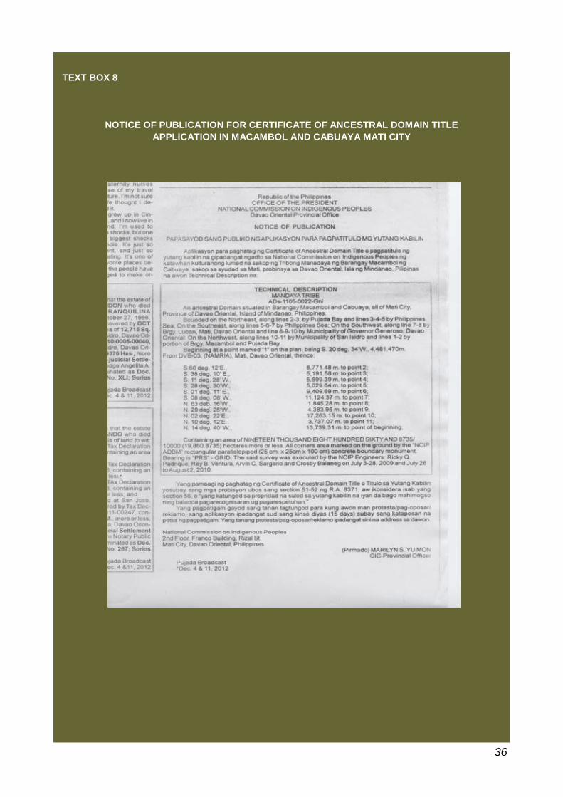
TEXT BOX 8
NOTICE OF PUBLICATION FOR CERTIFICATE OF ANCESTRAL DOMAIN TITLE
APPLICATION IN MACAMBOL AND CABUAYA MATI CITY
36
UNESCO National Commission of the Philippines
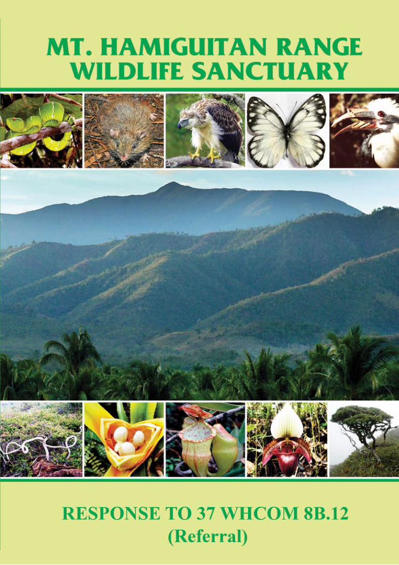
1
Explanatory Note
Referral of the Nomination of Mount Hamiguitan Range Wildlife Sanctuary to the UNESCO World Heritage List
With reference to Decision 37 COM 8B.12 adopted by the 37 th Session of the World
Heritage Committee (Phnom Penh, 2013), the State Party wishes to provide the following updates on the measures it has taken to comply with the recommendations of the Committee:
1. Continue the work with the National Commission for Indigenous Peoples (NCIP)
to resolve any outstanding land claims to ensure there is a broad based support for the nomination of the site and that any future use of the area does not compromise the Outstanding Universal Value of the site;
The Province of Davao Oriental continues its work to engage actively the communities of indigenous peoples in villages located in Mati City and the Municipality of Governor Generoso. Numerous consultation meetings with the indigenous communities have been and continue to be carried out by the government offices of Davao Oriental in collaboration with the National Commission for Indigenous Peoples (NCIP) where community organizers discuss the UNESCO World Heritage Program and the nomination of Mount Hamiguitan Range Wildlife Sanctuary to the UNESCO World Heritage List. The indigenous communities have expressed their support to the nomination of the site as they recognize that the inscription to the UNESCO World Heritage List will contribute to the protection of the mountain. The State Party submits herewith the following documents: a) Written expression of support for the nomination from the indigenous peoples of Macambol and Cabuaya (Mati City), and Governor Generoso; and b) Memorandum of Agreement between the Provincial Government of Davao Oriental and the above-mentioned indigenous peoples groups stipulating the relinquishment of the latter of their application for ancestral domain title covering areas overlapping with the nominated property, and their commitment for the protection and conservation of the nominated property and its buffer zone.
2. Implement the envisaged expansion of the site to include important nesting
habitats for endangered species such as the Philippine Eagle and implement the envisaged expansion of the buffer zone in order to enhance the integrity of the site; The government units of Davao Oriental Province and concerned localities – Mati City, San Isidro Municipality, and Governor Generoso – together with the Regional and Provincial Offices of the Department of Environment and Natural Resources, undertook the necessary measures to formally and legally expand the core zone of the nominated property, to include the nesting habitat of the Philippine Eagle and other endangered species, and its buffer zone, to further enhance the integrity of the site.
2
The State Party is pleased to submit herewith the following documents: a. Small-Scale Boundary Map of the Expanded Nominated Property and
Provincial Legislation Adopting the Map of the Expanded Nominated Property;
b. Large-Scale Boundary Map of the Expanded Nominated Property; and
c. Large-Scale Base Map of the Expanded Nominated Property.
3. Prepare a detailed Visitor and Tourism Management Plan as a sub-plan to the Management Plan in recognition of the potential for increasing pressure for access and higher numbers of park visitors.
The Protected Area Management Board (PAMB) of the property maintains a strict access control regime for the site, only allowing scientists access to the site, accompanied by forest rangers, for research purposes. Until a trail management plan is formulated and approved by the PAMB, this strict access control regime will be maintained. The State Party submits herewith the following document: a. Mount Hamiguitan Range Wildlife Sanctuary Visitor and Tourism
Development and Management Plan A Five-Year Visitor and Tourism Management Plan has been developed to define the necessary research and operational measures that have to be undertaken to establish a responsible and sustainable tourism for the nominated property. The Plan includes the development of alternative modeling sites, which could serve as interpretation site for Mount Hamiguitan in order to relieve the tourism pressure on the nominated site. It also sets forth plans for trail management and tourism services training in order to ensure that access of visitors to the park do not negatively impact its heritage values.
4. Develop and implement a research and monitoring programme to assess and adapt to the impacts of climate change on the site.
The State Party submits herewith the following document: a. Mount Hamiguitan Range Wildlife Sanctuary Monitoring and Assessment
Program for Climate Change Adaption
The Monitoring and Assessment Program is being carried out by the Technical Group for the continued socio-cultural, economic, and ecological study in Mount Hamiguitan Range, led by the Davao Oriental State College of Science and Technology. The information derived from the program is used for the maintenance of biodiversity and safeguard ecosystems. It likewise examines the trends in the ecological status of the existing ecosystems and species in the area.

1.a Written expression of support for the nomination from the indigenous peoples of Macambol and Cabuaya (Mati City), and Governor Generoso
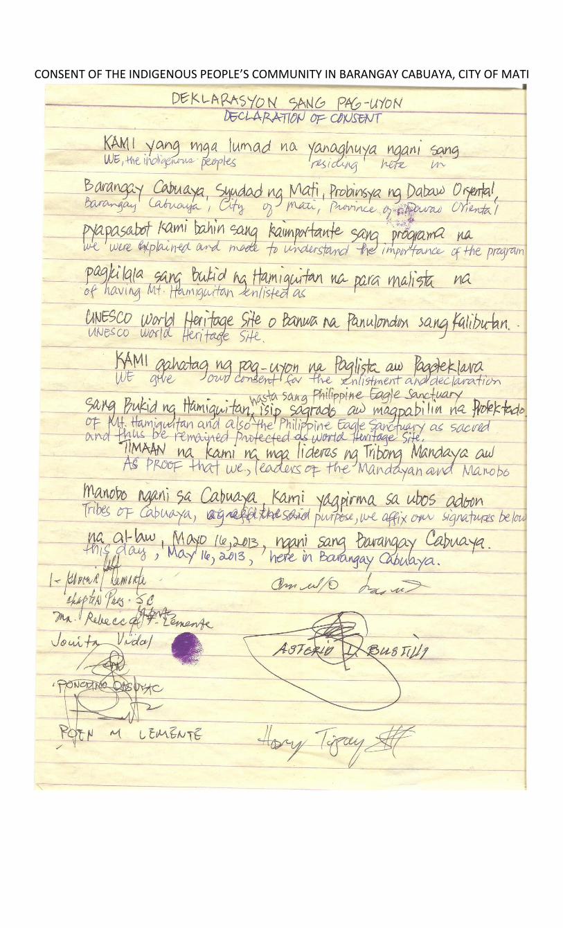
CONSENT OF THE INDIGENOUS PEOPLE’S COMMUNITY IN BARANGAY CABUAYA, CITY OF MATI


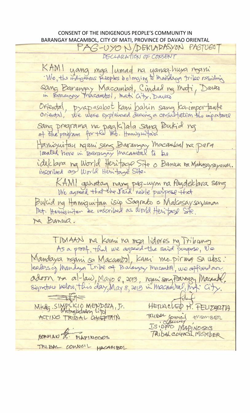
CONSENT OF THE INDIGENOUS PEOPLE’S COMMUNITY IN BARANGAY MACAMBOL, CITY OF MATI, PROVINCE OF DAVAO ORIENTAL
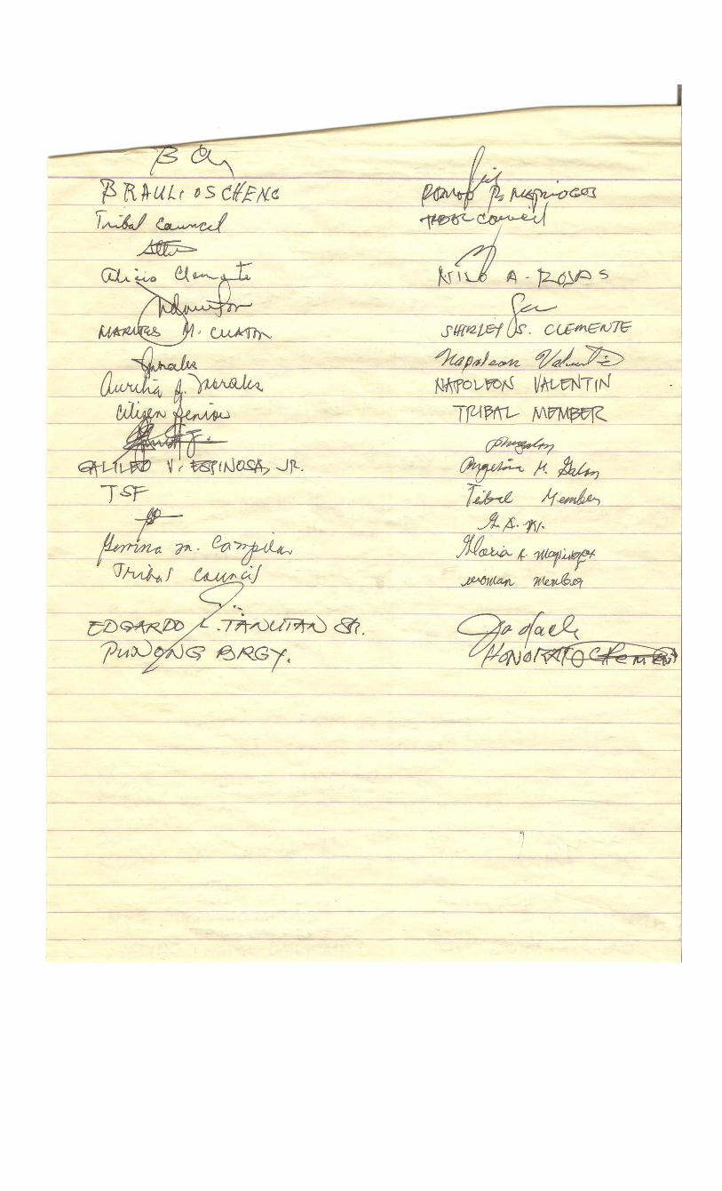
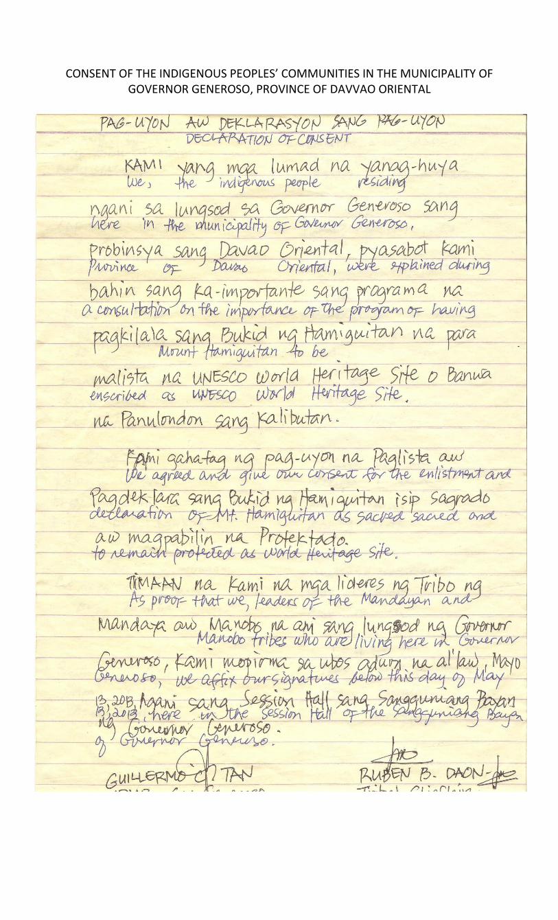
CONSENT OF THE INDIGENOUS PEOPLES’ COMMUNITIES IN THE MUNICIPALITY OF GOVERNOR GENEROSO, PROVINCE OF DAVVAO ORIENTAL
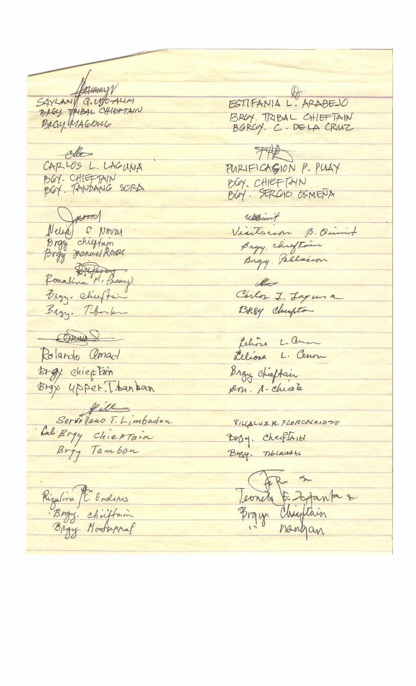


1.b Memorandum of Agreement between the Provincial Government of Davao Oriental, Tribal Group of Macambol (Mati City); Tribal Group of Cabuaya (Mati City), and Tribal Group of Governor Generoso (Municipality of Governor Generoso)
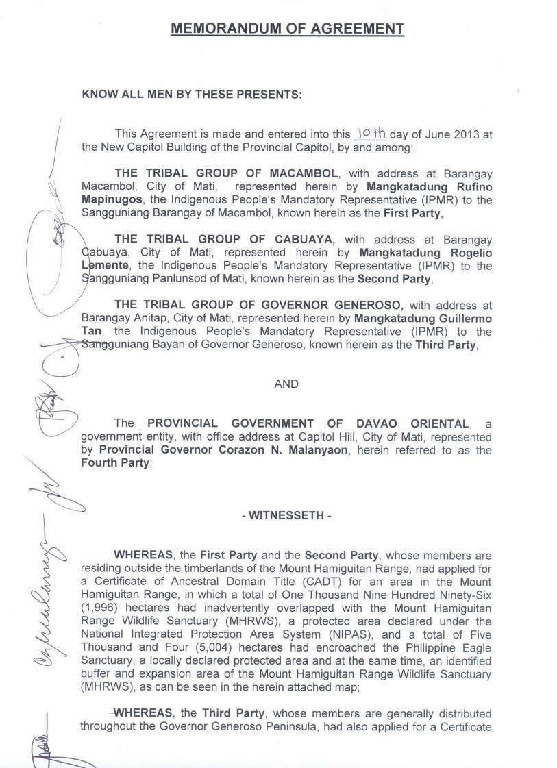
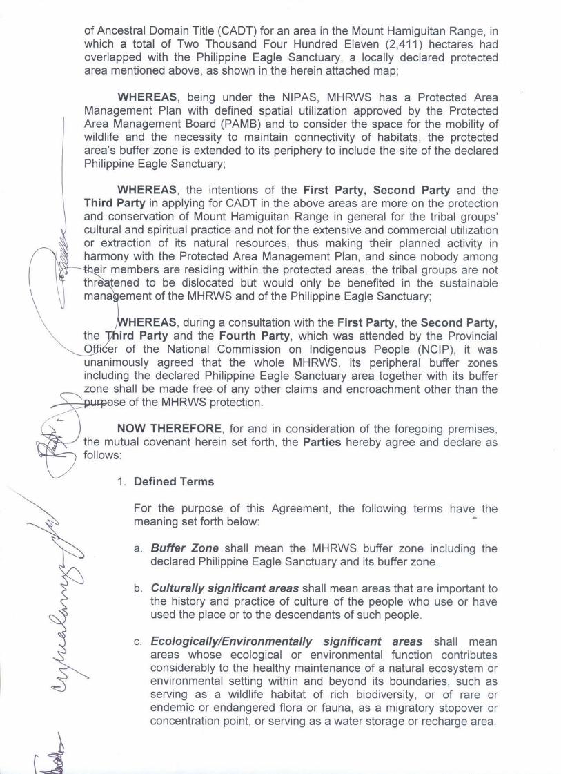
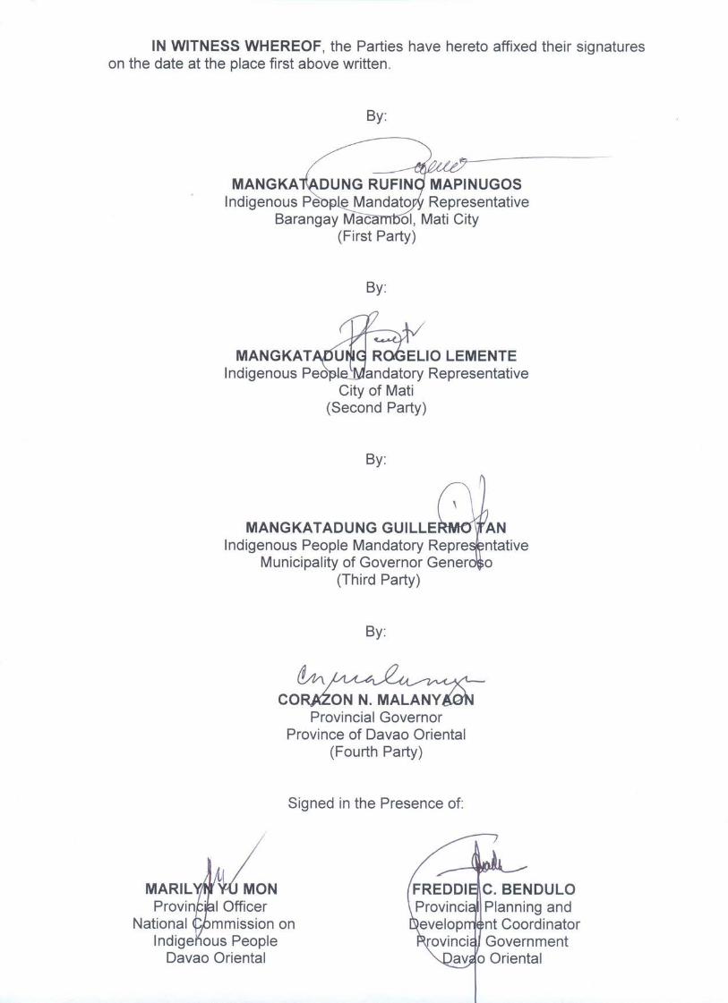

2.a Small-Scale Boundary Map of the Expanded Nominated Property and Provincial Legislation Adopting the Map of the Expanded Nominated Property

2.b Large-Scale Boundary Map of the Expanded Nominated Property
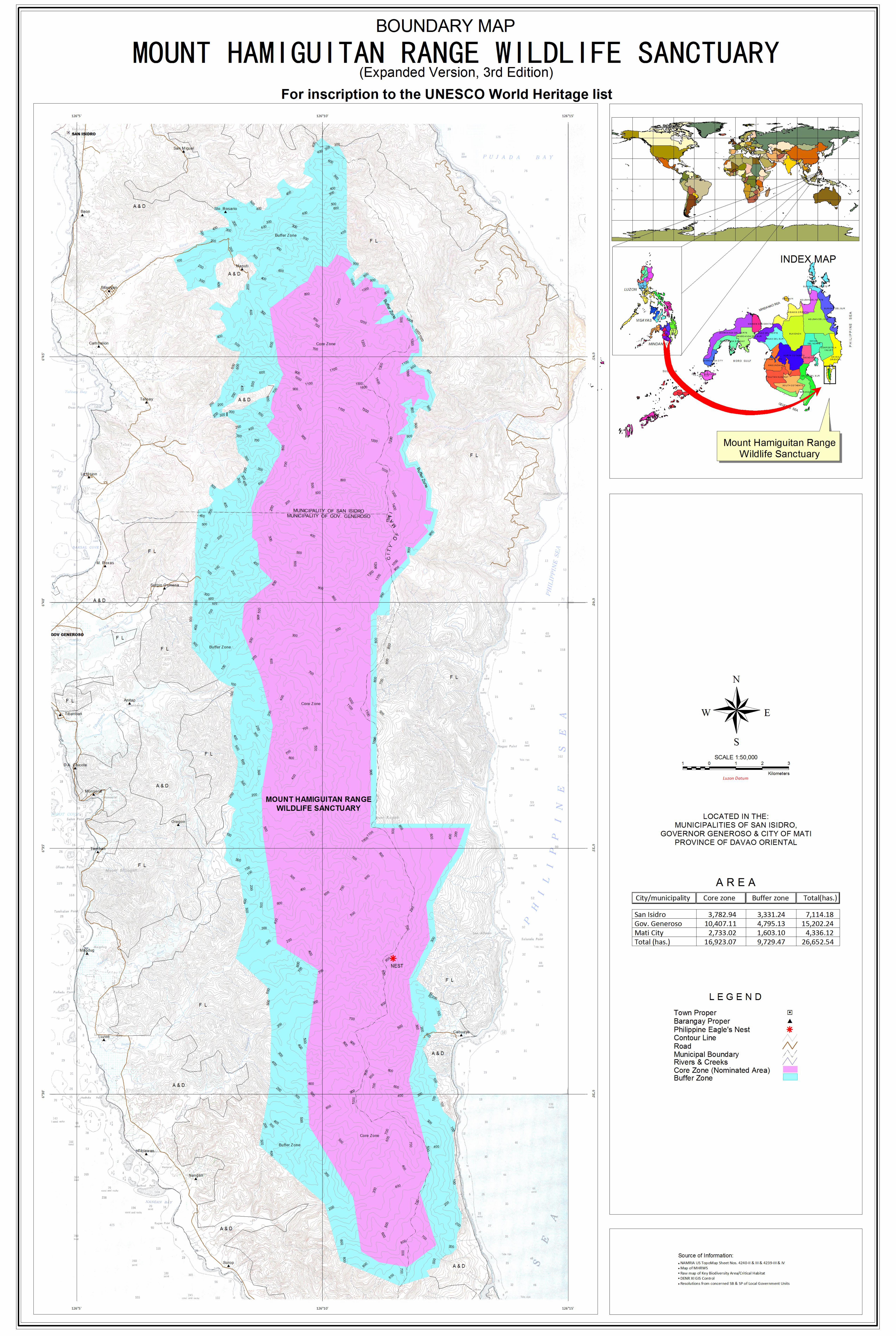

2.c Large-Scale Base Map of the Expanded Nominated Property
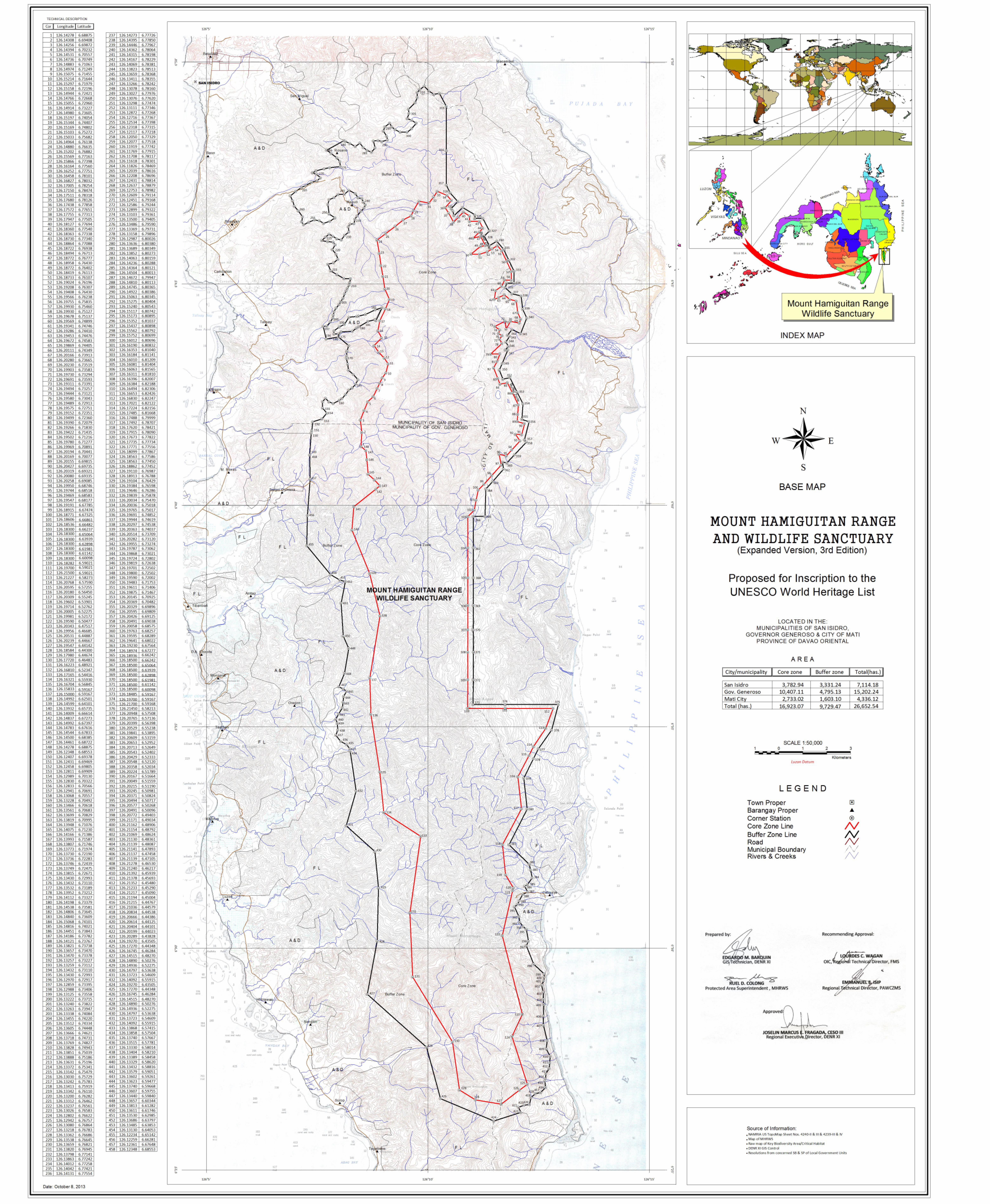
3.a Mount Hamiguitan Range Wildlife Sanctuary Visitor and Tourism Development and Management Plan
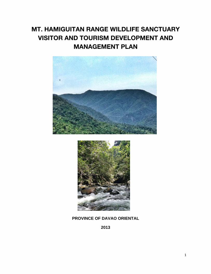
1
MT. HAMIGUITAN RANGE WILDLIFE SANCTUARY VISITOR AND TOURISM DEVELOPMENT AND
MANAGEMENT PLAN
PROVINCE OF DAVAO ORIENTAL
2013
2
TABLE OF CONTENTS
I. TOURISM ANALYSIS…………………………………………………………………………..4 A. Tourism Products Study…………………………………………………………………….4
1. Mt. Hamiguitan…………………………………………………………………………..4 2. Periphery of Mt. Hamiguitan……………………………………………………………7
B. Market Study…………………………………………………………………………………9 1. Demand Analysis………………………………………………………………………..9
a. National Tourism Market Trends………………………………………………….9 b. Regional and Provincial Tourism Market Trends………………………………15 c. National Tourism Development Plan Forecast…………………………………19
2. Tourism Service Analysis……………………………………………………………..20 II. SWOT ANALYSIS……………………………………………………………………………..21 III. TOURISM FRAMEWORK…………………………………………………………………….22 IV. STRATEGIC TOURISM DEVELOPMENT AND PLANNING……………………………..23
A. Modeling and Perimeter Development…………………………………………………..23 1. Modeling Sites………………………………………………………………………….24
B. Trail Management…………………………………………………………………………..25 C. Visitor Management (Buffer and Core Zones) ………………………………………….26 D. Visitor Management for Mainstream Markets (Periphery of the PA and Buffer Zone)……………………………………...……………………………..……..26 E. The Philippine Eagle……………………………………………...………………………..26 F. Off-site Mainstream Tourism Development…………………….………………………. 27
V. MARKETING PLAN……………………………………………………………………………30 VI. INSTITUTIONAL DEVELOPMENT………………………………………………………..…30 VII. 5-YEAR TIME FRAME……………………………………………………………………...…32 VIII. BUDGET REQUIREMENTS…………………………………………………………………..33
3
LIST OF TABLES
Table 1. Tourism products in Mt. Hamiguitan
Table 2. Tourism activities in Mt. Hamiguitan
Table 3. Tourist attractions surrounding Mt. Hamiguitan
Table 4. Top 10 source markets in 2011 and 2012
Table 5. Purpose of travel of international visitors
Table 6. Visitor arrivals per region (includes foreign and domestic travelers)
Table 7. Top destinations of travelers whose main purpose of trip is for pleasure or vacation
Table 8. Region XI visitor arrivals by country of residence 2010 and 2011
Table 9. Davao Oriental visitor arrivals 2009-2011
Table 10. Travel characteristics of tourists in Davao Oriental
Table 11. Visitor arrivals by their entry and exit points
Table 12. Accommodation facilities in Gov. Generoso, Mati City and San Isidro
Table 13. Priority tourism sites surrounding Mt. Hamiguitan
Table 14. Five-year action plan Table 15. Budget Requirements for Plan Implementation
LIST OF FIGURES
Figure 1. International arrivals in the Philippines 2000-2012
Figure 2. Foreign tourists’ average daily expenditure
Figure 3. Foreign tourists’ average length of stay
Figure 4. Distribution of regional travelers in 2011
Figure 5. Domestic tourist numbers and expenditure 2000, 2006, 2011
Figure 6. Visitor arrivals of Region XI from 20004-2011
Figure 7. Distribution of travelers by province (2009 – 2012)
Figure 8. International arrivals 2008 – 2016
Figure 9. MHRWS Tourism Framework
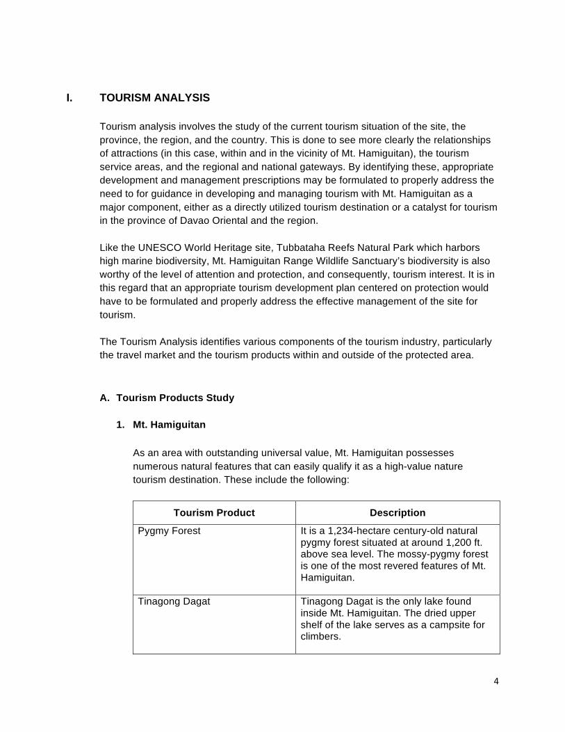
4
I. TOURISM ANALYSIS Tourism analysis involves the study of the current tourism situation of the site, the province, the region, and the country. This is done to see more clearly the relationships of attractions (in this case, within and in the vicinity of Mt. Hamiguitan), the tourism service areas, and the regional and national gateways. By identifying these, appropriate development and management prescriptions may be formulated to properly address the need to for guidance in developing and managing tourism with Mt. Hamiguitan as a major component, either as a directly utilized tourism destination or a catalyst for tourism in the province of Davao Oriental and the region. Like the UNESCO World Heritage site, Tubbataha Reefs Natural Park which harbors high marine biodiversity, Mt. Hamiguitan Range Wildlife Sanctuary’s biodiversity is also worthy of the level of attention and protection, and consequently, tourism interest. It is in this regard that an appropriate tourism development plan centered on protection would have to be formulated and properly address the effective management of the site for tourism. The Tourism Analysis identifies various components of the tourism industry, particularly the travel market and the tourism products within and outside of the protected area. A. Tourism Products Study
1. Mt. Hamiguitan
As an area with outstanding universal value, Mt. Hamiguitan possesses numerous natural features that can easily qualify it as a high-value nature tourism destination. These include the following:
Tourism Product Description
Pygmy Forest It is a 1,234-hectare century-old natural pygmy forest situated at around 1,200 ft. above sea level. The mossy-pygmy forest is one of the most revered features of Mt. Hamiguitan.
Tinagong Dagat Tinagong Dagat is the only lake found inside Mt. Hamiguitan. The dried upper shelf of the lake serves as a campsite for climbers.
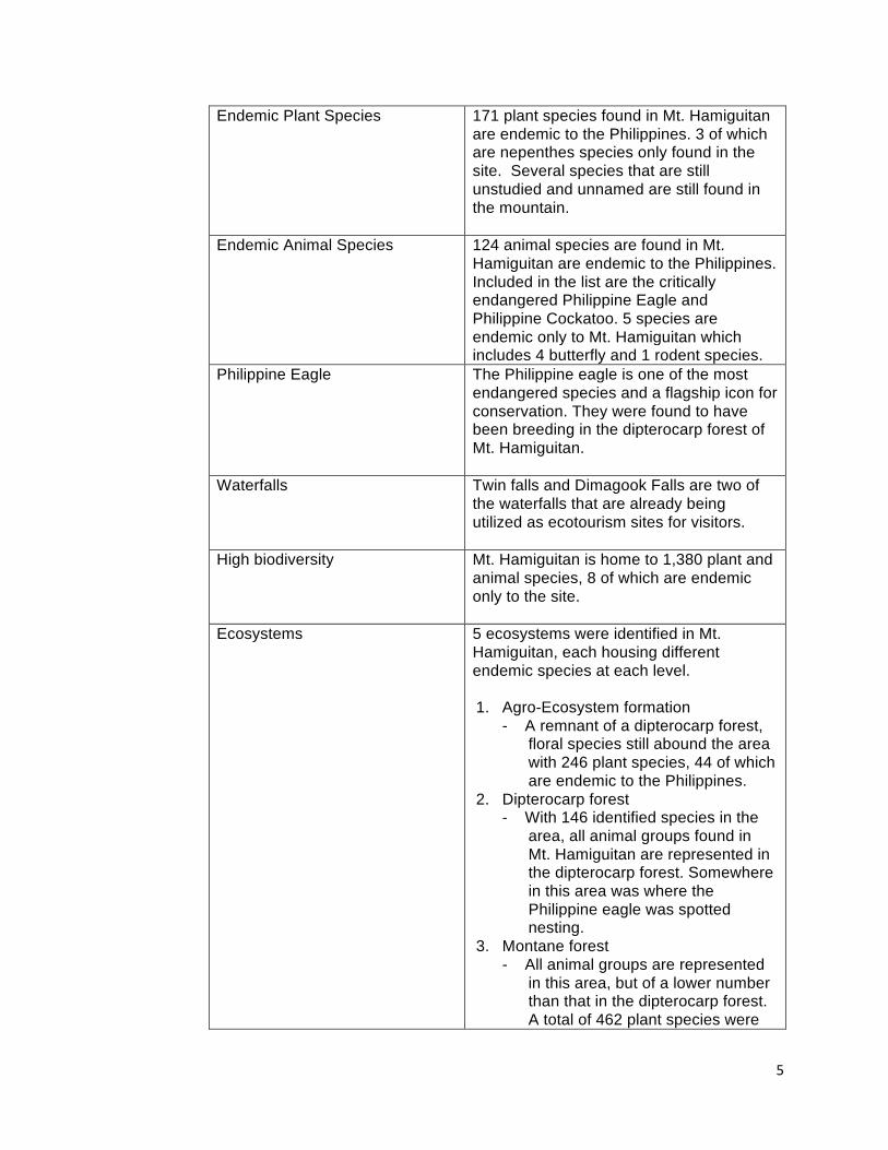
5
Endemic Plant Species 171 plant species found in Mt. Hamiguitan are endemic to the Philippines. 3 of which are nepenthes species only found in the site. Several species that are still unstudied and unnamed are still found in the mountain.
Endemic Animal Species 124 animal species are found in Mt. Hamiguitan are endemic to the Philippines. Included in the list are the critically endangered Philippine Eagle and Philippine Cockatoo. 5 species are endemic only to Mt. Hamiguitan which includes 4 butterfly and 1 rodent species.
Philippine Eagle The Philippine eagle is one of the most endangered species and a flagship icon for conservation. They were found to have been breeding in the dipterocarp forest of Mt. Hamiguitan.
Waterfalls Twin falls and Dimagook Falls are two of the waterfalls that are already being utilized as ecotourism sites for visitors.
High biodiversity Mt. Hamiguitan is home to 1,380 plant and animal species, 8 of which are endemic only to the site.
Ecosystems 5 ecosystems were identified in Mt. Hamiguitan, each housing different endemic species at each level. 1. Agro-Ecosystem formation
- A remnant of a dipterocarp forest, floral species still abound the area with 246 plant species, 44 of which are endemic to the Philippines.
2. Dipterocarp forest - With 146 identified species in the
area, all animal groups found in Mt. Hamiguitan are represented in the dipterocarp forest. Somewhere in this area was where the Philippine eagle was spotted nesting.
3. Montane forest - All animal groups are represented
in this area, but of a lower number than that in the dipterocarp forest. A total of 462 plant species were
6
recorded in this area. The montane forest has the most number of endemic species among the five ecosystems.
4. Mossy forest - Part of the Mt. Hamiguitan with the
least number of animals. 5. Mossy-pygmy forest
- At the topmost of the mountain range, it has a total of 338 plant species
Table 1 Tourism products in Mt. Hamiguitan
As such, various nature tourism activities can be developed in the area. These include:
Activity Remarks
Trekking and Camping Mt. Hamiguitan was closed to the public in 2004 upon the declaration of the site as a protected area. However, a number of researchers and permitted climbers were allowed for research and documentation purposes. There are three established trails:
1. Brgy. Osmena, Governor Generoso 2. La Union, San Isidro 3. Magum, Mati City
There are also seven established campsites in Mt. Hamiguitan:
1. Camp Jabbar 2. TinagongDagat 3. Helipad 4. Camp 3 5. Balongga 6. Tamama 7. Camp 4
Nature Tour Mt. Hamiguitan is regarded as one of the areas in the world with the highest biodiversity, with species that are some of the highest conservation status. According to initial studies, the number of endemic species increases as the elevation increases.
7
Birdwatching 108 species of birds are identified in Mt. Hamiguitan which includes the critically endangered Philippine eagle and the Philippine cockatoo.
Butterfly watching There are a total of 142 identified species of butterflies. 44 species are endemic to the Philippines, 4 of which are endemic to Mt. Hamiguitan. The rarest of them, Deliasmagsadana, can only be found in the moss-pygmy forest.
Table 2 Tourism activities in Mt. Hamiguitan
2. Periphery of Mt. Hamiguitan Natural attractions abound within the periphery of Mt. Hamiguitan that can cater to different types of tourists interested in adventure and culture. (Table 3)
Tourist Attraction Description 1. Beaches/Islands
- Dahican Beach - Waniban Island - Ivy Island - Tibanban Island - Pujada Island - Sigaboy Island - Bakbak Beach - Tulob Beach - Parola Beach
Dahican Beach in Mati City is best known to be a surfing and skimboarding destination. Nearby Waniban, Ivy, Tibanban and Pujada islands are white sand beaches good for swimming and snorkeling. Governor Generoso offers white sand beaches as well like Sigaboy Island, Bakbak and Tulob beaches. Parola Beach is known for its pink sand.
2. Viewing Decks - Sleeping Dinosaur
Deck - Pujada Bay - Monserrat Scenic
View - Cape San Agustin
The Sleeping Dinosaur in Mati City greets the tourists as they enter Mati City border. It is a peninsula in the shape of an Apatosaurus (or Brontosaurus, as interpreted by others). Pujada Bay in Mati City is where one can watch the sun rises first, 3 minutes ahead of time anywhere else in the Philippines. The seascape is also a protected area. There were reported sightings of dolphins, sharks, rays and dugongs in the bay as well. The Monserrat Scenic View in Governor Generoso offers a majestic view of the Davao Gulf. Cape San Agustin is located at the
8
southernmost tip between Mati City and Governor Generoso offers scenic views of Davao Gulf and Celebes Sea. There stand 3 lighthouses, and stunning rock formations also abound the area. One, which locals call The Altar, is believed to be where St. Francis Xavier celebrated his first mass in the Philippines. It is also the jump off point to Parola Beach.
3. Dive Sites - Sigaboy Reef Caves - San Agustin Reef - Tagabebe Wall
These 3 dive sites are among those listed with high marine biodiversity. There are reported sightings of dugongs as well. Scuba dive centers should be established to allow full-blown diving tourism in the region.
4. Philippine Eagle Sanctuary
The Philippine Eagle Santuary in Mati City is the first in the Philippines. It covers 7,000 hectares of lush tropical forest.
5. Waterfalls - Putting Bato Falls - Cagamisan Falls - Dimagook Falls - Sugnoyan Falls - Cawa-Cawa Falls
Putting Bato is located in Mati; Cagamisan, Dimagook and Sugnoyan in Governor Generoso; Cawa-Cawa in San Isidro. Can be utilized for trekking and educational tours.
6. Menzi Citrus Plantation Rented by DOLE Philippines, they produce fresh, quality fruits such as mangoes, banana and pomelo. Currently being utilized for agritourism.
7. Buso Hot Spring Located 30 minutes away from MatiPoblacion. There exists cottages and tourists can dip to relax.
8. Natural Science Museum Located in Mati City. With the huge skeleton of a Sperm Whale (7th largest in the world) as the centerpiece of the museum, this could attract large numbers of visitors and increase the total nature tourism value of the province.
Table 3 Tourist attractions surrounding Mt. Hamiguitan
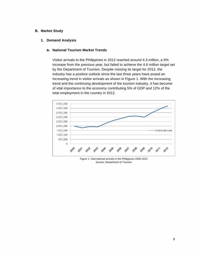
9
Figure 1. International arrivals in the Philippines 2000-2012 Source: Department of Tourism
B. Market Study
1. Demand Analysis
a. National Tourism Market Trends
Visitor arrivals to the Philippines in 2012 reached around 4.3 million, a 9% increase from the previous year, but failed to achieve the 4.6 million target set by the Department of Tourism. Despite missing its target for 2012, the industry has a positive outlook since the last three years have posed an increasing trend in visitor arrivals as shown in Figure 1. With the increasing trend and the continuing development of the tourism industry, it has become of vital importance to the economy contributing 5% of GDP and 12% of the total employment in the country in 2012.
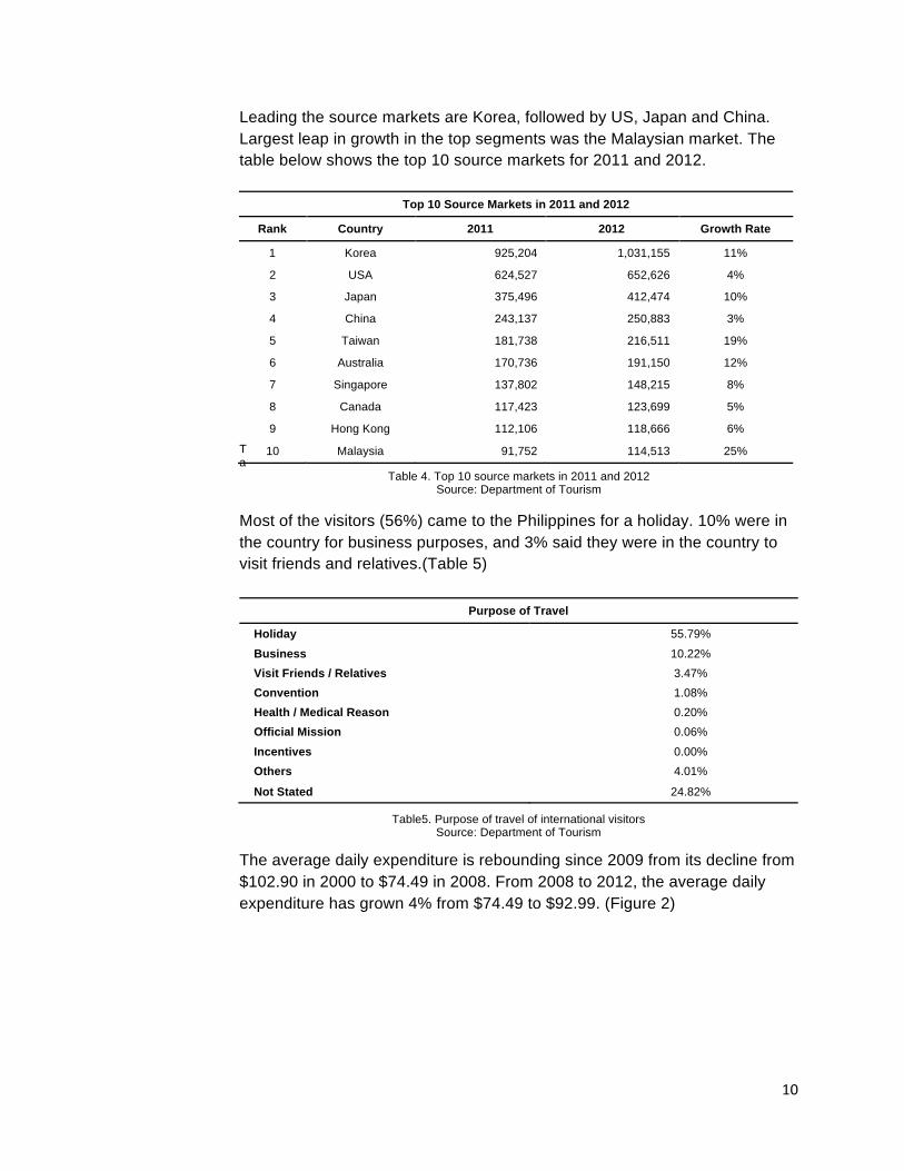
10
Leading the source markets are Korea, followed by US, Japan and China. Largest leap in growth in the top segments was the Malaysian market. The table below shows the top 10 source markets for 2011 and 2012.
Ta
Table 4. Top 10 source markets in 2011 and 2012 Source: Department of Tourism
Most of the visitors (56%) came to the Philippines for a holiday. 10% were in the country for business purposes, and 3% said they were in the country to visit friends and relatives.(Table 5)
Purpose of Travel
Holiday 55.79%
Business 10.22%
Visit Friends / Relatives 3.47%
Convention 1.08%
Health / Medical Reason 0.20%
Official Mission 0.06%
Incentives 0.00%
Others 4.01%
Not Stated 24.82%
The average daily expenditure is rebounding since 2009 from its decline from $102.90 in 2000 to $74.49 in 2008. From 2008 to 2012, the average daily expenditure has grown 4% from $74.49 to $92.99. (Figure 2)
Top 10 Source Markets in 2011 and 2012
Rank Country 2011 2012 Growth Rate
1 Korea 925,204 1,031,155 11%
2 USA 624,527 652,626 4%
3 Japan 375,496 412,474 10%
4 China 243,137 250,883 3%
5 Taiwan 181,738 216,511 19%
6 Australia 170,736 191,150 12%
7 Singapore 137,802 148,215 8%
8 Canada 117,423 123,699 5%
9 Hong Kong 112,106 118,666 6%
10 Malaysia 91,752 114,513 25%
Table5. Purpose of travel of international visitors Source: Department of Tourism
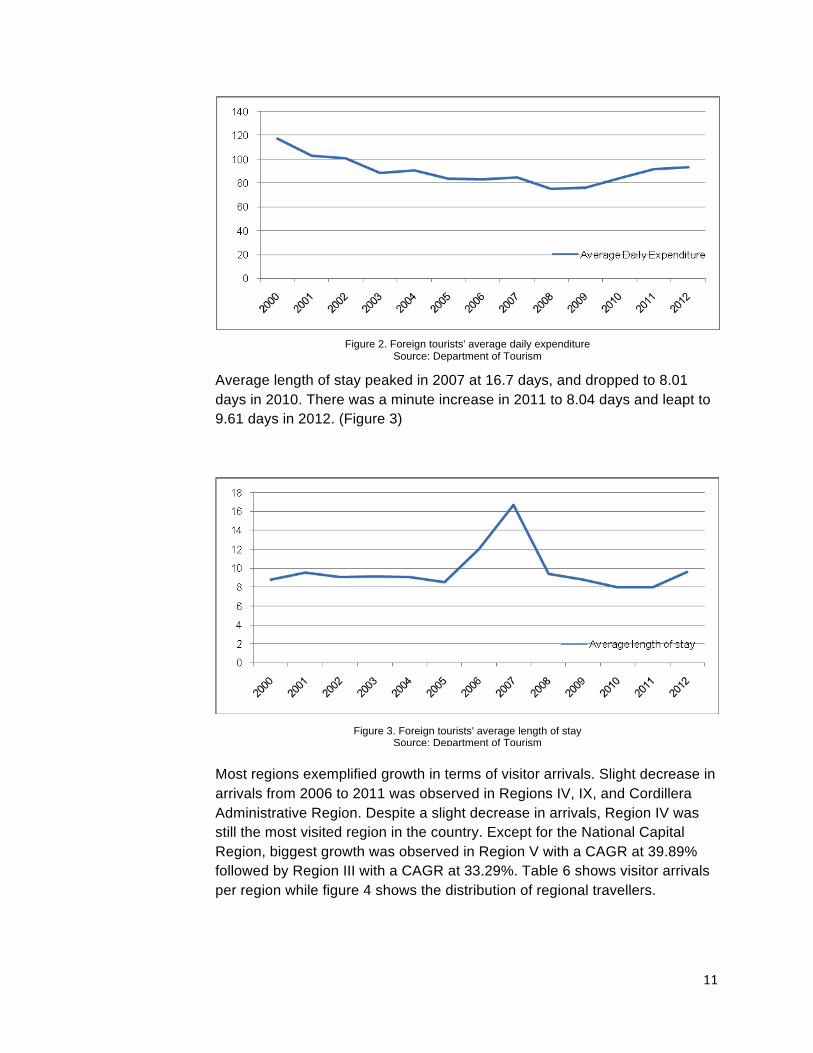
11
Average length of stay peaked in 2007 at 16.7 days, and dropped to 8.01 days in 2010. There was a minute increase in 2011 to 8.04 days and leapt to 9.61 days in 2012. (Figure 3) Most regions exemplified growth in terms of visitor arrivals. Slight decrease in arrivals from 2006 to 2011 was observed in Regions IV, IX, and Cordillera Administrative Region. Despite a slight decrease in arrivals, Region IV was still the most visited region in the country. Except for the National Capital Region, biggest growth was observed in Region V with a CAGR at 39.89% followed by Region III with a CAGR at 33.29%. Table 6 shows visitor arrivals per region while figure 4 shows the distribution of regional travellers.
Figure 2. Foreign tourists' average daily expenditure Source: Department of Tourism
Figure 3. Foreign tourists' average length of stay Source: Department of Tourism
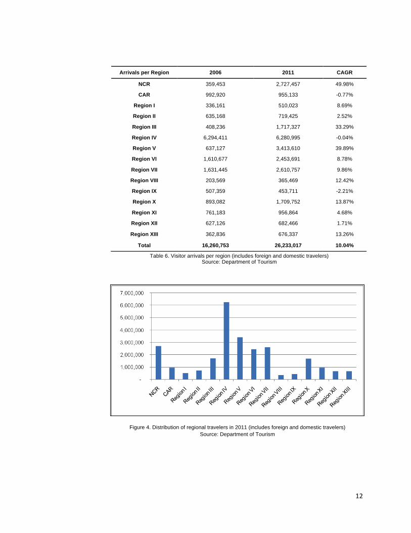
12
Figure 4. Distribution of regional travelers in 2011 (includes foreign and domestic travelers)
Source: Department of Tourism
Arrivals per Region 2006 2011 CAGR
NCR 359,453 2,727,457 49.98%
CAR 992,920 955,133 -0.77%
Region I 336,161 510,023 8.69%
Region II 635,168 719,425 2.52%
Region III 408,236 1,717,327 33.29%
Region IV 6,294,411 6,280,995 -0.04%
Region V 637,127 3,413,610 39.89%
Region VI 1,610,677 2,453,691 8.78%
Region VII 1,631,445 2,610,757 9.86%
Region VIII 203,569 365,469 12.42%
Region IX 507,359 453,711 -2.21%
Region X 893,082 1,709,752 13.87%
Region XI 761,183 956,864 4.68%
Region XII 627,126 682,466 1.71%
Region XIII 362,836 676,337 13.26%
Total 16,260,753 26,233,017 10.04%
Table 6. Visitor arrivals per region (includes foreign and domestic travelers) Source: Department of Tourism
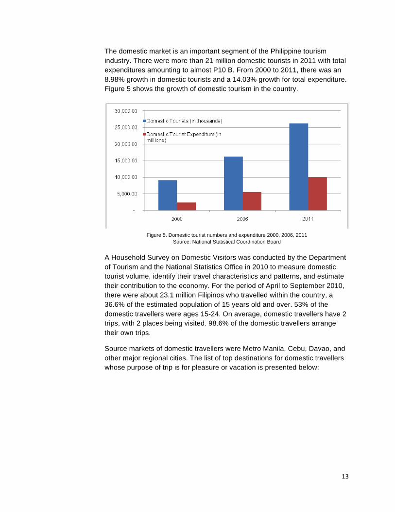
13
The domestic market is an important segment of the Philippine tourism industry. There were more than 21 million domestic tourists in 2011 with total expenditures amounting to almost P10 B. From 2000 to 2011, there was an 8.98% growth in domestic tourists and a 14.03% growth for total expenditure. Figure 5 shows the growth of domestic tourism in the country.
A Household Survey on Domestic Visitors was conducted by the Department of Tourism and the National Statistics Office in 2010 to measure domestic tourist volume, identify their travel characteristics and patterns, and estimate their contribution to the economy. For the period of April to September 2010, there were about 23.1 million Filipinos who travelled within the country, a 36.6% of the estimated population of 15 years old and over. 53% of the domestic travellers were ages 15-24. On average, domestic travellers have 2 trips, with 2 places being visited. 98.6% of the domestic travellers arrange their own trips.
Source markets of domestic travellers were Metro Manila, Cebu, Davao, and other major regional cities. The list of top destinations for domestic travellers whose purpose of trip is for pleasure or vacation is presented below:
Figure 5. Domestic tourist numbers and expenditure 2000, 2006, 2011 Source: National Statistical Coordination Board
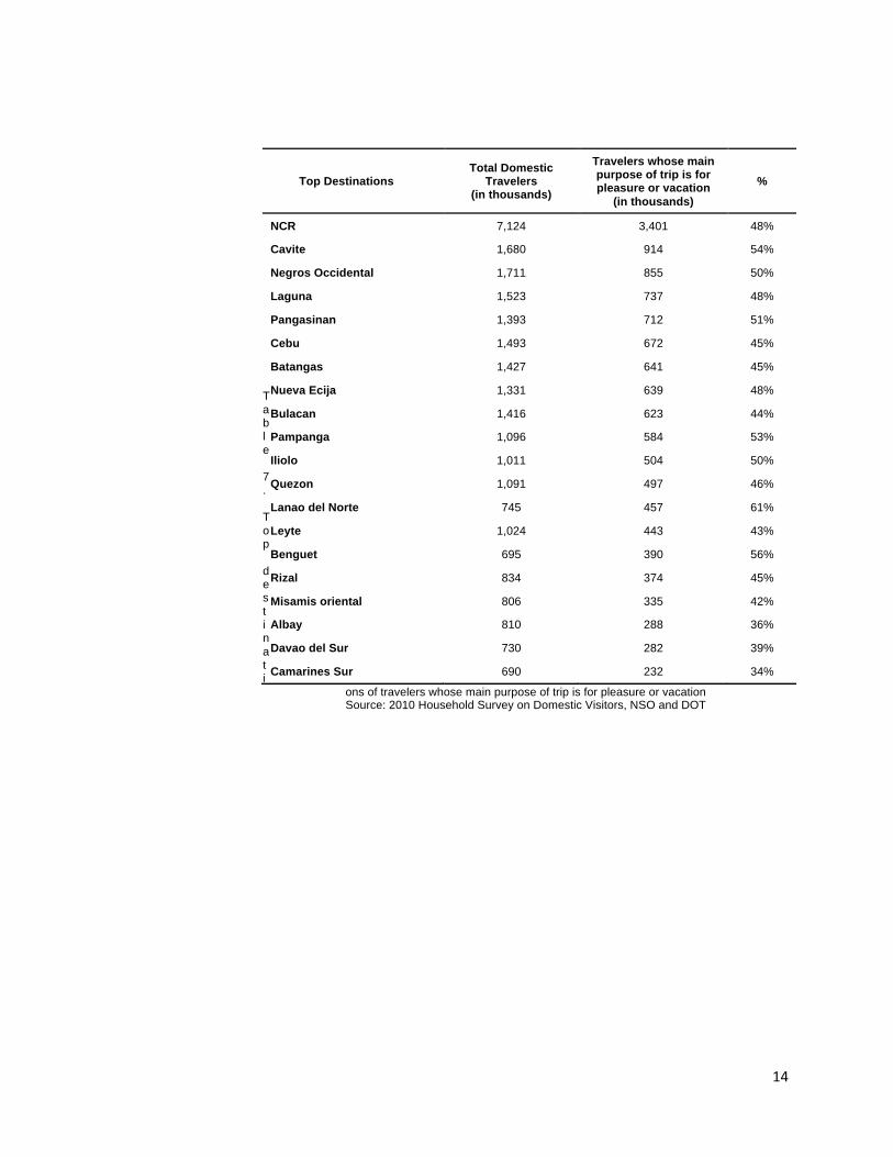
14
Table 7. Top destinati
ons of travelers whose main purpose of trip is for pleasure or vacation Source: 2010 Household Survey on Domestic Visitors, NSO and DOT
Top Destinations Total Domestic
Travelers (in thousands)
Travelers whose main purpose of trip is for pleasure or vacation
(in thousands)
%
NCR 7,124 3,401 48%
Cavite 1,680 914 54%
Negros Occidental 1,711 855 50%
Laguna 1,523 737 48%
Pangasinan 1,393 712 51%
Cebu 1,493 672 45%
Batangas 1,427 641 45%
Nueva Ecija 1,331 639 48%
Bulacan 1,416 623 44%
Pampanga 1,096 584 53%
Iliolo 1,011 504 50%
Quezon 1,091 497 46%
Lanao del Norte 745 457 61%
Leyte 1,024 443 43%
Benguet 695 390 56%
Rizal 834 374 45%
Misamis oriental 806 335 42%
Albay 810 288 36%
Davao del Sur 730 282 39%
Camarines Sur 690 232 34%
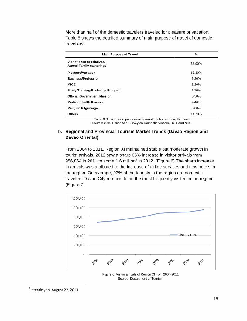
15
More than half of the domestic travelers traveled for pleasure or vacation. Table 5 shows the detailed summary of main purpose of travel of domestic travellers.
Main Purpose of Travel %
Visit friends or relatives/ Attend Family gatherings 36.90%
Pleasure/Vacation 53.30%
Business/Profession 6.20%
MICE 2.20%
Study/Training/Exchange Program 1.70%
Official Government Mission 0.50%
Medical/Health Reason 4.40%
Religion/Pilgrimage 6.00%
Others 14.70% Table 8 Survey participants were allowed to choose more than one
Source: 2010 Household Survey on Domestic Visitors, DOT and NSO
b. Regional and Provincial Tourism Market Trends (Davao Region and Davao Oriental) From 2004 to 2011, Region XI maintained stable but moderate growth in tourist arrivals. 2012 saw a sharp 65% increase in visitor arrivals from 956,864 in 2011 to some 1.6 million1 in 2012. (Figure 6) The sharp increase in arrivals was attributed to the increase of airline services and new hotels in the region. On average, 93% of the tourists in the region are domestic travelers.Davao City remains to be the most frequently visited in the region. (Figure 7)
1Interaksyon, August 22, 2013.
Figure 6. Visitor arrivals of Region XI from 2004-2011 Source: Department of Tourism
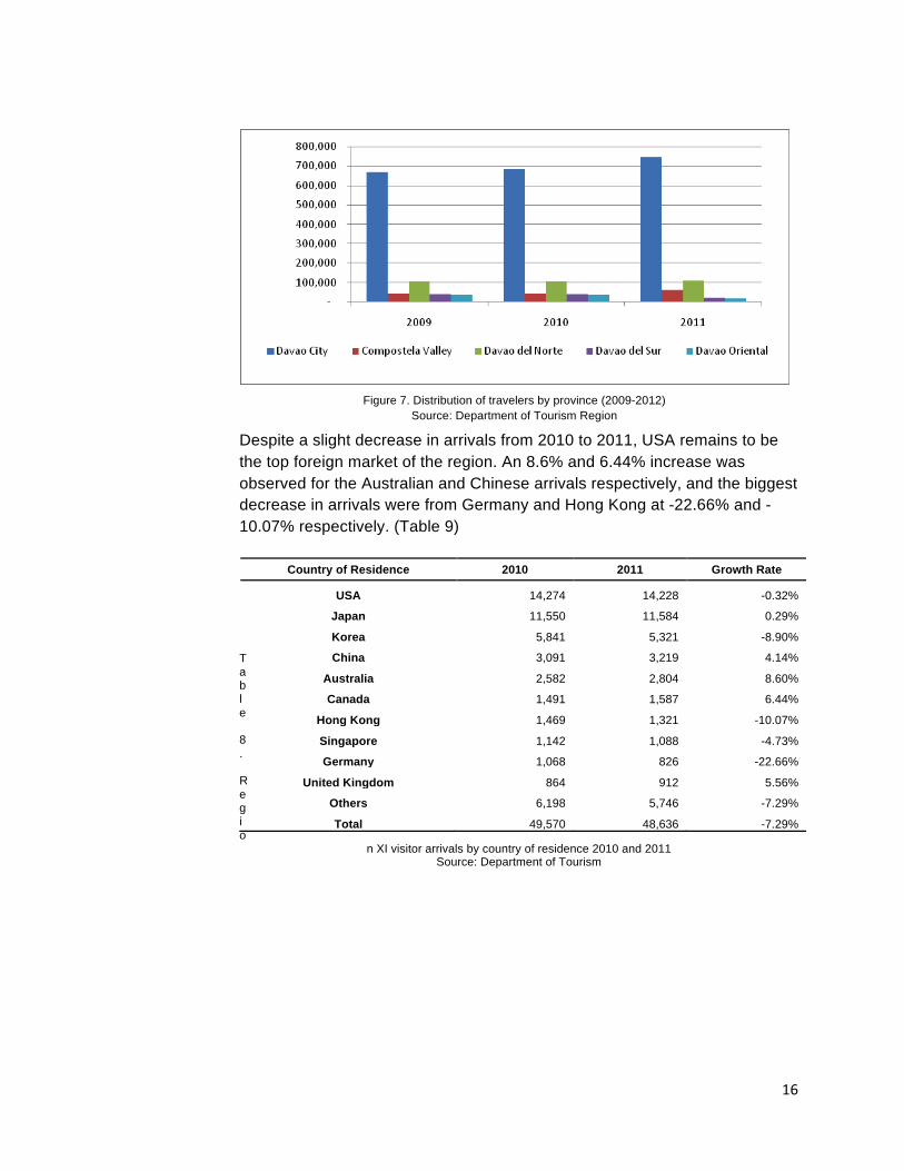
16
Despite a slight decrease in arrivals from 2010 to 2011, USA remains to be the top foreign market of the region. An 8.6% and 6.44% increase was observed for the Australian and Chinese arrivals respectively, and the biggest decrease in arrivals were from Germany and Hong Kong at -22.66% and -10.07% respectively. (Table 9)
Table 8. Regio
n XI visitor arrivals by country of residence 2010 and 2011 Source: Department of Tourism
Country of Residence 2010 2011 Growth Rate
USA 14,274 14,228 -0.32%
Japan 11,550 11,584 0.29%
Korea 5,841 5,321 -8.90%
China 3,091 3,219 4.14%
Australia 2,582 2,804 8.60%
Canada 1,491 1,587 6.44%
Hong Kong 1,469 1,321 -10.07%
Singapore 1,142 1,088 -4.73%
Germany 1,068 826 -22.66%
United Kingdom 864 912 5.56%
Others 6,198 5,746 -7.29%
Total 49,570 48,636 -7.29%
Figure 7. Distribution of travelers by province (2009-2012) Source: Department of Tourism Region
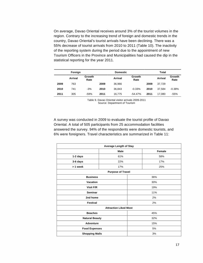
17
On average, Davao Oriental receives around 3% of the tourist volumes in the region. Contrary to the increasing trend of foreign and domestic trends in the country, Davao Oriental’s tourist arrivals have been declining. There was a 55% decrease of tourist arrivals from 2010 to 2011 (Table 10). The inactivity of the reporting system during the period due to the appointment of new Tourism Officers in the Province and Municipalities had caused the dip in the statistical reporting for the year 2011.
Table 9. Davao Oriental visitor arrivals 2009-2011 Source: Department of Tourism
A survey was conducted in 2009 to evaluate the tourist profile of Davao Oriental. A total of 505 participants from 25 accommodation facilities answered the survey. 94% of the respondents were domestic tourists, and 6% were foreigners. Travel characteristics are summarized in Table 11:
Foreign Domestic Total
Arrival Growth Rate Arrival Growth
Rate Arrival Growth Rate
2009 763 2009 36,966 2009 37,729
2010 741 -3% 2010 36,843 -0.33% 2010 37,584 -0.38%
2011 305 -59% 2011 16,775 -54.47% 2011 17,080 -55%
Average Length of Stay
Male Female
1-2 days 61% 58%
3-6 days 22% 17%
> 1 week 17% 25%
Purpose of Travel
Business 36%
Vacation 30%
Visit F/R 19%
Seminar 11%
2nd home 2%
Festival 2%
Attraction Liked Most
Beaches 45%
Natural Beauty 32%
Adventure 15%
Food Expenses 5%
Shopping Malls 3%
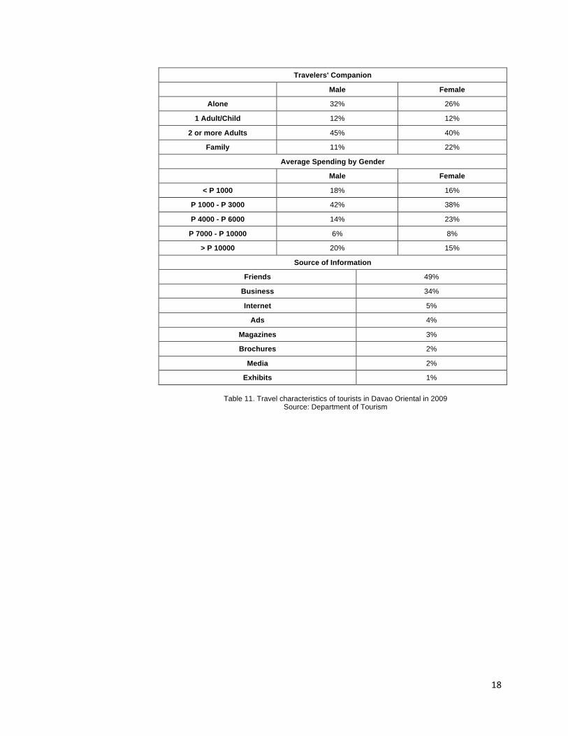
18
Travelers' Companion
Male Female
Alone 32% 26%
1 Adult/Child 12% 12%
2 or more Adults 45% 40%
Family 11% 22%
Average Spending by Gender
Male Female
< P 1000 18% 16%
P 1000 - P 3000 42% 38%
P 4000 - P 6000 14% 23%
P 7000 - P 10000 6% 8%
> P 10000 20% 15%
Source of Information
Friends 49%
Business 34%
Internet 5%
Ads 4%
Magazines 3%
Brochures 2%
Media 2%
Exhibits 1%
Table 11. Travel characteristics of tourists in Davao Oriental in 2009 Source: Department of Tourism
19
c. National Tourism Development Plan Forecast The National Tourism Development Plan for 2011-2016 envisioned the Philippines “to become the must experience destination in Asia.” It aims to have 10 million visitor arrivals and 35.5 million domestic travelers by 2016. (Figure 8). To achieve the 10 million international arrivals, the Department of Tourism has identified three market segments on which the marketing efforts shall be placed on. The market segments are: Key markets (large existing market share) – South Korea, USA, and Japan; Strategic markets (moderate existing market share) – Singapore, Malaysia, Australia, Canada, Taiwan and Hong Kong; Opportunity or niche markets (small existing market share) – India, Scandinavia, Russia, Germany and UK.
The department also identified priority cluster destinations for tourism development. They were: 1. Central Visayas, 2. Metro manila and CALABARZON, 3. Central Luzon, 4. Palawan, 5. Western Visayas, 6. Davao Gulf and Coast, 7. Northern Mindanao, 8. Bicol, and 9. Laoag-Vigan. According to the NTDP for 2011-2016, the Davao cluster would have reached 401,381 foreign tourist arrivals, a 4.01% share of the 10,000,000 target.
In addition to being part of the Davao Gulf and Coast cluster, Davao Oriental has been declared a tourism development area through RA 10560, signed by President Benigno S. Aquino III on May 17, 2013. Backed by strong support through national tourism and environmental policies, tourism in Davao Oriental is expected to prosper.
Figure 8 International arrivals 2008-2016 Source: Department of Tourism
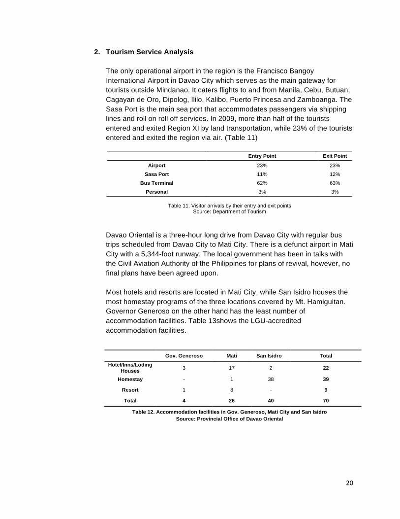
20
2. Tourism Service Analysis The only operational airport in the region is the Francisco Bangoy International Airport in Davao City which serves as the main gateway for tourists outside Mindanao. It caters flights to and from Manila, Cebu, Butuan, Cagayan de Oro, Dipolog, Ililo, Kalibo, Puerto Princesa and Zamboanga. The Sasa Port is the main sea port that accommodates passengers via shipping lines and roll on roll off services. In 2009, more than half of the tourists entered and exited Region XI by land transportation, while 23% of the tourists entered and exited the region via air. (Table 11)
Table 11. Visitor arrivals by their entry and exit points
Source: Department of Tourism
Davao Oriental is a three-hour long drive from Davao City with regular bus trips scheduled from Davao City to Mati City. There is a defunct airport in Mati City with a 5,344-foot runway. The local government has been in talks with the Civil Aviation Authority of the Philippines for plans of revival, however, no final plans have been agreed upon.
Most hotels and resorts are located in Mati City, while San Isidro houses the most homestay programs of the three locations covered by Mt. Hamiguitan. Governor Generoso on the other hand has the least number of accommodation facilities. Table 13shows the LGU-accredited accommodation facilities.
Table 12. Accommodation facilities in Gov. Generoso, Mati City and San Isidro Source: Provincial Office of Davao Oriental
Entry Point Exit Point
Airport 23% 23%
Sasa Port 11% 12%
Bus Terminal 62% 63%
Personal 3% 3%
Gov. Generoso Mati San Isidro Total Hotel/Inns/Loding
Houses 3 17 2 22
Homestay - 1 38 39
Resort 1 8 - 9
Total 4 26 40 70
21
II. SWOT ANALYSIS Davao Oriental has a good number of natural tourism sites that can easily stand on their own as compelling products (e.g. Dahican Beach) and attract their own travel markets. MHRWS can easily be made into a tourism icon and effectively supported by other tourism products in the province. The realities of low tourism awareness and visitation, plus other challenges with focus on the length of time required to travel from the regional gateway, Davao City to Davao Oriental is expected to be a weakness of the province. However, the continuously growing and diversifying tourism market can pose an opportunity to effectively tap the tourism products for the province and develop a good and increasing amount of tourists to Davao Oriental. The usual environmental threats such as climate change and resource use conflict with mining shall continue to be a threat for optimal tourism development in the area. Peace and order plus personal security may also decide to form a larger tourism impacts to the site and the three municipalities.
Strengths
- Underdeveloped tourism resources and pristine natural places - Diverse ecotourism products
Weaknesses
- Low investment in tourism facilities - Long travel time from major tourism service area and regional gateway
(Davao City) - Inadequate sea connectivity - Absence of air connectivity
Opportunities
- Growing domestic and foreign market - Strong support of national tourism policies - Priority funds for tourism development
Threats
- Possible resource conflict with mining (need to come up with a resolution to avert said conflict)
- Continuing perception on safety and security on Mindanao as a whole - Impacts of climate change (i.e. extreme weather conditions)
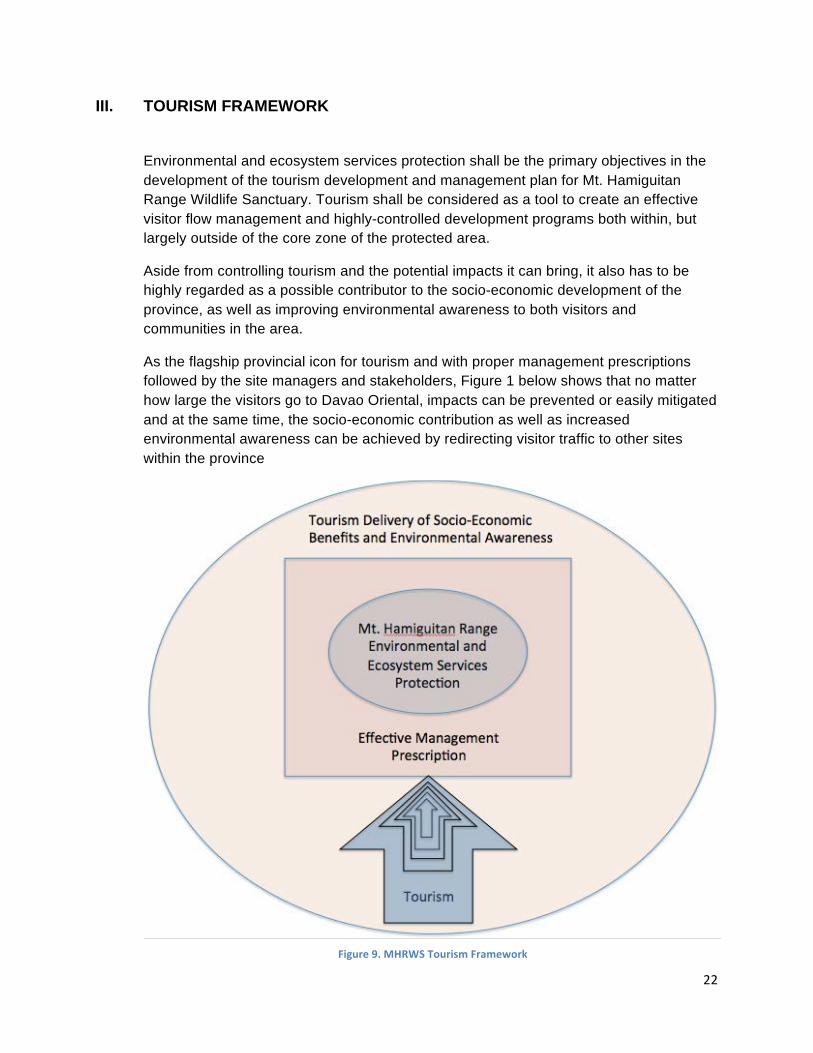
22
III. TOURISM FRAMEWORK
Environmental and ecosystem services protection shall be the primary objectives in the development of the tourism development and management plan for Mt. Hamiguitan Range Wildlife Sanctuary. Tourism shall be considered as a tool to create an effective visitor flow management and highly-controlled development programs both within, but largely outside of the core zone of the protected area.
Aside from controlling tourism and the potential impacts it can bring, it also has to be highly regarded as a possible contributor to the socio-economic development of the province, as well as improving environmental awareness to both visitors and communities in the area.
As the flagship provincial icon for tourism and with proper management prescriptions followed by the site managers and stakeholders, Figure 1 below shows that no matter how large the visitors go to Davao Oriental, impacts can be prevented or easily mitigated and at the same time, the socio-economic contribution as well as increased environmental awareness can be achieved by redirecting visitor traffic to other sites within the province
Figure 9. MHRWS Tourism Framework
23
IV. STRATEGIC TOURISM DEVELOPMENT AND PLANNING
Based on the Tourism Framework developed it shall be used as a guide in identifying existing and potential tourism products within the MHRWS, its perimeter, and the province of Davao Oriental.
Mt. Hamiguitan Range shall serve as the iconic landmark, but not necessarily as the target destination within Davao Oriental.
To achieve this, an off-site tourism development model shall be implemented in the province, particularly the three municipalities that the MHRWS straddles. The primary strategy would be the implementation of tourism modelling and off-site mainstream tourism development. On-site management programs shall also be implemented to address the potential impacts of visitors, no matter how few, who will go to the site for scientific, monitoring, documentation, and even recreation activities.
A. Modelling and Perimeter Development
To prevent unwanted development and visitor impacts to the core zone of Mt. Hamiguitan Range Wildlife Sanctuary, a modeling strategy shall be done in the area. Modeling is the development of an off-site representation of an area which should show to the visitors the look and feel of the actual site, thereby preventing large numbers of visitors from going to the actual zone and thus minimizing human impacts. Modeling will become very necessary if Mt. Hamiguitan Range is listed as a UNESCO World Heritage Site as curious masses of visitors would congregate to Mt. Hamiguitan to see for themselves the reasons why it was included in the prestigious list. It becomes very crucial that majority of the visitors are made to stay only in the modelling sites,and gain a deep sense of awareness through the things they already see and experience without having to go to the most sensitive areas of Mt. Hamiguitan.
Although access to Mt. Hamiguitan has been restricted to scientific and monitoring purposes thereby preventing casual recreation visitors to the core zone, there will be constant demand for people to see for themselves the mountain’s features and may cause uncontrolled, unmonitored and illegal entry which could potentially set back the conservation gains of the site. Coming up with an appropriate management strategy would not only prevent these scenarios from occurring, but also ensure that gains from tourism can be properly tapped and channeled to the recipient stakeholders (e.g. local communities).
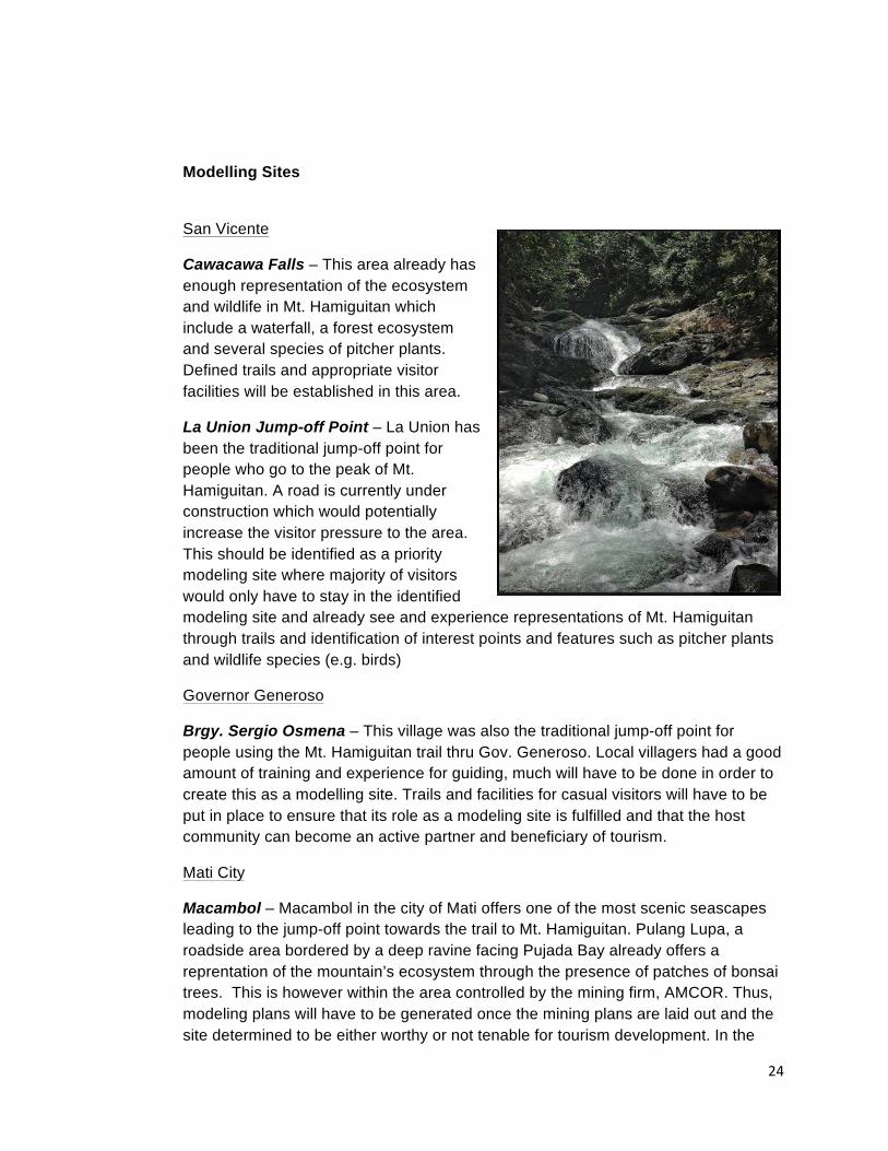
24
Modelling Sites
San Vicente
Cawacawa Falls – This area already has enough representation of the ecosystem and wildlife in Mt. Hamiguitan which include a waterfall, a forest ecosystem and several species of pitcher plants. Defined trails and appropriate visitor facilities will be established in this area.
La Union Jump-off Point – La Union has been the traditional jump-off point for people who go to the peak of Mt. Hamiguitan. A road is currently under construction which would potentially increase the visitor pressure to the area. This should be identified as a priority modeling site where majority of visitors would only have to stay in the identified modeling site and already see and experience representations of Mt. Hamiguitan through trails and identification of interest points and features such as pitcher plants and wildlife species (e.g. birds)
Governor Generoso
Brgy. Sergio Osmena – This village was also the traditional jump-off point for people using the Mt. Hamiguitan trail thru Gov. Generoso. Local villagers had a good amount of training and experience for guiding, much will have to be done in order to create this as a modelling site. Trails and facilities for casual visitors will have to be put in place to ensure that its role as a modeling site is fulfilled and that the host community can become an active partner and beneficiary of tourism.
Mati City
Macambol – Macambol in the city of Mati offers one of the most scenic seascapes leading to the jump-off point towards the trail to Mt. Hamiguitan. Pulang Lupa, a roadside area bordered by a deep ravine facing Pujada Bay already offers a reprentation of the mountain’s ecosystem through the presence of patches of bonsai trees. This is however within the area controlled by the mining firm, AMCOR. Thus, modeling plans will have to be generated once the mining plans are laid out and the site determined to be either worthy or not tenable for tourism development. In the
25
possibility of abandoning the current site due to a potential conflict with a major stakeholder, another site may have to be identified or even abandon the modeling program and focus instead on off-site tourism destinations (e.g. beaches)
B. Trail Management
Until a trail management plan is formulated and approved by the PAMB, access to Mt. Hamiguitan shall continue to be restricted to research and monitoring.
The three (3) existing trails shall remain as the only access to Hamiguitan Range. These include:
• La Union Trail – San Isidro • Macambol Trail – Mati • Brgy. Sergio Osmena – Gov. Generoso
A trail management plan shall be formulated to cover each trail with the following premises:
• Well-defined trails that prevent hikers from unnecessarily veering away and creating more trails or expanding established ones.
• Campsites – Campsites shall be established in the most appropriate spots that create zero to minimal impacts that allow effective mitigation measures or natural regeneration. Existing campsites may be utilized or new ones may have to be identified to replace currently established sites.
• Water sources – water sources need not be necessarily located within or in the immediate vicinity of the campsites so that the visitors do not create unnecessary harm to the natural environment of the area (e.g. hacking a trail or clearing a vegetation). Hikers and campers will have to adjust to the condition of minimum or zero water availability in specific campsites or trail lengths.
• Appropriate water drainage in case of rains – campsites shall not be located in areas where water naturally gets collected which then create bogs in case of human use. Each campsite should allow rain water to drain down away from the tents. Each existing campsite will have to be evaluated based on this requirement.
• The Pgymy Forest area shall be made free from camping or overnight use. Established campsite shall be abandoned and allow natural regeneration in the spots. This is to prevent people from depositing human wastes that would create an imbalance on the soil nutrient in the area and affect the natural growth and coverage of vegetation. Another justification is to prevent accidental forest fires that might do great damage to the forest as the trees already serve as sensitive tinder boxes due to the maturity of the bonsai trees’ woods. A replacement campsite shall be established at least 50 meters from the edge of the bonsai forest. This would make the peak/pygmy forest
26
as an assault-type or day-trip mountaineering objective rather than an overnight destination.
• NO-TAKE Policy shall be implemented – The policy shall be strictly enforced in Mt. Hamiguitan. Only individuals or firms with appropriate permits from mandated government agencies (e.g. National Museum) shall be allowed to take biotic and abiotic samples from the area. Visitors insisting on taking “souvenir items” shall be denied further stay in the area and the guides would be mandated to guide back visitors to the jump-off point without prejudice to the guides and the PAMB.
Once the Trail Management Plan is developed and implemented, the following activities and visitors shall then be allowed access to Mt. Hamiguitan
C. Visitor Management (Buffer and Core Zones)
• Scientific Purposes – So long as proper permits and coordination are made and recognized by the PAMB, scientific visits shall be allowed in the area.
• Hiking and Camping – These activities shall be allowed but the recommended carrying capacities for trails and campsites shall be observed.
• Nature Tours – Nature tours shall be allowed provided the tour group is guided and protected by deputized guides.
• Birdwatching and Bird Photography – Shall be allowed only along the established trails. Special permits will have to be obtained from the PAMB/PASU for birdwatching activities designed for wildlife monitoring and documentation, which will require veering off from the established trails.
• Other Wildlife Appreciation Activities – Activities like butterfly watching and photography will also be allowed only in the jump-off areas and along the trails and campsites. Special permits will have to be obtained from the PAMB/PASU for wildlife watching activities designed for wildlife monitoring and documentation
D. Visitor Management for Mainstream Markets (Periphery of the PA and
Buffer Zone)
Mainstream visitors shall be restricted in modelling sites, jump-off or off-site destinations around the borders of the protected area. It is possible that with attractive and appropriate development, the modelling sites could capture more than 90% of the visitors who may want to see and experience Mt. Hamiguitan and its features.
E. The Philippine Eagle
The Philippine Eagle provides great contribution to the biodiversity and environmental values of Mt. Hamiguitan. The Philippine Eagle can be used as an
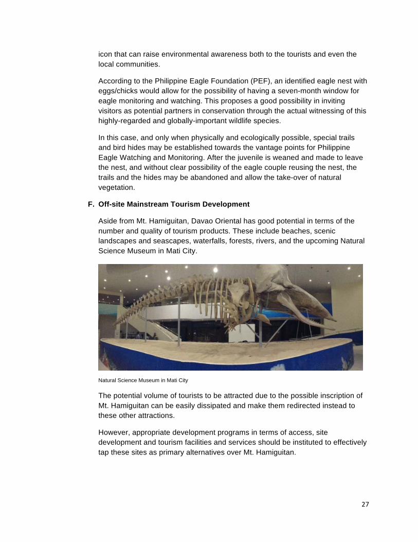
27
icon that can raise environmental awareness both to the tourists and even the local communities.
According to the Philippine Eagle Foundation (PEF), an identified eagle nest with eggs/chicks would allow for the possibility of having a seven-month window for eagle monitoring and watching. This proposes a good possibility in inviting visitors as potential partners in conservation through the actual witnessing of this highly-regarded and globally-important wildlife species.
In this case, and only when physically and ecologically possible, special trails and bird hides may be established towards the vantage points for Philippine Eagle Watching and Monitoring. After the juvenile is weaned and made to leave the nest, and without clear possibility of the eagle couple reusing the nest, the trails and the hides may be abandoned and allow the take-over of natural vegetation.
F. Off-site Mainstream Tourism Development
Aside from Mt. Hamiguitan, Davao Oriental has good potential in terms of the number and quality of tourism products. These include beaches, scenic landscapes and seascapes, waterfalls, forests, rivers, and the upcoming Natural Science Museum in Mati City.
Natural Science Museum in Mati City
The potential volume of tourists to be attracted due to the possible inscription of Mt. Hamiguitan can be easily dissipated and make them redirected instead to these other attractions.
However, appropriate development programs in terms of access, site development and tourism facilities and services should be instituted to effectively tap these sites as primary alternatives over Mt. Hamiguitan.
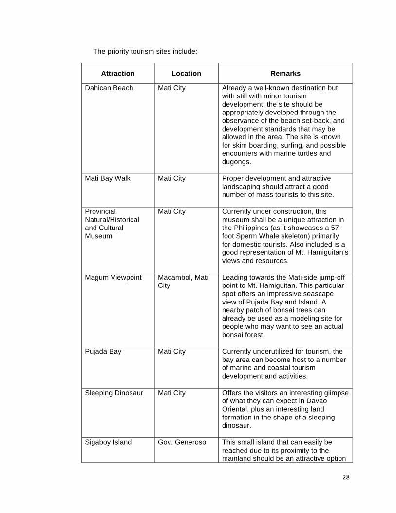
28
The priority tourism sites include:
Attraction Location Remarks
Dahican Beach Mati City Already a well-known destination but with still with minor tourism development, the site should be appropriately developed through the observance of the beach set-back, and development standards that may be allowed in the area. The site is known for skim boarding, surfing, and possible encounters with marine turtles and dugongs.
Mati Bay Walk Mati City Proper development and attractive landscaping should attract a good number of mass tourists to this site.
Provincial Natural/Historical and Cultural Museum
Mati City Currently under construction, this museum shall be a unique attraction in the Philippines (as it showcases a 57-foot Sperm Whale skeleton) primarily for domestic tourists. Also included is a good representation of Mt. Hamiguitan’s views and resources.
Magum Viewpoint Macambol, Mati City
Leading towards the Mati-side jump-off point to Mt. Hamiguitan. This particular spot offers an impressive seascape view of Pujada Bay and Island. A nearby patch of bonsai trees can already be used as a modeling site for people who may want to see an actual bonsai forest.
Pujada Bay Mati City Currently underutilized for tourism, the bay area can become host to a number of marine and coastal tourism development and activities.
Sleeping Dinosaur Mati City Offers the visitors an interesting glimpse of what they can expect in Davao Oriental, plus an interesting land formation in the shape of a sleeping dinosaur.
Sigaboy Island Gov. Generoso This small island that can easily be reached due to its proximity to the mainland should be an attractive option
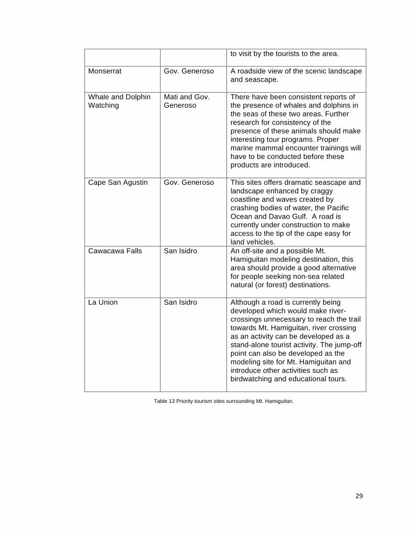
29
to visit by the tourists to the area.
Monserrat Gov. Generoso A roadside view of the scenic landscape and seascape.
Whale and Dolphin Watching
Mati and Gov. Generoso
There have been consistent reports of the presence of whales and dolphins in the seas of these two areas. Further research for consistency of the presence of these animals should make interesting tour programs. Proper marine mammal encounter trainings will have to be conducted before these products are introduced.
Cape San Agustin Gov. Generoso This sites offers dramatic seascape and landscape enhanced by craggy coastline and waves created by crashing bodies of water, the Pacific Ocean and Davao Gulf. A road is currently under construction to make access to the tip of the cape easy for land vehicles.
Cawacawa Falls San Isidro An off-site and a possible Mt. Hamiguitan modeling destination, this area should provide a good alternative for people seeking non-sea related natural (or forest) destinations.
La Union San Isidro Although a road is currently being developed which would make river-crossings unnecessary to reach the trail towards Mt. Hamiguitan, river crossing as an activity can be developed as a stand-alone tourist activity. The jump-off point can also be developed as the modeling site for Mt. Hamiguitan and introduce other activities such as birdwatching and educational tours.
Table 13 Priority tourism sites surrounding Mt. Hamiguitan.
30
V. MARKETING PLAN
Based on the markets currently visiting Davao Oriental and the Davao Region, the primary market to be targeted by the province would be the domestic travellers. Foreign visitors shall also be targetted with Davao City providing the gateway for said market.
As a potential center for learning, to be given enough consideration would be the student markets with primary interests on the museum and the Mt. Hamiguitan modelling sites.
Both domestic and foreign visitors travelling on a holiday to Davao Oriental shall be enjoined to prioritize their visits to destinations within the province and for the people with the primary interest on Mt. Hamiguitan, identify the modelling sites as their best options.
Marketing Strategy
Traditional marketing through the use of the established media (paper, television and radio) may prove financially challenging. Thus a Below-the-Line marketing strategy will be implemented through the use of the following:
Brochures – Develop brochures that already indicate the attractions and activities that can be undertaken by the visitors.
Familiarization Tours – Invite suppliers (e.g. Davao City-based tour operators) and media representatives (both traditional and online) to visit the province and the modeling sites. Said tours should be properly planned designed to enjoin the suppliers and the media to appreciate the sites and encourage other to visit the province.
On-Line Campaign – An online marketing person should be hired or appointed in order to effective promote responsible travel to Mt. Hamiguitan and mainstream tourist visit to the province. Said online marketing person shall create social media accounts to effectively address marketing opportunities and queries posted by potential visitors.
VI. INSTITUTIONAL DEVELOPMENT
To effectively operationalize the management of tourism both within Mt. Hamiguitan and its off-site support attractions, local stakeholders to be championed by the local government units shall put in enough resources for institutional development. These include:
• Setting up of municipal/city tourism offices and appointment of plantilla positions for tourism officers. This will ensure that enough focus in terms of product research and development, coordination, and local government support may be provided to particular programs, destinations or host communities.
• Community Organizing – since the trekking requires technical skills, appropriate training and enhancement programs should be provided to the local people
31
willing to be part of the tourism industry or become tourist service providers such as nature guides.
• Skills Training – help tap networks and provide training opportunities both for mainstream (e.g. resort operation) and niche activities (e.g. nature guiding).
• Develop modeling sites to effectively engage mainstream tourists in making them appreciate the values and features of Mt. Hamiguitan without necessarily going into the core zone.
• Improve and introduce tourism infrastructure and facilities for the province to effectively provide services and facilities to the visitors.
• Improve accessibility to the tourism sites.
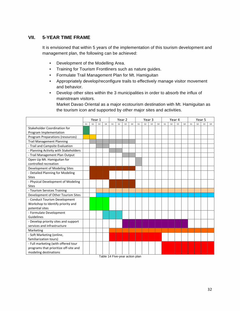
32
VII. 5-YEAR TIME FRAME
It is envisioned that within 5 years of the implementation of this tourism development and management plan, the following can be achieved:
• Development of the Modelling Area. • Training for Tourism Frontliners such as nature guides. • Formulate Trail Management Plan for Mt. Hamiguitan • Appropriately develop/reconfigure trails to effectively manage visitor movement
and behavior. • Develop other sites within the 3 municipalities in order to absorb the influx of
mainstream visitors. Market Davao Oriental as a major ecotourism destination with Mt. Hamiguitan as the tourism icon and supported by other major sites and activities.
Year 1 Year 2 Year 3 Year 4 Year 5 Q1 Q2 Q3 Q4 Q1 Q2 Q3 Q4 Q1 Q2 Q3 Q4 Q1 Q2 Q3 Q4 Q1 Q2 Q3 Q4
Stakeholder Coordination for Program Implementation
Program Preparations (resources)
Trail Management Planning
-‐ Trail and Campsite Evaluation
-‐ Planning Activity with Stakeholders
-‐ Trail Management Plan Output
Open Up Mt. Hamiguitan for controlled recreation
Development of Modeling Sites
-‐ Detailed Planning for Modeling Sites
-‐ Physical Development of Modeling Sites
-‐ Tourism Services Training
Development of Other Tourism Sites
-‐ Conduct Tourism Development Workshop to Identify priority and potential sites
-‐ Formulate Development Guidelines
-‐ Develop priority sites and support services and infrastructure
Marketing
-‐ Soft Marketing (online, familiarization tours)
-‐ Full marketing (with offered tour programs that prioritize off-‐site and modeling destinations
Table 14 Five-year action plan
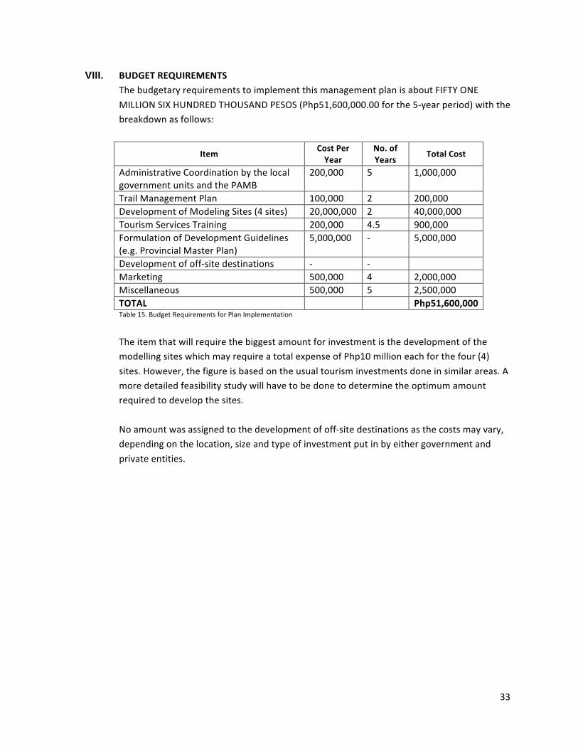
33
VIII. BUDGET REQUIREMENTS The budgetary requirements to implement this management plan is about FIFTY ONE MILLION SIX HUNDRED THOUSAND PESOS (Php51,600,000.00 for the 5-‐year period) with the breakdown as follows:
Item Cost Per Year
No. of Years
Total Cost
Administrative Coordination by the local government units and the PAMB
200,000 5 1,000,000
Trail Management Plan 100,000 2 200,000 Development of Modeling Sites (4 sites) 20,000,000 2 40,000,000 Tourism Services Training 200,000 4.5 900,000 Formulation of Development Guidelines (e.g. Provincial Master Plan)
5,000,000 -‐ 5,000,000
Development of off-‐site destinations -‐ -‐ Marketing 500,000 4 2,000,000 Miscellaneous 500,000 5 2,500,000 TOTAL Php51,600,000 Table 15. Budget Requirements for Plan Implementation
The item that will require the biggest amount for investment is the development of the modelling sites which may require a total expense of Php10 million each for the four (4) sites. However, the figure is based on the usual tourism investments done in similar areas. A more detailed feasibility study will have to be done to determine the optimum amount required to develop the sites. No amount was assigned to the development of off-‐site destinations as the costs may vary, depending on the location, size and type of investment put in by either government and private entities.
4.a Mount Hamiguitan Range Wildlife Sanctuary Monitoring and Assessment Program for Climate Change Adaption
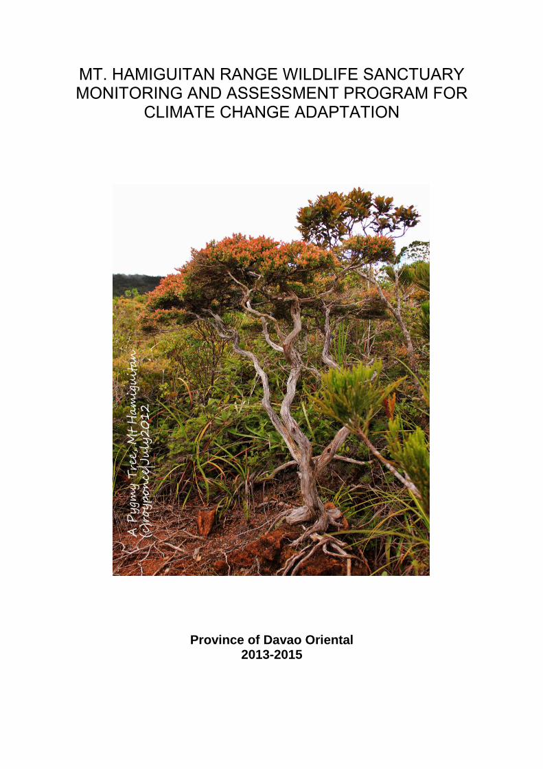
MT. HAMIGUITAN RANGE WILDLIFE SANCTUARY MONITORING AND ASSESSMENT PROGRAM FOR
CLIMATE CHANGE ADAPTATION
Province of Davao Oriental 2013-2015
TABLE OF CONTENTS
1. BACKGROUND - - - - - - - 1
2. PURPOSE OF MONITORING AND ASSESSMENT - - - 1
3. THE ISSUE ON PROTECTED AREA AND CLIMATE CHANGE - 3
4. OBJECTIVES OF MONITORING AND ASSESSMENT- - - 4
5. TOOLS, METHODOLOGIES AND STRATEGIES - - - 5
6. PILOT PROJECTS AND PRELIMINARY SURVEYS - - - 6
7. DESCRIPTION OF MHRWS - - - - - - 6
8. SELECTION OF SAMPLING SITE - - - - - 13
9. FREQUENCY AND TIMING OF SAMPLING - - - - 15
10. REFERENCES AND FURTHER READING - - - - 18
i
LIST OF TABLES
Table 1. MHRWS Ecosystems Location and Functions - - - 7 Table 2. MHRWS Ecological Features and Description - - - 8 - 9 Table 3. Sampling Site by location and by objectives of sampling - 13 Table 4. Tabulation Form of Relative Factor Severity Index (RTFSI) - 15 Table 5. Sampling Frequency by Sampling Station - 16
LIST OF FIGURES
Figure 7.1 Transect diagram of ecosystems and important species Observed in the existing trails to MHRWS Sitio Magum, Barangay Macambol, City of Mati - 10 Figure 7.2 Transect diagram of ecosystems and important species Observed in the existing trails to MHRWS Sitio Tumalite, Barangay La Union, Municipality of San Isidro - 11 Figure 7.3 Transect diagram of ecosystems and important species Observed in the existing trails to MHRWS Barangay Sergio Osmeňa, Municipality of Governor Generoso- 12 Figure 8.1 Planned Sampling Sites in the Expanded area of MHRWS - 14
ii
MOUNT HAMIGUITAN RANGE WILDLIFE SANCTUARY RESEARCH AND MONITORING PROGRAM
1. BACKGROUND Through Executive Order No. 5-A series of 2013, the Provincial Governor created the Technical Group for the continued socio-cultural, economic and ecological study in Mount Hamiguitan Range, tasking the Davao Oriental State College of Science and Technology (DOSCST), through its President, to lead the undertaking. Any research or study to be conducted in Mount Hamiguitan Range shall be coordinated with the DOSCST. Through the institution, Davao Oriental shall be able to acquire study results of the area and shall be able to control bio-piracy. Although specific projection of future scenario could not be exactly correct, still it is prudent to plan for a range of possible futures in order to balance risk and minimize large negative consequences (L. Hannah, 2003).
Through continued research, monitoring and assessment, appropriate measures can be applied to sustain the management, protection and conservation of Mount Hamiguitan Range Wildlife Sanctuary (MHRWS).
In consonance to the above Executive Order, the research and monitoring program to assess and adapt to the impacts of climate change on MHRWS shall be spearheaded by the DOSCST with the collaboration of the site managers by concerned local government units -- the municipalities of San Isidro and Governor Generoso, the City of Mati, and the Provincial Government of Davao Oriental, the Protected Area Management Board (PAMB), the DENR and other stakeholders. 2. PURPOSE OF MONITORING AND ASSESSMENT The main reason for monitoring the Mount Hamiguitan Range Wildlife Sanctuary is to acquire knowledge for the refinement of management practices in response to the results of the monitoring, study and impact assessment of the area in the face of rapid climate change. The information that shall be gathered from this undertaking shall be used for the appropriate management of the site in order for the wildlife and biodiversity therein to adapt to climate change impacts. The derived information shall be used for the maintenance of biodiversity, safeguard the functions of the ecosystems, control invasive species, and maintain the normal occurrence of the food web in the site. This research, monitoring and assessment shall also determine the trends in the ecological status of the existing eco-systems and species in the area – the biotic and abiotic components, how they react to the increasing temperature, extreme weather conditions, invasive species, socio-economic pressures in the periphery, and how would they be affected by the possible influx of visitors when the site shall have been enlisted as UNESCO World Heritage Site. The monitoring type to be used for this
Page 1
purpose is often impact monitoring, complemented with background environment quality monitoring. The research and monitoring program shall anchor on the inventory of existing species in the area, their abundance and spatial distribution, and their habitat conditions considering that the protected site is for biodiversity conservation. Using biodiversity monitoring approach (Gaines et. al, 1999), preliminary surveys and studies in the area shall be use as basis so as to determine the focus of this research and monitoring program. For MHRWS to sustain its status of meeting criteria (x) of the UNESCO World Heritage Sites, which is: contains the most important and significant natural habitats for in-situ conservation of biological diversity, including those containing threatened species of outstanding universal value from the point of view of science or conservation, there is a need to constantly update its information on ecosystems and biodiversity status of the site and correspondingly upgrade the management schemes in order to be able to meet the challenges of the changing environment. The final aim of this research, monitoring and assessment program is the protection of the critical species in the site for the advancement of scientific knowledge on conservation and survival. The research, monitoring and assessment of MHRWS for adaptation to climate change may be based on the abundance and distribution or migration pattern of the species in each of the identified ecosystems of the pedo-ecology of the site and the processes and interrelations of the biodiversity and elements within. The following goals per ecosystem may be aimed to be scrutinized:
Species abundance and distribution. What are the existing species of flora and fauna in each of the ecosystem range and how are they distributed? What are endemic and the invasive species?
How do the endemic species react to the invasive ones? How have past trends in species abundance and distribution been influenced
by natural events and by policies led to the present status? How does the wildlife in the site cope when the intermittent water bodies in
the area dry up? Influences of climatological and geological events to the status and quality of
wildlife and biodiversity in the area, such as how the wildlife is affected by strong storms, long dry spell, landslides/debris flow, flooding, etc.
What are the land uses in the area and how have these influenced the status of the different species in the site?
What is the capacity of the different types of forests and vegetations to assimilate the extreme weather effects?
Influences of anthropogenic activities, such as effect of non-indigenous species introduced by human activities to the eco-system, increasing number of site visitors, pressures from mining or farming in the periphery, etc. to the status of the ecosystems and status of biodiversity and of wildlife in the area.
Temperature trend on the site. How was the ambient temperature in the past
Page 2
period (10 to 50 years or more before) compared to the present? How does it affect the forest, the wildlife and the general biodiversity of the area?
What factors in present biodiversity status and in the past and planned future activities can give an insight in future trends and probability, and what are these?
Will climate change cause significant changes and mortality to the important species in Mt. Hamiguitan Range Wildlife Sanctuary?
These questions are just samples of deriving the goal of achieving the required information in undertaking research, monitoring and assessment for the adaptation of the site to climate change. The program shall approach the assessment and monitoring activities from different perspectives in terms of basic variables, parameters and status, temporal and spatial differences, nature and man-made impacts and management needs to support the adaptive capacity of the protected area to this climate related phenomenon that has also the potential to aggravate geological threats in the area. 3. THE ISSUE ON PROTECTED AREA AND CLIMATE CHANGE One of the major threats to protected area is climate change. Yet while it is threatened, protected areas provide a natural and economical means of mitigating and adapting to climate change impacts. They are the most sensible response to the challenges of climate change for they can help in mitigation since forests in these areas act as carbon pools, and also in adaptation since they maintain ecosystem integrity, reduce vulnerability and provide ecosystem services (UNDP, 2010).
The valuable data and information which would guide for the appropriate action and decision-making on the management of MHRWS in its adaptation to climate change can be derived from this program. The following are the examples of the range of information that can be gathered in the monitoring and assessment in the site:
Shifting ranges of species and habitats. As temperature increases, sensitive species may migrate while some species may adapt and some may perish. This will affect the distribution and abundance of ecological features. The species per range of habitats based on ecosystems existing in MHRWS may be affected. The agricultural ecosystem may not be productive anymore or may become damaged due to landslides or fire or pest infestation, which may force the locals to encroach into the protected area. The dipterocarp forest may become unable to support the essential needs of the Philippine Eagle for survival which would cause the out-migration of the eagle if there are still other alternative sites, or extinction if none. The montane forest may shift to higher altitude or perish due to temperature rise while the mossy forest may lose their moss due to drier atmosphere resulting to the decrease of recharge of springs and aquifer. On the other hand, the mossy pygmy forest, being on the topmost part of the range with nowhere else to shift to may eventually die off considering that these pygmy forest trees are not able to reproduce seedlings.
Page 3
All along the shifting of habitats, invasive species may come in which will compete with the endemic species and eventually take over the area. To identify endemic from invasive species, further inventory and assessment of existing species in MHRWS is a prerequisite.
Altered migration patterns and timing. Due to climate change, regular migration patterns of identified migratory species of birds in the area will be disrupted. They may arrive when their feeding ground on the site may not have yet produced their food.
Increase habitat fragmentation. Since climate change affects not only the
wildlife in the site but also their habitat, the shifting of species may bring about habitat fragmentation, rendering critical species vulnerable to extinction due to habitat and feeding ground decrease, isolation, and poor genetic exchange.
Increased frequency and intensity of storms, fires, flooding and
landslide. Davao Oriental’s experience with typhoon Bopha proved how destructive to the landscape, forest and wildlife strong typhoons are. Mt. Hamiguitan Range, with its unique biodiversity, is very vulnerable to such weather extremes. Being ultramaffic, the range has naturally poor macro-nutrients (M. Ater et. al., 1999) and having steep slopes, it is vulnerable to erosion, landslide and debris flow, which, all in all, affect the vegetation and wildlife in the area. Barangays Cabuaya and Macambol, the identified nesting ground of the Philippine Eagle, located in the south-eastern part of the protected area nestle in the alluvial fans of the range and have had experiences of debris flows and landslides in the past. These geohazards may be aggravated by weather extremes. On the other hand, farms in the perimeter of the protected site may trigger fire in areas rendered dry by longer hot season while farmers in the periphery, in search of relatively fertile soil, may encroach into the protected area.
4. OBJECTIVES OF MONITORING AND ASSESSMENT
Generally, the program aims to gather scientific-based information for the effective management of MHRWS for its sustainability in the face of climate change. Specifically, the research, monitoring and assessment program intends to:
a. Determine the extent and effects of climate change impacts in the site b. Identify baseline conditions and present species of biodiversity and wildlife in
the protected area c. Detect and determine any signs of degradation of species in relation to
climate anomalies d. Identify ecosystems and habitats that are affected by climate change impacts e. Identify and recommend for the control and removal of invasive species f. Come up with factual basis for planning and policy guidelines in the
appropriate management of the site in consideration to the threats of climate change
Page 4
g. Identification of critical ecosystems h. Project probable scenarios of climate change impacts to the ecosystems in
the site i. Evaluate the effectiveness of the existing conservation and protection
measures j. Assess and evaluate the impacts of competing land uses in the periphery of
the protected area (i.e. mining, farming) k. Develop guidelines on the maintenance of the quality of ecosystems in the
site in consideration to extreme weather conditions l. Develop and recommend regulations on the uses of the site m. Determine in situ temperature and precipitation in relation to climate change
factors n. Develop and recommend a climate change adaptation programme for the site
Achieving the above objectives is not for the benefit of the concerned local government units only but the resulting data may be shared among agencies and programs that have similar, related or distinct objectives. The Integrated Coastal Resource Management Programme could use the data in the management of coastal and marine resources with its ridge-to-reef approach since being archipelagic, the direct catchment of the Mount Hamiguitan Range is the Pujada Bay Protected Seascape in the eastern part and the Davao Gulf in the western portion, which are both critical waterbodies. 5. TOOLS, METHODOLOGIES AND STRATEGIES
To assess the impacts of climate change in MHRWS, the following tools may be used:
1. Modelling: a. Species range shift models b. Land-use projection models c. Regional climate models d. Species bioclimatic envelope models e. Other applicable models
2. Biodiversity and Ecosystem-based assessment 3. Integrative, sensitivity and risk analysis based on identified threats per
ecosystem and pedo-ecological features 4. Carrying capacity analysis of trails, model sites, habitats of interest 5. Combined capture of a variety of data on vegetation, ecological and
physical setting as well as GIS mapping
Methodologies and strategies in the research, monitoring and assessment may include the following:
1. Collaborative approach 2. Multi-level cooperation (vertical, horizontal, local, regional, national and
international) and exchange of best practices, enhancement of policies and intellectual supports
3. Involving the PAMB members/local residents
Page 5
4. Conservation and climate change adaptation policy enhancement and strict enforcement
5. Transect walk and field reconnaissance 6. Interview and focus group discussions with local residents
Since MHRWS is a conservation and protection area for wildlife and biodiversity which has significant sensitivity to climate change, the site managers shall also refine their management practices in response to the results of impact assessment. In its research, monitoring and assessment, the research group together with the site managers shall pursue the following steps:
1. Scenario-building capturing the major ecological events related to climate change in MHRWS
2. Enhanced monitoring of the ecosystems based on scenario developed 3. Biological survey, site and habitat assessment of which key data derived from
these activities shall complement monitoring and scenario refinement 4. Review and revision of management practices based on results of modelling,
scenarios, monitoring and survey 6. PILOT PROJECTS AND PRELIMINARY SURVEYS The monitoring and assessment program shall start with a small-scale pilot project so as to provide the newly trained staff researchers to gain hands-on experience as well as to confirm if the program components can be implemented as planned. In this stage, testing of assumptions on the status of the biodiversity in certain sampling sites of selected ecosystems or habitat within MHRWS shall be done. Variations of indicators and variables in abundance, distribution and status throughout an annual period shall be considered so that the number of samples can produce sets of data that can be regarded as representative. The preliminary survey shall take off from the results of previous studies in the area which has become the bases for the declaration of the site as protected area. 7. DESCRIPTION OF MHRWS
The original Mt. Hamiguitan Range Wildlife Sanctuary (MHRWS) as surveyed and delineated based on RA 9303 is only 7,132.76 hectares, disaggregated into 6,348.99 hectares core zone and 783.77 hectares buffer zone. With the extension of the core zone to include the locally declared Philippine Eagle Sanctuary and the expansion of the buffer zone, the total area of the site is now 25,834.45 hectares*, 16,036.67 hectares of which is the core zone while 9,797.78 hectares is the buffer zone. The expanded area still possesses the same ecosystems by pedo-ecology as shown below.
MHRWS is located in an ultramafic peninsula of Governor Generoso in the southern tip of Davao Oriental with its eastern part forming the western embayment of Pujada
Page 6
------------------------------------------ * Total area presented here is tentative since this is based only on plotting of the extended map for there is no actual delineation done yet by the DENR.
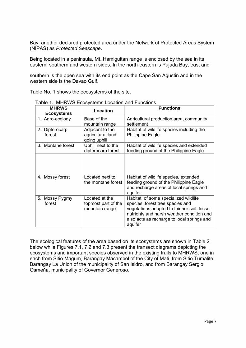
Bay, another declared protected area under the Network of Protected Areas System (NIPAS) as Protected Seascape.
Being located in a peninsula, Mt. Hamiguitan range is enclosed by the sea in its eastern, southern and western sides. In the north-eastern is Pujada Bay, east and
southern is the open sea with its end point as the Cape San Agustin and in the western side is the Davao Gulf.
Table No. 1 shows the ecosystems of the site.
Table 1. MHRWS Ecosystems Location and Functions MHRWS
Ecosystems Location
Functions
1. Agro-ecology Base of the mountain range
Agricultural production area, community settlement
2. Dipterocarp forest
Adjacent to the agricultural land going uphill
Habitat of wildlife species including the Philippine Eagle
3. Montane forest Uphill next to the dipterocarp forest
Habitat of wildlife species and extended feeding ground of the Philippine Eagle
4. Mossy forest
Located next to the montane forest
Habitat of wildlife species, extended feeding ground of the Philippine Eagle and recharge areas of local springs and aquifer
5. Mossy Pygmy forest
Located at the topmost part of the mountain range
Habitat of some specialized wildlife species, forest tree species and vegetations adapted to thinner soil, lesser nutrients and harsh weather condition and also acts as recharge to local springs and aquifer
The ecological features of the area based on its ecosystems are shown in Table 2 below while Figures 7.1, 7.2 and 7.3 present the transect diagrams depicting the ecosystems and important species observed in the existing trails to MHRWS, one in each from Sitio Magum, Barangay Macambol of the City of Mati, from Sitio Tumalite, Barangay La Union of the municipality of San Isidro, and from Barangay Sergio Osmeňa, municipality of Governor Generoso.
Page 7
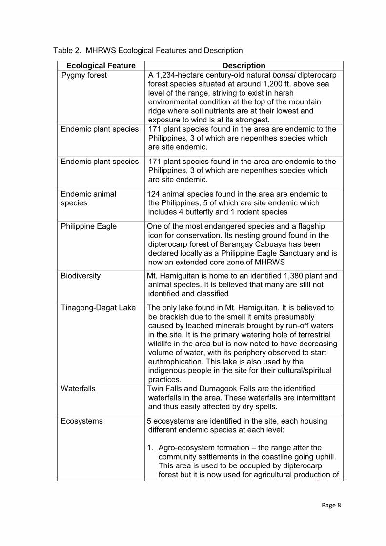
Table 2. MHRWS Ecological Features and Description
Ecological Feature Description
Pygmy forest A 1,234-hectare century-old natural bonsai dipterocarp forest species situated at around 1,200 ft. above sea level of the range, striving to exist in harsh environmental condition at the top of the mountain ridge where soil nutrients are at their lowest and exposure to wind is at its strongest.
Endemic plant species 171 plant species found in the area are endemic to the Philippines, 3 of which are nepenthes species which are site endemic.
Endemic plant species 171 plant species found in the area are endemic to the Philippines, 3 of which are nepenthes species which are site endemic.
Endemic animal species
124 animal species found in the area are endemic to the Philippines, 5 of which are site endemic which includes 4 butterfly and 1 rodent species
Philippine Eagle One of the most endangered species and a flagship icon for conservation. Its nesting ground found in the dipterocarp forest of Barangay Cabuaya has been declared locally as a Philippine Eagle Sanctuary and is now an extended core zone of MHRWS
Biodiversity Mt. Hamiguitan is home to an identified 1,380 plant and animal species. It is believed that many are still not identified and classified
Tinagong-Dagat Lake The only lake found in Mt. Hamiguitan. It is believed to be brackish due to the smell it emits presumably caused by leached minerals brought by run-off waters in the site. It is the primary watering hole of terrestrial wildlife in the area but is now noted to have decreasing volume of water, with its periphery observed to start euthrophication. This lake is also used by the indigenous people in the site for their cultural/spiritual practices.
Waterfalls Twin Falls and Dumagook Falls are the identified waterfalls in the area. These waterfalls are intermittent and thus easily affected by dry spells.
Ecosystems 5 ecosystems are identified in the site, each housing different endemic species at each level: 1. Agro-ecosystem formation – the range after the
community settlements in the coastline going uphill. This area is used to be occupied by dipterocarp forest but it is now used for agricultural production of the local inhabitants since the portion is classified as alienable and disposable. Despite agricultural ill abo the local inhabitants since the portion is classified as
Page 8
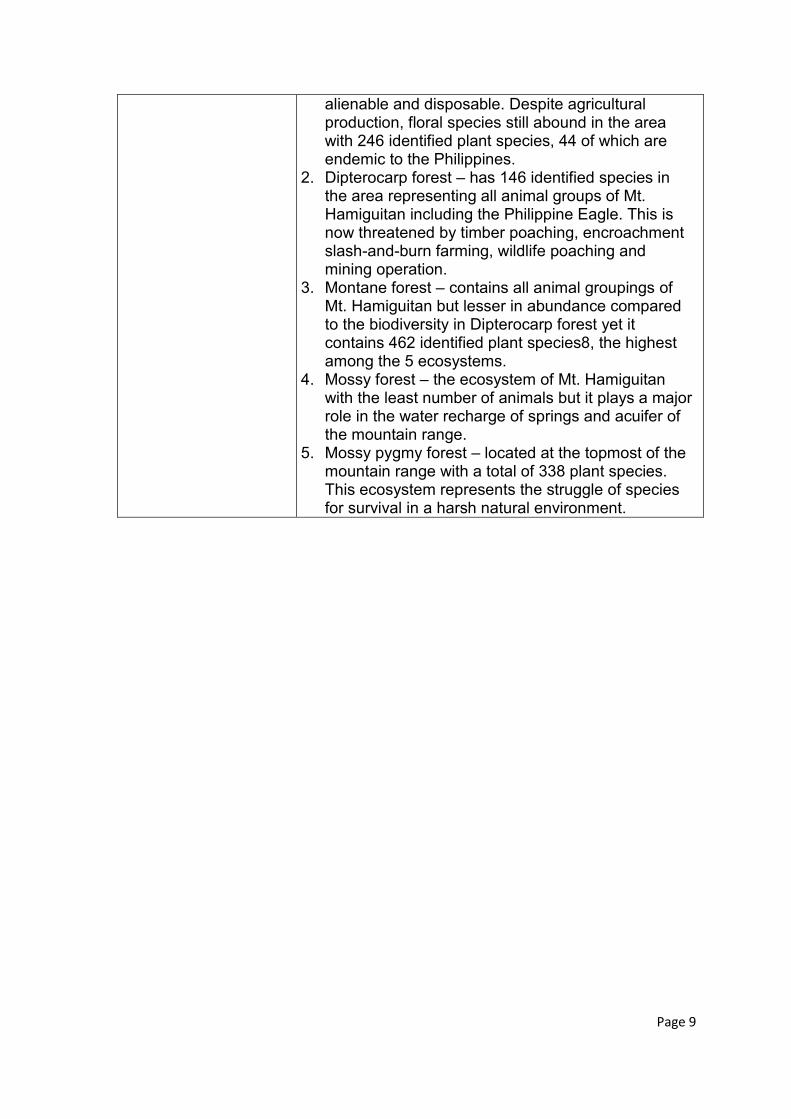
alienable and disposable. Despite agricultural production, floral species still abound in the area with 246 identified plant species, 44 of which are endemic to the Philippines.
2. Dipterocarp forest – has 146 identified species in the area representing all animal groups of Mt. Hamiguitan including the Philippine Eagle. This is now threatened by timber poaching, encroachment slash-and-burn farming, wildlife poaching and mining operation.
3. Montane forest – contains all animal groupings of Mt. Hamiguitan but lesser in abundance compared to the biodiversity in Dipterocarp forest yet it contains 462 identified plant species8, the highest among the 5 ecosystems.
4. Mossy forest – the ecosystem of Mt. Hamiguitan with the least number of animals but it plays a major role in the water recharge of springs and acuifer of the mountain range.
5. Mossy pygmy forest – located at the topmost of the mountain range with a total of 338 plant species. This ecosystem represents the struggle of species for survival in a harsh natural environment.
Page 9
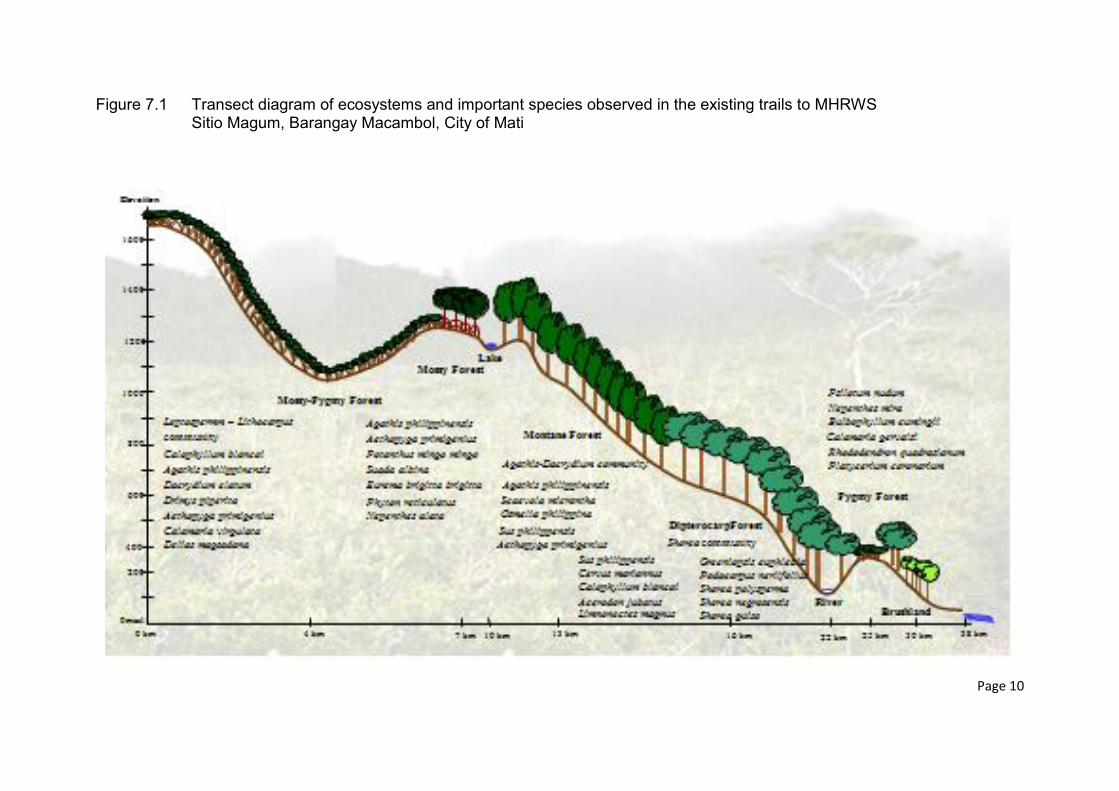
Figure 7.1 Transect diagram of ecosystems and important species observed in the existing trails to MHRWS Sitio Magum, Barangay Macambol, City of Mati
Page 10
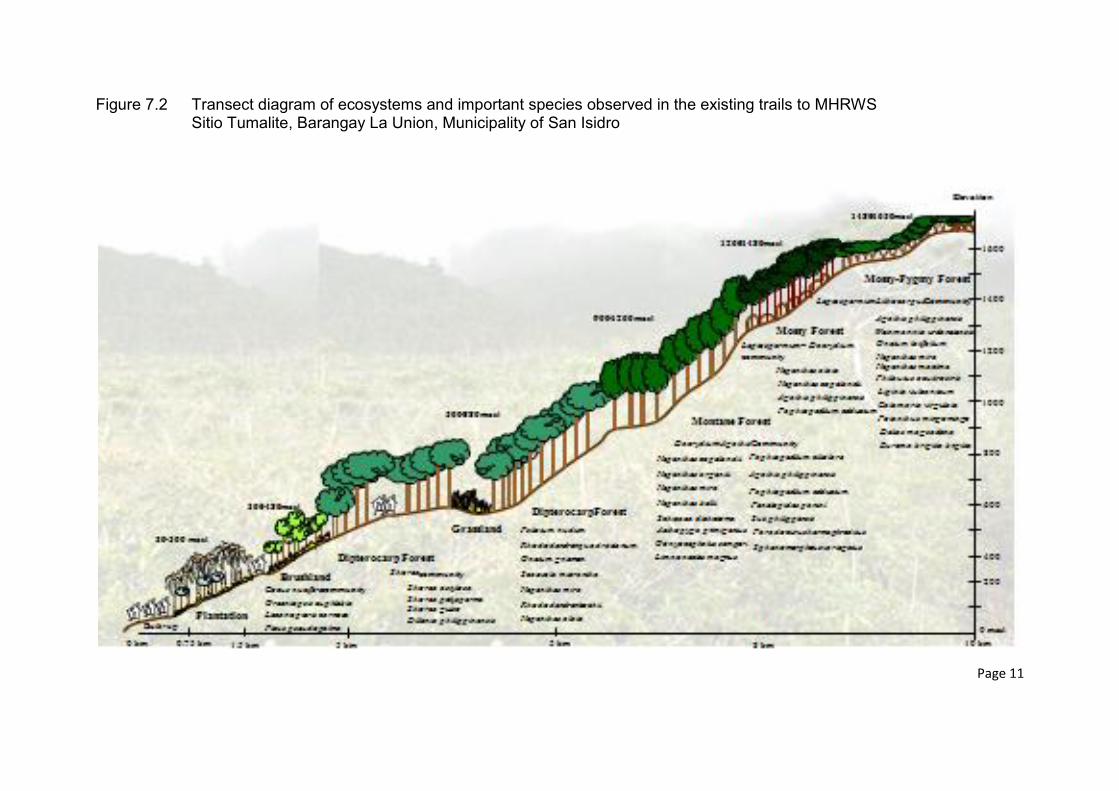
Figure 7.2 Transect diagram of ecosystems and important species observed in the existing trails to MHRWS Sitio Tumalite, Barangay La Union, Municipality of San Isidro
Page 11
Figure 7.3 Transect diagram of ecosystems and important species observed in the existing trails to MHRWS Barangay Sergio Osmeňa, Municipality of Governor Generoso
Page 12
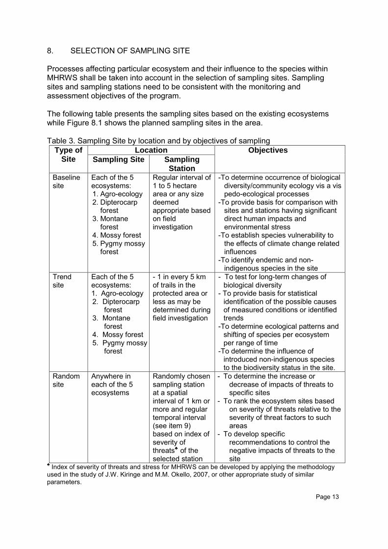
8. SELECTION OF SAMPLING SITE Processes affecting particular ecosystem and their influence to the species within MHRWS shall be taken into account in the selection of sampling sites. Sampling sites and sampling stations need to be consistent with the monitoring and assessment objectives of the program. The following table presents the sampling sites based on the existing ecosystems while Figure 8.1 shows the planned sampling sites in the area. Table 3. Sampling Site by location and by objectives of sampling
Type of Site
Location Objectives
Sampling Site Sampling Station
Baseline site
Each of the 5 ecosystems: 1. Agro-ecology 2. Dipterocarp
forest 3. Montane
forest 4. Mossy forest 5. Pygmy mossy
forest
Regular interval of 1 to 5 hectare area or any size deemed appropriate based on field investigation
-To determine occurrence of biological diversity/community ecology vis a vis pedo-ecological processes
-To provide basis for comparison with sites and stations having significant direct human impacts and environmental stress
-To establish species vulnerability to the effects of climate change related influences
-To identify endemic and non-indigenous species in the site
Trend site
Each of the 5 ecosystems: 1. Agro-ecology 2. Dipterocarp
forest 3. Montane
forest 4. Mossy forest 5. Pygmy mossy
forest
- 1 in every 5 km of trails in the protected area or less as may be determined during field investigation
- To test for long-term changes of biological diversity
- To provide basis for statistical identification of the possible causes of measured conditions or identified trends
-To determine ecological patterns and shifting of species per ecosystem per range of time
-To determine the influence of introduced non-indigenous species to the biodiversity status in the site.
Random site
Anywhere in each of the 5 ecosystems
Randomly chosen sampling station at a spatial interval of 1 km or more and regular temporal interval (see item 9) based on index of severity of threats♣ of the selected station
- To determine the increase or decrease of impacts of threats to specific sites
- To rank the ecosystem sites based on severity of threats relative to the severity of threat factors to such areas
- To develop specific recommendations to control the negative impacts of threats to the site
♣ Index of severity of threats and stress for MHRWS can be developed by applying the methodology used in the study of J.W. Kiringe and M.M. Okello, 2007, or other appropriate study of similar parameters. Page 13
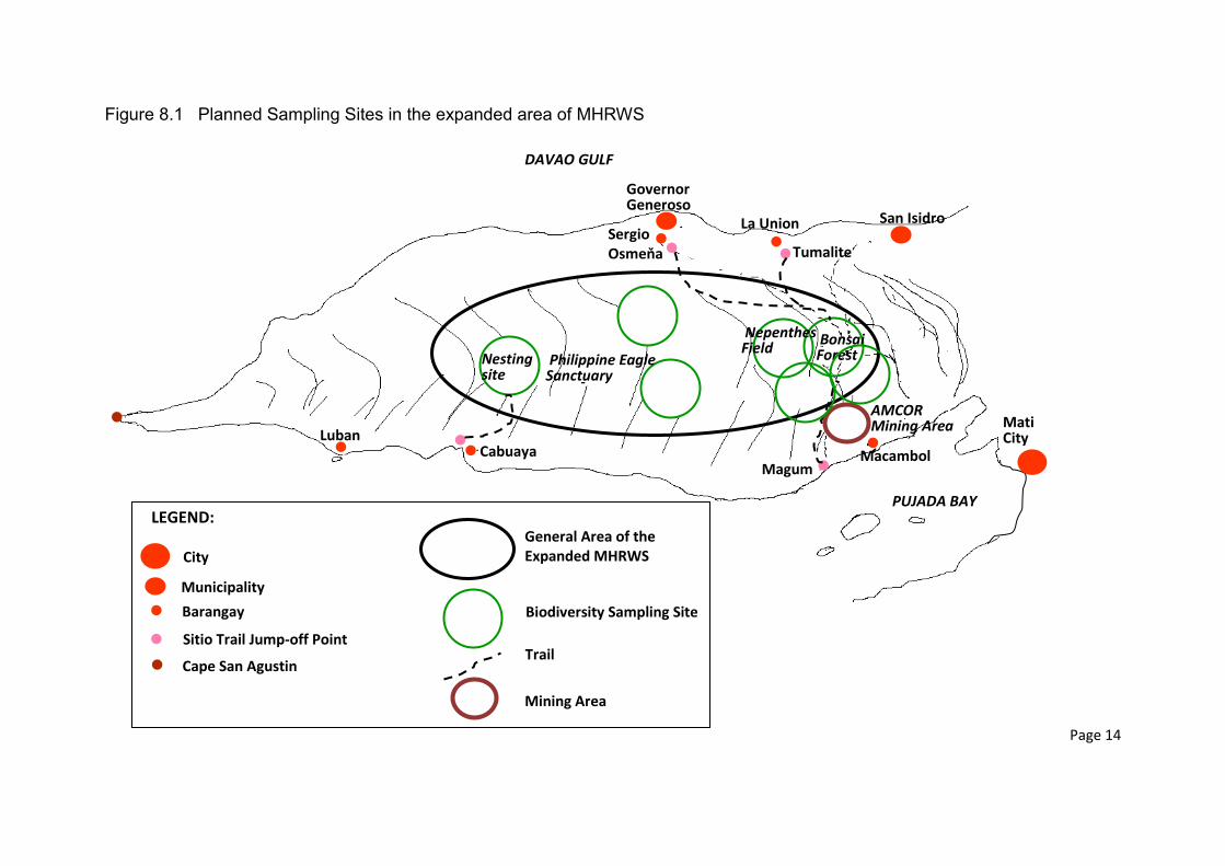
Figure 8.1 Planned Sampling Sites in the expanded area of MHRWS
Page 14
City
Municipality
Barangay
Sitio Trail Jump-off Point
Cape San Agustin
Mati City
San Isidro
Governor Generoso
Luban Cabuaya Macambol
Magum
La Union
Tumalite Sergio Osmeňa
General Area of the Expanded MHRWS
Biodiversity Sampling Site
Trail
PUJADA BAY
DAVAO GULF
Philippine Eagle Sanctuary
Bonsai Forest Nesting
site
Nepenthes Field
LEGEND:
Mining Area
AMCOR Mining Area
The sampling sites shall be marked in a GIS-generated resource data map of Mt. Hamiguitan Range Wildlife Sanctuary but the final decision on the precise location can be made only after a field investigation and reconnaissance survey to ensure that the sites can provide valid representative samples. The use of Relative Threat Factor Severity Index (RTFSI) developed by Kiringe and Okello (2007) can be applied to the site. Table 4 shows the tabulation format for factors of threats used in the mentioned study, which, with few modifications, are deemed applicable to MHRWS monitoring and assessment. Table 4. Tabulation Form of Relative Threat Factor Severity Index (RTFSI)
Threat Factor identified by protected area officers Mean threat factor score (Mean ± SE)
Relative Threat Factor Severity Index (RTFSI)
Illegal killing of wildlife for their bush meat for the local or regional markets
Large mammal poaching for international commercial purposes
Direct and indirect danger to biodiversity arising from the nature and intensity of human – wildlife conflicts
Loss, conversion and degradation of wildlife migration and dispersal corridors important for the protected area
Human encroachment in terms of their densities and distribution around protected areas
Unsustainable use, demand and exploitation of natural resources (e.g. water, plant resources and minerals) by local communities surrounding protected area
Recent agricultural expansion and other incompatible land use changes to biodiversity requirements
Pollutants from external sources of a protected area that harm biodiversity directly or indirectly
Negative and persistent tourism impacts to the welfare of biodiversity and their habitats Fencing of a protected area entirely or in part by certain form of fencing materials
Mean value (SE) From Kiringe and Okello (2007) 9. FREQUENCY AND TIMING OF SAMPLING Considering the sensitivity of species to ecological stress, sampling frequency where biological diversity and ecosystem processes are high should be higher than in
Page 15
Page 14
stations where ecosystem quality remains relatively constant. For research and monitoring projects of this program that have no advance information on quality variation should be preceded by a preliminary survey (see item 4) and then start with a planned sampling schedule that can be revised when the need arises. A proposed sampling frequency per station is presented as follows: Table 5. Sampling Frequency by Sampling Station
Sampling Station Degree of Frequency
Sampling Frequency
Baseline Stations Agro-ecology Minimum
Optimum 4 per year 8 per year
Dipterocarp forest Minimum Optimum
12 per year 24 per year
Montane forest Minimum Optimum
12 per year 24 per year
Mossy forest Minimum Optimum
12 per year 24 per year
Pygmy mossy forest Minimum Optimum
12 per year 24 per year
Trend Stations Agro-ecology Minimum
Optimum 4 per year 8 per year
Dipterocarp forest Minimum Maximum
12 per year 24 per year
Montane forest Minimum Maximum
12 per year 24 per year
Mossy forest Minimum Maximum
12 per year 24 per year
Pygmy mossy forest Minimum Maximum
12 per year 24 per year
Random Stations Station with the highest
threat index
Station with moderate threat index
Station with low threat
index
Minimum Maximum Minimum Maximum Minimum Maximum
24 per year 48 per year 12 per year 24 per year 6 per year 12 per year
The temporal interval of sample collection depends on the specific characteristics of the sample and the objective of monitoring and study. An interval of one month between the collection of individual samples from a certain station for the purpose of
Page 16
characterizing quality over a long period of time may be generally acceptable. For control purposes, however, weekly sampling may be necessary. Overall, sample collection should be frequent enough to enable the derivation of accurate calculation of the mean concentrations of variables included in the monitoring program. The frequency of sampling required to obtain a desired level of confidence in the mean values depends on statistical measures such as standard deviation and confidence interval.
Page 17
10. REFERENCES AND FURTHER READING CNPA Carpathian Network of Protected Areas, 2008 J. Juvik, J. Delay and L. Tango, 2005. Biodiversity Assessment of Tropical Island Ecosystems Climatological and Hydrological Field Monitoring, Ch. 5, PABITRA Manual for Interactive Ecology and Management. Honolulu. J.W. Kiringe and M.M. Okello, 2007. Threats and their Relative Severity to Wildlife Protected Areas of Kenya. Applied Ecology and Environmental Research 5(2)49-62. http://www.ecology.unicorvinus.hu_ISSN 1589 1623_2007, Penkala, Bt., Budapest, Hungary. L. Hannah, Ph.D., 2003, Regional Biodiversity Impact Assessments for Climate Change: A Guide for Protected Area Managers, WWF BUYINGTIME:A User’s Manual for Building Resistance and Resilience to Climate Change in Natural Systems M. Ater, C. Lefebvre, W. Gruber and P. Meerts, 1999. A Phytogeochemical survey of flora of utramafic and adjacent normal soils in North Morocco. Plant and Soil 218: 127-135, 2000. Kluwer Academic Publishers, Netherlands. SANBI – 2013. Biodiversity for Life. Monitoring Climate Change Impacts Tufaila, 2011. Characteristics of Soil Derived from Ultramafic Rocks for Extensification of Oil Palm in Langgikima, North Konawe, Southeast Sulawesi. AGRIVITA, Journal of Agricultural Science, Vol 33, No 1 USDE, 2009. Climate Change Research Program: strategic plan. Washington DC
Page 18