Embed Size (px)
Citation preview

http://www.personal-mastership.com/tag/red-ocean/ www.MarineDebris.noaa.gov
NOAA Action to Reduce the Impacts of
Marine Debris: Responses to Pervasive
Problems and Natural Disaster Events
Jason Rolfe Southeast and Caribbean regional coordinator NOAA Marine Debris Program

• NOAA Marine Debris Program (MDP) • Mission and Mandates • Partners and Products • Day to Day Activities and Severe Marine
Debris Event Response
National Oceanic and Atmospheric Administration (NOAA)
Derelict fishing gear removal in the Northwestern Hawaiian Islands. Credit: NOAA PIFSC CRED

Sources and Impacts • Wildlife entanglement
• Wildlife Ingestion
• Economic costs
• Aesthetic value/costs
• Vessel damage / navigation hazards
• Habitat destruction
• Invasive species
• Human health / safety
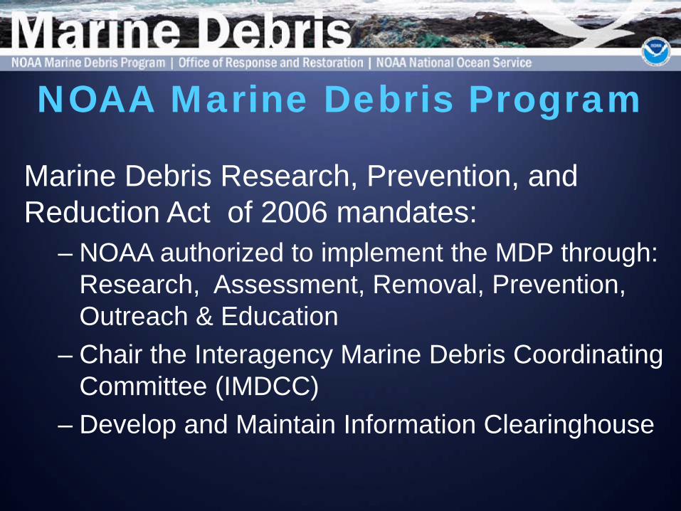
NOAA Marine Debris Program
Marine Debris Research, Prevention, and Reduction Act of 2006 mandates:
– NOAA authorized to implement the MDP through: Research, Assessment, Removal, Prevention, Outreach & Education
– Chair the Interagency Marine Debris Coordinating Committee (IMDCC)
– Develop and Maintain Information Clearinghouse

NOAA MDP Core Functions • Research Goals: 1) Understand the fate and
impacts of marine debris; 2) Mitigate those impacts
• Prevention Goal: Encourage social behavior
changes through outreach and education • Reduction Goal: Prevent and reduce the
occurrence and impacts of marine debris

Environmental and Economic Impact Assessment
Shoreline and at-sea monitoring
Degradation rates and chemical impacts
Research, Monitoring, and Impact

Outreach and Education
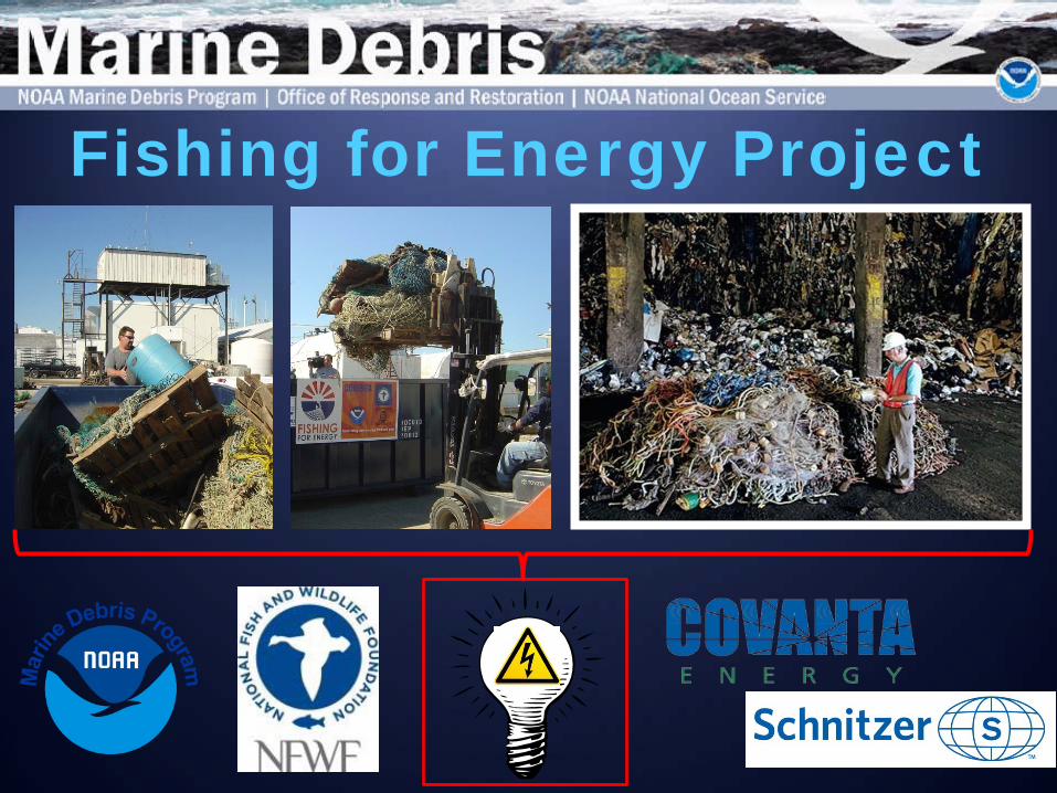
Fishing for Energy Project

Derelict Fishing Gear
NOAA
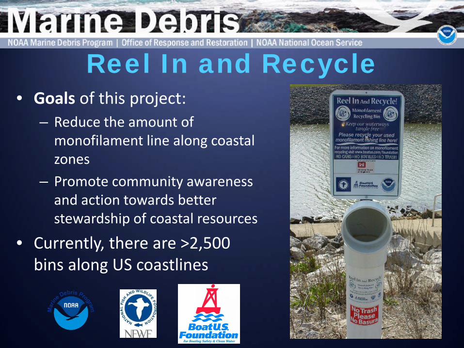
Reel In and Recycle • Goals of this project:
– Reduce the amount of monofilament line along coastal zones
– Promote community awareness and action towards better stewardship of coastal resources
• Currently, there are >2,500 bins along US coastlines

Main Activities During Event Response: 1. Providing scientific support 2. Assisting in coordination 3. Communications and outreach
Severe Marine Debris Events MDP Reauthorized in December 2012 Marine Debris Act defines a “severe marine debris event” as “atypically large amounts of marine debris caused by a natural disaster, including a tsunami, flood, landslide, or hurricane, or other source.’’
(US Navy, March 15, 2011)
(David Gard/The Star-Ledger October 30, 2012)

(Keichi Nakane/Associated Press)
• 9.0 magnitude
earthquake
• Tsunami: 130 ft max wave height
• 217 square miles
inundation • 15,844 people
confirmed dead, 5,890 injured, and 3,451 missing
Tsunami Event Overview

(US Navy, March, 2011)
Tsunami Debris Floats Out to Sea…

Event Overview
March 13, 2011: Debris off the Sendai coast
• Debris formed patches • Most debris likely sank immediately • NASA/NESDIS collaborated on early
satellite detection Debris dispersed; satellites could not detect after April 14, 2011
Debris Aftermath – Initial Tracking
(US Navy, March 2011)

North Pacific Ocean: Currents

NOAA GNOME (General NOAA Operational Modeling Environment) • Hindcast (vs. forecast) • Low, medium, and high windage • U.S. Navy HyCOM (ocean currents)
and NOAA data (wind) Recent GNOME results
o Winter of 2012-2013: Marine debris of mixed types may wash ashore in W. coast states, AK, and Hawaii.
No models exist yet specifically for marine debris of all shapes and sizes.
Computer Modeling

• 1,000 particles • Random windage:
low to high • 8 locations (>3.5m) • 0700,
11 March 2011 through 5 February 2013
• These do NOT represent fields/patches of debris
Area contains 95% of all simulated particles
Area with highest concentration of simulated debris with 1% windage

Satellite Detection • March – April 2011: Tracking debris
fields (with NASA) • National Geospatial Intelligence
Agency – images • NOAA National Environmental Satellite,
Data, and Information Service – analysis
• 7 sites – monthly Unmanned Aircraft System (UAS) • Testing phase • NOAA ship Fairweather – Gulf of
Alaska in 2013 NOAA PMNM
Satellite Detection & Unmanned Aircraft Systems

• Aerial (e.g., NOAA winter storms, U.S. Coast Guard Auxiliary) • At-sea (e.g., World Ocean Council, NOAA fleet, Hawaii longliners) • Shoreline (e.g., Non-governmental organizations, general public) • Reported to [email protected]
• 1,548 reports of potential Japan tsunami marine debris (since Dec. 2011)
• HI, AK, WA, OR, CA, British Columbia, and Mexico + N. Pacific • At-sea sightings = 784; On shore sightings = 764
• 21 confirmed Japan tsunami marine debris items
Reporting and Tracking of Sightings


• NOAA Marine Debris Program – Regional coordinators (WA/OR, CA, AK, Pacific Islands Region)
• Work with partners in all states/territories of potential impact
• Response coordination support and planning
• Meetings, workshops, and table-top exercises
• Communications • Funding ($50K from NOAA and $5M gift from
Japan)
• Work with the Consulates and Government of Japan
• Debris item confirmation as originating from the tsunami
Coordination Support 29 Sept 2012; N. Pacific
2 Nov. 2012; Midway Atoll, HI
30 Nov. 2012; Kahana Bay, HI
24 Dec. 2012; Punalu’u, HI
18 Jan. 2013; HI

• All states have developed action plans to respond to tsunami marine debris
• Plans include rapid-response
protocols; leverage state knowledge and capabilities
• State partners take lead with
support from various agencies, groups, and individuals
• NOAA provides support and helps
coordinate response efforts
State-led Response Plans
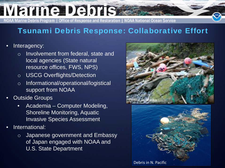
• Interagency: o Involvement from federal, state and
local agencies (State natural resource offices, FWS, NPS)
o USCG Overflights/Detection o Informational/operational/logistical
support from NOAA • Outside Groups
• Academia – Computer Modeling, Shoreline Monitoring, Aquatic Invasive Species Assessment
• International: o Japanese government and Embassy
of Japan engaged with NOAA and U.S. State Department
Debris in N. Pacific
Debris in Alaska
Tsunami Debris Response: Collaborative Effort

• Media – Traditional, social, and digital media
• Meetings, briefings, public presentations, events, & materials distribution
• Website: http://marinedebris.noaa.gov/tsunamidebris/
Communications and Outreach

NOAA Marine Debris Program Shoreline Monitoring Guide, data sheet, & database – [email protected]
= monitoring site (NOAA protocol)
= monitoring site (non-NOAA protocol)
Shoreline Monitoring

Marine Debris Monitoring and Assessment Project
Disseminate protocols and tools • Monitoring protocols
Coordination of efforts • Facilitate data collection and analysis • Standard protocols add context to local
issues or initiatives
Synthesis and communication of results
Request a copy:

Marine Debris Monitoring and Assessment Project
Monitoring: MD-MAP.net
Request an account: [email protected]

Jason Rolfe Southeast and Caribbean regional coordinator NOAA Marine Debris Program [email protected]
Thank you
www.MarineDebris.noaa.gov