Embed Size (px)
Citation preview


Nocona Burgess [Comanche]Cotudle Series (detail)
This program is funded in part by the Oklahoma Humanities Council (OHC) and the National Endowment for the Humanities (NEH). Any views, findings, conclusions or recommendations expressed in this publication do not necessarily represent those of OHC or NEH.
Newspapers for this educational program provided by:
Halito! Oklahoma has a unique history that differentiates it from any other state in the nation. Nowhere else in the United States can a visitor hear first hand-accounts from 39 different American Indian Tribal Nations regarding their journey from ancestral homelands, or discover how Native peoples have contributed and woven their identities into the fabric of contemporary Oklahoma. Oklahoma is deeply rooted in American Indian history and heritage. We hope you will use this guide to explore our great state and to learn about Okla-Humma. (“Red People” in the Choctaw language.)–Gena Timberman, Esq.,
Gena Timberman, Esq. (Choctaw)Executive Director of the Native American Cultural and Educational Authority.
American Indians have long been recognized for their rich contributions to the fine arts. Featured throughout this guide is a diverse collection of works generously offered by contemporary Oklahoma Indian artists. When in a gallery featuring their work, please support them and their communities by purchasing their art.
The American Indian Cultural Center and Museum (AICCM) is honored to present, in partnership with Newspapers In Education at The Oklahoman, the Native American Heritage educational workbook. Workbooks focus on the cultures, histories and governments of the American Indian tribes of Oklahoma. The workbooks are published twice a year, around November and April. Each workbook is organized into four core thematic areas: Origins, Native Knowledge, Community and Governance. Because it is impossible to cover every aspect of the topics featured in each edition, we hope the workbooks will comprehensively introduce students to a variety of new subjects and ideas. We hope you will be inspired to research and find out more information with the help of your teachers and parents as well as through your own independent research.
The American Indian Cultural Center and Museum would like to give special thanks to the Oklahoma Tourism & Recreation Departmentfor generously permitting us to share information featured in the Oklahoma Indian Country Guide in this edition of Newspapers in Education.
The Oklahoma Tourism and Recreation Department (OTRD) is working to advance the exceptional quality of life in Oklahoma by preserving, maintaining, and promoting our natural assets and cultural richness. The department is the steward of the state park system and also promotes Oklahoma as a travel destination through many award-winning programs. To learn more about Oklahoma’s unique events and attractions, and to order copies of the Oklahoma Indian Country Guide please visit www.TravelOK.com www.travelok.com/ or follow us at Facebook.com/TravelOK www.facebook.com/TravelOK or Twitter.com/OklahomaTourism.Thanks to Shauna Struby and Douglas Miller for the important work they contributed to this project.
COvER ARTIST Brent Greenwood

The Indian Nations of Oklahoma The state of Oklahoma is a mosaic of American Indian Nations, representing an amazing diversity of languages, histories and cultures. There are thirty-nine sovereign tribal Nations headquartered in Oklahoma. Each individual tribal history is also interwoven into the very fabric of American history. Some of the tribes in Oklahoma today even inspired the founding fathers of this Nation hundreds of years ago because of the democracy they employed in governing their own people.
How did so many separate Tribal Nations come to live in Oklahoma? Many factors including population growth and economic impacts during the 18th and 19th centuries , and other tensions fueled the concept of “Indian removal” during the early 1800s. Congress responded with discussions about removing tribes from their homelands to Indian Territory, known today as Oklahoma, as a way of resolving these issues. In the 1830s legislation was passed and law set into motion that began the devastating act of relocating over 67 tribes to “Indian Territory”. The process of removing and relocating these tribes from ancestral homelands in the United States and Canada involved well over 100,000 Native people and a process that spanned over seventy years. This removal experience differed from tribe to tribe; some tribes traveled to Indian Territory and chose the land that would be their new home, for other tribes the experience was much more traumatic and difficult. Many Native people traveled to these new lands by horse, in boats, covered wagons and even by walking. Once in Oklahoma, Native governments and communities had to forge a new life in unfamiliar lands and begin to rebuild everything they had lost.
Although many tribes now call Oklahoma home, they are all still linked to their traditional homelands through memory, story, ancestors, culture and through contemporary connections. It is hard to imagine that such diverse peoples are all in Oklahoma today – from the moundbuilding people of the southeast woodlands to the buffalo hunting tribes of the
Great Plains all the way to the Nations of the Great Lakes, reaching to the unique cultures from as far away as California, the southwest and the great Northeast. Tribal people in Oklahoma today maintain stories of their homelands, their histories and ways of life. These are some of the wonderful traditions and stories that were brought to Oklahoma a little over one hundred years ago. Many of these stories have ancient roots which extend beyond the boundaries of present-day Oklahoma and originate in homelands that encompass over thirty states within the U.S. and include regions in Canada and Mexico.
Today, the thirty-nine tribal nations in Oklahoma have enriched this state with beautiful cultures and diverse communities which have become interwoven with Oklahoma’s non-native cultures and communities – creating a beautiful, intricate braided path of shared history. This workbook celebrates the diversity and culture of Oklahoma’s Native people. This NIE features profiles of each Tribal Nation and shares some of the unique histories and cultures that make them distinct. In learning more about each of these tribes you will gain a better appreciation for why it is so special that these tribes call Okla-Humma home.
3
Harvey Pratt [Cheyenne] — We Danced (detail)

4
The 39 Tribes of Oklahoma
As you tour Oklahoma Indian Country, you’ll discover the distinctive culture, heritage and stories of each of the 39 tribal nations. In this section, you’ll find a very brief overview of each nation’s history, along with the tribe’s traditional name and language family. A language family is a way of showing the linguistic relationships among the many American Indian languages. Profiles were researched and created with the input, guidance and advice of tribal nations, the American Indian Cultural Center and Museum, and the following sources:
Tribal nation websites•“Indian Tribes of Oklahoma: A Guide,” by Blue Clark•Oklahoma Indian Affairs Commission website•Encyclopedia of Oklahoma History and Culture, a project •of Oklahoma Historical Society and the Oklahoma State University Library Electronic Publishing CenterOther online university libraries •
Nocona Burgess [Comanche] Toshaway

Albamo Koasati [ t r a d i t i o n a l n a m e ]
Alabama-Quassarte Tribal Town [ e n g l i s h n a m e ]
Language family: Muskoghean | Total tribal enrollment: 380 | Tribal enrollment in
Oklahoma: 375 Government: Tribal government was established under the Oklahoma Indian
Welfare Act (OIWA) in 1936, and members adopted a constitution and
bylaws in 1939. This tribal town is led by a chief elected to four-year terms. Tribal headquarters: 101 E. Broadway, Wetumka, 405 452-3987.
alabama-quassarte.org
The Alabama and Quassarte people each had a distinct identity as a tribal town in their ancestral homelands in the southeastern U.S. and are closely related culturally to other Muskoghean-speaking peoples such as the Creeks, Choctaw and Chickasaws. With the encroachment of Europeans into the region many members of these two groups, in an attempt to avoid contact with the Europeans, migrated southwest into Louisiana and Texas in the 1790s and early 1800s where they remain today (Coushatta Tribe of Louisiana & Alabama-Coushatta Tribe of Texas). The members who did not leave formed an alliance, participating in the old Muscogee Nation Confederacy government, and hence were subsequently included in the Removal Act of 1830. The Alabama and Quassarte people settled into Indian Territory in what is now Hughes, Okfuskee, McIntosh and a portion of Seminole Counties. During the 1930s the Alabamas and Quassarte merged and organized as a tribal town separate from the Creek Nation and maintained a traditional tribal town political structure.
Did you Know? The Hernando de Soto expedition first encountered the Alabamas in northern Mississippi in 1540, and the Koasati in their island town on the Tennessee River.
Shaawanwa [ t r a d i t i o n a l n a m e ]
Absentee Shawnee Tribe [ e n g l i s h n a m e ]
Language family: Central Algonquian | Total tribal enrollment: 3,049 | Tribal
enrollment in Oklahoma: 2,322 Government: The current form of government for the
Absentee Shawnee evolved over the first half of the 20th century. The
tribe is governed by a constitution ratified in 1938, amended in 1988. The
tribal government is comprised of two separate branches, the judicial and
the legislative/executive.
Tribal headquarters: 2025 S Gordon Cooper Drive, Shawnee, 405-275-4030. astribe.com
Although the Absentee Shawnee are known to have lived in the Eastern United States, it has been documented that they traveled from Canada to Florida, from the Mississippi River to the East Coast before being removed to the area they now occupy. Originally the Shawnee Indians lived in the northeastern part of the United States in areas now known as the states of Ohio, Indiana, Illinois, Kentucky, Tennessee, Pennsylvania and neighboring states. Treaties in the late 1700s and throughout the 1800s reveal the Shawnee had a large population and land holdings in what is now the state of Ohio. Encroaching colonial settlement persuaded the Shawnees living in Cape Girardeau, Missouri, to negotiate the 1825 treaty with the U.S. government, which ceded their lands in Missouri for a reservation in Kansas. However, several years before this treaty was introduced, a group of Shawnees left Missouri to begin a journey south that would lead them toward territory now known as the state of Texas, then under the control of Spain. This group of Shawnees became known as the Absentee Shawnees. The term
“Absentee Shawnees” stems from a provisional clause in an 1854 treaty regarding surplus lands in the Kansas Reservation which were set aside for the “absent” Shawnees. The outcome of the Texas-Mexico War (1846-1848) compelled many Absentee Shawnees to leave Texas and move into
Indian Territory, although it is estimated that the Absentee Shawnees began to settle in Oklahoma around 1839. In the late 1800s an Indian agent from the U.S. government brought soldiers from Fort Reno in western Oklahoma and forced the traditional band of Absentee Shawnees located along the Deep Fork River to leave. This band was taken south to the area known as Hog Creek and Little River where they were to remain. The group settling there is known as the Big Jim Band. Another band stayed in Pottawatomie County near the town of
Shawnee, Oklahoma, and is known as the White Turkey Band.
Did you Know? The Absentee Shawnee Tribe was one of the first seven tribes in the U.S. to become a self-governing nation during the 1990s.
5
ba sed on tr aditional comanche or na mental patter n
Ben Harjo, Jr . [Seminole, Shawnee]Without Reservation

Kadohadacho [ t r a d i t i o n a l n a m e ]
Caddo Nation [ e n g l i s h n a m e ]
Language family: Caddoan | Total tribal enrollment: 5,719 | Tribal enrollment
in Oklahoma: 3,377 Government: The Caddo Nation adopted a charter, constitution and bylaws in 1938. A
new constitution ratified in 1976 mandates a tribal council with a chair, vice chair, secretary,
treasurer and representatives from Anadarko, Fort Cobb, Binger and Oklahoma City districts.
Tribal headquarters: 5 miles east of Binger at the intersection
of Hwys 281 and 152, 405-656-2344. caddonation-nsn.gov
Ancestors of the Caddo people began settling farmstead communities in the present states of Arkansas, Louisiana, Texas and Oklahoma as early as A.D. 800. Long before first contact with Europeans in the 16th and 17th centuries, a strong, well-governed, populous and prosperous Caddo Nation grew from its ancestral root (kee oh no wah, the old ones). In this region they gradually developed earthen mound culture along major rivers, and some of the mound sites in these areas can be seen and toured today. Although they were primarily a southeastern Woodlands people, they also ventured into the plains to hunt buffalo. Contact with European settlers resulted in the spread of diseases and exacted a heavy toll on the Caddos. In 1855 they were moved to a reserve on the Brazos River in Texas shared with the Anadarkos, Delawares and affiliated Wichita tribes. Then in 1859, after whites slaughtered seven sleeping Caddos, the government led the Brazos Reserve Indians to refuge in
Oklahoma Indian Territory. It’s estimated 500 Caddos walked from Texas to what is now Oklahoma – nearly two hundred miles – bringing only what they could carry. Today the Caddo Nation preserves, celebrates and shares their culture and heritage via a large repertoire of songs and dances and the Caddo Heritage Museum. Located at the tribal
nation headquarters near Binger, exhibits utilize works and items from the museum’s holdings which include a vast collection
of prehistoric, historic and archival artifacts, photographs, books, manuscripts, video and audio recordings, as well
as contemporary art work and Caddo pottery.
Did you Know? The earthenware pottery made by the ancient Caddo was crafted by hand using locally
available materials and fired in an open fire (as opposed to a kiln) at relatively low temperatures (perhaps 600-700 degrees
centigrade).
Na-I-Sha [ t r a d i t i o n a l n a m e ]
Apache Tribe [ e n g l i s h n a m e ]
Language family: Southern Athapaskan | Total tribal enrollment: NA | Tribal
enrollment in Oklahoma: 1,700 Government: Constitution and bylaws were adopted in 1972 and amended in 1976 and
1987. The Tribal Council is comprised of all tribal members over the age
of 18 with a chair, vice chair and a secretary-treasurer and the tribe is
governed by a business committee of five members.
Tribal headquarters: 511 E Colorado Dr, Anadarko, 405-247-2330
There is some disagreement among historians about the prehistory of the Apache Tribe and ancestral lands. Some historians believe ancestral Apache split from their larger linguistic family in the Canadian Northwest Territory around 2,000 years ago and gradually moved into the plains of Canada and then later, into what is now the southwest U.S. Oral tradition from the Plains Apaches and from the Kiowas says the Plains Apaches merged with the Kiowas in the Black Hills region of South Dakota. Suggested dates for the entry of Apacheans onto the southern plains and southwest U.S. range between A.D. 1300 and 1500. By the 1800s pioneer pressure, diminished game and diseases such as smallpox and cholera ravaged tribal families. After a series of treaties, the Apache accepted confinement to a small reservation under the terms of the 1867 Medicine Lodge treaty. Because Plains Apache life depended upon communal hunting, individual farming proved disastrous to their social cohesion and land division and leasing plunged them into poverty. Boarding school education and missions took a further cultural toll with a resulting loss of language, ability and culture. Recovery of culture began with a revival of the Blackfeet Dancing Society in the late 1950s and continues to this day with other dances and powwow activities.
Did you Know? Walking Bear, One Who Is Surrendered, and Iron Show signed the first treaty of Fort Gibson in 1837 for the Plains Apaches.
Jereldine Redcorn [Caddo]Panther Rattlesnake
6

Aniyunwiya [ t r a d i t i o n a l n a m e ]
Cherokee Nation[ e n g l i s h n a m e ]
Language family: Iroquoian | Total tribal enrollment: 288,749 | Tribal enrollment
in Oklahoma: 181,867 Government: In 1975-76 members wrote and approved a constitution, setting up a principal
chief, deputy chief, and 15-member council. The constitution was amended in 2003, creating
the position of council speaker, increasing council membership and making other legal and
court changes. Tribal headquarters: 22361 S Bald Hill Road, Tahlequah,
918-453-5000. cherokee.org. | For information regarding cultural
tours of the Cherokee Nation visit CherokeeTourismOK.com or call toll-
free 877-779-6977.
Some archaeologists differ regarding prehistory origins of the Cherokees but most believe the Nation emerged out of South Appalachian Mississippian chiefdoms. Although originally a mound culture, by the time Europeans arrived extended families lived in dwellings arranged around a central council house. With the discovery of gold in Georgia in 1829, white intruders began to covet Cherokee homelands and despite a U.S. Supreme Court ruling in favor of Cherokee authority, the Indian Removal Act passed in Congress by one vote, over the objection of Daniel Boone and others, and was signed into law by Andrew Jackson. In 1838 more than 15,000 Cherokee men, women and children were rounded up and marched more than a thousand miles to Indian Territory on a pathway that became known as dig e tsi lv sv i, “The Trail Where They Cried.” About one quarter of the Cherokee people died in internment camps, on the trail and after arrival in what is now the state of Oklahoma. The Cherokee people rebuilt a progressive lifestyle from remnants of the society and the culture they were forced to leave behind. The years between the removal and the 1860s were called the “Cherokee Golden Age,” a period of prosperity that ended with division over the Civil War. After the Civil War, more Cherokee lands and rights were confiscated by the government due to the Cherokee being persuaded to side with the Confederacy. What remained of Cherokee tribal land was divided into individual allotments, which were given to Cherokees listed in the census compiled by the Dawes Commission in the late 1890s. Over the last 120 years the Cherokee people have again prospered. Their leaders promote the ancient practice of ga du gi, working together for a common cause and encourage their citizens toward self-reliance and the creation of a happy and healthy Nation. The Cherokee language is being preserved and revitalized and the Cherokee Heritage Center in Tahlequah is home to the permanent Trail of Tears exhibit, two major art shows each year and a genealogy center. The Cherokee National Supreme Court Museum, located in Tahlequah, offers visitors a look at the two passions of the Cherokee people – law and education. Open to the public Tuesday-Saturday, the museum details the evolution of Cherokee law from clan to court and the evolution of Cherokee journalism and the written Cherokee language.
Did you Know? The Cherokee Female Seminary in Tahlequah, established in 1851, was the first institute of higher learning for women west of the Mississippi.
The Cherokee Female Seminary, established by the Cherokee Nation in 1851, burned to the ground on Easter Sunday 1887. By 1889 the Nation completed a second seminary which is still in use today as Seminary Hall on the campus of Northeastern State University in Tahlequah. Today, the site of the first seminary is home to the Cherokee Heritage Center, where several support columns that survived the fire are memorialized with a reflecting pond.
Western History/Genealogy Dept., Denver Public Library, Denver, Colorado
America Meredith [Cherokee]unega kamama ale ssiquoyah (detail)
7

Tsistsistas& Hiinonon ‘ei [ t r a d i t i o n a l n a m e s ] Cheyenne & ArapahoTribes [ e n g l i s h n a m e ]
Language family: Algonquian | Total tribal enrollment: 12,185 | Tribal enrollment
in Oklahoma: 8,664. Approximately one-third of the combined Cheyenne-Arapaho Tribes consider
themselves to be Arapaho. Government: The Cheyenne-Arapaho Tribes officially organized a
business committee in 1937, rewrote their constitution in 1975, and
reorganized their government in 2006, putting in place a system of checks
and balances. Tribal government has four branches: executive, legislative, judicial and “The People”
with the power of petition as the fourth branch. A tribal courts system was established in 1988. Tribal
headquarters: 100 Red Moon Circle, Concho, 405-262-0345. c-a-tribes.org
The Cheyenne and Arapaho tribes have a long history as allies and friends, so when branches of these two distinct tribes were placed together on a reservation in Oklahoma, in order to survive and thrive, an even closer collaboration began. Most historians place prehistory Arapaho homelands in parts of the Saskatchewan, Manitoba and Ontario Provinces of Canada and in the upper parts of the U.S. in what is now Minnesota and Michigan. Over time they migrated west into Colorado and Wyoming, eventually occupying lands ranging from northern New Mexico, Oklahoma and Kansas north into Wyoming and South Dakota. The Cheyenne were originally a Woodland people living in the eastern portion of the U.S. and later migrated into the plains. Although they are identified as Plains Indians who followed the buffalo, they retain ties to their woodland heritage. For both tribes, encroachment by settlers from the mid-1800s onward caused ongoing struggles, including broken treaties and broken promises, the vagaries of the reservation system, and later the chicanery surrounding the disastrous Dawes Act, also known as the allotment system, often resulted in societal and cultural devastation and tragedy. Over the last 80 years both tribes have worked hard to recover their culture and heritage and continue to do so in a number of ways. The Arapahos engage in powwows and continue to be involved with their Northern Arapaho brethren through ceremonies in Wyoming such as the Sun Dance and other age-old rituals held in such high esteem that they are not publicized. The Cheyenne continue traditions such as the Sun Dance as
well, and many take part in frequent powwows.
Did you Know? Henrietta Whiteman Mann led the national lobbying effort on behalf of Indian religious freedom in the late 1970s, which resulted in the enactment of the American Indian Religious Freedom Amendment.
Brent Learnerd [Arapaho] Oklahoma Fall (detail)
Nathan Hart [Cheyenne-Arapaho] — Redwood Burl
8

[ t r a d i t i o n a l n a m e ] Chahta
Choctaw Nation[ e n g l i s h n a m e ] of Oklahoma
Language family: Western Muskoghean | Total tribal enrollment: 215,947 Tribal
enrollment in Oklahoma: 84,308 Government: Public Law 91-495 authorized the Choctaws in 1970 to select their own officers
through popular election, and the Choctaw constitution
was adopted in 1983, reviving their 1860 constitution with
updated modifications. The tribal nation is guided by an elected
12-member council with a chief. Tribal headquarters: 529 N 16th, Durant, 580-924-8280. choctawnation.com
Choctaw origin stories describe Nvnih Waiya, located in what is now Winston County, Mississippi, as the birthplace of Choctaw society. The Choctaw Homeland itself includes most of Mississippi, as well as part of Louisiana and Alabama. For thousands of years the ancestors of today’s Choctaw people supported their families by farming and hunting. The communities they formed constantly changed and adapted through time. Moundville, built in part by the ancestors of today’s Choctaws, grew into the second largest pre-contact settlement north of Mexico a few centuries before European arrival. Spanish conquistadors landed on the Gulf Coast in the early 1500s. For the next several decades ancestral Choctaw people and their neighbors intermittently faced waves of European diseases and Spanish military invasions. In part because of Choctaw military resistance the Spanish left and the Choctaw Homeland was not entered by large groups of Europeans again until the French came in the late 1600s. During the interim the Choctaws adopted many survivors from other local tribes. Formal relations with the United States began in 1786. The Choctaw served as military allies of the U.S. in the War of 1812 and the Creek War. Soon after Choctaws requested missionaries and western schools to come to Choctaw land. By the 1820s many Choctaws had become wealthy in western terms. White
Chikasha [ t r a d i t i o n a l n a m e ]
Chickasaw Nation [ e n g l i s h n a m e ]
Language family: Western Muskoghean | Total tribal enrollment: 47,928 | Tribal enrollment in Oklahoma: 29,000 Government: The Chickasaw Nation government operates under a constitution adopted in 1979 and revised and approved by tribal voters and the Bureau of Indian Affairs in 1983 and again in 1988. A governor, lieutenant governor, 13-member tribal
legislature and a judiciary represent and lead the tribe. Tribal headquarters: 520 Arlington Street, Ada, 580-436-2603. chickasaw.net
From their migration to what is now Mississippi, Kentucky, Alabama and Tennessee in prehistoric times, to the purchase of a new homeland in south-central Oklahoma in the mid-1800s, the Chickasaw culture and heritage is rooted in nature and the elements. The Chickasaw Nation’s first contact with Europeans came with Hernando de Soto’s 1540 expedition. Living in sophisticated town sites, the Chickasaws possessed a highly developed society, conducted a successful trade business with other tribes and with the French and English and lived a largely agrarian lifestyle. Like other tribes, the Chickasaw people were forced to move from their homelands by the U.S. government. The 1837 Treaty of Doaksville called for the resettlement of the Chickasaws among the Choctaw Tribe in Indian Territory. After their resettlement, the Chickasaws, in order to restore direct authority over their governmental affairs, separated from the Choctaws and formed their own government in 1856. Tribal leaders established the capital at Tishomingo, adopted a constitution and organized executive, legislative and judicial departments of government with the offices filled by popular election. At the outbreak of the Civil War, the Chickasaws signed an alliance with the South and raised troops to fight with the Confederacy. The Choctaw/Chickasaw Mounted Regiment, headquartered at Fort Washita, fought some of the last battles of the Civil War. Although suffering hardships after the defeat of the Confederacy, the tribe regained prosperity. Many Chickasaws became successful farmers and ranchers. Chickasaws built some of the first schools, banks and businesses in Indian Territory. Today the Chickasaws celebrate, preserve and share their vibrant culture and heritage by organizing a host of events, fostering
traditional songs and stomp dancing, and they recently completed the world-class
Chickasaw Cultural Center in Sulphur.
Did you Know? World-famous Chickasaw performer and storyteller, Te Ata, which means “bearer of the morning,” was described as “breathtaking,” “majestic,” and “full of grace” by reviewers in The New York Times, The Oklahoman and dozens of other media in her original one-woman show interpreting legends, songs and the history of Indian tribes.
9
Marcus Amerman [Choctaw]Engraved Whelk Shell(based on an original from spiro mounds)

Illinois and Ohio. They were one of the initial tribes to forge both a business and kindred bond with the French, controlling much of the northern fur trade during the 1700s. The Potawatomi fiercely resisted Anglo encroachment and proved to be formidable opponents to both the English and Americans. By the end of the 18th century, tribal villages were being displaced by white settlements, creating tension that ultimately ushered in the treaty era. Through a series of treaties, beginning in 1789, their land was dramatically reduced in size, and with the passage of the 1830 Indian Removal Act the Potawatomi were forcibly removed west of the Mississippi to a reservation in eastern Kansas. In 1861 the Potawatomi signed a treaty with the United States officially dividing the tribe. The signers wanted to sell portions of it and have their land allotted, while the other group (Prairie Band) desired to hold the land in common. Stipulations of the treaty required its signers to surrender their tribal membership and take U.S. citizenship. Doing this, these Potawatomi became the first American Indians granted citizenship and the foundation for the Citizen Potawatomi Nation. In 1867 the Citizen Potawatomi signed another treaty allowing tribal members to sell their allotments and using the proceeds to purchase lands in Indian Territory, resettle in the area surrounding Shawnee. Today the Citizen Potawatomi Nation is preserving and perpetuating their heritage with a Cultural Heritage Center that houses the Nation’s museum, archives, research and community-events facilities.
Did you Know? The Citizen Potawatomi Nation owns the First National Bank and Trust Co.. in Shawnee. It is the largest tribally owned bank in the U.S. with eight branches nationally.
society coveted their land. The Treaty of Dancing Rabbit Creek in 1830 set up the removal of most Choctaw Indians to Oklahoma territory, a 500-mile journey through frozen forests and disease-stricken swamps. It is estimated that perhaps one-quarter of the people died on the trip. The years of resettlement in Oklahoma were trying ones, but the Oklahoma Choctaw were determined to rise again and began laying the foundations for governance, adopting a new constitution in 1834 and building a council house at Nvnih Waiya, Oklahoma. It was here the first tribal council meeting was held in 1838. In 1897 the Dawes Commission negotiated the extinction of tribal governments, and most tribally owned lands were distributed among tribal members. Remaining lands were opened to white settlement. Like many other tribes, Choctaws served in both World Wars with distinction, and Choctaw code talkers used the Choctaw language as a code to transmit vital battlefield information. Over the years, the Oklahoma Choctaw recovered their governance and economic footing, and are preserving their heritage and culture with events such as the annual Choctaw festival and sites such as the Choctaw Nation Museum housed in their capitol building built
in 1884 in Tuskahoma.
Did you Know? In 1836 the Choctaws established the first national free public school system in the U.S. which included higher education.
Bodewadmi/Nishnabé [ t r a d i t i o n a l n a m e ]
Citizen Potawatomi Nation [ e n g l i s h n a m e ]
Language family: Algonquian | Total tribal enrollment: 28,211 | Tribal
enrollment in Oklahoma: 10,294 Government: A 1938 constitution, amended in 1985 and again in 2007, forms the basis
of the Citizen Potawatomi Nation government. Government leadership consists of a three-
person Executive Committee and a 16-person partisan Legislature. Tribal
headquarters: 1601 S Gordon Cooper Dr, Shawnee, 405-275-3121.
potawatomi.org
Culturally and linguistically, the Potawatomi are connected to the Ojibwe and the Odawa forming the Nishnabé (the Original People). Traditionally, they form an alliance known as the Three Fires in which each group functions to serve the Nishnabé as a whole. The Bodewadmi, are the “Keepers of the Fire,” and the word Potawatomi means “People of the Place of the Fire.” Historically, the Potawatomi were a powerful Great Lakes nation that controlled millions of acres in what are now Wisconsin, Michigan, Indiana,
Matt Bearden [Citizen Band Potawatomi, Lakota, Kickapoo, Blackfoot] Over the Hills and Far Away (detail)
10

Numunah [ t r a d i t i o n a l n a m e
Comanche Nation [ e n g l i s h n a m e ]
Language family: Uto-Aztecan | Total tribal enrollment: 14,557 | Tribal enrollment
in Oklahoma: 7,763 Government: The Comanche Nation established a constitution and bylaws in 1966 and
the tribe incorporated in 1972. Tribe members 21 and older elect a seven-member business
committee with chair, vice chair, secretary-treasurer and four council
members. Tribal headquarters: 584 NW Bingo Rd, Lawton.
580-492-4988, comanchenation.com
Archaeologists trace Comanche origins to the western Great Basin in what is now the far northwest U.S. The nomadic Comanche migrated and eventually arrived on the Great Plains, where in their heyday, they were known as the “Lords of the Plains,” renowned for their horsemanship and shrewd trading prowess. Eventually the Comanche dominated trade on the southern plains and participated in a trade network that connected the Mississippi River Valley with the Rockies and Texas with the Missouri River. Their close relationship with the Kiowas is thought to have begun sometime around 1800. Pressure from white settlement of the plains increased after the end of the Civil War. Treaty councils, ongoing reduction of the lands they controlled and increased military pressure eventually brought economic collapse and forced the Comanche onto a reservation, and by then their population had fallen to about 1,600. The reservation system led to drastic changes in their culture and the ensuing 1901 allotment devastated the tribe. By the time of the Indian New Deal, also known as the Indian Reorganization Act of 1934, half of the Comanche were landless. Over the next few decades the Comanche worked to recover, sharing a joint constitution and business committee with the Plains Apaches and Kiowa from 1936-1963. The Plains soldier tradition runs strong in the Comanche. Some worked as scouts at Fort Sill, others served in American military, and in World War II Comanche code Talkers were renowned for using their native language to relay military orders and information, a code the Germans were unable to break. Numerous events honor veterans, and the Comanche have a variety of dance associations that today preserve their heritage and identity along with the Comanche Language and Cultural Preservation Committee, Comanche Nation Historic Preservation Office, and the Comanche National Museum and
Cultural Center.
Did you Know? In 2002 the Comanche Nation became the first tribe in Oklahoma to open a tribal college, Comanche Nation College, in Lawton. In addition, the Comanche Nation was the 94th tribe in the United States to receive federal recognition as a government sanctioned Historic Preservation Office, funded by the National Park Service.
Matt Bearden [Citizen Band Potawatomi, Lakota, Kickapoo, Blackfoot] Over the Hills and Far Away (detail)
Lena’pe [ t r a d i t i o n a l n a m e ]
Delaware Nation [ e n g l i s h n a m e ] Language family: Eastern Algonquian | Total tribal enrollment: 1,422 | Tribal
enrollment in Oklahoma: 839 Government: The Delaware Nation government operates according to a tribal resolution
adopted in 1958, with a constitution and bylaws approved in 1973. Leadership is provided
via an executive committee comprised of a president and five
other elected members.
Tribal headquarters: 2 miles north of Anadarko on Hwy 281,
405-247-2448. delawarenation.com
The Delaware people have a long and ancient history and are the descendants of the Lenape people originally located in New Jersey, New York, Delaware and Pennsylvania. They were among the first Indians to come into contact with Europeans. In 1682, William Penn purchased Pennsylvania from the Delaware. Pushed westward by colonists to the Midwest, they signed 12 treaties between 1795 and 1830, surrendering their land in Indiana, Ohio and Missouri. The Delaware moved again, with one group settling on a reservation in Kansas and the other being removed to southwest Missouri. In 1820 the Missouri group, known as Absentee Delaware, entered Spanish Texas and received a land grant from Spanish authorities. In 1839 land was set aside for them on the Brazos, but that was short-lived as well when Texas settlers demanded the Indians be removed to Indian Territory. In 1859 the Delawares settled near present-day Fort Cobb, Oklahoma, sharing
11
Quanah Parker, (c.1852-1911). Comanche Chief. Widely recognized as a progressive statesmen and advocate for preserving the Comanche culture.
Prints and Photographs Collection, Texas State Library and Archives Commission.

their homelands and had established new settlements in what would later become Ohio and western Pennsylvania. The Delaware later signed the first Indian treaty with the newly formed United States Government on September 17, 1778, and the last Delaware resistance to U.S. expansion ended in 1795. Throughout the 19th century, the main body of the Delaware were continually forced to give up their lands and move westward – first to lands in Ohio, then to Indiana, Missouri, Kansas and finally, northeastern portions of what was then the Cherokee Nation, now eastern Oklahoma. One small band of Delawares left the larger group in the late 1700s and through different migrations are today located at Anadarko, Oklahoma. Another small group was later relocated to join the Stockbridge Munsee Band near Bowler, Wisconsin. Small contingents of Delawares also fled to Canada during a time of extreme persecution in the Ohio settlements and today occupy three reserves in Ontario (The Delaware Nation at Moraviantown, The Munsee-Delaware Nation, and the Six Nations Reserve). Today the Delaware Tribe maintains ties to their heritage through rituals, dance and song. They host the Delaware Powwow on Memorial Day Weekend and hold a number of Stomp Dances throughout the year. Pahsaheman, a Lenape football game that differs greatly from the non-Indian version, is
still played on Saturday morning of the Delaware Powwow.
Did you Know? Probably the most famous encounter of the Delaware Tribe with Europeans was the Dutch “purchase” of Manhattan (a Delaware word) from Delaware-speaking Indians in 1626.
[ t r a d i t i o n a l n a m e ] Saawanwaki Eastern Shawnee
[ e n g l i s h n a m e ] TribeLanguage family: Central Algonquian | Total tribal enrollment: 2,770 | Tribal
enrollment in Oklahoma: 777 Government: Tribal government is based on a constitution originally written in 1939 and revised
in 1994. A business committee is made up of six elected members, including a chief, with elections
held annually. Tribal headquarters: 12755 S 705 Road, Wyandotte, 918-666-2435.
estoo-nsn.gov
The Eastern Shawnee Tribe is one of three federally recognized Shawnee Tribes. Originally a nomadic Eastern Woodland tribe centered in Ohio, Virginia, West Virginia, western Maryland, Kentucky, Indiana, Georgia and Pennsylvania, the Eastern band known as the Mixed Band of Seneca/Shawnee was eventually removed and relocated to what was Indian Territory and today is Ottawa County, Oklahoma. In 1867 the tribe was given the name “the Eastern Shawnee” by the federal government. Tribal headquarters in
a reserve with the Caddos and Wichitas, but after allotment, many of the lands passed out of their hands due to pressures from assimilation. Much of the Delaware’s history and culture have disappeared due to the successive removals endured by the tribe. Regardless, tribal members are proud of their heritage and are working to preserve as much of their culture as possible via a museum and archive at the Delaware headquarters. They also participate with the Caddo and Wichita in dances and play Indian football to open their spring ceremonial season.
Did you Know? The Delaware were one of the first nations to have contact with Europeans, and the first treaty between the U.S. and an Indian nation was signed with the Delaware at Fort Pitt, Penn., in 1778. The Delaware symbol is a turtle emblazoned with a yellow sun in the center of its back, and their clan is TAA KOX which means turtle in the Delaware language
Lenape [ t r a d i t i o n a l n a m e ]
Delaware Tribeof Indians [ e n g l i s h n a m e ]
Language family: Eastern Algonquian | Total tribal enrollment: 10,529 | Tribal
enrollment in Oklahoma: 3,375 Government: The Delaware Tribe is governed by a business committee led by a chief and
operates under a constitution approved in 1982, amended in 2008 and
ratified in 2009.
Tribal headquarters: 170 NE Barbara, Bartlesville, 918-336-5272.
delawaretribe.org
Historically Delaware territory extended along the Delaware and Hudson river valleys in what are today the states of New Jersey, Delaware, eastern Pennsylvania and southeastern New York. The name Delaware was given to the people who lived along the Delaware River and the river in turn was named after Lord de la Warr, the governor of the Jamestown colony in what was to become Virginia. In the Delaware language, the tribe calls themselves Lenape (len-NAH-pay), which means something like “The People.” The tribe’s ancestors were among the first Indians to come in contact with the Europeans (Dutch, English and Swedish) in the early 1600s. The Delaware Tribe was respected by other tribes as peacemakers, and today the Delaware are still remembered as the “Grandfathers” by other tribes. Despite this peaceful reputation, they were also known for their fierceness and tenacity as warriors when fighting became necessary. Many of the early battles and subsequent treaties between Europeans and Native Americans were carried out by the Delaware with Dutch, and later, English settlers, who slowly encroached on Delaware lands. By the time of the American Revolution, most Delaware had been removed from
12

far northeastern Oklahoma straddle the Oklahoma and Missouri border, and entry into the tribal complex is actually from Seneca, Mo. Tribal members take part in powwow and stomp dance culture and like their Shawnee relations in other tribes begin their ceremonial season with an Indian football game in the spring. The Eastern Band of Shawnees, known as the Spring River People, actively participate in Shawnee ceremonies with the other two Shawnee Tribes at White Oak or Little Ax ceremonial grounds. Two summer powwows are held at the Eastern Shawnee Tribal powwow grounds.
Did you Know? One of the most famous and influential Eastern Shawnee war chiefs and diplomats who ever lived was Bluejacket. Bluejacket participated in the American Revolutionary War and led a loose confederation of tribal groups – Delawares, Miamis, Wyandottes and his own Shawnee – from the 1770s to 1808.
Tsoyaha [ t r a d i t i o n a l n a m e ]
Euchee (Yuchi)Tribe of Indians [ e n g l i s h n a m e ]
Language family: Yuchi is a language isolate, unrelated to any other known language. | Total tribal enrollment: Yuchi population estimates are difficult to calculate because
members are not enrolled separately within the Creek Nation. However, community
leaders estimated an active Yuchi population of approximately 1,500 in 2001. Approximately
240 are formally enrolled to date.
Government: The Yuchis are not yet federally recognized and rely on ceremonial ground leadership
for political and governmental guidance. The Yuchi Tribal Council is made up of the three ceremonial
ground chiefs, another member of each ground, and three representatives selected at large. Tribal headquarters: 2 S Independence, Sapulpa, 918-224-3065.
The Yuchi (often also spelled Euchee) are an American Indian people of Oklahoma whose original homelands were in the present southeastern United States. At first contact with Europeans they resided in autonomous communities found in what is now eastern Tennessee, but during the colonial period they established settlements throughout the southeastern United States. In the 1700s the Yuchi became geographically and militarily associated with Creek-speaking towns settled in present Georgia and Alabama, and subsequently they were forced by the United States to move west to Indian Territory along with their Creek neighbors. After relocation in the 1830s, the Yuchi established their present settlements in the northern and northwestern portions of the Creek Nation. The Yuchi are currently organized around ceremonial grounds known as: Polecat, Duck Creek and Sand Creek. Each Yuchi settlement is led by a traditional town chief known as the P’athl’@^ and continues to hold an annual
series of ceremonies at its square-ground site. The Yuchi have strongly asserted their identity as a distinct people separate from the Creek or any other people. They have long sought to have this identity acknowledged by the United States government and by fellow Oklahomans. Yuchi culture is preserved in distinctive funeral ritual, foodways, storytelling, clothing, customs and in the use of the Yuchi language. Presently only about five fluent elder speakers of Yuchi language remain. However, through ongoing language classes, several adults are developing Yuchi language skills and a number of children are learning to use the language. The Yuchi celebrate a series of rituals throughout the year that include Indian football games in the spring followed by a series of stomp dances, summer’s Arbor Dance, the Green Corn ceremony, and finally the Soup Dance at the end
of each ground’s regular season.
Did you Know? The name “Yuchi” has been translated by some historians to mean “situated yonder or over there” and it’s thought perhaps it was the response to the question “Who are you?” or “Where do you come from?” as it is not a Yuchi word. The Yuchi refer to themselves as “Tsoyaha” or “children of the sun.”
Richard Ray Whitman [Euchee, Muscogee Creek]Genetic Memory
13
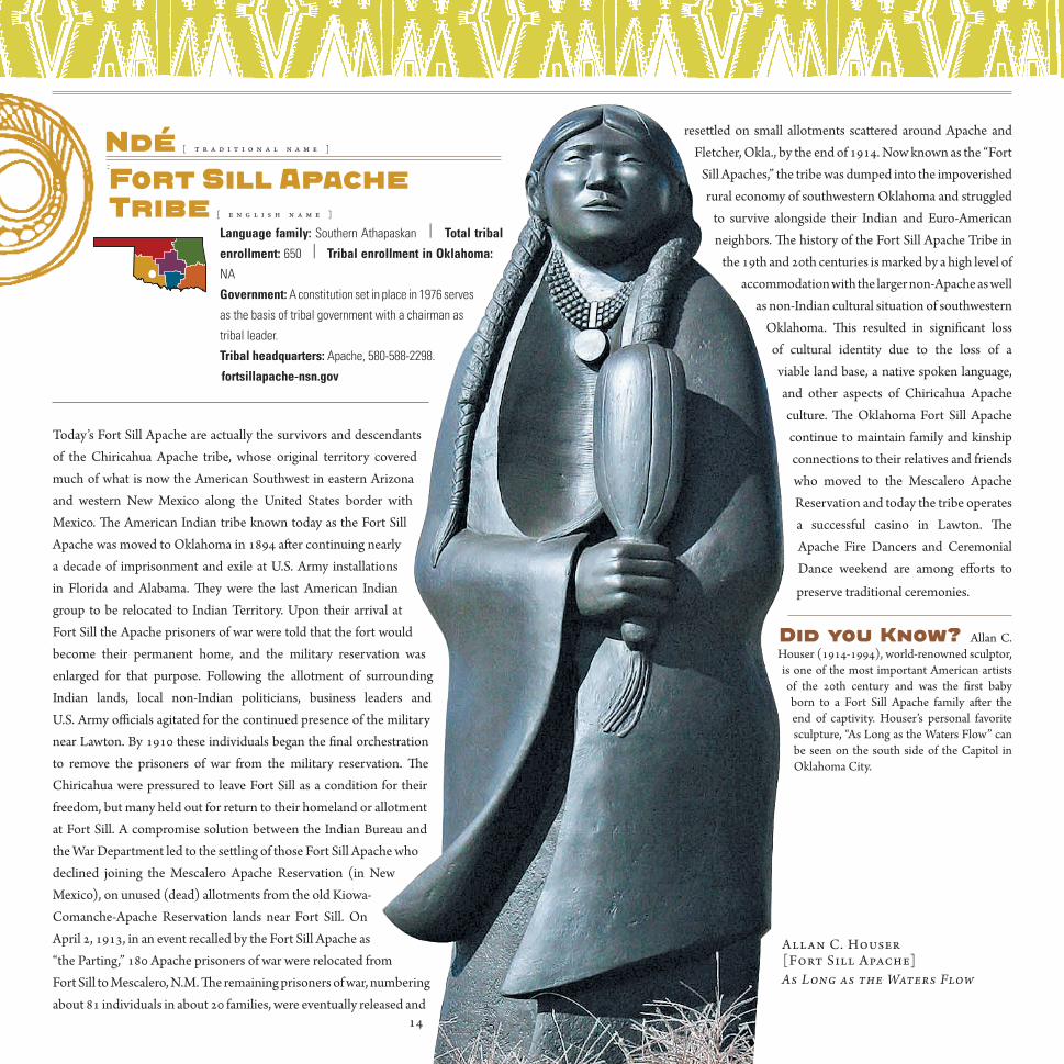
Ndé [ t r a d i t i o n a l n a m e ]
Fort Sill Apache Tribe [ e n g l i s h n a m e ]
Language family: Southern Athapaskan | Total tribal
enrollment: 650 | Tribal enrollment in Oklahoma: NA Government: A constitution set in place in 1976 serves
as the basis of tribal government with a chairman as
tribal leader.
Tribal headquarters: Apache, 580-588-2298.
fortsillapache-nsn.gov
Today’s Fort Sill Apache are actually the survivors and descendants of the Chiricahua Apache tribe, whose original territory covered much of what is now the American Southwest in eastern Arizona and western New Mexico along the United States border with Mexico. The American Indian tribe known today as the Fort Sill Apache was moved to Oklahoma in 1894 after continuing nearly a decade of imprisonment and exile at U.S. Army installations in Florida and Alabama. They were the last American Indian group to be relocated to Indian Territory. Upon their arrival at Fort Sill the Apache prisoners of war were told that the fort would become their permanent home, and the military reservation was enlarged for that purpose. Following the allotment of surrounding Indian lands, local non-Indian politicians, business leaders and U.S. Army officials agitated for the continued presence of the military near Lawton. By 1910 these individuals began the final orchestration to remove the prisoners of war from the military reservation. The Chiricahua were pressured to leave Fort Sill as a condition for their freedom, but many held out for return to their homeland or allotment at Fort Sill. A compromise solution between the Indian Bureau and the War Department led to the settling of those Fort Sill Apache who declined joining the Mescalero Apache Reservation (in New Mexico), on unused (dead) allotments from the old Kiowa-Comanche-Apache Reservation lands near Fort Sill. On April 2, 1913, in an event recalled by the Fort Sill Apache as “the Parting,” 180 Apache prisoners of war were relocated from Fort Sill to Mescalero, N.M. The remaining prisoners of war, numbering about 81 individuals in about 20 families, were eventually released and
resettled on small allotments scattered around Apache and Fletcher, Okla., by the end of 1914. Now known as the “Fort
Sill Apaches,” the tribe was dumped into the impoverished rural economy of southwestern Oklahoma and struggled
to survive alongside their Indian and Euro-American neighbors. The history of the Fort Sill Apache Tribe in
the 19th and 20th centuries is marked by a high level of accommodation with the larger non-Apache as well
as non-Indian cultural situation of southwestern Oklahoma. This resulted in significant loss
of cultural identity due to the loss of a viable land base, a native spoken language, and other aspects of Chiricahua Apache culture. The Oklahoma Fort Sill Apache continue to maintain family and kinship connections to their relatives and friends who moved to the Mescalero Apache Reservation and today the tribe operates a successful casino in Lawton. The Apache Fire Dancers and Ceremonial Dance weekend are among efforts to
preserve traditional ceremonies.
Did you Know? Allan C. Houser (1914-1994), world-renowned sculptor, is one of the most important American artists of the 20th century and was the first baby born to a Fort Sill Apache family after the end of captivity. Houser’s personal favorite sculpture, “As Long as the Waters Flow” can be seen on the south side of the Capitol in Oklahoma City.
Allan C. Houser [Fort Sill Apache]As Long as the Waters Flow
14

Bah-Kho-Je [ t r a d i t i o n a l n a m e ]
Iowa Tribe [ e n g l i s h n a m e ]
Language family: Chiwere Siouan | Total tribal enrollment: 688 | Tribal
enrollment in Oklahoma: 505 Government: Tribal government was established in 1936 with a tribal business committee
of five members, a constitution, bylaws and a charter and chairperson
as a leader. Tribal headquarters: Three miles south of Perkins, 405-547-2402.
iowanation.org
The native lands of the Iowas once encompassed an area of the Missouri and Mississippi River Valleys in what is presently Wisconsin, Iowa, Minnesota, Missouri, Kansas and Nebraska however, the Iowa lived for the majority of their recorded history in what is now the state of Iowa. Originally a Woodland culture, due to their migration to the south and west, the Iowa also adopted elements of the Plains culture, resulting in a mixture of the two. The Iowa Tribe relocated many times during its history and for many years maintained a village near Council Bluffs, Iowa, abandoning it because of aggression by the Sioux and a desire to locate closer to French traders. Thereafter the Iowa lived primarily near the Des Moines River on the Chariton/Grand River Basin. With encroachment of Euro-Americans into western lands, the Iowa Tribe ceded their lands in 1824 and were given two years in which to vacate. Additional lands were ceded in 1836 and 1838, and the tribe was removed to an area near the Kansas-Nebraska border. This proud tribe who had once roamed over a six-state area, now found themselves confined to a strip of land only 10 miles wide and 20 miles long. Subsequent treaties would reduce their lands even further. Dissatisfaction with their conditions and treatment resulted in a number of Iowa tribal members leaving the Kansas-Nebraska reserve in 1878 and moving to Indian Territory in Oklahoma. An 1883 executive order created an Iowa reservation in Indian Territory, but Iowas who wished to remain on the land near the Kansas-Nebraska border were allowed to do so. Today, the two are recognized as separate entities. The Northern Iowa are headquartered in White Cloud, Kan., while the Iowa Tribe of Oklahoma offices in Perkins, Okla. The Iowas hold an annual powwow in the summer and adhere to other selected practices of their Indian culture such as the Gourd Dance.
Did you Know? Phoebe O’Dell was the first woman elected as chairman of the Iowa Tribe of Oklahoma. She held office from 2003-2005. This position has been held by women since that time. And, in January 2006 the Iowa Tribe of Oklahoma opened an eagle sanctuary, Bah Kho Je Xla Chi (Grey Snow Eagle House), to protect eagles as they are sacred to the tribe. The Iowa people believe the eagle is the only creature that has seen the face of the Creator and has the ability to carry prayers to Him. The Grey Snow Eagle House is the only tribal aviary permitted to rehabilitate eagles for release back into the wild. The Grey Snow Eagle House also provides sanctuary for 19 non-releasable eagles. Visitors to the facility are able to see the bald and golden eagles housed at the sanctuary.
[ t r a d i t i o n a l n a m e ] Kanza
[ e n g l i s h n a m e ] Kaw NationLanguage family: Dhegiha Siouan | Total tribal enrollment: 3,083 | Tribal
enrollment in Oklahoma: 1,400 Government: The Kaw adopted a constitution in 1990 and
are governed via a seven member tribal executive council
that includes a chairperson. Tribal headquarters: 698 Grand View Dr, Kaw City, 580-269-2552.
kawnation.com
Kaw Nation oral history suggests original homelands around the Great Lakes, but by the mid-1800s the Kanza were the predominant tribe in what was to become the state of Kansas, named after the Kanza Nation. Their territory extended over most of present-day northern and eastern Kansas with hunting grounds extending into the West. Euro-American intruders coveted the tribe’s desirable lands along the Missouri and Kansas Rivers, and a succession of treaties undermined the Kaw Tribe and their culture. The results were devastating and over time the tribe’s original 20 million acre domain was reduced to only 80,000 of the poorest acres, sub-divided into 40-acre plots for each family at present-day Council Grove, Kan. Promised annuities were seldom delivered or were obligated to unscrupulous traders, while disease decimated the tribal population. Finally in 1872 over the strong protests of Chief Allegawaho and his people, a federal act moved the Kanza to a 100,137-acre site in northern Kay County, Okla. From a population of several thousand, the Kaw declined through disease and starvation to 1,500 by 1800 and to 194 by 1887. Yet even in Indian Territory, their land claim was not safe. The Kaw Allotment Act of 1902 legally obliterated the tribe until federal reorganization in 1959. The Kaw Nation survived adversity and today is growing stronger as a federally recognized, self-governing tribe recovering its Iowas hold an annual powwow in the summer and adhere to other selected practices of their Indian culture such as the Gourd Dance.
Did you Know? The last full-blood Kanza Indian, William Mehojah, served as tribal chairman from 1987 to 1990, during which time the tribe wrote a new constitution to engage in economic development activity. Mehojah died in 2000.
15
Jim Pepper(1941-1992) Influential jazz saxophonist, singer, and composer. With both Creek and Kaw ancestry, Jim’s music was deeply influenced by Oklahoma Indian culture.
The Pepper Family

ORIGINALLY KICkaPOO HOMELANDS were in the Great Lakes region but a slow and general migration of the population out of the region came sometime after 1400. The tribe split into different bands sometime after the mid-1700s and each band signed a separate cessation of Illinois lands in a treaty with the U.S. in 1819, although not all adhered and eventually some were removed forcibly. Another treaty in 1832 moved the Kickapoo to Kansas, putting them on a 12-square-mile reservation where railroad promoters after the Civil War secretly used political connections to swindle the Kickapoo out of their lands. In disgust, some Kickapoo went to Mexico, where some had lived since 1849, others accepted allotments and lost them and still others stayed on their diminished reservation lands. Beginning in 1873 about half the tribe moved to a 100,000-acre reservation in Indian Territory. In 1891 an attorney committed outright fraud, producing an allotment document that sold “surplus” tribal lands which led to tribal division and more Kickapoo migrating to Mexico. Only gradually did some begin to return in the 1920s. In 1997 representatives from three Kickapoo groups – Kansas, Oklahoma and Mexico – met in Kansas for a summit, the first time the three were together since their division in the 1800s. The Kickapoo aggressively preserve their culture with many practicing traditional rituals and ways of life. Approximately 80
percent of Kickapoo speak only their tribal language, not English.
Did you Know? The Kickapoo were the first Indians to greet the Lewis and Clark expedition as it departed St. Louis in 1804.
Kialegee [ t r a d i t i o n a l n a m e ]
Kialegee Tribal Town [ e n g l i s h n a m e ]
Language family: Muskoghean | Total tribal enrollment: 439 | Tribal enrollment
in Oklahoma: 429 Government: Kialegee Tribal Town government consists of a council as the legislature
and a king or chief as the executive officer. Tribal headquarters: 101 E. Broadway, Wetumka,
405-452-3987.
Culturally Kialegee Tribal Town is part of the Muscogee people but politically they constitute separate legal entities. Muscogee people were mound-builders and sun-worshipers and the Kialegee shared these traits, and were one of about 50 towns of the Muscogee (Creek) Confederacy, with homelands in what are now the states of Alabama and Georgia. After a series of treaties with the U.S. and increasing pressure to leave their homelands, 166 Kialegee families trekked to Indian Territory in the 1830s. After removal members of Kialegee Town lived south of present day Henryetta, but with the allotment of individual lands after 1899, many citizens could be found farther west near Wetumka, where the present administration building and tribal court building are located. Assimilation and allotment took its toll on the tribal town’s culture and over the years led to a transfer of land ownership from Indians to whites. When offered separate federal recognition in 1936, the Kialegee accepted along with two of the other Creek towns, Thlopthlocco and Alabama-Quassarte. Today members of the Kialegee Town celebrate an annual Kialegge Nettv Day in recognition of their history and heritage and the elders of the town strive to instill the language, culture
and traditions in younger generations.
Did you Know? Membership in Kialegee Tribal Town is matrilineal, meaning people become members automatically if their mother is a member. Children do not become members automatically through their fathers.
Kiwigapawa [ t r a d i t i o n a l n a m e ]
Kickapoo Tribe of Indians[ e n g l i s h n a m e ]
Language family: Central Algonquian | Total tribal enrollment: 2,713 | Tribal
enrollment in Oklahoma: 1,779 Government: The Kickapoo are organized under a 1940 federal charter and the basis
of their government is a 1937 constitution amended in 1977. An elected chair and five-
member business committee govern the tribe. Tribal headquarters: 401 North Highway 102, McLoud, 405-964-2075.
kickapootribeofoklahoma.com16
Baby Lone, Kickapoo man. 1917.Library of Congress

[ t r a d i t i o n a l n a m e ]
Caiugu (Principal People)
Kiowa Tribe [ e n g l i s h n a m e ]
Language family: Tanoan | Total tribal enrollment: 11,500 | Tribal enrollment
in Oklahoma: 6,958 Government: The Kiowa Tribe is governed by an elected eight-member committee
and chair and the provisions of
a 1970 constitution. Tribal headquarters: 100 Kiowa Way
Hwy. 9, Carnegie, 580-654-2300. kiowatribe.net
Kiowa oral tradition says their origins were in the far north, in the Yellowstone area or possibly even Canada. They were classic, nomadic Plains Indians, following the buffalo and as excellent horsemen their livelihood depended on hunting buffalo. Gradually the tribe migrated east and south through the Black Hills and later to Colorado and Nebraska. In 1790 the Kiowa made a peace treaty with the Comanche with whom they remained allies in the coming years. The Kiowa first encountered Euro-American encroachment in 1820 and signed their first treaty with the U.S. at Fort Gibson in 1837. As the U.S. sought to connect the two coasts with railroads, treaties increasingly confined the Kiowa farther south to Kansas and eventually to Oklahoma in 1868, where they were put on lands jointly with the Comanche and Apache. Tribal members resisted confinement on their assigned reservation and it took strong military action to enforce peace. The U.S. established Fort Sill, making it one of the largest military posts in the nation, and after an attack on a wagon train in 1881, the U.S. sent Kiowa leaders Satank, Satanta and Big Tree to prison. Eventually the U.S. military prevailed and forced the Indians into reservation life. In 1892 the Jerome Commission dictated the terms of allotment to the Kiowa, opening the Kiowa’s remaining two million acres of land to settlement. Commission members forged Indian signatures on the final agreement. Non-Indian invaders flooded the Kiowa lands, and the boarding school and other assimilation policies continued to wreak havoc on their culture. Beginning in the 1930s following the Indian New Deal, the Kiowa began recovering, creating a tribal government in 1940. Despite the
radical and disruptive changes in their past, the Kiowa keep their culture and heritage alive with a variety of clubs, fairs and festivals, and the resurgence of the Kiowa Black Leggings Warrior Society and Kiowa Gourd Clan further the preservation and restoration.
Did you Know? The Kiowa Five – Spencer Asah, Monroe Tsatoke, Stephen Mopope, Jack Hokeah and James Auchiah – and a lone woman, Lois Smoky, became internationally renowned artists in the 1920s under the guidance of Oscar B. Jacobson at the University of Oklahoma. You can see many of their works today at The Jacobson House Native Art Center in Norman.
[ t r a d i t i o n a l n a m e ] Myaamia
[ e n g l i s h n a m e ] Miami NationLanguage family: Central Algonquian | Total tribal enrollment: 3,877 | Tribal
enrollment in Oklahoma: 775 Government: Constitutional, with three branches: legislative
(General Council), executive (Business Committee) and judicial
(Tribal Court). Tribal headquarters: 202 S. Eight Tribes Trail, Miami, 918-542-1445.
miamination.com
The Miami first emerged as a distinct and different people at saakiiweeyonki (near South Bend, Indiana). Their traditional homelands include what are today the states of Indiana, Ohio, Illinois, lower Michigan and lower Wisconsin. This was a shared landscape with many other indigenous peoples including, but not limited to, Wyandot,
Satank (c.1800-1871). Kiowa war chief and medicine man. Member of the Koitsenko warrior society. W.S. Soule. National Anthropological Archives, Smithsonian Institution
Ledger art
Ah-Keah-Boat (Two Hatchet),
Kiowa warrior. 1898.
Continued page 2017
Delaware, Shawnee, Potawatomi, Ojibwa and Kickapoo peoples. In the 1600s, the Miami, who numbered in the tens of thousands, began having frequent contact with Europeans. Over the next two centuries, E u r o - A m e r i c a n encroachment, war and disease took a high toll on the Miami. Eventually a series of treaties with the United States required the Miami to cede their traditional homelands. In 1840 the tribe signed a treaty
calling for their removal beyond the Mississippi. In 1846, after many
attempts to avoid the devastating move, the Miami, by then numbering in the hundreds, were herded at gunpoint into canal boats to begin the long journey to a reservation in the Unorganized Territory near what later became La Cygne, Kansas. The Miami remained in Myaamionki Waapankiaakamionki (Miami lands by the La Cygne River) until 1873, when the tribe was once again forcibly relocated. This relocation forced the tribe into Indian Territory, which 34 years later, became the state of Oklahoma. By the time the tribe reached Indian Territory, there were fewer than 100 adults remaining. As with many tribes, allotment policy dealt yet another blow to the Miami and eventually they were landless. Today, however, the Miami are growing their land base and revitalizing their heritage, language and cultural identity. The Miami run their own elders food program, library, historical archive, cultural and natural resources offices, environmental programs, housing program, social services programs and childcare program. Once a year the tribe hosts its National Gathering, which includes Family Day, the annual Miami
Nation Powwow and the Annual Meeting of the General Council.
Did you Know? The word “Miami,” used all over Oklahoma, Kansas, and the Midwest, comes from “Myaamia,” which means the “downstream people.”
[ t r a d i t i o n a l n a m e ] Maklaks
[ e n g l i s h n a m e ] Modoc Tribe Language family: Penutian | Total tribal enrollment: 235 | Tribal enrollment
in Oklahoma: 120 Government: The Modocs are governed by four council
members and a chief.
Tribal headquarters: 418 “G” St SE, Miami,
918-542-1190. modoctribe.net
The ancestral home of the Modoc Tribe of Oklahoma consisted of some 5,000 square miles along what is now the California-Oregon border. While their tribal territory encompassed only a small area, it was one of panoramic eco-diversity with the perennially snow-capped peaks of the majestic Cascade Mountains in the distance. The arrival of fur traders, prospectors and finally farmers and settlers created enormous pressure on the tribe and they signed a reservation treaty in 1864. Life on the reservation was less than ideal and in 1865, Captain Jack (Kientpoos or Kintpuash) led his band of Modoc off the reservation and returned to the Lost River area of Northern California, refusing to return to the reservation, and requesting a separate Modoc reservation on Lost River. Angered by Captain Jack’s refusal, the U.S. Army was determined to capture Jack and his followers and return them to the Klamath reservation in Oregon. The clash between the two fueled the explosive Modoc War. The Modoc retreated to the nearby Lava Beds and with no more than 57 braves for almost six months, Captain Jack and his braves held off an army that came to number more than 1,000 men. After the war ended in 1873, Captain Jack and five of his warriors became the only Indians in American history to be tried by a military commission for war crimes and Captain Jack was executed. In October 1873, 155 Modoc– 42 men, 59 women and 54 children – were loaded into four boxcars that were designed to transport cattle. These boxcars were coupled between two railroad cars filled with soldiers. Men and boys who were capable of bearing arms were shackled. After a 2,000-mile winter trip, they arrived at the Quapaw Agency in the northeastern corner of Oklahoma. The first years following removal to Indian Territory were difficult ones for the Modoc, with a great deal of sickness, death and many hardships due to the corruption of the Indian agent assigned to the tribe. By the time allotment arrived in 1891 there were only 68 Modoc left to receive allotments, with many of those born after removal. In spite of the odds, the Modoc persevered, survived and were granted federal recognition in 1978. Today the tribe is preserving and restoring its heritage and culture
in tribal archives and a library.
Captain Jack (c.1837-1873). Chief of the Modoc and
leader during the Modoc War.
20
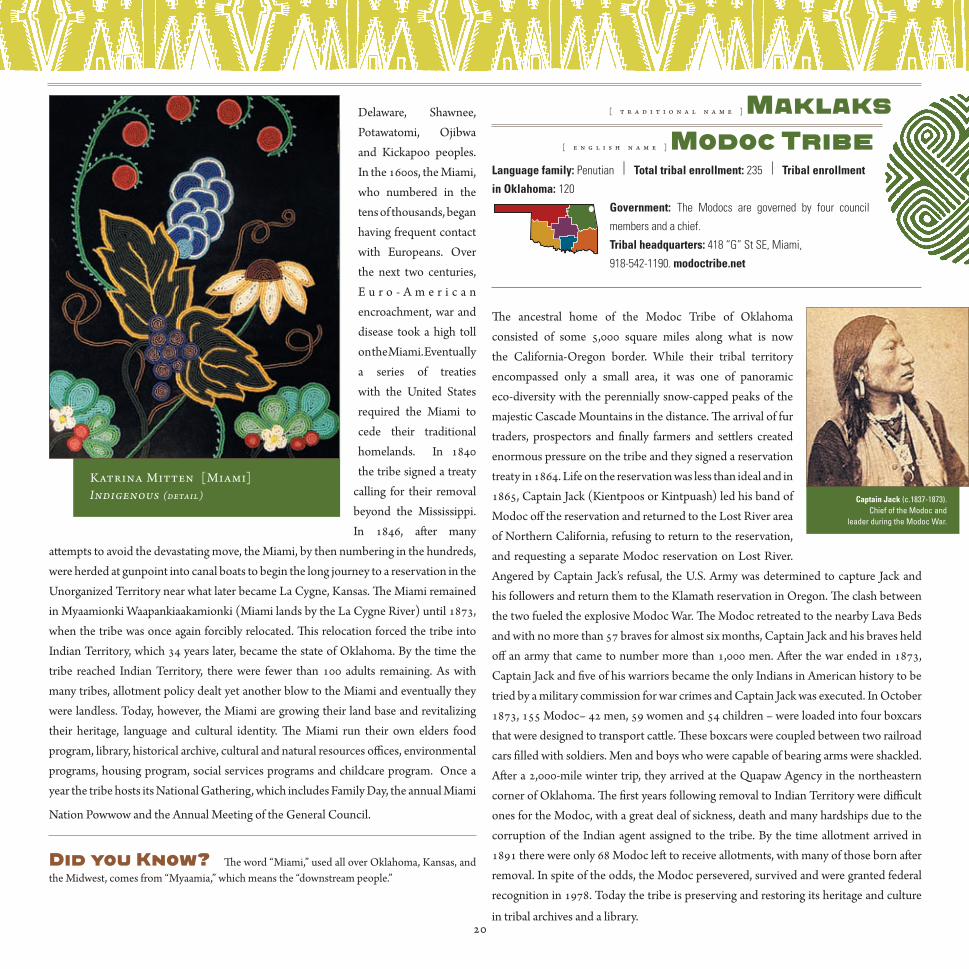
Katrina Mitten [Miami]Indigenous (detail)

Did you Know? The Modoc War of 1872-1873 cost the U.S. government, at its lowest estimate, half a million dollars. In comparison, the reservation requested by the Modoc on Lost River, which the U.S. government refused to grant them, would have cost at most $10,000.
Mvskoke [ t r a d i t i o n a l n a m e ]
Muscogee (Creek) Nation [ e n g l i s h n a m e ]
Language family: Mvskoke | Total tribal enrollment: 69,162 | Tribal enrollment
in Oklahoma: 55,591 Government: Operates under a tribal constitution adopted in 1979 and three separate branches of
government – executive (chief & second chief), legislative (National Council),
judicial (tribal court system). Tribal headquarters: U.S. Hwy 75 & S 56 Loop, Okmulgee, 918-732-7600.
muscogeenation-nsn.com
The Muscogee (Creek) people are descendents of a remarkable culture that before 1500 spanned much of what is now the Southeast U.S. Early ancestors of the Muscogee constructed magnificent earthen pyramids along the rivers and later built
expansive towns within these same broad river valleys, and this union of several tribes evolved into a confederacy. The Muscogee were once one of the most sophisticated political organizations north of Mexico. Member tribes were called tribal towns and each maintained political autonomy and distinct land holdings. The coming of Europeans dramatically changed the Muscogee Confederacy. In the early 19th century, U.S. Indian policy focused on the removal of the Muscogee and the other Southeastern tribes to areas west of the Mississippi River. In the removal treaty of 1832, Muscogee leadership exchanged the last of cherished Muscogee ancestral homelands for new lands in Indian Territory, in what is now Oklahoma. While a portion of Muscogee (Creeks) settled in the new homeland after the treaty of Washington in 1827, for the majority of Muscogee people the process of severing ties to a land they felt so much a part of proved impossible and in 1836 and 1837, the U.S. Army forced the removal of more than 20,000 Muscogee (Creeks) to Indian Territory. In the new nation, tribal towns were reestablished and the nation as a whole began to experience a new prosperity until the American Civil War. While the majority of Muscogee people desired neutrality, it proved impossible and eventually Muscogee citizens fought on both Union and Confederate sides. In the late 1800s, the Dawes Commission began negotiating with the Muscogee Nation for the allotment of the national domain and in 1898, the U.S. Congress passed the Curtis Act dismantling the national governments of the Five Civilized Tribes and allotment of Muscogee lands became inevitable. In the 197os, the Muscogee people began pursuing their sovereign rights to maintain a national court system and levy taxes. Today the Muscogee (Creek) people are actively engaged in the process of accepting and asserting
the rights and responsibilities of a sovereign nation as well as knowing and preserving their distinct cultural heritage.
Did you Know? In 1890, noted statesman Chitto Harjo helped lead organized opposition to the dissolution of the Muscogee national government and allotment of collectively held Muscogee lands. In his efforts, he epitomized the view of all Muscogee people that they possessed an inherent right to govern themselves.
21

Wazhazhi [ t r a d i t i o n a l n a m e ]
Osage Nation [ e n g l i s h n a m e ]
Language family: Dhegiha Siouan | Total tribal enrollment: 11,394 | Tribal
enrollment in Oklahoma: 5,682 Government: The Osage Nation operates under a constitutional
government approved in 2006 with three branches, executive
(principal chief), legislative (congress), and judicial.
Tribal headquarters: 827 Grandview Ave, Pawhuska,
918-287-5555. osagetribe.com
The culture of the Osage Nation reaches back far into the Mississippian culture of the mid-continent region, centered at Cahokia, Illinois. A written record of the Osage began in 1673. At that time traders and explorers began to document their encounters with tribes of the Midwest in what was later to become the United States. The Osage were considered a Siouan people, semi-nomadic in nature and recorded mainly throughout the Missouri, Oklahoma, Kansas and Arkansas area. They were a nation of people with a familial culture of the Woodland tribes. All nations east of the Mississippi traveled the Trail of Tears and the Osage were no different. They were removed and settled in Kansas, but by the time they negotiated the treaty of 1865 to purchase land in Oklahoma, the Osage population had decreased by 95 percent. As a result only 3,000 Osage People walked across the Kansas border into their new land. The Osage of today uphold and sustain their culture of long-standing traditions by embracing the lessons and culture of their ancestors, participating in dances, feasting and naming ceremonies. Each June on three consecutive weekends, the Osage hold E-lon-shka dances in each of three districts – Hominy, Gray Horse and Pawhuska – and the Osage are working to preserve their language and heritage. The Osage Nation also maintains the Osage Tribal Museum, Library & Archives, with exhibits and artifacts relating to Osage culture from the 1600s to the present, as well
as archives, photo collections and a gift shop.
Did you Know?The Osage Nation asserts that it occupies the only federally recognized reservation in the state of Oklahoma.
[ t r a d i t i o n a l n a m e ] Jiwere Nutache
Otoe-Missouria Tribe[ e n g l i s h n a m e ]
Language family: Siouan | Total tribal enrollment: 2,465 | Tribal enrollment in
Oklahoma: 1,666 Government: The Otoe-Missouria Tribe operates under a
constitution and by-laws initiated in 1984.
Tribal headquarters: 8151 Hwy 177, Red Rock, 580-723-4466. omtribe.org
The story of the confederated tribes of Otoe and Missouria, once two separate peoples, began centuries ago when a mass of people located near the Great Lakes withdrew from their parent stock and departed on a quest of their own. By the turn of the 18th century, the Otoe and Missouria had left evidence of their separate and independent villages along the way, as affirmation of their pilgrimage. The Otoe resided near the Platte River in Nebraska; the Missouria were on the Grand River in what is now the state of Missouri. In 1804 Lewis and Clark visited the Otoe, paving the way for the flood of white Europeans seeking Indian lands. With them came a peculiar and lasting relationship between the Otoe-Missouria and the United States government. A treaty period began with the treaty of 1817, negotiated to promote peace and friendship between the tribe and its neighbors. In the interest of peace and survival, the Otoes and Missourias reunited about this time as the Missouria population was in decline due to ongoing warfare with neighboring tribes. Numbering a little more than 100 members, the majority of the remaining Missouria were united with the Otoe. Since that union, the Otoe-Missouria Tribe has been recognized by other tribes and by the federal government as one people. Under the terms of an 1881 act, northern Otoe-Missouria were removed to a 129,000-acre reservation north of what is today Stillwater, Okla., near Red Rock Creek. The reservation officially ended in 1904 with the implementation of the Dawes Act wherein the Otoe-Missouria were individually allotted small parcels of land rather than owning a large swath of land communally. Today tribal members perpetuate tribal traditions with feasts,
dances and an annual encampment held the third weekend in July. The Otoe-Missouria Tribe maintains a tribal library and a museum is in the planning stages. The tribe also owns four casinos – Lil’ Bit of Paradise and 7 Clans Paradise Casino
in Red Rock and Lil’ Bit of Paradise Travel Plaza and First Council Casino in Newkirk.
Did you Know? The Ot0e-Missourias fought in court to receive just settlement of their land claims and in the mid-1940s became the first tribe west of the Mississippi River to win their claims. After years of wrangling, in 1964-67 the Indian Claims Commission awarded a judgment of $1.2 million to the Otoe-Missouria.
22
Anita Fields [osage] — Plate and Redmound
Hilda Moore Harris, Laura Moore, Madge Pettit Dent and Rhoda Dent Compton.Descendants of the Dent Family

Adawe [ t r a d i t i o n a l n a m e ]
Ottawa Tribe [ e n g l i s h n a m e ]
Language family: Algonquian | Total tribal enrollment: 2,490 | Tribal
enrollment in Oklahoma: 723 Government: The Ottawa Tribe operates under a 1979
constitution with a business committee composed of five members, including a chief in the
leadership role. Tribal headquarters: 13 S 69 A, Miami, 918-540-1536.
ottawatribe.org
The original homelands of the Ottawa contain one of the oldest prehistory sites on the North American continent – the Shaguiandah site on Manitoulin Island, Ontario – estimated to be 30,000 years old. The Ottawa ranged over parts of Ontario and the Great Lakes region and as prolific traders traveled over vast distances which led to early contact with Europeans. They met Samuel de Champlain in 1615 near the French River in Canada. The arrival of French traders transformed the tribe, engaging them more deeply in European-Indian politics, and the tribe became integral to fur trade. Traditionally the Ottawa lived in wigwams or wikis, wore buckskin clothing, and cultivated corn, beans and pumpkins. One of the greatest Indian chiefs and skilled leaders during this time was Chief Pontiac, a member of the Otter Clan of the Ottawa, who became the head of a loose confederacy consisting of the Ottawa, Ojibwa and Potawatomi Tribes, formed in response to offensive English policies in their territories. The ensuing conflict became known as Pontiac’s Rebellion. After the passage of President Jackson’s Indian Removal Act of 1830, and due to increasing encroachment by Euro-Americans, the tribe signed over their lands in Ohio, Michigan and Illinois. They were very hesitant to leave their lands, and it wasn’t until April 1837 that the Ottawa of Blanchard’s Fork, Roche de Boeuf and Oquanoxies’s Village agreed to migrate to Kansas where they were allotted 74,000 acres of land. Within five years of the move, nearly half of the Ottawa had died. Realizing their children would need to be educated to survive, in 1862 the tribe gave the Baptists acreage for a school, as well as another 20,000 acres to be sold to raise money to build a university for the education of whites and Indians, named after the Ottawa, and the tribe negotiated an arrangement with the university for Ottawa children to be educated free of charge. Under increasing pressure to cede remaining lands, in 1867 the Ottawa sold their land in Kansas and moved to northeastern Indian Territory. By this time there were only about 200 Ottawa. In 1956 the U.S. government decided the tribal government served no purpose and terminated its existence. This was a dark period in the tribe’s history but they didn’t give up and in May 1978, Ottawa Tribal governance was restored, followed by establishment as a federally recognized government in 1979.
Did you Know? A major focus of Ottawa cultural activities is the annual Ottawa Powwow held on Labor Day weekend. Among the foods the Ottawa enjoy at their annual powwow is traditional succotash, made from beans and dried corn.
Chaticks-Si-Chaticks[ t r a d i t i o n a l n a m e ]
Pawnee Nation [ e n g l i s h n a m e ]
Language family: Caddoan | Total tribal enrollment: 3,210 | Tribal enrollment
in Oklahoma: 1,725 Government: The Pawnee are governed by the Pawnee Business Council, the tribal
constitution and by-laws and the Corporate Charter.
Tribal headquarters: 881 Little Dee Rd, Pawnee, 918-762-3621.
pawneenation.org
The prehistoric homelands of the Pawnee were traced to the Central Plains for several centuries prior to the arrival of Europeans, centered in what is now northern and central Nebraska. Historically one of the largest and most prominent Plains tribes, they numbered 10,ooo or more during early contact with Europeans. Pawnee life was characterized by alternating patterns of cultivation and High Plains bison hunting. They lived in permanent villages of dome-shaped earth lodges that often housed two or more families. During the 1800s the Pawnee people were subjected to an incessant interplay of destructive forces that radically changed their lives, largely the result of an expansionist U.S. encroachment by white immigrants. In 1833 the Pawnee ceded their lands south of the Platte River, and in 1857 they accepted a small reservation on the Loup Fork of the Platte River, together with monetary and other economic provisions. A series of epidemics and constant attacks by Sioux war parties took a steady toll on the Pawnee population. Finally in 1874 the tribe began to remove to Indian Territory where the Pawnee settled on former Cherokee land between the forks of the Arkansas and Cimarron rivers, south of the Osage Reservation. In 1878 as a result of the Allotment Act individual families were encouraged to move to individual farms and agency officials relentlessly attacked many Pawnee social customs. The Pawnee people experienced poor health, coupled with inadequate sanitation and health care and as a result, the population reached a record low of 629 individuals in 1901 and did not begin to recover until the 1930s. Beginning in 1906 the Pawnee no longer had a tribal government and they remained unorganized politically during the first three decades of the 20th century. Chiefs continued to act for the tribe in dealing with U.S. government officials and after reorganization in 1937 Pawnee leaders began a long effort to regain Pawnee lands. Ownership was returned to the tribe in 1968 and in 1980 a tribal roundhouse, modeled on the traditional Pawnee earth lodge, was built to serve as a social center for dances and other events. Today the Pawnee Nation is making strides in teaching their language to younger generations, preserving tribal knowledge with a library, and celebrating history and heritage with dances, ceremonies and the Pawnee Homecoming Powwow, an annual, four-day event held in early July.
23
Hilda Moore Harris, Laura Moore, Madge Pettit Dent and Rhoda Dent Compton.Descendants of the Dent Family

Did you Know? Pawnee dancers’ regalia are covered with images such as star motifs, celestial designs and bird imagery symbolizing Pawnee beliefs about the origin and nature of the universe, and images of lightning bolts, stars and crosses with circles recall night skies and creation stories.
Kaskaskia | Peoria [ t r a d i t i o n a l n a m e s ]
Piankeshaw | Wea
Peoria Tribe of Indiansof Oklahoma [ e n g l i s h n a m e ]
Language family: Algonquian | Total tribal enrollment: 2,920 | Tribal enrollment
in Oklahoma: 778 Government: The Peoria Tribe of Indians adopted a constitution in 1939
and a federal charter in 1940. A new constitution was ratified in 1981
and revised and approved in 1997. Leadership is comprised of an elected,
seven-member business committee led by a chief. Tribal headquarters: 118 S Eight Tribes Trail, Miami, 918-540-2535. peoriatribe.com
The Peoria Tribe of Indians of Oklahoma is a confederation of Kaskaskia, Peoria, Piankeshaw and Wea Indians united into a single tribe in 1854. The tribes which constitute The Confederated Peorias, as they then were called, originated in the lands bordering the Great Lakes and drained by the mighty Mississippi. They are Illinois or Illini Indians, descendants of those who created the great mound civilizations in the central United States 2,000 to 3,000 years ago. Forced from their ancestral lands in Illinois, Michigan, Ohio and Missouri, the Peorias were relocated first in Missouri, then to Kansas, and finally to Indian Territory. While in Kansas, increasing encroachment from Euro-Americans in the 1840s and 1850s brought about cooperation among the Peoria, Kaskaskia, Piankeshaw and Wea Tribes to protect their holdings. With the Treaty of May 30, 1854, the United States recognized their cooperation and consented to their formal union as the Confederated Peoria. In addition to this recognition, the treaty also provided for the disposition of constituent tribal lands set aside by the treaties of the 1830s. Ten sections were to be held in common by the new Confederation with each tribal member to receive an allotment of 160 acres and the remaining or “surplus” land to be sold to settlers with proceeds to be used by the tribes. The Civil War caused considerable turmoil among all the people of Kansas, especially the Indians. After the war, most members of the Confederation agreed to remove to Indian Territory under the provisions of the so-called Omnibus Treaty of February 23, 1867. Some tribal members elected at this time to remain in Kansas, separate from the Confederated Tribes, and become U.S. citizens. The lands of the Confederation members in the Indian Territory
were subject to the provisions of the General Allotment Act of 1887. The allotment of all the tribal land was made by 1893 and by 1915, the tribe had no tribal lands or any lands in restricted status. Although the U.S government’s “Termination Policy” terminated supervision of the Peoria Tribe and its property in 1956, federal recognition was restored to the Peoria Tribe in 1978. Peorias today are maintaining old traditions within a modern context, participating in powwows with neighboring tribes, hosting stomp dances, and holding their own powwow celebration each June.
Did you Know? The Peoria Ridge Golf Course located in Miami is owned by the Peoria Tribe of Indians of Oklahoma and is an 18-hole championship course featuring five sets of tee boxes to accommodate any skill level. Rolling hills and large bodies of water offer beautiful scenic vistas and a challenging round of golf.
[ t r a d i t i o n a l n a m e ] Ponka
[ e n g l i s h n a m e ] Ponca NationLanguage family: Dhegiha Siouan | Total tribal enrollment: 3,548 | Tribal
enrollment in Oklahoma: 2,949 Government: The Ponca Nation approved a constitution
in 1950 which provides for several business committee
members.
Tribal headquarters: 20 White Eagle Dr, Ponca City,
580-762-8104, ponca.com
Traditionally the Ponca share common social and cultural characteristics with the Omaha, Osage, Kaw and Quapaw peoples. They once lived in the area of northern Kentucky and southern Indiana along the Ohio River, then migrated west into what is today known as Nebraska. The Ponca first encountered Europeans in 1789 when they lived in villages along Ponca Creek near the Niobrara River in northeastern Nebraska. Despite several treaties with the U.S., in 1868 due to an “administrative blunder” by federal agents, the entire Ponca Reservation was given to the Sioux. When the error was discovered, the U.S. government chose to remove the less powerful Poncas south to Indian Territory rather than admit the mistake. The tribe protested for nearly a decade, but under military escort, the Ponca’s forced removal to Indian Territory began in the spring of 1877. Their trek was beset by great hardship and upon their arrival to northeastern Oklahoma, they found no shelter and little food. After the first two years almost one-third of the tribe had perished and many others were ill and disabled. It was at this time one of the most famous Ponca sagas began. When his eldest son died in 1878, the Ponca Chief Standing Bear and 65 followers began a journey back to Nebraska to bury his son in traditional
24

Ponca territory. Standing Bear was arrested in Nebraska for leaving the reservation without permission. The ensuing trial in federal court resulted in the landmark decision which declared Indians to be considered “persons” with individual rights under the law. Allotment and the Land Rush of 1889 dramatically undermined tribal lifestyle, yet in spite of the allotments, the Ponca continued to gather together as a tribe
for the winter months and take part in traditional tribal life. Late in the 19th century non-Indian homesteaders began moving into areas surrounding the Ponca Reservation. In 1899 Ponca City was incorporated north of the Reservation and then a large percentage of the Ponca land was leased to the Miller Brothers and became the basis for the famous 101 Ranch. As original allottees died, the Miller Brothers purchased their allotments as they became available for sale. In 1911 oilman E.W. Marland struck oil on land leased from a Ponca tribal member named Willie Cries. It proved to be a major strike ushering in an era of unprecedented oil production in central Oklahoma. By the early 1920s local oil refineries began to dump oil waste into the Arkansas River and Ponca City used the river for disposal of raw sewage. Quickly the river water became unfit to drink, life in the river died off and the animals which had lived adjacent to the river all but disappeared, making already trying circumstances for the Ponca even more difficult. Boarding schools and missions further undermined tribal culture. Despite these difficulties, over the years the Ponca persevered and today the Ponca’s resolve and sense of community sustain
them as both a vibrant and vital part of Indian Country and the nation.
Did you Know? Standing Bear Park, Museum & Education Center features artifacts, artwork and educational material, along with the park’s focal point, a magnificent 22-foot bronze sculpture of Chief Standing Bear. You’ll also find audio centers honoring the six American Indian tribes around Ponca City and two miles of walking trails surrounded by native grasses and graceful trees.
[ t r a d i t i o n a l n a m e s ] Okaxpa
Quapaw Tribe[ e n g l i s h n a m e ] of Oklahoma
Language family: Dhegiha Siouan | Total tribal enrollment: 3,818 | Tribal
enrollment in Oklahoma: 1,651 Government: The Quapaw Tribe of Oklahoma has no constitution. An elected seven-
member business committee, which includes a chair, operates under the authority of a
Governing Resolution adopted in August 1956.
Tribal headquarters: 5681 South 630 Rd, Quapaw, 918-542-1853.
quapawtribe.com
The name “Quapaw” is a derivative of the tribal term Ugakhpa, meaning “downstream people.” It is believed the Quapaw were part of a larger group known as the Dhegiha Sioux that split into the tribes known today as the Quapaw, Osage, Ponca, Kansa and Omaha. Originally they all resided in the Ohio Valley and then separated and migrated to different areas, with the Quapaw following the Ohio River downstream to the Mississippi River eventually reaching what is now Arkansas. In the mid 1600s the French explorers Marquette and Joliet were traveling down the Mississippi using Illini Indians as their guides. The guides referred to the Quapaw tribe as “Akansea,” which later became the word Arkansas. The downstream people settled where the Arkansas River met the Mississippi, organizing into four villages and this is where the Quapaw stayed until they were pushed out by Euro-Americans several hundred years later. Like many other American Indian tribes, the Quapaw experienced a severe population decline due to European diseases. In the late 1600s it’s estimated there were more than 5,000 Quapaw, but over a period of 80 years their population dropped to 700. Sadly, due to the massive decline in population, much of early Quapaw history and lore, which was passed on orally, died with its storytellers. The French were the first Europeans to contact the Quapaw, and the tribe allied itself with the French in exchange for weapons. The Quapaw were faithful to their French allies in the tumultuous century that followed when major Europeans powers were vying for control of the continent. In 1803 Napoleon sold the Louisiana Territory to the United States and in ensuing years, like other tribes, the Quapaw signed multiple treaties with the U.S. government only to see the U.S. continue demanding more Quapaw land. In 1833 a final treaty provided for a reservation in the far northeastern corner of Indian Territory. Due to astute work by Quapaw Tribal Secretary, Abner W. Abrams, the tribe managed allotment in such a way that no Quapaw lands were opened to white settlers. The discovery of lead and zinc on Quapaw lands however led to a period of upheaval and eventual pollution of much of the land, resulting in the area receiving Superfund designation in 1983. Today the Quapaw celebrate and preserve their heritage and history with the Quapaw Tribal Museum and the Quapaw Tribal Library.
Did you Know? The Quapaw Tribe of Oklahoma holds an annual powwow each Fourth of July. It’s the oldest powwow in America and attracts the participation of many people from far and wide
25
Brent Greenwood [Ponca, Chickasaw] Sings His Song (detail)

Thakiwaki & Meskwaki [ t r a d i t i o n a l n a m e ]
Sac & Fox Nation [ e n g l i s h n a m e ]
Language family: Algonquian | Total tribal enrollment: 3,600 | Tribal enrollment
in Oklahoma: NA Government: A 1937 constitution replaced by a new document in 1987 forms the basis of
the Sac & Fox Nation’s government. Government leaders consist of an elected five-member
business committee that includes a principal chief and other members.
Tribal headquarters: 218 South 8th Avenue, Stroud, 918-968-3526.
sacandfoxnation-nsn.gov
The indigenous homelands of the Sac and Fox Nation were in the western Great Lakes region. “Sac and Fox” is actually a historical accident, a merging of “Sac” (Sauk), or Thâkîwaki, and “Fox,” or Meskwâki misapplied by the U.S. government during treaty negotiations in 1804. Although historically associated and closely related by language and culture, the two peoples have always remained geographically and politically distinct. The Meskwaki have resided on the Meskwaki Settlement in central Iowa since 1856, and the Thakiwaki have been in central Oklahoma since the 1870s. The contemporary Sac and Fox population in Oklahoma claim to be predominantly of Thakiwaki decent and typically refer to themselves as both “Sac and Fox” and Sauk, and to their heritage language as Sauk. At the time of European contact, the Thakiwaki resided in the Saginaw Valley near Saginaw Bay of Lake Huron and Green Bay of Lake Michigan on the east-central peninsula of what is now the state of Michigan. They were moved from their indigenous lands through a series of armed conflicts and treaties, residing for a time in Illinois (1764 to 1830), briefly in Iowa (1831 to 1846) and in Kansas (1847 to 1867), prior to being removed to the Indian Territory in the 1870s. During their time in Illinois, the principal Thakiwaki settlement was situated a short distance above the confluence of the Mississippi and Rock rivers. The most notable armed conflict involving the Thakiwaki is perhaps the three-month Black Hawk Conflict of 1832 and entailed an extended series of skirmishes between U.S. infantrymen as Black Hawk and a band of 1,000 Indians that included 500 warriors utilized diversionary military tactics to protect the women, children and elders with him. Although Black Hawk survived, the skirmishes ended tragically with the slaughter of unarmed Thakiwaki crossing the Mississippi River. Afterward only 150 to 200 of the original 1,000 warriors rejoined their companions on the Iowa
side of the river. Some Thakiwaki call the Black Hawk Conflict a historical example of an enduring spirit of resistance and Black Hawk’s name is symbolically represented at the center of the contemporary Sac & Fox Nation seal and flag. The conflict is also viewed as an historic watershed; it was the last armed resistance to Euro-American encroachment and resettlement east of the Mississippi River. The Sac and Fox Nation hold numerous social events celebrating their culture and heritage including an annual powwow held in July on tribal grounds, numerous benefit and honor dances, veterans’ events, banquets, holiday celebrations and the occasional rodeo.
Did you Know? Olympian Jim Thorpe (1888-1953), is perhaps the best known Sac and Fox tribal member and is symbolically represented on the Sac & Fox Nation seal and flag by five Olympic rings.
26
Jim Thorpe (Wa-Tho-Huk, Sac & Fox) (1888-1953).Born near Prague, Okla., Thorpe’s natural athletic abilities were quickly recognized as he lead his Carlisle Indian School football team to upset victories over numerous nationally recognized college teams. He would go on to win Gold Medals for both the Pentathlon and Decathlon in the 1912 Stockholm Olympics, where Sweden’s King Gustav v proclaimed him “the world’s greatest athlete.” He is still regarded by many to be one of the most versatile and graceful athletes of the modern sports era.

Seminole [ t r a d i t i o n a l n a m e ]
Seminole Nation[ e n g l i s h n a m e ]
Language family: Mvskoke | Total tribal enrollment: 16,338 | Tribal enrollment
in Oklahoma: 13,533 Government: The Seminole Nation operates under a federally recognized 1969
constitution. The tribe is led by a 28-member council with a principal chief and an assistant
chief. Each of the 14 bands selects a representative to the council.
Tribal headquarters: 36645 Hwy 270, Wewoka, 405-257-7200.
seminolenation.com
The Seminole, one of the Five Civilized Tribes, were originally part of the Creek, a loose confederacy of ethnic groups and tribes in southern Georgia, northern Florida and Alabama. During the late 18th century some Lower Creek villages cut ties with their neighbors and moved south into northern Florida where they became known as Seminole, thought to perhaps derive from cimarron, the Spanish term for runaway. By the 19th century encroachment on Seminole lands and continuous harassment by Euro-Americans led to the tribe being designated for removal. The Seminole resisted removal during the Seminole Wars (1817-18, 1835-42, and 1855-58) and although they were not conquered, thousands moved west in their aftermaths. The first group of Seminole arrived in Oklahoma in 1836 and by 1839 most had been relocated west. A minority of the Seminole (between 350 and 500) remained in Florida and eventually formed the separate Seminole Nation of Florida in 1957. After their relocation to Indian Territory the Seminole were initially confined to the Creek Nation where the U.S. allowed them to have some self-governance only if they adhered to the general laws of the Creek. Frustrations with these terms and general conditions in the region led two bands of Seminole under Wild Cat and John Horse to migrate to Mexico in 1849. In 1856, led by Chief John Jumper, the Seminole signed a treaty with the Creek and the U.S. government and established the Seminole Nation. During the American Civil War of 1861-65, most Seminole sided with the Confederacy and many dissident refugees fled to Kansas. Under the Curtis Act of 1898 the Dawes Commission dissolved the Seminole government and divided its territory among approximately 3,000 enrolled tribe members. The restrictions accompanying allotment did little to protect the Seminole’s interests in the land. Through sale, often by fraudulent means, many Seminole families and individuals lost their land holdings. By 1920 only about 20 percent of the Seminole lands remained in Seminole hands. Of those who retained their property, a few became wealthy following the discovery of the Greater Seminole Oil Field in 1923. The policy of allotment was repealed by Congress in 1934. By the following year the Seminole had reestablished their government and in 1970 the tribal council was reorganized to adhere to its traditional structure. Many Seminole frequently
participate in the stomp dance, green corn ceremonies, traditional fasts and other ancient rituals. The tribe’s Seminole Nation Museum documents and interprets the history and culture of its people.
Did you Know? Internationally recognized sculptor Enoch Kelly Haney, a Seminole Nation citizen, created “The Guardian,” an inspiring 22-foot-tall bronze sculpture that sits atop the Oklahoma capitol dome.
Enoch Kelly Haney [Seminole] The Guardian LSB, Photo Division
27

Hodinohso:ni: (Onondowa’ [ t r a d i t i o n a l n a m e s ]
ga’ ne Gayogoho:no’)
Seneca-Cayuga [ e n g l i s h n a m e ]
Tribe of OklahomaLanguage family: Northern Iroquoian | Total tribal enrollment: 4,892 | Tribal
enrollment in Oklahoma: 2,200 Government: The Seneca-Cayuga Tribe of Oklahoma is governed by a
constitution approved in 1937, and an elected seven-member business council
with a chief. Tribal headquarters: 23701 S. 655 Rd, Grove, 918-787-5452. sctribe.com
The homeland of both the Seneca and Cayugas originated in what is today the upstate Finger Lakes Region of the state of New York. The Seneca are the western-most members of the League of the Iroquois (Six Nations) know as the “Keepers of the West Door” while the Cayuga located to the east of the Seneca and are referred to as “Younger Brothers” within the League of Six Nations. During the 17th and 18th century Iroquoian bands and tribal remnants occupied areas in Pennsylvania and Ohio. Also known collectively as “Mingo” or as “Seneca,” they are the ancestors of today’s Seneca-Cayuga Tribe of Oklahoma. In 1817 the United States established two reservations for the Ohio Iroquois “Senecas.” One was for the Seneca of Sandusky, a mingling of Cayuga, Seneca, Onondaga, Mohawk, Erie, Conestoga and others, along the Sandusky River and the second was for a consolidated band of Seneca and Shawnee at Lewistown. Both groups exchanged their Ohio reserves for adjoining land in the Indian Territory in 1831. Approximately 358 Seneca of Sandusky arrived in Oklahoma in the summer of 1832. About 258 members of the Mixed Band of Seneca and Shawnee arrived later that year. Following negotiations with the Stokes Commission in December 1832, the Tribes readjusted their reservation boundaries and joined together as “the United Nation of Senecas and Shawnees.” Most Seneca and Shawnee spent the Civil War years as refugees in Kansas. The U.S. government separated the Seneca from the Shawnee in 1867. The Sandusky and Mixed Band Seneca were organized as a single Seneca tribe and the Shawnee became the Eastern Shawnee. Both surrendered land that was later occupied by Peoria, Piankashaw and other Indians. During the 1840s, 1870s and early 1880s the Seneca received newcomers, including Cayuga, Mohawk and Seneca proper, from Canada and New York and had a population of roughly 255 in 1890. The Seneca Reservation was first allotted to 130 individuals in 1888; by 1902 a total of 372 allotments had been issued. Today the Seneca-Cayugas continue their rituals as well as ceremonial
calendar and dances such as the Green Corn Ceremony and during this annual ceremony, the Peach Seed game and a ritual football game continue to be played. Oklahoma tribal members continue to interact with their New York and Canadian kinfolk as well as with neighboring northeastern Oklahoma Tribes for ceremonies, athletic contests and powwows. The primary language of the Seneca-Cayuga Tribe is Cayuga of which the Seneca language is closely related.
Did you Know? The Seneca-Cayugas were the first tribe in Oklahoma to organize after the enactment of the Oklahoma Indian Welfare Act of 1936.
[ t r a d i t i o n a l n a m e ] Shaawanwa
[ e n g l i s h n a m e ] Shawnee TribeLanguage family: Central Algonquian | Total tribal enrollment: 2,194 | Tribal
enrollment in Oklahoma: 1,060 Government: The tribe operates under a business committee
with 11 members led by a chairperson.
Tribal headquarters: 29 S Hwy 69a, Miami, 918-542-244. shawnee-
tribe.com
The Shawnees are an Eastern Woodlands tribe pushed west by white encroachment. They share a linguistic and historic background with the Absentee Shawnee. In 1793 some of the Shawnee Tribe’s ancestors received a Spanish land grant at Cape Girardeau, Missouri. After the 1803 Louisiana Purchase brought this area under American control, some Cape Girardeau Shawnees went west to Texas and Old Mexico and later moved to the Canadian River in southern Oklahoma, becoming the Absentee Shawnee Tribe. The 1817 Treaty of Fort Meigs granted the Shawnees still in northwestern Ohio three reservations. By 1824 about 800 Shawnees lived in Ohio and 1,383 lived in Missouri. In 1825 Congress ratified a treaty with the Cape Girardeau Shawnees ceding their Missouri lands for a 1.6-million-acre reservation in eastern Kansas. After the Indian Removal Act of 1830, the Ohio Shawnees on the Wapakoneta and Hog Creek reservations signed a treaty with the U.S. giving them lands on the Kansas Reservation. The Lewistown Reservation Shawnees, together with their Seneca allies and neighbors, signed a separate treaty with the federal government in 1831 and moved directly to Indian Territory. The Lewistown Shawnees became the Eastern Shawnee Tribe of Oklahoma. In 1854 the U.S. government decimated the Kansas Reservation to 160,000 acres. This, coupled with the brutal abuses perpetrated against them by white settlers during and after the Civil War, forced the Kansas Shawnees to relocate to Cherokee Nation in northeastern Oklahoma. The 1854 Shawnee Reservation in Kansas was never formally
28

extinguished and some Shawnee families retain their Kansas allotments today. The federal government caused the former Kansas Shawnees and Cherokees to enter into a formal agreement in 1869, whereby the Shawnees received allotments and citizenship in Cherokee Nation. The Shawnees settled in and around White Oak, Bird Creek (Sperry) and Hudson Creek (Fairland), in Oklahoma, maintaining separate communities and separate cultural identities. Known as the Cherokee Shawnees, they would also later be called the Loyal Shawnees. Initial efforts began in the 1980s to separate the Shawnee Tribe from Cherokee Nation culminated when Congress enacted Public Law 106-568, the Shawnee Tribe Status Act of 2000, which restored the Shawnee Tribe to its position as a sovereign Indian nation. Today the Shawnee continue their traditional ceremonies
such as the Bread Dance, Green Corn Dance and Buffalo Dance on an annual basis.
Did you Know? The Loyal Shawnees filed an Indian Claims Commission suit for lands seized in contravention of treaties in 1825, 1831 and 1854. They finally won a judgment in 1959, and formed the Loyal Shawnee tribal business committee in December 1960.
Rvp-Rakko Etulwv[ t r a d i t i o n a l n a m e ]
Thlopthlocco Tribal Town [ e n g l i s h n a m e ]
Language family: Mvskoke | Total tribal enrollment: 809 | Tribal enrollment in
Oklahoma: 641 Government: Governed by a constitution, the tribe has a business committee which
consists of an elected king and four town warriors.
Tribal headquarters: Okemah, 918-560-6198. tttown.org
Thlopthlocco Tribal Town was formed toward the end of the 18th century and was an upper Creek town of the old Creek Confederacy situated in Alabama and Georgia in historical times. Thlopthlocco (Rvp-Rakko), an upper Creek town, was established near Wetumka, Alabama. Rvp-Rakko (Thlopthlocco) meant “Tall Cane” or “Big Reed”, so named for the town’s location in the vicinity of a stream where there was an abundance of cane or reed. Thlopthlocco was known as a Red Town and in Creek culture Red Towns carried red beads and administered war functions. Thlopthlocco Tribal Town was one of the 44 or more Creek tribal towns immigrating to Indian Territory due to the Indian Removal Act of 1830. During removal members of the Thlopthlocco Tribal Town settled along the north fork of the North Canadian River in what is now
central Oklahoma. The Town was one of the most western settlements of the Creeks, establishing its square grounds and rekindling its fire between Wetumka and Okemah. In 1938 Thlopthlocco Tribal Town ratified its constitution and bylaws under the provisions of the Oklahoma Indian Welfare Act of June 26, 1936 and ratified its federal charter of incorporation in 1939. In 1941 the Secretary of the Interior placed 1,900 acres of land in trust for the Thlopthlocco Tribal Town for its exclusive use and benefit. On a tract of those lands near the North Canadian River the Town members constructed a council house made of hand-hewn stone using Works Progress Administration labor. Thlopthlocco Tribal Town members participate in activities at nearby ceremonial grounds.
Did you Know? The title of Thlopthlocco Tribal Town’s leader in the Muscogee language is “Mekko” and when translated in English means king. The designation reflects an ancient tradition.
Titch-kan-wa-titch [ t r a d i t i o n a l n a m e ]
[ e n g l i s h n a m e ] Tonkawa TribeLanguage family: Tonkawan | Total tribal enrollment: 600 | Tribal enrollment
in Oklahoma: 476 Government: The Tonkawa are governed by a constitution ratified in 1938 and amended
in 1977 and 1994. An elected tribal business committee oversees their government, led by
a president.
Tribal headquarters: 1 Rush Buffalo Rd, Tonkawa, 580-628-
2561. tonkawatribe.com
The Tonkawa belong to the Tonkawan linguistic family that once comprised a number of small tribes indigenous to south central Texas. They were one of the most warlike tribes during nearly two centuries of conflict with their enemy tribes on the Western plains and with the Spanish and later, American settlers in the Southwest. The Tonkawa people had a distinct language, unique to them and, were nomadic in their early historic period, moving their tipi villages according to the wishes of the chiefs of the different bands. They planted a few crops, but were well-known as great hunters of buffalo and deer, using bows and arrows and spears for weapons, as well as some firearms secured from early Spanish traders. They became skilled riders and owned many good horses in the 18th century. From about 1800 the Tonkawa were allied with the Lipan Apache and were friendly to the Texans and other southern divisions. By 1837 they had for the most part drifted toward the southwestern frontier of Texas and were among the tribes identified in Mexican territory. Due to their loyalty to the Confederacy during the Civil War, the tribe was nearly exterminated by pro-Union Indians in the Tonkawa Massacre of October 1862. The Tonkawa were removed from the Brazos River Reservation in
Chebon Dacon [Muscogee Creek, Thlopthlocco]
Thlopthlocco Church29

Texas in 1884 and transported by rail beginning in Cisco, Texas, to a temporary stop at the Sac-Fox Agency near Stroud, Oklahoma. A baby born en route was named “Railroad Cisco.” The entire tribe wintered at the Sac-Fox Agency until spring and then traveled the last 100 miles by wagon fording many rivers swollen with rain and slogging through axle-deep mud caused by severe spring rains. They reached the Ponca Agency on June 29 and finally reached the Fort Oakland Reserve near what is now the city of Tonkawa, on June 30, 1885. The journey is known as the Tonkawa “Trail of Tears,” a time the tribe commemorates with their annual powwow which takes place the last weekend in June. Today the Tonkawa celebrate and preserve their distinctive heritage with ceremonies, dances and music and the Tonkawa Tribal Museum displays artifacts and photographic histories.
Did you Know? The origin of the Tonkawa name is from the Waco term “Tonkaweya” meaning “they all stay together”.
Kituwah [ t r a d i t i o n a l n a m e ]
United Keetoowah Bandof Cherokee Indians [ e n g l i s h n a m e ]
Language family: Iroquoian | Total tribal enrollment: 14,300 | Tribal enrollment
in Oklahoma: 13,300 Government: The tribe is governed by a 13-member tribal council led by a chief. A constitution,
bylaws, and corporate charter were ratified in 1950. Tribal headquarters: West Willis Rd, Tahlequah, 918-431-1818.
keetoowahcherokee.org
Keetoowah Cherokee people believe that “Kituwah” or “Keetoowah” is the true name of the Cherokee people given to them by the Creator atop a mountain peak known as Kuwahi.
This site today is referred to as Clingman’s Dome and straddles the borders of North Carolina and Tennessee in the Great Smoky Mountains. The Keetoowah Cherokees also received their laws and sacred fire in their ancestral homelands (present day North Carolina, Tennessee, South Carolina, Georgia, and Alabama) and still see themselves as
Grant Richards, Tonkawa ChiefPhotographs of American Indians. / F.A. Rinehart.
the guardians of traditional Cherokee ways today. This does not mean that the tribe of the 21st century stands back as the world passes it by. The tribe administers millions of dollars in state, federal, and casino-generated funds; issues its own license plates; adjudicates legal matters in its own court system; and provides a variety of services to tribal members of all ages, functioning as a sovereign nation. Keetoowah Cherokees trace their governmental lineage to the Old Settler Cherokees who settled in Arkansas by treaty in 1817 and moved to present-day northeastern Oklahoma, also by treaty, in 1828. The arrival of the main body of Cherokees over the Trail of Tears in 1838 and 1839 led to a power struggle with the Old Settlers over the structure of the government. The contest ultimately ended in a bloody civil war. During the American Civil War, Keetoowah Cherokees fought on the side of the Union, but the bulk of the Cherokee Nation sided with the Confederacy. Once the war ended, Keetoowah Cherokees censured the Cherokee National Council for negotiating the postwar treaty with the United States. The Keetoowah Cherokees strongly opposed allotment and single statehood. Before the national government of the Cherokee Nation was dissolved in 1906, the Keetoowah Cherokees became the only ‘body politic’ representing the Cherokee people, received through federal court. The Keetoowah Cherokees continued to operate as such until receiving federal tribal recognition under the Oklahoma Indian Welfare Act with a ratified constitution in 1950, making the United Keetoowah Band of Cherokee Indians in Oklahoma the first federally
recognized Cherokee tribal government in the state of Oklahoma.
Did you Know? The Keetoowah Cherokees authored their first written constitution in 1859.
Shan Goshorn [Cherokee] — Caress (detail)30

Kirikir?i:s(also spelled kitikiti’sh)
[ t r a d i t i o n a l n a m e ]
Wichita and Affiliated Tribes(Wichita, Keechi, waco and
tawakoni) [ e n g l i s h n a m e ]
Language family: Caddoan | Total tribal enrollment: 2,542 | Tribal enrollment in
Oklahoma: 1,854 Government: The tribe operates under a tribal governing resolution adopted in 1961, with
amendments made throughout the years. Daily business is conducted by an elected seven-member
executive committee led by a president. Tribal headquarters: 1 and ¼ miles N on Hwy 281, Anadarko,
405-247-2425. wichitatribe.com
Indigenous to Oklahoma, the ancestors of the historic Wichita and Affiliated Tribes were probably the first people to settle upon the Southern Plains, ranging from south central Kansas to northern Texas, living in villages of grass lodges, raising bountiful crops of corn, squash and beans, conducting fall and winter buffalo hunts and carrying on extensive trade with the Pueblos of the Southwest. First contact with Europeans came with Coronado’s 1541 quest to find the fabled Quivira, thought to be in present Kansas. Early historic accounts describe the Wichita and their allies as numbering from 15,000 to 33,000 and as occupying villages of 2,000 or more, with large grass-lodge villages, a dual bison-hunting and horticulture economy and ample fields of maize, beans and gourds. Due to the United States removal policy and in order to establish peace among the tribes, the U.S. moved the Eastern tribes onto the plains amongst the indigenous tribes, and in 1835 the U.S. entered into a treaty with “the Comanche and the Wichetaw Indians and their associated Bands.” The Wichita remained north of the Red River throughout much of the 19th century, despite frequent forays south to the Mexican border and visitations to Tawakoni and Waco, who were assigned in 1855 to the Brazos River Reservation in Texas. With the objective of settling southern plains tribes in Indian Territory, the federal government leased lands, between the 98th and 100th Meridians and the Canadian River and Red River, from the Choctaw and the Chickasaw. When the Wichita were assigned to a reservation in 1859 in the Leased District, they were joined by some of the Delaware, Caddo, Tawakoni, Waco and two Comanche bands that had been exiled from Texas reserves. The Civil War, inhumane U.S. policy and governance, the disappearance of the buffalo, and epidemic European diseases brought the tribe to near extinction with only about 300 members surviving at the beginning of the 20th century. Although the
agency discouraged it, the Wichita had maintained highly valued pony herds and after 1880 families began to acquire cattle and hogs and the Wichita adapted older cultural patterns to their changing world. What later became known as Riverside Indian School opened at the Wichita agency in 1871 and by the turn of the century missions and missionary schools were well established on the reservation. During the reservation years, the Wichita Proper, Tawakoni, Waco, and Kichai came to be designated as the Wichita and Affiliated Bands. One of the objectives of the 1887 General Allotment Act (Dawes Act) was the dissolution of the tribal land base and of tribal organization. The legislation included provisions for the allotment of 160 acres to individual Indians and the opening of unallotted or so-called “surplus” reservation land to white settlement. The Wichita resisted allotment and argued the need for continuing to hold a portion of the reservation in common because their land was more suited to grazing than to farming, hence 160 acres was not sufficient for self-support, but were overruled. On July 4, 1901, President William McKinley issued a proclamation opening both the Wichita and the Kiowa-Comanche-Apache reservations by lottery. Anglo-Americans claimed homesteads or settled as tenants on Wichita allotments and the former Wichita Reservation was annexed to Oklahoma Territory. In response, the Wichita pursued land claims in the U.S. Court of Claims. At the end of the 1930s they were paid $675,000 for “surplus” lands on their reservation and in 1985 the tribe settled its land claim suit for land taken in Kansas, Oklahoma and Texas, receiving $14 million. Today the tribe preserves their language and heritage through dances, powwows and songs and the Wichita Tribal Museum, open by appointment.
Did you Know? The Wichitas are the sole Indian nation of the Southern Plains who remain in their place of origin.
31
Wichita Grass House c. 1927. Photograph by Edward S. Curtis, “The North American Indian,” Volume 19.

Wendat [ t r a d i t i o n a l n a m e ]
Wyandotte Nation [ e n g l i s h n a m e ]
Language family: Northern Iroquoian | Total tribal enrollment: 4,958 | Tribal enrollment
in Oklahoma: 1,200 Government: The Wyandotte Nation operates according to a 1999 constitution and bylaws, governed
by a business committee comprised of a chief, second chief and four council persons.
Tribal headquarters: 64700 E Hwy 60, Wyandotte, 918-678-2297.
wyandotte-nation.org
More than a dozen tribes of the Great Lakes Region collectively called themselves Wendat, much like saying, “I am an American.” Five of these tribes comprised a confederacy known as the Huron Confederacy. The founder of the Huron Confederacy was the Attignawantan. Another tribe, the Tionontati, lived adjacent to the Attignawantan; however, they were not part of the Huron Confederacy. They also referred to themselves as being Wendat. The Wyandotte are in fact, descendants of the Tionontati and the Attignawantan. They were two tribes; however, culturally they were almost identical. After a series of wars with the Iroquois Confederacy known as the Beaver Wars, in 1649-50, they set aside their individual tribal names, united as one people and called themselves Wendat, and this was their collective name. In 1701, Antoine de la Mothe Cadillac, invited the Wendat to settle near Fort Detroit. Within a few years a portion of the tribe ventured south. They settled around Upper Sandusky, Ohio, where they held a position of honor among other tribes of the Ohio Valley. In Ohio, after sustained contact with the British, their traditional name Wendat became corrupted and spelled as Wyandot. Pressure from settlers forced the Treaty of 1843 and their removal to land west of the Mississippi River. Upon arriving in the West, no land or provisions were available. Arrangements were made and land was purchased from the Delaware. Their new reservation was located on highly sought and fought over land in Kansas, which led to the Treaty of 1855 and the Wyandot being terminated [disbanded]. Their land was quickly allotted and sold to white interests. In 1857, some Wyandot who were unwilling to accept citizenship relocated to Indian Territory. After the Civil War concluded, in 1867, approximately 200 successfully sought reinstatement as a tribe. The name Wyandotte was officially used after the 1867 Treaty and reflects an influence from the French language. Although they came to Indian Territory to remain Indian, their small population, external influences and the decisions they made, compromised their traditional way of life. In the early 1900s, many did not teach their children their native language and soon those capable of continuing the traditional ceremonies were gone. Their tribal interests focused on the care of orphans, land disputes and ongoing issues with the government. In 1983, Leaford Bearskin was elected chief. He had a vision and determined purpose for his people. Under his leadership the Wyandotte have grown to
almost 5,000 members, secured their right of self-governance, initiated cultural renewal and achieved economic growth unlike any other time in their history. In September the Wyandotte Nation hosts an annual Culture Days, a celebration that includes language, history and special-interest classes, a powwow and other activities.
Did you Know? The Wyandotte were instrumental in the founding of Detroit, Mich., and Kansas City, Kan. At one time Kansas City was named Wyandotte City. Counties named Wyandotte exist in Michigan, Ohio and Kansas.
32

Make the Run for Fun!
Our comfy beds are waiting for
you-that is if you choose to rest.
Complimentary:Breakfast
Wi-fiValet Parking
12875 N HWY 77 Newkirk OK 74647
580 448 3225
Citizen Potawatomi NationCultural Heritage Centerand FireLake Gifts
1899 S. Gordon Cooper Drive, Shawnee, OK 74801 • 405.878.5830
• Open to the public• No admission fee• Great hands-on exhibits• Preserving Potawatomi Heritage

Workbook QuestionsRead each tribe’s profile to answer the following questions:
• Which tribe in Oklahoma has the largest population?
• Which tribe in Oklahoma has the smallest population?
• Which tribe occupies the only reservation in Oklahoma?
• Sequoyah, author of the Tsalagi syllabary was a member of which tribe?
• Nvnih Waiya is the birthplace of which tribe?
• Which tribe’s language is related to no other language in the world?
• Which tribe sold part of their traditional homelands; that would later
become Manhattan, New York to the Dutch?
• Which tribe is referred to as “Lords of the Plains”?
• Which tribe was the first to greet the Lewis and Clark expedition?
• Which tribe is an ancestral member of the Iroquoian Confederacy?
• Jim Thorpe “The World’s Greatest Athlete” belongs to which tribe?
• Kelly Haney, the artist who created “The Guardian” that sits atop the
Oklahoma Capitol, belongs to which tribe?
• Which tribes refer to their tribal leader as Mekko?
• Which tribe was instrumental in the founding of Detroit, Michigan
and Kansas City, Kansas?
Research Questions• How did the growth of the Colonies affect the lives of tribal nations?
• How did the Louisiana Purchase in 1803 affect Indian Removal?
• How did the Iroquoian “Great Law of Peace” inspire the United States
Constitution?
• How did Daniel Boone take a stand against Indian Removal?
Select two tribes and research how the tribes are maintaining their
culture today.
Select two tribes and research the tribe’s traditional form of
government. Since coming to Oklahoma, has the tribe’s form of
government changed? If so, in what ways?
Research the following historical tribal leaders and activists to
learn about their efforts to protect their traditional ways of life:
Captain Jack - Modoc
Tecumseh – Shawnee
The Prophet - Shawnee
Quanah Parker – Comanche
Pushmataha – Choctaw
Geronimo – Ft. Sill Apache
Chitto Harjo – Muscogee Creek
Standing Bear – Ponca
Black Kettle – Cheyenne
Blue Jacket – Shawnee
John Ross - Cherokee
34

Map Questions• What region of Oklahoma is home to the most tribes?
• What region of Oklahoma is home to the fewest tribes?
• Which tribe came from California?
• Which tribes came from the Great Lakes?
• Which tribes came from the Southeastern United States?
• Which tribes came from the Northeastern United States?
• Which tribes came from the Southwestern United States?
• Which tribes came from the Great Plains?
• Looking at the map, what tribe traveled the farthest to Indian Territory?
• Select four tribes and research how far they traveled to Indian Territory.
• Which tribes homelands include Oklahoma?
• After reviewing the map, discuss as a class your thoughts about
the distance from homelands to Oklahoma, the journey the tribes
experienced in coming to Oklahoma, and any other topics found in the
map that interest you?
Environment Using the same four tribes you researched above, visit the tribe’s website
and learn about what the landscape and climate is like in their traditional
homelands. Next, research what the landscape and climate is like where
the tribes are located today in Oklahoma. What are the similarities and
differences between the two environments? How did adjusting to a new
environment impact the tribes way of life?
35
Marcus Amerman [Choctaw]
Quanah Parker (detail)
Historic Chickasaw Capitol, T
ishomingo, O
K
The Chickasaw Nation is a proud sponsor of Newspapers in Education (NIE). By partnering with NIE, students receive the most current textbook available – the newspaper. The NIE program promotes literacy and a joy of reading that will last a lifetime. It’s said that “better readers make better leaders” and we couldn’t agree more.
Bill Anoatubby, Governor
The Chickasaw Nation
www.Chickasaw.net
The
CHICKASAWNATION