Embed Size (px)
Citation preview
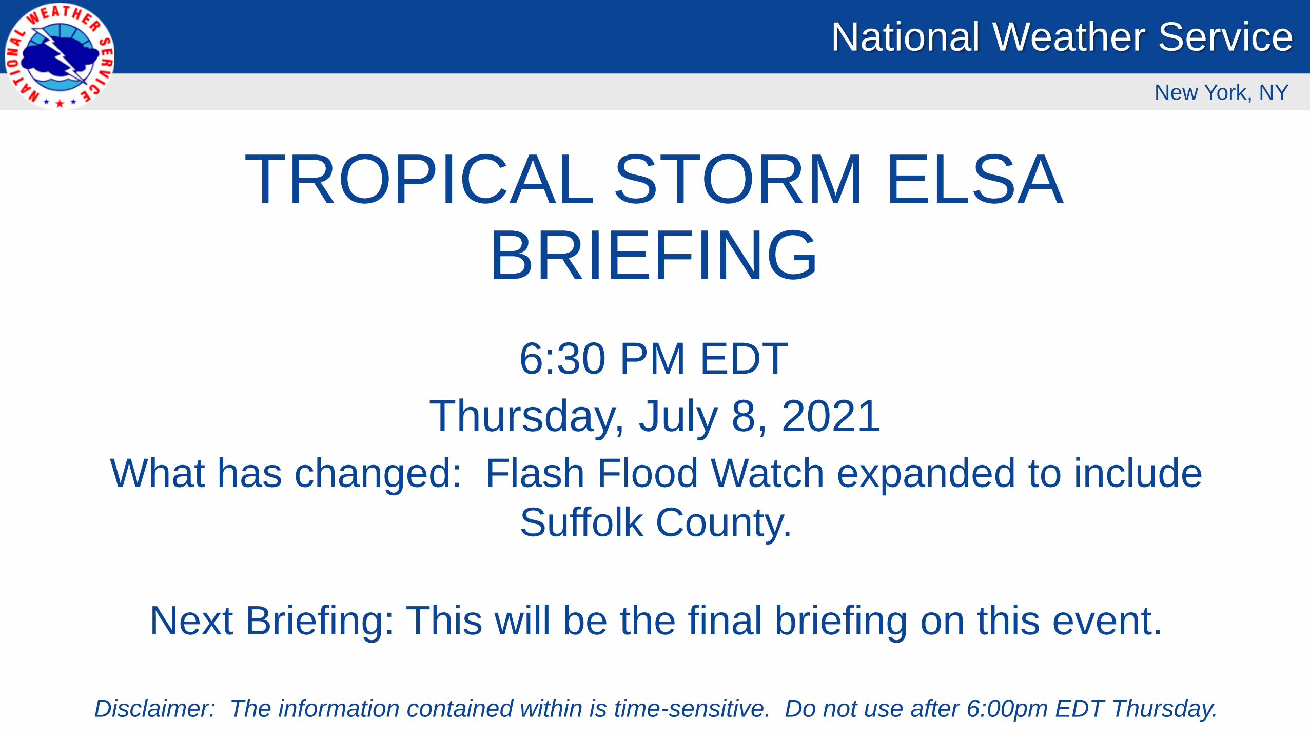
TROPICAL STORM ELSABRIEFING
Thursday, July 8, 2021
6:30 PM EDT
What has changed: Flash Flood Watch expanded to include
Suffolk County.
Next Briefing: This will be the final briefing on this event.
Disclaimer: The information contained within is time-sensitive. Do not use after 6:00pm EDT Thursday.
National Weather Service
New York, NY
National Weather Service – New York, NYLast Updated: 7/8/2021 6:29 PM
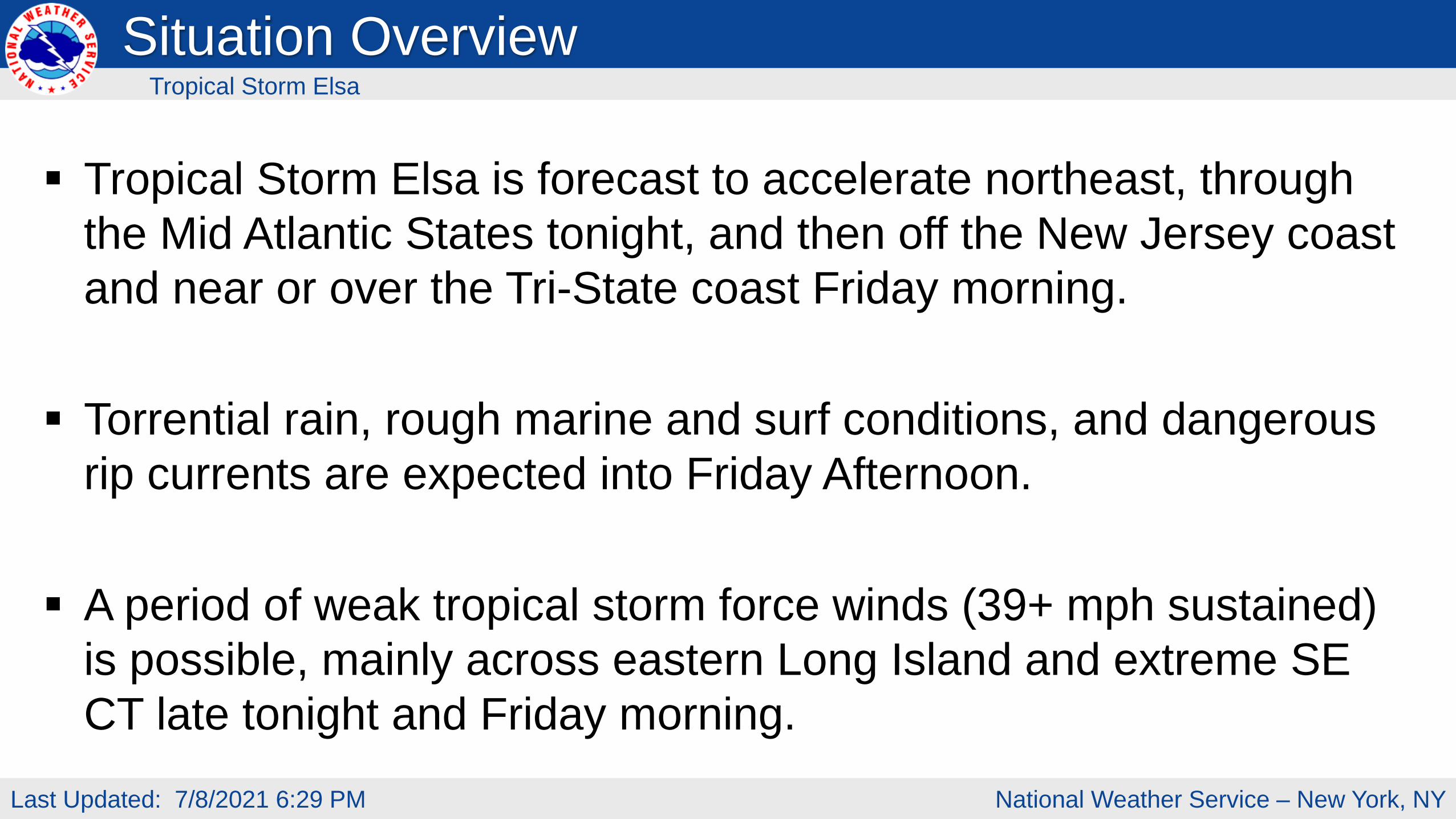
Situation Overview
Tropical Storm Elsa is forecast to accelerate northeast, through
the Mid Atlantic States tonight, and then off the New Jersey coast
and near or over the Tri-State coast Friday morning.
Torrential rain, rough marine and surf conditions, and dangerous
rip currents are expected into Friday Afternoon.
A period of weak tropical storm force winds (39+ mph sustained)
is possible, mainly across eastern Long Island and extreme SE
CT late tonight and Friday morning.
Tropical Storm Elsa
National Weather Service – New York, NYLast Updated: 7/8/2021 6:29 PM
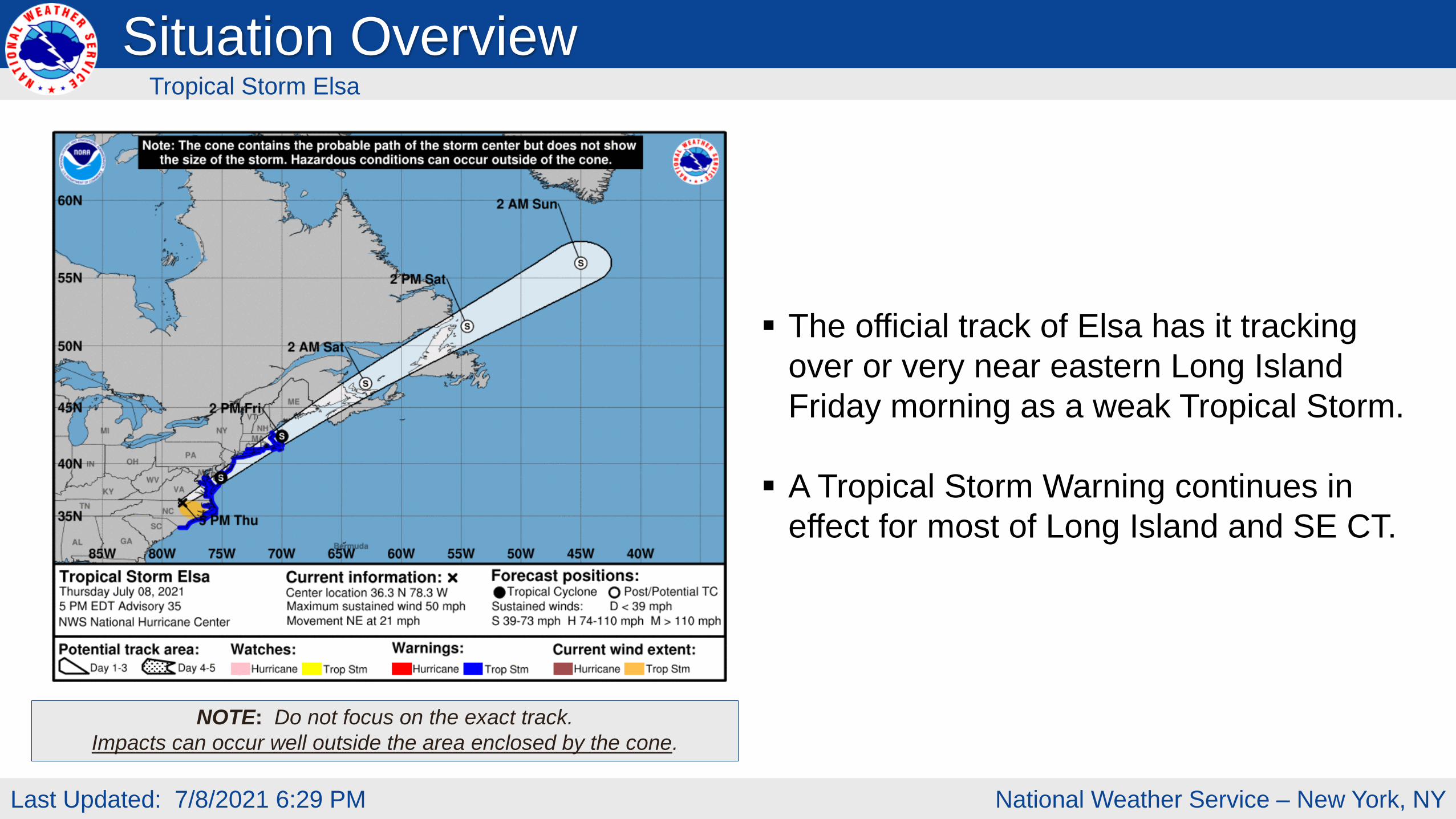
NOTE: Do not focus on the exact track.
Impacts can occur well outside the area enclosed by the cone.
The official track of Elsa has it tracking
over or very near eastern Long Island
Friday morning as a weak Tropical Storm.
A Tropical Storm Warning continues in
effect for most of Long Island and SE CT.
Situation OverviewTropical Storm Elsa
National Weather Service – New York, NYLast Updated: 7/8/2021 6:29 PM
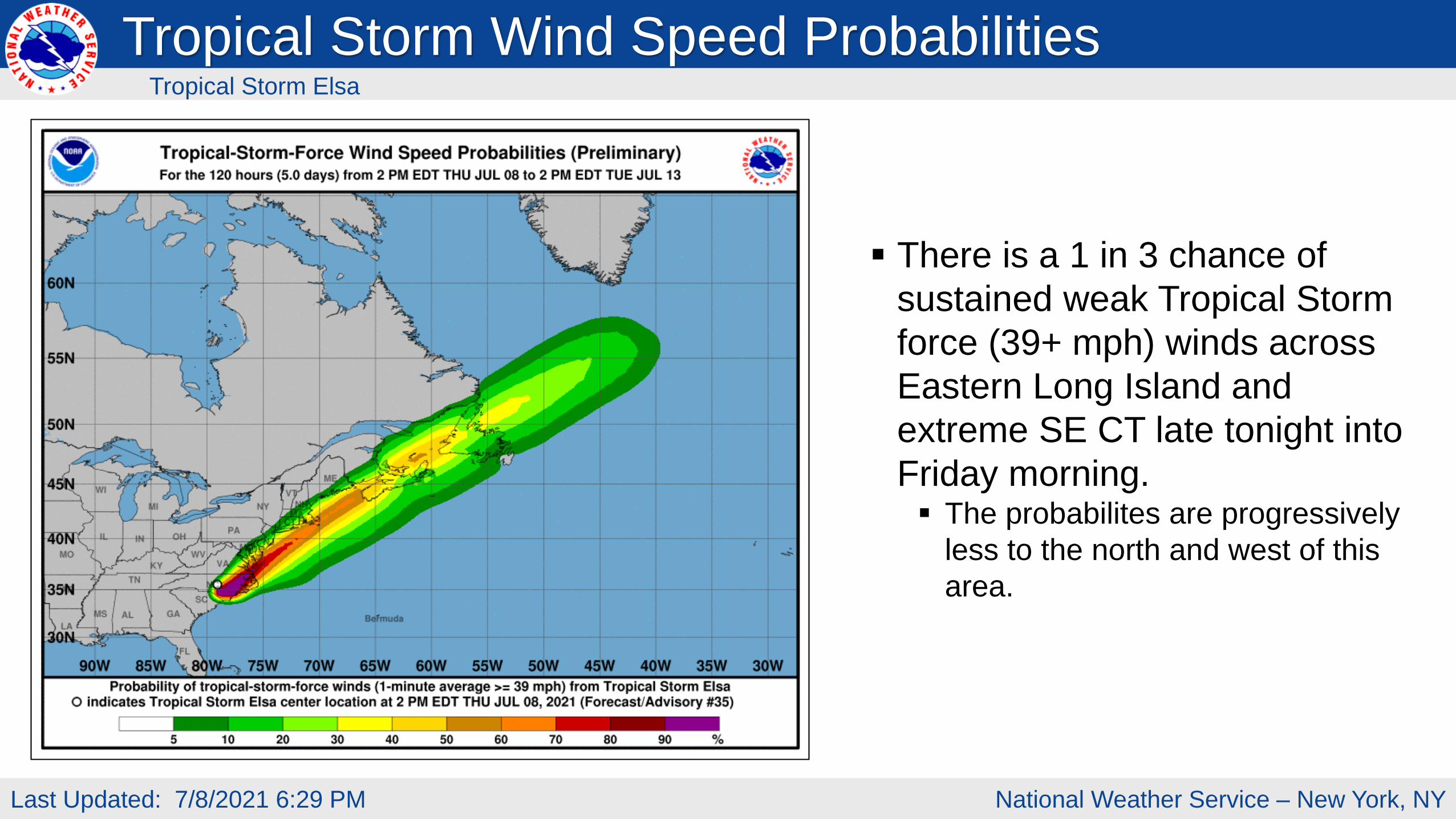
There is a 1 in 3 chance of
sustained weak Tropical Storm
force (39+ mph) winds across
Eastern Long Island and
extreme SE CT late tonight into
Friday morning. The probabilites are progressively
less to the north and west of this
area.
Tropical Storm Wind Speed ProbabilitiesTropical Storm Elsa
National Weather Service – New York, NYLast Updated: 7/8/2021 6:29 PM
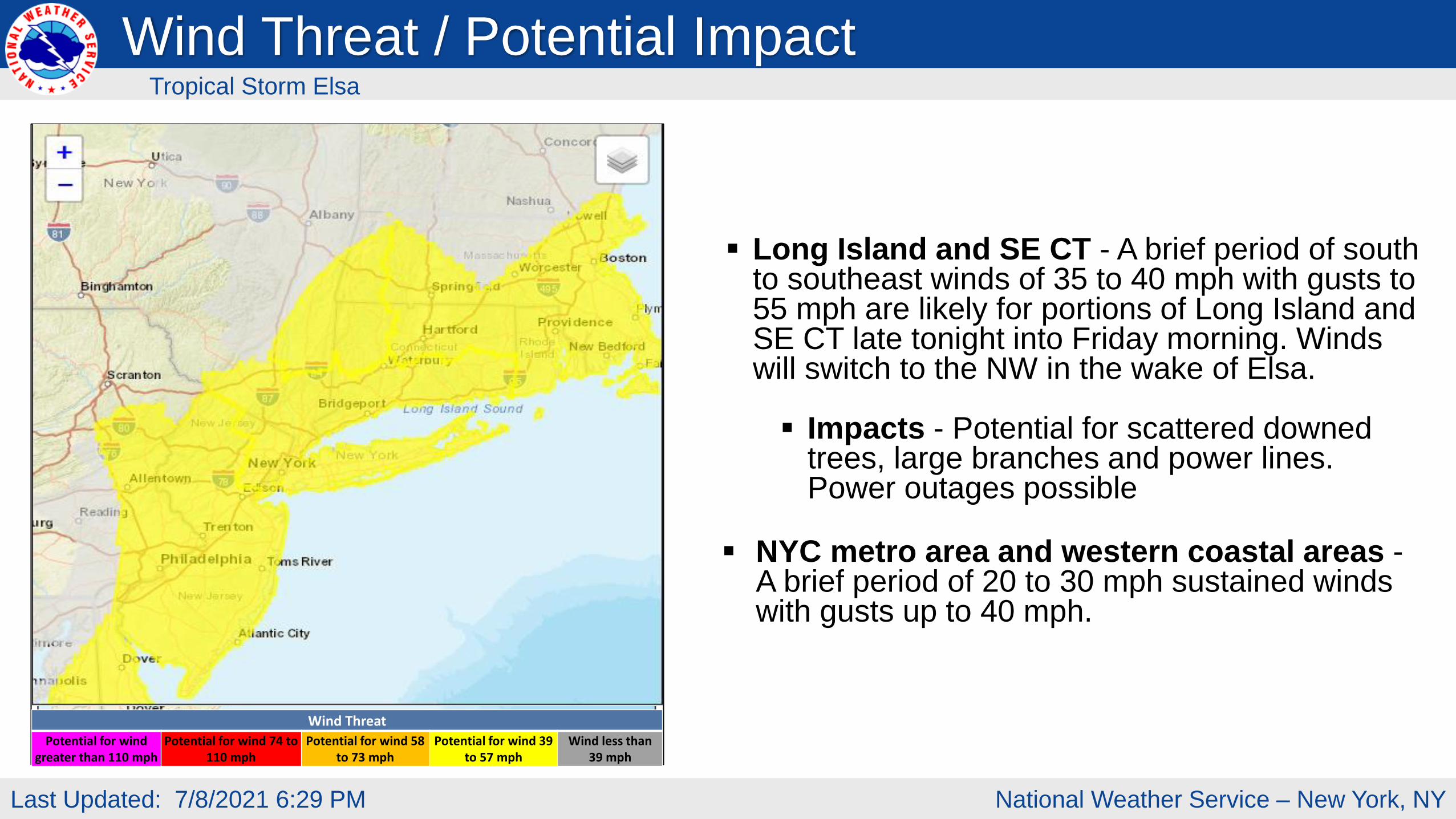
Long Island and SE CT - A brief period of south to southeast winds of 35 to 40 mph with gusts to 55 mph are likely for portions of Long Island and SE CT late tonight into Friday morning. Winds will switch to the NW in the wake of Elsa.
Impacts - Potential for scattered downed trees, large branches and power lines. Power outages possible
NYC metro area and western coastal areas -A brief period of 20 to 30 mph sustained winds with gusts up to 40 mph.
Wind Threat
Potential for wind greater than 110 mph
Potential for wind 74 to 110 mph
Potential for wind 58 to 73 mph
Potential for wind 39 to 57 mph
Wind less than 39 mph
Wind Threat / Potential ImpactTropical Storm Elsa
National Weather Service – New York, NYLast Updated: 7/8/2021 6:29 PM
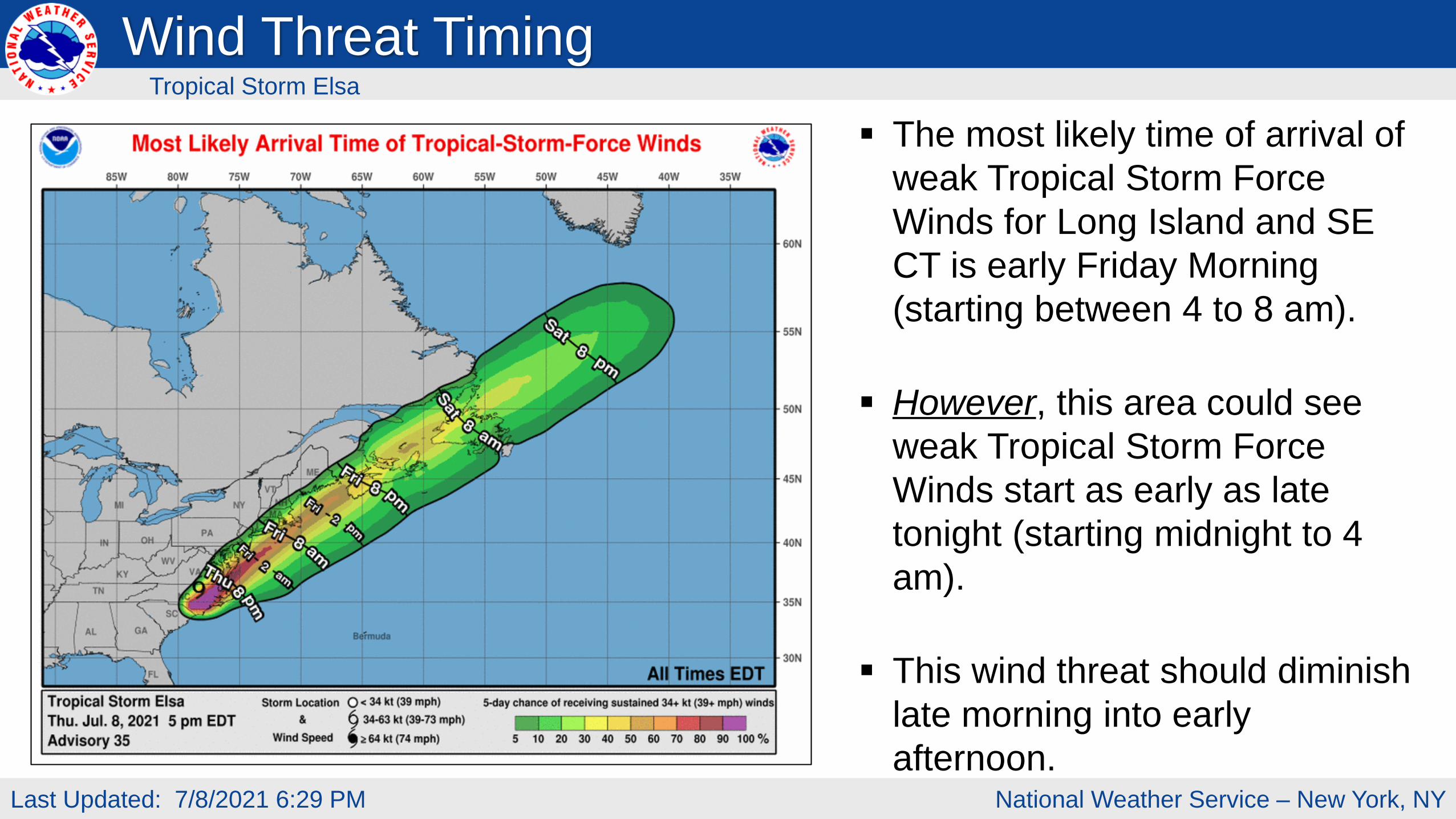
The most likely time of arrival of
weak Tropical Storm Force
Winds for Long Island and SE
CT is early Friday Morning
(starting between 4 to 8 am).
However, this area could see
weak Tropical Storm Force
Winds start as early as late
tonight (starting midnight to 4
am).
This wind threat should diminish
late morning into early
afternoon.
Wind Threat TimingTropical Storm Elsa
National Weather Service – New York, NYLast Updated: 7/8/2021 6:29 PM
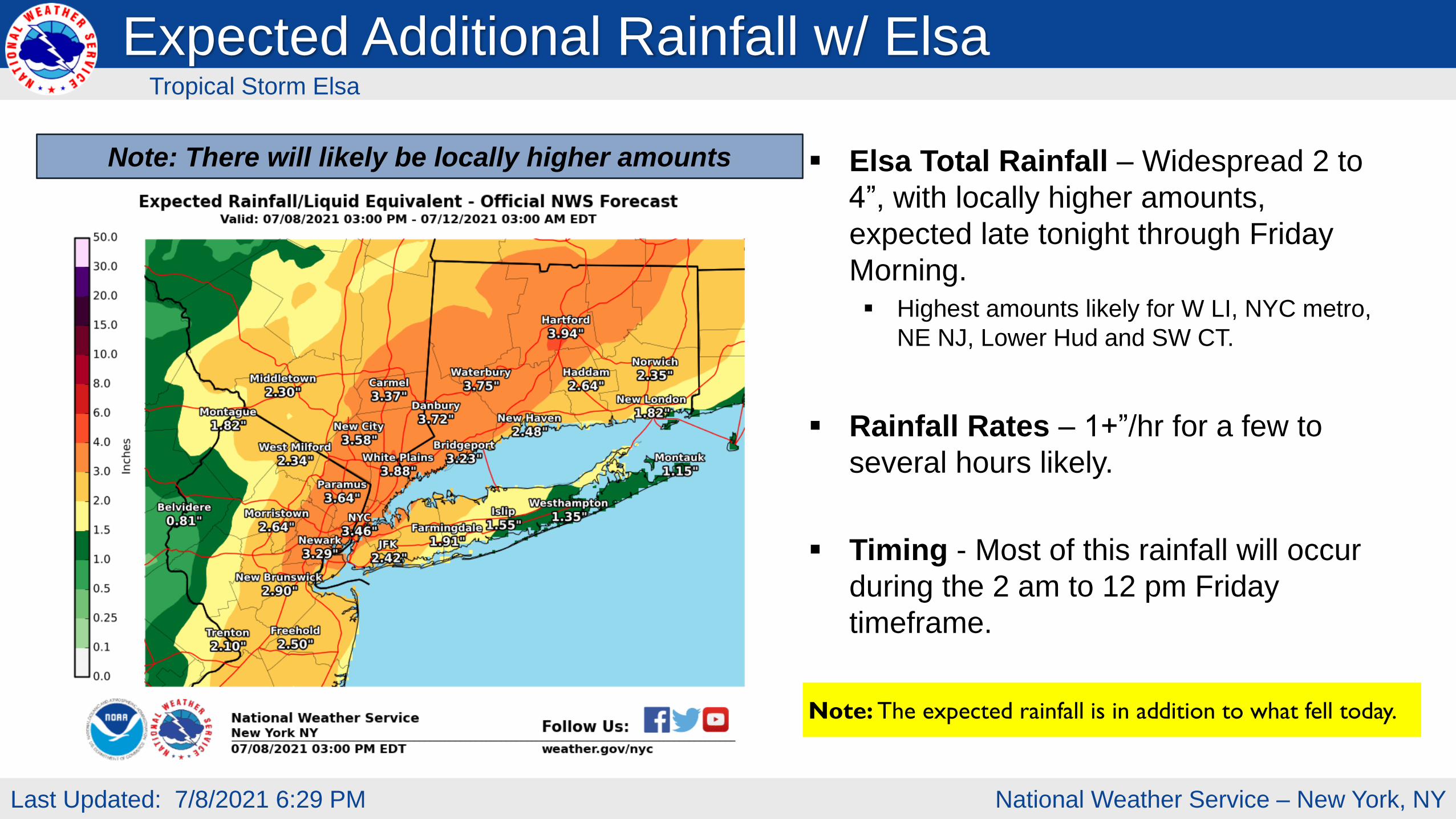
Elsa Total Rainfall – Widespread 2 to
4”, with locally higher amounts,
expected late tonight through Friday
Morning.
Highest amounts likely for W LI, NYC metro,
NE NJ, Lower Hud and SW CT.
Rainfall Rates – 1+”/hr for a few to
several hours likely.
Timing - Most of this rainfall will occur
during the 2 am to 12 pm Friday
timeframe.
Note: There will likely be locally higher amounts
Expected Additional Rainfall w/ ElsaTropical Storm Elsa
Note: The expected rainfall is in addition to what fell today.
National Weather Service – New York, NYLast Updated: 7/8/2021 6:29 PM
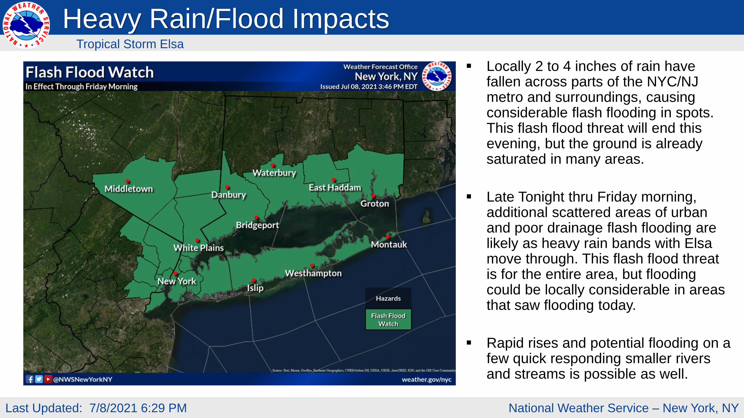
Locally 2 to 4 inches of rain have fallen across parts of the NYC/NJ metro and surroundings, causing considerable flash flooding in spots. This flash flood threat will end this evening, but the ground is already saturated in many areas.
Late Tonight thru Friday morning, additional scattered areas of urban and poor drainage flash flooding are likely as heavy rain bands with Elsa move through. This flash flood threat is for the entire area, but flooding could be locally considerable in areas that saw flooding today.
Rapid rises and potential flooding on a few quick responding smaller rivers and streams is possible as well.
Heavy Rain/Flood ImpactsTropical Storm Elsa
National Weather Service – New York, NYLast Updated: 7/8/2021 6:29 PM
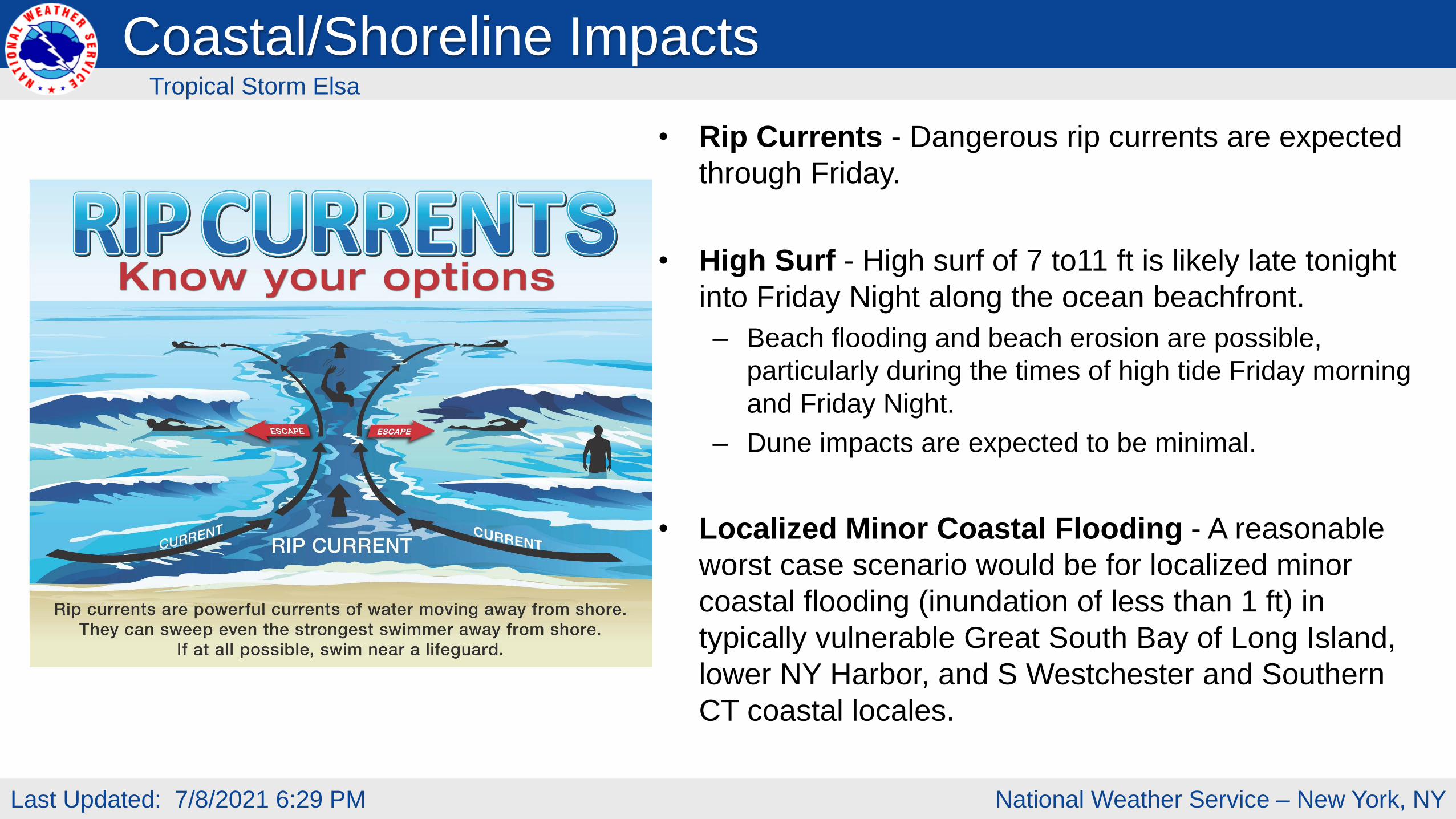
• Rip Currents - Dangerous rip currents are expected
through Friday.
• High Surf - High surf of 7 to11 ft is likely late tonight
into Friday Night along the ocean beachfront.
– Beach flooding and beach erosion are possible,
particularly during the times of high tide Friday morning
and Friday Night.
– Dune impacts are expected to be minimal.
• Localized Minor Coastal Flooding - A reasonable
worst case scenario would be for localized minor
coastal flooding (inundation of less than 1 ft) in
typically vulnerable Great South Bay of Long Island,
lower NY Harbor, and S Westchester and Southern
CT coastal locales.
Coastal/Shoreline ImpactsTropical Storm Elsa
National Weather Service – New York, NYLast Updated: 7/8/2021 6:29 PM
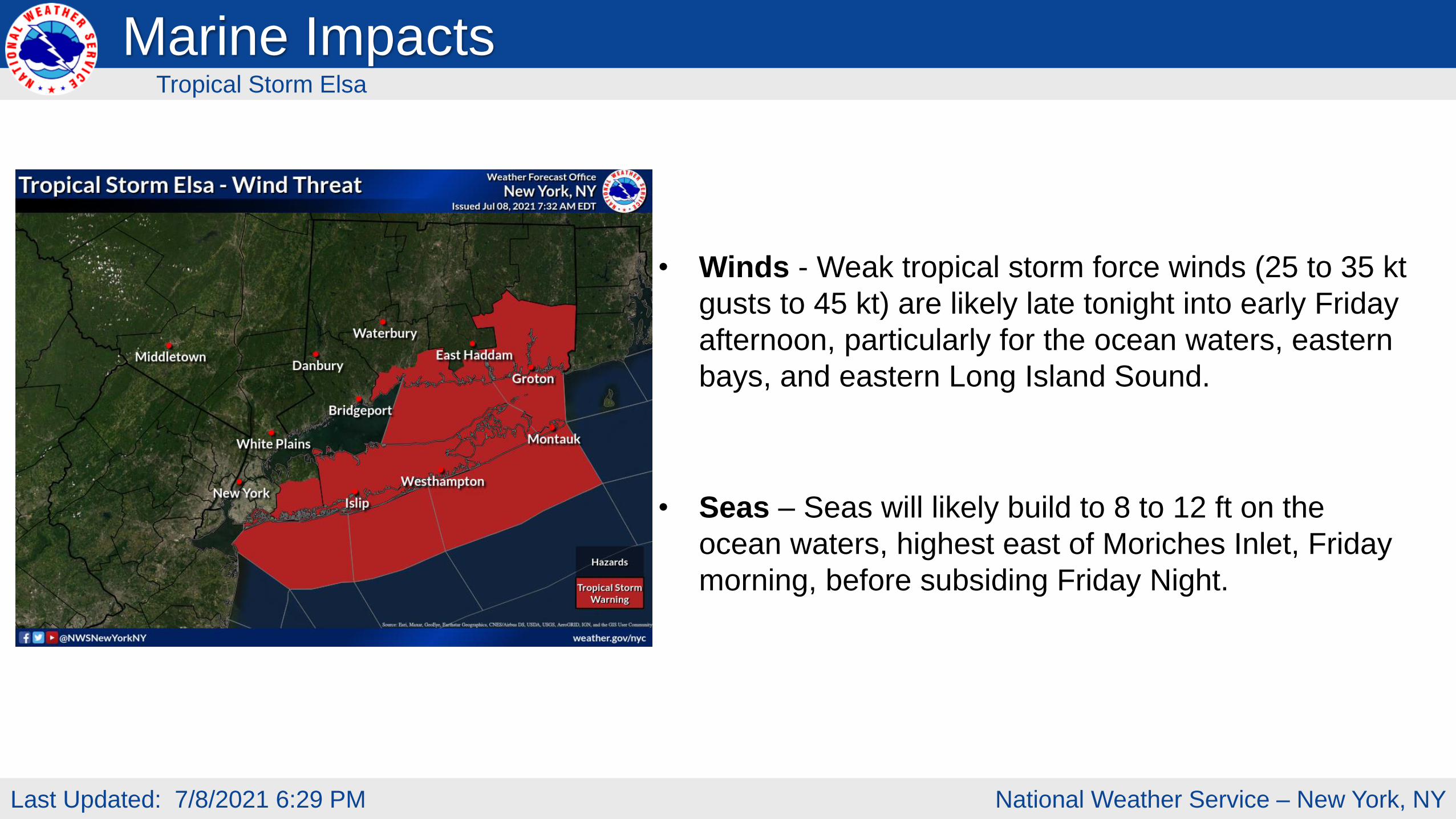
• Winds - Weak tropical storm force winds (25 to 35 kt
gusts to 45 kt) are likely late tonight into early Friday
afternoon, particularly for the ocean waters, eastern
bays, and eastern Long Island Sound.
• Seas – Seas will likely build to 8 to 12 ft on the
ocean waters, highest east of Moriches Inlet, Friday
morning, before subsiding Friday Night.
Marine ImpactsTropical Storm Elsa
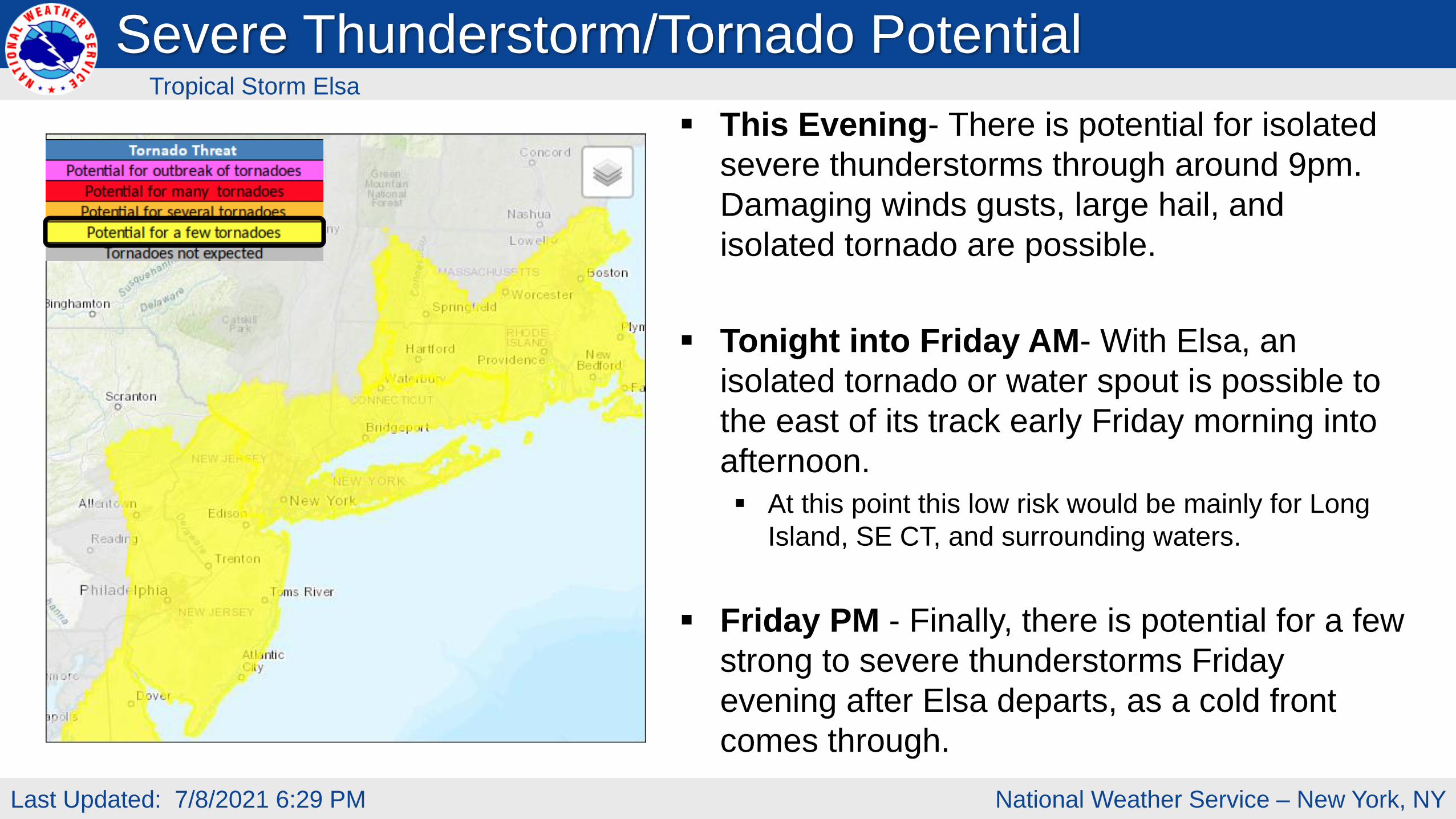
National Weather Service – New York, NYLast Updated: 7/8/2021 6:29 PM
This Evening- There is potential for isolated
severe thunderstorms through around 9pm.
Damaging winds gusts, large hail, and
isolated tornado are possible.
Tonight into Friday AM- With Elsa, an
isolated tornado or water spout is possible to
the east of its track early Friday morning into
afternoon.
At this point this low risk would be mainly for Long
Island, SE CT, and surrounding waters.
Friday PM - Finally, there is potential for a few
strong to severe thunderstorms Friday
evening after Elsa departs, as a cold front
comes through.
Severe Thunderstorm/Tornado PotentialTropical Storm Elsa
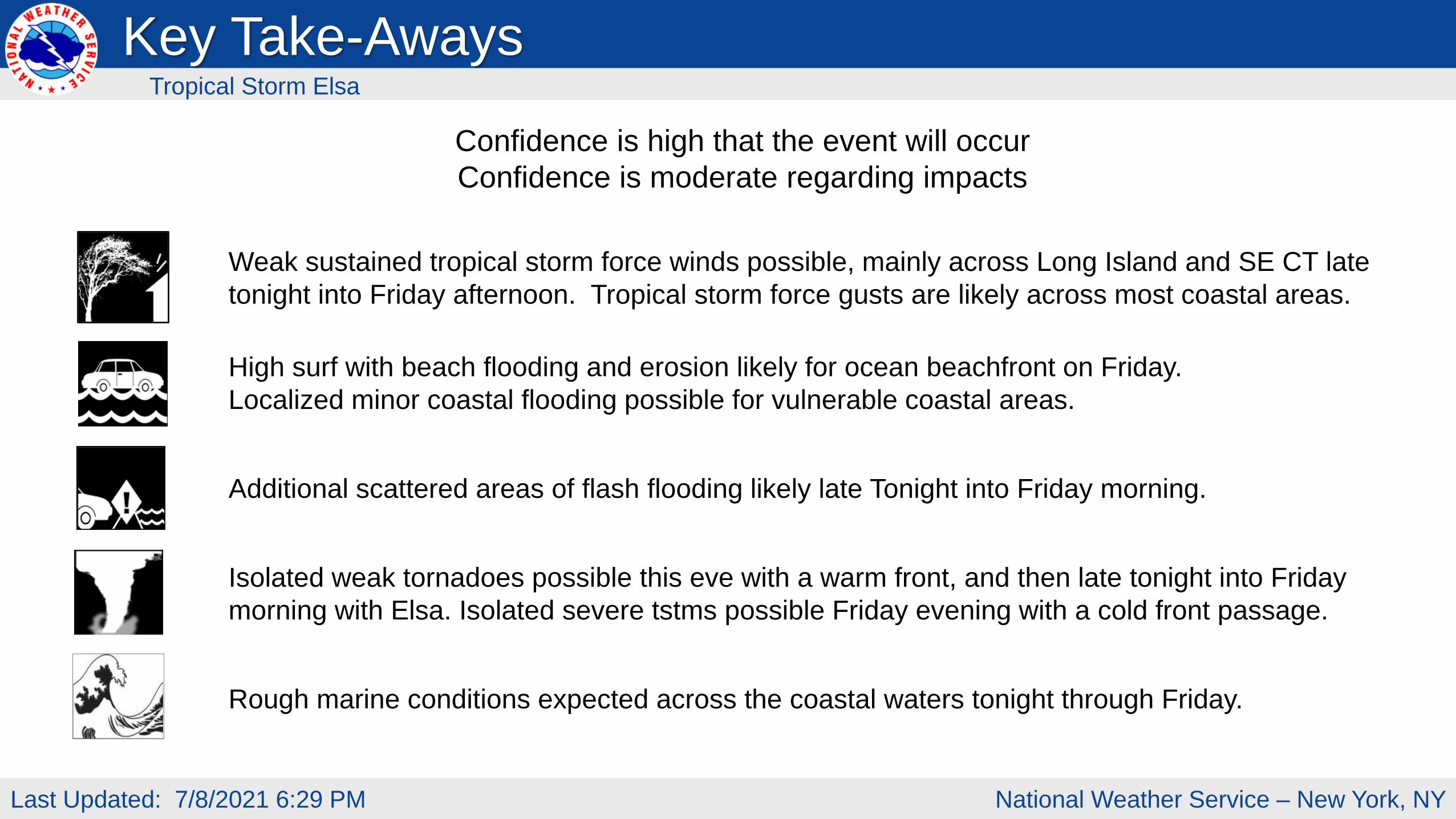
National Weather Service – New York, NYLast Updated: 7/8/2021 6:29 PM
Weak sustained tropical storm force winds possible, mainly across Long Island and SE CT late
tonight into Friday afternoon. Tropical storm force gusts are likely across most coastal areas.
High surf with beach flooding and erosion likely for ocean beachfront on Friday.
Localized minor coastal flooding possible for vulnerable coastal areas.
Additional scattered areas of flash flooding likely late Tonight into Friday morning.
Isolated weak tornadoes possible this eve with a warm front, and then late tonight into Friday
morning with Elsa. Isolated severe tstms possible Friday evening with a cold front passage.
Rough marine conditions expected across the coastal waters tonight through Friday.
Confidence is high that the event will occur
Confidence is moderate regarding impacts
Key Take-AwaysTropical Storm Elsa
Next Briefing:
This will be the last briefing for the event
For the latest graphics and information go to: www.hurricanes.gov or weather.gov/nyc/tropical
Web: http://weather.gov/nyc
Phone: (631) 924-0517
E-mail: [email protected]
Facebook: NWSNewYorkNY
Twitter: @NWSNewYorkNY
YouTube: NWSNewYorkNY
www