Embed Size (px)
Citation preview
IS, ' /
57l<)ot|
New Bedford Harbor
Superfund Site
Teacher VTorhshop
SDMS DocID 571904 Sponsored by:
US Environmental Protection Agency, Massachusetts Department of Public Health,
Massachusetts Department of Environmental Protection, The Lloyd Center for Environmental Studies, and Sea Lab
Table of Contents
I. Workshop Agenda
II. Curriculum Matrix
III. Student Activities A. Enviroscape B. Watershed in a Box C. Biomagnification Activity D. A Pot of Pollution E. One Fish, Two Fish, Red Fish, Blue Fish F. Who Dirtied the Water? G. Web of Life H. Flexi the Flounder I. The Water Cycle
IV. Background Information A. The Superfund Cleanup Program B. Polychlorinated Biphenyls (PCBs) C. Bioaccumulation/Biomagnification Effects D. Food Chains and Food Webs E. What is a Watershed? F. Ecosystems and Their Elements G. More Than Just a Swamp FL Groundwater I. Combined Sewer Overflows (CSOs) in New England J. What is Nonpoint Source (NPS) Pollution? K. What You Can Do to Prevent NPS Pollution
V. Additional Resources A. Resource Contacts B. Links of Interest
VI. Additional Activities A. Producers, Consumers, and Decomposers B. Wetlands Crossword C. Wetland Inhabitant Word Search D. Matching Game: How Much Water? E. Geographical Features F. Ocean Plant Facts G. A Whale is Hugel H. Ocean Chants
New Bedford Harbor Superfund Site Teacher Workshop July 26-27, 2005
Sponsors: US EPA, MA DPH, MA DEP, Lloyd Center for the Environment and New Bedford Sea Lab
Objective:
Incorporate Fish Smart and Environmental Messages into curriculum. Identify ways that teachers can
convey the following Fish Smart concepts to their students:
• New Bedford Harbor is contaminated with PCB's
• PCB's are chemicals that are dangerous to humans
• Seafood (fish, lobster, shellfish) in parts of New Bedford Harbor are contaminated with high
levels of PCB's and should not be eaten
• Avoid contact with contaminated sediments
• EPA is dredging PCB- contaminated sediment from New Bedford Harbor
• By raising awareness in the classroom and fostering stewardship for the harbor among children,
the health of residents and the Harbor can be protected continue to be improved and protected
into the future
Message:
Seafood in parts of New Bedford Harbor is contaminated—do not eat the fish.
Help us continue the work of protecting New Bedford Harbor.
Upon completion of this course, participants are expected to be able to explain
. • What are PCBs and where are they in the Harbor?
• Why are PCBs in the Harbor a long-term concern?
• Which populations are most at risk?
• What is the Fish Smart message?
• What is an estuary and why is it an important habitat?
• What is Superfund?
• How is the PCB-contaminated sediment being cleaned up?
• What you/students can do to protect and be a steward for this resource?
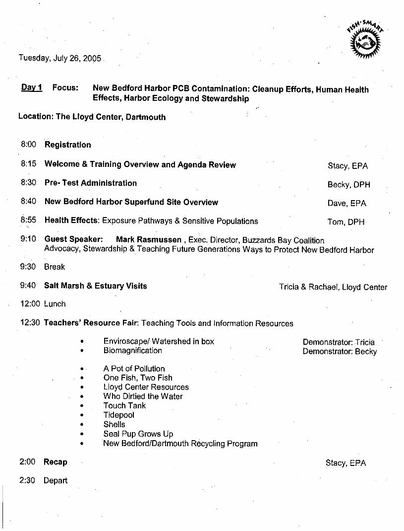
Tuesday, July 26, 2005
Day 1 Focus: New Bedford Harbor PCB Contamination: Cleanup Efforts, Human Health Effects, Harbor Ecology and Stewardship
Location: The Lloyd Center, Dartmouth
8:00 Registration
8:15 Welcome & Training Overview and Agenda Review Stacy, EPA
8:30 Pre-Test Administration Becky, DPH
8:40 New Bedford Harbor Superfund Site Overview Dave, EPA
8:55 Health Effects: Exposure Pathways & Sensitive Populations Tom, DPH
9:10 Guest Speaker: Mark Rasmussen , Exec. Director, Buzzards Bay Coalition Advocacy, Stewardship & Teaching Future Generations Ways to Protect New Bedford Harbor
9:30 Break
9:40 Salt Marsh & Estuary Visits Tricia & Rachael, Lloyd Center
12:00 Lunch
12:30 Teachers' Resource Fair: Teaching Tools and Information Resources
Lloyd Center Resources Who Dirtied the Water Touch Tank Tidepool Shells Seal Pup Grows Up New Bedford/Dartmouth Recycling Program
Enviroscape/ Watershed in box Biomagnification
Demonstrator: Tricia Demonstrator: Becky
A Pot of Pollution One Fish, Two Fish
2:00 Recap Stacy, EPA
2:30 Depart
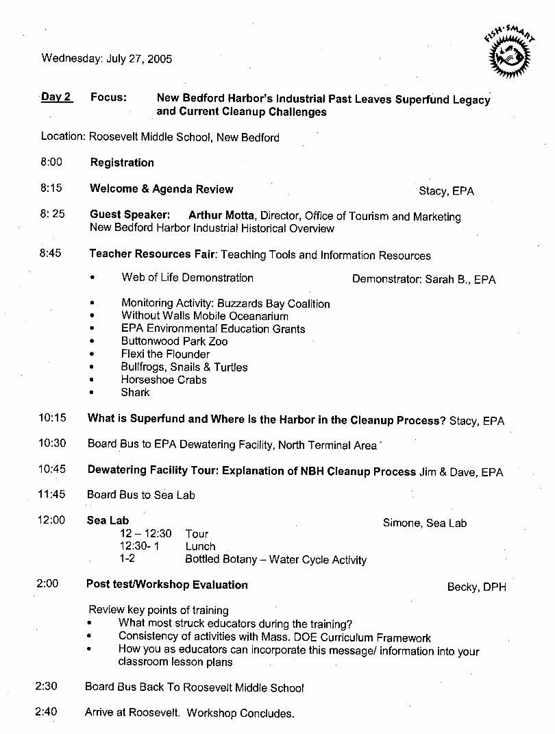
Wednesday: July 27, 2005 Co;
Day 2 Focus: New Bedford Harbor's Industrial Past Leaves Superfund Legacy and Current Cleanup Challenges
Location: Roosevelt Middle School, New Bedford
8:00 Registration
8:15 Welcome & Agenda Review Stacy, EPA
8: 25 Guest Speaker: Arthur Motta, Director, Office of Tourism and Marketing New Bedford Harbor Industrial Historical Overview
8:45 Teacher Resources Fair: Teaching Tools and Information Resources
• Web of Life Demonstration Demonstrator: Sarah B., EPA
Monitoring Activity: Buzzards Bay Coalition Without Walls Mobile Oceanarium EPA Environmental Education Grants Buttonwood Park Zoo Flexi the Flounder Bullfrogs, Snails & Turtles Horseshoe Crabs Shark
10:15 What is Superfund and Where is the Harbor in the Cleanup Process? Stacy, EPA
10:30 Board Bus to EPA Dewatering Facility, North Terminal Area'
10:45 Dewatering Facility Tour: Explanation of NBH Cleanup Process Jim & Dave, EPA
11:45 Board Bus to Sea Lab
12:00 Sea Lab Simone, Sea Lab 12-12:30 Tour 12:30-1 Lunch 1-2 Bottled Botany - Water Cycle Activity
2:00 Post test/Workshop Evaluation Becky, DPH
Review key points of training • What most struck educators during the training? • Consistency of activities with Mass. DOE Curriculum Framework • How you as educators can incorporate this message/ information into your
classroom lesson plans
2:30 Board Bus Back To Roosevelt Middle School
2:40 Arrive at Roosevelt. Workshop Concludes.

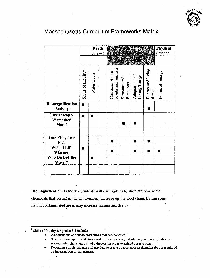
Massachusetts Curriculum Frameworks Matrix
& •a o
a 00
, / *l'ifc*>cieifc<v v-•* * Physical Science '4c. f$'-,i\ Science Earth <•£
<D >» u
<3 "3 £
o ^ CO O '
«
GO "C -g <u
it ,G « U OI
to 2 P p
il 00 (Xh
rr. r*\ CO ° OX) co c2 §i B 60 a, c •s-:s < a
& - *-H <u £
co 60 G
>> 60 »-( <L> G w o
o
Biomagnification Activity
Enviroscape/ Watershed
Model
One Fish, Two Fish
Web of Life (Marine)
Who Dirtied the Water?
Biomagnification Activity - Students will use marbles to simulate how some
chemicals that persist in the environment increase up the food chain. Eating some
fish in contaminated areas may increase human health risk.
1 Skills of Inquiry for grades 3-5 include: • Ask questions and make predictions that can be tested. • Select and use appropriate tools and technology (e.g., calculators, computers, balances,
scales, meter sticks, graduated cylinders) in order to extend observations). • Recognize simple patterns and use data to create a reasonable explanation for the results of
an investigation or experiment.
Watershed Model/ Enviroscape - Students will use a model (or create their own)
of a watershed, including farms, industries, and residential areas. Using a spray
bottle of water as rain and flavored powders (as pollutants) this model shows how
various activities pollute our watershed.
One Fish, Two Fish Activity - Students use gold fish crackers to simulate fishing
activity in a polluted and non-polluted area and to learn not to eat fish from certain
polluted areas.
Marine Web of Life Activity - Student hold labels representing various biotic
(animals, plants) and a-biotic (sun, water) factors in the environment and stand in a
circle. A ball of yarn is thrown from person to person and to form a web that
symbolizes how things in the environment are dependent on each other.
Who Dirtied the Water Activity - Students chant about a beautiful bay (gallon
jug) with clean water, fish and wildlife and asked if they want to live, swim and
fish there. As population grew and things (oil, powders) were dumped into the
river, they are again asked if they want to live, swim and fish there.

CO r-t C P-n> P r-r > O
n> C/)
Student Activities

The Lloyd Center's
Watershed W&SsDB
Welcome!
Enclosed is a packet of classroom activities to complement the Watershed
Watch program, which has been scheduled for your class. This information
will help prepare you and your students for our visit and reinforce concepts,
which will be covered during the program.
The Lloyd Center is a not-for-profit membership organization located in
Dartmouth, Massachusetts, which serves the region of southern New
England. The Lloyd Center’s mission is to help create the next generation of
environmental stewards through education and research; seeking to instill in
students of all ages an understanding and appreciation of our coastal
environment, its unique and fragile nature and our special relationship and
responsibility to it.
We are committed to providing quality, hands-on science programs for
students in kindergarten through college. The focus of our efforts is in the
interdisciplinary study of coastal environments and watersheds. All of our
programs are linked to the current Massachusetts Curriculum Frameworks in
Science and Technology/Engineering.
Watershed Watch Program Overview
The Watershed Watch program is a two-part, hands-on classroom
experience designed for elementary school students. Using both the
Enviroscape, a model that demonstrates how a watershed works and a
Ground Water Flow Model, that shows how water moves underground and
filters through soil; students will discover how water travels through a
watershed. Working alongside the Lloyd Center’s professional staff,
students will observe how pollutants can enter communities’ drinking water
through run-off and how these toxins flow underground to contaminate
groundwater.
Classes are divided into two groups to enhance the hands-on science
activities conducted throughout the program. Each group will be led by a
staff member who will explain the models and the key concepts. In these
groups, students will manipulate the models watching each concept in
action. Groups will then discuss how contaminated water sources directly
affect the quality of our lives and identify strategies to combat local
pollution problems.
Connections to the Massachusetts Science and Technology/Engineering Curriculum Framework
May 2001
Guiding Principal V: Investigation, experimentation, and problem solving are central to science and technology/engineering education. Investigations introduce students to the nature of original research, increase students’ understanding of scientific and technological concepts, promote skill development, and provide entry points for all learners. Guiding Principal VI: Students learn best in an environment that conveys high academic expectations for all students. School districts should also invite role models from business and the community (including professional engineers and scientists to visit classes, work with students, and contribute to instruction. Guiding Principal X: Implementation of an effective science and technology/engineering program requires collaboration with experts, appropriate materials, support from parents and community, ongoing professional development and quantitative and qualitative assessment. In addition, local members of the science and engineering community may be able to lend their own expertise to assist with the implementation of a new curriculum. Teachers and administrators should invite scientists, engineers, higher education faculty, and representatives of local businesses and museum personnel to help evaluate the planned curriculum and enrich it with community connections.
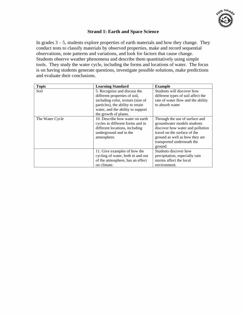
Strand 1: Earth and Space Science
In grades 3 – 5, students explore properties of earth materials and how they change. They conduct tests to classify materials by observed properties, make and record sequential observations, note patterns and variations, and look for factors that cause change. Students observe weather phenomena and describe them quantitatively using simple tools. They study the water cycle, including the forms and locations of water. The focus is on having students generate questions, investigate possible solutions, make predictions and evaluate their conclusions. Topic Learning Standard Example Soil 5. Recognize and discuss the
different properties of soil, including color, texture (size of particles), the ability to retain water, and the ability to support the growth of plants.
Students will discover how different types of soil affect the rate of water flow and the ability to absorb water
The Water Cycle 10. Describe how water on earth cycles in different forms and in different locations, including underground and in the atmosphere.
Through the use of surface and groundwater models students discover how water and pollution travel on the surface of the ground as well as how they are transported underneath the ground.
11. Give examples of how the cycling of water, both in and out of the atmosphere, has an effect on climate.
Students discover how precipitation, especially rain storms affect the local environment.
Strand 2: Life Science (Biology)
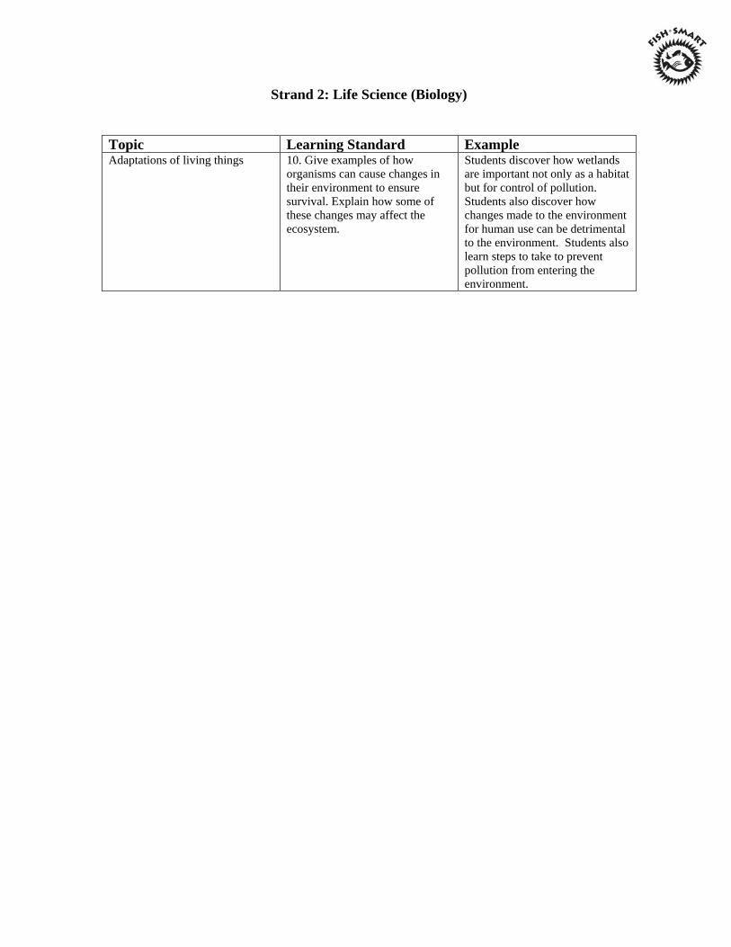
Topic Learning Standard Example Adaptations of living things 10. Give examples of how
organisms can cause changes in their environment to ensure survival. Explain how some of these changes may affect the ecosystem.
Students discover how wetlands are important not only as a habitat but for control of pollution. Students also discover how changes made to the environment for human use can be detrimental to the environment. Students also learn steps to take to prevent pollution from entering the environment.
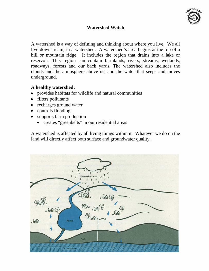
Watershed Watch A watershed is a way of defining and thinking about where you live. We all live downstream, in a watershed. A watershed’s area begins at the top of a hill or mountain ridge. It includes the region that drains into a lake or reservoir. This region can contain farmlands, rivers, streams, wetlands, roadways, forests and our back yards. The watershed also includes the clouds and the atmosphere above us, and the water that seeps and moves underground. A healthy watershed: • provides habitats for wildlife and natural communities • filters pollutants • recharges ground water • controls flooding • supports farm production
• creates “greenbelts” in our residential areas A watershed is affected by all living things within it. Whatever we do on the land will directly affect both surface and groundwater quality.
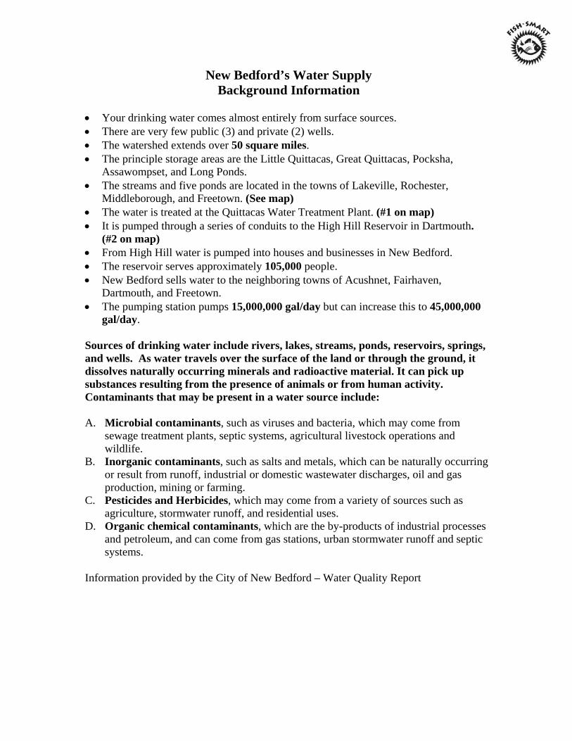
New Bedford’s Water Supply Background Information
• Your drinking water comes almost entirely from surface sources. • There are very few public (3) and private (2) wells. • The watershed extends over 50 square miles. • The principle storage areas are the Little Quittacas, Great Quittacas, Pocksha,
Assawompset, and Long Ponds. • The streams and five ponds are located in the towns of Lakeville, Rochester,
Middleborough, and Freetown. (See map) • The water is treated at the Quittacas Water Treatment Plant. (#1 on map) • It is pumped through a series of conduits to the High Hill Reservoir in Dartmouth. (#2 on map) • From High Hill water is pumped into houses and businesses in New Bedford. • The reservoir serves approximately 105,000 people. • New Bedford sells water to the neighboring towns of Acushnet, Fairhaven,
Dartmouth, and Freetown. • The pumping station pumps 15,000,000 gal/day but can increase this to 45,000,000
gal/day. Sources of drinking water include rivers, lakes, streams, ponds, reservoirs, springs, and wells. As water travels over the surface of the land or through the ground, it dissolves naturally occurring minerals and radioactive material. It can pick up substances resulting from the presence of animals or from human activity. Contaminants that may be present in a water source include: A. Microbial contaminants, such as viruses and bacteria, which may come from
sewage treatment plants, septic systems, agricultural livestock operations and wildlife.
B. Inorganic contaminants, such as salts and metals, which can be naturally occurring or result from runoff, industrial or domestic wastewater discharges, oil and gas production, mining or farming.
C. Pesticides and Herbicides, which may come from a variety of sources such as agriculture, stormwater runoff, and residential uses.
D. Organic chemical contaminants, which are the by-products of industrial processes and petroleum, and can come from gas stations, urban stormwater runoff and septic systems.
Information provided by the City of New Bedford – Water Quality Report
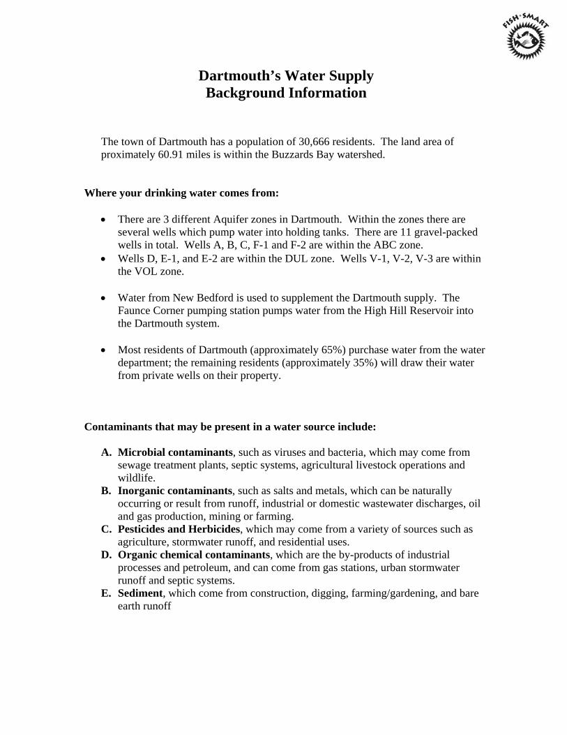
Dartmouth’s Water Supply Background Information
The town of Dartmouth has a population of 30,666 residents. The land area of proximately 60.91 miles is within the Buzzards Bay watershed.
Where your drinking water comes from:
• There are 3 different Aquifer zones in Dartmouth. Within the zones there are several wells which pump water into holding tanks. There are 11 gravel-packed wells in total. Wells A, B, C, F-1 and F-2 are within the ABC zone.
• Wells D, E-1, and E-2 are within the DUL zone. Wells V-1, V-2, V-3 are within the VOL zone.
• Water from New Bedford is used to supplement the Dartmouth supply. The
Faunce Corner pumping station pumps water from the High Hill Reservoir into the Dartmouth system.
• Most residents of Dartmouth (approximately 65%) purchase water from the water
department; the remaining residents (approximately 35%) will draw their water from private wells on their property.
Contaminants that may be present in a water source include:
A. Microbial contaminants, such as viruses and bacteria, which may come from sewage treatment plants, septic systems, agricultural livestock operations and wildlife.
B. Inorganic contaminants, such as salts and metals, which can be naturally occurring or result from runoff, industrial or domestic wastewater discharges, oil and gas production, mining or farming.
C. Pesticides and Herbicides, which may come from a variety of sources such as agriculture, stormwater runoff, and residential uses.
D. Organic chemical contaminants, which are the by-products of industrial processes and petroleum, and can come from gas stations, urban stormwater runoff and septic systems.
E. Sediment, which come from construction, digging, farming/gardening, and bare earth runoff
Pre-activities Descriptions
Were You Aware? Water Precious Water, 1988. AIMS Education Foundation.
This activity has students predicting the percentages of salt and fresh water found on the
earth and comparing their predictions to the actual percentages. Students will practice
estimating and graphing skills as well as recoding data. In addition, students gain an
understanding of the limited fresh water resources available for human use.
Included in this activity are data sheets, useful background information, discussion
questions and activity extensions.
Soil Soakers. Water Precious Water, 1988. AIMS Education Foundation.
Students will discover the rate at which water will soak into different soil types. This
activity incorporates graphing, measuring and computation skills as well as
hypothesizing, data collection/interpretation and drawing conclusions. Soil Soakers will
prepare students for the Groundwater Flow Model, which demonstrates how water moves
below the surface.
Included in this activity are data sheets, useful background information, discussion
questions and activity extensions.
Post-activity Description
Something’s Fishy Here! Aquatic Project Wild, 1987. Western Regional
Environmental Education Council.
After completion of the Watershed Watch program, students can draw on the lessons
presented to them to complete this activity. This activity allows students to identify the
cause and effect of water pollution in a given scenario. They will have the opportunity to
examine their own opinions and try to cooperatively solve a pollution problem.
Included in this activity are background information, activity extensions and evaluations.

A
V
W*th firV»(mk<cc>*
Watershed in a Box
DESCRIPTION I
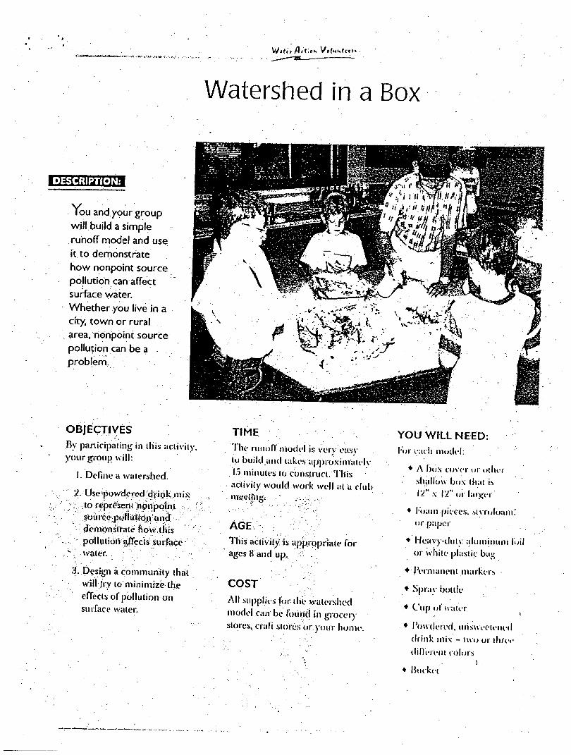
Vou and your group will build a simple runoff model and use it. to demonstrate how nonpoint source pollution can affect surface water. Whether you live in a city, town or rural
. area, nonpoint source pollution can be a . problem,
OBJECTIVES
By participating in this activity,
your group will:
I. Define a watershed.
'2.:Use powdered dpi.ik mix
; . to represent nonpoint
?ou rce polieticin and
demonstrate how tliis
pollulioiv Jtflecis Surface • water.
3. Design a community that
will try to minimize the
effects of pollution 011
surface water.
TIME
The runofl'niodel is ver\ easv
to build and takes approxinratelv
13 minutes to construct. This
activity would work well at a club nieeli'iig.
AGE
1 his activity is appropriate for
ages 8 and up,
COST
All supplies lor-tile watershed
model can be found in grocer)
stores, era It stores or. your home.
YOU WILL NEED: for eaeli model:
• A box cover or otlu-r
shallow box that is
V2' x IV (j|- larger
• l oam pieces; sivrolbain.'
or-paper
• Heavy-duty aluminum f
or while plastic bag
• Permanent markers
• Spray bottle
• Cup of water
• Powdered, unsweetened
drink mix - two or three
-different colors
• Bucket
Water #£<<»•> W(khtee><
BACKGROUND
No matter where you live, the
water quality in rivers and
streams is determined by what
happens oh the land around .
them. The land around a stream
or river is called a watershed.
One watershed is separated from
another watershed by a low rise,
the crest of a hill or a mountain
chain. Rain or snow that falls on opposite sides Of the higher land causes water to flow into different
watersheds.
Not all watersheds are the same. Some watersheds are hilly, while other watersheds-are flat plains. In all cases, precipitation that falls on the watershed flows over land to reach the lowest point - a lake,
river or stream.
As water flows over lafid, it picks up soil, chemicals and other
pollutants and carries them to
lakes, rivers or streams. This water
transportation system is called
runoff.
In rural or agricultural areas, runoff water carries a wide variety of materials, including pesticides, soil and animal wastes, direcdy into waterways.
In urban areas, hard surfaces such as driveways, sidewalks, rooftops and roadways prevent water from
soaking into the ground. As a
result, the runoff water, which can
be contaminated with road salt,
heavy metals, or automobile fluids,
flushes quickly into storm drains
that dump directly into streams
and rivers.
Pollutants that do not have a single source are called nonpoint
source pollution. This pollution
originates from many different
places.
Everyone lives in a watershed. We may not realize that what happens somewhere in the watershed will
eventually have an impact on the
lowest point in the watershed - a .
lake, a river. or a stream.
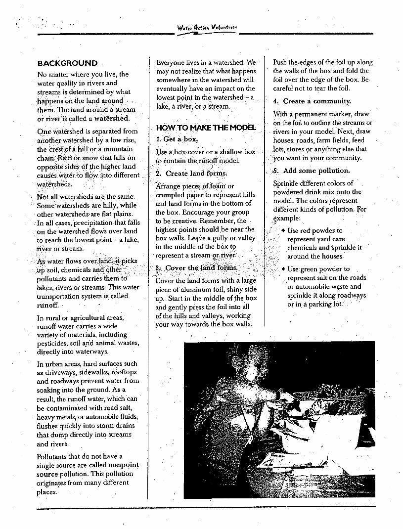
HOW TO MAKE THE MODEL 1. Get a box.
Use a box cover or a shallow box
to contain the ruiioff model.
2. Create land forms.
Arrange pieces of foam or crumpled paper to represent hills and land forms in the bottom of the box. Encourage your group to be creative. Remember, the highest points should be near the box walls. Leave a gully or valley in the middle of the box tp represent a stream or river. ,
3. Cover the land forms.
Cover the land forms with a large
piece of aluminum foil, shiny side
up. Start in the middle of the box
and gendy press the foil into all of the hills and valleys, working your way towards the box walls.
Push the edges of the foil up along the walls of the box and fold the foil over the edge of the box. Be
careful not to tear the foil.
4. Create a community.
With a permanent marker, draw on the foil to oudine the streams or rivers in your model. Next, draw
houses, roads, farm fields, feed
lots, stores or anything else that
you want in your community.
.5. Add some pollution.
Sprinkle different colors of powdered drink mix onto the model. The colors represent different kinds of pollution. For example:
• Use red powder to represent yard care chemicals and sprinkle it around the houses.
• Use green powder to
represent salt on the roads
or automobile waste and
sprinkle it along roadways
or in a parking lot.
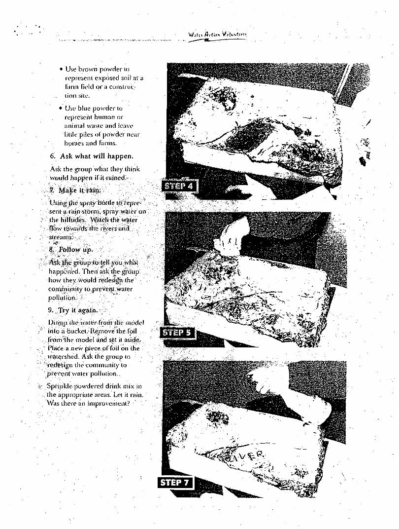
Wjto /bflJH
• Use brown powder lo
represent exposed soil at a
farm Held or a construc
tion sile.
• Use blue powder to represent human or animal waste and leave little piles of powder near
homes and farms.
6. Ask what will happen.
Ask the group what they think would happen il il tained.
7. Maice it T&in.
Using the spray bottle icf fepre-sent a rain storm, spray water on the hillsides. Watch the Water flow towards the rivers and streams: -
8. Follow up.
. Ask the group'to tell you what
happened. Then ask the group •how they would fedesifh the • community to prevent water
pollution. •
9. Try it again. >:
Dunip the water from the model into a bucket. Remove the foil
, from the model and set it aside. Place a new piece of foil on the • watershed. Ask the group to redesign the community to prevent water pollution..
Sprinkle powdered drink mix in the appropriate areas. Let it rain. Was there an improvement?
W*<« $£<<»* V» (KhtteX
RESOURCES
Environmental Resource Guide:
Nonpoint Source Pollution
Prevention Air and Waste Management Association c/ojane Wagner P.O. Box 1020 Sewickley, PA 15143
1-800-275-5851 or: Roger Dodds, Chairman of
Wisconsin Chapter, AWMA
Wingra Engineering, Box 1928 Milwaukee, WI 53201 608-255-5030 fr www.awma.org
It All Adds Up Video Series This video series is available
, from the DNR's Madison-office,
phone 608-264-6127 or
608-266-0140.
The five video titles include:
It All Adds Up (overview, 22 min.)
Conservation in the '90s: Meeting the Watb Quality Challenge (19 min.)
From Barnyard to Stream: Managing. Manure for Water Quality (17 min.) ...
Streamside Protection: Finishing the Job for Water Quality (14 min.)
From Curb to Stream: Cleaning Up Our Urban Waters (19 min.)
Pointless Pollution: America's
Water Crisis
Bullfrog Films, Inc.
Oley, PA 19547
1-800-543-FROG
www.bullfrogfilms.com
This 28-minute award-winning
program focuses on how
nonpoint pollution has affected
the lives of people in four
regions of the country.
Appropriate for grades 7-12.
Water Action Volunteers is a
cooperative program between the
University of Wisconsin-Extension
and the Wisconsin Department of ,
Natural Resources. For more
information, contact the Water Action
Volunteers Coordinator at
608-264-8948.
WAV materials revised
Winter, © 1998.

td J—'•
BIOMAGNIFICATION ACTIVITY
OVERVIEW:
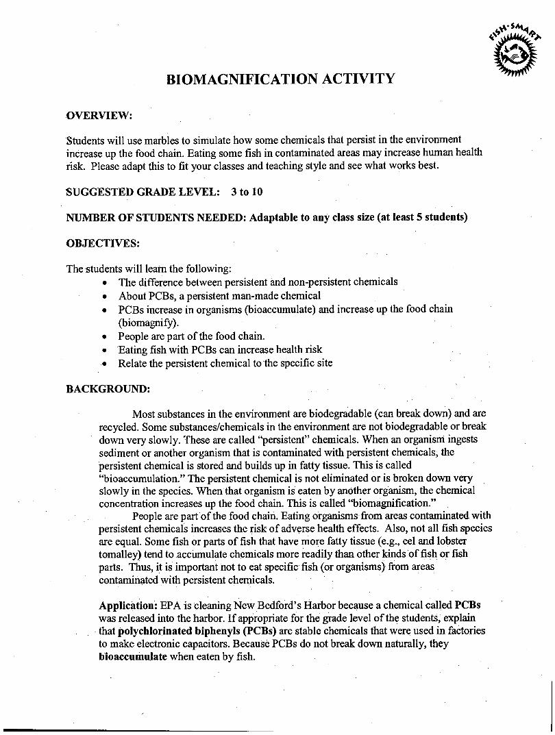
Students will use marbles to simulate how some chemicals that persist in the environment increase up the food chain. Eating some fish in contaminated areas may increase human health risk. Please adapt this to fit your classes and teaching style and see what works best.
SUGGESTED GRADE LEVEL: 3 to 10
NUMBER OF STUDENTS NEEDED: Adaptable to any class size (at least 5 students)
OBJECTIVES:
The students will leatn the following: • The difference between persistent and non-persistent chemicals • About PCBs, a persistent man-made chemical • PCBs increase in organisms (bioaccumulate) and increase up the food chain
(biomagnify). • People are part of the food chain. • Eating fish with PCBs can increase health risk • Relate the persistent chemical to the specific site
BACKGROUND:
Most substances in the environment are biodegradable (can break down) and are recycled. Some substances/chemicals in the environment are not biodegradable or break down very slowly. These are called "persistent" chemicals. When an organism ingests sediment or another organism that is contaminated with persistent chemicals, the persistent chemical is stored and builds up in fatty tissue. This is called "bioaccumulation." The persistent chemical is not eliminated or is broken down very slowly in the species. When that organism is eaten by another organism, the chemical concentration increases up the food chain. This is called "biomagnification."
People are part of the food chain. Eating organisms from areas contaminated with persistent chemicals increases the risk of adverse health effects. Also, not all fish species are equal. Some fish or parts of fish that have more fatty tissue (e.g., eel and lobster tomalley) tend to accumulate chemicals more readily than other kinds of fish or fish parts. Thus, it is important not to eat specific fish (or organisms) from areas contaminated with persistent chemicals.
Application: EPA is cleaning New Bedford's Harbor because a chemical called PCBs was released into the harbor. If appropriate for the grade level of the students, explain that polychlorinated biphenyls (PCBs) are stable chemicals that were used in factories to make electronic capacitors. Because PCBs do not break down naturally, they bioaccumulate when eaten by fish.
MATERIALS:
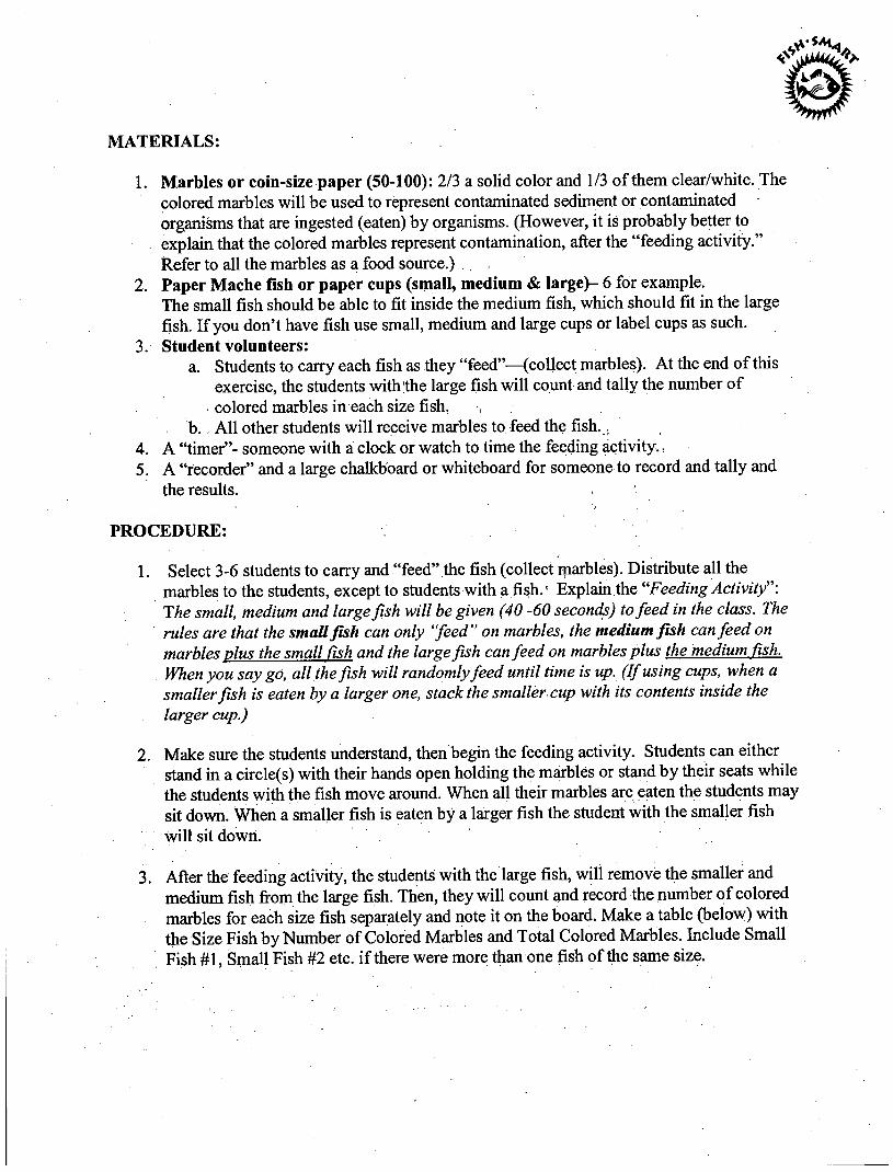
1. Marbles or coin-size paper (50-100): 2/3 a solid color and 1/3 of them clear/white. The colored marbles will be used to represent contaminated sediment or contaminated organisms that are ingested (eaten) by organisms. (However, it is probably better to explain that the colored marbles represent contamination, after the "feeding activity." Refer to all the marbles as a food source.) .
2. Paper Mache fish or paper cups (small, medium & large)- 6 for example. The small fish should be able to fit inside the medium fish, which should fit in the large fish. If you don't have fish use small, medium and large cups or label cups as such.
3. Student volunteers: a. Students to carry each fish as they "feed"—(collect marbles). At the end of this
exercise, the students with the large fish will count and tally the number of colored marbles in each size fish, •,
b. . All other students will receive marbles to feed the fish.. 4. A "timer"- someone with a clock or watch to time the feeding activity., 5. A "recorder" and a large chalkboard or whiteboard for someone to record and tally and
the results.
PROCEDURE:
1. Select 3-6 students to carry and "feed" the fish (collect marbles). Distribute all the marbles to the students, except to students with a fish.1 Explain the "Feeding Activity The small, medium and large fish will be given (40 -60 seconds) to feed in the class. The rules are that the small fish can only "feed" on marbles, the medium fish can feed on marbles plus the small fish and the large fish can feed on marbles plus the medium fish. When you say go, all the fish will randomly feed until time is up. (If using cups, when a smaller fish is eaten by a larger one, stack the smaller cup with its contents inside the larger cup.)
2. Make sure the students understand, then begin the feeding activity. Students can either stand in a circle(s) with their hands open holding the marbles or stand by their seats while file students with the fish move around. When all their marbles are eaten the students may sit down. When a smaller fish is eaten by a larger fish the student with the smaller fish will sit down.
3. After the feeding activity, the students with the large fish, will remove the smaller and medium fish from the large fish. Then, they will count and record the number of colored marbles for each size fish separately and note it on the board. Make a table (below) with the Size Fish by Number of Colored Marbles and Total Colored Marbles. Include Small Fish #1, Small Fish #2 etc. if there were more than one fish of the same size.
Size Fish #Colored Marbles Total Small #1 colored marbles in small fish-^ Medium #1 [M+S]= Large #1 [L + M]= Small #2 colored marbles small fish->
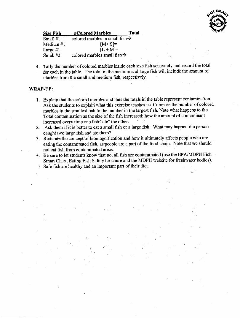
4. Tally the number of colored marbles inside each size fish separately and record the total for each in the table. The total in the medium and large fish will include the amount of marbles from the small and medium fish, respectively.
WRAP-UP:
1. Explain that the colored marbles and thus the totals in the table represent contamination. Ask the students to explain what this exercise teaches us. Compare the number of colored marbles in the smallest fish to the number in the largest fish. Note what happens to the Total contamination as the size of the fish increased; how the amount of contaminant increased every time one fish "ate" the other.
2. Ask them if it is better to eat a small fish or a large fish. What may happen if a person caught two large fish and ate them?
3. Reiterate the concept of biomagnification and how it ultimately affects people who are eating the contaminated fish, as people are a part of the food chain. Note that we should not eat fish from contaminated areas.
4. Be sure to let students know that not all fish are contaminated (use the EPA/MDPH Fish Smart Chart, Eating Fish Safely brochure and the MDPH website for freshwater bodies). Safe fish are healthy and an important part of their diet.
Connections to the Massachusetts Curriculum Frameworks in Science and Technology/Engineering (May 2001)
Grades 3-5
Strand Learning Standard Life Science 11. Describe how energy derived from the sun
is used by plants to produce sugars (photosynthesis) and is transferred within a food chain from producers (plants) to consumers to decomposers,

A POT OF POLLUTION
ALLOTTED TIME: Variable SUGGESTED GRADE LEVEL: 3 - 5 NUMBER OF STUDENTS NEEDED: Any OBJECTIVES:
Students will grow plants to study the effects of various pollutants. This project takes time, as plants should be close to maturity when used. The students choose a type and plant their seeds.
MATERIALS:
1. Seeds – lettuce, radishes, marigolds 2. Water 3. White vinegar 4. Vegetable oil (simulates oil spill) 5. Coarse salt (simulates road salt) 6. Soil; long planting containers or small window boxes 7. Camera (optional)
PROCEDURE:
1. Plant 4 rows of seeds in individual containers, each row containing the three types
of seeds. Label each seed type. Students can grid the arrangement for data collection. Rows should stay separated, but plant types should be able to be identified. Use Xeroxed seed packet pictures on straws to identify rows.
2. When seedlings have grown close to maturity, have students hypothesize and
record what effect each of the following mixtures will have on the plants:
a. Plain water in Row 1 b. ½ water and ½ vinegar in Row 2 (simulates acid rain) c. Oil spill in Row 3 d. ½ water and ½ salt in Row 4
3. Water each row regularly using the designated mixture. Students should record
daily any effects observed. Be sure to check leaves, stems, and roots. Check results of the tests with previous hypotheses. Photographs taken at distinctive stages can be used for later study.
4. Dispose of pollutants properly. Investigate the disposal procedure in your
community, or call the local environmental agency.

SOURCES:
1. Adapted from Lynn Leighton in CONNECT, Teacher’s Laboratory, October 1989.
2. Museum Institute for Teaching Science (MITS)

fo O n 3 PJ n> 31 31 cn p>. 3.^ W ST n o
ONE FISH, TWO FISH, RED FISH, BLUE FISH
FISHING ACTIVITY: ALLOTTED TIME: 2 hour- 45 minutes SUGGESTED GRADE LEVEL: 3 and up NUMBER OF STUDENTS NEEDED: up to 20 OBJECTIVES:
1. To facilitate discussion and understanding among children about PCB contamination in fish in the New Bedford Harbor.
2. To teach students that fish (lobster, shellfish) taken from NBH are not safe to eat because the harbor is contaminated, but fish outside the harbor (ie commercially caught fish) are safe to eat. You can not tell if fish are contaminated just by looking at them. It=s where they=re caught!
ADDITIONAL CONCEPTS:
1. Fish (inc. Lobster, shellfish) in New Bedford Harbor are contaminated with PCBs. 2. How fish became contaminated (New Bedford industrial history). 3. Do not eat fish in New Bedford Harbor. 4. PCBs in fish can make you sick over time if you eat them (bio-accumulation). 5. Fish caught outside of the harbor (Buzzards Bay) are okay to eat. 6. Know where a fish is caught before you eat it.
MATERIALS:
1. Two plastic bins or lasagna pans: One bin represents Buzzards Bay, one represents New Bedford Harbor
2. Plastic spoons (Rods) 3. Plastic cups (Nets) 4. Red, green, blue multi-colored goldfish crackers 5. Large box of white rice 6. 2 pails (plastic containers are fine)
PROCEDURE:
1. Label bins and pails ANew Bedford Harbor@ and ABuzzards Bay@. 2. Fills bins with white rice. 3. Add multi-color goldfish to New Bedford bin and mix fish with rice. 4. Add multi colored gold fish to Buzzards Bay bin and mix fish with rice. 5. Before the activity begins, give kids an overview of PCBs, the PCB problem, and PCB contaminated
fish in the harbor. Explain how the fish got contaminated, along with potential health problems that could occur if one eats contaminated fish. It should also be explained that commercial fish caught outside of the harbor (Buzzards Bay) are not contaminated and are okay to eat.
6. Give kids their Afishing gear@ (rods [spoons], cups [nets] and pails). Instruct children to put any fish they “catch” into a pail.
7. Give kids 3-5 minutes to fish. Ask them to put the rods and nets down after a few minutes. 8. Pour out Acatch@ into separate piles.
9. Have kids examine their catch and ask them about the fish they caught (below).
POTENTIAL DISCUSSION QUESTIONS: $ Where did you catch the fish? $ Can you tell difference between contaminated and non contaminated fish by looking at it? $ Are the fish okay to eat? Why? $ What happens if someone eats a lot of contaminated fish over time? $ What does Abio accumulation@ mean? $ What should one do when one catches a contaminated fish? $ Is it still okay to fish in New Bedford Harbor? $ Is it okay to catch and eat fish from Buzzards Bay? OPTIONAL INCENTIVE: Kids who answer thoughtfully get a prize (gold) goldfish
One Fish, Two Fish, Red Fish, Blue Fish
Connections to the Massachusetts Science and Technology/Engineering Curriculum Framework
May 2001
Guiding Principal V: Investigation, experimentation, and problem solving are central to science and technology/engineering education. Investigations introduce students to the nature of original research, increase students’ understanding of scientific and technological concepts, promote skill development, and provide entry points for all learners. Guiding Principal VI: Students learn best in an environment that conveys high academic expectations for all students. School districts should also invite role models from business and the community (including professional engineers and scientists to visit classes, work with students, and contribute to instruction. Guiding Principal X: Implementation of an effective science and technology/engineering program requires collaboration with experts, appropriate materials, support from parents and community, ongoing professional development and quantitative and qualitative assessment. In addition, local members of the science and engineering community may be able to lend their own expertise to assist with the implementation of a new curriculum. Teachers and administrators should invite scientists, engineers, higher education faculty, and representatives of local businesses and museum personnel to help evaluate the planned curriculum and enrich it with community connections.
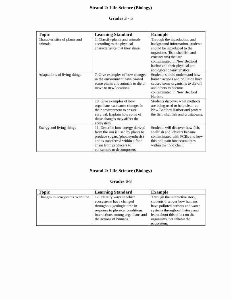
Strand 2: Life Science (Biology)
Grades 3 - 5
Topic Learning Standard Example Characteristics of plants and animals
1. Classify plants and animals according to the physical characteristics that they share.
Through the introduction and background information, students should be introduced to the organisms (fish, shellfish and crustaceans) that are contaminated in New Bedford harbor and their physical and ecological characteristics.
Adaptations of living things 7. Give examples of how changes in the environment have caused some plants and animals to die or move to new locations.
Students should understand how human actions and pollution have caused some organisms to die off and others to become contaminated in New Bedford Harbor.
10. Give examples of how organisms can cause changes in their environment to ensure survival. Explain how some of these changes may affect the ecosystem.
Students discover what methods are being used to help clean-up New Bedford Harbor and protect the fish, shellfish and crustaceans.
Energy and living things 11. Describe how energy derived from the sun is used by plants to produce sugars (photosynthesis) and is transferred within a food chain from producers to consumers to decomposers.
Students will discover how fish, shellfish and lobsters became contaminated with PCBs and how this pollutant bioaccumulates within the food chain.
Strand 2: Life Science (Biology)
Grades 6-8
Topic Learning Standard Example Changes in ecosystems over time 17. Identify ways in which
ecosystems have changed throughout geologic time in response to physical conditions, interactions among organisms and the actions of humans.
Through the interactive story, students discover how humans have polluted harbors and water systems throughout history and learn about this effect on the organisms that inhabit the ecosystem.

A
WHO DIRTIED THE WATER: A ROLE PLAYING ACTIVITY
Credits: From Mass. Bays Stewardship Guide orig. New England Coastlines c. 1992, by the New England Aquarium, Central Wharf; Boston 02210. Written by Constance Gavin and Alexander Goldowsky, graphic design by Sarah Meltzer, illustrations by Carol Bayle. Adapted from Who Dirtied the Water? by Christine Turnbull, W. Alton Jones Environmental Education Center, University of Rhode Island. Educational use encouraged. Removal of credits, or use in any publication offered for sale without written permission, is a violation of copyright laws. * This activity has been modified by the US Environmental Protection Agency and was found at http://www.msp.umb.edu/dirtied_water.html.
Metro Boston Region
Background: SIGNIFICANT RESOURCE MANAGEMENT ISSUES
Pollution Discharges: The pollution discharges of primary treated wastewater from the Deer Island and Nut Island sewage treatment plants along with release from CSO's during precipitation is of most concern. The Massachusetts Water Resource Authority is building a secondary treatment plant and undertaking a program to reduce or treat discharges from CSO's. These efforts will yield cleaner near-shore habitats that will bring more people to the shore to enjoy the marshes, beaches, and flats.
Contaminated Sediments: Industrial and human wastes overtime have contributed to contaminated mud and sand in inner Boston Harbor and the shipping channel. Dredging of the area may cause problems related to stirring up of the mud and their contaminates. Of particular concern are the heavy metals such as lead.
Natural Resources: The Boston Harbor Islands have been named a National Park Area. The National Park Service decided that the Islands deserved this designation after a recent study that examined the natural, cultural, and recreational values of the islands and presented a number of management options.
Other Concerns: The Saugus River Flood Control Project raises significant issues along with the problems associated with Pilayella littoralis, smelly seaweed which washes up and decomposes on the beaches of Swampscott, Lynn, Nahant, Revere, and Winthrop.
The Boston Harbor that we are trying to clean up today, as well as for the future, was dirtied over a period of hundreds of years. At first, there were only native people, and then the population grew along with technology and industry until we could no longer
ignore the problem. This activity demonstrates how drop by drop and bit by bit everyone adds to a big problem that is costing 100s of millions of dollars to correct.
Who Dirtied the Water encourages students to think about what has gone into Boston Harbor since the earliest days when only the Native People lived here. The students take on roles of historical and modern characters who contribute something they might throw away in their historic time. At the end, students should have a greater concern for their individual and collective responsibility for water pollution.
Part II - 23 Massachusetts Bays Watershed Stewardship Guide: An Education Resource Metro Boston Region Issues
Who Dirtied the Water?
ALLOTTED TIME (MINIMUM): ½ hour SUGGESTED GRADE LEVEL: 2 and up NUMBER OF STUDENTS NEEDED: Any
OBJECTIVES:
· This activity should evoke a mood. Though it contains a lot of specific information on sources of pollution, and much material for discussion, primarily it is a dramatic look at the plight of our coastal waters. · Students should develop a greater concern for local waters and an understanding that we are all partially responsible for water pollution. Solutions will require many groups working together.
OVERVIEW: This interactive story asks students to take on the roles of different historical and modern characters who have had a role in the pollution of Boston Harbor. As a story is read, each character in turn adds a film container full of pollutants to a jar of clean water representing the Harbor. The story may be modified to fit any local, polluted body of water.
MATERIALS: • Clear glass or plastic wide-mouth jar, one gallon capacity • 15 Film containers • 15 Self-adhesive address labels or a roll of masking tape • Permanent marker • Stir stick
• Substances to fill film containers (listed on the right) Part II - 24 Massachusetts Bays Watershed Stewardship Guide: An Education Resource, Metro Boston Region Issues: New England Coastlines PROCEDURE:
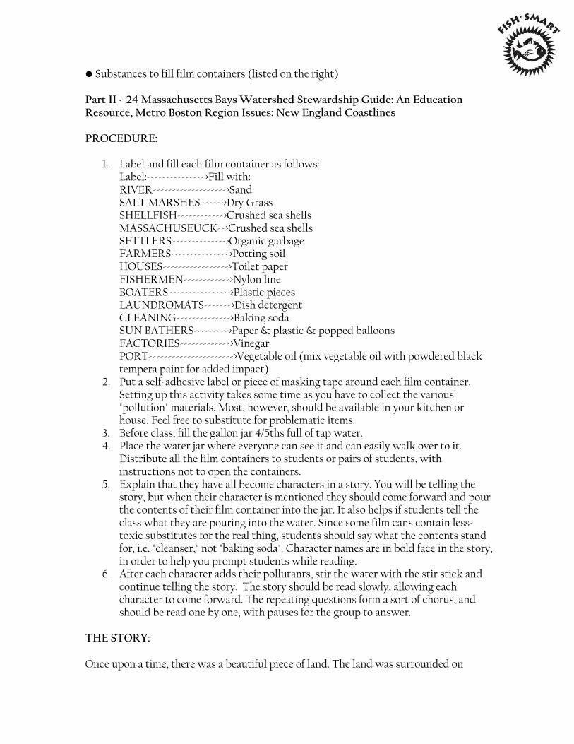
1. Label and fill each film container as follows: Label:--------------->Fill with: RIVER------------------->Sand SALT MARSHES------>Dry Grass SHELLFISH------------>Crushed sea shells MASSACHUSEUCK-->Crushed sea shells SETTLERS-------------->Organic garbage FARMERS--------------->Potting soil HOUSES----------------->Toilet paper FISHERMEN------------>Nylon line BOATERS---------------->Plastic pieces LAUNDROMATS------->Dish detergent CLEANING-------------->Baking soda SUN BATHERS--------->Paper & plastic & popped balloons FACTORIES------------->Vinegar PORT---------------------->Vegetable oil (mix vegetable oil with powdered black tempera paint for added impact)
2. Put a self-adhesive label or piece of masking tape around each film container. Setting up this activity takes some time as you have to collect the various "pollution" materials. Most, however, should be available in your kitchen or house. Feel free to substitute for problematic items.
3. Before class, fill the gallon jar 4/5ths full of tap water. 4. Place the water jar where everyone can see it and can easily walk over to it.
Distribute all the film containers to students or pairs of students, with instructions not to open the containers.
5. Explain that they have all become characters in a story. You will be telling the story, but when their character is mentioned they should come forward and pour the contents of their film container into the jar. It also helps if students tell the class what they are pouring into the water. Since some film cans contain less-toxic substitutes for the real thing, students should say what the contents stand for, i.e. "cleanser," not "baking soda". Character names are in bold face in the story, in order to help you prompt students while reading.
6. After each character adds their pollutants, stir the water with the stir stick and continue telling the story. The story should be read slowly, allowing each character to come forward. The repeating questions form a sort of chorus, and should be read one by one, with pauses for the group to answer.
THE STORY:
Once upon a time, there was a beautiful piece of land. The land was surrounded on
three sides by a bay; a bay filled with clear ocean water and dotted with green islands. (Point to the jar.) Fish lived in the water, and the land was covered with trees. Both the land and the bay teemed with wildlife.
Chorus: (Wait for group to answer each question.) • Would you want to swim in this bay? • Would you eat fish caught in this water? • Would you like to go boating on this bay?
A RIVER ran along one side of the land, carrying sediment and sand with it as it flowed into the bay.
SALT MARSHES grew along the edges of the bay. Grasses from the salt marshes washed into the bay and became food for the fish.
SHELLFISH grew in the shallow water, including clams, oysters, and scallops.
A small group of people lived on the land near the bay. They called the land Shawmut. The people called themselves the MASSACHUSEUCK. The Massachuseuck fished for food and shellfish in the bay. They also dumped some of their garbage near the bay. In fact, we still find the piles of the shells they left.
Chorus: (Answers will vary as students consider each question in light of the new substances added to the bay.) • Would you want to swim in this bay? • Would you eat fish caught in this water? • Would you like to go boating on this bay?
After many years SETTLERS from Europe came to live on the land called Shawmut. The settlers built a town much larger than the Massachuseuck villages. Some of the town's garbage was also dumped into the bay.
As the town grew, the settlers filled in the salt marshes to provide more land on which to build. FARMERS cut down trees to clear their fields. Without trees and marshes, rain carried soil into the bay.
Chorus: • Would you want to swim in this bay? • Would you eat fish caught in this water? • Would you like to go boating on this bay?
More and more HOUSES and shops were built, and the town grew into the city of New Bedford. Sewer pipes were constructed to remove the waste from homes and bathrooms. The sewage flowed through the sewer pipes into the bay.
Since the salt marshes had been filled in, RUNOFF water washed pollution from the streets directly into the bay.
FISHERMEN found that nets made of plastic or nylon were stronger than those made of rope. Sometimes these plastic nets got lost in the water.
Fishermen and other BOATERS sometimes threw trash overboard.
Chorus: • Would you want to swim in this bay? • Would you eat fish caught in this water? • Would you like to go boating on this bay?
The city of New Bedford continued to grow. The city built LAUNDROMATS where people could wash their clothes. The laundry detergents went down the sewage pipes and into the bay.
People CLEANING their houses used poisonous cleansers and drain cleaners, which also flowed through the sewage system and into the bay.
Even swimmers and SUN BATHERS going to enjoy the beach sometimes left garbage on the beaches, or balloons would float out over the ocean and pop.
FACTORIES built along the water's edge often dumped their wastes and chemicals into the water. And as New Bedford Harbor- as the bay was now called - grew into a major sea PORT, large oil tankers and ships came to unload their cargo. Sometimes oil spilled into the bay.
Chorus: • Would you want to swim in this bay? • Would you eat fish caught in this water? • Would you like to go boating on this bay?
• Who dirtied the water? • Who is responsible for cleaning it up?
PART II - 25 Massachusetts Bays Watershed Stewardship Guide: An Education Resource Metro Boston Region Issues: Who Dirtied the Water? - New England Coastlines
Applying the Concepts
• Discuss how students felt. • Do students know of other local bodies of water that have been polluted?
Research who is responsible for their pollution. • Talk about the different pollutants added. Is all pollution equally dangerous? Can
students invent categories of pollutants?
Research actions you can take to help reduce your class's polluting impact on water. Cutting down on toxic household products is one way. Water conservation also helps because it allows sewage treatment plants to work more effectively. What other steps can you take?
PART II - 26 Massachusetts Bays Watershed Stewardship Guide: An Education Resource Metro Boston Region Issues: Who Dirtied the Water? - New England Coastlines. Stewardship Guide developed by the Mass. Bays Education Alliance for teachers, under sponsorship of Mass. Bays Program and UMass Extension. Contact Faith Burbank to acquire a copy of the Guide at [email protected] or (781) 740-4913.
Who Dirtied the Water?
Connections to the Massachusetts Science and Technology/Engineering Curriculum Framework
May 2001
Guiding Principal V: Investigation, experimentation, and problem solving are central to science and technology/engineering education. Investigations introduce students to the nature of original research, increase students’ understanding of scientific and technological concepts, promote skill development, and provide entry points for all learners. Guiding Principal VI: Students learn best in an environment that conveys high academic expectations for all students. School districts should also invite role models from business and the community (including professional engineers and scientists to visit classes, work with students, and contribute to instruction. Guiding Principal X: Implementation of an effective science and technology/engineering program requires collaboration with experts, appropriate materials, support from parents and community, ongoing professional development and quantitative and qualitative assessment. In addition, local members of the science and engineering community may be able to lend their own expertise to assist with the implementation of a new curriculum. Teachers and administrators should invite scientists, engineers, higher education faculty, and representatives of local businesses and museum personnel to help evaluate the planned curriculum and enrich it with community connections.
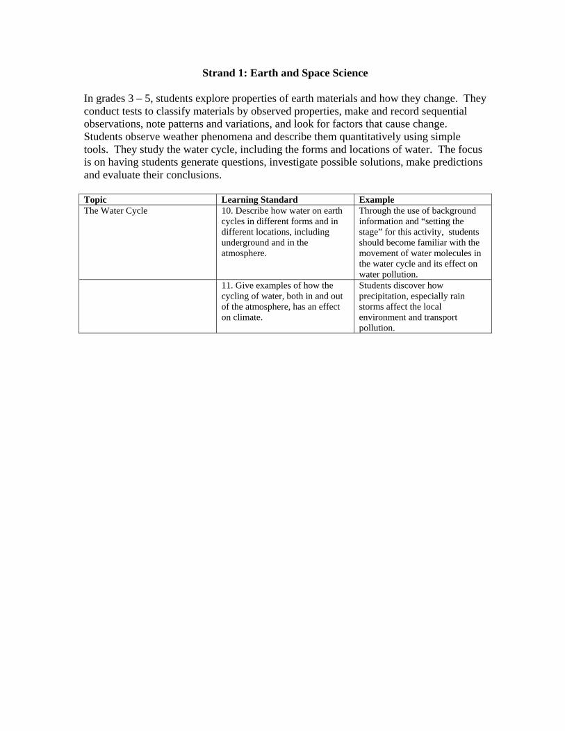
Strand 1: Earth and Space Science
In grades 3 – 5, students explore properties of earth materials and how they change. They conduct tests to classify materials by observed properties, make and record sequential observations, note patterns and variations, and look for factors that cause change. Students observe weather phenomena and describe them quantitatively using simple tools. They study the water cycle, including the forms and locations of water. The focus is on having students generate questions, investigate possible solutions, make predictions and evaluate their conclusions. Topic Learning Standard Example The Water Cycle 10. Describe how water on earth
cycles in different forms and in different locations, including underground and in the atmosphere.
Through the use of background information and “setting the stage” for this activity, students should become familiar with the movement of water molecules in the water cycle and its effect on water pollution.
11. Give examples of how the cycling of water, both in and out of the atmosphere, has an effect on climate.
Students discover how precipitation, especially rain storms affect the local environment and transport pollution.
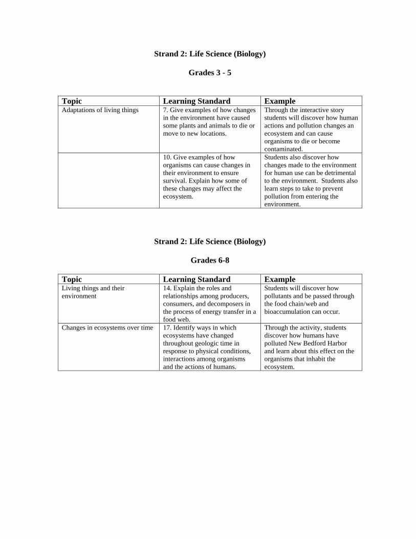
Strand 2: Life Science (Biology)
Grades 3 - 5
Topic Learning Standard Example Adaptations of living things 7. Give examples of how changes
in the environment have caused some plants and animals to die or move to new locations.
Through the interactive story students will discover how human actions and pollution changes an ecosystem and can cause organisms to die or become contaminated.
10. Give examples of how organisms can cause changes in their environment to ensure survival. Explain how some of these changes may affect the ecosystem.
Students also discover how changes made to the environment for human use can be detrimental to the environment. Students also learn steps to take to prevent pollution from entering the environment.
Strand 2: Life Science (Biology)
Grades 6-8
Topic Learning Standard Example Living things and their environment
14. Explain the roles and relationships among producers, consumers, and decomposers in the process of energy transfer in a food web.
Students will discover how pollutants and be passed through the food chain/web and bioaccumulation can occur.
Changes in ecosystems over time 17. Identify ways in which ecosystems have changed throughout geologic time in response to physical conditions, interactions among organisms and the actions of humans.
Through the activity, students discover how humans have polluted New Bedford Harbor and learn about this effect on the organisms that inhabit the ecosystem.
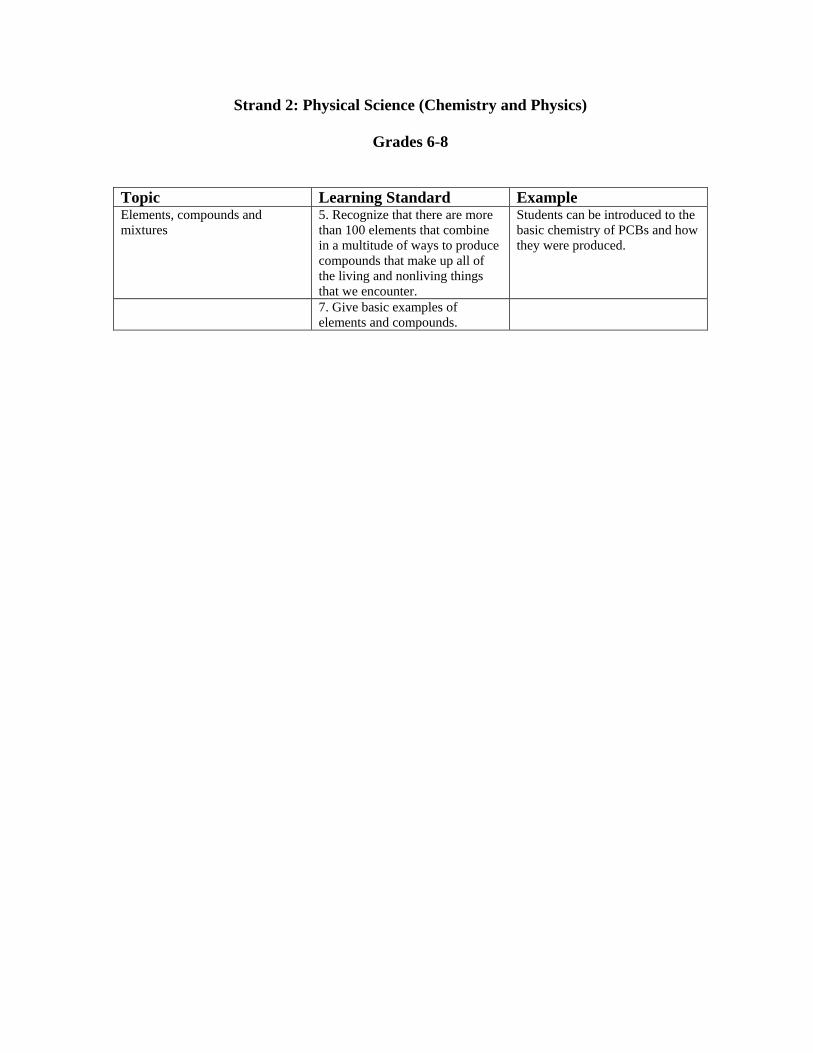
Strand 2: Physical Science (Chemistry and Physics)
Grades 6-8
Topic Learning Standard Example Elements, compounds and mixtures
5. Recognize that there are more than 100 elements that combine in a multitude of ways to produce compounds that make up all of the living and nonliving things that we encounter.
Students can be introduced to the basic chemistry of PCBs and how they were produced.
7. Give basic examples of elements and compounds.

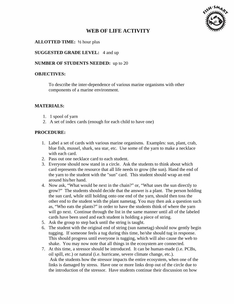
WEB OF LIFE ACTIVITY
ALLOTTED TIME: ½ hour plus
SUGGESTED GRADE LEVEL: 4 and up
NUMBER OF STUDENTS NEEDED: up to 20
OBJECTIVES:
To describe the inter-dependence of various marine organisms with other components of a marine environment.
MATERIALS: 1. 1 spool of yarn 2. A set of index cards (enough for each child to have one) PROCEDURE:
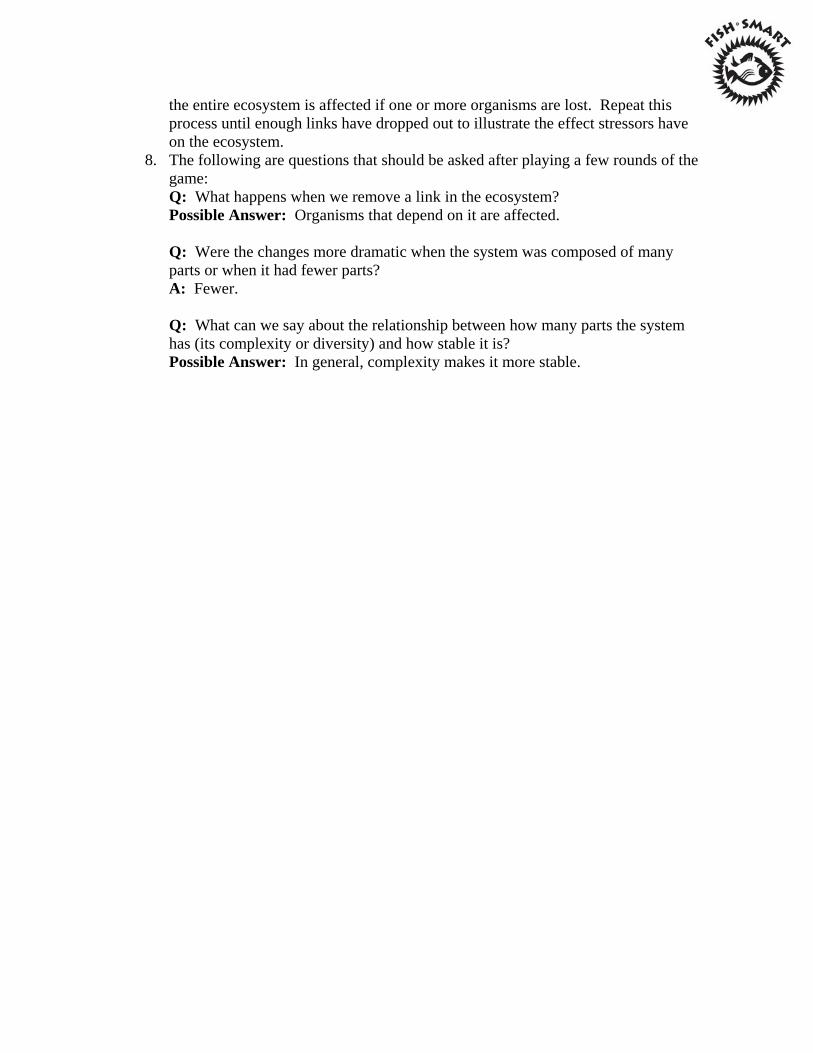
1. Label a set of cards with various marine organisms. Examples: sun, plant, crab, blue fish, mussel, shark, sea star, etc. Use some of the yarn to make a necklace with each card.
2. Pass out one necklace card to each student. 3. Everyone should now stand in a circle. Ask the students to think about which
card represents the resource that all life needs to grow (the sun). Hand the end of the yarn to the student with the "sun" card. This student should wrap an end around his/her hand.
4. Now ask, “What would be next in the chain?” or, “What uses the sun directly to grow?” The students should decide that the answer is a plant. The person holding the sun card, while still holding onto one end of the yarn, should then toss the other end to the student with the plant nametag. You may then ask a question such as, “Who eats the plants?” in order to have the students think of where the yarn will go next. Continue through the list in the same manner until all of the labeled cards have been used and each student is holding a piece of string.
5. Ask the group to step back until the string is taught. 6. The student with the original end of string (sun nametag) should now gently begin
tugging. If someone feels a tug during this time, he/she should tug in response. This should progress until everyone is tugging, which will also cause the web to shake. You may now note that all things in the ecosystem are connected.
7. At this time, a stressor should be introduced. It can be human-made (i.e. PCBs, oil spill, etc.) or natural (i.e. hurricane, severe climate change, etc.). Ask the students how the stressor impacts the entire ecosystem, when one of the links is damaged by stress. Have one or more links drop out of the circle due to the introduction of the stressor. Have students continue their discussion on how
the entire ecosystem is affected if one or more organisms are lost. Repeat this process until enough links have dropped out to illustrate the effect stressors have on the ecosystem.
8. The following are questions that should be asked after playing a few rounds of the game: Q: What happens when we remove a link in the ecosystem? Possible Answer: Organisms that depend on it are affected. Q: Were the changes more dramatic when the system was composed of many parts or when it had fewer parts? A: Fewer. Q: What can we say about the relationship between how many parts the system has (its complexity or diversity) and how stable it is? Possible Answer: In general, complexity makes it more stable.
FLOUNDER
EATS:
SILVERSIDE SHRIMP SEA WORMS
EATEN BY:
HUMAN DETRITUS
DISASTER
SUN
USED BY:
ALL PLANTS
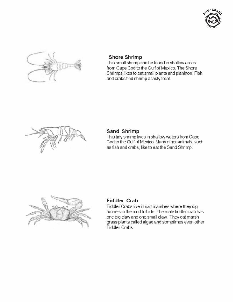
SHORE BIRDS EAT:
SILVERSIDE FIDDLER CRAB SEA WORMS
TAKEN BY:
DETRITUS
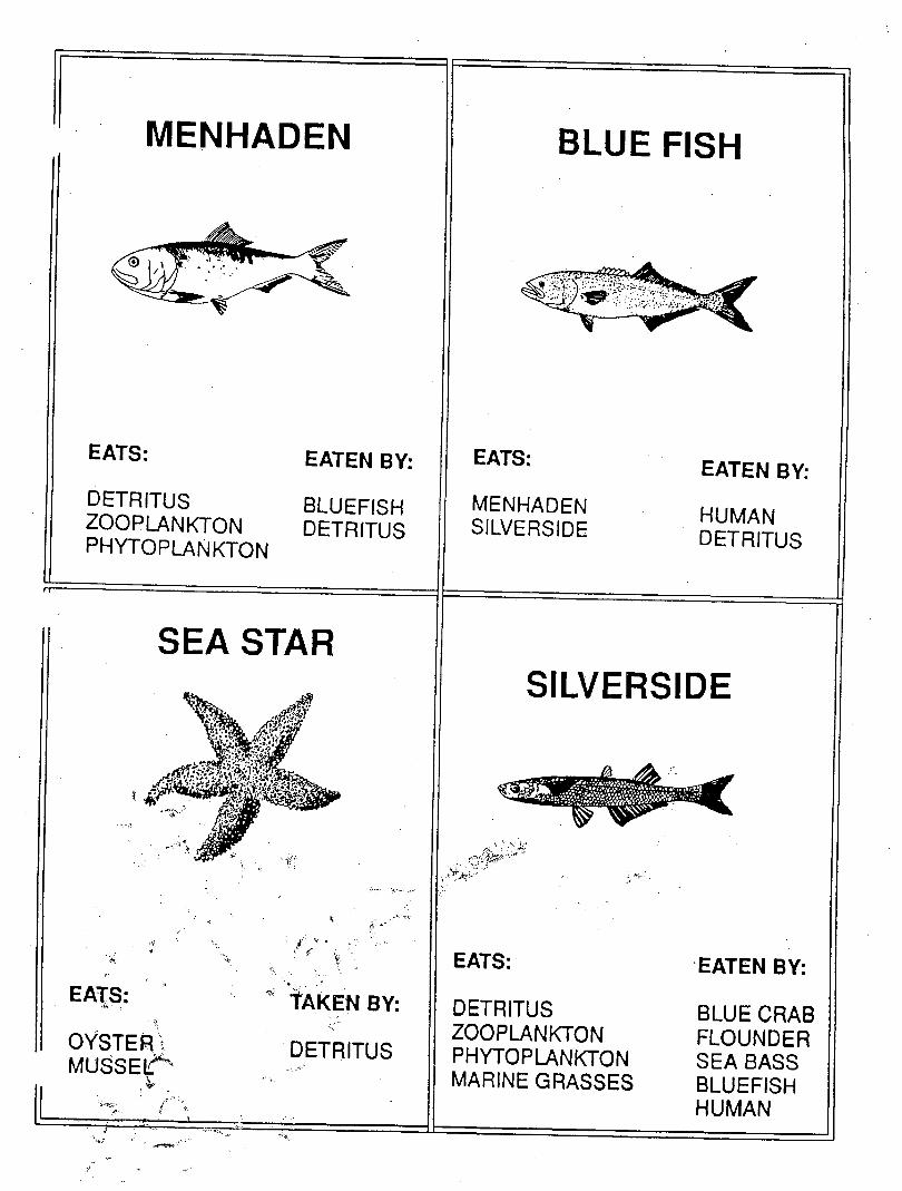
MENHADEN BLUE FISH
EATS:
DETRITUS ZOOPLANKTON PHYTOPLANKTON
EATEN BY:
BLUEFISH DETRITUS
EATS:
MENHADEN SILVERSIDE
EATEN BY:
HUMAN DETRITUS
SEA STAR
EATS:
OYSTER: MUSSEIT^
tAKEN BY:
DETRITUS
SILVERSIDE
•"va*
EATS:
DETRITUS ZOOPLANKTON PHYTOPLANKTON MARINE GRASSES
EATENBY:
BLUE CRAB FLOUNDER SEA BASS BLUEFISH HUMAN
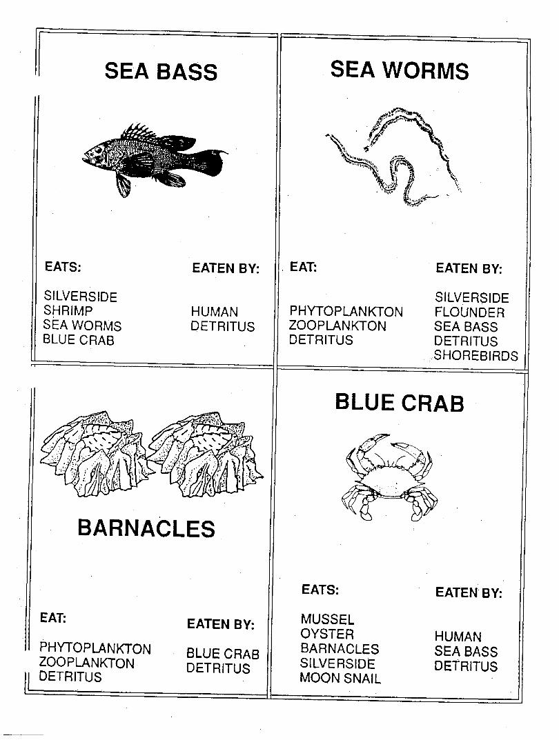
SEA BASS SEA WORMS
EATS:
SILVERSIDE SHRIMP SEA WORMS BLUE CRAB
EATEN BY:
HUMAN DETRITUS
BARNACLES
EAT:
PHYTOPLANKTON ZOOPLANKTON DETRITUS
EATEN BY:
BLUE CRAB DETRITUS
EAT:
PHYTOPLANKTON ZOOPLANKTON DETRITUS
EATEN BY:
SILVERSIDE FLOUNDER SEA BASS DETRITUS SHOREBIRDS
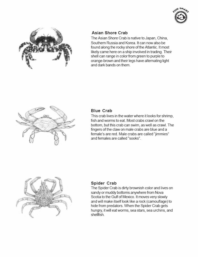
BLUE CRAB
EATS:
MUSSEL OYSTER BARNACLES SILVERSIDE MOON SNAIL
EATEN BY:
HUMAN SEA BASS DETRITUS
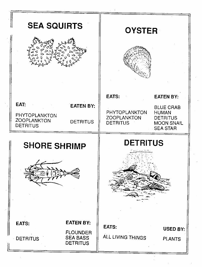
SEA SQUIRTS
c i:?«=
V « * . v
EAT:
PHYTOPLANKTON ZOOPLANKTON DETRITUS
EATEN BY:
DETRITUS
SHORE SHRIMP
EATS:
DETRITUS
EATEN BY:
FLOUNDER SEA BASS DETRITUS
OYSTER
Trs>: .... .
Sfcl sSSi'tL. ;}
EATS:
PHYTOPLANKTON ZOOPLANKTON DETRITUS
EATEN BY:
BLUE CRAB HUMAN DETRITUS MOON SNAIL SEA STAR
DETRITUS
EATS:
ALL LIVING THINGS
USED BY:
PLANTS
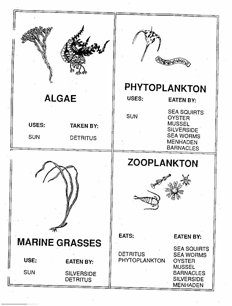
ALGAE
USES:
SUN
TAKEN BY:
DETRITUS
MARINE GRASSES
USE:
SUN
EATEN BY:
SILVERSIDE DETRITUS
PHYTOPLANKTON USES:
SUN
EATEN BY:
SEA SQUIRTS OYSTER MUSSEL SILVERSIDE SEA WORMS MENHADEN BARNACLES
ZOOPLANKTON
EATS:
DETRITUS PHYTOPLANKTON
EATEN BY:
SEA SQUIRTS SEA WORMS OYSTER MUSSEL BARNACLES SILVERSIDE MENHADEN
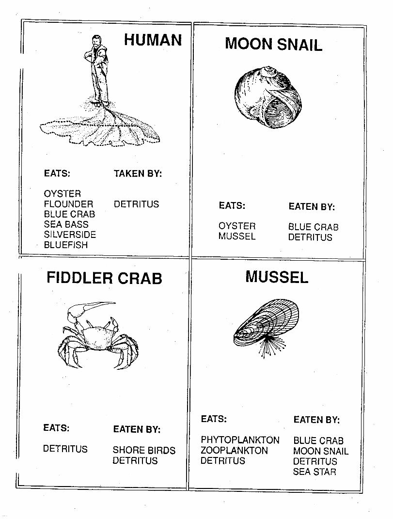
HUMAN
EATS:
OYSTER FLOUNDER BLUE CRAB SEA BASS SILVERSIDE BLUEFISH
TAKEN BY:
DETRITUS
FIDDLER CRAB
EATS:
DETRITUS
EATEN BY:
SHORE BIRDS DETRITUS
MOON SNAIL
EATS:
OYSTER MUSSEL
EATEN BY:
BLUE CRAB DETRITUS
MUSSEL
EATS:
PHYTOPLANKTON ZOOPLANKTON DETRITUS
EATEN BY:
BLUE CRAB MOON SNAIL DETRITUS SEA STAR
Web of Life
Connections to the Massachusetts Science and Technology/Engineering Curriculum Framework
May 2001
Guiding Principal V: Investigation, experimentation, and problem solving are central to science and technology/engineering education. Investigations introduce students to the nature of original research, increase students’ understanding of scientific and technological concepts, promote skill development, and provide entry points for all learners. Guiding Principal VI: Students learn best in an environment that conveys high academic expectations for all students. School districts should also invite role models from business and the community (including professional engineers and scientists to visit classes, work with students, and contribute to instruction. Guiding Principal X: Implementation of an effective science and technology/engineering program requires collaboration with experts, appropriate materials, support from parents and community, ongoing professional development and quantitative and qualitative assessment. In addition, local members of the science and engineering community may be able to lend their own expertise to assist with the implementation of a new curriculum. Teachers and administrators should invite scientists, engineers, higher education faculty, and representatives of local businesses and museum personnel to help evaluate the planned curriculum and enrich it with community connections.
Strand 2: Life Science (Biology)
Grades 3 - 5
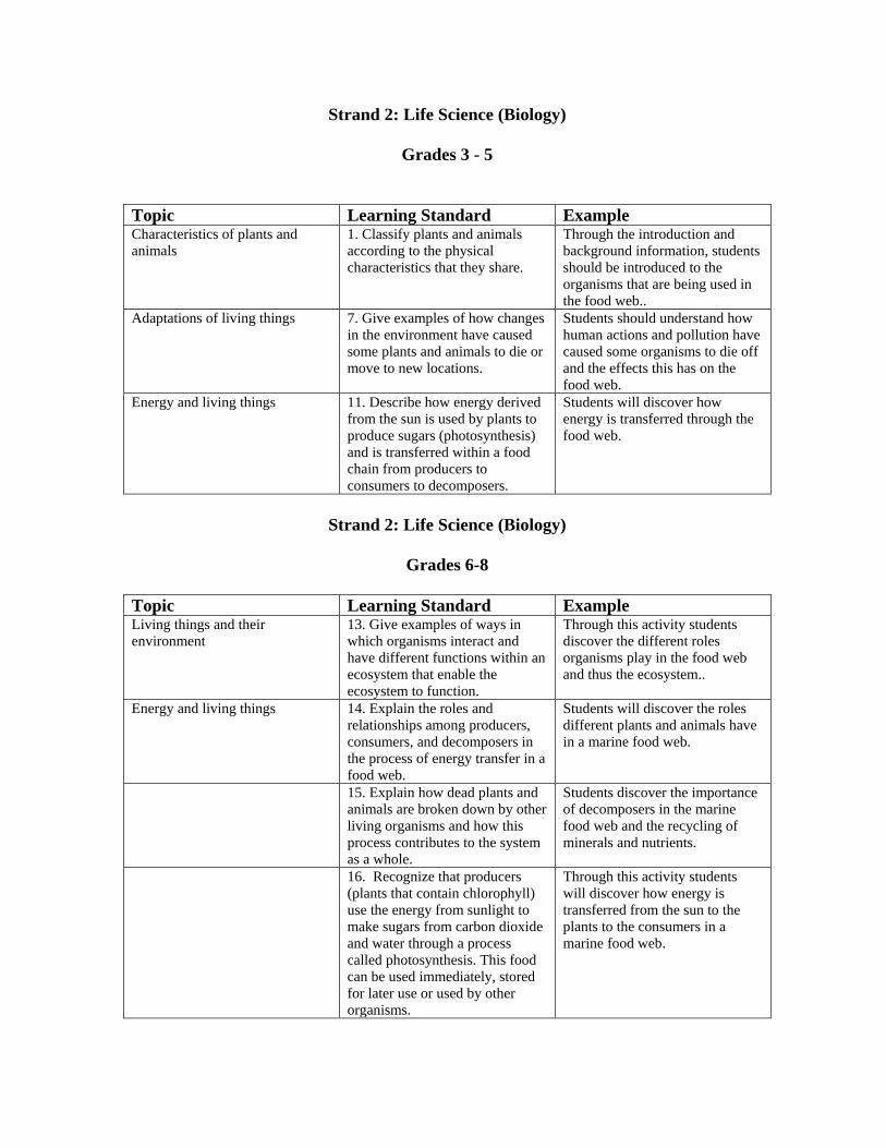
Topic Learning Standard Example Characteristics of plants and animals
1. Classify plants and animals according to the physical characteristics that they share.
Through the introduction and background information, students should be introduced to the organisms that are being used in the food web..
Adaptations of living things 7. Give examples of how changes in the environment have caused some plants and animals to die or move to new locations.
Students should understand how human actions and pollution have caused some organisms to die off and the effects this has on the food web.
Energy and living things 11. Describe how energy derived from the sun is used by plants to produce sugars (photosynthesis) and is transferred within a food chain from producers to consumers to decomposers.
Students will discover how energy is transferred through the food web.
Strand 2: Life Science (Biology)
Grades 6-8
Topic Learning Standard Example Living things and their environment
13. Give examples of ways in which organisms interact and have different functions within an ecosystem that enable the ecosystem to function.
Through this activity students discover the different roles organisms play in the food web and thus the ecosystem..
Energy and living things 14. Explain the roles and relationships among producers, consumers, and decomposers in the process of energy transfer in a food web.
Students will discover the roles different plants and animals have in a marine food web.
15. Explain how dead plants and animals are broken down by other living organisms and how this process contributes to the system as a whole.
Students discover the importance of decomposers in the marine food web and the recycling of minerals and nutrients.
16. Recognize that producers (plants that contain chlorophyll) use the energy from sunlight to make sugars from carbon dioxide and water through a process called photosynthesis. This food can be used immediately, stored for later use or used by other organisms.
Through this activity students will discover how energy is transferred from the sun to the plants to the consumers in a marine food web.

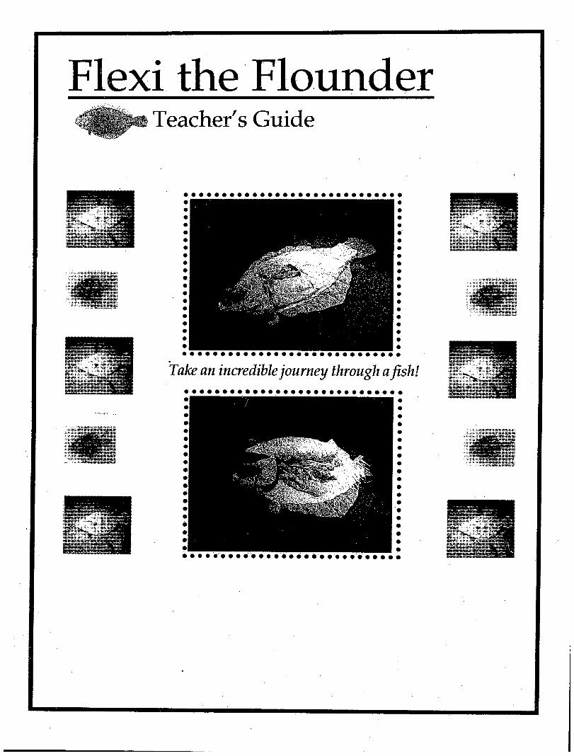
Flexi the Flounder Teacher's Guide
Welcome!
Enclosed is a packet of classroom activities to complement the Flexi the
Flounder program, which has been scheduled for your class. This
information will help prepare you and your students for our visit and
reinforce concepts, which will be covered during the program.
The Lloyd Center is a not-for-profit membership organization located in
Dartmouth, Massachusetts, which serves the region of southern New
England. The Lloyd Center’s mission is to help create the next generation of
environmental stewards through education and research; seeking to instill in
students of all ages an understanding and appreciation of our coastal
environment, its unique and fragile nature and our special relationship and
responsibility to it.
We are committed to providing quality, hands-on science programs for
students in kindergarten through college. The focus of our efforts is in the
interdisciplinary study of coastal environments and watersheds. All of our
programs are linked to the current Massachusetts Curriculum Frameworks in
Science and Technology/Engineering.
Flexi the Flounder Overview
Flexi the Flounder is a hands-on classroom experience designed to introduce
students to the diversity of local fish and their adaptations to survive in a
marine environment. Biological, physical and behavioral aspects of fish will
be incorporated into this one-hour program. Designed as an introduction to
the world of fish, the program’s main focus is a six-foot fabric summer
flounder.
Flexi is a larger than life, anatomically correct cloth replica of a summer
flounder. Students learn about comparative anatomy, adaptation,
camouflage, and the function of internal organs by “dissecting” Flexi. A
dynamic hands-on guided tour through the insides of this seven-foot
flounder, Flexi enables students to learn complex concepts in an easy to
understand interactive way.
Important Teacher Information
To insure that your program runs as smoothly as possible, we ask that you
read the following information prior to our arrival.
1. Expect the Lloyd Center instructors to arrive in your class approximately
15 minutes prior to the scheduled start time, in order to set up.
2. After a brief introduction, the class will be divided into two groups. We
ask that you have them assigned to two groups before the program starts.
This saves time during the program and allows you to separate students
into different groups if necessary. Each group will participate in hands-on
age appropriate activities and will switch activities half-way through the
program.
3. The Lloyd Center will visit your class as interpreters not disciplinarians.
Please be prepared to handle any disciplinary problems as they arise.

Background Information
Background Information Who is Flexi?
Flexi is the Lloyd Center’s seven-foot summer flounder made out of fabric. Although
Flexi lives at the Lloyd Center she enjoys visiting classrooms to help students discover
diversity of local fish and how they are adapted to survive in the marine environment.
She even lets students “dissect” her and pass around her internal organs, so they can learn
more about the anatomy and physiology of fish.
What’s so Special About Flexi?
Flexi is very different from other fish that students may have seen before. She has a flat
body, with a darker topside, she can use special cells in her skin to change her color to
match the environment, and both of her eyes are on the same side of her head. Students
will find out about all of these adaptations and why they are so important to flatfish.
Flexi’s Parts
Students will have the opportunity to examine Flexi’s outer parts, such as her scales, eyes
and fins. Then we will “dissect” or unzip Flexi and pull back her skin and muscle to take
a look at what’s inside – the brain, heart, liver, stomach, intestines, egg sac, spleen and
kidney. Students will even get a chance to open Flexi’s stomach and discover what she
had to eat.
Flounder Facts
• Flounder reach a maximum weight of 15 pounds and a maximum length of 3 feet.
• Flounder live most of their lives on the bottom of the ocean floor, preferably a muddy
or sandy bottom.
• Flounder eat smaller fish, squid, crabs, shrimp, small mollusks and worms.
• A female flounder can lay up to a half million eggs at one time.
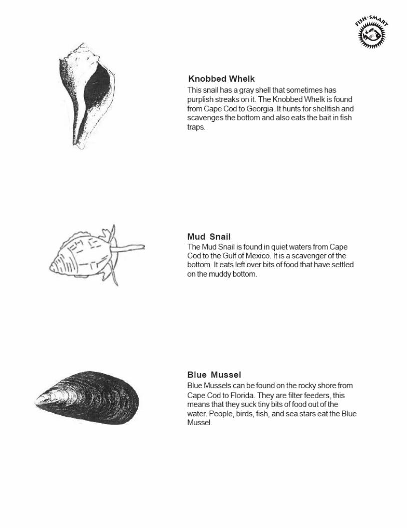
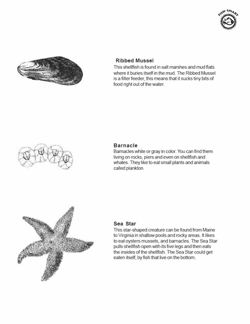
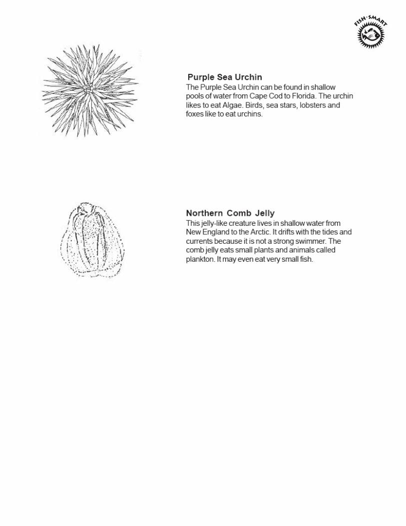
Common Coastal Fish Of New England
Common Coastal
Common Coastal Fish of New England

Activities
Activities
What Animal Am I?
Objective: Students will investigate and discover the adaptations organisms have developed to help them survive in their habitat. Materials: Large index cards Crayons/markers Procedure: 1. Write the following questions on the chalkboard or a poster:
What color is the organism? Is it camouflaged? How does it eat? Does it have any specialized mouthparts to help it eat or catch its food? How does it move? (does it swim, fly, run, etc.) Does it have specially adapted legs, claws, feet? How does it breathe?
2. On the index cards, write the name of an organism the students have seen or heard of.
You may also use the organisms from the identification sheets found in the background information section of this packet.
3. Introduce the concept of adaptations. Ask the students to describe some animals with
adaptations (elephant’s trunk, a giraffe’s long neck, etc.). How do these adaptations help the organism survive in its environment?
4. Divide the class into groups of 4 or 5 students. Give one student in each group an
index card with an organism’s name written on it. Tell that student not to let the rest of the group see the name of the organism. Through charades, the student with the organism card is to act out the part of the named organism. Once the group has successfully named the organism, they can draw the organism and the habitat it lives in on a large sheet of paper.
5. Each team shares with the rest of the class their organism, the habitat it lives in and
the answers to the questions originally written on the board.
Invent a Fish
Objective: Students will learn about the importance of fish adaptations and will increase their own creative ability by constructing a fish with certain adaptations. Materials: • Paper • Crayons/markers • List of fish adaptations (included in this packet) Procedure: 1. Introduce the concept of adaptations to students. Adaptations are special
characteristics or features which plants and animals have to help improve their chances of reproduction and survival. Describe some animal adaptations (elephants’ trunk, giraffes’ long neck, etc.). Ask students if they know of other adaptations.
2. Explain to students that they will be inventing a fish based on certain adaptations
which you will give to them. Students will also need to draw a habitat for their fish, such as a sandy bottom, rocky bottom, eelgrass, etc.
3. For older students, the adaptation descriptions can be written on strips of paper and
randomly passed out to students. You could also pass out more than one adaptation to each student and have them design a fish has multiple adaptations! For younger students, you could have them work in small groups and read a different adaptation to each group. Students could draw their own fish based on that adaptation. Have the students name their fish.
4. After the pictures have been completed, have each student show the class their
drawing and describe the adaptations their fish has. Students should describe their fish, the habitat the fish lives in, what it eats, the name of their fish and any other interesting things regarding their fish. You could also make a bulletin board with all of the drawings.
Supplemental Activity: Students could look through fish books for pictures of real fish which match their adaptations.
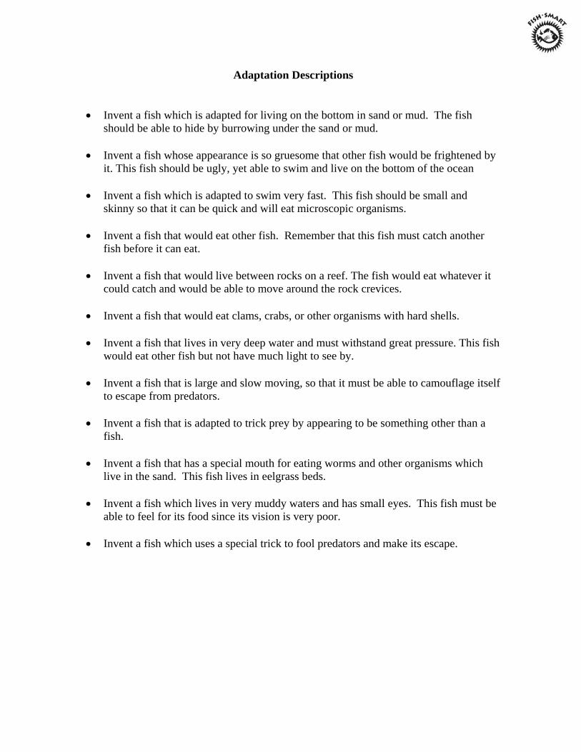
Adaptation Descriptions
• Invent a fish which is adapted for living on the bottom in sand or mud. The fish
should be able to hide by burrowing under the sand or mud. • Invent a fish whose appearance is so gruesome that other fish would be frightened by
it. This fish should be ugly, yet able to swim and live on the bottom of the ocean • Invent a fish which is adapted to swim very fast. This fish should be small and
skinny so that it can be quick and will eat microscopic organisms. • Invent a fish that would eat other fish. Remember that this fish must catch another
fish before it can eat. • Invent a fish that would live between rocks on a reef. The fish would eat whatever it
could catch and would be able to move around the rock crevices. • Invent a fish that would eat clams, crabs, or other organisms with hard shells. • Invent a fish that lives in very deep water and must withstand great pressure. This fish
would eat other fish but not have much light to see by. • Invent a fish that is large and slow moving, so that it must be able to camouflage itself
to escape from predators. • Invent a fish that is adapted to trick prey by appearing to be something other than a
fish. • Invent a fish that has a special mouth for eating worms and other organisms which
live in the sand. This fish lives in eelgrass beds. • Invent a fish which lives in very muddy waters and has small eyes. This fish must be
able to feel for its food since its vision is very poor. • Invent a fish which uses a special trick to fool predators and make its escape.
Fish Puzzle
Objective: Students will learn about the external anatomy of fish and will enhance their problem solving techniques by constructing a fish puzzle. Materials: • 1 copy of the fish puzzle parts sheet per student or group of students. • Posterboard • Crayons/markers • Scissors • Glue Procedure: 1. Ask the students what they know about the external parts of a fish. Do fish have teeth,
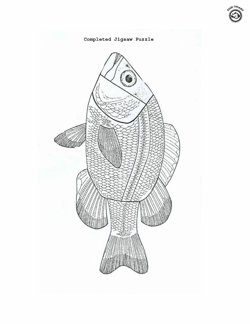
legs, hair, etc. Have students describe what they think fish look like on the outside. 2. Tell students they will be assembling a fish puzzle which will show the external parts
of fish. Point out that not all fish look the same. Some fish, such as Flexi the Flounder, have special body shapes (adaptations) to help them survive.
3. Pass out the fish puzzle pieces, posterboard or large sheet of paper, scissors, glue and
crayons/markers. 4. Have the students cut out the fish puzzle pieces (for younger students pre-cut the fish
puzzle pieces). You may wish to have the students sit in a circle on the floor while you guide them through the assembly of the fish. Use a puzzle you have cut out ahead of time. As you assemble the fish explain each part of the fish and what its function is. (see fish puzzle fact sheet).
5. Have students try to assemble the fish puzzle on their own. When completed they can
glue the puzzle onto posterboard and color it if desired.
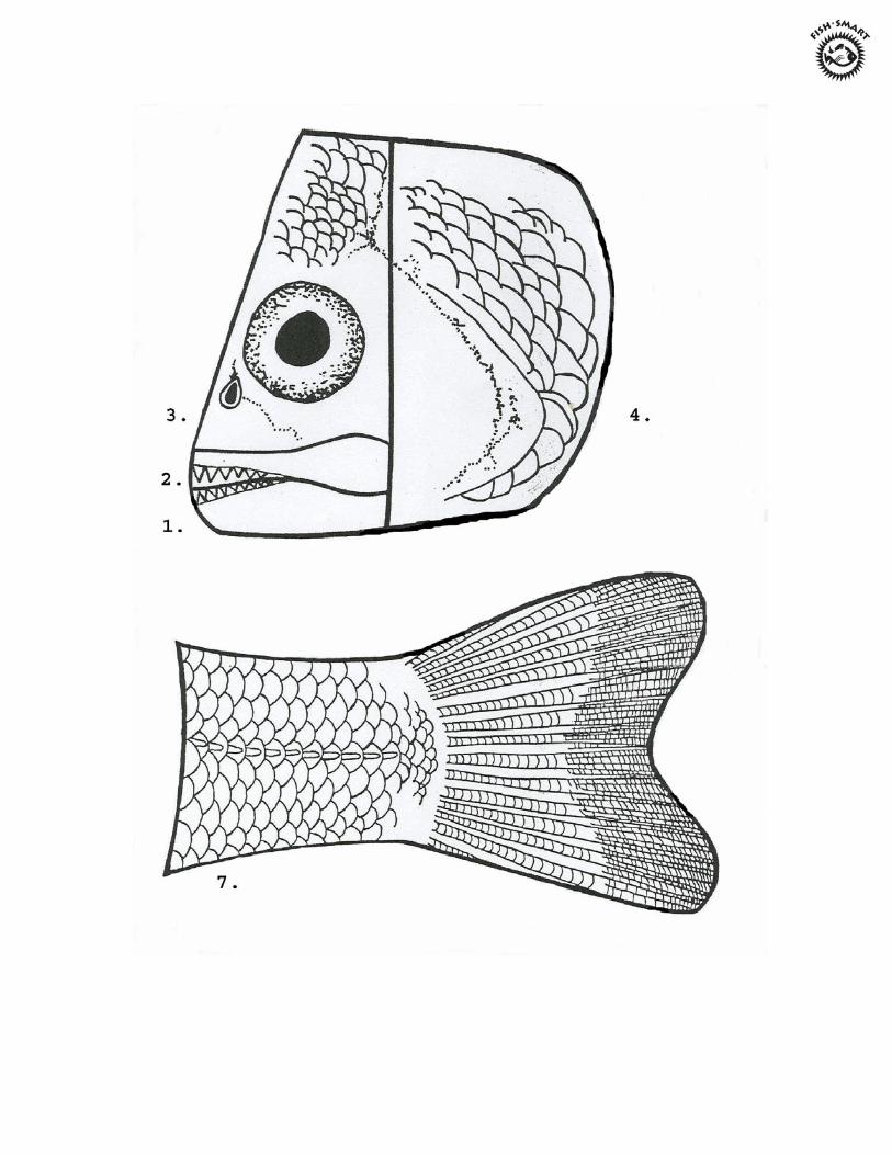
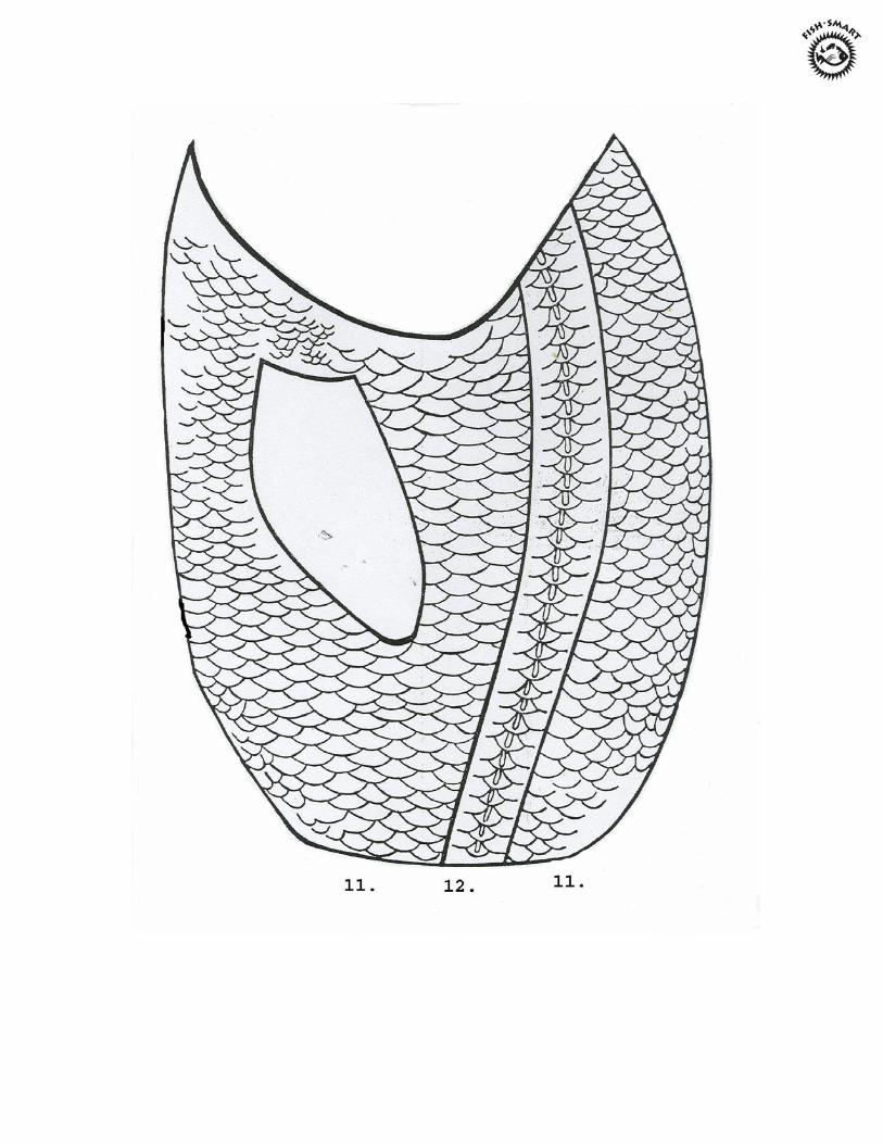
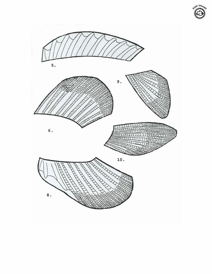
Fish Puzzle Fact Sheet
1. Teeth: Fish don’t really chew, they just grab onto their prey and swallow it whole. Fish species have a wide variety of teeth; some have big, sharp teeth to catch and hold prey; some have bristly teeth to scrape algae; and others have flat or heavy teeth for crushing hard-shelled animals.
2. Mouth: Fish can have big mouths, tubular mouths, flexible mouths, mouths that point
up and mouths that point down. All of these different mouth designs have special functions for that fish depending on its environment, the food it eats, and how it protects itself.
3. Nostrils: Fish have noses which are used for smelling chemicals in the water, not for
breathing! Eyes: The size and color of the eyes varies from fish species to fish species. Most fish lack eyelids since their eyes are constantly bathed in water. Fish lack sharp vision and are nearsighted, so that they must rely on other means to find food. Cave fish, which live in the dark all of the time, lack eyes completely.
4. Gill Cover: Known as the operculum, this flap covers and protects the delicate red
gills found underneath. Fish get their oxygen from air dissolved in the water. This can be compared with mammals such as dolphins and whales which have lungs and must surface periodically to breathe.
5. Dorsal fins: Some fish have one dorsal fin, while others have two and some fish have
none at all. There is great variety in the size and shape of fins. Some fish, such as sharks, have a sharp spine which projects from the dorsal fin for protection.
6. Dorsal fins: Some fish have one dorsal fin, while others have two and some fish have
none at all. There is great variety in the size and shape of fins. Some fish, such as sharks, have a sharp spine which projects from the dorsal fin for protection.
7. Caudal fin: This is the fish’s tail. Some fish move their bodies by thrusting the tail
back and forth. For other fish, the tail serves as a rudder or stabilizer, with propulsion coming from body movements and other fin movements.
8. Anal fin: This fin is sometimes armed with sharp projections. When these supporting
rods in fins are soft, they are called rays and when they are hard and stiff, they are called spines.
9. Pelvic fins: These fins are used primarily for fine adjustment of the fish’s movements
but may be modified for special functions, such as crawling along the bottom, holding or grasping.
10. Pectoral fins: These are used for fine movements. They may be modified for special
functions or may be absent in some fish.
11. Scales: Although most fish have scales, certain fish either lack them or have such small scales that they are not noticeable, (moray eels and catfish are examples). Scales are modified skin cells which help protect fish from abrasions and diseases.
12. Lateral line: The water fish live in is sometimes cloudy and often dark. Therefore,
fish cannot depend on sight to find its way around and find food. Instead, it uses a special sense organ known as the lateral line. This is a series of pits in the skin that looks like a dotted line. The nerve cells in these pits are sensitive to changes in water pressure and tell the fish how deep it is and what sounds are present. The lateral line is also sensitive to chemicals dissolved in the water.
What’s In a Name?
Objective: Students will combine their artistic creativity with science by drawing fishes based on their common names. Students are also introduced to some local fish species. Materials: • Pictures of fish (some are provided in this packet), you may also use a picture book or
field guide showing pictures of fish, such as Peterson’s Guide to the Fishes • Paper • Crayons or markers Procedure: 1. Tell students they will be discovering some local fish by first drawing their
interpretation of what they think the fish looks like. 2. Pass out drawing paper and crayons/markers to each student (pre-folded into
quarters). 3. Read aloud the common name of a fish and ask students to draw what they think each
fish looks like based on its name. Students should draw one of the following in each quarter of their paper.
Blue fish Pipefish Seahorse Lumpfish Pufferfish Stickleback Mummichog Sea Robin
4. After students have drawn their pictures, show them the actual pictures of the fish. Ask the students the following questions: Why did they draw the fish the way they did? Why do they think these were named the way they were? Can they give other examples of fish that are named because of the way they look?
5. Read some information about each fish to the children. Older students could research interesting facts about the fish.
6. You could make a bulletin board to display the students’ artwork.

Glossary
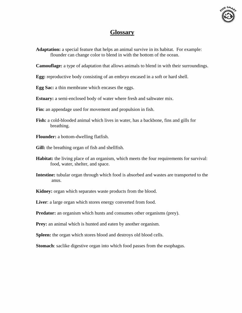
Glossary
Adaptation: a special feature that helps an animal survive in its habitat. For example: flounder can change color to blend in with the bottom of the ocean. Camouflage: a type of adaptation that allows animals to blend in with their surroundings. Egg: reproductive body consisting of an embryo encased in a soft or hard shell. Egg Sac: a thin membrane which encases the eggs. Estuary: a semi-enclosed body of water where fresh and saltwater mix. Fin: an appendage used for movement and propulsion in fish. Fish: a cold-blooded animal which lives in water, has a backbone, fins and gills for breathing. Flounder: a bottom-dwelling flatfish. Gill: the breathing organ of fish and shellfish. Habitat: the living place of an organism, which meets the four requirements for survival: food, water, shelter, and space. Intestine: tubular organ through which food is absorbed and wastes are transported to the anus. Kidney: organ which separates waste products from the blood. Liver: a large organ which stores energy converted from food. Predator: an organism which hunts and consumes other organisms (prey). Prey: an animal which is hunted and eaten by another organism. Spleen: the organ which stores blood and destroys old blood cells. Stomach: saclike digestive organ into which food passes from the esophagus.

H tr-ro
rt n> t-i n ^<3 o
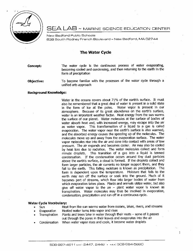
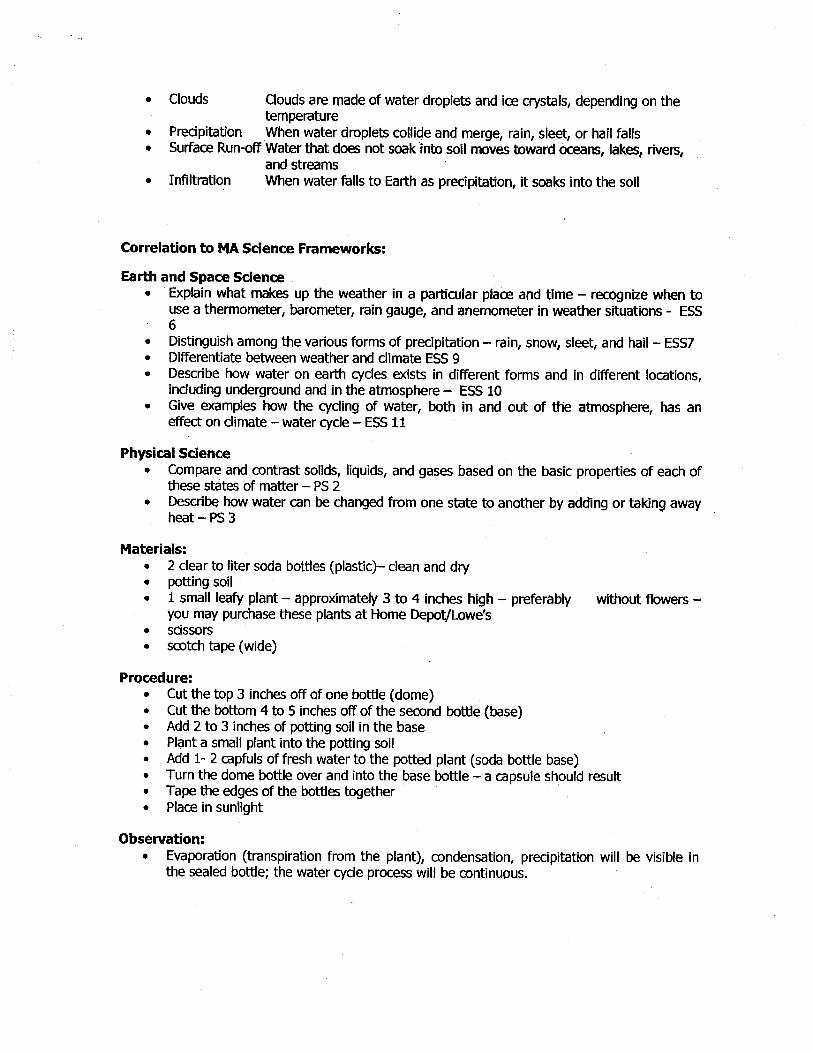

r
c
l-H HH
P P o Pn
3 W o d
o 3 d £L

The Superfund Cleanup Program Years ago, before there were laws to control how hazardous chemicals were handled, many people disposed of hazardous waste by dumping it on the ground and in rivers or lakes, or burying it in the ground. The result? Eventually, thousands of hazardous waste sites were created at warehouses, harbors,
manufacturing facilities, landfills, and many other kinds of places. In 1980 we began to get a handle on the problem, with the creation of the U.S. Environmental Protection Agency’s (EPA) Superfund Program.
What is Superfund?
The U.S. Congress passed the Comprehensive Environmental Response, Compensation, and Liability Act (CERCLA) in response to growing concern about health and environmental threats from hazardous waste sites. This law is commonly called Superfund. Working with states and Indian Tribal
governments, Superfund requires EPA to deal with abandoned, accidentally spilled, or illegally dumped hazardous substances from the past, primarily from businesses and industry. Other types of pollution are handled by other environmental laws.
EPA can take three types of actions (known as response actions) to deal with abandoned hazardous waste sites: emergency responses, early actions, and long-term actions.
An emergency response is used at a site that requires immediate action to eliminate serious risks to human health and the environment (for example, cleaning up chemicals spilled from an overturned truck on the highway).
An early action is used at a site posing a threat in the near future by preventing human contact with contaminants such as providing clean drinking water to a neighborhood, removing hazardous materials from the site, or preventing contaminants from spreading. Early actions may last a few days or up to five years.
A long-term action is used at a site where cleanup may take many years or decades (groundwater cleanups are frequently in this category). Often both early and long-term actions are performed at the same time. For example, leaking storage drums may be removed in an early action while contaminated soil is cleaned up under a long-term action.
How does Superfund work?
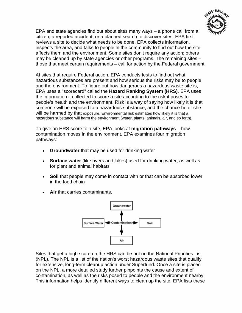
EPA and state agencies find out about sites many ways – a phone call from a citizen, a reported accident, or a planned search to discover sites. EPA first reviews a site to decide what needs to be done. EPA collects information, inspects the area, and talks to people in the community to find out how the site affects them and the environment. Some sites don’t require any action; others may be cleaned up by state agencies or other programs. The remaining sites – those that meet certain requirements – call for action by the Federal government.
At sites that require Federal action, EPA conducts tests to find out what hazardous substances are present and how serious the risks may be to people and the environment. To figure out how dangerous a hazardous waste site is, EPA uses a "scorecard" called the Hazard Ranking System (HRS). EPA uses the information it collected to score a site according to the risk it poses to people’s health and the environment. Risk is a way of saying how likely it is that someone will be exposed to a hazardous substance, and the chance he or she will be harmed by that exposure. Environmental risk estimates how likely it is that a hazardous substance will harm the environment (water, plants, animals, air, and so forth).
To give an HRS score to a site, EPA looks at migration pathways – how contamination moves in the environment. EPA examines four migration pathways:
Groundwater that may be used for drinking water
Surface water (like rivers and lakes) used for drinking water, as well as for plant and animal habitats
Soil that people may come in contact with or that can be absorbed lower in the food chain
Air that carries contaminants.
Sites that get a high score on the HRS can be put on the National Priorities List (NPL). The NPL is a list of the nation’s worst hazardous waste sites that qualify for extensive, long-term cleanup action under Superfund. Once a site is placed on the NPL, a more detailed study further pinpoints the cause and extent of contamination, as well as the risks posed to people and the environment nearby. This information helps identify different ways to clean up the site. EPA lists these
cleanup options in a proposed plan for long-term cleanup. The proposed plan describes different ways to clean up the site and the choice EPA prefers. The public has at least 30 days to comment on the plan.
After EPA answers the public’s concerns, it publishes a Record of Decision (ROD) that describes how it will clean up the site. The cleanup method is designed to address the unique conditions at the site. The design and actual cleanup is conducted either by EPA, a state, or the people responsible for contaminating the site.
Who pays for the cleanup?
The law says EPA can make the people responsible for contamination pay for site studies and cleanup work. EPA negotiates with these Potentially Responsible Parties (PRPs) to reach an agreement. Sometimes EPA pays for the cleanup out of a pool of money called the Superfund and then tries to make PRPs pay back the costs. Superfund money comes mainly from taxes on chemical and petroleum industries.
Who’s involved in the cleanup?
Like any team, EPA works with many other groups to clean up a Superfund site:
Communities provide important information about the site and surrounding area. They ensure that citizens’ concerns are addressed during the cleanup process. They also help determine what cleanup method should be used and how the site will be used in the future.
States work with EPA on making cleanup decisions, pay for 10 percent of cleanup costs in their state, and make sure sites are maintained after cleanup. They may also lead the cleanup activities. In addition, states address other sites on their own.
PRPs are responsible for and are encouraged to participate in all aspects of the cleanup. If PRPs refuse or are unable to pay for a cleanup, EPA may either legally require them to perform certain cleanup tasks or conduct the cleanup itself and try to make the PRPs pay EPA back.
Federal agencies can be involved in site cleanup either as site owners, as PRPs, or as EPA’s partners in conducting the cleanup (the Department of Justice, for example, provides legal help).
Contractors can be hired by the PRP or EPA, and usually perform much of the actual cleanup work at a Superfund site.
For more information on the Superfund Cleanup Program, visit:
http://www.epa.gov/superfund/students/index.htm
http://www.epa.gov/superfund/index.htm
POLYCHLORINATED BIPHENYLS (PCBs)
What are they?
PCBs are human-made chemicals of varying toxicity. Because they are good insulators and are nonflammable, PCBs have been widely used as coolants and lubricants in transformers and other electrical equipment. Evidence that PCBs damage the environment and may cause health hazards led to the end of PCB manufacture in the United States in 1977.
How can exposure occur?
Although PCBs are no longer manufactured, human exposure still occurs. Many older transformers, which have a lifespan of at least 30 years, use fluids that contain PCBs. PCBs are very persistent and are widely distributed in the environment. They have been found in over 300 Superfund sites. Levels of PCBs can be found in outdoor air, on soil surfaces, and in water. PCBs can be released into the environment from:
Poorly maintained hazardous waste sites that contain PCBs
Illegal or improper dumping of PCB wastes
Leaks of gases from electrical transformers that contain PCBs
Disposal of PCB-containing consumer products into municipal rather than hazardous waste landfills.
Eating PCB-contaminated fish can be a major source of exposure. Exposure from drinking water or from breathing outdoor air containing PCBs is less common. Once in the air, PCBs can be carried long distances — they have even been found in snow and seawater in the Antarctic. Contaminated indoor air may also be a major source of human exposure to PCBs.
How can they affect human health?
PCBs can cause such health problems as liver damage, skin irritation, cancer, and reproductive system damage. While the role of PCBs in causing cancer and other health problems in people cannot be clearly demonstrated, research shows there is cause for people to be concerned about PCB exposure.
For more information on PCBs, visit:
http://www.epa.gov/superfund/students/clas_act/haz-ed/ff_09.htm
http://www.epa.gov/pcb/
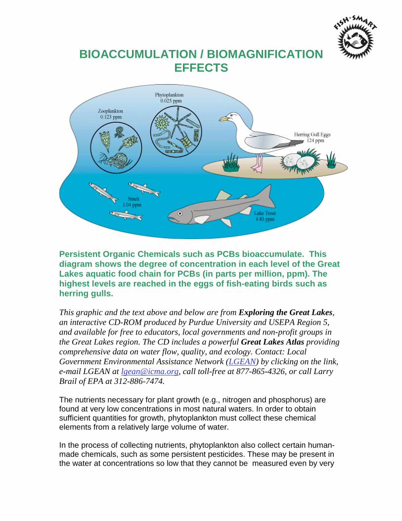
BIOACCUMULATION / BIOMAGNIFICATION EFFECTS
Persistent Organic Chemicals such as PCBs bioaccumulate. This diagram shows the degree of concentration in each level of the Great Lakes aquatic food chain for PCBs (in parts per million, ppm). The highest levels are reached in the eggs of fish-eating birds such as herring gulls. This graphic and the text above and below are from Exploring the Great Lakes, an interactive CD-ROM produced by Purdue University and USEPA Region 5, and available for free to educators, local governments and non-profit groups in the Great Lakes region. The CD includes a powerful Great Lakes Atlas providing comprehensive data on water flow, quality, and ecology. Contact: Local Government Environmental Assistance Network (LGEAN) by clicking on the link, e-mail LGEAN at [email protected], call toll-free at 877-865-4326, or call Larry Brail of EPA at 312-886-7474. The nutrients necessary for plant growth (e.g., nitrogen and phosphorus) are found at very low concentrations in most natural waters. In order to obtain sufficient quantities for growth, phytoplankton must collect these chemical elements from a relatively large volume of water. In the process of collecting nutrients, phytoplankton also collect certain human-made chemicals, such as some persistent pesticides. These may be present in the water at concentrations so low that they cannot be measured even by very
sensitive instruments. The chemicals, however, biologically accumulate (bioaccumulate) in the organism and become concentrated at levels that are much higher in the living cells than in the open water. This is especially true for persistent chemicals - substances that do not break down readily in the environment - like DDT and PCBs that are stored in fatty tissues. The small fish and zooplankton eat vast quantities of phytoplankton. In doing so, any toxic chemicals accumulated by the phytoplankton are further concentrated in the bodies of the animals that eat them. This is repeated at each step in the food chain. This process of increasing concentration through the food chain is known as biomagnification. The top predators at the end of a long food chain, such as lake trout, large salmon and fish-eating gulls, may accumulate concentrations of a toxic chemical high enough to cause serious deformities or death even though the concentration of the chemical in the open water is extremely low. The concentration of some chemicals in the fatty tissues of top predators can be millions of times higher than the concentration in the open water. The study of PCBs has contributed significantly to our understanding of bioaccumulation. Although production of PCBs has been banned in the U.S. for some years, many products containing PCBs such as electrical and building materials are widely used and commonly discarded or incinerated as waste. Substantial dangers therefore continue to be presented by release of PCBs into the environment. For more see EPA Region 2's factsheet, and the PCB Resource page of the International POPs Elimination Network. The Arctic Monitoring and Assessment Program said in a Sept. 24, 2002 report that mercury levels in some Arctic indigenous people are high enough to affect children's development, and PCBs build up in the food chain, especially in fatty tissue like blubber -- key nutrition for polar bears and the Inuit. As a result polar bears and Inuit suffer subtle effects on the immune system, brain development and reproduction. This information was taken from: Concerned Citizens of Cattaraugus County, Inc. http://www.homestead.com/concernedcitizens/osf.html
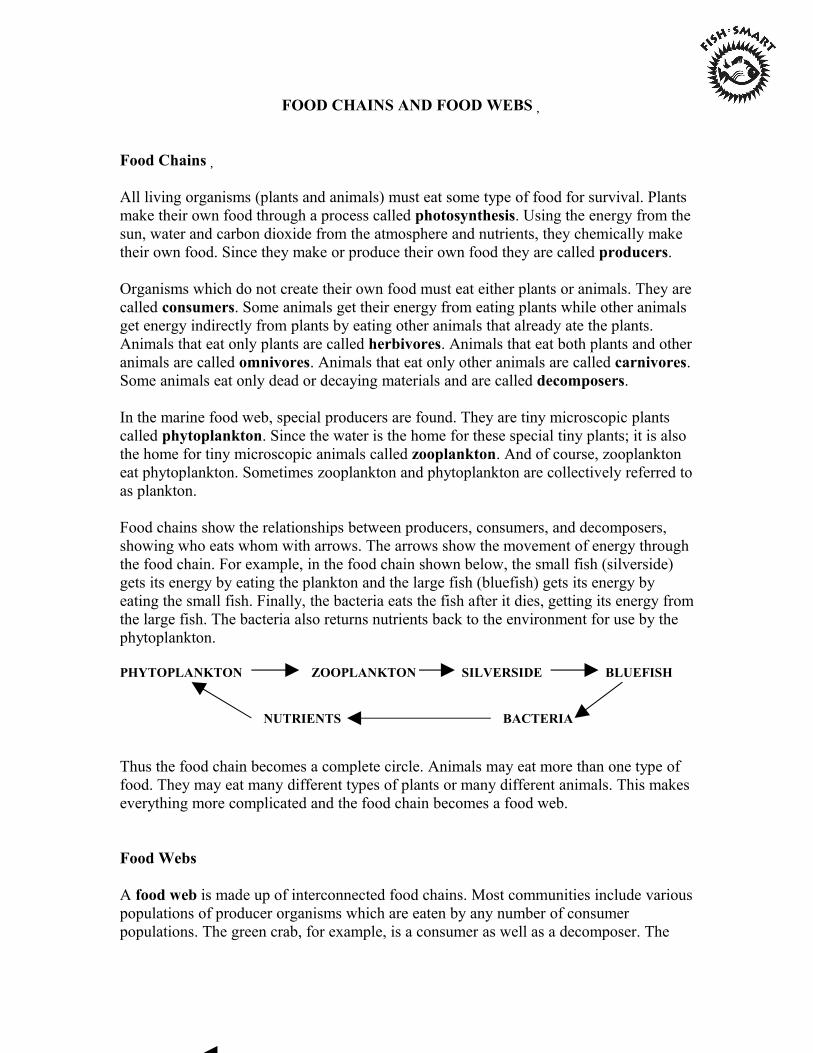
FOOD CHAINS AND FOOD WEBS�
Food Chains�
All living organisms (plants and animals) must eat some type of food for survival. Plants make their own food through a process called photosynthesis. Using the energy from the sun, water and carbon dioxide from the atmosphere and nutrients, they chemically make their own food. Since they make or produce their own food they are called producers.
Organisms which do not create their own food must eat either plants or animals. They are called consumers. Some animals get their energy from eating plants while other animals get energy indirectly from plants by eating other animals that already ate the plants. Animals that eat only plants are called herbivores. Animals that eat both plants and other animals are called omnivores. Animals that eat only other animals are called carnivores. Some animals eat only dead or decaying materials and are called decomposers.
In the marine food web, special producers are found. They are tiny microscopic plants called phytoplankton. Since the water is the home for these special tiny plants; it is also the home for tiny microscopic animals called zooplankton. And of course, zooplankton eat phytoplankton. Sometimes zooplankton and phytoplankton are collectively referred to as plankton.
Food chains show the relationships between producers, consumers, and decomposers, showing who eats whom with arrows. The arrows show the movement of energy through the food chain. For example, in the food chain shown below, the small fish (silverside) gets its energy by eating the plankton and the large fish (bluefish) gets its energy by eating the small fish. Finally, the bacteria eats the fish after it dies, getting its energy from the large fish. The bacteria also returns nutrients back to the environment for use by the phytoplankton.
PHYTOPLANKTON ZOOPLANKTON SILVERSIDE BLUEFISH
NUTRIENTS BACTERIA
Thus the food chain becomes a complete circle. Animals may eat more than one type of food. They may eat many different types of plants or many different animals. This makes everything more complicated and the food chain becomes a food web.
Food Webs
A food web is made up of interconnected food chains. Most communities include various populations of producer organisms which are eaten by any number of consumer populations. The green crab, for example, is a consumer as well as a decomposer. The
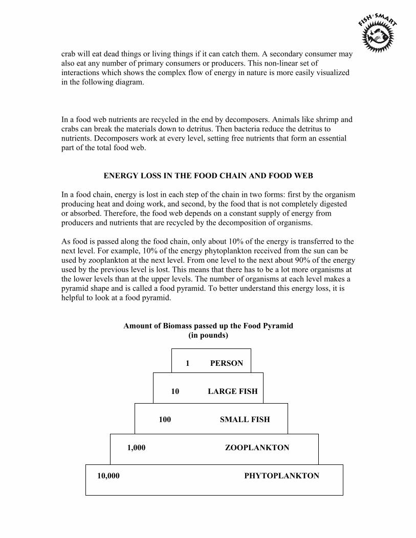
crab will eat dead things or living things if it can catch them. A secondary consumer may also eat any number of primary consumers or producers. This non-linear set of interactions which shows the complex flow of energy in nature is more easily visualized in the following diagram.
In a food web nutrients are recycled in the end by decomposers. Animals like shrimp and crabs can break the materials down to detritus. Then bacteria reduce the detritus to nutrients. Decomposers work at every level, setting free nutrients that form an essential part of the total food web.
ENERGY LOSS IN THE FOOD CHAIN AND FOOD WEB
In a food chain, energy is lost in each step of the chain in two forms: first by the organism producing heat and doing work, and second, by the food that is not completely digested or absorbed. Therefore, the food web depends on a constant supply of energy from producers and nutrients that are recycled by the decomposition of organisms.
As food is passed along the food chain, only about 10% of the energy is transferred to the next level. For example, 10% of the energy phytoplankton received from the sun can be used by zooplankton at the next level. From one level to the next about 90% of the energy used by the previous level is lost. This means that there has to be a lot more organisms at the lower levels than at the upper levels. The number of organisms at each level makes a pyramid shape and is called a food pyramid. To better understand this energy loss, it is helpful to look at a food pyramid.
Amount of Biomass passed up the Food Pyramid (in pounds)
1 PERSON
10 LARGE FISH
100 SMALL FISH
1,000 ZOOPLANKTON
10,000 PHYTOPLANKTON

Organisms at the broader base of the pyramid are greater in number than those at the top. There is, for example, a greater number of phytoplankton than zooplankton and more zooplankton than small fish, etc.
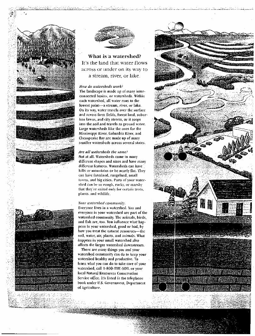
What is a watershed?
It's the land that water flows across or under on its way to
a stream, river, or lake.
How do watersheds work? The landscape is made up of many interconnected basins, or watersheds. Within eacii watershed, all water runs to the lowest point—a stream, river, or lake. On its way, water travels over the surface and across farm fields, forest land, subur
ban lawns, and city streets, or it seeps into the soil and travels as ground water.
Large watersheds like the ones for the
Mississippi River, Columbia River, and
Chesapeake Bay are made up of many
smaller watersheds across several states.
Are all watersheds the same? Not at all. Watersheds come in many
different shapes and sizes and have many
different features. Watersheds can have
hills or mountains or be nearly fiat. They
can have farmland, rangeland, small towns, and big cities. Parts of your watershed can be so rough, rocky, or marshy that they're suited only for certain trees, plants, and wildlife.
Your watershed community. Everyone lives in a watershed. You and
everyone in your watershed are part of the
watershed community. The animals, birds,
and fish are, too. You influence what happens in your watershed, good or bad, by how you treat the natural resources—the soil, water, air, plants, and animals. What happens in your small watershed also affects the larger watershed downstream.
There are many things you and your watershed community can do to keep your watershed healthy and productive. To learn what you can do to take care of your watershed, call 1-800-THE-SOII. or your
local Natural Resources Conservation
Service office. It's listed in the telephone
book under U.S. Government, Department of Agriculture.
4 * ^ *
<r
Ci>. -* f lk
Ecosystems and Their Elements
The following information will familiarize you with ecosystems and their elements. Your students will visit several habitats during their field study so as to understand ecosystems as a whole. The following are descriptions of four habitats, which together make up a coastal ecosystem. This information should be presented to students prior to their visit and will be reinforced during their field study.
The Ecosystem
An ecosystem is a unit consisting of living organisms of a particular habitat together with the physical, non-living environment in which they live. Living and non-living parts interact to form a stable system. All organisms and their habitats are part of this interconnected system. A salt marsh could be considered an ecosystem; it contains non-living elements like water, air, nutrients, and sediments as well as living plants, animals and fungi.
Energy and chemical cycles are two important components of an ecosystem. Energy flows through an ecosystem by transfer through food chains and webs. Chemicals cycle through water, soil, and air. Ecosystems depend on these energy and chemical cycles. The salt marsh and the estuary are two separate habitats. Although mutually interdependent, they are related because they help support each other. For example, the salt marsh supplies the estuary with nutrients from decaying plants and animals, which are washed to the estuary during high tides. Estuary animals consume these nutrients. Marsh banks and creeks offer estuary animals safety from sun, wind and predators. Fish hide under overhanging banks, and birds stay close to the marsh’s edge during storms.
An ecosystem’s physical and chemical characteristics determine the organisms that live there. The barrier beach ecosystem at Barney’s Joy has interdependent habitats of beach, dunes, salt marsh, and estuary. The beach supplies dunes with sand and protects them from waves by dispersing wave energy along its gradual slope. Dunes, in turn, protect the salt marsh from strong winds that blow off the water. As these winds strike the dune “wall” they lose energy.
Within these habitats live many interdependent species. The estuary harbors juvenile species of invertebrates and fish because they have readily available nutrients from decaying salt marsh grasses. Intertidal and subtidal organisms feed on these nutrients. When they die, the remains wash up on the beach where they break down adding nutrients.
The Sandy Beach
In general, the land bordering a large body of water is called a beach or shoreline. Along the New England Coast, this transitional zone between land and sea is composed of many different materials. These materials include cobble, pebbles and sand, which were deposited by glaciers thousands of years ago.
The white sandy beach is the most familiar type of shoreline along coastal Massachusetts. The mineral quartz gives these beaches their white appearance. Upon closer examination, sand
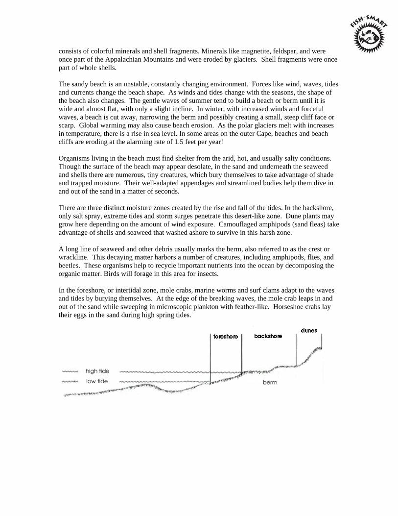
consists of colorful minerals and shell fragments. Minerals like magnetite, feldspar, and were once part of the Appalachian Mountains and were eroded by glaciers. Shell fragments were once part of whole shells.
The sandy beach is an unstable, constantly changing environment. Forces like wind, waves, tides and currents change the beach shape. As winds and tides change with the seasons, the shape of the beach also changes. The gentle waves of summer tend to build a beach or berm until it is wide and almost flat, with only a slight incline. In winter, with increased winds and forceful waves, a beach is cut away, narrowing the berm and possibly creating a small, steep cliff face or scarp. Global warming may also cause beach erosion. As the polar glaciers melt with increases in temperature, there is a rise in sea level. In some areas on the outer Cape, beaches and beach cliffs are eroding at the alarming rate of 1.5 feet per year!
Organisms living in the beach must find shelter from the arid, hot, and usually salty conditions. Though the surface of the beach may appear desolate, in the sand and underneath the seaweed and shells there are numerous, tiny creatures, which bury themselves to take advantage of shade and trapped moisture. Their well-adapted appendages and streamlined bodies help them dive in and out of the sand in a matter of seconds.
There are three distinct moisture zones created by the rise and fall of the tides. In the backshore, only salt spray, extreme tides and storm surges penetrate this desert-like zone. Dune plants may grow here depending on the amount of wind exposure. Camouflaged amphipods (sand fleas) take advantage of shells and seaweed that washed ashore to survive in this harsh zone.
A long line of seaweed and other debris usually marks the berm, also referred to as the crest or wrackline. This decaying matter harbors a number of creatures, including amphipods, flies, and beetles. These organisms help to recycle important nutrients into the ocean by decomposing the organic matter. Birds will forage in this area for insects.
In the foreshore, or intertidal zone, mole crabs, marine worms and surf clams adapt to the waves and tides by burying themselves. At the edge of the breaking waves, the mole crab leaps in and out of the sand while sweeping in microscopic plankton with feather-like. Horseshoe crabs lay their eggs in the sand during high spring tides.
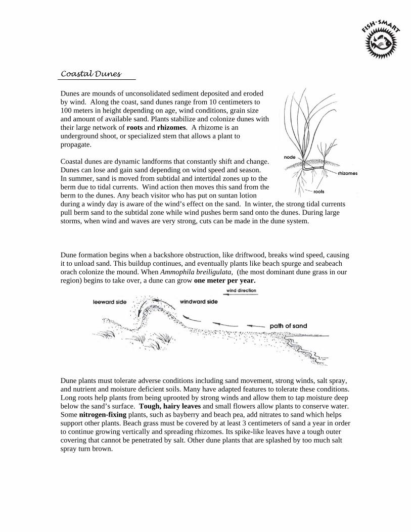
Coastal Dunes
Dunes are mounds of unconsolidated sediment deposited and eroded by wind. Along the coast, sand dunes range from 10 centimeters to 100 meters in height depending on age, wind conditions, grain size and amount of available sand. Plants stabilize and colonize dunes with their large network of roots and rhizomes. A rhizome is an underground shoot, or specialized stem that allows a plant to propagate.
Coastal dunes are dynamic landforms that constantly shift and change. Dunes can lose and gain sand depending on wind speed and season. In summer, sand is moved from subtidal and intertidal zones up to the berm due to tidal currents. Wind action then moves this sand from the berm to the dunes. Any beach visitor who has put on suntan lotion during a windy day is aware of the wind’s effect on the sand. In winter, the strong tidal currents pull berm sand to the subtidal zone while wind pushes berm sand onto the dunes. During large storms, when wind and waves are very strong, cuts can be made in the dune system.
Dune formation begins when a backshore obstruction, like driftwood, breaks wind speed, causing it to unload sand. This buildup continues, and eventually plants like beach spurge and seabeach orach colonize the mound. When Ammophila breiligulata, (the most dominant dune grass in our region) begins to take over, a dune can grow one meter per year.
Dune plants must tolerate adverse conditions including sand movement, strong winds, salt spray, and nutrient and moisture deficient soils. Many have adapted features to tolerate these conditions. Long roots help plants from being uprooted by strong winds and allow them to tap moisture deep below the sand’s surface. Tough, hairy leaves and small flowers allow plants to conserve water. Some nitrogen-fixing plants, such as bayberry and beach pea, add nitrates to sand which helps support other plants. Beach grass must be covered by at least 3 centimeters of sand a year in order to continue growing vertically and spreading rhizomes. Its spike-like leaves have a tough outer covering that cannot be penetrated by salt. Other dune plants that are splashed by too much salt spray turn brown.
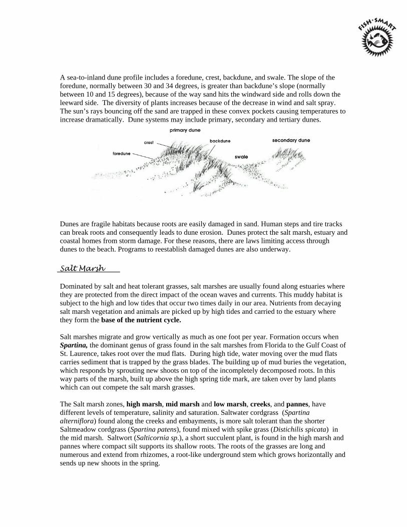
A sea-to-inland dune profile includes a foredune, crest, backdune, and swale. The slope of the foredune, normally between 30 and 34 degrees, is greater than backdune’s slope (normally between 10 and 15 degrees), because of the way sand hits the windward side and rolls down the leeward side. The diversity of plants increases because of the decrease in wind and salt spray. The sun’s rays bouncing off the sand are trapped in these convex pockets causing temperatures to increase dramatically. Dune systems may include primary, secondary and tertiary dunes.
Dunes are fragile habitats because roots are easily damaged in sand. Human steps and tire tracks can break roots and consequently leads to dune erosion. Dunes protect the salt marsh, estuary and coastal homes from storm damage. For these reasons, there are laws limiting access through dunes to the beach. Programs to reestablish damaged dunes are also underway.
Salt Marsh
Dominated by salt and heat tolerant grasses, salt marshes are usually found along estuaries where they are protected from the direct impact of the ocean waves and currents. This muddy habitat is subject to the high and low tides that occur two times daily in our area. Nutrients from decaying salt marsh vegetation and animals are picked up by high tides and carried to the estuary where they form the base of the nutrient cycle.
Salt marshes migrate and grow vertically as much as one foot per year. Formation occurs when Spartina, the dominant genus of grass found in the salt marshes from Florida to the Gulf Coast of St. Laurence, takes root over the mud flats. During high tide, water moving over the mud flats carries sediment that is trapped by the grass blades. The building up of mud buries the vegetation, which responds by sprouting new shoots on top of the incompletely decomposed roots. In this way parts of the marsh, built up above the high spring tide mark, are taken over by land plants which can out compete the salt marsh grasses.
The Salt marsh zones, high marsh, mid marsh and low marsh, creeks, and pannes, have different levels of temperature, salinity and saturation. Saltwater cordgrass (Spartina alterniflora) found along the creeks and embayments, is more salt tolerant than the shorter Saltmeadow cordgrass (Spartina patens), found mixed with spike grass (Distichilis spicata) in the mid marsh. Saltwort (Salticornia sp.), a short succulent plant, is found in the high marsh and pannes where compact silt supports its shallow roots. The roots of the grasses are long and numerous and extend from rhizomes, a root-like underground stem which grows horizontally and sends up new shoots in the spring.
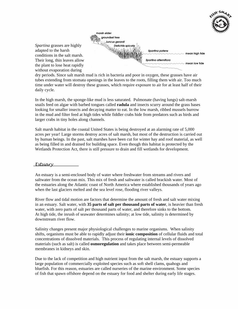
Spartina grasses are highly adapted to the harsh conditions in the salt marsh. Their long, thin leaves allow the plant to lose heat rapidly without evaporation during dry periods. Since salt marsh mud is rich in bacteria and poor in oxygen, these grasses have air tubes extending from stomata openings in the leaves to the roots, filling them with air. Too much time under water will destroy these grasses, which require exposure to air for at least half of their daily cycle.
In the high marsh, the sponge-like mud is less saturated. Pulmonate (having lungs) salt-marsh snails feed on algae with barbed tongues called radula and insects scurry around the grass bases looking for smaller insects and decaying matter to eat. In the low marsh, ribbed mussels burrow in the mud and filter feed at high tides while fiddler crabs hide from predators such as birds and larger crabs in tiny holes along channels.
Salt marsh habitat in the coastal United States is being destroyed at an alarming rate of 5,000 acres per year! Large storms destroy acres of salt marsh, but most of the destruction is carried out by human beings. In the past, salt marshes have been cut for winter hay and roof material, as well as being filled in and drained for building space. Even though this habitat is protected by the Wetlands Protection Act, there is still pressure to drain and fill wetlands for development.
Estuary
An estuary is a semi-enclosed body of water where freshwater from streams and rivers and saltwater from the ocean mix. This mix of fresh and saltwater is called brackish water. Most of the estuaries along the Atlantic coast of North America where established thousands of years ago when the last glaciers melted and the sea level rose, flooding river valleys.
River flow and tidal motion are factors that determine the amount of fresh and salt water mixing in an estuary. Salt water, with 35 parts of salt per thousand parts of water, is heavier than fresh water, with zero parts of salt per thousand parts of water, and therefore sinks to the bottom. At high tide, the inrush of seawater determines salinity; at low tide, salinity is determined by downstream river flow.
Salinity changes present major physiological challenges to marine organisms. When salinity shifts, organisms must be able to rapidly adjust their ionic composition of cellular fluids and total concentrations of dissolved materials. This process of regulating internal levels of dissolved materials (such as salt) is called osmoregulation and takes place between semi-permeable membranes in kidneys and skin.
Due to the lack of competition and high nutrient input from the salt marsh, the estuary supports a large population of commercially exploited species such as soft shell clams, quahogs and bluefish. For this reason, estuaries are called nurseries of the marine environment. Some species of fish that spawn offshore depend on the estuary for food and shelter during early life stages.

Juvenile bluefish, for example, begin their life cycle offshore, but migrate to bays and estuaries in the summer for most of their life cycle.
To avoid being expelled from the estuary during tidal flushing, fish and invertebrate larvae cling to the floor where water moves slowly. Animals like jellyfish, comb jellies and dinoflagellates that drift with the currents are usually flushed from the estuary during outgoing tides. Also called marine zooplankton, these creatures have specialized shapes that allow them to float in water.
Birds also flock to the estuary to feed. Mud and sand flats are dominated by small shorebirds such as sandpipers and plovers that feed on marine worms and insects. Larger birds, such as the great blue heron, hunt fish in the estuary channels and creeks.
For more information on estuaries, visit:
http://www.epa.gov/owow/estuaries/
http://www.epa.gov/NE/topics/ecosystems/estuaries.html
More Than Just A Swamp
Introduction:
Wetlands are very important to the well-being of many plants and animals, including people. But what are these areas, and what do they do? A Wetland is the area between dry land and open water. It is sometimes covered with a shallow layer of water, but there are also wetlands which can be dry for part of the year. The plants and animals which live there are adapted to this watery environment. There are many different types of wetlands.
Wetland Types
Swamp - Wetland where trees and shrubs grow which are flooded and rivers that experience both wet and dry periods during the year. They are often forested.
Marsh - Marshes are the wet areas filled with a variety of grasses and rushes. They can be found in both freshwater areas and in the saltwater areas near our coast.
Pocosin - These are the wet areas with evergreen trees and shrubs growing on peat or sandy soils. Peat is a spongy-feeling material made up of decaying plants. The word pocosin comes from the Algonquin Indian word meaning "swamp on a hill."
Wetland Functions
Flood Control - Excess water from heavy rains is slowed by wetlandplants and stored in the low-lying areas of wetlands, preventing the waters of nearby rivers and streams from overflowing and damaging property.
Storm Buffer - Along our coast, wetlands take a beating from high winds and waves, yet remain intact. The thick vegetation buffers the forces ofstorms and protects the land from erosion.
Water Banks - Wetlands hold water during the wet season. This waterseeps through the soil and into our underground water supplies.
Water Filter - Wetlands help purify runoff waters which carry pollutants. Silt and soil, which choke aquatic life, settle out. Wastes are broken down and absorbed by aquatic plants, as are many harmful chemicals.
Nurseries - Many fish and animals use wetlands as nurseries. They provide an abundant supply of food and shelter for they young.
Home Sweet Home - Wetlands are home to many animals. A thriving wetland probably has more life in it than any other kind of habitat.
Wildlife Pantry - Wetlands are so productive, many animals depend on them for food. Many migrating birds stopover in wetlands each spring and fall to rest and feed before continuing their trip, and some will spend the winter in the wetlands.
Recreational Opportunities - Wetlands provide us with places to watchbirds and animals, and to fish, boat, and hunt.
Economics - Commercial fisherman depend on the wetlands to supply us with crabs and many other types of seafood.
Wetlands in Danger!
More than half of the U.S. wetlands have been lost since the 1600's. They have been drained to make farm fields, or filled for developments or dredged for waterways. Wetlands become "drylands" when people fill them, build dams, or divert the water that feeds these areas.
In the past wetlands were considered useless wastelands. Now we know that they are very valuable to people and wildlife. Changing opinions are resulting in new laws to help save wetlands, but there is still much work to be done to stop the destruction and to restore our wonderful wetlands.
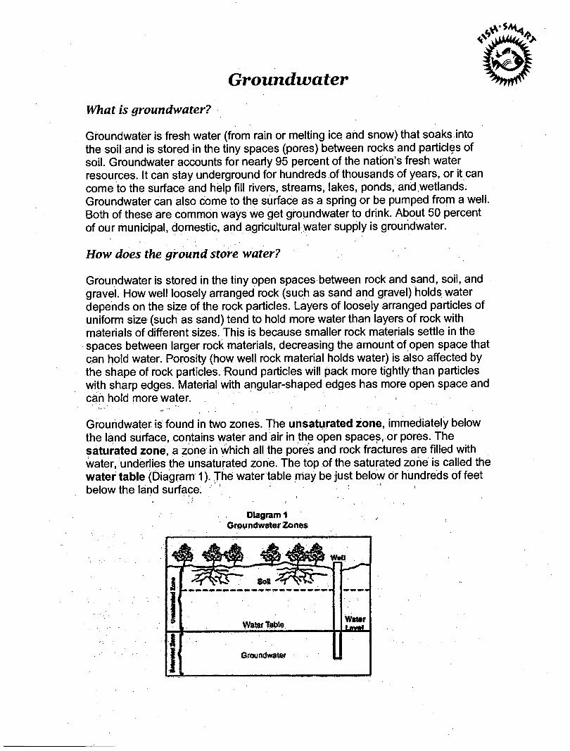
Groundwater
What is groundwater?
Groundwater is fresh water (from rain or melting ice and snow) that soaks into the soil and is stored in the tiny spaces (pores) between rocks and particles of soil. Groundwater accounts for nearly 95 percent of the nation's fresh water resources. It can stay underground for hundreds of thousands of years, or it can come to the surface and help fill rivers, streams, lakes, ponds, and wetlands. Groundwater can also come to the surface as a spring or be pumped from a well. Both of these are common ways we get groundwater to drink. About 50 percent of our municipal, domestic, and agricultural water supply is groundwater.
How does the ground store water?
Groundwater is stored in the tiny open spaces between rock and sand, soil, and gravel. How well loosely arranged rock (such as sand and gravel) holds water depends on the size of the rock particles. Layers of loosely arranged particles of Uniform size (such as sand) tend to hold more water than layers of rock with materials of different sizes. This is because smaller rock materials settle in the spaces between larger rock materials, decreasing the amount of open space that can hold water. Porosity (how well rock material holds water) is also affected by the shape of rock particles. Round particles will pack more tightly than particles with sharp edges. Material with angular-shaped edges has more open space and can hold more water.
Groundwater is found in two zones. The unsaturated zone, immediately below the land surface, contains water and air in the open spaces, or pores. The saturated zone, a zone in which all the pores and rock fractures are filled with water, underlies the unsaturated zone. The top of the saturated zone is called the water table (Diagram 1). The water table may be just below or hundreds of feet below the land surface:
Diagram 1 . , Groundwater Zones
What is an aquifer?
Where groundwater can move rapidly, such as through gravel and sandy deposits, an aquifer can form. In an aquifer, there is enough groundwater that it can be pumped to the surface and used for drinking water, irrigation, industry, or other uses.
For water to move through underground rock, pores or fractures in the rock must be connected. If rocks have good connections between pores or fractures and water can move freely through them, we say that the rock is permeable. Permeability refers to how well a material transmits water. If the pores or fractures are not connected, the rock material cannot produce water and is therefore not considered an aquifer. The amount of water an aquifer can hold depends on the volume of the underground rock materials and the size and number of pores and fractures that can fill with water.
An aquifer may be a few feet to several thousand feet thick, and less than a square mile or hundreds of thousands of square miles in area. For example, the High Plains Aquifer underlies about 280,000 square miles in 8 states— Colorado, Kansas, Nebraska, New Mexico, Oklahoma, South Dakota, Texas, and Wyoming.
How does water fill an aquifer?
Aquifers get water from precipitation (rain and snow) that filters through the unsaturated zone. Aquifers can also receive water from surface waters like lakes and rivers. When the aquifer is full, and the water table meets the surface of the ground, water stored in the aquifer can appear at the land surface as a spring or seep. Recharge areas are where aquifers take in water; discharge areas are where groundwater flows to the land surface. Water moves from higher-elevation areas of recharge to lower-elevation areas of discharge through the saturated zone.
How does water circulate?
Surface water and groundwater are part of the hydrologic cycle, the constant movement of water above, on, and below the earth’s surface (Diagram 2). The cycle has no beginning and no end, but you can understand it best by tracing it from precipitation.
Precipitation occurs in several forms, including rain, snow, and hail. Rain, for example, wets the ground surface. As more rain falls, water begins to filter into the ground. How fast water soaks into, or infiltrates the soil depends on soil type, land use, and the intensity and length of the storm. Water infiltrates faster into soils that are mostly sand than into those that are mostly clay or silt. Almost no
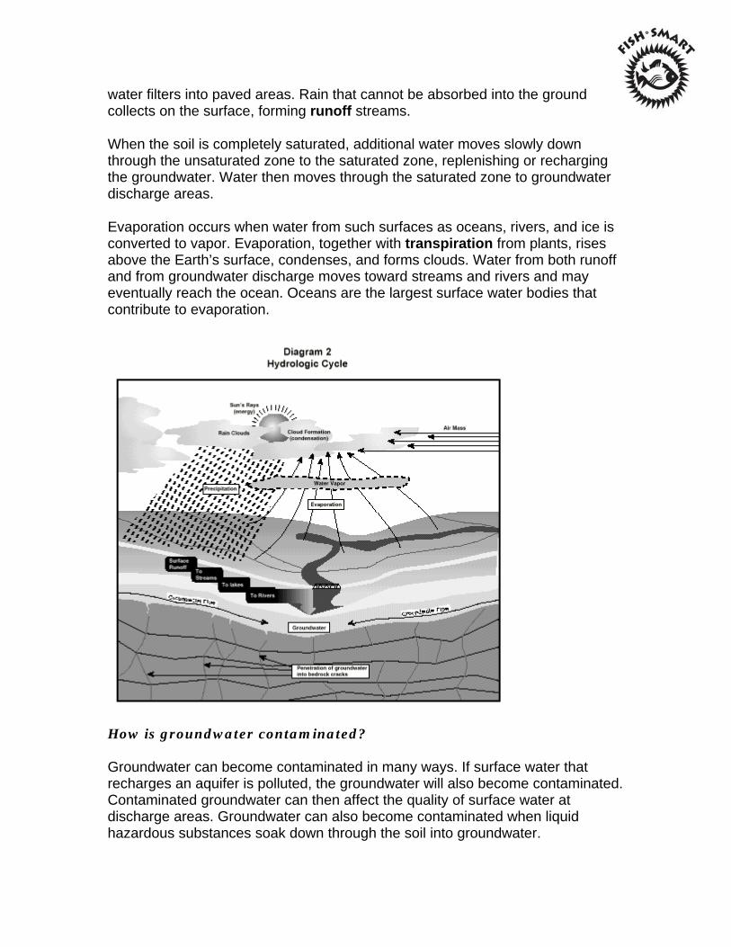
water filters into paved areas. Rain that cannot be absorbed into the ground collects on the surface, forming runoff streams.
When the soil is completely saturated, additional water moves slowly down through the unsaturated zone to the saturated zone, replenishing or recharging the groundwater. Water then moves through the saturated zone to groundwater discharge areas.
Evaporation occurs when water from such surfaces as oceans, rivers, and ice is converted to vapor. Evaporation, together with transpiration from plants, rises above the Earth’s surface, condenses, and forms clouds. Water from both runoff and from groundwater discharge moves toward streams and rivers and may eventually reach the ocean. Oceans are the largest surface water bodies that contribute to evaporation.
How is groundwater contaminated?
Groundwater can become contaminated in many ways. If surface water that recharges an aquifer is polluted, the groundwater will also become contaminated. Contaminated groundwater can then affect the quality of surface water at discharge areas. Groundwater can also become contaminated when liquid hazardous substances soak down through the soil into groundwater.
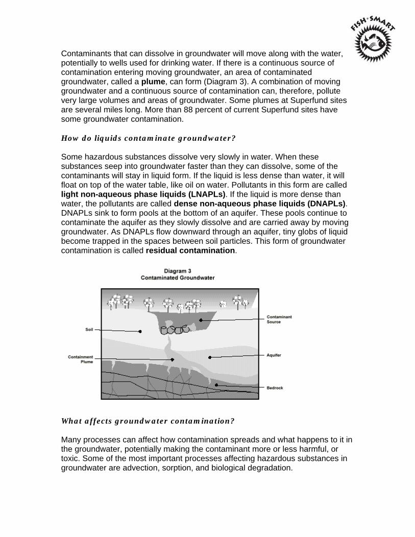
Contaminants that can dissolve in groundwater will move along with the water, potentially to wells used for drinking water. If there is a continuous source of contamination entering moving groundwater, an area of contaminated groundwater, called a plume, can form (Diagram 3). A combination of moving groundwater and a continuous source of contamination can, therefore, pollute very large volumes and areas of groundwater. Some plumes at Superfund sites are several miles long. More than 88 percent of current Superfund sites have some groundwater contamination.
How do liquids contaminate groundwater?
Some hazardous substances dissolve very slowly in water. When these substances seep into groundwater faster than they can dissolve, some of the contaminants will stay in liquid form. If the liquid is less dense than water, it will float on top of the water table, like oil on water. Pollutants in this form are called light non-aqueous phase liquids (LNAPLs). If the liquid is more dense than water, the pollutants are called dense non-aqueous phase liquids (DNAPLs). DNAPLs sink to form pools at the bottom of an aquifer. These pools continue to contaminate the aquifer as they slowly dissolve and are carried away by moving groundwater. As DNAPLs flow downward through an aquifer, tiny globs of liquid become trapped in the spaces between soil particles. This form of groundwater contamination is called residual contamination.
What affects groundwater contamination?
Many processes can affect how contamination spreads and what happens to it in the groundwater, potentially making the contaminant more or less harmful, or toxic. Some of the most important processes affecting hazardous substances in groundwater are advection, sorption, and biological degradation.
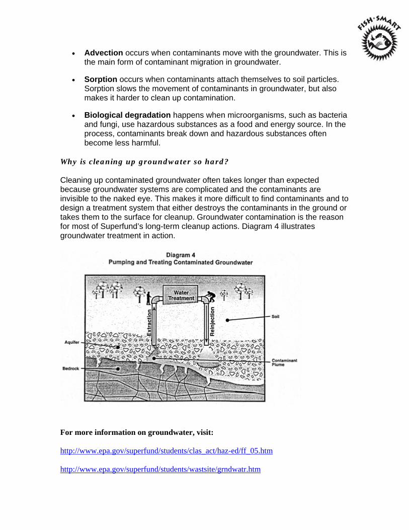
Advection occurs when contaminants move with the groundwater. This is the main form of contaminant migration in groundwater.
Sorption occurs when contaminants attach themselves to soil particles. Sorption slows the movement of contaminants in groundwater, but also makes it harder to clean up contamination.
Biological degradation happens when microorganisms, such as bacteria and fungi, use hazardous substances as a food and energy source. In the process, contaminants break down and hazardous substances often become less harmful.
Why is cleaning up groundwater so hard?
Cleaning up contaminated groundwater often takes longer than expected because groundwater systems are complicated and the contaminants are invisible to the naked eye. This makes it more difficult to find contaminants and to design a treatment system that either destroys the contaminants in the ground or takes them to the surface for cleanup. Groundwater contamination is the reason for most of Superfund’s long-term cleanup actions. Diagram 4 illustrates groundwater treatment in action.
For more information on groundwater, visit:
http://www.epa.gov/superfund/students/clas_act/haz-ed/ff_05.htm
http://www.epa.gov/superfund/students/wastsite/grndwatr.htm
Combined Sewer Overflows (CSOs) in New England What is a CSO?
Combined sewer overflows are sewer systems that were designed to carry sewage and storm water in the same pipe to a sewage treatment plant. After heavy rainfall or snowmelt events, the wastewater volume is often more than the sewer system or treatment plant can handle. For this reason, combined sewer systems were designed to overflow after rain events and result in excess wastewater being discharged directly into rivers, lakes and coastal areas. The wastewater the CSOs carry not only contains storm water but also untreated human waste and industrial waste, toxic materials and floating debris.
Overview of CSOs in New England:
Sewage discharges from combined sewer overflow pipes are a major problem in this country and are a big reason why many of the nation's rivers remain unsafe for swimming and fishing. The problem is especially acute in New England, where more than 100 communities are burdened with CSO pipes that discharge hundreds of millions of gallons of untreated sewage and stormwater into waterways after heavy rains. Eliminating these discharges is an enormous financial challenge. In New England alone, the price tag for eliminating CSOs could run as high as $4 billion. EPA New England recognizes the significant financial burden that the CSO abatement program will pose for the region and is working with communities to develop cost effective plans that maximize environmental and health benefits with affordability.
What are the Local Challenges for New Englanders?
CSO impacts on rivers that may be primary drinking water sources for communities are particularly serious. CSO discharges are a major pollution source to our rivers and are a big reason why water quality standards can be violated after heavy rains. For example in Lowell, Massachusetts, there are nine CSO outfall pipes that discharge more than 10 million gallons of combined sewage and storm water into the Merrimack River during a typical one-inch rainstorm. EPA is also working with Haverhill, Nashua, Greater Lawrence Sanitary District, Manchester, NH and other cities along the Merrimack to address their CSO problems.
What are the Environmental and Public Health Impacts of CSOs?
CSO discharges have widespread impacts across New England, causing beach closings, shellfishing restrictions and limiting fishing and other recreational
activities. In some instances, CSOs discharge raw sewage into rivers that also serve as primary sources of drinking water. Exposure to viruses, bacteria, pathogens and other CSO-related pollutants or toxics is an obvious public health concern. Swimmers, canoeists, and others exposed to CSO contaminants are vulnerable to gastroenteritis, respiratory infections, eye or ear infections, skin rashes, hepatitis and other diseases. Children, the elderly, and people with suppressed immune systems are especially vulnerable.
Wildlife and aquatic habitat are also adversely affected by CSO pollutants which lead to higher water temperatures, increased turbidity, toxins and reduced oxygen levels in the water.
What are Some Innovative Approaches from EPA?
EPA realizes that fixing CSOs is an expensive proposition and is committed to finding innovative abatement strategies that meet environmental standards while ensuring that the projects are affordable to local communities. EPA has adopted a CSO Control Policy that is aimed at minimizing CSO pollution impacts to water bodies while requiring case-by-case community approaches that give state and local flexibility in development of the solutions. EPA New England has combined enforcement and assistance efforts to show flexibility in crafting projects and implementation schedules. Communities are given flexibility through lengthy schedules to do the work and encouragement to use technologies that maximize environmental benefits. EPA New England is the first to use a watershed-based approach to prioritize CSO controls along with other critical environmental needs so that taxpayer dollars are spent to maximize environmental returns–more environmental benefit at the least cost.
Among the cities where EPA has shown flexibility and innovation in tackling CSOs:
1. Boston Harbor in Boston, MA: In Boston Harbor, EPA New England worked with the Massachusetts Water Resource Authority (MWRA), environmental groups, and the state to negotiate an agreement on priorities for CSO controls. Prioritizing CSO controls and agreement on changes in water quality standards to reflect those priorities allowed this CSO plan to provide very stringent controls in recreational beach areas, such as Dorchester Bay, in return for lesser levels of control in shipping channels. Beaches in the Boston Harbor, like Constitution Beach, are closed far fewer days today than in the past, largely thanks to the elimination of CSOs. Improvements to the MWRA wastewater system have resulted in much of the wastewater that used to flow to CSOs now being treated at the Deer Island

sewage treatment plant. Today, it takes a much larger rain storm to close a Boston Harbor beach.
2. Merrimack River in Manchester, NH: EPA's CSO agreement with Manchester is a good example of our flexible community-by-community approach. The agreement here has received enthusiastic support of environmental groups as well as state and local leaders, including Governor Shaheen and Mayor Baines. The agreement requires the city to invest $52 million in the first phase of a project to control CSOs along the Merrimack River. This phased approach reduced Manchester's upfront financial burden by more than $50 million–or $500 per resident. By allowing the CSO work to be done in phases, EPA was able to negotiate another $5.6 million in other environmental improvements, including polluted runoff controls along the river, purchase of important wetland areas in the city and a program to reduce childhood asthma and lead poisoning.
For more information on CSOs, visit:
http://www.epa.gov/region1/eco/cso/index.html
http://cfpub.epa.gov/npdes/home.cfm?program_id=5
http://cfpub.epa.gov/npdes/cso/cpolicy.cfm?program_id=5
What is Nonpoint Source (NPS) Pollution? Questions and Answers (taken from EPA's Polluted brochure EPA-841-F-94-005, 1994)
Q: What is nonpoint source pollution?
A: Nonpoint source (NPS) pollution, unlike pollution from industrial and sewage treatment plants, comes from many diffuse sources. NPS pollution is caused by rainfall or snowmelt moving over and through the ground. As the runoff moves, it picks up and carries away natural and human-made pollutants, finally depositing them into lakes, rivers, wetlands, coastal waters, and even our underground sources of drinking water. These pollutants include:
Excess fertilizers, herbicides, and insecticides from agricultural lands and residential areas;
Oil, grease, and toxic chemicals from urban runoff and energy production; Sediment from improperly managed construction sites, crop and forest
lands, and eroding streambanks; Salt from irrigation practices and acid drainage from abandoned mines; Bacteria and nutrients from livestock, pet wastes, and faulty
septicsystems;
Atmospheric deposition and hydromodification are also sources of nonpoint source pollution.
Q: What are the effects of these pollutants on our waters?
A: States report that nonpoint source pollution is the leading remaining cause of water quality problems. The effects of nonpoint source pollutants on specific waters vary and may not always be fully assessed. However, we know that these pollutants have harmful effects on drinking water supplies, recreation, fisheries, and wildlife.
Q: What causes nonpoint source pollution?
A: We all play a part. Nonpoint source pollution results from a wide variety of human activities on the land. Each of us can contribute to the problem without even realizing it.
Q: What can we do about nonpoint source pollution?
A: We can all work together to reduce and prevent nonpoint source pollution. Some activities are federal responsibilities, such as ensuring that federal lands are properly managed to reduce soil erosion. Some are state responsibilities, for example, developing legislation to govern mining and logging, and to protect groundwater. Others are best handled locally, such as by zoning or erosion control ordinances. And each individual can play an important role by practicing conservation and by changing certain everyday habits.
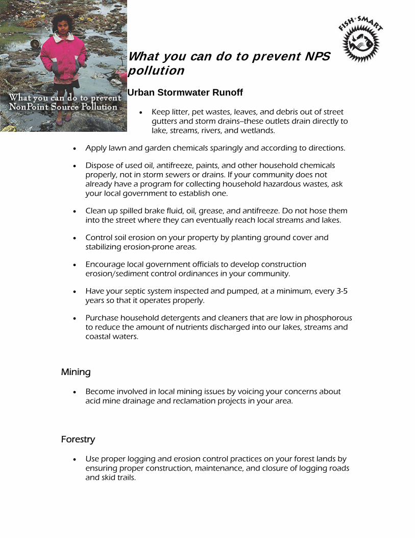
What you can do to prevent NPS pollution
Urban Stormwater Runoff
Keep litter, pet wastes, leaves, and debris out of street gutters and storm drains--these outlets drain directly to lake, streams, rivers, and wetlands.
Apply lawn and garden chemicals sparingly and according to directions.
Dispose of used oil, antifreeze, paints, and other household chemicals properly, not in storm sewers or drains. If your community does not already have a program for collecting household hazardous wastes, ask your local government to establish one.
Clean up spilled brake fluid, oil, grease, and antifreeze. Do not hose them into the street where they can eventually reach local streams and lakes.
Control soil erosion on your property by planting ground cover and stabilizing erosion-prone areas.
Encourage local government officials to develop construction erosion/sediment control ordinances in your community.
Have your septic system inspected and pumped, at a minimum, every 3-5 years so that it operates properly.
Purchase household detergents and cleaners that are low in phosphorous to reduce the amount of nutrients discharged into our lakes, streams and coastal waters.
Mining
Become involved in local mining issues by voicing your concerns about acid mine drainage and reclamation projects in your area.
Forestry
Use proper logging and erosion control practices on your forest lands by ensuring proper construction, maintenance, and closure of logging roads and skid trails.
Report questionable logging practices to state and federal forestry and state water quality agencies.
Agriculture
Manage animal waste to minimize contamination of surface water and ground water.
Protect drinking water by using less pesticides and fertilizers.
Reduce soil erosion by using conservation practices and other applicable best management practices.
Use planned grazing systems on pasture and rangeland.
Dispose of pesticides, containers, and tank rinsate in an approved manner.

w
Additional Resources
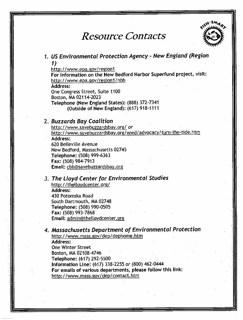
Resource Contacts
1. US Environmental Protection Agency - New England (Region 1) http://www.epa.gov/region1 For information on the New Bedford Harbor Superfund project, visit: http://www.epa.gov/region1/nbh Address: One Congress Street, Suite 1100 Boston, AAA 02114-2023 Telephone (New England States): (888) 372-7341
(Outside of New England): (617) 918-1111
2. Buzzards Bay Coalition http: / /www.savebuzzardsbay.org/ or http://www.savebuzzardsbav.org/wwd/advocacy/turn-the-tide.htm Address: 620 Belleville Avenue New Bedford, Massachusetts 02745 Telephone: (508) 999-6363 Fax:(508)984-7913 Email: [email protected]
3. The Lloyd Center for Environmental Studies http://thellovdcenter.org/ Address: 430 Potomska Road South Dartmouth, AAA 02748 Telephone: (508) 990-0505 Fax: (508) 993-7868 Email: [email protected]
4. Massachusetts Department of Environmental Protection http://www.mass.gov/dep/dephome.htm Address: One Winter Street Boston, MA 02108-4746 Telephone: (617) 292-5500 Information Line: (617) 338-2255 or (800) 462-0444 For emails of various departments, please follow this link: http://www.mass.gov/dep/contact.htm
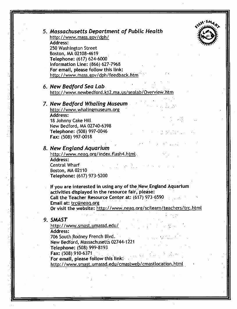
5. Massachusetts Department of Public Health http://www.mass.gov/dph/ Address: 250 Washington Street Boston, AAA 02108-4619 Telephone: (617) 624-6000 Information Line: (866) 627-7968 For email, please follow this link: http://www.mass.gov/dph/feedback.htm
6. New Bedford Sea Lab http: / / www, newbedford. k12. ma. us/sealab/Overview.: htm
7. New Bedford Whaling Museum http://www.whalingmuseum.org Address: 18 Johnny Cake Hill New Bedford, AAA 02740-6398 Telephone: (508) 997-0046 Fax: (508) 997-0018
8. New England Aquarium http://www.neaq.org/index.flash4.html Address: Central Wharf Boston, AAA 02110 Telephone: (617) 973-5200
If you are interested in using any of the New England Aquarium activities displayed in the resource fair, please: Call the Teacher Resource Center at: (617) 973-6590 Email at: [email protected] Or visit the yvebsite: http://www.neaq.org/scilearn/teachers/trc.html
9. SMAST http: / Zwww.smast.umassd.edu/ e Address: 706 South,Rodney French Blvd. v New Bedford, AAassachusetts 02744-1221 Telephone: (508) 999-8193 Fax: (508) 910-6371 . , For email, please follow this link: http://www.smast.umassd.edu/cmastweb/cmastlocation.html
Links of Interest
For students to explore while in the classroom:
1. "What on Earth?" Game http://qaia.ha.nasa.aov/auiz/auiz start-template.cfm
2. "What's Wrong with This Picture?" http://www.epa.qov/QWQW/NPS/kids/whatwrnq.htm
3. Waste Site Activity http://www.epa.gov/superfund/students/wastsite/index.htm
Specific Topics:
Combined Sewer Overflows (CSOs):
http://www.epa.qov/reqion1/eco/cso/index.html
http://cfpub.epa.qov/npdes/home.cfm?proaramJd=5
http://cfpub.epa.qov/npdes/Cso/cpolicv.cfm?proqram_id=5
Estuaries: h ttp: //www, e pa. a o v/o wo w/est uar i e s /
http://www.epa.a0v/NE/t6pics/ecosvstems/estuaries.html
Groundwater:
http://www.epa.qov/superfund/students/clas_act/haz-ed/ff_05.htm
http://www.epa.aov/superfund/students/wastsite/qrndwatr.htm
Massachusetts Department of Education Curriculum Frameworks
http://www.doe.fnass.edu/frameworks/scitech/200T/0501.pdf
m
Massachusetts Water Resources Authority (MWRA)
http: //www, mwra.com
For school programs and curriculum resources, visit: http://www.mwra.com/02ora/html/sti.htm
Nonooint Source Pollution:
http://www.epa.aov/NE/communities/nonpoint.html
http://www.epa.aov/NE/topics/water/npsources.html
Polvchlorinated Biphenvls (PCBs):
http://www.epa.aov/superfund/students/clas_act/haz-ed/ff_09.htm
http://www.epa.aov/pcb
Salt Marshes:
http://mbanet.mobot.ora/sait/sandv/saltmarsh.htm
Superfund Cleanup Program:
http://www.epa.gov/superfund/students/index.htm
http://www.epa.aov/superfund/index.htm
Superfund Stories: http://www.epa.aov/superfund/kids/stories.htm
Teacher Created Resources:
http://www.teachercreated.com/free/
If you are interested in ordering materials or downloading free lesson plans, visit: http://www,teachercreated.com/free/free.shtml

> o, o £-rt Q_, t-j. p? < rt P. • rt Oi s s? CO
f
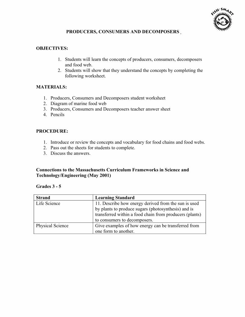
PRODUCERS, CONSUMERS AND DECOMPOSERS�
OBJECTIVES:
1. Students will learn the concepts of producers, consumers, decomposers and food web.
2. Students will show that they understand the concepts by completing the following worksheet.
MATERIALS:
1. Producers, Consumers and Decomposers student worksheet 2. Diagram of marine food web 3. Producers, Consumers and Decomposers teacher answer sheet 4. Pencils
PROCEDURE:
1. Introduce or review the concepts and vocabulary for food chains and food webs. 2. Pass out the sheets for students to complete. 3. Discuss the answers.
Connections to the Massachusetts Curriculum Frameworks in Science and Technology/Engineering (May 2001)
Grades 3 - 5
Strand Learning Standard Life Science 11. Describe how energy derived from the sun is used
by plants to produce sugars (photosynthesis) and is transferred within a food chain from producers (plants) to consumers to decomposers.
Physical Science Give examples of how energy can be transferred from one form to another.

PRODUCERS, CONSUMERS AND DECOMPOSERS
Name: Date:
1. In each of the following lists, one organism does not belong because it eats different types of food than the other organisms in the list. Cross off the organisms that does not belong and then label the list as producers, herbivores, carnivores, omnivores, or decomposers.
List A: Carnivore List B: Producer
Green crab phytoplankton Minnow seaweed Sea bass marsh grass Algae ribbed mussel Herring gull eel grass
List C: Herbivore List D: Decomposer
Zooplankton beach fleas Canada goose phytoplankton Periwinkle bacteria Grass shrimp Phytoplankton
2. A producer is
3. A consumer
4. A decomposer is.

5. Using some of the organisms from questions 1, create a food web on the back of this paper.
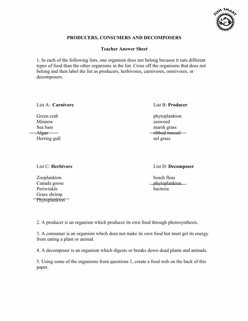
PRODUCERS, CONSUMERS AND DECOMPOSERS
Teacher Answer Sheet
1. In each of the following lists, one organism does not belong because it eats different types of food than the other organisms in the list. Cross off the organisms that does not belong and then label the list as producers, herbivores, carnivores, omnivores, or decomposers.
List A: Carnivore List B: Producer
Green crab phytoplankton Minnow seaweed Sea bass marsh grass Algae ribbed mussel Herring gull eel grass
List C: Herbivore List D: Decomposer
Zooplankton beach fleas Canada goose phytoplankton Periwinkle bacteria Grass shrimp Phytoplankton
2. A producer is an organism which produces its own food through photosynthesis.
3. A consumer is an organism which does not make its own food but must get its energy from eating a plant or animal.
4. A decomposer is an organism which digests or breaks down dead plants and animals.
5. Using some of the organisms from questions 1, create a food web on the back of this paper.
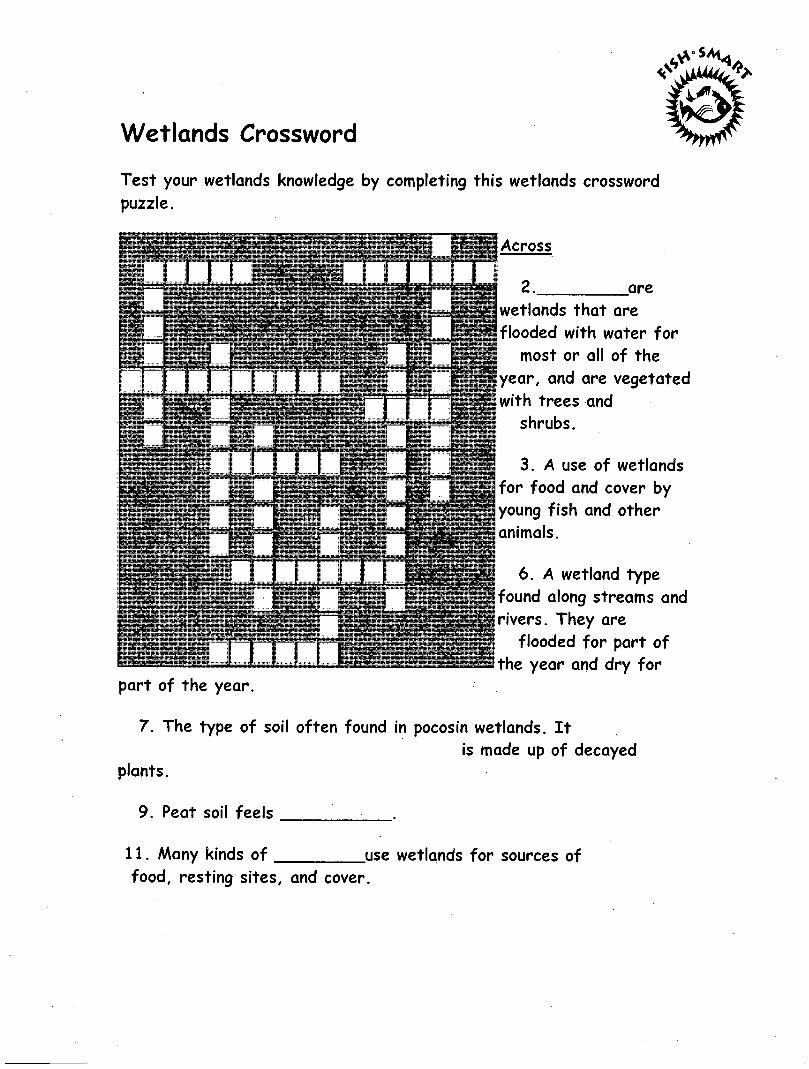
Wetlands Crossword
Test your wetlands knowledge by completing this wetlands crossword puzzle.
Across
are
part of the year.
wetlands that are flooded with water for
most or all of the year, and are vegetated with trees and
shrubs.
3. A use of wetlands for food and cover by young fish and other animals.
6. A wetland type found along streams and rivers. They are
" flooded for part of ®EsSsthe year and dry for
7. The type of soil often found in pocosin wetlands. It is made up of decayed
plants.
9. Peat soil feels
11. Many kinds of use wetlands for sources of food, resting sites, and cover.
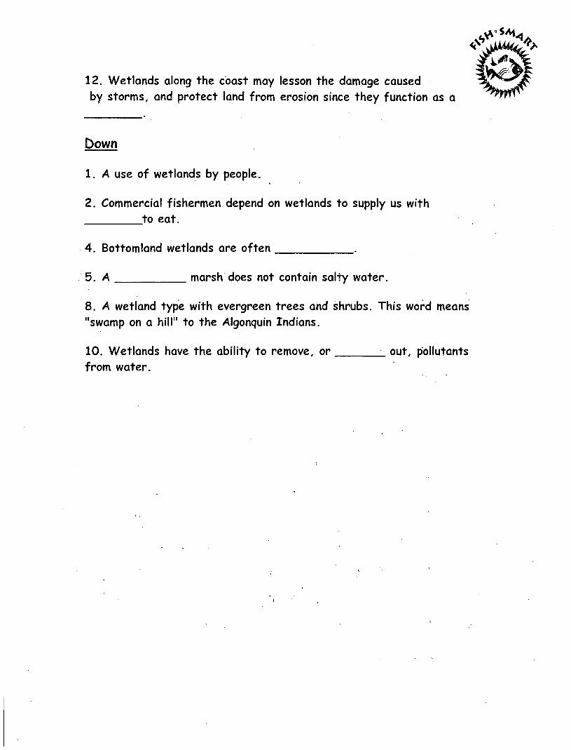
12. Wetlands along the coast may lesson the damage caused by storms, and protect land from erosion since they function as a
Down
1. A use of wetlands by people.
2. Commercial fishermen depend on wetlands to supply us with
8. A wetland type with evergreen trees and shrubs. This word means "swamp on a hill" to the Algonquin Indians.
to eat.
4. Bottomland wetlands are often
5. A marsh does not contain salty water.
10. Wetlands have the ability to remove, or from water.
out, pollutants
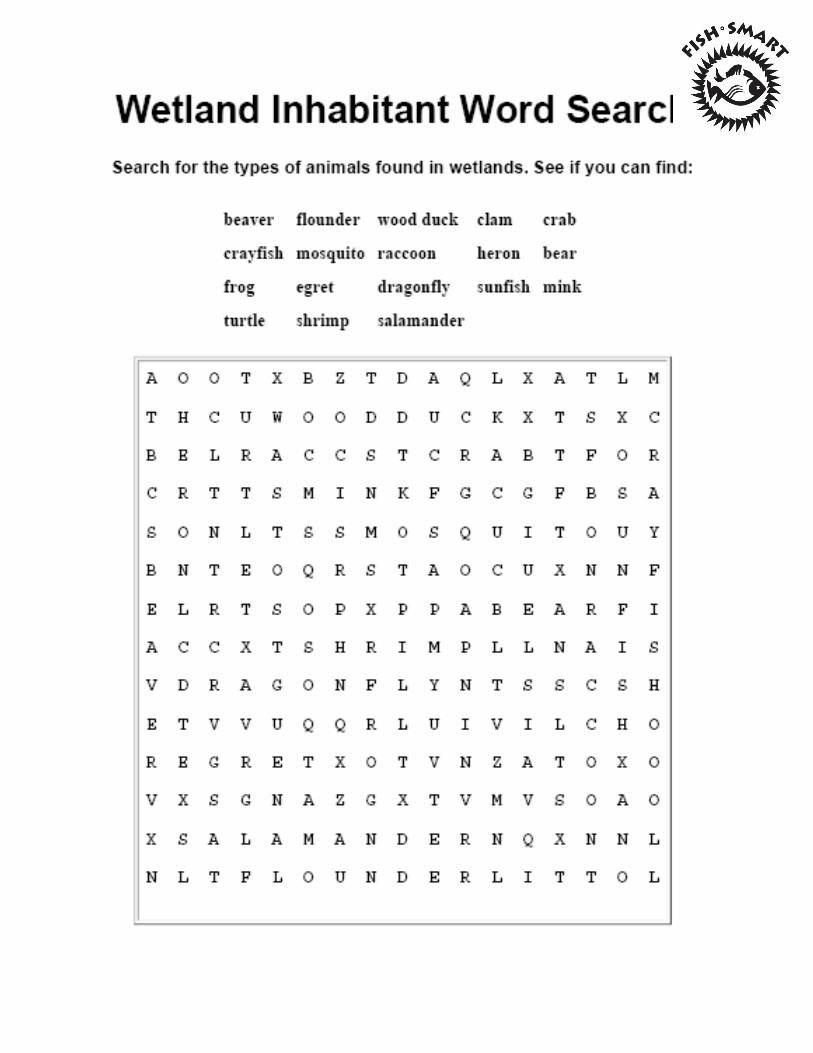
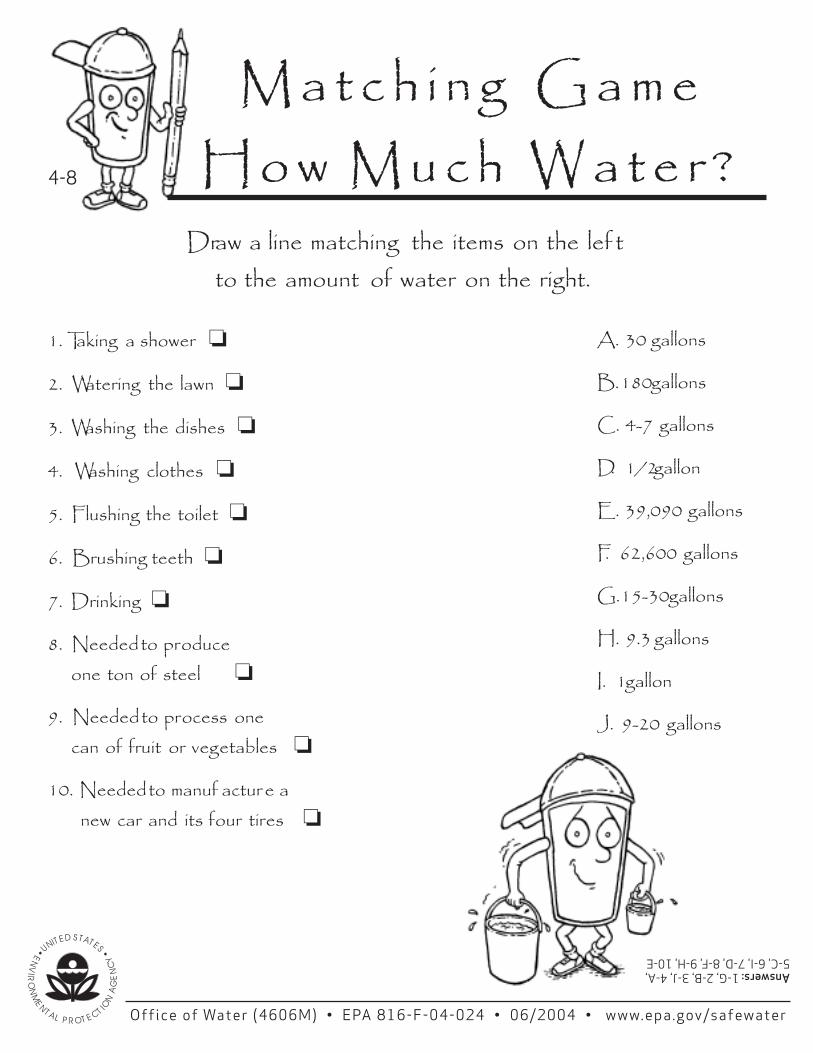
4-8
M a t c h i n g G a m e H o w M u c h W a t e r ?
Draw a line matching the items on the lef t
can of fruit or vegetables
10. Needed to manuf actur e a new car and its four tires ❏
Answers: 1-G, 2-B, 3-J, 4-A, 5-C, 6-I, 7-D, 8-F, 9-H, 10-E
to the amount of water on the right.
1. Taking a shower ❏
2. Watering the lawn ❏
3. Washing the dishes ❏
4. Washing clothes ❏
5. Flushing the toilet ❏
6. Brushing teeth ❏
7. Drinking ❏
8. Needed to produce one ton of steel ❏
9. Needed to process one ❏
A. 30 gallons
B. 180 gallons
C. 4-7 gallons
D. 1/2 gallon
E. 39,090 gallons
F. 62,600 gallons
G. 15-30 gallons
H. 9.3 gallons
I. 1 gallon
J. 9-20 gallons
Office of Water (4606M) • EPA 816-F-04-024 • 06/2004 • www.epa.gov/safewater
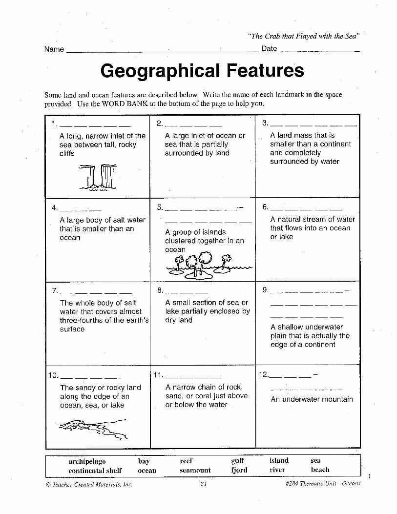
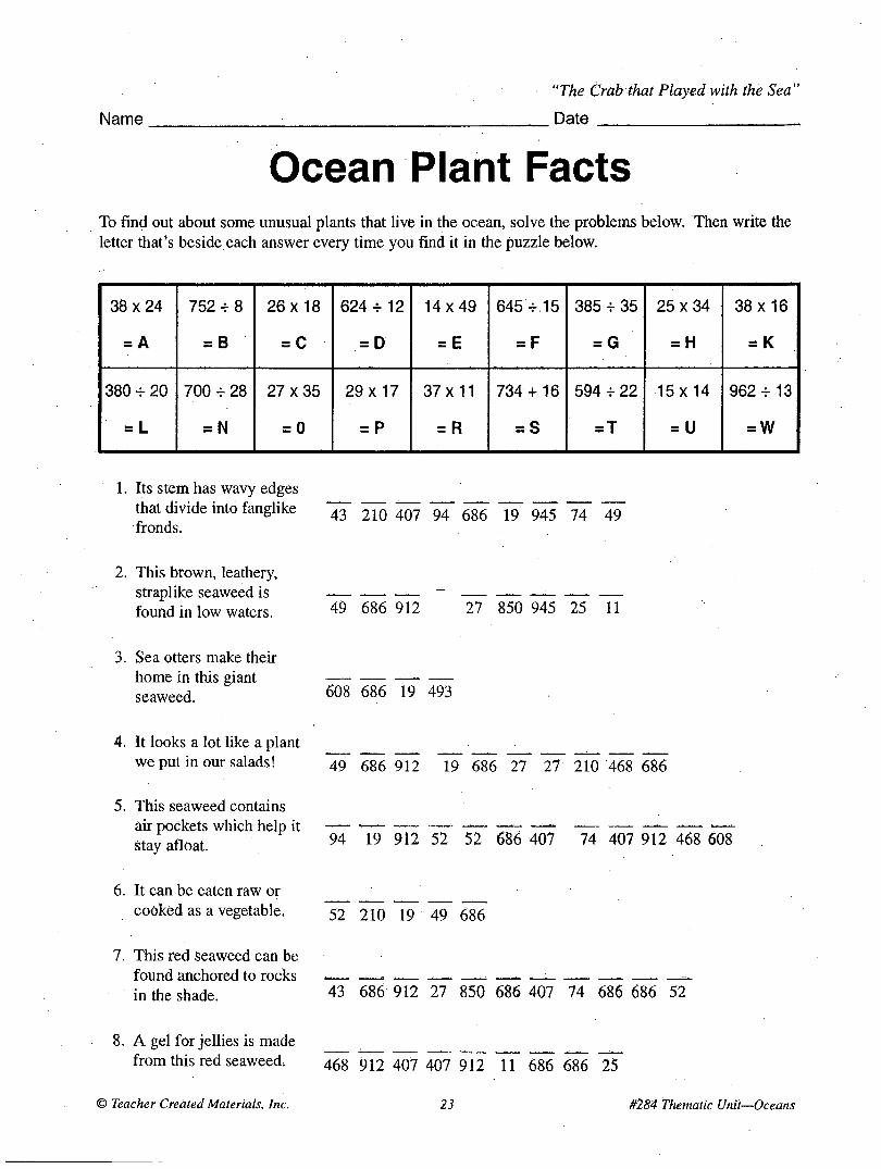
Name
"The Crab that Played with the Sea"
Date
Ocean Plant Facts To find out about some unusual plants that live in the ocean, solve the problems below. Then write the letter that's beside each answer every time you find it in the puzzle below.
38x24
= A
752 + 8
= B
26x18
= C
6 2 4 + 1 2
= D
1 4 x 4 9
= E
645 + 15
= F
385 + 35
= G
2 5 x 3 4
= H
3 8 x 1 6
= K
380 + 20
= L
700 + 28
= N
2 7 X 3 5
= 0
29 x 17
= P
3 7 x 1 1
= R
734 + 16
= S
594 + 22
= T
•15 x 14
= U
962 + 13
= W
1. Its stem has wavy edges that divide into fanglike fronds.
2. This brown, leathery, straplike seaweed is found in low waters.
43 210 407 94 686 19 945 74 49
49 686 912 27 850 945 25 11
3. Sea otters make their home in this giant seaweed. 608 686 19 493
4. It looks a lot like a plant we put in our salads! 49 686 912 19 686 27 27 210 468 686
5. This seaweed contains air pockets which help it stay afloat.
6. It can be eaten raw or cooked as a vegetable.
7. This red Seaweed can be found anchored to rocks in the shade.
94 19 912 52 52 686 407 74 407 912 468 608
52 210 19 49 686
43 686 912 27 850 686 407 74 686 686 52
8. A gel for jellies is made from this red seaweed. 46g 912 407 407 912 11 686 686 25
© Teacher Created Materials, Inc. 23 #284 Thematic Unit—Oceans
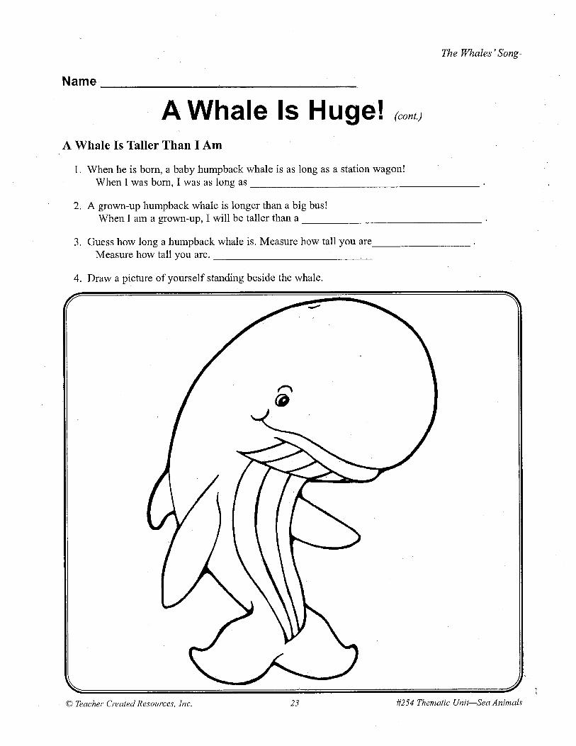
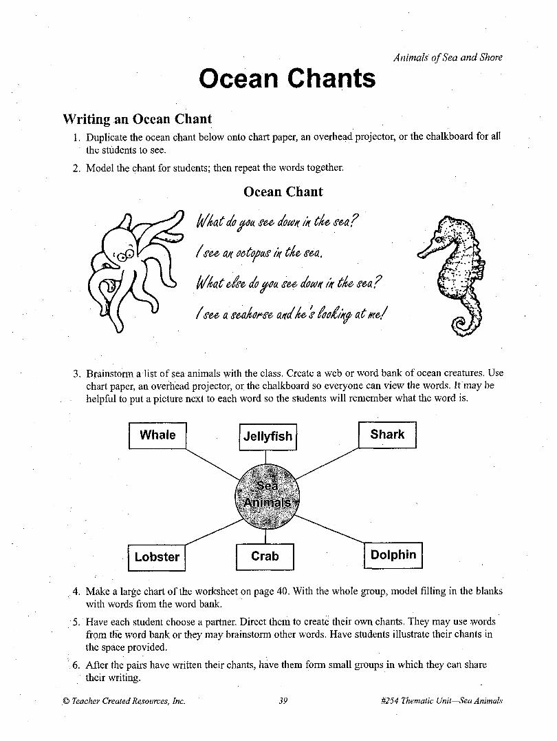
Animals of Sea and Shore
Ocean Chants Writing an Ocean Chant
1. Duplicate the ocean chant below onto chart paper, an overhead projector, or the chalkboard for all the students to see.
2. Model the chant for students; then repeat the words together.
Ocean Chant
Iff (vat do tfou. see down in tfve sea ?
f see an octopas in tfve sea.
If (at eise do cfOa see doa/n in t(e sea?
f see a seakonse and(e s ioodinff at mef
3. Brainstorm a list of sea animals with the class. Create a web or word bank of ocean creatures. Use chart paper, an overhead projector, or the chalkboard so everyone can view the words. If may be helpful to put a picture next to each word so the students will remember what the word is.
4. Make a large chart of the worksheet on page 40. With the whole group, model filling in the blanks with words from the word bank.
5. Have each student choose a partner. Direct them to create their own chants. They may use words from the word bank or they may brainstorm other words. Have students illustrate their chants in the space provided.
6. After the pairs have written their chants, have them form small groups in which they can share their writing.
© Teacher Created Resources, Inc. 39 #254 Thematic Unit—Sea Animals
Animals of Sea and Shore
Ocean Chants (cont.)
With a partner, write an ocean chant. Draw a picture in the box below.
Written by:
Illustrated by:
What do you see down in the sea?
I see a(n) in the sea.
What else do you see down in the sea?
I see a(n) ;
and he's looking at mel
f ; . '
#254 Thematic Unit—Sea Animals 40 © Teacher Created Resources, Inc.