Embed Size (px)
Citation preview
1
Nevado del Ruizand the town of Armero:
November 13, 1985
Sarah Black10/7/05
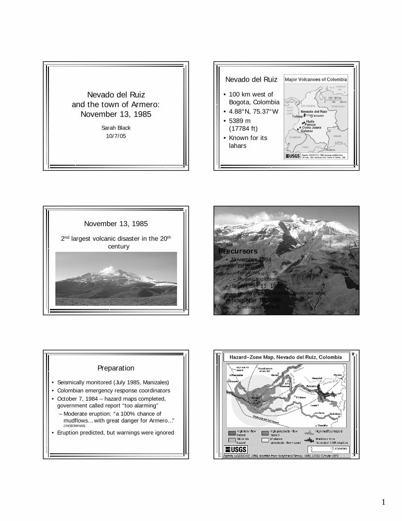
Nevado del Ruiz
• 100 km west of Bogota, Colombia
• 4.88°N, 75.37°W• 5389 m
(17784 ft)• Known for its
lahars
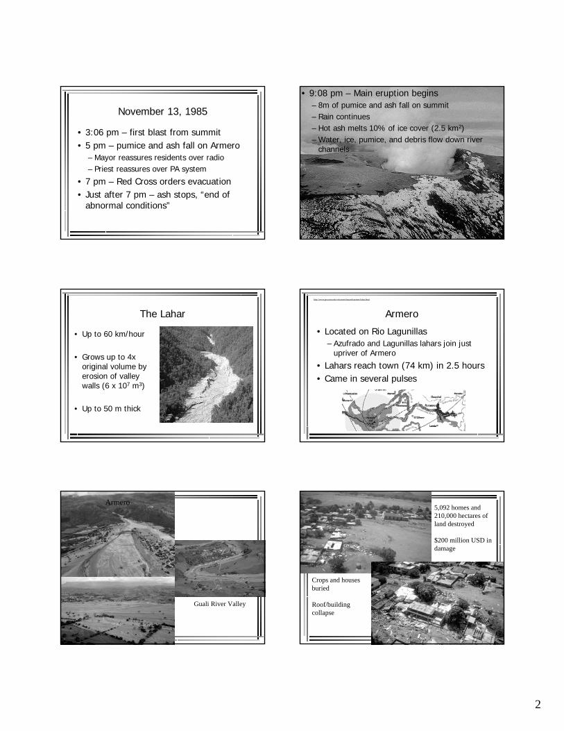
November 13, 1985
2nd largest volcanic disaster in the 20th
centuryPrecursors
• November 1984– Earthquakes– Fumaroles– Phreatic explosions
• September 11, 1985– Strong phreatic eruption, moderate lahar
• November 10, 1985– Continuous tremors
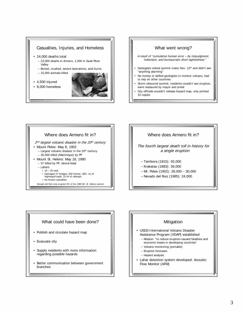
Preparation
• Seismically monitored (July 1985, Manizales)• Colombian emergency response coordinators• October 7, 1984 – hazard maps completed,
government called report “too alarming”– Moderate eruption: “a 100% chance of
mudflows… with great danger for Armero…” (INGEOMINAS)
• Eruption predicted, but warnings were ignored
2
November 13, 1985
• 3:06 pm – first blast from summit• 5 pm – pumice and ash fall on Armero
– Mayor reassures residents over radio– Priest reassures over PA system
• 7 pm – Red Cross orders evacuation• Just after 7 pm – ash stops, “end of
abnormal conditions”
• 9:08 pm – Main eruption begins – 8m of pumice and ash fall on summit– Rain continues– Hot ash melts 10% of ice cover (2.5 km2)– Water, ice, pumice, and debris flow down river
channels
The Lahar
• Up to 60 km/hour
• Grows up to 4x original volume by erosion of valley walls (6 x 10⁷ m3)
• Up to 50 m thick
Armero
• Located on Rio Lagunillas– Azufrado and Lagunillas lahars join just
upriver of Armero
• Lahars reach town (74 km) in 2.5 hours• Came in several pulses
http://www.geo.mtu.edu/volcanoes/hazards/primer/lahar.html
Armero
Guali River Valley
5,092 homes and 210,000 hectares of land destroyed
$200 million USD in damage
Crops and houses buried
Roof/building collapse
3
Casualties, Injuries, and Homeless
• 24,000 deaths total– 23,000 deaths in Armero, 1,000 in Guali River
Valley– Buried, crushed, severe lacerations, acid burns– 15,000 animals killed
• 4,500 injured• 8,000 homeless
What went wrong?
A result of “cumulative human error – by misjudgment, indecision, and bureaucratic short-sightedness.”
• Geologists visited summit crater Nov. 12th and didn’t see “anything alarming”
• No money or skilled geologists to monitor volcano, had to rely on other countries
• Storm obscured summit, residents couldn’t see eruption, were reassured by mayor and priest
• City officials wouldn’t release hazard map, only printed 10 copies
Where does Armero fit in?
2nd largest volcanic disaster in the 20th century• Mount Pelee: May 8, 1902
– Largest volcanic disaster in the 20th century– 30,000 killed (Martinique) by PF
• Mount St. Helens: May 18, 1980– 57 killed by PF, lateral blast– Lahars
• 10 – 25 mph• Damaged 27 bridges, 200 homes, 185+ mi of
highways/roads, 15 mi of railways• No known casualties
Nevado del Ruiz only erupted 3% of the 1980 Mt. St. Helens volume
Where does Armero fit in?
The fourth largest death toll in history for a single eruption
– Tambora (1815): 92,000– Krakatau (1883): 36,000– Mt. Pelee (1902): 28,000 – 30,000– Nevado del Ruiz (1985): 24,000
What could have been done?
• Publish and circulate hazard map
• Evacuate city
• Supply residents with more information regarding possible hazards
• Better communication between government branches
Mitigation
• USGS International Volcano Disaster Assistance Program (VDAP) established– Mission: “to reduce eruption-caused fatalities and
economic losses in developing countries”– Volcano monitoring (portable)– Eruption forecasts– Hazard analysis
• Lahar detection system developed: Acoustic Flow Monitor (AFM)
4
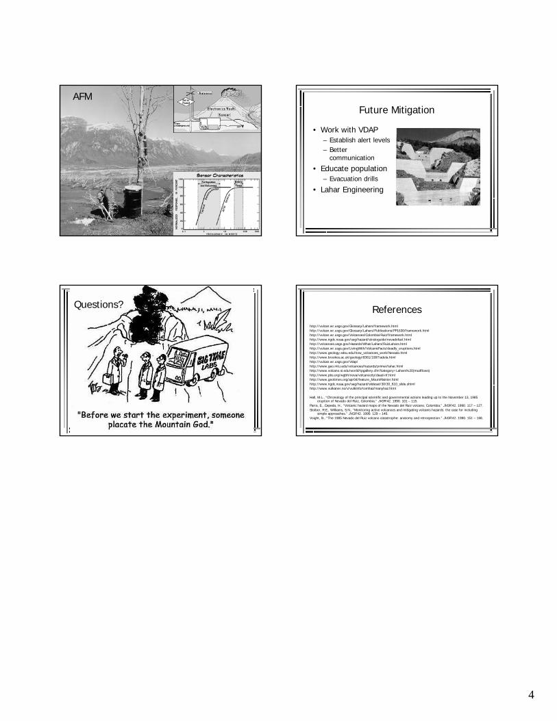
AFMFuture Mitigation
• Work with VDAP– Establish alert levels– Better
communication
• Educate population– Evacuation drills
• Lahar Engineering
Questions? Referenceshttp://vulcan.wr.usgs.gov/Glossary/Lahars/framework.htmlhttp://vulcan.wr.usgs.gov/Glossary/Lahars/Publications/PP1630/framework.htmlhttp://vulcan.wr.usgs.gov/Volcanoes/Colombia/Ruiz/framework.htmlhttp://www.ngdc.noaa.gov/seg/hazard/stratoguide/nevadofact.htmlhttp://volcanoes.usgs.gov/Hazards/What/Lahars/RuizLahars.htmlhttp://vulcan.wr.usgs.gov/LivingWith/VolcanicFacts/deadly_eruptions.htmlhttp://www.geology.sdsu.edu/how_volcanoes_work/Nevado.htmlhttp://www.brookes.ac.uk/geology/8361/1997/adela.htmlhttp://vulcan.wr.usgs.gov/Vdap/http://www.geo.mtu.edu/volcanoes/hazards/primer/lahar.htmlhttp://www.volcano.si.edu/world/tpgallery.cfm?category=Lahars%20(mudflows)http://www.pbs.org/wgbh/nova/volcanocity/dead-nf.htmlhttp://www.geotimes.org/apr04/feature_MountRainier.htmlhttp://www.ngdc.noaa.gov/seg/hazard/slideset/30/30_610_slide.shtmlhttp://www.vulkaner.no/v/vulkinfo/tomhaz/manyhaz.html
Hall, M.L., “Chronology of the principal scientific and governmental actions leading up to the November 13, 1985 eruption of Nevado del Ruiz, Colombia.” JVGR 42. 1990. 101 – 115.
Parra, E., Cepeda, H., “Volcanic hazard maps of the Nevado del Ruiz volcano, Colombia.” JVGR 42. 1990. 117 – 127.Stoiber, R.E., Williams, S.N., “Monitoring active volcanoes and mitigating volcanis hazards: the case for including
simple approaches.” JVGR 42. 1990. 129 – 149.Voight, B., “The 1985 Nevado del Ruiz volcano catastrophe: anatomy and retrospection.” JVGR 42. 1990. 151 – 188.
![Muschinski v Dodds [1985] HCA 78; (1985) 160 CLR …trusts.it/admincp/UploadedPDF/200903041201370... · Muschinski v Dodds [1985] HCA 78; (1985) 160 CLR 583 (6 December 1985) HIGH](https://img.pdfslide.us/doc/110x75/5ba7c99b09d3f2eb658beb04/muschinski-v-dodds-1985-hca-78-1985-160-clr-muschinski-v-dodds-1985-hca.jpg)
![New 1985 Eileen [Caulcutt] Elliott's Photo Albumrlymyc-history.org.uk/RLym_Cup/mainsail_locker/1985/1985... · 2015. 2. 15. · 1985 Eileen (Caulcutt) Elliott’s RLym Cup Photo Album:](https://img.pdfslide.us/doc/110x75/6044ef9fb8eca01b6f2ff563/new-1985-eileen-caulcutt-elliotts-photo-albumrlymyc-2015-2-15-1985-eileen.jpg)


![55th NCAA Wrestling Tournament 1985 3/14/1985 to … 1985.pdf55th NCAA Wrestling Tournament 1985 3/14/1985 to 3/16/1985 at Oklahoma City ... John Fisher [8] - Michigan Mark Ruettiger](https://img.pdfslide.us/doc/110x75/5b4bbed37f8b9a5c278cfb08/55th-ncaa-wrestling-tournament-1985-3141985-to-1985pdf55th-ncaa-wrestling-tournament.jpg)