Embed Size (px)
Citation preview
I
Nebraska Historic Buildings Survey Reconnaissance Survey Final Report
of Jefferson County,
Nebraska
Prepared for
Nebraska State Historical Society State Historic Preservation Office
Submitted by
Mississippi Valley Archaeology Center
at the University of Wisconsin-Lacrosse La Crosse, Wisconsin
Report of Investigation #258
June 1997
Barbara M . Kooiman, M.A., Principal Investigator Elizabeth A. Butterfield, M.A., Project Architectural HistorianIHistorian

-I Acknowledgments
Mississippi Valley Archaeology Center Appreciation
Mississippi Valley Archaeology Center (MVAC) received support from a variety of individuals and groups throughout the course of this project. We extend our sincere gratitude to Bill Callahan, Nebraska State Historical
Society (NSHS) Nebraska Historic Building Survey Program (NeHBS) Associate/National Register of Historic Places Coordinator and Carol Ahlgren, NeHBS Survey Coordinator, for their assistance in methodology development, public outreach, field survey, and report reviews. We also thank John Schleicher, NSHS Field Representative, for his generosity in introducing us to the residents of Jefferson County, as well as for promoting this project prior to its start. Other members of the NSHS Historic Preservation Office who assisted us during the entirety of the NeHBS include: Lawrence J. Somrner, Nebraska State Historic Preservation Officer; Robert Puschendorf, Deputy State Historic Preservation Officer; Greg Miller, Historian; Joni Gilkerson, Public Planning Program Associate; and Cindy Williamson, Staff Assistant.
On the local level, we extend our gratitude to Mark Werthmann, Director of Jefferson County Economic Development Corporation. Mr. Werthmann has continually assisted NeSHPO and MVAC with meetings, personal introductions, and technical guidance.
During the research phase of the project, we greatly benefitted from the staff at the NSHS Archives including Cynthia Monroe, Karrie Cole, Katherine Wyatt, and Chad Wall. In regards to photographic processing, we acknowledge Jeffrey Bebee, the contract photographer for NSHS. While researching in Jefferson County, MVAC appreciated the assistance extended by Jan Grummert at the Fairbury Public Library and Steve Hill at the Fairbury City Museum. We also thank the Jefferson Community Health Center for the loan of a small photocopier. We acknowledge Helen Gird for extending us information from her personal collection; Denise Anderson for providing information stored at The Fairbury Journal-News; Elizabeth Gasper for her personal collection about the Fairbury Planing Mill; and the Judd Family for the tour of the Endicott Clay Products Company.
We would also like to thank the following donors of photographs to this report: Nebraska State Historical Society (NSHS); Fairbury City Museum (FCM); and Jane Bakewell

Acknowledgments
(Bakewell Collection). All of the donors are identified next to their photographs throughout this report by the above-sited designations.
We recognize Chad Israelson for his assistance with the data entry of information from the field forms into the NeSHPO computer system. We thank Sara Gilles and Michael Staconis, MVAC student office assistants, for their help in reading Fairbury newspapers and cataloging field gathered information. Furthermore, we appreciate the assistance of R. Patrick Stewart, MVAC Graphic Specialist and Archaeologist, for his design of the report cover.
Lastly, we extend our gratitude to the citizens of Jefferson County for accommodating us while we were completing our field work. We are very appreciative to residents who attended the public meeting and Lioness' Club meeting; and to everyone who provided information regarding the history of the county.
State and Federal Acknowledgment
The Nebraska Historic Buildings Survey (NeHBS) projects are administered by the Nebraska State Historic Preservation Office (NeSHPO) with the cooperation of the Nebraska State Historical Society (NSHS). The NeHBS is funded in part with the assistance of a federal grant from the U.S. Department of the Interior, National Park Service.
However, the contents and opinions expressed in this publication do not necessarily reflect the views or policies of the U.S. Department of the Interior. Regulations of the U.S. Department of the Interior strictly prohibit unlawful discrimination on the basis of race, color, national origin, age or handicap. Any person who believes he or she has been discriminated against in any program, activity, or facility operated by a recipient of federal assistance should write to: Director, Equal Opportunity Program, U.S. Department of the Interior, National Park Service, P.O. Box 37127, Washington, D.C. 20013-7127. The paper used in this publication meets the minimum requirements of the American National Standard for Information Sciences-permanence of paper for printed Library Materials, (ANSI 239-48- 1984).
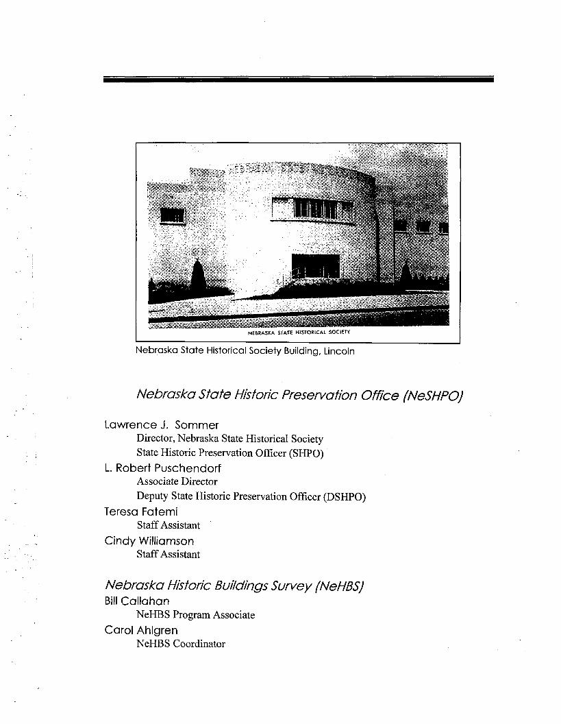
I NEBRASKA STATE HISTORICAL SOCIETY I
Nebraska State Historical Society Building, Lincoln
Nebraska State Historic Preservation Office f N e S W
Lawrence J. Sommer Director, Nebraska State Historical Society State Historic Preservation Officer (SHPO)
L. Robert Puschendorf Associate Director Deputy State Historic Preservation Officer (DSHPO)
Teresa Fatemi Staff Assistant
Cindy Williamson Staff Assistant
Nebraska Historic Buildings Survey fNeHBS' Bill Callahan
NeHBS Program Associate
Carol Ahlgren NeHBS Coordinator
National Register of Historic Places Bill Callahan
National Register Coordinator
Carol Ahlgren Architectural Historian
Greg Miller Historian
Certified Local Go vernmen f (CL Gj CLG Coordinator
Preservation Tax lncen fives Mike Rindone
Review and Preservation and Services Program Associate
Federal Agency Re view ('Section 106) Mike Rindone Greg Miller Bill Callahan
Public Outreach and Education Public Programming and Program Associate
Archaeology Terry Steinacher
Archaeology Program Associate
Nebraska State Historic Re view Board Kent Blaser, Wayne
Bob Blasing, Grand Island
Peter Bleed, Lincoln
Thomas Creigh, Jr., Hastings
Beverly Fleming, Lincoln
George Haecker, Omaha
Nancy Haney, Lyman
Robert Hurst, Lincoln
Lawrence J. Sommer, Lincoln
Marianne Simmons, Fremont
Charles E. Trimble, Omaha
Judith Wigton, Omaha

Table of Contents
I. Introduction
Nebraska Historic Buildings Survey . . . . . . . . . . . . . . . . . . . . . . . . . . . . . . . . . . . . . .1 National Register of Historic Places . . . . . . . . . . . . . . . . . . . . . . . . . . . . . . . . . . . . . .2 Certified Local Governments . . . . . . . . . . . . . . . . . . . . . . . . . . . . . . . . . . . . . . . . . . .4 Preservation Tax Incentives . . . . . . . . . . . . . . . . . . . . . . . . . . . . . . . . . . . . . . . . . . . . .5 Federal Project Review . . . . . . . . . . . . . . . . . . . . . . . . . . . . . . . . . . . . . . . . . . . . . . . .6 Public Outreach and Education . . . . . . . . . . . . . . . . . . . . . . . . . . . . . . . . . . . . . . . . .- 7 Methodology and Historic Integrity . . . . . . . . . . . . . . . . . . . . . . . . . . . . . . . . . . . . . . . 8 SurveyResults . . . . . . . . . . . . . . . . . . . . . . . . . . . . . . . . . . . . . . . . . . . . . . . . . . . . . .11 Numerical Summaries of Jefferson County
Reconnaissance Survey . . . . . . . . . . . . . . . . . . . . . . . . . . . . . . . . . . . . . . . . .12
II. Historic Overview of Jefferson County
Physical Description . . . . . . . . . . . . . . . . . . . . . . . . . . . . . . . . . . . . . . . . . . . . . . . . .15 Native American Inhabitants . . . . . . . . . . . . . . . . . . . . . . . . . . . . . . . . . . . . . . . . . . .17 Brief History of Nebraska . . . . . . . . . . . . . . . . . . . . . . . . . . . . . . . . . . . . . . . . . . . . .18 Jefferson County History . . . . . . . . . . . . . . . . . . . . . . . . . . . . . . . . . . . . . . . . . . . . .- 2 6 Jefferson County Villages. Towns. and Cities . . . . . . . . . . . . . . . . . . . . . . . . . . . . . .40
Daykin . . . . . . . . . . . . . . . . . . . . . . . . . . . . . . . . . . . . . . . . . . . . . . . . . . . . . .40 Diller . . . . . . . . . . . . . . . . . . . . . . . . . . . . . . . . . . . . . . . . . . . . . . . . . . . . . . .43 Endicott . . . . . . . . . . . . . . . . . . . . . . . . . . . . . . . . . . . . . . . . . . . . . . . . . . . . . 46 Fairbury . . . . . . . . . . . . . . . . . . . . . . . . . . . . . . . . . . . . . . . . . . . . . . . . . . . . .49 Gladstone . . . . . . . . . . . . . . . . . . . . . . . . . . . . . . . . . . . . . . . . . . . . . . . . . . . .58 Harbine . . . . . . . . . . . . . . . . . . . . . . . . . . . . . . . . . . . . . . . . . . . . . . . . . . . . . .59 Jansen . . . . . . . . . . . . . . . . . . . . . . . . . . . . . . . . . . . . . . . . . . . . . . . . . . . . . . .61 Plymouth . . . . . . . . . . . . . . . . . . . . . . . . . . . . . . . . . . . . . . . . . . . . . . . . . . . .64 Powell . . . . . . . . . . . . . . . . . . . . . . . . . . . . . . . . . . . . . . . . . . . . . . . . . . . . . .66 Reynolds . . . . . . . . . . . . . . . . . . . . . . . . . . . . . . . . . . . . . . . . . . . . . . . . . . . .67 SteeleCity . . . . . . . . . . . . . . . . . . . . . . . . . . . . . . . . . . . . . . . . . . . . . . . . . . .69 Thompson . . . . . . . . . . . . . . . . . . . . . . . . . . . . . . . . . . . . . . . . . . . . . . . . . . .72
Ill. Fairbury Commercial Historic District
Introduction . . . . . . . . . . . . . . . . . . . . . . . . . . . . . . . . . . . . . . . . . . . . . . . . . . . . . . . .73 Brief History of Fairbury Commercial District . . . . . . . . . . . . . . . . . . . . . . . . . . . . .75 Architectural Development of Fairbury Commercial Historic District . . . . . . . . . . .91 Survey Results of Fairbury Commercial District . . . . . . . . . . . . . . . . . . . . . . . . . . . .97
IV. Historic Contexts Introduction . . . . . . . . . . . . . . . . . . . . . . . . . . . . . . . . . . . . . . . . . . . . . . . . . . . . . . . .99
Religion . . . . . . . . . . . . . . . . . . . . . . . . . . . . . . . . . . . . . . . . . . . . . . . . . . . .101 Government . . . . . . . . . . . . . . . . . . . . . . . . . . . . . . . . . . . . . . . . . . . . . . . . .105 Association . . . . . . . . . . . . . . . . . . . . . . . . . . . . . . . . . . . . . . . . . . . . . . . . . .106 Education . . . . . . . . . . . . . . . . . . . . . . . . . . . . . . . . . . . . . . . . . . . . . . . . . . .107 Diversion . . . . . . . . . . . . . . . . . . . . . . . . . . . . . . . . . . . . . . . . . . . . . . . . . . .111 Agriculture . . . . . . . . . . . . . . . . . . . . . . . . . . . . . . . . . . . . . . . . . . . . . . . . . .113 Industries . . . . . . . . . . . . . . . . . . . . . . . . . . . . . . . . . . . . . . . . . . . . . . . . . . .118 Commerce . . . . . . . . . . . . . . . . . . . . . . . . . . . . . . . . . . . . . . . . . . . . . . . . . .120 Transportation . . . . . . . . . . . . . . . . . . . . . . . . . . . . . . . . . . . . . . . . . . . . . . .122 Services . . . . . . . . . . . . . . . . . . . . . . . . . . . . . . . . . . . . . . . . . . . . . . . . . . . .124 Settlement Systems . . . . . . . . . . . . . . . . . . . . . . . . . . . . . . . . . . . . . . . . . . .127
V. Recommendations Recommendations . . . . . . . . . . . . . . . . . . . . . . . . . . . . . . . . . . . . . . . . . . . . . . . . . .143
References References . . . . . . . . . . . . . . . . . . . . . . . . . . . . . . . . . . . . . . . . . . . . . . . . . . . . . . . .149
Appendices Appendix A .Location Index of Surveyed Properties Cited in the Report . . . . . . .159 Appendix B .Glossary . . . . . . . . . . . . . . . . . . . . . . . . . . . . . . . . . . . . . . . . . . . . . . . 173
I Introduction -
Throughout most of Nebraska's history, historic preservation was the province of dedicated individuals and organizations working along with their local communities. Since the passage of the National Historic Preservation Act of 1966, however, the Governor of each state has been required to appoint a State Historic Preservation Officer (SHPO) to oversee preservation efforts mandated by the 1966 Act. In Nebraska, the
Director of the Nebraska State Historical Society (NSHS) serves as SHPO. The staff of the NSHS' Historic Preservation Division forms the Nebraska State Historic Preservation Office (NeSHPO).
The NeSHPO administers a wide range of preservation programs. The duties of the NeSHPO relating to programs called for by the National Historic Preservation Act include:
Conducting and maintaining a statewide historic buildings survey; Administering the National Register of Historic Places program; Assisting local governments in the development of local historic preservation programs and certification of qualifying governments; Administering a federal tax incentives program for the preservation of historic buildings; Assisting federal agencies in their responsibility to identify and protect historic properties that may be affected by their projects and; Providing preservation education, training, and technical assistance to individuals and groups as well as local, state, and federal government agencies.
What follows is a brief description of NeSHPO programs. Though described separately, it is important to remember that the programs often act in concert, and should be considered elements of the NeSHPO mission, as well as a part of the mission of the NSHS.
Nebraska Historic Buildings Survey
The Nebraska Historic Buildings Survey (NeHBS) began in 1974. The survey is conducted on a county-by-county basis, and currently includes more than 60,000 properties that reflect

Chapter I Introduction
the rich architectural and historic heritage of Nebraska. The survey is conducted by researchers who drive every rural and urban public road in a county and record each property that meets certain historic and architectural requirements. Surveyors never enter private property without permission. In addition to this fieldwork, surveyors research the history of the area in order to better understand their subject. The NeHBS often includes thematic subjects that may be unique to a certain county, such as a historic highway or a type of industry.
The purpose of the NeHBS is to help local preservation advocates, land-use planners, economic development coordinators, and tourism promoters understand the wealth of historic properties in their community. Properties included in the survey have no use- restrictions placed on them, nor does the survey require any level of maintenance or accessibility by property owners. Rather, the survey provides a foundation for identifying properties that may be worthy of preservation, promotion, recognition, and protection within a community.
This publication is the final report for the NeHBS investigation of Jefferson County. It provides a basis for preservation and planning in Jefferson County at all levels of government and for individual groups or citizens. Generally, this report includes properties that convey a sense of architectural significance. When possible and known, the report also describes properties that have historical significance. Although every effort has been made to be accurate, mistakes and omissions may occasionally occur. Additionally, as this project is in part federally funded, the NeSHPO must use federal guidelines when identifying and evaluating historic properties. In short, this publication is not an end in itself, but a beginning for public planners and individuals who value their community's history.
For more information call the NeHBS Program Associate at 4021471-4'788, the NeHBS Coordinator at 4021471 -4773, or 8001833-6747.
National Register of Historic Places
One of the tasks of the NeHBS is to help identify properties that may be eligible for listing on the National Register of Historic Places. The National Register is our nation's official list of significant historic properties. Created by the National Historic Preservation Act of 1966, the National Register includes buildings, structures, objects, sites, and districts that are
Chapter I 3 Introduction
significant in our history or prehistory. These properties may reflect a historically significant pattern, event, person, architectural style, engineering technology, or archaeological site. National Register sites may be significant at the local, state, or national level.
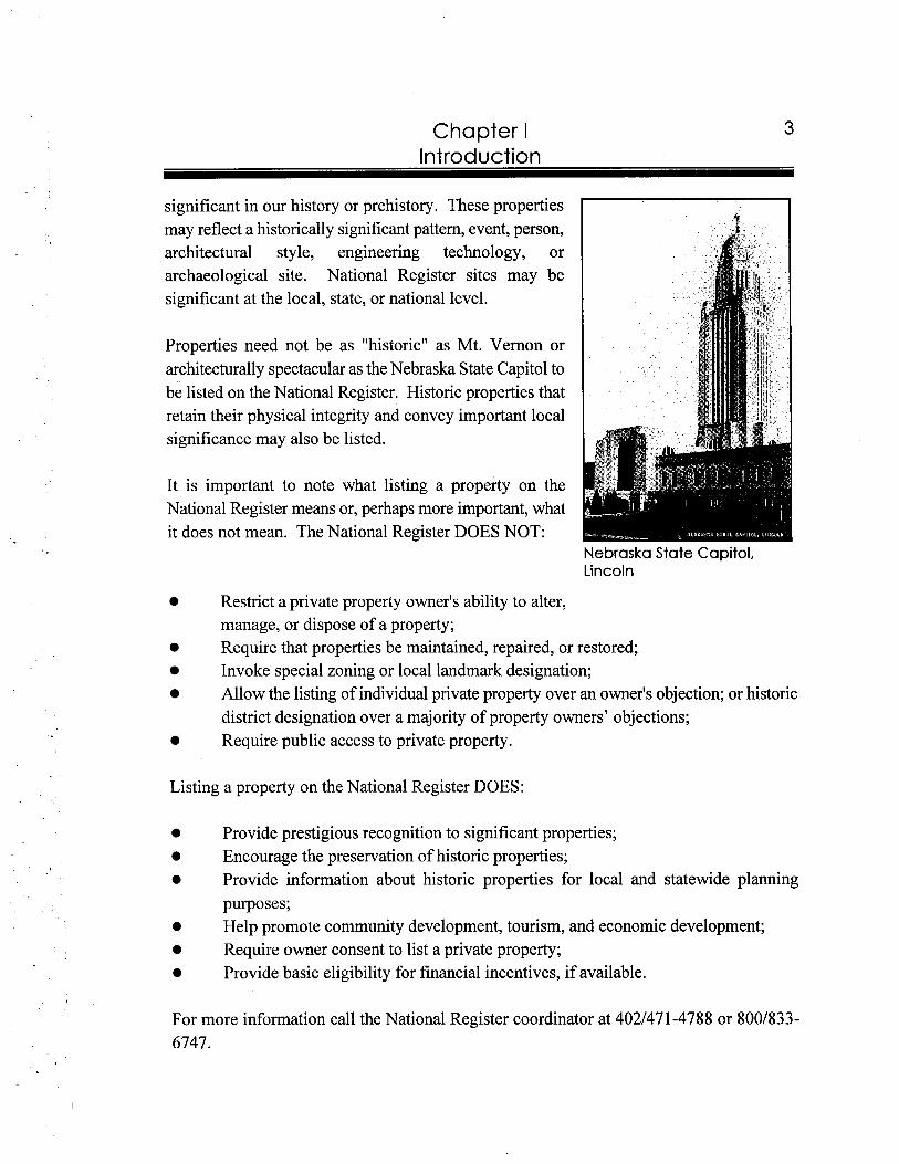
Properties need not be as "historic" as Mt. Vernon or architecturally spectacular as the Nebraska State Capitol to be listed on the National Register. Historic properties that retain their physical integrity and convey important local significance may also be listed.
It is important to note what listing a property on the National Register means or, perhaps more important, what it does not mean. The National Register DOES NOT:
Nebraska State Capitol, Lincoln
Restrict a private property owner's ability to alter, manage, or dispose of a property; Require that properties be maintained, repaired, or restored; Invoke special zoning or local landmark designation; Allow the listing of individual private property over an owner's objection; or historic district designation over a majority of property owners' objections; Require public access to private property.
Listing a property on the National Register DOES:
Provide prestigious recognition to significant properties; Encourage the preservation of historic properties; Provide information about historic properties for local and statewide planning purposes; Help promote community development, tourism, and economic development; Require owner consent to list a private property; Provide basic eligibility for financial incentives, if available.
For more information call the National Register coordinator at 4021471-4788 or 8001833- 6747.
4 Chapter I Introduction
Certified Local Governments
The primary goal of the NeSHPO is to translate the federal preservation program, as embodied by the National Historic Preservation Act, to the local level. One of the most effective and important tools for this purpose is the Certified Local Government, or CLG, program. A CLG is a local government, either a county or municipality, that has adopted preservation as a priority. To become a CLG, a local government must:
0 Establish a preservation ordinance that includes protection for historic properties at a level the community decides is appropriate;
0 Create a commission to oversee the preservation ordinance and the CLG program; Promote preservation education and outreach; Conduct and maintain some level of historic buildings survey; Establish a mechanism to locally landmark properties.
There are a number of advantages to achieving CLG status:
A CLG is eligible to receive matching funds from the NeSHPO that are unavailable to non-CLGs; Contributing buildings within locally landmarked historic districts may be eligible for preservation tax incentives (see below) without being listed on the National Register of Historic Places; CLGs have an additional tool when considering planning, zoning, and land use issues through their landmarking and survey programs; CLGs have the ability to monitor and preserve structures that reflect the community's heritage; CLGs have access to a nationwide information network of local, state, federal, and private preservation institutions; Finally, a CLG, through its ordinance and commission, has a built-in mechanism to promote pride in and understanding of a community's history.
Certification of a local government for CLG status comes from the NeSHPO and the National Park Service. A community considering CLG status, however, has broad flexibility within the parameters discussed above. The emphasis of the CLG program is local management of historic properties with technicalleconomic assistance from the NeSHPO. For more information call the CLG coordinator at 4021471-4787 or 8001833-6747.
Chapter I Introduction
Preservation Tax Incentives
Since 1976, the Internal Revenue Code has contained provisions offering tax credits for the certified rehabilitation of income-producing historic properties. Historic properties are defined as those listed on the National Register of Historic Places; or as properties that contribute to the significance of a National Register or locally landmarked (by a CLG, see above) historic district. An income producing property may be a rental residential, office, commercial, or industrial property.
A certified rehabilitation is, generally, one that conforms to The Secretary of the Interior's Standards for Rehabilitation and Guidelines for Rehabilitating Historic Buildings.' The Standards are a common sense approach to the adaptive re-use of historic buildings. It is important to remember that this program promotes the rehabilitation of historic properties so that they may be used to the benefit and enjoyment of a community into the twenty-first century. The program is not necessarily intended to reconstruct or restore historic buildings to exact, as-built specifications.
The tax incentive program in Nebraska has been responsible for:
The re-investment of millions of dollars toward the preservation of historic buildings; The establishment of thousands of low and moderate income housing units as well as upper-end units; The adaptive re-use of previously under utilized or unutilized historic properties in older commercial areas; Helping broaden the tax base; Giving real estate developers and city planners a tool to consider projects in older, historic neighborhoods.
Certification of the historic nature of the income-producing property (usually listing the property on the National Register) and certification of the historic rehabilitation are made by both the NeSHPO and the National Park Service. We strongly urge contacting the NeSHPO and a professional tax advisor, legal counsel, or appropriate local IRS office before initiating any activity for a project that anticipates the use of preservation tax incentives.
' The Secretary of the Interior's Standards for Rehabilitution, Washington, D.C.: 1983. U.S. Department of the Interior, National Park Senrice.
Chapter I Introduction
For more information call the Review and Preservation Services Program Associate at 4021471-4770 or 8001833-6747.
Federal Project Review
Section 106 of the National Historic Preservation Act requires that federal agencies take into account the effect of their undertakings on historic properties; seek ways to avoid or reduce adverse effects their projects may have on historic properties; and afford the Federal Advisory Council on Historic Preservation an opportunity to comment on the project and its effects on historic properties. The regulations that govern the "Section 106" process also require that the federal agency consult with the NeSHPO to: identify historic properties in the project area; assess the effects a project may have; and to seek ways to avoid or reduce adverse effects to historic properties.
For example, if the Federal Highway Administration, through the Nebraska Department of Roads, contemplates construction of a new highway, they must contact the NeSHPO for assistance in determining whether any sites or structures listed on or eligible for listing on the National Register exist in the project area. Notice that a property need not actually be listed on the Register, only be eligible. This process is to take place early enough in the planning process to allow for alternatives should historic properties be located in the project area: i.e., in the example above, the modification of a new highway's right-of-way could avoid an archaeological site or historic barn.
It is important to note that public participation in this process is vital. The Section 106 process requires the federal agency to seek the views of the public and interested parties if adverse effects to historic properties are discovered through consultation with the NeSHPO. The NeSHPO examines information provided by the federal agency, the NeHBS, and the National Register, but often the most valuable information comes from comments provided by the public. Section 106 was included in the National Historic Preservation Act to protect locally significant historic properties from unwitting federal action. It is truly a law that gives the public a voice in an often unsympathetic bureaucratic system.
For more information about Section 106 review, call the NeSHPO at 4021471-4787 or 8001833-6747.
Chapter I
Public Outreach and Education
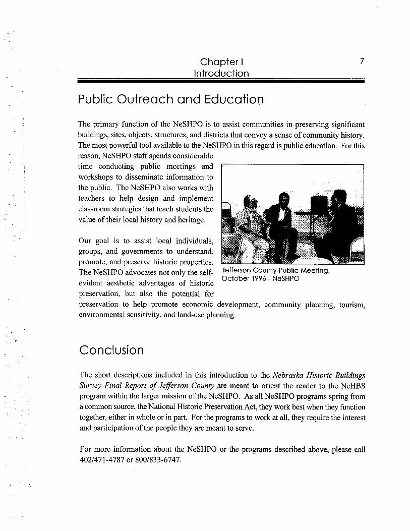
The primary function of the NeSHPO is to assist communities in preserving significant buildings, sites, objects, structures, and districts that convey a sense of community history. The most powerful tool available to the NeSHPO in this regard is public education. For this reason, NeSHPO staff spends considerable time conducting public meetings and workshops to disseminate information to the public. The NeSHPO also works with teachers to help design and implement classroom strategies that teach students the value of their local history and heritage.
Our goal is to assist local individuals, groups, and governments to understand, promote, and preserve historic properties. The NeSHPO advocates not only the self- Jefferson County Public Meeting,
October 1996 - NeSHPOevident aesthetic advantages of historic preservation, but also the potential for preservation to help promote economic development, community planning, tourism, environmental sensitivity, and land-use planning.
Conclu sion
The short descriptions included in this introduction to the Nebraska Historic Buildings Survey Final Report of Jefferson Counly are meant to orient the reader to the NeHBS program within the larger mission of the NeSHPO. As all NeSHPO programs spring from a common source, the National Historic Preservation Act, they work best when they function together, either in whole or in part. For the programs to work at all, they require the interest and participation of the people they are meant to serve.
For more information about the NeSHPO or the programs described above, please call 4021471-4787 or 8001833-6747.
Chapter I Introduction
Methodology and Historic Integrity
In September 1996, Mississippi Valley Archaeology Center (MVAC) contracted with the Nebraska State Historic Preservation Office (NeSHPO) to conduct the Nebraska Historic Buildings Survey (NeHBS) of Jefferson County. MVAC initiated the project entitled NeHBS Reconnaissance Survey Final Report of Jeflerson County, Nebraska by attending a preliminary meeting with the NeSHPO staff. At such time, both parties clarified the scope of work to be performed. MVAC staff also performed the prefield research by reviewing, gathering, andfor copying all necessary maps, previous survey forms and photographic cards, as well as collecting site-specific and general background information on Jefferson County. Other repositories visited during this phase included the NSHS Archives and Love Library at the University of Nebraska, Lincoln.
The field inventory served as the next phase of the project. Prior to initiating the inventory, Barbara Kooiman, Principal Investigator and Elizabeth Butterfield, Project Architectural Historian/Historian, updated reconnaissance survey forms utilized in the 1995- 1996 NeHBS survey project and collected new urban maps with the aid of Cindy Williamson, NeSHPO Staff Assistant. In regards to the final survey maps, the most current map for each community was utilized by MVAC. However, in several situations, the newest maps available were dated at the turn of the century. These maps were used except in two situations where thumbnail maps were used from the 1971 General Highway Map of Jefferson County. A preliminary review of the project area by the MVAC field crew (Kooiman and Butterfield) and NeSHPO (Bill Callahan and Carol Ahlgren) established the existence of any rare or unusual property types in Jefferson County.
The field inventory criteria utilized by the survey crew was designed by the NeSHPO based on an understanding of relative integrity in the county. Utilizing the criteria, MVAC surveyed all properties appearing to be at least fifty years old (pre-1947) and displaying high integrity of materials, design, location, setting, workpersonship, association, and feeling. Alterations on buildings such as windows, modern siding material (i.e., vinyl, metal, permastone, asbestos), and/or added porches or rear additions, did not generally meet the criteria for survey. The standards of integrity used for houses were more strict than those used for other property types, such as commercial or industrial buildings. The reason for the stricter integrity guidelines is due to the fact that houses are much more common in historic buildings surveys. Thus, to keep the inventory at a representative number, only the "best"
Chapter I Introduction
houses, in terms of integrity standards, were considered to be "contributing" to the ~u rvey .~ Commercial buildings were inventoried even if their first floor elevations were altered, but their upper stories were intact. In regards to abandoned buildings, MVAC only surveyed properties constructed in the nineteenth century.
In October 1996, the MVAC field crew, consisting of Kooiman and Butterfield, conducted a visual inventory of all properties discernible from the public right- of-way. Distant properties were evaluated using binoculars and a telephoto camera lens where necessary. In instances where a property was located a great distance from the road or hidden by trees, surveyors did not inventory the site due to the NeSHPO policy of no trespassing on private property. Field map and forms, 1996 - NeSHPO
Every public road was traversed in the county, with the exception of some impassable roads. In a situation where a road was overgrown with weeds or washed out, the survey crew did not drive the route. Every section mile of road not driven was marked on the field map.
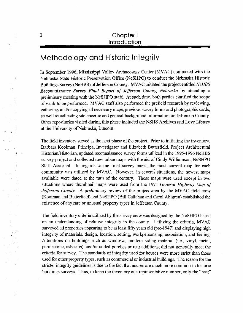
Field survey included the recordation of each inventoried property on a field map appropriate to its location (i.e. rural, village, and U.S.G.S), photographic documentation of each property in black and white film (35rnm film, two 45 degree angle shoots), notation of pertinent facts (i.e., shape, size, height, roof type) on a pre-approved field inventory form. The completion of the field form included utilizing historic context and property type codes, designed by the NeSHPO, to categorize each property. Once the field survey was completed, the film was processed and corresponding roll and frame numbers were entered onto the field forms. Furthermore, the survey numbers were copied from the field maps onto final maps in pencil and then highlighted with a yellow pencil. Eventually, all of this fieldwork information was compiled on one form and entered into the appropriate NeHBS database field.
During MVACYs first field trip to Jefferson County, Bill Callahan, NeHBS Program Associate/National Register Coordinator, joined the survey crew during one day of survey.
See Appendix B: Glossaly at the end of this report for definitions of the words "contributing" and "noncontributing" in relation to the NeHBS, a s well a s their definitions in regards to the National Register of Historic Places.
Chapter I Introduction
Callahan reviewed both the rural and urban survey methods as a quality control procedure. Furthermore, Callahan reviewed the building count and boundaries established for the Fairbury Commercial Historic District with Kooiman and Butterfield.
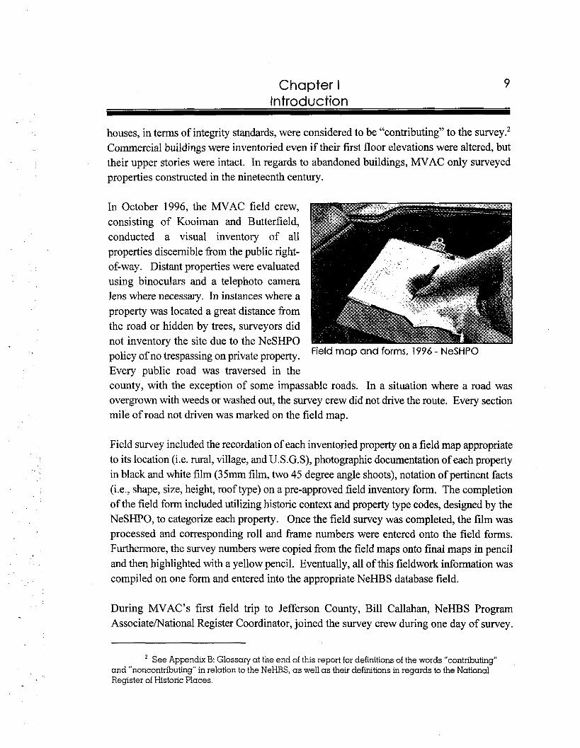
In October 1996, during the field inventory, Kooiman and Butterfield attended a public meeting organized by Bill Callahan, Carol Ahlgren, and John Schleicher of the NSHS at the Fairbury City Park Community Center to introduce county residents to the project. Both the MVAC contractors and NSHS staff explained the purpose of the survey and its related studies, fielded
Jefferson County Public Meeting, October questions from local citizens regarding the 1996 - NeSHPO purpose of the survey, and collected
information from residents about the general history associated with the county and site specific information. While in Jefferson County, Kooiman and Butterfield also conducted research at local repositories such as the Fairbury City Museum, and the Fairbury Public Library.
As part of a special thematic study for the project, MVAC prepared a National Register of Historic Places nomination for the Fairbury Commercial Historic District. This portion of the project included defining the boundaries of the district, preparing a district map, taking National Register quality black and white photographs and color slides, compiling a property list, researching and writing the historical development of the downtown, describing the architectural significance of the downtown, and reviewing Sanborn Fire Insurance Maps, telephone and city directories, and newspaper articles to secure construction dates and occupancy data for each property. A compilation of all of this material is contained in the nomination prepared on a computerized 10-900 NPS National Register form. The Fairbury Commercial Historic District was reviewed and accepted by the Nebraska Historic Review Board in May of 1997.
For the thematic study of the Fairbury commercial district, MVAC also systematically researched The Fairbury Gazette, The Fairbury News and the Fairbury Gazette, The Fairbury News, The Fairbury Journal, and The Jegerson County Journal every five years ranging from 1870 through 1945. The newspapers were lent to MVAC on microfilm by the NSHS archives. Collected historic information included construction dates, public
Chapter I Introduction
improvements, and county history. This information was then organized into thematic files. Site specific information was labeled with a survey number associated with the NeSHPO system. All of the data gathered from the newspapers was incorporated into the Jefferson County files submitted to the NeSHPO office.
The final deliverable products for this project, submitted to the NeSHPO in June 1997, included maps, site plans, source files, field survey forms, color slides, photographic negatives and contact sheets, and two-hundred copies of the final report. These products are located in the NeSHPO's survey room at 1500 R Street, Lincoln, Nebraska. All survey materials are available to the public.
Survey Results
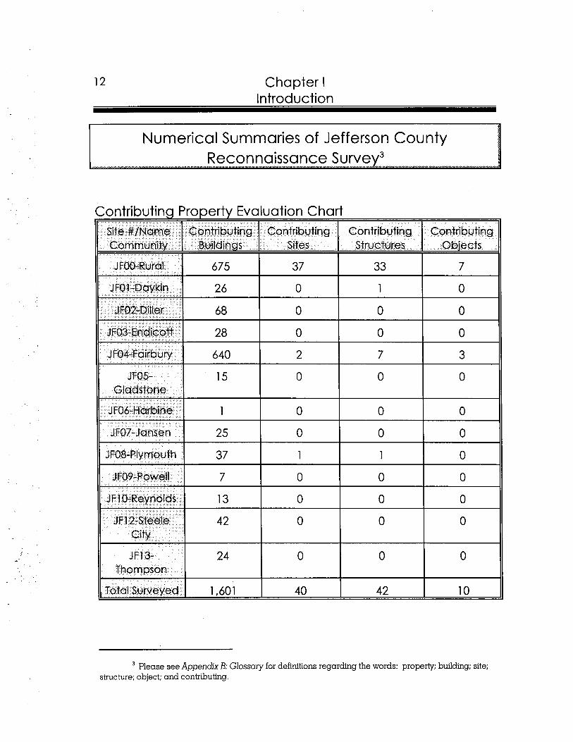
This section contains statistical results, in both text and table form, of the completed NeHBS of Jefferson County. However, for additional information on historic preservation concerns in the county, please see Chapter V - Recommendations.
Final results of the NeHBS of Jefferson County consisted of a total of 1,028 surveyed properties. MVAC identified forty-six (46) individual properties, the E Street residential historic district in Fairbury, and the Fairchild Farmstead rural historic district as potentially eligible for the National Register of Historic Places. Previously identified by the NeSHPO, MVAC prepared the Fairbury Commercial Historic District for the National Register which consists of ninety-seven (97) contributing and twenty (20) noncontributing properties. Prior to the NeHBS survey, Jefferson County boasted eleven individual properties and one district listed on the National Register.
12 Chapter I Introduction
Numerical Summaries of Jefferson County Reconnaissance Survey3
w.........".....,,...,..,. ""......-....,............-..,,..,....,.-.... ".."-" ...................................-... .......-..,.. "........................................ .....".....,...".".."..w..,"...."""-"..-".w,-.""- ....,<.....- ....,,,........
Contributing Property Evaluation Chart Site #lfName Contributing Contributing Contributing Contributing Community Buildings Sit es Structures Objects
J F00-Rural 675 37 33 7
JFOl -Daykin 26 0 1 0
3 FOIL-Ditler 68 0 0 0
JF03-Endicott 28 0 0 0
JFO4-Fairbury 640 2 7 3
JF05- 15 0 0 0 Gladstone
J F06-Harbine 1 0 0 0
JF07-Jansen 25 0 0 0
JFO8-Plymouth 37 1 1 0
JF09-Powell 7 0 0 0
JF10-Reynolds 13 0 0 0
JF12-Steele 42 0 0 0 City
JFI 3- 24 O O O Thompson
Total Surveyed 1,601 40 42 10
Please see Appendix B: Glossary for definitions regarding the words: property; building; site; structure; object; and contributing.
Chapter I Introduction
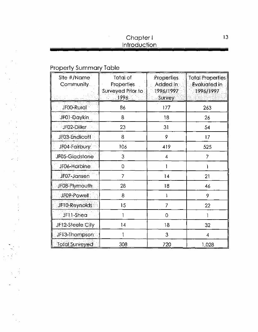
Property Summary Table I
Site #/Name Total of Properties Total Properties Community Properties Added in Evaluated in
Surveyed Prior to 1996/ 1997 199611 997 1996 Survey
JFOO-Rural 86 177 263
JFO 1-Daykin 8 18 26
J F02-Diller 23 31 54
JF03-Endicotf 8 9 17
JF04-Fairbury 106 41 9 525
JFO5-Gladstone 3 4 7
JF06-Harbine 0 1 1
JF07-Jansen 7 14 2 1 .. JF08-Plymouth 28 18 46
JFO9-Powell 8 1 9
JF1 0-Reynolds 15 7 22
JFI 1-Shea 1 0 1
JF12-Steele City 14 18 32
JFl3-Thompson 1 3 4
Total Surveyed 308 720 1,028

I
I
II Historic Overview of Jefferson
County
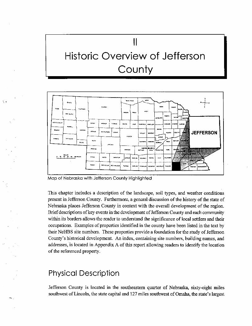
Map of Nebraska with Jefferson County Highlighted
This chapter includes a description of the landscape, soil types, and weather conditions present in Jefferson County. Furthermore, a general discussion of the history of the state of Nebraska places Jefferson County in context with the overall development of the region. Brief descriptions of key events in the development of Jefferson County and each community within its borders allows the reader to understand the significance of local settlers and their occupations. Examples of properties identified in the county have been listed in the text by their NeHBS site numbers. These properties provide a foundation for the study of Jefferson County's historical development. An index, containing site numbers, building names, and addresses, is located in Appendix A of this report allowing readers to identify the location of the referenced property.
Physical Description
Jefferson County is located in the southeastern quarter of Nebraska, sixty-eight miles southwest of Lincoln, the state capital and 127 miles southwest of Omaha, the state's largest
Chapter I I Historic Overview of Jefferson County
city. Jefferson County, which measures 576 square miles, is surrounded by the Nebraska counties of Saline to the north, Gage to the east, and Thayer to the west, as well as Washington County, Kansas to the south. The Sixth Principal Meridian serves as the western boundary for Jefferson County. The Little Blue River cuts through the southwest one-third of the county. Fairbury is the largest community and governmental seat of the county. The county also includes eleven other communities: Daykin, Diller, Endicott, Gladstone, Harbine, Jansen, Plymouth, Powell, Reynolds, Steele City, and Thompson.
An early description of the region in the 1912 Pioneer Tales of the Oregon Trail and of JefSerson County work by Charles Dawson notes:4
The surface is rough and almost mountainous in the southern part, through which flow the Little and Big Blue rivers and their tributaries; the northern part is comprised mostly of high rolling and level prairie lands. The soil of the bottom land is a light and sandy loam, while that of the high prairie is a dark loam. The hillsides and valleys produced annually rank growths of tall jointed grass, with buffalo-grass covering the high level prairies. The valley lands are fertile, and with the first attempts of cattle-ranching on the prairies and hog-ranching in the bottoms, promising this county bid fair to agriculturalists.
The varied landscape of Jefferson County consists of fertile soils conducive to agriculture. While the northern section of the county is utilized for crops, the rolling hills in the southern region feed cattle. Current primary crops produced in Jefferson County are corn, wheat, and milo; secondary crops include oats, soybeans, and alfalfa.5 The natural environment of Jefferson County was described, by James Olson in his History ofNebraska, as two distinct regions. The majority of the county is in the Loess Plains Region and a small portion of the eastern side is in the Drift Hills Region. The soil types in the county consist of Crete- Hastings-Idana and Carrington-Clyde. Crete-Hastings-Idana is mainly located in the west with a sliver of this type extending into the northeastern corner of the county. It is an excellent producer of small grains due to its compacted clay soil. Carrington-Clyde is located on the eastern edge of the county and extends in an arch into the north central portion
Charles Dawson, Pioneer Tales of the Oregon Trail and of Jefferson County (Topeka. KS: Crane & CO., l9l2), 266-267.
'"County Organized in 1864; Fairbury Largest of 12 Towns," The Fairbury Journal-News 28 May 1982.
17 Chapter II Historic Overview of Jefferson County
of the county. The category Carrington-Clyde is identified as a prairie soil and noted for excellent corn production and pasture^.^
The weather conditions in Jefferson County and the surrounding region consist of fluctuating temperatures and precipitation. In Elinor L. Baade Brown's book entitled Maps Tell Nebraska's History, the state is divided into eight climatic divisions. Jefferson County is located in the division known as the Southeast. The coolest month of the year in the Southeast region is January, which is reported with an average temperature of 22.6 degrees Fahrenheit. The warmest month of the year in this division, July, offers an average temperature of 77.7 degrees Fahrenheit. The Southeast region is the warmest in the state during July according to average temperature figures. The majority of precipitation in the division falls between the months of March and September. Both May and June receive the most precipitation totaling more than four inches each month, with the mean annual precipitation ranging between twenty-eight and thirty i n ~ h e s . ~
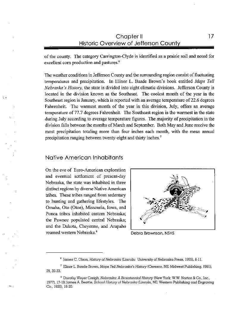
Native American Inhabitants
On the eve of Euro-American exploration and eventual settlement of present-day Nebraska, the state was inhabited in three distinct regions by diverse Native American tribes. These tribes ranged from sedentary to hunting and gathering lifestyles. The Omaha, Oto (Otoe), Missouria, Iowa, and Ponca tribes inhabited eastern Nebraska; the Pawnee populated central Nebraska; and the Dakota, Cheyenne, and Arapaho roamed western Nebraska.' Debra Brownson, NSHS
James C. Olson, History of Nebraska (Lincoln: University of Nebraska Press, 1955), 8-1 1.
Elinor L. Baade Brown, Maps Tell Nebraska's History (Ceresco, NE: Midwest Publishing, 1991), 29, 32-33.
Dorothy Weyer Creigh, Nebraska: A Bicentennial History (New York: W.W. Norton & Co., Inc., 1977). 17- 19; James A. Beattie, School History of Nebraska (Lincoln, NE: Western Publishing and Engraving CO., 1920). 18-20.
18 Chapter II Historic Overview of Jefferson Countv
In James C. Olson's History of Nebraska, a map of the state, dated approximately 1800, indicates that the Oto occupied present-day Jefferson County. Based upon James A. Beattie's book entitled School History of Nebraska, the word "Nebraska" is derived from the Oto language. It means "flat water" and referred to the Platte River. In terms of lifestyle, the Oto were labeled sedentary and grouped with the Iowa and the Missouria to form the Chiwere. As a result of the early Euro-American settlement of eastern Nebraska, the Oto were persuaded to cede their land to the federal government. As early as 1834, the Oto relinquished land to the government in fulfillment of a treaty. Twenty years later, in 1854, the Oto resigned their remaining land claim with the exception of a section near the Big Blue River. In 1855, the Oto were bound to a reservation west of the Big Blue River. The Oto Reservation stretched more than twenty-four square miles into the southeast corner of present-day Jefferson County. Although the Oto existed in relative peace despite the large influx of settlers to the state, in 1879 by the authority of a new treaty, the government gained legal control to remove the Oto to Oklahoma. When the Oto were removed, the southeast corner of Jefferson County was opened to settlement and the community of Diller was formed. Based upon the above time line, it is apparent that the federal government's efforts to first constrict the Oto and later remove them coincides with the early settlement of the state and the eventual designation of Jefferson C ~ u n t y . ~
Brief History of Nebraska
The Great Plains state of Nebraska holds an important role in the history of the United States. Though today it is thought of primarily as a producer of agricultural products such as grain and livestock, its earlier history is closely linked to its importance as a transportation corridor. After initial exploration of the Great Plains, early travelers used transportation corridors cutting through present-day state of Nebraska to reach the west. As the region became more heavily settled, early railroad tracks replaced the overland trails. Furthermore, federal legislation was enacted to entice settlers to the Great Plains. The trains brought settlers, and as the populations grew the necessity for commercial centers rose. Many of these communities were platted by land companies associated with the railroads. The newly
James C. Olson, History of Nebraska (Lincoln: University of Nebraska Press, 19551, 22, 26-27; JamesA. Beattie, ed., School History of Nebraska (Lincoln, NE: Western Publishing and Engraving Co., 1920), 103; Dorothy Weyer Creigh, Nebraska: A Bicentennial History (New York: W.W. Norton & Co., Inc., 1977), 17-18, 72-73; Charles Dawson, Pioneer Tales of the Oregon Trail and of Jefferson County (Topeka, KS: Crane & Co., 1912). 164-165; "County Organized in 1864; Fairbury Largest of 12 Towns," The Fairbury Journal-News 28 May 1982.
Chapter II Historic Overview of Jefferson County
formed communities served as shipping stops for agricultural goods and passengers. The agricultural industry in Nebraska prospered after the turn of the century especially with the demands placed on it by World War I. However, the Great Depression adversely impacted farmers throughout the country. The economy of Nebraska during this period was boosted with activities associated with New Deal programs. As a result of World War 11, rural Nebraskans began to uproot and move due to changing urban labor needs. Today, in the last decade of the twentieth century, Nebraska boasts a strong and diversified economic base, which has been encouraged and enhanced by its role as a nationally important transportation center.
The earliest contact by non-native people in the Great Plains was made in 1541 by a gold- seeking Spanish explorer named Francisco Vasquez Coronado. Though many historians believe that Coronado actually reached Nebraska, the location of his contact has never been confirmed. Nevertheless, the fact remains that Coronado did investigate the Great Plains, and finding the flat, arid region to be devoid of gold, the Spanish turned their attention elsewhere. Almost two centuries passed before the region of present-day Nebraska was entered by the Spanish in an organized fashion.''
The Spanish, who were well-established south of the Rio Grande River by the early 1700s, had heard that the Pawnee were trading with the French on the plains. In an attempt to hinder their French rivals, by 1720 the Spanish sent a small military party to the northern plains, where they crossed the Arkansas River and continued north to the South Platte River. After the party was attacked by the Pawnee, the few survivors returned to Santa Fe. Thereafter, the French were the non-native influence in the plains."
The French first came to the area now known as Nebraska when Father Marquette and Louis Joliet, traveling westward, crossed the Missouri in 1673. By 1739 two explorers, Paul and Pierre Mallet, assuming the Missouri River led to Santa Fe, pursued the route they hoped would lead to trade with the Spanish in New Mexico. Their exploration took them to the Platte, Loup, and Republican rivers in present-day Nebraska, and they eventually found their way to Santa Fe.I2
'O JamesC. Olson, History of Nebraska (Lincoln: University of Nebraska Press, 19551, 30.
" JamesC. Olson, History of Nebraska (Lincoln: University of Nebraska Press, 1955),31.
JamesC. Olson, History of Nebraska (Lincoln: University of Nebraska Press, 1955),34.
20 Chapter II Historic Overview of Jefferson Countv
Despite the French contact in the Great Plains, by 1763 the Treaty of Paris was signed and all of the land west of the Mississippi River became Spanish, while all land east of the Mississippi River went to the British. Though the Spanish made several attempts at trading with Native Americans, they had limited success. By 1800, the Spanish agreed to turn the Louisiana Territory back to the French, which led to the Louisiana Purchase, when Napoleon sold land west of the Mississippi River to the United States in 1 803.13
Almost immediately after the Louisiana Purchase was secured, President Thomas Jefferson sought an appropriation from Congress to send an exploration team to the Louisiana Territory. In May of 1804, the Lewis and Clark expedition began at the confluence of the Mississippi and the Missouri rivers. Though the Lewis and Clark expedition did not extend far into present-day Nebraska, their observations and brief stay at Council Bluffs, in present- day Iowa, led to the establishment of military camps in that vicinity.I4
Another Euro-American explorer to pass through Nebraska was John C. Fremont. In 1842, Fremont led an expedition of twenty-seven men, including Kit Carson, over the Platte Valley-South Pass route. In early summer, the group departed from a trading post, near present day Kansas City, and traversed the Oregon Trail to the Rocky Mountains. Although Fremont did not find a new route, he did confirm the quality of the western trail. Published reports regarding Fremont's findings popularized the trail for settlers seeking new homes in territory abutting the Pacific O ~ e a n . ' ~
Between 1841 and 1866, an estimated three-hundred and fifty thousand settlers traversed the overland trail, seeking opportunities in the west. Initially, based on earlier reports of the beautiful land on the west side of the Rockies, the settlers were headed to Oregon. However, before long, the destinations also included Utah, which was of particular interest to the Mormons, and the 1848 discovery of gold in California led many to try their fortune there. For most travelers, the route began in Independence, Missouri, headed west into present-day Kansas, then followed the Little Blue River through present-day Jefferson County, Nebraska, continued westwardly to Adams County, and finally turned north to the Platte River.
l 3 James C. Olson, History of Nebraska (Lincoln: University of Nebraska Press, 1955), 34-37.
l4 JamesA. Beattie, ed. School History of Nebraska (Lincoln: Western Publishing and Engraving Co., 1920), 33-36; Council Bluffs, Iowa is located across the Missouri River, east of Omaha, Nebraska.
l 5 James C. Olson, History of Nebraska (Lincoln: University of Nebraska Press, 1955), 57-58; James A. Beattie, ed. School History of Nebraska (Lincoln: Western Publishing and Engraving Co., 1920). 49.
Chapter II 21 Historic Overview of Jefferson County
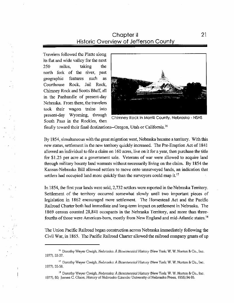
Travelers followed the Platte along its flat and wide valley for the next 250 miles, taking the north fork of the river, past geographic features such as Courthouse Rock, Jail Rock, Chimney Rock and Scotts Bluff, all in the Panhandle of present-day Nebraska. From there, the travelers took their wagon trains into present-day Wyoming, through
Chimney Rock in Morrill County, Nebraska - NSHS South Pass in the Rockies, then finally toward their final destinations--Oregon, Utah or California.16
By 1854, simultaneous with the great migration west, Nebraska became a territory. With this new status, settlement in the new territory quickly increased. The Pre-Emption Act of 1841 allowed an individual to file a claim on 160 acres, live on it for a year, then purchase the title for $1.25 per acre at a government sale. Veterans of war were allowed to acquire land through military bounty land warrants without necessarily living on the claim. By 1854 the Kansas-Nebraska Bill allowed settlers to move onto unsurveyed lands, an indication that settlers had occupied land more quickly than the surveyors could map it."
In 1854, the first year lands were sold, 2,732 settlers were reported in the Nebraska Territory. Settlement of the territory occurred somewhat slowly until two important pieces of legislation in 1862 encouraged more settlement. The Homestead Act and the Pacific Railroad Charter both had immediate and long-tern impact on settlement in Nebraska. The 1869 census counted 28,841 occupants in the Nebraska Territory, and more than three- fourths of those were American-born, mostly from New England and mid-Atlantic states.''
The Union Pacific Railroad began construction across Nebraska immediately following the Civil War, in 1865. The Pacific Railroad Charter allowed the railroad company grants of up
'"orothy Weyer Creigh, Nebraska: A Bicentennial History (New York: W. W. Norton & Co., Inc. 1977), 33-37.
l7 Dorothy Weyer Creigh, Nebraska: A Bicentennial History (New York: W. W. Norton & Co., Inc. 1977). 55-56.
l8 Dorothy Weyer Creigh, Nebraska: A Bicentennial History (New York: W. W. Norton & Co., Inc. 1977), 60; James C. Olson, History of Nebraska (Lincoln: University of Nebraska Press, 1955),94-95.
Chapter II Historic Overview of Jefferson County
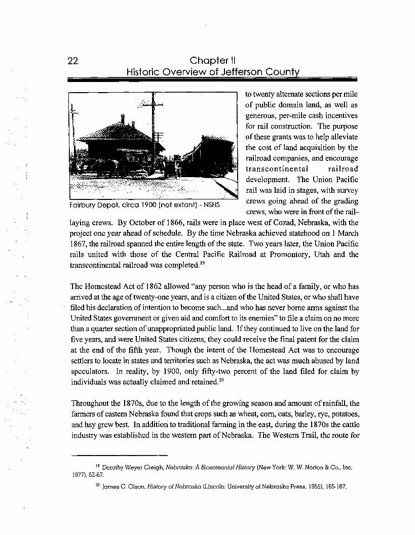
to twenty alternate sections per mile of public domain land, as well as generous, per-mile cash incentives for rail construction. The purpose of these grants was to help alleviate the cost of land acquisition by the railroad companies, and encourage transcontinental railroad development. The Union Pacific rail was laid in stages, with survey
Fairbury Depot, circa 1900 (not extant) - NSHS crews going ahead of the grading crews, who were in front of the rail-
laying crews. By October of 1866, rails were in place west of Cozad, Nebraska, with the project one year ahead of schedule. By the time Nebraska achieved statehood on 1 March 1867, the railroad spanned the entire length of the state. Two years later, the Union Pacific rails united with those of the Central Pacific Railroad at Promontory, Utah and the transcontinental railroad was ~ompleted. '~
The Homestead Act of 1862 allowed "any person who is the head of a family, or who has arrived at the age of twenty-one years, and is a citizen of the United States, or who shall have filed his declaration of intention to become such ...and who has never borne arms against the United States government or given aid and comfort to its enemies" to file a claim on no more than a quarter section of unappropriated public land. If they continued to live on the land for five years, and were United States citizens, they could receive the final patent for the claim at the end of the fifth year. Though the intent of the Homestead Act was to encourage settlers to locate in states and territories such as Nebraska, the act was much abused by land speculators. In reality, by 1900, only fifty-two percent of the land filed for claim by individuals was actually claimed and retained.20
Throughout the 1870s, due to the length of the growing season and amount of rainfall, the farmers of eastern Nebraska found that crops such as wheat, corn, oats, barley, rye, potatoes, and hay grew best. In addition to traditional farming in the east, during the 1870s the cattle industry was established in the western part of Nebraska. The Western Trail, the route for
Dorothy Weyer Creigh, Nebraska: A Bicentennial History (New York: W. W. Norton & Co., Inc. 1977). 62-67.
20 James C. Olson, History of Nebraska (Lincoln: University of Nebraska Press, 1955), 165-167,
Chapter I I Historic Overview of Jefferson County
driving longhorn cattle from Texas to shipping points north, traversed the southwestern part of Nebraska. Ogalalla, in Keith County, served as an important Union Pacific way station at the north end of the trail. As the cattle drives ended in the 1880s due to new laws restricting the large drives, the beef industry thrived in Nebraska's Panhandle. Here, good pastures were available and the land had been settled in sufficiently low numbers to allow open range ranching. The cattle drives, and later western Nebraska ranching, were encouraged by rail transportation of livestock and the establishment of packing houses and stockyards in Omaha in the 1870s and l88O~.~ '
Agricultural development continued into the last decades of the nineteenth century. The railroads sold much of their government-acquired land to speculators, who, in turn, offered it at a higher price to the farmers. In 1880 there were 63,389 farms in Nebraska, and by 1890 this number had increased to 113,608. Though in 1880 land in agricultural use had not extended much past Grand Island, a decade later the economic force of agriculture had expanded across the entire state. Corn continued to be the most popular of the crops grown in the late nineteenth century, mostly because it was a high-yield crop, could be fed profitably to livestock, and grew well in the Nebraska climate. Wheat varieties which thrived in the Nebraska climate were not readily available until the 1890s. Nonetheless, once introduced, wheat became an equally important
As argued by historian Frederick Jackson Turner in his famous 1893 thesis entitled "The Significance of the Frontier in American History", the frontier period was coming to an end. Though there were areas of northwestern Nebraska which would not be settled until after the turn of the century, settlement in Nebraska was essentially completed by the early 1890s. The number of farms in the state increased from 113,608 in 1890 to 121,525 in 1900, and up to 129,678 by 191 0. Agricultural land prices increased over this period, and livestock and crop prices doubled and tripled in value. By the turn of the century, new agricultural implements and the introduction of hearty varieties of crops, particularly winter wheat and alfalfa, aided the success of farming in Nebraska. To address the low rainfall in the state, by 1895 the state legislature had created the Board of Irrigation. As a result, by the turn of the century, more than one hundred and fifty thousand acres of land were irrigated. 23
21 James C. Olson, History of Nebraska (Lincoln:University of Nebraska Press, 19551, 184, 193-194, 209.
22 JamesC. Olson, History of Nebraska (Lincoln: University of Nebraska Press, 19551, 204-206.
23 JamesC. Olson, History of Nebraska (Lincoln: University of Nebraska Press, 19551,258-260.
Chapter II Historic Overview of Jefferson County
New land settlement legislation in the early twentieth century continued to influence Nebraska's population. Though the Homestead Act of 1862 worked well in regions of Nebraska best suited for agricultural development, a quarter-section of land was insufficient to support farming in the arid country of northwestern Nebraska. Cattlemen required larger parcels for their ranging livestock. The 1904 Kinkaid Act provided that the homestead claims could be up to 640 acres (one section) in thirty-seven northwestern counties where nearly eight million acres of unclaimed govemment property still remained. Irrigable lands were excluded from Kinkaid claims. Though available statistics do not sufficiently differentiate between Homestead Act claims and Kinkaid Act claims in Nebraska, it soon became apparent that even one section of land was insufficient for cattle grazing, where each animal required fifteen to twenty acres.24
Nebraska farmers experimented with new crops to ensure large yields and profits. They planted sugar beets, potatoes, and alfalfa in the Panhandle, and pursued hearty strains of wheat elsewhere in the state. When the United States entered World War I in 1917, the need for food increased dramatically and agricultural prices soared. To
Jefferson County Farmers, circa 1910 - NSHS take advantage of prices which nearly doubled, Nebraska farmers increased their wheat production,
expanding cultivation into southwest counties previously used as pasture lands. When prices continued to rise after the war, Nebraska farmers bought more land, which led to an over- extension of credit in the state by the mid- 1920s. By 1923, one-fourth of mortgaged farms failed and, as a result of unstable economic conditions, nearly six-hundred fifty banks closed in the state. When the stock market crashed in 1929, Nebraska farmers were already adjusting to hard times.25
24 JamesC. Olson, History of Nebraska (Lincoln: University of Nebraska Press, 19551,268-269; JamesA. Beattie, ed., School History of Nebraska (Lincoln: Western Publishing and Engraving Co., 1920), 252.
25 Dorothy Weyer Creigh, Nebraska: A Bicentennial History (New York: W.W. North & Co., Inc., 1977), 183-185.
1
Chapter II Historic Overview of Jefferson County
Though the lack of banks during the 1930s caused hardship for the people of Nebraska, perhaps the most devastating aspect of the Great Depression was the unusually harsh weather conditions. Nearly a decade of drought, heat, low rainfall, and wind storms devastzted Nebraska crops, which led to the necessity for enormous amounts of federal aid. Programs such as the Civilian Conservation Corps (CCC), Works Progress Administration (WPA), Public Works Administration (PWA), Agricultural Adjustment Administration (AAA), and other aid programs assisted destitute Nebraskans through the most challenging decade of the century. Despite the New Deal programs, hundreds of thousands of agricultural acres were abandoned and the state's population dropped by sixty-five thousand between 1930 and
The 1940s brought new challenges and opportunities, as World War I1 had its home front impact on Nebraska. Though many people left the state in the early 1940s to work in west coast war plants, a number of war-related industries were established in Nebraska as well. Ordnance plants emerged in Grand Island, Hastings, Mead, and Sidney, and the Glen L. Martin Bomber Plant constructed military aircraft south of Omaha. The Army Air Forces established air bases at Alliance, Ainsworth, Bruning, Fairmont, Grand Island, Harvard, Kearney, Lincoln, McCook, Scottsbluff, and Scribner. After the war, Off& Air Force Base, south of Omaha, became established as the headquarters for the Strategic Air Command during the Cold War era. All of these industries and air fields provided many jobs for both military personnel and civilians throughout the war and many continued well into the Cold War era, through the Korean and Vietnam conflicts.27
Present-day Nebraska, which experienced early exploration by the Spanish and French, was acquired by the United States through the 1804 Louisiana Purchase. By the mid-1 800s, this region experienced significant westward traffic due to its location along the overland trail. This western migration prompted the construction of railroads through the territory, which led to the platting of many of Nebraska's towns and cities. Twentieth century development of the state benefitted from improved transportation systems and agricultural techniques, as well as the establishment of military facilities. This ability to modernize allowed Nebraska to overcome economic recessions and support America's position in international affairs.
26 Dorothy Weyer Creigh, Nebraska: A Bicentennial History (New York: W.W. North & Co., Inc., 1977), 185-187.
27 James C. Olson, History of Nebraska (Lincoln: University of Nebraska Press, 1955), 335.
26 Chapter II Historic Overview of Jefferson County
Jefferson County History
I I
Map of Jefferson County, 1900 - NSHS
Jefferson County's rich history is closely linked to transportation. Initially, the area experienced early settlement due to its location along the Oregon Trail. This vital position afforded the area early exposure to immigrants, as well as mail and freight carriers. Although early residents benefitted from the sale of goods along the trail, the real boom in the county occurred with the arrival of railroad tracks. The railroad provided a means for farmers to move goods to market, as well as supplemented the local economy due to the county seat's designation as a western division point for the Rock Island Railroad.
27 Chapter II Historic Overview of Jefferson County
Jefferson County played a role in early American exploration of the west. In 1842, John C. Fremont and Kit Carson set out on an expedition to record the topography of a western trail. Although this route had been traversed by earlier Euro-American travelers, Fremont's publication of his notes aroused further interest in the route and present-day Oregon, as well as solidified the Platte Valley-South Pass as the superior westward As stated in James C. Olson's book entitled History of N e b r a ~ k a : ~ ~
The trail entered present-day Nebraska at about the line between Gage and Jefferson counties, followed the Blue Valley across Jefferson, Thayer, Nuckolls, and Adams counties, and joined the Platte near the head of the 'Grand Island' in Hall County. It went along the south side of the Platte to a point in Keith County. ... There the South Platte was crossed, and the emigrants went northwest through Ash Hollow to the North Platte, then past Court House and Jail rocks, Chimney Rock, and Scotts Bluff to Oregon Trail Marker in Jefferson Fort Laramie. County, 1996 - NeHBS
During the expedition, the party marked its passage through present-day Jefferson County by carving their names into a sandstone rock along the edge of Rock Creek. In 193 1, the Jefferson County Commissioners purchased the site, which was located northeast of Endicott, and the Fairbury Quivera Chapter of the Daughters of the American Revolution became its guardians. In honor of its keepers, the site was named Quivera Park.30 In 1997, due to an earlier flood, the carved stone is no longer extant and the park is not identified on the 1971 General Highway Map of Jeflerson County.
JamesC. Olson, History of Nebraska (Lincoln: University of Nebraska Press, 1955), 58-59; James A. Beattie, ed., School History of Nebraska (Lincoln: Western Publishing and Engraving Co., 1920), 48-49.
29 JamesC. Olson, History of Nebraska (Lincoln: University of Nebraska Press, 1955), 59.
30 Levi Boyd, comp., Iefferson County History; Quivera Park (N.p.,1955).
Chapter II Historic Overview of Jefferson Countv
As a result of its eastern location in the state, the development of Jefferson County occurred early in the history of Nebraska. In 1857, the first survey of present-day Jefferson County was conducted. Rock Creek Station and the Fort Laramie and Leavenworth Road were the only two indicators of what Euro-Americans termed "civilization." The field survey notes were categorized by precincts. For each precinct, the surveyors commented on landscape, soil quality, and the availability of water, timber, and stone^.^'
Similar to most early counties in the state of Nebraska, the area in present-day Jefferson County experienced several boundary and name changes during its early history. One year prior to the survey, in 1856, the land in present-day Jefferson County was formed as Jones County and the region to the west was named Jefferson County, in honor of the country's third president. In 1 867, Jefferson and Jones merged into one county. In 187 1, legislation was enacted to dissolve the previously enlarged county and an eastern section was again designated as Jefferson County.32
The newly formed Jefferson County included the Oto Reservation (see page 17), which consumed more than twenty-four acres of the southeast comer. Eventually, due to increased Euro-American settlement, the Native Americans occupying Jefferson County were uprooted and moved to Oklahoma. On 3 1 May 1883, fifty thousand acres of the Oto and Missouri Indian Reservation in Kansas and Nebraska were opened for settlement at a public sale. No one was allowed to purchase more than 160 acres and one-fourth of the price had to be paid within three months. The remainder was to be paid in installments over the next three years with five percent interest. The community of Diller was founded within the former boundaries of the Oto Reservation in Jefferson County.33
Permanent Euro-American settlement in Jefferson County occurred in the 1850s and 1860s. As early as 1856, Daniel Patterson and Newton and S.C. Glenn were as early ranchersftraders in present-day Jefferson County. While Patterson was located at the Big Sandy Station, the Glenns resided at Rock Creek Station. Thereafter, between 1859 and 1860, a large influx of
31 Charles Dawson, Pioneer Tales of the Oregon Trail and of Jefferson County (Topeka, KS: Crane & Co., 19121,280; "The First Survey Party In Jefferson County, Back in 1857, Painted an Uncomplimentary Picture of its Future For Agricultural Purposes, Thought it Too Dry," The Fairbury News and the Fairbury Gazette 15 August 1935.
32 Jane Graff, coor., Nebraska Our Towns.. .East Southeast (Dallas, TX:Taylor Publishing Co., 1992). 7 1; "County Organized in 1864; Fairbuy Largest of 12 Towns," The e air bury ]&rnal-News 28 May 1982.
33 Junior Chamber of Commerce and Senior Chamber of Commerce, comp., Welcome to Fairbury (N.p., n.d.1, 3; "Sale of the Otoe Reservation," The Fairbury Gazette 28 April 1883.
Chapter II Historic Overview of Jefferson County
settlers entered the area. In 1860, Dennis Myers filed the first land warrant in Jefferson County. One year later, area residents were sufficiently organized to hold elections at Big Sandy Station regarding the best management system for the county. By the next year, the second round of elections was held for county officials. Following the Homestead Act of 1862, another wave of settlers entered the county. On 2 January 1863 Jacob Tenesh was the first to file a homestead claim in present-day Jefferson County.34
Prior to 1866, one of the main occupations for people living in present-day Jefferson County was providing staples to travelers on the Oregon Trail. Station house35 operators were assured patrons from the large overland trail businesses passing through the county, including the Leavenworth & Pike's Peak Express Company, Central Overland California & Pike's Peak Express Company, the Pony Express, Ben Holladay Overland Mail & Express, and Wells Fargo & Company. By the mid 1860s, however, with the pending arrival of the railroad, overland traffic declined and area business people were forced to look toward other moneymaking ventures. Due to the anticipation of the railroad, land companies and area residents began to plat communities and start businesses along the expected route of the tracks.36
Increased settlement, community development, and efficient transportation resulted from the arrival of the railroad in Jefferson County. In 1871, the Republican River Branch of the Burlington and Missouri laid tracks through the county. By 1872 the St. Joseph & Denver City Railroad (aMa St. Joseph & Western and the St. Joseph & Grand Island) laid tracks which traversed through Jefferson County, connecting St. Joseph, Missouri with Grand Island, on the Platte River. On 13 March 1872, the first train of the St. Joseph & Denver City Railroad reached Fairbury. Prior to that time, the Wilson Stage Line delivered mail
34 Souvenir: History of Rock Creek Station (Fairbury, NE: Hollowcry Publishing Co., n.d.1; Charles Dcrwson, Pioneer Tales of the Oregon Trail and of Jefferson County (Topeka, KS: Crane & Co., 1912), 267- 272, 299-300.
35 Rock Creek serves a s an excellent example of a famous station house in Jefferson County, which is known for its association with western historical figures and overland trail companies. In 1997, the Rock Creek Station site functions a s a state historic park and recreation area. All extant buildings at the site are either reconstructions or replicas of original properties.
3"evi Boyd, comp., Egress of the Old West; the Beginning of Fairbury and its Founders (Fairbury, NE: Hollowcry Publishing Co., 1963); Charles Dawson, Pioneer Tales of the Oregon Trail and of Jefferson County (Topeka, KS: Crane & Co., 1912), 272.
30 Chapter II Historic Overview of Jefferson Countv
biweekly to the communities of Jenkins Mills, Fairbury, and Meridian. However, with the implementation of the railroad, the use of stage lines in Jefferson County became obsolete.37
One of the earliest land companies to come to Jefferson County was established by Colonel Thomas Harbine of St. Joseph, Missouri. In about 1872 he financed and administered the Nebraska Land and Town Company, which functioned as a developer of towns along the route of the St. Joseph and Denver City Railroad. His planned towns spanned across the entire route, and his promotion efforts encouraged emigrants to these new communities. Jefferson County villages platted by the Nebraska Land and Town Company included Steele City and Powell. Since these were early settled communities, both Steele City and Powell were platted using a parallel town plan, where the commercial development faced the
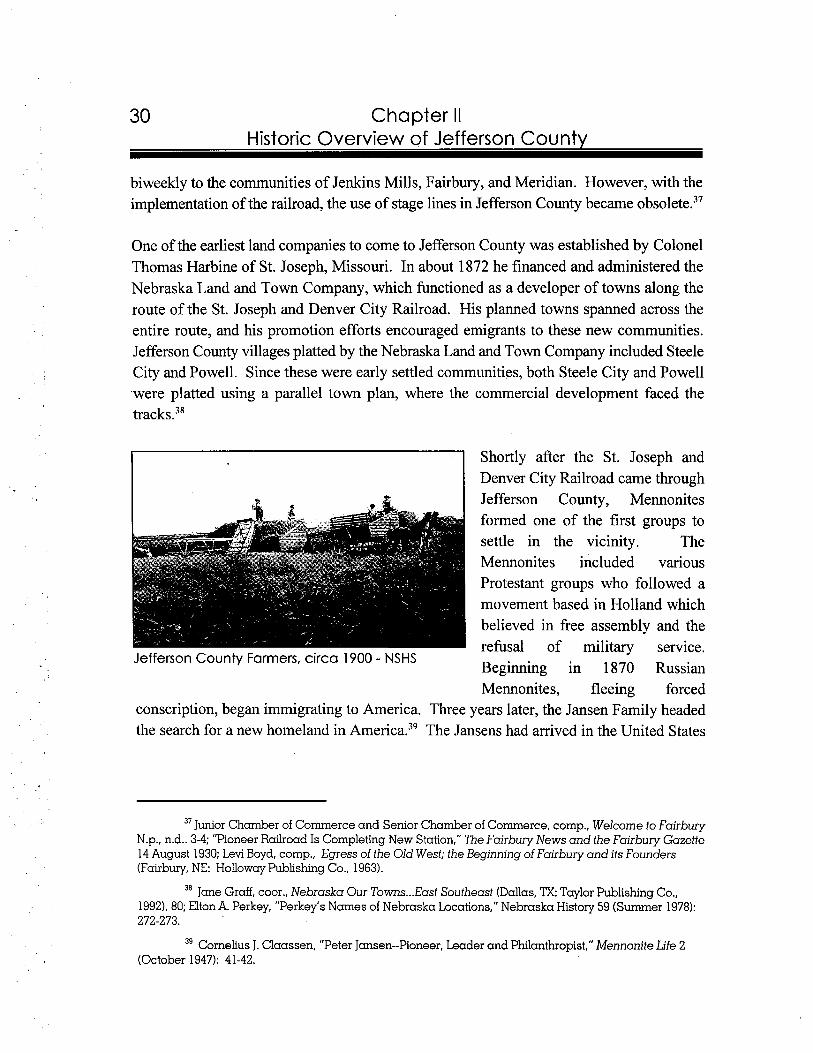
Shortly after the St. Joseph and Denver City Railroad came through Jefferson County, Mennonites formed one of the first groups to settle in the vicinity. The Mennonites included various Protestant groups who followed a movement based in Holland which believed in free assembly and the refusal of military service.
Jefferson County Farmers, circa 1900 - NSHS Beginning in 1870 Russian Mennonites, fleeing forced
conscription, began immigrating to America. Three years later, the Jansen Family headed the search for a new homeland in Ameri~a.~' The Jansens had arrived in the United States
37 Junior Chamber of Commerce and Senior Chamber of Commerce, comp., Welcome to Fairbury N.p., n.d.. 3-4; "Pioneer Railroad Is Completing New Station," The Fairbury News and the Fairbury Gazette 14 August 1930; Levi Boyd, cornp., Egress of the Old West; the Beginning of Fairbury and its Founders (Fairbury, NE: Hollowcry Publishing Co., 1963).
38 Jane Graff, coor., Nebraska Our Towns ...East Southeast (Dallas, ?X: Taylor Publishing Co., 1992),80; Elton A. Perkey, "Perkey's Names of Nebraska Locations," Nebraska History 59 (Summer 1978): 272-273.
39 Cornelius J. Claassen, "Peter Jansen--Pioneer, Leader and Philanthropist," Mennonite Life 2 (October 1947): 41-42.
Chapter II Historic Overview of Jefferson County
prior to the rest of their party to review the possibilities for settlement. Based upon excerpts taken from Peter Jansen's autobiography, he wrote:40
At that time ...the vast prairies beyond the Missouri river were just being opened by the railroads for settlement. Millions of acres had been granted by act of congress as subsidies for building railroads. The managements of these railroads vied with each other to attract settlers. We were furnished not only free transportation, but also were often given special cars and special trains to facilitate our work of looking over their lands.
Since Peter Jansen spoke English, he led a party west to choose between land in Kansas and Nebraska. A location near present-day Jansen, Jefferson County, Nebraska was selected for the site. These new settlers created a "quasi-village" with approximately thirty-seven farmhouses set next to each other and attached to long and narrow farmsteads, similar to the "long lot" system of farm settlement used in medieval Europe. Due to this heightened settlement of Jefferson County, the population jumped from 2,440 in 1870 to 8,096 in 1 880.41
In the 1880s, railroad construction continued in Jefferson County. The Omaha & Republican Valley Railroad Company, under the authority of the Chicago, Burlington and Quincy Railroad, constructed a line through Jefferson County between 1880-1 881. By the early 1880s, with two railroad lines running through the county, a map showed the communities of Antelope, Bower, Endicott, Fairbury, Jenkins Mill, Meridian, Plymouth, Reynolds, and Steele City.42
The county seat of Fairbury, as well as the rest of the region, continued to prosper with the construction of the Chicago, Rock Island and Pacific Railroad (aka Rock Island). During 1886 and 1887, the Rock Island Railroad constructed a line from St. Joseph, Missouri through Nebraska counties including Gage, Jefferson, Thayer and Nuckolls. Another line
40 "Jansen's Memories," The Fairbury News and the Fairbury Gazette 23 December 1920.
4 1 Cornelius J. Claassen, "Peter Jansen--Pioneer, Leader and Philanthropist," Mennonite Life 2 (October 1947): 41-42; The Mennonite "long lots" have nearly disappeared through the years, with few remnants remaining by the 1950s, according to Baltensperger (p. 214). Bradley H. Baltensperger, Nebraska: A Geography (Boulder, CO: Westview Press Inc., 1985), 214-215; Clerk of the Legislature, comp., Nebraska Blue Book 1990-1991 (Lincoln, NE: Clerk of the Legislature, 1990). 783.
42 Charles Dcrwson, Pioneer Tales of the Oregon Trail and of Jefferson County (Topeka, KS: Crane & Co., 1912), 316.; Junior Chamber of Commerce and Senior Chamber of Commerce, comp., Welcome to Fairbury (N.p., n.d.1, 3-4.
32 Chapter II Historic Overview of Jefferson County
was laid fiom Omaha to Belleville, Kansas. This line also passed through Jefferson County. As a result of the railroad activity by the Rock Island, Fairbury was designated as the company's western division headquarters and a roundhouse and yards were constructed. After the turn of the century, between $35,000 and
Rock Island Railroad Bridge over the Little Blue $40,000 per month were paid by the
River near Fairbury, circa 1900 - FCM Rock Island to employees stationed at Fairbury. While the branch line
ran through the middle of Jefferson County, the main line extended fiom the northeast to the southwest. With all of the railroad activity, the population of Jefferson County reached 14,850 in 1890, fifty-five percent larger than the-previous decade.43
Just prior to the turn of the century, the number of miles of railroad through the county was reported as follows: 36.44 Agricultural Products miles of Burlington & Missouri River; 53.94 miles of Chicago, Rock Island & Pacific; 27.26 miles of St. Joseph and Grand Island; 1 1.5 1 miles of Kansas City & Omaha. These railroads were servicing a well-established agriculture industry in Jefferson County. The 1899 agricultural statistics confirmed the county's role as a
corn Meadowfarming center. While the value of @joats Wheat
228,541 acres of improved land tallied Jefferson County Agriculture Products in
$4,776,975, another 127,636 acres of 1899 unimproved land totaled $1,687,650.
43 Charles Dawson, Pioneer Tales of the Oregon Trail and of lefferson County (Topeka, KS: Crane & Co., 1912), 314-315; Clerk of the Legislature, comp., Nebraska Blue Book 1990-1991 (Lincoln,NE: Clerk of the Legislature, 1990), 783.
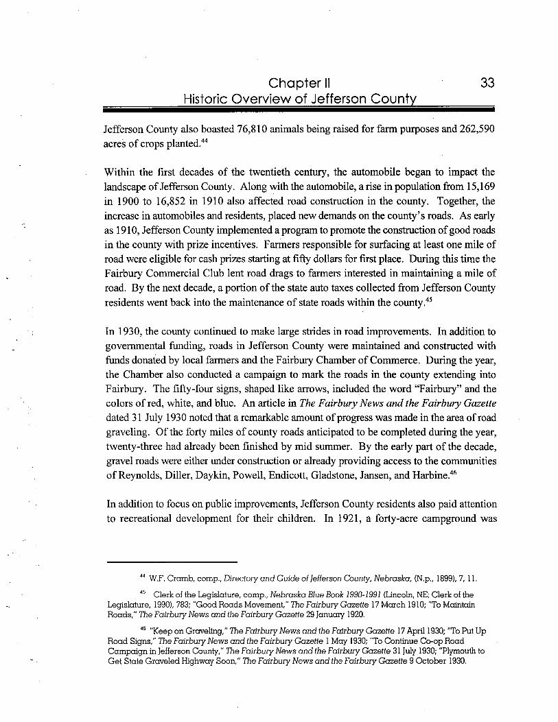
Chapter II 33 Historic Overview of Jefferson County
Jefferson County also boasted 76,810 animals being raised for farm purposes and 262,590 acres of crops planted.44
Within the first decades of the twentieth century, the automobile began to impact the landscape of Jefferson County. Along with the automobile, a rise in population fiom 15,169 in 1900 to 16,852 in 1910 also affected road construction in the county. Together, the increase in automobiles and residents, placed new demands on the county's roads. As early as 19 10, Jefferson County implemented a program to promote the construction of good roads in the county with prize incentives. Farmers responsible for surfacing at least one mile of road were eligible for cash prizes starting at fifty dollars for first place. During this time the Fairbury Commercial Club lent road drags to farmers interested in maintaining a mile of road. By the next decade, a portion of the state auto taxes collected fiom Jefferson County residents went back into the maintenance of state roads within the county.45
In 1930, the county continued to make large strides in road improvements. In addition to governmental funding, roads in Jefferson County were maintained and constructed with funds donated by local farmers and the Fairbury Chamber of Commerce. During the year, the Chamber also conducted a campaign to mark the roads in the county extending into Fairbury. The fifty-four signs, shaped like arrows, included the word "Fairbury" and the colors of red, white, and blue. An article in The Fairbury News and the Fairbury Gazette dated 3 1 July 1930 noted that a remarkable amount of progress was made in the area of road ,
graveling. Of the forty miles of county roads anticipated to be completed during the year, twenty-three had already been finished by mid summer. By the early part of the decade, gravel roads were either under construction or already providing access to the communities of Reynolds, Diller, Daykin, Powell, Endicott, Gladstone, Jansen, and Harbine.46
In addition to focus on public improvements, Jefferson County residents also paid attention to recreational development for their children. In 192 1, a forty-acre campground was
44 W.F. Cramb, cornp., Directory and Guide of Jefferson County, Nebraska, (N.p., 1899), 7, 1 1. 45 Clerk of the Legislature, cornp., Nebraska Blue Book 1990-1991 (Lincoln, NE: Clerk of the
Legislature, 19901, 783; "Good Roads Movement," The Fairbury Gazette 17 March 19 10; "To Maintain Roads," The Fairbury News and the Fairbury Gazette 29 January 1920.
46 "Keep on Graveling," The Fairbury News and the Fairbury Gazette 17April 1930; "To Put Up Road Signs," The Fairbury News and the Fairbury Gazette 1 May 1930; "To Continue Co-op Road Campaign in Jefferson County," The Fairbury News and the Fairbury Gazette 31 July 1930; "Plymouth to Get State Graveled Highway Soon," The Fairbury News and the Fairbury Gazette 9 October 1930.
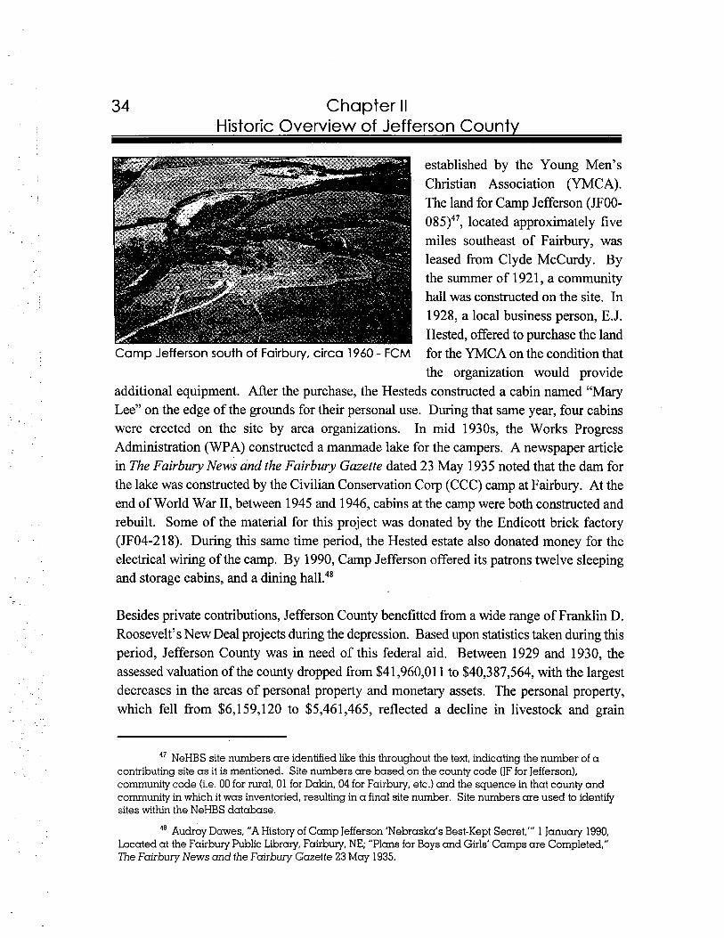
Chapter II Historic Overview of Jefferson Countv
established by the Young Men's Christian Association (YMCA). The land for Camp Jefferson (JFOO- 085)47, located approximately five miles southeast of Fairbury, was leased from Clyde McCurdy. By the summer of 1921, a community hall was constructed on the site. In 1928, a local business person, E.J. Hested, offered to purchase the land
Camp Jefferson south of Fairbury, circa 1960 - FCM for the YMCA on the condition that the organization would provide
additional equipment. After the purchase, the Hesteds constructed a cabin named "Mary Lee" on the edge of the grounds for their personal use. During that same year, four cabins were erected on the site by area organizations. In mid 1930s, the Works Progress Administration (WPA) constructed a manmade lake for the campers. A newspaper article in The Fairbury News and the Fairbury Gazette dated 23 May 1935 noted that the dam for the lake was constructed by the Civilian Conservation Corp (CCC) camp at Fairbury. At the end of World War 11, between 1945 and 1946, cabins at the camp were both constructed and rebuilt. Some of the material for this project was donated by the Endicott brick factory (JF04-218). During this same time period, the Hested estate also donated money for the electrical wiring of the camp. By 1990, Camp Jefferson offered its patrons twelve sleeping and storage cabins, and a dining
Besides private contributions, Jefferson County benefitted from a wide range of Franklin D. Roosevelt's New Deal projects during the depression. Based upon statistics taken during this period, Jefferson County was in need of this federal aid. Between 1929 and 1930, the assessed valuation of the county dropped from $41,960,011 to $40,387,564, with the largest decreases in the areas of personal property and monetary assets. The personal property, which fell from $6,159,120 to $5,461,465, reflected a decline in livestock and grain
47 NeHBS site numbers are identified like this throughout the text, indicating the number of a contributing site a s it is mentioned. Site numbers are based on the county code (JF for Jefferson), community code (i.e. 00 for rural, 01 for Dakin, 04 for Fairbury, etc.) and the squence in that county and community in which it was inventoried, resulting in a final site number. Site numbers are used to identlfy sites within the NeHBS database.
48 Audrey Dawes, "AHistory of Camp Jefferson 'Nebraska's Best-Kept Secret,"' 1 January 1990, Located at the Fairbury Public Library, Fairbury, NE; "Plans for Boys and Girls' Camps are Completed," The Fairbury News and the Fairbury Gazette 23 May 1935.
Chapter II Historic Overview of Jefferson County
production. The decreasing valuation in the county was most likely associated with the decline in population, which dropped during the depression from 16,409 in 1930 to 15,532 in 1940.49
One New Deal program set up to employ young men in need of work, was the Civilian Conservation Corps (CCC). In the 1930s, the Fairbury CCC camp, which included approximately two hundred workers, was located at the Jefferson County fairgrounds. Projects completed by this group included construction of terrace lines on farms and weir- notch drop structures which operated as terrace outlets.50 In 1935, the age requirement for CCC members at Fairbury was extended by three years. The new requirement not only included that standard age group, ranging from eighteen to twenty-five, but it also added men up to twenty-eight years old to the candidate lists. This change came at a time when a new quota of twenty additional workers was required at the Jefferson County
As indicated by The Fairbury News and the Fairbury Gazette, the Works Progress Administration (WPA) was also responsible for a variety of projects conducted in the county. Undertakings included the construction of sidewalks in Reynolds; a sewing center in Fairbury; a lake, dike, and swimming pool at Crystal Springs; curbs and gutters at Fairbury's public schools; a new bridge over the Little Blue; better roads throughout the county; an auditorium entrance, community cabin, and track in the Fairbury City Park; a coal storage shed at the Fairbury Power Plant; sidewalks, gutters, and curbs in Fairbury; and an extension of the sewer system in F a i r b ~ r y . ~ ~
The Resettlement Administration Rehabilitation Farmstead Program operated as another New Deal program in Jefferson County. One of the goals of this program focused on
49 "1930 Valuation Jefferson County Shows Decrease," The Fairbury News and the Fairbury Gazette 24 July 1930; Clerk of the Legislature, comp., Nebraska Blue Book 1990-1991 (Lincoln, NE: Clerk of the Legislature, 1990), 783.
"Structures and Benefits of CCC Work in County 'Have Stood the Test of Time"' and "Soil Conservation Work Here Dates Back to CCC Days," Subject File: CCC Camps and Other Work Projects, Located at the Fairbury Public Library, Fairbury, NE.
"To Enroll Twenty Youths Here in CCC," The Fairbury News and the Fairbury Gazette 6 June 1935.
52 "Begin Work on WPA Project," The Fairbury News and the Fairbury Gazette 31 October 1935; "Four More WPA Projects Ready," The Fairbury News and the Fairbury Gazette 7 November 1935; "Approvals Come Through for Local WPA Projects," The Fairbury News and the Fairbury Gazette 14 November 1935; "Many Called for WPA Projects Here," The Fairbury News and the Fairbury Gazette 28 November 1935; "Final Approval For Two Fairbury WPA Projects," The Fairbury News and the Fairbury Gazette 26 December 1935.
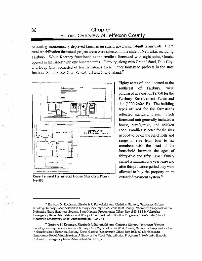
36 Chapter II Historic Overview of Jefferson County
relocating economically deprived families on small, government-built farmsteads. Eight rural rehabilitation farmstead project areas were selected in the state of Nebraska, including Fairbury. While Kearney functioned as the smallest farmstead with eight units, Omaha opened as the largest with one hundred units. Fairbury, along with Grand Island, Falls City, and Loup City, consisted of ten farmsteads each. Other farmstead projects in the state included South Sioux City, Scottsbluff and Grand Island.53
Eighty acres of land, located to the southeast of Fairbury, were purchased at a cost of $8,750 for the Fairbury Resettlement Farmstead site (JF00-260A-E). The building types utilized for the farmsteads reflected standard plans. Each farmstead unit generally included a house, bardgarage, and chicken
Elevation/PlanSmall Farmstead Home
coop. Families selected for the sites needed to be on the relief rolls and range in size from four to six members with the head of the household between the ages of thirty-five and fifty. Each family signed a minimal one year lease and after this probation period they were allowed to buy the property on an
Resettlement Farmstead House Standard Plan -NeHBS
extended payment system.54
53 Barbara M. Kooiman, Elizabeth A. Butterfield, and Christina Slattery, Nebraska Historic Buildings Survey Reconnaissance Survey Final Report of Scotts Bluff County, Nebraska, Prepared for the Nebraska State Historical Society, State Historic Preselvation Office, July 1995, 61-62; Nebraska Emergency Relief Administration, A Study of the Rural Rehabilitation Programs in Nebraska (Lincoln: Nebraska Emergency Relief Administration, 1935). 7-8.
54 Barbara M. Kooiman, Elizabeth A. Butterfield, and Christina Slattery, Nebraska Historic Buildings Survey Reconnaissance Survey Final Report of Scotts Bluff County, Nebraska, Prepared for the Nebraska State Historical Society, State Historic Preservation Office, July 1995, 62-65; Nebraska Emergency Relief Administration, A Study of the Rural Rehabilitation Programs in Nebraska (Lincoln: Nebraska Emergency Relief Administration, 19351, 7.

Chapter II Historic Overview of Jefferson County
Based upon articles in The Fairbury News and The Fairbury Gazette, over a year after the construction of the Resettlement Farmsteads in September of 1934, the complex prospered in the areas of infrastructure development and community involvement. In 1935, federal allotments provided for the construction of a bridge, tile cellars, a roadside market building, an irrigation system, and improved roads, as well as the introduction of h i t trees to the complex. Furthermore, money was provided for a community house, measuring 24 x 30 feet. It was planned to hold canning equipment in the basement and laundry, bathroom, and meeting facilities on the main
The government expected residents of the Fairbury Resettlement Farmsteads to live off their agricultural produce. In the first summer of operation, occupants planted ten acres of potatoes, eight acres of tomatoes, five acres of onions, and rows of beets, carrots, and cucumbers. A milk cow and two to three hundred chickens also supplemented each family's income.56 To aid in the financial condition of the farmsteads, both the male and female residents of the complex formed a non-stock cooperative association for the "production, purchase, processing, sale and distribution of agricultural, horticultural and dairy products, as well as purchase and re-sale of machinery and other product^."^^
Three years after the construction of the Fairbury complex, in 1937, the Resettlement Administration was renamed the Farm Security Administration. In 1946, with the passage of the Farmers Home Administration Act, the assets of the Farm Security Administration were to be sold. Shortly thereafter, the government offered the farmstead units at reasonable prices.58 In 1997, only five units are extant at the Fairbury complex.
The Rural Electrification Administration (REA), also a federal program, had a profound effect on a large number of farmers in Jefferson County. In 1940, activity by the REA to bring electricity to Jefferson County residents was often mentioned in The Fairbury News
55 "Allotment for Work at Local Farmsteads," The Fairbury News and The Fairbury Gazette 21 November 1935; "Local Homesteads Approach a Self-supporting Basis," The Fairbury News and IISFle Fairbury Gazette 25 July 1935.
56 "Local Homesteads Approach a Self-supporting Basis," The Fairbury News and The Fairbury Gazette 25 July 1935.
57 "Homesteaders Form Cooperative," The Fairbury News and The Fairbury Gazette 1 August 1935.
58 Barbara M. Kooiman, Elizabeth A. Butterfield, and Christina Slattery, Nebraska Historic Buildngs Survey Reconnaissance Survey Final Report of Scotts Bluff County, Nebraska, Prepared for the Nebraska State Historical Society, State Historic Presewation Office, July 1995,67-68.
Chapter II Historic Overview of Jefferson County
and the Fairbury Gazette. An article dated 25 April 1940 stated that, "rural electrification in the Daykin vicinity was given added impetus last week when a score of farmers met at the Daykin community hall and most of them signed up for the new lines southeast and northeast of town...."59 By the end of the year, the Norris REA District received a federal allocation to construct a line measuring sixty-seven miles at a cost of $56,000 in the neighboring counties of Jefferson and Saline.60
The economy of the county remained steady with the onset of World War 11. In 1944, Jefferson County farmers raised a bumper corn crop which totaled 727,444, nearly twice the amount of the previous year. Other increases in the one year period included a fifty percent rise in the number of horses and 5,087 more cattle. Overall, the property valuations in the county remained constant, with 1944 totalling $3,504,475 and one year later reaching $3,685,115. Property values in the communities also remained stable with a total of $1,047,320 to $1,108,570 between 1944 and 1945.6'
After the war, the population statistics of Jefferson County began to decline significantly. This reflected an overall population trend from rural to urban settings. While the number of farms decreased, new technology allowed farmers to increase their planted acreage and consolidate with neighboring farmsteads. Between 1940 and 1950, Jefferson County's population dropped from 15,532 to 13,623. Over the next ten years it fell to 11,620. This continued decrease in population can also be attributed to the changing role of the Rock Island Railroad in the county. In the mid 1960s, Fairbury lost its designation as the western division headquarters and fifteen years later the railroad pulled out completely. By 1990, the population of Jefferson County was 8,759.62
Jefferson County, which was settled prior to Nebraska's statehood, experienced early exposure to Euro-Americans as a result of its location along the Oregon Trail. With its economic livelihood entrenched in agriculture, Jefferson County prospered with the opening of distant markets due to the arrival of a number of railroad lines between the 1870s and
59 "Daykin Farmers Sign For New REALine," The Fairbury News and the Fairbury Gazette 25 April 1940.
" "REZ Allotment for 67 Miles New Line Is Officially Announced," The Fairbury News and the Fairbury Gazette 26 December 1940.
"Personal Property Value Totals Increase Slightly Over 1944 Assessments," The Fairbury News and the Fairbury Gazette 28 June 1945.
62 Clerk of the Legislature, comp., Nebraska Blue Book 1990-1991 (Lincoln, NE: Clerk of the Legislature, 1990), 783.
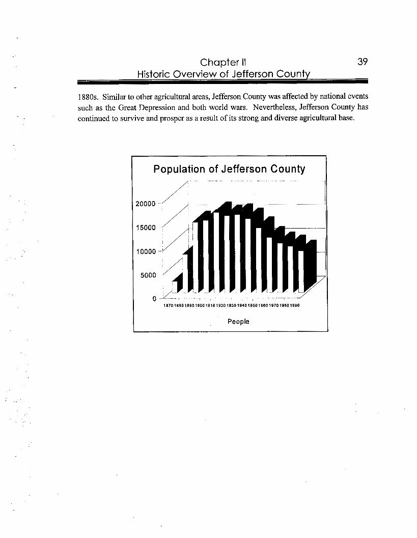
39 Chapter II Historic Overview of Jefferson County
1880s. Similar to other agricultural areas, Jefferson County was affected by national events such as the Great Depression and both world wars. Nevertheless, Jefferson County has continued to survive and prosper as a result of its strong and diverse agricultural base.
I Population of Jefferson County
-PeopleI
40 Chapter II Historic Overview of Jefferson County
Jefferson County Villages, Towns and Cities
The following section is a summary of the histories of incorporated and unincorporated communities of Jefferson County. It describes each community, its development, and some of the properties which were inventoried as part of the NeHBS. Each property which is mentioned in the text is listed numerically by site number in Appendix A - Index of Surveyed Properties Referenced in Report, at the end of this report. Please be aware that mention in the text or Appendix A does not necessarily mean a property is eligible for the National Register of Historic Places. Only properties which are mentioned in Chapter IV - Historic Contexts are either listed on, or potentially eligible for, the National Register.
The following text also uses many terms which are used to describe Jefferson County's historic buildings. Definitions of architectural terms can be found in Appendix B - Glossary, also located at the end of this report. All population charts were compiled from data located in the Nebraska Blue Book.
Daykin is located in the northwest corner of Jefferson County, two miles south of the Saline County border and four miles east of the Thayer County line. State Highway 4 runs east and west through the community.
The windmill played an important role in the founding of Daykin. When the Kansas City and Omaha Railroad decided to make Daykin a stop along its line, it constructed a large windmill near the tracks. Shortly thereafter, the community was mainly settled by people of German and Czech ancestry. Since these newcomers followed the lead example set by the railroad and used windmills to secure their water supply, the community was referred to as the "Town of windmill^."^^ Although it is unclear as to the exact date that tracks from the Omaha and Kansas City Railroad entered the community, by the late summer of 1887 a railroad section house operated in D a ~ k i n . ~ ~
63 Jane Graff, coor., Nebraska Our Towns ...East Southeast (Dallas,?X: Taylor Publishing Co., 19921,74.
64 Daykin Centennial History Book Committee, A Century of Progress: Daykin, Nebraska
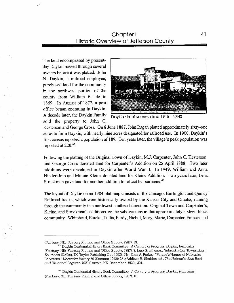
Chapter II Historic Overview of Jefferson County
The land encompassed by present- day Daykin passed through several owners before it was platted. John N. Daykin, a railroad employee, purchased land for the community in the northwest portion of the county from William E. Ide in 1869. In August of 1877, a post office began operating in Daykin. A decade later, the Daykin Family Daykin street scene, circa 1915 - NSHS sold the property to John C. Kesterson and George Cross. On 8 June 1887, John Ragan platted approximately sixty-one acres to form Daykin, with nearly nine acres designated for railroad use. In 1900, Daykin's first census reported a population of 189. Ten years later, the village's peak population was reported at 220.65
Following the platting of the Original Town of Daykin, M.J. Carpenter, John C. Kesterson, and George Cross donated land for Carpenter's Addition on 25 April 1888. Two later additions were developed in Daykin after World War 11. In 1949, William and Anna Niederklein and Minnie Kleine donated land for Kleine Addition. Two years later, Lena Struckrnan gave land for another addition to reflect her surname.66
The layout of Daykin on an 1984 plat map consists of the Chicago, Burlington and Quincy Railroad tracks, which were historically owned by the Kansas City and Omaha, running through the community in a northwest-southeast direction. Original Town and Carpenter's, Kleine, and Struckman's additions are the subdivisions in this approximately sixteen-block community. Whitehead, Eureka, Tullis, Purdy, Nichol, Mary, Marie, Carpenter, Francis, and
(Fairbury, NE: Fairbury Printing and Office Supply, 1987). 13. " Daykin Centennial History Book Committee, A Century of Progress: Daykin, Nebraska
(Fairbury, NE: Fairbury Printing and Office Supply, 1987). 9; Jane Graff, coor., Nebraska Our Towns ...East Southeast (Dallas, TX:Taylor Publishing Co., 19921, 74; Elton A. Perkey, "Perkey's Names of Nebraska Locations," Nebraska History 59 (Summer 1978): 271; Addison E. Sheldon, ed., The Nebraska Blue Book and Historical Register, 1920 (Lincoln, NE, December, 1920), 39 1.
" Daykin Centennial History Book Committee, A Century of Progress: Daykin, Nebraska (Fairbury, NE: Fairbury Printing and Office Supply, 1987), 16.
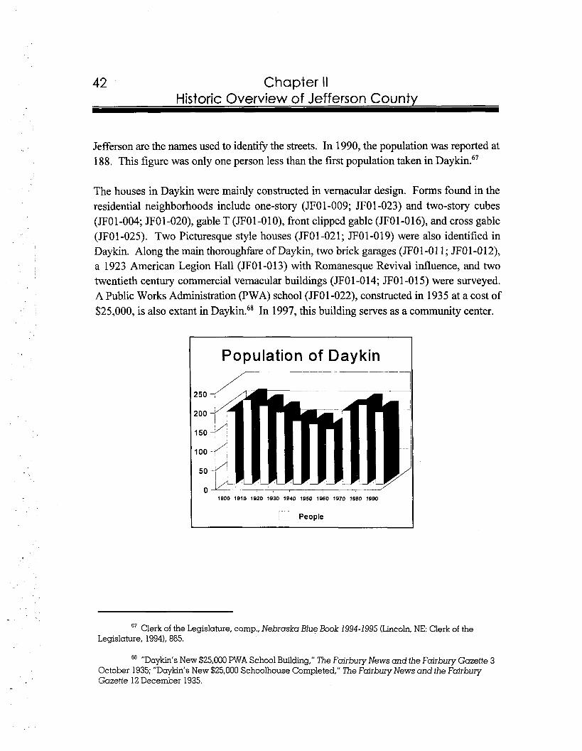
Chapter II Historic Overview of Jefferson County
Jefferson are the names used to identifl the streets. In 1990, the population was reported at 188. This figure was only one person less than the first population taken in D a ~ k i n . ~ ~
The houses in Daykin were mainly constructed in vernacular design. Forms found in the residential neighborhoods include one-story (JF01-009; JF01-023) and two-story cubes (JF01-004; JF01-020), gable T (JFO 1-0 1O), front clipped gable (JF01-0 16), and cross gable (JFO 1-025). Two Picturesque style houses (JFO 1-02 1 ;JF0 1-0 19) were also identified in Daykin. Along the main thoroughfare of Daykin, two brick garages (JFO 1 -0 1 1 ;JFO1-012), a 1923 American Legion Hall (JFO 1-0 13) with Romanesque Revival influence, and two twentieth century commercial vernacular buildings (JFO 1 -0 14; JF0 1-0 1 5) were surveyed. A Public Works Administration (PWA) school (JF01-022), constructed in 1935 at a cost of $25,000, is also extant in Daykk6* In 1997, this building serves as a community center.
Population of Daykin
People
67 Clerk of the Legislature, comp.. Nebraska Blue Book 1994-1995 (Lincoln, NE: Clerk of the Legislature, 1994), 865.
"Daykin's New $25,000 PWA School Building," The Fairbury News and the Fairbury Gazette 3 October 1935; "Daykin's New $25,000 Schoolhouse Completed," The Fairbury News and the Fairbury Gazette 12 December 1935.
Chapter II Historic Overview of Jefferson County
Diller is located on the eastern edge of Jefferson County, one mile west of the Gage County line. Paved access to the community is provided by State Highway 103, which runs north and south. This highway joins with State Highway 8 to the south and U.S. Highway 136 to the north.
In 1876, the government gained rights over the Oto Indian Reservation. By the next decade, the land was opened for Euro-American settlement. Samuel Diller took advantage of this opportunity and recruited a group of Germans living in Pennsylvania to travel to the center of the country and form a new community. Early residents of Diller included D.R. Kelley, W.H. and John Diller, William Green, A.H. Colman, and Joseph Bixby. In the spring of 1880, a post office began servicing area residents and by the fall the community was platted. In 1890, the first population statistic reported in Diller was 126.69
An article in The Fairbury Gazette dated 4 December 1880 stated:70
One year ago this town was unanticipated. It is 7 miles from Steele City, 14 from Fairbury, 15 fi-om Beatrice and Blue Springs. It embraces a section of country sadly in need of town facilities. The first building was commenced six weeks since. It has nine families, a post office, blacksmith, and butcher shop, two hotels and a livery and feed stable ....Price of lots are $125, $50 and $25.
An article in The Fairbury Gazette dated 28 April 1883 discussed the public sale of reservation lands to be held on 3 1 May 1883. However, this date was three years after the founding of Diller. Most likely the residents of Diller made a special agreement with the
69 Jane Graff, coor., Nebraska Our Towns ...East Southeast (Dallas, TX:Taylor Publishing Co., 19921, 76-77; Elton A. Perkey, "Perkey's Names of Nebraska Locations," Nebraska History 59 (Summer 1978): 271; Addison E. Sheldon, ed., The Nebraska Blue Book and Historical Register, 1920 (Lincoln,NE, December, 1920). 392.
70 "Diller, Nebraska," The Fairbury Gazette 4 December 1880.
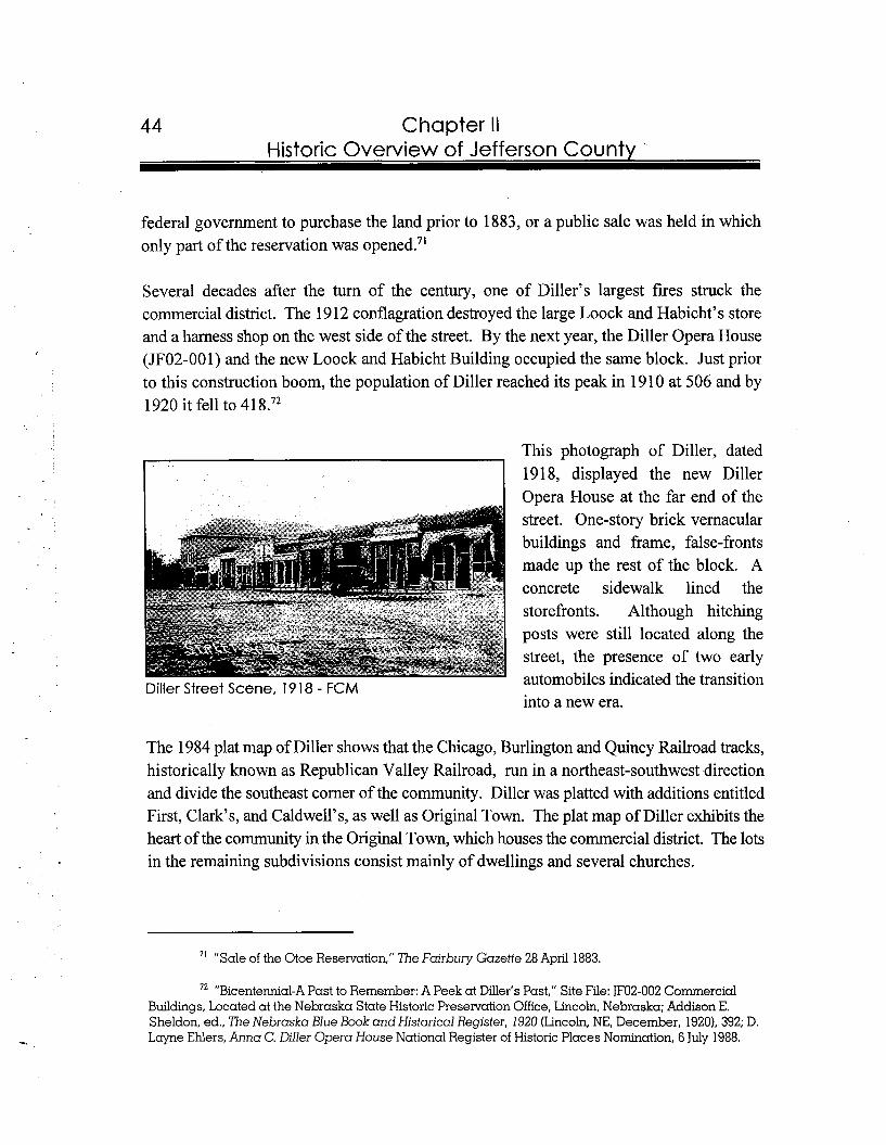
Chapter II Historic Overview of Jefferson County
federal government to purchase the land prior to 1883, or a public sale was held in which only part of the reservation was opened."
Several decades after the tum of the century, one of Diller's largest fires struck the commercial district. The 19 12 conflagration destroyed the large Loock and Habicht's store and a harness shop on the west side of the street. By the next year, the Diller Opera House (JF02-001) and the new Loock and Habicht Building occupied the same block. Just prior to this construction boom, the population of Diller reached its peak in 1910 at 506 and by 1920 it fell to 41 8.72
This photograph of Diller, dated 1918, displayed the new Diller Opera House at the far end of the street. One-story brick vernacular buildings and frame, false-fronts made up the rest of the block. A concrete sidewalk lined the storefronts. Although hitching posts were still located along the street, the presence of two early automobiles indicated the transition Diller Street Scene, 1918 - FCM into a new era.
The 1984 plat map of Diller shows that the Chicago, Burlington and Quincy Railroad tracks, historically known as Republican Valley Railroad, run in a northeast-southwest direction and divide the southeast comer of the community. Diller was platted with additions entitled First, Clark's, and Caldwell's, as well as Original Town. The plat map of Diller exhibits the heart of the community in the Original Town, which houses the commercial district. The lots in the remaining subdivisions consist mainly of dwellings and several churches.
" "Sale of the Otoe Reservation," The Fairbury Gazette 28 April 1883.
72 "Bicentennial-A Past to Remember: A Peek at Diller's Past," Site File: JF02-002 Commercial Buildings, Located at the Nebraska State Historic Preservation Office, Lincoln, Nebraska; Addison E. Sheldon, ed., The Nebraska Blue Book and Historical Register, 1920 (Lincoln, NE, December, 1920), 392; D. Lcryne Ehlers, Anna C. Diller Opera House National Register of Historic Places Nomination, 6 July 1988.
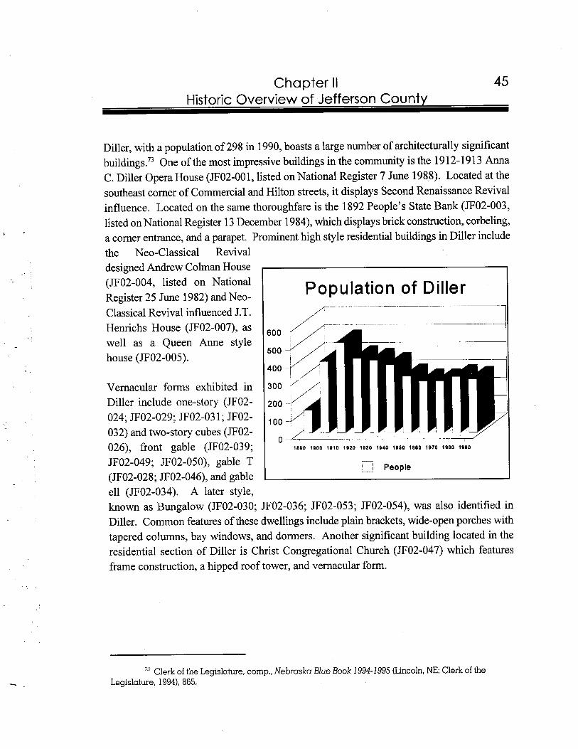
Chapter II Historic Overview of Jefferson County
Diller, with a population of 298 in 1990, boasts a large number of architecturally significant building^.^) One of the most impressive buildings in the community is the 1 9 1 2- 19 1 3 Anna C. Diller Opera House (JF02-001, listed on National Register 7 June 1988). Located at the southeast comer of Commercial and Hilton streets, it displays Second Renaissance Revival influence. Located on the same thoroughfare is the 1892 People's State Bank (JF02-003, listed on National Register 13 December 1984), which displays brick construction, corbeling, a comer entrance, and a parapet. Prominent high style residential buildings in Diller include the Neo-Classical Revival designed Andrew Colman House (JF02-004, listed on National Population of Diller Register 25 June 1982) and Neo- classical Revival influenced J.T. Henrichs House (JF02-007), as well as a Queen Anne style house (JF02-005).
Vernacular forms exhibited in Diller include one-story (JF02- 024; JF02-029; JF02-03 1 ;JF02-032) and two-story cubes (JF02- 026), front gable (JF02-039; JF02-049; JF02-050), gable T (JF02-028; JF02-046), and gable
-
* 1- People I ell (JF02-034). A later style, known as Bungalow (JF02-030; JF02-036; JF02-053; JF02-054), was also identified in Diller. Common features of these dwellings include plain brackets, wide-open porches with tapered columns, bay windows, and dormers. Another significant building located in the residential section of Diller is Christ Congregational Church (JF02-047) which features frame construction, a hipped roof tower, and vernacular form.
73 Clerk of the Legislature, comp., Nebraska Blue Book 1994-1995 (Lincoln,NE: Clerk of the Legislature, 1994), 865.
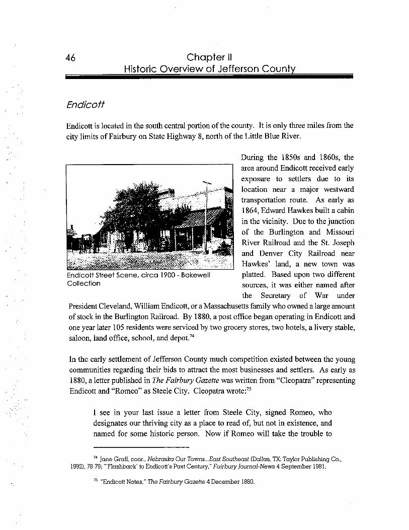
46 Chapter II Historic Overview of Jefferson County
Endicoff
Endicott is located in the south central portion of the county. It is only three miles from the city limits of Fairbury on State Highway 8, north of the Little Blue River.
During the 1850s and 1860s, the area around Endicott received early exposure to settlers due to its location near a major westward transportation route. As early as 1864, Edward Hawkes built a cabin in the vicinity. Due to the junction of the Burlington and Missouri River Railroad and the St. Joseph and Denver City Railroad near Hawkes' land, a new town was
Endicott Street Scene, circa 1900 - Bakewell platted. Based upon two different Collection sources, it was either named after
the Secretary of War under President Cleveland, William Endicott, or a Massachusetts family who owned a large amount of stock in the Burlington Railroad. By 1880, a post office began operating in Endicott and one year later 105 residents were serviced by two grocery stores, two hotels, a livery stable, saloon, land office, school, and depot.74
In the early settlement of Jefferson County much competition existed between the young communities regarding their bids to attract the most businesses and settlers. As early as 1880, a letter published in The Fairbury Gazette was written from "Cleopatra" representing Endicott and "Romeo" as Steele City. Cleopatra wrote:75
I see in your last issue a letter from Steele City, signed Romeo, who designates our thriving city as a place to read of, but not in existence, and named for some historic person. Now if Romeo will take the trouble to
74 Jane Graff, coor., Nebraska Our Towns ...East Southeast (Dallas, TX.Taylor Publishing Co., 1992), 78-79; "'Flashback' to Endicott's Past Century," Fairbury Journal-News 4 September 1981.
75 "Endicott Notes," The Fairbury Gazette 4 December 1880.
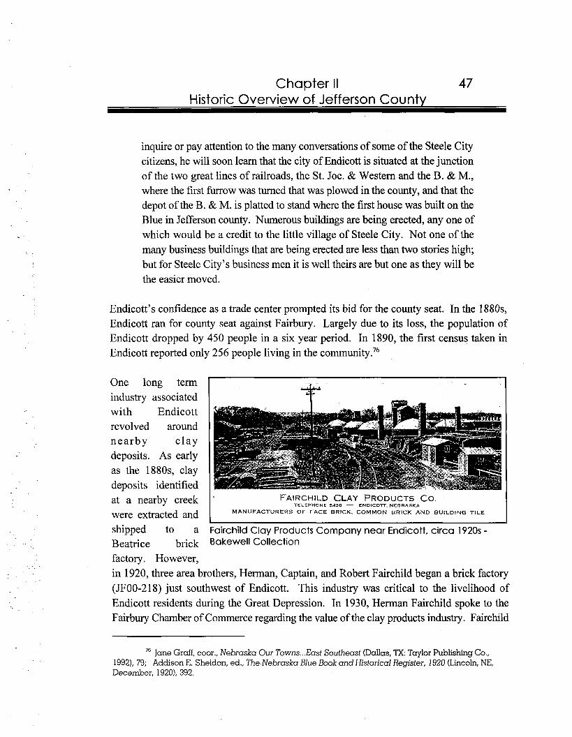
Chapter II 47 Historic Overview of Jefferson County
inquire or pay attention to the many conversations of some of the Steele City citizens, he will soon learn that the city of Endicott is situated at the junction of the two great lines of railroads, the St. Joe. & Western and the B. & M., where the first furrow was turned that was plowed in the county, and that the depot of the B. & M. is platted to stand where the first house was built on the Blue in Jefferson county. Numerous buildings are being erected, any one of which would be a credit to the little village of Steele City. Not one of the many business buildings that are being erected are less than two stories high; but for Steele City's business men it is well theirs are but one as they will be the easier moved.
Endicott's confidence as a trade center prompted its bid for the county seat. In the 1880s, Endicott ran for county seat against Fairbury. Largely due to its loss, the population of Endicott dropped by 450 people in a six year period. In 1890, the first census taken in Endicott reported only 256 people living in the community.76
One long term industry associated with Endicott revolved around nearby c lay deposits. As early as the 1880s, clay deposits identified at a nearby creek FAIRCHILD CLAY
'TELEPHONE 5530 -PRODUCTSCO.
ENDICOlT. NEBRASKA
were extracted and MANUFACTURERS OF FACE BRICK, COMMON BRICK AND BUILDING TILE
shipped to a Fairchild Clay Products Company near Endicott, circa 1920s -Beatrice brick Bakewell Collection
factory. However, in 1920, three area brothers, Herman, Captain, and Robert Fairchild began a brick factory (JF00-218) just southwest of Endicott. This industry was critical to the livelihood of Endicott residents during the Great Depression. In 1930, Herman Fairchild spoke to the Fairbury Chamber of Commerce regarding the value of the clay products industry. Fairchild
76 Jane Gruff, coor., Nebraska Our Towns ...East Southeast (Dallas,TX: Taylor Publishing Co., 1992), 79; Addison E. Sheldon, ed., The Nebraska Blue Book and Historical Register, 1920 (Lincoln,N E , December, 1920). 392.
Chapter II Historic Overview of Jefferson County
noted that the Fairchild Clay Products Company was using a clay bed that was forty feet deep, which guaranteed a quality product. Furthermore, the company had experienced steady growth and, in 1929, nine million bricks were produced. Fairchild closed his speech by stating that the annual payroll was $40,000, and that approximately 20,000 bricks at a cost of $800 were required for an average size house with a ba~ement.~' Throughout its history, the factory survived several buy-outs and in 1997, it continues operation under the name Endicott Clay Products Company.
The layout of Endicott's plan was influenced by the unique circumstance that two railroads cross at the south end of town.78 The blocks in the community form a triangle-shape, with the smallest section on the north end. First Addition and Original Town serve as the subdivisions in the approximately thirty-four block community. Streets exhibited on the map are entitled Simpson, Schuyler, Stanely, Scribner, Scott, Spaulding, Roscoe, Rockford, Reynolds, Rush, and Ridge. After 1890, Endicott's population fell until 1930, when it rebounded to 242. However, after 1940 a steady flow of people began to leave the community and by 1990 Endicott's population was reported at 1 63.79
The 1922 Methodist Church (JF03-002) is one of the most architecturally significant buildings in Endicott. Other community buildings include a front gable, brick constructed school (JF03-0 12) and the vernacular, brick Endicott Town Hall (JF03-0 14) at the southwest comer of Scribner and Reynolds. On the south end of the commercial district and across the railroad tracks is the side gable Union Pacific Depot (JF03-008). A unique manufacturing plant in Endicott is the O.K. Mattress Manufacturing Company (JF03-013) located on the northeast corner of Scribner and Reynolds. This twentieth century commercial vernacular, brick building has a curved entrance.
77 Jane Graff, coor., Nebraska Our Towns ...East Southeast (Dallas, TX:Taylor Publishing Co., 19921, 80; "Fairchild Speaks on Clay Products Industry's Value," The Fairbury News and the Fairbury Gazette 23 October 1930.
78 The Republican Valley and the St. Joseph and Western railroads historically crossed in Endicott.
79 Addison E. Sheldon, ed., The Nebraska Blue Book and Historical Register, 1920 (Lincoln, NE, December, 19201,392; Nebraska Legislative Reference Bureau, The Nebraska Blue Book 1930 (Lincoln, NE, December, 19301, 335; Nebraska Legislative Council, comp.. Nebraska Blue Book, 1942 (Lincoln, NE, December, 19421, 305; Clerk of the Legislature, comp., Nebraska Blue Book 1994-1995 (Lincoln, NE: Clerk of the Legislature, 19941, 865.
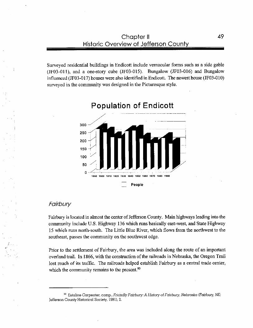
Chapter II Historic Overview of Jefferson Countv
Surveyed residential buildings in Endicott include vernacular forms such as a side gable (JF03-01 I), and a one-story cube (JF03-015). Bungalow (JF03-016) and Bungalow influenced (JFO3 -0 1 7) houses were also identified in Endicott. The newest house (JF03-0 10) surveyed in the community was designed in the Picturesque style.
Population of Endicott
1
! People
Fairbury is located in almost the center of Jefferson County. Main highways leading into the community include U.S. Highway 136 which runs basically east-west, and State Highway 15 which runs north-south. The Little Blue River, which flows from the northwest to the southeast, passes the community on the southwest edge.
Prior to the settlement of Fairbury, the area was included along the route of an important overland trail. In 1866, with the construction of the railroads in Nebraska, the Oregon Trail lost much of its traffic. The railroads helped establish Fairbury as a central trade center, which the community remains to the present."
Estaline Carpenter, comp., Friendly Fairbury: A History of Fairbury, Nebraska (Fairbury,NE: Jefferson County Historical Society, 19811, 2.
Chapter II Historic Overview of Jefferson County
James B. Mattingly and Woodford G. McDowell realized, with the coming of the St. Joseph and Denver City Railroad along the Little Blue River, townsites needed to be developed. Mattingly constructed a sawmill on the edge of the Little Blue River in 1868. Shortly thereafter, McDowell entered the area to plat a town due to the expected route of a railroad. In 1869, Mattingly and McDowell joined forces and platted their combined claimed acres which totaled 160. A block in the center of the plat was designed for public use. The name for the community was derived from McDowell's hometown in Illinois. In 1870, the first population of Fairbury was reported at 370. On 6 November 187 I , Fairbury was designated as county seat over Meridian. Two months later, the city of Fairbury was in~orporated.~'
During the 1870s and 1880s, Fairbury grew with the arrival of railroads. In 1872, tracks of the St. Joseph and Denver City entered Jefferson County. This railroad later fell under the authority of the Union Pacific and was referred to as the St. Joseph and Grand Island branch. This line built several facilities in Fairbury including a three-engine roundhouse and several depots throughout its history. In 1930, with the construction of a new Spanish Revival style depot (not extant), the St. Joseph and Grand Island Railroad boasted four passenger trains passing through Fairbury each day, as well as at least twelve freight trains. This train schedule resulted in approximately one train passing through Fairbury almost every hour of the day. By 1976, the Union Pacific Depot in Fairbury had stopped operating due to a reduction in passenger traffic.82
As early as 1879, reporters from The Hustings Gazette visited Fairbury and reported on the status of the ~omrnuni ty :~~
At the first thought one would conclude that the name implies everything desirable in a town, and such a supposition seems quite correct. Fairbury situated as it is in the valley of the beautiful Blue river, is indeed pretty. Its
" Jane Graff, coor., Nebraska Our Towns ...East Southeast (Dallas, ?X: Taylor Publishing Co., 1992), 71; Addison E. Sheldon, ed., The Nebraska Blue Book and Historical Register, 1920 (Lincoln, NE, December, 19201,392; Levi Boyd, comp., Egress of the Old West; the Beginning of Fairbury and its Founders (Fairbuy, NE: Holloway Publishing Co, 1963); Elton A. Perkey, "Perkey's Names of Nebraska Locations," Nebraska History 59 (Summer 1978): 272.
"Pioneer Railroad Is Completing New Station," The Fairbury News and the Fairbury Gazette 14 August 1930; Estaline Carpenter, cornp., Friendly Fairbury: A History of Fairbury, Nebraska (Fairbury, NE: Jefferson County Historical Society, 1981). 20.
83 "Fairbuy Nebraska," The Fairbury Gazette 7 June 1879.
Chapter II Historic Overview of Jefferson County
streets are well laid out; its business houses large and substantial; residences spacious and impart an air of home comfort and happy life to their many occupants. Being the most important town on the line of the St. Joe & D.C. railroad in Nebraska, after leaving Hastings, she feels her oats and has donned the expensive garb of a city of the second class. We observe, during our short visit there on Monday, that the streets were kept scrupulously clean, setting a lesson of great benefit to many an older town. No filth or garbage is thrown in the street to decay and transmit germs of disease to citizens and no disagreeable odors arise to offend the nostrils. Fairbury is clean and makes one feel as though the haven of rest they were in search of existed, not in fancy, but practically in the city which heads this article.
r c
The article went on to state that the community offered abundant water power, plenty of building materials such as stone and timber, and efficient railroad transportation. Furthermore, the business people of the community made an adequate wage because Fairbury served as a trade center to f m e r s extending in an array of directions. In 1880, the overall construction costs in the community reached $87,900, which was twofold greater than the previous year. Construction continued throughout the decade and in 1884 another $64,500 was spent on new development in Fairbury. One year later, twenty-four houses were built to accommodate the increasing pop~la t ion .~~
During the 1880s, Endicott challenged Fairbury for its position of county seat. Since Endicott was located on a crossing of two railroad tracks, residents thought that it would serve as an excellent location to house the governmental duties of Jefferson County. An article in The Fairbury Gazette firmly stated Fairbury's position:85
It is the habit of parties in Endicott to speak of Fairbury as a dead or dying town, and this in the face of the self-evident fact that the actual improvements completed or already under way in this town, since the first of last January, will nearly-or-quite equal in value all that has ever been accomplished in Endicott in the way of building from first to last if we except the mill.
84 "Fairbury Nebraska," The Fairbury Gazette 7 June 1879; "Fairbury in 1880," The Fairbury Gazette 1 January 1881; "Progress in 1884," The Fairbury Gazette 10 January 1885; "Improvement in 1885," The Fairbury Gazette 16 January 1886.
"Not a Very Dead Town," The Fairbury Gazette 4 October 1884.

52 Chapter II Historic Overview of Jefferson County
The article also explained that improvements in Fairbury during a nine month period included the construction of thirty homes and several commercial buildings. Furthermore every commercial building was occupied by a business.86 In the end, Fairbury defeated Endicott in the county seat race.
Between 1886 and 1887, Fairbury's role in transportation increased when it was named as the western division headquarters for the Chicago, Rock Island and Pacific Railroad line, which linked Kansas to Denver. Due to its designation, an eighteen-engine round house (not extant) and yard were constructed in Fairbury. In 191 3, the Rock Island also constructed a
'ock Island Depot, Fairbury, circa 1915 - FCM two-story brick depot and freight house (JF04-047, listed on National
Register in 1996) in Fairbury. According to the National Register nomination of the building, the depot is as a fine example of the Renaissance Revival style of architecture. The depot, which cost $40,000, was constructed during the height of the railroad's operation. During the early 1950s, even with the declining passenger service after World War 11, the railroad in Fairbury continued to operate with an employment base of five hundred workers. However, in 1965, the economic state of the railroad line prompted the Rock Island to terminate the use of the depot as its Western Division's Headquarters. By 1980, the Rock Island ceased operations in F a i r b ~ r y . ~ ~
The impact of the railroads on Fairbury was evident by three decades of population statistics. Between 1880 and 1885, the population of Fairbury increased by fourteen percent and rose from l,25 1 to 1,423. Over the next five years, the population jumped to 2,630. In one
86 "Not a Very Dead Town," The Fairbury Gazette 4 October 1884.
...87 Jane Graff, coor., Nebraska Our Towns East Southeast (Dallas, TX: Taylor Publishing Co., 1992), 72; Estaline Carpenter, comp., Friendly Fairbury: A History of Fairbury, Nebraska (Fairbury, NE: Jefferson County Historical Society, 1981), 20-21; Carol Ahlgren, Fairbury Rock Island Depot &Freight House National Register of Historic Places Nomination, 21 June 1996.
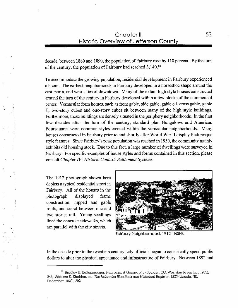
53 Chapter II Historic Overview of Jefferson County
decade, between 1880 and 1890, the population of Fairbury rose by 1 10 percent. By the turn of the century, the population of Fairbury had reached 3,140.88
To accommodate the growing population, residential development in Fairbury experienced a boom. The earliest neighborhoods in Fairbury developed in a horseshoe shape around the east, north, and west sides of downtown. Many of the extant high style houses constructed around the turn of the century in Fairbury developed within a few blocks of the commercial center. Vernacular form homes, such as front gable, side gable, gable ell, cross gable, gable T, two-story cubes and one-story cubes sit between many of the high style buildings. Furthermore, these buildings are densely situated in the periphery neighborhoods. In the first few decades after the turn of the century, standard plan Bungalows and American Foursquares were common styles erected within the vernacular neighborhoods. Many houses constructed in Fairbury prior to and shortly after World War I1 display Picturesque style features. Since Fairbury's peak population was reached in 1950, the community mainly exhibits old housing stock. Due to this fact, a large number of dwellings were surveyed in Fairbury. For specific examples of house styles and forms contained in this section, please consult Chapter IV: Historic Context: Settlement Systems.
The 1912 photograph shown here depicts a typical residential street in Fairbury. All of the houses in the photograph displayed frame construction, hipped and gable roofs, and stand between one and two stories tall. Young seedlings lined the concrete sidewalks, which ran parallel with the city streets.
Fairbury Neighborhood, 1912 - NSHS
In the decade prior to the twentieth century, city officials began to consistently spend public dollars to alter the physical appearance and infrastructure of Fairbury. Between 1892 and
" Bradley H. Baltensperger, Nebraska: A Geography (Boulder, CO: Westview Press Inc., 1985). 245; Addison E. Sheldon, ed., The Nebraska Blue Book and Historical Register, 1920 (Lincoln, NE, December, 1920), 392.
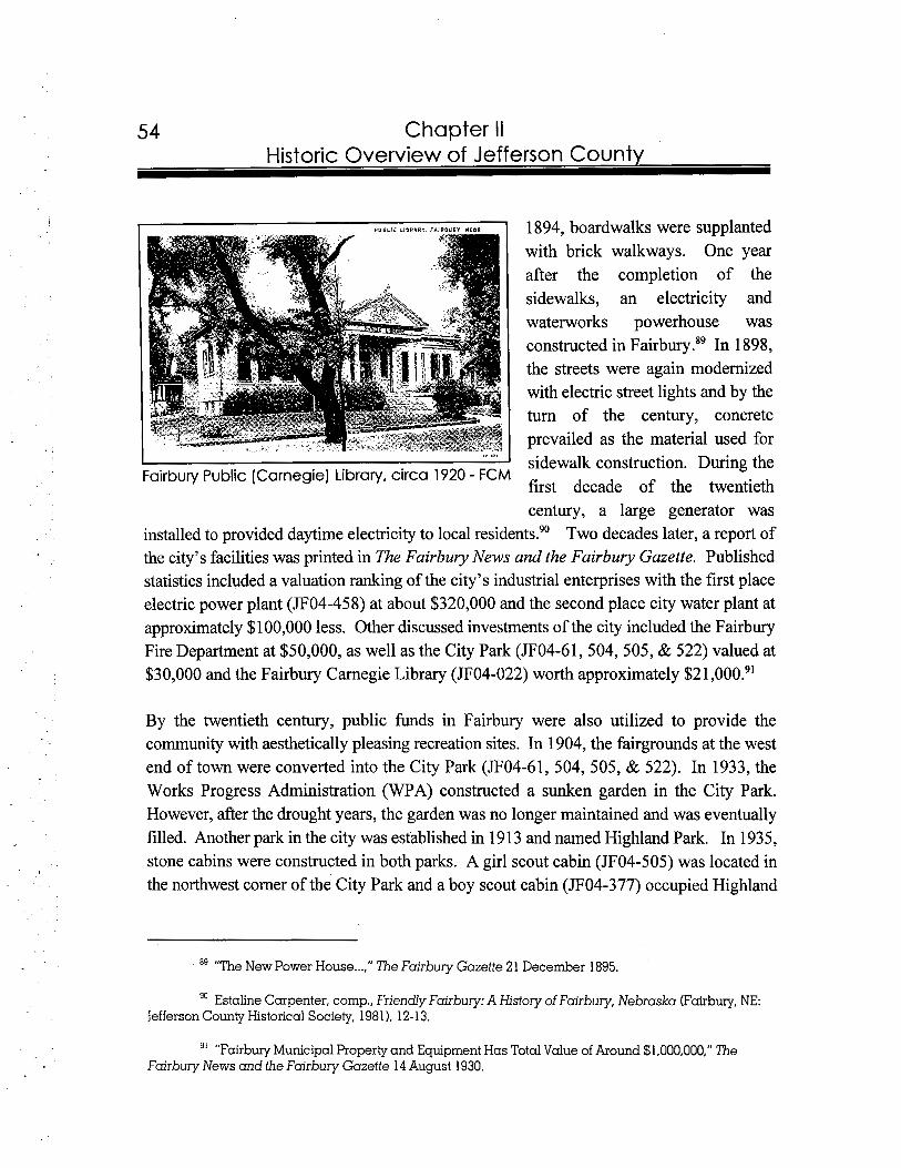
I
Chapter I I Historic Overview of Jefferson County
1894, boardwalks were supplanted with brick walkways. One year after the completion of the sidewalks, an electricity and waterworks powerhouse was constructed in Fairb~ry. '~ In 1 898, the streets were again modernized with electric street lights and by the turn of the century, concrete prevailed as the material used for
I sidewalk construction. During the Fairbury Public (Carnegie)Library, circa 1920 - FCM
first decade of the twentieth century, a large generator was
installed to provided daytime electricity to local resident^.^' Two decades later, a report of the city's facilities was printed in The Fairbury News and the Fairbury Gazette. Published statistics included a valuation ranking of the city's industrial enterprises with the first place electric power plant (JF04-458) at about $320,000 and the second place city water plant at approximately $100,000 less. Other discussed investments of the city included the Fairbury Fire Department at $50,000, as well as the City Park (JF04-61, 504, 505, & 522) valued at $30,000 and the Fairbury Carnegie Library (JF04-022) worth approximately $21 ,000.91
By the twentieth century, public funds in Fairbury were also utilized to provide the community with aesthetically pleasing recreation sites. In 1904, the fairgrounds at the west end of town were converted into the City Park (JF04-61, 504, 505, & 522). In 1933, the Works Progress Administration (WPA) constructed a sunken garden in the City Park. However, after the drought years, the garden was no longer maintained and was eventually filled. Another park in the city was established in 1 9 13 and named Highland Park. In 193 5, stone cabins were constructed in both parks. A girl scout cabin (JF04-505) was located in the northwest comer of the City Park and a boy scout cabin (JF04-377) occupied Highland
"The New Power House . . . , ' I The Fairbury Gazette 21 December 1895.
Estaline Carpenter, comp.. Friendly Fairbury: A History of Fairbury, Nebraska (Fairbury, NE: Jefferson County Historical Society, 1981 ), 12- 13.
"Fairbury Municipal Property and Equipment Has Total Value of Around $1,000,000," The Fairbury News and the Fairbury Gazette 14 August 1930.
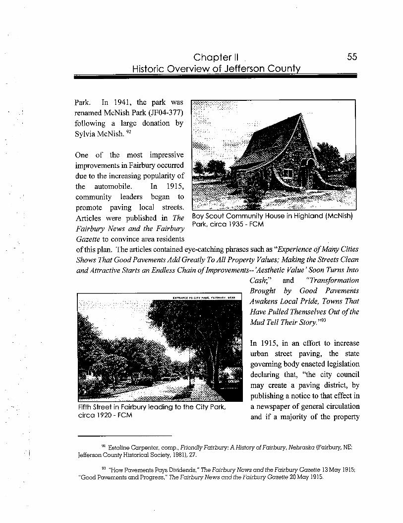
Chapter II Historic Overview of Jefferson Countv
Park. In 1941, the park was renamed McNish Park (JF04-377) following a large donation by Sylvia McNish. 92
One of the most impressive improvements in Fairbury occurred due to the increasing popularity of the automobile. In 1915, community leaders began to promote paving local streets. Articles were published in The BOY Scout Community House in Highland (McNish)
Fairbury News and the Fairbury Park, circa 1935 - FCM
Gazette to convince area residents of this plan. The articles contained eye-catching phrases such as "Experience of Many Cities Shows That Good Pavements Add Greatly To All Property Values; Making the Streets Clean and Attractive Starts an Endless Chain of Improvements-- 'Aesthetic Value' Soon Turns Into
Cash;" and "Transformation
, Brought by Good Pavements Awakens Local Pride, Towns That Have Pulled Themselves Out of the Mud Tell Their Story."93
In 191 5, in an effort to increase urban street paving, the state governing body enacted legislation declaring that, "the city council may create a paving district, by publishing a notice to that effect in
Fifth Street in Fairbury leading to the City Park, a newspaper of general circulation circa 1920 - FCM and if a majority of the property
92 Estaline Carpenter, comp., Friendly Fairbury: A History of Fairbury, Nebraska (Fairbury, NE: Jefferson County Historical Society, 1981), 27.
93 "HOW Pavements Pays Dividends,'' 7'he Fairbury News and the Fairbury Gazette 13 May 1915; "Good Pavements and Progress," 'The Fairbury News and the Fairbury Gazette 20 May 1915.
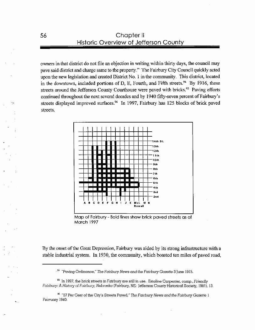
Chapter II Historic Overview of Jefferson County
owners in that district do not file an objection in writing within thirty days, the council may pave said district and charge same to the property." The Fairbury City Council quickly acted upon the new legislation and created District No. 1 in the community. This district, located in the downtown, included portions of D, E, Fourth, and Fifth streets.94 By 1916, these streets around the Jefferson County Courthouse were paved with Paving efforts continued throughout the next several decades and by 1940 fifty-seven percent of Fairbury's streets displayed improved surfaces.96 In 1997, Fairbury has 125 blocks of brick paved streets.
S t .
Map of Fairbury - Bold lines show brick paved streets as of March 1997
By the onset of the Great Depression, Fairbury was aided by its strong infrastructure with a stable industrial system. In 1930, the community, which boasted ten miles of paved road,
94 "Paving Ordinance," 7he Fairbury News and the Fairbury Gazette 3 June 19 15.
95 In 1997, the brick streets in Fairbury are still in use. Estaline Carpenter, comp., Friendly Fairbury: A History of Fairbury, Nebraska (Fairbury, NE: Jefferson County Historical Society, 1981 ), 13.
96 "57 Per Cent of the City's Streets Paved," The Fairbury News and the Fairbury Gazette 1 February 1940.
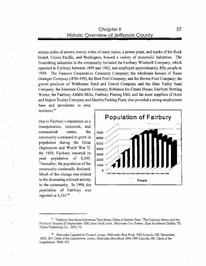
57 Chapter II Historic Overview of Jefferson Countv
sixteen miles of sewers, twenty miles of water mains, a power plant, and tracks of the Rock Island, Union Pacific, and Burlington, housed a variety of successful industries. The flourishing industries in the community included the Fairbury Windmill Company, which operated in Fairbury between 1899 and 1962, and employed approximately fifty people in 1930. The Farmers Cooperative Creamery Company; the wholesale houses of Rasse Grainger Company (JF04-199), the Burt Fruit Company, and the Brown Fruit Company; the gravel producer of Weblemoe Sand and Gravel Company and the Blue Valley Sand Company; the Interstate Concrete Company; Robinson Ice Cream House; Fairbury Bottling Works; the Fairbury Alfalfa Mills; Fairbury Planing Mill; and the meat suppliers of Hurst and Majors Poultry Company and Marthis Packing Plant, also provided a strong employment base and provisions to area residents.97
Population of Fairbury Due to Fairbury's reputation as a transportation, industrial, and commercial center, the community continued to grow in population during the Great Depression and World War 11. By 1950, Fairbury reported its peak population of 6,395. Thereafter, the population of the community continually declined. Much of this change was related
-to the decreasing railroad activity , People
in the community. In 1990, the population of Fairbury was reported at 4,3 3 5 .98
97 "Fairbuy Has More Industries Than Many Cities of Similar Size," The Fairbury News and the Fairbury Gazette 25 September 1930; Jane Graff, coor., Nebraska Our Towns ...East Southeast (Dallas, ?X: Taylor Publishing Co., 1992), 73.
98 Nebraska Legislative Council, cornp., Nebraska Blue Book, 1952 (Lincoln, NE, December, 1952), 357; Clerk of the Legislature, comp., NebraskaBlue Book 1994-1995 (Lincoln, NE: Clerk of the Legislature, 1994). 815.
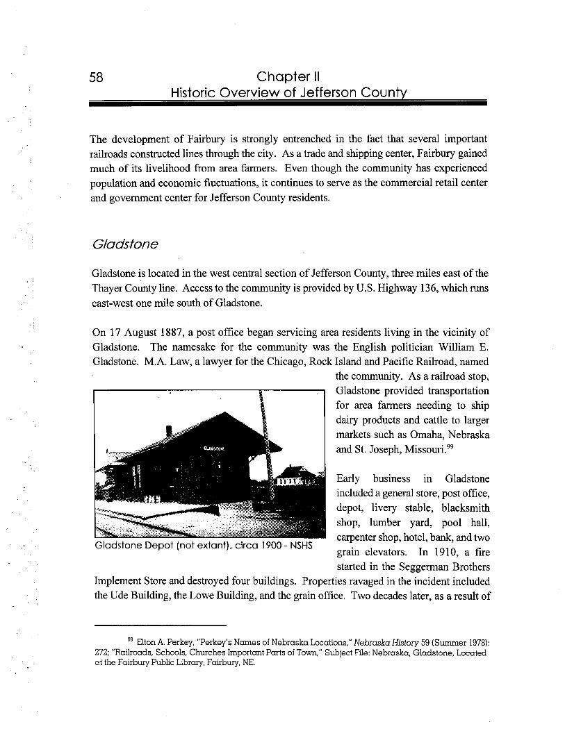
58 Chapter II Historic Overview of Jefferson Countv
The development of Fairbury is strongly entrenched in the fact that several important railroads constructed lines through the city. As a trade and shipping center, Fairbury gained much of its livelihood from area farmers. Even though the community has experienced population and economic fluctuations, it continues to serve as the commercial retail center and government center for Jefferson County residents.
Gladsfone
Gladstone is located in the west central section of Jefferson County, three miles east of the Thayer County line. Access to the community is provided by U.S. Highway 136, which runs east-west one mile south of Gladstone.
On 17 August 1887, a post office began servicing area residents living in the vicinity of Gladstone. The namesake for the community was the English politician William E. Gladstone. M.A. Law, a lawyer for the Chicago, Rock Island and Pacific Railroad, named
the community. As a railroad stop, Gladstone provided transportation for area farmers needing to ship dairy products and cattle to larger markets such as Omaha, Nebraska and St. Joseph, M i s ~ o u r i . ~ ~
Early business in Gladstone included a general store, post office, depot, livery stable, blacksmith shop, lumber yard, pool hall, carpenter shop, hotel, bank, and two
Gladstone Depot (not extant), circa 1900 - NSHS grain elevators. In 1910, a fire started in the Seggerman Brothers
Implement Store and destroyed four buildings. Properties ravaged in the incident included the Ude Building, the Lowe Building, and the grain office. Two decades later, as a result of
99 Elton A. Perkey, "Perkey's Names of Nebraska Locations," Nebraska History 59 (Summer 1978): 272; "Railroads, Schools, Churches Important Parts of Town,"Subject File: Nebraska, Gladstone, Located at the Fairbuy Public Library, Fairbury, NE.
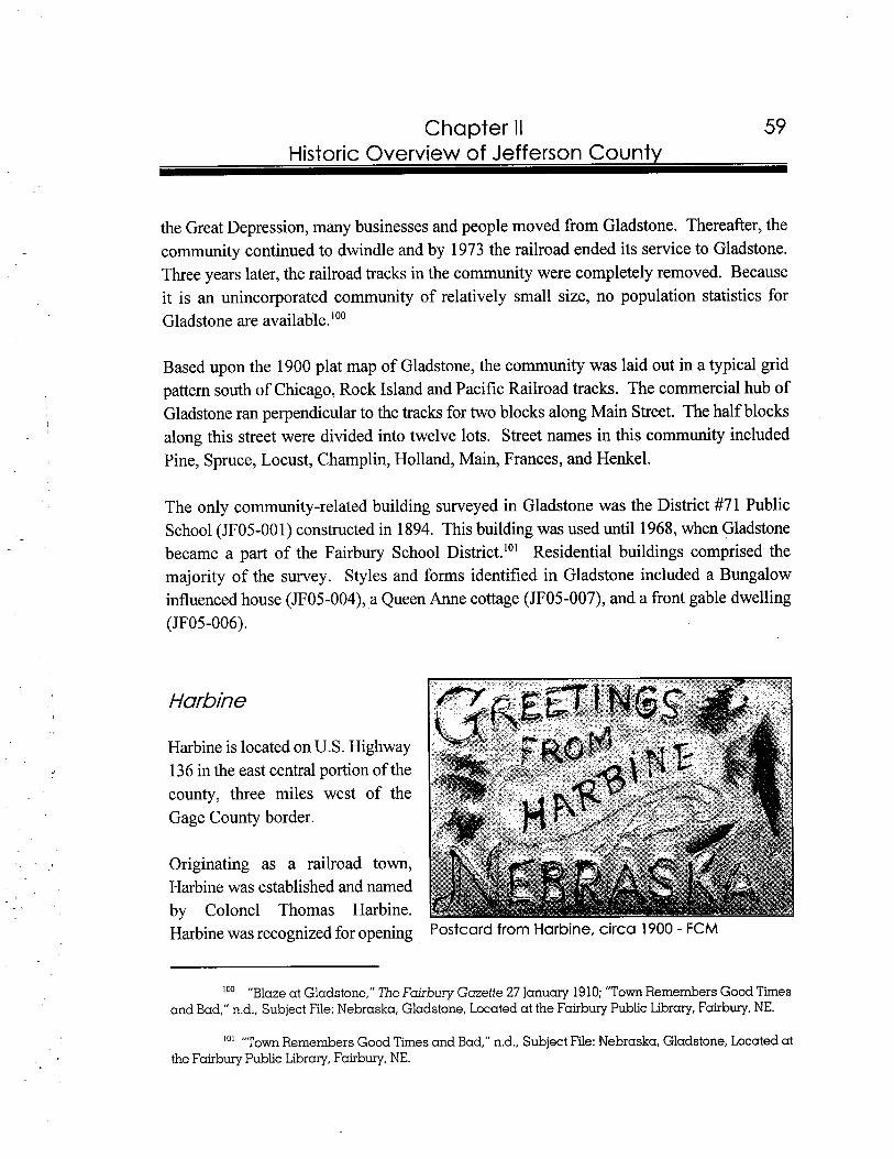
Chapter II Historic Overview of Jefferson County
the Great Depression, many businesses and people moved from Gladstone. Thereafter, the community continued to dwindle and by 1973 the railroad ended its service to Gladstone. Three years later, the railroad tracks in the community were completely removed. Because it is an unincorporated community of relatively small size, no population statistics for Gladstone are available."'
Based upon the 1900 plat map of Gladstone, the community was laid out in a typical grid pattern south of Chicago, Rock Island and Pacific Railroad tracks. The commercial hub of Gladstone ran perpendicular to the tracks for two blocks along Main Street. The half blocks along this street were divided into twelve lots. Street names in this community included Pine, Spruce, Locust, Champlin, Holland, Main, Frances, and Henkel.
The only community-related building surveyed in Gladstone was the District #71 Public School (JF05-001) constructed in 1894. This building was used until 1968, when Gladstone became a part of the Fairbury School District.''' Residential buildings comprised the majority of the survey. Styles and forms identified in Gladstone included a Bungalow influenced house (JF05-004), a Queen Anne cottage (JF05-007), and a front gable dwelling (JF05-006).
Harbine
Harbine is located on U.S. Highway 136 in the east central portion of the county, three miles west of the Gage County border.
Originating as a railroad town, Harbine was established and named by Colonel Thomas Harbine. Harbine was recognized for opening Postcard from Harbine, circa 1900 - FCM
loo "Blaze at Gladstone," The Fairbury Gazette 27 January 1910; "Town Remembers Good Times and Bad," n.d., Subject File: Nebraska, Gladstone, Located at the Fairbury Public Library, Fairbury, NE.
101 "Town Remembers Good Times and Bad," nd., Subject File: Nebraska, Gladstone, Located at the Fairbury Public Library, Fairbury, NE.
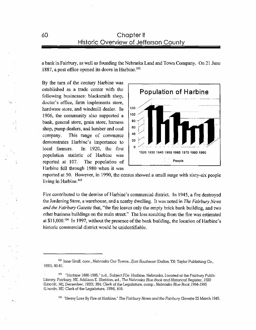
Chapter II Historic Overview of Jefferson Countv
a bank in Fairbury, as well as founding the Nebraska Land and Town Company. On 21 June 1887, a post office opened its doors in Harbine.Io2
By the turn of the century Harbine was established as a trade center with the Population of Harbine following businesses: blacksmith shop, doctor's office, farm implements store, hardware store, and windmill dealer. In 1906, the community also supported a bank, general store, grain store, harness shop, pump dealers, and lumber and coal company. This range of commerce demonstrates Harbine's importance to local farmers. In 1920, the first population statistic of Harbine was
.-Peoplereported at 107. The population of
Harbine fell through 1980 when it was reported at 50. However, in 1990, the census showed a small surge with sixty-six people living in Harbine.Io3
Fire contributed to the demise of Harbine's commercial district. In 1945, a fire destroyed the Jordening Store, a warehouse, and a nearby dwelling. It was noted in The Fairbury News and the Fairbury Gazette that, "the fire leaves only the empty brick bank building, and two other business buildings on the main street." The loss resulting from the fire was estimated at $1 1,000.'" In 1997, without the presence of the bank building, the location of Harbine's historic commercial district would be unidentifiable.
' 0 2 Jane Graff, coor., Nebraska Our Towns ...East Southeast (Dallas, 'lX:Taylor Publishing Co., 19921, 80-81.
'03 "Harbine 1886-1986," n.d., Subject File: Harbine, Nebraska, Located at the Fairbury Public Library, Fairbury, NE. Addison E. Sheldon, ed., The Nebraska Blue Book and Historical Register, 1920 (Lincoln, NE, December, 1920), 394; Clerk of the Legislature, comp., Nebraska Blue Book 1994-1995 (Lincoln, NE: Clerk of the Legislature, 1994), 816.
'04 "Heavy Loss By Fire at Harbine," The Fairbury News and the Fcrirbury Gazette 22 March 1945.
Chapter II Historic Overview of Jefferson Countv
The current, 1984 plat of Harbine shows a triangular-shaped layout with the former Rock Island Railroad tracks serving as the base. Approximately twelve blocks were laid out for the community. Since the half blocks along Main Street between Adams and Letton streets were divided into twelve lots, this area served as the commercial center for Harbine. Street names include Bedford, Hansen, Main, Rives, Curtis, Adams, Williams, Sandman, Barry, and Letton.
Only one building was surveyed in Harbine. It is a bank/commercial building (JF06-001), located on the northeast corner of Main and Sandman streets, which displays brick construction, an arched doorway and window, concrete sills, and corbeling.
Jansen
Located on U.S. Highway 136, Jansen is approximately five miles northeast fiom Fairbury, in the central portion of the county.
Mennonites, who had originally moved fiom Holland to Russia, were the earliest settlers in Jansen. In 1870, Russian policies changed and Mennonites were included on the military service rolls. As a result, many Mennonites searched for a new home abroad. Since the United States offered vast sections of unsettled land, groups of Mennonites were enticed to the immigrate. In the early 1870s, the Jansen Family, under the direction the English speaking Peter Jansen, led a group of Mennonites to Jefferson County. By the end of the decade, the Mennonites in the community had erected their first
Peter Jansen acquired wealth by raising sheep and wheat and utilized much of his profits to aid the community. In 1886, following the arrival of the Rock Island Railroad, Jansen platted land, then turned it over to the community. The community was named after its Mennonite founder, who later served as a state legi~la tor . '~~
'05 Cornelius J. Claassen, "Peter Jansen--Pioneer, Leader and Philanthropist," Mennonite Life 2 (October 1947): 41-42; Jane Gruff, coor., Nebraska Our Towns ...East Southeast (Dallas, 'lX:Taylor Publishing Co., 1992), 82.
lo6 Cornelius J. Claassen, "Peter Jansen--Pioneer, Leader and Philanthropist," Mennonite Life 2 (October 1947): 43; Jane Gmff, coor., Nebraska Our Towns ...East Southeast (Dallas, TX:Taylor Publishing Co., 1992). 83-84; Elton A. Perkey, "Perkey's Names of Nebraska Locations," Nebraska History 59 (Summer 1978): 272.
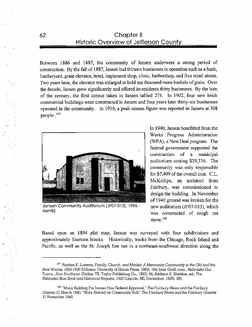
Chapter II Historic Overview of Jefferson County
Between 1886 and 1887, the community of Jansen underwent a strong period of construction. By the fall of 1887, Jansen had thirteen businesses in operation such as a bank, lumberyard, grain elevator, hotel, implement shop, clinic, barbershop, and five retail stores. Two years later, the elevator was enlarged to hold ten thousand more bushels of grain. Over the decade, Jansen grew significantly and offered its residents thirty businesses. By the turn of the century, the first census taken in Jansen tallied 271. In 1902, four new brick commercial buildings were constructed in Jansen and four years later thirty-six businesses operated in the community. In 1910, a peak census figure was reported in Jansen at 308 people . I o 7
In 1940, Jansen benefitted from the Works Progress Administration (WPA), a New Deal program. The federal government supported the construction of a municipal auditorium costing $29,336. The community was only responsible for $7,409 of the overall cost. C.L. McKellips, an architect from Fairbury, was commissioned to design the building. In November of 1940 ground was broken for the
Jansen Community Auditorium (JF07-013), 1996 - new auditorium (JF07-0 13), which NeHBS was constructed of rough cut
stone.'''
Based upon an 1894 plat map, Jansen was surveyed with four subdivisions and approximately fourteen blocks. Historically, tracks from the Chicago, Rock Island and Pacific, as well as the St. Joseph line ran in a northeast-southwest direction along the
'07 Royden K. Loewen, Family, Church, and Market: A Mennonite Community in the Old and the New Worlds, 1850-1930 (Urbana: University of Illinois Press, 1993), 164; Jane Graff, coor., Nebraska Our Towns...East Southeast (Dallas, lXTaylor Publishing Co., 19921, 84; Addison E. Sheldon, ed., The Nebraska Blue Book and Historical Register, 1920 (Lincoln, NE, December, 1920), 395.
'08 "Muny Building For Jansen Has Federal Approval," The Fairbury News and the Fairbury Gazette 21 March 1940; "Work Started on Community Hall," The Fairbury News and the Fairbury Gazette 21 November 1940.
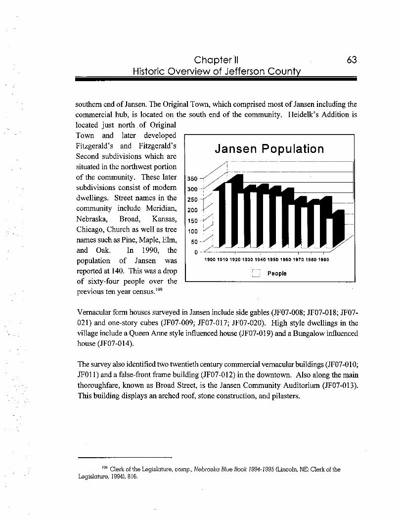
63 Chapter 'I1 Historic Overview of Jefferson County
southern end of Jansen. The Original Town, which comprised most of Jansen including the commercial hub, is located on the south end of the community. Heidelk's Addition is located just north of Original Town and later developed Fitzgerald's and Fitzgerald's Jansen PopulationSecond subdivisions which are situated in the northwest portion of the community. These later subdivisions consist of modern dwellings. Street names in the community include Meridian, Nebraska, Broad, Kansas, Chicago, Church as well as tree names such as Pine, Maple, Elm, and Oak. In 1990, the population of Jansen was
mreported at 140. This was a drop , People
L
of sixty-four people over the previous ten year census.'09
Vernacular form houses surveyed in Jansen include side gables (JF07-008; JF07-018; JF07- 021) and one-story cubes (JF07-009; JF07-017; JF07-020). High style dwellings in the village include a Queen Anne style influenced house (JF07-019) and a Bungalow influenced house (JF07-0 14).
The survey also identified two twentieth century commercial vernacular buildings (JF07-010; JFO11) and a false-front frame building (JF07-012) in the downtown. Also along the main thoroughfare, known as Broad Street, is the Jansen Community Auditorium (JF07-013). This building displays an arched roof, stone construction, and pilasters.
109 Clerk ofthe Legislature, comp.,Nebraska Blue Book 1994-1995 (Lincoln,NE: Clerk of the Legislature, 19941, 816.
64 Chapter II Historic Overview of Jefferson Countv
Plymouth is located in the northeastern portion of the county. State Highway 4 runs in an east-west direction through the north side of the village. Plymouth is only three miles south of Saline County and three and one-half miles west of Gage County.
In 1872, "Old Plymouth" was established by a group of Congregational ministers. Early residents, many of whom were East Coast transplants, chose the name of Plymouth for their new community. Furthermore, streets reflected the surnames of early Pilgrims. In 1879, the population was reported at one hundred with a post office, general store, cheese factory, and blacksmith shop operating in the community. However, since the expanded route of the railroad was not undertaken, the community dissolved by 1 890.'1°
In 1892, two years after the discontinuation of Old Plymouth, the Rock Island Railroad extended tracks from the city of Lincoln to Jefferson County. As a result, the Plymouth Townsite Company platted a new community three miles northeast of the old site. This land had been purchased from Otto Knoche. On 7 May 1893, the first train reached Plymouth and eleven months later, the community was incorporated. The new village was predominantly settled by Germans. In 1902, the 260 people living in Plymouth supported twenty-seven businesses. Eight years later, the population increased by 178 and thirty-five businesses were added. Continued prosperity in Plymouth was rooted in good land and water resources. Municipal improvements included a 19 13 water system, a 1920 electrical line from Beatrice, and a new water main installed by the WPA in the mid-1930s."'
According to the plat map, Plymouth was surveyed along the Chicago, Rock Island and Pacific Railroad tracks. Approximately fourteen blocks were defined by two subdivisions, known as Original Town and First Addition. Main Street serves as the primary thoroughfare for the community. Other street and avenue names include Rose, Maple, Main, Endicott,
l l o Jane Graff, coor., Nebraska Our Towns ...East Southeast (Dallas, TX:Taylor Publishing Co., 1992),85.
111 Jane Graff, coor.. Nebraska Our Towns ...East Southeast (Dallas, TX:Taylor Publishing Co., 1992), 85-86; "Railroads' Decisions Ended Existence of 'First': Provided Second Chance and Decision As To Plymouth Site," Fairbury Iournal-News 1 1 August 1992; Addison E. Sheldon, ed., The Nebraska Blue Book and Historical Register, 1920 (Lincoln, NE, December, 19201, 398; Plymouth Centennial History Committee, comp., Plymouth, NE: Saluting the Past-Building For the Future (N.F., 1992), 12, 17, 22, 26, 30.
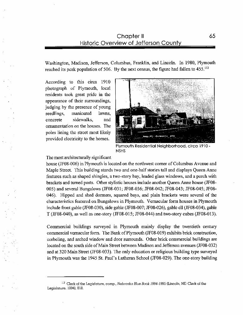
65 Chapter II Historic Overview of Jefferson Countv
Washington, Madison, Jefferson, Columbus, Franklin, and Lincoln. In 1980, Plymouth reached its peak population of 506. By the next census, the figure had fallen to 455."'
According to this circa 1910 photograph of Plymouth, local residents took great pride in the appearance of their surroundings, judging by the presence of young seedlings, manicured lawns, concrete sidewalks, and ornamentation on the houses. The poles lining the street most likely provided electricity to the homes.
Plymouth Residential Neighborhood, circa 1910 -NSHS
The most architecturally significant house (JF08-006) in Plymouth is located on the northwest corner of Columbus Avenue and Maple Street. This building stands two and one-half stories tall and displays Queen Anne features such as shaped shingles, a two-story bay, leaded glass windows, and a porch with brackets and turned posts. Other stylistic houses include another Queen Anne house (JF08- 005) and several Bungalows (JF08-03 1; JF08-036; JF08-042; JF08-043; JF08-045; JF08- 046). Hipped and shed dormers, squared bays, and plain brackets were several of the characteristics featured on Bungalows in Plymouth. Vernacular form houses in Plymouth include front gable (JF08-030), side gable (JF08-007; JF08-026), gable ell (JF08-034), gable T (JF08-040), as well as one-story (JF08-015; JF08-044) and two-story cubes (JF08-013).
Commercial buildings surveyed in Plymouth mainly display the twentieth century commercial vernacular form. The Bank of Plymouth (JF08-0 19) exhibits brick construction, corbeling, and arched window and door surrounds. Other brick commercial buildings are located on the south side of Main Street between Madison and Jefferson avenues (JF08-032) and at 320 Main Street (JF08-033). The only education or religious building type surveyed in Plymouth was the 1945 St. Paul's Lutheran School (JF08-029). The one-story building
112 Clerk of the Legislature, comp., Nebraska Blue Book 1994-1995 (Lincoln,NE: Clerk of the Legislature, 1994), 818.
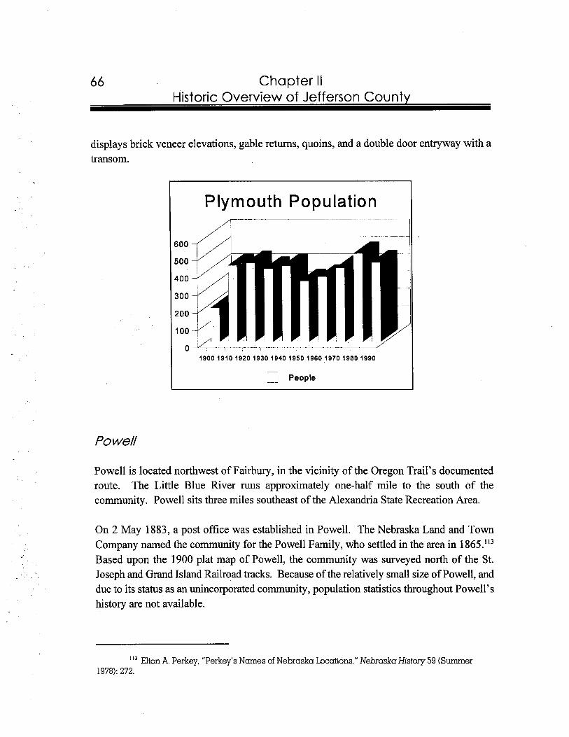
66 Chapter II Historic Overview of Jefferson Countv
displays brick veneer elevations, gable returns, quoins, and a double door entryway with a transom.
Plymouth Population
,--- PeopleI -
Powell
Powell is located northwest of Fairbury, in the vicinity of the Oregon Trail's documented route. The Little Blue River runs approximately one-half mile to the south of the community. Powell sits three miles southeast of the Alexandria State Recreation Area.
On 2 May 1883, a post office was established in Powell. The Nebraska Land and Town Company named the community for the Powell Family, who settled in the area in 1 865.'13 Based upon the 1900 plat map of Powell, the community was surveyed north of the St. Joseph and Grand Island Railroad tracks. Because of the relatively small size of Powell, and due to its status as an unincorporated community, population statistics throughout Powell's history are not available.
' I 3 Elton A. Perkey, "Perkey's Names of Nebraska Locations," Nebraska History 59 (Summer 1978):272.
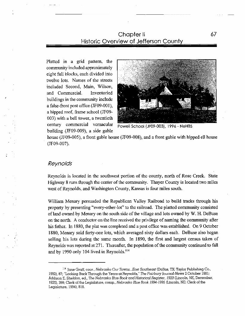
67 Chapter II Historic Overview of Jefferson County
Platted in a grid pattern, the community included approximately eight full blocks, each divided into twelve lots. Names of the streets included Second, Main, Wilson, and Commercial. Inventoried buildings in the community include a false-front post office (JF09-OOl), a hipped roof, frame school (JF09- 003) with a bell tower, a twentieth century commercial vernacular Powell School (JF09-003), 1996 - NeHBS building (JF09-009), a side gable house (JF09-005), a front gable house (JF09-008), and a front gable with hipied ell house (JF09-007).
Reynolds
Reynolds is located in the southwest portion of the county, north of Rose Creek. State Highway 8 runs through the center of the community. Thayer County is located two miles west of Reynolds, and Washington County, Kansas is four miles south.
William Menary persuaded the Republican Valley Railroad to build tracks through his property by presenting "every-other-lot" to the railroad. The platted community consisted of land owned by Menary on the south side of the village and lots owned by W. H. DeBuse on the north. A conductor on the line received the privilege of naming the community after his father. In 1880, the plat was completed and a post office was established. On 9 October 1880, Menary sold forty-one lots, which averaged sixty dollars each. DeBuse also began selling his lots during the same month. In 1890, the first and largest census taken of Reynolds was reported at 27 1. Thereafter, the population of the community continued to fall and by 1990 only 104 lived in Reynolds.'I4
'I4 Jane Gruff, coor., Nebraska Our Towns ...East Southeast (Dallas, ?X: Taylor Publishing Co., 1992), 87; "Looking Back Through the Years at Reynolds," The Fairbury Journal-News 2 October 1981; Addison E. Sheldon, ed., The Nebraska Blue Book and Historical Register, 1920 (Lincoln, NE, December, 1920), 399; Clerk of the Legislature, comp., Nebraska Blue Book 1994-1 995 (Lincoln, NE: Clerk of the Legislature, 1994), 818.
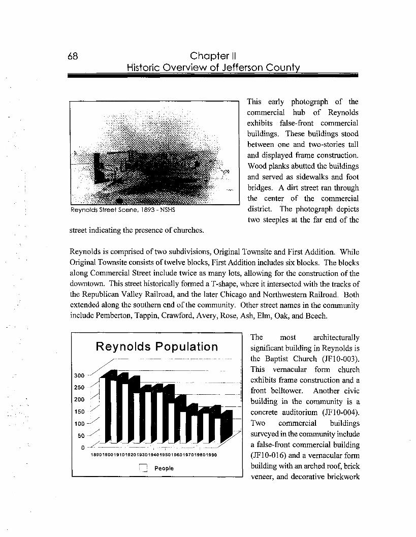
-- --- -
68 Chapter II Historic Overview of Jefferson Countv
This early photograph of the commercial hub of Reynolds exhibits false-front commercial buildings. These buildings stood between one and two-stories tall and displayed frame construction. Wood planks abutted the buildings and served as sidewalks and foot bridges. A dirt street ran through the center of the commercial
Reynolds Street Scene, 1893 - NSHS district. The photograph depicts two steeples at the far end of the
street indicating the presence of churches.
Reynolds is comprised of two subdivisions, Original Townsite and First Addition. While Original Townsite consists of twelve blocks, First Addition includes six blocks. The blocks along Commercial Street include twice as many lots, allowing for the construction of the downtown. This street historically formed a T-shape, where it intersected with the tracks of the Republican Valley Railroad, and the later Chicago and Northwestern Railroad. Both extended along the southern end of the community. Other street names in the community include Pemberton, Tappin, Crawford, Avery, Rose, Ash, Elm, Oak, and Beech.
The most architecturally Reynolds Population significant building in Reynolds is
I 7- p I the Baptist Church (JFIO-003). This vernacular form church exhibits frame construction and a front belltower. Another civic building in the community is a concrete auditorium (JF10-004). Two commercial buildings surveyed in the community include a false-front commercial building
18901900191019201930194019501960197019801990
- (JF 10-0 16) and a vernacular form
_;People building with an arched roof, brick veneer, and decorative brickwork
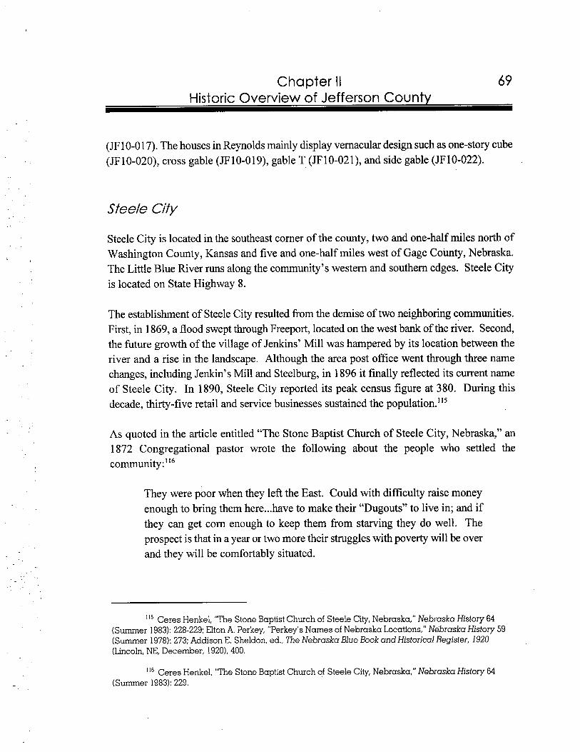
Chapter II Historic Overview of Jefferson County
(JF 10-0 17). The houses in Reynolds mainly display vernacular design such as one-story cube (JF 10-020), cross gable (JF 10-01 9), gable T (JF 10-02 I), and side gable (JF 10-022).
Steele City is located in the southeast corner of the county, two and one-half miles north of Washington County, Kansas and five and one-half miles west of Gage County, Nebraska. The Little Blue River runs along the community's western and southern edges. Steele City is located on State Highway 8.
The establishment of Steele City resulted from the demise of two neighboring communities. First, in 1869, a flood swept through Freeport, located on the west bank of the river. Second, the future growth of the village of Jenkins' Mill was hampered by its location between the river and a rise in the landscape. Although the area post office went through three name changes, including Jenkin's Mill and Steelburg, in 1896 it finally reflected its current name of Steele City. In 1890, Steele City reported its peak census figure at 380. During this decade, thirty-five retail and service businesses sustained the p~pulation."~
As quoted in the article entitled "The Stone Baptist Church of Steele City, Nebraska," an 1872 Congregational pastor wrote the following about the people who settled the community:' l 6
They were poor when they left the East. Could with difficulty raise money enough to bring them here ...have to make their "Dugouts" to live in; and if they can get corn enough to keep them from starving they do well. The prospect is that in a year or two more their struggles with poverty will be over and they will be comfortably situated.
]I5 Ceres Henkel, "The Stone Baptist Church of Steele City, Nebraska," Nebraska History 64 (Summer 1983): 228-229; Elton A. Perkey, "Perkey's Names of Nebraska Locations," Nebraska History 59 (Summer 1978): 273; Addison E. Sheldon, ed., The Nebraska Blue Book and Historical Register, 1920 (Lincoln, NE, December, 1920),400.
Ceres Henkel, "The Stone Baptist Church of Steele City, Nebraska," Nebraska History 64 (Summer 1983): 229.
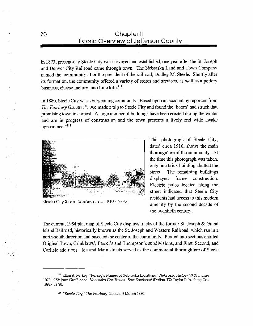
70 Chapter II Historic Overview of Jefferson County
In 1873, present-day Steele City was surveyed and established, one year after the St. Joseph and Denver City Railroad came through town. The Nebraska Land and Town Company named the community after the president of the railroad, Dudley M. Steele. Shortly after its formation, the community offered a variety of stores and services, as well as a pottery business, cheese factory, and lime kiln.Il7
In 1880, Steele City was a burgeoning community. Based upon an account by reporters from The Fairbury Gazette: "...we made a trip to Steele City and found the 'boom' had struck that promising town in earnest. A large number of buildings have been erected during the winter and are in progress of construction and the town presents a lively and wide awake
This photograph of Steele City, dated circa 1910, shows the main thoroughfare of the community. At the time this photograph was taken, only one brick building abutted the street. The remaining buildings displayed frame construction. Electric poles located along the street indicated that Steele City residents had access to this modern
Steele City Street Scene, circa 1910 - NSHS amenity by the second decade of the twentieth century.
The current, 1984 plat map of Steele City displays tracks of the former St. Joseph & Grand Island Railroad, historically known as the St. Joseph and Western Railroad, which ran in a north-south direction and bisected the center of the community. Plotted into sections entitled Original Town, Crinklaws', Persel's and Thompson's subdivisions, and First, Second, and Carlisle additions. Ida and Main streets served as the commercial thoroughfare of Steele
'I7 Elton A. Perkey, "Perkey's Names of Nebraska Locations," Nebraska History 59 (Summer 1978): 273; Jane Graff, coor., Nebraska Our Towns ...East Southeast (Dallas, TX:Taylor Publishing Co., 19921, 89-90.
"'"Steele City," The Fairbury Gazette 6 March 1880.
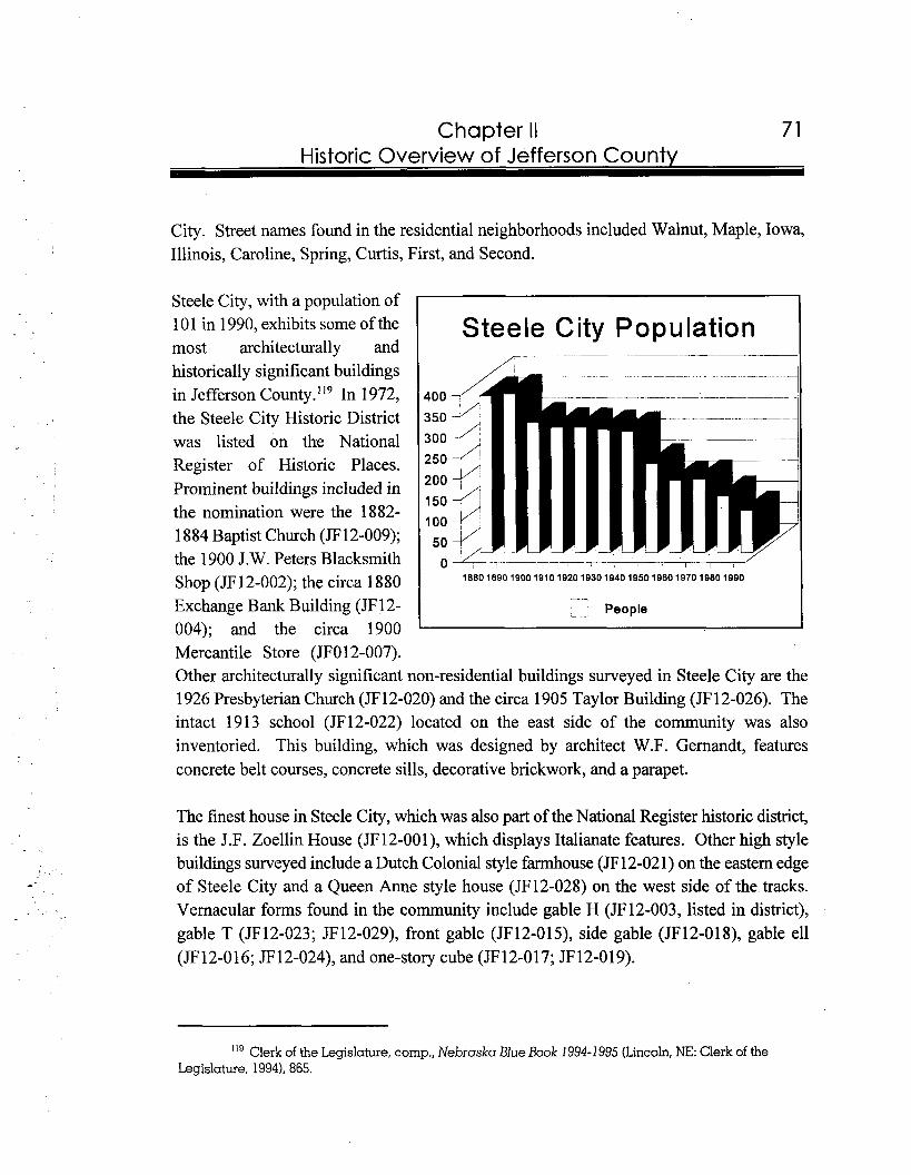
71 Chapter II Historic Overview of Jefferson County
City. Street names found in the residential neighborhoods included Walnut, Maple, Iowa, Illinois, Caroline, Spring, Curtis, First, and Second.
Steele City, with a population of 10 1 in 1990, exhibits some of the Steele City Population most architecturally and historically significant buildings in Jefferson C ~ u n t y . " ~ In 1972, the Steele City Historic District was listed on the National Register of Historic Places. Prominent buildings included in the nomination were the 1882- 1 884 Baptist Church (JF12-009); the 1900 J.W. Peters Blacksmith Shop (JF 12-002); the circa 1880 Exchange Bank Building (JF 1 2- - People 004); and the circa 1900 Mercantile Store (JFO 12-007). Other architecturally significant non-residential buildings surveyed in Steele City are the 1926 Presbyterian Church (JF12-020) and the circa 1905 Taylor Building (JF 12-026). The intact 1913 school (JF12-022) located on the east side of the community was also inventoried. This building, which was designed by architect W.F. Gernandt, features concrete belt courses, concrete sills, decorative brickwork, and a parapet.
The finest house in Steele City, which was also part of the National Register historic district, is the J.F. Zoellin House (JF12-OOl), which displays Italianate features. Other high style buildings surveyed include a Dutch Colonial style farmhouse (JF12-02 1) on the eastern edge of Steele City and a Queen Anne style house (JF12-028) on the west side of the tracks. Vernacular forms found in the community include gable H (JF12-003, listed in district), gable T (JF 12-023; JF l2-029), front gable (JF 12-01 9, side gable (JF 12-01 8), gable ell (JF 12-0 16; JF l2-024), and one-story cube (JF 12-0 17; JF 12-01 9).
'I9 Clerk of the Legislature, comp., Nebraska Blue Book l994-lg95 (Lincoln,NE: Clerk of the Legislature, 19941, 865.
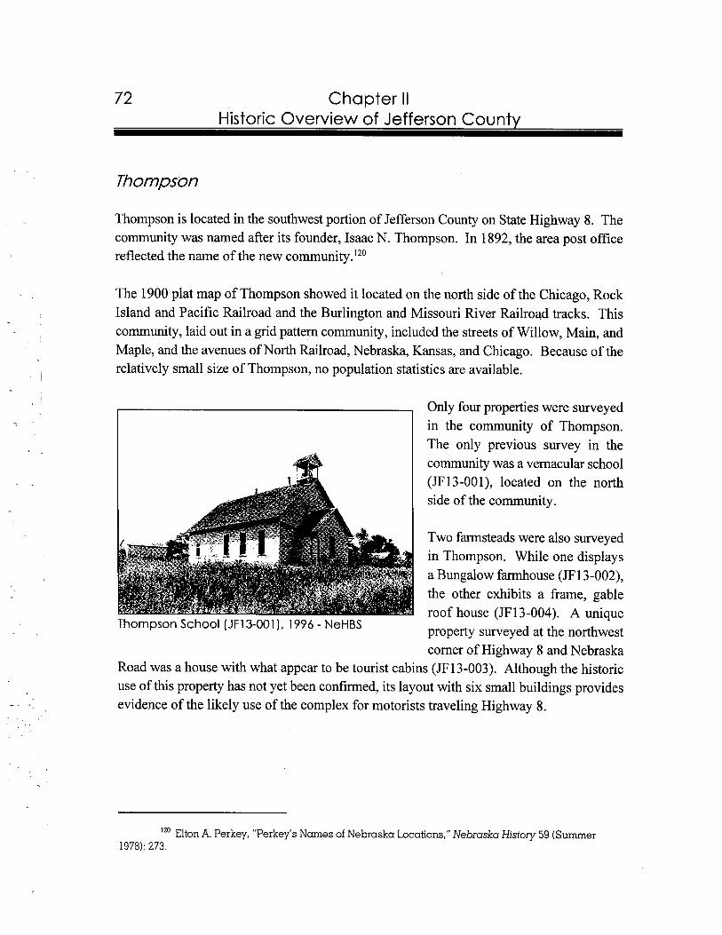
72 Chapter II Historic Overview of Jefferson County
Thompson
Thompson is located in the southwest portion of Jefferson County on State Highway 8. The community was named after its founder, Isaac N. Thompson. In 1892, the area post office reflected the name of the new c~mmun i ty . ' ~~
The 1900 plat map of Thompson showed it located on the north side of the Chicago, Rock Island and Pacific Railroad and the Burlington and Missouri River Railroad tracks. This community, laid out in a grid pattern community, included the streets of Willow, Main, and Maple, and the avenues of North Railroad, Nebraska, Kansas, and Chicago. Because of the relatively small size of Thompson, no population statistics are available.
Only four properties were surveyed in the community of Thompson. The only previous survey in the community was a vernacular school (JF13-001), located on the north side of the community.
Two farmsteads were also surveyed in Thompson. While one displays a Bungalow farmhouse (JF13-002), the other exhibits a frame, gable roof house (JF13-004). A unique
Thompson School (JF13-001),1996 - NeHBS property surveyed at the northwest corner of Highway 8 and Nebraska
Road was a house with what appear to be tourist cabins (JF13-003). Although the historic use of this property has not yet been confirmed, its layout with six small buildings provides evidence of the likely use of the complex for motorists traveling Highway 8.
Elton A. Perkey, "Perkey's Names of Nebraska Locations," Nebraska History 59 (Summer 1978): 273.
lntrod uction
Since Jefferson County is located in rich agricultural country, many farmers have continually utilized Fairbury as a commercial market and transportation center. Presently, the community serves as a trade center for approximately a twenty mile radius. With a population of 4,335, Fairbury is reached by U.S. Highway 136 fiom the east and west, State Highway 15 from the north and south, and State Highway 8 from the southeast and
so~thwest.'~'The hub of Fairbury's downtown spans approximately ten blocks, and the oldest section surrounds the courthouse square. As a component to the NeHBS of Jefferson County, MVAC prepared a National Register of Historic Places nomination for the Fairbury Commercial Historic District. The nomination includes a boundary map of the district, a list of contributing and noncontributing buildings which are located in the district, a property owners' list, historical overview, architectural description, statement of significance, bibliography, verbal boundary description, U.S.G.S. map, black and white photographs, and color slides. All of these products meet the standards specified by the National Park Service. The Fairbury Commercial Historic district was accepted by the Nebraska State Historic Review Board in May of 1997.
The Fairbury Commercial Historic District is historically signficant for its association with the commercial development of Fairbury and Jefferson County. The period of significance spans fiom 1873, when the earliest extant commercial building in Fairbury was constructed, to the end of the historic period dating 1947, fifty years prior to the present. Fairbury's development and growth as a trade and shipping center were closely linked to its position on important railroad lines, as well as the prosperous surrounding agricultural community. Compared to other communities in Jefferson County, Fairbury is the largest commercial retail and wholesale center. The next largest community in the county, Plymouth, with a peak population of 506 in 1980, featured only three blocks of commercial development, in comparison to more than ten blocks of downtown commercial development in Fairbury.
12' Clerk of the Legislature, comp., Nebraska Blue Book, 1994-1995 (Lincoln, NE, 19941, 865.
--
74 Chapter Ill Fairbuw Commercial Historic District
Fairbury Commercial Historic District Fairbury. Jefferson County, Nebraska
7th St.
Key
Shaded area = district boundary
MODnot to scale
Map prepared by MVAC, June 1997
The Fairbury Commercial Historic District is also significant in the area of architecture for its grouping of buildings representing an array of architectural styles and forms which were popular in the late nineteenth and early twentieth centuries. These buildings, enhanced by the accompaniment of brick streets throughout the district, display extremely intact exteriors and serve as fine examples of styles and forms commonly erected in communities throughout eastern Nebraska. Significant expansion and construction in the historic district took place between the years of 1900 and 1929. This span of years correlated with the height of railroad activity. The architectural character of the district includes continuity of design, a high level of integrity, and densely placed buildings.
Construction dates for buildings located in the district were derived from Sanborn Fire Insurance Maps, The Fairbury Gazette, Fairbury News, The Fairbury News and Fairbury Gazette, and The Fairbury Journal, city telephone books and directories, A Pictorial History of Jefferson County, Nebraska, as well as Helen Gird, Bill Muller, and Betty Gasper's personal historical recollections and collections. All of this information was gathered for
75 Chapter Ill Fairburv Commercial Historic District
each building within the district and placed in site files, which are identified by NeHBS survey numbers. If a building did not have a designated site number or other notation, it most likely is not extant or noncontributing to the district. All files compiled by MVAC, which are available to the public, are housed in the NeSHPO research room, 1500 R Street, Lincoln, Nebraska.
The proposed Fairbury Commercial Historic District consists of 117 properties, ninety-seven contributing and twenty noncontributing, located in a ten block area. The boundaries for this district were based upon a comprehensive combination of architectural styles and property types. The district runs approximately north to Sixth Street, south to Third Street, west to C Street, and east to F Street. The commercial center of Fairbury revolves around the Jefferson County Courthouse, which is located in the center of the downtown on the public square. The oldest buildings in the district surround the courthouse, while the later buildings fan away from the square.
Brief History of the Fairbury Commercial Historic District
Fairbury is located in the south central portion of Jefferson County in southeastern Nebraska. The Little Blue River, which runs northwest to southeast through the county, passes Fairbury on the south and west edges. The landscape surrounding the community consists of rolling hills to the south and flat terrain to the north. Fairbury sits on a slight incline, which descends to the south toward the Little Blue River. Railroad tracks bisect the community at the southern and western sides and stretch in a northwest-southeast direction. A dike runs along the western side of the community and the Little Blue River flows near the south and west borders of Fairbury.
County Seat and Commercial Center
Although this area received early Euro-American exposure due to its location on the Oregon Trail, the coming of the railroads prompted the development of Fairbury. In 1869, James B. Mattingly and Woodford G. McDowell combined efforts to plat a town on the expected route of a railroad. With a joint claim of 160 acres, Mattingly and McDowell laid out a community with its center block reserved for public use. McDowell's hometown in Illinois
Chapter Ill Fairbury Commercial Historic District
became the namesake for the new community. In November of 1871, Fairbury was elected as the county seat and two months later it was in~0rporated.l~~
Shortly after the original platting of Fairbury, initial commercial development of the community occurred around the public square. As early as 1870, Sidney Mason erected a hotel and Horace Clark operated a blacksmith shop in Fairbury. Just one year later, the economy of the community supported three hotels and five blacksmith shops along its streets.'23
One of the first major impacts on commerce in Fairbury was the arrival of the railroad. As early as 1872, the St. Joseph and Denver City Railroad (also known as the St. Joseph and Grand Island under the authority of the Union Pacific) laid tracks into Jefferson County. As a result, Fairbury became a shipping center with the construction of a roundhouse (not extant) and related facilities. In the first half of 1873 the importance of the railroad was substantiated by the fact that Fairbury shipped 255 cars of grain and unloaded 143 cars of lumber throughout the year.'24
The commercial district grew in the 1870s due to increased farming and shipping in Jefferson County. One year after the arrival of the railroad, in 1872-1873, the first brick building (JF04-054) in Fairbury was erected to serve as the courthou~e. '~~ During the same year that the courthouse was completed, construction work in the community totaled $42,300. By 1874, forty-four businesses operated in the commercial hub and serviced six hundred people. One of these new businesses was a hardware store operated by John Price in a false-front building (JF04-113) at 325 D Street.'26 One year later, in 1875, Colonel Harbine anchored
"'Jane Graff, coor., Nebraska Our Towns ... East Southeast (Dallas, TX:Taylor Publishing Co., 1992), 71; Levi Boyd, comp.. Egress of the Old West; the Beginning of Fairbury and its Founders (Fairbuy, NE: Holloway Publishing Co., 1963).
Jane Graff, coor., Nebraska Our Towns ... East Southeast (Dallas, TX:Taylor Publishing Co., 1992), 71.
Estaline Carpenter, comp., Friendly Fairbury; A History of Fairbury, Nebraska (Fairbury, NE: Jefferson County Historical Society, 198 11, 20; Charles Dawson, Pioneer Tales of the Oregon Trail and of Jefferson County (Topeka, KS: Crane & Co., 1912), 339-340.
Though this building remains extant, it has been significantly altered, and is noncontributing in the historic district.
" v a n e Graff, coor., Nebraska Our Towns ... East Southeast (Dallas, TX:Taylor Publishing Co., 19921, 72; Charles Dawson, Pioneer Tales of the Oregon Trail and of Jefferson County (Topeka, KS: Crane & Co., 19 12), 340; The Fairbury journal-News, comp., A Pictorial History of Jefferson County Nebraska
77 Chapter Ill Fairburv Commercial Historic District
the east side of the square with the construction of a brick building (JF04-139) at 400 E Street in downtown Fairbury. The Fairbury Gazette dated 3 1 July 1875 noted that Colonel Harbine's building was "the finest edifice in town."'27
At the end of the decade, in 1879, Fairbury's downtown experienced a setback. A significant fire swept through the south side of the commercial hub and created a substantial loss reaching approximately $50,000. It included damage to approximately fourteen buildings, as well as stock. An article in The Fairbury Gazette noted, "the loss of our principal business houses is a serious one and will fall heavily on many of the owners yet it will no doubt in the end prove a benefit. A row of frame buildings is always unsafe and the south side of the square which was the worst range in town will doubtless now be rebuilt with
-brick??
Fairbury business people quickly rebounded I w a x t o r A. wood's
from the fire with the construction of new IT 11v s j-1S G. 11 &I1S,.I;: s. buildings and the introduction of a broader range of merchandise. Servicing a county- wide population of eight thousand, Fairbury functioned as a trade center for residents living in at least a twenty-five-mile radius. An article in an 1880 issue of The Fairbury . ..
Gazette describes the growing commercial I . ~ . ~ ~ l , : , ~ ~ c ! 2 ~ . ~ ~ ~ . - . , ,?!.MO :..;.,.:: , , .a<lA,- v,r,+rz.hub of Fairbury with the construction of
fourteen brick andlor stone buildings. While Solf Elinding EEnrvc.stors.
Rcnpers and mowers
By the mid part of the decade, the 1885 Sanborn Map displayed every lot on the south side of the square occupied with a commercial
"New Brick Store," The Fairbury Gazette 31 July 1875.
"Destructive Conflagration," The Fairbury Gazette 4 October 1879.
Iz9 Clerk of the Legislature, comp., Nebraska Blue Book, 1990-1991 (Lincoln,NE: Clerk of the Legislature, 1990). 783; "Fairbury in 1880," The Fairbury Gazette 1 January 188 1.
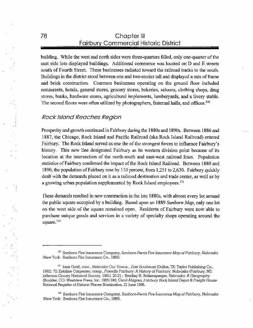
Chapter Ill Fairburv Commercial Historic District
building. While the west and north sides were three-quarters filled, only one-quarter of the east side lots displayed buildings. Additional commerce was located on D and E streets south of Fourth Street. These businesses radiated toward the railroad tracks to the south. Buildings in the district stood between one and two-stories tall and displayed a mix of frame and brick construction. Common businesses operating on the ground floor included restaurants, hotels, general stores, grocery stores, bakeries, saloons, clothing shops, drug stores, banks, hardware stores, agricultural implements, lumberyards, and a livery stable. The second floors were often utilized by photographers, fraternal halls, and offices.'30
Rock Island Reaches Region
P r o s p e r i ~ 5 ~ 1 d ~ g r o ~ w t h c o n t i n u e d i n E a i r b ~ d u r i n g _ t h e 1 88Os-anbl89Os._Be~eeILL88 6 - a n d 1887, the Chicago, Rock Island and Pacific Railroad (aka Rock Island Railroad) entered Fairbury. The Rock Island served as one the of the strongest forces to influence Fairbury's history. This new line designated Fairbury as its western division point because of its location at the intersection of the north-south and east-west railroad lines. Population statistics of Fairbury confirmed the impact of the Rock Island Railroad. Between 1880 and 1890, the population of Fairbury rose by 1 10 percent, from 1,25 1 to 2,630. Fairbury quickly dealt with the demands placed on it as a railroad destination and trade center, as well as by a growing urban population supplemented by Rock Island employees.I3'
These demands resulted in new construction in the late 1880s, with almost every lot around the public square occupied by a building. Based upon an 1889 Sanborn Map, only one lot on the west side of the square remained open. Residents of Fairbury were now able to purchase unique goods and services in a variety of specialty shops operating around the square.'32
130 Sanborn Fire Insurance Company, Sanborn-Perris Fire Insurance Map of Fairbury, Nebraska (New York: Sanborn Fire Insurance Co., 1885).
131 Jane Graff, coor., Nebraska Our Towns ... East Southeast (Dallas, TX:Taylor Publishing Co., 19921, 72; Estaline Carpenter, comp., Friendly Fairbury: A History of Fairbury, Nebraska (Fairbury, NE: Jefferson County Historical Society, 1981). 20-21 .; Bradley H. Baltensperger, Nebraska: A Geography (Boulder, CO: Westview Press, Inc. 1985) 245; Carol Ahlgren, Fairbury Rock Island Depot &Freight House National Register of Historic Places Nomination, 21 June 1996.
13' Sanborn Fire Insurance Company, Sanborn-Perris Fire Insurance Map of Fairbury, Nebraska (New York: Sanborn Fire Insurance Co., 1889).
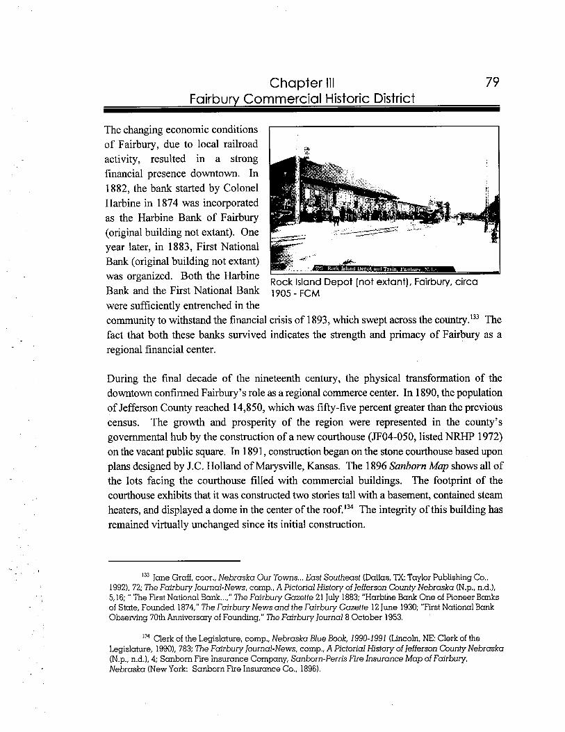
79 Chapter Ill Fairbury Commercial Historic District
The changing economic conditions of Fairbury, due to local railroad activity, resulted in a strong financial presence downtown. In 1882, the bank started by Colonel Harbine in 1874 was incorporated as the Harbine Bank of Fairbury (original building not extant). One year later, in 1883, First National Bank (original building not extant) was organized. Both the Harbine Rock Island Depot (notextant), Fairbury, circa Bank and the First National Bank 1905 - FCM were sufficiently entrenched in the community to withstand the financial crisis of 1893, which swept across the country.'33 The fact that both these banks survived indicates the strength and primacy of Fairbury as a regional financial center.
During the final decade of the nineteenth century, the physical transformation of the downtown confirmed Fairbury's role as a regional commerce center. In 1890, the population of Jefferson County reached 14,850, which was fifty-five percent greater than the previous census. The growth and prosperity of the region were represented in the county's governmental hub by the construction of a new courthouse (JF04-050, listed NRHP 1972) on the vacant public square. In 1891, construction began on the stone courthouse based upon plans designed by J.C. Holland of Marysville, Kansas. The 1896 Sanborn Map shows all of the lots facing the courthouse filled with commercial buildings. The footprint of the courthouse exhibits that it was constructed two stories tall with a basement, contained steam heaters, and displayed a dome in the center of the roof.'34 The integrity of this building has remained virtually unchanged since its initial construction.
133 Jane Graff, coor., Nebraska Our Towns ... East Southeast (Dallas, lX Taylor Publishing Co., 1992). 72; The Fairbury Journal-News, comp.. A Pictorial History of Jefferson County Nebraska (N.p., n.d.), 5.16; " The First National Bank ...," The Fairbury Gazette 21 July 1883; "Harbine Bank One of Pioneer Banks of State, Founded 1874," The Fairbury News and the Fairbury Gazette 12 June 1930; "First National Bank Observing 70th Anniversary of Founding," The Fairbury Journal8 October 1953.
134 Clerk of the Legislature, comp., Nebraska Blue Book, 1990-1 991 (Lincoln, NE: Clerk of the Legislature, 19901, 783; The Fairbury Journal-News, comp., A Pictorial History of Jefferson County Nebraska (N.p., n.d.), 4; Sanborn Fire Insurance Company, Sanborn-Perris Fire Insurance Map of Fairbury, Nebraska (New York: Sanborn Fire Insurance Co., 1896).
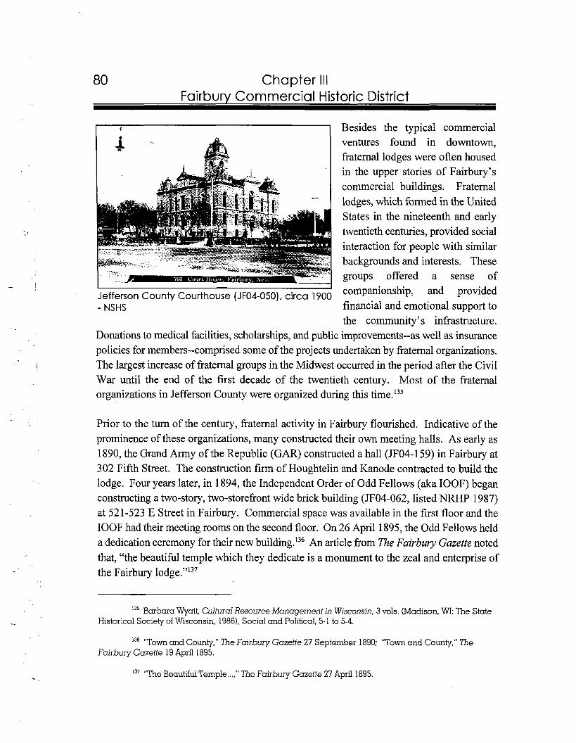
80 Chapter Ill Fairbury Commercial Historic District
t I Besides the typical commercial ventures found in downtown, fraternal lodges were often housed in the upper stories of Fairbury's commercial buildings. Fraternal lodges, which formed in the United States in the nineteenth and early twentieth centuries, provided social interaction for people with similar backgrounds and interests. These groups offered a sense of
I
Jefferson County Courthouse (JF04-050), circa 1900 companionship, and provided
- NSHS financial and emotional support to the community's infrastructure.
Donations to medical facilities, scholarships, and public improvements--as well as insurance policies for members--comprised some of the projects undertaken by fraternal organizations. The largest increase of fraternal groups in the Midwest occurred in the period after the Civil War until the end of the first decade of the twentieth century. Most of the fraternal organizations in Jefferson County were organized during this time.'35
Prior to the turn of the century, fraternal activity in Fairbury flourished. Indicative of the prominence of these organizations, many constructed their own meeting halls. As early as 1890, the Grand h y of the Republic (GAR) constructed a hall (JF04-159) in Fairbury at 302 Fifth Street. The construction firmof Houghtelin and Kanode contracted to build the lodge. Four years later, in 1894, the Independent Order of Odd Fellows (aka IOOF) began constructing a two-story, two-storefront wide brick building (JF04-062, listed NRHP 1987) at 521-523 E Street in Fairbury. Commercial space was available in the first floor and the IOOF had their meeting rooms on the second floor. On 26 April 1895, the Odd Fellows held a dedication ceremony for their new b~i1ding.l~~ An article from The Fairbury Gazette noted that, "the beautiful temple which they dedicate is a monument to the zeal and enterprise of the Fairbury lodge."I3'
135 Barbara Wyatt, Cultural Resource Management in Wisconsin, 3 vols. (Madison, WI: The State Historical Society of Wisconsin, 1986). Social and Political, 5-1 to 5-4.
13"'T~wn and County," The Fairbury Gazette 27 September 1890; "Town and County," The Fairbury Gazette 19 April 1895.
137 "The Beautiful Temple ...," The Fairbury Gazette 27 April 1895.
81 Chapter Ill Fairbury Commercial Historic District
At the onset of the next century, the Ancient, Free and Accepted Masons (aka Masons) of Fairbury, who had originally organized in 1871, purchased a lot along the west side of E Street, one lot away from the IOOF Temple. In 1916, the Masons constructed a building (JF04-064) on the site at a cost of $20,000. On 20 April 1917 the lodge conducted a dedication ceremony. Following World War I, social organizations were still active in Fairbury. This was represented by the fact that the American Legion gained ownership of the GAR Hall. In 1935, the legion remodeled the building to its current appearan~e.'~'
Conflagration Influenced New Cen fury
Following the turn of the century, another disaster struck the commercial district. In 1903, the largest fire in Fairbury's history destroyed almost the entire block south of the square. The only salvageable building was the old Jefferson County Courthouse (JF04-054) at 400 Fourth Street. By the next year, based upon the 1904 Sanborn Map, the entire block was again filled with buildings. Brick served as the main construction material for all of the buildings. Eight of the buildings stood two stories tall, one was three stories, and another was one-story. Businesses along the south side of the courthouse square included general stores, clothing shops, drug stores, as well as a hardware store, meat market, grocery shop, jewelers, boot and shoe shop, restaurant, opera house, and bank. Three of the buildings identified on the Sanborn Map include the Steele Opera House (JF04-065) at 404 Fourth Street, the Clarke-Price Building (JF04-196) at 41 2-414 Fourth Street, and the Weisel Building (JFO4- 1%) at 41 6 Fourth Street.'39
One of the most ornate buildings constructed on the south side of the square after the fire was the 1904 Harbine Bank (JF04-057) at 422 Fourth Street. During the same decade, Isaac Bonham of Kansas laid the groundwork for another bank in Fairbury with the purchase of property at the southwest comer of D and Fifth streets. In 1908, construction began on the
13' "Masons Purchase a Lot," The Fairbury Gazette 11 August 1900; The Fairbury Journal-News, comp.. A Pictorial History of Jefferson County Nebraska (N.p., n.d.1, 27,43.
f i e Fairbury Journal-News, comp., A Pictorial History of Jefferson County Nebraska (N.p., n.d,), 18; Sanborn Fire Insurance Company, Sanborn-Perris Fire Insurance Map of Fairbury, Nebraska (NewYork: Sanborn Fire Insurance Co., 1904).

82 Chapter Ill Fairburv Commercial Historic District
Bonham Bank (JF04-052) at 425 D Street. In 1912, Bonham Bank bought out First National Bank and continued operating under the latter name.I4O
Heightened railroad activity and population growth spurred additional commerce in the downtown. The largest census
South side of courthouse square, Fairbury, circa growth of Fairbury was reported at 1905 - NSHS the end of the first decade of the
twentieth century. Figures rose from 3,140 people in 1900 to 5,294 people in 1910, an increase of nearly sixty percent. During this same census, Jefferson County reported its peak population of 16,852. The growing populations brought more money into the regional trade center of Fairbury. This allowed merchants to feel secure in their financial status and divert money to the construction of substantial commercial buildings. While retail and service businesses such as the 1902 Davis Building (JF04-137) at 404 E Street, the 1902 Goodrich Brothers Banking Company (JF04-135) at 412 E Street, and the 1905 H. L. Clarke Building (JF04-114) at 409-41 1 D Street were constructed around the square, several communication-related facilities were erected one block away from the courthou~e.'~'
The history of Fairbury's local newspapers nearly dates back to the founding of the community. In 1870, one year after the Fairbury plat was completed, George Cross started the Fairbury Gazette. By 189 1, besides the Gazette, the Fairbury Enterprise, the Liberator, and the Fairbury- World operated in the city. One year later, the Fairbury Journal was published. In 1905, the Fairbury Journal, under the direction of W.F. Cramb, constructed its own building (JF04- 170) at 5 15 Fifth Street. Three years later, in 1908, a building used to facilitate communications was constructed. The Wooster Building (JF04-191), built at
I4O The Fairbury Journal-News, comp., A Pictorial History of Jefferson County Nebraska (N.p., n.d.), 16, 21; " "Harbine Bank One of Pioneer Banks of State, Founded 1874," The Fairbury News and the Fairbury Gazette 12 June 1930.
14' Addison E. Sheldon, ed., The Nebraska Blue Book and Historical Register 1920 (Lincoln, NE, December, 1920). 392; Clerk of the Legislature, comp.. Nebraska Blue Book, 1990-1991 (Lincoln, NE, Clerk of the Legislature, 19901, 783; The Fairbury Journal-News, comp., A Pictorial History of Jefferson County Nebraska (N.P., n.d.1, 10;"The New Clarke Building ...," The Fairbury Gazette 29 July 1905.
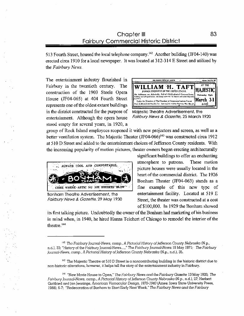
83 Chapter Ill Fairbury Commercial Historic District
5 13 Fourth Street, housed the local telephone company.'42 Another building (JF04-140) was erected circa 1910 for a local newspaper. It was located at 3 12-3 14 E Street and utilized by the Fairbury News.
The entertainment industry flourished in Fairbury in the twentieth century. The construction of the 1903 Steele Opera His Addrerm are Admirublc, Full of 0ld.Fkhioried cbrnrnan.~mrc, wd,day yight
nw.ri,h pd hhumvr, u n d . 1 ~ ~ .c~plirerrs hi. h r . r , , lunwh.n r h . y m ~ I0 c 4 r i . r .House (JF04-065) at 404 Fourth Street ~ , , b l l , ~ ~
01 The~ l a r n ~ r Lecture Courw,he Direction O! GmmcrceII IMarch 3 1II in the district constructed for the purpose of Majestic Theatre Advertisement, the entertainment. Although the opera house FakbW News Gazette,25 March 1920
stood empty for several years, in 1920, a group of Rock Island employees reopened it with new projectors and screen, as well as a better ventilation system. The Majestic Theater (JF04-066)'43 was constructed circa 19 12 at 5 10 D Street and added to the entertainment choices of Jefferson County residents. With the increasing popularity of motion pictures, theater owners began erecting architecturally
significant buildings to offer an enchanting
- ,ALWAYS COOL AND .cOMFORT@LG - ... .
. atmosphere to patrons. These motion ~icturehouses were usuallv located in the heart of the commercial district. The 1926
. . ... . . . C O ~ I E IVHE~E-ARTIC h.U A I R - B R ~ E T B L O ~ ~. I
Bonharn Theater (JF04-063) stands as a fine example of this new type of
Bonham Theatre Advertisement, the entertainment facility. Located at 5 19 E Fairbury News & Gazette,29 May 1 930 Street, the theater was constructed at a cost
of $100,000. In 1929 the Bonham showed its first talking picture. Undoubtedly the owner of the Bonham had marketing of his business in mind when, in 1940, he hired Hams Teichert of Chicago to remodel the interior of the theatre.'44
The Fairbury Journal-News, comp., A Pictorial History ofJefferson County Nebraska (N.p., n.d.1, 33; "History of the Fairbury Journal-News ....," The Fairbury Journal-News 19 May 1971; The Fairbury J~urnal-News,comp.,A Pictorial History of Jefferson County Nebraska (N.p., n.d.1, 35.
The Majestic Theatre at 510 D Street is a noncontributing building in the historic district due to non-historic alterations, however, it helps tell the story of the entertainment industry in Fairbury.
"New Movie House to Open," The Fairbury News and the Fairbury Gazette 13 May 1920; The Fairbury Journal-News, comp., A Pictorial History of Jefferson County Nebraska (N.p., n.d.1, 27; Herbert Gottfried and Jan Jennings, American Vernacular Design, 1870-1940 (Ames:Iowa State University Press, 1988),6-7; "Redecoration of Bonham to Start Early Next Week," The Fairbury News and the Fairbury
14'
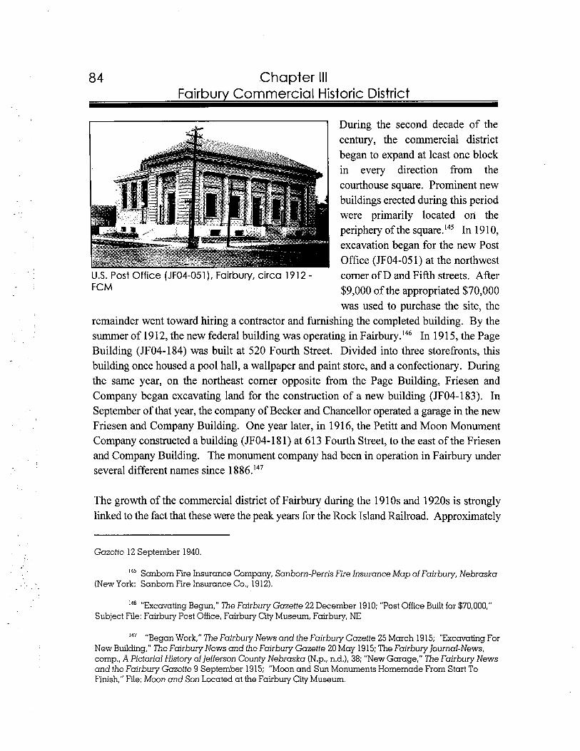
84 Chapter Ill Fairbury Commercial Historic District
During the second decade of the century, the commercial district began to expand at least one block in every direction from the courthouse square. Prominent new buildings erected during this period were primarily located on the periphery of the square.'45 In 191 0, excavation began for the new Post Office (JF04-05 1) at the northwest
U.S. Post Office (JF04-051), Fairbury, circa 1912 - comer of D and Fifth streets. After FCM $9,000 of the appropriated $70,000
was used to purchase the site, the remainder went toward hiring a contractor and furnishing the completed building. By the summer of 1912, the new federal building was operating in F a i r b ~ r y . ' ~ ~ In 191 5, the Page Building (JF04-184) was built at 520 Fourth Street. Divided into three storefronts, this building once housed a pool hall, a wallpaper and paint store, and a confectionary. During the same year, on the northeast corner opposite from the Page Building, Friesen and Company began excavating land for the construction of a new building (JF04-183). In September of that year, the company of Becker and Chancellor operated a garage in the new Friesen and Company Building. One year later, in 1916, the Petitt and Moon Monument Company constructed a building (JF04-18 1) at 613 Fourth Street, to the east of the Friesen and Company Building. The monument company had been in operation in Fairbury under several different names since 1 886.'47
The growth of the commercial district of Fairbury during the 19 10s and 1920s is strongly linked to the fact that these were the peak years for the Rock Island Railroad. Approximately
Gazette 12 September 1940.
145 Sanborn Fire Insurance Company, Sanborn-Perris Fire Insurance Map of Fairbury, Nebraska (New York: Sanborn Fire Insurance Co., 1912).
14' "Exccrvating Begun," The Fairbury Gazette 22 December 1910; "Post Office Built for $70,000," Subject File: Fairbury Post Office, Fairbury City Museum, Fairbury, NE
147 "Began Work," The Fairbury News and the Fairbury Gazette 25 March 19 15; "Excavating For New Building," 7'he Fairbury News and the Fairbury Gazette 20 May 19 15; The Fairbury ]ournal-News, comp., A Pictorial History of lefferson County Nebraska (N.p., n.d.1, 38; "New Garage," The Fairbury News and the Fairbury Gazette 9 September 1915; "Moon and Sun Monuments Homemade From Start To Finish," File: Moon and Son Located at the Fairbury City Museum.
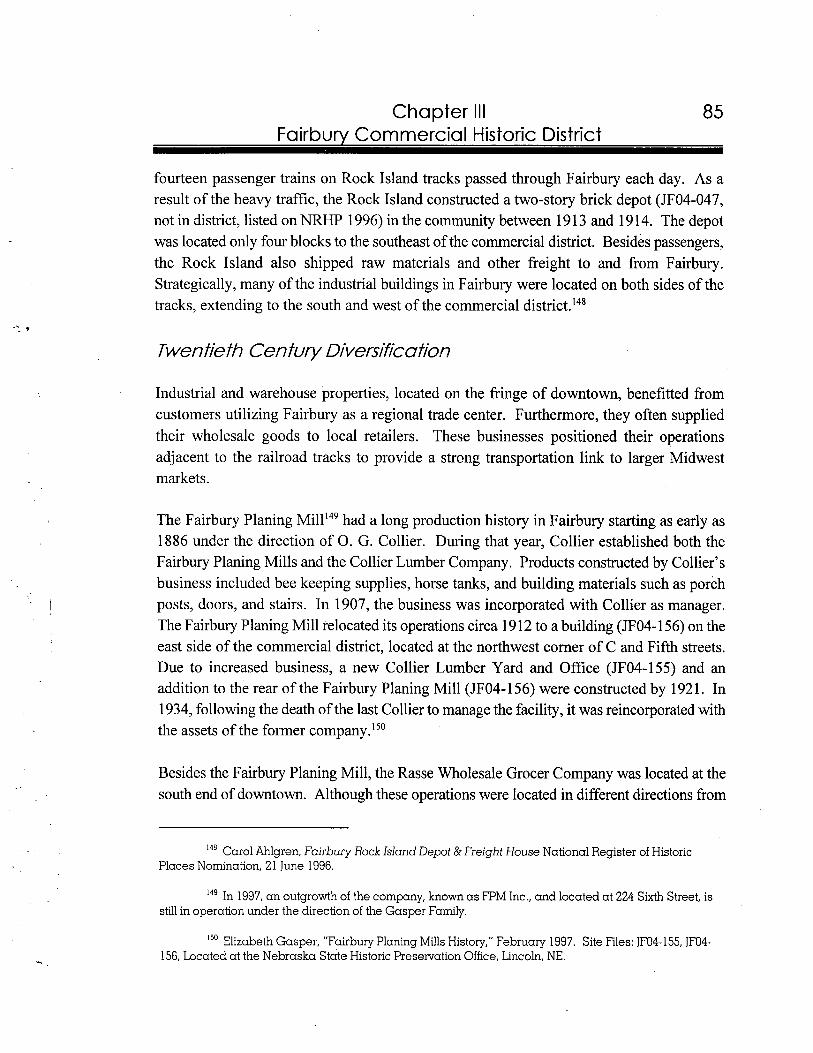
Chapter Ill Fairbury Commercial Historic District
fourteen passenger trains on Rock Island tracks passed through Fairbury each day. As a result of the heavy traffic, the Rock Island constructed a two-story brick depot (JF04-047, not in district, listed on NRHP 1996) in the community between 19 13 and 19 14. The depot was located only four blocks to the southeast of the commercial district. Besides passengers, the Rock Island also shipped raw materials and other freight to and from Fairbury. Strategically, many of the industrial buildings in Fairbury were located on both sides of the tracks, extending to the south and west of the commercial district.I4'
Twenfie fh Cenfury Diversifica fion
Industrial and warehouse properties, located on the fringe of downtown, benefitted from customers utilizing Fairbury as a regional trade center. Furthermore, they often supplied their wholesale goods to local retailers. These businesses positioned their operations adjacent to the railroad tracks to provide a strong transportation link to larger Midwest make ts.
The Fairbury Planing had a long production history in Fairbury starting as early as 1886 under the direction of 0 . G. Collier. During that year, Collier established both the Fairbury Planing Mills and the Collier Lumber Company. Products constructed by Collier's business included bee keeping supplies, horse tanks, and building materials such as porch posts, doors, and stairs. In 1907, the business was incorporated with Collier as manager. The Fairbury Planing Mill relocated its operations circa 191 2 to a building (JF04-156) on the east side of the commercial district, located at the northwest corner of C and Fifth streets. Due to increased business, a new Collier Lumber Yard and Office (JF04-155) and an addition to the rear of the Fairbury Planing Mill (JF04-156) were constructed by 1921. In 1934, following the death of the last Collier to manage the facility, it was reincorporated with the assets of the former company.150
Besides the Fairbury Planing Mill, the Rasse Wholesale Grocer Company was located at the south end of downtown. Although these operations were located in different directions from
Car01 Ahlgren, Fairbury Rock Island Depot & Freight House National Register of Historic Places Nomination, 2 1 June 1996.
149 In 1997, an outgrowth of the company, known a s FPM Inc., and located at 224 Sixth Street, is still in operation under the direction of the Gasper Family.
150 Elizabeth Gasper, "Fairbury Planing Mills History." February 1997. Site Files: JF04-155, JF04- 156, Located at the Nebraska State Historic Preservation Office, Lincoln, NE.
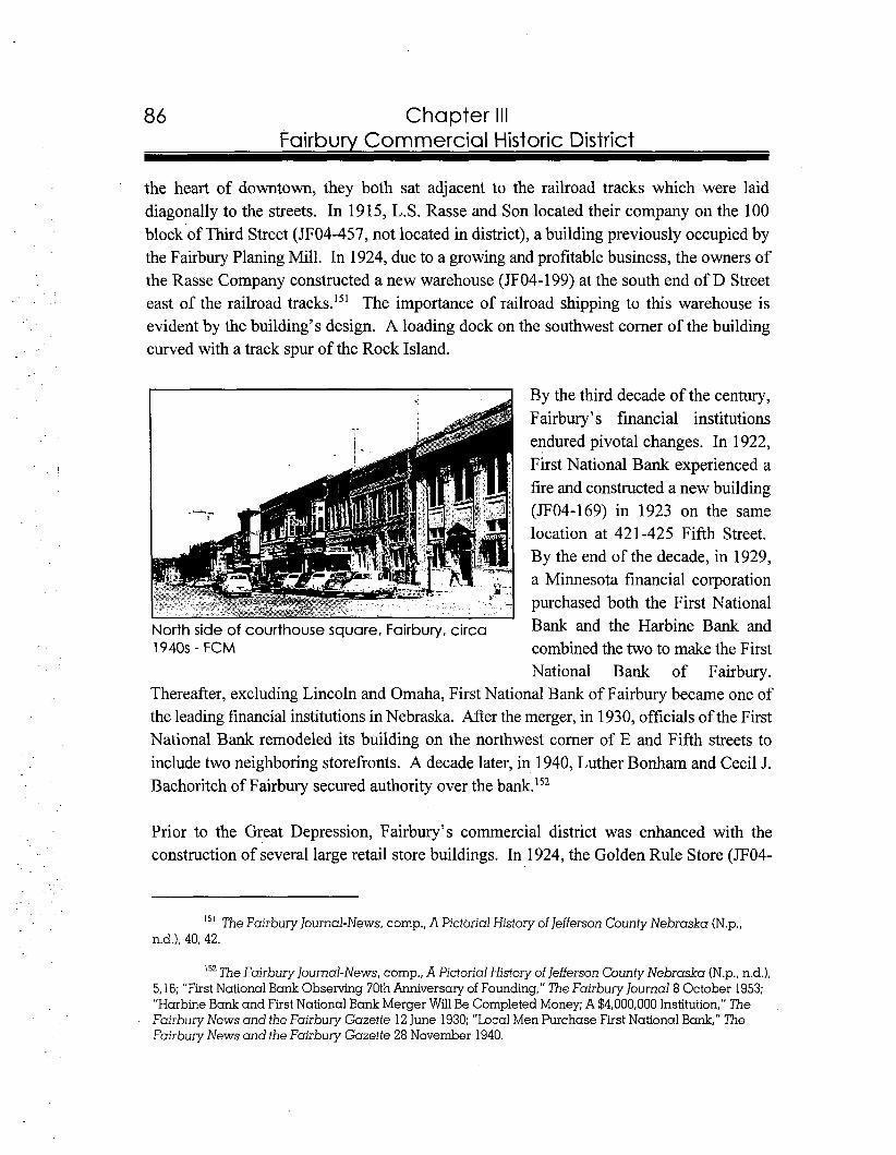
Chapter Ill Fairbury Commercial Historic District
the heart of downtown, they both sat adjacent to the railroad tracks which were laid diagonally to the streets. In 1915, L.S. Rasse and Son located their company on the 100 block of Third Street (JF04-457, not located in district), a building previously occupied by the Fairbury Planing Mill. In 1924, due to a growing and profitable business, the owners of the Rasse Company constructed a new warehouse (JF04-199) at the south end of D Street east of the railroad tracks.15' The importance of railroad shipping to this warehouse is evident by the building's design. A loading dock on the southwest corner of the building curved with a track spur of the Rock Island.
By the third decade of the century, Fairbury's financial institutions endured pivotal changes. In 1922, First National Bank experienced a fire and constructed a new building (JF04-169) in 1923 on the same location at 421-425 Fifth Street. By the end of the decade, in 1929, a Minnesota financial corporation purchased both the First National
North side of courthouse square, Fairbury, circa Bank and the Harbine Bank and 1940s - FCM combined the two to make the First
National Bank of Fairbury. Thereafter, excluding Lincoln and Omaha, First National Bank of Fairbury became one of the leading financial institutions in Nebraska. After the merger, in 1930, officials of the First National Bank remodeled its building on the northwest comer of E and Fifth streets to include two neighboring storefronts. A decade later, in 1940, Luther Bonharn and Cecil J. Bachoritch of Fairbury secured authority over the bank.'52
Prior to the Great Depression, Fairbury's commercial district was enhanced with the construction of several large retail store buildings. In 1924, the Golden Rule Store (JF04-
15' The Fairbury Journal-News, cornp., A Pictorial History of Jefferson County Nebraska (N.p., n.d.1, 40, 42.
The Fairbury Journal-News, cornp., A Pictorial History of Jefferson County Nebraska (N.p., n.d.), 5.16; "First National Bank Observing 70th Anniversary of Founding," The Fairbury Journal 8 October 1953; "Harbine Bank and First National Bank Merger WillBe Completed Money; A $4,000,000 Institution," The Fairbury News and the Fairbury Gazette 12 June 1930; "Local Men Purchase First National Bank," The Fairbury News and the Fairbury Gazette 28 November 1940.
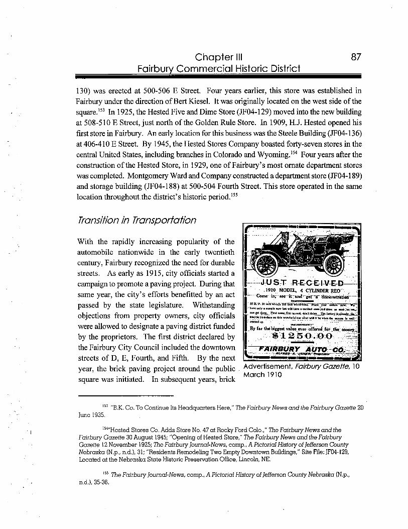
87 Chapter Ill Fairbury Commercial Historic District
130) was erected at 500-506 E Street. Four years earlier, this store was established in Fairbury under the direction of Bert Kiesel. It was originally located on the west side of the square.Is3 In 1925, the Hested Five and Dime Store (JF04-129) moved into the new building at 508-5 10 E Street, just north of the Golden Rule Store. In 1909, H.J. Hested opened his first store in Fairbury. An early location for this business was the Steele Building (JF04-136) at 406-410 E Street. By 1945, the Hested Stores Company boasted forty-seven stores in the central United States, including branches in Colorado and W y ~ m i n g . ' ~ ~ Four years after the construction of the Hested Store, in 1929, one of Fairbury's most ornate department stores was completed. Montgomery Ward and Company constructed a department store (JFO4- 189) and storage building (JF04-188) at 500-504 Fourth Street. This store operated in the same location throughout the district's historic period.155
Transition in Transporfa fion
With the rapidly increasing popularity of the automobile nationwide in the early twentieth century, Fairbury recognized the need for durable streets. As early as 19 15, city officials started a campaign to promote a paving project. During that same year, the city's efforts benefitted by an act passed by the state legislature. Withstanding objections from property owners, city officials were allowed to designate a paving district funded by the proprietors. The first district declared by the Fairbury City Council included the downtown streets of D, E, Fourth, and Fifth. By the next year, the brick paving project around the public ,dvertisement, Fakbury Gazette, 10
llarch 1910square was initiated. In subsequent years, brick
Is3 "B.K. Co. To Continue Its Headquarters Here," The Fairbury News and the Fairbury Gazette 20 June 1935.
Is4"Hested Stores Co. Adds Store No. 47 at Rocky Ford Colo.," The Fairbury News and the Fairbury Gazette 30 August 1945; "Opening of Hested Store," The Fairbury News and the Fairbury Gazette 12 November 1925; The Fairbury Journal-News, comp., A Pictorial History of Jefferson County Nebraska (N.p., n.d.1, 3 1; "Residents Remodeling Two Empty Downtown Buildings," Site File: JF04-129, Located at the Nebraska State Historic Preservation Office, Lincoln, NE.
The Fairbury Journal-News, cornp., A Pictorial History of Jefferson County Nebraska (N.p., n.d.), 35-36.

88 Chapter Ill Fairbury Commercial Historic District
pavers (JF04-523) eventually extended north to Fourteenth Street; east to L Street; south to Second Street; and west to the City Park. In 1997, the brick pavers (JF04-523) cover every street in the district and contribute to the historical character of the downtown.'56
The automobile industry also impacted the types and styles of buildings in downtown Fairbury. Prompted by travelers as well as local residents, garage and service station owners constructed new buildings for their establishments. However, in some instances, implement stores, livery stables, and blacksmith shops were convertedAutos in Fairburv, circa 1910 - FCM into auto-related businecses tc
accommodate the changing needs of technology. The 192 1 Sanborn Map displayed seven garages, three tire repair shops, one auto transfer store, one auto top repairing shop, and a battery station in the district boundaries. Three garages, with a total capacity of seventy-five cars, provided service on Fifth Street within a block from the public square. Included in the list were the circa 192 1 C.G. Catlin Company Garage (JFO4- 16 1) at 3 1 1-3 15 Fifth Street; the 191 5 Juhnke and Bell Garage (JF04-148; JF04-171) at 519-521 Fifth Street; and the 1910 Holtz and Lewis Machine Shop and Garage (JF04-174) at 524 Fifth Street. Two garages were also located at the south end of downtown, near the tracks. A twenty-car capacity garage (JF04-144), built circa 1896 at 302 E Street, had been converted from an implement store. Across the alley to the east, sat another twenty-car capacity garage (JF04-145), which had originally served as the circa 19 10 Ellsworth Livery Barn.15'
Throughout the late 1920s and 1930s, automobile related-businesses continued to be one of the most predominant building types constructed in the district. Based upon the 1931 Sanborn Map, approximately ten garages, three filling stations, two auto repair shops, one tire shop, one auto tire and service station, and one auto sales and service business operated
'56 ' "HOWPavements Pay Dividends," The Fairbury News and the Fairbury Gazette 13May 19 15; "Paving Ordinance," The Fairbury News and the Fairbury Gazette 3 June 19 15; Estaline Carpenter, comp., Friendly Fairbury: A History of Fairbury, Nebraska (Fairbury, NE: Jefferson County Historical Society, 1981), 13.
'57 Sanborn Fire Insurance Company, Sanborn-Perris Fire Insurance Map of Fairbury, Nebraska (New York: Sanborn Fire Insurance Co., 1921).
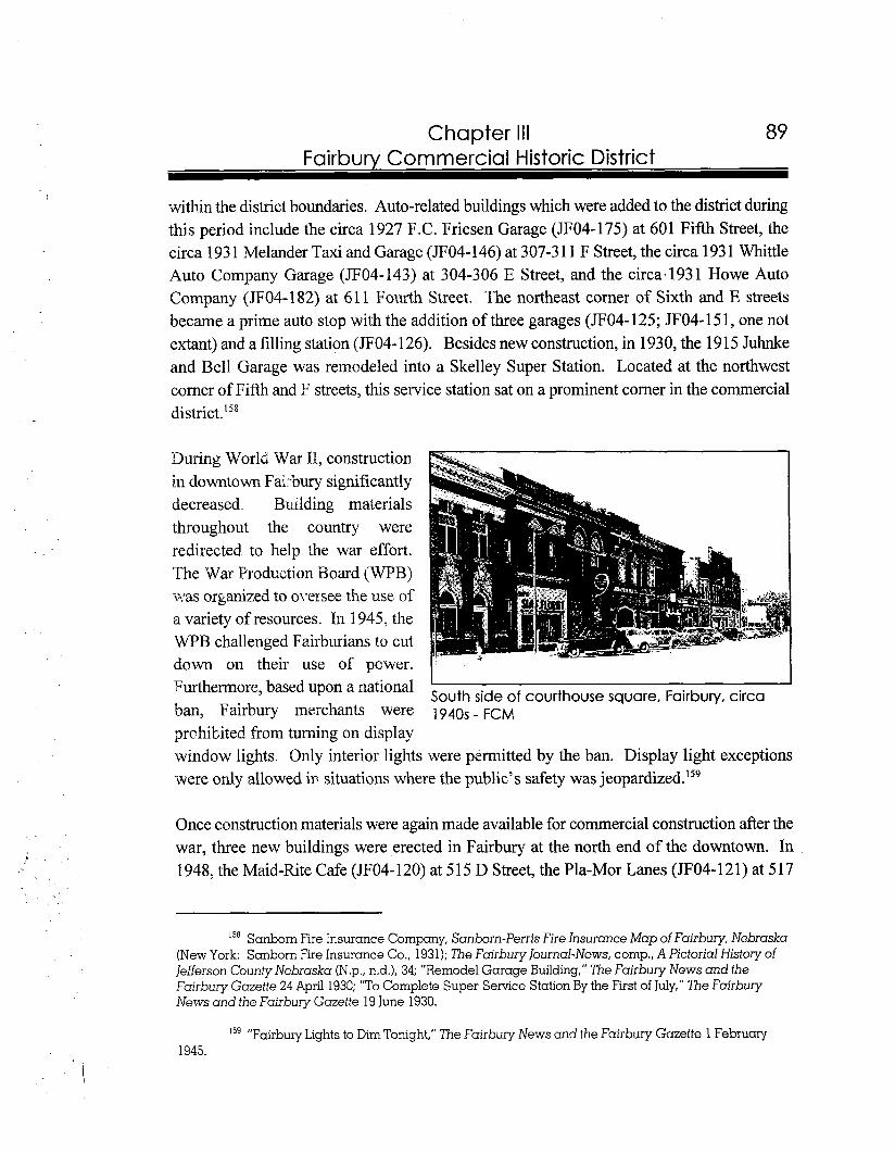
Chapter Ill Fairburv Commercial Historic District
within the district boundaries. Auto-related buildings which were added to the district during this period include the circa 1927 F.C. Friesen Garage (JF04-175) at 601 Fifth Street, the circa 193 1 Melander Taxi and Garage (JFO4- 146) at 307-3 1 1 F Street, the circa 1 931 Whittle Auto Company Garage (JF04-143) at 304-306 E Street, and the circa.1931 Howe Auto Company (JF04-182) at 61 1 Fourth Street. The northeast corner of Sixth and E streets became a prime auto stop with the addition of three garages (JF04- 125; JF04-15 1, one not extant) and a filling station (JFO4- 126). Besides new construction, in 1930, the 19 1 5 Juhnke and Bell Garage was remodeled into a Skelley Super Station. Located at the northwest corner of Fifth and F streets, this service station sat on a prominent corner in the commercial
During World War 11, construction in downtown Fairbury significantly decreased. Building materials throughout the country were redirected to help the war effort. The War Production Board (WPB) was organized to oyersee the use of a variety of resources. In 1 945, the WPB challenged Fairburians to cut down on their use of power. Furthermore, based upon a national I
South side of courthouse square, Fairbury, circa ban, Fairbury merchants were 1940s - FCM prohibited from turning on display window lights. Only interior lights were permitted by the ban. Display light exceptions were only allowed in situations where the public's safety was jeopardized.Is9
Once construction materials were again made available for commercial construction after the war, three new buildings were erected in Fairbury at the north end of the downtown. In 1948, the Maid-Rite Cafe (JF04- 120) at 515 D Street, the Pla-Mor Lanes (JFO4- 12 1) at 517
15' Sanborn Fire Insurance Company, Sanborn-Perris Fire Insurance Map of Fairbury, Nebraska (New York: Sanborn Fire Insurance Co., 1931); The Fairburylournal-News, comp., A Pictorial History of Jefferson County Nebraska (N.p., n.d.), 34; "Remodel Garage Building," 7he Fairbury News and the Fairbury Gazette 24 April 1930; "To Complete Super Senrice Station By the First of July," The Fairbury News and the Fairbury Gazette 19 June 1930.
15' "Fairbury Lights to Dim Tonight," The Fairbury News and the Fairbury Gazette 1 February 1945.
90 Chapter Ill Fairbury Commercial Historic District
D Street, and the E.C. Trindel Station (JF04-283) at 523 D Street were added to the downtown. These buildings add an important historical component to the district regarding the atmosphere of construction in the 1940s. The construction styles and integrity of these buildings, as well as their placement within the downtown visually blends them into the overall character of the district. Despite being seven months short of the fifty year old age criteria, their location, design, setting, materials, workmanship, and feeling contribute to the architectural and historical significance of the Fairbury Commercial Historic District.
At the end of World War 11, the railroad industry began experiencing a decrease in passenger traffic. Two decades later, the Rock Island Western Division Headquarters pulled out of Fairbury. By 1980, the Rock Island stopped servicing Fairbury entirely. During these declining years, the population of the city mirrored the railroad activity.I6O Due to its changing status, commercial construction in Fairbury also declined. Thus, only eight percent of buildings in the district were constructed or significantly remodeled outside the historic period.
The Fairbury Commercial Historic District physically represents a strong commercial history dating back to the early 1870s. By the next decade, one of the most significant impacts to the downtown was the designation of Fairbury by the Rock Island Railroad as a western division point. By the turn of the century, every lot around the public square was filled with prospering businesses. This physical sign of prosperity confirmed Fairbury's role as a regional trade center. Fairbury's economy continued to grow during the first three decades of the twentieth century. Adapting to the changing needs of its clientele, the downtown underwent a transition with the construction of large retail stores and automobile-related businesses by the 1920s. The general historical overview of Fairbury provides a clear understanding of the significance of the downtown to the region. Specific building and business examples cited in this narrative substantiate the impact of retail, banking, communication, industrial and warehouse operations, as well as the automobile industry on Fairbury. Although Fairbury no longer serves as a railroad division point, it still functions as a trade center for area residents. In 1997, a majority of the commercial buildings in downtown Fairbury, which exhibit high physical integrity, are still occupied by businesses. As a result, a bustle of activity continues to occur around the courthouse square.
'60 Carol Ahlgren, Fairbury Rock Island Depot & Freight House National Register of Historic Places Nomination, 21 June 1996.
Chapter Ill Fairbury Commercial Historic District
Architectural Development of the Fairbury Commercial Historic District
The Fairbury Commercial Historic District encompasses an area spanning approximately ten blocks and 117 properties, contains ninety-seven (97) contributing and twenty (20) noncontributing properties. The district is abutted by residential buildings on the east and north sides and railroad tracks to the south and west. These railroad tracks serve as a distinct visual boundary for the district, since they were so critical to the exact location of the downtown and the businesses located within it. Thoroughfares in the district include the east- west streets designated as Third, Fourth, Fifth, and Sixth and the north-south streets named C, D, E, and F. Virtually every street within the boundaries of the historic district are paved with brick, which were constructed circa 191 6. The district is distinguished by the prominent courthouse square, where the architecturally and historically significant Jefferson County Courthouse sits, between Fourth, Fifth, D, and E streets. The oldest buildings in the district are located around the courthouse square.
Many of the commercial buildings in the Fairbury Commercial Historic District are extremely intact. They retain their original form and ornamentation, particularly in the upper stories. Often, the storefronts and interiors have been altered to accommodate changing businesses. The general appearance of the district displays high integrity and very densely placed historic properties. The modern in-fill in the district totals no more than two buildings per face block.
The Fairbury Commercial Historic District represents a span of architectural periods ranging from the oldest extant, late nineteenth century building displaying false-front construction through turn-of-the-century high styles, to more modem influenced properties. The buildings in the district represent architectural development trends typical of Nebraska commercial centers. Fine representatives of Italianate, Romanesque Revival, Queen Anne, Late Gothic Revival, Neo-Classical Revival, Spanish Colonial Revival, and twentieth century commercial vernacular architectural styles and forms are located within the district. With the exception of the fringe blocks, the buildings within the district are densely packed, and consist mostly of two-story brick commercial buildings interspersed with several one-story buildings and one, three-story example. The largest amount of construction in the district during the period of significance (1 873 to 1947) took place between 1900 and 1929.
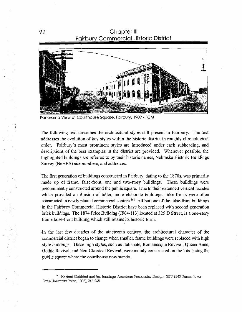
92 Chapter I l l Fairburv Commercial Historic District
Panorama View of Courthouse Square, Fairbury, 1909 - FCM
The following text describes the architectural styles still present in Fairbury. The text addresses the evolution of key styles within the historic district in roughly chronological order. Fairbury's most prominent styles are introduced under each subheading, and descriptions of the best examples in the district are provided. Whenever possible, the highlighted buildings are referred to by their historic names, Nebraska Historic Buildings Survey (NeHBS) site numbers, and addresses.
The first generation of buildings constructed in Fairbury, dating to the 1870s, was primarily made up of frame, false-front, one and two-story buildings. These buildings were predominantly constructed around the public square. Due to their extended vertical facades which provided an illusion of taller, more elaborate buildings, false-fronts were often constructed in newly platted commercial centers.16' All but one of the false-front buildings in the Fairbury Commercial Historic District have been replaced with second generation brick buildings. The 1874 Price Building (JF04-113) located at 325 D Street, is a one-story frame false-front building which still retains its historic form.
In the last few decades of the nineteenth century, the architectural character of the commercial district began to change when smaller, frame buildings were replaced with high style buildings. These high styles, such as Italianate, Romanesque Revival, Queen Anne, Gothic Revival, and Neo-Classical Revival, were mainly constructed on the lots facing the public square where the courthouse now stands.
Herbert Gottfried and Jan Jennings, American Vernacular Design, 1870-1940 (Ames: I o w ~ State University Press, 1988), 244-245.
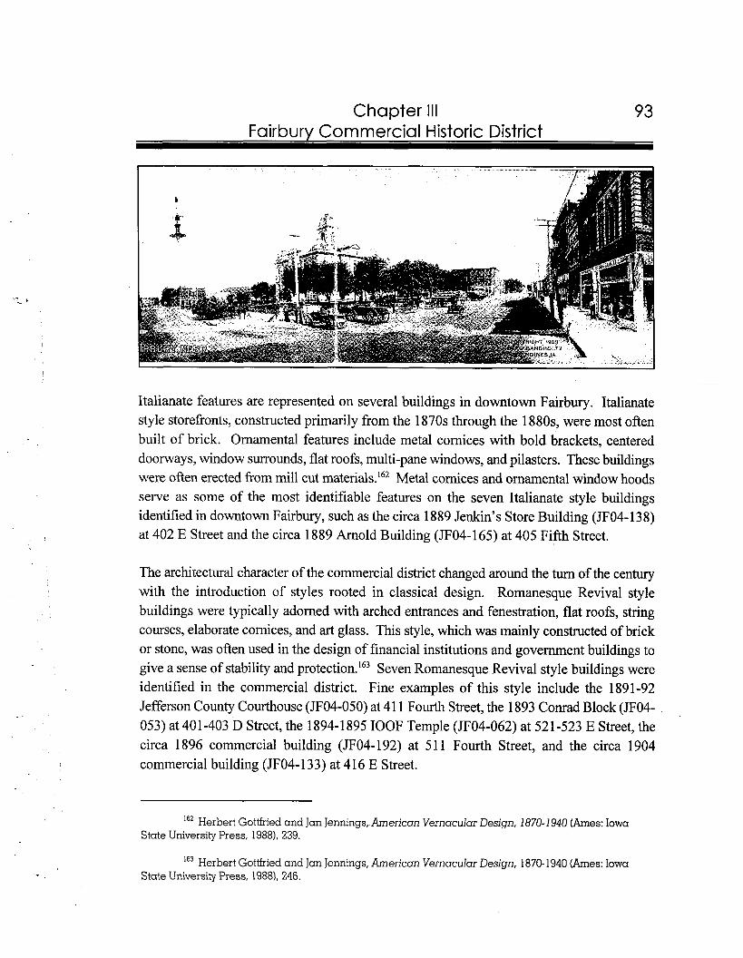
93 Chapter Ill Fairbury Commercial Historic District
Italianate features are represented on several buildings in downtown Fairbury. Italianate style storefronts, constructed primarily from the 1870s through the 1880s, were most often built of brick. Ornamental features include metal cornices with bold brackets, centered doorways, window surrounds, flat roofs, multi-pane windows, and pilasters. These buildings were often erected from mill cut materials.16* Metal cornices and ornamental window hoods serve as some of the most identifiable features on the seven Italianate style buildings identified in downtown Fairbury, such as the circa 1 889 Jenkin's Store Building (JFO4- 1 3 8) at 402 E Street and the circa 1889 Arnold Building (JF04-165) at 405 Fifth Street.
The architectural character of the commercial district changed around the turn of the century with the introduction of styles rooted in classical design. Romanesque Revival style buildings were typically adorned with arched entrances and fenestration, flat roofs, string courses, elaborate cornices, and art glass. This style, which was mainly constructed of brick or stone, was often used in the design of financial institutions and government buildings to give a sense of stability and pr~tect ion. '~~ Seven Romanesque Revival style buildings were identified in the commercial district. Fine examples of this style include the 1891-92 Jefferson County Courthouse (JF04-050) at 4 1 1 Fourth Street, the 1893 Conrad Block (JF04- 053) at 401-403 D Street, the 1894-1 895 IOOF Temple (JF04-062) at 52 1-523 E Street, the circa 1896 commercial building (JF04-192) at 51 1 Fourth Street, and the circa 1904 commercial building (JFO4- 133) at 4 16 E Street.
Herbert Gottfried and Jan Jennings, American Vernacular Design, i8i'O-i94O (Ames: Iowa State University Press, 19881, 239.
163 Herbert Gottfried and Jan Jennings, American Vernacular Design, 1870-1940 (Ames: Iowa State University Press, 19881, 246.
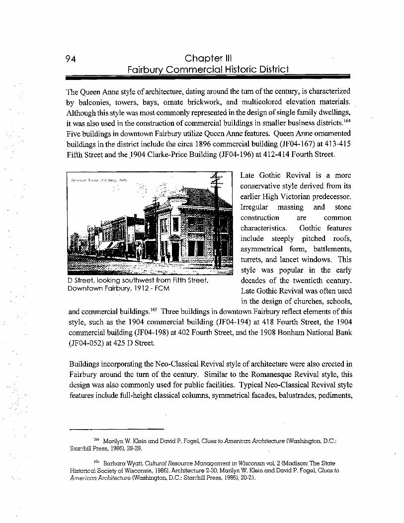
Chapter Ill Fairbury Commercial Historic District
The Queen Anne style of architecture, dating around the turn of the century, is characterized by balconies, towers, bays, ornate brickwork, and multicolored elevation materials. Although this style was most commonly represented in the design of single family dwellings, it was also used in the construction of commercial buildings in smaller business district^.'^^ Five buildings in downtown Fairbury utilize Queen Anne features. Queen Anne ornamented buildings in the district include the circa 1896 commercial building (JF04-167) at 413-41 5 Fifth Street and the 1904 Clarke-Price Building (JFO4- 196) at 4 12-4 14 Fourth Street.
Late Gothic Revival is a more conservative style derived from its earlier High Victorian predecessor. Irregular massing and stone construction are common characteristics. Gothic features include steeply pitched roofs, asymmetrical form, battlements, turrets, and lancet windows. This style was popular in the early
D Street, looking southwest from Fifth Street, decades of the twentieth century. Downtown Fairbury, 1912 - FCM Late Gothic Revival was often used
in the design of churches, schools, and commercial b~i1dings.l~~ Three buildings in downtown Fairbury reflect elements of this style, such as the 1904 commercial building (JF04-194) at 41 8 Fourth Street, the 1904 commercial building (JF04-198) at 402 Fourth Street, and the 1908 Bonham National Bank (JF04-052) at 425 D Street.
Buildings incorporating the Neo-Classical Revival style of architecture were also erected in Fairbury around the turn of the century. Similar to the Romanesque Revival style, this design was also commonly used for public facilities. Typical Neo-Classical Revival style features include full-height classical columns, symmetrical facades, balustrades, pediments,
I" Marilyn W. Klein and David P. Fogel, Clues to American Architecture (Washington, D.C.: Starrhill Press, 1986). 28-29.
'65 Barbara Wyatt, Cultural Resource Management in Wisconsin vol, 2 (Madison: The State Historical Society of Wisconsin, 19861, Architecture 2-30; Marilyn W. Klein and David P. Fogel, Clues to American Architecture (Washington, D.C.: Starrhill Press, 19861, 20-21.
Chapter Ill Fairbury Commercial Historic District
and ornate Neo-Classical Revival style details on the Fairbury buildings include elaborate cornices, pedimented doorways, rusticated first floor materials, and classical columns. In the Fairbury commercial district, five buildings display Neo-Classical Revival characteristics. The 1904 Harbine Bank (JF04-057) at 422 Fourth Street and the 19 10- 19 12 Fairbury Post Office (JF04-05 1) at 503 D Street stand as fine representative examples of the Neo-Classical Revival style.
Spanish Colonial Revival style, constructed in the 1920s in Fairbury, is characterized by red tile roofs, arched openings, cornices, and parapets. Exterior materials include brick, terra cotta, and TWO buildings in Fairbury's downtown display this style, such as the 1926 Bonham Theater (JF04-063) at 5 19 E Street and the 1929 Montgomery Wards Store and Storage Facility (JF04-189; JF04-188), located at 500-504 Fourth Street.
Twentieth century commercial vernacular design was widely used in the early decades of the 1900s. Since this period paralleled the highest commercial construction in Fairbury's downtown, a large number of buildings on the periphery of the square display this form. Twentieth century commercial vernacular forms generally exhibit rectangular-shaped elevations. Variations on the exteriors of this building form are exhibited in fenestration, materials, and affixed ornamentation. Common features found on these buildings include brick construction, large plate glass windows on the first floor, decorative cornices, corbeling, pilasters, belt and string courses, and transoms. When erected in a row, these buildings often share common walls.16' An array of examples of twentieth century commercial vernacular designed buildings include the 1903 Steele Opera House (JF04-065) at 404 Fourth Street, the 1929 H.A. Richardson Building (JFO4- 1 19) at 505-5 13 D Street, and the 189011935 GAR HallIAmerican Legion Lodge (JF04-159) at 302 Fifth Street.
Modern broad-front buildings, often built on the border streets of a downtown, were later commercial vernacular additions to the district. This form consists of a wide storefront
166 John J.G. Blumenson, ldentifying American Architecture (Nashville, TN:American Association for State and Local History, 1981), 68-69; Virginia and Lee McAlester, A Field Guide to American Houses (New York: Alfred A. Knopf, Inc., 1984). 342-345.
167 John J.G. Blumenson, Identifying American Architecture (Nashville, TN:American Association for Stgie and Local History, 19811, 8-9; Marilyn W. Klein and David P. Fogel, Clues to American Architecture (Washington, D.C.: Starrhill Press, 1986), 49.
Herbert Gottfried and Jan Jennings, American Vernacular Design, 1870-1940 (Ames: Iowa State University Press, 19881, 240-241.
Chapter Ill Fairburv Commercial Historic District
braced with steel supports. The front elevations on these one-story buildings usually display two end piers, plate glass windows divided by thin mullions, transoms, and terra cotta ~ a n e 1 s . I ~ ~Since this architectural form was conducive to the needs of the automobile industry, it was often used in the design of automobile dealerships and service stations. Several garages in Fairbury display the modem broad-front form such as the 191 5 Friesen and Company Garage (JF04-183) at 601 Fourth Street and the circa 1931 Whittle Auto Company Garage (JF04-143) at 304-306 E Street.
At approximately the same time Fairbury's downtown began to reflect modem architectural styles for automobile-related property types, the streets took on a more modem appearance as well. In 191 5, city officials initiated a funding program to pave the city streets with brick pavers. The laying of red brick pavement (JF04-523) began in the downtown the following year. The brick pavers are made of a hard, red brick which was specifically designed for the construction of roads. They were laid by hand, side-by-side, spanning to curbs on both sides of the streets. At street intersections, the pavers were laid diagonally. The brick streets continue--to the present (1997)--to add to the architectural character of the Fairbury Commercial Historic District with very high integrity, as they cover all streets within the district.
In conclusion, the Fairbury Commercial Historic District is representative of architectural styles utilized in the evolution of a typical Nebraska regional trade center. This district exhibits densely placed historic buildings, displaying high integrity. Furthermore, the brick pavement, which fills virtually all of the district's thoroughfares, contributes to the architectural cohesiveness of the downtown area. Commercial trends in the district are represented by styles and property types found in typical Nebraska business districts. The period of significance of the district, which dates between 1873 and 1947, is supported by Fairbury's location along two major railroad lines. The growth and prosperity of Fairbury are represented by an abundance of early high style commercial buildings such as Italianate, Romanesque Revival, Queen Anne, Late Gothic Revival, and Neo-Classical Revival.
The district exhibits a healthy construction atmosphere throughout the first four decades of the twentieth century, and retains a significant number of these buildings. Between 1900 and 1929, a total of sixty-four buildings were constructed. These properties comprise fifty-five percent of the buildings in the district. One of the strongest construction periods occurred
'13' Herbert Gottfried and JanJennings, American Vernacular Design, 1870-1940 (Ames: Iowa State University Press, 1988), 249.
97 Chapter Ill Fairbury Commercial Historic District
during the l92Os, with the construction of twenty-five buildings. After World War 11, the business district began to reflect the slow decline of the Rock Island Railroad until it pulled out of Fairbury completely in 1980. Furthermore, the development of the commercial hub was slowed by the establishment of a strip mall on the northeastern edge of the community. However, the Fairbury commercial district has withstood these setbacks. In 1997, with well- maintained commercial buildings, thoroughfares, and sidewalks, Fairbury's commercial center is prospering with a variety of specialty shops, offices, restaurants, and even a movie theater.
Survey Results of the Fairbury Commercial Historic District
The boundary for the Fairbury Commercial Historic District was selected based upon continuity and concentration of historically intact buildings. The proposed boundary covers approximately ten blocks. An entire block in the central portion of the district exhibits the county courthouse. Thoroughfares in the district included the east-west streets designated Third, Fourth, Fifth, and
Sixth and the north-south streets named C, D, E, and F.
For a property to be considered eligible for the National Register of Historic Places, high physical integrity (of exterior features) such as fenestration, doorways, ornamental detailing, materials, and form, is necessary. In the case of a two or more story building, the first floor can display modern signage and fenestration, however, the upper stories must be primarily intact. Furthermore, all contributing buildings in the district generally must meet the fifty- year age requirement. Based upon telephone interviews, secondary sources, city directories, Sanborn Maps, and newspaper articles, either exact or at least circa construction dates were determined for each property. These dates were utilized to understand boom periods of commercial construction in Fairbury, as well as subsequent alteration to individual buildings. This information, along with the integrity of each building, provided the necessary data needed to determine whether a building was contributing or not to the architectural and historical character of the district."'
For definitions of "contributing" and noncontributing" a s the terms relate to National Register properties, see Appendix B.
98 Chapter Ill Fairbury Commercial Historic District
Within the boundaries of the proposed district, 1 17 properties were analyzed. Ninety-seven of these properties were considered contributing to the district, and the remaining twenty were labeled as non-contributing. Eighty-three percent of the buildings in the district are contributing, thus, the downtown of Fairbury retains an excellent ratio of architecturally significant buildings.
In conclusion, Fairbury's downtown, which exhibits a cohesive fabric, is a flourishing commercial hub. Buildings located in the district continue to thrive economically, as well as house a variety of businesses. This nomination is the first of a number of possible steps that Fairbury residents may take to preserve and promote commercial historic properties. Besides the nomination, residents can pursue several other methods to enhance preservation in the community. Several ideas are listed as follows:
As stated in Chapter I- Introduction in this report, Fairbury can form a local historic sites commission and seek Certified Local Government (CLG) status. Under the authority of the historic sites commission, the downtown could also be listed as a local historic district.
The community of Fairbury can adopt a historic preservation plan to guide the future of preservation activity in the city.
Fairbury can apply for status as a Main Street community through the Nebraska Lied Main Street program, allowing the downtown organization to apply for assistance in economic revitalization, as well as renovation of historic properties.
National Register status allows owners of contributing, income-producing buildings to take advantage of a twenty percent federal tax credit for many kinds of renovations.
- For more information regarding the above activities, please contact the Nebraska State Historic Preservation Office (NeSHPO) in Lincoln, Nebraska.
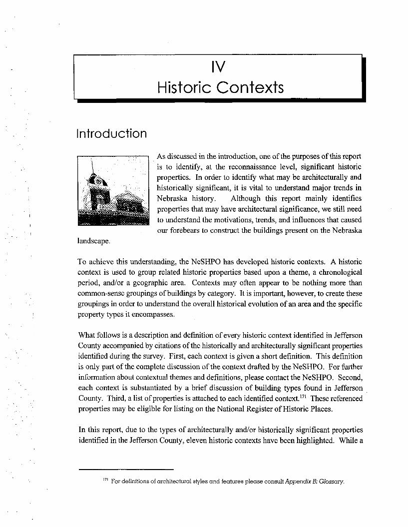
Historic Contexts
Introduction
As discussed in the introduction, one of the purposes of this report is to identify, at the reconnaissance level, significant historic properties. In order to identify what may be architecturally and historically significant, it is vital to understand major trends in Nebraska history. Although this report mainly identifies properties that may have architectural significance, we still need to understand the motivations, trends, and influences that caused our forebears to construct the buildings present on the Nebraska
landscape.
To achieve this understanding, the NeSHPO has developed historic contexts. A historic context is used to group related historic properties based upon a theme, a chronological period, and/or a geographic area. Contexts may often appear to be nothing more than common-sense groupings of buildings by category. It is important, however, to create these groupings in order to understand the overall historical evolution of an area and the specific property types it encompasses.
What follows is a description and definition of every historic context identified in Jefferson County accompanied by citations of the historically and architecturally significant properties identified during the survey. First, each context is given a short definition. This definition is only part of the complete discussion of the context drafted by the NeSHPO. For further information about contextual themes and definitions, please contact the NeSHPO. Second, each context is substantiated by a brief discussion of building types found in Jefferson County. Third, a list of properties is attached to each identified context."' These referenced properties may be eligible for listing on the National Register of Historic Places.
In this report, due to the types of architecturally and/or historically significant properties identified in the Jefferson County, eleven historic contexts have been highlighted. While a
17' For definitions of architectural styles and features please consult Appendix B: Glossary.

Chapter IV
total number of 1,028 properties were surveyed in Jefferson County, forty-nine (49)'72 have been identified as individually eligible for listing on the National Register, while another eleven have already been individually listed. Additionally, two districts in Jefferson County have been listed on the National Register: the Steele City Historic District (1972); and the Fairbury Commercial Historic District (1 997).
A majority of the information regarding vernacular construction is based upon Herbert Gottfiied and Jan Jennings' American Vernacular Design: 1870-1940. Other sources utilized in this chapter regarding the architectural development of Jefferson County include Virginia and Lee McAlesterYs A Field Guide to American Houses, John J.G. Blumenson's Identzfiing American Architecture, and Clues to American Architecture by Marilyn W.Klein and David P. Fogle.
The following buildings were emphasized because they have been determined as potentially eligible for the National Register of Historic Places. Under the National Register criteria, a building, site, structure, object, or district can be significant at the national, state andlor local level under the categories of historical significance; significance for association with a person; architectural, engineering or artistic significance; and/or significance due to its potential to yield further information (generally used for archaeological sites.)
Each property listed under a historic context is accompanied by a site number, historic name (if known), architectural style, construction date, address, and community. For complete definitions of architectural styles and features please consult Appendix B: Glossary. The table below has been included to provide the reader with an understanding of address abbreviations.
I ES I East Side I WS West Side
I NS I North Side
I
SS South Side
1 NEC I North East Corner 1 SEC South East Corner
I NWC 1I
North West Corner I
172 In addition to the forty-nine eligible properties, buildings within the boundaries of the Fairbury Commercial Historic District which would be individually eligible are also highlighted in this section.
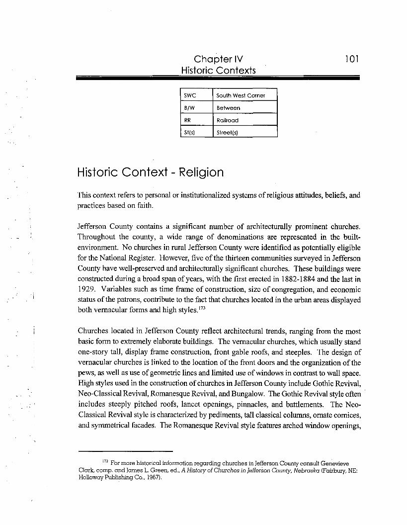
Chapter IV 101 Historic Contexts
( SWC I South West Corner 1 B/W Between
I Railroad
Historic Context - Religion
This context refers to personal or institutionalized systems of religious attitudes, beliefs, and practices based on faith.
Jefferson County contains a significant number of architecturally prominent churches. Throughout the county, a wide range of denominations are represented in the built- environment. No churches in rural Jefferson County were identified as potentially eligible for the National Register. However, five of the thirteen communities surveyed in Jefferson County have well-preserved and architecturally significant churches. These buildings were constructed during a broad span of years, with the first erected in 1882-1884 and the last in 1929. Variables such as time frame of construction, size of congregation, and economic status of the patrons, contribute to the fact that churches located in the urban areas displayed both vernacular forms and high ~ty1es . I~~
Churches located in Jefferson County reflect architectural trends, ranging from the most basic form to extremely elaborate buildings. The vernacular churches, which usually stand one-story tall, display frame construction, front gable roofs, and steeples. The design of vernacular churches is linked to the location of the front doors and the organization of the pews, as well as use of geometric lines and limited use of windows in contrast to wall space. High styles used in the construction of churches in Jefferson County include Gothic Revival, Neo-Classical Revival, Romanesque Revival, and Bungalow. The Gothic Revival style often includes steeply pitched roofs, lancet openings, pinnacles, and battlements. The Neo- classical Revival style is characterized by pediments, tall classical columns, ornate cornices, and symmetrical facades. The Romanesque Revival style features arched window openings,
173 For more historical information regarding churches in Jefferson County consult ~enevieve Clark, comp. and James L. Green, ed., A History of Churches in Jefferson County, Nebraska (Fairbury, NE: Hollowcry Publishing Co., 1967).
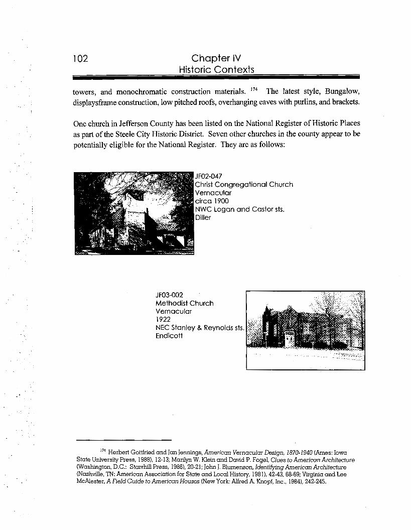
Chapter IV Historic Contexts
towers, and monochromatic construction materials. '74 The latest style, Bungalow, displaysframe construction, low pitched roofs, overhanging eaves with purlins, and brackets.
One church in Jefferson County has been listed on the National Register of Historic Places as part of the Steele City Historic District. Seven other churches in the county appear to be potentially eligible for the National Register. They are as follows:
JF02-047 Christ Congregational Church Vernacular circa 1900 NWC Logan and Castor sts. Diller
Methodist Church Vernacular I 1922 NEC Stanley & Reynolds sts. Endicott
174 Herbert Gottfried and Jan Jennings, American Vernacular Design, 1870-1940 (Ames: Iowa State University Press, 1988), 12-13; Marilyn W. Klein and David P. Fogel, Clues to American Architecture (Washington, D.C.: Starrhill Press, 1986), 20-21; John J. Blumenson, Identifymg American Architecture (Nashville,TN: American Association for State and Local History, 198 1), 42-43, 68-69; Virginia and Lee McAlester, A Field Guide to American Houses (New York: Alfred A. Knopf, Inc., 1984), 242-245.
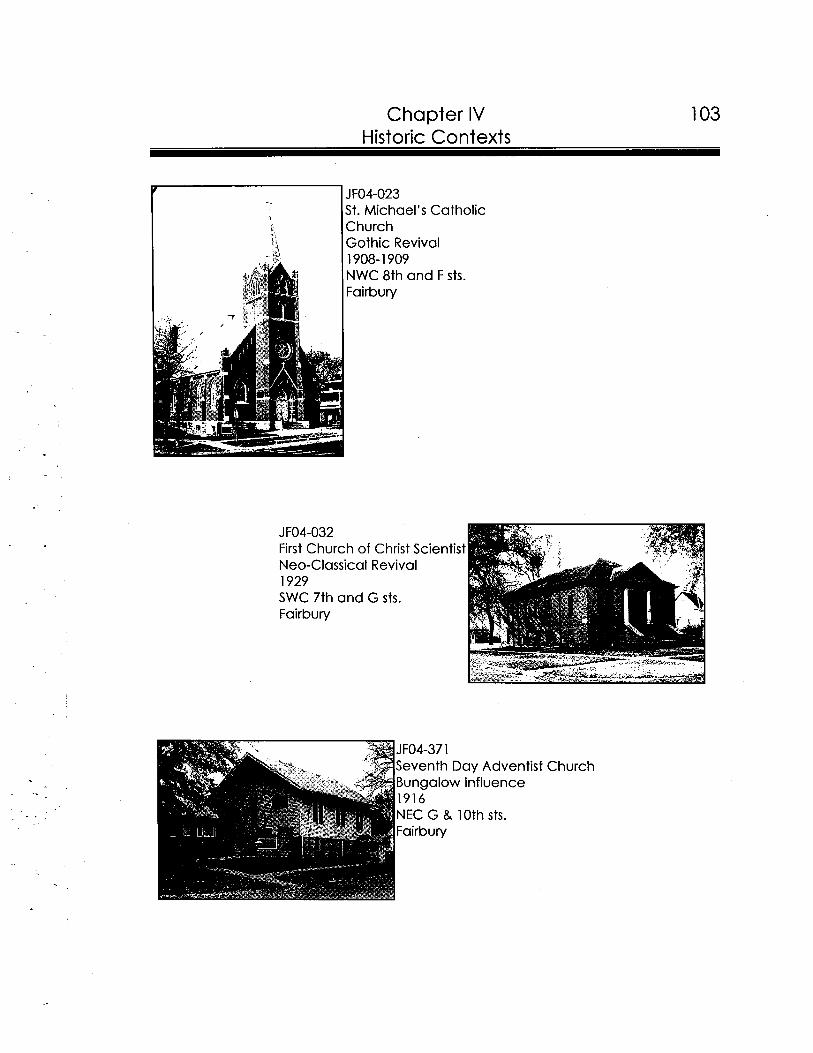
--
Chapter IV 103 Historic Contexts
St. Michael's Catholic I IChurch
Gothic Revival - 4I I< A I 1908-1 909
JF04-032 First Church of Christ Scientist Neo-Classical Revival 1929 SWC 7th and G sts. Fairbury
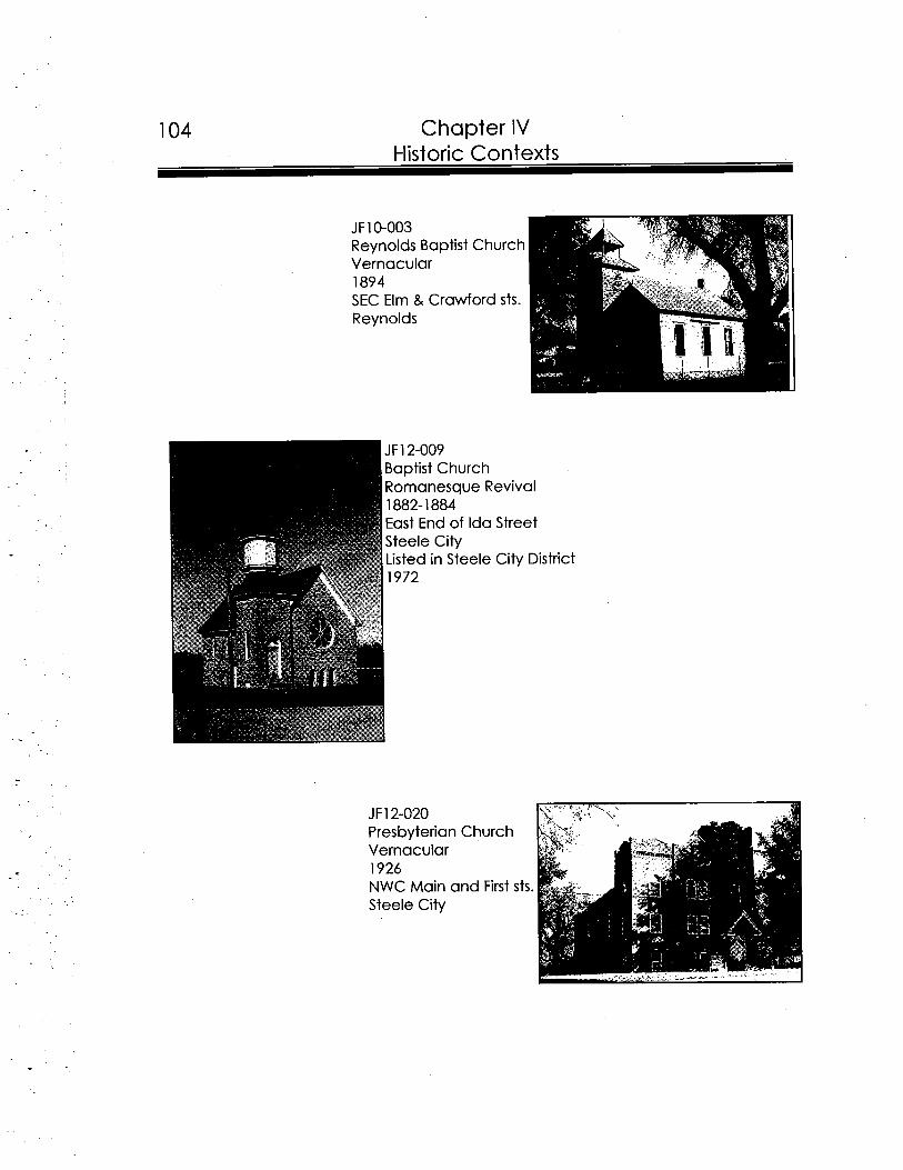
104 Chapter IV
JF10-003 Reynolds Baptist Church Vernacular 1894 SEC Elm & Crawford sts. Reynolds
evival
Street
City Dis trict
Presbyterian Church Vernacular 1926 NWC Main and First sts. Steele City
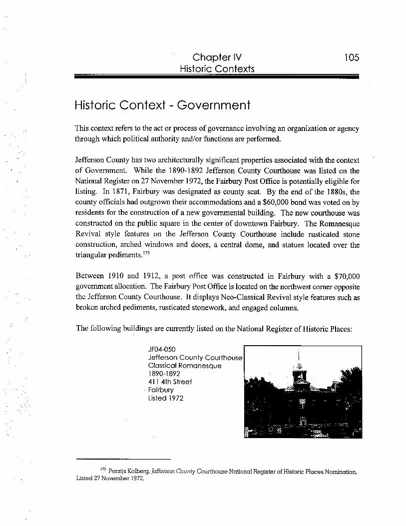
Chapter IV Historic Contexts
Historic Context - Government
This context refers to the act or process of governance involving an organization or agency through which political authority and/or functions are performed.
Jefferson County has two architecturally significant properties associated with the context of Government. While the 1890-1 892 Jefferson County Courthouse was listed on the National Register on 27 November 1972, the Fairbury Post Office is potentially eligible for listing. In 1871, Fairbury was designated as county seat. By the end of the 1880s, the county officials had outgrown their accommodations and a $60,000 bond was voted on by residents for the construction of a new governmental building. The new courthouse was constructed on the public square in the center of downtown Fairbury. The Romanesque Revival style features on the Jefferson County Courthouse include rusticated stone construction, arched windows and doors, a central dome, and statues located over the triangular pediment^.'^^
Between 1910 and 1912, a post office was constructed in Fairbury with a $70,000 government allocation. The Fairbury Post Office is located on the northwest corner opposite the Jefferson County Courthouse. It displays Neo-Classical Revival style features such as broken arched pediments, rusticated stonework, and engaged columns.
The following buildings are currently listed on the National Register of Historic Places:
JFO4-050 I
Jefferson County Courthouse I
175 Persijs Kolberg, Jefferson County Courthouse National Register of Historic Places Nomination, Listed 27 November 1972.
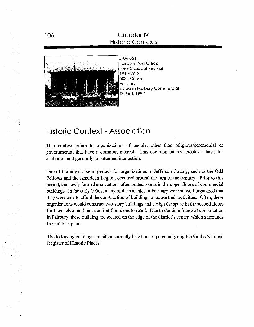
Chapter IV Historic Contexts
i JFO4-05 1 Fairbury Post Office
Historic Context - Association
This context refers to organizations of people, other than religious/ceremonial or governmental that have a common interest. This common interest creates a basis for affiliation and generally, a patterned interaction.
One of the largest boom periods for organizations in Jefferson County, such as the Odd Fellows and the American Legion, occurred around the turn of the century. Prior to this period, the newly formed associations often rented rooms in the upper floors of commercial buildings. In the early 1900s, many of the societies in Fairbury were so well organized that they were able to afford the construction of buildings to house their activities. Often, these organizations would construct two-story buildings and design the space in the second floors for themselves and rent the first floors out to retail. Due to the time frame of construction in Fairbury, these building are located on the edge of the district's center, which surrounds the public square.
The following buildings are either currently listed on, or potentially eligible for the National Register of Historic Places:
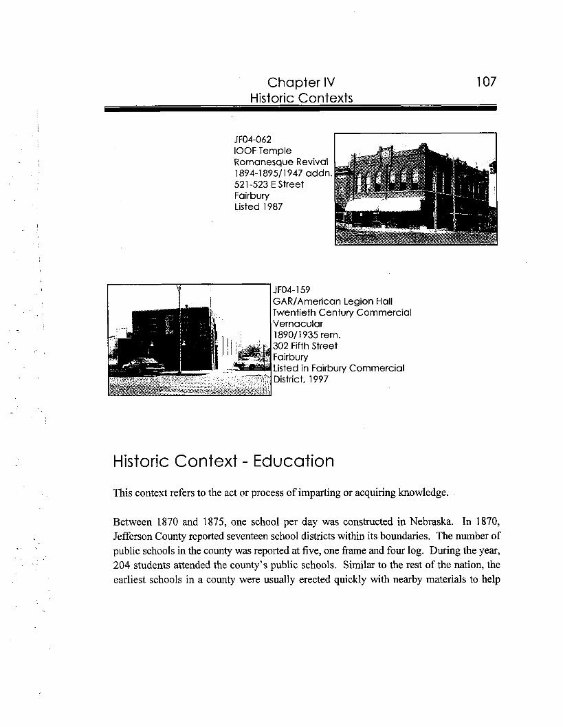
Chapter IV 107 Historic Contexts
JFO4- 159 . I GARIAmerican Leaion Hall
Historic Context - Education
This context refers to the act or process of imparting or acquiring knowledge.
Between 1870 and 1875, one school per day was constructed in Nebraska. In 1870, Jefferson County reported seventeen school districts within its boundaries. The number of public schools in the county was reported at five, one frame and four log. During the year, 204 students attended the county's public schools. Similar to the rest of the nation, the earliest schools in a county were usually erected quickly with nearby materials to help
Chapter IV Historic Contexts
entice more settlers to an area. Often these schools reflected both ethnic and regional influences.'76
Around the turn of the century, the county was divided into ninety-nine districts. Four schoolhouses were brick and 102 were frame. The style used for the second generation schoolhouses, often constructed with machine-made materials, was based upon common vernacular plans. Vernacular form schools, ranging from one to four room buildings, mainly stood one-story tall and were ornamented by the placement of the bell tower. Three vernacular schools were identified as potentially eligible in the survey.'77
By 1920, Jefferson County reported one hundred districts supporting 102 schools. During this decade, new schoolhouses were no longer vernacular in form. Architects submitted plans, which were detailed with hipped roofs, cutaway porches, and dormers, for schools to publishers of pattern books. Often, these buildings showed a likeness to the popular Bungalow style. In 1935, one of the first declines of rural education in Jefferson County occurred with suspended operations of four rural school districts. After World War 11, the number of rural school closings and consolidations began to increase across the country due to the change in population from rural to urban.17*
Schools are not the only properties categorized within the context of Education. Libraries also play an import role in the learning process. The Fairbury Public (Carnegie) Library was listed on the National Register on 12 September 1985. It features a pedimented entryway, columns, dentils, and a symmetrical facade.
The following buildings are either currently listed on, or potentially eligible for the National Register of Historic Places:
'75 "Report of State Superintendent of Public Instruction, 1870 Site File: JF00-036 School District # 10, Located at the Nebraska State Historic Preservation Office, Lincoln, Nebraska; Andrew Gulliford, America's Country Schools (Washington, D.C.: The Preservation Press, 19841, 160.
'77 "Report of State Superintendent of Public Instruction, 1900 Site File: JF00-036 School District # 10, Located at the Nebraska State Historic Preservation Office, Lincoln, Nebraska; Andrew Gulliford, America's Country Schools (Washington, D.C.: The Preservation Press, 19841, 164; Herbert Gottfned and Jan Jennings, American Vernacular Design, 1870-1940 (Ames: Iowa State University Press, 1988). 12-13.
Report of State Superintendent of Public Instruction, 1920," Site File: JF00-036 School District # 10, Located at the Nebraska State Historic Preservation Office, Lincoln, Nebraska; Andrew Gulliford, America's Country Schools (Washington, D.C.: The Preservation Press, 1984). 45,194. "Four Rural Districts Discontinue School Term; Have Too Few Pupils," The Fairbury News and the Fairbury Gazette 18 July 1935.
17'
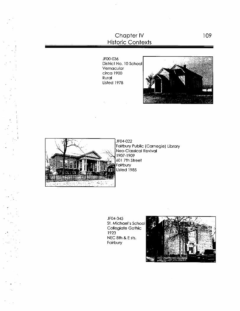
I
Chapter IV 109 Historic Contexts
JFOO-036 District No. 10 School Vernacular circa 1900 Rural Listed 1978
JF04-022 Fairbury Public (Carnegie) Library Neo-Classical Revival 1907-1909 601 7th Street Fairbury Listed 1985
JF04-345 St. Michael's School Collegiate Gothic 1923 NEC 8th & E sts. Fairbury
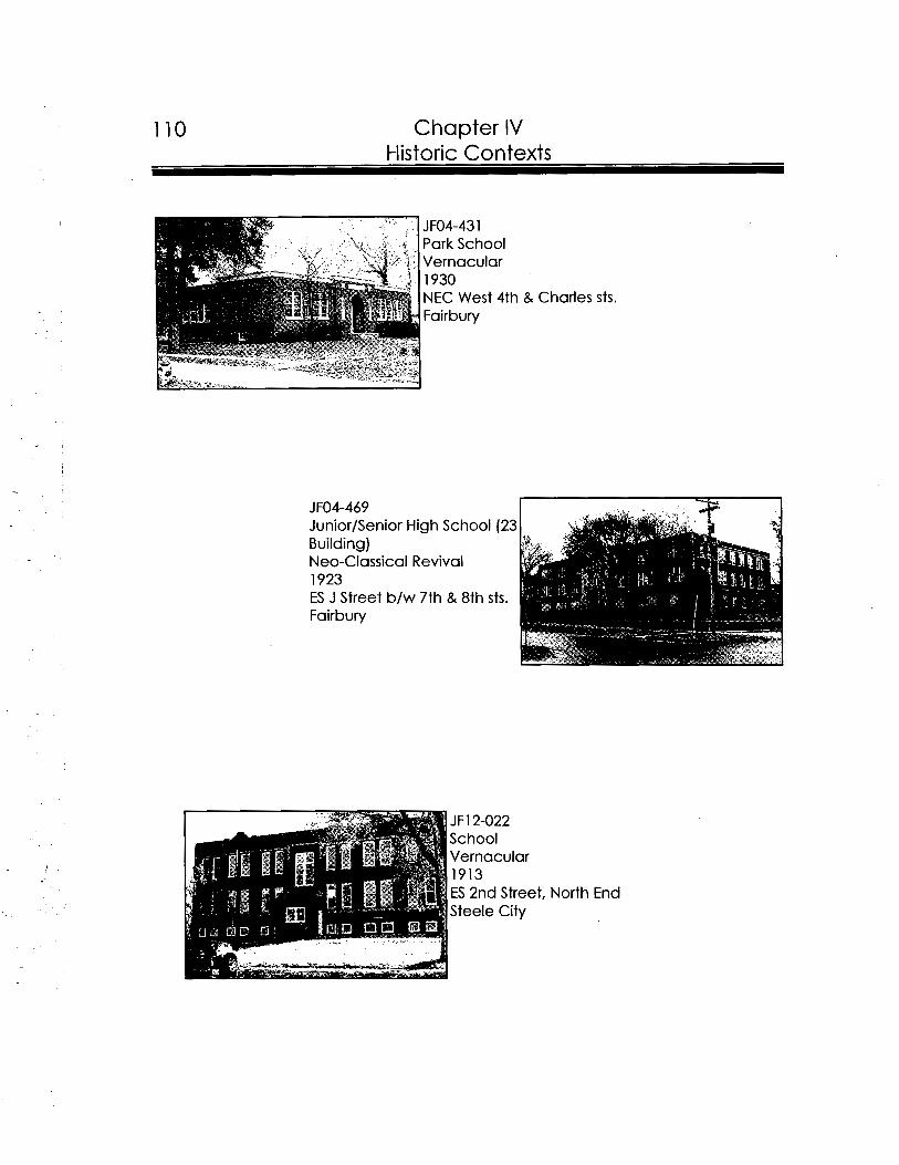
110 Chapter IV Historic Contexts
Vernacular 1913 ES 2nd Street, North End Steele City
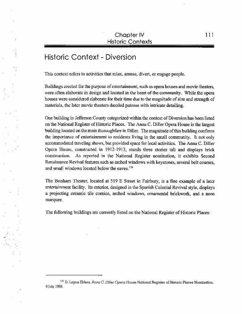
Chapter IV Historic Contexts
Historic Context - Diversion
This context refers to activities that relax, amuse, divert, or engage people.
Buildings erected for the purpose of entertainment, such as opera houses and movie theaters, were often elaborate in design and located in the heart of the community. While the opera houses were considered elaborate for their time due to the magnitude of size and strength of materials, the later movie theaters dazzled patrons with intricate detailing.
One building in Jefferson County categorized within the context of Diversion has been listed on the National Register of Historic Places. The Anna C. Diller Opera House is the largest building located on the main thoroughfare in Diller. The magnitude of this building confirms the importance of entertainment to residents living in the small community. It not only accommodated traveling shows, but provided space for local activities. The Anna C. Diller Opera House, constructed in 1912-191 3, stands three stories tall and displays brick construction. As reported in the National Register nomination, it exhibits Second Renaissance Revival features such as arched windows with keystones, several belt courses, and small windows located below the eaves.'79
The Bonham Theater, located at 519 E Street in Fairbury, is a fine example of a later entertainment facility. Its exterior, designed in the Spanish Colonial Revival style, displays a projecting ceramic tile cornice, arched windows, ornamental brickwork, and a neon marquee.
The following buildings are currently listed on the National Register of Historic Places:
179 D. Layne Ehlers, Anna C. Diller Opera House National Register of Historic Places Nomination, 6 July 1988.
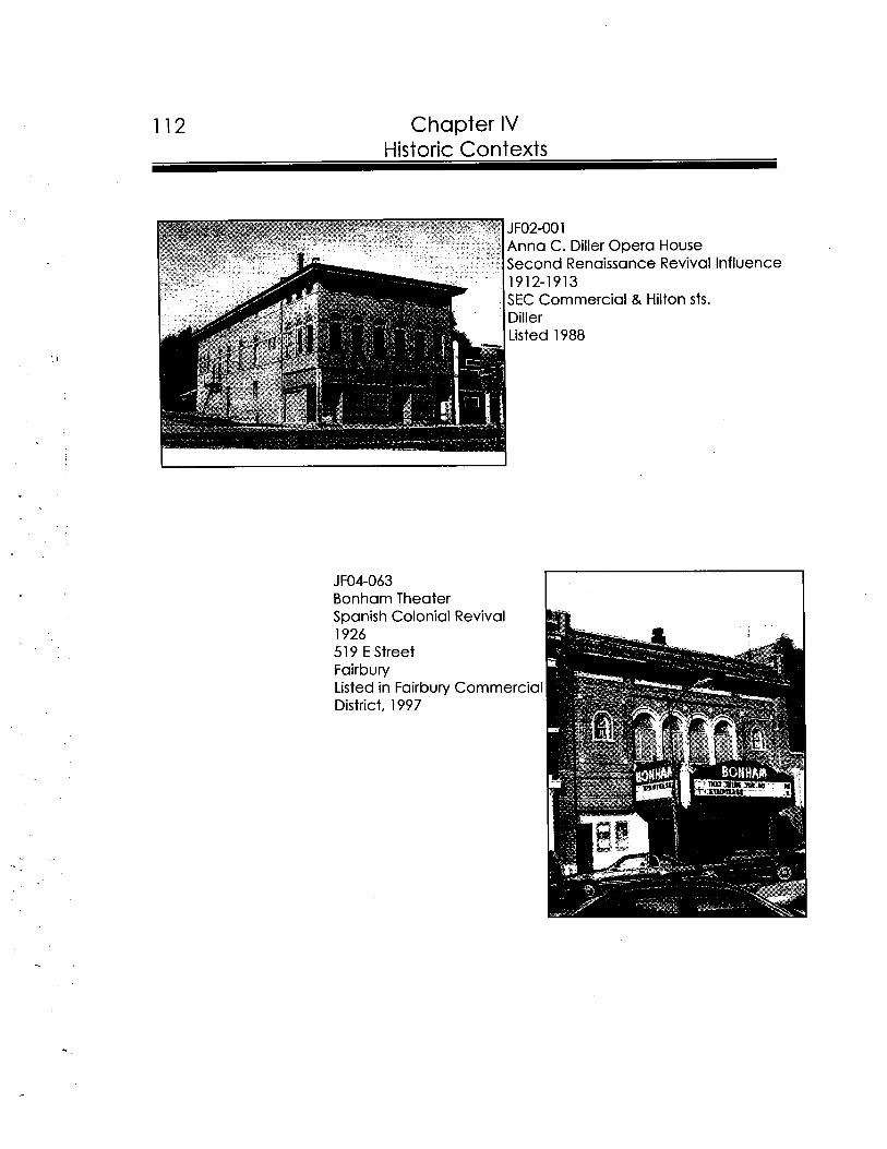
112 Chapter IV Historic Contexts
JF02-001 Anna C. Diller Opera House Second Renaissance Revival 1912-1913 SEC Commercial & Hilton sts. Diller Listed 1988
JFO4-063 Bonham Theater Spanish Colonial Revival 1926 51 9 E Street Fairbury Listed in Fairbury Commerci District, 1997
Influence
-
-
Chapter IV Historic Contexts
Historic Context - Agriculture
This context refers to any level of food production, including crops and livestock; and in varying degrees the preparation of these products for marketing.
Agriculture presents the most complex of all the NeHBS historic contexts because of the wide variety and uses of the properties used for agriculture, and the complex landscapes which encompass these same properties. Farmsteads include not just houses for the families to live in, but barns, sheds, and coops for livestock and fowl; sheds, silos and cribs for produce storage; as well as roads, walls, ponds, trees, windbreaks, errosion contours and other landscape features which help define a farm within the historic context of Agriculture. Since Jefferson County's history is intricately involved with agricultural development, the following discussion attempts to further define the evolution of farmsteads.
The majority of farmhouses in Jefferson County were vernacular in form. These buildings, which stand between one and two-stories tall, include front gable, side gable, gable ell, cross gable, and gable T. Other stylistic types of architecture utilized include Queen Anne, Bungalow, and American Foursquare. Overall, frame construction was the most common method in the county.
Reflecting the variety of Jefferson County agricultural products, an assortment of outbuildings were constructed on area farmsteads. A majority of the barns in the county display frame construction, either gable or gambrel roofs, and wood cladding. Chicken coops, animal sheds, storage sheds, machine sheds, and silos were also common outbuildings identified on many of the surveyed farmsteads. Often these buildings were positioned in close proximity to the main house to expedite farm work. By the third decade of the twentieth century, as a result of the increased rural use and ownership of automobiles, many farmsteads housed modem garages. During this period, garages erected on older farmsteads contrasted with the main house due to the use of the wider clapboard and moderately pitched roofs.
The configuration of the site served as the foremost consideration during the farmstead's development. Allen G. Noble and Hubert G.H. Wilhelm, in a work entitled "The Farm Barns of the American Midwest," declare that "topography, weather, convenience or labor efficiency, land survey systems, and traditionyy need careful consideration when planning the layout of a farm. Furthermore, to expedite chores, it was common to place a barn near the
Chapter IV Historic Contexts
animal pens and crops. To accommodate the most natural light with its disinfectant value, north-south served as the best position for the barn. In areas that experience harsh winters, barns were often placed in close proximity to the farmhouse, yet downwind. Three standard farmstead layouts were surmised by Noble and Wilhelm to dominate in the Midwest. First, the front elevation of each building were positioned in the same direction. Second, every building in a complex was placed to form a square, with the center left vacant to serve as a courtyard. Third, a farmstead where buildings were positioned to adapt to the terrain was known as the free-form plan.lgO
Increased availability of railroad transportation and improved farming techniques and machinery raised farm production. As a result, in the late 1800s and early 1900s, many small farms were either deserted or merged and the fate of their outbuildings took the same route. To accommodate larger machinery and quantities of produce, barns were improved with side shed additions and lengthened roofs. If barns could not be adapted to the changing needs, entirely new ones were built.Ig1
In September of 1895 The Fairbury Gazette printed several articles promoting innovative frame construction methods for barns. As taken from an East Coast publication, interior sketches and construction description were attached to each article.lg2 In an effort to convince farmers of the value of the new building, one article stated:Ig3
In the planning of a barn many things are to be considered--expenses, strength of the building, etc.--but most of all should be considered convenience and labor saving actual use. A convenient barn will save many dollars a year over an ill arranged one, and the money thus saved will cover the cost of the building long before it. is worn out. A barn for the storage of hay and grain and for the thrashing and other purposes should be free from beams and cross timbers from one end to the other, so that a hayfork or other tool may be used with perfect freedom.
''O Allen G. Noble and Hubert G.H. Wilhelm, ed., Barns of the Midwest ( Athens: Ohio University Press, 1995),9-10, 104.
'" Allen G. Noble and Hubert G.H. Wilhelm, ed., Barns of the Midwest ( Athens: Ohio University Press, 19951, 16-17, 25, 102.
"Barns Without Beams," TheFairbury Gazette 7 September 1895; "Barn Building," The Fairbury Gazette 2 1 September 1895.
"Barn Building," TheFairbury Gazette 21 September 1895.
Chapter IV Historic Contexts
While the first barns constructed in the Midwest often displayed gable roofs, many turn of the century barns exhibited gambrel roofs. By the third decade of the century, construction of barns changed with the availability of mill produced rafters. In the effort to accommodate more loft storage, round, Gothic, and rainbow roofs became popular. By the 1950s, farmers often assembled pole buildings with gable roofs to serve as barns.Ig4
The following photographs show the main farmhouses located on their respective farmsteads, and each are described by style. For a definition of architectural terms, please turn to Appendix B: Glossary. The following properties are potentially eligible for the National Register of Historic Places:
merican Foursquare
.. .~
Allen G. Noble and Hubert G.H. Wilhelm, ed., Barns of the Midwest ( Athens: Ohio University Press, 19951, 105.
116 Chapter IV Historic Contexts
. .
JFOO-152 Farmstead American Foursquare circa 1915 Rural
. .
JFOO-171 Fairchild House Bungalow circa 1925 Rural
JFOO-1 72 C.E. Fairchild Farmstead Queen Anne 1904 Rural
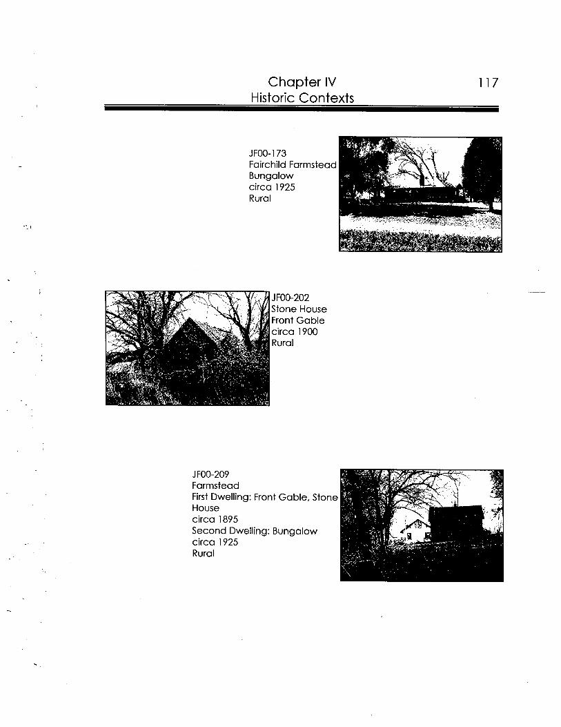
Chapter IV 117 Historic Contexts
JFOO-202 Stone House Front Gable circa 1900 Rural
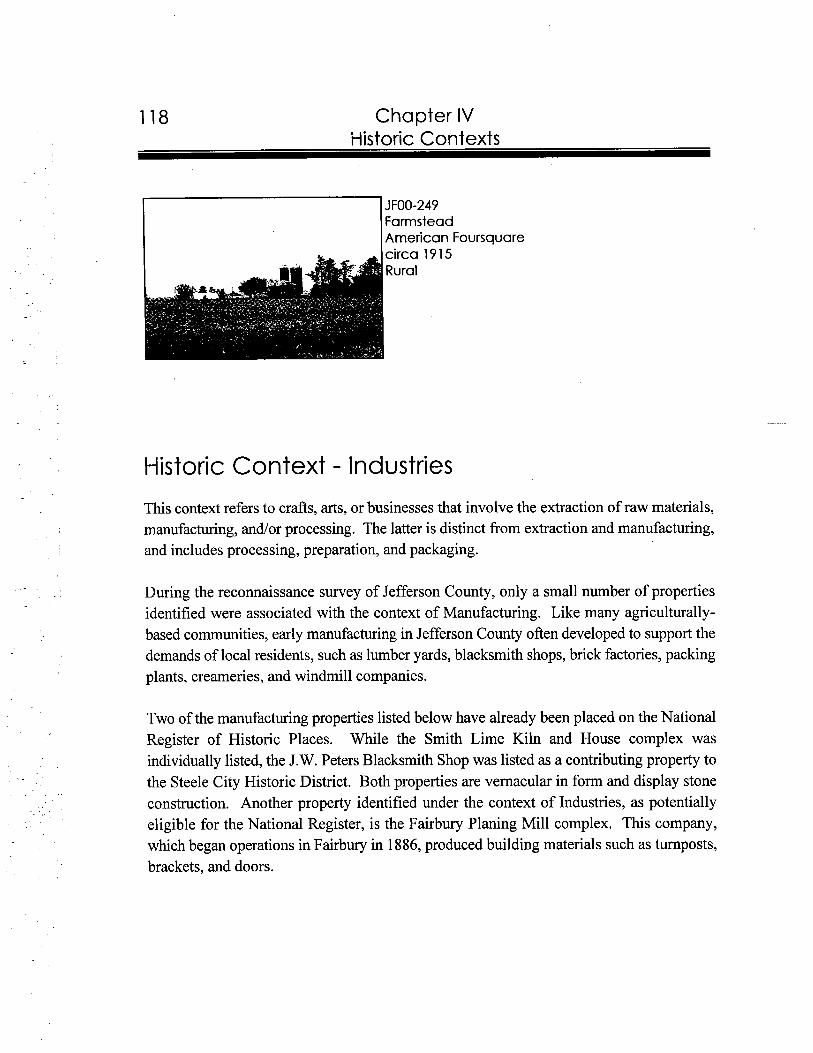
118 Chapter IV i-listoric Contexts
JFOO-249 Farmstead American Foursquare
Historic Context - Industries
This context refers to crafts, arts, or businesses that involve the extraction of raw materials, manufacturing, andlor processing. The latter is distinct from extraction and manufacturing, and includes processing, preparation, and packaging.
During the reconnaissance survey of Jefferson County, only a small number of properties identified were associated with the context of Manufacturing. Like many agriculturally- based communities, early manufacturing in Jefferson County often developed to support the demands of local residents, such as lumber yards, blacksmith shops, brick factories, packing plants, creameries, and windmill companies.
Two of the manufacturing properties listed below have already been placed on the National Register of Historic Places. While the Smith Lime Kiln and House complex was individually listed, the J.W. Peters Blacksmith Shop was listed as a contributing property to the Steele City Historic District. Both properties are vernacular in form and display stone construction. Another property identified under the context of Industries, as potentially eligible for the National Register, is the Fairbury Planing Mill complex. This company, which began operations in Fairbury in 1886, produced building materials such as turnposts, brackets, and doors.
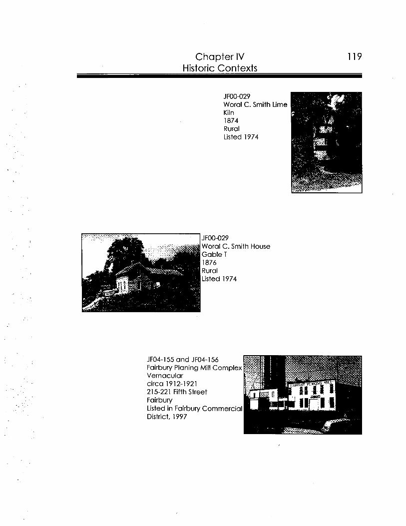
Chapter IV 119 Historic Contexts
JFOO-029 Woral C. Smith Lime Kiln 1874 Rural Listed 1974
JFOO-029 Woral C. Smith House Gable T I876 Rural Listed 1974
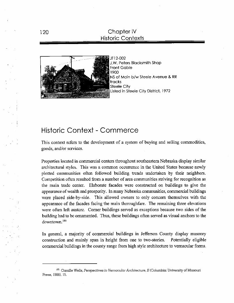
Chapter IV
JF12-002 J.W. Peters Blacksmith Shop Front Gable 1900 NS of Main b/w Steele Avenue & RR tracks Steele City Listed in Steele City District, 1972
Historic Context - Commerce
This context refers to the development of a system of buying and selling commodities, goods, andlor services.
Properties located in commercial centers throughout southeastern Nebraska display similar architectural styles. This was a common occurrence in the United States because newly plotted communities often followed building trends undertaken by their neighbors. Competition often resulted from a number of area communities striving for recognition as the main trade center. Elaborate facades were constructed on buildings to give the appearance of wealth and prosperity. In many Nebraska communities, commercial buildings were placed side-by-side. This allowed owners to only concern themselves with the appearance of the facades facing the main thoroughfare. The remaining three elevations were often left austere. Corner buildings served as exceptions because two sides of the building had to be ornamented. Thus, these buildings often served as visual anchors to the downtown.'85
In general, a majority of commercial buildings in Jefferson County display masonry construction and mainly span in height from one to two-stories. Potentially eligible commercial buildings in the county range from high style architecture to vernacular forms.
Camille Wells, Perspectives in Vernacular Architecture, I1 (Columbia: University of Missouri Press, 19861, 15.
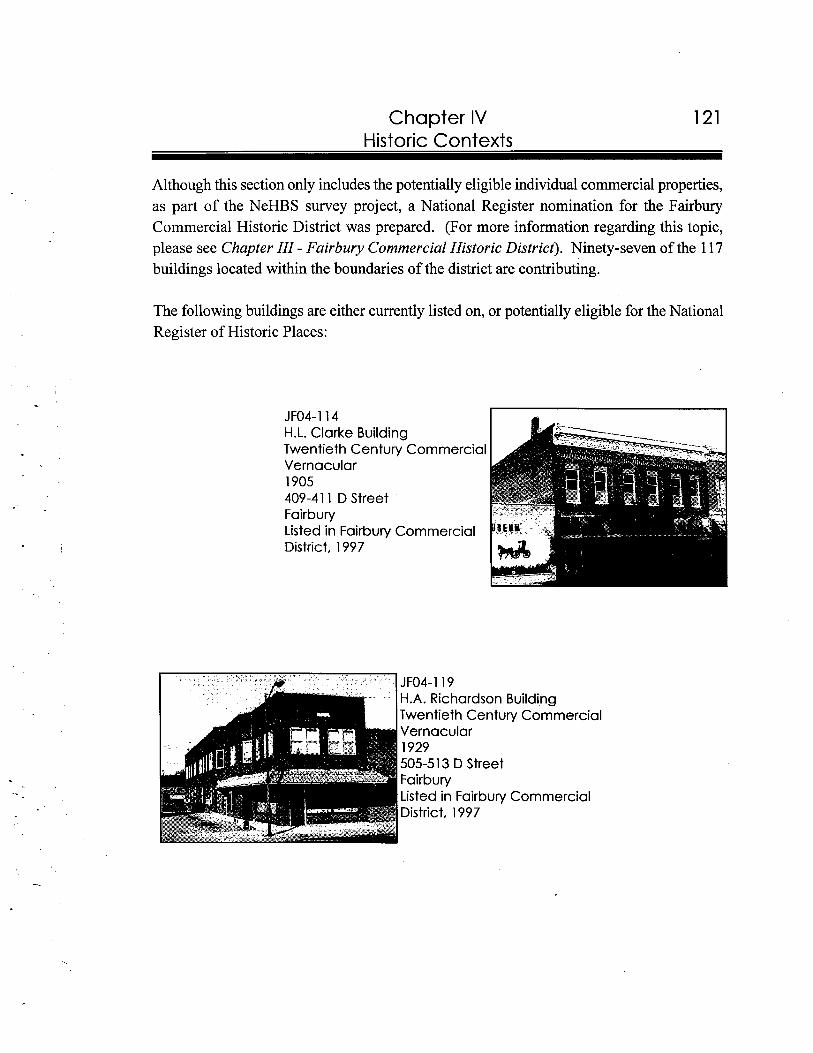
Chapter IV Historic Contexts
Although this section only includes the potentially eligible individual commercial properties, as part of the NeHBS survey project, a National Register nomination for the Fairbury Commercial Historic District was prepared. (For more information regarding this topic, please see Chapter 111-Fairbury Commercial Historic District). Ninety-seven of the 117 buildings located within the boundaries of the district are contributing.
The following buildings are either currently listed on, or potentially eligible for the National Register of Historic Places:
H.L. Clarke Building Twentieth Century Commercial Vernacular 1905 409-411 D Street Fairbury Listed in Fairbury Commercial District, 1997
H.A. Richardson Building Twentieth Century Commercial Vernacular 1929 505-513 D Street
District, 1997
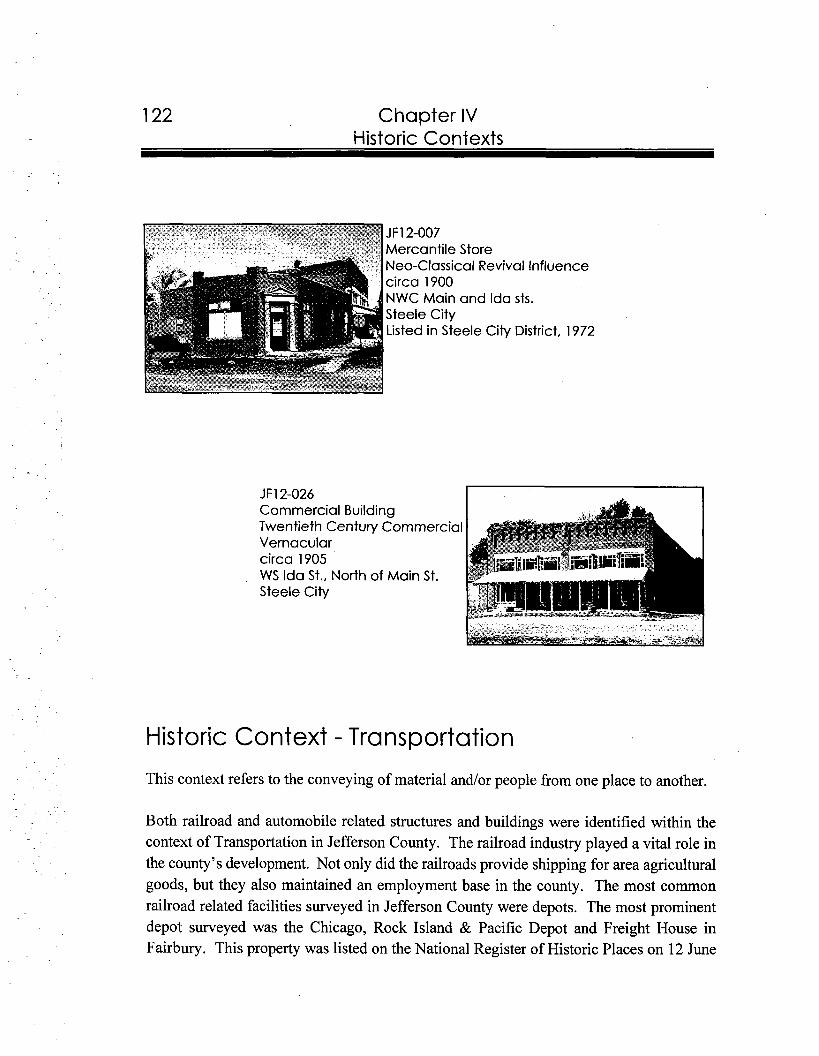
Chapter IV Historic Contexts
JF12-007 Mercantile Store Neo-Classical Revival Influence circa 1900 NWC Main and Ida sts. Steele City Listed in Steele City District, 1972
Historic Context - Transportation
This context refers to the conveying of material and/or people from one place to another.
Both railroad and automobile related structures and buildings were identified within the context of Transportation in Jefferson County. The railroad industry played a vital role in the county's development. Not only did the railroads provide shipping for area agricultural goods, but they also maintained an employment base in the county. The most common railroad related facilities surveyed in Jefferson County were depots. The most prominent depot surveyed was the Chicago, Rock Island & Pacific Depot and Freight House in Fairbury. This property was listed on the National Register of Historic Places on 12 June
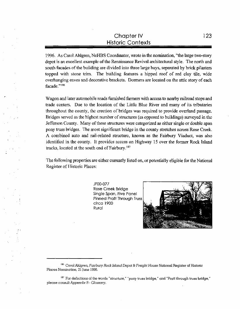
Chapter IV 123 Historic Contexts
1996. As Carol Ahlgren, NeHBS Coordinator, wrote in the nomination, "the large two-story depot is an excellent example of the Renaissance Revival architectural style. The north and south facades of the building are divided into three large bays, separated by brick pilasters topped with stone trim. The building features a hipped roof of red clay tile, wide overhanging eaves and decorative brackets. Dormers are located on the attic story of each facade."I 86
Wagon and later automobile roads furnished farmers with access to nearby railroad stops and trade centers. Due to the location of the Little Blue River and many of its tributaries throughout the county, the erection of bridges was required to provide overland passage. Bridges served as the highest number of structures (as opposed to buildings) surveyed in the Jefferson County. Many of these structures were categorized as either single or double span pony truss bridges. The most significant bridge in the county stretches across Rose Creek. A combined auto and rail-related structure, known as the Fairbury Viaduct, was also identified in the county. It provides access on Highway 15 over the former Rock Island tracks, located at the south end of Fairbury.'*'
The following properties are either currently listed on, or potentially eligible for the National Register of Historic Places:
18"ar~1 Ahlgren, Fairbury Rock Island Depot &FreightHouse National Register of Historic Places Nomination, 21 June 1996.
For definitions of the words "structure," "pony truss bridge," and "Pratt through truss bridge," please consult Appendix B - Glossary.
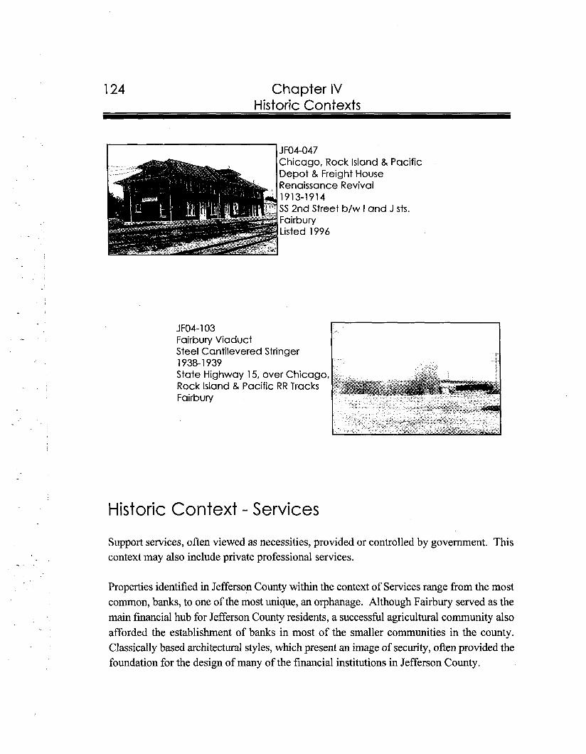
Chapter IV Historic Contexts
JFO4-103 Fairbury Viaduct Steel Cantilevered Stringer 1938-1939 State Highway 15, over Chicago, Rock Island & Pacific RR Tracks Fairbury
Historic Context - Services
Support services, often viewed as necessities, provided or controlled by government. This context may also include private professional services.
Properties identified in Jefferson County within the context of Services range from the most common, banks, to one of the most unique, an orphanage. Although Fairbury served as the main financial hub for Jefferson County residents, a successful agricultural community also afforded the establishment of banks in most of the smaller communities in the county. Classically based architectural styles, which present an image of security, often provided the foundation for the design of many of the financial institutions in Jefferson County.
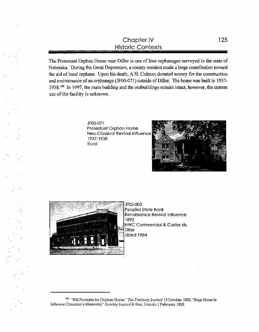
Chapter IV Historic Contexts
The Protestant Orphan Home near Diller is one of four orphanages surveyed in the state of Nebraska. During the Great Depression, a county resident made a large contribution toward the aid of local orphans. Upon his death, A.H. Colman donated money for the construction and maintenance of an orphanage (ROO-071) outside of Diller. The home was built in 1937-1938.1a8In 1997, the main building and the outbuildings remain intact, however, the current use of the facility is unknown.
JFOO-07 1 Protestant Orphan Home Neo-Classical Revival Influence 1937-1938 Rural
lnfluenc e
Castor sts.
188 "WillProvides for Orphan Home," The Fairbury lournal 13 October 1932; "Boys Home Is Jefferson Countian's Memorial," Sunday Journal & Star, Lincoln 1 February 1953.
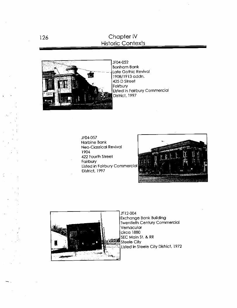
Chapter IV
..... ... . . _ ...
JFO4-052 Bonham Bank Late Gothic Revival 1908/1913 addn. 425 D Street Fairbury Listed in Fairbury Commercial District, 1997
JF12-004 Exchange Bank Building Twentieth Century Commercial Vernacular circa 1880 SEC Main St. & RR Steele City Listed in Steele City District, 1972
Chapter IV Historic Contexts
Historic Context - Settlement Systems
This context refers to the division, acquisition, and ownership of land; and related patterns created by cultural systems. The context is not restricted to any particular era or cultural group.
The largest number of buildings surveyed in Jefferson County within the context of Settlement Systems were residences. Settlement is an ongoing occurrence, which allows a wide span of time periods and thus building types and styles for residences. The earliest, vernacular form stone, log and sod houses of Nebraska therefore share this context with later residential styles such as Italianate, Queen Anne and Bungalow.
Because such a large number of houses were evaluated for this project, it was necessary to set more strict integrity standards for houses than for other property types (such as industrial or commercial buildings). Therefore, houses added to the NeHBS inventory had to exhibit a high degree of physical integrity. If houses were surveyed with alterations, the changes were determined to have been completed more than fifty years ago. Therefore, no houses with new siding material, windows, doors, or modern patios or porches were added to the inventory, unless the alterations were made to an elevation of the house which was not visible from the street or road.
The physical fabric in the urban settings generally ranged from vernacular forms to high style architecture. Vernacular forms, such as front, side, and cross gables, gable ells and Ts, and one and two-story cubes comprise the most popular types of houses in the county. Characterized by simplicity, these buildings usually are identified by their size and roof form. While most of these buildings display frame construction, a small number were built of brick and formed concrete block. Construction periods attached to each vernacular form listed below are based upon dates utilized in the central states of the country.'89
Barbara Wyatt, Cultural Resource Management in Wisconsin vol. 2 (Madison: The State Historical Society of W isconsin, 19861, 3-1 to 3-10.
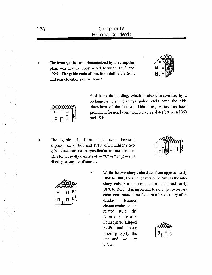
1 28 Chapter IV Historic Contexts
The front gable form, characterized by a rectangular plan, was mainly constructed between 1860 and 1925. The gable ends of this form define the front and rear elevations of the house.
A side gable building, which is also characterized by a rectangular plan, displays gable ends over the side elevations of the house. This form, which has been prominent for nearly one hundred years, dates between 1860 and 1940.
The gable ell form, constructed between
approximately 1860 and 1910, often exhibits two gabled sections set perpendicular to one another. This form usually consists of an "L" or "T" plan and displays a variety of stories.
While the two-story cube dates from approximately 1860 to 1880, the smaller version known as the one- story cube was constructed from approximately 1870 to 1930. It is important to note that two-story cubes constructed after the turn of the century often display features characteristic of a related style, the A m e r i c a n Foursquare. Hipped roofs and boxy massing typify the one and two-story cubes.
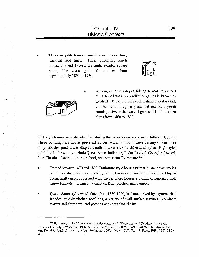
Chapter IV Historic Contexts
The cross gable form is named for two intersecting, identical roof lines. These buildings, which normally stand two-stories high, exhibit square plans. The cross gable form dates from approximately 1890 to 1930.
A form, which displays a side gable roof intersected at each end with perpendicular gables is known as gable H. These buildings often stand one-story tall, consist of an irregular plan, and exhibit a porch running between the two end gables. This form often dates from 1860 to 1890.
High style houses were also identified during the reconnaissance survey of Jefferson County. These buildings are not as prevalent as vernacular forms, however, many of the more simplistic designed houses display details of a variety of architectural styles. High styles exhibited in the county include Queen Anne, Italianate, Tudor Revival, Georgian Revival, Neo-Classical Revival, Prairie School, and American Four~quare.'~'
Erected between 1870 and 1890, Italianate style houses primarily stand two stories tall. They display square, rectangular, or L-shaped plans with low-pitched hip or occasionally gable roofs and wide eaves. These houses are often ornamented with heavy brackets, tall narrow windows, front porches, and a cupola.
Queen Anne style, which dates from 1880-1900, is characterized by asymmetrical facades, steeply pitched rooflines, a variety of wall surface textures, prominent towers, tall chimneys, and porches with bargeboard trim.
190 Barbara Wyatt, Cultural Resource Management in Wisconsin vol. 2 (Madison: The State Historical Society of Wisconsin, 1986), Architecture: 2-6, 2-15, 2-18, 2-21, 2-25, 2-28, 2-30; Marilyn W. Klein and David P. Fogel, Clues to American Architecture (Washington, D.C.: Starrhill Press, 1986), 22-23,28-29, 46.
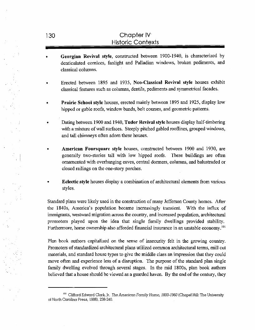
Chapter IV Historic Contexts
Georgian Revival style, constructed between 1900-1940, is characterized by denticulated cornices, fanlight and Palladian windows, broken pediments, and classical columns.
Erected between 1895 and 1935, Neo-Classical Revival style houses exhibit classical features such as columns, dentils, pediments and symmetrical facades.
Prairie School style houses, erected mainly between 1895 and 1925, display low hipped or gable roofs, window bands, belt courses, and geometric patterns.
Dating between 1900 and 1940, Tudor Revival style houses display half-timbering with a mixture of wall surfaces. Steeply pitched gabled rooflines, grouped windows, and tall chimneys often adorn these houses.
American Foursquare style houses, constructed between 1900 and 1930, are generally two-stories tall with low hipped roofs. These buildings are often ornamented with overhanging eaves, central dormers, columns, and balustraded or closed railings on the one-story porches.
Eclectic style houses display a combination of architectural elements from various styles.
Standard plans were likely used in the construction of many Jefferson County homes. After the 1840s, America's population became increasingly transient. With the influx of immigrants, westward migration across the country, and increased population, architectural promoters played upon the idea that single family dwellings provided stability. Furthermore, home ownership also afforded financial insurance in an unstable econ~rny. '~'
Plan book authors capitalized on the sense of insecurity felt in the growing country. Promoters of standardized architectural plans utilized common architectural terms, mill cut materials, and standard house types to give the middle class an impression that they could move often and experience less of a disruption. The purpose of the standard plan single family dwelling evolved through several stages. In the mid 1800s, plan book authors believed that a house should be viewed as a guarded haven. By the end of the century, they
19' Clifford Edward Clark, Jr. The American Family Home, 1800- 1960 (ChapelHill:The University of North Carolina Press, 1986), 238-240.
Chapter IV Historic Contexts
opined that a house should reflect creativity. After the turn of the century, the houses designed for the middle class served as a tools to promote better health.'92
An advertisement in The Fairbury Gazette dated 20 January 1900 utilized the idea that a house could act as an insurance policy for its owner. It stated:'93
PUT YOUR MONEY IN A HOUSE! It's the best savings bank on earth. The cashier will never run off with it. It will never go out of business.' You've got it right under your thumb. No one can take it away fiom you. There it is, a shelter in the time of storm. You'll have a place to sleep if you don't have anything to eat, and surely that's better than to have no place to sleep and nothing to eat. It is always something on which you can realize ready money. Every young man should start in life with a trim little cottage as ballast and anchor.
One of the most recognized styles to utilize standardized plans was the Bungalow, which was designed to upgrade well-being with an emphasis on nature. From the 191 0s to 1 WOs, the Bungalow served as one of the most popular house styles erected in the United States. It was one of the first architectural trends to spread from the west coast to the east. Due to its practical design and low construction costs, the style was promoted by magazines and plan books, contractors, home economists, and even feminists. This style of house allowed people of moderate incomes to afford their own d ~ e 1 l i n g . l ~ ~
The Bungalow is characterized by projecting rooflines, large-scale chimneys, large front porches, and millwork ornamentation such as brackets. Often, when second stories were constructed they were downplayed to give the house a horizontal appearance. A variety of original materials clad the exterior of the Bungalow including clapboard, stucco, pebble dash, and stone. Interior features included fully equipped kitchens and bathrooms, and exposed rooms. '95
Ig2 Clifford Edward Clark, Jr. The American Family Home, 1800-1 960 (Chapel Hill:The University of North Carolina Press, 19861, 238-240.
Ig3 "A.J.King Land and Insurance Agency Advertisement," The Fairbury Gazette 20 January 1900.
lg4 Clifford Edward Clark, Jr. The American Family Home, 1800-1 960 (Chapel Hill: The University of North Carolina Press, 1986), 183-184.
I g 5 Barbara Wyatt, Cultural Resource Management in Wisconsin vol. 2 (Madison: The State Historical Society of Wisconsin, 1986). 2-26.
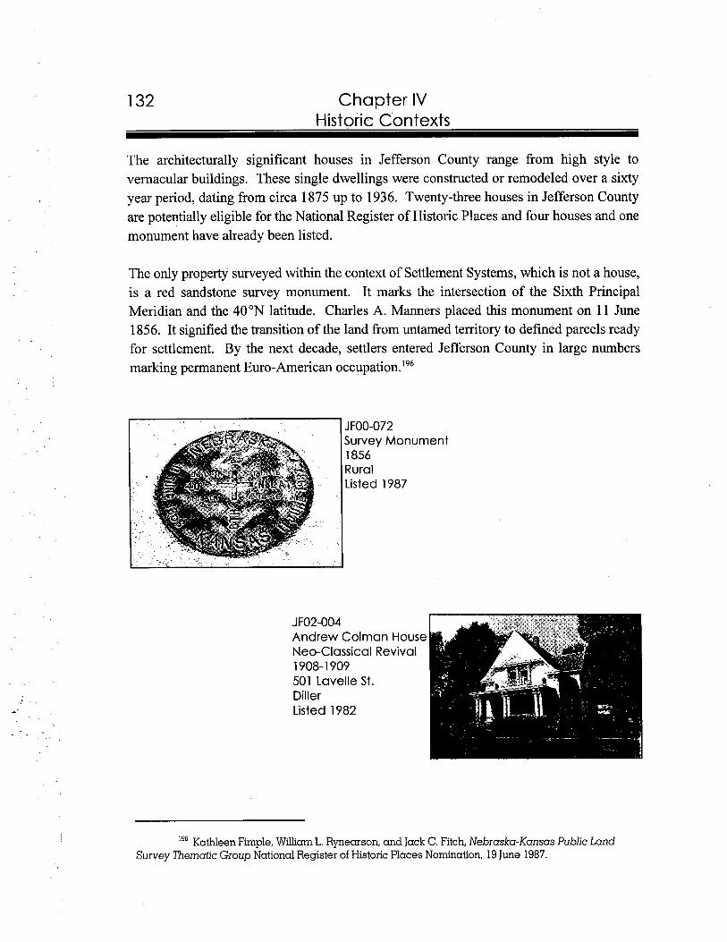
1 32 Chapter IV Historic Contexts
The architecturally significant houses in Jefferson County range from high style to vernacular buildings. These single dwellings were constructed or remodeled over a sixty year period, dating from circa 1875 up to 1936. Twenty-three houses in Jefferson County are potentially eligible for the National Register of Historic Places and four houses and one monument have already been listed.
The only property surveyed within the context of Settlement Systems, which is not a house, is a red sandstone survey monument. It marks the intersection of the Sixth Principal Meridian and the 40°N latitude. Charles A. Manners placed this monument on 11 June 1856. It signified the transition of the land from untamed territory to defined parcels ready for settlement. By the next decade, settlers entered Jefferson County in large numbers marking permanent Euro-American oc~upa t ion . '~~
JFOO-072 Survey Monumenl 1856 Rural Listed 1987
I9"athleen Firnple, William L. Rynearson, and Jack C. Fitch, Nebraska-Kansas Public Land Survey Thematic Group National Register of Historic Places Nomination, 19 June 1987.
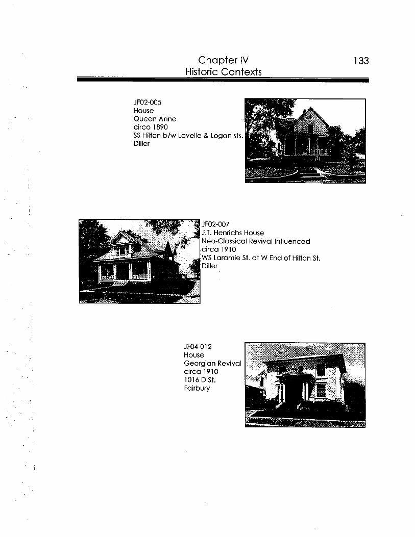
Chapter IV 133 Historic Contexts
JFO2-007 J.T. Henrichs House Neo-Classical Revival Influenced circa 1910 W S Laramie St. at W End of Hilton St. Diller
JF04-012 House Georgian Revival circa 1910 1016 D St. Fairbury
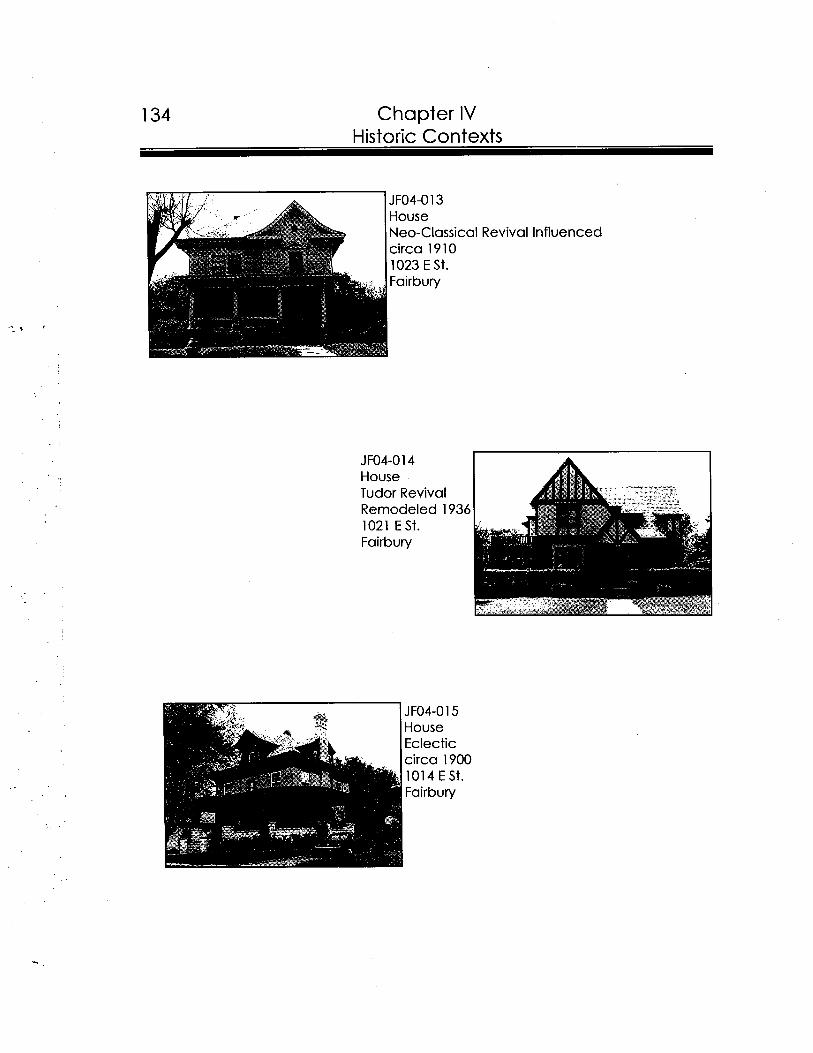
1 34 Chapter IV Historic Contexts
JF04-013 House Neo-Classical Revival Influenced circa 1910 1023 E St. Fairbury
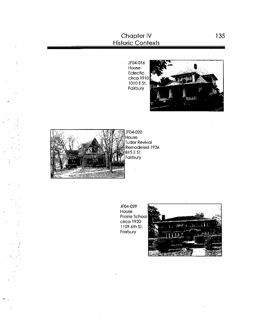
Chapter IV Historic Contexts
JF04-020 House Tudor Revival Remodeled 1936 815 E St. Fairbury
House Prairie School circa 1920 1 109 6th St. Fairbury
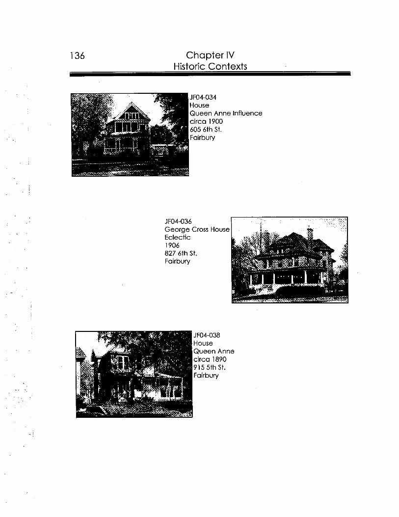
136 Chapter IV Historic Contexts
JFO4-036 Georae Cross House -Eclectic 1906 827 6th St. Fairbury
JF04-038 House Queen Anne circa 1890 915 5th St. Fairbury
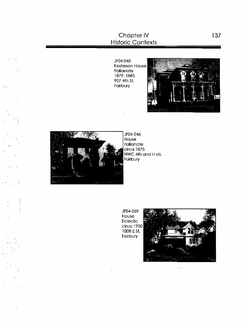
Chapter IV Historic Contexts
JFO4-046 House ltalianate
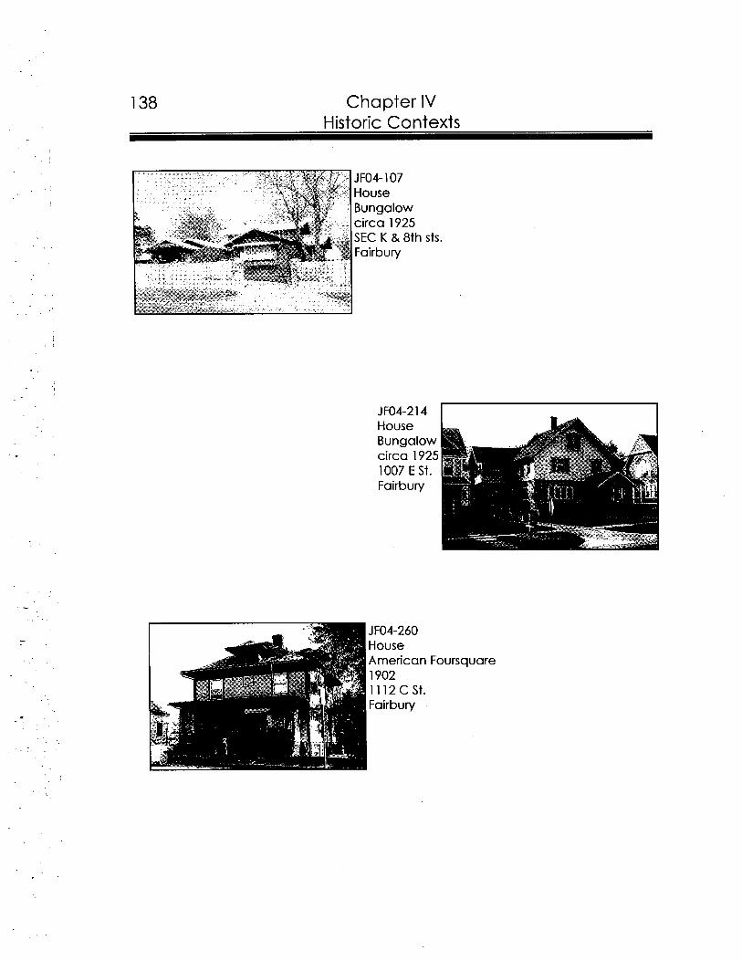
138 Chapter IV Historic Contexts
sts.
JF04-260 House American Foursquare
1 Fairbury
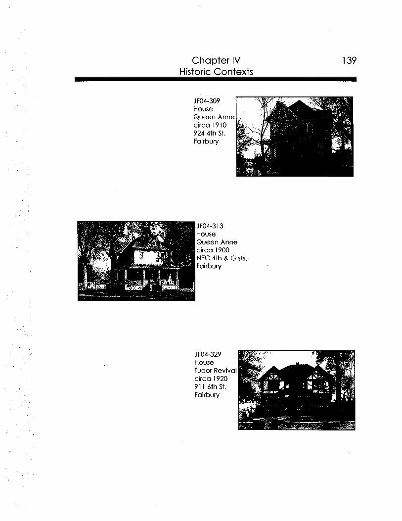
Chapter IV 139 Historic Contexts
JFO4-313 House Queen Anne circa 1900 NEC 4th & G sts. Fairbury
JFO4-329 House Tudor Revival circa 1920 91 1 6th St. Fairbury
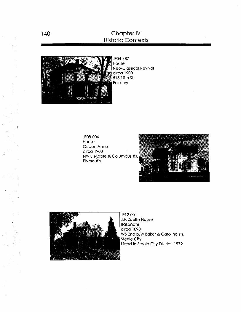
140 Chapter IV Historic Contexts
JF12-001 J.F. Zoellin House ltalianate circa 1890 WS 2nd b/w Baker & Caroline sts. Steele City Listed in Steele City District, 1972
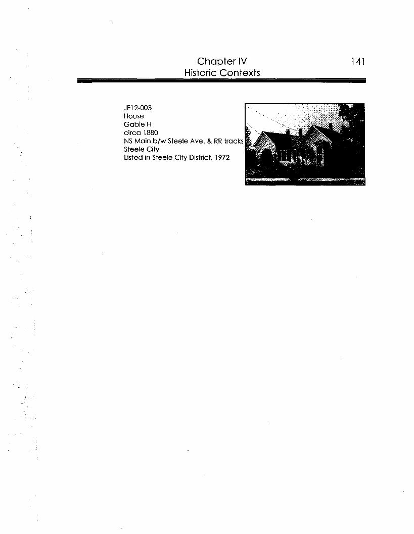
Chapter IV

v Recommendations-
The following recommendations were developed to give the people of Jefferson County and its communities a practical approach to historic preservation. This report tells the reader about the history of Jefferson County and its communities, as well as details concerning architectural influences on the area. Furthermore, it provides a list of resources housed at the Nebraska State Historic Preservation Office, Nebraska State
Historical Society Archives, Fairbury Public Library, and Fairbury City Museum. One of the most important goals of this project is to provide a common tool for state officials, area groups, and individuals dedicated to furthering historic preservation and reaping its rewards throughout Jefferson County.
1 ) National Register of Historic Places District Nomination of potentially eligible residential district in Fairbury along E Street between Tenth and Eleventh streets:
The proposed E Street Residential District stretches one block between Tenth and Eleventh streets. Properties along this thoroughfare make up one of the most intact residential districts in Jefferson County. This residential district would be eligible for the National Register under Criterion C for its architecture. See Chapter I entitled Introduction, for details on the National Register program.
A fine example of a National Register residential district in Nebraska is the Barnard Park Historic Residential District in Fremont, Dodge County, listed 12 July 1990. This document is located in the NeSHPO research room, 1500 R Street, Lincoln, Nebraska.
2) Nominate potentially eligible properties, identified in the reconnaissancesurvey, to the National Register of Historic Places:
A total of forty-nine properties were determined, during the course of the reconnaissance survey of Jefferson County, to be potentially eligible for the National Register of Historic Places. Many of these properties could be individually listed on the National Register; or
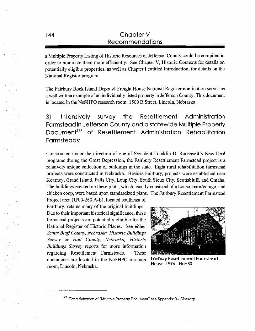
Chapter V Recommendations
a Multiple Property Listing of Historic Resources of Jefferson County could be compiled in order to nominate them more efficiently. See Chapter V, Historic Contexts for details on potentially eligible properties, as well as Chapter I entitled Introduction, for details on the National Register program.
The Fairbury Rock Island Depot & Freight House National Register nomination serves as a well written example of an individually listed property in Jefferson County. This document is located in the NeSHPO research room, 1500 R Street, Lincoln, Nebraska.
3) Intensively survey the Resettlement Administration Farmstead in Jefferson County and a statewide Multiple Properly ~ o c u m e n t ' ~ ~Resettlement Administration Rehabilitationof Farmsteads:
Constructed under the direction of one of President Franklin D. Roosevelt's New Deal programs during the Great Depression, the Fairbury Resettlement Farmstead project is a relatively unique collection of buildings in the state. Eight rural rehabilitation farmstead projects were constructed in Nebraska. Besides Fairbury, projects were established near Kearney, Grand Island, Falls City, Loup City, South Sioux City, Scottsbluff, and Omaha. The buildings erected on these plots, which usually consisted of a house, bamlgarage, and chicken coop, were based upon standardized plans. The Fairbury Resettlement Farmstead Project area (JF00-260 A-E), located southeast of Fairbury, retains many of the original buildings. Due to their important historical significance, these farmstead projects are potentially eligible for the National Register of Historic Places. See either Scotts BlufSCounty, Nebrasku, Historic Buildings Survey or Hall County, Nebrasku, Historic Buildings Survey reports for more information regarding Resettlement Farmsteads. These documents are located in the NeSHPO research Fairbu~Resettlement Farmstead
room, Lincoln, Nebraska. House, 1996 - NeHBS
19' For a definition of "Multiple Property Document" see Appendix B - Glossary.
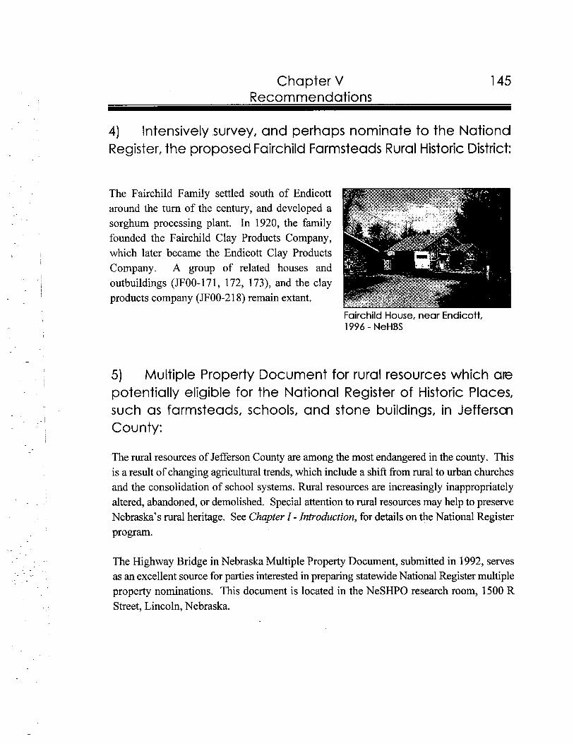
Chapter V 145 Recommendations
4) Intensively survey, and perhaps nominate to the Nationd Register, the proposed Fairchild Farmsteads Rural Historic District:
The Fairchild Family settled south of Endicott around the turn of the century, and developed a sorghum processing plant. In 1920, the family founded the Fairchild Clay Products Company, which later became the Endicott Clay Products Company. A group of related houses and outbuildings (JF00-171, 172, 173), and the clay products company (JF00-2 18) remain extant.
Fairchild House, near Endicott, 1996 - NeHBS
5) Multiple Property Document for rural resources which are potentially eligible for the National Register of Historic Places, such as farmsteads, schools, and stone buildings, in Jefferson County:
The rural resources of Jefferson County are among the most endangered in the county. This is a result of changing agricultural trends, which include a shift from rural to urban churches and the consolidation of school systems. Rural resources are increasingly inappropriately altered, abandoned, or demolished. Special attention to rural resources may help to preserve Nebraska's rural heritage. See Chapter I - Introduction, for details on the National Register program.
The Highway Bridge in Nebraska Multiple Property Document, submitted in 1992, serves as an excellent source for parties interested in preparing statewide National Register multiple property nominations. This document is located in the NeSHPO research room, 1500 R Street, Lincoln, Nebraska.
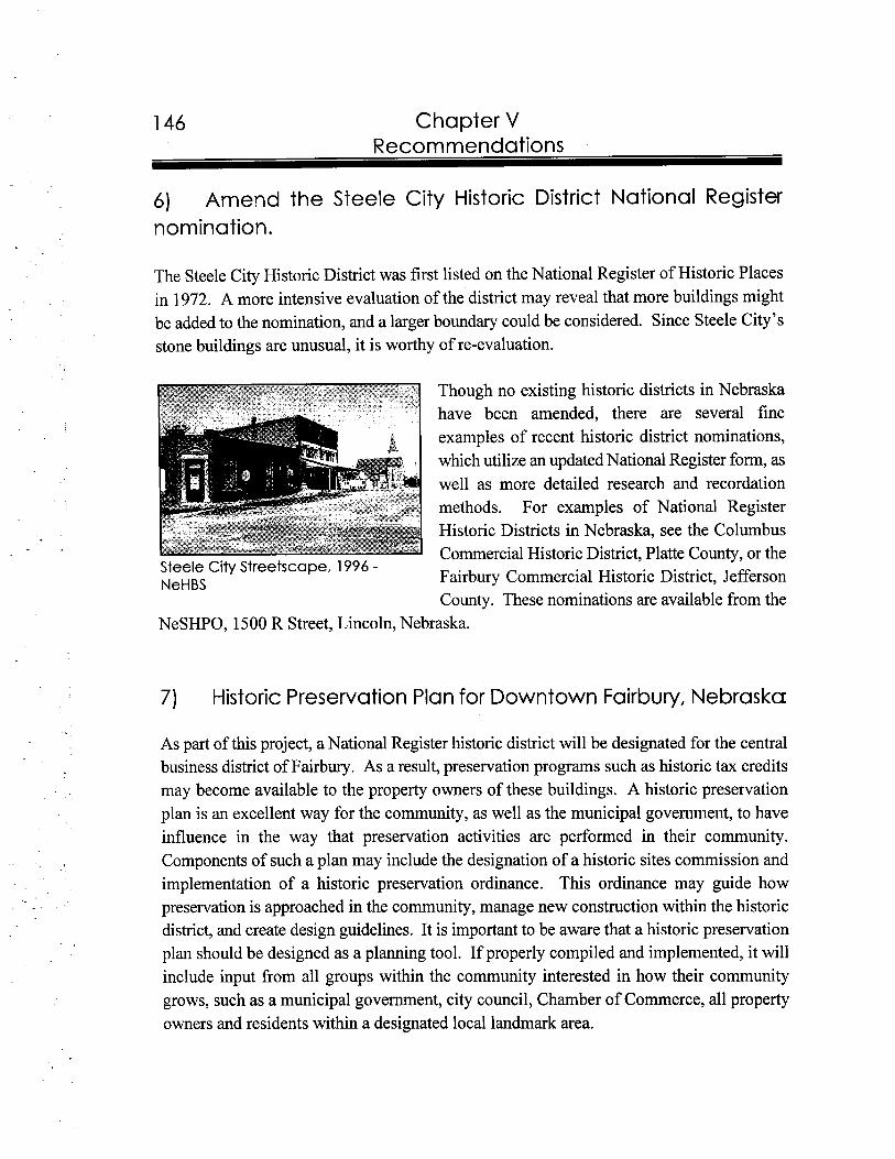
146 Chapter V Recommendations
6) Amend the Steele City Historic District National Register nomination.
The Steele City Historic District was first listed on the National Register of Historic Places in 1972. A more intensive evaluation of the district may reveal that more buildings might be added to the nomination, and a larger boundary could be considered. Since Steele City's stone buildings are unusual, it is worthy of re-evaluation.
Though no existing historic districts in Nebraska have been amended, there are several fine examples of recent historic district nominations, which utilize an updated National Register form, as well as more detailed research and recordation methods. For examples of National Register Historic Districts in Nebraska, see the Columbus Commercial Historic District, Platte County, or the
Steele City Streetscape, 1996 -NeHBS Fairbury Commercial Historic District, Jefferson
County. These nominations are available from the NeSHPO, 1500 R Street, Lincoln, Nebraska.
7) Historic Preservation Plan for Downtown Fairbury, Nebraska
As part of this project, a National Register historic district will be designated for the central business district of Fairbury. As a result, preservation programs such as historic tax credits may become available to the property owners of these buildings. A historic preservation plan is an excellent way for the community, as well as the municipal government, to have influence in the way that preservation activities are performed in their community. Components of such a plan may include the designation of a historic sites commission and implementation of a historic preservation ordinance. This ordinance may guide how preservation is approached in the community, manage new construction within the historic district, and create design guidelines. It is important to be aware that a historic preservation plan should be designed as a planning tool. If properly compiled and implemented, it will include input from all groups within the community interested in how their community grows, such as a municipal government, city council, Chamber of Commerce, all property owners and residents within a designated local landmark area.
Chapter V 147 Recommendations
The Nebraska cities of Lincoln and Omaha currently use historic preservation plans to guide local activities. The western community of Alliance, Box Butte County, is in the process of preparing a historic perservation plan and a copy of this draft document can be obtained from Bill Callahan at the NeSHPO, Lincoln, Nebraska.
8) Application for Main Street Program status for Fairbury, Nebraska:
The National Main Street Program is directed through the National Trust for Historic Preservation. Its principles incorporate business development plans and guidance to local businesses, while embracing the concepts of historic preservation. The Nebraska-Lied Main Street Program, whose offices are located on the University of Nebraska, Lincoln campus, oversees Main Street programs across the state. Application and acceptance to this program would enhance Fairbury's ability to receive technical assistance, grants, and other financial and technical advice. For more information regarding the Main Street Program, please contact Nebraska-Lied Main Street Director, Scott Sewell at 402/472-0718.
Current Main Street communties in Nebraska include Alliance, Bassett, Beatrice, Fremont, Gothenburg, McCook, Minden, Ogallala, Red Cloud, and Scottsbluff.
9 ) Application for Certified Local Government (CLG) status:
The CLG program, which is administered through the NeSHPO, will provide Fairbury with further assistance pertinent to historic preservation projects in the city, and would complement other programs, such as the Main Street Program, a historic preservation plan, andlor a historic preservation ordinance. See Chapter I entitled Introduction, for details on the CLG program.
Lincoln and Omaha are the only current CLG communties in the state of Nebraska.

References
Secondary Sources:
Baltensperger, Bradley H. Nebraska: A Geography. Boulder, CO: Westview Press, Inc., 1985.
Beattie, James A., ed. School History of Nebraska. Lincoln, NE: Western Publishing and Engraving Co., 1920.
Blurnenson, John J.G. IdentiJLing American Architecture: A Pictorial Guide to Styles and Terms 1600-1 945. Nashville, TN: American Association of State and Local History, 198 1.
Boyd, Levi, cornp. JefSerson County History; Quivera Park. N.p., 1955.
. Egress of the Old West; the Beginning of Fairbury and its Founders. Fairbury, NE: Holloway Publishing Co., 1963.
Brown, Elinor L. Baade Maps Tell Nebraska's History. Ceresco, NE: Midwest Publishing, 199 1.
Carpenter, Estaline, cornp. Friendly Fairbury: A History of Fairbury, Nebraska. Fairbury, NE: Jefferson County Historical Society, 198 1.
Claassen, Cornelius J.. "Peter Jansen--Pioneer, Leader and Philanthropist." Mennonite Life 2 (October 1947): 41-43,45.
Clark, Clifford Edward, Jr. The American Family Home, 1800-1960. Chapel Hill: University of North Carolina Press, 1986.
Clark, Genvieve, cornp. and James L. Green, ed. A History of Churches in Jefferson County, Nebraska. Fairbury, NE: Holloway Publishing Company, 1967.
Clerk of Legislature, cornp. Nebraska Blue Book 1990-1991. Lincoln, NE: Clerk of the Legislature, 1990.
150 References
Clerk of Legislature, comp. Nebraska Blue Book 1994-1 995. Lincoln, NE: Clerk of the Legislature, 1994.
Conzen, Michael P., ed. The Making of the American Landscape. Winchester, M A : Unwin Hyman, Inc., 1990.
Creigh, Dorothy Weyer. Nebraska: A Bicentennial History. New York: W.W. Norton & Co., Inc., 1977.
Dawes, Audrey. "A History of Camp Jefferson Nebraska Best Kept Secret," 1 January 1990. Located at the Fairbury Public Library, Fairbury, NE.
Dawson, Charles. Pioneer Tales of the Oregon Trail and of Jefferson County. Topeka, KS: Crane & Co., 1912.
Daykin Centennial History Book Committee. A Century of Progress: Daykin, Nebraska. Fairbury, NE: Fairbury Printing and Office Supply, 1987.
Dean, Edwin B. "The Plymouth Colony In Jefferson County, Nebraska." n.d. Located at the Nebraska State Historic Preservation Office, Lincoln, NE.
"Diller, Nebraska [and] The Dillers." N.d. Located at the Nebraska State Historical Society, Lincoln, NE.
Eide, A. Clyde. "Free As the Wind." Nebraska History 51 (Spring 1970): 25-47.
The Fairbury Journal-News, comp. A Pictorial History of Jefferson County Nebraska. N.p., n.d.
Federal Writers' Project. Nebraska: A Guide To The Cornhusker State. 2nd ed. New York: Hastings House Publishers, 1947.
Fitzpatrick, Lilian. Nebraska Place-Names. Lincoln: University of Nebraska Press, 1960.
Gottfried, Herbert and Jan Jennings. American Vernacular Design, 1870-1 940. Ames: Iowa State University Press, 1988.
References
Graff, Jane, coor. Nebraska Our Towns.. . East Southeast. Dallas, TX: Taylor Publishing Co., 1992.
Gulliford, Andrew. America's Country Schools. Washington, D.C.: The Preservation Press, 1984.
Henkel, Ceres. "The Stone Baptist Church of Steele City, Nebraska." Nebraska History 64 (Summer 1983): 228-237.
The Historical Committee of the Steele City Centennial Association. Early Life In Old Steele City. N.p., 1973.
Junior Chamber of Commerce and Senior Chamber of Commerce, comp. Welcome to Fairbury. N.p., n.d.
Klein, Marilyn W. and David P. Fogel. Clues to American Architecture. Washington, D.C.: Starrhill Press, 1986.
Kooiman, Barbara M., Elizabeth A. Butterfield, and Christina Slattery. Nebraska Historic Buildings Survey Reconnaissance Survey Final Report of Scotts Blug Nebraska. Prepared for the Nebraska State Historical Society, State Historic Preservation Office, July 1995.
Loewen, Roy den K. Family, Church, and Market: A Mennonite Community in the Old and New Worlds, 1850-1 930. Urbana: University of Illinois Press, 1993.
Mattes, Merrill J. The Great Platte River Road: The Covered Wagon Mainline Via Fort Kearny to Fort Laramie. Lincoln: University of Nebraska Press, 1969.
McAlester, Virginia and Lee. A Field Guide to American Houses. New York: Alfred A. Knopf, Inc., 1989.
Nebraska Emergency Relief Administration. A Study of The Rural Rehabilitation Programs in Nebraska. Lincoln: Nebraska Emergency Relief Administration, 1935.
Nebraska Legislative Council, comp. Nebraska Blue Book, 1942. Lincoln, NE, 1942.
References
. Nebraska Blue Book, 1952. Lincoln, NE, 1952.
. Nebraska Blue Book, 1962. Lincoln, NE, 1962.
. Nebraska Blue Book, 1972. Lincoln, NE, 1972.
Nebraska Legislative Reference Bureau. Nebraska Blue Book, 1930. Lincoln, NE, 1930.
Noble, Allen George and Hubert G.H. Wilhelm, ed. Barns of the Midwest. Athens: OhioUniversity Press, 1995.
Olson, James C. History of Nebraska. Lincoln: University of Nebraska Press, 1955.
Perkey, Elton A. "Perkey's Names of Nebraska Locations." Nebraska History 59 (Summer 1978): 438-472.
Plymouth Centennial History Committee, comp. Plymouth, NE: Saluting the Past- Building for The Future. N.p., n.d., 1992.
Reps, John W. Cities of the American West: A History of Frontier Urban Planning. Princeton, N. J.: Princeton University Press, 1979.
The Secretary of the Interior's Standards for Rehabilitation and Guidelines for Rehabilitating Historic Buildings. Washington, D.C.: U.S. Department of the Interior, National Park Service, 1983.
Sheldon, Addison E. Nebraska: The Land and the People. New York: The Lewis Publishing Co., 193 1.
,ed. The Nebraska Blue Book and Historical Register, 1920. Lincoln, NE, December 1920.
Site Files. Located at the Nebraska State Historic Preservation Office, Lincoln, NE.
Souvenir: History of Rock Creek Station. Fairbury, NE: Holloway Publishing Co., n.d.

References 153
Subject Files. Located at the Fairbury Public Library, Fairbury, NE.
Wells, Camille. Perspectives in Vernacular Architecture, II. Columbia: University of Missouri Press, 1986.
Wheeler, Wayne. An Almanac of Nebraska Nationality, Ethnic, and Racial Groups. Omaha, NE: Park Bromwell Press, 1975.
Wyatt, Barbara, ed. Cultural Resource Management in Wisconsin: A Manual for Historic Properties. 3 vols. Madison: State Historical Society of Wisconsin, 1986.
Primary Sources:
Cramb, W.F., comp. Directory and Guide of Jeflerson County, Nebraska. N.p., 1899.
. County Directory of Jefferson County, Nebraska. Fairbury: W.F Cramb, 1904.
Fairbury City Directory, 1939. N.p.
Fairbury, Nebraska City Directory, 1927. Hebron, NE: Baldwin Brothers Directory Co., 1927.
Fairbury Telephone Company. Exchange Directory (Fairbury and Powell Exchanges). Fairbury, NE: Fairbury News Printery, July 19 10.
Lincoln Telephone & Telegraph Company. Telephone Directory (Daykin, Fairbury, Jansen, Plymouth, and Steele City). N.p., May 1936.
. Telephone Directory of Fairbury, including Daykin, Jansen, Plymouth and Steele City. N.p., May 1954.
. Telephone Directory of Fairbury, including Daykin, Jansen, Plymouth and Steele City. N. p., May 1 95 5.
154 References
. Telephone Directory of Fairbury, including Alexandria, Daykin, Jansen, Steele City. N. p., May 1 96 1.
Mailing List and Directory of Jefferson County, Nebraska, 1910. Fairbury, NE: Wilson Shoebotham and W.F. Crarnb, 1910.
Newspapers:
The Fairbury Gazette. Various, 1870-1 891, 1895, 1900, 1905, 1910. Located on microfilm at the Nebraska State Historical Society Archives, Lincoln, NE.
The Fairbury News and the Fairbury Gazette. Various, 191 5 to 1945. Located on microfilm at the Nebraska State Historical Society Archives, Lincoln, NE.
The Fairbury Journal. 1932, 1953.
The Fairbury Journal-News. 1971, 198I , 1982.
Penney Press (Beatrice, NE). 1988.
Sunday Journal & Star (Lincoln, NE). 1953.
Maps:
Daykin. Nebraska. N.p., n.d. -Diller, Nebraska. N.p., n.d. - .
Endicott, Nebraska. N.p., n.d.
Fairbury, Nebraska. Office of City Engineer, n.d.
References
General Highway Map, Jefferson County, Nebraska. Lincoln, NE: Department of Roads, Program and Planning Division, 197 1.
Gladstone, Nebraska. N.p., 1900.
Jansen, Nebraska. N.p., n.d.
Plat Book of Jefferson County, Nebraska. Northwest Publishing Co., 1900.
Plat Map ofFairbury, Nebraska. N.p., n.d.
Plymouth Town Site Company. Plat Map of Plymouth, Nebraska. N.p., n.d.
Plymouth, Nebraska. N.p., n.d.
Powell, Nebraska. N.p., n.d.
Reynolds, Ne brash. N.p., n.d.
Sanborn Fire Insurance Company. Sanborn-Perris Fire Insurance Map of Fairbury, Nebraska. New York: Sanborn Fire Insurance Company, 1885, 1889, 1896, 1904,1912,1921,1931,1946.
Steele City, Nebraska. N.p., n.d.
Thompson, Nebraska. N.p., 1900
Wesco Mapping. Daykin, Nebraska. N.p., June 1984.
. Diller, Nebraska. N.p., June 1984.
. Endicott, Nebraska. N.p., June 1984.
. Harbine, Nebraska. N.p., June 1984.
. Jansen, Nebraska. N.p., June 1984.
References
. Plymouth, Nebraska. N.p., June 1984.
-. Reynolds, Nebraska. N.p., June 1984.
. Steele City, Nebraska. N.p., June 1984.
National Register Nominations:
Ackerman, Dr. and Mrs. Bruce and Joni Gilkerson. 1 0 . 0 .F. Temple Building. National Register of Historic Places Nomination. 15 June 1987.
Ahlgren, Carol. Fairbury Rock Island Depot & Freight House. National Register of Historic Places Nomination. 21 June 1996.
Chatfield, Penelope. District No. 10 School. National Register of Historic Places Nomination. 15 December 1978.
Dollase, Mark. Fairbury Public (Carnegie) Library. National Register of Historic Places Nomination. 12 September 1 985.
Ehlers, D. Layne. Anna C. Diller Opera House. National Register of Historic Places Nomination. 6 July 1988.
Fimple, Kathleen, William L. Rynearson, and Jack C. Fitch. Nebraska-Kansas Public Land Survey Thematic Group. National Register of Historic Places Nomination. 19 June 1987.
Gilkerson, Joni and David Murphy. Colman House. National Register of Historic Places Nomination. 25 June 1982.
Gilkerson, Joni. People 's State Bank. National Register of Historic Places Nomination. 13 June 1984.
Kivett, Ronald L. Woral C. Smith Lime Kiln and Limestone House. National Register of Historic Places Nomination. 3 December 1974.

References
Kolberg, Persijs and Richard E. Jensen, Steele City Historic District. National Register of Historic Places Nomination. 16 March 1972.

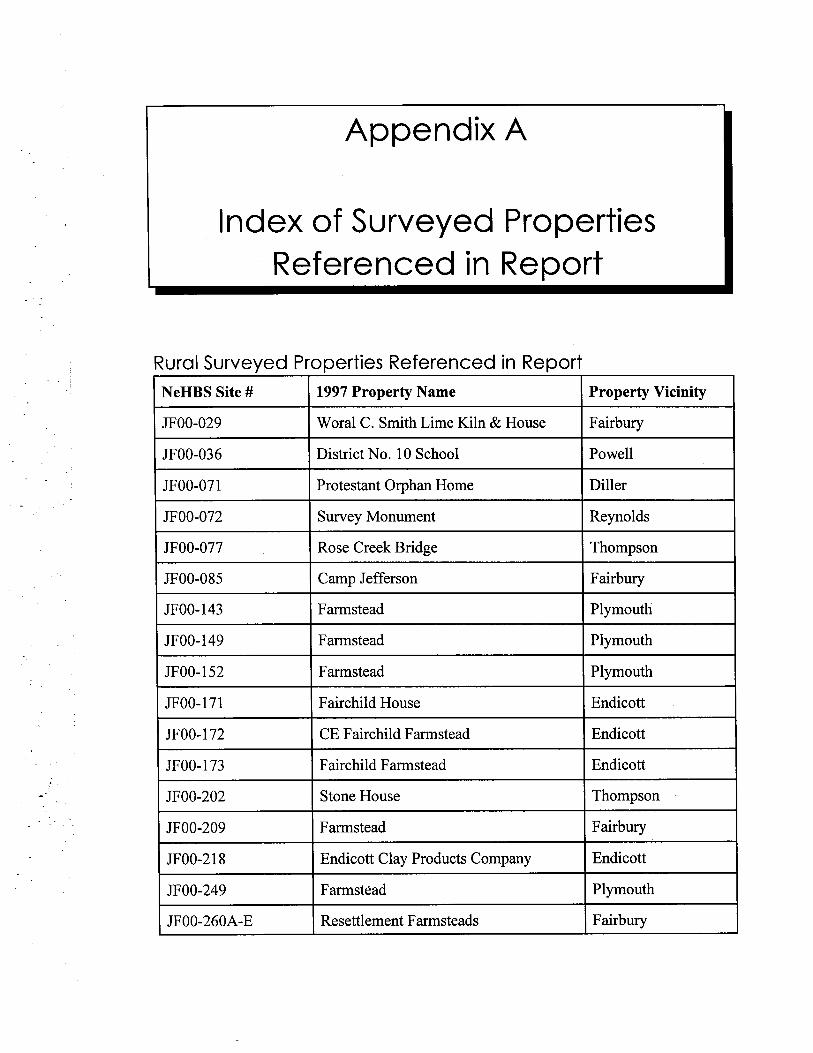
Appendix A
Index of Surveyed Properties Referenced in Report
Rural Surveyed Properties Referenced in Report I I I 1I NeHBS Site # 1 1997 Property Name I Property Vicinity I I JF00-029 I Woral C. Smith Lime Kiln & House I Fairbury I ~ O O - 0 3 6 District No. 10 School PowellI I I
~
JF00-07 1 (I
Protestant Orphan Home I I Diller
JF00-072 Survey Monument Reynolds
JF00-077 Rose Creek Bridge Thompson
JF00-085 Camp Jefferson Fairbury
I JF00-143 I Farmstead I Plymouth I JF00- 149 Farmstead Plymouth
JF00-152 Farmstead Plymouth
JF00- 17 1 Fairchild House Endicott
JF00- 172 CE Fairchild Farmstead Endicott
JF00- 173 Fairchild Farmstead Endicott ~~I JF00-202 I Stone House I Thompson
-.-- -
JF00-209 Farmstead Fairbury
JF00-2 1 8 Endicott Clay Products Company Endicott
JFOO-249 Farmstead Plymouth
JF00-260A-E Resettlement Farmsteads Fairbury
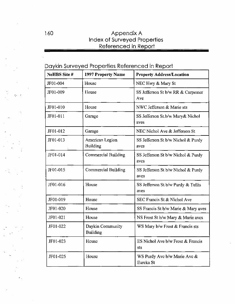
--
160 Appendix A Index of Surveyed Properties
Referenced in Re~ort
Daykin Surveyed Properties Referenced in Report NeHBS Site # 1 1997 Property Name I Property AddressLoeation
JFO 1-004 1 House ( NEC Hwy & Mary St
JFO 1-009 I House I SS Jefferson St blw RR & carpenterI Ave
I
JF01-010 House NWC Jefferson & Marie sts
JFO1-011
JF01-012
( Garage
II Garage
I SS Jefferson St.blw Mary& Nichol I aves
-- ~pI NEC Nichol Ave & Jefferson St - -
JFO1-013 American Legion SS Jefferson St blw Nichol & Purdy Building aves
JF01-014 Commercial Building SS Jefferson St blw Nichol & Purdy aves
JF01-015 1 Commercial Building SS Jefferson St blw Nichol & Purdy aves
- -
JF01-016 House SS Jefferson St blw Purdy & Tullis aves
JF01-019 I House I SEC Francis St & Nichol Ave
JFO 1-020 House SS Francis St blw Marie & Mary aves
JFO 1-02 1 House NS Frost St blw Mary & Marie aves
JFO 1-022 Daykin Community WS Mary blw Frost & Francis sts Building
JFO 1-023 House ES Nichol Ave blw Frost & Francis/ sts
JFO 1-025 House WS Purdy Ave blw Marie Ave & Eureka St
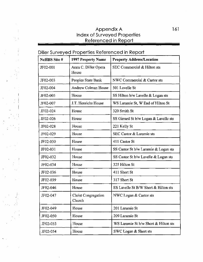
Appendix A 161 Index of Surveyed Properties
Referenced in Re~ort
Diller Surveyed Properties Referenced in Report NeHBS Site # 1997 Property Name Property AddressLocation
JF02-00 1 Anna C. Diller Opera SEC Commercial & Hilton sts House
JF02-003 Peoples State Bank NWC Commercial & Castor sts
JF02-004 Andrew Colman House 501 Lavelle St
JF02-005 House SS Hilton blw Lavelle & Logan sts
JF02-007 J.T. Henrichs House WS Laramie St, W End of Hilton St
1 JF02-024 1 House 1 320 Smith St I 1 JF02-026 I House I SS Girrard St blw Logan & Lavelle sts 1 1 JF02-028 I House 1 221 Kelly St I I JF02-029 I House I SEC Castor & Laramie sts I ( JF02-030 1 House 1 41 1 Castor St I
JF02-03 1 House SS Castor St blw Laramie & Logan sts
JF02-032 House SS Castor St blw Lavelle & Logan sts
JF02-034 House 325 Hilton St
JF02-036 House 41 1 Short St
I JF02-039 I House 1 317 Short St I I JF02-046 I House I ES Lavelle St BIW Short & Hilton sts (
Christ Congregation NWC Logan & Castor sts Church
JF02-049 1 House 201 Laramie St
JF02-050 I House 209 Laramie St
JF02-053 1 House WS Laramie St blw Short & Hilton sts
JF02-054 House SWC Logan & Short sts
- - - -
-- --
--- -
1 62 Appendix A Index of Surveyed Properties
Referenced in Re~ort
Endicott Surveved Pro~erties Referenced in Re~ort NeHBS 1997 Property Name Property AddressLocation
I JF03-002 I Methodist Church NEC Stanely & Reynolds sts I JF03-008 U.P. Depot NS RR Tracks b/w Scott & Stanely sts
!
JF03-0 10 House SEC Stanley & Rockford sts
JF03-0 1 1 Stone House SWC Stanely & Ridge sts
JF03-012 School NS Ridge St blw Scribner & Schulyer sts
JF03-0 13 OK Mattress NEC Scribner & Reynolds sts Manufacturing Co.
JF03-014 Endicott Town Hall SWC Scribner & Reynolds sts
JF03-015 House SEC Scribner & Rockford sts
JF03-016 House SWC Spalding & Reynolds sts
JF03-0 17 House NS Reynolds St, East End
Fairbury Surveyed Properties Referenced in Report NeHBS 1997 Property Name Property AddressLocation Site #
( JF04-0 12 ( House 1 1016 D St I JF04-013 House 1023 E StI 1 JFO4-0 14 House 1021 E St
JF04-0 15 House 1014 E St
JF04-0 16 House 1010 E St
JF04-020 House 815 E St
JF04-022 Fairbury Public 601 7th St (Carnegie) Library
- --
Appendix A 1 63 Index of Surveyed Properties
Referenced in Report
St. Michael's Catholic NWC 8th & F sts Church
House
First Church of Christ SWC 7th & G sts Scientist
House
George Cross House
House
Kesterson House
House NWC 4th & H sts
Chicago, Rock Island & SS 2nd St b/w I & J sts Pacific Depot & Freight House
Jefferson County Courthouse
US Post Office
Church of Jesus Christ & Latter Day Saints
La Von's House of Reality
Griffy's Steak House
Vacant Building
House 1008 E St
UP Steam Locomotive City Park
Ackerman & Johnson 521-523 E St Opt. Blue Valley Mental Health
Appendix A Index of Surveyed Properties
Referenced in Report
Bonham Theater 519 E St
First Federal Lincoln 513-515 E St
Barber Furniture Inc.
Denny Chilen Law Office
Fairbury Viaduct State Hwy 15, over Chicago, Rock Island ?k Pacific RR
House SEC K & 8th sts
Vacant Building
Pals's Antiques & Fabric Manor
H.A. Richardson Building
Pla-Mor Cafe
Pla-Mor Lanes
Vacant Garage
Gas Station
Stagecoach Mall
Fairbury Golden Rule
Russ Miller's Hardware
Polly Shoe Store
1 Lily's Flowers & Gifts
JB Book & Copy Shop Painter PaulIArla's Custom Quality Plus
'JFO4-137 Ideal Fashions
Appendix A Index of Surveyed Properties
Referenced in Report
J.D. Graham Paint & Wallpaper
J.D. Graham Paint & Wallpaper
JF04-140 I Cycle Shop
JF04- 143 Ken's Klassic Inc.
JF04-144 Garage
JF04- 145 P & D Paper & Chemical
JF04- 146 Vacant Building
JF04- 1 5 1 Buechler Plumbing & Heating
Fairbury Planing Mill
JF04-156 I Fairbury Planing Mill
JF04- 159 1 American Legion 1 302 5th St
Parklane Offices
Korbel Drug
Goeking Plumbing
First National Bank
Fairbury Printing
Philips 66 Gas Station
JF04- 174 Vacant Building 524 5th St
JF04-175 C & 0 Garage 601 5th St
JF04- 18 1 Moon & Sun Monument 6 13 4th St
JF04- 1 82 Riverside Chevrolet 611 4th St Parts

Appendix A Index of Surveyed Properties
Referenced in Re~ort
JF04- 183 Chevy, Olds, Cadillac, 601 4th St Buick, Pontiac Inc.
--
JF04- 1 84 Bundy's Auto Supply 520 4th St
JF04-188 Friese Photography 504 4th St
JF04- 1 89 Courtyard Square 500-502 4th St
JF04- 19 1 Chuckles Bar 513 4th St
JF04-192 Vacant Building 511 4th St
I JF04-195 I JC Wesch DDS 1 416 4th St I -
JF04- 196 The Computer 412-414 4th St CenterKGMT
JF04- 198 Commercial Building 402 4th St
JF04- 199 Storage Building 300-3 10 D St
JF04-2 14 House 1007 E St
JF04-260 House 1112 C St
JF04-283 Garage 523 D St
JF04-309 House 924 4th St
JF04-3 13 House NEC 4th & G sts
JF04-329 House 91 1 6th St
JF04-345 St. Michael's School NEC 8th & E sts
JF04-371 Seventh Day Adventist NEC G & 10th sts Church
JF04-43 1 1 Park School I NEC West 4th & Charles sts I JFO4-457 Industrial Building SS 3rd St blw A & B sts
JF04-458 Fairbury Municipal NS 3rd St b/w A & B sts Power Plant
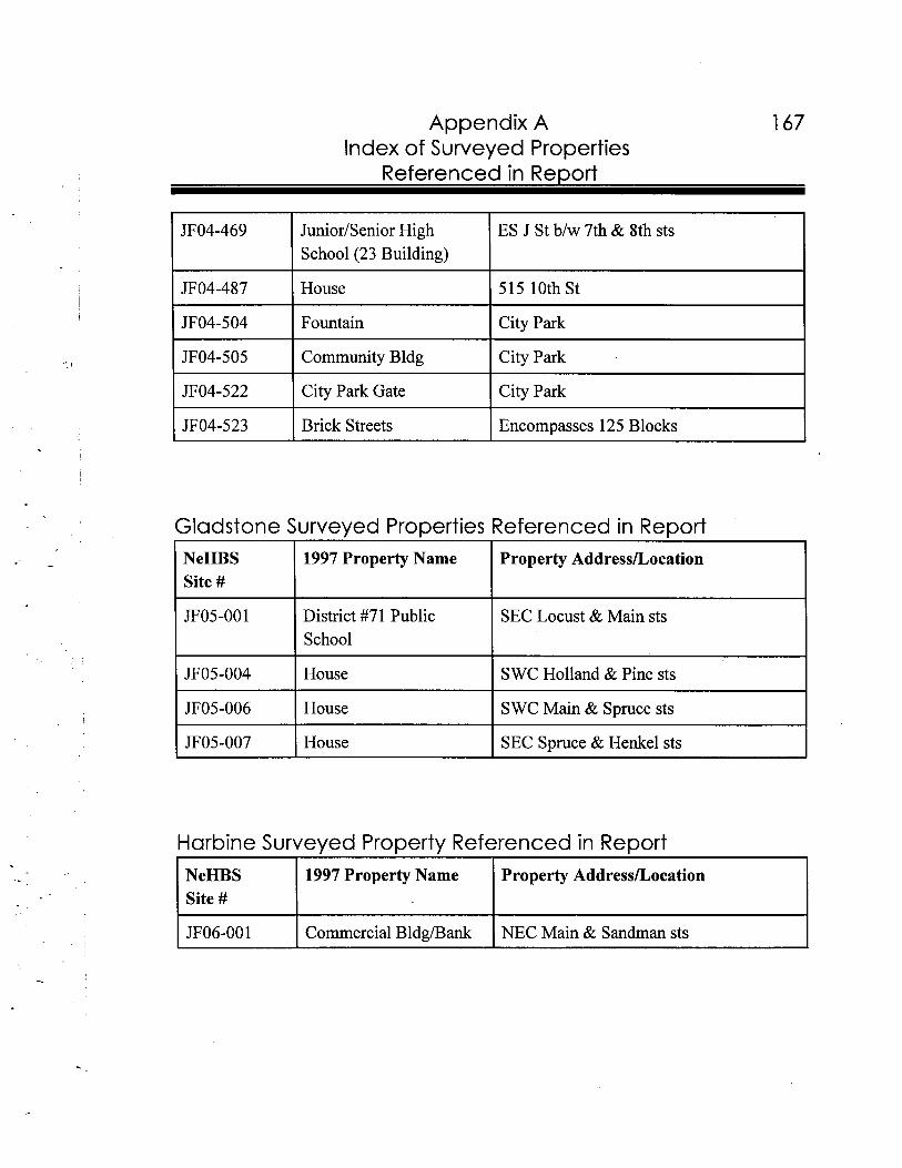
Appendix A Index of Surveyed Properties
Referenced in Re~ort
JF04-469 JuniodSenior High ES J St b/w 7th & 8th sts School (23 Building)
JF04-487 House 515 10th St
JF04-504 Fountain City Park
JF04-505 Community Bldg City Park
JF04-522 City Park Gate City Park
JF04-523 Brick Streets Encompasses 125 Blocks
Gladstone Surveyed Properties Referenced in Report NeHBS 1997 Property Name Property AddressLocation Site #
I I
JF05-001 District #71 Public SEC Locust & Main sts School
JF05-004 House SWC Holland & Pine sts
I JF05-006 I House I S WC Main & Spruce sts I I JF05-007 I House I SEC Spruce & Henkel sts I
Harbine Surveyed Property Referenced in Report I I I I1 NeHBS 1 1997 Property Name I Property AddressLocation I
Site #
JF06-001 Commercial Bldgh3ank NEC Main & Sandman sts
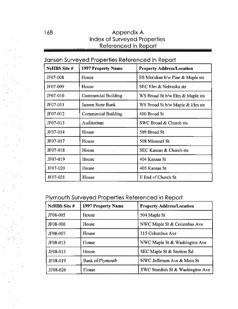
--
--
Appendix A Index of Surveyed Properties
Referenced in Re~ort
Jansen Surveyed Properties Referenced in Report I I
IYeHBS Site # 1997 Property Name Property AddressLocation -JF07-008 House ES Meridian b/w Pine & Maple sts - I House SEC Elm & Nebraska sts
7 I Commercial Building WS Broad St b/w Elm & Maple sts -JF07-011 Jansen State Bank WS Broad St b/w Maple & Elm sts -JF07-0 12 Commercial Building 400 Broad St -JF07-0 13 Auditorium SWC Broad & Church sts
-JF07-0 14 House 509 Broad St -JF07-0 17 I House 1 508 Missouri St -JF07-0 18 House SEC Kansas & Church sts I I -JF07-0 19 House 404 Kansas St I 1 -JF07-020 House 405 Kansas St I 1 -JF07-021 House E End of Church St -
Plymouth Surveyed Properties Referenced in Report NeHBS Site # 1997 Property Name Property AddressLocation
JF08-005 House 504 Maple St
JF08-006 House NWC Maple St & Columbus Ave
JF08-007 House 115 Columbus Ave
JF08-0 13 I House I NWC Maple St & Washington Ave I I House I SEC Maple St & Section Rd
JF08-019 Bank of Plymouth NWC Jefferson Ave & Main St
JF08-026 House SWC Standish St & Washington Ave
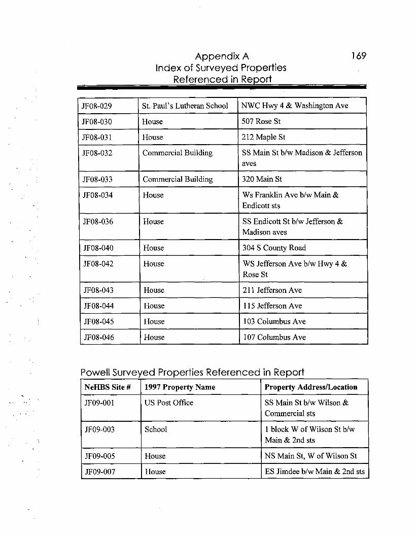
Appendix A Index of Surveyed Properties
Referenced in Report
JF08-029 St. Paul's Lutheran School NWC Hwy 4 & Washington Ave
JF08-030 House 507 Rose St
JF08-03 1 House 2 12 Maple St
JF08-032 Commercial Building SS Main St b/w Madison & Jefferson aves
JF08-033 ( Commercial Building 1 320 Main St I p~-~
JF08-034 House Ws Franklin Ave b/w Main & Endicott sts
JF08-036 House SS Endicott St b/w Jefferson & Madison aves
JF08-040 I House 1 304 S County Road I JF08-042 House WS Jefferson Ave b/w Hwy 4 &
Rose St
JF08-043 I House 1 21 1 Jefferson Ave I JF08-044 House 1 15 Jefferson Ave
JF08-045 House 103 Columbus Ave
JF08-046 House 107 Columbus Ave
Powell Surveyed Properties Referenced in Report NeHBS Site # 1997 Property Name Property Address/Location
JF09-001 US Post Office SS Main St b/w Wilson & Commercial sts
JF09-003 School 1 block W of Wilson St b/w Main & 2nd sts
JF09-005 House NS Main St, W of Wilson St
JF09-007 House ES Jimdee b/w Main & 2nd sts
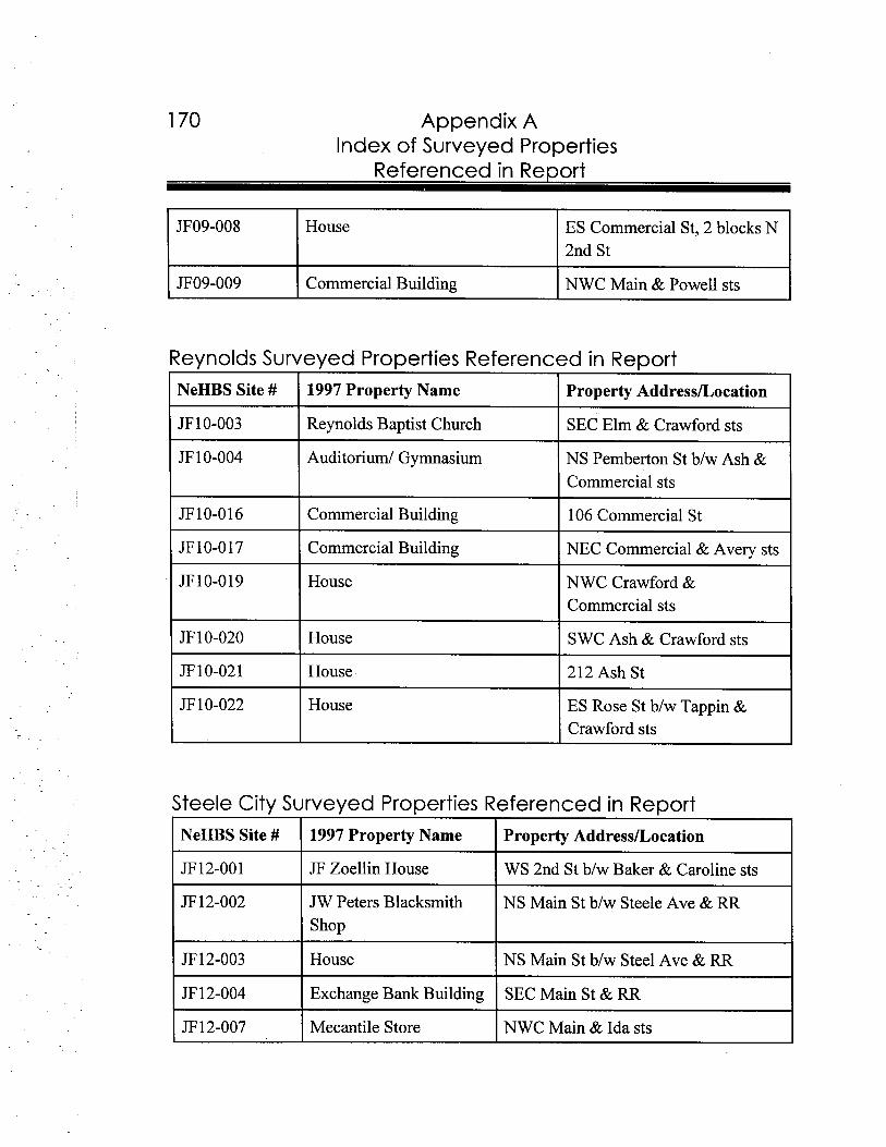
1 70 Appendix A Index of Surveyed Properties
Referenced in Re~ort
JF09-008 House ES Commercial St, 2 blocks N 2nd St
JF09-009 Commercial Building NWC Main & Powell sts
Reynolds Surveyed Properties Referenced in Report I I
NeHBS Site # 1 1997 Property Name I Property Address/Location -JF 10-003 I Reynolds Baptist Church I SEC Elm & Crawford sts
-JF 1 0-004 Auditorium1 Gymnasium NS Pemberton St blw Ash &
Commercial sts -JF10-016 Commercial Building 106 Commercial St -JF10-017 Commercial Building NEC Commercial & Avery sts
-JF10-019 House NWC Crawford &
Commercial sts -JF 10-020 House SWC Ash & Crawford sts
JF 10-02 1 I House 1 212 Ash St -
JF 10-022 I House I ES Rose St b/w Tappin & Crawford sts -
Steele City Surveyed Properties Referenced in Report
NeHBS Site # 1997 Property Name Property Address/Location
JF 12-00 1 JF Zoellin House WS 2nd St b/w Baker & Caroline sts
JF 12-002 JW Peters Blacksmith NS Main St blw Steele Ave & RR Shop
JF 12-003 House NS Main St b/w Steel Ave & RR
JF 12-004 Exchange Bank Building SEC Main St & RR
JF 12-007 Mecantile Store NWC Main & Ida sts
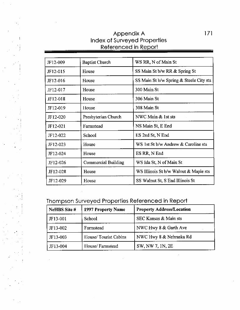
Appendix A Index of Surveyed Properties
Referenced in Report
JF 12-009 Baptist Church WS RR, N of Main St
JF12-015 House SS Main St b/w RR & Spring St
JF12-016 House SS Main St b/w Spring & Steele City sts
JF12-017 House 300 Main St
JF12-018 House 306 Main St
JF12-019 House 308 Main St
JF 12-020 Presbyterian Church NWC Main & 1 st sts
b 1 2 - 0 2 1 I Farmstead I NS Main St, E End
JF 12-022 School ES 2nd St, N End
JF 12-023 House WS 1st St b/w Andrew & Caroline sts
JF 12-024 House ES RR, N End
JF 12-026 Commercial Building WS Ida St, N of Main St
JF 12-028 House WS Illinois St b/w Walnut & Maple sts
JF 12-029 House SS Walnut St, S End Illinois St
Thompson Surveyed Properties Referenced in Report
NeHBS Site # 1997 Property Name Property Address/Location
JF13-001 School SEC Kansas & Main sts
JF 13-002 Farmstead NWC Hwy 8 & Garth Ave
JF13-003 House/ Tourist Cabins NWC Hwy 8 & Nebraska Rd
JF13-004 House/ Farmstead SW, NW 7, IN, 2E


Appendix B
Glossary-
a k a : also known as.
American Foursquare Style (circa 1900-1930): Popularized by mail-order catalogues and speculative builders in the early twentieth century, the style is typified by its box-like massing, two-stories, hipped roof, wide overhanging eaves, central dormers and one-story porch spanning the front facade.
Arch: A curved structural member used to span an opening.
Art Glass: Colored glass, often used in residential windows between the 1890s and 1920s. It was often utilized with clear glass, beveled glass, andlor etched glass panels connected by lead to create a pattern within the window sash.
Art Mode rne Style (circa 1930-1950): Related to the Art Deco style, it features industrial technology and streamlined simplicity. Features include smooth, rounded corners, horizontal massing, details in concrete, glass block, aluminum, and stainless steel.
Balustrade: Decorative, usually open design, railing generally found around exterior porches, balconies, and sometimes indoor stairs and balconies.
Batt lement(s): A parapet with open spaces that surmounts a wall and was, historically, used for defense. Battlements were sometimes added to Gothic Revival buildings for decoration.
Bay: The area of a facade usually between piers or columns creating divisions of the main facade.
Bay window: A decorative window which projects out from the flat surface of an exterior wall, often two or three-sided in design. Bay windows are often seen on Queen Anne style buildings.
Appendix B Glossarv
Belt Course: A horizontal band of brick or stone which projects from the elevation of a building, generally marking a major division in the wall plane. It spans around the front and sides, generally at the top of the foundation, and between stories.
Brackets: Support members used under overhanging eaves of a roof, usually decorative in nature.
Building: A building is erected to house activities performed by people.
Bungalow/Craftsman Style (circa 1890-1940): An architectural style characterized by overhanging eaves, modest size, open porches with large piers and low pitched roofs.
Cararra Glass: A type of opaque, colored glass which was popular as a cladding on commercial facades, particularly of the Art Deco and Art Moderne styles, in the 1920s through the 1950s.
Circa or @: At, in, or of approximately, used especially with dates.
C l apboa rd : Relatively long, thin boards that have a thick lower edge and a feathered, or tapered upper edge. The shape of the boards permits them to be overlapped horizontally. Clapboard is most commonly used as cladding material on vernacular form houses and their secondary buildings.
Columns: A circular or square vertical support member.
Commercial Vernacular (circa 1860- 1930): A form of building used to describe simply designed commercial buildings of the late nineteenth and early twentieth centuries, which usually display large retail windows and recessed entrances on the first floor.
Contributing (National Register definition): A building, site, structure, or object that adds to the historic associations, historic architectural qualities for which a property is significant. The resource was present during the period of significance, relates to the documented significance of the property, and possesses historic integrity or is capable of yielding important information about the period.
Appendix B Glossarv
Contributing (NeHBS definition): A building, site, structure, object, or collection of buildings such as a farmstead, which meets the NeHBS criteria of integrity, historic association, historic architectural qualities, and was present during the period of significance. A property which contributes to the NeHBS is generally evaluated with less strictness than for individual listing on the National Register, yet more strictness than buildings which may "contribute" to a proposed National Register district.
Corbeling: A series of projections typically found on a wall surface.
Cornice: Any decorative member along the top of a wall.
County Capitol (circa 1880 - 19 10): This was a popular form for courthouses in the state and was inspired by the United States Capitol in Washington D.C. Usually situated on a courthouse square, these square-shaped monumental buildings exhibit corner pavilions, a prominent central domed tower, and Neo-Classical or Romanesque styling.
Dentils: Small square blocks in masonry or wood usually located along the cornice.
Dormers: A vertical window projecting from the roof. Variations of d o h e r types can be from the roof forms utilized, for example shed dormers, gable dormers, and hipped dormers.
Eaves: The edge of a roof that extends beyond the wall surface.
Eclectic Style (circa 1890-1910): An eclectic building displays a combination of architectural elements from various styles. It commonly resulted when a house designed in one architectural style was remodeled into another.
Elevation: Any single side of a building or structure.
Eligible: Properties that meet the National Park Service criteria for nomination and listing on the National Register of Historic Places.
Engaged Columns: A column which is built into the wall, rather than laid on it like most pilasters.
Extant: Still standing or existing (as in a building, structure, site, and/or object)
Appendix I3 Glossarv
F a c a d e : The front of a building or any other face of the building give special architectural treatment.
False-front (circa 1850-1880): A vernacular building form, which is typically a one-and- one-half story front gable frame building with a square facade which extends vertically in front of the front-facing gable. This gives an entering visitor the sense of approaching a larger building. This form is often used in the construction of first-generation commercial buildings, thus is also known as "boom-town."
Fanlight: A semi-circular window, often segmented like the sections of an orange. Fanlights are typically found above doors as part of an entryway design on Georgian Revival, Colonial Revival and Neo-Classical Revival style houses.
Fenestration: The arrangement of openings, for example windows and doors, on an elevation.
Finial: Terminal ornaments found at the top of a gable, a pinnacle, a spire, or a newel.
Foundation: The support of a building, which is exposed near ground level.
Fret: An ornament or ornamental work, often in relief, consisting of small straight bars intersecting one another in right or oblique angles.
Front Gable (circa 1 860- 19 10): The vernacular form of a building, generally a house, in which the triangular end of the roof faces the street.
G a b l e : The vertical triangular end of a building from cornice or eaves to ridge.
Gabled Ell (circa 1860-1 910): The vernacular form of a building, generally a house, in which two gabled wings are perpendicular to one another in order to form an "L" shaped plan.
Gabled T (circa 1860-1910): The vernacular form of a building, generally a house, in which two gabled wings are perpendicular to one another in order to form a 'T" shaped plan.
Appendix B Glossarv
Gable End : The triangular end of an exterior wall.
Gable Roof: A roof type formed by the meeting of two sloping roof surfaces.
Hipped Roof: A roof type formed by the meeting of four sloping roof surfaces.
Historic Context: The concept used to group related historic properties based upon a theme, a chronological period, and/or a geographic area.
ltalianate Style (circa 1870-1 890): A popular style for houses, these square, rectangular, or L-shaped two-story buildings have low-pitched, hip roofs, with wide eaves usually supported by heavy brackets, tall narrow windows, and front porches. In some cases, the roof may be topped with a cupola.
Keystone: A wedge-shaped piece at the crown of an arch that locks the other pieces in place. It is seen most often over arched door and window openings and is sometimes of a different material than the opening itself.
Late Gothic Revival Style (circa 1880-1920): A later version of the Gothic style, these buildings are generally larger and use heavy masonry construction. In churches, masonry is sometimes used throughout the structure. The pointed-arch window opening remains a key feature, however, designs are more subdued than those of the earlier period.
Lintel: A horizontal member located at the top of a window, door, or other opening.
Modern Broad-Front (circa 1910-1940): A vernacular form utilized in the design of commercial buildings, the modem broad-front is usually one-story tall, constructed of brick over a steel frame with large, plate-glass windows, and a simple parapet. It is a style that was often used for automobile-related businesses, such as auto dealerships, garages, and service stations.
Modernistic Style (circa 1915-1940): Art Deco, the earlier Modernistic phase, was used primarily for public and commercial buildings and is characterized by angular composition, with towers and vertical projections and smooth wall surfaces with stylized and geometric motifs, including zigzags and chevrons. Art Moderne, the later version, shows smooth wall finishes without surface ornamentation, asymmetrical facades with a horizontal emphasis,
Appendix B Glossary
flat roofs, rounded corners, and bands of windows or curved window glass creating a streamlined effect.
Modillions : An ornamental block or bracket on the lower portion of a cornice.
Multiple Property Documen t : The National Register of Historic Places Multiple Property Documentation Form (NPS 10-900-b) nominates groups of related significant properties. On the form, themes, trends, and patterns of history shared by the properties are organized into historic contexts and property types that represent those historic contexts are defined. The Multiple Property Document Form is a cover document and not a nomination in its own right.
National Register of Historic Places: The official Federal list of districts, buildings, sites, structures, and objects significant in American history, architecture, archaeology, engineering, and culture which are important in the prehistory or history of their community, state or nation. The program is administered through the National Park Service by way of State Historic Preservation Offices (see Chapter I - Introduction of this report).
Neo-Classical Style (circa 1900-1920): An architectural style characterized by a symmetrical facade and usually includes a pediment portico with classical columns.
Noncontributing (National Register definition): A building, site, structure, or object that does not add to the historic architectural qualities or historic associations for which a property is significant. The resource was not present during the period of significance; does not relate to the documented significance of the property; or due to alterations, disturbances, additions, or other changes, it no longer possesses historic integrity or is capable of yielding important information about the period.
Noncontributing (NeHBS definition): A building, site, structure, object, or collection of buildings such as a farmstead, which does not meet the NeHBS criteria of integrity, historic association, historic architectural qualities, or was not present during the period of significance. Noncontributing properties are not generally entered into, nor kept in, the NeHBS inventory, however, exceptions do exist.
Ob jec t : Artistic, simple, andlor small scale constructions not identified as buildings or structures.
Appendix B 1 79 Glossarv
One-story Cube (circa 1870-1930): The vernacular form, generally of a house, which is a one-story building, box-like in massing, low-hipped roof, full front porch recessed under the roof, little ornamentation, and simple cladding, such as clapboard, and less frequently, brick or stucco.
P a r a p e t : A low wall located on the edge of a roof, may be stepped in form.
Ped imen t : A decorative, often triangular or semicircular-shaped, element found at the gable of the roof, or above an entryway.
Picturesque Style (circa 1930-1950): An architectural style used in residential design, the Picturesque style is reflective of romanticism. The style is generally one and one-half stories, steep gable roof with curving angles, irregular massing, and natural appearing materials, including brick, stucco, and pebble dash.
Pilasters: A rectangular column attached to a wall that is used for decorative purposes.
Pony Truss Bridge (circa 1880 - 1920): A low iron or steel truss, approximately five to seven feet in height, located alongside and above the roadway surface. Pony truss bridges often range in span lengths of 20 to 100 feet.
Portico: An entryway to a building, often with an overhanging covering which just hoods the entry, yet not large enough to be considered a porch. Often found on period revival style buildings.
Potentially Eligible: Properties that may be eligible for listing on the National Register of Historic Places pending further research and investigation.
Prairie School Style (circa 1900-1930): This movement, popularized by the world- renowned architect Frank Lloyd Wright, emphasized the integration of a building and its site. Elements of the style include a low-pitched roof line with wide over-hanging eaves, two- stories high with one-story porch, and an overall horizontal emphasis in the design.
Pratt Through Truss Bridge: An overhead truss bridge is up to 24 feet in height, located alongside the roadway surface but with lateral bracing at the top of the truss, connecting the top of the bridge, and creating a canopy overhead. The Pratt Overhead Truss was patented
1 80 Appendix B Glossarv
by Thomas and Caleb Pratt in 1844, and utilizes diagonal members in tension with vertical members to create compression, thus holding the bridge together.
Property: Building(s), site(s), structure(s) and/or object(s) situated within a delineated boundary.
Property Type: A classification for a building, structure, site, or object based on its historic use or function.
Q u e e n A n n e Style (circa 1880-1900): A style which enjoyed widespread popularity, particularly in the eastern portion of Nebraska, these houses are typically two stories tall, have asymmetrical facades and steeply pitched rooflines of irregular shape. Characteristics include a variety of surface textures on walls, prominent towers, tall chimneys, and porches with gingerbread trim.
Quoins: k series of stones, bricks, or wood used to decorate the comers of a building.
Returns: The continuation of moulding from one surface to another, commonly seen as cornice returns which are carried into the gable end of a building.
R o m a n e s q u e Revival Style (circa 1880-1 920): These buildings are generally of masonry construction and usually show some rough-faced stonework. The Roman or round-topped arch is a key feature. Facades are asymmetrical and most examples have towers, brick corbeling, and horizontal stone handing.
Roof Types: See definitions of front gable, side gable, hipped, mansard, and shed.
Rosettes: A disk of foliage or floral design usually in relief used as a decorative motif.
Rustication: A beveled or rebated edge, such as the edges of stone blocks, to make the joints conspicuous.
Sash: The framework within which windows are set.
Segmen ta l Arch: An arch formed by the segment of a circle, generally portrayed over a door or window opening, usually constructed of stone or brick.
Appendix B Glossarv
Shed Roof: A roof consisting of one inclined plane.
Side Gable (circa 1860-1940): The vernacular form of a building, generally a house, in which the gable end of the roof is perpendicular to the street.
Sidelights: A lone fixed window usually flanking each side of a door or another center window.
Sill: The horizontal framing member at the bottom of a window.
Site: The location of a prehistoric or historic event.
Spanish Colonial Revival Style (circa 1900-1920): These buildings, which have a southwestern flavor, show masonry construction usually covered with plaster or stucco, red-tiled hipped roofs, and arcaded porches. Some facades are enriched with curvilinear and decorated roof lines.
Stepped Facade: A facade in which one of the bays protrude from the main plane of the building at a regular interval like stairs.
Stepped Roof: See parapet.
. Streamlined: Smooth wall surfaces, emphasis on horizontal appearance, and curved comers, often used in relation to the Art Moderne style.
String course: A continuous horizontal band of brick or stone on a building used to visually divide an elevation.
Structure: Practical constructions not used to shelter human activities.
Stucco: A material usually made of portland cement, sand, and a small percentage of lime and applied in a plastic state to form a hard covering for exterior walls.
Appendix B Glossary
Sullivanesque: In the style of architect Louis Sullivan, generally extremely decorative elements, often utilizing stylized organic designs. Sullivanesque ornamentation is often executed in glazed terra cotta relief or wrought iron.
Swag: An ornamentation which gives the appearance of a decoration hanging in a curve between two points. Swag ornamentation is often found in relief form as decoration on Classical Revival style builidngs.
Terra Cotta: A glazed or unglazed fired clay used for architectural purposes such as roofing, facing, and relief ornamentation.
Transom: A small window located above a door.
Tripartite: In architectural applications, tripartite often refers to windows which are placed together in sets of three.
Tudor Revival (circa 1920-1940): A style which reflects a blend of a variety of elements from late English medieval styles. It is identified by steep gables, half-timbering and mixes of stone, stucco and wood.
Turret: A little tower which is an ornamental structure at an angle from a larger structure.
Two-story CUbe (circa 1860- 1890): The vernacular form, generally for a house, which is a two-story building box-like in massing, with a hipped roof, near absence of surface ornament and simple exterior cladding such as brick, clapboard, or stucco.
USGS map: United States Geological Survey maps depict variations in topographical elevations. USGS maps are used by the National Park Service to locate National Register properties and districts.
Vernacular: The vernacular form is a functional, simplistic building or structure without stylistic details. Vernacular form buildings were usually designed by the builder, not by an architect.
Appendix B Glossarv
Weatherboard: A wood cladding material, usually long, thin, wide boards, with rabbeted or lapped edges. It is laid on the horizontal with the edge of each board overlapped to prevent rain or other moisture from passing through the walls.