Embed Size (px)
Citation preview
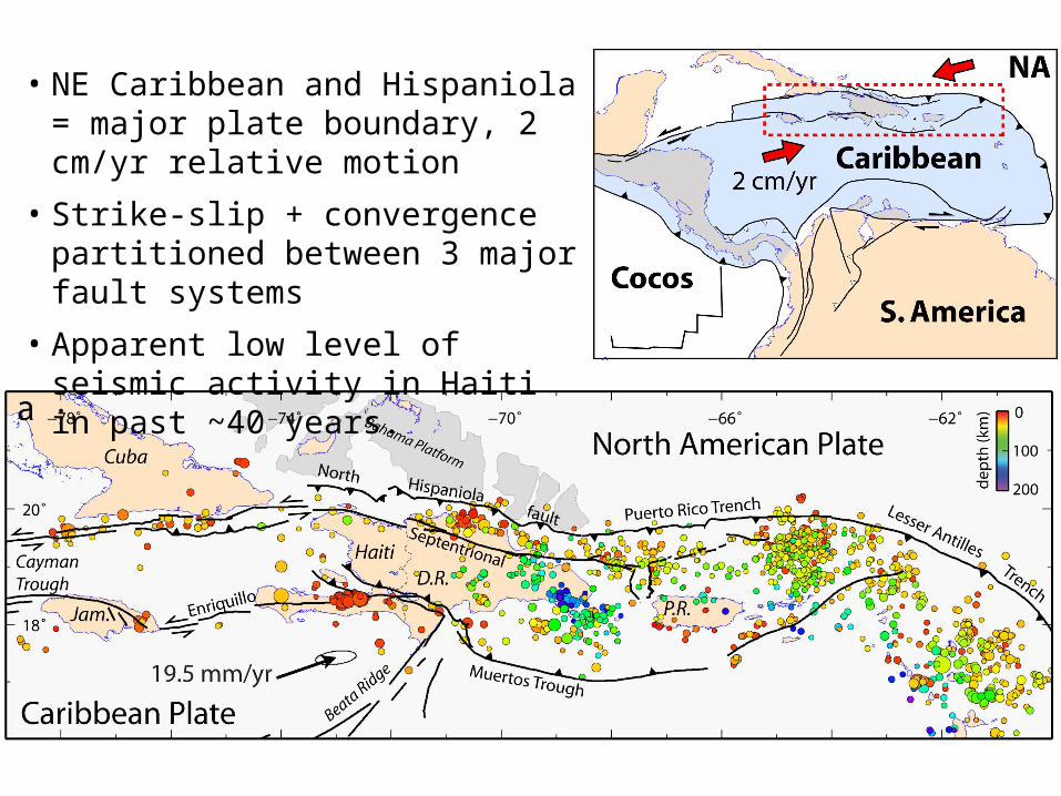
• NE Caribbean and Hispaniola = major plate boundary, 2 cm/yr relative motion
• Strike-slip + convergence partitioned between 3 major fault systems
• Apparent low level of seismic activity in Haiti in past ~40 years.
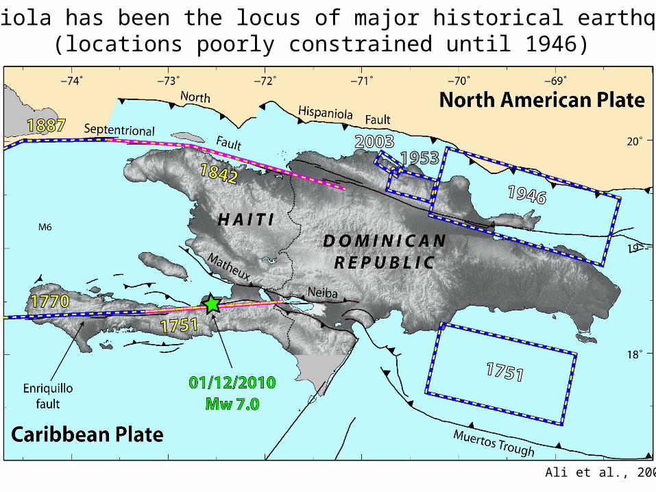
Hispaniola has been the locus of major historical earthquakes(locations poorly constrained until 1946)
Ali et al., 2008
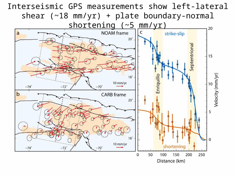
Interseismic GPS measurements show left-lateral shear (~18 mm/yr) + plate boundary-normal shortening (~5 mm/yr)
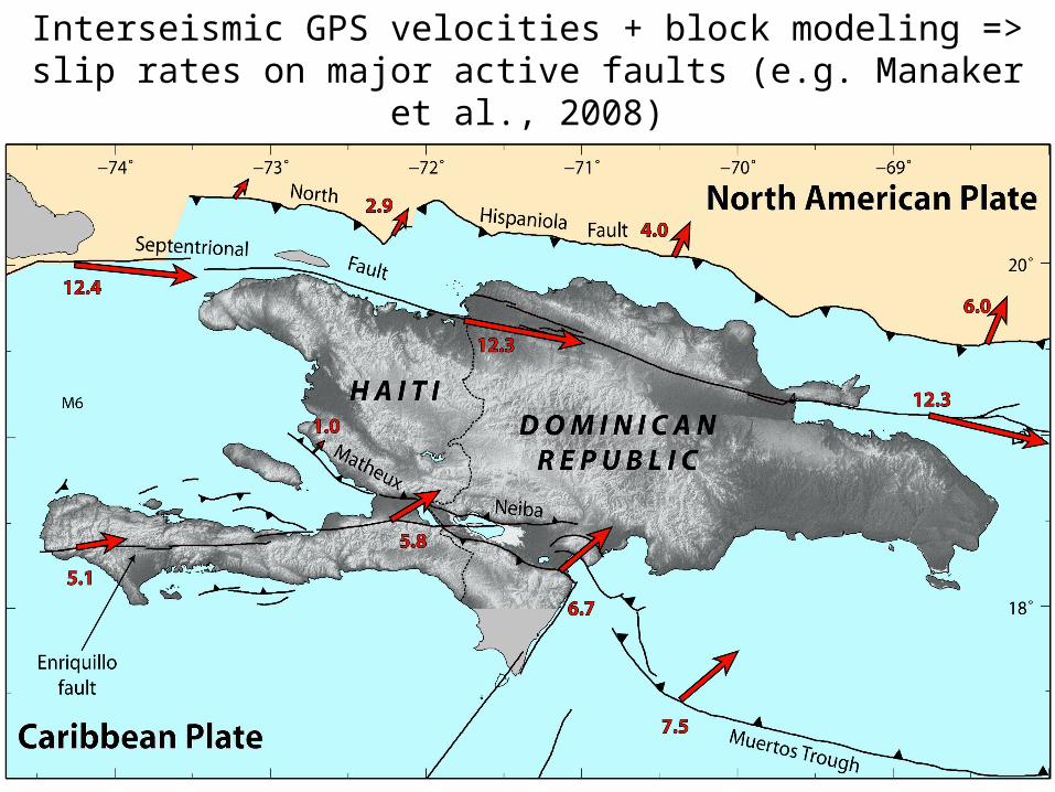
Interseismic GPS velocities + block modeling => slip rates on major active faults (e.g. Manaker et al., 2008)
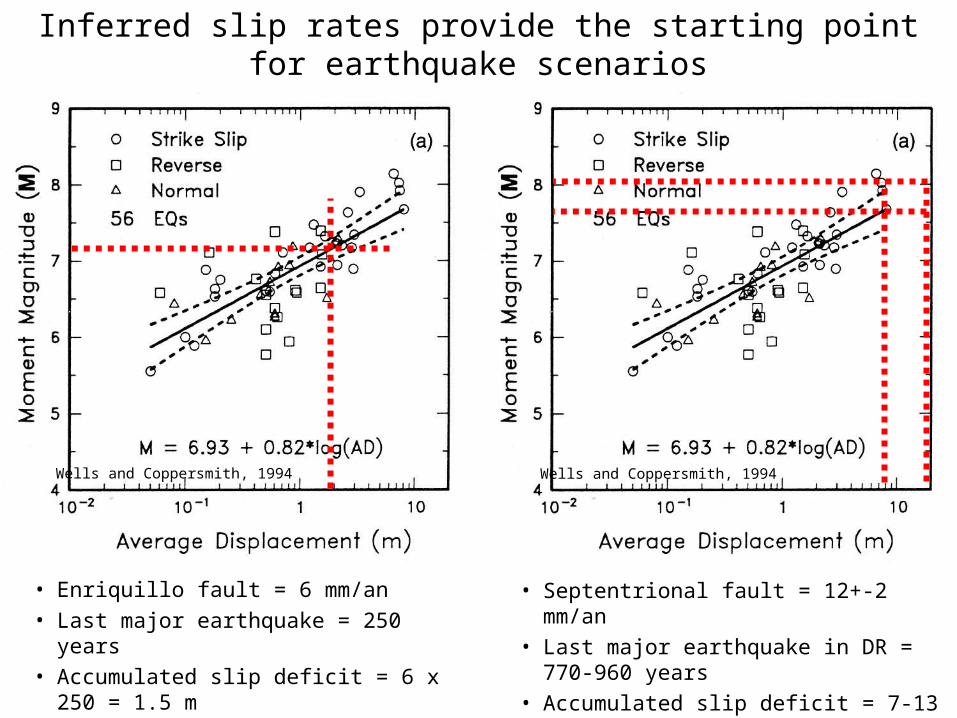
• Enriquillo fault = 6 mm/an• Last major earthquake = 250 years• Accumulated slip deficit = 6 x 250 = 1.5 m• Potential for Mw=7.1
• Septentrional fault = 12+-2 mm/an• Last major earthquake in DR = 770-960 years• Accumulated slip deficit = 7-13 m• Potentiel pour Mw=7.7-8.1
Inferred slip rates provide the starting point for earthquake scenarios
Wells and Coppersmith, 1994 Wells and Coppersmith, 1994
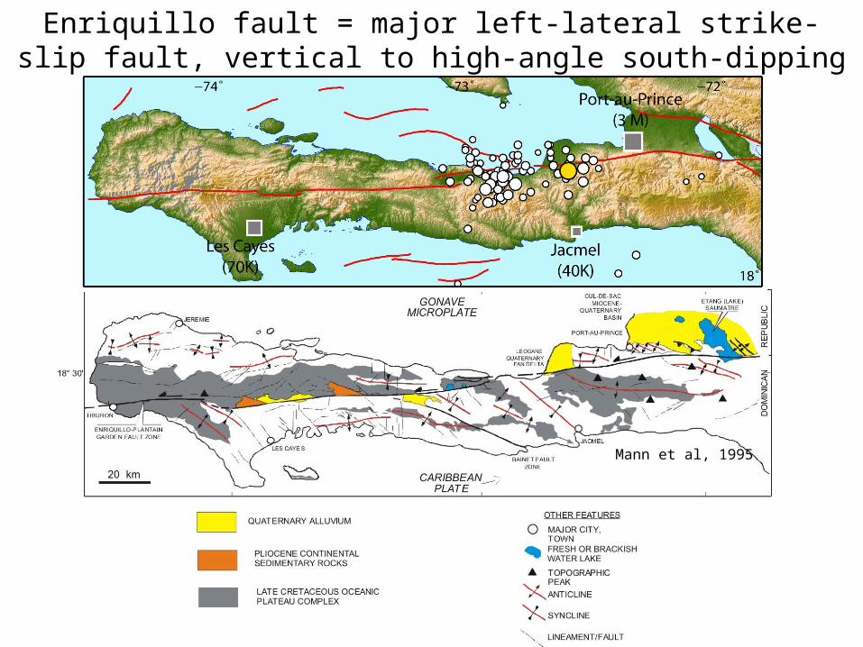
Mann et al, 1995
Enriquillo fault = major left-lateral strike-slip fault, vertical to high-angle south-dipping
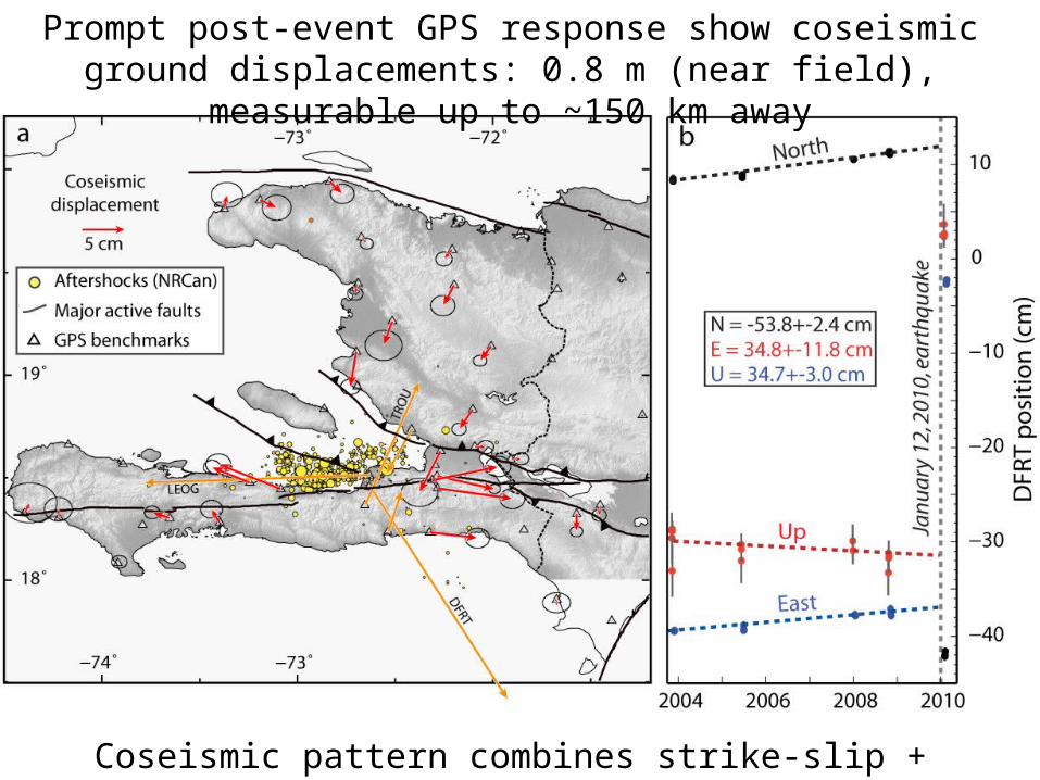
Prompt post-event GPS response show coseismic ground displacements: 0.8 m (near field), measurable up to ~150 km away
Coseismic pattern combines strike-slip + shortening
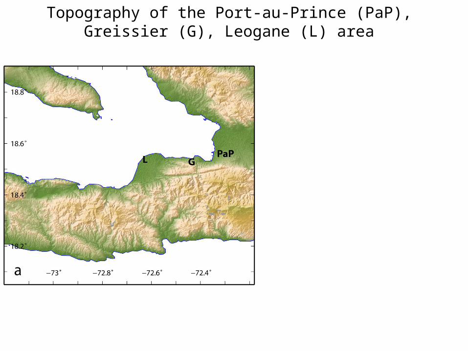
Topography of the Port-au-Prince (PaP),Greissier (G), Leogane (L) area
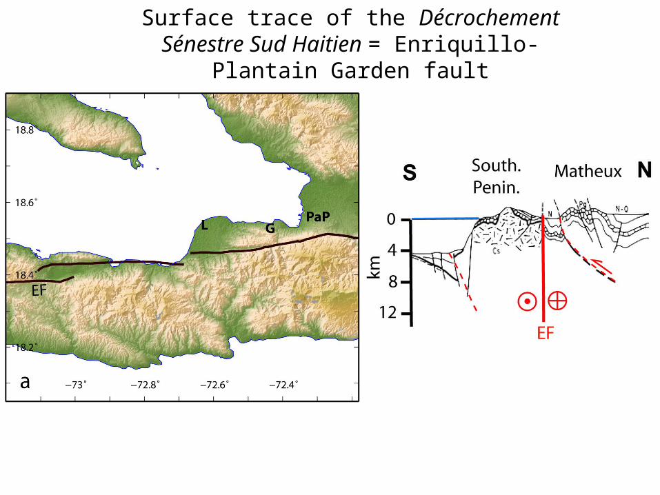
Surface trace of the Décrochement Sénestre Sud Haitien = Enriquillo-Plantain Garden fault

Radar interferogram 03/09/2009 – 01/25/2010each fringe = 0.2 m of displacement in ground-satellite direction
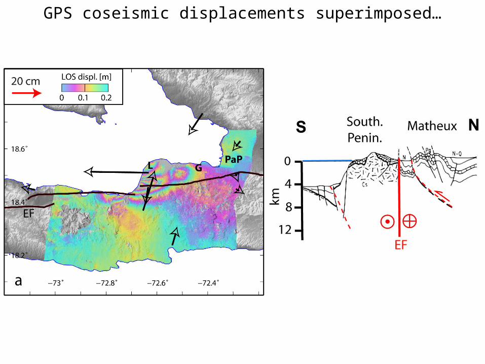
GPS coseismic displacements superimposed…
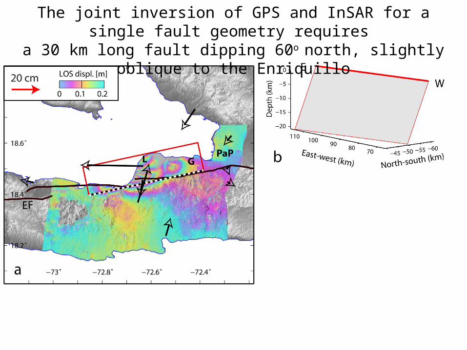
The joint inversion of GPS and InSAR for a single fault geometry requires a 30 km long fault dipping 60o north, slightly oblique to the Enriquillo

The inversion of geodetic data indicates up to 5 m of slip between depths of ~20 and 5 km, with two main patches
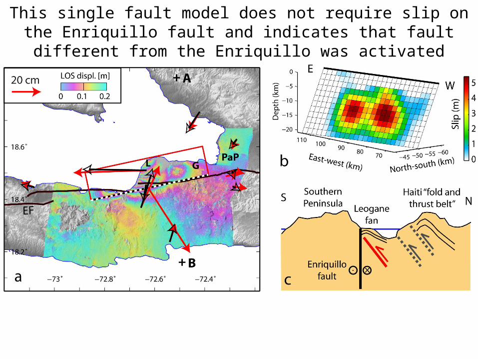
This single fault model does not require slip on the Enriquillo fault and indicates that fault different from the Enriquillo was activated

The single fault model implies that moment release was partitioned between 62% by strike-slip, 38 % dip-slip thrust

De Lepinay et al (OBS deployment - triangles), see also Nettles and S.Hjorleifsdottir, LDEO
Aftershock studies indicate (1) locations north of the EPGFZ, (2) pure reverse faulting mechanisms on WNW-ESE trending faults
White circles = USGS PDEsColor circles = relocated aftershocksTriangles = seismic stations (OBS + onland)
White circles = USGS PDEsColor circles = relocated aftershocksTriangles = seismic stations (OBS + onland)

Changes in Coulomb failure stresses
(aftershock locations from NRCan)
Depth = 10 km, apparent friction = 0.8, receiver faults with strike=130, dip=60,
and pure reverse motion
Depth = 10 km, apparent friction = 0.2, receiver faults with strike=85, dip=90,
and pure left-lateral motion
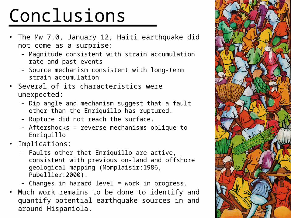
Conclusions• The Mw 7.0, January 12, Haiti earthquake did not come
as a surprise:– Magnitude consistent with strain accumulation rate and
past events– Source mechanism consistent with long-term strain
accumulation• Several of its characteristics were unexpected:
– Dip angle and mechanism suggest that a fault other than the Enriquillo has ruptured.
– Rupture did not reach the surface.– Aftershocks = reverse mechanisms oblique to Enriquillo
• Implications:– Faults other that Enriquillo are active, consistent with
previous on-land and offshore geological mapping (Momplaisir:1986, Pubellier:2000).
– Changes in hazard level = work in progress.• Much work remains to be done to identify and quantify
potential earthquake sources in and around Hispaniola.

Frankel, A.et al.,Documentation for Initial Seismic Hazard Maps for Haiti, USGS Open-File Report 2010.
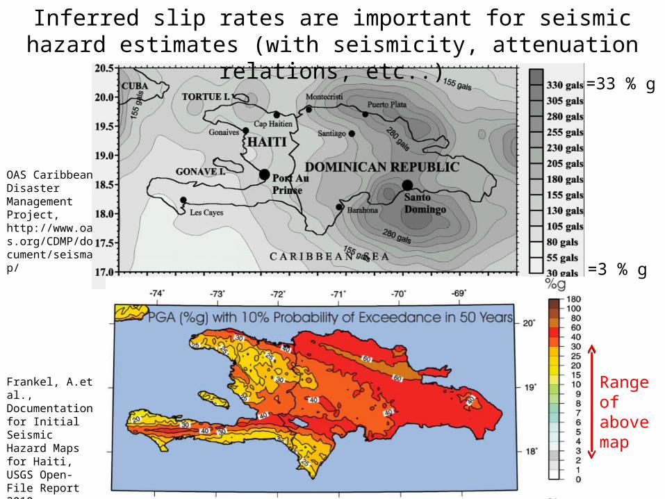
Inferred slip rates are important for seismic hazard estimates (with seismicity, attenuation relations, etc..)
OAS Caribbean Disaster Management Project, http://www.oas.org/CDMP/document/seismap/
=33 % g
=3 % g
Range of above map