Embed Size (px)
Citation preview
National
Cooperative
Soil
Survey Newsletter
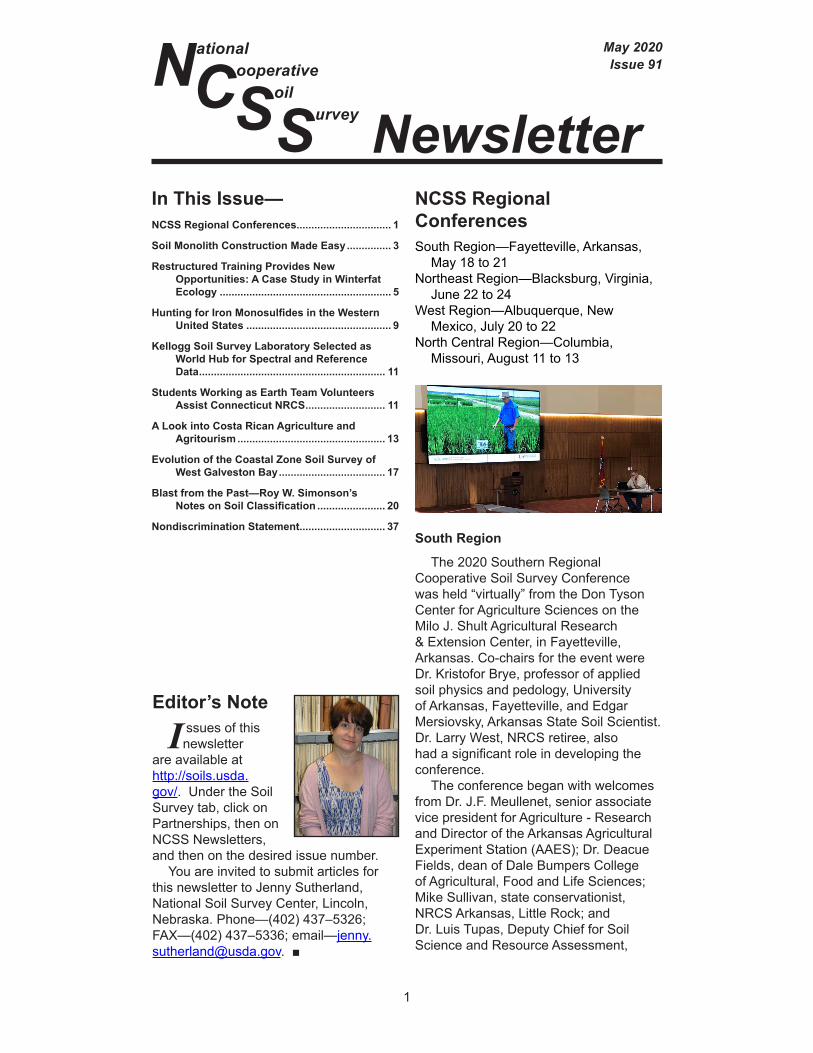
May 2020Issue 91
In This Issue—NCSS Regional Conferences................................ 1
Soil Monolith Construction Made Easy ............... 3
Restructured Training Provides New Opportunities: A Case Study in Winterfat Ecology .......................................................... 5
Hunting for Iron Monosulfides in the Western United States ................................................. 9
Kellogg Soil Survey Laboratory Selected as World Hub for Spectral and Reference Data ............................................................... 11
Students Working as Earth Team Volunteers Assist Connecticut NRCS ........................... 11
A Look into Costa Rican Agriculture and Agritourism .................................................. 13
Evolution of the Coastal Zone Soil Survey of West Galveston Bay .................................... 17
Blast from the Past—Roy W. Simonson’s Notes on Soil Classification ....................... 20
Nondiscrimination Statement ............................. 37
Editor’s Note
I ssues of this newsletter
are available at http://soils.usda.gov/. Under the Soil Survey tab, click on Partnerships, then on NCSS Newsletters, and then on the desired issue number.
You are invited to submit articles for this newsletter to Jenny Sutherland, National Soil Survey Center, Lincoln, Nebraska. Phone—(402) 437–5326; FAX—(402) 437–5336; email—[email protected]. ■
1
NCSS Regional ConferencesSouth Region—Fayetteville, Arkansas,
May 18 to 21 Northeast Region—Blacksburg, Virginia,
June 22 to 24West Region—Albuquerque, New
Mexico, July 20 to 22 North Central Region—Columbia,
Missouri, August 11 to 13
South Region
The 2020 Southern Regional Cooperative Soil Survey Conference was held “virtually” from the Don Tyson Center for Agriculture Sciences on the Milo J. Shult Agricultural Research & Extension Center, in Fayetteville, Arkansas. Co-chairs for the event were Dr. Kristofor Brye, professor of applied soil physics and pedology, University of Arkansas, Fayetteville, and Edgar Mersiovsky, Arkansas State Soil Scientist. Dr. Larry West, NRCS retiree, also had a significant role in developing the conference.
The conference began with welcomes from Dr. J.F. Meullenet, senior associate vice president for Agriculture - Research and Director of the Arkansas Agricultural Experiment Station (AAES); Dr. Deacue Fields, dean of Dale Bumpers College of Agricultural, Food and Life Sciences; Mike Sullivan, state conservationist, NRCS Arkansas, Little Rock; and Dr. Luis Tupas, Deputy Chief for Soil Science and Resource Assessment,
NCSS Newsletter
2
NRCS, Washington, D.C. Jeff Olson gave a welcome from the Arkansas Association of Professional Soil Classifiers. Dr. Dave Lindbo, director of NRCS Soil and Plant Science Division (SPSD), gave a talk on plans for the Division. David Hoover, director of the National Soil Survey Center, gave an update of the activities at the center. SPSD Regional Directors Debbie Anderson, Jo Parsley, and Dave Kingsbury gave updates for their respective regions.
On Tuesday afternoon, there were presentations about the Ag Handbook 296 update, the proposal for the Aquasol soil order, and creating historical orthoimagery from 1980s NHAP (National High Altitude Program) photography. The originally planned 1-day tour was replaced with a 2.5-hour virtual tour of northwest Arkansas. Viewers learned about the Discovery Farm network in Arkansas from the University Arkansas Extension Service and its emphasis in water quality with the Moore Farm poultry operation. The Morris cattle and sheep operation gave some perspective on soil health. The Chesney Prairie Natural Area generated a lot of chat over the long-time question on what created the mima mounds. The Illinois River Watershead Partnership talked about their water quality conservation efforts, especially in an urban environment. The session ended with a lightning round of posters and videos, which will be posted on the conference website.
On Wednesday, the committees, which have held virtual meetings since January, met to resolve issues and allow new perspectives from new members. A big thanks goes to all that attended. Each of the committees had great discussions, which resulted in items to forward to the National Leaders. A special thanks goes to the co-committee chairs for their hard work and dedication.
Thursday morning was spent on the SPSD Focus Teams. Each team had an opportunity to talk about their progress and accomplishments. Cooperators got to know a bit more about the activities of the teams and see where they may fit in with their work. This led to a lot of discussion.
The conference concluded with the business meeting in the afternoon. Each committee gave a report, and amendments to the bylaws were approved. Full committee reports and minutes of the meeting will be posted on the website. Special thanks go to the small army of people that helped in the conference’s successful change to “virtual.” The meeting did accomplish some of the goals of this conference, but one important missing piece was the networking and building of professional relationships. The next Southern Regional Conference will be hosted by South Carolina.
Northeast Region
The Northeast Region will hold a virtual conference June 22 to 24. It will be hosted by Virginia Tech’s “Canvas,” a learning management software that is used to teach classes. Each of the 57 sessions will be presented through Zoom software. The agenda is filled with oral presentations, lightning fast talks (5 minutes each), poster sessions, standing committee sessions and reports, task force committee reports, cooperator group meetings/discussions, general business, and awards. Attendees can enter or leave any session at will. There will be a virtual field trip with interviews and some video from the field. Included will be a talk about predicting erosion on steep shallow soils in the mountains following gas pipeline installation, genesis of soils at high elevations in west-central Virginia, and vernal pool wetlands in the mountains. The conference is free of charge, and interested people are welcome regardless of which region or country they live in.
West Region
The West Regional Cooperative Soil Survey’s virtual conference will be held July 20 to 22 via Zoom meeting technology. The theme of this meeting is “Uses of Soil Survey.” In the true spirit of the cooperative soil survey, the conference is planned to
NCSS Newsletter
3
include presentations from NRCS, U.S. Forest Service, Bureau of Land Management, and U.S. Geological Survey.
Highlights of this meeting will include virtual tours of soils distinct to many of the western States as well as lightning talks from graduate student researchers. Furthermore, the organizers will to award a cash prize to the student with a winning presentation!
In these unprecedented times, the organizers are grateful to their collaborators throughout the West and especially at their home base, New Mexico State University, for helping to ensure this year’s WRCSS conference is informative, exciting, and memorable for all who attend!
North Central Region
Due to the COVID-19 pandemic, the 2020 NCSS North Central Meeting has been postponed until August 11 to 13. It will be hosted by the University of Missouri and the Natural Resources Conservation Service in Missouri, along with the U.S. Forest Service and Agricultural Research Service. The theme is “Measuring Soil Ecosystem Responses in a Changing Climate.”
For more information on the conferences, visit: https://www.nrcs.usda.gov/wps/portal/nrcs/detail/soils/survey/partnership/ncss/?cid=nrcs142p2_053541. ■
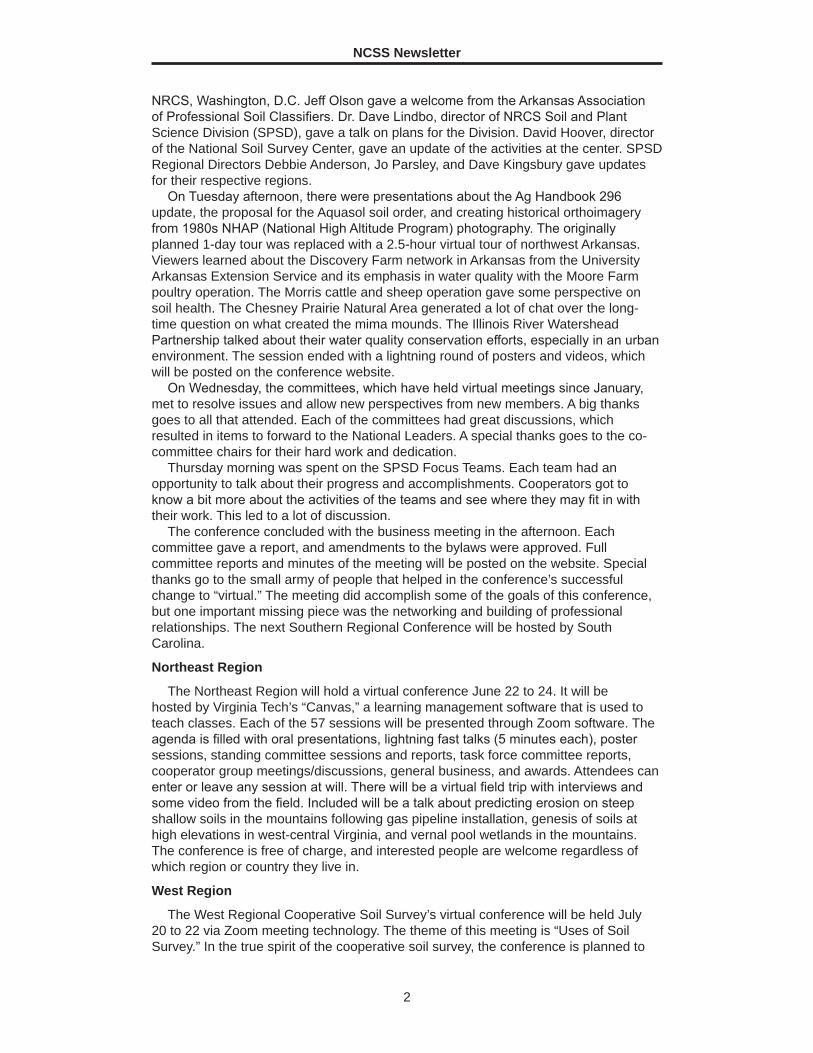
Soil Monolith Construction Made EasyBy Dave Kohake, NRCS resource soil scientist, Manhattan, Kansas.
O ne of the best teaching aids for a soil scientist is a soil monolith that
visually displays characteristics about a certain soil type. Numerous kinds of monoliths have been created over the years. The most commonly constructed monolith requires that the scientist first dig a small pit with a backhoe. Next, the scientist must smooth out a profile, hammer in a metal frame, excavate soil out and into the frame, and transfer the soil from the frame onto a mounting board. This process is very labor-intensive and time-consuming.
A simpler way of creating monoliths has been developed and is outlined below. In this procedure, the scientist uses a Giddings hydraulic probe to pull a 3-inch soil core, which is then placed into a preconstructed frame. A monolith can be created for any soil that is accessible by truck and that a soil probe can penetrate. To locate a good representative of the soil you want for the monolith, we suggest starting in areas that already have been sampled for the Kellogg Soil Survey Laboratory, Official Soil Series Descriptions’ type locations, and taxonomic unit descriptions.
Figure 1.—Completed monoliths.

NCSS Newsletter
4
Steps for Making the Monolith
1. For the back, cut a 1 x 10 inch board to a length of 54 inches.
2. For the sides, cut two 1 x 3 inch boards to a length of 48 inches.
3. For the bottom, cut a 1 x 3 inch board to a length of 3½ inches.
4. Cut a 3-inch PVC pipe to a length of 47-¼ inches, and then cut the pipe in half using a jigsaw.
5. Place the 1 x 3 inch boards so that they will center the soil core. Glue the boards to the back and screw them on.
6. Place the PVC pipe between the boards. Attach it using 2-inch screws every few inches.
7. At the site, use WD-40 to lubricate both the inside and outside of the probe’s 3-inch tube. This allows the core to slide out relatively easy. Be careful to not compact the soil in the tube.
8. Lay the soil core into the PVC pipe. 9. Lay the pre-constructed frame next to the core. 10. Place cheesecloth into the frame, sliding it over the numerous screws holding
the PVC pipe in place. Although it may not be needed, the cheesecloth makes the surface rougher so that the soil core bonds better.
11. Pour undiluted Elmer’s glue into the PVC pipe straight from the jug. Use a very liberal amount and spread it around with a brush.
12. The soil core now can be placed onto the frame. It is best to start at the top and work your way down. Make sure you force the core down onto the screws, so that it is resting on the PVC pipe.
13. Pick the core down to show the natural soil structure. Once the entire profile is picked down, it is ready to be sprayed.
14. Make sure that any loose, picked-off material is wiped off. Use a paintbrush or simply blow off the loose material. A screwdriver can be used to get material from between the PVC pipe and the frame.
15. Fill a regular spray bottle with diluted Elmer’s glue. (We used a glue-to-water ratio of about 1:7.) The glue will dry clear.
16. Before spraying, make sure you shake the spray bottle well. Otherwise, spraying can leave behind shiny globs. (We laid small PVC pipe on the frame
Figure 2.—Pulling the soil core.
Figure 3.—Placing the core into the frame.

NCSS Newsletter
5
to prevent excess glue from getting onto the frame.)
17. After spraying, use a rag to wipe all excess glue from the frame. The glue wipes off easily when wet.
18. Back at the office, spray the core down a few more times to make sure it is solid.
My staff stained the frames before construction and spray painted the pipe a dark-brown color to make it less noticeable. We also created a placard with the soil series name and glued it on the top of the frame. Additional information, such as taxonomic classification, horizonation, soil properties, depths, etc., also can be placed on the monolith.
Using scrap pieces, we constructed other frames for monoliths that would hold 32-inch or 14-inch cores. These frames will be used for moderately deep, shallow, and possibly very shallow soils.
In summary, we now have monoliths that look professional but were much easier and cheaper to create. Each frame required roughly $15 worth of materials. ■
Figure 4.—Spraying the soil profile with diluted glue (1:7 glue-to-water ratio).
Restructured Training Provides New Opportunities: A Case Study in Winterfat EcologyBy Erin Hourihan, ecological site data quality specialist, NRCS Region 9, Temple, Texas.
I t is not every day that a training course provides the opportunity to explore important management questions and inform your day-to-day workload. The
NRCS course “Range Ecology and Management II” has been specifically restructured to do this. It informs students about advanced rangeland ecology and management principles and issues so that they can better apply these principles and describe ecological process. The following is a brief summary of a final project that investigated the controlling abiotic factors for an important, but understudied, desert shrub native to North America. Knowledge and awareness of abiotic factors have important implications for restoration and management of plant communities everywhere. This was a wonderful opportunity to increase both knowledge and awareness about winterfat (Krascheninnikovia lanata).
Results indicated that winterfat communities in Nevada are commonly associated with soils that are well drained, have high amounts of calcium carbonates throughout, have increased nitrate accumulation at depth, and are on slopes of less than 15 percent in landscape positions that receive moisture. These characteristics are specific to the Great Basin, but landform position, landform shape, and depth to changes in soil chemistry should be considered throughout the range of winterfat.
Winterfat is known for its superior forage quality and ability to maintain the weight of grazing animals on sparsely vegetated winter rangelands. It grows in western Nebraska, throughout the intermountain West, and up to the Yukon Territory of Canada. Unfortunately, decades of mismanagement have contributed to declining populations, despite improvements in grazing and management practices. Management is challenging, in part, due to limited published information specific to abiotic factors such as soil and landscape characteristics. Winterfat is common in
NCSS Newsletter
6
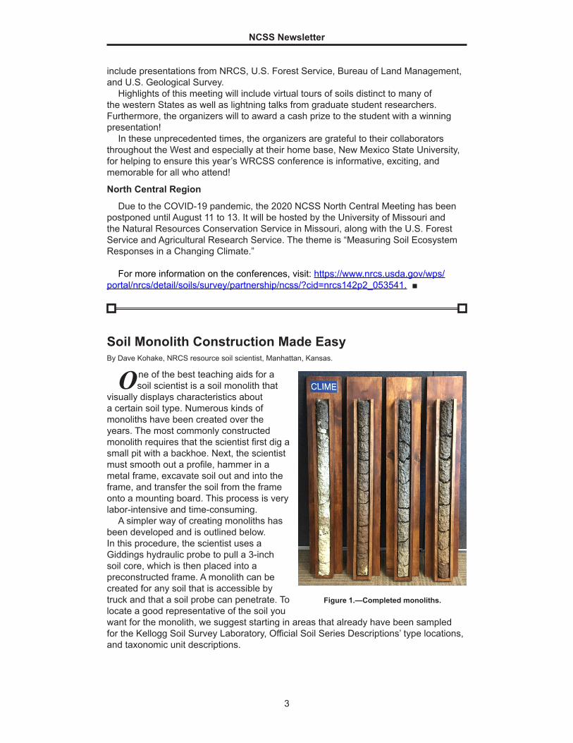
areas characterized by moisture and temperature extremes. It may form near monocultures over extensive areas in the salt-desert shrub or sagebrush steppe; it may also persist in minor amounts throughout the successional process in grasslands and open forests.
Drought is an ongoing disturbance in winterfat habitat. Winterfat exhibits both low mortality and low natality during drought periods (Chambers and Norton, 1993), demonstrating its stress tolerance. Without external perturbations the habitat can tolerate natural disturbances such as drought and seasonal grazing. Characteristics that allow winterfat to survive high-stress environments may also be responsible for slow rates of recovery following extended periods of defoliation and other disturbances (Grime, 1977).
Winterfat is vulnerable to competition by non-native, invasive species, including halogeton (Halogeton glomeratus), Russian thistle (Salsola kali), and annual mustards with lesser amounts of cheatgrass (Bromus tectorum). Stands of halogeton are common on sites where the reference community was dominated by winterfat. Studies have shown that halogeton can increase the amount of sodium in soils that previously supported winterfat and so lead to changes in soil chemistry and the soil microbial communities. Over the long term, increases in sodium could reduce uptake of other cations, resulting in nutrient stresses on the present vegetation (Kitchen and Jorgensen, 2001). Overall, the presence of introduced annuals reduces the likelihood of native perennials replacing themselves (Freeman and Emlen, 1995) through increased competition and changes to the disturbance return intervals.
Soils data used for this project were gridded SSURGO (gSSURGO). The Create Soil Map tool, in the Soil Data Development Toolbox, was used to create soil interpretation maps based on gSSURGO database files. Statistical analysis was conducted using R. Packages developed specifically for soil science and ecology, such as soilDB, allowed for access to commonly used soil databases. R was also used to compare soil survey map units correlated to winterfat-dominated ecological sites via sampling of various raster data sources within map unit polygons.
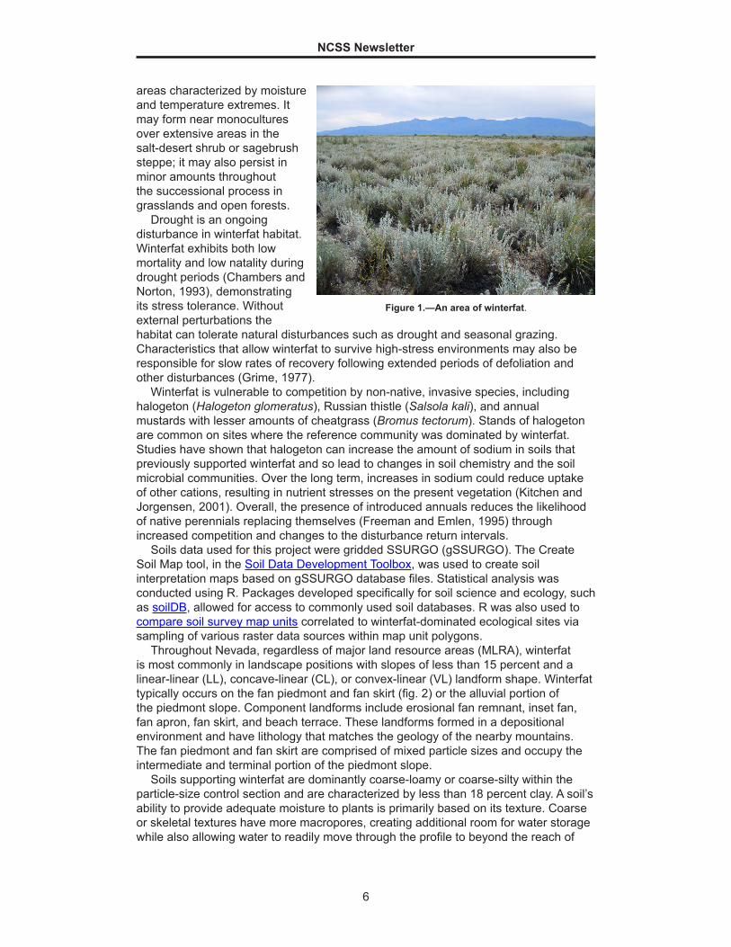
Throughout Nevada, regardless of major land resource areas (MLRA), winterfat is most commonly in landscape positions with slopes of less than 15 percent and a linear-linear (LL), concave-linear (CL), or convex-linear (VL) landform shape. Winterfat typically occurs on the fan piedmont and fan skirt (fig. 2) or the alluvial portion of the piedmont slope. Component landforms include erosional fan remnant, inset fan, fan apron, fan skirt, and beach terrace. These landforms formed in a depositional environment and have lithology that matches the geology of the nearby mountains. The fan piedmont and fan skirt are comprised of mixed particle sizes and occupy the intermediate and terminal portion of the piedmont slope.
Soils supporting winterfat are dominantly coarse-loamy or coarse-silty within the particle-size control section and are characterized by less than 18 percent clay. A soil’s ability to provide adequate moisture to plants is primarily based on its texture. Coarse or skeletal textures have more macropores, creating additional room for water storage while also allowing water to readily move through the profile to beyond the reach of
Figure 1.—An area of winterfat.
NCSS Newsletter
7
plant roots. Surface and subsurface soil textures may be highly variable, even across one ecological type. According to NCSS lab data on soils supporting winterfat plant communities, the soils are occasionally silt loam but are more commonly loamy, such as very fine sandy loam or fine sandy loam. These soil textural characteristics support winterfat but also promote some of winterfat’s commonly associated species. Both Indian ricegrass and needle and thread are known for their drought tolerance and affinity to sandy soil surface textures.
Soil depth does not appear to be a driving abiotic factor controlling the presence of winterfat across any of the ecological sites analyzed. However, depth to changes in soil chemistry, specifically accumulation of carbonates and nitrate, do. Throughout the study area, soils supporting winterfat are commonly calcareous or geographically associated with soils characterized by greater than 15 percent, by volume, calcium carbonate (CaCO3) in the upper 50 cm. Winterfat is extensive (about 325,000 acres) in east-central Nevada where much of the soil parent material is limestone and readily weathers to CaCO3.
However, parent material alone does not explain the distribution of winterfat. Secondary carbonates are important. Also called pedogenic carbonates, they are precipitated in place from the soil solution rather than inherited from the parent material. Secondary carbonates form when dissolved carbon dioxide (CO2) precipitates carbonate and bicarbonate with calcium (Ca2+) and magnesium (Mg2+) from outside the system (Bronick and Lal, 2005). Rates of soil carbonate vary due to differences in dust sources, precipitation, and parent material. In areas with limited moisture, dissolved carbonates can react with available cations to form secondary carbonate coatings on soil particles. Accumulation of pedogenic calcium carbonate is common in arid and semiarid climates, and its distribution and abundance are capable of influencing soil fertility, erodibility, and available water capacity (Doner and Lynn, 1989). The presence of carbonates can also change the water-holding potential of a soil. Very fine carbonates can coat clay and slit particles and so reduce their surface tension (McCauley et al., 2005), allowing free water to drain away and creating droughty conditions in a soil that would otherwise be able to store an adequate amount of water.
Nitrate (NO -3) is a form of inorganic nitrogen (N) that naturally occurs in soils and is
important to the growth of plants and microorganisms. It is very soluble in water and easily lost from the system through leaching or runoff. The accumulation of NO -
3 in
Figure 2.—Slope shape or curvature class associated with winterfat ecological sites. “C” = concave, “L” = linear, and “V” = convex.
NCSS Newsletter
8
soils of the Great Basin has long been recognized. Sources of nitrate in desert soils include eolian dust, rainfall, mineralization of organic matter, and microorganisms. In Nevada, Nettleton and Peterson (2011) determined that there is a relationship between NO -
3 accumulation and landform, soil morphology, and vegetation. They found that soils on inset fans and fan skirts accumulated the most NO -
3 while soils on fan summits accumulated the least. This relationship corresponds with the amount of run-on moisture. Concave or concave-linear landform positions (inset fans, fan skirts, etc.) receive overland flow and run-on, while convex landform positions (fan summits) shed water and contribute to runoff. Nitrate only accumulates in soils when it is available in greater amounts than plants can utilize. The authors found that soils with well developed pedogenic horizons, like argillics or petrocalcids, tend to accumulate very little NO -
3. Well developed pedogenic horizons prevent the deep percolation of water and leaching of nitrate, allowing plants to utilize available NO -
3 within the rooting zone. Soils supporting extensive stands of winterfat in Nevada lack these well developed pedogenic horizons. Significant amounts of NO -
3 were measured in soils supporting winterfat: values ranged from 2100 to 7400 kg/ha (Nettleton and Peterson, 2011). Some soils had very little accumulation within 150 cm of the soil surface, although they did receive run-on moisture. It is possible that NO -
3 had leached to greater depths in medium and coarse textured soils because NO -
3 does not easily bind to sandy soil particles. Winterfat is characterized by a very deep taproot and may still utilize plant available nitrogen below a depth of 150 cm.
Winterfat is widely adapted. Its range in environmental requirements is too extensive to be readily used as an edaphic indicator everywhere it occurs. However, by limiting analysis to one geographical area—the central Great Basin area of Nevada—several abiotic characteristics became clearly relevant. Consistent across all seven ecological sites, the pertinent abiotic characteristics include fan piedmont and fan skirt landforms, slopes of less than or equal to 15 percent, and positions that receive run-on moisture. The soils all include a coarse subsurface texture that is well drained, significant accumulations of nitrate in the soil profile, and inputs of primary or secondary carbonates.
Future research should explore the relationship between winterfat and soil chemistry. CaCO3 and NO -
3 will likely be important in Nevada and the central Great Basin. However, other soil chemical properties should be evaluated across winterfat’s range. Investigations should also explore interactions between soil texture and soil chemistry to determine the effects on soil fertility, soil structure, and available water. Available research has shown that individual winterfat plants benefit from increased population density. This means that as mortality increases and recruitment decreases, existing individuals suffer in terms of health and vigor, creating a positive feedback that results in further degradation. In order to protect existing at-risk winterfat populations, managers must identify populations that are showing year-to-year changes in cover, density, recruitment, and/or rates of soil erosion. The landscape and soil characteristics discussed here were found to be consistent across the central Great Basin. Management activities focused on winterfat take into account the characteristic abiotic factors of a site, i.e., soil texture, landform position, and landform shape. All of these factors have important implications for water and nutrient availability and impact management outcomes.
References
Bronick, C.J., and R. Lal. 2005. Soil structure and management: A review. Geoderma 124:3-22.
Chambers, J.C., and B.E. Norton. 1993. Effects of grazing and drought on population dynamics of salt desert shrub species on the Desert Experimental Range, Utah. Journal of Arid Environments 24:261-275.

NCSS Newsletter
9
Doner, H.E., and W.C. Lynn. 1989. Carbonate, halide, sulfate, and sulfide minerals. In: J.B Dixon and S.B. Weed (eds.) Minerals in the soil environment, 2nd edition. Soil Science Society of America Book Series No. 1, Madison, WI.
Freemen, D.C., and J.M. Emlen. 1995. Assessment of interspecific interactions in plant communities: An illustration from the cold desert saltbush grasslands of North America. Journal of Arid Environments 31:179-198.
Grime, J.P. 1977. Evidence for the existence of three primary strategies in plants and its relevance to ecological and evolutionary theory. The American Naturalist 111(982):1169-1194.
Kitchen, S.G., and G.L. Jorgensen. 2001. Winterfat decline and halogeton spread in the Great Basin. In: Shrubland ecosystems genetics and biodiversity: Proceedings, June 13-15, 2000, Provo, UT.
McCauley, A., C. Jones, and J. Jacobsen. 2005. Soil and water management: Basin soil properties. MSU Extension Service 4481-1.
Nettleton, W.D., and F.F. Peterson. 2011. Landform, soil, and plant relationship to nitrate accumulation, Central Nevada. Geoderma 160:265-270. ■
Hunting for Iron Monosulfides in the Western United StatesBy Kristi Mingus, soil scientist, NRCS, Price, Utah.
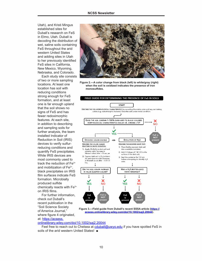
Distinguishing between black redoximorphic features and organic matter in a soil profile can be confusing even to an astute soil scientist. Manganese oxides, heavily decomposed organic matter, and iron monosulfides (FeS) manifest similar faces, sometimes resulting in misidentification in the field. A simple field test can distinguish FeS from other black features. If the soil is exposed to an oxidizing agent (as demonstrated in figure 2), commonly 3% hydrogen peroxide (H2O2) or air, and the color clearly changes from black to Munsell values greater than 4, FeS is present. Alternatively, if hydrochloric acid (HCl, typically 1M) is applied to the soil and produces a rotten egg odor from hydrogen sulfide (H2S) evolution, FeS is present (see figure 3). These field tests are commonplace for soils in wet, saline coastal regions yet arguably underutilized for inland soils of the arid western United States. Reducing conditions, a carbon source, necessary microbes, an iron source, and a sulfur source, all of which are typical of shale-derived or gypsum-rich soils, are required for FeS formation.
Chelsea Duball, a PhD student in soil science at the University of Wyoming, is researching the genesis, morphology, and distribution of FeS in freshwater systems in the arid west. Teasing apart when, where, and under what conditions FeS form could unveil FeS as a useful addition to “Field Indicators for Hydric Soils.” In mid-March, Duball, Will Bowers (PhD student in hydrology at the University of Wyoming), Dean Stacy (ecological site specialist, NRCS, Price,
Figure 1.—Chelesea Duball and Dean Stacy collect samples from a soil pit where there are reducing conditions containing FeS.
NCSS Newsletter
10
Utah), and Kristi Mingus established sites for Duball’s research on FeS in Elmo, Utah. Duball is decoding the distribution of wet, saline soils containing FeS throughout the arid western United States and adding sites in Utah to her previously identified FeS sites in California, New Mexico, Wyoming, Nebraska, and Colorado.
Each study site consists of two or more sampling locations. At least one location has soil with reducing conditions strong enough for FeS formation, and at least one is far enough upland that the soil shows no signs of FeS and has fewer redoximorphic features. At each site, in addition to describing and sampling soils for further analysis, the team installed Indicator of Reduction in Soil (IRIS) devices to verify sulfur-reducing conditions and quantify FeS precipitates. While IRIS devices are most commonly used to track the reduction of Fe3+ and mobilization of Fe2+, black precipitates on IRIS film surfaces indicate FeS formation. Microbially produced sulfide chemically reacts with Fe3+ on IRIS films.
For further information, check out Duball’s recent publication in the “Soil Science Society of America Journal,” where figure 4 originated, at: https://acsess.onlinelibrary.wiley.com/doi/10.1002/saj2.20044
Feel free to reach out to Chelsea at [email protected] if you have spotted FeS in soils of the arid western United States! ■
Figure 2.—A color change from black (left) to white/gray (right) when the soil is oxidized indicates the presence of iron monosulfides.
Figure 3.—Field guide from Duball’s recent SSSA article (https://acsess.onlinelibrary.wiley.com/doi/10.1002/saj2.20044).
NCSS Newsletter
11
Kellogg Soil Survey Laboratory Selected as World Hub for Spectral and Reference Data
I n November of 2019, an FAO-GSP Global Soil Laboratory Network (GLOSOLAN) team met at the National Soil Survey Center (NSSC) to discuss
standardizing mid infrared (MIR) predictive analysis. A significant conclusion of the meeting was that, as a global endeavor, one limitation facing spectrometry is that diverse laboratories that provide inputs offer varying methods and quality control for doing the same named analysis (e.g., organic carbon). To improve model accuracies, the team proposed that a single facility be designated to serve spectral and reference data. Because of USDA’s open data policy and the Kellogg Soil Survey Laboratory’s (KSSL) demonstrated capacity to produce quality measured data, it was proposed that the KSSL serve as a world hub for collecting measured and spectral data for global spectrometry efforts. With over 80,000 samples from areas ranging from Puerto Rico to Alaska already MIR scanned, the growing KSSL spectral library offers applicability beyond U.S. borders. Adding freely available, consistently obtained spectral and measured data samples from outside the U.S. would improve accuracies for modeling efforts the world over.
The proposal was approved by FAO-GSP leadership and the program was officially launched on Earth Day, April 22, 2020. Under the helpful and inclusive umbrella of FAO, initial leadership for the program is provided by the NSSC; the World Agroforestry Centre, Kenya; the International Soil Reference and Information Centre (ISRIC); The Netherlands; the University of Nebraska–Lincoln; the Woods Hole Research Center, Massachusetts; and the University of Sydney, Australia. This initiative for collaborative and organized science will bring soil spectrometry to the next level for stakeholders worldwide.
For more information on participating leadership, see the following:
FAO (http://www.fao.org/fao-stories/article/en/c/1271807/)ISRIC (https://www.isric.org/news/innovation-understanding-soils-new-soil-spectral-
calibration-library-and-estimation-service)World Agroforestry Centre (http://www.worldagroforestry.org/blog/2020/04/21/soil-
spectral-calibration-library-and-estimation-service) ■
Students Working as Earth Team Volunteers Assist Connecticut NRCS
I n the Spring of 2020, Connecticut NRCS soil scientists were lucky enough to work with two enthusiastic Earth Team volunteers who were undergraduate
students at the University of Connecticut: Angelique Lopez and Kim Stafko. Prior to COVID-19, Angelique and Kim were out in the field with NRCS soil scientists, conservation planners, and engineers conducting technical soil services. They gained experience in how to describe soils, take soil samples, use ground-penetrating radar, and document data to prepare trip reports.
In the office, Angelique and Kim assisted the soil scientists in conducting various lab analyses necessary for current soil survey projects and technical soil services. They also assisted ecological site specialists and Kenneth Metzler (retired ecologist/botanist and Earth Team volunteer) with database entry to maintain up-to-date ecological site records. This data pertains to site-specific vegetation, soils, and land use history—information necessary for making informed land management decisions.
NCSS Newsletter
12
In mid-March, when the State issued stay-at-home orders, Angelique and Kim quickly agreed to stay on and help out remotely. They attended conservation webinars and wetland trainings, updated the CT Web Soil Survey cheat sheet, and sorted out almost 20-year-old data on the euic versus dysic issue to help update Soil Taxonomy.
Angelique recently graduated from the University of Connecticut and is actively looking for a full-time job. Kim, a sophomore, wants to continue her volunteer work with the soil and ecological staff. Both stated that they are interested in
learning more about soils and working with NRCS. The following is a short summary by Angelique of her experience with Connecticut NRCS, written April 2020.
“Working for the Natural Resources Conservation Service as an Earth Team volunteer has proven to be a truly valuable experience. As a senior majoring in environmental science at the University of Connecticut, I was looking to gain hands-on experience and work with other professionals in my field before graduation.
This volunteer experience allowed me to work one-on-one with soil scientists, conservationists, ecologists, and engineers in the field. While in the field, I took soil samples, wrote soil descriptions, and examined soil horizons. The collected samples were taken to the lab so that we could test the pH, texture, and density of the soils. We used this data to create management plans for clients looking to implement projects on their land. Additionally, I had the opportunity to research and analyze soil interpretation data through the Web Soil Survey database.
What I enjoyed most about my volunteer experience was working with soil scientists in the field and the lab. They were eager to share their knowledge and teach me how to operate field equipment, such as ground-penetrating radar (GPR) and portable x-ray
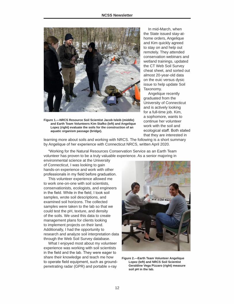
Figure 1.—NRCS Resource Soil Scientist Jacob Isleib (middle) and Earth Team Volunteers Kim Stafko (left) and Angelique Lopez (right) evaluate the soils for the construction of an aquatic organism passage (bridge).
Figure 2.—Earth Team Volunteer Angelique Lopez (left) and NRCS Soil Scientist Geraldine Vega Pizzaro (right) measure soil pH in the lab.
NCSS Newsletter
13
fluorescence (pXRF). NRCS also provided numerous opportunities for me to earn certifications and develop professional skills while volunteering.
For all the reasons listed above, I would recommend this volunteer role to any student seeking to gain hands-on experience with a great group of encouraging professionals. I am truly thankful for this opportunity and the skills and knowledge gained as an Earth Team volunteer.” ■
A Look into Costa Rican Agriculture and Agritourism By Kayleen Meinen, Soil Science intern, NRCS, Chesapeake, Virginia. Photos by Will Cioci.
P rior to the global outbreak of COVID-19, I was one of many students studying abroad to gain real-world experience in my chosen field. I worked with The
Center for Sustainable Development, part of the School for Field Studies. The School operates 10 “centers” in 10 different countries to conduct research and educate students about specific environmental issues. The Center for Sustainable Development, located in Atenas, focuses on agroforestry, conservation, permaculture, and sustainable ecotourism. My assignment with the Center included intensive coursework, field trips, and volunteer opportunities in the Central Valley of Costa Rica. Although I was not able to spend the entire semester in Costa Rica, I am grateful for the opportunity to learn about the country’s agricultural history and its recent emergence of agritourism.
Costa Rica’s economy has been historically reliant on agricultural exports (i.e., bananas, pineapples, coffee, and beef) to Europe and the United States. To become a player in the global market, Costa Rica welcomed multinational corporate producers who could grow and export these items. The country cleared and stripped rainforests to create space for fields and pastureland until only 20 to 25 percent of the original forest cover remained. As reforestation efforts gained momentum and laws banned further deforestation, the corporate producers began purchasing family farms so that they could further expand intense monocropping. The detrimental effects associated with this continued.
Industrial-style agriculture continues to pose serious environmental and socioeconomic threats. In almost all cases, corporate producers focus on the planting
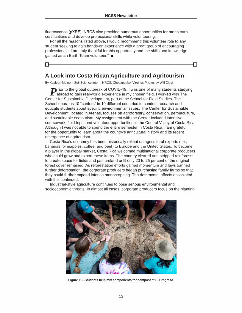
Figure 1.—Students help mix components for compost at El Progreso.
NCSS Newsletter
14
of a single crop in row after row of monoculture fields. The space between crops is generally left bare, leading to heavy soil erosion during the rainy season. As the crop is continuously planted on the same plots of land, the soil becomes degraded and depleted of nutrients. Tons of artificial fertilizers are used to “solve” this problem and provide crops with essential nutrients. Because monocrops are more susceptible to pests and diseases due to their genetic and ecological homogeneity, pesticides, insecticides, and herbicides are generously applied to the land. Runoff with these agrochemicals contaminates nearby waterways, threatening the health of entire communities
The contaminated water causes serious health problems for workers who typically are migrants and refugees from neighboring countries. These people come to Costa Rica to escape political and military unrest in their home countries and to provide better lives for their families. Corporate producers take advantage of this situation, giving the workers hope for stability and safety but in reality requiring them to work extremely long hours and paying them a barely livable or unlivable wage. Consistent exposure to harsh agrochemicals also leaves workers with chronic illnesses.
Recently, Costa Rica’s economy has benefited greatly from tourism as their national parks and reserves draw visitors from around the world. Efforts to protect ecosystems and biodiversity have helped Costa Rica emerge as a leader in sustainability, and ecotourism has been gaining popularity. Instead of flocking to conventional tourist sites, ecotourists and agritourists travel to learn about small-scale sustainable agriculture. Agritourism brings attention to family farms that use specific conservation methods, provides products for community and tourist consumption, conserves the environment, and helps build local economies. I visited two farms that are great examples of these initiatives.
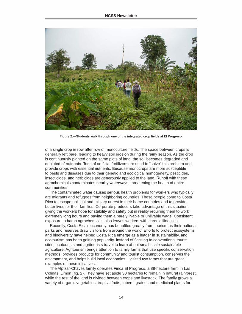
The Alpízar-Chaves family operates Finca El Progreso, a 88-hectare farm in Las Colinas, Limón (fig. 2). They have set aside 30 hectares to remain in natural rainforest, while the rest of the land is divided between crops and livestock. The family grows a variety of organic vegetables, tropical fruits, tubers, grains, and medicinal plants for
Figure 2.—Students walk through one of the integrated crop fields at El Progreso.
NCSS Newsletter
15
their own use, and the excess sold at local markets provides a stream of income. They use an integrated growing technique in which a combination of species is grown in the same land area and compost (nature’s fertilizer) provides vital nutrients. El Progreso employs vermicompost (worms) and bokashi compost (anaerobic fermentation) techniques to break down organic matter such as food scraps and animal waste. Microorganisms from the rainforest floor are added to the compost mixtures along with molasses from sugar cane, which serves as a quick source of carbon energy. These composting methods produce a nutrient-rich organic fertilizer that nourishes the soil and plants.
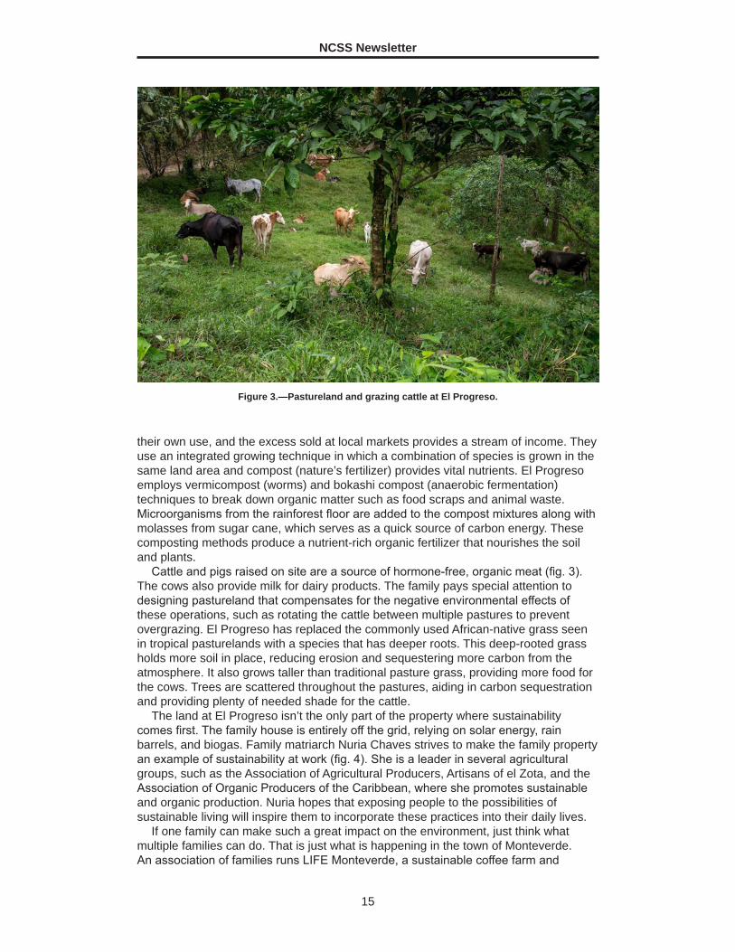
Cattle and pigs raised on site are a source of hormone-free, organic meat (fig. 3). The cows also provide milk for dairy products. The family pays special attention to designing pastureland that compensates for the negative environmental effects of these operations, such as rotating the cattle between multiple pastures to prevent overgrazing. El Progreso has replaced the commonly used African-native grass seen in tropical pasturelands with a species that has deeper roots. This deep-rooted grass holds more soil in place, reducing erosion and sequestering more carbon from the atmosphere. It also grows taller than traditional pasture grass, providing more food for the cows. Trees are scattered throughout the pastures, aiding in carbon sequestration and providing plenty of needed shade for the cattle.
The land at El Progreso isn’t the only part of the property where sustainability comes first. The family house is entirely off the grid, relying on solar energy, rain barrels, and biogas. Family matriarch Nuria Chaves strives to make the family property an example of sustainability at work (fig. 4). She is a leader in several agricultural groups, such as the Association of Agricultural Producers, Artisans of el Zota, and the Association of Organic Producers of the Caribbean, where she promotes sustainable and organic production. Nuria hopes that exposing people to the possibilities of sustainable living will inspire them to incorporate these practices into their daily lives.
If one family can make such a great impact on the environment, just think what multiple families can do. That is just what is happening in the town of Monteverde. An association of families runs LIFE Monteverde, a sustainable coffee farm and
Figure 3.—Pastureland and grazing cattle at El Progreso.

NCSS Newsletter
16
educational center near the famous cloud forest. The high altitudes of this area are perfect for coffee farming, and the influx of tourists provides an opportunity for educational tours. LIFE is an acronym for Low Impact for Earth and truly represents the mindset behind the agricultural methods.
LIFE Monteverde includes 17 hectares of coffee farming and rainforest habitat as well as space for goats, pigs, and chickens. The operators view the farm animals as part of the agroecosystem, using their manure for compost. Like El Progreso, LIFE Monteverde refrains from using agrochemicals and applies compost to fertilize the coffee plants. Incorporating rainforests throughout the property increases biodiversity and enables the owners to control pests through natural means. The presence of rainforest habitat also provides temperature control, protection from erosion, carbon sequestration, and pollinator habitat.
Controlling weeds and picking coffee beans are labor-intensive as both processes are done by hand. Most of the hired workers are migrants from Nicaragua (fig. 5). At LIFE Monteverde, they receive a consistent livable wage, are treated with respect, and are provided housing for themselves and their families. A portion of the beans harvested at LIFE Monteverde
Figure 4.—Nuria Chaves explaining her growing techniques.
Figure 5.—Two Nicaraguan workers sort coffee beans at LIFE Monteverde.
NCSS Newsletter
17
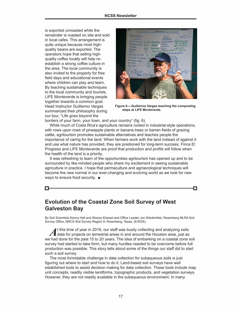
is exported unroasted while the remainder is roasted on site and sold in local cafes. This arrangement is quite unique because most high-quality beans are exported. The operators hope that selling high-quality coffee locally will help re-establish a strong coffee culture in the area. The local community is also invited to the property for free field days and educational events where children can play and learn. By teaching sustainable techniques to the local community and tourists, LIFE Monteverde is bringing people together towards a common goal. Head Instructor Guillermo Vargas summarized their philosophy during our tour, “Life goes beyond the borders of your farm, your town, and your country” (fig. 6).
While much of Costa Rica’s agriculture remains rooted in industrial-style operations, with rows upon rows of pineapple plants or banana trees or barren fields of grazing cattle, agritourism promotes sustainable alternatives and teaches people the importance of caring for the land. When farmers work with the land instead of against it and use what nature has provided, they are positioned for long-term success. Finca El Progreso and LIFE Monteverde are proof that production and profits will follow when the health of the land is a priority.
It was refreshing to learn of the opportunities agritourism has opened up and to be surrounded by like-minded people who share my excitement in seeing sustainable agriculture in practice. I hope that permaculture and agroecological techniques will become the new normal in our ever-changing and evolving world as we look for new ways to ensure food security. ■
Figure 6.—Guillermo Vargas teaching the composting steps at LIFE Monteverde.
Evolution of the Coastal Zone Soil Survey of West Galveston BayBy Soil Scientists Kenny Hall and Stacey Kloesel and Office Leader Jon Wiedenfeld, Rosenberg MLRA Soil Survey Office, NRCS Soil Survey Region 9, Rosenberg, Texas, (9-ROS).
At this time of year in 2019, our staff was busily collecting and analyzing soils data for projects on terrestrial areas in and around the Houston area, just as
we had done for the past 15 to 20 years. The idea of embarking on a coastal zone soil survey had started to take form, but many hurdles needed to be overcome before full production was possible. This story tells about some of the things our staff did to start such a soil survey.
The most formidable challenge in data collection for subaqueous soils is just figuring out where to start and how to do it. Land-based soil surveys have well established tools to assist decision making for data collection. These tools include map unit concepts, readily visible landforms, topographic products, and vegetation surveys. However, they are not readily available in the subaqueous environment. In many
NCSS Newsletter
18
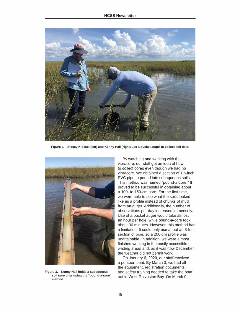
ways a subaqueous soil survey is the ultimate initial soil survey because you start with a clean slate. The optimum method of collecting subaqueous soil data is to use a vibracore to extract soil samples. From August 2019 until we acquired a vibracore-equipped boat, we worked in less than a meter of water using various techniques to get a soil profile description. Initially, we used a bucket auger. As you can imagine, this method had problems. For example, water and mud fill the hole after each extraction. In addition, although one can eventually get to a depth of 2 meters, measurements are inaccurate and one must determine what portion of each bucket is fill and what portion is new material. Nonetheless, this method allowed our staff to get a glimpse of what subaqueous soils looked like.
Over several days, we figured out which techniques worked and which seemed useful but in practice were not. One technique that worked involved the use of pool floats and plastic sleds to transport gear. One that did not work was the use of a plastic barrel to act as a cofferdam; the barrel kept floating away. Fortunately, the Soil Survey Region 9 office was readily willing to help us in this discovery period. We purchased a kayak and floating beverage container, which facilitated transporting gear and keeping it dry.
As already mentioned, it was a challenge determining what material was fresh dig or what was fill from the surface. This problem was largely overcome when we finally gained use of a vibracore. At that time, the Soil and Plant Science Division, through the Coastal Zone Soil Survey Focus Team, was in the process of purchasing vibracore-equipped pontoon boats for use in coastal zone soil surveys. Our office was slated to receive a boat, and training on the use of the boat and equipment was scheduled for September 2019. The Rosenberg staff spent 1 week in New Jersey receiving training on the use of a vibracore, site selection, and subaqueous soil pedon descriptions. The Hammonton MLRA Office (3-HAM) in New Jersey (Soil Survey Region 3) provided the training.
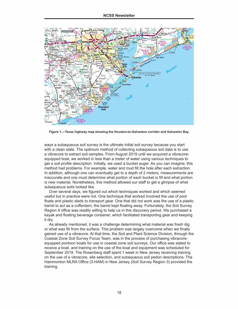
Figure 1.—Texas highway map showing the Houston-to-Galveston corridor and Galveston Bay.
NCSS Newsletter
19
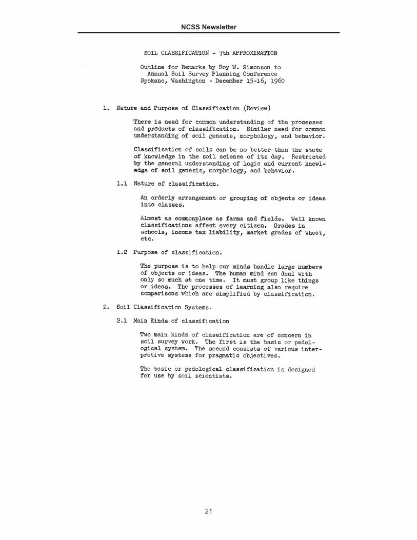
By watching and working with the vibracore, our staff got an idea of how to collect cores even though we had no vibracore. We obtained a section of 1½-inch PVC pipe to pound into subaqueous soils. This method was named “pound-a-core.” It proved to be successful in obtaining about a 100- to 150-cm core. For the first time, we were able to see what the soils looked like as a profile instead of chunks of mud from an auger. Additionally, the number of observations per day increased immensely. Use of a bucket auger would take almost an hour per hole, while pound-a-core took about 30 minutes. However, this method had a limitation. It could only use about an 8-foot section of pipe, so a 200-cm profile was unattainable. In addition, we were almost finished working in the easily accessible wading areas and, as it was now December, the weather did not permit work.
On January 6, 2020, our staff received a pontoon boat. By March 3, we had all the equipment, registration documents, and safety training needed to take the boat out in West Galveston Bay. On March 9,
Figure 2.—Stacey Kloesel (left) and Kenny Hall (right) use a bucket auger to collect soil data.
Figure 3.—Kenny Hall holds a subaqueous soil core after using the “pound-a-core” method.

NCSS Newsletter
20
we used the vibracore for the first time. Although it had been September when our staff received training, we remembered the steps necessary to run the equipment. The vibracore, although much more efficient for retrieving samples, required our whole staff to operate it smoothly. We discovered that communication is key to success and safety. We learned what worked best for us and improved on some of the basic sampling procedures. It also helped that we had a cell phone and could call Greg Taylor, Region 3 senior regional soil scientist, when we had questions about the boat. By mid-March, our daily catch was four pedons and the last was extracted within about 45 minutes from anchor drop to anchor pull. We now had 14 total cores. Since that time, COVID-19 has kept us from returning to the water. However, it has allowed us time to study the cores we obtained.
The result of the work has yielded four soil classifications: Typic and Sulfic Psammowassents, Typic Sulfiwassents, and Typic Haplowassents. At this point, we think that the Psammowassents are mostly on submerged washover fans and that the Sulfiwassents and Haplowassents are in areas with submerged dredge deposits. The landforms will become more apparent after we gather more information. As you can see, we have a lot more work to do. ■
Figure 4.—Stacey Kloesel using the chain hoist to extract the core out of the water.
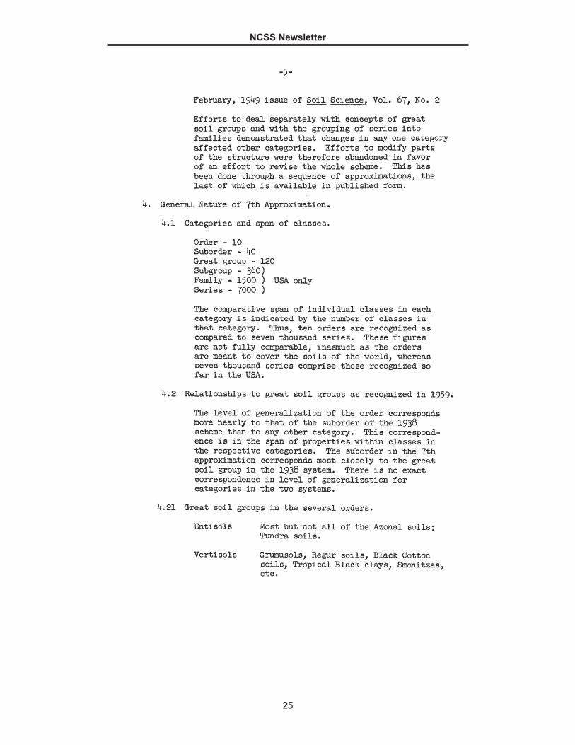
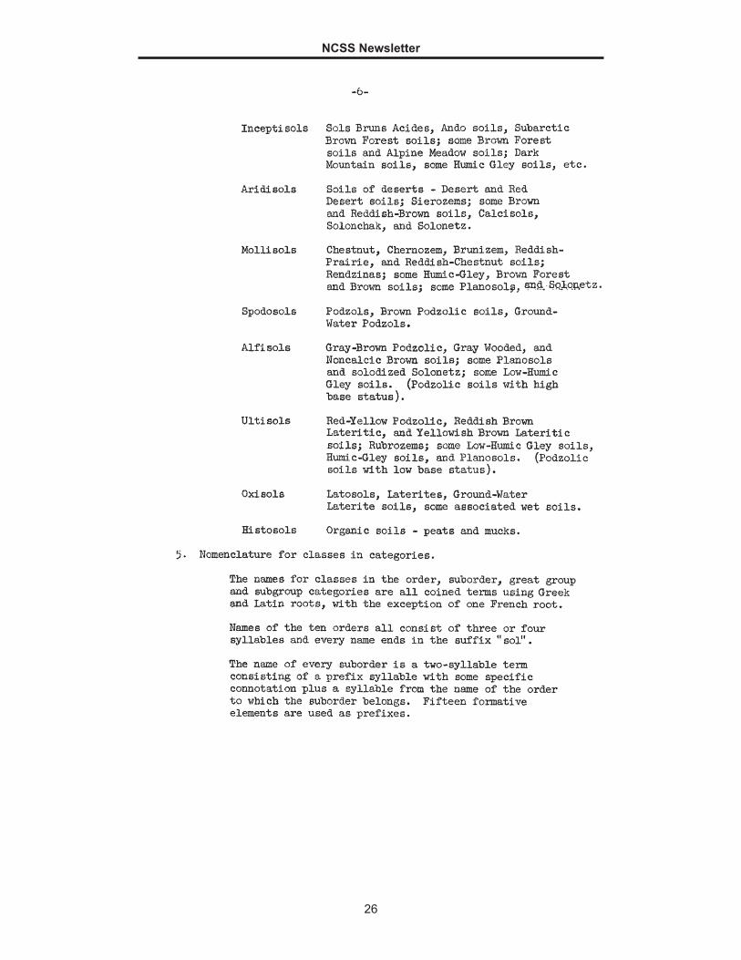
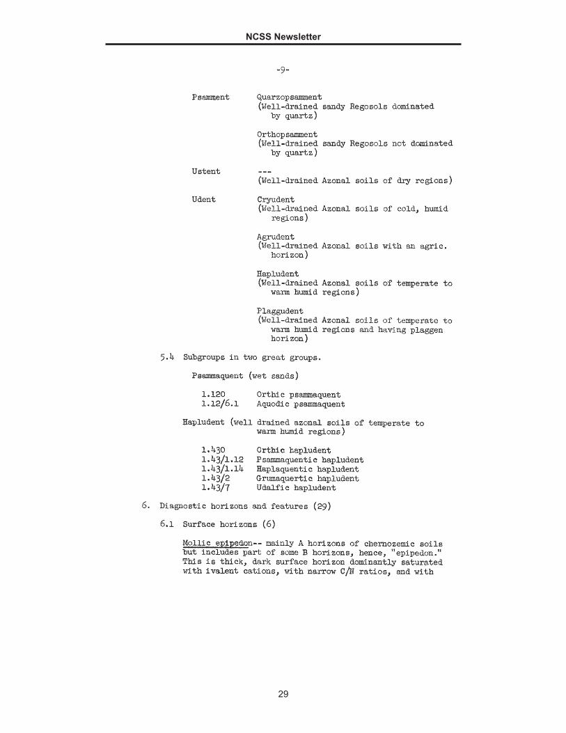
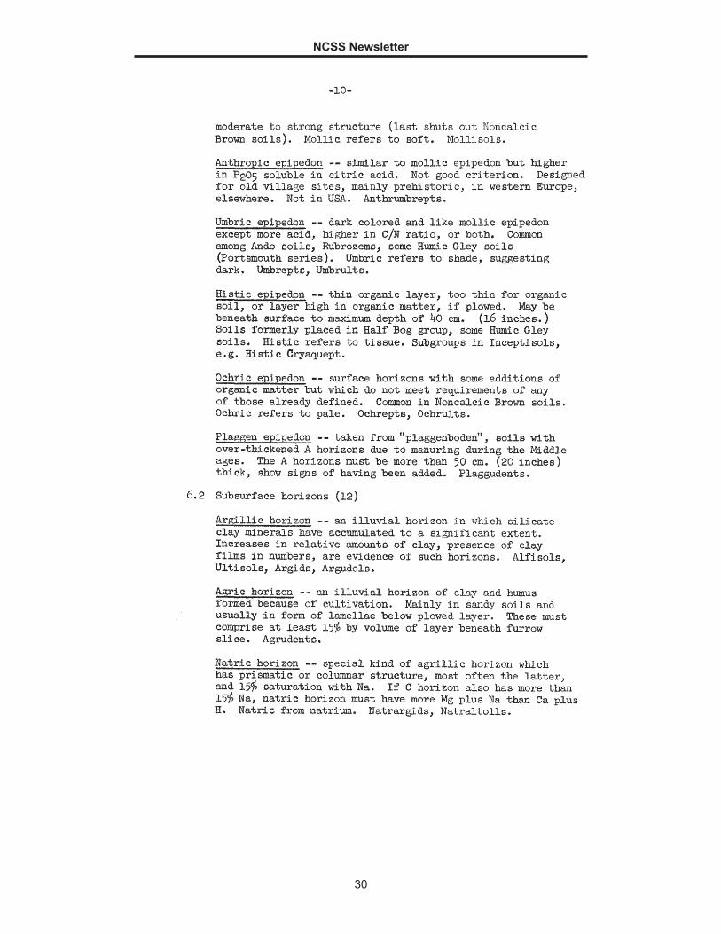
Blast from the Past—Roy W. Simonson’s Notes on Soil Classification
E ach issue of the newsletter includes information or a document considered historical. Please submit any ideas to the Editor Jenny Sutherland. The featured
document in this issue was found in the Soils Library at the National Soil Survey Center.
NCSS Newsletter
21

NCSS Newsletter
22

NCSS Newsletter
23
NCSS Newsletter
24
NCSS Newsletter
25
NCSS Newsletter
26

NCSS Newsletter
27

NCSS Newsletter
28
NCSS Newsletter
29
NCSS Newsletter
30
NCSS Newsletter
31
NCSS Newsletter
32
NCSS Newsletter
33

NCSS Newsletter
34

NCSS Newsletter
35
NCSS Newsletter
36
NCSS Newsletter
37
Nondiscrimination Statement
I n accordance with Federal civil rights law and U.S. Department of Agriculture (USDA) civil rights regulations and policies, the USDA, its Agencies, offices,
and employees, and institutions participating in or administering USDA programs are prohibited from discriminating based on race, color, national origin, religion, sex, gender identity (including gender expression), sexual orientation, disability, age, marital status, family/parental status, income derived from a public assistance program, political beliefs, or reprisal or retaliation for prior civil rights activity, in any program or activity conducted or funded by USDA (not all bases apply to all programs). Remedies and complaint filing deadlines vary by program or incident.
Persons with disabilities who require alternative means of communication for program information (e.g., Braille, large print, audiotape, American Sign Language, etc.) should contact the responsible Agency or USDA’s TARGET Center at (202) 720-2600 (voice and TTY) or contact USDA through the Federal Relay Service at (800) 877-8339. Additionally, program information may be made available in languages other than English.
To file a program discrimination complaint, complete the USDA Program Discrimination Complaint Form, AD-3027, found online at http://www.ascr.usda.gov/complaint_filing_cust.html and at any USDA office or write a letter addressed to USDA and provide in the letter all of the information requested in the form. To request a copy of the complaint form, call (866) 632-9992. Submit your completed form or letter to USDA by:
mail: U.S. Department of Agriculture Office of the Assistant Secretary for Civil Rights 1400 Independence Avenue, SW Washington, D.C. 20250-9410;
fax: (202) 690-7442; or email: [email protected].
USDA is an equal opportunity provider, employer, and lender. ■