Embed Size (px)
Citation preview

OceanwiseNaviModel - the GIS you already have
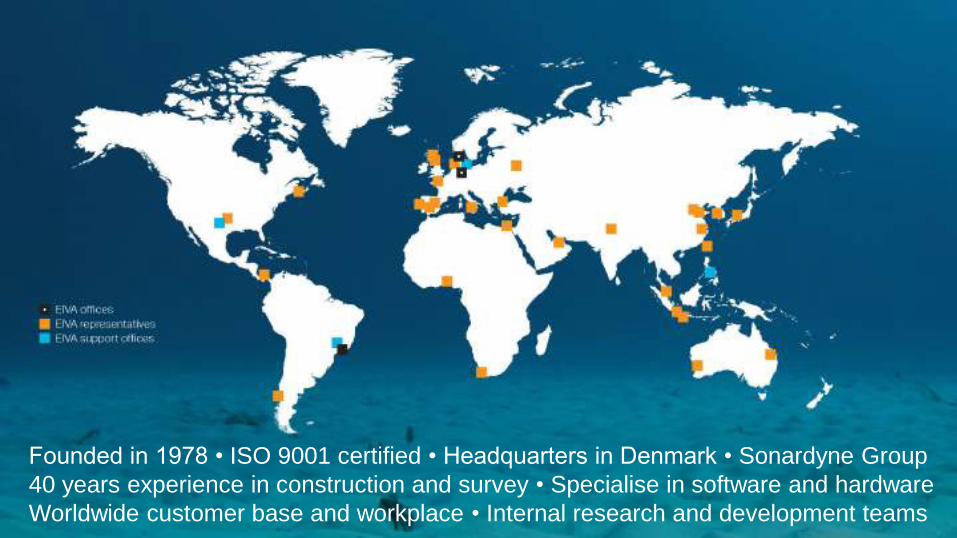
Founded in 1978 • ISO 9001 certified • Headquarters in Denmark • Sonardyne Group 40 years experience in construction and survey • Specialise in software and hardwareWorldwide customer base and workplace • Internal research and development teams

ScanFish Rocio

ScanFish onboard the AURORA

ScanFish Katria

ScanFish 3D steering

ScanFish XL
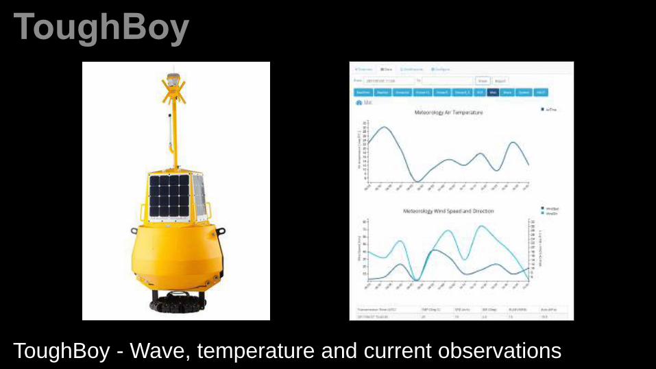
ToughBoy - Wave, temperature and current observations

EUR 150k spent per year on temporary marker buoys

Digital marker buoys can be placed onto DTM (upto 250 buoys)

Virtual marker buoys are then broadcast across the AIS (AtoN)


Automatic processing of massive amounts of sensor data
Developed in collaboration with Swire Seabed for the Ocean Infinity project


Aberdeen

Aberdeen - Rubislaw Quarry

Aberdeen - Rubislaw Quarry

Dunnottar Castle
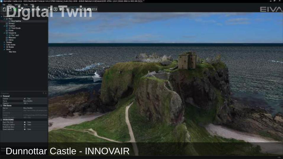
Dunnottar Castle - INNOVAIR

Edinburgh Rail and Road Bridges

Edinburgh Rail and Road Bridges - Aberdeen University

National Oceanography Centre

National Oceanography Centre - L3HARRIS

World War II - Douglas TBD Devastator
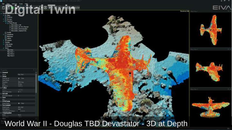
World War II - Douglas TBD Devastator - 3D at Depth

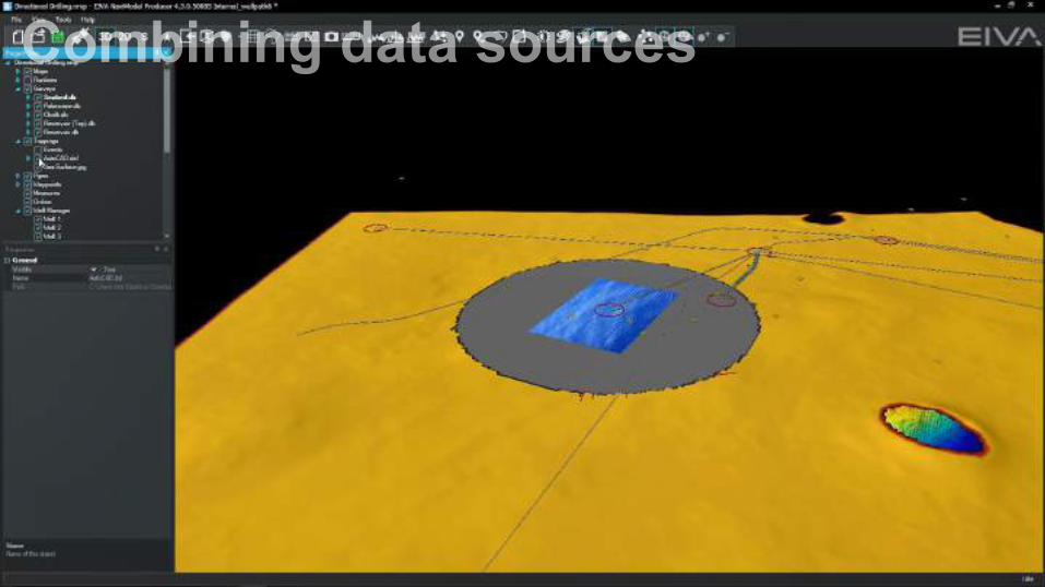
Wellpaths and AutoCADWellpathsWellpaths, AutoCAD and surfaceWellpaths, AutoCAD, surface and seabedWellpaths, AutoCAD, surface, seabed and reservoir


*.3ds *.obj *.fbx

Manifold on Seabed

We support the following:
• Web Map Services (WMS) – tile / raster• Web Map Tile Services (WMTS) - vector• Electronic Navigation Charts (ENC’s)
SevenC’s S-57 and OpenStreetMap recently added
Map Support
02/12/2019

Interpretation

Quick contour creation

Quickly change Colourscale and Light Settings

Objects Identified:
Seabed 100%Pipeline 97%Anode 0%Fieldjoint 0%Flange 0%
Deep Learning is faster than real-time:
15 minutes of video = 1 minute processing time (Cloud Server)
Images analysed and classified one-by-one

Deep Learning is trained on diverse data sets…
Rocks
Mattress Damage
Rocks Debris Damage
Pipes Anodes Corals Flanges
Structures Mattresses Debris

What is SLAM?
Simultaneous Localisation And Mapping
“The computational problem of constructing
or updating a map of an unknown environment while simultaneously keeping track of an agent's location within it”
Photogrammetry will just compare features in all images – this is why it is so slow….
If we track recognisable features in movingimages, it is possible to calculate the position of the camera and the position of features.
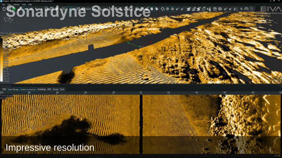
Impressive resolution

We are now training to identify habitat and seabed classification