Embed Size (px)
Citation preview
US Sailing
Safe Powerboat Handling and Safety and Rescue
Boat Handling
Day Two
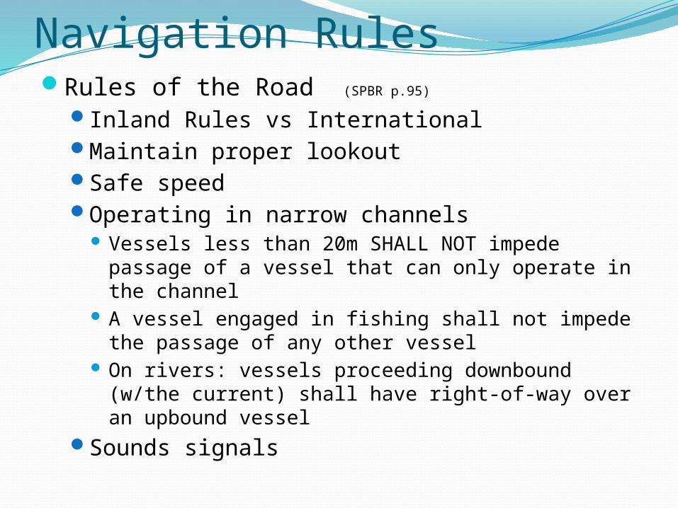
Navigation RulesRules of the Road (SPBR p.95)
Inland Rules vs InternationalMaintain proper lookoutSafe speedOperating in narrow channels
Vessels less than 20m SHALL NOT impede passage of a vessel that can only operate in the channel
A vessel engaged in fishing shall not impede the passage of any other vessel
On rivers: vessels proceeding downbound (w/the current) shall have right-of-way over an upbound vessel
Sounds signals
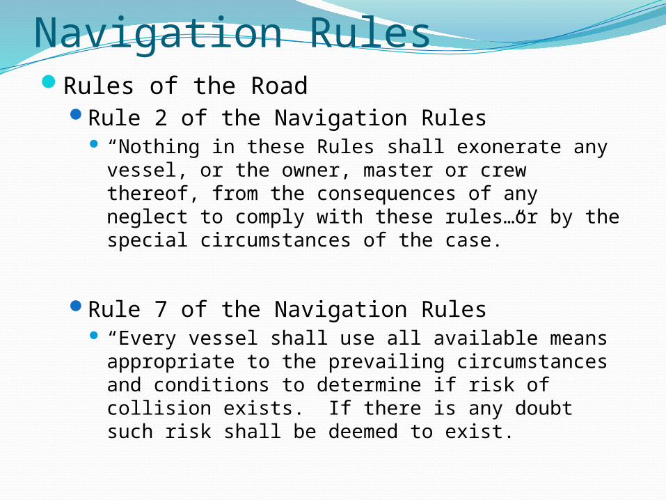
Navigation RulesRules of the Road
Rule 2 of the Navigation Rules “Nothing in these Rules shall exonerate any vessel,
or the owner, master or crew thereof, from the consequences of any neglect to comply with these rules…or by the special circumstances of the case.”
Rule 7 of the Navigation Rules “Every vessel shall use all available means
appropriate to the prevailing circumstances and conditions to determine if risk of collision exists. If there is any doubt such risk shall be deemed to exist.
Navigation Rules
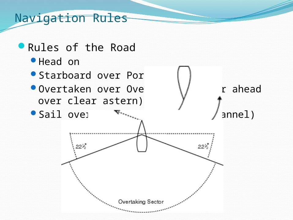
Rules of the RoadHead onStarboard over PortOvertaken over Overtaking (Clear ahead over
clear astern)Sail over Power (unless in a channel)
Navigation RulesRules of the Road
Vessels underway must always keep clear of: A vessel not under command (ie. Adrift or on fire) A vessel that is restricted in its ability to manuever (ie.
Dredging) A vessel engaged in fishing with nets, lines or trawls
DOES NOT include fishing with trolling lines
Remember – the stand on vessel has the right way, the give way vessel must alter her course
A formal accident report must be submitted within 48 hours if a person dies, there are injuries requiring more than first aid or if there is more than $2000 in damage.
Navigation RulesRules of the Road
Only Overtaken
New Not under command
Reels Restricted in its ability to maneuver
Catch Constrained by draft
Fish Fishing
So Sailing
Purchase Power driven vessel
Some Seaplane
Worms WIG
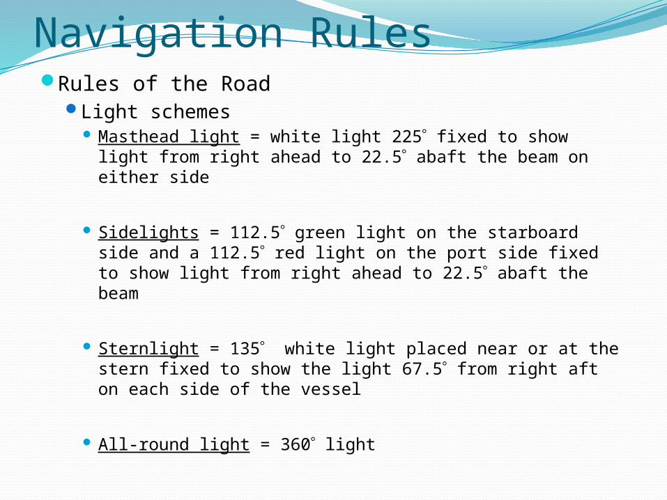
Navigation RulesRules of the Road
Light schemes Masthead light = white light 225 fixed to show light
from right ahead to 22.5 abaft the beam on either side
Sidelights = 112.5 green light on the starboard side and a 112.5 red light on the port side fixed to show light from right ahead to 22.5 abaft the beam
Sternlight = 135 white light placed near or at the stern fixed to show the light 67.5 from right aft on each side of the vessel
All-round light = 360 light
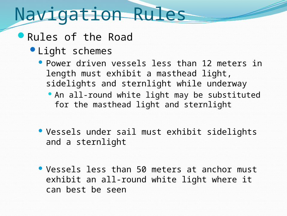
Navigation RulesRules of the Road
Light schemes Power driven vessels less than 12 meters in length
must exhibit a masthead light, sidelights and sternlight while underway An all-round white light may be substituted for the
masthead light and sternlight
Vessels under sail must exhibit sidelights and a sternlight
Vessels less than 50 meters at anchor must exhibit an all-round white light where it can best be seen
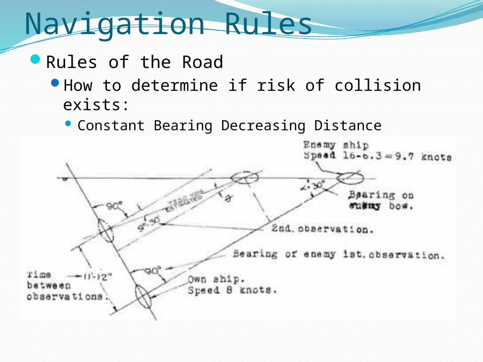
Navigation RulesRules of the Road
How to determine if risk of collision exists: Constant Bearing Decreasing Distance
Navigation RulesRules of the Road
What is bearing drift? (handout)
Bearing taken relative to you or your boat
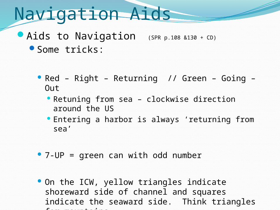
Navigation AidsAids to Navigation (SPR p.108 &130 + CD)
Some tricks:
Red – Right – Returning // Green – Going – Out Retuning from sea – clockwise direction around the
US Entering a harbor is always ‘returning from sea’
7-UP = green can with odd number
On the ICW, yellow triangles indicate shoreward side of channel and squares indicate the seaward side. Think triangles for mountains
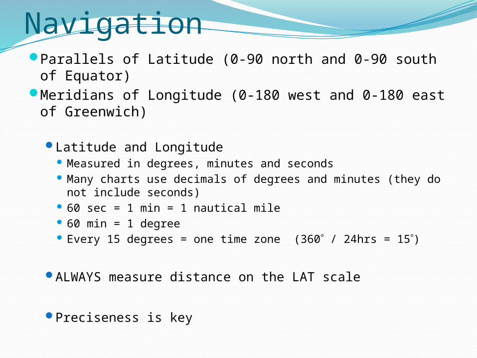
Navigation Parallels of Latitude (0-90 north and 0-90 south of
Equator)Meridians of Longitude (0-180 west and 0-180 east
of Greenwich)
Latitude and Longitude Measured in degrees, minutes and seconds Many charts use decimals of degrees and minutes (they do
not include seconds) 60 sec = 1 min = 1 nautical mile 60 min = 1 degree Every 15 degrees = one time zone (360 / 24hrs = 15)
ALWAYS measure distance on the LAT scale
Preciseness is key
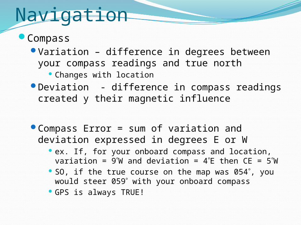
NavigationCompass
Variation – difference in degrees between your compass readings and true north
Changes with locationDeviation - difference in compass readings
created y their magnetic influence
Compass Error = sum of variation and deviation expressed in degrees E or W
ex. If, for your onboard compass and location, variation = 9W and deviation = 4E then CE = 5W
SO, if the true course on the map was 054, you would steer 059 with your onboard compass
GPS is always TRUE!
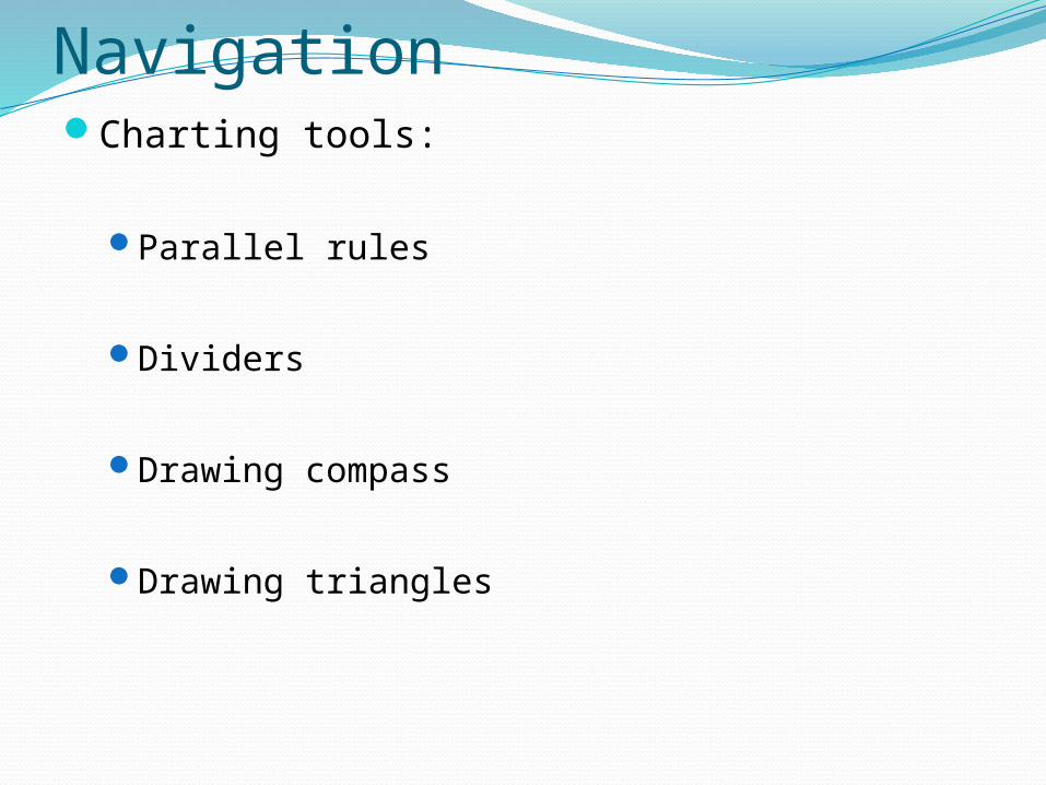
NavigationCharting tools:
Parallel rules
Dividers
Drawing compass
Drawing triangles
NavigationRanges (SRS Supp p.16-17)
Tides (SRS Supp p.18-21)
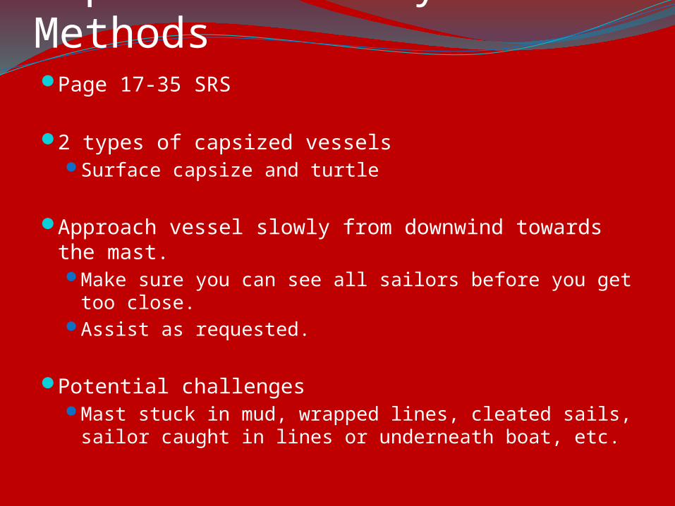
Capsize Recovery MethodsPage 17-35 SRS
2 types of capsized vesselsSurface capsize and turtle
Approach vessel slowly from downwind towards the mast.Make sure you can see all sailors before you get too
close.Assist as requested.
Potential challengesMast stuck in mud, wrapped lines, cleated sails,
sailor caught in lines or underneath boat, etc.
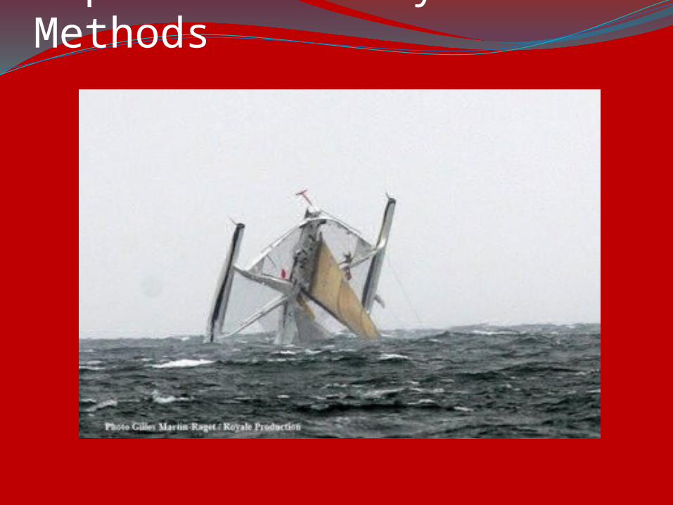
Capsize Recovery Methods
TowingPage 47-52 SRS
Five Types of towing methods
Single-linePram variationDouble-lineHerringbone Tow
Towing alongside
COMMUNICATION IS KEY!
TowingUse proper driving technique while towing
Accelerate and decelerate at a constant rate to avoid jerking or severe line slack.
Make sure to inform the towed vessel driver to steer at your transom (avoid the waterskier effect).
Mainsails should be lowered BEFORE you pick up the sailboat. In any kind of breeze it is dangerous to tow a boat
with the mainsail up in any direction but directly upwind.
If a boat falls off the tow, maintain tension for the remaining boats and circle around to pick them up.
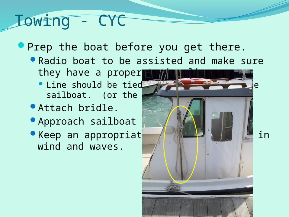
Towing - CYCPrep the boat before you get there.
Radio boat to be assisted and make sure they have a proper towing line. Line should be tied around the mast of the sailboat.
(or the bow cleat**)Attach bridle.Approach sailboat from downwindKeep an appropriate distance – factor in wind
and waves.
TowingCommon problems:
The waterskier
The hot dog
The guy who thinks steering is unnecessary
The capsizer – worst!!!
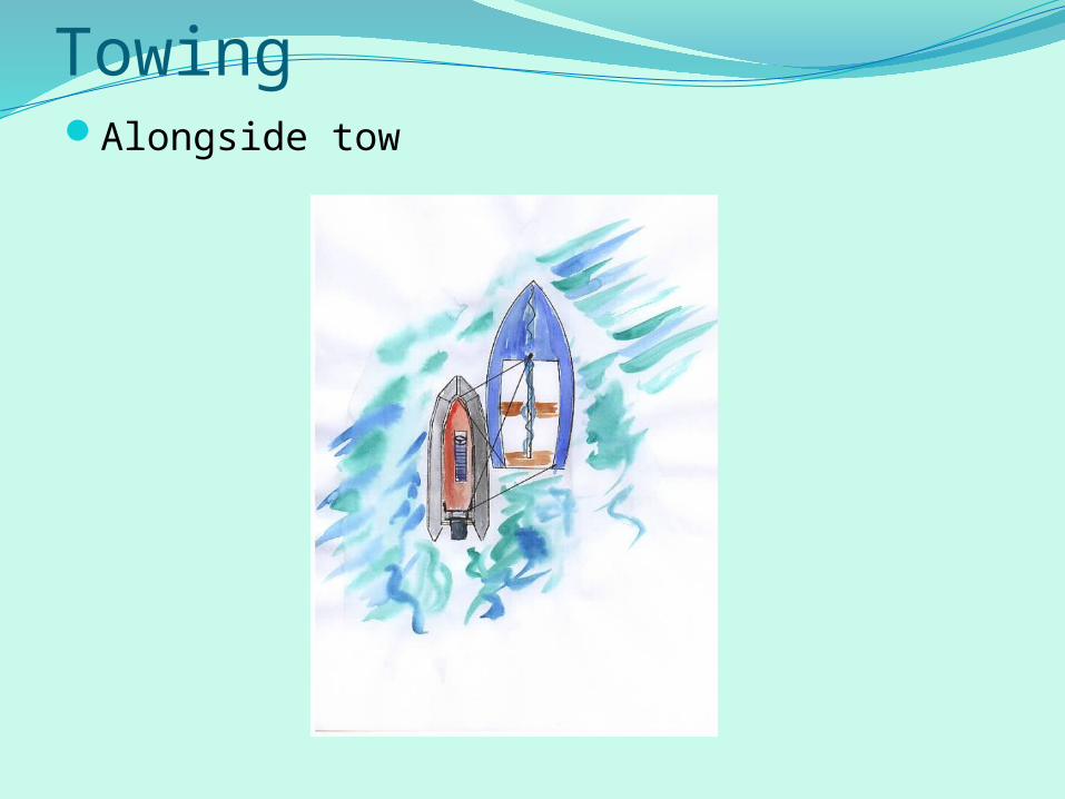
TowingAlongside tow
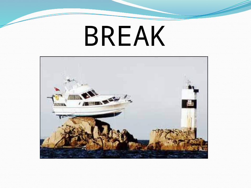
BREAK
AnchoringPage 52-55 SPBR
Types of anchorsDanforth, bruce, plow and mushroom
Rode = anchor line
Scope = length of rode / (water depth + freeboard)5:1 for lunch; 7:1 or more for extended stays or
strong winds/seas
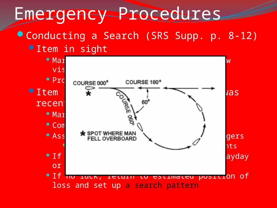
Emergency ProceduresConducting a Search (SRS Supp. p. 8-12)
Item in sight Mark position w/ GPS or Loran and throw visible
flotation Proceed with PIW recovery
Item is not in sight but incident was recent Mark position w/ GPS or Loran Commence modified Williamson Turn Assign visual search sectors to passengers
Scan using regularly spaced eye movements If loss involves human life, place a Mayday or Pan-
Pan If no luck, return to estimated position of loss and set
up a search pattern
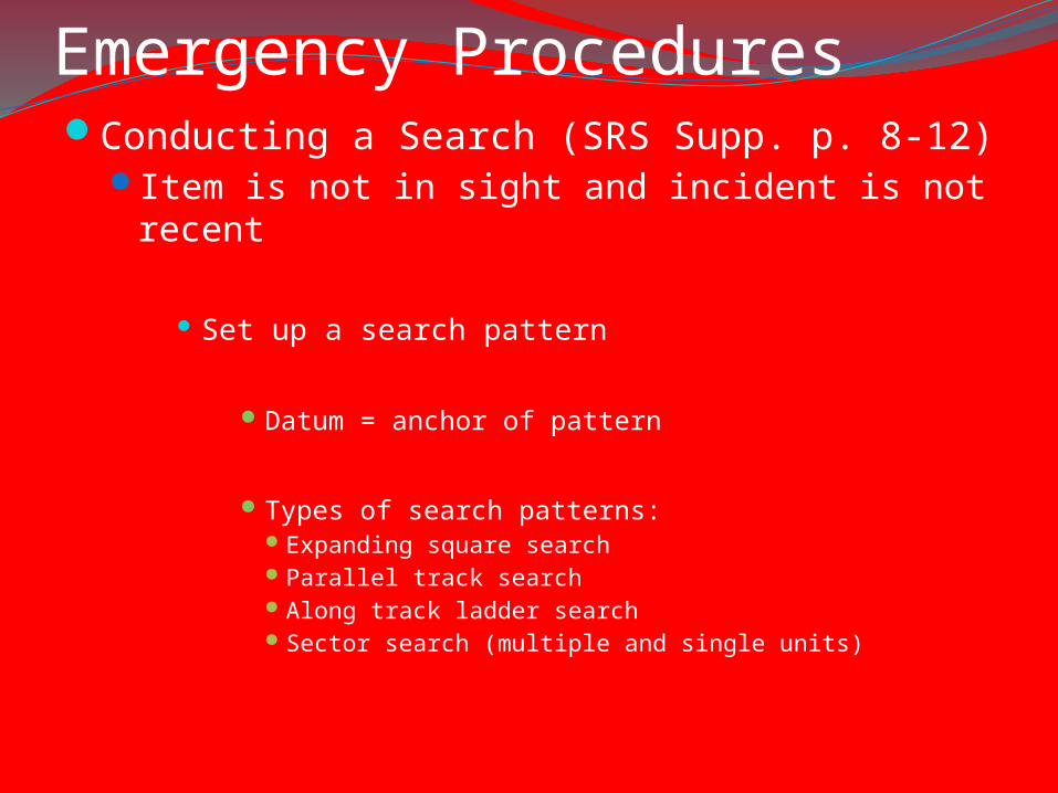
Emergency ProceduresConducting a Search (SRS Supp. p. 8-12)
Item is not in sight and incident is not recent
Set up a search pattern
Datum = anchor of pattern
Types of search patterns: Expanding square searchParallel track searchAlong track ladder searchSector search (multiple and single units)
VHF Protocol and UsagePage 4 SRSChannels:
16 – Emergencies, hailing09 – Recreational hailing22 – Coast Guard
VHF channels are monitored by the USCG, Chicago Marine Police and others
It is against the law to use these channels improperly
They can find you!
VHF Protocol and UsageSecurite
Pan-Pan
Mayday
VHF Protocol and UsageHow to operate (demo)
Things to remember Position VHF perpendicular to the wind or directly
downwind The Hi/Lo function ONLY affects your transmitting power –
it does not increase your receiving power The antenna is most effective held straight up and down
as high as you can hold it Wait a second after depressing the call button before
speaking (it will save people a lot of frustration) BE SUCCINCT! It is not a telephone. Have a point and get
to it quickly.
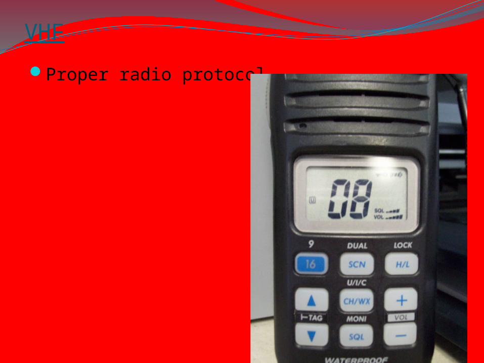
VHF
Proper radio protocol
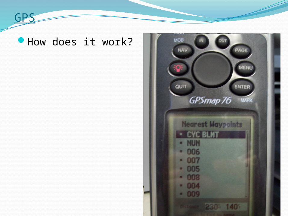
GPS
How does it work?
Boat Operation
Steering a range (inbound and outbound)
Position relative to moving vessel
Boat handling in adverse weather conditions

RC / Markset Information
KnotsQuick release
Bowline on a bight
Bowline w/half-hitch
Rolling hitch
Towing bridle