Embed Size (px)
Citation preview
NATURAL SMALL WATER RETENTION MEASURES
– CASE STUDIES –
32
Edited byWaldemar Mioduszewski Institute of Technology and Life Sciences, PolandTomasz Okruszko Warsaw University of Life Sciences, Poland
AuthorsHungary János Fehér, Judit Gáspár; GWP Hungary / János Tamás, University of DebrecenSlovakia Vladimir Mosný; HYCOMP / Richard Muller; GWP CEESlovenia Darja Istenič, Anja Potokar; Limnos, Ltd Poland Ignacy Kardel, Tomasz Okruszko, Tomasz Stańczyk; Warsaw University of Life Sciences /
Waldemar Mioduszewski; Institute of Technology and Life Sciences
Peer Review GroupJanusz Kindler, Warsaw University of Technology, PolandHenny A.J. van Lanen, European Drought Centre, Wageningen University, the NetherlandsRobert Stefanski, World Meteorological Organization, Geneva, Switzerland
Cover photos: Waldemar MioduszewskiEditing, proofreading: Therese RudebeckDesign, layout: Ivo AndreevCoordination: Sabina Bokal, Gergana MajercakovaPhoto credit: GWP CEE / Muller
PrefaceDifferent projects engaging with the implementation of small water natural retention measures (SWNRM) have been executed in all the countries participating in that publication. Various examples of technical solutions for surface water retention, including retention for flood protection purposes, as well as water retention resulting from beavers’ activity have been presented in this manual.
The discussed examples do not represent all the possible measures for improving water retention capacity in catchments in each European country. These case studies should simply be treated as interesting examples, which can provide an overview of how to mitigate the effects of droughts through small retention measures. In addition to the measures discussed here, the reconstruction of drainage systems, meandering of rivers, and limiting runoff from sealed surfaces in urban areas, should also be considered as valuable retention measures.
The main focus among these case studies is surface water retention, including construction of small water reservoirs. However, one case study focuses on wetlands protection. The aim of this particular project was to limit the negative ecological effects resulting from drainage. This project is an example of combining the problem of rainwater retention, and the protection of wetlands ecosystems. In addition, because many small water retention measures are implemented in forests, one example of a project implemented in such an area is provided.
Furthermore, the example discussing the implementation of a small water retention program in Poland is worth highlighting since no such measures were implemented in other European countries at that time.
The Global Water Partnership Central and Eastern Europe (GWP CEE), is an international network, which comprises 12 Country Water Partnerships in Bulgaria, Czech Republic, Estonia, Hungary, Latvia, Lithuania, Moldova, Poland, Romania, Slovakia, Slovenia and Ukraine and more than 160 partners located in 15 countries. Its mission is to advance governance and management of water resources for sustainable and equitable development. GWP CEE is a part of global network that consists of thirteen regions across the world.
www.gwpcee.org
The World Meteorological organization (WMO) is a specialized agency of the United Nations. It is the UN system’s authoritative voice on the state and behaviour of the Earth’s atmosphere, its interactions with the oceans, the climate it produces and the resulting distribution of water resources. WMO has a membership of 191 countries and territories.
www.wmo.int
Integrated Drought Management Programme for Central and Eastern Europe (IDMP CEE) supports the governments of Bulgaria, the Czech Republic, Hungary, Lithuania, Moldova, Poland, Romania, Slovakia, Slovenia and Ukraine in the development of drought management policies and plans. It also builds capacity of stakeholders at different levels for proactive integrated drought management approach and tests innovative approaches for future drought management plans. It is part of the Integrated Drought Management Programme (IDMP), which was launched by WMO and GWP at the High-level Meeting on National Drought Policy in March 2013. Further information on the IDMP is available at www.droughtmanagement.info
www.gwpcee.org
Citation: Global Water Partnership Central and Eastern Europe (2015). Natural small water retention measures. Case Studies, Global Water Partnership Central and Eastern Europe
© Global Water Partnership Central and Eastern Europe, 2015. All rights reserved.
54
List of case studies
HUNGARY: Marsh protection in Egyek-Pusztakócs ............................................................................................ 5
Water infrastructure including small water retention supports
land and water management ........................................................................................................... 8
Complex water retention at the Nagyszéksos Lake System ............................................................ 13
SLOVAKIA: Reconstruction of the mountain weir HB Klauzy ........................................................................... 16
Flood protection area - Polder Klatova Nova Ves .......................................................................... 18
The Podspady - Protected Area Bor - natural water retention
by beaver weirs ............................................................................................................................. 20
Small water retention measures in Haluzice Gorge ....................................................................... 22
SLOVENIA: Karst pond in the village Goče ....................................................................................................... 28
Rehabilitation of clay pit in the village Renče ................................................................................ 30
Multifunctional phytoremediation system ..................................................................................... 32
POLAND: National small water retention program ....................................................................................... 35
Small water retention in Garwolin forest ...................................................................................... 42
Water reservoir Czyżew ................................................................................................................. 45
Water reservoir Zgorzała in urban areas ....................................................................................... 48
HUNGARYMarsh protection in Egyek–Pusztakócs
IntroductionSince its foundation in 1973, the Hortobágy National Park has aimed to restore and rehabilitate the Great Plain landscapes that has been transformed for centuries by human activities.
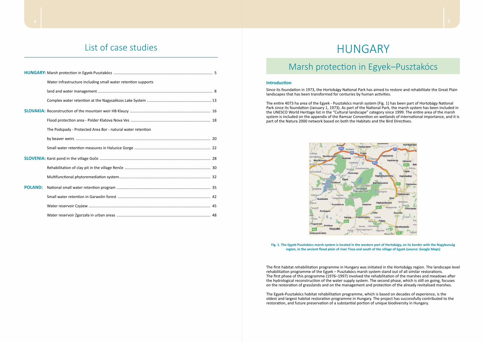
The entire 4073 ha area of the Egyek - Pusztakócs marsh system (Fig. 1) has been part of Hortobágy National Park since its foundation (January 1, 1973). As part of the National Park, the marsh system has been included in the UNESCO World Heritage list in the “Cultural landscape” category since 1999. The entire area of the marsh system is included on the appendix of the Ramsar Convention on wetlands of international importance, and it is part of the Natura 2000 network based on both the Habitats and the Bird Directives.
Fig. 1. The Egyek-Pusztakócs marsh system is located in the western part of Hortobágy, on its border with the Nagykunság region, in the ancient flood plain of river Tisza and south of the village of Egyek (source: Google Maps)
The first habitat rehabilitation programme in Hungary was initiated in the Hortobágy region. The landscape level rehabilitation programme of the Egyek – Pusztakócs marsh system stand out of all similar restorations. The first phase of this programme (1976–1997) involved the rehabilitation of the marshes and meadows after the hydrological reconstruction of the water supply system. The second phase, which is still on going, focuses on the restoration of grasslands and on the management and protection of the already revitalised marshes.
The Egyek-Pusztakócs habitat rehabilitation programme, which is based on decades of experience, is the oldest and largest habitat restoration programme in Hungary. The project has successfully contributed to the restoration, and future preservation of a substantial portion of unique biodiversity in Hungary.
76
The Egyek–Pusztakócs marsh system that used to be regularly flooded by the river Tisza has been drained gradually since the early 19th century. However, the regulation of the river Tisza, which has occurred since the 1860s terminated the most important source of water supply to the marsh system. The construction of the system to drain inland waters, which started in the 1900s and accelerated between 1930 and 1950, has drained most marshes, and led to the sinking of the ground water table and to the emergence of a general water deficit in the habitats. Canal constructions, done as part of the Egyek area melioration programme in the 1980s, have led to a near-fatal drought, and an almost irreversible degradation of the marsh system.
As a result of river regulation, flood control and drainage works, the sources of natural water supply have almost vanished. The drying was mainly caused by theses changes, and was only exacerbated by the extremely long low-precipitation period between the late 1970s and early 1990s. Most of the natural water catchments of the marshes were ploughed and the connections between the marshes were terminated by filling upof the former natural depressions which connected the marshes.
Parallel to the drying of the area, ploughing broke up an increasing amount of grasslands and meadows, and the proportion of arable lands have gradually increased. In addition to the reduction of wetland habitats, characteristic edge habitats and zonal transitions (e.g. dry grassland-wet meadow-tussock meadow-marsh) have disappeared. In many areas, patches of homogeneous habitats separated by sharp, sudden, non-transitional edges have appeared.
Title of the projectMARSH PROTECTION IN EGYEK–PUSZTAKÓCS
Type of the projectThe project has a regional character, and it covers a large wetland area within the Hortobágy National Park.
Specific objectives of the project The Egyek-Pusztakócs marsh system is, with a severely degraded 4000 ha plus area in dire need of restoration.
The aim of the rehabilitation was to construct and operate a water supply system that could mimic the flooding that had been characteristic to the area before river regulation, and to achieve a hydrological reconstruction and revitalisation of the marshes. The construction of the water supply system was started with Fekete-rét (1976) and continued with Kis-Jusztus, Bőgő and Meggyes marshes, and was completed in 1997 with Hagymás and Csattag marshes. The canal system has brought the water of river Tisza back to the marshes.
Legal basis of the undertaken measuresThe nature conservation policy of the European Union is founded on two directives, the Birds and the Habitats Directives. The aim of the Birds Directive, adopted in 1979 (79/409/EGK), is to protect all bird species that naturally occur in the area of the member states. Annex I of the Directive lists those species for which member states are required by law to designate and protect through Special Protection Areas.
The aim of the Habitats Directive, adopted in 1992 (43/92/EGK) is to preserve all plant species and all animal species other than birds, and in general, to protect the biological diversity that naturally occurs in the area of the member state.
Two habitat types found in the Egyek - Pusztakócs marsh system and in Hortobágy Z are designated as “priority” habitat types, in Annex I of the Habitats Directive: Pannonian alkali steppes (Natura 2000 code: 1530) and Pannonian loess steppic grass-lands.
Connections with other programmesNo connection.
Organisational and financial basisThis project has been supported by the LIFE financial instrument of the European Commission, and co-financed by the Department of Water and Environment, Hungary.
Beneficiary: Hortobágy National Park Directorate Partner: University of Debrecen Further information: Hortobágyi Nemzeti Park Igazgatóság (Hortobágy National Park Directorate) H-4024 Debrecen, Sumen u. 2., Hungary Phone: (+36-52) 529-920 Web: www.hnp.hu
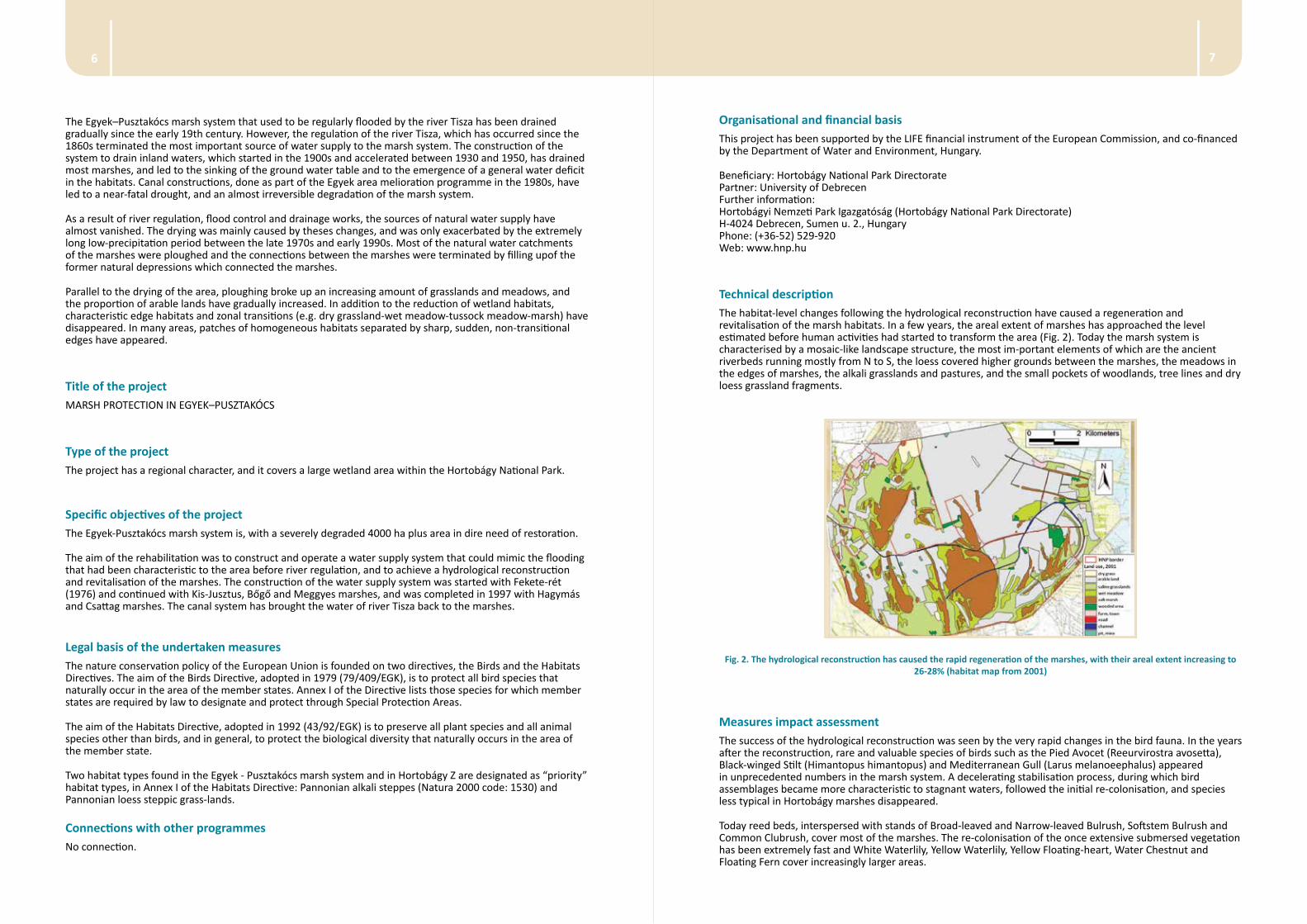
Technical descriptionThe habitat-level changes following the hydrological reconstruction have caused a regeneration and revitalisation of the marsh habitats. In a few years, the areal extent of marshes has approached the level estimated before human activities had started to transform the area (Fig. 2). Today the marsh system is characterised by a mosaic-like landscape structure, the most im-portant elements of which are the ancient riverbeds running mostly from N to S, the loess covered higher grounds between the marshes, the meadows in the edges of marshes, the alkali grasslands and pastures, and the small pockets of woodlands, tree lines and dry loess grassland fragments.
Fig. 2. The hydrological reconstruction has caused the rapid regeneration of the marshes, with their areal extent increasing to 26-28% (habitat map from 2001)
Measures impact assessmentThe success of the hydrological reconstruction was seen by the very rapid changes in the bird fauna. In the years after the reconstruction, rare and valuable species of birds such as the Pied Avocet (Reeurvirostra avosetta), Black-winged Stilt (Himantopus himantopus) and Mediterranean Gull (Larus melanoeephalus) appeared in unprecedented numbers in the marsh system. A decelerating stabilisation proc ess, during which bird assemblages became more characteristic to stagnant waters, followed the initial re-colonisation, and species less typical in Hortobágy marshes disappeared.
Today reed beds, inter spersed with stands of Broad-leaved and Narrow-leaved Bulrush, Softstem Bulrush and Common Clubrush, cover most of the marshes. The re-colonisation of the once extensive submersed vegetation has been extremely fast and White Waterlily, Yellow Waterlily, Yellow Floating-heart, Water Chestnut and Floating Fern cover increasingly larger areas.
98
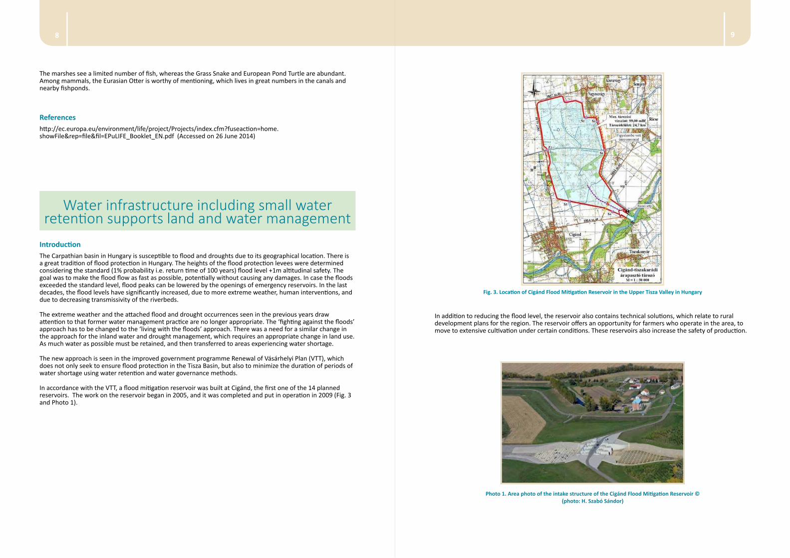
Fig. 3. Location of Cigánd Flood Mitigation Reservoir in the Upper Tisza Valley in Hungary
In addition to reducing the flood level, the reservoir also contains technical solutions, which relate to rural development plans for the region. The reservoir offers an opportunity for farmers who operate in the area, to move to extensive cultivation under certain conditions. These reservoirs also increase the safety of production.
Photo 1. Area photo of the intake structure of the Cigánd Flood Mitigation Reservoir © (photo: H. Szabó Sándor)
The marshes see a limited number of fish, whereas the Grass Snake and European Pond Turtle are abundant. Among mammals, the Eurasian Otter is worthy of mentioning, which lives in great numbers in the canals and nearby fishponds.
Referenceshttp://ec.europa.eu/environment/life/project/Projects/index.cfm?fuseaction=home.showFile&rep=file&fil=EPuLIFE_Booklet_EN.pdf (Accessed on 26 June 2014)
Water infrastructure including small water retention supports land and water management
IntroductionThe Carpathian basin in Hungary is susceptible to flood and droughts due to its geographical location. There is a great tradition of flood protection in Hungary. The heights of the flood protection levees were determined considering the standard (1% probability i.e. return time of 100 years) flood level +1m altitudinal safety. The goal was to make the flood flow as fast as possible, potentially without causing any damages. In case the floods exceeded the standard level, flood peaks can be lowered by the openings of emergency reservoirs. In the last decades, the flood levels have significantly increased, due to more extreme weather, human interventions, and due to decreasing transmissivity of the riverbeds.
The extreme weather and the attached flood and drought occurrences seen in the previous years draw attention to that former water management practice are no longer appropriate. The ‘fighting against the floods’ approach has to be changed to the ‘living with the floods’ approach. There was a need for a similar change in the approach for the inland water and drought management, which requires an appropriate change in land use. As much water as possible must be retained, and then transferred to areas experiencing water shortage.
The new approach is seen in the improved government programme Renewal of Vásárhelyi Plan (VTT), which does not only seek to ensure flood protection in the Tisza Basin, but also to minimize the duration of periods of water shortage using water retention and water governance methods.
In accordance with the VTT, a flood mitigation reservoir was built at Cigánd, the first one of the 14 planned reservoirs. The work on the reservoir began in 2005, and it was completed and put in operation in 2009 (Fig. 3 and Photo 1).
1110
Connections with other programmesNo connections.
Organisational and financial basisLead Organisation(s) for the VTT:
• Ministry of Environmental Protection and Water Management (currently called as the successor: Ministry of Rural Development)
• VKKI - Central Directorate for Water and Environment (currently called as the successor: National Water Authority) - VKKI was responsible for coordinating: (i) the preparation of the overall concept, (ii) research, (iii) design and implementation on behalf of the Ministry of Environment Protection and Water Management
• VIZITERV Consult Zrt. - Lead organisation of technical design of conceptual planning and detailed design of VTT
The Nord Hungarian Water Management Directorate (Miskolc, Hungary) was the head of the project. The financial sources of VTT were (i) the Operational Programmes of the National Development Plan; (ii) the framework of the National Rural Development Plan, which implemented the National Rural Development Strategic Plan; and (iii) the financial instruments from the European Union’s funding scheme that can be obtained by applying for tenders.
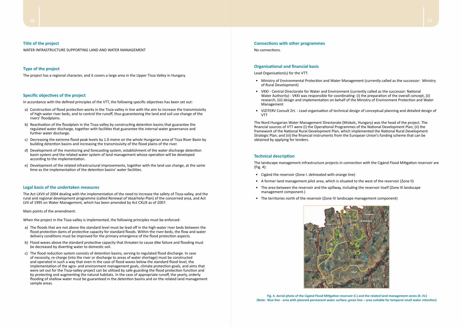
Technical descriptionThe landscape management infrastructure projects in connection with the Cigánd Flood Mitigation reservoir are (Fig. 4):
• Cigánd the reservoir (Zone I. delineated with orange line)
• A former land management pilot area, which is situated to the west of the reservoir (Zone II)
• The area between the reservoir and the spillway, including the reservoir itself (Zone III landscape management component.)
• The territories north of the reservoir (Zone IV landscape management component)
Fig. 4. Aerial photo of the Cigánd Flood Mitigation reservoir (I.) and the related land management zones (II.-IV.) (Note: Blue line - area with planned permanent water surface; green line – area suitable for temporal small water retention)
Title of the projectWATER INFRASTRUCTURE SUPPORTING LAND AND WATER MANAGEMENT
Type of the projectThe project has a regional character, and it covers a large area in the Upper Tisza Valley in Hungary.
Specific objectives of the project In accordance with the defined principles of the VTT, the following specific objectives has been set out:
a) Construction of flood protection works in the Tisza-valley in line with the aim to increase the transmissivity of high-water river beds, and to control the runoff, thus guaranteeing the land and soil use change of the rivers’ floodplains.
b) Reactivation of the floodplain in the Tisza-valley by constructing detention basins that guarantee the regulated water discharge, together with facilities that guarantee the internal water governance and further water discharge.
c) Decreasing the extreme flood peak levels by 1.0 metre on the whole Hungarian area of Tisza River Basin by building detention basins and increasing the transmissivity of the flood plains of the river.
d) Development of the monitoring and forecasting system, establishment of the water discharge detention basin system and the related water system of land management whose operation will be developed according to the implementation.
e) Development of the related infrastructural improvements, together with the land use change, at the same time as the implementation of the detention basins’ water facilities.
Legal basis of the undertaken measuresThe Act LXVII of 2004 dealing with the implementation of the need to increase the safety of Tisza-valley, and the rural and regional development programme (called Renewal of Vásárhelyi Plan) of the concerned area, and Act LVII of 1995 on Water Management, which has been amended by Act CXLIX as of 2007.
Main points of the amendment:
When the project in the Tisza-valley is implemented, the following principles must be enforced:
a) The floods that are not above the standard level must be lead off in the high-water river beds between the flood protection dams of protective capacity for standard floods. Within the river-beds, the flow and water delivery conditions must be improved for the primary emergence of the flood protection aspects.
b) Flood waves above the standard protective capacity that threaten to cause dike failure and flooding must be decreased by diverting water to domestic soil.
c) The flood reduction system consists of detention basins, serving to regulated flood discharge. In case of necessity, re-charge (into the river or discharge to areas of water shortage) must be constructed and operated in such a way that even in the case of flood waves below the standard flood level, the implementation of the agro- and environment management goals, climate protection goals, and aims that were set out for the Tisza-valley project can be utilised by safe-guarding the flood protection function and by protecting and augmenting the natural habitats. In the case of appropriate runoff, the yearly, orderly flooding of shallow water must be guaranteed in the detention basins and on the related land management sample areas.
1312
Complex water retention actions for the Nagyszéksós Lake System
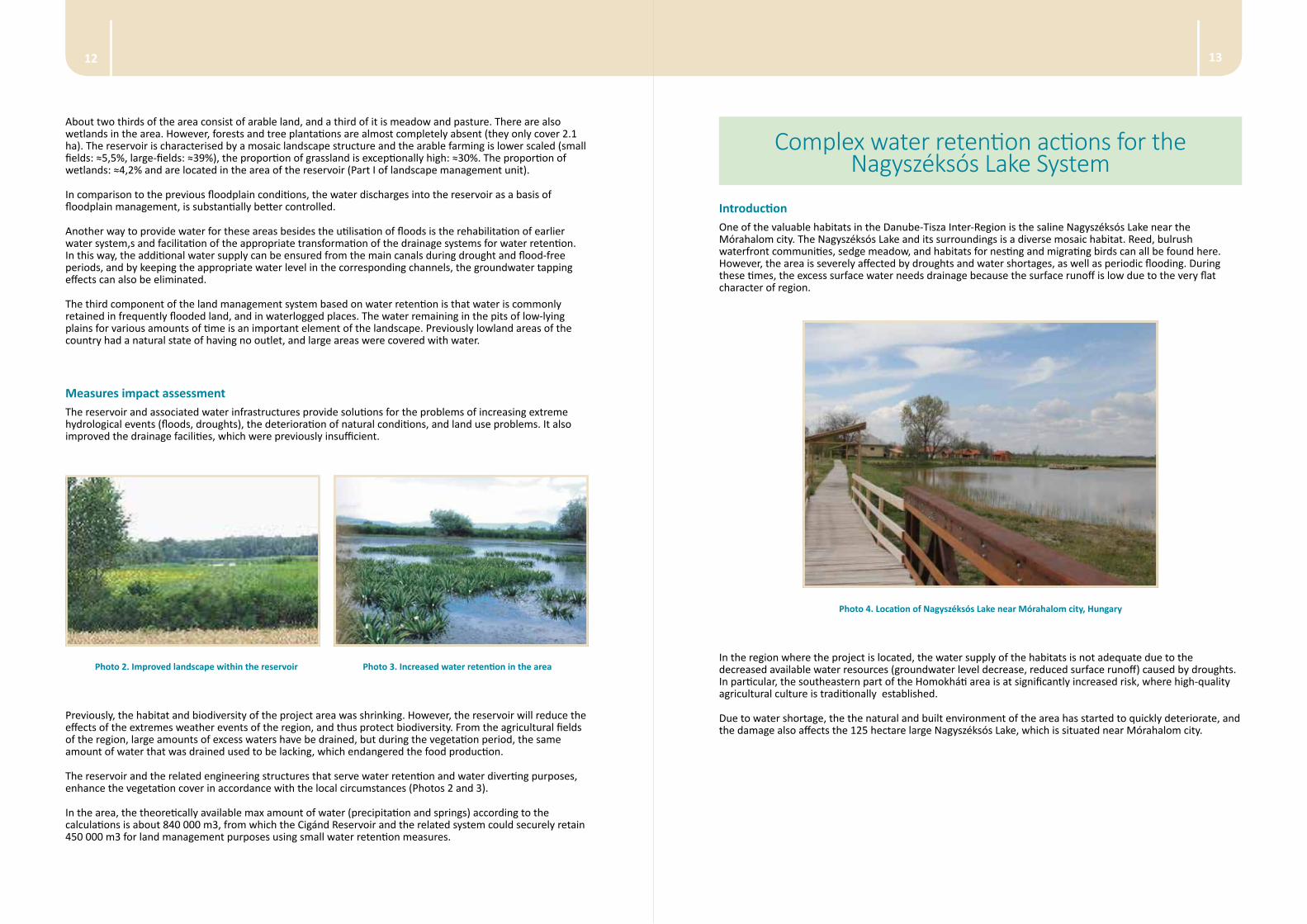
IntroductionOne of the valuable habitats in the Danube-Tisza Inter-Region is the saline Nagyszéksós Lake near the Mórahalom city. The Nagyszéksós Lake and its surroundings is a diverse mosaic habitat. Reed, bulrush waterfront communities, sedge meadow, and habitats for nesting and migrating birds can all be found here. However, the area is severely affected by droughts and water shortages, as well as periodic flooding. During these times, the excess surface water needs drainage because the surface runoff is low due to the very flat character of region.
Photo 4. Location of Nagyszéksós Lake near Mórahalom city, Hungary
In the region where the project is located, the water supply of the habitats is not adequate due to the decreased available water resources (groundwater level decrease, reduced surface runoff) caused by droughts. In particular, the southeastern part of the Homokháti area is at significantly increased risk, where high-quality agricultural culture is traditionally established.
Due to water shortage, the the natural and built environment of the area has started to quickly deteriorate, and the damage also affects the 125 hectare large Nagyszéksós Lake, which is situated near Mórahalom city.
About two thirds of the area consist of arable land, and a third of it is meadow and pasture. There are also wetlands in the area. However, forests and tree plantations are almost completely absent (they only cover 2.1 ha). The reservoir is characterised by a mosaic landscape structure and the arable farming is lower scaled (small fields: ≈5,5%, large-fields: ≈39%), the proportion of grassland is exceptionally high: ≈30%. The proportion of wetlands: ≈4,2% and are located in the area of the reservoir (Part I of landscape management unit).
In comparison to the previous floodplain conditions, the water discharges into the reservoir as a basis of floodplain management, is substantially better controlled.
Another way to provide water for these areas besides the utilisation of floods is the rehabilitation of earlier water system,s and facilitation of the appropriate transformation of the drainage systems for water retention. In this way, the additional water supply can be ensured from the main canals during drought and flood-free periods, and by keeping the appropriate water level in the corresponding channels, the groundwater tapping effects can also be eliminated.
The third component of the land management system based on water retention is that water is commonly retained in frequently flooded land, and in waterlogged places. The water remaining in the pits of low-lying plains for various amounts of time is an important element of the landscape. Previously lowland areas of the country had a natural state of having no outlet, and large areas were covered with water.
Measures impact assessmentThe reservoir and associated water infrastructures provide solutions for the problems of increasing extreme hydrological events (floods, droughts), the deterioration of natural conditions, and land use problems. It also improved the drainage facilities, which were previously insufficient.
Photo 2. Improved landscape within the reservoir Photo 3. Increased water retention in the area
Previously, the habitat and biodiversity of the project area was shrinking. However, the reservoir will reduce the effects of the extremes weather events of the region, and thus protect biodiversity. From the agricultural fields of the region, large amounts of excess waters have be drained, but during the vegetation period, the same amount of water that was drained used to be lacking, which endangered the food production.
The reservoir and the related engineering structures that serve water retention and water diverting purposes, enhance the vegetation cover in accordance with the local circumstances (Photos 2 and 3).
In the area, the theoretically available max amount of water (precipitation and springs) according to the calculations is about 840 000 m3, from which the Cigánd Reservoir and the related system could securely retain 450 000 m3 for land management purposes using small water retention measures.
1514
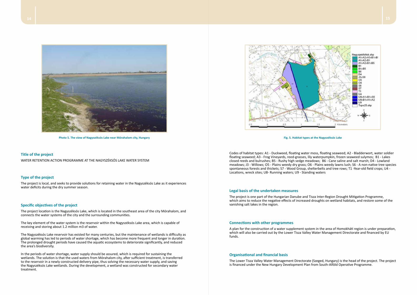
Fig. 5. Habitat types at the Nagyszéksós Lake
Codes of habitat types: A1 - Duckweed, floating water moss, floating seaweed; A2 - Bladderwort, water soldier floating seaweed; A3 - Frog Vineyards, reed-grasses, lily waterpumpkin, frozen seaweed sulymos; B1 - Lakes closed reeds and bulrushes; B5 - Rushy high sedge meadows; B6 - Cane saline and salt marsh; D4 - Lowland meadows; J3 - Willows; O5 - Plains weedy dry grass; O6 - Plains weedy lawns lush; S6 - A non-native tree species spontaneous forests and thickets; S7 - Wood Group, shelterbelts and tree rows; T1 -Year-old field crops; U4 - Locations, wreck sites; U8- Running waters; U9 - Standing waters
Legal basis of the undertaken measuresThe project is one part of the Hungarian Danube and Tisza Inter-Region Drought Mitigation Programme, which aims to reduce the negative effects of increased droughts on wetland habitats, and restore some of the vanishing salt lakes in the region.
Connections with other programmesA plan for the construction of a water supplement system in the area of Homokháti region is under preparation, which will also be carried out by the Lower Tisza Valley Water Management Directorate and financed by EU funds.
Organisational and financial basisThe Lower Tisza Valley Water Management Directorate (Szeged, Hungary) is the head of the project. The project is financed under the New Hungary Development Plan from South-Alföld Operative Programme.
Photo 5. The view of Nagyszéksós Lake near Mórahalom city, Hungary
Title of the projectWATER RETENTION ACTION PROGRAMME AT THE NAGYSZÉKSÓS LAKE WATER SYSTEM
Type of the projectThe project is local, and seeks to provide solutions for retaining water in the Nagyszéksós Lake as it experiences water deficits during the dry summer season.
Specific objectives of the project The project location is the Nagyszéksós Lake, which is located in the southeast area of the city Mórahalom, and connects the water systems of the city and the surrounding communities.
The key element of the water system is the reservoir within the Nagyszéksós Lake area, which is capable of receiving and storing about 1.2 million m3 of water.
The Nagyszéksós Lake reservoir has existed for many centuries, but the maintenance of wetlands is difficulty as global warming has led to periods of water shortage, which has become more frequent and longer in duration. The prolonged drought periods have caused the aquatic ecosystems to deteriorate significantly, and reduced the area’s biodiversity.
In the periods of water shortage, water supply should be assured, which is required for sustaining the wetlands. The solution is that the used waters from Mórahalom city, after sufficient treatment, is transferred to the reservoir in a newly constructed delivery pipe, thus solving the necessary water supply, and saving the Nagyszéksós Lake wetlands. During the development, a wetland was constructed for secondary water treatment.
1716
Title of the project RECONSTRUCTION OF THE MOUNTAIN WEIR HB KLAUZY
Type of the project Forests of the Slovak Republic, State Enterprise is responsible for management of the reconstruction of the weir. The project was funded by the State Enterprise. The total budget was 130 000 Eur.
Specific objective of the project The purpose of reconstructing the water weir is to restrict water runoff, and control the dispatch of excess water and accumulated sediments in the water reservoir. The aim is also to use it for recreation, including hiking and fishing. The progress of the project has been reported in regional news, in local schools and by local environmental organisations.
Legal basis of the undertaken measuresSince the reconstruction weir of water was implemented within the territory of the National Park, it was crucial to ensure that the project aligned with the legislation concerning nature conservation and water. Following these laws, this project has complied with the legal and environmental restrictions, and thus ensured that the reconstruction of the weir has had the minimum amount of negative environmental impact.
Connections with other programmes This project was not connected with other national programs.
Organisational and financial basisThe various stages of the project included a hydrological analysis, a technical project, engineering, an approval period, and the realisation of the project. All these stages of the project were financed by the State Enterprise.
Technical description The reconstruction was focused to increase security of the weir, which was disrupted during flood situation in year 2010 and increased flood (active) retention volume of weir. Flood discharge is Q100 = 29,4 m3.s-1.
Photo 6 illustrates the condition weir before reconstruction.
Photo 6. The Weir HB Klauzy after passing flood wave 2010 (photo by Mosný)
Photo 7 illustrated the condition after reconstruction.
Technical description
Project phases Short content description
1. Built up the Nagyszéksós Lake water supply system
The treated urban waste waters diversion into the lake, and construction of the corresponding wetland.
2. Modification of the inner part of the reservoir
Shaping of the water supply route within the reservoir, undertaking the necessary landscaping work.
3. Rebuilt of the elements of the connecting drainage system
Rebuilt the connecting Széksós Lake and Paphalmi main channel and related engineering structures.
Measures impact assessmentThe construction of the water reservoir and the related works improved the water balance in that region, including in the wetlands ecosystems.
SLOVAKIAReconstruction of the mountain weir HB Klauzy
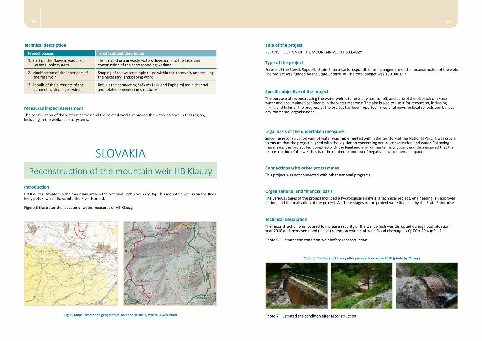
IntroductionHB Klauzy is situated in the mountain area in the National Park Slovenský Raj. This mountain weir is on the River Biely potok, which flows into the River Hornád.
Figure 6 illustrates the location of water measures of HB Klauzy.
Fig. 6. Maps - water and geographical location of basin, where is weir build
1918
Title of the project FLOOD PROTECTION AREA – POLDER KLATOVA NOVA VES
Type of the project Slovak Water Management Enterprise, State Enterprise is responsible for the management of this project. The project was co-funded by the EU and the Slovak state. The total budget was 1,032 mil EUR.
Specific objective of the project The project aimed to protect the area from floods, thus protect the property and people in the surrounding areas. Additionally, the structure improved the retention volume. The project was publicised in the regional news, on websites, in meetings, and by local environmental organisations.
Legal basis of the undertaken measuresThe project conformed to Slovak law. Construction and water right permits were provided using EU funds, and financial resources of the State budget.
Connections with other programmes The project is in line with the guidelines set out by the Flood Protection division of the Ministry of Environment of the Slovak republic.
Organisational and financial basisThe various stages of the project included a geology and hydrology analysis, technical project, engineering, an approval period, and implementation of the project. The project was financed by EU funding, state budget, and by State Enterprise. The project started in 2010 and finished 2013.
The budget of project was:
• Funded EU 745 924,62 Eur 80,75 %
• State budget SR 131 633,76 Eur 14,25 %
• Budget State Enterprise 154 826,66 Eur 5 %
• The complete budget 1 032 385,04 Eur
Technical description The measures implemented during the project reduced the risk of flooding.
The transformation of maximum discharges flood wave is from Qmax=13 m3.s-1 to Qmax=4,2 m3.s-1, what is reduced peak of the flood wave about 85 %.
The next photo illustrates the construction of the polder and the reconstruction of the river Hradsky potok.
Photo 7. The Reconstructed mountain weir HB Klauzy 2014 (photo by Fodor, State Enterprice)
Measures impact assessment The benefits of the reconstruction include to rescuing historic mountain wear for destruction due to floods, restoring and enhancing retention capacity of the reservoir, and improving their flood transformational abilities. The improved water retention capacity also improve the conditions for flora and fauna in the basin. The area will also be used for fishing, recreation and tourism.
This reconstruction should be seen as an example of changed conditions of runnof using new technical parameters for construction.
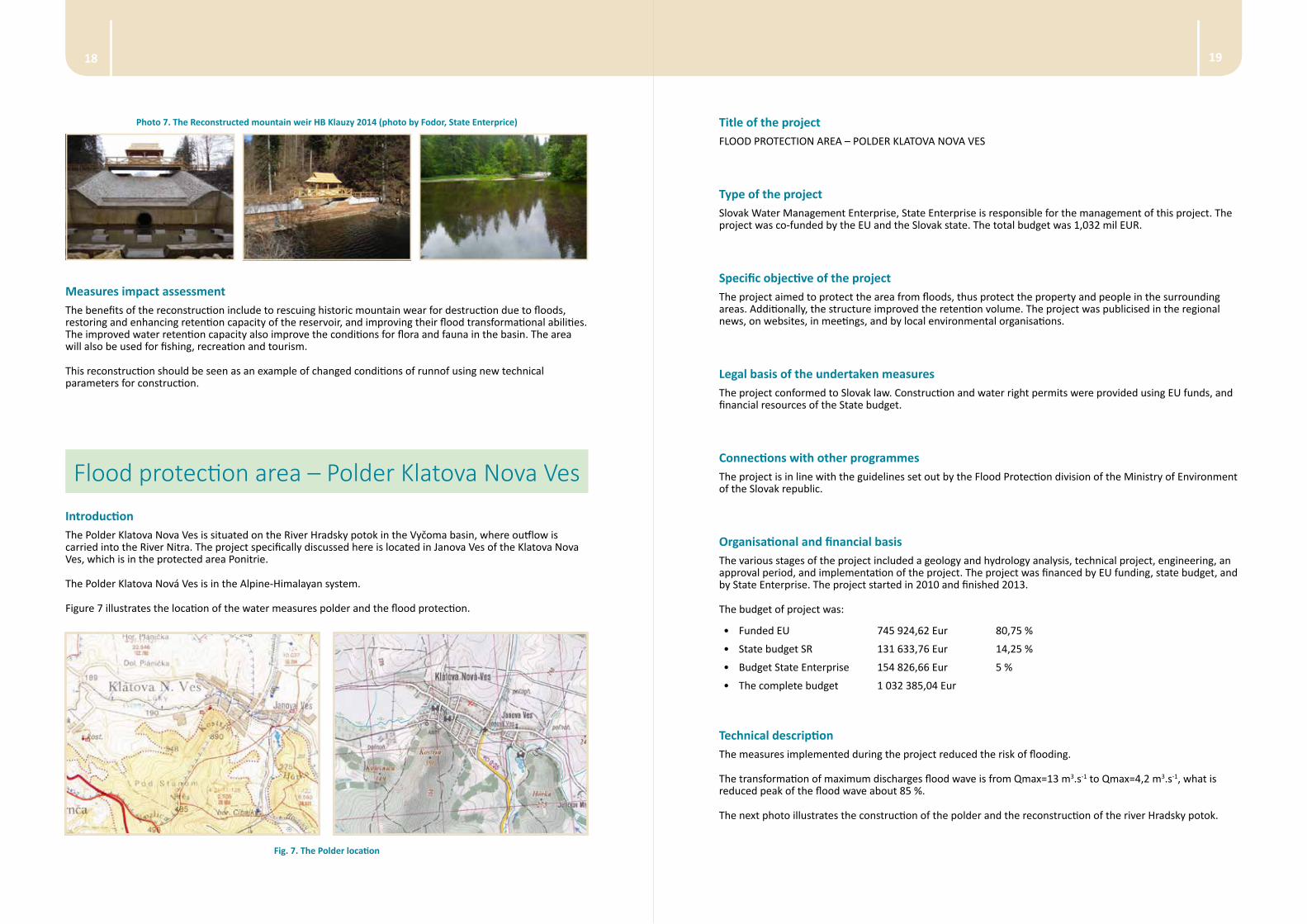
Flood protection area – Polder Klatova Nova VesIntroductionThe Polder Klatova Nova Ves is situated on the River Hradsky potok in the Vyčoma basin, where outflow is carried into the River Nitra. The project specifically discussed here is located in Janova Ves of the Klatova Nova Ves, which is in the protected area Ponitrie.
The Polder Klatova Nová Ves is in the Alpine-Himalayan system.
Figure 7 illustrates the location of the water measures polder and the flood protection.
Fig. 7. The Polder location
2120
Title of the project THE PODSPÁDY – PROTECTED AREA BOR – NATURAL WATER RETENTION BY BEAVER WEIR
Type of the project Beavers, and the structures they create, occur naturally in nature without causing serious problems. They can thus be encouraged in protected areas where it is impossible to implement technical solutions that change runoff patterns.
Specific objective of the project Because this is a naturally occurring phenomenon, it is popular among citizens and environmentalists. The project has been presented in publications and at conferences, where it has been discussed as a water retention measure, and in regional news and in schools, where has been referred to as a ‘green solution’.
Legal basis of the undertaken measuresBecause this is a naturally occurring phenomenon, the constructions did not need any legal permission. These constructions have no time limit, but depend on the community of beavers and access to woody materials in the river basin.
Connections with other programmes The main programmes connected with these measures are environmental education programs and education about water in schools, where it is highlighted as a measure that can be implemented to improve water retention.
Organisational and financial basisBecause this is naturally occurring, it does not require human planning or financing.
Technical description These measures could be seen as a non-technical water retention measure. It is an example of changing conditions in a protected area, and creating more favourable conditions for the flora and fauna in the surrounding area.
Measures impact assessment The beavers weirs restore and enhance retention water capacity. The improved water retention improve the conditions of flora and fauna in the basin (Photo 9).
Photo 8. The Polder on the River 2014 (photo: Slovak Water Management Enterprise)
Measures impact assessment Polders are one solution to reduce flooding, but it does not control the dispatch of the runoff.
Nevertheless, the benefits of build hydrotechnical flood protection structures are delay runoff from the basin after hight atmosferic precipitation or/and snowmelt.
The Podspády – Protected Area Bor – natural water retention by beaver weir
IntroductionBeavers naturally build dams, and thus slow down the water flow in the catchment area where they live.
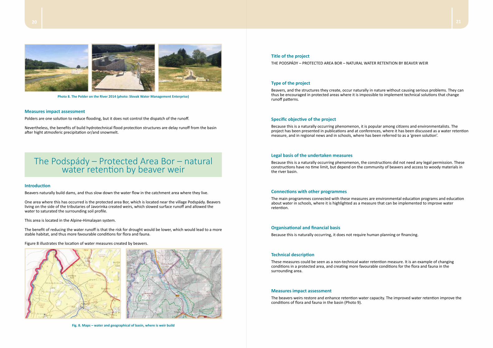
One area where this has occurred is the protected area Bor, which is located near the village Podspády. Beavers living on the side of the tributaries of Javorinka created weirs, which slowed surface runoff and allowed the water to saturated the surrounding soil profile.
This area is located in the Alpine-Himalayan system.
The benefit of reducing the water runoff is that the risk for drought would be lower, which would lead to a more stable habitat, and thus more favourable conditions for flora and fauna.
Figure 8 illustrates the location of water measures created by beavers.
Fig. 8. Maps – water and geographical of basin, where is weir build
2322
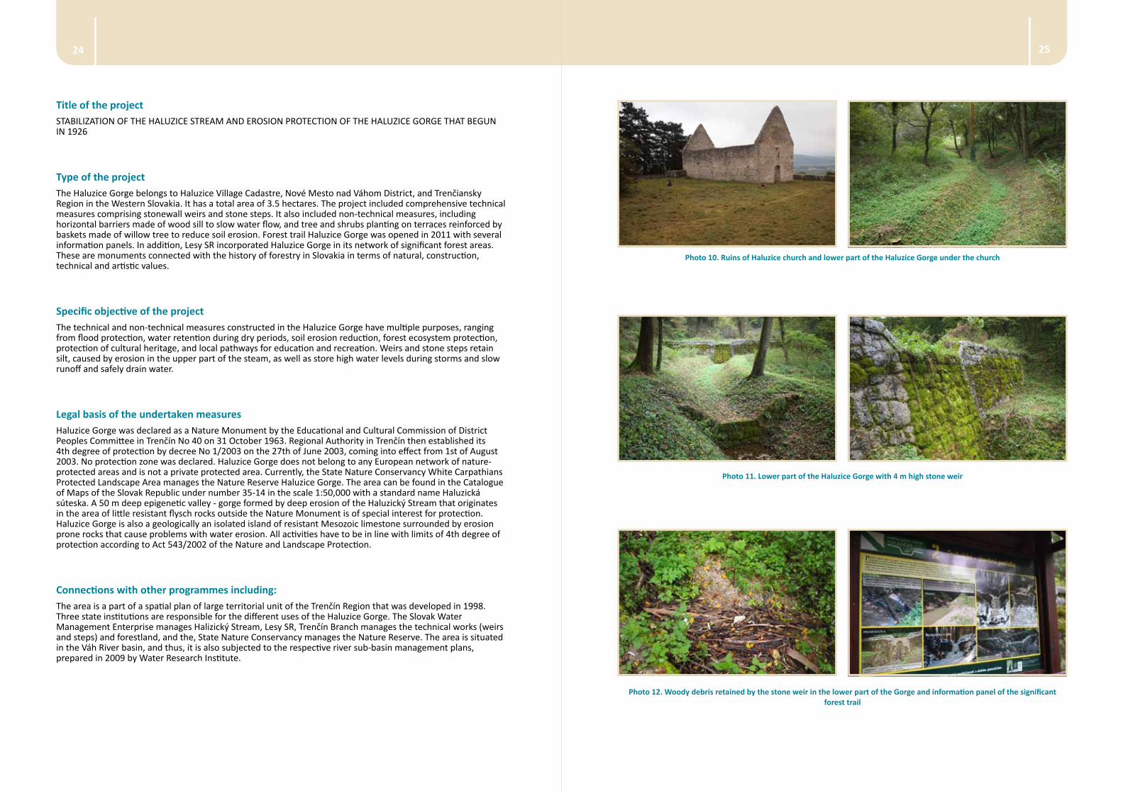
Fig. 9. Location of the Nature Monument Haluzice Gorge Source: http://uzemia.enviroportal.sk/main/detail/cislo/43 (Accessed on 2 August 2014)
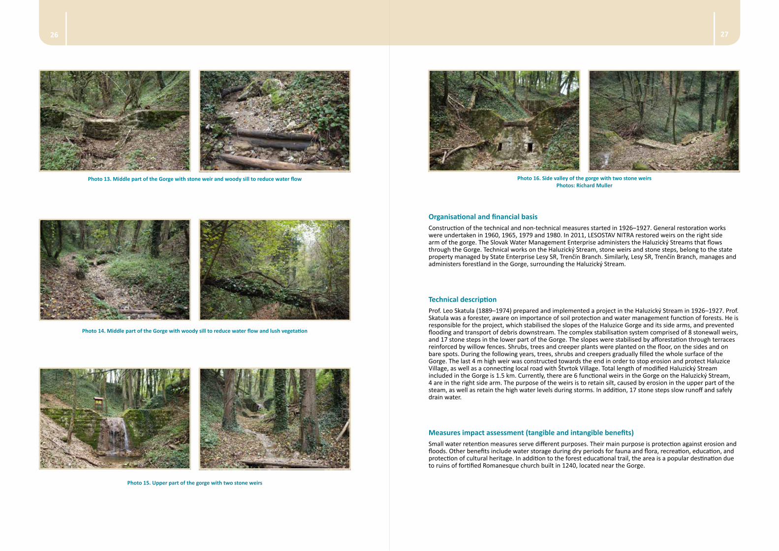
Fig. 10. Location of Nature Monument Haluzice Gorge Source: Google Earth
Photo 9. The Natural water measures in basin Javorinka 2014 (photo by Mosny)
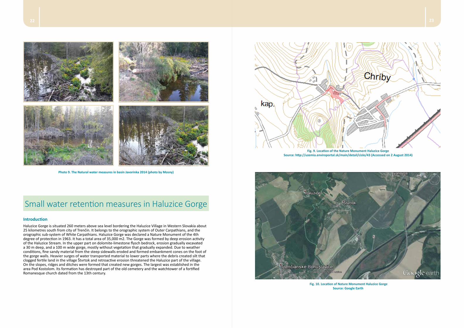
Small water retention measures in Haluzice GorgeIntroductionHaluzice Gorge is situated 260 meters above sea level bordering the Haluzice Village in Western Slovakia about 25 kilometres south from city of Trenčín. It belongs to the orographic system of Outer Carpathians, and the orographic sub-system of White Carpathians. Haluzice Gorge was declared a Nature Monument of the 4th degree of protection in 1963. It has a total area of 35,000 m2. The Gorge was formed by deep erosion activity of the Haluzice Stream. In the upper part on dolomite-limestone flysch bedrock, erosion gradually excavated a 30 m deep, and a 100 m wide gorge, mostly without vegetation that gradually expanded. Due to weather conditions, fine sandy material from the steep sidewalls eroded and formed embankment cones on the foot of the gorge walls. Heavier surges of water transported material to lower parts where the debris created silt that clogged fertile land in the village Štvrtok and retroactive erosion threatened the Haluzice part of the village. On the slopes, ridges and ditches were formed that created new gorges. The largest was established in the area Pod Kostolom. Its formation has destroyed part of the old cemetery and the watchtower of a fortified Romanesque church dated from the 13th century.
2524
Photo 10. Ruins of Haluzice church and lower part of the Haluzice Gorge under the church
Photo 11. Lower part of the Haluzice Gorge with 4 m high stone weir
Photo 12. Woody debris retained by the stone weir in the lower part of the Gorge and information panel of the significant forest trail
Title of the project STABILIZATION OF THE HALUZICE STREAM AND EROSION PROTECTION OF THE HALUZICE GORGE THAT BEGUN IN 1926
Type of the projectThe Haluzice Gorge belongs to Haluzice Village Cadastre, Nové Mesto nad Váhom District, and Trenčiansky Region in the Western Slovakia. It has a total area of 3.5 hectares. The project included comprehensive technical measures comprising stonewall weirs and stone steps. It also included non-technical measures, including horizontal barriers made of wood sill to slow water flow, and tree and shrubs planting on terraces reinforced by baskets made of willow tree to reduce soil erosion. Forest trail Haluzice Gorge was opened in 2011 with several information panels. In addition, Lesy SR incorporated Haluzice Gorge in its network of significant forest areas. These are monuments connected with the history of forestry in Slovakia in terms of natural, construction, technical and artistic values.
Specific objective of the project The technical and non-technical measures constructed in the Haluzice Gorge have multiple purposes, ranging from flood protection, water retention during dry periods, soil erosion reduction, forest ecosystem protection, protection of cultural heritage, and local pathways for education and recreation. Weirs and stone steps retain silt, caused by erosion in the upper part of the steam, as well as store high water levels during storms and slow runoff and safely drain water.
Legal basis of the undertaken measuresHaluzice Gorge was declared as a Nature Monument by the Educational and Cultural Commission of District Peoples Committee in Trenčín No 40 on 31 October 1963. Regional Authority in Trenčín then established its 4th degree of protection by decree No 1/2003 on the 27th of June 2003, coming into effect from 1st of August 2003. No protection zone was declared. Haluzice Gorge does not belong to any European network of nature-protected areas and is not a private protected area. Currently, the State Nature Conservancy White Carpathians Protected Landscape Area manages the Nature Reserve Haluzice Gorge. The area can be found in the Catalogue of Maps of the Slovak Republic under number 35-14 in the scale 1:50,000 with a standard name Haluzická súteska. A 50 m deep epigenetic valley - gorge formed by deep erosion of the Haluzický Stream that originates in the area of little resistant flysch rocks outside the Nature Monument is of special interest for protection. Haluzice Gorge is also a geologically an isolated island of resistant Mesozoic limestone surrounded by erosion prone rocks that cause problems with water erosion. All activities have to be in line with limits of 4th degree of protection according to Act 543/2002 of the Nature and Landscape Protection.
Connections with other programmes including:The area is a part of a spatial plan of large territorial unit of the Trenčín Region that was developed in 1998. Three state institutions are responsible for the different uses of the Haluzice Gorge. The Slovak Water Management Enterprise manages Halizický Stream, Lesy SR, Trenčín Branch manages the technical works (weirs and steps) and forestland, and the, State Nature Conservancy manages the Nature Reserve. The area is situated in the Váh River basin, and thus, it is also subjected to the respective river sub-basin management plans, prepared in 2009 by Water Research Institute.
2726
Photo 16. Side valley of the gorge with two stone weirs Photos: Richard Muller
Organisational and financial basisConstruction of the technical and non-technical measures started in 1926–1927. General restoration works were undertaken in 1960, 1965, 1979 and 1980. In 2011, LESOSTAV NITRA restored weirs on the right side arm of the gorge. The Slovak Water Management Enterprise administers the Haluzický Streams that flows through the Gorge. Technical works on the Haluzický Stream, stone weirs and stone steps, belong to the state property managed by State Enterprise Lesy SR, Trenčín Branch. Similarly, Lesy SR, Trenčín Branch, manages and administers forestland in the Gorge, surrounding the Haluzický Stream.
Technical descriptionProf. Leo Skatula (1889–1974) prepared and implemented a project in the Haluzický Stream in 1926–1927. Prof. Skatula was a forester, aware on importance of soil protection and water management function of forests. He is responsible for the project, which stabilised the slopes of the Haluzice Gorge and its side arms, and prevented flooding and transport of debris downstream. The complex stabilisation system comprised of 8 stonewall weirs, and 17 stone steps in the lower part of the Gorge. The slopes were stabilised by afforestation through terraces reinforced by willow fences. Shrubs, trees and creeper plants were planted on the floor, on the sides and on bare spots. During the following years, trees, shrubs and creepers gradually filled the whole surface of the Gorge. The last 4 m high weir was constructed towards the end in order to stop erosion and protect Haluzice Village, as well as a connecting local road with Štvrtok Village. Total length of modified Haluzický Stream included in the Gorge is 1.5 km. Currently, there are 6 functional weirs in the Gorge on the Haluzický Stream, 4 are in the right side arm. The purpose of the weirs is to retain silt, caused by erosion in the upper part of the steam, as well as retain the high water levels during storms. In addition, 17 stone steps slow runoff and safely drain water.
Measures impact assessment (tangible and intangible benefits)Small water retention measures serve different purposes. Their main purpose is protection against erosion and floods. Other benefits include water storage during dry periods for fauna and flora, recreation, education, and protection of cultural heritage. In addition to the forest educational trail, the area is a popular destination due to ruins of fortified Romanesque church built in 1240, located near the Gorge.
Photo 13. Middle part of the Gorge with stone weir and woody sill to reduce water flow
Photo 14. Middle part of the Gorge with woody sill to reduce water flow and lush vegetation
Photo 15. Upper part of the gorge with two stone weirs
2928
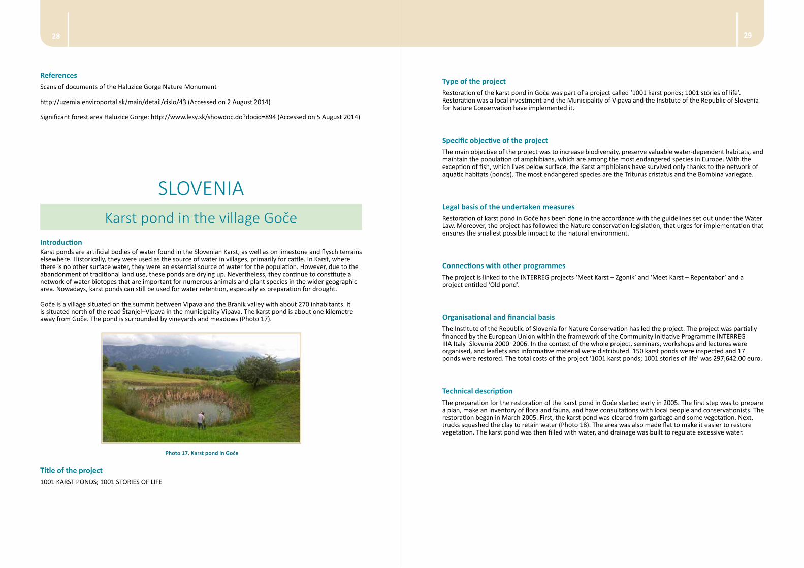
Type of the project Restoration of the karst pond in Goče was part of a project called ‘1001 karst ponds; 1001 stories of life’. Restoration was a local investment and the Municipality of Vipava and the Institute of the Republic of Slovenia for Nature Conservation have implemented it.
Specific objective of the project The main objective of the project was to increase biodiversity, preserve valuable water-dependent habitats, and maintain the population of amphibians, which are among the most endangered species in Europe. With the exception of fish, which lives below surface, the Karst amphibians have survived only thanks to the network of aquatic habitats (ponds). The most endangered species are the Triturus cristatus and the Bombina variegate.
Legal basis of the undertaken measuresRestoration of karst pond in Goče has been done in the accordance with the guidelines set out under the Water Law. Moreover, the project has followed the Nature conservation legislation, that urges for implementation that ensures the smallest possible impact to the natural environment.
Connections with other programmes The project is linked to the INTERREG projects ‘Meet Karst – Zgonik’ and ‘Meet Karst – Repentabor’ and a project entitled ‘Old pond’.
Organisational and financial basisThe Institute of the Republic of Slovenia for Nature Conservation has led the project. The project was partially financed by the European Union within the framework of the Community Initiative Programme INTERREG IIIA Italy–Slovenia 2000–2006. In the context of the whole project, seminars, workshops and lectures were organised, and leaflets and informative material were distributed. 150 karst ponds were inspected and 17 ponds were restored. The total costs of the project ‘1001 karst ponds; 1001 stories of life’ was 297,642.00 euro.
Technical description The preparation for the restoration of the karst pond in Goče started early in 2005. The first step was to prepare a plan, make an inventory of flora and fauna, and have consultations with local people and conservationists. The restoration began in March 2005. First, the karst pond was cleared from garbage and some vegetation. Next, trucks squashed the clay to retain water (Photo 18). The area was also made flat to make it easier to restore vegetation. The karst pond was then filled with water, and drainage was built to regulate excessive water.
ReferencesScans of documents of the Haluzice Gorge Nature Monument
http://uzemia.enviroportal.sk/main/detail/cislo/43 (Accessed on 2 August 2014)
Significant forest area Haluzice Gorge: http://www.lesy.sk/showdoc.do?docid=894 (Accessed on 5 August 2014)
SLOVENIAKarst pond in the village Goče
IntroductionKarst ponds are artificial bodies of water found in the Slovenian Karst, as well as on limestone and flysch terrains elsewhere. Historically, they were used as the source of water in villages, primarily for cattle. In Karst, where there is no other surface water, they were an essential source of water for the population. However, due to the abandonment of traditional land use, these ponds are drying up. Nevertheless, they continue to constitute a network of water biotopes that are important for numerous animals and plant species in the wider geographic area. Nowadays, karst ponds can still be used for water retention, especially as preparation for drought.
Goče is a village situated on the summit between Vipava and the Branik valley with about 270 inhabitants. It is situated north of the road Štanjel–Vipava in the municipality Vipava. The karst pond is about one kilometre away from Goče. The pond is surrounded by vineyards and meadows (Photo 17).
Photo 17. Karst pond in Goče
Title of the project
1001 KARST PONDS; 1001 STORIES OF LIFE
3130
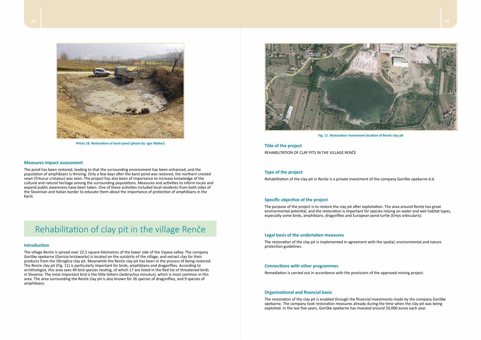
Fig. 11. Restoration investment location of Renče clay pit
Title of the project REHABILITATION OF CLAY PITS IN THE VILLAGE RENČE
Type of the project Rehabilitation of the clay pit in Renče is a private investment of the company Goriške opekarne d.d.
Specific objective of the project The purpose of the project is to restore the clay pit after exploitation. The area around Renče has great environmental potential, and the restoration is important for species relying on water and wet habitat types, especially some birds, amphibians, dragonflies and European pond turtle (Emys orbicularis).
Legal basis of the undertaken measuresThe restoration of the clay pit is implemented in agreement with the spatial, environmental and nature protection guidelines.
Connections with other programmes Remediation is carried out in accordance with the provisions of the approved mining project.
Organisational and financial basisThe restoration of the clay pit is enabled through the financial investments made by the company Goriške opekarne. The company took restoration measures already during the time when the clay pit was being exploited. In the last five years, Goriške opekarne has invested around 50,000 euros each year.
Photo 18. Restoration of karst pond (photo by: Igor Maher)
Measures impact assessment The pond has been restored, leading to that the surrounding environment has been enhanced, and the population of amphibians is thriving. Only a few days after the karst pond was restored, the northern crested newt (Triturus cristatus) was seen. The project has also been of importance to increase knowledge of the cultural and natural heritage among the surrounding populations. Measures and activities to inform locals and expand public awareness have been taken. One of these activities included local residents from both sides of the Slovenian and Italian border to educate them about the importance of protection of amphibians in the Karst.
Rehabilitation of clay pit in the village RenčeIntroductionThe village Renče is spread over 22.5 square kilometres of the lower side of the Vipava valley. The company Goriške opekarne (Gorizia brickworks) is located on the outskirts of the village, and extract clay for their products from the Okroglica clay pit. Meanwhile the Renče clay pit has been in the process of being restored. The Renče clay pit (Fig. 11) is particularly important for birds, amphibians and dragonflies. According to ornithologist, this area sees 49 bird species nesting, of which 17 are listed in the Red list of threatened birds in Slovenia. The most important bird is the little bittern (Ixobrychus minutus), which is most common in this area. The area surrounding the Renče clay pit is also known for 26 species of dragonflies, and 9 species of amphibians.
3332
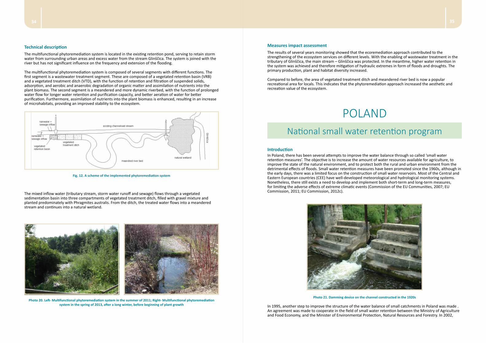
Preliminary ecotoxicological analysis along the stream Glinščica has shown an increase in pollution, as well as toxicity in the stream. This was due to outflow from septic tanks and sewage systems, and storm water runoff into the stream, as well as non-point sources of pollution from agricultural surfaces nearby. To address this, a construction of a multifunctional phytoremediation system (ecoremediation object) on one of the tributaries of the stream Glinščica was proposed, and constructed in 2006. The site was selected as a demonstration site of good practices using phytotechnologies for the improvement of water quality status.
The multifunctional phytoremediation system consists of phytoremediation segments and artificially meandered stream segment, which function to retain and treat incoming flows, and improve other ecosystem services.
Multifunctional phytoremediation system combines several important functions, which improve the environment:
• water retention on site
• controlled water treatment with flow regulation
• improvement of ecosystem services of the stream and riparian habitats
• attractive open surfaces in urban environment that enhance biodiversity
Title of the projectECOREMEDIATION SYSTEM ON A POLLUTED TRIBITARY OF GLINŠČICA
Type of the project
The project is of local nature, and was financed by the City of Ljubljana, Department for Environmental Protection.
Specific objective of the projectThe objective of the project was to demonstrate good phytoremediation praxis for the improvement of water quality, ecosystem services, and water retention on site.
Legal basis of the undertaken measuresMultifunctional phytoremediation system has been implemented in accordance with Slovenian legislation.
Connections with other programmes The multifunctional phytoremediation system is designed to demonstrate best practices to improve the quality of watercourses in the area of the City of Ljubljana.
Organisational and financial basisImplementation of multifunctional phytoremediation system was enabled by the City of Ljubljana, which invested 44.066 euros. The project was implemented by Limnos Ltd. The results presented here were published in the article ‘Phytoremediation and stream revitalization for amelioration of ecological status of stream Glinščica’ by Vrhovšek et al. („STREPOW“ International Workshop; 02/2011).
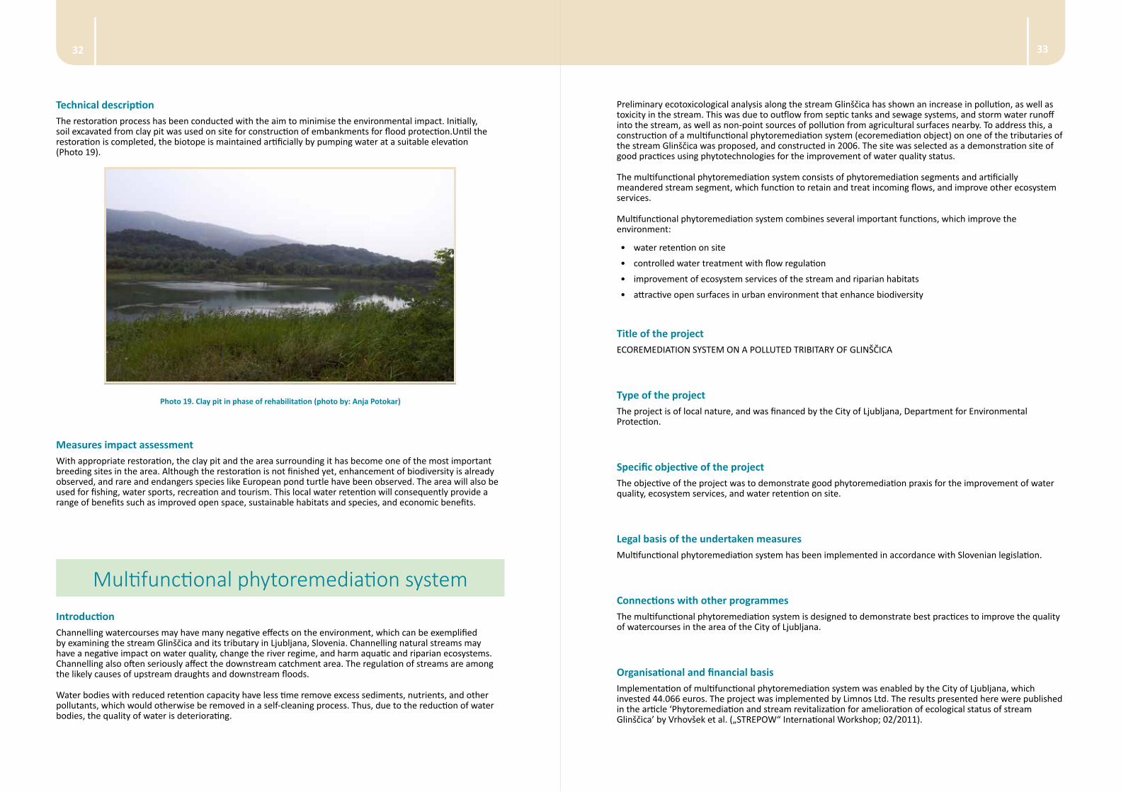
Technical description The restoration process has been conducted with the aim to minimise the environmental impact. Initially, soil excavated from clay pit was used on site for construction of embankments for flood protection.Until the restoration is completed, the biotope is maintained artificially by pumping water at a suitable elevation (Photo 19).
Photo 19. Clay pit in phase of rehabilitation (photo by: Anja Potokar)
Measures impact assessmentWith appropriate restoration, the clay pit and the area surrounding it has become one of the most important breeding sites in the area. Although the restoration is not finished yet, enhancement of biodiversity is already observed, and rare and endangers species like European pond turtle have been observed. The area will also be used for fishing, water sports, recreation and tourism. This local water retention will consequently provide a range of benefits such as improved open space, sustainable habitats and species, and economic benefits.
Multifunctional phytoremediation systemIntroductionChannelling watercourses may have many negative effects on the environment, which can be exemplified by examining the stream Glinščica and its tributary in Ljubljana, Slovenia. Channelling natural streams may have a negative impact on water quality, change the river regime, and harm aquatic and riparian ecosystems. Channelling also often seriously affect the downstream catchment area. The regulation of streams are among the likely causes of upstream draughts and downstream floods.
Water bodies with reduced retention capacity have less time remove excess sediments, nutrients, and other pollutants, which would otherwise be removed in a self-cleaning process. Thus, due to the reduction of water bodies, the quality of water is deteriorating.
3534
Measures impact assessment The results of several years monitoring showed that the ecoremediation approach contributed to the strengthening of the ecosystem services on different levels. With the enabling of wastewater treatment in the tributary of Glinščica, the main stream – Glinščica was protected. In the meantime, higher water retention in the system was achieved and therefore mitigation of hydraulic extremes in form of floods and droughts. The primary production, plant and habitat diversity increased.
Compared to before, the area of vegetated treatment ditch and meandered river bed is now a popular recreational area for locals. This indicates that the phytoremediation approach increased the aesthetic and recreation value of the ecosystem.
POLANDNational small water retention program
IntroductionIn Poland, there has been several attempts to improve the water balance through so called ‘small water retention measures’. The objective is to increase the amount of water resources available for agriculture, to improve the state of the natural environment, and to protect both the rural and urban environment from the detrimental effects of floods. Small water retention measures have been promoted since the 1960s, although in the early days, there was a limited focus on the construction of small water reservoirs. Most of the Central and Eastern European countries (CEE) have well-developed meteorological and hydrological monitoring systems. Nonetheless, there still exists a need to develop and implement both short-term and long-term measures, for limiting the adverse effects of extreme climatic events (Commission of the EU Communities, 2007; EU Commission, 2011; EU Commission, 2012c).
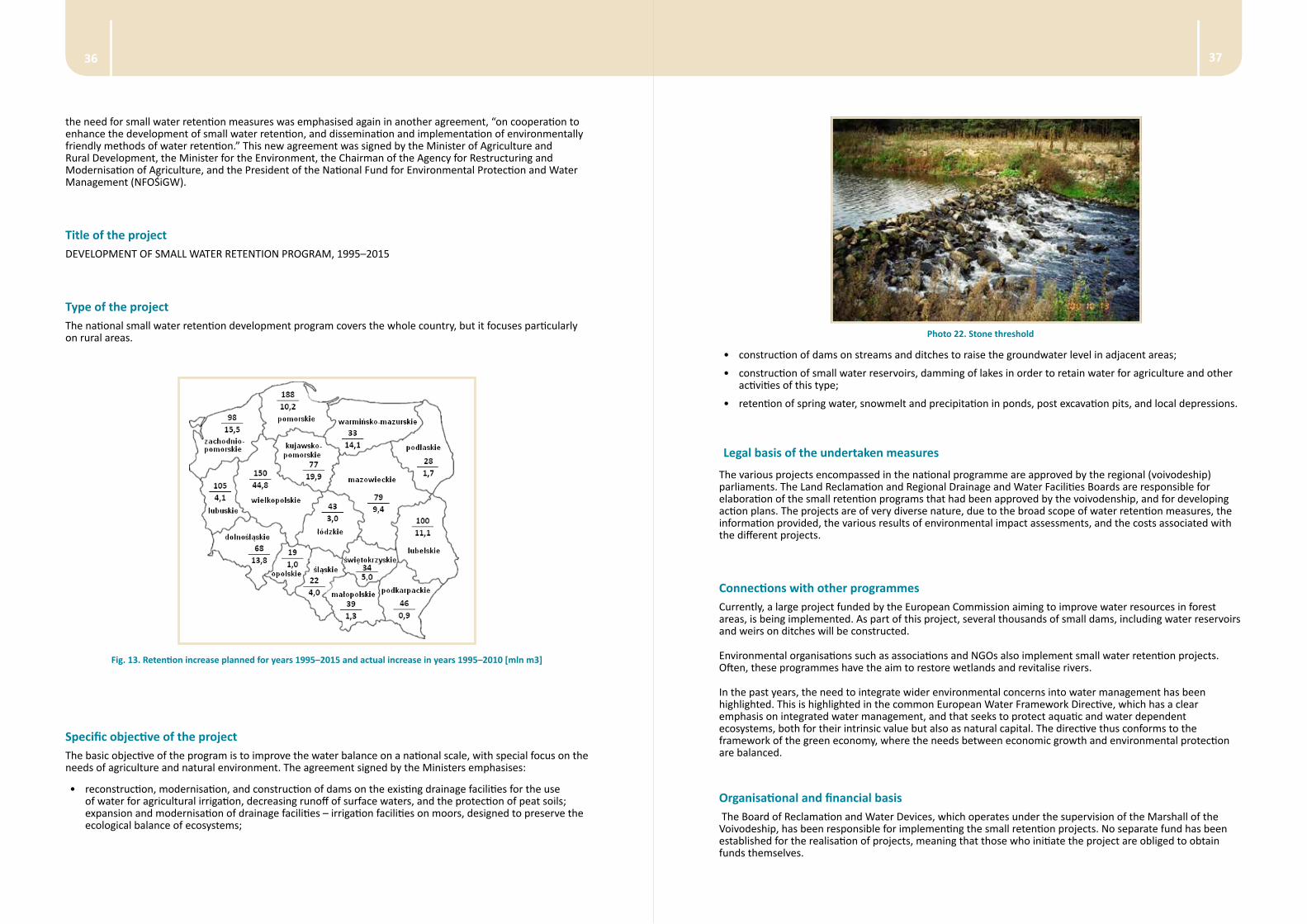
Photo 21. Damming device on the channel constructed in the 1920s
In 1995, another step to improve the structure of the water balance of small catchments in Poland was made . An agreement was made to cooperate in the field of small water retention between the Ministry of Agriculture and Food Economy, and the Minister of Environmental Protection, Natural Resources and Forestry. In 2002,
Technical descriptionThe multifunctional phytoremediation system is located in the existing retention pond, serving to retain storm water from surrounding urban areas and excess water from the stream Glinščica. The system is joined with the river but has not significant influence on the frequency and extension of the flooding.
The multifunctional phytoremediation system is composed of several segments with different functions. The first segment is a wastewater treatment segment. These are composed of a vegetated retention basin (VRB) and a vegetated treatment ditch (VTD), with the function of retention and filtration of suspended solids, adsorption, and aerobic and anaerobic degradation of organic matter and assimilation of nutrients into the plant biomass. The second segment is a meandered and more dynamic riverbed, with the function of prolonged water flow for longer water retention and purification capacity, and better aeration of water for better purification. Furthermore, assimilation of nutrients into the plant biomass is enhanced, resulting in an increase of microhabitats, providing an improved stability to the ecosystem.
Fig. 12. A scheme of the implemented phytoremediation system
The mixed inflow water (tributary stream, storm water runoff and sewage) flows through a vegetated sedimentation basin into three compartments of vegetated treatment ditch, filled with gravel mixture and planted predominately with Phragmites australis. From the ditch, the treated water flows into a meandered stream and continues into a natural wetland.
Photo 20. Left- Multifunctional phytoremediation system in the summer of 2011; Right- Multifunctional phytoremediation system in the spring of 2013, after a long winter, before beginning of plant growth
3736
Photo 22. Stone threshold
• construction of dams on streams and ditches to raise the groundwater level in adjacent areas;
• construction of small water reservoirs, damming of lakes in order to retain water for agriculture and other activities of this type;
• retention of spring water, snowmelt and precipitation in ponds, post excavation pits, and local depressions.
Legal basis of the undertaken measures
The various projects encompassed in the national programme are approved by the regional (voivodeship) parliaments. The Land Reclamation and Regional Drainage and Water Facilities Boards are responsible for elaboration of the small retention programs that had been approved by the voivodenship, and for developing action plans. The projects are of very diverse nature, due to the broad scope of water retention measures, the information provided, the various results of environmental impact assessments, and the costs associated with the different projects.
Connections with other programmes Currently, a large project funded by the European Commission aiming to improve water resources in forest areas, is being implemented. As part of this project, several thousands of small dams, including water reservoirs and weirs on ditches will be constructed.
Environmental organisations such as associations and NGOs also implement small water retention projects. Often, these programmes have the aim to restore wetlands and revitalise rivers.
In the past years, the need to integrate wider environmental concerns into water management has been highlighted. This is highlighted in the common European Water Framework Directive, which has a clear emphasis on integrated water management, and that seeks to protect aquatic and water dependent ecosystems, both for their intrinsic value but also as natural capital. The directive thus conforms to the framework of the green economy, where the needs between economic growth and environmental protection are balanced.
Organisational and financial basis The Board of Reclamation and Water Devices, which operates under the supervision of the Marshall of the Voivodeship, has been responsible for implementing the small retention projects. No separate fund has been established for the realisation of projects, meaning that those who initiate the project are obliged to obtain funds themselves.
the need for small water retention measures was emphasised again in another agreement, “on cooperation to enhance the development of small water retention, and dissemination and implementation of environmentally friendly methods of water retention.” This new agreement was signed by the Minister of Agriculture and Rural Development, the Minister for the Environment, the Chairman of the Agency for Restructuring and Modernisation of Agriculture, and the President of the National Fund for Environmental Protection and Water Management (NFOŚiGW).
Title of the project DEVELOPMENT OF SMALL WATER RETENTION PROGRAM, 1995–2015
Type of the project The national small water retention development program covers the whole country, but it focuses particularly on rural areas.
Fig. 13. Retention increase planned for years 1995–2015 and actual increase in years 1995–2010 [mln m3]
Specific objective of the project The basic objective of the program is to improve the water balance on a national scale, with special focus on the needs of agriculture and natural environment. The agreement signed by the Ministers emphasises:
• reconstruction, modernisation, and construction of dams on the existing drainage facilities for the use of water for agricultural irrigation, decreasing runoff of surface waters, and the protection of peat soils; expansion and modernisation of drainage facilities – irrigation facilities on moors, designed to preserve the ecological balance of ecosystems;
3938
The largest funds are directed to the construction of reservoirs (64,3%) and damming constructions on channels and ditches of the canals and drainage network (18,0%) (Fig. 15). In contrast, the non-technical forms of water retention are almost completely ignored. Details regarding the implementation of the small retention programme apply only to investments made in consultation with the provincial boards of drainage and water devices.
Technical description A number of hydraulic structures aiming to improve water retention for various purposes have been constructed as elements of small water retention programmes. Mostly, these objects have been constructed to retain water for agricultural purposes (irrigation, flood protection). Fish ponds are considered to be a part of agriculture. Most reservoirs are, in addition to their hydrological functions, also used for recreation.
Photo 24. Water reservoir with small power plant Photo 25. Stone threshold – small retention in forests
The number of reservoirs, and their water retention capacity is presented in Figures 16 and 17. Significant differentiation of objects constructed in the following years is clearly visible. The figures also indicate that there has been a reduction in the construction of damming devices. Moreover, the reservoirs constructed nowadays have a smaller water volume than the ones constructed in the past.
Fig. 16. The main structures constructed in 1997–2010 in the programme of small water retention (source: Kowalewski, 2013)
Photo 23. Pond supplied by drainage waters
Significant financial resources for some hydraulic works have been allocated to the voivodeships (23,8%) as well as to the Fund for Environmental Protection and Water management (Fig. 14).
For several years after the signing of the agreements, investors were able to obtained financial support, among others, from Fund for Environmental Protection and Water Management (NFOŚiGW). NFOŚiZW organised competitions for the best investment in field of small water retention.
Fig. 14. The source of finance for small water retention programme during the years 1997–2010 (1 EURO ≈ 4,2 ZLOTY)
Fig. 15. The structure of investments in small retention objects in years 1997–2010
4140
Photo 26. Hydraulic structure in the Kampinoski National Park – wetlands protection
The planned increase in the volume of retention waters was based mainly on small water bodies (ponds), which is predicted to increase retention by 860 million m3 (4789 reservoirs). Damming of lakes (620 pcs) is assumed to increase the retention by 263 million m3, and damming of water in the drainage system (basic and detailed) is expected to increase it by another 18 million m3. In total, the national retention programme is expected to increase water storage by 1141 million m3 by the end of 2015. It is estimated that the investments made has resulted in an increase in water retention in the country by an average of about 15 million m3 per year, although in rural areas, the increase was planned to be approximately 60 million m3 per year.
Photo 27. Construction of the reservoir in the river valley
Small water retention measures meet most of the ecological requirements for water management in agricultural landscapes, forests, and urban areas. Agricultural areas are of significant importance because they cover almost 60% of the country, and they are a crucial element for regulating the circulation of water in river basins. Increasing the retention capacity of agricultural areas can thus significantly contribute to the improvement of the water balance in the country.
Fig. 16. The main structures constructed in 1997–2010 in the programme of small water retention (source: Kowalewski, 2013)
Fig. 17. Summary capacity of the main water retention objects constructed in 1997–2010 (source: Kowalewski, 2013)
Measures impact assessment There is no possibility to evaluate the overall impact that the retention programmes may have had on decreasing the risk for floods, and on limiting the detrimental effects of droughts. Water retention measures are still not widespread, and do not yet impact the hydrological regime of rivers. However, the performed analysis shows a positive impact of the investments on local water conditions. They also have the positive impact on soil humidity conditions in agricultural lands. It can thus be claimed that small retention contributes to the improvement of the state of ecosystems and water dependent ecosystems.

4342
Fig. 18. Investments implemented within the project
Specific objective of the project
The basic objective of the project was to improve the water balance by constructing small retention reservoirs that could collect snowmelt, and which also limit the fast runoff of rainwater. These measures will allow restoration and maintenance of the protected biotopes of flora and fauna connected with the water – mud environment. An additional aim of the project was to construct watering holes for forest animals. These watering holes could also be used for water collection by fire fighters in case of there would be a fire in the forest.
Photo 28. Retention reservoir (photo by: W. Mioduszewski)
Photo 29. Water collection point (photo by: W. Mioduszewski)
Legal basis of the undertaken measuresThe project was implemented after a request made by the management team of the Garwolin Forest Division, under the framework of the National Small Retention Program, discussed in detail above.
ReferencesKowalewski Z. 2013. Efekty realizacji programu rozwoju małej retencji w latach 1997–2010. (typescript in Polish).
Mioduszewski W. 2004. Small retention as a protection of water resources in rural areas. Ann. Agric. Univ. SGGW Land Reclamation 35 s. 47–54.
Mioduszewski W. 2014. Small (natural) retention in rural areas. Journal of Water and Land Development 20 (January – March).
Small water retention in the Garwolin forestIntroduction To acquire new land for agriculture or forestry, drainage facilities or irrigation systems were constructed.
A number of drainage measures were implemented in the area administered by the Garwolin District. However, these measures caused a decrease in the groundwater table, loss of aquatic biotopes and wetlands, and loss of fauna and flora. As more attention is given to the ecological function of forests, rather than simply its economic value, measures to restore selected elements of water ecosystem embedded in forests have been promoted.
When the project in the Garwolin forest was designed, it was based upon the assumption that the design of the previous water management programmes had been flawed, having negative effects on the forest. Bearing this in mind, the aims of the new project were to improve water conditions by decreasing water outflow from the forest area, and restoring the mid-forest water reservoirs and wetlands.
An important factor was to inhibit water outflow from the forest, collect and store water in reservoirs and in soils, to minimise negative impacts of potential water deficit during the summer.
Title of the project SHAPING AND PROTECTING WATER-MUD BIOTOPES IN GARWOLIN FOREST DIVISION THROUGH DEVELOPMENT OF SMALL RETENTION
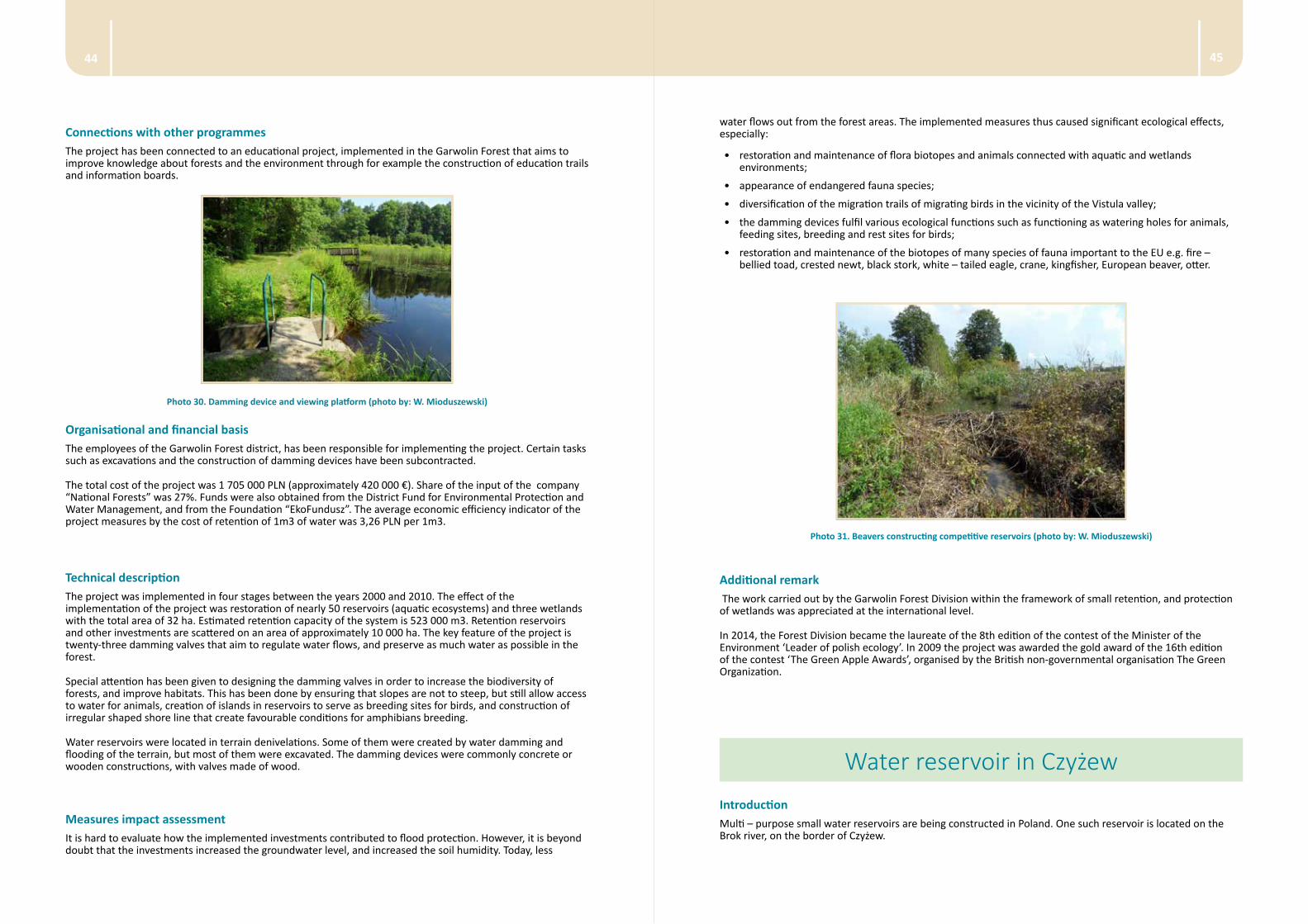
Type of the project The project has a regional character and it covers wetlands situated at the borders of the Garwolin Forest Division (Fig. 18). The area is situated in the Vistula catchment and it covers lower sections of Wilga, Promnik and Okrzejka rivers.
4544
water flows out from the forest areas. The implemented measures thus caused significant ecological effects, especially:
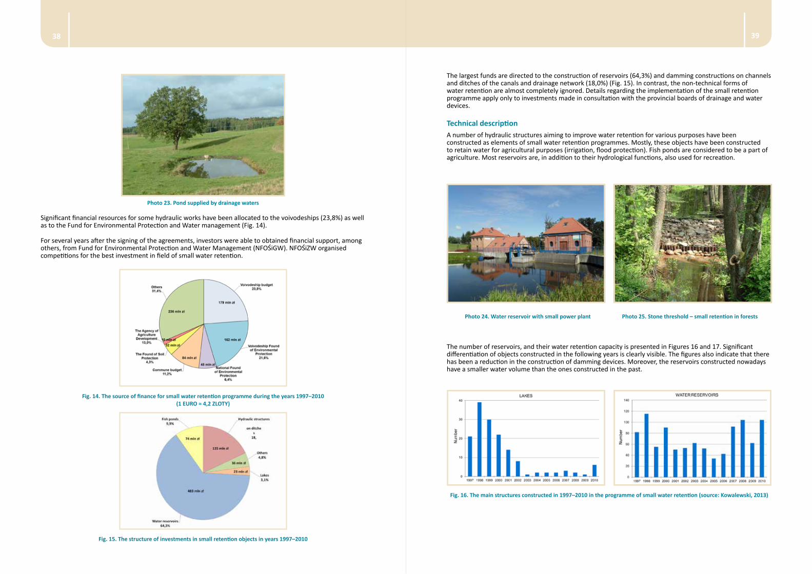
• restoration and maintenance of flora biotopes and animals connected with aquatic and wetlands environments;
• appearance of endangered fauna species;
• diversification of the migration trails of migrating birds in the vicinity of the Vistula valley;
• the damming devices fulfil various ecological functions such as functioning as watering holes for animals, feeding sites, breeding and rest sites for birds;
• restoration and maintenance of the biotopes of many species of fauna important to the EU e.g. fire – bellied toad, crested newt, black stork, white – tailed eagle, crane, kingfisher, European beaver, otter.
Photo 31. Beavers constructing competitive reservoirs (photo by: W. Mioduszewski)
Additional remark The work carried out by the Garwolin Forest Division within the framework of small retention, and protection of wetlands was appreciated at the international level.
In 2014, the Forest Division became the laureate of the 8th edition of the contest of the Minister of the Environment ‘Leader of polish ecology’. In 2009 the project was awarded the gold award of the 16th edition of the contest ‘The Green Apple Awards’, organised by the British non-governmental organisation The Green Organization.
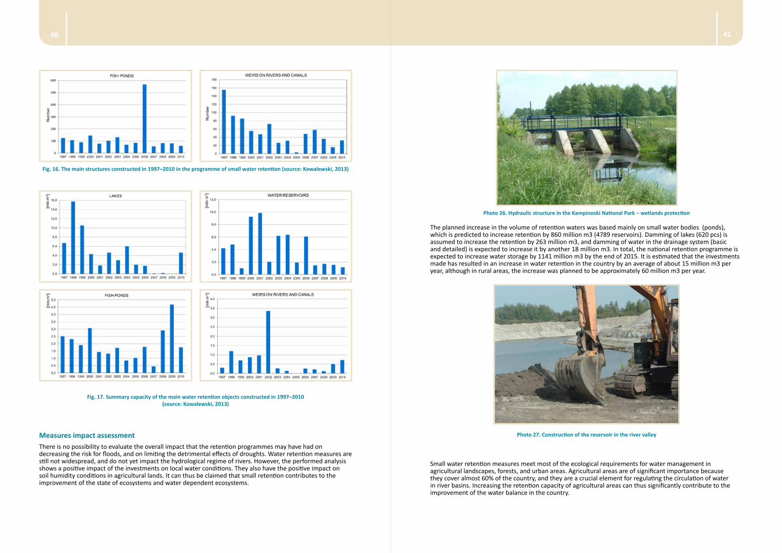
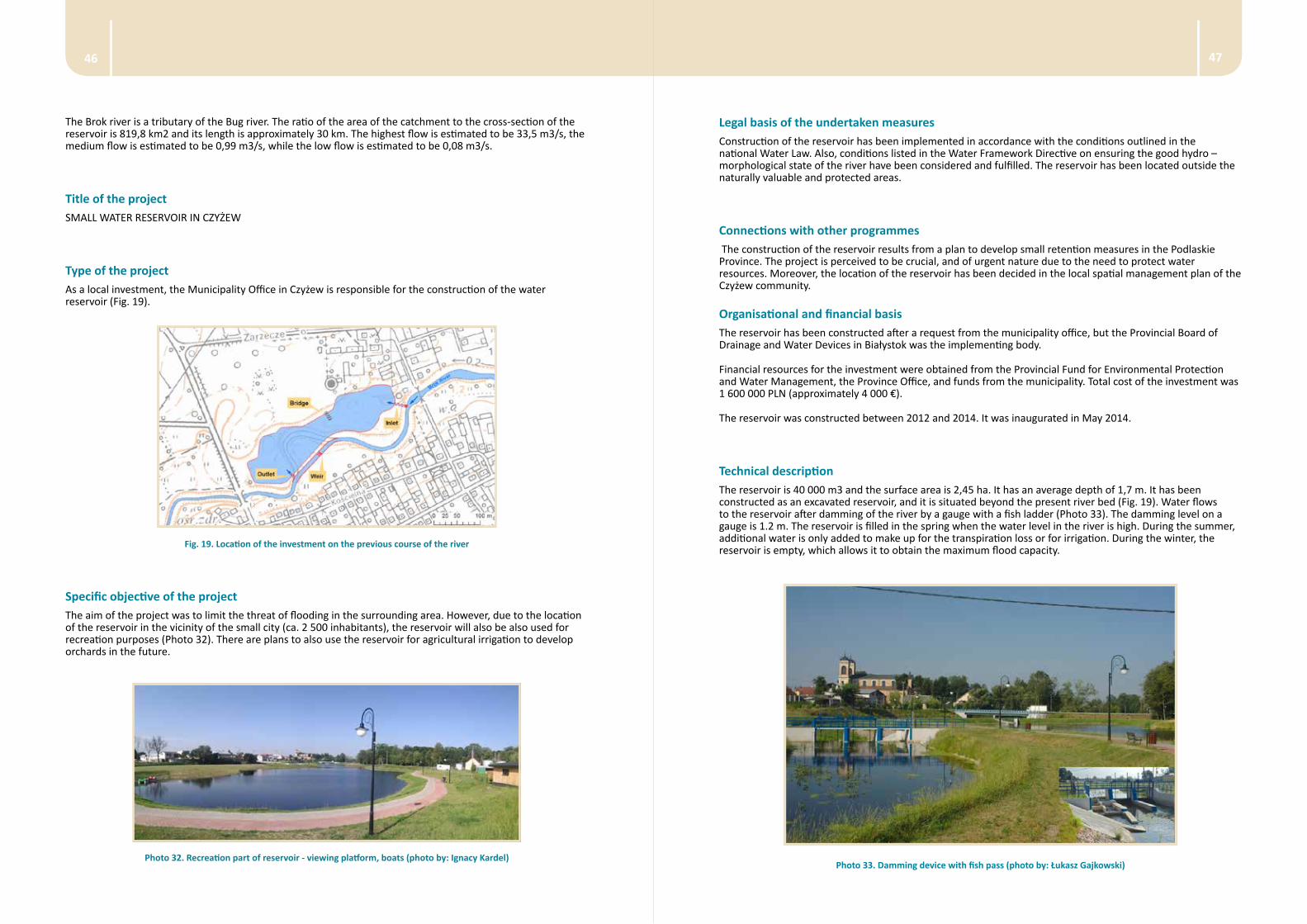
Water reservoir in CzyżewIntroductionMulti – purpose small water reservoirs are being constructed in Poland. One such reservoir is located on the Brok river, on the border of Czyżew.
Connections with other programmes The project has been connected to an educational project, implemented in the Garwolin Forest that aims to improve knowledge about forests and the environment through for example the construction of education trails and information boards.
Photo 30. Damming device and viewing platform (photo by: W. Mioduszewski)
Organisational and financial basisThe employees of the Garwolin Forest district, has been responsible for implementing the project. Certain tasks such as excavations and the construction of damming devices have been subcontracted.
The total cost of the project was 1 705 000 PLN (approximately 420 000 €). Share of the input of the company “National Forests” was 27%. Funds were also obtained from the District Fund for Environmental Protection and Water Management, and from the Foundation “EkoFundusz”. The average economic efficiency indicator of the project measures by the cost of retention of 1m3 of water was 3,26 PLN per 1m3.
Technical description The project was implemented in four stages between the years 2000 and 2010. The effect of the implementation of the project was restoration of nearly 50 reservoirs (aquatic ecosystems) and three wetlands with the total area of 32 ha. Estimated retention capacity of the system is 523 000 m3. Retention reservoirs and other investments are scattered on an area of approximately 10 000 ha. The key feature of the project is twenty-three damming valves that aim to regulate water flows, and preserve as much water as possible in the forest.
Special attention has been given to designing the damming valves in order to increase the biodiversity of forests, and improve habitats. This has been done by ensuring that slopes are not to steep, but still allow access to water for animals, creation of islands in reservoirs to serve as breeding sites for birds, and construction of irregular shaped shore line that create favourable conditions for amphibians breeding.
Water reservoirs were located in terrain denivelations. Some of them were created by water damming and flooding of the terrain, but most of them were excavated. The damming devices were commonly concrete or wooden constructions, with valves made of wood.
Measures impact assessment It is hard to evaluate how the implemented investments contributed to flood protection. However, it is beyond doubt that the investments increased the groundwater level, and increased the soil humidity. Today, less
4746
Legal basis of the undertaken measuresConstruction of the reservoir has been implemented in accordance with the conditions outlined in the national Water Law. Also, conditions listed in the Water Framework Directive on ensuring the good hydro – morphological state of the river have been considered and fulfilled. The reservoir has been located outside the naturally valuable and protected areas.
Connections with other programmes The construction of the reservoir results from a plan to develop small retention measures in the Podlaskie Province. The project is perceived to be crucial, and of urgent nature due to the need to protect water resources. Moreover, the location of the reservoir has been decided in the local spatial management plan of the Czyżew community.
Organisational and financial basisThe reservoir has been constructed after a request from the municipality office, but the Provincial Board of Drainage and Water Devices in Białystok was the implementing body.
Financial resources for the investment were obtained from the Provincial Fund for Environmental Protection and Water Management, the Province Office, and funds from the municipality. Total cost of the investment was 1 600 000 PLN (approximately 4 000 €).
The reservoir was constructed between 2012 and 2014. It was inaugurated in May 2014.
Technical description The reservoir is 40 000 m3 and the surface area is 2,45 ha. It has an average depth of 1,7 m. It has been constructed as an excavated reservoir, and it is situated beyond the present river bed (Fig. 19). Water flows to the reservoir after damming of the river by a gauge with a fish ladder (Photo 33). The damming level on a gauge is 1.2 m. The reservoir is filled in the spring when the water level in the river is high. During the summer, additional water is only added to make up for the transpiration loss or for irrigation. During the winter, the reservoir is empty, which allows it to obtain the maximum flood capacity.
Photo 33. Damming device with fish pass (photo by: Łukasz Gajkowski)
The Brok river is a tributary of the Bug river. The ratio of the area of the catchment to the cross-section of the reservoir is 819,8 km2 and its length is approximately 30 km. The highest flow is estimated to be 33,5 m3/s, the medium flow is estimated to be 0,99 m3/s, while the low flow is estimated to be 0,08 m3/s.
Title of the project SMALL WATER RESERVOIR IN CZYŻEW
Type of the project As a local investment, the Municipality Office in Czyżew is responsible for the construction of the water reservoir (Fig. 19).
Fig. 19. Location of the investment on the previous course of the river
Specific objective of the project The aim of the project was to limit the threat of flooding in the surrounding area. However, due to the location of the reservoir in the vicinity of the small city (ca. 2 500 inhabitants), the reservoir will also be also used for recreation purposes (Photo 32). There are plans to also use the reservoir for agricultural irrigation to develop orchards in the future.
Photo 32. Recreation part of reservoir - viewing platform, boats (photo by: Ignacy Kardel)
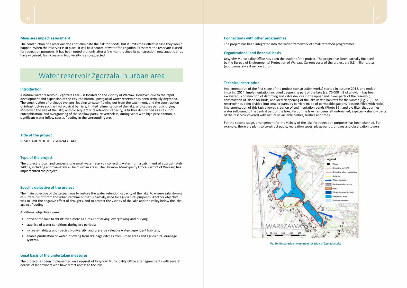
4948
Connections with other programmes The project has been integrated into the wider framework of small retention programmes.
Organizational and financial basisUrsynów Municipality Office has been the leader of the project. The project has been partially financed by the Bureau of Environmental Protection of Warsaw. Current costs of the project are 5.8 million zlotys (approximately 2.4 million Euro).
Technical descriptionImplementation of the first stage of the project (construction works) started in autumn 2012, and ended in spring 2014. Implementation included deepening part of the lake (ca. 70 000 m3 of alluvium has been excavated), construction of damming and valve devices in the upper and lower parts of the reservoir, construction of island for birds, and local deepening of the lake as fish habitats for the winter (Fig. 20). The reservoir has been divided into smaller parts by barriers made of permeable gabions (baskets filled with rocks). Implementation of this task allowed creation of sedimentation ponds (Photo 35), and bio filter that purifies water inflowing to the central part of the lake. Part of the lake has been left untouched, especially shallow parts of the reservoir covered with naturally valuable rushes, bushes and trees.
For the second stage, arrangement for the vicinity of the lake for recreation purposes has been planned. For example, there are plans to construct paths, recreation spots, playgrounds, bridges and observation towers.
Fig. 20. Restoration investment location of Zgorzala Lake
Measures impact assessmentThe construction of a reservoir does not eliminate the risk for floods, but it limits their effect in case they would happen. When the reservoir is in place, it will be a source of water for irrigation. Presently, the reservoir is used for recreation purposes. It has been noted that only after a few months since its construction, new aquatic birds have occurred. An increase in biodiversity is also expected.
Water reservoir Zgorzała in urban areaIntroductionA natural water reservoir – Zgorzała Lake – is located on the vicinity of Warsaw. However, due to the rapid development and expansion of the city, the natural, postglacial water reservoir has been seriously degraded. The construction of drainage systems, leading to water flowing out from the catchment, and the construction of infrastructure such as hydrological barriers, limited alimentation of the lake, and causes periodic drying. Moreover, the size of the lake, and consequently its retention capacity, is further diminished as a result of eutrophication, and overgrowing of the shallow parts. Nevertheless, during years with high precipitation, a significant water inflow causes flooding in the surrounding area.
Title of the project RESTORATION OF THE ZGORZAŁA LAKE
Type of the project The project is local, and concerns one small water reservoir collecting water from a catchment of approximately 340 ha, including approximately 20 ha of urban areas. The Ursynów Municipality Office, district of Warsaw, has implemented the project.
Specific objective of the project The main objective of the project was to restore the water retention capacity of the lake, to ensure safe storage of surface runoff from the urban catchment that is partially used for agricultural purposes. Another objective was to limit the negative effect of droughts, and to protect the vicinity of the lake and the valley below the lake against flooding.
Additional objectives were:
• prevent the lake to shrink even more as a result of drying, overgrowing and burying;
• stabilise of water conditions during dry periods;
• increase habitats and species biodiversity, and preserve valuable water-dependent habitats;
• enable purification of water inflowing from drainage ditches from urban areas and agricultural drainage systems.
Legal basis of the undertaken measuresThe project has been implemented on a request of Ursynów Municipality Office after agreements with several dozens of landowners who have direct access to the lake.
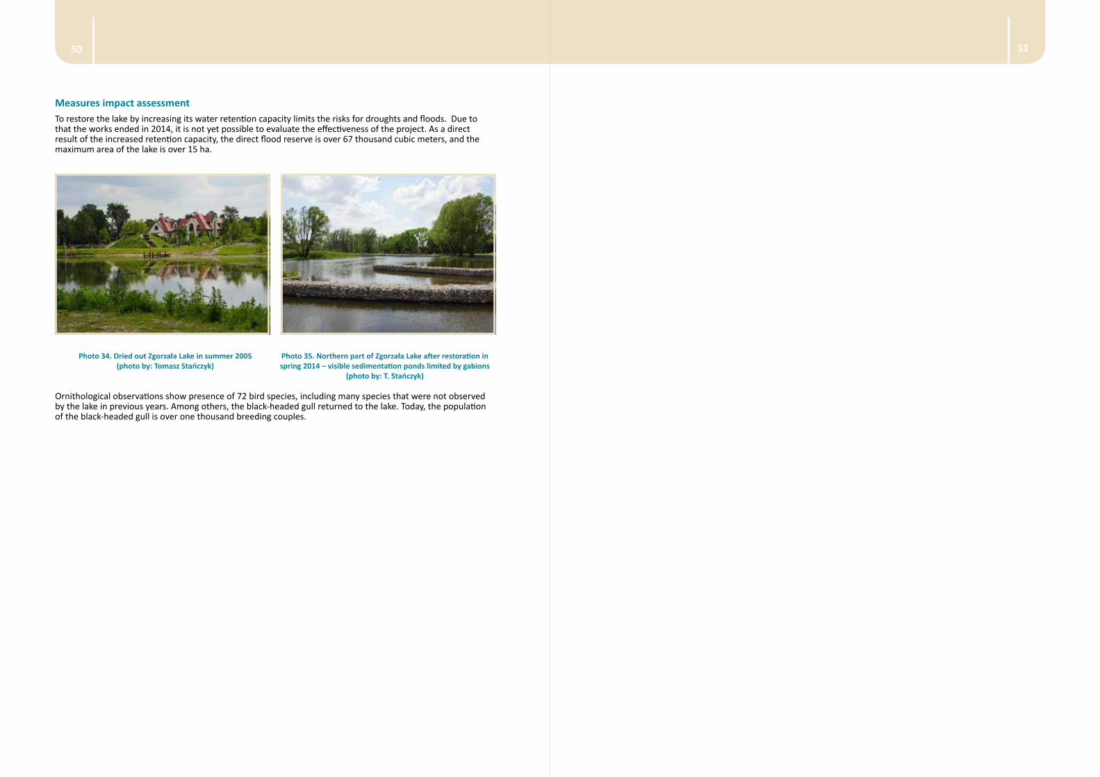
5150
Measures impact assessment To restore the lake by increasing its water retention capacity limits the risks for droughts and floods. Due to that the works ended in 2014, it is not yet possible to evaluate the effectiveness of the project. As a direct result of the increased retention capacity, the direct flood reserve is over 67 thousand cubic meters, and the maximum area of the lake is over 15 ha.
Photo 34. Dried out Zgorzała Lake in summer 2005 (photo by: Tomasz Stańczyk)
Photo 35. Northern part of Zgorzała Lake after restoration in spring 2014 – visible sedimentation ponds limited by gabions
(photo by: T. Stańczyk)
Ornithological observations show presence of 72 bird species, including many species that were not observed by the lake in previous years. Among others, the black-headed gull returned to the lake. Today, the population of the black-headed gull is over one thousand breeding couples.