Embed Size (px)
Citation preview
Natural Resources and Environmental Sciences
Lake Fort Scott Bathymetric Survey
Spring 2006Natural Resources and Environmental Sciences
Kansas State University
Kevin BergmanKyle Fitzgerald
Jud GladinJennifer Hancock
Tyler Pjesky
Natural Resources and Environmental Sciences
Natural Resources and Environmental Sciences
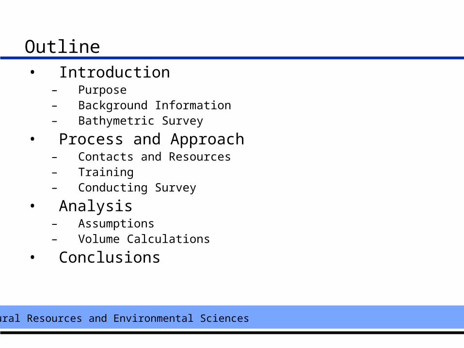
Outline• Introduction
– Purpose– Background Information– Bathymetric Survey
• Process and Approach– Contacts and Resources– Training– Conducting Survey
• Analysis– Assumptions– Volume Calculations
• Conclusions
Natural Resources and Environmental Sciences
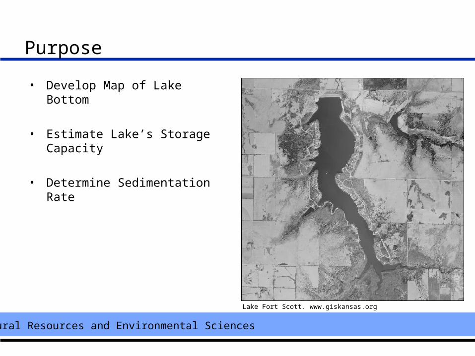
Purpose
• Develop Map of Lake Bottom
• Estimate Lake’s Storage Capacity
• Determine Sedimentation Rate
Lake Fort Scott. www.giskansas.org
Natural Resources and Environmental Sciences
Background Information
• Lake Fort Scott constructed in 1958 to augment water supply
• Original capacity of 2.1 billion gallons or 6485 acre-feet.
• Water occasionally used from lake during dry years to maintain sufficient quality drinking water for city.
• Land use within watershed is primarily production agriculture (grassland)
• Shoreline property has been sub-divided into 141 lots for part-time and permanent year round residential housing
Natural Resources and Environmental Sciences
Bathymetric Survey
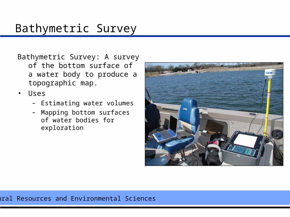
Bathymetric Survey: A survey of the bottom surface of a water body to produce a topographic map.
• Uses – Estimating water volumes– Mapping bottom surfaces of water
bodies for exploration
Natural Resources and Environmental Sciences
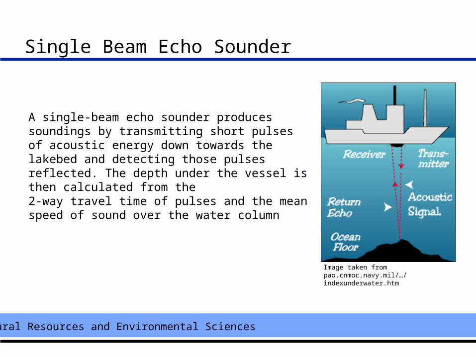
Single Beam Echo Sounder
A single-beam echo sounder produces soundings by transmitting short pulses of acoustic energy down towards the lakebed and detecting those pulses reflected. The depth under the vessel is then calculated from the 2-way travel time of pulses and the mean speed of sound over the water column
Image taken from pao.cnmoc.navy.mil/…/ indexunderwater.htm
Natural Resources and Environmental Sciences
Making Contacts and Acquiring Resources
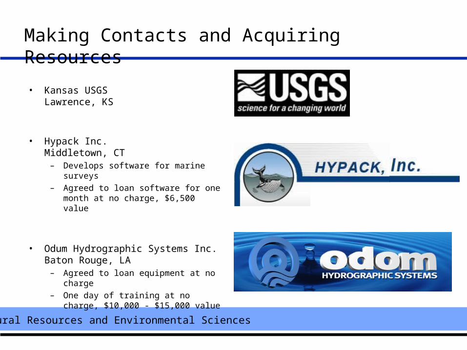
• Kansas USGSLawrence, KS
• Hypack Inc.Middletown, CT
– Develops software for marine surveys
– Agreed to loan software for one month at no charge, $6,500 value
• Odum Hydrographic Systems Inc.Baton Rouge, LA
– Agreed to loan equipment at no charge
– One day of training at no charge, $10,000 - $15,000 value
Natural Resources and Environmental Sciences
Training
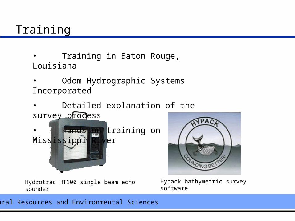
• Training in Baton Rouge, Louisiana
• Odom Hydrographic Systems Incorporated
• Detailed explanation of the survey process
• Hands-on-training on Mississippi River
Hydrotrac HT100 single beam echo sounder Hypack bathymetric survey software
Natural Resources and Environmental Sciences
Conducting Survey
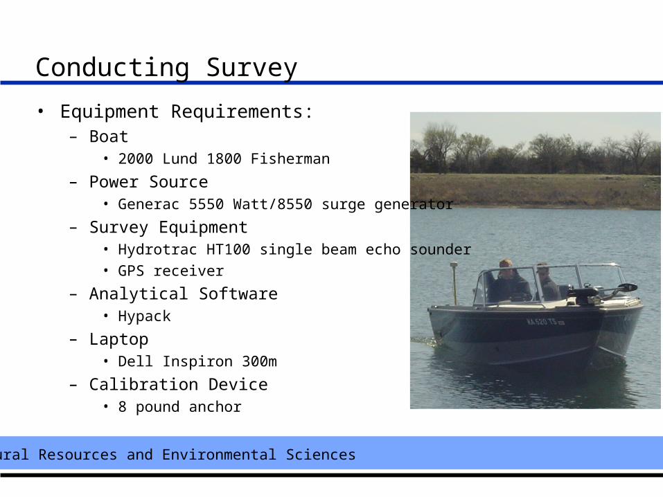
• Equipment Requirements:– Boat
• 2000 Lund 1800 Fisherman
– Power Source • Generac 5550 Watt/8550 surge generator
– Survey Equipment • Hydrotrac HT100 single beam echo sounder• GPS receiver
– Analytical Software • Hypack
– Laptop • Dell Inspiron 300m
– Calibration Device • 8 pound anchor
Natural Resources and Environmental Sciences
Conducting Survey
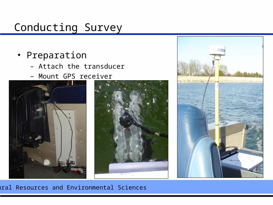
• Preparation– Attach the transducer
– Mount GPS receiver
Natural Resources and Environmental Sciences
Conducting Survey
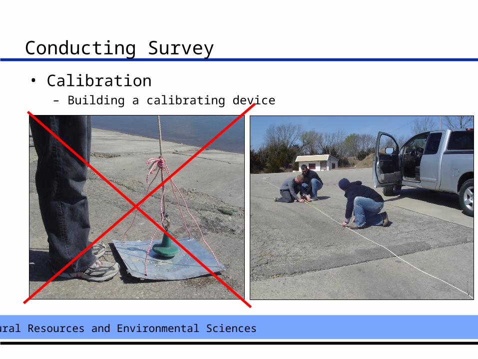
• Calibration– Building a calibrating device
Natural Resources and Environmental Sciences
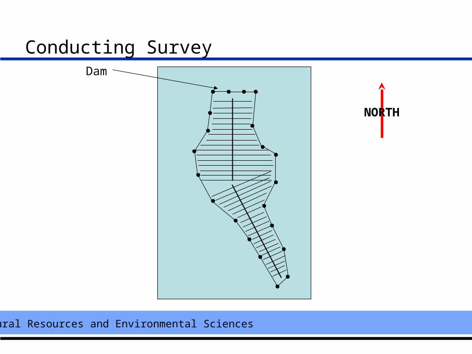
Conducting SurveyDam
NORTH
Natural Resources and Environmental Sciences
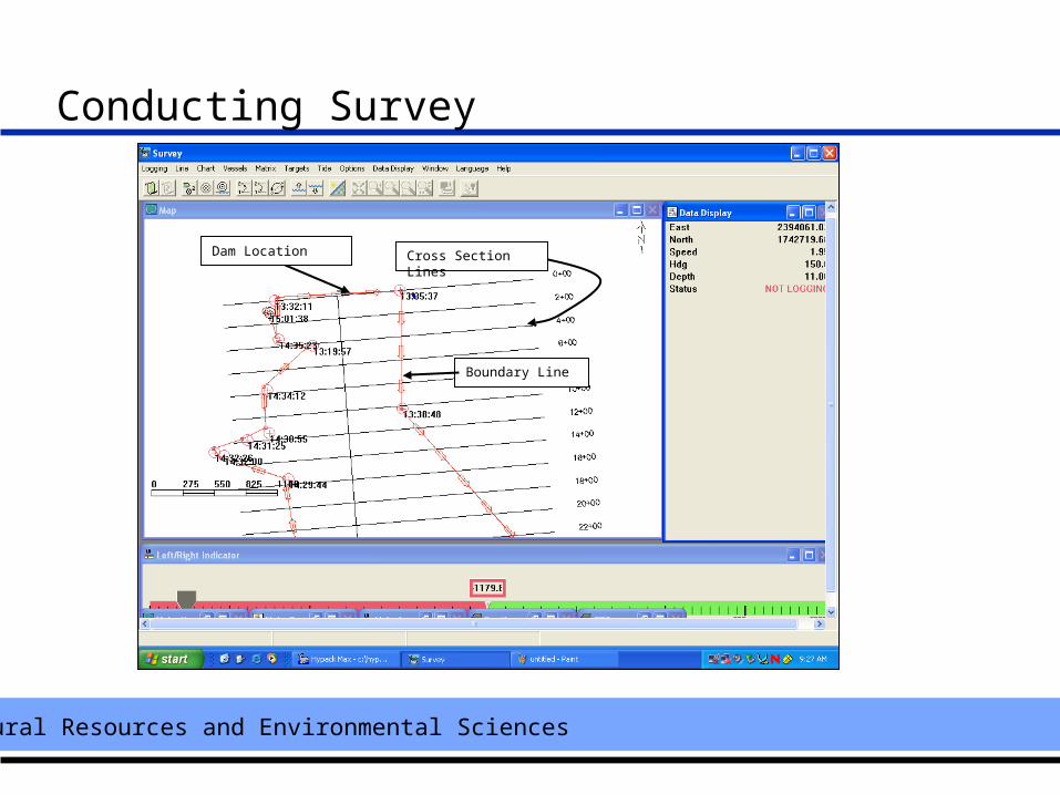
Conducting Survey
Dam Location Cross Section Lines
Boundary Line
Natural Resources and Environmental Sciences
Analysis
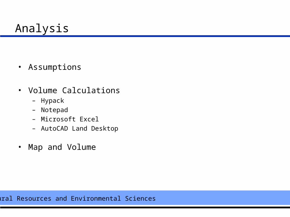
• Assumptions
• Volume Calculations – Hypack– Notepad– Microsoft Excel– AutoCAD Land Desktop
• Map and Volume
Natural Resources and Environmental Sciences
Assumptions
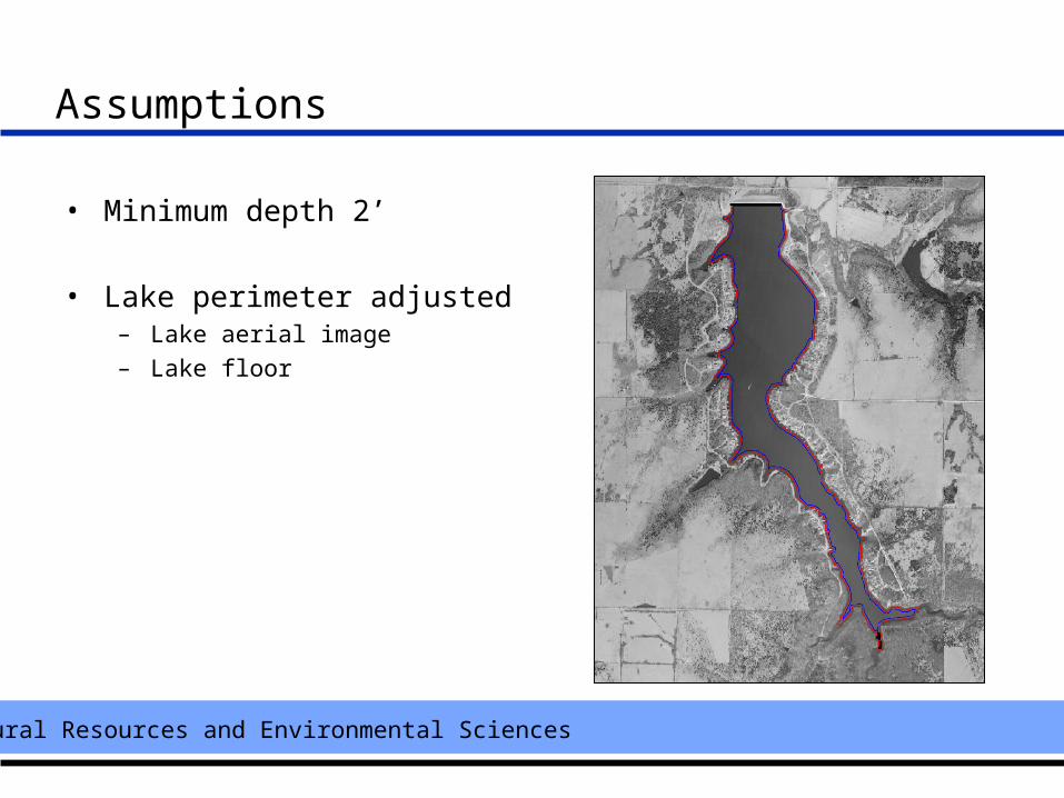
• Minimum depth 2’
• Lake perimeter adjusted – Lake aerial image– Lake floor
Natural Resources and Environmental Sciences
Volume Calculations
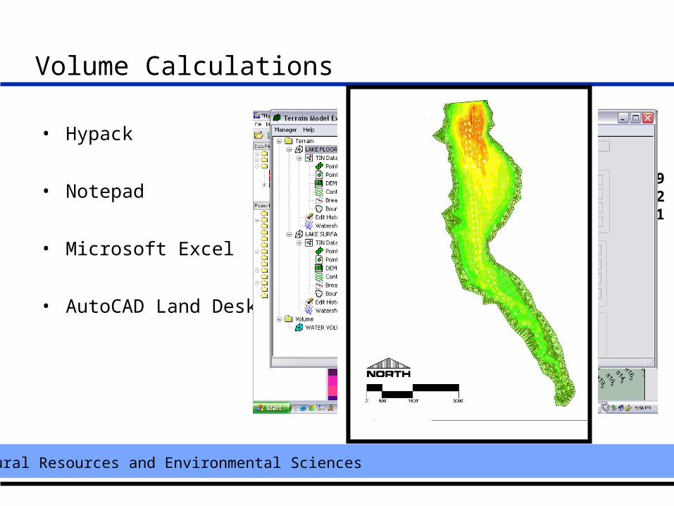
• Hypack
• Notepad
• Microsoft Excel
• AutoCAD Land Desktop
2393474.48 1736804.91 840.302393543.38 1736881.02 843.002393618.11 1736951.12 841.602393700.28 1737010.30 839.702393787.47 1737060.83 837.40
1 2392920.09 1742689.33 844.92 2392940.53 1742683.83 843.23 2392960.56 1742682.78 842.14 2392981.52 1742685.28 841
Natural Resources and Environmental Sciences
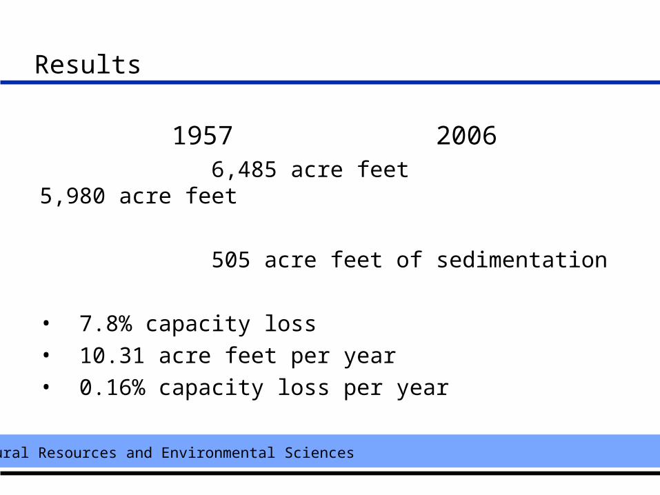
Results
1957 2006 6,485 acre feet 5,980 acre feet
505 acre feet of sedimentation
• 7.8% capacity loss• 10.31 acre feet per year• 0.16% capacity loss per year
Natural Resources and Environmental Sciences
Conclusions
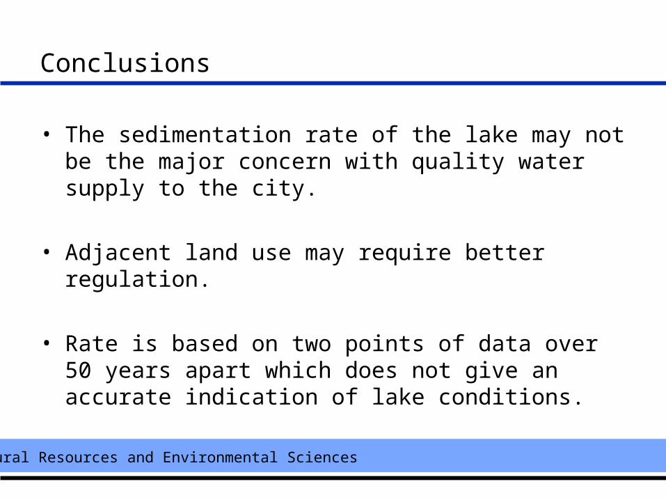
• The sedimentation rate of the lake may not be the major concern with quality water supply to the city.
• Adjacent land use may require better regulation.
• Rate is based on two points of data over 50 years apart which does not give an accurate indication of lake conditions.
Natural Resources and Environmental Sciences
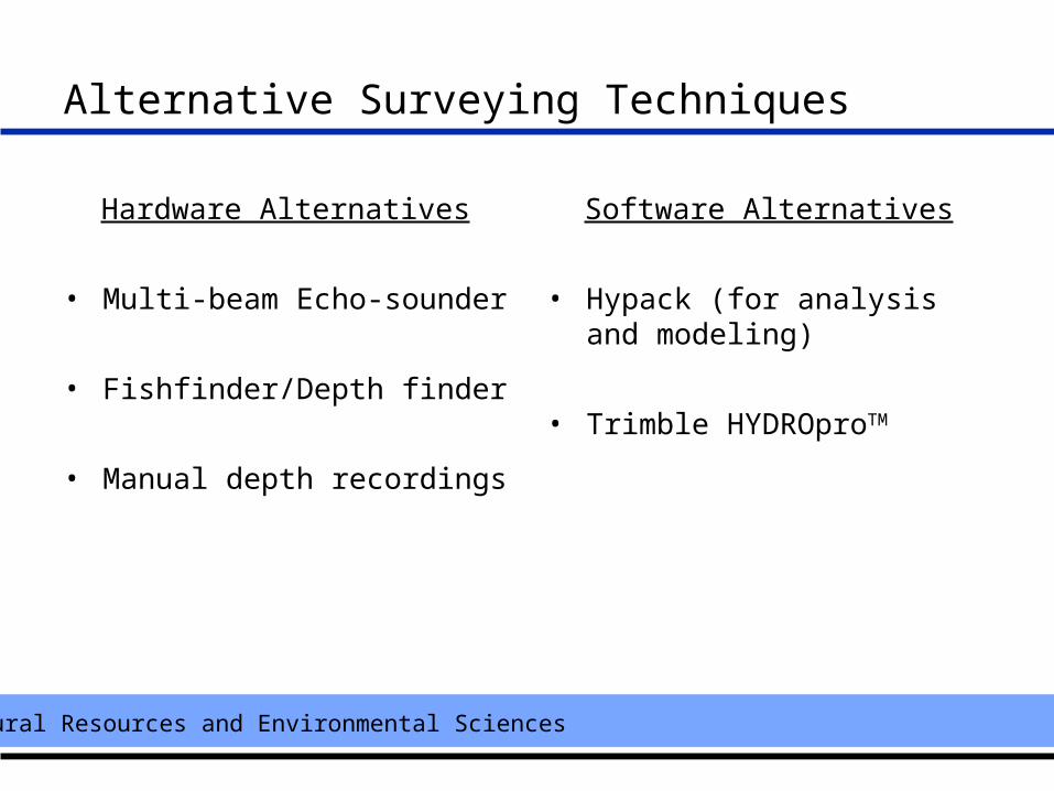
Alternative Surveying Techniques
Hardware Alternatives
• Multi-beam Echo-sounder
• Fishfinder/Depth finder
• Manual depth recordings
Software Alternatives
• Hypack (for analysis and modeling)
• Trimble HYDROproTM
Natural Resources and Environmental Sciences
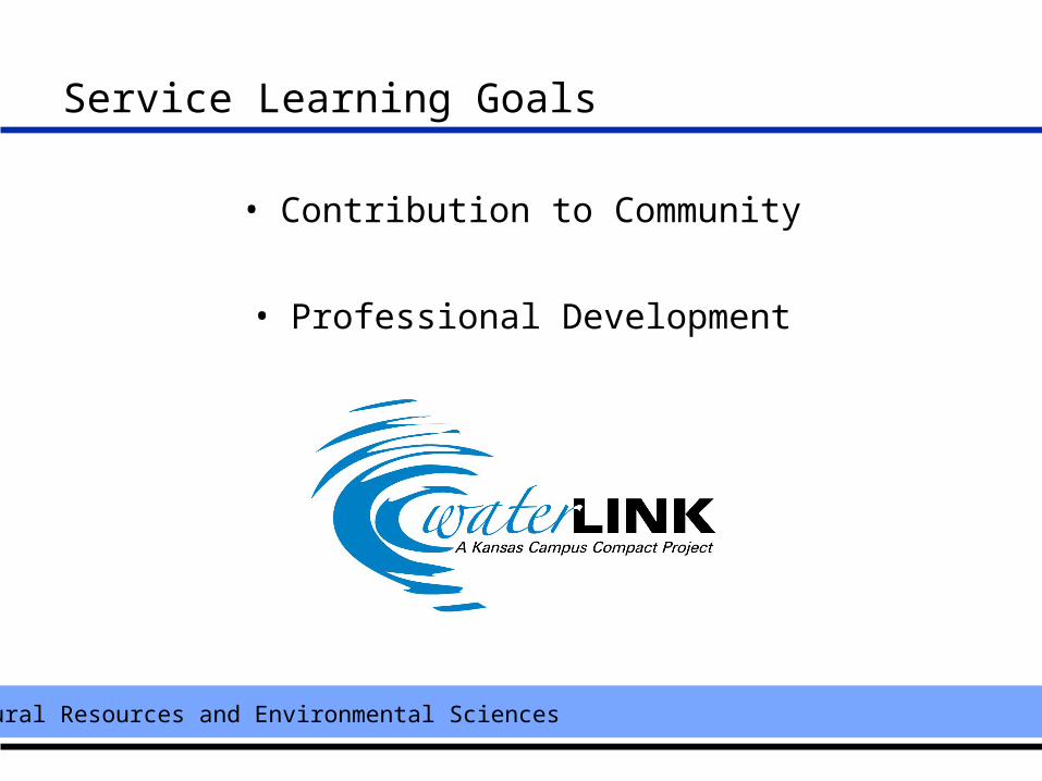
Service Learning Goals
• Contribution to Community
• Professional Development
Natural Resources and Environmental Sciences
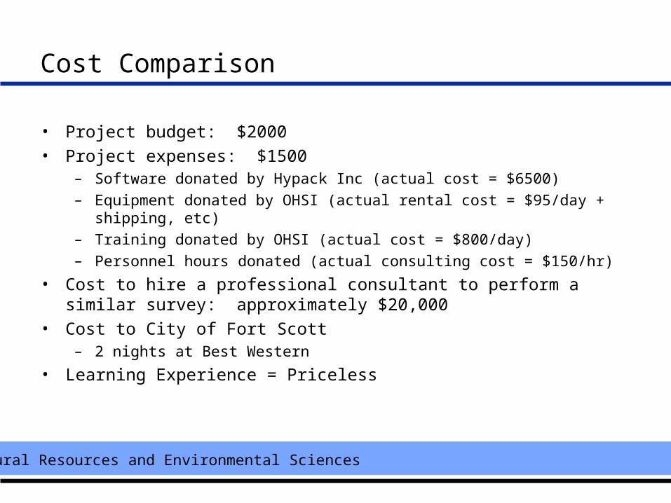
Cost Comparison
• Project budget: $2000
• Project expenses: $1500– Software donated by Hypack Inc (actual cost = $6500)– Equipment donated by OHSI (actual rental cost = $95/day + shipping, etc)– Training donated by OHSI (actual cost = $800/day)– Personnel hours donated (actual consulting cost = $150/hr)
• Cost to hire a professional consultant to perform a similar survey: approximately $20,000
• Cost to City of Fort Scott– 2 nights at Best Western
• Learning Experience = Priceless
Natural Resources and Environmental Sciences
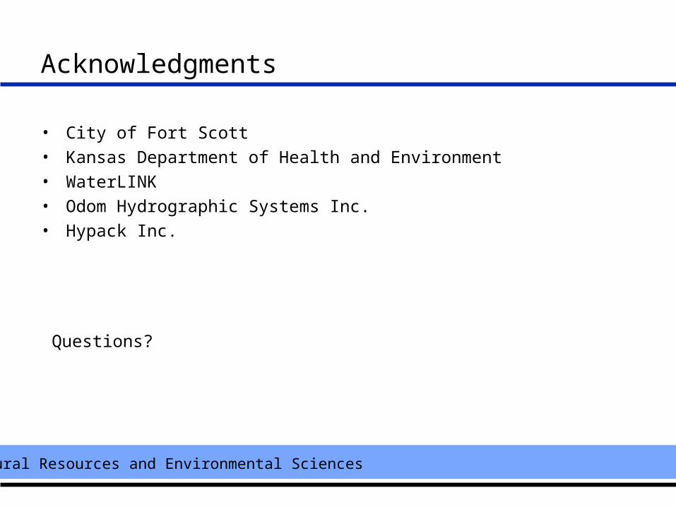
Acknowledgments
• City of Fort Scott
• Kansas Department of Health and Environment
• WaterLINK
• Odom Hydrographic Systems Inc.
• Hypack Inc.
Questions?