Embed Size (px)
Citation preview
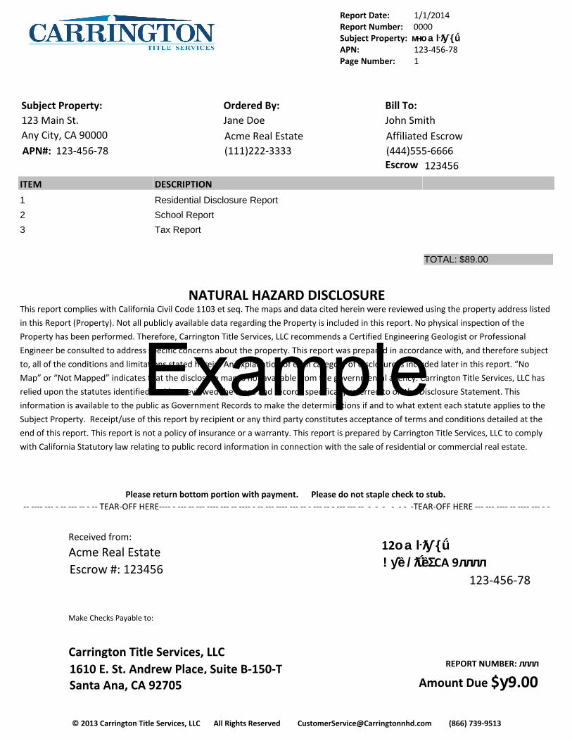
Report Date: 1/1/2014Report Number: 0000Subject Property: мно aŀƛƴ {ǘAPN: 123-456-78Page Number: 1
© 2013 Carrington Title Services, LLC All Rights Reserved [email protected] (866) 739-9513
Subject Property:123 Main St.Any City, CA 90000APN#: 123-456-78
Ordered By:Jane DoeAcme Real Estate (111)222-3333
Bill To:John SmithAffiliated Escrow(444)555-6666Escrow
#:123456
ITEM DESCRIPTION
1 Residential Disclosure Report
2 School Report
3 Tax Report
TOTAL: $89.00
NATURAL HAZARD DISCLOSUREThis report complies with California Civil Code 1103 et seq. The maps and data cited herein were reviewed using the property address listed
in this Report (Property). Not all publicly available data regarding the Property is included in this report. No physical inspection of the
Property has been performed. Therefore, Carrington Title Services, LLC recommends a Certified Engineering Geologist or Professional
Engineer be consulted to address specific concerns about the property. This report was prepared in accordance with, and therefore subject
to, all of the conditions and limitations stated herein. An explanation of each category of disclosure is included later in this report. “No
Map” or “Not Mapped” indicates that the disclosure map is not available from the governmental agency. Carrington Title Services, LLC has
relied upon the statutes identified and has reviewed the maps and records specifically referred to on the Disclosure Statement. This
information is available to the public as Government Records to make the determinations if and to what extent each statute applies to the
Subject Property. Receipt/use of this report by recipient or any third party constitutes acceptance of terms and conditions detailed at the
end of this report. This report is not a policy of insurance or a warranty. This report is prepared by Carrington Title Services, LLC to comply
with California Statutory law relating to public record information in connection with the sale of residential or commercial real estate.
Please read the Terms and Conditions carefully.
Please return bottom portion with payment. Please do not staple check to stub. -- ---- --- - -- --- -- - -- TEAR-OFF HERE---- - --- -- --- ---- --- -- ---- - -- --- ---- --- -- - --- -- - --- --- -- - - - - - - -TEAR-OFF HERE --- --- ---- -- ---- --- - -
Received from:
Acme Real EstateEscrow #: 123456
12о aŀƛƴ {ǘ !ƴȅ /ƛǘȅΣ CA 9лллл
123-456-78
Make Checks Payable to:
Carrington Title Services, LLC1610 E. St. Andrew Place, Suite B-150-TSanta Ana, CA 92705
REPORT NUMBER: лллл
Amount Due $у9.00
Example
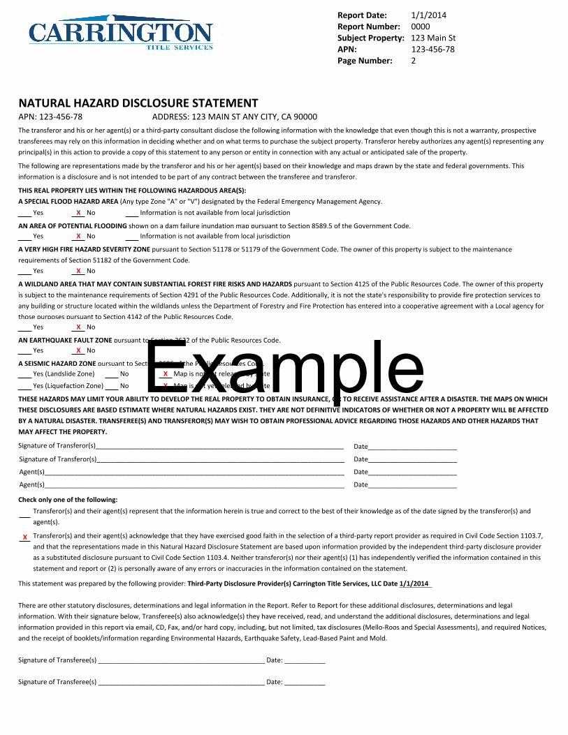
Report Date: 1/1/2014Report Number: 0000Subject Property: 123 Main StAPN: 123-456-78Page Number: 2
NATURAL HAZARD DISCLOSURE STATEMENTAPN: 123-456-78 ADDRESS: 123 MAIN ST ANY CITY, CA 90000The transferor and his or her agent(s) or a third-party consultant disclose the following information with the knowledge that even though this is not a warranty, prospective
transferees may rely on this information in deciding whether and on what terms to purchase the subject property. Transferor hereby authorizes any agent(s) representing any
principal(s) in this action to provide a copy of this statement to any person or entity in connection with any actual or anticipated sale of the property.
The following are representations made by the transferor and his or her agent(s) based on their knowledge and maps drawn by the state and federal governments. This
information is a disclosure and is not intended to be part of any contract between the transferee and transferor.
THIS REAL PROPERTY LIES WITHIN THE FOLLOWING HAZARDOUS AREA(S):
A SPECIAL FLOOD HAZARD AREA (Any type Zone "A" or "V") designated by the Federal Emergency Management Agency.
Yes X No Information is not available from local jurisdiction
AN AREA OF POTENTIAL FLOODING shown on a dam failure inundation map pursuant to Section 8589.5 of the Government Code.Yes X No Information is not available from local jurisdiction
A VERY HIGH FIRE HAZARD SEVERITY ZONE pursuant to Section 51178 or 51179 of the Government Code. The owner of this property is subject to the maintenance
requirements of Section 51182 of the Government Code.Yes X No
A WILDLAND AREA THAT MAY CONTAIN SUBSTANTIAL FOREST FIRE RISKS AND HAZARDS pursuant to Section 4125 of the Public Resources Code. The owner of this property
is subject to the maintenance requirements of Section 4291 of the Public Resources Code. Additionally, it is not the state's responsibility to provide fire protection services to
any building or structure located within the wildlands unless the Department of Forestry and Fire Protection has entered into a cooperative agreement with a Local agency for
those purposes pursuant to Section 4142 of the Public Resources Code.Yes X No
AN EARTHQUAKE FAULT ZONE pursuant to Section 2622 of the Public Resources Code.Yes X No
A SEISMIC HAZARD ZONE pursuant to Section 2696 of the Public Resources Code.Yes (Landslide Zone) No X Map is not yet released by state
Yes (Liquefaction Zone) No X Map is not yet released by state
THESE HAZARDS MAY LIMIT YOUR ABILITY TO DEVELOP THE REAL PROPERTY TO OBTAIN INSURANCE, OR TO RECEIVE ASSISTANCE AFTER A DISASTER. THE MAPS ON WHICH
THESE DISCLOSURES ARE BASED ESTIMATE WHERE NATURAL HAZARDS EXIST. THEY ARE NOT DEFINITIVE INDICATORS OF WHETHER OR NOT A PROPERTY WILL BE AFFECTED
BY A NATURAL DISASTER. TRANSFEREE(S) AND TRANSFEROR(S) MAY WISH TO OBTAIN PROFESSIONAL ADVICE REGARDING THOSE HAZARDS AND OTHER HAZARDS THAT
MAY AFFECT THE PROPERTY.
Signature of Transferor(s)___________________________________________________________________ Date________________________
Signature of Transferor(s)___________________________________________________________________ Date________________________
Agent(s)_________________________________________________________________________________ Date________________________
Agent(s)_________________________________________________________________________________ Date________________________
Check only one of the following:
Transferor(s) and their agent(s) represent that the information herein is true and correct to the best of their knowledge as of the date signed by the transferor(s) and
agent(s).
X Transferor(s) and their agent(s) acknowledge that they have exercised good faith in the selection of a third-party report provider as required in Civil Code Section 1103.7,
and that the representations made in this Natural Hazard Disclosure Statement are based upon information provided by the independent third-party disclosure provider
as a substituted disclosure pursuant to Civil Code Section 1103.4. Neither transferor(s) nor their agent(s) (1) has independently verified the information contained in this
statement and report or (2) is personally aware of any errors or inaccuracies in the information contained on the statement.
This statement was prepared by the following provider: Third-Party Disclosure Provider(s) Carrington Title Services, LLC Date 1/1/2014
There are other statutory disclosures, determinations and legal information in the Report. Refer to Report for these additional disclosures, determinations and legal
information. With their signature below, Transferee(s) also acknowledge(s) they have received, read, and understand the additional disclosures, determinations and legal
information provided in this report via email, CD, Fax, and/or hard copy, including, but not limited, tax disclosures (Mello-Roos and Special Assessments), and required Notices,
and the receipt of booklets/information regarding Environmental Hazards, Earthquake Safety, Lead-Based Paint and Mold.
Signature of Transferee(s) _____________________________________________ Date: ___________
Signature of Transferee(s) _____________________________________________ Date: ___________
Example

Report Date: 1/1/2014Report Number: 0000Subject Property: 123 MAIN STAPN: 123-456-78Page Number: 3
© 2013 Carrington Title Services, LLC All Rights Reserved [email protected] (866) 739-9513
Report SummarySubject Property: 123 MAIN ST ANY CITY, CA 90000APN: 123-456-78
This property is located in/within: Yes No Not Mapped Details:A Supplemental Flood Hazard Zone X Page 4A Supplemental Fire Hazard Zone X Page 5A Supplemental Earthquake Fault Hazard Zone X Page 6A Supplemental Seismic Geologic Hazard Zone X Page 6School Map Included Page 7A Special Flood Hazard Area X Page 8An Area of Potential Flooding Due to Dam Inundation X Page 8A Very High Fire Hazard Severity Zone X Page 8A State of California Fire Responsibility Area X Page 8An Earthquake Fault Zone X Page 9A Landslide Seismic Hazard Zone Data Not Available Page 9A Liquefaction Seismic Hazard Zone Data Not Available Page 91 Mile of a Former Military Ordnance Site X Page 101 Mile of a Commercial/Industrial Use Zone X Page 102 Miles of FAA Approved Landing Facility X Page 10An Airport Influence Area X Page 10An Area with Potential for Radon Gas X Page 11Tsunami Inundation Hazard X Page 11Land Under Contract Pursuant to the Williamson Act X Page 12Right to Farm/Important Farmland X Page 12A Naturally Occurring Asbestos Area X Page 12Critical Habitats X Page 131 Mile of a Mining Operation X Page 13This Page Intentionally Left Blank Page 14City/County Hazard Disclosure Explanations Included Page 15Registered Sex Offender (Megan’s Law) Advisory Included Page 16Duct Sealing & Testing Requirement Disclosure Included Page 16Notice of Energy Efficiency Standards Advisory Included Page 17Notice of Home Energy Efficiency Tax Credit Advisory Included Page 17Mold Addendum Included Page 17Notice of Methamphetamine Contamination Included Page 17Notice of Abandoned Water Wells and Oil/Gas Wells Included Page 18Notice of Abandoned Mines Included Page 18Notice Regarding Gas and Hazardous Liquid Transmission Pipelines Included Page 18Notice of Terms and Conditions Included Page 19Property Tax Disclosure Page Included Page 21A Mello-Roos Community Facility District X Page 21A Special Tax Assessment District X Page 21Notices of Transfer Tax Disclosure and Supplemental Property Tax Bill Included Page 21Property Tax Information Included Page 22Notices of Special Taxes and Assessments Included Page 23Supplemental and Property Tax Bill Calculators Included Page 23Tax Bill Explanations Included Page 25Statement of Liability, Limitations, Conditions, Terms and Assumptions Included Page 27
This Summary Page merely summarizes the research results contained in this full Carrington Title Services, LLC Report, and does not, in
any way, reduce or eliminate the need to read the report in its entirety. Please verify the street address and/or APN for accuracy.
Example

Report Date: 1/1/2014Report Number: л000Subject Property: 123 MAIN STAPN: 123-456-78Page Number: 4
© 2013 Carrington Title Services, LLC All Rights Reserved [email protected] (866) 739-9513
NATURAL HAZARD DISCLOSURES - FLOOD
Subject Property
IS X IS NOT Located in a Special Flood Hazard Area.
IS X IS NOT Located in a Dam Indundation Area.
X IS IS NOT Located in a Supplemental Flood Hazard Zone.
This map is for your aid in locating natural hazard areas in relation
to the subject property described above. Please verify street
address and/or assessor's parcel number for accuracy. The map is
intended for informational purposes only. The company assumes
no liability (express or implied) for any loss occurring by
reference, misinterpretation, misuse, or sole reliance thereon.
This map is not intended for use as a substitute disclosure under
California Civil Code § 1103.2.
Example

Report Date: 1/1/2014Report Number: 0000Subject Property: 123 Main StAPN: 123-456-78Page Number: 5
© 2013 Carrington Title Services, LLC All Rights Reserved [email protected] (866) 739-9513
NATURAL HAZARD DISCLOSURES - FIRE
Subject Property
IS X IS NOT Located in a Very High Fire Hazard Severity Area.
X IS IS NOT Located in a Supplemental Fire Hazard Zone.
IS X IS NOT Located in a State (Wildland) Fire Responsibility Area.
This map is for your aid in locating natural hazard areas in relation
to the subject property described above. Please verify street
address and/or assessor's parcel number for accuracy. The map is
intended for informational purposes only. The company assumes
no liability (express or implied) for any loss occurring by
reference, misinterpretation, misuse, or sole reliance thereon.
This map is not intended for use as a substitute disclosure under
California Civil Code § 1103.2.
Example
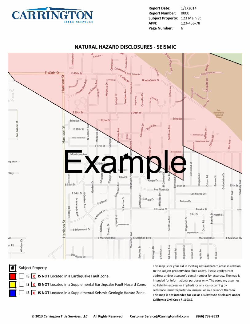
Report Date: 1/1/2014Report Number: 0000Subject Property: 123 Main StAPN: 123-456-78Page Number: 6
© 2013 Carrington Title Services, LLC All Rights Reserved [email protected] (866) 739-9513
NATURAL HAZARD DISCLOSURES - SEISMIC
Subject Property
IS X IS NOT Located in a Earthquake Fault Zone.
IS X IS NOT Located in a Supplemental Earthquake Fault Hazard Zone.
IS X IS NOT Located in a Supplemental Seismic Geologic Hazard Zone.
This map is for your aid in locating natural hazard areas in relation
to the subject property described above. Please verify street
address and/or assessor's parcel number for accuracy. The map is
intended for informational purposes only. The company assumes
no liability (express or implied) for any loss occurring by
reference, misinterpretation, misuse, or sole reliance thereon.
This map is not intended for use as a substitute disclosure under
California Civil Code § 1103.2.
Example
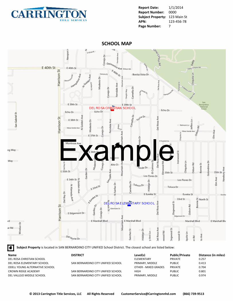
Report Date: 1/1/2014Report Number: 0000Subject Property: 123 Main StAPN: 123-456-78Page Number: 7
© 2013 Carrington Title Services, LLC All Rights Reserved [email protected] (866) 739-9513
SCHOOL MAP
Subject Property is located in SAN BERNARDINO CITY UNIFIED School District. The closest school are listed below:
Name DISTRICT Level(s) Public/Private Distance (in miles)DEL ROSA CHRISTIAN SCHOOL ELEMENTARY PRIVATE 0.257DEL ROSA ELEMENTARY SCHOOL SAN BERNARDINO CITY UNIFIED SCHOOL PRIMARY, MIDDLE PUBLIC 0.413ODELL YOUNG ALTERNATIVE SCHOOL OTHER - MIXED GRADES PRIVATE 0.704CROWN RIDGE ACADEMY SAN BERNARDINO CITY UNIFIED SCHOOL HIGH PUBLIC 0.801DEL VALLEJO MIDDLE SCHOOL SAN BERNARDINO CITY UNIFIED SCHOOL PRIMARY, MIDDLE PUBLIC 0.974
Example

Report Date: 1/1/2014Report Number: 0000Subject Property: 123 Main StAPN: 123-456-78Page Number: 8
© 2013 Carrington Title Services, LLC All Rights Reserved [email protected] (866) 739-9513
EXPLANATIONS AND NOTICES
SPECIAL FLOOD HAZARD AREASSUBJECT PROPERTY IS X IS NOT LOCATED IN A SPECIAL FLOOD HAZARD AREA
The Federal Emergency Management Agency (FEMA) has prepared Flood Insurance Rate Maps, which delineate flood zones based on estimated flood risk.
The zones pertinent to the Natural Hazard Disclosure are Zone A and V (Special Flood Hazard Areas). Zone V is for coastal areas and Zone A is for inland
areas. These zones are located within 100-year flood plain. A 100-year flood has a one-percent chance of occurrence in any given year. Flood insurance is
required by federally regulated lending institutions for the properties located within Zones A or V. Local flood control projects to mitigate flood hazard
potential can change the flood risk of a specific area or property. The flood risk of a specific area or property may be updated through a Letter of Map
Change filed with FEMA. Specific updated flood risk information, not included on the Flood Insurance Rate Maps, is not provided in our report. If a property
is located within a Special Flood Hazard Area, Carrington Title Services, LLC recommends contacting FEMA for the updated risk assessment of the property
and the current flood insurance requirements. It should be noted that properties within a Special Flood Hazard Zone may never experience flooding, and
conversely, properties not located within a Special Flood Hazard Zone may experience flooding. This disclosure is not meant to predict flooding, but rather
to identify properties for which flood insurance may be required by federally regulated lending institutions.
AREAS OF POTENTIAL FLOODING FROM DAM FAILURESSUBJECT PROPERTY IS X IS NOT LOCATED IN A DAM INUNDATION ZONE
The California Office of Emergency Services (CA OES) has provided Inundation Maps, which delineate areas subject to flooding from a sudden, catastrophic
failure of a dam with a full reservoir. Maps are not available for all dams in the state. Additional maps may become available subsequent to approval by
OES. Inundation from reservoir, dam, or dike failure can pose serious risks to large segments of the population. Cities and counties within the mapped
areas are required to adopt emergency procedures for the evacuation of populated areas.
VERY HIGH FIRE HAZARD SEVERITY ZONESSUBJECT PROPERTY IS X IS NOT LOCATED IN A VERY HIGH FIRE SEVERITY ZONE
The California Department of Forestry and Fire Protection (CDF) under the Bates Bill (AB 337) established Very High Fire Hazard Severity Zones (VHFHSZ) in
the Local Responsibility Areas (LRA) of California. The maps prepared by the CDF shows zones based on State criteria. Local agencies, by law, are allowed to
make changes to the zones. Fire defense improvements are mandated for properties located within the zones under section 51178 and 51179 of the
Government Code. Mandated improvements include a Class A roof for new development or replacement of an existing roof and brush clearing within 30
feet of a structure. For a complete listing of the mandated fire defense improvements and local zone changes, contact the local fire department. The Very
High Fire Hazard Severity Zone Maps were prepared at a scale that does not always allow a conclusive determination to be made at zone boundaries. If a
conclusive determination cannot be made, the property will be reported on the Natural Hazard Disclosure Statement as boundary condition on our
Residential Disclosure Report. Therefore, the local fire department should be contacted to determine if the property is located within the zone.
STATE OF CALIFORNIA FIRE RESPONSIBILITY AREASUBJECT PROPERTY IS X IS NOT LOCATED IN A STATE FIRE RESPONSIBILITY AREA
The California Department of Forestry and Fire Protection has established State Responsibility Areas (SRA) for which the primary financial responsibility for
prevention and suppression of fires is that of the State. However, the State is not responsible for protecting structures within these areas. The property
owner is subject to certain maintenance requirements and may be responsible for fire protection of structures under Section 4291 of the Public Resources
Code. IF the property is located within a State Responsibility Area, Carrington Title Services, LLC recommends contacting the county fire department to
obtain a full listing of property owner maintenance and fire protection requirements. Public Resources Code Section 4326 reads, “A seller of a real property
which is located within a state responsibility area determined by the board, pursuant to Section 4125, shall disclose to any prospective purchase the fact
that the property is located within a wild land area which may contain substantial forest fire risks and hazards and is subject to the requirements of Section
4291.” The State Responsibility Area Maps were prepared at a scale that does not always allow a conclusive determination to be made at zone boundaries.
If a conclusive determination cannot be made, the property will be reported on the Natural Hazard Disclosure Statement as situated in the zone as
mandated by Section 1002.6C of the California Civil Code. Carrington Title Services, LLC will report the property as in a boundary condition on our
Residential Disclosure Report. The county fire department should be contacted to determine if the property is located within the zone.
Example
Report Date: 1/1/2014Report Number: 0000Subject Property: 123 Main StAPN: 123-456-78Page Number: 9
© 2013 Carrington Title Services, LLC All Rights Reserved [email protected] (866) 739-9513
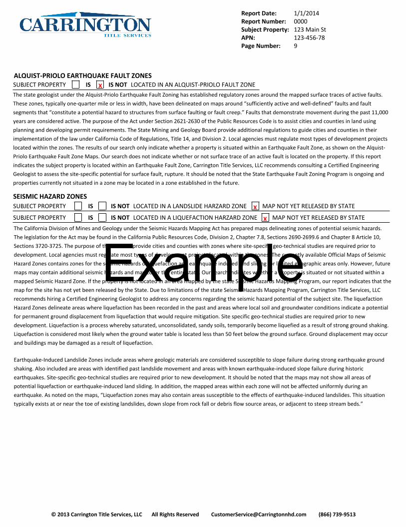
ALQUIST-PRIOLO EARTHQUAKE FAULT ZONESSUBJECT PROPERTY IS X IS NOT LOCATED IN AN ALQUIST-PRIOLO FAULT ZONE
The state geologist under the Alquist-Priolo Earthquake Fault Zoning has established regulatory zones around the mapped surface traces of active faults.
These zones, typically one-quarter mile or less in width, have been delineated on maps around “sufficiently active and well-defined” faults and fault
segments that “constitute a potential hazard to structures from surface faulting or fault creep.” Faults that demonstrate movement during the past 11,000
years are considered active. The purpose of the Act under Section 2621-2630 of the Public Resources Code is to assist cities and counties in land using
planning and developing permit requirements. The State Mining and Geology Board provide additional regulations to guide cities and counties in their
implementation of the law under California Code of Regulations, Title 14, and Division 2. Local agencies must regulate most types of development projects
located within the zones. The results of our search only indicate whether a property is situated within an Earthquake Fault Zone, as shown on the Alquist-
Priolo Earthquake Fault Zone Maps. Our search does not indicate whether or not surface trace of an active fault is located on the property. If this report
indicates the subject property is located within an Earthquake Fault Zone, Carrington Title Services, LLC recommends consulting a Certified Engineering
Geologist to assess the site-specific potential for surface fault, rupture. It should be noted that the State Earthquake Fault Zoning Program is ongoing and
properties currently not situated in a zone may be located in a zone established in the future.
SEISMIC HAZARD ZONESSUBJECT PROPERTY IS IS NOT LOCATED IN A LANDSLIDE HARZARD ZONE X MAP NOT YET RELEASED BY STATE
SUBJECT PROPERTY IS IS NOT LOCATED IN A LIQUEFACTION HARZARD ZONE X MAP NOT YET RELEASED BY STATE
The California Division of Mines and Geology under the Seismic Hazards Mapping Act has prepared maps delineating zones of potential seismic hazards.
The legislation for the Act may be found in the California Public Resources Code, Division 2, Chapter 7.8, Sections 2690-2699.6 and Chapter 8 Article 10,
Sections 3720-3725. The purpose of the Act is to provide cities and counties with zones where site-specific geo-technical studies are required prior to
development. Local agencies must regulate most types of development projects located within the zones. The currently available Official Maps of Seismic
Hazard Zones contains zones for the seismic hazards of liquefaction and earthquake induced land sliding for limited geographic areas only. However, future
maps may contain additional seismic hazards and may cover the entire state. Our search indicates whether a property is situated or not situated within a
mapped Seismic Hazard Zone. If the property is not located in an area mapped by the state Seismic Hazards Mapping Program, our report indicates that the
map for the site has not yet been released by the State. Due to limitations of the state Seismic Hazards Mapping Program, Carrington Title Services, LLC
recommends hiring a Certified Engineering Geologist to address any concerns regarding the seismic hazard potential of the subject site. The liquefaction
Hazard Zones delineate areas where liquefaction has been recorded in the past and areas where local soil and groundwater conditions indicate a potential
for permanent ground displacement from liquefaction that would require mitigation. Site specific geo-technical studies are required prior to new
development. Liquefaction is a process whereby saturated, unconsolidated, sandy soils, temporarily become liquefied as a result of strong ground shaking.
Liquefaction is considered most likely when the ground water table is located less than 50 feet below the ground surface. Ground displacement may occur
and buildings may be damaged as a result of liquefaction.
Earthquake-Induced Landslide Zones include areas where geologic materials are considered susceptible to slope failure during strong earthquake ground
shaking. Also included are areas with identified past landslide movement and areas with known earthquake-induced slope failure during historic
earthquakes. Site-specific geo-technical studies are required prior to new development. It should be noted that the maps may not show all areas of
potential liquefaction or earthquake-induced land sliding. In addition, the mapped areas within each zone will not be affected uniformly during an
earthquake. As noted on the maps, “Liquefaction zones may also contain areas susceptible to the effects of earthquake-induced landslides. This situation
typically exists at or near the toe of existing landslides, down slope from rock fall or debris flow source areas, or adjacent to steep stream beds.”
Example
Report Date: 1/1/2014Report Number: 0000Subject Property: 123 Main StAPN: 123-456-78Page Number: 10
© 2013 Carrington Title Services, LLC All Rights Reserved [email protected] (866) 739-9513
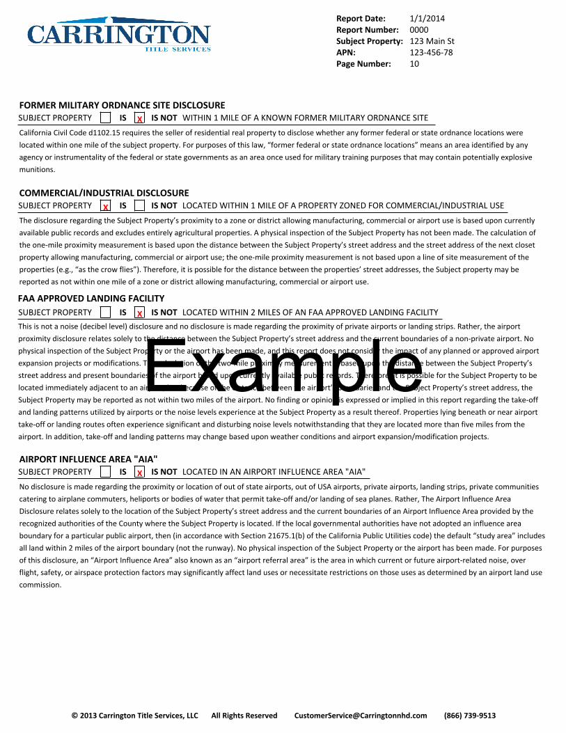
FORMER MILITARY ORDNANCE SITE DISCLOSURESUBJECT PROPERTY IS X IS NOT WITHIN 1 MILE OF A KNOWN FORMER MILITARY ORDNANCE SITE
California Civil Code d1102.15 requires the seller of residential real property to disclose whether any former federal or state ordnance locations were
located within one mile of the subject property. For purposes of this law, “former federal or state ordnance locations” means an area identified by any
agency or instrumentality of the federal or state governments as an area once used for military training purposes that may contain potentially explosive
munitions.
COMMERCIAL/INDUSTRIAL DISCLOSURESUBJECT PROPERTY X IS IS NOT LOCATED WITHIN 1 MILE OF A PROPERTY ZONED FOR COMMERCIAL/INDUSTRIAL USE
The disclosure regarding the Subject Property’s proximity to a zone or district allowing manufacturing, commercial or airport use is based upon currently
available public records and excludes entirely agricultural properties. A physical inspection of the Subject Property has not been made. The calculation of
the one-mile proximity measurement is based upon the distance between the Subject Property’s street address and the street address of the next closet
property allowing manufacturing, commercial or airport use; the one-mile proximity measurement is not based upon a line of site measurement of the
properties (e.g., “as the crow flies”). Therefore, it is possible for the distance between the properties’ street addresses, the Subject property may be
reported as not within one mile of a zone or district allowing manufacturing, commercial or airport use.
FAA APPROVED LANDING FACILITYSUBJECT PROPERTY IS X IS NOT LOCATED WITHIN 2 MILES OF AN FAA APPROVED LANDING FACILITY
This is not a noise (decibel level) disclosure and no disclosure is made regarding the proximity of private airports or landing strips. Rather, the airport
proximity disclosure relates solely to the distance between the Subject Property’s street address and the current boundaries of a non-private airport. No
physical inspection of the Subject Property or the airport has been made, and this report does not consider the impact of any planned or approved airport
expansion projects or modifications. The calculation of the two-mile proximity measurement is based upon the distance between the Subject Property’s
street address and present boundaries of the airport based upon currently available public records. Therefore, it is possible for the Subject Property to be
located immediately adjacent to an airport, but because of the distance between the airport’s boundaries and the Subject Property’s street address, the
Subject Property may be reported as not within two miles of the airport. No finding or opinion is expressed or implied in this report regarding the take-off
and landing patterns utilized by airports or the noise levels experience at the Subject Property as a result thereof. Properties lying beneath or near airport
take-off or landing routes often experience significant and disturbing noise levels notwithstanding that they are located more than five miles from the
airport. In addition, take-off and landing patterns may change based upon weather conditions and airport expansion/modification projects.
AIRPORT INFLUENCE AREA "AIA"SUBJECT PROPERTY IS X IS NOT LOCATED IN AN AIRPORT INFLUENCE AREA "AIA"
No disclosure is made regarding the proximity or location of out of state airports, out of USA airports, private airports, landing strips, private communities
catering to airplane commuters, heliports or bodies of water that permit take-off and/or landing of sea planes. Rather, The Airport Influence Area
Disclosure relates solely to the location of the Subject Property’s street address and the current boundaries of an Airport Influence Area provided by the
recognized authorities of the County where the Subject Property is located. If the local governmental authorities have not adopted an influence area
boundary for a particular public airport, then (in accordance with Section 21675.1(b) of the California Public Utilities code) the default “study area” includes
all land within 2 miles of the airport boundary (not the runway). No physical inspection of the Subject Property or the airport has been made. For purposes
of this disclosure, an “Airport Influence Area” also known as an “airport referral area” is the area in which current or future airport-related noise, over
flight, safety, or airspace protection factors may significantly affect land uses or necessitate restrictions on those uses as determined by an airport land use
commission.
Example

Report Date: 1/1/2014Report Number: 0000Subject Property: 123 Main StAPN: 123-456-78Page Number: 11
© 2013 Carrington Title Services, LLC All Rights Reserved [email protected] (866) 739-9513
RADON GASSUBJECT PROPERTY X IS IS NOT LOCATED WITHIN A COUNTY THAT IS DESIGNATED ZONE 2 FOR RADON GAS POTENTIAL
For its Radon Advisory, Carrington Title Services, LLC uses the updated assessment of radon exposure published in 1999 by the Lawrence Berkeley National
Laboratory (LBNL) and Columbia University, under support from the U.S. Environmental Protection Agency (EPA), the National Science Foundation, and the
US Department of Energy. All of California's 58 counties have a predicted median annual-average living-area concentration of radon below 2.0 pCi/L
(picocuries per liter of indoor air) -- which is well below the EPA's guideline level of 4 pCi/L and equivalent to the lowest hazard zone (Zone 3) on the 1993
EPA Map of Radon Zones. A "median", like an average, is a central value. The "median concentration" means that half of the homes in a county are
expected to be below this value and half to be above it. All houses contain some radon, and a few houses will contain much more than the median
concentration. The only way to accurately assess long-term exposure to radon in a specific house is through long-term testing (sampling the indoor air for a
year or more). The EPA Radon website offers help to homeowners in assessing the cost vs. benefit of testing a specific house for radon or modifying it for
radon reduction (see http://www.epa.gov/radon/).
TSUNAMI INUNDATION HAZARDSUBJECT PROPERTY IS X IS NOT LOCATED IN A TSUNAMI INUNDATION AREA
A tsunami is a sea wave typically generated by a submarine earthquake, but may be caused by an offshore landslide or volcanic action. A large offshore
earthquake, typically a magnitude 7 or greater, may generate a tsunami. Properties located along the California coastline have a potential for inundation
from a tsunami. Although early warning systems may provide sufficient warning from distant tsunamis, near-shore generated tsunamis may reach the coast
in a matter of minutes. Therefore, homeowners should contact their local emergency management agency and become knowledgeable about tsunami
warning signs and local evacuation plans.
Example

Report Date: 1/1/2014Report Number: 0000Subject Property: 123 Main StAPN: 123-456-78Page Number: 12
© 2013 Carrington Title Services, LLC All Rights Reserved [email protected] (866) 739-9513
LAND UNDER CONTRACT PURSUANT TO THE WILLIAMSON ACTSUBJECT PROPERTY IS X IS NOT LOCATED IN LAND UNDER CONTRACT PURSUINT TO THE CALIFORNIA LAND CONSERVATION
OR WILIAMSON ACT
Approximately 16.9 million of the State’s 29 million acres of farm and ranch land are currently protected under the California Land Conservation, or
Williamson Act. The California Legislature passed the Williamson Act in 1965 to preserve agriculture and open space lands by discouraging premature and
unnecessary conversion to urban use. The Act creates an arrangement whereas private land owners contract with Counties and Cities to voluntarily restrict
land to agricultural and open-space uses. The vehicle for these agreements is a rolling term 10 year contract (i.e. unless either party files a “notice of non-
renewal” the contract is automatically renewed annually for an additional year). In return, restricted parcels are assessed for property tax purposes at a rate
consistent with their actual use, rather then potential market value. An “agricultural preserve” defines the boundary of an area within which a City or
County will enter into contracts with land owners. The boundary is designated by resolution of the board supervisors or city council having jurisdiction. Only
land located within an agricultural preserve is eligible for a Williamson Act contract. Preserves are regulated by rules and restrictions designated in the
resolution to ensure that the land within the preserve is maintained for agricultural or open-space use. The Williamson Act Contract is the legal document
that obligates the property owner and any successors of interest to the contracts enforceable restrictions. A landowner interested in enrolling land should
contact the local planning department of the County in which the land is located to obtain information and instructions. A Williamson Act Contract runs
with the land and is binding on all successors in interest of the landowner. More information may be found by contacting the California Department of
Conservation, Division of Land Resources Protection at (916) 324-0850, or on their web site at http://www.conservation.ca.gov/dlrp/lca
RIGHT TO FARM/IMPORTANT FARMLANDSUBJECT PROPERTY IS X IS NOT LOCATED WITHIN 1 MILE OF A FARM OR RANCH LAND
California Civil Code section 1103.4 requires notice if a property is presently located within one mile of a parcel of real property designated as “Prime
Farmland,” “Farmland of Statewide Importance.” “Unique Farmland,” “Farmland of Local Importance,” or “Grazing Land” on the most current countylevel
GIS "Important Farmland Map" issued by the California Department of Conservation, Division of Land Resource Protection. Properties situated in these
zones may be subject to inconveniences or discomforts resulting from agricultural operations that are a normal and necessary aspect of living in a
community with a strong rural character and a healthy agricultural sector. Customary agricultural practices in farm operations may include, but are not
limited to, noise, odors, dust, light, insects, the operation of pumps and machinery, the storage and disposal of manure, bee pollination, and the ground or
aerial application of fertilizers, pesticides, and herbicides. These agricultural practices may occur at any time during the 24-hour day. Individual sensitivities
to those practices can vary from person to person.
NATURALLY OCCURRING ASBESTOSSUBJECT PROPERTY IS X IS NOT LOCATED WITHIN AN AREA OF NATURALLY OCCURRING ASBESTOS
Asbestos is the common name for a group of silicate minerals that are made of thin, strong fibers. It occurs naturally in certain geologic settings in
California, most commonly in ultrabasic and ultramafic rock, including serpentine rock, and along associated faults. Chrysotile is the most common type of
asbestos, and is often contained in serpentine rock. Serpentine rock is a typically grayish-green to bluish-black color rock that may be shiny in appearance,
and is commonly found in the Sierra foothills, the Klamath Mountains, and Coast Ranges. While asbestos formation is more likely in the formations of these
rocks, its presence is not certain. Because asbestos is a mineral, asbestos fibers are generally stable in the environment. The fibers will not evaporate in the
air. Some naturally occurring asbestos can become friable, or crushed into a powder. This may occur when vehicles drive over unpaved roads or driveways
that are surfaced with ultrabasic, ultramafic or serpentine rock, when land is graded for building purposes, or at quarrying operations. Weathering and
erosion may also naturally release asbestos. Friable asbestos can become suspended in the air, and under these conditions, asbestos fibers represent a
significant risk to human health. Asbestos is a known carcinogen, and inhalation of asbestos may result in the development of lung cancer. Carrington Title
Services, LLC has obtained geologic maps from the California Department of Conservation, Division of Mines and Geology, which detail areas within the
state that contain naturally occurring ultrabasic and ultramafic rocks. Those properties whose underlying geologic substructure contains these types of rock,
with their higher potential for asbestos content, have a higher chance of asbestos exposure, and thus may be in a potential asbestos hazard area.
Example
Report Date: 1/1/2014Report Number: 0000Subject Property: 123 Main StAPN: 123-456-78Page Number: 13
© 2013 Carrington Title Services, LLC All Rights Reserved [email protected] (866) 739-9513
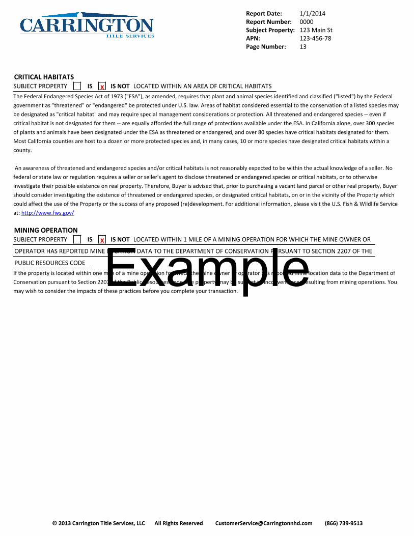
CRITICAL HABITATSSUBJECT PROPERTY IS X IS NOT LOCATED WITHIN AN AREA OF CRITICAL HABITATS
The Federal Endangered Species Act of 1973 ("ESA"), as amended, requires that plant and animal species identified and classified ("listed") by the Federal
government as "threatened" or "endangered" be protected under U.S. law. Areas of habitat considered essential to the conservation of a listed species may
be designated as "critical habitat" and may require special management considerations or protection. All threatened and endangered species -- even if
critical habitat is not designated for them -- are equally afforded the full range of protections available under the ESA. In California alone, over 300 species
of plants and animals have been designated under the ESA as threatened or endangered, and over 80 species have critical habitats designated for them.
Most California counties are host to a dozen or more protected species and, in many cases, 10 or more species have designated critical habitats within a
county.
An awareness of threatened and endangered species and/or critical habitats is not reasonably expected to be within the actual knowledge of a seller. No
federal or state law or regulation requires a seller or seller's agent to disclose threatened or endangered species or critical habitats, or to otherwise
investigate their possible existence on real property. Therefore, Buyer is advised that, prior to purchasing a vacant land parcel or other real property, Buyer
should consider investigating the existence of threatened or endangered species, or designated critical habitats, on or in the vicinity of the Property which
could affect the use of the Property or the success of any proposed (re)development. For additional information, please visit the U.S. Fish & Wildlife Service
at: http://www.fws.gov/
MINING OPERATIONSUBJECT PROPERTY IS X IS NOT LOCATED WITHIN 1 MILE OF A MINING OPERATION FOR WHICH THE MINE OWNER OR
OPERATOR HAS REPORTED MINE LOCATION DATA TO THE DEPARTMENT OF CONSERVATION PURSUANT TO SECTION 2207 OF THE
PUBLIC RESOURCES CODE
If the property is located within one mile of a mine operation for which the mine owner or operator has reported mine location data to the Department of
Conservation pursuant to Section 2207 of the Public Resources Code, the property may be subject to inconveniences resulting from mining operations. You
may wish to consider the impacts of these practices before you complete your transaction.Example

Report Date: 1/1/2014Report Number: 0000Subject Property: 123 Main StAPN: 123-456-78Page Number: 14
© 2013 Carrington Title Services, LLC All Rights Reserved [email protected] (866) 739-9513
THIS PAGE INTENTIONALLY LEFT BLANK
Example

Report Date: 1/1/2014Report Number: 0000Subject Property: 123 Main StAPN: 123-456-78Page Number: 15
© 2013 Carrington Title Services, LLC All Rights Reserved [email protected] (866) 739-9513
CITY/COUNTY HAZARD DISCLOSURE EXPLANATIONS
Carrington Title Services, LLC provides information on locally identified natural hazards as an additional service because their disclosure to purchasers is
either required by ordinance or the information is available on maps publicly available from various City and County sources. This service also supplements
and completes the natural hazard information required by the California Civil Code 1103.
Flood Hazard Zones
Supplemental flood zones include information not covered by Special Flood Hazard Areas as designated by the Federal Emergency Management Agency or
by Dam Inundation zones as reported by the California State Office of Emergency Services. These can include tsunamis, runoff hazards, historical flood data
and additional dike failure hazards.
Fire Hazard Zones
Local agencies may, at their discretion, include or exclude certain areas from the requirements of California Government Code Section 51182 (imposition of
fire prevention measures on property owners), following a finding supported by substantial evidence in the record that the requirements of Section 51182
either are, or are not necessary for effective fire protection within the area. Any additions to these maps that Carrington Title Services, LLC has been able to
identify and substantiate are included in our disclosure.
Seismic/Geologic Hazard Zones
The California Division of Mines and Geology (DMG) has not completed the project assigned it by Section 2696 of the California Public Resources Code to
identify areas of potential seismic hazards within the State of California. The DMG and the United States Geological Survey (USGS) have performed many
valuable studies that supplement the Section 2696 maps and fill many missing areas. These maps are included in our disclosures. Also included in our
disclosure is the review of maps that indicate many hazards that may or may not be seismically related, including, but not limited to, landslides, debris
flows, mudslides, coastal cliff instability, volcanic hazards, and avalanches. Many cities and counties require geologic studies before any significant
construction if the subject property is in or near a geologic hazard known to them. We have attempted to include all official and publicly available maps
indicating geologic hazards identified by these jurisdictions.
Earthquake Fault Hazard Zones
Many local jurisdictions have different or higher standards then the State for the identification of active earthquake fault zones. These jurisdictions have
created their own maps which indicate the active faults according to these standards. Some jurisdictions also recommend or require the disclosures of
potentially active faults. Carrington Title Services, LLC has attempted to include all official and publicly available maps indicating earthquake faults identified
by these jurisdictions.
Example

Report Date: 1/1/2014Report Number: 0000Subject Property: 123 Main StAPN: 123-456-78Page Number: 16
© 2013 Carrington Title Services, LLC All Rights Reserved [email protected] (866) 739-9513
REGISTERED SEX OFFENDER (MEGAN’S LAW) ADVISORY
California Civil Code Section 2079.10a (commonly referred to as “Megan’s Law”) requires the following notice be provided as part of the purchasers
agreement to a buyer or lessee of residential property: The California Department of Justice, sheriff’s departments, police departments serving jurisdictions
of 200,000 or more and many other local law enforcement authorities maintain for public access a data base of locations of persons required to register
pursuant to paragraph (1) of subdivision (a) of Section 290.4 of the Penal Code. The database is updated on a quarterly basis and a source of information
about the presence of these individuals in any neighborhood. A new California law, Assembly Bill 488 (Nicole, Parra) sponsored by the State Attorney
General now provides the public with Internet access to detailed information on registered sex offenders. This expanded access allows the public for the
first time to use their personal computers to view information on sex offenders required to register with local law enforcement under California's Megan's
Law. Previously, the information was available only by personally visiting police stations and sheriff offices or by calling a 900 toll-number. The new law was
given final passage by the Legislature on August 24, 2004 and signed by the Governor on September 24, 2004.
DUCT SEALING & TESTING REQUIREMENT DISCLOSURE
The Energy Policy and Conservation Act directs the Department of Energy (DOE) to establish minimum efficiency standards for various products, including
central air conditioners and heat pumps. The DOE has amended the energy conservation standards for residential central air conditioners and heat pumps
manufactured for sale in the United States. As of January 23, 2006, these products are required to be manufactured with an energy rating of 13 SEER (SEER,
Seasonal Energy Efficiency Ratio, is the measurement of energy efficiency for the cooling performance of central air conditioners and heat pumps). This
amended SEER rating is 30 percent more efficient than 10 SEER, the previous standard. This new standard applies to split system air conditioners and heat
pumps and small duct, high velocity systems manufactured after January 23, 2006. Products manufactured prior to this date with a SEER rating of less than
13 may still be sold and installed. Homeowners are not required to replace or upgrade existing central air conditioning units or heat pumps to comply with
the new standards. Carrington Title Services, LLC recommends that the potential buyer of the subject property verify the SEER rating of the central air
conditioning or heat pump system through a professional such as a home inspector or through the California Home Energy Efficiency Rating Services. This
agency, a home energy rating provider, is a non-profit organization that promotes energy efficiency through comprehensive analyses of homes. Additional
information may be found at: http://www.eere.energy.gov/buildings/appliance_standards/residential/central_ac_hp.html or at www.cheers.org The
California Energy Commission outlines the new duct sealing requirements in a letter to homeowners, which states: Beginning October 1, 2005, you must
have your home’s ducts tested for leaks when you have a central air conditioner or furnace installed or replaced. Ducts that leak 15 percent or more must
be repaired to reduce the leaks. After your contractor tests and fixes the ducts, you choose whether to have an approved third-party field verifier check to
make sure the duct testing and sealing was done properly or to have your house included in a random sample where one in seven duct systems are
checked. Duct sealing is not required in the following situations: 1) when homes are in specific coastal climates; 2) when systems have less than 40 feet of
ductwork in unconditioned spaces like attics, garages, crawlspaces, basements or outside the building, or 3) when ducts are constructed, insulated or sealed
with asbestos. There also are specific alternatives that allow high efficiency equipment and added duct insulation to be installed instead of fixing duct leaks.
You also should know that any contractor failing to obtain a required building permit and failing to test and repair your ducts is violating the law and
exposing you to additional costs and liability. Real estate law requires you to disclose to potential buyers and appraisers whether or not you obtained
required permits for work done on your house. If you do not obtain a permit, you may be required to bring your home into compliance with code
requirements for that work and you may have to pay penalty permit fees and fines prior to selling your home. According to the California Energy
Commission, these duct sealing requirements apply when the following are replaced: the air handler, the outdoor condensing unit of a split system air
conditioner or heat pump, the cooling or heating coil, or the furnace heat exchanger. More information may be found at www.energy.ca.gov/title24/
changeout.
Example

Report Date: 1/1/2014Report Number: 0000Subject Property: 123 Main StAPN: 123-456-78Page Number: 17
© 2013 Carrington Title Services, LLC All Rights Reserved [email protected] (866) 739-9513
NOTICE OF CALIFORNIA’S 2005 ENERGY EFFICIENCY STANDARDS ADVISORY
Effective October 1, 2005, the California Energy Commission adopted Title 24, Building Energy Efficiency Standards for 2005. Under these standards, local
governments must adopt and enforce building codes that require ductwork to be inspected whenever new heating, ventilating or air conditioning
equipment is installed. If the ductwork is found to leak in excess of 15%, then repairs to the ductwork are required to bring it into compliance. The California
Energy Commission estimates that the average home’s ductwork leaks by 30% or more; so, some repair costs are likely for most homes when a new furnace
for example is installed. Title 24 does not require a seller to replace a furnace that is otherwise safe and serviceable or to inspect or repair a home’s
ductwork. However, the future replacement of a furnace will require such an inspection and possible repairs, which may impose an unexpected cost on the
property owner. This new standard also specifically bans the use of cloth-backed tape (“duct tape”) in making duct repairs, unless the tape is used in
combination with approved adhesive materials. Compliance with the standard is assured by hiring a contractor who is properly licensed, and doing the
installation with a building permit so that the City Building Inspector can check the work when completed. For more information, visit http://
www.energy.ca.gov/title24/2005standards
NOTICE OF HOME ENERGY EFFICIENCY IMPROVEMENTS TAX CREDIT ADVISORY
According to the DOE, the higher replacement cost of SEER 13-compliant air conditioning system will be offset by a savings of up to 23 percent in monthly
energy costs. The California Energy Commission notes that leaking ductwork accounts for up to 25 percent of the heating costs of a typical home. Therefore,
compliance with the new Federal and State standards offers substantial benefits to the property owner, as well as significant environmental benefits
through decreased energy consumption, compared with older systems. In addition, consumers who purchase and install specific products, such as energy
efficient windows, insulation, doors, roofs, and heating and cooling equipment in the home can receive a tax credit of up to $500 beginning January 2006.
For more information visit http://www.energy.gov/taxbreaks.htm
MOLD ADDENDUM
California law (California Civil Code Section 1102.6 et Seq requires any seller, transferor, or lessor of residential, commercial. Or industrial property; or
public entity that owns, leases, or operates a building provide a written disclosure to prospective purchasers, prospective tenants, renters, or occupants if
the seller, transferor, lessor, or public entity has knowledge of mold conditions or in specified instances has reasonable cause to believe, that mold (visible
or hidden) that exceeds permissible exposure limits is present that affects the unit, or building. The State Department of Health Services is designated as the
lead agency for identifying, adopting, and determining permissible exposure limits to mold in indoor environments, mold identification and remediation
efforts
NOTICE OF METHAMPHETAMINE CONTAMINATION
California law (Health and Safety Code Section 25400.28) requires property owners to notify prospective buyers in writing of any pending order that would
prevent the use or occupancy of a property because of methamphetamine laboratory activity, and to provide the prospective buyer with a copy of the
pending order. Receipt of a copy of the pending order shall be acknowledged in writing by the prospective buyer. The “Methamphetamine Contaminated
Property Cleanup Act of 2005,” chapter 6.9.1 specifies human occupancy standards for property that is subject to the act. These standards will be replaced
by any that are devised by the Department of Toxic Substance Control, in consultation with the Office of Environmental Substance Control. In addition, this
act outlines procedures for local authorities in dealing with methamphetamine contaminated properties, including the use of a property lien. This disclosure
is meant to inform prospective buyers of the California disclosure law regarding methamphetamine lab activity, and does not indicate or imply that a
particular property is or has been contaminated according to law.
Example

Report Date: 1/1/2014Report Number: 0000Subject Property: 123 Main StAPN: 123-456-78Page Number: 18
© 2013 Carrington Title Services, LLC All Rights Reserved [email protected] (866) 739-9513
NOTICE OF ABANDONED WELLS
According to the California Department of Water Resources an abandoned or “ permanently inactive well” is a well that has not been used for a period of
one year. Abandoned wells that are not properly sealed are a potential hazard to people and animals and may be a potential site of illegal waste disposal.
Abandoned wells may allow contamination of groundwater. Abandoned wells should be destroyed in accordance with methods developed by the
Department of Water Resources pursuant to Secton 13800 of the Water Code.
NOTICE OF OIL AND GAS WELLS
California is ranked fourth in the nation among oil producing States. Surface oil production is concentrated mainly in Southern California, and in districts
elsewhere in the State. In recent decades, real estate development has rapidly encroached into areas where oil production has occurred. Because the
State’s oil production has been in decline since the 1980’s, thousand of oil and gas wells have been shut down or abandoned, and many of those wells are in
areas where residential neighborhoods now exist. According to the California Department of Conservation (DOC), to date, approximately 180,000 oil, gas
and geothermal wells have been drilled in California, and approximately 88,000 are still in use. The remaining wells are used intermittingly, have been
sealed under the supervision of the DOC’s Division of Oil, Gas, and Geothermal Resources, or have been abandoned and have no known operator. The State
has a special fund that pays the cost of safely capping or abandoning the wells, however, the program is limited in scope and progress. Buyer should be
aware that the DOC database lists oil and gas wells in any County, and those may include abandoned wells. Health and safety hazards may be associated
with oil and gas wells, whether abandoned, capped or active, but not limited to, soil and groundwater contamination, oil and methane seeps, fire hazards,
air quality problems, and physical safety hazards to humans and animals. For general information, visit the California Department of Conservation, Division
of Oil, Gas and Geothermal Resources at: http://www.conservation.ca.gov/dog/Pages/Index.aspx.
NOTICE OF ABANDONED MINES
According to the California Department of Conservation, Office of Mine Reclamation, since the Gold Rush of 1949, thousands of mines have been drilled in
California. Many were abandoned when they became unproductive or unprofitable. The result is that California’s landscape contains many thousands of
abandoned mines, which can pose many health, safety, and environmental hazards on and around the mine property. Mines can present serious physical
safety hazards such as open shafts and tunnels, and they may create the potential to contaminate surface water, groundwater, or even air quality. Some
abandoned mines are such massive problems and have earned a spot on the Federal Superfund Environmental Hazards List. No California Law required the
disclosure of abandoned mines in a real estate transaction, unless the existence of an abandoned mine is within the actual knowledge of the seller and is
deemed to be a fact material to the transaction. The Office of Mine Reclamation (OMR) and the United States Geological Survey maintain a database of
abandoned mines; however it is known to be incomplete and based on maps that are often decades out-of-date. Many mines are not mapped because they
are on private land. The OMR warns that the State’s abandoned mines database “should NOT be relied upon for the obligations of sellers of real property
and their disclosure obligations under California Law. Carrington Title Services, LLC Report does not contain an abandoned mines disclosure from any
government database, or map, or any other source. Parties concerned with the possible existence, or impact of abandoned mines in the vicinity of a
property are advised to retain a state-licensed geotechnical consultant to study the site and issue a report. Other sources of information include, but are
not limited to, the State Office of Mine Reclamation at (916) 323-9198. You can also visit their web site at: http://www.conservation.ca.gov/OMR/Pages/
Index.aspx. Carrington Title Services, LLC also recommends that you contact the engineering, planning and building departments in the properties City or
County for additional information.
NOTICE REGARDING GAS AND HAZARDOUS LIQUID TRANSMISSION PIPELINES
This notice is being provided simply to inform you that information about the general location of gas and hazardous liquid transmission pipelines is available
to the public via the National Pipeline Mapping System (NPMS) Internet Web site maintained by the United States Department of Transportation at http://
www.npms.phmsa.dot.gov/. To seek further information about possible transmission pipelines near the property, you may contact your local gas utility or
other pipeline operators in the area. Contact information for pipeline operators is searchable by ZIP Code and county on the NPMS Internet Web site.
Example
Report Date: 1/1/2014Report Number: 0000Subject Property: 123 Main StAPN: 123-456-78Page Number: 19
© 2013 Carrington Title Services, LLC All Rights Reserved [email protected] (866) 739-9513
TERMS AND CONDITIONS
1. This Carrington Title Services, LLC Natural Hazard Disclosure Report (“Report”) was prepared by Carrington Title Services, LLC. This Report was prepared
solely for one transaction and one escrow, as described on page 1 (collectively, the “Transaction”). This Report may be used solely between this seller and
this buyer for that single Transaction related to the property address and assessor’s parcel number (the “Property”) provided to Carrington Title Services,
LLC.
2. Only the seller, buyer, listing agent/broker and selling agent/broker, if any, involved in the Transaction (collectively, the “Recipients”) may use and rely
on this Report and only after they have paid in full for the Report. Neither lenders nor subsequent buyers of the Property may use or rely on this Report.
There are no third party beneficiaries to this Report even if they have a foreseeable relationship with any of the Recipients, or with the Property. This
Report is time-sensitive; its information is accurate only as of the date referenced on Page 1 (the “Effective Date”). Taxes, governmental legislation and
other matters affecting the Property after the Effective Date are not disclosed, and Carrington Title Services, LLC expressly disclaims any duty to supplement
this Report to disclose any taxes, legislation, changes or charges becoming effective after the Effective Date. If the Transaction does not close within a
reasonable time after the Effective Date, Carrington Title Services, LLC strongly recommends that a new report be ordered.
3. This Report may not be used in conjunction with any Natural Hazard Disclosure Statement (“NHDS”) other than the NHDS issued as part of this Report.
This Report may have an effect on the value of the Property; nevertheless, this Report may not be used in connection with any appraisal or valuation of the
Property, or for any other purpose. This Report is protected by copyright, trademark and other intellectual property laws and may not be copied or
reproduced in any manner. Violators will be prosecuted as permitted by law.
4. Carrington Title Services, LLC has not visually inspected the Property. Instead, this Report refers specifically to certain records, statutes and other
information provided by various governmental agencies. Carrington Title Services, LLC has no way to verify the accuracy or completeness of this
information, but has assumed the information is accurate and complete. If such information is not accurate or complete, Carrington Title Services, LLC
cannot and shall not be liable or responsible for such omissions or inaccuracies. Carrington Title Services, LLC further shall not be liable or responsible for
omissions or inaccuracies in the Report that the Recipients, or any of them, knew or should have known as of the Effective Date. This Report does not
disclose whether the Property is contaminated with hazardous substances.
5. There may be other disclosures required by applicable state law; Carrington Title Services, LLC makes no representations or warranties as to the
adequacy or accuracy of any other representations, warranties or disclosures required under other applicable state laws. Carrington Title Services, LLC shall
not be liable or responsible for failing to disclose any matters not known to Carrington Title Services, LLC, not shown on the maps used by Carrington Title
Services, LLC, not recorded in the public record as of the Effective Date, or not included within the categories of items included in the Report. Carrington
Title Services, LLC’s total liability and responsibility to any Recipient for any liabilities, causes of action, claim or claims, including but not limited to any claim
for breach of contract or negligence, shall be for actual proven damages only and is limited to the difference in fair market value of the Property on the
Effective Date, if any, caused by Carrington Title Services, LLC’s error up to a maximum of $100,000. In the event of any error, omission or inaccuracy in the
Carrington Title Services, LLC Report for which Carrington Title Services, LLC is liable, Carrington Title Services, LLC shall have no duty to defend or pay any
attorneys’ fees, costs or expenses incurred by the Recipients, or any of them. The Recipients, and each of them, expressly waive the benefits of California
Civil Code Section 2778.
6. Recipients are encouraged to contact a local insurance agent regarding earthquake insurance, fire insurance and flood insurance. Recipients also may
contact the National Flood Insurance Program regarding flood insurance. Carrington Title Services, LLC is not and shall not be responsible or liable for any
costs, losses, or compensatory or consequential damages arising from earthquakes, fires or floods.
7. If the Transaction involves multiple adjacent parcels, the parcel shown on Page 1 of this Report is regarded as the “Primary Parcel,” and the disclosures
contained in the Report operate as if only a single parcel is involved. In other words, even if a matter affects only one parcel, it will be disclosed as affecting
all of the parcels. For parcel-by-parcel disclosures, individual reports must be ordered separately for each parcel. With regard to Mello-Roos Community
Facilities Districts and/or Special Assessment Districts (1915 Bond Act) (collectively, “Mello-Roos/SAD”) tax disclosures, the tax information is provided only
for the Primary Parcel.
Example

Report Date: 1/1/2014Report Number: 0000Subject Property: 123 Main StAPN: 123-456-78Page Number: 20
© 2013 Carrington Title Services, LLC All Rights Reserved [email protected] (866) 739-9513
8. Only current tax-year Mello-Roos/SAD assessments are disclosed. However, accurate or complete Mello-Roos/SAD information sometimes is unavailable
for a number of reasons, including (a) if a property is in foreclosure because a Mello-Roos/SAD assessment is delinquent, (b) if the secured property tax bill
information is unavailable or has not been released by the county where the property is located. In addition, this Report may not disclose certain items
because (i) they are not levied on the current tax bill, (ii) if the owner has applied for an exemption, certain items may not appear on the current tax bill, (iii)
judicial foreclosure lawsuits sometimes cause items to be removed from the current tax bill, (iv) the property owner was billed directly for an item, e.g.,
apart from the secured property tax bills, and (v) the relevant county has not yet released the applicable tax information. The information in this Report
comes from what Carrington Title Services, LLC believes to be reliable sources. However, Carrington Title Services, LLC shall not be responsible or liable for
errors in the tax data it obtains from third party suppliers.
9. The maximum tax amounts specified in this Report are estimates only, calculated based on available county assessor data and/or third party data.
Carrington Title Services, LLC does not review of the relevant County recorder’s or other jurisdictions’ files to determine the presence of any other taxes or
assessments affecting the Property. The levy amounts are subject to change for many reasons, including different interpretations of the Special Tax
Formula, availability of data, and changes or corrections to classifications from year-to-year. The Report provides an estimate of items not included on the
current tax bill, but the estimates are not comprehensive. For example, there may exist taxes and assessments which have not yet been levied on the tax
bill or during the tax year described in the Report. Carrington Title Services, LLC updates its information annually reasonably after updated information is
released. Assessment districts also are subject to change, and therefore, this Report cannot be used or relied upon for nearby properties or future
transactions involving this Property. Each Recipient is encouraged to contact the appropriate agents representing the local Mello-Roos/SAD with any
specific questions they may have.
10. This Report is intended to satisfy the disclosure obligations related to Calif. Civil Code §§1103.2, 1102.6b, 1102.15, 1102.17, and 20799.10a. Carrington
Title Services, LLC has been asked by the seller to provide this Report to assist the seller, and both the buyer’s and seller’s agents, in availing itself/
themselves of the protections contained in Calif. Civil Code §1103.4. However, Carrington Title Services, LLC cannot guaranty the availability of such
protections, and makes no representations or warranties in connection therewith. California law also requires sellers to disclose a continuing lien securing
the levy of special taxes pursuant to the Mello-Roos Community Facilities Act (Chapter 2.5 (commencing with Section 53311) of Part 1 of Division 2 of Title 5
of the Government Code) and of a fixed lien assessment collected in installments to secure bonds issued pursuant to the Improvement Bond Act of 1915
(Division 10 (commencing with Section 8500) of the Streets and Highways Code) in connection with the sale of real property in California. Carrington Title
Services, LLC strongly recommends that the buyer obtain a title report and title insurance covering the Property; the Carrington Title Services, LLC Report is
not a replacement for a title report or a title insurance policy.
11. This Report discloses certain earthquake zones, flood zones, fire zones, and special tax assessment matters. Nothing in this Report relates to (a) title or
title defects, (b) encroachments, geological issues or matters that would be disclosed by a land surveyor, soil survey or geological survey, (c) land use or
zoning related matters, (d) parcel maps or subdivisions under the California Subdivided Land Acts or the Subdivision Map Act, (e) compliance with the
Americans with Disabilities Act, local building codes or other federal, state or local laws, ordinances or restrictions that may affect the Property, (f) the use,
occupancy or development of the property, including any restrictions resulting from any state, local or federal governmental agency, such as school
districts, water districts, joint power districts, flood control districts, or the California Coastal Commission, (g) building permits or any other permits that
may be required for the Property or its current or future anticipated uses, or (h) any other matter potentially affecting the Property.
12. BY SIGNING, ACCEPTING OR USING THE NATURAL HAZARD DISCLOSURE STATEMENT OR THIS REPORT, THE RECIPIENTS, AND EACH OF THEM AND THEIR
AGENTS AND REPRESENTATIVES, HEREBY ACKNOWLEDGE AND AGREE (AND SHALL BE DEEMED TO HAVE ACKNOWLEDGED AND AGREED) THAT THEY HAVE
REVIEWED, APPROVED AND ACCEPTED ALL OF THE TERMS, CONDITIONS AND LIMITATIONS CONTAINED HEREIN. CARRINGTON TITLE SERVICES, LLC SHALL
NOT BE LIABLE OR RESPONSIBLE FOR ANY INDIRECT, INCIDENTAL OR CONSEQUENTIAL DAMAGES, INCLUDING WITHOUT LIMITATION LOST PROFITS OR ANY
REDUCTION IN THE VALUE OF THE PROPERTY, ARISING OUT OF OR RELATED TO THE PREPARATION, ISSUANCE, USE OF OR RELIANCE UPON THIS REPORT,
EVEN IF THE SUCH DAMAGES ARE FORESEEABLE.
Example

Report Date: 1/1/2014Report Number: 0000Subject Property: 123 Main StAPN: 123-456-78Page Number: 21
© 2013 Carrington Title Services, LLC All Rights Reserved [email protected] (866) 739-9513
Property Tax Disclosure PageSection 1102.6b of the California Civil Code requires the transferor of real property (seller) to make a good faith effort to obtain and deliver to the prospective transferee
(buyer) a disclosure notice concerning a continuing lien securing the levy of special taxes pursuant to the Mello-Roos Community Facilities Act, and assessment installments to
secure bonds issued pursuant to the Improvement Bond Act of 1915. The transferor and his or her agent(s) disclose the following information with the knowledge that even
though this is not a warranty, prospective transferees may rely on this information in deciding whether and on what terms to purchase the subject property. Transferor hereby
authorizes any agent(s) representing any principal(s) in this action to provide a copy of this statement to any person or entity in connection with any actual or anticipated sale
of the property. This information is a disclosure and is not intended to be part of any contract between the transferee and transferor.
SUBJECT PROPERTY: 3600 MOUNTAIN AVE UNIT 12E, SAN BERNARDINO, CA 92404
IS X IS NOT IN MELLO-ROOS COMMUNITY FACILITIES DISTRICT(S).
IS X IS NOT IN 1915 BOND ACT SPECIAL ASSESSMENT DISTRICT(S).
If the property is located in a Mello-Roos and/or a 1915 Special Assessment District(s), the Buyer and Seller must also sign the official notice form(s) included in this report.
Notice of your “Supplemental” Property Tax Bill: Pursuant to Civil Code 1102.6c, Seller or his or her agent, is providing this “Notice of Your ‘Supplemental’ Property Tax Bill”:
“California property tax law requires the Assessor to revalue real property at the time the ownership of the property changes. Because of this law, you may receive one or two
supplemental tax bills, depending on when your loan closes.” The supplemental tax bills are not mailed to your lender. If you have arranged for your property tax payments to
be paid through an impound account, the supplemental tax bills will not be paid by your lender. It is your responsibility to pay these supplemental bills directly to the Tax
Collector. If you have any question concerning this matter, please call your local Tax Collector’s Office.”
Transfer Fee Disclosure: Pursuant to Civil Code 1102.6e, Seller or his or her agent, is required to disclose specific information about any Transfer Fee that may affect the
property. Please refer to the legal code or to the C.A.R. Form NTF (11/07), provided by the California Association of Realtors, for a standard format to use in making the
Transfer Fee Disclosure if you elect to investigate and make this disclosure personally. Civil Code 1098 defines a “Transfer Fee” as “any fee payment requirement imposed
within a covenant, restriction, or condition contained in any deed, contract, security instrument, or other document affecting the transfer or sale of, or any interest in, real
property that requires a fee be paid upon transfer of the real property.” Certain existing fees such as government fees, court ordered fees, mechanic lien fees, common interest
development fees, etc. are specially excluded from the definition of “Transfer Fee”. Private transfer fees are different from city or county Documentary Transfer Taxes. Private
Transfer Fees may apply in addition to government Documentary Transfer Taxes that are due upon sale or transfer of the property.
Determining the Existence of a Transfer Fee. If a Transfer Fee does exist affecting the property, the document creating the fee may be on file with the County Recorder as a
notice recorded against the property and should be disclosed in the preliminary title report on the property. However, the preliminary title report will merely disclose the
existence of the documents affecting title, not the content of the documents. The title of a document may also not be sufficient to disclose that a transfer fee is included in its
terms. Accordingly Seller should (a) request the title company which issued the preliminary title report to provide copies of the documents shown as “exceptions” and (b)
review each document to determine if it contains a transfer fee.
To determine if the property is subject to a Transfer Fee, OBTAIN COPIES OF ALL EXCEPTIONS LISTED ON THE PRELIMINARY TITLE REPORT FROM THE TITLE COMPANY AND
READ THEM TO DETERMINE IF ANY TRANSFER FEES ARE APPLICABLE. Please be aware that private transfer fees may be difficult to identify by simply reading the title report.
We acknowledge and understand the information contained in this report.
DATE: _______________________________________
_________________________________________________________
Seller Signature
_________________________________________________________
Seller Signature
DATE: _______________________________________
_________________________________________________________
Buyer Signature
_________________________________________________________
Buyer Signature
Example

Report Date: 1/1/2014Report Number: 0000Subject Property: 123 Main StAPN: 123-456-78Page Number: 22
© 2013 Carrington Title Services, LLC All Rights Reserved [email protected] (866) 739-9513
Property Tax Information PageTo the prospective purchaser of the real property known as:
Assessor’s Parcel Number: 12345678Street Address: 123 Main St, Any City, CA 90000
Assessment Description Assessment Amount
Annual Property Tax $479.92
Tax Rate Area
Assessed Land Value $13,000.00
Assessed Improvements Value $29,000.00
Total Assessed Value $42,000.00
Homeowner's Exemption $7,000.00
Net Assessed Value $35,000.00
Levy Code Levy Description Levy AmountAA01AA01 GENERAL TAX LEVY $350.00
AE01SP08 CO VECTOR CONTROL $5.62
SB01DD05 SAN BDNO COMM COLLEGE BOND $13.05
SB02DD08 SCHOOL BONDS $34.23
SR04DA54 Description not supplied by county $0.00
UF01SP07 PARAMEDIC SERV. ZONE PM-2 $19.30
WU23DA01 SB VALLEY MUNI WTR DBT SVC $57.75
Total Tax $479.95Example

Report Date: 1/1/2014Report Number: 0000Subject Property: 123 Main StAPN: 123-456-78Page Number: 23
© 2013 Carrington Title Services, LLC All Rights Reserved [email protected] (866) 739-9513
Supplemental Tax Bill CalculatorOn July 1, 1983, California State law was enacted to require the assessor to appraise property on the date a change in ownership occurs. Taxes are
computed from the 1st of the month following the change of ownership to the end of the fiscal year. In most cases, this assessment results in one or
possibly two supplemental tax bills being sent to the property owner in addition to the regular secured property tax bill that is mailed annually.
The Assessor appraises the property to determine the new base year value as of the date of the change of ownership. The Assessor then calculates the
difference between the new base year value and the existing roll value. The result is the new Supplemental Assessment. The Assessor will send you a
"NOTICE OF SUPPLEMENTAL ASSESSMENT AND IMPENDING TAX BILL".
If the reassessment results in an increase in property value, your supplemental taxes will be calculated by the Auditor-Controller based on the change in
value, and one or possibly two supplemental tax bills will be created and mailed to you by the Tax Collector. If the reassessment results in a reduction in
value, a refund will be prepared by the Auditor-Controller and mailed to you. A reduction in value WILL NOT reduce the amount due on the annual tax bill.
The annual tax bill must be paid in the amount originally billed.
The tables below are provided as a tool for you to estimate the amount of your new supplemental tax bill(s). NOTE: Supplemental tax bills are not paid in
escrow or impounded by your lender. Note numbers are rounded and may not match exactly to your property tax bill.
Line 1 New value at date of purchase (sales price) $
Line 2 Assessed value for current fiscal year (from tax bill) $35,000.00
Line 3 Supplemental assessment value (subtract Line 2 from Line 1) $
Line 4 Estimated Annual Supplemental Tax (Multiple Line 3 by 1.371 (Overall Tax Rate)) $
You must now prorate your supplemental bill based upon portion of the year for which you have ownership. NOTE: You will receive ONE supplemental bill if
the date of the change in ownership is between June 1 and December 31 inclusive. You will receive TWO supplemental bills if the date of the change in in
ownership is between January 1 and May 31 inclusive. The TWO bills are the supplemental tax bill calculated below AND the annual supplemental bill (Line
4 above).
Jan Multiply Line 4 from above by 0.4170 $
Feb Multiply Line 4 from above by 0.3333 $
Mar Multiply Line 4 from above by 0.2500 $
Apr Multiply Line 4 from above by 0.1667 $
May Multiply Line 4 from above by 0.0866 $
June Multiply Line 4 from above by 1.0 $
July Multiply Line 4 from above by 0.9167 $
$Aug Multiply Line 4 from above by 0.8333 $
Sep Multiply Line 4 from above by 0.7500 $
Oct Multiply Line 4 from above by 0.6670 $
Nov Multiply Line 4 from above by 0.5830 $
Dec Multiply Line 4 from above by 0.5000 $
The Supplemental Tax Bill Calculator is designed to help you estimate your supplemental tax bill(s) and does NOT include exemptions or exclusions which
may affect your assessed value. The Company bears no liability for any losses or damages suffered resulting from the use of this Supplemental Tax Bill
Calculator.
Example

Report Date: 1/1/2014Report Number: 0000Subject Property: 123 Main StAPN: 123-456-78Page Number: 24
© 2013 Carrington Title Services, LLC All Rights Reserved [email protected] (866) 739-9513
Property Tax Bill CalculatorProperty tax is an ad valorem tax that an owner pays on the value of the property being taxed. Counties, cities, towns, villages, school districts, and special
districts each raise money through the real property tax. The money funds schools, pays for police and fire protection, maintains roads, and funds other
municipal services enjoyed by residents.
The amount of a particular property's tax bill is determined by two things: the property's taxable assessment and the tax rates of the taxing jurisdictions in
which the property is located. The tax rate is determined by the amount of the tax levy to be raised from all, or part, of an assessing unit, and the unit's total
taxable assessed value. The assessment is determined by the assessor and should be based on the value of the property less any applicable property tax
exemptions.
The table below is provided as a tool for you to estimate the amount of your property tax bill. NOTE: This is an estimate and does NOT include charges for
new districts/fees or other changes. Note numbers are rounded and may not match exactly to your property tax bill.
Line 1 Sales price $
Line 2 Multiply the overall Tax Rate 1.371 by Line 1 $
Line 3 Total Estimated Annual Taxes Add Line 2 to Line 3 $
Ad Valorem Taxes: The phrase ad valorem is Latin for "according to value". In the case of municipal property taxes, property owners have their property
assessed on a periodic basis by the county assessor. The assessed value of the property is then used to compute an annual tax, which is levied on the owner
by his or her municipality. Proposition 13 (officially named the People's Initiative to Limit Property Taxation) was enacted during 1978 and limits the tax rate
for real estate to one percent (1%) of the full cash value of such property plus an amount for the debt service on any voter approved bonds.
Direct levies/Special Assessments: These are levied on the tax bill by the county tax collector on behalf of the local levying agency or district, not on behalf
of the assessor, auditor-controller, and/or the county tax collector divisions. These assessments, if present, will vary depending on the location of the
property. Typical examples of these types of levies are monies used to pay for municipally maintained lighting and landscaping, installation/upgrading of
sewer systems and Mello-Roos bonds/special taxes.
Exemptions and exclusions: The state Constitution provides for a variety of full and partial exemptions. The following is a brief list of some of the major
property tax exemptions in California. NOTE: the assessor’s office should be consulted for detailed requirements regarding exemptions.
• Homeowners’ Exemption: The Constitution requires a $7,000 reduction of taxable value for qualifying owner-occupied homes. The state
reimburses local agencies for the loss in property tax revenue. The homeowner must make a simple one-time filing with the county assessor for
the exemption.
• Disabled Veterans’ Exemption: Current law provides a basic exemption of $100,000 on the principal place of residence for veterans with
specified disabilities or for unmarried surviving spouses of deceased disabled veterans. A one-time filing is required. This exemption may be
raised to $150,000 if the applicant meets the income limit of $40,000. Annual filing is required for the $150,000 exemption. The income limit
and both the exemption amounts are adjusted annually for inflation.
• Disaster Relief: The taxable value of properties that have been substantially damaged or destroyed by a disaster may be reassessed to reflect
the damage if the county where the property is located has adopted a disaster relief ordinance. Claims for this relief must be filed with the
county assessor within the time period specified in the ordinance or within one year from the date the property was damaged or destroyed by
the disaster, whichever is later. The reduced value remains until the property is fully repaired, restored, or reconstructed.
• New Construction Exclusion for Disabled Access: New construction may be excluded from reassessment if it consists of modifying an existing
structure to make the structure more accessible to a physically disabled person.
• Over 55 and Disabled Citizens Relief: People over the age of 55 or who are severely and permanently disabled may transfer the taxable value
of their principal residence to a replacement property if it is of equal or lesser value, located within the same county, and purchased or newly
constructed within two years of the sale of the original property. This tax relief is available only once in a lifetime. There is one exception to this
one-time-only limit. If a claimant becomes physically and permanently disabled after transferring the taxable value under the age requirements
(over 55), the claimant may transfer the taxable value a second time under the disability requirements if the move is related to the disability.
Example
Report Date: 1/1/2014Report Number: 0000Subject Property: 123 Main StAPN: 123-456-78Page Number: 25
© 2013 Carrington Title Services, LLC All Rights Reserved [email protected] (866) 739-9513
Tax Bill Explanations
AD VALOREM TAX
Ad valorem taxes relating to property taxes are based on the assessed value of real estate property. Property ad valorem taxes are the major source of
revenue for state and municipal governments. The phrase ad valorem is Latin for "according to value". In the case of municipal property taxes, property
owners have their property assessed on a periodic basis by a public tax assessor. The assessed value of the property is then used to compute an annual tax,
which is levied on the owner by his or her municipality.
HOMEOWNER’S EXEMPTION
The California Constitution provides for the exemption of $7,000 (maximum) in assessed value from the property tax assessment of any property owned
and occupied as the owner’s principal place of residence. The exemption reduces the annual property tax bill for a qualified homeowner by up to $70.
(Article XIII Section 3 of the California Constitution, Rev & Tax 218). A qualifying dwelling can be any place you own as your principal place of residence and
that is subject to property tax.
VOTER APPROVED BONDS
Under Proposition 13, the property tax rate is fixed at 1% of assessed value plus any voter approved bonds. These bonds appear on annual property tax bills
as “direct levies”. Some common direct levies are:
• Library Services
• Reclamation Districts
• Neighborhood park maintenance
• Delinquent county utility billings
• Weed and hazard abatement charges
• Landscape and Lighting
MELLO-ROOS FACILITIES DISTRICT
The "Mello-Roos Community Facilities Act of 1982" provides an alternative method for any city, county, special district, school district, joint powers of
authority, or any municipal corporation for financing certain public capital facilities (with a useful life of five or more years) and/or services, especially in
developing areas and areas undergoing rehabilitation. A local government may use these provisions instead of any other method of financing part or all of
the cost of providing the authorized kinds of capital facilities and services.
A community facilities district (CFD) may be established to finance any one or more of the following types of services within an area: Police protection
services, fire protection and suppression services, ambulance and paramedic services, recreation program services, libraries and library services,
maintenance services for elementary and secondary school sites and structures, the operation and maintenance of museums and cultural facilities,
maintenance of parks, parkways, and open space, flood and storm protection services, services with respect to removal or remedial action for the cleanup
of any hazardous substance released or threatened to be released into the environment, child care facilities, the construction or under grounding of water
transmission and distribution facilities, natural gas pipeline facilities, telephone lines, facilities for the transmission or distribution of electrical energy, and
cable television lines to provide access to those services to customers who do not have access to those services or to mitigate existing visual blight, and the
acquisition, improvement, rehabilitation, or maintenance of any real or other tangible property.
By purchasing a property located within a CFD you can expect to be assessed for a Mello-Roos tax which will typically be collected with your general
property tax bill. These special tax payments are subject to the same penalties that apply to regular property taxes. If a general tax payment is not made on
time, the Facilities District that obtained the lien may withdraw the assessment from the tax roll and commence judicial foreclosure.
Example

Report Date: 1/1/2014Report Number: 0000Subject Property: 123 Main StAPN: 123-456-78Page Number: 26
© 2013 Carrington Title Services, LLC All Rights Reserved [email protected] (866) 739-9513
Most special taxes levied on properties within these districts have been structured on the basis of density of development, square footage of construction,
or flat acreage charges. The act, however, allows for considerable flexibility in the method of apportionment of taxes, and the local agencies may have
established an entirely different method of levying the special tax against property in the district in question. When a CFD is established, a maximum
amount of bonded indebtedness is authorized. Special taxes also may be levied to pay directly for public facilities and public services at issue. The tax will
stay in effect as long as it is needed to pay the expenses of services or until the principal and interest on the bonds are paid off along with any reasonable
administrative costs incurred in collecting the special tax or so long as it is needed to pay the expenses of services.
1915 BOND ACT SPECIAL ASSESSMENT DISTRICT
The “Improvement Bond Act of 1915” is a form of public financing that provides an alternative system which allows any city, county, special district, school
district, joint powers of authority, or any municipal corporation to form a special assessment district (SAD) for the issuance of bonds to represent and be
secured by the assessments to finance the costs and expenses of the work or improvement services usually associated with off-site land improvements,
such as roads, curbs, gutters and underground sewer and water infrastructure that will particularly benefit the property.
By purchasing a property located within a SAD you can expect to be levied for a special assessments tax that will typically be collected with your general
property tax bill. These special assessment tax payments are subject to the same penalties that apply to regular property taxes. If a general tax payment is
not made on time, the Special Assessments District that obtained the lien may withdraw the assessment from the tax roll and commence judicial
foreclosure.
Most special assessment taxes levied on properties within these districts have been structured on the basis of density of development, square footage of
construction, or flat acreage charges. The act, however, allows for considerable flexibility in the method of apportionment of taxes, and the local agencies
may have established an entirely different method of levying the special assessments against property in the district in question.
Most of the time, when a SAD is established, a maximum amount of bonded indebtedness is authorized. When a SAD is activated, an assessment lien is
placed against each affected property and a special assessment appears on the property tax bill until the debt is fully paid which can be anywhere from 10,
40 years, or in some cases the assessment is levied in perpetuity.Example

Report Date: 1/11/2014Report Number: 0000Subject Property: 123 Main StAPN: 123-456-78Page Number: 27
© 2013 Carrington Title Services, LLC All Rights Reserved [email protected] (866) 739-9513
Statement of Liability, Limitations, Conditions, Terms and Assumptions
This report is for the exclusive use of the individual(s), herein referred to as “Client”, involved in the transaction (as identified by the address on the report)
for which this report, herein referred to as “Report”, was created. This Report may not be referred to or relied upon by any party other than Client without
the written consent of the providing Company, herein referred to as “Company”. Company has no accountability, obligation or liability to any third party.
This Report concerns the property identified in the Report, herein referred to as “Property” which does NOT include any property beyond the lines of the
area described, or referred to in this Report, nor any real property described as an easement in the Report, nor any right, title, interest, estate or easement
in abutting streets, roads, alleys, lanes, ways, or waterways. Company has not made a physical inspection of the Property. This Report is not a substitute for
a physical inspection of the Property, examination of its physical conditions, and/or its surroundings by Client and its consultants, and it is not a substitute
for a title report or title insurance and may not be relied upon as such.
Company reviewed only those records and information, herein referred to as “Records", specifically referred to in Report, which are readily available for
public inspection and are provided by private and public Government sources. Conditions frequently change, and changes occurring after the date of this
report are not disclosed, nor does Company have any responsibility or liability to disclose such changes. Company relies upon the information contained in
the Records, and assumes their accuracy without any further investigation or analysis of that underlying data supporting the information embodied in the
Records. No responsibility is assumed for the accuracy of information furnished by the Client, third parties, or Records.
The legal description of the Property in this Report was furnished to Company by Client and is assumed to be correct without independent verification by
Company. Company is not responsible for the accuracy of the address or APN provided to Company. No opinion is rendered, nor responsibility assumed,
and no representation is made as to the title to the Property, nor whether the Property is comprised of legal lots in conformance with the California
Subdivision Map Act and local ordinances enacted pursuant thereto.
No responsibility is assumed, nor opinion rendered, and no representation is made concerning the condition of the Property whether architectural,
structural, mechanical, engineering or legal in character or nature. Company assumes no responsibility regarding structural integrity or adequacy, nor soil
conditions, potential for flooding, settlement, drainage, subsidence, fire, compliance with applicable laws and zoning regulations or other occurrences or
problems arising from neither soil conditions, zones, areas, nor marketability of the Property. No opinion is expressed with respect to the presence or
absence of hazardous or toxic materials or substances or any other defects on or within the Property. Company assumes no responsibility for conditions or
consequences resulting from information that was withheld, concealed, misrepresented or not fully disclosed at the time the Report was compiled.
Company is in no way responsible for any costs incurred to correct any deficiencies of any type present in the Property.
Company assumes no responsibility for any costs or consequences arising due to the need, or the lack of need for earthquake, flood, casualty and/or
liability insurance. The decision to insure or not to insure is a personal one of the owner and should be made in consultation with an insurance advisor.
This Report is intended to include only information pertaining to whether current secured tax rolls contain Mello-Roos Community Facilities District
Assessments and/or 1915 Bond Act Special Assessments against the Property. This Report does not purport, either explicitly or by implication to include or
provide information regarding any other matters not specifically addressed herein, including without limitation: (a) state of title of the Property, including
without limitation any liens, encumbrances, covenants, conditions, restrictions, reservations, easements, mining claims, water rights, encroachments, or
any other title matters adversely affecting title which would be identified through a correct survey of the Property and/or a real estate title examination; (b)
status of the Property in relation to ordinances and regulations of the State of California, City and County where the Property is located, including but not
limited to the California Subdivision Map Acts, and federal and state laws; (c) environmental protection laws and regulations; (d) legal proceedings before
any judicial or other adjudicative tribunal or any regulator or administrative agency or any governmental entity; (e) building codes, permits of any nature,
income taxes, liquor licenses or other laws restricting, regulating or relating to the character, dimensions or location or any improvement now or hereafter
erected on the Property or the occupancy, use, anticipated use, or enjoyment of the Property; (f) in rem forfeiture laws: (g) rights of eminent domain and;
(h) ordinances, administrative decision, rules and regulations of any special political subdivision, whether created or enabled through legislative action at
the federal, state or regional level, such as but not limited to water agencies, school districts, flood control districts, Coastal Commission or joint powers
districts.
This Report is issued as of the date specified herein. Company has no obligation to advise Client or any other interested party of any relevant fact,
circumstance or change that occurs after the date specified herein which pertains to the Property or which modified or otherwise affects the information
provided in this Report.
Example
Report Date: 1/11/2014Report Number: 0000Subject Property: 123 Main StAPN: 123-456-78Page Number: 28
© 2013 Carrington Title Services, LLC All Rights Reserved [email protected] (866) 739-9513
Should it become necessary for Company to give testimony in court or any hearing, or consult with Client or any other interested party after the issuance of
this Report because of having issued this Report, a separate and special arrangement and additional fee agreement will apply. If testimony or deposition is
required from Company because of any subpoena, the Client shall be responsible for any additional time, fees and charges of Company, regardless of which
party issued the subpoena.
This Report shall be governed by and construed in accordance with the laws of the State of California.
ACCEPTANCE OF, AND/OR USE OF THIS REPORT BY CLIENT OR ANY OTHER INTERESTED PARTY CONSTITUTES ACCEPTANCE OF THE ABOVE LIMITATIONS,
CONDITIONS, TERMS AND ASSUMPTIONS. COMPANY’S LIABILITY EXTENDS ONLY TO THE STATED CLIENT, NOT TO ANY OTHER INTERESTED PARTY OR
USER (S). COMPANY IS NOT LIABLE FOR ANY SPECIAL, INDIRECT OR CONSEQUENTIAL DAMAGES IN CONNECTION WITH OR ARISING OUT OF THE
PREPARATION, ISSUANCE OR USE OF THIS REPORT.
Example