Embed Size (px)
Citation preview
Contact InformationFor more information about the Delaware Water Gap National Recreation Area and Middle Delaware National Scenic and Recreational River Foundation Document, contact: (570) 426-2452 or write to: Superintendent, Delaware Water Gap National Recreation Area and Middle Delaware National Scenic and Recreational River, 1978 River Rd Bushkill, PA 18324
NATIONAL PARK SERVICE • U.S. DEPARTMENT OF THE INTERIOR
Foundation Document OverviewDelaware Water Gap National Recreation Area and Middle Delaware National Scenic and Recreational RiverNew Jersey and Pennsylvania
Purpose
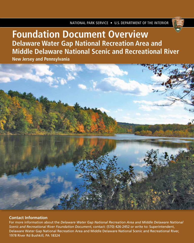
The purpose of Delaware water Gap NatioNal recreatioN area aND the MiDDle Delaware NatioNal SceNic aND recreatioNal river is to preserve the natural, cultural, and scenic resources and values of the Delaware River valley and provide opportunities for resource based recreation, education, and enjoyment in close proximity to the most densely populated region of the nation.
© Jim Davis
Significance
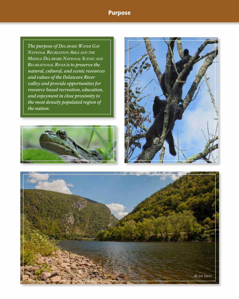
Significance statements express why Delaware Water Gap National Recreation Area and the Middle Delaware National Scenic and Recreational River resources and values are important enough to merit national park unit designation. Statements of significance describe why an area is important within a global, national, regional,
and systemwide context. These statements are linked to the purpose of the park unit, and are supported by data, research, and consensus. Significance statements describe the distinctive nature of the park and inform management decisions, focusing efforts on preserving and protecting the most important resources and values of the park unit.
The following significance statements have been identified for Delaware Water Gap National Recreation Area and the Middle Delaware National Scenic and Recreational River. (Please note that the sequence of the statements does not reflect the level of significance.)
1. Delaware Water Gap National Recreation Area’s outstanding scenery, interwoven with cultural landscapes and historic sites, is defined by the composition of natural landscapes that range from the cliffs of the Pocono Plateau and Kittatinny Ridge to the broader floodplain valley and include dramatic bends in the Delaware River and the iconic Delaware Water Gap.
2. Delaware Water Gap National Recreation Area is the keystone of an extensive network of local, state, and federally protected natural landscapes that preserves and connects essential habitat for the sustained health and adaptability of native plant and animal communities.
3. The complex mosaic of landforms and aquatic habitats within the Delaware Water Gap National Recreation Area supports an exceptional concentration and diversity of native plant and animal communities, including ecological communities and species that are rare, threatened, or endangered.
4. The Middle Delaware National Scenic and Recreational River is a vital component of and contributes substantially to the exceptional ecological integrity of the Delaware River, the longest undammed river within the eastern United States.
5. Visitors to the Middle Delaware National Scenic and Recreational River within the Delaware Water Gap National Recreation Area have opportunities to immerse themselves in an environment of solitude, tranquil natural landscapes, striking river valley scenery, and a substantially undeveloped river corridor that is unmatched among large rivers in the most densely populated region of the United States.
6. Documenting approximately 11,000 years of human use and adaptation, Delaware Water Gap National Recreation Area contains the most well-preserved concentration and intact diversity of known archeological sites and artifacts in the northeastern United States, including the Minisink National Historic Landmark District, with ongoing significance to American Indian tribes.
7. The variety of 18th through 20th century historic structures at Delaware Water Gap National Recreation Area demonstrates the transition from the Colonial frontier to an agrarian-based economy to the early 20th century when the area became a center of working class leisure in the wake of the industrial revolution.
8. Delaware Water Gap National Recreation Area offers easily obtainable opportunities for diverse, year-round, outdoor recreation and leisure to residents of major Northeast urban centers; this need was specifically recognized in the park’s legislative history.
9. The effort to preserve a free-flowing Delaware River, rather than construct the Tocks Island Dam within Delaware Water Gap National Recreation Area, contributed to the 20th century “grass-roots” environmental movement that led to Earth Day and passage of the National Environmental Policy Act.

Fundamental Resources and Values
Fundamental resources and values are those features, systems, processes, experiences, stories, scenes, sounds, smells, or other attributes determined to merit primary consideration during planning and management processes because they are essential to achieving the purpose of the park and maintaining its significance.
The following fundamental resources and values have been identified for Delaware Water Gap National Recreation Area and the Middle Delaware National Scenic and Recreational River.
• The Middle Delaware National Scenic and Recreational River and Tributaries. The Middle Delaware National Scenic and Recreational River and its tributaries are a defining attribute of Delaware Water Gap National Recreation Area. A combination of exceptionally high water quality, fully functioning floodplains, excellent aquatic and riparian habitats, and the absence of dams on the main stem gives rise to a diverse array of species and a productive, complex food web with strong ecological integrity. As an integral part of the entire Delaware River system, this section of the river provides a migration corridor, critical habitat, and a stronghold for native migratory fish species such
as American shad and American eel. In addition, the high-quality water of the main stem river provides additional beneficial habitat and a movement corridor for fish species that primarily inhabit tributaries such as native brook trout and at least 52 other species of fish. Miles of mostly undisturbed shoreline, high-quality water, and natural landscapes create opportunities for an exceptional visitor experience.
• Evidence of Changing Land Use, Settlement Patterns, and Lifeways. The Middle Delaware river valley is full of examples of the changing land use, settlement patterns, and lifeways of the European settlement starting with the Dutch and English settlers who arrived in the region beginning around 1650 and stretching through the formation of the park in 1965. Throughout the valley examples of landscapes, structures, and archeological resources illustrate the changes in use and economic drivers in the region throughout the centuries. Some of the evidence of land use changes and settlements include agricultural landscapes and associated buildings, ruins of water-powered mills, Delaware River-based resorts and camps, historic villages, and the Old Mine Road Historic District that preserves one of the oldest commercial roadways in the northeastern United States.
• Rich Archeological Heritage. Delaware Water Gap National Recreation Area has nearly 500 documented American Indian archeological sites, of which more than 100 are currently considered eligible for inclusion in the National Register of Historic Places. This complex of American Indian sites is the best preserved in the northeastern United States, making it a high-value research area for archeologists and geoarcheologists to study the rich archeological heritage of the park.
• Stunning Scenic Resources and Distinct Aesthetic Values. The Middle Delaware River is framed by the mountains of the Kittatinny Ridge in New Jersey and the cliffs of Pocono Plateau in Pennsylvania. The diverse floodplain includes islands, woodlands, tributary crossings, grassland, and agricultural fields. The adjoining landscape includes steep hemlock- and rhododendron-lined ravines and hardwood forests cut through by streams and waterfalls. Visitors are immersed in the forested and pastoral characters of the area by day and dark skies by night. The nuances of the changing seasons, such as spring wildflowers, summer greenery, fall foliage, and winter frost, provide a backdrop for visitors to enjoy the stunning scenic resources and striking aesthetic values.

Fundamental Resources and Values (continued)
Other Important Resource or Values
• Mosaic of Terrestrial and Wetland Habitats. The varied topography, geology, hydrology, and land use history of the park gives rise to a rich mosaic of terrestrial and wetland habitats within the park. Large unbroken tracts of forest dominated by native oaks, hickories, and pines extend along the upper elevations of the Kittatinny Ridge and Pocono Plateau. Forests dominated by various mixtures of eastern hemlock, white pine, maple, birch, ash, sycamore, and other native hardwoods predominate throughout the mid- to lower elevations. Interspersed within the dominant forests are distinct areas of dry cactus barrens, talus slopes, various grasslands and shrub lands, acidic and calcareous wetlands, ephemeral ponds, riparian zones, and floodplains. This mosaic of connected terrestrial and wetland habitats supports a high diversity of native species of birds, mammals, reptiles, amphibians, and invertebrates, including numerous rare, threatened, and endangered species. The large tracts of undisturbed forests, wetlands, riparian zones, and floodplains reduce flood damage downstream of the park.
• Sustainable Access to High-quality Recreation Opportunities. The river and surrounding landscape support a wide variety of opportunities to enjoy the natural and cultural resources of the park during all four seasons. High-quality outdoor recreational opportunities include canoeing, swimming, hiking, hunting, fishing, scenic driving, bird watching, and cross-country skiing. The remoteness found in some areas of the park offers the chance to experience solitude, while other areas provide social recreational settings.
• Striking Geological Features. The most iconic feature in the park is its namesake, the Delaware Water Gap. Other prominent geologic landforms include the Pocono Plateau, Kittatinny Ridge, and the Walpack Bend. Other geologic features within the park include talus slopes, glacial features, cave and karst features, dramatic waterfalls, alluvial fans, and paleontological resources. These striking geological features define the park’s landscape, influence its ecology, and shape historic patterns of human settlement.
Delaware Water Gap National Recreation Area and the Middle Delaware National Scenic and Recreational River may contain other resources and values that may not be fundamental to the purpose and significance of the park, but are important to consider in management and planning decisions. These are referred to as other important resources and values.
The following other important resources and values have been identified for Delaware Water Gap National Recreation Area and the Middle Delaware National Scenic and Recreational River:
• Landscape-scale Habitat Connectivity. Delaware Water Gap National Recreation Area is the keystone of an extensive network of local, state, and federally protected natural landscapes that preserves and connects essential habitat for the sustained health and adaptability of plant and animal communities. Many populations of plants and animals are more stable and secure because they can inhabit an unfragmented landscape. The ecological integrity of the river and the park is dependent on the protected and managed
landscapes in the 3,500-square-mile Delaware River watershed. Landscape-scale habitat connectivity is not only essential to present-day ecosystems, but also provides opportunities for climate change adaptation and sustainable natural communities into the future.
• Management Through Collaboration. Collaboration and cooperation with partners; volunteers; and state, local, and federal agencies, to achieve common goals allow all stakeholders to become better stewards of resources. Collaborative management of Delaware Water Gap National Recreation Area provides many essential services such as public safety, interpretation, education, art appreciation, and facility maintenance.
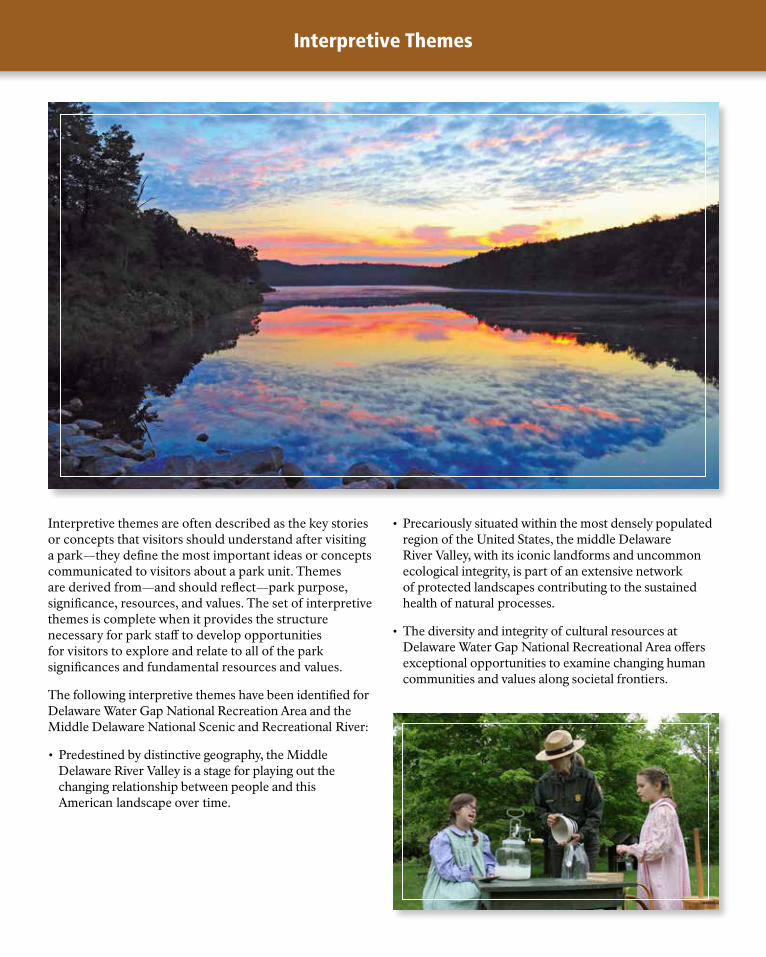
Interpretive Themes
Interpretive themes are often described as the key stories or concepts that visitors should understand after visiting a park—they define the most important ideas or concepts communicated to visitors about a park unit. Themes are derived from—and should reflect—park purpose, significance, resources, and values. The set of interpretive themes is complete when it provides the structure necessary for park staff to develop opportunities for visitors to explore and relate to all of the park significances and fundamental resources and values.
The following interpretive themes have been identified for Delaware Water Gap National Recreation Area and the Middle Delaware National Scenic and Recreational River:
• Predestined by distinctive geography, the Middle Delaware River Valley is a stage for playing out the changing relationship between people and this American landscape over time.
• Precariously situated within the most densely populated region of the United States, the middle Delaware River Valley, with its iconic landforms and uncommon ecological integrity, is part of an extensive network of protected landscapes contributing to the sustained health of natural processes.
• The diversity and integrity of cultural resources at Delaware Water Gap National Recreational Area offers exceptional opportunities to examine changing human communities and values along societal frontiers.

Description
84
521
23
66209
6209
84
645
640560
560
739
6
209
206
521
627
617
617
209
402
80
521
602
402
94
94
209
209BUS209
80
80
611
611
191
611
209
519
519
2001
NPS615
NPS615
2001
46
Appalach
ian
Nat
iona
l Sc
enic
Trail
Scen
ic T
rail
App
alac
hian
Nat
iona
l
Nat
iona
l Sc
enic
Trai
l
Appal
achi
an
SUSSEX COUNTY
WARREN COUNTY
PIKE COUNTY
MONROE COUNTY
MONRO
E
NORTHAM
PTO
N
CO. CO
. NEW JERSEY
PENNSYLVAN
IA
N E W J E R S E Y
N.Y.N.J.
PA.
N.J.
P E N N S Y L V A N I A
DELAWARE WATER GAP
NATIONAL
RECREATION
AREA
250
245
240
235
230
225
215
210
205
255
220
RaymondskillFalls
Dingmans Falls
ButtermilkFalls
Del
awar
e
R
iver
Delaw
are
Rive
r
Delawar
e R
iver
Sawkill Creek Creek
Vanderm
ark
Dee
p
Bro
ok
Craw
ford Branch
Cu
mm
ins
Creek
Nev
ers
ink
R .
Shimers
Brook
Raymondskill
Creek
Conashaugh Cr
Dry Brook
Adams Creek Litt
le F
lat
Bro
ok
Big
Flat
Broo
k
Hornbecks Cr
HemlockLake (Pond) Crater
Lake
LongPine
Pond
BlueMountain
Lakes
Toms Creek
Bu
sh
Kill
Little
Flat
Broo
k
Saw
Creek
Van
cam
pens
Br
ook
Jack
sonb
urg
C
reek
Blair
Creek
Kill
Bush
CatfishPond
UpperYards CreekReservoir
Pond
Cree
k
Marshalls
C reek
Paul
ins
Kill
Sto
ny
Bro
ok
Sunfish Pond
Cher
ry
Creek
Brodhead
Creek
Cale
do
nia
C
reek
Dunnfield
Creek
KittatinnyLake
CulversLake
WildAcresLake
MinksPond
LakeMaskenozha
Lake
Ow
assa
Sw
arts
woo
d La
ke
FairviewLake
LowerYards CreekReservoir
Dingmans FallsVisitor Center
Kittatinny Point Visitor Center
Columbia
Portland
Hainesburg
Slateford
Walnut Valley
Stillwater
Dead end
Blairstown
Shawnee onDelaware
Marshalls Creek
Bushkill
Flatbrookville
Swartswood
CulversGap
Layton
Hainesville
Montague
MilfordKnob
DingmansFerry
ToBranchville
ToNewton
To Newton
ToNew York
City
ToNew York
City
ToMiddletown
To Honesdaleand Scranton
To Scranton
To Scranton,Bethlehem,andHazleton
Totts Gap
Tott
s G
ap R
d
Tollbridge
HopeMt Minsi1463ft446m
1527ft465mMt Tammany
TOCKSISLAND
EASTSTROUDSBURG
MILFORD
MATAMORAS
PORTJERVIS
S T O K E S
S T A T E
F O R E S T
STILLWATER
NATURAL
AREA
WORTHINGTONSTATE FOREST
Tollbridge
Wilson HillRoad
Pompey RidgeRoad
Tollbridge
KI T
T AT I N
NY
MO
UN
TAI N
K
I TTA
T I NN
Y
RI D
GE
GO
DF R
E Y
R
I DG
E
DELAWAREWATER GAP
ResortPoint
OverlookPoint of Gap
Overlook
ArrowIsland
Overlook
Hialeah
Smithfield Beach(Fee area)
Turtle Beach(Fee area)
Coppermine
Kaiser
PoxonoAccess
BlueMountain
Lakes
Crater Lake
MohicanOutdoorCenter
Upper GlenSouth Contact StationWatergate(Fee area)
Millbrook Village
Bushkill Access (Fee area)
Rivers BendGroup Campsites(permit)
Valley View Group Campsites (permit)
Toms Creek
Eshback Access
ParkHeadquarters
Pocono EnvironmentalEducation Center
Walpack CenterVanCampenInn
SWARTSWOODSTATE PARK
KI T
TA
TI N
NY
R
I DG
E
Natio
nal
Drive
Park
KI T
TA
TI N
NY
R
I DG
E
George W. ChildsRecreation Site
Namanock
LochLomond
Cliff Park InnHotel and golf course
North Contact Station
Ramirez Solar House
Milford Beach (Fee area)
CaddooAccess
Foster-ArmstrongHouse
Nelden-RobertsStonehouse
MarieZimmermann
House
Grey TowersNational Historical
LandmarkU.S. Forest Service
River
Road
Ridg
e
Ro
ad
Milf
ord
R
oad
Co
nashaugh
View
Road
Old
M
ine
Road
Milf
ord
Roa
d
Old
Min
e R
oad
O
ld M
ine
Roa
d Emery
Road
Jager Road
Silver
Lake Road
Bushkill Falls Road
Rive
r Rd
Hidde
n La
ke
Gai
sler
Rd
Cherry V
alle
y Rd
Popl
ar V
alle
y Rd
Blu
e M
t D
riv
e
Driv
e
Free
man
Tra
ct R
oad
Cam
p Rd
Dingmans FerryAccess (Fee area)
H I G H
P O I N T
S T A T E
P A R K
DELAWARE
STATE
FOREST
Peters ValleyCraft Center
Dunnfield
Hidden Lake
THE GAP
Tollbridge
DingmansCampground
BushkillMeeting Center
1
310309
4
Old
Min
e R
oad
46
53
1
235
Picnic area
Horse trail
Hiking trailhead
Wheelchair accessible
Lifeguarded swimarea (summer)
Boat launch
Ranger station
Canoe launch
Information
Appalachian Trail
Other hiking trail
Joseph M. McDadeRecreational Trail(biking and hiking)
State Forest
River mileage(Mile zero is at theriver’s mouth)
Unpaved road
Area within the authorizedNational Recreation Areaboundary also contains wild-life management areas and private land. Respect privateproperty.
Joseph M. McDadeRecreational Trail(hiking only)
0
0 5 Miles
5 Kilometers
North
0 25 Kilometers
25 Miles0
North
Monticello
Carbondale
Kingston
Newburgh
Hancock
NarrowsburgLackawaxenBarryville
Scranton
Honesdale
Hawley
Wurtsboro
Milford Port JervisMatamoras
Stroudsburg
Middletown
Delaware Water Gap
National Recreation
Area
Upper DelawareScenic and
Recreational River
Delaw
are
River
Riv
erH
ud
son
17B
209
209
15
97
33
52
17
17
23
206
652
80
81
84
87
6
6
380
476
ToNew York
City
To Binghamton
ToPhiladelphia
NE ExtensionPa. Turnpike(toll)
N.Y.Thruway
(toll)
To Albany
N.Y.
N.Y.Pa.
Pa.
N.J.
The Delaware Water Gap National Recreation Area is a 67,210-acre park that includes the Middle Delaware National Scenic and Recreational River in New Jersey and Pennsylvania. At the southern end of this park, the river cuts a pass through the mountains, forming the Delaware Water Gap. The park contains an environment of unique geologic and natural features as well as cultural landscapes and historic resources. The park’s outstanding geologic and natural features form some of the best-known scenic landscapes in the northeastern United States and illustrate the characteristic landforms and biotic areas of the Appalachian Ridge and Valley Province and the Southern Appalachian Plateau Province. The diverse ecosystems and landscape features provide unique scenery and experiences for visitors and crucial habitat for plants and animals. Furthermore, the mainstem of the Delaware River is the longest undammed river in the eastern United States, and one of the cleanest rivers in the nation due to years of effort to protect and restore it. The park protects a long segment of that river designated as the Middle Delaware National Scenic and Recreational River. The Upper Delaware Scenic and Recreational River and the Lower Delaware National Wild and Scenic River along the mainstem Delaware River are also included in the Wild and Scenic River System.

•
Description (continued)
The geographic area surrounding the Delaware Water Gap became an important leisure retreat for working-class people in the wake of the industrial revolution, when an increasing trend in American leisure time spurred a trend in vacationing in western New Jersey and the Pocono Mountains in northeastern Pennsylvania. These two trends were embodied in the legislative history of Delaware Water Gap National Recreation Area, which asserts the need to establish publicly owned outdoor recreation areas and open space for city dwellers in the northeastern United States.
Delaware Water Gap National Recreation Area was established in 1965 as a way to provide for public outdoor recreational use and enjoyment of the reservoir that was to be created by the proposed Tocks Island Dam. The dam project represented a long-time interstate interest in water supply, hydropower, and flood control from the Delaware River. The associated recreation was viewed as an additional benefit to the urban populations of the region’s major cities. The park was created by Congress to be a park for the people and near the people. Throughout the 1960s and into the 1970s, the costs of the dam project and associated infrastructure climbed, the available funding diminished (largely due to the Vietnam War), engineering challenges became evident, and opposition to the project from grassroots organizations representing local and environmental concerns began to sway popular opinion about the need and appropriateness of the dam.
In 1975, the Delaware River Basin Commission (DRBC), composed of the four governors of the basin-states (Pennsylvania, New York, New Jersey, and Delaware) and one federally appointed commissioner, voted to discontinue the Tocks Island Dam project. The land already acquired by the federal government was transferred in its entirety to the National Park Service for stewardship, and Delaware Water Gap National Recreation Area, originally intended as a narrow swath of land around a reservoir, became a 67,210-acre park. In 1978, 40 miles of free-flowing river were added to the Wild and Scenic River System as the Middle Delaware National Scenic and Recreational River, to add extra protection for the river. In 1992, the Tocks Island Dam project was officially deauthorized.
Delaware Water Gap National Recreation Area’s open spaces anchor a multistate greenway corridor, supplemented with other regional protection and preservation initiatives. This corridor preserves essential habitat for the sustained health of plant and animal
communities, including special status species, in the region. Terrestrial habitats include native hardwood and hemlock forests, wetlands, ephemeral ponds, mixed successional forests, grasslands, talus slopes, dry cactus barren landscapes, and riparian corridors. The park provides opportunities to view native wildlife such as black bears, bald eagles, and migratory fish, within well-preserved ecosystems.
The most popular geologic feature in the park is the Delaware Water Gap itself, which is approximately 1,200 feet deep from the summit of the mountains to the surface of the Delaware River. The Gap is one mile wide from New Jersey’s Mount Tammany to Pennsylvania’s Mount Minsi.
The park also contains a significant concentration of cultural resources spanning 11,000 years of human habitation. The valley has been inhabited for thousands of years, and dozens of historic structures dot the park’s scenic drives. Historic rural villages from the 18th and 19th centuries remain intact on the New Jersey side, and landscapes of past settlements are scattered throughout the park. Additionally, the park encompasses significant American Indian archeological sites.
The park offers a variety of outdoor recreational opportunities, including boating, fishing, hunting, swimming, biking, cross-country skiing, rock climbing, sightseeing, natural and cultural history, and the opportunity to experience natural and cultural history and the general solitude of a rural environment. In addition, the recreation area offers more than 100 miles of hiking trails, including nearly 27 miles of Appalachian Trail. Each year, the park receives more than 5.2 million recreational visitors. Much of this visitation is from the nearby, rapidly expanding, New York / northern New Jersey and Philadelphia greater metropolitan areas.