Embed Size (px)
Citation preview
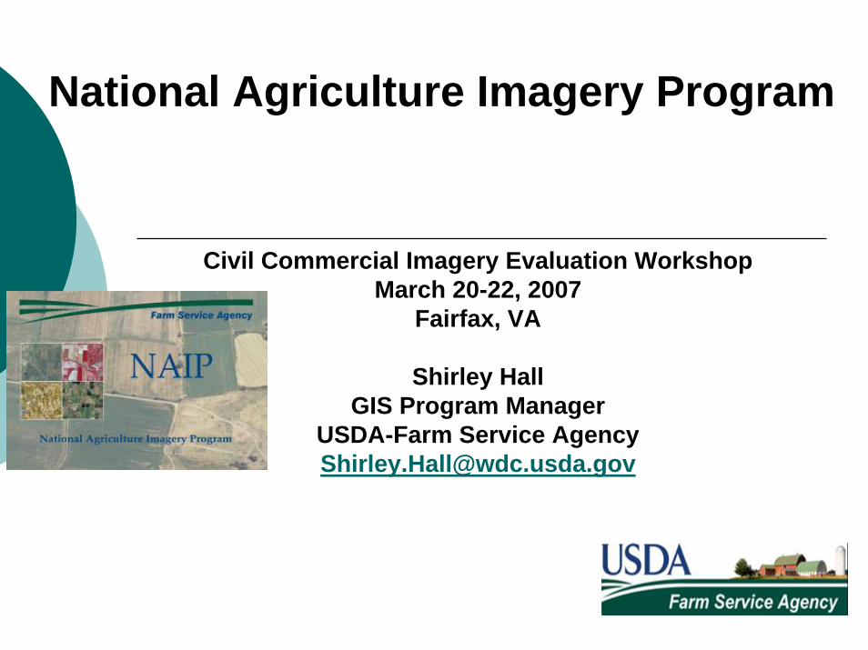
National Agriculture Imagery Program
Civil Commercial Imagery Evaluation WorkshopMarch 20-22, 2007
Fairfax, VA
Shirley HallGIS Program Manager
USDA-Farm Service [email protected]
• About FSA…• NAIP – Program and Products• Partnership Opportunities• NAIP and the Imagery for the
Nation initiative
National Agriculture Imagery Program
USDA – Farm Service Agency• FSA administers and manages farm
commodity, credit, conservation, disaster and loan programs as laid out by Congress.
• FSA programs are designed to improve the economic stability of the agricultural industry and to help farmers adjust production to meet demand.
• Currently, there are 2,346 FSA county offices in the continental states that certify farmers for farm programs and pay out farm subsidies and disaster payments.
The Farm Service Agency,Ortho-Imagery and GIS
• Modernization effort that integrates GIS and farm program administration
• Digitized farm field boundaries called Common Land Units
• Base Ortho Imagery updated on a 3-5 year cycle
• Imagery that meets FSA program requirements – Ag. lands, annual/during growing season, natural color
• Program management, change detection, and program compliance
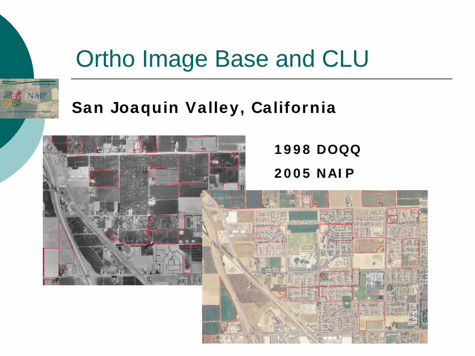
Ortho Image Base and CLU
San Joaquin Valley, California
1998 DOQQ
2005 NAIP
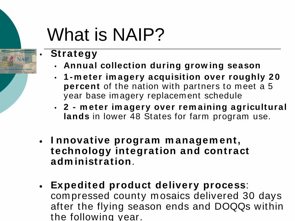
What is NAIP?• Strategy
• Annual collection during growing season• 1-meter imagery acquisition over roughly 20
percent of the nation with partners to meet a 5 year base imagery replacement schedule
• 2 - meter imagery over remaining agricultural lands in lower 48 States for farm program use.
• Innovative program management, technology integration and contract administration.
• Expedited product delivery process: compressed county mosaics delivered 30 days after the flying season ends and DOQQs within the following year.
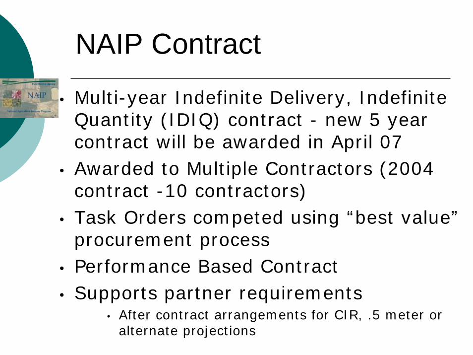
• Multi-year Indefinite Delivery, Indefinite Quantity (IDIQ) contract - new 5 year contract will be awarded in April 07
• Awarded to Multiple Contractors (2004 contract -10 contractors)
• Task Orders competed using “best value”procurement process
• Performance Based Contract• Supports partner requirements
• After contract arrangements for CIR, .5 meter or alternate projections
NAIP Contract
Competitive source selection process which evaluates contractor proposals according to:
•Technical merit•Project management capabilities•Past performance and quality assessment
•Pricing and other criteria
Best Value Procurement Process
• Statement of work describes products and services to be provided by the contractor
• Defines required end products rather than a rigid “how to” set of specifications
• Allows innovative methods to produce the end product including film or digital options
Performance Based Contract
NAIP Specifications• Natural Color (RGB)• Leaf On• Horizontal Accuracy
• 1 meter GSD -- 5 meters from DOQ base
• 2 meter GSD -- 10 meters from DOQ base
• Best available elevation for orthorectification - Mostly NED
• 10% cloud cover per quarter quad is acceptable
• UTM coordinate system
Acquisition Plan
• Projects are state based• 6 to 8 week flying season• Large states split into multiple flying
seasons
• No reflights after flight season• Re-processing where required
• Based on initial QA
• Final payment reflects quarter quads that do not pass QA
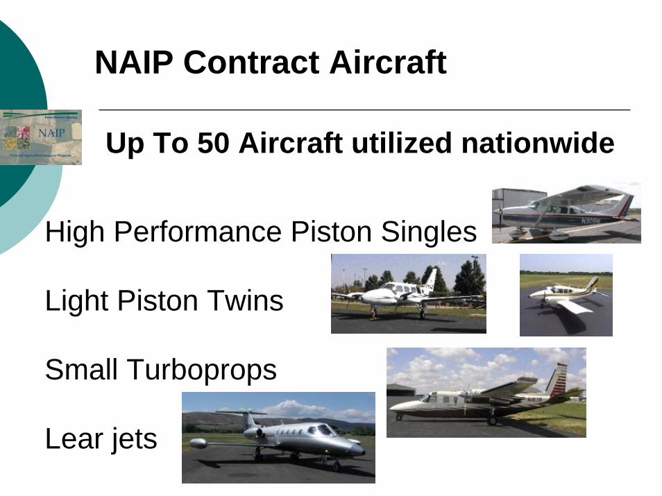
High Performance Piston Singles
Light Piston Twins
Small Turboprops
Lear jets
NAIP Contract Aircraft
Up To 50 Aircraft utilized nationwide
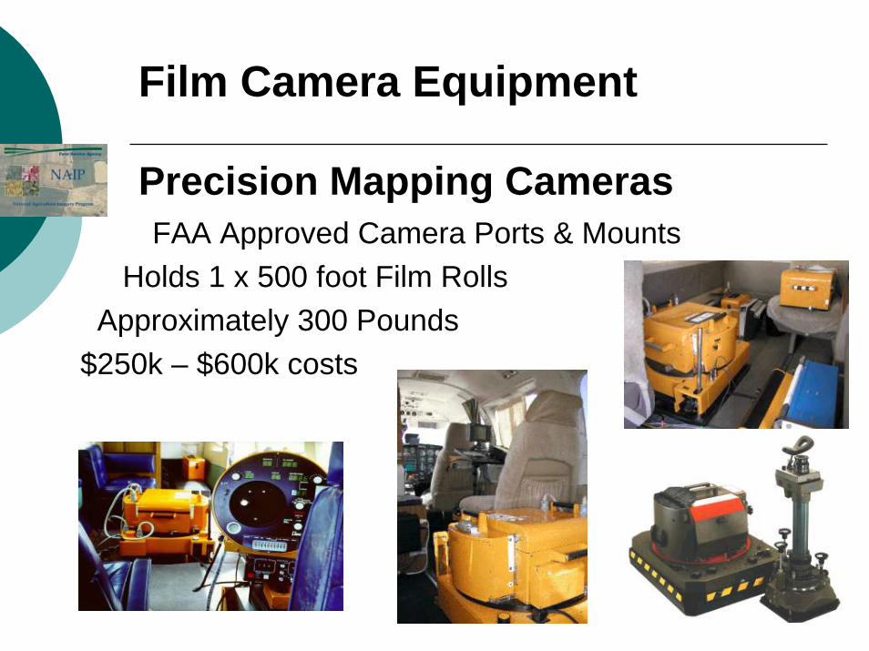
FAA Approved Camera Ports & MountsHolds 1 x 500 foot Film Rolls
Approximately 300 Pounds$250k – $600k costs
Film Camera Equipment
Precision Mapping Cameras
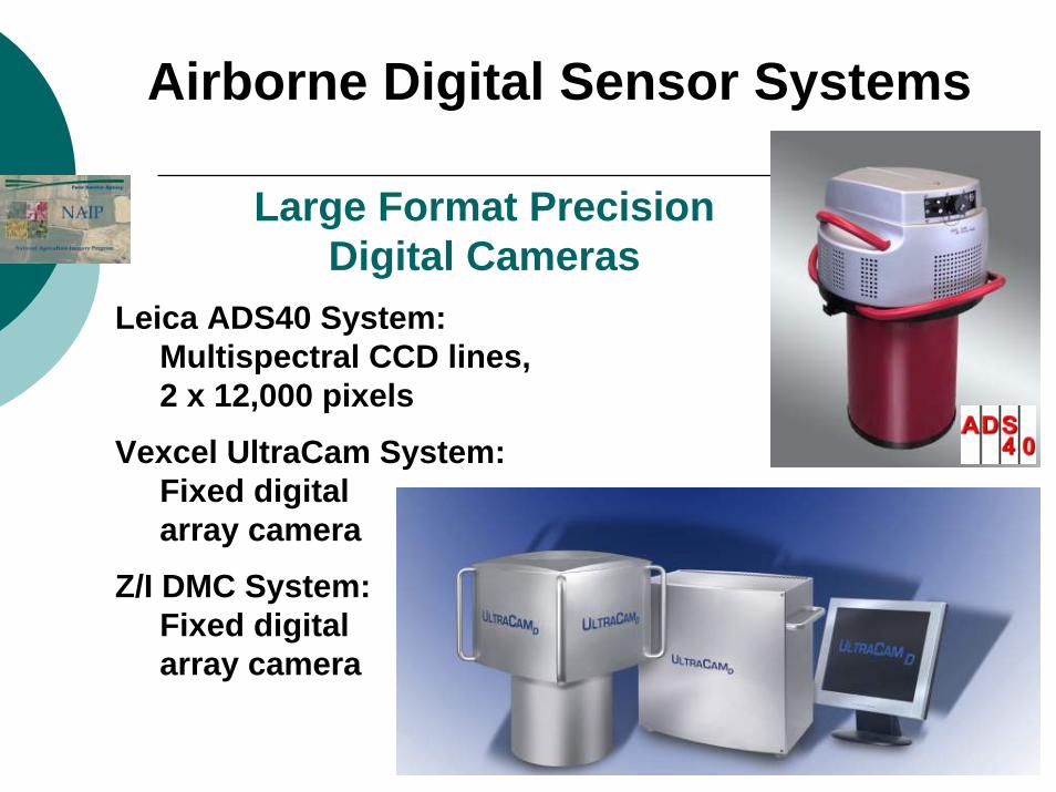
Airborne Digital Sensor Systems
Large Format Precision Digital Cameras
Leica ADS40 System:Multispectral CCD lines,2 x 12,000 pixels
Vexcel UltraCam System:Fixed digitalarray camera
Z/I DMC System:Fixed digital array camera
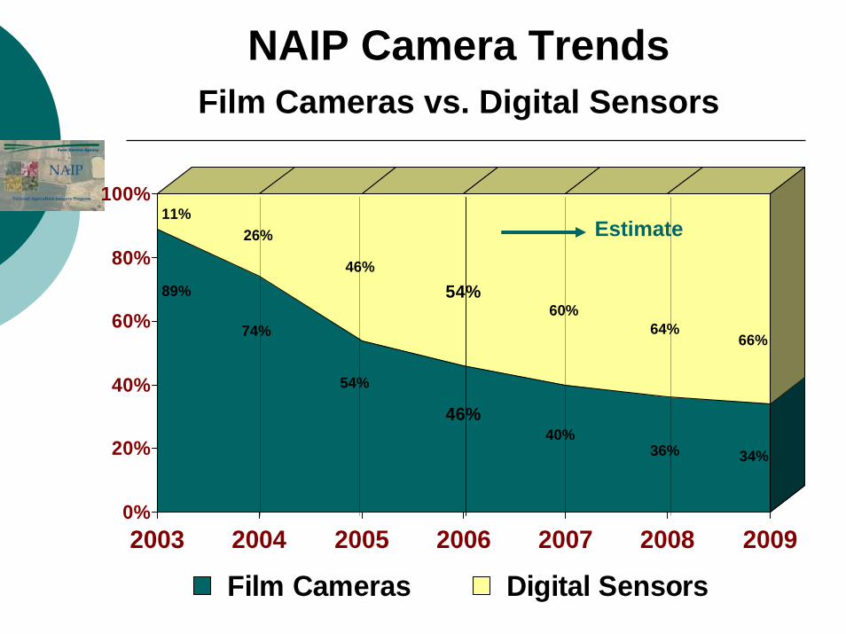
89%
11%
74%
26%
54%
46%
46%
54%
40%
60%
36%
64%
34%
66%
0%
20%
40%
60%
80%
100%
2003 2004 2005 2006 2007 2008 2009
Film Cameras Digital Sensors
Estimate
NAIP Camera TrendsFilm Cameras vs. Digital Sensors
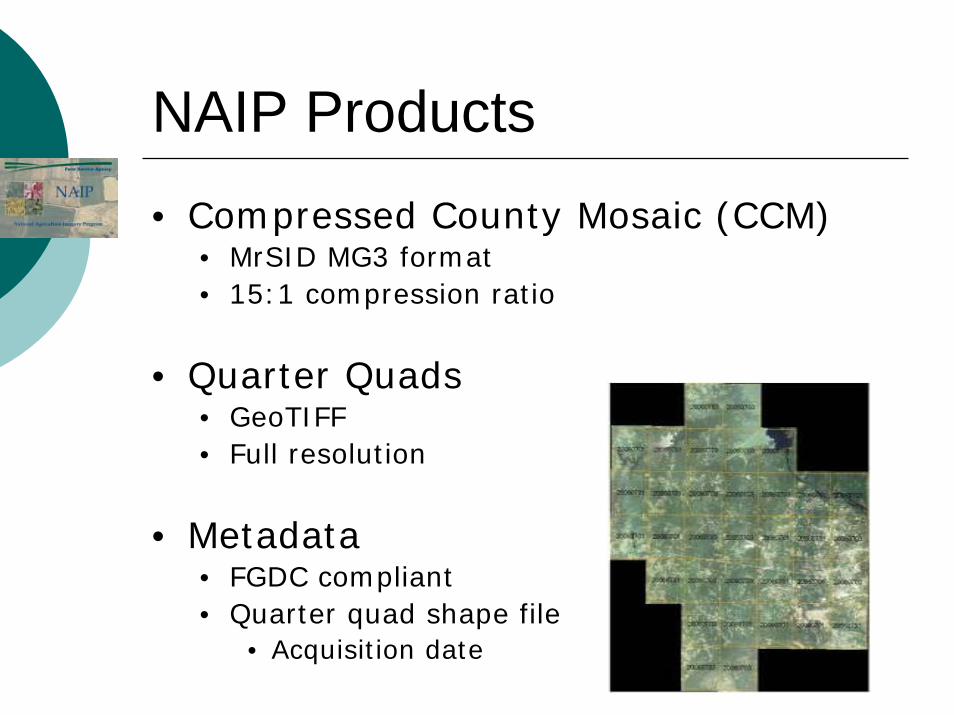
NAIP Products• Compressed County Mosaic (CCM)
• MrSID MG3 format• 15:1 compression ratio
• Quarter Quads• GeoTIFF• Full resolution
• Metadata• FGDC compliant• Quarter quad shape file
• Acquisition date
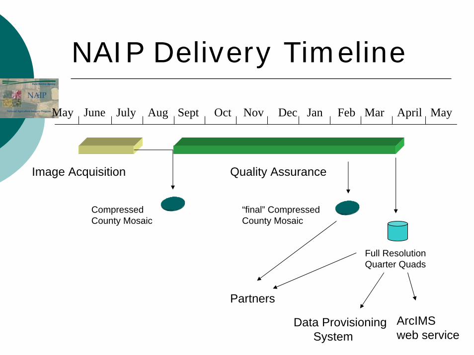
Image Acquisition
NAIP Delivery Timeline
June July Aug Sept Oct Nov Dec Jan Feb Mar April MayMay
Compressed County Mosaic
Full ResolutionQuarter Quads
Quality Assurance
Partners
ArcIMSweb service
“final” Compressed County Mosaic
Data Provisioning System
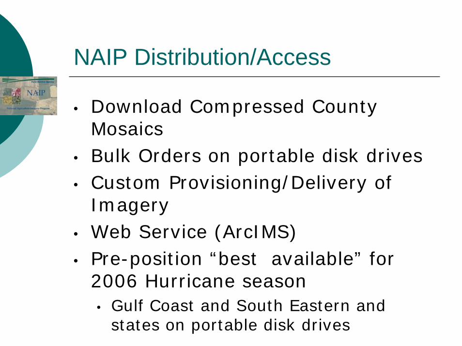
NAIP Distribution/Access
• Download Compressed County Mosaics
• Bulk Orders on portable disk drives• Custom Provisioning/Delivery of
Imagery• Web Service (ArcIMS)• Pre-position “best available” for
2006 Hurricane season• Gulf Coast and South Eastern and
states on portable disk drives
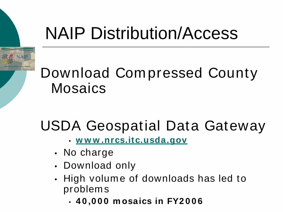
NAIP Distribution/Access
Download Compressed County Mosaics
USDA Geospatial Data Gateway• www.nrcs.itc.usda.gov
• No charge• Download only• High volume of downloads has led to
problems• 40,000 mosaics in FY2006
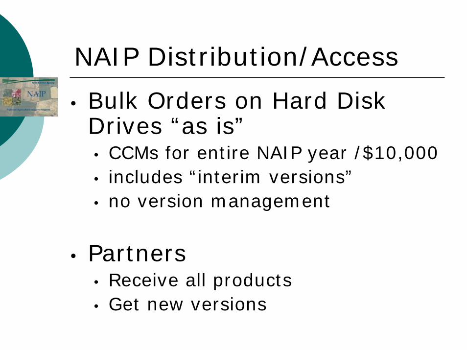
NAIP Distribution/Access
• Bulk Orders on Hard Disk Drives “as is”• CCMs for entire NAIP year /$10,000• includes “interim versions”• no version management
• Partners• Receive all products• Get new versions
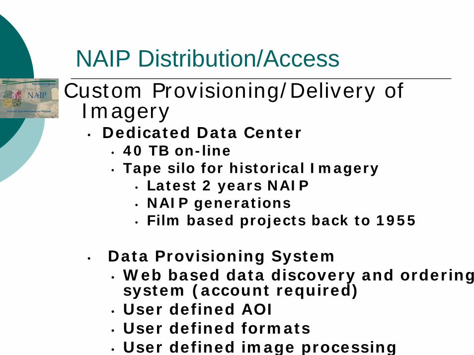
NAIP Distribution/AccessCustom Provisioning/Delivery of
Imagery• Dedicated Data Center
• 40 TB on-line• Tape silo for historical Imagery
• Latest 2 years NAIP• NAIP generations• Film based projects back to 1955
• Data Provisioning System• Web based data discovery and ordering
system (account required)• User defined AOI• User defined formats• User defined image processing
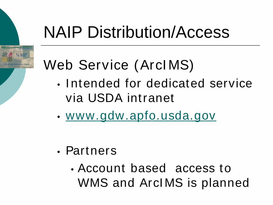
NAIP Distribution/Access
Web Service (ArcIMS)• Intended for dedicated service via USDA intranet
• www.gdw.apfo.usda.gov
• Partners• Account based access to WMS and ArcIMS is planned
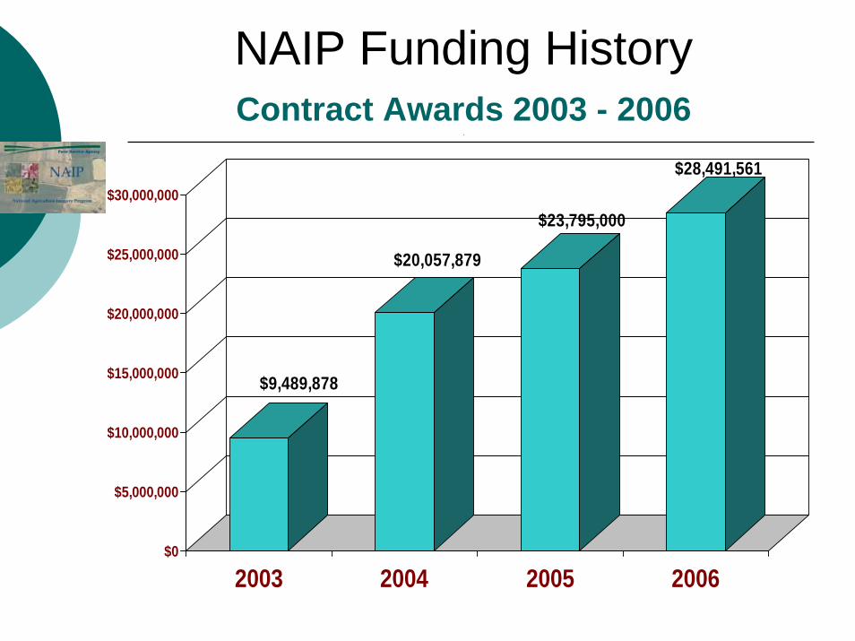
NAIP Funding HistoryContract Awards 2003 - 2006
.
$9,489,878
$20,057,879
$23,795,000
$28,491,561
$0
$5,000,000
$10,000,000
$15,000,000
$20,000,000
$25,000,000
$30,000,000
2003 2004 2005 2006
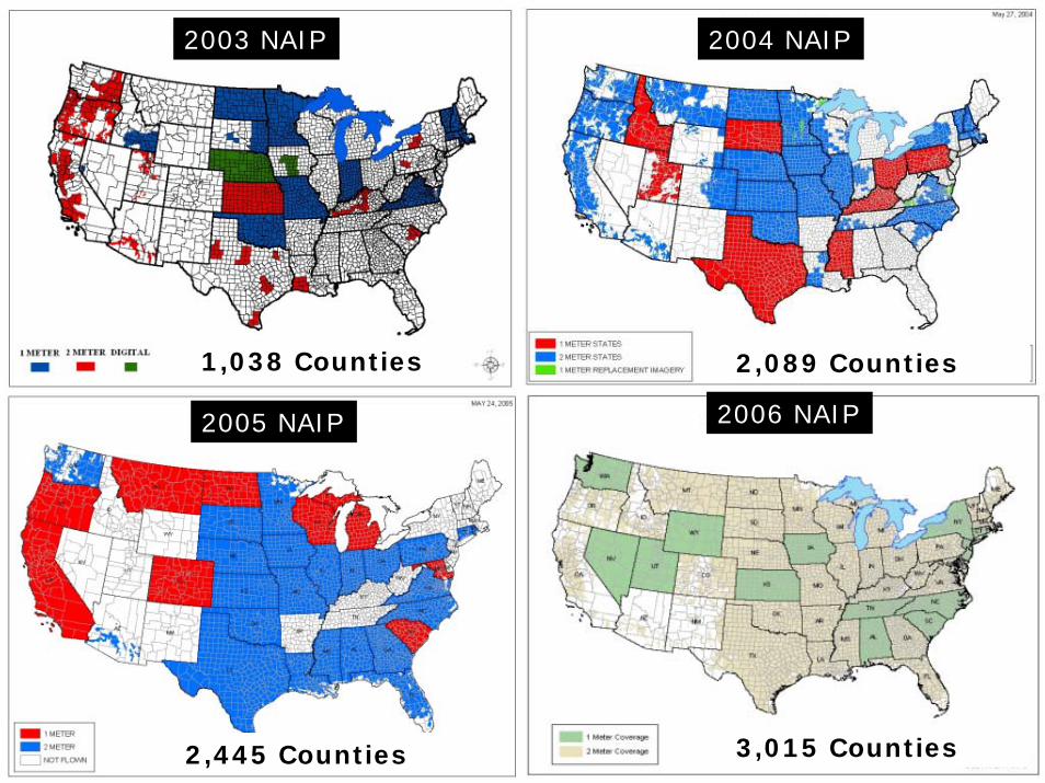
2003 NAIP 2004 NAIP
2005 NAIP 2006 NAIP
1,038 Counties 2,089 Counties
2,445 Counties 3,015 Counties
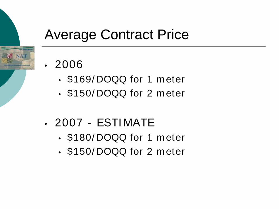
Average Contract Price
• 2006 • $169/DOQQ for 1 meter• $150/DOQQ for 2 meter
• 2007 - ESTIMATE• $180/DOQQ for 1 meter• $150/DOQQ for 2 meter
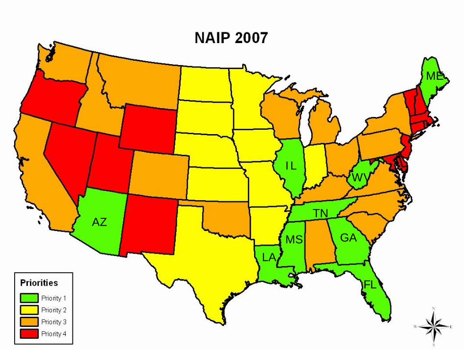
AZ
LA
MS GA
FL
TN
ILWV
ME
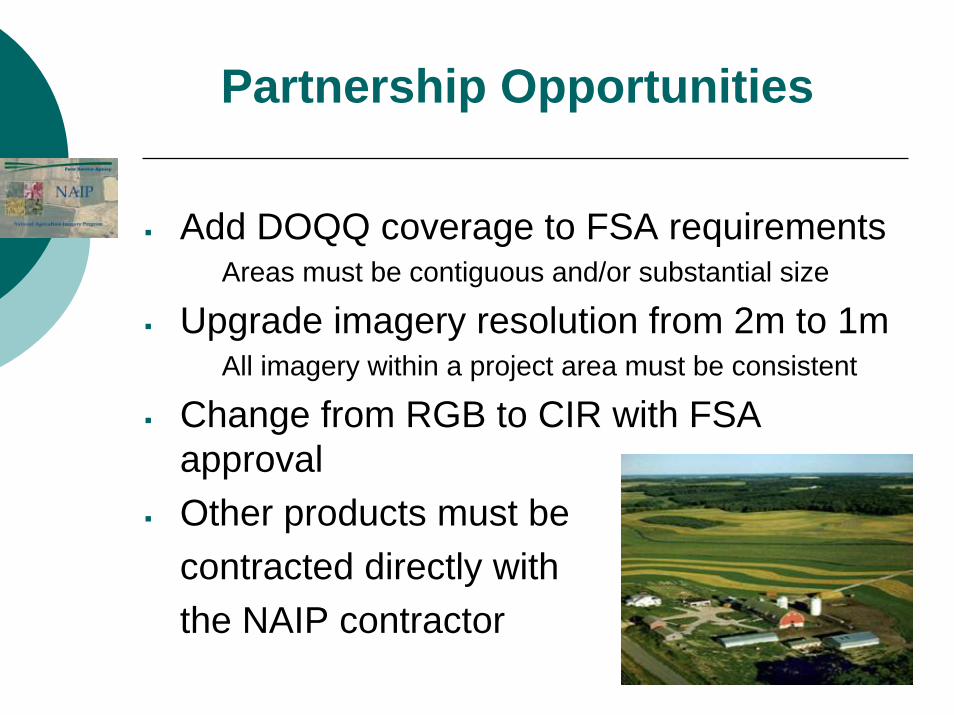
Add DOQQ coverage to FSA requirementsAreas must be contiguous and/or substantial size
Upgrade imagery resolution from 2m to 1mAll imagery within a project area must be consistent
Change from RGB to CIR with FSA approvalOther products must becontracted directly withthe NAIP contractor
Partnership Opportunities
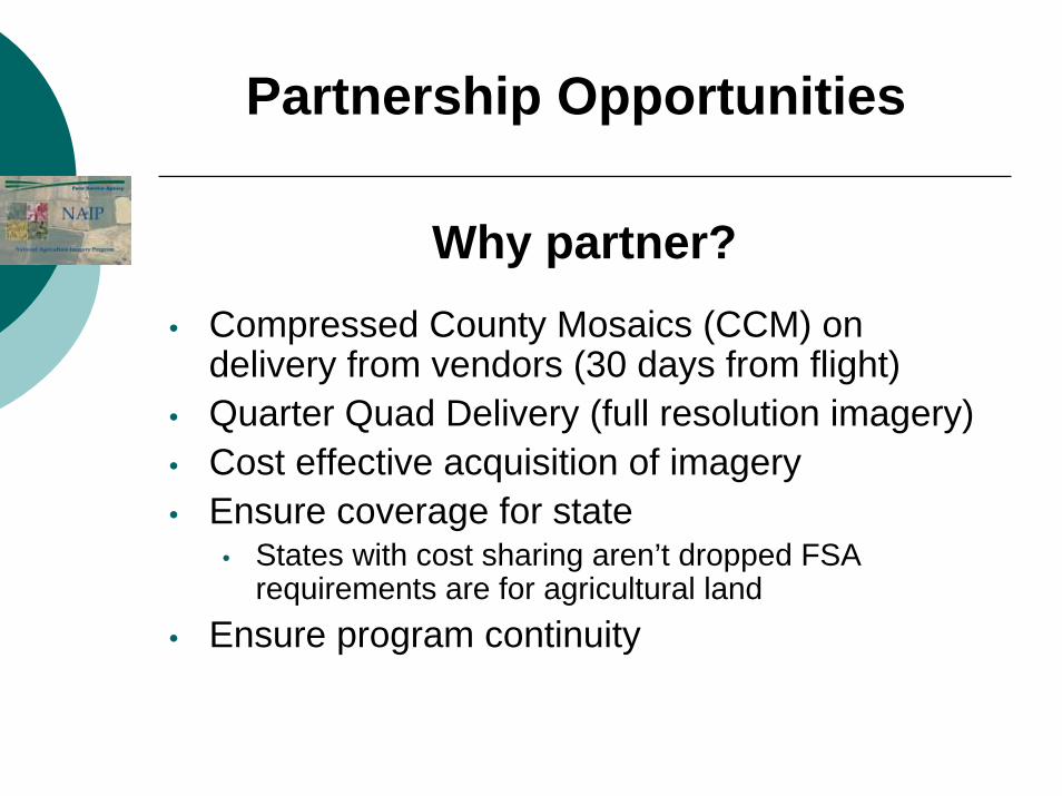
Why partner?• Compressed County Mosaics (CCM) on
delivery from vendors (30 days from flight)• Quarter Quad Delivery (full resolution imagery)• Cost effective acquisition of imagery• Ensure coverage for state
• States with cost sharing aren’t dropped FSA requirements are for agricultural land
• Ensure program continuity
Partnership Opportunities
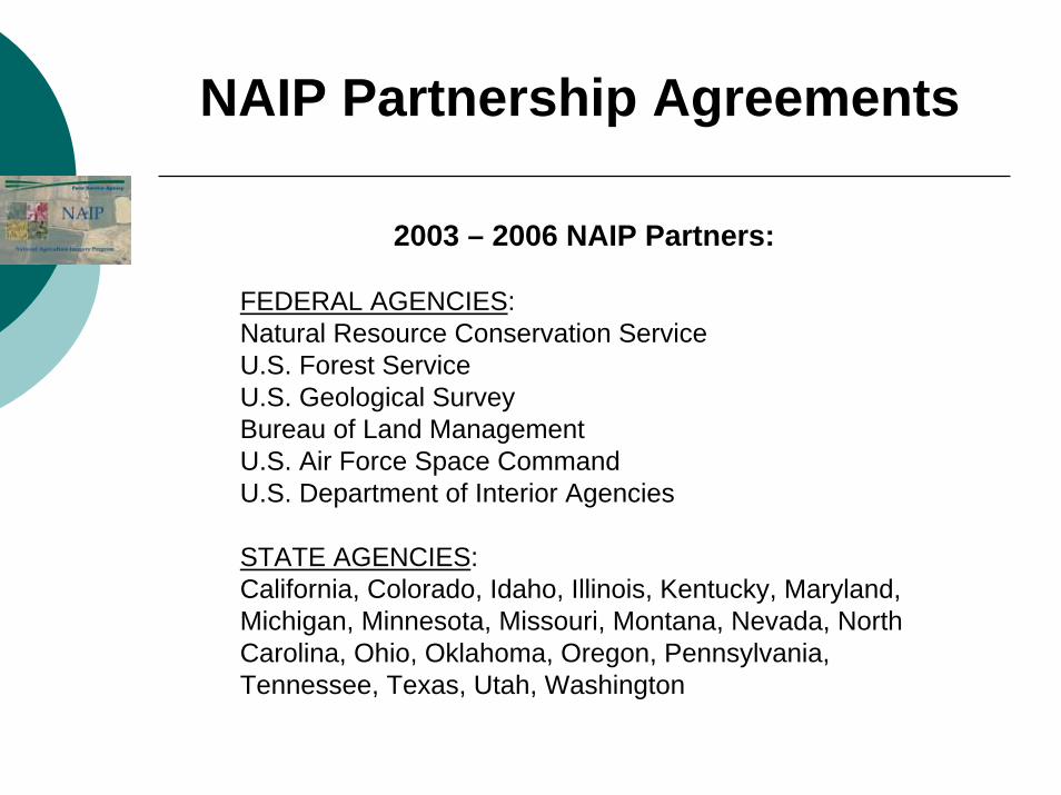
NAIP Partnership Agreements
2003 – 2006 NAIP Partners:
FEDERAL AGENCIES:Natural Resource Conservation ServiceU.S. Forest ServiceU.S. Geological SurveyBureau of Land ManagementU.S. Air Force Space CommandU.S. Department of Interior Agencies
STATE AGENCIES:California, Colorado, Idaho, Illinois, Kentucky, Maryland, Michigan, Minnesota, Missouri, Montana, Nevada, North Carolina, Ohio, Oklahoma, Oregon, Pennsylvania, Tennessee, Texas, Utah, Washington
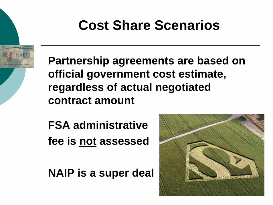
Partnership agreements are based on official government cost estimate, regardless of actual negotiated contract amount
FSA administrativefee is not assessed
NAIP is a super deal
Cost Share Scenarios
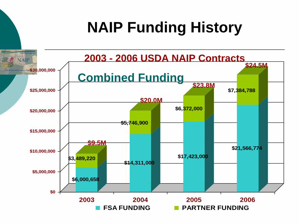
$6,000,658
$3,489,220$14,311,000
$5,746,900
$17,423,000
$6,372,000
$21,566,774
$7,384,788
$0
$5,000,000
$10,000,000
$15,000,000
$20,000,000
$25,000,000
$30,000,000
2003 2004 2005 2006 FSA FUNDING PARTNER FUNDING
NAIP Funding History
2003 - 2006 USDA NAIP Contracts
Combined Funding
$9.5M
$20.0M
$23.8M
$24.5M
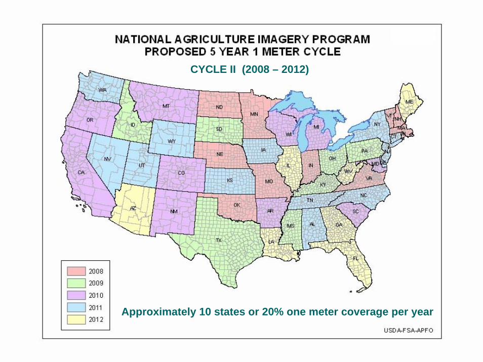
Approximately 10 states or 20% one meter coverage per year
CYCLE II (2008 – 2012)
NAIP 2007 – Improvements to Implement with Partners
• Improved Horizontal Accuracy• Absolute accuracy specification (7 meter CE95)• Need additional control• Confidence in DEMs (NED)
• 4-Band Imagery• Requires digital camera• Support color infrared and RGB deliverables
• Improved acquisition metadata• Sensor mosaic cut line/polygon
• Acquisition date
Challenges• FUNDING• Acquisition within the FSA flying
season• Color quality issues
• Target image• Vendor visits• Image chain analysis (ITT JACIE
Poster)• User requirements/perception• Processing “best practices”
• Delivery/Access
What is Imagery for the Nation?
NAIP and Imagery for the Nation
• Organized effort to acquire imagery over the entire US
• Initiated by National State Geographic Information Council
• Incorporates current USDA and USGS programs
• Includes Multi-Resolution acquisition (6”, 1’, 1-meter)
• Annual collection and repeat cycles of 3 to 5 years
• Imagery stays in public domain• Consistent national standards (image
type/quality & security concerns) • Proposes Federal government funds program
Imagery for the Nation
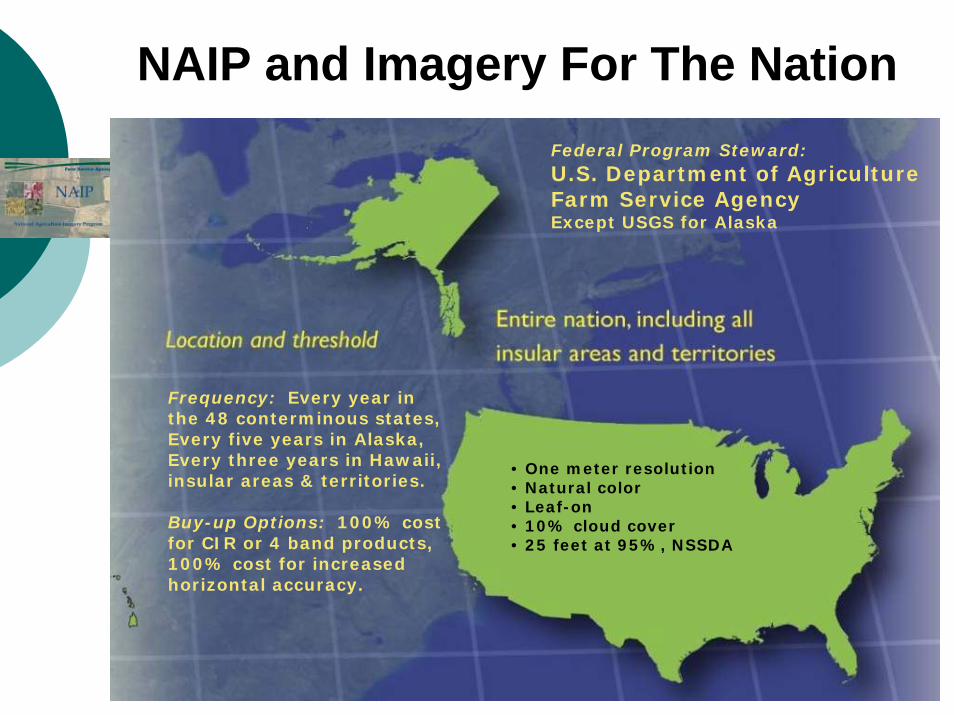
NAIP and Imagery For The Nation
• One meter resolution• Natural color• Leaf-on• 10% cloud cover• 25 feet at 95%, NSSDA
Frequency: Every year inthe 48 conterminous states,Every five years in Alaska,Every three years in Hawaii, insular areas & territories.
Buy-up Options: 100% cost for CIR or 4 band products, 100% cost for increased horizontal accuracy.
Federal Program Steward:U.S. Department of AgricultureFarm Service AgencyExcept USGS for Alaska
FSA Points of Contact
FSA GIS Program ManagerShirley Hall (202) 720-3138
APFO NAIP Program ManagerKent Williams (801) 975-3500 X261
Partnership Information Cindy Sessions – Partnership Coordinator
(801) 975-3500 [email protected]