Embed Size (px)
Citation preview

1
Name: __________________________________ AST 114
Date: ___________________________________
THE DEEP SKY
The purpose of this lab is to familiarize the student with the use of the planisphere, sky atlas, and
coordinate systems for the night sky and introduce the student to the variety of objects visible at
night. The goals of this lab include determining the positions of astronomical objects using the
celestial coordinate system and finding these objects among the constellations of the night sky.
INTRODUCTION Look up into the night sky and the first thing you are likely to notice is the stars. They are
bright, colorful, and their patterns have always fascinated people. While the stars are, in one
sense, the building blocks of the Universe, there is more to the night sky and the Universe than
the stars.
Look up into the night sky from a dark location and you will see the Milky Way arching
overhead. Hidden within the Milky Way’s glowing band are nebulas and star clusters too faint
for the unaided eye to see. A pair of binoculars or small telescope will reveal countless stars
spread across the Milky Way punctuated by dense clusters of stars and glowing clouds of gas.
The relatively starless regions on either side of the Milky Way are the realm of the galaxies. The
Andromeda Galaxy is the closest large neighbor to the Milky Way and the only distant galaxy
beyond our home Milky Way that is easily visible to the unaided eye. Observing even more
distant galaxies requires a telescope and dark skies.
USING A PLANISPHERE (or STARWHEEL)
There are a variety of computer programs and websites that provide accurate maps of the Moon
and planets, stars, constellations, star clusters, nebulas, galaxies, and other “deep sky” objects.
Planetarium software is useful, but carrying a computer with you out under the night sky can be
inconvenient.
A planisphere (also known as a starwheel) provides a compact, convenient alternative. A
planisphere displays the stars and constellations on a flat, round map with the days of the year
printed along the edge of the map. A second panel labeled with the hours of the day is attached
on top of the star map. By rotating the upper panel, you can match the date with the time and
view the portion of the starry sky that is visible at that time and date. Constellations are labeled
in ALL CAPITALS (e.g. AQUILA) and star names are Capitalized (e.g. Altair).
1) Set the planisphere to 10pm on February 1. In the circle on the next page, sketch and label
the following prominent constellations: Auriga, Canis Major, Gemini, Leo, and Orion. You
do not need to include every star of each constellation, but be sure to draw each constellation
with the correct size and position on the sky relative to the horizon.

2
1) Carefully examine the stars visible at 10pm on February 1. Name 3 bright stars and their
constellations visible at this time and date.
2) Which bright, familiar constellation is near the northeastern horizon at this time and date?
3) Which constellation is almost exactly overhead at 10pm on February 1?
NORTH
SOUTH
EA
ST
WE
ST

4) Now set your starwheel for 10 pm on
large constellations you sketched
5) At what time are the constellations Gemini and Orion visible during September?
constellations visible at night
6) The Sun and Earth during 12 months of the year are shown in the diagram
constellation Scorpius on the diagram above. What time of year is Scorpius visible in the
night sky? What prevents us from seeing Scorpius 6 months later?
7) Are the stars and constellations visible in one month of the year
night of the year? What celestial object prevents us from seeing these constellations?
3
Now set your starwheel for 10 pm on March 1. What has happened to the positions of the
large constellations you sketched for February 1? Have they moved east or west?
At what time are the constellations Gemini and Orion visible during September?
at night in February and March always visible in the night sky?
The Sun and Earth during 12 months of the year are shown in the diagram above. Identify the
constellation Scorpius on the diagram above. What time of year is Scorpius visible in the
night sky? What prevents us from seeing Scorpius 6 months later?
Are the stars and constellations visible in one month of the year necessarily visible every
night of the year? What celestial object prevents us from seeing these constellations?
1. What has happened to the positions of the
west?
At what time are the constellations Gemini and Orion visible during September? Are the
always visible in the night sky?
above. Identify the
constellation Scorpius on the diagram above. What time of year is Scorpius visible in the
necessarily visible every
night of the year? What celestial object prevents us from seeing these constellations?

CELESTIAL COORDINATES
To locate a position on Earth’s surface, two coordinates are used
is measured north or south of Earth’s equator. L
meridian. While Earth’s equator i
meridian of zero longitude was chosen
England.
Latitude & longitude are measured in degrees (
• Any location on the Equator has a latitude of zero degrees
• The North Pole has a latitude of +90 degrees or 90 degrees north
• The South Pole has a latitude of
• Greenwich, England: (longitude, latitude
• Mesa Community College: (
• Sydney, Australia: (longitude,
Astronomers use similar coordinates to locate objects on the
sky: the celestial coordinate system
The celestial equator is the projection of Earth’s e
the sky. If you stand on Earth’s e
passes directly overhead and intersects
and due west.
The north celestial pole and south celestial pole
projections of the north and south
axis onto the sky. If you stand on
the celestial poles is directly overhead.
4
To locate a position on Earth’s surface, two coordinates are used: latitude and longitude
r south of Earth’s equator. Longitude is measured east or west of the prime
quator is situated halfway between the north and south
was chosen – for historical reasons – to run through
ongitude are measured in degrees (east & north positive, west & south
quator has a latitude of zero degrees
ole has a latitude of +90 degrees or 90 degrees north
a latitude of –90 degrees or 90 degrees south
longitude, latitude) = (0.0 degrees, 51.5 degrees north
: (longitude, latitude) = (111.9 degrees west, 33.4 degrees north
longitude, latitude) = (151.0 degrees east, 33.8 degrees south
Astronomers use similar coordinates to locate objects on the
celestial coordinate system.
is the projection of Earth’s equator onto
on Earth’s equator, the celestial equator
intersects the horizon due east
south celestial pole are the
and south ends of Earth’s rotation
If you stand on one of Earth’s poles, one of
is directly overhead.
Declination is exactly equivalent to latitude; it is the angle
measured north or south from the celestial equator
declination and latitude are measured in degrees
positive for locations north of the equator and negative for
locations south of the equator. (Declination and latitude
often displayed as degrees, arcminutes, and arcseconds.
arcminute is 1/60th
of a degree and 1 arcsecond is 1/60
arcminute.)
Right Ascension is equivalent to longitude,
differences. Longitude is measured east or west, but right
ascension is measured eastward only. Longitu
in degrees, but right ascension is measured in hours, minutes,
& seconds. There are 24 hours of right ascension in a
complete circuit around the celestial equator.
longitude. Latitude
s measured east or west of the prime
south poles, the prime
to run through Greenwich,
west & south negative):
0.0 degrees, 51.5 degrees north)
111.9 degrees west, 33.4 degrees north)
degrees south)
to latitude; it is the angle
celestial equator. Both
atitude are measured in degrees and both are
positive for locations north of the equator and negative for
(Declination and latitude are
s, arcminutes, and arcseconds. One
of a degree and 1 arcsecond is 1/60th
of an
is equivalent to longitude, but there are
ured east or west, but right
Longitude is measured
in hours, minutes,
. There are 24 hours of right ascension in a
5
While the longitude of zero degrees was chosen for historical reasons, the right ascension of zero
hours was chosen for astronomical reasons. Zero hours right ascension is the location where the
ecliptic (the Sun’s annual path) crosses the celestial equator moving from south to north. This
definition means the Sun has a right ascension of zero hours on the first day of northern spring.
A location on Earth’s surface has latitude and longitude coordinates that do not change. In the
same way, distant objects like stars, nebulas, and galaxies have right ascension and declination
coordinates that do not change (or only slowly over decades or centuries). This makes each
coordinate system useful since the coordinates you look up one year are accurate the next year.
8) The star Polaris is known as the “North Star” because it lies very close to the north celestial
pole. Based on the definition on the previous page, estimate the declination of Polaris.
9) The stars that form the “belt of Orion” straddle the celestial equator. What is the approximate
declination of these stars?
10) Because of Earth’s orbital motion around the Sun, the Sun’s position appears to change
relative to the background stars. Are the right ascension & declination of the Sun the same
from one day to the next?
11) Which other celestial objects are close enough to Earth that their changing positions are
noticeable relative to the background stars over periods of days, months, or years?
12) Do the right ascension & declination of this group of objects remain the same over time?
13) Explain why planispheres do not display the positions of the Moon or the planets.

6
SIMBAD: AN ASTRONOMICAL DATABASE
With the invention of the World Wide Web, large amounts of astronomical data have become
easy to browse. A major astronomical resource is the SIMBAD database located at
http://simbad.u-strasbg.fr/simbad. Visit this website and click “basic search” under “Queries”.
Enter “Polaris” into the search field and press enter or click the “SIMBAD search” button. A
page of information about the star Polaris will be displayed. The right ascension and declination
of Polaris are labeled “ICRS coord.”
Pointing the mouse cursor at these coordinates will reveal that right ascension is given in hours,
minutes, and seconds and declination is given in degrees, minutes, and seconds.
14) Record the right ascension and declination of Polaris. Compare the declination of Polaris
with your estimate in Question #8. Was your estimate accurate?
Next search SIMBAD for “Mintaka”, the western-most belt star of Orion.
15) Record the ICRS right ascension and declination for this star. Compare the declination of
Mintaka to your estimate in Question #9. Was your estimate accurate?
Search for “Betelgeuse”, the bright red supergiant north-east of Mintaka in Orion’s shoulder.
16) Record the ICRS right ascension and declination for this star. Compare the coordinates of
Betelgeuse to the coordinates of Mintaka. How can you tell by looking at the coordinates of
these two stars that Betelgeuse is north and east of Mintaka?
7
THE SKY ATLAS
Before computers had revolutionized astronomy, finding celestial objects in the sky required the
careful use of a sky atlas. Just as a geographic atlas of Earth’s surface shows the natural features
(lakes, rivers, mountain ranges) and artificial features (cities, roads, borders) of a landscape, a
sky atlas shows the positions of the objects in the night sky.
In this lab course, you will be using the Sky & Telescope’s Pocket Sky Atlas. In this atlas, the
entire sky has been broken into multiple charts. These charts are numbered with large blue
numbers in the upper corners of the pages. These are not page numbers! The small, blue,
numbered triangles at the edges of the pages indicate which chart lies in each direction. The
inside of the back cover of the atlas also provides a map for all of the charts relative to prominent
constellations.
Turn to Chart 2. Notice that lines of constant declination cross the page from left to right and
lines of constant right ascension cross the page from top to bottom.
17) Estimate the right ascension and declination of the star Mirfak in the constellation Perseus.
You may notice that many of the brighter stars (shown with larger dots) are labeled with small
letters. These Greek letters were assigned by German astronomer Johann Bayer around 1603.
This system generally places the stars of each constellation in order of brightness, with the
brightest star labeled alpha (α), second brightest labeled beta (β), third gamma (γ), and so on.
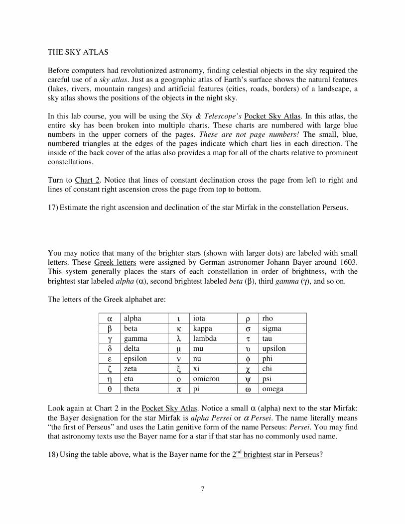
The letters of the Greek alphabet are:
α alpha ι iota ρ rho
β beta κ kappa σ sigma
γ gamma λ lambda τ tau
δ delta µ mu υ upsilon
ε epsilon ν nu φ phi
ζ zeta ξ xi χ chi
η eta ο omicron ψ psi
θ theta π pi ω omega
Look again at Chart 2 in the Pocket Sky Atlas. Notice a small α (alpha) next to the star Mirfak:
the Bayer designation for the star Mirfak is alpha Persei or α Persei. The name literally means
“the first of Perseus” and uses the Latin genitive form of the name Perseus: Persei. You may find
that astronomy texts use the Bayer name for a star if that star has no commonly used name.
18) Using the table above, what is the Bayer name for the 2nd
brightest star in Perseus?

8
19) Find this star on Chart 2 in the Pocket Sky Atlas. What is this star’s common name?
Visit http://www.skyandtelescope.com/howto/Constellation_Names.html.
20) What is the Bayer designation of the brightest star in Canis Major (the big dog)?
21) Turn to Chart 27 of the Pocket Sky Atlas. What is the common name of this star?
Flip to Chart 6 – 7 of the Pocket Sky Atlas.
22) What kind of non-stellar object is most numerous in this part of the sky? The page facing
Chart 1 and Chart 11 is a Chart Legend showing the types of objects plotted.
23) What constellations are shown on Chart 6 – 7?
24) Give the common name and Bayer name of two bright stars shown on Chart 6 – 7.
Examine Chart 62 in the Pocket Sky Atlas. Flip back one page to find a Chart Legend.
25) What 3 types of non-stellar objects are common in this part of the sky?
26) What is the common name and Bayer name of the brightest star in Cygnus?

9
OBSERVING THE STARRY SKY IN THE PLANETARIUM
Set a planisphere for 8pm during the first week of May and find the bright stars and prominent
constellations listed below. Briefly describe where on the sky you should look to find each item
(for example, high overhead? near the horizon? north? south? east? west?).
• Orion and the star Betelgeuse: __________________________________________________
• Gemini and the stars Castor and Pollux: __________________________________________
• Bootes and the star Arcturus: ___________________________________________________
• Virgo and the star Spica: ______________________________________________________
• Ursa Major and the Big Dipper: _________________________________________________
• Leo and the star Regulus: ______________________________________________________
Once you have indentified the stars and constellations on your planispheres, head into the
planetarium. The stars visible at 8pm during the first week of May are projected onto the
planetarium dome. Relative to your seated position, the north celestial pole is at the back of the
planetarium dome about 30 degrees up from the dome edge (the “horizon”).
27) Which direction are you facing when you sit in the planetarium seats? __________________
28) Which direction is to your left? __________________ To your right? __________________
29) Based on your answers to the previous 3 questions, how should you hold the planisphere to
match the directions on the planisphere with the directions on the planetarium dome?
Practice with a planisphere until you can identify the bright stars and prominent constellations
listed on the previous page. Identifying several of these stars and constellations will be part of
the lab quiz next week.
The stars and constellations you identified on the dome are easy to find on the sky, even through
the light pollution of the city.

10
Throughout the semester go outside and practice! Use a planisphere, the pages in the back of the
textbook, or a planetarium program to guide you. Recognizing the stars and constellations takes
practice, but it’s a lot of fun and it’s easy to do! You will also be given time during the lab period
to practice. Make use of this time to practice, too.
At the end of the semester, you will be given a Constellation Quiz to test your knowledge. A
series of bright stars, prominent constellations, and the bright planets will be displayed for you in
the planetarium. You will be asked to identify 20 of them.
To help you study, your instructor will provide you a handout of possible objects in a few weeks.
If you have questions about the Constellation Quiz, be sure to ask your instructor! It is an
important part of your astronomy lab grade.