Embed Size (px)
Citation preview
Brougham and Eamont Bridge
a walk with two rivers, a Roman fort, a castle, a fortified manor house, and two ancient henges
Lake District
NatioNaL Park
North PeNNiNes
aoNB
Scottish Border
Howgills
M6
soLway Firth
River Edencatchment area
© Crown copyright. All rights reservedLicence no. 10000 5056 (2006)
Carlisle
appleby
penrith
KirKbystephen
brampton
armathwaite
little salKeld
shap brough
N
2
3
4
5
6
7
8 9
1
River Eden
writ
ten
an
d d
esig
ne
d b
y EC
CP
te
l: 01
228
5616
0108
/07/
2k
yorkshire DaLes
Brougham Castle
Mayburgh Henge
2
3
Brougham and Eamont Bridge
“He pass’d red Penrith’s Table Round,for feats of chivalry renown’dleft Mayburgh’s mound and stones of power,by druids raised in magic hour,and traced the Eamont’s winding way…”
Walter Scott
From Penrith town centre, start from the Corn Market and head to Angel Square. Turn right at the T-junction and follow the A6 along King Street. Turn left onto Roper Street, then continue along Carleton Road to the A686. With great care, cross the A686 following the sign for Frenchfield, and walk straight down the service road past the entrance to the Frenchfield sports field. Proceed to the end and go through the underpass below the A66. Our route returns to the underpass, along the river from Eamont Bridge.
Turn left out of the underpass and then right along the road over the bridge across the River Eamont, to Brougham Castle. Continue along the road to the crossroads and turn left towards the A66.
Our walk starts at the beginning of the side road which turns off from the A66 east of Brougham Castle Bridge.
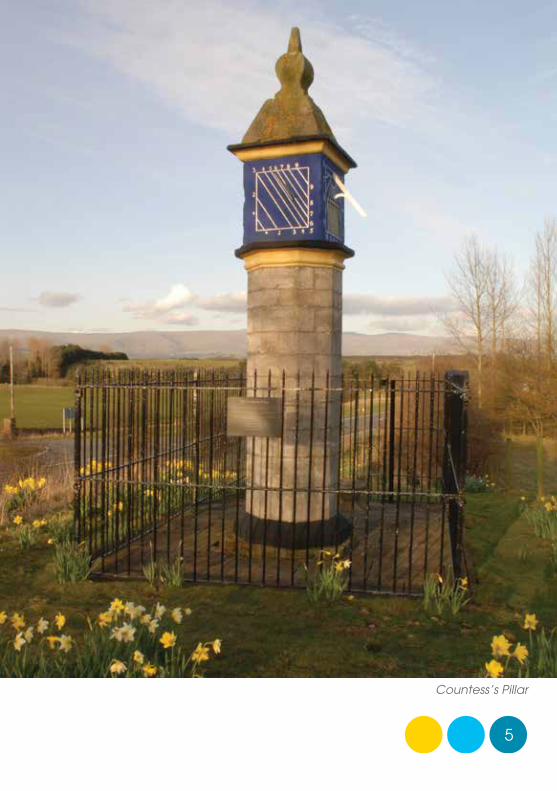
Cars can be parked in the lay-by, just inside the junction where a path along a redundant segment of the old A66, made available by kind permission of local landowner, John Slack, provides safe pedestrian access to the Countess’s Pillar.
4
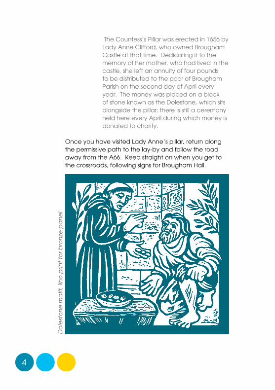
The Countess’s Pillar was erected in 1656 by Lady Anne Clifford, who owned Brougham Castle at that time. Dedicating it to the memory of her mother, who had lived in the castle, she left an annuity of four pounds to be distributed to the poor of Brougham Parish on the second day of April every year. The money was placed on a block of stone known as the Dolestone, which sits alongside the pillar; there is still a ceremony held here every April during which money is donated to charity.
Once you have visited Lady Anne’s pillar, return along the permissive path to the lay-by and follow the road away from the A66. Keep straight on when you get to the crossroads, following signs for Brougham Hall.
Do
lest
on
e m
otif
, lin
o p
rint
for b
ron
ze p
an
el
5
Countess’s Pillar
6
earth banks and ditches are the remains of Brocavum
7
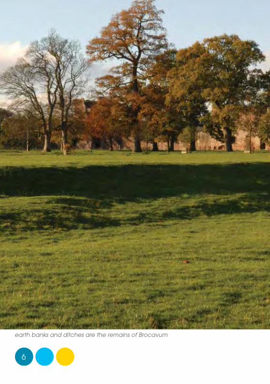
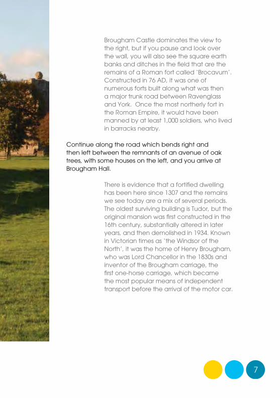
Brougham Castle dominates the view to the right, but if you pause and look over the wall, you will also see the square earth banks and ditches in the field that are the remains of a Roman fort called ‘Brocavum’. Constructed in 76 AD, it was one of numerous forts built along what was then a major trunk road between Ravenglass and York. Once the most northerly fort in the Roman Empire, it would have been manned by at least 1,000 soldiers, who lived in barracks nearby.
Continue along the road which bends right and then left between the remnants of an avenue of oak trees, with some houses on the left, and you arrive at Brougham Hall.
There is evidence that a fortified dwelling has been here since 1307 and the remains we see today are a mix of several periods. The oldest surviving building is Tudor, but the original mansion was first constructed in the 16th century, substantially altered in later years, and then demolished in 1934. Known in Victorian times as ‘the Windsor of the North’, it was the home of Henry Brougham, who was Lord Chancellor in the 1830s and inventor of the Brougham carriage, the first one-horse carriage, which became the most popular means of independent transport before the arrival of the motor car.
8
The property is now gradually being restored by the Brougham Hall Charitable Trust and offers a wealth of period architecture as well as a café, plenty of space to picnic, craft studios and specialist shops.
From Brougham Hall, carry on along the main road past the Hall, around the bend to the left.
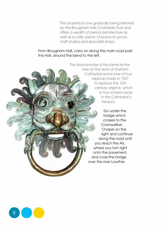
The door-knocker is the same as the one on the door at Durham
Cathedral and is one of four replicas made in 1927
to replace the 12th century original, which
is now locked away in the Cathedral’s treasury.
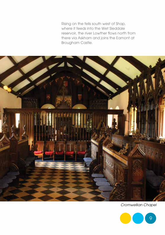
Go under the bridge which crosses to the
Cromwellian Chapel on the right and continue
along the road until you reach the A6,
where you turn right onto the pavement,
and cross the bridge over the river Lowther.
9
Rising on the fells south west of Shap, where it feeds into the Wet Sleddale reservoir, the river Lowther flows north from there via Askham and joins the Eamont at Brougham Castle.
Cromwellian Chapel
10
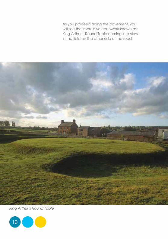
As you proceed along the pavement, you will see the impressive earthwork known as King Arthur’s Round Table coming into view in the field on the other side of the road.
King Arthur’s Round Table
11
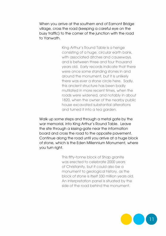
When you arrive at the southern end of Eamont Bridge village, cross the road (keeping a careful eye on the busy traffic) to the corner of the junction with the road to Yanwath.
King Arthur’s Round Table is a henge consisting of a huge, circular earth bank, with associated ditches and causeways, and is between three and four thousand years old. Early records indicate that there were once some standing stones in and around the monument, but it is unlikely there was ever a stone circle here. Sadly, this ancient structure has been badly mutilated in more recent times, when the roads were widened, and notably in about 1820, when the owner of the nearby public house excavated substantial alterations and turned it into a tea garden.
Walk up some steps and through a metal gate by the war memorial, into King Arthur’s Round Table. Leave the site through a kissing-gate near the information board and cross the road to the opposite pavement. Continue along the road until you arrive at a huge block of stone, which is the Eden Millennium Monument, where you turn right.
This fifty-tonne block of Shap granite was erected to celebrate 2000 years of Christianity, but it could also be a monument to geological history, as the block of stone is itself 330 million years old. An interpretation panel is situated by the side of the road behind the monument.
12
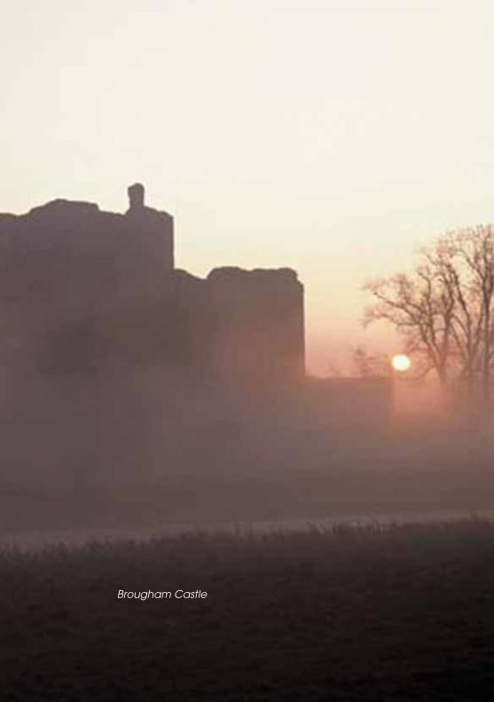
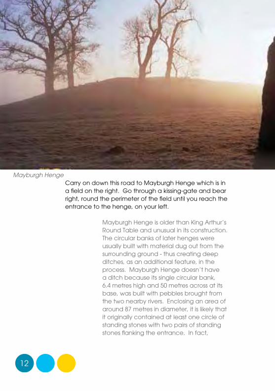
Carry on down this road to Mayburgh Henge which is in a field on the right. Go through a kissing-gate and bear right, round the perimeter of the field until you reach the entrance to the henge, on your left.
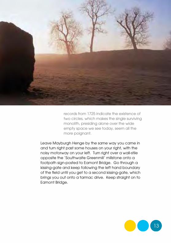
Mayburgh Henge is older than King Arthur’s Round Table and unusual in its construction. The circular banks of later henges were usually built with material dug out from the surrounding ground - thus creating deep ditches, as an additional feature, in the process. Mayburgh Henge doesn’t have a ditch because its single circular bank, 6.4 metres high and 50 metres across at its base, was built with pebbles brought from the two nearby rivers. Enclosing an area of around 87 metres in diameter, it is likely that it originally contained at least one circle of standing stones with two pairs of standing stones flanking the entrance. In fact,
Mayburgh Henge
13
records from 1725 indicate the existence of two circles, which makes the single surviving monolith, presiding alone over the wide empty space we see today, seem all the more poignant.
Leave Mayburgh Henge by the same way you came in and turn right past some houses on your right, with the noisy motorway on your left. Turn right over a wall-stile opposite the ‘Southwaite Greenmill’ millstone onto a footpath sign-posted to Eamont Bridge. Go through a kissing-gate and keep following the left hand boundary of the field until you get to a second kissing-gate, which brings you out onto a tarmac drive. Keep straight on to Eamont Bridge.
14
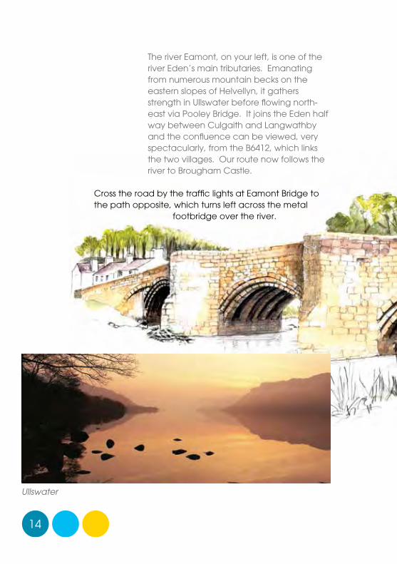
The river Eamont, on your left, is one of the river Eden’s main tributaries. Emanating from numerous mountain becks on the eastern slopes of Helvellyn, it gathers strength in Ullswater before flowing north-east via Pooley Bridge. It joins the Eden half way between Culgaith and Langwathby and the confluence can be viewed, very spectacularly, from the B6412, which links the two villages. Our route now follows the river to Brougham Castle.
Cross the road by the traffic lights at Eamont Bridge to the path opposite, which turns left across the metal
footbridge over the river.
Ullswater
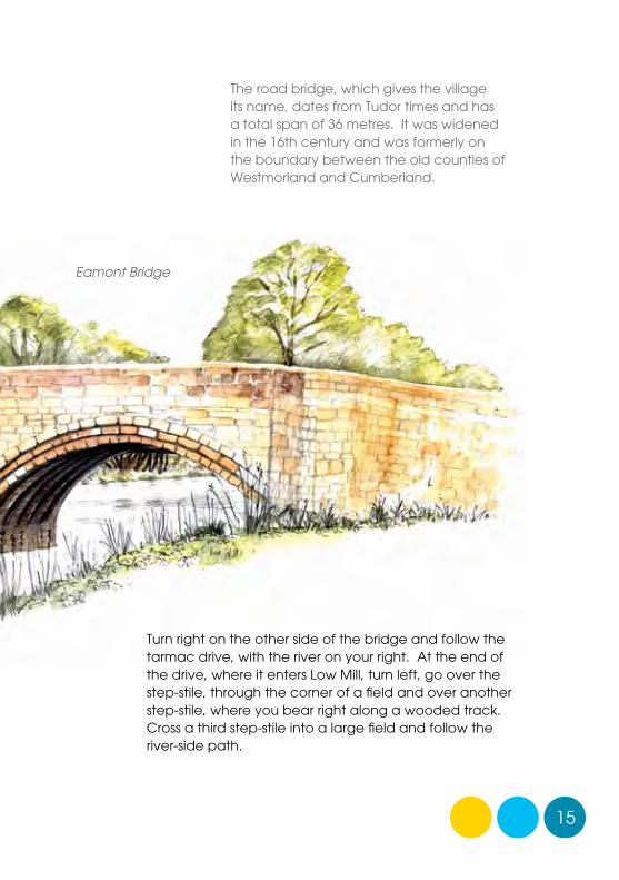
15
The road bridge, which gives the village its name, dates from Tudor times and has a total span of 36 metres. It was widened in the 16th century and was formerly on the boundary between the old counties of Westmorland and Cumberland.
Turn right on the other side of the bridge and follow the tarmac drive, with the river on your right. At the end of the drive, where it enters Low Mill, turn left, go over the step-stile, through the corner of a field and over another step-stile, where you bear right along a wooded track. Cross a third step-stile into a large field and follow the river-side path.
Eamont Bridge
16
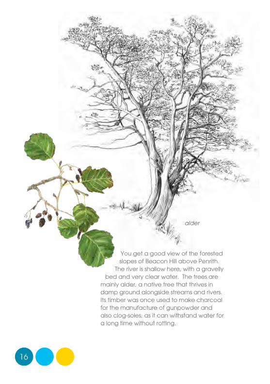
You get a good view of the forested slopes of Beacon Hill above Penrith.
The river is shallow here, with a gravelly bed and very clear water. The trees are
mainly alder, a native tree that thrives in damp ground alongside streams and rivers. Its timber was once used to make charcoal for the manufacture of gunpowder and also clog-soles, as it can withstand water for a long time without rotting.
alder
17
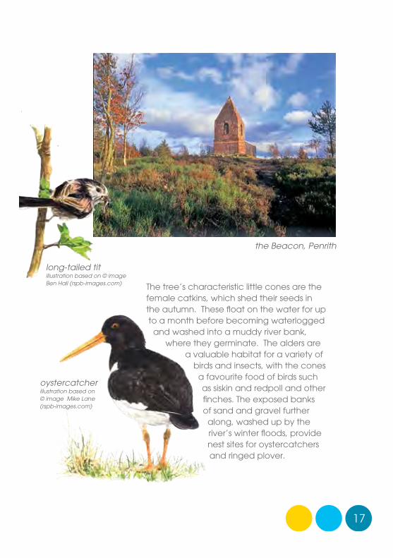
The tree’s characteristic little cones are the female catkins, which shed their seeds in the autumn. These float on the water for up to a month before becoming waterlogged
and washed into a muddy river bank, where they germinate. The alders are
a valuable habitat for a variety of birds and insects, with the cones
a favourite food of birds such as siskin and redpoll and other finches. The exposed banks of sand and gravel further
along, washed up by the river’s winter floods, provide nest sites for oystercatchers and ringed plover.
oystercatcherillustration based on © image Mike Lane (rspb-images.com)
long-tailed titillustration based on © image Ben Hall (rspb-images.com)
the Beacon, Penrith
swim
me
rs, l
ino
prin
t fo
r bro
nze
pa
ne
l
18
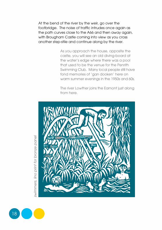
At the bend of the river by the weir, go over the footbridge. The noise of traffic intrudes once again as the path curves close to the A66 and then away again, with Brougham Castle coming into view as you cross another step-stile and continue along by the river.
As you approach the house, opposite the castle, you will see an old diving-board at the water’s edge where there was a pool that used to be the venue for the Penrith Swimming Club. Many local people still have fond memories of ‘gan dooken’ here on warm summer evenings in the 1950s and 60s.
The river Lowther joins the Eamont just along from here.
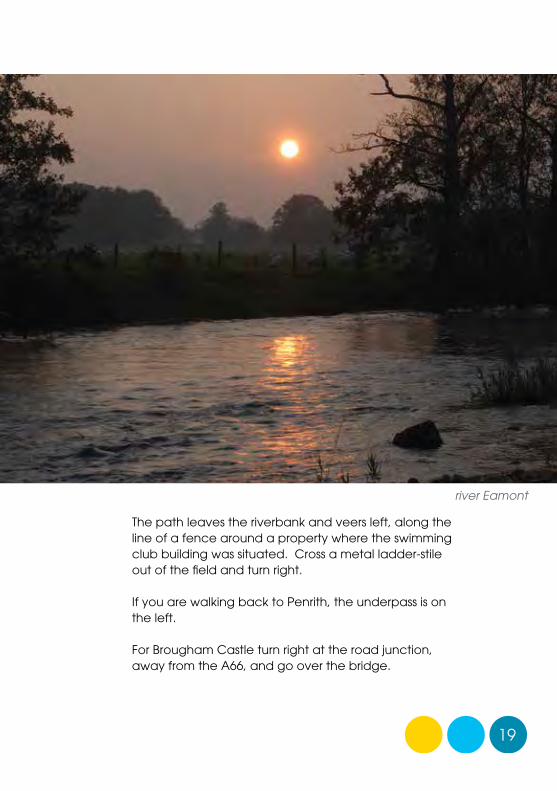
19
The path leaves the riverbank and veers left, along the line of a fence around a property where the swimming club building was situated. Cross a metal ladder-stile out of the field and turn right.
If you are walking back to Penrith, the underpass is on the left.
For Brougham Castle turn right at the road junction, away from the A66, and go over the bridge.
river Eamont
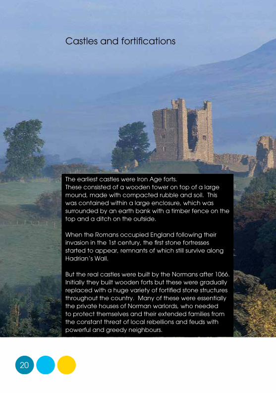
The earliest castles were Iron Age forts. These consisted of a wooden tower on top of a large mound, made with compacted rubble and soil. This was contained within a large enclosure, which was surrounded by an earth bank with a timber fence on the top and a ditch on the outside.
When the Romans occupied England following their invasion in the 1st century, the first stone fortresses started to appear, remnants of which still survive along Hadrian’s Wall.
But the real castles were built by the Normans after 1066. Initially they built wooden forts but these were gradually replaced with a huge variety of fortified stone structures throughout the country. Many of these were essentially the private houses of Norman warlords, who needed to protect themselves and their extended families from the constant threat of local rebellions and feuds with powerful and greedy neighbours.
Castles and fortifications
20
rive
rba
nk
wo
od
s
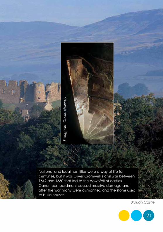
National and local hostilities were a way of life for centuries, but it was Oliver Cromwell’s civil war between 1642 and 1660 that led to the downfall of castles. Canon bombardment caused massive damage and after the war many were dismantled and the stone used to build houses.
21
Brough Castle
Bro
ug
ha
m C
ast
le s
tairw
ay
22
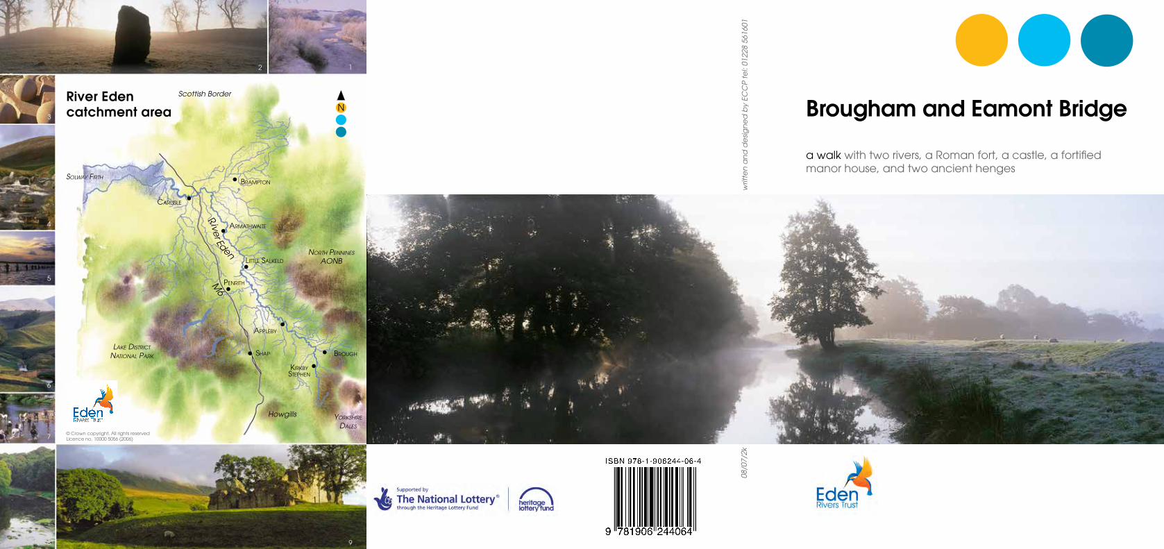
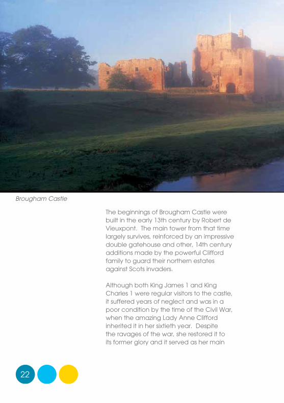
The beginnings of Brougham Castle were built in the early 13th century by Robert de Vieuxpont. The main tower from that time largely survives, reinforced by an impressive double gatehouse and other, 14th century additions made by the powerful Clifford family to guard their northern estates against Scots invaders.
Although both King James 1 and King Charles 1 were regular visitors to the castle, it suffered years of neglect and was in a poor condition by the time of the Civil War, when the amazing Lady Anne Clifford inherited it in her sixtieth year. Despite the ravages of the war, she restored it to its former glory and it served as her main
Brougham Castle
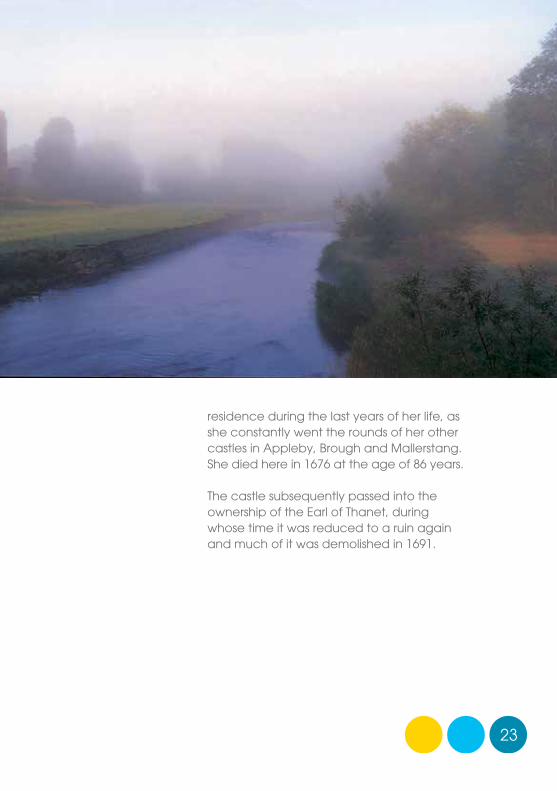
23
residence during the last years of her life, as she constantly went the rounds of her other castles in Appleby, Brough and Mallerstang. She died here in 1676 at the age of 86 years.
The castle subsequently passed into the ownership of the Earl of Thanet, during whose time it was reduced to a ruin again and much of it was demolished in 1691.
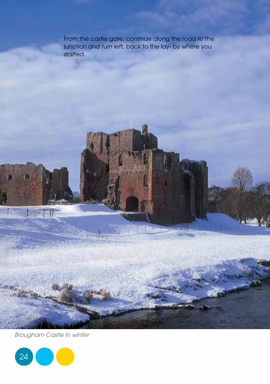
Brougham Castle in winter
24
From the castle gate, continue along the road to the junction and turn left, back to the lay- by where you started.
Reproduced from 1923 Ordnance Survey map with the kind permission of the Ordnance Survey © East Cumbria Countryside Project 2007
River Lowther
River Eamont
A66
A686
Roper Street
Leisure Centre
King Street
A6
A6
Carleton Road
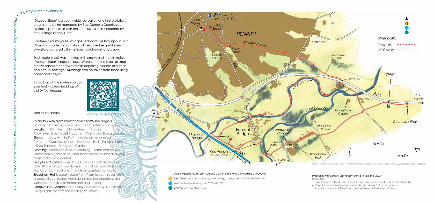
‘Discover Eden’ is a countryside recreation and interpretation programme being managed by East Cumbria Countryside Project in partnership with the Eden Rivers Trust supported by the Heritage Lottery Fund.
Fourteen circuital routes at dispersed locations throughout East Cumbria provide an opportunity to explore the great scenic diversity associated with the Eden catchment landscape.
Each route is well way-marked with arrows and the distinctive ‘Discover Eden’ kingfisher logo. Watch out for a series of small bronze panels etched with motifs depicting aspects of human and natural heritage. Rubbings can be taken from these using paper and crayon.
By walking all the routes you can eventually collect rubbings of eighty four images.
Brief route details:
To do this walk from Penrith town centre see page 3Parking: limited, in layby near the Countess’s Pillar (see map)Length: 3¾ miles 6 kilometres 3 hoursAllow extra time to visit Brougham Castle and Brougham HallGrade: easy with half of the route on minor roadsRoute: Countess’s Pillar – Brougham Hall – Eamont Bridge – River Eamont - Brougham CastleClothing: Boots and outdoor clothing – paths can be wetPlease leave gates as you find them, leave no litter and keepdogs under close controlBrougham Castle is open from 1st April to 30th Septemberdaily 10 am to 5 pm and from 1st to 31st October Thursday toMonday 10 am to 4 pm. There is an admission charge.Brougham Hall is usually open from 9 am to 6 pm seven daysa week all year round. Admission is free but donations arewelcome to help with restoration and upkeep.Cromwellian Chapel is open only occassionally. Details on theChapel gate or from the Rectory at Clifton.
bronze motifs by Pip Hall
Originally published by East Cumbria Countryside Project, (c/o Carlisle City Council)
Eden Rivers Trust: Dunmail Building, Newton Rigg College. Penrith. Cumbria CA11 0AH
email: [email protected] tel: 01768 866788
website: edenriverstrust.org.uk
Images by Val Corbett, Barry Stacy, David Philips and ECCP Inside flap1. River Eamont 2. Mayburgh Henge 3. ‘Red River’ Benchmark near Temple Sowerby4. Mosedale near Caldbeck 5. Haaf netting in Solway 6. Ravenstonedale7. Appleby horse fair 8. River Eden near Wetheral 9. Pendragon Castle
START
Brougham Hall
FrenchfieldFarm
Brougham Hall Farm
Brougham Castle
Eamont Bridge
Lowther Bridge
MayburghHenge
A66
to Keswick
to Clifton A6
Carleton
A66 to Appleby
to Carlisle
Countess’s Pillar
other paths
footpathbridleway
PENRITH
King Arthur’sRound Table
P
main
line
railw
ay L
ond
on –
Gla
sgo
w
underpass
P
to Preston
M6
Cromwellian Chapel
Corn Market
Bus StationWC
N
Scale0 1km
0 ½ mile
LOO
K O
UT
for
6 b
ron
ze m
oti
fs •
th
e C
ou
nte
ss’s
Pill
ar •
Ro
ma
n s
old
iers
• d
oo
r kn
oc
ker •
clo
gs
an
d a
lde
r •ringed plover • swimmers