Embed Size (px)
Citation preview

Municipal GIS ApplicationsMunicipal GIS Applications
JOHN C. CHLARSON, P.E.JOHN C. CHLARSON, P.E.UNIVERSITY OF TENNESSEEUNIVERSITY OF TENNESSEE
MUNICIPAL TECHNICAL ADVISORY SERVICEMUNICIPAL TECHNICAL ADVISORY SERVICE
F URE

Municipal GIS ApplicationsMunicipal GIS ApplicationsWhat are local governments doing with GIS?

Municipal GIS ApplicationsMunicipal GIS ApplicationsWhat are local governments doing with GIS?
Water/Sewer/StormAsset ManagementWork Order ManagementField Data CollectionCapital Improvement PlanningWorkforce Management

Municipal GIS ApplicationsMunicipal GIS ApplicationsWhat are local governments doing with GIS?
Public WorksAsset ManagementWork Order ManagementField Data CollectionCapital Improvement PlanningCall Center IntegrationTree Inventories

Municipal GIS ApplicationsMunicipal GIS ApplicationsWhat are local governments doing with GIS?
Emergency ManagementAd-Hoc Map ProductionIncident Management System IntegrationCommon Operational PictureField Data CollectionPublic Safety/HLS Exercise & Evaluation Programs

Municipal GIS ApplicationsMunicipal GIS ApplicationsWhat are local governments doing with GIS?
Law EnforcementCrime Analysis & ReportingCAD/RMS IntegrationCommon Operational Picture/ComStatCritical Infrastructure Protection and Planning (BZPP)Mobile Data Solutions (Mobile Data Terminals)

Municipal GIS ApplicationsMunicipal GIS ApplicationsWhat are local governments doing with GIS?
Land Records ManagementCAMA IntegrationPublic AccessLand Assessment & AnalysisMobile Data Collection
CartographyCartography

Information ManagementInformation ManagementWhich parcels are within 50 feet of the road?
Well type Drilled
Building owner Smith
Soil type Sandy
• ProximityProximity
• OverlayOverlay
• NetworkNetwork
What Survey Control is within 1/2 mile of my project area?

Land Use and TransportationLand Use and Transportation
TransportationTransportation
Regional PlanningRegional Planning
Urban PlanningUrban Planning
SustainabilitySustainability

InfrastructureInfrastructure
Electric UtilitiesElectric UtilitiesFlood ControlFlood Control
Storm WaterStorm Water
Water SystemsWater SystemsCadastralCadastral
TrafficTraffic
SewerSewer
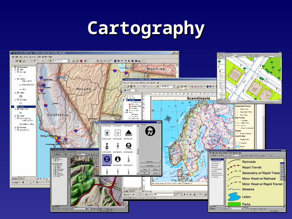
Natural EnvironmentNatural Environment
GeologyGeologyHydrologyHydrology
MarineMarine
EnvironmentalEnvironmental
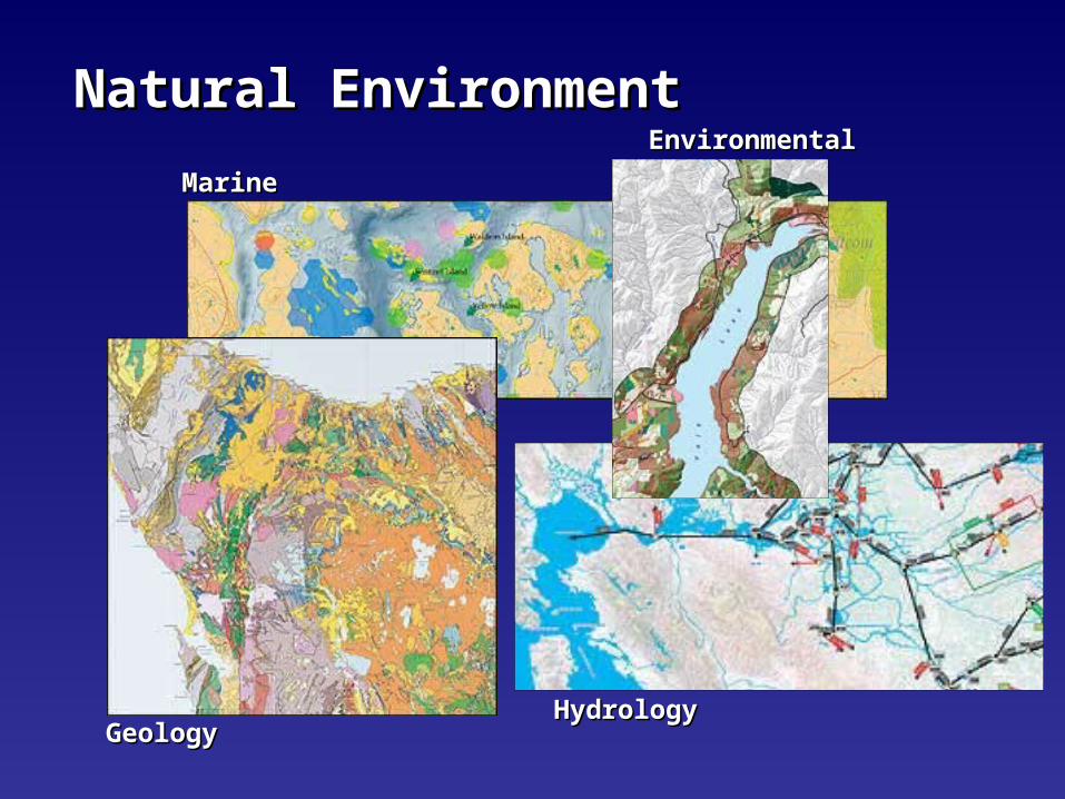
Public SafetyPublic Safety
Coastal FloodingCoastal Flooding
EarthquakesEarthquakesHurricanesHurricanes
FireFire
CrimeCrime
Dam RuptureDam Rupture

HomelandHomeland SecuritySecurity
Scenario ManagementScenario Management
Airborne ContaminantsAirborne Contaminants
Disaster AssessmentDisaster AssessmentSecurity Maps on DemandSecurity Maps on Demand
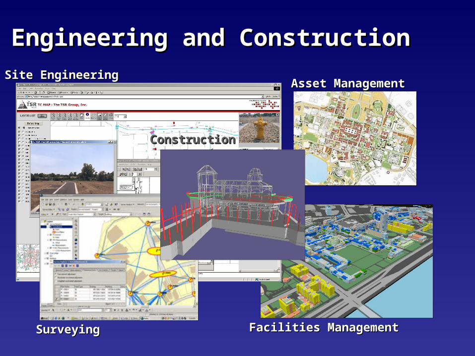
Engineering and ConstructionEngineering and Construction
SurveyingSurveying
Site EngineeringSite Engineering
Facilities ManagementFacilities Management
Asset ManagementAsset Management
ConstructionConstruction

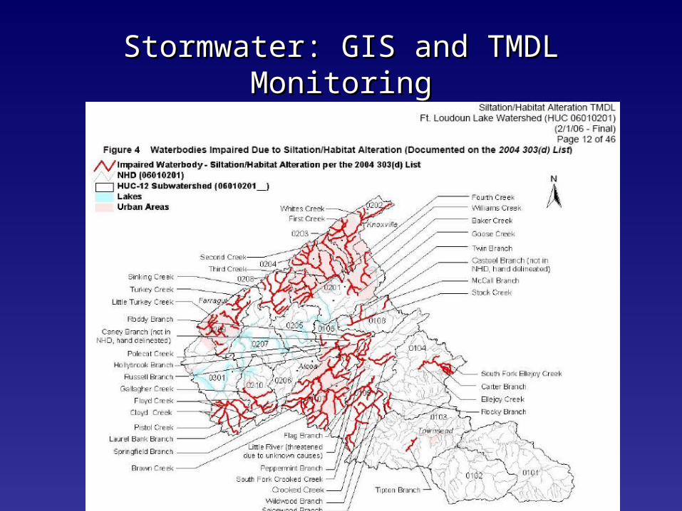
Stormwater: GIS and TMDL MonitoringStormwater: GIS and TMDL Monitoring
• TMDL monitoring for the MS4s will be pendant on the specific type of TMDL. There are three protocols:
• Visual Stream Assessment and Inventory - based on EPA’s and NRCS’s visual assessment protocols and is being developed by Jimmy Smith and John Burr. The basics in the assessments will be the identification, documentation and prioritization of the sources of the pollution within the entire HUC 12 watersheds within a 5-year period.
• RBP3 protocol - strait from our SOP/QAPP and will include at least one sample per HUC 12 in a 5-year period.
• Chemical and biological - also from our SOPs/QAPP, utilizing the identified parameter lists and methodologies and will include 1 set of samples (12 monthly/4 during high flow) per 5-year period.

Stormwater: GIS and TMDL MonitoringStormwater: GIS and TMDL Monitoring
The chart below is a summary of the requirements:
Monitoring Requirement Sediment/Habitat Alteration TMDL Metals TMDL Pathogens TMDL Nutrients TMDLVisual Stream Assessment and Inventory X X X X1 or more RPB3 Benthic Sample X X XChemical and Bacteriological Sample of Surface Water X X X
Stormwater: GIS and TMDL MonitoringStormwater: GIS and TMDL Monitoring

Stormwater: GIS MethodologyStormwater: GIS Methodology

What isWhat is
Low Impact Development?Low Impact Development?•Comprehensive, landscape-based
approach to sustainable development
•Set of strategies to maintain existing natural systems, hydrology, ecology
•Cost-effective, flexible approach based on a toolkit of simple techniques
•Collection of practices that have been implemented nationwide

WHY DO WE NEED LOW IMPACT DEVELOPMENT?WHY DO WE NEED LOW IMPACT DEVELOPMENT?
Conventional strategies Conventional strategies aren’t workingaren’t working
•Increased runoff & decreased recharge
•Loss of vegetation and wildlife habitat
•Loss of community character
•Polluted waterways
•Cost of development

Typical pre-development conditions: Runoff = 10% Infiltration = 50%
WHY DO WE NEED LOW IMPACT DEVELOPMENT? WHY DO WE NEED LOW IMPACT DEVELOPMENT?

Typical post-development conditions:
Runoff = 55% Infiltration = 15%
WHY DO WE NEED LOW IMPACT DEVELOPMENT?WHY DO WE NEED LOW IMPACT DEVELOPMENT?

LID PRINCIPLESLID PRINCIPLES
Use existing natural systems as the Use existing natural systems as the integrating framework for site planningintegrating framework for site planning
• Land use planning and watershed planning
• Identify environmentally sensitive resources: wetlands, mature trees, slopes, drainageways, permeable soils, waterway buffers
• Assess existing hydrology
• Define a development envelope
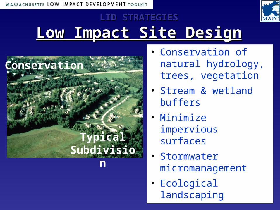
LID STRATEGIESLID STRATEGIES
Low Impact Site DesignLow Impact Site Design• Conservation of
natural hydrology, trees, vegetation
• Stream & wetland buffers
• Minimize impervious surfaces
• Stormwater micromanagement
• Ecological landscaping
Typical Subdivision
Conservation
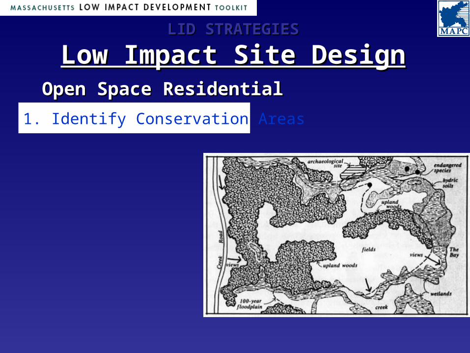
LID STRATEGIESLID STRATEGIES
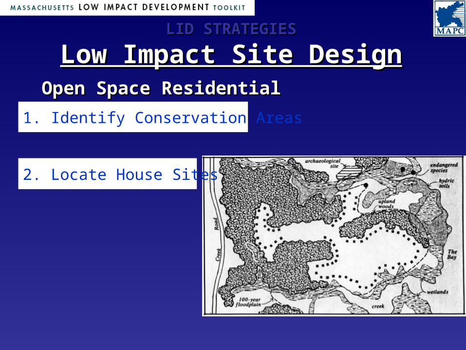
Low Impact Site DesignLow Impact Site DesignOpen Space Residential DesignOpen Space Residential Design
1. Identify Conservation Areas
LID STRATEGIESLID STRATEGIES
Low Impact Site DesignLow Impact Site DesignOpen Space Residential DesignOpen Space Residential Design
1. Identify Conservation Areas
2. Locate House Sites

LID STRATEGIESLID STRATEGIES
Low Impact Site DesignLow Impact Site DesignOpen Space Residential DesignOpen Space Residential Design
1. Identify Conservation Areas
2. Locate House Sites
3. Align Roads & Trails

1. Identify Conservation Areas
2. Locate House Sites
3. Align Roads & Trails
4. Draw the Lot Lines
Open Space Residential DesignOpen Space Residential Design
LID STRATEGIESLID STRATEGIES
Low Impact Site DesignLow Impact Site Design

Buildings and RoadwaysBuildings and Roadways
LID STRATEGIESLID STRATEGIES
Low Impact Site DesignLow Impact Site Design
• Cluster buildings within the development envelope
• Design buildings with smaller footprints
• Roadways should follow existing grades.
• Use parking structures • Separate parking areas
Stormwater ManagementStormwater Management
LID STRATEGIESLID STRATEGIES
Low Impact Site DesignLow Impact Site Design
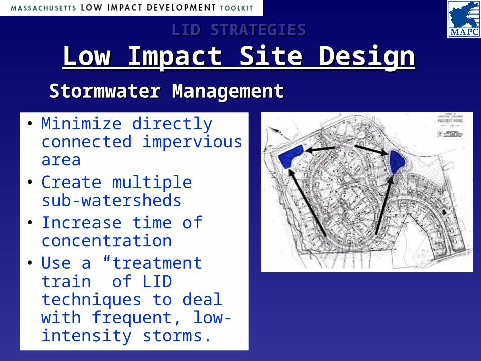
• Minimize directly connected impervious area
• Create multiple sub-watersheds
• Increase time of concentration
• Use a “treatment train” of LID techniques to deal with frequent, low-intensity storms.

Stormwater ManagementStormwater Management
LID STRATEGIESLID STRATEGIES
Low Impact Site DesignLow Impact Site Design
• Minimize directly connected impervious area
• Create multiple sub-watersheds
• Increase time of concentration
• Use a “treatment train” of LID techniques to deal with frequent, low-intensity storms.

LID STRATEGIESLID STRATEGIES
Low Impact Site DesignLow Impact Site Design

Municipal GIS ApplicationsMunicipal GIS ApplicationsWhat GIS assistance would local governments like to have from the State?
Among other things, an easily accessible clearing house entity that coordinates lists, locations, and links to the various GIS datasets, etc. that different groups within state government have produced.
Without such a source, local governments don’t know “what they don’t know”. That is, they don’t know what is available, or who has it.