Embed Size (px)
Citation preview
International Association of Geodesy19-May-16 1
Multi-GNSS Monitoring by IGS and ICGGerhard Beutler
Astronomical Institute, University of BernIAG representative on PNT Advisory Board
based on material provided by Urs Hugentobler
Institut für Astronomische und Physikalische GeodäsieTechnical University of Munich
IGS immediate past chair
17th PNT Advisory Board Meeting May 19, 2016
Gaylord National Resort & Convention Center201 Waterfront Street, National Harbor
Maryland 20745USA
International Association of Geodesy19-May-16 2
Contents
�The IGS: Monitoring the Earth with GNSS� International Committee on GNSS (ICG)� International GNSS Monitoring and
Assessment (IGMA)� IGMA ICG joint Trial Project�Contributions of the IGS�Next Steps, Challenges�Summary� IGS Endorsement by PNT
2
International Association of Geodesy19-May-16 3
The IGS
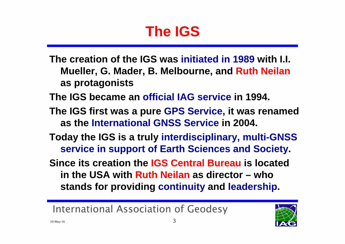
The creation of the IGS was initiated in 1989 with I.I. Mueller, G. Mader, B. Melbourne, and Ruth Neilanas protagonists
The IGS became an official IAG service in 1994.The IGS first was a pure GPS Service , it was renamed
as the International GNSS Service in 2004.Today the IGS is a truly interdisciplinary, multi-GNSS
service in support of Earth Sciences and Society .Since its creation the IGS Central Bureau is located
in the USA with Ruth Neilan as director – who stands for providing continuity and leadership .
International Association of Geodesy19-May-16 4
Monitoring the Earth with GNSS
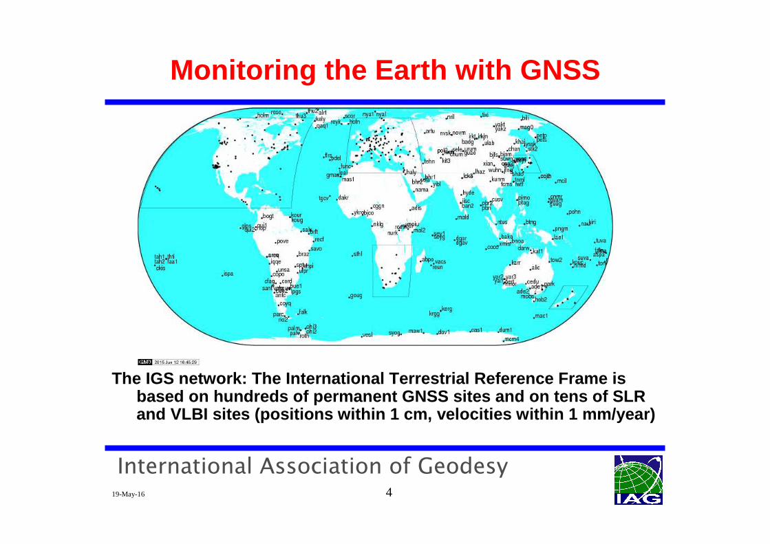
The IGS network: The International Terrestrial Refe rence Frame is based on hundreds of permanent GNSS sites and on te ns of SLR and VLBI sites (positions within 1 cm, velocities w ithin 1 mm/year)
International Association of Geodesy19-May-16 5
Monitoring the Earth with GNSS
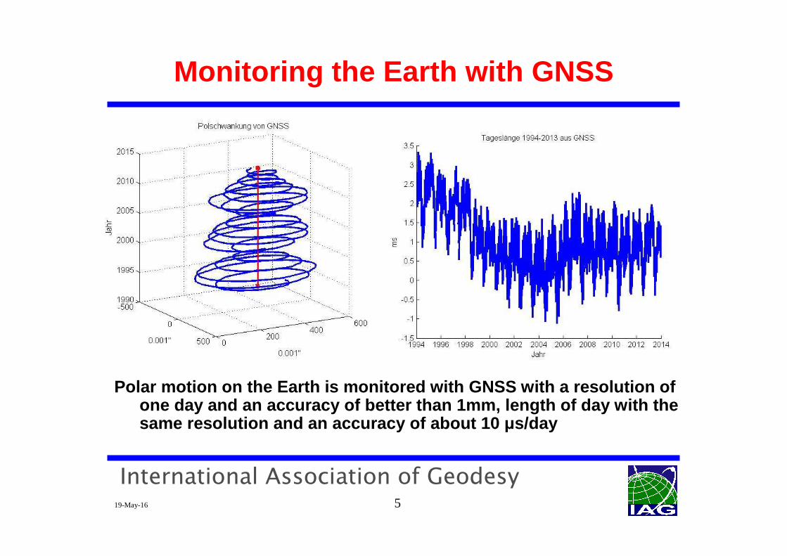
Polar motion on the Earth is monitored with GNSS wi th a resolution of one day and an accuracy of better than 1mm, length of day with the same resolution and an accuracy of about 10 µs/day
International Association of Geodesy19-May-16 6
Monitoring the Earth with GNSS
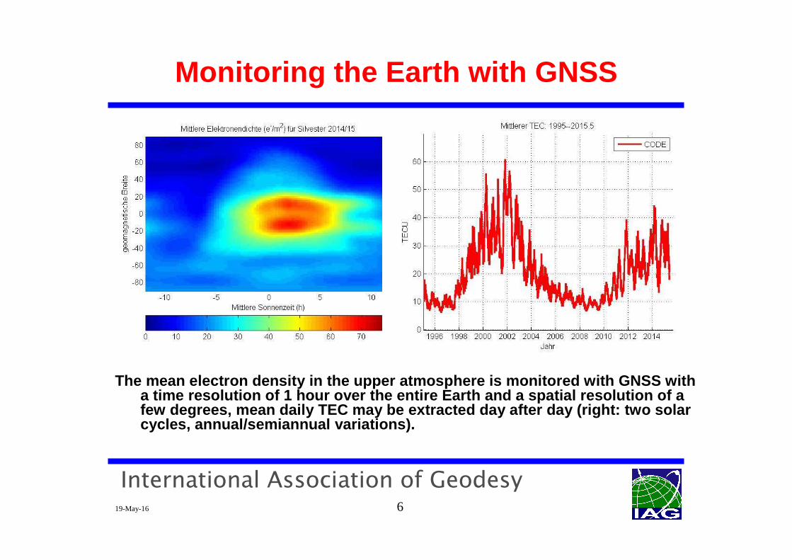
The mean electron density in the upper atmosphere i s monitored with GNSS with a time resolution of 1 hour over the entire Earth a nd a spatial resolution of a few degrees, mean daily TEC may be extracted day af ter day (right: two solar cycles, annual/semiannual variations).
International Association of Geodesy19-May-16 7
Monitoring the Earth with GNSS
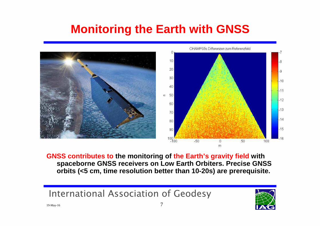
GNSS contributes to the monitoring of the Earth’s gravity field with spaceborne GNSS receivers on Low Earth Orbiters. Pre cise GNSS orbits (<5 cm, time resolution better than 10-20s) are prerequisite.
International Association of Geodesy19-May-16 8
Monitoring the Earth with GNSS
There are many more applications enabled by global GNSS monitoring including, e.g., world-wide time and freq uency transfer, GPS meteorolgy (e.g., by occultation techniqu e).
Facts:� In science we live for more than 10 years in a multi-GNSS world .� Multi-GNSS orbitography is a challenge (presentation by Marek Ziebart)� Orbit accuracies of few cm for any point in time ar e a requirement .� This is only possible, if the properties of all GNSS are known (to the
extent possible) or can be determined in orbit determination process .� Many parameters (broadcast ephemerides , phase center variations ,
inter-GNSS-biases , satellite-specific and receiver-specific biases have to be determined by monitoring .
� Monitoring the Earth and monitoring GNSS properties may be viewed as “the bright side and dark side of the Moon”
� In other words: Earth monitoring by GNSS is not possible without GN SS performance monitoring!
These facts are the motivation for the International GNSS Monitoring and Assessment (IGMA) of IGS and ICG.
International Association of Geodesy19-May-16 9
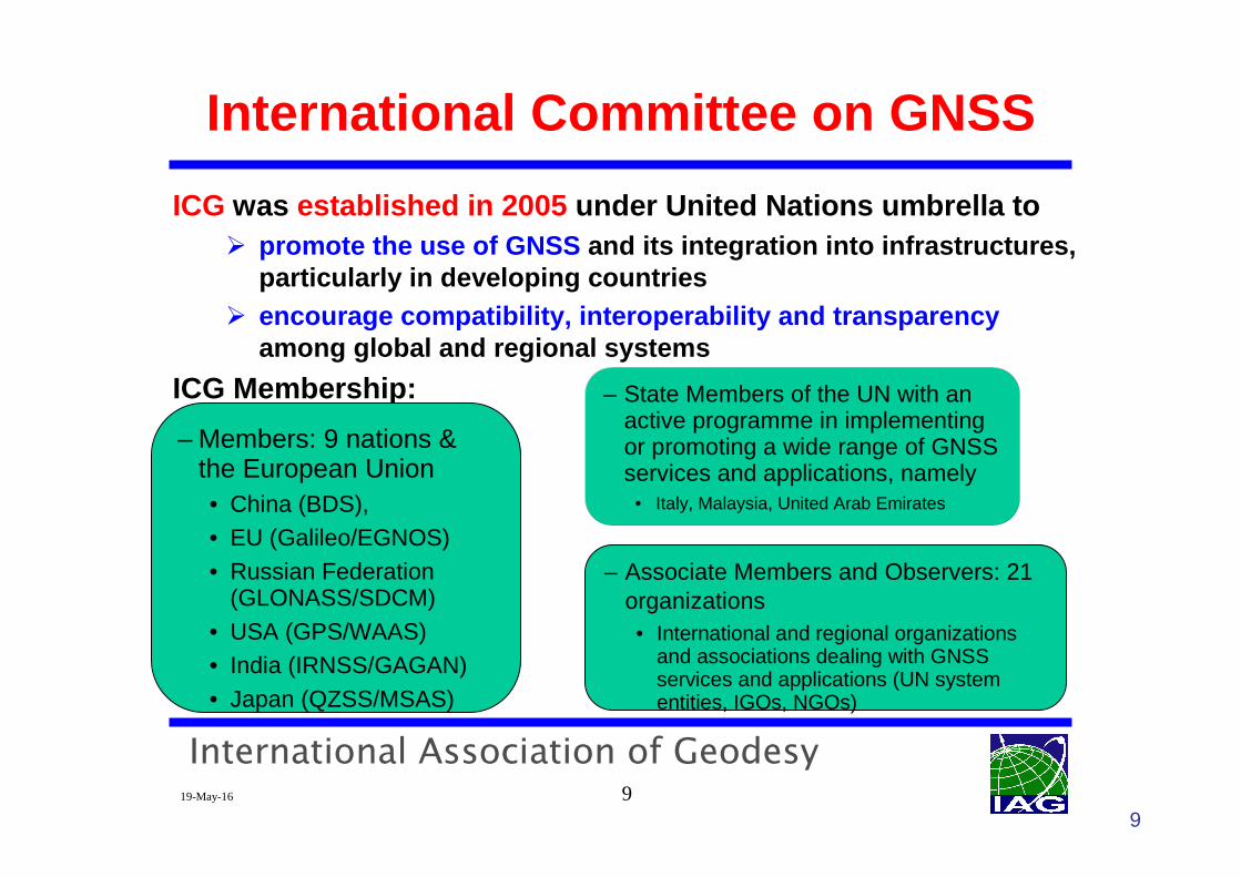
International Committee on GNSS
ICG was established in 2005 under United Nations umbrella to� promote the use of GNSS and its integration into infrastructures,
particularly in developing countries� encourage compatibility, interoperability and trans parency
among global and regional systems
ICG Membership:
– Members: 9 nations & the European Union• China (BDS), • EU (Galileo/EGNOS)• Russian Federation
(GLONASS/SDCM)• USA (GPS/WAAS)• India (IRNSS/GAGAN)• Japan (QZSS/MSAS)
– State Members of the UN with an active programme in implementing or promoting a wide range of GNSS services and applications, namely
• Italy, Malaysia, United Arab Emirates
– Associate Members and Observers: 21 organizations• International and regional organizations
and associations dealing with GNSS services and applications (UN system entities, IGOs, NGOs)
9
International Association of Geodesy19-May-16 10
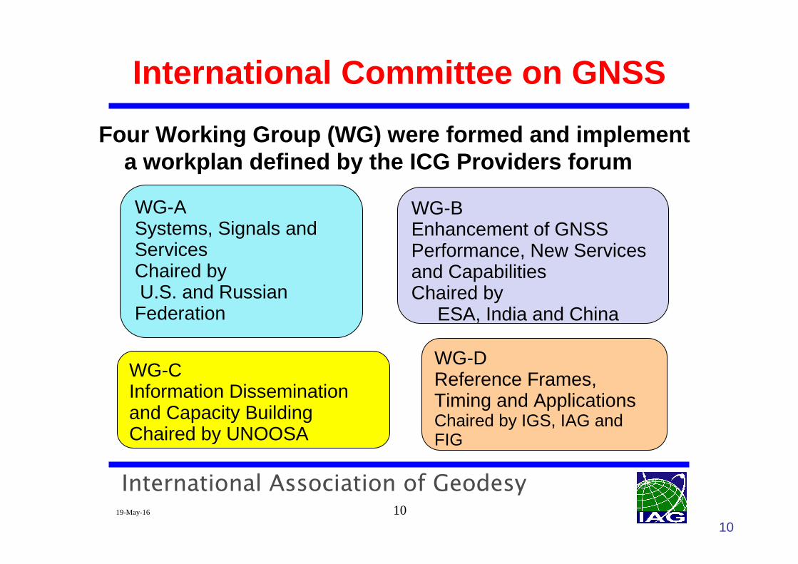
International Committee on GNSS
Four Working Group (WG) were formed and implement a workplan defined by the ICG Providers forum
WG-ASystems, Signals and ServicesChaired by U.S. and Russian Federation
WG-BEnhancement of GNSS Performance, New Services and CapabilitiesChaired by
ESA, India and China
WG-CInformation Dissemination and Capacity BuildingChaired by UNOOSA
WG-DReference Frames, Timing and ApplicationsChaired by IGS, IAG and FIG
10
International Association of Geodesy19-May-16 11
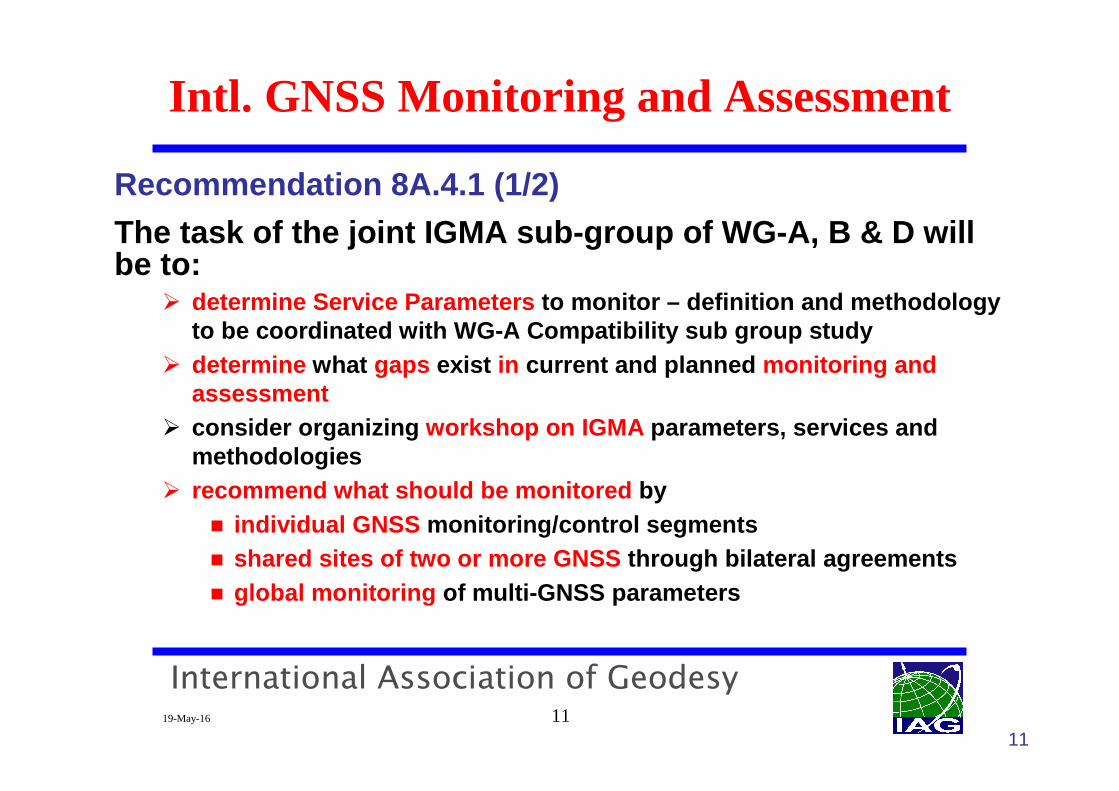
Recommendation 8A.4.1 (1/2)
The task of the joint IGMA sub-group of WG-A, B & D will be to:
� determine Service Parameters to monitor – definition and methodology to be coordinated with WG-A Compatibility sub group study
� determine what gaps exist in current and planned monitoring and assessment
� consider organizing workshop on IGMA parameters, services and methodologies
� recommend what should be monitored by� individual GNSS monitoring/control segments� shared sites of two or more GNSS through bilateral agreements� global monitoring of multi-GNSS parameters
Intl. GNSS Monitoring and Assessment
11
International Association of Geodesy19-May-16 12
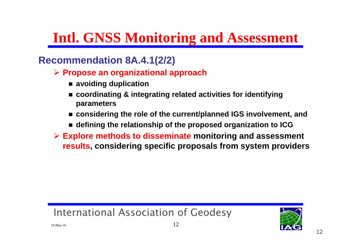
Recommendation 8A.4.1(2/2)� Propose an organizational approach
� avoiding duplication� coordinating & integrating related activities for i dentifying
parameters � considering the role of the current/planned IGS inv olvement, and� defining the relationship of the proposed organizat ion to ICG
� Explore methods to disseminate monitoring and assessment results , considering specific proposals from system providers
Intl. GNSS Monitoring and Assessment
12
International Association of Geodesy19-May-16 13
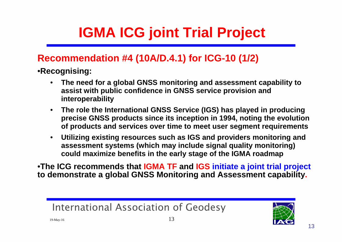
Recommendation #4 (10A/D.4.1) for ICG-10 (1/2)•Recognising:
• The need for a global GNSS monitoring and assessmen t capability to assist with public confidence in GNSS service provi sion and interoperability
• The role the International GNSS Service (IGS) has p layed in producing precise GNSS products since its inception in 1994, noting the evolution of products and services over time to meet user seg ment requirements
• Utilizing existing resources such as IGS and provid ers monitoring and assessment systems (which may include signal qualit y monitoring)could maximize benefits in the early stage of the I GMA roadmap
•The ICG recommends that IGMA TF and IGS initiate a joint trial projectto demonstrate a global GNSS Monitoring and Assessmen t capability .
13
IGMA ICG joint Trial Project
International Association of Geodesy19-May-16 14
� The Trial Project shall be launched as soon as possible. � the Trial Project will be phased and starts with monitoring of
a limited set of parameters� in post processing,� with system level performance monitoring for each G NSS
� Next phases will be expanded by monitoring/assessment capabilities based on the progress of the Trial Proje ct and based on ICG review. Strive for� real-time processing� User-level performance monitoring including combined use of
multiple constellation� combined product and assessment function
14
IGMA ICG joint Trial Project
International Association of Geodesy19-May-16 15
IGMA ICG joint Trial Project
15
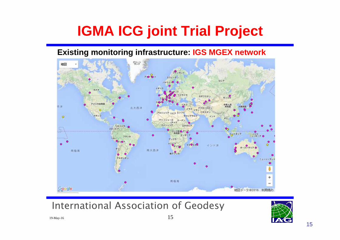
Existing monitoring infrastructure: IGS MGEX network
International Association of Geodesy19-May-16 16
IGMA ICG joint Trial Project
16
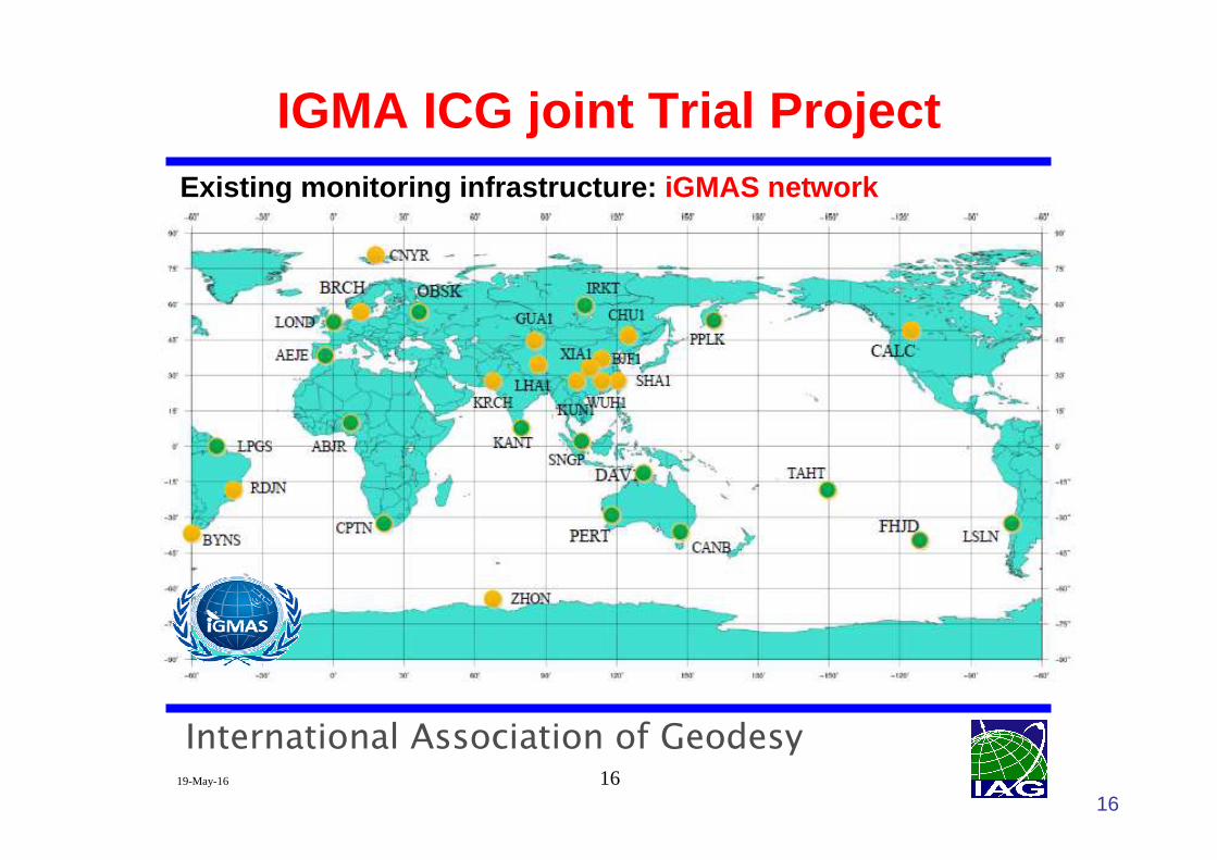
Existing monitoring infrastructure: iGMAS network
International Association of Geodesy19-May-16 17
IGMA ICG joint Trial Project
17
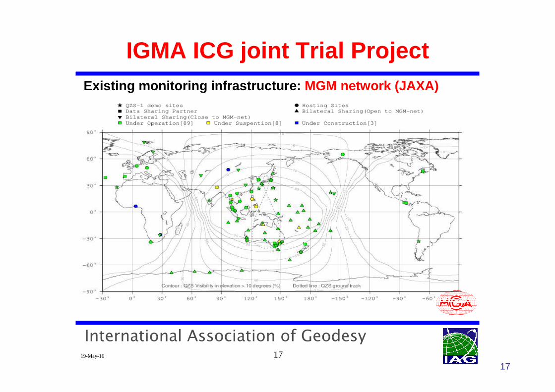
Existing monitoring infrastructure: MGM network (JAXA)
International Association of Geodesy19-May-16 18
IGMA ICG joint Trial Project
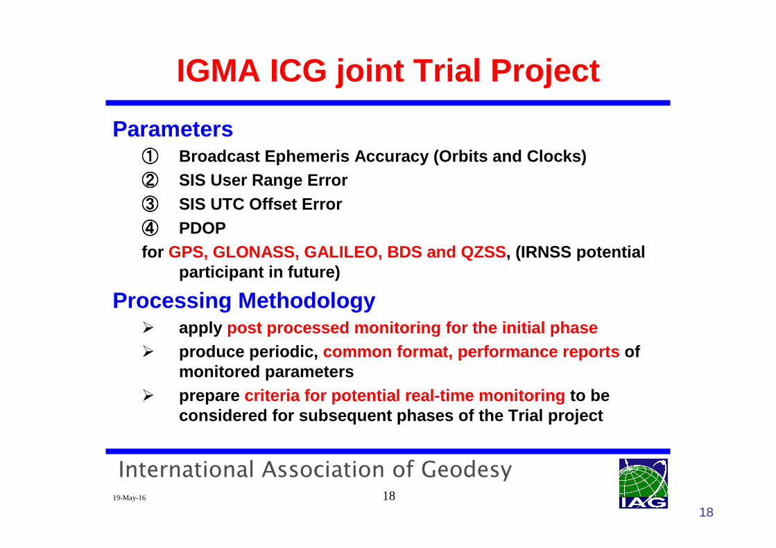
Parameters①①①① Broadcast Ephemeris Accuracy (Orbits and Clocks)②②②② SIS User Range Error③③③③ SIS UTC Offset Error ④④④④ PDOPfor GPS, GLONASS, GALILEO, BDS and QZSS , (IRNSS potential
participant in future)
Processing Methodology� apply post processed monitoring for the initial phase� produce periodic, common format, performance reports of
monitored parameters� prepare criteria for potential real-time monitoring to be
considered for subsequent phases of the Trial proje ct
18
International Association of Geodesy19-May-16 19
IGMA ICG joint Trial Project
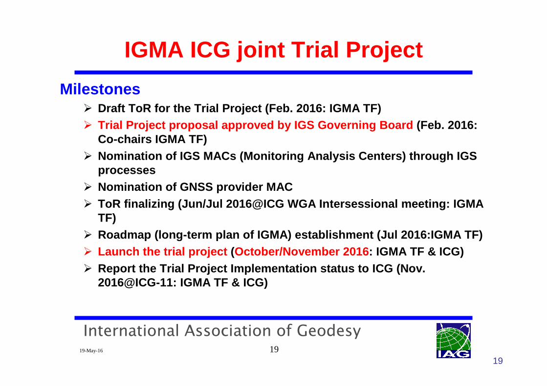
Milestones� Draft ToR for the Trial Project (Feb. 2016: IGMA TF)� Trial Project proposal approved by IGS Governing Bo ard (Feb. 2016:
Co-chairs IGMA TF)� Nomination of IGS MACs (Monitoring Analysis Centers) through IGS
processes � Nomination of GNSS provider MAC � ToR finalizing (Jun/Jul 2016@ICG WGA Intersessional m eeting: IGMA
TF) � Roadmap (long-term plan of IGMA) establishment (Jul 2016:IGMA TF) � Launch the trial project (October/November 2016 : IGMA TF & ICG)� Report the Trial Project Implementation status to I CG (Nov.
2016@ICG-11: IGMA TF & ICG)
19
International Association of Geodesy19-May-16 20
Summary
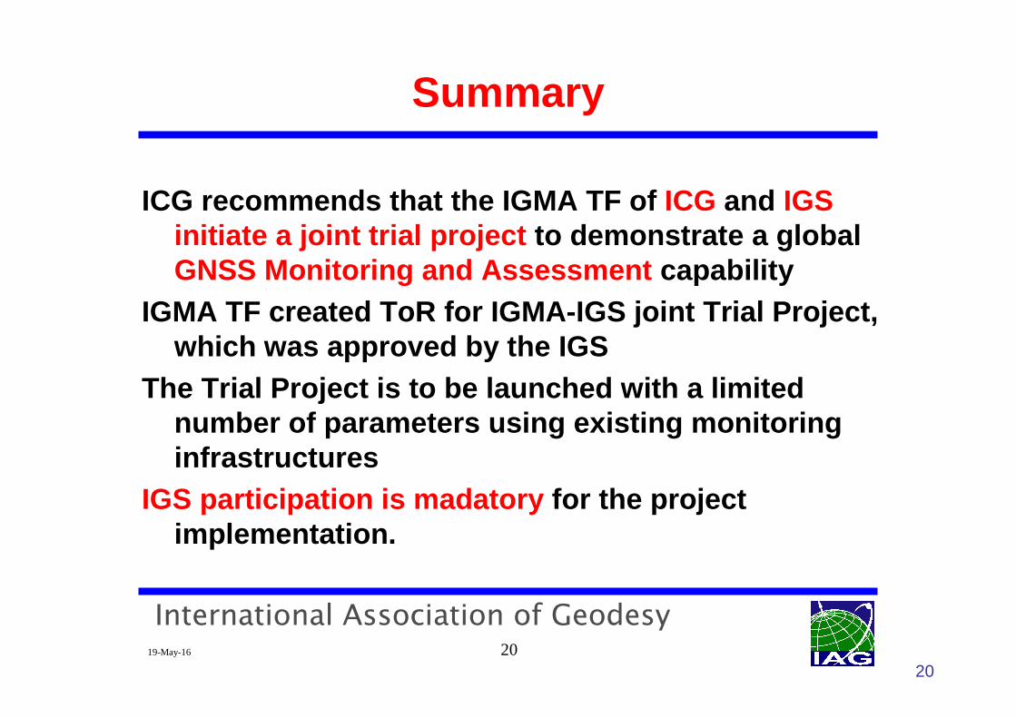
ICG recommends that the IGMA TF of ICG and IGSinitiate a joint trial project to demonstrate a global GNSS Monitoring and Assessment capability
IGMA TF created ToR for IGMA-IGS joint Trial Project , which was approved by the IGS
The Trial Project is to be launched with a limited number of parameters using existing monitoring infrastructures
IGS participation is madatory for the project implementation.
20
International Association of Geodesy19-May-16 21
IGS Endorsement by PNT Board
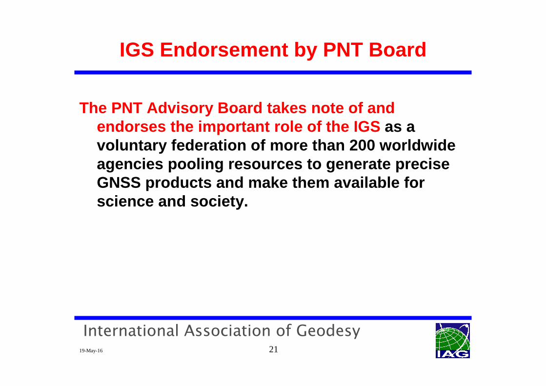
The PNT Advisory Board takes note of and endorses the important role of the IGS as a voluntary federation of more than 200 worldwide agencies pooling resources to generate precise GNSS products and make them available for science and society.
International Association of Geodesy19-May-16 22
Backup Slides
International Association of Geodesy19-May-16 23
International Committee on GNSS
Revised Work Plan – Related to Service Performance Mon itoring (2/2)� When requested by a provider or providers, the Subgroup will assist
in exchanging information with ICG participants to help resolve GNSS open service anomalies that impact users.
� The Subgroup will also facilitate cooperation and information exchanges between providers and scientific organiza tions that engage in open service signal quality monitoring.
� If necessary, the sub-group will establish ad hoc task forces to implement concrete tasks and reach objectives in sc hedule.
23
International Association of Geodesy19-May-16 24
Intl. GNSS Monitoring and Assessment
The International GNSS Monitoring and Assessment(IGMA) Task Force was established at ICG-6 meeting in Tokyo, 2011 (at that time, it was called IGMA Sub Group)
After discussions at several meetings, the tasks were defined and renamed as IGMA Task Force of ICG, WG A with B,D at ICG-8 in Dubai (Rec. 8A.4.1)
24
International Association of Geodesy19-May-16 25
Recommendation #4 (10A/D.4.1) for ICG-10 (2/2)• Before launching the joint Trial Project, the follo wing issues have to be resolved:
– ToR for the Trial Project
– Status of Trial Project and list of participating o rganizations (existing monitoring systems and/or providers), ope ration modes
– List of stations to be used in Trial Project, providing 1X coverage (collecting all measurement data from all satellite s of all GNSS)
– Requirements for receivers and related equipment
– List of monitored parameters for Trial Project and calculation methods for them
– Definition of organizational procedures (reference data validation for parameters calculations, measurement data excha nge, monitoring results exchange, etc.)
25
IGMA ICG joint Trial Project
International Association of Geodesy19-May-16 26
International Committee on GNSS
Revised Work Plan – Related to Service Performance Mon itoring (1/2)� Consider the development and discussion of proposal s to widely
monitor the performance of their open signals and p rovide timelyupdates to users regarding critical performance characteristics.
� The Working Group, through the Interoperability and Service Standards Subgroup, will support this activity by t ranslating open service performance standards into parameters for m ulti-GNSS monitoring.
� Recommendations on the necessary monitoring infrast ructure and organizational approaches may be made to providers and international organizations in coordination with ot her ICG working groups as necessary and appropriate.
26
International Association of Geodesy19-May-16 27
IGMA ICG joint Trial Project
Objectives of Trial Project:� implement a monitoring system for all GNSS by
� monitoring a limited number of parameters� using existing monitoring infrastructures� developing a set of requirements for monitoring system(s)
in subsequence phases of the project
� demonstrate user benefits of� Consolidated monitoring system products� Combined use of multi-constellations
� promote trust in GNSS through ICG monitoring system
27
International Association of Geodesy19-May-16 28
28
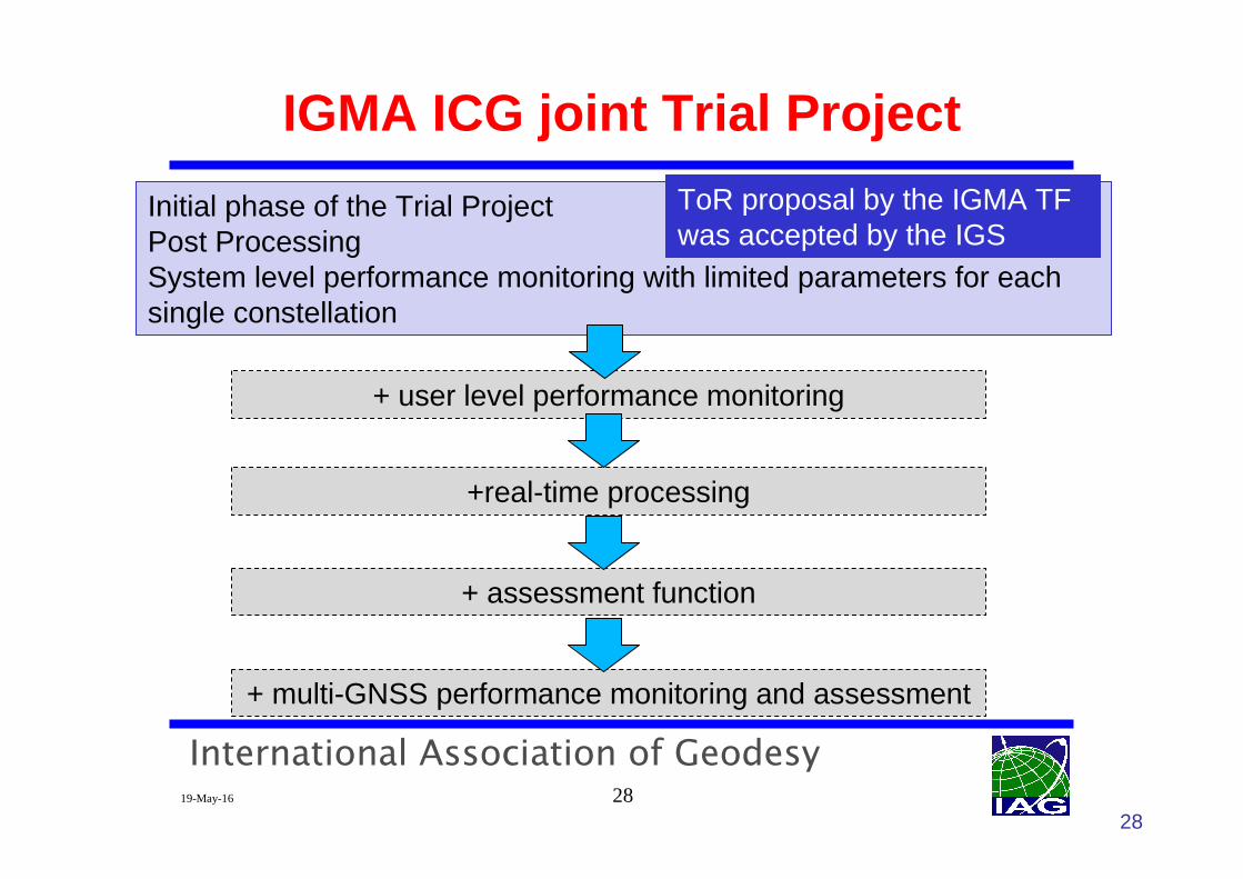
IGMA ICG joint Trial Project
Initial phase of the Trial ProjectPost ProcessingSystem level performance monitoring with limited parameters for each single constellation
+ user level performance monitoring
+real-time processing
+ multi-GNSS performance monitoring and assessment
+ assessment function
ToR proposal by the IGMA TF was accepted by the IGS
International Association of Geodesy19-May-16 29
IGMA ICG joint Trial Project
29
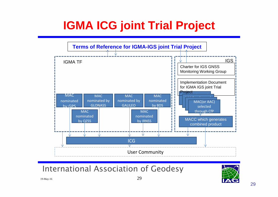
Terms of Reference for IGMA-IGS joint Trial Project
IGMA TF
MAC
nominated
by GPS
MAC
nominated by
GLONASS
MAC
nominated by
GALILEO
MAC
nominated
by BDS
MAC
nominated
by QZSS
MAC
nominated
by IRNSS
MAC selected
through CfP
Charter for IGS GNSS Monitoring Working Group
Implementation Document for IGMA IGS joint Trial Project
MAC selected
through CfPMAC selected
through CfPMAC(or AAC)
selected
through CfP
MACC which generates combined product
User Community
ICG
IGS
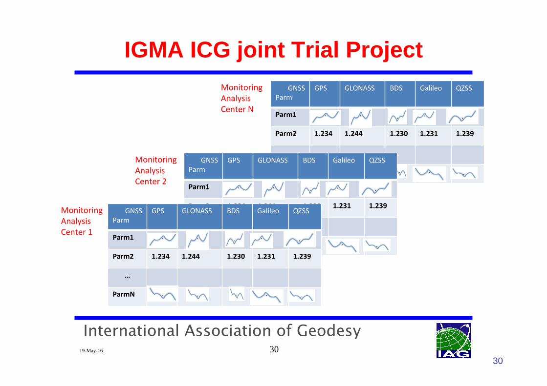
International Association of Geodesy19-May-16 30
IGMA ICG joint Trial Project
30
GNSS
Parm
GPS GLONASS BDS Galileo QZSS
Parm1
Parm2 1.234 1.244 1.230 1.231 1.239
…
ParmN
Monitoring
Analysis
Center N
GNSS
Parm
GPS GLONASS BDS Galileo QZSS
Parm1
Parm2 1.234 1.244 1.230 1.231 1.239
…
ParmN
Monitoring
Analysis
Center 2
GNSS
Parm
GPS GLONASS BDS Galileo QZSS
Parm1
Parm2 1.234 1.244 1.230 1.231 1.239
…
ParmN
Monitoring
Analysis
Center 1
International Association of Geodesy19-May-16 31
IGS Contribution
Launch of IGMA-IGS joint Trial Project through� data provision
� observation and NAV data for specific stations� as a first step, use RINEX (non-real time data), RT data stream for next
steps
� AC/AACs with MGEX participation and product generati on� join the Trial Project as a MAC to� provide reference / benchmark orbits and clocks for broadcast ephemeris
accuracy and SIS-URE calculation , not only for GPS and GLO but also for BDS, GAL, QZSS (post processing, combined final pr oduct in the first step)
31
Charter for the IGS Monitoring Working Group, and t he implementation document for the Trial Project have been accepted b y the IGS Governing Board. A CfP will be issued in the near future.
International Association of Geodesy19-May-16 32
Next steps, Challenges
Next steps
IGS and ICG will nominate / select participants of th e project
ChallengesHarmonization between ToR and IGS CharterEstablish effective and appropriate management and implementation mannerCreate common definitions and calculation methodolog ies for monitoring parameters which are agreed by all participan ts
32