Embed Size (px)
Citation preview
MRWTP Phase Two Expansion Project Final Subsequent Environmental Impact Report 2-1
June 2005
J&S 03-564
Chapter 2 Comments and Responses
IntroductionCopies of the comment letters/testimony received on the MRWTP Phase Two Expansion Project DSEIR and responses to each comment are included in this chapter. The purpose of the public review process was to receive input on the content of the Proposed Project and the DSEIR. CEQA requires MID and the City of Modesto to make a good-faith reasoned analysis and respond to comments received (CEQA Guidelines, Section 15088).
Each comment letter received on the DSEIR has been assigned a number, and comments within each letter are lettered consecutively (e.g., 1-A, 1-B, 2-A, 2-B) in the right margin adjacent to the individual comment. Each comment letter is followed by MID and the City’s response(s) to that letter. The responses are numbered to correspond with the comments as identified in the right margin of the letter. Where the response indicates that a change has been made to the DSEIR, the relevant text change can be found in Chapter 3 of this FSEIR.
Comments and Responses The following represents MID and the City’s responses to all comments received during the public comment period (November 5 – December 15, 2004) and public hearing on the DSEIR (December 15, 2004), as well as two additional comment letters that were accepted after the formal comment period. A total of five comment letters were received. Listed below are the sources of the comment letters and the dates they were received, as well as the numbers assigned to each of the comment letters.
California Department of Water Resources (November 23, 2004)—Letter 1
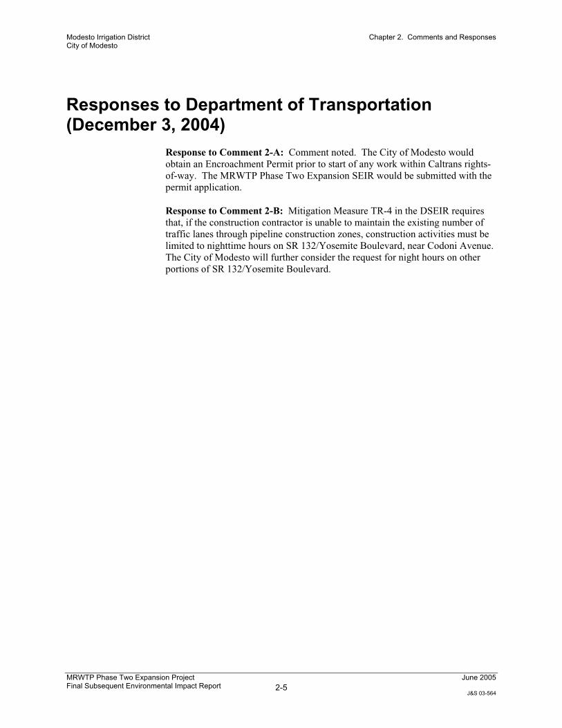
California Department of Transportation (December 3, 2004)—Letter 2
Tuolumne River Trust (December 13, 2004)—Letter 3
City of Waterford (February 10, 2005)—Letter 4
California State Water Resources Control Board (March 4, 2005)—Letter 5

Modesto Irrigation District City of Modesto
Chapter 2. Comments and Responses
MRWTP Phase Two Expansion Project Final Subsequent Environmental Impact Report 2-2
June 2005
J&S 03-564
This page intentionally left blank.
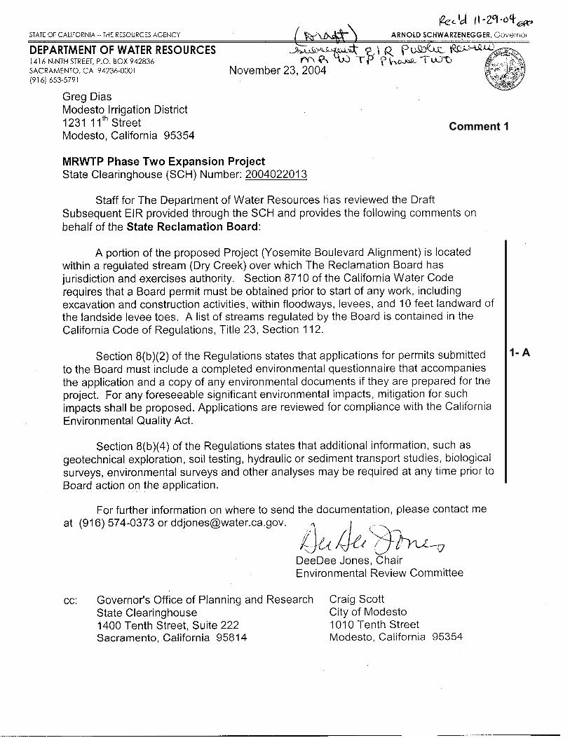
1- A
Comment 1

Modesto Irrigation District City of Modesto
Chapter 2. Comments and Responses
MRWTP Phase Two Expansion Project Final Subsequent Environmental Impact Report 2-3
June 2005
J&S 03-564
Responses to Department of Water Resources (November 23, 2004)
Response to Comment 1-A. Comment noted. If the City of Modesto chooses to construct improvements along the Yosemite Boulevard alignment, then the City would obtain a State Reclamation Board Permit and comply with all requirements of the Board prior to start of any work within or adjacent to Dry Creek (i.e., wetted area, floodplain, and levees). The MRWTP Phase Two Expansion SEIR would be submitted with the permit application.

Modesto Irrigation District City of Modesto
Chapter 2. Comments and Responses
MRWTP Phase Two Expansion Project Final Subsequent Environmental Impact Report 2-4
June 2005
J&S 03-564
This page intentionally left blank.
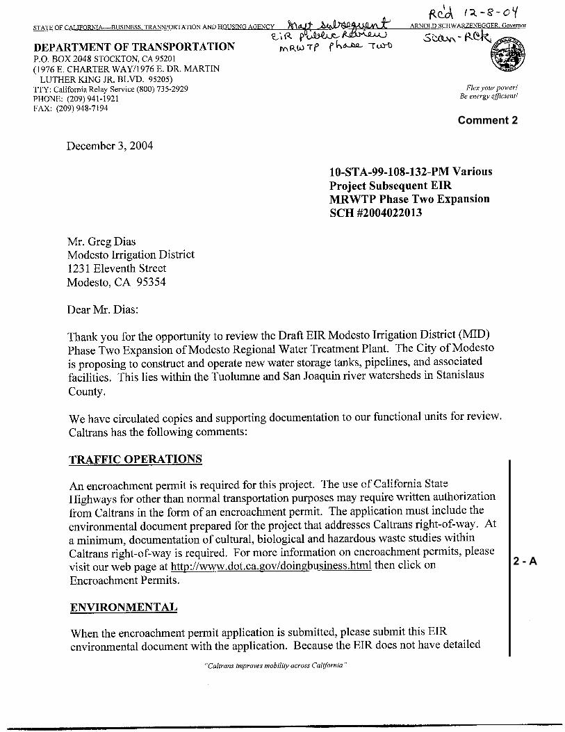
2 - A
Comment 2
2 - A (cont.)
2 - B
Modesto Irrigation District City of Modesto
Chapter 2. Comments and Responses
MRWTP Phase Two Expansion Project Final Subsequent Environmental Impact Report 2-5
June 2005
J&S 03-564
Responses to Department of Transportation (December 3, 2004)
Response to Comment 2-A: Comment noted. The City of Modesto would obtain an Encroachment Permit prior to start of any work within Caltrans rights-of-way. The MRWTP Phase Two Expansion SEIR would be submitted with the permit application.
Response to Comment 2-B: Mitigation Measure TR-4 in the DSEIR requires that, if the construction contractor is unable to maintain the existing number of traffic lanes through pipeline construction zones, construction activities must be limited to nighttime hours on SR 132/Yosemite Boulevard, near Codoni Avenue. The City of Modesto will further consider the request for night hours on other portions of SR 132/Yosemite Boulevard.
Modesto Irrigation District City of Modesto
Chapter 2. Comments and Responses
MRWTP Phase Two Expansion Project Final Subsequent Environmental Impact Report 2-6
June 2005
J&S 03-564
This page intentionally left blank.
3 - A
3 - B
3 - C
3 - D
3 - E
Comment 3
3 - E (cont.)
3 - F
3 - G
3 - H
3 - I
Modesto Irrigation District City of Modesto
Chapter 2. Comments and Responses
MRWTP Phase Two Expansion Project Final Subsequent Environmental Impact Report 2-7
June 2005
J&S 03-564
Responses to Tuolumne River Trust (December 13, 2004)
Response to Comment 3-A: MID has performed a substantial analysis of the MID water supply allocated for the Phase Two Expansion Project. This work includes a computerized modeling analysis developed from the statewide planning model CALSIM II (Tuolumne River segment). This simulation model is described in Appendix E of the DSEIR.
Additional discussion and clarification of the Proposed Project’s water supply can be found in Response to Comments 3-C and 5-C.
Response to Comment 3-B: See Response to Comment 5-C.
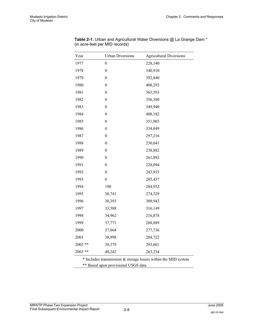
Response to Comment 3-C: The Proposed Project would not change the total annual amount of water diverted from the Tuolumne River because urban customers would use water that was previously applied to agricultural lands (see Response to Comment 5-C). As a result, there would be no significant change in the amount of future Tuolumne River diversions at La Grange Dam by MID.
As shown in FSEIR Table 2-1, the annual water diversion at La Grange Dam to meet agricultural and urban requirements fluctuates from year to year, depending upon numerous factors such as weather conditions, water year type, available water supply, irrigation allocation, cropping patterns, agricultural and domestic water system capacity, and other factors that impact downstream demand.
Modesto Irrigation District City of Modesto
Chapter 2. Comments and Responses
MRWTP Phase Two Expansion Project Final Subsequent Environmental Impact Report 2-8
June 2005
J&S 03-564
Table 2-1. Urban and Agricultural Water Diversions @ La Grange Dam * (in acre-feet per MID records)
Year Urban Diversions Agricultural Diversions
1977 0 228,140
1978 0 340,910
1979 0 392,840
1980 0 408,293
1981 0 363,593
1982 0 356,390
1983 0 349,940
1984 0 408,182
1985 0 351,003
1986 0 334,849
1987 0 297,216
1988 0 230,641
1989 0 238,882
1990 0 261,892
1991 0 228,094
1992 0 243,933
1993 0 285,437
1994 190 284,952
1995 30,741 274,329
1996 30,393 309,943
1997 33,588 316,149
1998 34,962 216,878
1999 37,771 288,889
2000 37,864 277,736
2001 38,998 284,722
2002 ** 38,379 293,601
2003 ** 40,242 263,234
* Includes transmission & storage losses within the MID system
** Based upon provisional USGS data
Modesto Irrigation District City of Modesto
Chapter 2. Comments and Responses
MRWTP Phase Two Expansion Project Final Subsequent Environmental Impact Report 2-9
June 2005
J&S 03-564
Response to Comment 3-D: As described in the DSEIR and in more detail in the Response to Comments 3-E and 3-F, the Proposed Project would not have a significant impact on the Tuolumne River. As such, there would be no impacts to report upon under CEQA.
Regarding reporting requirements, the Turlock Irrigation District (TID) Board has no authority or responsibilities tied to this project. Further, while MID and the City of Modesto are co-Lead Agencies for this project, MID is the Lead Agency in regard to the Proposed Project’s agricultural and urban water supply. MID staff regularly report to the MID Board of Directors on water use and other matters relating to water resources.
Response to Comment 3-E: Contrary to the implications of the comment, the simulation model shows that releases from La Grange Dam would maintain the minimum flows in the Tuolumne River required by the 1995 Federal Energy Regulatory Commission (FERC) Settlement Agreement and all water rights licenses and permits under all conditions. While the simulation model is consistent with widely accepted techniques for analyzing water systems, there are certain limitations in the ability of any water model to precisely replicate complex water systems such as the Tuolumne River watershed. For example, the model does not have the ability to factor in daily operational decisions made by MID and TID. Nevertheless, MID and TID monitor flows in the Tuolumne River below La Grange Dam to ensure that all minimum flow requirements are maintained. The Proposed Project would not, under any circumstances, reduce flows below the required levels. In addition, although the flow regimes were designed to protect salmon, they also protect rainbow trout/steelhead fisheries.
The river flow changes shown in DSEIR Table 3.4-4 were inaccurately transcribed from the modeling results in that reductions in flows were shown as increases in flows, and vice versa. This has been corrected, and the revised table is shown in Chapter 3 of this FSEIR. Despite this error in the table in the DSEIR, the simulation model indicates that minimum river flow requirements are maintained under all circumstances, as described above.
Response to Comment 3-F: Corrected Table 3.4-4 (see Chapter 3 of this FSEIR) shows insignificant reductions in average monthly flows of the Tuolumne River from February through April, and during November; insignificant increases in average monthly Tuolumne River flows are shown in the remaining months. The simulation model identifies a maximum average monthly reduction of 23 cubic feet per second (cfs) in February. The modeled flow changes would have an insignificant effect on temperatures in the Tuolumne River for the following reasons.
Reductions in river flow would occur during late winter and early spring when flows are already high and generally above minimum flows requirements and ambient water temperatures are cold. Any reduction would represent a small fraction of the total flow in the Tuolumne River during those periods.
Modesto Irrigation District City of Modesto
Chapter 2. Comments and Responses
MRWTP Phase Two Expansion Project Final Subsequent Environmental Impact Report 2-10
June 2005
J&S 03-564
Releases from La Grange Dam are of homogenous temperature, regardless of the quantity of water that is released. Therefore, the only factor that could increase temperatures downstream would be the effects of air temperature as the water is in transit. Because air temperatures are typically lower during late winter and early spring and because of the volume of water in the river at that time, such thermal effects would not likely be measurable and are considered insignificant.
In summary, while the simulation model shows small changes in the flows of the Tuolumne River, flows would still meet all regulatory requirements under all conditions, and changes in flows would not cause increases in water temperature that could be harmful to fish.
Response to Comment 3-G: There would be no adverse temperature impacts on the Tuolumne River as the result of the Proposed Project (see the Response to Comment 3-F), and therefore, no temperature mitigation measures are necessary. In addition, use of a downstream diversion point would require one of the following two changes to the project:
1. Construction of a separate water treatment plant at or near the new diversion point, and construction of associated pipelines and infrastructure to connect to the existing MID transmission system; or
2. Construction of approximately 10 miles of pipeline and one or more pump stations to covey the water uphill to the existing plant site.
Option 1 would not meet the project objective stated in the DSEIR to “provide water treatment and delivery capacity through expansion of MID’s existing MRWTP…” (DSEIR Page 2-3). Further, neither option would reduce any of the significant impacts identified in the SEIR; in addition, both options could result in additional impacts over and above those identified in the SEIR related to construction and operation of the additional facilities. Finally, both options would cost more than the Proposed Project. For these reasons, use of a downstream diversion point did not meet the criteria for an alternative under CEQA, and was not considered in the SEIR.
Note that a downstream diversion point was considered as an alternative in the EIR for the Modesto Surface Water Treatment Plant (Modesto Irrigation District 1990).1 This alternative was found in that EIR to be infeasible for reasons including those cited above, and was not ultimately selected as the preferred alternative.
Response to Comment 3-H: The City is currently engaged in an active program to clean up contaminated wells and prevent future contamination from historic sources such as dry cleaners. In addition, the City is building additional water supply wells to make up for well capacity lost due to well contamination. Because these activities are already occurring and use of all available
1 Modesto Irrigation District. 1990. Final Environmental Impact Report for the Modesto Surface Water Treatment Plant. March. (State Clearinghouse Number 1990101208.) Prepared by URS Consultants, Inc. San Bernardino, CA.
Modesto Irrigation District City of Modesto
Chapter 2. Comments and Responses
MRWTP Phase Two Expansion Project Final Subsequent Environmental Impact Report 2-11
June 2005
J&S 03-564
groundwater would not be sufficient to supply Modesto’s future water demands, this is not a feasible project alternative which would reasonably attain most of the basic objectives of the project. As discussed below in the Response to Comment 3-I, conjunctive use of surface water and groundwater is part of the City’s overall master plan for water supply.
It also bears noting that the aquifers in the Modesto area have natural deposits of uranium, which is a source of contamination that is expensive to remediate.Further, to meet upcoming drinking water standards related to arsenic, some wells will require treatment systems, which will also be expensive, consume energy, and require disposal of waste products. These factors underscore the need for the operational flexibility afforded by an additional surface water supply and conjunctive water supply management.
Response to Comment 3-I: The City of Modesto’s water supply is a conjunctive use program wherein currently 60% of its supply is from groundwater and the remaining 40% is surface water provided by MID. This conjunctive use program will continue into the future and is in fact part of the baseline setting in which the Proposed Project would operate, which is why it was not considered as a separate project alternative.
The City of Modesto and MID, along with other agencies, continue to actively manage the groundwater supply in the project area. More detailed information can be found in the 2000 Final Urban Water Management Plan jointly developed by the City of Modesto and MID, and MID’s Final Groundwater Management Plan (1996).2 Both of these reports will be updated in 2005. Further information can be found in California’s Groundwater Bulletin 118 (California Department of Water Resources 2004).3
It should also be noted that there are two groundwater associations that meet regularly to help coordinate groundwater issues in the project area. Agencies belonging to the Stanislaus and Tuolumne Rivers’ Groundwater Basin Association include the Cities of Modesto, Oakdale, and Riverbank, the Modesto and Oakdale Irrigation Districts, and Stanislaus County. The Turlock Groundwater Basin Association includes the City of Modesto, Stanislaus County, and several other agencies south of the Tuolumne River. Both groundwater associations have completed groundwater management plans. The City of Modesto plans to complete its groundwater management plan in conjunction with the updating the two-groundwater basin association’s existing groundwater management plans, expected in 2005.
2 City of Modesto and Modesto Irrigation District. 2000. Final Urban Water Management Plan. Prepared by Black and Veatch. Modesto, CA; and Modesto Irrigation District. 1996. Final Groundwater Management Plan for the Modesto Irrigation District. Prepared in accordance with State Assembly Bill 3030 and adopted March 26, 1996. 3 California Department of Water Resources. 2004. California’s Groundwater. (Bulletin 118.) Last revised: 2004. Available: <http://www.groundwater.water.ca.gov/bulletin118/update2003/index.cfm>. Accessed: January 27, 2004.
Modesto Irrigation District City of Modesto
Chapter 2. Comments and Responses
MRWTP Phase Two Expansion Project Final Subsequent Environmental Impact Report 2-12
June 2005
J&S 03-564
This page intentionally left blank.
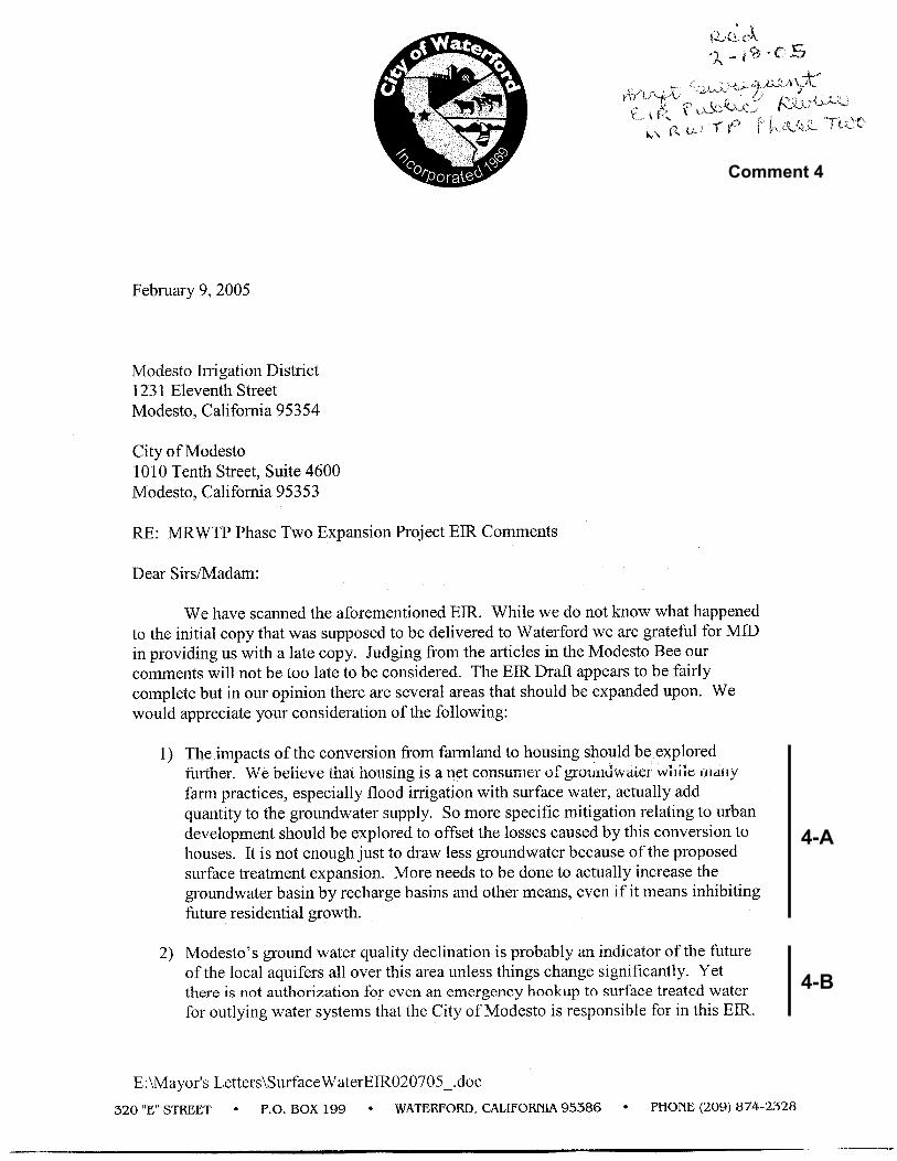
4-A
4-B
Comment 4
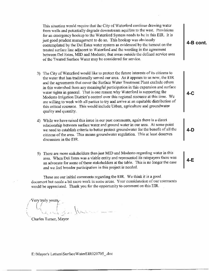
4-B cont.
4-C
4-D
4-E
Modesto Irrigation District City of Modesto
Chapter 2. Comments and Responses
MRWTP Phase Two Expansion Project Final Subsequent Environmental Impact Report 2-13
June 2005
J&S 03-564
Responses to City of Waterford (February 10, 2005) Response to Comment 4-A: The DSEIR identified agricultural to urban conversion as one of the indirect effects of growth, and the commenter correctly notes a relationship between such land conversion and rates of groundwater recharge. While the list of indirect effects of growth presented in the DSEIR was not intended to be comprehensive, this clarification to that list is noted. The DSEIR found all indirect effects of growth as significant and unavoidable, and this clarification does not change that conclusion. A more detailed discussion of groundwater and groundwater recharge is presented below.
There are two components of agricultural land use conversion that have occurred within the boundaries of MID – existing growth and forecasted growth. The forecasted growth is consistent with the City of Modesto General Plan and within the LAFCO defined Sphere of Influence.
Due to the construction and commercial operation of Phase One of the MRWTP in 1995, the existing urban lands are now served by a combination of both groundwater, supplied by the City of Modesto, and surface water, supplied by MID via the MRWTP. Since the MRWTP came on-line, the City of Modesto has lessened its reliance on groundwater by about 33,000 acre-feet on an average annual basis and the City has measured significant groundwater level recoveries (as measured in various monitoring wells).
The forecasted growth of the urban area, onto lands that are presently agricultural (or very recently were agricultural) and historically irrigated by surface water delivered by MID, presents a slightly different scenario than that which occurred during Phase One of the MRWTP. The urban growth in these areas will continue to be primarily served by surface water, provided from the Phase Two expansion of the MRWTP. The volume of water delivered to these urbanized lands, on a per acre basis, will be approximately the same as the volume of water delivered to these lands when they were agricultural.
Whereas these historical agricultural lands were primarily irrigated via “flood irrigation” methods (even though there has been a steady conversion over the last 10 – 20 years to solid set sprinkler and micro-irrigation systems) most of the water applied in this manner was consumptively used by the crop or returned to the atmosphere due to evaporation. However, a component of the irrigation water did, in fact, provide incidental local recharge to the groundwater basin due to deep percolation of the applied surface water.
The amount of aquifer recharge depends on many different factors such as surface soil permeability, location within the groundwater basin (up-gradient or down-gradient), the presence or absence of near surface clay layers or regionally significant aquitards, such as the Corcoran Clay. These same factors control the extent of recharge occurring under natural conditions. Nevertheless, there is no dispute that aquifer recharge has occurred, over time, due to the applied surface
Modesto Irrigation District City of Modesto
Chapter 2. Comments and Responses
MRWTP Phase Two Expansion Project Final Subsequent Environmental Impact Report 2-14
June 2005
J&S 03-564
water using flood irrigation methods. Additionally, recharge occurs in urban areas through distribution system leakage, irrigation, and precipitation. It is uncertain whether there is a significant reduction in recharge with the urbanization of certain agricultural lands. However, if there is reduction in recharge due to development, this is not a phenomenon distinctly unique or directly related to this project or this area of the Central Valley of California, but is something that is occurring, to some extent, anywhere where agricultural land is either converted to more efficient irrigation delivery systems or converted to urban land uses.
To address the broader issue of groundwater management in the Modesto Sub-Basin, and particularly the issue of groundwater recharge, the Stanislaus & Tuolumne Rivers Groundwater Basin Association (the Association), which is represented by the cities of Modesto, Oakdale and Riverbank, Stanislaus County, Oakdale Irrigation District and Modesto Irrigation District, are nearing completion of an Integrated Regional Groundwater Management Plan for the Modesto Sub-Basin. The plan was adopted by the Association on May 12, 2005. The Association supports activities and programs that:
Relieve aquifer overdraft through substitution of surface water for groundwater
Continue implementation of water conservation programs that will reduce reliance on groundwater pumping
Continue and enhance groundwater monitoring and groundwater management to ensure the balanced state of the groundwater basin
Seek funding for programs and projects that would identify and mitigate potential condition of overdraft in the basin
The Association is evaluating the subsurface geology within and directly adjacent to its boundary for the purpose of delineating areas having potentially high recharge rates. The basin contains numerous discontinuous recharge and withdrawal areas that do not allow for easily defined mapping of recharge zones. The Association seeks to better define the areas within the basin that have a high potential for contributing effective aquifer recharge and will communicate that information to land use planning entities within the basin to enact the measures necessary to protect these lands from development that would reduce their value as recharge to the groundwater basin. The first step in implementing this plan is to identify recharge areas within the cities and the county, to develop a GIS-based map of the natural recharge areas, to inform planning entities of the importance of these areas and to make recommendations for the protection of those areas that are effective and affordable, and to the extent practicable, can be implemented.
Response to Comment 4-B: The primary objective of the MRWTP Phase Two Expansion Project is to provide additional treated water and operational flexibility and reliability to existing and future water users in the City of Modesto (see DSEIR Page 2-3, “Project Objectives and Need” and DSEIR Figure 2-1, showing water service area boundary). Because a connection between the City
Modesto Irrigation District City of Modesto
Chapter 2. Comments and Responses
MRWTP Phase Two Expansion Project Final Subsequent Environmental Impact Report 2-15
June 2005
J&S 03-564
of Modesto’s surface water supply system and outlying water systems is not consistent with this objective, such a connection has not been proposed as part of this project. The commentor’s concern regarding potential degradation of downstream aquifers to the west is noted, however the comment is speculative as there is no evidence to indicate that Waterford’s existing or planned use of groundwater will degrade downstream aquifers or that implementation of the Phase Two Expansion would result in the hypothetical adverse impact raised by the commentor. To the contrary, as noted above, implementation of the Phase Two Expansion will improve management of the groundwater basin and alleviate potential adverse impacts to the basin by lessening the City’s reliance on groundwater and improving opportunities for conjunctive use. In addition, implementation of the MRWTP Phase Two Expansion Project does not preclude the consideration of such a connection from being included in a future expansion of the MRWTP.
Response to Comment 4-C: The City of Modesto and MID are open to working with the City of Waterford to address regional water supply issues. However, the current project and the subject of the environmental review is implementation of the MRWTP Phase Two Expansion Project and associated facilities, as contemplated in the original Surface Water Treatment Plant project (see 1990 EIR Figure 2-1 and DSEIR Figure 2-1). The anticipated expansion never contemplated the inclusion of Waterford as part of the service area for this project. It was designed and intended to serve only the portion of the City of Modesto service area shown in the 1990 EIR Figure 2-1. The City is not proposing to expand the service area at this time, as it would undermine the City’s ability to meet the project objectives (see Response to Comment 4-B). The inclusion of additional service areas would necessitate a further expansion of the plant, which is beyond the scope of this project. As noted above, implementation of the MRWTP Phase Two Expansion does not preclude discussions regarding the possibility of making such a connection in the future as part of a separate project.
Response to Comment 4-D: See Response to Comment 4-A. In addition, the subject of groundwater usage and regulation has been previously addressed in the 1990 Final EIR. No substantial changes have occurred and no new information has become available which would warrant a significant revision of the 1990 Final EIR as it relates to this issue.
Response to Comment 4-E: Comment noted. As indicated in Response to Comment 4-C, the inclusion of Waterford as part of the service area for the Phase Two Expansion is beyond the scope of this project, but this does not preclude future discussion on this subject as part of a separate project.

Modesto Irrigation District City of Modesto
Chapter 2. Comments and Responses
MRWTP Phase Two Expansion Project Final Subsequent Environmental Impact Report 2-16
June 2005
J&S 03-564
This page intentionally left blank.
5-A
Comment 5
5-B
5-C
5-D
5-D cont.
5-E
5-F
5-G
5-H
5-I
5-J
5-K
5-L

Modesto Irrigation District City of Modesto
Chapter 2. Comments and Responses
MRWTP Phase Two Expansion Project Final Subsequent Environmental Impact Report 2-17
June 2005
J&S 03-564
Responses to California State Water Resources Control Board (March 4, 2005)
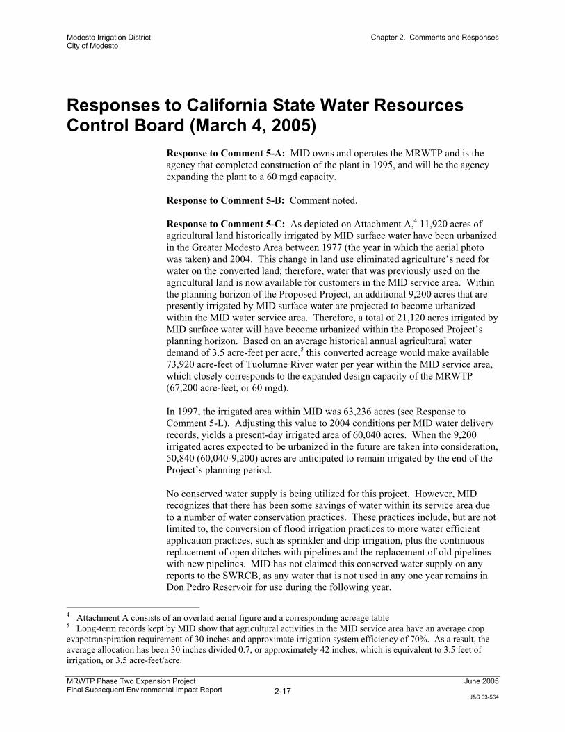
Response to Comment 5-A: MID owns and operates the MRWTP and is the agency that completed construction of the plant in 1995, and will be the agency expanding the plant to a 60 mgd capacity.
Response to Comment 5-B: Comment noted.
Response to Comment 5-C: As depicted on Attachment A,4 11,920 acres of agricultural land historically irrigated by MID surface water have been urbanized in the Greater Modesto Area between 1977 (the year in which the aerial photo was taken) and 2004. This change in land use eliminated agriculture’s need for water on the converted land; therefore, water that was previously used on the agricultural land is now available for customers in the MID service area. Within the planning horizon of the Proposed Project, an additional 9,200 acres that are presently irrigated by MID surface water are projected to become urbanized within the MID water service area. Therefore, a total of 21,120 acres irrigated by MID surface water will have become urbanized within the Proposed Project’s planning horizon. Based on an average historical annual agricultural water demand of 3.5 acre-feet per acre,5 this converted acreage would make available 73,920 acre-feet of Tuolumne River water per year within the MID service area, which closely corresponds to the expanded design capacity of the MRWTP (67,200 acre-feet, or 60 mgd).
In 1997, the irrigated area within MID was 63,236 acres (see Response to Comment 5-L). Adjusting this value to 2004 conditions per MID water delivery records, yields a present-day irrigated area of 60,040 acres. When the 9,200 irrigated acres expected to be urbanized in the future are taken into consideration, 50,840 (60,040-9,200) acres are anticipated to remain irrigated by the end of the Project’s planning period.
No conserved water supply is being utilized for this project. However, MID recognizes that there has been some savings of water within its service area due to a number of water conservation practices. These practices include, but are not limited to, the conversion of flood irrigation practices to more water efficient application practices, such as sprinkler and drip irrigation, plus the continuous replacement of open ditches with pipelines and the replacement of old pipelines with new pipelines. MID has not claimed this conserved water supply on any reports to the SWRCB, as any water that is not used in any one year remains in Don Pedro Reservoir for use during the following year.
4 Attachment A consists of an overlaid aerial figure and a corresponding acreage table 5 Long-term records kept by MID show that agricultural activities in the MID service area have an average crop evapotranspiration requirement of 30 inches and approximate irrigation system efficiency of 70%. As a result, the average allocation has been 30 inches divided 0.7, or approximately 42 inches, which is equivalent to 3.5 feet of irrigation, or 3.5 acre-feet/acre.
Modesto Irrigation District City of Modesto
Chapter 2. Comments and Responses
MRWTP Phase Two Expansion Project Final Subsequent Environmental Impact Report 2-18
June 2005
J&S 03-564
Response to Comment 5-D: Regarding the term “baseline conditions,” this term was used interchangeably with the term “benchmark” to reflect existing conditions as depicted by the model.
Regarding the tables, Table R19 presented data in acre-feet, while DSEIR Table 3.4-3 presented data in thousands of acre-feet. The discrepancies noted are a result of rounding data for the purposes of DSEIR Table 3.4-3 and do not represent an error.
Response to Comment 5-E: Regarding the term “baseline conditions,” please refer to Response to Comment 5-D.
The commenter correctly notes an error in DSEIR Table 3.4-4. The river flow changes shown in Table 3.4-4 were inaccurately transcribed from the modeling results in that reductions in flows were shown as increases in flows, and vice versa. This has been corrected, and the revised table is shown in Chapter 3 of this FSEIR.
Response to Comment 5-F: Please see Response to Comments 5-I, 5-J, and 5-K.
Response to Comment 5-G: Commenter is correct that the DSEIR did not contain a section titled “Sources of Additional Water.” The correct reference should have been to the section “Water Supply and Demand Setting,” which begins on Page 3.4-2 of the DSEIR. This correction is shown in Chapter 3 of the FSEIR.
Response to Comment 5-H: Please see Response to Comments 5-I, 5-J, and 5-K.
Response to Comment 5-I: As modeled, the delivery of up to 67,200 acre-feet per year on an MID delivery schedule in lieu of delivering that amount of water on an agricultural demand schedule can result in a slightly higher yearly diversion from storage during the non-irrigation months of November through early March. However, this is not the case in all years since MID releases water from Don Pedro during the winter months for hydroelectric generation and for storage in Modesto Reservoir for downstream use within the MID service area. In years where MID diversions exceed normal winter hydroelectric diversions, there will be a slight decrease in the winter storage level at Don Pedro. Such lower storage levels can create a small amount of additional storage capacity in Don Pedro Reservoir, but this would only be applicable during wet years. During wet years, when winter reservoir levels would be at or slightly below the maximum flood control level of 801.9 feet, the difference in storage would not be large enough to cause any different than normal operational decisions. Based on the modeling results,6 this condition would have occurred only during two of the
6 See Attachment B, which includes: -Figure 1, Don Pedro End of Month Storage, 1980-1998 -Table 1, Don Pedro Storage Change 1980-1998
Modesto Irrigation District City of Modesto
Chapter 2. Comments and Responses
MRWTP Phase Two Expansion Project Final Subsequent Environmental Impact Report 2-19
June 2005
J&S 03-564
nineteen-modeled years (1995 and 1996). The difference in storage levels for each of these two years would have been less than 0.5 feet in Don Pedro Reservoir level, or 5,000 acre-feet. Operationally, this difference of 0.3% is so small in comparison to the size of Don Pedro Reservoir that there is virtually no difference in the amount of water released or stored for either the Project or the Benchmark alternative. Consequently, MID believes that this difference in storage would have no potential to injure any other legal users of water and does not represent the initiation of a new water right.
Further, it should be noted that in contrast to 1995 and 1996 years where the modeling showed slightly lower reservoir levels under the Project alternative, and slight increases in reservoir releases to avoid encroachment in Don Pedro’s flood control space, the above normal runoff year types under the Project alternative can also result with increased downstream releases during August and September as the reservoir is drawn down to the winter flood control level. A review of the modeling data shows that this occurred in modeling years of 1980, 1986, 1993 and 1996.
Response to Comment 5-J: To clarify, Impact WR-4 does mention New Melones Reservoir, on the second full paragraph of DSEIR Page 3.4-20. The discussion in Impact WR-4 supports the assertion that the Proposed Project would not result in any changes that could affect operational decisions (i.e., water releases) at New Melones Reservoir.
Response to Comment 5-K: Attachment A identifies the agricultural lands expected to be converted to urban usages.
Details concerning the modeling assumptions may be found in Response to Comment 5-L.
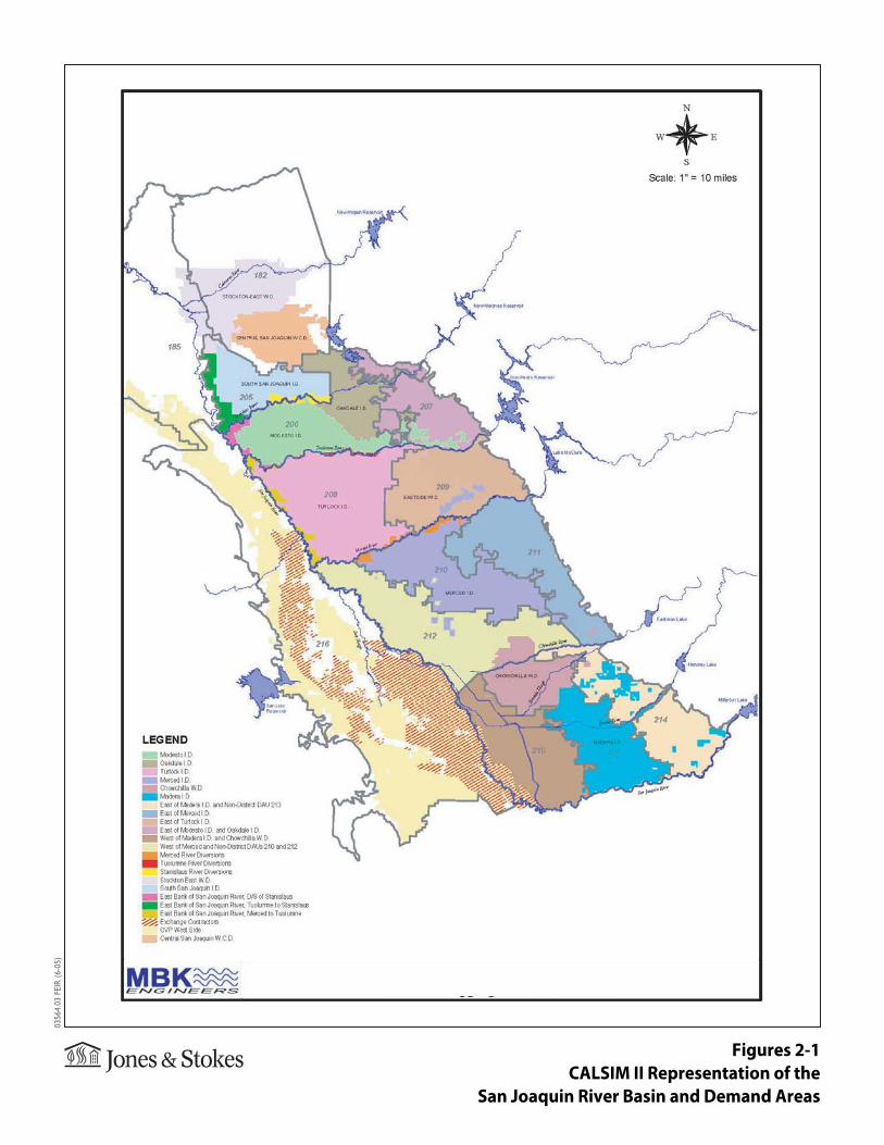
Response to Comment 5-L: The modeling results in the DSEIR rely upon a simulation of District operations over a long sequence of years. The model systematically simulates a month-to-month and year-to-year operation that varies according to hydrologic conditions, through periods of abundant water supplies and periods of drought. Underpinning the water demand of the District is the consumptive use requirement of the lands served. For the “current” level of demand, data currently developed for the statewide planning model CALSIM II is used for the DSEIR analysis. This data is currently under review by the U.S. Bureau of Reclamation (Reclamation). The following is an adaptation of Reclamation’s draft documentation for consumptive use included in CALSIM II.
A land-use based approach is used to depict water demands on the east side of the San Joaquin River including water demands in the District. Land-use based agricultural demands are developed by assuming an irrigated acreage within an area and estimating how much water is required to irrigate that land’s associated crops.
Land-use based demands are developed by first estimating the consumptive use of applied water (CUAW). The District is one of the 21 demand areas depicting
Modesto Irrigation District City of Modesto
Chapter 2. Comments and Responses
MRWTP Phase Two Expansion Project Final Subsequent Environmental Impact Report 2-20
June 2005
J&S 03-564
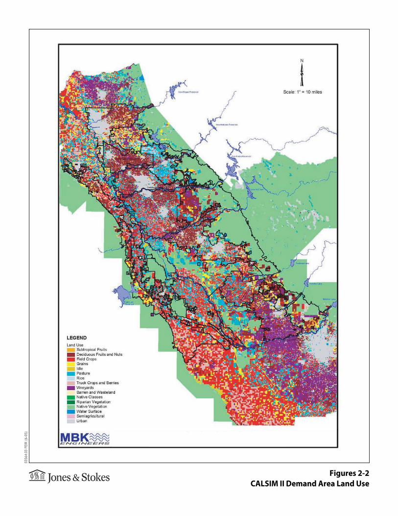
the east side of the San Joaquin Basin (see FSEIR Figure 2-1). Historical land use data was used to develop a simulation current demands and operations. GIS was used to determine land use for each demand area in the San Joaquin Basin including the District. A map containing CALSIM II demand areas and land use is illustrated in FSEIR Figure 2-2.
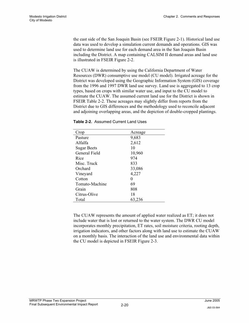
The CUAW is determined by using the California Department of Water Resources (DWR) consumptive use model (CU model). Irrigated acreage for the District was developed using the Geographic Information System (GIS) coverage from the 1996 and 1997 DWR land use survey. Land use is aggregated to 13 crop types, based on crops with similar water use, and input to the CU model to estimate the CUAW. The assumed current land use for the District is shown in FSEIR Table 2-2. These acreages may slightly differ from reports from the District due to GIS differences and the methodology used to reconcile adjacent and adjoining overlapping areas, and the depiction of double-cropped plantings.
Table 2-2. Assumed Current Land Uses
Crop Acreage Pasture 9,683 Alfalfa 2,612 Sugar Beets 10 General Field 10,960 Rice 974 Misc. Truck 833 Orchard 33,086 Vineyard 4,227 Cotton 0 Tomato-Machine 69 Grain 808 Citrus-Olive 18 Total 63,236
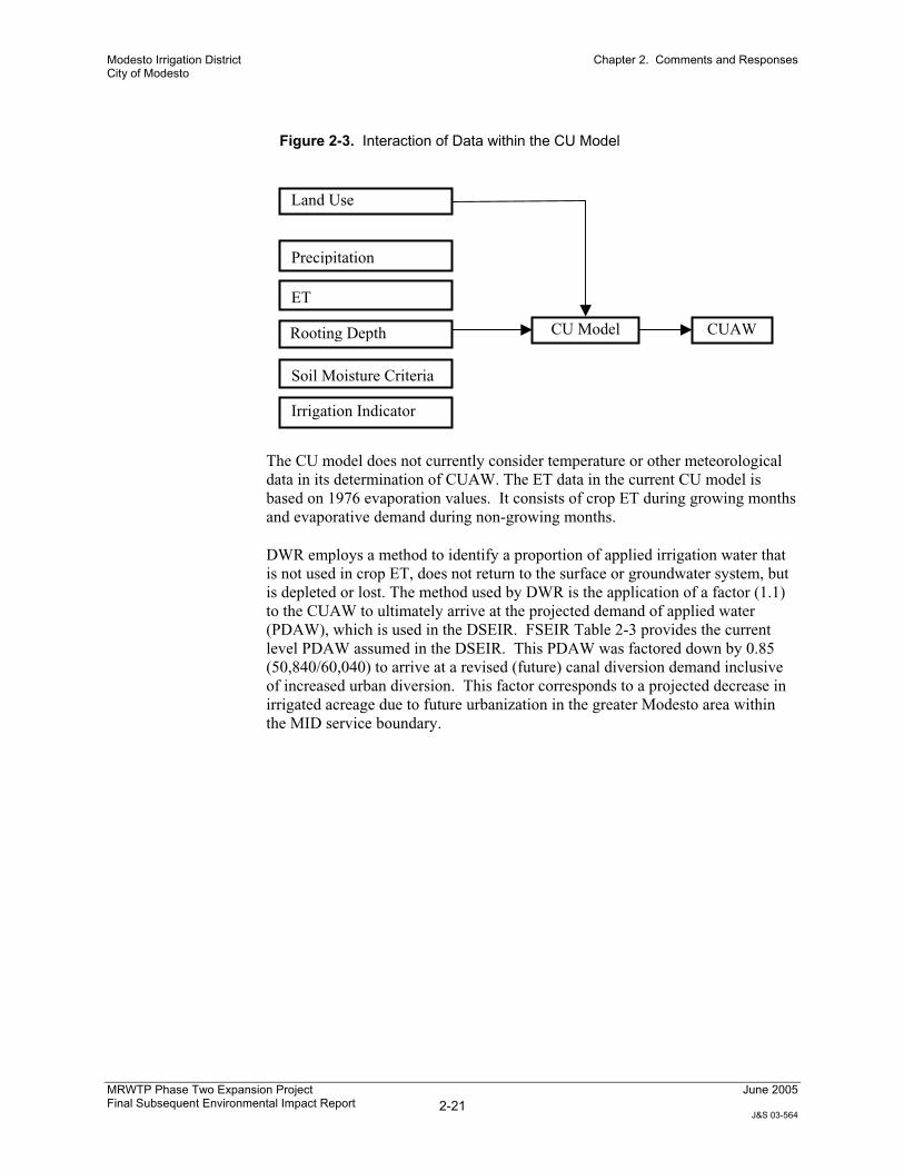
The CUAW represents the amount of applied water realized as ET; it does not include water that is lost or returned to the water system. The DWR CU model incorporates monthly precipitation, ET rates, soil moisture criteria, rooting depth, irrigation indicators, and other factors along with land use to estimate the CUAW on a monthly basis. The interaction of the land use and environmental data within the CU model is depicted in FSEIR Figure 2-3.
Figures 2-1CALSIM II Representation of the
San Joaquin River Basin and Demand Areas
0356
4.03
FEI
R (6
-05)

Figures 2-2CALSIM II Demand Area Land Use
0356
4.03
FEI
R (6
-05)

Modesto Irrigation District City of Modesto
Chapter 2. Comments and Responses
MRWTP Phase Two Expansion Project Final Subsequent Environmental Impact Report 2-21
June 2005
J&S 03-564
Figure 2-3. Interaction of Data within the CU Model
The CU model does not currently consider temperature or other meteorological data in its determination of CUAW. The ET data in the current CU model is based on 1976 evaporation values. It consists of crop ET during growing months and evaporative demand during non-growing months.
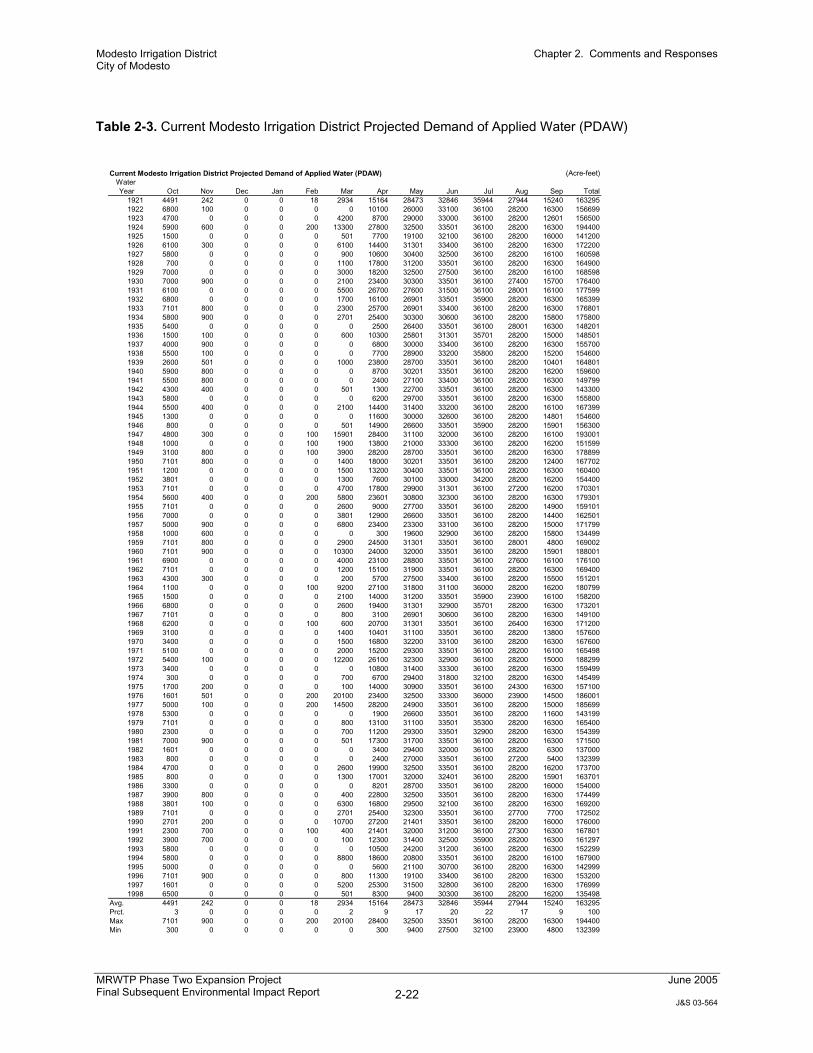
DWR employs a method to identify a proportion of applied irrigation water that is not used in crop ET, does not return to the surface or groundwater system, but is depleted or lost. The method used by DWR is the application of a factor (1.1) to the CUAW to ultimately arrive at the projected demand of applied water (PDAW), which is used in the DSEIR. FSEIR Table 2-3 provides the current level PDAW assumed in the DSEIR. This PDAW was factored down by 0.85 (50,840/60,040) to arrive at a revised (future) canal diversion demand inclusive of increased urban diversion. This factor corresponds to a projected decrease in irrigated acreage due to future urbanization in the greater Modesto area within the MID service boundary.
Land Use
Precipitation
ET
Rooting Depth
Soil Moisture Criteria
CU Model CUAW
Irrigation Indicator
Modesto Irrigation District City of Modesto
Chapter 2. Comments and Responses
MRWTP Phase Two Expansion Project Final Subsequent Environmental Impact Report 2-22
June 2005
J&S 03-564
Table 2-3. Current Modesto Irrigation District Projected Demand of Applied Water (PDAW)
Current Modesto Irrigation District Projected Demand of Applied Water (PDAW) (Acre-feet)Water Year Oct Nov Dec Jan Feb Mar Apr May Jun Jul Aug Sep Total
1921 4491 242 0 0 18 2934 15164 28473 32846 35944 27944 15240 1632951922 6800 100 0 0 0 0 10100 26000 33100 36100 28200 16300 1566991923 4700 0 0 0 0 4200 8700 29000 33000 36100 28200 12601 1565001924 5900 600 0 0 200 13300 27800 32500 33501 36100 28200 16300 1944001925 1500 0 0 0 0 501 7700 19100 32100 36100 28200 16000 1412001926 6100 300 0 0 0 6100 14400 31301 33400 36100 28200 16300 1722001927 5800 0 0 0 0 900 10600 30400 32500 36100 28200 16100 1605981928 700 0 0 0 0 1100 17800 31200 33501 36100 28200 16300 1649001929 7000 0 0 0 0 3000 18200 32500 27500 36100 28200 16100 1685981930 7000 900 0 0 0 2100 23400 30300 33501 36100 27400 15700 1764001931 6100 0 0 0 0 5500 26700 27600 31500 36100 28001 16100 1775991932 6800 0 0 0 0 1700 16100 26901 33501 35900 28200 16300 1653991933 7101 800 0 0 0 2300 25700 26901 33400 36100 28200 16300 1768011934 5800 900 0 0 0 2701 25400 30300 30600 36100 28200 15800 1758001935 5400 0 0 0 0 0 2500 26400 33501 36100 28001 16300 1482011936 1500 100 0 0 0 600 10300 25801 31301 35701 28200 15000 1485011937 4000 900 0 0 0 0 6800 30000 33400 36100 28200 16300 1557001938 5500 100 0 0 0 0 7700 28900 33200 35800 28200 15200 1546001939 2600 501 0 0 0 1000 23800 28700 33501 36100 28200 10401 1648011940 5900 800 0 0 0 0 8700 30201 33501 36100 28200 16200 1596001941 5500 800 0 0 0 0 2400 27100 33400 36100 28200 16300 1497991942 4300 400 0 0 0 501 1300 22700 33501 36100 28200 16300 1433001943 5800 0 0 0 0 0 6200 29700 33501 36100 28200 16300 1558001944 5500 400 0 0 0 2100 14400 31400 33200 36100 28200 16100 1673991945 1300 0 0 0 0 0 11600 30000 32600 36100 28200 14801 1546001946 800 0 0 0 0 501 14900 26600 33501 35900 28200 15901 1563001947 4800 300 0 0 100 15901 28400 31100 32000 36100 28200 16100 1930011948 1000 0 0 0 100 1900 13800 21000 33300 36100 28200 16200 1515991949 3100 800 0 0 100 3900 28200 28700 33501 36100 28200 16300 1788991950 7101 800 0 0 0 1400 18000 30201 33501 36100 28200 12400 1677021951 1200 0 0 0 0 1500 13200 30400 33501 36100 28200 16300 1604001952 3801 0 0 0 0 1300 7600 30100 33000 34200 28200 16200 1544001953 7101 0 0 0 0 4700 17800 29900 31301 36100 27200 16200 1703011954 5600 400 0 0 200 5800 23601 30800 32300 36100 28200 16300 1793011955 7101 0 0 0 0 2600 9000 27700 33501 36100 28200 14900 1591011956 7000 0 0 0 0 3801 12900 26600 33501 36100 28200 14400 1625011957 5000 900 0 0 0 6800 23400 23300 33100 36100 28200 15000 1717991958 1000 600 0 0 0 0 300 19600 32900 36100 28200 15800 1344991959 7101 800 0 0 0 2900 24500 31301 33501 36100 28001 4800 1690021960 7101 900 0 0 0 10300 24000 32000 33501 36100 28200 15901 1880011961 6900 0 0 0 0 4000 23100 28800 33501 36100 27600 16100 1761001962 7101 0 0 0 0 1200 15100 31900 33501 36100 28200 16300 1694001963 4300 300 0 0 0 200 5700 27500 33400 36100 28200 15500 1512011964 1100 0 0 0 100 9200 27100 31800 31100 36000 28200 16200 1807991965 1500 0 0 0 0 2100 14000 31200 33501 35900 23900 16100 1582001966 6800 0 0 0 0 2600 19400 31301 32900 35701 28200 16300 1732011967 7101 0 0 0 0 800 3100 26901 30600 36100 28200 16300 1491001968 6200 0 0 0 100 600 20700 31301 33501 36100 26400 16300 1712001969 3100 0 0 0 0 1400 10401 31100 33501 36100 28200 13800 1576001970 3400 0 0 0 0 1500 16800 32200 33100 36100 28200 16300 1676001971 5100 0 0 0 0 2000 15200 29300 33501 36100 28200 16100 1654981972 5400 100 0 0 0 12200 26100 32300 32900 36100 28200 15000 1882991973 3400 0 0 0 0 0 10800 31400 33300 36100 28200 16300 1594991974 300 0 0 0 0 700 6700 29400 31800 32100 28200 16300 1454991975 1700 200 0 0 0 100 14000 30900 33501 36100 24300 16300 1571001976 1601 501 0 0 200 20100 23400 32500 33300 36000 23900 14500 1860011977 5000 100 0 0 200 14500 28200 24900 33501 36100 28200 15000 1856991978 5300 0 0 0 0 0 1900 26600 33501 36100 28200 11600 1431991979 7101 0 0 0 0 800 13100 31100 33501 35300 28200 16300 1654001980 2300 0 0 0 0 700 11200 29300 33501 32900 28200 16300 1543991981 7000 900 0 0 0 501 17300 31700 33501 36100 28200 16300 1715001982 1601 0 0 0 0 0 3400 29400 32000 36100 28200 6300 1370001983 800 0 0 0 0 0 2400 27000 33501 36100 27200 5400 1323991984 4700 0 0 0 0 2600 19900 32500 33501 36100 28200 16200 1737001985 800 0 0 0 0 1300 17001 32000 32401 36100 28200 15901 1637011986 3300 0 0 0 0 0 8201 28700 33501 36100 28200 16000 1540001987 3900 800 0 0 0 400 22800 32500 33501 36100 28200 16300 1744991988 3801 100 0 0 0 6300 16800 29500 32100 36100 28200 16300 1692001989 7101 0 0 0 0 2701 25400 32300 33501 36100 27700 7700 1725021990 2701 200 0 0 0 10700 27200 21401 33501 36100 28200 16000 1760001991 2300 700 0 0 100 400 21401 32000 31200 36100 27300 16300 1678011992 3900 700 0 0 0 100 12300 31400 32500 35900 28200 16300 1612971993 5800 0 0 0 0 0 10500 24200 31200 36100 28200 16300 1522991994 5800 0 0 0 0 8800 18600 20800 33501 36100 28200 16100 1679001995 5000 0 0 0 0 0 5600 21100 30700 36100 28200 16300 1429991996 7101 900 0 0 0 800 11300 19100 33400 36100 28200 16300 1532001997 1601 0 0 0 0 5200 25300 31500 32800 36100 28200 16300 1769991998 6500 0 0 0 0 501 8300 9400 30300 36100 28200 16200 135498
Avg. 4491 242 0 0 18 2934 15164 28473 32846 35944 27944 15240 163295Prct. 3 0 0 0 0 2 9 17 20 22 17 9 100Max 7101 900 0 0 200 20100 28400 32500 33501 36100 28200 16300 194400Min 300 0 0 0 0 0 300 9400 27500 32100 23900 4800 132399