Embed Size (px)
Citation preview
September 2010Concordis International Sudan Report
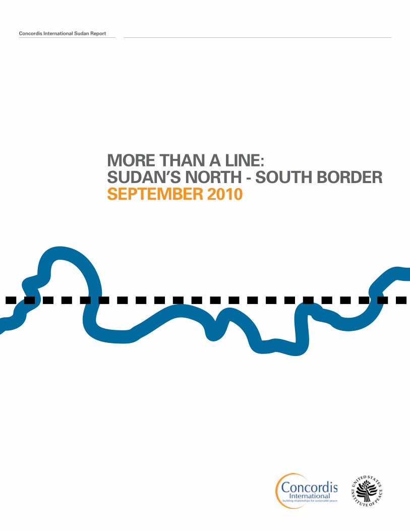
MORE THAN A LINE: SUDAN’S NORTH - SOUTH BORDER SEPTEMBER 2010
02 Concordis International Sudan Report
04 Acknowledgements
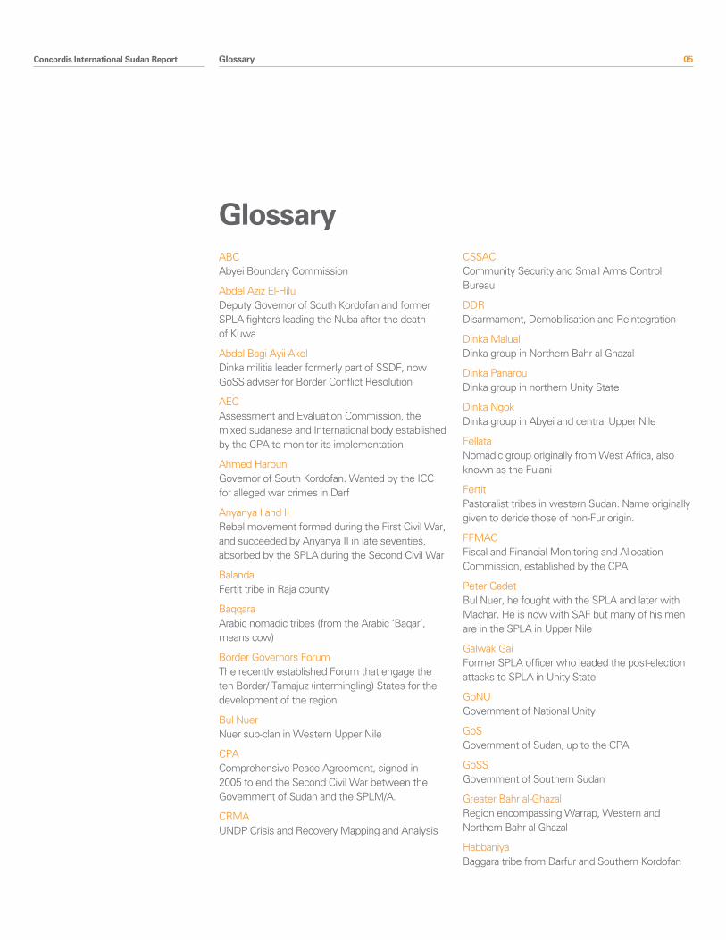
05 Glossary
08 Executive Summary 1.1 General Findings 1.2 Thematic Findings 1.3 Conflict Prone Areas
14 Introduction 1.1 General Findings 1.2 Thematic Findings 1.3 Conflict Prone Areas
28 South Darfur-Western Bahr al Ghazal 1.1 Snapshot Summary 1.2 Conflict Drivers 1.2.1 Border demarcation 1.2.2 Militarisation 1.2.3 SPLA-Rezeigat Clashes 1.2.4 Other Armed Groups 1.2.5 Wider Regional Instability 1.2.6 Conflict Trends 1.3 Conflict Mitigation
38 South Darfur-Northern Bahr al Ghazal 1.1 Snapshot Summary 1.2 Conflict Drivers 1.2.1 Contested Rights Along the Grazing Area 1.2.2 Transportation of Arms 1.2.3 Militarisation 1.2.4 Referendum/Demarcation 1.2.5 Post-election Fallout 1.3 Conflict Mitigation 1.3.1 Peace conferences
50 Abyei 1.1 Snapshot Summary 1.2 Conflict Drivers 1.2.1 National Political Context 1.2.2 Border Demarcation and the Abyei Referendum 1.2.3 Physical Demarcation 1.2.4 Land 1.2.5 Militarisation 1.3.6 Additional Factors 1.4 Conflict Management
67 Southern Kordofan/Unity 1.1 Snapshot Summary 1.2 Conflict Drivers 1.2.1 Transhumance 1.2.2 Political Marginalisation 1.2.3 Hardening Conflict Memory 1.2.4 Land/Oil and Demarcation 1.2.5 Community Land 1.2.6 Militarisation 1.2.7 Community Conflict Management 1.3 Conflict Trends and Mitigation
79 Southern Kordofan 1.1 Snapshot Summary 1.2 Conflict Drivers 1.2.1 National Political Context 1.2.2 Land 1.2.3 Socio-economic Underdevelopment 1.2.4 Integration of Adminstration 1.2.5 Security Integration and Militarisation 1.3 Conflict Trends and Mitigation
Contents
Contents
Concordis International Sudan Report 03
91 Upper Nile/White Nile/Sennar/Blue Nile 1.1 Snapshot Summary 1.2 Conflict Drivers 1.2.1 Land and Land Use 1.2.2 Border Disputes 1.2.3 Citizenship 1.2.4 Taxation 1.2.5 Oil 1.2.6 Militarisation 1.3 Conflict Trends and Mitigation 1.4 Intra-Upper Nile State Dynamics 1.4.1 Snapshot 1.4.2 Conflict Drivers 1.4.2.1 Potential for Fragmantation 1.4.2.2 Shilluk-Dinka Conflict 1.4.3 Conflict Mitigation
111 Blue Nile State 1.1 Snapshot Summary 1.2 Conflict Drivers 1.2.1 Land Use and Ownership 1.2.2 Militarisation 1.2.3 Roseires Dam 1.2.4 Popular Consultation 1.3 Conflict Trends and Mitigation
Contents
Contents
04 Concordis International Sudan Report
This report is the result of contributions by a team of Sudanese and international consultants and Concordis International staff, including Mohamed Ali, Benedetta de Alessi, John Fenning, Khalid Hassan, Jort Hemmer, Roger Middleton, Chris Milner, Martina Santschi, and Jolien Veldwijk.
Countless individuals and organisations offered informational and logistical support to make the report possible. We thank all those who generously contributed their time, organisational support, and encouragement.
The research team would like to thank specifically Peter Dixon and Richard King in the Concordis UK office and Lucian Harriman and all the Concordis staff in Sudan for their insights and logistical support. Our thanks also go to Andy Blum at USIP for his continual encouragement and Sharath Srinivasan and Jason Matus for providing valuable and insightful comments to drafts of this document.
Thanks also go to the National Forum on Reconciliation and Peace-building for their partnership in organising a workshop in Khartoum, which we hope stimulated debate around key issues related to the borderlands at a critical time.
Lastly, we thank all those involved in the Cross-Border Relations Project, a partnership between Concordis International and the Centre for Peace and Development Studies at the University of Juba. Workshops undertaken by the project in seven locations along the North-South border help inform this report. We thank all those who participated for sharing their perceptions and concerns with patience and goodwill.
Acknowledgements
Acknowledgements
Concordis International Sudan Report 05
ABCAbyei Boundary Commission
Abdel Aziz El-HiluDeputy Governor of South Kordofan and former SPLA fighters leading the Nuba after the death of Kuwa
Abdel Bagi Ayii AkolDinka militia leader formerly part of SSDF, now GoSS adviser for Border Conflict Resolution
AECAssessment and Evaluation Commission, the mixed sudanese and International body established by the CPA to monitor its implementation
Ahmed HarounGovernor of South Kordofan. Wanted by the ICC for alleged war crimes in Darf
Anyanya I and IIRebel movement formed during the First Civil War, and succeeded by Anyanya II in late seventies, absorbed by the SPLA during the Second Civil War
BalandaFertit tribe in Raja county
BaqqaraArabic nomadic tribes (from the Arabic ‘Baqar’, means cow)
Border Governors ForumThe recently established Forum that engage the ten Border/ Tamajuz (intermingling) States for the development of the region
Bul NuerNuer sub-clan in Western Upper Nile
CPAComprehensive Peace Agreement, signed in 2005 to end the Second Civil War between the Government of Sudan and the SPLM/A.
CRMAUNDP Crisis and Recovery Mapping and Analysis
CSSACCommunity Security and Small Arms Control Bureau
DDRDisarmament, Demobilisation and Reintegration
Dinka MalualDinka group in Northern Bahr al-Ghazal
Dinka PanarouDinka group in northern Unity State
Dinka NgokDinka group in Abyei and central Upper Nile
FellataNomadic group originally from West Africa, also known as the Fulani
FertitPastoralist tribes in western Sudan. Name originally given to deride those of non-Fur origin.
FFMACFiscal and Financial Monitoring and Allocation Commission, established by the CPA
Peter GadetBul Nuer, he fought with the SPLA and later with Machar. He is now with SAF but many of his men are in the SPLA in Upper Nile
Galwak GaiFormer SPLA officer who leaded the post-election attacks to SPLA in Unity State
GoNUGovernment of National Unity
GoSGovernment of Sudan, up to the CPA
GoSSGovernment of Southern Sudan
Greater Bahr al-GhazalRegion encompassing Warrap, Western and Northern Bahr al-Ghazal
HabbaniyaBaggara tribe from Darfur and Southern Kordofan
Glossary
Glossary
06 Concordis International Sudan Report
HegligMain oil field in Sudan, was separated by the Abyei area by PCA ruling and is now contested between Southern Kordofan and Unity States
JEMJustice and Equality Movement, a rebel movement in Darfur spilling into South Kordofan
Jikany NuerNuer clan from Nasir in Western Upper Nile
Joseph KuwaNuba freedom fighters who guided Nuba rebellion into the SPLM/A
Juba DeclarationAgreement signed in 2006 uniting the SSDF with the SPLA
KareshFertit tribe in Raja county
Gordon KongFormer SSDF Commander after the SPLA Nasir split, he is now allied to SAF
Lam Akol Former high-ranking SPLA, architect of the Nasir split with Machar, he was Minister in the GoNU after the CPA. He is now leader of the SPLM-DC.
Lou Nuer Nuer clan from Akobo, in Northern Jonglei
Riek MacharFormer senior military figure in the SPLA, he organised the Nasir split and signed the Khartoum peace Agreement with GoS. He is now vice president of GoSS and first Deputy Chairman ofthe SPLM
Malik AgarGovernor of Blue Nile and Deputy Chairman of the SPLM
Melut BasinUpper Nile oilfields with main centres in Adar and Paloich
MisseriyaArab nomadic tribe who migrate from South Kordofan and Abyei into South Sudan
Muglad BasinA principal oil-producing area in Sudan comprising of South Kordofan, Abyei and Unity States
Nasir Declaration1991 split from the SPLM/A by Lam Akol and Riek Machar, forming SPLM-Nasir (later SPLM-United)
NRDFNational Reconstruction and Development Fund established by the CPA for the northerner war affected areas
Technical National Border CommitteeCommittee set up by the CPA to identify and demarcate the boundaries between North and South
NCPNational Congress Party, the governing party of Sudan
NIFNational Islamic Front
OAGsOther Armed Groups
P’agan AmumSecretary General of the SPLM and GoSS Minister of Peace and CPA implementation
Paulino MatiepFormer head of SSDF who became deputy Commander in Chief of SPLA with the Juba Declaration
PCAPermanent Court of Arbitration that decided on Abyei area boundaries on July 2009
PDFPopular Defence Force, tribal militias supported by SAF in western Sudan and the transitional areas
Glossary
Concordis International Sudan Report 07
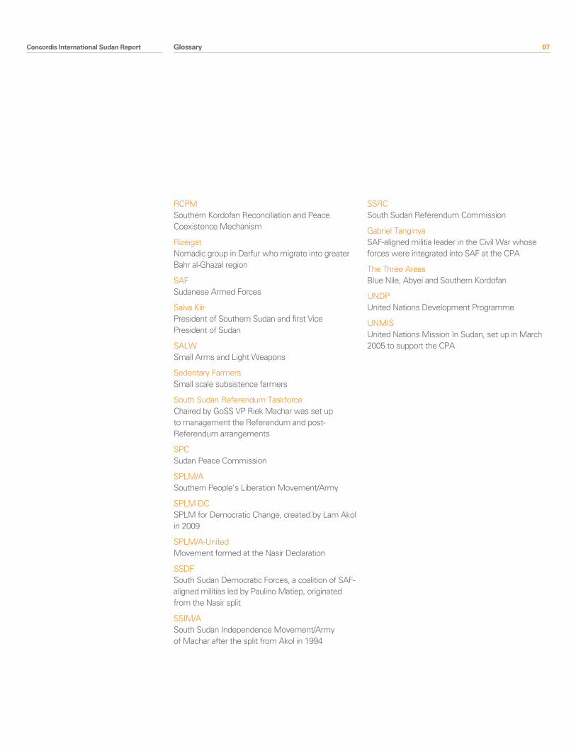
RCPMSouthern Kordofan Reconciliation and Peace Coexistence Mechanism
RizeigatNomadic group in Darfur who migrate into greater Bahr al-Ghazal region
SAFSudanese Armed Forces
Salva KiirPresident of Southern Sudan and first Vice President of Sudan
SALWSmall Arms and Light Weapons
Sedentary FarmersSmall scale subsistence farmers
South Sudan Referendum TaskforceChaired by GoSS VP Riek Machar was set up to management the Referendum and post-Referendum arrangements
SPCSudan Peace Commission
SPLM/ASouthern People’s Liberation Movement/Army
SPLM-DCSPLM for Democratic Change, created by Lam Akol in 2009
SPLM/A-UnitedMovement formed at the Nasir Declaration
SSDFSouth Sudan Democratic Forces, a coalition of SAF-aligned militias led by Paulino Matiep, originated from the Nasir split
SSIM/ASouth Sudan Independence Movement/Army of Machar after the split from Akol in 1994
SSRCSouth Sudan Referendum Commission
Gabriel TanginyaSAF-aligned militia leader in the Civil War whose forces were integrated into SAF at the CPA
The Three AreasBlue Nile, Abyei and Southern Kordofan
UNDPUnited Nations Development Programme
UNMISUnited Nations Mission In Sudan, set up in March 2005 to support the CPA
Glossary
08 Concordis International Sudan Report
This report, prepared by Concordis International under commission from the United States Institute of Peace, examines drivers of conflict in the North-South border areas of Sudan and current initiatives aimed at managing them. The contents derive from desk and field research undertaken in mid-2010. The document is also informed by the views and concerns expressed by participants at workshops in seven locations along the North-South border1 and at a senior level workshop in Khartoum2.
General Findings Hardening the North-South Divide
The CPA did not fully address the issue of the North-South border in Sudan, which goes beyond demarcation and requires peaceful coexistence between border communities in the years to come. The overall attention on post-referendum arrangements in the last year, though essential, has sidelined the urgent resolution of key CPA benchmarks, which are crucial for the sustainability of the referenda outcome. In assuming that unity could be made attractive, the CPA did not prepare the country for an attractive separation, even though the provision for a Southern Sudan referendum assumed the possibility of both scenarios. Instead, mistrust across the North-South divide has increased at national and local levels.
National mistrust, the consequent lack of full implementation of the CPA and militarisation have amplified instability and missed the opportunity presented by the borderlands. The border areas, among the areas worst affected by war, have received little support from the side of the Government of National Unity (GoNU) and Government of Southern Sudan (GoSS). Today their socio-economic context is fragile, whilst state and local capacity to deal with border governance issues, land disputes and conflict resolution is limited. The CPA has resulted neither in effective state decentralisation nor in the empowerment of traditional authorities for conflict resolution. The reconciliation of diverse identities in a framework of cooperation and mutual respect, as envisaged by the drafters of the CPA, is not achieved. Instead, there has been a hardening of conflict memory in Sudan, and in particular at the borderlands.
Executive summary
Executive summary
1 The workshops were organised as part of the Cross Border Relations Project, an EU funded partnership between Concordis International and the Centre for Peace and Development Studies at the University of Juba. The locations of the workshops are Bentiu, Renk, Kosti, Agok, Muglad, Kadugli, and Damazin
2 Organised in collaboration with the National Forum for Reconciliation and Peace-building with support from USIP and the European Union
Concordis International Sudan Report 09
Divergent interests between local and national interests fuel feelings of marginalisation in the border communities
National agreement (formal or informal) on post-referendum arrangements is a necessary but not sufficient condition to secure a lasting peace. The presence of divergent interests, marginalisation, complex alliances, a militarised culture and the availability of arms, also means that local actors risk drawing the CPA parties back to larger scale conflict if their interests are not perceived as being met.
Communities in the border region do not feel that they have been consulted in the definition of the North-South border and Misseriya feel excluded from decisions made regarding Abyei’s boundaries. They ultimately perceive that insecurity and uncertainty at the border is driven by national interests; if resolution is achieved at that level then local reconciliations may also be possible. To ensure stability, the border communities say their interests must be reflected in the design of the popular consultations and in arrangements for the post-referendum period.
Border communities fear further marginalisation in the event of internationalisation or continued militarisation of the North-South border. The idea of ‘separation’ is unfamiliar within populations who have interacted for centuries in the absence of substantial local administration or border governance. Pastoralist livelihoods and increasingly consumer societies depend upon a soft border to allow freedom of movement of people and goods. Border mechanisms to facilitate this whilst guaranteeing security will be required whatever the result of the Southern referendum.
A cycle of reinforcing conflict drivers
Local historical dynamics in the border areas have been reinforced by national disagreement over the control of land, oil and natural resources unresolved by the CPA. In 2010 several clashes occurred between SPLA and nomadic tribes (clashes with Rizeigat in Hofrat al Nahas and Misseriya groups around the South Kordofan-Unity ‘triangle’). In the context of unmet CPA expectations at the local level ‘Other Armed Groups’ are re-emerging as a significant security threat in both North and South and links between armed groups in Southern Kordofan and Southern Darfur highlight the potential for regional instability. The interplay between national politics and the territorial ambitions of former militia in the context of a lack of state consolidation, widespread presence of arms and resentment towards SAF and SPLM/A is a risk to stability in the whole border land (e.g. the post-electoral violence in Unity state and the armament of Misseriya in South Kordofan). ‘Tribal violence’ in 2009 and the post-election defection of SPLA commanders have also exposed cleavages within the SPLA and wider southern societies, facilitated by the widespread presence of arms in the hands of civilians and former commanders (including police officers).
Ad hoc conflict resolution initiatives are filling some gaps is addressing some of the higher priorities in the conflict areas, such as the Southern Kordofan Reconciliation and Peaceful Coexistence Mechanism (RPCM). However, weaknesses in traditional conflict resolution mechanisms, changes in authority structures resulting from the impact of the CPA and wider development processes and mistrust arising from national and local disagreements undermine most attempts to reconcile populations.
Executive summary
10 Concordis International Sudan Report
Conflict drivers Referendum on Self-Determination for Southern SudanThe principle of self-determination for Southern Sudan and the potential changes in border regime it may bring set the scene within which conflict drivers outlined in the report play out. The stakes are high for local and national interests and national mistrust fuels insecurity on the border owing to the heavy militarisation. The referendum has become a political and security struggle between SPLM/A and NCP/SAF. A lack of ownership of the referendum process for the local population has been observed in the border areas.
Border demarcation and land disputesThe CPA and the forthcoming referendum have intensified local and national conflict over land along the North-South border. Land claims appear to derive both from historical perceptions of land entitlement and from responses to contemporary political and livelihood challenges aggravated during the Interim Period. There are specific points of national disagreement but the whole North-South border area carries potential for local contestation (as do other intra-state administrative boundaries)3. The establishment of State border committees is seen by many border communities as necessary, to reach cross-border agreements and work alongside the North-South national border committee in the final demarcation phase (for example, in Mabaan/Kurmuk and Gulli areas). Moreover, State Land Commissions, sufficiently empowered and endowed4, could play a role in dealing with cross-border disagreements and disputes which could easily generate insecurity in the wider border area (for example in South Kordofan).
Strategic mineral resourcesCurrently, oil is the main driver of national contestation over border demarcation5. Since the Permanent Court of Arbitration (PCA) ruling restricted the Abyei area, Heglig (between Unity and Southern Kordofan) has become the most significant contested border area, owing to the scale of reserves, oil infrastructure, and lack of clarity in the border demarcation process. Arrangements regarding the Melut basin in a politically fractured Upper Nile State, not currently contested, are likely to be of increasing importance as its relative share of Sudan’s oil production continues to grow vis-à-vis the Muglad basin.
In addition to oil, the borderland is rich in agricultural schemes (Upper Nile pick, White Nile, Blue Nile), copper and potentially uranium (Western Bahr al Ghazal/South Darfur), and gold (Mabaan/Kurmuk). Strategic interest in these resources is reflected in a history of redrawing boundaries in response to the economic opportunities they represent. Lack of clarity in the 1/1/56 line has led to SPLA and SAF deployment within contested resource-rich areas. Border demarcation, compensation, and revenue-sharing can reverse the effects of militarisation and confrontation over control of resources.
Executive summary
3 Research team interviews in the border states, July 2010. Many people living in or near locally contested areas say they could be willing to fight for control of territory
4 Various research team interviews. For example, MOLACD advisor, July 2010 and Unity State Land Commission July, 2010
5 Foreign diplomats interviewed in Khartoum suggested that Heglig would be the main reason for disagreement between the Parties over border demarcation: the SPLM consider it a contested area while the NCP say the Permanent Court of Arbitration Ruling on Abyei’s Boundaries automatically places the area in Southern Kordofan. This position is repeated down to the community level
Concordis International Sudan Report 11
Militarisation and Community SecurityUNMIS reports that SAF has redeployed one hundred per cent of their forces from Southern Sudan and SPLA has withdrawn thirty five per cent of their stated strength from Northern Sudan (though initial figures presented by the SPLA might have been inflated)6. This does not mean that militarisation of the region is decreasing. Both armies are reported to have deployed heavily along the North-South border and stand in close proximity, particularly around Heglig (at Tishwa), between Abyei and Unity State and in the Upper Nile pick. Both SAF and SPLA are reportedly present in the contested areas of Kajia Kinji and Upper Nile, fuelling mistrust and insecurity at national and local level7.
’Militarisation is impacting negatively on community livelihoods (for example, through increasing commodity prices) and further reduces local perceptions of a peace dividend. The presence of arms is widespread. CSSAC and DDR Commission have now coordinating efforts to support voluntary disarmament around the border but the process has not yet started. Failure to agree on border demarcation, oil revenues, or a referendum process carries the risk of national conflict at the border over control of economically and strategically important territory, supported locally by armed civilians, militias and soldiers.
Migration The post-CPA period has generally intensified mistrust across the border between nomads and southern groups8. Nomadic groups are deeply concerned about the impact a change in border regime might have on their access to essential traditional grazing land in South Sudan. The abundance of arms and disgruntled former fighters among affected nomadic groups, in a militarised and highly contested environment, represents a significant threat to stability. Flashpoints are currently limited to the Northern Bahr al Gazal northern belt and the Southern Kordofan-Unity ‘triangle’, though this could change. The next dry season, starting in October, will be the last opportunity to prevent insecurity from spreading at the time of the popular consultation and referendum.
Traditional mechanisms for negotiating relationships over land use are under stress. The cumulative grievances of unresolved disputes represent a significant challenge to resolving current local disagreements. Nuer and Dinka communities in Mayom and Abyei said that the situation had gone ‘beyond traditional cattle raiding’ and questioned whether local mechanisms could control volatile elements9. However, traditional mechanisms are fruitful elsewhere. Rizeigat, Misseriya and Malual Dinka undertook peace conferences in 2008 and 2009 which have done much to re-establish working relationships. Migrations between White Nile and Upper Nile are also based on ad hoc but functional grazing agreements made between a successful combination of traditional chiefs and administrators.
Executive summary
6 Report of the Secretary-General on the Sudan 2010: 9
7 Field interviews various with UNMIS Civil Affairs, SPLA officers, members of communities living in close proximity to these areas
8 A dynamic observed in all of the Concordis-CPDS Cross-Border Relations Project workshops
9 Interviews with traditional authorities, Mayom County and Pariang County, May-July 2010
12 Concordis International Sudan Report
The three transitional areas: the Abyei referendum and popular consultationsThe CPA postponed the problem of the transitional areas, carrying major implications for North-South border dynamics. Blue Nile, Southern Kordofan, the Abyei area are, with South Darfur, the main northern regions lying on the border line. Under development and insecurity have fostered internal fragmentation and further weakened the capacity of administrations to address border issues.
The potential Abyei referendum is at the heart of national and local conflicts over the Abyei Area. These remain a significant threat to national peace. Misseriya militias are active in northern Abyei and have publicly threatened to fight to destabilise the referendum unless they are deemed eligible to participate. The SPLA, in which Dinka Ngok are represented at senior levels, risks being dragged into conflict if tensions in the Abyei area spill over into violence associated with the referendum.
Blue Nile and Kordofan remained constitutionally northern states as a result of the CPA but were entitled to a popular consultation exercise. From the outset, the scope of the popular consultation was ambiguous and the lack of full implementation of the CPA has fostered expectations of self-determination among local populations. The States have assertive and powerful Governors; however, political commitment does not translate into clear political outcomes. The postponement of the national elections delayed the implementation of the popular consultations. It is consequently harder to delink them from the South Sudan and Abyei referenda. The popular consultation is an opportunity, but also a substantial risk if populations are left unsatisfied by the process.
CitizenshipThe option of self-determination of Sudan creates new challenges in relation to citizenship. The Interim National Constitution of Sudan accepts dual nationality but the CPA does not provide arrangements for southerners in North and northerners in South, including militaries, IDPs and nomads in the post-referendum period. Discussion of the situation of SPLA soldiers in the transitional areas is still a taboo. Harder border controls in any scenario will put border communities at risk, in particular nomadic tribes and cross-border residents.
Executive summary
Concordis International Sudan Report 13
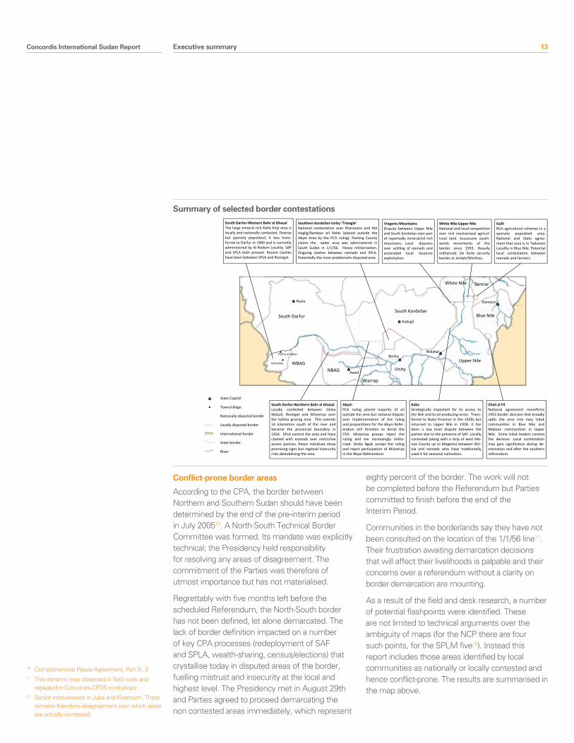
Conflict-prone border areas
According to the CPA, the border between Northern and Southern Sudan should have been determined by the end of the pre-interim period in July 200510. A North-South Technical Border Committee was formed. Its mandate was explicitly technical; the Presidency held responsibility for resolving any areas of disagreement. The commitment of the Parties was therefore of utmost importance but has not materialised.
Regrettably with five months left before the scheduled Referendum, the North-South border has not been defined, let alone demarcated. The lack of border definition impacted on a number of key CPA processes (redeployment of SAF and SPLA, wealth-sharing, census/elections) that crystallise today in disputed areas of the border, fuelling mistrust and insecurity at the local and highest level. The Presidency met in August 29th and Parties agreed to proceed demarcating the non contested areas immediately, which represent
eighty percent of the border. The work will not be completed before the Referendum but Parties committed to finish before the end of the Interim Period.
Communities in the borderlands say they have not been consulted on the location of the 1/1/56 line11. Their frustration awaiting demarcation decisions that will affect their livelihoods is palpable and their concerns over a referendum without a clarity on border demarcation are mounting.
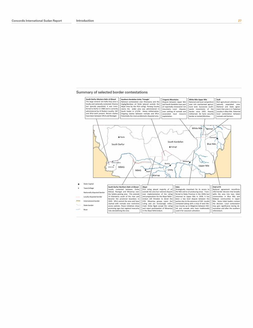
As a result of the field and desk research, a number of potential flashpoints were identified. These are not limited to technical arguments over the ambiguity of maps (for the NCP there are four such points, for the SPLM five12). Instead this report includes those areas identified by local communities as nationally or locally contested and hence conflict-prone. The results are summarised in the map above.
Executive summary
10 Comprehensive Peace Agreement, Part III, 311 This dynamic was observed in field work and
repeated in Concordis-CPDS workshops12 Senior interviewees in Juba and Khartoum. There
remains therefore disagreement over which areas are actually contested
South Kordofan
WBAG NBAG
Warrap
Unity
Upper Nile
White Nile Sennar
Blue Nile
Aweil
Bentiu Malakal
Damazin
Kadugli
Nyala
South Darfur
Hofrat al Nahas
Kafia Kinji
South Darfur-Western Bahr al Ghazal The large mineral rich Kafia Kinji area is locally and nationally contested. Diverse but sparsely populated, it was trans-ferred to Darfur in 1960 and is currently administered by Al Rodom Locality. SAF and SPLA both present. Recent clashes have been between SPLA and Rezeigat.
South Darfur-Northern Bahr al Ghazal Locally contested between Dinka Malual, Rezeigat and Misseriya over the Safaha grazing area. This extends 14 kilometres south of the river and became the provincial boundary in 1924. SPLA control the area and have clashed with nomads over restrictive access policies. Peace initiatives show promising signs but regional insecurity risks destabilising the area.
Abyei PCA ruling placed majority of oil outside the area but national dispute over implementation of the ruling and preparations for the Abyei Refer-endum still threaten to derail the CPA. Misseriya groups reject the ruling and are increasingly milita-rised. Dinka Ngok accept the ruling and reject participation of Misseriya in the Abyei Referendum.
Southern Kordofan-Unity ‘Triangle’ National contestation over Kharasana and the Heglig/Bamboo oil fields (placed outside the Abyei Area by the PCA ruling). Pariang County claims the wider area was administered in South Sudan in 1/1/56. Heavy militarisation. Ongoing clashes between nomads and SPLA. Potentially the most problematic disputed area.
Chali al Fil National agreement reconfirms 1953 border decision that broadly splits the area into two; Uduk communities in Blue Nile and Mabaan communities in Upper Nile. Some Uduk leaders contest the decision. Local contestation may gain significance during de-marcation and after the southern referendum.
White Nile-Upper Nile National and local competition over rich mechanised agricul-tural land. Successive south-wards movements of the border since 1955. Heavily militarised. De facto security border at Jordah/Winthou.
Kaka Strategically important for its access to the Nile and to oil producing areas. Trans-ferred to Nuba Province in the 1920s but returned to Upper Nile in 1928, it has been a low level dispute between the parties due to the presence of SAF. Locally contested (along with a strip of west Ma-nyo County up to Megenis) between Shil-luk and nomads who have traditionally used it for seasonal cultivation.
Megenis Mountains Dispute between Upper Nile and South Kordofan over part of reportedly mineral/oil rich mountains. Local disputes over settling of nomads and associated local resource exploitation.
State Capital
Town/village
Nationally disputed border
Locally disputed border
International border
State border
River
Gulli Rich agricultural schemes in a sparsely populated area. National and State agree-ment that area is in Tadamon Locality in Blue Nile. Potential local contestation between nomads and farmers.
Summary of Selected Border Contestations Summary of selected border contestations
14 Concordis International Sudan Report
IntroductionThis report was commissioned by the United States Institute of Peace. It has been produced by Concordis International, which has responsibility for its content.
The report aims to: a) identify the likely drivers of conflict that are exacerbated by dynamics related to the North-South border in Sudan; b) identify the geographic areas that are most likely to suffer violence as a result of these conflict drivers; and c) outline what government and civil society intiatives are in place within Sudan tasked with managing border-related issues.
In June 2010, a team of international consultants experienced in Sudan conducted a desk study involving a wide range of primary and secondary sources. In July, an international consultant undertook field work in Southern Sudan and a number of Sudanese consultants contributed from South Darfur, Khartoum and Blue Nile States. In each location, the team interviewed state and county/locality officials, traditional/native authorities, religious leaders, representatives of political parties, military officers, academics and national and international NGOs.
The study is also informed by workshops conducted as part of the Cross-Border Relations Project in seven locations along the border (Agok, Bentiu, Damazin, Kadugli, Kosti, Muglad and Renk). The Cross-Border Relations Project is being conducted by Concordis International in partnership with the Centre for Peace and Development Studies at the University of Juba.
A research and validation workshop, organised by the National Forum on Reconciliation and Peace-building, took place on 28th and 29th July in Khartoum and further crystallised the research. Participants were senior policy makers and community-based organisations from Khartoum, Juba and the border states.
This report is not primarily about demarcation of the North-South border. The Comprehensive Peace Agreement sets out a mechanism for delineating and demarcating this line. Instead, the report asks what impact national and local issues relating to the border are having, or could have, for communities living near it and for the wider peace in Sudan. In responding to this central question, much of the report outlines perceptions described by populations at the border. These determine human response even if they do not necessarily reflect objective realities. It follows that in reporting perceptions of diverse Sudanese groups and individuals, Concordis International does not necessarily endorse any particular view.
We hope that this report will contribute to a greater understanding of the role border-related dynamics play in driving conflict in the region and that it will assist in the generation of policies and programmes that will be effective in establishing lasting peace between the people of the North and the South of Sudan and, more particularly, among the communities who live, work and move close to and across the border.
Introduction
Introduction
Concordis International
Concordis International is a British non-profit organisation that works alongside and in support of official peace processes, where they exist. Concordis aims to improve the potential for lasting peace by building consensus through dialogue on divisive issues, on the foundation of in-depth research into conflict causes.
Concordis International Sudan Report 15
General FindingsHardening the North-South DivideThe CPA has not addressed the problem of the North-South border in Sudan, which goes beyond a technical demarcation exercise. The problem is how to generate peaceful coexistence between border communities and cooperation between state elites. While the CPA advocated an attractive unity, it has not prepared the country for an attractive separation, even though the provision for a Southern Sudan referendum made possible both scenarios. Instead, mistrust across the North-South divide has increased at national and local levels.
National mistrust and consequent lack of full implementation of the CPA and militarisation have amplified instability and caused missed opportunities in the borderlands. The border areas, among the worst war affected areas, have received little support from the Government of National Unity (GoNU) and the Government of Southern Sudan (GoSS). Today their socio-economic context is fragile and state and local capacity to deal with border governance issues, land disputes and conflict resolution is limited. The CPA has neither resulted in effective state decentralisation nor in the empowerment of traditional authority for conflict resolution.
The overall attention on post-referendum arrangements in the last year, though essential, has sidelined urgent resolution of key CPA benchmarks such as establishing a national process of reconciliation and healing. Negotiations over post-2011 referendum arrangements between the National Congress Party (NCP) and the Sudan People’s Liberation Movement (SPLM), are only tangentially addressing the problem of the North-South border through discussion on citizenship, natural resources and security13. These issues of citizenship, wealth sharing, and security crystallise at the border. National disagreements throughout the course of the CPA have impacted upon local relationships and fed mistrust between communities.
Divergence between local and national interests fuels feelings of marginalisation among border communities National agreement (formal or informal) on post-referendum arrangements is a necessary but not sufficient condition to secure a lasting peace. The presence of divergent interests, marginalisation, complex alliances, a military culture and the availability of arms means local actors risk drawing the parties back to larger scale conflict if their interests are not perceived to be met. To ensure stability, the interests of border communities should be reflected in the design of the popular consultations and in arrangements for the post-referendum period.
Diverging national and local interests is the central dynamic affecting the North-South border region. Disagreement within the Presidency over demarcation is directly affecting local communities, including pastoralist groups, populations in the transitional areas and northerners in the South. Local communities do not feel consulted in the definition of the North-South border and Misseriya in particular feel excluded from decisions made regarding Abyei’s boundaries. Communities ultimately perceive that insecurity at the border is driven by national interests; if resolution is achieved at that level then local reconciliations may also be possible.
On both sides of the disputed line, border populations lack basic services, schools, infrastructure and security. Consequent perceptions of marginalisation combine with a militarised culture, the availability of arms and a history of shifting alliances to generate threats to stability, in particular in the Southern Kordofan/Abyei/Unity triangle. Communities and local leaders are aware that Sudan’s wealth derives largely from resources in their areas and they expected the CPA to deliver development and opportunities. These expectations have not been met during the Interim Period. The consequence is heightened resentment towards Khartoum and Juba as well as towards their local wartime adversaries whom they perceive to be gaining greater benefits from the peace than
Introduction
13 The post-Referendum talks are facilitated by the African Union High Panel AUHIP chaired by former Vice President of South Africa Tsabo Mbeki. In Mekelle, Ethiopia (21st – 22nd June, 2010) Parties agreed to form a Joint Negotiation Team composed of six members for each side and to cluster the post-2011 referendum negotiations into four working groups as follows: a. Citizenship b. Security c. Financial, economic and natural resources d. International Treaties and Legal Issues, in accordance with the provisions of section 67 of the Southern Sudan Referendum Act, 2009’ (see Mekelle MOU) Negotiations were launched in Khartoum and in Juba on 19th-20th, July the so called ‘exposure talks’ with experts from the international community where held. The North-South border was not discussed
16 Concordis International Sudan Report
themselves. The Border Governors’ Forum initiative and activation of the Unity Fund are supporting peace and development initiatives in the border region but these may have come too late to change local perceptions towards the CPA and the State14.
Border communities fear further marginalisation in the event of internationalisation or further militarisation of the North-South border. The idea of ‘separation’ is unfamiliar within many populations who have interacted for centuries in the absence of substantial local administration or border governance. Pastoralist livelihoods and increasingly consumer societies depend upon a soft border to allow freedom of movement of people and goods. Border mechanisms to facilitate this, whilst guaranteeing security, will be required whatever the result of the referendum. National and state administrative systems need to accommodate existing social boundaries around which local contestation could develop (particularly in Northern Bahr al Ghazal, Unity and Abyei). At the same time, administrative arrangements need to accommodate the interests of the national actors.
A cycle of reinforcing conflict driversConflicts are resource based and the product of interactions between local and national interests; local historical disagreements between farmers and nomads over land and water were exploited by the parties during Sudan’s civil wars. Communities initially motivated by local interests were armed by SAF and SPLA against each other as part of a national contestation over the control and shape of the State. In the post-CPA era the increasing militarisation of the border areas has been a general trend, in particular in the central triangle and in the Upper Nile pick, perpetuating a culture of conflict. Local historical dynamics have been reinforced by national disagreement over the control of land, oil and natural resources unresolved by the CPA.
A collapse in local and state sponsored conflict resolution mechanisms and associated changes in traditional authority structures and influence have led to a radicalisation of the youth and the failure of traditional mechanisms to manage conflict. The failure to reconcile and compensate victims of insecurity increases perceptions of marginalisation, further undermines conflict resolution mechanisms and radicalises losers. Wartime patterns of conflict have emerged reinvigorated. In 2010 several clashes occurred between SPLA and nomadic tribes including in newly occupied territories (for example, with Rizeigat in Hofrat al Nahas). Other armed groups (OAGs) are remerging as a significant security threat in both North and South. Links between armed groups in Southern Kordofan and Southern Darfur highlight the potential for regional instability. The interplay between national politics and the territorial ambitions of former militia in the context of a lack of state consolidation and resentment towards SAF and SPLM/A is a risk to stability in the whole border land.
Introduction
14 Two Border Governors Fora for the Tamazuj/Intermixing States were held in February, 27th-28th, 2010 in Kadugli, Southern Kordofan and in July 14th-15th, 2010 in Northern Bahr al Gazhal. They are the result of two roundtables held in Merowe and Wau in 2009. From the final communiqué, the forum ‘seeks deep-rooting of the peace and accelerating steps of interaction of the people, realizing development besides deepening means of peaceful coexistence among those states, supporting the peace, security and stability in the area, besides ensuring spirit of determination and the real desire in durability of peace of a united strong Sudan’. The third meeting should be held in Kadugli but at the time of writing it has been postponed several times
Concordis International Sudan Report 17Introduction
Conceptual Approaches to Borders‘Where and What’A border is both a line and a set of arrangements and relationships. If economic, security and social arrangements governing a border meet the needs of communities and structures on either side, it may not matter where the border is actually drawn.
Social Boundaries and Administrative BordersTo the modern state, borders generally delineate territories over which an authority exercises exclusive rights. In many traditional societies land is neither owned nor used individually; customary arrangements are negotiated between communities to govern land use. The North-South border in Sudan is approximately two thousand kilometres long. State capacity at the borderland is weak. Social boundaries and administrative borders each play their part in border governance.
Hard and Soft BordersHard borders are associated with words such as ‘closed’, ‘exclusive’, separation’, ‘threat’ and ‘barrier’. Policy corrollaries might be strict visa regimes, extensive policing and heavy controls on the movement of people and goods.
Soft borders are associated with characteristics such as ‘open’, ‘inclusive’, ‘communicative’, ‘porous’ and ‘bridge’. Policy corrollaries facilitate the easy movement of goods and services in the absence of a security concern.
Policy choices can reflect hard and soft elements such as a combination of a lenient visa policy but very strict border controls.
Border RegimeThe collection of institutions and political arrangements that govern a border.
National and Local InterestsNationally determined border regimes affect state elites, local communities and all those in between. Border-related contestation can therefore take place between national actors, between local actors, and between varying combinations of the two and agreement between one set of actors does not imply acceptance by another. Of course, levels are not monolithic and may interact in complex ways.
18 Concordis International Sudan Report Introduction
Thematic Findings Referendum on Self Determination for Southern Sudan
“ The people of South Sudan have the right to self determination, inter alia, through a referendum to determine their future status.”
Machakos Protocol, 2002
The principle of self-determination for Southern Sudan sets the scene within which conflict drivers outlined in this report play out. National political disagreement over the referendum has been intense since the enactment of the fiercely negotiated Referendum Act. Tensions between the parties continue to increase, most recently over composition of the Referendum Commission. The chairman, Mohamed Osman Al-Nijoumi, was appointed on September 2nd. The SPLM and GoSS positions – which merge in the official statements of the SPLM Secretary General and Minister for CPA Implementation – are that the vote should take place on 9th January 2011 regardless of the status of other outstanding CPA issues such as border demarcation15. The NCP agree on the date but has set border demarcation as a pre-requisite for holding the referendum and accused SPLM of stalling border demarcation16.
The lack of ownership of the referendum process for the local population has been observed in the border areas. In South Sudan, GoSS has reportedly arrested individuals promoting unity. In the North, there is no significant mobilisation of southerners and, at the border, returnees are being more assertively checked by the SPLA. Top SPLM leaders have said that if the referendum cannot be organised in time due to technical or political challenges then the Southern Sudan Legislative Assembly will be forced to make the decision on behalf of the people17. The signs are that the majority of southerners do favour secession18, but there is a danger that GoSS policy will distance them from the decision. Members of political parties in the South have joined the SPLM after the elections as they are seen as the only party able to secure the referendum, mainly due to its
control of the SPLA. The referendum has become a political and security struggle between SPLM and NCP playing out in Khartoum and Juba, and between SAF and SPLA in the borderlands.
Border Demarcation and land disputesThe CPA and the forthcoming referendum have intensified local and national conflict over land along the North-South border. Demographic changes associated with decades of war, policies of successive national governments, conflicting livelihoods, increasing livestock populations, environmental change, and the development of oil and agricultural industries have led to diverging perceptions of land ownership and use between nomadic and settled communities. Land claims appear to derive both from historical perceptions of land entitlement and from responses to contemporary political and livelihood challenges aggravated during the Interim Period. There are specific points of national disagreement but the whole North-South line carries potential for local contestation (as do other intra-state administrative boundaries).
Systems for administering, adjudicating, compensating and resettling displaced persons are absent. The National and Southern Sudan Land Commissions have been established by the CPA but lack both the legal and financial capacity and the political support to address underlying land issues19. A number of State Land Commissions including in the transitional areas have not been formed20. State governments lack law enforcement agencies and an effective judicial system. Traditional mechanisms for dispute resolution are of limited effectiveness. Ad hoc conflict resolution initiatives are filling some gaps. For example, the Reconciliation and Peaceful Coexistence Mechanism (RPCM) in Southern Kordofan is addressing some of the higher priority conflicts in the area (such as those between Misseriya Zuruq and Western Nuba in Lagawa and Alsunut localities) but is not empowered to deal with North-South border conflicts. However, in the absence of an active Land Commission alongside functioning courts and police, the underlying issues related to land will remain unresolved.
15 The SPLM fears that one day of delay would cause indefinite postponement, Research team interviews with SPLM leaders, July 2010
16 Sudan tribune, ‘Sudan’s NCP accuses SPLM of stalling border demarcation’, 19 July 2010 it is not clear whether the recent decision of the Parties to demarcate the non-contested areas could be considered as sufficient to hold the Referendum in January 2011
17 Research team interviews to SPLM leaders in Juba, July 2010
18 See ‘Imagining the Elections’, NDI report on Sudan, September 30, 2009. The trend was confirmed through the research team’s field work in Southern Sudan, in the Border States and in Juba
19 Research Team interviews with MOLACD advisor, July 2010
20 The land commission visited in Unity State had not been empowered to address land disputes in the state, let alone around the border
Concordis International Sudan Report 19Introduction
Disputes over land are a major cause of grievances among communities along the North-South border and in the wider transitional areas. Large-scale returns of displaced people are further complicating and exacerbating land conflicts21. Southern communities in Unity State and in northern and western Upper Nile State are particularly frustrated at what they see as settlement and land exploitation (gum arabic, hunting, deforestation) on land which they claim was administered by Southern Sudan in 1956. The CPA stipulation that the Border Committee should determine the 1/1/56 border also does little to recognise the now relatively long-term residence of some nomadic groups in areas which were formerly administered from Southern Sudan.
Conflicts over land will re-emerge if left unresolved. Border communities in South Kordofan, Abyei, Unity, Bahr al Ghazal, South Darfur and Upper Nile all said they would fight to ensure their claims to land ownership and land use are recognised and implemented22. In the face of diverging and complex interests, a national agreement on the North-South border is unlikely to alleviate local grievances. Instead, without a clearly understood regulatory framework to meet the needs of the border communities and locally endorsed resolution of contests over land ownership, it is likely to intensify feelings of marginalisation on one or both sides of a locally disputed territory23.
Priority should be given to the establishment of state border committees to reach cross border agreements and work alongside the North-South national border committee in the final demarcation phase. This effort should involve the local chiefs and former administrators who know the border but have not been consulted in the first assessment. State Land Commissions should also be empowered to deal with cross border disagreements.
Strategic mineral resources“Heglig will be the Kashmir of Sudan”:
Unity State Peace Commissioner
OilOil is critical to both the North and the South. The industry provided 60% of total revenues to GoNU in 2008 and 98% of income to GoSS ($7 billion has been transferred to GoSS since 2006). GoSS expects that its dependency to oil revenues would still be 96% in 201124. Failure to sustain the oil industry could lead to bankruptcy of the State and associated costs to the population, particularly in Southern Sudan. It should therefore represent an incentive to the parties to resolve outstanding issues and work towards a peaceful transition in the months to come. Currently, oil is the main driver of national contestation over border demarcation25.Oil production is ongoing in Upper Nile, Unity and Abyei26. Since the Permanent Court of Arbitration (PCA) ruling, Heglig has become the most significant contested border area, owing to the scale of reserves, oil infrastructure, and lack of clarity in the border demarcation process. The militarisation of Heglig by national armies combined with fiercely held local contestation and grievances over land are of serious concern. Arrangements regarding the Melut basin in a politically fractured Upper Nile State, not currently contested, are likely to be of increasing importance as its share of Sudan’s oil production continues to grow in comparison to production from the Muglad basin, which is reducing.
The parties are currently discussing wealth sharing arrangements for the post-2011 period and this process is a precondition for wider peace in Sudan27. However, discussions over revenue sharing should go hand in hand with resolving border disputes at the local and national levels. For example, a national agreement on post-2011 oil sharing which places the territory of Heglig in Southern Kordofan would be contested at the local level and easily draw in national actors. Likewise, a
21 ODI, ‘A long road home: Challenges of returnee reintegration in Southern Sudan’, November 2008
22 Research team interviews in the border states, July 2010
23 This dynamic emerged in all Concordis workshops with border communities.
24 Southern Sudan Financing Requirements & Fiscal Issues, Aggrey Tisa Sabuni, Under Secretary Planning, MoFEP, GoSS
25 Foreign diplomats interviewed in Khartoum, confirmed that Heglig would be the main reason for disagreement between the Parties over border demarcation: the SPLM consider it a contested area while the NCP already part of Southern Kordofan
26 Mainly blocks 1,2, and 4 in Muglad Basin and blocks 3 and 7 in Melut Basin, the latter of lower quality but increasing production
27 More precisely the working group deals with Financial, Economic Issue and Natural Resources. The other three working groups manage Citizenship, Security and International Treaties and Agreements
20 Concordis International Sudan Report
national conflict over the region would quickly draw in local communities who see their interests as better represented by one or other of the sides28.
Oil has been a key source of tension between the parties throughout the interim period. Despite the establishment and operation of a National Petroleum Commission, GoSS has consistently questioned the transparency of the revenue sharing mechanism and denounced a lack of access to overall production figures. Disputes over oil sharing were cited as a cause of the SPLM’s suspension of its participation in the GoNU in 2007 and GoSS complaints over the management of oil revenues continue. GoSS is currently entitled to 50% of revenues from oil produced in South Sudan. Oil producing states should receive 2% of that produced within their territory. Governments in Upper Nile and Unity denounce the lack of state government participation in planning and managing oil production29.
Communities on both sides of the border complain that they have not benefited from the oil boom. They expected employment and complain of discrimination in favour of people from Khartoum (in the case of the Misseriya and in Upper Nile) and in favour of the Misseriya (in the case of Nuer and Dinka). War-affected areas have derived little benefit from the 2% of oil revenues allocated for the oil-producing states. Indeed, the oil industry is cited as the cause of environmental degradation, land alienation and insecurity which affects all border populations. Increasing insecurity along the border in the oil producing areas has also led to the closure of peace markets which were an effective economic and social tool in the past. At the same time, insecurity on roads and double taxation, for example between Southern Kordofan and Unity and in Raja county, has increased30.
Other natural resourcesIn addition to oil, the borderland between northern and southern Sudan is rich in agricultural schemes (Upper Nile pick, White Nile, Blue Nile), copper and uranium (Western Bahr al Ghazal/South Darfur), and gold (Mabaan/Kurmuk). Strategic interest
in these resources is reflected in a history of redrawing boundaries in response to the economic opportunities they represent forcing in some cases displacement of the population (such as in Kafia Kingi area, around Heglig and in Tadamon locality). National disagreement between parties and colonial and Sudanese policies of depopulation did not always lead to large gains. For example, exploitation at Hofrat al Nahas brought little benefit to local, national, or international economic interests31.
Lack of clarity in the 1/1/56 line has led to SPLA and SAF deployment within contested areas (like in Kafia Kinji and Renk) relating to their strategic and economic value. The presence of national armies risks giving local conflict national characteristics. It also offers opportunities for locally aggrieved leaders to draw in national support for local struggles. Militarisation and confrontation over control of resources should be reversed through border demarcation, compensation, and revenue sharing. These mechanisms should be designed in cooperation with local communities. Local youth can be employed to reduce militarisation.
Militarisation and Community Security“ The Referendum is becoming a community security problem”
Chairman of the CSSAC Bureau
UNMIS say that SAF has redeployed one hundred per cent of their forces from Southern Sudan and SPLA has withdrawn thirty five per cent of their stated strength from the North (though initial figures presented by the SPLA might have been inflated)32. This does not mean militarisation of the region is decreasing. Both armies have deployed heavily along the North-South border and stand in close proximity, particularly around Heglig (at Tishwa), between Abyei and Unity State and in the Upper Nile pick33. Militarisation is impacting negatively on community livelihoods (for example, through increasing commodity prices) and further reduces perceptions of a peace dividend at the local level. SPLA clashes with nomadic groups crossing the border (for example, in Northern Bahr al Ghazal and Unity) critically reproduce dynamics
Introduction
28 Research team interviews in Unity State, Pariang county, and Southern Kordofan, including with Misseriya, July 2010
29 Research team interviews in Bentiu and Malakal, July, 2010
30 Interview with Rubkona Commissioner, Rubkona, July, 2010
31 Eddie Thomas, Public Lecture, University of Juba, June 2010
32 Report of the Secretary-General on the Sudan 2010: 9
33 Research team interviews in the states, July 2010
Concordis International Sudan Report 21
common during the war time. Moreover new clashes between SPLA and Rizeigat on the border between South Darfur and Western Bahr al Ghazal are a post-CPA dynamic linked to the war in Darfur and pointing to potential regional instability.
Failure to agree on border demarcation, oil revenues or a referendum process carries the risk of national conflict at the border over control of territories of economic and strategic importance. Historical alliances in the region show that conflict over national interests can draw in local actors on both sides who feel marginalised and aggrieved at their current situation. There is a risk that a national clash in one location may spread along the border (thus Rizeigat clashes in Western Bahr al Ghazal are linked to Northern Bahr al Ghazal insecurity). Equally, in a tense atmosphere a minor incident has the potential to draw national armed forces positioned in close proximity to each other into conflict, as was the case in Abyei in 2008.
The interplay between national politics and the territorial ambitions of former militia in the context of a lack of state consolidation and grievances towards SAF and SPLM/A is a risk to stability in the whole border land. For example, former SSDF leaders in the Upper Nile region now aligned with SAF still have influence over their former forces, some of which are active in the JIUs34. This reality has led to confrontations such as those in Malakal in 2006 and 200935.
‘Tribal violence’ in 2009 and the post-election defection of SPLA commanders have also exposed cleavages within the SPLA and wider southern societies, facilitated by the widespread presence of arms in the hands of civilians and former commanders (including police officers), in Upper Nile and Unity State. Historical power struggles within the SPLA are still playing out. Combined with perceptions of marginalisation, a culture of war and the potential for complex political alliances, they represent a significant source of instability within the South and can affect security along the border.
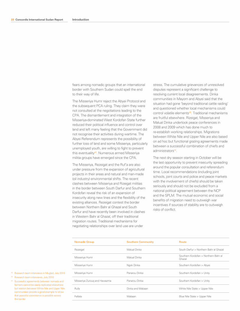
Migration Nomadic groups are deeply concerned about the impact the referendum might have on their access to essential traditional grazing land in Southern Sudan. The abundance of arms and disgruntled former fighters among affected nomadic groups in a militarised and highly contested environment represents a significant threat to stability. Nomads move into Southern Sudan during the dry season (October – April) which can lead to local conflicts over water, grazing, damage to agricultural land and cattle rustling. The main grazing routes can be summarised as follows:
Relations between nomads and southern communities vary according to the migration route and its conflict history36. Nomadic groups fought brutally, first as local militia and then for the government as core members of the PDF from the 1990s (for example, the Fursan of the Rezeigat and the Misseriya militias of El-Muglad). Importantly, leaders negotiated successfully with SAF to restrict their operations to areas surrounding their migration routes and until now local considerations remain paramount37.
The post-CPA period has generally intensified mistrust across the border between nomads and southern groups38. Flashpoints are currently limited to the Northern Bahr al Ghazal northern belt and the Unity/Abyei/Southern Kordofan triangle, though this could change. Moreover, they involve only some nomadic groups and the SPLA, and emerge from lack of alternative opportunities to the war economy, scarcity of land and historical mistrust39. Since the CPA was signed relations between the Humr and Dinka Panarou/SPLA in Unity State have been most stressful. The nomads have clashed with the SPLA on numerous occasions trying to enter Unity State with arms, which they say they need in the face of general insecurity.
There is a huge suspicion among Dinka communities that Misseriya elements are supported by a national interest to intentionally instigate violence in order to jeopardise the referendum40. In the last dry season, nomads were refused access to the South unless they disarmed41. These dynamics have reinforced
34 Research team interviews in Upper Nile and Unity States, July and August 2010
35 It is the case of Gabriel Tanginya, whose forces are part of the SAF contingent in the state JIUs (see area analysis below)
36 Considering nomadic tribes as monolithic groups is perhaps one of the major weakness of the post-CPA interventions in the border areas.
37 Salmon, Jago, ‘A Paramilitary Revolution: The Popular Defence Forces’, Small Arms Survey December 2007
38 Pantuliano et al.,‘Put Out to Pasture’, ODI HPG, March, 2009
39 Massirya leaders interviews confirmed that relations with border communities are peaceful in the absence of the SPLA.
40 Research team interviews in Pariang county, Unity State, July 2010
41 Rubkona commissioner confirmed that no nomads entered his locality in the last two dry seasons
Introduction
22 Concordis International Sudan Report
fears among nomadic groups that an international border with Southern Sudan could spell the end to their way of life.
The Misseriya Humr reject the Abyei Protocol and the subsequent PCA ruling. They claim they were not consulted at the negotiations leading to the CPA. The dismantlement and integration of the Misseriya-dominated West Kordofan State further reduced their political influence and control over land and left many feeling that the Government did not recognise their activities during wartime. The Abyei Referendum represents the possibility of further loss of land and some Misseriya, particularly unemployed youth, are willing to fight to prevent this eventuality42. Numerous armed Misseriya militia groups have emerged since the CPA.
The Misseriya, Rezeigat and the Ruf’a are also under pressure from the expansion of agricultural projects in their areas and natural and man-made (oil industry) environmental shifts. The recent clashes between Misseriya and Rizeigat militias in the border between South Darfur and Southern Kordofan reveal the risk of an expansion of insecurity along new lines and the flexibility of the existing alliances. Rezeigat contest the border between Northern Bahr al Ghazal and South Darfur and have recently been involved in clashes in Western Bahr al Ghazal, off their traditional migration routes. Traditional mechanisms for negotiating relationships over land use are under
stress. The cumulative grievances of unresolved disputes represent a significant challenge to resolving current local disagreements. Dinka communities in Mayom and Abyei said that the situation had gone ‘beyond traditional cattle raiding’ and questioned whether local mechanisms could control volatile elements43. Traditional mechanisms are fruitful elsewhere. Rizeigat, Misseriya and Malual Dinka undertook peace conferences in 2008 and 2009 which has done much to re-establish working relationships. Migrations between White Nile and Upper Nile are also based on ad hoc but functional grazing agreements made between a successful combination of chiefs and administrators44.
The next dry season starting in October will be the last opportunity to prevent insecurity spreading around the popular consultation and referendum time. Local recommendations (including joint schools, joint courts and police and peace markets with the involvement of chiefs) should be taken seriously and should not be excluded from a national political agreement between the NCP and the SPLM. The mutual economic and social benefits of migration need to outweigh war incentives if sources of stability are to outweigh risks of conflict.
42 Research team interviews in Muglad, July 201043 Research team interviews, July 201044 Successful agreements between nomads and
farmers cannot be easily replicated elsewhere but relation between White Nile and Upper Nile communities provide a good example to show that peaceful coexistence is possible across the border
Introduction
Nomadic Group Southern Community Route
Rezeigat Malual Dinka South Darfur > Northern Bahr al Ghazal
Misseriya Humr Malual Dinka Southern Kordofan > Northern Bahr al Ghazal
Misseriya Humr Ngok Dinka Southern Kordofan > Abyei
Misseriya Humr Panarou Dinka Southern Kordofan > Unity
Misseriya Zurouq and Hawazma Panarou Dinka Southern Kordofan > Unity
Rufa Dinka and Mabaan White Nile State > Upper Nile
Fellata Mabaan Blue Nile State > Upper Nile
Concordis International Sudan Report 23
The Three transitional areasThe CPA postponed the problem of the transitional areas carrying major implications for North-South border dynamics. Blue Nile, Southern Kordofan and the Abyei area are the main northern regions lying on the border line together with Southern Darfur. Underdevelopment and insecurity has fostered internal fragmentation and further weakened the capacity of administrations to address border issues. The ‘Three Areas’ have taken different security-political developments during the Interim Period.
Abyei Referendum “ The issue of the Abyei referendum has come to a standstill… This has the potential to cause a regional and international conflict”
Deng Arop, Chief Administrator, Abyei Area Administration
The Abyei Referendum is at the heart of national and local conflicts over the Abyei Area. These remain a significant threat to the national peace. National disagreement over Abyei’s boundaries has been reopened by recent statements by NCP saying that the ruling of the Permanent Court of Arbitration did not resolve the issue between the two parties45. Locally, Misseriya groups reject the Abyei Protocol and the PCA ruling and have prevented physical demarcation of the boundary on the ground. The SPLM and the Dinka Ngok are united in support of the PCA ruling and reject the idea of Misseriya voting in the referendum46. The parties have now agreed that the referendum can be implemented without demarcation of the border of Abyei area47.
According to the CPA the Abyei referendum is to take place simultaneously with the South’s referendum on self-determination48. Heated arguments over residency criteria and composition of the Abyei Referendum Commission make this increasingly unlikely49. Large numbers of Misseriya and Dinka are reportedly trying to settle in the area ahead of the referendum and this will further raise tensions over land and natural resources. Misseriya militia are active in northern Abyei and have publicly threatened to fight to destabilise the referendum. The SPLA, in which Dinka Ngok are represented at senior levels, risks being dragged into conflict if tensions in the Abyei area spill over into violence associated with the referendum.
45 Sudan tribune, 1 August, 201046 Research team interviews with Abyei
representatives, July 201047 Sudan tribune, 4 August, 201048 There is however no legal bound between the
two so the Southern Referendum could take place even without the Abyei one
49 Generally, SPLM leaders reject a northern chair for the commission; likewise the NCP has rejected all southern candidates proposed by the SPLM
Introduction
24 Concordis International Sudan Report
Popular consultations Since the signing of the CPA, we have only received empty baskets, we are yet to fight, this time our fight is a constitutional war with the centre, but for us to win it, we need to educate our people, go out with the skills you have been equipped with and educate them, it is the beginning of our journey which is long, we need all of us to be on board’ Speech of Blue Nile State Governor Malik Agar at a civic education forum for women trainers June 2010.
While Abyei was granted the right to self-determination, the other ‘transitional areas’ were constitutionally northern states entitled to popular consultation exercises and not referenda. According to the CPA, ‘Popular consultation is a democratic right and mechanism to ascertain the views of the people in Southern Kordofan/Nuba Mountains and Blue Nile State on the comprehensive agreement reached by GoS and the SPLM (CPA, TAA 3.1). The CPA links the process to the elections50.
From the outset, the scope of the popular consultation was ambiguous and the lack of full implementation of the CPA has fostered expectations among local populations around self-determination51. The States have assertive and powerful Governors. In Southern Kordofan, the NCP leader, Ahmed Haroun, and in Blue Nile, the SPLM deputy Chairman, Malik Agar, with support from active deputy Governors and from international organizations (NDI, HD, USAID, UNDP, and UNMIS among others) appear to have linked the opportunity created by the consultations to the socio-economic development of their state.
The delay in national elections has had knock on effects on the possible implementation of the popular consultations. It is consequently harder to delink them from the Southern Sudan and Abyei referenda. Postponement of the Southern Kordofan state elections to November 2011, in particular, will delay completion of the popular consultation until after the Southern Sudan referendum. The popular consultations are an opportunity, but they are also a substantial risk. If populations are left unsatisfied by the process the States could polarise along wartime lines.
Introduction
50 According to the CPA an ad hoc independent commission should be established within the new elected assembly to work for 90 days and assess people expectations towards the CPA and report shortcomings to the Presidency for resolution
51 Mainly among southern tribes in Blue Nile (Ingessana, Uduk) and Southern Kordofan (Nuba)
Concordis International Sudan Report 25
CitizenshipThe option of self-determination for Southern Sudan creates new challenges around citizenship. The Interim National Constitution of Sudan accepts dual nationality but the CPA does not provide arrangements for southerners in the North and for northerners in the South, including those in the militaries, IDPs and nomads in the post-referendum period. Both Parties have announced that no forced expulsion will happen in the event of separation but guarantees of inclusive nationality have also not been laid out and the approach of a potential new southern State is not yet known52. Harder border controls will put border communities at risk, in particular nomadic tribes and cross border residents, whose livelihoods, access to goods and services, and family relations depend upon cross border movements53.
The Southern Sudan Referendum Act of 2009 has defined southern Sudanese eligible to vote based on criteria of tribal affiliation and continuous residency since independence. The criteria for citizenship of Southern Sudan after the vote should be more open and the Parties are negotiating over it. Generally, however, citizenship laws based on ethnic affiliation can create disenfranchised communities; Northern traders in Bentiu and Rebkona (Unity State) have already decided to leave in December to go to the north with major consequences for access to goods by local communities.
Introduction
52 The New Sudan Nationality Act adopted during the war prohibits dual nationality, see Abdulbari N., Citizenship rules in Sudan and post-secession problems, Journal of African Law (JAL), foreseen
53 The 2004 Four Freedoms Agreement signed by Sudan with Egypt granted the right to work and of movement, residence, and ownership to each other’s citizens; it could be replicated to the N-S border
26 Concordis International Sudan Report
The North-South Border: Crystallising Outstanding CPA IssuesThe CPA linked definition of the North-South border to the jurisdiction of a new political institution, the Government of Southern Sudan (CPA, PSP 3.1), and the option of self-determination for southern Sudanese. It therefore became a pivotal step to facilitate full implementation of the CPA project.
According to the CPA, the border between northern and southern Sudan should have been determined by the end of the pre-interim period in July 2005 . A North-South Technical Border Committee was created by the CPA to ‘demarcate precisely the 1/1/56 North/South borderline’ (PSP IM, 46). Its mandate is technical and the Presidency holds responsibility for resolving areas of disagreement. The commitment of the parties towards the resolution of border disputes is therefore of utmost importance but it has not materialised.
Four months before the scheduled Referendum, the North-South border has not been defined, let alone demarcated. The Committee completed a draft report – a recommendation – which was submitted to the Presidency in June 2010. The NCP and SPLM disagreed on its content and there remain a number of nationally contested areas54. The Presidency met on August 29th and the parties agreed to proceed in demarcating the non-contested areas immediately, which represent the majority (around 80%) of the border. The work will not be completed before the Referendum but the parties committed to finishing it before the end of the Interim Period55. To date it is not clear whether this accord could be considered as sufficient to hold the Referendum in January 2011.
The lack of border definition is the product of challenges in implementing key CPA processes. It also impacts upon them, crystallising the biggest challenges in CPA implementation and fuelling mistrust and insecurity at the local and national levels.
A. Security Arrangements: “The line of redeployment of SPLA and SAF must be the N/S Border of 1956” (CPA, SA 18.1). Pending definition of the border, armed forces are deployed in contested areas: Heglig (SAF), Safaha (SPLA), Kafia Kinji enclave (SAF/SPLA) and the Upper Nile pick (de facto border at Jordah/Winthou).
B. Wealth Sharing: determination of the location of the oil fields, other natural resources, and agro-industry is critical to allocating revenues and taxation. Contestation over resources at the border regions therefore strike at the heart of political will to address imbalances in the distribution of wealth by the Sudanese State, a central theme of the CPA project.
C. Power Sharing: the work of the Civil Service and Land Commissions, the National Census, National Elections, South Sudan Referendum and the definition of citizenship have all been affected by the lack of definition of the North-South border.
The historical flashpoints The research process identified a number of areas along the North-South border where local or national border related conflict drivers could spark conflict. These are summarised on the schematic map overleaf. The points are not limited to technical arguments over the ambiguity of maps (for the NCP there are four such points, for the SPLM five). Instead we include those areas identified by local communities as the subject of local or national contestation or both.
Introduction
54 The percentage of disagreement is reportedly around 20% but the report was never made public. A four member political committee made up of two senior representatives from NCP and SPLM has been set up, tasked with resolving misunderstandings and agreeing a final report but it has never met
55 Phone interviews with Khartoum officials, September, 2010
Concordis International Sudan Report 27Introduction
South Kordofan
WBAG NBAG
Warrap
Unity
Upper Nile
White Nile Sennar
Blue Nile
Aweil
Bentiu Malakal
Damazin
Kadugli
Nyala
South Darfur
Hofrat al Nahas
Kafia Kinji
South Darfur-Western Bahr al Ghazal The large mineral rich Kafia Kinji area is locally and nationally contested. Diverse but sparsely populated, it was trans-ferred to Darfur in 1960 and is currently administered by Al Rodom Locality. SAF and SPLA both present. Recent clashes have been between SPLA and Rezeigat.
South Darfur-Northern Bahr al Ghazal Locally contested between Dinka Malual, Rezeigat and Misseriya over the Safaha grazing area. This extends 14 kilometres south of the river and became the provincial boundary in 1924. SPLA control the area and have clashed with nomads over restrictive access policies. Peace initiatives show promising signs but regional insecurity risks destabilising the area.
Abyei PCA ruling placed majority of oil outside the area but national dispute over implementation of the ruling and preparations for the Abyei Refer-endum still threaten to derail the CPA. Misseriya groups reject the ruling and are increasingly milita-rised. Dinka Ngok accept the ruling and reject participation of Misseriya in the Abyei Referendum.
Southern Kordofan-Unity ‘Triangle’ National contestation over Kharasana and the Heglig/Bamboo oil fields (placed outside the Abyei Area by the PCA ruling). Pariang County claims the wider area was administered in South Sudan in 1/1/56. Heavy militarisation. Ongoing clashes between nomads and SPLA. Potentially the most problematic disputed area.
Chali al Fil National agreement reconfirms 1953 border decision that broadly splits the area into two; Uduk communities in Blue Nile and Mabaan communities in Upper Nile. Some Uduk leaders contest the decision. Local contestation may gain significance during de-marcation and after the southern referendum.
White Nile-Upper Nile National and local competition over rich mechanised agricul-tural land. Successive south-wards movements of the border since 1955. Heavily militarised. De facto security border at Jordah/Winthou.
Kaka Strategically important for its access to the Nile and to oil producing areas. Trans-ferred to Nuba Province in the 1920s but returned to Upper Nile in 1928, it has been a low level dispute between the parties due to the presence of SAF. Locally contested (along with a strip of west Ma-nyo County up to Megenis) between Shil-luk and nomads who have traditionally used it for seasonal cultivation.
Megenis Mountains Dispute between Upper Nile and South Kordofan over part of reportedly mineral/oil rich mountains. Local disputes over settling of nomads and associated local resource exploitation.
State Capital
Town/village
Nationally disputed border
Locally disputed border
International border
State border
River
Gulli Rich agricultural schemes in a sparsely populated area. National and State agree-ment that area is in Tadamon Locality in Blue Nile. Potential local contestation between nomads and farmers.
Summary of Selected Border Contestations Summary of selected border contestations
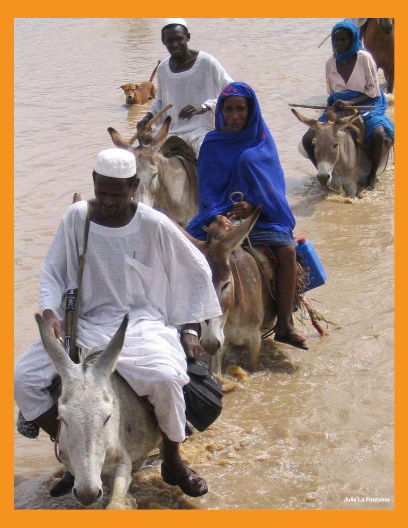
28 Concordis International Sudan Report
Julie La Fontaine
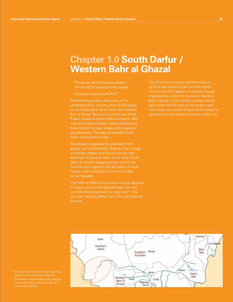
Concordis International Sudan Report 29
Chapter 1.0 South Darfur / Western Bahr al Ghazal
“ The border should not be a problem. We should be focusing on the people”
Displaced native of Kafia Kinji56
The Kafia Kingi enclave area south of the Umbelacha River, covering over 10,000 square km, is contested by South Darfur and Western Bahr al Ghazal. The area is currently part of the Rodom locality of South Darfur but before 1960 was part of Bahr al Ghazal. Hofrat al Nahas and Kafia Kinji are the main villages in this sparsely populated area. The area sits between South Darfur and Southern Sudan.
The enclave is populated by pastoralist Fertit groups such as the Karesh, Balanda, Yulu, Foroge and Banda, (Karesh and Balanda are the main ethnicities of the area) while, to the north, South Darfur is home to Baggara groups such as the Ta’aysha who migrate in the dry season through Western Bahr al Ghazal and into the Central African Republic.
The Hofrat al Nahas-Songo area is home to deposits of copper, uranium and gold although none are currently being exploited on a large scale57. The Canadian company Billiton has in the past explored the area.
The SPLM do not accept that the enclave is rightfully part of South Darfur and the North, whereas the NCP appears unwilling to discuss implementing a return of the area to Western Bahr al Ghazal. In this conflict complex national arguments over the route of the border meet local issues over access to land and the failure to demobilize armed militias to create a volatile mix.
56 The report does not reveal the identity of local people who wish to remain anonymous
57 The Canadian company Billiton has in the past explored the area but exploitation deemed economically inefficient
Chapter 1.0 South Dafur / Western Bahr al GazhalConcordis International Sudan Report 29
30 Concordis International Sudan Report
Conflict in this area is intimately connected to the unresolved contestation over the border between North and South. Both the SPLA and SAF have reportedly increased their presence in the area58 and there is a political impasse over resolving the dispute. Meanwhile local militias and insecurity in nearby regions and countries provide potential for localised violence. The conflict in Darfur represents a major threat to this area.
The threat of instability comes either from an all out SPLA/SAF fight to resolve the border demarcation by violent means or from local militias initiating a conflict that draws in national actors. Pastoralists from South Darfur have begun to travel further south than before and this is increasing tensions with local groups. Local communities appear ambivalent about their allegiance to central government in the form of Khartoum or Juba. It is difficult to predict how a historical pattern of shifting alliances may play out in the future. Further conflicts in Darfur and CAR and the influence of the LRA represent external threats that spill into this area and threaten lives.
There is little indication that a resolution is likely in the short term.
Summary Features• Nationalcontestationovertheresource
endowed (copper, uranium, gold) Kafia Kinji enclave (including Hofrat al Nahas) currently administered by South Darfur.
• Increasedmilitarisationoftheareaandrecentclashes between Rezeigat nomads and SPLA.
• Isolationandalackofeffectiveauthorityofferfertile ground for armed groups and increase the likelihood of regional instability drawing in local actors.
• ProximityandrelationtoDarfurconflictandregional conflict complexes (CAR) draws local actors into confrontation and military alliances.
• Diversepeopleswithahistoryofshiftingandunpredictable alliances.
Chapter 1.0 South Darfur / Western Bahr al Ghazal
1.0 Snapshot Summary
58 Field interviews, Al Rodom Locality, July 2010
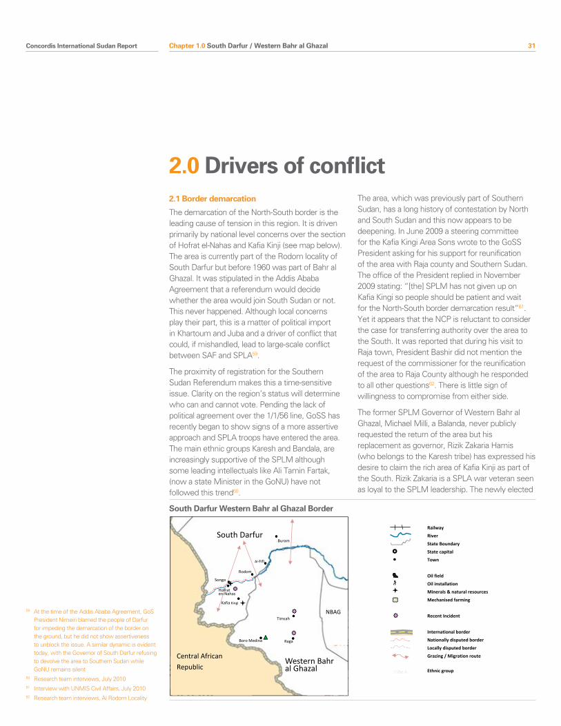
Concordis International Sudan Report 31
2.1 Border demarcation
The demarcation of the North-South border is the leading cause of tension in this region. It is driven primarily by national level concerns over the section of Hofrat el-Nahas and Kafia Kinji (see map below). The area is currently part of the Rodom locality of South Darfur but before 1960 was part of Bahr al Ghazal. It was stipulated in the Addis Ababa Agreement that a referendum would decide whether the area would join South Sudan or not. This never happened. Although local concerns play their part, this is a matter of political import in Khartoum and Juba and a driver of conflict that could, if mishandled, lead to large-scale conflict between SAF and SPLA59.
The proximity of registration for the Southern Sudan Referendum makes this a time-sensitive issue. Clarity on the region’s status will determine who can and cannot vote. Pending the lack of political agreement over the 1/1/56 line, GoSS has recently began to show signs of a more assertive approach and SPLA troops have entered the area. The main ethnic groups Karesh and Bandala, are increasingly supportive of the SPLM although some leading intellectuals like Ali Tamin Fartak, (now a state Minister in the GoNU) have not followed this trend60.
The area, which was previously part of Southern Sudan, has a long history of contestation by North and South Sudan and this now appears to be deepening. In June 2009 a steering committee for the Kafia Kingi Area Sons wrote to the GoSS President asking for his support for reunification of the area with Raja county and Southern Sudan. The office of the President replied in November 2009 stating: “[the] SPLM has not given up on Kafia Kingi so people should be patient and wait for the North-South border demarcation result”61. Yet it appears that the NCP is reluctant to consider the case for transferring authority over the area to the South. It was reported that during his visit to Raja town, President Bashir did not mention the request of the commissioner for the reunification of the area to Raja County although he responded to all other questions62. There is little sign of willingness to compromise from either side.
The former SPLM Governor of Western Bahr al Ghazal, Michael Milli, a Balanda, never publicly requested the return of the area but his replacement as governor, Rizik Zakaria Hamis (who belongs to the Karesh tribe) has expressed his desire to claim the rich area of Kafia Kinji as part of the South. Rizik Zakaria is a SPLA war veteran seen as loyal to the SPLM leadership. The newly elected
Chapter 1.0 South Darfur / Western Bahr al Ghazal
2.0 Drivers of conflict
59 At the time of the Addis Ababa Agreement, GoS President Nimeiri blamed the people of Darfur for impeding the demarcation of the border on the ground, but he did not show assertiveness to unblock the issue. A similar dynamic is evident today, with the Governor of South Darfur refusing to devolve the area to Southern Sudan while GoNU remains silent
60 Research team interviews, July 201061 Interview with UNMIS Civil Affairs, July 201062 Research team interviews, Al Rodom Locality
South Darfur
Western Bahr al Ghazal
Central African
Republic
NBAG
South Darfur / Western Bahr al Ghazal Border
Railway
River
State Boundary
State capital
Town
Oil field
Oil installation
Minerals & natural resources
Mechanised farming
Recent Incident
International border
Nationally disputed border
Locally disputed border
Grazing / Migration route
Ethnic group
Buram
Raga
Kafia Kingi
Rodom
Songo
Karesh, Balanda tribes
Where is blabla, erre payam??! Clashes
24th april. Major losses both sides.
Timsah
Hofrat en-Nahas
Boro Medina
Al-Fifi
South Darfur Western Bahr al Ghazal Border
32 Concordis International Sudan Report Chapter 1.0 South Darfur / Western Bahr al Ghazal
63 Research team interviews with military officers in Juba, July 2010, electronic correspondence with UNMIS CA, July 2010
64 This is the case of Kajia Kinji and the Safaha area of Northern Bahr al Gazal
65 Research team interviews, community leaders, Al Rodom, Songo, July 2010
66 However, that incident had been already resolved with the intervention of the Governor and the dia (blood money) was paid
67 McDoom, Opheera, 25th April 201068 Interviews with UNMIS Civil Affairs, July 2010
Governor of South Darfur, Abdel Hamid Musa Kash, is a Rizeigat and has so far not encouraged or accepted the idea of a transfer of the area to Western Bahr al Ghazal. He has indicated that he thinks the areas of Hofrat Al-Nahas and Kafia Kingi belong to South Darfur and has expressed a desire to begin exploiting the mineral wealth.
2.2 SAF / SPLA Militarisation
The failure to define and demarcate the border in accordance with CPA provisions has dangerous implications on the ground. Both the SAF and the SPLA are present in the enclave and increasing their forces, meaning that the danger of a small-scale conflict escalating is heightened. The SAF has reportedly increased its presence in Kafia Kinji and Songa, and at al Fifi in Southern Darfur, while the SPLA is said to have established a presence in Raja, Timsah and Boro Medina63.
The SPLA entered the Kafia Kinji enclave following the CPA, using Timsah as its base. The local population did not give them a warm welcome and remain antipathetic towards the SPLA presence, although interviews suggested this attitude is beginning to change. For their part, the SPLM/A never considered the inhabitants to be loyal allies during the war and appear to have paid little attention to their concerns in the post-CPA period. Since the CPA signature, the SPLA has steadily attempted to move northwards towards the river, leading to clashes with communities from Darfur64.
Militarisation has generated fear and uncertainty in the area and affected livelihoods, for example by reducing access to resources such as water. Community leaders report that the armies have established checkpoints and have reportedly begun taxing the movements of goods in and out of the Kafia Kinji area. The capacity of the two armies to maintain peaceful positions until a national agreement is found is constantly tested. The SPLA/Rizeigat clash reported below is a manifestation of instability in the delicate political environment of the area.
2.3 SPLA / Rizeigat clashes
On 24th April 2010 Rizeigat and the SPLA clashed around Blabla village, in Erre Payam, causing major losses on both sides. There are differing accounts of what happened.
The SPLA claim that the attackers were uniformed members of the Sudan Armed Forces (SAF) and used four Land Cruisers with mounted machine guns. The SAF deny any involvement in the attack and stated that the SPLA had clashed with the Rizeigat nomads, calling it a “clear violation” of the 2005 peace deal. The head of the Rizeigat Al Shilu Council said that the Rizeigat had been involved in the clash with the SPLA in response to SPLA aggression while searching for new pastures for their cattle. UN sources say that the Rizeigat reportedly attacked SPLA troops in reaction to the perceived illegal occupation of the land and as a response to the SPLA killing of Rizeigat in Timsah on 11th April and in Aweil in 200965. The SPLA stated that another attack had been launched on its forces on 25th April in Raja area and forced the SPLA force to retreat. Of the approximately 100 men in the area66 had reported back with the remainder presumed to be still out in the field67.
Some in the SPLA said the clashes should be seen as part of a broader project to use the Rizeigat as proxy militias to create instability and weaken the SPLA in advance of the Referendum. It is hard to evaluate such claims and there is little evidence for them. However, the fact that these ideas are given credence demonstrates the prevailing atmosphere.
The conflict should be seen as part of wider tensions between the Rizeigat and the SPLA along the border (including in Northern Bahr al Ghazal)68. These stem from the tribe’s fear of scarcity of grazing land if the Referendum leads to separation and the possible closure of the border. Interviewees suggested that it was possible Rizeigat are investigating new grazing areas in view of this scenario.
Concordis International Sudan Report 33
2.4 Other Armed Groups
The wider insecurity and history of conflict in the area have left behind a number of armed groups leaving a legacy that could destabilise an already tense situation. Parts of the area are ‘no man’s lands’ where UNMIS access is severely restricted.
In December 1989, the Peace Army militia of the Fertit tribe in Wau was incorporated into the PDF (see PDF box next chapter). Shortly afterwards, in March 1990, the Fursan militia of the Rizeigat tribe around Ed-Dein, was also absorbed70. Local motivations were paramount in the decision to join the PDF and can be assumed still to be so, these groups will act in their own self interest; the ability of their patrons in Juba or Khartoum to control their actions is limited. The shifting alliances of the following groups would have to be monitored, in order to understand the dangers of future conflict.
The SAF-aligned Quwat Al Fursan forces based in Raja, made up of Arabs from South Darfur under the command of Ahmed Almunin, are the most prominent group today (around 1,000 strong). Officially disarmed after the CPA, they are reportedly in Timsah payam, over which Raja county has no authority and to which UNMIS has no access71.
The former PDF, SAF-aligned Fertit and Balanda militias under Maj. Gen. Atom al Nur are operating in Raja, Tonj and Wau. Their number is limited (around 300). The Al Fursan Raja division, under the command of Alhaj Beshir Mawin also in Raja and Babelo, joined the SPLA in April 2007 because of a lack of support promised by Khartoum.
Fellata tribes, especially the Ambororo clan, migrate with weapons into Raja but have so far only generated local conflicts.
Binga and Forgie groups also live in the area of Al-Rodom, Kafia Kinji, and Songa and have shown some support for the NCP particularly among their leaders. They are disappointed with what they see as a lack of consideration by the SPLM. Today they have no militia but they have the potential to play a role in a system of shifting alliances.
The danger of these groups lies in their unpredictability and the possibility of local conflict with the SPLA or SAF becoming a wider issue depending on national politics. While groups remain armed and unincorporated into regular armies they are a dangerous and destabilising factor.
Chapter 1.0 South Darfur / Western Bahr al Ghazal
69 Unfortunately, research on the Rizeigat is limited and the team could not visit South Darfur. More research is needed to grasp the complexity and interests of these influential Arab nomads
70 Salmon, 200771 This information is compiled from field interviews
with traditional and political leaders in Songo and Al Rodom, July 2010 and through electronic correspondence with UN Civil Affairs in Raja, July 2010
The Rizeigat
The Rizeigat tribe is the biggest Baggara group after the Misseriya and the most influential group in South Darfur69.
Baggara Rizeigat and Ta’aysha have largely avoided taking sides in the current conflict in Darfur and they maintain open relationships with all players in the region. However, Baggara groups in Southern Kordofan and South Darfur were central to the SAF strategy during the second civil war and the direction of their allegiance could be pivotal to future control of the area.
The group’s migration goes from the area of Ed-Dein southwards. Their main grazing area is the Safaha land south of the Bahr al Arab/Kiir river in Northern Bahr al Ghazal. Local clashes with Dinka Malual are regulated by historical agreements, the last being the successful Dinka-Rizeigat peace conference of January 2010 in Aweil (see next chapter). However, national dynamics and regional insecurity impact negatively on the effectiveness of such traditional mechanisms. Rizeigat have recently clashed with Misseriya in the border between South Darfur and Southern Kordofan and with the SPLA around Hofrat al Nahas. Clashes with the SPLA in the area represent a dangerous new post-CPA dynamic.
34 Concordis International Sudan Report
2.5 Wider regional instability
The border has a history as a site of confrontation between pastoralist groups accessing the area. The problems relate mostly to pastureland and the livestock migration route and involve the Habaniya, Ta isha, the Fellata (Ambororo), as well as Misseriya and Rizeigat. However, conflict in other areas has seen an increase in other groups trying to access this area including the Salamat.
Darfur Nexus Since the beginning of the conflict in Darfur, rebel groups have been using this area as rear base for their combat with GoS. At the beginning of 2007, two rebel groups, the JEM/Peace wing led by Siddiq and the SLA/Abdulshafi camped in the areas of Raja and Ghor Gawafa and attacked the road. Their presence is reported to have negatively impacted the relations between the communities living in those areas.
Subsequently GoS-backed militia forces took action against the Darfur groups. However, the legacy of empowered militias is further polarization of local communities. This border area has been a site of confrontation between distinct and hostile pastoralist groups, and the indigenous communities.
Later the Siddiq group attacked SAF positions at Songo and Dafak. In response, the Binga created an alliance with Habaniya and Fellata tribal militias (with support from the South Darfur Government) and defeated the faction in 2008. Despite the efforts of the South Darfur Government the tribal militias remained in the area.
The Habaniya and Kara semi-nomadic groups are known to be grazing around the areas of Rodom, Kafia Kinji, and Hofrat al Nahas up to the Boro River. Habaniya are believed to be practising commercial activities with South Sudan and a considerable number of Habaniya militias have joined the SPLA. However they were also involved in the campaign against the Siddiq group and their allegiance to SAF appears stronger.
Another factor is the presence of IDPs from Darfur. The town and area of Boro Medina has become a centre for IDPs escaping the current conflict to the north. This is not considered to be a high-risk issue at present. In the past, IDPs camps in the area have been used as training and mobilisation centres by tribal militias.
Wider Regional Insecurity Central African RepublicThe area north of the Umbelacha River is heavily militarized because of insecurity in CAR. The Gala Movement was attacked in 2007 provoking the displacement of some 10000 people in Umdafok and Rahed Al Birdi. Large numbers of displaced people could increase tensions over land access.
Lord’s Resistance ArmyThere have been persistent rumours since the breakdown of the LRA peace talks that some elements of the LRA, possibly including the leader Joseph Kony, have moved northwest from the DRC and Western Equatoria State into the Central African Republic. The area of their most recent attack is close to the border with CAR and it is possible that LRA elements may have crossed into Raja County, perhaps hoping to find an escape route through to Darfur and Khartoum72.
On 5th August 2010, following an attack against the area allegedly by elements belonging to LRA, the governor of Western Bahr al Ghazal, Zakaria Hassan, accompanied by the commander of the fifth SPLA infantry brigade, police and security officers, embarked on a long field trip to all the areas around Raja73.
The SPLA commander in the area has deployed additional forces in those areas and seems to have prevented LRA from attacking the areas of Deym-Jalab and Mangay on the border with Central African Republic (CAR)74.
Regional insecurity, be it in Darfur or from outside Sudan’s borders, has the capacity to cause localised conflicts, either targeting civilians or provoking a violent response from local militia groups. It is likely that the spill over from Darfur has the greatest chance of causing an escalating national conflict.
Chapter 1.0 South Darfur / Western Bahr al Ghazal
72 Presence of LRA however is not confirmed73 Research team interviews, July, 201074 Field research interviews, August 2010
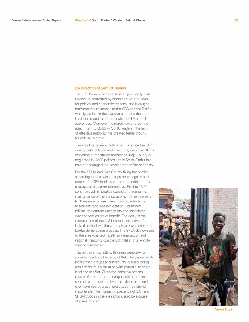
Concordis International Sudan Report 35
2.6 Direction of Conflict Drivers
The area known today as Kafia Kinji, officially in Al Rodom, is contested by North and South Sudan for political and economic reasons, and is caught between the influences of the CPA and the Darfur war dynamics. In the last two centuries the area has been prone to conflict instigated by central authorities. Moreover, its population shows little attachment to GoSS or GoNU leaders. This lack of effective authority has created fertile ground for militias to grow.
The area has received little attention since the CPA, owing to its isolation and insecurity, with few NGOs delivering humanitarian assistance. Raja County is neglected in GoSS politics, while South Darfur has never encouraged the development of its periphery.
For the SPLM and Raja County fixing the border according to their wishes represents legality and respect for CPA implementation, in addition to the strategic and economic incentive. For the NCP, continued administrative control of the area, i.e. maintenance of the status quo, is in their interests; NCP representatives have indicated intentions to resume resource exploitation. For armed militias, the current uncertainty and associated war economies are of benefit. The delay in the demarcation of the N/S border is indicative of the lack of political will the parties have invested in the border demarcation process. The SPLA deployment to the area was technically an illegal action and national insecurity could erupt right in this remote spot of the border.
The parties show little willingness seriously to consider resolving the issue of Kafia Kinji; meanwhile local armed groups and insecurity in surrounding areas make this a situation with potential to spark localised conflict. Given the sensitive national nature of the border the danger exists that local conflict, either initiated by local militias or as spill over from nearby areas, could assume national importance. The increasing presence of SAF and SPLM troops in the area should also be a cause of grave concern.
Chapter 1.0 South Darfur / Western Bahr al Ghazal
News Hour
36 Concordis International Sudan Report Chapter 1.0 South Darfur / Western Bahr al Ghazal
3.0 Conflict Mitigation
There do not appear to be any systematic and comprehensive efforts to mitigate conflict in this area. The trouble in Darfur makes a more urgent call on attentions. Similarly, the lack of a large population underplays the significance of the area. However, there are very serious risks of conflict, and a further danger that could spread to the national level.
To prevent escalation of the SPLA/Rizeigat conflict dynamic, and any possible negative backlash on the successful relations between Rizeigat and Dinka Malual in Northern Bahr al Ghazal, conflict resolution activities should be supported with the relevant actors. The example of successful conferences between the Dinka and the Rizeigat (see next chapter) in Northern Bahr al Ghazal could fruitfully be expanded to other ethnic groups. The SPLA need to develop working relations with tribes in the area.
For conflict mitigation efforts to be successful they will need the involvement of the SAF and SPLA alongside the governors of South Darfur and Western Bahr al Ghazal. Regardless of the referendum outcome these conflict tensions will continue to exist.
At the national level, the SPLM and NCP need urgently to engage on resolving the demarcation of the border and need to commit to demilitarising the area. Once this is achieved, dealing with issues of access (especially allaying the concerns of nomads), and local armed militias will be crucial.
3.0 Conflict Mitigation
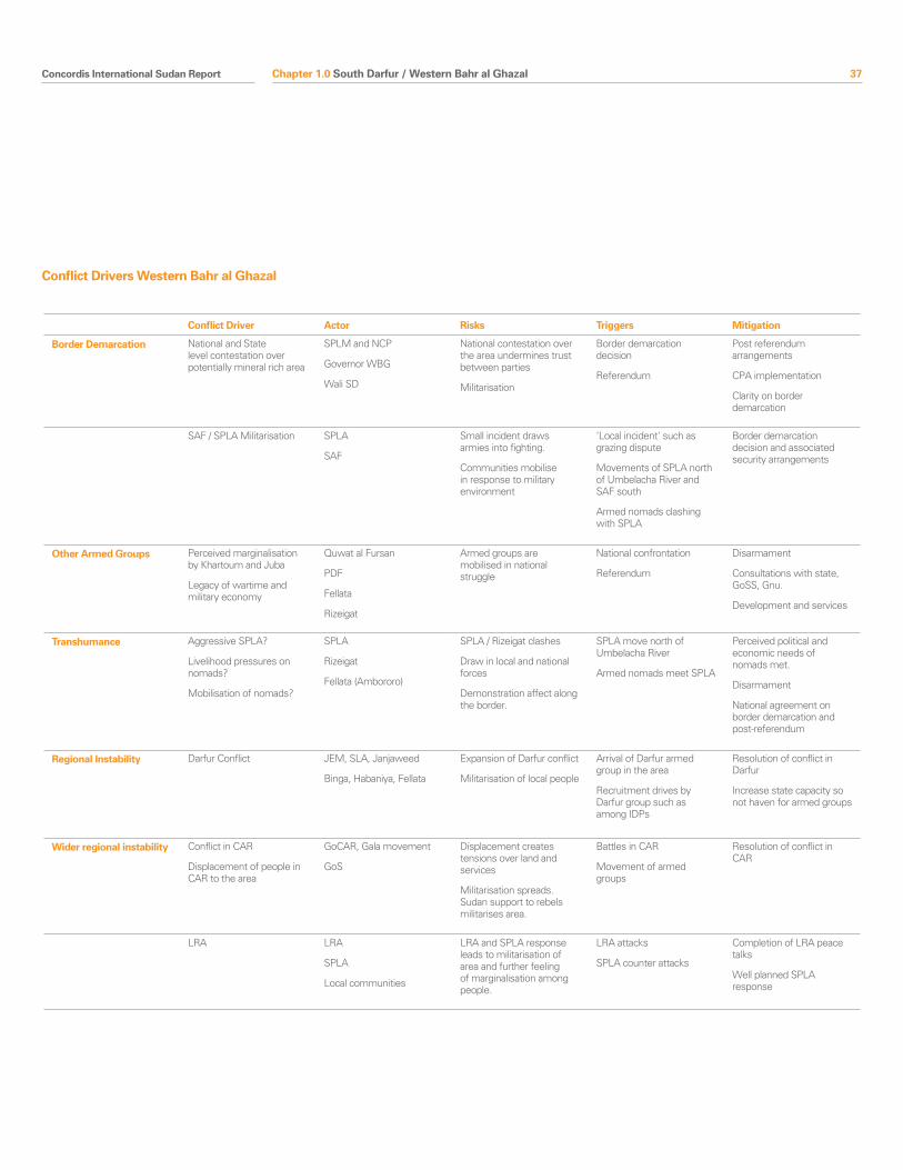
Concordis International Sudan Report 37
Conflict Driver Actor Risks Triggers Mitigation
Border Demarcation National and State level contestation over potentially mineral rich area
SPLM and NCP
Governor WBG
Wali SD
National contestation over the area undermines trust between parties
Militarisation
Border demarcation decision
Referendum
Post referendum arrangements
CPA implementation
Clarity on border demarcation
SAF / SPLA Militarisation SPLA
SAF
Small incident draws armies into fighting.
Communities mobilise in response to military environment
‘Local incident’ such as grazing dispute
Movements of SPLA north of Umbelacha River and SAF south
Armed nomads clashing with SPLA
Border demarcation decision and associated security arrangements
Other Armed Groups Perceived marginalisation by Khartoum and Juba
Legacy of wartime and military economy
Quwat al Fursan
Fellata
Rizeigat
Armed groups are mobilised in national struggle
National confrontation
Referendum
Disarmament
Consultations with state, GoSS, Gnu.
Development and services
Transhumance Aggressive SPLA?
Livelihood pressures on nomads?
Mobilisation of nomads?
SPLA
Rizeigat
Fellata (Ambororo)
SPLA / Rizeigat clashes
Draw in local and national forces
Demonstration affect along the border.
SPLA move north of Umbelacha River
Armed nomads meet SPLA
Perceived political and economic needs of nomads met.
Disarmament
National agreement on border demarcation and post-referendum
Regional Instability Darfur Conflict JEM, SLA, Janjaweed
Binga, Habaniya, Fellata
Expansion of Darfur conflict
Militarisation of local people
Arrival of Darfur armed group in the area
Recruitment drives by Darfur group such as among IDPs
Resolution of conflict in Darfur
Increase state capacity so not haven for armed groups
Wider regional instability Conflict in CAR
Displacement of people in CAR to the area
GoCAR, Gala movement
GoS
Displacement creates tensions over land and services
Militarisation spreads. Sudan support to rebels militarises area.
Battles in CAR
Movement of armed groups
Resolution of conflict in CAR
LRA LRA
SPLA
Local communities
LRA and SPLA response leads to militarisation of area and further feeling of marginalisation among people.
LRA attacks
SPLA counter attacks
Completion of LRA peace talks
Well planned SPLA response
Conflict Drivers Western Bahr al Ghazal
Chapter 1.0 South Darfur / Western Bahr al Ghazal
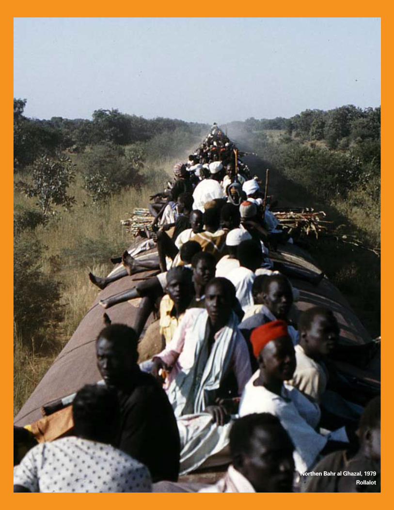
38 Concordis International Sudan Report
Northen Bahr al Ghazal, 1979
Rollalot
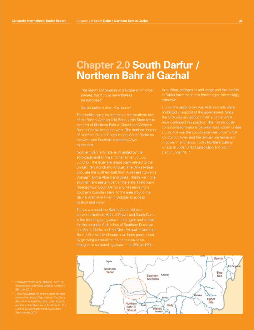
Concordis International Sudan Report 39
“ The region still believes in dialogue and mutual benefit, but it could nevertheless be politicised”
Senior policy maker, Khartoum75
The conflict complex centres on the southern belt of the Bahr al Arab (or Kiir) River. Unity State lies to the east of Northern Bahr al Ghazal and Western Bahr al Ghazal lies to the west. The northern border of Northern Bahr al Ghazal meets South Darfur on the west and Southern Kordofan/Abyei to the east.
Northern Bahr al Ghazal is inhabited by the agro-pastoralist Dinka and the farmer Jo Luo/Jur Chol. The latter are linguistically related to the Shilluk, Pari, Acholi and Anyuak. The Dinka Malual populate the northern belt from Aweil east towards Warrap76. Dinka Abiem and Dinka Palieth live in the southern and eastern part of the state. Historically, Rizeigat from South Darfur and Misseriya from Southern Kordofan travel to the area around the Bahr al Arab (Kiir) River in October to access pasture and water.
The area around the Bahr al Arab (Kiir) river between Northern Bahr al Ghazal and South Darfur is the richest grazing area in the region and crucial for the nomadic Arab tribes of Southern Kordofan and South Darfur and the Dinka Malual of Northern Bahr al Ghazal. Livelihoods have been pressurised by growing competition for resources since droughts in surrounding areas in the 80s and 90s.
In addition, changes in land usage and the conflict in Darfur have made this fertile region increasingly attractive.
During the second civil war Arab nomads were mobilized in support of the government. Since the CPA was signed, both SAF and the SPLA have continued this practice. This has seriously compromised relations between local communities. During the war the countryside was under SPLA control but Aweil and the railway line remained in government hands. Today Northern Bahr al Ghazal is under SPLM jurisdiction and South Darfur under NCP.
Chapter 2.0 South Darfur / Northern Bahr al Gazhal
75 Participant contributiion, National Forum on Reconciliation and Peace-building, Khartoum, 28th July 2010
76 The Dinka Malual live in the current counties of Aweil North and West (Malual). The Dinka Abiem live in Aweil East (also called Abiem), and the Dinka Palieth live in Aweil South. The Luo live in Aweil Centre and Aweil South. See Harragin, 2007
Chapter 2.0 South Dafur / Northern Bahr al GazhalConcordis International Sudan Report 39
40 Concordis International Sudan Report
Conflict is primarily concerned with the Safaha area, the 14 miles south of the Bahr Al Arab / Kiir River and the rights of nomad communities from the north to graze their cattle there in the dry season. The exact line of the border is a subject of contestation between the SPLM and NCP. Furthermore, the contested areas are important for the livelihoods of communities in both North and South Sudan and disagreements over land usage and passage rights have the potential to assume regional or national importance because of national political sensitivities over border demarcation.
Since the war, local communities have largely been able to share resources peacefully using traditional or state-mediated systems to organise relations. However, Dinka groups continue to demonstrate mistrust in the Misseriya, who they believe are reluctant to follow agreed rules for entering their territory. Misseriya indicated that they have been unfairly treated by SPLA units in the area and this had caused them to retaliate violently77. Relations with Rizeigat have been more peaceful.
The situation is further complicated by the continued existence of ‘other armed groups’ (OAGs) from the war and the widespread ownership of firearms. Internal political space in Northern Bahr al Ghazal has been closed by the SPLM and the danger of this breeding resentment in the future clearly exists. The conflict in Darfur and tensions in Southern Kordofan have knock-on impacts on this conflict complex.
In general the post-war period has been peaceful in Northern Bahr al Ghazal/South Darfur and communities on both sides of the border have committed to peaceful coexistence. However, the wartime experience in this area should serve as a caution for how easily the situation could escalate.
Summary features• Localandnationalcontestationaroundlanduse
and ownership rights of the Safaha area south of the River Kiir.
• Regionalpoliticalandenvironmentalchangesincrease the importance of the Safaha area as a grazing land for the Rezeigat and Misseriya. The presence of SPLA in grazing areas risks clashes and conflict escalation.
• Shiftingalliancesandprimacyoflocalinterestsfor OAGs and former OAGs. Conflict in Abyei or Unity State could draw these interests into fighting.
• Post-CPAconferences(DinkaMalual-Misseriyaand Dinka Malual-Rezeigat) to regulate access to grazing and water led to some successes.
• RelativestabilityinNorthernBahralGhazaland mutual interests in cross border trade and transhumance.
Chapter 2.0 South Darfur / Northern Bahr al Gazhal
1.0 Snapshot Summary
77 Research team interviews in Muglad, July 2010
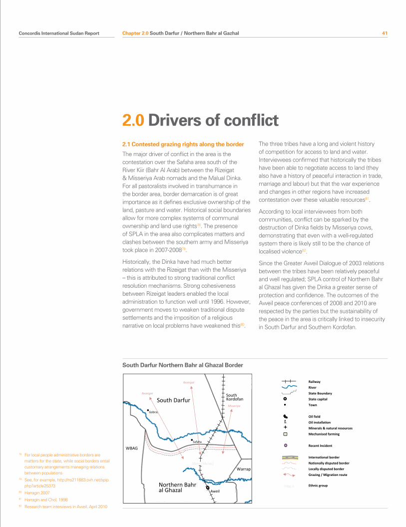
Concordis International Sudan Report 41
2.1 Contested grazing rights along the border
The major driver of conflict in the area is the contestation over the Safaha area south of the River Kiir (Bahr Al Arab) between the Rizeigat & Misseriya Arab nomads and the Malual Dinka. For all pastoralists involved in transhumance in the border area, border demarcation is of great importance as it defines exclusive ownership of the land, pasture and water. Historical social boundaries allow for more complex systems of communal ownership and land use rights78. The presence of SPLA in the area also complicates matters and clashes between the southern army and Misseriya took place in 2007-200879.
Historically, the Dinka have had much better relations with the Rizeigat than with the Misseriya – this is attributed to strong traditional conflict resolution mechanisms. Strong cohesiveness between Rizeigat leaders enabled the local administration to function well until 1996. However, government moves to weaken traditional dispute settlements and the imposition of a religious narrative on local problems have weakened this80.
The three tribes have a long and violent history of competition for access to land and water. Interviewees confirmed that historically the tribes have been able to negotiate access to land (they also have a history of peaceful interaction in trade, marriage and labour) but that the war experience and changes in other regions have increased contestation over these valuable resources81.
According to local interviewees from both communities, conflict can be sparked by the destruction of Dinka fields by Misseriya cows, demonstrating that even with a well-regulated system there is likely still to be the chance of localised violence82.
Since the Greater Aweil Dialogue of 2003 relations between the tribes have been relatively peaceful and well regulated; SPLA control of Northern Bahr al Ghazal has given the Dinka a greater sense of protection and confidence. The outcomes of the Aweil peace conferences of 2008 and 2010 are respected by the parties but the sustainability of the peace in the area is critically linked to insecurity in South Darfur and Southern Kordofan.
Chapter 2.0 South Darfur / Northern Bahr al Gazhal
2.0 Drivers of conflict
78 For local people administrative borders are matters for the state, while social borders entail customary arrangements managing relations between populations
79 See, for example, http://ns211683.ovh.net/spip.php?article25373
80 Harragin 2007 81 Harragin and Chol, 199882 Research team interviews in Aweil, April 2010
South Darfur
Northern Bahr al Ghazal
South Kordofan
WBAG
Warrap
South Darfur / Northern Bahr al Ghazal Border
Gabras
Aweil
ethnic groups?
Where is Ed-Deain
Rezeigat
Rezeigat
Misseriya
Safaha
Railway
River
State Boundary
State capital
Town
Oil field
Oil installation
Minerals & natural resources
Mechanised farming
Recent Incident
International border
Nationally disputed border
Locally disputed border
Grazing / Migration route
Ethnic group
South Darfur Northern Bahr al Ghazal Border
42 Concordis International Sudan Report
Pressures from other areasPressures on land in nearby areas have in the past contributed toward increased tension in this conflict complex; this seems likely to continue. For example, the beginning of oil exploration in the Muglad Basin and new farming schemes in the 1990s narrowed Misseriya access to land and made the seasonal grazing south of the Bahr al Arab (Kiir) River more valuable83. Conflict in other areas also impacts on this region; the Rizeigat, who remained neutral in the Darfur conflict, have had to look for pastures outside that conflict zone, while Misseriya have had their migration routes disrupted because of the conflict in Abyei.
The Misseriya and Rizeigat fear that in the event of southern independence they could lose access to historic grazing areas. This is certainly a potential source of future conflict, especially if their access to other areas in the north is curtailed.
Misseriya-Rizeigat strugglesThe post-CPA period has seen an increase in struggles between the Misseriya and Rizeigat. In 2008 access to water provoked clashes between Rizeigat and the Misseriya Fayarin Awlad Jibril sub-tribe on the South Darfur and Southern Kordofan border. The conferences between the three tribes are no longer held since CPA signature and Northern Bahr al Ghazal deals with the Rizeigat and Misseriya separately. The post election period has seen an escalation in Rezeigat-Misseriya clashes in South Darfur leading to many fatalities. Despite a state sponsored reconciliation in June 2010, recent fighting in late August took place, reportedly set off when Rizeigat failed to pay compensation for outstanding claims.
2.2 Transportation of arms
The Dinka Malual say they are willing to provide the Misseriya with access to pasture and water during the dry season on the condition that the Misseriya leave their weapons behind84. Several Dinka Malual interviewees expressed their mistrust of the Misseriya and their fear that they would loot cows and abduct women and children in Northern Bahr al Ghazal. Interviewed Misseriya, however, underlined that they need weapons to protect and defend their cattle against wild animals and thieves. Dinka Malual referred to the Rizeigat as a positive example because they left their weapons behind.
When SPLA soldiers stopped Misseriya in the border area for carrying guns the Misseriya attacked the SPLA garrison at the river in reaction. Several Dinka interviewed were convinced that the Misseriya who attacked the SPLA were not cattle herders but militias supported by SAF and NCP in order to push the north-south border further south and to take possession of oil reserves and grazing land.
According to Misseriya sources, though, the SPLA soldiers stopped Misseriya youth from bringing their cattle to water points. In addition, the SPLA started to shoot cattle. Several Misseriya elders stressed their youth looking after cattle get out of control if their cattle are in danger. Misseriya interviewees emphasized that during the dry season they would be ready to do anything, including fight, to ensure access to water and pasture for their cattle. They strongly denied that they had been armed by NCP and by SAF. It is a similar discourse heard in the Unity/Southern Kordofan/Abyei borders.
Chapter 2.0 South Darfur / Northern Bahr al Gazhal
83 See ‘Put out to pasture’, 200984 Research team interviews in Aweil, April, 2010
Concordis International Sudan Report 43
2.3 Militarisation of the area
The SPLA is deployed along the Northern Bahr al Ghazal border but not in the same numbers as in Unity and Upper Nile; the border is considered less strategic in relation to an attack to/from the North. Nevertheless, the danger of unprepared soldiers and nomads clashing and leading to a larger scale conflict is very real85. The militarisation of this area has broader consequences for North–South relations.
The active involvement of nomad militias on the side of the SAF during the war created mistrust between nomad groups and the SPLA which still exists today86. Both Rizeigat and Misseriya have clashed with the SPLA in 2010 (in Abyei, Abienhom County in Unity State and around Hofrat al-Nahas in Raja county/South Darfur). This mistrust makes resolving contentious issues more difficult and points to potential problems in the future.
Following CPA signature, tribal militias were officially disbanded but not all OAGs have been successfully integrated; rather tribal militias seem to be being remobilized and pose a serious security threat in the border region87. Since the CPA, the SPLA has tried to co-opt former armed militias, the muhareliin, who allied with SAF during the war. The strategy is to tempt them by allowing access to land in the fertile but less strategic Northern Bahr al Ghazal88.
Chapter 2.0 South Darfur / Northern Bahr al Gazhal
85 Research team interviews, Juba, July 2010 86 Julie Flint, ‘Rhetoric and Reality:The Failure to
Resolve the Darfur Conflict’, Small arms Survey, January 2010
87 ‘The Joint Integrated Units and the future of the CPA’, Small Arms Survey 2008
88 Research team interviews, Juba 201089 Human Rights Watch, 1996, pp. 274–7590 de Waal, 2007a, pp. 27–28 in Flint 2009: 16
Popular Defence Forces (PDF)
During the second civil war, the SAF used tribal militias in Western Sudan to fight the SPLA (and the Ngok, Abiem, Malual, and Twic Dinka who allegedly supported the SPLA in Northern Bahr al Ghazal). The 1989 Popular Defence Forces Act formally recognised the new force, and from then until early 1990 existing militia and paramilitary groups in Bahr El Ghazal, South Darfur and Southern Kordofan were absorbed into the PDF, followed in December 1989 by the Misseriya militia of El-Muglad, and the Peace Army militia of the Fertit tribe in Wau, and in March 1990 the Fursan militia of the Rizeigat tribe around Ed-Dein, South Darfur89.
Some Arab nomads sought livelihoods from the war economy to compensate for losses of their livestock through drought, banditry and the increasing urbanization of the youth. Local motivations were paramount. Some units negotiated to restrict their operations to their migratory routes and many insisted on campaigning according to their seasonal agenda rather than the Army’s strategic priorities. They were not paid but were allowed to keep whatever they looted. According to a study, the counterinsurgency formula was founded on ethnically targeted killing and total impunity90.
The CPA security arrangements regulate the dismantlement of the ‘Other Armed Groups’ (OAGs). But the PDF are not considered OAGs by the Presidency, despite SPLM complaints.
The conditions that made the war economy appealing to tribal militias in the past are still valid today, but alliances are shifting. Former PDF groups now form the pro-SPLA Debab Forces (mainly Misseriya) and Abu Matrig Forces (mainly Rizeigat). The strength of those alliances is questionable, in particular within the Misseriya and depends mainly on the possibility of increasing grazing access in Abyei, Unity and Northern Bahr al Ghazal.
44 Concordis International Sudan Report
Both the SPLM and NCP are reportedly mobilising militias amongst the Misseriya and Rizeigat in South Darfur and Southern Kordofan as they try to assert control over the border and the resources in the border lands91. Insecurity could have spill-over effects in Northern Bahr al Ghazal and potentially drag the border area into a wider conflict. Certainly increased insecurity in South Darfur, Southern Kordofan and Abyei would increase pressure on grazing lands and water resources in Northern Bahr al Ghazal.
The Rizeigat are the biggest source of nomadic support for the SPLM in South Darfur. Most of their militias were formerly members of the PDF (mainly from the Umahmed sub clan). During the war they fought on the side of the government. Following the signing of the CPA in 2005, they felt ignored by Khartoum. In 2006 approximately 2,000 Rizeigat fighters led by a commander called Khalid Abu-Igeel announced themselves as SPLA/M Rizeigat Branch. They were based in the area of Safaha about 160KM South west of El-Dein (see also previous chapter).
In late 2009 / early 2010, political interventions by SAF, the SPLA and Darfur-based rebel groups reportedly led to the split of the SPLA Rizeigat into two groups. The first one is led by Khalid Abu-Ageel (with the involvement of Mohammed Mahmud Al-Gami) and strongly supports the SPLA. The other group led by Hamid Al-Ansari and Hassan Hamid Guma, also known as revolutionary forces, supports the SAF. They were used against the SPLA/Rizeigat members during armed confrontations in Safaha at the border with the Northern Bahr al Ghazal, including the bloodiest post election conflict in the area. It is also widely believed that hundreds integrated into the Northern central reserve police (CRP) and that some others have been given military ranks92.
Despite their nominal allegiance to SAF or the SPLM tribal militias will put their own interests first and so the danger exists that they can start a conflict regardless of good relations at the national level.
Chapter 2.0 South Darfur / Northern Bahr al Gazhal
91 See Small Arms Survey 2008 92 Research team interviews, Juba and
Khartoum, 2010
Tim McKulka
Concordis International Sudan Report 45
2.4 Referendum / Demarcation and perceptions of the border
The 1924 Wheatly-Munro Agreement set the administrative border 14 miles south of the Bahr al Arab (or Kiir) River, changing the 1912 line that had set the boundary at the river. The 1/1/56 line is based on this definition and is contested by the SPLM, due to the political significance of this area. After the CPA was signed, the SPLA occupied the area, provoking clashes with nomadic groups because of restricted access.
Dinka Malual and Misseriya interviewees had conflicting views about where their respective land ends and where the north-south border should be demarcated. Moreover, while Misseriya interviewees stated that they defend themselves, the Dinka Malual see themselves as more reliant on GoSS and the SPLA for protection93.
The most controversial aspects of this conflict complex linked to the national political level, such as the demarcation of the north-south border and the deployment of armed forces and militias, were all intentionally left out of the inter-community peace conference agenda. Disambiguating these national issues from local grievances reduces the chance of violence escalating. Of course, the national-level issues still need to be resolved, or the possibility of SAF/SPLA conflict to control the border areas is high.
2.5 Post-election fallout / internal political contestation
Northern Bahr al Ghazal has not been affected by intra-state violent conflict since 2005; although relations between the different ethnic groups are at times competitive, tensions are generally solved without violence. The establishment of new administrative units, however, did demonstrate the competition over resources and posts between Dinka and Luo within Northern Bahr al Ghazal. During the elections competition was very stiff with considerable tensions especially between SPLM and independent candidates. SPLM efforts to remain politically dominant have led to tensions with opposition groups and accusation of underhand tactics.
During the election campaign the accusation that independent candidates were linked to the NCP was used by the SPLM to de-legitimize those candidates. There were rumours that Dau Aturjong, who contested and lost in the election for the governorship, would start a rebellion in Northern Bahr al Ghazal with SPLA soldiers, as had happened in Jonglei, but it appears that there was no substance to these rumours94.
Political manoeuvring to ensure favoured candidates win elections could potentially lead to localised conflict, especially if local demands and grievances are not addressed. The possibility or perception of northern meddling and northern support for opposition candidates has the potential to legitimise crackdowns on opposition activity.
Chapter 2.0 South Darfur / Northern Bahr al Gazhal
93 Research team interviews, Aweil, April 2010
94 To date there have been no clashes
46 Concordis International Sudan Report
2.6 Direction of Conflict Drivers
The Northern Bahr al Ghazal/South Darfur conflict complex has multiple drivers of conflict, related to cross-border relations between communities and between Khartoum and Juba. Furthermore, internal tensions have the potential to spark localised conflict.
The biggest driver of conflict is competition over grazing and water access to which the other drivers relate. It seems apparent that these more localised issues are most likely to be the cause of conflict in Northern Bahr al Ghazal/South Darfur rather than national concerns. However, the continued existence of OAGs and the competition between the SPLM and NCP for their support suggests that small triggers could easily and quickly escalate to a wider and more serious level.
The lack of openness to political diversity shown by the SPLM in Northern Bahr al Ghazal points to future tensions within the state that could be exploited by outside actors. The perception that the NCP was meddling in the election, regardless of the truth of the matter, demonstrates a continuing lack of trust.
Local communities insist that historically they have coexisted and various peace conferences demonstrate that it is possible for nomads from South Darfur and Southern Kordofan to move through Northern Bahr al Ghazal peacefully. However, the legacy of the war and co-option of local groups makes it hard to put away old habits; nomads and Dinka groups demonstrate a lack of respect for one another’s rights that has dangerous potential for the future.
Chapter 2.0 South Darfur / Northern Bahr al Gazhal
Concordis International Sudan Report 47Chapter 2.0 South Darfur / Northern Bahr al Gazhal
3.0 Conflict Mitigation3.1 Peace Conferences
The pre-CPA institution of annual conferences of the Dinka, Misseriya and Rizeigat tribes to regulate access to grazing and water has fallen into abeyance. However, an intervention by the Governors of Southern Kordofan and Northern Bahr al Ghazal led to a reconciliation conference held in Aweil in 2008. Northern Bahr al Ghazal Governor Malong’s good relations with Misseriya leaders and traders have been crucial in the peace-building activities. The Northern Bahr al Ghazal State Government was actively engaged first in the Dinka Malual-Misseriya peace conference in November 2008 and then in the Dinka Malual-Rizeigat peace conference in January 2010. Since early 2008 no major clashes have happened in the border area95.
2008 Dinka Malual and Misseriya Grassroots Peace ConferenceIn early 2008 the Dinka Malual and Misseriya set up committees to facilitate a peace initiative between the two communities. Two Misseriya sections were involved: the Fiyarin and the Awlad Kamil who bring their cattle through the western corridor to Aweil East County from Southern Kordofan.
In January 2008 representatives of GoNU, GoSS, the border states, SAF, SPLA and traditional authorities attended a preliminary meeting in the oil-rich and disputed border region of Heglig. Aldo Ajou Deng, an elderly politician from Aweil East County headed the Dinka Malual committee of 17 members and El Kheir El Fahim el Mekki the Misseriya committee. A GoNU ministerial committee under Pagan Amum, the Secretary General of the SPLM and at the time Minister of Cabinet affairs, and Ahmed Haroun, Governor of Southern Kordofan, supervised the peace process. At this meeting the participants agreed to hold a peace conference to seek an end to the conflicts in the border area.
The initiative successfully set off a dialogue between representatives of the two communities. As a result in April 2008 the road linking Northern and Southern Sudan reopened. The rapprochement between the two communities was symbolically
underlined by the visit of several Misseriya delegations to Northern Bahr el-Ghazal in May 2008. After being postponed several times, the conference took place on 11-14 November 2008 in the compound of the Legislative Assembly of Northern Bahr el – Ghazal in Aweil town, with some 190 participants.
The conference aimed at reaching agreements on access to water and grazing land in the dry season, on the return of abducted women and children, on compensation for persons killed or made to ‘disappear’, on destroyed property and on disarmament in accordance with the CPA. Participants asked for a revival of regular meetings as well as for interethnic courts which would solve disputes related to transhumant activities96. Despite the effective intervention, the necessary state support has so far been lacking for the implementation of these resolutions.
2010 Dinka Malual and Rizeigat Grassroots conferenceThe Dinka Malual and Rizeigat Grassroots conference was held in Aweil on 22nd – 25th January 2010 with the support of GoSS and GONU and international organizations. It was not provoked by major clashes but was rather simply the reinstatement of the annual conference between the tribes to prevent conflict in view of the general instability in the wider region.
The conference resolutions stated that Dinka Malual and Rizeigat would provide mutual security to each other, that they would respect peaceful coexistence and that the latter ‘should consult with Dinka Malual traditional authority to allow entry in Dinka Malual land, use of water resources and passage in agricultural areas’97.
Disarmament is a precondition for entering the Dinka lands. A Joint Traditional Court will be reinstated to support and implement the agreement, alongside the creation of joint schools, the construction of roads, and trade. The grassroots conference was considered an example for conflict resolution at the last Border Governors’ Forum98. Rizeigat have abided by the agreements reached
95 Research team interviews, Aweil, April 201096 Dinka Malual and Misseriya grassroots peace
conference resolution, Aweil, November 2008 97 Communiqué Dinka Malual & Rezeigat Grassroots
Peace Conference January 22nd to 25th, 2010 98 Final Communiqué and recommendations,
The second conference of Tamajuz (intermingling) States, Northern Bahr al Gazal State, 14-15 July 2010
48 Concordis International Sudan Report
and last year entered Northern Bahr al Ghazal unarmed (like the Fellata in Unity State) and trust between the communities and parties at State level has increased99.
These conferences show that dialogue between the tribes is possible and point to the important role that national actors can play. It is not just the local communities who are concerned by the consequences of bad inter-community relations, national and state level politicians also recognise that bad relations in Northern Bahr al Ghazal/South Darfur could have wider consequences.
3.2 Positive trends
Intra state Dinka clan relations are peaceful. Cattle raiding and the associated violence – widespread in other states such as Warrap, Lakes, Jonglei, and Unity – have not occurred in Northern Bahr al Ghazal since the last war. The agro-pastoralist Dinka of Northern Bahr al Ghazal explained in interviews that since they suffered so heavily from Misseriya and Rizeigat militia attacks during the war the Dinka Malual understood that they have a common enemy and should not waste energy on fighting each other. Conflicts over cows, marriage, and elopement of girls are mostly solved peacefully in customary law courts.
Mutual interests linked to trade and transhumance. Parts of the Misseriya and Rizeigat as well as the Dinka Malual and Northern Bahr al Ghazal authorities share common interests in a stable and secure border region. The Misseriya and Rizeigat depend on access to water and pasture in the border area. In addition, they are involved in trade with communities in Northern Bahr al Ghazal, while the Dinka Malual depend on goods imported from the north. In Northern Bahr al Ghazal most manufactured goods, as well as food sold during periods of crop failure, are imported from Khartoum. For example, during 2007/2008 when the Misseriya closed the road between Meriam and Warawar prices increased heavily in Northern Bahr al Ghazal and many Dinka had difficulty buying sorghum. Likewise the state government of Northern Bahr al Ghazal has an interest in trade
as it raises taxes this way. The mutual interests in trade resulted in the establishment of the peace markets in Northern Bahr al Ghazal during the war, although these have not continued.
Relative stability in Northern Bahr al Ghazal.Northern Bahr al Ghazal is stable and secure compared with other states in Southern Sudan and as such less vulnerable to potential interference from outside. The judiciary and the customary courts systems in the state are able to solve most communal conflicts peacefully in customary or statuary law courts. Tensions related to competition over resources and power between political parties, different ethnic groups, sections and administrative units are generally solved without violent means. Also, since the peace conferences in Northern Bahr al Ghazal no major incidents in the border area have occurred. The state governments seem to be committed to peace-building.
99 Research team interviews, July 2010
Chapter 2.0 South Darfur / Northern Bahr al Gazhal
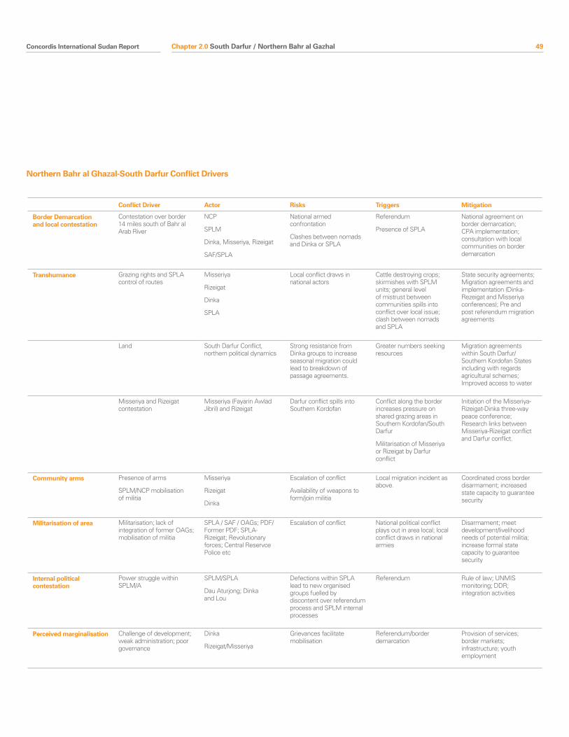
Concordis International Sudan Report 49
Conflict Driver Actor Risks Triggers Mitigation
Border Demarcation and local contestation
Contestation over border 14 miles south of Bahr al Arab River
NCP
SPLM
Dinka, Misseriya, Rizeigat
SAF/SPLA
National armed confrontation
Clashes between nomads and Dinka or SPLA
Referendum
Presence of SPLA
National agreement on border demarcation; CPA implementation; consultation with local communities on border demarcation
Transhumance Grazing rights and SPLA control of routes
Misseriya
Rizeigat
Dinka
SPLA
Local conflict draws in national actors
Cattle destroying crops; skirmishes with SPLM units; general level of mistrust between communities spills into conflict over local issue; clash between nomads and SPLA
State security agreements; Migration agreements and implementation (Dinka-Rezeigat and Misseriya conferences); Pre and post referendum migration agreements
Land South Darfur Conflict, northern political dynamics
Strong resistance from Dinka groups to increase seasonal migration could lead to breakdown of passage agreements.
Greater numbers seeking resources
Migration agreements within South Darfur/Southern Kordofan States including with regards agricultural schemes; Improved access to water
Misseriya and Rizeigat contestation
Misseriya (Fayarin Awlad Jibril) and Rizeigat
Darfur conflict spills into Southern Kordofan
Conflict along the border increases pressure on shared grazing areas in Southern Kordofan/South Darfur
Militarisation of Misseriya or Rizeigat by Darfur conflict
Initiation of the Misseriya-Rizeigat-Dinka three-way peace conference; Research links between Misseriya-Rizeigat conflict and Darfur conflict.
Community arms Presence of arms
SPLM/NCP mobilisation of militia
Misseriya
Rizeigat
Dinka
Escalation of conflict
Availability of weapons to form/join militia
Local migration incident as above.
Coordinated cross border disarmament; increased state capacity to guarantee security
Militarisation of area Militarisation; lack of integration of former OAGs; mobilisation of militia
SPLA / SAF / OAGs; PDF/Former PDF; SPLA-Rizeigat; Revolutionary forces; Central Reservce Police etc
Escalation of conflict National political conflict plays out in area local; local conflict draws in national armies
Disarmament; meet development/livelihood needs of potential militia; increase formal state capacity to guarantee security
Internal political contestation
Power struggle within SPLM/A
SPLM/SPLA
Dau Aturjong; Dinka and Lou
Defections within SPLA lead to new organised groups fuelled by discontent over referendum process and SPLM internal processes
Referendum Rule of law; UNMIS monitoring; DDR; integration activities
Perceived marginalisation Challenge of development; weak administration; poor governance
Dinka
Rizeigat/Misseriya
Grievances facilitate mobilisation
Referendum/border demarcation
Provision of services; border markets; infrastructure; youth employment
Northern Bahr al Ghazal-South Darfur Conflict Drivers
Chapter 2.0 South Darfur / Northern Bahr al Gazhal
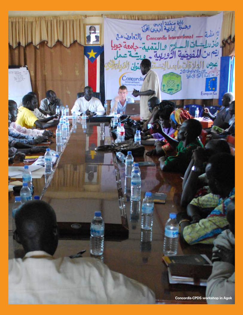
50 Concordis International Sudan Report
Concordis-CPDS workshop in Agok
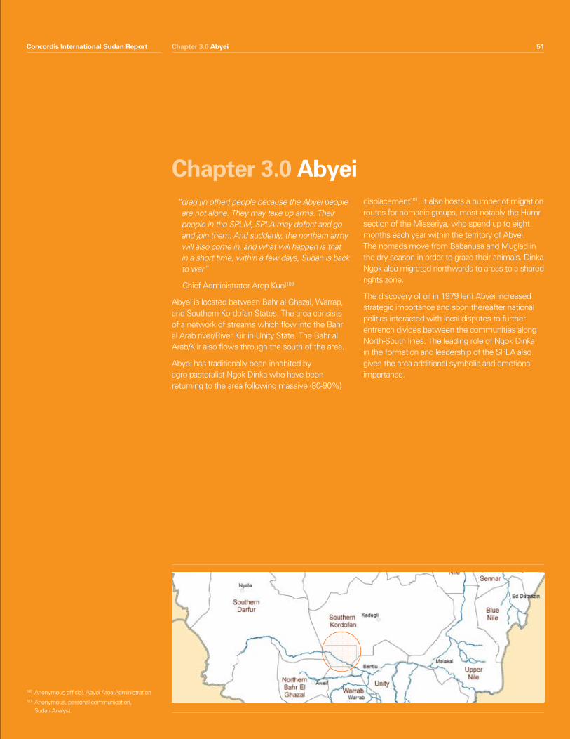
Concordis International Sudan Report 51Chapter 3.0 Abyei
“ drag [in other] people because the Abyei people are not alone. They may take up arms. Their people in the SPLM, SPLA may defect and go and join them. And suddenly, the northern army will also come in, and what will happen is that in a short time, within a few days, Sudan is back to war”
Chief Administrator Arop Kuol100
Abyei is located between Bahr al Ghazal, Warrap, and Southern Kordofan States. The area consists of a network of streams which flow into the Bahr al Arab river/River Kiir in Unity State. The Bahr al Arab/Kiir also flows through the south of the area.
Abyei has traditionally been inhabited by agro-pastoralist Ngok Dinka who have been returning to the area following massive (80-90%)
displacement101. It also hosts a number of migration routes for nomadic groups, most notably the Humr section of the Misseriya, who spend up to eight months each year within the territory of Abyei. The nomads move from Babanusa and Muglad in the dry season in order to graze their animals. Dinka Ngok also migrated northwards to areas to a shared rights zone.
The discovery of oil in 1979 lent Abyei increased strategic importance and soon thereafter national politics interacted with local disputes to further entrench divides between the communities along North-South lines. The leading role of Ngok Dinka in the formation and leadership of the SPLA also gives the area additional symbolic and emotional importance.
Chapter 3.0 Abyei
Concordis International Sudan Report 51
100 Anonymous official, Abyei Area Administration101 Anonymous, personal communication,
Sudan Analyst
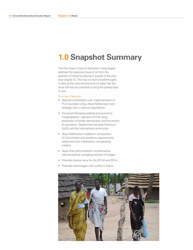
52 Concordis International Sudan Report
The Permanent Court of Arbitration ruling largely delinked the explosive issue of oil from the question of Abyei by placing it outside of the area (see chapter 4). This has not led to breakthroughs in talks at the national level and it is clear that the issue still has the potential to bring the parties back to war.
Summary Features• Nationalcontestationoverimplementationof
PCA boundary ruling, Abyei Referendum and strategic role in national negotiations.
• PerceivedMisseriyapoliticalandeconomicmarginalisation; rejection of PCA ruling, prevention of border demarcation and armament of population. Resentment towards Khartoum, GoSS, and the international community.
• AbyeiReferendumstalledoncompositionof Commission and residency requirements; settlement and militarisation complicating matters.
• AbyeiAreaAdministrationconstrainedbynational political wrangling and lack of budget.
• PotentialdivisiveissuefortheSPLMandSPLA.
• PotentialinterlinkageswithconflictinDarfur.
Chapter 3.0 Abyei
1.0 Snapshot Summary
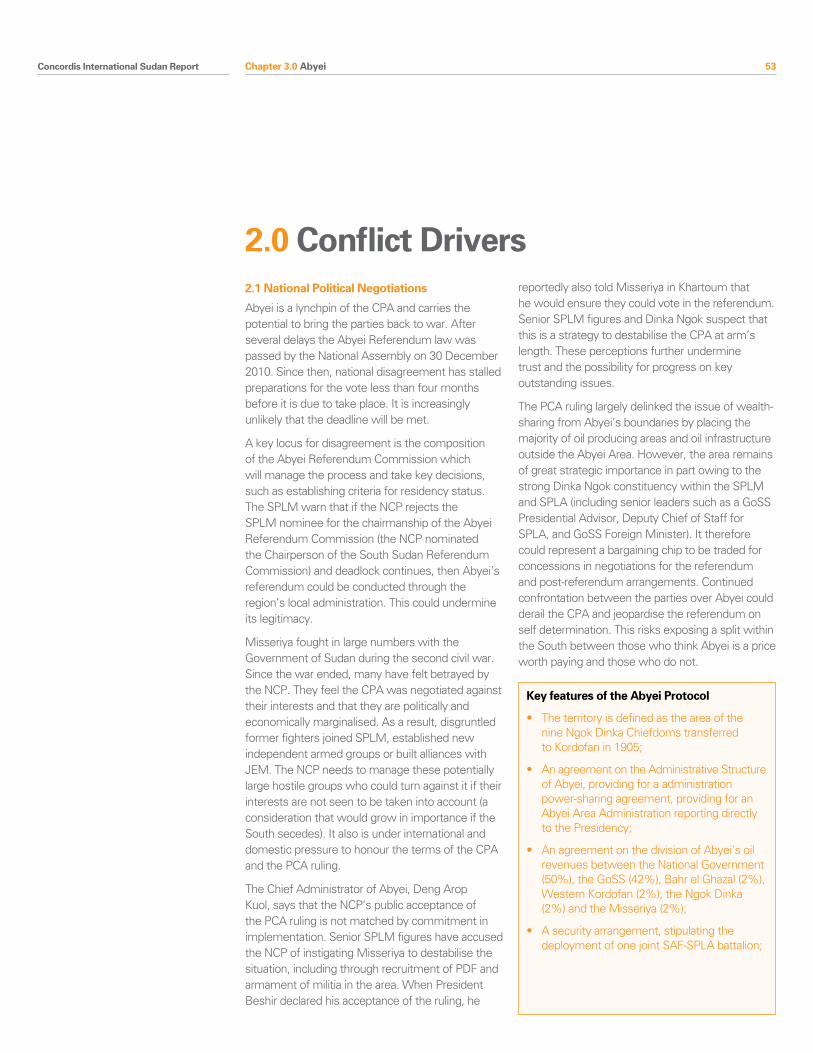
Concordis International Sudan Report 53
2.1 National Political Negotiations
Abyei is a lynchpin of the CPA and carries the potential to bring the parties back to war. After several delays the Abyei Referendum law was passed by the National Assembly on 30 December 2010. Since then, national disagreement has stalled preparations for the vote less than four months before it is due to take place. It is increasingly unlikely that the deadline will be met.
A key locus for disagreement is the composition of the Abyei Referendum Commission which will manage the process and take key decisions, such as establishing criteria for residency status. The SPLM warn that if the NCP rejects the SPLM nominee for the chairmanship of the Abyei Referendum Commission (the NCP nominated the Chairperson of the South Sudan Referendum Commission) and deadlock continues, then Abyei’s referendum could be conducted through the region’s local administration. This could undermine its legitimacy.
Misseriya fought in large numbers with the Government of Sudan during the second civil war. Since the war ended, many have felt betrayed by the NCP. They feel the CPA was negotiated against their interests and that they are politically and economically marginalised. As a result, disgruntled former fighters joined SPLM, established new independent armed groups or built alliances with JEM. The NCP needs to manage these potentially large hostile groups who could turn against it if their interests are not seen to be taken into account (a consideration that would grow in importance if the South secedes). It also is under international and domestic pressure to honour the terms of the CPA and the PCA ruling.
The Chief Administrator of Abyei, Deng Arop Kuol, says that the NCP’s public acceptance of the PCA ruling is not matched by commitment in implementation. Senior SPLM figures have accused the NCP of instigating Misseriya to destabilise the situation, including through recruitment of PDF and armament of militia in the area. When President Beshir declared his acceptance of the ruling, he
reportedly also told Misseriya in Khartoum that he would ensure they could vote in the referendum. Senior SPLM figures and Dinka Ngok suspect that this is a strategy to destabilise the CPA at arm’s length. These perceptions further undermine trust and the possibility for progress on key outstanding issues.
The PCA ruling largely delinked the issue of wealth-sharing from Abyei’s boundaries by placing the majority of oil producing areas and oil infrastructure outside the Abyei Area. However, the area remains of great strategic importance in part owing to the strong Dinka Ngok constituency within the SPLM and SPLA (including senior leaders such as a GoSS Presidential Advisor, Deputy Chief of Staff for SPLA, and GoSS Foreign Minister). It therefore could represent a bargaining chip to be traded for concessions in negotiations for the referendum and post-referendum arrangements. Continued confrontation between the parties over Abyei could derail the CPA and jeopardise the referendum on self determination. This risks exposing a split within the South between those who think Abyei is a price worth paying and those who do not.
Chapter 3.0 Abyei
2.0 Conflict Drivers
Key features of the Abyei Protocol
• Theterritoryisdefinedastheareaofthe nine Ngok Dinka Chiefdoms transferred to Kordofan in 1905;
• AnagreementontheAdministrativeStructureof Abyei, providing for a administration power-sharing agreement, providing for an Abyei Area Administration reporting directly to the Presidency;
• AnagreementonthedivisionofAbyei’soilrevenues between the National Government (50%), the GoSS (42%), Bahr el Ghazal (2%), Western Kordofan (2%), the Ngok Dinka (2%) and the Misseriya (2%);
• Asecurityarrangement,stipulatingthedeployment of one joint SAF-SPLA battalion;
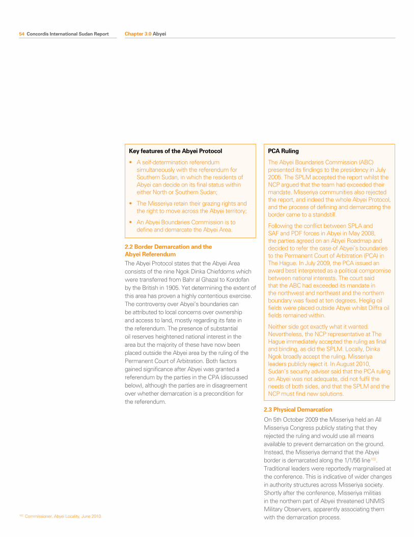
54 Concordis International Sudan Report
2.2 Border Demarcation and the Abyei ReferendumThe Abyei Protocol states that the Abyei Area consists of the nine Ngok Dinka Chiefdoms which were transferred from Bahr al Ghazal to Kordofan by the British in 1905. Yet determining the extent of this area has proven a highly contentious exercise. The controversy over Abyei’s boundaries can be attributed to local concerns over ownership and access to land, mostly regarding its fate in the referendum. The presence of substantial oil reserves heightened national interest in the area but the majority of these have now been placed outside the Abyei area by the ruling of the Permanent Court of Arbitration. Both factors gained significance after Abyei was granted a referendum by the parties in the CPA (discussed below), although the parties are in disagreement over whether demarcation is a precondition for the referendum.
2.3 Physical Demarcation
On 5th October 2009 the Misseriya held an All Misseriya Congress publicly stating that they rejected the ruling and would use all means available to prevent demarcation on the ground. Instead, the Misseriya demand that the Abyei border is demarcated along the 1/1/56 line102. Traditional leaders were reportedly marginalised at the conference. This is indicative of wider changes in authority structures across Misseriya society. Shortly after the conference, Misseriya militias in the northern part of Abyei threatened UNMIS Military Observers, apparently associating them with the demarcation process. 102 Commissioner, Abyei Locality, June 2010
Chapter 3.0 Abyei
Key features of the Abyei Protocol
• Aself-determinationreferendumsimultaneously with the referendum for Southern Sudan, in which the residents of Abyei can decide on its final status within either North or Southern Sudan;
• TheMisseriyaretaintheirgrazingrightsandthe right to move across the Abyei territory;
• AnAbyeiBoundariesCommissionistodefine and demarcate the Abyei Area.
PCA Ruling
The Abyei Boundaries Commission (ABC) presented its findings to the presidency in July 2005. The SPLM accepted the report whilst the NCP argued that the team had exceeded their mandate. Misseriya communities also rejected the report, and indeed the whole Abyei Protocol, and the process of defining and demarcating the border came to a standstill.
Following the conflict between SPLA and SAF and PDF forces in Abyei in May 2008, the parties agreed on an Abyei Roadmap and decided to refer the case of Abyei’s boundaries to the Permanent Court of Arbitration (PCA) in The Hague. In July 2009, the PCA issued an award best interpreted as a political compromise between national interests. The court said that the ABC had exceeded its mandate in the northwest and northeast and the northern boundary was fixed at ten degrees. Heglig oil fields were placed outside Abyei whilst Diffra oil fields remained within.
Neither side got exactly what it wanted. Nevertheless, the NCP representative at The Hague immediately accepted the ruling as final and binding, as did the SPLM. Locally, Dinka Ngok broadly accept the ruling. Misseriya leaders publicly reject it. In August 2010, Sudan’s security adviser said that the PCA ruling on Abyei was not adequate, did not fulfil the needs of both sides, and that the SPLM and the NCP must find new solutions.
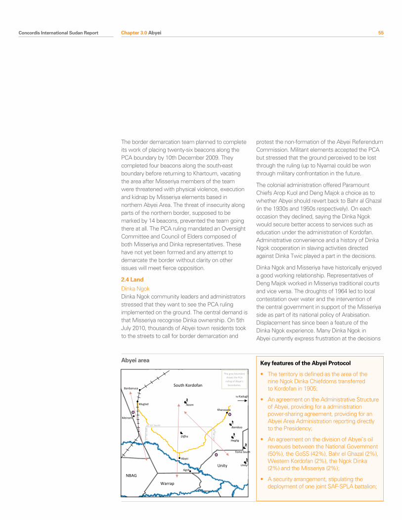
Concordis International Sudan Report 55
The border demarcation team planned to complete its work of placing twenty-six beacons along the PCA boundary by 10th December 2009. They completed four beacons along the south-east boundary before returning to Khartoum, vacating the area after Misseriya members of the team were threatened with physical violence, execution and kidnap by Misseriya elements based in northern Abyei Area. The threat of insecurity along parts of the northern border, supposed to be marked by 14 beacons, prevented the team going there at all. The PCA ruling mandated an Oversight Committee and Council of Elders composed of both Misseriya and Dinka representatives. These have not yet been formed and any attempt to demarcate the border without clarity on other issues will meet fierce opposition.
2.4 Land
Dinka NgokDinka Ngok community leaders and administrators stressed that they want to see the PCA ruling implemented on the ground. The central demand is that Misseriya recognise Dinka ownership. On 5th July 2010, thousands of Abyei town residents took to the streets to call for border demarcation and
protest the non-formation of the Abyei Referendum Commission. Militant elements accepted the PCA but stressed that the ground perceived to be lost through the ruling (up to Nyama) could be won through military confrontation in the future.
The colonial administration offered Paramount Chiefs Arop Kuol and Deng Majok a choice as to whether Abyei should revert back to Bahr al Ghazal (in the 1930s and 1950s respectively). On each occasion they declined, saying the Dinka Ngok would secure better access to services such as education under the administration of Kordofan. Administrative convenience and a history of Dinka Ngok cooperation in slaving activities directed against Dinka Twic played a part in the decisions.
Dinka Ngok and Misseriya have historically enjoyed a good working relationship. Representatives of Deng Majok worked in Misseriya traditional courts and vice versa. The droughts of 1964 led to local contestation over water and the intervention of the central government in support of the Misseriya side as part of its national policy of Arabisation. Displacement has since been a feature of the Dinka Ngok experience. Many Dinka Ngok in Abyei currently express frustration at the decisions
Chapter 3.0 Abyei
South Kordofan
NBAG
Warrap
Unity
Abyei area
Abyei
Muglad
10°10’ North
29° 00’ East 27°5
0’ E
ast
Agok
Diffra
Bamboo
Heglig
Toma South
Unity
Neem
Meiram
Banbanusa
The grey boundary shows the PCA
ruling of Abyei’s boundaries.
Explanatory note on migrations, or note beside arrow ‘Eastern corri-dor…’
Kharasana
to Kadugli
Railway
River
State Boundary
State capital
Town
Oil field
Oil installation
Minerals & natural resources
Mechanised farming
Recent Incident
International border
Nationally disputed border
Locally disputed border
Grazing / Migration route
Road
Ethnic group
Abyei area Key features of the Abyei Protocol
• Theterritoryisdefinedastheareaofthe nine Ngok Dinka Chiefdoms transferred to Kordofan in 1905;
• AnagreementontheAdministrativeStructureof Abyei, providing for a administration power-sharing agreement, providing for an Abyei Area Administration reporting directly to the Presidency;
• AnagreementonthedivisionofAbyei’soil revenues between the National Government (50%), the GoSS (42%), Bahr el Ghazal (2%), Western Kordofan (2%), the Ngok Dinka (2%) and the Misseriya (2%);
• Asecurityarrangement,stipulatingthedeployment of one joint SAF-SPLA battalion;
56 Concordis International Sudan Report
of Deng Majok and Arop Kuol. These historical grievances combined with contemporary territorial disputes between chiefdoms are signal emerging rifts within the Dinka Ngok.
MisseriyaMisseriya groups contest ownership of the Abyei Area north of the Bahr al Arab/ Kiir River. This in turn is affecting their relations with the Dinka Ngok and preventing peaceful access to the Abyei Area for water and grazing. Land ownership claims represent in some cases a real attachment to the land. In others they are a pragmatic response to fear over a hardening of the border and a potential severing of Misseriya from their grazing lands. On 15th April 2010, at another All-Misseriya conference, participants publicly reiterated the message that they would not allow the return of land to Bahr al Ghazal, would prevent demarcation on the ground and would increase settlements in Abyei in order to disrupt the referendum.
The President of Southern Sudan has repeatedly assured border communities that migration rights will be respected before and after the referendum. The CPA and the PCA ruling also enshrine land usage rights for migration in the area. However, cattle-owning Misseriya remain concerned about a potentially hard border. They have twice experienced borders governed by a southern regional government. The first following the Addis Ababa Accord and the second came after the signature of the CPA. In the first case, these challenges manifested themselves in clashes with southern police forces. In the second, time restrictions, requirements to disarm, and taxes have led to clashes with SPLA at the Unity and Warrap State borders. These concerns are a source of instability around which mobilisation can occur.
Rumours abound. According to one story circulating in the region, the SPLM will install an electric fence along the northern edge of Abyei capable of killing livestock and humans. Another states that Israel will immediately establish a base in Abyei in a US conspiracy to retake conquered Muslim lands. Such rumours are natural products of combined fear and ignorance. Interviewees also said that tactical
propaganda is being disseminated by Misseriya in Khartoum to radicalise populations against the referendum. These fears around a potential international border combine with the pressures in Kordofan caused by real and perceived political and economic marginalisation, environmental degradation (also due to oil industry expansion), and agricultural expansion (as seen in the Unity-Southern Kordofan Triangle section below) to generate grievances towards NCP and SPLM.
Misseriya land claims are based on a number of narratives including: 1) that the Misseriya are the original inhabitants of the area and they originally welcomed the Ngok to the land; 2) that the original Ngok Dinka inhabitants have been hunted to extinction or into slavery so contemporary Dinka can have no claim to the land; and 3) that Misseriya has conquered the land and it is therefore not to be given up.
Misseriya have also settled on the land in increasing numbers since 1964 as Dinka Ngok were displaced and the presence of SAF and SPLA offered opportunities (especially after 1991) for traders. Misseriya interviewed for this report said that thousands of Misseriya fled after the signature of the CPA in the face of aggressive SPLA troops moving into the Abyei area. These included many born in the area and living in joint Dinka-Misseriya settlements. Five thousand Misseriya fled from Abyei town to Babanusa and Muglad during the fighting in May 2008. After Meiram and the areas to the north fell outside the PCA boundary, the number of Misseriya living in Abyei is low.
2.5 Abyei Referendum
ResidencyA heated debate now centres on who will be allowed to vote in Abyei’s referendum. The referendum law confers voting rights on ‘habitual residents’ and the Abyei Referendum Commission stipulated in the Law is tasked with settling the eligibility criteria. In practice, competition between the parties over eligibility to vote has led to delays in agreeing the composition of the Commission. The subcommittee should have been on the
Chapter 3.0 Abyei
Concordis International Sudan Report 57
ground by now but the parties have not yet agreed on a Chair. Chief Administrator of Abyei, Deng Arop Kuol, has accused the NCP of complicating the situation through repeated promises, including from the President, to Misseriya that they will vote in the referendum.
The 2010 national elections complicated matters further as it can be argued it created a precedent that a large number of Misseriya are resident and eligible to vote. At this election, populations in Abyei voted in the Southern Kordofan national assembly elections in constituency 32 and this included north Abyei and south Debab. Dinka Ngok from south Abyei voted in the Warrap elections. A UN source suggested around 23,000 people voted in north Abyei and 24,000 in South Abyei. North Abyei being mostly Misseriya and south Abyei (for Warrap) mostly Dinka. The census and drawing of constituency boundaries in Southern Kordofan may address this issue, but the experience will do little do ease resolution over residency and the Abyei referendum.
Settlement and ReturnsThe administration say that 60,000 Dinka Ngok plan to return before the referendum to areas which Misseriya claim to have also settled and in which Misseriya militia are active. The administration is preparing to support them. A senior UN figure argued that the region does not have the absorptive capacity to cope with the influx and that the UN can offer limited support due to the politically charged context.
The North-South axis is not safe. The road from Khartoum passes through the Misseriya heartland and is greatly affected by insecurity. Increased Dinka returns and associated agricultural activity will also heighten tensions between migrating groups as they pass through northern Abyei.
Up to 75,000 Misseriya have reportedly also begun to settle in north Abyei103. The Chief Administrator has publicly accused the NCP of attempting to fill the area ahead of the referendum in order to affect the vote. The possibility of clashes over land and resources is high. The potential involvement of
PDF and former disgruntled Misseriya fighters risks drawing SPLA into a large-scale conflict.
TimingThe vote is planned for January, a period when around 10,000 Misseriya pastoralists traditionally reside in Abyei to graze their cattle (they are expected to arrive in Abyei town in mid-December). The presence of large numbers of Misseriya, disputes over grazing or water, attempts by SPLA to prevent access, or armed Misseriya could exacerbate an extremely tense situation.
2.6. Militarisation
SAF/SPLAOne of the main factors leading to the 2008 violence in Abyei was the proximity of the armed forces. Armies were located five hundred metres from one another in the context of rising tension. Reports suggest that conflict erupted after a single shooting north of Abyei town, and possibly instigated by the presence of former PDF leaders in the area, this catalysed the forces into heavy fighting104.
There is officially no SAF or SPLA presence in Abyei105. On 9th March 2009, SAF withdrew from Diffra in accordance with the Abyei Road Map, though the Petroleum Police remained in the area. The 31st Brigade was redeployed in Meiram, Babanusa, and Heglig close by. SPLA withdrew its last remaining troops from Agok on 2nd March 2009 to Unity and Warrap States. Both forces have a heavy presence at the borders of the Abyei Area.
The Joint Integrated Unit (JIU) mandated by the CPA has been established but the battalion is poorly equipped and unable to control its territory. The JIU commander consistently requested fuel from the UN in order to undertake joint patrols. Drunken JIU soldiers are a common sight particularly at night at the checkpoint between Agok and Abyei towns. Integration is partial and SAF and SPLA troops could split in the event of a spark as they did in 2008. Similarly, the Joint Integrated Police Units currently lack the capacity effectively to contribute to community perceptions of security and is dominated by officers loyal to SPLA106.
103 Reuters, 1st August 2010 104 Field interviews, Abyei, June 2010105 Field interview, UNMIS Civil Affairs, Abyei,
June 2010106 Field interviews, UNMO, UNMIS Civil Affairs,
June 2010
Chapter 3.0 Abyei
58 Concordis International Sudan Report
Misseriya Organisations/PDF
Divisions within the Misseriya exist along generational and clan lines. Misseriya youth movements and movements under non-traditional leadership have broken away from the authority of traditional leadership structures. Both educated and illiterate youth and former PDF fighters are unemployed, deeply unsatisfied, and increasingly organised. Since the signing of the CPA, former PDFs have not been disarmed. They can be identified in three main groups: 1) the Debab forces that joined the SPLA; 2) non-aligned former PDF alienated from the government and the SPLA; and 3) PDF still loyal to Khartoum.
The first group has a history of strategic alliances to secure migration routes for its constituencies. The second is a product of the post-CPA dismantling of PDF, without recognition of their contribution to the war as military service, which brings with it employment opportunities. The associated loss of income has further reinforced grievances and, combined with a vacuum in authority within Misseriya communities, provided opportunities for non traditional leaders to mobilise support.
Dinka Ngok leaders claim that Misseriya are being re-armed by the government in Khartoum. They say that 12.7mm anti aircraft guns, mortars, light machine guns and anti-tank weapons have been given to the Awlad Omran section of the Misseriya Humr. Another shipment of weapons was reportedly delivered to the leader of the Abyei Liberation Front107 (see below). A senior ranking SPLA officer told researchers that 50,000 weapons had been delivered to one section of irregular forces in Southern Kordofan in 2009108.
Within Abyei, Misseriya groups led by youth leaders have taken control of parts of the northern areas. Reportedly, the JIU will not travel into these areas without seeking authorisation from local militia leaders. UNMIS will not engage these groups in combat. PDF loyal to Khartoum have been involved in fighting SPLA in Meiram, Abyei, and Kharasana.
A number of movements require careful monitoring109:
PDFThe SPLM spokesman in Abyei reportedly alleged that 2,000 PDF had been mobilised from outside Abyei to settle in the north of the area in a bid to facilitate Misseriya settlement of the area and to destabilise the referendum110.
The Abyei Liberation Front (ALF)The ALF emerged following the appointment of Edward Lino as Chairman of the Abyei Administration. Led by a dynamic Mohammed Omar al Ansari, from a sub clan of the Awlad Kamil, the movement rejects the Abyei Boundary Commission report and drew support from former PDF or SAF Misseriya leaders, who were disgruntled with their position, and their former forces. The Small Arms Survey SHSBA reports that the ALF received weapons (600 AK-47s, 27 rifles, and some mortars) from the government after the signing of the CPA.
Shamam (Shabab Mantigat Misseriya)The Shamam, or ‘Youth of the Misseriya Region’ is a coalition of young people with associations to traditional northern political forces such as the Umma, Ba’athist and Communist Parties. Initially a non violent movement set up as a response to fears that Kordofan could be drawn into the Darfur conflict, the group is said to be losing faith in dialogue processes as a mechanism for meeting Misseriya needs.
ShebabThe Shebab (‘Youth’) is a movement of disaffected NCP supporters with links to PDF and Shamam, which contains representation from the wider region. They reject the Abyei Protocol but have not so far been involved in military action, attempting to initiate non-violent mechanisms to bridge the divide between the Ngok and the Misseriya such as sports and arts initiatives.
107 Small Arms Survey, August 2010108 Personal communication, June 2010109 This section covering Misseriya groups draws
heavily on reports published by the Sudan Human Security Baseline Assessment (HSBA), August 2010, HPG ‘Put out to Pasture’, 2009, and a confidential independent assessment
110 Small Arms Survey, August 2010
Chapter 3.0 Abyei
Concordis International Sudan Report 59
Shahama Shahama (‘Courage’) is reportedly a large armed group. Membership consists primarily of young illiterate men who were central to the PDF during wartime. Musa Ali Hamadein, a former PDF leader and member of Hassan al Turabi’s PCP, founded the movement vowing to fight for the ‘neglected rights of the Misseriya’111 and was critical of both SPLA and NCP.
Following the death of Musa Ali Hamadein in 2004, the group split into two. Hamadein’s nephew Musa Ali Hamadein led a faction allied with JEM. Another, led by Babo Adam Joda, continued operations in the area to draw attention to the lack of an ‘oil dividend’ to local communities and its impact on Misseriya livelihoods. The movement has been quiet since the capture of Musa Ali Hamadein during the JEM attack on Omdurman in May 2008.
2.7. Additional Factors Reinforcing Local Grievances and Animosity between Communities
Challenges in AdministrationThe Abyei Protocol provided for a joint administration to be established by the Presidency. The SPLM was to select the Chief Administrator and three of five cabinet positions. The NCP was to choose the Deputy Administrator and the remaining cabinet members. It took three years and the Abyei conflict of 2008 before the Abyei Area Administration and the Abyei Legislative Assembly was set up and hailed as an achievement of the Abyei Roadmap.
Parliament soon approved a budget for the administration but the Federal Finance Minister refuses to release funds citing a number of technical difficulties, primary among them the need to harmonise civil service grades to national standards. The administration receives some support but the lack of structures and qualified staff (the majority are former fighters; qualified diaspora are overlooked because of the military character of the SPLM) means that the majority of donors cannot release available funds. The lack of institutions that have the capacity to manage the 2% of oil revenues due to the both Misseriya
and Dinka Ngok also partly explains the problems behind disbursing this money.
The administration has therefore largely been one in name only. It has proved impossible to provide services or respond to insecurity, further damaging confidence in the CPA and increasing grievances on both sides.
TranshumanceThe interplay of migration with various conflict drivers has already been described above and in the Southern Kordofan-Unity Triangle section. A number of additional factors are important.
The dry season 2009-2010 reinforced Misseriya fears around the Abyei Referendum. SPLM stipulations on disarmament of nomadic groups before entering South Sudan were rejected by Misseriya. They cited Nuer cattle raiding (in the first week of May a group from Awlad Omra clan lost 300 heads of cattle in the eastern corridor). The refusal to disarm led to severe clashes with the SPLA along the border with Abiemnom County in Unity State and an increased use of the central corridor within the Abyei region, including by members of the Awlad Omran who, as we have seen in the previous chapter traditionally migrate through the Heglig area into Unity State.
The result is twofold: 1) the experience reinforced Misseriya fears that if Abyei Area joins Bahr al Ghazal in South Sudan through a referendum then the border between Abyei and Southern Kordofan will become more difficult; and 2) it increased local resource competition within the Abyei Area at a time when water levels are reportedly falling as a result of the oil industry, infrastructure projects and local damming in Unity State. Misseriya communities in Muglad and Abyei told the research team that the Ragaba ez Zarga/Ngol waterway is now waterless for months at a time when it was formerly a source of water year round.
111 Sudan Human Security Baseline Assessment, August 2010
Chapter 3.0 Abyei
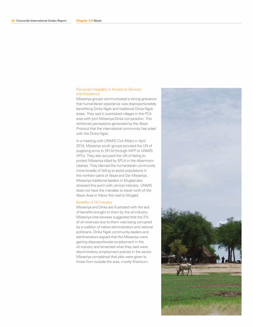
60 Concordis International Sudan Report
Perceived Inequality in Access to Services and AssistanceMisseriya groups communicated a strong grievance that humanitarian assistance was disproportionately benefitting Dinka Ngok and traditional Dinka Ngok areas. They said it overlooked villages in the PCA area with joint Misseriya-Dinka composition. This reinforces perceptions generated by the Abyei Protocol that the international community has sided with the Dinka Ngok.
In a meeting with UNMIS Civil Affairs in April 2010, Misseriya youth groups accused the UN of supplying arms to SPLM through WFP or UNMIS APCs. They also accused the UN of failing to protect Misseriya killed by SPLA in the Abiemnom clashes. They blamed the humanitarian community more broadly of failing to assist populations in the northern parts of Abyei and Dar Misseriya. Misseriya traditional leaders in Muglad also stressed this point with utmost intensity. UNMIS does not have the mandate to travel north of the Abyei Area or follow the road to Muglad.
Benefits of Oil IndustryMisseriya and Dinka are frustrated with the lack of benefits brought to them by the oil industry. Misseriya interviewees suggested that the 2% of oil revenues due to them was being corrupted by a coalition of native administrators and national politicians. Dinka Ngok community leaders and administrators argued that the Misseriya were gaining disproportionate employment in the oil industry and lamented what they said were discriminatory employment policies in the sector. Misseriya complained that jobs were given to those from outside the area, mostly Khartoum.
Chapter 3.0 Abyei
Concordis International Sudan Report 61
3.1 Conflict Management
As in other parts of the border areas, decades of warfare have caused the development of a reduced ability of traditional mechanisms to manage local conflicts. The increased significance of the border as a result of the CPA has accelerated this process. The May 2008 conflict also contributed to a worsening of relations between communities, as the Ngok blame Misseriya civilians for siding with SAF (Brigade 31 is itself composed mainly of Misseriya) in the hostilities and looting the town after the violence.
The framework for some mechanisms for managing conflict do exist. There is a local will for peaceful coexistence and a romantic celebration of a golden age in relations between the communities. During wartime Dinka Ngok and Misseriya organised common markets (such as at Abildao), Peace Committees, and migration conferences.
Today, each of the key migration villages, Roma Maya, Dokra, Nun, Makay, and Lou has a migration committee. These village committees are now being supported directly by UNMIS and UNDP. USAID/AECOM. PACT, Concordis International, and others are also working to facilitate and strengthen existing mechanisms with potential to improve relations. Before each migration season begins, a Dinka-Misseriya Traditional Leader’s Migration Conference takes place. Migration routes are agreed, outstanding compensation paid and security arrangements made.
Community leaders and administrators on both sides say that the key challenge to building trust is the politicisation of the conflict by NCP and SPLM, and that this undermines all attempts to resolve the conflict in traditional ways.
Chapter 3.0 Abyei
3.0 Conflict Management
62 Concordis International Sudan Report Chapter 3.0 Abyei
Area Workshop Summary, Agok, Abyei Area, Sudan, 15-18 June 2010
This three day meeting brought together traditional authorities, local administrators, Abyei Area Administration officials and representatives of civil society, such as leaders of women and youth associations from Dinka Ngok communities in the Abyei Area.
ChallengesMajor identified challenges include: 1) Politicisation of the conflict by national elites; 2) Loss of authority of traditional leadership over elements of society (particularly youth); 3) Weak or non-existent rule of law; 4) Weak international peacekeeping; 5) Other armed groups; 6) Unemployment; 7) oil; 8) Propaganda in the media; 9) Resettlement; 10) Cultural differences; 11) Managing migration; 12) Border demarcation.
Highlighted Recommendations and ProposalsCourts should be established at the populated locations along the border in the Abyei area. Two types of courts are necessary: traditional courts administered by Chiefs and criminal courts administered through official state structures. Traditional courts managed by Chiefs should solve social conflicts according to the customary system. Chiefs are supported in this role by their communities and it is legitimate for them to manage social issues. Traditional courts are also needed along pastoral migration routes.
Markets and trading centres should be established along the border to facilitate cross-border trade.
Construction of roads to connect the populated areas along and across the border is necessary. Communications infrastructure should also be developed, as well as basic and secondary education, health centres, veterinary services and water systems which are all lacking in the Abyei area. Boarding schools which provide basic accommodation and facilities to the students and staff should be built to encourage education.
Input is needed for the development of agricultural schemes and projects to establish food security. The government should facilitate the provision of fertilisers to establish modern farming systems.
The workshop was organised through the Cross Border Relations Project, an EC funded partnership between Concordis and the Center for Peace and Development Studies at the University of Justice.
State Workshop Summary, El-Muglad, Southern Kordofan, Sudan, 5-7 July 2010
This three day meeting brought together traditional authorities, government officials and representatives of civil society such as leaders of youth and women associations and religious leaders, from the Misseriya tribe in the Abyei, El Salam, Babanosa, Keilak and Lagawa localities. The workshop was an opportunity for border communities to articulate principles and proposals to help inform the management of the border and cross-border relations; and help ensure that it works in the interests of a sustainable Sudanese peace over the long term.
ChallengesIdentified challenges are: 1) Maintaining security between the two neighbouring countries; 2) No intervention by the two governments in laying down basis of peaceful coexistence between the two sides; 3) Ineffectiveness of the Joint Inspection Units; 4) The spreading of weapons.
Highlighted Recommendations and ProposalsOn Security: Activate the Disarmament Demobilization and Reintegration programme; Enhance the Joint Inspection Units, and joint cross-border security organs and improve their role in local security provision, including protection of migrating pastoralists when they are in the south; Strengthen Native Administration to resolve conflicts.
On Trade and Economy: Set up Joint administrative offices and/or protocols to regulate and coordinate cross-border trade; Facilitate free movement of goods across the border; Protection of traders from robbery and insecurity; Commercial agreements across the border that facilitate trade and prevent multiple taxation.
On Infrastructure and Development: Develop canals for irrigation; Build schools and hostels, Develop medical and veterinary services, including clinics and hospitals, and training of midwives; Build of roads between different Misseriya areas; Develop agricultural development schemes.
The workshop was organised through the Cross Border Relations Project, an EC funded partnership between Concordis and the Center for Peace and Development Studies at the University of Justice.
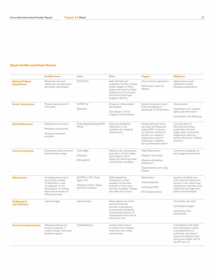
Concordis International Sudan Report 63
Conflict Driver Actor Risks Triggers Mitigation
National Political Negotiations
Bargaining over post referendum arrangements and border demarcation
NCP/SPLM Splits SPLM/A and outbreak of conflict in Abyei (wider collapse of CPA); Delay in formation of Abyei Referendum Commission. SPLM and Dinka Ngok engage in fighting
Tense political negotiations
Referendum does not happen
Agreement on post-referendum issues; Managing expectations
Border Demarcation Physical demarcation of PCA ruling
NCP/SPLM
Misseriya
Misseriya militia prevent demarcation
Dinka Ngok or SPLA engage in confrontations
Border demarcation team enter and attempt to demarcate 10’10 boundary.
Disarmament
Guarantees over migration rights post-referendum
Consultation with Misseriya
Abyei Referendum Settlement and returns
Residency requirement
Misseriya perceived exclusion
Dinka Ngok/Misseriya/NCP/SPLM
Misseriya destabilise referendum if not satisfied with residency requirements
Clashes between Dinka returnees and Misseriya settlers/PDF; Insecurity on road from Khartoum; Decision on residency requirement; result of referendum; migration during referendum period
Civic education of Misseriya and Dinka; guarantees over land usage rights; community dialogue and planning before referendum; UNMIS presence
Land and migration Competing claims over land ownership and usage
Dinka Ngok
Misseriya
(SPLM/NCP)
Misseriya do not recognise land claims of Dinka Ngok; Dinka Ngok or SPLA respond by blocking routes. Confrontation escalates.
Abyei Referendum
Migration route clash
Misseriya destabilise referendum
Closed borders with Unity/Warrap
Community dialogues on land usage and ownership
Militarisation Increasing national and local tensions ahead of referendum; Lack of integration of JIU; Militarisation of northern Abyei and armament of Misseriya groups
SAF/SPLA; PDF; Dinka Ngok; JIUs
Misseriya militia in Abyei and South Kordofan
Militia destabilise referendum; conflict spreads into Southern Kordofan or from Unity-Southern Kordofan Triangle; very difficult to control
Referendum
Grazing disputes
Local arguments
SPLA assertiveness
Southern Kordofan and AAA meet the interests of fighters in non violent way; employment; services; post referendum arrangements clearly communicated/
Challenges in administration
Lack of budget AAA and GoS Weak capacity to control security or provide services to populations. Lowers peace dividends, increased perceptions of marginalisation and cost of returning to war.
Partnership with AAA.
GoS release budget
Joint police units depoliticised
Perceived marginalisation Misseriya political and economic position in northern Sudan. Dinka lack benefits of peace.
Dinka/Misseriya Lowers cost of return to conflict and increases incentive to join militia/armed forces
Consultations with State and national gov; access to development and livelihoods; aid industry should lack apparent bias; AAA given budget; lack of benefit from oil.
Abyei Conflict and Peace Drivers
Chapter 3.0 Abyei
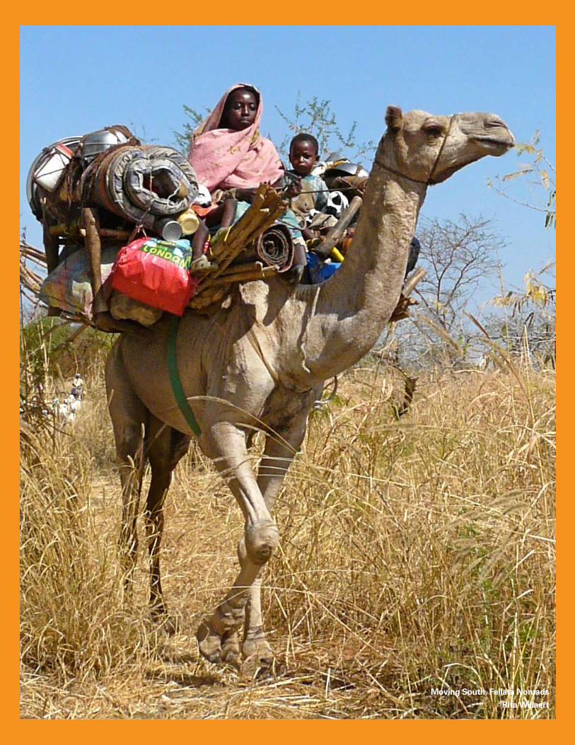
64 Concordis International Sudan Report
Moving South, Fellata Nomads
Rita Willaert
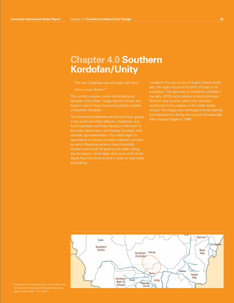
Concordis International Sudan Report 65Chapter 4.0 Southern Kordofan/Unity Triangle
“The next Sudanese war will begin right here”
Anonymous, Bentiu112
This conflict complex covers the borderlands between Unity State, Heglig, and the Central and Eastern side of Abyei Area and southern localities of Southern Kordofan.
The southern borderlands are home to Nuer groups in the South and West (Mayom, Rubkhona, Guit, Koch Counties) and Dinka Panarou in the North of the State (Abiemnom, and Pariang Counties), both nomadic agro-pastoralists. The whole region is spanned by numerous nomadic migration corridors by which Misseriya sections have historically moved southwards for grazing and water during the dry season. Dinka Ngok also move north of the Abyei Area from time to time in order to seek water and grazing.
Located in the very centre of Sudan’s North-South axis, the region accounts for 80% of Sudan’s oil production. The discovery of the Bentiu oil fields in the early 1970’s led to serious tensions between Northern and Southern elites and ultimately contributed to the collapse of the Addis Ababa Accord. The Heglig area witnessed intense fighting and displacement during the second civil especially after oil export began in 1999.
Chapter 4.0 Southern Kordofan/Unity
Concordis International Sudan Report 65
112 Participant from Pariang County, Concordis-Centre for Peace and Development Studies Workshop, Bentiu, March 29th – 31st 2010
66 Concordis International Sudan Report
The situation in the area between Southern Kordofan and Unity State has a high potential to generate national conflict of significant import.
Summary Features• ThenationaldisputeovertheHegligandBamboo
oil fields could lead to national confrontation which quickly draws in local actors and armed movements. The widespread availability of small arms and history of community conflict engagement increases this risk.
• Customarydisputesoverlanduse,landownership and settlement are strongly contested and lead to regular clashes, most recently between nomads and SPLA.
• Heavymilitarisationandtheproximityofforcescould escalate conflict quickly.
• Communitiesfeelpoliticallyandeconomicallysidelined, particularly Misseriya, and say national interests playing out at the border are a prime source of instability.
• Attemptstomanageconflictandbuildtrustacross communities have broadly not been successful.
Chapter 4.0 Southern Kordofan/Unity Triangle
1.0 Snapshot Summary
Concordis International Sudan Report 67
2.1 Transhumance
Heavy militarisation, the presence of partially integrated forces/OAGs and PDF and the weakness in rule of law institutions make community conflict over migration a significant threat to stability in the area. Recent clashes have been defined confrontations between armed nomads and SPLA on the Southern Kordofan/Unity border.
Conflict over access to water and grazing are not new to the region. Pastoral groups and host communities have for a century accused each other of conducting raids and counter-raids during periods of migration. Until the second civil war local mechanisms for conflict management succeeded in containing conflicts and maintaining a set of norms governing social relationships. The introduction of modern weaponry heightened national strategic interest and intervention in the area. An associated breakdown in traditional modes of resolution has caused spiralling mistrust. Over the same period, mechanised agriculture and associated land law reforms reduced access to land. Oil exploration, growing herd sizes due in part to ‘capitalist’ herding and a degree of desertification increased the importance of southward movements.
Two main subgroups of Misseriya Humr migrate from areas around Muglad into Unity State. The Awlad Omran move from Muglad through Abyei to Abiemnom and Mayom Counties and the Awlad Kamil from Keilak through Kharasana to Pariang County (See map). In addition, Fellata groups move through Heglig to Rubkhona County. Interactions along these migration routes share a number of common conflict drivers.
Chapter 4.0 Southern Kordofan/Unity Triangle
2.0 Conflict Drivers
113 See ‘Put out to pasture’, ODI, 2009114 Research team interviews in Muglad, July 2010
Misseriya
The Misseriya are a Baggara Arab pastoralist group. Since the end of the 18th Century, they have been living in south eastern Darfur and south western Kordofan, an area commonly referred to as Dar Misseriya (‘Land of the Misseriya’) with its capital at Al Muglad113. The Misseriya are divided into two main groups, the Zuruq and the Humr, each of which is itself divided into multiple sub-sections. Their annual migration in search for pastures to graze their cattle takes place along three main livestock routes: the western corridor, terminating in Bahr el Ghazal; the central corridor which historically passed through Abyei and into Warrap State; and the eastern corridor passing through Heglig and terminating in Unity State. During the second civil war, large numbers of Misseriya were armed and deployed as militias to counter the South’s insurgency. As the backbone of the Popular Defence Forces (PDF), they were involved in numerous attacks against communities suspected of supporting the SPLA.
In general, the Misseriya are unhappy with the outcome and implications of the CPA. The referenda in particular risk affecting access to critical land and water resources in Abyei and the South. Migration into Unity State and Warrap State has been severely affected by clashes with the SPLA over the carrying of arms by the nomads, adding greater pressures on resources in the central corridor. Furthermore, following the signing of the CPA, Western Kordofan, the Misseriya stronghold perceived to be ‘their state’, was dissolved to become parts of North and Southern Kordofan114.
The CPA also ended the profitable war economy in which the Misseriya were heavily involved and the removal of gains made in wartime. The dismantling of the PDF occurred without compensation for former fighters or assistance in reintegration to civil life. These factors fuelled their perception of having been misused by the NCP during the war and unrecognised during the peace. Other grievances relate to implementation of the Abyei Protocol and the marginal benefits Misseriya enjoy from the oil
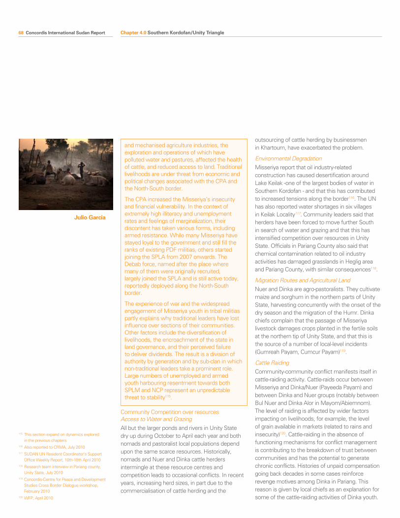
68 Concordis International Sudan Report
Community Competition over resources Access to Water and GrazingAll but the larger ponds and rivers in Unity State dry up during October to April each year and both nomads and pastoralist local populations depend upon the same scarce resources. Historically, nomads and Nuer and Dinka cattle herders intermingle at these resource centres and competition leads to occasional conflicts. In recent years, increasing herd sizes, in part due to the commercialisation of cattle herding and the
outsourcing of cattle herding by businessmen in Khartoum, have exacerbated the problem.
Environmental DegradationMisseriya report that oil industry-related construction has caused desertification around Lake Keilak -one of the largest bodies of water in Southern Kordofan - and that this has contributed to increased tensions along the border116. The UN has also reported water shortages in six villages in Keilak Locality117. Community leaders said that herders have been forced to move further South in search of water and grazing and that this has intensified competition over resources in Unity State. Officials in Pariang County also said that chemical contamination related to oil industry activities has damaged grasslands in Heglig area and Pariang County, with similar consequences118.
Migration Routes and Agricultural LandNuer and Dinka are agro-pastoralists. They cultivate maize and sorghum in the northern parts of Unity State, harvesting concurrently with the onset of the dry season and the migration of the Humr. Dinka chiefs complain that the passage of Misseriya livestock damages crops planted in the fertile soils at the northern tip of Unity State, and that this is the source of a number of local-level incidents (Gumreah Payam, Cumcur Payam)119.
Cattle Raiding Community-community conflict manifests itself in cattle-raiding activity. Cattle-raids occur between Misseriya and Dinka/Nuer (Payeeda Payam) and between Dinka and Nuer groups (notably between Bul Nuer and Dinka Alor in Mayom/Abiemnom). The level of raiding is affected by wider factors impacting on livelihoods, for example, the level of grain available in markets (related to rains and insecurity)120. Cattle-raiding in the absence of functioning mechanisms for conflict management is contributing to the breakdown of trust between communities and has the potential to generate chronic conflicts. Histories of unpaid compensation going back decades in some cases reinforce revenge motives among Dinka in Pariang. This reason is given by local chiefs as an explanation for some of the cattle-raiding activities of Dinka youth.
and mechanised agriculture industries, the exploration and operations of which have polluted water and pastures, affected the health of cattle, and reduced access to land. Traditional livelihoods are under threat from economic and political changes associated with the CPA and the North-South border.
The CPA increased the Misseriya’s insecurity and financial vulnerability. In the context of extremely high illiteracy and unemployment rates and feelings of marginalization, their discontent has taken various forms, including armed resistance. While many Misseriya have stayed loyal to the government and still fill the ranks of existing PDF militias, others started joining the SPLA from 2007 onwards. The Debab force, named after the place where many of them were originally recruited, largely joined the SPLA and is still active today, reportedly deployed along the North-South border.
The experience of war and the widespread engagement of Misseriya youth in tribal militias partly explains why traditional leaders have lost influence over sections of their communities. Other factors include the diversification of livelihoods, the encroachment of the state in land governance, and their perceived failure to deliver dividends. The result is a division of authority by generation and by sub-clan in which non-traditional leaders take a prominent role. Large numbers of unemployed and armed youth harbouring resentment towards both SPLM and NCP represent an unpredictable threat to stability115.
Chapter 4.0 Southern Kordofan/Unity Triangle
115 This section expand on dynamics explored in the previous chapters
116 Also reported to CRMA, July 2010117 SUDAN UN Resident Coordinator’s Support
Office Weekly Report, 10th-18th April 2010118 Research team interview in Pariang county,
Unity State, July 2010119 Concordis-Centre for Peace and Development
Studies Cross Border Dialogue workshop, February 2010
120 WFP, April 2010
Julio Garcia
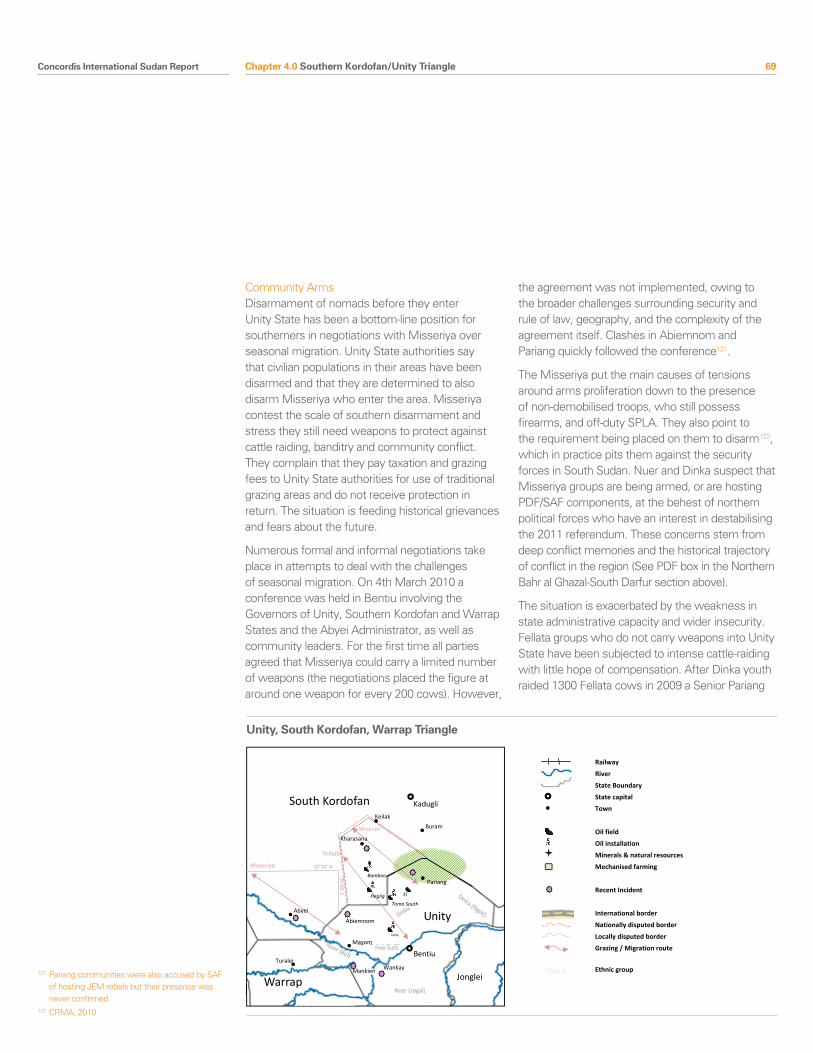
Concordis International Sudan Report 69
Community ArmsDisarmament of nomads before they enter Unity State has been a bottom-line position for southerners in negotiations with Misseriya over seasonal migration. Unity State authorities say that civilian populations in their areas have been disarmed and that they are determined to also disarm Misseriya who enter the area. Misseriya contest the scale of southern disarmament and stress they still need weapons to protect against cattle raiding, banditry and community conflict. They complain that they pay taxation and grazing fees to Unity State authorities for use of traditional grazing areas and do not receive protection in return. The situation is feeding historical grievances and fears about the future.
Numerous formal and informal negotiations take place in attempts to deal with the challenges of seasonal migration. On 4th March 2010 a conference was held in Bentiu involving the Governors of Unity, Southern Kordofan and Warrap States and the Abyei Administrator, as well as community leaders. For the first time all parties agreed that Misseriya could carry a limited number of weapons (the negotiations placed the figure at around one weapon for every 200 cows). However,
the agreement was not implemented, owing to the broader challenges surrounding security and rule of law, geography, and the complexity of the agreement itself. Clashes in Abiemnom and Pariang quickly followed the conference121.
The Misseriya put the main causes of tensions around arms proliferation down to the presence of non-demobilised troops, who still possess firearms, and off-duty SPLA. They also point to the requirement being placed on them to disarm122, which in practice pits them against the security forces in South Sudan. Nuer and Dinka suspect that Misseriya groups are being armed, or are hosting PDF/SAF components, at the behest of northern political forces who have an interest in destabilising the 2011 referendum. These concerns stem from deep conflict memories and the historical trajectory of conflict in the region (See PDF box in the Northern Bahr al Ghazal-South Darfur section above).
The situation is exacerbated by the weakness in state administrative capacity and wider insecurity. Fellata groups who do not carry weapons into Unity State have been subjected to intense cattle-raiding with little hope of compensation. After Dinka youth raided 1300 Fellata cows in 2009 a Senior Pariang
Chapter 4.0 Southern Kordofan/Unity Triangle
121 Pariang communities were also accused by SAF of hosting JEM rebels but their presence was never confirmed
122 CRMA, 2010
Pariang
South Kordofan
Unity
Warrap Jonglei
Unity / South Kordofan / Warrap Triangle
Abyei
Kadugli
Bentiu Turalei
Mayom
Bamboo
Heglig
Unity
Toma South
El
Buram
Note presence of JIUs elsewhere…
Presence ten thousand acres of
mechanised maize farming (this isn’t
that much—maybe not mark?)
Dinka
Dinka (Ngok)
Nuer (Bul)
Mankien Wankay
Abiemnom
Nuer (Lek)
Nuer (Jegai)
Fellata
Misseriya
Kharasana
Misseriya
Keilak
10°10’ N
29°00’ E
Railway
River
State Boundary
State capital
Town
Oil field
Oil installation
Minerals & natural resources
Mechanised farming
Recent Incident
International border
Nationally disputed border
Locally disputed border
Grazing / Migration route
Ethnic group
Unity, South Kordofan, Warrap Triangle
70 Concordis International Sudan Report
County official admitted it was impossible to catch them “due to lack of adequate police in number, training, and knowledge of the territory”. It is within this context that the question of arms control need be approached.
2.2 Political Marginalisation
All communities feel a sense of political marginalisation from processes which affect their security and livelihoods. This is a significant multiplying factor in explaining existing and emerging conflict.
The Misseriya perceive themselves to be losers from the CPA for multiple interlocking reasons. First, they reject the Abyei Protocol and complain that they were not consulted, considered or represented at the IGAD negotiations that led to the CPA. The special administrative status of Abyei and the proposed Abyei Referendum have generated fear that a new border bisecting their migration routes to their dry season camps is a threat to their way of life. The experience of the Misseriya following the Addis Ababa Accord reinforces these fears; the southern regional government had greater powers than the Kordofan government at the border. The southern army and administrators tended to side with the local Nuer or Dinka and mobile police units patrolling the grazing lands frequently came into conflict with the Misseriya123. Recent experience with the Unity State and Warrap borders has further expanded these fears (see Abyei chapter).
Second, the subsequent dismantling and integration of the Misseriya-dominated West Kordofan State into Southern Kordofan State and the associated loss of homeland have diminished political influence at state and national level and control over key livelihood resources. During wartime the Misseriya took positions within PDF forces and fought some of the most brutal campaigns of the conflict. Post-CPA developments are perceived by many Misseriya communities as a betrayal by leaders in Khartoum, and community leaders expressed frustration at being caught between a potentially hostile government to the
South and lack of influence or representation in the North.
Third, and common to Misseriya, Nuer and Dinka, is the lack of tangible benefits derived from oil revenues and the perception that national actors have not done enough to ensure that peace dividends (security, services, employment, and infrastructure) are delivered at the border. Communities have not seen the benefits of the 2% of oil revenues which should be allocated to each State nor compensations which oil companies say they have paid to government institutions for distribution. Allegations of wider corruption in both Southern Kordofan and Unity State are also rife. The Nuer and Dinka also have additional grievances related to border demarcation and resettlement of displaced populations which are dealt with below. These perceptions contribute to a radicalisation of the population, particularly youth, on both sides of the conflict.
2.3 Hardening Conflict Memory and the Breakdown of Conflict Management Mechanisms
There is an almost complete breakdown in trust between Misseriya and the Nuer and Dinka communities. All of the conflict drivers outlined in this chapter should be viewed with this in mind. This is true along the length of the Unity State border regardless of varying experiences during wartime. For example, Misseriya had reasonable wartime relations with Bul-Nuer in Mayom County (in large part due to their affiliation to SAF) but these have deteriorated since the signing of the CPA. Senior Chiefs in Mayom County said that the collapse in trust has gone beyond traditional cattle raiding and disputes over water and grazing, pointing to new dynamics such as attacks on women and children; these must be seen in the context of the increasing militarisation along the border.
Traditional mechanisms for negotiating relationships between the communities worked well until the late seventies. Misseriya representatives would negotiate migration routes and any outstanding
Chapter 4.0 Southern Kordofan/Unity Triangle
123 Research team interview, UNMIS Civil Affairs, Bentiu, July 2010
Concordis International Sudan Report 71
compensation before entering southern Sudan. In some areas, such as Mayom, communities maintain that these worked well until as recently as 2006. In others, such as Pariang, administrators and communities said that the list of unresolved issues goes back decades and that this tally of unpaid compensation is a key feature in motivating young members of the Dinka community to conduct cattle raids on Misseriya communities, contributing to the cycle of violence and growing mistrust. General resentment amongst the Nuer and Dinka communities, Southern authorities and the SPLA towards the Misseriya also resulted from their role in attacks on SPLA at Kharasana on 24th April 2008 which led to the redeployment of SPLA from the area, and the perceived loss of Southern territory124.
A corollary of the collapse in traditional dispute mechanisms is the generational cleavage apparent on both sides of the border. As Misseriya and Dinka traditional authorities fail to resolve the situation through conventional and traditional means, the combination of conflict drivers leads individual young people and youth movements, particularly on the Misseriya side in the context of diversifying livelihoods, to challenge existing authorities. This creates an additional challenge to conventional peacemaking and significantly increases the risk that local people can be drawn into national conflicts.
2.4 Land/Oil and Border Demarcation
The border is contested by national and community actors as oil interests intersect with local historical claims to land ownership and usage. Heglig became a new epicentre of national contestation between the NCP and SPLM, after it was placed outside the Abyei area by the PCA ruling of 22nd July 2009. At the local level, Nuer and Dinka communities claim to have been displaced from Heglig and other areas (including Kharasana) after 1956 and that the administrative border lies north of these locations. The physical demarcation of the border will generate local tensions which could easily escalate, owing to the presence of incompatible beliefs, the availability of weapons, weak institutions, and OAGs and armed forces in close proximity.
National contestation - OilThe NCP has stated that the PCA ruling (see Abyei chapter) automatically places the Heglig oil fields in Southern Kordofan. This would mean that GoSS is no longer entitled to a share in the oil revenues. Senior SPLM members say that the location of the area in North or South Sudan should be decided by the North/South Technical Border Commission just like all other areas excepting Abyei. At the same time, they claim the NCP has forged administrative maps placing Heglig in Southern Kordofan. The area was not explicitly dealt with during negotiations for the CPA. For the SPLM, the twin mechanisms of North/South border demarcation and the Abyei Referendum were perceived to ultimately guarantee Southern control.
Oil exploration began in Heglig (later called Block 2) in 1996 and since 1999 it has also been the starting point of the longest of Sudan’s three oil pipelines to Port Sudan, operated by the China National Petroleum Corporation. Senior Sudanese policymakers interviewed for this report said that the oil infrastructure gives the area its strategic importance at least as much as the presence of the oil itself.
Kharasana is the second area contested by both national actors and local communities. It was occupied by SPLA following the absorption of the SSDF into the SPLA in 2006 but changed hands two years later. An April 2008 dispute in a Dinka public court in Gatasna erupted into a full-scale attack on the SPLA garrison by armed Misseriya. The following days witnessed the besiegement of SPLA in Kharasana by Misseriya from Keilak, continued fighting in Gatasna, and the displacement of up to 4000 civilians to Unity State. It was only after some days that an agreement emerged between the Governors of Unity and Southern Kordofan States that SPLA would redeploy southwards according to the contemporary administrative border, and Southern Kordofan took control of the area. Dinka in Pariang and senior members of the SPLM and SPLA are bitter about the outcome and warn that it is the locus of future conflict125.
Chapter 4.0 Southern Kordofan/Unity Triangle
124 Research team interviews in Unity and Southern Kordofan, July 2010
125 Dinka in Pariang complain that they have not been consulted or they would have not allowed the move. The compliance of the Governor was said it have reduced his popularity
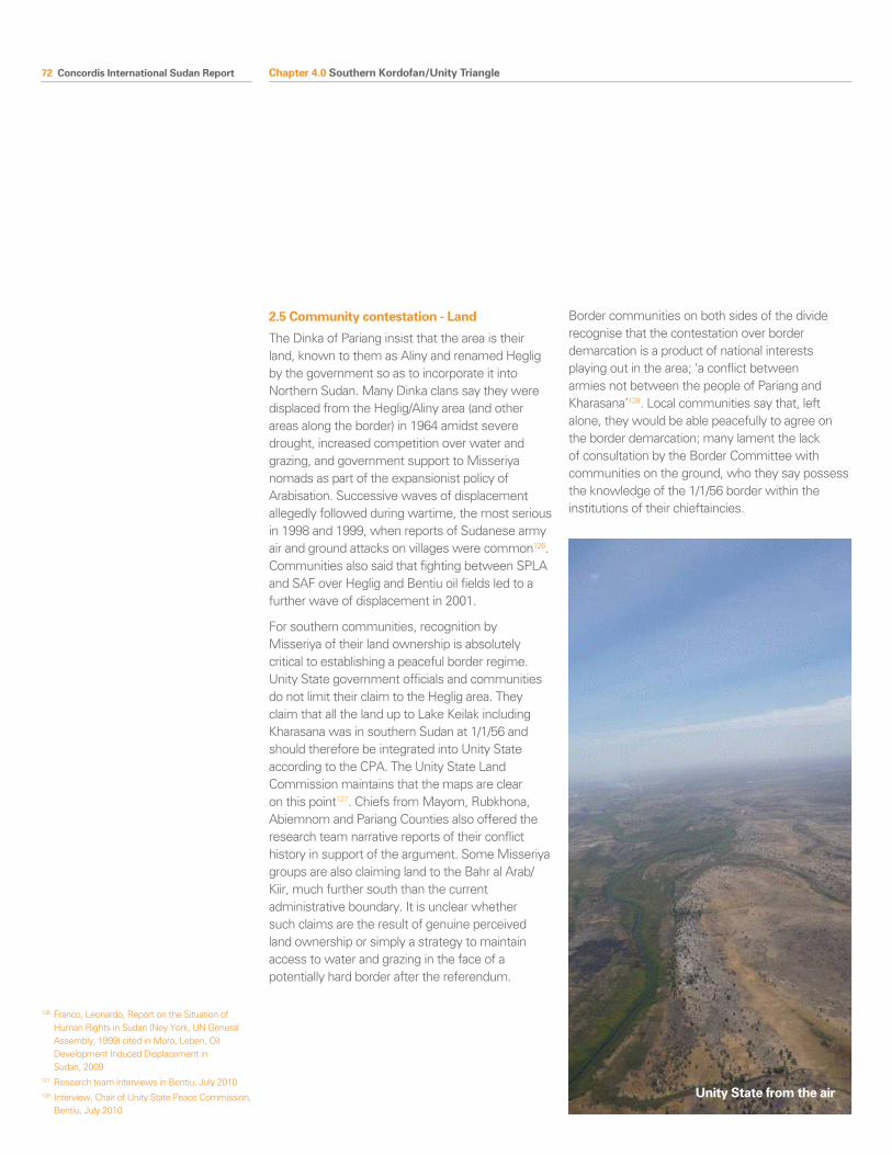
72 Concordis International Sudan Report
2.5 Community contestation - Land
The Dinka of Pariang insist that the area is their land, known to them as Aliny and renamed Heglig by the government so as to incorporate it into Northern Sudan. Many Dinka clans say they were displaced from the Heglig/Aliny area (and other areas along the border) in 1964 amidst severe drought, increased competition over water and grazing, and government support to Misseriya nomads as part of the expansionist policy of Arabisation. Successive waves of displacement allegedly followed during wartime, the most serious in 1998 and 1999, when reports of Sudanese army air and ground attacks on villages were common126. Communities also said that fighting between SPLA and SAF over Heglig and Bentiu oil fields led to a further wave of displacement in 2001.
For southern communities, recognition by Misseriya of their land ownership is absolutely critical to establishing a peaceful border regime. Unity State government officials and communities do not limit their claim to the Heglig area. They claim that all the land up to Lake Keilak including Kharasana was in southern Sudan at 1/1/56 and should therefore be integrated into Unity State according to the CPA. The Unity State Land Commission maintains that the maps are clear on this point127. Chiefs from Mayom, Rubkhona, Abiemnom and Pariang Counties also offered the research team narrative reports of their conflict history in support of the argument. Some Misseriya groups are also claiming land to the Bahr al Arab/Kiir, much further south than the current administrative boundary. It is unclear whether such claims are the result of genuine perceived land ownership or simply a strategy to maintain access to water and grazing in the face of a potentially hard border after the referendum.
Border communities on both sides of the divide recognise that the contestation over border demarcation is a product of national interests playing out in the area; ‘a conflict between armies not between the people of Pariang and Kharasana’128. Local communities say that, left alone, they would be able peacefully to agree on the border demarcation; many lament the lack of consultation by the Border Committee with communities on the ground, who they say possess the knowledge of the 1/1/56 border within the institutions of their chieftaincies.
Chapter 4.0 Southern Kordofan/Unity Triangle
126 Franco, Leonardo, Report on the Situation of Human Rights in Sudan (Ney York, UN General Assembly, 1999) cited in Moro, Leben, Oil Development Induced Displacement in Sudan, 2009
127 Research team interviews in Bentiu, July 2010128 Interview, Chair of Unity State Peace Commission,
Bentiu, July 2010
Unity State from the air
Concordis International Sudan Report 73
2. 6 Militarisation and Armed Groups
MilitarisationThe area is heavily militarised with Army, security services, and communities living in close proximity. SAF control Heglig and have done so since before the discovery of oil. Since 2008 SAF also control Kharasana. The presence of armies undermines local confidence in the peace process, hardens wartime attitudes, and brings associated livelihood challenges (including inflated prices for goods and services). SPLA and SAF have a heavy and reportedly increasing presence at the border and the proximity of forces is worrying; in the area of Tishwa three battalions of SAF and SPLA forces are reportedly deployed just a few kilometres from each other129. As seen a number of times (Malakal 2006, Meiram 2007, Kharasana and Abyei 2008), local disputes can easily draw in national actors and escalate incidents quickly.
Militarisation negatively increases community grievances. The presence of SPLA in Kharasana led to accusations by Misseriya of tax extortion, restricted movement, assault and murder, and the linking of current conditions to those which were experienced in southern Sudan after the Addis Ababa Accord. Nuer and Dinka communities now make similar statements about management of the Kharasana-Heglig-Tishwin-Bentiu road. This road is often blocked by Misseriya as a protest against perceived injustices. It is the main route for southerners in the North to return to the South to settle or vote. UNMIS cannot move on it and security incidents frequently occur. In the context of wider militarisation, small incidents on the road could draw in larger players.
Cleavages in SPLA in Unity StateJIUs have been established130 but struggle to achieve full integration. The composition of the JIUs includes former SSDF fighters and mistrust among officers is large. On 2nd July 2010, the SPLA clashed with State police officers in Mankien (the home of Paulino Matip), an incident which cast doubt on the stability and loyalty of troops and command and control within the SPLA. Cleavages and mistrust within the force are of significant
concern; some SPLA allege that the militias of Paulino Matip created unrest in October 2009 by plotting against the Governor131.
Taban Deng, SPLM Governor of Unity State, is the son of an Arab father and a Nuer mother. He fought on both sides during the North-South conflict. In 1991, he joined Riek Machar and broke away from the SPLA, eventually taking up ministerial positions in the Khartoum government. Taban Deng did not follow Machar when he realigned with Garang in 2002 and only returned South just before the signing of the CPA. While his gift-giving style of governance allowed him to re-establish firm relations with the SPLM and SPLA leadership, his alienation from the Unity population is reportedly growing in parallel. He was re-elected as Governor in 2010 amid suspicions of fraud and support from GoSS132.
Post-election violence has also demonstrated the threat of schisms within the SPLA, tested its strength, and cast light on potential alternative alliances. In May 2010, former SPLA Colonel Galwak Gai deserted after the elections and began entering Unity State from Heglig following Misseriya routes to attack SPLA forces at Wankay, Wichok, Nhiadu and up to Toreh Bouth. A senior SPLA commander told the research team that Galwak Gai had been supported by SAF as well as opposition southern politicians. A Misseriya interviewee suggested that Galwak Gai on his retreat had also been hosted by settled Misseriya communities in north-east Abyei Area. There is no direct evidence for these alliances beyond the fact Galwak Gai and his men were able to pass through SAF controlled areas undisturbed.
The SPLA remains itself porous – not immune from internal divisions or manipulation. Galwak Gai’s rebellion and concerns around integration of SSDF into the SPLA offer opportunities for disgruntled officers (Galwak Gai reportedly split after he failed to achieve the post of Commissioner following the elections) and for parties who may have an interest in exploiting cleavages or are in need of allies in the area. The increasing importance of the border multiplies this risk as spoilers can
Chapter 4.0 Southern Kordofan/Unity Triangle
129 Multiple sources, field interviews and workshop participants, Unity State May-July 2010
130 JIUs are in Pariang, Tor, Munga, Nhialdu, Mayom, Mankien, Wangkay, Abiemnom, Jongyang, Alregad, Mirmir, and Koch/Tar Jiarth
131 Research team interviews, July 2010132 Research team interviews, Bentiu, July 2010
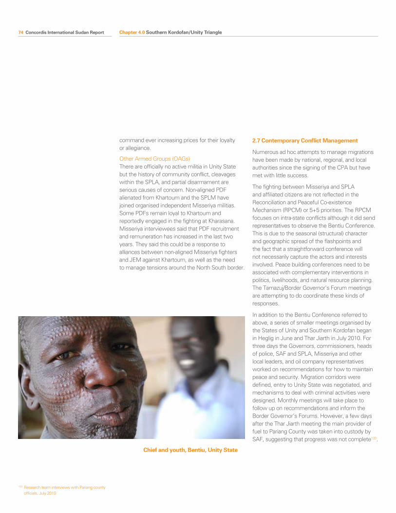
74 Concordis International Sudan Report
command ever increasing prices for their loyalty or allegiance.
Other Armed Groups (OAGs)There are officially no active militia in Unity State but the history of community conflict, cleavages within the SPLA, and partial disarmament are serious causes of concern. Non-aligned PDF alienated from Khartoum and the SPLM have joined organised independent Misseriya militias. Some PDFs remain loyal to Khartoum and reportedly engaged in the fighting at Kharasana. Misseriya interviewees said that PDF recruitment and remuneration has increased in the last two years. They said this could be a response to alliances between non-aligned Misseriya fighters and JEM against Khartoum, as well as the need to manage tensions around the North South border.
2.7 Contemporary Conflict Management
Numerous ad hoc attempts to manage migrations have been made by national, regional, and local authorities since the signing of the CPA but have met with little success.
The fighting between Misseriya and SPLA and affiliated citizens are not reflected in the Reconciliation and Peaceful Co-existence Mechanism (RPCM) or 5+5 priorities. The RPCM focuses on intra-state conflicts although it did send representatives to observe the Bentiu Conference. This is due to the seasonal (structural) character and geographic spread of the flashpoints and the fact that a straightforward conference will not necessarily capture the actors and interests involved. Peace building conferences need to be associated with complementary interventions in politics, livelihoods, and natural resource planning. The Tamazuj/Border Governor’s Forum meetings are attempting to do coordinate these kinds of responses.
In addition to the Bentiu Conference referred to above, a series of smaller meetings organised by the States of Unity and Southern Kordofan began in Heglig in June and Thar Jiarth in July 2010. For three days the Governors, commissioners, heads of police, SAF and SPLA, Misseriya and other local leaders, and oil company representatives worked on recommendations for how to maintain peace and security. Migration corridors were defined, entry to Unity State was negotiated, and mechanisms to deal with criminal activities were designed. Monthly meetings will take place to follow up on recommendations and inform the Border Governor’s Forums. However, a few days after the Thar Jiarth meeting the main provider of fuel to Pariang County was taken into custody by SAF, suggesting that progress was not complete133.
Chapter 4.0 Southern Kordofan/Unity Triangle
133 Research team interviews with Pariang county officials, July 2010
Chief and youth, Bentiu, Unity State
Concordis International Sudan Report 75Chapter 4.0 Southern Kordofan/Unity Triangle
Border demarcation and the CPA are reinforcing conflict drivers by hardening attitudes on both sides and creating an apparent zero-sum game at every level with respect to access to resources. The interaction of conflict drivers represents a significant and increasing threat to stability along the border and in Sudan more generally. Heavily militarised national contestation over resources combines with frustrated, organised, and armed communities to generate an unstable system providing numerous access points for exploitation.
In Pariang and Mayom (and along the border with Warrap State) there is a large presence of SPLA and during dry season migrations in 2010 only Fellata and Misseriya who disarmed were allowed to pass through to Unity State. Misseriya insisting on carrying arms were prevented by the SPLA from reaching a number of key grazing areas in Unity State; and very few moved through to Rubkhona or Guit Counties in the last two dry seasons134. These experiences do little to convince the Misseriya that their grazing rights will be respected whatever, and wherever, the border becomes; this reinforces the root causes of radicalisation among Misseriya.
In 2010, the conflict drivers outlined above combined to provoke incidents defined by clashes between Misseriya and SPLA. All clashes have taken place along Misseriya livestock migration routes and close to SPLA garrisons. On 4th February 2010, for example, a surprise conflict between SPLA in Awila and Awerphin in Abiemnom County reportedly displaced eight hundred families, killed 39 people and derailed a planned community peace conference135. SPLA rather than police management of the border migration increases the risk that local conflicts take on national dimensions. Nuer and Dinka communities say that attacks are conducted by heavily armed Misseriya without cattle. They infer involvement of PDF elements, SAF, or other external political forces with an interest in destabilising the referendum, further diminishing trust.
Misseriya are aggrieved by processes of political and economic marginalisation which threaten their way of life. Dinka and Nuer communities want to resettle and be recognised as owners of lands from which they were displaced and to which they feel the CPA, in addition to their emotions, entitles them. Many members of both communities expressed their preference for peace, but their willingness to fight. Their interests need to be reflected in national agreements on border demarcation and wealth sharing, and in the regime governing the border.
134 Confirmed by UNMIS and county officials interviewed
135 Research team interviews, Unity State, July 2010
3.0 Conflict Trends
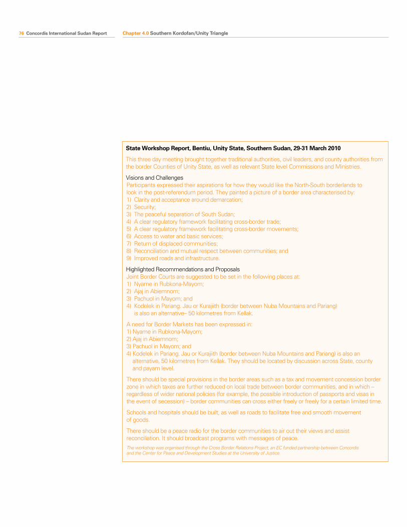
76 Concordis International Sudan Report Chapter 4.0 Southern Kordofan/Unity Triangle
State Workshop Report, Bentiu, Unity State, Southern Sudan, 29-31 March 2010
This three day meeting brought together traditional authorities, civil leaders, and county authorities from the border Counties of Unity State, as well as relevant State level Commissions and Ministries.
Visions and ChallengesParticipants expressed their aspirations for how they would like the North-South borderlands to look in the post-referendum period. They painted a picture of a border area characterised by: 1) Clarity and acceptance around demarcation; 2) Security; 3) The peaceful separation of South Sudan; 4) A clear regulatory framework facilitating cross-border trade; 5) A clear regulatory framework facilitating cross-border movements; 6) Access to water and basic services; 7) Return of displaced communities; 8) Reconciliation and mutual respect between communities; and 9) Improved roads and infrastructure.
Highlighted Recommendations and ProposalsJoint Border Courts are suggested to be set in the following places at: 1) Nyame in Rubkona-Mayom; 2) Ajaj in Abiemnom; 3) Pachuol in Mayom; and 4) Kodelek in Pariang. Jau or Kurajiith (border between Nuba Mountains and Pariang)
is also an alternative– 50 kilometres from Kellak.
A need for Border Markets has been expressed in: 1) Nyame in Rubkona-Mayom; 2) Ajaj in Abiemnom; 3) Pachuol in Mayom; and 4) Kodelek in Pariang. Jau or Kurajiith (border between Nuba Mountains and Pariang) is also an
alternative, 50 kilometres from Kellak. They should be located by discussion across State, county and payam level.
There should be special provisions in the border areas such as a tax and movement concession border zone in which taxes are further reduced on local trade between border communities, and in which – regardless of wider national policies (for example, the possible introduction of passports and visas in the event of secession) – border communities can cross either freely or freely for a certain limited time.
Schools and hospitals should be built, as well as roads to facilitate free and smooth movement of goods.
There should be a peace radio for the border communities to air out their views and assist reconciliation. It should broadcast programs with messages of peace.
The workshop was organised through the Cross Border Relations Project, an EC funded partnership between Concordis and the Center for Peace and Development Studies at the University of Justice.
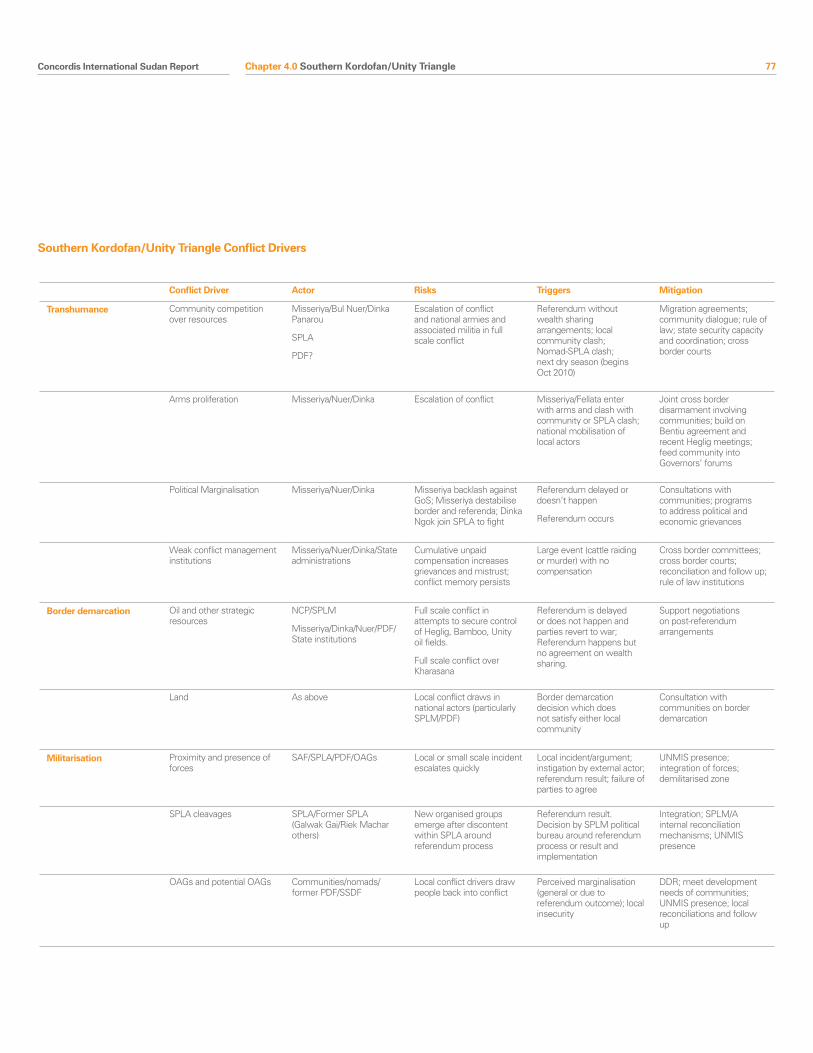
Concordis International Sudan Report 77
Conflict Driver Actor Risks Triggers Mitigation
Transhumance Community competition over resources
Misseriya/Bul Nuer/Dinka Panarou
SPLA
PDF?
Escalation of conflict and national armies and associated militia in full scale conflict
Referendum without wealth sharing arrangements; local community clash; Nomad-SPLA clash; next dry season (begins Oct 2010)
Migration agreements; community dialogue; rule of law; state security capacity and coordination; cross border courts
Arms proliferation Misseriya/Nuer/Dinka Escalation of conflict Misseriya/Fellata enter with arms and clash with community or SPLA clash; national mobilisation of local actors
Joint cross border disarmament involving communities; build on Bentiu agreement and recent Heglig meetings; feed community into Governors’ forums
Political Marginalisation Misseriya/Nuer/Dinka Misseriya backlash against GoS; Misseriya destabilise border and referenda; Dinka Ngok join SPLA to fight
Referendum delayed or doesn’t happen
Referendum occurs
Consultations with communities; programs to address political and economic grievances
Weak conflict management institutions
Misseriya/Nuer/Dinka/State administrations
Cumulative unpaid compensation increases grievances and mistrust; conflict memory persists
Large event (cattle raiding or murder) with no compensation
Cross border committees; cross border courts; reconciliation and follow up; rule of law institutions
Border demarcation Oil and other strategic resources
NCP/SPLM
Misseriya/Dinka/Nuer/PDF/State institutions
Full scale conflict in attempts to secure control of Heglig, Bamboo, Unity oil fields.
Full scale conflict over Kharasana
Referendum is delayed or does not happen and parties revert to war; Referendum happens but no agreement on wealth sharing.
Support negotiations on post-referendum arrangements
Land As above Local conflict draws in national actors (particularly SPLM/PDF)
Border demarcation decision which does not satisfy either local community
Consultation with communities on border demarcation
Militarisation Proximity and presence of forces
SAF/SPLA/PDF/OAGs Local or small scale incident escalates quickly
Local incident/argument; instigation by external actor; referendum result; failure of parties to agree
UNMIS presence; integration of forces; demilitarised zone
SPLA cleavages SPLA/Former SPLA (Galwak Gai/Riek Machar others)
New organised groups emerge after discontent within SPLA around referendum process
Referendum result. Decision by SPLM political bureau around referendum process or result and implementation
Integration; SPLM/A internal reconciliation mechanisms; UNMIS presence
OAGs and potential OAGs Communities/nomads/former PDF/SSDF
Local conflict drivers draw people back into conflict
Perceived marginalisation (general or due to referendum outcome); local insecurity
DDR; meet development needs of communities; UNMIS presence; local reconciliations and follow up
Southern Kordofan/Unity Triangle Conflict Drivers
Chapter 4.0 Southern Kordofan/Unity Triangle
78 Concordis International Sudan Report
Nuba woman
Rita Willaert
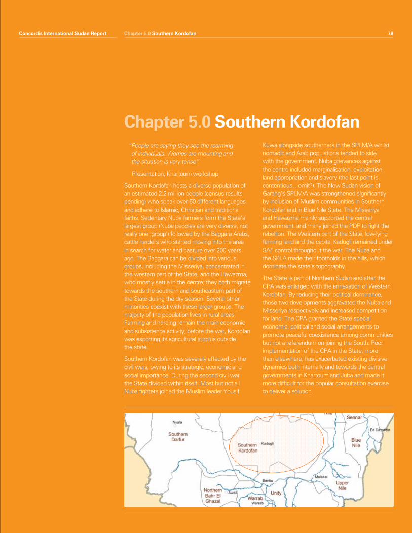
Concordis International Sudan Report 79Chapter 5.0 Southern Kordofan
“ People are saying they see the rearming of individuals. Worries are mounting and the situation is very tense”
Presentation, Khartoum workshop
Southern Kordofan hosts a diverse population of an estimated 2.2 million people (census results pending) who speak over 50 different languages and adhere to Islamic, Christian and traditional faiths. Sedentary Nuba farmers form the State’s largest group (Nuba peoples are very diverse, not really one ‘group’) followed by the Baggara Arabs, cattle herders who started moving into the area in search for water and pasture over 200 years ago. The Baggara can be divided into various groups, including the Misseriya, concentrated in the western part of the State, and the Hawazma, who mostly settle in the centre; they both migrate towards the southern and southeastern part of the State during the dry season. Several other minorities coexist with these larger groups. The majority of the population lives in rural areas. Farming and herding remain the main economic and subsistence activity; before the war, Kordofan was exporting its agricultural surplus outside the state.
Southern Kordofan was severely affected by the civil wars, owing to its strategic, economic and social importance. During the second civil war the State divided within itself. Most but not all Nuba fighters joined the Muslim leader Yousif
Kuwa alongside southerners in the SPLM/A whilst nomadic and Arab populations tended to side with the government. Nuba grievances against the centre included marginalisation, exploitation, land appropriation and slavery (the last point is contentious…omit?). The New Sudan vision of Garang’s SPLM/A was strengthened significantly by inclusion of Muslim communities in Southern Kordofan and in Blue Nile State. The Misseriya and Hawazma mainly supported the central government, and many joined the PDF to fight the rebellion. The Western part of the State, low-lying farming land and the capital Kadugli remained under SAF control throughout the war. The Nuba and the SPLA made their footholds in the hills, which dominate the state’s topography.
The State is part of Northern Sudan and after the CPA was enlarged with the annexation of Western Kordofan. By reducing their political dominance, these two developments aggravated the Nuba and Misseriya respectively and increased competition for land. The CPA granted the State special economic, political and social arrangements to promote peaceful coexistence among communities but not a referendum on joining the South. Poor implementation of the CPA in the State, more than elsewhere, has exacerbated existing divisive dynamics both internally and towards the central governments in Khartoum and Juba and made it more difficult for the popular consultation exercise to deliver a solution.
Chapter 5.0 Southern Kordofan
Concordis International Sudan Report 79
80 Concordis International Sudan Report
The situation in Southern Kordofan State has become more stable since the appointment of Governor Haroun for the NCP and the deputy SPLM Governor Abdelaziz el Hilu. The State administration as a whole is more assertive with its demands and is seen to have used its powers objectively. For example, it rejected the census results on the ground that the ratio of Nuba was lower than reality. The census has now been reconducted and elections have been postponed to November 2010 pending final results. As will be seen below, the timeline implies that the popular consultation process will not be completed before the referenda. This exacerbates the potential threats to stability outlined below by increasing uncertainties and risking grievances being left unaddressed.
Today the main drivers of conflict are related to land and farmer-pastoralist tensions, the presence of major oilfields and the significance of the border, political marginalisation of the Nuba and Misseriya groups, integration of the administration of the former SPLA controlled areas ad legacy of Nuba SPLA and the process of popular consultation. The significance oMany Nuba feel let down by the SPLM in Juba because negotiations failed to secure a referendum on the region joining southern Sudan. Combined with an uncertain and dynamic national political picture, these represent potential flashpoints for significant instability.
The higher priority conflicts in Southern Kordofan include those between Misseriya Zurug and Western Nuba in Lagawa and Alsunut localities, Katla and Wali, Dar Naela and Gulfan in Dilling and Habila locality. The underlying causes for these conflicts - related to land - remain unresolved in the absence of the formation of the State Land Commission and there is a risk they will re-emerge at a later stage. Increased militarisation of the population, resulting from a lack of development and unmet expectations of the CPA, risks instability in the region as Southern Kordofan moves towards a popular consultation process and South Sudan to the referendum.
Southern Kordofan State, as one of the three transitional areas, is a northern state that was granted special political arrangements by the CPA. The protocol dealing with Southern Kordofan/Nuba Mountains provided for a popular consultation on the CPA arrangements, a rotating governorship, and a power-sharing agreement between the NCP and SPLM at a 55% and 45% ratio. In the first 3 years of administration, cooperation between the NCP and the SPLM was poor. Both the Nuba and the Misseriya felt sidelined from political processes; mistrust within communities increased as did the gap between communities and Juba and Khartoum. This laid foundation for deep political and social polarisation, exacerbating the conflict drivers associated with the border and leaving the State uncertain about its future.
Summary features
•Theresultofthereferendumoranunsatisfactorypopular consultation process could lead to polarisation, radicalisation, and conflict in the State.
•Nubafeelingsofdisappointment,entrenchedbyfailure to obtain referendum on self-determination for the region in CPA negotiations and a perceived lack of progress in the Interim Period, could be catalysed into conflict.
•Impactofelectionsandreferendumcouldundermine progress towards popular consultation.
•Landandfarmer-pastoralisttensionsdriveamajority of local conflicts.
•Challengesinintegratingtheadministrationhavehampered development, trade and reconciliation.
•MilitarisationandweaknessinDDRcreateseriouspotential for conflict escalation, in the context of the referendum and the popular consultation.
•TheReconciliationandPeacefulCoexistenceMechanism and the partnership between the NCP Governor and the SPLM Deputy Governor represent an opportunity for conflict management.
Chapter 5.0 Southern Kordofan
1.0 Snapshot Summary
Concordis International Sudan Report 81Concordis International Sudan Report 81
2.1 National Political Context and Threats to Stability
The ReferendumFeelings among the Nuba of disenfranchisement from Juba and historical confrontation with Khartoum opens up risks of a Nuba alliance with northern rebellions against Khartoum. This risk is increased if the referendum heralds secession, or if the process of popular consultation does not address political and economic grievances among Nuba leaders and populations.
Recently, some Nuba leaders have publicly called on southerners to vote for unity in the referendum. Their perception is that separation would leave some populations in Southern Kordofan and Blue Nile in a difficult position, distanced from Juba and a minority in northern Sudan. A lack of understanding about the opportunities that a popular consultation process might offer contributes to this fear, as do concerns over the representation of Nuba interests in negotiations for post-referendum arrangements.
Popular consultationThe popular consultation is both a threat and an opportunity. A lack of dissemination of the CPA and awareness among local populations make the exercise a risky one. Generally, expectations are high: for some Nuba the exercise represents a route to self-determination, something it cannot deliver. For others, it offers the possibility of creating an autonomous region in the North. Such confusion is being addressed in the civil education exercise promoted by the State with the full support of both the Governor and his deputy. If the popular consultation cannot address concerns and people are not satisfied with political and economic developments in the State, then there is a risk leaders may call for a violent response. This decision will also be dependent on the result of the referendum.
Elections and KhartoumThe postponement of elections increases the instability of the State. Elections will be an important test for the popularity of the two leaders and the result will determine political and military
strategies around the popular consultation and the referendum. There are significant uncertainties around how the Nuba will react if Abdelaziz does not win a position in the elections or how Khartoum will react if Haroun is ousted from the Governorship. NCP support to Governor Haroun appears solid and any changes brought by the elections may destabilise positive trends.
2.2 Land and Borders
The land-related causes of conflict today include contestations over land ownership, use, conflicting livelihoods, increase in livestock populations and oil compensation. Since the signature of the CPA, Southern Kordofan has witnessed ongoing small-scale clashes between Nuba and Baggara Arabs, which are mainly land-related, occuring around water points and along traditional migration routes. While the Nuba feel they benefit from clear borders and fixed grazing areas, Baggara nomads require freedom of movement136.
Grievances have been further compounded by major droughts in the 1980s and more recently the return of around 600,000 IDPs after the signing of the CPA137. Nomadic groups are now increasingly contesting land use among themselves in the border areas, leading to low-level violent incidents. The CPA stipulated the establishment of the Southern Kordofan Land Commission to address issues of land ownership, access and usage rights but the Commission has not been formed.
Land ownership and use between farmers and nomads (and returnees) Conflicts over land and grazing rights between Nuba and Baggara Arabs have been escalating since the CPA was signed. Recent incidents in Um Adara area are indicative of this. Conflict incidents are concentrated in the northern and central parts of the State and do not directly affect cross North-South border dynamics. They do nevertheless have deep implications for the stability of Southern Kordofan and by implication the North-South border as a whole.
Chapter 5.0 Southern Kordofan
2.0 Conflict Drivers
136 Tensions were aggravated by changes to land legislation in 1968 and 1970 which increased the State’s hand in managing land. Through the adoption of the 1968 Mechanized Farming Corporation Act and particularly the 1970 Unregistered Land Act by the Nimeiri government changed, customary rights were no longer recognized and all unregistered land was nationalized, which allowed prosperous ‘clients’ of the state to alienate the land and set-up mechanized farming systems (see Harragin, Thomas)
137 HPG 2009
82 Concordis International Sudan Report
Since CPA signature, disenfranchised Nuba farmers and pastoralist Misseriya have been fighting for recognition and land ownership. Nuba feel distant from Khartoum and abandoned by the SPLM after the CPA was signed; their land rights have grown in importance as a result. The Misseriya have lost control over ownership or use of land in Unity, Warrap, Abyei and the former West Kordofan.
Recent reconciliation efforts have yielded positive signs. Major conflict actors such as the Abu Junuk (Nuba) and Zuruq (Misseriya) in Lagawa area have been reconciled. However, compensations have not yet been paid and the calm is fragile. The problem of compensation remains a major impediment for the success of peace conferences. The resolution of the tribal conflict between Silaihab (West Africans) and Ineinat (Misseriya) in the area is also affected by a lack of capacity to ensure compensation is paid.
Conflict between Nuba and Hawazma is also a concern; Ghulfan (Nuba) and Dair Ni’aila (Hawazma) are fighting in Dilling (high-level conflict) and Hawila (lower level). The situation is being monitored by the Reconciliation and Peaceful Coexistence Mechanism (RPCM) (see below) as one of the State’s main priorities but no services or activities have yet been delivered.
Finally in Khor Deleib, Rashad area, high-level conflicts involving Hawazma, Kawalib, Leira and Togov (all Nuba) are ongoing, with low-level manifestations in Heiban. Parties appear willing to reconcile: Kawalib confessed to the murder of nine Hawazma and partial compensation was paid by the State Government.
Border conflict involving Misseriya, other Arab nomads and farmersAl Buram, Keilak and Muglad are the areas where North-South border dynamics interact directly on State affairs. In these cases, Misseriya nomads interact with external actors in their search for water and grazing.
Intertribal conflicts involving Krongo, Angolo, Shatt, Dageig, Hawazma and Misseriya are occurring in Al Buram locality. According to RCPM, intra-tribal
agreements and agreements with Misseriya are holding. Conferences have also been planned to involve the Dinka Pariang, Fellata Umbororo and Moro-Nuba tribes. If implemented, these could begin a process of cross-border trust-building.
In Keilak, low-level conflict between Misseriya groups interact with unresolved issues between Misseriya and Pariang (Unity) communities over Kharasana and historical boundary claims. The Bentiu conference of March 2010 did not resolve this issue (see South Kordofan-Unity ‘Triangle’ chapter). The high level of mistrust between border communities can be a threat in the coming dry season if not addressed comprehensively by both States. The area is reportedly heavily militarised by SAF following the withdrawal of the SPLA in 2008.
Fighting between Misseriya and Rizeigat on the border between Darfur and Southern Kordofan is ongoing and represents a major risk to regional security138. The nomads compete over scarcity of food and water. International organisations such as AECOM have provided water to the area in an attempt to address one of the causes of the conflict. However, service provision cannot reduce the need for political resolution, which is lacking in the absence of key interlocutors on both sides and necessary State support. The military link between the Darfur rebellion and nomadic clashes in Southern Kordofan needs to be better analysed in order to properly address the conflict.
Intra-Nuba fighting over land The Nuba peoples are made up of diverse sub-groups and are not united. Cleavages exist along historical and ideological lines. However, the tribal groups appear to be seeking and accepting solutions to their conflicts, at least in the short term. The situation within the Nuba is relatively calm compared to recent history. High-priority conflicts are being addressed. Specifically, the Nuba Kamda and Tulushi conflict mentioned above seems to have ceased in Lagawa pending further compensation payments. The Wali and Katla and the Ghulfan, Teimein, Tulushi conflicts in the Dilling area have been reconciled and agreements appear to be holding. Water has been provided by WFP
138 For example, http://sudanwatch.blogspot.com/2010/08/nomads-abyei-sudan-security-situation.html
Chapter 5.0 Southern Kordofan
Concordis International Sudan Report 83
and vocational training by USAID/AECOM to the former, while community reconciliation is ongoing in the latter area.
Lower-level conflict in Dalami between Kawalib and Ghulfan, over land and boundary issues, is still ongoing. In the area there are also criminal activities of the Shanabla, which affect the Kawalib. In Heiban the Atoro, Heiban, Tira, Lira and Shawaya conflict is temporarily on hold and parties appear willing to wait for the Land Commission to resolve their disputes.
Intra-Misseriya Conflict Misseriya clans (Zuruk, Humr, Ghazaya) are competing over land because of disagreements over who has usage rights and who should receive compensation from oil companies. This manifests itself in the dispute over the border of Lagawa and Keilak localities, which is not seen appropriately to reflect traditional understandings of land rights in the area. The effect of these clashes reaches the borderland as groups migrate in the dry season. The problem areas of Heglig and Kharasana, today claimed by both Southern Kordofan and Unity, entails restriction of land use for both Misseriya and Dinka of Pariang and lack of oil compensation for both.
A breakdown of traditional (native) administration and historical tribal alliances (for example between Misseriya and Bargo) comprises another cause of conflict over land. Some sections are demanding new native administration structures which reflect contemporary relationships. The creation of new localities and non-demarcation of boundaries (e.g. Lagawa-Keilak) have also fuelled unresolved tensions between tribes over land139.
2.3 Socio-economic underdevelopment and conflicting livelihoods
The GoNU designated Southern Kordofan as a priority area for additional funding, but thus far the peace dividend has been slow to materialise. This undermines trust in peace and increases the attractiveness of armed options. Unemployment rates, particularly among youth, are high and access to basic services like clean drinking water, health care and educational facilities remain limited. SPLA
areas are less developed than the rest of the State, both as a result of the war and because of access restrictions imposed by the administration. The influx of returnees has stressed even further problems associated infrastructure and services. In a 2009 NDI study, the population expressed little hope for improved conditions in the future140. The Border Governors’ Forums which began in Kadugli with a strong backing from Governor Haroun has managed to ensure development opportunities for the State as could the belated activation of the Unity Fund.
2.4 Integration of the Administration One of the major complications since the signing of the CPA has been the integration of the former government and SPLA-controlled areas, both politically and in terms of security. The problem has been exacerbated by internal division within the SPLM in the State and lack of trust for the central authority. These divisions have provoked some Nuba groups to close themselves off from the State in order to protect their land.
Political separation of SPLA areas affects developmentFormally, there is a joint government at State level. In reality, the NCP and the SPLM have found it extremely difficult to work together. Separate systems of administration remain intact, serving to perpetuate mistrust. The NCP has been accused by SPLM of blocking integration and accountable and transparent governance so as to keep control over the State finances141. What does the NCP say? The NCP-SPLM separation is a major obstacle to the recovery of the region. NGOs and UN agencies find it difficult to work in the isolated SPLM-controlled areas. Moreover, trade movement between the two areas is hampered by double taxation.
139 This issue emerged in recent statewide RPCM-led and CRMA-supported workshops
140 NDI 2009141 ICG 2008
Chapter 5.0 Southern Kordofan
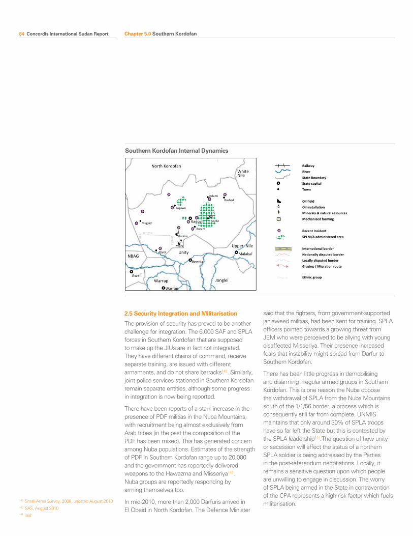
84 Concordis International Sudan Report
2.5 Security Integration and Militarisation
The provision of security has proved to be another challenge for integration. The 6,000 SAF and SPLA forces in Southern Kordofan that are supposed to make up the JIUs are in fact not integrated. They have different chains of command, receive separate training, are issued with different armaments, and do not share barracks142. Similarly, joint police services stationed in Southern Kordofan remain separate entities, although some progress in integration is now being reported.
There have been reports of a stark increase in the presence of PDF militias in the Nuba Mountains, with recruitment being almost exclusively from Arab tribes (in the past the composition of the PDF has been mixed). This has generated concern among Nuba populations. Estimates of the strength of PDF in Southern Kordofan range up to 20,000 and the government has reportedly delivered weapons to the Hawazma and Misseriya143. Nuba groups are reportedly responding by arming themselves too.
In mid-2010, more than 2,000 Darfuris arrived in El Obeid in North Kordofan. The Defence Minister
said that the fighters, from government-supported janjaweed militias, had been sent for training. SPLA officers pointed towards a growing threat from JEM who were perceived to be allying with young disaffected Misseriya. Their presence increased fears that instability might spread from Darfur to Southern Kordofan.
There has been little progress in demobilising and disarming irregular armed groups in Southern Kordofan. This is one reason the Nuba oppose the withdrawal of SPLA from the Nuba Mountains south of the 1/1/56 border, a process which is consequently still far from complete. UNMIS maintains that only around 30% of SPLA troops have so far left the State but this is contested by the SPLA leadership144.The question of how unity or secession will affect the status of a northern SPLA soldier is being addressed by the Parties in the post-referendum negotiations. Locally, it remains a sensitive question upon which people are unwilling to engage in discussion. The worry of SPLA being armed in the State in contravention of the CPA represents a high risk factor which fuels militarisation.
South Kordofan Internal Dynamics
North Kordofan
Unity
Jonglei
White Nile
Warrap
NBAG
Upper Nile
Kadugli
Bentiu
Malakal
Aweil
Warrap
Abyei
Muglad Kauda
Buram
Dalami
Lagawa
Heglig
Bamboo
Rashad
10°10’ N 29°00’ E
27°5
0’ E
Railway
River
State Boundary
State capital
Town
Oil field
Oil installation
Minerals & natural resources
Mechanised farming
Recent Incident
SPLM/A administered area
International border
Nationally disputed border
Locally disputed border
Grazing / Migration route
Ethnic group
Southern Kordofan Internal Dynamics
142 Small Arms Survey, 2008, updated August 2010143 SAS, August 2010144 ibid
Chapter 5.0 Southern Kordofan
Concordis International Sudan Report 85
Turning point: the new leadersSome progress towards integration of the state government was made after a high-level NCP-SPLM delegation visited Southern Kordofan’s SPLM-controlled areas in July 2008 and agreed to take steps to revitalise the process. The real turning point followed in the first half of 2009. Amid complaints about the lack of CPA implementation, the Southern Kordofan sector of the SPLM demanded the replacement of Deputy Governor Daniel Kodi. In April 2009, the Juba leadership responded and installed Abdelaziz al Hilu, a former senior SPLA commander in the Nuba Mountains who is widely trusted and respected among the Nuba population and considered the heir of Kuwa. Seemingly in response, the NCP appointed NCP heavyweight Ahmed Haroun as Southern Kordofan’s new Governor in May 2009.
Free movement between the “selected areas” (former SPLA areas) and the rest of the state is beginning to occur (this was not the case as late as 2009). Despite initial fears of further NCP-SPLM divisions and polarisation of communities, for the time being the appointment of Haroun and Abdelaziz has marked a change for the better. Both have demonstrated leadership and unprecedented political will to move things forward and were given the budget by the NCP to achieve results. The integration and development of the SPLM areas
was made an immediate priority and new bodies to address intra-state and cross-border conflicts were set up, resulting in considerable progress in these areas.
Nevertheless, as the CPA Interim Period nears its end the Haroun-Abdelaziz alliance is bound to reach the limits of what it can achieve. Thus far, the two have managed to work around Southern Kordofan’s most explosive issues, including land and security. With state elections, popular consultations and Southern Sudan’s referendum forthcoming, unreserved cooperation will become increasingly more difficult. Both Haroun and Abdelaziz were military commanders during the war, of PDF and SPLA respectively, involved in mutual oppressions.
Southern Kordofan’s heavyweights: Ahmed Haroun and Abdelaziz el Hilu
Ahmed Haroun, Governor of Southern Kordofan, is regarded as one of the most capable and influential members of the NCP. A former PDF commander during the war, Haroun was Minister for both Internal and Humanitarian Affairs in the post-CPA era. Some observers have said Haroun’s appointment as Governor is an attempted rehabilitation after he was indicted by the ICC over his alleged role in the conflict in Darfur.
Half-Nuba and half -Darfuri, Abdelaziz el Hilu was a key SPLA commander during the war in the Nuba Mountains. He further represented the Nuba during the negotiations that led to the 2002 ceasefire and the CPA. He moved on to become the Secretary of the SPLM Northern Sector, before leaving for the USA after a disagreement with the SPLM’s new leadership. Upon his return to Sudan in 2008, he briefly served as deputy Secretary General of the SPLM for the Northern Sector and Secretary for Political Affairs and Mobilisation in Khartoum.
Chapter 5.0 Southern Kordofan
86 Concordis International Sudan Report
Stuck in the middle: the case of the Nuba
The Nuba, mostly sedentary farmers inhabiting the central plateau of the Nuba Mountains, form the largest part of the Southern Kordofan population. They comprise more than 50 different ethnic groups who do not share one particular culture, tradition, language or religion. Rather, what unifies them is their perception of a common history and shared identity: they widely recognise themselves to be Nuba.
At independence, the Nuba did not question their status as ‘northerners’, nor did they collectively sympathise with Southern Sudan’s repeated call for an independent state, though similar long-term perceptions of economic and political marginalisation were, and still are, present. Their alignment with the SPLA can be traced back to the early 1980s, when the Khartoum government ordered attacks on Nuba villages suspected of supporting the South’s insurgency. Under the leadership of Yousif Kuwa Mekke, the Nuba took up arms and joined the SPLA’s rebellion, signalling the beginning of the War in the Nuba Mountains (1985-2005).
From 1986 onwards, the government of President Sadiq al-Mahdi armed local Baggara Arab militia in areas associated with the rebellion, many of whom had already taken up arms in response to livelihood challenges and insecurity. These militias were involved in some of the most brutal fighting of the war and the Nuba suffered enormous displacement. After the National Salvation Government came to power in 1989, many of these militias were brought under government direction through their incorporation into the PDF. After 1992, Jihad against SPLA supporters was announced and a period of forcible relocations of the Nuba population to so-called ‘peace camps’ took place. The land evacuated by populations was leased by the government.
In January 2002, the parties signed a ceasefire agreement in Bürgenstock, Switzerland. Nuba leaders are generally unhappy with the CPA arrangements and feel the SPLM sacrificed demands over Southern Kordofan to the benefit of southern groups. In particular, while the South and the Abyei area were granted a self-determination referendum, Southern Kordofan was awarded a ‘popular consultation’ with an ambiguous status.
The CPA’s integration of Misseriya-dominated parts of former West Kordofan into Southern Kordofan aggravated Nuba grievances, given that this reduced their numerical dominance and potentially endangers their opportunity to utilise the popular consultation as a mechanism to reshape their future. They further mourn the loss of the ‘Nuba Mountains’ designation. Overall, the Nuba feel that the CPA arrangements insufficiently recognise and tackle what they see as their disadvantaged position within the North.
Most Nuba adhered to John Garang’s New Sudan Vision and are ultimately thought to favour the unity of the country. With his death, the SPLM’s national appeal and the belief in a unity scenario waned, cooling further Nuba-SPLM relations. Nevertheless, a mistrust of the NCP-led government remains strong among Nuba, and in the event of new North-South hostilities, a revival of their strategic alliance with the SPLA, in which many Nuba still hold senior positions, is likely.
Chapter 5.0 Southern Kordofan
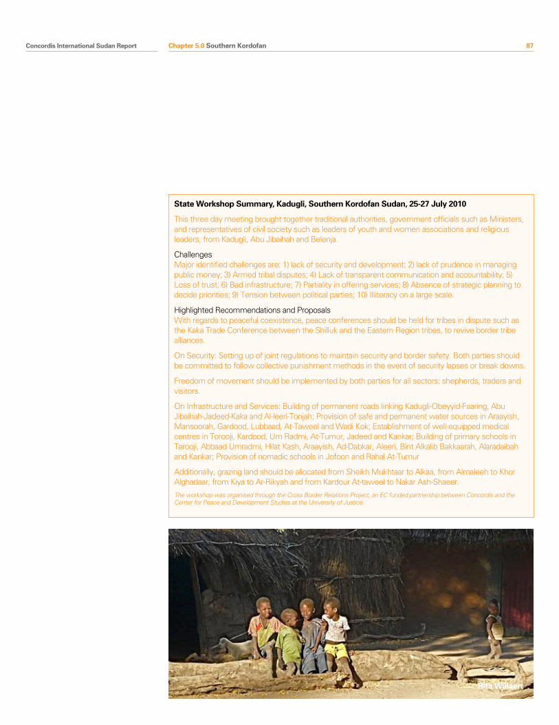
Concordis International Sudan Report 87
State Workshop Summary, Kadugli, Southern Kordofan Sudan, 25-27 July 2010
This three day meeting brought together traditional authorities, government officials such as Ministers, and representatives of civil society such as leaders of youth and women associations and religious leaders, from Kadugli, Abu Jibaihah and Belenja.
ChallengesMajor identified challenges are: 1) lack of security and development; 2) lack of prudence in managing public money; 3) Armed tribal disputes; 4) Lack of transparent communication and accountability; 5) Loss of trust; 6) Bad infrastructure; 7) Partiality in offering services; 8) Absence of strategic planning to decide priorities; 9) Tension between political parties; 10) Illiteracy on a large scale.
Highlighted Recommendations and ProposalsWith regards to peaceful coexistence, peace conferences should be held for tribes in dispute such as the Kaka Trade Conference between the Shilluk and the Eastern Region tribes, to revive border tribe alliances.
On Security: Setting up of joint regulations to maintain security and border safety. Both parties should be committed to follow collective punishment methods in the event of security lapses or break downs.
Freedom of movement should be implemented by both parties for all sectors: shepherds, traders and visitors.
On Infrastructure and Services: Building of permanent roads linking Kadugli-Obeyyid-Faaring, Abu Jibaihah-Jadeed-Kaka and Al-leeri-Tonjah; Provision of safe and permanent water sources in Araayish, Mansoorah, Gardood, Lubbaad, At-Taweel and Wadi Kok; Establishment of well-equipped medical centres in Torooji, Kardood, Um Radmi, At-Tumur, Jadeed and Kankar; Building of primary schools in Tarooji, Abbaad Umradmi, Hilat Kash, Araayish, Ad-Dabkar, Aleeri, Bint Alkalib Bakkaarah, Alaradaibah and Kankar; Provision of nomadic schools in Jofoon and Rahal At-Tumur
Additionally, grazing land should be allocated from Sheikh Mukhtaar to Alkaa, from Almaleeh to Khor Alghadaar, from Kiya to Ar-Rikyah and from Kardour At-taweel to Nakar Ash-Shaeer.
The workshop was organised through the Cross Border Relations Project, an EC funded partnership between Concordis and the Center for Peace and Development Studies at the University of Justice.
Rita Willaert
Chapter 5.0 Southern Kordofan
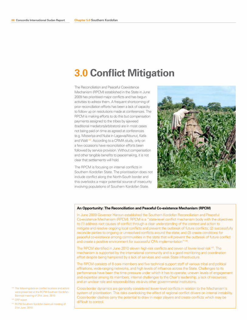
88 Concordis International Sudan Report
3.0 Conflict MitigationThe Reconciliation and Peaceful Coexistence Mechanism (RPCM) established in the State in June 2009 has prioritised major conflicts and has begun activities to adress them. A frequent shortcoming of prior reconciliation efforts has been a lack of capacity to follow up on resolutions made at conferences. The RPCM is making efforts to do this but compensation payments assigned to the tribes by ajaweed (traditional mediators/arbitrators) are in most cases not being paid on time as agreed at conferences (e.g. Misseriya and Nuba in Lagawa/Alsunut, Katla and Wali)145. According to a CRMA study, only on a few occasions have reconciliation efforts been followed by service provision. Without compensation and other tangible benefits to peacemaking, it is not clear that settlements will hold.
The RPCM is focusing on internal conflicts in Southern Kordofan State. The prioritisation does not include conflict along the North-South border and this overlooks a major potential source of insecurity involving populations of Southern Kordofan State.
145 The following data on conflict locations and actors were presented at the RCPM Southern Kordofan Biannual meeting of 21st June, 2010
146 CRP report147 RCPM Southern Kordofan biannual meeting of
21st June, 2010
Conflict Driver Actor Risks Triggers Mitigation
The political dependency of the State
Elections SPLM/NCP/Nuba/nomads Elections destabilise positive developments and change current support from Khartoum and Juba
Election result Representation of Nuba in post-ref arrangements talks.
Clarity on opportunities around the popular consultation. (concerns over referendum)
Southern Referendum SPLM/NCP/Nuba/nomads Southern Kordofan splits along wartime lines with Nuba and northern SPLM disappointed at a weakened position.
Referendum result Establish clarity, popular acceptance, and manage expectations around popular consultation process
Abyei Referendum Misseriya Misseriya backlash towards NCP or against Nuba
Implementation of Abyei Referendum, or referendum held by AAA
National agreements between parties on Abyei
Land Land ownership and use Nuba farmers and nomads Fighting around the elections and Popular consultation
Returnees
Decision around scope and style of popular consultation
Referendum result
Compensation agreed at reconciliation activities is paid. Services and infrastructure provided by State.
Cross border conflict Misseriya other Arab nomads and farmers
Conflict in the dry season destabilises referendum
Closure of borders in the next dry season/hard border after the referendum
RCPM to replicate internal efforts with cross border mechanisms; similar mechanisms set up in other states coordinating with each other
Intra-Nuba fighting over land
Nuba Nuba feel unprotected by the SPLM during the popular consultation
New returns lack of security from SPLA
Provision of services and management of land disputes
Intra-Misseriya fighting and oil compensation monies
Misseriya Strengthening of PDF militias
Referendum result National agreement on outstanding issues; land right guaranteed for the Misseriya
Socio-economic underdevelopment and conflicting livelihoods
All Militarisation Election/popular consultation
Provision of services and livelihood opportunities
New native administration structures
All Fighting between various actors if administrative boundaries do not reflect perceived power or alliances.
Unsatisfactory popular consultation
Establish and activate a Southern Kordofan Land Commission
Integration of the administration
Political separation of SPLA areas from State administration
State administration/SPLM Administration
Further closures of land and underdevelopment
Election/popular consultation/Referendum
Development and reconciliation and support from Juba
Security integration and militarisation
Disfranchised youth Militarisation Election/popular consultation/Referendum
Provision of livelihood opportunities, employment, services, education
SPLA soldiers in the North SPLA
SPLM/NCP
Presence of SPLA (or former SPLA) destabilises Southern Kordofan post referendum
Referendum result; failure to fulfil DDR or redeploy
National agreement; popular consultation deal with issue
Popular consultation All Nuba or Arab radicalisation Unexpected, unsatisfactory, or undesired result
Civic education; agreements between the parties at State level on agenda; meaningful process
An Opportunity: The Reconciliation and Peaceful Co-existence Mechanism (RPCM)
In June 2009 Governor Haroun established the Southern Kordofan Reconciliation and Peaceful Co-existence Mechanism (RPCM). RPCM is a “state-level conflict mechanism body with the objectives to (1) address root causes of conflict through a clear understanding of the context and action to mitigate and resolve ongoing local conflicts and prevent the outbreak of future conflicts; (2) successfully reconcile parties to ongoing or unresolved conflicts around the state; and (3) create conditions for peaceful co-existence among communities in the state that will prevent the outbreak of future conflict and create a positive environment for successful CPA implementation”146.
The RPCM identified in June 2010 eleven high-risk conflicts and seven of lower-level risk147. The mechanism is supported by the international community and is a good monitoring and coordination effort despite being hampered by a lack of services and weak State infrastructure.
The RPCM consists of 8 core members and five technical support staff of various tribal and political affiliations, wide-ranging networks, and high levels of influence across the State. Challenges to its performance have been the time pressure under which it has to operate; uneven levels of engagement and expertise among its members; internal challenges to the Chair’s leadership; a lack of resources; and an unclear role and responsibilities vis-à-vis other governmental institutions.
Cross-border dynamics are generally considered lower-level conflicts in relation to the Mechanism’s system of prioritisation. This risks overlooking the effect of regional conflict drivers on internal instability. Cross-border clashes carry the potential to draw in major players and create conflicts which may be difficult to control.
Chapter 5.0 Southern Kordofan
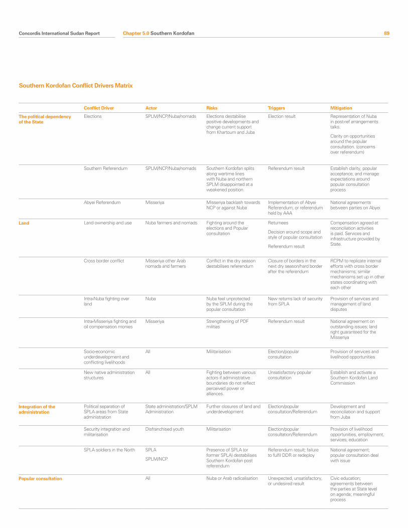
Concordis International Sudan Report 89
Conflict Driver Actor Risks Triggers Mitigation
The political dependency of the State
Elections SPLM/NCP/Nuba/nomads Elections destabilise positive developments and change current support from Khartoum and Juba
Election result Representation of Nuba in post-ref arrangements talks.
Clarity on opportunities around the popular consultation. (concerns over referendum)
Southern Referendum SPLM/NCP/Nuba/nomads Southern Kordofan splits along wartime lines with Nuba and northern SPLM disappointed at a weakened position.
Referendum result Establish clarity, popular acceptance, and manage expectations around popular consultation process
Abyei Referendum Misseriya Misseriya backlash towards NCP or against Nuba
Implementation of Abyei Referendum, or referendum held by AAA
National agreements between parties on Abyei
Land Land ownership and use Nuba farmers and nomads Fighting around the elections and Popular consultation
Returnees
Decision around scope and style of popular consultation
Referendum result
Compensation agreed at reconciliation activities is paid. Services and infrastructure provided by State.
Cross border conflict Misseriya other Arab nomads and farmers
Conflict in the dry season destabilises referendum
Closure of borders in the next dry season/hard border after the referendum
RCPM to replicate internal efforts with cross border mechanisms; similar mechanisms set up in other states coordinating with each other
Intra-Nuba fighting over land
Nuba Nuba feel unprotected by the SPLM during the popular consultation
New returns lack of security from SPLA
Provision of services and management of land disputes
Intra-Misseriya fighting and oil compensation monies
Misseriya Strengthening of PDF militias
Referendum result National agreement on outstanding issues; land right guaranteed for the Misseriya
Socio-economic underdevelopment and conflicting livelihoods
All Militarisation Election/popular consultation
Provision of services and livelihood opportunities
New native administration structures
All Fighting between various actors if administrative boundaries do not reflect perceived power or alliances.
Unsatisfactory popular consultation
Establish and activate a Southern Kordofan Land Commission
Integration of the administration
Political separation of SPLA areas from State administration
State administration/SPLM Administration
Further closures of land and underdevelopment
Election/popular consultation/Referendum
Development and reconciliation and support from Juba
Security integration and militarisation
Disfranchised youth Militarisation Election/popular consultation/Referendum
Provision of livelihood opportunities, employment, services, education
SPLA soldiers in the North SPLA
SPLM/NCP
Presence of SPLA (or former SPLA) destabilises Southern Kordofan post referendum
Referendum result; failure to fulfil DDR or redeploy
National agreement; popular consultation deal with issue
Popular consultation All Nuba or Arab radicalisation Unexpected, unsatisfactory, or undesired result
Civic education; agreements between the parties at State level on agenda; meaningful process
Southern Kordofan Conflict Drivers Matrix
Chapter 5.0 Southern Kordofan
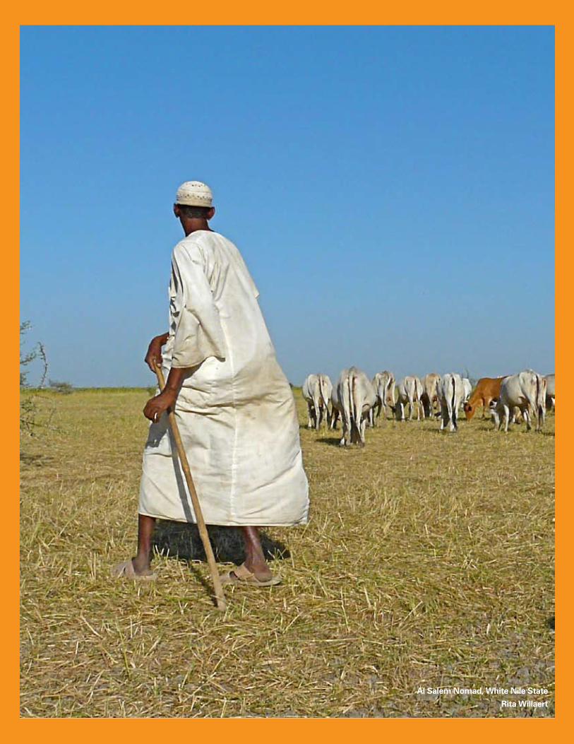
90 Concordis International Sudan Report
Al Salem Nomad, White Nile State
Rita Willaert
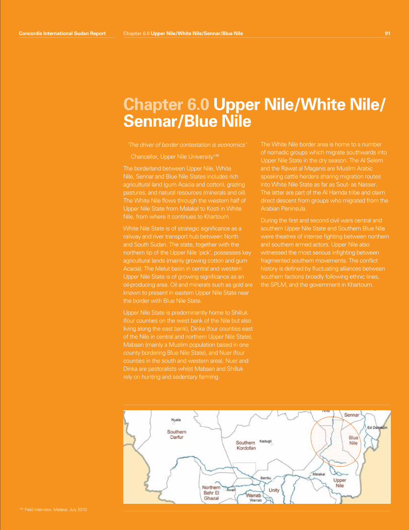
Concordis International Sudan Report 91Chapter 6.0 Upper Nile/White Nile/Sennar/Blue Nile
‘ The driver of border contestation is economics’
Chancellor, Upper Nile University148
The borderland between Upper Nile, White Nile, Sennar and Blue Nile States includes rich agricultural land (gum Acacia and cotton), grazing pastures, and natural resources (minerals and oil). The White Nile flows through the western half of Upper Nile State from Malakal to Kosti in White Nile, from where it continues to Khartoum.
White Nile State is of strategic significance as a railway and river transport hub between North and South Sudan. The state, together with the northern tip of the Upper Nile ‘pick’, possesses key agricultural lands (mainly growing cotton and gum Acacia). The Melut basin in central and western Upper Nile State is of growing significance as an oil-producing area. Oil and minerals such as gold are known to present in eastern Upper Nile State near the border with Blue Nile State.
Upper Nile State is predominantly home to Shilluk (four counties on the west bank of the Nile but also living along the east bank), Dinka (four counties east of the Nile in central and northern Upper Nile State), Mabaan (mainly a Muslim population based in one county bordering Blue Nile State), and Nuer (four counties in the south and western area). Nuer and Dinka are pastoralists whilst Mabaan and Shilluk rely on hunting and sedentary farming.
The White Nile border area is home to a number of nomadic groups which migrate southwards into Upper Nile State in the dry season. The Al Selem and the Rawat al Maganis are Muslim Arabic speaking cattle herders sharing migration routes into White Nile State as far as Sout- as Nasser. The latter are part of the Al Hamda tribe and claim direct descent from groups who migrated from the Arabian Peninsula.
During the first and second civil wars central and southern Upper Nile State and Southern Blue Nile were theatres of intense fighting between northern and southern armed actors. Upper Nile also witnessed the most serious infighting between fragmented southern movements. The conflict history is defined by fluctuating alliances between southern factions broadly following ethnic lines, the SPLM, and the government in Khartoum.
Chapter 6.0 Upper Nile/White Nile/Sennar/Blue Nile
Concordis International Sudan Report 91
148 Field Interview, Malakal, July 2010
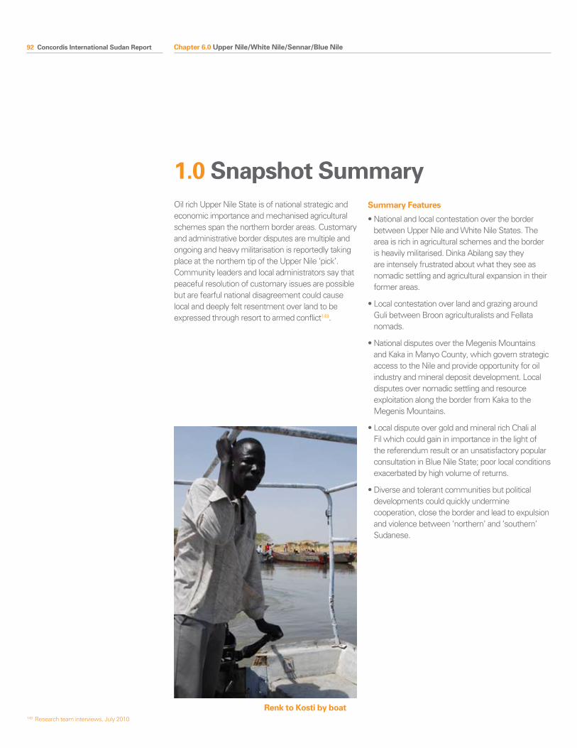
92 Concordis International Sudan Report Chapter 6.0 Upper Nile/White Nile/Sennar/Blue Nile
Oil rich Upper Nile State is of national strategic and economic importance and mechanised agricultural schemes span the northern border areas. Customary and administrative border disputes are multiple and ongoing and heavy militarisation is reportedly taking place at the northern tip of the Upper Nile ‘pick’. Community leaders and local administrators say that peaceful resolution of customary issues are possible but are fearful national disagreement could cause local and deeply felt resentment over land to be expressed through resort to armed conflict149.
Summary Features
•Nationalandlocalcontestationovertheborderbetween Upper Nile and White Nile States. The area is rich in agricultural schemes and the border is heavily militarised. Dinka Abilang say they are intensely frustrated about what they see as nomadic settling and agricultural expansion in their former areas.
•LocalcontestationoverlandandgrazingaroundGuli between Broon agriculturalists and Fellata nomads.
•NationaldisputesovertheMegenisMountainsand Kaka in Manyo County, which govern strategic access to the Nile and provide opportunity for oil industry and mineral deposit development. Local disputes over nomadic settling and resource exploitation along the border from Kaka to the Megenis Mountains.
•LocaldisputeovergoldandmineralrichChalialFil which could gain in importance in the light of the referendum result or an unsatisfactory popular consultation in Blue Nile State; poor local conditions exacerbated by high volume of returns.
•Diverseandtolerantcommunitiesbutpoliticaldevelopments could quickly undermine cooperation, close the border and lead to expulsion and violence between ‘northern’ and ‘southern’ Sudanese.
1.0 Snapshot Summary
149 Research team interviews, July 2010
Renk to Kosti by boat

Concordis International Sudan Report 93Chapter 6.0 Upper Nile/White Nile/Sennar/Blue NileConcordis International Sudan Report 93
2.1 Land and Land Use
Mechanised AgricultureDisputes related to mechanised farming and settlement of the area strike at the heart of potential for national and local conflict in the area. The northern area of Renk County and southern White Nile saw heavy investment in mechanised agricultural schemes150. This has complicated the management of the area since the CPA was signed. The whole area was a site of huge investment following a wave of land legislation in the 1970s that transferred control from native administration to government structures. Following the opening up of the international market to Sudanese cereal crops (particularly sorghum and millet), the central government expanded agricultural schemes in rain-fed areas of Blue Nile, Southern Kordofan, and northern Upper Nile States.
Thousands of Feddans of fertile lands were distributed to retired government and military officials, as well as to large national and Arab commercial companies (for example, 250,000 to Arab Sudanese Agric Company, 168,000 to Sudanese Egyptian Agric Co and 150,000 to SMA)151. Dinka in northern Upper Nile remain extremely and personally aggrieved by the transfer of Dinka-controlled land to the State citing losses of large agricultural projects of their own. The process accelerated after the September laws made appeal against the state impossible.
Migration Migration into Upper Nile State from Kordofan, Sennar, White Nile, and Blue Nile is a relatively peaceful process. Upper Nile and White Nile communities share common cultural traits developed through a century of shared administration. The northern pick of Upper Nile is also home to many Muslims and northern Sudanese, particularly traders. Interviewees suggest that this presence of shared faiths and cultural characteristics helps to generate tolerance between diverse communities. The Paramount Chief of the Ruf’ah nomadic group publicly acknowledged land ownership to the Dinka and thanked the host communities for sharing the resources 152.
Grazing agreements between Dinka Abelang in Renk and the Al Hamda and Al Selem groups are broadly implemented. Ad hoc grazing taxes are paid, though these can generate tensions between traditional authorities and the government. Isolated incidents occur in Renk and Manyo Counties when cattle enter agricultural areas but community leaders say these are not significant.
Mabaan County witnesses greater potential for tensions to develop153. Increased migration into Mabaan from Sennar and Blue Nile, such as Fellata, Wajdab, Nabmo, and Kibushuab groups, faces resistance from agricultural Mabaan communities. The Fellata played a major role in the war and remain heavily armed. Their routes are particularly conflict-prone as they come into contact with farmers. Conflict is currently local and low-level, centring on damage to plantations and access to water, but Mabaan leaders say the presence of oil and settling in the area could lead to significant tensions154.
The signature of the CPA led to regulatory changes at the border and new people to manage them. Nomadic groups say a lack of institutional and individual understanding of traditional movements has led to new challenges such as temporary closure of migration routes and harassment and cattle theft by SPLA. Looking ahead, nomadic leaders and White Nile administrators fear that secession would restrict movement of people and goods across the border.
2.0 Conflict Drivers
150 Research team interviews at the Ministry of Agriculture, Malakal, 2010
151 CRMA Asessment, updated May 2010152 Research team interviews, July 2010153 Research team interviews with Upper Nile state
deputy Governor, a Mabaan, Malakal, July, 2010154 Concordis Cross-border dialogue workshop in
Renk, May 2010
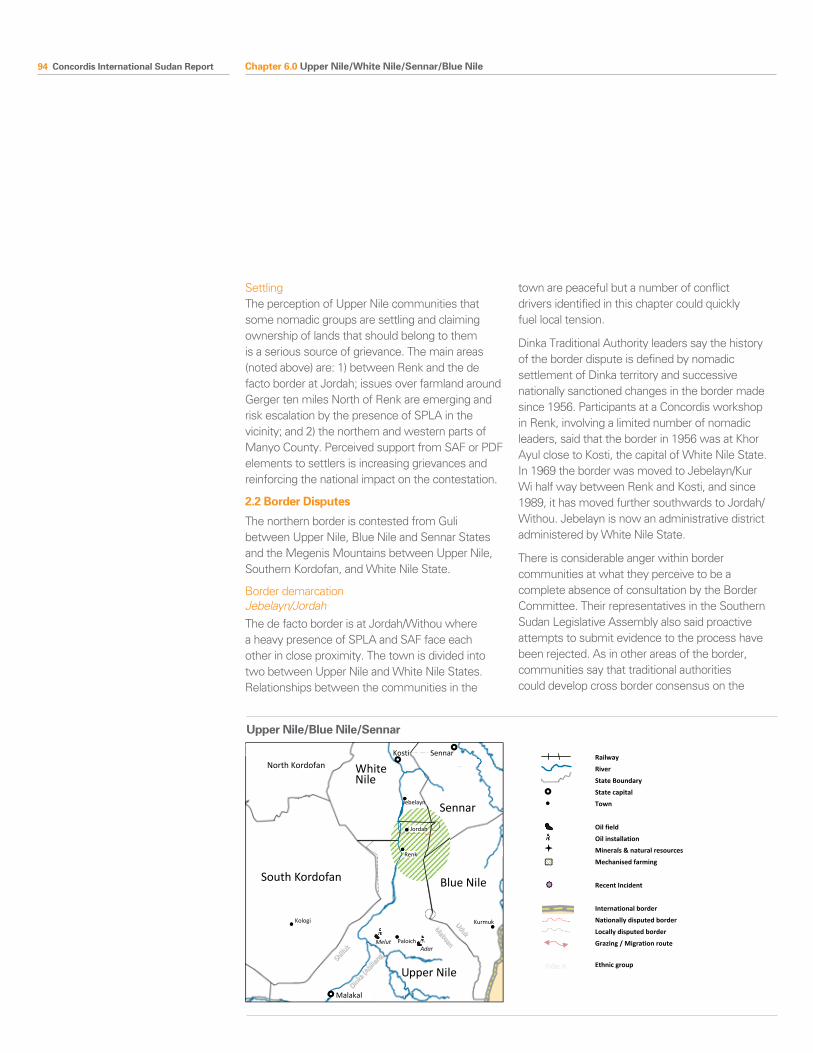
94 Concordis International Sudan Report
SettlingThe perception of Upper Nile communities that some nomadic groups are settling and claiming ownership of lands that should belong to them is a serious source of grievance. The main areas (noted above) are: 1) between Renk and the de facto border at Jordah; issues over farmland around Gerger ten miles North of Renk are emerging and risk escalation by the presence of SPLA in the vicinity; and 2) the northern and western parts of Manyo County. Perceived support from SAF or PDF elements to settlers is increasing grievances and reinforcing the national impact on the contestation.
2.2 Border Disputes
The northern border is contested from Guli between Upper Nile, Blue Nile and Sennar States and the Megenis Mountains between Upper Nile, Southern Kordofan, and White Nile State.
Border demarcationJebelayn/JordahThe de facto border is at Jordah/Withou where a heavy presence of SPLA and SAF face each other in close proximity. The town is divided into two between Upper Nile and White Nile States. Relationships between the communities in the
town are peaceful but a number of conflict drivers identified in this chapter could quickly fuel local tension.
Dinka Traditional Authority leaders say the history of the border dispute is defined by nomadic settlement of Dinka territory and successive nationally sanctioned changes in the border made since 1956. Participants at a Concordis workshop in Renk, involving a limited number of nomadic leaders, said that the border in 1956 was at Khor Ayul close to Kosti, the capital of White Nile State. In 1969 the border was moved to Jebelayn/Kur Wi half way between Renk and Kosti, and since 1989, it has moved further southwards to Jordah/Withou. Jebelayn is now an administrative district administered by White Nile State.
There is considerable anger within border communities at what they perceive to be a complete absence of consultation by the Border Committee. Their representatives in the Southern Sudan Legislative Assembly also said proactive attempts to submit evidence to the process have been rejected. As in other areas of the border, communities say that traditional authorities could develop cross border consensus on the
Blue Nile South Kordofan
North Kordofan White Nile
Sennar
Malakal
Sennar Kosti
Renk
Kologi
Paloich
Kurmuk
Upper Nile
Melut Adar
Mabaan
Shillu
kDinka
(Abilia
ng)
Jordah
Jebelayn
Uduk
Chali al-Fil and SPLA presence
Migration Routes
Guli
White Nile / Upper Nile / Blue Nile Border
Railway
River
State Boundary
State capital
Town
Oil field
Oil installation
Minerals & natural resources
Mechanised farming
Recent Incident
International border
Nationally disputed border
Locally disputed border
Grazing / Migration route
Ethnic group
Upper Nile/Blue Nile/Sennar
Chapter 6.0 Upper Nile/White Nile/Sennar/Blue Nile
Concordis International Sudan Report 95
1956 border and point to the presence of border posts installed by British officials are still in place. Communities and administrators on both sides of the border developed argued that contestation over the border is linked to national interests regarding control over agricultural lands and associated revenue flows.
GuliThe area of Guli is disputed between Tadamon Locality and Renk Payam in Upper Nile over the village of Bibnes. Conflict in the area manifests itself in clashes between the Broon community, Fellata nomads migrating into the area, and SPLA. In May 2010, the National Border Committee visited the area, sparking clashes on the ground.
The chairman of the commission the Technical Committee for North-South Border Demarcation has announced completion of the delineation of the boundary between Upper Nile State, Sennar and Blue Nile State. The dispute has also been resolved within the Border Demarcation Committee, locating Bibnes in Blue Nile State155 and the Upper Nile and Blue Nile border technical committees have identified twelve demarcation points on the ground. However, the village remains disputed by the parties, pending a decision by the presidency and by local communities on the ground. The area is scarcely populated but weapons are widespread156.
Guli is a small area resting in the triangle that connects Upper Nile, Blue Nile, and Sennar States. Communities in both Upper Nile and Blue Nile both consider the village as historically belonging to Upper Nile, moving from Upper Nile after 1956; first to al Gazeera province, then the Middle Region, and finally following a presidential decree in 1994 to Blue Nile State. It is currently administered by the newly established At-Tadamon Locality, a scarcely populated land with many mechanised agricultural schemes.
During wartime, the SPLA blocked migration routes south of Baw in Blue Nile State, forcing nomads to roam in greater numbers through At-Tadamon and intensifying seasonal land disputes in the area. No OAGs are officially registered in Blue Nile State
but there is a certified presence of PDF such as the Shatta Zaina (‘Mobile Police’) in At-Tadamon Locality157.
Manyo CountyThe area of Kaka in Manyo County is contested between Southern Kordofan and Upper Nile State up to the River Nile. Local level historical disputes between al Hamra Misseriya and Shilluk communities have not ceased. Parts of the area were transferred to Nuba province in the 1920s to facilitate access to the Nile for the Nuba from northern Sudan. It reverted back to Upper Nile in 1928 when the Nuba Mountains became a part of Kordofan. The potential for conflict lies in the strategic value of access to the Nile, a soil trace of oil, and rich grazing and agricultural land, not in a lack of clarity over 1956 borders.
Migration is managed peacefully but Shilluk complain about settling of nomads in Manyo County from Kaka in central Manyo to the Megenis Mountains where Southern Kordofan, White Nile, and Blue Nile meet. In the northern parts, administrators in Wadekona Payam told the research team that settling is taking place up to Um Jellala 20 kilometres west of the River Nile.
Mayom administrators said settlers have established companies for production of charcoal and gum Arabic and suspect them to be receiving from SAF or PDF, especially during tapping season. Community leaders from Wadekona say they have seen uniformed men working and guarding settler farms. Manyo County authorities have written to the government in Southern Kordofan with their concerns but have no capacity to take action internally. This is a new dynamic of competing claims over land ownership between Shilluk and traditionally nomadic groups and tensions are increasing.
Mabaan/Chali al FilChali al Fil area between Mabaan County in Upper Nile State and Kurmuk Locality in Blue Nile State is the site of unresolved border disputes. It was administered by Upper Nile province until 1953 when it was transferred to Blue Nile, though some
155 UNMIS Damazine Civil Affairs Head of Office statement during the Cross Border Relations Beyond 2011 Workshop – 2nd August 2010 – Damazine town
156 Husham al Sisi, representative of Democratic United Party’s statement in the Cross Border Relations Beyond 2011 Workshop August 1st 2010, Damazin town
157 Research team interviews in Damazin, August 2010
Chapter 6.0 Upper Nile/White Nile/Sennar/Blue Nile
96 Concordis International Sudan Report
Uduk leaders claim the boundary change was not implemented until 1958. The wider area, together with Abyei, had been promised a referendum on reverting to southern Sudanese administration by the Addis Ababa Agreement.
Chali al Fil is chiefly inhabited by Mabaan, mainly but not exclusively Muslim farmers who fought with the SPLM/A during the war, and Uduk peoples (in Kortumback, Helletnafar, and Abengoru at the Ura Mountains). Historically, Mabaan and Uduk have lived in both Upper Nile and Blue Nile States. The 1953 boundary change split the groups on ethnic lines, Uduk in Blue Nile and Mabaan in Upper Nile. The area is currently administered by Blue Nile State Kurmuk Locality and Mabaan living in the area registered to vote in the 2010 elections within the Shatta constituency of Blue Nile State.
The issue is sensitive. Chali contains gold and other minerals. The area of Mabaan has recently seen a proliferation in road-building by Petrodar. Oil and gas deposits are rumoured and the Upper Nile Peace Commission confirmed that cross-border smuggling is a lucrative business. Populations and leaders alike do not speak easily about the border dispute or the implications of secession on stability in the region. Some community leaders on both sides suggest that the status quo may be acceptable in the case of unity but that secession would require some Uduk to reconsider their position in Blue Nile State158.
The area is calm, owing to the overwhelming presence of SPLM/A in Southern Blue Nile. The mobile 10th Division SPLA from its base in Guffa are moving between Blue Nile and Upper Nile despite stipulations on redeployment to the borders of 1/1/56 outlined in the CPA159. The referendum and potential secession are extremely significant and the situation in Chali could become tense depending upon the outcome.
The Uduk have been subjected to waves of migration beginning after SPLA attempts to capture Kurmuk in 1986/7. Consequently, Chali is a major area for returns for refugees from Ethiopia. Community leaders are frustrated at the absence
of sustainable recovery activities (many returnees do not speak Arabic) and virtually nonexistent government assistance.
2.3 Citizenship
The association of communities as northern or southern peoples in diverse societies is a significant conflict driver in the context of the referendum on self-determination for Southern Sudanese.
The case of Upper Nile, Blue Nile, White Nile shows that no indicators (religious, economic, ethnic) can be reliably used to indicate the label which people will choose for themselves. The Halleib people, Muslims originating in northern Sudan and residing in Mabaan County, are fully resident and registered citizens of the area and members of the community said they would choose to remain there should the South secede. Dinka chiefs in Renk agreed they should be entitled to do so, stating “it is their home”160. The SPLA never reached Manyo County, so many Shilluk of its communities have lived entirely under government control. Their culture, outlook, and names have changed through the experience. Religion and ethnic origin have limited significance regarding affiliation to the North or South of Sudan.
The region is a model for tolerance and peaceful coexistence between diverse Sudanese communities. The volume of movement of peoples and goods across the border is high. Renk County, traditionally a Dinka area, is now a majority Shilluk town with a large population of traders from towns in North Sudan. A sultan from Al Selem said he has fifteen family members in Malakal because of inter-marriage161. There is recognition of historical ties between communities going back to the time of the Mahdi when there was also a large southern population living in Khartoum.
Yet during the 2010 elections, Dinka and Shilluk in Upper Nile were arguably the most strongly separatist areas in South Sudan, despite acknowledging they had potentially the most to lose from this outcome in terms of trade and cooperative cross-border relationships. Communities and officials on both sides were
158 Research team interviews in Damazin, August 2010
159 Various field interviews including Blue Nile State security advisor, Blue Nile State 2010
160 Concordis workshop, May 2010161 Research team interviews, July 2010
Chapter 6.0 Upper Nile/White Nile/Sennar/Blue Nile
Concordis International Sudan Report 97
clear that national developments, politicisation of local issues, and latent mistrust could quickly undermine cooperation and lead to closure of the border and expulsion of communities associated with northern Sudan. In early March, for example, a market incident involving a former southern SAF soldier who had joined the SPLA led to the death of a northern trader and businessmen shut the town markets for a number of days in protest at what they perceived to be a political act. Shilluk and Dinka community leaders also warned that any problems faced by southerners in Khartoum would be met with tit-for-tat responses in Upper Nile162.
2.4 Taxation
Successive taxes from Khartoum, related to insecurity and militarisation on the roads, lead to high commodity prices in Upper Nile State. For example, a bar of soap with a price of six Sudanese pounds in Khartoum will cost twelve Sudanese Pounds in Renk. This impacts upon livelihoods but also has the potential to destabilise relationships within Southern Sudan. Lack of clarity and multiple systems of taxation are leading to suspicions that northern traders are exploiting local consumers.
2.5 Oil
Chevron discovered oil in 1981 at Adar Yel, south of Melut town. Serious oil development began in 2001 after the foundation of Petrodar the previous year and subsequent oil development was associated with widespread displacement of the local Dinka Ageer. The region is of increasing importance in contrast to declining production in the Muglad basin, even though the oil is not of the same quality.
Since the signature of the CPA, populations around major oil installations in Paloich and Melut are not benefitting from the oil industry and complain of continuing land expropriation without compensation or consultation as mandated by the CPA. Oil exploration has caused post-CPA grievances in the areas of Adar, Paloich, and Manyo163 where seismic operations have damaged acacia trees and led to destruction of a number of homes. Rumours of oil
and gas deposits in western Mabaan County have also generated tensions between Melut Dinka and Dinka Plant over internal borders164.
The strategic value of the resources and the benefits features large in the perceptions of communities and leaders. Rumours abound in the region, even among circles of very senior police and security officers, that the NCP have decided the North-South border should be the Sobat River, which would place much of Upper Nile State and all of the energy-producing areas in Northern Sudan165.
2.6 Militarisation
SAF and SPLA are dangerously close at Jordah leading to serious concerns among communities on both sides. The deployment to Renk of SPLA 1st Division, considered one of the most effective in the Army, demonstrates the importance attached to the region. According to UNMIS, the SPLA are showing more assertiveness ahead of the referendum and control movement of people and goods from Renk, including UNMIS vehicles and WFP relief shipments. SPLA checkpoints along the main road from Kosti place restrictions on returnees and other migrants. A new SPLA river police has increased the capability to control the Nile. Populations in White Nile shared negative experiences in dealing with SPLA, alleging cases of extortion, blocked cross-border movements, and cattle theft166. The border with Blue Nile is less militarised, with SPLA working to control the situation within the State and effectively creating a buffer zone along the border.
The Community Security and Small Arms Control Bureau said that the quantity of weapons in Upper Nile State has not declined since 2005167. Disarmament has been problematic, owing to the use of SPLA without the involvement of police or local communities; interviewees reported physical violence directed against non-cooperative traditional authorities. This has exacerbated existing friction between and within tribal groups, due to historical differences in community support to, and experience, of the SPLA. CSSAC also reported a limited number of weapons were arriving in sacs
162 Research team interviews, July 2010163 Moro, Leben, Oil Development Induced
Displacement in Sudan, Sir William Luce Publication Series, University of Durham, 2009
164 Research team interviews, July 2010165 This view is common in Southern Sudan since
the time of the war; significantly, during the interim period it has not changed
166 Research team interviews with NGOs, July 2010167 Research team interviews, Khartoum, July 2010
Chapter 6.0 Upper Nile/White Nile/Sennar/Blue Nile
98 Concordis International Sudan Report
of sorghum via barge and that they had received unverifiable reports of helicopter drops of weapons into Fashoda County.
The SPLA in Upper Nile State contains potential divisions inherited from the war. Former OAG commanders take prominent positions and integrated solders maintain old loyalties. In particular, Division 7 is composed of many former fighters from the militia of Peter Gadet, who is rumoured to have been behind pre-CPA SPLA aggression towards SPLM-DC. Former SSDF generals now allied with SAF and former OAGs now with SPLA have interests in territorial control of their areas. This is a persistent source of risk for the stability of the areas168.
168 Research team interviews, July 2010
State Workshop Summary, Kosti, White Nile State, Northern Sudan, 25-27 May 2010
This three day meeting brought together traditional authorities, government officials and representatives of civil society, such as leaders of youth and women associations and religious leaders, from the tribes in southern White Nile state who live adjacent to, and frequently move across, the 1/1/1956 border between Northern and Southern Sudan. Attending tribes included Silaim and Al-Ahamda tribes from the western bank of the river, Sabaha and Nuzi tribes from the eastern side, and others such as Dar Miharib.
ChallengesChallenges identified included: 1) Making unity attractive; 2) Potential loss of property and grazing rights in the South; 3) presence of the SPLA in border areas undermining co-existence between communities which had been peaceful in the past.
Highlighted Recommendations and ProposalsJoint security arrangements between the two governments should be created to ensure peaceful coexistence and allow for joint activities, such as the founding of committees to secure justice and manage law and order. The role of cross-border traditional leadership and traditional courts needs to be strengthened in order to solve border disputes. Joint border police forces should be located in Almeghenis and Akwaik, and some small police stations along the border must be enlarged and upgraded and made into headquarters.
On Citizenship and Movement, an agreement should be drafted that gives people their rights, whether they are northerners in the south or southerners in the north. A relocation and compensation package should be in place for those who wish to relocate.
A duty free border zone should be established to abolish the double border taxation system. In this zone, duty free border markets will be set up to promote good trading relations between both sides of the border. Additionally, to finance trade and other economic projects, banks should be set up in the border areas.
The workshop was organised through the Cross Border Relations Project, an EC funded partnership between Concordis and the Center for Peace and Development Studies at the University of Justice.
Chapter 6.0 Upper Nile/White Nile/Sennar/Blue Nile
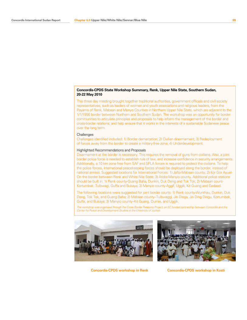
Concordis International Sudan Report 99
Concordis-CPDS State Workshop Summary, Renk, Upper Nile State, Southern Sudan, 20-22 May 2010
This three day meeting brought together traditional authorities, government officials and civil society representatives, such as leaders of women and youth associations and religious leaders, from the Payams of Renk, Mabaan and Manyo Counties in Northern Upper Nile State, which are adjacent to the 1/1/1956 border between Northern and Southern Sudan. The workshop was an opportunity for border communities to articulate principles and proposals to help inform the management of the border and cross-border relations; and help ensure that it works in the interests of a sustainable Sudanese peace over the long term.
ChallengesChallenges identified included: 1) Border demarcation; 2) Civilian disarmament; 3) Redeployment of forces away from the border to create a military-free zone; 4) Underdevelopment.
Highlighted Recommendations and ProposalsDisarmament at the border is necessary. This requires the removal of guns from civilians. Also, a joint border police force is needed to establish rule of law, and increase confidence in security arrangements. Additionally, a 10 km zone free from SAF and SPLA forces is required to protect the civilians. To help the police forces, international peacekeeping forces should be deployed along the border, instead of national armies. Suggested locations for International Forces: 1) Jafta-Mabaan county; 2) Kor Gor Ayuel-On the border between Renk and White Nile State; 3) Atidoi-Manyio county. Additional police stations should be built in: 1) Renk county-Guang Baha, Dunkin, Duk Deng and Tok Tok; 2) Mabaan count-Kortumbak. Tulbwagi, Guffa and Bukaya; 3) Manyio county-Aggif, Uggik, Kit Guang and Gedaed.
The following locations were suggested for joint border courts: 1) Renk county-Wunthau, Dunkin, Duk Deng, Tok Tok, and Guang Baha; 2) Mabaan county–Tulbwaggi, Jin Dinga, Jin Ding Dingu, Kortumbak, Guffa, and Bukaya; 3) Manyio county–Kit Guang, Oumie, and Uggik.
The workshop was organised through the Cross Border Relations Project, an EC funded partnership between Concordis and the Center for Peace and Development Studies at the University of Justice.
Chapter 6.0 Upper Nile/White Nile/Sennar/Blue Nile
Concordis-CPDS workshop in Renk Concordis-CPDS workshop in Kosti
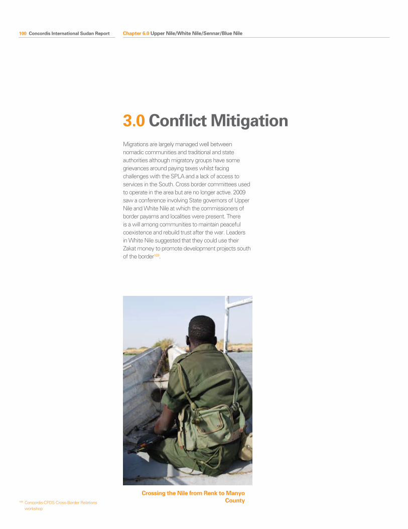
100 Concordis International Sudan Report
3.0 Conflict MitigationMigrations are largely managed well between nomadic communities and traditional and state authorities although migratory groups have some grievances around paying taxes whilst facing challenges with the SPLA and a lack of access to services in the South. Cross border committees used to operate in the area but are no longer active. 2009 saw a conference involving State governors of Upper Nile and White Nile at which the commissioners of border payams and localities were present. There is a will among communities to maintain peaceful coexistence and rebuild trust after the war. Leaders in White Nile suggested that they could use their Zakat money to promote development projects south of the border169.
169 Concordis-CPDS Cross-Border Relations workshop
Crossing the Nile from Renk to Manyo County
Chapter 6.0 Upper Nile/White Nile/Sennar/Blue Nile
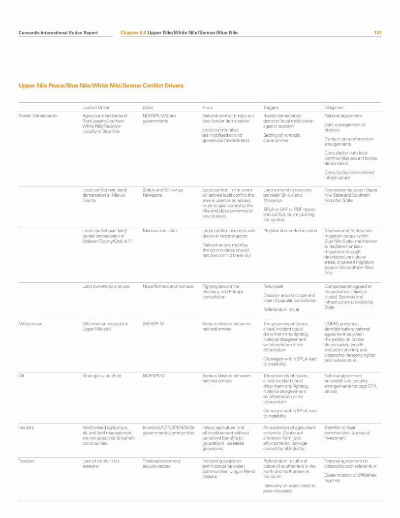
Concordis International Sudan Report 101
Conflict Driver Actor Risks Triggers Mitigation
Border Demarcation Agricultural land around Renk payam/southern White Nile/Tadamon Locality in Blue Nile
NCP/SPLM/State governments
National conflict breaks out over border demarcation
Local communities are mobilised around grievances towards land.
Border demarcation decision; local mobilisation against decision
Settling of nomadic communities
National agreement
Joint management of projects
Clarity in post referendum arrangements
Consultation with local communities around border demarcation
Cross border committees/infrastructure
Local conflict over land/demarcation in Manyo County
Shilluk and Misseriya Hawazma
Local conflict; in the event of national level conflict the area is used as an access route to gain control to the Nile and close proximity to key oil areas
Land ownership contests between Shilluk and Misseriya.
SPLA or SAF or PDF drawn into conflict, or are pushing the conflict.
Negotiation between Upper Nile State and Southern Kordofan State
Local conflict over land/border demarcation in Mabaan County/Chali al Fil
Mabaan and Uduk Local conflict increases and draws in national actors
National actors mobilise the communities should national conflict break out
Physical border demarcation Mechanisms to delineate migration routes within Blue Nile State; mechanism to facilitate nomadic migrations through developed agricultural areas; improved migration access into southern Blue Nile.
Land ownership and use Nuba farmers and nomads Fighting around the elections and Popular consultation
Returnees
Decision around scope and style of popular consultation
Referendum result
Compensation agreed at reconciliation activities is paid. Services and infrastructure provided by State.
Militarisation Militarisation around the Upper Nile pick
SAF/SPLM Serious clashes between national armies
The proximity of forces; a local incident could draw them into fighting. National disagreement on referendum or no referendum
Cleavages within SPLA lead to instability
UNMIS presence; demilitarisation; national agreement between the parties on border demarcation, wealth and asset sharing, and citizenship (property rights) post referendum.
Oil Strategic value of oil NCP/SPLM Serious clashes between national armies
The proximity of forces; a local incident could draw them into fighting. National disagreement on referendum or no referendum
Cleavages within SPLA lead to instability
National agreement on wealth and security arrangements for post CPA period;
Industry Mechanised agriculture, oil, and land management are not perceived to benefit communities
Investors/NCP/SPLM/State governments/communities
Heavy agricultural and oil development without perceived benefits to populations increases grievances.
An expansion of agricultural schemes. Continued alienation from land, environmental damage caused by oil industry
Benefits to local communities in areas of investment
Taxation Lack of clarity in tax systems
Traders/consumers/security actors
Increasing suspicion and mistrust between communities living in Renk/Malakal
Referendum result and status of southerners in the north and northerners in the south
Insecurity on roads leads to price increases
National agreement on citizenship post referendum
Dissemination of official tax regimes
Upper Nile Peace/Blue Nile/White Nile/Sennar Conflict Drivers
Chapter 6.0 Upper Nile/White Nile/Sennar/Blue Nile
102 Concordis International Sudan Report
Conflict drivers within Upper Nile State inherited from the war are the main threat to security in the region. These are intimately linked to relations between northern and southern groups and of increasing significance in light of potential changes in the border regime. The interplay between national disputes over the location and functions of the border and local actors with historical grievances and territorial ambitions has been a constant source of instability since independence. Lack of state consolidation has left significant power in the hands of local political and military leaders. Competition between leaders in the region strikes at the heart of stability within the SPLA and the political cohesion of the SPLM. Combined with increasing economic and strategic importance, a heavy presence of small arms and existing territorial control of former SSDF and SPLA leaders, instability in the State could undermine the national peace.
Summary features
•Historyofsouthernfactionalisationandshiftingalliances leaves a fragile and potentially unstable security sector.
•TheinfluenceofformerSSDFleadersonSPLAtroops has reportedly been a source of instability; as is the possibility of discontent within the SPLA as shown by dissension led by Athor, Yaoyao and Gatluak Gai in the post-election period.
•Historicalconflictmemoryandcontemporarycleavages between Lou Nuer and Jikany Nuer create a risk for the potential destabilisation of Upper Nile State.
•EscalationoftheShilluk-Dinkaconflictcontinuesover land ownership of the East Bank of the Nile; underpinned by Shilluk perceptions of political and economic marginalisation. The Shilluk kingdom is strategically located between North and South Sudan.
•Weakstateinstitutionsformanaginginternalconflicts.
1.0 Snapshot Summary
Intra-Upper Nile State“ Our threat is within” Senior SPLA officer, Malakal170
Chapter 6.0 Upper Nile/White Nile/Sennar/Blue Nile
170 Field interview, July 2010
Concordis International Sudan Report 103Concordis International Sudan Report 103
2.1 SPLA, former SSDF and Potential for Frag-mentation
Former SSDFMilitia and armed youth groups are present in the State despite the official integration of all OAGs into SAF and the SPLA in 2007. Major OAGs aligned to SAF were present in Malakal, Phom El-Zeraf (Fangak), Kodok, Adok and Tonga during the war. Other former SSDF commanders have high-ranking positions within the SPLA. Integration of fighters has been incomplete and ad hoc. Malakal therefore remains a highly complex and unstable town in which identifying militia is a difficult task. Former fighters abandoned or hid weapons but did not discard old loyalties. Others returned to their areas.
Major Gabriel TanginyaThe relationship between SPLA and Major Gabriel Tanginya and his forces has been a source of instability. Gabriel Tanginya is a Nuer from New Fangak and a former SSDF commander. After the Juba Declaration, which incorporated the SSDF into the SPLA, his troops were integrated into local SAF JIUs in Malakal and took part in clashes with SPLA JIUs in 2006 and 2009.
Historical and contemporary power struggles underlie the insecurity. People close to Gabriel Tanginya recognise him as a longstanding separatist with deep-seated grievances towards the SPLA over its history with Anyanya II and the prominent role Dinka took in the movement. After the CPA was signed, Gabriel requested the position of commissioner of Fangak in return for integration into SPLA; in return, the SPLA demanded his resignation from the NCP, which was refused. The failure to agree caused fighting in Fangak and insecurity on the road to Renk and GoSS issued an arrest warrant against him.
Following the 2006 clashes, the JIU components were moved to different parts of the town, SAF near the airport in the north and SPLA to the south. This undermined the vision behind the JIUs and did not prevent an eruption of violence again in 2009 after Tanginya reportedly visited SAF JIU barracks. Members of the former Fangak Forces which he had used in his campaign for County
Commissioner also took part in the conflict, which killed 59 people. On his return to Khartoum, he was promoted by SAF to major general. This increased suspicions in Upper Nile that his visits to Malakal were engineered by northern forces to destabilise the South.
The situation is further complicated by divisions within the SAF JIU itself. Tanginya’s supporters have reportedly tense relations with those associated with other southern SAF aligned militia leaders such as Gordon Kong, a Nuer commander from Nasir, and Thomas Maboir.
The JIUs remain a source of insecurity. In 2010, the SPLA component has relocated to a position closer to that of the SAF JIU172. This is symptomatic of an increasingly assertive SPLA in the Upper Nile area. At the high level, Salva Kiir has reached out to Tanginya, allegedly promising that his arrest warrant could be lifted if he cooperates, showing his significance to the politics and security of the area.
Lou Nuer-JikanyThe issue of relations between former SSDF components and SPLA goes hand in hand with the presence of former White Army around Akobo, Ayod, Nasir, Pibor. The cleavages are not directly related to the borderlands but represent a core risk for destabilisation of the area if border-related national and local arrangements cannot be found to satisfy national and local actors. Increased significance of the border resulting from a referendum requiring heavy deployment of SPLA would stretch GoSS and SPLA internally. The ability of tribal militia in these areas to weaken the SPLA and GoSS in any future conflict could be substantial.
In the 1990s, fighting began between Lou and Jikani Nuer over control of the Windari grazing and fishing areas and a bitter civil war ensued until 2002. Lou occupied areas on the West of the Sobat River in south eastern Upper Nile State, traditionally the Jikany homeland. Numerous war- and peace-time conferences have attempted to address the divisions but land disputes continue. 2009 witnessed an escalation in cattle raiding, brutal revenge attacks, and associated rearmament.
2.0 Conflict Drivers
171 Small Arm survey, 2008172 Research team interviews with UNMIS, Malakal,
July 2010
Chapter 6.0 Upper Nile/White Nile/Sennar/Blue Nile
104 Concordis International Sudan Report
In June 2009, a 21-barge WFP convoy taking assistance to vulnerable groups in Akobo was reportedly joined by two or three extra barges at Rabak allegedly commissioned by Dr Riek Gai Kok, a Lou Nuer politician and former SSDF leader from Akobo. SPLA 8th division inspected the boats at Khorfulus area and were guarding the convoy but Jikany in Nasir were not satisfied. They suspected the boats were carrying shipments of arms and uniforms to Lou upstream. They said the boats were known to them, owned by relatives of Dr Riek Gai and had been used during wartime for this purpose. When the boats left Nasir they were attacked by Jikany militia. Three days of fighting ensued in which an estimated 89 SPLA and 30 Jikany were killed173.
Despite allegations from senior SPLM figures, there is no direct evidence that northern forces are instigating violence in the South. However, the militarisation at the border is weakening GoSS’s already weak capacity to manage its internal conflicts. The risk of patronage networks and strategic alliances between northern and southern groups to meet diverse interests away from the border should be taken seriously.
SPLA174 Speculation surrounding northern instigation of divisions in southern Sudan can be misleading. In the Upper Nile region, real threats have emerged from within the SPLA. In particular, instability has arisen in the form of post-election defections of SPLA commanders who had contested as independent candidates and lost: Georges Athor (Khorfulus), David Yaoyao (Pibor), and Gatluak Gai (Unity State). Lt. General George Athor is a former head of Political and Moral Orientation for the SPLA. After losing the competition for governorship in Jonglei State he and a number of officers have been moving widely. Reports of their activities cover an area from Ayod in Jonglei State to Doleib Hill in Upper Nile but it is not known to what extent these reflect his real movement. The group have received some support from local populations in a number of locations (including by providing much needed support in the form of water and food),
police support (in Khorfulus), and have been linked to a senior GoSS Minister. Athor’s actions, together with those of Gatluak Gai and Yaoyao, are symbolic of wider post-election discontent within the SPLM/A. On 17th August, speaking to the Sudan Radio Service, he summed up the risk associated with this trend:
“[The] referendum will not take place if I am outside and others are outside. And if he [Salva] is dreaming that referendum will take place it will never. It will need unity of all southern Sudanese… And I am one among the people who will really fight to topple this government and not think to talk to them again because they have wasted what we have fought for, for almost 23 years.”175
2.2 Shilluk – Dinka Conflict
Post CPA escalation and 2009 ConflictThe CPA has heralded an escalation in the conflict between Shilluk and Dinka in Upper Nile State. Confrontation centres around land ownership, in particular with respect to the strip of land in Fashoda and Akoka counties along the East Bank of the Nile. It also revolves around control of Malakal town, Nagdier, and other minor towns up to Kodok. Shilluk and many Dinka leaders have opposing positions on the location of the border. Dinka claim that the River Nile itself is the boundary whilst Shilluk see their historical settlement along the East Bank of the Nile as evidence that the border is east of the River176. During wartime, and particularly from the early 1990s, many Shilluk retreated to relative security west of the Nile and to Kosti and Khartoum. Dinka settlement in the areas increased.
The CPA ushered in a wave of IDP returns to the region which exacerbated disagreements between the two groups over land. Tensions manifested themselves in the fighting associated with the fourth-anniversary celebrations in Malakal town. In the presence of the President and Vice-President of Sudan, GoNU, and GoSS officials, Dinka and Shilluk groups each wanted to lead the procession to the ceremony, sparking clashes in the town. The murder of a paramount Dinka chief, Thom
Chapter 6.0 Upper Nile/White Nile/Sennar/Blue Nile
173 See ‘Preventing Implosion in Sudan’, ICG report, January 2010
174 This section is the result of interviews with military officers and local people, Upper Nile, July 2010
175 http://sudanwatch.blogspot.com/2009_05_01_archive.html
176 Research team interviews, Malakal, July 2010
Concordis International Sudan Report 105
Wayi Awin, and eighteen others in September 2009 led to widespread retaliations. Shilluk villages such as Nagdier and Abonheim on the east bank of the Nile were burned, including buildings on the east side of the river in Malakal town. Many Shilluk fled to the West Bank, have not returned for fear of attack, and complain that they have still received no support since their displacement177.
The parliament divided along ethnic lines over the incident and a Nuer-Shilluk alliance emerged against Dinka representatives. The Governor requested an investigation from the Presidency into the causes of the conflict and the role of a number of Dinka ministers in instigating violence. The request was reportedly refused.
The CPA has brought neither peace nor prosperity to Shilluk areas. This is a root cause of the current tensions. At the same time, Dinka towns such as Melut have grown rapidly. The complete lack of government assistance following the 2009 displacement of Shilluk was even surprising to those who did not expect much help and reinforced longstanding feelings of political and economic marginalisation.
National Political DynamicsFollowing his departure from the SPLM, the Shilluk former Minister of Foreign Affairs, Lam Akol, formed SPLM-Democratic Change in 2009. At the regional level the party remained weak. Lam Akol won only 7% of votes through his candidacy for GoSS presidency. However, the party gained local political momentum during the election campaign in 2010 and won seats in the Shilluk Kingdom, mainly Fashoda, Manyo, and Makal counties. The critique of SPLM which sat at the heart of the national campaign was interpreted at the local level as an anti-Dinka sentiment. SPLM-DC took a vocal position on land ownership of the east bank and of Malakal town, to which it referred using the Shilluk name Makal.
The west bank of the Nile was never controlled by SPLM/A during wartime. The area is of huge strategic importance for its access to the Nile and the Melut basin. Melut town was a key strategic objective for the SPLA during wartime as a means to cut off supplies to SAF-held Malakal178. After the Nasir Declaration in 1991, Lam Akol found an ally in SAF and his forces became a part of the SSDF. Cross-border alliances are central to the history of Upper Nile. The growing Shilluk-Dinka divide and perceived Shilluk marginalisation creates incentives and opportunities for this to be a central part of its future.
Further, the emergence of SPLM-DC has highlighted and exacerbated intra-Shilluk conflicts. This is suggested by events in Panying County. In May 2010, a Shilluk chief who had promoted the SPLM during the elections was killed. Some SPLM-DC leaders have now rejoined SPLM ‘as the only party to be able to deliver the referendum’179.
Disarmament and militiaCSSAC and community members say that ‘youth groups’ are armed and active in Fashoda County, linked to Akol and commanded by his associates (Gwang Robert was said to be leading the reorganisation with SPLM-DC support). GoSS representatives referred to an SPLM-DC military wing called Fashoda Lul.
During and after the elections GoSS conducted a program of forceful disarmament. This was designed to include local chiefs and authorities in the process but it was perceived by communities as a purely SPLA intervention. The campaign saw SPLA arrest a number of SPLM-DC elements, including a newly elected MP. Youth interviewed for this report said that the soldiers involved in disarmament have been predominantly Dinka and this has reinforced perceptions that disarmament is a political tool to weaken the Shilluk (although Division 7 does have a large contingent of Nuer). Militia associated with SPLM-DC resisted disarmament and attacked SPLA and their families, burning homes and displacing people. In the Akoka area, Shilluk began a ‘No Dinka’ campaign, ambushed barges and killed Dinka policemen.
Chapter 6.0 Upper Nile/White Nile/Sennar/Blue Nile
177 Research team interviews, Malakal, July 2010178 Reportedly, as a commander of SPLA Lam Akol
himself was in control of operations to capture Melut, and succeeded for a number of days.
179 Research team interviews, Malakal, July 2010
106 Concordis International Sudan Report
Integration of former SPLA-UnitedThe few officers and soldiers loyal to Lam Akol before the CPA were integrated into the SPLA. Many were posted far from their homeland and received little or delayed salaries. For example, after the realignment of SPLM/A-United Robert Gwang was deployed in Wau without a salary. He recently returned to Fashoda to reorganise other frustrated SPLA youth who are increasingly mobilising against the perceived Dinka threat.
Relationships with influential Shilluk leadersShilluk complain of lack of support from senior Shilluk in Juba. Oyey Ajak was the Chief of Staff of the SPLA in 2009 when the Dinka attacked and burned Nagdier and Abonheim. Some interviewees said that he should have done more to prevent and control the attacks and felt aggrieved that he did not offer his condolences to his people in their wake. The situation added to a sense that their influential leader was not protecting their interests. Attacks by Anyanya II (mainly Nuer) against the Shilluk in Tonga had previously taken place whilst he was in command of the Fashoda battalion of SPLA. Oyey Ajak was very close to Garang and is married to a Bor Dinka. He is seen by most as being detached from the Shilluk community and lost in the recent elections for the Legislative Assembly. Other senior Shilluk, such as Pagan Amum, the General Secretary of the SPLM and new Minister for CPA in GoSS, is blamed for ‘talking like a Dinka’ and overlooking the needs of his people180.
Attitudes towards senior Shilluk bring out the divisive nature of increasingly vocal reactionary local politics. Many Shilluk do maintain support for politicians like Pagan Amum and the politics of national revolutionary struggle. Pagan is in frequent contact with the Reth and his family has a strong history of political leadership. Educated Shilluk diaspora and those in Khartoum, economically better off than many other southern groups and distanced from local politics, also view the role of senior leaders in a different light.
Distrust and disappointment in national Shilluk figures also does not necessarily translate into support for Lam Akol. Prominent former Anyanya politicians such as the recently deceased Matthew Obur argued that Lam Akol is as detached from the Shilluk community as Oyey Ajak.
180 Research team interviews, Malakal, July 2010
Chapter 6.0 Upper Nile/White Nile/Sennar/Blue Nile
Concordis International Sudan Report 107
The 1991 Nasir split of the SPLM/A and the SSDF
In 1991, Riek Machar, a Nuer, and Lam Akol, a Shilluk, broke away from the SPLM/A leader John Garang in protest over what they saw as authoritarianism, an outspoken unionist agenda, and perceived Dinka favouritism. They formed the SPLA-United faction (1991-1994), which fought bitterly with the SPLA before itself splitting into two groups headed by Riek Machar (SSIM) and Lam Akol (SPLA-United) respectively.
In 1997, Riek Machar signed the Khartoum Agreement which granted the South a vote on self-determination and offered several positions in the national government. This deal facilitated the development of an oil industry in Western Upper Nile (now Unity State) which is a Nuer stronghold and Machar’s power base. Lam Akol signed the Fashoda Agreement with Khartoum the following year and joined the government as Minister of Transport.
The origin of the South Sudan Democratic Forces (SSDF) can be traced back to the formation of militias at the end of the first civil war in 1972. However, these forces were formed as a unified SAF proxy militia on the signing of the Khartoum Peace Agreement. The core of the forces were made up of Nuer from Greater Upper Nile. Towards the end of the second civil war, these forces were critical in providing security for GoS garrisons across southern Sudan and protected the emerging oil industry.
Non-implementation of the Khartoum Agreement led Machar to resign from the government in 2000 and rejoin the SPLM/A in 2002. The SSDF command remained with SAF under Paulino Matiep, a Bul Nuer from Mankien, in Mayom County in Unity State. Machar played an important role in reconciling John Garang and Salva Kiir in the run-up to the CPA and became Vice-President of GoSS at its formation. Although his loyalty to the movement has been under question, he remains popular in Unity State for his responsiveness to people’s demands and his clear stance in favour of separation.
Until 2006, the SSDF was a constellation of government-aligned militias operating under the command of Paulino Matiep. Today, the vast majority of SSDF have joined the SPLA following the Juba declaration of 2006. A small number of officers, such as Gordon Kong and Gabriel Tanginya, decided to remain allied with SAF. They are both Nuer and have limited control of a sub-clan, the former among the Jikani Nuer and the latter in Fangak area.
Chapter 6.0 Upper Nile/White Nile/Sennar/Blue Nile
108 Concordis International Sudan Report
181 Lam Akol, SPLA/SPLM: i=Inside an African Revolution, Khartoum University Press, 2001
Key PeopleRiek Machar. Vice President of GoSS and first deputy Chairperson of the SPLM. He was responsible together with Lam Akol for the Nasir split of the SPLM/A in 1991. In 1994 the two leaders split and Machar formed the Southern Sudan Independence Movement (SSIM) with headquarters in Nasir and an overtly separatist agenda. When the Khartoum Peace Agreement was clearly not leading to Southern self-determination, Machar rejoined the SPLM/A and played an important political role in reconciling different internal struggles within the movements paving the way for the CPA.
Lam Akol was a key international liaison officer for the SPLM/A during the war before the split from the SPLM/A at Nasir in 1991181. His promotions within the SPLA were seen by some others close to the leadership as John Garang favouring education over experience (Lam Akol and Riek Machar both held doctorates from UK universities). In 1994 he formed SPLM/A-United with headquarters in Fashoda. In 2003 he rejoined the SPLM/A and after CPA signature was appointed GoNU Minister of Foreign Affairs. Following a GoSS reshuffle in 2008, he left the SPLM and formed a rival party SPLM-DC. Dr Lam Akol had a small militia in Tonja area of the Shilluk Kingdom. Some of these soldiers remain active and not integrated into formal forces.
Peter Gadet is a Bul Nuer and former Sudan Army officer who fought in the SPLA before leaving with Riek Machar in 1991. Many of his former fighters reportedly remain loyal to him but are serving with SPLA Division 7, active in Upper Nile. After the Khartoum Peace Agreement he commanded forces within the SSUM/A pro-government militia particularly in western Upper Nile (Unity State). He mutinied against Matiep in 1999 and after two years with first the SSDF and then the SPLM he rejoined the government side.
Paulino Matiep Paulino is a Bul Nuer from Mankien in Mayom County, Unity State. He was a deputy commander of Anyanya II with a rank of brigadier. After splitting with Riek Machar, he became head of the SSDF (and in 2002 Chief of Staff) and his troops stayed with him. He was given the rank of major general in SAF before joining the SPLA as Deputy Chief of Staff after the Juba Declaration in 2006.
Chapter 6.0 Upper Nile/White Nile/Sennar/Blue Nile

Concordis International Sudan Report 109
182 Research team interview with Peace Commission, Malakal, July 2010
183 Research team interviews, Malakal, July 2010
Chapter 6.0 Upper Nile/White Nile/Sennar/Blue Nile
3.0 Conflict MitigationThe State Government, through the State Peace Commission, has opened a forum for reconciliation talks involving the Shilluk King, the church, elders and MPs182. The next step is to involve Lam Akol in the process. The Peace Commission has conducted with UNDP/CSSAC an assessment of border disputes in all 13 counties. Despite the commitment, it is severely impaired in its ability to address conflict resolution of border conflict by a lack of funding. The new SPLM State apparatus formed after the elections (involving a change in all the top executives, including 11 of the 13 commissioners) has not yet prepared a strategy to address the border dynamics, although the Governor considers it a top priority. Police are not involved in the border security and the major role is taken by the SPLA.
The Peace commission chairs a peace forum with local NGOs, DDRC, UNMIS, PACT, SRRC, CSSAC to promote reconciliation opportunities. The main priority at the moment was recognized as the Dinka-Shilluk conflict. The State Government was involved into reconciliation talks with the Shilluk King, the church, elders and MPs. The next step is to involve Lam Akol in the process. The fact that the new elected Governor is a Nuer and its Deputy a Mabaan, was considered a good auspice for the resolution of the conflict by the Shilluk community183.
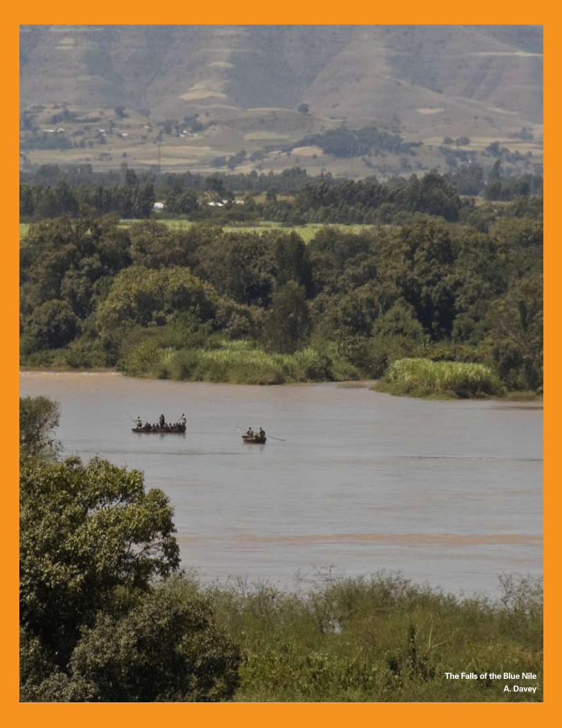
110 Concordis International Sudan Report
The Falls of the Blue Nile
A. Davey
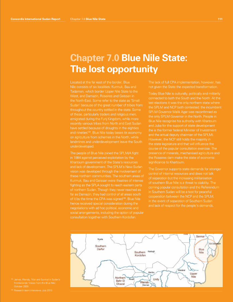
Concordis International Sudan Report 111Chapter 7.0 Blue Nile State
Located at the far east of the border, Blue Nile consists of six localities: Kurmuk, Bau and Tadamon, which border Upper Nile State to the West, and Damazin, Roseires and Geissan in the North-East. Some refer to the state as ‘Small Sudan’ because of the great number of tribes from throughout the country settled in the state. Some of these, particularly traders and religious men, emigrated during the Funj Kingdom, while more recently various tribes from North and East Sudan have settled because of droughts in the eighties and nineties184. Blue Nile today bases its economy on agriculture from schemes in the North, while landmines and underdevelopment leave the South underdeveloped.
The people of Blue Nile joined the SPLM/A fight in 1984 against perceived exploitation by the Khartoum government of the State’s resources and lack of development. The SPLM’s New Sudan vision was developed through the involvement of these northern communities. The southern areas of Kurmuk, Bau and Geissan were theatres of intense fighting as the SPLA sought to reach eastern parts of northern Sudan. Though they never reached as far as Damazin, they had control of all areas south of it by the time the CPA was signed185. Blue Nile hence received special consideration during the negotiations with ad hoc political, economic and social arrangements, including the option of popular consultation together with Southern Kordofan.
The lack of full CPA implementation, however, has not given the State the expected transformation.
Today Blue Nile is culturally, politically and militarily connected to both the South and the North. At the last elections it was the only northern state where the SPLM and NCP both contested: the incumbent SPLM Governor Malik Agar was reconfirmed as the only SPLM Governor in the North. People in Blue Nile recognise his authority with Khartoum and Juba for the support of state development (he is the former federal Minister of Investment and the actual deputy chairman of the SPLM). However, the NCP still holds the majority in the state legislature and that will influence the course of the popular consultation exercise. The presence of minerals, mechanised agriculture and the Roseires dam make the state of economic significance to Khartoum.
The Governor supports state demands for stronger control of internal resources and does not talk of separation but the increasing militarisation of southern Blue Nile is a threat to stability. The coming popular consultation and the Referendum in Southern Sudan will be a test for peaceful cooperation between the NCP and the SPLM, in the event of separation of Southern Sudan and lack of respect for the people’s demands.
Chapter 7.0 Blue Nile State:The lost opportunity
Concordis International Sudan Report 111
184 James, Wendy, ‘War and Survival in Sudan’s Frontierlands: Voices from the Blue Nile’, October 2009
185 Research team interviews, July 2010
112 Concordis International Sudan Report
Blue Nile State was considered a key test for peace in the borderlands and the unity of Sudan; it has been relatively stable compared to the other transitional areas and Upper Nile State. Nomads, farmers and the different tribes have coexisted fairly peacefully during the Interim Period in the presence of disputes over land, minerals (gold), the Nile waters and the Roseires dam. Conflict drivers are not directly linked to demarcation of the North/South border but the situation is growing more fragile on the eve of the popular consultation and the Referendum.
Lack of GoNU support and national disagreement between the Parties have weakened CPA implementation and constrained opportunities for development186. As a consequence, conflict drivers persist. The root causes of the war in the area included contestation of ownership and use of land, a lack of opportunities for youth and the exploitation of resources by external investors. These remain threats to stability. Moreover, the CPA has not lessened militarisation of the state and an increase in the presence of militia from Darfur is leading to growing tension. UN officials report that the Governor of Blue Nile State has also mobilised a militia from his own Ingessena tribe. The fate of SPLA soldiers and the interests of the SPLM northern chapter in the North, if not addressed, also generate a potential instability in the event of the separation of Southern Sudan.
Coexistence within Blue Nile depends on a fair and meaningful popular consultation exercise in which the interests of the different armed and political groups are addressed and livelihood opportunities are created for populations.
Summary Features• RelativestabilityduringInterimPeriodbut
fragility growing more evident on the eve of the popular consultation exercise
• Divisionsalongwartimelinesregardingthe scope and aim of the popular consultation could undermine its ability to address all concerns; referendum result could increase demands for popular consultation to radically address the state’s relationship with the centre.
• Localiseddisputesoccurbetweenfarmers, nomads and large scale farming. The erosion of customary land rights and the growth in mechanised agriculture since the 1970s and the closure of migration routes due to war and multiple administrations has led to ethnicisation and hardening of local conflicts.
• Stateintroducingsomelandreorganisationand the reintroduction of customary land law but State Land Commission not active.
• SPLA,SAFandPDFareallactiveintheState. Recruitment is reportedly ongoing in the context of increasing livelihood challenges, particularly for nomads.
• TheRoseiresDamriskssparkingcivilunrest by flooding an estimated forty five villages, changing political distribution of populations and adding pressures to resettlement areas. However, compensation plans have been disseminated and have reportedly met with some acceptance from affected communities.
Chapter 7.0 Blue Nile State
1.0 Snapshot Summary
186 Interview with Mr. Ziad Esa Zaid AEC Blue Nile Co-Chairperson on August 4th 2010, AEC report - June 2010
Concordis International Sudan Report 113
2.1 Land use and ownership
The erosion of land rights has been a historical grievance for the people of Blue Nile. In 1970 the ‘Unregistered Land Act’ gave the Government the ownership of land that was not privately owned, and in 1971 the ‘Abolition of Native Administration Act’ deprived local communities and tribal groups of ownership, recognising only rights of land use. The establishment of the Mechanised Farming Corporation Ordinance, which gave Khartoum authority to grant licences to external farmers, followed in 1975 and further alienated indigenous farmers from land they had cultivated for hundreds of years. Many landless people thus took up arms to fight for their rights to land tenure and balanced development187.
Problems continued throughout the 1990s as the Government began allocating land to foreign investors, with little consideration to the impact on local communities. The rights of farmers, cattle-owning nomads, and the environmental impact of mechanised agriculture were not considered by policy-makers and investors. Tribal chiefs did not feel they were consulted, compensation was not offered to those affected, and livelihood opportunities were reduced as jobs went to Egyptians or labourers from the North, with locals often only employed as cheap, seasonal labour188.
Localised disputes between nomads and small farmersThe expansion of farming, combined with the historical development of the war, has put pressure on land use, hardened divisions between communities and increased tensions between pastoralists and sedentary farmers. Disputes tend to occur away from densely populated areas, where migration routes pass near mechanised farms, in particular in the northern part of the State. Farmers claim that they suffer crop losses owing to destruction by animals and accidental fires; nomads in return claim to have lost key grazing areas.
The presence of weapons is widespread among communities today, in particular in Roseires, Baw and parts of Geissan189. This adds seriousness to the risk of significant conflict in any disputes between nomads and farming communities during the dry season. The situation is further exacerbated by the increase in herd sizes over recent years. Since CPA signature, Fellata have started moving southwards, generating conflict also with the SPLA northwest of Kurmuk towards Blue Nile and in Geissan190. During the last dry season conflicts occurred in Ulu and Malkan, but remained isolated events191.
Since the 1970s, the expansion of mechanised farming and the abolition of the Native Administration in 1971, pastoralists have found their routes blocked by large farms but without recourse to traditional mechanisms they were unable to solve the disputes. Their problems were compounded by the government-sponsored resettlement of sedentary farmers into previously non-agricultural land. In response to these changes, nomads continually shifted their routes in search of grazing areas and water points. New routes were often established without the consultation of locals or relevant stakeholders, leading to increased disputes between nomads and farmers.
The war added an ethnic and political dimension to the dispute between farmers and nomads and exacerbated locally brewing conflict. The groups took sides in the conflict, for example Fellata nomads were armed by the North as militias, and this reduced the opportunities for peaceful coexistence. The SPLA blocked migration routes south of Baw (at the Ingessena Hills) and Geissan, forcing nomads into the areas of Tadamon and North Roseires towards Ethiopia. Greater numbers of people and cattle were consequently forced onto smaller grazing lands and fewer watering points, creating environmental problems and new disputes also between nomads in the North and central belt of the state.
Chapter 7.0 Blue Nile State
2.0 Conflict Drivers
187 Ahmed, Abdel Ghaffar Mohammed, Changing systems of livelihoods in rural Sudan, OSSREA, 2002
188 CRMA BNSA, p29-30189 Research team interviews in Damazin, July 2010190 They also create insecurity in Mabaan county,
Upper Nile, Research team interviews, July 2010191 CRMA BNSA, p.35
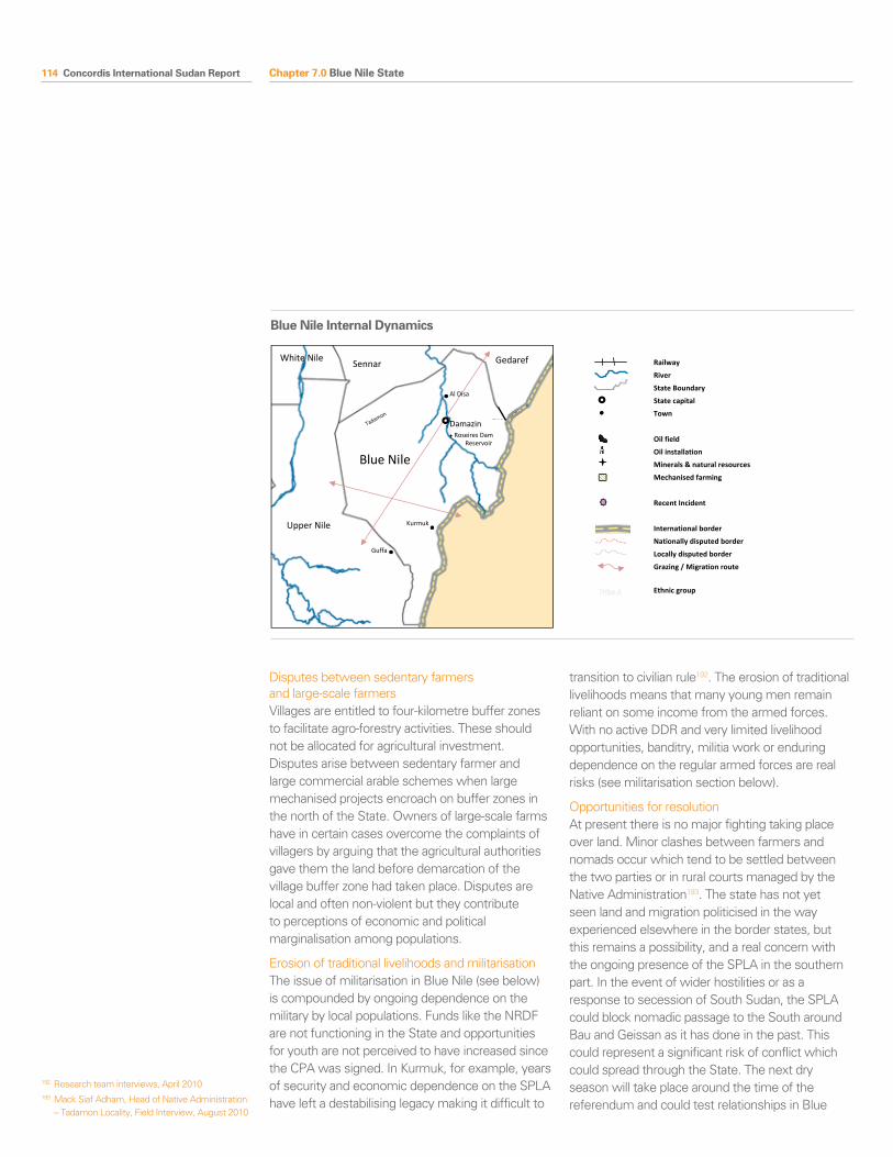
114 Concordis International Sudan Report
Disputes between sedentary farmers and large-scale farmersVillages are entitled to four-kilometre buffer zones to facilitate agro-forestry activities. These should not be allocated for agricultural investment. Disputes arise between sedentary farmer and large commercial arable schemes when large mechanised projects encroach on buffer zones in the north of the State. Owners of large-scale farms have in certain cases overcome the complaints of villagers by arguing that the agricultural authorities gave them the land before demarcation of the village buffer zone had taken place. Disputes are local and often non-violent but they contribute to perceptions of economic and political marginalisation among populations.
Erosion of traditional livelihoods and militarisationThe issue of militarisation in Blue Nile (see below) is compounded by ongoing dependence on the military by local populations. Funds like the NRDF are not functioning in the State and opportunities for youth are not perceived to have increased since the CPA was signed. In Kurmuk, for example, years of security and economic dependence on the SPLA have left a destabilising legacy making it difficult to
transition to civilian rule192. The erosion of traditional livelihoods means that many young men remain reliant on some income from the armed forces. With no active DDR and very limited livelihood opportunities, banditry, militia work or enduring dependence on the regular armed forces are real risks (see militarisation section below).
Opportunities for resolutionAt present there is no major fighting taking place over land. Minor clashes between farmers and nomads occur which tend to be settled between the two parties or in rural courts managed by the Native Administration193. The state has not yet seen land and migration politicised in the way experienced elsewhere in the border states, but this remains a possibility, and a real concern with the ongoing presence of the SPLA in the southern part. In the event of wider hostilities or as a response to secession of South Sudan, the SPLA could block nomadic passage to the South around Bau and Geissan as it has done in the past. This could represent a significant risk of conflict which could spread through the State. The next dry season will take place around the time of the referendum and could test relationships in Blue
Chapter 7.0 Blue Nile State
Blue Nile
Upper Nile
Sennar Gedaref White Nile
Blue Nile Internal Dynamics
Damazin
Kurmuk
Roseires Dam Reservoir
Tadamon
Al Disa
Guffa
Railway
River
State Boundary
State capital
Town
Oil field
Oil installation
Minerals & natural resources
Mechanised farming
Recent Incident
International border
Nationally disputed border
Locally disputed border
Grazing / Migration route
Ethnic group
Blue Nile Internal Dynamics
192 Research team interviews, April 2010193 Mack Siaf Adham, Head of Native Administration
– Tadamon Locality, Field Interview, August 2010
Concordis International Sudan Report 115
Nile State. Clear and inclusive mechanisms for agreement of migration routes and grazing lands need to be developed along with associated forums for mediating disputes.
The CPA made land the responsibility of the State and this has led to some progress since the war. Blue Nile State’s Minister for Agriculture is reorganising the land system. This has involved mapping land use and farming schemes and reducing the size of allocations to accommodate more investment and facilitate more flexible relations between agricultural schemes and agricultural peoples. At the same time, the Native Administration is working with communities to reintroduce customary land laws based on traditional knowledge of land rights to use/access land194. Nevertheless, shortcomings are many. The Blue Nile Land Commission mandated by the CPA is yet to be activated. It is widely felt that the police force needs to be strengthened and it, not the army, should be responsible for protecting the rights and property of the population in order to ensure security and establish rule of law.
2.2 Militarisation
Blue Nile was a major battleground during the Second Civil War and remains a highly militarised State. The presence of both the SPLA and SAF on its territory, typical of the transitional areas, is a matter of concern. In addition, the number of militias is increasing in relation to the regional northern insecurity. A growing presence of SAF and associated militias in the north of Blue Nile, as well as SPLA’s continued influence in the South is a matter of concern, particularly given the stipulations for redeployment of both parties in the CPA. The question of how the SPLA in Blue Nile will respond in the event of secession by Southern Sudan is extremely sensitive in the area and communities and policy makers alike defer the matter to high-level policy discussions.
A majority of those interviewed in Blue Nile think there is a risk Khartoum and Juba will mobilise the region in the event of a new war. They say that the battle for influence and control of the area would
begin immediately following the referendum. This could involve movements of SPLA northwards towards the border with Sennar State and SAF deployment around the borderline in Tadamon Locality195.
The SPLAThe CPA made provisions for SPLA troops to be redeployed south of the 1/1/56 border. However, there remain a high number of SPLA forces in Kurmuk town, where recruitment and training is ongoing. The troops in Kurmuk form part of the SPLA 10th Division with headquarters in Guffa at the border of Upper Nile State; it is a mobile division roaming across both Upper and Blue Nile states. SPLA assembly points reportedly also remain in Baw, Geissan and Roseires196. According to the CPA the redeployment should have taken place after the JIUs, to comprise 3,000 SPLA, had been formed197. SPLA has not so far been reactive in the State and during the elections appeared to cooperate with northern security services who had access to Southern Blue Nile.
The presence of the SPLA is a violation of the CPA and poses a political and a security risk. The CPA does not contain arrangements regarding the fate of SPLA troops in northern Sudan or southerners in SAF after the referendum. In case of separation of Southern Sudan, SPLA soldiers in the state are a risk to stability if not redeployed or demobilised. The popular consultation exercise is one opportunity to address the needs of this constituency. Unfortunately, as noted above, the topic is still a taboo in the State and serious debate over this significant risk is not yet forthcoming. The parties have not yet found a solution on the matter.
SAF and affiliated militiasThe widespread availability of small arms is a problem and progress on DDR is limited. There is an increasing presence of SAF in Damazin town, as well as the Central Reserve Police Forces, who were deployed to the area by Khartoum following the election. These urban conflict specialists have been involved heavily in the fighting in Darfur and local communities interviewed in Damazin are concerned at this development. Recently,
Chapter 7.0 Blue Nile State
194 CRMA BNSA, p.31195 Interviews with Government employees,
University students, Security personnel, government officials
196 Research team interviews, July 2010197 CPA, Chapter 6, Section 3.c.
116 Concordis International Sudan Report
janjaweed have been deployed from Darfur to Al-Disa area where the SAF military training garrison is located. There is an ongoing replacement of military units, as troops from Blue Nile are transferred to Darfur and replaced by janjaweed and troops from the northern division. In his speech at the national service (Ezat al-Sudan 14) graduation ceremony on 25th July 2010, at Damazin football stadium Governor Malik Agar stated that ‘Blue Nile people will never accept the presence of Janjaweed in their region’ and asked the janjaweed militia leaders to withdraw their troops from the area. He also stressed that Blue Nile people should resist sending their sons who are recruited in the military to Darfur198. Dr Mack Yousif Adlan, the head of Blue Nile Native Administration and Chair of the State’s Peace Council, sent a letter to the Presidency on 3rd August: ‘The Native Administration of Blue Nile appeal to the President to intervene and withdraw the janjaweed from the region in order to maintain peace.’ He also said that the so-called Native Administration forces led by some units of the native administration have joined this militia199.
PDF are still active in Blue Nile. The command office is also in Damazin town and there is reportedly ongoing recruitment among the Arab youth and Fellata militias and training at the National Service Military Camp south of Damazin200. Many nomads are now seeking alternative livelihoods, owing to the reduction in resources and adverse conditions for pastoralists in Blue Nile, as has been described above. This makes the option of joining militia or the regular armed forces a more appealing prospect.
2.3 Roseires Dam and risk of civil unrest
The presence of various resources in the state, including gold, and possibly even oil, is a strategic consideration for the parties. At the level of local and state politics, there is great concern about the heightening of the Roseires Dam (a planned increase of 10 metres by 2013). The dam was built in 1966 to provide the northern agriculture plantations and Khartoum with water, and in 1971 power-generating facilities were added. The dam will provide power to the central region of Sudan as far as Khartoum, as well as additional irrigation to mechanised farming projects.
Critics believe there has been little community participation in the project or adequate plans for resettlement. UNDP research predicting areas that will be flooded after the heightening process estimates almost twice the flooded area predicted by the Dams Implementation Unit (DIU)201. The extension is predicted to cause flooding to 46,000 hectares of land, forty-five villages, fifteen primary schools, twenty-two hand-pumps, eleven Community Health Care Units, and four other health centres202. Dam-related population displacement will add further strain to already overstretched resettlement operations in the state and will affect the ethnic politics of the region. This carries with it associated risks for peace and security.
Some stakeholders are less worried. Ustaz Al-Fatih Al Mak Yusuf A’dlan, a representative of the Native Administration, said that the unveiling of resettlement projects has reduced fears among affected communities and stressed the support of Native Administration leaders for the project203. The DIU notes planned compensation for the affected communities has increased from $13 million to $240 million.
Chapter 7.0 Blue Nile State
198 Blue Nile State Governor Speech in the graduation of the National Service (Ezat al Sudan14) – Damazin Stadium on July 25th 2010
199 Native Administration and Peace Council of Blue Nile state appeal letter to Withdraw Janjweed Malitia from Blue Nile territory dated August 3rd 2010
200 Interview with Abas Hag Hamas Advisor to the Governor on Security Affairs August 3rd 2010
201 CRMA BNSA, p.32202 ‘On the Brink’, p.26203 ‘People Affected by Dam Welcome Resettlement
Projects’, 27th October 2009. Available via URL: http://diu.gov.sd/roseires/en/news/newspublish/home.viewdetails.php?news_id=15
Concordis International Sudan Report 117
2.4 The Popular Consultation
The status of Blue Nile as one of the three transitional areas is an opportunity for the population of Blue Nile State to determine their future relationship with the central government and address the development needs of the State. It also risks exacerbating existing tensions through focusing on structural challenges and the potential for unmet expectations.
The state government is divided between the contrasting political ideologies of the SPLA and the NCP and the format of the popular consultation and its meaning remains uncertain. NCP supporters think it is about development issues within the state, such as the provision of schools, health and water access. SPLM members focus on national constitutional and administrative reforms that could enable the people of Blue Nile to manage their own affairs effectively204. The State Legislative Council, in which the majority of members are from the NCP, is responsible for managing the popular consultation process. Wrangling over the scope of the popular consultation could split the State politically.
There are positive signs of cooperation at the political level. SPLM Governor Malik Agar offered thirty per cent of his cabinet positions to the NCP. Progressive discussions are ongoing between the Governor, NCP Deputy Governor and the Speaker of the State Assembly on the ongoing civil education process for the popular consultation. This contrasts sharply with deteriorating relations between the NCP and SPLM at a national level which could affect progress in the area as the process develops.
The 2009 Popular Consultation Act stipulates that a Parliament Commission should be appointed by the State Legislative Council to conduct a public opinion survey on whether the CPA is satisfactory and met the region’s peoples’ aspirations. The Commission will be appointed after Ramadan in September 2010 and operate for 90 days. The State is therefore in a strong position to conduct the popular consultation compared to Southern Kordofan which is awaiting results of state elections in November before it can progress with the exercise.
Despite positive signals, links to the Southern Sudanese referendum bring risks. Southern secession may lead populations in Southern Blue Nile to press harder for discussion of constitutional reform at the national level. This could divide the State along wartime lines. In either scenario, citizens will expect the popular consultation to improve conditions in their areas. Unmet expectations will lead to additional grievances.
Chapter 7.0 Blue Nile State
204 These opposing views were observed in popular consultation civic education workshops, where each group was trying hard to influence participants (Popular Consultation Locality Based Workshop Repor – SCCSS Damazine)

118 Concordis International Sudan Report Chapter 7.0 Blue Nile State
Conflict Driver Actor Risks Triggers Mitigation
The political dependency of the State
Land use Nomads (Fellata) and local farmers/SPLA
Armed nomads in the next dry season clash with SPLA and farmers. PDF elements drawn in or mobilises around clashes.
Localised incidents Police and rule of law institutions developed; state sponsored reconciliation activities
Land ownership Sedentary farmers and large holding farmers
Increased grievances which might lead to mobilisation
Expansion of agricultural schemes. Lack of respect for legal buffer zones.
Establishment of functioning Land Commission, courts and strengthening/training police
Militarisation SPLA presence SPLA Instability, other armed group forms
Attempts at relocation/forced disarmament
SPLA northern soldiers unwilling to demobilise or not receiving adequate compensations or opportunities for reintegration
Dialogue and participation in popular consultation
National agreement on security and citizenship
Livelihood opportunities
Education
Increasing presence of SAF and PDF
SAF
Youth
Nomads
Clashes in southern Blue Nile. Unrest around popular consultation and referendum
Attacks on villages
SPLA block nomadic routes
Agreements on migration
Voluntary collection of arms CSSAC/DDR
National agreement
Janjaweed Janjaweed
Khartoum
Fostering local insecurity and militarisation; militarisation of population
Local clashes with SPLA/control of popular consultation exercise
Moving janjaweed camps
National agreement
Erosion of traditional livelihoods
All (particularly youth) Increasing militarisation around popular consultation and referendum time
Unsatisfactory popular consultation outcome
Livelihood opportunities
Education
Popular consultation and Southern Referendum
Popular consultation All Perceived unfair process and unmet expectations
Unexpected or undesired outcome
Open and transparent process
Southern referendum All Split along wartime lines; fighting resumes or hard military border is established.
Expulsions/militarised borders/local conflict/division within SPLM
National agreement
State Workshop Summary, Damazin, Blue Nile State, Sudan, 31 July-2 August 2010
This three day meeting brought together traditional authorities, government officials such as governors and ministers, and representatives of civil society such as leaders of youth and women associations and religious leaders, from Damazin, Rosaries and Kurmuk municipality.
ChallengesIdentified challenges are: 1) Borders are not recognised; 2) Lack of security and political conflicts; 3) The measures of the Popular Consultation take too long; 4) Lack of implementation of the CPA security arrangements; 5) Lack of access to rural areas; 6) Economic instability; 7) National government does not concern itself enough with Blue Nile State; 8) Lack of accountability; 9) Government offices are overstaffed.
Highlighted Recommendations and ProposalsThe communities should make sure they maintain or build up mutual administrative, commercial, social and pastoral relations between themselves. The participation of the Native Administration is of extreme importance in solving disputes between border communities of the two states. Therefore briefing encounters conducted by executive, popular and native administration entities are necessary.
On Justice, the participants proposed to implement the following project: The Joint Border Justice Apparatus Project aiming to maintain security; bring resolution; and impose the State Authority and rule of law. This project should be implemented in the head offices of Ar-Tadaamun, Kurmuk and Bao Municipalities.
With regards to Infrastructure and Services the following has been requested: Electricity networks from Damazin-Kali-Renk; Roads between An-Nasir-Olo-Jabal Moya.
Other suggested projects and activities to generate income and stability are: 1) Chicken and dairy farms; 2) Mineral Development; 3) Bee hives; 4) Construction of a Foundry; 5) Establishment of banks to invest in income generating activities. These projects can take place all over Blue Nile State.
The workshop was organised through the Cross Border Relations Project, an EC funded partnership between Concordis and the Center for Peace and Development Studies at the University of Justice.
Market in Kurmuk, Blue Nile State
Arseine Coseac
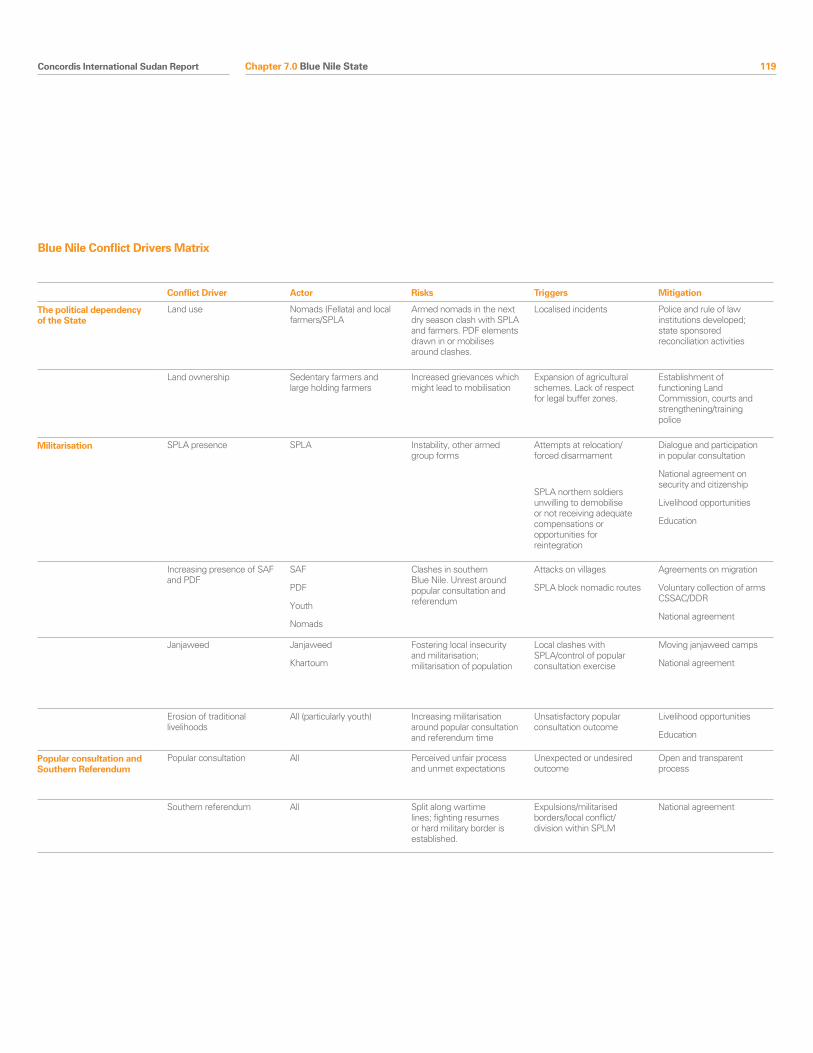
Concordis International Sudan Report 119Chapter 7.0 Blue Nile State
Conflict Driver Actor Risks Triggers Mitigation
The political dependency of the State
Land use Nomads (Fellata) and local farmers/SPLA
Armed nomads in the next dry season clash with SPLA and farmers. PDF elements drawn in or mobilises around clashes.
Localised incidents Police and rule of law institutions developed; state sponsored reconciliation activities
Land ownership Sedentary farmers and large holding farmers
Increased grievances which might lead to mobilisation
Expansion of agricultural schemes. Lack of respect for legal buffer zones.
Establishment of functioning Land Commission, courts and strengthening/training police
Militarisation SPLA presence SPLA Instability, other armed group forms
Attempts at relocation/forced disarmament
SPLA northern soldiers unwilling to demobilise or not receiving adequate compensations or opportunities for reintegration
Dialogue and participation in popular consultation
National agreement on security and citizenship
Livelihood opportunities
Education
Increasing presence of SAF and PDF
SAF
Youth
Nomads
Clashes in southern Blue Nile. Unrest around popular consultation and referendum
Attacks on villages
SPLA block nomadic routes
Agreements on migration
Voluntary collection of arms CSSAC/DDR
National agreement
Janjaweed Janjaweed
Khartoum
Fostering local insecurity and militarisation; militarisation of population
Local clashes with SPLA/control of popular consultation exercise
Moving janjaweed camps
National agreement
Erosion of traditional livelihoods
All (particularly youth) Increasing militarisation around popular consultation and referendum time
Unsatisfactory popular consultation outcome
Livelihood opportunities
Education
Popular consultation and Southern Referendum
Popular consultation All Perceived unfair process and unmet expectations
Unexpected or undesired outcome
Open and transparent process
Southern referendum All Split along wartime lines; fighting resumes or hard military border is established.
Expulsions/militarised borders/local conflict/division within SPLM
National agreement
Blue Nile Conflict Drivers Matrix