Embed Size (px)
Citation preview
Fiscal Year 2018 Montana Land lnformation Act Grant Application - Chouteau County, MT
MONTANA LAND INFORMATIONGRANT APPLICATION
STATE FISCAL YEAR 2018
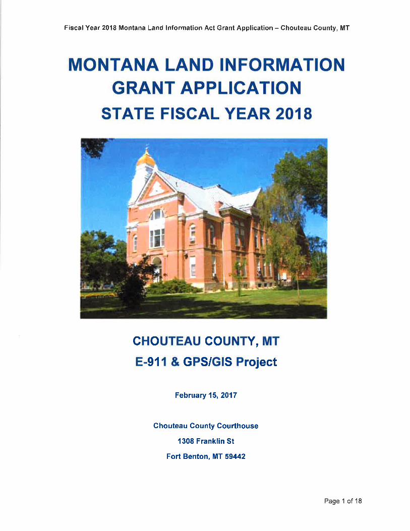
CHOUTEAU GOUNTY, MT
E-911 & GPS/GIS Project
February 15,2017
Ghouteau Gounty Gourthouse
1308 Franklin St
Fort Benton, MT 59442
Page 1 of 18
Fiscal Year 2018 Montana Land lnformation Act Grant Application - Ghouteau County, MT
APPLICATION MLIA GRANT FUNDING
SEGTION I - APPLICANT, PARTNER, AND PROPOSAL INFORMATION
Primary Applicant 1:
Name of principle individual Commissioner Darren Schuster
Name of agency/entity: Chouteau County, MT
Street: 1308 Franklin St
Citv Fort Benton
County Chouteau
State MT
Zip Code 59442
Contact email address dtschus@itstriangle. com
Contact fax address
Contact phone 406-622-3631
Primary Applicant 2:
Name of contact: Debra Gessaman
Name ofAgency: Chouteau Co. Disaster and Emerqencv Services (DES)
Street 1308 Franklin St
Citv: Fort Benton
Countv: Chouteau
State MT
Zip Code: 59442
Contact email address chouteaucountydes@g mail. com
Contact phone: 406-622-3027
Page2of 18
Project Partner:(required for each partner, copy box as needed)
Name of contact: Matt Pearce, ENP
Name ofAqency: Mappinq and Planninq Specialists. lnc
Street: 1880 Livinqston Ave, Suite 202
Citv: West Saint Paul
State MN
Zip Code 55118
Contact email address: [email protected]
Contact phone: 651-602-9554
FiscalYear 2018 Montana Land lnformation Act Grant Application - Chouteau County, MT
List All Past Awarded MLIA Grants:
Proposal lnformation
Date Submitted: February 15,2017
Date Received by State:
Short Title of Proposal
Chouteau Gounty, MT - E-glf & GPS/GIS Proiect
Executive Summary:
Chouteau County (the County) understands that they will eventually need to migrate their E-911 System to the NG9-1-1 platform. The County is applying for MLIA funding to update theCounty's existing Enhanced 9-1-1 and GIS data to meet the NENA NG9-1-1 standards, aswell as to supplement current data with additional attribution and information.
Page 3 of 18
FiscalYear 2018 Montana Land lnformation Act Grant Application - Chouteau County, MT
SECTION 2 - RELEVANCE
Land Plan - Secfion 1. Land Records - 1.a. Next Generation g-1-1 Data Standardization
The purpose of the MLIA program is to develop a standardized, sustainable method to collect,maintain, and disseminate information in digital formats about the natural and artificial landcharacteristics of Montana. Chouteau County has initially met that purpose through theimplementation of their Enhanced 9-1-1 (E-911) Telephone System, which was developedbetween 1998 and 2001 and resulted in a healthy GIS program. To date, approximately 3,500structures and 2,650 miles of road have been mapped and addressed using the standardizedmethods of National Emergency Numbering Association (NENA) data guidelines and US PostalService (USPS) addressing standards. The County has sustained that initial project effort bysupporting an ongoing GIS data maintenance program administered through the County'sDisaster and Emergency Services (DES) Office to map, address and integrate new structuresand roads. The need for accurate and up{o-date digital data to support efficient emergencyresponse and disaster preparedness, as well as disaster mitigation efforts, is best supportedthrough active and robust GIS efforts.
The MLIA's FY 2018 Land Plan Priorities under Section "l. Land Records" and Section "1.a.
Next Generation 9-1-1 Data Standardization" indicate that Next Generation 9-1-1 (NG9-1-1), a
more detailed approach to routing of calls to 9-1-1 based on geographic location that reliesheavily on accurate and standardized GIS data, is an imminent concern and one that is
supported by the MLIA objectives. To facilitate that eventual migration of their current E-911System to the NG9-1-1 platform, the County will need up{o-date structure point and roadcenterline attribution and emergency responder jurisdictional boundaries that meet the NENANG9-1-1 standard models. The County is applying for MLIA funding to update the County'sexisting Enhanced 9-1-1's GIS data to meet the NENA NG9-1-1 standards, as well as tosupplement the current data with additional attribution and information.
The development of improved structure point and road centerlines data from the proposedproject will be coordinated with the appropriate MSDI theme stewards - and the resulting datawill be shared with them as well. These initiatives will ultimately improve the County's portion ofthe statewide MSDI datasets for roads and structure points.
Page 4 of 18
Fiscal Year 2018 Montana Land lnformation Act Grant Application - Chouteau County, MT
SECTION 3 - PUBLIC BENEFIT
Chouteau County is applying for MLIA funding to supplement, upgrade and update the County'sexisting Enhanced 9-1-1 and GIS data to meet the NENA NG9-1-1 standards. Since most ofthe GPS/GIS data was collected over 15 years ago, the County is concerned that without aconcerted effort to review and update their data now, the value of their GIS will keep diminishingas it ages.
The County assigns addresses for new construction - if they become aware of it. Residentsneeding utility or postal services are supposed to contact the County, but not every newstructure is identified this way, as the County does not have a residential building permitprogram. Some new structures are found via State electrical permitting and phone serviceorders (adds, deletes and changes to landlines). The County maps the new construction itidentifies through these methods using GPS field collection 2-3 times annually. Since 2010, thismethodology has averaged only 15 new structures per year. Change or development is often"stumbled into" when conducting fieldwork, but certainly every road has not been driven toidentify changes in structures. Annual E-911 audits are conducted by comparing phone recordaddresses to the GIS to ensure accuracy. The number of landlines, however, are dwindlingevery year, which lessens the ability to keep structure point data up-to-date. As local wirelesscoverage and wireless devices continually improve, residents are increasingly switching solelyto wireless (and dropping their landlines). The number of wireless 9-1-1 calls is increasingdramatically, but the County does not receive any wireless account info. As a result, the GISdata attribution related to phone numbers is aging quickly without adequate means ofmaintenance and updating.
To overcome the above shortfalls in capturing and maintaining up{o-date structure point dataand update their overall E-911 data, the County proposes to implement a multi-prongedapproach to:
A) transition their current E-911 data (road centerlines, structure points and emergencyservice jurisdictions) to the NENA NG9-1-1 model with the support of their E-911consultant (MaPS, lnc.) and coordination with the appropriate MSDI theme stewards;
B) distribute the GIS data to benefit more users, both private and public, by setting up anArcGlS Online account and publishing digital maps/data, which will be accessible viaweb links from the County's website;
C) collect new information by conducting standardized and consistent fieldwork;D) integrate the field data into the County's Public Alert Notification System (PANS),
resulting in enhanced means to communicate with the local public in emergencysituations;
E) and ultimately share the final structures points and road centerlines data with the State.
The above initiatives to improve the accuracy of land information will benefit the MSDI priorityfor Land Records, 1.a. Next Generation g-1- Data Standardization.
At present, the regular users of the County's digital GIS data are dispatch and DES. TheCounty recently purchased five (5) mobile GPS/GIS tablet computers ($3,665) to distributeamong the local emergency responders to provide GIS data in the field, as well as improvenavigation and response efforts. lmproving the GIS data loaded to these mobile devices will
Page 5 of 18
FiscalYear 2018 Montana Land lnformation Act Grant Application - Ghouteau County, MT
assist the users to accurately and efficiently locate and navigate to emergencies, therebybenefitting all of the residents in the County, as well as visitors. By also offering the GIS dataonline in an easy to use format, the County will greatly expand the number of local and remotedata users, benefitting potential new users, such as realtors, insurance agents, deliverycompanies, prospective property buyers, the general public, etc.
Page 6 of l8
Fiscal Year 2018 Montana Land Information Act Grant Application - Chouteau County, MT
SECTION 4 - SCOPE OF WORK
Chouteau County proposes the following Goals, objectives and tasks for the successful implementation andcompletion of this MLIA grant application.
Goal 1: Transition Chouteau County's current E-91I data to the NENA NG9-1-1 model
Objective 1.1. Establish an NG9-1-1 file geodatabase framework by March 1,2018.
Task 1.1: The County and their E-9'1 1 Consultant, MaPS, lnc., will work with the State theme stewards,NENA standards and Zuercher Technologies to establish the proper field names, field types, fieldwidths, etc. recommended forthe NG9-1-1 model, to which the County's existing E-911 data can bemorphed into. A new file GDB will be created with appropriate feature classes as a framework to whichdata can be loaded by March 1, 2018.
Objective 1.2: Transition the existing GIS data into the NG9-1-1 framework by April 1,2018
Task 1.2: MaPS, lnc. will then transition the existing GIS data (e.9. structure points, road centerlinesand emergency services jurisdictional boundaries, etc.) into the framework by April 1, 2018. Newjurisdictional boundaries will be created using the current cadastral data as control (to ensure there areno gaps/slivers) and the road network will be intersected to ensure the roads are split at the zoneboundaries. From-Address/To-Address values on intersecting road arcs will need to be adjusted, aswell as ESN LefUESN Right values. New NG9-1-1 fields, e.g. MSAG Community Name Left(MSAGComm_L)/MSAG Community Name Right (MSAGComm_R) and Postal Code Left(PosteCode_L)/Postal Code Right (PostCode_R), will also need to be calculated based on an analysisof existing structure point attribution.
Objective 1.3: Ensure the integrity of the dispatch mapping software functionality by May 1, 2018.
Task 1.3: MaPS, lnc. will then submit the updated data to the County's mapped ALI vendor, ZuercherTechnologies, along with an updated map document(s), to ensure that the new data formats arecompatible with the dispatch mapping software (e.9. making sure the dispatch map still "pops" to thecorrect location during landline 9-1-1 calls). Tweaks/testing will be complete before May 1 , 2018.
Objective 1.4: Review and reconcile the existing MSAG/ESZ data against the GIS data by June 1 ,2018.
Task 1.4: lt is not known when NG9-1-1 will become a reality for MT. Because the current MasterStreet Address Guide (MSAG) records and Emergency Service Zone (ESZ) polygons were not nearlyas exacting as NG9-1-1 data requirements, a comprehensive review of the current MSAG will need tobe conducted. MSAG records will need to be reconciled against the updated data to ensure accuracyand that the integrity of the present E-91 1 System remains intact by June 1,2018.
Goal 2: Open the door to the Gounty's GIS data.
Objective 2.1: Using the DES ArcGlS Desktop license and its corresponding Online license, the Countywill set-up an ArcGlS Online account to allow for data collection by July 15,2017. ln addition, the ArcGlSOnline access will benefit more uses and users, both private and public by February 1,2018.
Page 7 of 18
Fiscal Year 2018 Montana Land lnformation Act Grant Application - Chouteau County, MT
Task 2.1: The County intends to establish an ESRI ArcGlS Online account for data management byJuly 15, 2017. Ultimately, an ArcGlS Online account for the County will allow for the creation and
sharing of maps and data to multiple County GIS users (e.9. DES, Sheriff's Office, Commissioners,Roads Dept., etc.). Access, content and privileges/security will be managed by the DES office as theAdministrator. ln order to publish data online, the DES office will use its ArcGlS Desktop license and itscorresponding ArcGlS Online license to set up an ArcGlS Online Account. The DES Office's ArcGlSDesktop license and its online subscription come with 100 credits. Additional credits may need to bepurchased as the County's data grows. The single ArcGlS online account will serve as a
collector/editor role initially. GIS data can be shared to a broader audience (e.9. the public) by sharingcertain data and maps to Everyone. ln the future, the County may need additional user licenses toprovide viewer access to other users (e.9. other County departments, while not over-sharing to thebroader public.
Objective 2.2: Publish digital maps/data accessible via web links from the County's website and configureeach feature layer by March 1, 2018.
Task2.2: MaPS, lnc. will assist the DES office to publish County maps and establish and test linkagesfrom the County's website by February 1, 2018. County staff users will have full access to the data(e.9. via account credentials, with a user name/password), whereas the general public will be able toaccess a stripped-down version.
Goal 3: Develop a Gounty E-911 & GPS/GIS maintenance mapping program.
Objective 3.1: Purchase an accurate GPS receiver for ongoing data maintenance by July 15,2017
Task 3.1: By July 15,2017, the DES Office will purchase one (1) Trimble R1 (sub-meter) GPS unit(with external antenna; $2,545) so they can perform ongoing maintenance mapping (sub-meter GPSaccuracy is needed for mapping of road centerlines to maintain the accuracy/integrity of the existingGIS data, which was mapped using sub-meter DGPS equipment) based on accurate, standardized,and consistent fieldwork.
Objective 3.2: Set-up a Field Data Collection System by July 31,2017
Task 3.2: The DES Office has already purchased a mobile computer/tablet (including accessories).MaPS, lnc. will load the Collector for ArcGlS software to the mobile tablet and appropriate data, thentest the configuration with the Trimble GPS unit to ensure the desired output is achieved. The resultingField Data Collection System will be operational by July 31, 2017 .
Objective 3.3: Train County staff to map new roads and structures by August 31,2017
Task 3.3: Train County statf to verify existing data and map new roads and structures via the Field
Data Collection System by August 31, 2017. Emphasis will be on standardized field methods andprocedures to ensure consistency and accuracy. Structures will be visited to verify the existing spatialaccuracy (and make on-the-fly corrections) and take a digital structure photo and collect up{o-datestructure attributes (landline number and/or mobile number, owner name, resident name, structuretype, structure description, etc.). New roads and structures will be mapped as they are constructed. Toreduce direct costs/expenses, County training (two days, on-site) will be onthe-job, shadowing MaPS,lnc., as part of Task 4.1 below.
Page I of 18
Goal4: GPS/GIS Field Audit
FiscalYear 2018 Montana Land lnformation Act Grant Application - Chouteau County, MT
Objective 3.4: Train County staff to integrate new data within the geodatabase and update the E-911System by November 30, 2017.
Task 3.4: Train County staff on ArcGlS processing training to allow the transition of ongoingmaintenance mapping by November 30, 2017. County staff need additional training on integratingnew GPS field data (e.9. new roads and structures) with the geodatabase and E-911 System. Thetraining will focus on tasks such as:
o splitting existing road arcs (and updating from-address/to-address and other attribution neededby the Zuercher dispatch display software);
o snapping functions (to ensure connectivity/topology integrity);. atlas feature class updates (e.9. structure and road annotation layer additions/deletions);o atlas index maintenance (e.9. adding/deleting entries);o and E-911/MSAG maintenance refresher training (e.9. submitting MSAG change requests for
new or changed roads).
Objective 4.1: Start a GPS/GIS field audit between September and October 2017
Task 4.1: The County will begin a multi-year GPS/GIS field audit using the above Field Data CollectionSystem (Collector software loaded onto a field computer/tablet paired with wireless sub-meter GPSreceiver using an external magnetic-mount rooftop antenna placed over the driver's head). TheCounty's approximately 3,400 structure points will be broken down into manageable geographic piecesthat can be tackled over the next four (4) years, including rural vs. municipal. Because of the density ofstructures and most benefit to the greatest residents (and greater odds of calling 9-1-1), collection willlikely be started in the communities of Fort Benton, Big Sandy, Geraldine, Highwood, Carter, Loma,Floweree and Square Butte, before the rural areas are tackled. The County's goal is to verify 850structures each year. MaPS, lnc. has offered to provide seasonal (Sept. and Oct.) field auditingservices at a cost of $9 per structure (covers all labor, fuel, vehicle, per diem, etc.). The DES staff willalso be afield ior 1-2 days a month to conduct at least 15o/o of the field audit, or 130 structures. MaPS,lnc. will be responsible for the remainder, or 720 structures, at a cost of $6,480.
Based on the above plan, the pre-defined collection area (or town) will be canvassed systematically,road by road, structure by structure. The tablet computer will display all of the current GIS data (e.9.road centerlines, road points, structure points, access points, access-point-to-structure-pointconnectors, etc.) as well as background imagery (e.9. 2015 NAIP Color Orthos). While afield, theattribution of each structure point will be accessed, its current data reviewed (e.9. owner, resident,structure type and structure description, etc.) and updates will be made on{he-fly, based on availableand observed conditions. Digital structure photographs will be taken and attached to structure points.
Objective 4.2: Develop an informative data gathering form letter and print them by August 31, 2017Deliver them to each structure during the GPS/GIS field audit during September and October 2017.
Task 4.2: The above field audit will yield updated and valuable owner and resident data (particularlycell phone numbers and emails) should the County need to deploy its Public Alert Notification System(PANS). The PANS relies on GIS data supplied by the County, and can be used to effectivelycommunicate with the County residents during disasters (e.9. wildland fires, floods, etc.) or large-scale
Page 9 of 18
Fiscal Year 2018 Montana Land lnformation Act Grant Application - Chouteau Gounty, MT
emergencies (e g. school lockdowns, threatening weather events, etc.). To update the current data andgather new contact information to support emergency communications with the residents of the County,a post-it style form letter (e.9. a 4" x 6" sticky note), detailing the project and informing the residents willbe left at each structure as it is verified/mapped Form letter development and printing costs (forapproximately 3,400 forms) are estimated at $500. Forms will be printed by August 31,2017.
The structure's unique Geo_lD# will be written on each form as they are delivered (e.9. attached to thefront door of the visited structure or handed to the owner/resident if present). The form letter willinclude a printed weblinUURl to the County's website/PANS form and contain verbage to encourageuse of the PANS form to provide contact info (e.9. owner names, resident names, landline and/orwireless phone numbers, medical conditions present in the household, etc.).
Objective 4.3: Validate data gathered via resident feedback and update the GIS accordingly over thewinter months (November 2017 to February 2018).
Task 4.3: As stated in Task 4.2, while afield, a post-it style form letter will be left atlon each structureduring verification/mapping, detailing the project and informing the residents of the project'spurpose/goals, as well as asking for information validation/feedback (based on each structure'sGeo_lD#). lnformation received - whether from the County's website/PANS form, reported in person,mailed in or called in - will be validated by the DES statf (e.9. compared to the existing structure pointattribution, landline phone records, E-911 data, parcel data, etc.) and the structure point data will beupdated accordingly. The DES office will track (in the GIS with field attribution) whether informationwas received. Based on previous E-911 experience (with tear-off, mail-back postcards left as eachstructure was mapped), only about 60% of the owners/residents will actually respond (approximately510 responses out of 850 forms each year delivered). Responses received will be validated andprocessed by DES staff over the winter months (November to February).
Objective 4.4: Process digital structure photographs over the winter months (November 2017 to February2018).
Task 4.4: Each attached digital structure photograph taken afield will also be stored locally by theCounty staff and renamed with the structure's unique identification number (Geo_lD#), to allow laterhyperlinking in ArcGlS (e.9. so they can also be accessed in dispatch). Digital photo processing will beconducted by County staff over the winter months (November to February).
Goal 5: MSD|Theme Steward Data Submittal
Objective 5.1 : Submit an interim set of structure points and road centerlines (results of the data transitionto the NG9-1-1 model and Year 1's partial field audiVverification efforts) with the appropriate MSDI themestewards to promote consistency and accuracy.
Task 5.1: Before June 30, submit a digital dataset to the State including valid metadata for thegeodatabase and feature classes developed during the successful completion of this project.
Page 10 of 18
Fiscal Year 20f I Montana Land lnformation Act Grant Application - Ghouteau County, MT
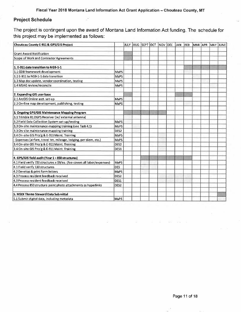
Project Schedule
The project is contingent upon the award of Montana Land lnformation Act funding. The schedule forthis project may be implemented as follows:
Chouteau Counw E-911 & GPS/GlS Proiect JULY AUG SEPT ocT NOV DEC JAN FEB MAR APR MAY JUN E
Grant Award Notif ication
Scope of Work and ContractorAgreements
1. E-911 data transítion to NG91-11. 1 GDB f ramework development MaPS
1.2 E-911 to NG9-1-1 data transition MaPS
1.3 Map doc update, vendor coordination, testins MaPS
1.4 MSAG review/reconcile MaPS
2. Expanding GIS user base
2.1ArcGlS Online acct. set-up MaPS
2.2 On-line map development, publishing, test¡ng MaPS
3. Ongoing GPS/GlS Maintenance Mapping Program
3.L Trimble R1 DGPS Receiver (w/ external antenna)
3.2 Field Data Collection System set-up/testing MaPS
3.3 On-site ma¡ntenance mapping training (see Task 4.1) MaPS
3.3 On-site maintenance mapping training DES2
3.4On-site GIS Prcs'g & E-91L Maint. Training MaPS
- Expenses (airfare, travel tm, mileage, lodging, per diem, etc.) MaPS
3.4 On-site GIS Prcs'g & E-911 Maint. Training DES2
3.4On-site GIS Prcs'g & E-91-1 Maint. Training DESl
4. G PS/GIS field audit (Year 1 = 85() structures)4.1 Field verify 720 structures x Sg/ea. (fee covers all labor/expenses) MaPS
4.1 Field verifv 130 structures DES
4.2 Develop & print form letters MaPS
4.3 Process resident feedback received DES2
4.3 Process resident feedback received DESl
4.4 Process 850 structure point photo attachments as hyperlinks DES2
5. MSDI Theme Steward Data Submittal5.1Submit digital data, including metadata MaPS
Page 11 of 18
Fiscal Year 2018 Montana Land lnformation Act Grant Application - Chouteau County, MT
SECTION 5 - PROJECT MANAGEMENT AND ORGANIZATIONAL CAPABILITY
The proposed project will be managed by the Chouteau County Disaster Emergency Service (DES)Coordinator, Debbie Gessaman. Debbie is a native of the County and a proud mother, partnering with herhusband to operate their family farm. She started working in 2006 as a Deputy DES Coordinator and AssistantEMS Coordinator. Debbie has helped the Countyworkthrough Presidential Disasterdeclarations in 1992 and1996. During these disasters, she helped write up the Project Worksheets (PW's) for each of the roads andbridges that were damaged from flooding, including gathering all information about the work hours, equipmentand supplies (e.9. taking all the timecards of the road crews, going through all the records of supplies theyused, equipment that was used and how many hours for each piece of equipment, then reporting all this on thePW's). Debbie worked with the County Commissioners to close these projects and making sure they weredone according to Federal Emergency Management Association (FEMA) standards. These disasters includedworking alongside FEMA and Emergency Relief for Federally Owned Roads (ERFO) organizations. Shecontinues to work with State, Federal and local officials to create a disaster resilient community.
Debbie started out as a first responder and trained and certified as an Emergency Medical Technician - Basic(EMT-B) and has recently certified as an Advanced EMT (AEMT). She is the EMS Coordinator for ChouteauCounty and an AEMT for Memorial Ambulance Service of Fort Benton. Debbie has experience with grantmanagement and administration for large and small projects and supervisory experience at many differentlevels. Each year Debbie applies for an Emergency Management Program Grant from the State of Montana.This grant is used to fund various exercises, wages for the County's mapping consultant and DES Coordinator,Developing various EOP (Emergency Operating Plans) for the county and various meetings. As the CountyEMS Coordinator, she has also successfully applied for and executed grants for a portable suction unit and anew 2001 ambulance (through the State DOT). Debbie is a member of the County 9-1-1 Advisory Board, aswell as their Secretary/Treasurer. Regarding overall contractual and grant administration, Debbie will besupported by the 9-1-1 Advisory Board and the County Commissioners.
Kellie Butler, the County's Deputy DES and Mapping/Addressing Coordinator since the Spring of 2015, is alsoa native of Chouteau County and takes a personal pride and interests in keeping the GIS data current andcorrect. As the daughter of the previous (and original) GIS mapping coordinator (who was also a formeremergency dispatcher), Kellie grew up with Public Safety and through her mother, has a wealth of knowledgeabout the County and the development of its map data. She is responsible for working with (on the phone andin person) County landowners and residents on the assignment and input of all new structure addresses,including road naming. Kellie maintains the current GlS, including the structure points/address database andthe E-911 system (e.9. the Master Street Address Guide or MSAG, hosted by lntrado). Kellie reviewstelephone service order activity reports received from the local telephone companies (e.9. service orders foradds, deletes and changes) and works with the County Clerk & Recorder and Dept. of Revenue office tomonitor grantor/grantee changes. She has worked extensively with MaPS, lnc. for the past year in improvingthe current GIS mapping data for the County and spearheaded the effort to pursue and develop this project.Kellie also has 9 years of previous experience as an Office Manager and Bookkeeper which supplied her withan extreme attention to detail and exceptional customer service skills. Kellie attended the College of GreatFalls - MSU and graduated with an Associates Degrees in Graphic and Web Design in 2016. She will also begraduating with a Bachelor's of Science in Organizational Communication from MSU - Billings in May 2017.
It is proposed that this project be contracted to Mapping and Planning Specialists, lnc. (MaPS, lnc.) andmanaged by the County DES Office. MaPS, lnc. has been working for the County as their E-911 Consultantsince April 2000 (and Matt Pearce, as part of Baker GeoResearch, for several years prior to that). MaPS, lnc.successfully implemented the County's E-911 System over a decade ago and has completed multiple
Page 12 of 18
Fiscal Year 2018 Montana Land lnformation Act Grant Application - Chouteau County, MT
contracts with other County and City agencies in Montana and the region and has a reputation for providingquality GPS/GIS services. MaPS, lnc.'s personnel have extensive experience in GPS field data collection,GIS development and E-911 implementation and have worked on over fifty projects in many states across thenation. MaPS, lnc. has successfully completed previous projects of similar scope and have demonstrateda thorough understanding of the required GPS/GIS services. MaPS, lnc has implemented ArcGlSOnline solutions for several utility projects in the State. The County believes that MaPS, lnc. hasprovided a reliable and fair project cost that is a good use of MLIA grant funding.
MaPS, lnc. is managed by Matthew Pearce, it's President and company Founder. Matt is a graduate of theUniversity of Minnesota with a B.S. in Geography with GIS/Cartography emphasis. He has been working inthe geographic field for 24 years and is a certified Emergency Numbering Professional (ENP) and a memberof the National Emergency Numbering Association (NENA). MaPS, lnc. is currently providing E-911 andGPS/GIS mapping and addressing services for a significant number of MT counties, including Toole,Pondera, Chouteau, Valley, Granite, Mineral and Sanders. MaPS, lnc. specializes in PuHic Safety Consulting,GPS field data collection and GIS processing, including on-site project coordination and training, and has ahard-earned reputation of providing clients with high quality data and excellent customer service.
Page 13 of 18
FiscalYear 2018 Montana Land lnformation Act Grant Application - Chouteau County, MT
SECTION 6 - BUDGET JUSTIFICATION AND BUDGET TABLE
The proposed project's costs for contracted services, equipment, in-kind labor, etc., include the following:
1) E-911 data transition to the NENA NG9-1-1 model (100 hours).
1.1) MaPS, lnc. NG9-1-1 GDB framework development; 8 hours.
1.2) MaPS, lnc. E-911 to NG9-1-1 data transition; 36 hours.
1 .3) MaPS, lnc. Map document update, dispatch software vendor coordination, testing; 16 hours.
1.4) MaPS, lnc. MSAG revieMreconcile; 40 hours.
2) Expanding GIS user base; (55 hours).
2.1) MaPS, lnc. ArcGlS On-line account set-up; 15 hours.
2.2) MaPS, lnc. On-line map development, map publishing, testing, website linking; 40 hours
3) Ongoing GPS/GlS maintenance mapping program development and training; (40 hours)
3 1) County DES to purchase a Trimble R1 DGPS receiver (with external magnetic antenna); $2,550.
3.2) MaPS, lnc. to set-up and test the Field Data Collection system; 8 hours.
3.3) MaPS, lnc. to provide on-site maintenance mapping training; see 4.1; (16 hours). County DES toreceive said training; 16 hours.
3.4) MaPS, lnc. to provide training; 16 hours/$1,275 expenses. County to receive said training; 20 hours.
4) GPS/GIS Field Audit; (126 hours).
4.1) MaPS, lnc. to field verify 720 structures x $9/ea.; $6,480. County DES to map 130 structures.
4.2) MaPS, lnc. to develop and print (approximately 3,400) post-it style form letters; $500.
4.3) County DES to process resident feedback received; 45 hours.
4.4) County DES to process structure point photo attachments as hyperlinks; 15 hours.
5) MSDI Theme Steward Data Submittal (15 hours)
5.1) Submit a digital dataset to the State including valid metadata (15 hours).
cou NTY (rN-KrND) CONTRTBUTTONS
The County expects to provide a considerable in-kind contribution of labor to the project effort, including grant
administration from Debbie Gessaman and field data collection and structure point data validation by Kellie Butler.
Debbie Gessaman (DES1) anticipates providing at least 12 hrs. over the course of the project for grantadministration, including MaPS, lnc. coordination and State progress reporting, and 4 hrs. for ArcGlS Training.Debbie will also assist with an additional estimated I hrs. of validation of the structure point information bytaking overflow phone calls and covering for Kellie when she is conducting field data collection. Debbie's
Page 14 of 18
Fiscal Year 2018 Montana Land lnformation Act Grant Application - Chouteau Gounty, MT
hourly rate (salary and benefits) is $24lhr., so her estimated 20 hrs. of labor contribution to the overall project is$480. Supplies/copies are also anticipated at $50 during the project period.
Kellie Butler (DES2) will be trained on field data collection training (16 hrs.), GIS processing and E-911maintenance (16 hrs.). Kellie will also provide the bulk of labor for the validation of the structure pointinformation, an estimated 37 hrs. of labor, as well as contributing to the field data collection effort, supplylng anestimated 16 hrs. of direct labor (County vehicle and fuel will be supplied). Kellie will also be responsible forprocessing all of the digital structure photographs (850) taken as during field data collection, an estimated 15hrs. of labor. Kellie's estimated labor contribution to the project will be at least 100 hrs. At a labor rate of$19/hr., Kellie's labor contribution is $1,900.
The detailed tasks are listed below with the hours/costs and the assigned partner for the task.
TASK ASGN'D FEE HRS CO HRS RATE COST
Overal I Grant Admi nistration/Coordi nationGeneral supplies/copies
DESl t2 24 288
50
338
1. E-gll data transition to NG91-11. 1 GDB framework development1.2 E-911 to NG9-1-1 data transition1.3 Map doc update, vendor coordination, testing1.4 MSAG revi ew/reconci le
MaPS
MaPS
MaPS
MaPS
75
75
75
95
8
36
16
Æ
600
27æt2æ3800
75
75
100
15
n
8300 Subtl2. Expanding GIS user base
2.1ArcGlS Online acct. set-up2.2 On-line mao develooment. ou blishins, testins
MaPS
MaPS
IL253000
55 4125 Subtl
2545
304
1520
1275
3@
96
3. Ongoing GPS/GlS Maintenance Mapping Program
3.l Trimble R1 DGPS Receiver (w/ external antenna)3.2 Field Data Collection System set-up/testing3.3 On-site maintenance mapping training (see Task 4.1)
3.3 On-site maintenance mapping training3.4 On-site GIS Prcs'g & E-911 Maint. Training- Expenses (airfare, travel tm, mileage, lodging, per diem, etc.)
3.4On-site GIS Prcs'g & E-911 Maint. Training
3.4 On-site GIS Prcs'g & E-911 Maint. Training
MaPS
MaPS
DES2
MaPS
MaPS
DES2
DESl
75
19
95
19
24
600
16
16
4
L6
24 36 66214 Subtl4. GPS/GlS field audit (Year 1= 85() structures)4.1 Field verify 720 structures x S9/ea. (fee covers all labor/expense MaPS
4.1 Field verify 130 structures DES
4.2 Develop & print form letters MaPS
4.3 Process resident feedback received DES2
4.3 Process resident feedback received DES1
50 6480
304
500
703
792
2854.4 Process 850 structure ooint ohoto attachments as hvperlinks DES2
16
37
8
15
19
19
24
19
50
15
76 8464 Subtl
tr255. MSDI Theme Steward Data Submittal5.1Submit digital data, including metadata MaPS 75
24 <DES1 Hrs.
1fi) <DES2 Hrs.
MaPS Hrs.> 244
Page 15 of 18
528,996.00 Total
Fiscal Year 2018 Montana Land Information Act Grant Application - Ghouteau County, MT
Applicant Summary
MLIAShare
ApplicantCash
OtherCash
ln-kindApplicantSubtotal Total
576 576 576
1 900 1,900 1,900
2,545 2,545
500 50 550
23,425 23,425
a. Personnel
a. 1. Debbie Gessaman
a. 2. Kellie Butler
b. Trarcl
c. Equipment
d. Supplies
e. Contractual - MaPS, lnc.
f. Other
Category
Total 26,470 2,526 28,996
Proj ect Part¡ter* S u m m ary
MaPS,lnc.
Partner 2 Partner 3 Total
15,670 15,670
1,275 1,275
a. Personnel
a. 1. Fringe Benefits
b. Trarcl
c. Equipment
d. Supplies
e. Contractual
f. Other
Category
6,480 6,480
Total 23,425 23,425
MLIA GRANT BUDGET SUMMARY
MLIA GRANT BUI
The County will continue to contract with MaPS, lnc. for Technical Support resulting from thisproject in future E-911 budgeting. Please note that the County intends to apply for and conductPhases 2-4 in subsequent fiscal years, to field verify an est¡mated 850 additional structures eachyear, until the entire County's road network and structure points have been completely verified and
updated.
Page 16 of 18
Fiscal Year 2018 Montana Land lnformation Act Grant Application - Chouteau County, MT
Section 7 - Statements of Support
*ln this section, applicants must include statements of support are required for each party listedas a funding partner-see MLIA Grant Compliance - MLIA Grant Partners section for thedefinition of a funding partner. Do not include other statements of support as they will not þeevaluated.
Chouteau County does not have other funding partners for the proposed project.
SECTION 8 - RENEWABLE GRANT ACCOUNTABILITY
*ln this section, applicants awarded a FY2017 MLIA Grant for the same project or purpose,must submit a report on the progress made toward meeting the requirements of that grant: thereport must include the status of all tasks or deliverables outlined in the grant.
This section is not applicable to this Application.
Page 17 of 18
Authorizing Statement
I hereby certify that the information and all statements in this application are true,complete and accurate to the best of my knowledge and that the project or activitycomplies with all applicable state, local and federal laws and regulations.
I further certify that this project will comply with applicable statutory and regulatorystandards.
I further certify that I am (by my signature) authorized to enter into a binding agreementwith the Montana State Library to obtain a grant if this application receives approval.
ò*a,n < S.n r*p/.Darren Schuster
}orp¡r J.S. [' sln rChouteau Gounty Gommissioner
Signature and Title of Authorized Representative(s) of Public Entity Applicant
zf ts f tt
Date
Fiscal Year 2018 Montana Land lnformation Act Grant Application - Ghouteau County, MT
SECTION I - Sign the Application
Page 18 of 18
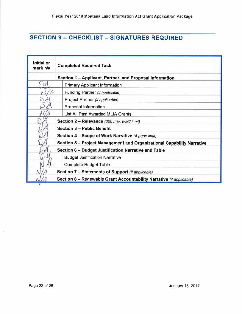
Fisca[Year 201E lMontana La¡ld lr¡fonrnation Act G¡.ant ApplÉcatíon Fackage
lnitial ormark n/a
Gompleted Required Task
Section I - Applicant, Partner, and Proposal lnformationgA Primary Applicant I nformation'*t/n
Funding Partner (if applicable)
f,H Proiect Partner (if applicable)
til8 Proposal lnformation
N/1) List All Past Awarded MLIA Grants
Narrative
Com
Section 7
max word limiS
' Section 4 rrative (4-page limit)I
Section 5 - P Managgment and Organizational Capability Narrative
Section 6 - Narrative and Table
Budget Table
Statements Sof u
2 RelevanSection
Budget J ustification Narrative
Section 8 - Renewable Grant Accountabil
Section 3 - Public Benefit
SECTION 9 - CHECKLIST - SIGNATURES REQUIRED
Page22 oÍ 26 Jarruary 13,2017


![[PVG] Hannah Montana - Hannah Montana 3](https://img.pdfslide.us/doc/110x75/56d6bf381a28ab30169562c0/pvg-hannah-montana-hannah-montana-3.jpg)