Embed Size (px)
Citation preview
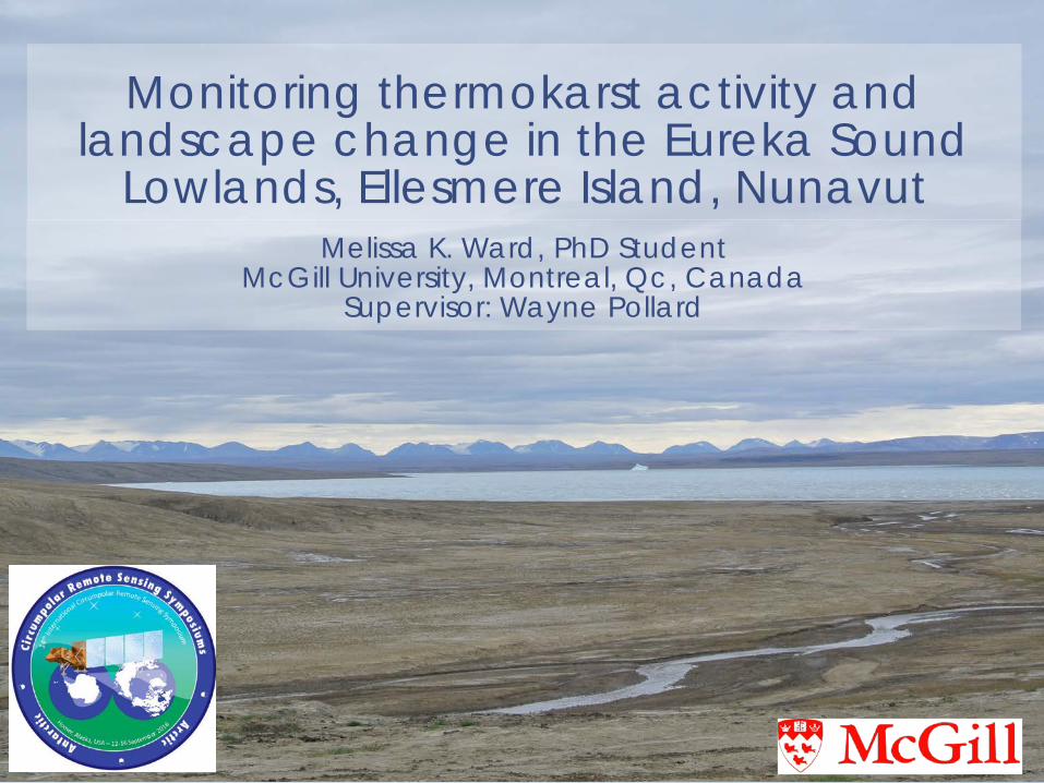
Monitoring thermokarst activity and landscape change in the Eureka Sound
Lowlands, Ellesmere Island, NunavutMelissa K. Ward, PhD Student
McGill University, Montreal, Qc, CanadaSupervisor: Wayne Pollard
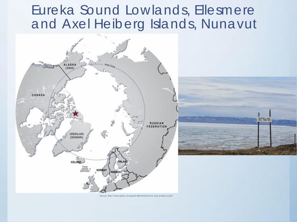
Source: http://www.grida.no/graphicslib/detail/arctic-map-political_1547
Eureka Sound Lowlands, Ellesmere and Axel Heiberg Islands, Nunavut
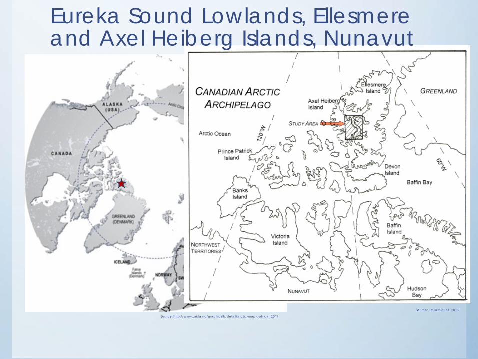
Source: http://www.grida.no/graphicslib/detail/arctic-map-political_1547
Source: Pollard et al., 2015
Eureka Sound Lowlands, Ellesmere and Axel Heiberg Islands, Nunavut
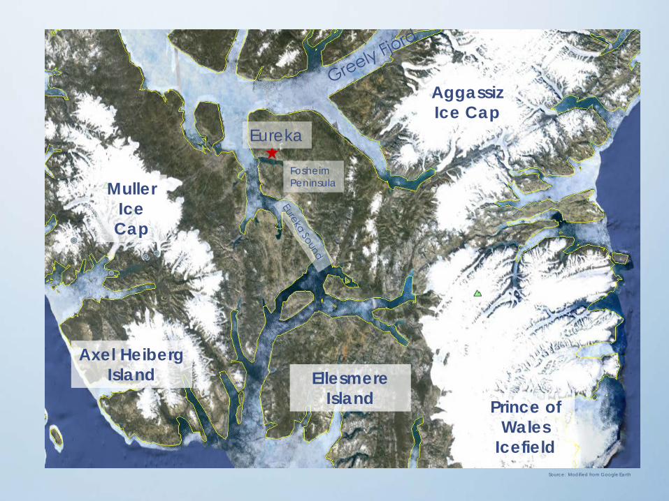
Muller Ice Cap
AggassizIce Cap
Axel Heiberg Island Ellesmere
Island
Eureka
Prince of Wales
IcefieldSource: Modified from Google Earth
FosheimPeninsula
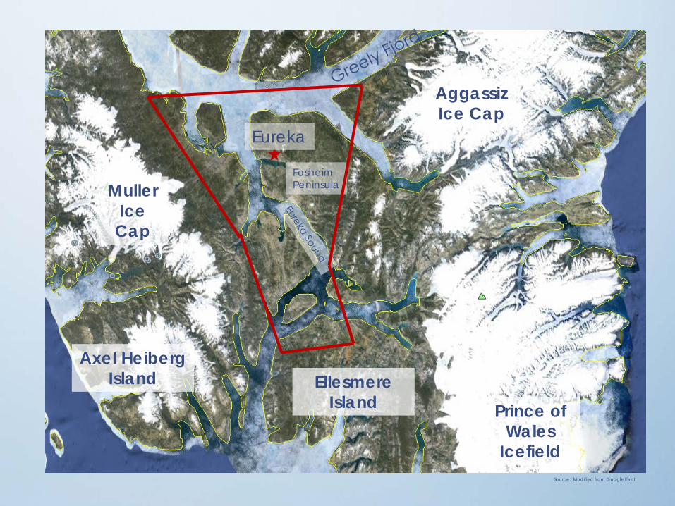
Muller Ice Cap
AggassizIce Cap
Axel Heiberg Island Ellesmere
Island
Eureka
Prince of Wales
IcefieldSource: Modified from Google Earth
FosheimPeninsula
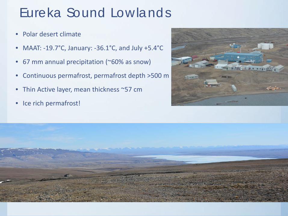
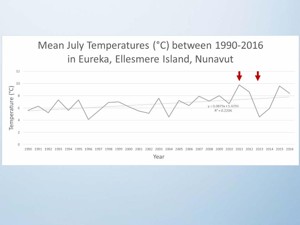
Eureka Sound Lowlands• Polar desert climate
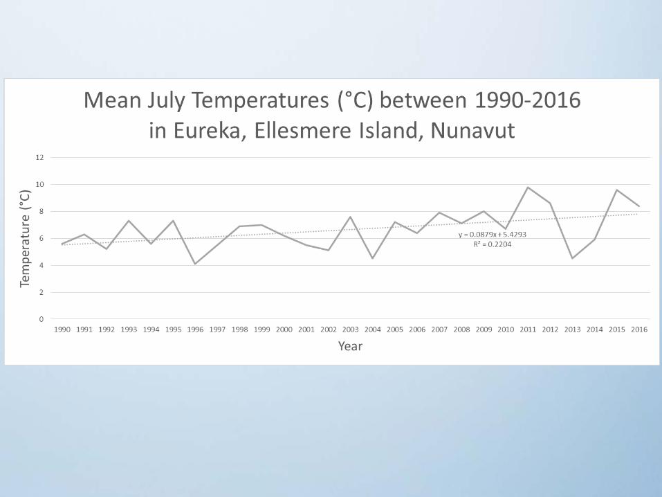
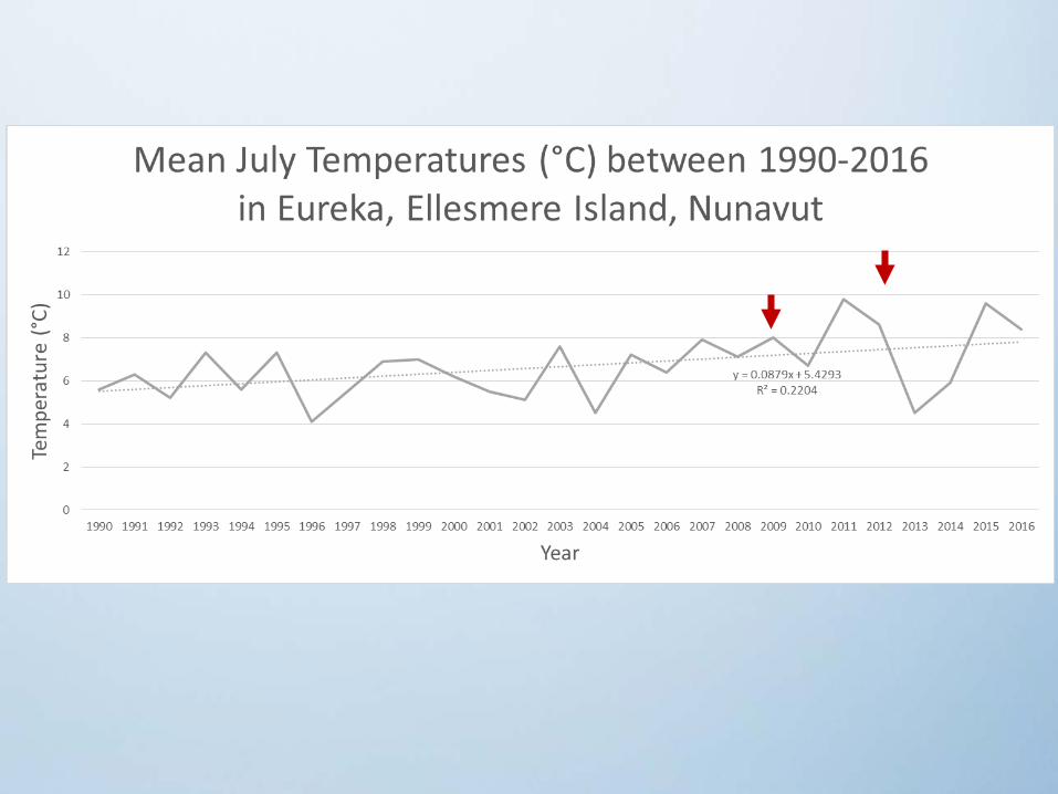
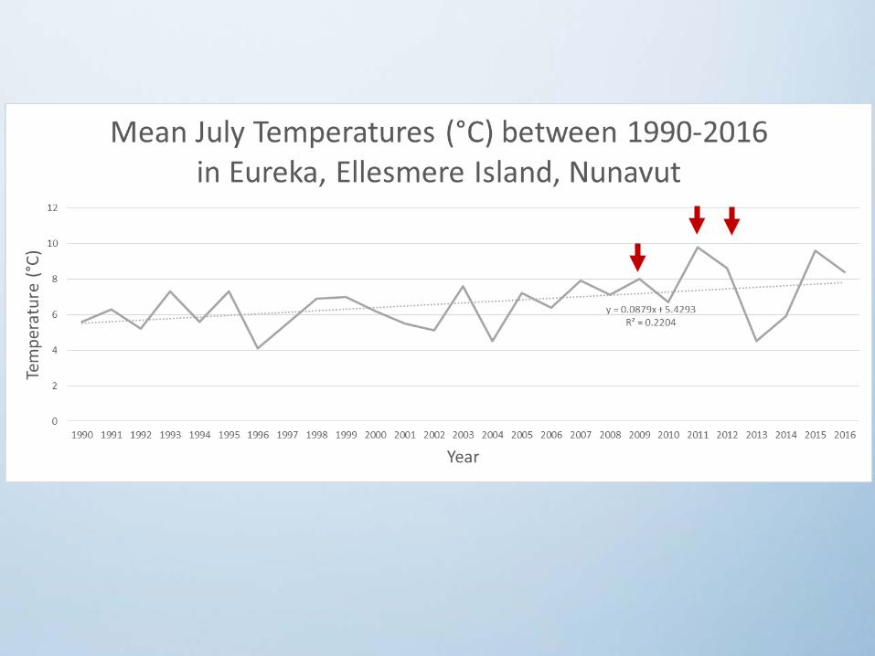
• MAAT: -19.7°C, January: -36.1°C, and July +5.4°C
• 67 mm annual precipitation (~60% as snow)
• Continuous permafrost, permafrost depth >500 m
• Thin Active layer, mean thickness ~57 cm
• Ice rich permafrost!
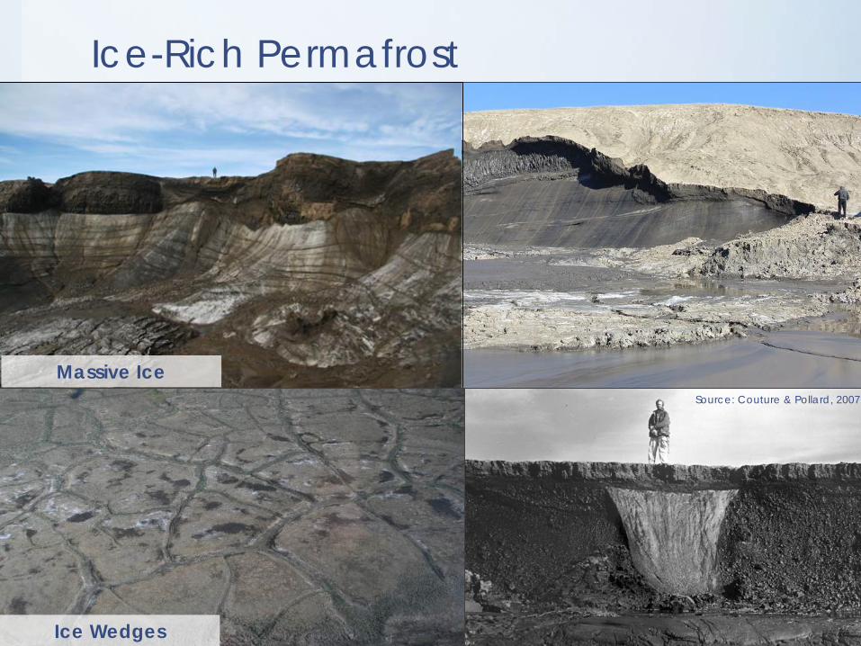
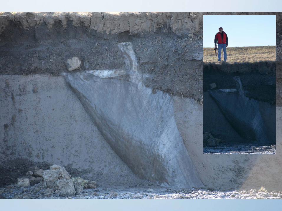
Ice-Rich Permafrost
Massive Ice
Ice Wedges
Source: Couture & Pollard, 2007
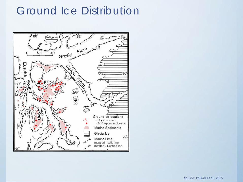
Ground Ice Distribution
Source: Pollard et al., 2015
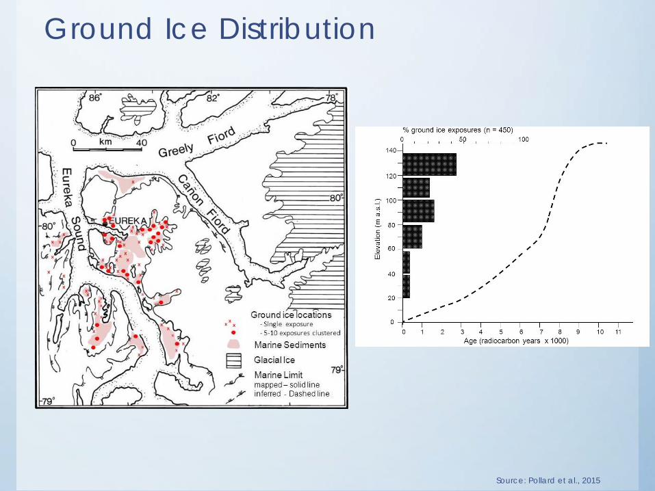
Ground Ice Distribution
Source: Pollard et al., 2015
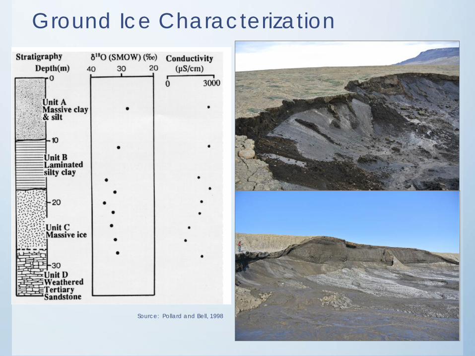
Ground Ice Characterization
Source: Pollard and Bell, 1998
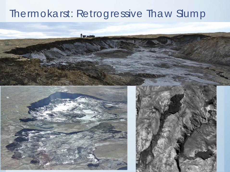
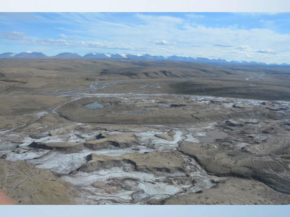
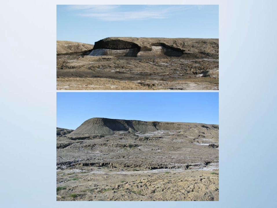
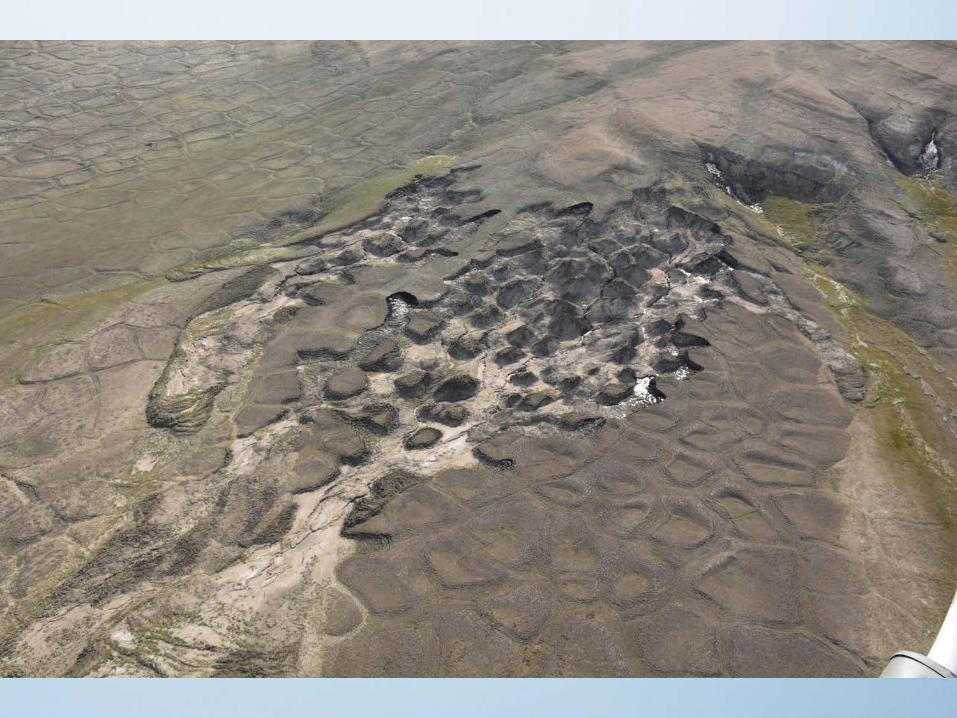
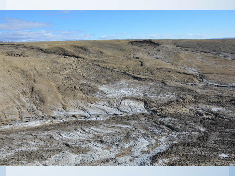
Thermokarst: Retrogressive Thaw Slump
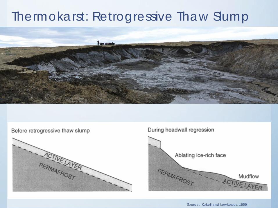
Thermokarst: Retrogressive Thaw Slump
Source: Kokelj and Lewkoxicz, 1999

Thermokarst: Retrogressive Thaw Slump
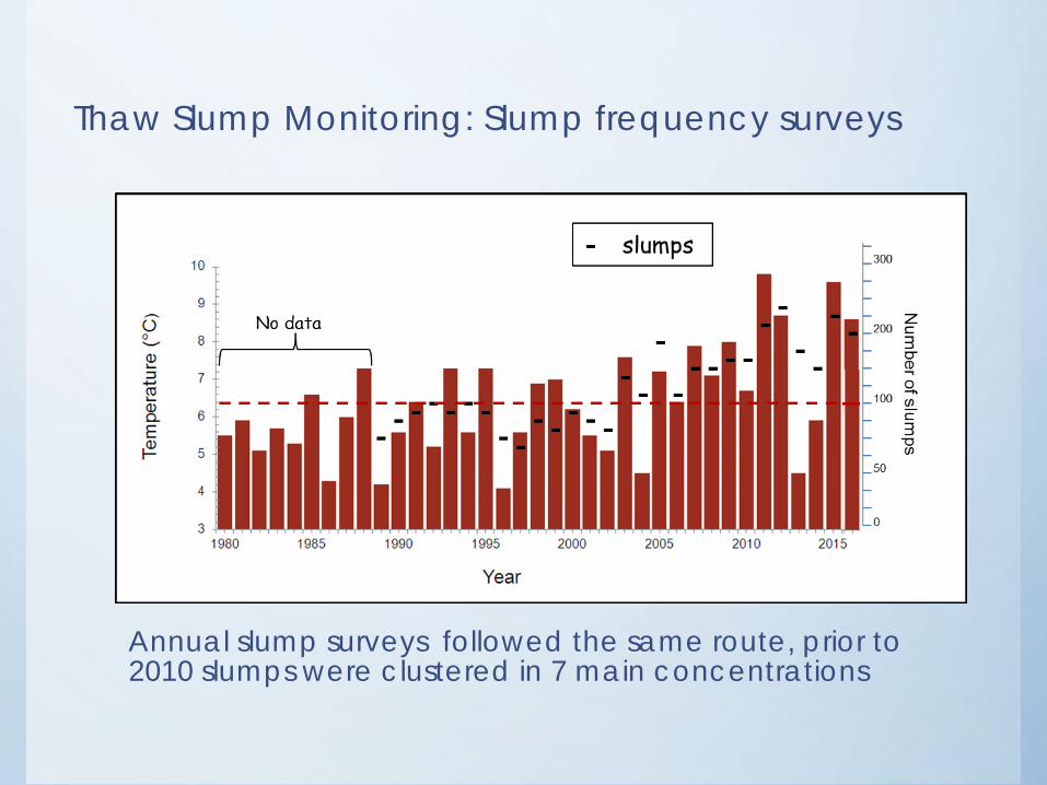
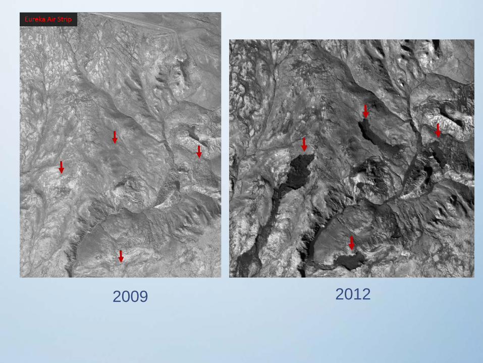
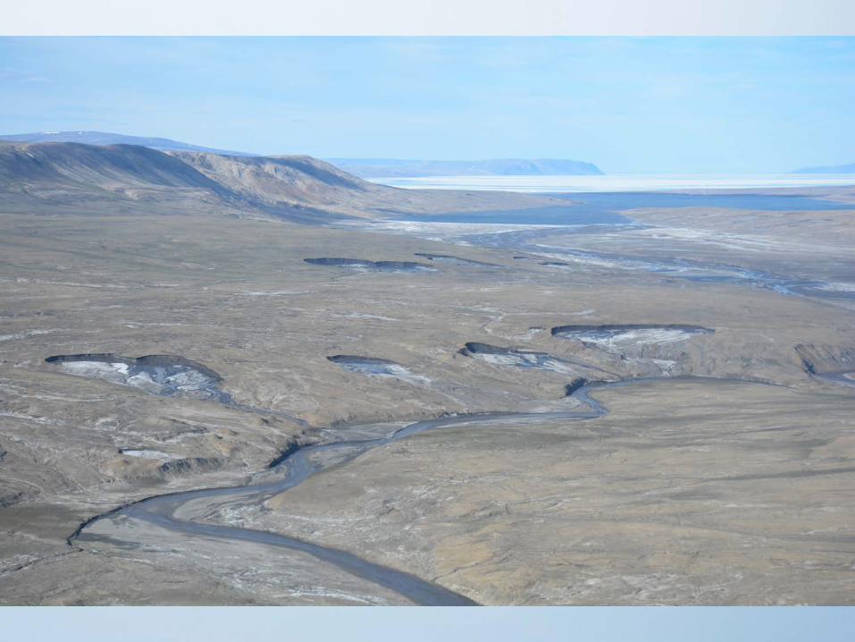
Thaw Slump Monitoring: Slump frequency surveys
Annual slump surveys followed the same route, prior to 2010 slumps were clustered in 7 main concentrations
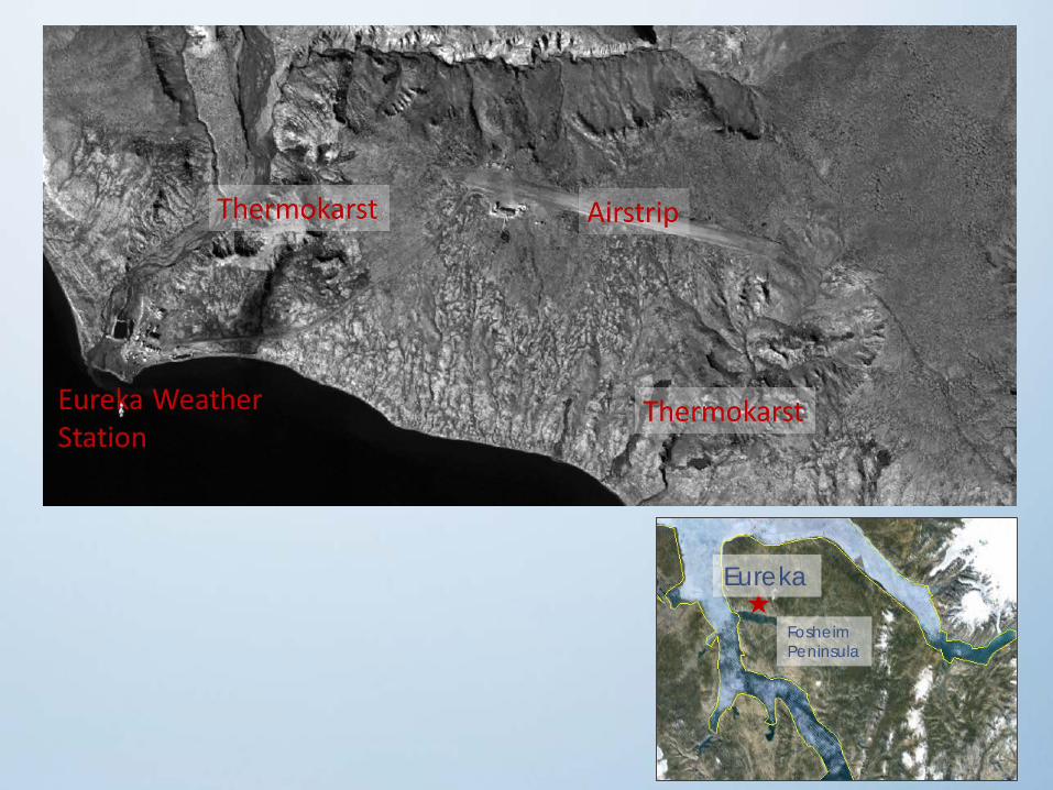
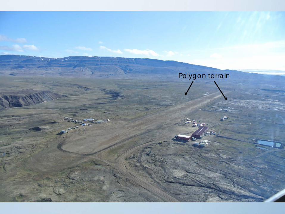
Eureka
FosheimPeninsula
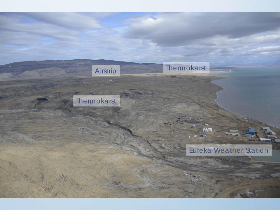
Airstrip
Thermokarst
Thermokarst
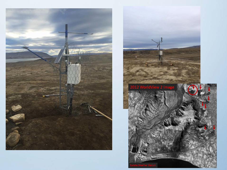
Eureka Weather Station
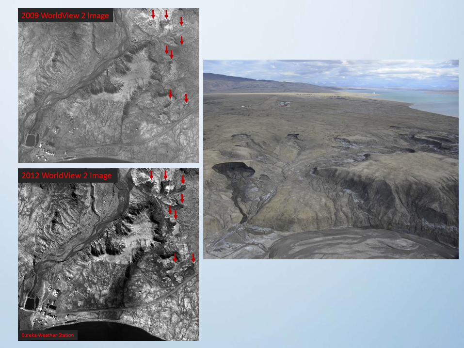
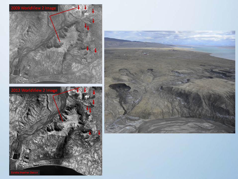

2009 2012
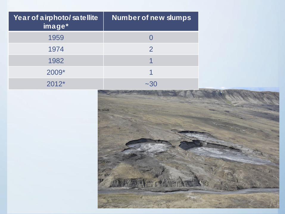
Year of airphoto/satellite image*
Number of new slumps
1959 01974 21982 12009* 12012* ~30
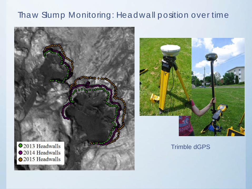
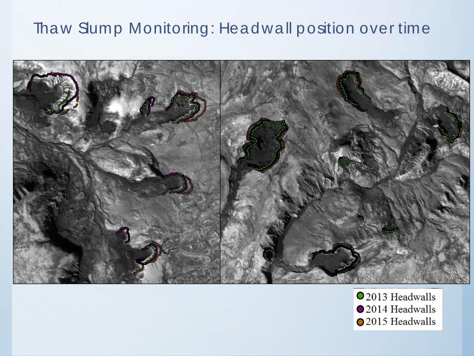
Thaw Slump Monitoring: Headwall position over time
Trimble dGPS
Thaw Slump Monitoring: Headwall position over time
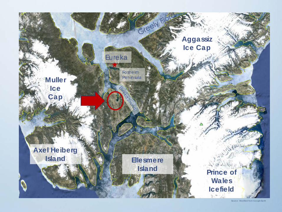
Muller Ice Cap
AggassizIce Cap
Axel Heiberg Island Ellesmere
Island
Eureka
Prince of Wales
IcefieldSource: Modified from Google Earth
FosheimPeninsula
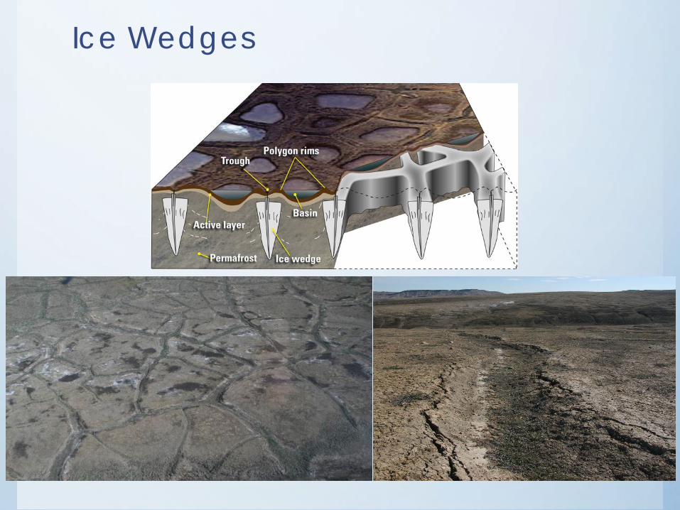
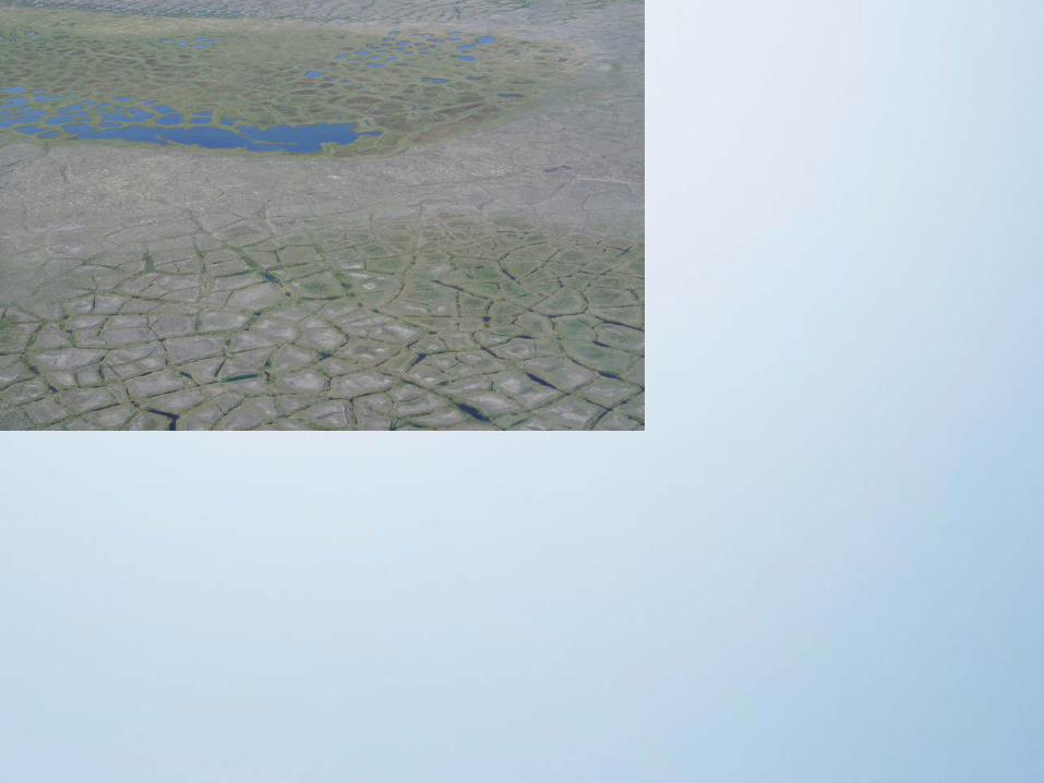
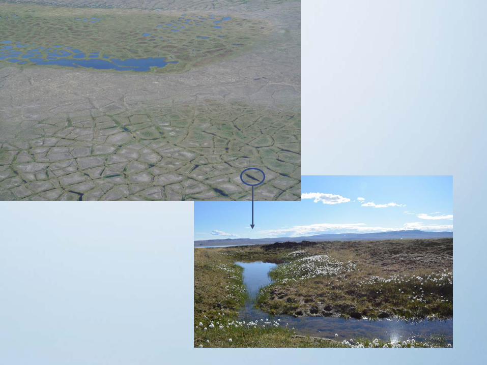
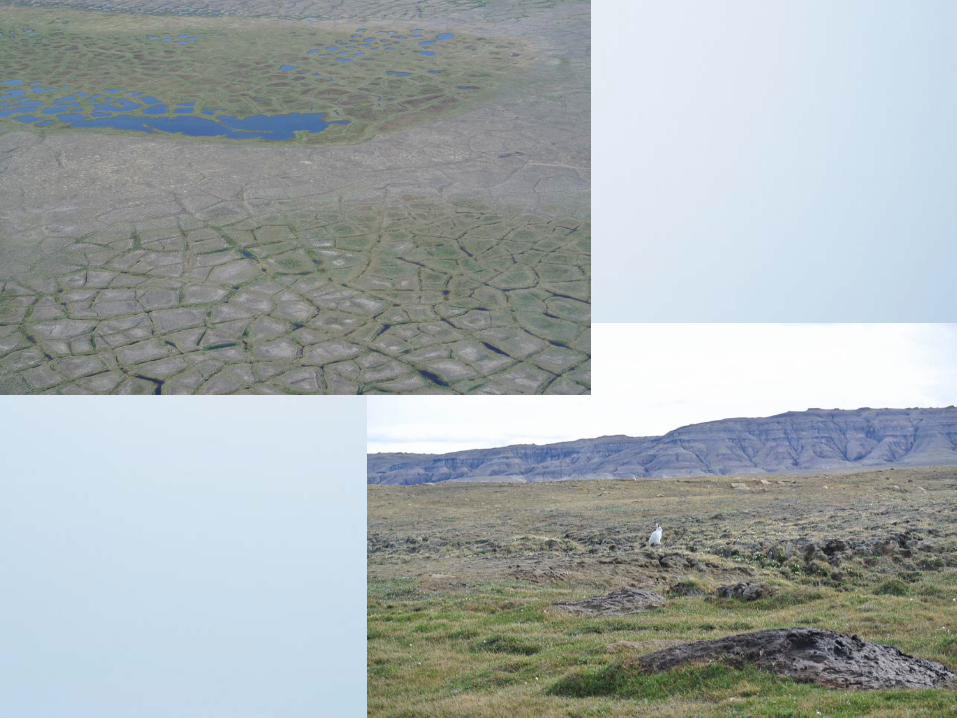
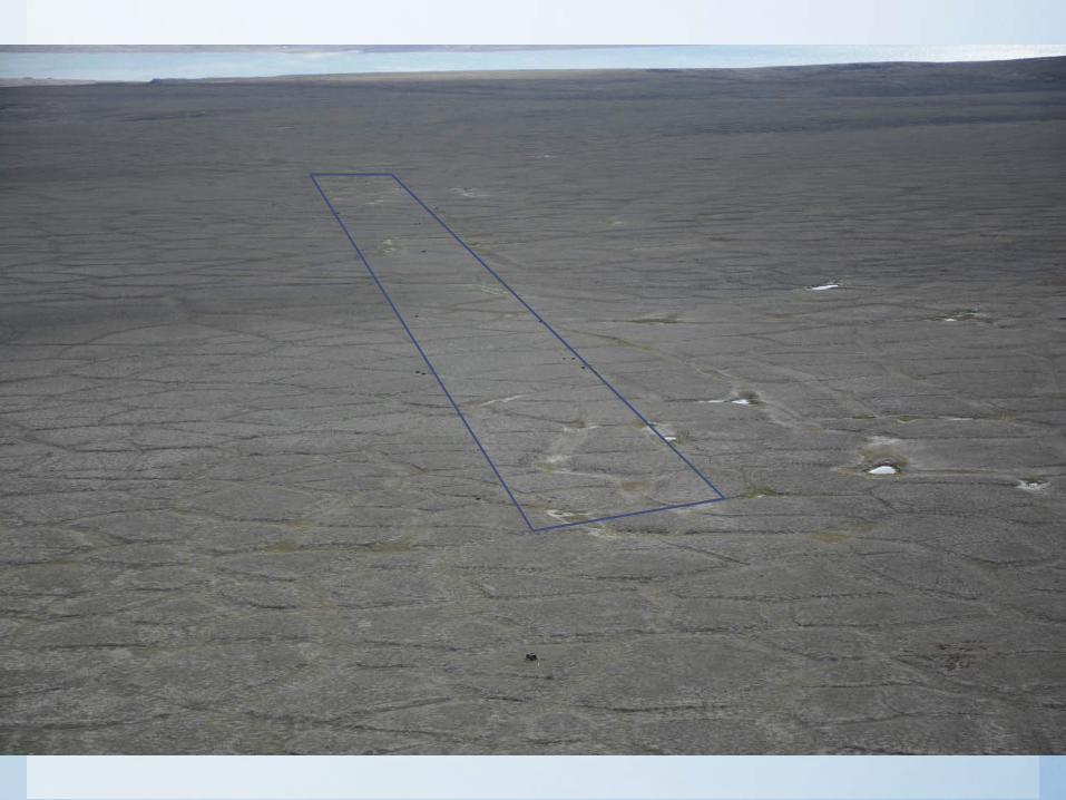
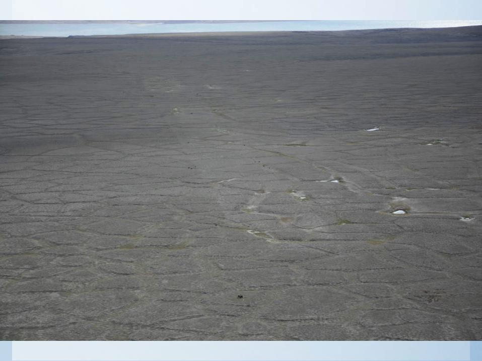
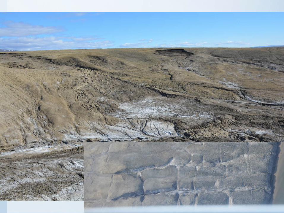
Ice Wedges
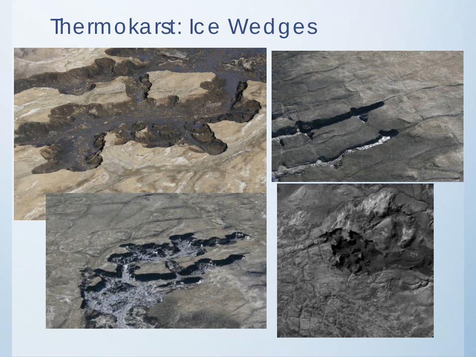
Thermokarst: Ice Wedges
Polygon terrain
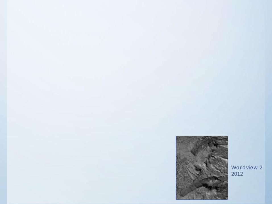
Worldview 2 2012
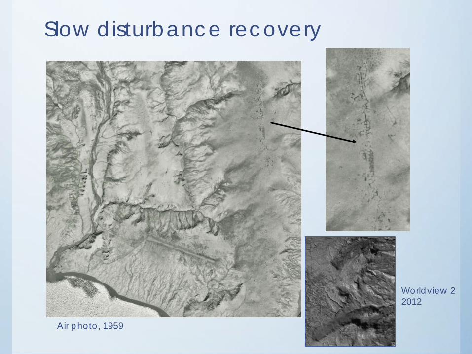
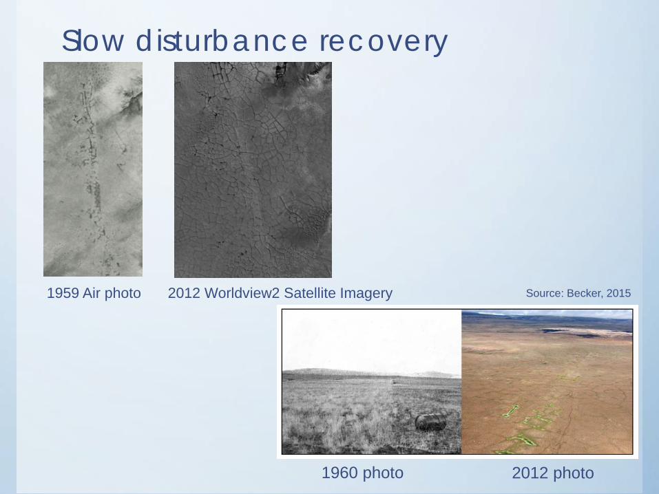
Slow disturbance recovery
Worldview 2 2012
Air photo, 1959
Slow disturbance recovery
1959 Air photo 2012 Worldview2 Satellite Imagery
1960 photo 2012 photo
Source: Becker, 2015

Acknowledgements & Research FundingResearch Support Opportunity in Arctic Environmental Studies; Association of Canadian Northern University Studies (ACUNS)
Fonds de Recherche du Quebec – Nature et technologies (FRQNT) Doctoral Scholarship
National Scientific and Engineering Research Council (NSERC; W. Pollard)
Polar continental Shelf Program (PSCP; W. Pollard)
Northern Scientific Training Program (NSTP)
David Erb Fellowship
Eben Hopson Fellowship
Thanks to Wayne Pollard, Michael Templeton, Michelle Maillet, and all of the staff at the Eureka Weather Station!
Thank you!