Embed Size (px)
Citation preview
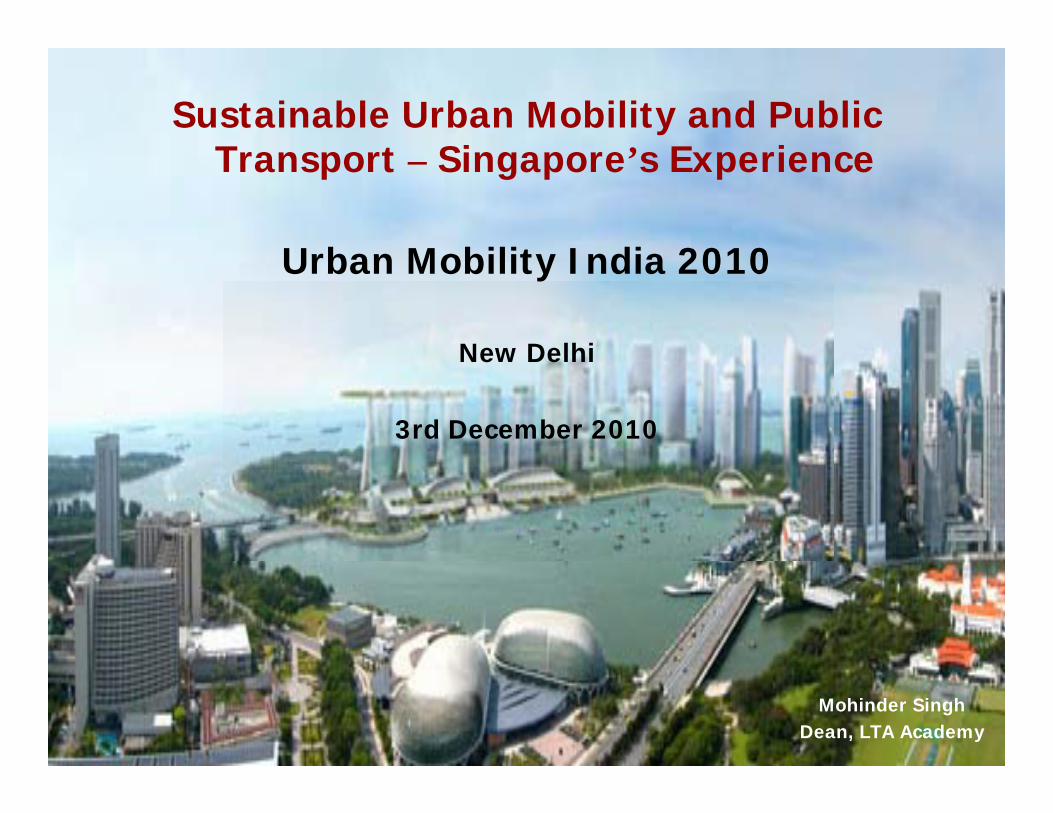
Sustainable Urban Mobility and Public Transport – Singapore’s Experience
Urban Mobility India 2010
New Delhi
3rd December 2010
Mohinder Singh Dean, LTA Academy
Outline of Presentation
Land Transport PoliciesLand Use – Transport Integration Planning of Public Transport NetworkRegulation of Public Transport
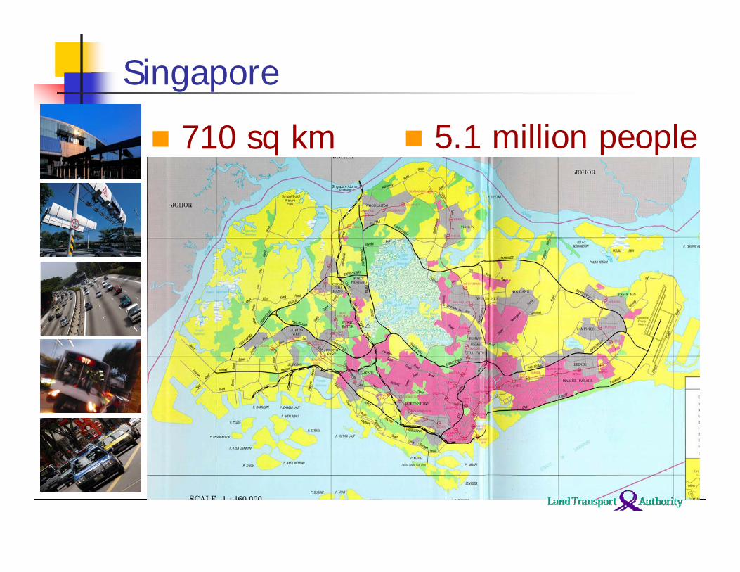
5.1 million people
Singapore
710 sq km
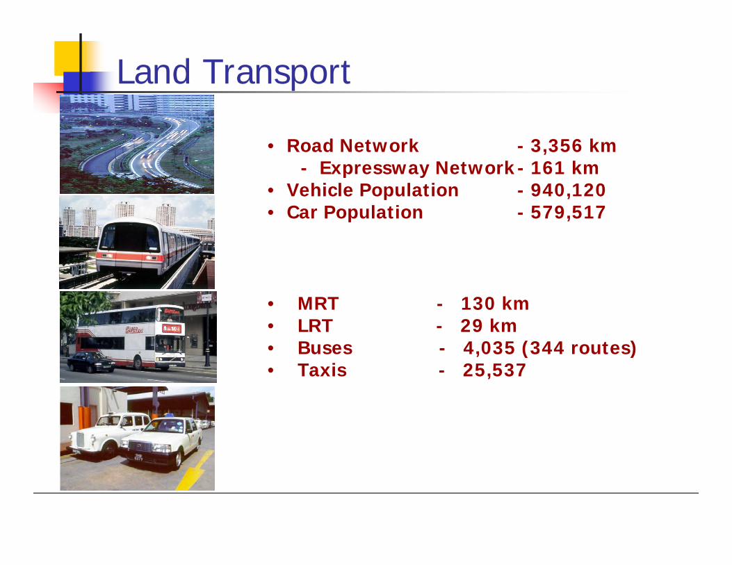
Land Transport
• Road Network - 3,356 km- Expressway Network- 161 km
• Vehicle Population - 940,120• Car Population - 579,517
• MRT - 130 km• LRT - 29 km• Buses - 4,035 (344 routes) • Taxis - 25,537
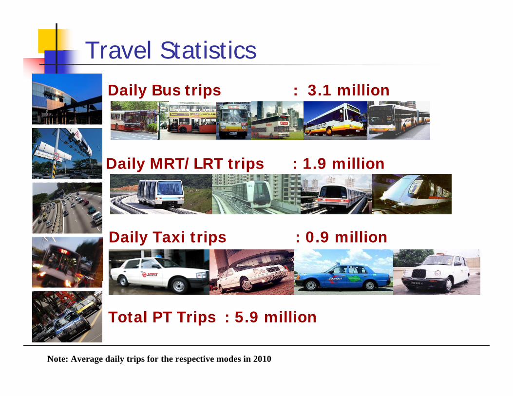
Travel StatisticsDaily Bus trips : 3.1 million
Daily MRT/LRT trips : 1.9 million
Daily Taxi trips : 0.9 million
Total PT Trips : 5.9 million
Note: Average daily trips for the respective modes in 2010
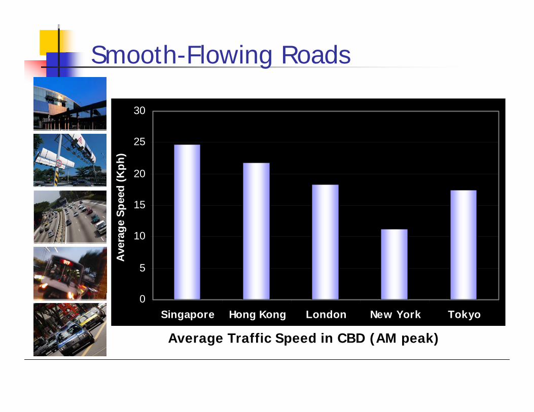
Smooth-Flowing Roads
0
5
10
15
20
25
30
Singapore Hong Kong London New York Tokyo
Ave
rage
Spe
ed (K
ph)
Average Traffic Speed in CBD (AM peak)
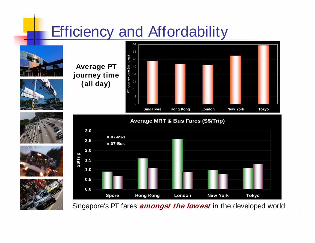
Singapore’s PT fares amongst the lowest in the developed world
Average MRT & Bus Fares (S$/Trip)
0.0
0.5
1.0
1.5
2.0
2.5
3.0
Spore Hong Kong London New York Tokyo
S$/
Trip
07-MRT07-Bus
Efficiency and Affordability
0
8
16
24
32
40
48
56
64
Singapore Hong Kong London New York Tokyo
PT jo
urne
y tim
e (m
inut
es)
Average PT journey time
(all day)
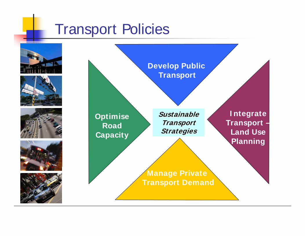
Sustainable Sustainable TransportTransportStrategies Strategies
IntegrateTransport –
Land UsePlanning
Develop Public Transport
Manage Private Transport Demand
Optimise Road
Capacity
Transport Policies
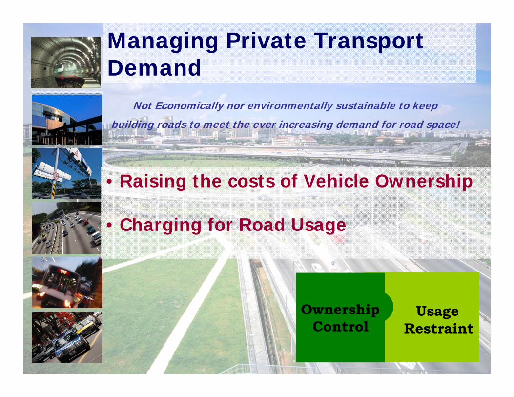
Managing Private Transport Demand
• Raising the costs of Vehicle Ownership
• Charging for Road Usage
UsageRestraint
OwnershipControl
Not Economically nor environmentally sustainable to keep
building roads to meet the ever increasing demand for road space!
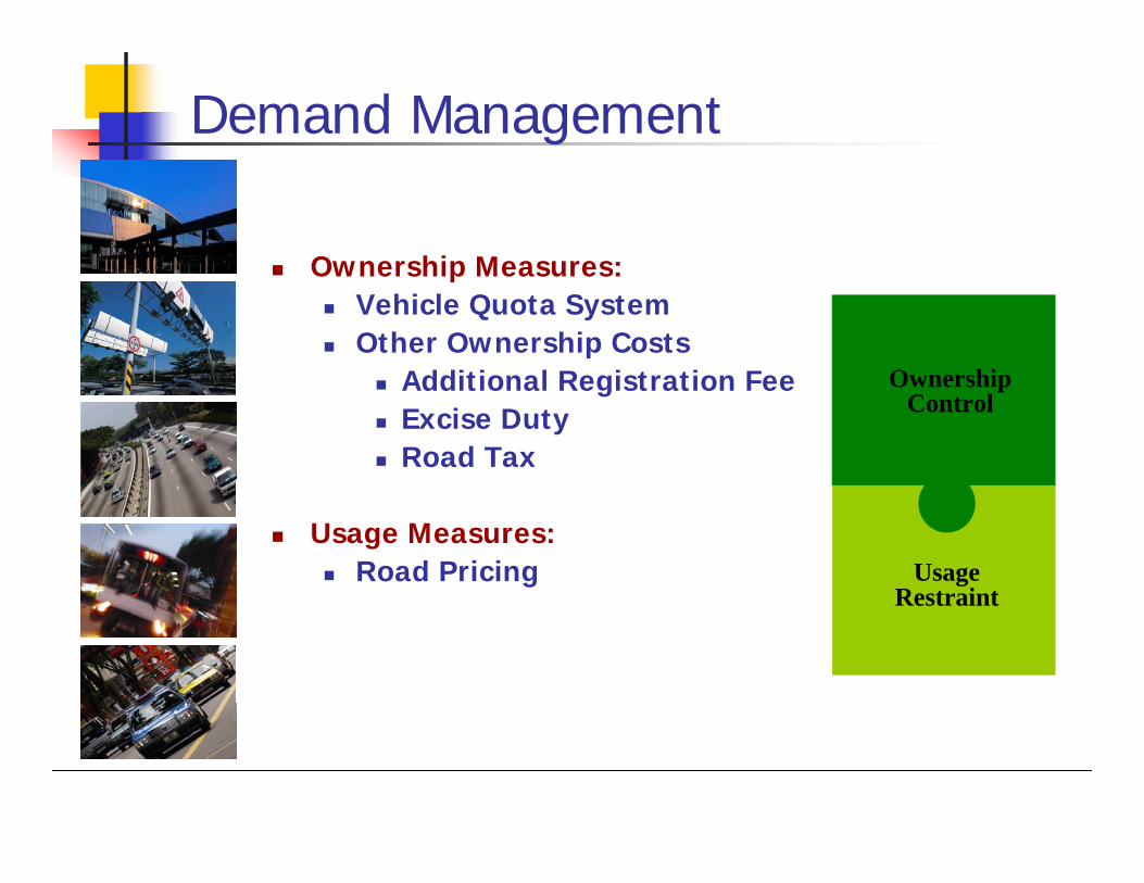
Usage Restraint
Ownership Control
Demand Management
Ownership Measures:Vehicle Quota SystemOther Ownership Costs
Additional Registration FeeExcise DutyRoad Tax
Usage Measures:Road Pricing
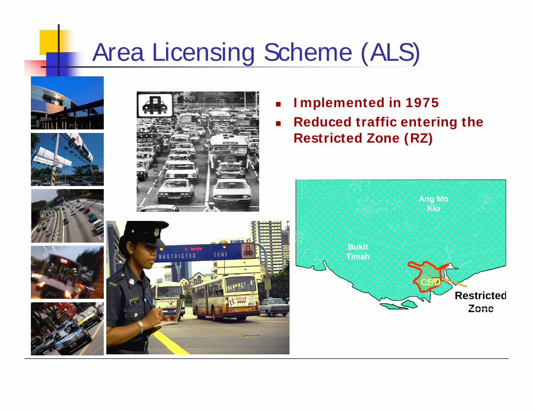
Area Licensing Scheme (ALS)
Restricted Zone
RT
Ang Mo Kio
CBD
Bukit Timah
RT
Ang Mo Kio
CBD
Bukit Timah
Implemented in 1975Reduced traffic entering the Restricted Zone (RZ)
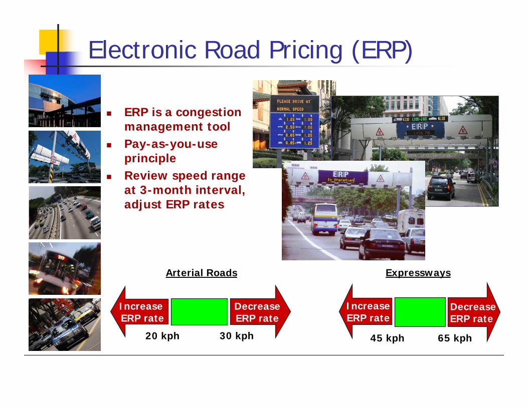
65 kph45 kph
IncreaseERP rate
DecreaseERP rate
Expressways
30 kph20 kph
Increase ERP rate
DecreaseERP rate
Arterial Roads
ERP is a congestion management toolPay-as-you-use principle Review speed range at 3-month interval, adjust ERP rates
Electronic Road Pricing (ERP)
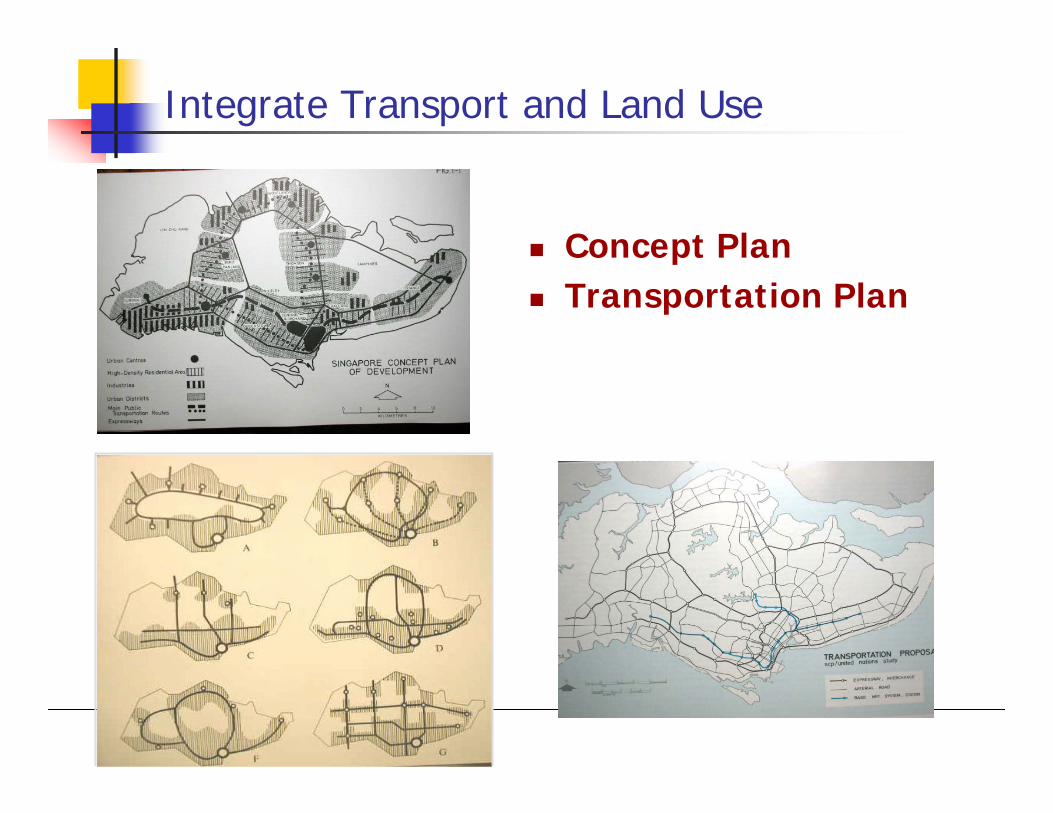
Integrate Transport and Land Use
Concept PlanTransportation Plan
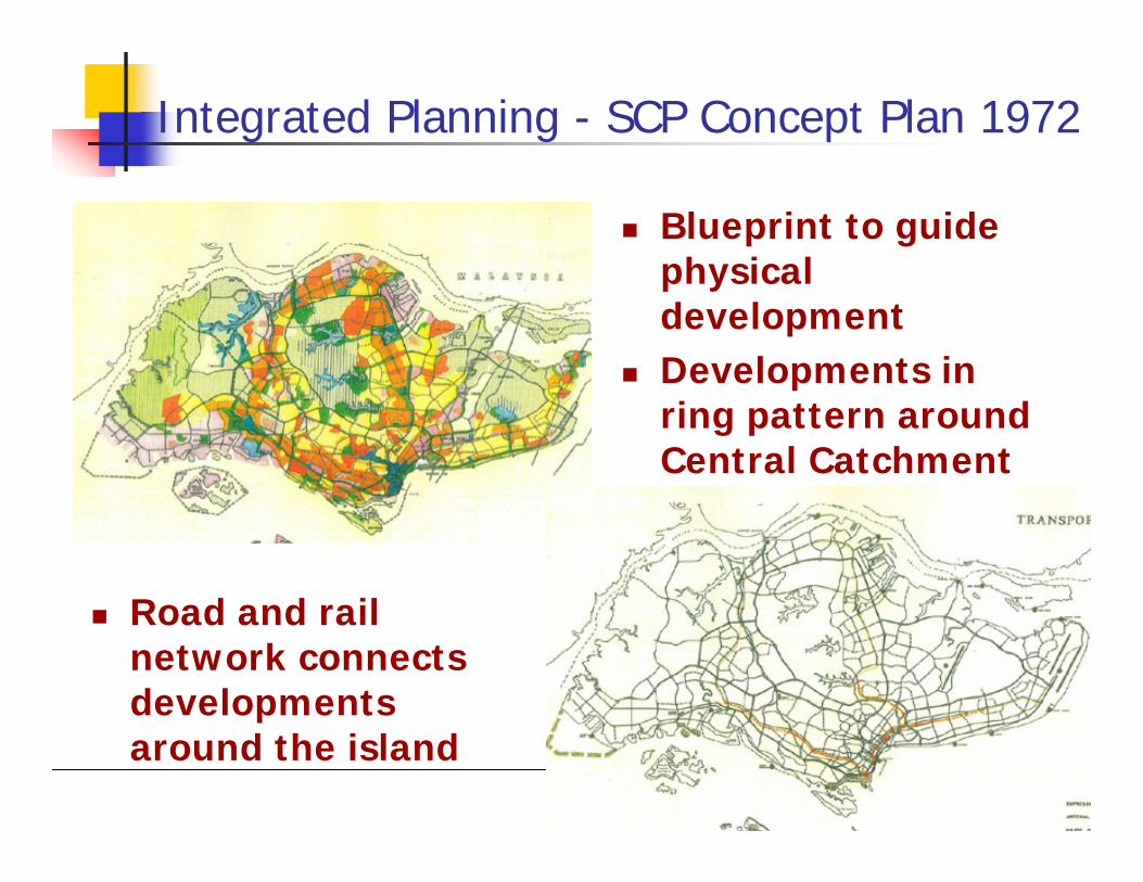
Integrated Planning - SCP Concept Plan 1972
Blueprint to guide physical developmentDevelopments in ring pattern around Central Catchment
Road and rail network connects developments around the island
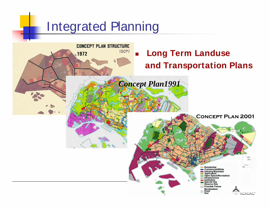
Integrated Planning
1972
Concept Plan1991
Long Term Landuse and Transportation Plans

Integration of Transport with Housing
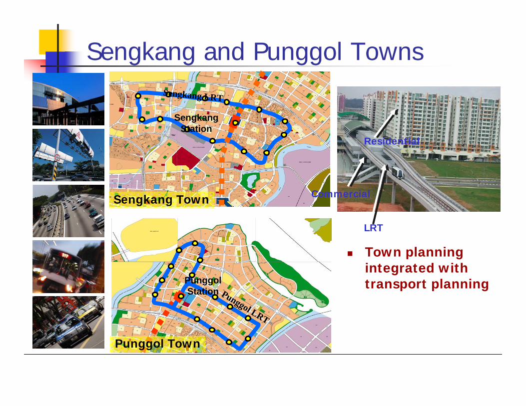
Town planning integrated with transport planning
Sengkang and Punggol Towns
Sengkang Station
Sengkang LRT
Punggol Town
Sengkang Town
Punggol Station Punggol LRT
Residential
Commercial
LRT
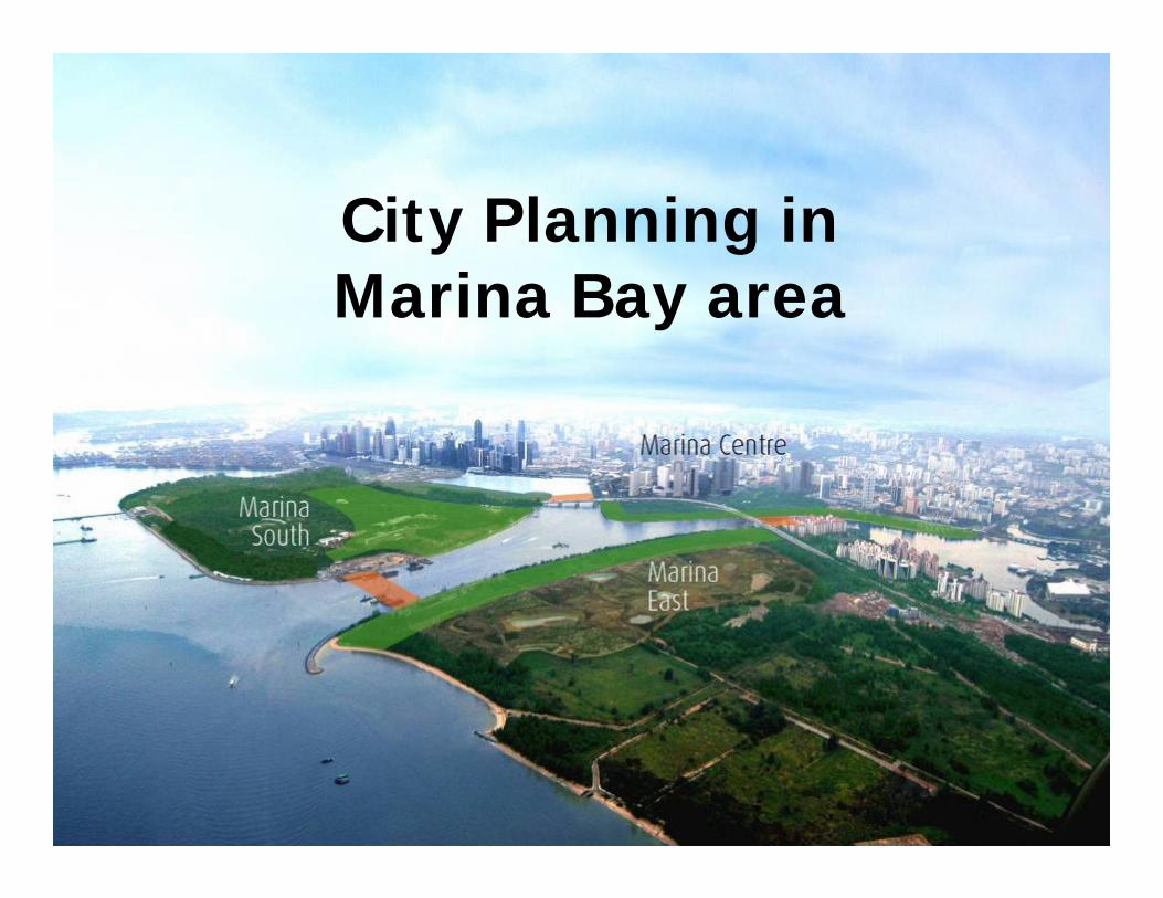
City Planning inMarina Bay area
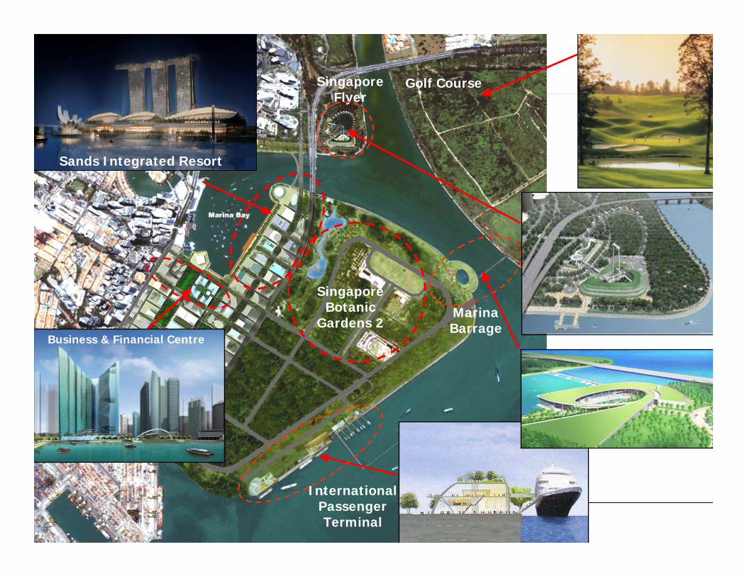
InternationalPassengerTerminal
MarinaBarrage
SingaporeFlyer
Business & Financial Centre
Golf Course
Sands Integrated Resort
Singapore Botanic
Gardens 2
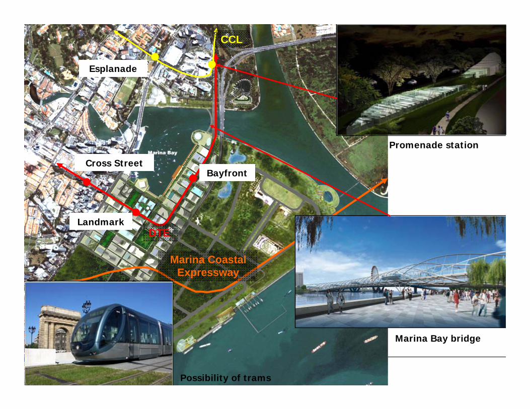
DTE
Marina Coastal Expressway
CCL
Marina Bay bridge
Promenade station
Possibility of trams
Esplanade
Bayfront
Landmark
Cross Street
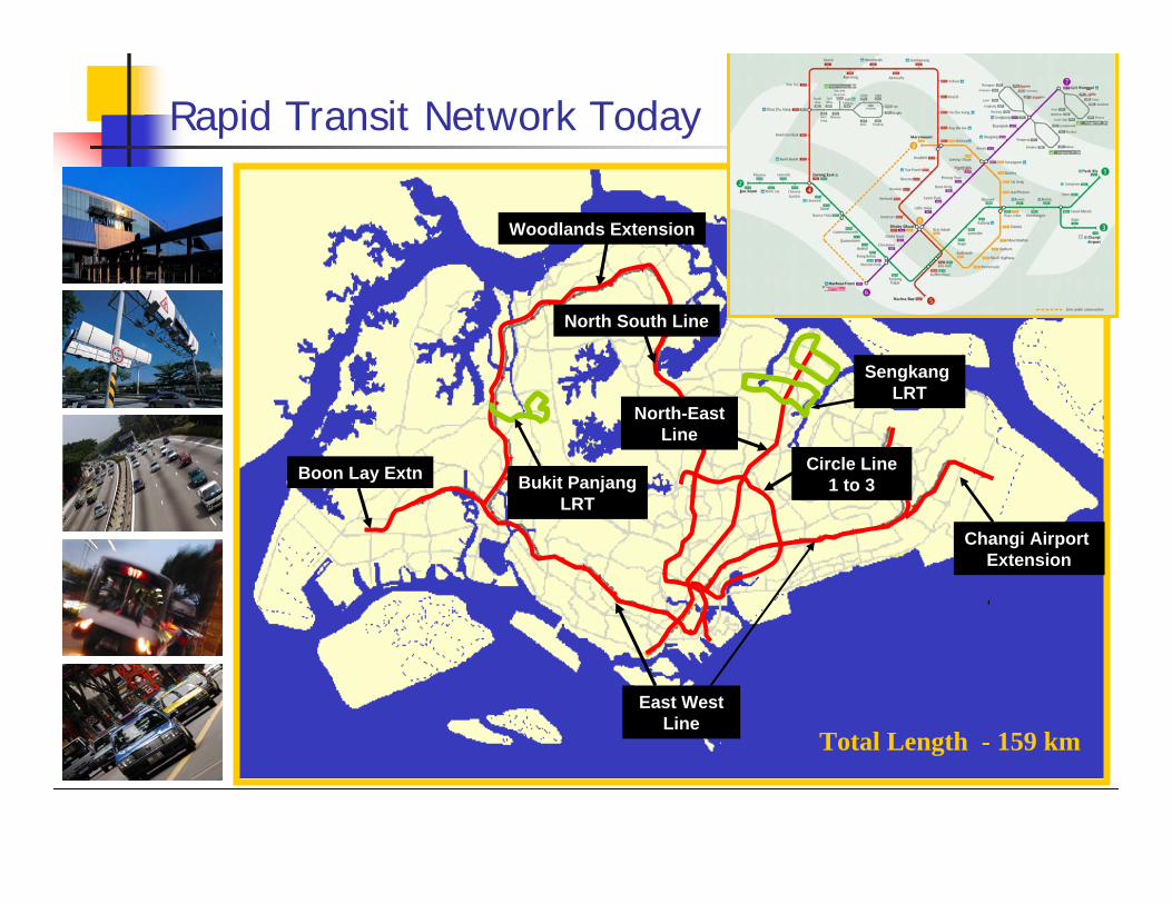
Rapid Transit Network Today
Woodlands Extension
North-East Line
Sengkang LRT
Bukit PanjangLRT
Changi Airport Extension
East West Line
North South Line
Total Length - 159 km
Circle Line 1 to 3Boon Lay Extn

RTS Network & Ridership
0
30
60
90
120
150
180
1986 1990 1996 1999 2001 2003 2007 2009 20100.00
0.25
0.50
0.75
1.00
1.25
1.50
1.75
2.00
2.25
Rid
ersh
ip (M
illio
ns)
RTS Ridership RTS Stations (as-built) RTS Length (km)
RTS
Len
gth
& Nu
mbe
r of S
tatio
ns
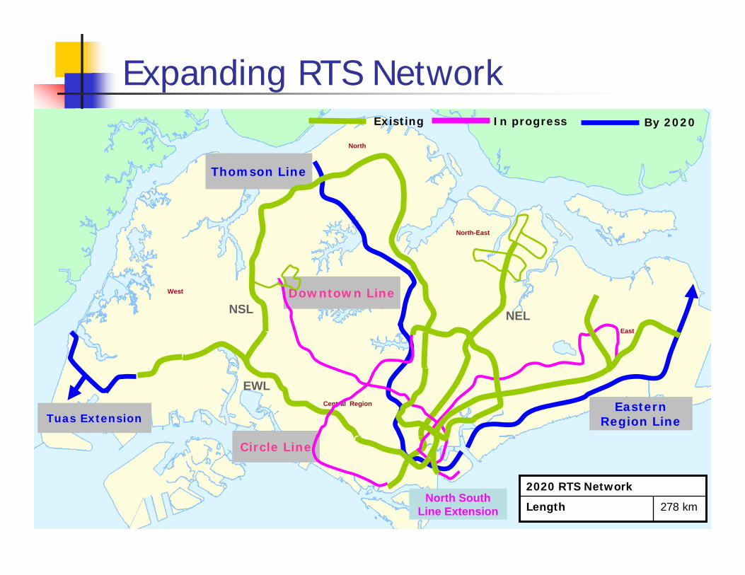
Expanding RTS NetworkExisting
East
North
West
North-East
In progress
NEL
Central Region
Downtown Line
Thomson Line
Eastern Region LineTuas Extension
Circle Line
By 2020
NSL
EWL
278 kmLength
2020 RTS NetworkNorth South
Line Extension
9
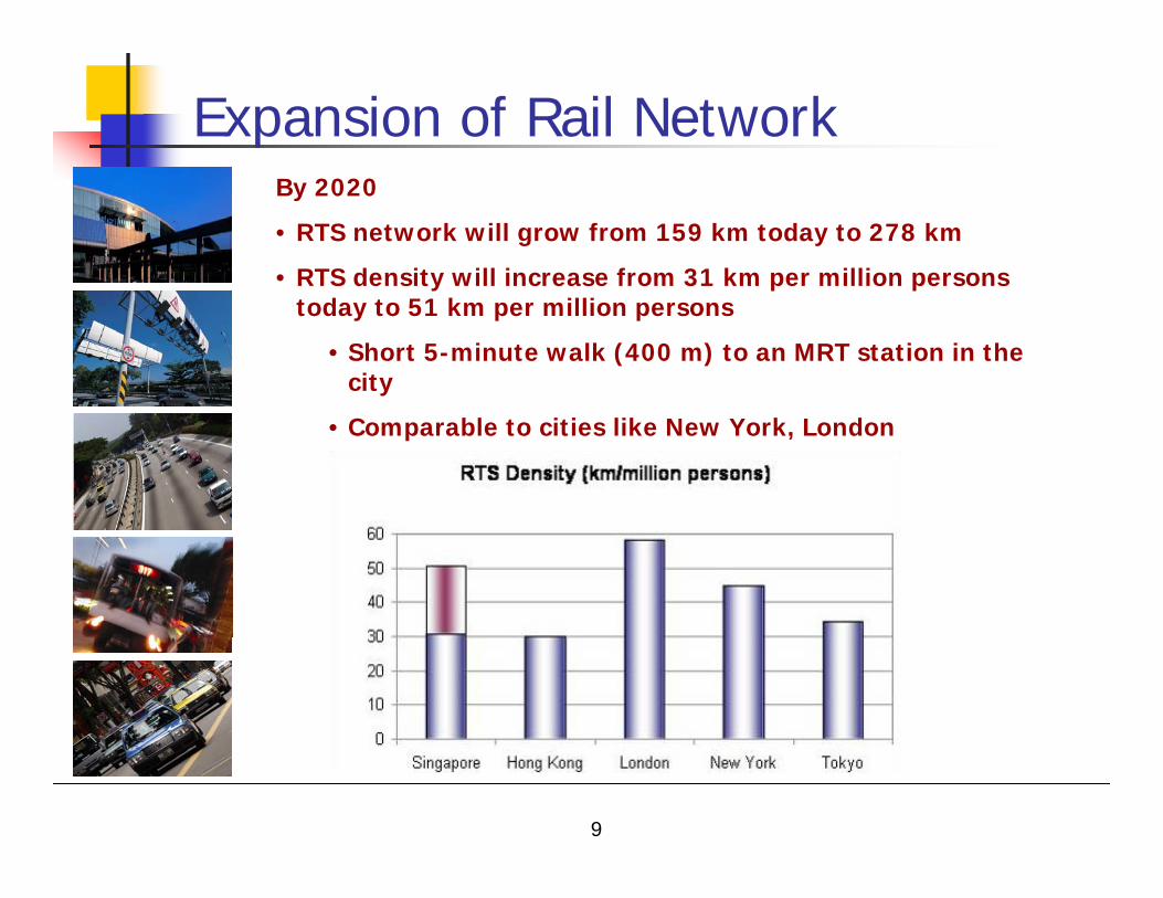
Expansion of Rail NetworkBy 2020
• RTS network will grow from 159 km today to 278 km
• RTS density will increase from 31 km per million persons today to 51 km per million persons
• Short 5-minute walk (400 m) to an MRT station in the city
• Comparable to cities like New York, London
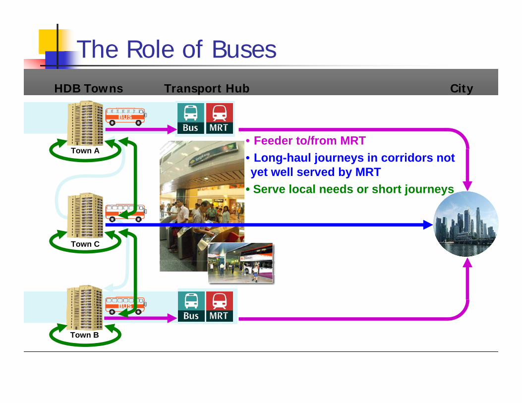
The Role of BusesHDB Towns Transport Hub City
Town A
Town B
Town C
• Feeder to/from MRT• Long-haul journeys in corridors not yet well served by MRT
• Serve local needs or short journeys
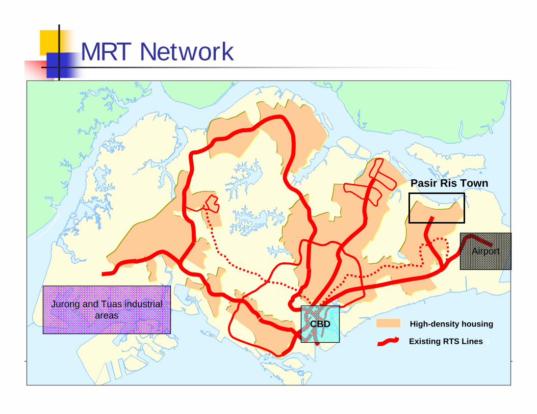
MRT Network
High-density housing
Existing RTS Lines s
Jurong and Tuas industrial areas
Airport
CBD
Pasir Ris Town
TAMPINES EXPRESSWAY
TAM
PIN E
S AV
ENUE
10
PASIR RIS DRIVE 1
LOYA
NG AVENUE
TAM
PIN
ES A
VENU
E 12
PASIR RIS DRIVE 3
PASI
R RI
S DR
IVE
12
DUSTRIAL AVENUE 3
TAMPINES LIN
K
LOYA
NG AVENUE
PASIR RIS DRIVE 1
PASIR RIS DRIVE 3
PASIR RIS DRIVE 1
PASIR RIS DRIVE 3
PASIR RIS DRIVE 1
PASIR RIS DRIVE 3
PASIR RIS DRIVE 3
PASIR RIS DRIVE 1
0 500 1,000 1,500 2,000250Meters
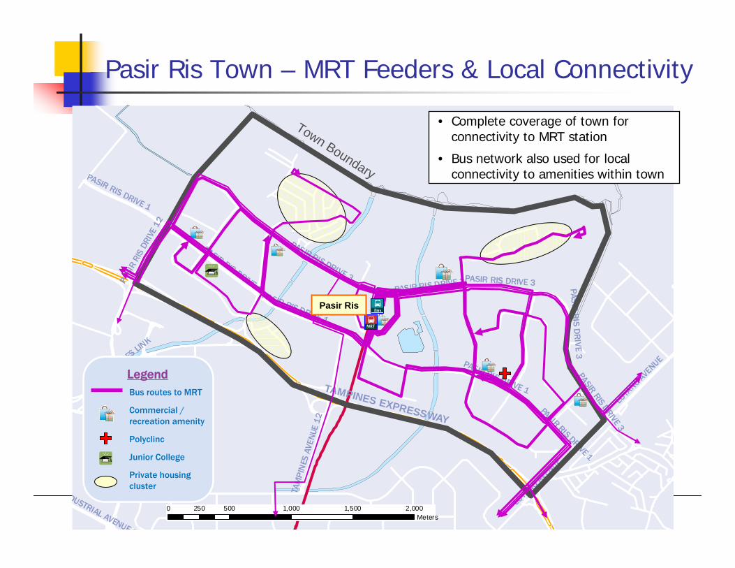
Pasir Ris Town – MRT Feeders & Local Connectivity
Bus routes to MRT
Commercial / recreation amenity
Polyclinc
Junior College
Private housing cluster
Legend
Town Boundary
• Complete coverage of town for connectivity to MRT station
• Bus network also used for local connectivity to amenities within town
Pasir Ris
0 2,500 5,000 7,500 10,0001,250Meters
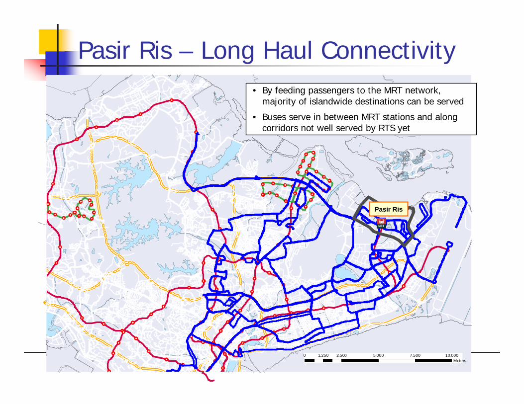
Pasir Ris – Long Haul Connectivity• By feeding passengers to the MRT network,
majority of islandwide destinations can be served
• Buses serve in between MRT stations and along corridors not well served by RTS yet
Pasir Ris
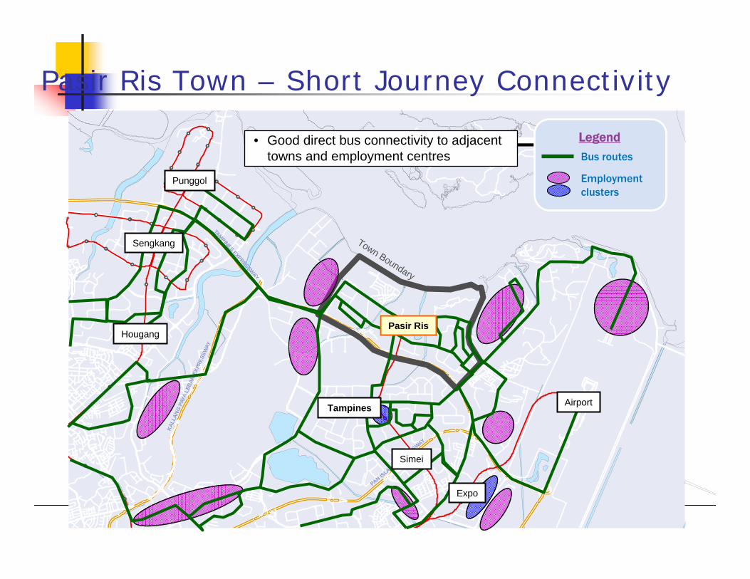
Pasir Ris Town – Short Journey Connectivity
TAMPINES EXPRESSWAY
PAN ISLAND EXPRESSWAY
KALL
ANG
PAYA
LEB
AR E
XPRE
SSW
AY
0 1,250 2,500 3,750 5,000625Meters
Town Boundary
Bus routes
Employment clusters
Legend
Hougang
Sengkang
Tampines
Punggol
Simei
Expo
Airport
Pasir Ris
• Good direct bus connectivity to adjacent towns and employment centres
Integration of Public Transport
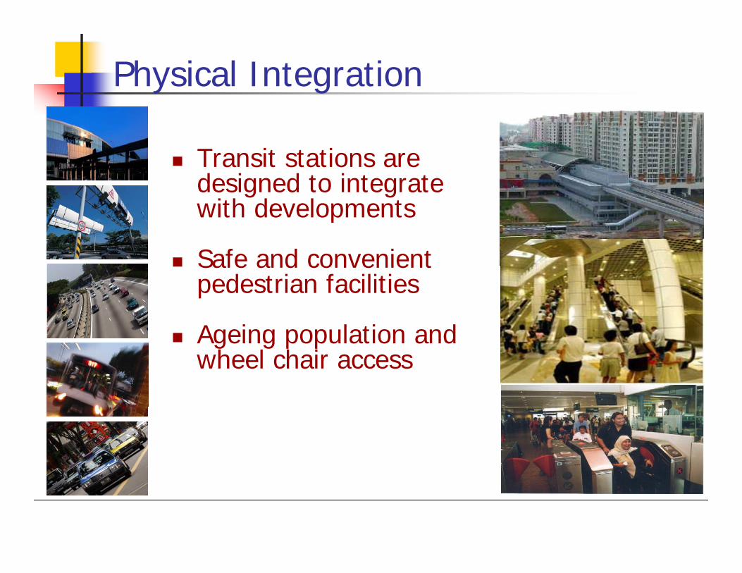
Physical Integration
Transit stations are designed to integrate with developments
Safe and convenient pedestrian facilities
Ageing population and wheel chair access
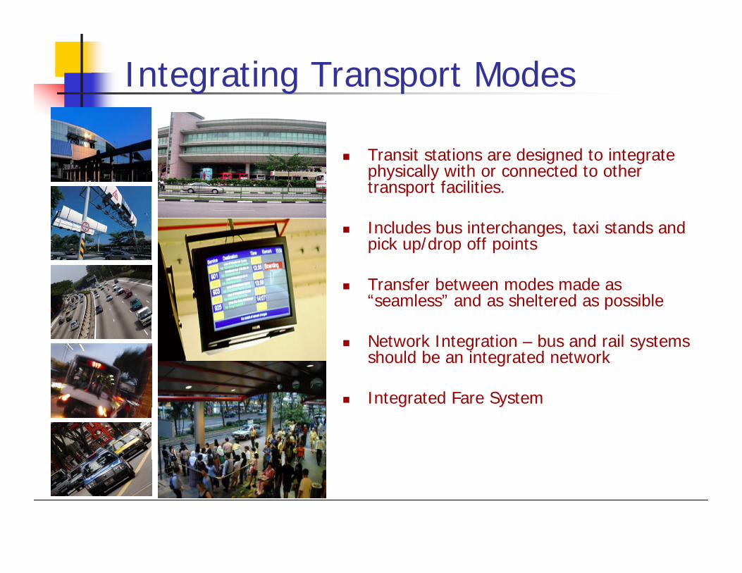
Integrating Transport Modes
Transit stations are designed to integrate physically with or connected to other transport facilities.
Includes bus interchanges, taxi stands and pick up/drop off points
Transfer between modes made as “seamless” and as sheltered as possible
Network Integration – bus and rail systems should be an integrated network
Integrated Fare System
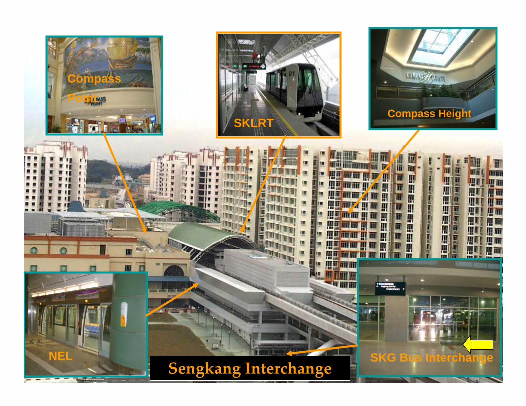
Sengkang Interchange
SKLRT
NEL
Compass Point
SKG Bus Interchange
Compass Height
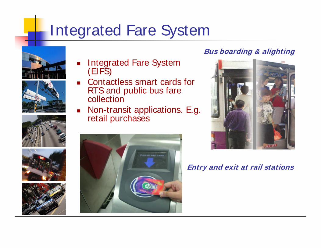
Integrated Fare System
Entry and exit at rail stations
Bus boarding & alightingIntegrated Fare System (EIFS)Contactless smart cards for RTS and public bus fare collectionNon-transit applications. E.g. retail purchases
Regulation ofPublic Transport
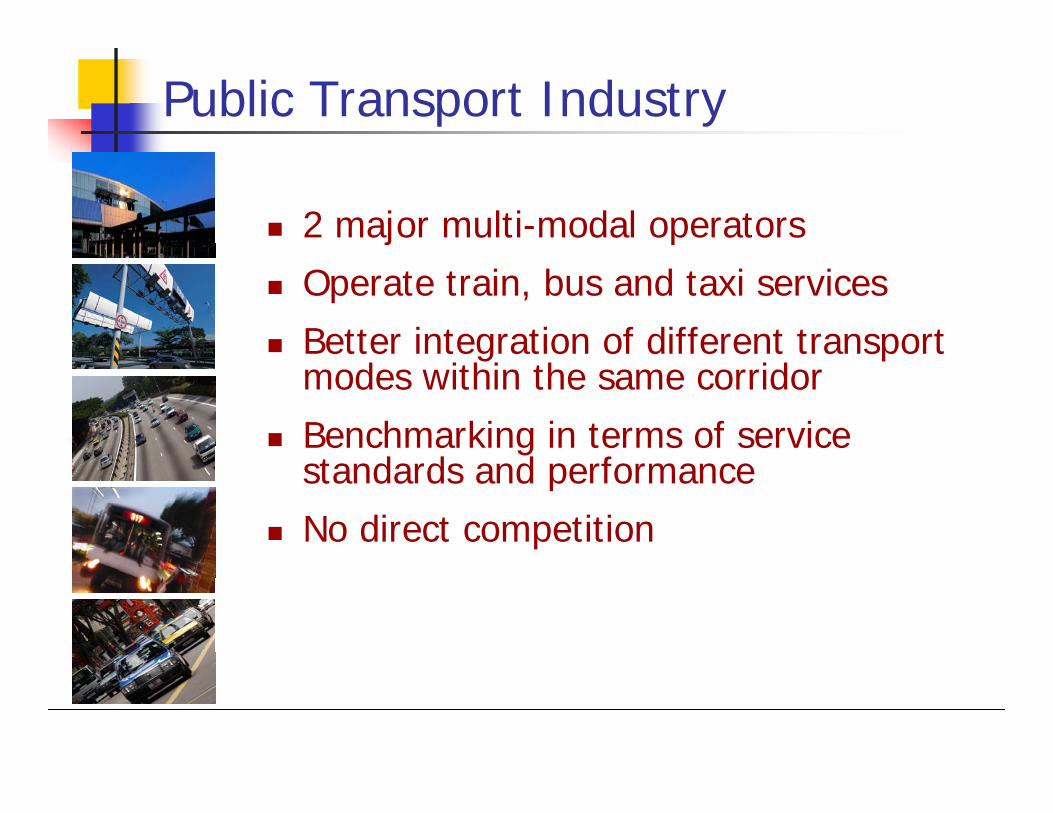
Public Transport Industry
2 major multi-modal operators
Operate train, bus and taxi services
Better integration of different transport modes within the same corridor
Benchmarking in terms of service standards and performance
No direct competition

Regulation of Public Transport Industry
Public Transport
Council (PTC)
Approves Bus & RTS
Fares
Approves Bus
Routes
Licences &
regulates Bus
Services
LTA
Licences &
regulates Taxi
Services
Approves vocational licences
Licences &
regulates RTS
services
Provides technical and
agency services
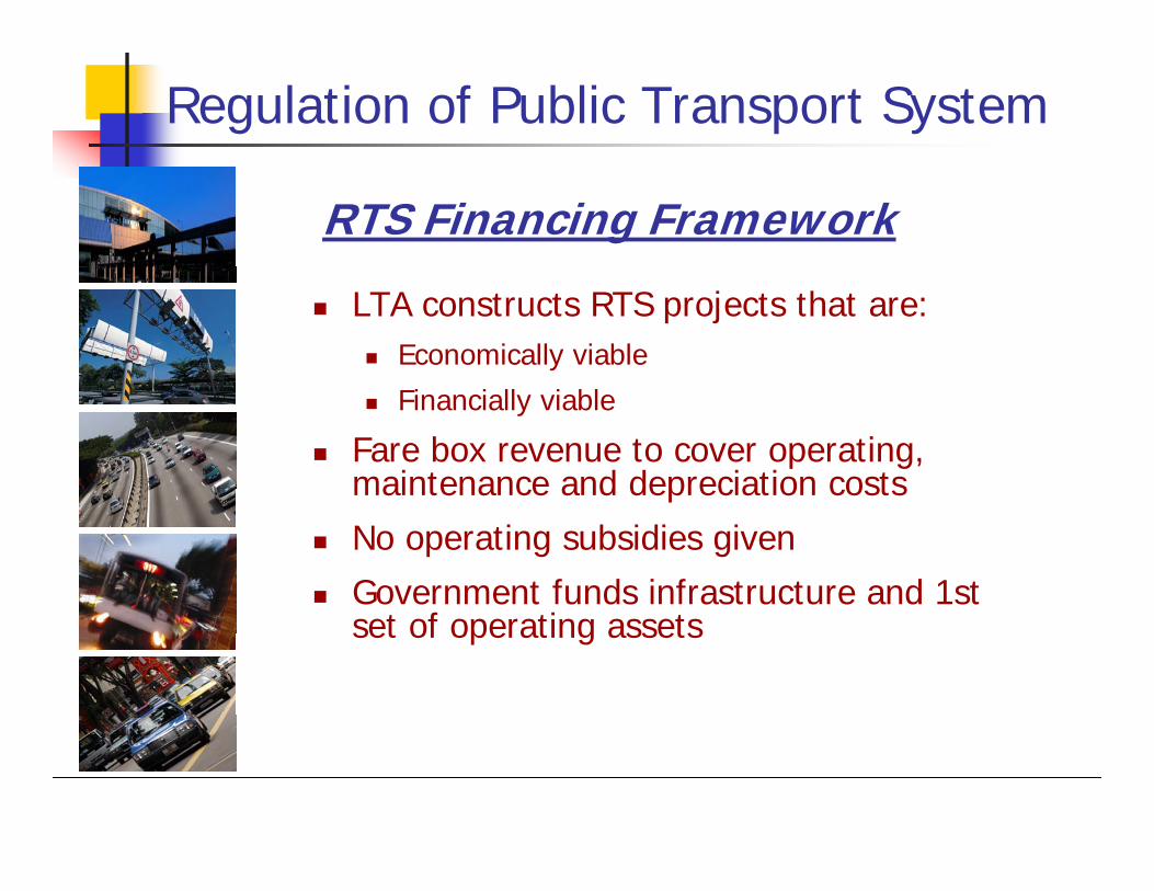
Regulation of Public Transport System
RTS Financing Framework
LTA constructs RTS projects that are:Economically viable
Financially viable
Fare box revenue to cover operating, maintenance and depreciation costs
No operating subsidies given
Government funds infrastructure and 1st set of operating assets
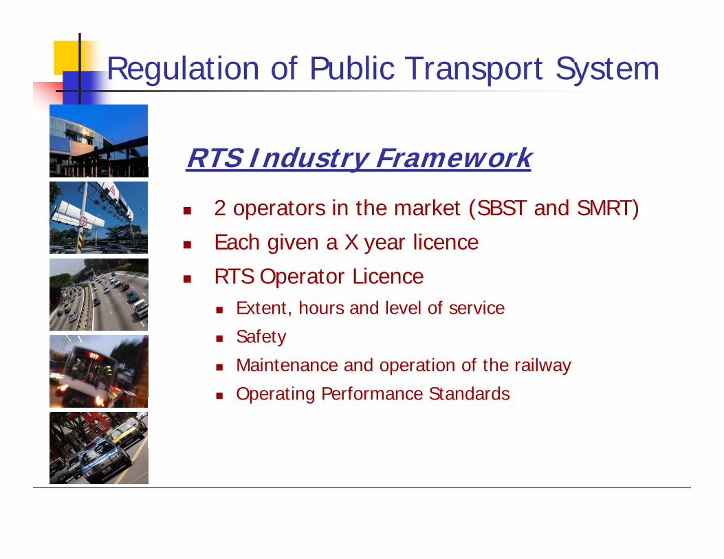
Regulation of Public Transport System
RTS Industry Framework
2 operators in the market (SBST and SMRT)
Each given a X year licence
RTS Operator LicenceExtent, hours and level of service
Safety
Maintenance and operation of the railway
Operating Performance Standards

Regulation of Public Transport System
Govt funds infrastructure such as bus interchanges and bus shelters
Capital costs of buses & depots borne by operators
Operators enjoy certain tax concessions for buses
No operating subsidies given
Bus Financing Framework
Regulation of Public Transport System
2 basic bus operators (SBST and SMRT Buses)
PTC issues Bus Service Operator Licence
Universal Service Obligations (USO) within their respective areas of responsibilities
Covers a set of Quality of Service (QoS) standards, other licence conditions
Penalties imposed for non-compliance
Bus Industry Framework
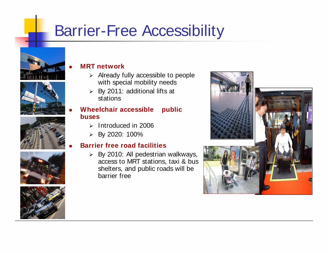
Barrier-Free Accessibility
MRT networkAlready fully accessible to people with special mobility needs By 2011: additional lifts at stations
Wheelchair accessible public buses
Introduced in 2006By 2020: 100%
Barrier free road facilitiesBy 2010: All pedestrian walkways, access to MRT stations, taxi & bus shelters, and public roads will be barrier free
Thank you