Embed Size (px)
Citation preview
Session Overview
• What is location sensing• How do we use location• Location sensing techniques
– Triangulation– Proximity– Scene analysis
• System examples
Location sensing
• Use computing and digital communications to find location
• How did we do it before?– used landmarks in the environment– used proximity to landmarks– used the positions of starts– somebody else told us where we are
• Why do we need location?– to navigate– to know how to behave
Uses of location
• Mapping systems• Locating people and objects• Wireless routing (geo-casting)• Supporting smart spaces and location-based
applications• Location is just one type of context
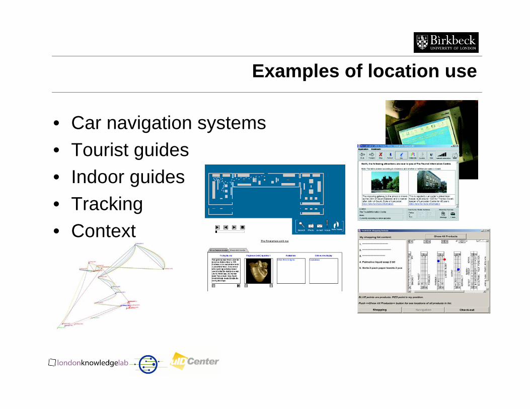
Examples of location use
• Car navigation systems• Tourist guides• Indoor guides• Tracking• Context
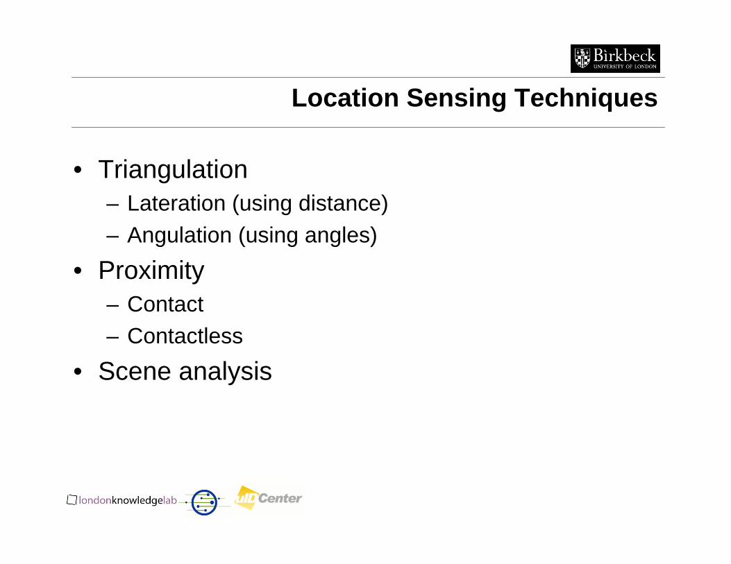
Location Sensing Techniques
• Triangulation– Lateration (using distance)– Angulation (using angles)
• Proximity– Contact– Contactless
• Scene analysis
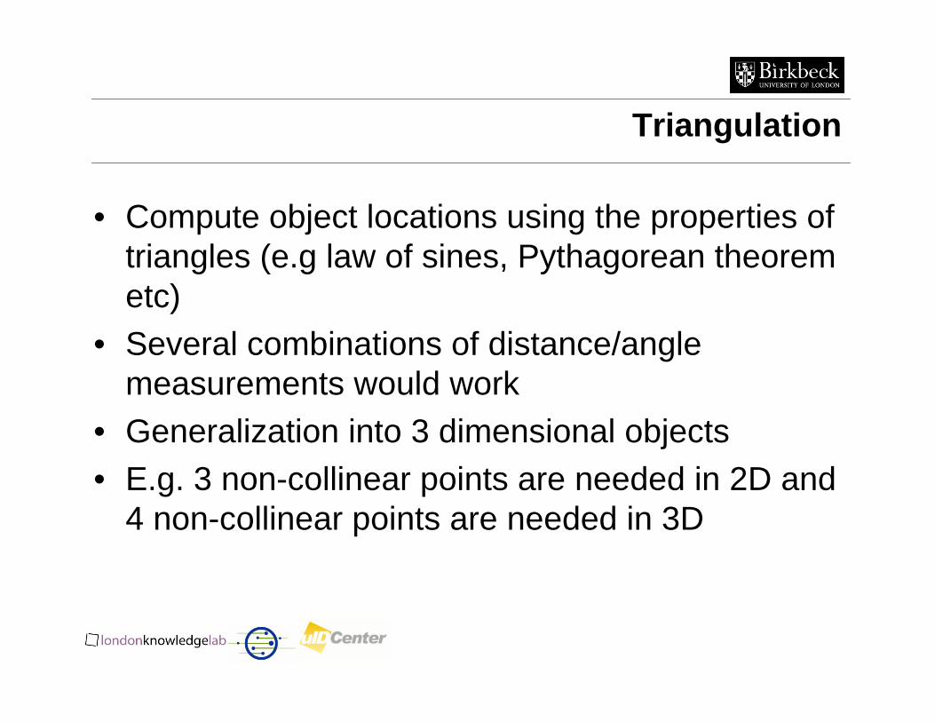
Triangulation
• Compute object locations using the properties of triangles (e.g law of sines, Pythagorean theorem etc)
• Several combinations of distance/angle measurements would work
• Generalization into 3 dimensional objects• E.g. 3 non-collinear points are needed in 2D and
4 non-collinear points are needed in 3D
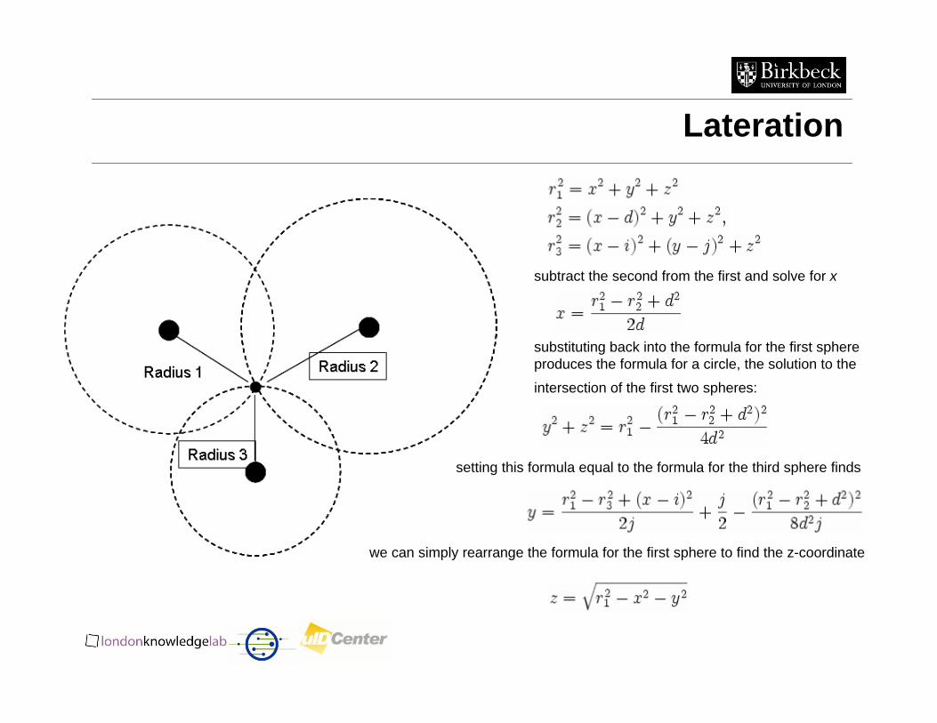
Lateration
subtract the second from the first and solve for x
substituting back into the formula for the first sphere produces the formula for a circle, the solution to the
intersection of the first two spheres:
setting this formula equal to the formula for the third sphere finds
we can simply rearrange the formula for the first sphere to find the z-coordinate
Lateration Measurements
Types of measurements– Direct touch
• Measure distance directly
– Time-of-flight of the radio signal between transmitter and receiver
• Measure time and then calculate the distance using the speed of the signal
– Signal attenuation ie. drop in the strength of a signal as it propagates in space
• Measure the signal at the receiving end and then calculate the distance as the drop to what the signal was at the source
Lateration Measurements
• Time-of-flight example– sound waves – speed 344m/s at 21oC – distance = time x speed– speed depends on environmental conditions– depends on accurate timings
• Signal attenuation– calculate based on send and receive strength
• Absorption, scattering, interference• Free space loss = 32.4 + 20xLog F(MHz) + 20xLog R(Km)
– attenuation varies based on environment
Time-of-Flight Problems
• Often requires high time resolution (for accurate light or radio propagation measurements)– a light pulse which travels at 299,792,458m/s will
cover 5m in 16.7ns– a 0.001 sec error leads to 200 miles error!
• Clock synchronization critical– Accurate synchronization between reference
beacons and receivers– Beacons could use atomic clocks (100k cost)– Could improve using extra measurements
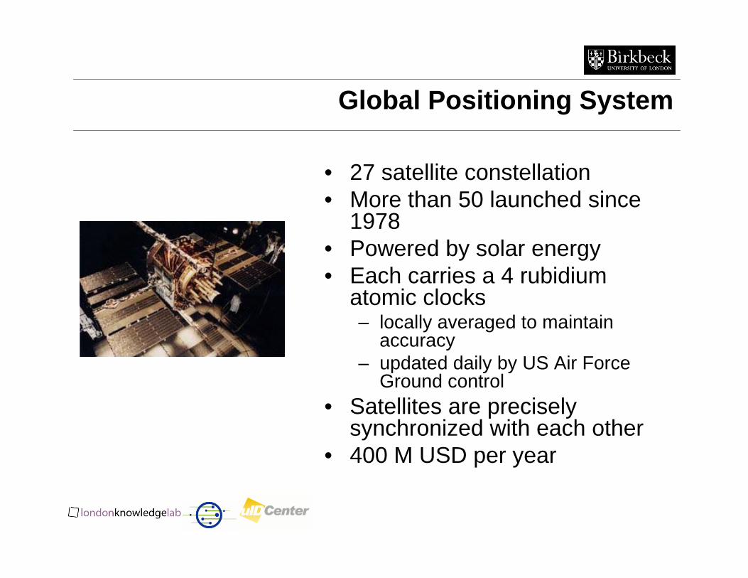
Global Positioning System
• 27 satellite constellation • More than 50 launched since
1978• Powered by solar energy• Each carries a 4 rubidium
atomic clocks – locally averaged to maintain
accuracy – updated daily by US Air Force
Ground control• Satellites are precisely
synchronized with each other• 400 M USD per year
Global Positioning System
• Receiver is not synchronized with the satellite transmitter• Satellites transmit their local time in the signal• Receivers compute their difference in time-of-arrival• Receivers estimate their position (longitude, latitude,
elevation) using (at least) 4 satellites• Accuracy is about 5 meters (20 meters until recently
when random error was introduced)• Differential GPS provides extra accuracy approx. 2
meters
• European solution: Galileo
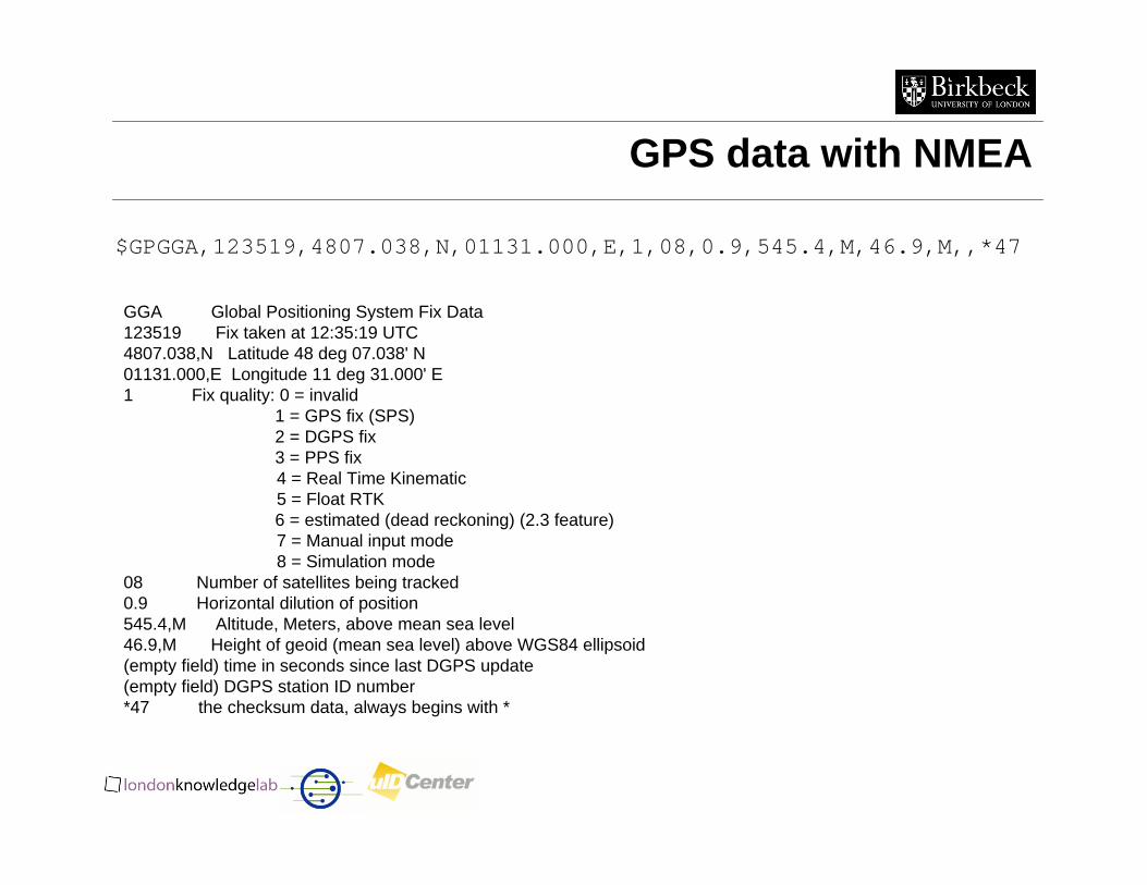
GPS data with NMEA
$GPGGA,123519,4807.038,N,01131.000,E,1,08,0.9,545.4,M,46.9,M,,*47
GGA Global Positioning System Fix Data123519 Fix taken at 12:35:19 UTC4807.038,N Latitude 48 deg 07.038' N01131.000,E Longitude 11 deg 31.000' E1 Fix quality: 0 = invalid
1 = GPS fix (SPS)2 = DGPS fix3 = PPS fix4 = Real Time Kinematic5 = Float RTK6 = estimated (dead reckoning) (2.3 feature)7 = Manual input mode8 = Simulation mode
08 Number of satellites being tracked0.9 Horizontal dilution of position545.4,M Altitude, Meters, above mean sea level46.9,M Height of geoid (mean sea level) above WGS84 ellipsoid(empty field) time in seconds since last DGPS update(empty field) DGPS station ID number*47 the checksum data, always begins with *
Using GPS
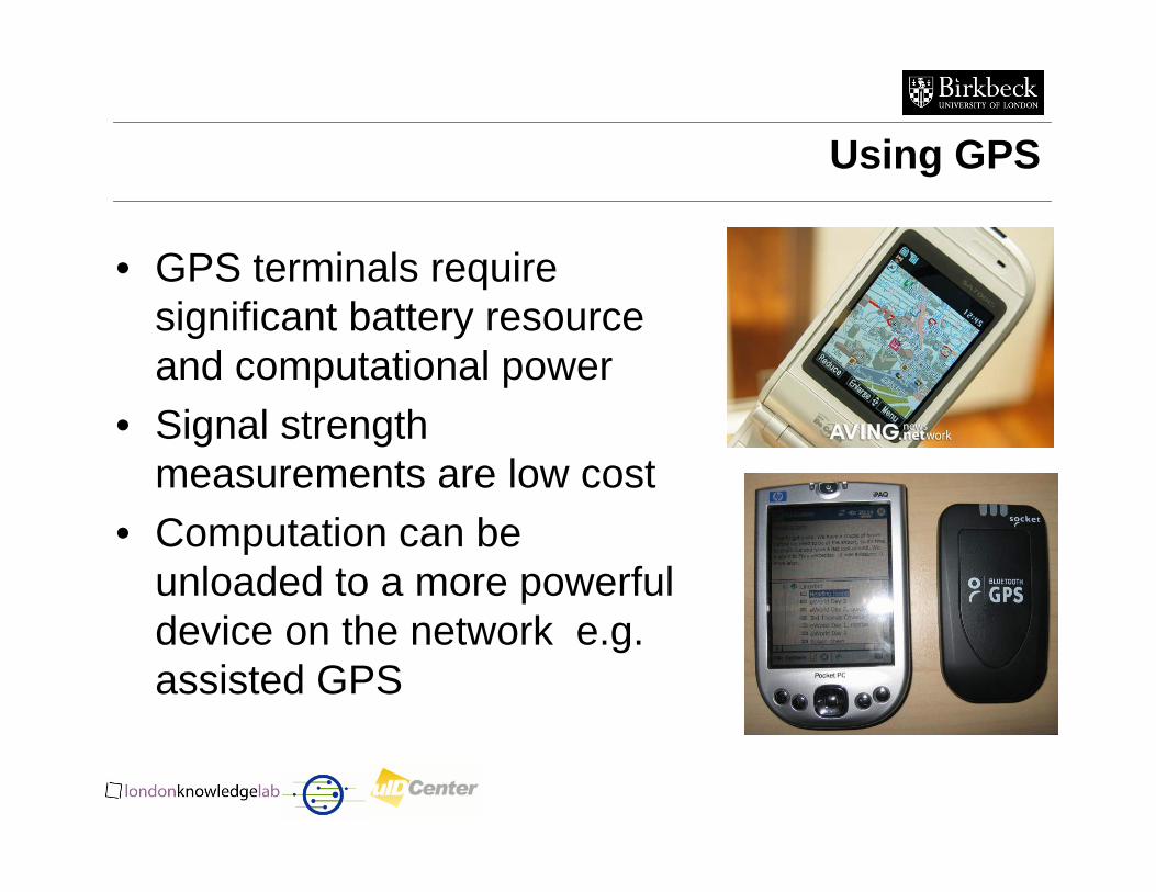
• GPS terminals require significant battery resource and computational power
• Signal strength measurements are low cost
• Computation can be unloaded to a more powerful device on the network e.g. assisted GPS
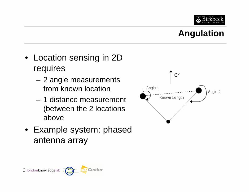
Angulation
• Location sensing in 2D requires– 2 angle measurements
from known location – 1 distance measurement
(between the 2 locations above
• Example system: phased antenna array
Phased Antenna Array
• Multiple antennas with known separation (i.e. distance) – the military is very fond of this!
• Each measures time-of-flight of signal• Using the difference in times and the (known)
geometry of the receiving array, we can calculate the required angle
• If there are enough elements in the array and large separation, angulation can be performed accurately
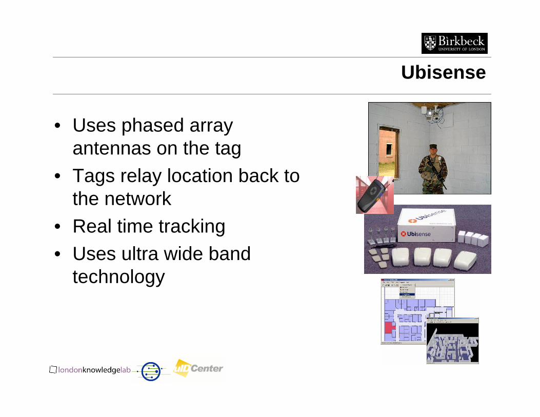
Ubisense
• Uses phased array antennas on the tag
• Tags relay location back to the network
• Real time tracking• Uses ultra wide band
technology
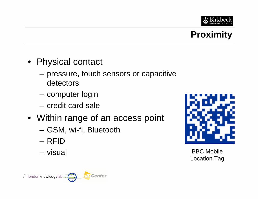
Proximity
• Physical contact – pressure, touch sensors or capacitive
detectors– computer login– credit card sale
• Within range of an access point – GSM, wi-fi, Bluetooth– RFID– visual BBC Mobile
Location Tag
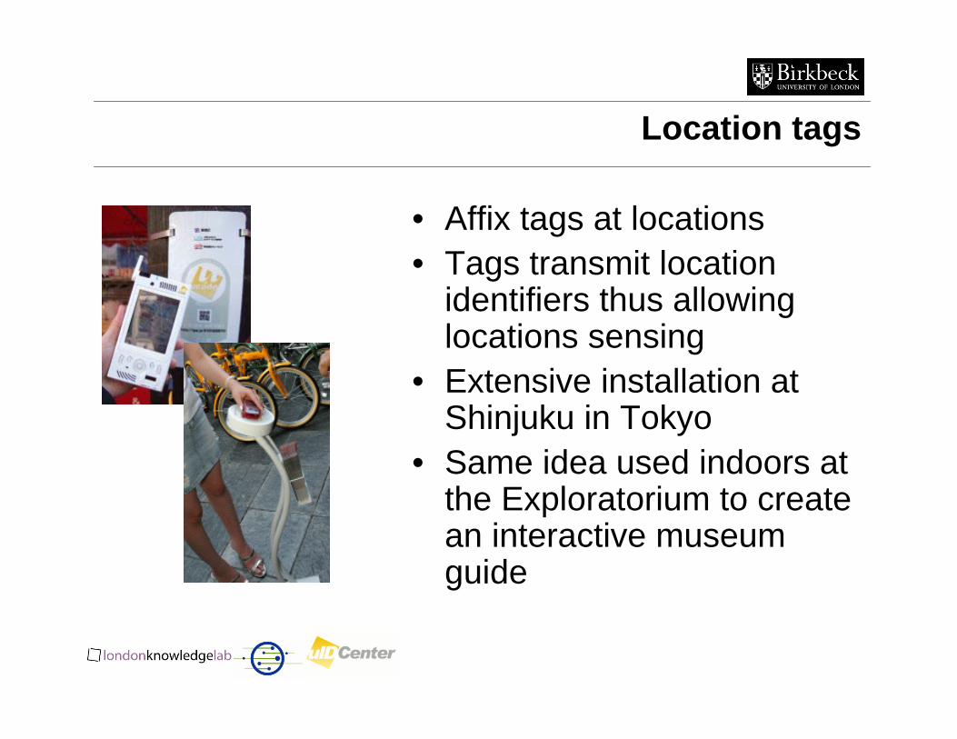
Location tags
• Affix tags at locations• Tags transmit location
identifiers thus allowing locations sensing
• Extensive installation at Shinjuku in Tokyo
• Same idea used indoors at the Exploratorium to create an interactive museum guide
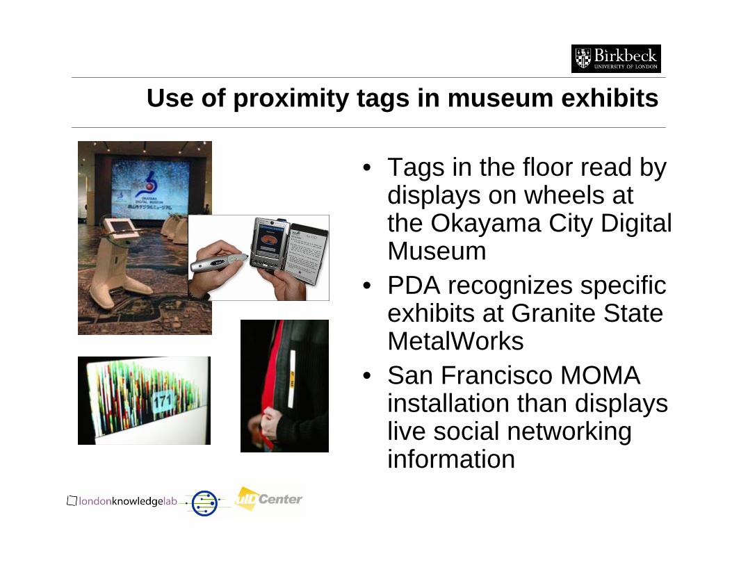
Use of proximity tags in museum exhibits
• Tags in the floor read by displays on wheels at the Okayama City Digital Museum
• PDA recognizes specific exhibits at Granite State MetalWorks
• San Francisco MOMA installation than displays live social networking information
Scene Analysis
• Compares scenes to reference scenes– Image, electromagnetic spectrum
• Construct a signature of a position and apply pattern matching techniques with this signature
• Differential scene analysis– Tracks differences in scenes
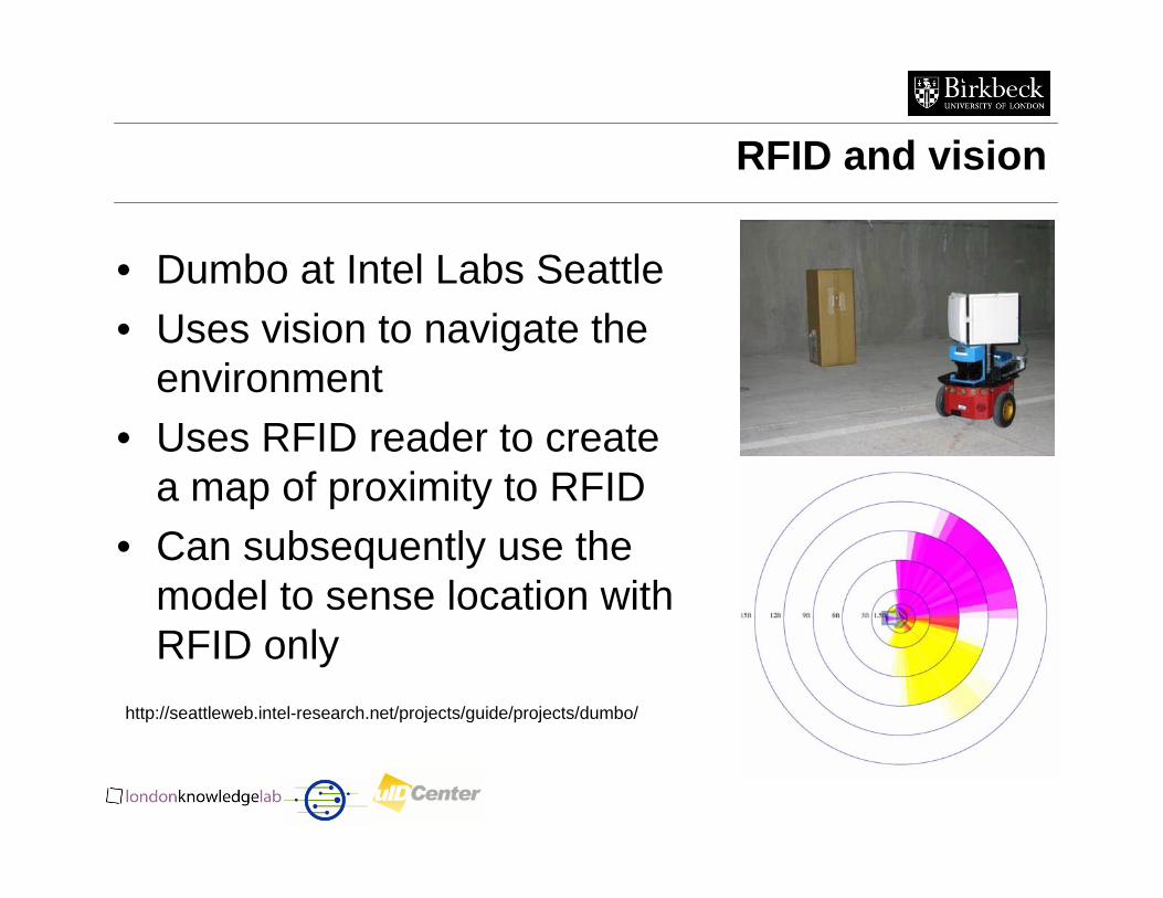
RFID and vision
• Dumbo at Intel Labs Seattle• Uses vision to navigate the
environment• Uses RFID reader to create
a map of proximity to RFID• Can subsequently use the
model to sense location with RFID only
http://seattleweb.intel-research.net/projects/guide/projects/dumbo/
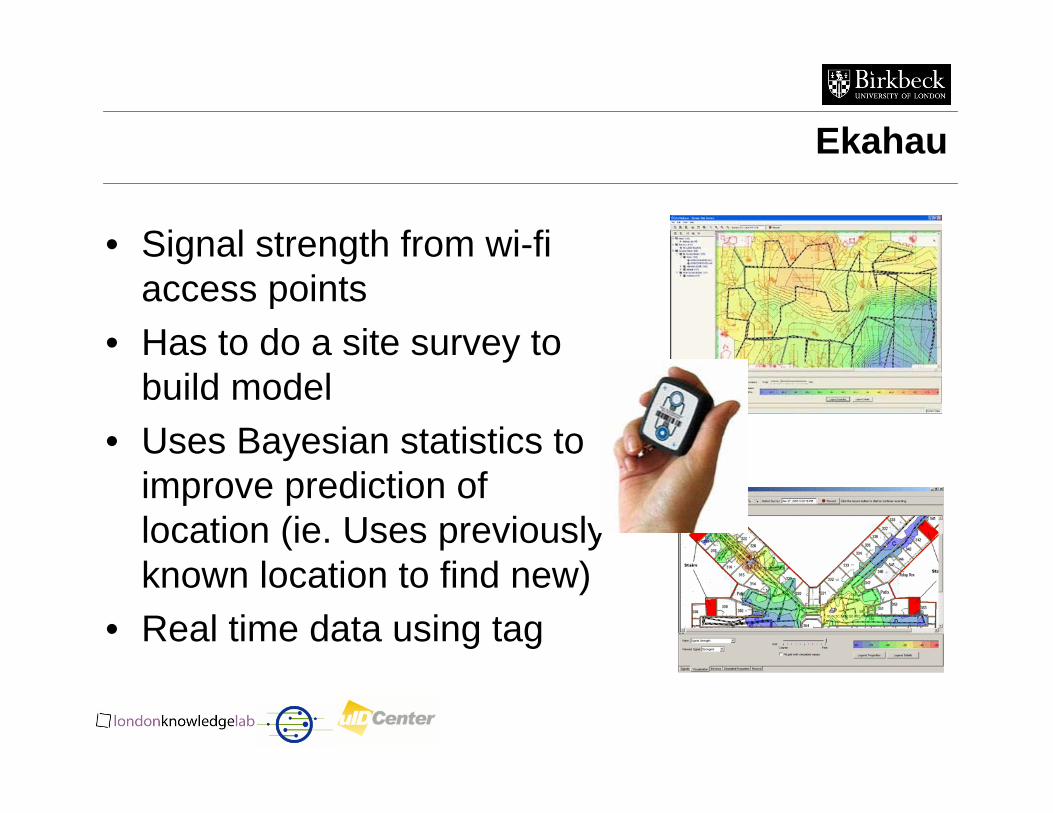
Ekahau
• Signal strength from wi-fiaccess points
• Has to do a site survey to build model
• Uses Bayesian statistics to improve prediction of location (ie. Uses previously known location to find new)
• Real time data using tag
Scene Analysis Challenges
• Issues– the observer needs access to the features of the
environment against which it will compare its observed scenes
– changes of the environment that affects these features may require their reconstruction
Summary
• What is location sensing• How do we use location• Location sensing techniques
– Triangulation– Proximity– Scene analysis
• System examples