Embed Size (px)
Citation preview
MMS/MLS – Mobile Mapping and Mobile Laser Scanning System
4th ISPRS SC and WG VI/5 Summer School, Warsaw 2009.
4th ISPRS SC and WG VI/5 Summer School, Warsaw 2009. 2/36
OUTLINE
1. Laser scanning
2. MMS/MLS
3. Fusion of aerial imagery and laser scanning
4. Exemplary Project
5. Applications of photogrammetry and Mobile Laser Systems in
Forestry
6. Summary
4th ISPRS SC and WG VI/5 Summer School, Warsaw 2009. 3/36
BASIC INFORMATION ABOUT LASER SCANNING
Laser scanning is an active remote sensing technique, which allows collecting precise coordinates of objects in its range. The main principle in the laser scanner is the range measurement done by the laser beam.
Data collected by the laser scanner provides a point cloud. Each component of it has three coordinates (XYZ) and reflection intensity value. Laser scanning gives a full, three-dimensional information about scanned objects.
4th ISPRS SC and WG VI/5 Summer School, Warsaw 2009. 4/36
TERRESTRIAL LASER SCANNING
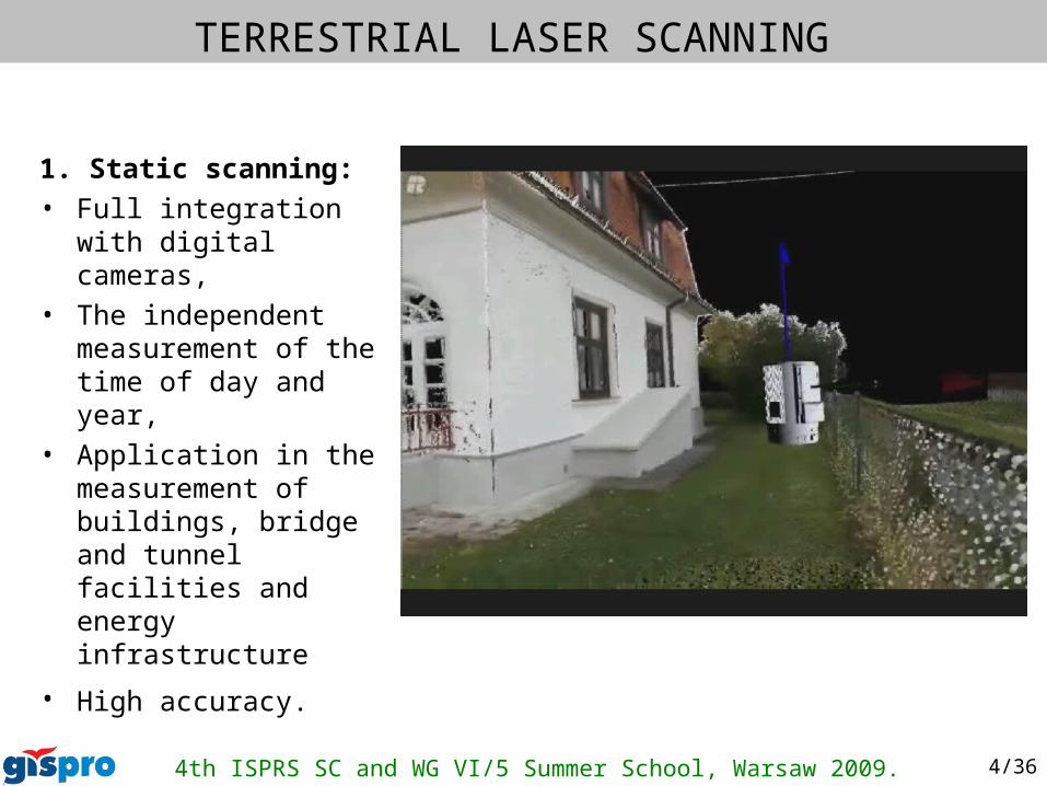
1. Static scanning:
• Full integration with digital cameras,
• The independent measurement of the time of day and year,
• Application in the measurement of buildings, bridge and tunnel facilities and energy infrastructure
• High accuracy.
4th ISPRS SC and WG VI/5 Summer School, Warsaw 2009. 5/36
TERRESTRIAL LASER SCANNING
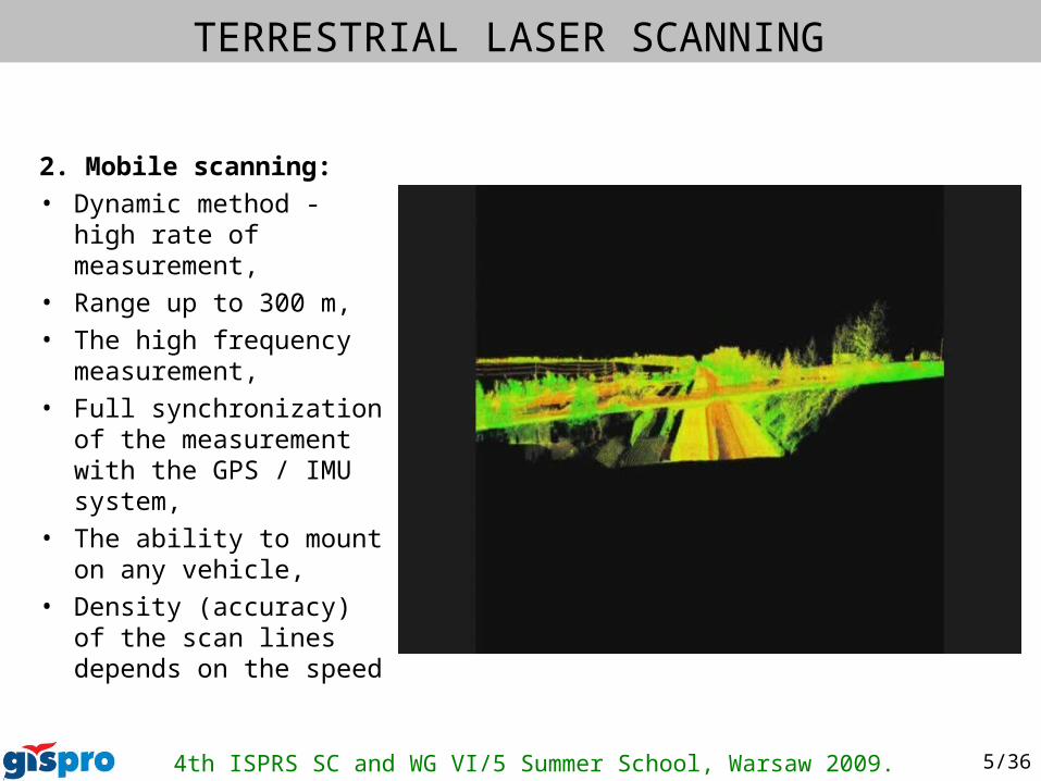
2. Mobile scanning:
• Dynamic method - high rate of measurement,
• Range up to 300 m,
• The high frequency measurement,
• Full synchronization of the measurement with the GPS / IMU system,
• The ability to mount on any vehicle,
• Density (accuracy) of the scan lines depends on the speed
4th ISPRS SC and WG VI/5 Summer School, Warsaw 2009. 6/36
MMS/MLS
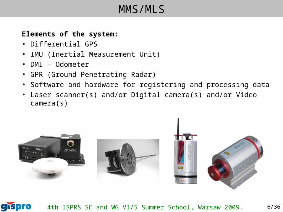
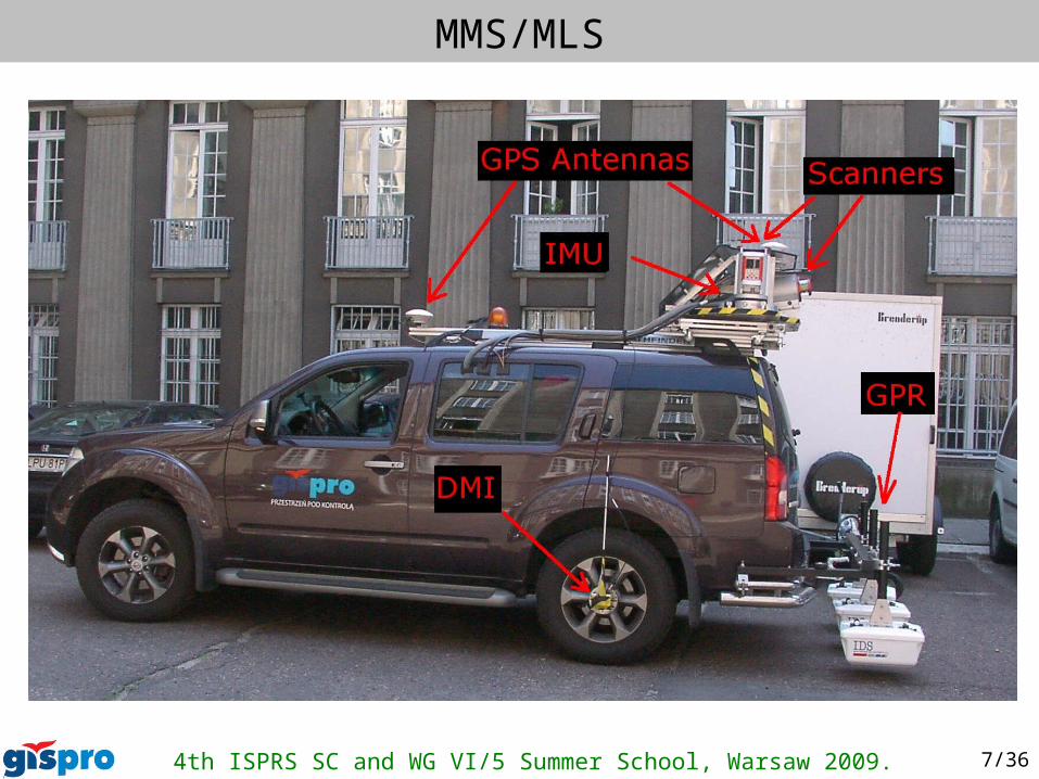
Elements of the system:
• Differential GPS
• IMU (Inertial Measurement Unit)
• DMI – Odometer
• GPR (Ground Penetrating Radar)
• Software and hardware for registering and processing data
• Laser scanner(s) and/or Digital camera(s) and/or Video camera(s)
4th ISPRS SC and WG VI/5 Summer School, Warsaw 2009. 7/36
MMS/MLS
4th ISPRS SC and WG VI/5 Summer School, Warsaw 2009. 8/36
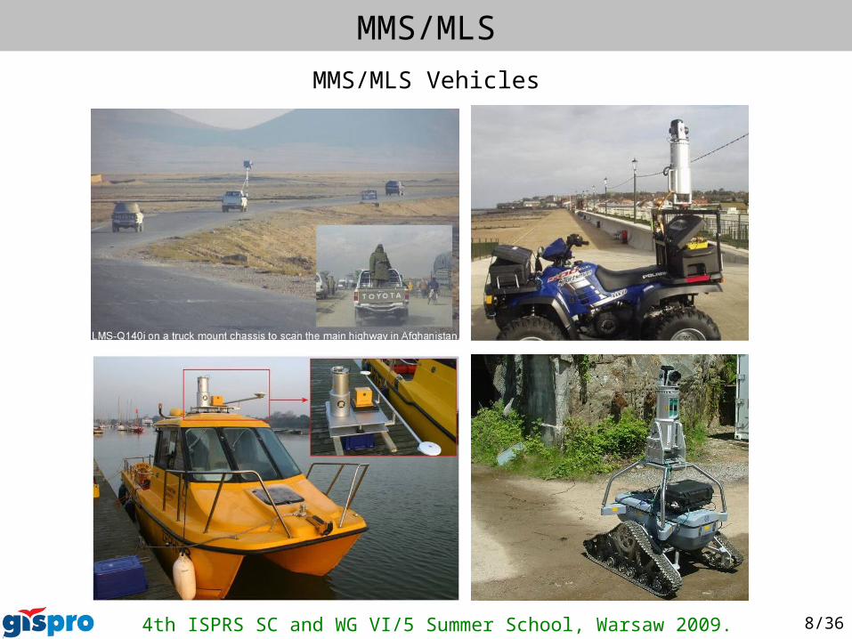
MMS/MLS
MMS/MLS Vehicles
4th ISPRS SC and WG VI/5 Summer School, Warsaw 2009. 9/36
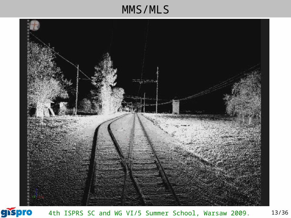
MMS/MLS
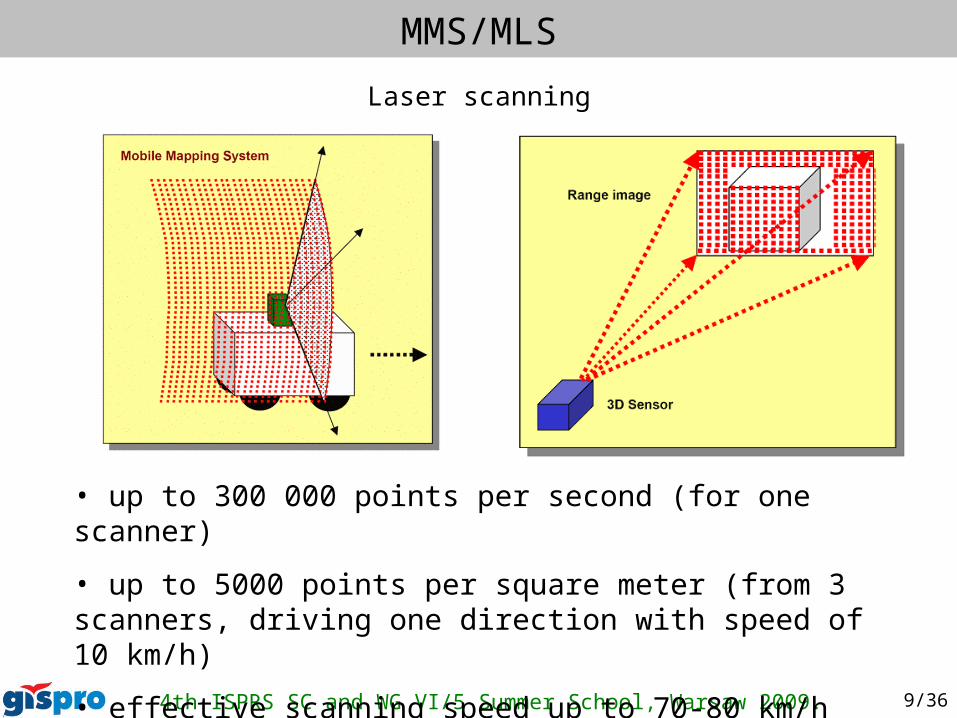
• up to 300 000 points per second (for one scanner)
• up to 5000 points per square meter (from 3 scanners, driving one direction with speed of 10 km/h)
• effective scanning speed up to 70-80 km/h
Laser scanning
4th ISPRS SC and WG VI/5 Summer School, Warsaw 2009. 10/36
MMS/MLS
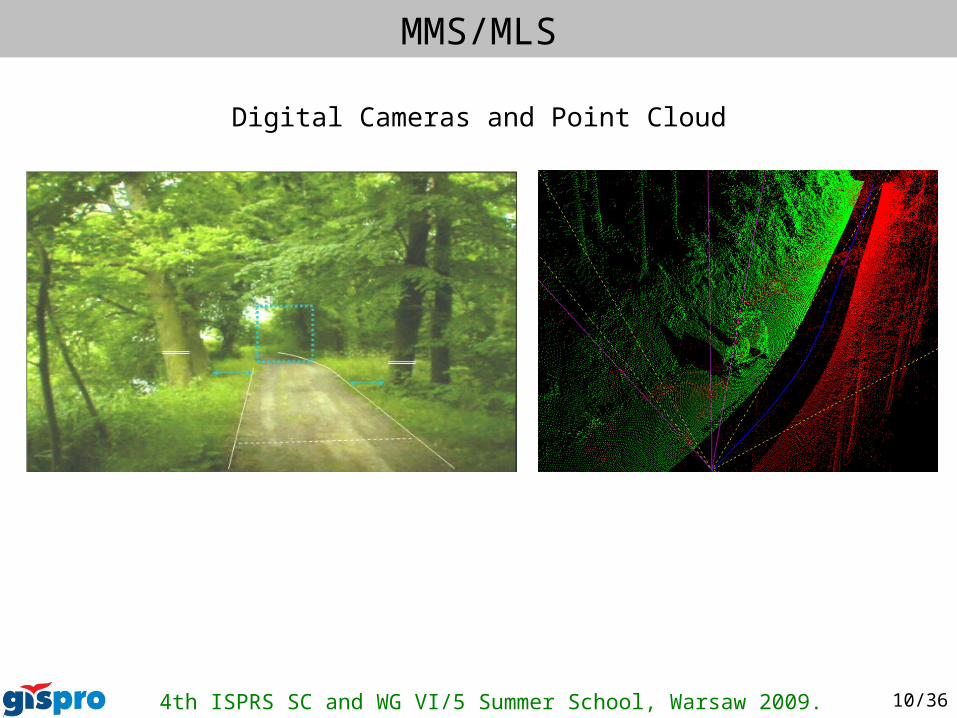
Digital Cameras and Point Cloud
4th ISPRS SC and WG VI/5 Summer School, Warsaw 2009. 11/36
MMS/MLS
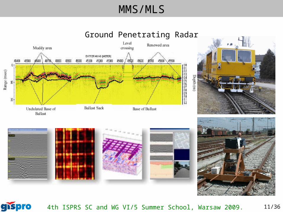
Ground Penetrating Radar
4th ISPRS SC and WG VI/5 Summer School, Warsaw 2009. 12/36
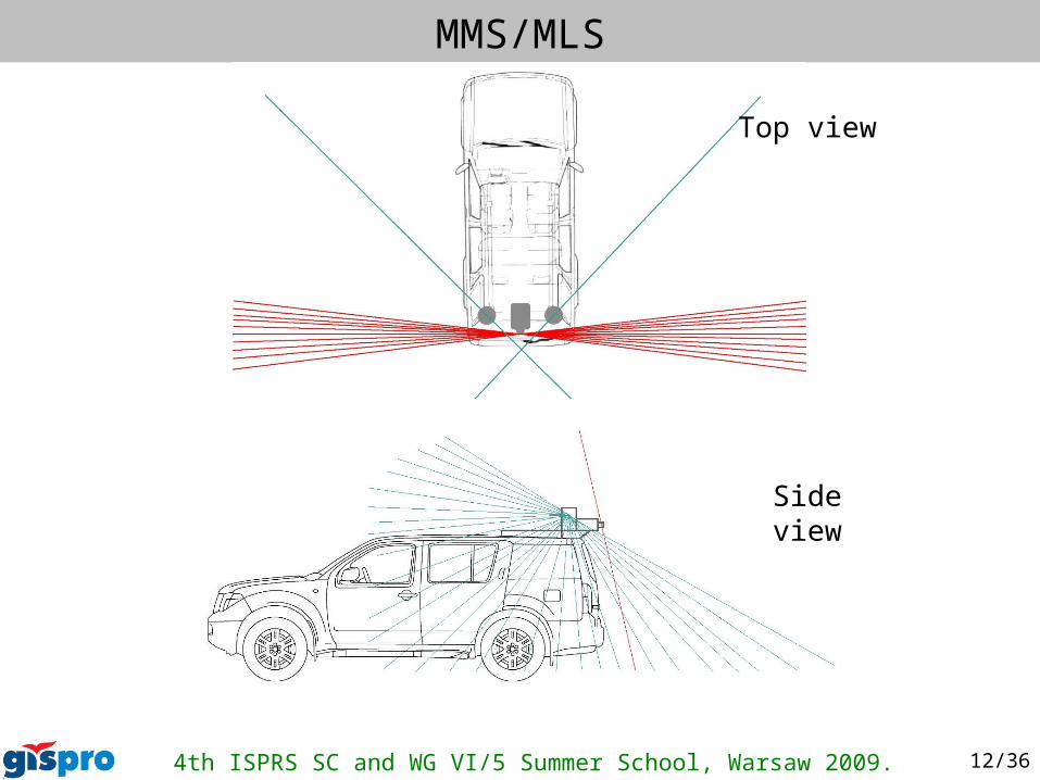
MMS/MLS
Top view
Side view
4th ISPRS SC and WG VI/5 Summer School, Warsaw 2009. 13/36
MMS/MLS
4th ISPRS SC and WG VI/5 Summer School, Warsaw 2009. 14/36
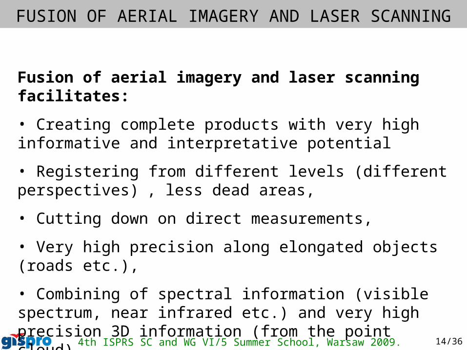
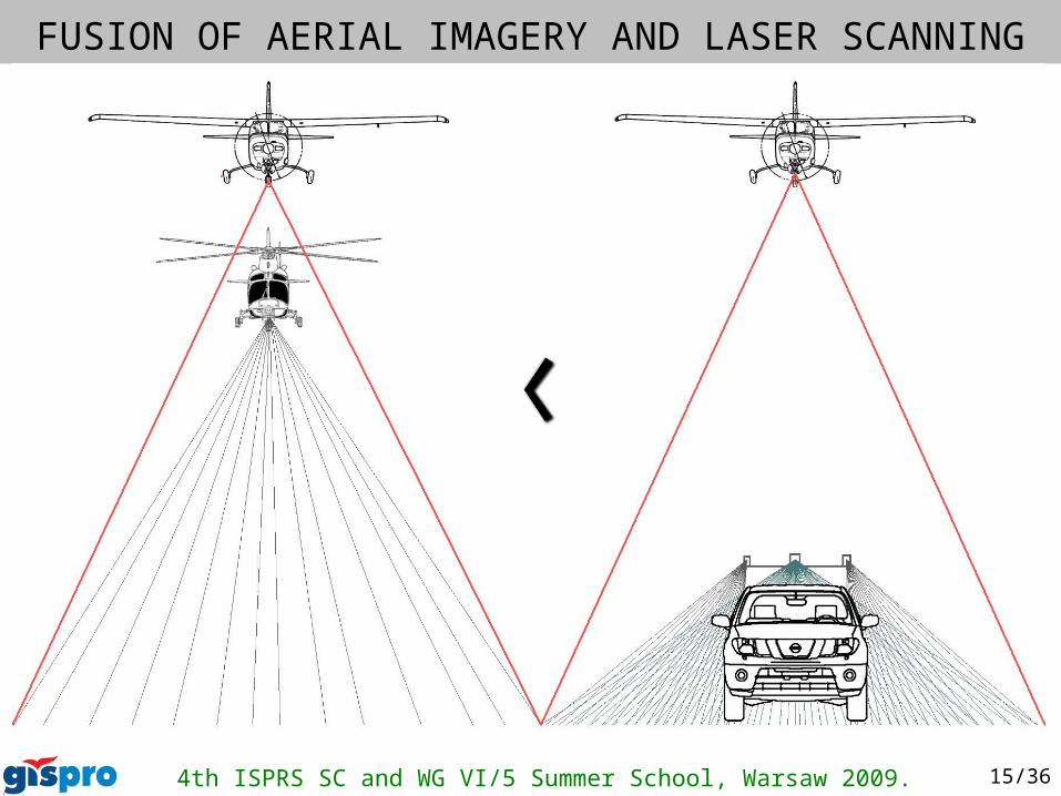
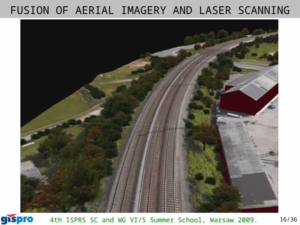
Fusion of aerial imagery and laser scanning facilitates:
• Creating complete products with very high informative and interpretative potential
• Registering from different levels (different perspectives) , less dead areas,
• Cutting down on direct measurements,
• Very high precision along elongated objects (roads etc.),
• Combining of spectral information (visible spectrum, near infrared etc.) and very high precision 3D information (from the point cloud).
FUSION OF AERIAL IMAGERY AND LASER SCANNING
4th ISPRS SC and WG VI/5 Summer School, Warsaw 2009. 15/36
FUSION OF AERIAL IMAGERY AND LASER SCANNING
4th ISPRS SC and WG VI/5 Summer School, Warsaw 2009. 16/36
FUSION OF AERIAL IMAGERY AND LASER SCANNING
4th ISPRS SC and WG VI/5 Summer School, Warsaw 2009. 17/36
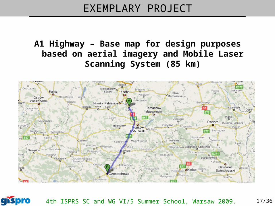
A1 Highway – Base map for design purposes based on aerial imagery and Mobile Laser Scanning System (85 km)
EXEMPLARY PROJECT
4th ISPRS SC and WG VI/5 Summer School, Warsaw 2009. 18/36
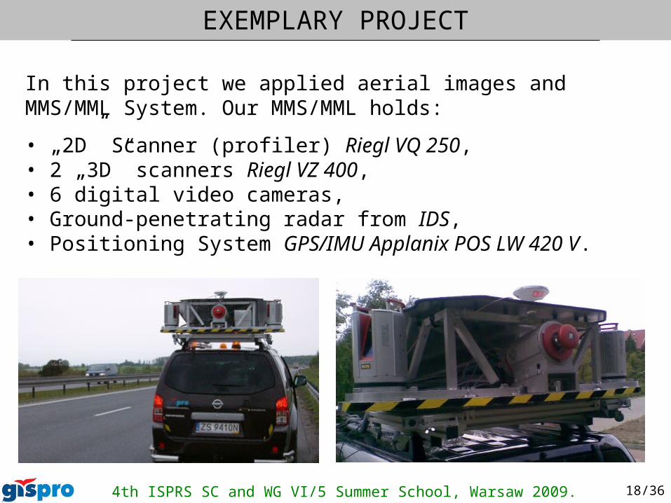
In this project we applied aerial images and MMS/MML System. Our MMS/MML holds:
• „2D” Scanner (profiler) Riegl VQ 250,• 2 „3D” scanners Riegl VZ 400,• 6 digital video cameras,• Ground-penetrating radar from IDS,• Positioning System GPS/IMU Applanix POS LW 420 V.
EXEMPLARY PROJECT