Embed Size (px)
Citation preview
1
DETAILED TEXT AGAINST GLOBAL EXPRESSION OF INTEREST (EOI) NO. OIL/NEF/EOI/01/2009
For
HIRING OF SERVICES FOR ACQUISITION AND PROCESSING OF 600 SQ. KM. OF 3D SEISMIC DATA FROM THE HILLY/THRUST BELT/ LOGISTICALLY DIFFICULT AREA OF NELP-VI BLOCK: MZ-ONN-2004/1 IN MIZORAM
1.0 PREAMBLE: OIL INDIA LIMITED (OIL), a premier National Oil Company with its Headquarters at Duliajan, Assam, India, engaged in exploration, production & transportation of crude oil & natural gas proposes to acquire & process 600 Sq.Kms 3D seismic data using state-of-the-art technology in its NELP-VI Block: MZ-ONN-2004/1 in the state of Mizoram, North East India by hiring the services of an internationally reputed and competent Contractor having required infrastructure and relevant experience of carrying out 3D seismic surveys in similar logistically difficult & geologically complex thrust fold areas. The Contractor is expected to meet the following requirement: - Acquisition & Processing (AP) of 600 SQ.KM of 3D seismic data as per international industry standards over the prospects identified based on the results of 2D seismic data acquired recently.
- Contractor must possess adequate experience and expertise of acquiring 3D Seismic data in similar hilly, mountainous thrust belt areas covered with forests.
- The entire project would be required to be executed on a Turnkey basis within the stipulated time frame.
INTERESTED PARTIES are requested to make themselves fully aware of the topography, logistics, environmental concerns etc and to understand clearly the area and the job involvement, prior to submission of EOI.
2.0 GEOLOGY, OBJECTIVE AND GENERAL INFORMATION OF THE SURVEY AREA: A. GEOLOGY OF THE AREA: 2.1 Northeastern part of India constitutes the seven states. These are; Assam, Arunachal Pradesh, Meghalaya, Nagaland, Manipur, Mizoram and Tripura. It constitutes the sedimentary basin complex of Assam Shelf and Assam-Arakan. Physiographically, Cachar, the southern district of Assam, forms an entrenched part of Manipur – Mizoram and Tripura. Myanmar and Bangladesh are, respectively, to the east and west of these states. The Assam-Arakan sedimentary basin is a shelf-slope-basinal system. The shelf part of the basin spreads over the Brahmaputra valley. The basinal part (geosynclinal) is occupied by the Naga Schuppen belt and the Cachar, Tripura, Mizoram and Manipur fold belts. The Assam-Arakan fold belt extends southward to the Cachar-Mizo fold zone. West of this zone, lies the frontal belt of Tripura with mostly closed folds which gradually become tighter towards east in Mizoram.
2
2.2 Assam - Arakan region, Mizoram, Manipur and Tripura have drawn the attention of exploration geologists ever since the discovery of Digboi and Makum oil fields of Upper Assam around 1890. The Badarpur oil field in Cachar district of Assam, presently abandoned, was discovered in 1901. This discovery followed a spate of other discoveries in Assam since Sixties of the last Century. Gas occurrence in Tripura is very relevant to the exploration of the region. Commercial gas in this state was discovered during the late seventies of previous century within the Surma sequence of Miocene age. Several other gas fields have also been found since then. 2.3 Cachar- Tripura- Mizoram fold belt constitutes a distinct part of Assam-Arakan Tectonic system. Myanmar’s Shan Plateau and the Ophiolite complex extend to the east of it. The Bangladesh flood plains are to the west. The Naga Schuppen belt of Assam forms the northern extreme and Chittagong hill track (Bangladesh) lies to the south of it. 2.4 The area of operation is a part of Tripura – Cachar – Mizoram fold belt of AssamArakhan Basin. The Mizoram fold belt is composed of tight linear folds with their axes almost in north-south direction. The intensity of folding increases from west to east where the rocks of Indian plate sub-ducted below the Burmese plate. The anticlines are long, narrow and tight, whereas the synclines are broad and gentle. As per the geological section of the area of operation, the area has Tipam formation exposed in the central part and Bokabil formation is exposed in the eastern and western part. The Bhuban formation is divided in three formations as Lower, Middle and Upper Bhuban formations. Lower Bhuban formation is mainly alternations of sandstones and shale. The Middle Bhuban consists of mainly shale with subordinate sandstones. The Upper Bhuban consists of alternations of sandstones and shales. B OBJECTIVE OF THE PROPOSED 3D SEISMIC SURVEY: 2.5 The main objective of the proposed 3D seismic survey is to acquire international standard quality 3D seismic data for proper delineation and imaging the hydrocarbon prospects of this geologically complex thrust fold area. The zone of interest lies between 2000 – 5000 meters. C. PHYSIOGRAPHY, CLIMATE AND COMMUNICATION Physiography 2.6 The region, in general, exhibits first - order topography of folded Miocene Strata. The compact and relatively - older rocks constitute these ridges and the younger strata make up the valleys. Elements of second - order topography are seen towards east of longitude
93°30’ East. 2.7 Geomorphology of Manipur-Mizoram-Tripura region is typified by a succession of sub-parallel hill ranges and long valleys. The hill ranges reach a maximum height of around 1800m in Mizoram with most of these between 900-1200m. Thus, the general elevation increases towards east up to the Myanmar border. 2.8 Major river systems follow the north-south longitudinal valleys. The important rivers, Barak and Langai, flowing through Cachar originate in the hills of Manipur. Other rivers are Rukni, Dhaleshwari and Singla. Regional drainage, in general, is oriented in a north – south direction. The important rivers of Mizoram are Tlawng, Tiau, Chhimtuipui, Karnaphuli etc.
3
Climate 2.9 Northeastern India experiences a sub-tropical to tropical climate with a rainfall of 300 to 400cm per annum. Summer is hot and humid and maximum temperatures range
from 30°C to 38°C during April to June, Monsoon sets in rather early during the season. From May onwards, pre- monsoon showers are frequent. Winter season from November
to January is milder when temperatures are between 12° to 25°C.
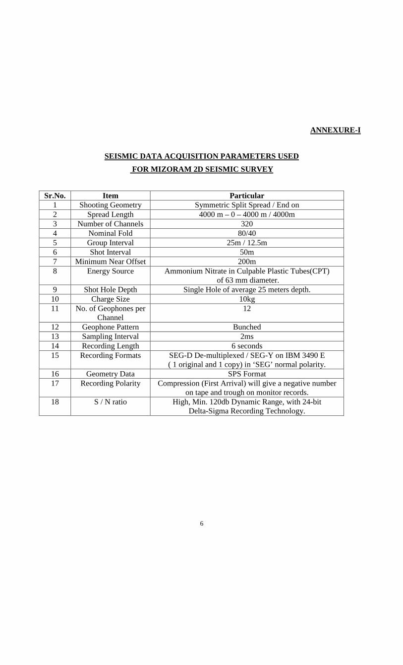
Communication 2.10 Mizoram- Manipur – Tripura is mainly a hilly region. The area is connected by national highway (NH54), which touches the southern end of Mizoram state at Lunglei. Highway No. (NH39) reaches Aizawl, the capital of Mizoram. In addition to National Highway, there are State Highways and fair weather motorable roads criss-crossing the territory (Refer Figure-1). The nearest railhead is at Bairabi close to the border with Cachar district of Assam. Broad gauge railway line connects Kolkata to Guwahati and Upper Assam. Meter gauge railway line from Dimapur (Nagaland) to Guwahati (Upper Assam) passes through Bairabi in Mizoram, Silchar in Cachar and Jiriban in Manipur. 2.11 Aizawl is also linked by air to the rest of India. The nearest International Airport is at Kolkata in West Bengal. Airports at Guwahati, Jorhat, Agartala, Imphal and Aizawl receive regular domestic air traffic.
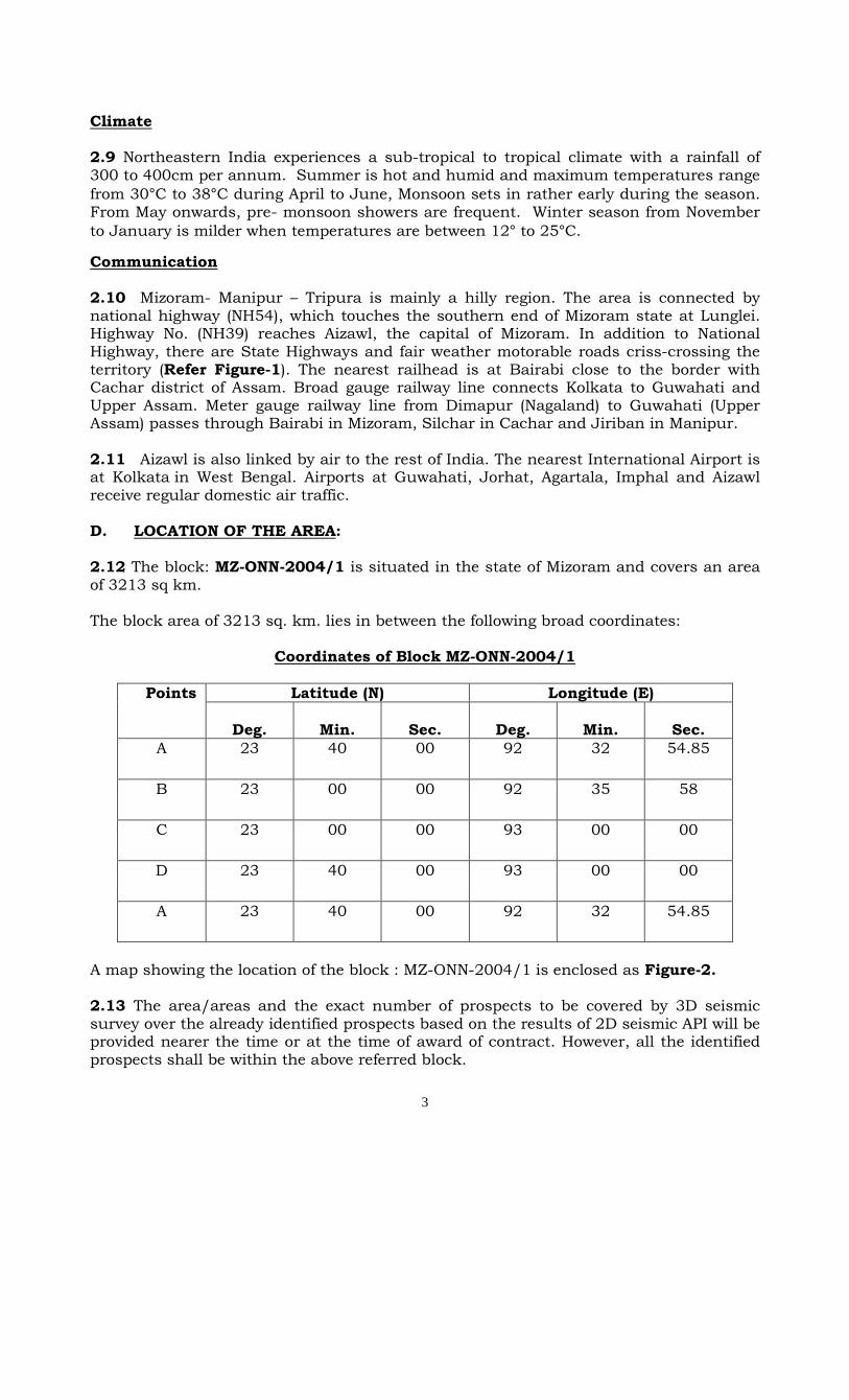
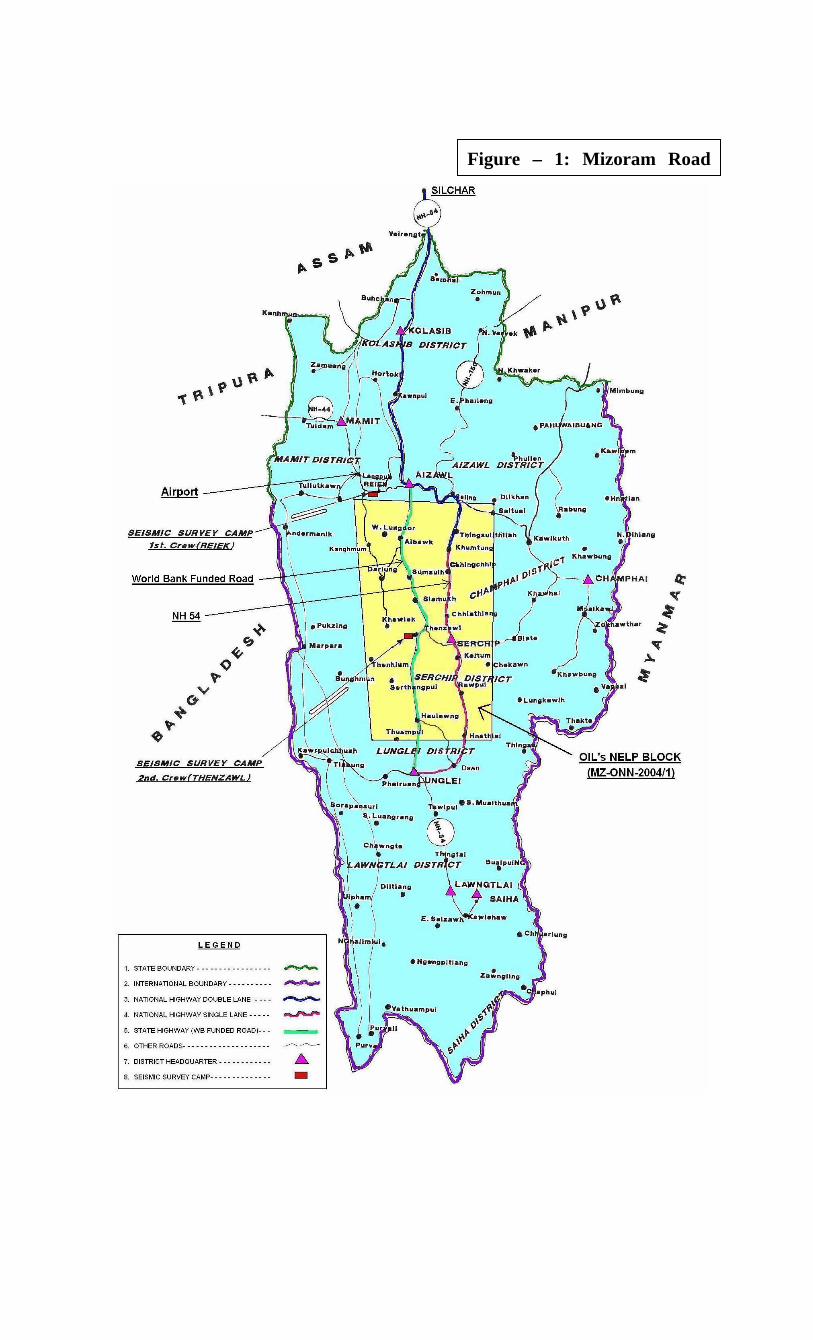
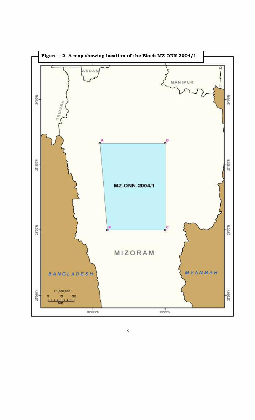
D. LOCATION OF THE AREA: 2.12 The block: MZ-ONN-2004/1 is situated in the state of Mizoram and covers an area of 3213 sq km. The block area of 3213 sq. km. lies in between the following broad coordinates:
Coordinates of Block MZ-ONN-2004/1
Latitude (N) Longitude (E) Points
Deg.
Min.
Sec.
Deg.
Min.
Sec.
A 23 40 00 92 32 54.85
B 23 00 00 92 35 58
C 23 00 00 93 00 00
D 23 40 00 93 00 00
A 23 40 00 92 32 54.85
A map showing the location of the block : MZ-ONN-2004/1 is enclosed as Figure-2. 2.13 The area/areas and the exact number of prospects to be covered by 3D seismic survey over the already identified prospects based on the results of 2D seismic API will be provided nearer the time or at the time of award of contract. However, all the identified prospects shall be within the above referred block.
4
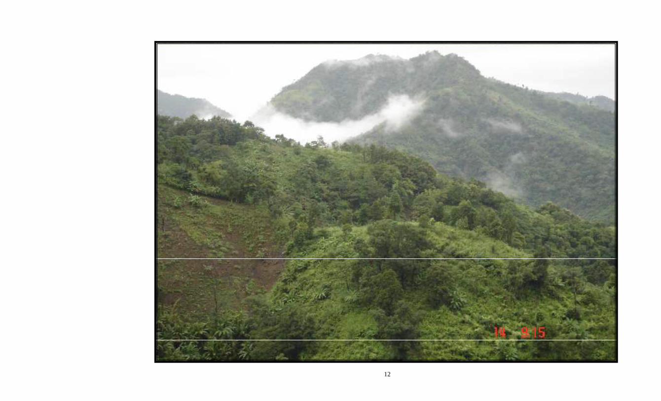
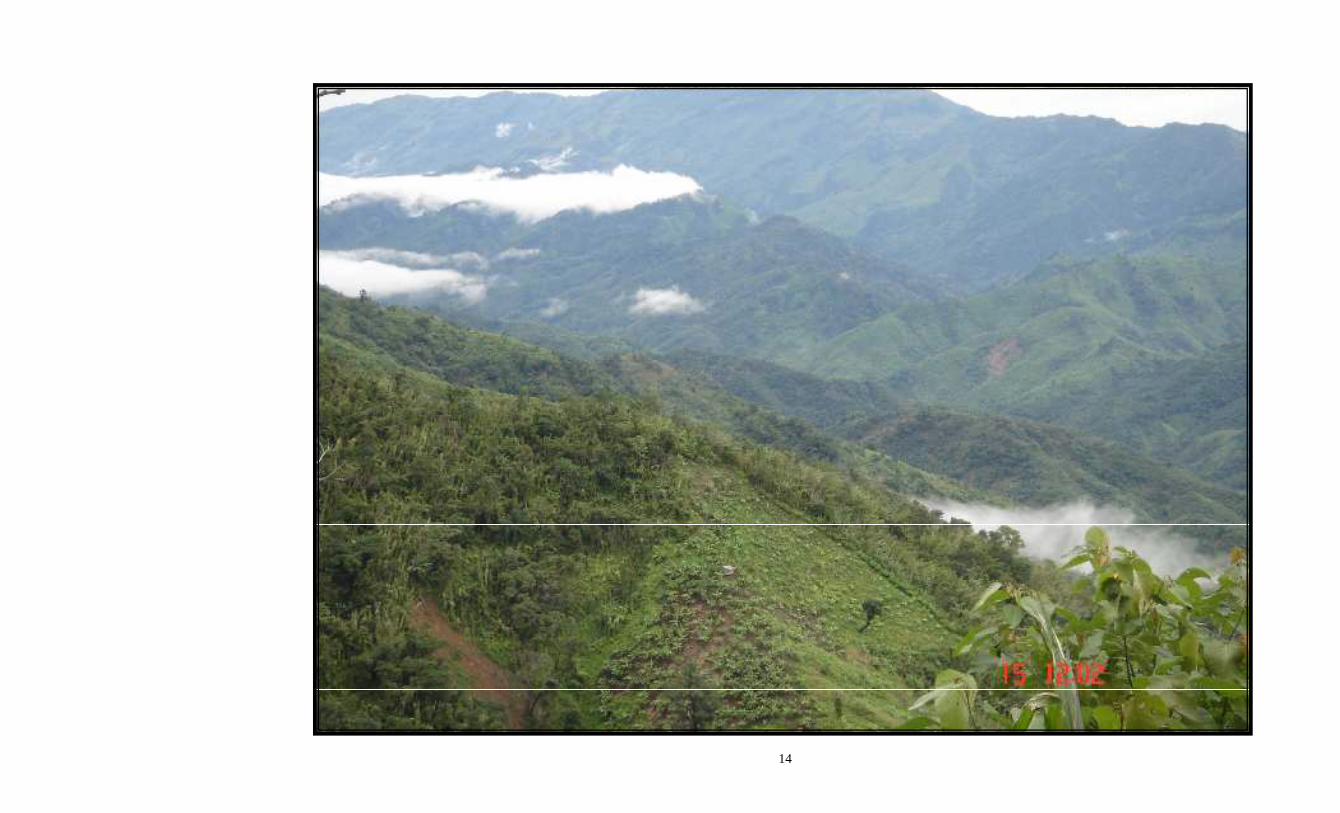
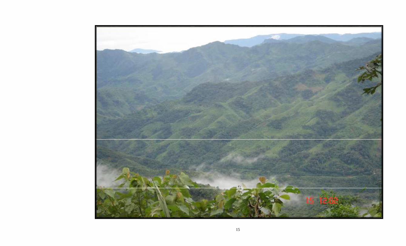
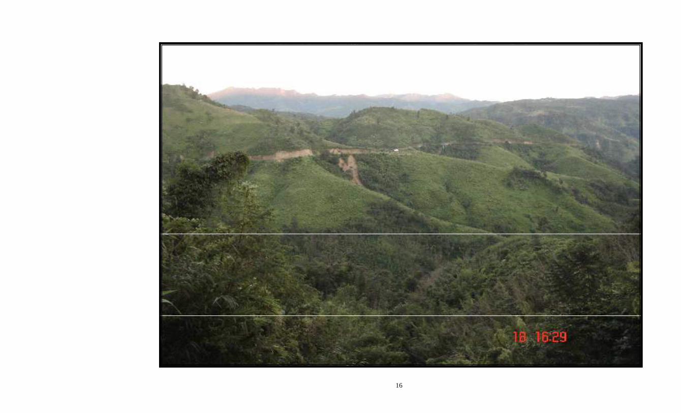
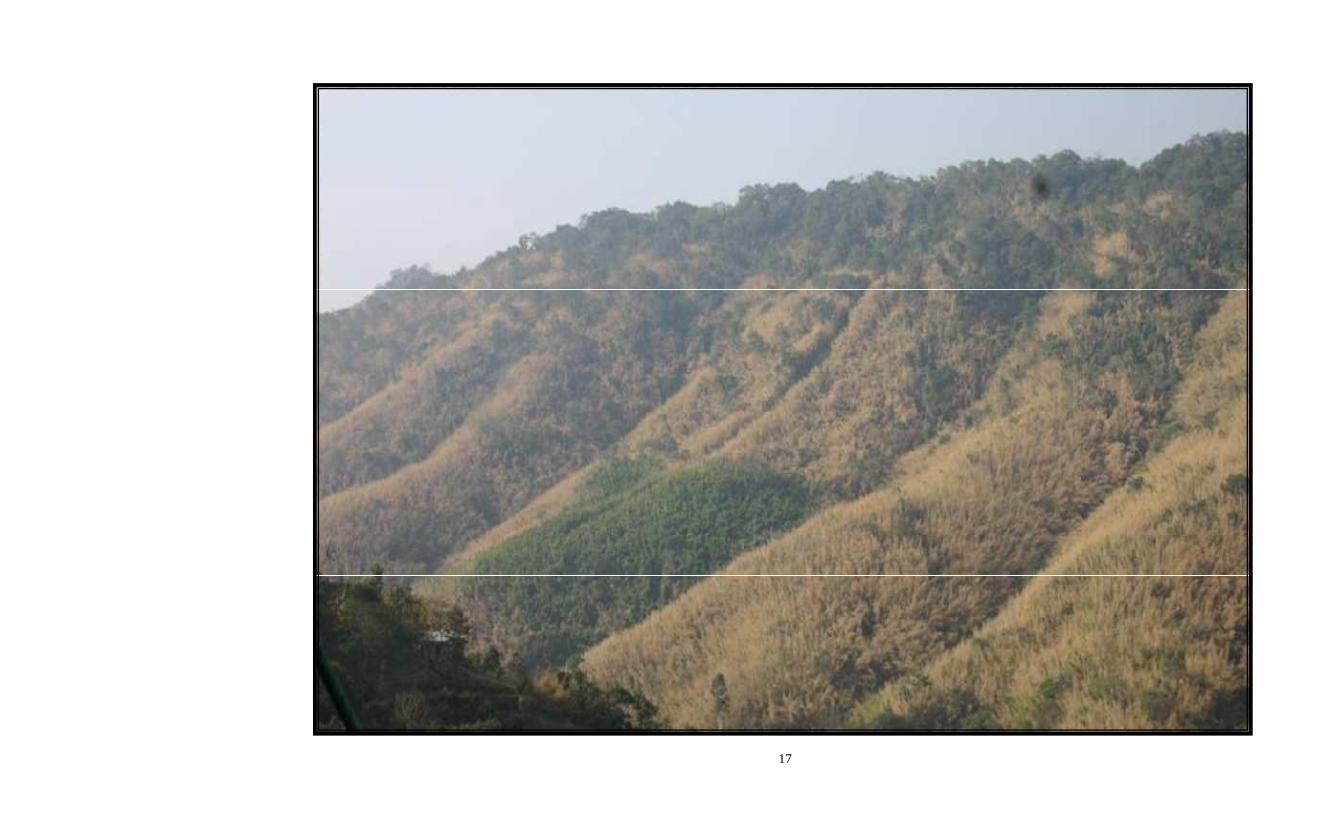
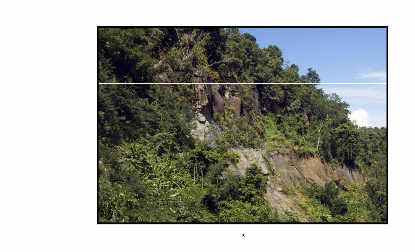
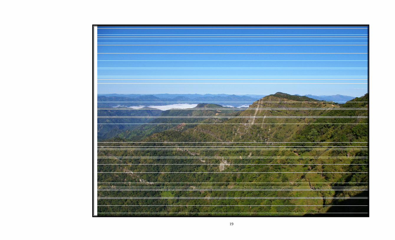
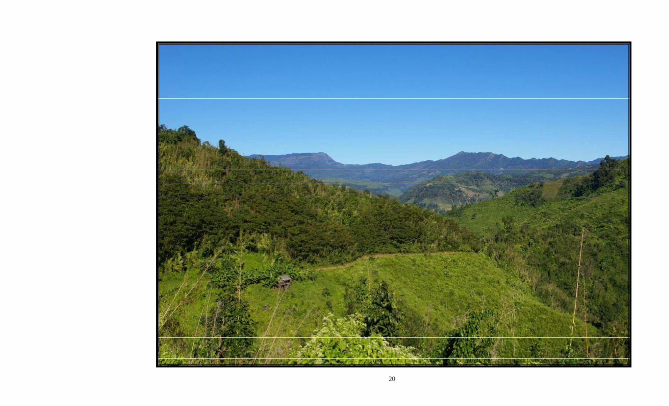
E. TYPE OF AREA & LOGISTICS: 2.14 Mizoram has geographical area of approximately 21081 sq. km. Logistic constraints have so far hampered sustained exploration efforts in this state. However, improved communication and latest technology should accelerate the pace of exploration. The surface topography of the proposed area of seismic operation is that of typical northeastern rugged hilly terrain of India. The topographic features are highly undulating with thick forest cover. The hillocks have very steep slopes ranging between 60-80 degrees with intervening deep gorges. Small seepages of water from sharply cut hillocks are found to be the only source of water. There are hardly motorable roads in the working area except national high way NH-54. There is acute shortage of water in the area. The operation in the area is expected to be carried out mainly on head load mode. The block MZ-ONN-2004/1 is typified by a succession of sub-parallel hill ranges and long valleys. The hill ranges reach a height of around 1800m in Mizoram with most of these between 900-1300m. Thus, the general elevation increases towards east up to the Myanmar border. A few photographs are attached to show the logistics and other important features of the survey area.
2.15 Appropriate energy sources (Dynamite or equivalent with suitable detonators etc.) may be deployed to image target horizon. Man portable drilling rigs with suitable compressors may be required as there is scarcity of water in the operational area for shot hole drilling operations. As the area is logistically difficult and geologically complex with imbricate thrusts, the interested parties has to carry out sufficient modeling exercises and laboratory simulations to arrive at the best recording geometry to achieve good quality data.
3.0 INFORMATION ON PRESENTLY ON-GOING 2D SEISMIC SURVEY:
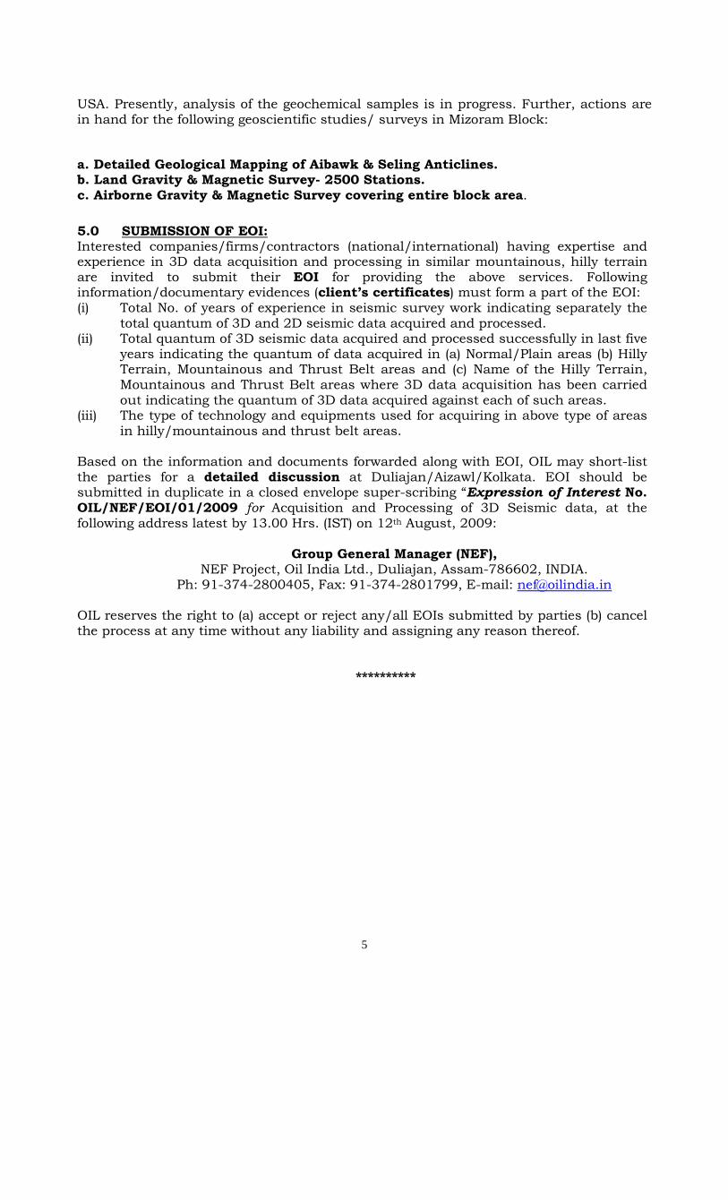
3.1 Acquisition of 2D seismic data was commenced in the block during February 2007. A total of around 760 GLKM of 2D seismic data has been acquired till end May, 2009. Presently, field operations are suspended due to monsoon period in India and the same will be resumed again in the month of Nov/Dec, 2009 to complete the remaining work in the post monsoon period. The seismic data acquisition parameters are given in Annexure-I.
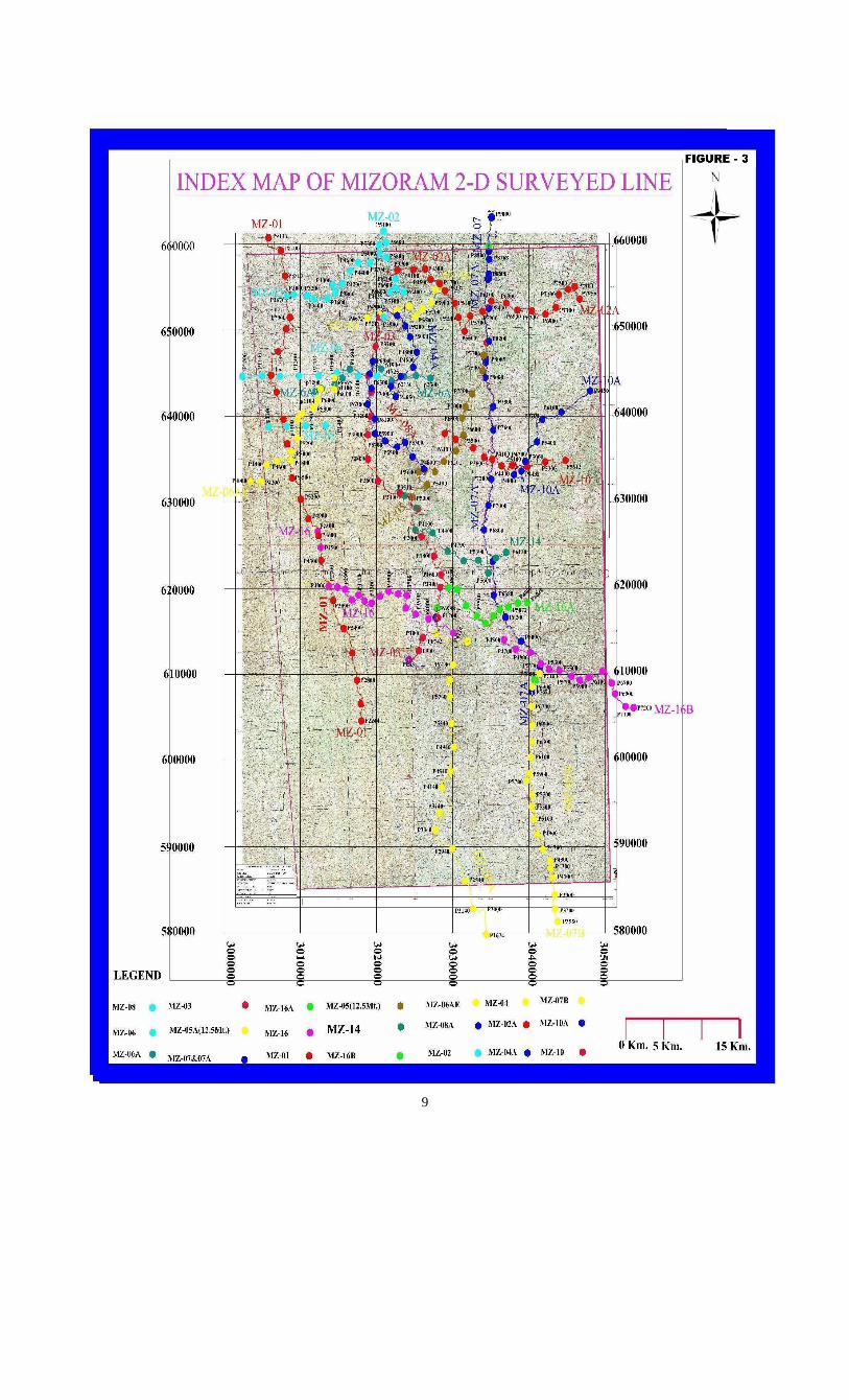
3.2 Most of the seismic data was acquired along Crooked Lines as the area of operation is rugged hilly terrain with high elevations and steep slopes with intervening deep gorges. Almost all the 2D seismic lines were shot along the available roads/approachable paths. A map showing the 2D seismic coverage with crooked lines is enclosed as Figure-3.
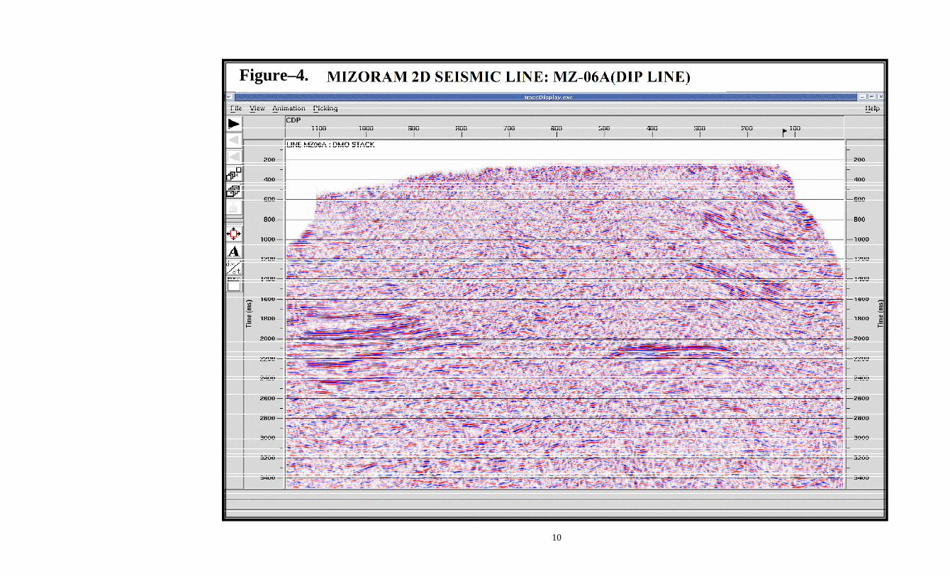
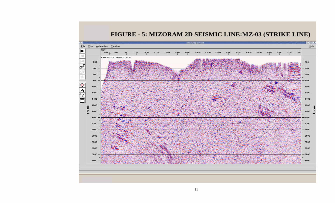
3.3 The above 2D seismic data of the completed lines is being processed on priority basis and the quality of the data has been found to be satisfactory. Seismic sections of two lines [one dip line & one strike line] are enclosed as Figure-4 & Figure-5 for reference. Interpretation & prospect identification based on the above 2D seismic data likely to be completed by Sept./Oct., 2009.
4.0 In addition to the above 2D Seismic survey, Surface Geological Mapping & Structural Analysis of the block was carried out by Dr. Daniel Shelling of Structural Geology International, LLC (SGI), USA during the month of November, 2007. Geochemical Survey was carried out during May/June, 2009 in the northern part of the Mizoram block using GORE Amplified Geochemical Technology by M/s. W.L.GORE Associates Inc,
5
USA. Presently, analysis of the geochemical samples is in progress. Further, actions are in hand for the following geoscientific studies/ surveys in Mizoram Block:
a. Detailed Geological Mapping of Aibawk & Seling Anticlines. b. Land Gravity & Magnetic Survey- 2500 Stations. c. Airborne Gravity & Magnetic Survey covering entire block area.
5.0 SUBMISSION OF EOI: Interested companies/firms/contractors (national/international) having expertise and experience in 3D data acquisition and processing in similar mountainous, hilly terrain are invited to submit their EOI for providing the above services. Following information/documentary evidences (client’s certificates) must form a part of the EOI: (i) Total No. of years of experience in seismic survey work indicating separately the
total quantum of 3D and 2D seismic data acquired and processed. (ii) Total quantum of 3D seismic data acquired and processed successfully in last five
years indicating the quantum of data acquired in (a) Normal/Plain areas (b) Hilly Terrain, Mountainous and Thrust Belt areas and (c) Name of the Hilly Terrain, Mountainous and Thrust Belt areas where 3D data acquisition has been carried out indicating the quantum of 3D data acquired against each of such areas.
(iii) The type of technology and equipments used for acquiring in above type of areas in hilly/mountainous and thrust belt areas.
Based on the information and documents forwarded along with EOI, OIL may short-list the parties for a detailed discussion at Duliajan/Aizawl/Kolkata. EOI should be submitted in duplicate in a closed envelope super-scribing “Expression of Interest No. OIL/NEF/EOI/01/2009 for Acquisition and Processing of 3D Seismic data, at the following address latest by 13.00 Hrs. (IST) on 12th August, 2009:
Group General Manager (NEF),
NEF Project, Oil India Ltd., Duliajan, Assam-786602, INDIA. Ph: 91-374-2800405, Fax: 91-374-2801799, E-mail: [email protected]
OIL reserves the right to (a) accept or reject any/all EOIs submitted by parties (b) cancel the process at any time without any liability and assigning any reason thereof.
**********
6
ANNEXURE-I
SEISMIC DATA ACQUISITION PARAMETERS USED
FOR MIZORAM 2D SEISMIC SURVEY
Sr.No. Item Particular 1 Shooting Geometry Symmetric Split Spread / End on 2 Spread Length 4000 m – 0 – 4000 m / 4000m 3 Number of Channels 320 4 Nominal Fold 80/40 5 Group Interval 25m / 12.5m 6 Shot Interval 50m 7 Minimum Near Offset 200m 8 Energy Source Ammonium Nitrate in Culpable Plastic Tubes(CPT)
of 63 mm diameter. 9 Shot Hole Depth Single Hole of average 25 meters depth. 10 Charge Size 10kg 11 No. of Geophones per
Channel 12
12 Geophone Pattern Bunched 13 Sampling Interval 2ms 14 Recording Length 6 seconds 15 Recording Formats SEG-D De-multiplexed / SEG-Y on IBM 3490 E
( 1 original and 1 copy) in ‘SEG’ normal polarity. 16 Geometry Data SPS Format 17 Recording Polarity Compression (First Arrival) will give a negative number
on tape and trough on monitor records. 18 S / N ratio High, Min. 120db Dynamic Range, with 24-bit
Delta-Sigma Recording Technology.
7
Figure – 1: Mizoram Road
8
Figure – 2. A map showing location of the Block MZ-ONN-2004/1
9
10
Figure–4.
11
www.fugro.com
FIGURE - 5: MIZORAM 2D SEISMIC LINE:MZ-03 (STRIKE LINE)
12

13
14
15
16
17
18
19
20