Embed Size (px)
Citation preview
Missouri River GeospatialDecision Support Framework
Bryan Baker, Martha BullockUS Army Corps of Engineers

• Bryan Baker• Session 8c• Work – 402-697-2684• US Army Corps of Engineers• [email protected]
Introduction
• Operation of the Missouri River Mainstem ReservoirSystem to adequately provide for flood control,navigation, irrigation, hydropower, water supply, waterquality, recreation, and fish and wildlife requirements isan ongoing challenge for the the Corps
• Revision of the Missouri River Master Water ControlManual in 2004 addresses requirements set by USFWSto restore the Missouri River ecosystem and to protectand recover threatened and endangered species
• To facilitate a comprehensive approach to recoveryimplementation, the Missouri River RecoveryImplementation Committee (MRRIC) has beenestablished
Introduction
• The strategy defined and implemented by the MRRICwill generate volumes of research data on the ecologicalhabitat needs, physiological endpoints and populationmodes of species
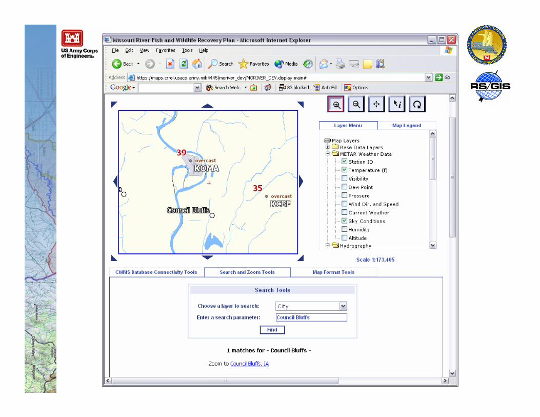
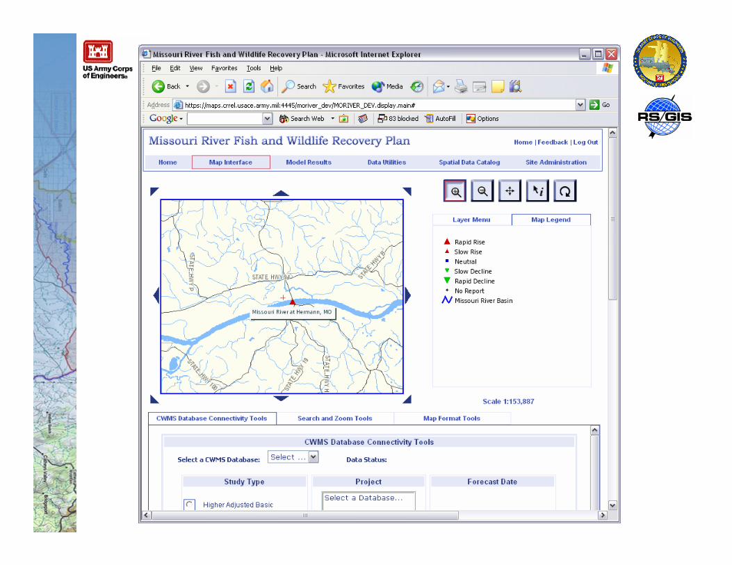
• To address these requirements, and to encourage acollaborative approach to restoration activities, a webportal has been developed that permits access toassociated data and information about the shallow waterhabitat restoration on the Missouri River
• The web portal integrates the data, tools, and utilitiesinto a comprehensive system to facilitate stakeholdercollaboration, data sharing, and sound decision-making
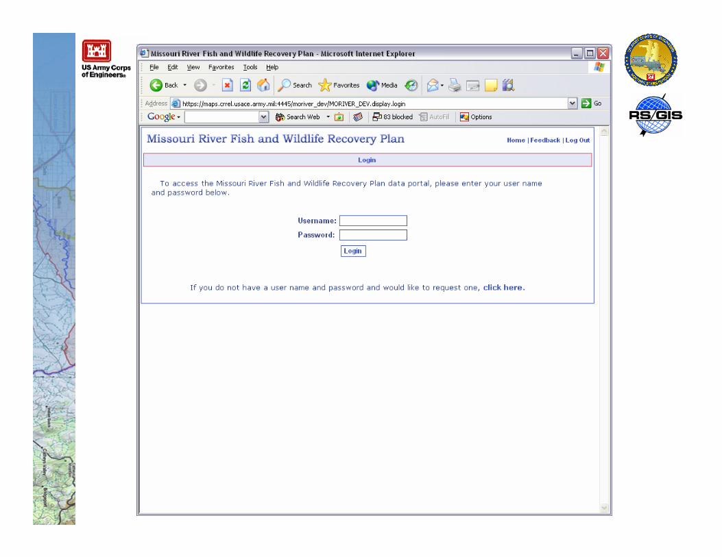
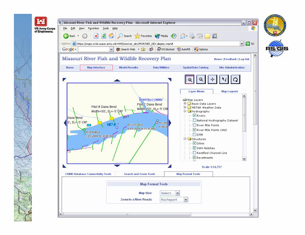
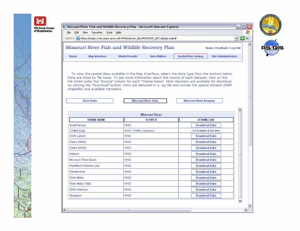
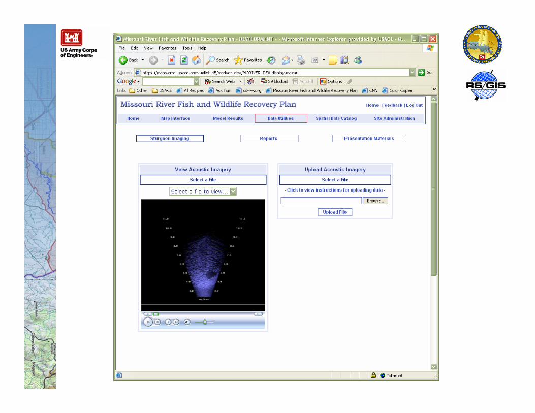
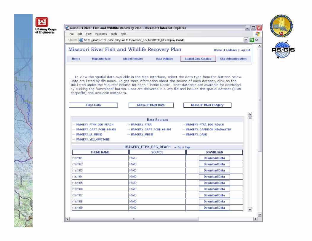
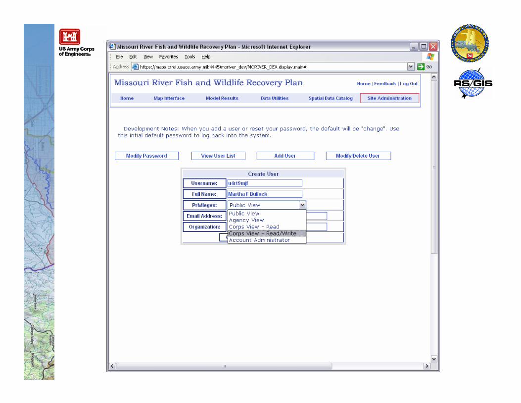
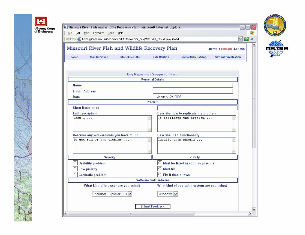
Web Portal
• Single, uniform access point for all stakeholders to load,view, modify, and share data, documentation, andinformation
• Provide incentive to stakeholders to collect and distributedata in a standard and systematic way

Active stakeholders include:
Some States have shown interest like IA
Approach To Problem
• Net-centric data strategy encourages local control ofdistributed databases, rather than data standardization
• Support for Oracle Integrating Architecture• Vector data available as Oracle Tables through straight SQL
queries or through Oracle API (OCI)• Any CADD or GIS client that can access Oracle geometry can
use these data
• Support for ESRI integrating architecture• Vector data available as seamless SDE 8.3 layers• Map views available as ArcIMS Services
• Support for Service Oriented Architecture• Application can consume as well as expose web services• Integrates services developed for and supported by other Corps
automates information systems (AIS)
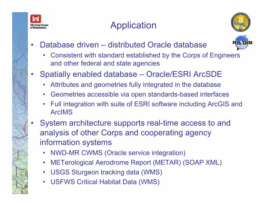
Application
• Database driven – distributed Oracle database• Consistent with standard established by the Corps of Engineers
and other federal and state agencies
• Spatially enabled database – Oracle/ESRI ArcSDE• Attributes and geometries fully integrated in the database• Geometries accessible via open standards-based interfaces• Full integration with suite of ESRI software including ArcGIS and
ArcIMS
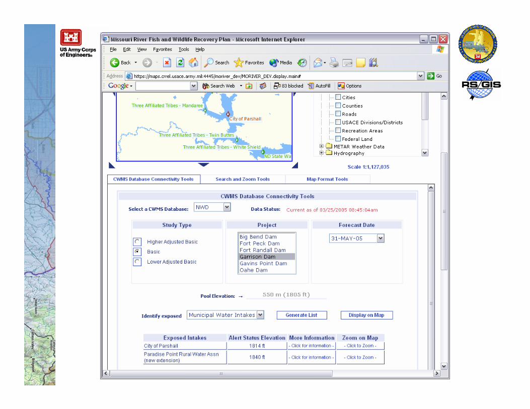
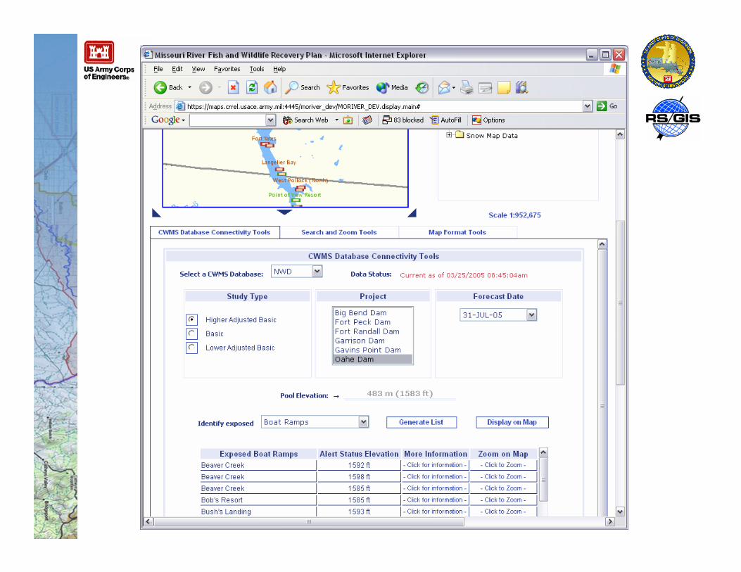
• System architecture supports real-time access to andanalysis of other Corps and cooperating agencyinformation systems• NWD-MR CWMS (Oracle service integration)• METerological Aerodrome Report (METAR) (SOAP XML)• USGS Sturgeon tracking data (WMS)• USFWS Critical Habitat Data (WMS)
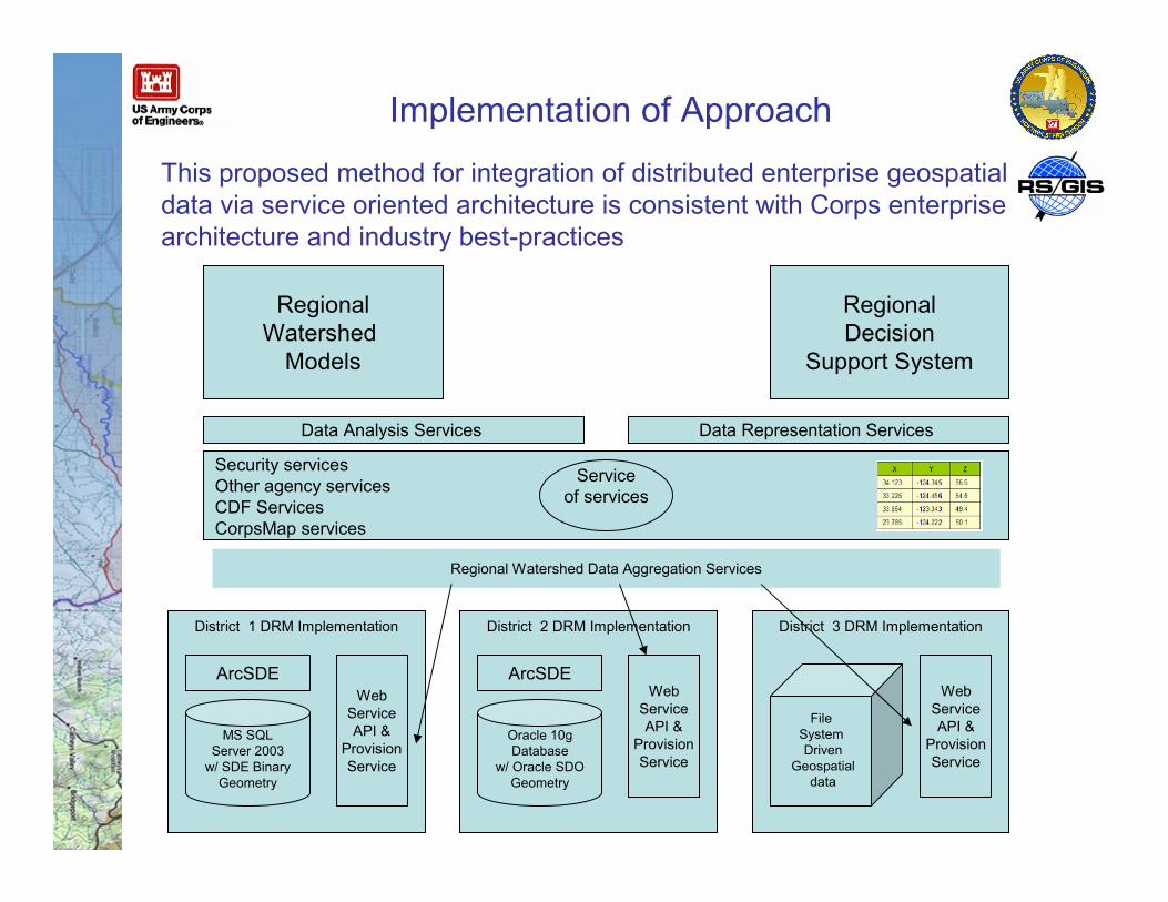
Implementation of Approach
Security servicesOther agency servicesCDF ServicesCorpsMap services
District 1 DRM Implementation
MS SQLServer 2003
w/ SDE BinaryGeometry
ArcSDEWeb
ServiceAPI &
ProvisionService
This proposed method for integration of distributed enterprise geospatialdata via service oriented architecture is consistent with Corps enterprisearchitecture and industry best-practices
Regional Watershed Data Aggregation Services
Data Analysis Services
RegionalWatershed
Models
Serviceof services
District 2 DRM Implementation
Oracle 10gDatabase
w/ Oracle SDOGeometry
ArcSDEWeb
ServiceAPI &
ProvisionService
District 3 DRM Implementation
WebServiceAPI &
ProvisionService
FileSystemDriven
Geospatialdata
Data Representation Services
RegionalDecision
Support System
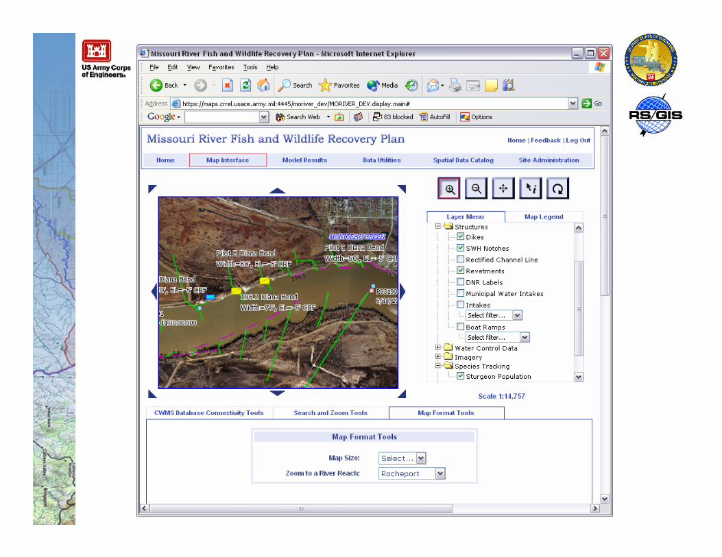
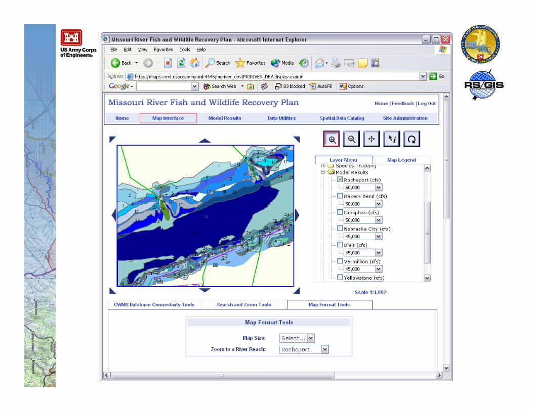
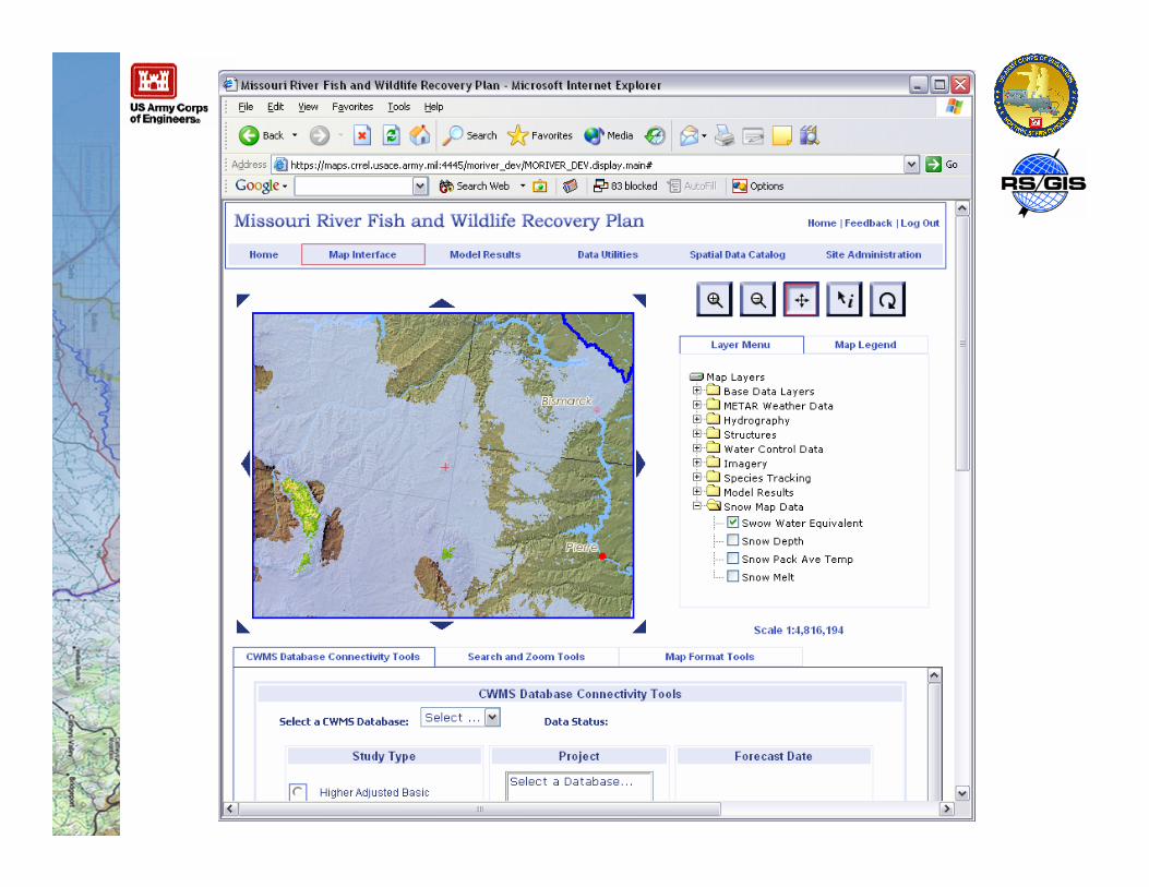
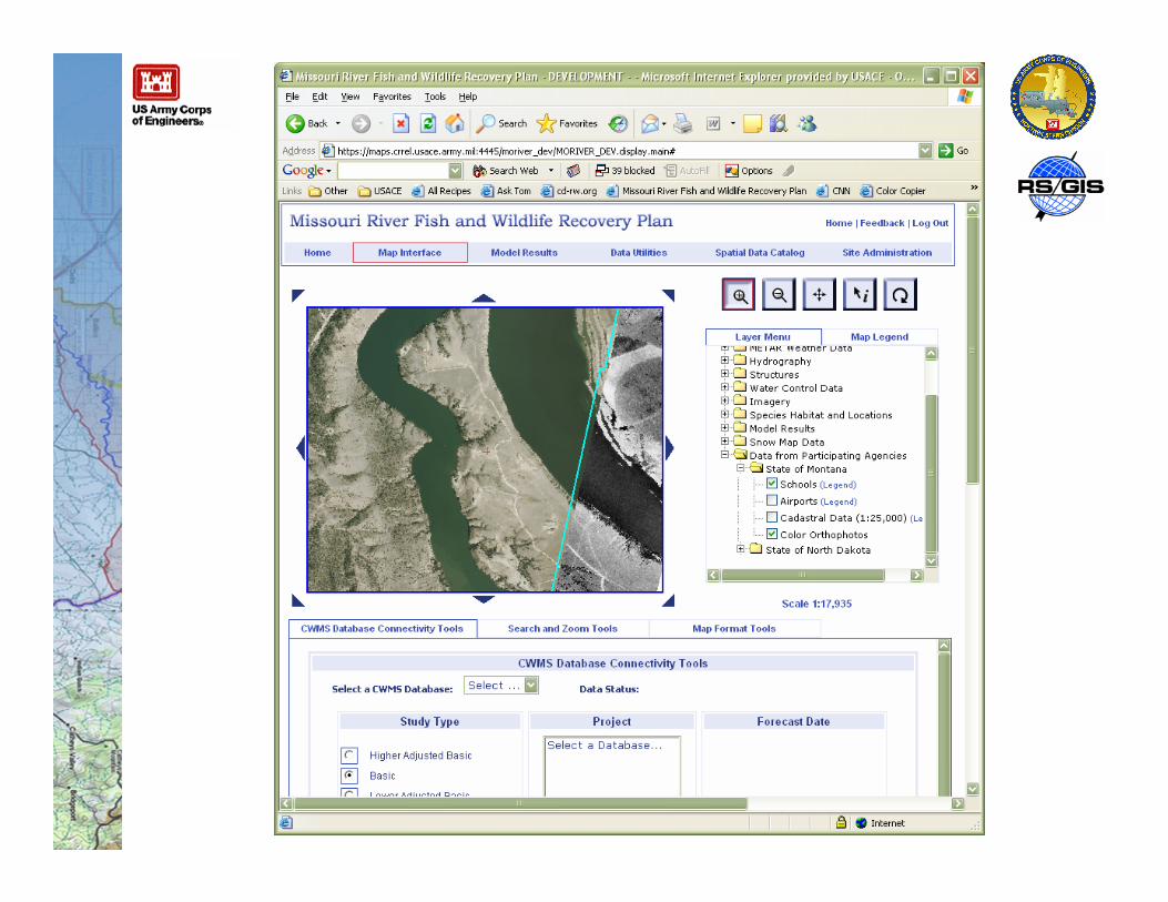
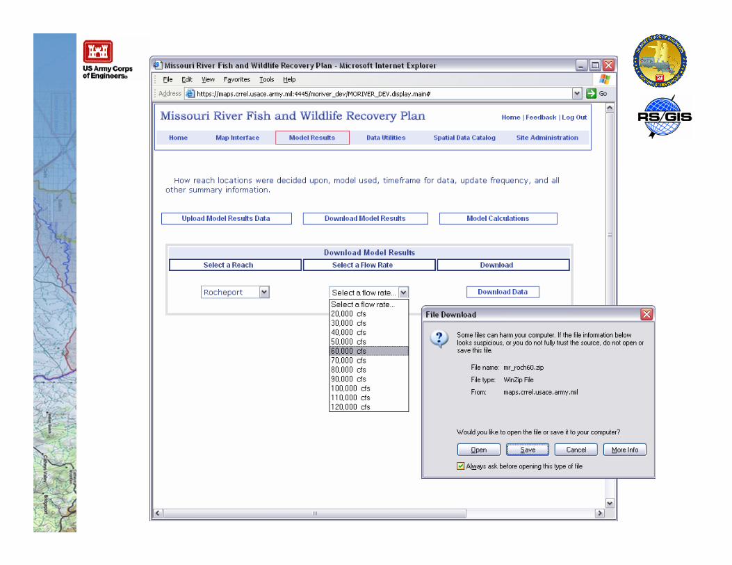
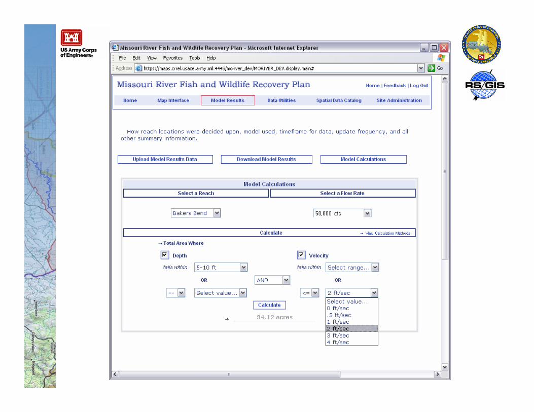
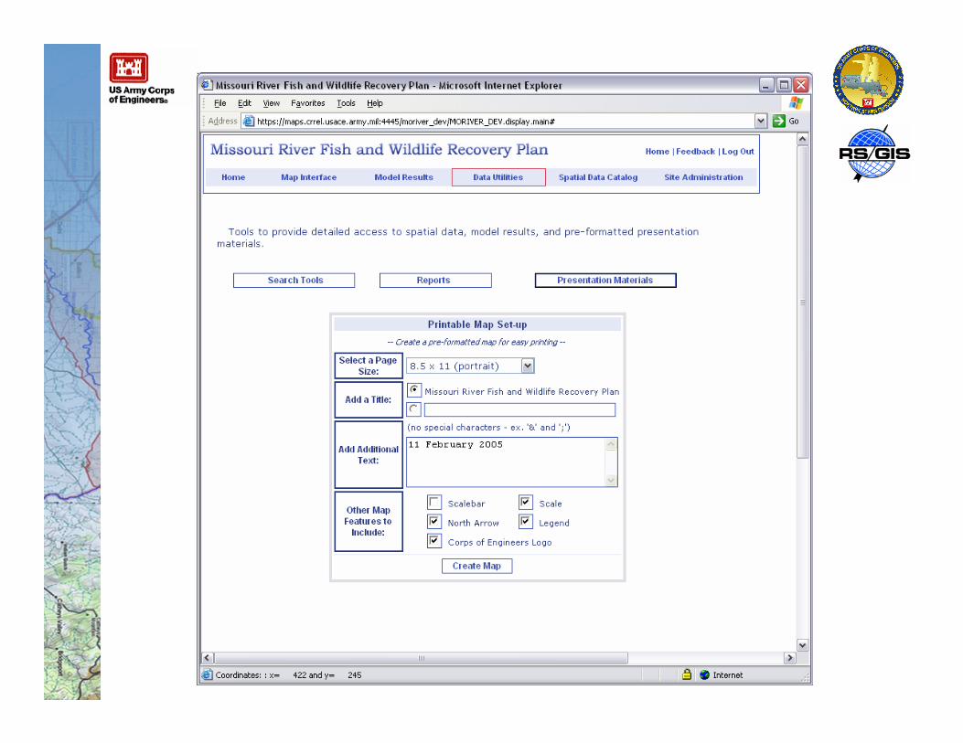
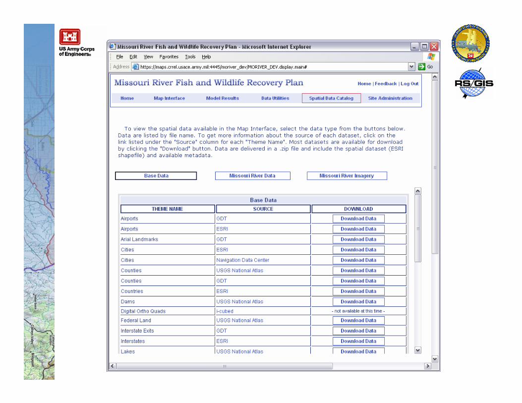
Current Capabilities
Comments/Questions?
Bryan E BakerNorthwest Division, Missouri River RegionUS Army Corps of EngineersOmaha, NE
Martha F BullockRemote Sensing/GIS Center of ExpertiseUS Army Corps of EngineersHanover, NH