Embed Size (px)
Citation preview
Mississippi Water Resources Research InstituteAnnual Technical Report
FY 2008
Mississippi Water Resources Research Institute Annual Technical Report FY 2008 1
Introduction
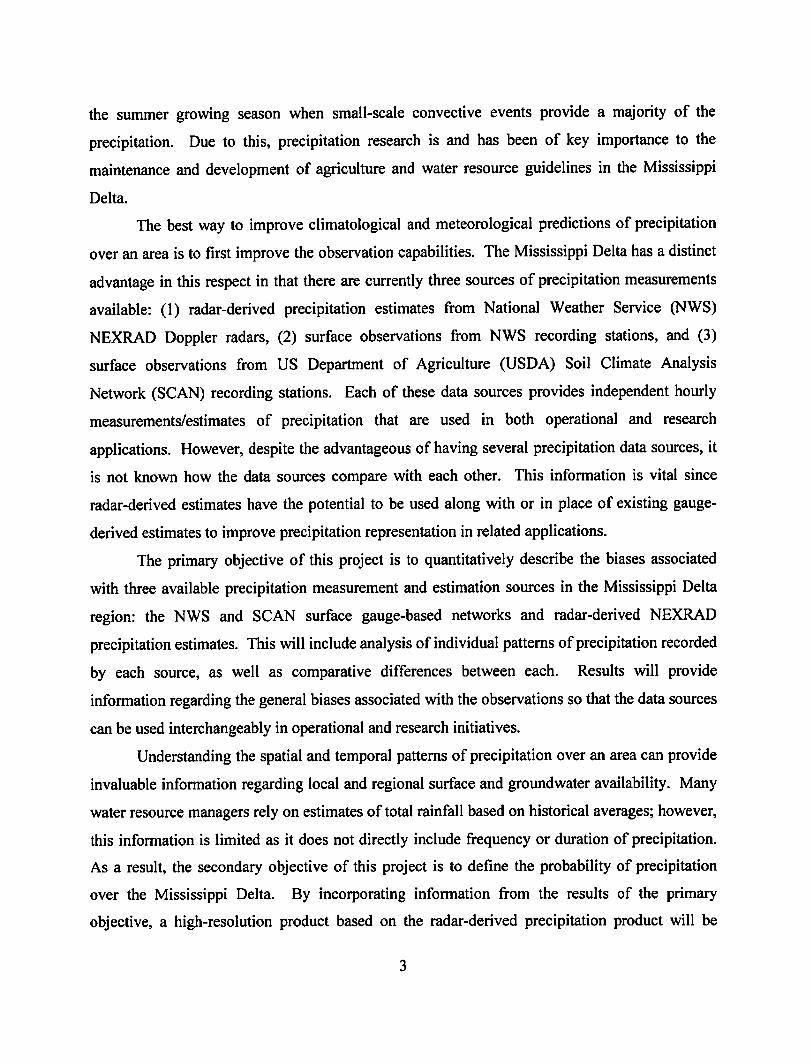
The Mississippi Water Resources Research Institute (MWRRI) provides a statewide center of expertise inwater and associated land use and serves as a repository of knowledge for use in education, research,planning, and community service.
The MWRRI goals are to serve public and private interests in the conservation, development, and use of waterresources; to provide training opportunities in higher education whereby skilled professionals becomeavailable to serve government and private sectors alike; to assist planning and regulatory bodies at the local,state, regional, and federal levels; to communicate research findings to potential users in a form thatencourages quick comprehension and direct application to water related problems; to assist state agencies inthe development and maintenance of a state water management plan; and to facilitate and stimulate planningand management that: deals with water policy issues, supports state water agencies' missions with research onproblems encountered and expected, and provides water planning and management organizations with tools toincrease efficiency and effectiveness.
Introduction 1
Research Program Introduction
The Mississippi Water Resources Research Institute (MWRRI) conducts an annual, statewide competitivegrants program to solicit research proposals. Proposals are prioritized as they relate to the research prioritiesestablished by the MWRRI Advisory Board and by their ability to obtain Letters of Support or External CostShare from non−federal sources in Mississippi. The MWRRI's External Advisory Board then evaluates allproposals. Based on the most current list of research priorities, these would include: water quality, surface andgroundwater management, water quality management and water resources development, contaminanttransport mechanisms, wetlands and ecosystems, groundwater contamination, as well as other issuesaddressing coastal and marine issues linking water associations through the state, and institutional needs thatinclude capacity building and graduate student training.
Research Program Introduction 1
Natural Enhanced Transport of Agricultural Pb and AsThrough Riparian Wetlands
Basic Information
Title: Natural Enhanced Transport of Agricultural Pb and As Through Riparian WetlandsProject Number: 2007MS61B
Start Date: 3/1/2007End Date: 8/31/2009
Funding Source: 104BCongressional District: 1st
Research Category: Ground-water Flow and TransportFocus Category: Wetlands, Sediments, Non Point Pollution
Descriptors:Principal Investigators: Gregg R. Davidson
Publication
Natural Enhanced Transport of Agricultural Pb and As Through Riparian Wetlands 1
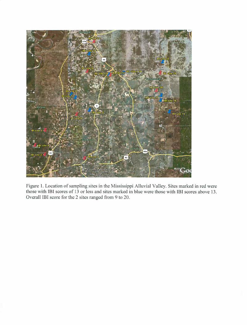
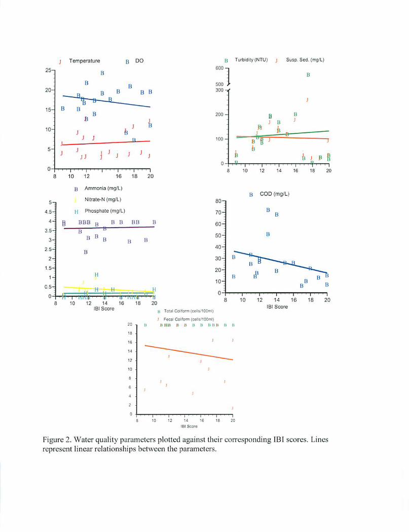
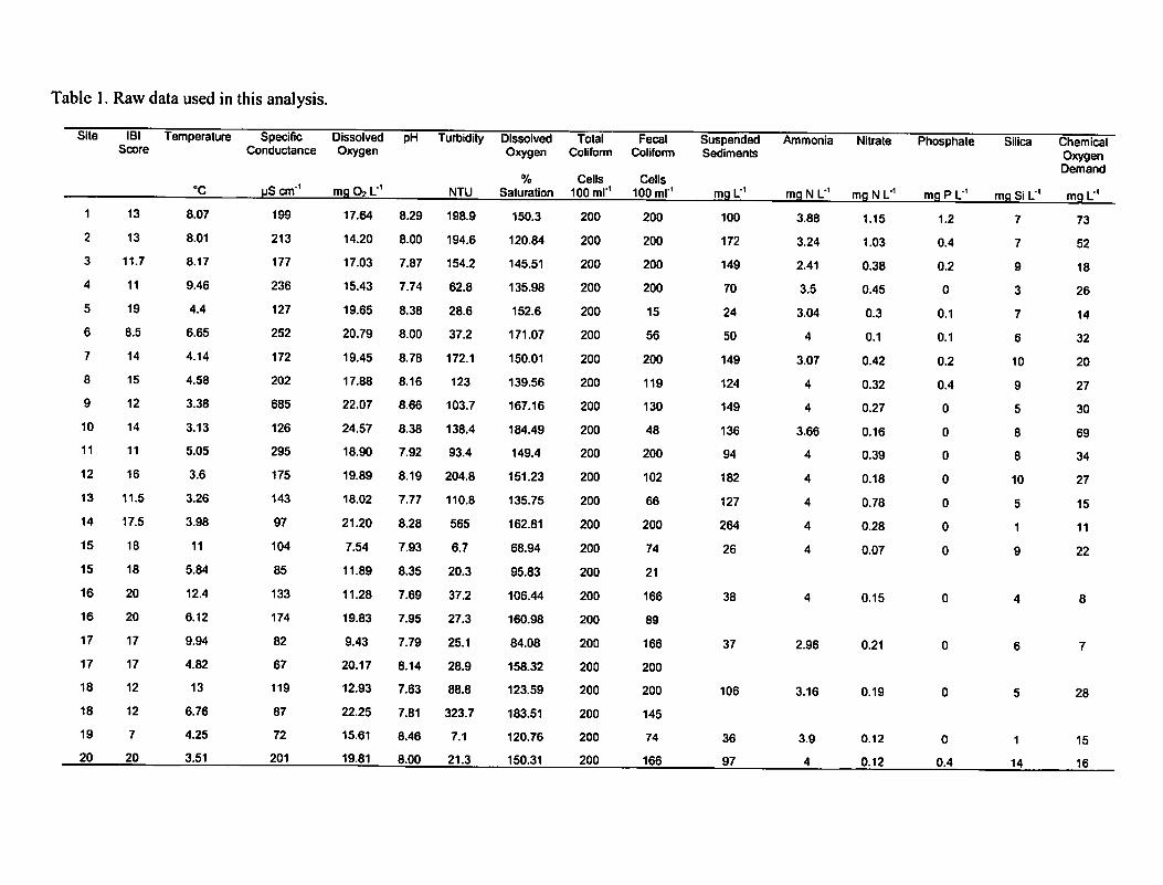
Water Quality and Floristic Habitat Assessments in theColdwater and Sunflower River Basins: Comparingtraditional measures of water and habitat quality to Index ofBiotic Integrity findings
Basic Information
Title:Water Quality and Floristic Habitat Assessments in the Coldwater and Sunflower RiverBasins: Comparing traditional measures of water and habitat quality to Index of BioticIntegrity findings
Project Number: 2007MS62BStart Date: 3/1/2007End Date: 2/29/2009
Funding Source: 104BCongressional
District: 3rd
ResearchCategory: Water Quality
Focus Category: Wetlands, Water Quality, Management and PlanningDescriptors:
PrincipalInvestigators: Todd Tietjen, Gary N. Ervin
Publication
Water Quality and Floristic Habitat Assessments in the Coldwater and Sunflower River Basins: Comparing traditional measures of water and habitat quality to Index of Biotic Integrity findings1

Climatological and Cultural Influences on AnnualGroundwater Decline in the Mississippi Delta ShallowAlluvial Aquifer: Identifying the Causes and Solutions
Basic Information
Title: Climatological and Cultural Influences on Annual Groundwater Decline in theMississippi Delta Shallow Alluvial Aquifer: Identifying the Causes and Solutions
Project Number: 2007MS63BStart Date: 3/1/2007End Date: 8/31/2008
Funding Source: 104BCongressional
District: 3rd
ResearchCategory: Climate and Hydrologic Processes
Focus Category: Climatological Processes, Groundwater, Water UseDescriptors:
PrincipalInvestigators: Charles Wax, Jonathan Woodrome Pote
Publication
Wax, C.L., J.W. Pote, and T.L. Merrell (2008). Climatological and cultural influences on annualgroundwater decline in the Mississippi Delta shallow alluvial aquifer. 38th Annual Mississippi WaterResources Conference, April 15-16, 2008, Jackson, MS, Book of Abstracts, p. 24.
1.
Climatological and Cultural Influences on Annual Groundwater Decline in the Mississippi Delta Shallow Alluvial Aquifer: Identifying the Causes and Solutions1
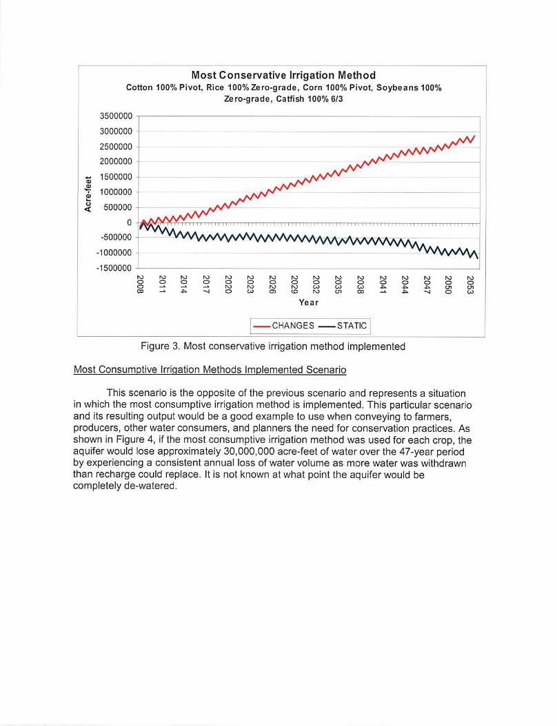
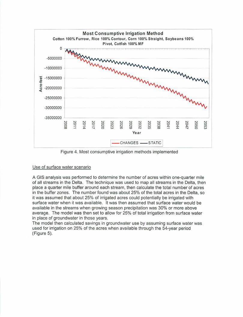
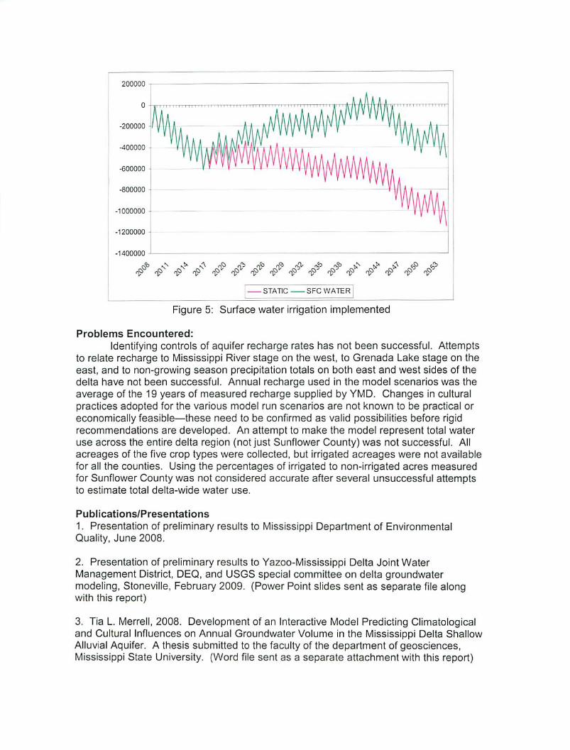
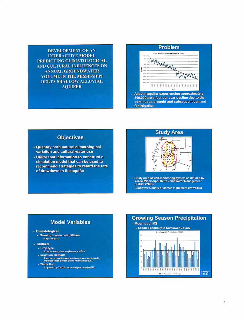
1. Title: Climatological and Cultural Influences on Annual Groundwater Decline in the Mississippi Delta Shallow Alluvial Aquifer: Identifying the Causes and Solutions 2. Focus Categories: CP, GW, WU 3. Keywords: Delta alluvial aquifer, recharge, withdrawal, catfish, rice, climatic variability 4. Duration: March 2007/February 2008 5. Federal funds requested--$19,602 6. Non-Federal (matching) funds pledged and cooperator contribution. State match--$35,528 Coop match--$60,000 7. Principal investigators: Charles L. Wax, PI, Mississippi State University, Starkville, Mississippi WRRI Jonathan W. Pote, co-PI, Mississippi State University, Starkville, Mississippi WRRI Joseph Massey, co-PI, Mississippi State University, Starkville, Mississippi WRRI Dean Pennington, Cooperator, Yazoo Mississippi Delta Joint Water Management District, Stoneville, MS 8. Congressional district: Mississippi Third Congressional District 9. Statement of critical regional water problems: The shallow alluvial aquifer is the main source of groundwater developed in the Mississippi Delta region. The aquifer is heavily used for irrigation of corn, soybeans, and cotton, as well as for rice flooding and filling aquaculture ponds in the prominent catfish industry. Water levels in the aquifer are subject to seasonal declines and annual fluctuations caused by both climatological and crop water use variations from year-to-year. These declines can be dramatic and are most notable during the period April-October of each year, particularly in years when normal crop water demands are accentuated by concurrent abnormally dry climatic conditions. Recharge during the remainder of the year has recently been insufficient to restore water levels, and the aquifer is now being mined at the approximate rate of 300,000 acre-feet per year. To underscore the critical nature of this water problem, the most recent water level decline in the aquifer (October 2005- 2006) is estimated at 500,000 acre-feet (Pennington, 2006). This may represent a worst-case situation in which severe drought combined with consequent increased demand for irrigation. It is estimated that water use for row crops doubled during this period (Pennington, 2006).
It is of critical importance to understand how climatological variability and cultural uses of the water cause the groundwater level in the aquifer to vary. It is also critical to discover and implement management strategies to use precipitation and other surface water sources as substitutes for aquifer withdrawals and thereby reduce the use of groundwater in the region. Stopping the consistent drop in water level in the aquifer will require a curtailment of about 300,000 acre-feet of groundwater use each year, and this is the highest priority of this research project. This information is essential to agricultural producers in the region and to planners in the Yazoo Water Management District who must design sustainable water use scenarios which will allow continuation of the productivity of the region. 10. Statement of the results, benefits, and/or information expected to be gained from this study: Relationships between use and water level drop in the aquifer will be the chief result of this study. Baseline information on maximum decline during drought will be compiled, with the assumption that these times of decline are unavoidable. Alternatives to mitigate the declines of water levels in other years will include strategies to optimize use of surface water and captured precipitation in lieu of groundwater. 11. Nature, scope, and objectives of the research. The purpose of this research is to determine causes of short-term aquifer declines, primarily cultural water uses and climatological processes, with a conscious effort to exclude the effects of river recharge or extraction. The spatial scope of the research is the central part of the Delta, the temporal scope is a period from 1980-2006. Primary objectives are to assess the effects of agricultural demands/uses and climatological variability on withdrawal of water from the shallow alluvial aquifer. The main concern is to evaluate the long-term drop in water level in the aquifer, stemming from growing season uses exceeding recharge rate year-after-year. The approach to be taken is to determine what each year’s annual decline has contributed to the multi-year decline. The “sawtooth” pattern presently identified is one in which declines in the water level occur seasonally during wet years with mostly complete recovery, but the decline during drought years is much more substantial and recovery is negligible. Over the past 30 years this has resulted in an overall decline in water level in the aquifer. There is little that can be done to reduce the water demand of agriculture in dry years, but in years with at least normal or above normal rainfall, maximizing use of that rain to substitute for groundwater is a preferred alternative. Once the size of the demand is known, the research will attempt to determine alternatives needed to offset the demand. Since drought years will inevitably cause groundwater level decline, in years of normal or surplus rainfall the precipitation must be used to make up any declines in water level from cultural uses. The nature of this research is to determine if the amount of precipitation used in lieu of groundwater in wet years can be sufficient to offset the combined decline of both that year and drought years. 12. Methods, procedures, and facilities. Provide enough information to permit evaluation of the technical adequacy of the approach to satisfy the objectives.
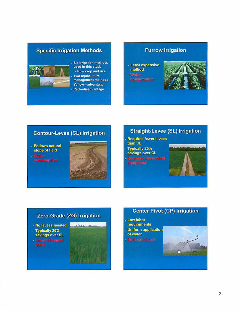
The initial phase of the research will involve collecting the climate record, the water level record, and the water use record for major users of groundwater in a centrally-defined portion of the region. Climatological data will be used to establish drought years. The water level record and water use records will be used to establish a maximum demand water use, which will be referenced to the amount of acreages of various crops using water in those drought years. There will also be an attempt to reference water use to changing practices over time. For example, catfish farming no longer uses pond flushing, rice culture no longer produces tail-water, etc., thus water use totals will have to be time-indexed to the acceptable practices of different years. These procedures will produce an evaluation of overuse periods and amounts, maximum sustainable use, and required savings in water use to eliminate or mitigate water level decline in the aquifer. Present best management practices will be assessed to see if they can, over a period of years, reduce use enough to stop water level declines. Specific practices to be evaluated include those that are designed to collect and store rainfall for use in place of pumped groundwater. Examples include the 6/3 management strategy in catfish pond, and a similar strategy in rice fields which similarly relies on leaving storage capacity inside the levees of rice fields instead of keeping the fields completely covered all the time. Specific methods are 1) statistically correlate ground water drop with climatic variability and cultural water use in drought years, wet years, and average years; 2) statistically correlate recharge rates in those same years; and 3) determine the net demand during each of those years. Then the potential amount of captured precipitation with the various management strategies will be applied against these previously determined demands. Existing climate data will be used, and the cooperator on this project—the Yazoo Mississippi Delta Joint Water Management District—will supply the needed water level and cultural water use information for analysis (see attached cooperator letter). Additional equipment purchases are not anticipated from this funding. 13. Related Research. Show by literature and communication citations the similarities and dissimilarities of the proposed project to completed or on-going research on the same topic.
Agriculture is the major water consumer in the southeast region, and aquaculture has the potential to become disproportionately consumptive. For example, most row crops in the region require 30-40 cm/yr, whereas catfish farming requires up to 100 cm/yr under current practices. In the “Delta” region of Mississippi where nearly 60% of U.S. farm raised catfish are produced, catfish production accounts for about 28% of all water used (Pennington, 2005). Research to reduce reliance on groundwater in aquaculture has shown remarkable potential reductions in groundwater use by use of management strategies to create storage capacity which can capture rainfall to keep ponds filled. For example, one study shows the potential to reduce consumption of groundwater in delta catfish ponds by precipitation capture by nearly 70% annually (Pote and Wax, 1993; Pote, et al, 1988; Cathcart et al., 2006). Extension Services in Alabama and Louisiana include variations of those strategies as industry best management practices for reducing groundwater use in those states (Auburn University, 2002; LCES, 2003). In rice production, straight levee systems and use of multiple inlets have been shown to significantly reduce water use (Smith et al., 2006). Intermittent (wet-dry) irrigation has been shown to reduce water use and NPRS runoff by up to 50% with no yield losses in Mississippi field trials (Massey et al., 2006).

Auburn University, 2002. Auburn University and USDA/Natural Resources Conservation Service, Managing Ponds to Reduce Effluent Volume, BMP No. 21. (http://efotg.mrcs.usda.gov.references/public/AL/G02ReduceEffluent.pdf) LCES, 2003. “Aquacultural Production Best Management Practices (BMPs),” Plub. 2894 4/03 (online only). Louisiana Cooperative Extensive Service, Baton Rouge, LA. (http://www.agctr.lsu.edu/NR/rdohlyres/4005CC33-BF01-4FAB-8EA3-E2D9ABCE038C/2616/pub2894aquaBMP6.pdf Massey, H.H., Smith, M.C., Johnson, A., Thomas, J., Tacker, P.L., Vories, E.D., Lancaster, S., Andrews, A.A. and Ampin, P. 2006. Multiple-inlet plus Intermittent Rice Irrigation Increases Rainfall Capture and Reduces Non-point Source Runoff. Proceedings of the 31st Rice Technical Working Group Meeting. The Woodlands, TX. Pennington, Dean, 2005. 2005 Annual Report, Yazoo Mississippi Delta Joint Water Management District, Stoneville, MS 38766. Pennington, Dean, 2006. Personal communication, October 31, 2006. Pote, J.W., C.L. Wax, and C.S. Tucker, 1988. Water in Catfish ProductionL Sources, Uses, and Conservation. Special Bulletin 88-3, November 1988, Mississippi Agricultural and Forestry Experiment Station, Mississippi State, MS. Pote, J.W. and C.L. Wax, 1993. “Modeling the Climatological Potential for Water Conservation in Aquaculture.” Transactions of the American Society of Agricultural Engineers, Volume 36 (5), 1343-1348. Smith, M.C., J.H. Massey, P. Tacker, E. Vories, D. Pennington, J. Epting, and C. Wilson. 2006. Water use estimates for various rice production systems in Mississippi and Arkansas. Irrigation Science (DOI 10.1007/s00271-006-0041-0: Wed 14 June 2006, pgs. 1-7) Submitted 2006. T.P. Cathcart, C.L. Wax, J.W. Pote and Sugeng Triyono. “A Climatological Basis for Conserving Groundwater and Reduciong Overflow in Aquaculture Ponds in the Southeast United States.” Aquacultural Engineering. 14. Investigator's qualifications. Include a resume(s) of the principal investigator(s). No resume shall exceed two pages or list more than 15 pertinent publications. Biosketches are appended. 15. Training potential. Estimate the number and level of graduate and undergraduate students, by field of study and degree that are expected to receive training in the project. One graduate and two undergraduate students will be supported by these funds. It is anticipated that additional students will contribute to the research. Those students supported by this project are geoscience students, working toward B.S. and M.S. degrees.
16. Attach Cooperator letter. Appended. Identify the Information Transfer Plan (up to two pages). Indicate the plan for disseminating information on the results of the research and promoting their application. 1. Define the subject matter and the problems to be addressed. This research addresses declining water levels in the shallow alluvial aquifer in the Mississippi Delta region. Potential causes and alternative water management strategies to stabilize the aquifer are identified. 2. Identify the target audience. The target audience includes water users in the Mississippi Delta region (agriculture, aquaculture) and water managers (YMD Joint Water Management District, US Army Corps of Engineers). In addition, scientists doing similar research will be targeted. 3. Indicate the strategies to be employed; e.g. workshops, publications. Results will be published in both MAFES Bulletin format and journal articles. Results will be presented at the annual Mississippi Water Resources Conferences and published in the Proceedings of that conference. Results will be specifically shared with NRCS and MDEQ personnel involved in water management in the region. 4. Identify the cooperators (e.g., Cooperative Extension service). The primary cooperator is the Yazoo Mississippi Delta Joint Water Management District. Cooperators on information transfer specifically are identified above.
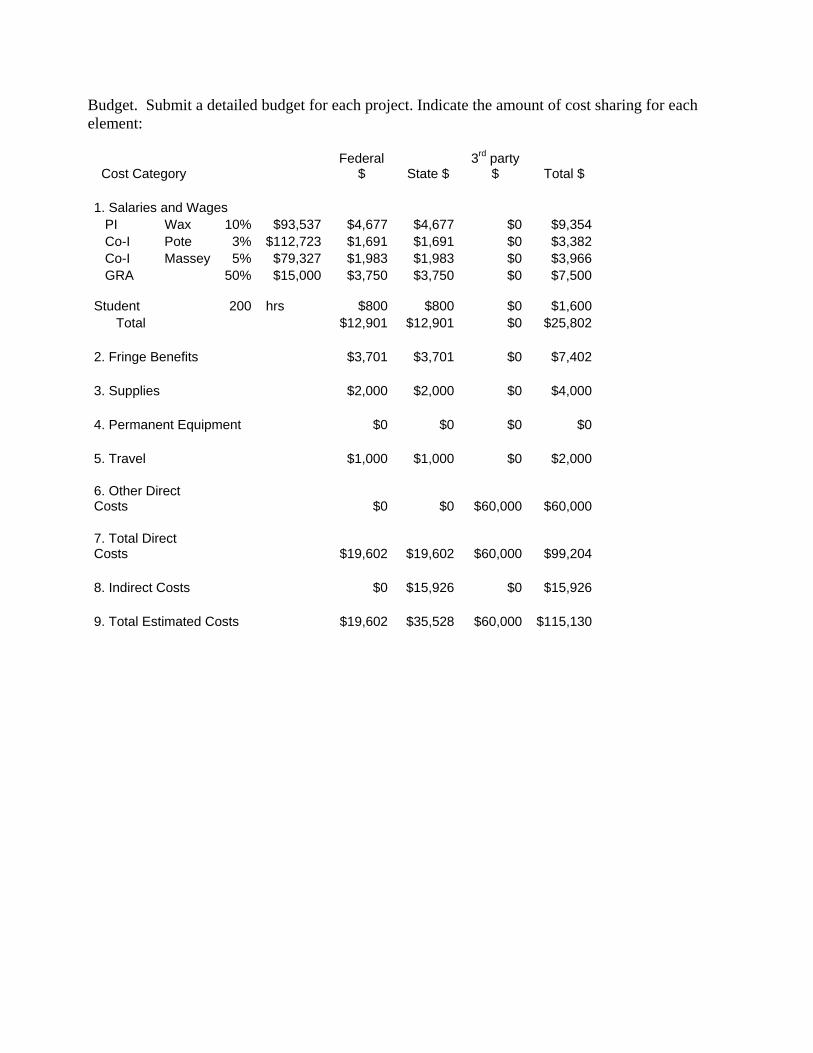
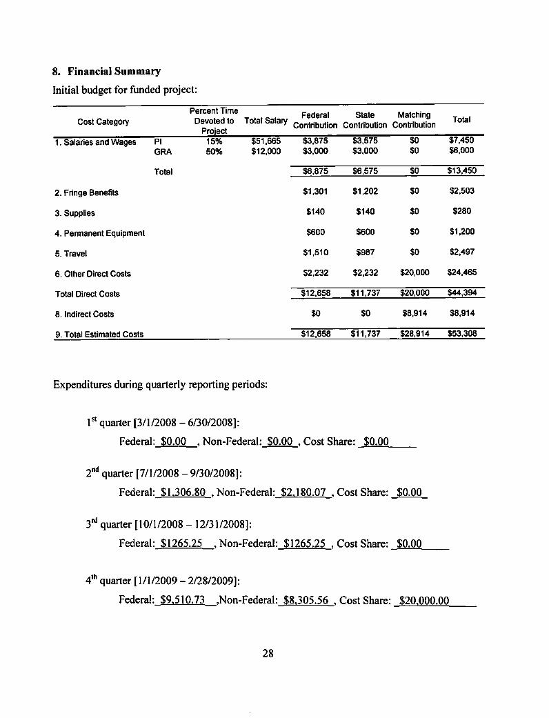
Budget. Submit a detailed budget for each project. Indicate the amount of cost sharing for each element:
Cost Category Federal
$ State $ 3rd party
$ Total $ 1. Salaries and Wages PI Wax 10% $93,537 $4,677 $4,677 $0 $9,354 Co-I Pote 3% $112,723 $1,691 $1,691 $0 $3,382 Co-I Massey 5% $79,327 $1,983 $1,983 $0 $3,966 GRA 50% $15,000 $3,750 $3,750 $0 $7,500 Student 200 hrs $800 $800 $0 $1,600 Total $12,901 $12,901 $0 $25,802 2. Fringe Benefits $3,701 $3,701 $0 $7,402 3. Supplies $2,000 $2,000 $0 $4,000 4. Permanent Equipment $0 $0 $0 $0 5. Travel $1,000 $1,000 $0 $2,000 6. Other Direct Costs $0 $0 $60,000 $60,000 7. Total Direct Costs $19,602 $19,602 $60,000 $99,204 8. Indirect Costs $0 $15,926 $0 $15,926 9. Total Estimated Costs $19,602 $35,528 $60,000 $115,130
YMD
Dean A. Pennington., PhD Executive Director P. O. Box 129 Stoneville, MS 38776 Tel: (662) 686-7712 Fax: (662) 686-9078
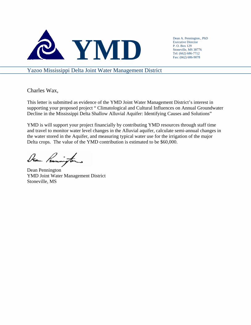
Yazoo Mississippi Delta Joint Water Management District Charles Wax, This letter is submitted as evidence of the YMD Joint Water Management District’s interest in supporting your proposed project “ Climatological and Cultural Influences on Annual Groundwater Decline in the Mississippi Delta Shallow Alluvial Aquifer: Identifying Causes and Solutions” YMD is will support your project financially by contributing YMD resources through staff time and travel to monitor water level changes in the Alluvial aquifer, calculate semi-annual changes in the water stored in the Aquifer, and measuring typical water use for the irrigation of the major Delta crops. The value of the YMD contribution is estimated to be $60,000.
Dean Pennington YMD Joint Water Management District Stoneville, MS

Bio-Sketch: Charles L. Wax Experience: Professor of Geography, Mississippi State University, 1987-present; Professor and Head of the Department of Geosciences, Mississippi State University, 1989-2001; State Climatologist for Mississippi, 1983-present; Part-time Professor of Geography, Mississippi University for Women, 1985-1987; Research Climatologist, Miss. Ag. and Forestry Experiment Station, Dept. of Ag. and Bio.Engineering, Mississippi State University, part-time 1984-1990; Associate Professor of Geography, Mississippi State University, 1983-1987; Assistant Professor of Geography, Mississippi State University, 1978-1983; Associate Scientist, Coastal Environments, Inc., Baton Rouge, LA, 1977; Graduate Research Assistant, Center for Wetland Resources, LSU, 1975-1977; Research Associate, Coastal Studies Institute, LSU, summer 1973; Instructor, Department of Geography and Anthropology, LSU, 1973-1975; U.S. Marine Corps, 1969-1972. Education: Ph.D.(physical geography: climatology), Louisiana State University, 1977 M.S.(physical geography: geomorphology), Louisiana State University, 1974 B.A.(political science), Delta State University, 1969 A.A., Miss. Delta Jr. College, 1967 Specialties: Physical geography, applied climatology, meteorology, water resources, natural resource conservation Courses Taught: World Geography Physical Geography Meteorology Meteorology I: Observations Synoptic Meteorology Conservation of Natural Resources Geography of North America Geowriting Climatology Special Topics in Geography Applied Climatology Hydroclimatology Geography of Mississippi Field Methods in Geography Computer Applications in Geosciences Geographic Literature Geographic Seminar Directed Individual Studies in Geography Honors/Awards/Offices Held:
Charles L. Wax is active in several state, regional, and national organizations, among which are the Mississippi Geographic Alliance and the Association of American Geographers. He served on and chaired the U.S.D.A.'s Southern Region Research Committee for Climatology in Agricultural Production, and has served as President of the American Association of State Climatologists. He has been presented the Outstanding Faculty Award by the University Honors Council at Mississippi State University. Presentations and Publications: Authored or co-authored 82 publications on climatological, water resources, and environmental topics Presented 53 papers at professional meetings—examples: 1990. _____ and J.W. Pote. "A Derived Climatology of Water Temperatures for the Mississippi Catfish Industry." Journal of the World Aquaculture Society, 21(1), pp. 63-89.

1990. _____. "General Climatology of Mississippi--Floods and Droughts." In National Water Summary 1988- Hydrologic Events and Floods and Droughts, USGS Water Supply Paper 2375. U. S. Geological Survey, Reston VA. 1990. _____, J.W. Pote and R.A. Poncet. "Selected Climatological Features Affecting Agriculture and Forestry in Mississippi." Bulletin 969. Miss. Ag. and For. Experiment Station, MSU, Miss. State, MS. 1993. Pote, J.W. and C.L. Wax. "Modeling the Climatological Potential for Water Conservation in Aquaculture." Transactions of the American Society of Agricultural Engineers, Volume 36 (5), 1343-1348. 1995. Pote, J.W. and C.L. Wax. "Climatic Criteria for Land Application of Municipal Wastewater Effluent". Water Research, Vol 29, No.1, pp. 323-328. 1995. _____, J.W. Pote and L.L. Wasson. "Impact of Climatic Anomalies on Design of Land Application Systems for Disposal of Wastewater." In Proceedings, Mississippi Water Resources Conference, pp. 6-15. Mississippi Water Resources Research Institute. 1996. _____ and J.W. Pote. "The Influence of Climate on Design of Systems for Land Application of Wastewater." Climate Research, 6:71-78. 1996. _____. "Geography of Mississippi." In Microsoft Encarta 96 Encyclopedia. Microsoft Corporation, Redmond, WA. 1996. Tucker, C.S., S.K. Kingsbury, J.W. Pote and C.L. Wax. "Effluents from Channel Catfish Ponds in Northwest Mississippi." Aquaculture,147:59-67. 1998. _____. "El Nino and Mississippi Weather". Paper presented at the Mississippi Seedsmen's Association Annual Convention, Biloxi, MS, February 13-15. 1998. _____ and J.W. Pote. "Incorporating Natural Climate Patterns Into Management Plans for Swine Wastewater Lagoons." In Proceedings, Mississippi Water Resources Conference, pp. 272-279. Mississippi Water Resources Research Institute. 2000. Pote, J.W., C.L. Wax and B.L. Karr. "Effects of Climate and Soil Type Interactions on Probable Work Days with Harvest Equipment in Mississippi and Alabama Forests". Southern Journal of Applied Forestry, 24:4 (213-218). 2002. Brown, M.E., C.L. Wax and J.W. Pote. “Weather’s Role in Phenological Period Length in Mississippi Soybeans: A Watered-down Contribution!” Proceedings, Mississippi Water Resources Conference. Mississippi Water Resources Research Institute. 2003. _____. “Weather and Pests: The Southern Climate.” Invited paper presented at the Annual Meeting of the Mississippi Agricultural Pest Management Associations, Greenville, Mississippi. Abstract Published. Submitted 2005. _____, J.W. Pote and T.P. Cathcart. “A Climatological Basis for Conserving Groundwater and Reducing Overflow in Aquaculture Ponds in the U.S. Southern Region.” Aquacultural Engineering. 2006. _____. “Climate of Mississippi.” Climatography of The United States No. 60, National Oceanic and Atmospheric Administration, National Climatic Data Center, Asheville, NC. Online at: http://www5.ncdc.noaa.gov/climatenormals/clim60/states/Clim_MS_01.pdf

Joseph Harry Massey Vitae
Dr. Massey is an associate professor/pesticide scientist (20% teaching, 80% research) with Mississippi State University in Starkville. He teaches graduate-level courses in Herbicide Physiology & Biochemistry (PSS 8724) and the Environmental Fate of Herbicides (PSS 8634). As coordinator of the Environmental Science minor/certificate program at MSU, he also teaches Introduction to Environmental Science (ENS 2102) for undergraduates. His research investigates water quality/quantity issues in agriculture. Education Ph.D. Agronomy, 1995. University of Arkansas, Fayetteville. M.S. Agronomy, 1990. University of Arkansas, Fayetteville.
B.S. Chemistry/Mathematics minor, 1986. University of Central Arkansas, Conway. Professional Experience Associate Professor, Department of Plant and Soil Science, Mississippi State University, Starkville. July 2005 to present. Assistant Professor, Department of Plant and Soil Science, Mississippi State University, Starkville. January 2000 through June 2005. Section Research Chemist, Regulatory E-Fate Field Group, DuPont Crop Protection, Newark, DE. July 1997 through November 1999. Research Chemist, Regulatory E-Fate Laboratory Group, DuPont Crop Protection, Newark, DE. August 1995 through July 1997. Laboratory Instructor, Department of Chemistry & Biochemistry, University of Delaware, Newark, DE. Fall 1996 and 1997; Spring 1998. Research Assistant, Pesticide Residue Laboratory, University of Arkansas, Fayetteville, AR. May 1989 through July 1995. Graduate Assistant, Pesticide Residue Laboratory, University of Arkansas, Fayetteville, AR. August 1986 through April 1989. Chemist Intern, Water Laboratory, Arkansas Department of Environmental Quality, Little Rock, AR. June through August 1986. Recent Publications
Smith, M.C., J. H. Massey, P. Tacker, E. Vories, D. Pennington, J. Epting, and C. Wilson. 2006. Water use estimates for various rice production systems in Mississippi and Arkansas. Irrigation Science (DOI 10.1007/s00271-006-0041-0; Wed 14 June 2006, pgs. 1-7).
Massey, J.H., J.M. Taylor, N. Binbuga, K. Chambers, G.E. Coats, W.P Henry. 2006. Iron antagonism of MSMA herbicide applied to bermudagrass: Characterization of the Fe2+—MAA complexation reaction. Weed Science 54:23-30.
Avila, L.A., J. H. Massey, S. A. Senseman, K. L. Armbrust, S. R. Lancaster, G. N. McCauley, and J. M. Chandler. 2006. Imazethapyr Aqueous Photolysis, Reaction Quantum Yield and Hydroxyl Radical Rate Constant. J. Agric. Food Chem. 54:2635-2639.
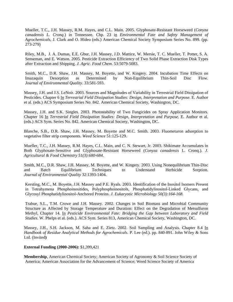
Mueller, T.C., J.H. Massey, R.M. Hayes, and C.L. Main. 2005. Glyphosate-Resistant Horseweed (Conyza canadensis L. Cronq.) in Tennessee. Chp. 23 in Environmental Fate and Safety Management of Agrochemicals, J. Clark and O. Hideo (eds.) American Chemical Society Symposium Series No. 899. (pp. 273-279) Riley, M.B., J. A. Dumas, E.E. Gbur, J.H. Massey, J.D. Mattice, W. Mersie, T. C. Mueller, T. Potter, S. A. Senseman, and E. Watson. 2005. Pesticide Extraction Efficiency of Two Solid Phase Extraction Disk Types after Extraction and Shipping. J. Agric. Food Chem. 53:5079-5083. Smith, M.C., D.R. Shaw, J.H. Massey, M. Boyette, and W. Kingery. 2004. Incubation Time Effects on Imazaquin Desorption as Determined by Non-Equilibrium Thin-Soil Disc Flow. Journal of Environmental Quality. 33:581-593.
Massey, J.H. and J.S. LeNoir. 2003. Sources and Magnitudes of Variability in Terrestrial Field Dissipation of Pesticides. Chapter 6 In Terrestrial Field Dissipation Studies: Design, Interpretation and Purpose. E. Author et al. (eds.) ACS Symposium Series No. 842. American Chemical Society, Washington, DC. Massey, J.H. and S.K. Singles. 2003. Photostability of Two Fungicides on Spray Application Monitors. Chapter 16 In Terrestrial Field Dissipation Studies: Design, Interpretation and Purpose. E. Author et al. (eds.) ACS Sym. Series No. 842. American Chemical Society, Washington, DC. Blanche, S.B., D.R. Shaw, J.H. Massey, M. Boyette and M.C. Smith. 2003. Fluometuron adsorption to vegetative filter strip components. Weed Science 51:125-129. Mueller, T.C., J.H. Massey, R.M. Hayes, C.L. Main, and C. N. Stewart, Jr. 2003. Shikimate Accumulates in Both Glyphosate-Sensitive and Glyphosate-Resistant Horseweed (Conyza canadensis L. Cronq.). J. Agricultural & Food Chemistry 51(3):680-684. Smith, M.C., D.R. Shaw, J.H. Massey, M. Boyette, and W. Kingery. 2003. Using Nonequilibrium Thin-Disc and Batch Equilibrium Techniques to Understand Herbicide Sorption. Journal of Environmental Quality 32:1393-1404.
Kersting, M.C., M. Boyette, J.H. Massey and P.E. Ryals. 2003. Identification of the Inositol Isomers Present in Tetrahymena Phosphoinositides, Polyphosphoinositols, Phosphatidylinositol-Linked Glycans, and Glycosyl Phosphatidylinositol-Anchored Proteins. J. Eukaryotic Microbiology 50(3):164-168. Trabue, S.L., T.M. Crowe and J.H. Massey. 2002. Changes in Soil Biomass and Microbial Community Structure as Affected by Storage Temperature and Duration: Effect on the Degradation of Metsulfuron Methyl, Chapter 14. In Pesticide Environmental Fate: Bridging the Gap between Laboratory and Field Studies. W. Phelps et al. (eds.). ACS Sym. Series 813, American Chemical Society, Washington, DC.
Massey, J.H., S.H. Jackson, M. Saha and E. Zietz. 2002. Soil Sampling and Analysis. Chapter 8.4 In Handbook of Residue Analytical Methods for Agrochemicals. P. Lee (ed.). pp. 840-891. John Wiley & Sons Ltd. (Invited)
External Funding (2000-2006): $1,399,421
Membership, American Chemical Society; American Society of Agronomy & Soil Science Society of America; American Association for the Advancement of Science; Weed Science Society of America
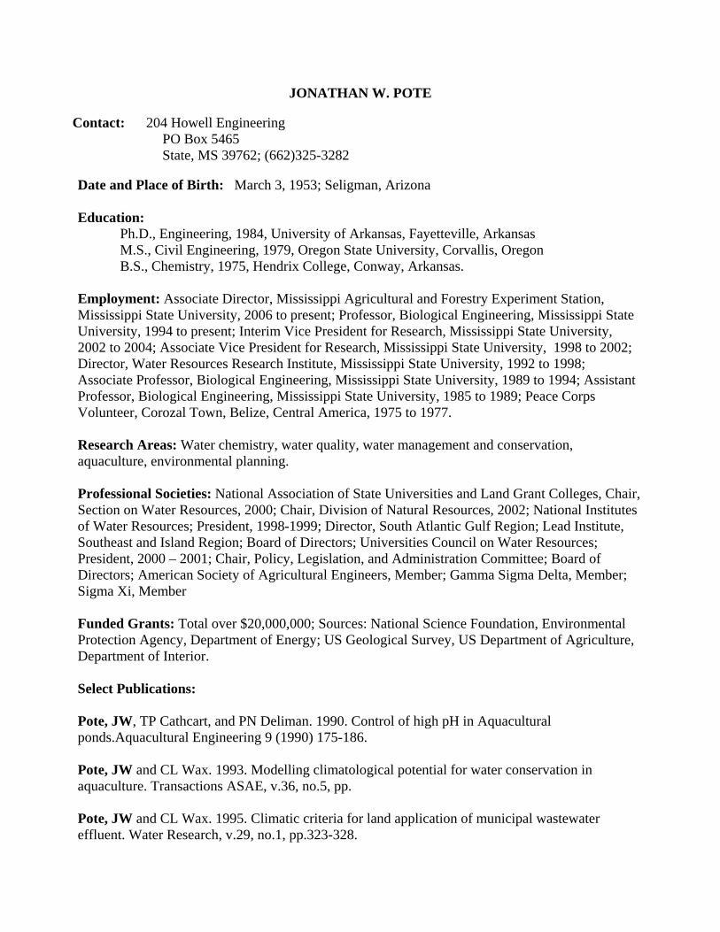
JONATHAN W. POTE
Contact: 204 Howell Engineering PO Box 5465 State, MS 39762; (662)325-3282
Date and Place of Birth: March 3, 1953; Seligman, Arizona Education:
Ph.D., Engineering, 1984, University of Arkansas, Fayetteville, Arkansas M.S., Civil Engineering, 1979, Oregon State University, Corvallis, Oregon B.S., Chemistry, 1975, Hendrix College, Conway, Arkansas.
Employment: Associate Director, Mississippi Agricultural and Forestry Experiment Station, Mississippi State University, 2006 to present; Professor, Biological Engineering, Mississippi State University, 1994 to present; Interim Vice President for Research, Mississippi State University, 2002 to 2004; Associate Vice President for Research, Mississippi State University, 1998 to 2002; Director, Water Resources Research Institute, Mississippi State University, 1992 to 1998; Associate Professor, Biological Engineering, Mississippi State University, 1989 to 1994; Assistant Professor, Biological Engineering, Mississippi State University, 1985 to 1989; Peace Corps Volunteer, Corozal Town, Belize, Central America, 1975 to 1977. Research Areas: Water chemistry, water quality, water management and conservation, aquaculture, environmental planning. Professional Societies: National Association of State Universities and Land Grant Colleges, Chair, Section on Water Resources, 2000; Chair, Division of Natural Resources, 2002; National Institutes of Water Resources; President, 1998-1999; Director, South Atlantic Gulf Region; Lead Institute, Southeast and Island Region; Board of Directors; Universities Council on Water Resources; President, 2000 – 2001; Chair, Policy, Legislation, and Administration Committee; Board of Directors; American Society of Agricultural Engineers, Member; Gamma Sigma Delta, Member; Sigma Xi, Member Funded Grants: Total over $20,000,000; Sources: National Science Foundation, Environmental Protection Agency, Department of Energy; US Geological Survey, US Department of Agriculture, Department of Interior. Select Publications: Pote, JW, TP Cathcart, and PN Deliman. 1990. Control of high pH in Aquacultural ponds.Aquacultural Engineering 9 (1990) 175-186. Pote, JW and CL Wax. 1993. Modelling climatological potential for water conservation in aquaculture. Transactions ASAE, v.36, no.5, pp. Pote, JW and CL Wax. 1995. Climatic criteria for land application of municipal wastewater effluent. Water Research, v.29, no.1, pp.323-328.
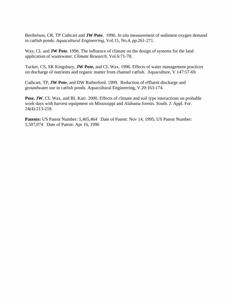
Berthelson, CR, TP Cathcart and JW Pote. 1996. In situ measurement of sediment oxygen demand in catfish ponds. Aquacultural Engineering, Vol.15, No.4, pp.261-271. Wax, CL and JW Pote. 1996. The influence of climate on the design of systems for the land application of wastewater. Climate Research, Vol.6:71-78. Tucker, CS, SK Kingsbury, JW Pote, and CL Wax. 1996. Effects of water management practices on discharge of nutrients and organic matter from channel catfish. Aquaculture, V.147:57-69. Cathcart, TP, JW Pote, and DW Rutherford. 1999. Reduction of effluent discharge and groundwater use in catfish ponds. Aquacultural Engineering, V.20:163-174. Pote, JW, CL Wax, and BL Karr. 2000. Effects of climate and soil type interactions on probable work days with harvest equipment on Mississippi and Alabama forests. South. J. Appl. For. 24(4):213-218. Patents: US Patent Number: 5,465,464 Date of Patent: Nov 14, 1995; US Patent Number: 5,507,074 Date of Patent: Apr 16, 1996
A Continuation of Climatological and Cultural Influences onAnnual Groundwater Decline in the Mississippi DeltaShallow Alluvial Aquifer: Modeling Potential Solutions (YearTwo)
Basic Information
Title:A Continuation of Climatological and Cultural Influences on Annual GroundwaterDecline in the Mississippi Delta Shallow Alluvial Aquifer: Modeling Potential Solutions(Year Two)
Project Number: 2008MS72BStart Date: 3/1/2008End Date: 2/28/2009
Funding Source: 104BCongressional
District: 3rd
ResearchCategory: Climate and Hydrologic Processes
Focus Category: Climatological Processes, Groundwater, Water UseDescriptors: None
PrincipalInvestigators: Charles Wax, Joseph H. Massey, Jonathan Woodrome Pote
Publication
Merrell, T.L. 2008. Development of an Interactive Model Predicting Climatological and CulturalInfluences on Annual Groundwater Volume in the Mississippi Delta Shallow Alluvial Aquifer. Thesissubmitted to Department of Geosciences, Mississippi State University, 95 pgs.
1.
A Continuation of Climatological and Cultural Influences on Annual Groundwater Decline in the Mississippi Delta Shallow Alluvial Aquifer: Modeling Potential Solutions (Year Two)1


Multi-scale Evaluation and Analysis of PrecipitationPatterns over the Mississippi Delta
Basic Information
Title: Multi-scale Evaluation and Analysis of Precipitation Patterns over the MississippiDelta
Project Number: 2008MS73BStart Date: 3/1/2008End Date: 2/28/2009
Funding Source: 104BCongressional District: 3rd
Research Category: Climate and Hydrologic ProcessesFocus Category: Water Quality, Climatological Processes, Hydrology
Descriptors: NonePrincipal
Investigators: Jamie Dyer
Publication
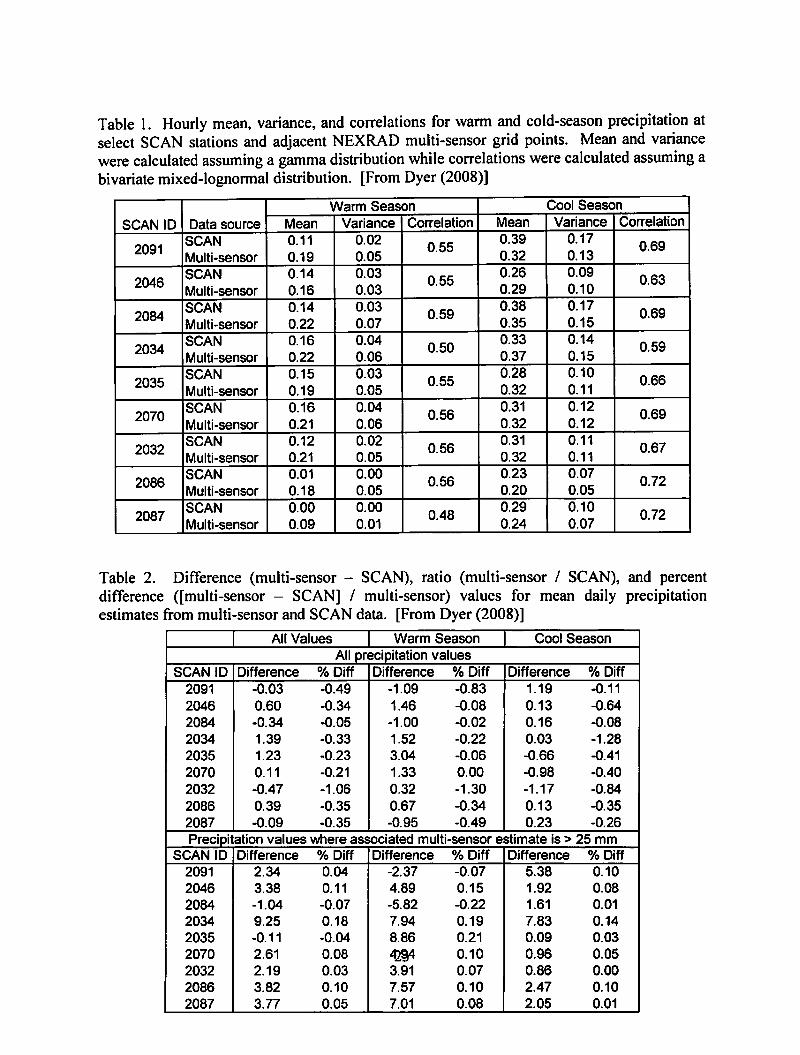
Dyer, J. 2008. Basin-scale precipitation analysis for southeast US watersheds using high-resolutionradar precipitation estimates. Physical Geography, 29, 320-340.
1.
Dyer, J. 2009. Comparison of multi-sensor precipitation estimates over the lower Mississippi Riveralluvial plain. American Meteorological Society annual meeting, Phoenix, AZ, January 10-15, 2009.http://ams.confex.com/ams/89annual/techprogram/paper_150039.htm
2.
Multi-scale Evaluation and Analysis of Precipitation Patterns over the Mississippi Delta 1


Monitoring and Modeling Water Pollution in MississippiLakes
Basic Information
Title: Monitoring and Modeling Water Pollution in MississippiLakes
Project Number: 2008MS81BStart Date: 7/1/2008End Date: 6/30/2009
Funding Source: 104BCongressional District: 1
Research Category: Water QualityFocus Category: Water Quality, Surface Water, Recreation
Descriptors: NonePrincipal Investigators: Cristiane Q. Surbeck
Publication
Monitoring and Modeling Water Pollution in Mississippi Lakes 1
Watershed Assessment and Education
Basic Information
Title: Watershed Assessment and EducationProject Number: 2008MS82B
Start Date: 7/1/2008End Date: 6/30/2009
Funding Source: 104BCongressional District: 02
Research Category: Water QualityFocus Category: Water Quality, Education, Surface Water
Descriptors: NonePrincipal Investigators: Maifan Silitonga
Publication
Watershed Assessment and Education 1


Information Transfer Program Introduction
The Mississippi Water Resources Research Institute addresses research and outreach efforts targeted atmaintaining plentiful, quality water supplies throughout the state. The Institute is a hub for information andexpertise on water resources issues within the state and region. We do this in full partnership with our publicand private cooperators.
The Mississippi Water Resources Research Institute is committed to providing public outreach, educationopportunities, and assisting with economic development activities. Researchers and students have theopportunity to present their research by giving oral and poster presentations. Also included are plenarysessions and workshops. Those persons subscribed to the MWRRI listserv receive newsletters, awardopportunity notices, and timely water-related information.
Information Transfer Program Introduction 1
Information Transfer Program-Publications
Basic Information
Title: Information Transfer Program-PublicationsProject Number: 2006MS69B
Start Date: 3/1/2006End Date: 2/28/2009
Funding Source: 104BCongressional District: 3rd
Research Category: Not ApplicableFocus Category: None, None, None
Descriptors:Principal Investigators: George M. Hopper
Publication
Mississippi Water Resources Research Institute. 2006. 2006 Annual Report. Mississippi WaterResources Research Institute. Mississippi State University, Mississippi State, MS, 24 pages.
1.
Mississippi Water Resources Research Institute. 2007. 2007 Annual Report. Mississippi WaterResources Research Institute. Mississippi State University, Mississippi State, MS, 28 pages.
2.
Mississippi Water Resources Research Institute. 2008. 2008 Annual Report. Mississippi WaterResources Research Institute. Mississippi State University, Mississippi State, MS, 24 pages.
3.
Information Transfer Program-Publications 1
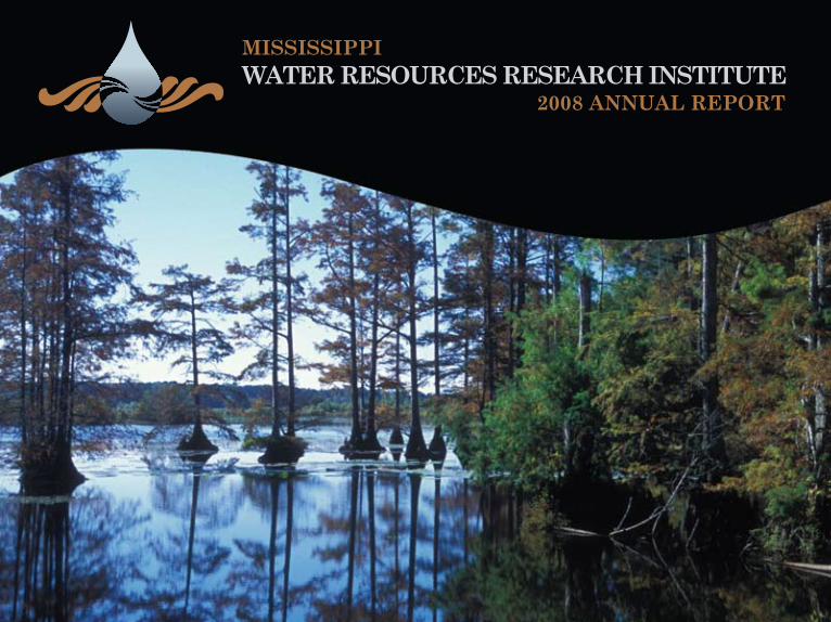
mississippi
2008 annual reportWater resourCes researCH institute

Cover photo by Dave Ammon, Mississippi State UniversityNoxubee National Wildlife Refuge, Brooksville, MS
2008 ANNUAL REPORT
2008 Annual Report
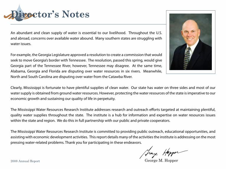
An abundant and clean supply of water is essential to our livelihood. Throughout the U.S. and abroad, concerns over available water abound. Many southern states are struggling with water issues.
For example, the Georgia Legislature approved a resolution to create a commission that would seek to move Georgia’s border with Tennessee. The resolution, passed this spring, would give Georgia part of the Tennessee River, however, Tennessee may disagree. At the same time, Alabama, Georgia and Florida are disputing over water resources in six rivers. Meanwhile, North and South Carolina are disputing over water from the Catawba River.
Clearly, Mississippi is fortunate to have plentiful supplies of clean water. Our state has water on three sides and most of our water supply is obtained from ground water resources. However, protecting the water resources of the state is imperative to our economic growth and sustaining our quality of life in perpetuity.
The Mississippi Water Resources Research Institute addresses research and outreach efforts targeted at maintaining plentiful, quality water supplies throughout the state. The institute is a hub for information and expertise on water resources issues within the state and region. We do this in full partnership with our public and private cooperators.
The Mississippi Water Resources Research Institute is committed to providing public outreach, educational opportunities, and assisting with economic development activities. This report details many of the activities the institute is addressing on the most pressing water-related problems. Thank you for participating in these endeavors.
George M. Hopper
Director’s notes
mississippi Water resources research institute
The Mississippi Water Resources Research Institute (MWRRI) provides a statewide center of expertise in water and associated land use and serves as a repository of knowledge for use in education, research, planning, and community service.
The MWRRI goals are to serve public and private interests in the conservation, development, and use of water resources; to provide training opportunities in higher education whereby skilled professionals become available to serve government and private sectors alike; to assist planning and regulatory bodies at the local, state, regional, and federal levels; to communicate research findings to potential users in a form that encourages quick comprehension and direct application to water related problems; to assist state agencies in the development and maintenance of a state water management plan; and to facilitate and stimulate planning and management that:
• deals with water policy issues,• supports state water agencies’ missions with research on problems encountered and expected,• provides water planning and management organizations with tools to increase efficiency and effectiveness.
The Mississippi Water Resources Research Institute is a unit of the Forest and Wildlife Research Center, Mississippi State University.
1 2
mWrri-funded projects
Carbon 14 is often used to date specific layers in lake sediments. However, problems in this type of dating can result in erroneous calculated ages. Four separate sedimentation regimes were identified while researching the history of Sky Lake, an oxbow lake in northwestern Mississippi. Scientists incorporated 14C activities from bulk sediment samples and collection of deeper cores from the open water region of the lake. This allowed scientists to completely map the history of sedimentation in the lake from the time it was abandoned as an active meander bend to the present. Items identified
2008 Annual Report
Developing a reliable method for identifying pre-settlement Wetland sediment accumulation rates: 14C Dating on Bulk lake sediments and extractsGregg Davidson, Geology and Geological Engineering, University of Mississippi
for analysis included: sand, deposition while still part of an actively flowing system, abandonment from the river system with a relative high sediment accumulation rate from seasonal flooding, migration of the river away from the lake with a subsequent drop in the rate of accumulation, and post land clearing with a 50-fold increase in the rate of sediment accumulation.
Using time intervals prior to land clearing, 97 percent of the lake’s history can be represented. This period lasted upwards of 3600 years during which time approximately 120 cm of sediment accumulated in the lake. In the last 100 to 120 years, since the land began to be cleared, an equivalent thickness of sediment has been added, doubling the total sediment thickness. Radioisotope data and recent observations of sediment accumulation over the past five years indicate that the 50-fold increase in sediment accumulation rate continues unabated.
These projects reflect the success of the institute to facilitate strong relationships between university researchers and Mississippi’s state agencies and other organizations to identify and address priority water resource issues. These projects all include partial cost share from a participating non-federal agency or organization.
3 4
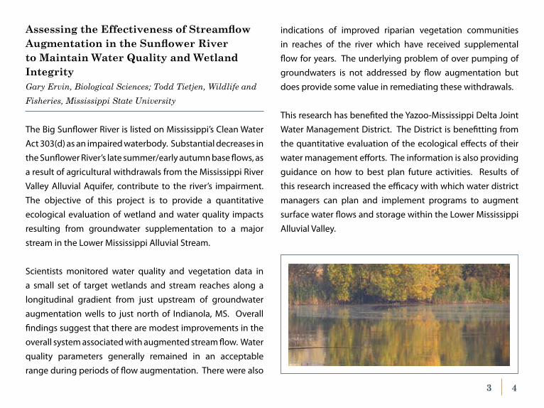
The Big Sunflower River is listed on Mississippi’s Clean Water Act 303(d) as an impaired waterbody. Substantial decreases in the Sunflower River’s late summer/early autumn base flows, as a result of agricultural withdrawals from the Mississippi River Valley Alluvial Aquifer, contribute to the river’s impairment. The objective of this project is to provide a quantitative ecological evaluation of wetland and water quality impacts resulting from groundwater supplementation to a major stream in the Lower Mississippi Alluvial Stream.
Scientists monitored water quality and vegetation data in a small set of target wetlands and stream reaches along a longitudinal gradient from just upstream of groundwater augmentation wells to just north of Indianola, MS. Overall findings suggest that there are modest improvements in the overall system associated with augmented stream flow. Water quality parameters generally remained in an acceptable range during periods of flow augmentation. There were also
Assessing the Effectiveness of Streamflow Augmentation in the Sunflower River to maintain Water Quality and Wetland integrityGary Ervin, Biological Sciences; Todd Tietjen, Wildlife and Fisheries, Mississippi State University
indications of improved riparian vegetation communities in reaches of the river which have received supplemental flow for years. The underlying problem of over pumping of groundwaters is not addressed by flow augmentation but does provide some value in remediating these withdrawals.
This research has benefited the Yazoo-Mississippi Delta Joint Water Management District. The District is benefitting from the quantitative evaluation of the ecological effects of their water management efforts. The information is also providing guidance on how to best plan future activities. Results of this research increased the efficacy with which water district managers can plan and implement programs to augment surface water flows and storage within the Lower Mississippi Alluvial Valley.
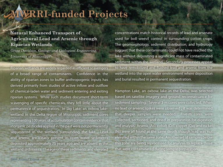
Riparian wetlands are widely regarded as efficient scavengers of a broad range of contaminants. Confidence in the ability of riparian zones to buffer anthropogenic inputs has derived primarily from studies of active inflow and outflow of chemical-laden water and sediment entering and exiting riparian systems. While such studies document short-term scavenging of specific chemicals, they tell little about the permanence of sequestration. In Sky Lake, an oxbow lake-wetland in the Delta region of Mississippi, sediment cores representing 100 years of accumulation contain evidence that inorganic pesticides applied in the past were not permanently sequestered in the wetland surrounding the lake. Lead and arsenic are clearly present in open water sediments deposited approximately 75 years ago and are absent in the wetland sediments. The age of these sediments and elevated
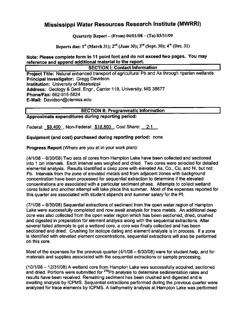
natural enhanced transport of agricultural lead and arsenic through riparian Wetlands Gregg Davidson, Geology and Geological Engineering, University of Mississippi
2008 Annual Report
concentrations match historical records of lead and arsenate used for boll weevil control in surrounding cotton crops. The geomorphology, sediment distribution, and hydrology suggest that these contaminants could not have reached the lake without depositing a significant mass of contaminated sediment within the wetland. Secondary processes appear to have remobilized and flushed lead and arsenic from the wetland into the open water environment where deposition and burial resulted in permanent sequestration.
Hampton Lake, an oxbow lake in the Delta, was selected based on satellite imagery and ground reconnaissance for sediment sampling. Several 3-m cores were collected. When no lead or arsenic spikes were observed , it was determined that deeper samples were needed. Five-m cores were collected, sectioned, and dried in preparation for digestion and analysis. Arsenic (As), cobalt (Co), copper (Cu), and nickel (Ni) were all found at the same depth though lead was not elevated within the same zone. Another set of samples below this zone are being reprocessed for analysis to replace those that were contaminated during sample preparation.
mWrri-funded projects
5 6
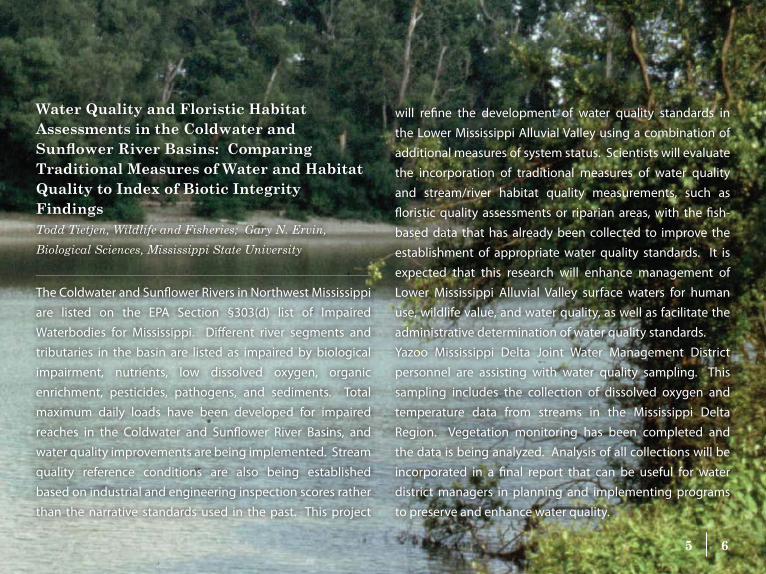
Water Quality and Floristic Habitat Assessments in the Coldwater and Sunflower River Basins: Comparing traditional measures of Water and Habitat Quality to index of Biotic integrity FindingsTodd Tietjen, Wildlife and Fisheries; Gary N. Ervin, Biological Sciences, Mississippi State University
The Coldwater and Sunflower Rivers in Northwest Mississippi are listed on the EPA Section §303(d) list of Impaired Waterbodies for Mississippi. Different river segments and tributaries in the basin are listed as impaired by biological impairment, nutrients, low dissolved oxygen, organic enrichment, pesticides, pathogens, and sediments. Total maximum daily loads have been developed for impaired reaches in the Coldwater and Sunflower River Basins, and water quality improvements are being implemented. Stream quality reference conditions are also being established based on industrial and engineering inspection scores rather than the narrative standards used in the past. This project
will refine the development of water quality standards in the Lower Mississippi Alluvial Valley using a combination of additional measures of system status. Scientists will evaluate the incorporation of traditional measures of water quality and stream/river habitat quality measurements, such as floristic quality assessments or riparian areas, with the fish-based data that has already been collected to improve the establishment of appropriate water quality standards. It is expected that this research will enhance management of Lower Mississippi Alluvial Valley surface waters for human use, wildlife value, and water quality, as well as facilitate the administrative determination of water quality standards. Yazoo Mississippi Delta Joint Water Management District personnel are assisting with water quality sampling. This sampling includes the collection of dissolved oxygen and temperature data from streams in the Mississippi Delta Region. Vegetation monitoring has been completed and the data is being analyzed. Analysis of all collections will be incorporated in a final report that can be useful for water district managers in planning and implementing programs to preserve and enhance water quality.
mWrri-funded projects
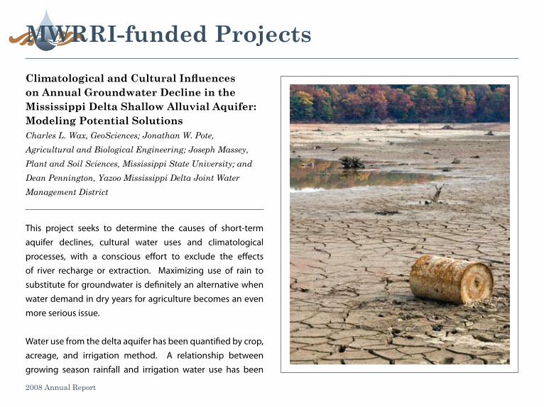
This project seeks to determine the causes of short-term aquifer declines, cultural water uses and climatological processes, with a conscious effort to exclude the effects of river recharge or extraction. Maximizing use of rain to substitute for groundwater is definitely an alternative when water demand in dry years for agriculture becomes an even more serious issue.
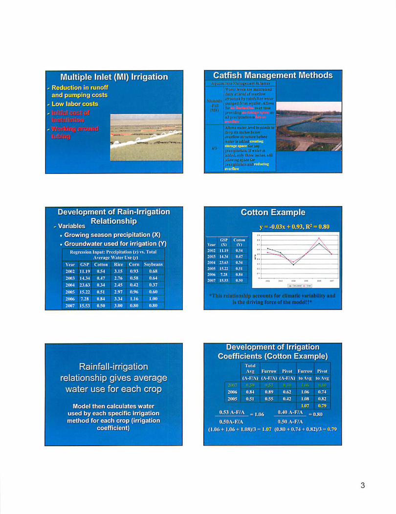
Water use from the delta aquifer has been quantified by crop, acreage, and irrigation method. A relationship between growing season rainfall and irrigation water use has been
Climatological and Cultural Influences on Annual Groundwater Decline in the Mississippi Delta Shallow Alluvial Aquifer: modeling potential solutionsCharles L. Wax, GeoSciences; Jonathan W. Pote, Agricultural and Biological Engineering; Joseph Massey, Plant and Soil Sciences, Mississippi State University; and Dean Pennington, Yazoo Mississippi Delta Joint Water Management District
2008 Annual Report
7 8
a Continuation of Climatological and Cultural Influences on Annual Groundwater Decline in the Mississippi Delta Shallow Alluvial Aquifer: Modeling Potential Solutions (Year Two)Charles L. Wax, Geosciences, Jonathan W. Pote, Agricultural and
Biological Engineering, Joseph Massey, Plant and Soil Sciences,
Mississippi State University; and Dean Pennington, Yazoo
Mississippi Delta Joint Water Management District
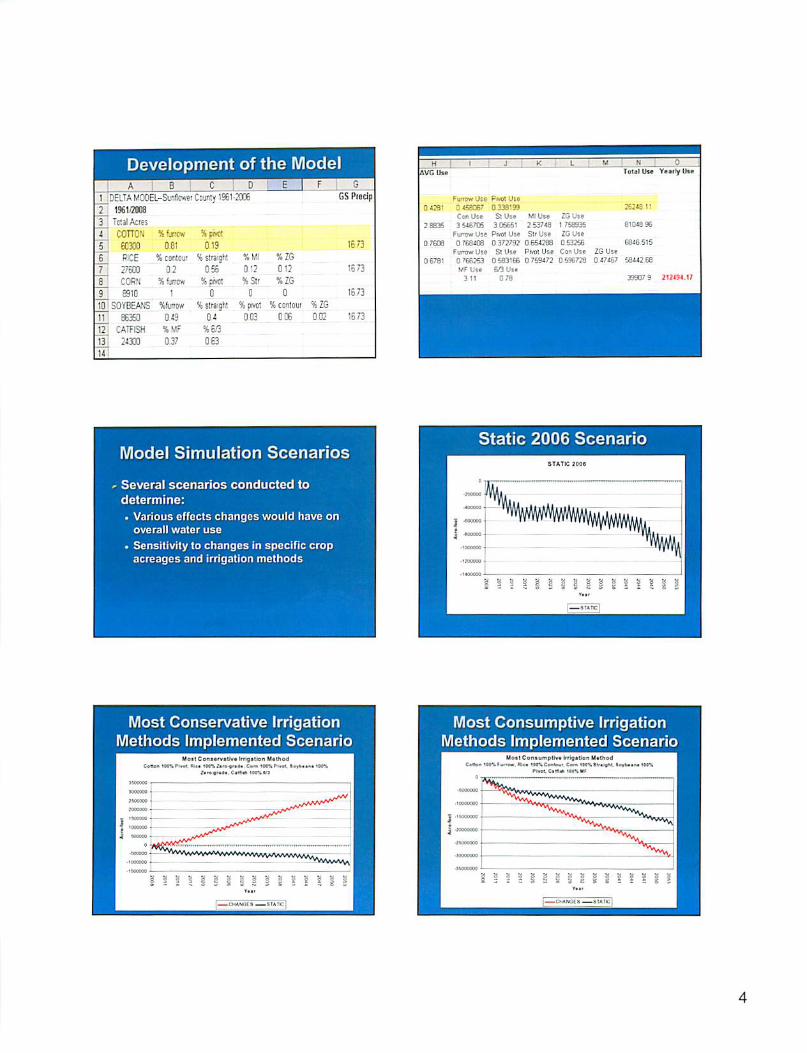
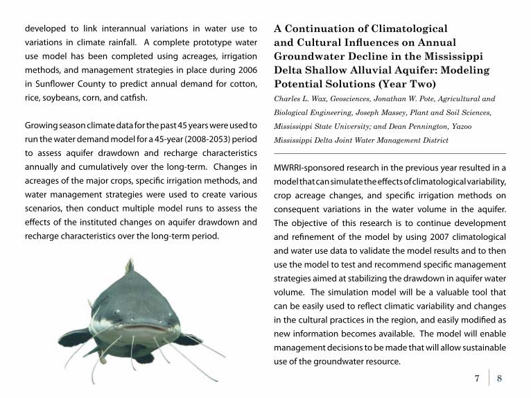
MWRRI-sponsored research in the previous year resulted in a model that can simulate the effects of climatological variability, crop acreage changes, and specific irrigation methods on consequent variations in the water volume in the aquifer. The objective of this research is to continue development and refinement of the model by using 2007 climatological and water use data to validate the model results and to then use the model to test and recommend specific management strategies aimed at stabilizing the drawdown in aquifer water volume. The simulation model will be a valuable tool that can be easily used to reflect climatic variability and changes in the cultural practices in the region, and easily modified as new information becomes available. The model will enable management decisions to be made that will allow sustainable use of the groundwater resource.
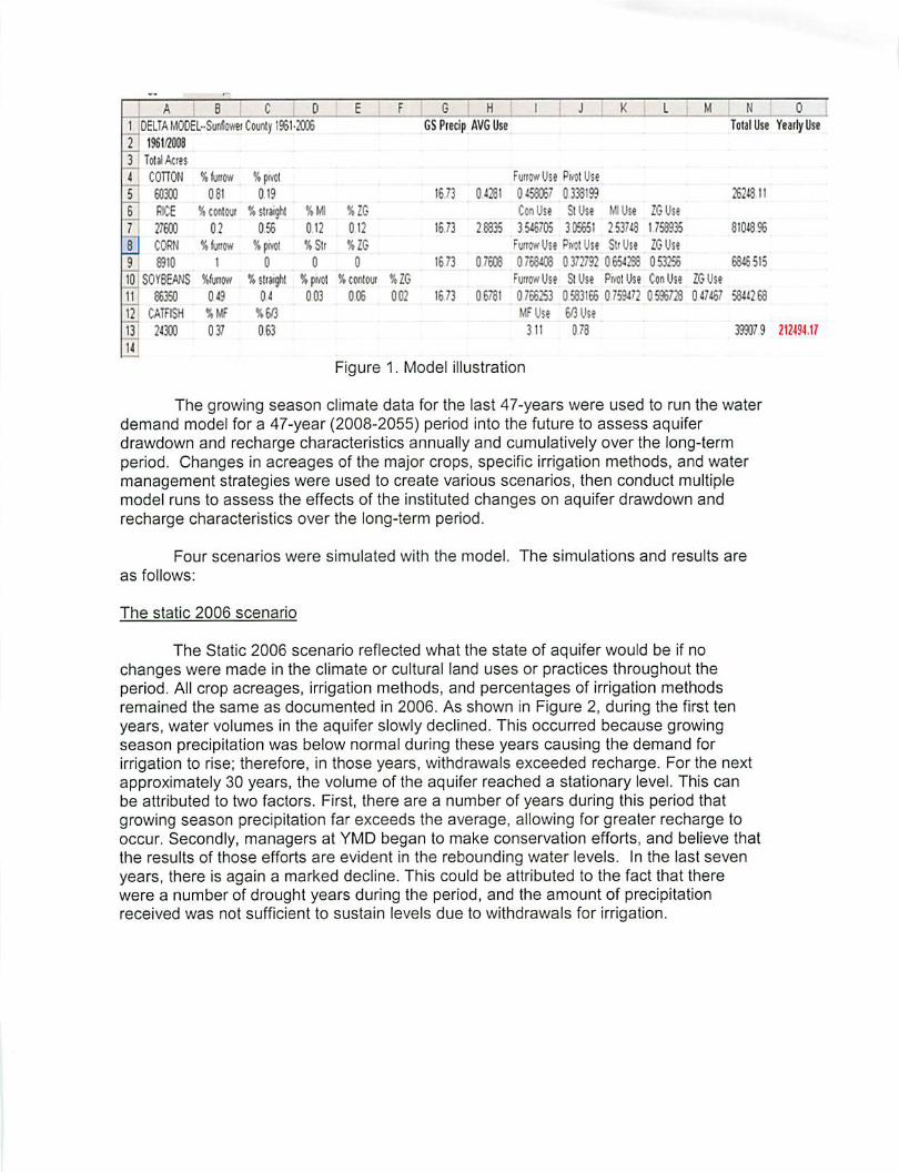
developed to link interannual variations in water use to variations in climate rainfall. A complete prototype water use model has been completed using acreages, irrigation methods, and management strategies in place during 2006 in Sunflower County to predict annual demand for cotton, rice, soybeans, corn, and catfish.
Growing season climate data for the past 45 years were used to run the water demand model for a 45-year (2008-2053) period to assess aquifer drawdown and recharge characteristics annually and cumulatively over the long-term. Changes in acreages of the major crops, specific irrigation methods, and water management strategies were used to create various scenarios, then conduct multiple model runs to assess the effects of the instituted changes on aquifer drawdown and recharge characteristics over the long-term period.
mWrri-funded projects
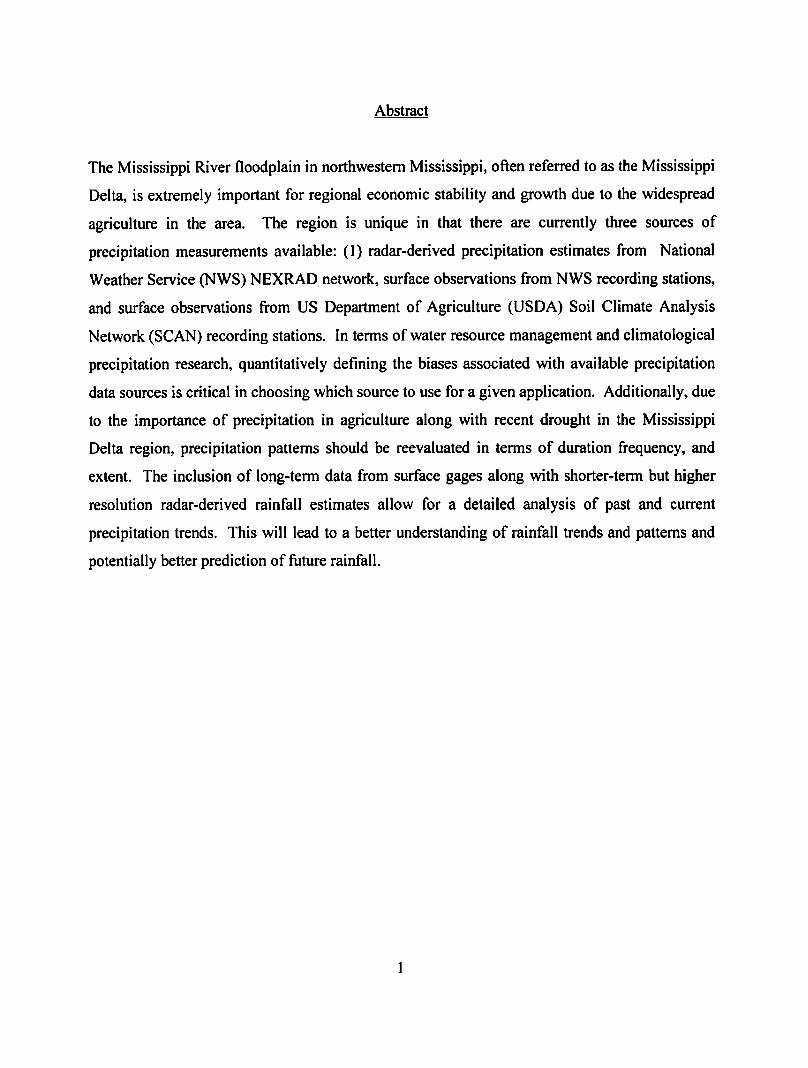
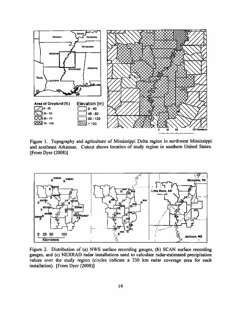
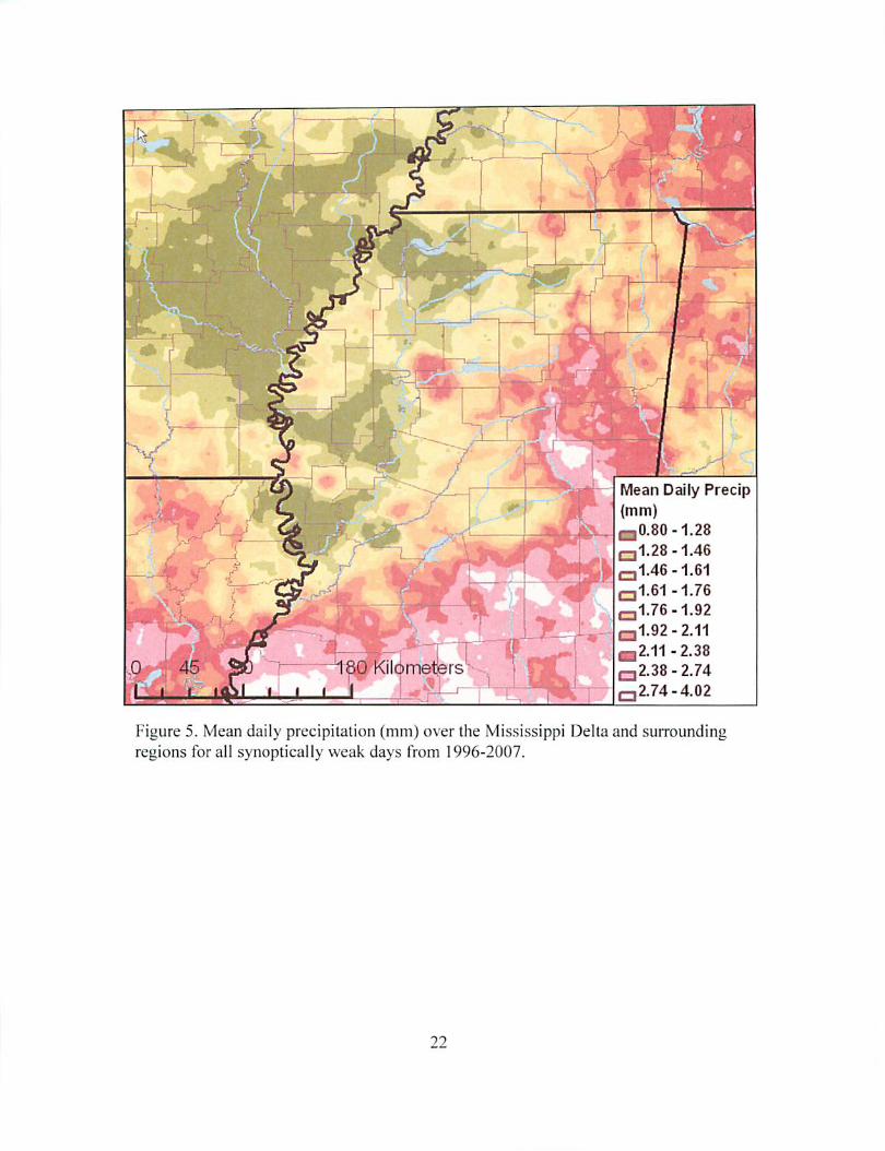
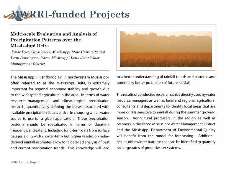
The Mississippi River floodplain in northwestern Mississippi, often referred to as the Mississippi Delta, is extremely important for regional economic stability and growth due to the widespread agriculture in the area. In terms of water resource management and climatological precipitation research, quantitatively defining the biases associated with available precipitation data is critical in choosing which water source to use for a given application. These precipitation patterns should be reevaluated in terms of duration, frequency, and extent. Including long-term data from surface gauges along with shorter-term but higher resolution radar-derived rainfall estimates allow for a detailed analysis of past and current precipitation trends. This knowledge will lead
multi-scale evaluation and analysis of precipitation patterns over themississippi DeltaJamie Dyer, Geosciences, Mississippi State University and Dean Pennington, Yazoo Mississippi Delta Joint Water Management District
2008 Annual Report
to a better understanding of rainfall trends and patterns and potentially better prediction of future rainfall.
The results of conducted research can be directly used by water resource managers as well as local and regional agricultural consultants and departments to identify local areas that are more or less sensitive to rainfall during the summer growing season. Agricultural producers in the region as well as planners in the Yazoo Mississippi Water Management District and the Mississippi Department of Environmental Quality will benefit from the model for forecasting. Additional results offer winter patterns that can be identified to quantify recharge rates of groundwater systems.
9 10
History of usGs-funded projects
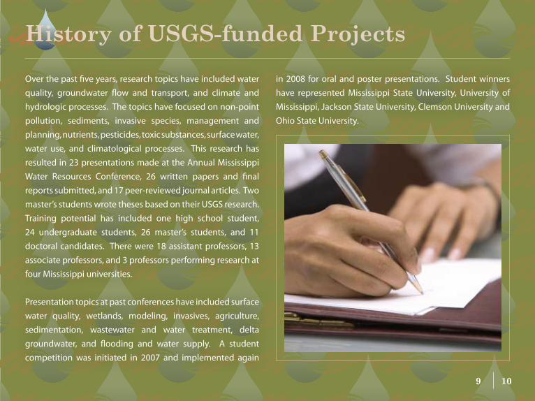
Over the past five years, research topics have included water quality, groundwater flow and transport, and climate and hydrologic processes. The topics have focused on non-point pollution, sediments, invasive species, management and planning, nutrients, pesticides, toxic substances, surface water, water use, and climatological processes. This research has resulted in 23 presentations made at the Annual Mississippi Water Resources Conference, 26 written papers and final reports submitted, and 17 peer-reviewed journal articles. Two master’s students wrote theses based on their USGS research. Training potential has included one high school student, 24 undergraduate students, 26 master’s students, and 11 doctoral candidates. There were 18 assistant professors, 13 associate professors, and 3 professors performing research at four Mississippi universities.
Presentation topics at past conferences have included surface water quality, wetlands, modeling, invasives, agriculture, sedimentation, wastewater and water treatment, delta groundwater, and flooding and water supply. A student competition was initiated in 2007 and implemented again
in 2008 for oral and poster presentations. Student winners have represented Mississippi State University, University of Mississippi, Jackson State University, Clemson University and Ohio State University.
The Mississippi Water Resources Research Institute builds partnerships with the private sector, county and municipal governments, and economic development agencies to identify and pursue water-related economic development opportunities in Mississippi. The Institute plays a key role in defining potential projects and determining their likely economic feasibility and potential. Once it is determined that a project is economically feasible and there is local or regional support, these water development projects often become long-term, multi-disciplinary efforts that utilize expertise from across the State.
economic Development
smith County lake studyJeff Ballweber and Mary Love Tagert, Mississippi Water Resources Research Institute; Jonathan Pote, Agricultural and Biological Engineering; Jon Rezek, Finance and Economics; Steve Grado, Forestry; Garen Evans and Darren Hudson, Agricultural Economics; and Darrel Schmitz and James May, GeoSciences, Mississippi State University
2008 Annual Report
Working closely with the U.S. Forest Service and the Bienville Resources and Development Council (an interlocal agreement between Smith, Jasper, Rankin, and Simpson counties), this project is identifying and evaluating sites in Smith County that could be developed into a multi-purpose lake. As part of a master planning effort, the project is also evaluating facilities and amenities that could be directly or indirectly associated with the lake to make it a regional economic development hub for all counties participating in the council. Amenities that were evaluated included water-related structures such as docks and piers, marinas, and boat ramps; land-based facilities such as cabins, camping areas, and structures for recreational activities; residential areas; a conference center; a lodge(s); and complementary commercial establishments.
11 12
Using a 2007 PricewaterhouseCoopers report, economic and fiscal impacts from residential activities at the lake were estimated to establish patterns of residential development expected near the proposed Smith County/Bienville National Forest Lake. Data from Lake Eddins was collected from the Jasper County Tax Assessor to estimate the distribution of home values and associated household incomes of residents that would populate the proposed site. PricewaterhouseCoopers estimates were combined with Lake Eddins property tax data to determine economic impacts attributed by new residents. These economic impacts were used to gauge the value of sales tax revenues generated by the project. Another component of the residential analysis involved calculating the property tax implications. In addition to presumed residential activities, estimates from recreational activities planned at the lake and associated facilities were also necessary. Again, the PricewaterhouseCoopers report was used to estimate the number of visitors to the site. Also surveyed were several recreational lakes in Mississippi to estimate typical spending patterns by recreational visitors. The combined visitor numbers and expenditure patterns were used to arrive at estimates of economic impacts of visitors on the region. Economic impacts were then used to extrapolate an estimate of the additional sales tax revenue expected from the project.
From all studies, the scientists found that the proposed lake and associated residential and recreational activities, including business and infrastructure development will generate $183 million (2006 dollars) in future sales. A major source of the revenue would be generated from new residents and construction of the required infrastructure. These two activities would provide a very significant economic stimulus to the region.
Part-time residents and recreational visitors will have a minor impact on the region. Approximately 209 full- and part-time jobs will be created by the lake’s economic stimulus with the majority coming from spending by new residents. Jobs created by the construction of the lake and related infrastructure are considered temporary; however, the average of 58 full-and part-time jobs was skewed with approximately 385 full- and part-time jobs being created in year 1 of the project and about 30 full- and part-time jobs being supported by construction during year 20, the last year of the project.
economic Development
Grenada lake economic Development projectMary Love Tagert, Mississippi Water Resources Research Institute; Jon Rezek and Ben Blair, Finance and Economics; Wayne Wilkerson, Landscape Architecture, Mississippi State University
The Grenada Chamber of Commerce contacted the Mississippi Water Resources Research Institute for assistance in promoting economic development around Grenada
Lake, a U.S. Army Corps of Engineers lake. The operation of the lake began in 1954 to help control flooding in the Yazoo River Basin. The 90,000-acre multi-use project is managed through the Corps’ Vicksburg District for flood control, public recreation, conservation of fish and wildlife, and public
2008 Annual Report
forests. Grenada Lake is also home to Hugh White State Park and a recently constructed 18-hole golf course. The Chamber sought help in working with the Corps to promote economic development based on the lake’s numerous recreational opportunities and bountiful natural resources. The MWRRI led two public meetings to obtain feedback on amenities and opportunities Grenada’s citizens would like to see around the lake. The MWRRI then teamed with Mississippi State University’s Departments of Landscape Architecture and Finance and Economics to develop a preliminary master plan and conduct economic and marketing feasibility studies, respectively.
13 14
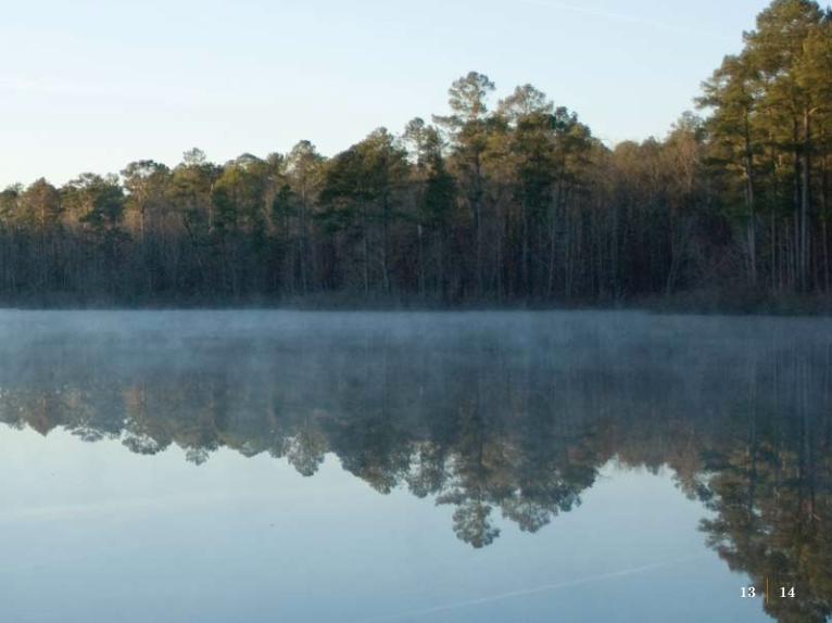
Water Quality
southeastern regional small public Water systems technical assistance Center (SE-TAC)Jeff Ballweber and Kim Steil, Mississippi Water Resources Research Institute; Amy Schmidt, Department of Agricultural and Biological Engineering, Mississippi State University; Jonathan Pote, Mississippi Agricultural and Forestry Experiment Station
The Mississippi Water Resources Research Institute continues to recognize the need for assisting small public water systems in Mississippi and the southeastern United States to provide safe, clean drinking water to the public. The Southeastern Regional Small Public Water Systems Technical Assistance Center (SE-TAC), funded by the Environmental Protection Agency, was established in 2000 and has been administered by the MWRRI at Mississippi State University. SE-TAC works with state and regional agencies to assist small public water systems in acquiring and maintaining the technical, financial, and managerial capacity to provide safe drinking water and meet the Safe Drinking Water Act’s public health protection
2008 Annual Report
goals. SE-TAC has adopted an applied approach to directly and meaningfully supporting small public water system issues in the southeastern United States. Throughout its existence, SE-TAC has provided nearly $2 million on over 40 projects that have directly assisted small drinking water systems across the southeast region of the United States. Hundreds of small water systems have received training and assistance with technical, financial and managerial issues through SE-TAC funded projects.
As county and local governments begin to take a more active role in addressing nonpoint sources of water pollution, it is important to accurately and fully quantify the potential water quality benefits of various non-regulatory management alternatives. The Mississippi Water Resources Research Institute works with state and regional agencies to design projects to meet these needs.
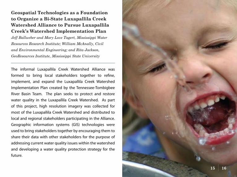
Geospatial technologies as a Foundation to organize a Bi-state luxapallila Creek Watershed alliance to pursue luxapallila Creek’s Watershed implementation planJeff Ballweber and Mary Love Tagert, Mississippi Water Resources Research Institute; William McAnally, Civil and Environmental Engineering; and Rita Jackson, GeoResources Institute, Mississippi State University
The informal Luxapallila Creek Watershed Alliance was formed to bring local stakeholders together to refine, implement, and expand the Luxapallila Creek Watershed Implementation Plan created by the Tennessee-Tombigbee River Basin Team. The plan seeks to protect and restore water quality in the Luxapallila Creek Watershed. As part of this project, high resolution imagery was collected for most of the Luxapallila Creek Watershed and distributed to local and regional stakeholders participating in the Alliance. Geographic information systems (GIS) technologies were used to bring stakeholders together by encouraging them to share their data with other stakeholders for the purpose of addressing current water quality issues within the watershed and developing a water quality protection strategy for the future.
15 16
Water Quality
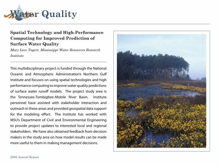
This multidisciplinary project is funded through the National Oceanic and Atmospheric Administration’s Northern Gulf Institute and focuses on using spatial technologies and high performance computing to improve water quality predictions of surface water runoff models. The project study area is the Tennessee-Tombigbee-Mobile River Basin. Institute personnel have assisted with stakeholder interaction and outreach in these areas and provided geospatial data support for the modeling effort. The Institute has worked with MSU’s Department of Civil and Environmental Engineering to provide project updates to interested local and regional stakeholders. We have also obtained feedback from decision makers in the study area on how model results can be made more useful to them in making management decisions.
spatial technology and High-performance Computing for improved prediction of surface Water QualityMary Love Tagert, Mississippi Water Resources Research Institute
2008 Annual Report
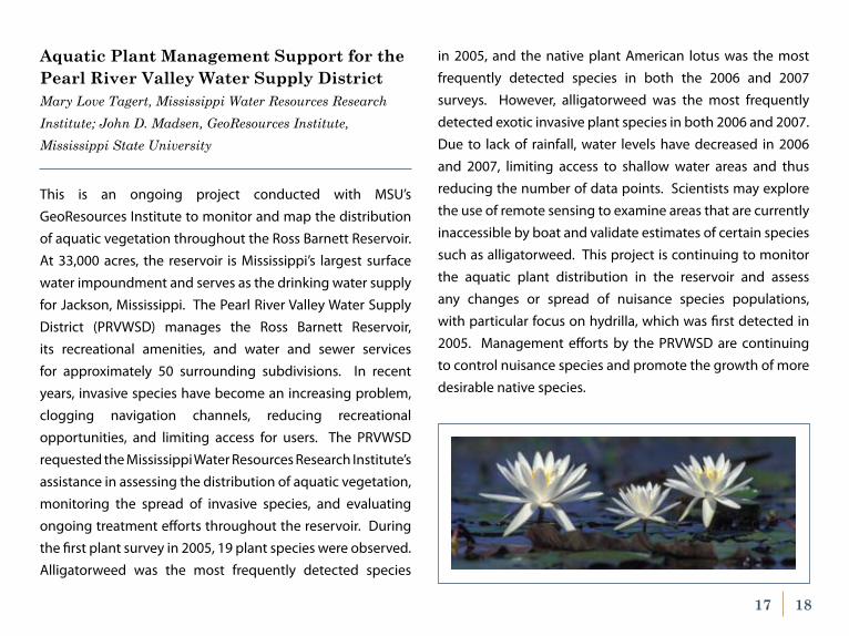
Aquatic Plant Management Support for the pearl river Valley Water supply DistrictMary Love Tagert, Mississippi Water Resources Research Institute; John D. Madsen, GeoResources Institute, Mississippi State University
This is an ongoing project conducted with MSU’s GeoResources Institute to monitor and map the distribution of aquatic vegetation throughout the Ross Barnett Reservoir. At 33,000 acres, the reservoir is Mississippi’s largest surface water impoundment and serves as the drinking water supply for Jackson, Mississippi. The Pearl River Valley Water Supply District (PRVWSD) manages the Ross Barnett Reservoir, its recreational amenities, and water and sewer services for approximately 50 surrounding subdivisions. In recent years, invasive species have become an increasing problem, clogging navigation channels, reducing recreational opportunities, and limiting access for users. The PRVWSD requested the Mississippi Water Resources Research Institute’s assistance in assessing the distribution of aquatic vegetation, monitoring the spread of invasive species, and evaluating ongoing treatment efforts throughout the reservoir. During the first plant survey in 2005, 19 plant species were observed. Alligatorweed was the most frequently detected species
17 18
in 2005, and the native plant American lotus was the most frequently detected species in both the 2006 and 2007 surveys. However, alligatorweed was the most frequently detected exotic invasive plant species in both 2006 and 2007. Due to lack of rainfall, water levels have decreased in 2006 and 2007, limiting access to shallow water areas and thus reducing the number of data points. Scientists may explore the use of remote sensing to examine areas that are currently inaccessible by boat and validate estimates of certain species such as alligatorweed. This project is continuing to monitor the aquatic plant distribution in the reservoir and assess any changes or spread of nuisance species populations, with particular focus on hydrilla, which was first detected in 2005. Management efforts by the PRVWSD are continuing to control nuisance species and promote the growth of more desirable native species.
publications
Davidson, G.R., D.G. Wren, W.G. Walker, and S.G. Ultroksa. 2008. Contaminant transport through riparian wetlands. Page 79 in Proceedings, 38th Annual Mississippi Water Resources Conference, Jackson, MS, April 15-16, 2008.
Madsen, J.D., R.M. Wersal, and M.L. Tagert. 2008. Littoral zone aquatic plant community assessment of the Ross Barnett Reservoir, Mississippi for 2007. Page 140-143 in Proceedings, 38th Annual Mississippi Water Resources Conference, Jackson, MS, April 15-16, 2008.
Schmidt, J. and K.A. Brasher. 2007. Mississippi Water Resources Research Institute Newsletter 1(1).
Schmidt, J. and K.A. Brasher. 2008. Mississippi Water Resources Research Institute Newsletter 1(2).
2008 Annual Report
Tietjen, T. and G. Ervin. 2008. Comparing index of biotic integrity scores to traditional measures of water quality: Exploring the causes of impairment in streams of the Mississippi Delta. Page 96 in Proceedings, 38th Annual Mississippi Water Resources Conference, Jackson, MS, April 15-16, 2008.
Tietjen, T. and G. Ervin. 2008. Big Sunflower River water quality assessments following streamflow augmentation. Page 38 in Proceedings, 38th Annual Mississippi Water Resources Conference, Jackson, MS, April 15-16, 2008.
Walker, W.G., G.R. Davidson, T. Lange, and D. Wren. 2007. Accurate lacustrine and wetland sediment accumulation rates determined from 14C activity of bulk sediment fractions. Radiocarbon 49:983-992.
Wax, C.L., J.W. Pote, and T.L. Merrell. 2008. Climatological and cultural influences on annual groundwater decline in the Mississippi Delta shallow alluvial aquifer. Page 41-49 in Proceedings, 38th Annual Mississippi Water Resources Conference, Jackson, MS, April 15-16, 2008.
Wren, D.G., G.R. Davidson, W.G. Walker, and S.J. Galicki. 2008. The evolution of an oxbow lake in the Mississippi alluvial floodplain. Journal of Soil and Water Conservation 63(3):129-135.
Wren, D.G. and G.R. Davidson. 2008. Practical implications of quantifying ancient sedimentation rates in lakes. Journal of Soil and Water Conservation 63(3):89a.
19 20
advisory Board
Mr. Jan BoydMississippi Department of Marine Resources
Mr. Tom BryantPickering Incorporated
Mr. Jamie CrawfordMississippi Department of Environmental Quality
Dr. Pat DelimanCEERD-EP-E
Mr. Carey HardinClearwater Consultants
2008 Annual Report
Mr. Kim HarrisNatural Resource Conservation Service
Mr. Chip MorganDelta Council
Dr. Jami NettlesWeyerhaeuser Company
Dr. Dean A. PenningtonYazoo Mississippi Delta Joint Water Management District
Mr. Mickey PlunkettU.S. Geological Survey
The Honorable Brandon PresleyMississippi Public Service Commission
Dr. Mathias J.M. RömkensNational Sedimentation Laboratory
Dr. LaDon SwannMS-AL SeaGrant Consortium
Dr. Paul TchounwouJackson State University
Mr. Andy WhittingtonMississippi Farm Bureau Federation
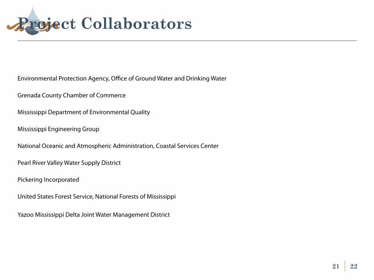
Environmental Protection Agency, Office of Ground Water and Drinking Water
Grenada County Chamber of Commerce
Mississippi Department of Environmental Quality
Mississippi Engineering Group
National Oceanic and Atmospheric Administration, Coastal Services Center
Pearl River Valley Water Supply District
Pickering Incorporated
United States Forest Service, National Forests of Mississippi
Yazoo Mississippi Delta Joint Water Management District
project Collaborators
21 22
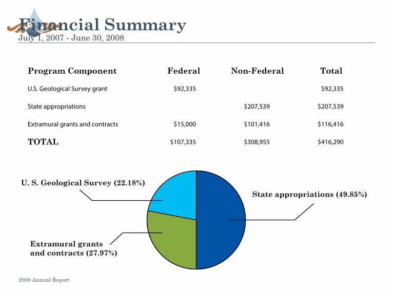
Financial summary
program Component Federal non-Federal total
U.S. Geological Survey grant $92,335 $92,335
State appropriations $207,539 $207,539
Extramural grants and contracts $15,000 $101,416 $116,416
total $107,335 $308,955 $416,290
State appropriations (49.85%)U. S. Geological Survey (22.18%)
extramural grants and contracts (27.97%)
2008 Annual Report
July 1, 2007 - June 30, 2008


Discrimination based upon race, color, religion, sex, national origin, age, disability, or veteran’s status is a violation of federal and state law and MSU policy and will not be tolerated. Discrimination based upon sexual orientation or group affiliation is a violation of MSU policy and will not be tolerated.
www.wrri.msstate.edu
College of Forest ResourcesMiss iss ippi S tate Univers i ty
Forest and Wi ld l i fe Research Center
Information Transfer Program-Conferences
Basic Information
Title: Information Transfer Program-ConferencesProject Number: 2006MS70B
Start Date: 3/1/2006End Date: 2/28/2009
Funding Source: 104BCongressional District: 3rd
Research Category: Not ApplicableFocus Category: None, None, None
Descriptors:Principal Investigators: George M. Hopper
Publication
2006, Mississippi Water Resources Conference Proceedings, Mississippi Water Resources ResearchInstitute, Mississippi State, MS, CD ROM.
1.
2006, Mississippi Water Resources Conference Program and Abstracts, Mississippi Water ResourcesResearch Institue, Mississippi State, MS, 66 pg.
2.
2007, Mississippi Water Resources Conference Proceedings, Mississippi Water Resources ResearchInstitute, Mississippi State, MS, CD ROM.
3.
2007, Mississippi Water Resources Conference Program and Abstracts, Mississippi Water ResourcesResearch Institute, Mississippi State, MS, 67 pg.
4.
2008, Mississippi Water Resources Conference Proceedings, Mississippi Water Resources ResearchInstitute, Mississippi State, MS. www.wrri.msstate.edu.
5.
2008, Mississippi Water Resources Conference Program and Abstracts, Mississippi Water ResourcesResearch Institute, Mississippi State, MS, 67 pg.
6.
Information Transfer Program-Conferences 1
USGS Summer Intern Program
None.
USGS Summer Intern Program 1

Notable Awards and Achievements
Notable Awards and Achievements 1

Publications from Prior Years
Publications from Prior Years 1