Embed Size (px)
Citation preview

Mesozoic of the Gulf Rim and Beyond:New Progress in Science and Exploration
of the Gulf of Mexico Basin
35th Annual Gulf Coast Section SEPM FoundationPerkins-Rosen Research Conference
2016
Program and Abstracts
Marathon Conference CenterHouston, Texas
December 8–9, 2016
Edited by
Christopher M. Lowery
John W. Snedden
Norman C. Rosen
Mesozoic of the Gulf Rim and Beyond: New Progress in Science and Exploration of the Gulf of Mexico Basin i
Copyright © 2016 by theGulf Coast Section SEPM Foundation
www.gcssepm.org
Published December 2016
The cost of this conference has been subsidized by generous grants from Hess Corporation and Freeport McMoRan.
ii Program and Abstracts
Foreword
Thirty-two years ago, the Gulf Coast Section of SEPM convened its 3rd Annual Research Conference on theJurassic of the Gulf Rim (Ventress et al., 1984). At that time, the Mesozoic was being explored onshore asconventional carbonate and sandstone reservoirs, the Cantarell Field (Mexico) was in its early stages of production,and offshore areas of the U.S. Gulf of Mexico were primarily Cenozoic reservoir targets. Today, the Mesozoic isknown to contain large discovered volumes in unconventional shale reservoirs onshore, Cantarell is in decline, andMesozoic discoveries are being made in the ultradeep water of the Desoto and Mississippi canyons. Mexico hasopened for international exploration, and political events in Cuba may eventually cause it to follow suit.
This increased economic interest in the Mesozoic of the Gulf of Mexico has in turn spurred a huge volume ofscientific research and increased investment in research and access to samples from wells in previously undrillableregions. New seismic refraction surveys are revealing the deep crustal structure of the basin and its early Mesozoichistory. In particular, attention is beginning to focus on the presalt rift basins. State of the art seismic reflectionsurveys are illuminating the subsalt domain of both the U.S. and Mexico deep water. New techniques, such asdetrital zircon geochronology, are reconstructing the continental scale drainage systems that feed into the basin,while new exploration in the deep water has identified sand fairways farther offshore than anyone expected.Advances and new concepts in economically important disciplines such as salt tectonics, depositional systems,source rock development, migration, and charge have proved equally important scientifically and have yielded newinsights into the formation and evolution of the Gulf of Mexico Basin.
The 2016 GCSSEPM Perkins-Rosen Research Conference presentations included in this proceedings volumefocus on the Mesozoic of the Gulf Basin, from the mountain source terranes to the deep-water abyssal plain andrange in time through the Triassic pre-salt rift basins to the basin-wide event beds associated with the ChicxulubImpact at the K-Pg Boundary. As a whole, this publication demonstrates just how far our understanding of theMesozoic of the Gulf of Mexico has advanced since that 3rd Annual GCSSEPM Research Conference in 1984.
Of particular note are a the contributions to a special session on the source-to-sink depositional history of the Gulfof Mexico, including a number of papers using detrital zircon geochronology to untangle the source terranes ofterrigenous deposits in the shallow and deep water. These include a number of notable siliciclastic units in the Gulf,including the pre-salt Eagle Mills, the Haynesville, and the Tuscaloosa.
Although our understanding of the Mesozoic Gulf of Mexico is miles ahead of where it was 32 years ago, the datapresented here also highlights how much is still unknown and undiscovered in this interval. Very little is currentlyknown about the timing rift basin formation in the Triassic or the paleoenvironments represented there. How muchtime is missing between the top of those synrift sediments and the emplacement of salt? How old, exactly, is theLouann Salt? Our knowledge of many Mesozoic source-rock and reservoir intervals are restricted to areas of activeoil exploration. This observation borders on tautology, of course, but highlights important questions about the extentof these plays, and the existence of as-yet undiscovered plays. For example, the organic-rich facies of theCenomanian-Turonian Eagle Ford Shale are well-known from Texas, but how does it correlate to the age-equivalentTuscaloosa? Or into southern Mexico? Or the deep water? We have learned a great deal about the Mesozoic of theGulf of Mexico, but there is still a great deal left to do.
The conveners are indebted to the technical program committee for their assistance soliciting and contributingresearch for this volume: Erik Scott, Luke Walker, Rick Reuquejo, Thomas Hearon, Richard Denne, Robert Pascoe,Hilary Olson, Felipe Ortuño Arzate, James Pindell, Barbara Radovich, Rich Adams, Ian Norton, Sophie Warny, AmyWeislogel, and Ricardo Padilla. In addition, the assistance of Gail Bergan and Patty Ganey Curry in preparing thisvolume and advertising this conference was invaluable. We appreciate the kind offer of Marathon to allow us to usetheir meeting space for this meeting. Finally, we are grateful for the guidance and editorial oversight provided byNorman Rosen, without whom none of this would have happened.
Chris Lowery
Mesozoic of the Gulf Rim and Beyond: New Progress in Science and Exploration of the Gulf of Mexico Basin iii
Mesozoic of the Gulf Rim and Beyond:New Progress in Science and Exploration
of the Gulf of Mexico Basin
35th Annual Gulf Coast Section SEPM FoundationPerkins-Rosen Research Conference
2016
Program
Wednesday, December 7
Optional Core Workshop at the BEG Core Facility in Houston. Details will be sent to participants.
6:00–8:00 P.M. Registration and refreshments at the Sheraton Suites Houston, 2400 West Loop South.
Thursday, December 8, Marathon Auditorium
7:15 A.M. Continuous registration (coffee will be available)7:40 A.M. Welcome remarks, Tony D’Agostino (Executive Director, GCSSEPM Foundation)7:45 A.M. Introduction to the Conference, John Snedden (Technical Committee Chairman)
Session 1: Early Gulf of Mexico/Evolution of Gulf of Mexico
John Snedden and James Pindell, Morning Co-Chairs
8:00 A.M. Gulf of Mexico Tectonic Evolution from Mexico Deformation to Oceanic Crust .........................1Norton, I.O.; Lawver, L.A.; and Snedden, J.W.
8:30 A.M. An Initial Quantitative Attempt to Estimate How Much Louann Evaporite was Deposited in the Gulf of Mexico Basin .....................................................................................................................2
Fiduk, J. Carl
9:00 A.M. Stratigraphy and Mineralogy of the Oxfordian Lower Smackover Formation in the Eastern Gulf of Mexico ...............................................................................................................................3
Brand, John H.
9:30 A.M. Implications of Early Gulf of Mexico Tectonic History for Distribution of Upper Jurassic to Mid-Cretaceous Source Rocks in Deep-Water Exploration Areas of the US and Mexico ............4
Pepper, Andy
10:00–10:45 A.M. Extended coffee break with time to view posters.
iv Program and Abstracts
10:45 A.M. Chronostratigraphic Views of Gulf of Mexico Tectonic and Deposystem Evolution in the Mesozoic ........................................................................................................................................5
Fillon, Richard H.
11:15 A.M. Constraints on the Timing of Continental Rifting and Oceanic Spreading for the Mesozoic Gulf of Mexico Basin .....................................................................................................................7
Pascoe, Rob; Nuttall, Peter; Dunbar, David; and Bird, Dale
11:45-1:00 P.M. Lunch provided
Chris Lowery and Luke Walker, Afternoon Co-Chairs
1:00 P.M. Aeromagnetic Map Constrains Jurassic-Early Cretaceous Synrift, Break Up, and Rotational Seafloor Spreading History in the Gulf of Mexico ........................................................................8
Pindell, James; Miranda C., Ernesto; Cerón, Alejandro; and Hernandez, Leopoldo
Session 2: Biostratigraphy
1:30 P.M. Pre-Albian Biostratigraphical and Paleoecological Observations from the De Soto Canyon Area; Gulf of Mexico, USA ............................................................................................................9
Weber, Ryan D. and Parker, Brandon W.
2:00 P.M. Relationship Between the Depositional Episodes of the Woodbine/Eagle Ford of East Texas and the Eagle Ford of South Texas ...............................................................................................10
Denne, Richard and Breyer, John
2:30 P.M. Coffee break
Session 3: Early Cretaceous
2:45 P.M. The Mesozoic of Nuevo Leon, Mexico: An Ancient Extension of the Gulf of Mexico. Paleogeo-graphy and Tectonics ....................................................................................................................11
Longoria, Jose F. and Monreal, Rogelio
3:15 P.M. Triple-Porosity Diagram Proposed to Characterize Complex Carbonate Reservoirs—Examples from Mexico ...................................................................................................................................12
Stabler, Colin
3:45 P.M. The Siliciclastic Upper Cretaceous Play of Eastern Mississippi Canyon .....................................13Harding, Andrew; Walker, Luke; Ehlinger, Steve; and Chapman, Tim
4:15 P.M. A Petroleum Systems Perspective on the Siliclastic Cretaceous Play of the Eastern Mississippi Canyon, Gulf of Mexico .................................................................................................................14
Kovas, Edward; Giallorenzo, Michael; Schafer, Kirk; and Taylor, Jack
Mesozoic of the Gulf Rim and Beyond: New Progress in Science and Exploration of the Gulf of Mexico Basin v

Friday, December 9
7:15 A.M. Continuous registration (coffee available)
Session 4: Gulf of Mexico Source to Sink
Mike Blum and Ricardo José Padilla y Sánchez Morning Co-Chairs
8:00 A.M. Resolving Presalt Sediment Source Terrains and Dispersal Pathways for the Northern Gulf of Mexico Basin .............................................................................................................................15
Frederick, Bruce C.; Blum, Mike D.; Lowery, Chris M.; and Snedden, John W.
8:30 A.M. Triassic-Jurassic Provenance Signatures in the Nascent Eastern Gulf of Mexico Region from Detrital Zircon Geochronology .....................................................................................................16
Weislogel, Amy L.; Wiley, Kory S.; Bowman, S.; and Robinson, Delores M.
9:00 A.M. Provenance of Cenozoic Siliciclastic Units in the Southern Gulf of Mexico by Heavy-Mineral Determinations and Geochemistry, and Detrital Zircon U-Pb Geochronology ...........................17
Beltrán-Triviño, Alejandro and Martens, Uwe
9:30 A.M. Late Triassic-Late Cretaceous Paleogeography of Mexico and the Gulf of Mexico ...............................................................................................................................18
Padilla y Sánchez, Ricardo José
10:00 A.M. Detrital Zircon Evidence for Amazonian Provenance of Upper Jurassic Norphlet Formation in North Central Gulf, Mobile Bay: Implications for Paleoriver Systems in South and Central America ..........................................................................................................................................19
Gomes, Sonnet; Weislogel, Amy; and Barbeau, David
10:30 A.M. Coffee break
10:45 A.M. Evolution of Late Cretaceous–Paleogene Foreland Sediment-Dispersal Systems of Northern and Central Mexico .......................................................................................................................20
Lawton, Timothy F.; Juárez-Arriaga, Edgar; Ocampo-Díaz, Yam Zul Ernesto; Beltrán-Triviño, Alejandro; Martens, Uwe; and Stockli, Daniel
11:15 A.M. Regional Correlation of Lithofacies Within the Haynesville Formation from Onshore Alabama: Analysis and Implications for Provenance and Paleostructure ....................................................21
Essex, Caleb W.; Robinson, Delores M.; and Weislogel, Amy L.
11:45 A.M.—1:00 P.M. Lunch provided
Richard Denne and Amy Weislogel Afternoon Co-Chairs
1:00 P.M. Cenomanian Gulf of Mexico Paleodrainage from Detrital Zircons: Source-to-Sink Sediment Dispersal and Prediction of Basin-Floor Fans .............................................................................22
Blum, Mike; Milliken, Kristy; Frederick, Bruce; and Snedden, John
1:30 P.M. Cenomanian Gulf of Mexico Paleodrainage—Application of Channel-Belt Scaling to Drainage Basins .............................................................................................................................................23
Milliken, Kristy; Blum, Mike; Snedden, John; and Galloway, Bill
vi Program and Abstracts
2:00 P.M. New Models of Early Cretaceous Source-to-Sink Pathways in the Eastern Gulf of Mexico ........24Snedden, John W.; Bovay, Ann Caroline*; and Xu, J.
2:30 P.M. Coffee break
Session 5: Late Cretaceous
2:45 P.M. Mesozoic Structure and Petroleum Systems in the De Soto Canyon Salt Basin in the Mobile, Pensacola, Destin Dome, and Viosca Knoll Areas of the MAFLA Shelf ......................................25
Pashin, Jack C.; Guohai, Jin; and Hills, Denise J.
3:15 P.M. The Expression of the Cenomanian-Turonian Oceanic Anoxic Event 2 in the Gulf of Mexico: A Review ........................................................................................................................................26
Lowery, Christopher M.
3:45 P.M. The KPg Impact Deposits in the Tampico-Misantla Basin, Eastern Mexico ................................27Cossey, Stephen P.J. and Bitter, Mark R.
4:15 P.M. Final comments
Posters Only
Deep-Seated Dynamics Including Crust and Upper Mantle Impacting Hydrocarbon Localiza-tion Within Sediment-Filled Basins ...............................................................................................28
Adams, Rich and Lowrie, Allen
Lithological and Geochemical Analysis to Reduce Uncertainty in the Exploration of Unconven-tional Gas Deposits in the Burro-Picachos Basin, Northeastern Mexico .....................................29
Herrera Palomo, Alberto
Stratigraphy of Fredericksburg-Washita Division (Albian), Comanche-Cretaceous, Texas, Emphasizing Person and Georgetown Formations .......................................................................30
Rose, Peter R.
Integral Analysis of the Opening of the Gulf of Mexico and its Relationship with the Sediment-ary Basins Generation ...................................................................................................................31
Cruz, Tomas Rodríguez
Albian Stratigraphy of the San Marcos Platform, Texas: Why the Person Formation Correlates with Upper Fredericksburg Group not Washita Group ................................................................32
Scott, Robert W.; Campbell, Whitney; Hojnacki, Rachel; Lai, Xin; and Wang, Yulun
Mesozoic of the Gulf Rim and Beyond: New Progress in Science and Exploration of the Gulf of Mexico Basin vii
GCSSEPM Foundation
Trustees and Executive DirectorJory PachtAltair ResourcesSugar Land, Texas
Ron WaszczakConsultantHouston, Texas
Bruce HartStatoilHouston, Texas
Dorene WestDorene B. West CPG Inc.Houston, Texas
Anthony D’Agostino, Executive DirectorHess CorporationHouston, Texas
Executive CouncilPresidentDorene WestDorene B. West CPG Inc.Houston, Texas
President ElectJohn SuterConsultantHouston, Texas
Vice PresidentSophie WarnyLouisiana State UniversityBaton Rouge, Louisiana
SecretaryJennifer WadsworthBPHouston, Texas
TreasurerJulitta Kirkova PourciauConsultantHouston, Texas
Past-PresidentThomas HearonConocoPhillipsHouston, Texas
Audio-Visual and Poster CommitteeMichael J. Nault (Chairman)Applied Biostratigraphix
Arden CallenderApplied Biostratigraphix
Technical Program Co-ChairmenJohn W. SneddenUniv. of Texas–Austin
Mike BlumUniv. of Kansas
Chris LoweryUniv. of Texas–Austin
Norman C. RosenRetired
viii Program and Abstracts
Technical Program CommitteeEric ScottRepsol
Rick ReugeujoCobalt
Thomas HearonConocoPhillips
Richard Denne
Texas Christian University
Robert PascoeLeopard Energy
Hilary OlsonUniv. of Texas–Austin
James PindellTectonic Analysis Inc.
Barbara RadovichSilvergrass Enterprises
Ian NortonUniv. of Texas–Austin
Sophie WarnyLouisiana State Univ.
Amy WeislogelWest Virginia Univ.
Ricardo PadillaUniversidad Nacional Autónama México
Mesozoic of the Gulf Rim and Beyond: New Progress in Science and Exploration of the Gulf of Mexico Basin ix
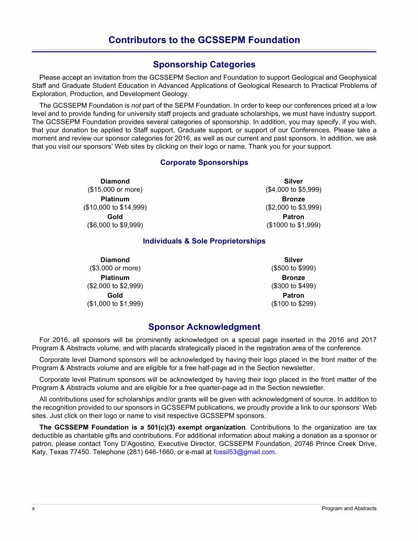
Contributors to the GCSSEPM Foundation
Sponsorship CategoriesPlease accept an invitation from the GCSSEPM Section and Foundation to support Geological and Geophysical
Staff and Graduate Student Education in Advanced Applications of Geological Research to Practical Problems ofExploration, Production, and Development Geology.
The GCSSEPM Foundation is not part of the SEPM Foundation. In order to keep our conferences priced at a lowlevel and to provide funding for university staff projects and graduate scholarships, we must have industry support.The GCSSEPM Foundation provides several categories of sponsorship. In addition, you may specify, if you wish,that your donation be applied to Staff support, Graduate support, or support of our Conferences. Please take amoment and review our sponsor categories for 2016, as well as our current and past sponsors. In addition, we askthat you visit our sponsors’ Web sites by clicking on their logo or name. Thank you for your support.
Corporate Sponsorships
Diamond($15,000 or more)
Platinum($10,000 to $14,999)
Gold($6,000 to $9,999)
Silver($4,000 to $5,999)
Bronze($2,000 to $3,999)
Patron($1000 to $1,999)
Individuals & Sole Proprietorships
Diamond($3,000 or more)
Platinum($2,000 to $2,999)
Gold($1,000 to $1,999)
Silver($500 to $999)
Bronze($300 to $499)
Patron($100 to $299)
Sponsor AcknowledgmentFor 2016, all sponsors will be prominently acknowledged on a special page inserted in the 2016 and 2017
Program & Abstracts volume, and with placards strategically placed in the registration area of the conference.
Corporate level Diamond sponsors will be acknowledged by having their logo placed in the front matter of theProgram & Abstracts volume and are eligible for a free half-page ad in the Section newsletter.
Corporate level Platinum sponsors will be acknowledged by having their logo placed in the front matter of theProgram & Abstracts volume and are eligible for a free quarter-page ad in the Section newsletter.
All contributions used for scholarships and/or grants will be given with acknowledgment of source. In addition tothe recognition provided to our sponsors in GCSSEPM publications, we proudly provide a link to our sponsors’ Websites. Just click on their logo or name to visit respective GCSSEPM sponsors.
The GCSSEPM Foundation is a 501(c)(3) exempt organization. Contributions to the organization are taxdeductible as charitable gifts and contributions. For additional information about making a donation as a sponsor orpatron, please contact Tony D’Agostino, Executive Director, GCSSEPM Foundation, 20746 Prince Creek Drive,Katy, Texas 77450. Telephone (281) 646-1660, or e-mail at [email protected].
x Program and Abstracts
Mesozoic of the Gulf Rim and Beyond: New Progress in Science and Exploration of the Gulf of Mexico Basin xi
2016 Sponsors
2015 Sponsors
Sponsorship Category
CorporationsIndividuals and
Sole Proprietorships
Gold J. Carl Fiduk
Silver
Bronze Dorene WestMike Nault
Sponsorship Category
CorporationsIndividuals and
Sole Proprietorships
Platinum
Michael Styzen
Gold Michael J. Nault
SilverTim Bennett
Richard FillonEd Picou
Bronze
Credits
Design and Digital Publishing by
Rockport, Texaswww.bergan.com
Cover Image
The cover image chosen for this year’s conference is Figure 3 from Pascoe et al., which shows Mesozoic Gulf ofMexico Basin salt distribution superposed on crustal architecture.
xii Program and Abstracts
Gulf of Mexico Tectonic Evolution from Mexico Deformation to Oceanic Crust
Norton, I.O.Lawver, L.A.Snedden, J.W. Institute for GeophysicsJackson School of GeosciencesUniversity of Texas at AustinAustin, Texas U.S.A. e-mail: [email protected]
Extended Abstract
Although the final stage of formation of the Gulfof Mexico is fairly well constrained, earlier evolution isstill debated. The final stage was rotation of Yucatanabout a Florida Straits Euler pole that created most ofthe observed oceanic crust (Pindell and Dewey, 1982).From observations of salt overlying seaward-dippingreflectors (diagnostic of volcanism during the rift todrift transition) in the northeast Gulf of Mexico, wesuggest that salt was deposited at the onset of sea floorspreading, which coincides with initiation of the rota-tional motion of Yucatan. It is important to understandYucatan motion that preceded this rotation becausedelineating any presalt play that might exist would bedependent on understanding of depositional systemsdeveloped during this early motion of Yucatan. Verylittle is known about the nature of presalt deposition inthe northern Gulf of Mexico. Salt is Callovian or earli-est Oxfordian in age, and the next oldest rocks knownfrom the northern Gulf of Mexico are Late Triassic red
beds found in what are generally regarded as proximalgrabens formed during early rifting. This gap in knowl-edge, what we refer to as the “50 million year gap,” canpotentially be bridged by incorporating analogs withknown systems in Mexico and northern South Amer-ica. There are uncertainties here, however, mostlybased on how Mexico and northern South America arepalinspastically restored and the fact that these rocksare in a proximal location. In particular, we note thatthere was a long-lived continental margin arc in Mex-ico that lasted from the Permian through the MiddleJurassic (Barboza-Gudino et al., 2012). A lot of therocks of this age seen in Mexico that are linked to Gulfof Mexico rifting are in fact associated with this arc. Inthis presentation, we will review reconstructions of theregion and develop a tectonic model that forms thebasis for further understanding of rifting in the Gulf ofMexico.
Mesozoic of the Gulf Rim and Beyond: New Progress in Science and Exploration of the Gulf of Mexico Basin 1
An Initial Quantitative Attempt to Estimate How Much Louann Evaporite was Deposited in the Gulf of Mexico Basin
Fiduk, J. CarlFreeport McMorane-mail: [email protected]
Abstract
Published estimates for the original volume ofMid-Jurassic Louann evaporites found throughout theentire Gulf of Mexico Basin vary widely. Volume totalsderived from both map data and actual volume num-bers, range from about 10,500 km3 (2,500 mi3) to839,000 km3 (200,000 mi3), an 80 fold variation. Littlenew information has been published during the pasttwenty-five years to address this disparity. But gainingknowledge of the present day volume of salt would bean important metric if debates concerning the origin ofthe salt and the nature of the Gulf of Mexico Basinduring salt deposition are to be reconciled.
A methodology now exists to estimate moreaccurately and quantitatively the volume of salt presentin a given area. Multiple, recent generations of 3-Dseismic depth volumes in the offshore Gulf of Mexico
require that salt velocities be inserted. This vital pro-cessing step includes a systematic picking andinterpretation of the tops and bases of all salt bodiesencountered. The resulting models of salt velocityallow salt volume in the 3-D data sets to be calculated.Combining the salt volumes calculated from multipleseismic surveys offers new stratigraphic insights acrosslarge portions of the original salt basin.
A comparison of salt volumes derived from seis-mic data cubes and volumes derived from publishedmaps can now be made. The comparisons should givesome suggestion as to the accuracy of the map data. Byextrapolation it should also give a more accurate andquantitative estimation of the original salt volumedeposited in the Gulf of Mexico basin.
2 Program and Abstracts
Stratigraphy and Mineralogy of the Oxfordian Lower Smackover Formation in the Eastern Gulf of Mexico
Brand, John H.Nexen Petroleum U.S.A.945 Bunker Hill RoadHouston, Texas 77024e-mail: [email protected]
Abstract
The Oxfordian Smackover Formation is gener-ally acknowledged to be a hydrocarbon source fornumerous reservoirs in the Gulf of Mexico, bothonshore and offshore. More than 25 wells in the easternGulf of Mexico have penetrated the Smackover since2003. Offshore, the Smackover consists predominantlyof limestone and shale containing thin organic layers.Immediately above the lower Smackover is a wide-spread shale marker. This thin shale is correlated as thebase of the upper Smackover Formation, which con-sists of interbedded shale and limestone.
This study will demonstrate that the lowerSmackover Formation in the eastern Gulf of Mexico(Mississippi Canyon and De Soto Canyon offshoreareas) is composed of a series of seven units that occurin the same sequence in virtually every well in whichthe lower Smackover has been encountered. Althoughthe seven individual units can be resolved readily withthe proper wireline suite, each has a sub-seismic thick-ness. The overall thickness of the lower Smackover isabout 300 +/-100 feet. Unlike the lower Smackover, thesurrounding Mesozoic formations, from Cotton Valleyto Norphlet, vary greatly in thickness in the easternGulf.
The initial correlations of the units in the lowerSmackover were made by comparing the gamma ray,resistivity, and density log patterns with the computedmineralogy of Elemental Capture Spectroscopy (ECS)
wireline logs. It was immediately obvious that the samesequence of beds/units was present in the lowerSmackover in well after well. Within the lower Smack-over Formation is a conspicuous zone characterized byiron-bearing minerals having a matrix density in excessof 3.0 g/cm3 throughout.
However, X-Ray Diffraction (XRD) data fromrotary sidewall cores was necessary to validate themineralogy. Because the mineralogy of the ECS log isa model-based calculation from the elemental concen-trations of iron, calcium, aluminum, etc,. rather than adirect measurement, the modeled mineralogy can beinaccurate as was the case in the bottom two units.
Mineralogy of the seven units has been verifiedby XRD analyses, albeit from a limited number ofrotary sidewall cores obtained in only five wells. Thetop three units are limestones which vary in carbonate,clay, and pyrite content. The fourth and fifth units con-tain significant amounts of high density minerals,particularly siderite and pyrite. The sixth zone is domi-nated by anhydrite. The seventh unit is a hematite-richshale and its base is an unconformity.
Although wireline data are plentiful, analysis ofthe seven units within the lower Smackover is ham-pered by the limited amount of rock data and thecomplete lack of whole core. Many depositional andgeochemical questions suggested by the unusual min-eralogy and sequence of beds remain unanswered.
Mesozoic of the Gulf Rim and Beyond: New Progress in Science and Exploration of the Gulf of Mexico Basin 3
Implications of Early Gulf of Mexico Tectonic History for Distribution of Upper Jurassic to Mid-Cretaceous Source Rocks in Deep-Water Exploration Areas of the US and Mexico
Pepper, AndyPetroleum Systems LLC777 South Mayde Creek Drive, Unit 101Houston, Texas 77079 USAe-mail: [email protected]
Abstract
The central Gulf of Mexico Basin formed byCallovian rifting followed by oceanic spreading duringanticlockwise rotation of Yucatan Block betweenOxfordian (160Ma) and Valanginian (140Ma). Therotation pole was in the Straits of Florida, resulting in awiper-blade motion having greatest sweep along atransform paralleling the coast offshore Tampico-Mis-antla Basin. Oceanic crust progressively separated the160-140Ma stratigraphy, creating bands of ocean crustlacking Oxfordian, Kimmeridgian, Tithonian and, nearthe ridge, even Berriasian deposition: present day, thesestages appear progressively absent towards the spread-ing center.
After a basin-wide 140Ma (Valanginian) uncon-formity on the rimming shelves at the end of spreading,thermal subsidence resumed and water deepened fur-ther, in the basin. However, an arch separating the Gulfof Mexico and paleo-Caribbean basins across the Flor-ida Straits remained a bathymetric sill to deep oceancirculation post-140Ma as before.
The impact of this tectonic/bathymetric evolu-tion on the presence and ultimate expellable potential(UEP) of source rocks in the basin center is profound.Using a scheme of basin-wide correlated organic mat-ter depositional acmes (recently developed byPetroleum Systems LLC, where the acme age is
expressed in Ma), candidate source rocks in the Gulf ofMexico are: Acme A157 (late Oxfordian); A154 (Kim-meridgian); A148 (Tithonian); A144 (Berriasian/Portlandian). All four acmes have zones of nondeposi-tion due to oceanic spreading, and older acmes areabsent over a greater area. Some workers have pro-posed the main deep-water basin source rock in theUnited States is Tithonian; however, new work (so farlimited to eastern deep water Mississippi Canyon,Atwater Valley, and Desoto Canyon) indicates thatA157 (i.e., the oldest, most susceptible to nondeposi-tion) is the most effective source rock.
Risk on Acme 157-144 non-deposition can bemitigated if source rocks younger than 140Ma, havingsignificant ultimate expellable potential, were depos-ited in the deep basin. Based on recent reappraisal ofdata in DSDP Leg 77, Cuba and rafted sediment blocksin U.S. waters, significant ultimate expellable potentialdoes exist in five younger Early to mid-Cretaceousacmes: A138 (Valanginian); A120 (early Aptian);A110 (early Albian); A101 (late Albian); and A98(early Cenomanian). A138 may result from restrictedcirculation, reinforced during the 140Ma uplift of rim-ming shelves, while A120, A110, and A101 can becorrelated with oceanic anoxic events OAE1a, b, and d.
4 Program and Abstracts
Chronostratigraphic Views of Gulf of Mexico Tectonic and Deposystem Evolution in the Mesozoic
Fillon, Richard H.Earth Studies Group96 Vivante Blvd. #9627Punta Gorda, Fl 33950e-mail: [email protected]
Abstract
We cannot hope to predict Mesozoic depositionalprocesses and sediment properties well enough to planeffective regional exploration strategies without con-sidering the big picture of Gulf of Mexico deposystemevolution. The two critical big picture elements are thekinematics and timing of the Yucatan Block’s detach-ment and separation from North America and thevarious major expansions and contractions and the ulti-mate disappearance of the Western Interior Seaway.
Although a number of authors, including thisone, have speculated on the timing of separation ofYucatan from North America (Fillon, 2007a), no defin-itive evidence exists: i.e., drilled samples of the oceancrust and the sediments directly overlying it. Withoutthat unambiguous information we must infer the paleo-geographic evolution of the early Gulf of Mexico Basinfrom deposystem architecture by asking questions suchas when do Gulf of Mexico deposystems transitionfrom architectures consistent with deposition in ayouthful block-faulted basin underlain by activelyattenuating continental crust to deposition in a maturebasin having stable margins surrounding a centralregion underlain by subsiding ocean crust. An under-standing of the paleogeography and paleoceanographyof the Gulf of Mexico Basin derived from deposystemarchitecture can help provide answers to crustal kine-matic questions and to more exploration focusedquestions such as: where, and in section of what ageshould we look to find facies similar to the organicrich, generative Haynesville Shale facies of easternTexas and western Louisiana.
Although we all know something about the West-ern Interior Seaway, most of us working on theMesozoic of the Gulf of Mexico Basin have not spentmuch time considering what effects it might have hadon the prospectivity of Gulf of Mexico deposystems.Through much of Albian and Late Cretaceous time theWestern Interior Seaway connected the Gulf of Mexico
Basin with the Arctic Ocean Basin. The effects of theestablishment and intermittent blocking of this majorseaway connecting arctic and tropical water masses onglobal paleoceanography, on global paleoenviron-ments, and locally on onshore and offshore Gulf Basindeposystems cannot be ignored in our quest to under-stand the Mesozoic of the Gulf Rim.
This paper is a “big picture” review of Gulf ofMexico Basin deposystem evolution within the LateJurassic (Oxfordian)–Late Cretaceous (Maastrichtian)interval. Seventeen Mesozoic chronosequences aredefined therein based on chronostratigraphic data gar-nered from over 130,000 industry well and pseudowellpenetrations of Mesozoic section in the Gulf of MexicoBasin region. Examination of the collected data sug-gests that grouping the seventeen Gulf of MexicoMesozoic chronosequences into seven super-chronose-quences optimally distinguishes key phases ofdeposystem and basin evolution.
The oldest super-chronosequence defined in thisstudy, dubbed “MG,” encompasses ca. 16.45 Ma ofNorphlet through lowermost Cotton Valley Late Juras-sic deposition. Sediment distribution and accumulationrates within the MG interval clearly define the rectilin-ear configuration of the earliest Gulf of Mexico Basin.This early basin geometry is consistent with fault con-trolled attenuation and foundering of North Americancontinental crust, associated flooding, and rapid depo-sitional infill concurrent with the earliest detachment ofthe Mayan (Yucatan) crustal block from North Amer-ica. The Yucatan block, although showing an affinitywith South American (Amazonian) terranes (Martens,2009), was left attached to the North American platewhen North America began pulling away from Gond-wana during the initial breakup of Pangea (Fillon,2007a).
The next younger super-chronosequence, “MF,”contains a. ca. 13.47 Ma record of Cotton Valley, Boss-
Mesozoic of the Gulf Rim and Beyond: New Progress in Science and Exploration of the Gulf of Mexico Basin 5
ier, Knowles limestone., Late Tithonian through midHauterivian, deposition. The “MF” interval reflects thesame rectilinear outline as the “MG,” but is marked bydecreased accumulation rates, suggesting that the faultbounded crustal attenuation, rapid sediment infill phasehad markedly slowed.
The ca. 9.4 Ma of Hosston, Sligo, Sunnilandlimestone, James limestone, mid-Hauterivian throughEarly Aptian section contained within the succeeding“ME” super-chronosequence records modification ofthe early rectilinear basin outline by a temporary reacti-vation of attenuation and foundering in the westernportion of the Gulf of Mexico Basin. “ME” sedimentdistribution patterns also indicate development of adepositional continental margin and accumulation oftrue continental margin type deltaic and reef systems.These observations suggest that during this interval adeep continental basin, probably floored by oceancrust, was beginning to form outboard of the attenuatedcontinental crust.
Sediment distribution and accumulation rateswithin the ca. 23.5 Ma Rodessa through lower Washita,Early Aptian through Early Cenomanian “MD” super-chronosequence reflect growth of the Wisconsin inte-rior seaway and a stable phase of relatively lowaccumulation rates throughout the entire Gulf of Mex-ico Basin deposystem. During this interval, depositionwas very likely influenced by a vigorous tidal and ther-mohaline current circulation driven by strongtemperature contrasts within the Gulf of Mexico–Wis-consin interior seaway–Arctic Ocean connection.
The next younger super-chronosequence, “MC,”contains a ca. ca. 16.0 Ma record of Dantzler, Washita,Lower Pine Key, Eutaw, Woodbine, Eagle Ford, Aus-tin, and Early Cenomanian through Late Santonian(Late Cretaceous) deposition. During this phase, thereis a marked reduction of accumulation rates in the
northwestern portion of the basin, attributable perhapsto expansion of the Western interior seaway and contin-ued subsidence of the old Gulf of Mexico Basinmargin. Associated small, perhaps tidal submarinedelta-like depopods developed, perhaps in response tothe regional Western interior seaway transgression(Blakey, 2014). These delta-like depocenters appear todefine a new basin margin presaging the moderncurved shape of western Gulf of Mexico so familiar tous today. Here also we see the first unambiguous evi-dence of abyssal deposition in the deepest portion ofthe Gulf of Mexico Basin underlain by ocean crust.
The succeeding ca. 12.82 Ma interval of LateSantonian through Early Maastrichtian upper Pine Key,upper Selma, upper Austin, Taylor, Olmos, Saratoga,and low accumulation rate mainly chalk and marldeposition contained within the “MB” super-chronose-quence provides evidence of transgressive onlapassociated with an expanding and deepening interiorseaway during “MB” time. “MB” onlap has the effectof temporarily reemphasizing structural trends inher-ited from crustal attenuation that took place during“ME” time.
Finally, the ca. 5.4 Ma long terminal Mesozoic“MA” super-chronosequence consists of Maastrichtian,Navarro equivalent, low accumulation rate marlsdeposited along the basin margin. These low accumula-tion rate basin rim sediments and low accumulationrate slope sediments are punctuated by high accumula-tion rate canyon fill and lobe-shaped slope depopodswhich are probably attributable to sediment reworking,transport and deposition by transitional Cretaceous-Paleogene (K/P) interval mega-tsunami backwashflows immediately following the Chicxulub impact.Higher accumulation rates in the deeper parts of thebasin underlain by ocean crust are also consistent withhigh volume backwash flows.
6 Program and Abstracts
Constraints on the Timing of Continental Rifting and Oceanic Spreading for the Mesozoic Gulf of Mexico Basin
Pascoe, Robe-mail: [email protected], PeterDunbar, DavidDynamic Data Services1 Briar Lake Plaza, Suite 1752000 W. Sam Houston Pkwy S.Houston, Texas 77042
Bird, DaleBird Geophysical16903 Clan MacintoshHouston, Texas 77084-1942
Abstract
The Mesozoic Gulf of Mexico Basin is consid-ered in this discussion as the set of contiguous, Triassicand Jurassic sub-basins directly involved in thecounter-clockwise rotation of the Yucatan Block fromNorth America in the Late Jurassic. The rifting and sea-floor spreading history of the basin is less wellunderstood than analogous salt basins of the Atlanticmargins, largely because the base salt surface is signifi-cantly deeper and has hereto widely been consideredacoustic basement.
In 2012, 17,000 km of 2D PSDM reflection seis-mic data (SuperCache) were acquired across the deepwater of the U.S. Gulf of Mexico. The unique acquisi-tion configuration of long-offset, powerful source, anddeep-tow of both source and receivers was designed tooptimize the imaging of the presalt architecture of thebasin to a depth of 40 km. On these seismic data, thebase of the salt and its correlative unconformity, conti-nental and oceanic basement, and the Moho areevident. In combination with vintage, reflection seis-mic data, shipboard and regional gravity data, and
regional refraction profiles, a crustal interpretation hasbeen extended to the greater Gulf of Mexico Basin.
The continental crustal architecture is describedin terms of crustal thinning: from low (<30%) to transi-tional (>70%). Synkinematic sequences are recognizedwithin the Late Triassic to the Middle Oxfordian (~70my). The final break-up phase occurred within 15 my,ending with a basin-wide open marine transgressionand initial emplacement of oceanic crust at 160±1 Ma;continued extension may have occurred in the easternpart of the basin in the latest Jurassic. The basin mar-gins are considered to be intermediate betweenmagma-poor and volcanic end-members. The oceancrust tapers from a maximum width of 700 km in thewest, where it is anomalously thin, to anomalouslythick as it approaches the pole of rotation in the Straitsof Florida. The architecture of extinct spreading valleysand fracture zones is analogous to the modern, slowspreading mid-Atlantic ocean, suggesting that spread-ing continued until the latest Jurassic (~142 Ma),possibly as late as within the early Cretaceous (~132Ma).
Mesozoic of the Gulf Rim and Beyond: New Progress in Science and Exploration of the Gulf of Mexico Basin 7
Aeromagnetic Map Constrains Jurassic-Early Cretaceous Synrift, Break Up, and Rotational Seafloor Spreading History in the Gulf of Mexico
Pindell, JamesDept. of Earth ScienceRice University6100 Main StHouston, Texas 77005 USAalso: Tectonic Analysis Ltd.Chestnut House, Burton ParkDuncton, West Sussex GU28 0LH United Kingdome-mail: [email protected]
Miranda C., ErnestoFormerly Instituto Mexicano de Petróleo, Mexico City, now retiredCerón, AlejandroFormerly Instituto Mexicano de Petróleo, Mexico City, now retiredHernandez, Leopoldo Formerly Pemex, Villahermosa, Mexico, now retired
Abstract
We present a reduced-to-pole, total magneticintensity map derived from merged aeromagnetic sur-veys in and around the Gulf of Mexico. Most of thedeep central Gulf crust has a magnetic pattern oforthogonally intersecting features similar to, and inter-preted as, fracture zones and ridge segments of oceaniccrust formed by seafloor spreading. This spreading ordrift phase occurred after the primary synrift phase ofcontinental stretching across the greater Gulf of Mex-ico region, and thus the ocean crust rests within abroader zone of stretched continental crust withYucatán, western Florida, the southern USA, and east-ern Mexico forming the surrounding continentalmargins. We identify three regional magnetic anomalytrends that can be used to constrain the Gulf of Mex-ico’s Late Jurassic through earliest Cretaceousspreading history. A central magnetic anomaly trend isinterpreted to accord with the later increments and ces-sation of seafloor spreading, for which a stage pole ofrotation is estimated. Two flanking magnetic anomalytrends to the north and south of the central one, respec-tively, occur just basinward from the inferreddepositional limits of autochthonous Callovian-EarlyOxfordian salt. These anomalies appear to define thelandward limits of oceanic crust in the northern andsouthern Gulf, and probably lie in crust that is medial
or Late Oxfordian in age. They have similar mappedpatterns that can be reconstructed onto one another andhence are probably genetically related but separated byspreading. These landward anomalies are best fitaround a different stage pole than the central anomaly;thus the rotation pole appears to have jumped duringspreading in the Gulf. Seismic reflection data show thatthe two outer anomalies occur at the basement “stepups” to the oceanic crust or the basinward shoulders ofthe “outer marginal troughs.” Until specific magneticsource modelling is done on the outer anomaly pair, wefavor an edge-effect interpretation caused by the intru-sive interface between Oxfordian oceanic crust andserpentinized and exhumed subcontinental mantle, thelatter of which we infer forms the step ups to the oce-anic crust. In addition, the aeromagnetic map shows anorth-south trending “Campeche Magnetic Anomaly”downslope from the western shelf edge of Yucatán thatwe argue helps to constrain the reconstruction ofYucatán along Texas at the start of the synrift stage.Thus, the aeromagnetic map provides vital insights intothe kinematics of all three stages of the basin’s devel-opment, namely the synrift, the drift, and theinterpreted intervening transitional phase of crustalhyperextension/mantle exhumation along the Gulf’smagma-poor continent-ocean transitions.
8 Program and Abstracts
Pre-Albian Biostratigraphical and Paleoecological Observations from the De Soto Canyon Area; Gulf of Mexico, USA
Weber, Ryan D.Paleo-Data, Inc6619 Fleur de Lis Dr.New Orleans, Louisiana 70124email: [email protected]
Parker, Brandon W.Paleo-Data, Inc6619 Fleur de Lis Dr.New Orleans, Louisiana 70124email: [email protected]
Abstract
A biostratigraphical review of eight explorationboreholes located within the De Soto Canyon protrac-tion area in the Gulf of Mexico yields a repeatable andpredictive evolutionary and paleoecological sequencewith implications to paleogeography. The Oxfordiansection within these boreholes contains primitiveplanktic foraminifera such as Globuligerina oxford-iana. Near the end of the Kimmeridgian (or slightlyabove the nannofossil Calcivascularis cassidyi extinc-tion), nannofossils are of low abundance, anddominated by Cyclagelosphaera spp. Weakly devel-oped benthic foraminifera abundance gives rise toReinholdella A which is coincident with a nannofossildominance switch to Polycostella spp. Planktic fora-minifera are not observed in this section
In the overlying section, the extinction of nanno-fossil genus Polycostella, the origination anddominance of Nannoconus, and minute benthic fora-minifera gradually increase. Here, the suggesteddatum, Polycostella beckmanii extinction, is observedconsistently higher than the Reinholdella A extinctionin the early Tithonian. The fossil assemblage changethrough this section suggests a change in water masses,
which has implications to major reorganization in oce-anic circulation.
The Lower Cretaceous continues with multiplenannofossil originations that persist into the Valangin-ian. Here, a significant, diverse, and abundant benthicforaminifera and ostracod assemblage occurs in multi-ple, rapid abundance increases followed by gradualupward decreases, suggesting cyclical change in theshallower, upslope paleoenvironments. The cause ofcyclical changes is unclear and may be the result of sealevel change, progradation, and/or changes in oceancomposition.
The Hauterivian to Aptian section varies greatlyin thickness with the maximum thickness in the north-ern De Soto Canyon area and thinning to the south.Nannoconus continues to dominate the nannofossilassemblage through the Aptian; benthic foraminiferaand ostracods disappear rapidly during the Hauterivianand remaining sparse until the Albian when there is anincrease of Nezzazata spp. The significance of thesefossil sequences and respective assemblages are dis-cussed in a paleoecological and paleogeographicalcontext, which has implications to depositional historyand correlation.
Mesozoic of the Gulf Rim and Beyond: New Progress in Science and Exploration of the Gulf of Mexico Basin 9
Relationship Between the Depositional Episodes of the Woodbine/Eagle Ford of East Texas and the Eagle Ford of South Texas
Denne, RichardTexas Christian UniversityTCU Box 298830Fort Worth, Texas 76129e-mail: [email protected]
Breyer, JohnMarathon Oil Company5555 San FelipeHouston, Texas 77056
Abstract
A chronostratigraphic framework was devel-oped for the subsurface Eagle Ford of South Texas inconjunction with a log-based regional study that wasextended across the San Marcos Arch and into EastTexas using biostratigraphic and geochemical data toconstrain log correlations of 12 horizons from 1729wells in South and East Texas. Seven regional deposi-tional episodes were identified by the study. The clay-rich Maness Shale was deposited during the EarlyCenomanian in East Texas and northern South Texaswhere it correlates to the base of the Lower Eagle Ford.After a fall in sea-level, East Texas was dominated bythe thick siliciclastics of the Woodbine Group, whereasin South Texas deposition of the organic-richEGFD100 marls of the Lower Eagle Ford began duringthe subsequent Lewisville transgression. A shift in dep-ositional style to the limestones and organic-rich shalesof the Eagle Ford Group occurred in East Texas duringthe Middle-Late Cenomanian EGFD200 and EGFD300episodes produced by the continued rise in sea-level.
Erosion along the Sabine Uplift shifted the focus ofdeposition in East Texas southward to the Harris deltaand deposited the “clay wedge” of northern SouthTexas during the EGFD400 episode. The introductionof an oxygenated bottom-water mass onto the Texasshelf produced the considerable decrease in TOC pres-ervation that marks the Lower/Upper Eagle Fordcontact. This event coincided with the onset of OceanicAnoxic Event 2 (OAE2) and the Cenomanian-TuronianBoundary sea-level high, which starved much of theTexas shelf of sediment. The only significant source ofsediment was from the south; within the study area, theEGFD500 interval is essentially absent north of the SanMarcos Arch. Deposition recommenced on much of theTexas shelf during the Late Turonian EGFD600 epi-sode with the Sub-Clarksville delta of East Texas andthe carbonate-rich Langtry Member of South Texas andeastern West Texas. Bottom-waters became oxygenatedat approximately 90 Ma, initiating the transition fromthe Eagle Ford Group to the Austin Chalk.
10 Program and Abstracts
The Mesozoic of Nuevo Leon, Mexico: An Ancient Extension of the Gulf of Mexico. Paleogeography and Tectonics
Longoria, Jose F.Instituto Longoria de Investigaciones Científicas Apli-
cadas (ILICA)e-mail: [email protected]
Monreal, RogelioDepartamento de GeologíaUniversidad de Sonora
Abstract
The Mesozoic of Nuevo Leon is composed ofmore than 10,000 m of sedimentary rocks displayingabrupt physical changes and containing abundantplanktonic foraminifera, allowing precise chronostrati-graphic determinations. This succession has beendeposited in the western extension of the ancestral Gulfof Mexico (Mexican Sea). Its paleogeographic settingcorresponds to the oblique subduction of the Kula-Far-allon plate under the North American plate. Activeoblique subduction of the western margin of Mexicohas resulted in the structural features of the Mesozoicsedimentary cover, forming a folded belt made of anintricate array of mountain ranges corresponding to theNuevo Leones Cordillera characterized by: (1) kilo-metric-scale anticlinal ridges and narrow synclinalvalleys of the Jurassic-Cretaceous sedimentary covercommonly displaying box (fan-shaped) folds; (2) awell-developed pattern of en echelon anticlinal folds;(3) juxtaposition of tectonostratigraphic domains;(4) asymmetrical, overturned, doubly plunging anti-clines evolving into faulted anticlines; (5) disrupted,long and sinuous fold trends; (6) lack of large horizon-tal displacement due to overthrusting; (7) folding beingpredominant over faulting; (8) local thrusting with
opposite vergence; and (9) lack of volcanism andregional metamorphism. Those features are the resultof transpressional tectonics since the mid-Jurassicincluding a greater basement involvement in the tec-tonic deformation.
Analysis of the megastructures exposed in theregion using SIR-A and LANDSAT imagery of north-east Mexico revealed that the megastructures of theMesozoic Cordillera between parallels 22°00' and26°00' and meridians 99° 00’ and 101°00’ can bereferred to deformation of the thin sedimentary coverabove transcurrent faults following the morphologicalpattern of the lab experiment by Odonne and Vialon.The folding styles of the Nuevo Leones Cordillerawere analyzed in light of tectonic transpression andwrench-fault tectonics driven by transcurrent faults inthe basement as established by Harland, Lowell, andBeck, resulting in the recognition of subsurface faultsin the basement. We associate the geometric arrange-ment of the megastructural trends to sense ofdisplacement of strike-slip (transcurrent) faults andfold patterns as demonstrated by Odonne and Vialon(1983) and the well-known strike-slip tectonic settingof New Zealand as described by Bishop (1967).
Mesozoic of the Gulf Rim and Beyond: New Progress in Science and Exploration of the Gulf of Mexico Basin 11
Triple-Porosity Diagram Proposed to Characterize Complex Carbonate Reservoirs—Examples from Mexico
Stabler, ColinConsulting Petroleum GeologistMexico City, Mexicoe-mail: [email protected]
Abstract
Limestone and dolomite reservoir rocks are byfar the more important producers of oil and gas in Mex-ico compared to sandstone reservoirs. Many of thecarbonate reservoirs are complex in that they displaythree types of pores: matrix porosity; vugs, and cavern-ous porosity; and fracture-induced porosity. Thiscombination of three types of porosity can be described
as “triple porosity.” Each pore type presents a differentpore-throat size range and each has a different effect onpermeability.
In order to better characterize these reservoirs,this paper proposes to visualize the relative abundanceof each of these three pore types by plotting them on atriple-porosity pore-type ternary diagram (Fig. 1).
12 Program and Abstracts

The Siliciclastic Upper Cretaceous Play of Eastern Mississippi Canyon
Harding, AndrewWalker, LukeEhlinger, SteveChapman, TimNoble Energye-mail: andrew.harding@nblenergy
Abstract
The eastern Mississippi Canyon area has beenlargely a Miocene oil and gas province in which recentdiscoveries in the Jurassic Norphlet Formation havebeen made. This paper focuses on a nascent Cretaceousplay targeting the eastern Tuscaloosa fan comprised oflarge symmetric and asymmetric structures created byan expulsion-rollover system in the pre-Miocene inter-val. The top of the Cretaceous interval is foundbetween 15,000’ and 27,000’, is up to 15,000’ thick,
and is underlain by a mature Tithonian source rock.The play extends downdip from the Cretaceous shelfedge and the reservoir is interpreted to be the equiva-lent of the Tuscaloosa Formation of onshore SouthLouisiana. This paper will examine the idea that thecentral Cretaceous basin is in the optimal zone for thetrend of appropriate subsurface temperatures, depth,and significantly expanded reservoir section in theUpper and Lower Cretaceous intervals.
Mesozoic of the Gulf Rim and Beyond: New Progress in Science and Exploration of the Gulf of Mexico Basin 13
A Petroleum Systems Perspective on the Siliclastic Cretaceous Play of the Eastern Mississippi Canyon, Gulf of Mexico
Kovas, Edwarde-mail: [email protected], MichaelSchafer, KirkTaylor, JackNoble Energy
Abstract
The eastern Mississippi Canyon area has longbeen known as a prolific Miocene oil and gas province.Organic rich shales and marls of Tithonian and Oxford-ian age strata are considered the major source rocks inthe region. Recently however, attention has beendirected towards the intervening siliciclastic Creta-ceous strata as an enticing exploration target.
This presentation focuses on the duality of theCretaceous section as both a “first carrier” for hydro-carbons expelled from Late Jurassic source rocks andas a potentially significant “container” for hydrocarbonaccumulations as well.
Examined are the petroleum system elementsand processes of eastern Mississippi Canyon. Emphasisis placed on the relative roles of vertical versus lateral
secondary hydrocarbon migration from source to trap.Fluid properties from sampled accumulations help con-strain model-derived estimates of thermal maturation,migration timing, loss en route and potentially avail-able hydrocarbon yield.
The “carrier/container” nature of the Cretaceousis characterized through multiple scenarios thataddress: Subsurface pressure relationships, bed-sealand fault properties; as well as seismically derivedlithology and facies distributions. Fetch area con-strained source rock expulsion through the Cretaceousis modeled, taking into account known Miocene accu-mulations. The results of such analyses lend insightinto hydrocarbon potential within the Cretaceous.
14 Program and Abstracts
Resolving Presalt Sediment Source Terrains and Dispersal Pathways for the Northern Gulf of Mexico Basin
Frederick, Bruce C.University of KansasDepartment of Geology1475 Jayhawk Blvd.Lawrence, Kansas 66045-7594e-mail: [email protected], Mike D.University of KansasDepartment of Geology1475 Jayhawk Blvd.Lawrence, Kansas 66045-7594e-mail: [email protected]
Lowery, Chris M.University of Texas at AustinInstitute for Geophysics10100 Burnet Rd. (R2200)Austin, Texas 78758-4445e-mail: [email protected], John W.University of Texas at AustinInstitute for Geophysics10100 Burnet Rd. (R2200)Austin, Texas 78758-4445e-mail: [email protected]
Abstract
As part of a larger intercollegiate effort to recon-struct late Triassic, presalt sediment provenance androuting environments for the Gulf of Mexico sedimen-tary basin, an integrated geochronologic approachleveraging more traditional biostratigraphic, sedimen-tologic, and sequence stratigraphic provenanceconstraints from geologic cores, cuttings, and geophys-ical well logs was initiated. This paper presents theinitial results of this ongoing study and details detritalzircon U-Pb extraction methodologies while Induc-tively Coupled Plasma Mass Spectrometry analyses arepending. Eagle Mills Formation sandstone sampleswere collected from well core and cuttings, at five sub-crop locations extending from Texas to South Carolinato the West Florida shelf, in preparation for U-Pb detri-tal zircon provenance analysis. Prior to separation ofdetrital zircon grains, a sedimentologic-stratigraphicanalysis was conducted including detailed coredescription, well log evaluation, and thin-sectionpetrography assessment. These findings confirm a
hypothesis that late Triassic Eagle Mills siliciclasticswere derived from the erosion of an active horst-grabenrift block topography with associated igneous intru-sives. Specifically, preliminary results reveal pervasivevery fine-grained mottled gray to red bed sandstonelithology confirming synrift continental alluvium hav-ing little or no marine component, and probabledeposition in a warm, humid environment but withincreasing aridity. Classic fluvial facies features arehighlighted including depositional cross strata typify-ing dynamic braided to meandering channel belts andalluvial floodplain deposits. Less common siltstone andshale lithologies were likely deposited amidst lowerenergy subfacies including potential shallow lakes,marshes, and/or ephemeral ponds. Bioturbated tracefossils were only rarely preserved, and there was noevidence of marine or eolian facies incursion. Igneousmagmatism was prevalent in most subsurface EagleMills Formation samples including intrusive diabase,basalt flows, and volcanic ash.
Mesozoic of the Gulf Rim and Beyond: New Progress in Science and Exploration of the Gulf of Mexico Basin 15
Triassic-Jurassic Provenance Signatures in the Nascent Eastern Gulf of Mexico Region from Detrital Zircon Geochronology
Weislogel, Amy L.e-mail: [email protected], Kory S.Bowman, S.West Virginia University Department of Geology & GeographyMorgantown, West Virginia 26506
Robinson, Delores M.University of Alabama Department of Geological SciencesTuscaloosa, Alabama 35487
Abstract
By comparing new detrital zircon provenanceanalysis of Triassic synrift sediments from the Talla-hassee graben (FL), the South Georgia rift basin (GA),and Deep River rift basin (NC) with our previous detri-tal zircon provenance data for the Jurassic NorphletFormation erg in the Eastern Gulf of Mexico, we havedeveloped a regional model of Triassic-Jurassic erosionand sediment transport. In the Eastern Gulf of Mexico,detrital zircon ages observed in Triassic synrift clasticsfrom the Tallahassee graben and southern South Geor-gia rift system contain not only Gondwanan-aged andGrenville-aged zircon grains but also an abundance ofPaleozoic detrital zircon grains, reflecting sedimentinflux from rocks associated with the Paleozoic oro-gens of eastern Laurentia. Although Paleozoic detritalzircon grains are present in the younger Norphletdeposits, they are less abundant than in Triassic riftsediments. In southwest Alabama, the most abundantdetrital zircon age population in the Norphlet Forma-tion is Grenville-aged (950-1,250 Ma). In the Conecuh
embayment of southeastern AL and western FL pan-handle, Norphlet samples show a marked decrease inGrenville detrital zircon and an increase in 525-680 Mazircon ages, interpreted to represent influx from rocksassociated with the Gondwanan Suwannee terrane. Inthe Apalachicola Basin, the proportion of Gondwananzircon ages increases to nearly 40% of the total popula-tion and Grenville-aged grains constitute just ~20% ofthe population. We suggest that the difference betweenTriassic and Jurassic detrital zircon signatures in theEastern Gulf of Mexico reflects significant unroofingof Paleozoic rocks during early Mesozoic rifting of theeasternmost Eastern Gulf of Mexico, possibly includ-ing rocks equivalent with those exposed in theTalladega slate belt units. Subsequent erosion of rift-flanking highlands to expose older Gondwanan andGrenville rocks and/or input from northern sedimentsources supplied the older Grenville-aged detrital zir-con grains present in the Norphlet erg in the area to thewest and within the Conecuh embayment.
16 Program and Abstracts
Provenance of Cenozoic Siliciclastic Units in the Southern Gulf of Mexico by Heavy-Mineral Determinations and Geochemistry, and Detrital Zircon U-Pb Geochronology
Beltrán-Triviño, AlejandroGeological InstituteETH Zuriche-mail: [email protected]
Martens, UweTectonic Analysis and Centro de GeocienciasUniversidad Nacional Autónoma de MéxicoJuriquilla, Querétaro, Mexico
Abstract
We established provenance of Cenozoicsequences sampled in wells in the southern and south-western Gulf of Mexico by heavy mineral analysis andLAICPMS detrital zircon U-Pb ages. The age spectraare dominated by Cenozoic ages. Other populations areof Cretaceous, Late Permian-Early Triassic, and Neo-Mesoproterozoic ages. Minor Jurassic, Devonian, andOrdovician ages are included.
Paleoproterozoic-Archean ages are related to theAmazonian craton. Meso-Neoproterozoic ages (1 Ga)are ubiquitous in Mexico (Oaxaquia terrane) and arerelated to the Grenville orogen. Neoproterozoic ages(750-550 Ma) were possibly derived from sedimentaryrocks on the Panafrican orogen. Cambrian-Ordovicianages (490-450 Ma) might relate to plutons of the Espe-ranza suite of the Acatlán complex. Carboniferous andPermian ages (350-290 Ma) were possibly derivedfrom the western Gondwanan arc. Permian and Triassicages (290-250 Ma) may represent the east Mexican arc.Late Triassic and Jurassic ages (210-170 Ma) suggest aderivation from the Nazas arc in north-central Mexico.
Late Jurassic ages (160 Ma) may represent the Jurassicmagmatism associated with an extensional regime.Cretaceous ages (145 Ma) might be derived from EarlyCretaceous arc of Mexico. Cretaceous ages (135-90Ma) were possibly derived from the Alisitos-Peninsu-lar Ranges arc. Late Cretaceous-Early Palaeogene ages(90-55 Ma) suggest relations with Laramide magma-tism and the Late Cretaceous volcanic province insouthern Mexico.
Paleogene-Neogene zircons (50 Ma andyounger) are likely related to Cenozoic volcanic arcs inMexico such as the Sierra Madre Occidental. Threeearlier recognised ignimbrite flare-ups in the Eocene-Oligocene, early Oligocene, and early Miocene, matchour detrital zircon populations. Furthermore, Mioceneunits contain kyanite-sillimanite possibly related tomedium- to high-grade rocks such as the Acatlán com-plex or the Guatemalan Chuacús complex. We discussthe provenance based on geochemistry of the heavyminerals.
Mesozoic of the Gulf Rim and Beyond: New Progress in Science and Exploration of the Gulf of Mexico Basin 17
Late Triassic-Late Cretaceous Paleogeography of Mexico and the Gulf of Mexico
Padilla y Sánchez, Ricardo JoséProfessor, Division de Ingenieria en Ciencias
de la TierraUniversidad Nacional Autonoma de Mexicoe-mail: [email protected]
Abstract
Most plate tectonic models for the opening of theGulf of Mexico focus on the fit of different crustalblocks, regional faults, the areal extent of abnormaloceanic crust, transitional crust, and continental crust,as well as on today’s geophysical data, but only a fewinclude paleogeographic data. High quality paleogeo-graphic maps are available for the northern part of theGulf of Mexico, but the same type of information forthe southern part is difficult to obtain. However, infor-mation from many published sources has been used tocompile a series of maps of the entire country of Mex-ico, including the Gulf of Mexico.
The main objective of this project is to build-uppalinspastic paleogegraphic maps of Mexico throughthe Mesozoic, where the various marine and transi-tional sedimentary facies are restored to their originalgeographical positions prior to folding and faulting,and then are overlapped on the tectonic blocksinvolved in the most popular plate tectonics models.The data contained in these maps correspond to out-crops in continental Mexico and to publishedsubsurface data in the marine areas.
18 Program and Abstracts
Detrital Zircon Evidence for Amazonian Provenance of Upper Jurassic Norphlet Formation in North Central Gulf, Mobile Bay: Implications for Paleoriver Systems in South and Central America
Gomes, Sonnet West Virginia University 330 Brooks HallMorgantown, West Virginia 26505 e-mail: [email protected]
Weislogel, Amy L.West Virginia University 330 Brooks HallMorgantown, West Virginia 26505 Barbeau, DavidUniversity of South Carolina701 Sumter Street, EWS 617Columbia, South Carolina 29208
Abstract
Detrital zircon from the Upper Jurassic NorphletFormation in the vicinity of Mobile Bay, AL reflects aLaurentian provenance, with U-Pb age populationsincluding dominant Paleozoic (265-490 Ma) and Gren-ville (950-1250 Ma) age. Twenty-three zircon grainsfrom a sandstone sample recovered from the upper partof the Norphlet formation in well permit# 9863-OS-46-B show a population of 850-920 Ma zircon that is notobserved in stratigraphically older samples. As thereare very few sources for zircon of this age in southeast-ern United States, we interpret derivation from eitherthe Goiás magmatic arc of Brazil; the conglomeraticsandstone of the eastern Yucatan peninsula; and/orMixteca terrain of Mexico as probable sources. Previ-ous study of 850-920 Ma zircon grains from the Goiásmagmatic arc shows an origin from a depleted mantlewithout any crustal contamination (Hf(t)= +8 to +12);however, the same age zircons in eastern Yucatan andMixteca terrain indicate crystallization from magmas
having a strong crustal signature (Hf(t)= -3.2 to -3.8).Detrital Neoproterozoic zircon grains in the NorphletFormation shows a wide Hf(t) range (-5.1 to +11.9) forthe 850-920 Ma zircons, indicating sediments influx tothe Gulf of Mexico basin during late Norphlet time wasa mix of material from all of these sources during theNorphlet deposition. We propose that sediments fromthe Goiás magmatic arc probably were transported tothe Mixteca terrain through a paleo-fluvial system;given the proximity of Mixteca terrain to southernNorth America during Late-Early Jurassic, we inferthat erosion of Mixteca terrane sedimentary rocks sup-plied sediment to the Norphlet erg in the eastern Gulfof Mexico. Alternately, the Neoproterozoic grains mayhave been derived directly from the Goiás arc andtransported to the eastern Gulf of Mexico by a proto-Orinoco river that developed during Jurassic-EarlyCretaceous time.
Mesozoic of the Gulf Rim and Beyond: New Progress in Science and Exploration of the Gulf of Mexico Basin 19
Evolution of Late Cretaceous–Paleogene Foreland Sediment-Dispersal Systems of Northern and Central Mexico
Lawton, Timothy F.Juárez-Arriaga, EdgarCentro de GeocienciasUniversidad Nacional Autónoma de México (UNAM)Blvd. Juriquilla No. 3001Querétaro, 76230, Méxicoemail: [email protected]íaz, Yam Zul ErnestoÁrea de Ciencias de la TierraFacultad de IngenieríaUniversidad Autónoma de San Luís de PotosíAv. Dr. Manuel Nava No. 8San Luis, Potosí, 78290, México
Beltrán-Triviño, Alejandro Geological InstituteETHZurich, SwitzerlandMartens, UweTectonic Analysis Inc.1315 Alma Ave, Ste 134Walnut Creek, California 94596, USAStockli, Daniel Department of Geological SciencesJackson School of GeosciencesThe University of Texas at Austin, Texas 78712-0254, USA
Abstract
Upper Cretaceous-Paleogene strata of northernand central Mexico were deposited in a retroarc fore-land basin that was at first narrow but expandedeastward during the Paleogene. New petrographic dataand U-Pb detrital zircon ages yield insights into strati-graphic age of the basin fill, sediment sources, andsediment-dispersal pathways. The basin differs fromthe contemporary Cordilleran foreland basin of the USto the north in having a dominant volcanic-lithic com-ponent in all of its sandstones. Like its northerncounterpart, the Mexican basin migrated eastward withtime, ahead of an advancing orogenic wedge. Prove-nance data indicate that the dominant sediment sourcefor all strata was the coeval continental margin arc ofwestern Mexico. Nevertheless, temporal differences inzircon content indicate distant sediment sources inbasement and derivative sedimentary rocks of south-western Laurentia during early (Cenomanian–Turonian) and late (Campanian–Maastrichtian andPaleogene) stages in basin evolution; during an inter-mediate stage (Coniacian–earliest Campanian), theLaurentian sources were absent and most pre-arc grainswere derived from accreted rocks of western Mexico.The initial basin possessed a narrow foredeep filled by
sediment-gravity flow deposits filled with dominantlyaxial sediment transport. Carbonate platforms of east-ern Mexico supplied calclithites to the foredeep duringearly stages of basin formation, indicating the impor-tance of pre-foreland paleotopography on sediment fill.
Sediment-dispersal systems evolved in concertwith the stages of basin development. During the Ceno-manian–Turonian stage, turbidites deposited in theMesa Central had headwaters as far away as northernSonora, but headwaters for Coniacian–Campaniandeep-water deposits probably lay closer to centralMexico. Although late-stage uppermost Cretaceous–lower Eocene shallow marine and continental strata inthe foreland of northeast Mexico were linked to a flu-vial drainage basin whose extent was probably thegreatest in Mexico, it is unclear if these clastic sedi-ments ever reached the Gulf of Mexico. Partitioning ofthe distal foreland by inversion of Jurassic extensionalbasins in Santonian–Campanian time was probablyeffective at isolating dispersal systems of northernMexico from time-equivalent sediment-routing sys-tems of northeasternmost Mexico and southwesternTexas.
20 Program and Abstracts
Regional Correlation of Lithofacies Within the Haynesville Formation from Onshore Alabama: Analysis and Implications for Provenance and Paleostructure
Essex, Caleb W. e-mail: [email protected], Delores M.The University of Alabama Department of Geological Sciences2000A Bevill BuildingTuscaloosa, Alabama 35401The University of Alabama
Weislogel, Amy L.West Virginia UniversityDepartment of Geology and Geography241 Brooks HallMorgantown, West Virginia 26506
Abstract
Although the Upper Jurassic Haynesville Forma-tion is a proven hydrocarbon reservoir in the onshoreeastern Gulf of Mexico, the unit remains understudiedbecause exploration has been focused on the older andmore productive Norphlet and Smackover Formations.In this study, we use cores, gamma ray logs, and spon-taneous potential logs from 49 wells in southernAlabama to analyze the Haynesville Formation. Wepoint-counted 18 sandstone samples from seven cores,and six sandstone samples from four of those coreswere analyzed for detrital zircon age distributions.Core and well log analyses indicate that the Haynes-ville Formation can be subdivided into anhydrite,sandstone, and carbonate lithofacies. The thickness anddistribution of these lithofacies suggests that relictbasement topography derived from the opening of theeastern Gulf of Mexico during Late Triassic-Early
Jurassic time is the primary influence on Upper Juras-sic sediment distribution. Framework graincompositions indicate that the sandstone lithofacieswas derived from a recycled orogenic provenance,indicating a primarily Laurentian terrane source withsome mixing from the Gondwanan Suwannee terrane.Detrital zircon age distributions from Haynesville For-mation sandstones contain major age populations thatcorrespond with derivation from both the LaurentianGrenville Province and Appalachian Mountain sourcerocks, with some mixing from the GondwananSuwanee terrane. Haynesville Formation detrital zirconages and sandstone compositions are similar to that ofthe underlying Norphlet Formation, indicating that theprovenance and sediment transport pathways remainedsimilar through deposition of the Upper Jurassic units.
Mesozoic of the Gulf Rim and Beyond: New Progress in Science and Exploration of the Gulf of Mexico Basin 21
Cenomanian Gulf of Mexico Paleodrainage from Detrital Zircons: Source-to-Sink Sediment Dispersal and Prediction of Basin-Floor Fans
Blum, Mikee-mail: [email protected], Kristye-mail: [email protected], Brucee-mail: [email protected]
Department of GeologyThe University of KansasLawrence, Kansas 66045
Snedden, JohnInstitute for GeophysicsJackson School of GeosciencesThe University of Texas at AustinAustin, Texas 78758e-mail: [email protected]
Abstract
U-Pb dating of detrital zircons in fluvial sand-stones provides a method for reconstruction ofdrainage basin and sediment routing systems forancient sedimentary basins. This paper summarizes adetrital-zircon record of Cenomanian paleodrainageand sediment routing for the Gulf of Mexico and U.S.midcontinent. Detrital zircon data from Cenomanianfluvial deposits of the Gulf of Mexico coastal plain(Tuscaloosa and Woodbine formations), the CentralPlains (Dakota Group), and the Colorado Front Range(Dakota Formation) show the Appalachian-Ouachitaorogen represented a continental divide between south-draining rivers that delivered sediment to the Gulf ofMexico, and west- and north-draining rivers that deliv-ered sediment to the eastern margins of the WesternInterior seaway. Moreover, Cenomanian fluvial depos-its of the present-day Colorado Front Range werederived from the Western Cordillera, flowed generallywest to east, and discharged to the western margin ofthe seaway. Western Cordillera-derived fluvial systemsare distinctive because of the presence of Mesozoic-age zircons from the Cordilleran magmatic arc: thelack of arc zircons in Cenomanian fluvial deposits that
discharged to the Gulf of Mexico indicates no connec-tion to the Western Cordillera.
Detrital zircon data facilitate reconstruction ofcontributing drainage area and sediment routing. Fromthese data, the dominant system for the CenomanianGulf of Mexico was an ancestral Tennessee River (Tus-caloosa Formation), which flowed axially through theAppalachians, had an estimated channel length of1200-1600 km, and discharged sediment to the east-central Gulf of Mexico. Smaller rivers drained theOuachita Mountains of Arkansas and Oklahoma(Woodbine Formation), had length scales of <300 km,and entered the Gulf through the East Texas Basin.From empirical scaling relationships between drain-age-basin length and the length of basin-floor fans,these results predict significant basin-floor fans relatedto the paleo-Tennessee River system and very smallfans from the east Texas fluvial systems. This predic-tive model is consistent with mapped deep-watersystems, as the largest fan system was derived fromrivers that entered the Gulf of Mexico through thesouthern Mississippi embayment.
22 Program and Abstracts
Cenomanian Gulf of Mexico Paleodrainage—Application of Channel-Belt Scaling to Drainage Basins
Milliken, Kristye-mail: [email protected], Mikee-mail: [email protected] of GeologyThe University of Kansas1475 Jayhawk Blvd.Lawrence, Kansas 66045 USA
Snedden, Johne-mail: [email protected], Bille-mail: [email protected] for GeophysicsJackson School of GeosciencesThe University of Texas at Austin10100 Burnet RoadAustin, Texas 78758 USA
Abstract
Fluvial systems possess a range of scaling rela-tionships that reflect drainage-basin controls on waterand sediment flux. Quaternary channel-belt thickness(as controlled by bank-full water discharge) has beendocumented as a reliable first-order proxy for drainagebasin size if climatic regimes are independently con-strained. In hydrocarbon exploration and production,scaling relationships for fluvial deposits can be utilizedto constrain drainage basin size with implications forsequence-stratigraphic interpretations.
This study documents the scales of channel beltswithin Cenomanian fluvial successions from the Gulf
of Mexico. Data on single-story channel-belt scaleswere compiled from well logs and utilized to constraincontributing catchment areas of fluvial systems. Thedata indicate that the Cenomanian fluvial systems weresignificantly smaller than the Cenozoic fluvial systems,which can be related to drainage basin reorganization.These scaling relationships can be validated byregional paleogeographic maps and provide additionalinsight into the variability of sediment routing systemsthrough time.
Mesozoic of the Gulf Rim and Beyond: New Progress in Science and Exploration of the Gulf of Mexico Basin 23
New Models of Early Cretaceous Source-to-Sink Pathways in the Eastern Gulf of Mexico
Snedden, John W.Institute for GeophysicsJackson School of GeosciencesThe University of Texas at Austin10100 Burnet RoadAustin, Texas 78758, USAe-mail: [email protected]
Bovay, Ann Caroline*e-mail: [email protected]*Present address: Chevron ProductionCovington, LouisianaXu, J.e-mail: [email protected] of Geological SciencesJackson School of GeosciencesThe University of Texas at Austin2275 Speedway C9000Austin, Texas 78712, USA
Abstract
This study provides an assessment of two source-to-sink sediment routing systems of the Early Creta-ceous and highlights sedimentologic changes thatoccurred in response to major tectonic reorganizationof the eastern Gulf of Mexico during the Valanginian-Hauterivian stages. Depth-imaged 2D and 3D seismicdata, well log correlation, sand grain size, and detritalzircon U-Pb data obtained from the Valanginian inter-vals of the cores of a key well, facilitates source-to-sinkanalysis of Early Cretaceous deep-water deposits, aswell as construction of a new depositional model ofHosston equivalent-siliciclastics previously investi-gated only in the western Gulf of Mexico onshoreareas.
U-Pb dating of detrital zircon grains suggeststhat Hosston siliciclastics observed in the 200-km-longbase-of-slope sandy progradational delta-fed apron atthe Florida Escarpment originated in a peninsular Flor-ida source terrane – the Ocala Arch. Interpretation of3D seismic data with nearby well control also allowsconclusions to be drawn about the Appalachian-sourced Hosston fan system in Mississippi Canyon.This Appalachian-sourced sandy fan is believed tohave terminated updip of a series of salt-related asym-
metric expulsion rollovers, although we know sedimentaccommodation in these inverted basins was not con-fined to the Valanginian-Hauterivian age Hosstoninterval and extended from the Jurassic Cotton Valley-Bossier supersequence to the Late Cretaceous Navarro-Taylor supersequence. Two plausible models of Appa-lachian-sourced fan length are considered,incorporating calculations of salt rafting to estimate abest-case scenario fan length of 90-km, while a moreprobable fan geometry is determined from seismicobservations and well control, yielding a Valanginian-Hauterivian submarine fan of 70-km length. The studypresents a new paleogeographic model, with specialfocus on the eastern Gulf of Mexico and the interpretedsand-prone fan and progradational delta-fed apron. Italso provides a robust model for source to sink trans-port during a critical phase of Gulf of Mexico basinevolution. The shorter fan length calculated in thisstudy suggest the majority of asymmetric expulsionrollovers in Mississippi Canyon are either sandstone-poor or were sourced from a different, likely younger,source-to-sink system (e.g., Late Cretaceous, Ceno-manian-Turonian-age Tuscaloosa fluvial system).
24 Program and Abstracts
Mesozoic Structure and Petroleum Systems in the De Soto Canyon Salt Basin in the Mobile, Pensacola, Destin Dome, and Viosca Knoll Areas of the MAFLA Shelf
Pashin, Jack C.Boone Pickens School of GeologyOklahoma State UniversityStillwater, Oklahoma 74078e-mail: [email protected]
Guohai, JinHills, Denise J.Geological Survey of AlabamaP.O. Box 869999Tuscaloosa, Alabama 35486-6999
Abstract
Large parts of the De Soto Canyon Salt Basin areunexplored, and structural and petroleum system mod-els may facilitate continued hydrocarbon exploration,as well as the development of geologic CO2 storageprograms. The basin contains four structural provinces:(1) Destin fault system, (2) salt pillow province, (3)diapir province, and (4) salt roller province. The Destinfault system bounds half grabens that formed near theupdip limit of salt. The faults have variable displace-ment and were active mainly during the Cretaceous.Broad salt pillows occur basinward of the Destin faultsystem, and the largest of these structures forms thecore of Destin Dome. Salt pillows basinward of DestinDome began forming shortly after Smackover deposi-
tion, whereas Destin Dome largely post-dates theDestin fault system. The diapir province is in the struc-turally deepest part of the salt basin, and diapirismoccurred from the Jurassic into the Tertiary. The saltroller province contains a complex array of normalfaults and rollover structures that record gravitationalshelf spreading during Jurassic time. Petroleum sys-tems analysis indicates that the basin contains adistinctive suite of source rocks, sealing strata, reser-voir strata, and trap types. Exploration efforts have thusfar proven successful in structures that formed beforeor during hydrocarbon expulsion, and many such struc-tures remain untested.
Mesozoic of the Gulf Rim and Beyond: New Progress in Science and Exploration of the Gulf of Mexico Basin 25
The Expression of the Cenomanian-Turonian Oceanic Anoxic Event 2 in the Gulf of Mexico: A Review
Lowery, Christopher M.University of Texas Institute for GeophysicsJ.J. Pickle Research Campus Bldg. 19610100 Burnet RoadAustin, TX 78758-4445e-mail: [email protected]
Abstract
The Cenomanian-Turonian Oceanic AnoxicEvent 2 (OAE2) is the last major OAE of the Mesozoicand probably the best studied. In marine rocks aroundthe Gulf of Mexico it is associated with a variety of dif-ferent environments, from well-oxygenated carbonateplatforms to anoxic, organic-rich outer shelf environ-ments and un-studied basinal muds. This paper reviewsthe current level of knowledge about the geographicdistribution and stratigraphic expression of OAE2 inthe Gulf of Mexico in order to synthesize this disparatedata and attempt to draw some conclusions aboutregional oceanography during this critical interval ofthe Cretaceous.
A large number of localities with varying localredox states have been tied to OAE2, including theValles-San Luis Potosí and Guerrero-Morelos plat-forms in southern Mexico, deep shelf sites in northernMexico, the well-studied outcrops and cores of westTexas on the Comanche platform, cores and wells
along the Barremanian-Albian shelf margin of southTexas, geophysical data in the East Texas basin, coresin the Marine Tuscaloosa Formation of Louisiana, Ala-bama, and Mississippi, and deep wells in the deepwater Gulf of Mexico. The distribution of anoxic sedi-ments at these sites during OAE2 appears to bedetermined by water depth. Shallow sites, like theMexican carbonate platforms and the Comanche plat-form of Texas, are oxygenated during the event. Deepershelf sites, like the south Texas Rio Grande submarineplateau and the noncarbonate platform parts of theMexican shelf, are anoxic and enriched in organic car-bon; it seems likely that this trend continues across therest of the Cretaceous Gulf shelf, although data issparse. Whether this oxygen minimum zone onlyimpacts the deeper parts of the shelf or extends all theway to the basin floor is the most significant outstand-ing question about OAE2 in the Gulf of Mexico.
26 Program and Abstracts
The KPg Impact Deposits in the Tampico-Misantla Basin, Eastern Mexico
Cossey, Stephen P.J.Cossey and Associates Inc.Durango, Colorado
Bitter, Mark R.Independent GeologistHouston, Texas
Abstract
The impact of the asteroid (KPg impact event) atChicxulub is now a well-documented geologic eventwhich took place at the Cretaceous/Paleogene (KPg)boundary (Schulte et al., 2010). However, the effect ofthis event is relatively unknown in the Tampico-Mis-antla Basin, which is only about 900 km to the west ofthe impact site.
In the detailed well reports in the Tampico-Mis-antla Basin, it is noted that a “brecha” (breccia) is oftendescribed at the top of the Cretaceous in many of thewells.. The breccia is described as being gray or white,containing mudstone clasts, having a sandy matrix,recrystallized Globotruncana, and traces of chert,amber, and bentonite (for example, in the Marques-1well). Early geologists thought the breccia had beendeposited in response to the Laramide uplift of theSierra Madre Oriental. To our knowledge, none of the100 project wells cored the breccia.
The same KPg breccia crops out in the southernpart of the Tampico-Misantla Basin to the southwest ofthe town of Martinez de la Torre (Figs. 1 and 2). Here,the breccia is a clast-supported conglomerate consist-ing of cobbles and boulders of limestone, sandstone(medium to coarse grained), and quartz. The matrix is amedium- to coarse-grained sandstone. The KPg contacthas been documented just to the west of this outcrop(Mark Bitter, personal communication). The limestoneclasts are thought to have been derived from the Tux-pan platform to the northeast, and the sandstone clastsare thought to have been derived from the Sierra MadreOriental to the west by the backwash of the tsunamigenerated by the impact event.
In many of the well reports, the wellsite geolo-gists also note that the “Velasco Formation” overliesthis breccia. The Velasco Formation is alwaysdescribed as a shale, red, gray, or brown, and com-pacted. The Velasco Formation has been cored in theEntabladero-101 well from 1140-1149 m and the corehas been described as compacted grey/brown shale(Fig. 3). It is devoid of sand.
In this study, the presence and thickness of boththe breccia and the Velasco Formation were noted and
mapped from the well reports. The wells were drilledbetween 1936 and 2010 and the early wellsite geolo-gists were probably not always aware of the detailedstratigraphic sequence and certainly not aware of therelevance of the breccia in the basin. The thicknesses ofboth the breccias and Velasco Formation were esti-mated from the cuttings descriptions in the wells.
The breccia is absent in the northern third of theChicontepec Basin. The thickness of the brecciadeposit varies between 4 m and 38 m, and is generallyabout 10-15 m thick. The deposit is fan-shaped, thesource is interpreted to be from the northeast (Tuxpanplatform), and it pinches out to the southwest (Fig. 4).The only carbonate source area that is present to thenortheast is the Faja de Oro atoll, an Albian age reefcomplex. Additionally, the distribution of the VelascoFormation seems to mimic the distribution of the brec-cia, albeit covering a slightly larger area. The VelascoFormation varies in thickness between 16 m and 145m, but it is generally in the range of 30 to 40 m thick.
It is proposed that the breccia plus the VelascoFormation are actually a “megabed” created by thehuge tsunami (estimated by some authors to have beenover 300 m high) from the KPg impact event (Fig. 5).Many other megabeds around the world show thesesame characteristics (Cossey and Ehrlich, 1979). Thebreccia would represent the basal Bouma “A,” orgraded division. The Velasco Formation would repre-sent the muddy top, or Bouma “E” division. A goodanalog for this megabed is from the Jurassic of north-ern Tunisia (Cossey and Ehrlich, 1979) where acarbonate megabed up to 90 m thick is exposed.
Prior to the KPg impact event, the Tampico-Mis-antla Basin is primarily a site of carbonate depositionthroughout the Cretaceous. Afterwards, the Chiconte-pec Basin forms as a foredeep in front of the risingSierra Madre Oriental to the west. The overlying Paleo-cene Chicontepec Formation consists of turbidite sandscomposed of over 50% carbonate material (Bitter,1993) derived from the uplift and erosion of the SierraMadre Oriental.
Mesozoic of the Gulf Rim and Beyond: New Progress in Science and Exploration of the Gulf of Mexico Basin 27

Deep-Seated Dynamics Including Crust and Upper Mantle Impacting Hydrocarbon Localization Within Sediment-Filled Basins
Adams, Riche-mail: [email protected], Allen
Abstract
Hydrocarbons occur within sediments in basinswithin the uppermost crust. Localization is affected byregional temperature and pressure gradients as well asanomalies in sediment distribution; porosity and per-meability; and breakages (faults, joints and fractures)in both soft and hard materials. In our search for thesehydrocarbons, we map and record geophysical andgeochemical anomalies, generally caused by sedimentand crustal tectonics. Many of these in turn appearinfluenced and guided by lower crust-upper mantleinteractions that include, among others, buoyant mantleplumes and lateral plate tectonics. In order to betterunderstand how such a total geologic system operates,it is necessary to think of this entire sediment - basin -crust - upper mantle complex as a single unit. We mustseek new and pertinent explanations for hydrocarbonoccurrences including these mantle and crust influ-
ences as we extend our exploration models into newfrontiers.
In summary, the cumulative actions of the entiregeologic system including upper mantle to upper crustcreate forces and dynamics capable of modifying over-lying basins and hydrocarbon-bearing sedimentsrecording these underlying forces. We suggest that thewhole petroleum system concept needs examination inlight of upper mantle and crust dynamics.
With mantle plumes causing the Late Trias-sic North Atlantic Rifting, the evolutionary scenariohere is appropriate explanation for continental riftingfollowed by basin initiation and subsequent deepeningand in-filling and locating hydrocarbons. Plume andcrust interactions and derivatives are a constant inputimpacting hydrocarbon formation.
28 Program and Abstracts
Lithological and Geochemical Analysis to Reduce Uncertainty in the Exploration of Unconventional Gas Deposits in the Burro-Picachos Basin, Northeastern Mexico
Herrera Palomo, Alberto Centro de GeocienciasUniversidad Nacional Autónoma de México (UNAM)e-mail: [email protected]
Abstract
In the search for unconventional reservoirs, oneof the geological formations most studied in the UnitedStates is the Eagle Ford (Upper Cretaceous), whichextends from the state of Texas in United States to thenortheastern portion of the Mexican republic. TheEagle Ford Formation consists of argillaceous lime-stones and calcareous siltstone deposited in a mixedenvironment. These lithologies have petrophysical andgeochemical characteristics sufficient to be consideredas producing gas and/or oil, depending on the contentof organic matter and the degree of maturity thermalreached.
In the northeast of the State of Coahuila, basedon lithology, paleontological content, and TOC, EagleFord formation can be divided into three units:
Biozone A:
• Heterohelix sigali and Helvetoglobotruncanahelvética, dominated by limestone, in platformenvironments, thicknesses of 16 to 100m, andTOC content of 0.56% to 1.65%.
Biozone B:
• Whiteinella archaeocretacea, limestone and cal-careous shales, interbedded lithologies, depos-
ited in slope environment, thickness of 30 to 70m, and TOC content of 0.91% to 2.51%.
Biozone C:
• Rotalipora, black shales deposited in suboxicbasin, thicknesses of 60 to 95m, and TOC con-tent of 1.86% to 5.2.
With the thickness distribution of the proposedunits, it can be interpreted that the variation in thewater depth depends on the topographic relief thatprevailed in the Late Cretaceous (Cenomanian–Turonian) in the northeastern portion of Mexico: in ashelf and basin environment, influenced by MaverickBasin. Geochemical data analyzed and the proposedsubdivision, indicates that Biozone C drive is thethickest, and has more TOC content in the northeasternpart of the Burro-Picachos Basin; the predominant typeof kerogen in the area is the type III.
Using the Dykstra-Parson method to determinethe homogeneity of the distribution of values of eachproposed unit, Biozone A has a higher degree of homo-geneity than Biozone C. However, based on TOC anddegree of homogeneity, Biozone B has a lower degreeof exploration.
Mesozoic of the Gulf Rim and Beyond: New Progress in Science and Exploration of the Gulf of Mexico Basin 29
Stratigraphy of Fredericksburg-Washita Division (Albian), Comanche-Cretaceous, Texas, Emphasizing Person and Georgetown Formations
Rose, Peter R.Rose & Associates, LLP.718 Yaupon ValleyAustin, Texas 78746email: [email protected]
Abstract
A regional network of five interlocking strati-graphic cross-sections compiling the published work ofmany geologists throughout central and southwestTexas demonstrates the true stratigraphic relationshipsamong formations of the Lower Cretaceous Fredericks-burg and lower Washita subcycles. Strongly supportedby a long-established ammonite zonation, thesedetailed stratigraphic cross-sections show lateral rela-tions between Edwards Group formations (Kainer,Person, Fort Terrett, Segovia, Fort Lancaster, and Dev-ils River) of the Central Texas Platform with equivalentformations of the East Texas Basin (Walnut, ComanchePeak, Goodland, Georgetown) and the Maverick Basinof South Texas (West Nueces, McKnight, SalmonPeak). These cross-sections document the followingregional stratigraphic relationships:
1. The Burt Ranch Member (basal Segovia Forma-tion), the Regional Dense Member (basal PersonFormation), and the Kiamichi Member (basalGeorgetown Formation) are stratigraphic equiva-lents, all three being in the Adkinsites bravoensisAmmonite Zone (lowermost Washita)
2. The peritidal Person Formation is the shelf-inte-rior equivalent of the pelagic-shelf GeorgetownFormation, except for its uppermost member, theMain Street, which forms the thin remnantGeorgetown Formation on the distal CentralTexas Platform.
3. Thus the Person Formation is properly assignedto the lower Washita subcycle, not the Freder-icksburg.
30 Program and Abstracts
Integral Analysis of the Opening of the Gulf of Mexico and its Relationship with the Sedimentary Basins Generation
Cruz, Tomas RodríguezExploration GeologistPemex Exploration and Production (retired)e-mail: [email protected]
Abstract
This paper integrates, analyzes, and interprets the existing geological and geophysical information related to the opening of the Gulf of Mexico. The analysis of this information has the objective to consider the opening of the Gulf of Mexico as a result of global tectonic processes. Without doubt, the opening of the Gulf of Mexico has its origin in the interaction of two important tectonic events that generated the separation of Pangea: the Faral-lon Plate subduction in the Pacific and on the opening of the Central Atlantic, whose start is marked by the presence of the Central Atlantic magmatic province.
A proposal of this work is that as much oceaniccrust was generated in the Oxfordian, as part of thestage in the Central Atlantic Jurassic opening. This
Oxfordian period is characterized by a large positivegeomagnetic chron, which explains the absence ofpolarity changes in the magnetic response for the Gulfof Mexico.
Another proposal is that the Sierra de Chiapas isthe transpressional front that represents the final stagein the gulf opening and is associated with the edgeeffect of gravity anomaly that can be observed in theoverall gravimetric maps.
The proposed model assumes that the magmaticarc causes continental rifting, creating basins contain-ing red beds deposits that are located parallel to theorientation of the arc; these rifting areas evolve to formthe subbasins of Chihuahua, Sabinas, and Burgos in thenortheast of Mexico and Tampico Misantla, Veracruz,and Southeastern basins in eastern Mexico.
Mesozoic of the Gulf Rim and Beyond: New Progress in Science and Exploration of the Gulf of Mexico Basin 31
Albian Stratigraphy of the San Marcos Platform, Texas: Why the Person Formation Correlates with Upper Fredericksburg Group not Washita Group
Scott, Robert W.University of Tulsa and
Precision Stratigraphy Associates149 W. Ridge RoadCleveland, Oklahoma 74020e-mail: [email protected], Whitney University of Tulsa, Geosciences Department 800 South Tucker Ave. Tulsa, Oklahoma 74104
Hojnacki, Rachel University of Tulsa, Geosciences Department 800 South Tucker Ave. Tulsa, Oklahoma 74104 Lai, XinResearch Institute of Petroleum Exploration &
Development-LangfangHebei 065007, ChinaWang, Yulun Oklahoma State University, School of Geology 105 Noble Research CenterStillwater, Oklahoma 74078
Abstract
Uppermost Aptian-Albian-lower Cenomanianstrata of the Texas Comanchean Series represent threelong-term transgressive-regressive cycles: the Trinity,Fredericksburg, and Washita groups that are composedmainly of marine limestone and shale. Each group iscomposed of shorter term deepening-shallowingcycles. On the Central Texas San Marcos Platform andits downdip equivalents, subsurface strata above theTrinity Group are grouped into the Edwards andWashita groups. Correlations in the 1960s were based
on wire-line well logs and inferred biostratigraphy thatcorrelated the upper Edwards Group Person Formationwith the lower parts of the Washita Group. This cor-relation crosses a widespread subaerial unconformitythat separates the Washita from the underlying Freder-icksburg in the northern East Texas Basin and in theFort Stockton Basin. New biostratigraphic and sedi-mentological data show that the Person actuallycorrelates with the upper part of the Fredericksburg inthe Gulf Coast.
32 Program and Abstracts
Author Index
AAdams, Rich 28
BBarbeau, David 19Beltrán-Triviño, Alejandro 17, 20Bird, Dale 7Bitter, Mark R. 27Blum, Mike 15, 22, 23Bovay, Ann Caroline 24Bowman, S. 16Brand, John H. 3Breyer, John 10
CCampbell, Whitney 32Cerón, Alejandro 8Chapman, Tim 13Cossey, Stephen P.J. 27Cruz, Tomas Rodríguez 31
DDenne, Richard 10Dunbar, David 7
EEhlinger, Steve 13Essex, Caleb W. 21
FFiduk, J. Carl 2Fillon, Richard H. 5Frederick, Bruce C. 15, 22
GGalloway, Bill 23Giallorenzo, Michael 14Gomes, Sonnet 19Guohai, Jin 25
HHarding, Andrew 13
Hernandez, Leopoldo 8Herrera Palomo, Alberto 29Hills, Denise J. 25Hojnacki, Rachel 32
JJuárez-Arriaga, Edgar 20
KKovas, Edward 14
LLai, Xin 32Lawton, Timothy F. 20Lawver, L.A. 1Longoria, Jose F. 11Lowery, Christopher M. 15, 26Lowrie, Allen 28
MMartens, Uwe 17, 20Milliken, Kristy 22, 23Miranda C., Ernesto 8Monreal, Rogelio 11
NNorton, I.O. 1Nuttall, Peter 7
OOcampo-Díaz, Yam Zul Ernesto 20
PPadilla y Sánchez, Ricardo José 18Parker, Brandon W. 9Pascoe, Rob 7Pashin, Jack C. 25Pepper, Andy 4Pindell, James 8
RRobinson, Delores M. 16, 21Rose, Peter R. 30
Author Index A-1
SSchafer, Kirk 14Scott, Robert W. 32Snedden, John W. 1, 15, 22, 23, 24Stabler, Colin 12Stockli, Daniel 20
TTaylor, Jack 14
WWalker, Luke 13Wang, Yulun 32Weber, Ryan D. 9Weislogel, Amy L. 16, 19, 21Wiley, Kory S. 16
XXu, J. 24
A-2 Program and Abstracts