Embed Size (px)
Citation preview
MESOPOTAMIAN MESOPOTAMIAN GEOGRAPHYGEOGRAPHY
Cradle of CivilizationCradle of Civilization
LocationLocation
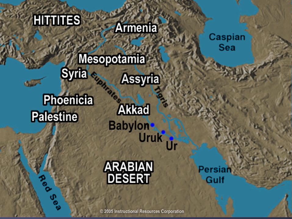
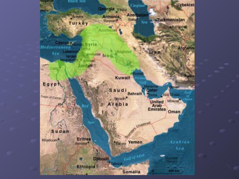
Ancient Mesopotamia lay in what we know Ancient Mesopotamia lay in what we know today as Iraq, northeast Syria and part of today as Iraq, northeast Syria and part of south east Turkey.south east Turkey.
The name comes from the GreeksThe name comes from the Greeks Meso: meaning middleMeso: meaning middle Potamos: meaning riverPotamos: meaning river
Thus Mesopotamia literally means “land Thus Mesopotamia literally means “land between the rivers”.between the rivers”.
Specifically the Tigris and EuphratesSpecifically the Tigris and Euphrates
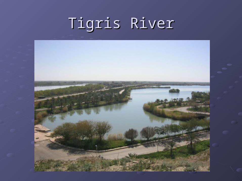
Tigris RiverTigris River
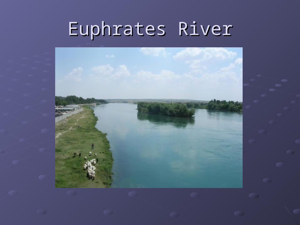
Euphrates RiverEuphrates River
The Fertile CrescentThe Fertile Crescent
Mesopotamia was part of an area known Mesopotamia was part of an area known as the “Fertile Crescent” which stretched as the “Fertile Crescent” which stretched in an arc from the Persian Gulf through in an arc from the Persian Gulf through northeast Syria to the Mediterranean Sea.northeast Syria to the Mediterranean Sea.
It was the site of the world’s first It was the site of the world’s first permanent farming villagespermanent farming villages
Egyptian GeographyEgyptian Geography
The Nile RiverThe Nile River
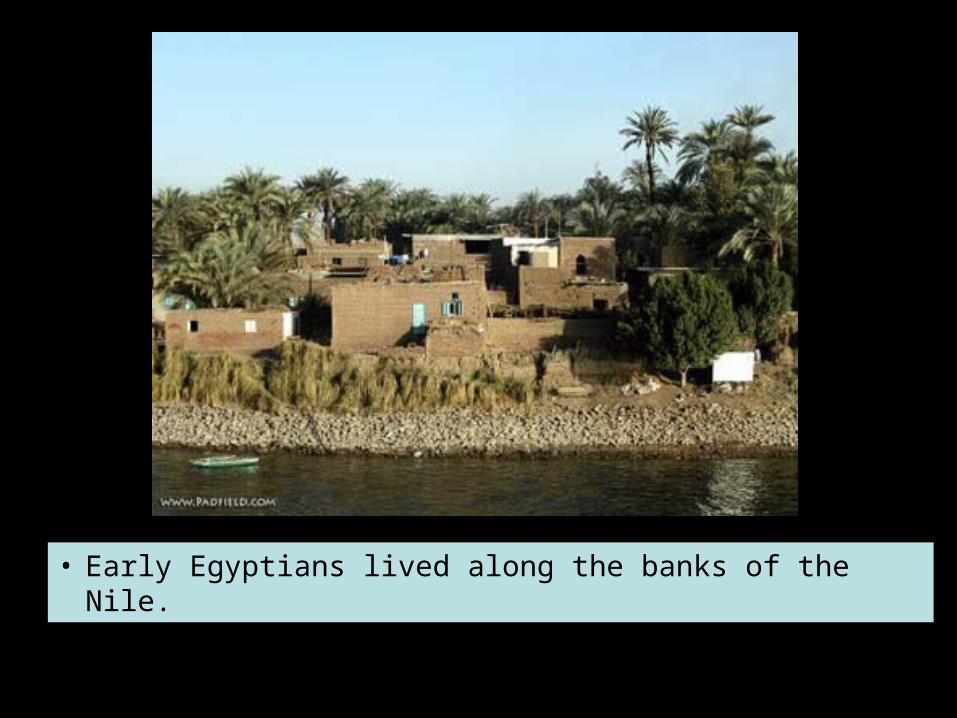
• Early Egyptians lived along the banks of the Nile.
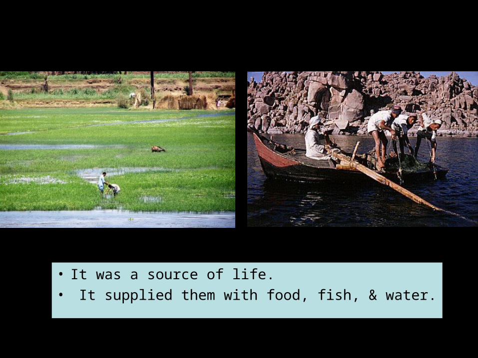
• It was a source of life.• It supplied them with food, fish, & water.
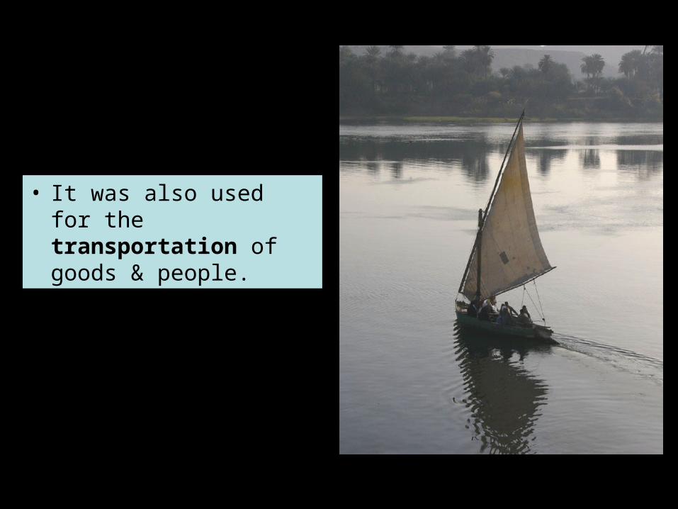
• It was also used for the transportation of goods & people.
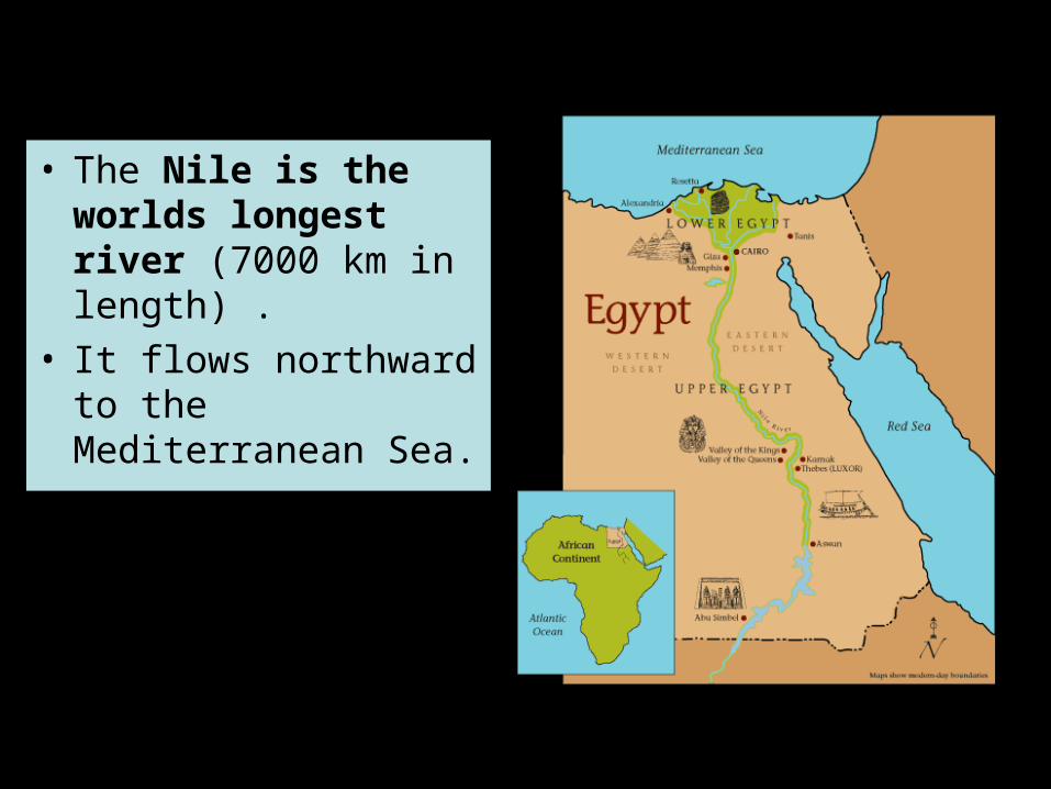
• The Nile is the worlds longest river (7000 km in length) .
• It flows northward to the Mediterranean Sea.
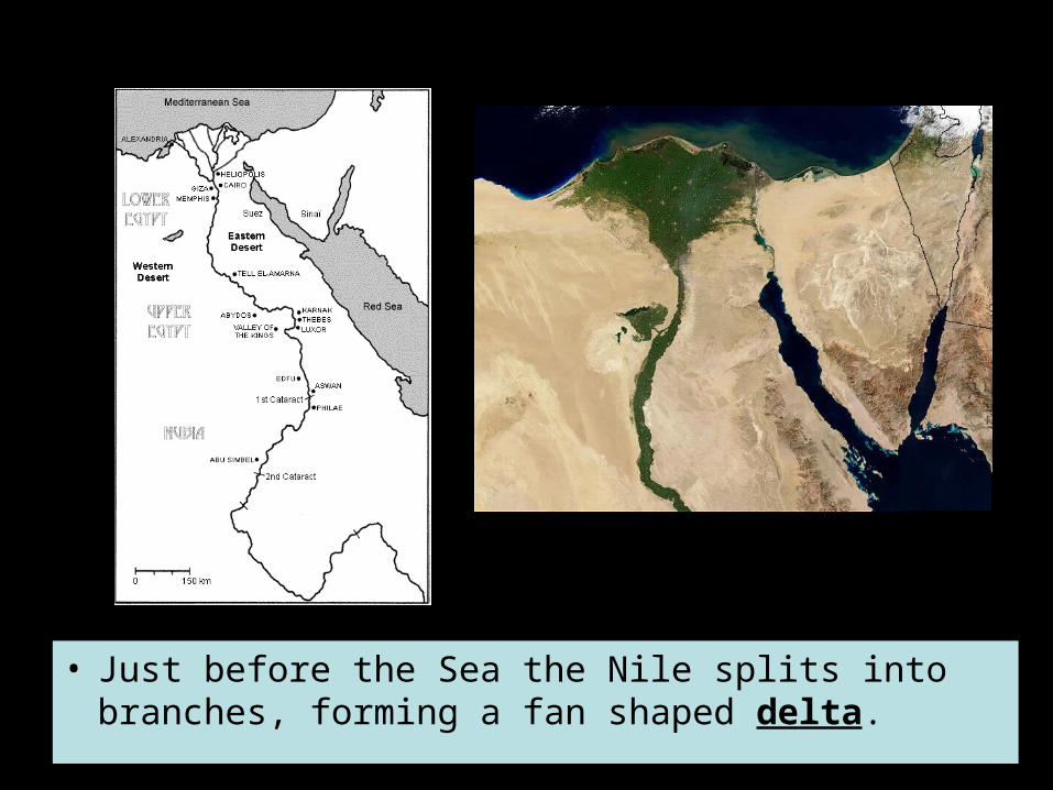
• Just before the Sea the Nile splits into branches, forming a fan shaped delta.
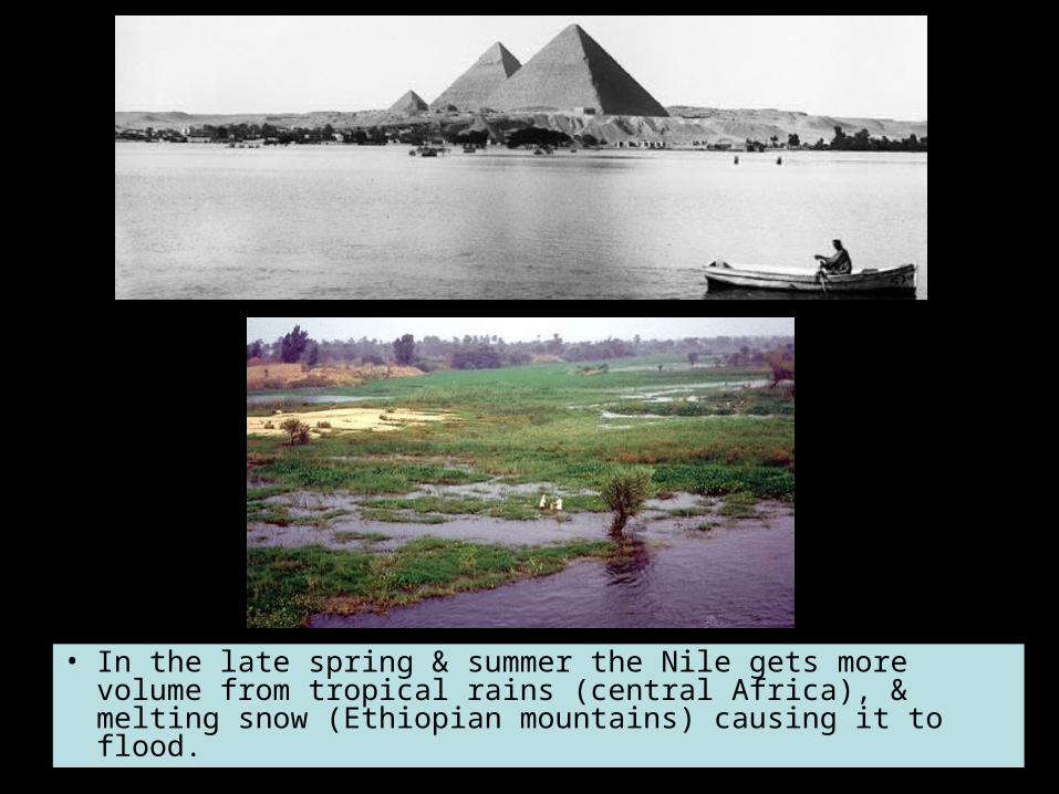
• In the late spring & summer the Nile gets more volume from tropical rains (central Africa), & melting snow (Ethiopian mountains) causing it to flood.
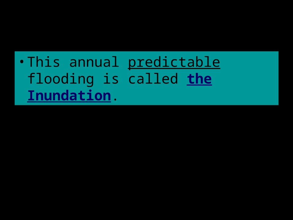
• This annual predictable flooding is called the Inundation.
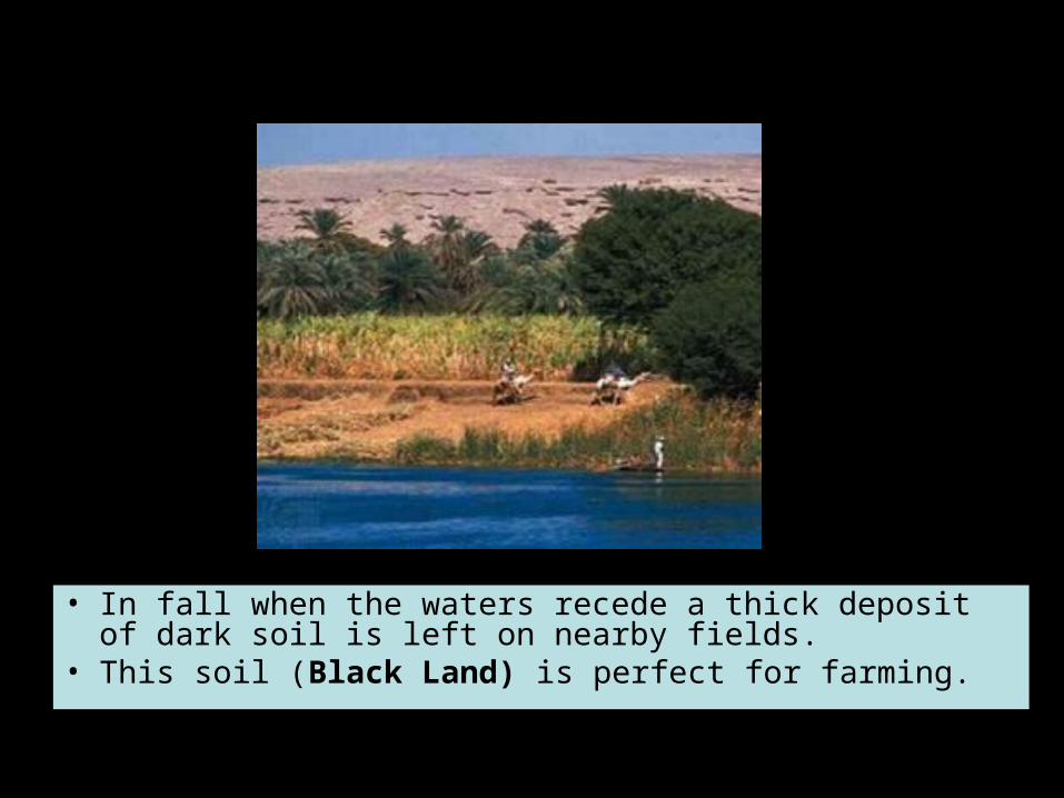
• In fall when the waters recede a thick deposit of dark soil is left on nearby fields.
• This soil (Black Land) is perfect for farming.
• There were 3 main seasons: flood season, growing season, & dry season.
• Their calendar of 365 days was based on these cycles..
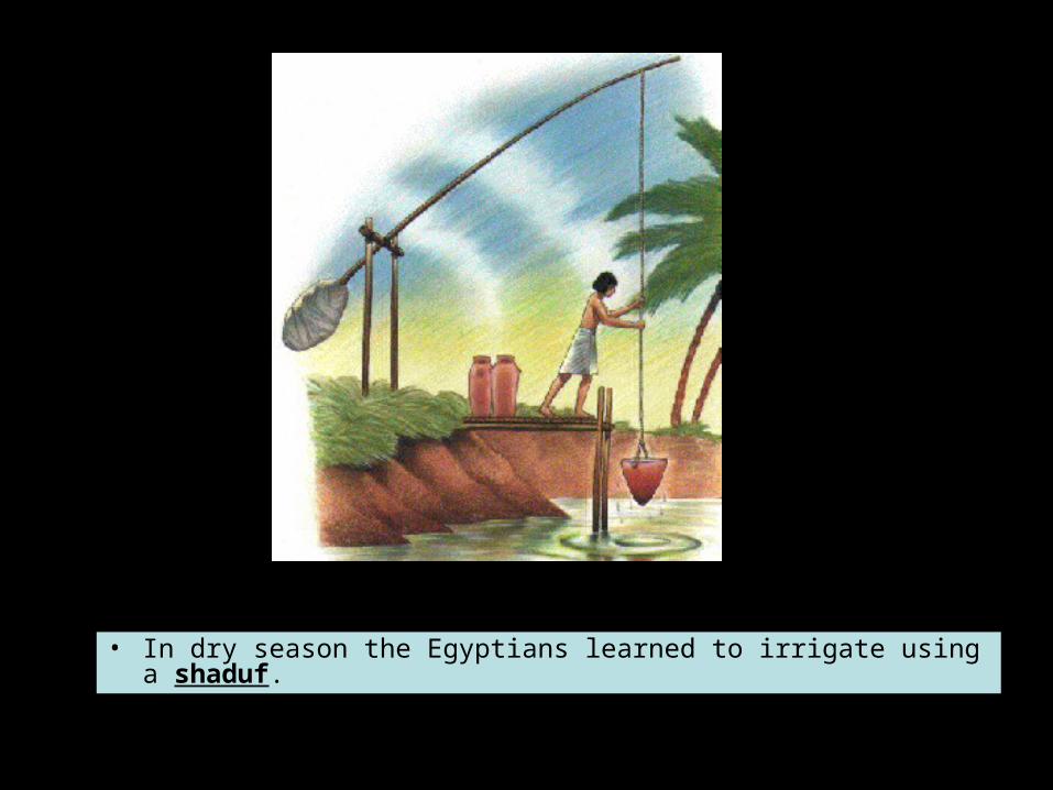
• In dry season the Egyptians learned to irrigate using a shaduf.
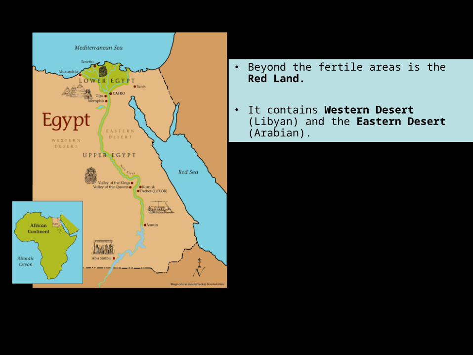
• Beyond the fertile areas is the Red Land.
• It contains Western Desert (Libyan) and the Eastern Desert (Arabian).
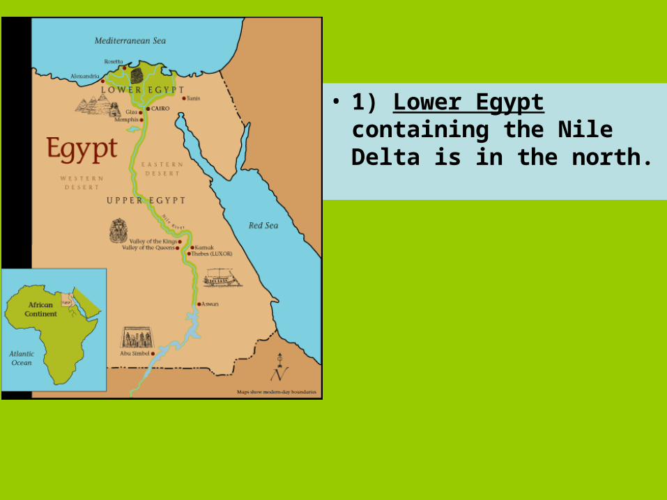
• 1) Lower Egypt containing the Nile Delta is in the north.
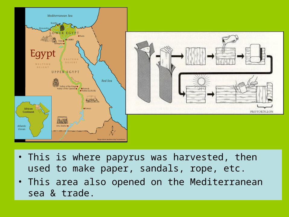
• This is where papyrus was harvested, then used to make paper, sandals, rope, etc.
• This area also opened on the Mediterranean sea & trade.
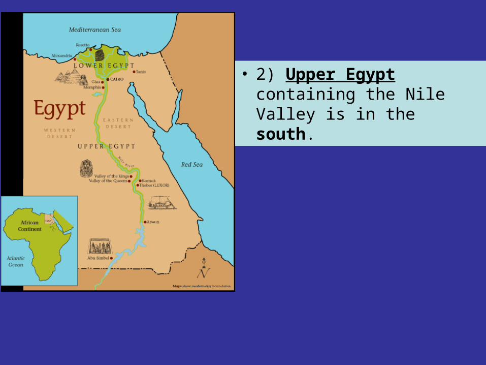
• 2) Upper Egypt containing the Nile Valley is in the south.
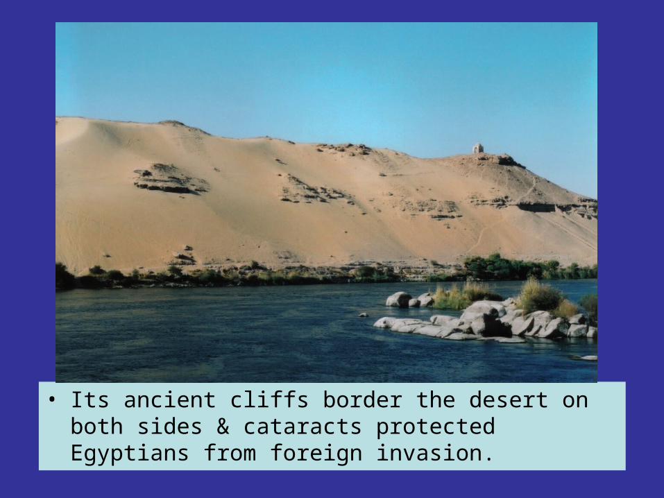
• Its ancient cliffs border the desert on both sides & cataracts protected Egyptians from foreign invasion.
Characteristics of Characteristics of civilizationcivilization
Natural Resources: Civilizations emerge Natural Resources: Civilizations emerge in regions able to support growing in regions able to support growing populations. Fertile soil and a regular populations. Fertile soil and a regular source of water are needed to support source of water are needed to support larger communities.larger communities.
According to our list of characteristics, According to our list of characteristics, both Egypt and Mesopotamia meet this both Egypt and Mesopotamia meet this first criteria of a civilization.first criteria of a civilization.