Embed Size (px)
Citation preview

H:\DC Shared\Committee\Committee Agenda\F 02) Rowan School\Rowan School_Report.doc
PLANNING APPLICATIONS COMMITTEE13 September 2007
Item No: 02
UPRN APPLICATION NO. DATE VALID57/22/05538/0001/A/000 07/P1216 18/04/2007
Address/Site Former Rowan High School, Rowan Road, SW16 5JF
Ward Longthornton
Proposal: Redevelopment of the site to provide 217 residential unitsconsisting of 86 flats (including 27 in the part retained andconverted school building) and 131 houses, a scouthut/community facility covering 390 square metres, a medicalcentre covering 1985 square metres, 2.6 hectares of landscapedpublic open space, vehicular access to the site from the existingentrance and a second new entrance from Rowan Road,pedestrian and cycle access from Hoylake gardens, Kingsmeadavenue and two new access points on Rowan Road, 270 carparking spaces and 171 cycle parking spaces with buildingheights ranging from 1 storey to 4 storeys.
Drawing No’s 3014_00_1 rev A, 00_2 rev A, 20_201 rev A to 208 rev A,20_230 rev A to 238 rev A, 20_243 rev A, 20_244 rev A, 20_250 to 20_ 261, 20_ 263, 20_ 265 to 20_ 269, 20_262 rev A,20_270 rev A to 20_272 rev A, 20_273, 20_274, 20_280 rev A,20_281 rev A, Doc_7, SK_3, GDO466\13887\SK01B, SK3E,GDO4666\13887\SK4A, SK8A, SK9A, SK10A, GD4666 \ 13887\ SK02B, 13887-1557/01A, 3014-sk-003
Contact Officer: Tony Ryan (8545 3114)__________________________________________________________________
RECOMMENDATION
GRANT PLANNING PERMISSION subject to referral to the Mayor of London,completion of a Section 106 obligation/Unilateral Undertaking and planningconditions.___________________________________________________________________________
1. SITE AND SURROUNDINGS1.1 The ‘L’ shaped application site, covering an area of 6.1 hectares, is located on
the south west side of Rowan Road and to the north east of Mitcham towncentre.
1.2 The surrounding area is residential in character with small terraces of twostorey properties found in Rosemead Avenue, Kingsmead Avenue, ManorWay, Hoylake Gardens and Malvern Close to the south, south west and south
63

H:\DC Shared\Committee\Committee Agenda\F 02) Rowan School\Rowan School_Report.doc
east boundaries of the site and opposite the site in Rowan Road. StreathamPark Cemetery and the Jewish Cemetery make up the remaining part of thesouth west boundary and the north east site boundary. Rowan Road formspart of the B272 a local distributor road that links Croydon Road (A236) in thesouth to Streatham Road (A23) in the north.
1.3 The site is currently occupied by the former Rowan School (covering 6343square metres) and surrounding land that was previously used as playingfields attached to the school and private open space. The open areas of thesite are designated as open space in the Unitary Development Plan (UDP).
1.4 The vacant former school buildings are located on the eastern side of the site;the main two storey school building typical of schools built in the 1930’s bySurrey County Council. The main school building has a classical architecturalstyle including prominent detailing at eaves level, brick quoins and archedrecesses. The building is included within Merton’s Local (non statutory) List ofBuildings of Historic or Architectural Interest. A number of unsympathetic oneand two storey extensions have been added to the original school building toprovide additional teaching accommodation. A single storey timber buildingpreviously occupied by the 36th Mitcham Scout group is found to the rear ofthe school buildings.
1.5 The whole application site is identified within the UDP as proposal site 50Pand covered by a development brief. The brief adopted after publicconsultation in November 2003 lists the Council’s preferred land uses asresidential, open space and community uses; an update to the brief waspublished in December 2005. The site is not located in a conservation areaand there is currently no public access to the site.
2. CURRENT PROPOSAL
Background2.1 In June 2000 the Secretary of State approved the Schools Reorganisation
Programme (SRP). Merton previously operated a three tier education systemof first, middle and high schools. Following the SRP, the overall school systemchanged significantly with the adoption of a two tier education system ofprimary and secondary schools. As a result of this reorganisation the RowanHigh School site became available for disposal, with the majority of the sitesold to the national regeneration body English Partnerships.
2.2 The majority of the application site, although not accessible to the generalpublic is designated as open space within the Unitary Development Plan. TheCouncil’s strategy for the provision for open space and recreation is based onthe findings of the Merton Open Space Study (MOSS, 2002) and the EastMitcham Open Space Strategy – (EMOSS, 2003).
2.3 The EMOSS identified a number of opportunities to improve the provision ofopen space within East Mitcham and current deficiencies in provision; one ofthese opportunities was the future use of the Rowan High School site. The
64
H:\DC Shared\Committee\Committee Agenda\F 02) Rowan School\Rowan School_Report.doc
future use of the school site was seen as an opportunity to improve theprovision of open spaces within the area, providing greater value to thecommunity, and needs of the local residents. Any change from private topublic ownership and the provision of improved facilities that would meet theneeds of the area were considered to represent a significant gain for the area.
2.4 The Rowan School site has been the subject of lengthy discussions involvingthe Council and the majority landowner English Partnerships (a section of thesite remains in Council ownership) as part of the Design for ManufactureCompetition (DfM). The nationwide DfM was launched in April 2005 by theDeputy Prime Minister in response to major increases in residentialconstruction costs.
2.5 The aims of the competition were to demonstrate that it is possible to build ahigh-quality home for £60,000 (NB: a target construction cost, not the totaldevelopment cost or final sale price). This focus on the cost of constructionaimed to improve construction efficiency, quality and design; with the hopethat this cost efficiency would then impact on total scheme costs and help tomake homes more affordable.
2.6 The competition also aimed to stimulate fresh thinking that would help thehousing industry with research and development. The competition wouldpromote the integration of efficient construction methods into housingdevelopment, whilst providing an example to others in the constructionindustry.
2.7 After the submission and assessment of separate detailed bids from fourdifferent developers to English Partnerships, the current applicant CrestNicholson was announced as the winner in relation to the Rowan School site.The Rowan School site is the last of ten competition sites to be released andis also the largest site in the DfM nationwide initiative.
Proposed Development2.8 The current application includes the redevelopment of the site to provide 217
residential units, a scout hut/community facility covering 390 square metres, amedical centre covering 1985 square metres and 2.6 hectares of landscapedpublic open space.
2.9 The application involves the demolition of the existing extensions to the locallylisted school building (covering a footprint of 2,210 square metres), with theoriginal building retained and converted to provide 27 flats, including 2 studiounits, 4 one bedroom and 21 two bedroom units.
2.10 The remaining 59 purpose built flats are provided in six new blocks locatedacross the site (15 one bedroom and 41 two bedroom) and in 3 three, twostorey buildings on the site providing flats (3 two bedroom units) above groundfloor garages (FOGs).
65
H:\DC Shared\Committee\Committee Agenda\F 02) Rowan School\Rowan School_Report.doc
2.11 The majority of the six flatted blocks (referenced on application drawings asFB1a, FB1b, FB1c, FB1d, FB1e & FB2) are three storeys high, with two fourstorey blocks (FB1d & FB2) located in the centre of the site.
2.12 The majority of the 131 proposed houses (33 two bedroom, 59 three bedroomand 39 four bedroom) are arranged in terraces of between 3 and 8 propertieswith several semi-detached pairs of properties located in the centre of the site.The semi detached houses and terraces are two and three storeys in height.
2.13 The layout of the development has been designed with several buildingelements; including an armature, body and the crescents. These buildingelements are highlighted by the use of different construction materials acrossthe site to provide different characteristics to distinct sections of thedevelopment. The materials chosen include the use of render to contrast withand to ensure that the important brick school building maintains its currentprominence.
2.14 All buildings within the armature use coloured fibre cement board, with darktones of ‘Eternit’ cladding. The rear elevation of some houses in the armatureand within the body will be finished in brick with the front elevation in cleanrender. The crescent buildings and areas of the facades of the houses in thebody are clad in close boarded sweet chestnut rain screen cladding. Thecladding will be used untreated and will allowed to age to a mature silverwithin two to three years.
2.15 The roofs within the development will be finished in dark grey fibre cementboard slate. Rainwater goods and fascias will be aluminium finished to matchthe roof covering. A variety of surface materials are used across the site todenote different uses, including block paving and concrete paving.
2.16 The scout hut/community building is located over the lower two floors of thefour storey block (FB2) located in the centre of the site; the upper two floorswill provide residential accommodation. The facility includes a double heighthall with direct access to a kitchen area. On the ground floor toilets areprovided together with storage space for the scouts, the first floor providesmeeting rooms and office accommodation. The four storey scouthut/community building (FB2) is attached to an adjacent four storey building(FB1d) that provides residential accommodation.
2.17 The doctor’s surgery/health centre will be located in a visible location on theRowan Road adjacent to the site entrance. The full details of the building areto be considered by way of a planning condition as the detailed plans of thebuilding are currently being finalised.
2.18 The building will be three storeys high including a reception and entrancearea, pram storage area, lift access, waiting rooms, toilets and offices, recordsstore. On the upper floors of the building, doctors’ and nurses consultingrooms, waiting areas and a minor operating suite will be provided togetherwith facilities for staff. A pharmacy is also proposed on the ground floor of the
66

H:\DC Shared\Committee\Committee Agenda\F 02) Rowan School\Rowan School_Report.doc
building with a separate entrance onto Rowan Road. The doctor’ssurgery/health centre is allocated 14 car parking spaces.
2.19 The application site is currently provided with two vehicular access points fromRowan Road. The existing vehicular access in the middle of the site frontagewill be retained to provide the main access to the development, with thesecond access provided for emergency vehicles only; a second emergencyaccess point is proposed from Kingsmead Avenue. The development alsoincludes a new pedestrian and cycle access from Hoylake Gardens andKingsmead Avenue. The development includes the provision of 270 carparking spaces and 171 cycle parking spaces.
2.20 Following consultation with various stakeholders on the original applicationincluding a meeting with residents on the 9 June 2007 revised plans werereceived on the 5 July 2007. The revisions to the original proposal included:• A reduction in the level of car parking from 278 spaces to 270 spaces.• A greater distribution of the 65 affordable houses/ flats throughout the
development• The wind turbines replaced with photovoltaic panels.• The main square redesigned with a reduction in parking and additional
trees.• The surface treatment on road surfaces revised with a greater number of
pedestrian crossings.• Block FB1e to the rear of 1-11 (odd) Kingsmead Avenue and 153-161
(odd) Manor Way increased in height to three storeys.• Block FB1a reduced in height to three storeys
2.21 The following supporting documents have been submitted with the application:• Design Statement
The design statement gives the aims of the wider brief as providing ahigh quality design and landscape proposal which seeks to maintain thegreen nature of the existing site wherever possible. The development isto provide a generous new park incorporating a sustainable urbandrainage system (SUDS); a strong network of informal and formal publicspaces; a strong frontage on to Rowan Road with a gateway into thedevelopment; improved pedestrian and cycle access to surroundingareas and a variety of housing types, sizes and styles.
• Transport Statement & Road Safety AuditThe road safety audit carried out by BTP Hyder Consulting raisedseveral minor issues including in relation to emergency access, facilitiesfor the disabled and visibility splays. The architect has submitted astatement in response to these concerns making minor changes to thelayout of the development. Other points have been reserved for futureconsideration, including in some cases an assessment post occupation.
The aims of the submitted transport assessment were to consider theaccessibility of the site by non car means and the impact that trafficassociated with the development will have on the local road network.The report concludes that the site is accessible by modes of transport
67
H:\DC Shared\Committee\Committee Agenda\F 02) Rowan School\Rowan School_Report.doc
other the private car and has provided a range of facilities to make thesite accessible to walking and cycling. The report found that in themorning peak hour the proposed development will generate considerablyless traffic then the former school with only a relatively small increase inthe weekday evening peak. The report found that the proposeddevelopment would not have a material impact on traffic conditions andthat adequate car parking was provided.
• Travel PlanA travel plan has been submitted as part of the application by BTP HyderConsulting. The travel plan concludes that the site is well located interms of public transport facilities. The recommends that the a greentravel plan coordinator is appointed with the role including liaison withfuture residents to encourage more sustainable means of traveldesigning and overseeing effective marketing to promote the travel planand coordinating the monitoring programme including target setting.
• Ecological AssessmentThe conclusions of an ecological assessment carried out by JFA Ltdfound the site to be of low ecological value with habitats that arecommon across the UK. There was no evidence of bats within thebuildings or in the mature trees on the site. There was no evidence ofbadger setts, however badgers were know to use the site as part of theirextended territory. There were no reptiles found on the site.
• Sustainability ReportA sustainability report has been received from the RHB Partnership. Theagreed strategy for the site includes the provision of 150 square metresof photovoltaic (PV) panels provided for some of the houses, thecommunity scout hut and the GP surgery. The visible location of thepanels designed to achieve maximum awareness of climate change andits mitigation. The provision of the PV panels and a natural gasCombined Heat & Power (CHP) plant equates to the provision of 5% ofenergy requirements through on site renewable energy equipment.
• Flood Risk AssessmentThe flood risk assessment carried out by BTP Hyder Consulting foundalmost the entire site outside the 1:100 year indicative fluvial floodplain ofthe Figgs Marsh Ditch that runs along the site boundary. As the site isgreater then one hectare, an assessment of surface water discharge wasrequired as well as an assessment of the risk of fluvial flooding from localwatercourses. With the exception of the western part of the site, theground is elevated and the report concludes that the developed easternarea of the site will not flood in the 1:100 year event.
To satisfy drainage requirements attenuation ponds and swales areshown on the plans to manage surface water. This surface water afterbeing collected by a formal drainage system will discharge into theculverted Figgs Marsh ditch. Although any overflow is unlikely, in thisunlikely event a flood routing swale has also been included along the
68

H:\DC Shared\Committee\Committee Agenda\F 02) Rowan School\Rowan School_Report.doc
south east boundary. The report demonstrates that the foul and surfacewater drainage can be dealt with without significant impact on existingsewers, drains and watercourses and no environmental, social andeconomic consequences are expected from a flood risk perspective
• Community Consultation ReportA report has been submitted outlining the conclusions from the publicexhibition held on behalf of the applicant at St Olaves’s Church Hall onthe evenings of the 28 & 29 November and Saturday 2 December 2006and comments received through a related consultation website. Around2,400 letters were sent to local households with 162 local peopleattending the exhibition over the three days.
3. PLANNING HISTORY3.1 The application site has a long-standing education use. Planning records from
the 1960’s and 1970’s indicate various planning approvals for extensions tothe original school building. These extensions provided a new two storeyscience block, a single storey gymnasium, a two storey practical block andtheatre hall, and a new two storey sixth form building.
3.2 In more recent years planning permission was approved in May 1988 for atwo storey extension to the school to provide additional classrooms and staffaccommodation (88/p0456). Planning permission was approved in September1998 for the retention of a detached temporary building to provide classroomaccommodation (98/0840).
4. CONSULTATION4.1 The planning application has been advertised by means of site notice and a
major application press notice, together with individual letters to neighbouringresidential occupiers and to statutory consultees. A petition of 104 signatureswas submitted objecting to the proposal before the receipt of the currentplanning application.
4.2 In response to the consultation on the application 67 individual responses (30circular letters) have been received from local residents together with 13further letters received after additional consultation on revised plans objectingto the proposal on the following grounds: -• The school building built for local education purposes should be used a
community use.• There is a need for community facilities in this area.• There are very few scouts groups in the area• The safety of the cul-de-sac Hoylake Gardens will be lost where children
can play in safety and strangers are easily identified.• The point of access is narrow and is considered unsuitable for a shared
cycle and pedestrian path.• With the limited parking on the site adjoining sites will become a magnet
for overspill parking.
69
H:\DC Shared\Committee\Committee Agenda\F 02) Rowan School\Rowan School_Report.doc
• The access to Hoylake Gardens will endanger the safety of residentswho adjoin the pavement
• The number of residential units proposed and the ‘low cost’ nature wouldput a strain on local infrastructure including doctors and schools,especially with the possible closure of St. Helier Hospital.
• The proposal includes insufficient car parking space with an average of 2cars per household, which is contrary to UDP policies.
• The construction traffic and extra traffic from future occupiers will worsenthe existing traffic problems in the area.
• The additional traffic and parking will create a danger for school pupils inthe area.
4.3 A residents meeting was held on the 9 June 2007 at St Olave's Church Halland attended by approximately 150 residents, together with SiobhanMcDonagh MP, Council Officers and representatives of the architect and thedeveloper.
Longthornton Re-Development Working Party4.4 A number of concerns were raised at the meeting with residents at St Olave’s
Church Hall on the 9 June 2007. The proposed access to Hoylake Gardens,Malvern Close and Kingsmead Avenue was unanimously rejected by localresidents with the option of alternative emergency exits in Rowan Roadsuggested.
4.5 The three storey block of flats overlooking existing houses should berelocated to a less dominating position. A community use should beconsidered in the school building.
Longthornton & Tamworth Residents Association4.6 The density of the development is considered too high and the design of the
development is not in keeping with surrounding brick built development. Thethree storey medical centre building is considered to be too high as it will facetwo storey properties on the opposite side of Rowan Road.
4.7 Local residents object to the use of s106 monies from this development beingused for Eastfields station as this money should be used to fund morecommunity facilities in this area, including the possible relocation of PollardsHill Library in to the school building or a new purpose built library building onthe site.
4.8 There has been considerable objection to the proposed new access point toHoylake gardens, including in terms of the limited space available immediatelyoutside the site. The loss of privacy is also considered an issue.
English Partnerships4.9 The submitted revised scheme is supported on the basis that it represents
very good practice in terms of linking the principles of environmentalsustainability and urban design. The scheme as proposed has the potential tobe an award winning scheme of national significance and a great place to live.
70
H:\DC Shared\Committee\Committee Agenda\F 02) Rowan School\Rowan School_Report.doc
4.10 The car parking approach encourages homeowners to walk from their car andinteraction with neighbours which in turn promotes a safer and secureenvironment. The decision to raise the height of the previous two storeybuilding to three storeys is supported on the basis that the higher buildingprovides a clear visual marker in this location in line with the original planningbrief. The three storey building is moderate in height and scale. It isconsidered that the three storey building will not have any detrimental impacton amenity due to the considerable distance from adjacent properties and theaccess road immediately adjacent to the application site boundary.
Natural England4.11 Various standards regarding the access and distance to areas of open space
are highlighted and general concerns expressed over the loss of the publicopen space as part of the current proposal.
Wimbledon & Wandle Scout Council4.12 Concerns are expressed over the fact that the area for the scouts has a
shared use as a community facility and that the scouts do not have exclusiveuse of the space. The scout hut is considered of a relatively small size. Thepossibility of being charged for the use of the space in the future is of aconcern as previously the space was rent free.
Western Charitable Foundation (owners of the adjacent Jewish Cemetery)4.13 There is no objection in principle to the redevelopment of the Rowan School,
Site however there are concerns regarding the privacy of mourners and thesecurity and sanctity of the Jewish cemetery.
4.14 The Foundation request that any planning permission be conditional in orderto ensure that the boundary with the cemetery is marked by a security fenceat least 2.6 metres high. A condition should be added to prevent trees plantednear the boundary providing a route across the boundary and to avoid a areahidden from view adjacent to the boundary. The Foundation also ask that theopen space is securely closed after dark and that movement sensitive lightingis installed.
Environment Agency4.15 The Environment Agency has no objection, to the proposed development, as
submitted, provided the following planning condition is imposed: Surfacewater management measures shall be carried out in accordance with thesubmitted Flood Risk Assessment and surface water details shall besubmitted to and approved in writing by the Local Planning Authority beforedevelopment commences. REASON: To prevent the increased risk of floodingand to improve water quality.
4.16 The following informative is also suggested; Under the Land Drainage Act1991, consent is required for any culverting or flow control structure (such asa weir) on any ordinary watercourse. The Environment Agency generallyopposes culverts, further details are available on the internet athttp://www.environmentagency.gov.uk/subjects/flood/362926/362984/362988/
71

H:\DC Shared\Committee\Committee Agenda\F 02) Rowan School\Rowan School_Report.doc
The Rowans Surgery4.17 The partners who operate the existing surgery at 1 Windermere Road wish to
formally express their desire to move to the proposed new medical centre. It isfelt that there is currently a high demand for the practice from existing patientsmany of whom have complex health needs and language barriers. Theexisting premises are too small both in terms of the waiting room capacity, thecapacity to deal with the volume of telephone calls and administration space.
4.18 The surgery is aware of concerns amongst existing residents that the influx ofpeople in to the area as part of several local redevelopment schemes will putextra pressure on local services.
4.19 It is understood that there may be a pharmacy provided within the medicalcentre building, this would be supported on the basis that it would provide astreamlined service for patients and would allow a closer working relationshipwith other health care professionals.
4.20 There are two important factors that need to be resolved to allow the move tothe new medical centre to take place; the rent levels attached to the newmedical centre building need to be at a level that is affordable to the Suttonand Merton Primary Care Trust and the existing surgery premises need to besold.
Merton Design Review Panel4.21 This application was reviewed at the Design Review Panel meeting on the 28
June 2007. The strengths of the scheme were felt to be:-• The contemporary approach to architecture and design and layout, the
panel were in admiration of such an approach.• The logical progression of ideas contained in the masterplan are
impressive.• The range of street typologies (eg square and mews) offer variety and
interest. Like historic towns which have quirky little streets and placesthat are loved and offer surprise, the panel are glad to see this being re-created in a contemporary housing development.
• The site tries to link up with the existing neighbourhood at HoylakeGardens and Kingsmead Avenue which is to be applauded in terms ofpromoting legibility and good urban design.
• The crescent element of the scheme gives a nod to Radburn principles,almost reminiscent of a New Town, but with other measures which couldmake the scheme work, where Radburn’s may have failed.
• The Panel was pleased to see the retention of the Locally Listed schoolbuilding.
4.22 The weaknesses of the scheme were considered to be:-• There seems to be a lot of elements happening in the site, perhaps
lacking in an overall consistency.• Details regarding the level of privacy and defensible private space on the
interface between the crescent blocks and the park were raised as aconcern.
72

H:\DC Shared\Committee\Committee Agenda\F 02) Rowan School\Rowan School_Report.doc
• Interface between the park and Rowan Road is a concern, as is thegeneral security of the park, but needs discussion with the Council whowill manage the space
• With a singular vehicle access from Rowan Road, the development hasthe feeling of an estate or a large cul-de-sac, which could be alleviatedby providing full vehicular links to neighbouring streets, particularlyKingsmead Avenue.
4.23 Overall conclusion - The panel were impressed by the proposals, particularlywith the contemporary design approach and the sustainability features of thescheme. The master plan is extremely well thought out – demonstrating astring of ideas that are put together imaginatively to create a much better idea.The scheme is to be commended and was a pleasure for the panel to review.
Commission for Architecture and the Built Environment (CABE)4.24 CABE provide advice to central government in relation to architecture, urban
design and public space issues. The proposal was considered at the CABEdesign review panel meeting on the 10 May 2007.
4.25 The aspiration of the development to test how economic off site constructionof housing can be successfully translated into a site specific layout wasapplauded. The scheme was found to have many positive aspects and thearrangement of the built form in relation to the landscape was found to havethe potential to create a pleasant space. The strategy for achievingenvironmental sustainability is also unusually strong.
4.26 Comments were made in relation to urban design, parking strategy andarchitecture where it was thought there was scope for improvement. Whilstthe pedestrian routes through the site were noted, the panel noted that therewas no vehicular link to Kingsmead Avenue; it was considered that theproposal would benefit from better links into surrounding roads.
4.27 A point was made in terms of the crescent form of the housing and why therewas some variation in the layout of the terraces with some inward and someoutward looking. It was considered that more could be done to provide viewsfrom the end of terrace houses.
4.28 It was considered that better thought should be given to the parking strategyespecially in terms of the parking courtyards. A concern was expressed inrelation to the interior of the houses and the achievement of the sense of lightand space as shown as a positive aspect in the submitted plans.
Transport Planning.4.29 The principle of residential development in this location is considered
acceptable. Whilst the site currently has a poor level of public transportaccessibility (PTAL=2) the accessibility of the site will be improved by theplanned Eastfields rail station that can be reached by a short bus or cyclejourney.
73
H:\DC Shared\Committee\Committee Agenda\F 02) Rowan School\Rowan School_Report.doc
4.30 Car parking will be provided at a ratio of just under 1.2 parking spaces perdwelling. Census information relating to car ownership in the LongthorntonWard shows that 24% of households do not own a vehicle. It is consideredthat the proposed level of parking provision will be more than sufficient toaccommodate parking demand associated with the development, and will notlead to overspill parking on surrounding residential streets. The proposedparking associated with the health centre and scout hut/community facility isconsidered acceptable and in line with the Council’s maximum standards.
4.31 To ensure the efficient management of the parking spaces within thedevelopment it will be necessary for the applicant to provide a parkingmanagement plan. The plan should show a minimum of 5% of spaces withinthe development allocated and secured for the use of disabled drivers.
4.32 The development has been designed to increase permeability through thesite, providing new pedestrian/cycle links from Rowan Road, HoylakeGardens and Kingsmead Avenue. Transport Planning strongly support thisaspect of the scheme, as the additional routes through the site will encouragewalking and cycling.
4.33 There are also concerns regarding the width of footpaths/cyclepaths within thesite and immediately outside the site boundaries with a requirement that themain footpath/cyclepath connecting Hoylake Gardens with the site accessroad widened to 3 metres.
Tree Officer4.34 There are a number of trees of varying quality spread across the site and
most are shown as being retained. Several conflicts between the proposeddevelopment and existing screening trees are highlighted; these conflictscould be resolved by the removal of buildings from the proposal. Despitethese small criticisms overall the development was seen to provide clearbenefits to the local community.
Regeneration Partnerships Unit.4.35 The Regeneration Partnerships Unit considers that the scale of this new
housing development within an area where social infrastructure (and thebudgets that turn that infrastructure into viable services) are already underpressure, make it imperative that the development should adequately cross-subsidise the provision of local health services.
4.36 Accordingly (and following detailed discussions with Sutton and Merton PCT)the unit supports the inclusion in the s106 heads of agreement of arequirement that the core and shell of 1,000 sq. m. of health centre floorspace be made available at zero cost. This would leave the PCT only havingto underwrite a rent for the health centre which reflected only the £500,000(approx) cost of fitting out the centre
4.37 This contribution would benefit the PCT and local service users in perpetuityand would enable the PCT to ensure that the ongoing cost of operating theincreased local health services which are envisaged will be economically
74

H:\DC Shared\Committee\Committee Agenda\F 02) Rowan School\Rowan School_Report.doc
sustainable. This is notwithstanding the appropriate contribution arising fromthe HUDU model which is a general, once-off contribution to the overallfinances of the National Health Service.
4.38 The Regeneration Partnerships Unit calculates that the residual value of theproposed development is quite capable of absorbing the cost of making thisfree provision without undermining the overall viability of the development.
Housing Development Team.4.39 The proposed scheme is supported by the Housing Development Team on
the basis that it meets the borough requirement in the UDP to provide 30%affordable housing on developments in excess of 15 units.
4.40 In addition, the scheme provides a range of bed sizes that meet the boroughsneeds as identified in the Housing Needs Survey 2005. The main shortagesidentified are for smaller one and two bedroom homes, however, the shortagerelative to supply is greatest for four bedroom properties where it is estimatedthat none of the need can be met.
4.41 The mix of affordable units on this scheme provides 41.5% family sized (3+beds) units with many providing many much needed houses rather then flats.This figure exceeds the Housing Corporation target of 35%. The variety in theabove mix of units offers the opportunity to free larger under occupiedaccommodation elsewhere within the borough.
4.42 The development is located in a well established residential area withsufficient access to transport, education and leisure facilities and will thereforebe sustainable in the long term.
4.43 Based on the provision of 65 affordable units, and after consideration of need,demand and the current waiting list, the Council will be looking to secure 5%Full DPU's (3 units) and would like these to be 1 x 1 bed, 1 x 2 bed and 1 x 3units, it would be ideal if these units could be secured by way of a planningcondition.
Leisure Facilities and Technical Services.4.44 Comments are put forward in relation to maintenance, fencing and gates and
the proposed cycle ways and footpaths.
4.45 Maintenance - The cost of maintaining the proposed open spaces will beexpensive, and therefore the s106 agreement must allow for the provision offuture site maintenance.
4.46 Fencing and Gates - The choice of boundary treatments should provide thenecessary security to ensure that the site can be locked at night if in the futurethis is required. The fencing along the Rowan Road frontage should be raisedto deter people climbing over with the design of the railings submitted forapproval.
75
H:\DC Shared\Committee\Committee Agenda\F 02) Rowan School\Rowan School_Report.doc
4.47 A double gate only accessible by ground staff is required in the Rowan Roadfor access by maintenance vehicles. A separate pedestrian access gateshould be provided for the public with footpaths altered to reflect thesechanges.
4.48 After experiences elsewhere in the borough the pedestrian access gate fromHoylake Gardens is considered important to avoid future damage to the siteboundary treatments. In the absence of a gate it is likely that people will seekto gain access to the new park rather than walk the long distance to thealternative gate off Rowan Road. This damage to boundary treatments haslong term cost implications for the Council in terms of repair works. A singlegate is considered sufficient with a deterrent for motorbikes.
4.49 Footpaths/cycle way – The open space should include the provision oftarmacadam footpaths at least 1.5 meters wide. The cycle path/footpathsshould be 3 metres wide to allow for pedestrians and cycles to use the sharedaccess route. These paths should be marked to reflect this dual usage.
Crime Prevention Officer4.50 The architect has confirmed that rear alleys will be fitted with metal locking
gates that have removed the previously expressed concerns about them. Thecommunity facility is set on an island site and the developers have beenrequested to look at the provision of surface treatment in order to prevent anti- social behaviour.
4.51 The footpaths from adjoining roads will open up and allow access to what is asafe and secure environment. The footpaths are not wide enough to beconsidered as anything other than an alley. People who have no right to be ineither community will find themselves with a plausible reason if challenged.
5. POLICY CONTEXT
Adopted Unitary Development Plan (October 2003).5.1 The relevant policies in the Adopted Unitary Development Plan (October
2003) include, ST1 (sustainable development), ST3 (mixed uses), ST.9(quality residential areas), ST10 (mixed use neighbourhoods), ST11 (housingprovision), ST.12 (development on previously developed land), ST13 (housingneeds), ST16 (economic diversity), ST17 (built environment), ST19 (naturalenvironment), ST31 (land use/transport integration), ST32 (trafficrestraint/reduction), ST35 (parking), ST36 (community benefits), LU.3 (transport Impact of new development), PE7 (capacity of water systems), PE8(contaminated, vacant and derelict land), PE.9 (waste minimisation and wastedisposal), PE11 (recycling points), PE13 (energy efficient design), PK2 (carparking standards), PK.3 (car parking and development), HP1 (housingtarget), HP4 (density of development), HN1 (affordable housing), HN3(dwelling mix), HS1 (housing layout and amenity), HS2 (sustainable housing),C1 (location and access of facilities), C13 (planning obligations for educationalfacilities), NE2 (development in proximity to MOL), NE3 (green chains), NE6(sites of importance for nature conservation), NE8 (green corridors), NE.11
76
H:\DC Shared\Committee\Committee Agenda\F 02) Rowan School\Rowan School_Report.doc
(tree protection BE11 (local list rehabilitation and maintenance), BE13(archaeological protection), BE14 (archaeological evaluation), BE15 (newbuildings - daylight, sunlight, privacy, visual intrusion and noise), BE16 (urbandesign), BE17 (urban design – application of standards), BE18 (gardens),BE22 (design of new development), BE.25 (sustainable development), PE7(capacity of water systems), PE8 (contaminated, vacant and derelict land),PE.9 (waste minimisation and waste disposal), PE11 (recycling points), PE13(energy efficient design), PU1 (transport infrastructure and development), L5(urban green space), L6 (public open space), L7 (recreational open space), L8(open space deficiencies) L9 (children’s play facilities), L.14 (community andreligious meeting places), PT1 (local and regional public transport needs),RN3 (vehicular access), RN.9 (accessibility), WC1 (increased walking), WC3(cycle facilities), PU1 (transport infrastructure and development), LU3(transport impact of new development), LU5 (developer contributions), RN3(vehicular access), RN.9 (accessibility).
Adopted Planning Brief (November 2003)5.2 The Rowan School site is proposals site 50P within the Unitary Development
Plan adopted in October 2003; with a planning brief for the site adopted inNovember 2003.
5.3 The purpose of the brief was to establish a planning framework and to providedetailed guidance to prospective developers. There have been further lengthydiscussions between the developer and the Council on the nature of theproposed development on the Rowan School site; these discussions haveconsidered the changes which have occurred during the four years since thebrief was adopted.
5.4 In summary the planning brief promoted a sustainable form of mixed usedevelopment to include a new public local park to the west of the site and amix of community uses and housing to the east. The density of thedevelopment was left to be assessed in terms of the provision of a satisfactorydevelopment design and layout and against the Council’s planning policiesand guidance.
The London Plan (February 2004).5.5 The relevant policies in the London Plan (February 2004) are: - 2A.1
(Sustainability criteria), 3A.1 (Increasing London’s supply of housing), 3A.2(Borough housing targets), 3A.7 (Affordable housing targets), 3D.12(Biodiversity and nature conservation), 3C.1 (Integrating transport anddevelopment), 3C.3 (Sustainable transport in London), 3C.16 (Tacklingcongestion and reducing traffic), 3C.19 (Improving conditions for buses),3C.20 (Improving conditions for walking), 3C.21 (Improving conditions forcycling), 3C.22 (Parking strategy), 3D.12 (Biodiversity and natureconservation), 4A.7 (Energy efficiency and renewable energy), 4A.8 (Energyassessment), 4A.9 (Providing for renewable energy), 4A.10 (Supporting theprovision of renewable energy), 4A.11 (Water supplies), 4A.16 (Bringingcontaminated land into beneficial use), 4B.1 (Design principles for a compactcity), 4B.3 (Maximising the potential of sites), 4B.4 (Enhancing the quality ofthe public realm), 4B.5 (Creating and inclusive environment), 4B.6
77

H:\DC Shared\Committee\Committee Agenda\F 02) Rowan School\Rowan School_Report.doc
(Sustainable design and construction), 4B.7 (Respect local context andcommunities), 4B.10 (London’s built heritage), 4B.11 (Heritage conservation),4B.12 (Historic conservation-led regeneration), 4C.8 (Sustainable drainage),6A.4 (Priorities in planning obligations), 6A.5 (Planning obligations).
Central Government Guidance –Planning Policy Statement 1: Delivering Sustainable Development.
5.6 The advice in Planning Policy Statement 1 aims to bring a strong, stable, andproductive economy that bring jobs and prosperity for all. Planning authoritiesshould recognise that economic development can deliver environmental andsocial benefits Good quality development should be promoted and theprovision of sufficient and an appropriate mix of new housing in suitablelocations which reduce the new to travel.
5.7 The guidance on design (paragraphs 33-39) advises that planning authoritiesshould reject designs that fail to improve the character and quality of an area.High quality and inclusive design should be the aim of all those involved in thedevelopment process. High quality and inclusive design should create well-mixed and integrated developments which avoid segregation and have well-planned public spaces that bring people together and provide opportunities forphysical activity and recreation.
5.8 Good urban design should be integrated into the existing urban form and thebuilt environment. Key objectives should be to respond to local context andcreate, or reinforce local distinctiveness. The Government is committed todeveloping strong, vibrant and sustainable communities and to promotingcommunity cohesion in urban areas. Development should be integrated intothe existing urban form and the natural and built environments.
Planning Policy Statement 3: Housing5.9 The housing policy objectives put forward aim to deliver high quality housing
that is well-designed and built to a high standard; a mix of housing, bothmarket and affordable, particularly in terms of tenure and price. The policyaims to support a wide variety of households in all areas; a sufficient quantityof housing taking into account need and demand and seeking to improvechoice and with good access to jobs, key services and infrastructure. Thepolicy objectives include a flexible, responsive supply of land – managed in away that makes efficient and effective use of land, including re-use ofpreviously-developed land, where appropriate.
Planning Policy Guidance Note 13: Transport5.10 The guidance states that the physical form and qualities of a place, shape,
and are shaped by, the way it is used and the way people and vehicles movethrough it. New development should help to create places that connect witheach other sustainably.
5.11 The planning system can help to reduce the need to travel and the length ofjourneys by shaping the pattern of development and influencing the location,scale, density, design and mix of land uses. Planning can make it safer andeasier for people to access jobs and services by public transport, walking, and
78
H:\DC Shared\Committee\Committee Agenda\F 02) Rowan School\Rowan School_Report.doc
cycling. Consistent application of these planning policies will help to reducesome of the need for car journeys (by reducing the physical separation of keyland uses) and enable people to make sustainable transport choices.
Planning Policy Guidance Note 17: Sport and Recreation5.12 The guidance note states that in planning for new open spaces and in
assessing planning applications for development, local authorities shouldseek opportunities to improve the local open space network.
6. PLANNING CONSIDERATIONS6.1 The main planning considerations relate to the loss of the existing education
use, the impact on the quality and quantity of open space provision includingimpact on nature conservation, the impact on the locally listed building, impacton the amenities of neighbouring residential occupiers, traffic, transport,parking and access matters, design and layout, the standard, type, and mix ofresidential accommodation, the standard of the new primary health carecentre and scout hut/community facility and the provision of live/work units.
Loss of the Education Use6.2 A key objective of the UDP, and the London Plan, is to promote sustainable
communities by balancing the need for housing with the need for employmentand other social and community facilities. The relevant UDP policy C10Distribution of Schools states that the loss of education sites will only bepermitted where the education site is no longer required; where there is noprospect of the education use returning and where the new development willmeet an identified demand for community, religious or recreational use. Thejustification for the policy states that utilising surplus educational land orbuildings for other purposes enables the best use of land and buildingresources.
6.3 After the reorganisation of the school system in the borough Rowan HighSchool was declared surplus as it was no longer required for educationpurposes and became available for disposal. Whilst the spare capacityavailable in local schools has reduced since Rowan School closed, there isstill adequate capacity to meet demand, including the demand generated bythe current redevelopment proposal.
6.4 The application site is covered by an adopted planning brief that states thatthe provision of a community facility and medical centre on the site will provideadequate compensation for the loss of the school.
6.5 The current application will provide regeneration in the local area bringing thevacant school buildings and adjacent land back into beneficial use. Thedevelopment will remove unsympathetic extensions to the original schoolbuilding and will secure the long term future of this building on the Council’slocal list of historically important buildings.
79

H:\DC Shared\Committee\Committee Agenda\F 02) Rowan School\Rowan School_Report.doc
Quality and Quantity of Open Space Provision.6.6 Apart from the land occupied by the school buildings, the application site is
identified within the Unitary Development Plan as private open space. Thisopen space consists of the former school playing fields and an adjoining areaof private open space.
6.7 Policy L1 of the UDP encourages the opening up of areas of private openspace for public access and informal recreation. Policies L6 to L8 of the UDPrequire the retention of urban green space and set out a presumption againstthe loss of private open spaces.
6.8 The Council’s overall strategy for the provision for open space and recreationis based on the findings of the Merton Open Space Study (MOSS, 2002) andthe East Mitcham Open Space Strategy – (EMOSS, 2003). The EMOSSidentified a number of opportunities to improve the provision of open spacewithin East Mitcham and deficiencies in provision; one of these opportunitieswas the Rowan High School site.
6.9 The area surrounding the application site is identified in the UDP as over 1200metres from a District and Metropolitan Park. Residential areas to the southand east of the site are also shown as being over 400 metres from local,district and metropolitan parks. UDP policy L9 seeks to secure additionalprovision of public open space within areas of open space deficiency. Theprovision of a public local park as part of the current application is welcomedas this provides an opportunity to meet a recognised deficiency of open spacein this area.
6.10 The current school site includes 4.6 hectares of open space that isinaccessible to the general public. The development proposal will provide 2.6hectares of retained open space in the provision of a new landscaped publicpark. Whilst the proposal does involve the loss of some open space there iscurrently no public access to this open space and consequently the sitecurrently provides limited benefit to the area. The provision of the new parkand opening the currently closed off land for public use is considered torepresent a significant gain for the local area with significant benefits for thelocal community.
Nature Conservation6.11 The site has no specific nature conservation designation within the Unitary
Development Plan; however UDP policy NE10 states that the Council will takeinto account any implications for biodiversity and wildlife habitat on landwithout any specific wildlife designation.
6.12 UDP policies NE11 and NE12 seek the protection and enhancement of treesand existing landscape features on a development site. The submittedproposal includes the retention of the majority of the existing trees andvegetation within the site. The majority of the trees that are recommended forremoval are of a poor condition. Planning conditions are suggested to ensurethat existing trees are protected during demolition of the school buildings andthe development of the site.
80

H:\DC Shared\Committee\Committee Agenda\F 02) Rowan School\Rowan School_Report.doc
6.13 The proposal includes extensive planting in the open areas of the site in theform of native hedgerow, native shrubs, trees and meadow planting andplanting as part of the proposed swale. This new planting will create a greaterdiversity of habitat on the site and improve the nature conservation value ofthe open space.
6.14 The overall approach to the design and layout of the open areas of the site isconsidered in keeping with the Council aim of blending nature conservationwith general leisure pursuits. The design also takes into account thedifficulties of siting an open space next to a residential estate.
6.15 The landscaped park is to be transferred to the Council once completed andfinancial contributions are sought from the developer through the s106/Unilateral Undertaking for the management and maintenance of the local parkover a period of 8 years.
6.16 Whilst recognising the clear benefits that the proposal will bring to the localcommunity the Council’s Tree Officer has expressed some concerns inrelation to the proximity of trees to residential units. It is thought likely thatwhilst the trees may not be affected by the actual development, futureresidents may wish to remove/prune trees to increase sunlight levels.
6.17 Whilst the protection of trees is an important factor in the assessment of adevelopment proposal, in this case the layout of the development as a wholeis considered of greater importance. The layout of the development has beendesigned to minimise any impact on trees and is considered acceptable onthat basis.
Impact on the Locally Listed Building6.18 The main school building is included on the Council’s Local List of Buildings of
historic or special architectural interest. Policy BE.11 of the UDP states that aproposal to alter a locally listed building will be permitted provided that thealterations are sympathetic to the scale, proportion and character of theoriginal building, that they respect character and do not detract from localhistoric interest.
6.19 The current application involves the removal of unsympathetic extensions tothe original school building and its conversion to provide 27 residential units(21 two bedroom, 4 one bedroom and 2 studio units). The characteristic tallwindows to the school building are retained as part of the proposal with theefficient use of the internal space achieved by the provision of mezzaninefloors within seven of the thirteen two bedroom units at first floor level in thebuilding.
6.20 The current proposal will bring a vacant structure on the local list of historicbuildings back into beneficial use with the removal of later unsympatheticadditions as part of an overall scheme for the preservation and re-use of thebuilding. The proposed use of the building is considered compatible with thehistoric form, character and appearance of the building.
81
H:\DC Shared\Committee\Committee Agenda\F 02) Rowan School\Rowan School_Report.doc
6.21 The adopted planning brief specified that the original school building beretained and used for community or residential uses. It has been suggested incomments from residents that the school building should be used to providethe proposed health centre. The use of the school building as a health centrewas considered by the Primary Care Trust at an early design stage. Theschool building due to its layout, size and shape of the building was notconsidered appropriate for the provision of the health centre.
Impact on Residential Amenity6.22 Policy HS.1 of the UDP states that all proposals for residential development
should safeguard the amenities of the occupiers of adjacent properties interms of daylight and sunlight, privacy, layout and avoidance of noise.
6.23 The Council’s design standards state that there must be 20 metres separationbetween directly opposing residential windows. In practice this requirementnormally results in rear gardens of 10 metres in length; this distance isconsidered an acceptable separation distance to provide privacy to reargardens and to avoid any loss of daylight and sunlight.
-Loss of Daylight and Sunlight6.24 The proposed development is made up of buildings of between one and four
storeys in height. The majority of the new buildings are located some distancefrom existing development and therefore will have no impact on residentialamenity.
6.25 The development also includes new buildings located behind two storeyresidential properties in Rosemead Avenue, Kingsmead Avenue and ManorWay. The application site is separated from the rear gardens of residentialproperties in these streets by unmade private service roads that provideaccess to garages found in the majority of the existing rear gardens.
6.26 Whilst several of the buildings will be three storeys in height the predominantbuilding height will be two storeys. It is considered that due to their height andseparation distances the new two storey buildings will not impact upondaylight and sunlight to adjacent gardens.
6.27 In terms of the three storey buildings these are annotated as Blocks FB1b,FB1c, FB1e and unit types H4e and H4f on the submitted plans. The impact ofeach of these three storey blocks on nearby residential properties will beconsidered in the following sections.
6.28 Although not located directly behind any residential property block FB1b islocated to the west of the property at 53 Kingsmead Avenue. This blockproviding 1, one bedroom and 8, two bedroom flats has an eaves height of 9.3metres and a ridge height of 11.8 metres. The building will provide 6affordable rented and 3 private residential units. It is considered that due tothe orientation and the separation distance of 39 metres at the closest pointthe building will result in no significant loss of daylight or sunlight toneighbouring properties.
82

H:\DC Shared\Committee\Committee Agenda\F 02) Rowan School\Rowan School_Report.doc
6.29 Block FB1c rising from an eaves height of 9 metres to 11.5 metres at the ridgewill provide 9, one bedroom flats including 6 rented and 3 private units. Thisblock is not directly behind a residential property but is located parallel to andto the north west of the side boundary of the property at 53 KingsmeadAvenue.
6.30 It is considered that with the distance of 14 metres (including the unmadeservice road) separating the rear elevation of block FB1c from the sideboundary of 53 Kingsmead Avenue and the building orientation there will bean insignificant loss of day light or sunlight from the submitted proposal. Anyimpact on this end of terrace property is further reduced as it is provided witha wider garden then most other properties in the vicinity and has the benefit ofa single storey garage adjacent to the flank elevation.
6.31 Block FB1e rising from an eaves height of 8.3 metres to a ridge height of 11.4metres is located to the rear of properties at 1 to 11 Kingsmead Avenue and153 to 159 Manor Road and separated from the rear elevations of adjacentproperties by distances of 30 metres and 32 metres respectively. This blockprovides 1, one bedroom and 8 two bedroom units with 6 affordable and 3private units.
6.32 With the new building located to the north west of Manor Road there will be noimpact on these properties in terms of loss of direct sunlight. Whilst theorientation of the new buildings to the south west of properties in Manor Roadmay result in some loss of direct sunlight in the late afternoon to the reargardens, this will be of an insignificant impact to justify the refusal of planningpermission.
6.33 The terrace of properties annotated as H4e rises from an eaves height of 8.3to a ridge height of 10.4 and provides 4, four bedroom houses. The terraceprovides 2 private units, 1 affordable and 1 shared ownership residential unit.This terrace of four properties is located behind the properties at 1, 3 & 5Rosemead Avenue. The properties provided with rear gardens of 10 metresare separated from these adjacent properties to the north west by a distanceof 34 metres. It is considered that these properties due to the separationdistance, height and orientation will have no undue impact on residentialamenity.
6.34 The two semi detached properties annotated as H4f rise from an eaves heightof 8.3 to a ridge height of 10.4 and provide two private four bedroom houses.These semi detached four bedroom properties are located between the twoflatted blocks of FB1b and FB1c and overlook the rear unmade service roadand the rear section of the garden of 53 Kingsmead Avenue. The propertiesare provided with rear gardens 11 metres in length. It is considered that due tothe separation distance of 23 metres at the closest corner from the nearestexisting property and the orientation that this block will have no undue impacton residential amenity.
83
H:\DC Shared\Committee\Committee Agenda\F 02) Rowan School\Rowan School_Report.doc
- Loss of Privacy6.35 In order to avoid a loss of privacy and overlooking the Council’s guidance
requires a separation distance of 20 metres between opposing residentialwindows. At the closest points the separation distances between the proposeddevelopment and existing properties will exceed this distance.
6.36 In terms of the rear gardens of existing adjacent properties, it is consideredthat due to the separation provided by the rear access road, the separationdistance of the new buildings from the boundary and trees in this locationthere will be no undue loss of privacy to adjacent rear gardens.
6.37 Whilst no detailed plans have been submitted of the heath centre building, thebuilding will be three storeys in height and located on the Rowan Road sitefrontage. The front elevation of the building will follow the building line of theexisting school building positioned at an angle to the site boundary withRowan Road. The northern corner of the building (at the closest point) will be24 metres from residential properties on the opposite side of Rowan Road, thesouthern building corner separated by 31 metres.
6.38 It is considered that given the scale of other buildings in this location, theadjacent three storey school building and the distance form adjacentresidential properties the new building is unlikely to result in any loss ofsunlight, daylight or loss of privacy to adjacent existing residential properties.
6.39 The layout of the development includes residential gardens adjacent to thehealth centre car parking area. The matter of privacy, both for theseresidential gardens and the rear of the health centre floorspace can beaddressed at the detailed design stage. Measures such as the use ofobscured glazing or angled windows are available to ensure adequate privacyis provided and to prevent overlooking.
-Lighting and Noise Nuisance6.40 Policies PE 2 and PE 3 of the UDP consider issues relating to pollution,
amenity and noise nuisance. The policies state that the impact of nuisance inthe form of light intrusion and noise on residential amenity will be consideredas part of a planning application and mitigated where necessary by the use ofplanning conditions.
6.41 In terms of possible light intrusion, it is accepted that for safety reasonsacceptable levels of illumination need to be secured on the site. It isrecommended that a planning condition be attached to any permission toavoid any adverse effects on local amenity caused by light spillage.
6.42 In terms of general activity levels, any possible impact on neighbouringoccupiers needs to be assessed against the previous use of the site as aschool that had 567 pupils enrolled in 2000. It is considered that generallevels of activity on the site including the proposed health centre on theRowan Road frontage will be comparable to those associated with theprevious use as a school.
84

H:\DC Shared\Committee\Committee Agenda\F 02) Rowan School\Rowan School_Report.doc
6.43 The proposed development also includes a freestanding pump house buildingand a combined heat and power plant provided in part of the retained originalschool building. The impact of these buildings is considered below.
-CHP Plant6.44 The gas driven CHP plant is located over two floors within part of the retained
school building, the remaining parts of the building will be in residential use. Itis important that the plant is constructed in a way that will prevent nuisance tofuture residential occupiers of the adjacent converted school building and theoccupiers of adjacent separate residential units. The CHP plant is located tothe north west elevation of the school building and is 64 metres from thenearest existing residential properties in Rowan Road.
6.45 In order to prevent nuisance and damage to residential amenity, the CHPengines will need to incorporate sound insulation measures with the possibilityof further insulation being required to the walls and roof of the building. Thesubmitted elevation drawings show that the CHP plant will maintain theoriginal external appearance of the building which is welcomed. It is importantthat the provision of the CHP equipment and necessary insulation againstnoise and vibration also maintain the character of the existing buildingincluding what is visible through the windows of the building.
-Pump House6.46 Following concerns of residents the pump house building was relocated to the
south western corner of the application site; separated from existingproperties in Manor Way by a distance of 34 metres and from properties inMalvern Close by a distance of 36 metres. The pump house will be 15 metresfrom the nearest residential property within the proposed development. Thescreening of the building is achieved by existing and proposed new planting inthis location. It is considered that with these separation distances and the useof necessary sound insulation secured by planning conditions the pump housewill have no undue impact on residential amenity. The pump house is requiredto ensure the effective removal of foul water from the site due to the fall in thepipes on the site.
6.47 In order to avoid any loss of amenity a planning condition is suggestedrequesting the submission and approval of sound insulation measures to beincorporated into the pump house building, CHP plant and also in relation tothe scout hut/community building and the health centre.
6.48 The application submission has demonstrated that the design of theresidential development, including the siting of different land uses, canminimise any impact on the amenity of neighbouring residential properties andthe future residential occupiers of dwellings included as part of thedevelopment.
Traffic, Transport, Parking and Access.6.49 In line with UDP policy LU2 developers are required to take into consideration
the level of public transport serving a site, and assess the potential impact thatnew development could have on the local environment and transport network.
85

H:\DC Shared\Committee\Committee Agenda\F 02) Rowan School\Rowan School_Report.doc
6.50 The site has a low Public Transport Accessibility Level (PTAL) of 2 where 1arepresents the least accessible areas and 6b the most accessible. Inresponse to this accessibility level and in line with UDP policy LU5 acontribution through a s106/Unilateral Undertaking agreement isrecommended for sustainable transport initiatives at a rate of £750 perdwelling. This contribution to provide improvements to pedestrian and cyclefacilities immediately outside the site and the accessibility to the plannedrailway station at Eastfields.
6.51 As well as the contribution towards sustainable transport measures thedeveloper will also be required to compile and submit a green travel plan. Thisplan to include measures used to promote alternative forms of transport andsustainable travel patterns by the occupiers of the development. In order toencourage car clubs to operate from the site, two parking spaces need to beallocated for their use and steps taken by the developer to ensure thatvehicles are provided.
6.52 After an assessment of the submitted traffic impact analysis Officers aresatisfied that the proposed development will result in fewer trips overall thenthose associated with the existing lawful use of the site as a school operatingat capacity. In addition, the morning peak hour vehicle trips generated by theproposal will be significantly lower than those generated by the previous useof the site. Whilst there will be a minor increase in vehicle movements duringthe PM peak, the overall impact on the surrounding highway network will benegligible.
-Car Parking6.53 UDP policy PK 2 requires all developments to provide appropriate levels of
car and cycle parking in accordance with the Council’s standards.Development will not be permitted which would lead to an increase in onstreet parking, which would inconvenience local residents, adversely affecttraffic management, or environmental quality.
6.54 The Council’s parking standards are set out in Schedule 6 of the UDP; andstate that for one or two bedroom dwellings a maximum of 1 space perdwelling shall be provided with 1 space per 4 dwellings for communal use.When properties with three or four bedroom dwellings are proposed then amaximum of 2 spaces per dwelling should be provided.
6.55 The development will provide a total of 270 car parking spaces with 235spaces provided for the residential units, 6 spaces for the scouthut/community space, 10 spaces for the medical centre and 19 visitor spaces.The studio and one bed properties are designed as car free with all other flatsizes provided with one car parking space, the two and three bedroom housesare provided with one space with the four bedroom houses provided with twospaces.
6.56 After consideration of the improvements to the accessibility of the site whichwill be achieved as a result of this development and the nature of thesurrounding area it is considered that sufficient car parking has been provided
86
H:\DC Shared\Committee\Committee Agenda\F 02) Rowan School\Rowan School_Report.doc
as part of the development in line with the Council’s maximum parkingstandards (as set out above) and will not lead to overspill parking onsurrounding residential streets. The proposed parking associated with thehealth centre and scout hut/community facility is considered acceptable and inline with the Council’s maximum standards.
- Cycle Facilities6.57 UDP policy WC3 states that new developments including new dwellings will
be expected to provide secure cycle parking facilities. The Council requirescycle parking facilities to be located as close as possible to the proposeddevelopment, offer security against theft and be visually acceptable.
6.58 As part of the development 171 cycle parking spaces are provided for theproposed 217 residential units. This provision in excess of the Council’sminimum standard of one space per 2 dwellings for flats and houses (109cycle parking spaces) is supported. A planning condition is recommendedrequiring details of cycle parking for the scout hut/community facility and thehealth centre to be submitted together with details of the location andappearance of this parking.
- Vehicular, Pedestrian and Cycle Access6.59 The application site is currently provided with two vehicular access points from
Rowan Road. The existing vehicular access in the middle of the site frontageis retained to provide the main access to the development, with the secondaccess only provided for emergency vehicles only.
6.60 Policy WC1 of the UDP states that development proposals will be expected toimprove pedestrian access through the creation of new or more directfootpaths. UDP Policy WC4 states that development proposals will beexpected to respect and contribute towards the provision of new cycle waysand links with the existing network.
6.61 The submitted drawings show pedestrian and cycle access through the sitefrom Rowan Road to Hoylake Gardens and Kingsmead Avenue, withemergency only vehicle access points provided from Kingsmead Avenue andRowan Road. The external design advice received from CABE and advicefrom the Council’s Design Review Panel have both welcomed the provision ofthese links; however they have advised that the development would beimproved by greater permeability and the provision of additional links toneighbouring streets.
6.62 Whilst Officers would also support further links with neighbouring streets thesehave not been included due to land ownership issues at the site boundariesand the narrow width of Kingsmead Avenue that makes it unsuitable as ageneral vehicle route and restricted for emergency vehicle access only.
6.63 The development will provide positive pedestrian routes through the site withthe main route running from the spine road to Hoylake Gardens shared withcyclists. It is important that the hierarchy of pedestrian routes within the site
87

H:\DC Shared\Committee\Committee Agenda\F 02) Rowan School\Rowan School_Report.doc
are organised by the width of the pavements and a planning condition isrecommended requiring further details on this matter.
6.64 The proposed development by the provision of the cycle and pedestrian linksto Hoylake Gardens and Kingsmead Avenue will increase the permeability ofthe site providing a new and important link from Rowan Road. The newaccess will provide a link to the new landscaped park area making this newfacility easily accessible to a much greater number of local residents. The newpedestrian and cycle link will also increase the accessibility of the communitybuilding/scout hut and health centre to the adjacent residential area and interms of sustainability allow simple access to these facilities without the use ofa car.
6.65 The two cycle and pedestrian access points to Hoylake Gardens andKingsmead Avenue need to discourage general access by motorised vehicles(apart from the emergency access to Kingsmead Avenue) and provide a safeenvironment for pedestrians and cycles both within the site and immediatelyoutside the site. This could include the provision of chicane barriers (or similartreatments) at the end of each link, with appropriate signage to indicatewhether cyclists are required to dismount A planning condition isrecommended requesting the submission of details of entry gates in these twolocations and details of surface materials, together with the measures toprevent general use of the emergency access points in Kingsmead Avenueand the second access point from Rowan Road.
6.66 The internal layout of the development in terms of the general designprinciples of the roads and pathways are supported by the Council’s TransportPlanning Officer. The combination of a main spine route running through thesite, with connections to homezone areas, will provide a good environment toreduce the dominance of the car and encourage sustainable travel patterns.
6.67 The use of different surface materials and colours and narrow carriageways,together with the alignment of the streets, will encourage low vehicle speeds.The layout design, together with the location of the parking spaces, will reducethe opportunities for vehicles to park indiscriminately along the access road,ensuring sufficient space for refuse / service vehicle access. The layout alsosatisfies the key objectives of residential design guidance, advocated incurrent national design documents such as Manual for Streets.
Design, Layout and Density6.68 Policies BE22 design of new development states that developments should
respect adjacent areas in terms of siting, rhythm, scale, density, proportions,height, massing and materials. Developments should achieve a high standardof design and enhance the character of the area where local distinctiveness islacking.
6.69 BE16 urban design states that development proposals will be expected tocreate public spaces that are attractive safe and assessable to all members of
88
H:\DC Shared\Committee\Committee Agenda\F 02) Rowan School\Rowan School_Report.doc
the community; catering for ease of movement between buildings and amenityspaces so that places connect with each other and are easy to move through.
6.70 In December 2005, the Council provided supplementary guidance to updatethe planning brief that had been adopted in November 2003. This guidanceincluded detailed design advice including considering the improved publictransport accessibility that would be achieved by the new Eastfields RailStation. The current application is in accordance with this design guidance.
6.71 The application site is occupied by the former Rowan High School, whichserved the predominantly residential surrounding area. The surroundingresidential area consists mainly of rows of residential properties with noparticular character or architectural merit. Adjacent residential buildings areprovided with ridged roofs and are faced in brickwork, render, timber andweatherboard cladding. There are no conservation areas adjacent to the siteor in the immediate surrounding area (Mitcham Cricket Green ConservationArea is 0.6 miles from the site). With the lack of any particular building style orcharacter found in the surrounding area the current site offers the opportunityin line with UDP policy BE22 to enhance the character of this area.
6.72 The development site whilst in an existing residential area has no strong linkswith adjacent buildings, with the majority of the site boundary shared withother open space to the north and west and the unmade service roads toproperties in Rosemead Avenue, Kingsmead Avenue and Manor Way to thesouth and east. On the Rowan Road frontage the flank elevation of the end ofterrace property at 41 Rosemead is found to the south with the JewishCemetery to the north.
6.73 It is considered that the current application succeeds in realising theopportunities offered by the location of this site and the separation fromadjacent buildings with a contemporary design approach with the creation of aplace that stands out from the inter-war suburbia that dominates the localarea.
6.74 As part of a national competition the development will generate new interest inMitcham and raise the profile of the area. The development unlike otherhousing developments offers great variety in the size, scale, type andappearance of the proposed buildings and the residential units.
6.75 The proposals respond well to the fundamental principles of urban design byproviding a variety of street typologies, including streets, squares, mews andcourtyards that offer interest, variety and choice. The design of thedevelopment also ensures that the public spaces are well overlooked by andwhere possible windows have been repositioned to increase naturalsurveillance.
6.76 Sustainability has also shaped the final design of the proposals including rooforientation and the shape and use of the public spaces, including the park.The houses and flat blocks are provided with skyline lanterns that areorientated in relation to the direction of the sun and have the facility to provideshade, ventilation and light depending on the season or weather conditions.
89

H:\DC Shared\Committee\Committee Agenda\F 02) Rowan School\Rowan School_Report.doc
6.77 The original design of the development was revised to include higher blocks atthe end of important vistas including an additional storey third storey on blockFB1e. The provision of an additional storey on this building is supported as itconsidered that it will have little impact on residential amenity and will provideimprovements to the design of the development. The proposed developmentprovides a good standard of design and is supported on that basis.
6.78 The layout of the development includes the retention of the locally listedschool building on the Rowan Road frontage that will provide a reminder ofthe original use of the site and retain an important prominent building on thisthe only main street frontage of the site.
6.79 The three storey health centre building will also provide a second prominentbuilding on the Rowan Road site frontage. These two buildings and theterrace of three, two storey buildings to the south will provide a definedbuilding line with an area of landscaping separating the buildings from theroad and provide a setting to these buildings. The main site vehicular accessrunning between the former school and the three storey health centre willensure legibility and the prominence of the entrance to the development.
6.80 The layout of the development has three interrelated elements ‘the armature’,‘the crescents’ and ‘the body’. The layout of the ‘armature’ the backbone tothe development reflects the general layout of existing development inneighbouring streets and also marks the main vehicular access through thedevelopment. The ‘crescent’ located adjacent to the edge of the new park ismade up of terraces of six and eight properties and the ‘body’ linking thesetwo elements and defining public and private space.
6.81 The proposed cycle and pedestrian link from the site to Hoylake Gardens andKingsmead Avenue provides an important route for pedestrians and cyclistsbetween the development and adjacent residential areas. The proposed linksalso reduces any perception that the proposed park is a private spaceassociated with the new residential development. The proposed links ensurethat the park is clearly recognised as a public place for the use of existing andfuture residents.
-Crime Prevention6.82 The basic crime prevention principles to be adopted in the design of housing
developments are in the document ‘Secure by Design’ published by theAssociation of Chief Police Officers. This document recognises that newdevelopments must provide adequate access to meet functional andrecreational needs, including footpaths and access for emergency services.The document recognises that public footpaths and cycle ways form a vitalpart of the transport network and often provide an important local recreationalamenity.
6.83 Whilst the guidance states that multiple footpaths and points of access can insome cases provide alternative escape routes and make crime easier tocommit this can be avoided by careful attention to the design of access. Theguidance goes on to say that in order to avoid opportunities for crime
90

H:\DC Shared\Committee\Committee Agenda\F 02) Rowan School\Rowan School_Report.doc
buildings, open areas and access points should well lit and overlooked.Officers are satisfied that the revised design and layout of the developmentprovides sufficient natural surveillance in terms of the prevention of crime and‘secure by design’.
6.84 Planning conditions are recommended requesting further details in terms ofthe width of the footpaths, landscaping, lighting and signage within thedevelopment site, with a sustainable transport financial contribution soughtthrough a s106/unlaterial undertaking to improve the environment for cyclistsand pedestrians outside the site boundaries.
6.85 The layout and location of the car parking areas close to residential propertiesensures that parking areas are overlooked to provide necessary security. Inresponse to comments from local Crime Prevention Officer the shared accessroutes to the rear of proposed residential properties will be gated.
-Density6.86 Adopted UDP policy BE.16 requires that development proposals respond to
and reinforce locally distinctive patterns of development. The London Plan(policy 4B.3) aims to ensure that development proposals achieve the highestpossible intensity of uses compatible with the local context and publictransport capacity. Adopted UDP policy HP.4 states that the density range ofresidential development should relate to the location/density/parking matrixwhich states that remote sites should have a density range of 150 – 200habitable rooms per hectare.
6.87 Whilst the proposed development, excluding the new park, amounts to 222habitable rooms per hectare (including the park 127 habitable rooms perhectare) the density of the development is considered acceptable andappropriate for this location with the proposed scale and layout comparable tothat of the adjacent residential area. The accessibility of the site to publictransport will be improved by the planned new railway station at Eastfields.The density of the development is considered suitable in terms of makingmore efficient use of land as advocated by central government guidance inPlanning Policy Statement 3 and in London Plan policies
Standard, Type and Mix of Residential Accommodation.6.88 Policy ST.11 of the UDP states that provision will be made to provide on
average an additional 430 households yearly in the period 2001 to 2016. UDPpolicy HP1 states that this housing should come from several sourcesincluding the allocation of new land for housing; the use of underused orvacant land and buildings; and previously developed land. Policy ST12 statesthat 95% of additional housing in the borough should be provided onpreviously developed land. Developing part of the brownfield and vacant sitefor housing purposes will contribute to meeting theses targets for newhousing.
-Tenure and Mix6.89 UDP policy HN3 Dwelling Mix states that residential development will be
expected to provide a mix of housing types and sizes in order to create mixed
91

H:\DC Shared\Committee\Committee Agenda\F 02) Rowan School\Rowan School_Report.doc
and inclusive communities and to provide a choice of housing to meet avariety of housing needs.
6.90 UDP policy HN1 Affordable Housing states that on sites of 15 or more unitsthe Council will require the provision of affordable housing and will seek toenter into agreements with developers so that at least 30% of new units canbe made available and retained as permanent affordable housing. There isclear evidence that a large proportion of the Borough’s residents are unable togain access to the private residential market or secure good quality rentedaccommodation.
6.91 The development will provide a total of 217 residential units, consisting of 86flats (2 studios, 19 one bedroom & 65 two bedroom) and 131 houses (33 twobedroom, 59 three bedroom & 39 four bedroom). The development provides152 general market residential units and 65 affordable units (30%) and of theaffordable units there will be 42 rented units (12 two bed, 6 one bed flats & 5two bed, 13 three bed and 6 four bed houses) and 23 shared ownership units(10 two bed and 2 one bed flats & 3 two bed, 7 three bed and 1 four bedhouses).
6.92 The proposed affordable units in order to create a balanced community havebeen spread across the development with a limited number in each cluster ofunits. This mix of affordable and general market housing and the range of bedsizes will meet an identified local need in line with the UDP policies. The mixand size of the units are considered acceptable and supported by theCouncil’s Housing Development Team.
6.93 The ‘design for manufacture’ competition of which the application site formspart required a minimum of 30% of the residential units to be constructed for£60,000. These ‘£60k’ units are also spread across the development site withno correlation to the affordable housing provision.
6.94 Based on the provision of 65 affordable units, and an assessment of need,demand and the current waiting list, the Council will be looking for thedevelopment to provide three disabled persons units (1 one, 1 two bed and 1three bedroom units).
-Standard of Accommodation6.95 The development provides a good standard of residential accommodation in
line with the Council’ minimum room size standards with adequate provision ofdaylight, sunlight and privacy. The design of the development encouragesinteraction between occupiers and offers great variety and choice in the sizeand appearance of residential units.
-Amenity Space6.96 Adopted policies HS.1 and BE.15 seek to ensure good quality amenity space
for future occupiers of residential developments. The Council’s supplementaryplanning guidance requires the provision of 10 square metres of amenityspace per habitable room for flatted development and 50 square metres forhouses.
92
H:\DC Shared\Committee\Committee Agenda\F 02) Rowan School\Rowan School_Report.doc
6.97 The development provides adequate private rear garden space for all of theproposed houses and flats. With the majority of the flatted accommodation setin areas of open space, the green provided behind the retained schoolbuilding and the new adjacent landscaped park there is ample amenity spaceprovided as part of the development. A large number of the residential unitsare also provided with balconies and a number of units with a terrace.
Standard of the New Primary Health Care Centre6.98 The 3 storey building along the Rowan Road frontage would provide a health
centre including the provision of a doctor’s surgery and pharmacy. It has beenshown through consultation responses from the existing local doctors practiceand local residents that the existing doctor’s premises in Windermere Roadare too small and there is a need for replacement premises in the area. Theprovision of a pharmacy within the building as ancillary to the doctor’s surgeryis welcomed as this would encourage linked trips and reduce the need totravel elsewhere.
6.99 The plans for this building are the subject of on going discussions between thedeveloper, the Primary Care Trust and the doctor’s that will use the buildingwith no detailed plans submitted as part of the current application. The qualityof the design and visual appearance of this building is important in this visiblelocation on the site frontage.
6.100 A planning condition is recommended requiring the details of this building tobe submitted to and approved in writing by the local planning authority withthe time period for the delivery of the doctor’s surgery included as part of as106/ Unilateral Undertaking. In order to ensure the affordability of the newbuilding the s106/ Unilateral Undertaking also seeks the transfer of the healthcentre building to the primary care trust at nil cost.
Community Facility/Scout Hut6.101 UDP policy C11 seeks to maintain and improve the network of youth centres
across the borough. A single storey timber building previously occupied by the36th Mitcham Scout group is currently found to the rear of the schoolbuildings, the scout group currently using other accommodation in the area.
6.102 The current application includes the provision of a new by purpose built scouthut/community facility The scout hut/community building is located over thelower two floors of the four storey block (FB2) located in the centre of the site.The building includes a double height hall with direct access to a kitchen area,toilets and storage space for the scouts, first floor meeting rooms and officeaccommodation. The proposed accommodation in this purpose built buildingis considered to be of a good standard providing facilities that can easily beshared by the scouts and the local community.
6.103 The future management of the scout hut/community building is consideredimportant to ensure that the building is available both physically andfinancially for the local community. The submission of a management plan,which would include details of the running of the building and a chargingregime is requested as part of the s106 agreement/Unilateral Undertaking
93
H:\DC Shared\Committee\Committee Agenda\F 02) Rowan School\Rowan School_Report.doc
Live/Work Development6.104 The adopted planning brief requested a proportion to units on the application
site to be designed as live/work units. Since the publication of the planningbrief Merton together with other London boroughs have reevaluated theeffectiveness of live/work development.
6.105 It has been found that live/work development is generally a precursor to a fullyresidential scheme and therefore such developments were found to offer littlevalue. In light of these considerations live/work units were not sought as partof the current redevelopment proposal.
7. SUSTAINABILITY/ENVIRONMENTAL IMPACT ASSESSMENT7.1 UDP policy ST1 states that development proposals will be expected to meet
the principles of sustainable development. UDP policy PE.13 states that allnew non-residential development above a threshold of 1,000 square metreswill be expected to incorporate renewable energy production equipment toprovide at least 10% of predicted energy requirements.
7.2 The development includes the provision of 150 square metres of photovoltaic(PV) panels on buildings along the spine road/’armature’, the scouthut/community buildings and the doctor’s surgery/health centre buildings. Theprovision of these panels as well as being an important source of energy tothese buildings is also designed to portray a visible sustainability message.
7.3 Whilst the PV panels will only provide 5% of predicted energy requirementsthe development also includes a combined heat and power (CHP) plant withinpart of the retained school building. The CHP plant will provide importantsustainability benefits for the site and the surrounding area, with the facility tolink the site to a wider renewable energy network in this area. In this respectthe development is considered in line with policy PE.13. It is intended that theCHP plant, together with the PV panels will also provide an importanteducational tool for local school children to highlight the value of renewableenergy.
7.4 Policy ST1 of the Unitary Development Plan states that the Council willassess development proposals in the light of the sustainable developmentchecklist. After an assessment of the development, including whether cardependence will be reduced the development achieved a good score of 72out of a maximum score of 100.
7.5 The landscaped parkland whilst providing an important amenity for existingand future residents also serves as part of the water management system forthe site. The surface runoff from the site is directed through a filtration systemthat includes the use of reed beds, with the provision of areas in the park thatare designed to flood during heavy rainfall. These ponds and reed beds alsoincreasing the ecological value of the parkland area.
94

H:\DC Shared\Committee\Committee Agenda\F 02) Rowan School\Rowan School_Report.doc
7.6 The land is currently significantly under utilised and the development of thesite is directly in line with the objectives of Council and Government policies tomake more efficient use of land.
7.7 In view of the size of the site and the nature of the proposals, the applicationcomprises Schedule 2 development within the meaning of the Town &Country Planning (Environmental Impact Assessment) Regulations 1999.After taking into account the characteristics of the development, the locationand potential impacts, Officers have issued a screening opinion confirmingthat the submission of an Environmental Impact Assessment (EIA) would notbe required in this instance. Notice of this decision has been placed on Part 1of the Statutory Register.
8. CONCLUSION8.1 The proposed development represents an effective and sustainable use of
this brownfield site and incorporates an innovative design and layoutsympathetic to the character of the surrounding area, whilst at the same timeminimising any adverse impacts on neighbouring residential areas.
8.2 The proposals offer a new suburban vernacular that will improve theperception of Mitcham and demonstrate that the Council is committed toraising the standard and quality of design across the borough. Thesustainability credentials of the development will also attract national attentionand will demonstrate that the Council is committed to renewable energy andsustainable development.
8.3 The proposal accords with UDP policy and national planning guidance.Accordingly, it is recommended that planning permission be granted subjectto conditions and the s106/Unilateral Undertaking as set out below.
RECOMMENDATION
GRANT PLANNING PERMISSION subject to referral to the Mayor of London,completion of a Section 106 obligation/unilateral undertaking and planningconditions.
Section 106 Heads of Terms1. Financial contribution towards education provision.2. Financial contribution towards sustainable travel initiatives including
monitoring of green travel plans submitted in compliance with planningconditions.
3. Financial contribution towards improvements to sports facilities and recreationin the local area.
4. The construction of roads to adoptable standards at no cost to the Counciland the dedication of the land for highways purposes.
5. Financial contribution for the management and maintenance of the publicopen space on the site for 8 years
6. The transfer of the landscaped parkland completed in accordance with theapproved development to the Council.
95
H:\DC Shared\Committee\Committee Agenda\F 02) Rowan School\Rowan School_Report.doc
7. Financial contribution towards the provision of health care facilities in thearea.
8. The provision of 1270 square metres of floorspace within the doctor’ssurgery/health centre building for use by the Sutton and Merton Primary CareTrust; such accommodation to be transferred at no charge by the developerfor use by the Sutton and Merton Primary Care Trust.
9. Provide a minimum of 30% of the total housing units as affordable housing10. The doctor’s surgery/health centre and scout hut/community building shall be
constructed in accordance with the approved plans and ready for occupationin accordance with a phasing scheme to be submitted to and approved inwriting by the local planning authority as part of a planning condition.
11. The scout hut/community building shall operate in accordance with themanagement/charging scheme previously submitted to and approved inwriting by the local planning authority.
12. Financial contribution towards regeneration in Mitcham including developmentof its role as an Energy Action Area.
13. Payment of the Council’s legal and professional costs in preparing,completing and monitoring the legal agreement.
Subject to the following conditions: -1. A.1 Commencement of development (full application).
2. B.8 Slab levels
3. I.12 Ground Contamination
4. H5 Tree Protection
5. I.10 Wash Down Facilities
6. Non Standard ConditionNo demolition or construction work or ancillary activities e.g. deliveries, shall becarried out on or before 08.00 or after 18.00 on Mondays to Fridays inclusive,before 08.00 or after 13.00 on Saturdays and at any time on Sundays or BankHolidays.
Reason: To ensure a satisfactory standard of amenity for future occupiers.
7. Non Standard ConditionNo part of the residential development shall take place until a phasing schemefor the whole development has been submitted to and approved in writing bythe local planning authority. The development shall be undertaken inaccordance with the approved phasing scheme unless otherwise agreed inwriting by the local planning authority.
Reason: To ensure adequate arrangements during the construction phase ofthe development.
8. Non Standard Condition
96
H:\DC Shared\Committee\Committee Agenda\F 02) Rowan School\Rowan School_Report.doc
Notwithstanding the submitted plans, details of boundary treatments shall besubmitted to and approved in writing by the Local Planning Authority prior to thecommencement of development and shall be completed in accordance with theapproved details and in place prior to the occupation of the buildings herebyapproved/commencement of the use, and permanently maintained thereafter.
Reason: To ensure adequate security and a satisfactory appearance of thecompleted development.
9. B.7 Removal of permitted development for dwelling houses.
10. Non Standard ConditionPrior to the commencement of development, details of the provision to be madefor cycle parking shall be submitted to and approved in writing by the LocalPlanning Authority. The cycle parking shall be provided in accordance with theapproved details before the use hereby permitted commences and shallthereafter be retained solely for its designated use.
Reason: In order to provide adequate facilities for cyclists
11. Non Standard ConditionThe car parking spaces as shown on the approved drawing 3014-00-002A shallbe provided in accordance with the approved details before commencement ofthe use of the land or buildings hereby permitted and thereafter shall be keptfree from obstruction and shall be retained for parking purposes for users of thedevelopment and for no other purpose.Reason: To ensure the provision of adequate off-street parking and in order toprevent additional parking in surrounding streets.
12. Non Standard ConditionPrior to commencement of the development, a parking management plan shallbe submitted to and approved in writing by the local planning authority and shallinclude the location of two new car club bays within the site. The developmentshall operate in accordance with the approved plan in perpetuity
Reason: In order to ensure the safe operation of the use and the surroundingroad network and to promote sustainable transport patterns
13. Non Standard ConditionPrior to commencement of the development details of disabled parking spacesshall be submitted to and approved in writing by the local planning authority andshall be provided in accordance with the approved details beforecommencement of the use of the land or buildings hereby permitted andthereafter shall be kept free from obstruction and shall be retained for parkingpurposes for users of the development and for no other purpose.
Reason: In order to ensure adequate provision for the disabled.
14. I.1 Access for Persons with Disabilities
97

H:\DC Shared\Committee\Committee Agenda\F 02) Rowan School\Rowan School_Report.doc
15. Non Standard ConditionPrior to the commencement of the development details of the proposed mainvehicular access from Rowan Road to serve the development, including detailsof tactile paving and any associated amendments to parking control measureswithin the site boundary and on the public highway, shall be submitted to andapproved in writing by the Local Planning Authority. Such works to becompleted in accordance with the approved details prior to the first occupationof the development.
Reason: In order to ensure the safe operation of the development and thesurrounding road network
16. Non Standard ConditionPrior to the commencement of the development details of the pedestrian / cyclesafety measures to be introduced for all routes at the boundary of the site andthe public highway including measures to prevent motorcycle access shall besubmitted to and approved in writing by the Local Planning Authority. Suchworks to be completed in accordance with the approved details prior to the firstoccupation of the development and maintained permanently.
Reason: In order to ensure a safe environment for pedestrians and cyclists
17. Non Standard ConditionPrior to the commencement of the development details of the proposedemergency access to serve the development, including details of the proposeddemountable bollards any associated amendments to parking control measureswithin the site boundary and on the public highway, shall be submitted to andapproved in writing by the Local Planning Authority. Such works to becompleted in accordance with the approved details prior to the first occupationof the development.
Reason: In order to ensure a safe pedestrian environment
18. Non Standard ConditionPrior to the commencement of the development details of the proposedrelocation of the bus shelter to facilitate the new vehicle access arrangementsshall be submitted to and approved in writing by the Local Planning Authority.Such works to be completed in accordance with the approved details prior tothe first occupation of the development.
Reason: In order to ensure a safe pedestrian environment
19. Non Standard ConditionPrior to the occupation of the development the existing redundant crossoverson Rowan Road that served the previous site should be reinstated by raisingthe kerb and reinstating the footway in accordance with the requirements of theHighway Authority.
Reason: In order to ensure a safe pedestrian environment
98
H:\DC Shared\Committee\Committee Agenda\F 02) Rowan School\Rowan School_Report.doc
20. Non Standard ConditionPrior to the commencement of the development details of the materials /dimensions of the footpaths / cycle paths and signage within the site and detailsof the protection of the edges of the open space shall be submitted to andapproved in writing by the Local Planning Authority. Such works to becompleted in accordance with the approved details prior to the first occupationof the development.
Reason: In order to ensure a safe environment for pedestrians and cyclists
21. Non Standard ConditionNotwithstanding the submitted drawings, details of separate access gates formaintenance vehicles and pedestrians provided in the Rowan Road frontageand associated linking paths shall be submitted to and approved in writing bythe Local Planning Authority prior to work commencing on site and completedin accordance with the approved details before occupation of any of thebuildings hereby approved unless otherwise agreed in writing by the LocalPlanning Authority.
Reason: In order to ensure the safe operation of the use and the surroundingroad network
22. Non Standard ConditionPrior to the occupation of the development 2 metre x 2 metre pedestrianvisibility splays should be provided either side of the main vehicular access tothe development and the area contained within the splays shall be kept free ofany obstruction exceeding 0.6 metres in height
Reason: In order to ensure a safe pedestrian environment
23. Non Standard ConditionBefore first occupation of the relevant part of the development (scouthut/community building, doctors surgery/health centre and residential) theapplicant shall have submitted to and had approved in writing a green travelplan to include details of measures to promote sustainable forms of travel andto reduce reliance on private car use.
Reason: To ensure that the development meets the principles of sustainabledevelopment and top comply with UDP policies ST.1, ST.3 and BE.25
24. Non Standard ConditionDetails of proposals for external lighting on the site shall be submitted to andapproved in writing by the Local Planning Authority prior to the commencementof development and shall be in place in accordance with the approved detailsprior to the occupation of the buildings/commencement of use hereby approvedand permanently retained thereafter.
Reason: To ensure a safe and secure environment for future occupiers inaccordance with policy BE.16 and BE. 22.
99
H:\DC Shared\Committee\Committee Agenda\F 02) Rowan School\Rowan School_Report.doc
25. Non Standard ConditionDetails of sound proofing measures to provide effective resistance to thetransmission of airborne and impact sound and vibration between the CHPplant, scout hut/community building, doctors surgery/health centre, pump houseand adjacent residential properties shall be submitted to, approved in writing bythe local planning authority and implemented in accordance with the approveddetails prior to the occupation of the building/commencement of the relevantuse hereby approved and permanently retained thereafter.
Reason: To ensure a satisfactory standard of amenity for future occupiers.
26. Non Standard ConditionThe scout hut/community hall shall only be used for purposes within Use ClassD1 (other then as a place of worship) of the Schedule to the Town & CountryPlanning (Use Classes) Order 1987 (as amended), or any statutory instrumentrevoking or re-enacting that order with or without modification.
Reason: In order to properly assess the impact of other uses included withinUse Class D1 of the Town & Country Planning (Use Classes) Order 1987 (asamended) and to protect neighbouring amenity by ensuring that other useswhich could result in a loss of amenity do not occur without the prior approval ofthe local planning authority.
27. Non Standard ConditionThe scout hut/community building shall only be in use between 0800 hours and2200 hours Monday to Saturday and 0900 hours to 2200 hours on a Sundaywithout the prior written approval of the local planning authority
Reason: To ensure a satisfactory standard of amenity for future occupiers.
28. Non Standard ConditionThe health centre/doctors surgery building including any ancillary services shallbe used for that purpose and for no other purpose in Use Class D1 of theSchedule to the Town & Country Planning (Use Classes) Order 1987 (asamended), or any statutory instrument revoking or re-enacting that order with orwithout modification.
Reason: In order to properly assess the impact of other uses included withinUse Class D1 of the Town & Country Planning (Use Classes) Order 1987 (asamended) and to protect neighbouring amenity by ensuring that other useswhich could result in a loss of amenity do not occur without the prior approval ofthe local planning authority.
29. Non Standard ConditionPrior to the commencement of development full details of the doctorssurgery/health centre building including floor plans and elevations shall besubmitted to and approved in writing by local planning authority with thedevelopment implemented and retained in accordance with the approveddrawings.
100

H:\DC Shared\Committee\Committee Agenda\F 02) Rowan School\Rowan School_Report.doc
Reason: In order to ensure that the Local Planning Authority is satisfied with thedesign of the building
30. Non Standard ConditionThe doctors surgery/ health centre building shall only be open to the publicbetween 0800 hours and 2200 hours Monday to Saturday and 0900 hours to2200 hours on a Sunday without the prior written approval of the local planningauthority
Reason: To ensure a satisfactory standard of amenity for future occupiers.
31. Non Standard ConditionThe proposed tree planting/landscaping scheme shown on the approveddrawing no 13887-1557/05A shall be implemented during the next plantingseason after the completion of the building operations on site or within any suchlonger period as may be agreed in writing with the Local Planning Authority.Such planting shall be maintained, including the replacement of dead, dying ordefective trees, shrubs or ground cover plants for a period of 5 years.
Reason: To preserve and maintain the visual amenities and character of thelocality.
32. H4 Replacement Trees
33. Non Standard ConditionBefore the development hereby approved commences the applicant shall havesubmitted to and had approved details of renewable energy productionequipment to provide at least 5% of predicted energy requirements for the nonresidential development. The development shall be constructed in accordancewith such details as are approved and shall be retained and maintained so asto meet this requirement for as long as the development remains.
Reason: To ensure that the development provides an energy efficient designand to accord with adopted policy PE. 13.
34. Non Standard ConditionFull plans and elevations of the pump house building shall be submitted to andapproved in writing by the Local Planning Authority prior to any workcommencing on site and the pump house shall be constructed in accordancewith the approved drawings unless otherwise agreed in writing by the LocalPlanning Authority.
Reason: In order to ensure that the Local Planning Authority is satisfied with theexternal appearance of the building
35. Non Standard ConditionSurface water management measures shall be carried out in accordance withthe submitted Flood Risk Assessment and surface water details shall besubmitted to and approved in writing by the Local Planning Authority before
101

H:\DC Shared\Committee\Committee Agenda\F 02) Rowan School\Rowan School_Report.doc
development commences and completed in accordance with the approveddetails prior to occupation of the development.
Reason: To prevent the increased risk of flooding and to improve water quality.
INFORMATIVES1. The applicant is advised to consult the Council’s Highways team prior to the
commencement of construction to obtain necessary approvals and licencesbefore undertaking any works within the Public Highway.
2. It is Council policy for the Council's contractor to construct new vehicularaccesses and to reinstate the footway across redundant accesses. Thedeveloper is to contact the Council's Highways team, prior to thecommencement of construction, to arrange for any such work to be done.
3. Under the Land Drainage Act 1991, consent is required for any culverting orflow control structure (such as a weir) on any ordinary watercourse. TheEnvironment Agency generally opposes culverts, further details are available onthe internet athttp://www.environment-agency.gov.uk/subjects/flood/362926/362984/362988/.
REASON FOR APPROVALThe proposal would result in the provision of a quality replacement medicalfacility for the Mitcham area that will bring the current vacant and prominent siteback into use with a development that respects the character of this area. Theproposed development represents an effective and sustainable use of thisbrownfield site and incorporates a design and layout sympathetic to thecharacter of the surrounding area, whilst at the same time minimising anyadverse impact on neighbouring occupiers. The proposal accords with UDPpolicy and national planning guidance. The proposal accords with the Council'sAdopted Unitary Development Plan and London Plan Policies. The policieslisted below were relevant to the determination of this proposal.
Adopted Unitary Development Plan (October 2003)ST1 (sustainable development),ST3 (mixed uses),ST.9 (quality residential areas),ST10 (mixed use neighbourhoods),ST11 (housing provision),ST.12 (development on previously developed land),ST13 (housing needs),ST16 (economic diversity),ST17 (built environment),ST19 (natural environment),ST31 (land use/transport integration),ST32 (traffic restraint/reduction),ST35 (parking),ST36 (community benefits),LU.3 (transport impact of new development),
102

H:\DC Shared\Committee\Committee Agenda\F 02) Rowan School\Rowan School_Report.doc
PE7 (capacity of water systems),PE8 (contaminated, vacant and derelict land),PE.9 (waste minimisation and waste disposal),PE11 (recycling points),PE13 (energy efficient design),PK2 (car parking standards),PK.3 (car parking and development),HP1 (housing target),HP4 (density of development),HN1 (affordable housing),HN3 (dwelling mix),HS1 (housing layout and amenity),HS2 (sustainable housing),C1 (location and access of facilities),C13 (planning obligations for educational facilities),NE2 (development in proximity to MOL),NE3 (green chains),NE6 (sites of importance for nature conservation),NE8 (green corridors),NE.11 (tree Protection).BE11 (local list rehabilitation and maintenance).BE13 (archaeological protection),BE14 (archaeological evaluation),BE15 (new buildings - daylight, sunlight, privacy, visual intrusion and noise),BE16 (urban design),BE17 (urban design – application of standards),BE18 (gardens),BE22 (design of new development),BE.25 (sustainable development),PE7 (capacity of water systems),PE8 (contaminated, vacant and derelict land),PE.9 (waste minimisation and waste disposal),PE11 (recycling points),PE13 (energy efficient design),PU1 (transport infrastructure and development),L5 (urban green space),L6 (public open space),L7 (recreational open space),L8 (open space deficiencies),L9 (children’s play facilities),L.14 (community and religious meeting places),PT1 (local and regional public transport needs),RN3 (vehicular access),RN.9 (accessibility),WC1 (increased walking),WC3 (cycle facilities),PU1 (transport infrastructure and development),LU3 (transport impact of new development),LU5 (developer contributions),RN3 (vehicular access),
103

H:\DC Shared\Committee\Committee Agenda\F 02) Rowan School\Rowan School_Report.doc
RN.9 (accessibility).
The London Plan.2A.1 (Sustainability criteria),3A.1 (Increasing London’s supply of housing),3A.2 (Borough housing targets),3A.7 (Affordable housing targets),3D.12 (Biodiversity and nature conservation),3C.1 (Integrating transport and development),3C.3 (Sustainable transport in London)3C.16 (Tackling congestion and reducing traffic),3C.19 (Improving conditions for buses),3C.20 (Improving conditions for walking)3C.21 (Improving conditions for cycling),3C.22 (Parking strategy)3D.12 (Biodiversity and nature conservation),4A.7 (Energy efficiency and renewable energy),4A.8 (Energy assessment),4A.9 (Providing for renewable energy),4A.10 (Supporting the provision of renewable energy),4A.11 (Water supplies),4A.16 (Bringing contaminated land into beneficial use),4B.1 (Design principles for a compact city),4B.3 (Maximising the potential of sites),4B.4 (Enhancing the quality of the public realm),4B.5 (Creating and inclusive environment),4B.6 (Sustainable design and construction),4B.7 (Respect local context and communities),4B.10 (London’s built heritage),4B.11 (Heritage conservation),4B.12 (Historic conservation-led regeneration),4C.8 (Sustainable drainage),6A.4 (Priorities in planning obligations),6A.5 (Planning obligations).
104
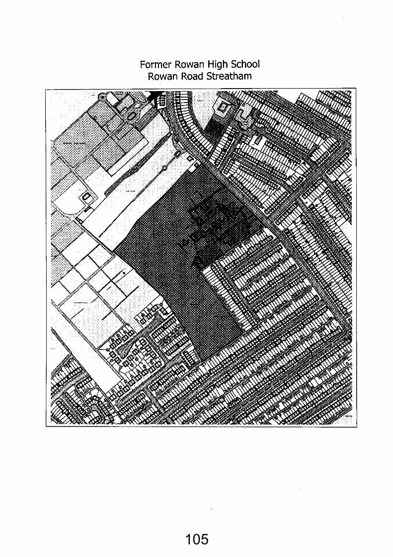
105
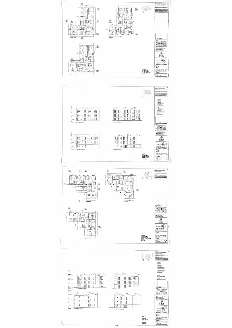
106
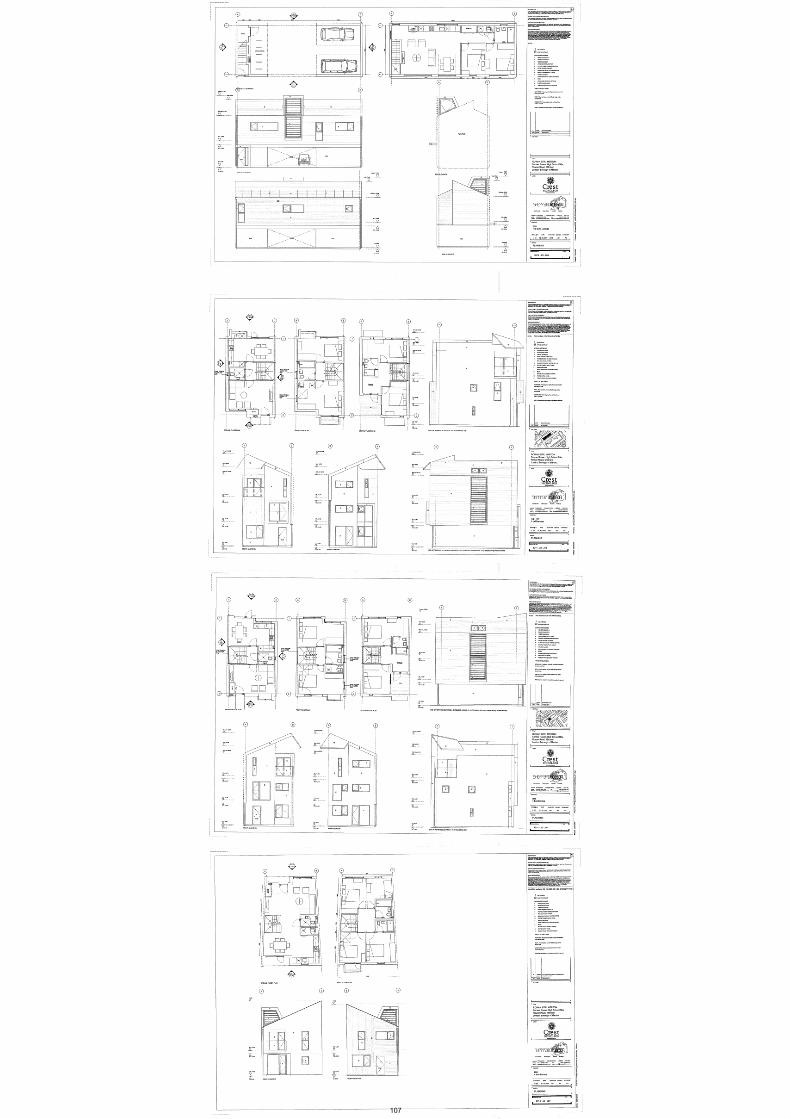
107
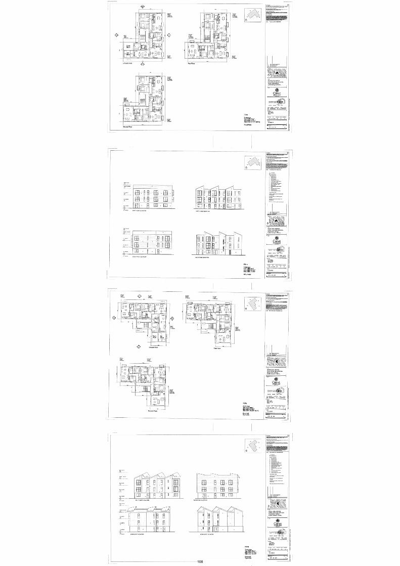
108
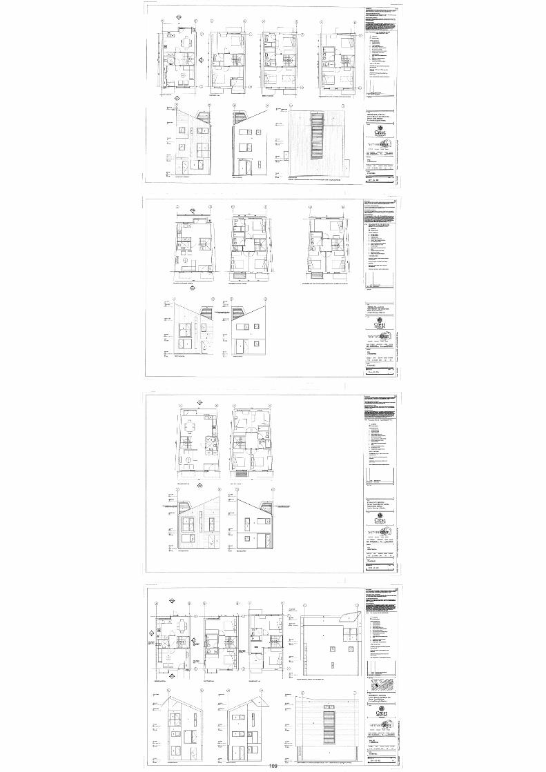
109

110
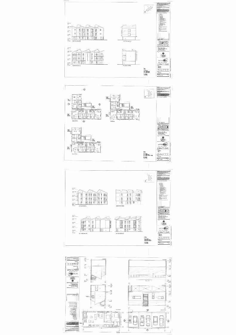
111

112

113
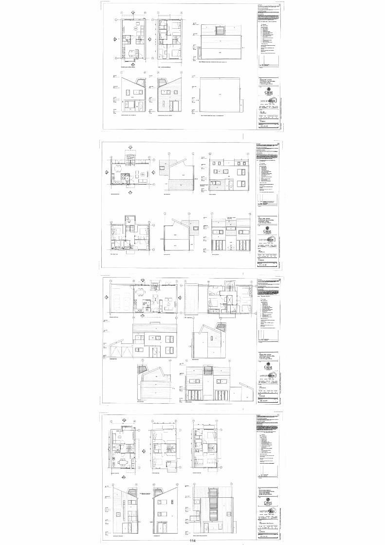
114
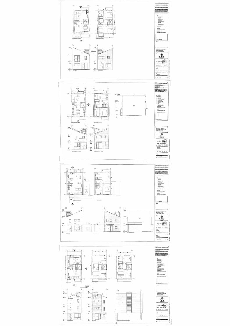
115
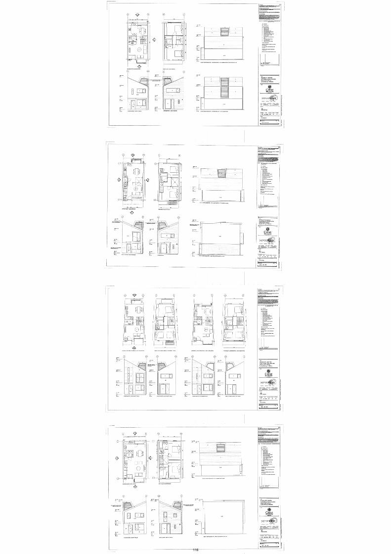
116
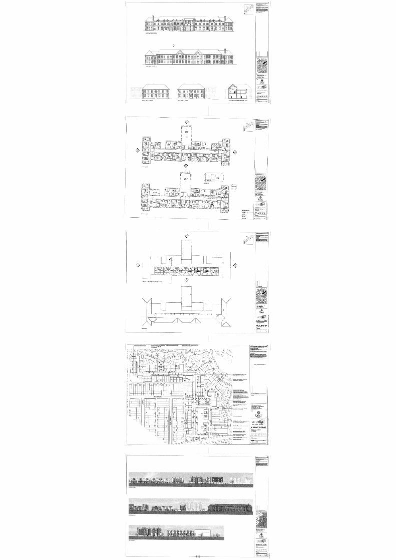
117
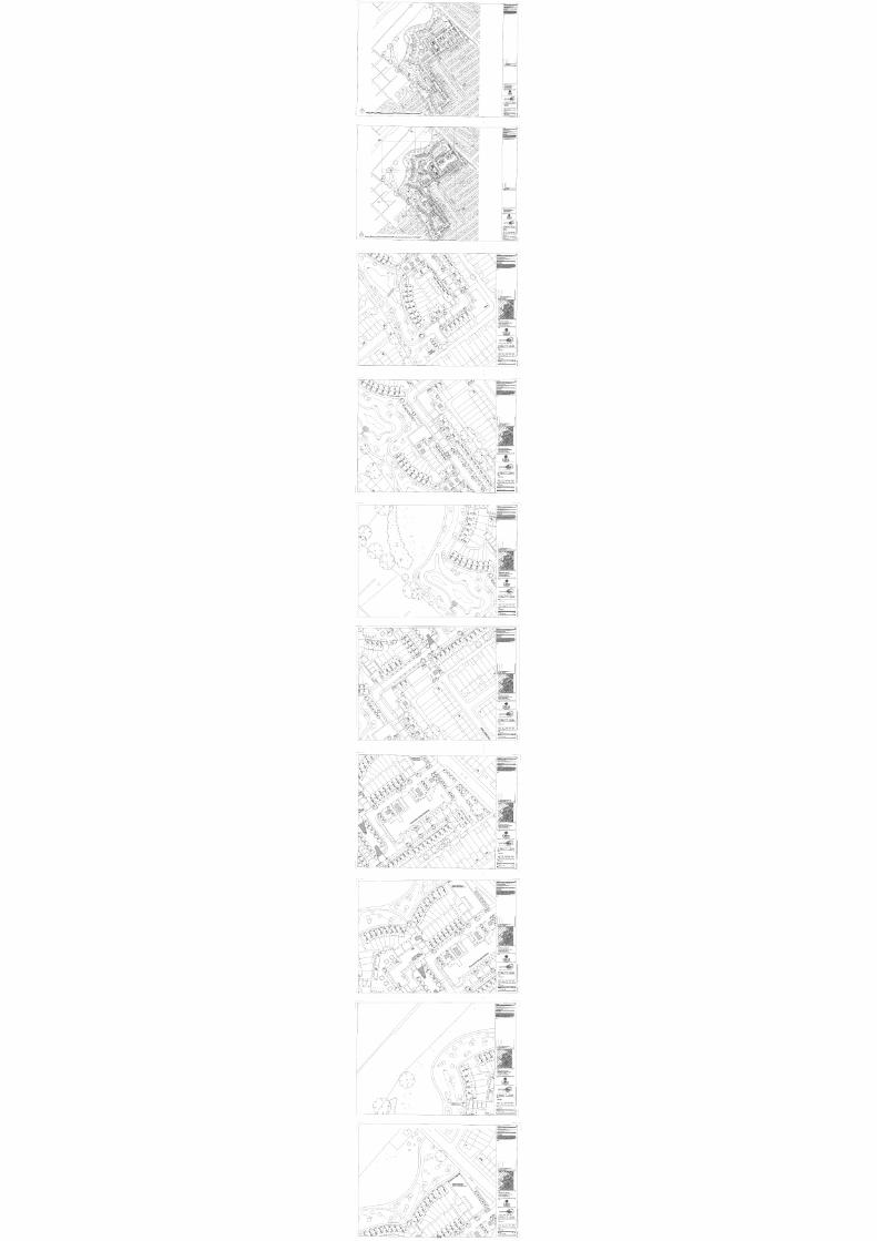
118